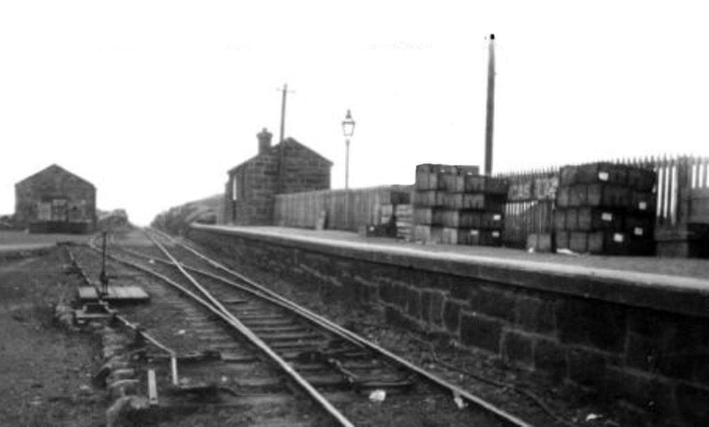
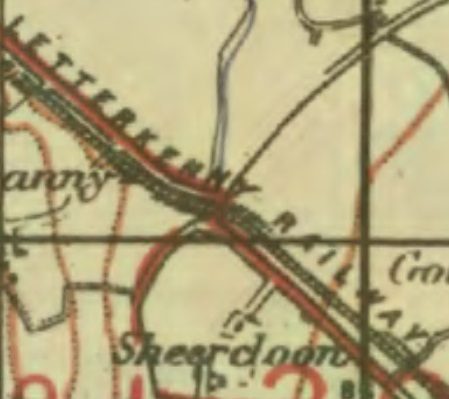
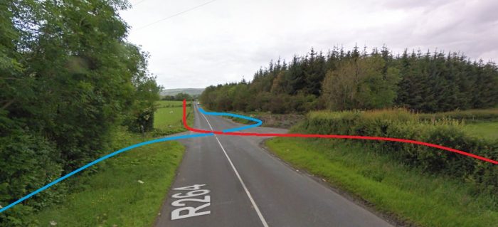
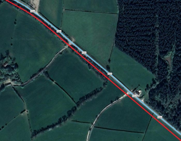
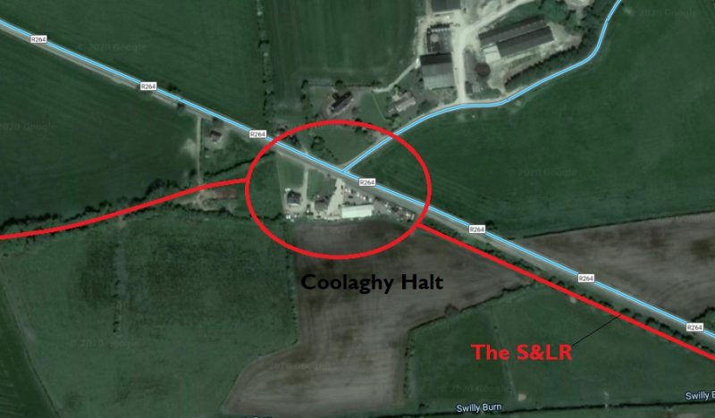
Category Archives: Ireland

The Donegal Railway Heritage Centre

On Saturday 22nd April 2023, I had the pleasure of dropping into the Railway Heritage Centre in Donegal Town. We had planned a holiday in Co. Donegal in 2020 but we were foiled by the COVID-19 lockdown. This visit was well overdue.

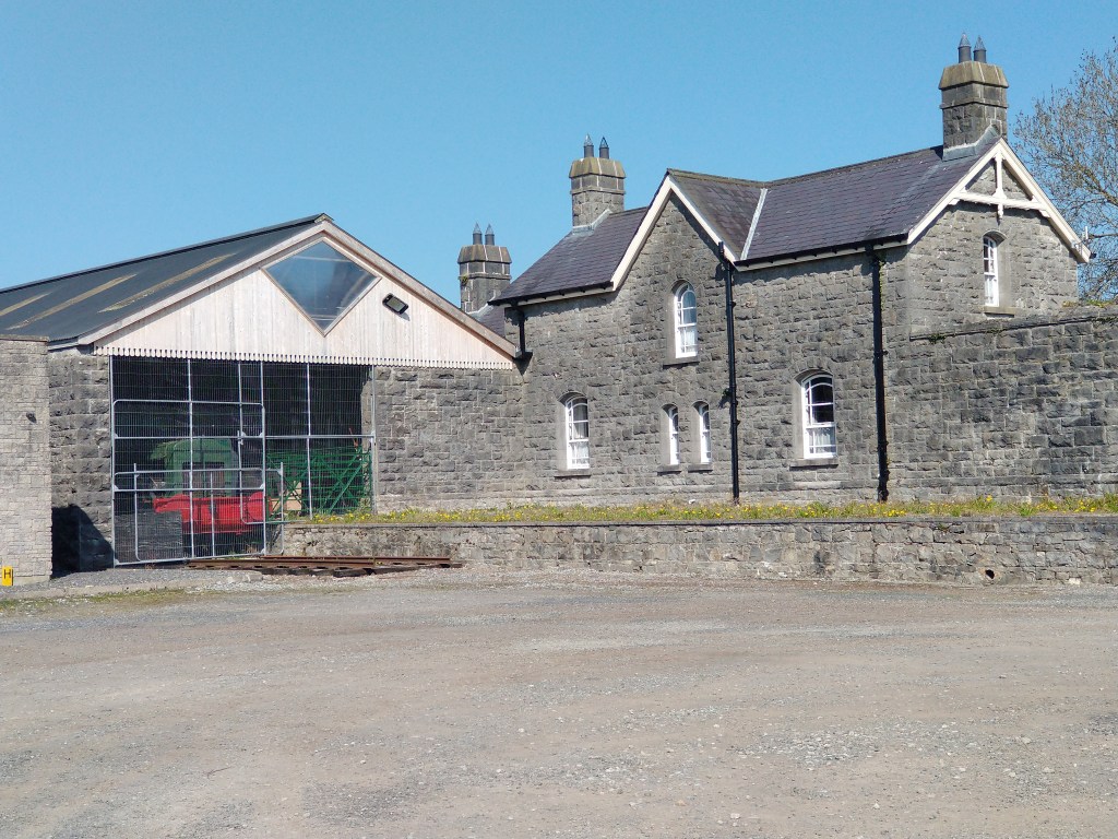
The Donegal Railway Heritage Centre records and celebrates “the operations of the County Donegal Railways Committee which operated two narrow-gauge railways in County Donegal from 1863 until 1959. The County Donegal Railway Restoration Society restored the centre, which opened in 1995 and is housed in the old station house in Donegal Town. Today, it operates as a visitor attraction comprising a museum, information centre and shop. On display are rolling stock, historical artefacts and an audio-visual presentation on the railways’ history.” [1]

Over the period of lockdown quite a lot happened at the Heritage Centre.

The most significant event was the home-coming of No. 5, ‘Drumboe’, the Co. Donegal Railway Joint Committee 2-6-4T Locomotive on 9th October 2021. This locomotive was originally built by Nasmyth, Wilson and Company [2] in 1907 and served on the railways of Co. Donegal until the end of 1959. Now cosmetically restored, ‘Drumboe’ has pride of place at the entrance to the Heritage Centre.

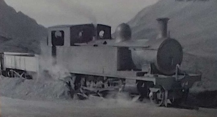
No. 5, ‘Drumboe’ in service at Barnesmore Gap in the late 1950s. [5] [My photograph, 22nd April 2023]
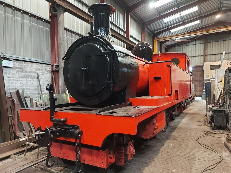
‘Drumboe’ underwent an extensive restoration job in Whitehead, Co. Antrim. The locomotive is shown here at the Works prior to being returned to Donegal. [3]
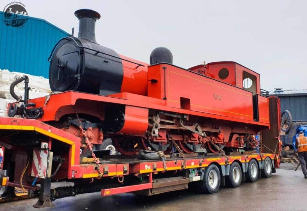
‘Drumboe’ on its way home. [4]
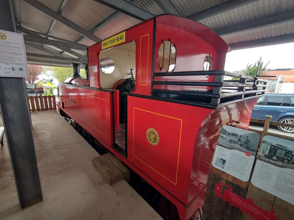
‘Drumboe‘ settled in its new home. It is undercover to protect it as much as possible from the elements! The text on the display board reads: Built in 1907,
Nasmyth Wilson/Manchester. Drumboe’s original name was No. 17 Glenties. She was renamed in 1937 to No. 5, Drumboe. In 1907/8 the CDRIC ordered 5 new modern steam locomotives to deal with the growing traffic as the CDR network expanded. They were called the Class 5 locomotives and numbered 16-20. All of them were 2-6-4Ts: the numbers stand for the wheel arrangement and the T for tank engine. On the evening of 31 December 1959 Drumboe hauled the very last train from Stranorlar to Strabane and back as the CDR finally closed as a railway.  [My photograph, 22nd April 2023]

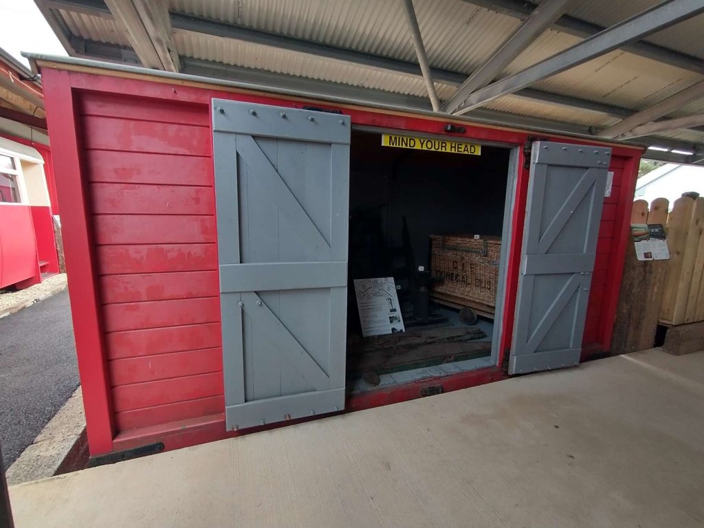
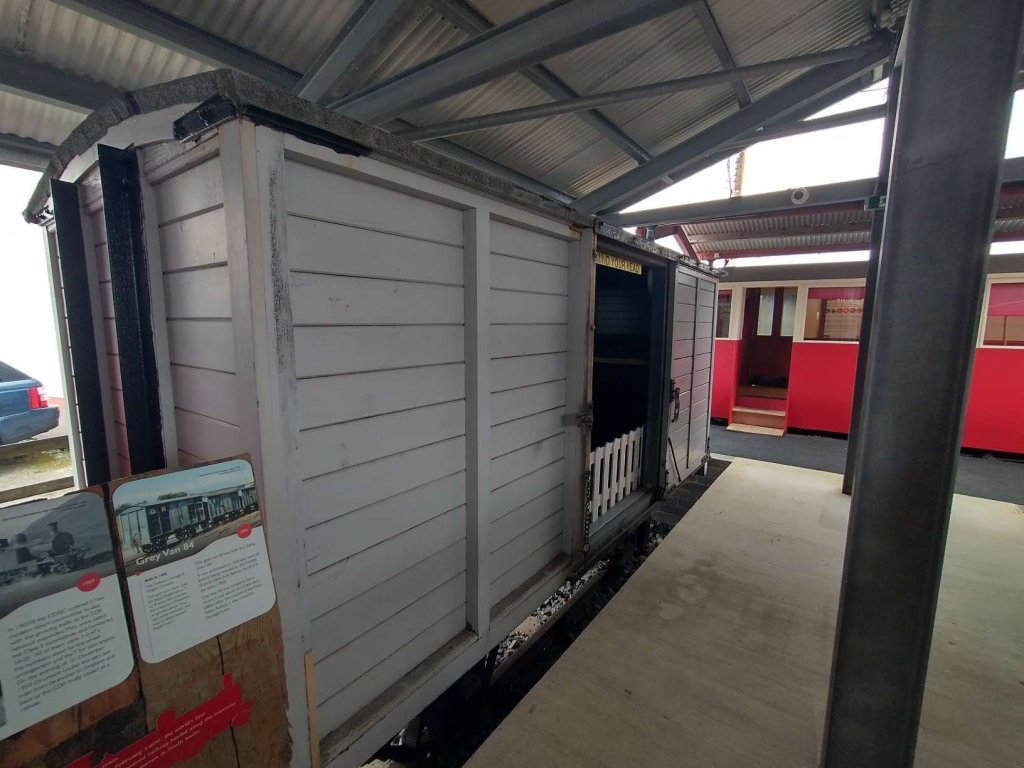
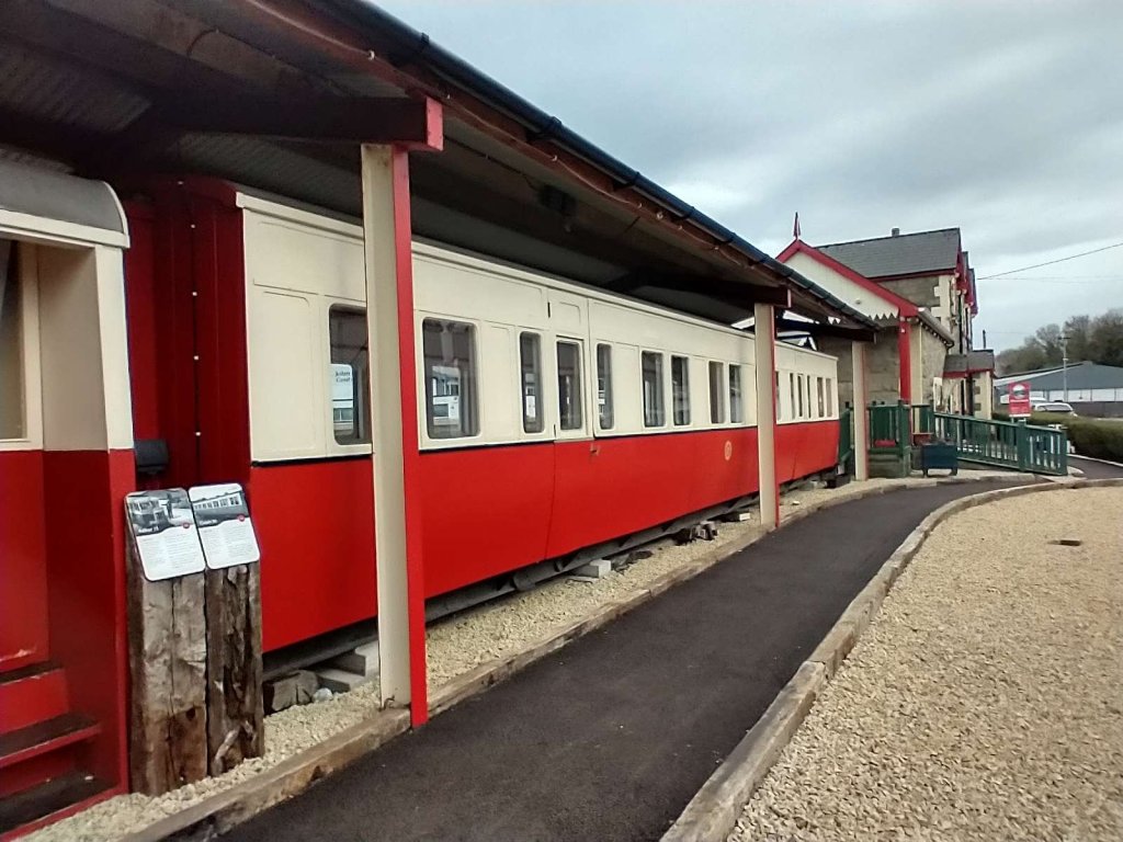
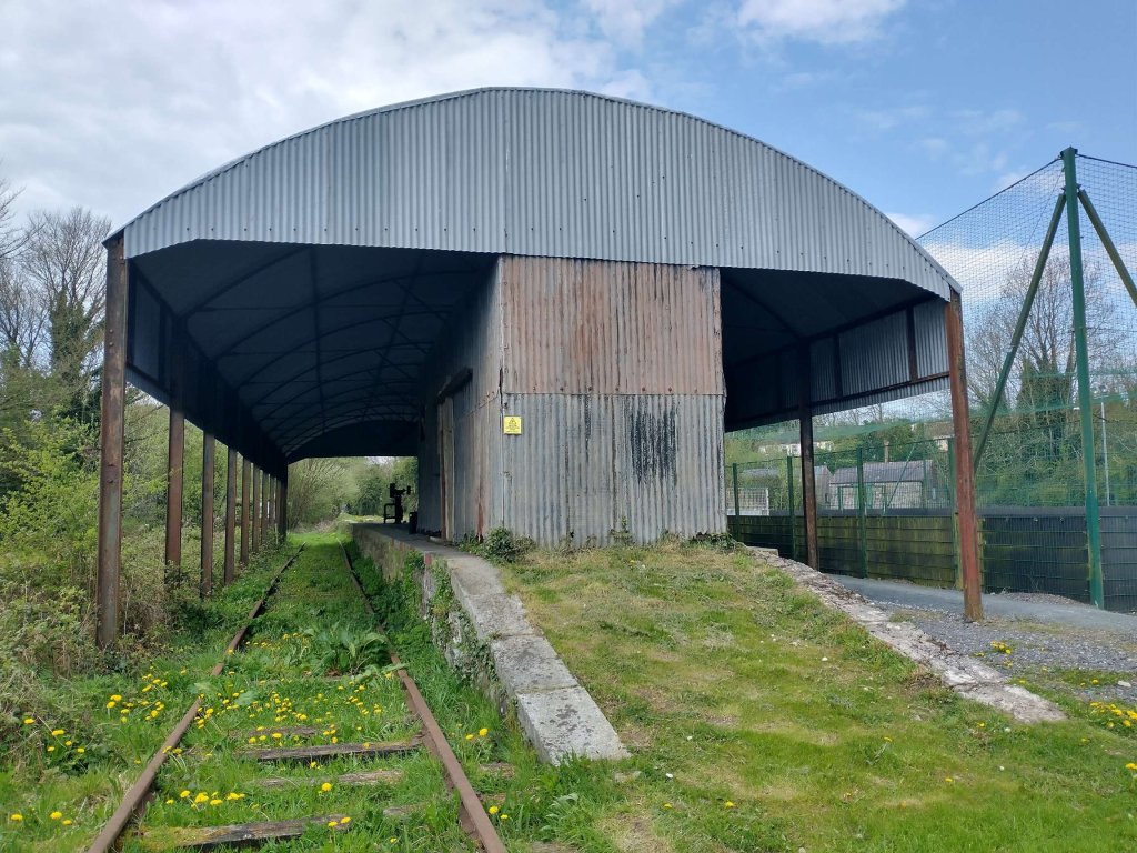
Preparing for Drumboe’s arrival at the Heritage Centre required a significant re-organisation of the centre’s outside exhibits. All are now protected from the worst that the elements can throw at them by a series of different roof structures. Just a few photographs from 222nd April 2023.

The Red Van in its new location: the text on its display board reads: Built in 1887, Metropolitan Carriage & Wagon Company for the Clogher Valley Railway. Red Vans only transported goods. They were for lighter use, up to the capacity of 2 tons.
The Clogher Valley Railway (1887-1941) was a 37 Mike long narrow-gauge railway in County Tyrone and County Fermanagh. After the closure of the Clogher Valley Railway in 1942 the County Donegal Railway (CDR) bought all the red vans. These covered vans were converted to run behind the CDR Railcars. Our red van retains its original wooden chassis from 1887 and all original metalwork. [My photograph, 22nd April 2023]
The Grey Van (No. 84) in its new display position: the text on its display board reads: Built in 1893, the Oldbury Carriage & Wagon Company. The grey vans were used for heavy freight up to 7 or 8 tons this could be the transport of livestock or general goods. Grey vans were normally only used in steam hauled freight trains. Our grey van 84 was built as a sliding door van.It was withdrawn in 1960 and sold off before being rescued by the NWIRS (North West Irish Railway Society) in the early 1990s. Grey Van 84 was stored in Derry where it was set on fire in the early 2000s. After the closure of the Foyle Valley Railway it was moved to Donegal town. [My photograph, 22nd April 2023]
Coach No. 58</strong>: the text on its display board reads: Built in 1928, Coach 58 was built on a second-hand frame 41 feet and 3 inches in length. The CDR bought this coach along with two others in January 1952 from the NCC numbering them 57-59. Formerly Coach 318 became CDR 58. Coach 58 was one of the three most modern on the whole of the Irish narrow gauge lines. It came to the County Donegal Railway on the closure of the NCC (Northern County Committee) lines near Larne in 1950. Though Coach 58 was built on an original chassis from 1879, it provided modern accommodation for Donegal excursions, and later on as a railcar trailer until the railway closed. [My photograph, 22nd April 2023]: the text on its display board reads: Built in 1928, Coach 58 was built on a second-hand frame 41 feet and 3 inches in length. The CDR bought this coach along with two others in January 1952 from the NCC numbering them 57-59. Formerly Coach 318 became CDR 58. Coach 58 was one of the three most modern on the whole of the Irish narrow gauge lines. It came to the County Donegal Railway on the closure of the NCC (Northern County Committee) lines near Larne in 1950. Though Coach 58 was built on an original chassis from 1879, it provided modern accommodation for Donegal excursions, and later on as a railcar trailer until the railway closed. [My photograph, 22nd April 2023]
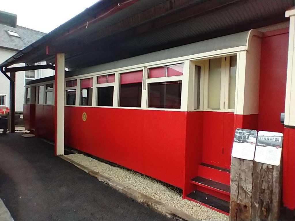
Railcar No.15 passenger unit: the text on the railcar body’s display board reads: Built in 1936, Walker Brothers & the Dundalk Works (GNR). Railcar 15 was the first articulated Railcar. This means that the driver’s cab was separated from the railcar body. The railcar cost £2,275, seated 41 passengers and could transport a weight of 12 tons. The County Donegal Railway pioneered the use of diesel railcars introducing the first one in 1931. The passenger unit of railcar 15 survives here at the museum, restored after a period of dereliction following the railway’s closure in 1959. Railcar 15 was withdrawn in 1960 and was sold at auction in 1961.The body of Railcar 15 was acquired by the CDRRS in 1995 and moved to Donegal Town. [My photograph, 22nd April 2023]

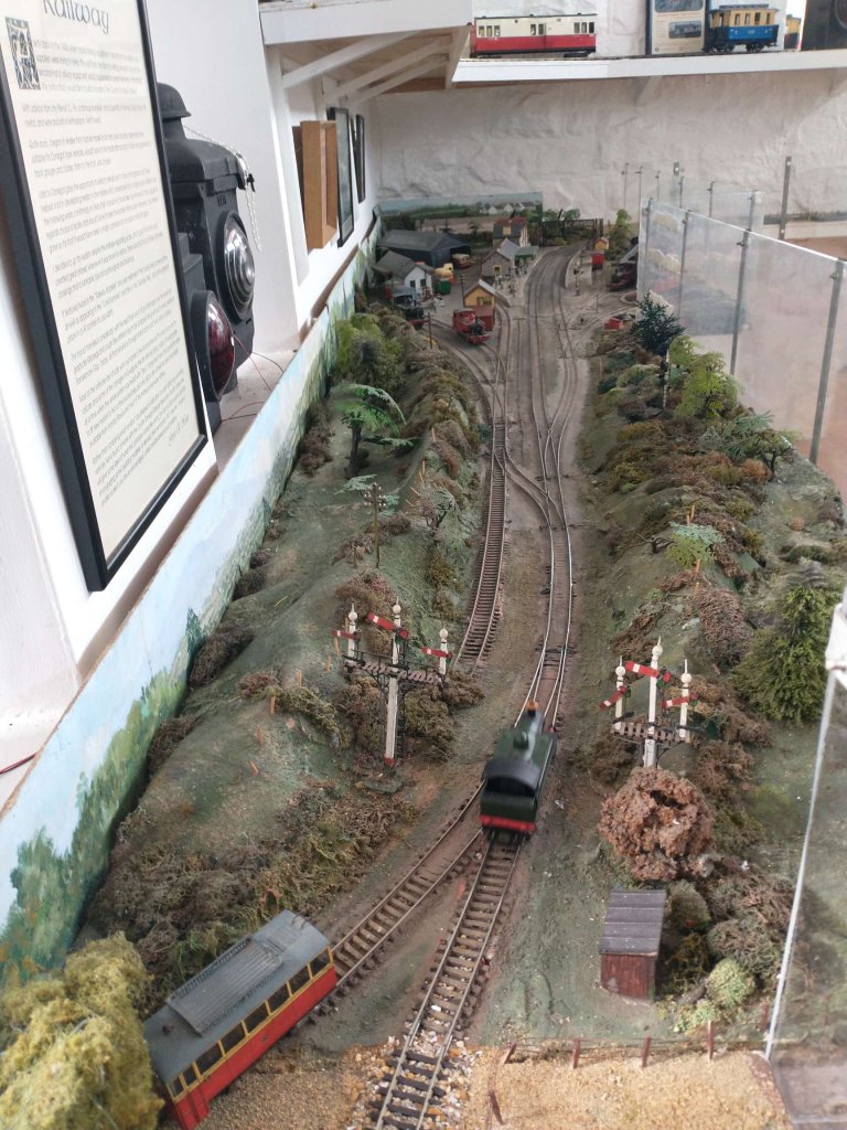
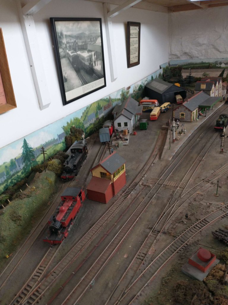
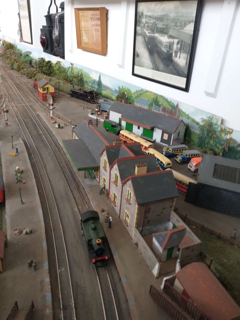
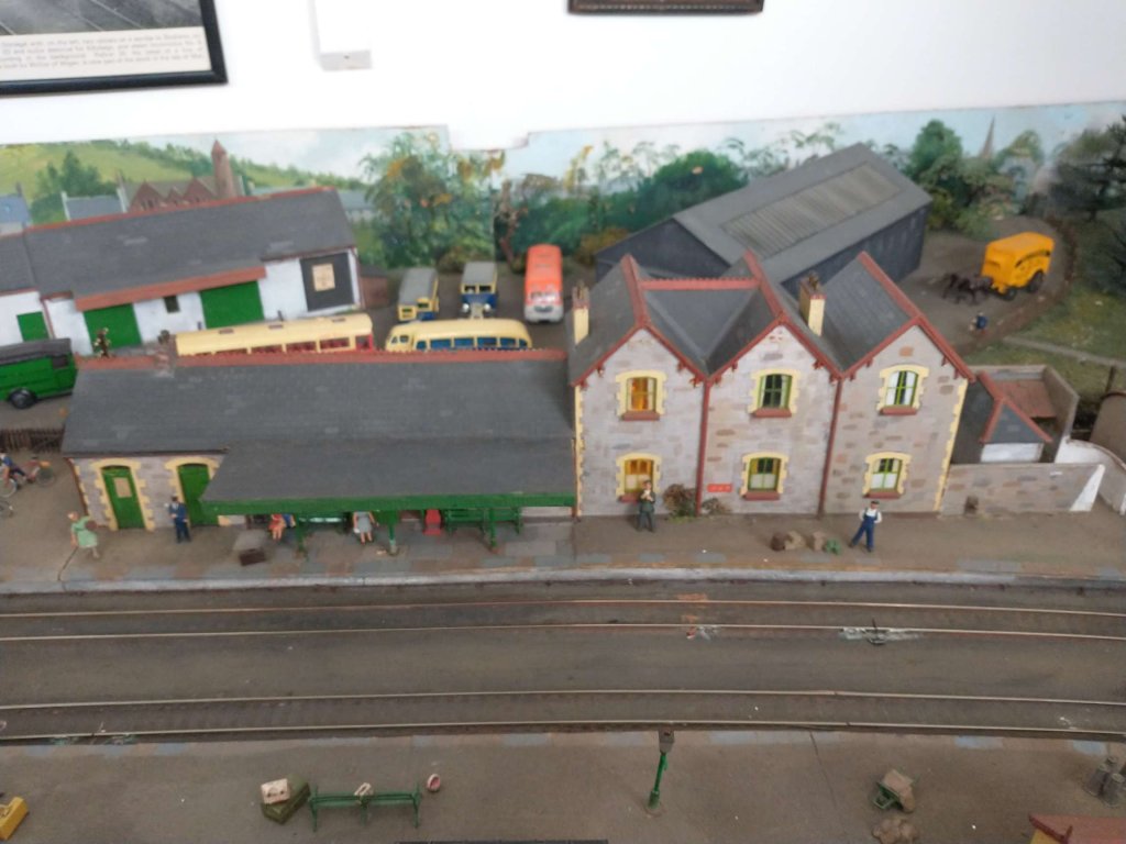
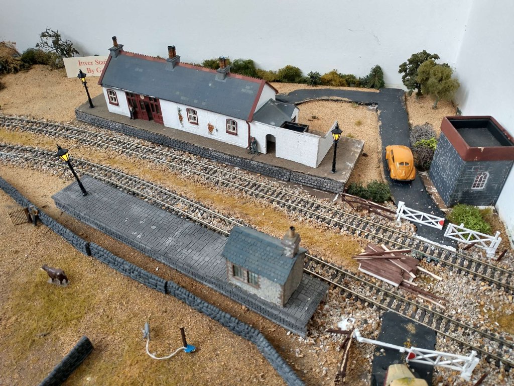
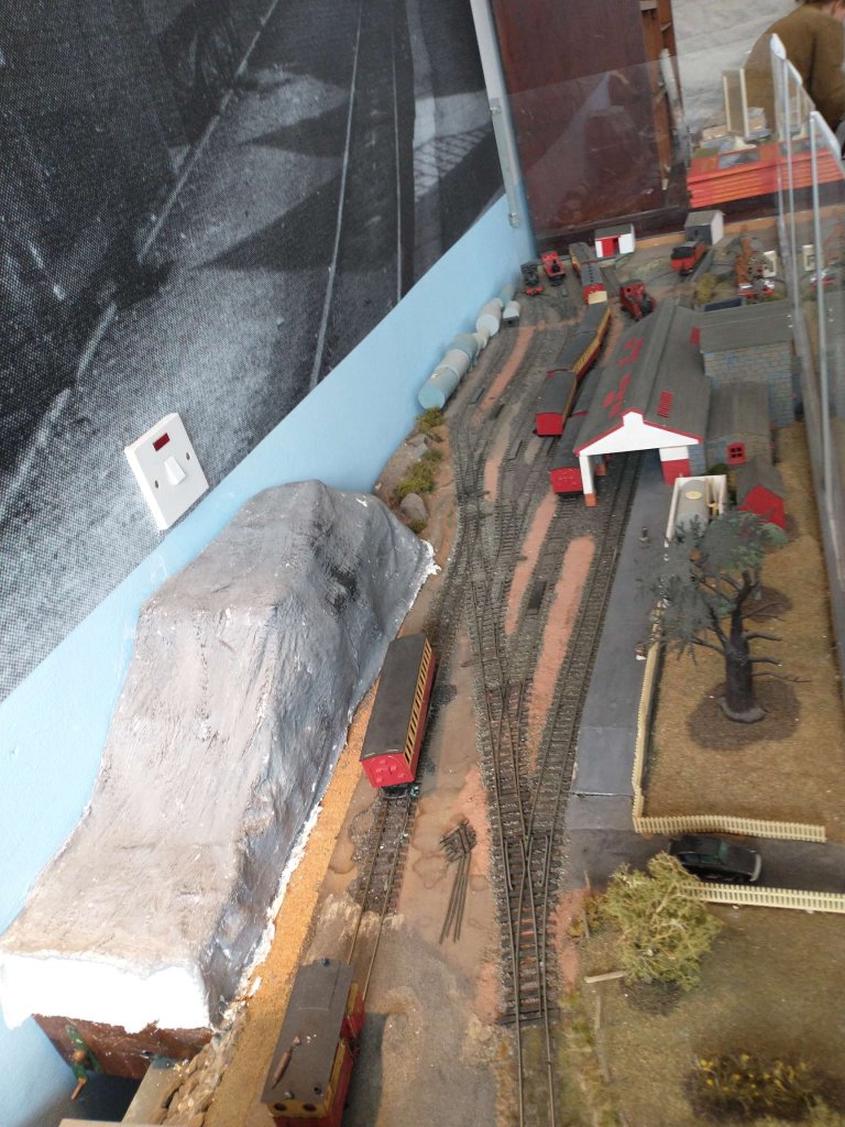
On entering the museum, which occupies the ground floor of the old passenger station building, one has the opportunity to look at an excellent model railway which depicts Donegal Town Railway Station and Inver Station. Inver Station was on the branch from Donegal Town to Killybegs. All six of the pictures immediately below were taken by me on 22nd April 2023.

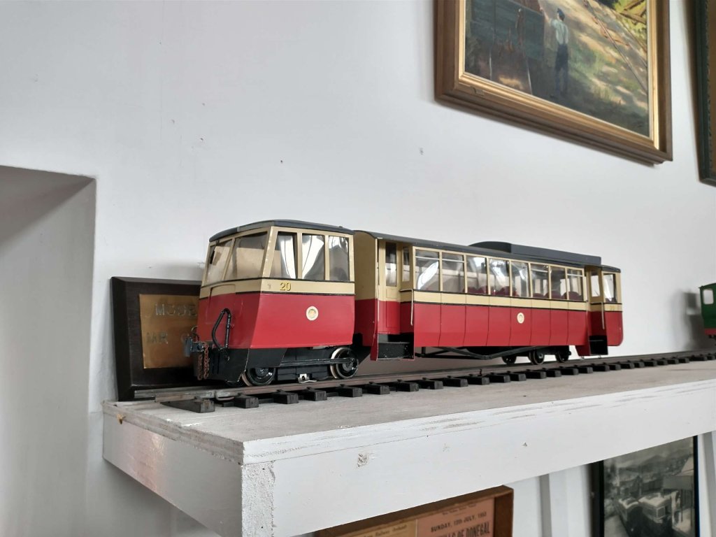
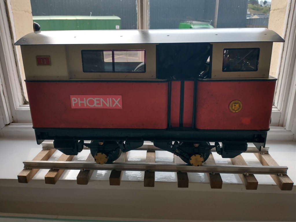
As well as this working model a number of other models of railway vehicles are on static display. Just a couple of examples here. The first is a Walker Brothers Railbus, the second is Phoenix a unique diesel shunter. Both of the pictures below were taken by me on 22nd April 2023.

Phoenix was built by Atkinson-Walker Wagons Ltd of Preston in September 1928 as one of their Class A3 engines. After a short trial on the Clogher Valley Railway, it was found to be totally unsuitable. No buyer to be found and the engine lay idle at Aughnacloy coach and wagon shed until 1932. It was bought by Henry Forbes for the County Donegal Railway and converted at the Great Northern Railway’s Dundalk workshop to diesel power. It was fittingly named the “Phoenix” and worked on the County Donegal Railway till its closure in 1959. It can now be seen in the Ulster Folk & Transport Museum.

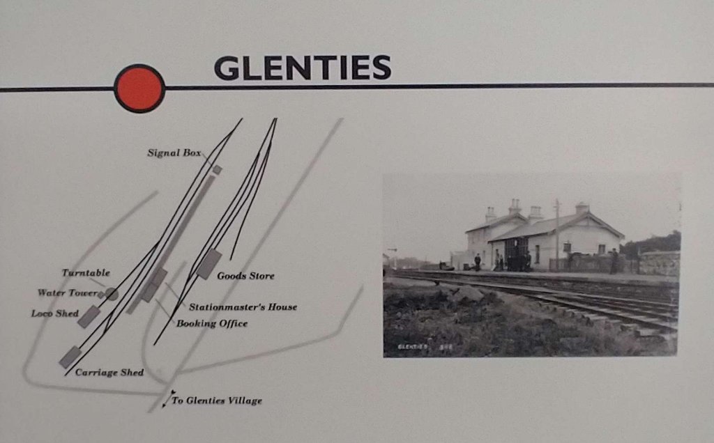
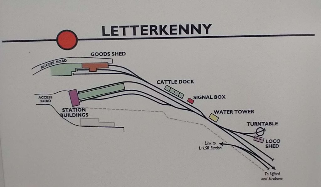
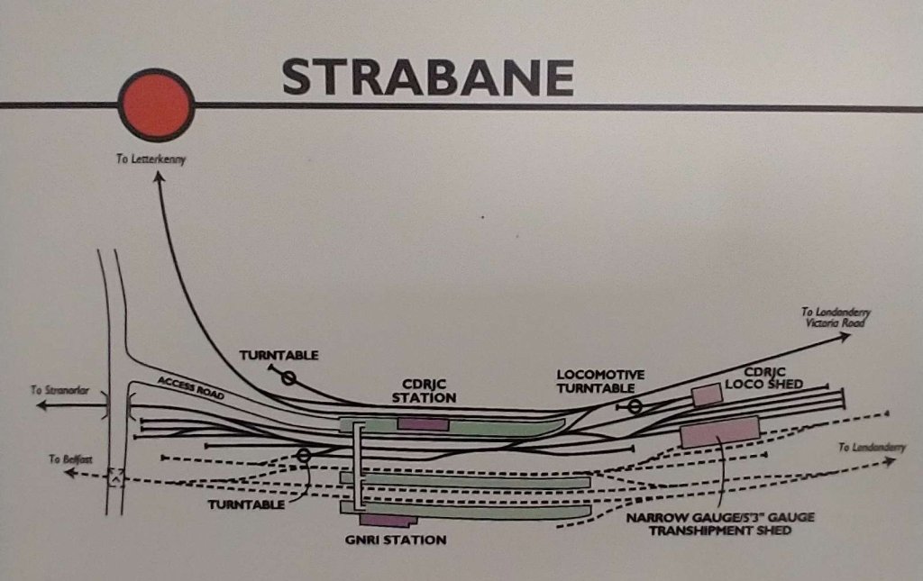
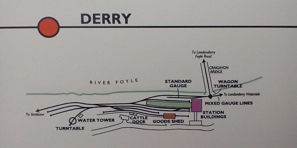
The major part of the indoor space at the Heritage Centre is dedicated to a series of displays centring on the different stations on the network. Each includes a track plan and a series of photographs of the location. Carefully placed around the Centre are artifacts and railwayana from the Co. Donegal Railways.

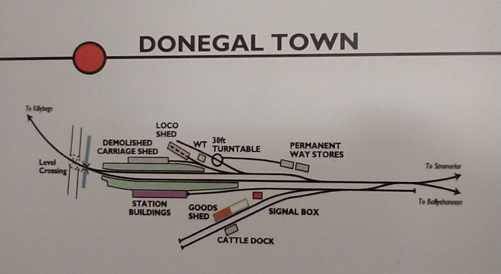
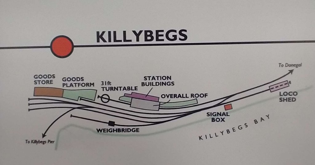
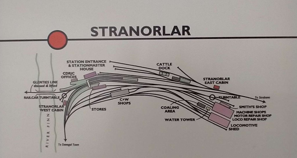
Of particular interest to me were the track plans of the various stations on the network. Some of these are shown below. Much of the text attached to each station plan comes from the Heritage Centre’s displays …

Donegal Town Railway Station was opened in 1889 and closed in 1959 it was about 19 miles from Stranorlar. The West Donegal Railway was opened between Stranorlar and Lough Eske (Druminin) on the 25th April, 1882. From 1882 to 1889, the journey between Stranorlar and Lough Eske took some 40 minutes and then passengers transferred to horse-drawn road cars for the last four miles down into Donegal. The fare was 6 pence. The final section to Donegal town was inspected on the 9th of September 1889 and opened on the 16th of September 1889. [My photograph, 22nd April 2023]
Killybegs Railway Station opened in 1893 and closed in 1959. The journey from Killybegs to Donegal was 19 miles. The line out to Killybegs from Donegal Town was the result of government intervention some forty years after the famine. For the promotion of the local food industries (agriculture, fishing and food processing) a good transport infrastructure was needed. Railway travellers were reminded of their arrival in Killybegs by the intense smell of the fishmeal factory when entering the town. The Killybegs line served the local communities it passed with regular passenger and freight. In summer it was often the destination for excursions from Derry and Strabane. There are many fond memories of steam-hauled specials cautiously winding their way along the Atlantic coast. There is very little evidence of the station in Killybegs in the 21st century. Killybegs is now a thriving port which has seen major redevelopment. [My photograph, 22nd April 2023]
Stranorlar Railway Station was opened in 1863 and was due to close in 1959, however, it remained open to goods until 6th February 1960 because road improvements necessary for lorries had not been completed by 31st December 1959. It was 13 miles from Strabane. Stranorlar Station was first constructed as a branch from the GNR station at Strabane. With the construction and operation of the West Donegal Railway to Donegal Town the station became an important junction. Stranorlar was at the heart of the Co. Donegal Railway network. The extensive layout of Stranorlar reflected its key role in all of the operations of the railway and it was the headquarters for all administration and the running of the system. Skilled jobs specific to the railway were signalmen, drivers, guards and shunters. Stranorlar Station and the associated offices, depots and fitters’ shops was a major employer. Practical skills included engineering, joinery, coachbuilding, foundry work, smithies and clerical workers. [My photograph, 22nd April 2023]
Glenties Railway Station opened in 1895 and closed in 1952. It closed to passengers in 1947 and all traffic 1952. Glenties is 24 miles from Stranorlar. I have covered the branch in two previous articles.

(https://rogerfarnworth.com/2020/05/27/co-donegal-railways-ireland-part-1-the-glenties-branch-stranorlar-to-ballinamore, and https://rogerfarnworth.com/2020/06/22/co-donegal-railways-ireland-part-2-the-glenties-branch-ballinamore-to-glenties)

The line never paid its way and services were lightly used at all times though there were occasional heavy workings associated with market days. Hugging the valley floor and in company with the river and road it continued north-westwards from Stranorlar. Proceeding on through the now bleak and windswept moorland the line continued alongside Lough Finn down into Glenties Station.

I have covered the branch to Glenties in two previous articles.

https://rogerfarnworth.com/2020/05/27/co-donegal-railways-ireland-part-1-the-glenties-branch-stranorlar-to-ballinamore, and

Co. Donegal Railways, Ireland – Part 2 – The Glenties Branch – Ballinamore to Glenties

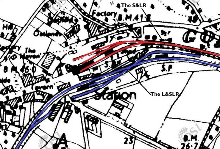
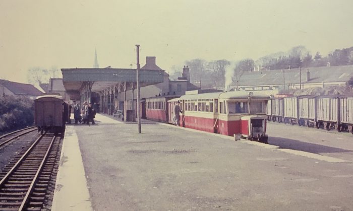
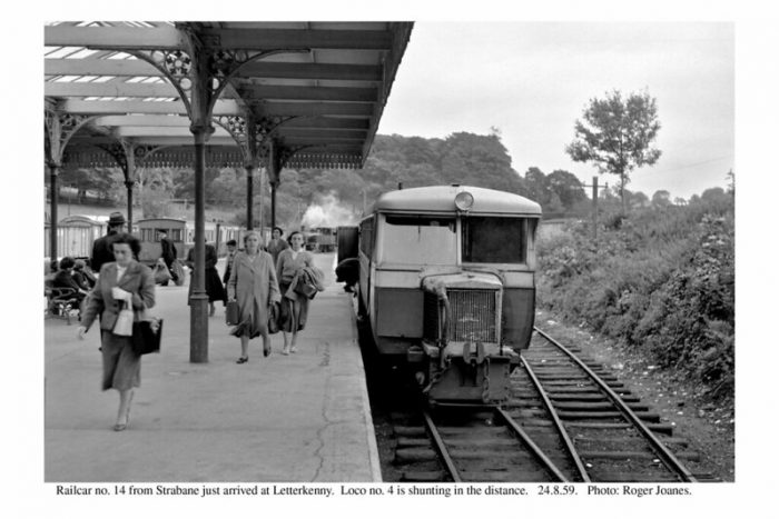
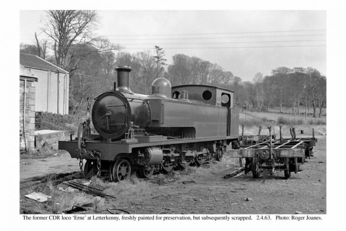
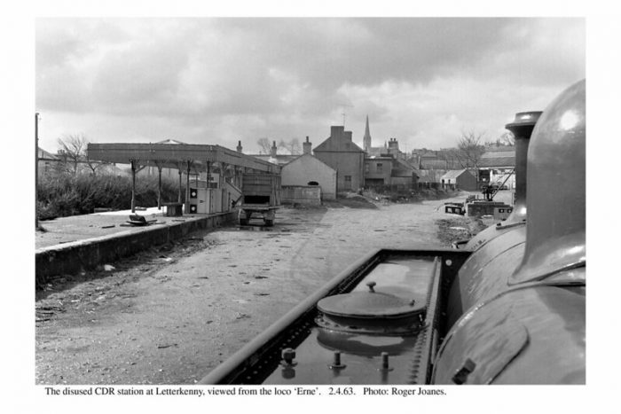
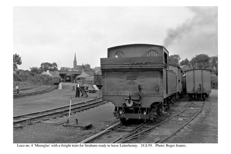
Letterkenny Railway Station was opened in 1909 and closed in 1959. The Strabane and Letterkenny Railway began life to promote the prosperous farmland north-west of Strabane. Letterkenny to was 19 miles. It was intended to facilitate trade and agriculture in the area of south-east Donegal north of the Finn Valley. Letterkenny was also served by the Lough Swilly Railway to Derry and Burtonport. [My photograph, 22nd April 2023]

I have covered the line between Strabane and Letterkenny in a series of three previous articles:

Co. Donegal Railways, Ireland – Part 4 – Strabane to Letterkenny (Part A – Strabane to Raphoe)

https://rogerfarnworth.com/2020/10/05/co-donegal-railways-ireland-part-5-strabane-to-letterkenny-part-b-raphoe-to-convoy, and

Co. Donegal Railways, Ireland – Part 6 – Strabane to Letterkenny (Part C – Convoy to Letterkenny)

Strabane Railway Station opened in 1863 and was due to close in 1959, however, it remained open to goods until 6th February 1960 because road improvements necessary for lorries had not been completed by 31st December 1959. Strabane was approximately 13 miles from Stranorlar. Strabane to Stranorlar was the first stretch of line in Co. Donegal. The line was built by Finn Valley Railway as 5’3″ gauge. It was re-gauged to the narrow (3′) gauge in the summer of 1894 over only one weekend to match with the rest of the Donegal network! The partition of Ireland in 1922 led to serious delays and other complications for the Railway. All of its extensive freight traffic and all passengers had to clear through customs at Lifford (Republic of Ireland) and Strabane (Northern Ireland). [My photograph, 22nd April 2023]
Derry Railway Station was opened in 1900 and closed.in 1954. It was just under 15 miles from Strabane. The County Donegal Railway’s own line to Derry improved the handling of the substantial through goods traffic of imported coal from the Foyle quayside to the many customers throughout the system. This station was adjacent to the twin-deck Craigavon Bridge which, at its lower level, gave rail access to Derry’s three other railway stations and the Harbour Commissioners’ own lines. The Derry line was always steam worked for both passenger and freight services. This was to gain maximum benefit from cheaper coal in Northern Ireland and to save depleting stocks at the company’s depot at Strabane. [My photograph, 22nd April 2023]

References

  1. https://en.m.wikipedia.org/wiki/Donegal_Railway_Heritage_Centre, accessed on 29th April 2023.
  2. https://en.m.wikipedia.org/wiki/Nasmyth,_Gaskell_and_Company, accessed on 29th April 2023.
  3. https://www.steamtrainsireland.com/members/galleries/56/whitehead-news-2021, accessed on 29th April 2023.
  4. https://www.donegaldaily.com/2021/10/09/train-coming-the-beautiful-drumboe-is-on-her-way-home, accessed on 29th April 2023.
  5. From a display board alongside the loco at the Donegal Railway Heritage Centre.

The Burtonport Extension of the ‘Londonderry & Lough Swilly Railway’ – Part 1

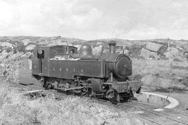
The featured image shows No. 14 on the turntable at Burtonport. The photograph was taken in April 1940 and was shared by Joe Begley on the Burtonport Heritage Facebook Group on 21st October 2020. [15]

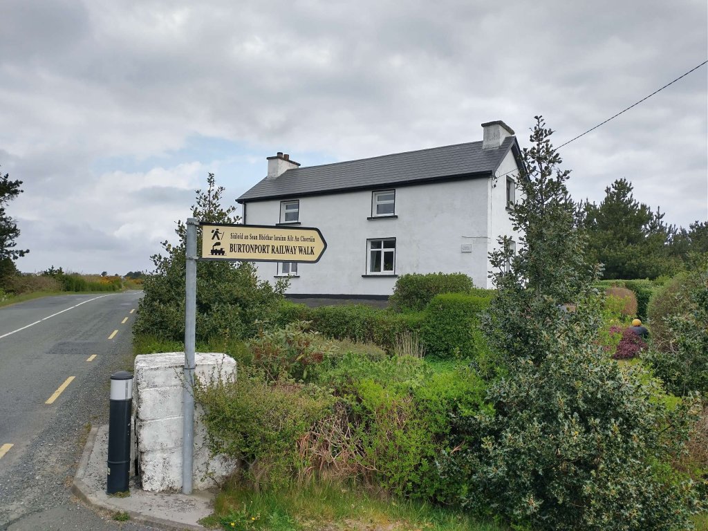
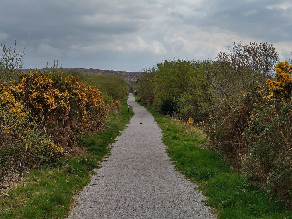
In April 2023 we stayed close to Burtonport, adjacent to Loch Meela, in Co. Donegal. On the first full day of our stay, we walked the Burtonport Old Railway Walk. [1] A 6km length of the Burtonport extension of the Londonderry & Lough Swilly Railway has been made into an accessible path. The weather was great and the walk very enjoyable. We were impressed by the investment in the walk made by the local community and Donegal County Council.

After the closure of the line it seems that it remained undisturbed for many years. Apparently, in 2009, however, “there was a heavy snowfall, and some of the old railway line was cleared to access water mains that needed repairing. The remaining section was later cleared and gradually developed as a walkway with the support of the local community. A massive effort has gone into creating this beautiful and peaceful walk.” [1]

This first length of the old railway extends from Burtonport as far as Kincasslagh Road Station and, apart from a short length close to the latter, can be walked with relative ease.

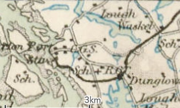
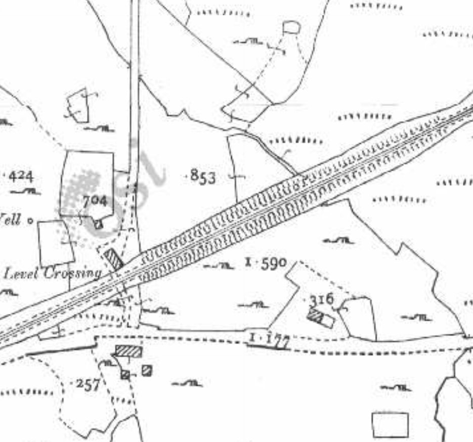
The route of the old railway between Burtonport and Kincasslagh Road Station as shown on historic mapping provided by the Ordnance Survey of Ireland dating from the early 1940s. The latter station was located to the East of Lough Waskel, to the top right of this map extract. [6]
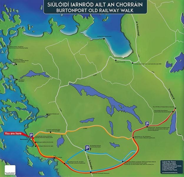
The map displayed on the information board in Burtonport shows the length of the old railway covered in this first article. [My photograph, 23rd April 2023]

The whole of the Burtonport Extension features in a guide written in the late 1980s by Dave Bell & Steve Flanders. [2] In that guide, they provide a series of relatively low resolution monochrome photographs of the railway in operation and as they found it in the 1980s. This article is the first in a series looking again at the line and what can be found along its route.

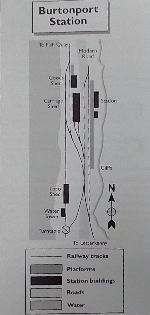
At Burtonport, Bell and Flanders provide a station plan and a number of photographs from before closure and at the time of their survey.

A schematic plan of Burtonport Railway Station. [2: p84]
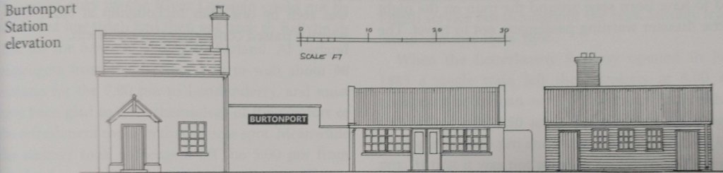
Burtonport Railway Station Elevation, as shown by Begley, Flanders and Patterson. [10: p113]
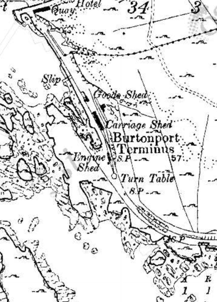
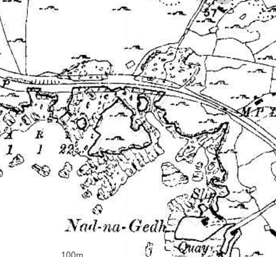
The historic 6″ mapping provided by the Ordnance Survey of Ireland shows that the station was not aligned North-South but a little more to a North-northwest-South-southeast axis. Immediately beyond the Station throat the line curved away to the East. [6]
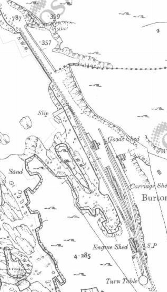
The historic 25″ mapping provided by the Ordnance Survey of Ireland shows the station layout more clearly. [6]
A first length of the Burtonport Old Railway Walk as it appears on Google Maps. [Google Maps, 27th April 2023]
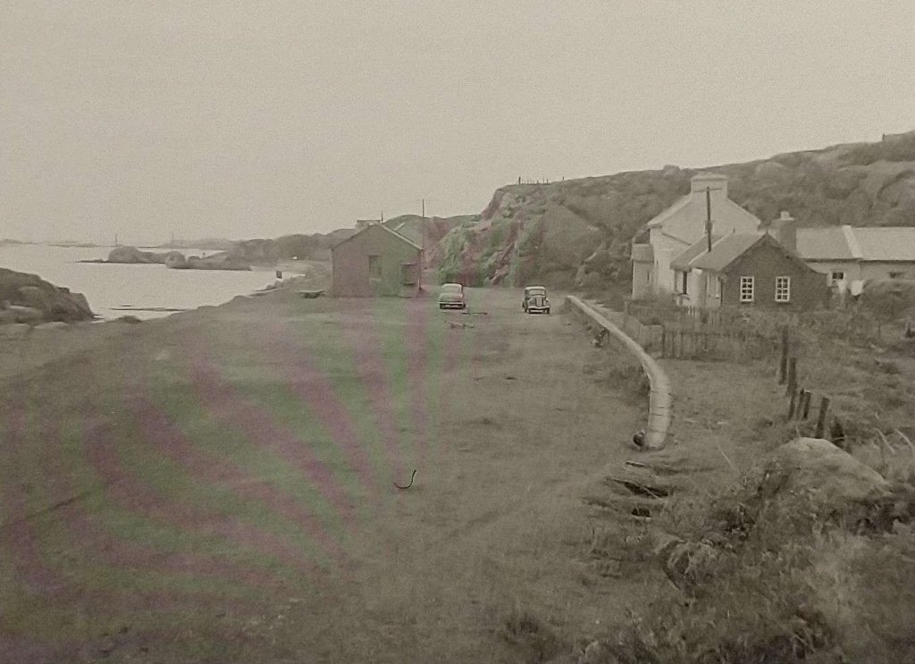
Burtonport Railway Station viewed from the South in around 1960. At this date the station building, platform and goods shed all appear to be in reasonable condition. Two cars are parked on the former railway formation. This image is the last of a series of images in Jim McBride’s recent book, “The Lough Swilly Remembered,” © HMRS (Eric S. Russell, LNWR Society). [9: p64]
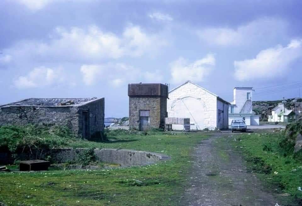
Burtonport Railway Station in July 1971 viewed from the South, © Peter Leigh and scanned by Roger Geach it was originally forwarded to Jim McBride (on behalf of the Donegal Railway Heritage Centre). The image was shared on the Londonderry & Lough Swilly Railway L&LSR Facebook Group by Colm McDaid on 25th October 2021. In 1971 much of the infrastructure, except the trackwork remained in reasonable condition. The turntable well is in the left foreground, the water tower and engine shed feature centre-stage and the station building and platform can be made out on the right side of the image. [3]

Bell and Flanders describe arriving at the station from the South in the 1980s by car, the old trackbed now being a narrow road: “You drive through a small cutting before entering the railway’s terminus at Burtonport. … Just before the station itself you drive through a fish processing plant then, suddenly, on the left, you can see the engine shed, recognisable by its characteristic round-top windows and door.” [2: p83]

They go on to describe the station as they found it on their visit: “In the middle distance is the terminus station itself with a length of platform still in existence on the right-hand side of the road. The station house and offices still stand but are now derelict. They and the [engine] shed are now the only railway structures left at Burtonport. … Originally a siding ran along the quayside so that fish vans could be loaded directly from the fishing boats. Burtonport is still an important centre for Ireland’s fishing industry but today refrigerated articulated lorries haul the catches to their markets. It’s also from here that the ferry service runs to Aran Island, known as Arainn Mhór, Big Aran.” [2: p84]

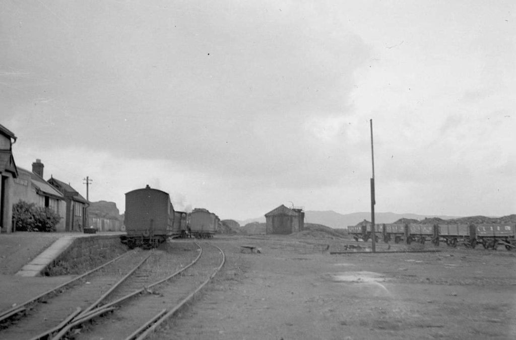
A view of Burtonport Railway Station from the North while still in use, although some tracks appear to have been removed, © H.C.A. Beaumont and shared on the Londonderry & Lough Swilly Railway L&LSR Facebook Group by Jonathan Beaumont on 17th November 2021. [4]
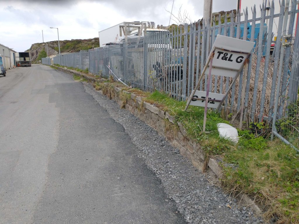
The old railway station platform edge is still visible beneath the palisade fencing in April 2023. [My photograph, 23rd April 2023]
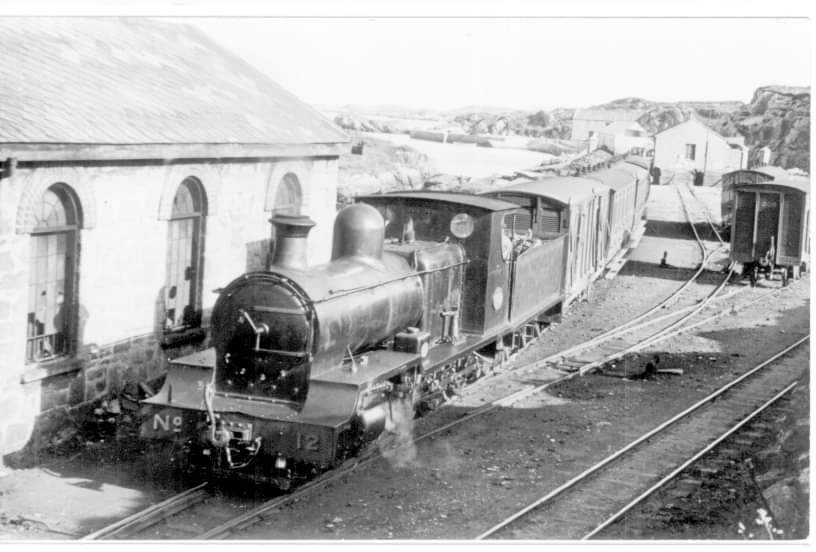
Locomotive No. 12 at Burtonport in 1937, readying its train for departure, © H.C. Casserley, shared on by the Donegal Railway Heritage Centre on their Facebook page on 9th June 2020. [5]
A low resolution copy of a print showing Loco No. 12 leaving Burtonport with the 8.30am to Derry sometime in 1937, heading South past the engine shed, © H.C. Casserley reproduced by Bell and Flanders. [2: p83]
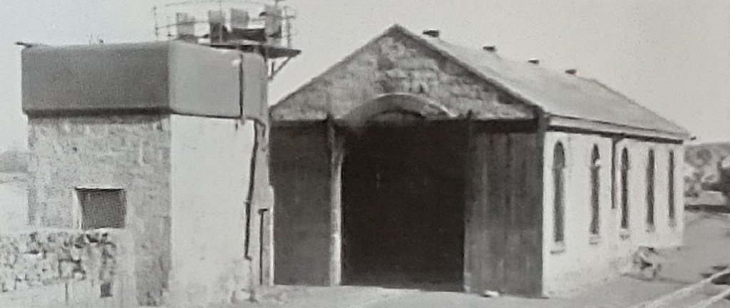
A similar low resolution view of the water tower and engine shed. [2: p84]
A 1980s view of the engine shed with what look like palleted loads stored close to its end wall, © Dave Bell & Steve Flanders. [2: p83]
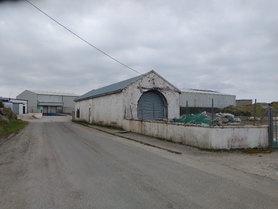
The engine shed viewed from the South in April 2023. The remnants of the station platform can be seen in the distance to the right of the engine shed. [My photograph, 23rd April 2023]
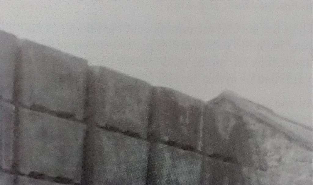
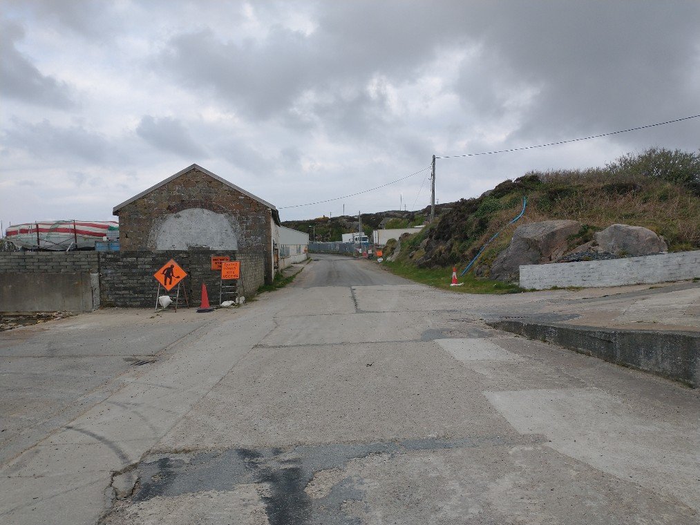
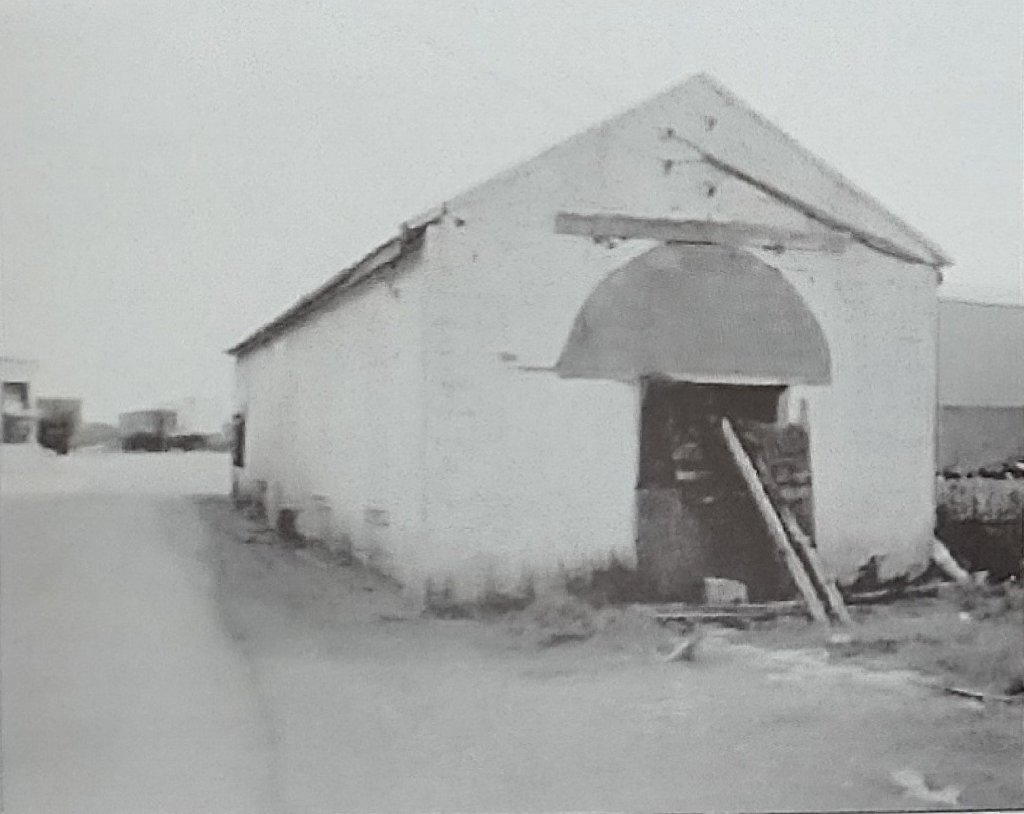
A view of the North end of the engine shed in the 1980s in a South-facing view, © Dave Bell & Steve Flanders. [2: p84]
The engine shed viewed from the North in April 2023. [My photograph, 23rd April 2023]

A number of other photographs of Burtonport Railway Station site can be found on Flickr by following these links:

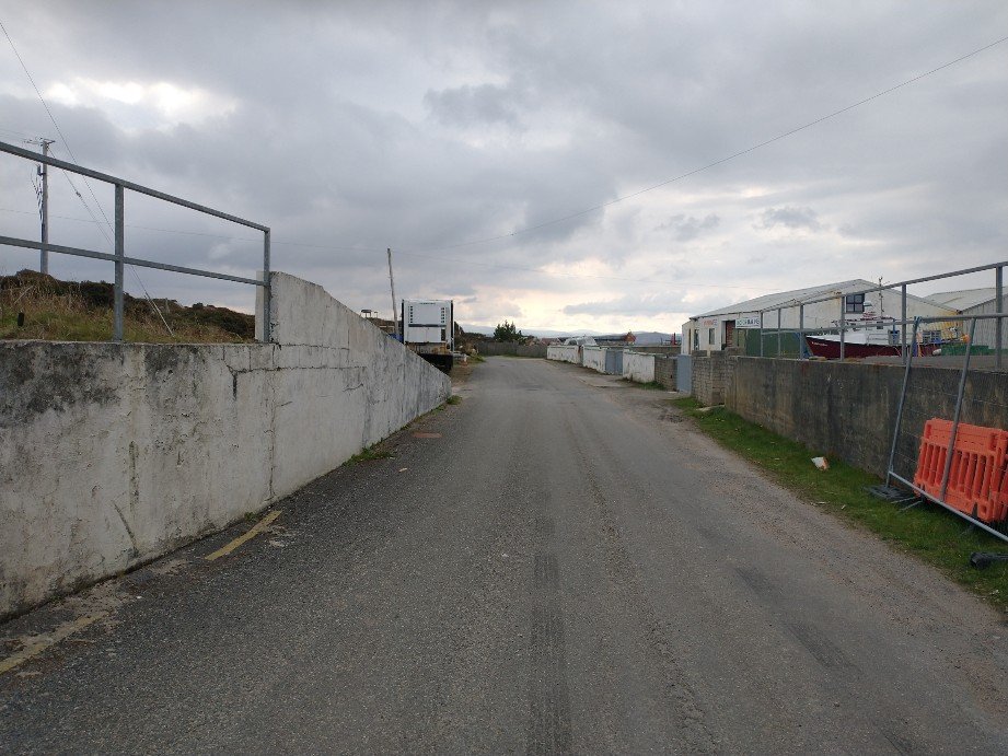
The road South of the engine shed follows the formation of the old railway line. [My photograph, 23rd April 2023]
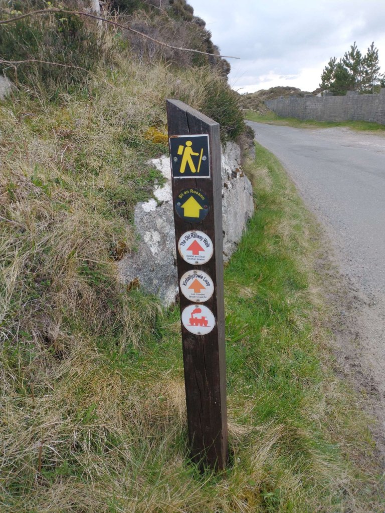
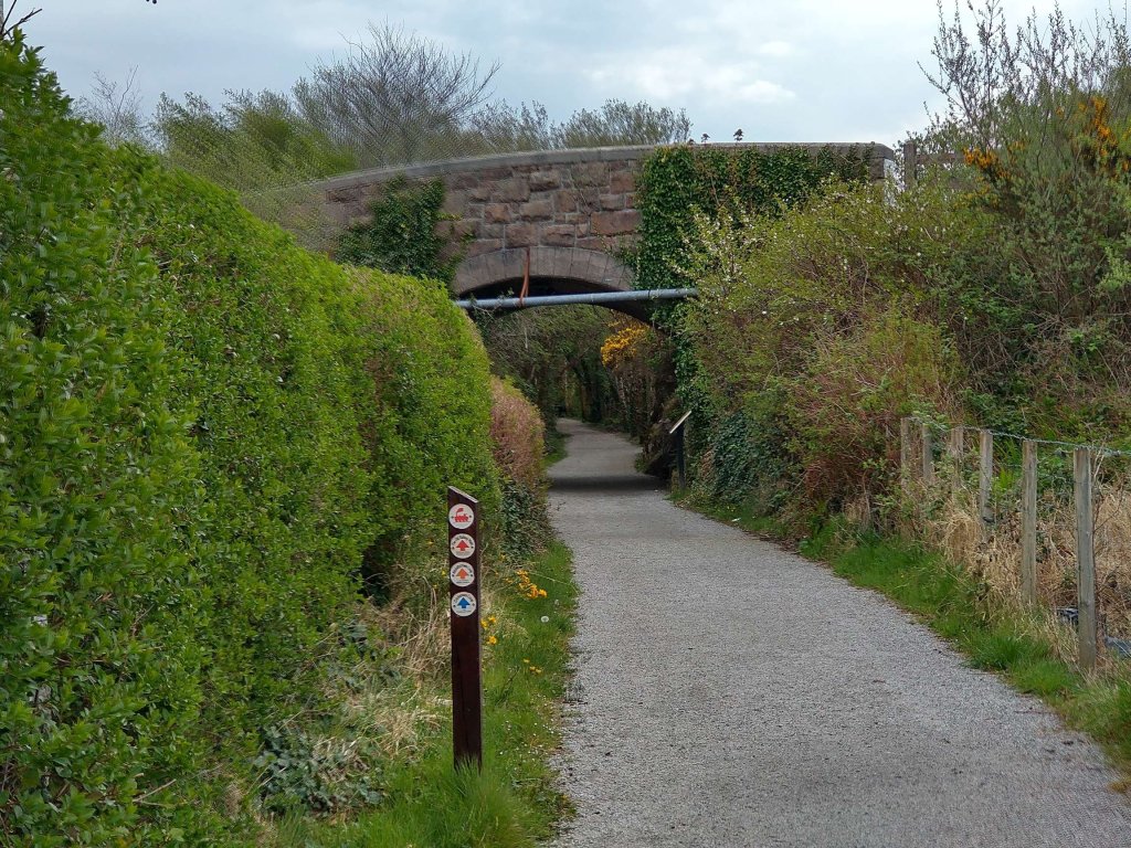
The route of the old railway is now very well signed for walkers. [My photograph, 23rd April 2023]
The historic 6″ mapping provided by the Ordnance Survey of Ireland shows the line curving first to the East and then towards the Southeast. [6]
As it ran South and East sway from Burtonport Railway Station, the line stayed close to the rocky shore, alternating between rock cuttings and embankments. [My photograph, 23rd April 2023]
At some locations embankments have become causeways with water on each side. [My photograph, 23rd April 2023]
The old railway formation now covered in tarmac and running across another short causeway. [My photograph, 23rd April 2023]
The historic 6″ mapping provided by the Ordnance Survey of Ireland shows the line continuing in a Southeasterly direction, before beginning to curve to the East. Southeast of Mile Point 74 on the line we encounter the first gatekeeper’s cottage which can be made out on the South side of the crossing adjacent to the benchmark. [6]
A second length of the route as it appears on Google Maps. [Google Maps, 27th April 2023]
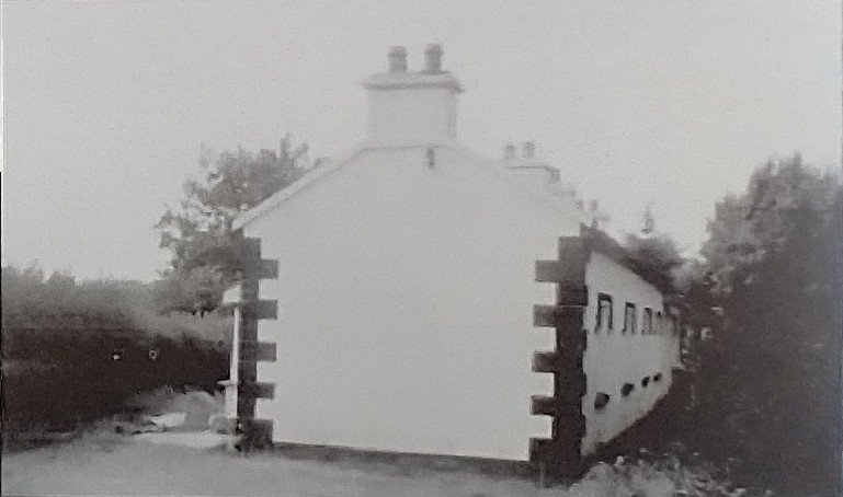
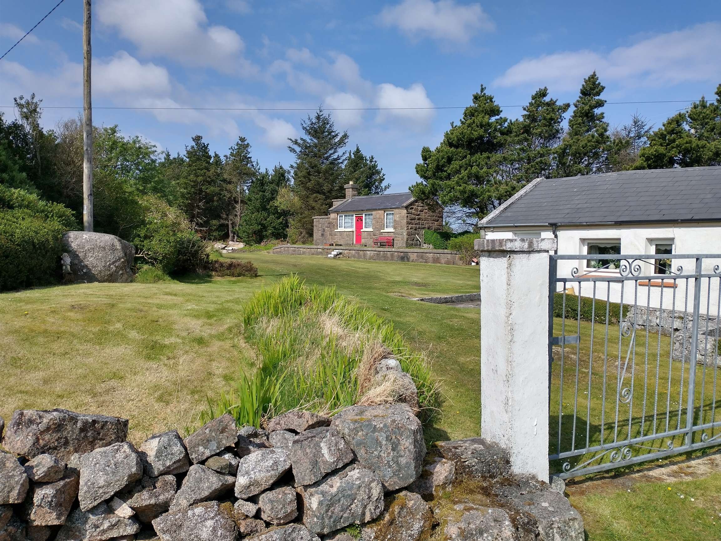
Crossing keeper’s cottage No. 24 is the first encountered after leaving Burtonport Railway Station. The original was damaged by fire but it was refurbished after the fire largely to match the original. [10: p172][My photograph, 23rd April 2023]
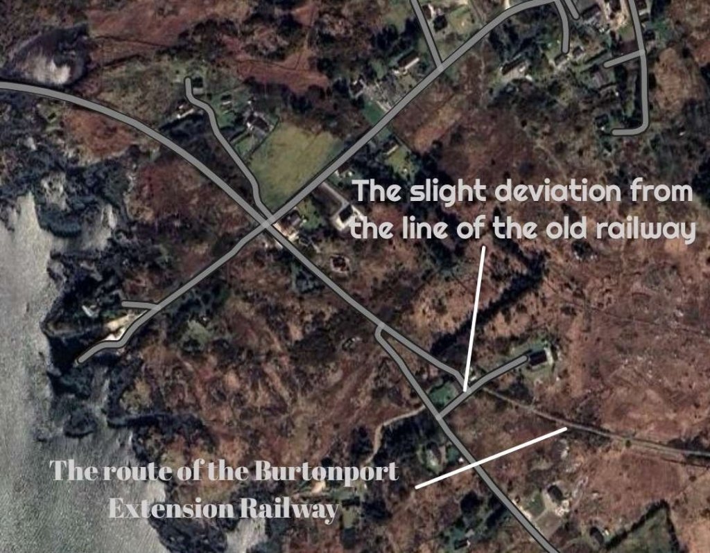
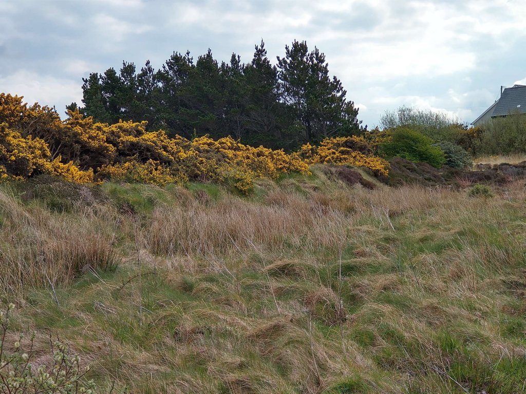
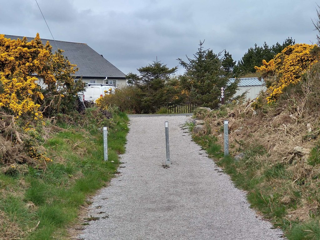
A short distance beyond Crossing No. 24 the modern footpath has to leave the old railway formation which, for a short distance is in private hands. The route of the old line runs through the flowering gorse ahead and to the left of the modern house beyond. [My photograph, 23rd April 2023]
The view of the old line from the footpath diversion. It runs on shallow embankment which is now overgrown with gorse. [My photograph, 23rd April 2023]
The old formation is quickly regained after the short diversion. This photograph looks back toward Burtonport across the land in private ownership. [My photograph, 23rd April 2023]
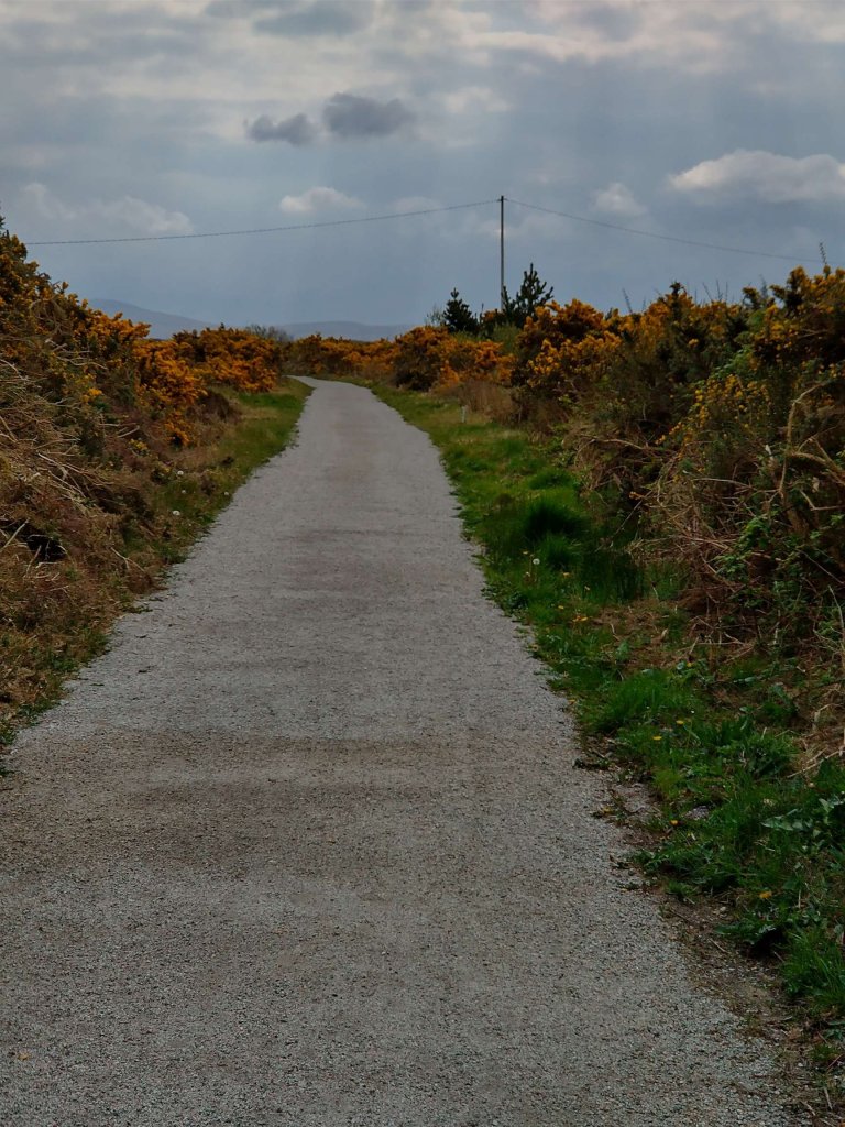
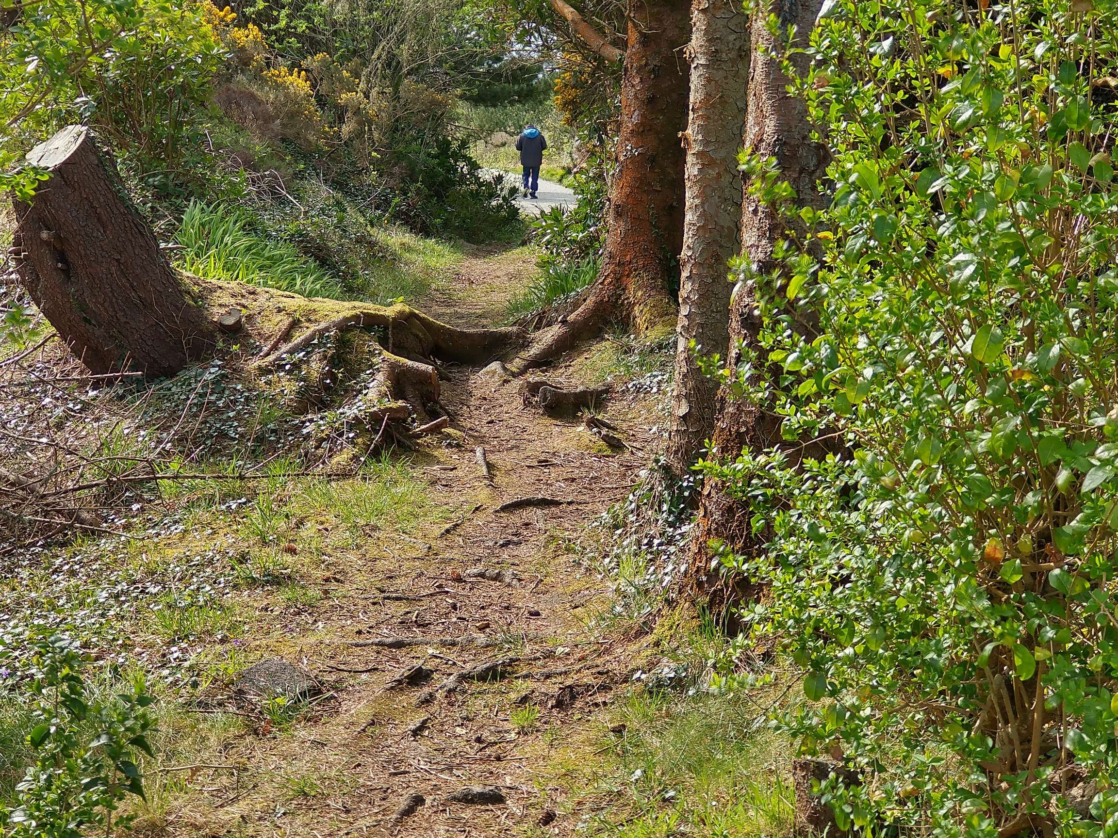
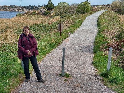
Looking ahead along the footpath which follows the old railway. [My photograph, 23rd April 2023]
The historic 6″ mapping provided by the Ordnance Survey of Ireland shows the line curving through East and then East-northeast. [6]
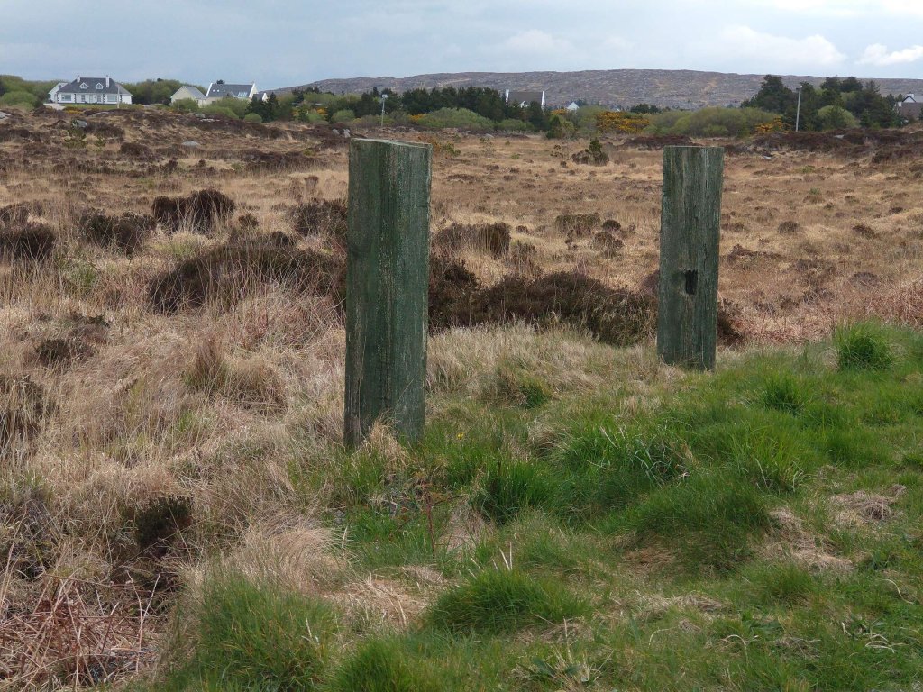
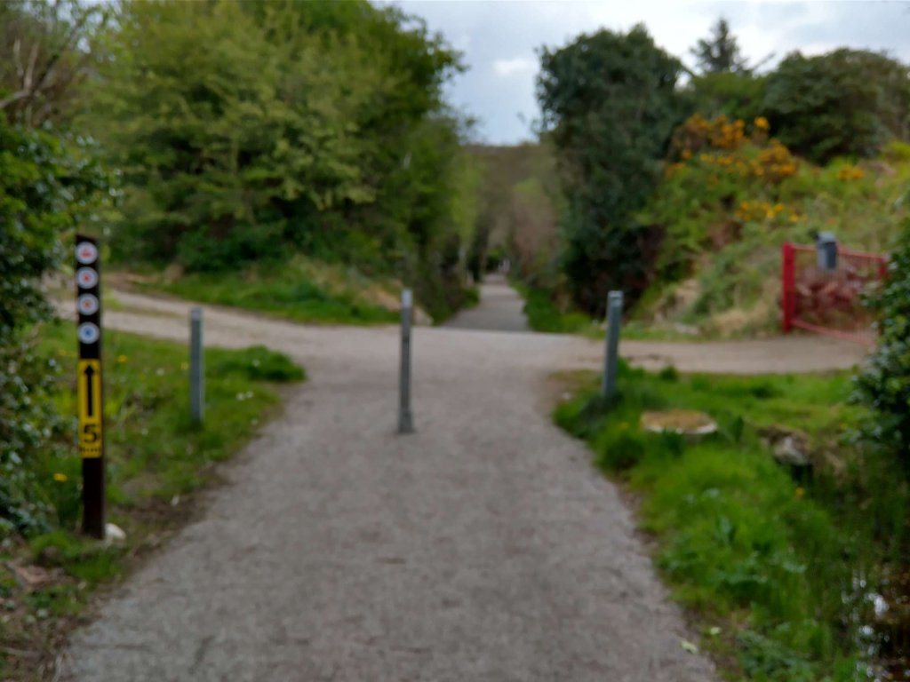
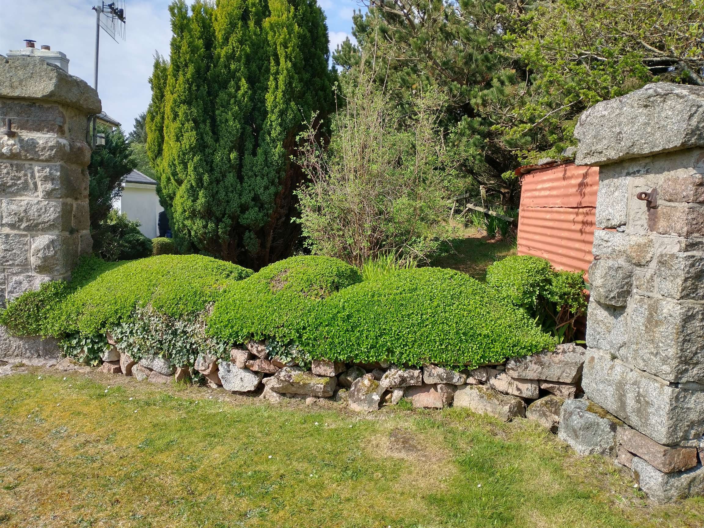
Crossing points where access across the old railway could be expected were marked either by stone pillars or, as here, by large timber baulks. [My photograph, 23rd April 2023]
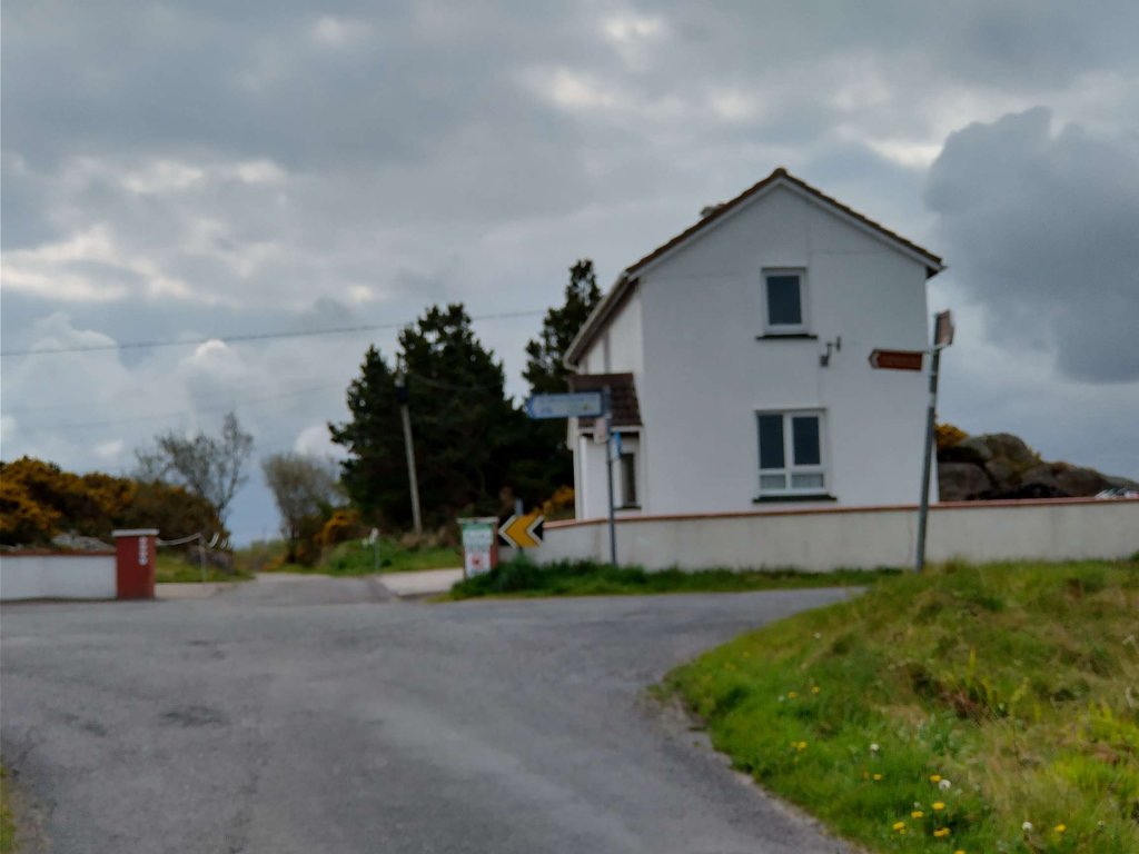
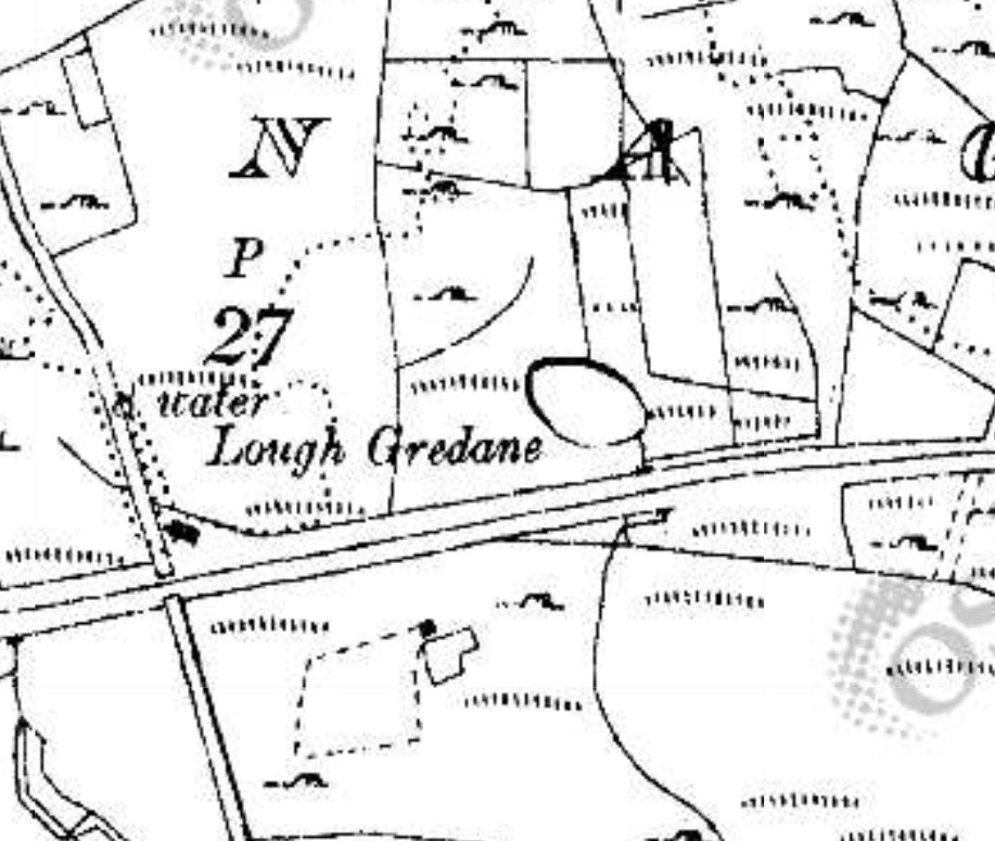
The historic 6″ mapping provided by the Ordnance Survey of Ireland again shows the line heading East-northeast and then East. To the left of the map extract is what is now the main road (R259) between Burtonport and Dungloe which crossed the line at level. [6]
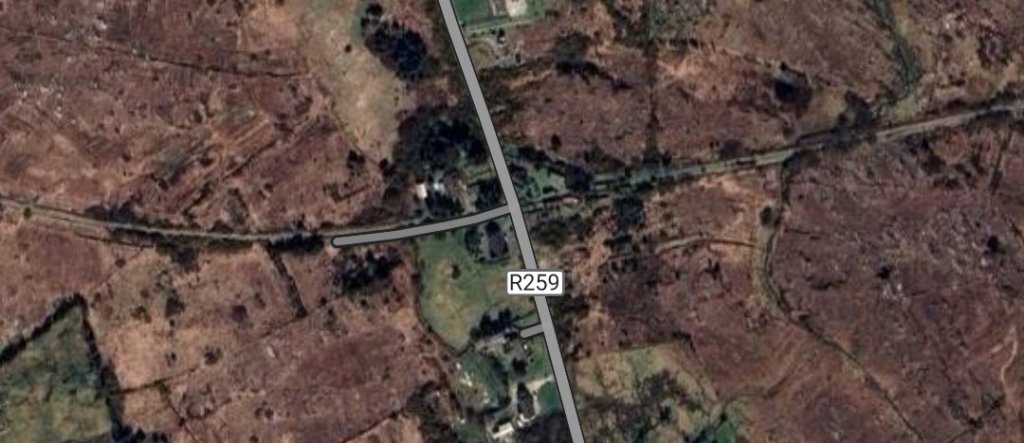
A third length of the walk as it appears on Google Maps. The crossing at the R259 is at the centre of the satellite image. [Google Maps, 27th April 2023]
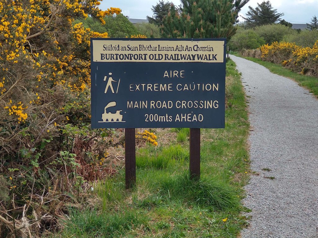
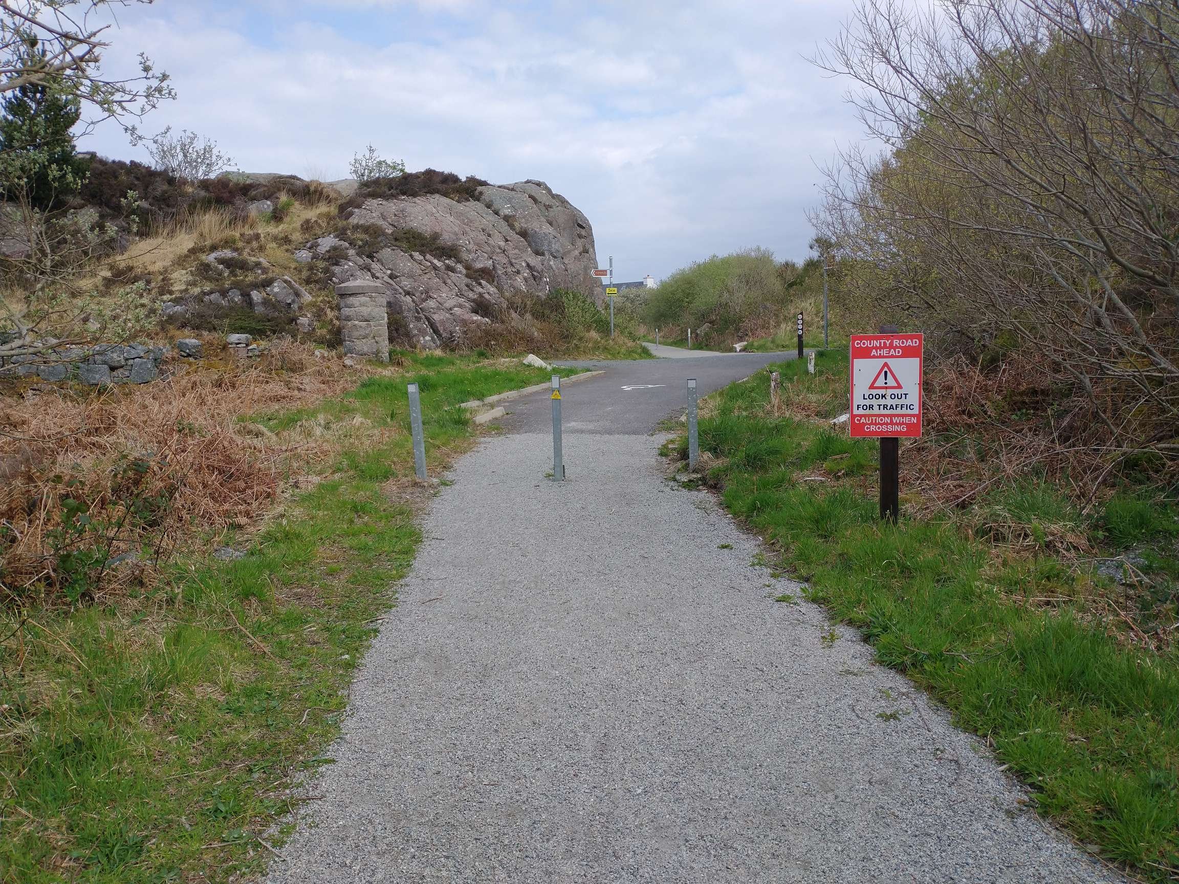
The first warning sign of the approach to the main road. [My photograph, 23rd April 2023]
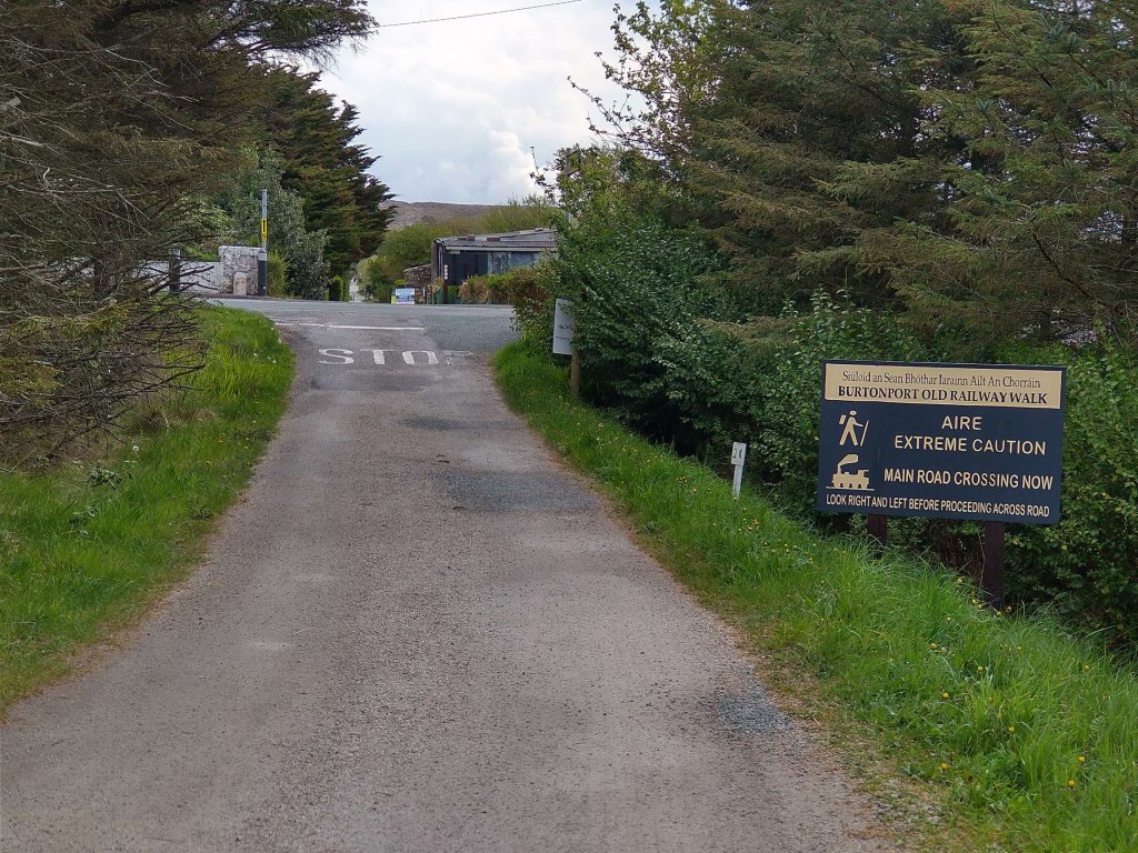
The approach to the R259. [My photograph, 23rd April 2023]
Gatehouse No. 23 as it appears in the 21st century. When the railway was in operation this was not the main route between Dungloe and Burtonport. As we will see, the more important road at the beginning of the 20th century warranted the construction of a bridge over the railway adjacent to Dungloe Road Railway Station. [My photograph, 23rd April 2023]
The route of the old line heading away from the R259. [My photograph, 23rd April 2023]
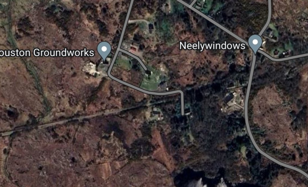
A minor track crosses the route of the old railway. This track appears on the early 6″ OSi map extract and on the satellite imagery below on the approach to Dungloe Road Station.
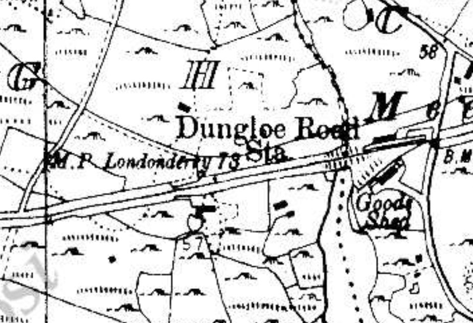
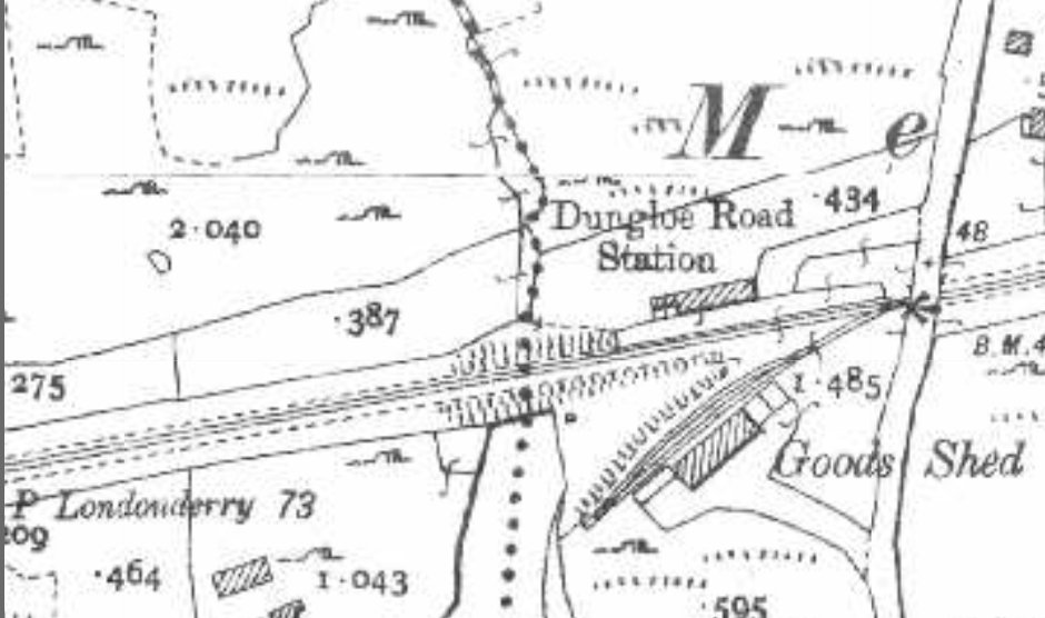
The historic 6″ mapping provided by the Ordnance Survey of Ireland again shows the line heading East-northeast and shows Dungloe Road Station at its Eastern edge. Detail at the station site is rather lacking. [6]
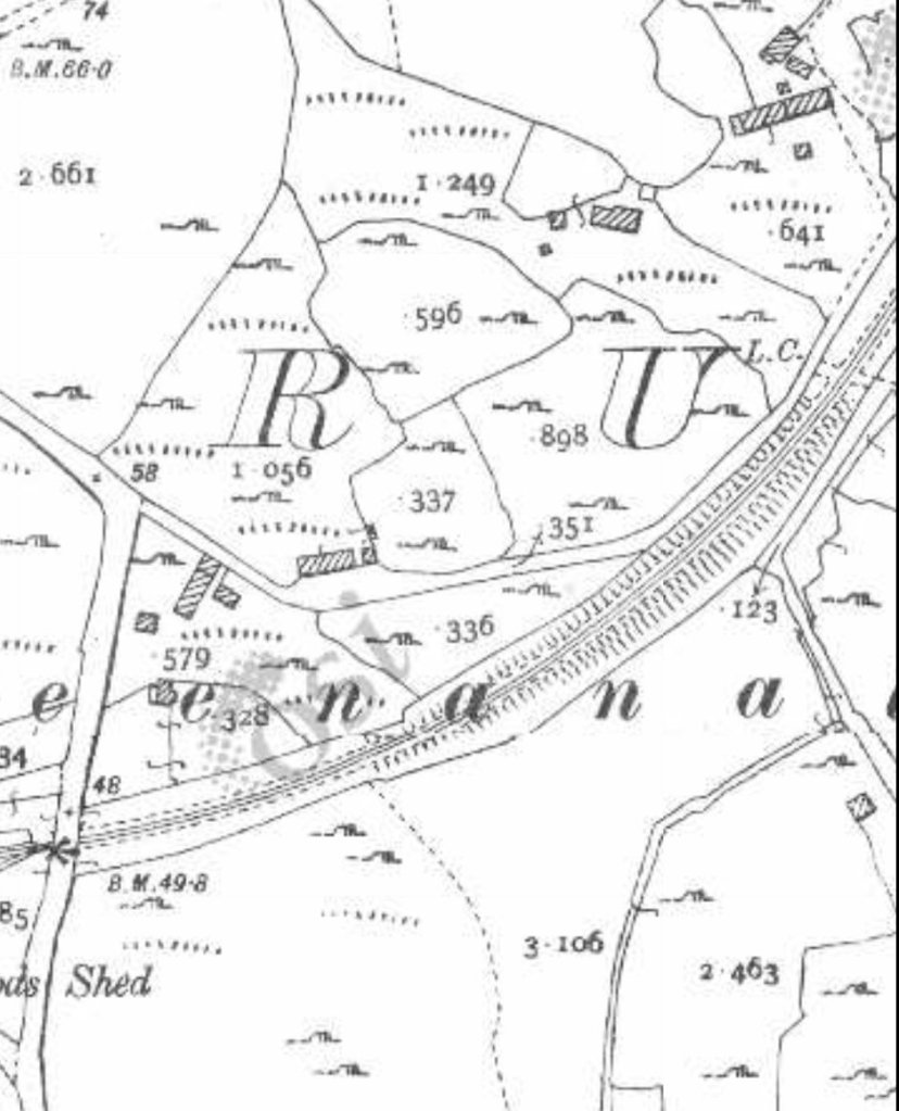
The historic 25″ mapping provided by the Ordnance Survey of Ireland again shows Dungloe Road Station and the bridge immediately to its East. There was no run-around facility for passenger trains but a reasonable provision was made for goods. The Goods Shed has its own siding with a short loop to aid shunting. [6]
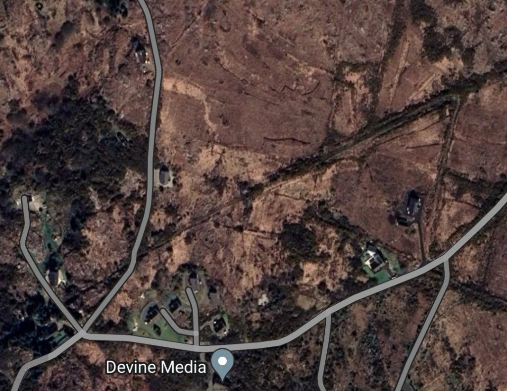
The satellite imagery shows the route of the old railway line but at this scale it can at times be difficult to make out. The roads are highlighted on Google Maps and so are easier to make out than the route of the old railway. The route of the railway appears as a narrow beige line entering the Western edge of the image which increasingly is surrounded by trees as it travels East. The station is immediately to the left of the road shown towards the right side of the image. [Google Maps, 27th April 2023]
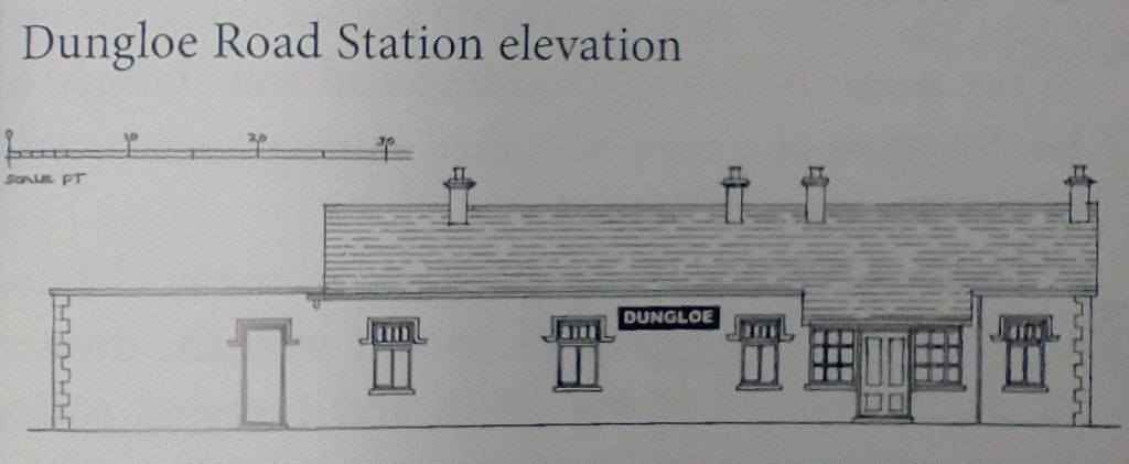
Dungloe Road Railway Station Elevation, as shown by Begley, Flanders and Patterson. [10: p113]
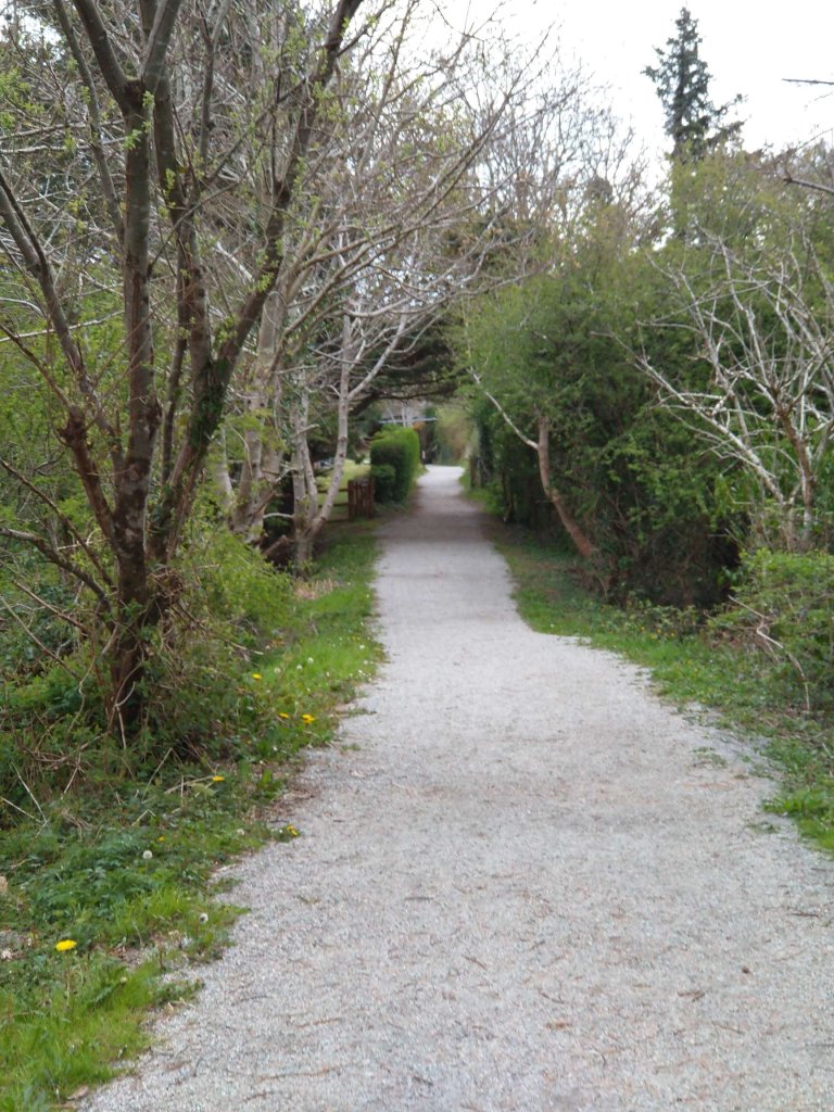
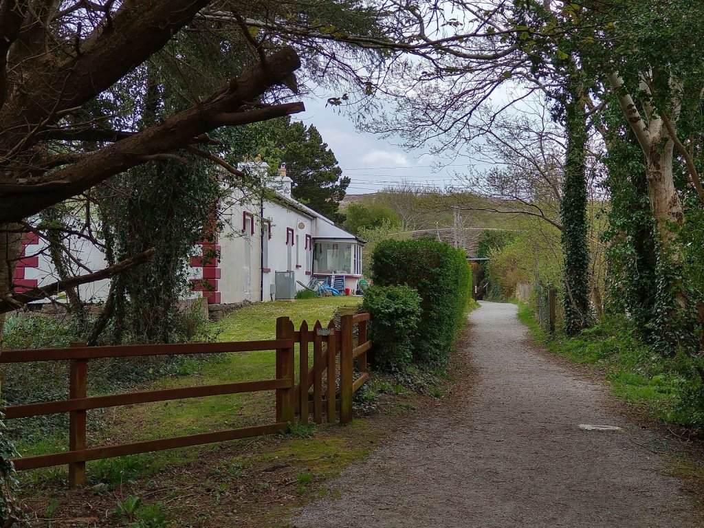
Approaching Dungloe Road Railway Station site along the old track bed in April 2023. [My photograph, 23rd April 2023]
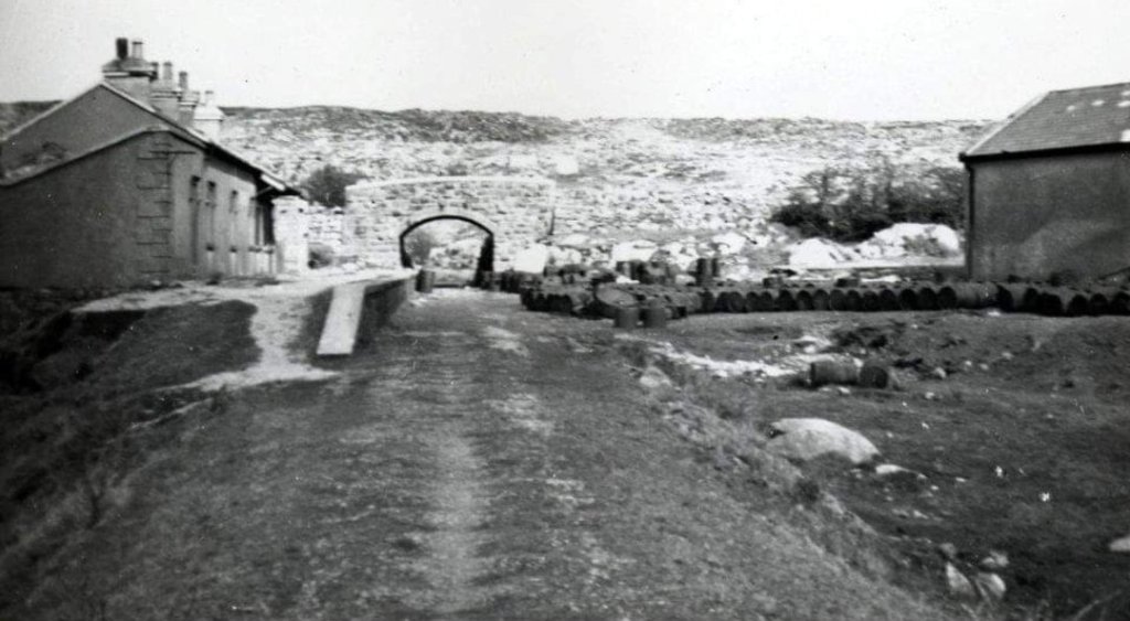
Dungloe Road Station as it appeared immediately after the lifting of the railway tracks in the early 1940s. Beyond the station building is the road overbridge and to the right of the image the goods shed can be seen. This image was shared by on the Burtonport Old Railway Walk Facebook page on 26th November 2011. [7]
An April 2023 view along the formation of the old railway at approximately the same location as shown in the monochrome image immediately above. The hedge follows the line of the platform edge. The station building is substantially the same as when it was in use as a public facility. [My photograph, 23rd April 2023]
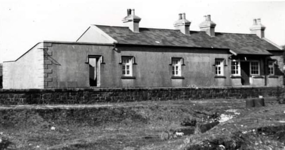
Dungloe Road Station building viewed from the South in the early 1940s after the track had been lifted. This image was shared by Patrick Boner on the Burtonport Heritage Facebook Group on 30th March 2015. [8]
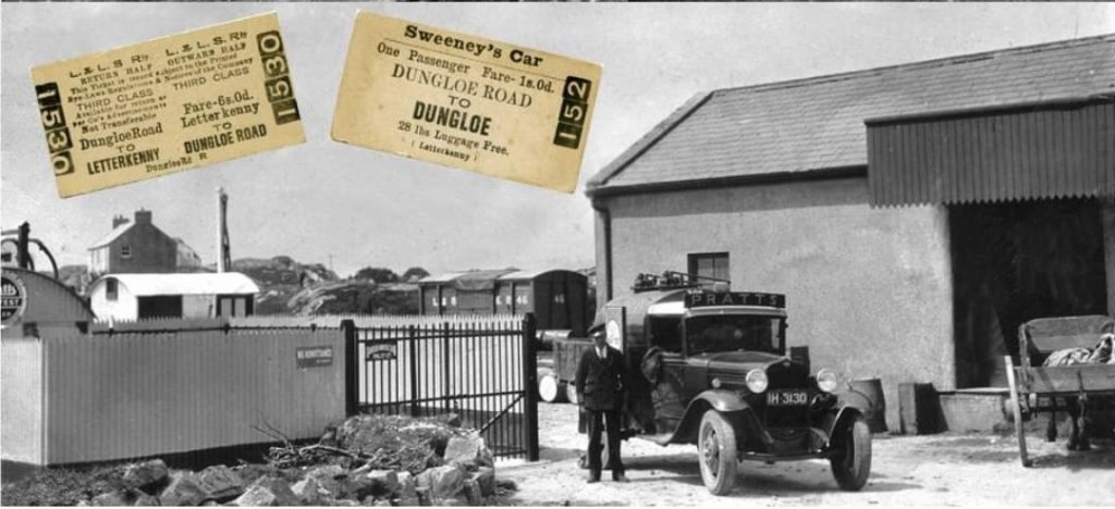
An earlier view of the Dungloe Road Goods Shed, taken from the South. This image was shared by Patrick Boner on the Burtonport Heritage Facebook Group on 30th March 2015. [8]
Dungloe Road Railway Station: the view towards Burtonport in the last years of the 20th century. The Goods Shed is on the left, the passenger station building on the right. [2: p82]
Dungloe Road Railway Station Goods Shed as it appeared in June 1995, © Andy Cundick. The goods shed, looking rather dilapidated in this and the next image, is now a fine private dwelling as can be seen below. This image was shared on the Burtonport Heritage Facebook Group by Joe Begley on 4th July 2014. [11]
Dungloe Road Railway Station Goods Shed as it appeared in June 1995, © Andy Cundick. The goods shed, looking rather dilapidated in this and the previous image, is now a fine private dwelling as can be seen below. This image was shared on the Burtonport Heritage Facebook Group by Joe Begley on 4th July 2014. [11]
The same view in the 2020s as taken by the Google roving camera. The Goods Shed is much changed. [Google Streetview, April 2023]
Dungloe Road Railway Station: the view of what was the passenger station building from the road to the North of the overbridge in the last years of the 20th century. The subsequent growth of vegetation makes the image impossible to replicate in 2023 without significant trespass onto private land. [2: p82]
The road overbridge seen from the West in the late 20th century. [2: p83]
The road bridge again seen from the West on the footpath on the old railway formation in 2023. [My photograph, 23rd April 2023]
Dungloe Road Railway Station site viewed from the South. The camera is on the road which crosses the old railway route on the overbridge noted above. The bridge parapets can be seen the right of the image. On the left of the image is the old goods shed which has been transformed into a modern home. To the right of the old goods shed, the passenger facilities can be made out among the trees. [Google Streetview, April 2023]
The same bridge viewed from the Southeast in theater years of the 20th century. [2: p83]
The view of the bridge from the East in April 2023, looking along the old trackbed. The Railway Station is just beyond the bridge. [My photograph, 23rd April 2023]
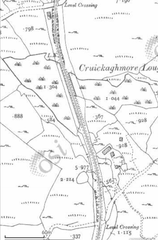
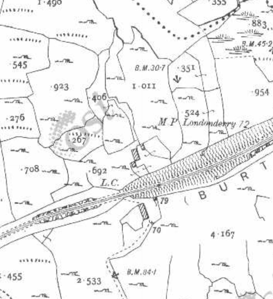
The historic 25″ mapping provided by the Ordnance Survey of Ireland again shows the line heading East-northeast and then turning towards the North. One crossing point is marked L.C. towards the right edge of the map extract. [6]
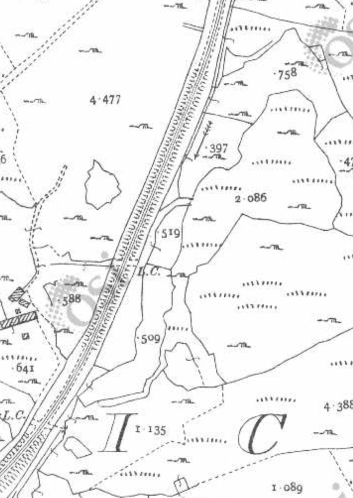
The historic 25″ mapping provided by the OSi again shows the line heading North-northeast. The crossing point noted on the last map extract appears again to the left of this image. A further crossing point is marked L.C. towards the centre of the extract. [6]
The historic 25″ mapping provided by the Ordnance Survey of Ireland again shows the line heading North. A more significant crossing point is marked ‘Level Crossing close to the bottom of this extract. [6]
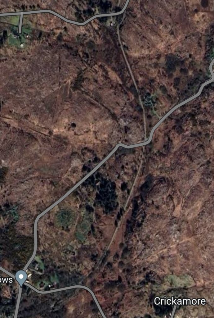
This satellite image covers the same length as the three OSi map extracts above. At the very top of this image, crossing keeper’s cottage No. 22 can be made out alongside a very short diversion of the footpath from the line if the old railway. [Google Maps, 28th April 2023]
The approach from the South to the Level Crossing shown at the bottom of the map extract above. [My photograph, 23rd April 2023]
This photograph is taken looking North towards the top of the OSi map extract above. The crossing keeper’s cottage peeps out above the vegetation in the top left of the image. Trees have encroached onto the line of the old railway and the modern footpath has been diverted over a very short distance. [My photograph, 23rd April 2023]
Looking South along the line of the old railway from close to the crossing keeper’s cottage. The diverted path is off to the right of the photo. [My photograph, 23rd April 2023]
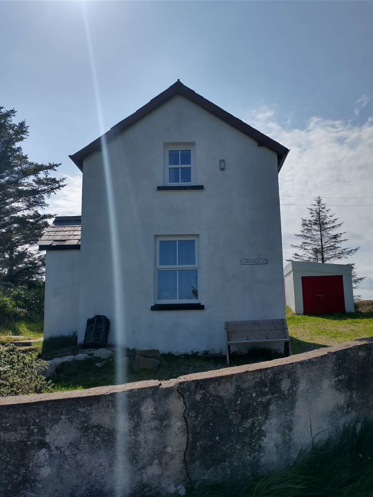
Crossing keeper’s cottage No. 22. [My photograph, 23rd April 2023]
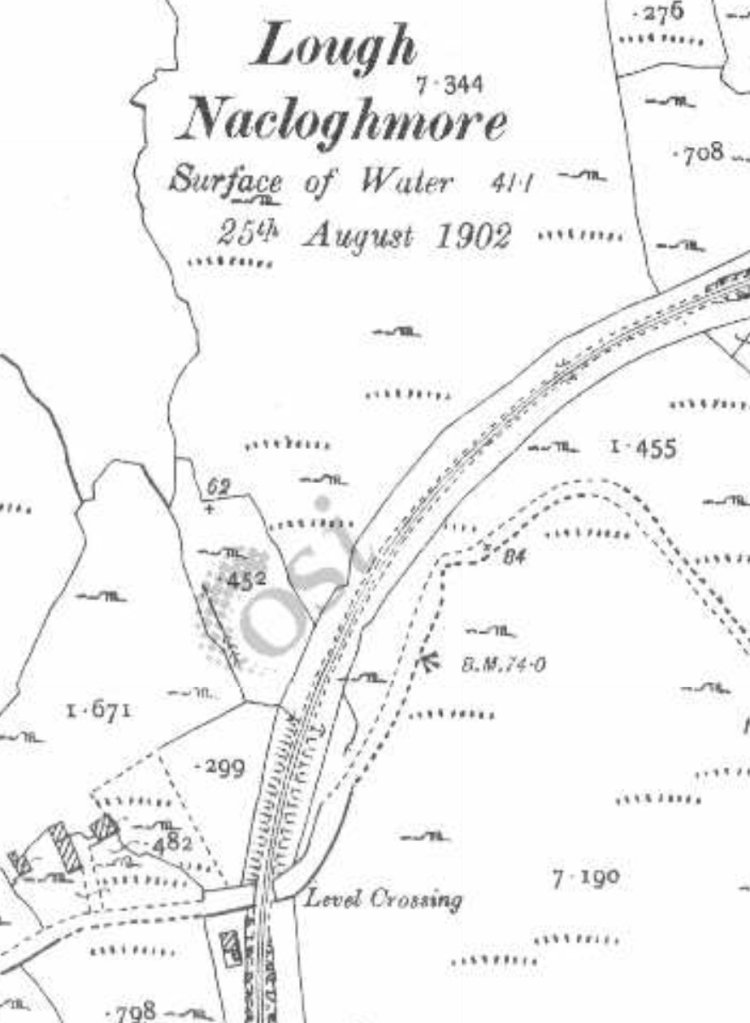
The old railway is shown curving round to the East as it travels on from crossing keeper’s cottage No.22. Lough Nacloghmore is Northwest of the line. This is another extract from the 25″ OSi mapping. The level on the Lough was taken on 25th August 1902. [6]
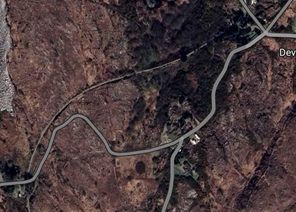
This satellite image covers the length of the old railway from Crossing Keeper’s Cottage No. 22 Northeast to the point where the modern footpath leaves the route of the old railway, just to the West of the crossroads shown in the top-right of the image. This includes the area cover by the map extract above and the next two map extracts below. [Google Maps, 28th April 2023]
Looking Northeast along the line of the old railway from a point adjacent to crossing keeper’s cottage No. 22. [My photograph, 23rd April 2023]
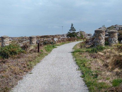
The stone pillars shown in this photo are typical of those used along the line to mark crossing points. [My photograph, 23rd April 2023]
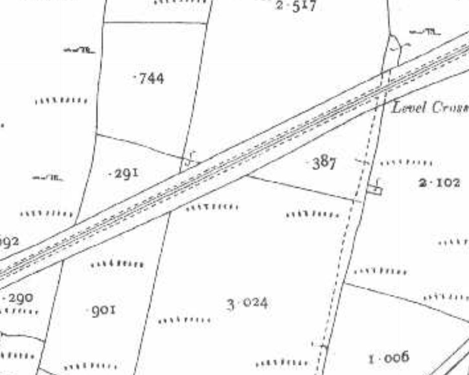
Continuing Northeast this next extract from the 25″ OSi mapping shows another accommodation crossing (marked L.C.) and shows the line on high embankment from that point East. [6]
Further to the Northeast, this extract from the historic 25″OSi mapping shows the line running straight through three further crossing points.At the first of these the modern footpath leaves the line of the old railway and follows the road to its South side. [6]
The old railway continues Northeast but across private land the footpath route follows the road which runs bottom-left to middle-right of this satellite image. [Google Maps, 28th April 2023]
The topography changes again and the line runs on embankment over the length beyond the Level Crossing shown on this next map extract. From a point just inside the left edge of this extract, the route of the old line enters what, in the 21st century, is private land the footpath is diverted away from the line and follows the road running East in the bottom part of the map extract. [6]
Looking Northeast, this is the point at which the footpath leaves the line of the old railway. A modern home is built across the line ahead. [My photograph, 23rd April 2023]
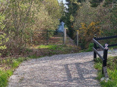
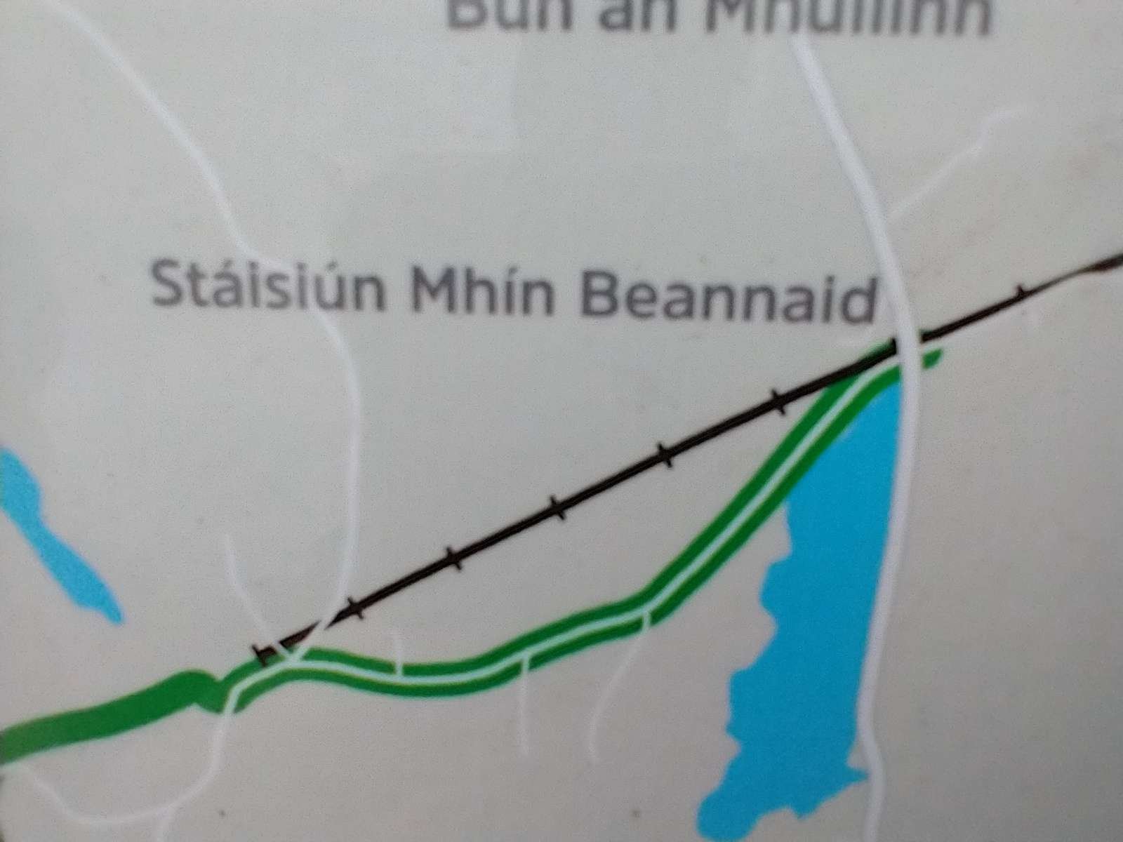
The footpath diversion from the display board adjacent to Crossing Keeper’s Cottage No. 21. [My photograph, 23rd April 2023]
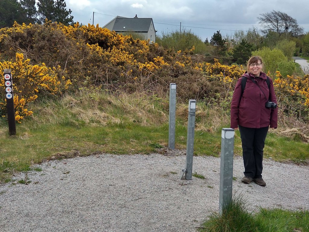
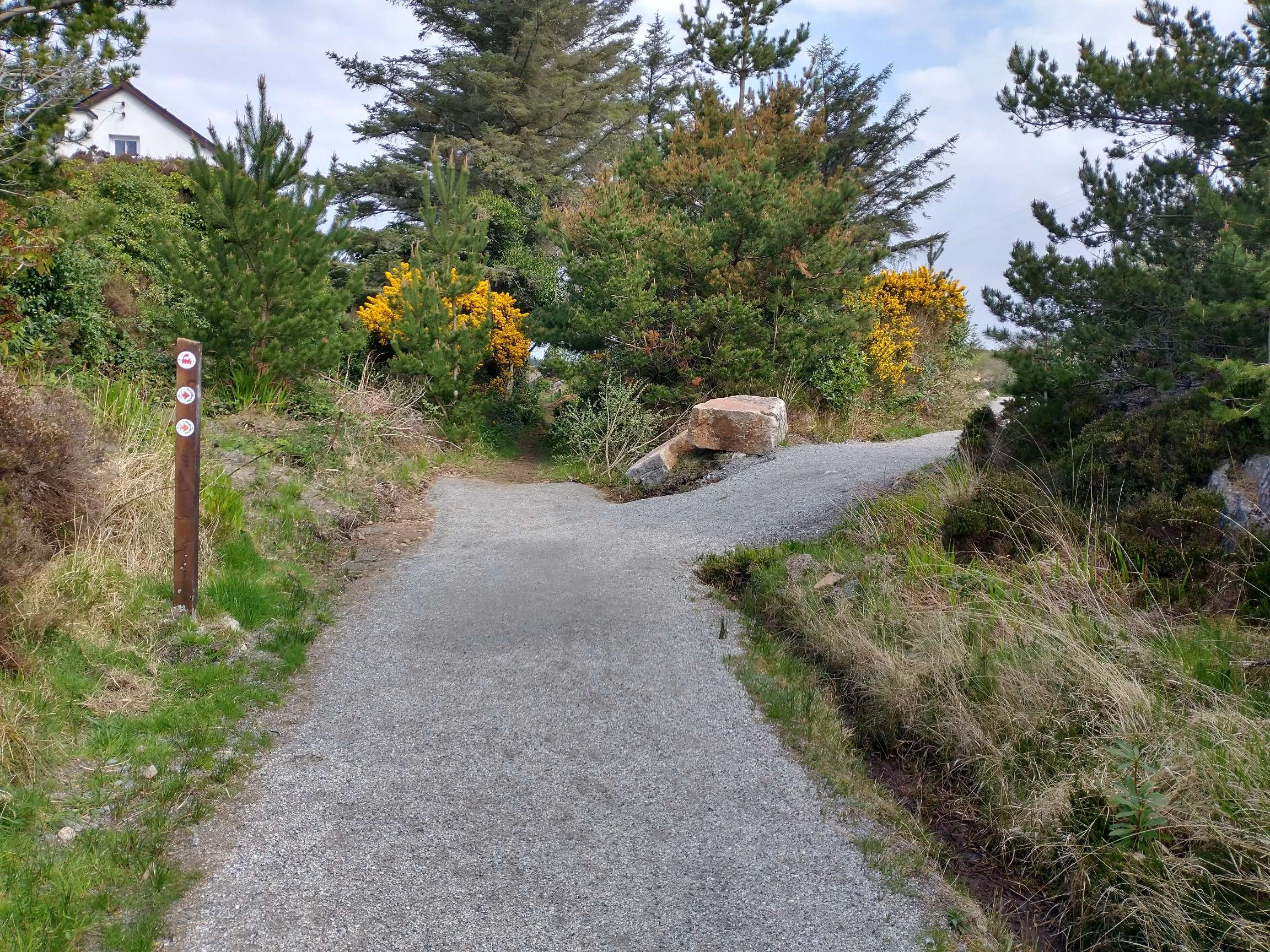
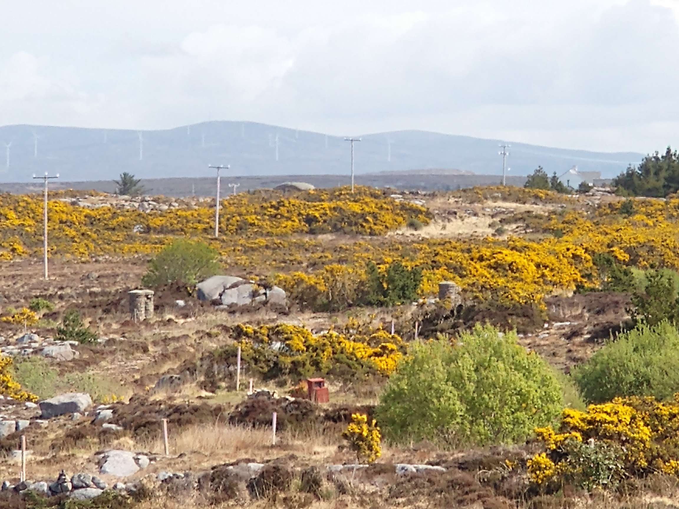
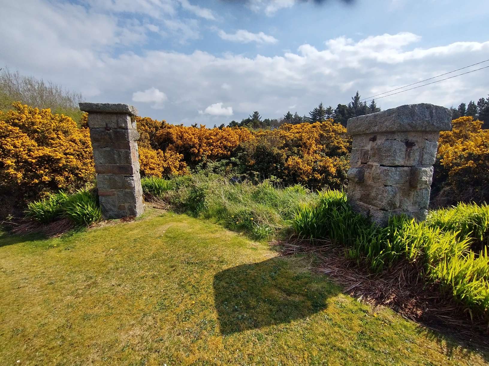
Looking ahead, Northeast, along the old railway, it’s route passes between the four stone bollards, which mark the crossing point shown on the map extract below, and then follows the line of gorse bushes toward the right edge of the photo. [My photograph, 23rd April 2023]
Further to the Northeast, this extract from the historic 25″OSi mapping shows the line running straight through the landscape at the same level as the surrounding land. This length of the railway is in private hands in the 21st century. [6]
A further crossing point is shown on this next map extract, this length is also in private hands. [6]
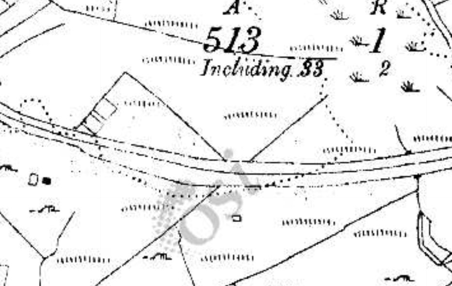
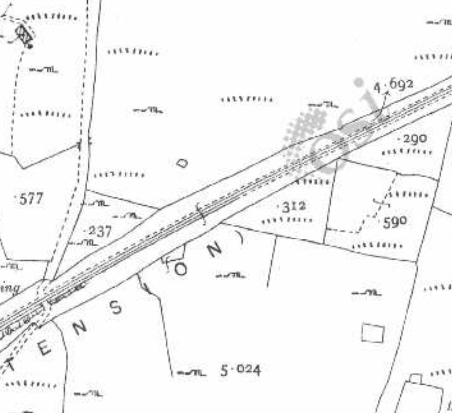
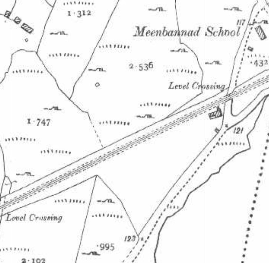
A further level crossing is marked at the top-right of this next extract adjacent to Meenbannad School. At the time that this part of the 6″ and 25″ OSi mapping was surveyed there was only a crossing cottage (No. 21) at this location. It was ultimately chosen as the location of an additional railway station/halt which was built in 1913. [6][10: p113]

Kincasslagh Railway Station and Crossing Keeper’s Cottage No. 21 are now in private hands. This article finishes with some older pictures of the site and some taken in 2023.

Kincasslagh Railway Station looking Southwest along the line towards Burtonport The Goods Shed is to the left and the passenger facilities are towards the end of the platform on the right. The station was built in 1913 and closed with this length of the line in 1940. This image was shared on the Burtonport Heritage Facebook Group by Patrick Boner on 15th February 2013. [12]
The remains of the Goods Shed in the 21st century, seen from the public road to the South. [My photograph, 23rd April 2023]
A 1959 view through the site of Kincasslagh Railway Station from Southwest of the Goods Shed seen in the right foreground. The Crossing Keeper’s Cottage is partially masked by the Goods Shed and the passenger facilities are on the left. This photo was taken in May 1959 by Michael Davis and was shared by Patrick Boner on the Burtonport Heritage Facebook Group on 1st September 2018. [13]
A view looking Northeast through the site of the station from the location of the goods shed. The passenger building is on the left and crossing keeper’s cottage on the right. The photograph was taken in 1965 by Michael Davis and was shared by Patrick Boner on the Burtonport Heritage Facebook Group on 3rd September 2018. [14]
This satellite image is at a slightly larger scale than similar images above it shows the location of what was Kincasslagh Railway Station. [Google Maps, 28th April 2023]
The passenger station building and platform as they appear in the 21st century. The site is very well maintained. [My photograph, 23rd April 2023]
Crossing Keeper’s Cottage No.21. [My photograph, 23rd April 2023]
The view from what used to be the Level Crossing, looking Southwest into the site of the station. [My photograph, 23rd April 2023]
Turning through 180°, this is the view Northeast from the old level crossing location. The modern road is ahead beyond the gorse bushes.
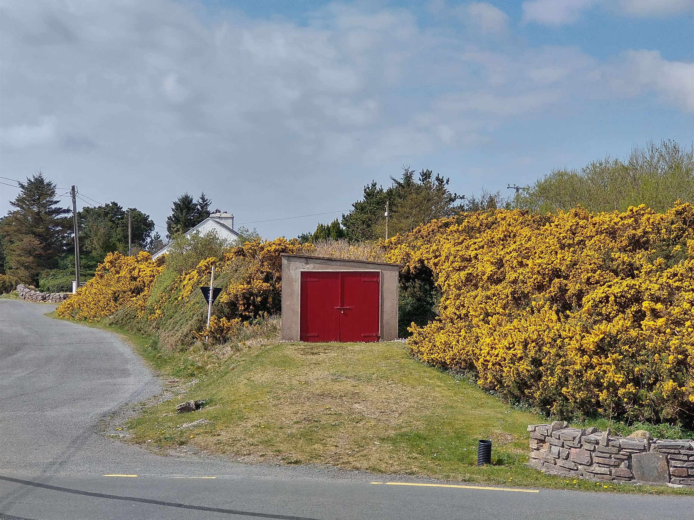
The view Southwest from the modern road. The Crossing Keeper’s Cottage is just visible above the gorse. The garage is on the line of the old railway. [My photograph, 23rd April 2023]
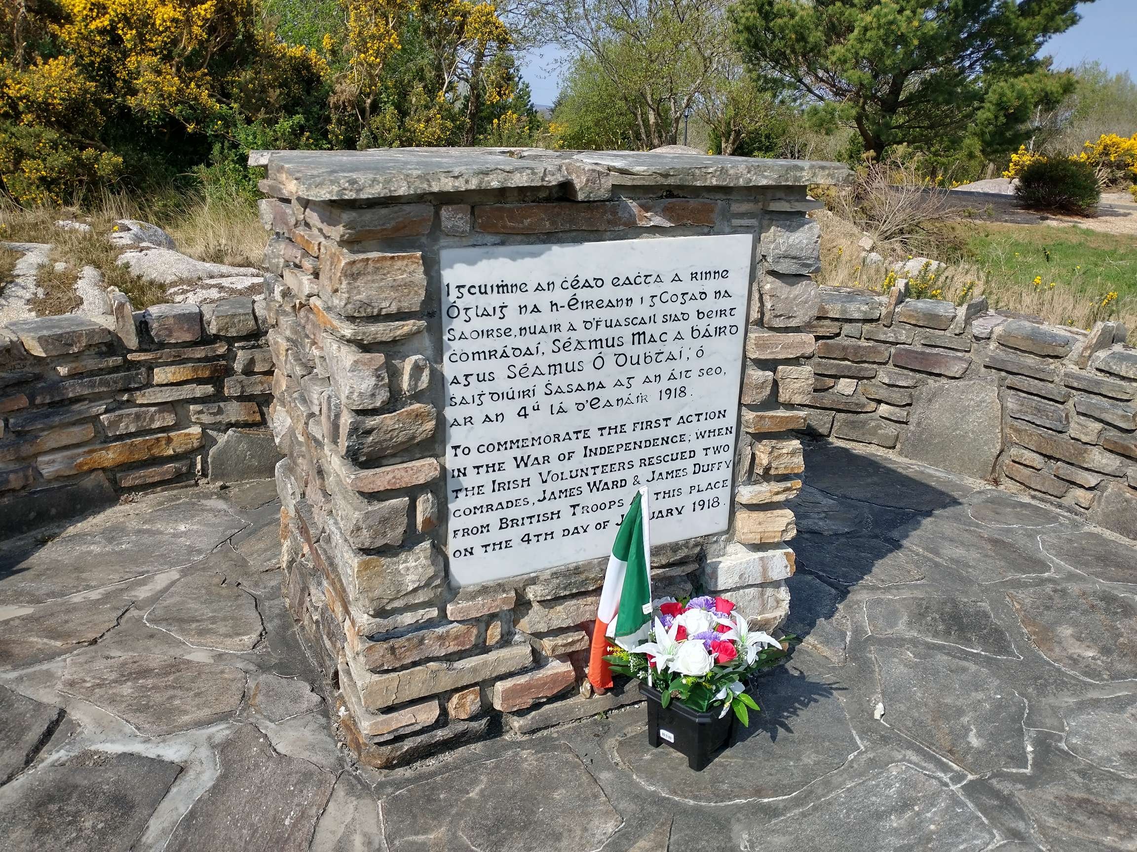
This is a memorial adjacent to the line of the old railway to the first action in the War of Independence. [My photograph, 23rd April 2023]

The next article in this short series can be found on this link:

The Burtonport Extension of the ‘Londonderry & Lough Swilly Railway’ – Part 2

References

  1. https://emmafcownie.com/2019/12/15/the-burtonport-old-railway-walk-donegal-ireland, accessed on 23rd April 2023.
  2. Dave Bell & Steve Flanders; Donegal’s Raulway Heritage Guide No. 2, The Londonderry & Lough Swilly Railway: A Visitor’s Guide to the old railway and all the bits that can still be seen; County Donegal Restoration Society, Donegal Town, Co. Donegal, 198…
  3. https://m.facebook.com/groups/788818974978955/permalink/1178313109362871, accessed on 25th April 2023.
  4. https://m.facebook.com/groups/788818974978955/permalink/1193387747855407, accessed on 24th April 2023.
  5. https://m.facebook.com/story.php?story_fbid=pfbid0KVungzAVHUePoRjDphqZ3topTijYW7y56LuREeDGJRBMWv2g7pEtfcMPQhGGW9UVl&id=1223882780981294, accessed on 24th April 2023.
  6. https://osi.maps.arcgis.com/apps/webappviewer/index.html?id=bc56a1cf08844a2aa2609aa92e89497e, accessed on 25th April 2023.
  7. https://m.facebook.com/burtonportrailway/photos/a.272196396164954/272197266164867/?type=3, accessed on 25th April 2023.
  8. https://m.facebook.com/groups/burtonportheritage/permalink/683856108385937, accessed on 25th April 2023.
  9. Jim McBride; The Lough Swilly Remembered; County Donegal Railway Restoration CLG, 2021. Illustrations from this book are reproduced here with the kind permission of Jim McBride.
  10. Joe Begley, Steve Flanders & E.M. Patterson; The Lough Swilly Railway: Revised Edition; Colourpoint Books, Newtownards, 2017.
  11. https://m.facebook.com/groups/burtonportheritage/permalink/548660425238840, accessed on 27th April 2023.
  12. https://m.facebook.com/groups/burtonportheritage/permalink/339803386124546, accessed on 28th April 2023.
  13. https://m.facebook.com/groups/burtonportheritage/permalink/1648247588613446, accessed on 28th April 2023.
  14. https://m.facebook.com/groups/burtonportheritage/permalink/339803386124546, accessed on 28th April 2023.
  15. https://m.facebook.com/groups/burtonportheritage/permalink/3138712962900227, accessed on 28th April 2023.

The Cavan and Leitrim (C&L) Railway again – Belturbet Railway Station …..

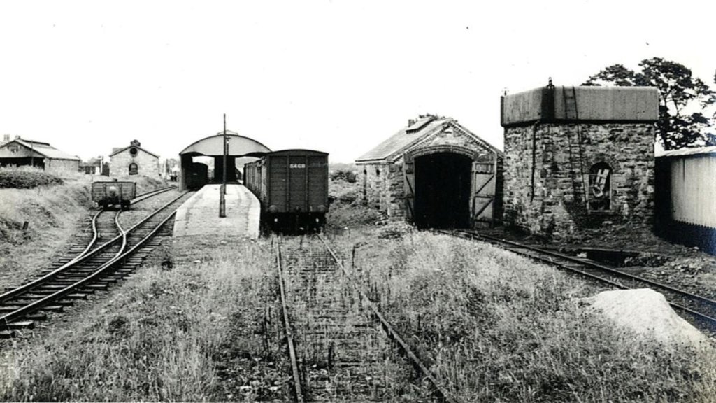
Belturbet Railway Station viewed from the West. The main passenger facilities are on the left behind an unidentified C&L locomotive with its mixed goods/passenger train. The 3ft gauge C&L entered Belturbet Railway Station from the West and it’s trains used the North face of the platform. Great Northern Railway (GNR) trains entered the station from the East and were able to make use of the protection afforded by the station roof as they used the South face of the station platform. The GNR water tower, shown here on the right of the image was relocated during the renovation of the site to occupy the location of the C&L Engine Shed which would, at the time of this picture been some distance behind the photographer and over to the right. [5]
Taken from further Northwest this photograph, which was shared by the Heritage Railway Magazine on its Facebook page on 8th August 2021, shows the transshipment platform and shed at Belturbet with the broad gauge on the right of the platform and the 3ft gauge C&L to the left. On the right are the C&L Engine Shed and Water Tower and in the distance to the left, the GNR Engine Shed and at the extreme left of the image the passenger station’s roof. [6]
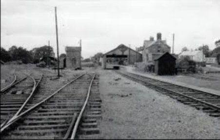
A view of Belturbet Station from the East, only GNR broad gauge is visible in this image. [7]

In April 2023 we were able to drop in at Belturbet Railway Station on our way to Co. Donegal. The Station Museum was open Fridays, Saturdays and Sundays from 12noon to 5pm throughout the Summer season. [1][2][3] A small group of enthusiast’s have turned a derelict site into a good museum and rescued the majority of rail related buildings on the site. A patient wife allowed me a pleasant hour or so looking round the Museum.

Belturbet was the terminus for two different railway lines: the Irish standard gauge (5ft 3in) line from Ballyhaise on the Cavan Branch of the Great Northern Railway (GNR), and the Cavan and Leitrim Railway (C&L) – a 3ft gauge line which served Dromod to the Southwest and Arigna to the West with its three 3ft gauge lines meeting at Ballinamore in Co. Leitrim). At Dromod the C&L connected to the Midland Great Western Railway mainline from Dublin to Sligo.

Closure of the Station occurred in 1959. The site remained derelict for 36 years until, in 1995, Belturbet Community Development Association commenced restoration work. That work was completed in 1999. Further development of the site is planned which will see original track being relaid and with the intention of seeing trains running once again in Belturbet.

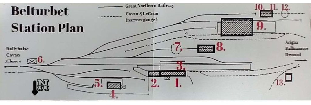
Belturbet Railway Station as shown in publicity material for the Station Museum. A North point has been added to the plan so as to avoid confusion if comparing the plan with maps of the location. [4]

The plan of the Station Site is numbered to allow easy identification of different buildings. The 3ft gauge line enters the schematic plans from the West (the right side of the image), the 5ft 3in gauge line enters from the East (the left side of the image). The buildings are:

  1. The Main Station Building and Museum – the dressed stone buildings were the main reception area, office and waiting rooms for the Great Northern Railway (GNR) at Belturbet. What is now a single reception room was originally two separate rooms, the first being the main concourse for access to the platforms. To the East were two waiting rooms, one for the general public and one (with toilet) for ladies holding first class tickets. To the West of the main reception area (behind the museum reception desk was the ticket office leading to the Station Master’s office, which had a connecting door to his house.
  2. The Station Master’s House – has been restored. It would have originally been a family home but can now be booked for self-catering holidays.
  3. Railway Lines and Platform – Belturbet railway station, which opened in 1885, was built and operated by the Great Northern Railway Company of Ireland (GNR). It was the last station of the GNR broad-gauge railway line – 5ft. 3 in. (1.6 m.). In 1887 the Cavan & Leitrim (C&L) narrow-gauge line – 3 ft. (0.9 m.) was built, Belturbet was the first station on this line. On the newly extended platform, passengers transferred from one line to the other. GNR and C&L trains stopped on opposite sides of the platform. There was a roof over the platform immediately adjacent to the station buildings.
  4. GNR Goods Shed/Store – Goods Wagons were positioned alongside the small platform in front of the Goods Store. Wagon floors were level with the platform which made it easy for the porters with their barrows to move goods on and off the wagons. A crane was used to load and unload heavy items.
  5. Cattle Dock and Ramp – The Cattle Dock was virtually unchanged from its opening in 1885 until its closure on March 31st, 1959. The dock was used to load livestock onto the wagons. This was particularly useful on the first Thursday of every month, when Belturbet Fair took place on the Fair Green.
  6. GNR Signal Box – this building was no longer on site when the preservation work commenced.
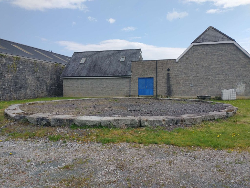
  7. GNR Turntable – The circle of stones indicate the position of the turntable. It was so well balanced that one man could single- handedly turn around a 50 ton engine.
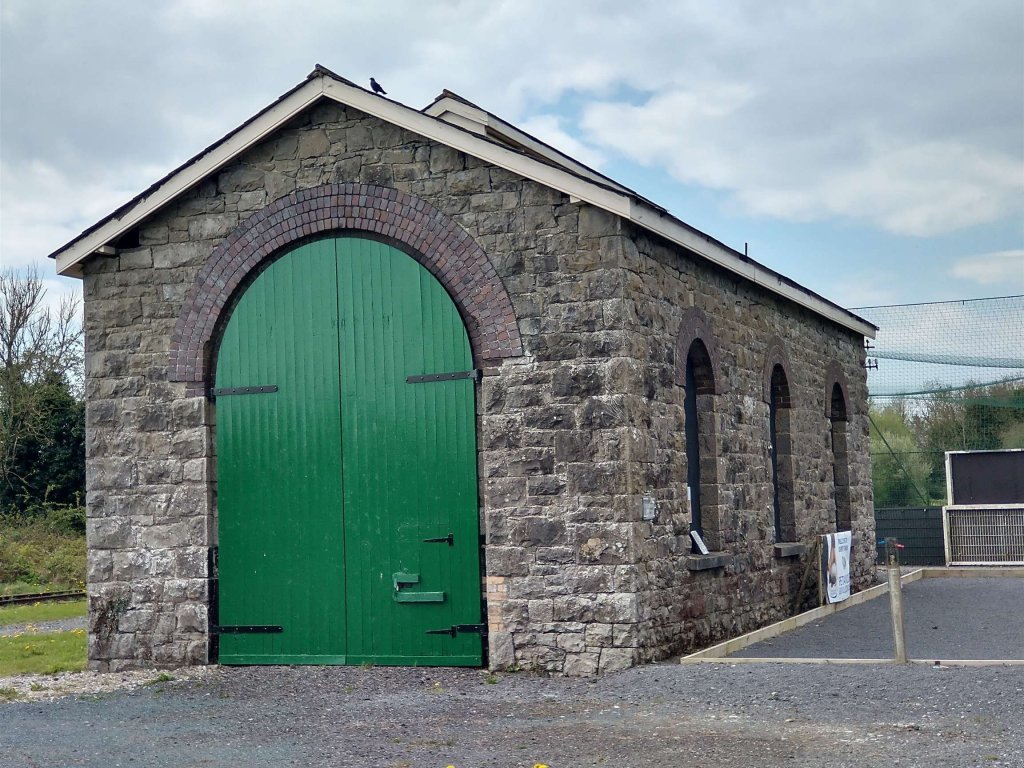
  8. GNR Engine Shed – The GNR Engine Shed, refurbished to original specifications, is where an engine was housed at night. The large vent in the roof allowed smoke and steam to escape when the engine was in steam.
  9. Transshipment Shed – For many years GNR coal trains were filled from C&L coal wagons by local men using only shovels, barrows and planks of timber. The demand for Arigna coal ensured that Belturbet Station remained open five or six years longer than many similar stations.
  10. C&L Engine Shed and Water Tower – the C&L shed and water tower were demolished before renovation of the station site commenced.
  11. GNR Water Tower – In 1997 the GNR water tower was dismantled and reassembled on the site of the original C&L Engine Shed and Water Tower, which had been demolished.
  12. C&L Turntable – this had been removed before renovation commenced.
  13. C&L Goods Shed/Store – this was the only building on the station site to have survived the period of dereliction with its original slate roof and wooden doors.

There are a significant number of historic photographs on display cover both the broad gauge line and the narrow gauge line.

The following photos were taken by me on 21st April 2023.

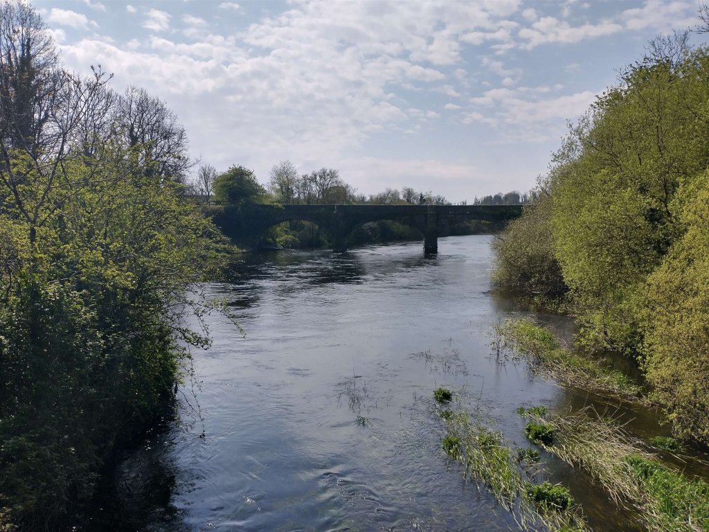
The viaduct which carried the C&L across the River Erne on its approach to Belturbet Railway Station. [My photograph, 21st April 2023]
Crossing the viaduct on the C&L on the way to Belturbet Railway Station. [My photograph, 21st April 2023]
Continuing our approach to Belturbet Railway Station. [My photograph, 21st April 2023]
The historic 25″ OSi mapping shows the C&L approach to Belturbet Railway Station across a level crossing which had an associated Crossing Keeper’s Cottage. [8]
Crossing the road on the C&L’s final approach to the station. The Crossing Keeper’s Cottage still stands in very good condition in the 21st century. [My photograph, 21st April 2023]
The Station site at Belturbet close to the turn of the 20th century as recorded on 25″ OSi mapping. [8]
The Transshipment Shed viewed from beyond the West end of its platform. It was primarily used for the transfer of Arigna coal from the C&L to the GNR. [My photograph, 21st April 2023]
Just a little closer in. The GNR engine shed is visible just to the left of the roof of the Transshipment Shed. C&L trains from Arigna drew in to the near face of the platform. GNR trains approached the rear of the platform from beyond the Shed. On the right, the water tower base can just be made out. [My photograph, 21st April 2023]
The GNR water tower base was dismantled and reassembled (in 1997) on the site of the original C&L Engine Shed and Water Tower, which had been demolished. [My photograph, 21st April 2023]
The GNR Engine Shed as seen from the Southwest. The stones which mark the location of the GNR turntable can just be seen beyond. [My photograph, 21st April 2021]
The GNR Engine Shed viewed from the East. [My photograph, 21st April 2023]
The location of the GNR turntable. The building beyond the turntable to the left is the roof which covered the GNR passenger platform. The buildings directly behind the turntable were built on the site a long time after closure. The house a men’s charity. The GNR water tower was relocated to allow this building to be built. [My photograph, 21st April 2023]
The Transshipment Shed, seen from the East with broad gauge track in evidence to the left of the platform.  [My photograph, 21st April 2023]
The trainshed roof over the GNR platform is on the left of this image with the passenger facilities beyond. The two storey building is the Station Master’s House. [My photograph, 21at April 2023]
The GNR Goods Shed to the East of the main station buildings. [My photograph, 21st April 2023]
Two views from the station approach roads, both show the main facade of the station. [My photographs, 21st April 2023]

References

  1. https://belturbetheritagerailway.com, accessed on 21st April 2023.
  2. https://www.discoverireland.ie/cavan/belturbet-heritage-railway-museum, accessed on 22nd April 2022.
  3. http://www.discoverbelturbet.ie/about-belturbet/belturbet-railway-station, accessed on 22nd April 2022.
  4. Belturbet Railway Station Museum publicity leaflet, (www.belturbetheritagerailway.com).
  5. https://www.anglocelt.ie/2021/02/13/railway-group-on-track-with-funding-plan, accessed on 23rd April 2023.
  6. https://www.anglocelt.ie/2021/08/08/belturbet-train-crash-in-1879?fbclid=IwAR2o6BJftonlCnh4RvghHx2FvBwFgJvqDN47ucVbmwHKKY-OOUi5zeasd0Q, accessed on 23rd April 2023.
  7. https://bizlocator.ie/listings/belturbet-railway-museum, accessed on 4th June 2019
  8. https://osi.maps.arcgis.com/apps/webappviewer/index.html?id=bc56a1cf08844a2aa2609aa92e89497e, accessed on 28th April 2023.

Teelin Bay, Teelin Pier and Co. Donegal Railways

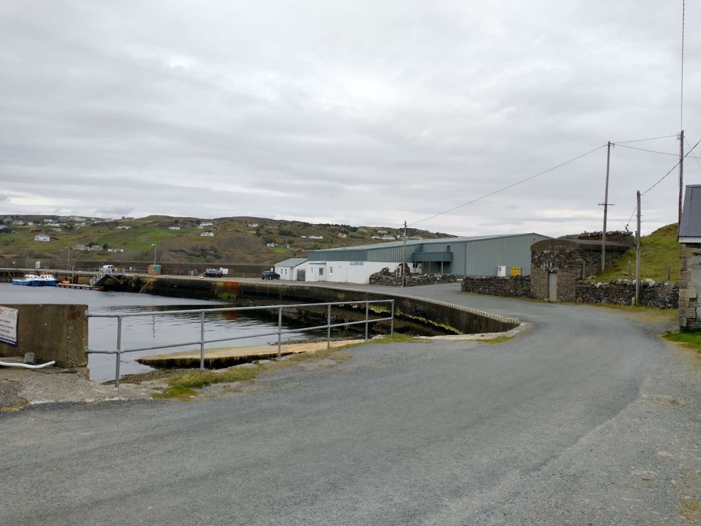
Teelin Pier, Co. Donegal. … [My photograph, 26th April 2023]

What happened to the proposed extension to the Killybegs branch of the Co. Donegal Railways to Teelin Pier?

The short answer is that it did not really get beyond the imaginations of a few folk in the Glean Cholm Cille (Glencolumbkille) and Carrick area of Co. Donegal.

There was a government scheme which provided support to fishermen in the area, first in the Congested Districts Board establishing Teelin as the principal fish-curing station and then in supplying fisherman with large fishing smacks (and associated gear). [1]

Local parties could not countenance this investment going to waste for the want of a short railway extension from Killybegs. Revd C. Cunningham of Glencolumbkille expressed the feeling of a meeting of the Glencolumbkille and Kilcar Industrial Committee, held at Carrick, Co Donegal when he said that “with such efforts being made to make Teelin a fishing centre of unequalled importance with a fleet of first class fishing vessels, it was sad to reflect that the rich harvest which would naturally be expected from the broad Atlantic shall be in a great measure fruitless through the want of this short extension.” [1].

He went on to argue at that meeting that should the extension from Killybegs to Teelin be made “not only would existing industries be re-invigorated but others would be developed, and thus the people instead of having, in case of failure of crop, to appeal for relief to the Government, would become self-supporting, happy and independent.” [1]

It seems that the authorities turned a deaf ear to the appeals of local people. The reason given in histories of the line, for the failure to extend the line beyond Killybegs is that the topography would have required serious civil engineering features making it too expensive to construct. [1]

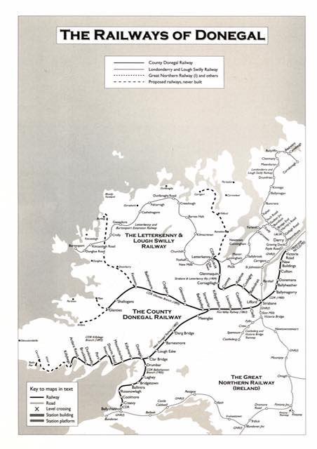
However, some maps of the Co. Donegal Railways show a dotted line between Killybegs and Teelin Pier, following the coastline. A typical example is shown below. …

The Railways of County Donegal. This map of the lines in Co. Donegal includes those which were considered as possible extensions and shows them as dotted lines. The line between Killybegs and Teelin Pier is shown bottom-left of this image. [2]

But … What if? … What if it had been built soon after the completion of the line to Killybegs? I am given some encouragement in following this flight-of-fancy by the publication in 2022 of the Donegal Railway Heritage Trail by the Donegal Railway Heritage Centre which seems to show a line from Killybegs to Teelin Pier, not as a possible or proposed line but as a line which seemingly got built. [4]

Is my flight-of-fancy possible?

I guess that I want to be able to imagine a parallel universe in which every proposed railway line not only was built, but remains in operation today.

Is there anything else that might encourage my flight-of-fancy? … I think there might be! Here are a few things to contemplate ….

1. Have another look at the photograph at the top  of this article which shows Teelin Pier as it was in April 2023 when we visited. What might the substantial stone structure be which sits just in from the right edge of the image, if not the base of a long disused water tower? Might it not be good to imagine one of the Co. Donegal locomotives idling alongside the water tank while it’s crew refill it’s tanks for the long run through to Killybegs and on to Donegal?

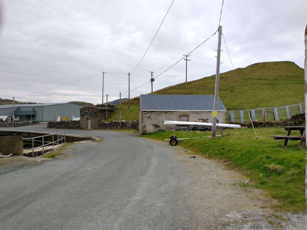
2. And, just peeping into the same image is another building. The photograph below shows that building close to the “water tower” base. What might it be if not an engine shed?

Teelin Pier buildings in April 2023. [My photograph, 26th April 2023]
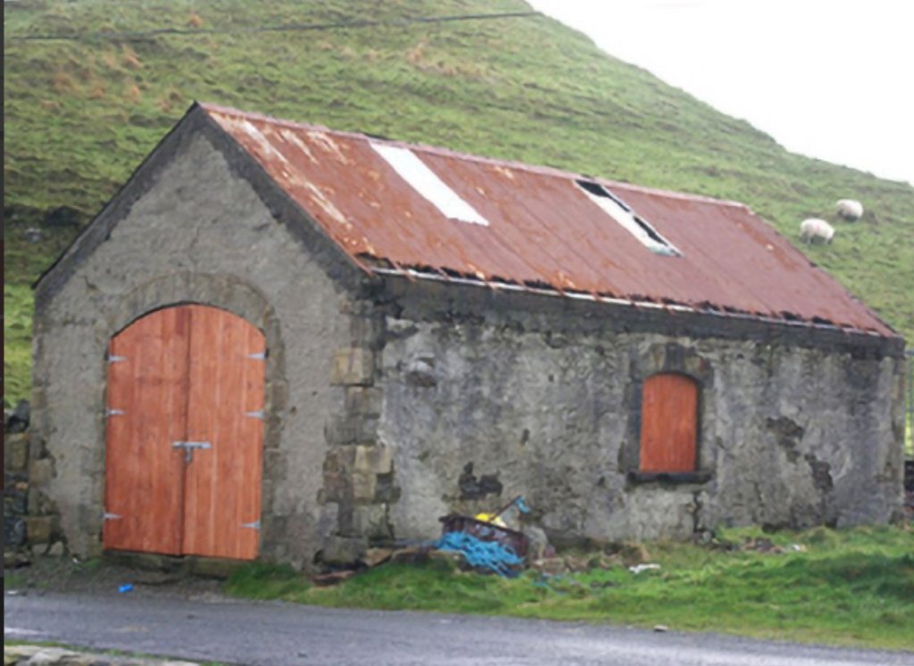
The same building before it was re-roofed recently. [3]

Yep, it does look very much like a typical small engine shed. Might the plastic panels in the corrugated iron roof have marked locations where steam and smoke were allowed to vent as an engine was being prepared, early in the morning, for its next duty on the line?

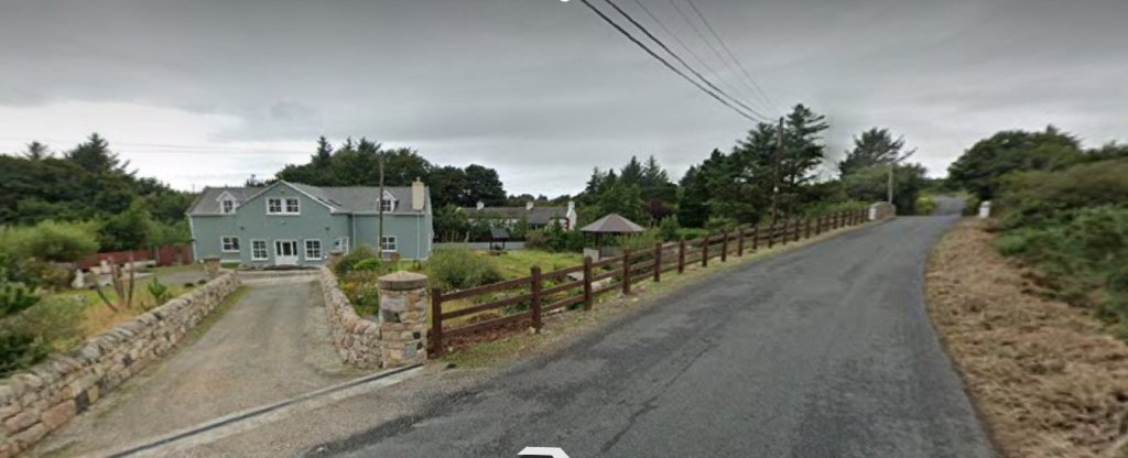
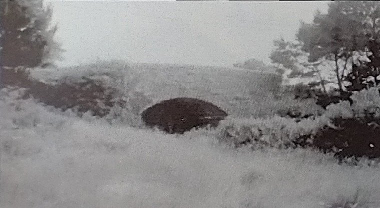
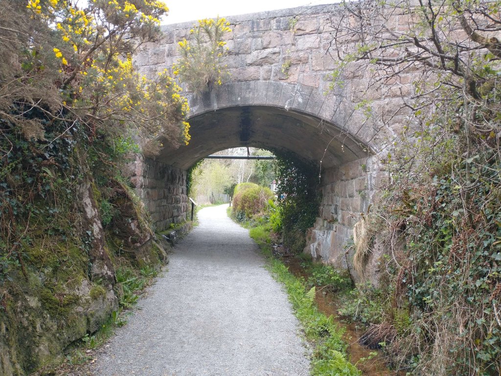
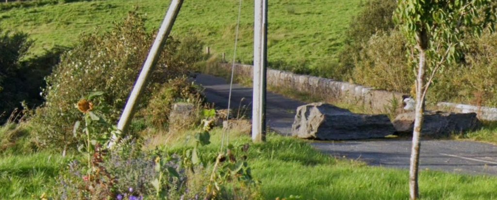
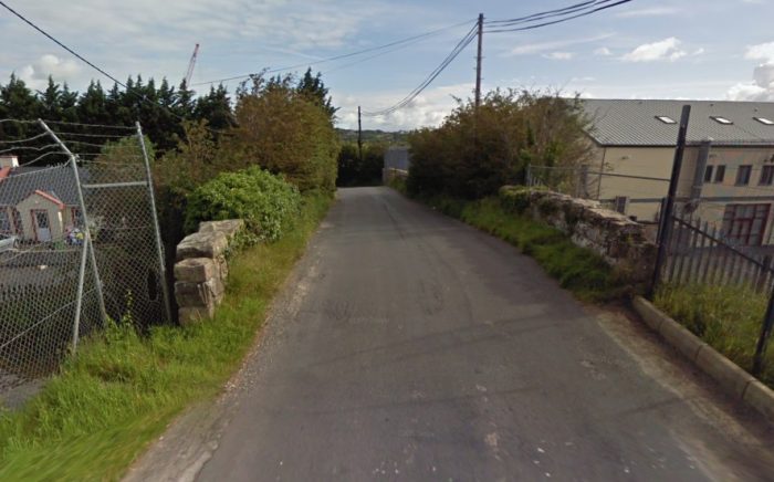
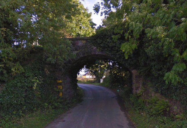
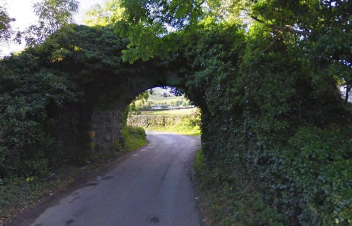
3. Close to the road to Killybegs (R263), to the East of Carrick there is an old stone bridge which clearly carried an earlier incarnation of the R263 but could so easily have carried a 3ft-gauge railway as well! The two images below are taken from Google Streetview …

Please understand, this is just a ‘what-might-have-been’ and understand too that even if it had been true, these little indications of a possible old railway would probably be all that remained in the 21st century.

What I do need to do to complete this short fairytale is to look again at the three possible indications of the presence of an old railway and clarify their actual use, and then to allow Dr. E.M. Paterson a final word …

1. The stone base for a water tank. That might just be what it was, although with no railway connotations. It is more likely that it was an ice house, needed to allow fish catches to be preserved for onward transport. [3]

2. The engine shed. Sadly, the origins of this building are well documented and have nothing to do with any old railway. It is a detached gable-fronted single-bay single-storey former coastguard boathouse, built in 1871, originally associated with Teelin Coastguard Station. Now in use as a private boathouse. When surveyed it was described as having a “pitched corrugated metal roof. Roughcast rendered finish over rubble stone construction with rock-faced ashlar sandstone block-and-start quoins to the corners of the front elevation (north) with dressed margins. Single segmental-headed window opening to the centre of each side elevation (east and west) having rock-faced ashlar sandstone block-and-start surrounds with dressed margins, cut stone sills; openings now blocked. Segmental-headed carriage-arch to the front elevation (north) having rock-faced ashlar sandstone block-and-start surrounds with dressed margins, and with replacement timber double-doors.” [3]

Obvious, really, when you see the same building from a different angle ….

The view, from Teelin Pier, of the two structures discussed above. The use of the building on the right as a boathouse is emphasised by the ramp which would have permitted the launch of a coastguard vessel and which makes the building ideal for its private use today.

3. The stone bridge did indeed carry a previous incarnation of the R263 but never saw use as a railway structure!

Dr E.M.Paterson tells us that Barton’s 1896 map of the Co. Donegal railway network, “drawn on a scale of 4 miles to 1 inch and measuring 30 in by 22 in, shows four probable Government Railways, none of which was built as shown. … [The fourth of these] was a westerly extension of the Killybegs branch … out to the coastal villages of Kilcar and Teelin, where there was a ‘government’ pier. … Had the Killybegs-Teelin extension been constructed, it would have been a spectacular one, reaching into some of Donegal’s wildest scenery and ending near the mighty sea cliffs of Slieve League, which rise 2,000 ft above the Atlantic. It would justifiably have rivalled the Valentia branch and the Mallaig extension of the West Highland Railway.” [5: p31-32]

References

  1. https://carrickonline.net/history?view=article&id=295:the-story-behind-the-proposed-rail-line-to-teelin-pier&catid=11, accessed on 26th April 2023.
  2. https://twitter.com/PMacoscair/status/1049570854030454784?t=at2TWDk8-c3LbDi5IUSUGA&s=19, accessed on 26th April 2023.
  3. https://www.buildingsofireland.ie/buildings-search/building/40909615/staisiun-garda-costa-an-teileann-rinnakill-donegal, accessed on 26th April 2023.
  4. https://www.govisitdonegal.com/blog/february-2022/donegal-railway-heritage-trail-guide-launched, 26th April 2023.
  5. Joe Begley, Steve Flanders, E.M. Patterson; The County Donegal Railways Revised Edition; Colourpoint Books, Newtownards, 2014.

The Fintona Tram

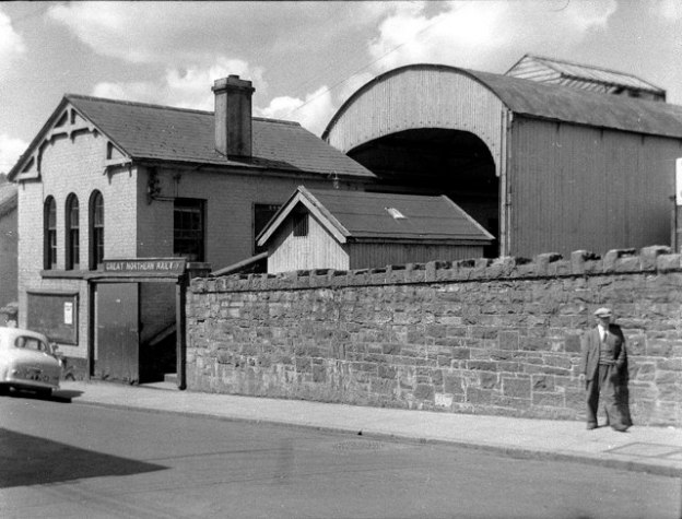
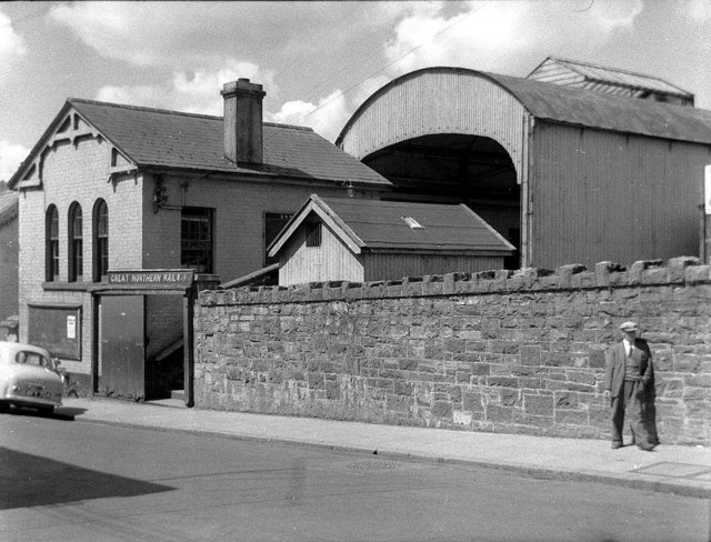
The featured image above shows Fintona Railway Station from Main Street, Fintona in June 1957, (c) Wilson Adams. The image is used here under the Creative Commons Attribution-Share Alike 2.0 Generic license (CC BY-SA 2.0). [7]

The Londonderry and Enniskillen Railway [2] opened the railway station in Fintona on 5th June 1853. A short time after the Londonderry to Enniskillen Railway completed its mainline to Enniskillen (in 1854 [2]). mainline services were withdrawn from Fintona (in 1856 [1]), and the link to Fintona became a branch from the mainline at Fintona Junction railway station. [3] Most passenger services on this branch line were then provided by a horse-drawn tram car. [1] Since the line’s closure, the tram has been preserved at the Ulster Folk and Transport Museum at Cultra, County Down. [2]

Wikipedia notes that the branch line to Fintona was taken over by the Great Northern Railway (Ireland) in 1883 when it took control of the Londonderry and Enniskillen Railway. [1]

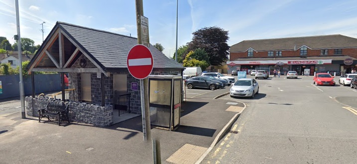
The branch-line and the station at Fintona were closed on 1 October 1957. [1] The whole area comprising the Fintona Train station is now a car park and public toilet. [4]

As we have noted, “Passenger services on the half mile Fintona branch were worked by horse traction throughout the 104 years of its existence up to closure in 1957.” [4]

Timetables were worked out on what a horse could reasonably be expected to achieve. This meant that rail authorities “allowed 10 minutes for the slightly downhill trip to Fintona, and 15 minutes for the return working. Seven trips per day were scheduled in summer 1951.” [5]

The tramcar which was used for the majority of the life of the service, “entered service in 1883, had longitudinal seating, back to back on the upper deck and with seats facing each other on the lower deck. Originally the latter was divided into 1st and 2nd class, and the top deck was 3rd class. The car is estimated to have covered 125,000 miles in its ambulation’s on the branch.” [5]

“Goods wagons for Fintona were worked by a steam engine which, in later years at least, made a return trip in the morning before passenger services started.” [5]

The Line between Fintona and Fintona Junction

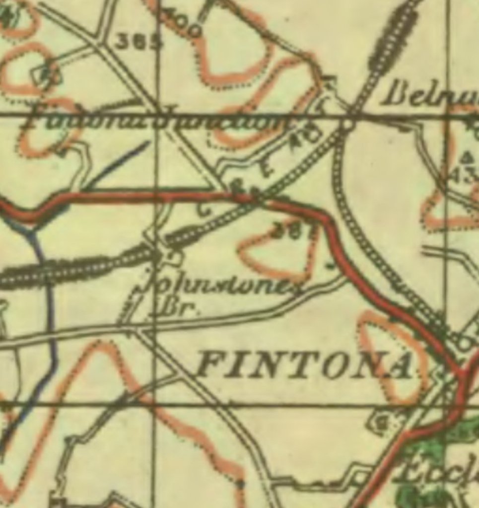
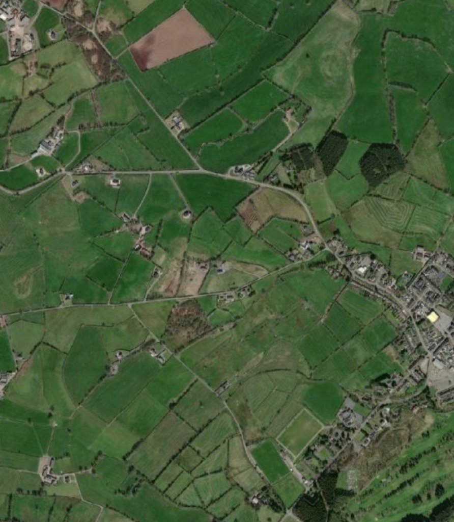
The first image below shows the route of the line on an extract from the GSGS maps of 1941-1943 produced by the British War Office at a scale of 1″ to 1 mile. [6] The second picture is a matching 21st century satellite image which shows how little of both the mainline and the branch remain in the 21st century.

The Fintona Branch: a map extract from the British War Office (G.S.G.S 4136) 1″ to the mile survey published 1941-1943. [6]
The location of the Fintona Branch on modern satellite imagery. [6]
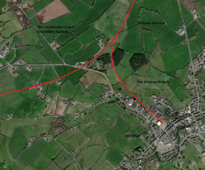
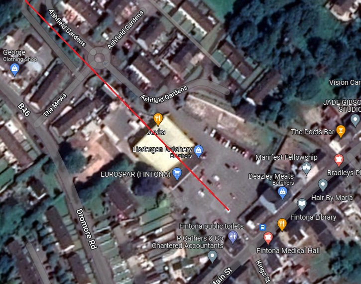
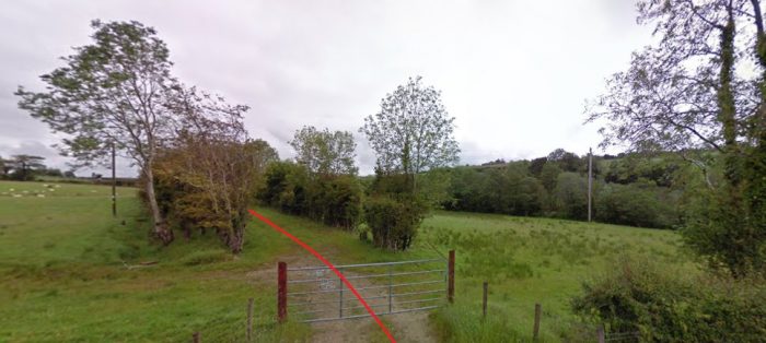
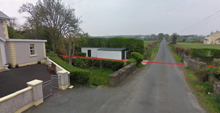
A similar area on the Satellite imagery with the route of the mainline (The Londonderry and Enniskillen Railway) and the alignment of the Fintona Branch illustrated by redlines. [6])

Fintona Junction

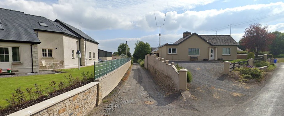
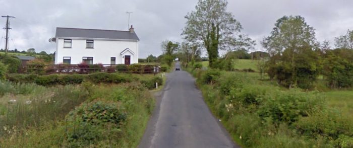
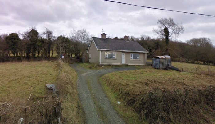
The next image below shows the approach road to what was Fintona Junction Railway Station from the B46. Immediately to the right of this road was a level-crossing which took the mainline across the B46. The Londonderry and Enniskillen Railway ran under the location of the bungalow on the right, parallel to the station approach road.

The access road shown above now only provides access to a farm. At one time it was the public access to the junction station.

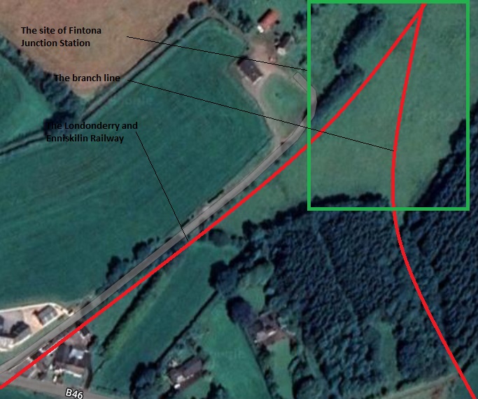
Fintona Junction Station site. The line of the railway to Enniskillin can be seen crossing the B46, Dromore Road in the bottom left of this satellite image. The line to Fintona is indicative rather then accurate. [Google Maps]
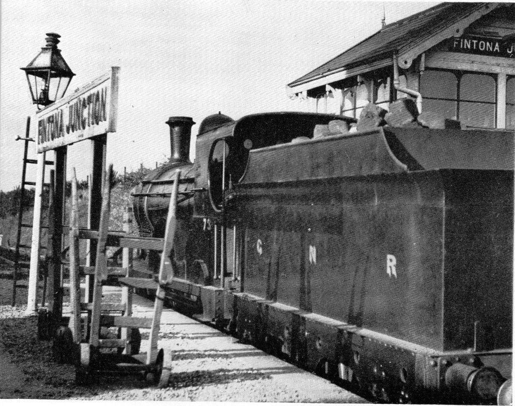
Fintona Junction: GNR 4-4-0 goods engine No.73 of Class ‘P’ stands in the bay, having shunted its train to await the passing of the two passenger trains of the evening of August Bank Holiday Saturday, 1954. [12]
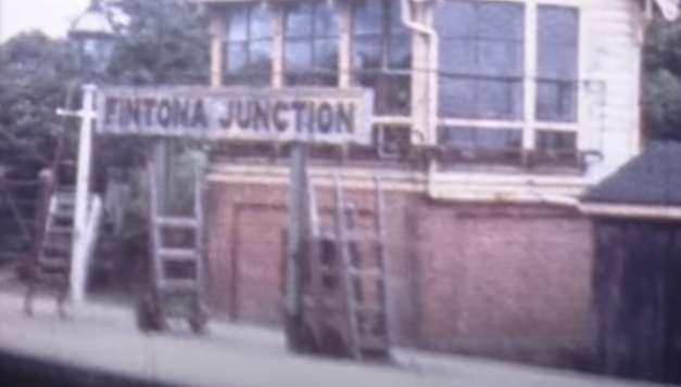
A Still image from a 1950s cinefilm which shows the signal box, station sign and porters trolleys at Fintona Junction, (c) The Huntley Archives, Film No.96367. [13]

The line

AS we have already noted, the journey from Fintona Junction to Fintona Railway Station was timetabled as just a 10 minute journey. The tram was usually waiting for connections at Fintona Junction as in the first picture below.

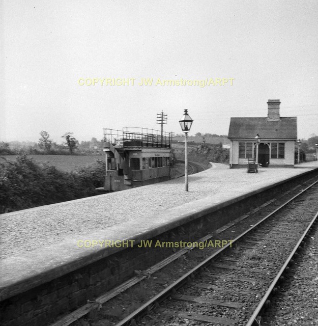
0953-4 Horse Tram Fintona Ireland (JW Armstrong)  102
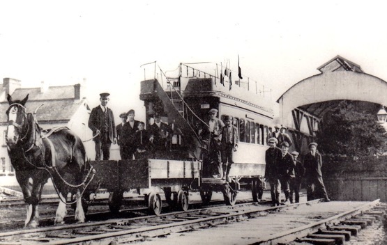
The view from the mainline of Fintona Junction Station. The tram is waiting to offer a connection for the train arriving from Londonderry, (c) J.W. Armstrong/ARPT – this link is to the image as held on Ernie’s Railway Archive on Flickr. [8]
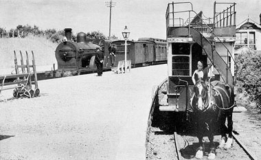
The tram for Fintona with horse”Dick” (apparently all the horses used on the service were called ‘Dick’) waiting with the branch connection at Fintona Junction, while PPs class 4-4-0 No.44 arrives with 1.45pm Omagh – Enniskillen local train (c) L.King,5th July 1955. [4]
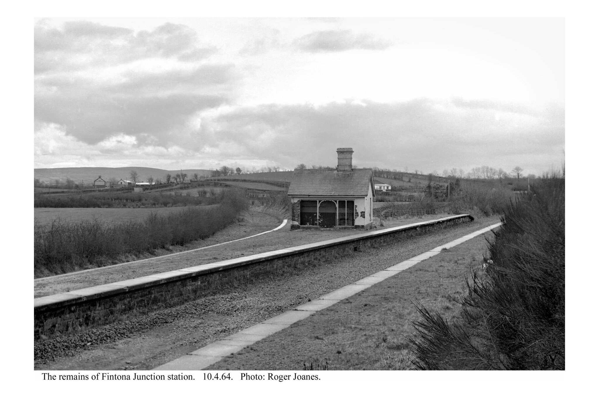
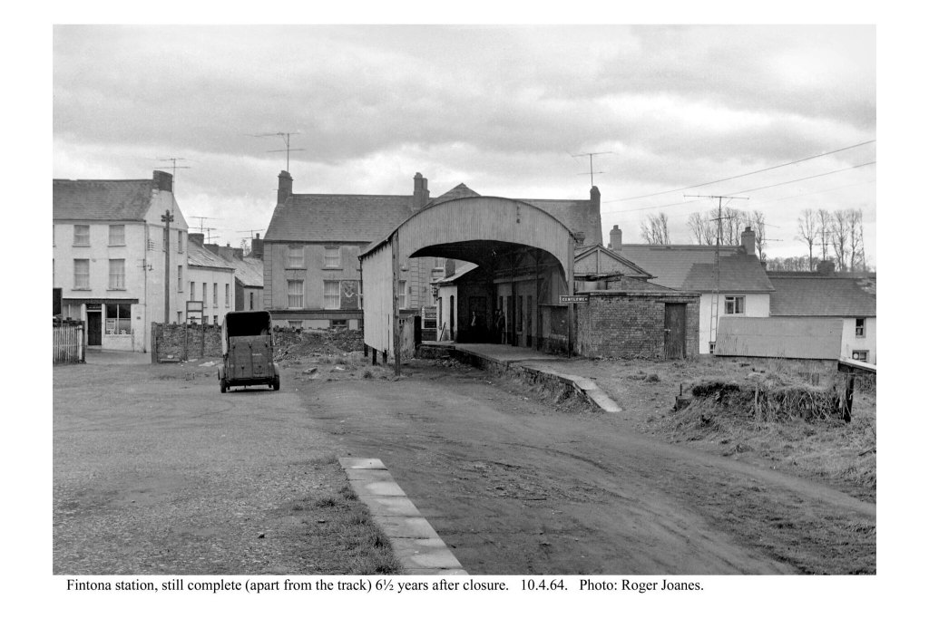
Fintona Junction Railway Station in April 1964 (c) Roger Joanes. The image is included here under a creative Commons Licence, Attribution-NonCommercial-NoDerivs 2.0 Generic (CC BY-NC-ND 2.0). [9]

In the picture above the line can be seen to be in a shallow cutting soon after leaving the railway station. As can be seen below, this was a very shallow and short cutting.

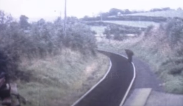
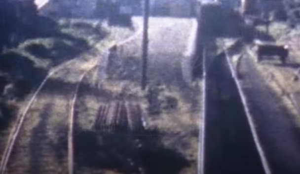
Lookin ahead down the line from Fintona Junction in the 1950s, (c) The Huntley Film Archive Film No. 96367. [13]
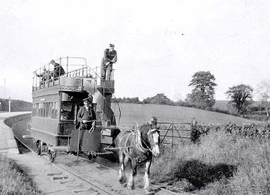
The tram transporting military personnel leaves Fintona Junction and runs along the section of track being inspected in the image above, (c) Mr Gallagher c1941-45. [4]
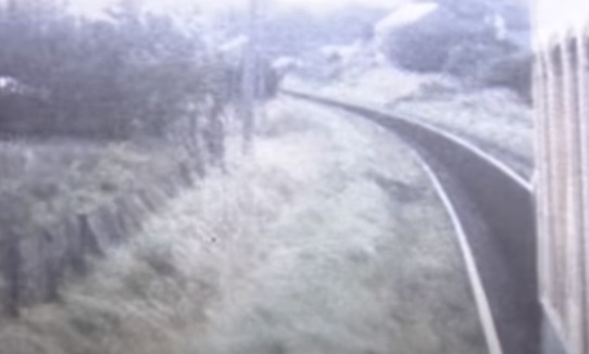
Now just beyond the cutting mentioned above. The line continues to curve towards Fintona, (c) The Huntley Film Archive Film No. 96367. [13]
Leaning out of the tram window, we can see the line continuing to curve westwards, just ahead, shrubs are beginning to encroach on the line, (c) The Huntley Film Archive Film No. 96367. [13]
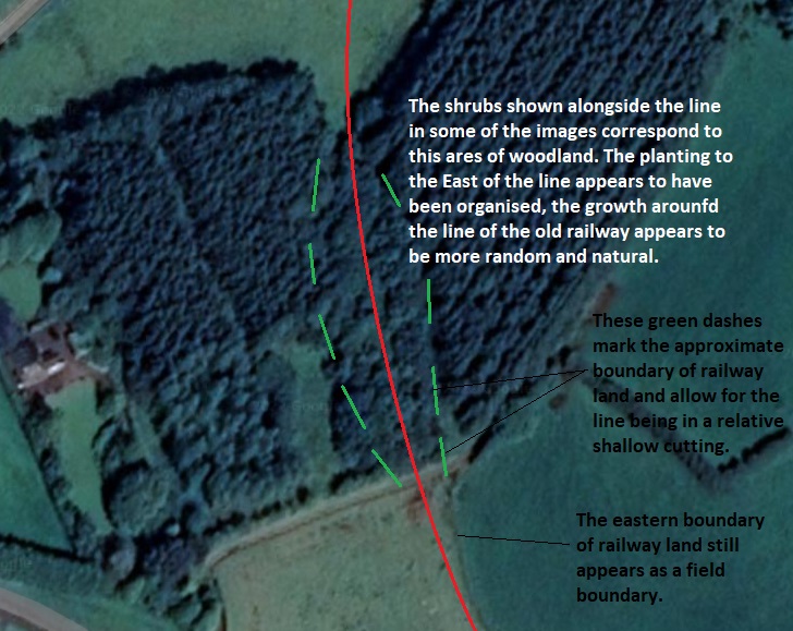
This satellite image shows the current landscape around the next section of the old railway linejust south of the junction station. [Google Maps]
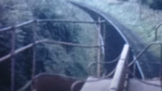
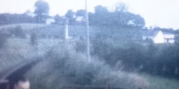
A hazy view from the top deck of the tram looking back along the line towards Fintona junction, (c) The Huntley Film Archive Film No. 96367. [13]
Postcard View circa 1930 which shows the tram rounding the curve after leaving Fintona Junction Station on the way to Fintona. It is in the midst of the shrubs mentioned above, (c) Public Domain. [1]
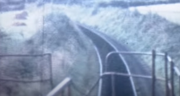
A little further ahead along the line is again in a shallow cutting, (c) The Huntley Film Archive Film No. 96367. [13]
The next length of the line sees the old railway leave the curve and straighten up heading for Fintona in a southeasterly direction. [Google Maps]
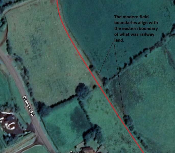
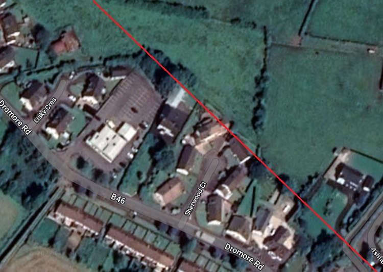
Over this next length of the old railway it is much more difficult to determine the precise alignment of the line. The redline cannot be taken as accurate in anyway. The vast majority of the buildings shown to the southwest of the line all postdate the removal of the old railway. [Google Maps]
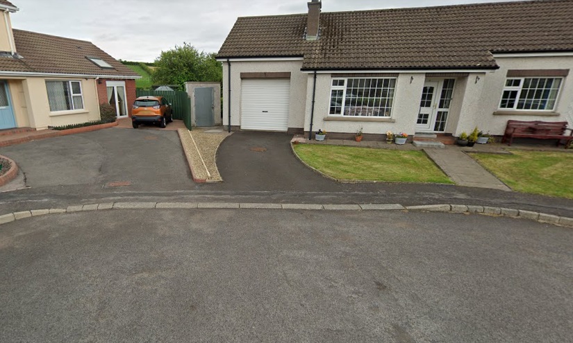
The north end of Sherwood Close. The old railway probably ran approximately on the line of the green fence between the two properties shown here. [Google Streetview]
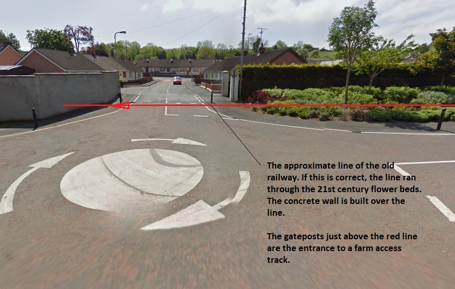
A view from the north on Ashfield Gardens. The farm access track referred to on the image appears in the bottom right of the satellite image above. It can also be seen at the top left of the satellite image below. [Google Streetview]
This final satellite image shows the approximate line of the railway as it enters the station throat and runs through to the terminus buffer stops. The station used to front onto Main Street. The area is now the premises of Lisdergan Butchery (https://lisderganbutchery.com), Eurospar and the town car park. The building which fronts onto Main Street being Fintona’s public toilets. [Google Maps]
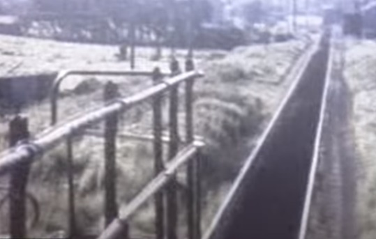
A short distance further along the line, the land has dropped away once again and the station at Fintona is in sight, (c) The Huntley Film Archive Film No. 96367. [13]
GNRI 1952-06-26 Fintona station 049
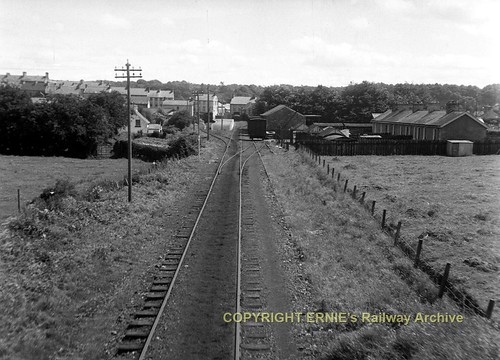
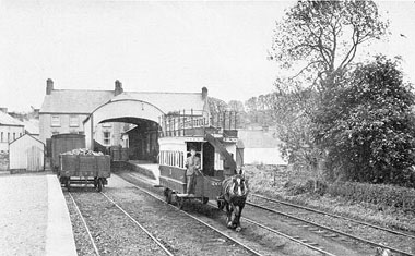
The view Southeast towards Fintona Station from along the line. The permanent way between the two rails is filled with earth up to sleeper level or just above to create a suitable surface for the horse. Notice how, at the point ahead, hoof marks show that the horse has avoided crossing the switch rail until the last possible moment, (c) Ernie’s Railway Archive – this link is to the image as held on Ernie’s Railway Archive on Flickr. [8]
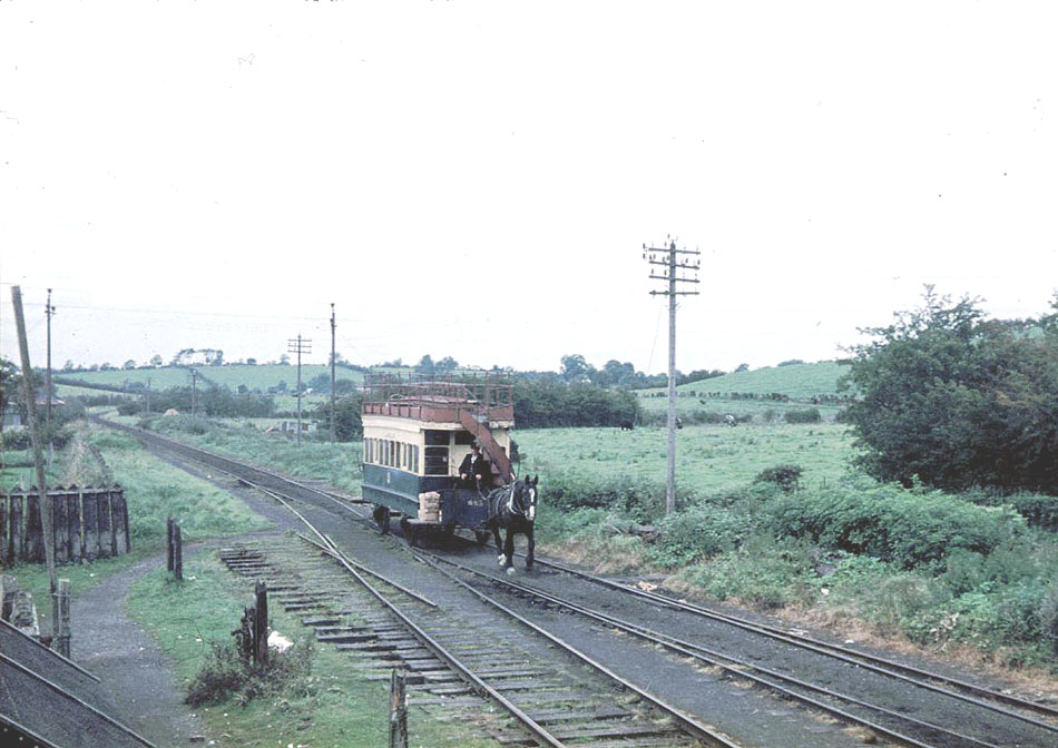
Arriving at Fintona. The tram is a few yards closer to the station than it was in the image above, (c) David Bradley, September 1957. [4]
Closer again to the station platform now. Do not be deceived by the platform visible close to the camera, this was a goods loading point which is described on the plan below as ‘The Beach’, (c) The Huntley Film Archive Film No. 96367. [13]
We are now close-in to the covered station platform at Fintona. This a picture of the Railway Station in April 1964 a good few years after the closure of the line, (c) Roger Joanes. The image is included here under a creative Commons Licence, Attribution-NonCommercial-NoDerivs 2.0 Generic (CC BY-NC-ND 2.0). [9]
A similar image to the Roger Joanes’ photograph above, this time in colour. As the vegetation encroachment is greater on this image it is probably a summer-time image. [Public Domain] [11]
A plan of Fintona Railway Station as shown on the Irish Railway Modellers Forum. It is taken from from Norman Johnston’s book on the Tram, “The Fintona Horse Tram.” [10]
Fintona Railway Station as shown at the head of this article, (c) Wlison Adams. The image is included here under The image is included here under a creative Commons Licence (CC BY-SA 2.0). [14]
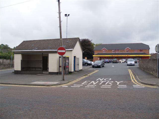
This is approximately the same view but taken in 2007. (c) Kenneth Allen. The image is included here under The image is included here under a creative Commons Licence (CC BY-SA 2.0). [15]
Approximately the same location but this time in June 2021. The toilet block has been replaced with something which looks a little more as though it belongs in the heart of Fintona. [Google Streetview]

The Return Journey to Fintona Junction

Just a few photographs now which show the return journey to Fintona Junction.

The line’s horse stands in Fintona station ready to depat with a baggage truck and the tramcar in 1926. This consist does not appear in any other images but it is how the tram is displayed in the Museum at Cultra, (c )the Tramway and Light Railway Society. The image was seen on the Tramway Badges and Buttons website. [16]
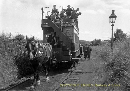
“Dick” leaving Fintona with the 4.14pm to Fintona Junction, (c) N.W.Sprinks taken on 25th June 1952. [4]
GNRI 1952-06-26 Fintona CURC trip 052
The journey back from Fintona to Fintona Junction on 26th June 1952 (c) Ernie’s Railway Archive. This link is to the image as held on Ernie’s Railway Archive on Flickr. [8]

And finally. …

After closure of the line, Fintona’s tram was preserved and now sits in Ulster Transport Museum, Cultra.

Fintona’s tram on display in Ulster Transport Museum, Cultra. [11]

References

  1. https://en.m.wikipedia.org/wiki/Fintona_railway_station, accessed on 24th May 2022.
  2. https://en.m.wikipedia.org/wiki/Londonderry_and_Enniskillen_Railway, accessed on 24th May 2022.
  3. https://en.m.wikipedia.org/wiki/Fintona_Junction_railway_station, access on 24th May 2022.
  4. http://www.trolleybus.net/subhtml/picture9.htm
  5. Irish Railway Record Society; Irish Railways in Pictures No.1 – Great Northern; Irish Railway Record Society [London Area],1976.
  6. https://maps.nls.uk/geo/explore/#zoom=14.476527836102857&lat=54.50393&lon=-7.33038&layers=14&b=1, accessed on 26th May 2022.
  7. https://upload.wikimedia.org/wikipedia/commons/3/3f/Fintona_Station_-geograph.org.uk-_333213.jpg, accessed on 26th May 2022.
  8. https://www.flickr.com/photos/irishswissernie, accessed on 26th May 2022.
  9. https://www.flickr.com/photos/110691393@N07/12908937435/in/photolist-kEHFmP-kEKVcj, accessed on 26th May 2022.
  10. Norman Johnston; The Fintona Horse Tram; Omagh: West Tyrone Historical Society, 1992; https://irishrailwaymodeller.com/topic/10057-minimally-interesting-track-layouts, accessed on 26th May 2022.
  11. https://stringfixer.com/tags/fintona, accessed on 26th May 2022.
  12. https://chasewaterstuff.wordpress.com/2014/04/22/some-early-lines-six-counties-scenes, accessed on 26th May 2022.
  13. The Huntley Archives: https://www.youtube.com/watch?v=bcv_XjOpcBE, accessed on 27th May 2022.
  14. https://commons.wikimedia.org/wiki/Category:Fintona_railway_station#/media/File:Fintona_Station_-geograph.org.uk-_333213.jpg, accessed on 24th May 2022.
  15. https://upload.wikimedia.org/wikipedia/commons/8/8d/Public_Toilets%2C_Fintona_-geograph.org.uk-_552343.jpg, accessed on 27th May 2022.
  16. http://www.tramwaybadgesandbuttons.com/page148/page149/styled-241/page664.html, accessed on 27th May 2022.

The Owencarrow Viaduct Accident in 1925. ….

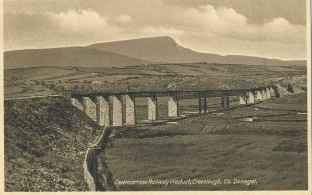
The featured image above shows the Viaduct in good condition. [7]

In the February 1963 edition of The Railway Magazine there was a letter from L. Hudlass which said: “The accident on the Owencarrow Viaduct, on the Letterkenny & Burtonport line, Ireland, of January 30, 1925, involved a westbound train running from Londonderry to Burtonport, on the Burtonport extension of the Londonderry and Lough Swilly Railway. The 380 yd.-long viaduct, sited between Kilmacrenan and Creeslough in County Tirconaill is in wild and open country and, on the day in question, a gale of 100mph caught the train broadside on and one carriage plunged through the parapet, pulling another with it. The couplings held and neither of the vehicles fell into the valley, but roof destruction caused several passengers to be thrown out, three people being killed outright, a fourth dying later in hospital. Being situated on a north-south section of the line, the 30ft.-high viaduct, across Glen Lough and over the Owencarrow River, caught the full force of the westerly gales. When the line was in operation a wind velocity of 60mph meant the exclusion of open wagons from the train, while a wind speed of 80mph caused the suspension of all traffic. The breach in the viaduct parapet was still visible in 1949. Other derailments due to gales gave been recorded on the west coast of Ireland.” [1]

One day, I will get round to covering the route of the Londonderry and Lough Swilly Railway (L&LSR) which ran from Derry to Burtonport through some of the wildest of Co. Donegal scenery.

This article is by way of a taster and focusses on an incident at Owencarrow Viaduct in the 1920s.

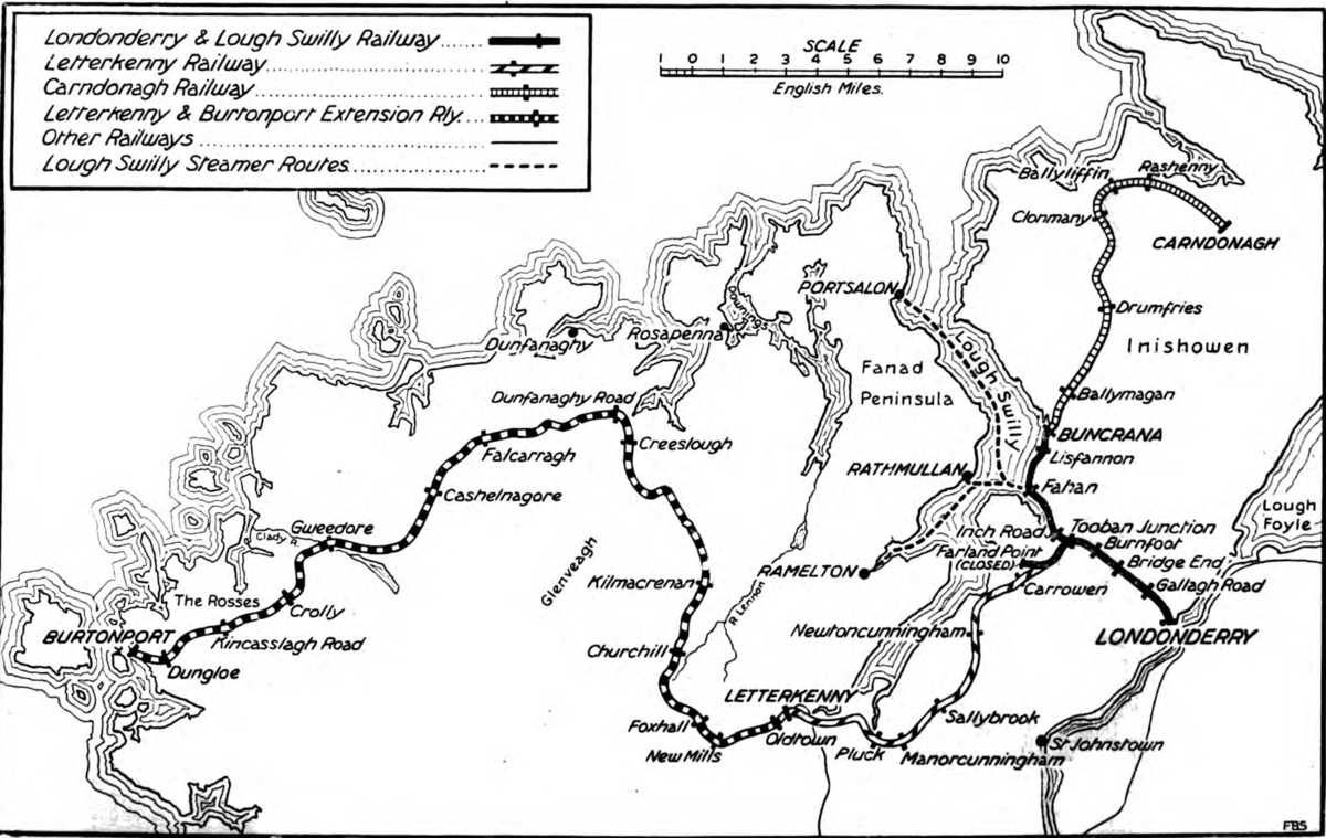
The Londonderry and Lough Swilly Railway ran from Derry to Burtonport via Letterkenny. [2]

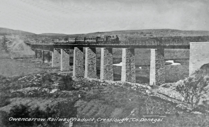
The Owencarrow Viaduct was sited between Barnes Gap and Creeslough and was, other than earthworks, the major civil engineering structure on the L&LSR.

The Owencarrow Viaduct with a Burtonport train crossing. From an old postcard. The photographer is not known. [8]
 

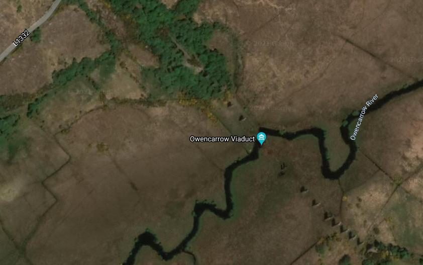
The Google Maps satellite image and Google Street view images below show what remains of the structure in the 21st century.

The Owencarrow Viaduct in Co. Donegal. [Google Maps]
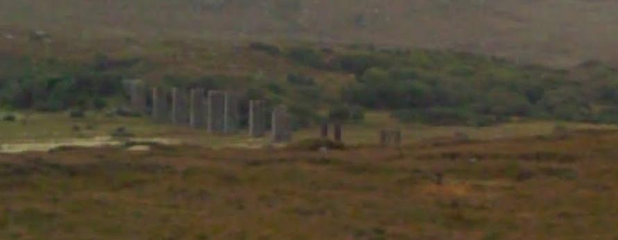
The remains of the Owencarrow Viaduct, seen from the Northwest on the L1332. [Google Streetview]
The remains of the Owencarrow Viaduct seen from the West on the L1332. [Google Streetview]

Wikipedia/Wikiwand covers the accident in a single paragraph: “Disaster occurred on the night of 30 January 1925 at around 8pm at the Owencarrow Viaduct, County Donegal. Winds of up to 120 mph derailed carriages of the train off the viaduct causing it to partially collapse. The roof of a carriage was ripped off throwing four people to their deaths. The four killed were: Philip Boyle and his wife Sarah from Arranmore Island, Una Mulligan from Falcarragh and Neil Duggan from Meenbunowen, Creeslough. Five people were seriously injured. The remains of the viaduct can today be seen from the road (N56) which carries on from the Barnes Gap on the road to Creeslough.” [2]

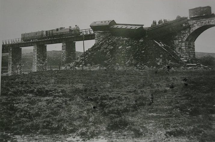
The scene of the accident. This picture was taken on 31st January 1925, the day after the disaster. The photographer is not known. [3]

There are a number of accounts of the accident available online which provide a bit more detail of the tragic events of 30th January 1925.

Walking Donegal looks at the event through the eyes of fireman John Hannigan who was on the footplate that day. [4] Long after that day Hannigan recalled “vividly the events of the night, the passing years ha[d] not erased the memory of the harrowing scenes or stilled the sound of the screams of agony. He still relive[d] the feeling of hopelessness he endured as he surveyed the scene of desolation in the fleeting moments, oblivious to his own danger, he scrambled over the wreck-strewn terrain to run the two odd miles to Creeslough to raise the alarm.” [4]

Hannigan was interviewed in 1984. [5] He was 85 when he gave that interview, a few years before he died in 1987 at the age of 88. Much of the text of the interview was reproduced in a Donegal Daily news item on 14th November 2019 and was extracted from a Christmas Annual published by Letterkenny Community Centre in the 1980s.

Hannigan spoke eloquently of his experience of working on the railway, first joining the staff of the L&LSR when he was just 15 years old, he was just 26 the night the train left the rails in the storm. After years of efficient service on the footplate, he realised his youthful ambition and was promoted to the position of driver the following year.

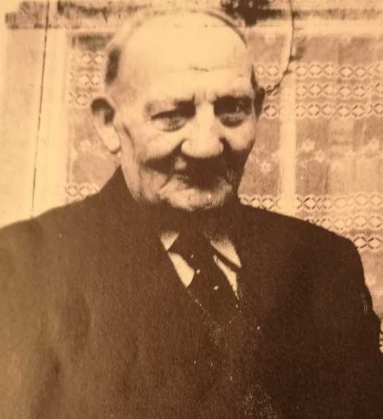
John Hannigan. [5]

Speaking of the first part of the journey from Derry, Hannigan said, “We left Derry that evening around 5.15pm, we had two wagons of bread next to the engine. They were sent out from Derry by Stevensons and Brewsters Bakeries. After that was three carriages, a first, a second and a third class, behind that were six wagons of general merchandise and the guards’ van at the end. Neilly Boyle was in charge as guardsmen who was from Burtonport, who later was a conductor on the buses.” [5]

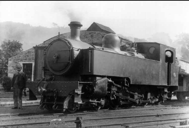
When the train reached Letterkenny a bit of shunting was required to remove the six wagons and replace them with others. Hannigan remembered that they were using locomotive No. 14 which was a 4-6-2T and is shown below.

Locomotive 4-6-2T No 14 seen here at Pennyburn, Derry, 1931. Donegal Railway Heritage Centre (DRHC) Collection. [8]

By the time that they reached Kilmacrennan Station the wind was starting to blow hard and Hannigan and the train driver, Bob McGuinness, consulted about the state of the weather, wondering about whether it would be safe to go ahead.  Hannigan commented: “I had often gone over the viaduct in a smaller engine. We decided to proceed. Bob slowed down to a snails pace and as we crossed the bridge we did not think that the storm was all that bad.”

From Hannigan’s recollection of the evening it seems as though a freak gust of wind hit the train close to the end of the viaduct. He said:  “The carriage behind the two bread wagons was raised up on the line, it was like a hump on its back. It then fell against the parapet and the roof was smashed, two passengers were thrown out, Phil Boyle was killed, his wife was injured and died afterwards.” [5]

“A Mrs Mulligan also lost her life, they had fallen through the roof and into the river below. Another man, Andy Doogan, was found dead near the viaduct, he must have also been on the train.” [5]

As the minutes ticked by, the wind continued increasing in strength, the hostility of the gale made it hard for voices to be heard. Hannigan remembered managing to stumble across the bridge to the end of the train to free Neilly Boyle jammed against the bridge railing. He then trekked the two miles to Cresslough Station for help. “Between running, walking and falling I finally made it. On the way, I called at the homes of the two-level crossing men and brought them with me. We told John Gallagher the Station Master what had happened. Next we alerted the local guards and doctors. I got a lift back to the scene. It was about quarter to eight. A young priest, Fr. Gallagher was attending to the dead and injured.” [5]

The ‘Why Donegal?’ Facebook page carries a less personal account of events. [6] The train apparently left Letterkenny at 7:05PM. The journey to Kilmacrennan was uneventful, but “by the time they reached Barnes Gap, the driver remarked that the wind was bad. As the train approached the Owencarrow viaduct a strong gale was blowing. He slowed down to 10m.p.h. and was a few dozen yards from the Creeslough side of the viaduct and almost clear of it, when a sudden gust came so strong that it blew the carriage nearest to the engine off the rails. Two were derailed in all. One somersaulted and the roof was smashed. The four occupants of the coach were thrown through the roof into the rocky ravine forty feet below. The victims were Philip and Sarah Boyle from Arranmore Inland, Una Mulligan from Falcarragh and Neil Duggan from Meenbunowen, Creeslough. Duggan’s home was only a stones throw from the crash.” [6]

“Six of the injured were taken to Letterkenny General Hospital. Of the 14 passengers, just one was unhurt, a young woman who was flung from the upturned carriage and landed on the soft boggy soil.” [6]

The ‘Why Donegal’ Facebook page includes a few photographs of the viaduct as it remains today which were taken by Jacqui Reed.

The Owencarrow Viaduct in the 21st century (c) Jacqui Reed. [6]

References

  1. L. Hudlass; Owencarrow Viaduct Accident; a letter in The Railway Magazine, February 1963, p148-149.
  2. https://www.wikiwand.com/en/Londonderry_and_Lough_Swilly_Railway, accessed on 30th May 2021.
  3. https://www.monreaghulsterscotscentre.com/owencarrow-viaduct, accessed on 30th May 2021.
  4. http://www.walkingdonegal.net/owencarrow-viaduct-disaster-by-john-hannigan
  5. https://www.donegaldaily.com/2019/11/14/dd-motoring-brian-mcdaid-recalls-the-owencarrow-viaduct-disaster, accessed on 30th May 2021.
  6. https://m.facebook.com/story.php?story_fbid=416203555247099&id=358197231047732, accessed on 30th May 2021.
  7. https://twitter.com/Donegalcomuseum/status/956480040069488640?s=09, accessed on 30th May 2021.
  8. https://donegalheritage.wordpress.com/2020/01/31/the-owencarrow-viaduct-disaster, accessed on 30th May 2021.

Co. Donegal Railways, Ireland – Part 6 – Strabane to Letterkenny (Part C – Convoy to Letterkenny)

As we noted at the start of the two previous articles about this line, Wikipedia gives us a very short history of the line from Strabane to Letterkenny and provides a single image – the Railway Clearing House map with stations in Strabane and Letterkenny:

The Railway Clearing House map with stations in Strabane and Letterkenny. [3]

This series of articles seeks to expand our understanding of the route of the various Co. Donegal Railways through combining old images and modern views. Satellite images also give us a good understanding of what remains of the infrastructure of these lines.

The previous articles about this line which cover the length from Strabane to Convoy can be found by following these links:

Co. Donegal Railways, Ireland – Part 4 – Strabane to Letterkenny (Part A – Strabane to Raphoe)

Co. Donegal Railways, Ireland – Part 5 – Strabane to Letterkenny (Part B – Raphoe to Convoy)

A Journey Along the Line – Strabane to Letterkenny – Part C – Convoy to Letterkenny

We return to Convoy Railway Station which sits to the East of the Village. While we are waiting for our train, a railcar from Letterkenny stops at the station.
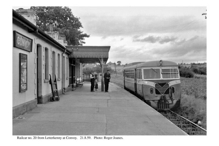
Convoy Railway Station in 1959 (c) Roger Joanes, (CC BY-NC-ND 2.0) Railcar No. 20 from Letterkenny stops at Convoy. [14]

I have found two further pictures of Convoy Railway Station and its site in Anthony Burges’ book, ‘The Swilly and The Wee Donegal’. Both of these photos were taken in 1957 and were either taken by the author or are from his collection. [8: p34 and 35]

The second photograph [8: p35] shows the goods shed, water tower and a number of sidings, but only the goods shed was standing in 2010 when Google Streetview cameras visited the site.
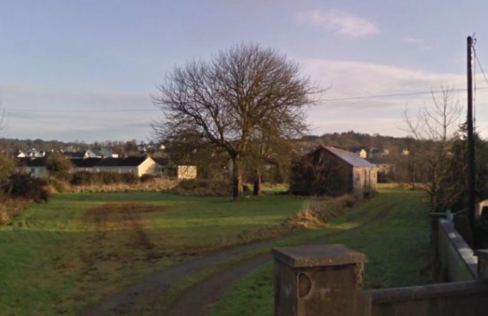
Convoy Railway Station Goods Shed is shown to the right of center in this image taken in 2010 (Google Streetview).

The line out of Convoy Railway station travelling to the West crossed the R236 at a shallow angle protected by Crossing Gates. The Crossing keeper’s cottage (or Gatehouse) is still standing. It has been extended to better be used as a modern family home.
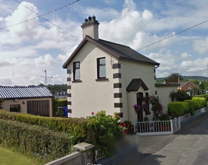
The Gatehouse and the road crossing to the West of Convoy Railway Station. The photograph looks from the Northeast, (Google Streetview).
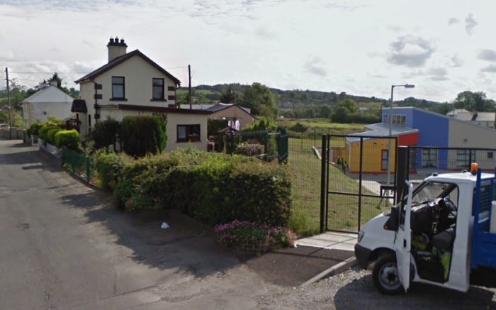
The Gatehouse guards the route of the old railway which ran just to the right of it in this picture. The image looks from the West back along the old line. (Google Streetview).

The next image shows the centre of Convoy on a Google Maps satellite image. The approximate route of the old railway is shown as a red line running across the image.
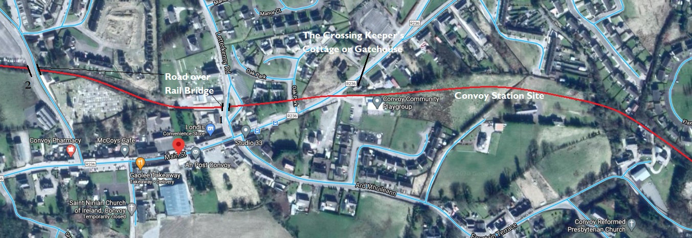
The approximate route of the old line through Convoy (Google Maps) The location of the Gatehouse is marked close to the centre of the image. To the West, the line passed under the two bridges which I have numbered 1 and 2 in black type. Clicking on the image will enlarge it sufficiently to allow these locations to be identified easily.

Shortly after crossing the R236, trains passed under the first of two road-over-rail bridges in Convoy. This bridge carried the Letterkenny Road. The railway cutting has been filled-in and there is no evidence of the bridge in the early 21st century.
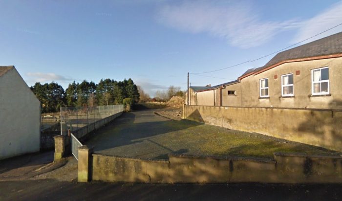
The old railway cutting has been infilled and to the West of the location of the bridge it is now used as a car park for one of the local churches. It is shown here in 2010, (Google Streetview).
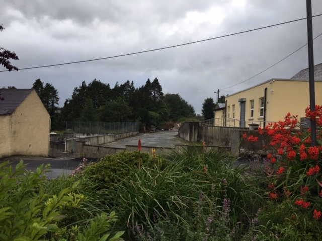
This image is one taken by Kerry Doherty and kindly sent by him to me by email. It shows the same location in the years following the Google Streetview image. [6]

A short distance further along the line a bridge carried a lane heading Northwest from Convoy towards Falmore.
This first view shows the bridge parapet on the East side of the bridge in January 2010 (Google Streetview). The parapet is in a very poor condition.
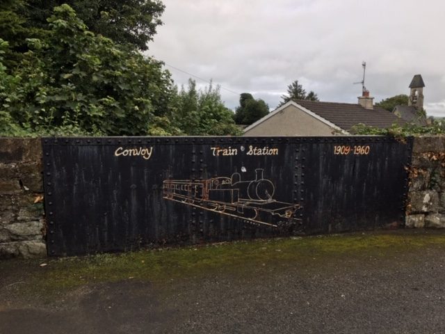
This later view, a picture taken by Kerry Doherty, shows that some local pride has resulted, more recently in a cosmetic refurbishment of the old parapet. [6]

To the West of the old bridge the cutting is still infilled and no sign of a bridge parapet can be found.
Looking West along the line of the old railway from the road to Falmore in 2010, (Google Streetview).

Heading away from Convoy the line quickly turned to the North as shown on the next satellite image. It soon crossed the road to Falmore once again, this time at level. The Gatehouse for this road-crossing is indicated on the satellite image and can be seen in the Google Streetview image which follows.
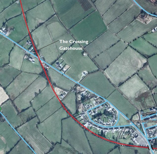
The old line to the West of Convoy, (Google Maps).
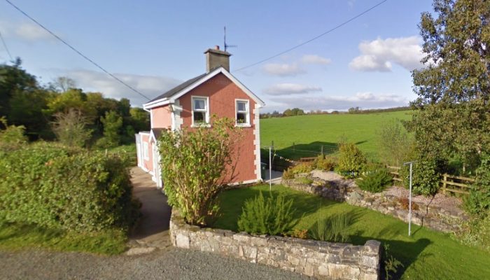
Kelly’s Gatehouse on the road to Falmore. The line ran to the right of the cottage in this image, (Google Streetview).

The line now heads in a northerly direction as the satellite images show.
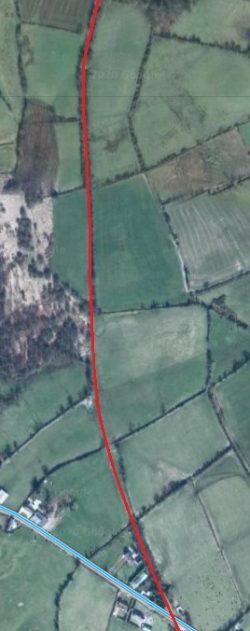
The first length to the North of the Gatehouse on the road between Convoy and Falmore, (Google Maps).
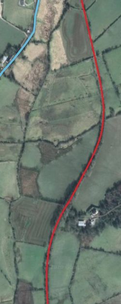
The second length north of the road, (Google Maps).
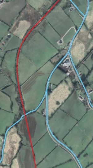


The line continued in a northerly direction passing over the Cloghcore to Cornagilagh road, (Google Maps).


Further North, the line crossed the road from Cloghcore to Cornagilagh. Either side of this road, the line was on an embankment which has now been removed but the bridge which carried it over the road is still in place – an elegant small stone arch bridge bears excellent testimony to the route of the old railway. The location of the old bridge is at the point where the line (red) crossed the road (light blue) in the bottom left of the adjacent satellite image.

Photographs of this bridge follow below. Two of which are taken from Google Streetview and one sent to me in an email by Kerry Doherty. The light in his photograph shows the bridge at its best.

Very soon after crossing this bridge, trains entered Cornagillagh Halt which was only a short distance from the hamlet/village which bears the same name.
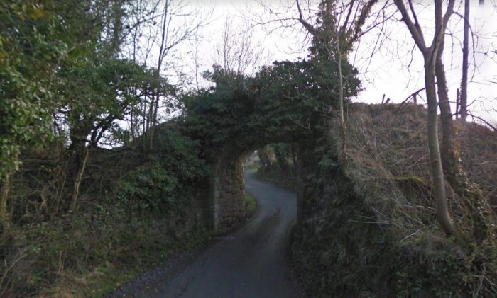
The rail-over-road bridge on the …. road. This image shows the bridge from the Southwest in March 2011, (Google Streetview).
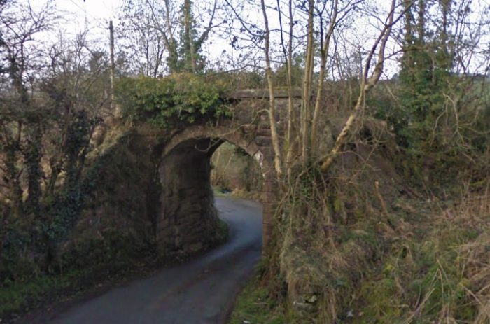
The same bridge also viewed in March 2011 from the Northeast (Google Streetview).
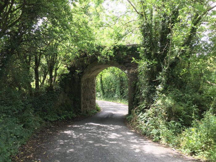
A much more recent picture taken of the same bridge by Kerry Doherty. [6] Kerry comments: ‘The over bridge just before Cornagillagh halt. The embankment at either side has been taken away but the bridge has been kept..’
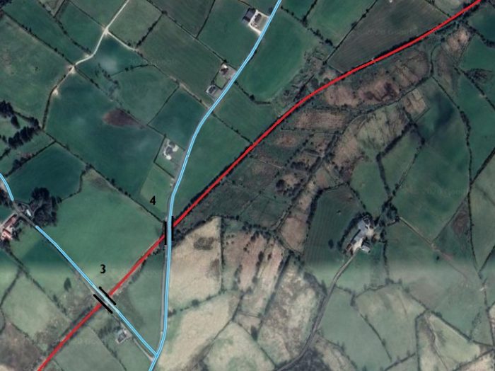
The next length of the old line is featured in this satellite image which shows it passing in cutting under two road bridges marked ‘3’ and ‘4’ either side of and close to Cornagillagh Halt, (Google Maps).
The road-over-rail bridge close to Cornagillagh Halt is marked on the Google Maps image as No. ‘3’. The vertical alignment of the road gives away the bridge location. The image is a telephoto lens view because of a slight glitch in the Google Streetview image sequence close to the bridge location. This picture was taken from the Southeast in December 2009 in what looks like late afternoon sunshine, (Google Streetview). This image shows the same bridge (No. ‘3’) from the Northwest just a few weeks after the image which precedes it. The road alignment changes at the bridge and on this image it is easier to see the bridge parapets,(Google Streetview).
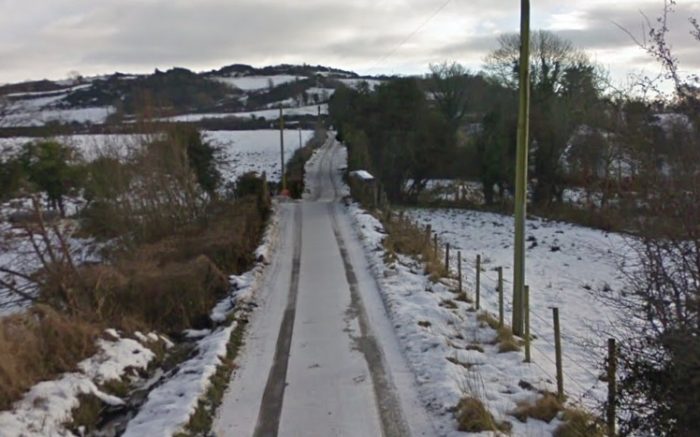
The next few photographs come from the location of the road-over-rail bridge that I have marked ‘4’ on the satellite image. All of them were taken as part of Google’s survey in March 2011.
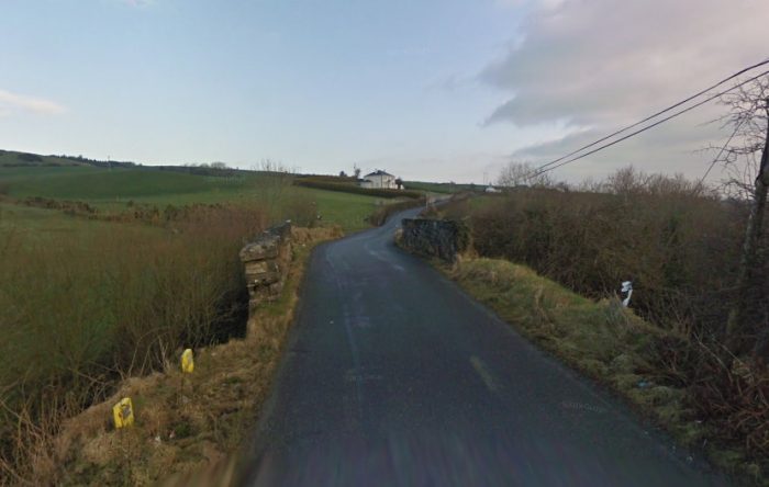
Bridge numbered ‘4’ viewed looking North along the road, (Google Streetview)
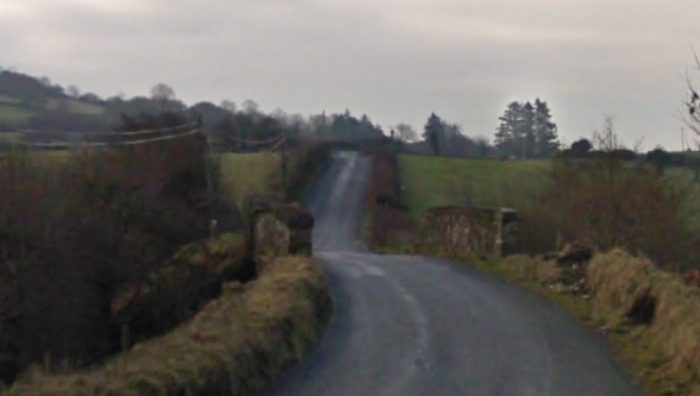
Then same bridge but viewed from the North on the same day, (Google Streetview).
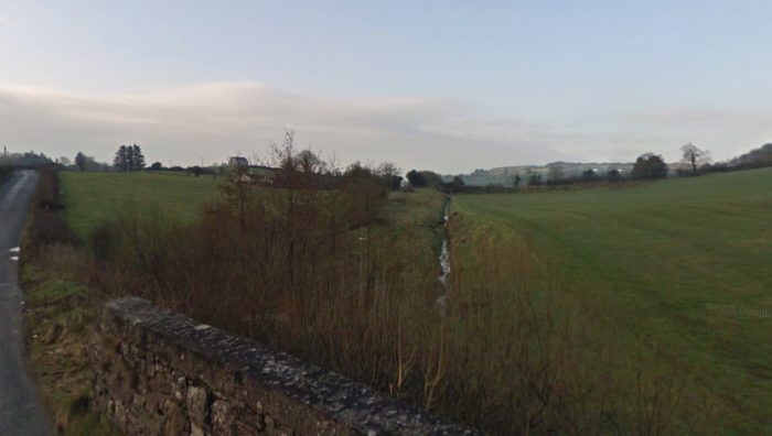
This picture shows the formation of the old railway between the bridge numbered ‘3’ by me and bridge ‘4’, (Google Streetview).
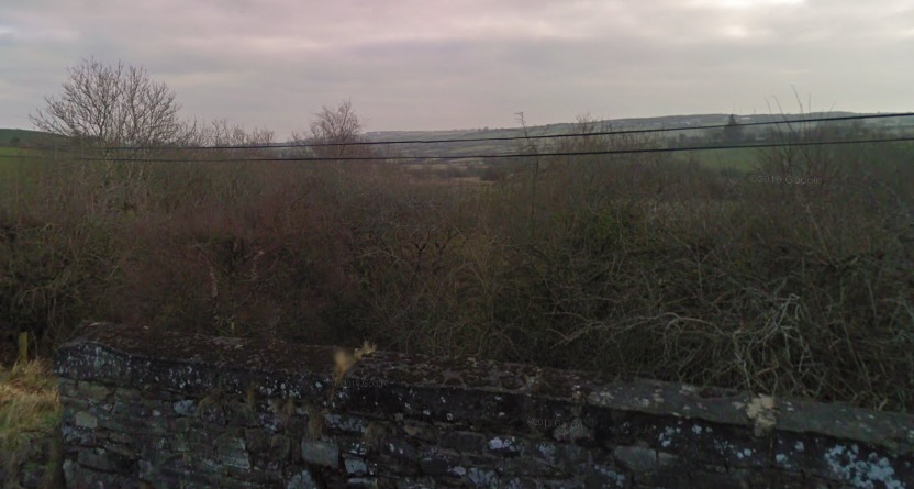
Looking to the Northeast, the formation of the Strabane and Letterkenny Railway has been overtaken by small trees and shrubs. (Google Streetview).
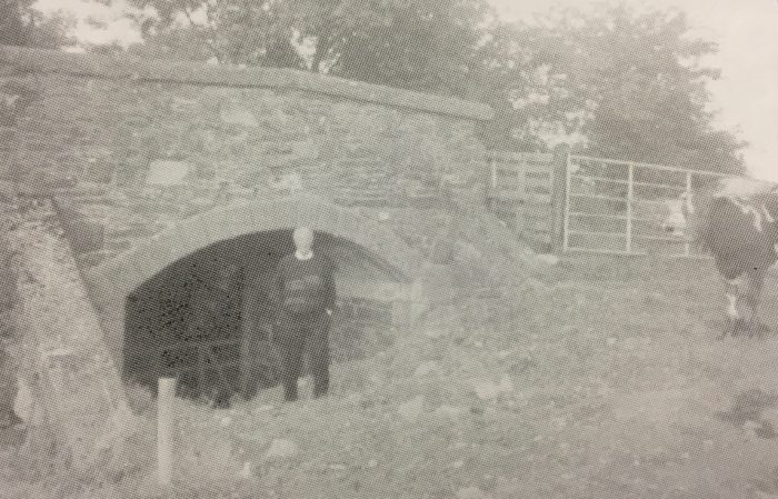
Kerry Doherty comments that this is a view of the bridge close to the site of Cornagillagh Halt (now impossible to photograph as its so overgrown). Pictured is former railcar driver Michael Gallen (recently dec’d, and one of the very last railcar drivers). The picture comes was taken by Dave Bell and comes from the CDR visitors guide book. [6][4]

The old railway route begins to turn North again soon after passing under the road-bridge and heads for Glenmaquin (Glerundorum) station.
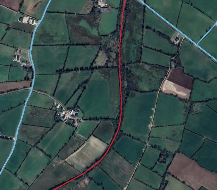
Beyond the road-bridge the old formation turns to the North once again, (Google Maps).
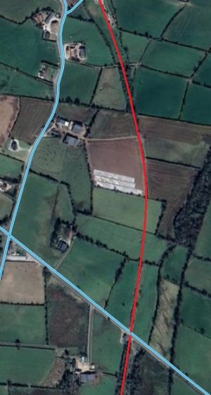
The line South of Gerundoram Railway Station. The location of the station can still be picked out at the top of this satellite image, (Google Maps).

The adjacent satellite image shows the route of the old line to the South of Glenmaquin (Glerundorum) Station. The first location to note is the at-level crossing of a local road towards the bottom of the image. The gatehouse can be picked out just to the West of the route of the old line.

The Gatehouse (N0. 57) has been extended to make it suitable as a small modern dwelling. and pictures from Google Streetview show it in really good condition with well-tended gardens.

The line shows up as a tree-lined track crossing the road at this point. The third image below is the closest that Google Streetview gets to providing a view along the length of the line North of the Level-Crossing towards Glenmaquin Railway Station.


The old line passes to the East of the old crossing cottage (No. 57) which has been refurbished and extended, (Google Streetview). This view is taken looking from the Northwest across the line of the old railway which ran on the far side of the crossing cottage.This view shows the same location but from the road to the Southeast of the Railway Crossing. The line ran in front of the cottage in this view, (Google Streetview).Looking North along the old railway from the Crossing-keepers cottage, (Google Streetview).

A short distance further North trains entered Glenmaquin (Glerundorum) Station, shown here on the old GSGS mapping from the 1940s. …Glenmaquin (Glerundorum) Station was location close to a road junction and was framed by a road-over-rail bridge to its Northwest. [2]
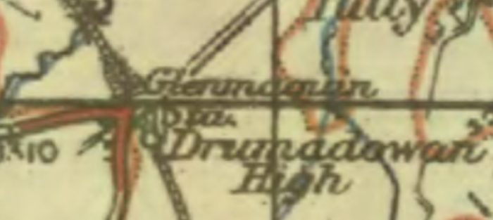
Kerry Doherty has kindly provided a view across the old station site which was taken in the early 21st century.
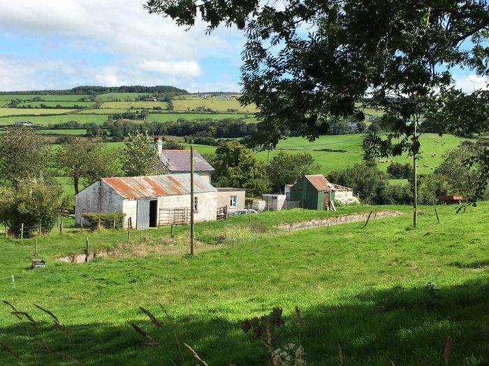
The old station site taken from the fields to the Northwest, (c) Kerry Doherty. [6] The old platform is still clearly visible in this photograph.

Google Streetview shows that the space between the railway station and the road-over bridge is, in the 21st century, filled by a modern home. That property sits just out of view to the left of Kerry Doherty’s picture above.Glenmaquin Station, (Google Streetview).The road bridge just North of the Station, (Google Streetview).A much earlier view of Glenmaquin Railway Station which comes from the Dave Bell collection, taken from the CDR visitors guide book. Kerry Doherty’. [6]

The continues in cutting North of the road bridge at Glenmaquin Station.Cutting to the North of Glenmaquin Station. This photograph was taken from the road bridge, (c) Kerry Doherty. [6] Just out of sight the railway bridged a small river.
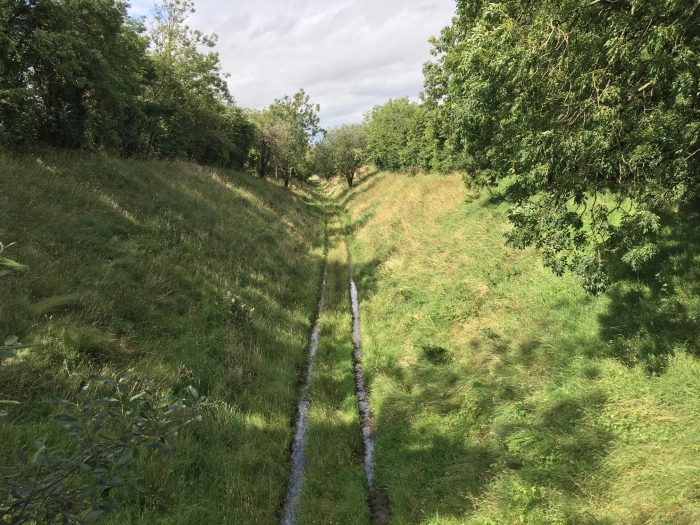
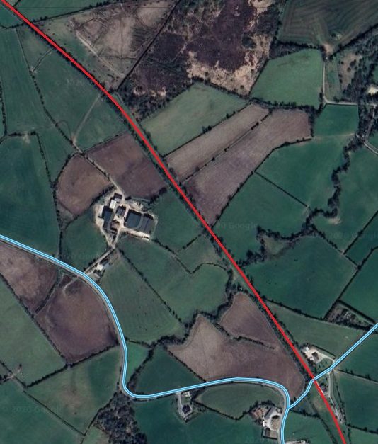
Beyond Glemaquin Station, the old line continued heading Northwest, (Google Maps).
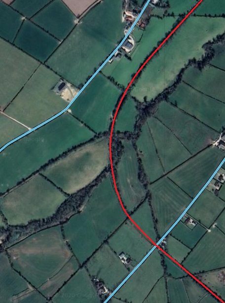
After crossing another minor road the old track-bed curved round towards the Northeast, (Google Maps).

The road crossing visible at the bottom right of the satellite image immediately above was un-gated. A closer image o the crossing location is provided immediately below this text. The Google Streetview images here show an extended property based on a typical Gate-keeper’s Cottage. This location is not recorded in the Visitor’s Guide {4} as a Crossing with Gatehouse. Interestingly the cottage is sited out of alignment with the railway as the satellite image below shows.Un-gated Crossing Northwest of Glenmaquin Railway Station, (Google Maps)
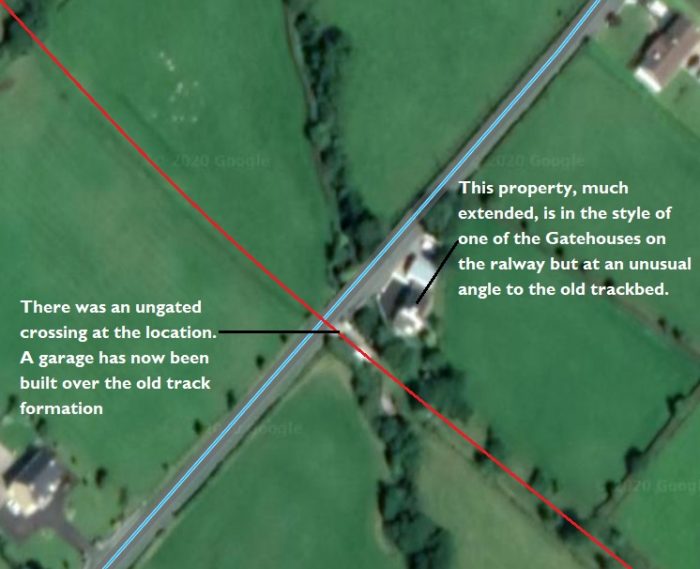
These next few images are taken at the location above – all are from Google Streetview. This may well be the location of Gatehouse No. 58.

The distinctive form of a Gatehouse is visible in this photograph which is taken looking from the North, (Google Streetview).Still looking from the North, this view shows the line of the old railway. The garage to the left of the road is built over the old formation, (Google Streetview).This view shows the old formation beyond the road-crossing and is taken from close to the property in the earlier images above, (Google Streetview).

We noted in the satellite images above that, to the Northwest of the road crossing, the old line turn round to the Northeast.The next length of the line as shown on the GSGS mapping from the 1940s. [7]

We pick it up again in the next satellite image on the left. The track follows a sinuous course over the next kilometre or so, as can be seen on the next satellite image below.
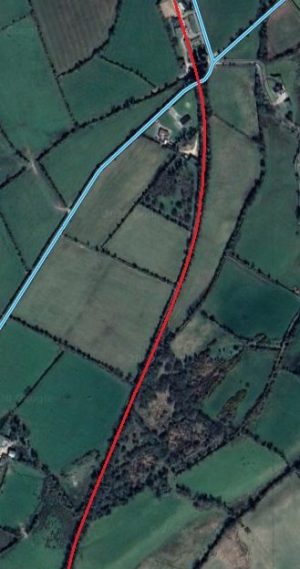


These two image show the line passing under the road from Listillion to Lyons Court and then crossing the road between Listillion and Drumerdagh at Gatehouse No. 59. Kerry Doherty comments that the first of these two locations is a “bridge now filled in and the road re-aligned.”

Doherty provides two photographs from that location:
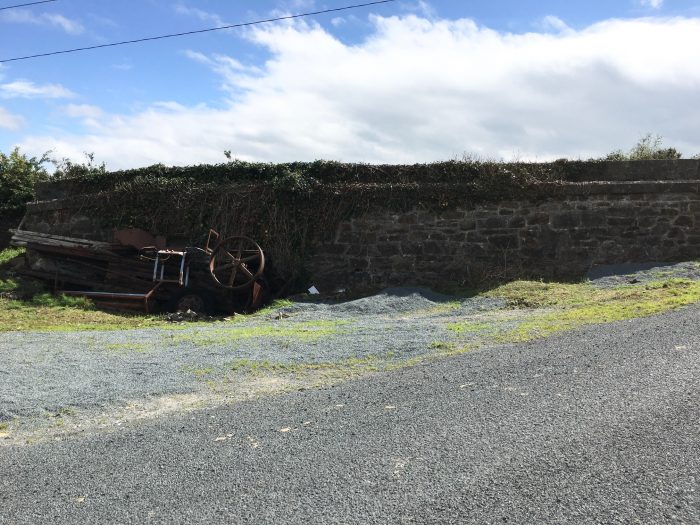
At this location the old road has been realigned when the bridge over the railway cutting was filled in. Both photographs were taken by Kerry Doherty, (c) Kerry Doherty [6]
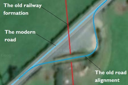
A close-up Satellite image shows the old road alignment across the bridge. ….

The next feature along the line is Gatehouse No. 59 which is shown on the second of the two adjacent satellite images above.
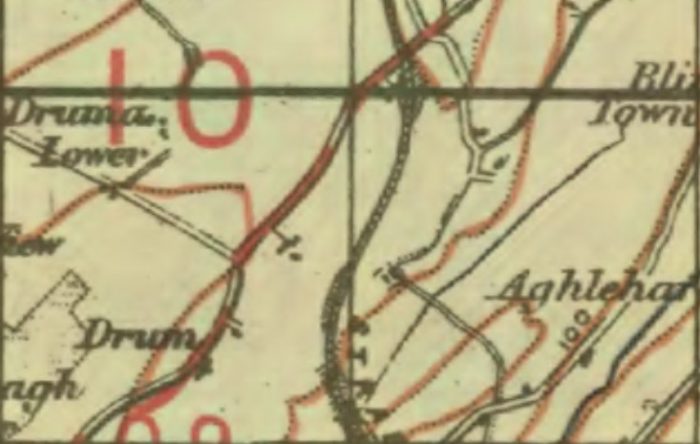
Another extract from the GSGS Maps of the 1940s shows the length of the old line to the South of Gatehouse 59. [9]
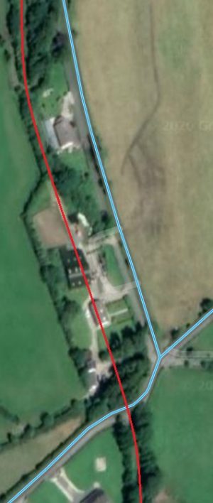
Gatehouse 59 is at the bottom of this enlarged extract from Google’s satellite imagery, (Google Maps).

Beyond the infilled road bridge, the formation of the old line snaked northwards before reaching Gatehouse 59. Both the GSGS map and the satellite image above show that route. Gatehouse 59. The adjacent enlarged satellite image shows the location of Gatehouse 59 just to the North of the road at the bottom of the image.

The first Streetview image below shows the Gatehouse from the South. It is followed by a short series of views mainly from Google Streetview of the same Gatehouse. One image was generously provided by Kerry Doherty.

As the adjacent satellite image shows the old railway continued North from the location of Gatehouse No. 59. A modern bungalow and farm building straddles the old line and before it runs at the back of the gardens of a further two properties.

The first satellite image below show the route of the old railway as it begins to approach Letterkenny. After continuing North for a short distance the line turned sharply to the West running to the South side of what is today the N13/N14 dual carriageway and the L1114 local road.
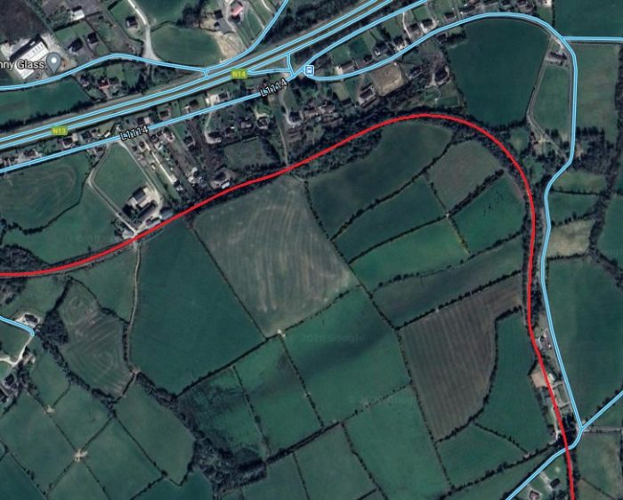
Gatehouse 59 seen from the road immediately to the South, (Google Streetview).Gatehouse 59 seen from the road junction to the East of the location in 2011, (Google Streetview).A telephoto view of the Gatehouse taken more recently from the same position, (c) Kerry Doherty. [6]Gatehouse No. 59 seen from the Northeast, (Google Streetview).

The Strabane and Letterkenny Railway turned sharply to the left a short distance beyond Gatehouse No. 59, (Google Maps). The route is highlighted by a linear woodland which appears once the buildings close to the Gatehouse have been passed.

The old line was initially on a small embankment to the North of Gatehouse No. 59, but by the time it stared to curve to the West is was in cutting. Its route is now a linear woodland, as the satellite image above shows. I am really grateful to Kerry Doherty who visited this location on my behalf in October 2020. The next few images are taken by him.This picture is taken from the old track-bed looking towards the bridge, (c) Kerry Doherty. [6] The old formation can be seen curving to the left in this image. This is one of the more substantial structures along the length of the Strabane to Letterkenny Railway.Looking back to the South from the 3-arch Bridge, (c) Kerry Doherty. [6]The substantial stone parapets belie the use of the over bridge which carries no more thana local track, (c) Kerry Doherty. [6]Looking ahead towards Letterkenny from the track carried by the old bridge, (c) Kerry Doherty. [6]Looking back towards the bridge from the old railway formation, (c) Kerry Doherty. [6]The structure still retains its old number – 279! (c) Kerry Doherty. [6]
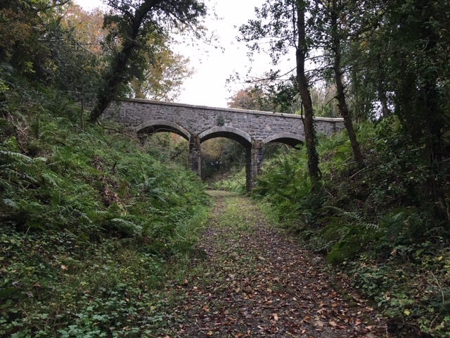
Beyond structure No. 279 the old railway continued to curve round to a westerly direction and still in cutting encountered another road over rail bridge. The location of that bridge is to the right of the satellite image below.The Eastern outskirts of Letterkenny with the route of the Strabane & Letterkenny Railway highlighted in red, (Google Maps). 
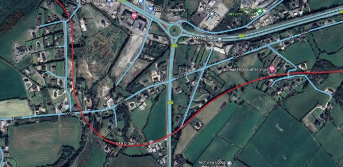
The cutting at the Eastern side of the satellite image above has been partially infilled but the old bridge still has a void underneath it. Although the bridge is clearly of an age commensurate with having been built at the same time as the line, it does not appear on the 1940s GSGS map below.GSGS 1940s Map of the Strabane and Letterkenny Railway on its early approaches to Letterkenny. At the western extremity of the map extract the point where the line begins to run immediately parallel to the Londonderry & Lough Swilly Railway can just be seen. [10]
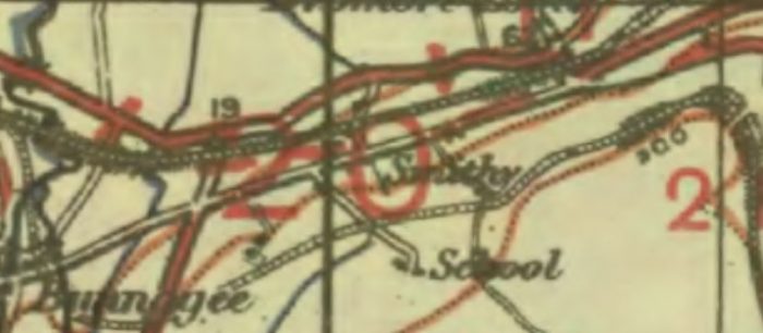
Kerry Doherty commented that the filling of the cutting seems to have cut off drainage runs and as a result there is a small body of water in the cutting. This does not show up on the pictures below.
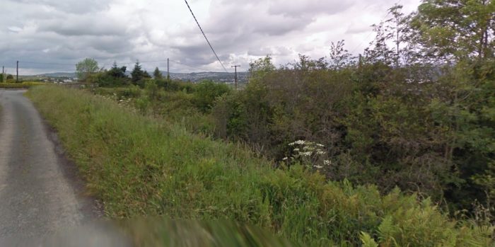
 

The old railway cutting with the bridge just visible in the distance (Google Streetview)The bridge. This Google image shows the void underneath the structure. It is taken from the road which runs alongside the cutting (on its North side) for a short distance, (Google Streetview)This is Kerry Doherty’s photo of the bridge taken from the South side of the railway cutting in October 2020, (c) Kerry Doherty. [6]This view shows the overgrown cutting looking back towards Strabane from the bridge above, (c) Kerry Doherty. [6]Finally at this location, another of Kerry Doherty’s photographs. This shows the route of the old railway taken from over the bridge parapet and looks towards Gatehouse 60 and Letterkenny, (c) Kerry Doherty. [6]Looking back along the route of the old line towards the two bridges shown above, (Google Streetview).A View from the old main road South showing the route of the old line as it crossed the road and a much extended Gatehouse 60 which appears to make an excellent private home, (Google Streetview). There is little sign here of the main N13 road which runs behind the trees which are just beyond property.Google Maps shows how close the Gatehouse No. 60 is to the new N13 road,(Google Maps).This view is taken from the N13 looking back along the old railway alignment towards Strabane. Gatehouse No. 60 can just be made out among the trees, (Google Streetview).Looking across the N13 and on along the route of the old line towards Gatehouse 61 and Letterkenny, (Google Streetview).
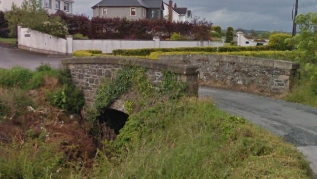
Beyond Gatehouse No. 60, the railway curved round from a Southwesterly trajectory towards the North before crossing the modern day L1114. On the way it crossed a single track lane by means of a bridge.The locations of a bridge and Crossing No. 61, (Google Maps)

Reaching the L1114 (at Bonagee Lane) the old railway was now running roughly North/South. The picture below shows the approximate alignment of the old railway where it crossed the L1114. A bungalow has now been built over the line of the old railway. The line was still on embankment at this point and a bridge took it over the L1114.The approximate route of the old railway where it crossed the L1114. A bungalow has now been built on the route of the old line, (Google Streetview).The 6″ OS Map of the location of the bridges and Gatehouse No. 61. [16]
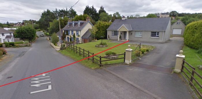
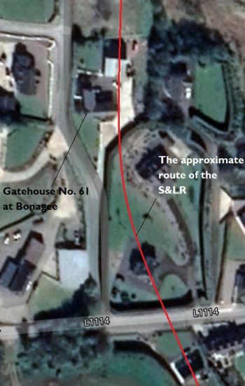
Gatehouse No. 61 sits some distance North of the Bridge which carried the old railway over the L1114, (Google Maps).

North of the L1114 the railway alignment is not obvious. It ran 50 metres or perhaps less to the East of Bonagee Lane. Travelling North along Bonagee Lane leads to the discovery of what was Gatehouse No. 61. An accommodation lane crossed the railway at this point.

Kerry Doherty very kindly pointed out the location of the Gatehouse, without that help, I doubt that I would have located it. The building has been much extended as the Google Streetview image below shows.

Kerry missed the location himself, despite driving along Bonagee Lane from the North a few days ago. The clue is in the property name on the gatepost which can only be seen from the South and which appears in the image below.
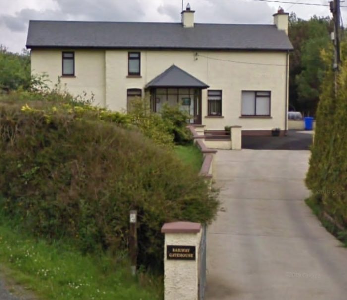
An extended and refurbished Gatehouse No. 61 seen from the South, (Google Streetview).Gatehouse No. 61 is much extended. This photo is a 2011 view from the West on Bonagee Lane, (Google Streetview).
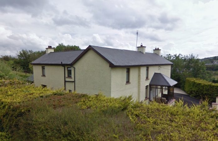
Kerry Doherty provided this link to the location in the archives of the National Library of Ireland – http://catalogue.nli.ie/Record/vtls000731777/MooviewerImg?mobileImage=vtls000731777_001 – on which at the top centre of the image Gatehouse No. 60 is visible. The two arched bridges mentioned above can also be picked out and, in the centre foreground, Gatehouse No. 61 can be seen in its original form. [17]

After Gatehouse No. 61 the old line continued North a short distance to the East of Bonagee Lane, until that lane turned from the North to the Northeast in Bonagee where Gatehouse No. 62 was sited. The crossing was known as Baird’s Crossing and the Keeper’s house can still be seen beyond the railway. It is heavily screened by trees and shrubs but can be seen from the Northeast, as the second image immediately below this text shows.The location of Gatehouse No. 62. the red line is a very approximate representation of the route of the old railway at this point, (Google Streetview).Baird’s Crossing Cottage (Gatehouse No. 62) seen from the Northeast in 2011. The original cottage has been extended at ground level. The railway ran behind the cottage in this view. Its route is over grown by trees and shrubs, (Google Streetview).
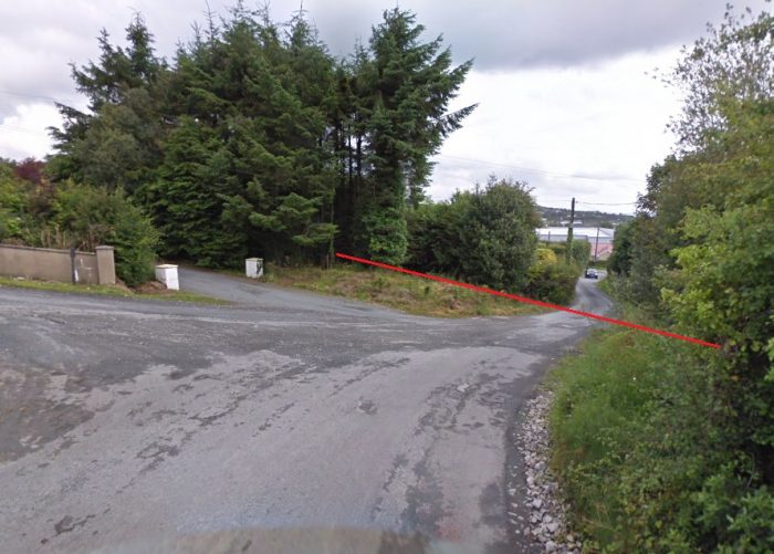
The Strabane and Letterkenny Railway crossed the Londonderry and Lough Swilly Railway by means of an over-bridge, (Google Maps).

Close to the final approach to Letterkenny, the Strabane and Letterkenny line ran parallel to the Londonderry & Lough Swilly Railway. The point where they meet is illustrated on this GSGS 1940s map extract in the bottom right corner. [11]The two lines are shown entering the sketch plan from the right. The lighter dashes represent the Strabane and Letterkenny Railway and the heavier dashes, the L&LSR. (the North Point is at the top of the sketch map) (c) John Baird, Dave Bell, Steve Flanders & Blanche Pay. [12]A later OS Ireland Map showing the routes of the two railways. [13]

The Strabane and Letterkenny Railway approached the Londonderry and Lough Swilly Railway from the South at a point which appears in the bottom right of the adjacent map extract from the 1940s. The scale of the map is such that it is impossible to distinguish any indication of the track arrangement at this location and beyond towards Letterkenny.

The Visitor’s Guide to the Londonderry and Lough Swilly Railway [12] shows the Strabane and Letterkenny Railway running for a short distance on the South side of the Londonderry and Lough Swilly Railway (L&LSR), the Strabane and Letterkenny Railway is then shown crossing the route of the Lough Swilly line by means of an over-bridge and then running parallel to it into Letterkenny on the North side of the L&LSR.

That route is illustrated on the adjacent sketch Map. [12]

Other mapping suggests that the point at which the Strabane and Letterkenny Railway crossed the Lough Swilly line was further to the East, close to the point where the former met the L&LSR . This is illustrated on the adjacent later OS Ireland Map. [13]

The location of the rail over rail bridge is shown on Google Maps Satellite imagery of 2020 in the next image below.

From this point on the two lines converged gradually in both vertical and horizontal directions.
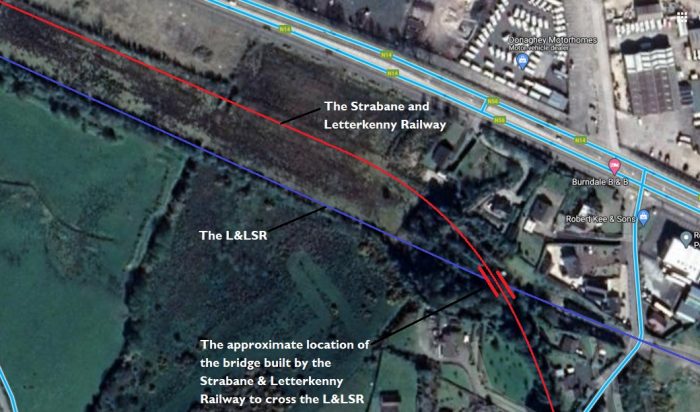
The Strabane and Letterkenny Railway crossed the Londonderry and Lough Swilly Railway by means of an over-bridge, (Google Maps).

I have only been able to find a couple of pictorial records of the rail-over-rail bridge myself. both of these are of a relatively poor print quality. They both appear in the same publication: The Londonderry and Lough Swilly Railway: A Visitor’s Guide. [12: p46]. The first shows the bridge as it was in the 1980s, the second in the years when it was still in use.

Kerry Doherty very kindly sent me a colour copy of a photograph of a S&LR train crossing the bridge in May 1959 with No. 5 Drumboe in charge of a goods train.This picture kindly supplied for use in this article by Kerry Doherty. It shows No. 5 Drumboe crossing the rail-over-rail bridge in 1959. By this time the Swilly line was already closed, (c) J.G. Dewing, Color-rail. [6]

To the West of this point the two railways passed under an accommodation road. The next photo shows the remains of the bridges at that location. The Swilly railway bridge parapets are close to the camera. The S&LR parapets can be seen in the distance with the metal fencing on the top.
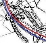
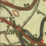
The old road-over bridges on the eastern approaches to the River Swilly, looking North, (Google Streetview).  Dave Bell and Steve Flanders describe the location in the 1980s: “There is a small side road behind the filling station which runs over two bridges, carrying the road over both railway lines. The Swilly used a single arch overbridge here while, conversely, the CDR used a three-arched bridge: two smaller arches either side of the main arch.” [12:p46] The filling station is long-gone, replaced by more modern buildings alongside the N56.The S&LR railway bridge parapets can still be seen. Concrete with metal fencing is on the East face of the old bridge, Google (Streetview)Dave Bell and Steve Flanders describe the use of the bridge arches in the 1980s like this: “The present owner of the filling station has made good use of the CDR bridge by bricking up one side and building a garage against the other. In effect he now has a garage with three bays, the roof of which is actually the side road.” [12: p47] There are two pictures of the arched bays in Bell and Flanders book.Kerry Doherty also very kindly supplied this photograph which shows the arches of the old S&LR bridge inside the garage facility, (c) Dave Bell. [6]

The two railways then encountered the River Swilly and the main road into Letterkenny from the East. Twin structures carried the two railways over the river and the main road. The modern N56 main road and a large roundabout have obliterated almost all of the railway infrastructure at this location. There are some clues as to what it was like in Bell and Flanders book which was written before much of the infrastructure here had been removed. [12:p47]The modern N56 bridge over the River Swilly sits on the line of the two old railways, (Google Streetview). The roundabout ahead has almost entirely obliterated the rail-over-road bridges which carried the two railway lines over the Port Road. The only remnant appears in the next image.The North abutment of the S&LR bridge over the old road is all that remains of the two railway bridges at this location, (c) Kerry Doherty. [6]Looking back along the old railway with the remaining bridge abutment to our right, (c) Kerry Doherty. [6] 

The plaque which is visible in both these two photographs carries a drawing of what the old bridge(s) looked like.

The plaque in the images above, (c) Kerry Doherty. [6]The historic OS Ireland Map extract show both of the two lines on the approach to the two Letterkenny Railway Stations which sat right next to each other at the Eastern edge of Letterkenny.. [13]The routes of the L&LSR and the S&LR shown on a 21st century satellite image, (Google Maps). The S&LR terminated in Letterkenny. The L&LSR continued further to the West and North.The Letterkenny Railway Stations. [13]

The two railway stations sat next to each other just to the East of the centre of Letterkenny. The two lines approached the stations on the South side of the R940. Their approximate route is highlighted on the Google Streetview image below.
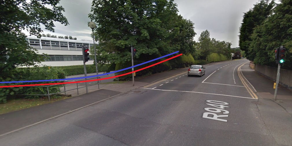
Close to the junction between the R940 and Ashlawn the two railways ran very close to the road. Their route is now covered by the tarmac surface of the car parks of the Letterkenny Institute of Technology, (Google Streetview). The blue/mauve and red lines show the approximate alignment of the railways.

The location of the two railway stations includes the car parks of Letterkenny Shopping Centre and the bus station. Two building from the railway ear remain on the site. The old S&LR goods shed is one of these, it has been refurbished and is now called Railway House.The old S&LR goods shed has been refurbished and is now known as Railway House. This image was taken in 2017 from the R940, (Google Streetview).The same building as seen from the car park of the Letterkenny Shopping Centre, (c) Kerry Doherty. [6]
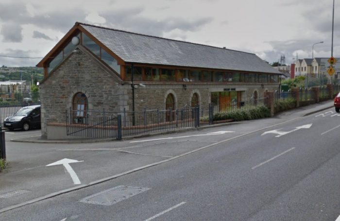
The old passenger facilities at the station have been converted in recent years into the town’s Bus Station. This required an extension to the building on what was the track-facing side. Kerry Doherty has generously provided three photographs of the modern building. [6]The front facade of the old Station Building, looking from the Southwest in 2020, (c) Kerry Doherty. [6]Inside the extension. The picture shows the old building’s Northeast facing aspect form roughly the position of the buffers stops on the old line. The platform canopy columns have been retained in the new building. The filigree detail has been retained, (c) Kerry Doherty. [6]Looking along the line of the old platform towards the Passenger Station Building. This facade is modern, (c) Kerry Doherty. [6]This final present-day image was again provided by Kerry Doherty and shows the station yard crane almost swamped by vegetation, (c) Kerry Doherty. [6]

We finish this article with a series of pictures of the old S&LR facilities at Letterkenny.

This first image was provided by Kerry Doherty and shows the length of the station platform at Letterkenny in 1959, (c) B. Hilton, Colorrail. [6]This monochrome photograph was taken by Roger Joanes in 1959. The photo was taken from close to the Station building. The railcar is No. 14 and in the distance, under a plume of steam, No. 4 can be seen shunting the yard, (c) Roger Joanes (CC BY-NC-ND 2.0). [14]Also by Roger Joanes, the inscription states: “The former CDR loco ‘Erne’ at Letterkenny, freshly painted for preservation but subsequently scrapped. 2.4.63.” (c) Roger Joanes (CC BY-NC-ND 2.0). [14]The disused S&LR station at Letterkenny in 1963 seen from the location of ‘Erne’ (c) Roger Joanes (CC BY-NC-ND 2.0). [14]An overall shot of the Station and Goods Yard in 1959. Loco No. 4, ‘Meenglas’ is preparing to set off for Strabane in charge of a goods train, (c) Roger Joanes (CC BY-NC-ND 2.0). [14]

Donegal Railway Heritage Centre posted this next photograph on their Facebook page. In this series of articles about the Co. Donegal Railways, photographs from the Donegal Railway Heritage Centre’s Facebook page are ‘linked-to’ after discussion with and kind permission from Jim McBride.

References

  1. Edward M Patterson (original author), Joe Begley & Steve Flanders (authors of additional material in the Revised Edition); The County Donegal Railways; Colourpoint Books, Newtownards, Co. Down 2014. As noted in my first article about the Co. Donegal Railways this was to have been my holiday reading while walking different parts of the network, but 2020 has been a strange year!
  2. https://maps.nls.uk/geo/explore/#zoom=16&lat=54.91092&lon=-7.65886&layers=14&b=1, accessed on 11th October 2020.
  3. https://commons.wikimedia.org/wiki/File:Athlone,_Cavan_%26_Clara._LetterKenny_Strabane_RJD_113.jpg#/media/File:Athlone,_Cavan_&_Clara._LetterKenny_Strabane_RJD_113.jpg, accessed on 14th July 2020.
  4. The County Donegal Railways Visitor Guide to the Strabane and Letterkenny Railway is now out of print and i have not been able to find a copy.
  5. Edward M Patterson (original author), Joe Begley & Steve Flanders (authors of additional material in the Revised Edition); The Lough Swilly Railway; Colourpoint Books, Newtownards, Co. Down 2017. This was also to have been part of my holiday reading, but 2020 has been a strange year!
  6. Kerry Doherty of Ballindrait very kindly sent me a series of pictures of the Strabane and Letterkenny Railway route. Each of these, in this article, bears the reference number [6]
  7. https://maps.nls.uk/geo/explore/#zoom=15&lat=54.92484&lon=-7.66844&layers=14&b=1, accessed on 12th October 2020.
  8. Anthony Burges; The Swilly and the Wee Donegal; Colourpoint Books, Newtownards, Co. Down, Second Impression, 2010.
  9. https://maps.nls.uk/geo/explore/#zoom=15&lat=54.93626&lon=-7.67260&layers=14&b=1, accessed on 12th October 2020.
  10. https://maps.nls.uk/geo/explore/#zoom=15&lat=54.94389&lon=-7.68287&layers=14&b=1, accessed on 14th October 2020.
  11. https://maps.nls.uk/geo/explore/#zoom=15&lat=54.94758&lon=-7.70755&layers=14&b=1, accessed on 27th October 2020.
  12. Dave Bell and Steve Flanders; The Londonderry and Lough Swilly Railway: A Visitor’s Guide; County Donegal Railway Restoration Society; an small extract from the sketch plan on p42, rotated through 90 degrees.
  13. http://geohive.maps.arcgis.com/apps/webappviewer/index.html?id=9def898f708b47f19a8d8b7088a100c4, accessed on 27th and 28th October 2020.
  14. https://www.flickr.com/photos/110691393@N07, accessed on 27th October 2020.
  15. https://www.facebook.com/DonegalRailwayHeritageCentre/photos, accessed on 28th October 2020.
  16. http://geohive.maps.arcgis.com/apps/webappviewer/index.html?id=9def898f708b47f19a8d8b7088a100c4, accessed on 10th November 2020.
  17. http://catalogue.nli.ie/Record/vtls000731777/MooviewerImg?mobileImage=vtls000731777_001, accessed on 10th November 2020 – a thumbnail is provided here , the full size image can be viewed by clicking on the link
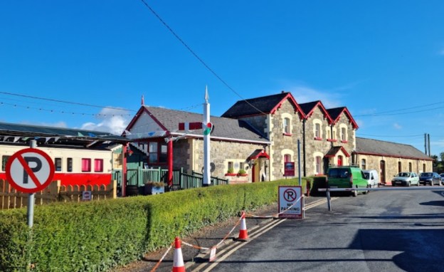
Co. Donegal Railways, Ireland – Part 5 – Strabane to Letterkenny (Part B – Raphoe to Convoy)

As we noted at the start of the previous article about this line, Wikipedia gives us a very short history of the line from Strabane to Letterkenny and provides a single image – the Railway Clearing House map with stations in Strabane and Letterkenny:

The Railway Clearing House map with stations in Strabane and Letterkenny. [3]

This series of articles seeks to expand our understanding of the route of the various Co. Donegal Railways through combining old images and modern views. Satellite images also give us a good understanding of what remains of the infrastructure of these lines.

A Journey Along the Line – Strabane to Letterkenny – Part B – Raphoe to Convoy

A sketch plan of Raphoe Railway Station by Steve Flanders from the book ‘The County Donegal Railways’ [1: p43] This drawing is included by kind permission of Steve Flanders.


Railcar No. 20 at Raphoe Station, heading for Letterkenny in 1959 (c) Roger Joanes (CC BY-NC-ND 2.0) The Crossing-keepers cottage at the level-crossing to the East of the Station can be picked out to the right of the railcar. By this time, the passing loop shown in Steve Flanders sketch plan above had been lifted. [7]

Having enjoyed a stopover in Raphoe, we start the next stage of this journey back at the Railway Station at Raphoe and pick up the last image (above) from the previous article about the line:

Co. Donegal Railways, Ireland – Part 4 – Strabane to Letterkenny (Part A – Strabane to Raphoe)

Before we climb aboard Railcar No. 20 as it sets off for Letterkenny we look at the condition of the station site in the 21st century. The two pictures immediately below were taken relatively recently by Kerry Doherty. The first shows the location of the old station platform, the second looks from the West through the station site.

All that remains of the platform of Raphoe station. You can clearly see this shed is built on top of it (c) Kerry Doherty. [6]


This picture appeared at the end of the last article about this line. It shows the site of Raphoe Station in 21st century taken from a similar position to the Roger Joanes image above. The Station Master’s House on the left is the only building remaining on the site. Kerry Doherty comments that ‘it was difficult to get a photo of the site as many lorries now occupy the yard’, (c) Kerry Doherty. [6]

There are also two excellent photographs of Raphoe in Anthony Burges Album of the line. [8: p32-33]

Now we set off towards Convoy from Raphoe Railway Station. …….


GSGS 1940s Map of Raphoe and its Southwestern approaches. [2]


The site of Raphoe Railway Station in the 21st century. [4]


The route continues through Aughnakeeragh (Google Maps).
The three images immediately above show that the line began, gradually, to curve round to a Southwesterly direction as it left Raphoe Railway Station, before turning almost directly South at Aughnakeeragh.
At location ‘1’ on the map immediately above, the road turned sharply to the south so as to cross the railway on a bridge.


The narrow road crossed the old railway on a stone arch bridge. The railway cutting has now been infilled and the road alignment marginally improved (Google Streetview). This view shows the approach from Raphoe.


Crossing the bridge location and turning to look back towards Raphoe, this is the view (Google Streetview)

At location ‘4’, an accommodation bridge provided access across the old line.

The location of the old bridge is difficult to pick out on this image from Google Streetview.

This image, taken by Kerry Doherty from the top of the bridge at location ‘3’ above gives a better impression of the remains of the old bridge. The S&LR was in cutting at the bridge but the land drops away towards the foreground and at the point of the modern access road in the middle of the picture, the line went from being in cutting to being on an embankment, (c) Kerry Doherty [6]

As noted under the picture above, at location ‘2’, the old railway was almost at the same level as the surrounding land with cutting to the East and embankment developing to the West.


A modern farm access road crosses the old line at the approximate location when natural land levels and the formation of the S&LR matched (Google Streetview).

At location ‘3’, close to Aughnakeeragh, the railway was carried over a road on a stone arch bridge.


This Google Streetview image shows the bridge viewed from the Southeast.

\n Convoy Railway Station


The Google Streetview image of the bridge taken from the Northwest shows it heavily overgrown by ivy.


In this recent photograph, the bridge has been stripped of vegetation and is much more clearly visible, (c) Kerry Doherty. [6]


This Google Streetview image is taken from the road on the North side of the line, immediately to the West of the above bridge and shows the Railway embankment disturbed to allow vehicles to access land to the South.


The next extract from the GSGS 1940s series of Maps shows the line to the West of Aughnakeeragh. [9]

After passing immediately to the West of Aughnakeeragh the line headed South for a Short distance before curving to the West once again.

There was an accommodation bridge which carried a lane across the S&LR at Tullyvinny. The location appears on the adjacent Google Maps extract to the Southwest of the road junction at the centre of the satellite image. The lane ran parallel to the S&LR for a short distance on the East side of the railway cutting before turning West across the line. The closest we can get on Google Streetview is shown in the first image below.

The next track to cross the line was that leading to Figart Upper Farm. The Lane appears in the bottom third, on the left-hand side of the next Google Maps satellite image below. The farm is on the left-hand side of the image close to the top.

From Figart Upper Farm to Kiltole the old line was alternately in cutting and at the same level as the surrounding land but on the hill above the road which ran parallel to it to the South. An accommodate bridge over the line is marked by the black circle on the above plan and appears to relate to another structure which can be seen on the Goggle Streetview photograph below and which is taken from the road a little to the West of the accommodation bridge.


A lime kiln adjacent to the accommodation bridge referred to above. It seems as though the bridge permitted access to the lime kiln. (Google Streetview).

Very kindly, when I first asked about this structure in very early October 2020, Kerry Doherty offered to investigate. He took his camera with him as he endeavoured to walk the line from the West. He gained access to the old line through a field adjacent to the Kiltole Quarry . His first photograph shows the formation to the East of the quarry.

The formation of the Strabane and Letterkenny Railway to the East of Kiltole Quarry, (c) Kerry Doherty [6]

Kerry’s trek along the line increasingly required him to struggle through bushes, small trees and thick under growth. The next picture is taken looking West from close to the lime-kiln and its bridge.

Looking West towards Convoy close to the Limekiln, (c) Kerry Doherty. [6]


Kerry Doherty says: “It got almost impassable approaching the bridge beside the lime kiln. The bridge pillars can just be seen through the trees,” (c) Kerry Doherty. [6]


Kerry says: “I climbed the cutting to get a better shot of the bridge,” (c) Kerry Doherty. [6]


Some original boundary fencing adjacent to the bridge parapet, (c) Kerry Doherty. [6]


Looking across the accommodation bridge and then across the Lime Kiln to the South, (c) Kerry Doherty. [6]


Adjacent to the Lime Kiln the two approach walls to the bridge parapet railing can be seen. That to the East is curved in plan, (c) Kerry Doherty. [6]

Three pictures of the Lime Kiln follow. All again taken by Kerry Doherty:


The Lime Kiln from the South, (c) Kerry Doherty. [6]


The view from the Southwest, (c) Kerry Doherty. [6]


A close-up shot of the mouth of the Kiln, (c) Kerry Doherty. [6]

Immediately to the west, the road and old railway ran close together. This can be seen in this next Google Streetview image.


In this picture the formation of the S&LR can be seen in the trees immediately at the back of the land belonging to this bungalow (Google Streetview).

The line ahead now approaches Convoy. Although the formation is completely lost as it crossed the site of the now defunct Kiltole Quarry. The railway station was in the part of Convoy referred to as Milltown (to the East of Convoy itself), sited just to the North of the old mills.


The Village/Town of Convoy (Milltown) on the GSGS 1940s Series of Maps. [10]

Convoy on the Header National Townland and Historical Map Viewer. The route of the old railway has been imposed on the map as a thin red line. [11]


The approximate route of the old line through Convoy (Google Maps). The locations of the Gatehouse and the two road over rail bridges are marked.

The closest view of the Railway Station site at Convey that is available on Google Streetview. The last remaining structure on the site is the goods shed.

Convoy Railway Station 1959 (c) Roger Joanes, (CC BY-NC-ND 2.0).

This second length of the Strabane to Letterkenny line finishes here at Convoy, the remainder of the line to Letterkenny will follow in another post.

References

  1. Edward M Patterson (original author), Joe Begley & Steve Flanders (authors of additional material in the Revised Edition); The County Donegal Railways; Colourpoint Books, Newtownards, Co. Down 2014. As noted in my first article about the Co. Donegal Railways this was to have been my holiday reading while walking different parts of the network, but 2020 has been a strange year!
  2. https://maps.nls.uk/geo/explore/#zoom=15&lat=54.87036&lon=-7.61772&layers=14&b=1, accessed on 25th July 2020.
  3. https://commons.wikimedia.org/wiki/File:Athlone,_Cavan_%26_Clara._LetterKenny_Strabane_RJD_113.jpg#/media/File:Athlone,_Cavan_&_Clara._LetterKenny_Strabane_RJD_113.jpg, accessed on 14th July 2020.
  4. http://geohive.maps.arcgis.com/apps/webappviewer/index.html?id=9def898f708b47f19a8d8b7088a100c4, accessed on 25th July 2020.
  5. Edward M Patterson (original author), Joe Begley & Steve Flanders (authors of additional material in the Revised Edition); The Lough Swilly Railway; Colourpoint Books, Newtownards, Co. Down 2017. This was also to have been part of my holiday reading, but 2020 has been a strange year!
  6. Kerry Doherty of Ballindrait very kindly sent me a series of pictures of the Strabane and Letterkenny Railway route. Each of these, in this article, bears the reference number [6] Later, and also referenced [6] Kerry scrambled through the undergrowth along the old line to find evidence of the accommodation bridge and the rear of the lime kiln.
  7. https://www.flickr.com/photos/110691393@N07/11364546546/in/photolist-ijfgKG-ijfnbj, accessed on 22nd July 2020.
  8. Anthony Burges; The Swilly and the Wee Donegal; Colourpoint Books, Newtownards, Co. Down, Second Impression, 2010.
  9. https://maps.nls.uk/geo/explore/#zoom=15&lat=54.86372&lon=-7.63776&layers=14&b=1, accessed on 8th August 2020.
  10. https://maps.nls.uk/geo/explore/#zoom=15&lat=54.86396&lon=-7.65969&layers=14&b=1, accessed on 9th August 2020.
  11. https://www.flickr.com/photos/110691393@N07/11371005014/in/photolist-ijf23V-ijPnCA, accessed on 5th October 2020.

Co. Donegal Railways, Ireland – Part 4 – Strabane to Letterkenny (Part A – Strabane to Raphoe)

Wikipedia gives us a very short history of the line from Strabane to Letterkenny and provides a single image – the Railway Clearing House map with stations in Strabane and Letterkenny:

The Railway Clearing House map with stations in Strabane and Letterkenny. [3]

“The County Donegal Railways Joint Committee (CDRJC) constructed the Strabane and Letterkenny Railway. It opened for public service on 1 January 1909 with a route length of 19.25 miles. It was the last railway constructed by the CDRJC bringing the network operated by this company to 121 miles. The company pioneered the use of diesel operated railcars, but despite this innovation, closure came at the end of 1959, and the railway was shut on 1 January 1960.” [2]

 This history must be worth expanding! It gives so little detail!

Wikipedia tells us that Letterkenny was already rail-served in 1909. “‘The Londonderry and Lough Swilly Railway Company’ (The L&LSR, the Swilly) was an Irish public transport and freight company that operated in parts of County Londonderry and County Donegal between 1853 and 2014.” [4] Incorporated in June 1853, [5] “it once operated 99 miles of railways. … It closed its last railway line in July 1953 but continued to operate bus services under the name Lough Swilly Bus Company until April 2014, becoming the oldest railway company established in the Victorian era to continue trading as a commercial concern into the 21st century. Following a High Court petition by HM Revenue and Customs, the company went into liquidation and operated its final bus services on 19 April 2014.” [4][7][8]

The first railway station in Letterkenny opened on 30th June 1883. The line out of Derry started out as the “Londonderry and Buncrana Railway” and was absorbed into the L&LSR in 1887. [9] That line is not the subject of this article but it is important to note that Letterkenny had been rail-served for many years before the branch from Strabane arrived in the town.

Raphoe Bishop’s Palace. [10]
Raphoe Cathedral. [11]
Raphoe Royal and Prior School in 21st century. [12]

Patterson et al [1: p41] explain that the Co. Donegal Railways from Strabane to Stranolar – which were accessed from Londonderry over either the Great Northern Railway (along the valley of the River Foyle) to Strabane or the more tortuous route owned by the Co. Donegal Railways which passed over the higher ground to the East of the River Foyle, through New Buildings, Collion, Donemana, Ballyheather and Ballymagorry and on to Strabane – ran to the South of an area which included the small towns of Raphoe and Convoy. The L&LSR ran to the North of this area. “At the end of the 19th century, Raphoe had a population of around 700, …. centred around a cathedral, a ruined bishop’s palace and a Royal School. Convoy, only about a third he size of Raphoe, was a manufacturing village with a reputation for woolen textile manufacture. By Donegal standards, the people living there felt they ought to have a railway.” [1: p41]

That sense of entitlement built on endeavours which began as early as 1860 but which foundered on more powerful interests. It wasn’t until around 25 years later that a light railway/tramway was planned between Strabane and Drumcairn and it became more likely that the area would be rail served. However, that scheme also foundered for lack of money. [1: p41]

It was 1902 when a new version of the scheme was proposed at an estimated cost of £100,000 which ran between Strabane and Letterkenny via Lifford, Ballindrait, Convoy and Raphoe. The scheme was the subject of a bill submitted to Parliament in the winter of 1902-3. [1: p41-42] That application failed to achieve its key objective of reaching Letterkenny. The Act only allowed a line from Strabane to Convoy. A further submission was made in 1904 and was successful. The promoters called the line the Strabane and Letterkenny Railway (S&LR)  and within no more than a year it had effectively been taken over by the Great Northern Railway in advance of their takeover of the Co. Donegal Railway. [1: p42-43]. Work started on building the line in 1906. Robert McAlpine and Sons were the principal contractor. The line was eventually opened to traffic on New Year’s Day 1909. [1: p43-44]

Patterson et al comment that “since much of the share capital of the S&L had been provided by the Midland and the Great Northern, owners of the CDRJC since 1906, it was natural that the Joint Committee should take over the operation of the line and work it as a branch. ” {1: p44-45]

1905 Ordnance Survey Map. [14]

Strabane Railway Station was first opened in 1847 on the Great Northern Irish standard-gauge line. It expanded to include the narrow-gauge Co. Donegal lines in 1894 when the new narrow gauge crossed the river into the southern end of the station.

Prior to the narrow-gauge, the Finn Valley railway shared the southern approach to the railway station with the Irish North Western Railway – the predecessor of the GNR. The Finn Valley Railway was held to ransom for access into Strabane Railway Station. The advent in Ireland of the new 3ft gauge railways encouraged the directors of the West Donegal Railway  (WDR) to choose that gauge for their new railway in the late 1870s. After a period of mixed gauge use of Stranorlar Railway Station, Parliament sanctioned the amalgamation of the  Finn Valley  with the WDR in 1892 and in 1893 powers were obtained for a change of gauge between Stranorlar and Strabane and for the construction of a new narrow-gauge link from the old Finn Valley junction with the GNR into Strabane Railway Station. [1: p19-28] That link appears on the 1905 Ordnance Survey Map above. The map was drawn only a few years before the construction of the S&LR.

My sketch below shows the layout of Strabane Railway Station in the years following the construction of the S&LR. Strabane Railway Station in the 1930s (c) Roger Farnworth

A Journey Along the Line – Strabane to Letterkenny – Part A – Strabane to Raphoe

Strabane on the GSGS Map from the 1940s. The GNR runs roughly North-South the Co. Donegal runs from the top right to the bottom left with the branch to Letterkenny returning to the North edge of the map having passed through the Railway Station at Lifford. The station at Strabane is marked by the linked roundels near to the centre of the map. [13]

On the GSGS 1940s OS Map, the Strabane to Letterkenny branch is shown leaving the  Co. Donegal mainline just to the North of Strabane Railway Station.  My sketch above shows the actual arrangement. It was difficult to fairly represent the track arrangement at the station at the scale the GSGS Maps were drfated. Letterkenny trains left Strabane Railway Station at the station platforms and then turned sharply round to the Northwest before crossing the River Foyle and entering Lifford Railway Station.

Recently, I have been consulting with Chris Amundson. The link immediately below shows what is known about the layout of Strabane Railway Station in different eras:
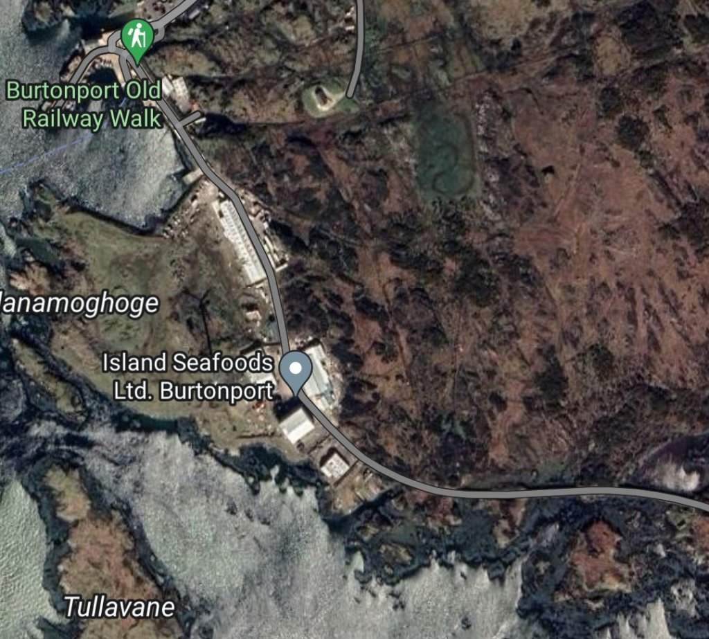
https://www.flickr.com/gp/spw45/mFAX44

The next few pictures show the footbridge at Strabane Station. The first three  are relatively low resolution images posted on the BBC Northern Ireland Your Place and Mine website. [15]

These first three images are taken looking North through the Station. The first is taken from just South of the Western station platform. On the far left of the image the S&LR platform can be glimpsed. The second shows the main station buildings with the footbridge steps to the right of the image. The third looks Northeast under the footbridge towards the main station buildings.

The fourth picture was found on both Sepiatown [16] and OldStrabane webpages [17] It shows the station footbridge, again looking North, from the GNR side of the station. (I have been unable to contact both of the two sites to get permission to share photographs, postcard images, etc., here. Email links, where they exist, no longer function. Should the site owners wish me to remove the images credited to those sites then I will do so and replace them with the links referred to in the references at the end of this article.)

The first colour image shows the station footbridge again, also looking Northeast, this time from close to the Co. Donegal lines turntable. County Donegal Railway No 11 “ERNE” is moving vans in May 1957. [17][18]

The second colour image shows the same engine (No. 11 ERNE Class 4, 4-6-4 ‘Baltic’ tank), heading away, light engine, from Strabane Railway Station on the Letterkenny line in March 1958. The CDR signal box, and station footbridge are shown in the background. [17][19]

The following image shows a Goods Train approaching Strabane from Lifford, presumably having travelled from Letterkenny. The photographer is looking Southwest from a point near the Signal Box at Strabane. [17][20]

As noted above, these superb images can be found on two sites, http://www.sepiatown.com and oldstrabane.blogspot.com. Each image is individually referenced on the http://www.sepiatown.com website. I have only been able to provide a general reference for the same images on the  oldstrabane.blogspot.com website.

Those on the http://www.sepiatown.com website are geographically referenced for their location around the station site.

A train prepares to depart for Letterkenny. Platform 5 at Strabane Railway Station. [17][24]
Diesel Shunter Phoenix at Strabane Station looking Southwest from Platform 5 – the platform used by the Strabane to Letterkenny services The signal box can be made out beyond the end of the platform. [17][22]
Railcar  No. 14 at Strabane Railway Station on 20th August 1959, preparing to leave Platform 5 for Letterkenny. [17][23]
he Strabane & Letterkenny Railway closed on 1st January 1960. This photograph was taken sometime after the closure (probably in 1965). The rail track has been removed and replaced by a road. The building on the right nearest to the camera is the Co. Donegal Railways signal box. [17][21]
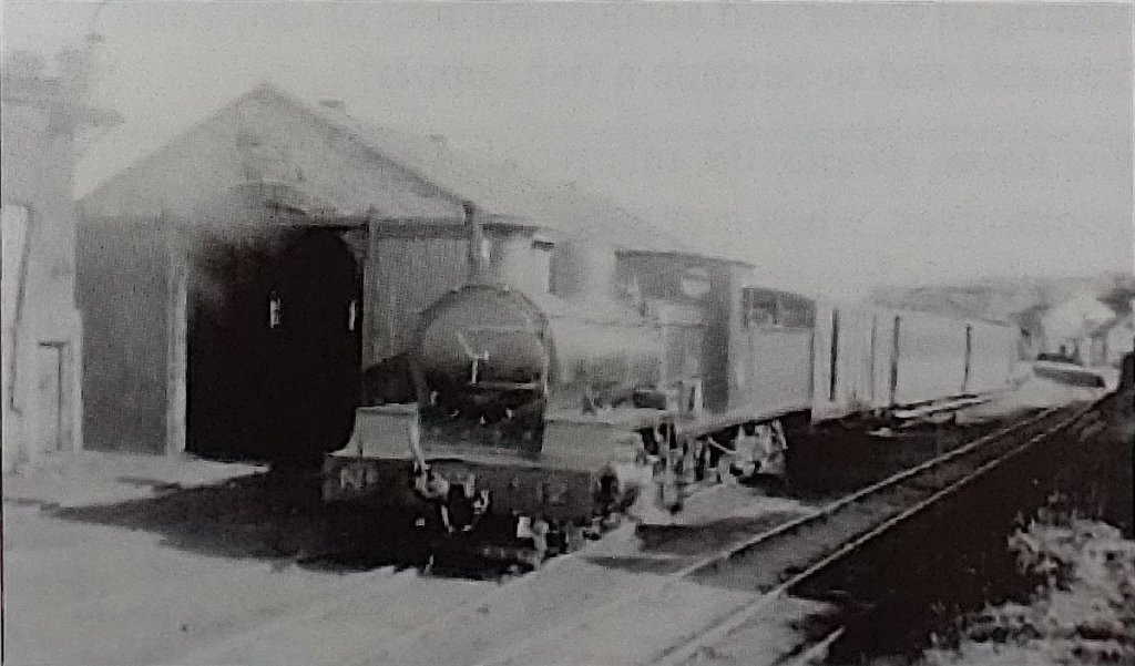
he route of the old S&LR is marked by the double row of trees heading North from the modern A38 (Google Maps).
Kerry Doherty supplied this photograph for comparison with the one above. It shows Strabane Railway Station and is taken from the “camels hump” bridge. He comments that ‘This site has been much filled in and raised quite a bit.’ Photograph supplied by Kerry Doherty. [45]
Kerry Doherty supplied this photograph for comparison with the one above. It shows Strabane Railway Station and is taken from the “camels hump” bridge. He comments that ‘This site has been much filled in and raised quite a bit.’  The line in the centre foreground is the S&LR. Photograph supplied by Kerry Doherty. [45]
Turning through 180 degrees, we are now looking in the direction of Lifford, the Letterkenny line trackbed would have been where the grass is on the far side of the road. Curving off sharply to the right (c) Kenny Doherty. [45]

Trains for Letterkenny used the most westerly platform at Strabane Railway Station – Platform No. 5. Trains traversed a very tight curve round to the Northwest, followed a short straight-alignment before crossing the River Foyle.

As we have noted, there was a sharp curve in the line out of out of Strabane. THis image shows the trackbed after the curve, looking towards Lifford. Kerry Doherty comments: ‘It’s interesting to note that when the line was lifted in January 1960, this was tarred and the railway bridge used for buses and lorries and the road bridge was being replaced. The tar is still under the moss underfoot,’ (c) Kerry Doherty. [45]
Looking across the River Foyle at the location of Lifford Station which is in the trees, (c) Kerry Doherty [45]
The magnificent stone abutment of the bridge. This is the southern bridge abutment, (c) Kerry Doherty. [45]
The location of Lifford Bridge, (c) Kerry Doherty. [45]
Lifford Bridge. Photo by John Langford, supplied for inclusion here by Kerry Doherty. The picture is taken from approximately the same angle as the more modern image above. Lifford Station Halt can be seen on the right side of this image. Kerry Doherty Collection. [45]
The location of the old Strabane/Liffor Railway Bridge across the River Foyle. (Google Maps)
he Construction of Lifford Railway Bridge. The photographer is on the West side of the River Foyle, looking SE towards Strabane Station on the Strabane-Letterkenny line. The picture was taken in 1908. [17][25]
A much later image of the Strabane/Lifford Railway Bridge (c) Margaret (Blee) Fisher. [26]

The Strabane/Lifford Railway Bridge over the River Foyle is shown during construction above and much later, probably not long before demolition, in the adjacent photograph.

All that remained in the latter 20th century was the bridge foundations. By the early 21st century, these also were gone.

The same bridge in 1959. This photograph is taken from the end of the platform at Lifford Halt (c) Roger Joanes (CC BY-NC-ND 2.0). [29]

The S&LR bridge can be seen towards the top of this image. Lifford Halt Station is just to the left pf the bridge. This image is embedded with permission from http://www.gettyimages.co.uk. An unidentified Co. Donegal steam locomotive is crossing the bridge in charge of a long goods from Letterkenny. [30]

Lifford Station and Railway on the S&LR. [27]
Lifford Halt Station Builing, a colourised monochrome image. The photograph was taken by William Lawrence included here courtesy of Kerry Doherty. [43]
Lifford Station (from behind), the platform was on the other side of the building. This picture was taken some years ago as the building has been modified and is now surrounded, as can be seen below, by a high fence. The images below show the building as it is now, owned by two different people. The track-side elevation is much better kept and in recent years was the post office, (c) Kerry Doherty. [45]
Lifford Halt Station Building (Google Streetview).
Lifford Halt Station (Google Streetview).

The photo above appears on the Donegal Heritage Centre Facebook page and is embedded here with permission. [31] There is also  an excellent photograph of the station and platform in Anthony Burges book, The Swilly and the Wee Donegal. [44: p30] The satellite image below shows the S&LR just North of the location of the old station.
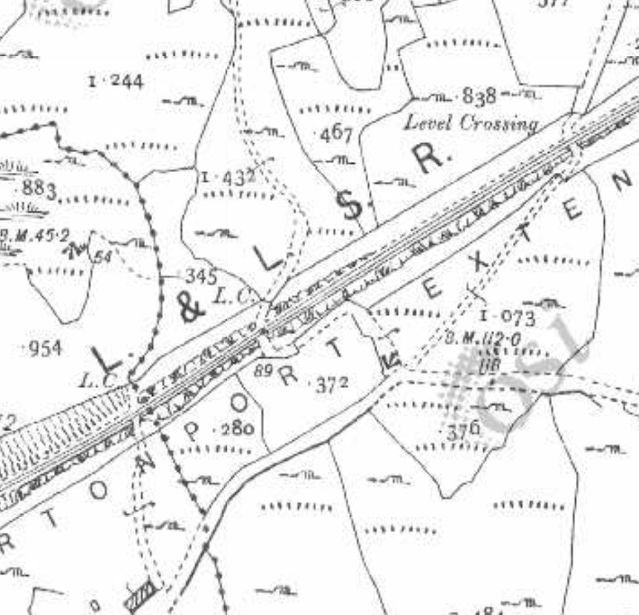
The S&LR (Google Maps)
The S&LR [31]
The S&LR [31]
The approximate alignment of the S&LR approaching Ballindrait Station which is just off the satellite image to the West. [31]
The approximate line of the S&LR in the 21st century. [27]
Ballindrait Railway Station as first built. This picture is an old postcard view taken by William Lawrence and provided courtesy of Kerry Docherty. [43]
Ballindrait Station in 21st century viewed from the West along the access road from the village (Google Streetview). The building on the right is the old passenger building with the platform beyond.

Ballindrait Railway Station was to the Northeast of the village on the North side of the Deele River.

The Goods Shed (Google Streetview).
Ballindrait Goods Shed, looking towards Lifford (c) Kerry Doherty. [43]

There is a bungalow on the site of the old station, close to the old station house, but many of the buildings associated with the station are also still present. A sequence of views are adjacent to this text, three of which are views on Google Streetview.

The two wintry views are from the Irish National Inventory of Architectural Heritage. [32]

Ballindrait Goods Shed from the Southwest. [32]
The Station Master’s House (Google Streetview)

There are also some pictures taken recently by Kerry Doherty which show the site from the alignment of the old railway (these make an excellent comparison with one of the images in the book, The Swilly and the Wee Donegal, by Anthony Burges . [44: p31])

Kerry Doherty’s photos include one of the old goods shed looking towards Lifford.

The Station Master’s House from the Southeast. [32]

The station buildings are in a surprisingly good condition having seen little or no maintenance over the years since the closure of the S&LR.

Ballindrait platform shelter and platform remains, looking towards Coolaghy (c) Kerry Doherty. [43]

I am particularly grateful to Kerry Doherty for the modern images which appear to be more up-to-date than the Google Streetview images.

Leaving the station, the railway travelled only a short distance due West before crossing the station access road leading up from Ballindrait village on a steel girder bridge.

Ballindrait platform shelter and platform remains, looking towards Coolaghy (c) Kerry Doherty. [43]

The bridge deck has been removed and the abutments, if they still exist, are completely obscured by vegetation.

Beyond Ballindrait the S&LR followed the route of the R264 closely. The picture below looks back towards Ballindrait railway station in the year before closure of the line.

Leaving Ballindrait the line followed a relatively straight course for a short distance. This view looks back towards the station from just beyond the road under bridge which took the station access road into Ballindrait. [45]

Initially crossing a side road on the level at Tamnawood Crossing. The crossing keeper’s cottage still stands in the early 21st century and is shown below in two images, the first comes from the Irish National Inventory of Architectural Heritage. [33] The second from Google Streetview.

Tamnawood Crossing-keeper’s Cottage [33]
Tamnawood Crossing-keeper’s Cottage (Google Streetview)
The S&LR [Google Maps]

At first it ran along the North side of the road. Modern develop obscures its route. The first two Google Satellite images below show that modern development.

After a few more hundreds of metres, line crossed the R264 on the level. The old road has been realigned at this point. The location can be picked out on the GSGS Map below but is more easily picked out on the larger scale extract provided after the two satellite images.

The approximate alignment of road and rail is illustrated on the Google Streetview photograph below the larger scale map extract.

Beyond the road crossing the S&LR followed the South side of the R264, only a few metres away from the carriageway, until it reach Coolaghy Halt where it turned away Southwest from the road.

The route as far as Coolaghy Halt is illustrated on the Google Sateliite images below.GSGS Map from 1941 shows the route of the Strabane to Letterkenny Railway following the route of the Ballindrait to Raphoe Raod (R264). [34]GSGS Map from 1941 shows the point at which the S&LR crossed the R264. [34]The R264 looking Northwest towards Raphoe showing the approximate alignments of the old road and the S&LR (Google Streetview).

The location of Coolaghy Halt (Google Maps)

Coolaghy Halt was the first point for some distance that the railway left the side of the old road. The route of the S&LR is still easily picked out as a line of trees and shrubs running West-southwest away from the R264.Coolaghy Halt in 1942 from the Tom P. McDevitte Collection courtesy of Kerry Doherty, the image is also reproduced in ‘Railway Days in Strabane’. [43]Coolaghy Halt’s location in the 21st century. The platform was where the fence sits today. Photograph by Kerry Doherty. [43]The location of Coolaghy Halt (Google Streetview)A side road from the Northeast met the R264 at the location of the Halt which was on the South side of the road. The red line on these two Google Streetview images shows the approximate alignment of the old S&LR at this point (Google Streetview).

Onward from Coolaghy Halt, the S&LR was only away from the R264 for a few hundred metres, running behind what is now P Connolly Car Sales and Repairs before drifting back towards the road and roughly following its alignment for a few hundred metres before turning away to the Southwest again en-route to what was Raphoe Railway Station.Raphoe Railway Station sat on the South side of the town. [35]

A view from above the cutting just before crossing the road into the Raphoe Station site, you can see the gap where it crossed the road, (c) Kerry Doherty. [45].

The Crossing-keeper’s cottage, Gate House 52, in the early 21st century, The photographer is standing on the track-bed, (c) Kerry Doherty. [45]A nice acknowledgement to the railway past, (c) Kerry Doherty. [45]
The approach from the East to the level-crossing at Raphoe. This picture matches the more modern one above and is also taken from above the cutting on the route from Strabane and looks toward Raphoe station, © Copyright James Chambers, the gate-keeper at Raphoe crossing. He developed his own images. This image is included here by kind permission of his grandson Nigel Simon. [37]
Raphoe Crossing-keeper’s Cottage just after closure of the line, © Copyright James Chambers, the gate-keeper at Raphoe crossing. He developed his own images. This image is included here by kind permission of his grandson Nigel Simon. [38]
The Level-crossing location in the 21st century. The Crossing-keeper’s cottage remains (Google Streetview)
Looking forward from Raphoe gates into the station site, © Copyright James Chambers, the gate-keeper at Raphoe crossing. He developed his own images. This image is included here by kind permission of his grandson Nigel Simon. [42]

There is an excellent view of the station complex available in Ernie’s Railway Archive on Flickr … https://flic.kr/p/2iRSdWW … That image is best seen as part of that album of photographs on Flickr. [40] The next few pictures show the station while the line was in operation.

Erne at Raphoe Railway Station in 1959 (c) Douglas Robinson, used with permission from the Co. Donegal Railway Heritage Centre. [36]
Shunting at Ballindrait in 1959 (c) Roger Joanes (CC BY-NC-ND 2.0) [41]
Railcar No. at Rahoe Station (c) Roger Joanes (CC BY-NC-ND 2.0) [39]
A view of Raphoe Station from the West (c) Roger Joanes (CC BY-NC-ND 2.0) [38]
The site of Raphoe Station in 21st century taken from a similar position to the last Roger Joanes image above. The Station Master’s House on the left is the only building remaining on the site. Kerry Doherty comments that ‘it was difficult to get a photo of the site as many lorries now occupy the yard’, (c) Kerry Doherty. [45]

We complete the first stage of the journey along the Strabane to Letterkenny Railway at Raphoe. As we noted at the start of this article, this is a place with a long history and it is worth the stopover to see the town!! There are two superb pictures of the station in Anthony Burges book, The Swilly and the Wee Donegal. [44: p32 &33]

References

  1. Edward M Patterson (original author), Joe Begley & Steve Flanders (authors of additional material in the Revised Edition); The County Donegal Railways; Colourpoint Books, Newtownards, Co. Down 2014. As noted in my first article about the Co. Donegal Railways this was to have been my holiday reading while walking different parts of the network, but 2020 has been a strange year!
  2. https://en.wikipedia.org/wiki/Strabane_and_Letterkenny_Railway#:~:text=The%20County%20Donegal%20Railways%20Joint,this%20company%20to%20121%20miles., accessed on 14th July 2020.
  3. https://commons.wikimedia.org/wiki/File:Athlone,_Cavan_%26_Clara._LetterKenny_Strabane_RJD_113.jpg#/media/File:Athlone,_Cavan_&_Clara._LetterKenny_Strabane_RJD_113.jpg, accessed on 14th July 2020.
  4. https://en.wikipedia.org/wiki/Londonderry_and_Lough_Swilly_Railway, accessed on 14th July 2020.
  5. Steve Flanders & Hugh Dougherty, The Londonderry and Lough Swilly Railway; Midland Publishing, 1997.
  6. Edward M Patterson (original author), Joe Begley & Steve Flanders (authors of additional material in the Revised Edition); The Lough Swilly Railway; Colourpoint Books, Newtownards, Co. Down 2017. This was to have been part of my holiday reading, but 2020 has been a strange year!
  7. https://donegalnews.com/2014/04/famous-lough-swilly-bus-company-to-close-within-days, accessed on 14th July 2020.
  8. https://www.independent.ie/irish-news/bus-company-closes-30190034.html, accessed on 14th July 2020.
  9. https://www.stationhouseletterkenny.com/things-to-do-letterkenny/history-letterkenny-donegal, accessed on 14th July 2020.
  10. https://www.antaisce.org/buildingsatrisk/bishops-palace-raphoe, accessed on 14th July 2020.
  11. https://en.wikipedia.org/wiki/St_Eunan%27s_Cathedral,_Raphoe, accessed on 14th July 2020.
  12. https://twitter.com/rsh_raphoe/status/928058579046883330, accessed on 14th July 2020.
  13. https://maps.nls.uk/geo/explore/#zoom=15&lat=54.83082&lon=-7.47324&layers=14&b=1, accessed on 14th July 2020.
  14. http://oldstrabane.blogspot.com/2010/09/1905-ordnance-survey.html, accessed on 14th July 2020.
  15. https://www.bbc.co.uk/northernireland/yourplaceandmine/tyrone/A716690.shtml, accessed on 18th July 2020.
  16. http://www.sepiatown.com/812264-Strabane-Railway-Station, accessed on 18th July 2020.
  17. http://oldstrabane.blogspot.com/2010/10/strabane-railway-station-1930-1959.html, accessed on 18th July 2020.
  18. http://www.sepiatown.com/813662-Strabane-Railway-Station, accessed on 18th July 2020.
  19. http://www.sepiatown.com/813665-Strabane-Railway-Station, accessed on 18th July 2020.
  20. http://www.sepiatown.com/814730-Strabane-Railway-Station, accessed on 19th July 2020.
  21. http://www.sepiatown.com/814448-Strabane-Railway-Station, accessed on 19th July 2020.
  22. http://www.sepiatown.com/814729-Strabane-Railway-Station, accessed on 19th July 2020.
  23. http://www.sepiatown.com/813674-Strabane-Railway-Station, accessed on 19th July 2020.
  24. http://www.sepiatown.com/814723-Strabane-Railway-Station, accessed on 19th July 2020.
  25. http://www.sepiatown.com/814657-Strabane-Railway-Station, accessed on 19th July 2020.
  26. https://cotyrone.com/towns/index.html, accessed on 19th July 2020 and used on a not-for-profit basis as per the copyright notice on the website.
  27. http://geohive.maps.arcgis.com/apps/webappviewer/index.html?id=9def898f708b47f19a8d8b7088a100c4, accessed on 19th July 2020.
  28. https://www.buildingsofireland.ie/buildings-search/building/40835005/station-road-lifford-lifford-co-donegal, accessed on 19th July 2020.
  29. https://www.flickr.com/photos/110691393@N07/11370970966, accessed on 19th July 2020.
  30. https://www.gettyimages.co.uk/detail/news-photo/lifford-the-centre-of-co-donegal-with-tyrone-on-the-other-news-photo/533285858, accessed on 19th July 2020.
  31. https://www.facebook.com/DonegalRailwayHeritageCentre/photos/a.1230417866994452/2723764270993130/?type=3&theater, accessed on 19th July 2020 – embedded here with permission..
  32. https://www.buildingsofireland.ie/buildings-search/building/40834011/ballindrait-railway-station-ballindrait-ballindrait-county-donegal, accessed on 19th July 2020.
  33. https://www.buildingsofireland.ie/buildings-search/building/40834014/tamnawood-ballindrait-county-donegal, accessed on 20th July 2020.
  34. https://maps.nls.uk/geo/explore/#zoom=14&lat=54.85980&lon=-7.56551&layers=14&b=1, accessed on 20th July 2020.
  35. https://maps.nls.uk/geo/explore/#zoom=15&lat=54.87162&lon=-7.60309&layers=14&b=1, accessed on 22nd July 2020.
  36. https://m.facebook.com/story.php?story_fbid=3010690898967131&id=1223882780981294, accessed on 22nd July 2020.
  37. http://www.incony.org/History/StartPage.html, accessed on 22nd July 2020 – embedded directly from the website.
  38. http://www.incony.org/History/StartPage.html, accessed on 20th July 2020 – embedded directly from the website.
  39. https://www.flickr.com/photos/110691393@N07/11364546546/in/photolist-ijfgKG-ijfnbj, accessed on 22nd July 2020 – permission to use here has been sought and a response is awaited.
  40. https://flic.kr/p/2iRSdWW, accessed on 23rd July 2020.
  41. https://www.flickr.com/photos/110691393@N07/11370944925/in/photolist-ijP4Lz, accessed on 23rd July 2020.
  42. http://www.incony.org/History/StartPage.html, accessed on 22nd July 2020 – embedded directly from the website.
  43. Kerry Doherty of Ballindrait, Co. Donegal. provided a series of images from his collection of photographs for use in this article.
  44. Anthony Burges; The Swilly and the Wee Donegal; Colourpoint, Newtownards, Second Impression, 2010.
  45. After first publishing this article, Kerry Doherty of Ballindrait very kindly sent me a series of pictures which needed to be included in the article. Each of these bears the reference number [45].

The Guinness Brewery Railways, Dublin, again. ….

The featured image above shows a staggering number of barrels at the Guinness Brewery in Dublin! [3]

This very short article results from some recent reading about the railways on the Guinness Brewery site in Dublin.

  • An article in ‘Narrow Gauge & Industrial Railway Modelling Review’ Issue 60 Volume 8, October 2004, p134-142; [1] and
  • Paul Webb, ‘Shifting the Stout’, The Moseley Trust, Apedale, Newcastle-under-Lyme, Staffordshire. [2]

The Brewery in St James’s Gate, Dublin was founded by Arthur Guinness in 1759, one of dozens based on the pure water available from the River Liffey. Guinness outlasted and outgrew all its competitors to become one of the greatest brewing empires in the world. 

Between 1868 and 1886 Guinness spent over £1 million on capital projects. As part of these developments, two rail systems were created within the expanded brewery site. I have covered these in some depth in an earlier article about the brewery railways. ….

The Guinness Brewery Railways, Dublin

Instrumental in much of the development of the brewery site was Samuel Geoghegan who was Engineer to the Brewery.

The article in Narrow Gauge & Industrial Railway Modelling Review is archive material, courtesy of ‘Engineering’ magazine and the Greenwich & District NGRS. It consists primarily of a transcript of an illustrated presentation by Samuel Geoghegan which was carried by ‘Engineering’ Magazine in September and October 1888. It includes detailed drawings, engravings and photographs. Back copies of the magazine are available from Roy C. Link, Cambrian Forge, Garndolbenmaen, Gwynedd, LL51 9RX.

Paul Webb’s book is an A4 no-frills publication in basic green card cover and printed on standard copier paper but it contains a wealth of illustrations and detailed text about the Brewery and the various forms of transport, road, rail and water, that served it. Well worth the £8.50 plus postage that it cost, especially knowing that any profit from the sale supports the Moseley Railway Trust.

There are also some excellent YouTube offerings which focus on the brewery and the different modes of transport it employed. …. For example: [4]

References

  1. Samuel Geohegan; Tramways and Rolling Stock at Guinness’s Brewery; Narrow Gauge & Industrial Railway Modelling Review, Issue 60 Volume 8, October 2004, p134-142 (https://narrowgaugeandindustrial.co.uk, accessed on 22nd July 2020.)
  2. Paul Webb, Shifting the Stout; The Moseley Trust, Apedale, Newcastle-under-Lyme, Staffordshire. (https://avlr.org.uk/moseley-railway-trust, accessed on 22nd July 2020.)
  3. This image is available from a variety of online sources including: https://www.lizcovart.com/blog/guinness-storehouse?format=amp, accessed on 22nd July 2020; https://www.pinterest.co.uk/pin/323133341987983419/?%24ios_deeplink_path=pinterest%3A%2F%2Fpin%2F323133341987983419&%24android_deeplink_path=pinterest%3A%2F%2Fpin%2F323133341987983419&amp_client_id=amp-q7GRAwBYyhpqAMkTd7nxbg&utm_source=168&utm_medium=2160&current_page_url=https%3A%2F%2Fwww.pinterest.co.uk%2Famp%2Fpin%2F323133341987983419%2F&install_id=ac61f0899ae3492288c7cff241bd5a0c&%24fallback_url=https%3A%2F%2Fwww.pinterest.co.uk%2Fpin%2F323133341987983419%2F%23details&amp_url=https%3A%2F%2Fwww.pinterest.co.uk%2Famp%2Fpin%2F323133341987983419%2F&_branch_match_id=814525083296268811#details, accessed on 22nd July 2020
  4. https://youtu.be/Dacn58a1x5s, accessed on 22nd July 2020.