An article by Seymour Glendenning in the July 1906 issue of The Railway Magazine focussed on the newly opened Burton & Ashby Light Railway. [1]
The light railway was a 3ft 6in gauge electric tram line supplied with electricity from a diesel generator plant near Swadlincote. [3] The power plant sat alongside the tram depot. [1: p56]
The first article about the line covered the length from Burton, through Newhall and Sawdlincote to Castle Gresley. It can be found here. [4]
Glendenning notes that the construction cost for the whole network was £150,000. [1: p57] He says that it served a population of about 100,000 inhabitants in the towns and villages through which it passed.
This second article about the line completes the journey, covering the length from Sawdlincote to Ashby-de-la-Zouch.
The route of the line(s) is shown in black on the map extract below.
The Burton and Ashby Light Railway. [2]
We start this second part of the journey at the tram depot which sat in Swadlincote on the North side of the Swadlincote and Woodville Branch of the Midland Railway and to the East of the Burton and Ashby Light Railway
The tram depot off Midland Road, Swadlincote, seen from the West. The trams on the depot are (left to right) Nos. 18, 5, 14, 9 and 10. On the left of the depot is the horse-drawn trolley tower. The map extract immediately below shows the depot (top-left). [3]Glendenning provided a photograph of the bridge in this photograph under construction (see above). The bridge appears on the map extract immediately above and is seen here in use by the Burton and Ashby Light Tramway, (c) Public Domain. [13]A similar view in the 21st century. [Google Streetview, August 2022]The tram depot sat to the East of the Burton and Ashby Light Railway and on the North side of the Swadlincote and Woodville Branch of the Midland Railway, just off the top-right of this extract from the 1920 25″ Ordnance Survey. As can be seen here, the branch into the tram depot left the mainline at high level adjacent to the North abutment of the bridge over the standard-gauge line. The Burton and Ashby Light Railway is shown heading South towards Swadlincote Market Place along Midland Road. Sitting to the West of the Light Railway Bridge and at a lower level was Swadlincote Railway Station. To its North were some Sanitary Earthenware Works. [5]This extract from the 21st century Google Maps satellite imagery shows much the same area as the map extract above. The light railway ran down the full length of Midland Road as far as its junction with the High Street in Sawdlincote. [Google Maps, October 2024]A tram sits on the South side of Market Place and is about to set off for Burton (turning left and running beyond the Town Hall which is at the left rear of the photograph), or Ashby (bearing to the right off the right side of the photograph), (c) Public Domain. [14]A very similar view looking from West Street East into Market Place in the 21st century. [Google Streetview, May 2017]
At Swadlincote Market Place a branch left the main line to Ashby-de-la-Zouch. That branch ran South from Swadlincote to serve Castle Gresley. We followed that branch in the first article about the Burton and Ashby Light Railway.
In this article we follow the route of the line from Swadlincote to Ashby-de-la-Zouch which heads East from the Market Place.
“The road towards Ashby rises continuously until it reaches a height of 569 ft. above sea level. It passes through the heart of the Derbyshire Potteries, where a great industry is carried on in the manufacture of furnace bricks, sanitary pipes, and common earthenware. Furnaces and kilns abound in Swadlincote, and the subsidiary industry of crate-making is also much in evidence.
There are numerous stacks arranged in the form of a lofty cone, of the long tapering branches of timber with untrimmed bark, which are used for making the big rectangular crates for the conveyance of heavy earthenware.
The clay for the pipes and pots is obtained on the surface, but the fire clay for furnace bricks has to be reached from a depth, by sinking shafts equipped with hoisting machinery.
Imperceptibly, Swadlincote grows into Woodville, where the large pipe works are situated, with their groups of ever-smoking furnaces and yards stacked with great heaps of pipes for sewerage and drainage purposes. But the broken pottery is even more aggressive than the sound ware. Every ‘grotto’, or ‘rockery’, is made of it; every garden path is edged with it, or with fused fire bricks. The mounds of refuse adjacent to the works are continually extending their borders and spreading over the country.” [1: p55]
The road East of Swadlincote Market Place is High Street. As can be seen from the closely cropped extract from the 1920 25″ Ordnance Survey, the line was dual-tracked in the vicinity of the Market Place. Midland Road runs down to the Market Place on the East side of the Town Hall. Trams for Ashby left to the bottom-right of the map extract. [5]
Trams ran East along High Street and turned Southeast and the road became Hill Street. The area to the East of the town centre was heavily industrialised. Different industrial concerns were linked by a network of tramways which were generally below the level of the public road and passed under it, as necessary, by means of bridges and tunnels as the map extract below illustrates.
Another estract from the Ordnance Survey revised sheets of the 1920s. This sheet was surveyed/revised on the basis of what was present on the ground in 1921. [15]
These two extracts from Google Maps satellite imagery cover the same length of the Light Railway as shown on the extract from the 1921 25″ Ordnance Survey above. The Southeastern length of what was Hill Street is now the A514 which bypasses the centre of the town. [Google Maps, October 2024]
A view East along High Street, Swadlincote from the Market Place. This image was shared on the photographs New and Old of Swadlincote & Burton on Trent Facebook Group by Darren Jones on 8th July 2024. [17]A similar view down High Street in the 2st century. [Google Streetview, August 2022]Facing Southeast along High Street, Swadlincote in the 21st century. [Google Streetview, August 2022]A tram climbs Hill Street towards the Centre of Sawdlincote circa. 1910. This image was shared on the Swadlincote Area Railways, Tramways and Industrial History Facebook Group by Ian Siddalls on 24th February 2019. [33]From Hill Street the line of the old Light Railway runs along a short length of Sir Herbert Wragg Way . Ignoring the junction with the A514, the old line continued to curve gently to the East to follow the modern A514. [Google Streetview, March 2023]Facing East along the A514, the land either side of the modern road has been landscaped and shows little sign of its industrial heritage. [Google Streetview, March 2023]This next extract from the 1921 25″ Ordnance Survey shows the Light Railway running East along Swadlincote Road. The Midland Railway Woodville Brach Line can be seen entering the extract from the South. [15]Further to the East the Light Railway crossed the Woodville Goods Branch of the Midland Railway and ran through the centre of Woodville. [15]The same location in the 21st century. The goods depot is long-gone as are both the road overbridges close to the junction. [18]A tram on its way to Swadlincote passing New Inn, Woodville in the early part of the 20th century. This image was shared on the photographs New and Old of Swadlincote & Burton on Trent Facebook Group by Keith Townsley on 10th January 2023. [19]A similar view looking Northeast on High Street, Woodville, A511 in the 21stcentury. New Inn is on the left of the photo. [Google Streetview, July 2023]Woodville High Street on the 1921 25″ Ordnance Survey. [15]A similar area in the 21st century. [Google Maps, October 2024]Tram No. 13 on High Street Woodville on its test run in 1906. This image, which looks Southeast, was shared on the photographs New and Old of Swadlincote & Burton on Trent Facebook Group by Keith Townsley on 3rd May 2021. [16]A similar vantage point in the 21st century. [Google Streetview, July 2023]Further Southeast on Woodville High Street. [15]A similar area in the 21st century. [Google Maps, October 2024]Further to the Southeast once again. Trams followed the bend in the highway from High Street into Ashby Road. [15]Approximately the same length of road in the 21st century. [Google Maps, October 2024]High Street, Woodville bears left and becomes Ashby Road. [Google Streetview, July 2023]This next extract from the 1921 25″ Ordnance Survey takes us to the East edge of the particular map sheet. [15]Heading away from the camera circa 1911 Is Tram No. 7 en-route from Ashby to Burton on what is now the A511. In a minute or two, the tram would be running Northwest along High Street, Woodville. [34]The same location in the 21st century, looking West towards Woodville. [Google Streetview, July 2023]
The next three extracts for the 1920 25″ Ordnance Survey follow the line across the next map sheet.
The Burton and Ashby Light Railway to the East of Woodville. [20]The Burton and Ashby Light Railway further to the East. At Boundary the line/road run Southeast towards Ashby. [20]Further to the Southeast, the bottom of this extract is also the bottom of the particular map sheet of the 25″ Ordnance Survey of 1920. [20]
Glendenning continues:
“After passing Swadlincote and Woodville, – the top of a hill is reached, 569 ft. above the sea level. Cornfields and meadows abound on either side, and there is also the magnificent landscape of Charnwood Forest. Then comes the hamlet of Boundary, so called, as it is a boundary of shires, parishes, and manors. Close by is the notable village of Smisby, set amongst fine park-like scenery.
It can still boast of its tournament field, which Sir Walter Scott made allusion to in “Ivanhoe.” The situation is very exposed at Boundary; severe storms rage there periodically, and the inhabitants say that anyone who can live winter and summer at Boundary could live anywhere. After entering Leicestershire, the new line makes a quick descent into Ashby-de-la-Zouch. The old town has the refined air of a fashionable inland watering-place, though its medicinal saline baths are not more than a century old. The fourteenth-century castle was wrecked during the seventeenth-century civil wars; but even the portions that remain are magnificent, alike in size, strength and beauty of architecture.” [1: p55-56]
On its way down to Ashby-de-la-Zouch the road and light railway traverse another full 1921 25″ OS Sheet with little worthy of note. [21] The next image shows the line as it appears on the 25″ Ordnance Survey, much closer to Ashby-de-la-Zouch. [22]
“The power station and car shed have been built at Swadlincote, which is about midway between Burton and Ashby. These premises are designed to give every facility for convenient and economical working, with ample margins for any extensions that may be necessary in future. The shed has six lines of rails, and underneath there are pits about 4 ft. deep, like a railway engine shed, so that the motor machinery on the cars may be easily got at for the purpose of examination and repairs. Adjacent to the car shed is the spacious and well-equipped power station. Here we find that not only is steam out of date for light locomotive purpose, on a short track, but it is also being superseded as a prime-mover for the generation of electricity; at any rate, in comparatively small and isolated stations, where a varying and not very heavy load has to be dealt with.” [1: p56]
Perhaps for an audience unfamiliar with the use of electricity as a power-source for a railway, Glendenning spends quite a few words explaining the reason for the choice of diesel engines to create electricity for the network. Not initially the most obvious choice in a coal-mining area. He goes on to say that:
“There are two three-cylinder vertical engines of 240 18.1lp each with a huge fly-wheel weighing about nine tons, coupled direct to two cylinders, each capable of giving an output of 150 kilowatts.” [1: p57]
The Depot was “built with accommodation for 24 trams, 8 tracks x 3 deep but only 20 trams were owned.” [6]
Following closure of the system, “the tram sheds were used to accommodate Thomson’s Fair from 1935 into the 1940s and then for munitions during the Second World War.” [7]
Rolling Stock
Glendenning reports that the new line was to be operated by open-topped cars “with all the latest possible improvements, … Built at the Brush Electrical Company’s Works, Loughborough.” [1:p57]
Glendenning goes on to describe the tramcars:
“They bear the Midland Railway Company’s coat-of-arms, and are designed to carry 57 passengers each, 22 inside and 35 outside. They are mounted on Brush rigid wheel base trucks, with steel tyred wheels, provided with Hudson-Bowring-lifeguards, and magnetic track brakes. The electrical equipments, powerful motors, etc., were furnished by the British Westinghouse Electric Manufac- turing Company, of Trafford Park, Man- chester. Accommodation has been provided for the carrying of a limited number of parcels on the platforms of the cars, while, at a later stage, it is intended to carry booked parcels. Workmen’s cars, with special fares, will be run as soon after the formal opening of the line as possible.” [1: p57]
Electric Tramcar No. 2. [1: p56]
The LMS Society notes that: “The cars were in Crimson Lake and a white livery with ornate gold panelled lining and Midland crest. It was in this condition that the cars came into LMS ownership but all the cars were repainted in a simpler livery at Derby Works. The original white had weathered to a light cream and the later cream mellowed in a short life to a yellow. Although the method of tramsport to Derby Works is not certain the LMS owned bogie tramcar wagons and with an open top tramcar the bodies would almost certainly come within the loading gauge. The trolley pole, seats and wire screens were easily removed and so it is more than likely visits to works were by rail journey.” [6]
There was also a horse-drawn trolley tower/maintenance platform which can be seen in the photograph of the tram depot above.
The Service Provided
Glendenning notes that the frequency of service “between Ashby, Swadlincote and Burton [is] every half hour. … Between Woodville, Swadlincote, Newhall and Gresley, every 15 mins. … Ordinary service commences at 8 am. … Passengers between Ashby and Gresley change at Swadlincote Market Place or Woodhouse Road.” [1: p57]
This photograph was taken on West Street, Swadlincote. It is probably a picture of one of the Sunday School outings. The image was shared on the Photographs New and Old of Swadlincote and Burton on Trent Facebook Group by Keith Townley on 19th June 2021. [11]
The LMS Society goes on to tell us that:
“Special services were often run, Sunday School Outings and other Club Outings, and even a Railway Club on 8th July, 1909 hired three trams for a return trip from Burton to Ashby. Special services to feed passengers to excursions from Burton Station before normal services, and upon their return after the last train, were another feature.
Three Aspect Colour light signalling was installed on the reserved country stretch between Stanhope Bretby and Sunnyside, Newhall where the line traversed the brow of a hill and the west passing loop was out-of-sight from both sides. The lights were operated by a trolley wheel contact on a solenoid, a system devised and installed by a firm, Bracknell, Munro and Rogers.” [6]
The safety record of the Light Railway “was marred by only one serious accident. No. 19 ran away and overturned at the foot of Bearwood Hill in 1915 but there were few injuries.” [6] Another source says that there was an accident in 1919 which resulted in the death of two people. [10]
The 1919 accident at the bottom of Bearwood Hill which resulted in the death of two people. [10]
The line was completed in 1906 and was assumed locally and by Glendenning to have a bright future. It was, in fact, short-lived:
“The Burton and Ashby Light Railway Company had a fleet of 20 tramcars and these operated until early in 1927. … With the increasing use of the motor bus, competition for passengers was intense and the tramway services were reduced to rush hours only. With costly maintenance required on the now 20 year-old trackwork, the tramways were beset with problems and finally the doors were closed on 19th February 1927.
Rail passenger services were still running through Castle Gresley, Swadlincote, Woodville and Ashby and motor buses took over the tram services.
The major undertaking ‘Midland Red’ or the Birmingham and Midland Motor Omnibus Co. Ltd., to quote its full title, in which the LMS had a controlling interest, took over the main services. Other local operators, Victoria Motorways, Regent buses, Brooks Blue buses ran alongside the trams for a period.” [6]
References
Seymour Glendenning; The Burton and Ashby Light Railway; in The Railway Magazine, London, July 1906, p53-57.
The June 1922 issue of The Railway Magazine celebrated its Silver Jubilee with a number of articles making comparisons between the railway scene in 1897 and that of 1922 or thereabouts.
In celebrating its Silver Jubilee, The Railway Magazine was also offering, in its June 1922 edition, its 300th number.
Reading through the various celebratory articles, a common theme encountered was statistical comparisons between 1897 and 1922.
This started in the first few words of J.F. Gairns article, Twenty-five Years of Railway Progress and Development: [1]
“Railway mileage in 1897 was officially given as 21,433 miles for the British Isles, of which 11,732 miles were double track or more. In the course of the past 25 years the total length of railway (officially stated as 23,734 miles according to the latest returns available) has increased by 2,300 miles, and double track or more is provided on no less than 13,429 miles. Detailed figures as to the mileage laid with more than two lines in 1897 cannot be given; but there are now about 2,000 miles with from three to 12 or more lines abreast. Therefore, while the total route mileage increase is not so great indeed, it could not be, seeing that all the trunk lines and main routes except the Great Central London extension were completed long before 1897, and additions are therefore short or of medium length – there has been a very large proportionate increase in multiple track mileage. As the extent to which multiple track is provided is an important indication of traffic increase, this aspect calls for due emphasis. … The total paid-up capital of British railways, including in each case nominal additions, has increased from £1,242,241,166 to £1,327,486,097, that is, by some £85,000,000, apart from the cost of new works, etc., paid for out of revenue.” [1: p377]
Gairns went on to highlight newly constructed railways during the period which included:
The London Extension of what became the Great Central Railway in 1899;
The Cardiff Railway at the turn of the 29th century, which “involved a number of heavy engineering works. … Nine skew bridges, five crossing the Merthyr river, three across the Glamorganshire Canal, and one across the River Taff. Near Nantgawr the River Taff [was] diverted. The various cuttings and embankments [were] mostly of an extensive character. Ten retaining walls, 12 under bridges, 10 over bridges, a short tunnel and a viaduct contributed to the difficult nature of the work.” [2]
The Port Talbot Railway and Docks Company, which “opened its main line in 1897 and reached a connection with the Great Western Railway Garw Valley line the following year. A branch line to collieries near Tonmawr also opened in 1898. The lines were extremely steeply graded and operation was difficult and expensive, but the company was successful.” [3]
The London Underground, which had its origins in “the Metropolitan Railway, opening on 10th January 1863 as the world’s first underground passenger railway. … The first line to operate underground electric traction trains, the City & South London Railway… opened in 1890, … The Waterloo and City Railway opened in 1898, … followed by the Central London Railway in 1900. … The Great Northern and City Railway, which opened in 1904, was built to take main line trains from Finsbury Park to a Moorgate terminus.” [4] Incidentally, by the 21st century, “the system’s 272 stations collectively accommodate up to 5 million passenger journeys a day. In 2023/24 it was used for 1.181 billion passenger journeys.” [4]
Many Light Railways “by which various agricultural and hitherto remote districts have been given valuable transport facilities.” [1: p377]
Brackley Viaduct was one of many heavy engineering works entailed in the construction of the GCR extension to London which opened formally on 15th March 1899. It was built to carry the railway across the Great Ouse and the river’s flood plain, the 22 arch 755 foot viaduct was perhaps the most striking piece of architecture on the London Extension. It was demolished in the late 1970s. [1: p377][10]
Gairns goes on to list significant lines by year of construction:
“In 1897, the Glasgow District Subway (cable traction, the first sections of the Cardiff and Port Talbot Railways, and the Hundred of Manhood and Selsey, and Weston, Cleveland and Portishead Light Railways were brought into use.
In 1898, the Lynton and Barnstaple narrow gauge (1 ft. 11 in.), Waterloo and City (electric tube, now the property of the London and South Western Railway), and North Sunderland light railways, were added.
In 1899, … the completion and opening of the Great Central extension to London, the greatest achievement of the kind in Great Britain in modern times.
In 1900, the Rother Valley Light Railway was opened from Robertsbridge to Tenterden, and the Sheffield District Railway (worked by the Great Central Railway) and the Central London electric railway (Bank to Shepherd’s Bush) were inaugurated. …
In 1901 the Bideford, Westward Ho! and Appledore (closed during the war and not yet reopened), Sheppey Light (worked by South Eastern and Chatham Railway), and Basingstoke and Alton (a “light” line worked by the London and South Western Railway, closed during the war and not yet reopened), were completed.
In 1902, the Crowhurst and Bexhill (worked by the South Eastern and Chatham Railway), Whitechapel and Bow (joint London, Tilbury and Southend – now Midland – and Metropolitan District Railways, electric but at first worked by steam), Dornoch Light (worked by Highland Railway), and Vale of Rheidol narrow gauge (later taken over by the Cambrian Railways) railways were opened.
[In 1903], the Letterkenny and Burtonport Railway (Ireland), 49 miles in length 3 ft. gauge; [the] Llanfair and Welshpool, Light (worked by Cambrian Railways), Lanarkshire and Ayrshire extension (worked by Caledonian Railway), Meon Valley and Axminster and Lyme Regis (worked by London and South Western Railway), Axholme Joint (North Eastern and Lancashire and Yorkshire – now London and North Western Railways), and Wick and Lybster Light (worked by Highland Railway) railways were opened.” [1: p377-378]
A number of the lines listed by Gairns are covered in articles on this blog. Gairns continues:
In 1904, the Tanat Valley Light Railway (worked by the Cambrian Railways), Great Northern and City Electric (now Metropolitan Railway), Leek and Manifold narrow gauge (worked by North Staffordshire Railway but having its own rolling-stock), Kelvedon, Tiptree and Tollesbury Light (worked by Great Eastern Railway), Mid-Suffolk Light and Burtonport Extension Railways were opened.
1905 saw the Cairn Valley Light (worked by Glasgow and South Western Railway), and Dearne Valley (worked by Lancashire and Yorkshire Railway, now London and North Western Railway) railways opened.
1906 includes quite a lengthy list: part of the Baker Street and Waterloo electric (now London Electric), Bankfoot Light (worked by Caledonian Railway), Amesbury and Bulford Light (worked by London and South Western Railway), Burton and Ashby Light (Midland Railway, worked by electric tramcars), Corringham Light, North Lindsey Light (worked by Great Central Railway), Campbeltown and Machrihanish (1 ft. 11 in. gauge), and Great Northern, Piccadilly and Brompton (now London Electric) railways.
In 1907, the Charing Cross, Euston and Hampstead Railway(now London Electric) was added.
In 1908, the Bere Alston and Callington section of the Plymouth, Devonport and South Western Junction Railway, worked with its own rolling-stock, was opened.
In 1909, the Strabane and Letterkenny (3 ft. gauge) Railway in Ireland. Also the Cleobury Mortimer and Ditton Priors Light, Newburgh and North Fife (worked by North British Railway), and part of the Castleblaney, Keady and Armagh Railway (worked by Great Northern Railway, Ireland) in Ireland.
In 1910, the South Yorkshire Joint Committee’s Railway (Great Northern, Great Central, North Eastern, Lancashire and Yorkshire – now London and North Western – and Midland Railways) was opened.
1911 saw passenger traffic inaugurated on the Cardiff Railway, and the Shropshire and Montgomeryshire Light, East Kent, and Mawddwy (worked by Cambrian Railways) lines opened.
In 1912 the Cork City Railway was opened, the Dearne Valley line brought into use for passenger traffic, and a section of the Derwent Valley Light Railway opened.
In 1913 the Elsenham and Thaxted Light Railway (worked by Great Eastern Railway) was opened, and a part of the Mansfield Railway (worked by Great Central Railway) brought into use for mineral traffic.
Then came the war years, which effectively put a stop to much in the way of new railway construction, and the only items which need be mentioned here are: a part of the old Ravenglass and Eskdale, reopened in 1915 as the Eskdale Railway (15 in. gauge), and the Mansfield Railway, brought into use for passenger traffic (1917). The Ealing and Shepherd’s Bush Electric Railway, worked by the Central London Railway, was opened in 1920.
A lengthy list, but including a number of lines which now count for a great deal, particularly in regard to the London electric tube railways, … It must be remembered, too, that except where worked by another company and as noted, most of these lines possess their own locomotives and rolling-stock.” [1: p378-379]
Despite the extent of these new lines, Gairns comments that it is “the extensions of previously existing railways which have had the greatest influence.” [1: p379] It is worth seeing his list in full. It includes:
“In 1897, the Highland Railway extended its Skye line from Stromeferry to Kyle of Lochalsh, and in 1898 the North British Railway completed the East Fife Central lines. 1899 was the historic year for the Great Central Railway, in that its London extension was opened, giving the company a main trunk route and altering many of the traffic arrangements previously in force with other lines. Indeed, the creation of this ‘new competitor’ for London, Leicester, Nottingham, Sheffield, Manchester and, later, Bradford traffic, materially changed the general railway situation in many respects. In the same year, the Highland Railway direct line, from Aviemore to Inverness was opened, this also having a considerable influence upon Highland traffic. In 1900 the London, Brighton and South Coast Railway completed the new ‘Quarry’ lines, giving an independent route from Coulsdon to Earlswood.
In 1901, the Great Western Railway opened the Stert and Westbury line, one of the first stages involved in the policy of providing new and shorter routes, which has so essentially changed the whole character of Great Western Railway train services and traffic operation. In that year, also, the West Highland Railway (now North British Railway) was extended to Mallaig, adding one of the most scenically attractive and constructionally notable lines in the British Isles. The Bickley-Orpington connecting lines of the South Eastern and Chatham Railway, brought into service in 1902, enabled trains of either section to use any of the London termini, and this has essentially changed the main features of many of the train services of the Managing Committee.
In 1903, the Great Western Railway opened the new Badminton lines for Bristol and South Wales traffic, a second stage in the metamorphosis of this system. In 1906 the Fishguard-Rosslare route was completed for Anglo-Irish traffic, while the opening of the Great Central and Great Western joint line via High Wycombe materially altered London traffic for both companies in many respects. The same year saw the completion of connecting links whereby from that time the chief route for London-West of England traffic by the Great Western Railway has been via Westbury instead of via Bristol.
The year 1908 provided still another Great Western innovation, the completion of the Birmingham and West of England route via Stratford-on-Avon and Cheltenham.
In 1909 the London and North Western Railway opened the Wilmslow-Levenshulme line, providing an express route for London-Manchester traffic avoiding Stockport. In that year also the Thornhill connection between the Midland and the then Lancashire and Yorkshire Railway introduced new through facilities.
In 1910 the opening of the Enfield-Cuffley line of the Great Northern Railway provided the first link in a new route for main line traffic to and from London, though this is even yet only partially available, and opened up a new suburban area for development. The same year saw the advent of the Ashenden-Aynho line, by which the Great Western Railway obtained the shortest route from London to Birmingham, with consequent essential changes in the north train services, and the inauguration of the famous two-hour expresses by that route and also by the London and North Western Railway.
In 1912 the latter railway brought into operation part of the Watford lines, paving the way for material changes in traffic methods, and in due course for through working of London Electric trains between the Elephant and Castle and Watford, and for electric traffic to and from Broad Street and very shortly from Euston also. In 1913 part of the Swansea district lines were brought into use by the Great Western Railway, and in 1915 the North British Railway opened the new Lothian lines. [1: p379-380]
Many of the changes over the 25 years were far-reaching in character others were of great local significance, such as station reconstructions, widenings, tunnels, dock/port improvements and new bridges.
New long tunnels included: Sodbury Tunnel on the GWR Badminton line; Ponsbourne Tunnel on the GNR Enfield-Stevenage line; Merstham (Quarry) Tunnel on the LB&SCR ‘Quarry’ line.
Reconstructed/new/enlarged stations included: Victoria (LB&SCR); Glasgow Central (CR); Manchester Victoria (L&YR); Waterloo (L&SWR); Birmingham Snow Hill (GWR); Euston (LNWR); Crewe (LNWR) and Paddington (GWR)
Among a whole range of Capital Works undertaken by the GWR, was the new MPD at Old Oak Common. The LNWR’s new carriage lines outside Euston and the Chalk Farm improvements were significant, as were their system of avoiding lines around Crewe.
The MR takeover of the LT&SR in 1912 and their works between Campbell Road Junction and Barking are noteworthy. The L&SWR undertook major electrification of suburban lines, built a new concentration yard at Feltham, and made extensions and improvements at Southampton.
The LB&SCR’s widenings/reconstructions of stations on the ‘Quarry’ lines, which enabled through trains to run independently of the SE&CR line through Redhill were of importance. As we’re the SE&CR’s works associated with the improvements at Victoria, the new lines around London Bridge, the new Dover Marine Station and changes throughout their system.
The GCR London Extension is equalled in importance by the High Wycombe joint line and the GCR’s construction and opening of Immingham Dock in 1912. Gairns also points out that the NER and the H&BR works associated with the King George Dock in Hull should not be forgotten.
Also of significance were some railway amalgamations and some other events of historic interest between 1897 and 1922. Gairns included:
In 1897, the Manchester, Sheffield and Lincolnshire Railways name changed to ‘Great Central Railway’.
In 1899, the South Eastern and Chatham Joint Committee was set up.
In 1900, the Great Southern & Western Railway took over the Waterford & Central Ireland Railway and absorbed the Waterford, Limerick & Western Railway in 1901.
In 1903, the Midland Railway took over the Belfast & Northern Counties Railway.
In 1905, the Hull, Barnsley & West Riding Junction Railway & Dock Company became the Hull & Barnsley Railway; the Great Central Railway headquarters were moved from Manchester to London.
In 1906 the Harrow-Verney Junction section of the Metropolitan Railway was made joint with the Great Central Railway.
In 1907, the Lancashire, Derbyshire & East Coast Railway was amalgamated with the Great Central Railway; the Dublin, Wicklow & Wexford Railway became the Dublin & South Eastern Railway; and the greater part of the Donegal Railway was taken over jointly by the Great Northern of Ireland and Midland (Northern Counties section) under the County Donegal Railways Joint Committee.
In 1912, the London, Tilbury & Southend Railway was taken over by the Midland Railway.
In 1913, the Great Northern & City Railway was absorbed by the Metropolitan Railway.
Gairns also noted “the now almost universal provision of restaurant cars and corridor carriages of bogie type, Pullman cars upon many lines, and through carriages providing a wide variety of through facilities, culminating in the introduction last year of direct communication without change of vehicle between Penzance, Plymouth and Aberdeen, Southampton and Edinburgh, etc.” [1: p382]
In the period from 1897 to 1922, there had been essential changes to traffic characteristics:
“notably in the abolition of second-class accommodation by all but a very few lines in England and Scotland, though it is still retained generally in Ireland and to some extent in Wales.” [1: p382]
“the generous treatment of the half-day, day and period and long-distance excursionist, who in later years has been given facilities almost equal, in regard to speed and comfort of accommodation, to those associated with ordinary traffic.” [1: p383]
Gairns also provides, in tabular form, comparative statistics which illustrate some remarkable changes over the period from 1827 to 1922. His table compares data from 1897, 1913 and 1920.
Table showing comparative statistics for 1897, 1913 1920 and, in the case of cash receipts and expenditure, 1921. The year of 1913 was probably chosen as it was the last full set of statistics available prior to the start of the first World War. [1: p383]
In commenting on the figures which appear in the table above, Gairns draws attention to: the decline in numbers of second class passengers, the dramatic fall and then rise in the number of annual season tickets; the rise and then fall in tonnages of freight carried by the railways; and the significant increase in turnover without a matching increase in net receipts.
In respect of season tickets, Gairns notes that “whereas in 1897 and 1913 each railway having a share in a fare included the passenger in its returns, in 1920 he was only recorded once. … [and] that in later years the mileage covered by season tickets [had] considerably increased.” [1: p383]
He also comments on the way that in the years prior to the War, local tramways took significant suburban traffic from the railways, whereas, after the War, that traffic seemed to return to the railways.
Gairns also asks his readers to note the limited statistical changes to goods traffic over the period and to appreciate that in the 1920 figures freight movements were only records once rather than predicted to each individual railway company.
In respect of gross receipts and expenditure, he asks his readers to remember that in 1920 the Government control of railways under guarantee conditions was still in place and to accept that, “the altered money values, and largely increased expenditure (and therefore gross receipts) figures vitiate correct comparison, so that the 1897 and 1913 figures are of chief interest as showing the development of railway business.” [1: p383]
‘Articulated’ Sleeping Car, East Coast Joint Stock, designed by H.N. Gresley and built at Doncaster. [1: p382]Two different Pullman Cars. The top image illustrates a First Class car on the SE&CR, the lower image shows a Third Class car on the LBSCR. [1: p384]
Gairns goes on to show rolling-stock totals for 1897 and 1920. …
Steam Loco numbers increased from 19,462 to 25,075; ElectricLoco numbers rose from 17 to 84; Railmotor cars rose from 0 to 134; Coaching vehicles (non-electric) increased from 62,411 to 72,698; Coaching vehicles (electric, motor and trailer) rose from 107 to 3,096; Goods and mineral vehicles rose from 632,330 to 762,271.
A GWR Steam Railmotor and Trailer Car. [1: p385]
“In 1897 the 17 electric locomotives were all on the City and South London Railway, and 44 of the electric motor cars on the Liverpool Overhead, and two on the Bessbrook and Newry line, with the 54 trailer cars on the City and South London, and seven on the Liverpool Overhead.” [1: p383-385]
Gairns notes as well that by 1922 there was a “widespread use of power for railway signalling with its special applications for automatic, semi-automatic and isolated signals.” [1: p385]G
Gairns completes his article with an optimistic look forward to the new railway era and the amalgamations that would take place as a result of the Railways Act, 1921. Changes that would come into effect in 1923.
References
G.F. Gairns; Twenty-five Years of Railway Progress and Development; in The Railway Magazine, London, June 1922, p377-385.
The Cardiff Railway in The Railway Magazine, London, April 1911.
The featured image for this short article is the petrol motor-car used by the Croydon District Engineer of the London, Brighton, and South Coast Railway, in connection with his duties. The car is block-signalled in the same way as a train and carries head code discs. It was included in The Railway Magazine of July 1906. [1]
Motorised inspection trolley built by Alldays & Onions, 8 hp. [5]
Alldays & Onions was an English engineering business and an early automobile manufacturer based at Great Western Works and Matchless Works, Small Heath, Birmingham. It manufactured cars from 1898 to 1918. [9]
1907 El Dorado Springs Railway Company Texas Auto Railway Car. [6]
In the United States and Canada, in the 20th century, a particular form of inspection vehicle known often as a ‘Speeder’ was developed. “A speeder (also known as a section car, railway motor car, putt-putt, track-maintenance car, crew car, jigger, trike, quad, trolley, inspection car, or draisine) is a small railcar formerly used around the world by track inspectors and work crews to move quickly to and from work sites. Although slow compared to a train or car, it is called speeder because it is faster than a human-powered vehicle such as a handcar. Motorized inspection cars date back to at least 1896, when it was reported that the U.S. Daimler Motor Company created a gasoline-powered rail inspection car capable of 15 mph (24 km/h).” [10][11]
Much later, in the 1990s, many speeders were replaced by pickup trucks or sport utility vehicles with additional flanged wheels that could be lowered for travelling on rails, called “road–rail vehicles” or “hi-rails” for “highway-railroad”. Speeders are collected by hobbyists, who refurbish them for excursions organized by the North American Railcar Operators Association in the U.S. and Canada and the Australian Society of Section Car Operators, Inc. in Australia.
Three typical ‘Speeders’ are shown below: [10][12]
The three cars above are:
A Fairmont Speeder; [12]
A speeder in use in Santa Cruz, California; [10] and
A former Chessie System (a holding company that owned the Chesapeake and Ohio Railway) speeder at the Linden Railroad Museum, Linden, Indiana. [10]
What is the most important thing in your life? …. The children? The grandkids? The football team? The husband? The wife? The bingo? Bowling? Work?
What is the most important thing in your life?
What’s so important that you put it above everything else?
We have been reading though Mark’s Gospel for most of the year. We know by now what Jesus has been saying about himself and God’s kingdom. He has spoken of his own death, he has talked of God’s kingdom as a place of radically different values. And while all that has been happening, various people around Jesus have been making it very clear where their priorities lie.
Two Sundays ago, if we read the set Gospel in the lectionary, we would have read of a rich young man whose riches were the most important thing in his life. He was unable to give them up to follow Jesus.
Last Sunday, the lectionary pointed us to the verses immediately preceding today’s Gospel reading. We read of James and John asking for special privileges – wanting to sit at Jesus’ right and left hand when Jesus came in his glory. They were interested primarily in power, wealth and influence.
Previously, in the Gospel, the disciples had been caught arguing like little boys in the school playground about who was the greatest among them and Jesus had to bring a child into their midst to help them see what greatness was really all about.
These are all stories about people fixated on riches, wealth and power, rather than on following Jesus. And at the end of all this, Mark chooses to tell us the story of Bartimaeus.
Here too is someone who is really focussed on what he wants, someone who will not let anything get in his way, not his disability, not the jibes of the crowd, not the scorn of the disciples. Nothing. … ‘All want my sight’, says Bartimaeus when Jesus asks him what he wants. He believes that Jesus can give him his sight. He might not really understand who Jesus is, he only sees him as Son of David, not Son of God. But he is desperate and determined, he believes.
Jesus sees Bartimaeus’ faith and heals him. And Bartimaeus follows Jesus.
Perhaps when you go home you might like to read through Mark Chapter 10. Or borrow a bible from church and have a read together over coffee this morning. … Mark is being very clever in his Gospel.
People believed then, and still believe now, that wealth is a blessing from God – surely the Rich Young Man was blessed, surely wealth was no barrier to being a follower of Jesus. … But Jesus makes it clear that his wealth did stand in the way between him and the possibility of knowing God.
James and John, and the other disciples had been with Jesus for 3 years. Surely, by now, they would have understood just a little bit of what Jesus ministry was about. Hadn’t he talked with them repeatedly about suffering and death. But no, they’ve failed to catch on, and they make fools of themselves.
The privilege of wealth, the desire for preference and the privilege of being a companion of Jesus. Are both are compared by Mark with a blind man.
People in Jesus day saw sickness as a consequence of Sin. When you looked at a blind beggar – your first question would be, ‘What has he or his parents done wrong, that he is here begging like this?’ … We still make similar assumptions. How many times, when you’ve been going through hard times have you said something like, ‘What have I done to deserve this?’ … We still think in terms of consequences.
It is the person regarded by society as the sinner and the outcast, the blind man, who gets his priorities right.
The Rich Man walks away saddened, Bartimaeus is healed and follows Jesus on the Way. The disciples bicker as they surround Jesus, they even try to prevent Bartimaeus from reaching Jesus. Bartimaeus, even with his limited understanding of Jesus, knows that Jesus is the answer to his problems. He’s not interested in bickering, he pursues Jesus tenaciously, and then follows him enthusiastically.
Mark is making a very significant point … that those we see as outsiders, those on the margin of society, those who seem to be outside of the community of faith, those whom we might even feel tempted to condemn. They may just have something to teach us about faith and about an appropriate focus for our lives.
It would be so easy for us to lose our focus, to get so bound up, like the disciples, in the politics or the business of being Church, that we no longer focus on following Jesus. It would be so easy for us, like the rich man, to let other things become more important than our relationship with Jesus. And before we know it our faith will have ceased to be about love for God and will have become no more than meaningless ritual.
At times we need the Bartimaeus, the outsider who discovers for themselves the love of God, that new church member who cannot stop talking about what God has done for them, perhaps even a person whose morals, or lifestyle, or position in society that we abhor.
At times we need the outsider, the newcomer to remind us of the reality of our faith, the depth of God’s love for us, to challenge us about where our priorities lie.
What is most important to you? What’s most important to me?
Bartimaeus reminds us that focussed, committed pursuit of our faith, ‘following Jesus on the way’, has be our highest priority.
A contemporary account of the completion of the additional rail bridge over the River Tyne.
This is the Bridge that became known as the King Edward VII Bridge. It is a Grade II listed structure and has been described as “Britain’s last great railway bridge”. [4]
The King Edward VII Bridge, Newcastle, (c) Ardfern and licenced for reuse under a Creative Commons Licence (CC BY-SA 3.0). [5]A map of the North-Eastern Railway at Newcastle -on-Tyne. This sketch comes from the article in The Railway Magazine and suffers from a minor problem that left me struggling, for a short while, to make sense of it. Surely Central Station, Newcastle is on the North bank of the Tyne? It was the lack of a North point on the map that left me confused! [1: p9]
The introduction to the article in the Railway Magazine says:
“Travellers journeying by the East Coast route to and from places north of Newcastle-on- Tyne, have always commented on an anachronism of the twentieth century, that hitherto has required trains to run into a ‘dead end’ station, thus compelling a stop, with consequent delay, whatever might be the stress of competition between the rival routes. Now however, all this is to be altered. Readers of The Railway Magazine are acquainted with the fact that for some years past the North-Eastern Railway has had under construction a duplicate high-level bridge across the Tyne, by means of which trains north to south, and vice versa, will be enabled to pass through the Central Station, without stopping, if necessary, but, at all events, without having the direction in which the train is travelling altered. The plan [above shows] how this improvement is effected by means of the new bridge and connecting lines. His Majesty the King has consented to open the new bridge, and thus inaugurate the improvement, on Tuesday, 10th July, after which date it will be possible to work the North-Eastern Railway trains that pass through Newcastle-on-Tyne in a manner showing a considerable improvement in the system now [pertaining]” [1: p9-10]
The New High Level Bridge Carrying the North Eastern Railway across the Tyne at Newcastle. [1: p10]
From the South side of the River Tyne a triangular junction gives access to the bridge, which is described by The Railway Magazine::
“A stone viaduct of three spans forms the approach to the bridge proper, which consists of four girder spans; the first being 191 ft. between piers, the two centre ones each 300 ft., and the northern span 231 ft. between the piers; this is followed by a stone viaduct of 10 spans each 25 ft. wide. The height of the ten piers of this viaduct, from road level to the spring of the arch, is 18 ft., and the arches are semi-circular, the arch stones being 18 in. in depth. The distance from road level to rail level is 33 ft., the foundations being on clay and averaging about 7 ft. in depth. This arching rests on ashlar piers 4 ft. thick and 51 ft. transversely, each pier being relieved by three 7 ft. arches.
The new line is next carried by a bridge across Pottery Lane, and then enters the well-known Forth goods warehouse of the North-Eastern Railway at the first storey level by steel girders resting on brick piers. The spans through the warehouse are 40 ft., and the foundations for the piers are taken down to good clay beneath the cellar floor. The distance from rail to the bottom of the foundation is 40 ft. The roof of the warehouse is held up by a wind screen, resting on the piers outside the parapet girders, and the corner of the building, cut off by the railway, is now being used as offices for the goods staff.
Beyond the goods warehouse the new line continues to a junction with the Newcastle and Carlisle Railway, a short distance west of the Central station at Newcastle.
The new bridge carries four pairs of metals.
The total length of the main bridge, measuring from the first abutment on the north side to the abutment on the south side is 1,150 ft. The girders measure 48 ft. 6 in. from centre to centre of parapets, and the breadth of steel work overall is 50 ft., so that there is thus provided a space of 6 ft. between the tracks, and room for a pathway for the use of platelayers on either side. The girders are built of double lattice work, with top and bottom booms 3 ft. deep, and are braced together at the top and bottom by transoms, of which the lower are of lattice work and the upper of plate work 164 in. deep, the latter carrying the timberway on which the rails run. Each girder has panels of 23 ft., of which the struts or ties are lattice girders 4 ft. 1 1/2 in. wide.
The girders for the centre spans have a camber of 7 1/2 in. and the north span of 6 in. The parapets, which are 5 ft. high are bracketed to the outside of the girders and are of lattice work, and, in order to carry the railway over the piers, the opposite top booms are bracketed out towards each other leaving a space of 6 in. between the ends of the top booms of the girders. To provide for expansion these girders rest on roller bearings at one end of cast steel, with a base of 38 sq. ft. each. The total weight of steel for each of the spans is: North span, 950 tons; two central spans, 3,482 tons; southern span, 1,350 tons. As the rails begin to diverge on the pier in the southern side of the river they are some distance apart at the next pier, there being then 132 ft. between the parapets. For this span of 191 ft. there are also five girders, but they spread out towards the south like a fan instead of being parallel.
The river piers are of Norway granite, and the foundations have all been taken down to the same depth, namely, 69 ft. below high water, and they have been built in caissons. The adoption of the caisson method of constructing the foundations marks a difference between the new high-level and the old bridge, as the latter was built on piled foundations. It should, however, be remembered that in 1845, when Stephenson’s great work was undertaken, the Tyne could almost be forded at low water, whilst there is now a deep-water channel beneath both bridges.
The total length of the new railway is 4 furlongs 2 chains, whilst the loop to the south-east is 1 furlong 2 chains in length. Of this length of railway 19 chains is straight, including the crossing of the river, but the rails are on a 10-chain curve on leaving the west end of the Central station, and again, on a similar curve on reaching the south side of the river, the south-east curve having a radius of 7 chains. The line is level from the commencement on the north side as far as the pier on the south side of the river, when the main curve falls to the south-west on a gradient of 1 in 132, and the loop falls at 1 in 226. The new high-level bridge has been constructed from the designs of Mr. C. A. Harrison, the chief engineer of the Northern Division of the North-Eastern Railway, and this gentleman laid the foundation stone on 29th July 1902, so that less than four years have been occupied in constructing the bridge and new approach railway to Newcastle Central station.” [1: p10-11]
Another view of the King Edward VII Bridge, Newcastle, (c) Nathan Holth, 13th May 2018. [6]
The original ‘High Level Bridge’ – designed by Robert Stephenson
The first High Level Bridge across the Tyne at Newcastle was opened in 1849. It was designed by Robert Stephenson, that bridge carried rail and road traffic and was the first in the world to do so.
Network Rail tells us that “the Newcastle & Berwick Railway secured the Act to build its line in 1845. It stipulated that the company should construct a combined road and rail bridge across the River Tyne between Newcastle and Gateshead, to be completed within four years. … The bridge was designed by Robert Stephenson and detailed drawings were made under the supervision of Thomas E Harrison. To avoid excessive width, and thereby expense, it was decided to carry the railway above, rather than beside, the roadway. The roadway itself was designed to be 20ft (6m) wide with a 6 1/2ft (2m) footway on either side. The combined width allowed three standard gauge tracks to run across the top rail level of the bridge. The overall length of the bridge was to be 1338ft (408m).” [2]
An extract from the contract drawings for Stephenson’s bridge. [2]
Network Rail goes on to describe the construction of the bridge:
“The bridge was a tied arch (or bow-string) bridge with the main structural elements made of either cast or wrought iron. It had in total six spans each 125ft (38m) in length, the cast iron bows supporting the railway while wrought iron ties supported the road deck below. To enable a level line for the railway across the deep and wide Tyne valley, the roadway was built at 96ft (29m) and the railway 120ft (37m) above high water on the river. Contracts for the production of the ironwork were let to local firm Hawkes, Crawshay & Co. of Newcastle.
The bridge sits on five masonry piers, 50ft (15m) thick and 16ft (5m) wide. Although the River Tyne at the point the bridge is constructed was no more than 3ft (1m) deep at low water, its bed consisted of some 30ft (9m) of silt before underlying bedrock could be reached.
A recent invention, the ‘Nasmyth Steam Pile Driver’, was used for the first time in bridge building, enabling the piles for the bridge foundations to be driven down to the bedrock quickly and efficiently. Rush & Lawton of York were contracted to build the five main masonry piers and the land arches on each side carrying the approaches; 50,000 tons of stone was quarried near Newcastle, mainly at Heddon on the Wall.
To assist in the construction work a wooden viaduct was built immediately to the east of the permanent one. This temporary structure was opened to railway traffic on 29 August 1848, just a year before the High Level Bridge itself was opened by Queen Victoria on 28 September 1849. The public roadway over the bridge was not completed and opened until some six months later.” [2]
A Gallery of photos, drawings and engravings of Stephenson’s High Level Bridge. …..
A coloured early engraving looking downstream (1863). [3]An engraving showing the roadway under the rail bridge in early days. [3]Three lines crossed the bridge. This is a view from the South side of the Tyne at high level. [3]A similar image but this time showing more of the West face of the structure. [3]An aerial view of the High Level Bridge in 1967. [3]The entrance to the road bridge in more modern times, after weight and width restrictions were imposed. [3]A view of the High Level Bridge from the Southeast in 2012, looking upstream. [3]A view of the High Level Bridge in 2014 from the Northwest. [3]A modern DMU (A Class 185 diesel multiple unit) crossing the High Level Bridge in 2015. [3]
References
The New High Level Bridge at Newcastle-on-Tyne; in The Railway Magazine, London, July 1906, p9-11.
It had been many years since Yahweh had spoken in a new way to the people of lsrael People continued to look back with an element of nostalgia to those early days. Yahweh’s involvement with Israel seemed to have been so immediate at that time. He had chosen lsrael from among the nations bringing them miraculously out of Egypt. They were his elect people and their history was one of salvation.
Yahweh had been involved in more recent times through chosen kings and different prophete, but it wasn’t quite the same as in the days when he dealt with the whole people of Israel
In the 8th century BCE, suddenly prophets of a somewhat different nature burst upon the stage of history. These prophets had something new to say. No longer were they essential parts of the establishment, nor purely thorns in the side of wayward monarchs. These prophets announced that Yahweh was going to be involved with his people again and in a big way!
This essay draws together some of the common characteristics of those 8th century prophets and highlights some of the features that make each prophet distinctive. The prophets Amos and Hosea spoke to the northern kingdom and lsaiah and Micah to the southern. It is difficult to place lsaiah’s sayings into a chronological framework with certainty. Isaiah chapters 1 to 39 are assumed to belong to the 8th century.
What did the Prophets have in Common?
The prophets were not so much visionaries and mystics as God’s messengers; not so much poets as speakers; not theologians; not social reformers or radicals but conservative, calling lsrael back to the old ways, not seers predicting the future so much as those who announced divine intervention in history, not preachers of repentance, because such calls to repentance were rare and they had no real programme for reform or change (Tucker, p165-170).
It is important when considering the prophets’ message to remember that the material we have received is generally in the form of relatively short speeches intended for specific audiences. We are, therefore, looking for basic underlying themes rather than systematic theology. Nevertheless it is clear that the prophets call Israel and Judah back to the old ways – they have strong words of indictment for their contemporaries. They announce something new – the Day of Yahweh. They re-emphasise Israel’s status as God’s chosen people and talk in new ways of God’s salvation.
1. Words of Indictment
It seems that the two nations of Israel and Judah have gradually left behind their erstwhile reliance on Yahweh. The Mosaic traditions have almost been forgotten. The northern kingdom has established its own patterns of worship, representing Yahweh with golden images of calves at Bethel and Dan, their two main places of worship (1 Kings 12:26-30). The worship of the Canaanite Baalim and Asherah had become a normal part of the worship of Israel (1 Kings 16:32-33). The southern kingdom has replaced the Mosaic tradition with temple worship and kings in the line of David – developments which are seen in the Old Testament to be part of God’s plan. Judah has, however, allowed its worship to become legalistic and gradually idols have begun to be important.
There has been a window in world history between the zeniths of two large civilisations. It has been possible for a number of the smaller nations to have periods of significance. David and Solomon ruled over a united Israel at the zenith of its power in the late 11th, and for much of the 10th, century. First the northern kingdom under Omri and later Syria had periods of strength. Prior to, and during, the 8th century both of the two Israelite kingdoms have seen an increase in their influence in Palestine and its surroundings. Jeroboam II had recaptured
Damascus and Hamath for Israel (2 Kings 14:28) Amaziah deflated Edom (2 Kings 14:7), his son Uzziah/Azariah captured Philistia and subjugated the whole region down to the borders of Egypt (2 Chronicles 26:6-15). In the early 8th century Israel and Judah are riding the crest of a wave.
The prophets speak into this situation of complacency and arrogance in commercial and social life, in politics and in worship (Wolff, p22-24)
a) Commercial and Social Life – the evidence from the prophets is quite clear. Oppression is rife and social injustice is the norm (Amos 2:6-7; 3:10; 4:1; 5:11; 8:4), false testimony in encouraged by corrupt judges (Isaiah 5:23; Amos 5:7,10,12; Micah 3:9-11), the rich live in luxury at the expense of the poor (Amos 4:1; 5:11; 6:4-6; Micah 3:2) and wealth is only in the hands of a few (Isaiah 5:8-12; Amos 3:9-10; Micah 2:1-2), cheating in business predominates (Hosea 12:7; Amos 8:4-6; Micah 6:11), conceit and complacency are common (Isaiah 3:16-23; 32:9-11; Аmos 6:1; 9:10). The two nations are corrupt and overly self-confident.
b) Politics – Amos focuses specifically on the internal life of the northern kingdom and its corrupt life and leadership. Micah similarly, riles against the unjust leaders of the southern kingdom (Micah 3:1-4). The other prophets have strong words to say about lsrael’s and Judah’s relationships with surrounding nations; external alliances are condemned because they reflect a turning away from reliance on Yahweh (Isaiah 31:1-3; Hosea 5:13; 12:1-2; 14:1-4). Both kingdoms make expedient political alliances without consulting Yahweh. The prophets proclaim Yahweh’s anger at internal injustice and unnecessary external alliances
c) Worship – Amos seems to suggest that the northern kingdom had exalted their king and their idols above Yahweh (Amos 5:26; 8:14). He talks of worship at Bethel and Gilgal as pious acts of which the people love to boast (Amos 4:4-5) and brings Yahweh’s condemnation on this worship (Amos 5:21-24) Amos also highlights that this not just a problem in Israel. Judah is just as guilty (Amos 2:4). Isaiah echoes the words of Amos in his condemnation of Judah (Isaiah 1:10-17). Hosea rebukes Israel’s priests for flagrantly abandoning true worship of Yahweh and introducing prostitution and idol worship (Hoses 4:7-14) Micah has words for the false prophets (Micah 3:5-7) and he suggests that the temple worship in Jerusalem is no better than that in the high places in israel (Micah 1:5).
The prophets proclaimed that worship of Yahweh was false because of on-going social injustice, and that it was corrupted by the influence of the worship of surrounding cultures.
2. The Day of Yahweh
There are two themes relating to the future. The first is the announcement of the Day of Yahweh. The second is the sense of a future salvation. We will first consider ‘the Day of Yahweh’.
Gerhard von Rad says that the new feature in the preaching of these prophets “was the message that Yahweh was summoning larael before his judgement seat, and that he had in fact already pronounced sentence upon her” (G. von Rad, p147). This theme is something completely new. Amos 8:2 explicitly states that “the time is now ripe for my people lsrael; I will spare them no longer“, (see also: Amos 5:2; 9:1-4). There are a number of references in the 8th century prophets to this phenomenon. The popular perception was of a Day when Yahweh would majestically reverse all of the misfortunes experienced by the lsraelites. The prophets will have nothing of this. It will be a day of devastation for Israel and Judah, a reversal of all of their hopes. It will be a day of darkness rather than light (Amos 5:18-20), a day when the proud will be humbled (Isaiah 2:9-11). Even when the Day of Yahweh is focused away from Israel, it is the whole world that will be punished (Isaiah 13:9-13, 34:2).
The Day of Yahweh is the end for Israel. Hans Walter Wolff describes this as the end of *salvation-election-history” (Wolff; p20) and he comments that Yahweh is to be seen as advancing against Israel (Isaiah 28:21-22), those who had been given the land of Israel will be deported (Amos 2:10-16, 7:11,17), the elect will be judged (Amos 3:2); the ‘exodus’ people will have no greater standing than the rest of the nations (Amos 9:7); the covenant relationship will end (Hosea 1:9); and Jerusalem will be destroyed (Micah 3:12).
Yahweh has never before stated so explicitly that he will destroy Israel and Judah. Some of the references quoted above have a strong sense of finality. However, this is not the whole story.
3. A New Concept of Salvation
For 8th century Israelites the idea of salvation was a glorious one, but one associated with their history. God had saved them from Egypt.
Wolff refers to the Day of Yahweh as a turning point (Wolff, p20). This is a clear element in the books of the 8th century prophets. There is some doubt as to whether this theme is original to these prophets or an editorial addition to reinterpret the prophets for a later period. This is particularly so in the case of Micah.
If, however, we take the books as they have been passed on to us the theme is strong – the end is only another beginning! Wolff highlights passages where the prophets speak of compassion after judgement (Amos 5:14-15; 9:11-15), the possibility that Israel will come to repentance (Hosea 2:19-23; 3:5) following God’s initiative (Hosea 2:14-18); the purification that will result from punishment (Isaiah 1:21-26); the final destruction of Assyria which will allow a change in the fortunes of the Israelites (Isaiah 10:5-25).
Micah perhaps contains the most positive statements regarding the long term future of Jerusalem (Micah 4:1-13). The destruction of Jerusalem and the exile of the inhabitants are seen as the means by which Yahweh will rescue and redeem his people (Micah 4:10).
Salvation was, however, never seen as a spiritual in New Testament terms. It was about return to Israel (Isaiah 10:21; Amos 9:14; Micah 2.:12), about freedom and peace (Micah 4:3), about pre-eminence in the world (Micah 4:1,13), about having shelter (Amos 9:14) and fod to eat (Amos 9:13, Micah 4:4), and about control over one’s own destiny (Tucker, p165-166).
We have considered a number of issues which show that the books of the 8th century prophets are united around Yahweh’s message of indictment, judgement and mercy. Gerhard von Rad sees this “common conviction” as “so novel and revolutionary when compared with their inherited beliefs that it makes [their] differences, considerable as they are, seem almost trivial and peripheral” (G von Rad, p146). Each prophet, however, has a distinctive message which we must now consider.
The Prophets
1. Amos
Amos was from Judah but called by Yahweh to speak in Israel. It seems that his ministry was short but sufficiently intrusive to warrant action by the priests in Bethel in an attempt to have him deported (Amos 7:10-15). The language of the book is harsh and direct. He has no concern for his own status in the community of the northern kingdom. He emphasises social injustice as the most significant reason that Yahweh is about to punish Israel (e.g. Amos 2:6-8, 5:7-13) and he calls strongly for justice and righteousness. “But let justice roll on like a river, righteousness like a never- failing stream” (Amos 5:24). The book contains little that is positive, except in the last five verses which suddenly talk of restoration. It is questionable whether these five verses were part of Amos’s original message.
2. Hosea
Hosea was a northerner and his message was for his own people. His ministry was born out of his own failed relationships. It is at times difficult to judge whether he was a godly saint, a poor judge of character or a bad husband. Nevertheless, Yahweh uses Hosea’s relationships as a graphic picture for Israel of its own spiritual state. This is a much softer message of judgement, if that is possible. Yahweh’s grace, mercy and forgiveness (Hosea 2:14-23; 3:1-5; 6:6) are emphasised as much as Israel’s spiritual prostitution (Hosea 2:2-13; 4:7-19). Yahweh’s desire is for a relationship of love with his people (Hosea 2:19; 6:6; 10:12; 11:1-11; 12:6) but he does not force this on them, he stays with them calling them back to himself. Yahweh’s judgement is rigorously pronounced (Нова 2:9-13; 5:1-14; 9:1-3,15-17) yet he aches to have Israel back, and his judgement is designed (Hosea 5:15) to make them pursue him!
3. Isaiah
The first 39 chapters of Isaiah come from the 8th or early 7th centuries although much of the material may have been adjusted by later editors to make it relevant to the times of Josiah, the exile, and the post-exilic period. Isaiah’s language is vigorous and dramatic (e.g. Isaiah 14:11-17) and his poetry is excellent.
The book of Isaiah is best understood from the perspective of Isaiah’s vision in chapter 6 and the apparent summary of the message in the first chapter. The strongest theme in the book is ‘the holy one of Israel’ which occurs 26 times in the book as a whole. A sense of Yahweh’s holiness propelled Isaiah into his ministry (Isaiah 6:1-8) which he understood would involve him repeating Yahweh’s call of repentance to an uninterested and unheeding people over a long period of time (Isaiah 6:9-13).
Isaiah’s message is that persistent rebellion makes no sense (Isaiah 1:2-9), that Judah’s worship has no meaning and is abhorrent to Yahweh because of the social injustice endemic in the nation (Isaiah 1:10-17); that Yahweh wants to reason with Judah before punishment is applied (Isaiah 1:18-20); that punishment will come with the intent of purging the nation (Isaiah 1:21-25) so that Jerusalem can again be called “a City of Righteousness, the Faithful City” (Isaiah 1:26). Thermes of Yahweh’s justice and righteousness, and of judgement intermingle with visions of hope for the future (e.g. Isaiah 32).
4. Micah
Micah is a strange mixture of doom and hope. This is usually explained by suggesting that later editors felt the need to tone down Micah’s devastating message of judgement to make it more palatable for their readers. On one hand there is a message of condemnation for exploitation, absence of justice and corrupt religious practice (Micah 1:10-16; 2:1-5,8-9; 3:8-12; 5:9-14; 6:9-15) for which punishment will be severe. On the other hand there are passages which seem to target punishment on other nations, and look more for changes in attitude in Judah with worship of Yahweh becoming central again (Micah 2:12-13; 4:1-2,5-13; 5:7-8; 7:8-20).
It is possible that these two elements represent two different theological streams, that of the ‘exodus’ and that of ‘city’. Micah seems to hold in very uneasy tension the need for justice, liberation, equality and simplicity with the need for institution, structure and stability. While both of these are necessary in a balanced society it is almost impossible to reconcile their differing demands. Micah cannot. The value of his message probably depends on the reader recognising his/her own innate perspective and endeavouring to read and apply the text with rigorous honesty.
Conclusion
We have surveyed the work of four 8th century prophets and seen that, although their communication was primarily verbal, there is a striking series of common convictions underlying their individual messages. We have also illustrated their distinctive features. Yahweh took a number of very different people and used them to pass on a clear, new message to his people; one which they were unable, or unwilling, to hear. Their inclusion in our Old Testament illustrates the recognition given to these prophets in later generations. They stand as ‘the word of Yahweh’ not just because of their importance to their original hearers but because they have continued to have something significant to say in each subsequent generation.
We must let Yahweh have the last word
“… so is my word that goes out from my mouth:
It will not return to me empty,
but will accomplish what I desire
and achieve the purpose for which I sent it.”
(Isaiah 55:11)
Bibliography
Gene M. Tucker, “The Role of the Prophets and the Role of the Church”; in David L. Petersen (ed.); “Prophecy in Israel”; SPCK, London, 1987.
Hans Walter Wolff, “Prophecy from the Eighth Through the Fifth Century”; in James Luther Mays and Paul J. Achtemeier, “Interpreting the Prophets”; Fortress Press, Philadelphia, 1987.
Gerhard von Rad; “The Message of the Prophets”; SCM, London, 1968.
David F. Hinson; “History of Israel”; SPCK, London, 1990.
David F. Hinson; “The Books of the Old Testament”; SPCK, London, 1992.
An unattributed article about these LNWR units was carried in the August 1922 issue of The Railway Magazine. From 6th February 1922 a ‘reversible’ or ‘push-and-pull’ train was in use for working locally between Manchester (Victoria) and Atherton.
Courtesy of Mr. Ashton Davies, M.Β.Ε., General Superintendent (Northern Division) of the LNWR, The Railway Magazine was able to illustrate and describe the equipment of the train employed:
“The train normally consists of a tank engine adapted to run with two bogie coaches, but can be increased to four or six coaches when the volume of traffic calls for further accommodation. The vehicles adapted for use in this way are arranged in pairs, providing nine third-class compartments in one vehicle, seating 108 passengers, while the composite carriage has two first-class and four third-class compartments seating 64 passengers, together with luggage and driver’s compartments. There is thus total accommodation for 172 passengers for each unit pair of vehicles. The length over buffers of each coach is 57 ft. 7 in. and the width over the body is 9 ft. The engine is a 2-4-2 radial tank, the diameter of the coupled wheels being 5 ft. 8 in. and of the radial wheels 3 ft. 7 in. Cylinders are 17.5 in. diam. and 26 in. stroke: boiler pressure is 180 lb. per square inch; length over buffers, 37 ft. 2 in. When the train is made up to six coaches the total length over buffers is 382 ft. 8 in. In one direction the engine is operated as with an ordinary steam train, but in the other direction the driver operates the engine from the driver’s compartment at the rear end of the train.” [1: p128]
A General View of a Two-Coach Train ‘Unit’ with the Driver’s Control Compartment Leading. [1: p128]
The locomotives used on the push-pull services in the old Lancashire and Yorkshire Railway area of the then very new combined company were Webb’s 2-4-2T locos. [4]
The LNWR 4ft 6in Tank was a class of 220 passenger 2-4-2T locomotives manufactured by the London and North Western Railway in their Crewe Works between 1879 and 1898. The ‘4ft 6in’ refers to the diameter of the driving wheels. “The design was an extension of the earlier 2234 2-4-0T built from 1876 which became known as ‘Chopper Tanks’. They had been designed for working local passenger trains. From 1909 many locomotives of the class were fitted for Push-Pull working, giving the nickname of ‘Motor Tanks’. … Withdrawals started in 1905: 118 were scrapped in the years up to 1923 grouping, leaving 90 to be passed to the London, Midland and Scottish Railway. They were allocated power class 1P, and assigned the numbers 6515–6600 and 6758–6761; although only 37 survived long enough to receive them: withdrawals restarted in 1924, and when the last was withdrawn in June 1936, the class became extinct. None were preserved.” [5]
The 2-4-2T engines were not the only locos adapted by the LNWR for push-pull working. From 1914 onwards some of the LNWR Webb ‘Coal Tanks’ “were fitted with push-pull ‘motor train’ equipment with the first so equipped being 576 and 597 which were then deployed on the Brynmawr to Ebbw Vale service. The system used by the LNWR involved the use of mechanical rods and linkages which ran beneath the axles of the locomotives. By 1921, the company was operating 30 branches by this method with many being worked by ‘Coal Tanks’. As a result, 55 locomotives had been equipped with the necessary equipment.” [2]
Webb built his class of 500 0-6-0 coal locomotives between 1873 and 1892 for slow freight work. Between 1881 and 1897 he built 300 0-6-2Ts which were tank engine versions of his of the 58320 class. These tank engines became known as ‘Coal Tanks’. “They had the same cheaply produced cast iron wheels and H-section spokes as the tender engines. A trailing radial truck supporting the bunker was added also with two similarly cast iron wheels. … They were almost entirely built of Crewe standard parts, including the radial rear axle. … Most were relieved of freight duties when the extent of their appalling brakes (initially made of wood) were uncovered, and some were fitted for motor train working.” [3]
The Interior of the 2-4-2T Locomotive Cab, Showing Regulator Fittings, Steam-Driven Air Compressor, etc. [1: p129]
The Railway Magazine article continues:
“The engine and train are fitted with the automatic vacuum brake. A compressed-air apparatus is installed to operate the regulator handle on the engine, when the driver is controlling from the driver’s compartment.
The regulator handle is shown connected to a rod by means of a French pin; the other end is coupled to an operating air cylinder by means of a bell crank lever. The operating cylinder contains two pistons, one larger than the other; both are mounted on the same piston rod. The chamber between the two pistons is directly connected to an auxiliary reservoir, to which air pressure is supplied through a back pressure valve, so that a sufficient air pressure is always available. The underside of the large piston can be put in communication with the main reservoir or the atmosphere under the control of the driver’s compressed air valve. When air pressure is supplied to the underside of the large piston it is placed in equilibrium, and the air pressure from the auxiliary reservoir then forces up the small piston, and opens the regulator. When the air pressure on the underside of the large piston is destroyed, by opening the driver’s compressed-air valve to atmosphere and closing the air supply from the main reservoir, the air pressure from the auxiliary reservoir forces down the large piston and shuts the regulator. By manipulating the driver’s compressed air valve any desired opening of the regulator may be obtained. … Movement of the regulator on the engine is repeated to the driver by an electrical indicator fixed over the look-out window in the driver’s compartment. The vacuum and pressure gauges are placed on each side of the electrical indicator in the driver’s compartment, above the observation window. A pneumatic whistle is provided to give warning on the road.
A special feature of this train is the driver’s ‘safeguard’ in the event of the driver becoming incapacitated when driving alone from the rear. If he releases his hold of the brake handle in this condition it will act as an ’emergency handle’, immediately shutting the regulator and applying the brake.” [1: p129]
Following the 1923 grouping, the London Midland & Scottish Railway (LMS) became responsible for this fleet of push-pull fitted 2-4-2T and 0-6-2T Locomotives. The LMS took the decision to adopt the Midland Railway’s vacuum-worked push-pull equipment instead of the LNWR system.
As we have already noted, withdrawals of the 2-4-2T locos started as early as 1905: 118 had gone before the 1923 grouping, 90 were passed to the LMS. “They were allocated power class 1P, and assigned the numbers 6515–6600 and 6758–6761; although only 37 survived long enough to receive them: withdrawals restarted in 1924, and when the last was withdrawn in June 1936, the class became extinct. None were preserved.” [5]
In all, 65 of the ‘Coal Tanks’ (0-6-2Ts) received the LMS vacuum-worked push-pull fittings, “12 of them formerly having had the mechanical type. … The use of push-pull equipped ‘Coal Tanks’ was long-lived with the last one running on the Bangor to Bethesda branch as late as 1951.” [2]
References
‘Reversible’ Steam Train, London & North Western Railway; in The Railway Magazine, London, August 1922, p128-129.
A report from The EastAfrican, 21st October 2024. [1]
On Monday 14th October 2024, Uganda signed a deal with Turkish firm Yapi Merkezi for the construction of the standard gauge railway (SGR) from Malaba to Kampala, after a 16-year wait.
When completed, the $2.9 billion-dollar electric rail project is expected to reduce transportation costs and increase the efficiency of the rail transport system in Uganda.
Construction of Uganda’s 273km SGR line, expected to be completed in four years, has started without a lender bankrolling the project, and authorities say it will be commissioned in the first week of November.
The EastAfrican has learnt that in this financial year, the SGR was allocated $40.8 million for compensation of project-affected persons. Canon Perez Wamburu, coordinator of Uganda’s SGR Unit, said the total budget is close to $49 million.
The Finance ministry has identified American lender Citi Bank to syndicate a loan of about $3 billion.
Uganda is under pressure from Tanzania and Kenya, which have SGR systems, to build its section to facilitate a synchronised regional rail network. Kenya is also working on extending its SGR line from Naivasha to Kisumu and on to Malaba.
“The two systems will be connected and will be seamless. We support our Kenyan friends in doing that. And the timelines agreed on with the Kenya brothers will be met,” said Gen Katumba Wamala, Uganda’s Works and Transport minister.
He explained that the two countries agreed that by the time the Malaba-Kampala SGR section reaches Kampala, the Naivasha-Kisumu-Malaba section will also be ready.
Uganda plans to develop 1,700km of SGR network covering Tororo to Gulu and Nimule at the South Sudan border, with a spur from Gulu to Pakwach and Vurra at the Democratic Republic of Congo border.
A western line will run from Kampala to Bihanga and Kasese-Mpondwe at the DR Congo border, with a spur southward from Bihanga to Mirama Hills at the Uganda-Rwanda border and another to Muko, Kabale.
Wikipedia tells us that the Ugandan SGR network will be part of a much wider SGR rail network in East Africa:
“The Uganda Standard Gauge Railway is a planned railway system linking the country to the neighboring countries of Kenya, Rwanda, Democratic Republic of the Congo and South Sudan, as part of the East African Railway Master Plan. The new Standard-gauge railway (SGR), is intended to replace the old, inefficient metre-gauge railway system. The entire 1,724 kilometres (1,071 mi) SGR in Uganda will cost an estimated $12.8 billion.” [3]
“This 1435 mm (4 ft 8 1⁄2 in) railway line is intended to ease the transfer of goods between the port of Mombasa and the Ugandan capital of Kampala, and subsequently to Kigali in Rwanda, and to Beni in the Democratic Republic of the Congo and to Nimule and Juba in South Sudan. Goods would travel from Mombasa along the Kenya Standard Gauge Railway to Malaba, at the border with Uganda, and transfer on to this railway system.” [2]
“In March 2019, during a state visit to Kenya, President Yoweri Museveni of Uganda and his host, President Uhuru Kenyatta of Kenya, jointly publicly committed to extend the Kenyan Standard Gauge Railway to Uganda. Completing the critical missing link to the Kenyan SGR would then unlock the funding for Uganda’s Malaba–Kampala line. As of October 2023, the Naivasha–Malaba section of Kenya’s SGR has not been constructed.” [2] It seems that, in October 2024, a renewed commitment has been made to complete the SGR to the border with Uganda.
In Uganda the SGR network will consist of four main sections:
“Malaba–Kampala Section
Also referred to as the Eastern Line, this section will stretch from the border with Kenya at Malaba, through Tororo and Jinja, to end at Kampala. The distance of this section is approximately 219 kilometres (136 mi).[5] The entire Malaba–Kampala section, measuring 273 kilometres (170 mi) with associated train stations and railway yards, is budgeted to cost US$2.3 billion. Once funding is secured, the construction of the Eastern Line is expected to last 42 months.
Tororo–Gulu Section
Also referred to as the Northern Line, this section will extend from Tororo, through Mbale and Lira to Gulu, a distance of approximately 367 kilometres (228 mi). From Gulu, one spur will continue north to Elegu and on to Nimule and Juba in South Sudan. The section in Uganda measures approximately 106 kilometres (66 mi). Another extension stretches from Gulu southwestwards through Pakwach to end at Goli at the Border with the Democratic Republic of the Congo, a distance of approximately 187 kilometres (116 mi).
Kampala–Mpondwe Section
This is referred to as the Western Line. It will start in Kampala and pass through Bihanga in Ibanda District, continuing on to Mpondwe at the border with DR Congo, a distance of about 430 kilometres (267 mi).
Bihanga–Mirama Hills Section
This is also referred to as the Southwestern Line. It will stretch from Bihanga through Ibanda and Mbarara to end at Mirama Hills, at the border with Rwanda, a distance of about 191 kilometres (119 mi).” [2]
The Wikipedia article continues:
“The construction was expected to be financed by the government of Uganda, using borrowed money from the Exim Bank of China. However, the lender has been unwilling to approve the loan until Kenya finalizes the funding arrangement for the Naivasha–Kisumu–Malaba section of its SGR.
In January 2023, the Ugandan government terminated the contract that it had signed with China Harbour Engineering Company (CHEC) to build the Kampala–Malaba section of the Ugandan SGR, on account of ‘failure to execute’ for eight consecutive years.
In May 2023, the government identified Yapı Merkezi Group from Turkey as the new engineering, procurement and construction (EPC) contractor. Funding is expected to be sourced from European banks. Works are expected to commence in 2024 starting with the 273 kilometres (170 mi) Kampala–Malaba section. The funding bank was later identified as Standard Chartered Plc of the United Kingdom.
In July 2023, the Ugandan and Kenyan cabinet ministers of transportation met in Mombasa. The communique issued at the end of the two-day consultations announced that going forward, the two countries will jointly explore funding sourcing for the Naivasha–Kisumu–Malaba portion of the Kenya Standard Gauge Railway. Together, the two countries are seeking at least $6 billion in new funding for their SGR projects from financiers in Europe and the Middle East.
In February 2024, both countries reaffirmed their commitments to build the Naivasha-Kisumu-Malaba section in Kenya and the Malaba-Kampala section in Uganda, starting in 2024. The Ugandan government has contracted the Yapı Merkezi Group from Turkey to build the 273 kilometres (170 mi) section between Malaba and Kampala at a contract price of US$2.9 billion. Work was expected to start in August 2024. As of August 2024, the Uganda government was working on finalizing the engineering, procurement and construction (EPC) documentation and obtaining approvals from relevant government bureaucrats. The construction distance from Malaba to Kampala is now reported as 332 kilometres (206 mi). Construction is expected to begin in [late] 2024.
On 14th October 2024, the government of Uganda signed the EPC documents with Yapı Merkezi to build the Malaba-Kampala section of the Uganda Standard Gauge Railway at a contract price of €2.7 billion (approx. USh10.8 trillion). Construction is expected to take four years and conclude in [late] 2028.” [2]
The Cross-Cultural Foundation of Uganda (CCFU) a non-governmental, not-for-profit organisation that promotes and appreciation of culture as vital for human development that responds to our diverse identities, with support from the European Union and SOGEA SATOM and the Uganda Railways Corporation established the Uganda Railway Museum. [4]
The museum highlights the important role that railways played in Uganda’s history and nation building. It is located along the Jinja-Iganga Highway at the Railway Station in Jinja City. It offers a varied programme that includes heritage theme nights, exploring a locomotive and coach, film recollections/stories, guided tours and access to a cafeteria. Part of the museum has been designed with young people in mind to support their learning and appreciation of Uganda’s history.
Welcome to Uganda’s Railways Museum! This image was posted on the Museum’s Facebook Page on 17th September 2024. [11]
The Museum’s formal opening ceremony took place in March 2022. It is now open for public visits every Tuesday to Sunday, 11:00am – 6:00pm at 5000 Ugandan shillings for adults and 2000 shillings for children.
While there are ongoing government efforts to revamp the railway transport with the rehabilitation of the northern line and the construction of the Standard Gauge Railway. The establishment of the railway museum complements the government of Uganda’s efforts to highlight the importance of railway transport by reinvigorating its interest among Ugandans.
B. Ugandan Old Railway Line Rehabilitation on Track
In January 2024, The EastAfrican reported that Uganda’s planned overhaul of the metre gauge railway to cut transport costs on the Northern Corridor and improve trade competitiveness had entered its final stages, even as the country faced a shortage of equipment, wagons, and trains.
The EastAfrican reported in January 2024 that Spanish firm Imathia Construction had completed replacing steel sleepers with concrete sleepers on the Namanve-Kampala section of the line, which was handed over to the Uganda Railways Corporation (URC) at the beginning of 2024. The contractor then embarked on the final section, Namanve-Mukono.
This would be the second section of the track to be completed after rehabilitation of the Tororo-Namanve line, including the line to Jinja Pier, which was completed a year ago.
While the Malaba-Namanve metre gauge track is now in fair condition, importers, exporters, and shippers remain sceptical about switching to rail, citing a shortage of rolling stock and inefficiency, which has resulted in 90 percent of traffic on the Northern Corridor being carried by road and only about seven percent is carried by rail because of the poor state of rail infrastructure. [5]
Uganda’s General Motors GL30 Locomotives
C. Restoring Uganda’s Railways: The Long Road Ahead.
Rothschild Jobi; Restoring Uganda’s Railways: The Long Road Ahead; in Infrastructure, Travel and Tourism, Uganda, 9th August 2024. [10]
“The Uganda Railways Corporation (URC) is now focusing on restoring railway infrastructure in up-country areas, a step taken months after the successful resumption of limited passenger services on the Kampala-Mukono route. This move comes as part of an effort to address the deteriorating state of the country’s railway system.
Table: Status of Uganda’s main railway lines in August 2024.
In April, the Kampala-Mukono route was reopened, offering passengers a 40-minute journey from Namanve to Kampala in the morning, with a return trip available in the evening. This was seen as a positive development, but it also highlighted the need for broader improvements across the railway network.
URC’s Head of Communications, Mr. John Linnon Sengendo, stated in an interview on Monday that the focus is now shifting to the up-country lines. He emphasized that the aim is to complete the railway network by restoring these lines, which have suffered from neglect over the years.
One such line is the Pakwach railway, which was originally constructed in 1964. It played a crucial role in transporting goods and passengers from Nebbi District. However, by the 1980s, the line fell into disrepair. Despite plans announced in 2005 to repair the Gulu-Pakwach line, it remains overgrown with vegetation, and the infrastructure has deteriorated significantly.
Mr. Daudi Onencan, a 68-year-old farmer in Pakwach, reminisced about the line’s past significance. He noted that the railway provided a cost-effective way for farmers to transport goods to markets in distant districts.
Pakwach District Chairperson, Mr. Robert Omito Steen, highlighted ongoing efforts to revive the railway line due to its importance for transporting bulky goods. Discussions with various line ministries have been ongoing, with the hope that these efforts will lead to the line’s restoration.
In 2016, feasibility studies and bush clearance were carried out to assess the state of the railway lines. These efforts raised hopes for the line’s revival, but the overgrowth has since returned.
Mr. Sengendo mentioned that the study results will inform the government’s next steps. He noted that the Ministry of Works and Transport has sanctioned a company to undertake the study, and the restoration of the railway line is a key objective. The broader SGR (Standard Gauge Railway) project also includes the Tororo-Gulu-Pakwach line.
In Mityana District, residents in several villages are resisting eviction from the railway reserve despite numerous warnings. The railway reserve, now occupied by residential and commercial buildings and gardens, faces challenges as some residents claim they unknowingly purchased land in the reserve from individuals who have since relocated.
Mr. Ssande Kafunda, Chairperson of Bbuye Village, reported that affected residents are seeking advice on how to handle the situation, as they were misled about the land’s status.
Mityana municipal mayor, Mr. Faustine Mukambwe, supports the railway rehabilitation and believes it will boost local development. He urged residents to embrace the project and mentioned that the municipal council is exploring new land for constructing a new abattoir, as the current one is situated in the railway reserve.
In 2014, over 80,000 encroachers on railway reserves in various areas were given 28 days to vacate to allow for railway transport revitalization. Despite these orders, many encroachers remain, although some have relocated.
Progress is being made on the Tororo-Gulu line, with rehabilitation efforts underway. The previously non-existent track is now being upgraded with new tracks, improved drainage systems, and enhanced level crossings.
Regarding the Eastern route, Mr. Sengendo indicated that there are no immediate plans to work on this line but assured that the public will be informed if the need for restoration arises.
Mr. Sengendo also mentioned that the government, through URC, is committed to enhancing both land and water railway infrastructure to improve service for Ugandans. The aim is to reduce transportation costs for both exports and imports, thereby lowering prices for goods and increasing export earnings.
Passenger services are nearing completion on the Kampala-Mukono route, which is expected to be fully operational by September. Work will soon commence on the Kampala-Kyengera and Port Bell routes, funded by the African Development Bank.
For cargo transport, new locomotives and wagons are being acquired to support the expanding network. Plans include procuring multipurpose wagon ferries for routes between Kisumu and Mwanza. The goal is to have both the Metre Gauge Railway and Standard Gauge Railway networks complement each other, as part of the East African Community’s efforts to improve the railway system.
In the Teso Sub-region, Kumi Resident District Commissioner, Mr. Ahamada Washaki, stressed the importance of rehabilitating the railway line. However, much of the railway line in Teso remains vandalized, with key stations deserted. URC’s Mr. Sengendo explained that the line has been non-operational for over 30 years, contributing to its current state. Rehabilitation work by China Road and Bridge Corporation is ongoing on a 375km stretch, with completion expected in two years.” [10]
Uganda Railways Corporation locomotive. [13]
D. Uganda Railways Projects to be Implemented in the Financial Year 2024/2025.
On 21st June 2024, infrastructure.go.ug [6] reported that the Ugandan government was working on their objective of reducing the cost of doing business in Uganda by making improvements to the rail network.
They note the then imminent completion of the Kampala-Namanve project. They highlight ongoing work on the line between Tororo & Gulu, funded entirely by the Ugandan government. They talk of work on the African Development Bank project, which will address some of the unfinished portions of the Kampala-Malaba route. They mention work on the route between Port Bell and Kyengera in Kampala and plans for the acquisition of better passenger carriages and locomotives.
URC board technical committee chairperson, Andrew Muguluma commented in an interview with New Vision that, “Even though Uganda is developing its standard gauge railway at a different pace than other countries, … the country is catching up to the current infrastructure.” [6]
The article on infrastructure.go.ug’s website continues:
“The government has made significant investments in the rail industry, according to Leonard Kerezya, senior principal auditor in the Office of Auditor General, who urged URC top management to conduct engineering audits in order to address risks.n … KAccording to him, due to inadequate infrastructure driving up transportation costs along the northern corridor (the Malaba-Kampala rail line), only 7% of traffic in Uganda travels by rail. This means that over 90% of traffic in Uganda moves by road.” [6]
“The government committed to building a multimodal transportation infrastructure as part of NDP III (FY2020–2025) in order to increase the nation’s competitiveness through investments in better and more affordable transportation.” [6]
In respect of the SGR, they say:
“The Democratic Republic of the Congo, Uganda, Kenya, Rwanda, and other partner states of the Northern Corridor Integration Projects (NCIP) decided last month (May 2024) to pool resources to expedite the Standard Gauge Railway (SGR) project’s development. … The Joint Ministerial Committee on SGR met in Mombasa, Kenya, and decided to take this action. … The transportation ministers restated their determination to finish the remaining SGR portions as soon as possible, from Kenya’s Naivasha to Rwanda, Uganda, South Sudan, and the Democratic Republic of the Congo.” [6]
“Kenya pledged to restart building on the Naivasha-Kisumu-Malaba and Kisumu-Malaba SGR sections, respectively, beginning in July and September of 2024. … Subject to the availability of resources, Uganda is also anticipated to begin building on Malaba-Kamppala in September. The country is currently nearing the conclusion of discussions with Yapi Merkezi, the prospective contractor.” [6] An agreement which, in October 2024, now appears to be in place.
URC is a business entity that answers to the Ministry of Transportation and Works. It was founded to carry out railway, marine, and road services for the carriage of goods and passengers both inside and outside of Uganda, as required by the Uganda Railways Corporation Act, Cap 331. URC’s network of tracks spans 1,266 kilometers in total.
E. Uganda Railways Brochure
Uganda Railways Corporation has produced a glossy 4 page .pdf brochure. [7]
F. A Journey on Kampala’s Newly Reopened Commuter Train
By Kabona Esiara, Correspondent in Kampala, Uganda Nation Media Group [8]
“Five O’clock found me at the station ready for the 5.30pm train, which leaves Kampala city heading eastwards to Namanve, 16 kilometres away.
The Kampala train station, established in the 1920s, hosts the offices, service centre, and waiting and boarding areas, and has worked as the main office for passenger and cargo trains over the years.
Located in the central business district convenient for departing and incoming goods and passengers the station has recently become a beehive of activity after the return of the train.
Booking for tickets is done here. Mornings and evenings are busy, as dozens of passengers throng the station to get a trip worth Ush2,000 ($0.52), much cheaper than the fare of the commuter taxis for the same journey, which is Ush4,000 ($1.05) or more.
On the day I took the train, the line was long and the ticketing officers were picking out people who had smaller denominations of the Ugandan currency – 1,000; 2000 and 5,000 leaving those with big ones to wait.
As 5.30pm approached, the train hooted, sending an echoing sound into the city and signalling the start of the journey. The people in the queue rushed in to find seats.
Inside the coach, the once-tattered seats are now covered in brown leather and thin-inch sponge cushions making them more comfortable than the metal seats of the past.
The fans mounted above the dash of the coaches have been fixed, sending fresh air circulating and improving travellers’ experience. Before they were fixed, a frequent rider on the train says the heat in the coaches was unbearable.
The old, five-coach train snaked through Nakawa, Kireka, Namboole and terminated at Namanve.
For the 16km ride to Namanve, the train spent only 45 minutes, a huge difference from an average of two hours that vehicles, especially public commuter taxis, spend from the CBD to Kazinga near Namanve.
However, Uganda Railways Corporation (URC) is operating old rolling stock, and most of it is in disuse.
There are only five coaches to transport passengers in a city of four million people.
In order not to miss the train, many passengers reach the station early, some by 5.00am for the morning trip and 4.00pm to catch the train that departs at 5.30pm for the evening return journey.
With the market yearning for train services and Kampala struggling to achieve its ambitious plan to shift 20% of the freight and passenger bases to rail, Paul Power, a transport sector commentator based in Kampala, says the city needs $200 million to invest in rail passenger transport.
The money will be pumped into buying rolling stock, constructing stations and improving the safety and security of the railway system in the Kampala commuter railway networks.
‘My understanding is that at least 20% of the market share for rail transport is needed to make the planned standard gauge railway project viable and bankable. I don’t know the latest cost estimate, but I have heard anything from $3 billion to over $12 billion, with electrification’, Mr Power said.
He, however, noted that achieving a 20% market share for railway transport would be challenging, as currently rail transport on the metre gauge railway is less than one per cent of the freight transport market, and passenger services resumed on 1st May 2024, after almost a one year of absence due to track rehabilitation.
‘The rolling stock needed to transport 20 percent of the freight and passenger markets by rail is enormous’, he said.
The government has also to come up with deliberate policies to encourage private investment in the railway to achieve the significant shift from road to rail transport, some of which include subsidies, enforcement of tighter road weight restrictions, restrictions on the type of goods that can be transported on roads.
Uganda’s railway sector is described as not well organised. There is no safety regulator. Laws need to be updated, and there is no sustainable funding model for implementing a modern rail transport system.
According to Power, in Uganda, a strategic direction for the sector is missing, sector targets and objectives need to be defined, and a need to separate infrastructure management from train operations and safety regulation.
‘These challenges are mostly ‘soft.’ Institutional and private investors need clarity on the ‘operating environment’ – that is, rules – before significant investor interest can be mobilised’, he explained.
Uganda’s plan to grow rail freight and passenger traffic got a boost recently, when Italian investors, led by Ambassador Mauro Massoni, expressed interest in constructing a 64km railway line from Tororo to Majanji.
This alternative route on the Northern Corridor is meant to reduce congestion and increase efficiency in the region’s transportation network, as it links to water, railways, and roads.
The planned investment complements the SGR linking Kenya to Kampala, whose construction works are yet to begin. The details of the investment in the proposed route, funding, and implementation timelines have not been made public.
President Yoweri Museveni welcomed the proposal, highlighting the potential for the railway line to cater to traffic from northern Uganda and neighbouring countries, bypassing Kampala.
‘That traffic doesn’t have to come to Kampala. It can go straight either to Kenya or to Tanzania’, the President said, emphasising the project’s strategic importance.
The Italian investors also proposed establishing an academy to train Ugandans in cutting-edge railway construction and maintenance technology, ensuring skills transfer and job creation for the local workforce.
But, amid the challenges, signs that URC is fighting for a piece of the big commuter transport market share are clear. Lately, the train and coaches have been repainted.
Margret Nantume, one of the frequent users of the commuter train, said many people have not embraced the train because of the cost.
‘While I use the train to escape the daily traffic gridlock on the Kampala-Jinja highway, the increase in the train ticket from Ush1,000 ($0.26) to Ush2,000 ($0.52) for every stop is discouraging passengers’, she said.
‘Many people are opting for taxis and boda boda, which are flexible in pricing and charge fares per stop, while others walk to their destinations’.
Recently, URC acting managing director David Musoke Bulega revised the fares upwards to hedge his ticket sale revenues against fuel costs.
The train stops are located at far distances from the main road, which inconveniences passengers and adds to the transport costs to their destinations.
Passengers who live in Seeta and Mukono incur an additional Ush2000 ($0.52) to reach their destinations by taxi, in addition to the train ticket of the same amount, bringing the total to Ush4,000 ($1.05).
Besides, they have to walk 500 metres from the Namanve railway station to the nearest taxi stage.
The walk-to-work measure many households in Uganda have adopted to reduce pressure on their home budgets is also contributing to the reduced number of passengers travelling by train.
When the train stops at Namanve railway station, factory employees in Kampala’s Business and Industrial Park walk for either night shifts or to their homes. A 2021 study commissioned by Friedrich-Elbert-Stifting says 50 percent of workers in Uganda walk to and from work.
But John Leon Sengendo, URC publicist, says every inch of the train coach will be occupied in the coming days, when schools open for the second term.
He also expects passengers who opted for other transport modes to return and new ones recruited, especially when the Namanve-Kyetume line is completed in August [2024].
The Namanve-Mukono section will be the third track to be completed, after the rehabilitation of the Tororo-Namanve line, including the line to Jinja Pier, which was completed two years ago. The Namanve-Kampala section, which was handed over in January this year, was the second to be completed by Spanish firm Imathia Construction, after replacing steel sleepers with concrete beams.
After Uganda Transport Company, a public passenger transportation firm, folded in the 1980s, Kampala was plunged into a disorganised and unreliable transport service run by unprofessional private players.
The government, under pressure to reduce traffic gridlocks, is betting on an efficient railway system to address this challenge. A 2017 World Bank study estimated that traffic jams cost Uganda more than $800 million annually in lost productivity, wasted fuel and increased emissions.
The ultimate plan of URC is to extend passenger services to Mukono, Kyengera, and Port Bell Kampala.
‘We want to alleviate the problem and stress people face with road transport. Our roads are still highly congested, and people spend a lot of time in traffic jams for short distances. With the train service, it will be far smoother and faster. It is a worthwhile endeavour’, said Minister of Works and Transport Katumba Wamala. [8]
F. Uganda Railways Rules Out Electric Locomotives For Now
URN – 24th October 2024. [9]
“The Uganda Railways Corporation (URC) has no immediate plans to deploy electric trains, despite growing calls for a more modern railway system.
Instead, the focus remains on restoring the existing rail network and expanding services, particularly with diesel-powered trains, as part of the country’s railway revitalization strategy according to John Lennon Sengendo, URC’s senior public relations and communications officer.
URC recently completed upgrades on the Kampala-Mukono Meter Gauge Railway (MGR), primarily catering to passenger services. Plans are underway to introduce cargo services soon, while ongoing projects, including the Tororo-Gulu line, aim to enhance the rail system across key regions like Mbale, Kumi, Soroti, and Lira, culminating at the Gulu Logistics Hub.
Additionally, there is significant progress toward the construction of the Standard Gauge Railway (SGR) line between Kampala and Malaba, which will eventually extend to borders with the Democratic Republic of Congo, Rwanda, and South Sudan.
Unlike the planned SGR project, which will be electric, all upgrades on the MGR will continue using diesel-powered trains. According to URC, procurement is underway for diesel multiple units (DMUs), which are trains powered by onboard diesel engines and do not require a separate locomotive.
This decision has sparked debate, particularly as Uganda now generates electricity far beyond current demand. Many question why the country isn’t transitioning to electric trains, given its increased electricity capacity.
“For the improvements we are doing on the MGR network, specifically for the passenger service component, there will not be electrification, at least for now. Electrification will be purely on the SGR,” said Sengendo.
He emphasized that DMUs and electric multiple units (EMUs) are the same. The only difference is that one is electric and the other is Diesel,” he says, adding that the DMUs to be deployed will be able to move at speeds of 120 kilometres per hour, “which is relatively good.”
Furthermore, Sengendo pointed out that cost is a major factor behind the preference for DMUs. While Uganda has abundant electricity, the infrastructure needed for electrification is expensive. “A lot of work and money goes into the installation of the infrastructure, which may not make sense to do on the MGR, yet the government is constructing an SGR, which will be electric,” he explained.
Uganda plans to incorporate feedback from citizens to ensure the DMUs offer both comfort and efficiency, with the manufacturer tailoring them to the country’s specific requirements.
A potential challenge to seamless rail transport across the region lies in Kenya’s SGR, which remains diesel-powered. This could hinder smooth operations between Mombasa and Kampala. Sengendo, however, expressed optimism that by the time Uganda’s SGR is complete, the two countries will have aligned their strategies, possibly considering hybrid rolling stock that can operate on both diesel and electric tracks if Kenya doesn’t electrify its SGR.
Many countries worldwide continue to use DMUs, including the USA, Canada, the UK, Australia, Japan, and several European nations like Germany, Belgium, and Russia. Recent technological advancements have produced diesel-hydraulic engines, which can alternate between diesel and hydraulic power, reducing emissions, noise, and fuel consumption.
Experts note that DMUs offer more flexibility since they can run on electrified tracks, whereas electric trains can only operate on dedicated electric railways. While electrified systems may prove more cost-effective in the long run – typically after about 30 years, depending on electricity costs – DMUs remain a practical and affordable solution for Uganda’s immediate rail needs.” [9]
This is the second article in a series about the Border Counties Railway. The first can be found here. [3]
An online acquaintance pointed me to a film made in the mid-1980s, ‘Slow Train to Riccarton’ which records something of the lives of people associated with this railway line:
The film shows different lengths of the line and records a number of people speaking about their life on and around the line.
This first image is a still from the film which denotes where we are starting this next length of the journey along the line. A few more ‘stills’ will help to locate us as we travel along the line.
The line travelled on, Northwest from Chollerton, much of the time in deep cutting as far as Dallabank Wood, by which time it was running on a northerly course. Soon after the wood, the line turned towards the Northwest, passed under the local road (Dalla Bank), crossed a short but high embankment under which Barrasford Burn was culverted, and entered Barrasford Railway Station.
The red line shows the route of the old railway immdiately to the North of Chollerton Railway Station. [Google Maps, October 2024]The cutting South of Dalla Bank, Facing towards Chollerton in 2013, (c) Mike Quinn and licensed for reuse under a Creative Commons Licence (CC BY-SA 2.0). [15]The line continued on as marked by the red line under Dalla Bank and on to Barrasford Station which was located at the top left of this extract from Google’s satellite imagery. [Google Maps, October 2024]The view along the old railway line North-northwest from Dalla Bank. [Google Streetview, August 2023]Barrasford Railway Station name-board. [2]
Barrasford Railway Station opened on 1st December 1859 by the North British Railway. The station was situated on a lane to Catheugh, around “200 yards northeast of the centre of Barrasford village. A siding adjoined the line opposite the platform and there was a further loop to the northwest. Both of these were controlled by a signal box, which was at the northwest end of the platform. The station was host to a camping coach from 1936 to 1939.” [4]
“Barrasford station was closed to passengers on 15th October 1956 but remained open for goods traffic until 1st September 1958, although it was downgraded towards an unstaffed public siding.” [4]
A short distance Northwest of Barrasford Railway Station, was Barrasford Quarry which was provided with its own siding.
The line Northwest of Barrasford Railway Station. [Google Maps, October 2024]The track bed of the old railway a little to the Northwest of Barrasford Railway Station, looking back along the line towards the station in December 2013, (c) Mike Quinn and licensed for reuse under a Creative Commons Licence (CC BY-SA 2.0). [12]Looking back towards Barrasford Station from Chishill Way. The line was carried at high level over the road. Only the embankments remain. [Google Streetview, August 2023]A wintertime view along the old railway to the West from the East side of Chishill Way, in December 2013, (c) Mike Quinn and licensed for reuse under a Creative Commons Licence (CC BY-SA 2.0). [13]Looking West from Chishill Way. The railway embankment is to the right of the trees. [Google Streetview, August 2023]The track bed further West from Chswell Way, in December 2013, (c) Mike Quinn and licensed for reuse under a Creative Commons Licence (CC BY-SA 2.0). [14]Barrasford Quarry Sidings and Tramway. [7]Tarmac’s quarry at Barrasford is a much larger affair in the 21st century. [Google Maps, October 2024]The entrance to Barrasford Quarry. The red line indicates the approximate route of the old railway which is treelined to the West of the quarry road and through open fields to the East of the quarry road. The siding was on the North side of the line. [Google Streetview, August 2023]Just to the Northwest of Barrasford Quarry Siding was a branch line to Camp Hill, Gunnerton Quarry.This branhc was about 2 miles in length and is recorded on some maps as an old Waggonway. [8]The same location in the 21st century with the old railways superimposed. [Google Maps, October 2024]
The Camp Hill Branch as shown on satellite imagery from Railmaponline.com. The branch was a short industrial line serving a relatively small quarry to the North of Barrasford Quarry. It appears to have been disused by 1920 as one of the local OS Map sheets across which the line travels shows the line lifted by that time and referred to as an ‘Old Waggonway”. The line is present on map sheets surveyed in 1895.
A short section of the Camp Hill Branch Line as shown on the 1920 25″ Ordnance Survey which was published in 1922. [18]
A little further to the Northwest, the access road to Short Moor crossed the old railway. Just before that lane there was another stone bridge which gave access between fields either side of the line.
Stone bridge Southwest of the Short Moor access road in December 2013, (c) Mike Quinn and licensed for reuse under a Creative Commons Licence (CC BY-SA 2.0). [28]Two bridges crossed the line close to Short Moor. [29]
A distant view from the Southwest of the bridge carrying the access road to South Moor which is on the left of this image. The stone-arched bridge is just to the right of centre. [Google Streetview, April 2011]
Further to the Northwest, the line as shown on the railmaponline.com satellite imagery. {17}The line ran on to the Northwest and this is the next significant point on the old railway. Close to Chipchase Castle the line was bridged by a minor road. [20]The view across the old railway bridge from the Northeast. [Google Streetview, June 2009]This next roadoverbridge carries an access road over the Border Counties Railway close to Kiln Plantation shortly before the highway turns away from the railway to the West along the North side of the plantation. [21]The view from the South of the road bridge in the map extract above. [Google Streetview, April 2011]The same structure in a photograph taken by Paul Hill and shared by him on the Border Counties Railway Facebook Group on 17th August 2020. [23]
A short distance to the Northwest another access road runs off the highway and crosses the Border Counties Railway.
This map estract shows the lane leading to Comogon in 1920, which was carried over the old railway by means of a private access bridge. [24]The access road is private and this is the closest view of the old line at this location that is possible. The red lines show its route which was in a slight cutting to the right of the access road and a slight embankment to the left of the road. [Google Streetview, April 2011]Wark Railway Station as shown on the 25″ Ordnance Survey of 1895. [25]The view Southeast along the Border Counties Railway through Wark Railway Station. [Google Streetview, June 2009]The Goods Shed at Wark Railway Station. [Google Streetview, June 2009]Wark Signal Box when still in use. It sat just Northwest of the station platforms. This image was shared by Ian Farnfield on the Border Counties Railway Facebook Group on 6th April 2022. The provenance of this image is not known. [26]Wark Signal Box in the 21st century. This image was taken by Ian Farnfield and shared by him on the Border Counties Railway Facebook Group on 6th April 2022. [26]
A short distance Northwest from Wark Railway Station the Border Counties Railway passed under another minor road.
This next extract from the 1895 25″ Ordnance Survey shows that bridge mentioned above crossing the old railway. [27]The bridge mentioned above. [Google Streetview, July 2023]
From this point, the line turns to a more northerly direction as this next extract from the railmaponline.com satellite imagery shows. An accommodation track and Blind Burn next passed under the line of the railway. The image below shows the location.
The view Northeast along Piper Gate towards what was a bridge carrying the Border Counties Railway over the Burn and road. [Google Streetview, Aril 2011]
Northwest of Piper Gate a private access road follows the track bed to a private dwelling. Further North another access track passed underneath the line (shown in the first map extract below)
Continuing North from Countess Park alongside the River North Tyne, the Border Counties Railway reaches Redesmouth Railway Station which was a junction station.
Redesmouth as shown on the OS Explorer Map Sheet. The dismantled railways can easily be seen. The Border Counties Railway bears Northwest from the Station and crosses the River North Tyne.
The two images immediately above focus on the railway infrastructure at Redesmouth which spreads over quite a large site surrounding the hamlet of Redesmouth. [Google Maps, October, 2024] [36]
An article by Seymour Glendenning in the July 1906 issue of The Railway Magazine focussed on the newly opened Burton & Ashby Light Railway. [1]
The light railway was a 3ft 6in gauge electric tram line supplied with electricity from a diesel generator plant near Swadlincote. [17] The power plant sat alongside the tram depot. [1: p56]
Glendenning explains that the rail network in the area between Burton and Ashby-de-la-Zouch was, of necessity design round the topography of South Derbyshire which resulted in the Midland Railway bypassing some significant industry and associated communities. A branch, built by the Midland Railway, off the main line penetrated the South Derbyshire Hills to serve Bretby Colliery. Another Midland Railway branch line described a rough horseshoe alignment, leaving the mainline not far from the Bretby Colliery line. This second branch served Newhall, Swadlincote and Woodville with a short branch designated as the Woodville Goods Branch.
This network of lines meant that the journey from Burton to Ashby was longer than the two towns might have hoped, and that transport to and from Ashby and Burton and the villages in the hills was much longer than it might be if an alternative could be designed which could cope with the steeper gradients necessary on a more direct route.
Initially local interests brought a bill before Parliament for the construction of a Light Railway. The Midland Railway opposed the bill which was then withdrawn with the Midland Railway agreeing to construct the line. Glendenning notes that it took only two years from the Midland’s agreement to carry out the project to its completion in 1906.
The Light Railways was “an electric railway, laid upon the public highway, with stopping places at all penny stages and intermediate points, while the various villages and towns through which it passes will practically serve as stations. … [Some] of the line … resembles that of a branch railway, fenced or hedged in on either side, this being necessary in consequence of short cuts across fields or garden plots. … The electric current is taken from an overhead cable, suspended from steel poles or standards, placed at frequent intervals along the line of route.” [1: p54]
Glendenning tells us that “the greater part of the track [was] laid singly and on one side of the public highway, a double road being laid at frequent intervals to serve as crossing places. An enormous expense, however, [was] incurred in widenings and clearance. For nearly half-a-mile in Newhall the street … had to be widened, involving the demolition of a number of houses and the clearing away of numerous front gardens. In Ashby itself, also, where the tram [had] to take some very abrupt curves on its tortuous way to the station, valuable property [was] cleared away in Bath Street and Market Street, in order to afford a safe route for the cars.” [1: p54]
The route of the line(s) is shown in black on the map extract below.
The line runs through 3 counties – Staffordshire, Derbyshire and Leicestershire. In 1906, Glendenning starts to describe the route:
“At the western extremity is Burton, with its huge breweries which supply a great part of the world’s beer. It was intended at first that, after crossing the Trent Bridge, the railway should leave Burton up a steep slope between the Winshill and Stapenhill roads, but eventually it was mutually agreed between the town and the railway that the Corporation track should be used as far as Winshill. The new line, therefore, begins at High Bank Road, with a very deep curved gradient up to Moat Bank, where a height of 250 ft. above Burton is reached. A fine stretch of hilly country then opens to view, with Brizlincote Hall on the right; next the line dips 60 ft. to cross a lateral valley. Then it rises again, and follows a number of switchback undulations until it enters Newhall, which is 400 ft. above ordnance survey datum line. Newhall furnishes a strong contrast to the fair country west of it. Collieries, brick yards, and pipe works abound. Newhall displays the characteristics of mining villages, i.e., it is dingy, squalid, and untidy. However, its teeming population will doubtless find the new line a very great convenience, both for business and pleasure purposes, and there seems little doubt but what the Midland Railway Company will reap a continued harvest of fares from the thousands of miners and their families. From Newhall, the level of the track gradually descends until it is below 200 ft., and then leaves the Ashby main road to take a right-angled turn into Swadlincote. Here the line, after going due south for a time, is carried over the old railway the single loop to Swadlincote and Woodville before mentioned on a long bridge of steel girders, resting on blue brick piers. The bridge [as can be seen below] has a switchback appearance, while the [second view below] taken from Swadlincote goods yard, shows a Midland Railway train passing under [the bridge there]. Shortly after crossing the bridge the track takes an abrupt turn to the left, in order to resume its eastward direction. At the same place, there is a branch about two miles long, going first south and then south-west to Gresley. The road towards Ashby rises continuously until it reaches a height of 569 ft. above sea level. It passes through the heart of the Derbyshire Potteries, where a great industry is carried on in the manufacture of furnace bricks, sanitary pipes, and common earthenware. Furnaces and kilns abound in Swadlincote, and the subsidiary industry of crate making is also much in evidence.” [1: p54-55]
Before continuing to follow Glendenning’s description of the line East from Swadlincote, it is worth looking at the first part of the line already described by Glendenning on contemporary mapping from the early 20th century, and as it appears in the 21st century.
The Burton terminus of the line was in Wellington Street, although as we have already noted the route within Burton ran not on Midland Railway metals but on those of the Corporation.
Burton-on-Trent’s tramway network opened on 3rd August 1903. “The system comprised four routes going out from Station Street to Horninglow, Branston Road, Stapenhill, and Winshill. The depot was in Horninglow Road. … The initial 20 tramcars were built by the Electric Railway & Tramway Carriage Works of Preston. A further four cars were obtained in 1919. … The system was closed on 31 December 1929.” [3]
The Burton-on-Trent tramway network. The terminus of the Burton and Ashby Light Railway was to the West of the railway station which sits, in the adjacent map extract, below the second ‘n’ of Burton-on-Trent. The terminus of the tramway was close to the Town Hall on Wellington Street, just beneath the second ‘o’ of Burton-on-Trent.
The terminus of the Burton and Ashby Light Railway was outside the post office on Wellington Street, just a stone’s throw from Burton Town Hall and the railway station just a short distance to the Southeast. The lilac line superimposed on the 1920 25″ OS map (published in 1922), shows the route of the line which ran along the town’s tramway network. [4]The same area in the 21st century. [Google Earth, October 2024]The railway station, seen from the Northwest in 1927. Burton-on-Trent Railway Station Passenger Facilities were at road level above the station platforms. Borough Road ran across the front of the station building, at the centre of this extract from Britain From Above aerial image No. EPW019724. The route followed by trams from the Burton and Ashby Light Railway started off the bottom of the image on Wellington Street and followed Borough Road. [11]The 1920 25″ OS mapping shows the route continuing along Station Street and turning up High Street. [5]Approximately the same area in the 21st century. [Google Earth, October 2024]Burton and Ashby Light Railway trams continued Northeast on High Street. [6]The Light Railway trams continued to follow the track of the Corporation Tramways across Trent Bridge. [7]The Light Railway’s trams continued to the East along Bearwood Hill Road. [7]Trent Bridge and Bearwood Hill Road to the East.
A series of images showing Trent Bridge in tramway days follows below.
After crossing the Midland Branch the Burton and Ashby Light Railway turned of the road that became the A511 (Burton Road) to the South and rather then following a highway picked its own route through the fields.
The Burton and Ashby Light Railway turned South off Burton Road (A511) to the East of what was the Stanhope Arms. [Google Streetview, August 2023]A tram on what appears to be the length of the line between the A511 and Sunnyside, (c) Public Domain. [9]The Burton and Ashby Light Railway followed its own fenced route South as Far as Sunnyside where it turned to the East. [16]The modern satellite image has the approximate route of the tramway superimposed in green. Before reaching Sunnyside, the railway followed what is now the line of ‘The Tramway’ a modern small estate road. It then turned towards the East running down Sunny side and across it junction with Bretby Road. [Google Maps, October 2024]Looking Northwest from Sunnyside, the green line shows the route of the old railway. [Google Streetview, March 2023]Looking Southeast along Sunnyside, the old railway ran down the centre of the road. There was a passing loop immediately in front of the camera. [Google Streetview, March 2023]A view looking Northwest on Sunnyside – on the right of this image a tram can be seen approaching Sunnyside from the North. This image was shared on the Newhall, Stanton & BretbyYesteryears Facebook Group by Keith Townsley on 5th December 2020, (c) Public Domain. [27]On this very similar image, a tram is turning onto Sunnyside. This image was shared on the Newhall, Stanton & Bretby Yesteryears Facebook Group by Marcus Payne on 10th September 2020, (c) Public Domain for the original image. [24]Looking Southeast along Sunnyside towards Bretby Road with the Light Railway rails in the road surface. This image was shared on the Newhall, Stanton & Bretby Yesteryears Facebook Group by Marcus Payne on 12th September 2020, (c) Public Domain for the original image. [24]Looking Southeast from Sunnyside across its junction with Bretby Road and along the line of the Light Railway which ran next to Matsyard Footpath. This image was shared on the Newhall, Stanton & Bretby Yesteryears Facebook Group by Julie Brown on 14th August 2022, (c) Public Domain [25]A similar view in 2024. The Light Railway ran along the line of the footpath. {Google Streetview, February 2023]The view towards Newhall from Bretby Road. This image was shared on the Newhall, Stanton & Bretby Yesteryears Facebook Group by Marcus Payne on 10th September 2020, (c) Simnett, Public Domain for the original. [24]This further extract from the 1920 25″ Ordnance Survey shows the line entering Newhall village alongside Matsyard Footpath and then running along the High Street. [16]Approximately the same area as it appears on Google Maps satellite imagery. The line entered at the top left corner of this image and then ran onto and along High Street (B5353). [Google Maps , October 2024]Looking Northwest from High Street, Newhall along Matsyard Footpath. The green line shows the approximate line of the old railway. [Google Streetview, February 2023]A tram approaching High Street, Newhall from the Northwest. This image was shared on the Newhall, Stanton & Bretby Yesteryears Facebook Group by Marcus Payne on 10th September 2020, (c) Public Domain for the original image. [24]Tram No. 13 entering Newhall at the same location as the Google Streetview image above, (c) Public Domain. [18]High Street, Newhall. This image was shared on the Newhall, Stanton & Bretby Yesteryears Facebook Group by Marcus Payne on 10th September 2020, (c) Public Domain for the original image. [24]A tram on Newhall High Street. This image was shared on the Newhall, Stanton & Bretby Yesteryears Facebook Group by Julie Brown on 16th January 2023, (c) Public Domain [26]The line ran on Southeast along High Street, Union Road and Newhall Road (B5353) passing St. Peter & St. Paul’s Catholic Church (which appears bottom-right on this map extract). [16]A tram on High Street/Union Street, Newhall. This image was shared on the Newhall, Stanton & Bretby Yesteryears Facebook Group by Julie Brown/Keith Townsley on 15th February 2023, (c) Public Domain. [24] Much the same location in the 21st century. [Google Streetview, August 2022]Approximately the same area as that shown on the extract from the 1920 25″ Ordnance Survey. [Google maps, October 2024]Looking Southeast along Newhall Road, B5353 with St. Peter and St. Paul Roman Catholic Church on the right of the image. The Button and Ashby Light Railway ran down Newhall Road towards Swadlincote. [Google Streetview, Aril 2019]
Another extract from the 1920 25″ Ordnance Survey. Trams from Burton-on Trent remained on Newhall Road for only a short distance, turning South along Midland Road. [16]
The same area in the 21st century, as shown by Google Maps satellite imagery. [Google Maps, October 2024]
This next extract from the 1920 25″ Ordnance Survey shows the Burton and Ashby Light Railway heading South towards Swadlincote Market Place along Midland Road. Sitting to the West of the Light Railway Bridge and at a lower level was Swadlincote Railway Station. To its North were some Sanitary Earthenware Works. [20]
The North end of the bridge on Midland Road, a tram is approaching from the North. Three trams are waiting to head out from the depot access road towards the Market Place. [29]
Glendenning provided a photograph of the bridge in this photograph under construction (see above). The bridge appears on the map extract immediately above and is seen here in use by the Burton and Ashby Light Tramway, (c) Public Domain. [19]The bridge over the Swadlincote and Woodville Branch seen from the East. A Midland Railway locomotive is about to depart the yard through Swadlincote Railway Station which is on the far side of the bridge. The station footbridge can be seen beneath the Light Railway Bridge. [1: p57]A similar view in the 21st century. [Google Streetview, August 2022]
The tram depot for the Burton and Ashby Light Railway was accessed at high level off the bridge shown above.
The tram depot off Midland Road, Swadlincote, seen from the West. The trams on the depot are (left to right) Nos. 18, 5, 14, 9 and 10. On the left of the depot is the horse-drawn trolley tower. The map extract immediately below shows the depot (top-left). [17]
We digress a little here to take a quick look at the Midland Railway’s Swadlincote and Woodville Branch which passes under the Light Railway in the image above.
This extract from the 1921 revision of the 252 Ordnance Survey shows the Swadlincote and Woodville Brach to the East of the Light Railway overbridge. Note the Mineral Railway leaving the Branch approximately at the centre of this extract. [21]
To the East of the overbridge a Mineral Railway left the Swadlincote & Woodville Branch in a southerly direction, it served a number of industrial concerns including: Anchor Glazed Brick and Sanitary Pipe Works (which sat to the Southwest of Swadlincote High Street and which were served by means of a bridge under High Street); Swadlincote Sanitary Pipe Works (on the East side of the High Street/Hill Street); Jack i th’ Holes Pottery (by means of a tunnel under Hill Street and Granville Colliery); Middle Sinks & Chimney Pots Works; and Hill Top Works (by means of a tunnel under Granville Colliery.
To the West of the overbridge sat Swadlincote Railway Station and the branch line headed away from Swadlincote to the West-southwest.
Swadlincote Railway Station sits on the West side of Midland Road close to the Light Railway Bridge. The map extract shows the Swadlincote and Woodville Brach heading away to the West-southwest. [20]
West of Swadlincote, the Swadlincote and Woodville branch served a number of industrial concerns, those closest to Swadlincote included: Swadlincote Old Colliery (and associated Brick & Pipe Works); Stanton Colliery (and Hawfields Brickworks); and Cadley Hill Colliery.
Cadley Hill Colliery. [20]Stanton Colliery. [20]Swadlincote Old Colliery. [20]
Returning to the Light Railway, we note that at Swadlincote Market Place a branch left the main line to Ashby-de-la-Zouch which ran South from Swadlincote to serve Castle Gresley.
The Castle Gresley Branch
The branch line to Castle Gresley first ran West-southwest along West Street and then, by means of a relatively wide arc (see the small image below), turned down Alexandra Road. Track was dualled along these two streets as far as a point a little to the South of the Public Library. [20]
The Light Railway turned South into Alexandra Road by means of a wide arc. The green line gives the approximate alignment of the double track tramway at this location. [Google Streetview, March 2023]
Tram No. 10 dropping down Alexandra Road towards Swadlincote Town Centre. Sharpe’s can be seen at the bottom of the hill. This image was shared by Keith Townsley on the New and Old of Swadlincote & Burton on Trent Facebook Group on 10th April 2021. [28]
The line ran South from Alexandra Road into Church Avenue. It then turned to the South-southeast along Wilmot Road before sweeping round to the West on York Road before turning sharply into Market Street. [20]
The Light Railway ran off Wilmot Street in a wide arc through what is now park land. [Google Streetview, March 2023]
The Burton and Ashby Light Railway (Gresley Branch) swept round from Market Street into Church Street. [20]
Trams swept round from Market Street into Church Street. [Google Streetview, April 2019.
The line continued in a generally westerly direction passing Church Sanitary Earthenware Works and Church Gresley Colliery. Sharp right and left curves took the railway through the square at the colliery gates and onto Castle Street. [22]The light Railway served the square outside Castle Gresley Colliery which is now a roundabout. It turned sharply towards the North and then back to wards the West as it left the square. [Google Streetview, March 2023]
A short distance along Castle Street took the line as far as Gresley Railway Station where the Gresley Branch terminated in front of the Station buildings.
The branch line terminated outside Gresley Railway Station buildings. [22]These two views shows the Gresley Station buildings before closure of the Station. Both show the platform elevation of the station, (c) Public Domian, found on the Burton-on-Trent Local History site maintained by Kevin Gallagher. [23]
Gresley Station is long-gone, the railway remains in place in the 21st century.
The location of Gresley Station seen from High Cross Bank Roundabout on the A444. [Google Streetview, March 2023]
References
Seymour Glendenning; The Burton and Ashby Light Railway; in The Railway Magazine, London, July 1906, p53-57.

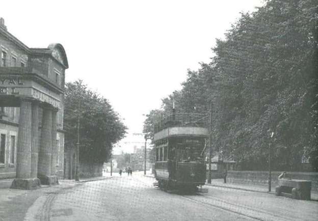

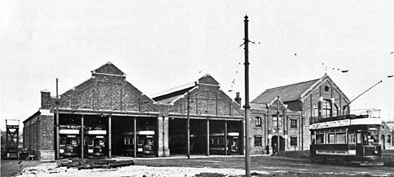
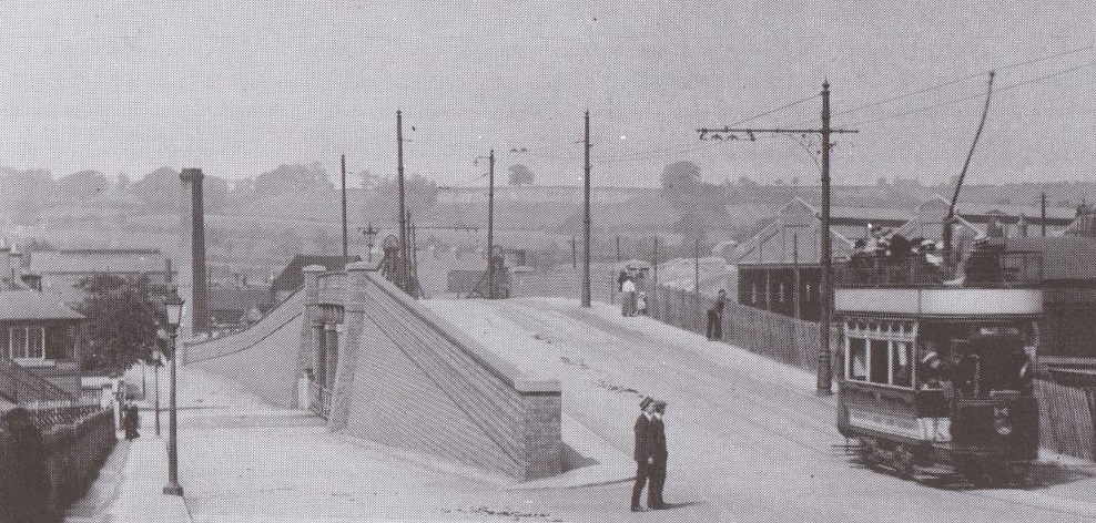
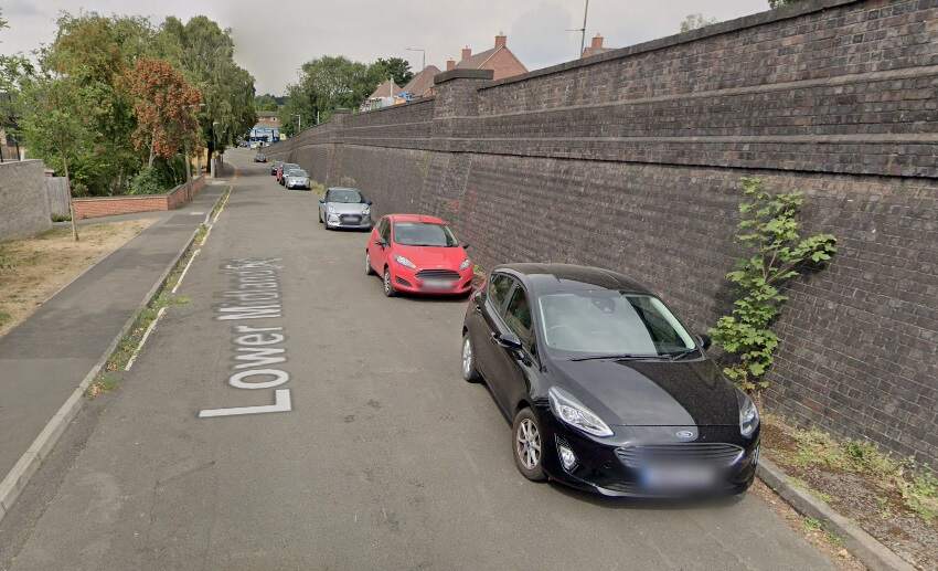
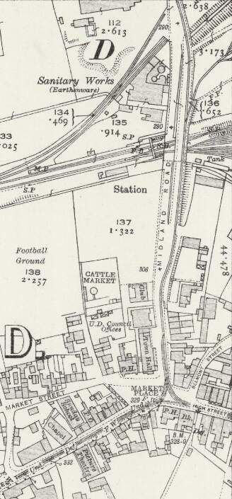

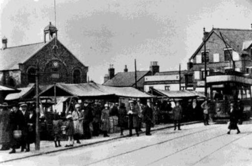
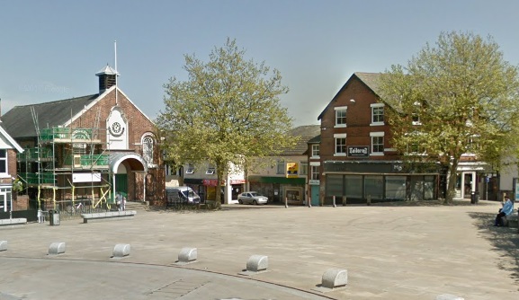
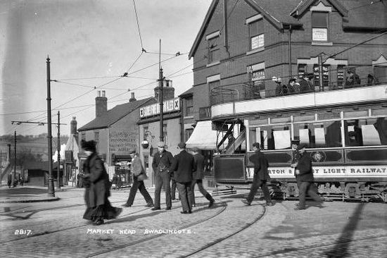
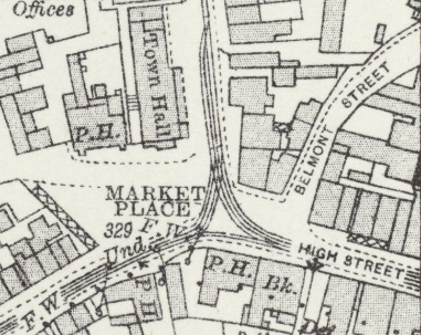
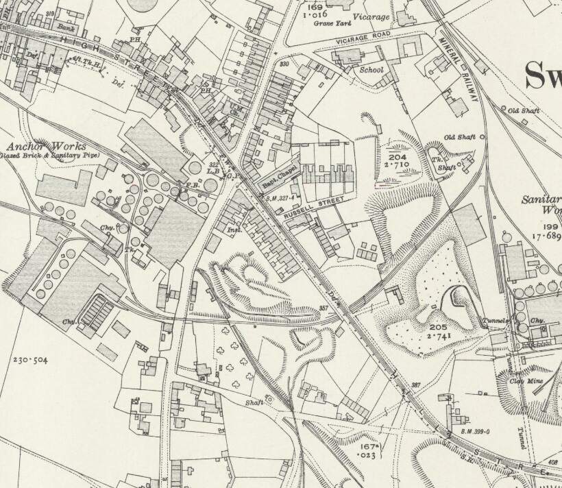
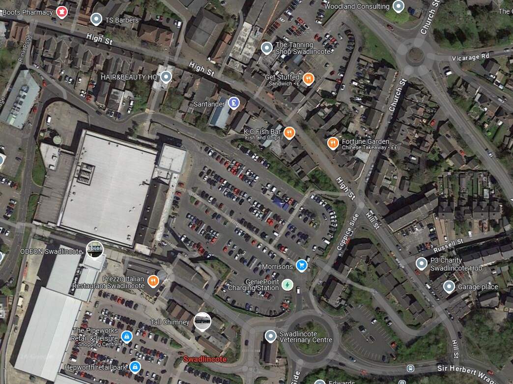
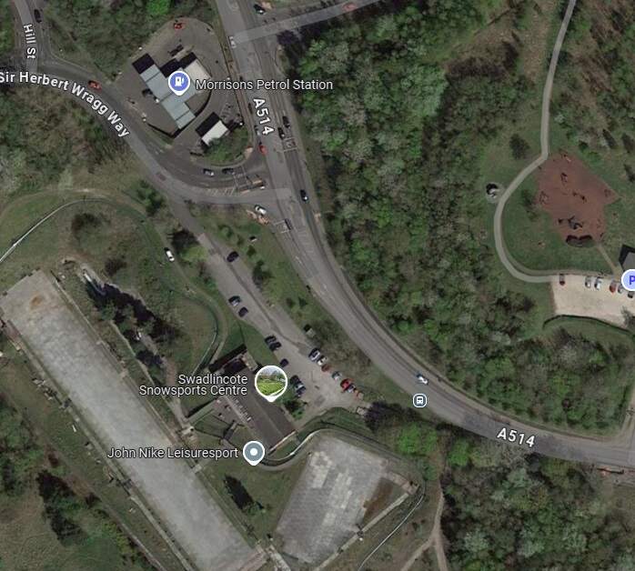
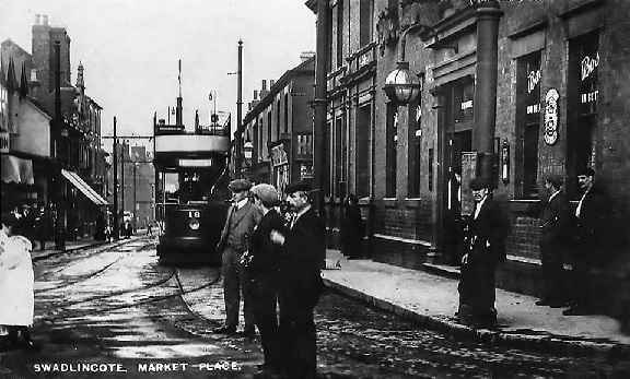
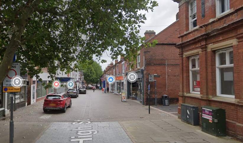
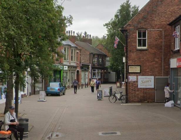
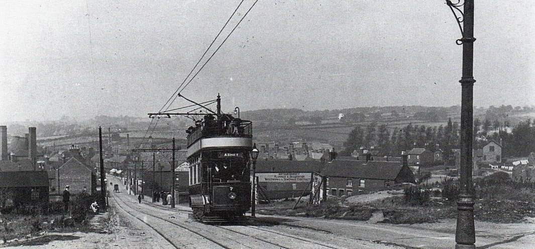
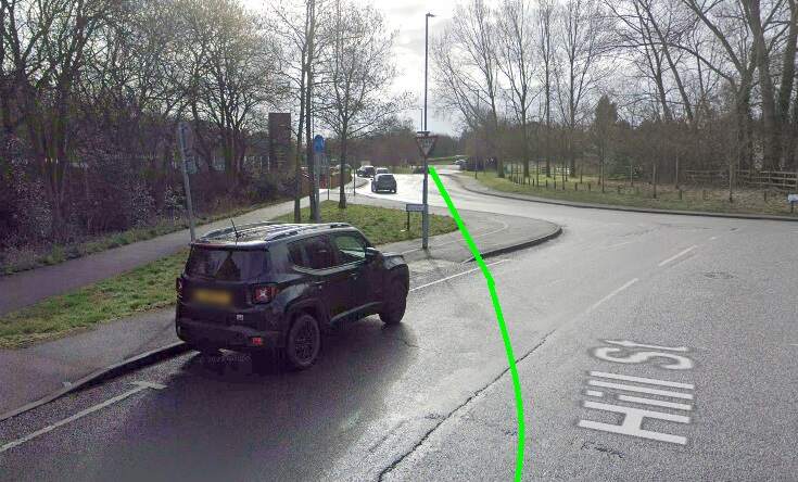
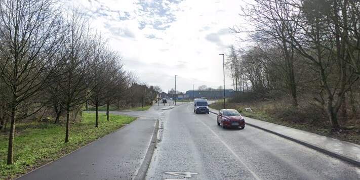
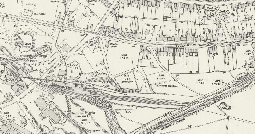
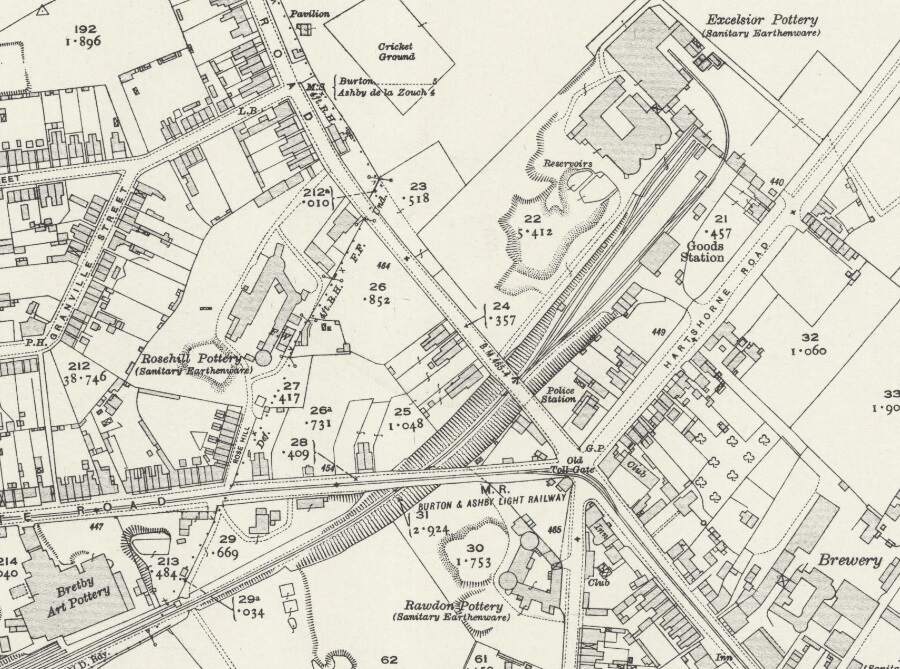
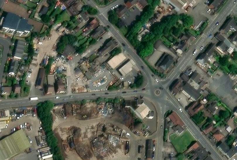
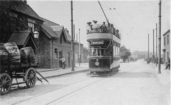
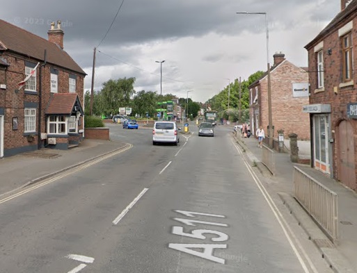
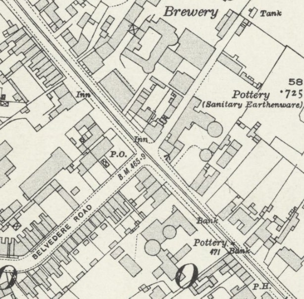
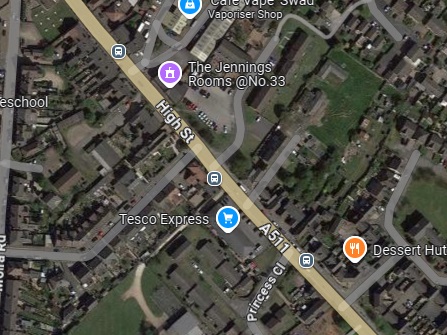
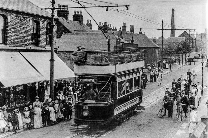
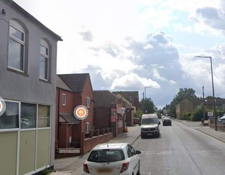
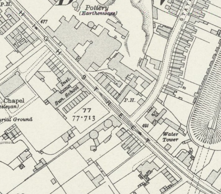
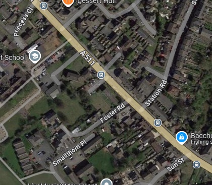
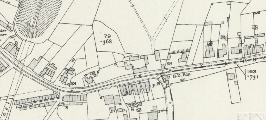
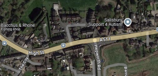
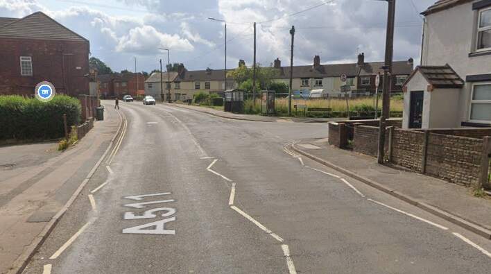
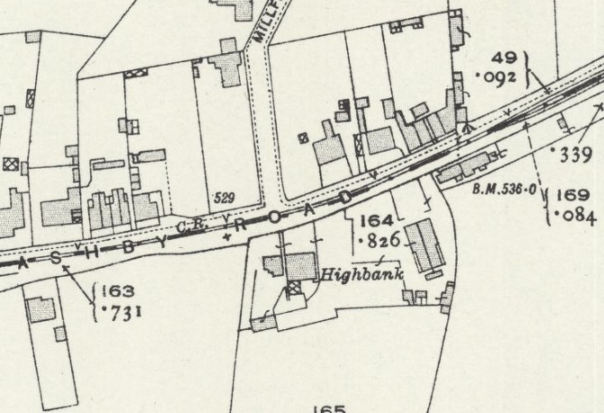
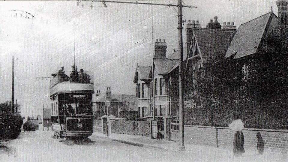
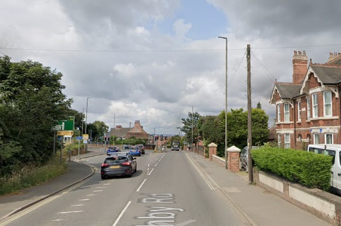
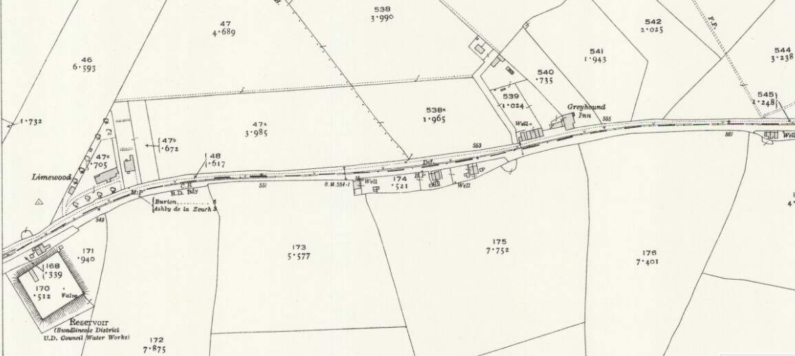
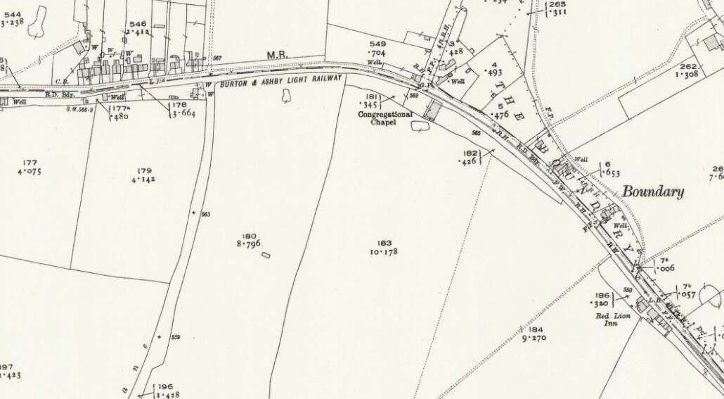
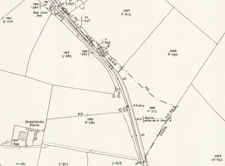
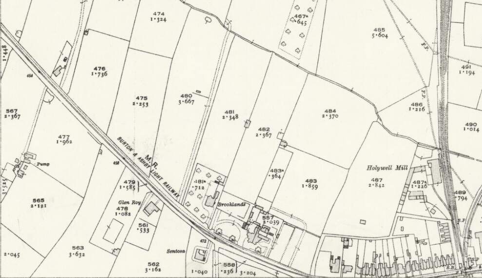

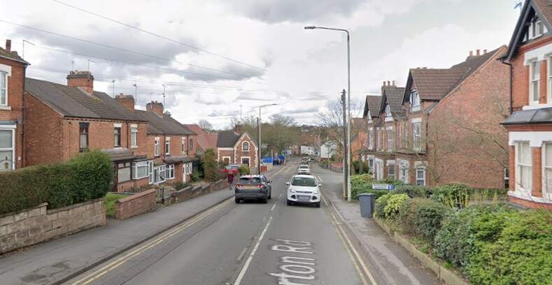
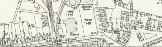
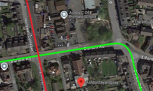
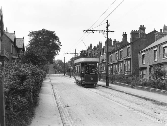
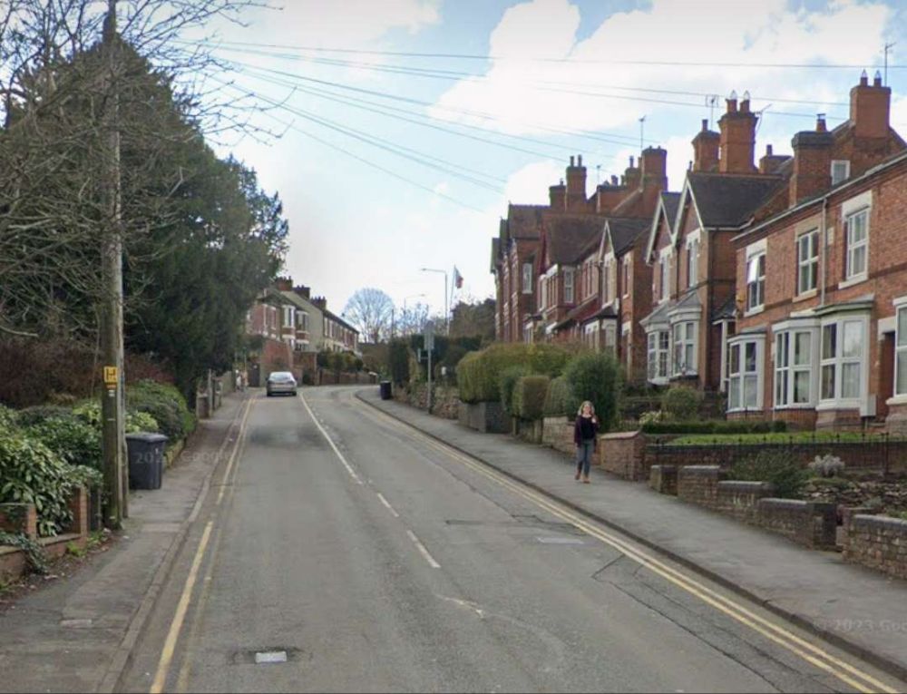
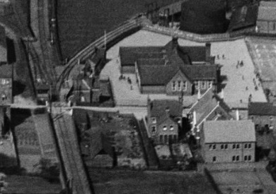
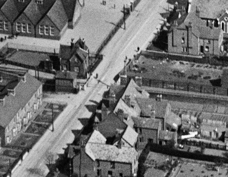
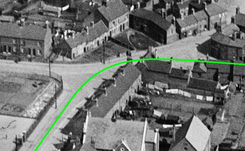
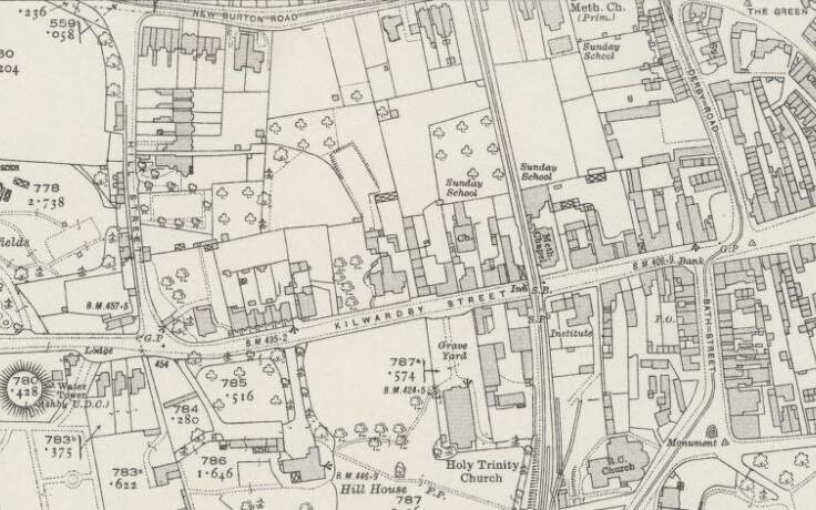
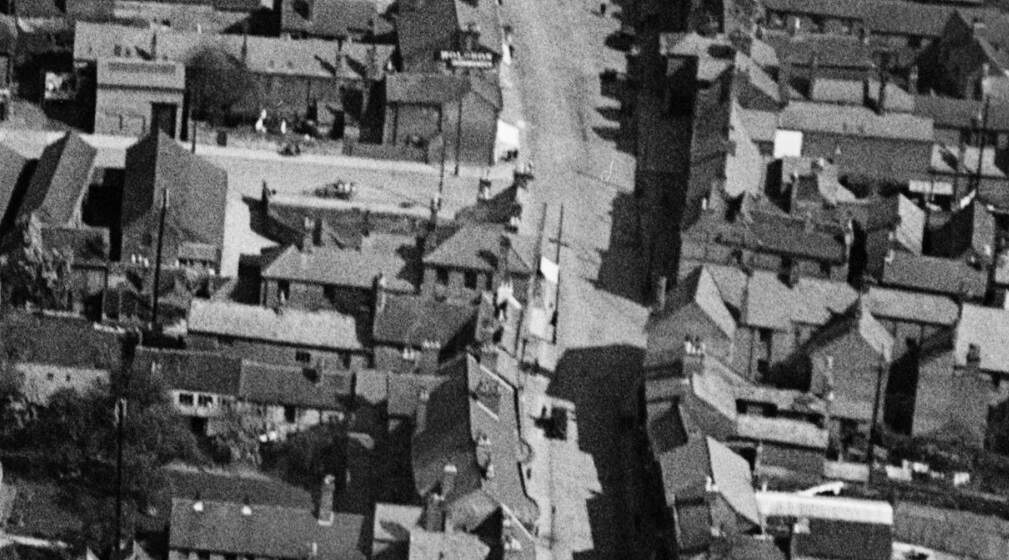
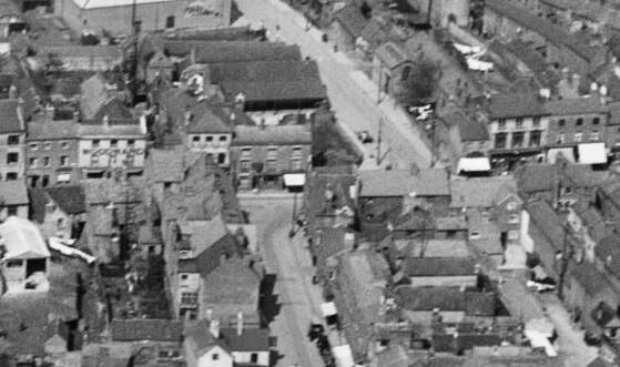
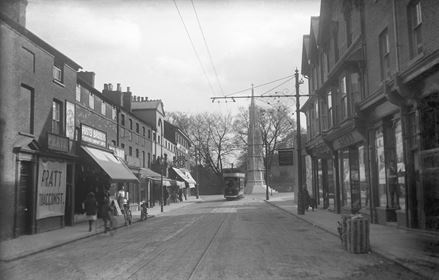
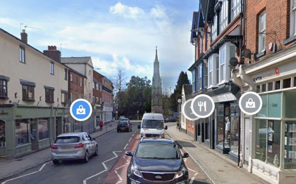
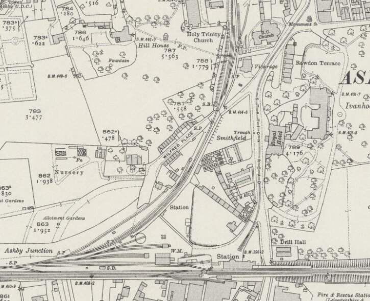
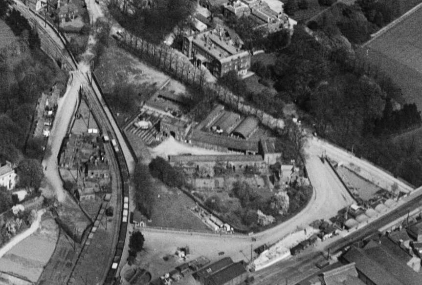
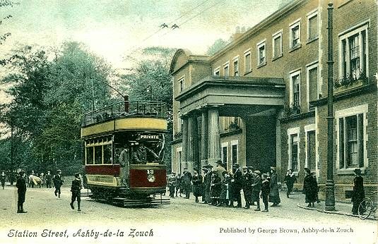
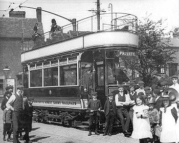
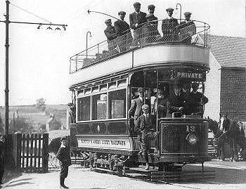
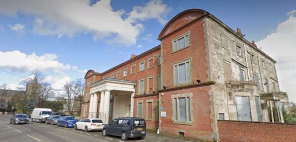
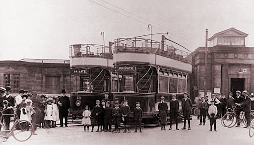
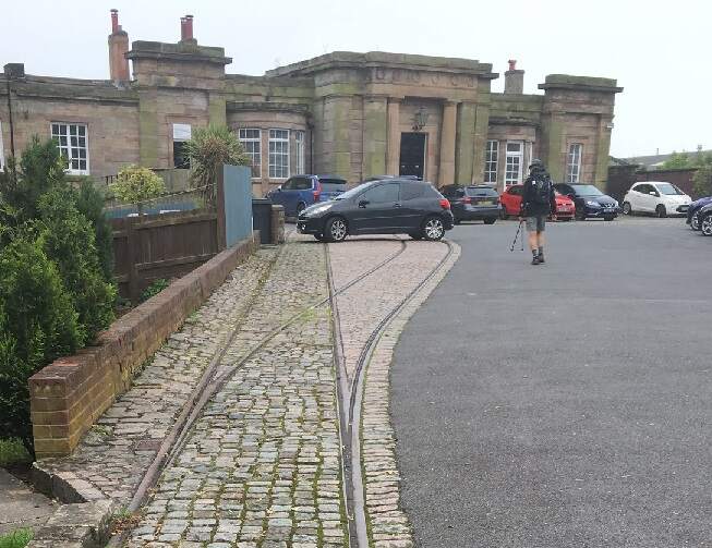
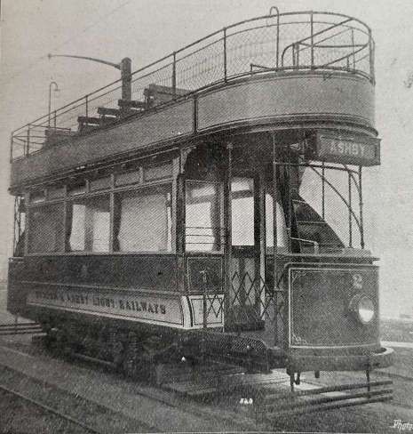
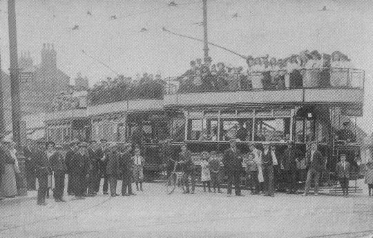
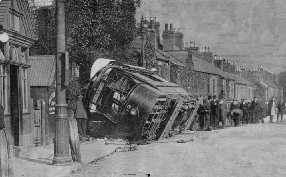
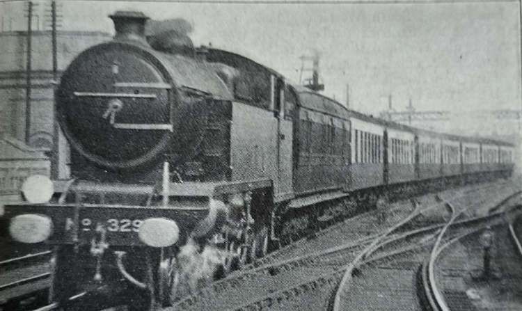
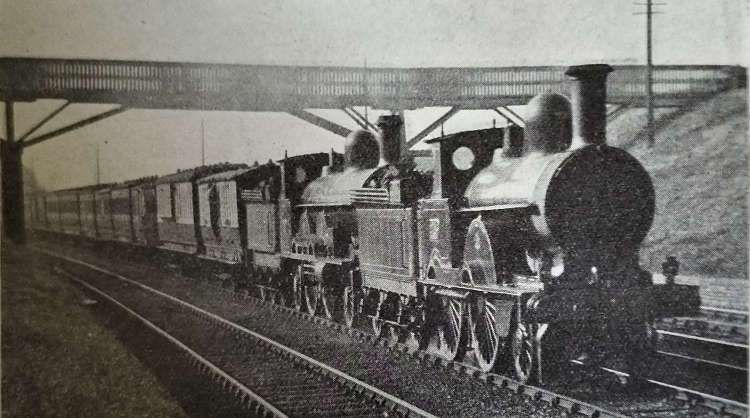
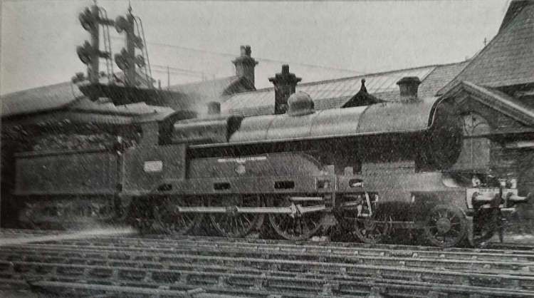
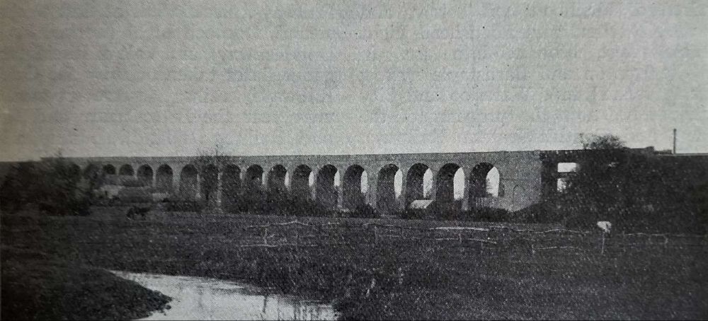
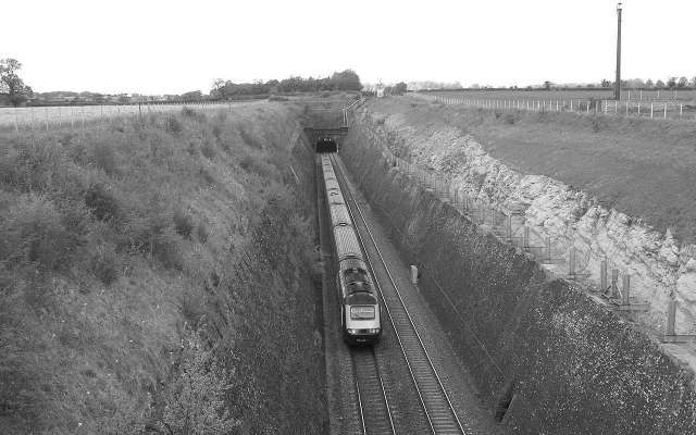
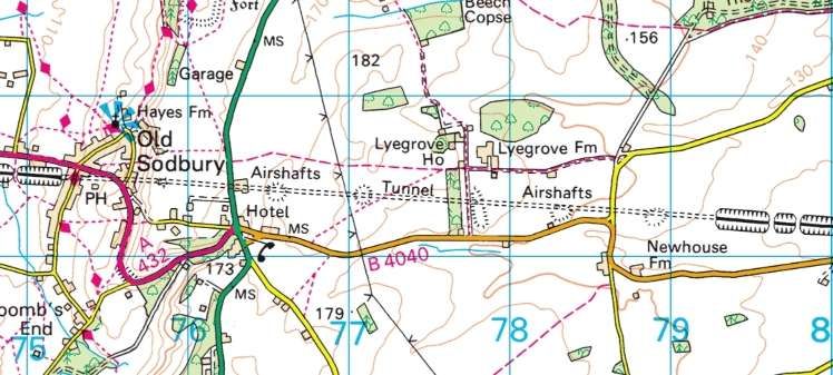
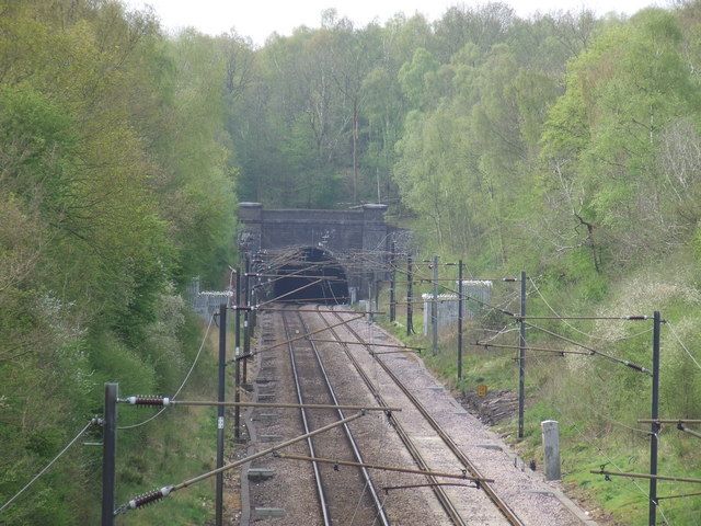
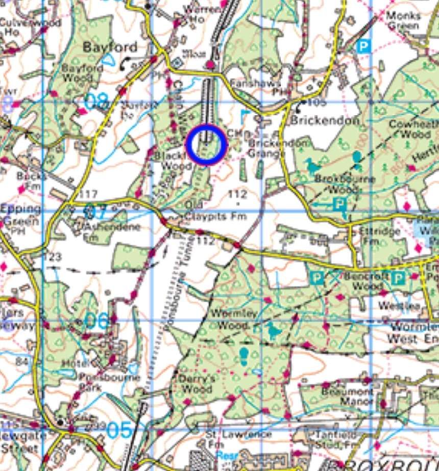
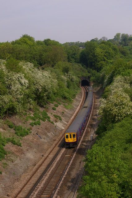
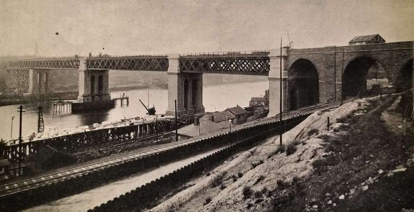
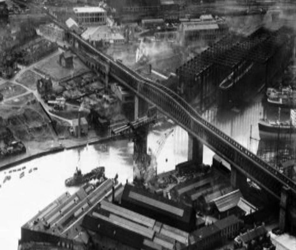
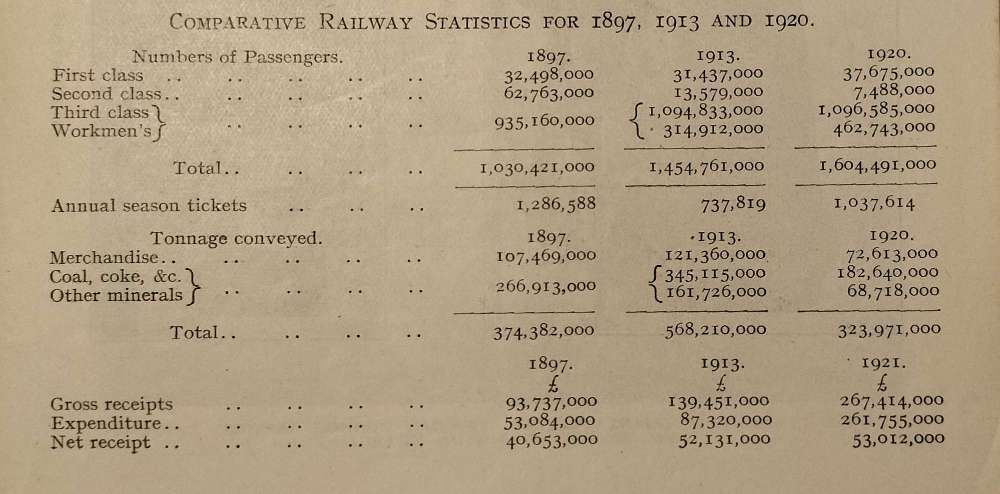
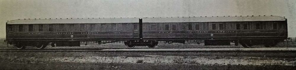
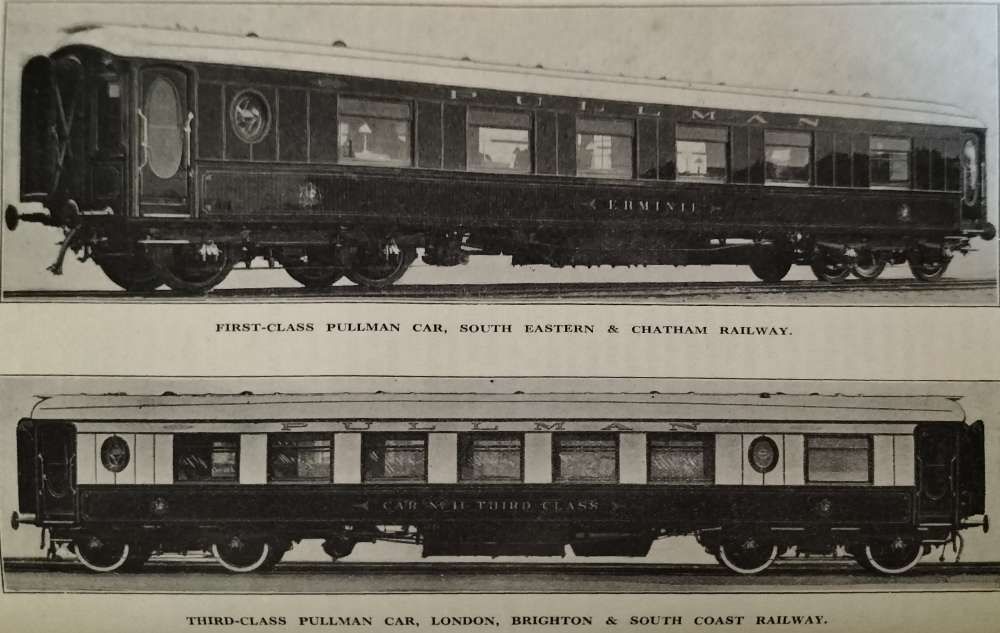
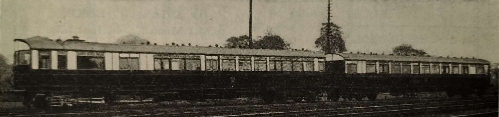

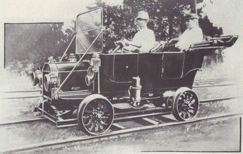
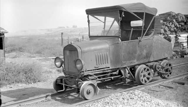
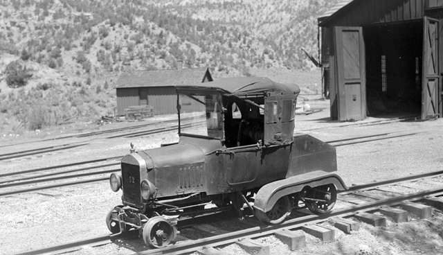
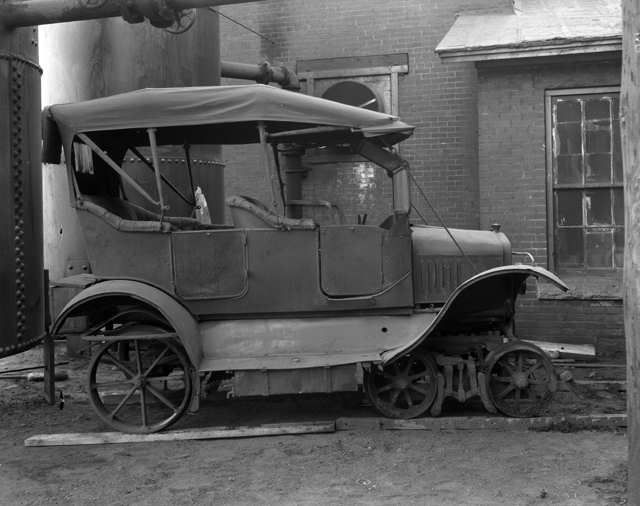
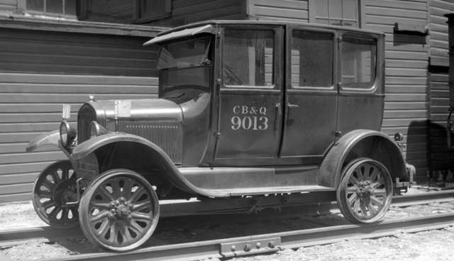
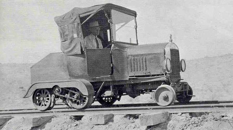
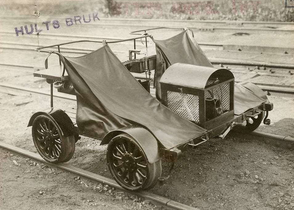
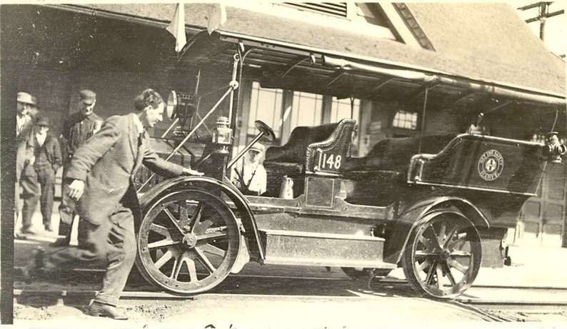
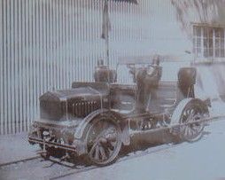
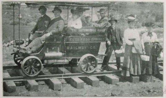
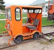
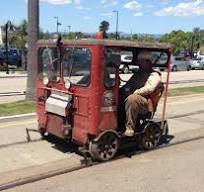
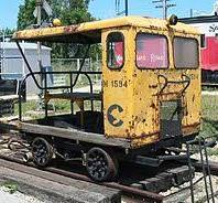
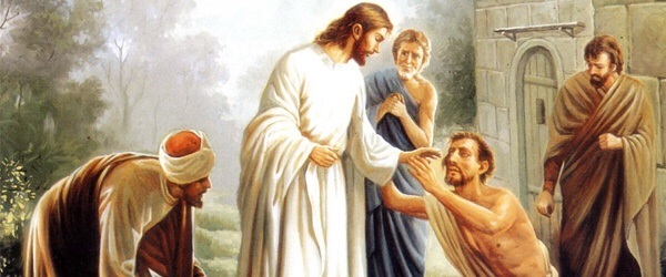


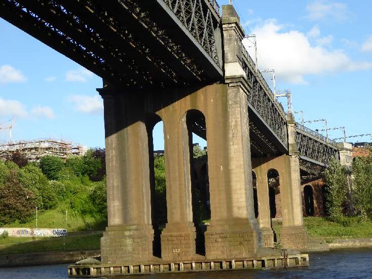

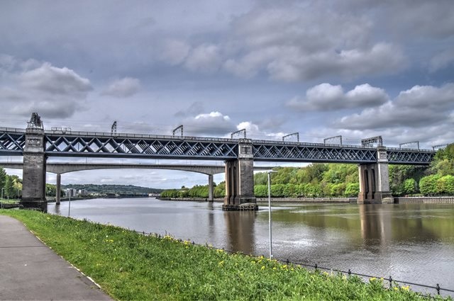
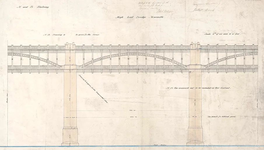
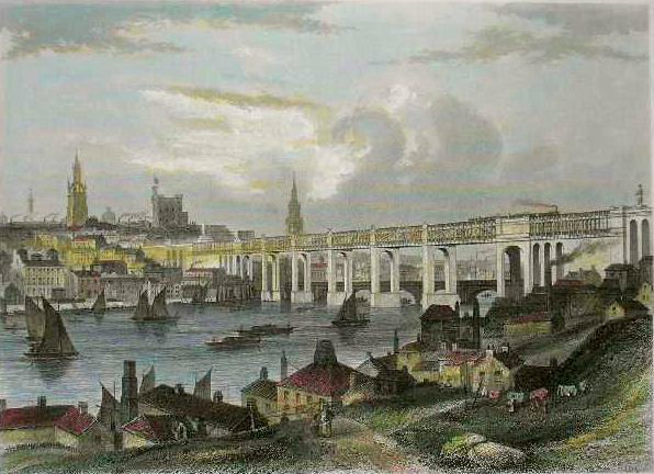
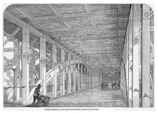
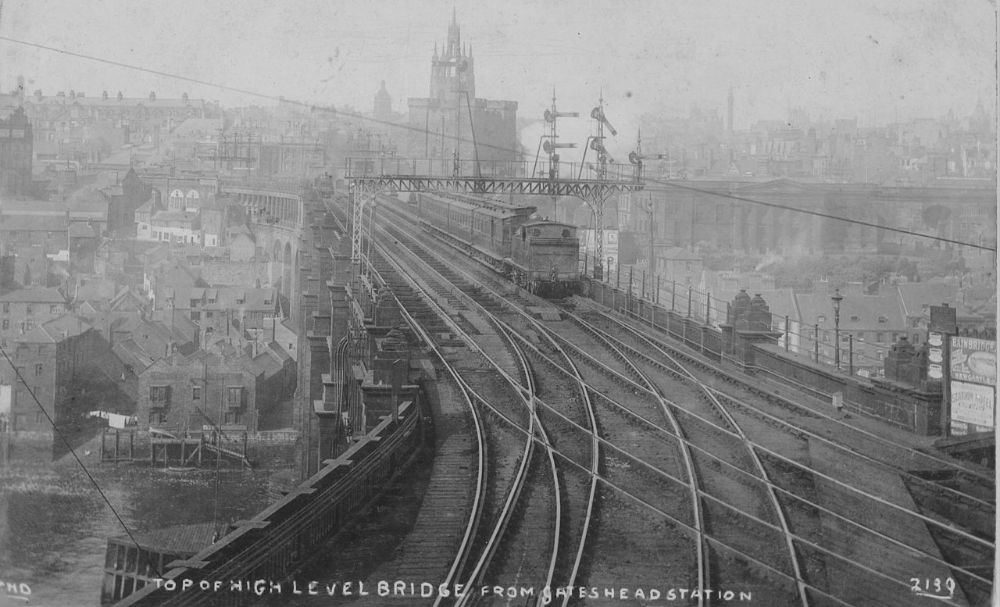
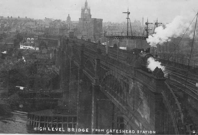
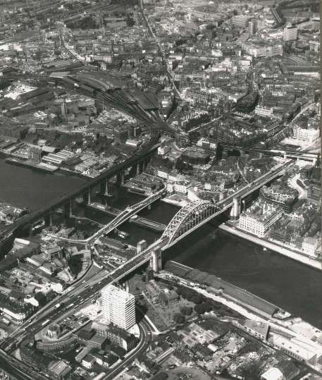
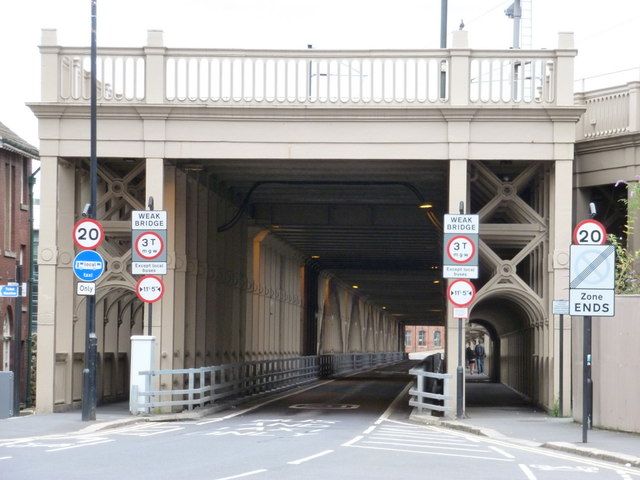
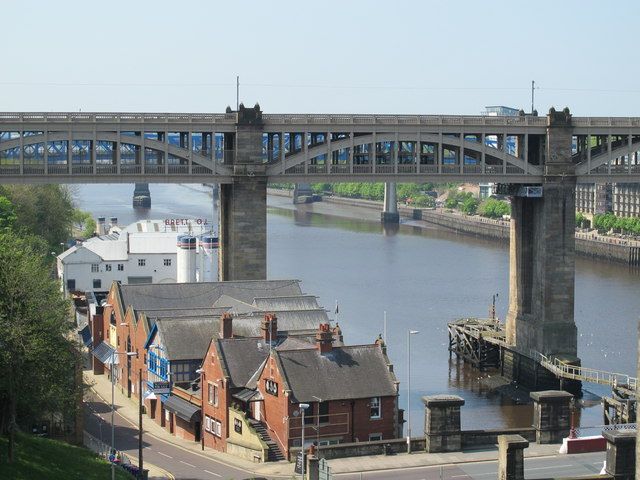
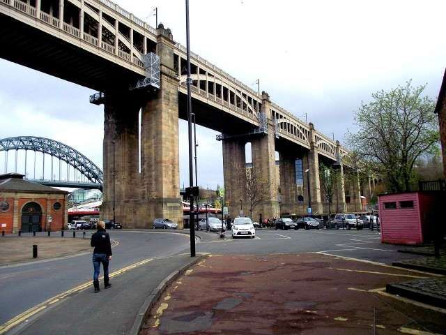
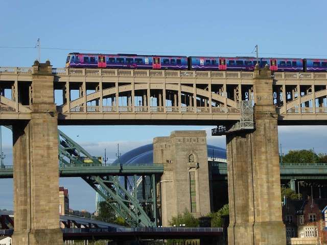


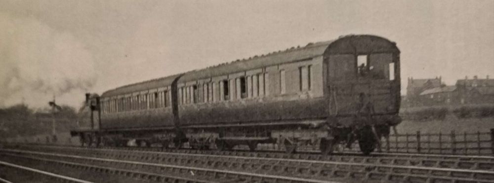
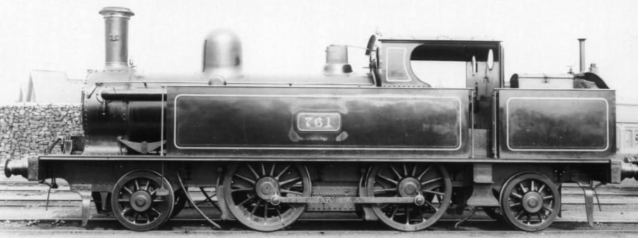
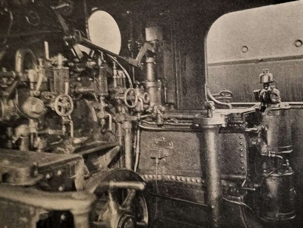
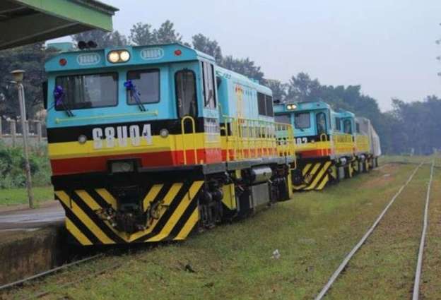
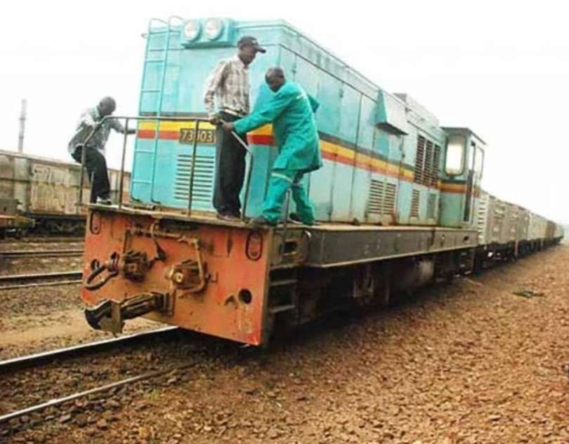
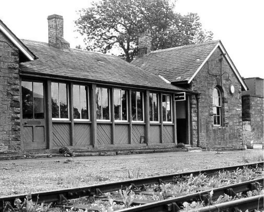


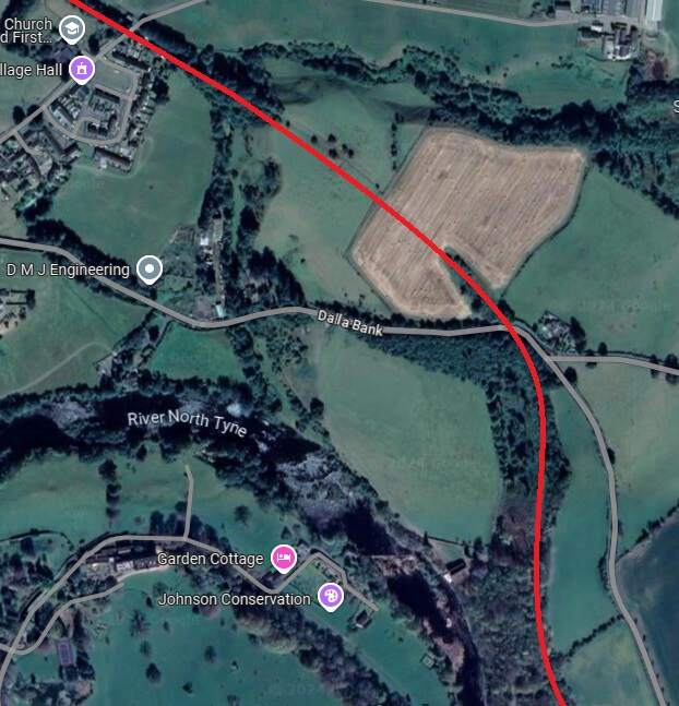
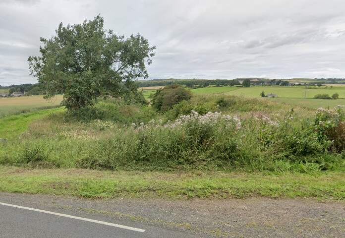
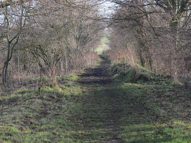
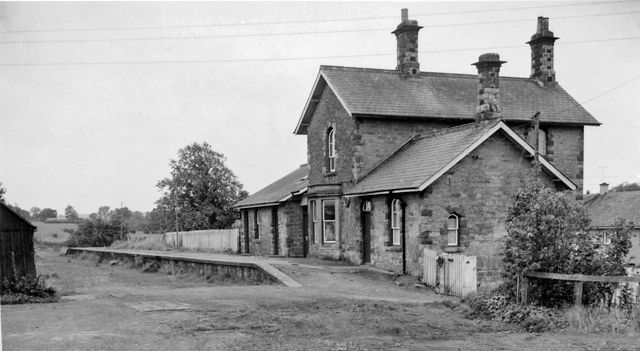
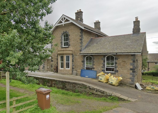
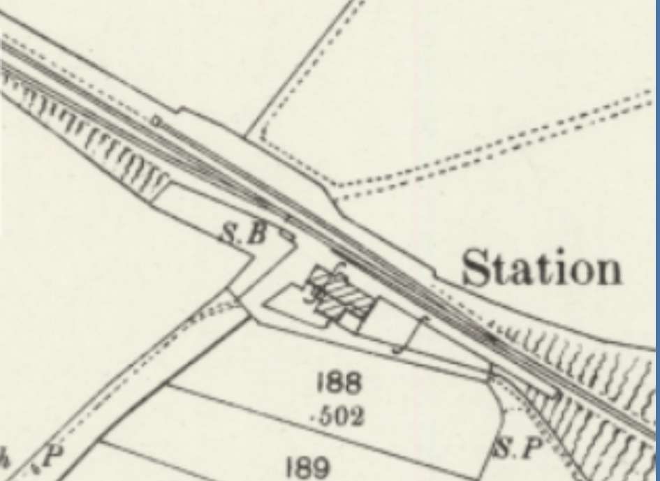
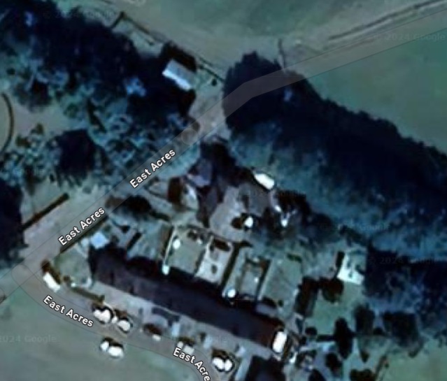
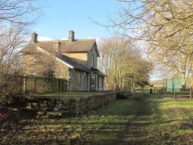
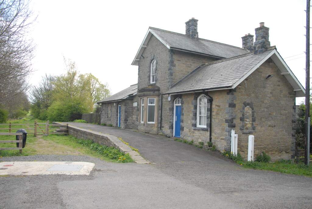
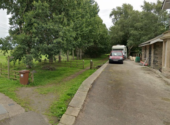
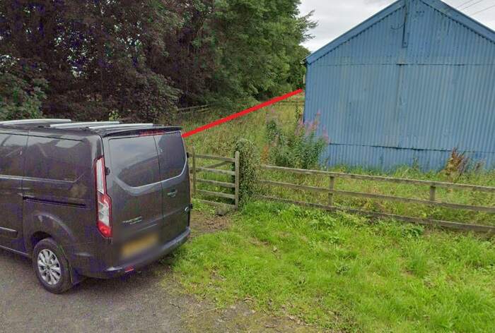
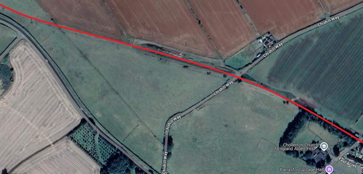
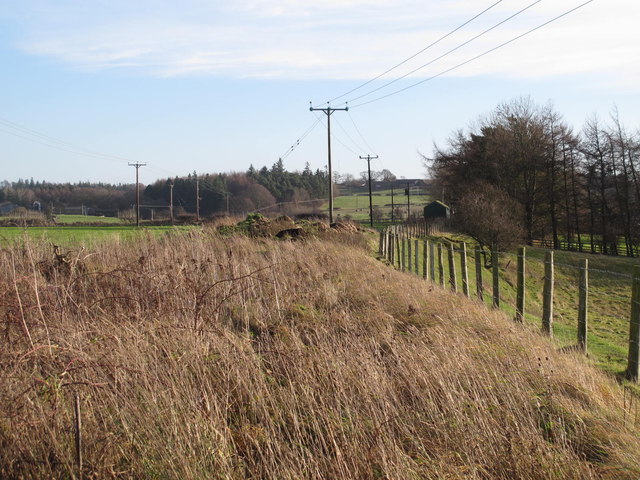
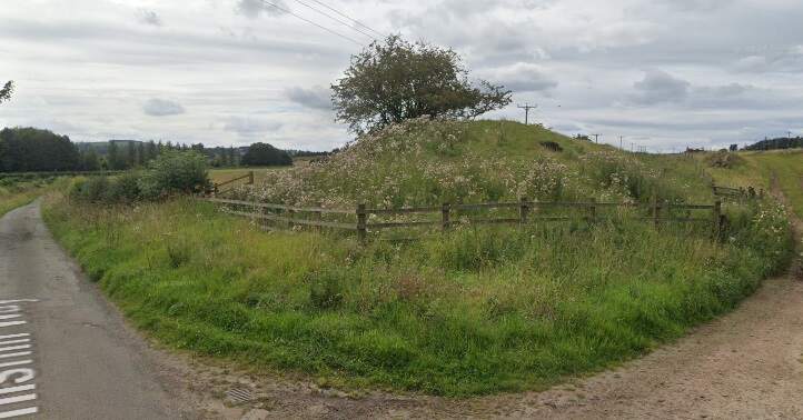
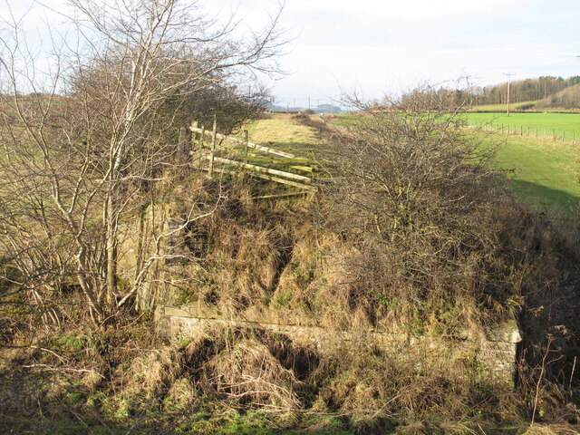
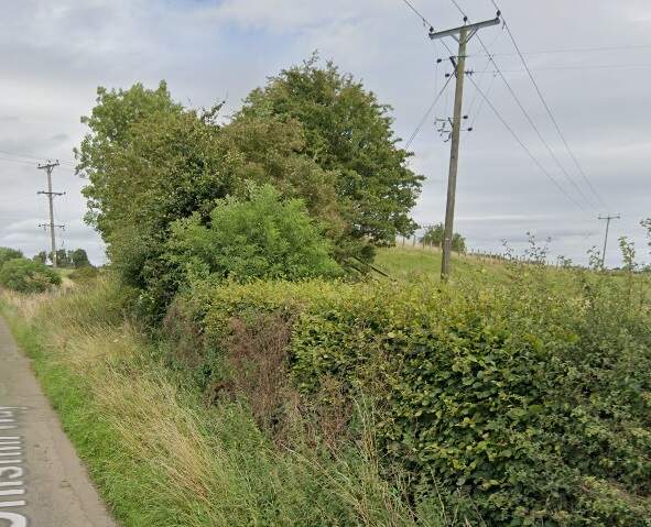
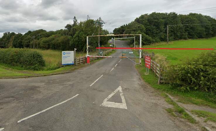

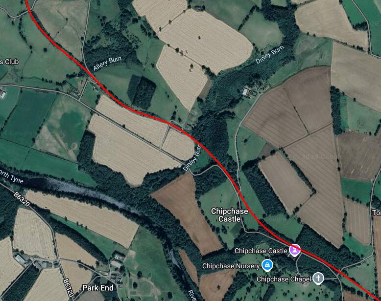
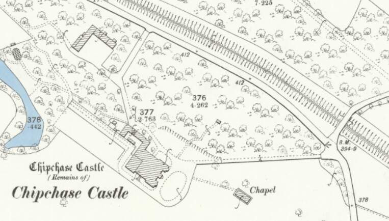
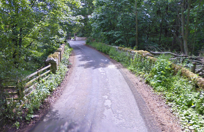
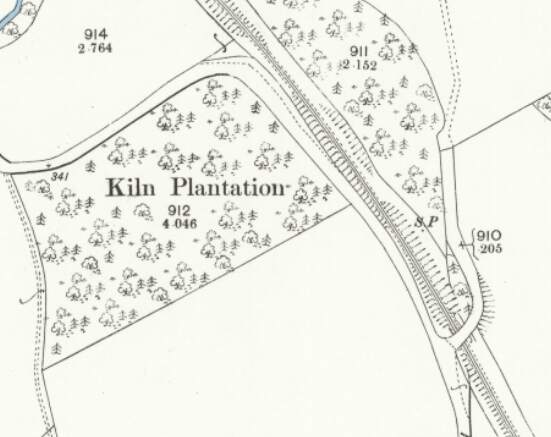
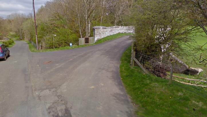
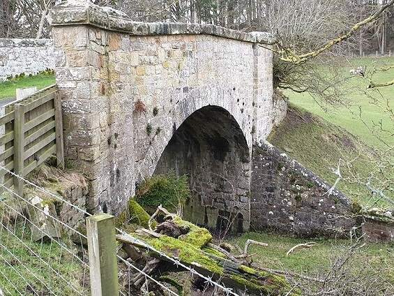
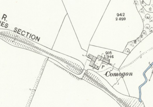
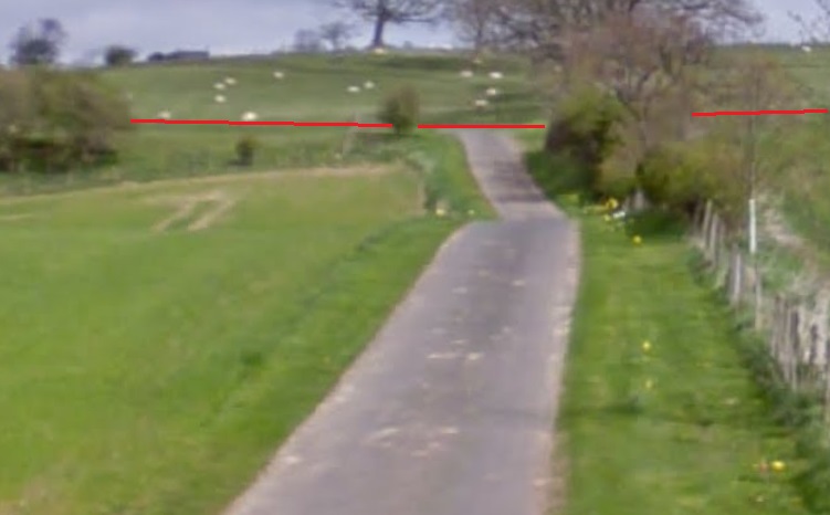
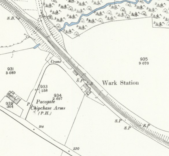
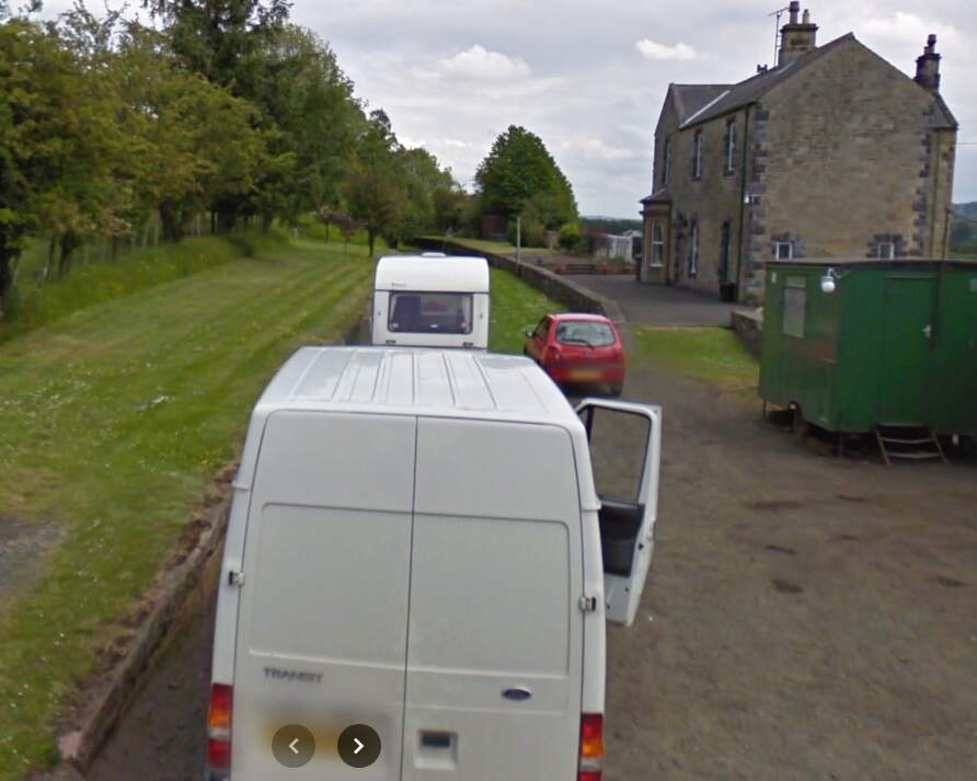
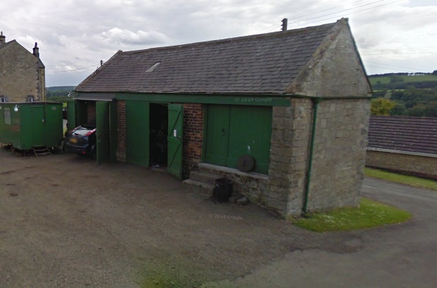
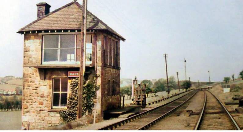
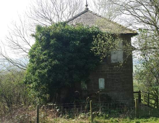
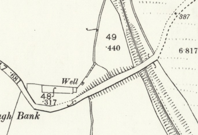
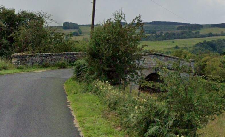

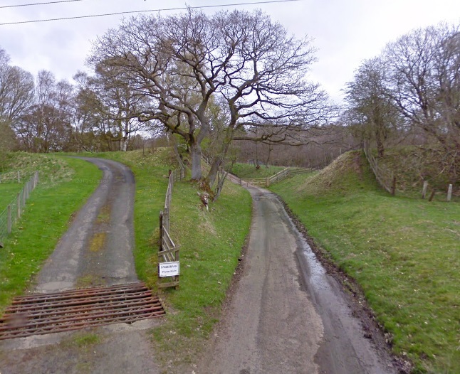
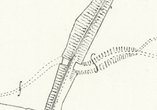
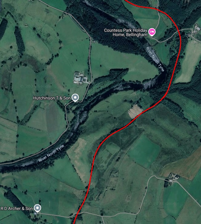
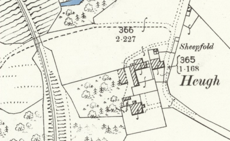
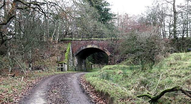
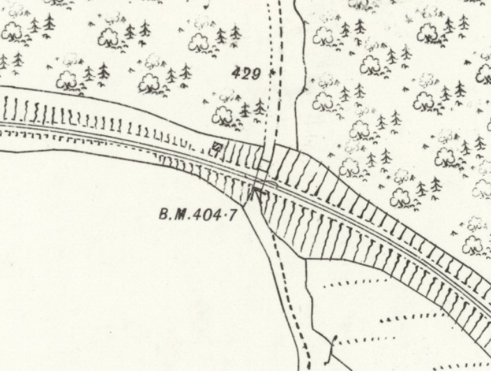
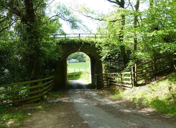
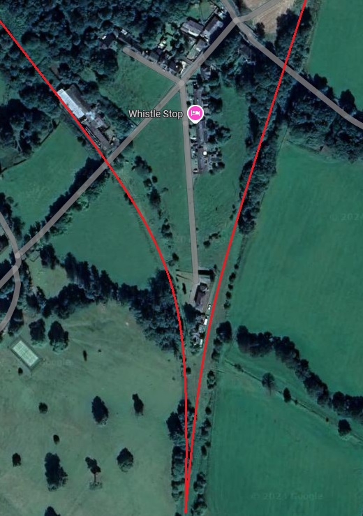


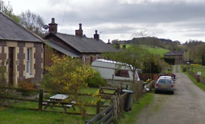

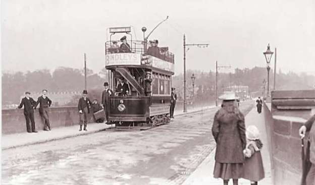
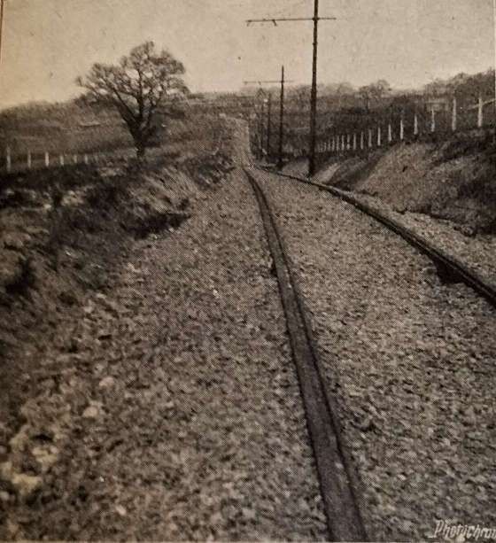
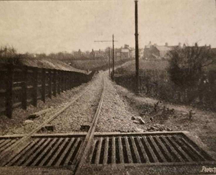
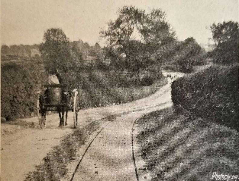
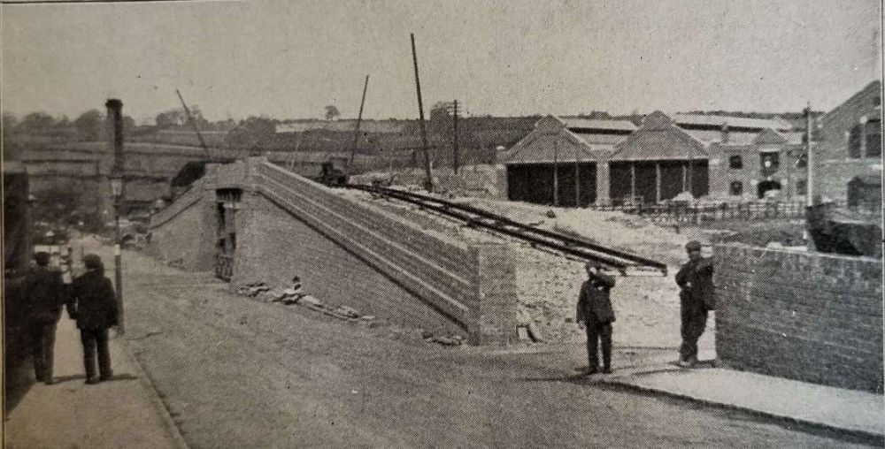
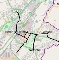
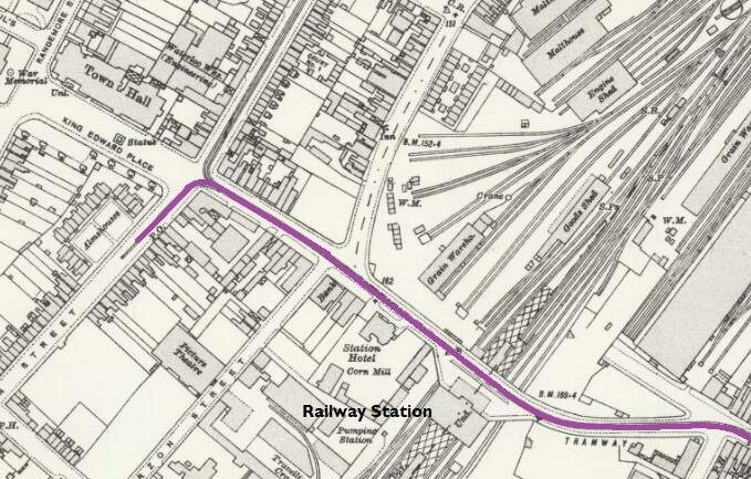
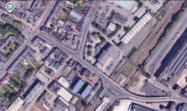
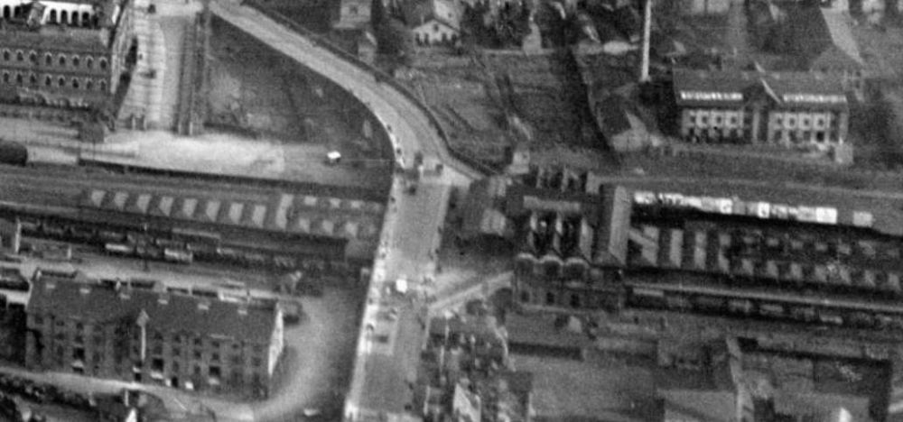
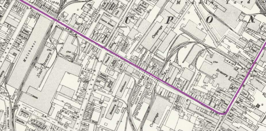
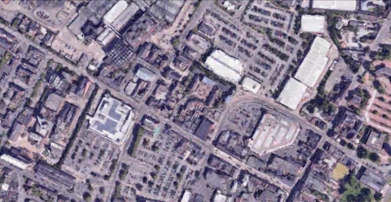
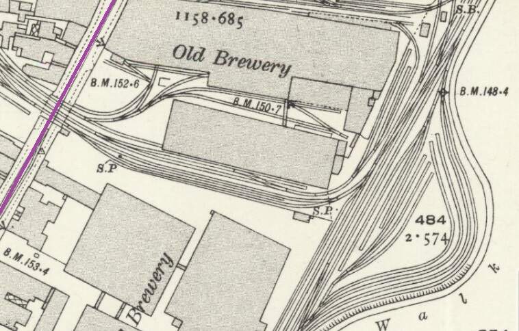
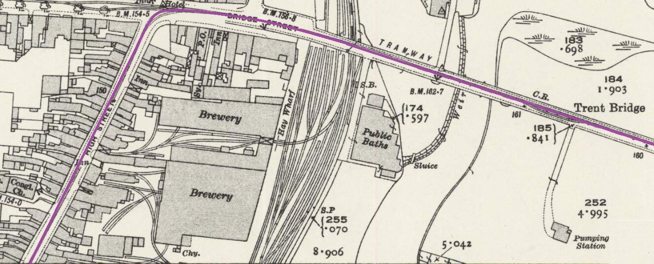
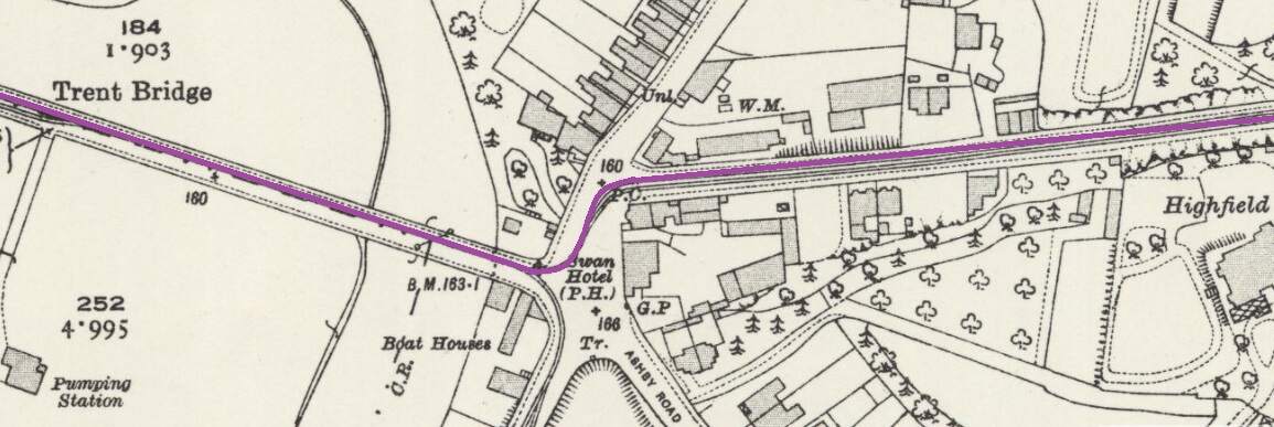
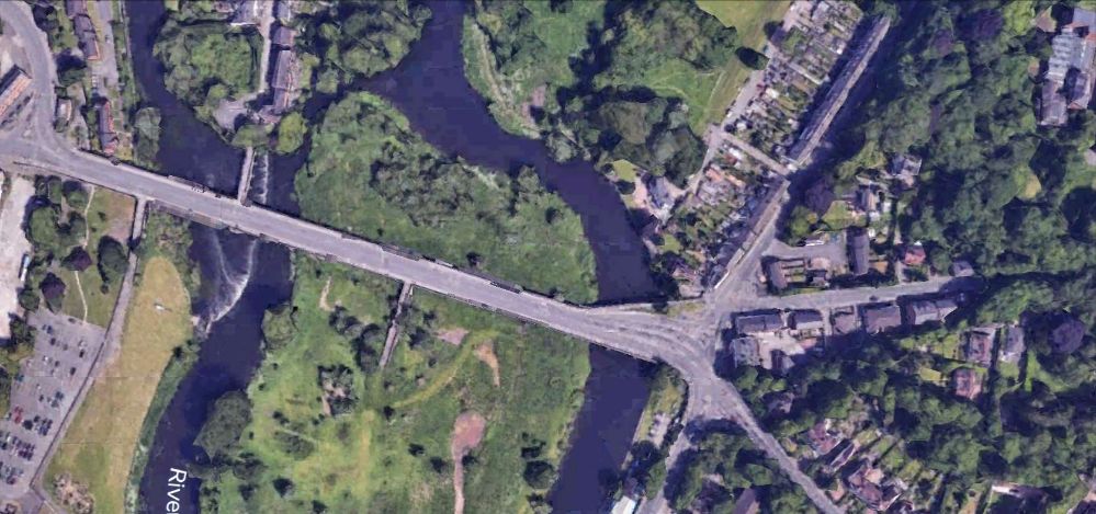
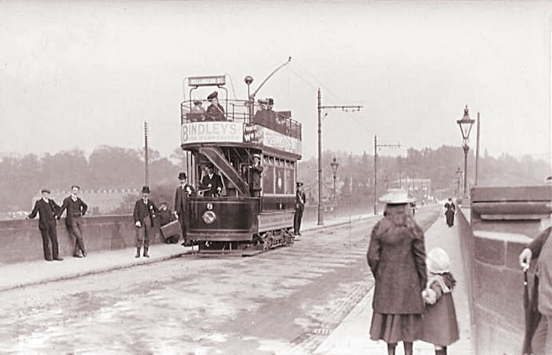
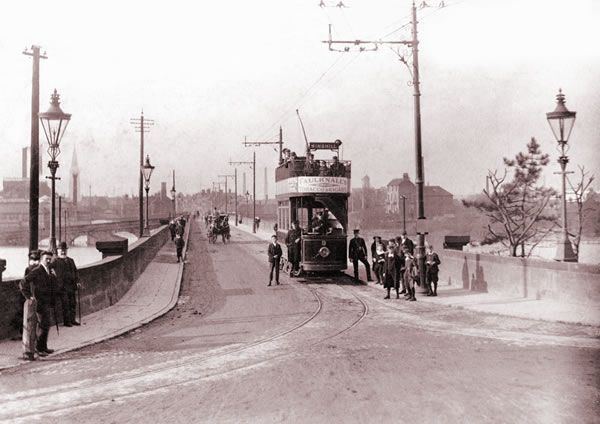
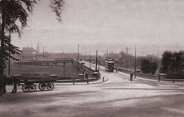
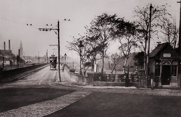
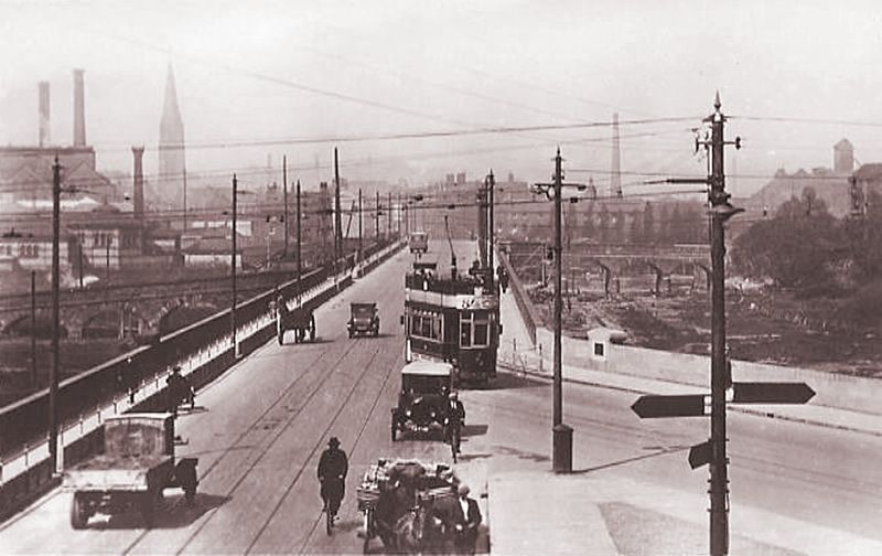
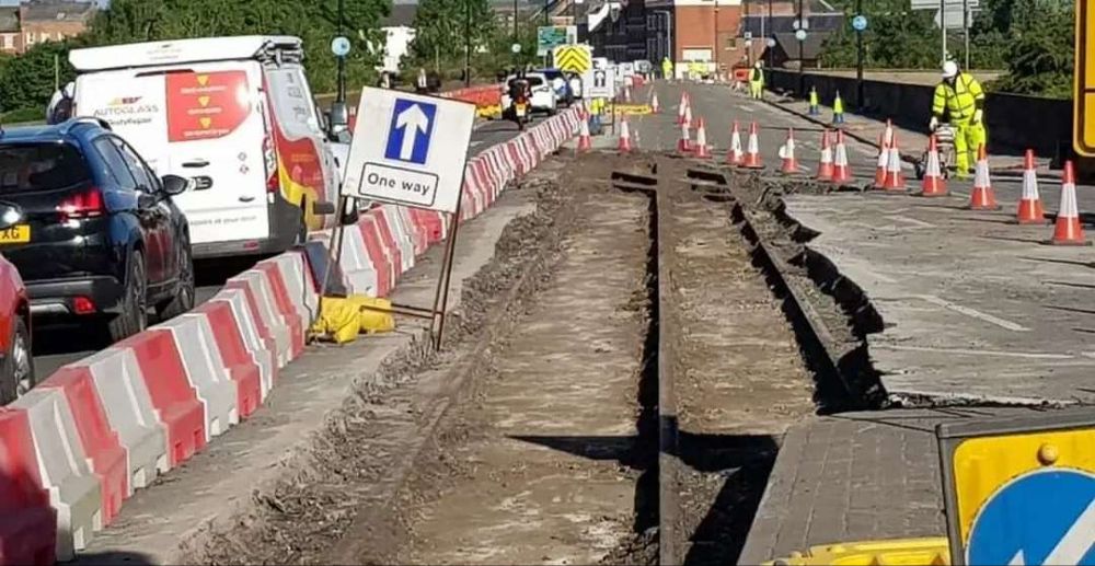
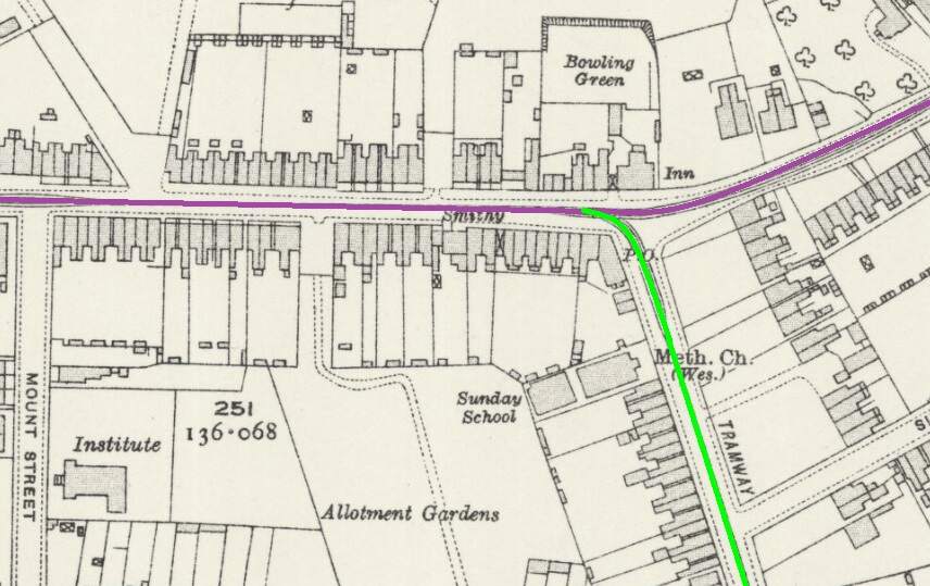
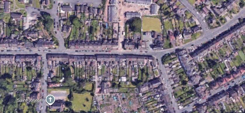
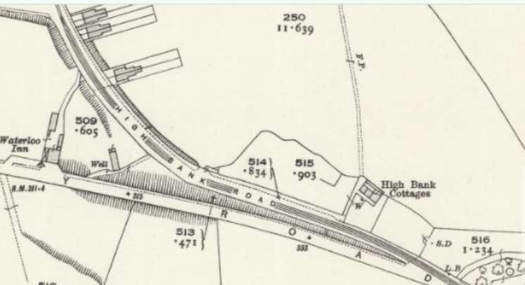
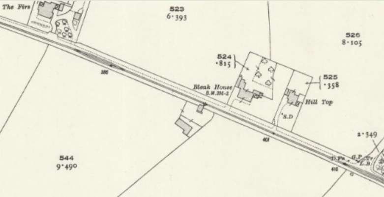
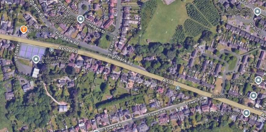
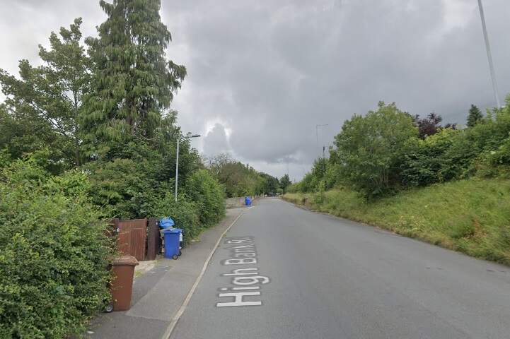
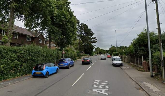
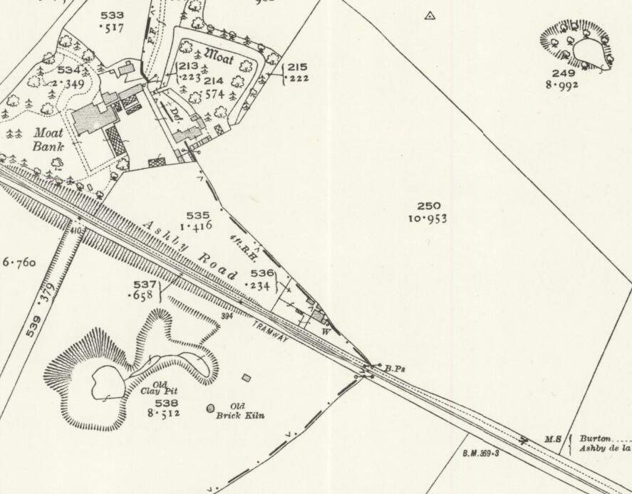
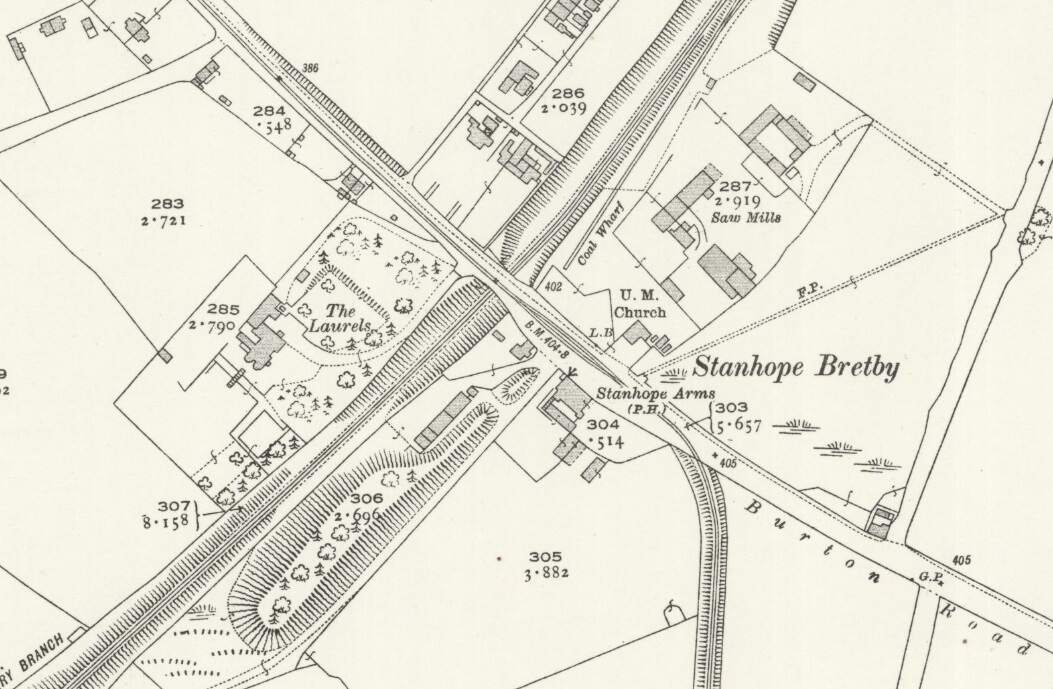
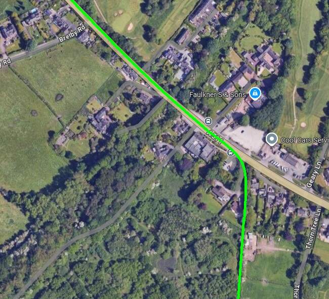
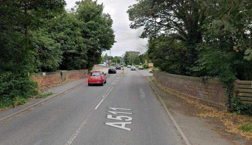
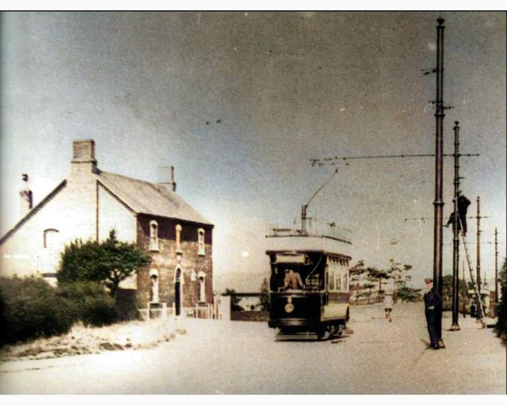
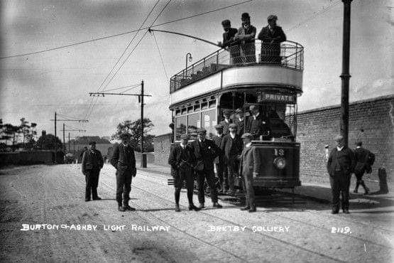
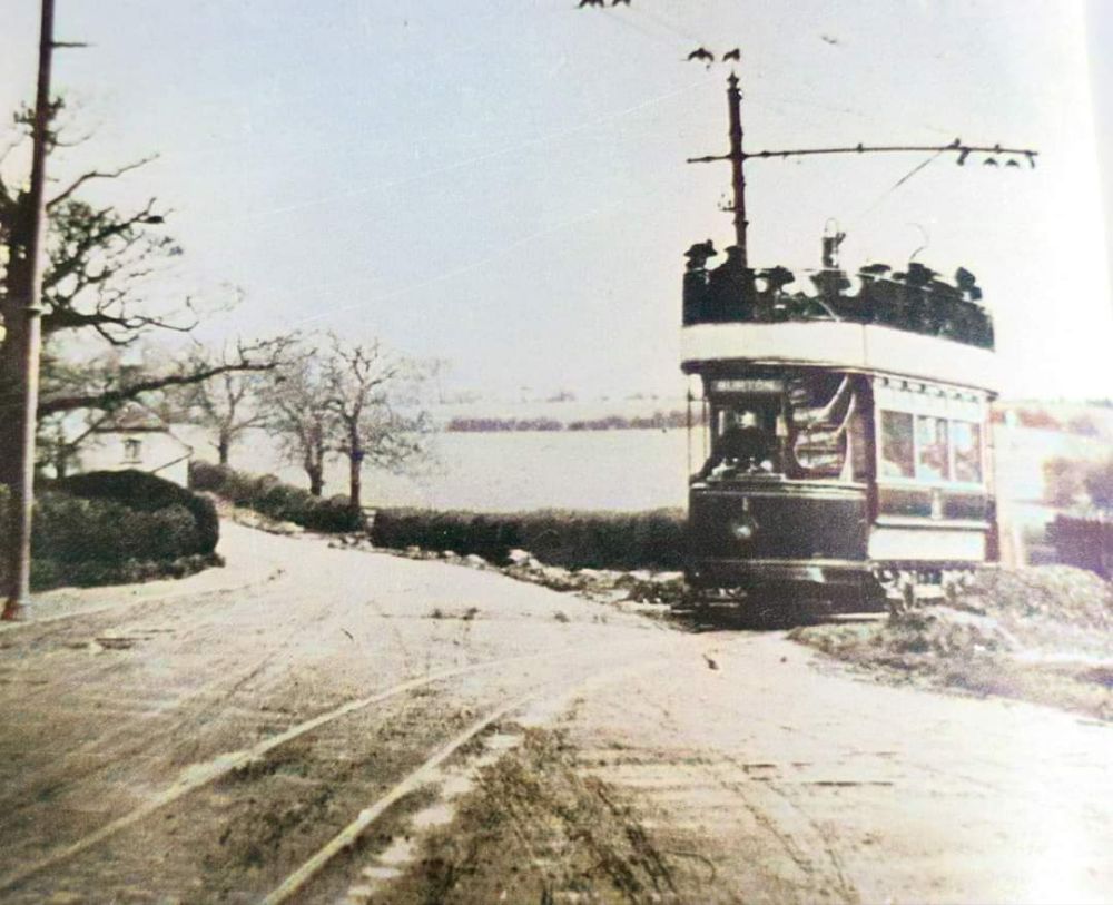
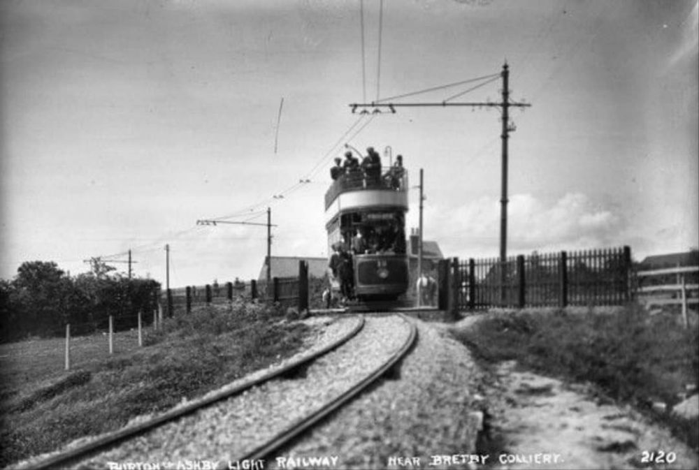
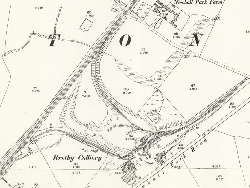
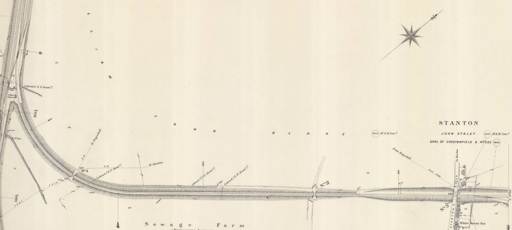
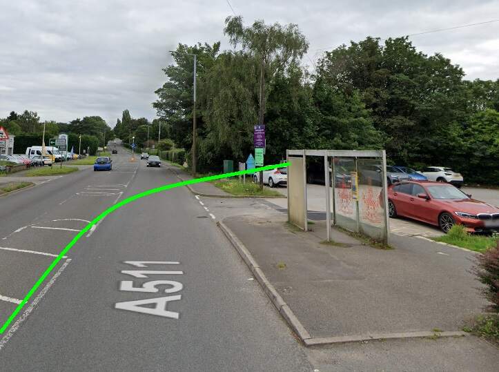
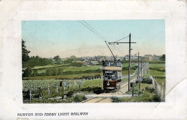
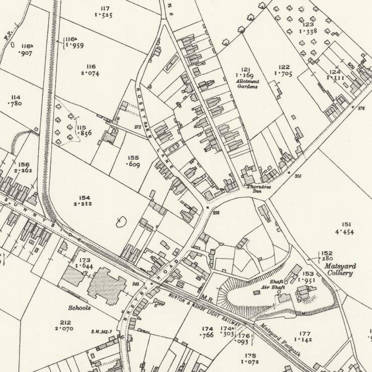
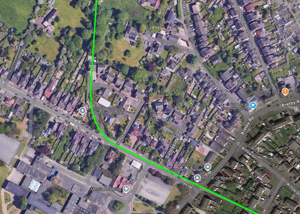
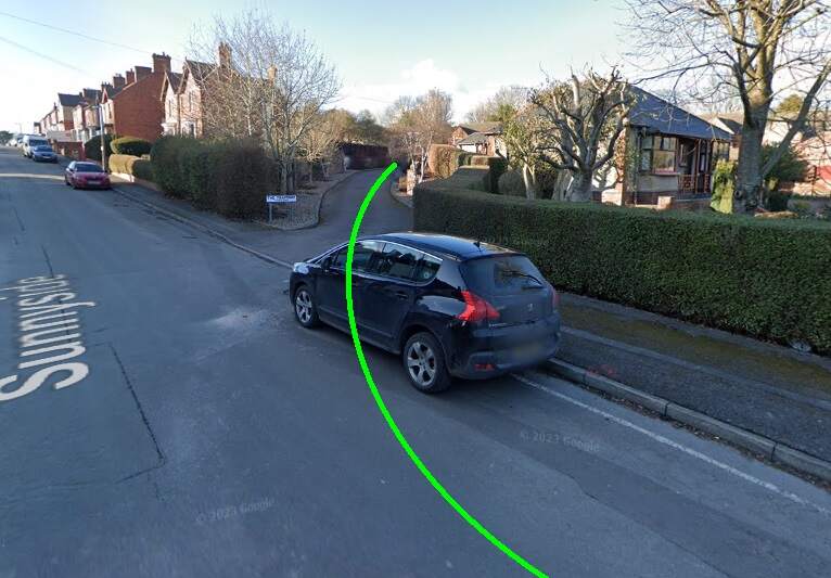
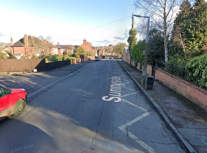
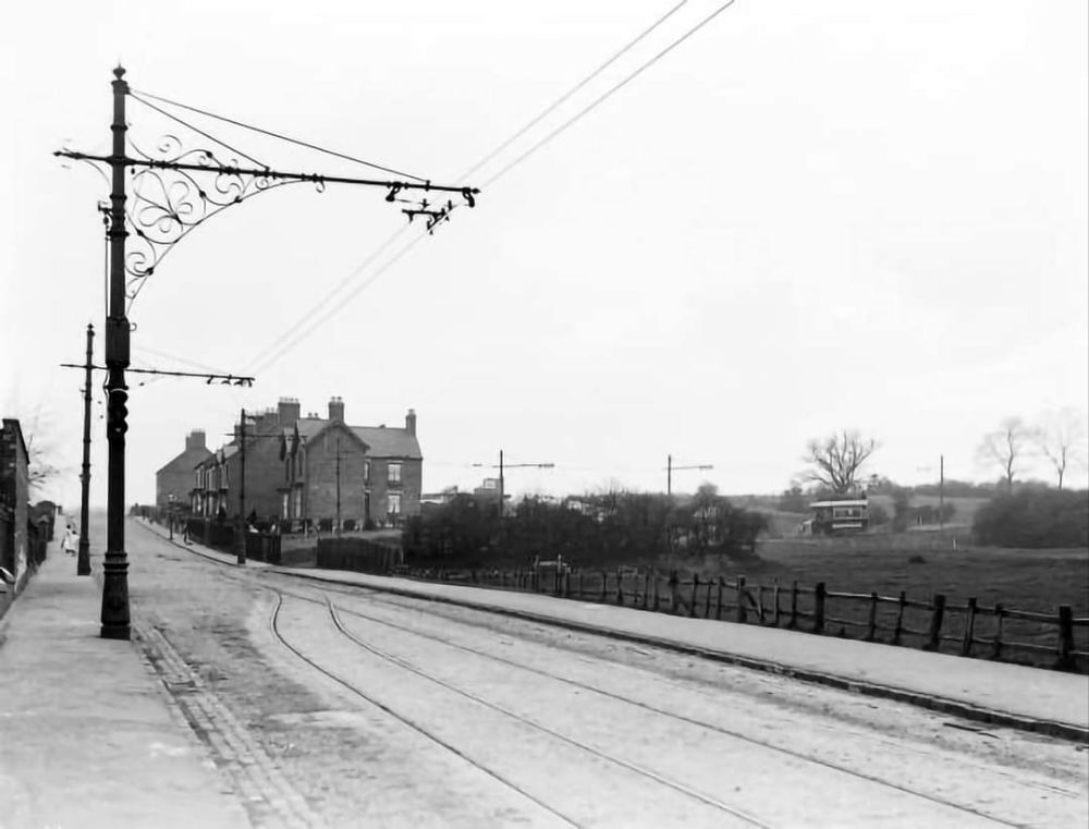
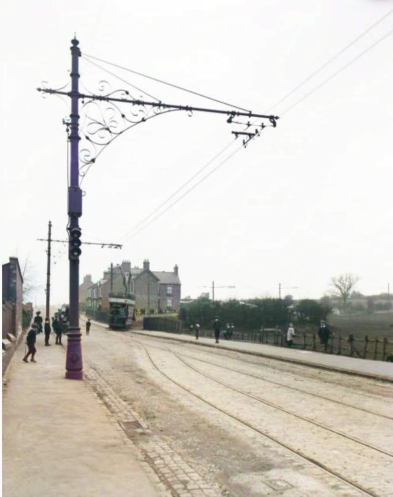
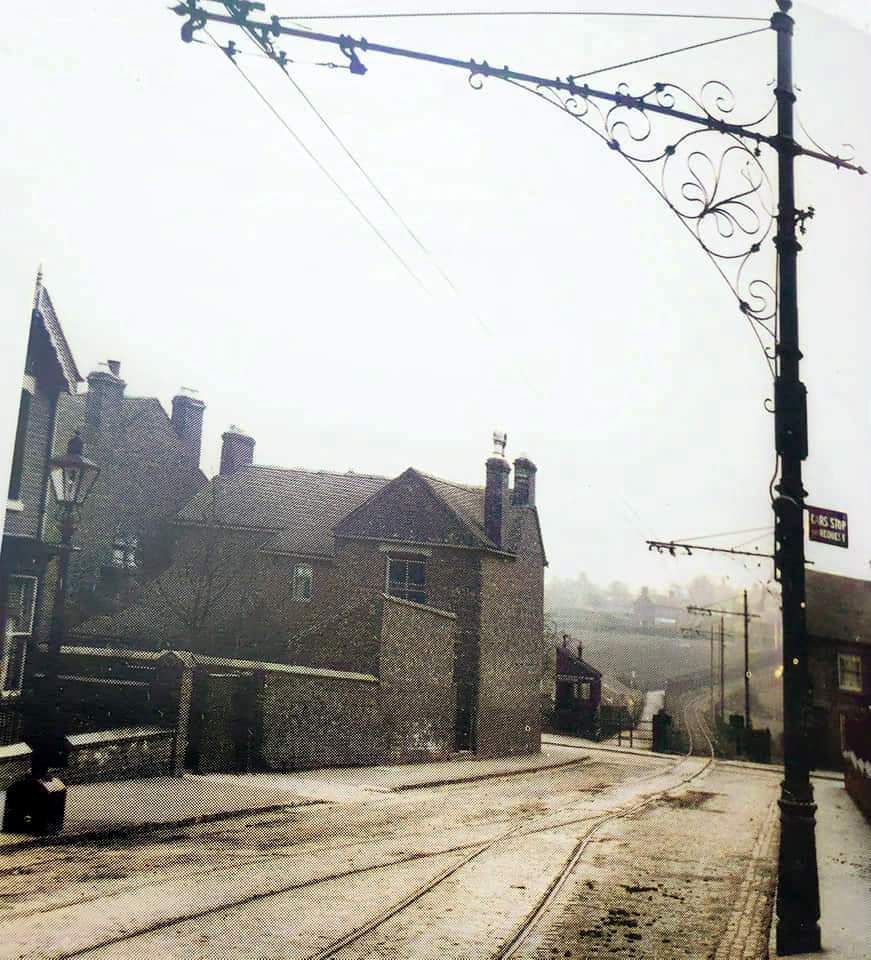
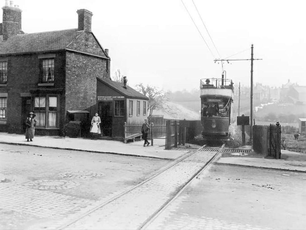
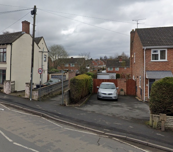
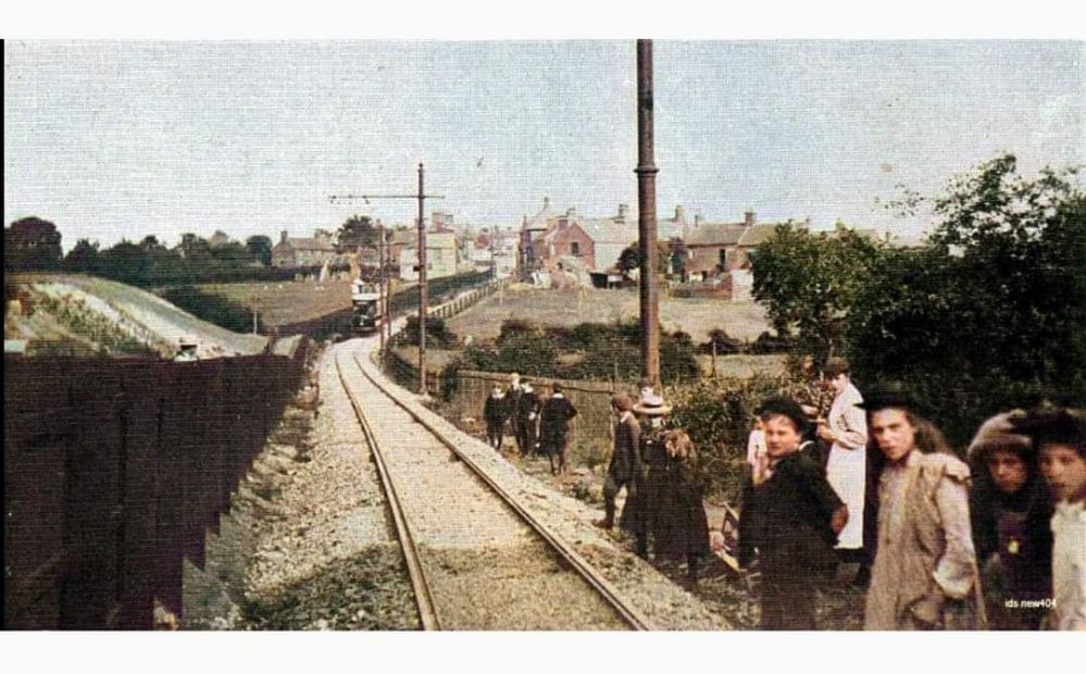
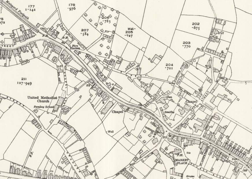
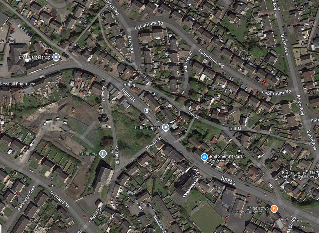
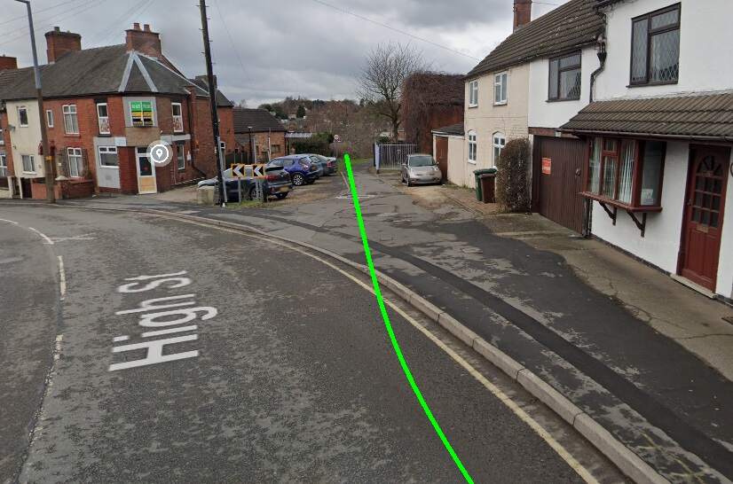
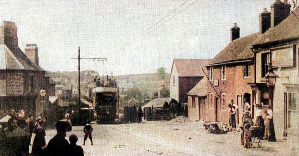
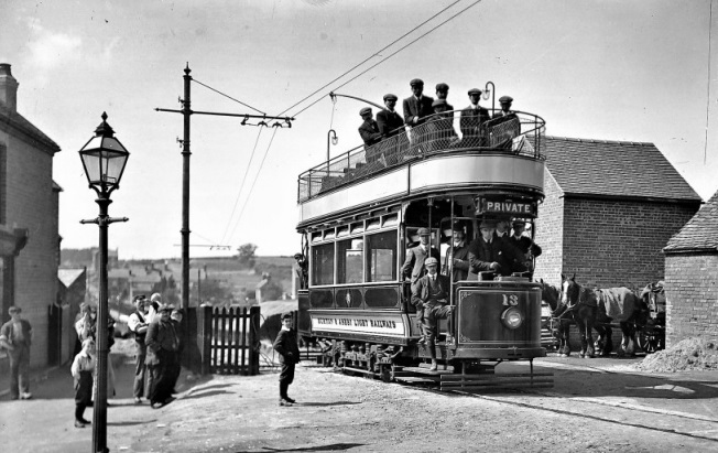
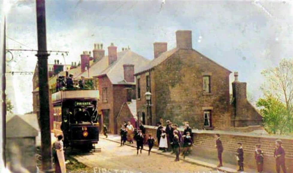

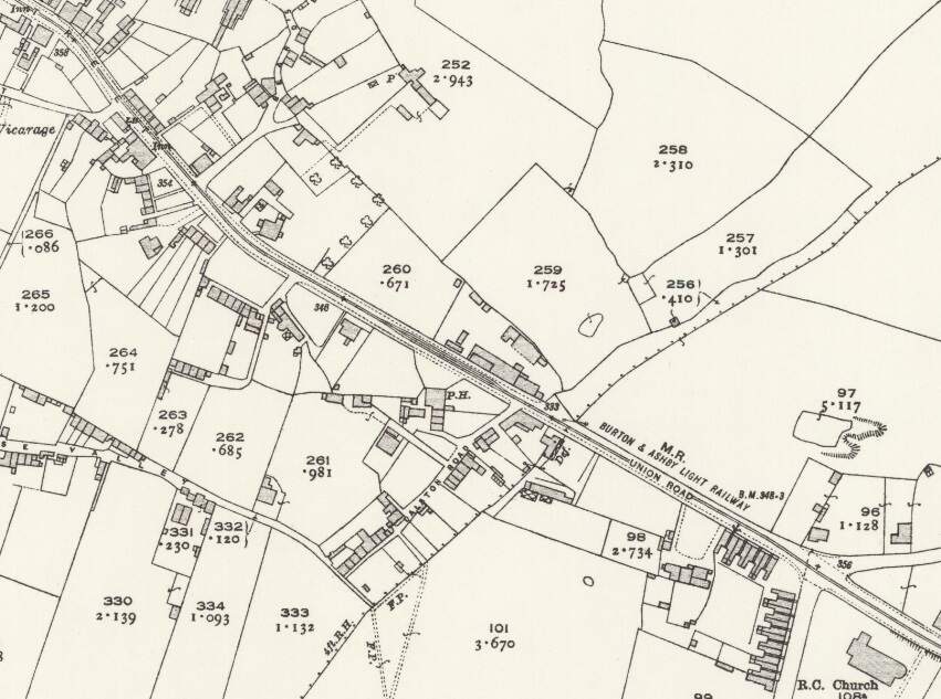
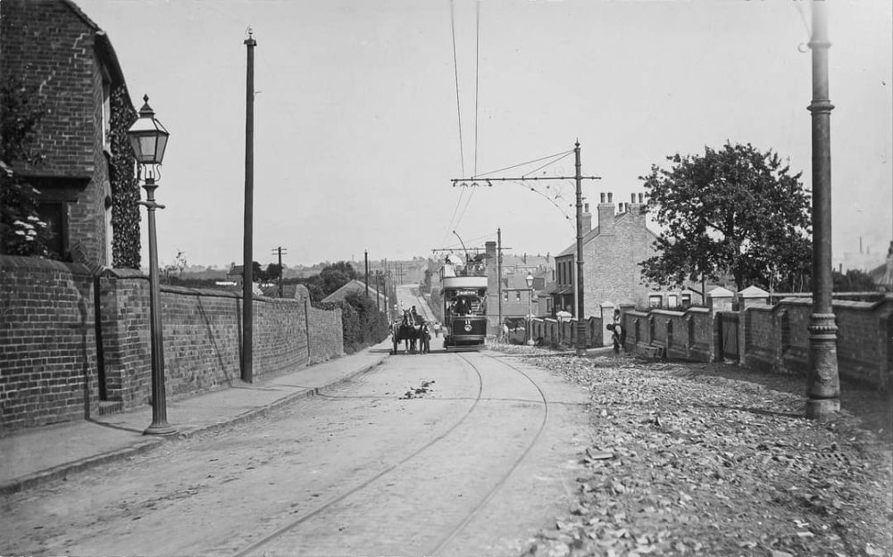
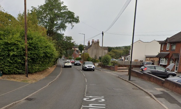
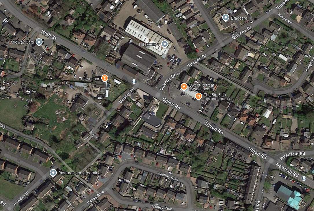
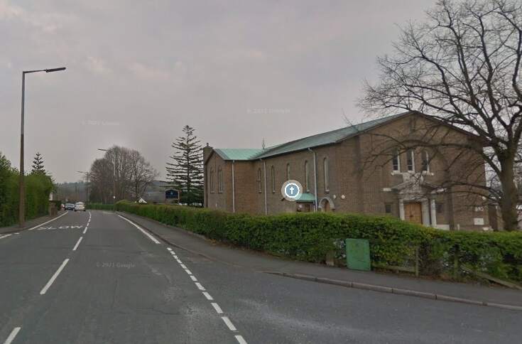
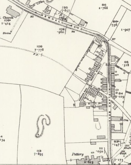
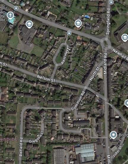
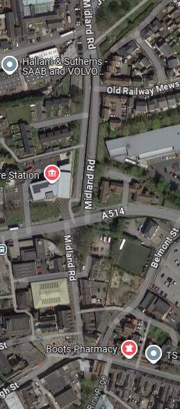
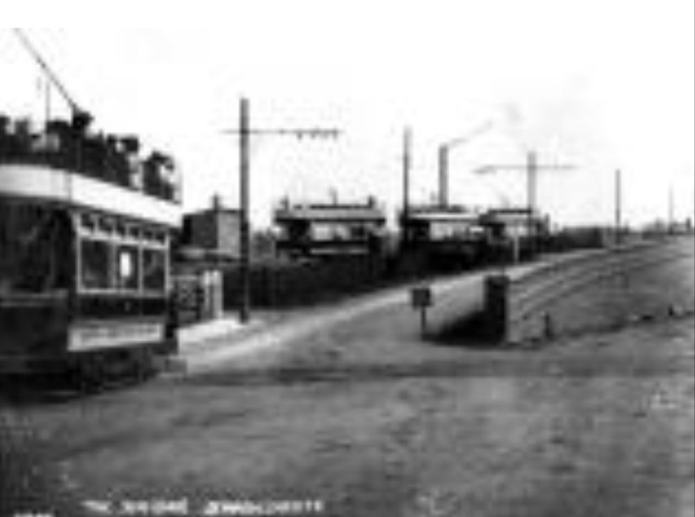
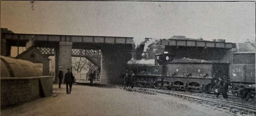
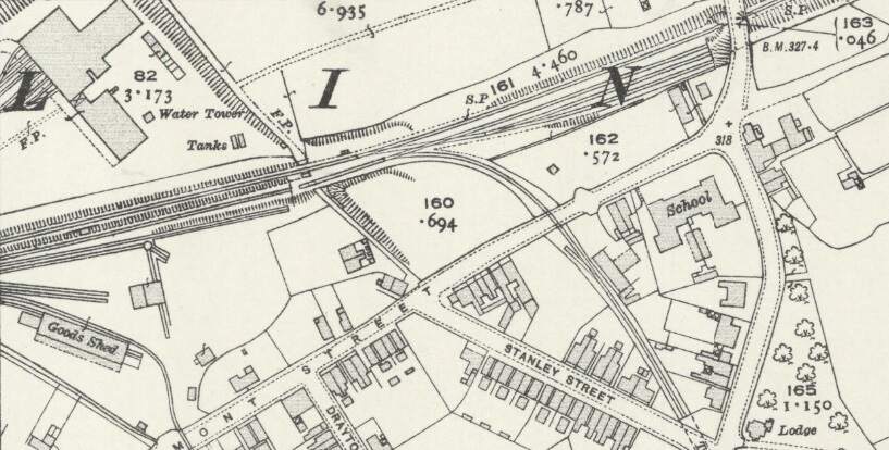
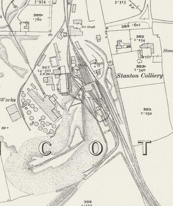
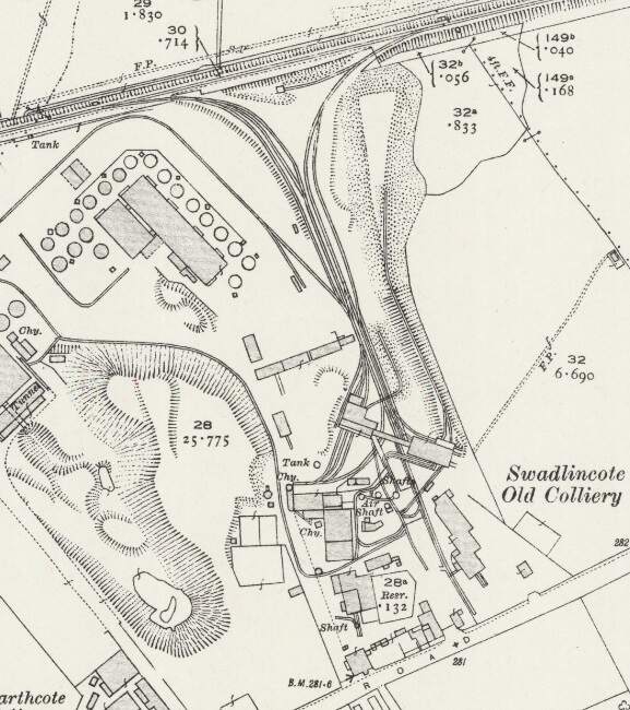
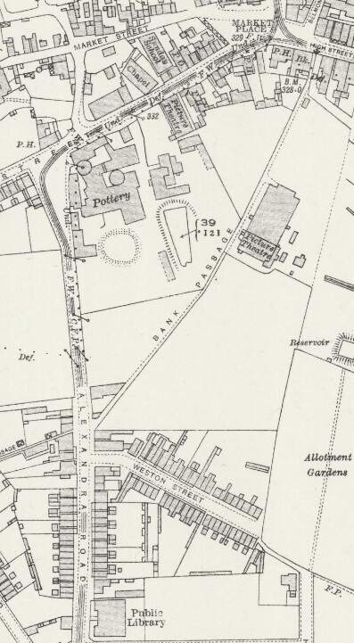
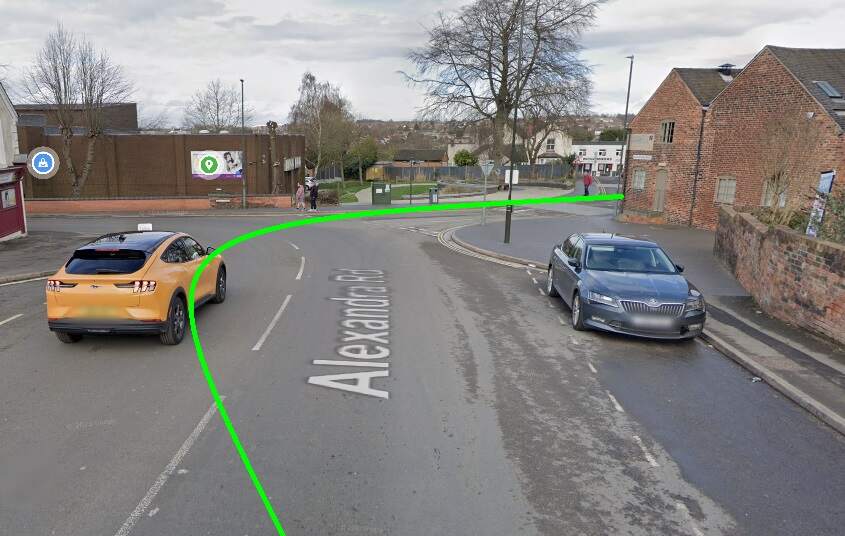
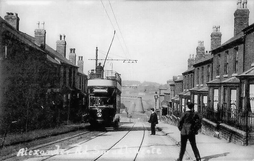
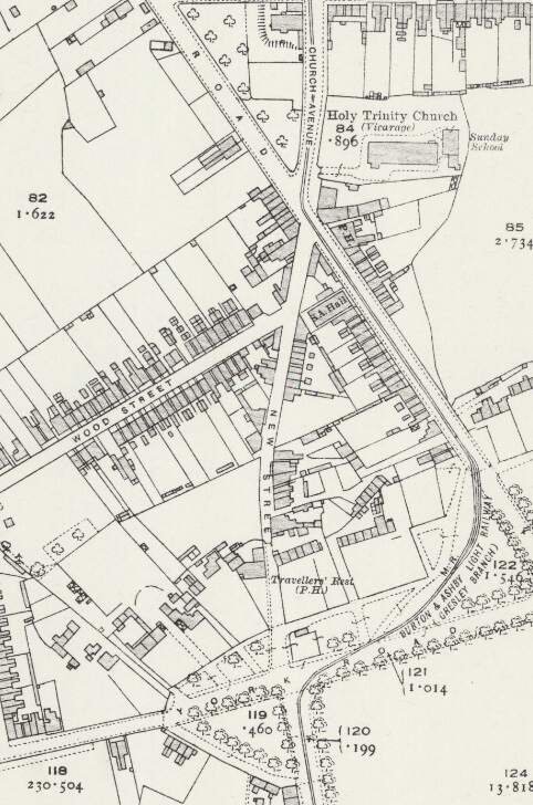
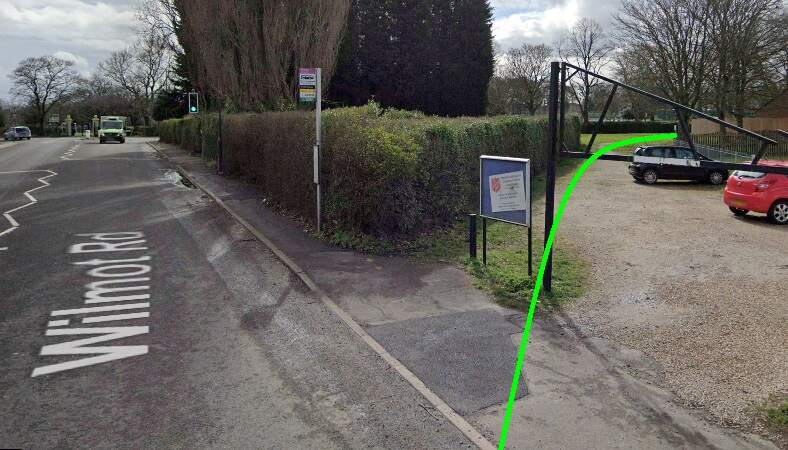
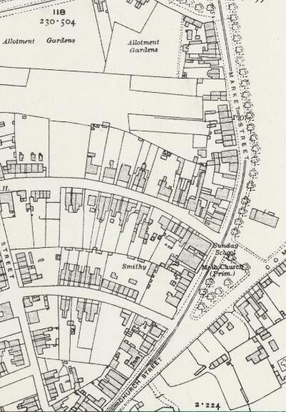
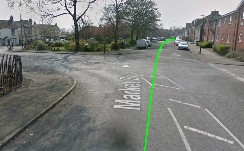
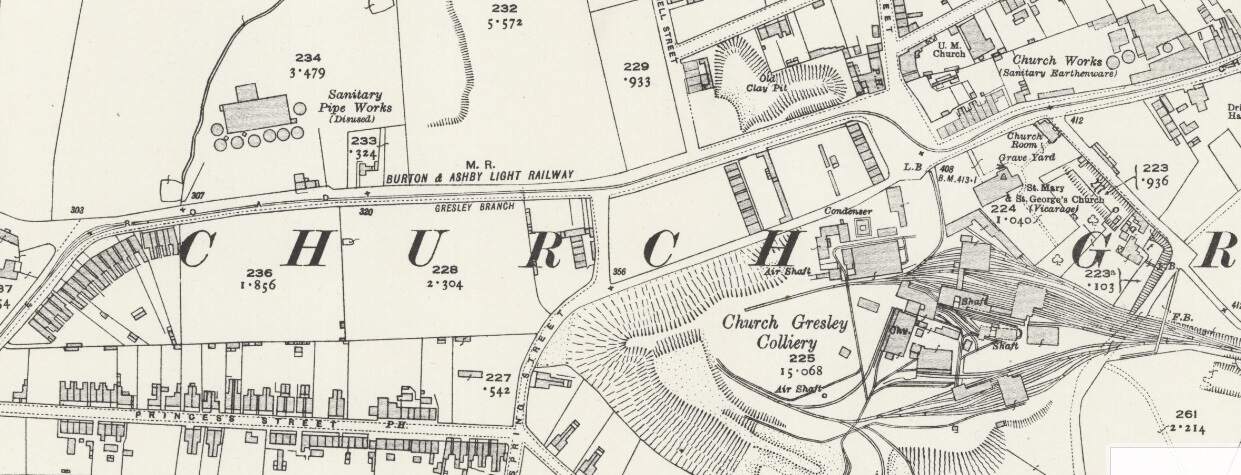
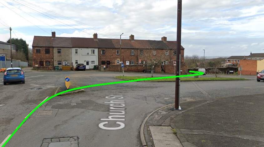
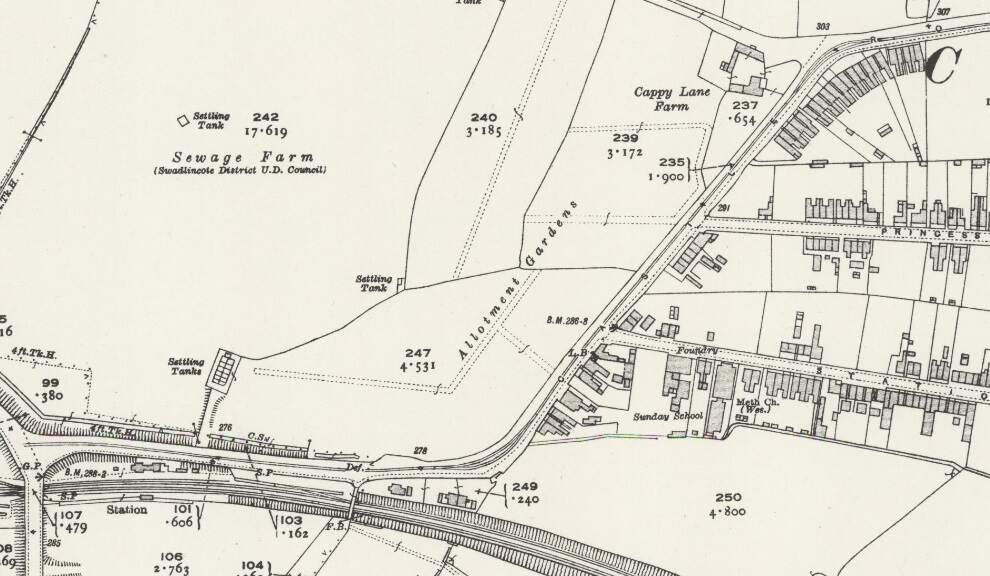
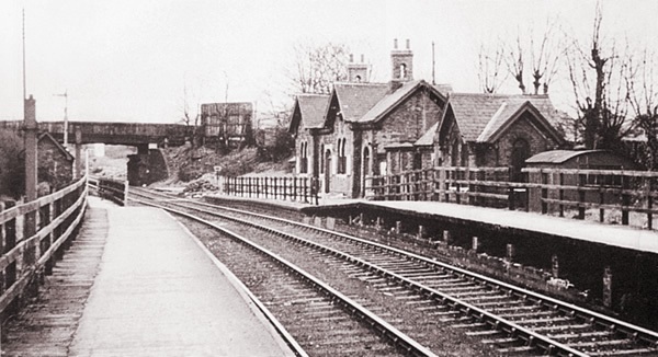
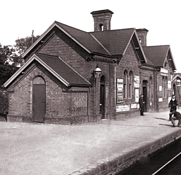


.JPG)
.jpg)