
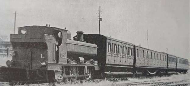
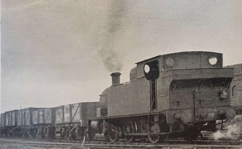
The featured image for this article is a ‘1901’ series 0-6-0PT in charge of a train of low-headroom coaches at Burry Port (H. C. Casserley) © Public Domain. [1: p737]
Kymer’s Canal is the oldest canal in Wales, built near the town of Kidwelly in Carmarthenshire between 1766 and 1768. It was about 3 miles in length, built by Thomas Kymer, a local mine owner to carry anthracite coal from the Pwll y Llygod pits to a new dock (Kidwelly Quay) on the Gwendraeth Fach river for shipping to clients in the wider world.
The channel and dock suffered from severe mud silting over the decades, making navigation dangerous. In Later years, it became part of the larger Kidwelly and Llanelly Canal and Tramroad Company system authorised in 1812. [2][3][4][5][6]
You can still see parts of the historic waterway and walk alongside dry sections in the 21st century. Walking routes link the old canal directly to the Wales Coast Path and the nearby Kidwelly Town Council local heritage sites. [6][7][8]
Bourne tells us that Canal and Tramroad Company authorised in 1812 was, as well as being permitted to undertake maintenance of the Kidwelly Harbour and to improve Kymer’s Canal, authorised to build railways and tramways to supplement the canal or even replace it. [1: p737]
In parallel, in the following decade (1825) the Pembrey Harbour Co. was incorporated to construct a relocated harbour at Pembrey and to build a canal, tramroad or railway to connect with the harbour. The old harbour, which was constructed in 1819 by industrialist George Bowser and partners to ship local coal, suffered from severe silting problems almost immediately. (It was completely abandoned in 1878 after larger ships moved to the newer downstream port). [9]
The new port was constructed to accommodate larger vessels. It was first opened in 1832 but almost immediately suffered from the collapse of a harbour wall and the collapse of the scouring reservoir walls. It was 1836 before the port was to open fully. [9]
To save confusion between the two harbours an amendment to the Act of Parliament was passed in 1835 to change the name of the newer harbour to ‘Burry Port Harbour’, and the town, which had grown up during the construction work, took on the name at the same time. [1: p737][9]
Three decades later, the designation of the Canal & Tramroad Company was, by Act of 30th April 1866, “changed to the Kidwelly & Burry Port Railway Company. This Act authorised railways, partly by canal conversion, from Kidwelly and Burry Port to Llanarthney, with branches. In 1867 [possibly 1868 [9]), the Harbour Company was dissolved and vested into the railway company under the title of the Burry Port & Gwendraeth Valley Railway Company, and this name remained in use until the railway was absorbed by the Great Western in 1922.” [1: p737]
Bourne continues: “Construction of the railway was completed between Burry Port and Cwmmawr in 1869. The first mineral train ran to Pontyberem in July, and the section between Pontyberem and Cwmmawr was opened later in the year. A branch to Kidwelly was brought into use in July, 1873. Extensions of the line to the east were completed in 1891, partly on the [line] of an old tramway, from Burry Port to a junction with the Llanelly & Mynydd Mawr Railway at Sandy, Llanelly. The proposed railway to Llanarthney did not materialise, although surveys were taken of the route in 1874.” [1: p737]
“In 1898, the railway was approached by local colliery companies with a request that it should operate workmen’s trains from Burry Port and Kidwelly to Cwmmawr.” [1: p737-738]
Despite the fact that the Board of Trade had only passed the railway for freight use, the Company (being in poor financial health) agreed to the use. Initially the requisite coaches were provided by the colliery owners, who contributed 50 shillings/week/coach to cover the railway company’s expenses. The railway company undertook to purchase the coaches when its finances permitted.
Bourne tells us that, “On Llanelly market days it became the practice for the miners’ wives to travel in the workmen’s trains or in the guard’s brake-van of the mineral trains, a charge of sixpence being made in respect of an article belonging to the passenger instead of a fare. When the collieries were closed, free trains were run to enable miners to attend meetings, and to give their families a day by the sea. These trains consisted of colliery wagons, previously cleaned by the miners and provided with benches; ladders were used for entering and leaving the vehicles.” [1: p738]
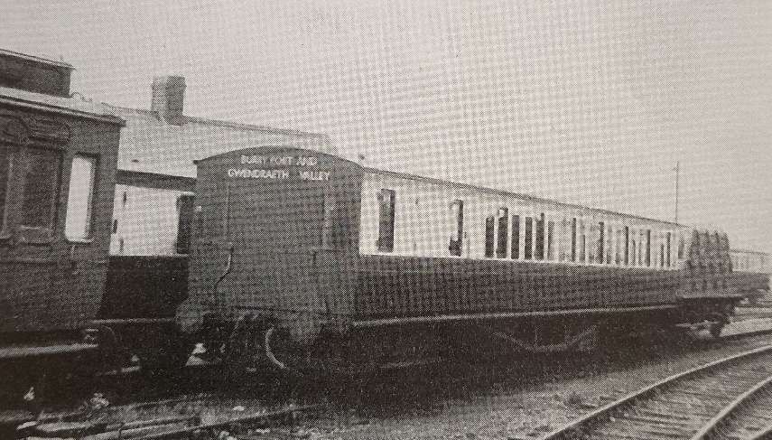
After a fatal accident in August 1903, the Company “decided that the reconditioning of the railway for use as a passenger line should be considered without delay. When the improvements were completed, sanction was obtained, under a Light Railway Order, to operate passenger trains between Burry Port, Kidwelly and Pontyberem. The service was brought into operation on 2nd August 1909.” [1: p738-739]
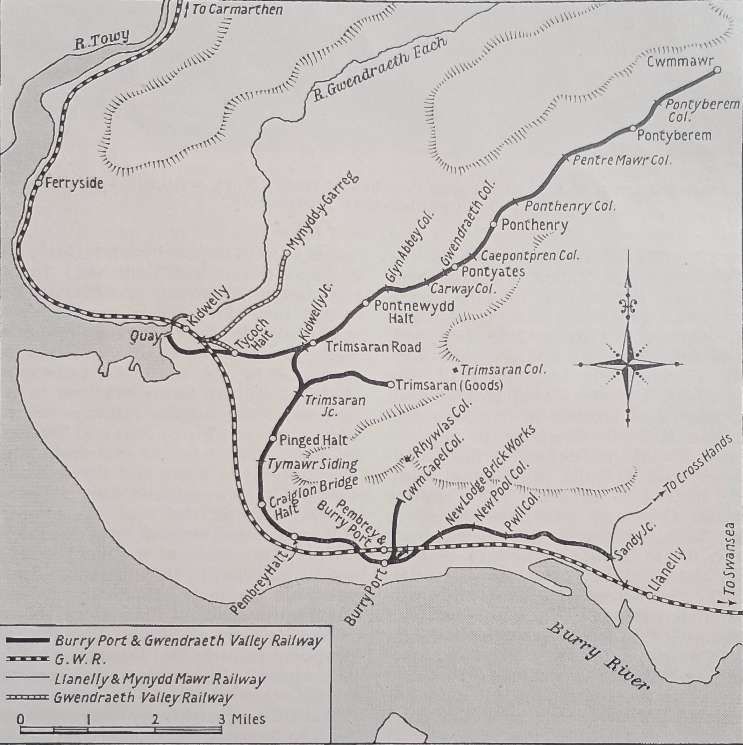
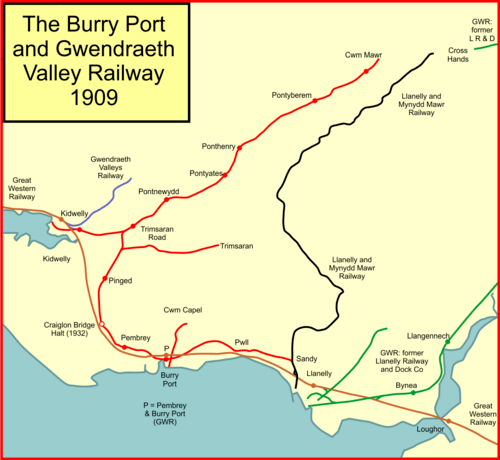
A similar diagrammatic representation of the BR&GVR and surrounding railways, (c) Afterbrunel and licensed for reuse under a Creative Commons licence (CC BY-SA 4.0). [10]
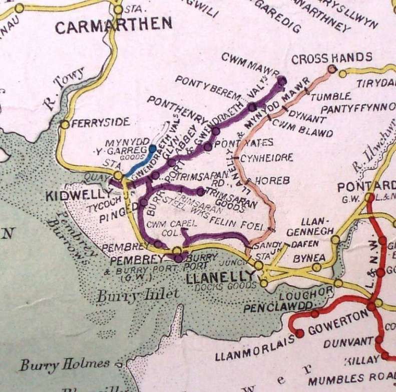
A similar area as it appears on a Railway Clearing House (RCH) map of South Wales. [14]
“The BP&GVR was single line throughout, and consisted of the 12.75 miles from Burry Port to Cwmmawr (the main line), the Kidwelly branch, and shorter branches (used only for freight traffic) from Burry Port to Sandy, Burry Port to Cwm Capel, the junction near Pinged to Trimsaran, and to various collieries. Connections with other railways were maintained at Burry Port, with the Great Western; at Kidwelly, with the Great Western and the Gwendraeth Valley Railway, traffic to and from the GWR passing over 25 chains of the valley line; at Sandy, with the Llanelly & Mynydd Mawr Railway; and at various colliery sidings.” [1: p739]
The Colonel Stephens Society notes that, “The railway was poorly managed in the nineteenth century and often bankrupt. Increasing traffic at the turn of the century and intelligent management transformed it as a business and Holman Fred Stephens was employed as a consultant in 1908 to reconstruct it [and] to legalise its unofficial carrying of passengers. The necessary legislation was obtained in two Light Railway Orders in 1909 and 1911. Stephens supervised re-construction and re-equipment over the years up to 1913 after which he had no further connection.” [11]
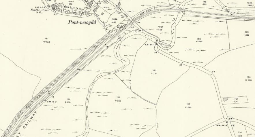
“The Burry Port-Cwmmawr section originated from a separate station at Burry Port, alongside the main-line Pembrey & Burry Port Station. When this line was equipped for passenger traffic to Pontyberem, in 1909, stations were erected at Burry Port, Pontyates, and Pontyberem, and halts at Pembrey, Pinged, Trimsaran Road, Pontnewydd, and Ponthenry. Signal boxes or ground frames were provided at Dock Junction (Burry Port), Kidwelly Junction, Pontyates, and Pontyberem, and eighteen single lever ground frames, working siding connections, were installed. The permanent way consisted of flat bottom steel rails, weighing 75 lb. per yard, secured by bolts to the sleepers. The over and under bridges, which existed when the railway was a mineral line, had sufficient theoretical strength for an axle load of 14 tons, the maximum allowed.” [1: p739]
Bourne continues: “Passenger trains commenced running through to Cwmmawr in 1913, under powers granted by a Light Railway Extension Order (1911), the old mineral line having been rerailed throughout. The original passenger terminus at Pontyberem became a crossing station with an additional platform, while Cwmmawr was furnished with a single platform, booking office, waiting room and ground frame. In addition, five ground frames, controlled by the train staff, were added to work various sidings. In 1914, a new crossing place and signalbox, both since removed, were established at Tymawr, between Burry Port and Kidwelly Junction.” [1: p739]
Bourne continues his description of the line:
“The stations were primitive, with platforms of the short earth type 250 or 350 ft. long, and 3 ft. above rail level. They usually consisted of a small corrugated iron hut with one end roughly partitioned off for an office and the other for a waiting room, though at Ponthenry small brick buildings were erected just before the GWR took over. The signals, mostly electrically lit, were of rather ancient pattern; distant signals, gradient boards and mileposts were not provided. Industries on the line 30 years ago included ten collieries producing anthracite coal, one small colliery raising steam coal, a brickworks and a small tin-plate works. Trains coming down the line to Burry Port often consisted of 45 to 60 loaded wagons. Long trains of empties were taken up the valley with one engine and a 15-ton brake-van. The population was connected almost exclusively with the mining industry, so that general goods traffic was light.
The Burry Port-Cwmmawr line was equipped for working with the train staff and one engine in steam between Burry Port and Dock Junction, and electric train staff or token between Dock Junction and Cwmmawr. Crossing facilities are avail-able at Kidwelly Junction, Pontyates, Pontyberem, and Cwmmawr, but at the first and last named two passenger trains could not be crossed. Staffed stations were situated at Burry Port, Trimsaran Road (population 200), Pontyates (2,000), Ponthenry (700), Pontyberem (3,500), Cwmmawr (2,250), and unstaffed halts at Pembrey (1,800), Craiglon (80), Pinged (80) and Glyn Abbey (150). Signalboxes were installed at the crossing stations and at Dock Junction.
There [were] several noticeable curves on the line, including that at Dock Junction. The railway [was] laid alongside the old canal bed for half its distance, consequently gradients [were] not difficult; … but it [rose] from Pontyates to Cwmmawr, on gradients as steep as 1 in 48 and 1 in 40, each for over half-a-mile. Every station and halt [had] long needed a coat of paint and repairs. The track [was] a mass of weeds. Closed pits, with broken buildings and useless pit gear, [bordered] the line.
Until the passenger services were withdrawn on 21st September [1953], there were four trains daily, one a workmen’s train from Burry Port to Cwmmawr, on weekdays only, with an additional train on Saturdays and five services daily in the reverse direction. They consisted of an engine and two coaches, but the 1.45 p.m. Burry Port to Cwmmawr (Saturdays excepted) was formed with two engines and four coaches, to provide stock for the additional return service. Speed was limited to 25 m.p.h., with further restrictions of 15, 10 or 5 m.p.h. at level crossings, and at the sharp reverse curve near Dock Junction. The level crossings, which [were] rather numerous, [were] not provided with gates (except at Pontyates), the railway being quite open to road traffic. No keepers [were] employed, and public users [had] to look after themselves.
The majority of passengers, a number of whom were miners, travelled only short distances, and the total number carried in 1950 was 35,645, with a revenue of £1.499, compared with 83,965 in 1938. Colliery upon colliery [had been] closed from Pontyates to Cwmmawr, and only three [remained in 1953]. Pentremawr, the largest, [had] a daily output of some 55 wagons, and certain passenger trains stopped at the colliery sidings, the majority of workers travelling from Ponthenry and Pontyates, one and two miles distant. Carway Colliery [produced] some 15 wagons of coal daily, and [there] again passenger trains called at the colliery siding, but the train user was irregular and very light, an average of two miners alighted and one joined daily in a sample week. Glynhebog Colliery, at Cwmmawr, closed in November, 1949, [was then] used as an N.C.B. training centre and some passenger trains stopped at the colliery sidings. The railway [served] an area of no great population, and parallel road services [operated] with much greater frequency and convenience than did the trains. So after attempts to recapture passenger traffic for the railway it was decided to withdraw the service.
The freight train service [was] continued, as traffic offered amply [justified] its retention. The tonnage dealt with in 1949 was 243,461, and the output of Pentremawr Colliery [was] to be increased. The services [were] maintained by a daily train from Burry Port to Pontyberem and back, and to the Kidwelly branch and return. There [were] also two freight trains, except on Saturdays, to Cwmmawr and back.” [1: p740]
- 1923–1924: Owned by Great Mountain Collieries Co. Ltd., employing 121 underground and 32 surface workers (Manager: Jas. Steele) before it was abandoned on May 30, 1924.
With the withdrawal of the passenger service on 21st September 1953, the line was operated on the one engine in steam principle between Kidwelly Junction and Cwmmawr. The crossing gates at the level-crossing at Pontyates were operated by train crew.
Bourne says that electric train staff working between Dock Junction and Kidwelly Junction had to be maintained because of developments in opencast coal workings at Trimaran.
Bourne continues:
“At Cwmmawr, the goods shed siding, the platform road and the line running parallel [were] removed, and the short portion of the line now leading to the platform road [was] slewed to effect connection with the mileage siding; traffic [was] propelled from Pontyberem to Cwmmawr. The passenger track from Dock Junction to [Burry Port] station, together with the loop and three carriage sidings at Burry Port, [were] recovered. Pontyberem and Pontyates parcels offices … remain[ed] open to deal with station-to-station parcels traffic, but the other stations [were] closed and let, and parcels traffic collected and delivered by road vehicles based at Llanelly.
“The Kidwelly Junction-Kidwelly section, from Trimsaran Road to the South Wales main line, slightly east of Kidwelly, [was] worked on the staff and one engine in steam principle. [Operation in the 1950s embraced] the former Gwendraeth Valley Railway, quite a separate undertaking to the Burry Port & Gwendraeth Valley Railway. The Gwendraeth Valley Railway (GVR) was opened to traffic over the three miles from Kidwelly to Mynydd-y-Garreg in 1871, and worked by the BP&GVR until 1904. The actual BP&GVR branch ran to Kidwelly Quay, via Tycoch Junction with the GVR. With the exception of a miners’ train, long discontinued, operated from Tycoch Halt to Pontyberem, no passenger train had traversed this section. … [By the 1950s, the permanent way [was] in a very rough state, overgrown with grass and weeds, and low-lying and wet near Kidwelly. The rails were of light flanged type, bolted to the sleepers, and no signals were provided. Between Tycoch and Kidwelly Quay, the line was used for an occasional few trucks of coal, despatched in small boats carrying 10 to 20 tons at a time. … [In the 1950s], the track [was] used only by the 8.25 a.m. freight train from Burry Port to Kidwelly; the engine [spent] the day shunting at Kidwelly, and running trips on the Mynydd-y-Garreg branch, conveying stone from the quarry to Stephens Works, Kidwelly, and [returned] from Kidwelly to Burry Port at 5.45 p.m. (3 p.m. on Saturdays). The line between Tycoch and Kidwelly Quay was abandoned about 1934, when the quay was closed.
[In 1953], consideration [had] recently been given to the possible closure of the line between Kidwelly Junction and Kidwelly, but no action [was] taken because of the inability of the local breakdown crane to clear several low bridges between Burry Port and Kidwelly Junction. In these circumstances, the loop line [was] the only means of access to the Cwmmawr branch [by] the crane.” [1: p743]
Bourne’s notes are essentially a ‘snapshot’ of the prevailing conditions in 1952/53. He comments that it was the intention to close the line to through traffic when the scheme relating to the National Coal Board sidings at Coed Bach was completed, but the track would not be broken and would remain available, if required in an emergency.
Bourne continues:
“Reception sidings [were] laid during [1953] on a site near Kidwelly Junction to serve the new opencast coal disposal centre at Coed Bach. The normal daily output of the new washery [was] just over 1,000 tons, all of which were despatched by rail. The new works [were] of a temporary nature, as it [was] expected to clear the 1,116,000 tons of opencast coal in the area by 1956.
“The Burry Port-Sandy Junction line crosses the Great Western main line on the level at Pembrey East. At one time, the line served three small collieries and a small brick works, but traffic was light and mainly that emanating from the collieries. Flanged rails weighing 75 lb. a yard, secured by nut and bolt to the sleepers, were used, and the permanent way generally was in a bad condition and overgrown. Fencing was poor and had disappeared in many places, and the track was used regularly as a footpath to Llanelly. One trip daily each way served the line, conveying approximately 30 wagons to Burry Port and 15 to Llanelly. A colliery locomotive worked over the branch between the New Pool and Crown colliery connections. Stop boards were provided to halt BP&GVR trains and the drivers had to satisfy themselves that the line was not occupied before proceeding slowly.” [1: p743 & p744]
Bourne continues his description of the line and its usage in the early 1950s:
“The portion between Pwll and Sandy [was] no longer used for traffic, or even wagon storage, but [was] still in position. The daily freight train [plied] only between Berry Port and Pwll Brick Works, a distance of under two miles. In connection with the N.C.B. new sinkings at Cynheidre, the former Llanelly & Mynydd Mawr track [would, within [a] few years, be doubled, and, to assemble empties for use at the new colliery, a proposal to lay in sidings on the site of the Sandy branch about one mile from Sandy Junction [was] being considered.
“The Trimsaran branch, which [left] the Cwmmawr line between Pinged Halt and Kidwelly Junction, [was] used for marshalling of coal from the Trimsaran Colliery and for wagon storage. Marshalling [was] performed by the colliery’s own locomotive. The branch [had] a ruling gradient of 1 in 47 for 1.25 miles.
“The track [had] been removed from from the Burry Port-Cwm Capel branch. Trains over this branch were propelled from Burry Port, with the guard riding in the leading vehicle. Trains operated during daylight only. Before the train passed over any of the level crossings on the branch, it came to a stand, and the guard went forward and hand-signalled it over. Frequent whistle sounding while running was the practice, and all shunting operations were performed with the engine at the Burry Port end of the train.
“At Burry Port, a short branch, [closed by 1953], served Gwscwm Colliery sidings, and trains of not more than 20 wagons were propelled from Burry Port. Speed did not exceed 5 m.p.h., and a red light was exhibited on the leading vehicle during the hours of darkness. Other colliery lines included the Carway branch and the Glyn Abbey branch, used for wagon storage.
“The small wet dock at Burry Port [was by 1953] out of use, and the hoists and other equipment [had] been removed. The dock, which covered 64,000 sq. ft., was provided with two hydraulic coal tips and hydraulic capstans for shunting. An electric power station was situated on it for the supply of light to the dock premises.” [1: p744]
Wikipedia tells us that, “From 1953 opencast coal extraction gathered pace in the Gwendraeth Valley, and this coupled with economic factors gradually led to closure of most of the deep mines. By 1961 only the Capel Ifan Colliery at Pontyberem continued deep mining, and that pit ceased to forward coal by rail in 1970.” [10]
“The Sandy branch, connected the BP&GVR to the Llanelly and Mynydd Mawr Railway near Llanelly. At the eastern end it divided into two and curved round to the south; one part joined the Stradey estate line and the other the L&MMR line; with the closure of the Pwll brickworks all traffic between Burry Port and Sandy Gate sidings ceased from 4th October 1962. Sandy Gate sidings were simply located on a short stub now served from Sandy, and that too closed on 22nd December 1963.” [10]
“The Trimsaran branch closed to revenue traffic in 1960, but it was retained for wagon storage until June 1962. Goods traffic to Pwll Brickworks ended on 4th October 1962. Regular traffic to Smart’s Dinas Silica Brickworks at Kidwelly ceased in February 1959, after which the Kidwelly branch was little used, and was closed in October 1965.”
“The section from Kidwelly Junction to Kidwelly closed in October 1965, but reopened after relaying on 19th September 1983.” [10]
“Diesel traction was inaugurated on the BP&GVR section on 4th October 1965. Two D2000 Class (later 03 Class) locomotives were modified to work together in multiple, and soon a third was used to bank the trains up the steep gradients in the rear of the train. On the downhill journey the three locomotives hauled the train.” [10]
“The short section from the New Dynant North ground frame to the Cwmmawr terminus was closed on 1st May 1967, although the coal depot at New Dynant continued to be referred to as Cwmmawr.” [10]
“The Kidwelly branch beyond Coed Bach was re-opened (after relaying the track) on 19th September 1983 and, for the first time, large main line locomotives were able to use this short section of the BP&GVR as far as Coed Bach. The re-opening enabled the original section of line from Burry Port to Kidwelly Junction to be completely closed, from 19th September 1983. The remaining line was now worked in two sections; Kidwelly Yard to Coed Bach and Coed Bach to Cwmmawr (New Dynant). From February 1987 substitute locomotives capable of operating air-braked wagons were introduced on the line.” [10]
The very last train to Cwmmawr ran on Friday 29th March 1996, … closure of this remaining section of the BP&GVR main line took place on 1st April 1996. Coed Bach continued to be fed by road so there was still rail traffic over the short distance from there to Kidwelly Yard. This remaining stub of the BP&GVR, and also of the GVR, finally closed on 23rd March 1998. [10][17]
Locomotives and Rolling Stock
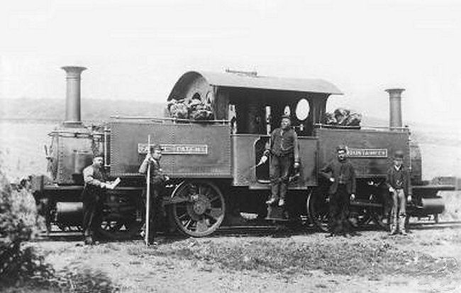
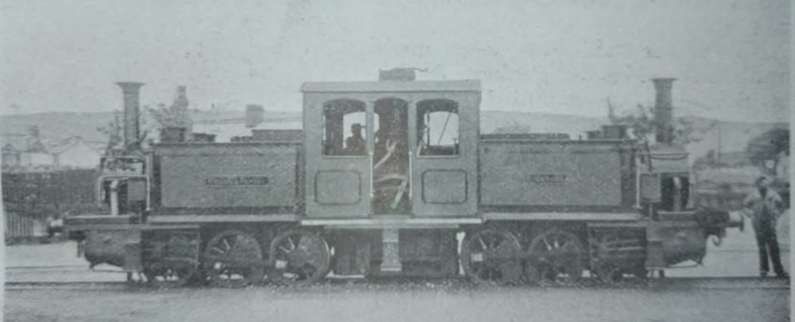
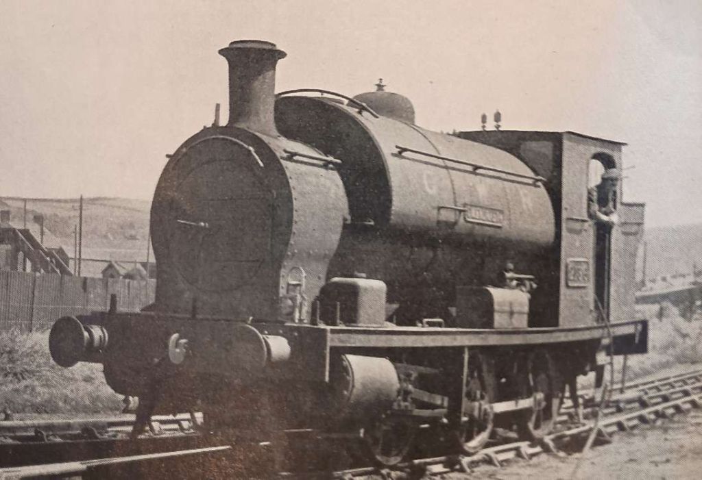
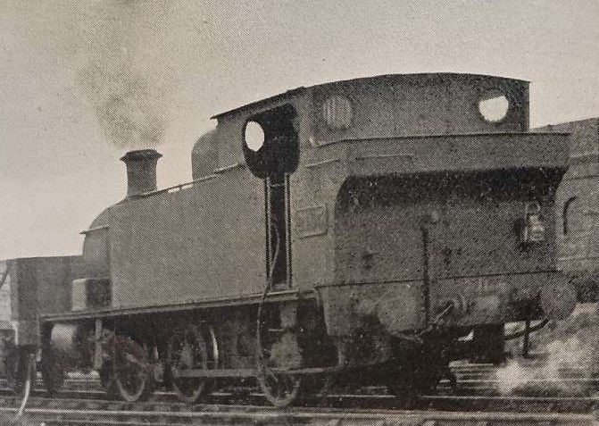
Former BP&GVR (No. 12) 0-6-0T No. 2165, built in 1913 by Hudswell Clarke. [1: p742][16]
Further photographs of locomotives from the BP&GVR can be found here. [16] (Most of the images on this link will probably be in the public domain, but rather than showing them in this article they are well collated on the link.)
Bourne says that:
“Fifteen tank engines were taken into GWR stock at the absorption; all were 0-6-0s some with saddle and others with side tanks. BP&GVR Nos. 1-15, they respectively became Nos. 2102, 2162, 2193 to 2196, 2176, 2197, 2163, 2198, and 2164 to 2168, in GWR stock. The named engines were Nos. 1. Ashburnham, 3. Burry Port, 4, Kidwelly, 5, Cym Mawr, 6. Gwendraeth, and 8, Pioneer. A small shed at Burry Port could accommodate ten engines. At one time, the company possessed 31 passenger and 18 goods vehicles; advantage was taken of the free use of other companies’ wagons given under the common user arrangement. The passenger coaches were secondhand vehicles fitted with the vacuum brake, and had third class accommodation only.
“Seven BP&GVR locomotives still [survived in 1953], Nos. 2162, 2165, 2166, 2168, 2176, 2196 and 2198. No. 2164 was withdrawn in 1929, No. 2163 in 1944, No. 2192 in 1951, Nos. 2193 and 2197 in 1952, and Nos 2167, 2194 and 2195 in 1953. No. 2195, Cym Mawr, the nameplate of which was removed by the GWR because of a controversy over the spelling, was condemned in March. 1939, but was reprieved during the war, and withdrawn in January [1953].
“Eight locomotives, all 0-6-0 tanks, [were] allocated to Burry Port shed. In 1953, they [consisted] of ‘1600’ Class Nos. 1609, 1613, 1614 and 1644; ‘2021’ Class No. 2081; and ex- BP&GVR Nos. 2162, 2165 and 2198. Engine working [included] the operation of the two ex- BP&GVR lines, two daily freight trips between Burry Port and Llandilo Junction, and one daily trip between Burry Port and Lando R.A.F. Station. The ’16xx’ Class engines worked all the passenger services and also freight trips, and BP&GVR engines and No. 2081 [were] used on goods trains and for yard shunting. The Kidwelly freight [was] operated either by a ’16xx’ engine or BP&GVR. No. 2198.” [1: p744]
As we have noted above, “D2000 Class (later 03 Class) locomotives were deployed on the BP&GVR. The cabs were cut down to pass under the low bridges on the line. The original reason for the use of the 03 Class was the frequent flooding on the line which would interfere with the low-slung auxiliary equipment on the more powerful 08 Class; however in June 1984 the affected section of line was closed and there was no longer an objection to the 08 Class; three locomotives were modified to lower the profile for the low bridges and were designated Class 08/9.” [10]
The Railway Hub has an article about these diesel locomotives which can be found here. [18]
The Route
We start at the most easterly extent of the BP&GVR – at Sandy Junction.
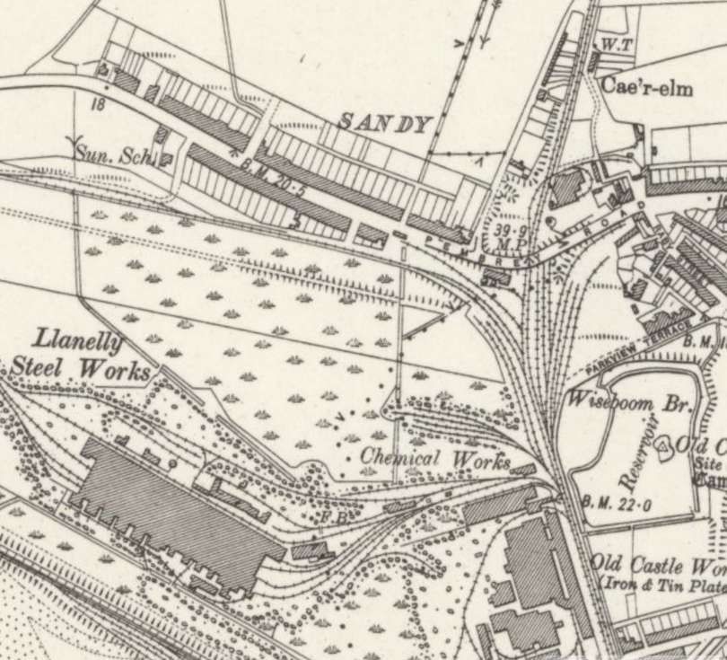
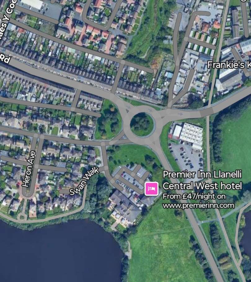
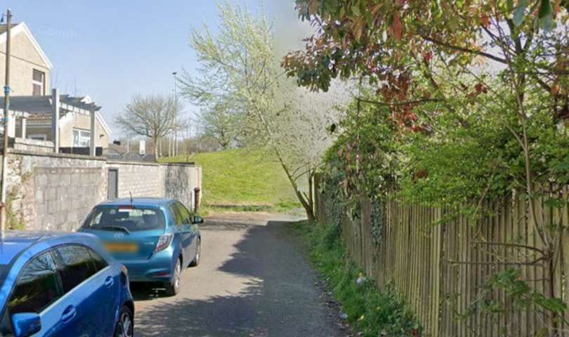
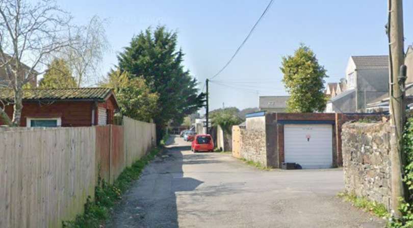
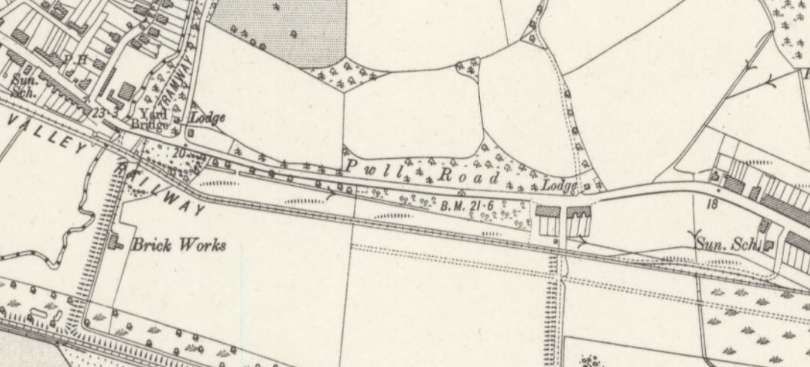
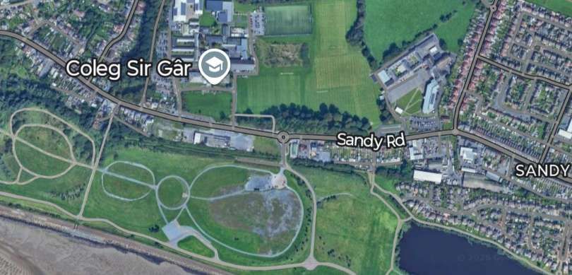
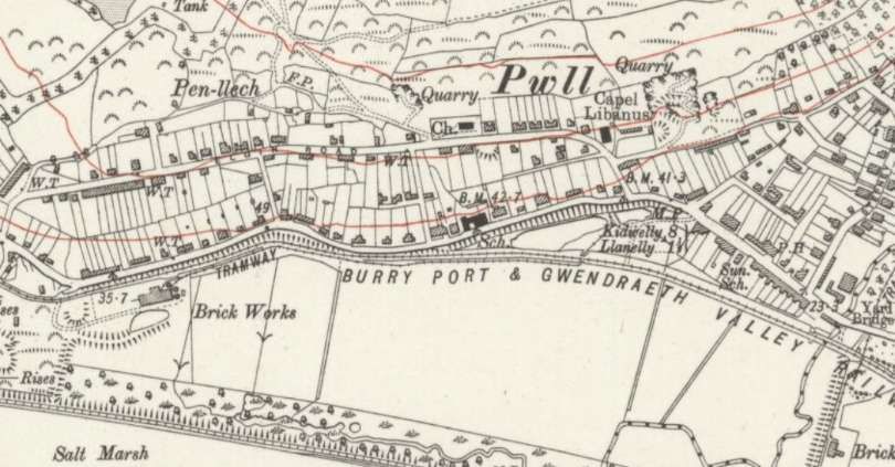
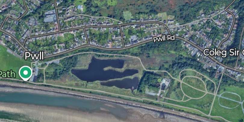
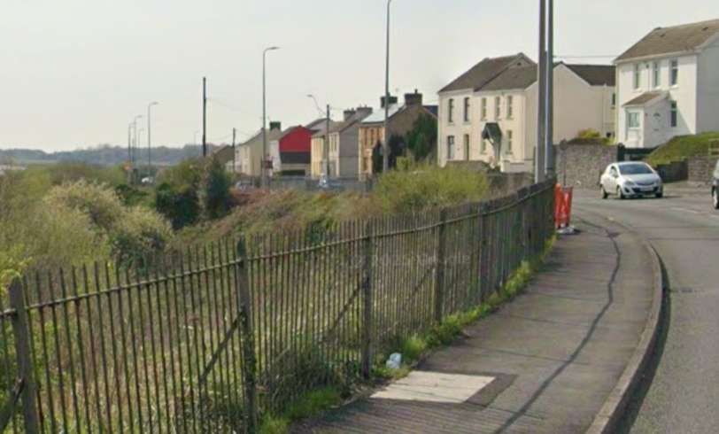
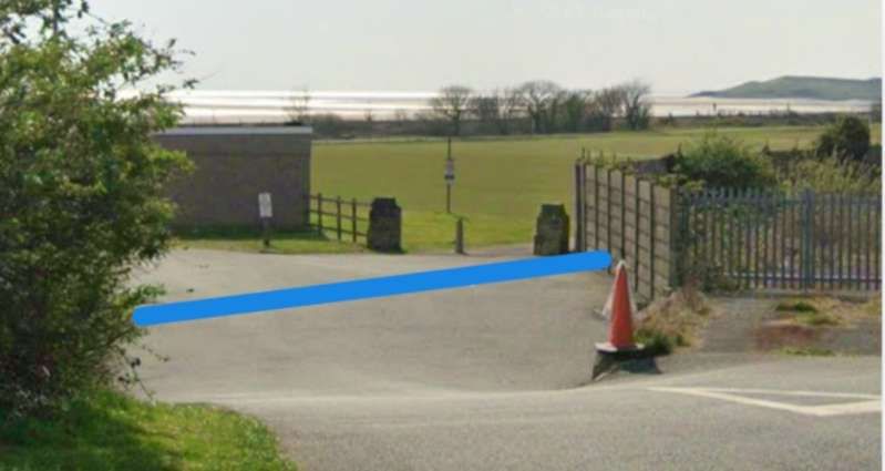
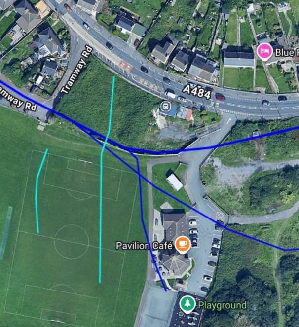
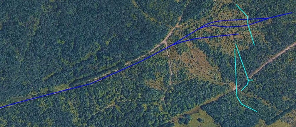
Railmaponline.com shows that the BP&GVR mainline left the side of what is now the A484 and crossed what is now the access road to the pavilion before turning Northwest. Two short branch lines at one time left the main line at this location, both shown in blue. There were once brickworks at this location and a colliery (Pwll Colliery) between the road and the railway to the East of Tramway Road. [20]
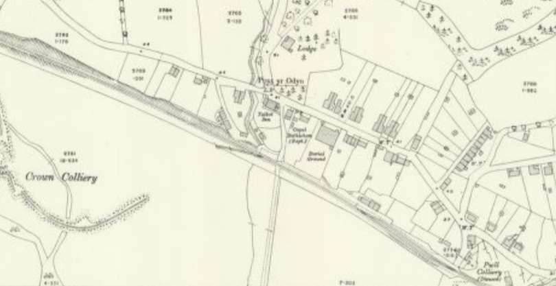
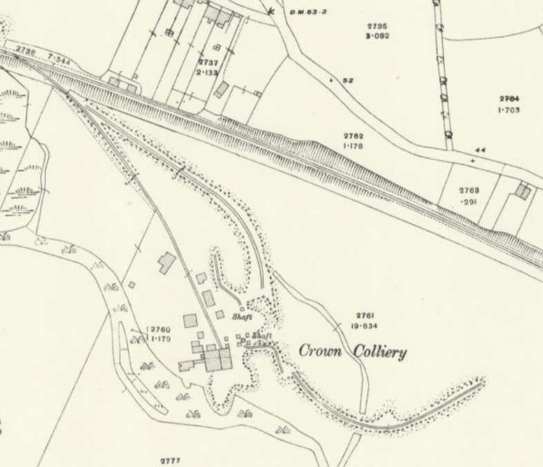
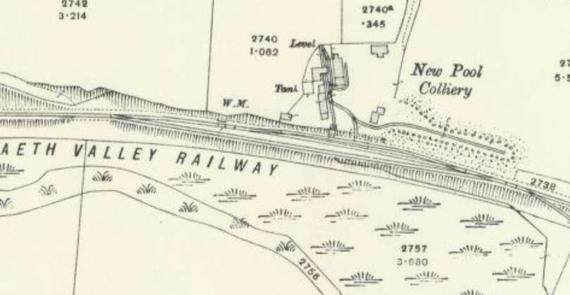
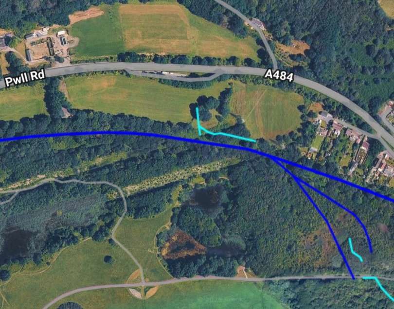
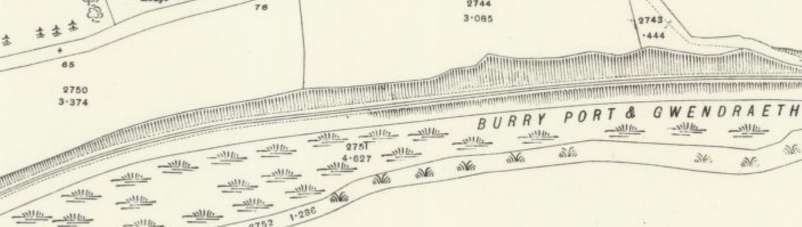
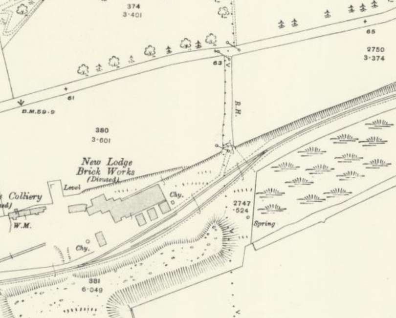
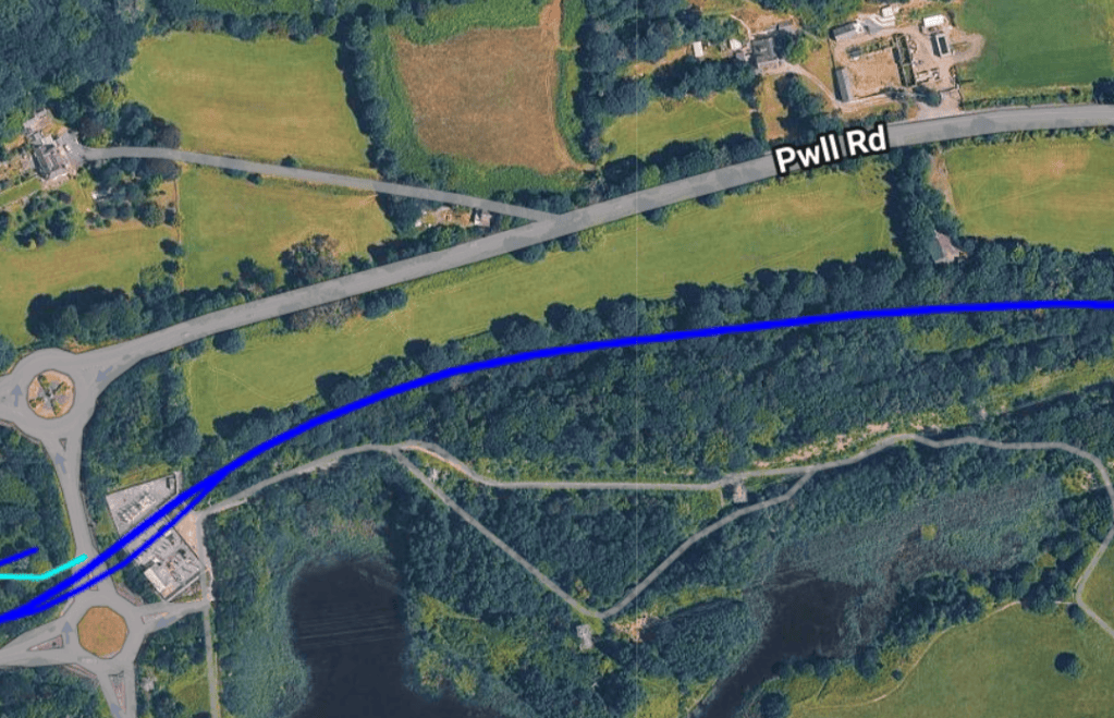
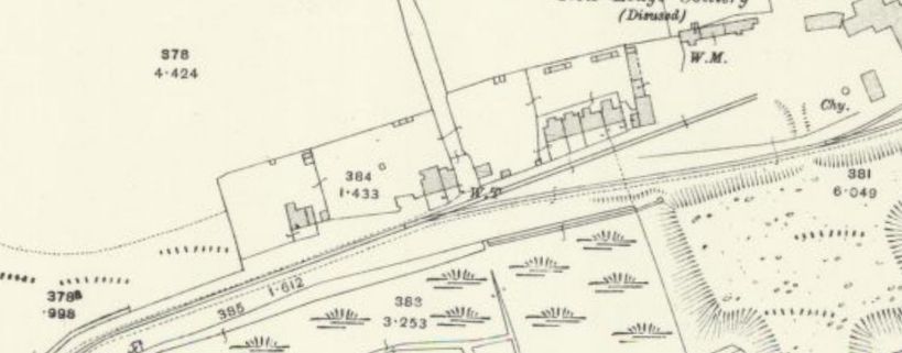
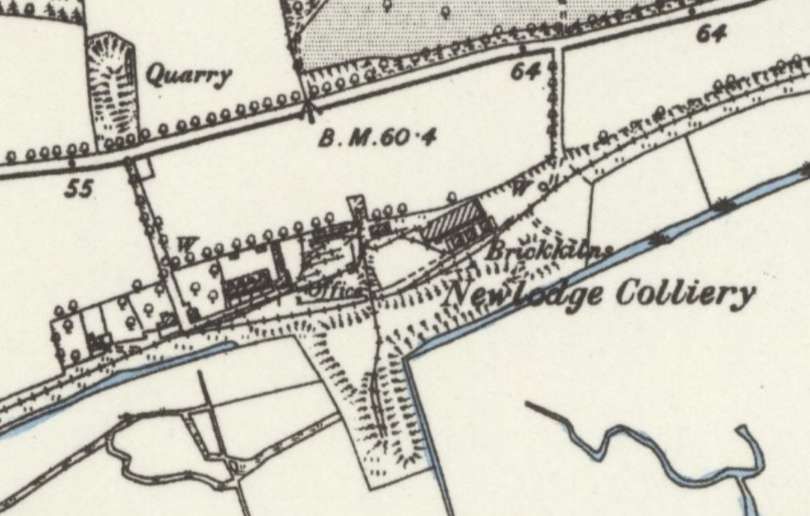
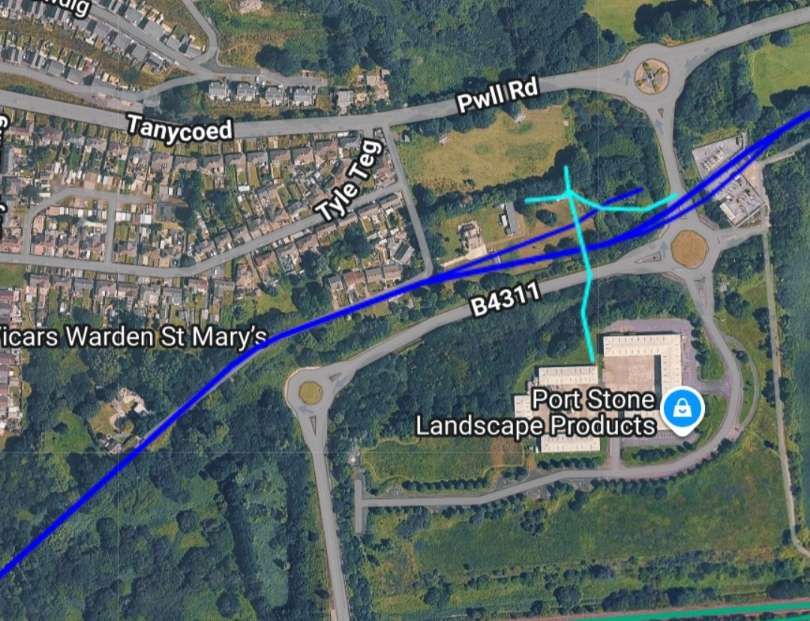
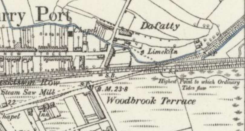
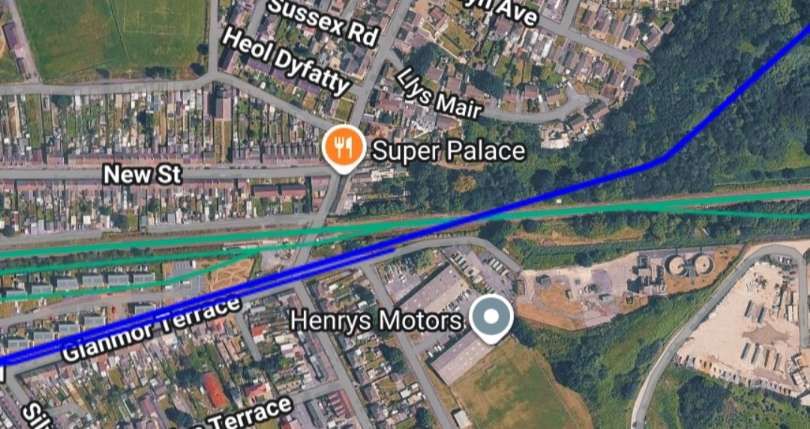
Given that the BP&GVR was built on the line of the Kymer’s Canal it is much more likely that, rather then crossing the GWR at level, the BP&GVR passed under the GWR main line making use of the canal tunnel/bridge. As we have already noted, because the railway replaced a canal network, it inherited very low bridge clearances originally meant for horse-drawn canal boats. This forced the railway to use uniquely modified, low-profile steam locomotives with cut-down cabs and boiler fittings to squeeze under the structures.
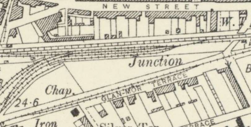
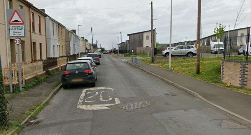
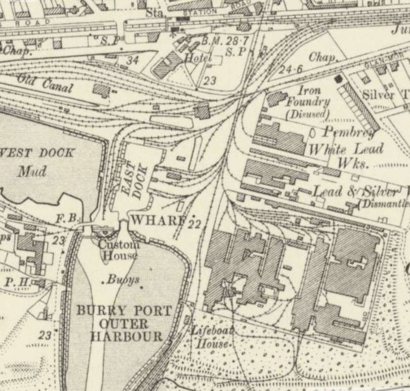
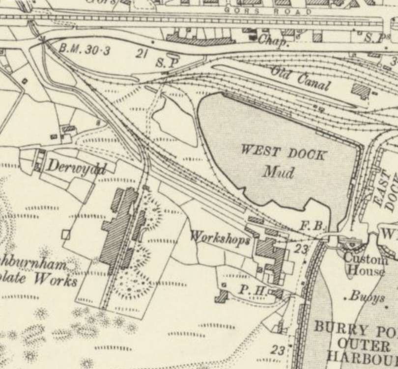
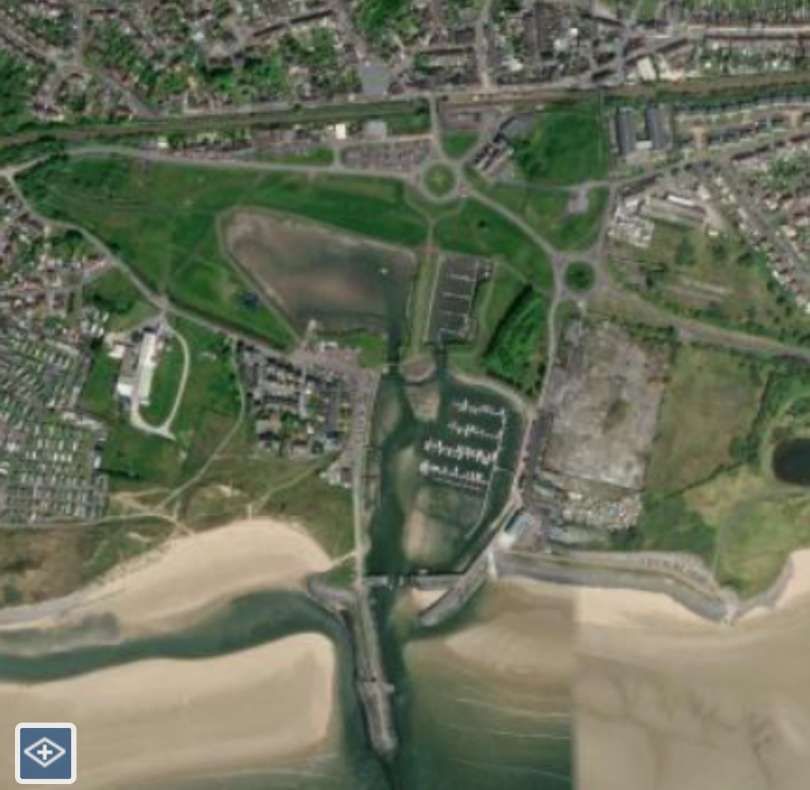
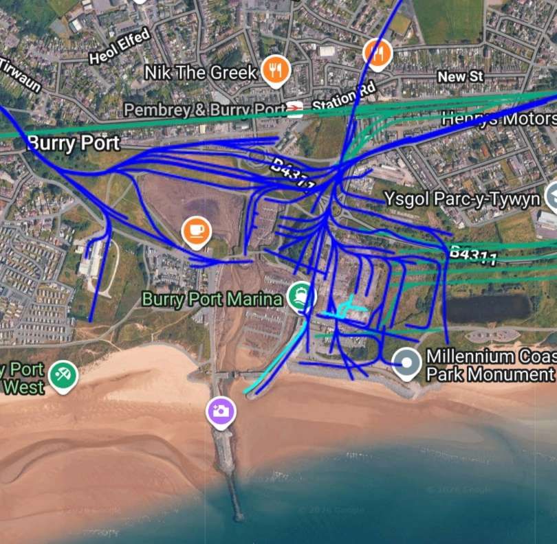
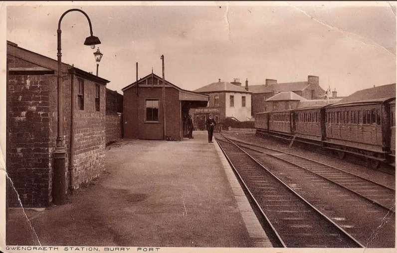
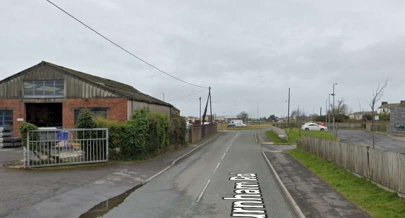
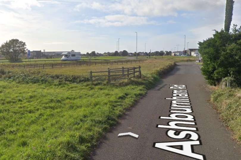
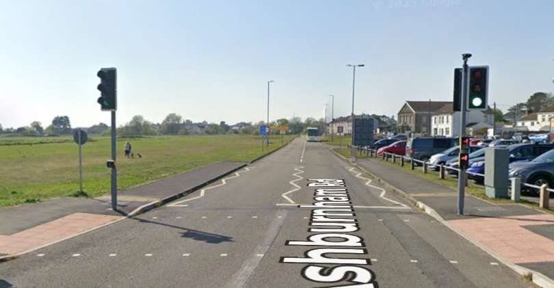
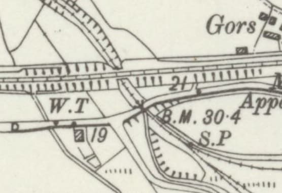
This would seem the appropriate point to pause in our journey along the BP&GVR main line to look at the Cwm Capel Branch.
The Cwm Capel Branch of the BP&GVR
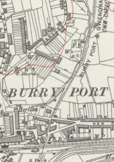
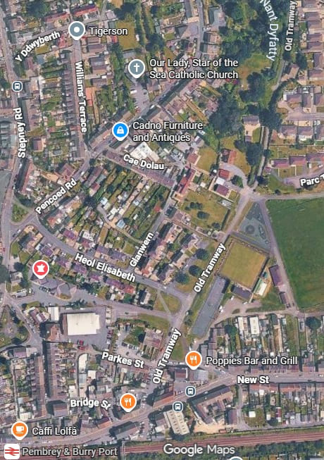
The Cwm Capel branch of the BP&GVR left the port area of Burry Port in a northerly direction, passing under the GWR main line to the East side of the GWR Railway Station. It then crossed Station Road and Parkes Street, and ran North-northeast through, what was in the early 20th century open ground. [26]
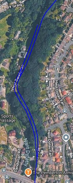
The satellite image below [Google Maps, September 2026] shows that the line of BP&GVR is now occupied over this length by a road named ‘Old Tramway’. It appear to run alongside the Nant Dyfatty. Some open ground remains but much has been built over.
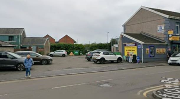
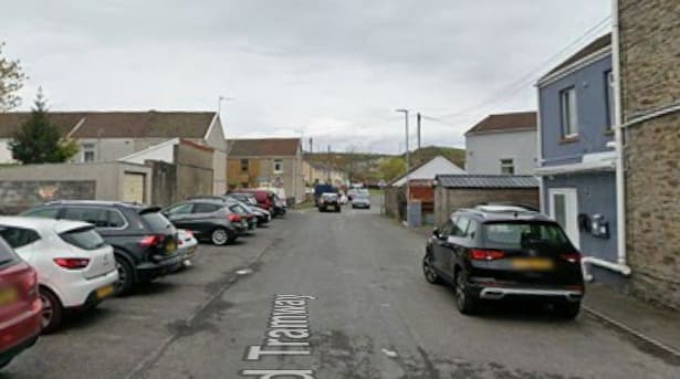
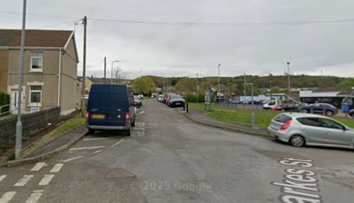
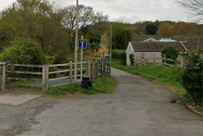
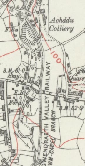
The next length of the Cwm Capel Branch. [26]
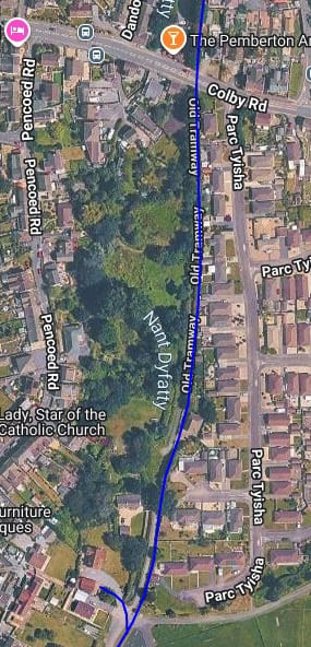
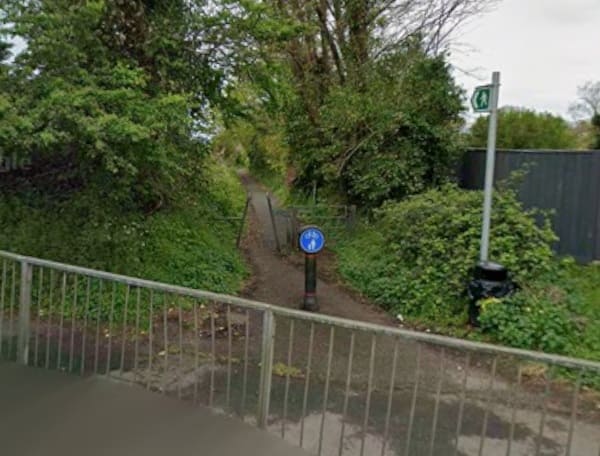
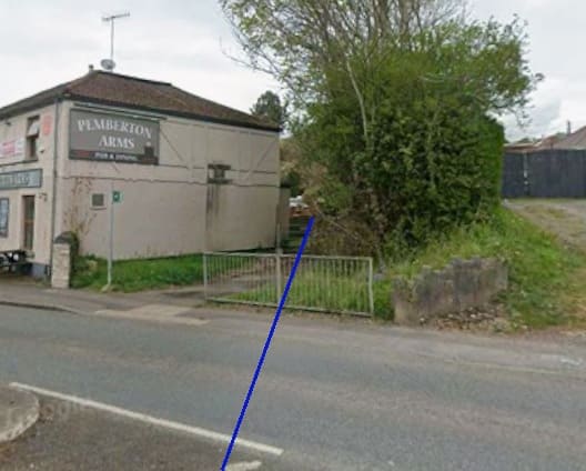
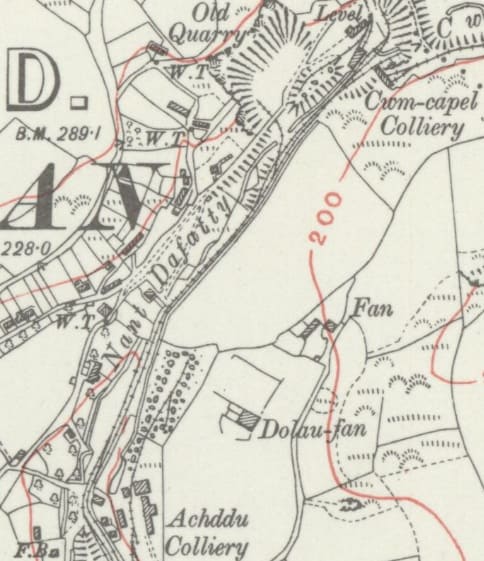
The next length of the line runs through the area of Achddu Colliery which appears on the 6″ Map extract above. [20]
Small-scale coal workings in the area date back to around 1814. Separate local pits were combined into the unified Achddu Colliery in 1903 by the Achddu Colliery Co. Ltd. Operations were primarily focused on working the Gwscwm Coal Seam/Vein. Coal was transported via the Cwm Capel branch to Burry Port harbour.
The main colliery phase ended in 1917, though minor related local industrial activities and subsequent reopening attempts or re-workings occurred into the late 1920s. [27]
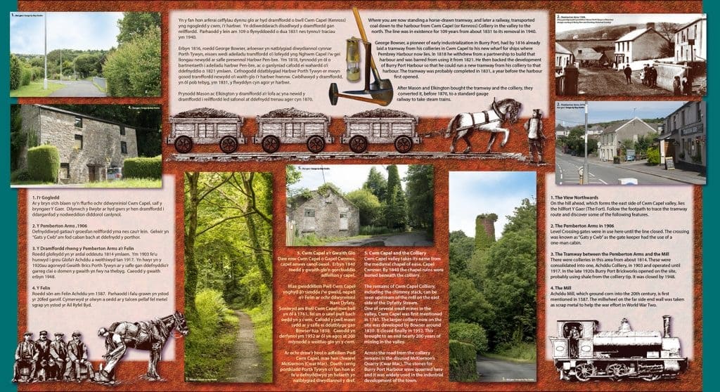
The Cwm Capel Branch of the BP&GVR was once a horse drawn tramway taking coal from Cwm Capel (Kenross) Colliery down to the wharves at Burry Port. More information can be found on the Pembury and Burry Port Heritage Website. [28]
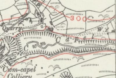
The remaining length of the Cwm Capel Branch led North to Cwm Capel Colliery. [26]
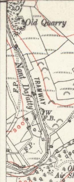
The tramway ran first East and then North towards Rhiw-las Colliery. [30]
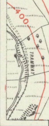
These map extracts are piecemeal as the tramway crossed between OS Sheets. [31][32]
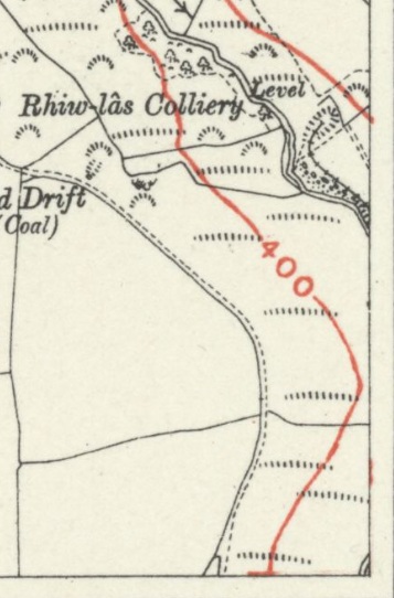
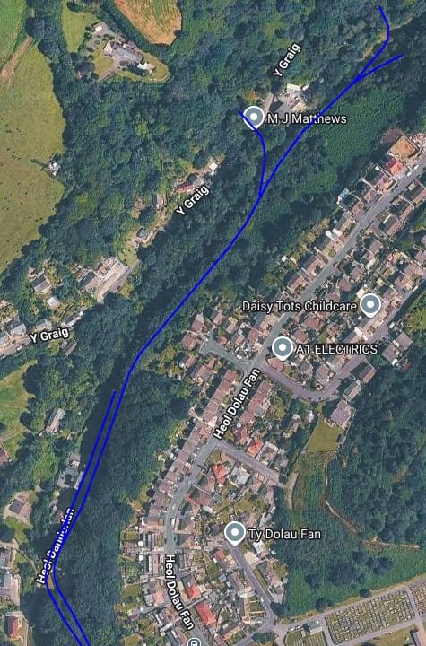
Railmaponl;ine.com shows the length of the old tramway that was converted into the Cwm Capel branch of the BP&GVR but not the extended tramway up to Rhiw-las Colliery. [20]
Cwm Capel colliery was first mentioned around 1761, a larger colliery was later developed on the site by George Bowser around 1830. Its expansion by 1840 completely engulfed the site of a medieval chapelry named Capel Cynnor.
Operated by multiple owners over its lifetime, coal was extracted from the Cenrhos and Coed Rhyal coal seams.
The colliery finally closed in 1952, ending nearly 200 years of recorded mining activity in the valley. [29][33]
The BP&VR main line again – just a short length!
We now continue our journey along the Burry Port & Gwendraeth Valley Railway to the West of Burry Port.
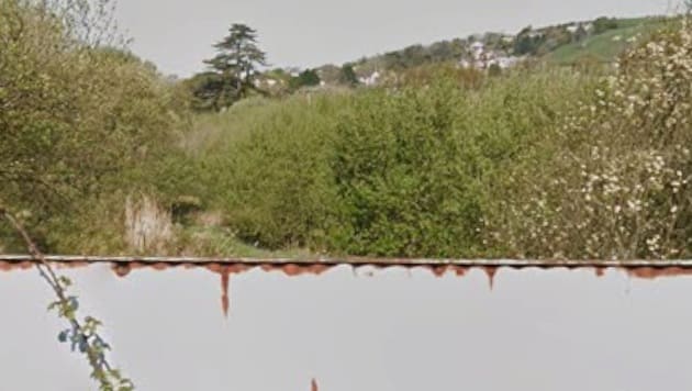
Looking East from the bridge carrying Furnace Road over the line of the BP&GVR. [Google Streetview, April 2025 & March 2009]
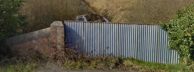
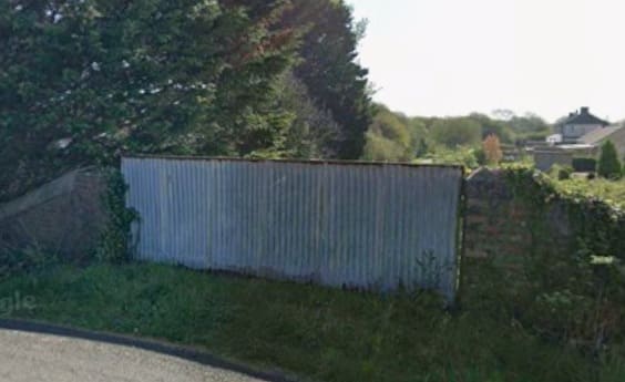
Looking West from the bridge carrying Furnace Road over the line of the BP&GVR. [Google Streetview, April 2025 & March 2009]
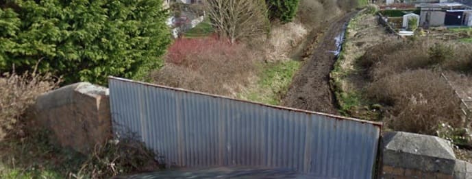
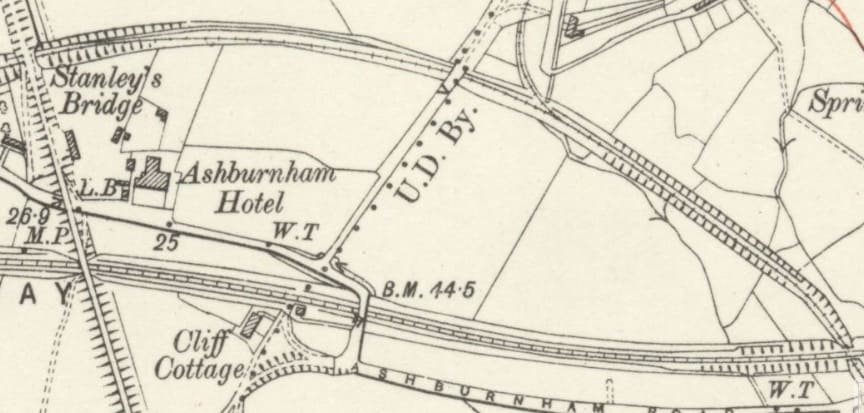
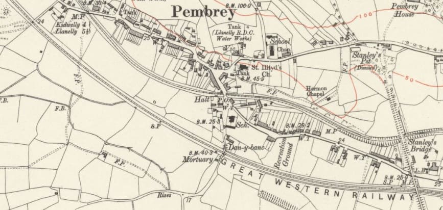
The old tramway, noted at the left of the map extract above, was not part of the BP&GVR network. It connected Stanley’s Pit to the old Pembury Harbour which was replaced by the facilities at Burry Port. As can be seen above both the GWR and the BP&GVR had to provide bridges to carry the old tramway over their right of way.
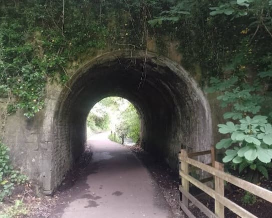
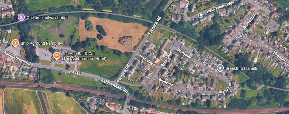
The BP&GVR provides the formation level for the National Cycle Route No. 4 which follows the route of the old railway. This tunnel takes the cycle route under Stanley’s tramroad and was provided for the BP&GVR. It sits at the top-left of the map extract above and is marked by the lilac flag on the top-left of the satellite image below, (c) David B. W. Rees (2024). [Google Maps, September 2026]
The Furnace Branch
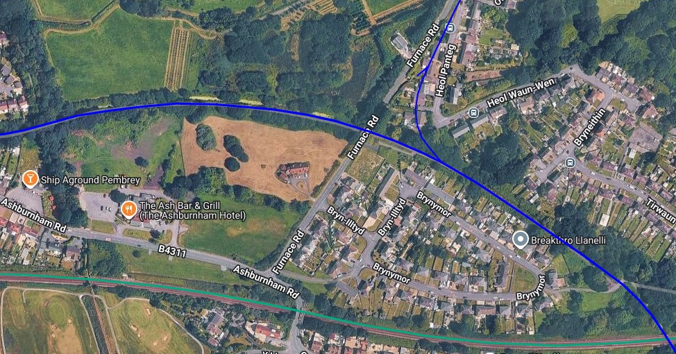
In the satellite image above and on the previous 6″ extract from the 1913 Ordnance Survey a branch line can be seen leaving the BP&GVR to the East of Furnace Road. This branch line was short leading to the furnace that gave the name to the adjacent road.
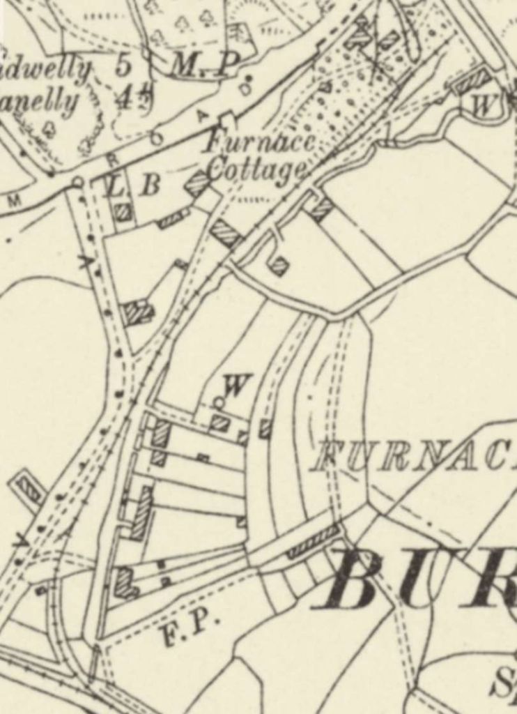
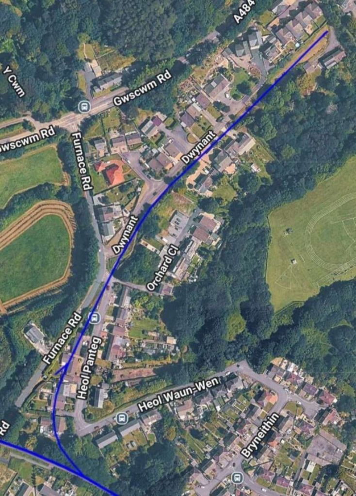
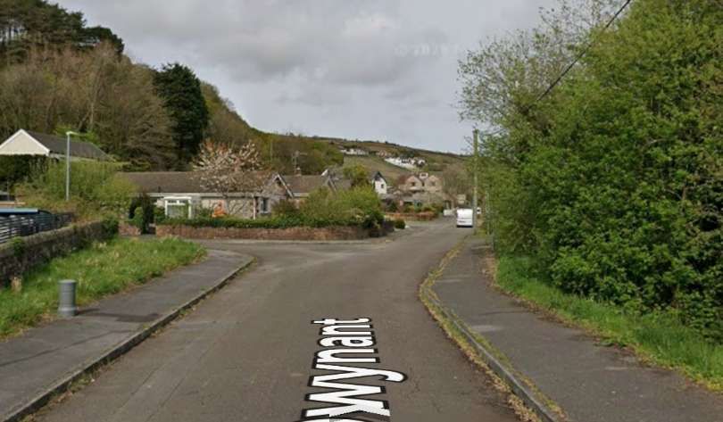
In 1810, an attempt was made to establish an iron works called Pembrey Iron Works, probably in the area now known as Furnace in Burry Port, but it didn’t last long and was closed by 1816. The site of it was likely re-developed by the Pembrey Iron and Coal Company in 1824. [34]
The Pembrey Iron and Coal Company was formed by George Bowser and Thomas Gaunt, who leased marshland from Lord Ashburnham to develop local industry. Pembrey Harbour was built in 1819 at Carreg Edwig to export coal from local mines like Gwscwm and Cwm Capel, and to serve the iron foundry. The Pembrey Canal was a two mile canal opened in 1824 to connect the harbour to the Kidwelly and Llanelly canal network, transporting coal and iron ore via horse-drawn barges. Years later, John Stanley took over management of the company (around 1845) as the area’s industrial focus shifted toward nearby Burry Port development and copper smelting. For more information about the tramroad, please click here. [35]
The BP&VR main line again – West of Stanley’s Bridge
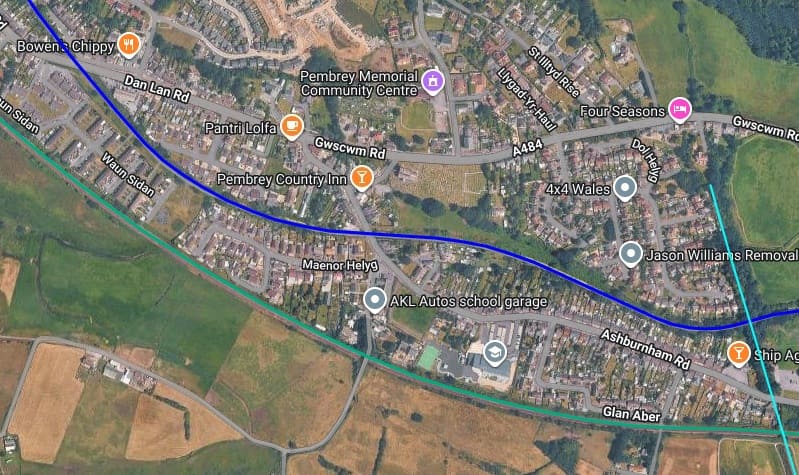
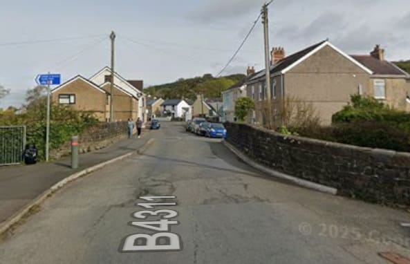
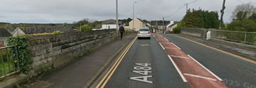
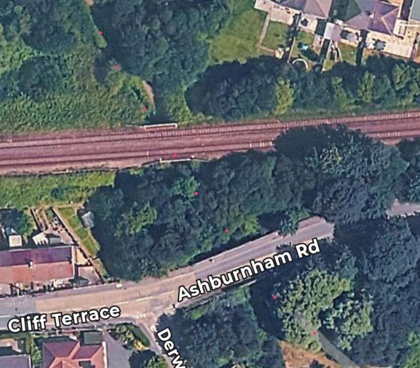
Looking Southeast from the bridge carrying the A484 over the old BP&GVR. [Google Streetview, April 2025]
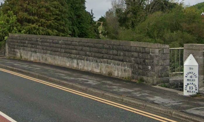
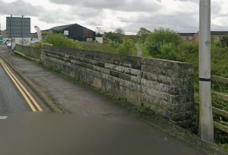
Looking Northwest from the bridge carrying the A484 over the old BP&GVR. The height at which the photograph was taken does not allow the tarmacked formation of the National Cycle way to be seen. [Google Streetview, April 2025]
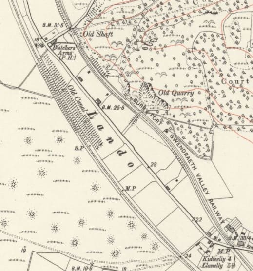
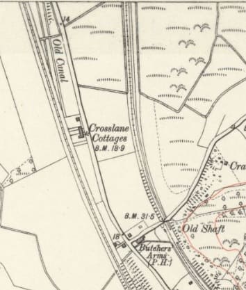
The line turned North, roughly parallel to the GWR, both map extracts are from the same OS Sheet. [26]
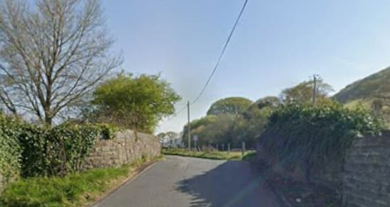
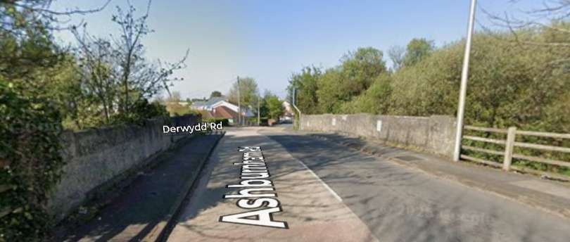
Looking Northeast along the minor road which bridges the old railway. These are the rough stone parapets of the bridge. [Google Streetview, April 2025]
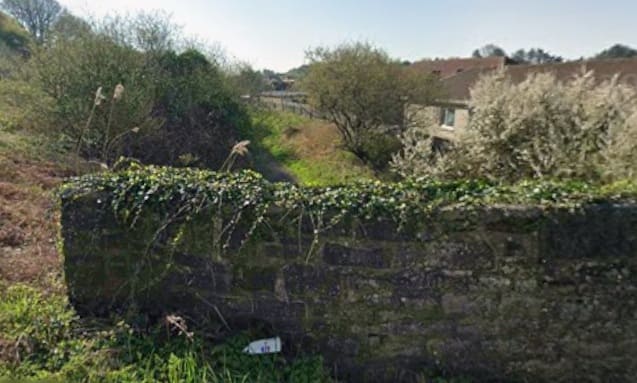
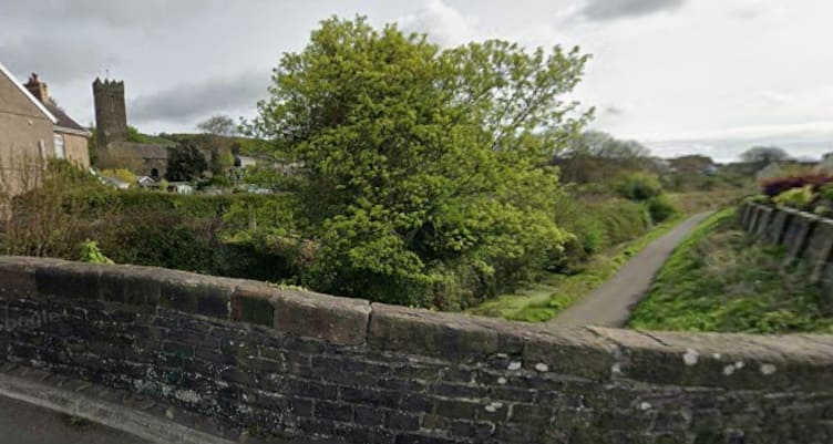
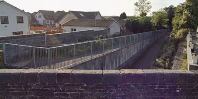
Looking Southeast over the wingwall parapet of the same bridge. The tarmac of the cycle way can just be made out. [Google Streetview, April 2025]
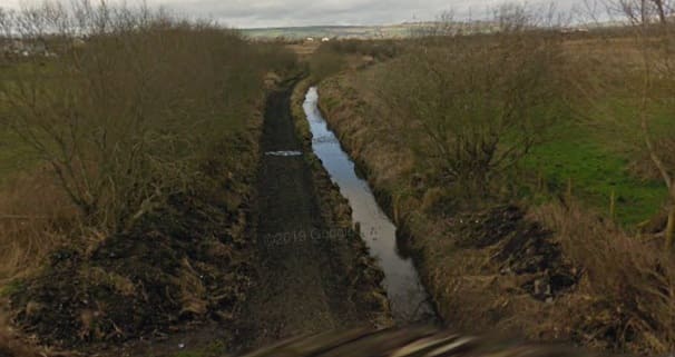
Vegetation growth by 2025 meant that nothing other than vegetation could be seen over the Northwest parapet by that date. This image from 2009 shows the condition of the cycleway prior to being tarmacked. [Google Streetview, March 2009]
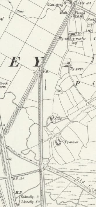
The next 6″ Ordnance Survey sheet from 1913/1914 was not published until 1946. It shows the line heading North and then turning Northeast. [36] Railmaponline has the same details [20]
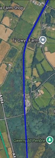
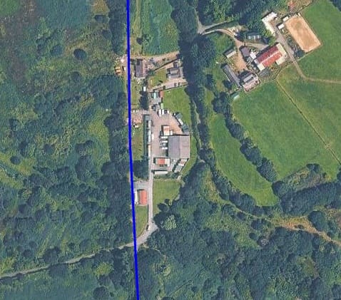
A closer view of the first crossing location above. [20]
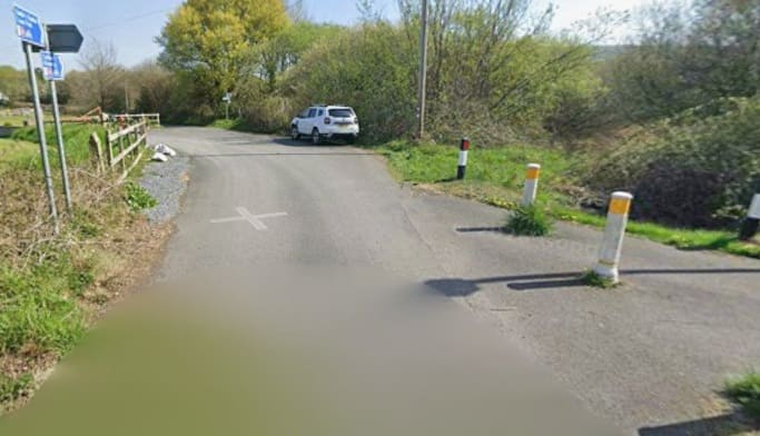
The line crossed the next minor road on the level. [Google Streetview, April 2025]
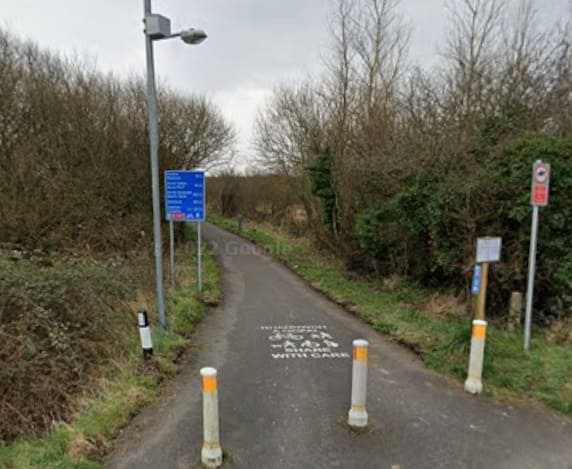
Looking back South from the old crossing point on the BP&GVR. [Google Streetview, March 2022]
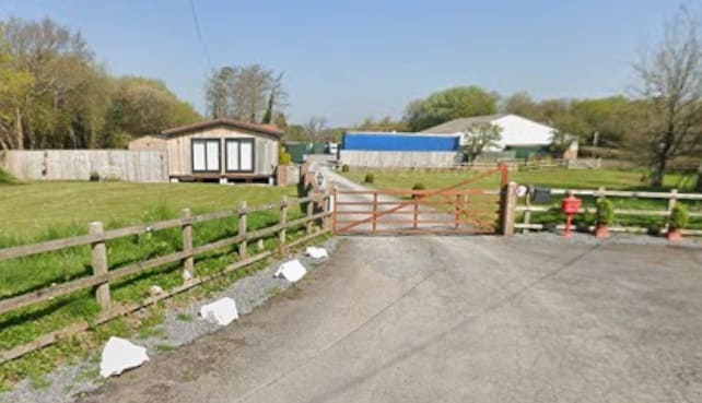
Looking North along the line of the BP&GVR from the same crossing location. The old railway ran to the left of the portable building which is prominent in this photograph. [Google Streetview, April 2025]
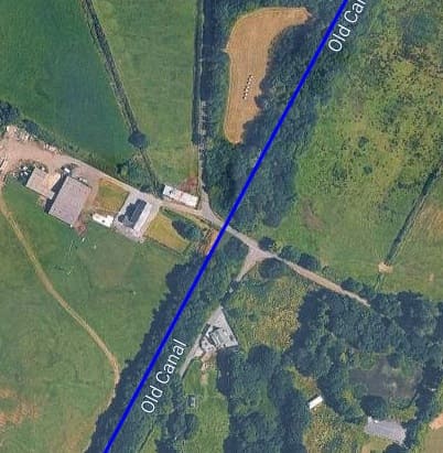
The next significant location heading North along the old railway is shown here. This bridge is at the top of the map extract above. [20]
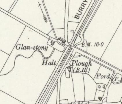
The same location as shown on the 6″ Ordnance Survey of 1913/1914 which was not published until 1946. [36]
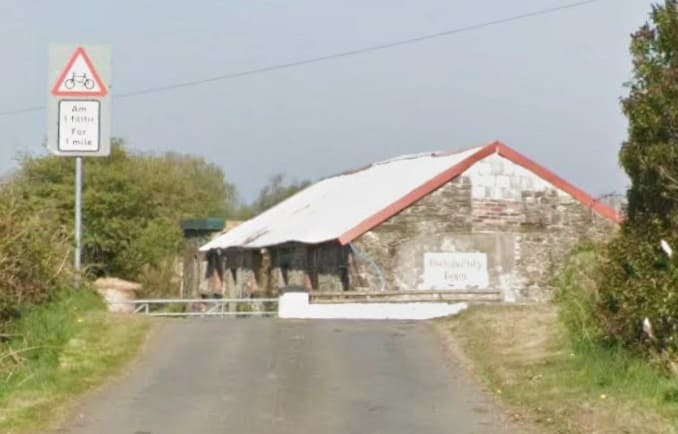
The humpback bridge at this location, no longer appears to have its parapets and the span below may well have been filled. There is nothing to see at the location looking either direction along the old railway. [Google Streetview, April 2025]
The Trimsaran Branch
Just to the South of a bridge over the Gwendraeth Fawr a branch line headed East away from the BP&GVR main line. It is shown on the map extracts and Railmaponlin.com satellite images below.
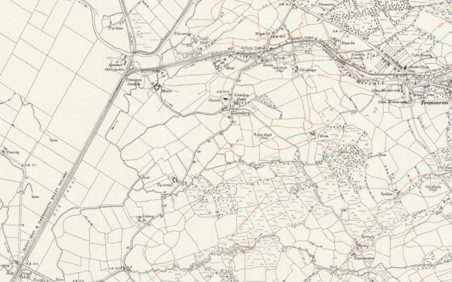
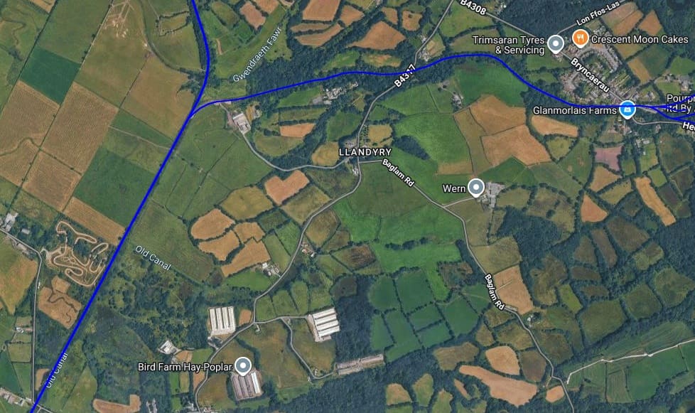
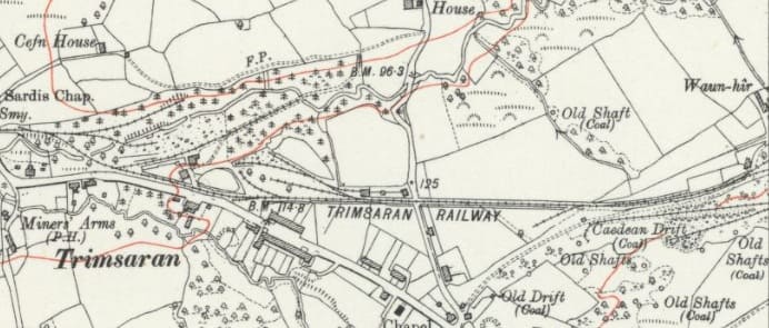
The next length of the Trimsaran Branch as shown on the 6″ Ordnance Survey of 1913/1914 published in 1946. [36]
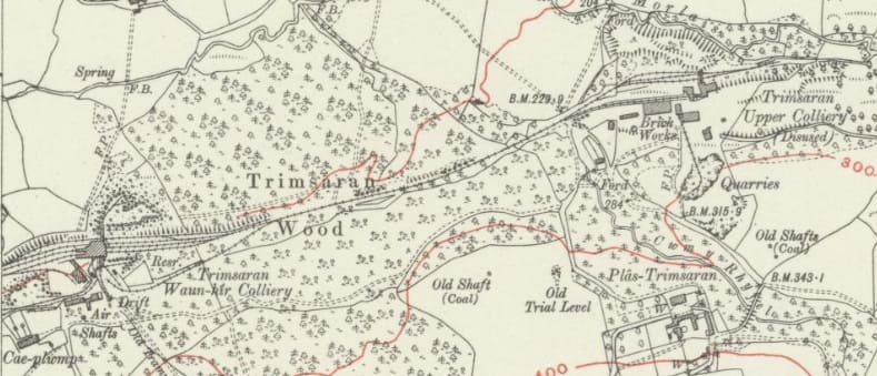
The final length of the Trimsaran Branch as shown on the 6″ Ordnance Survey of 1913/1922. [37]
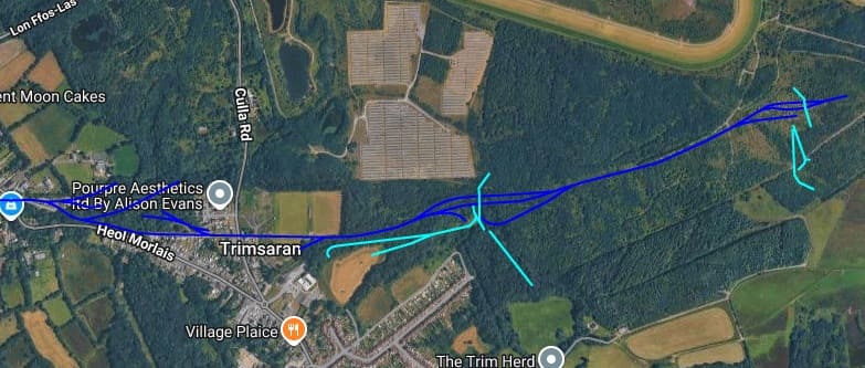
In the Trimsaran valley, small-scale surface mining and bell pits (such as those found near Coed y Clun) date back to the 1600s or earlier to supply local smiths. By the late 19th and early 20th centuries, large-scale operations at Trimsaran Colliery grew into a network of drift and slant mines—principally the Caedean (deepest), Waunhir, and Upper Slants (Coal Seams). Employment at the colliery grew from 144 men in 1896 to a peak of over 700 workers by 1931. It produced valuable anthracite and fireclay. The last traditional drift mine closed in 1954, though large-scale open-cast mining operations (operated by firms like Sir John Jackson, Jackson, and Wimpey) continued until 1997. [38]
An ironworks operated around 1900, employing hundreds of local workers. Local brickworks produced durable, hard-fired bricks until 1967, which were used to build garden suburbs and homes throughout Llanelli, Pontyates, and Pontyberem. [39]
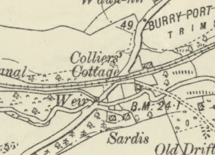
The first significant location on the branch was the level-crossing adjacent to Collier’s’ Cottage on what is now the B4317. There is no longer any evidence of the railway at this location. [36]
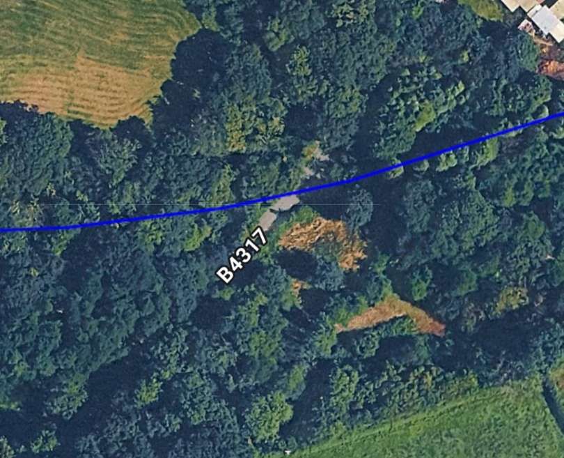
The same location in the 21st century. [20]
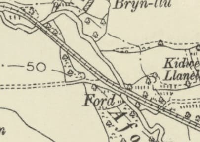
Further East, the line bridged the Afon Morlais twice in quick succession. [36]
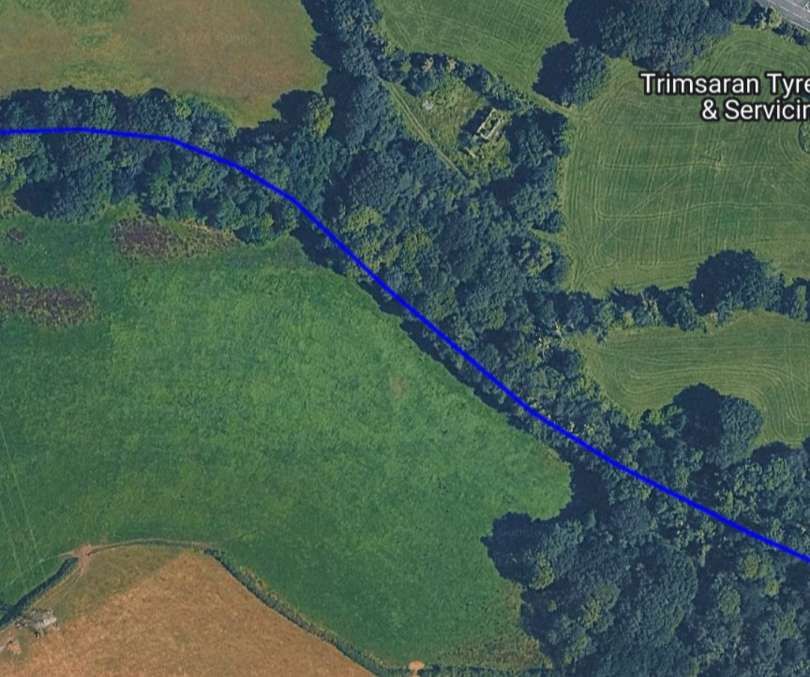
The same location in the 21st century. [20]
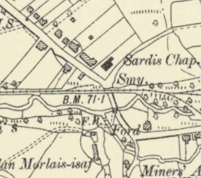
The road – Bryncaerau (B4308) – to the Northwest of the centre of Trimsaran. [36]
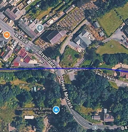
The same location in the 21st century. [20]
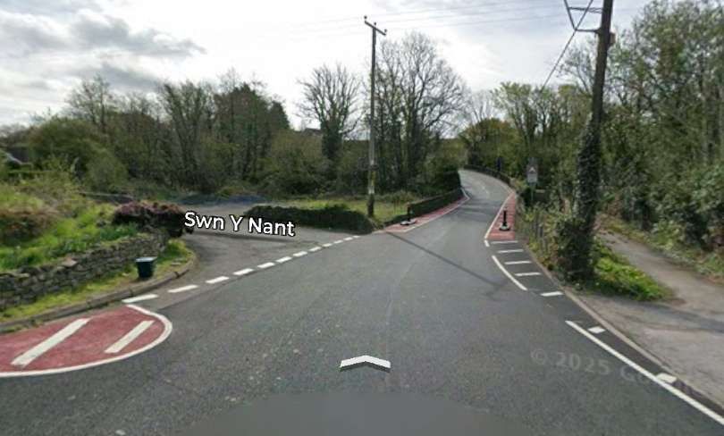
Looking Southeast down Bryncaerau, the old railway crossed the road at this location entering the image a little above bottom-right and running along Swn Y Nant (off the image centre-left. [Google Streetview, April 2025]
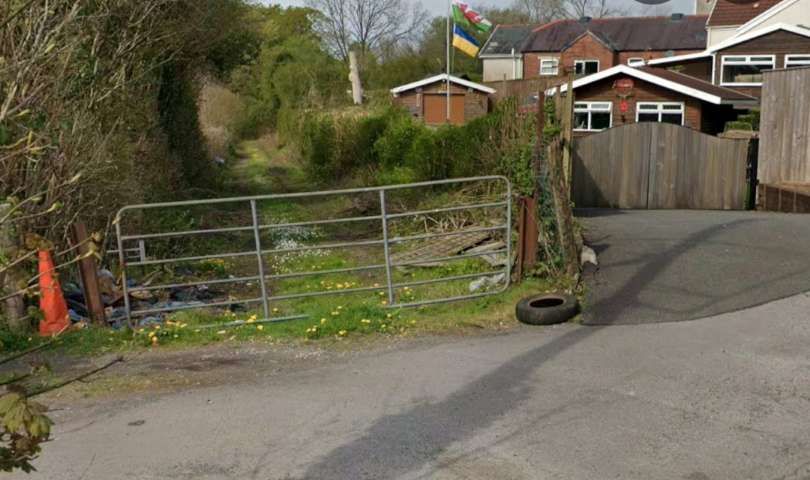
Looking West along the line of the old railway. [Google Streetview, April 2025]
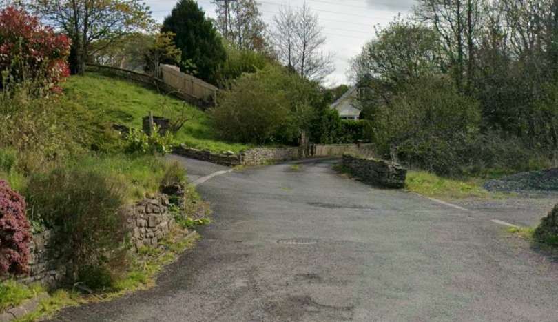
Looking East along the line of the old railway, along Swn Y Nant. [Google Streetview, April 2025]
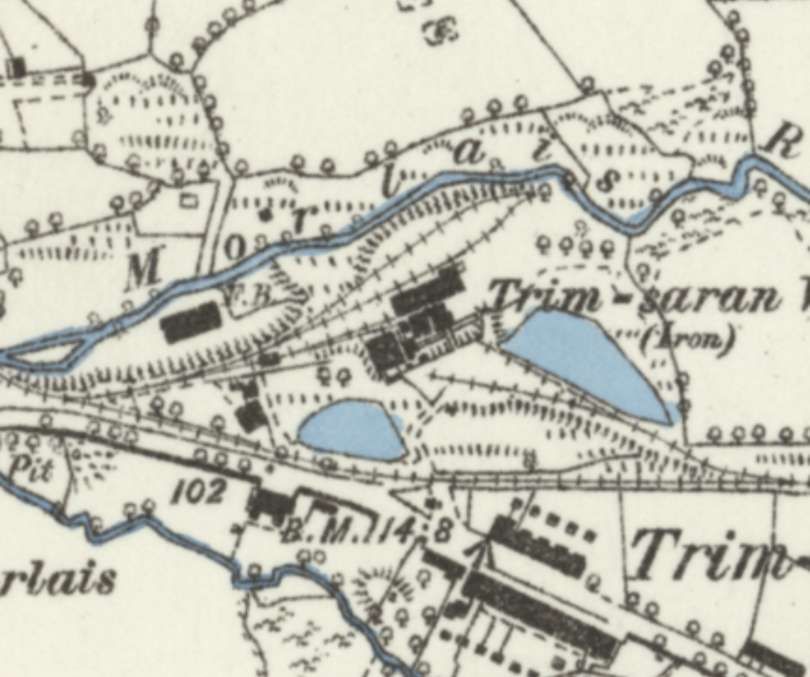
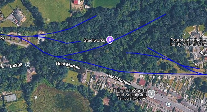
The branch line continued East beyond the Steelworks. …
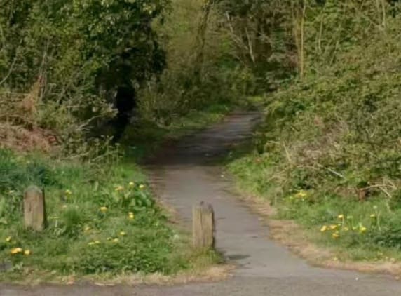
Looking back West towards Swn Y Nant from the location of the steelworks. [Google Streetview, April 2025]
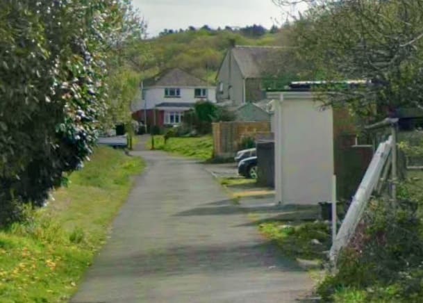
Looking ahead to the East along the line of the railway from the location of the steelworks. [Google Streetview, April 2025]
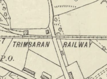
The road crossing over Culla Road (B4317). [36]
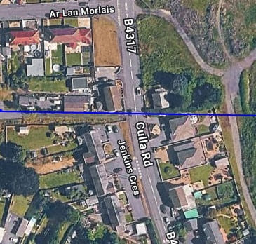
The same location in the 21st century. [20]
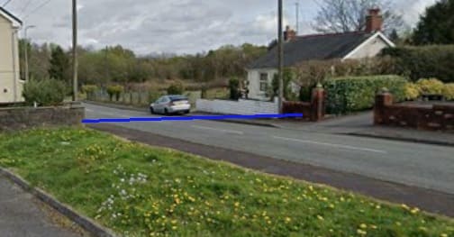
Culla Road seen looking North from Jenkins Crescent. The line of the old railway is highlighted by the blue line. [Google Streetview, April 2025]
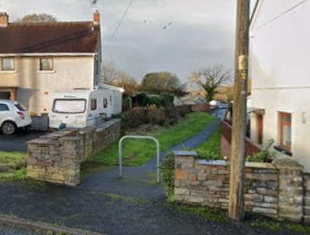
Looking back West from Culla Road along the line of the old railway. [Google Streetview, December 2021]
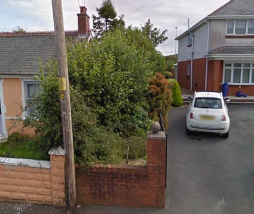
Looking East along the line of the railway. [Google Streetview, August 2011]
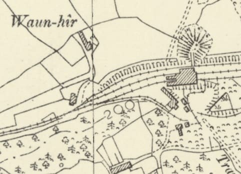
Trimsaran (Waun-hir) Colliery. The location spans the joint in two OS Sheets. [42]
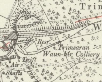
Trimsaran (Waun-hir) Colliery – this map extract sows the remaining length of the colliery sidings. The line continued on the the East beyond this mine. [37]
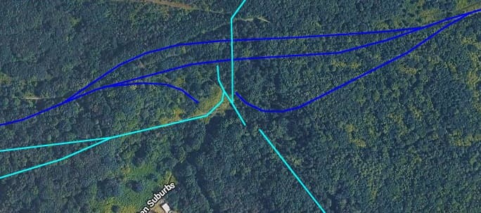
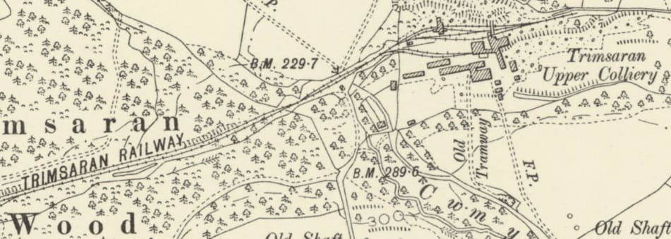
The BP&VR main line again – North of the Gwendraeth Fawr
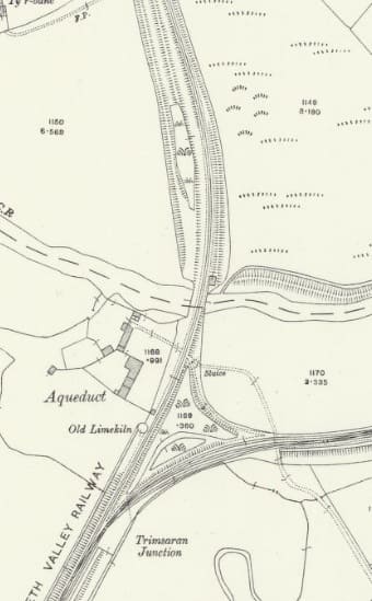
A short length of the Burry Port & Gwendraeth Valley Railway runs North from the Trimsaran Junction, across the Gwendraeth River (Fawr). [36]
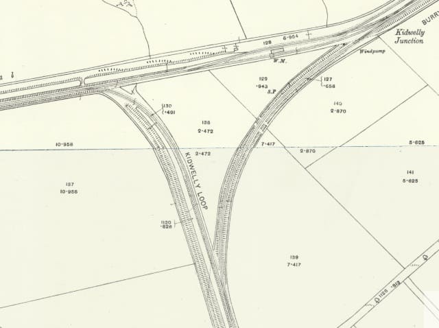
The Kidwelly Junction sits just to the North of the Gwendraeth Fawr. Its location spans the join between two adjacent 25″ OS Sheets. [43]
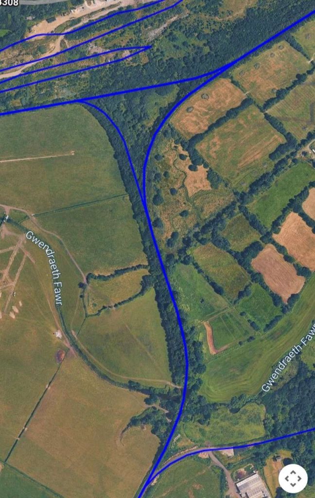
This extract from railmaponline.com’s satellite imagery covers the length of line shown on the two map extracts above. The sidings to the North of Kidwelly Junction served … [20]
The Line to Kidwelly
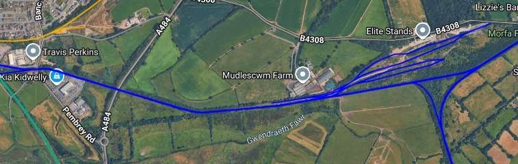
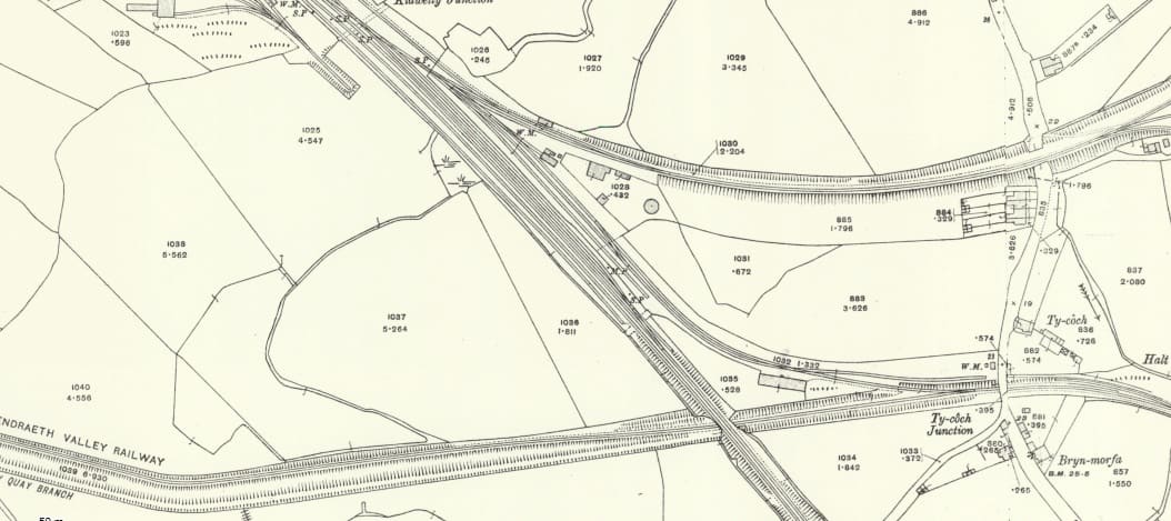
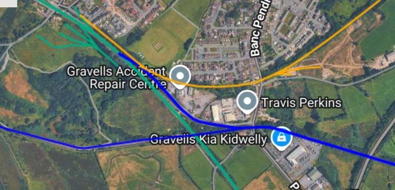
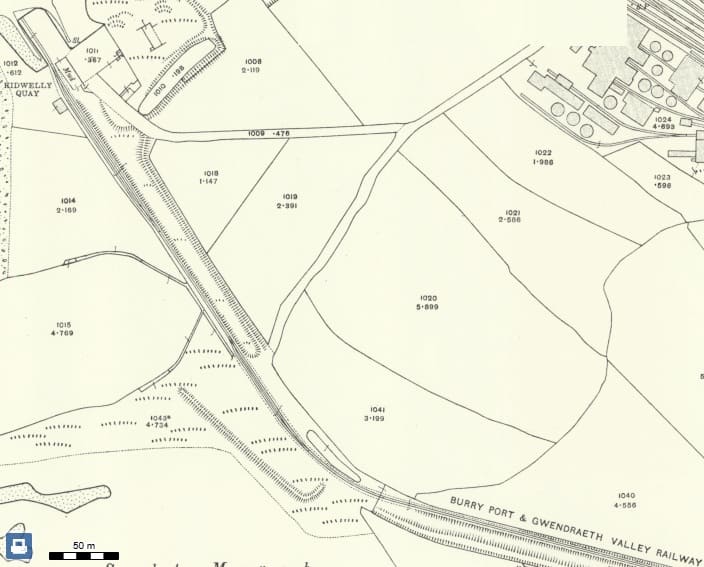
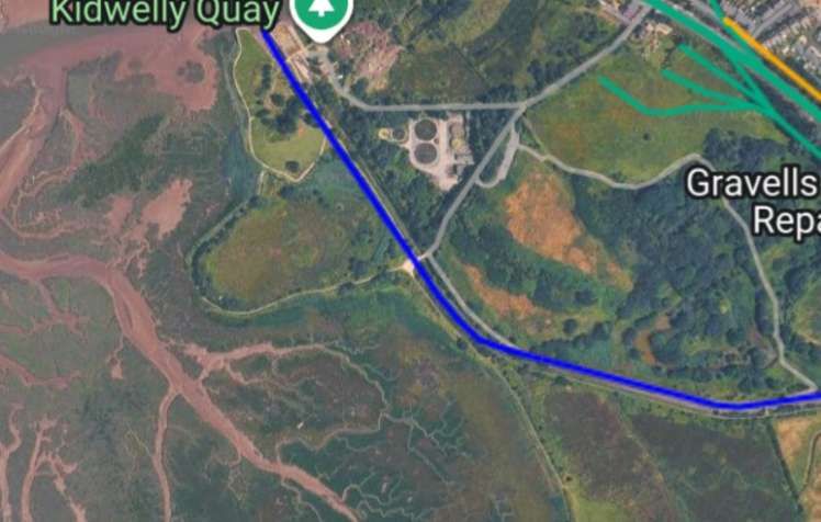
Railmaponline.com’s satellite imagery shows the Kidwelly Quay Branch. [20]
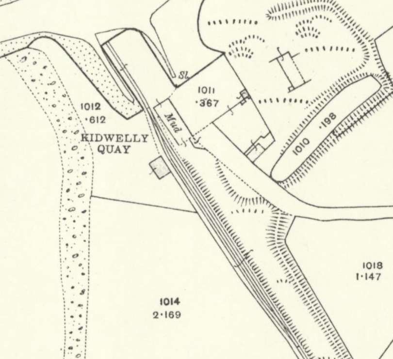
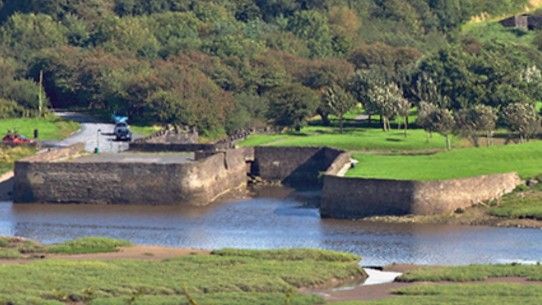
Kidwelly Quay was originally the transfer point between the barges used on Kymer’s Canal and ocean-going coasters. Kymer’s dock at Kidwelly continued to be used for the export of coal by coasters well into the 20th century. It was used as a rubbish dump during the 1950s, but together with a short section of the canal was restored in the 1980s. A few of the structures of the canal can still be traced in the landscape, and the route of the now closed railway can be followed for most of its length.
The BP&GVR Northeast of Kidwelly Junction
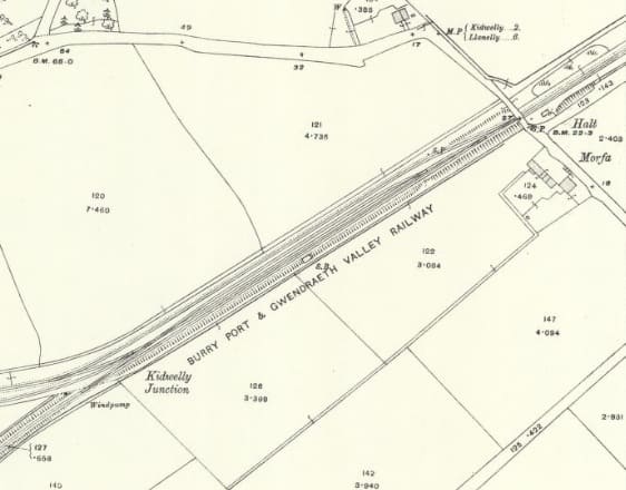
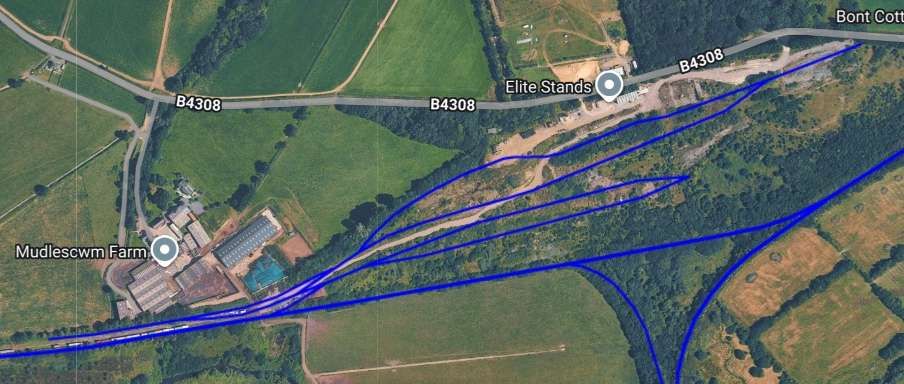
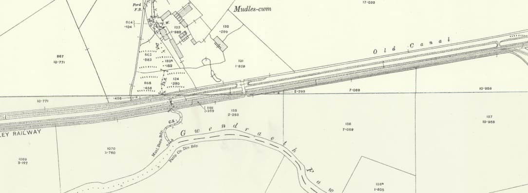
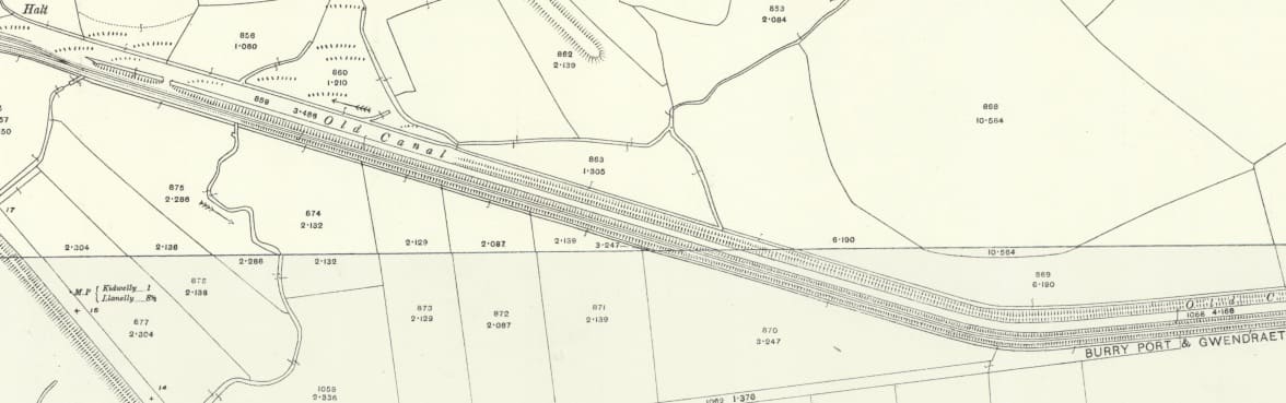
The 25″ Ordnance Survey of 1913, published on 1915 shows that the line headed Northeast from Kidwelly Junction and passed under what is the B4308 in the 21st century. [51]
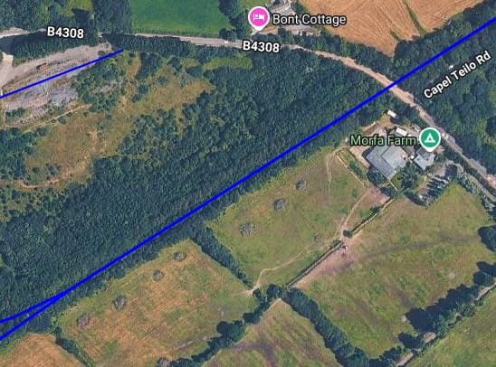
The same area as shown on railmaponline.com’s satellite imagery. [20]
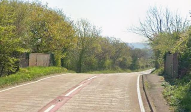
Looking Southeast along the B4308 over the line of the railway. The metal bridge parapets remain in place. [Google Streetview, April 2025]
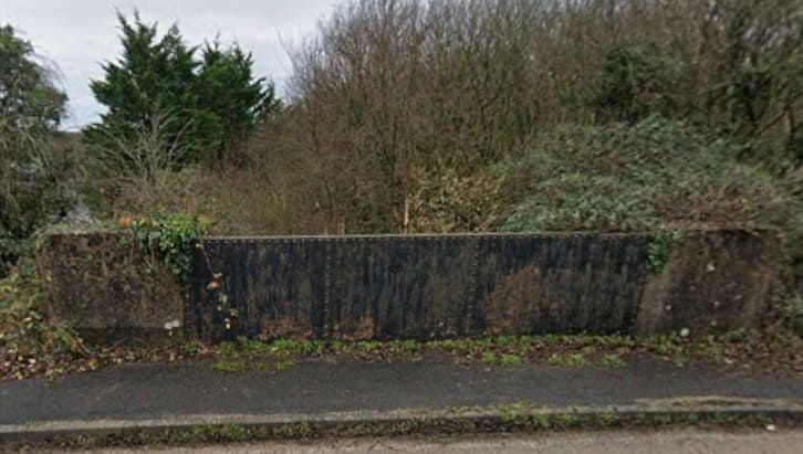
Looking Southwest from the bridge carrying the B4308. Even in this wintertime view, it is impossible to see the formation of the old railway which is hidden by tree-growth. [Google Streetview, December 2021]
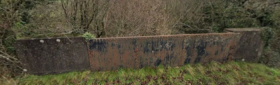
The same is true looking Northeast from the bridge carrying the B4308. [Google Streetview, December 2021]
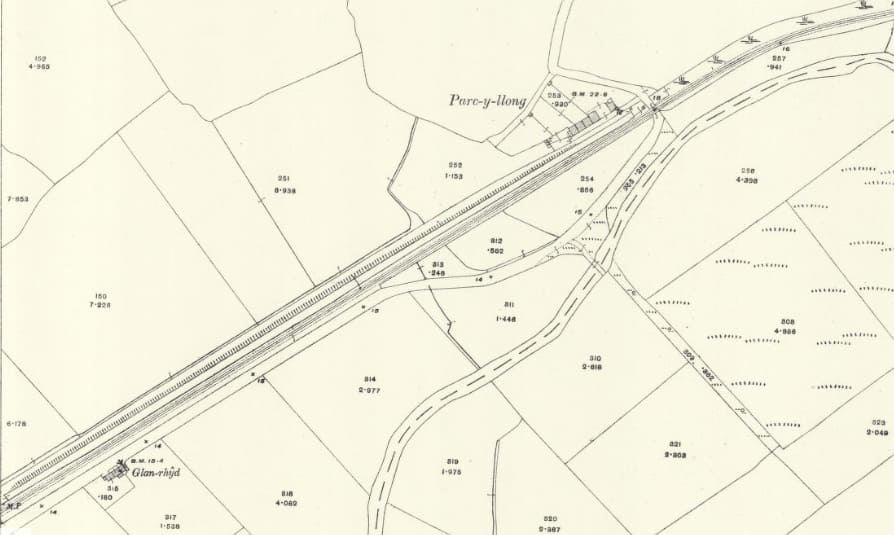
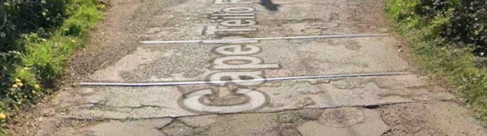
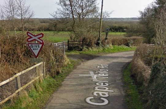
Looking Southeast as late as 2009, the furniture associated with the level-crossing also remained in place. In both 2009 and 2026, the route of the line was overgrown in both directions from the crossing. [Google Streetview, March 2009]
The Carway Branch/Siding
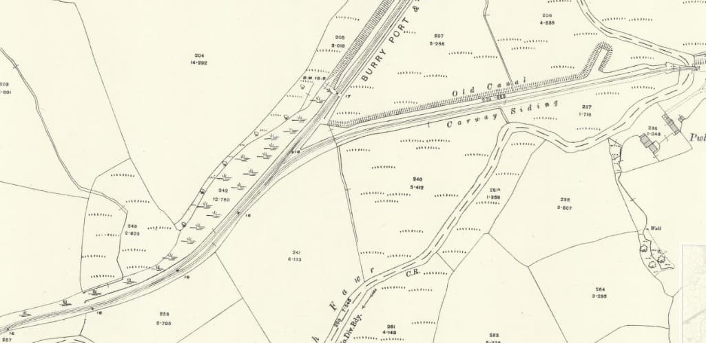
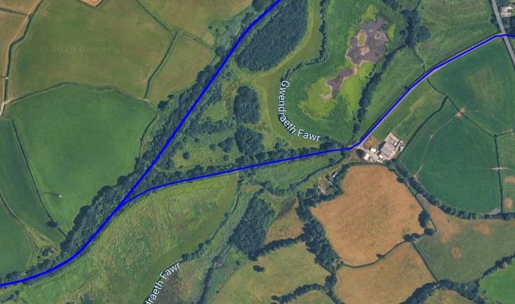
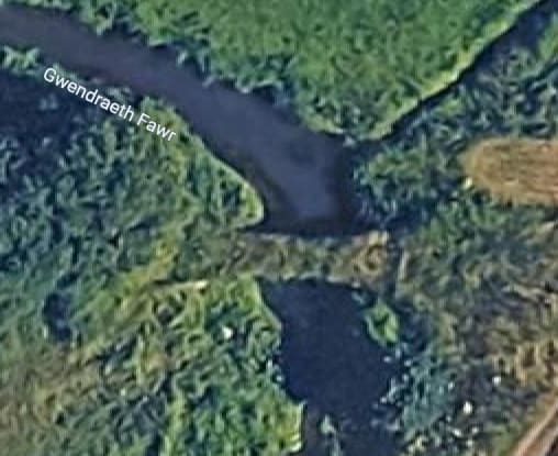
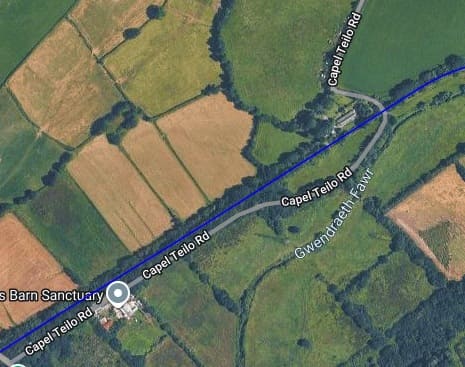
The old tramway/railway bridge over the Gwendraeth Fawr. [Google Maps, October 2026]
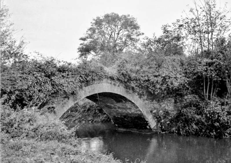
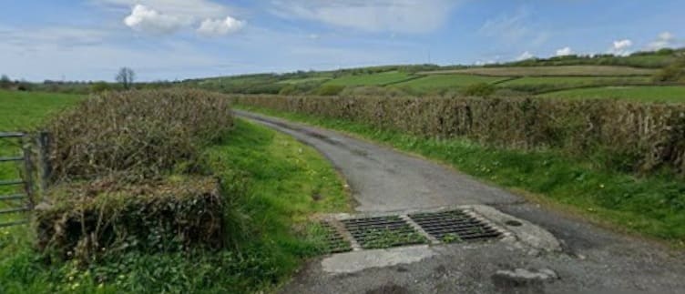
Looking back West along the line of the old railway which in the 21st century is an access road to Pwll-y-llygod Farm. There is nothing to see looking East but dense vegetation, with a golf course beyond. [Google Streetview, April 2026]
The BP&GVR main line again. …
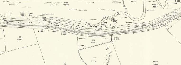
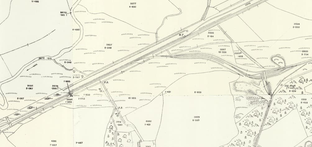
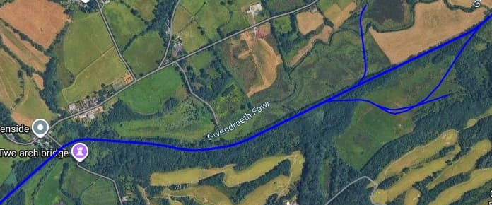
The Carway Colliery Tramway
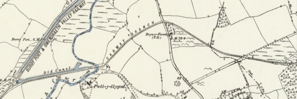
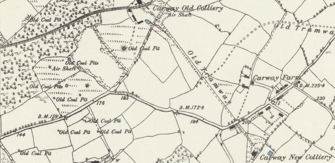
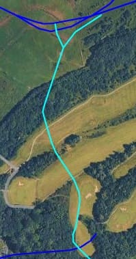
Earlier in this article we noted the Carway Branch which in 1879 was the rail link running West from Carway Old Colliery to meet the BP&GVR. By 1913, that line had been curtailed to a short siding connected to the BP&GVR. In its place was a line running from the colliery to screens
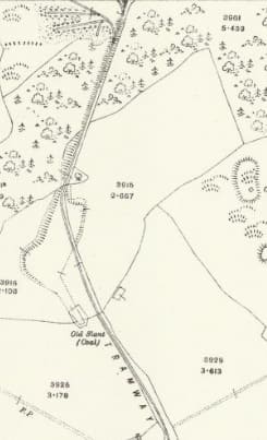
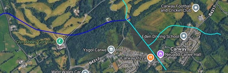
As we have noted the industrial tramway ran North/South between Caraway Colliery and its screens. [57][20]
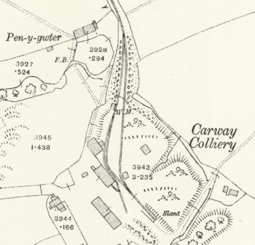
On the adjacent map extract, which shows the Colliery, the route of the old Carway Branch remains fenced/walled off towards the bottom-left, but with the track lifted. The newer private industrial line heads North from the Colliery. [57]
The BP&GVR continuing Northeast. …
We have noted that a loop left the BP&GVR to serve the screens of Carway Colliery. As of 1913, that loop was no more than a series of sidings serving Carway Colliery Screens.
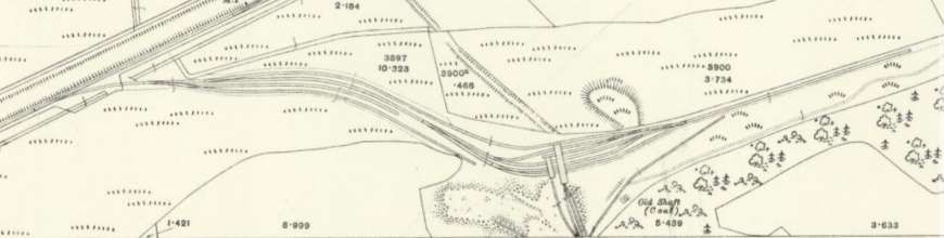
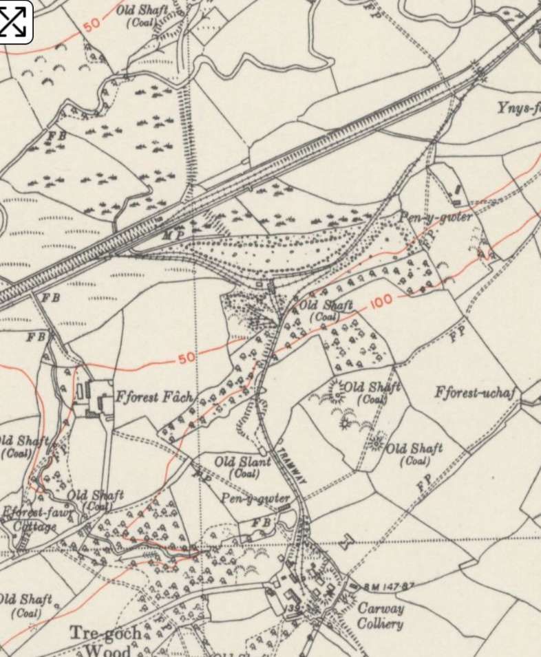
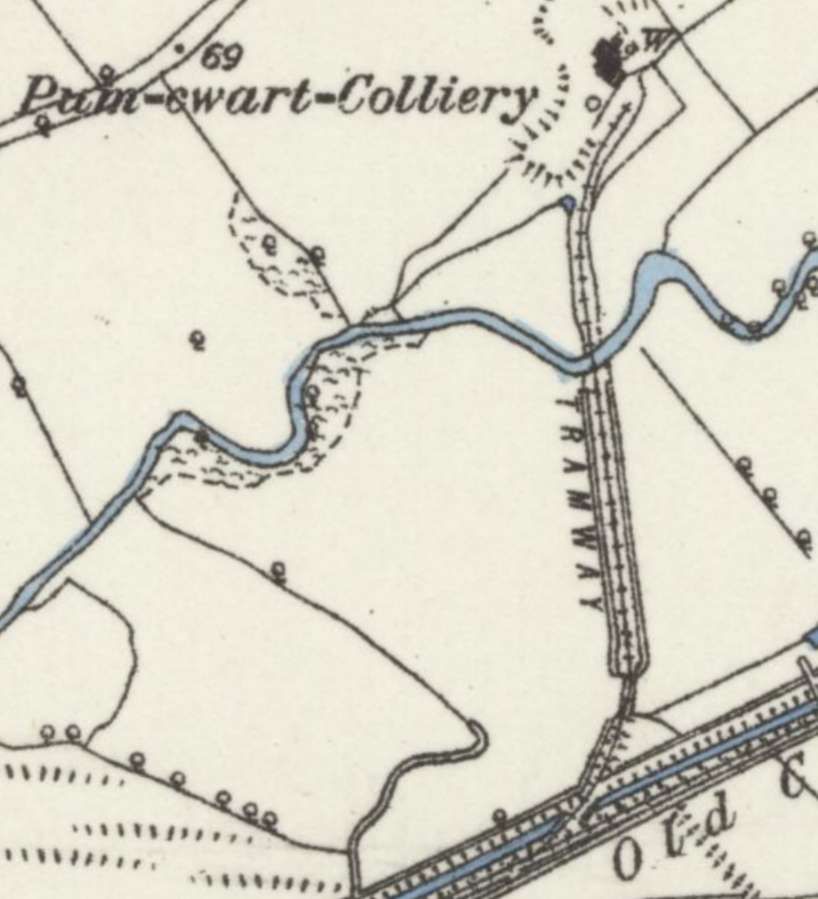
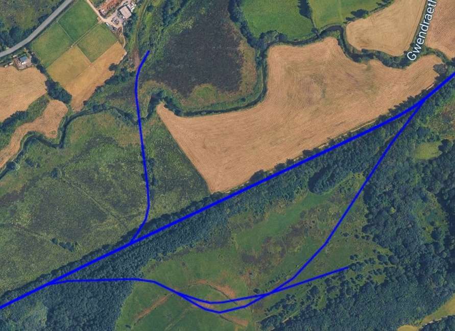
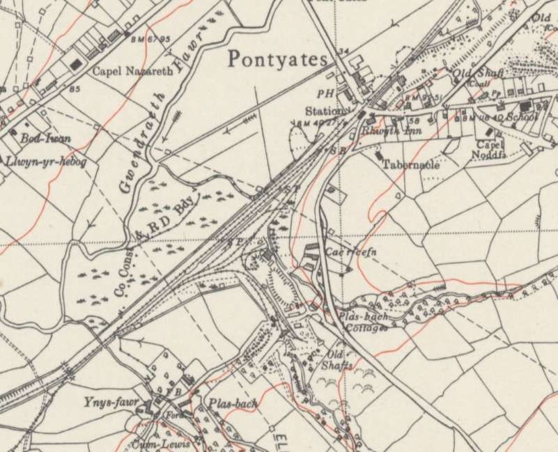
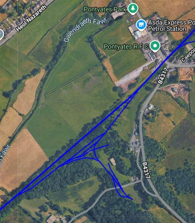
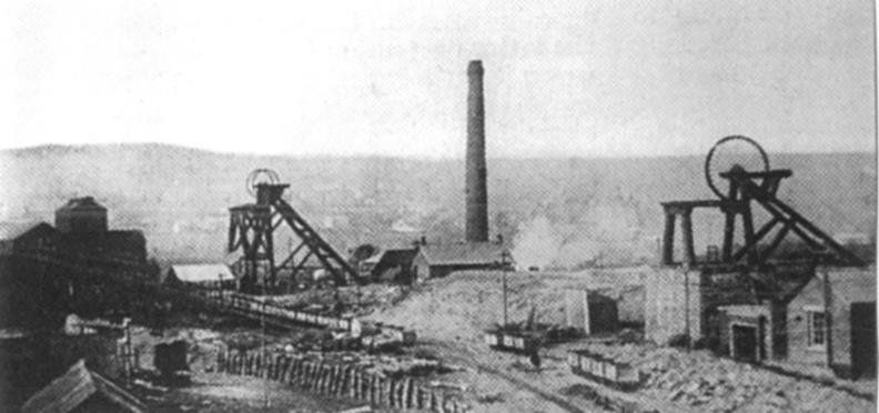
Plas-bach Colliery sat just to the Southwest of Pontyates. It was opened in 1856 by Roberts and Evans, the colliery featured two shafts, including one measuring 130 metres deep. The colliery extracted coal from three primary seams: the Gwendraeth, Gras, and Pumpquart. The Pumpquart seam was notorious for hazardous outbursts of methane gas and fine coal dust. Despite 20 recorded outbursts between 1920 and 1926, the mine maintained a record of zero fatalities during this period due to strong management and being one of the first in the valley to install underground electric lighting. It was linked both underground and via a surface tramway to the nearby Gwendraeth mine. Employment dropped from 202 workers in 1918 down to 19 men by 1923, and the site officially closed in 1928. So by the date of the 1948 survey it was long closed. [59][60]
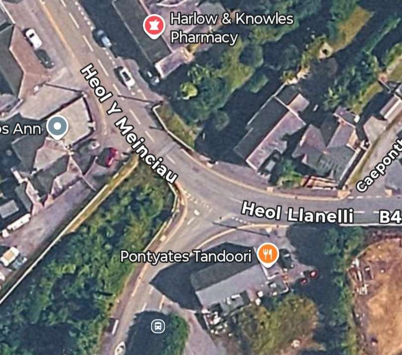
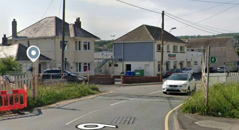
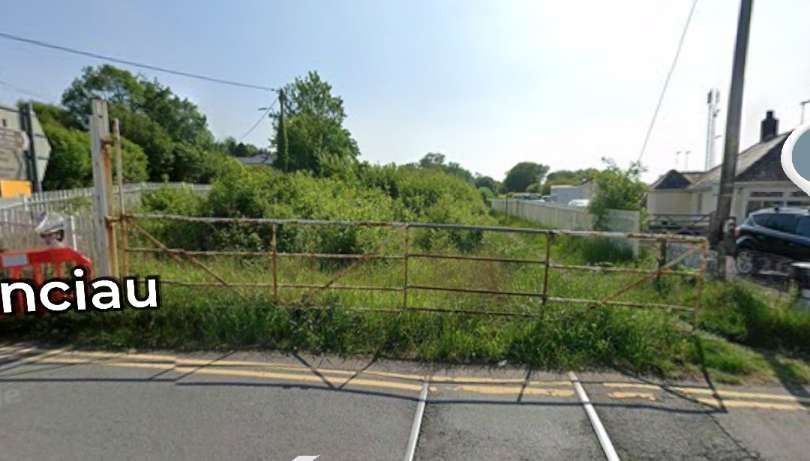
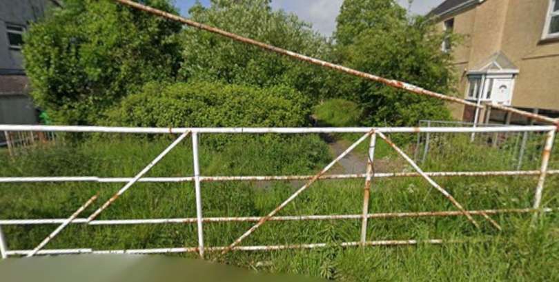
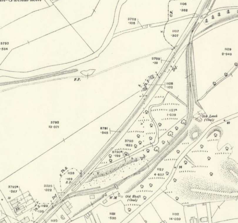
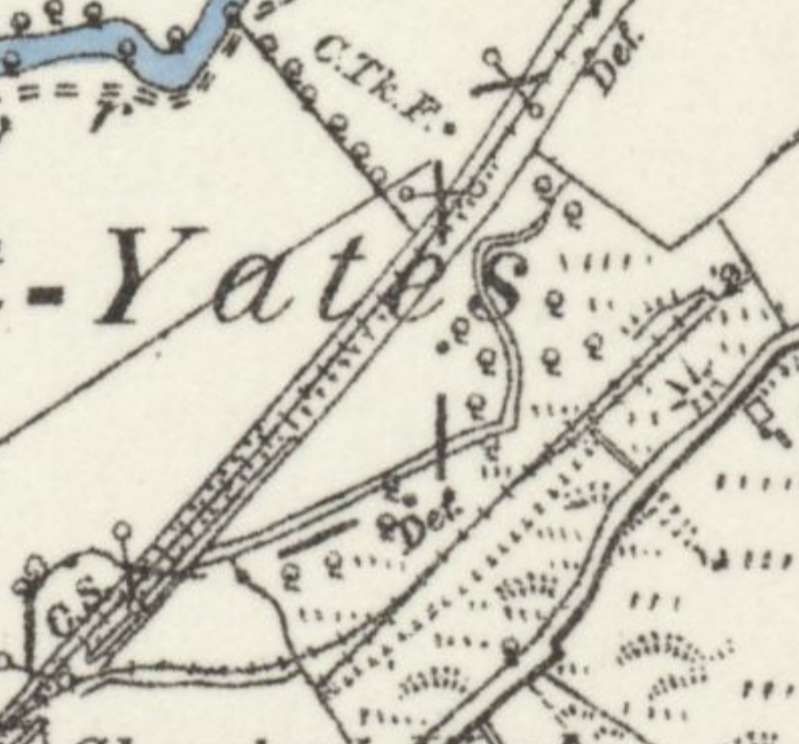
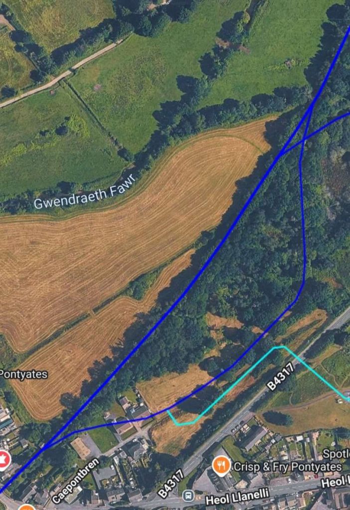
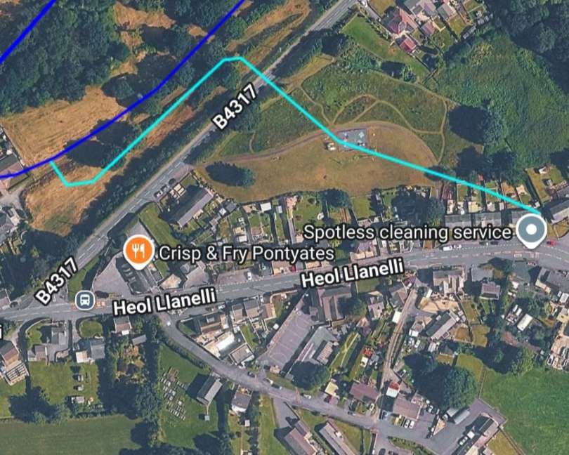
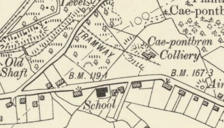
Cae-pontbren Colliery operated through various phases between 1887 and 1913. Two initial Shafts were sunk in 1887 to work the Braslyd and Gwendraeth seams, but operations failed and were abandoned in 1896 due to local faulting. A new drift opened in 1900 opposite the New Inn pub to work the Green Vein/Felen seam. By 1907 and 1908, the pit employed around 157 to 160 men. But its life was short. It was finally abandoned in 1913. [63][64]
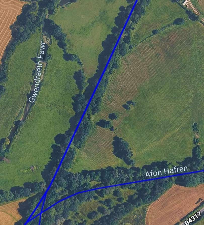
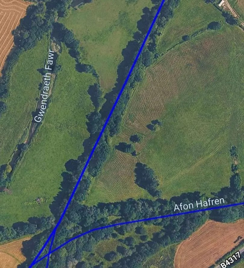
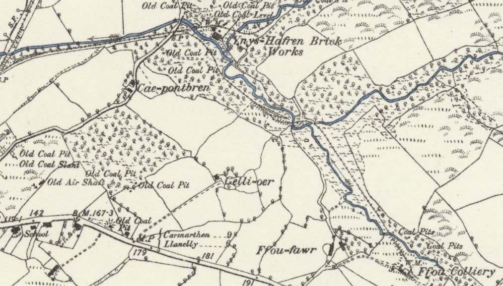
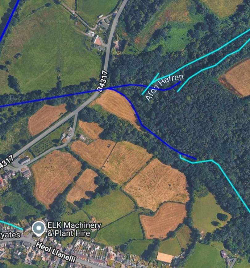
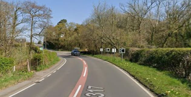
Ffou Colliery (also known as Ffoy Colliery) was an historic anthracite mine which sat just east of Pontyates, near the road running from Cynheidre to Pontyates. Historic records from the British Geological Survey note that operations at Ffou encountered specific geological variations, such as a parting in the notable Carway Fawr Vein. The BP&GVR line extended to exchange siding to the Northwest of Fou Colliery. An ‘internal tramway linked the exchange sidings to the Colliery. This length of line appears on the railmaponline satellite image above and again on that immediately below.
Ynys-Hafren Brick Works was active by 1809, originally associated with Cwmgelwr, an area corresponding to land later mapped in the 1840s Tithe Maps. Rai
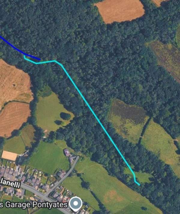
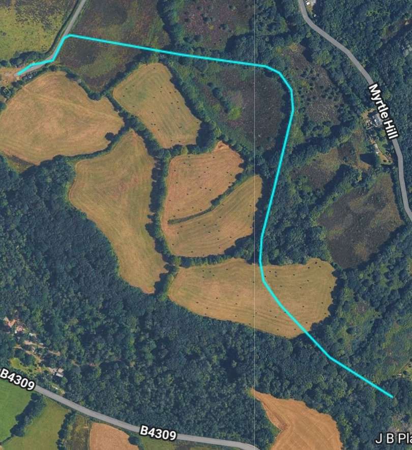
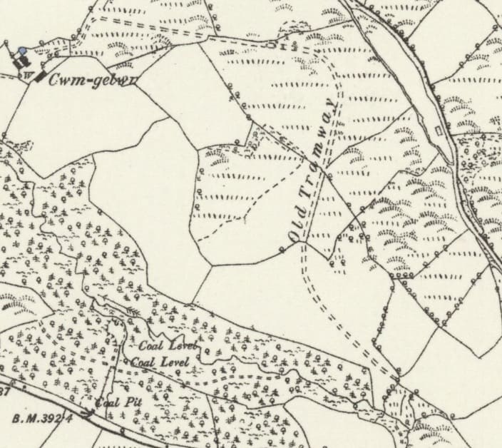
This extract shows that the tramway recorded by railmaponline was already abandoned at the time of the 1878/1879 Ordnance Survey. [65]
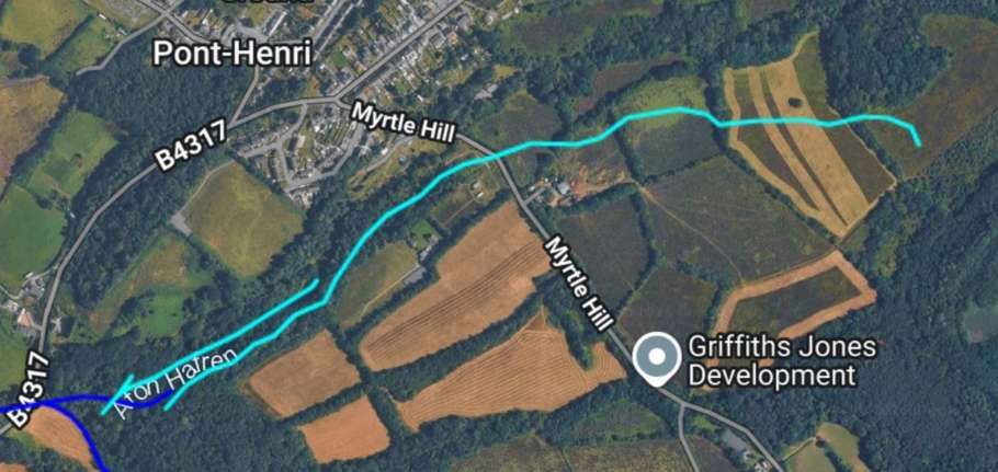
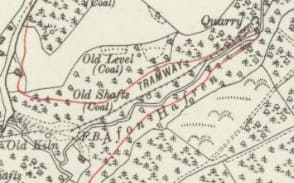
One of the tramways shown by railmaponline appears on this map extract from the 1913 6″ Ordnance Survey which was published in 1922. The longer of the two tramways does not appear on these Ordnance Survey sheets [66]
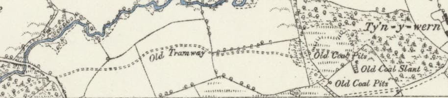
However on the next 6″ OS sheet to the North (of 1878/1879) an old tramway is shown linking to T’yn-y-Wern Colliery. [67]
T’yn-y-Wern Colliery was a small operation which clearly was abandoned before 1878.
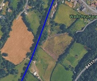
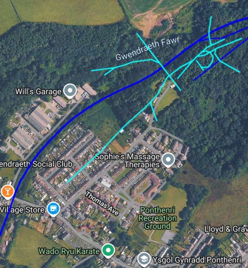
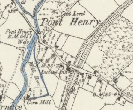
The railway cutting and bridge at Pont Henry as it appears on the 1878/1879 6″ Ordnance Survey, published in 1889. [67]
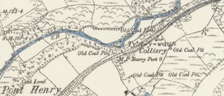
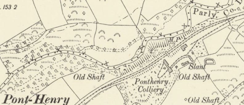
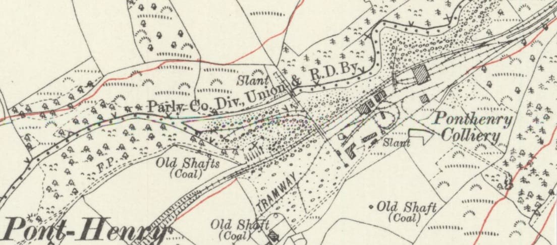
Pont Henry Colliery operated from the 1820s/1865 until its final closure in 1936. the colliery had three main slants: Glynhir, Gwendraeth, and Stepney and a central coal washery. It extracted high-quality anthracite from the Gwendraeth, Braslyd, Gras, Pumpquart, Green, and Big Vein seams. Manpower peaked at 833 workers in 1927, producing around 200,000 tons of coal annually in both 1930 and 1935. [70]
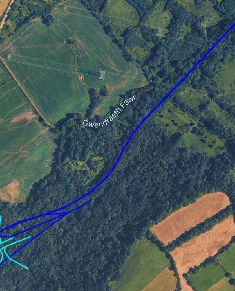
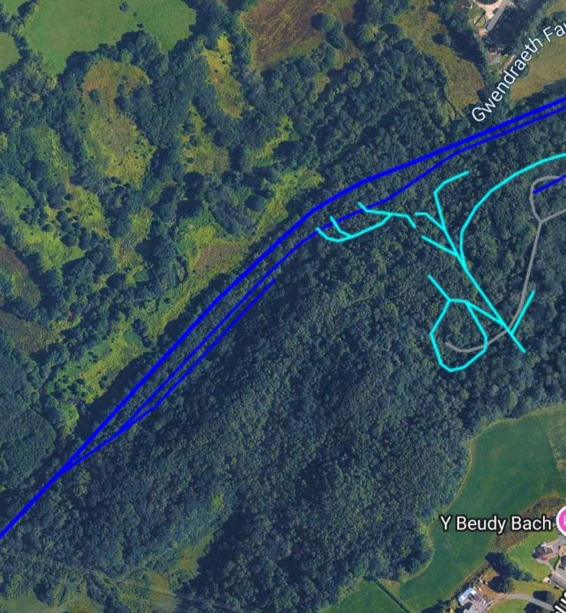
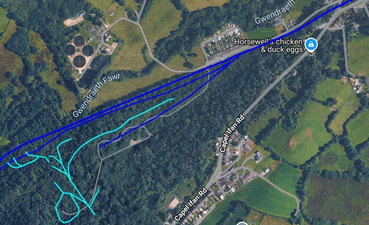
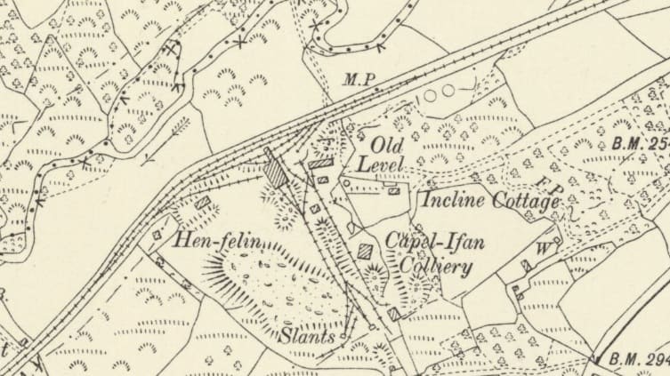
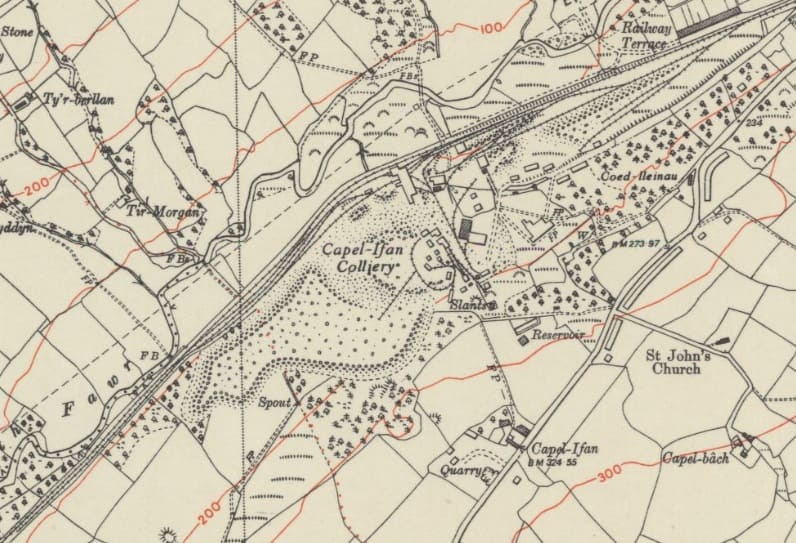
The Capel-Ifan Colliery (was also known as Pentremawr Colliery) and sat to the Southwest of Pontyberem, It was a drift mine (slant mine) due to the angle and depth of the anthracite seams. It opened in 1870, the site faced early setbacks from geological faults before opening slants (Capel Ifan Nos. 1–4 and Pentremawr). It was absorbed into the Amalgamated Anthracite Combine in 1927 and nationalized under the National Coal Board (NCB) in 1947. The seams worked were: Gwendraeth, Braslyd, Gras, Trichwart, Pumpquart, and the 8-foot-thick Big Vein seam discovered in 1939. [71]
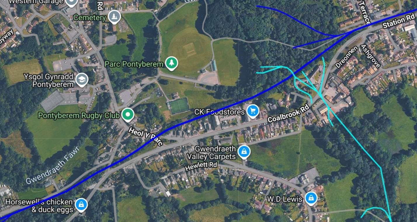
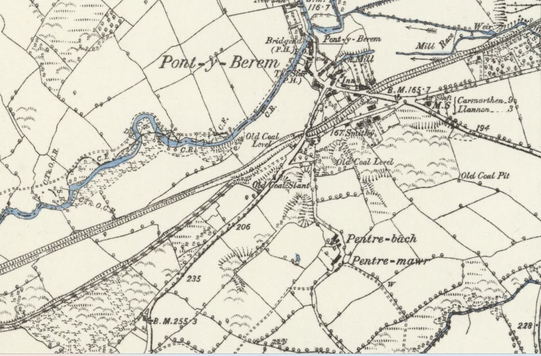
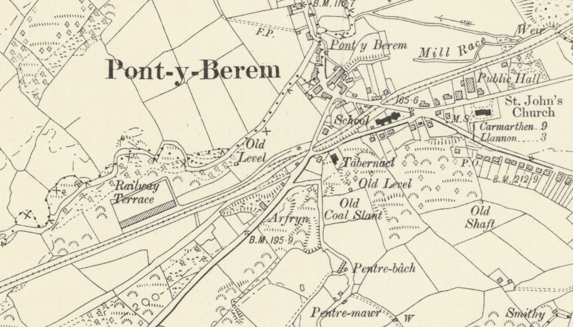
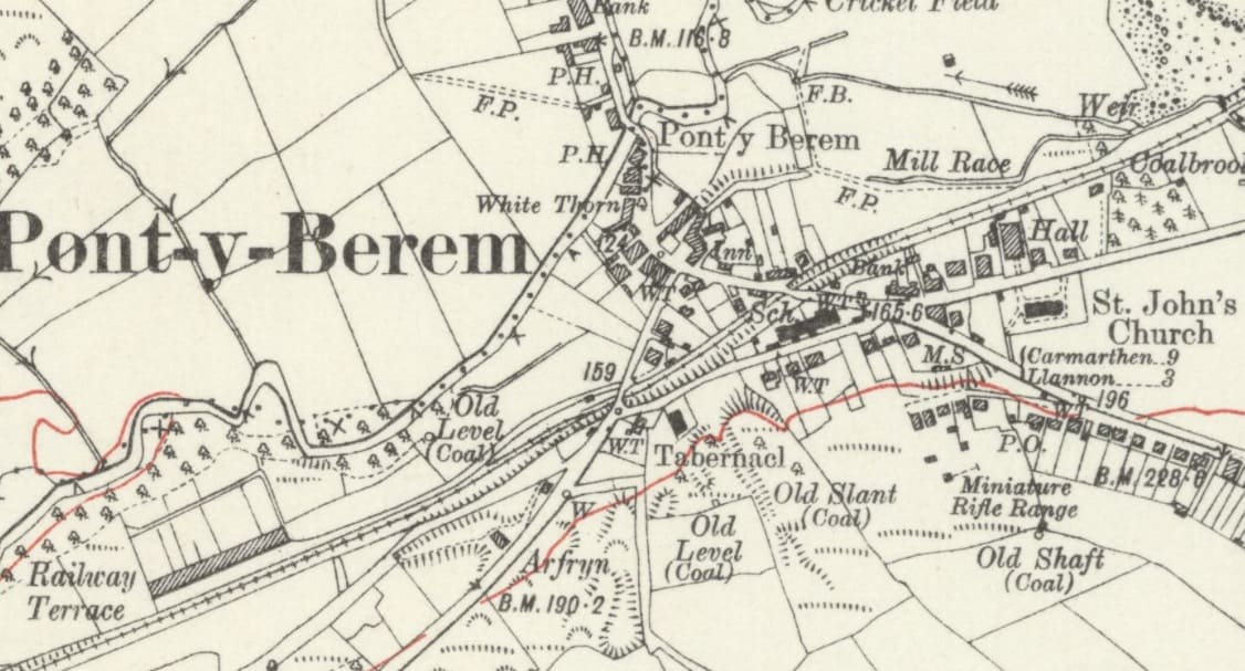
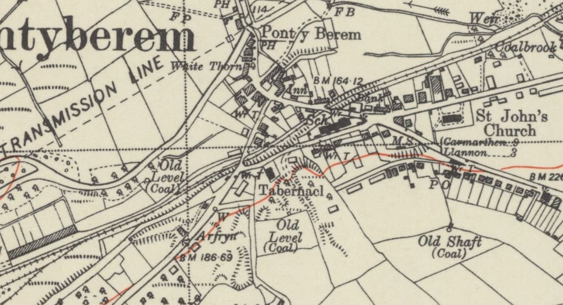
Before looking at the 6″ OS sheets which cover the Pontyberem collieries, we take a quick look at the line of the old railway through Pontyberem village. …
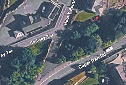
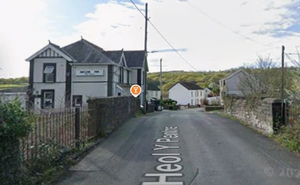
The line was in cutting through Pontyberem. The first bridge encountered carried Heol Y Pentre over the line. [Google Maps, October 2026].
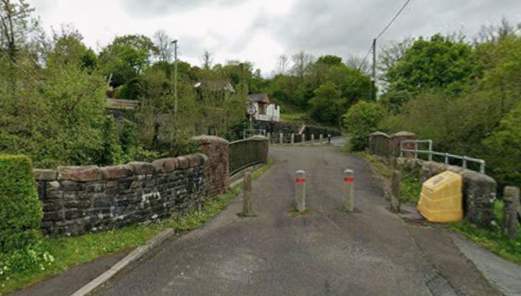
Looking South along Heol Y Pentre across the bridge carrying the road over the BP&GVR. [Google Streetview, April 2025]
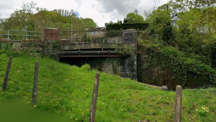
The bridge seen looking Southeast from Railway Terrace. [Google Streetview, April 2025]
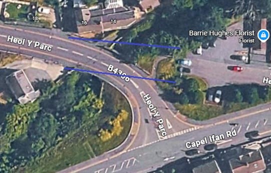
The second bridge carried Heol Y Parc over the railway. The purple lines mark the location of the parapets of the old bridge at this location. [Google Maps, October 2026]
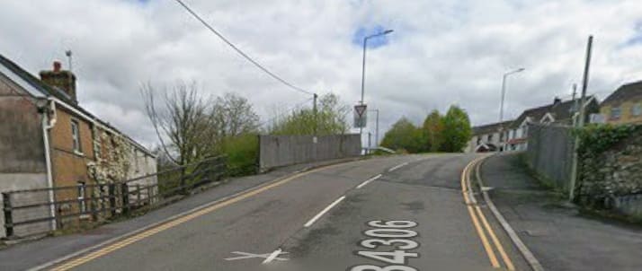
Looking East along Heol Y Parc: the terraced houses faced out across the old railway, with the old road running through the location of the trees to the left of the more modern road and its bridge parapets. {Google Streetview, April 2025]
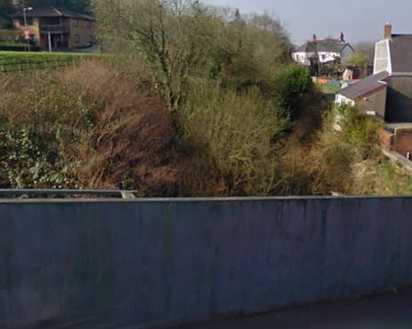
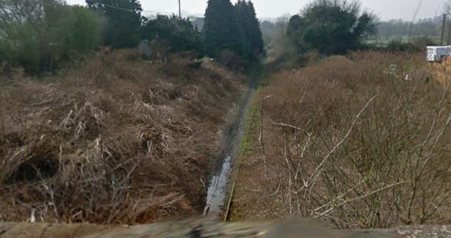
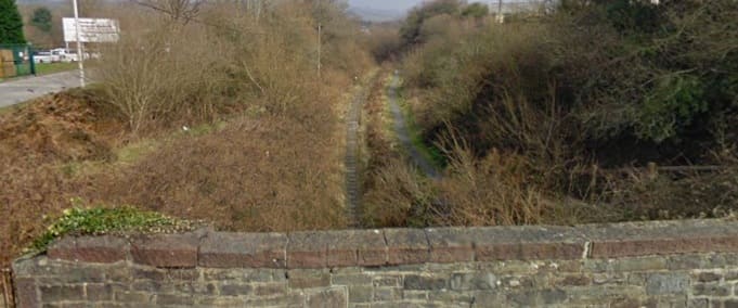
Looking back West along the railway cutting. [Google Streetview, March 2009]
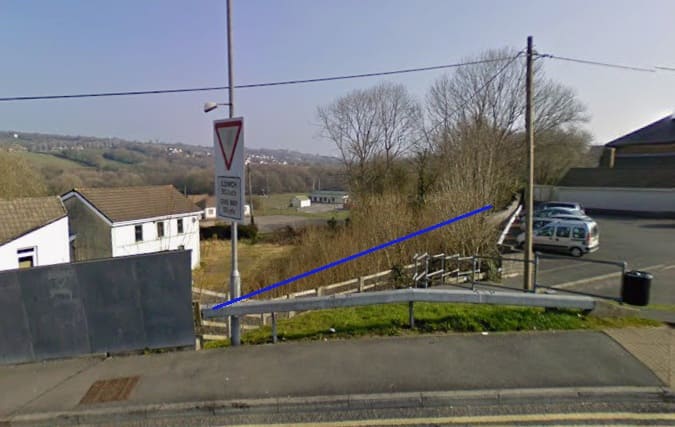
Looking Northeast beyond the modern bridge parapet, the alignment of the railway cutting is marked by the blue line. [Google Streetview, March 2009]
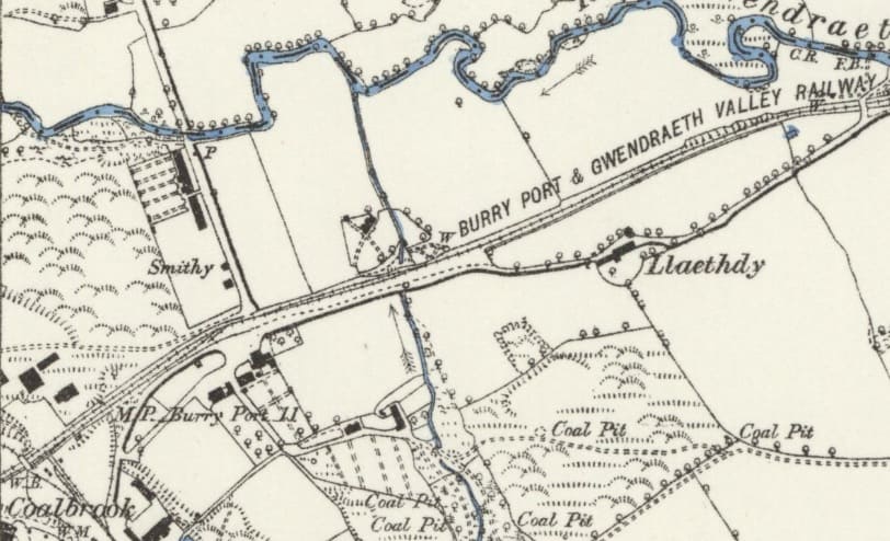
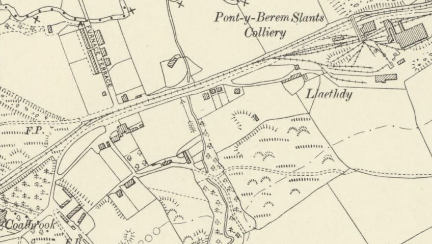
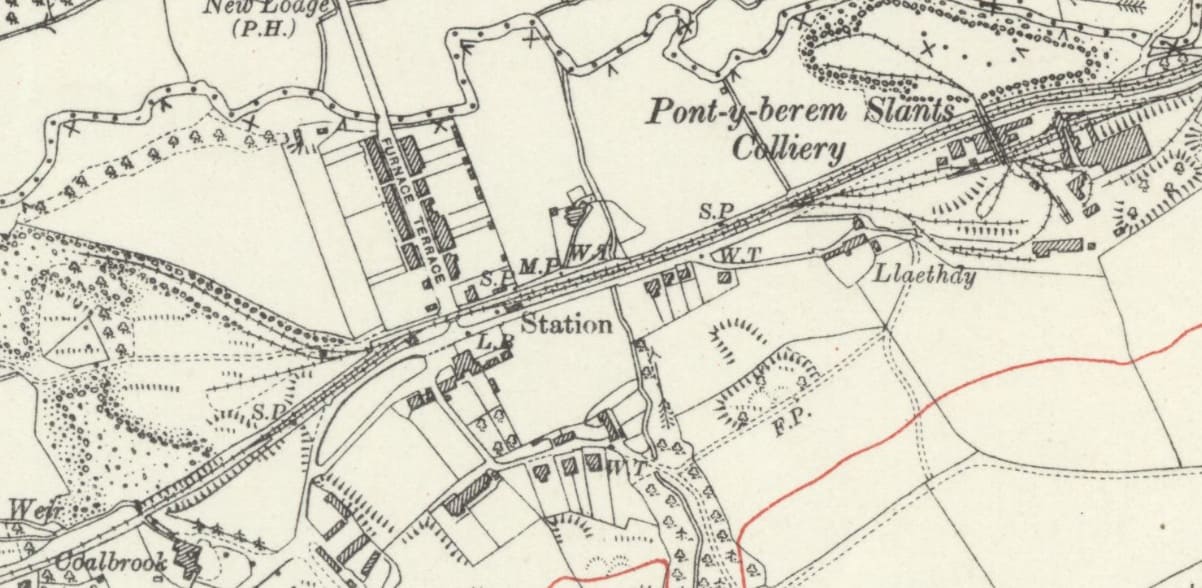
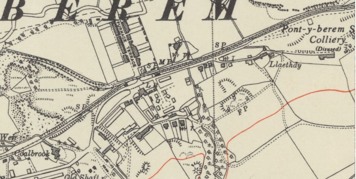
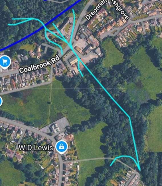
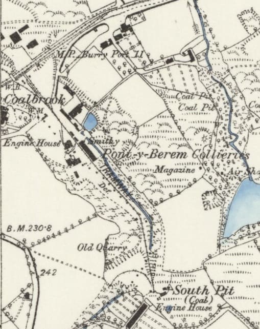
Pontyberem Collieries in the late 19th century as they appeared on the 1878/1879 6″ Ordnance Survey which was published in 1888. [73]
Pontyberem Collieries (later Gwendraeth Collieries) were listed in 1878 as consisting of the Pontyberem Five-Quarter pit and the Pontyberem South pit and in 1882 as the Pump Quart Pit and South Pit. [75]
The collieries were first operational as early as 1845. They were operated by the Pontyberem Colliery Company. In 1907, the name was changed to the Gwendraeth Colliery. [75]
Along with the other collieries in the Gwendraeth Valley, this colliery was nationalised in 1947.
Northern Mine Research Society points out that the South Pit was sunk to a depth of 245 ft., and the Gwendraeth/Pumpquart Pit to a depth of 450 ft. Working seams include the Pumpquart, Trichwart, and Big Vein. Employment reached a high of 824 workers in 1927. Final closure took place on 15th October 1949.
The Pontyberem Slants Colliery is marked on the Ordnance Survey sheet of 1948, as closed. [75]
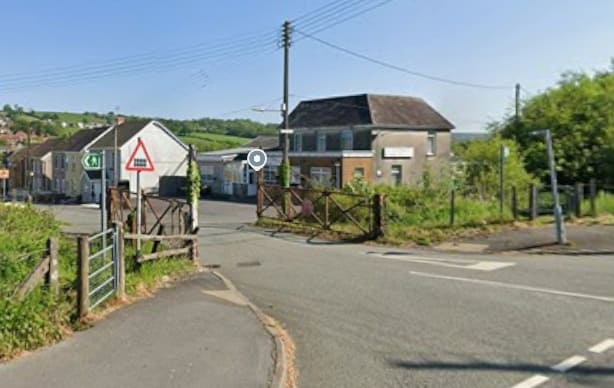
The level-crossing at Furnace Terrace, seen from Station Road. The single track rails can be seen between the crossing gates.[Google Streetview, May 2025]
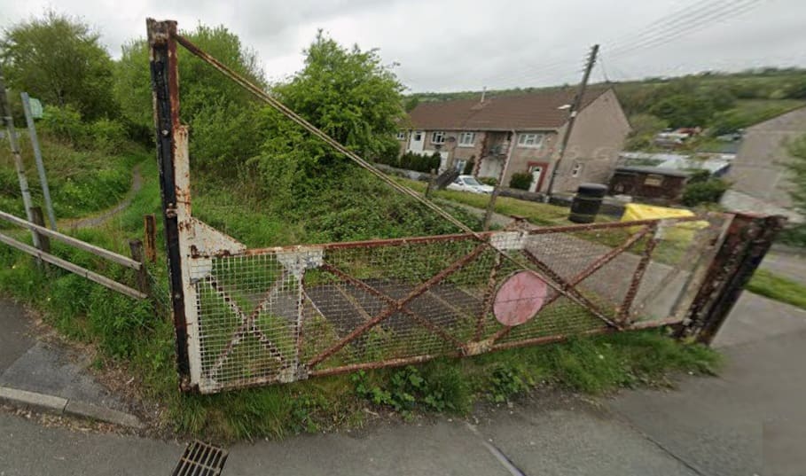
Looking West, back down the line towards the centre of Pontyberem. [Google Streetview, May 2022]
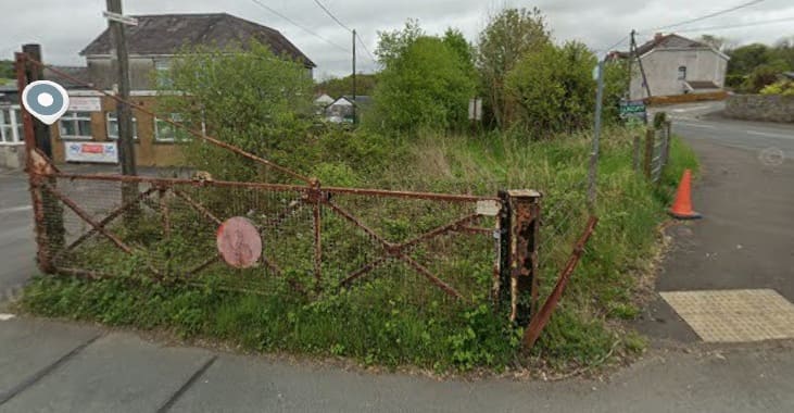
Looking East into what was the railway station site. [Google Streetview, May 2022]
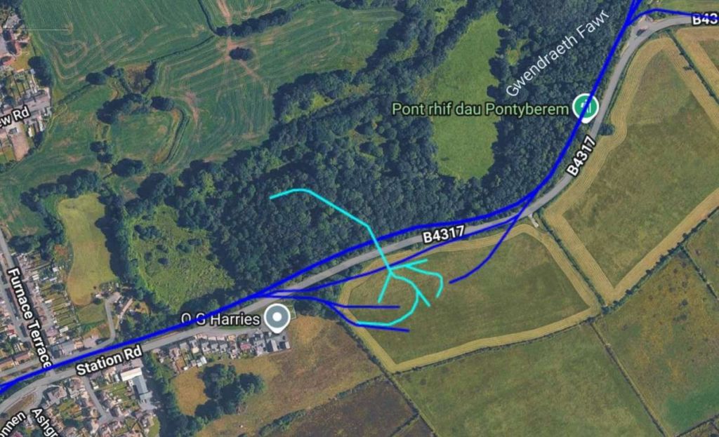
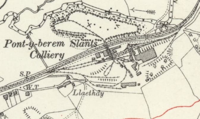
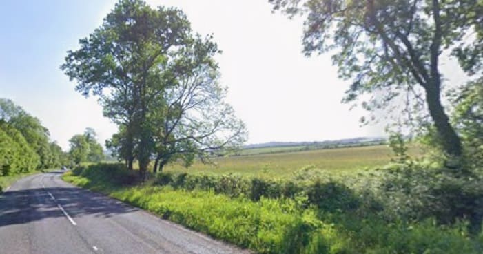
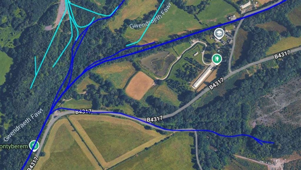
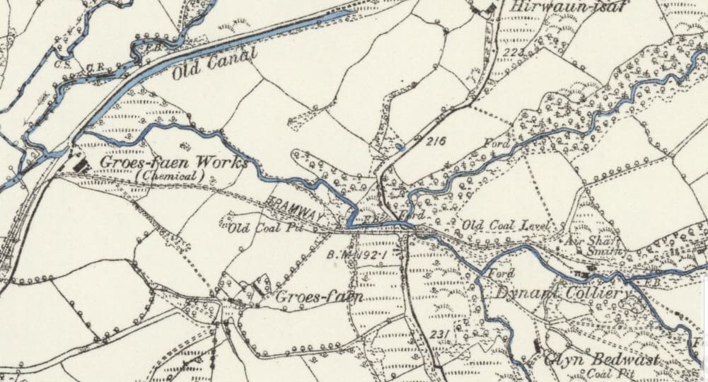
Dynant Colliery must have been closed in the late 19th century as it does not appear on later editions of Ordnance Survey mapping. Note, in the railmaponline satellite image above, that for a short distance the modern B4317 follows the route of the old tramway. A more minor road occupied the line of the tramway further to the East.
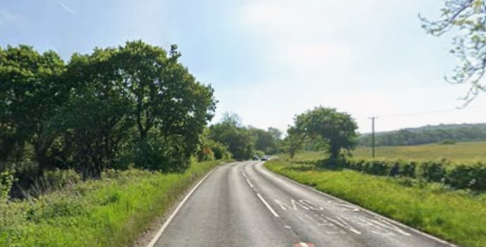
Looking East along the line of the old tramway which is buried under the B4317. [Google Streetview, May 2025]
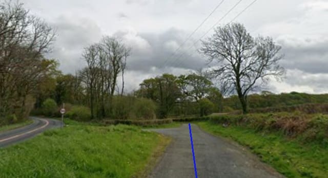
The tramway route continues East as the B4317 turns to the North. [Google Streetview, April 2025]
AQ very short distance along the BP&GVR brings us to the location of another colliery – Clyn-hebog Colliery. …

Clyn-hebog Colliery as it appears on the 6″ Ordnance Survey of 1913, published in 1922. Note the sidings alongside the BP7GVR main line and the standard-gauge line under colliery screens. North of the screens are a series of tramway lines which feed the screens form the pit/slant head and give access to spoils heaps to the West of the screens. There also appears to be a single tramway line which meets the standard-gauge line Northeast of the screens, which presumably allowed for other loads to be moved between the tramway and the railway. Finally, note the tramway which starts alongside the exchange sidings next to the BP&GVR main line and heads Northeast. [69]
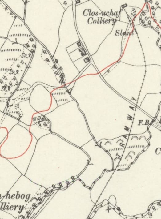
The remaining length of the tramway which appeared on the right of the map extract above. It served a small colliery – Clos-uchaf Colliery. [69]
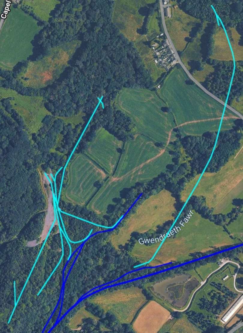
Continuing East-northeast the BP&GVR leaves behind the Clyn-hebog Colliery. …
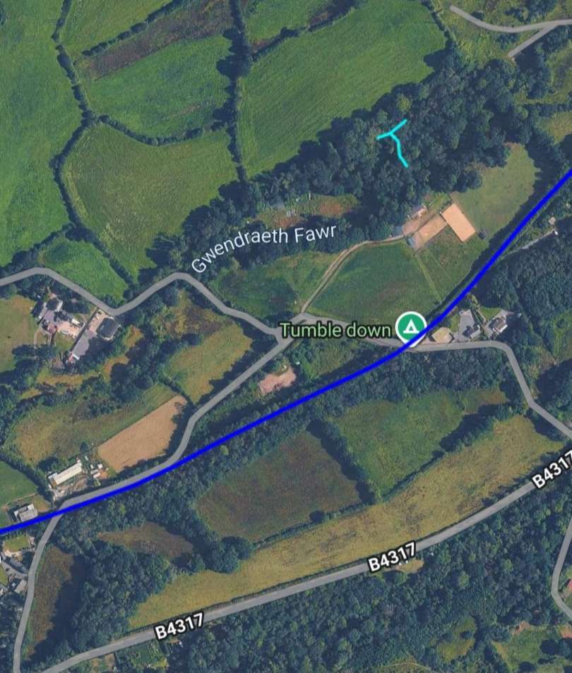
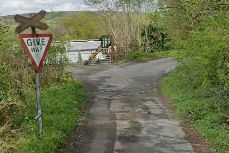
Looking North across the line of the railway along the minor road to the left of the image above. [Google Streetview, April 2025]
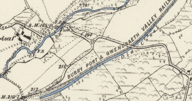
A penultimate length of the BP&GVR as it appears on the 6″ Ordnance Survey of 1878/1879, published in 1889. [76]
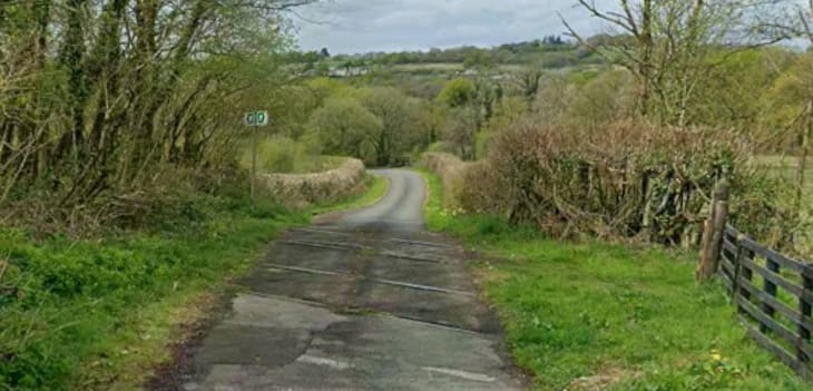
Looking West across the line of the old railway along the minor road shown crossing the line to the right side of the satellite image above, and to the right side of the map extract immediately above. [Google Streetview, April 2025]
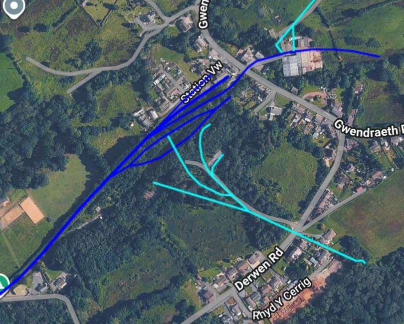
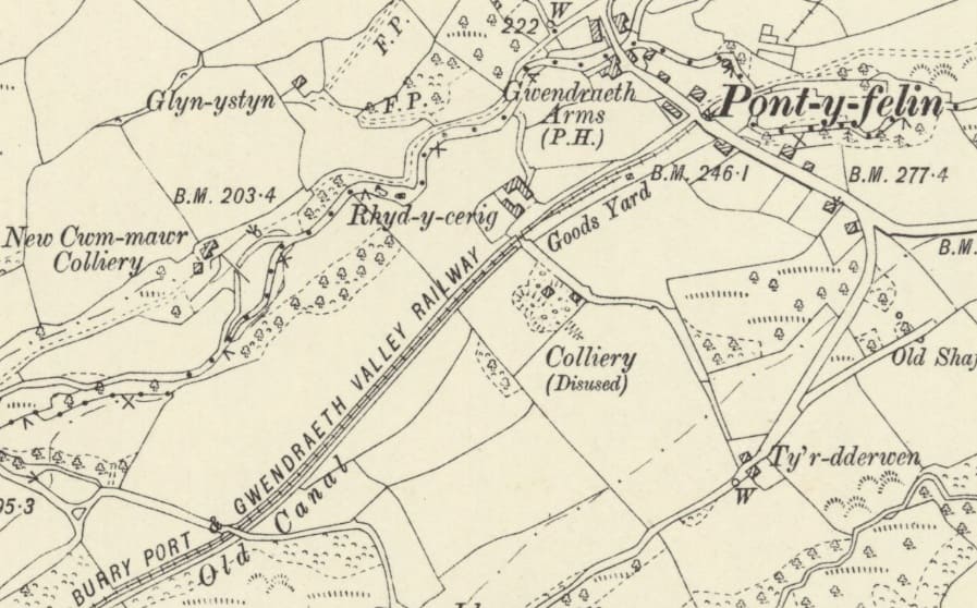
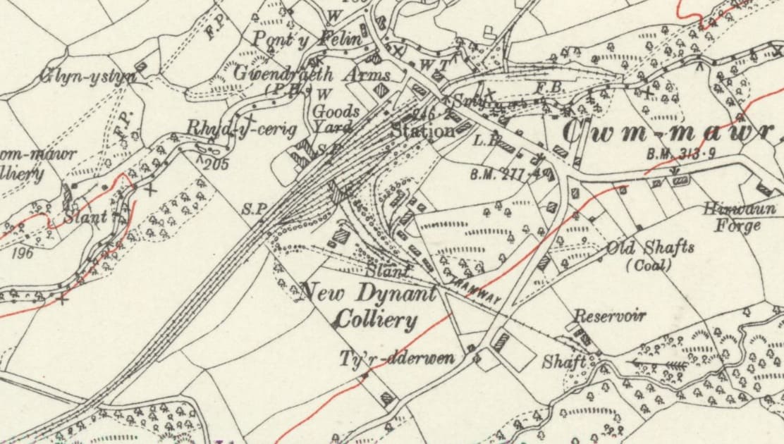
New Dynant Colliery and Cwm-mawr (Pont-y-felin) sat at the northern railhead of the BP&GVR. New Dynant Colliery was an anthracite coal mine. In the early 1900s it was operated by the New Dynant Anthracite Collieries Co. and later reorganized as New Dynant Anthracite Colliery (1914) Ltd. In 1924, it became part of United Anthracite Collieries Limited (UAC), a group that combined several regional anthracite mines. In 1926, UAC merged with Amalgamated Anthracite Collieries Limited (AAC). It was nationalised in 1947. [77]
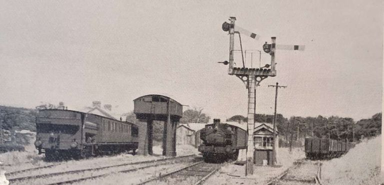
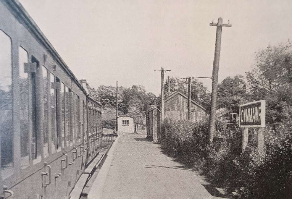
‘Cwmmawr for Tumble‘ railway station, (Cwm Mawr railway station or Cwmmawr railway station) was opened in 1913 to timetabled passenger services. It continued to serve the inhabitants of the Cwmmawr area and hinterland between 1913 and 1953; it was one of several basic stations opened on the Burry Port and Gwendraeth Valley Railway. Passenger service ended in September 1953. The line remained open for coal freight until 29th March 1996.
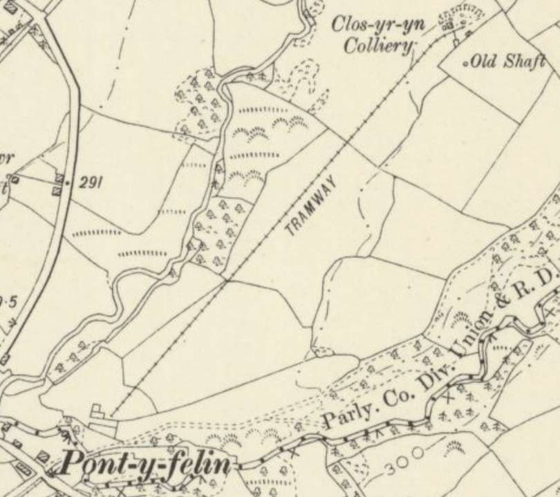
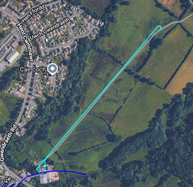
Clos-yr-yn-Colliery was a small anthracite coal mine that opened in 1903. It was closed/abandoned by 1924/1925. Seams worked included Pumpquart and Trichwart (Triquart). In 1905, the colliery employed 19 men. Numbers were 66 underground and 12 at the surface by 1908, and 125 in total by 1913. From 1914-1922, the colliery was owned by New Dynasty Anthracite Colliery (1914) Ltd. In 1918, it employed about 126 underground and 21 at the surface. Between 1923 and 1924 it was owned by Great Mountain Collieries Co. Ltd. and employed 121 underground and 32 surface workers before it was abandoned on 30th May 1924.
It was truly the end of the line!
References
- John Bourne; The Burry Port & Gwendraeth Valley Railway; in The Railway Magazine, Volume 99, No. 631, Tothill Press, London, November 1953, p737-744.
- https://en.wikipedia.org/wiki/Kidwelly_and_Llanelly_Canal, accessed on 14th September 2026.
- https://www.nationaltransporttrust.org.uk/heritage-sites/heritage-detail/kymers-canal, accessed on 14th September 2026.
- https://www.facebook.com/TheHistoryOfWales/posts/on-19th-february-1766-thomas-kymer-was-granted-an-act-of-parliament-allowing-him/1201894841302902, accessed on 14th September 2026.
- https://kids.kiddle.co/Kidwelly_and_Llanelly_Canal, accessed on 14th September 2026.
- https://www.walescoastpath.gov.uk/plan-your-visit/itineraries/circular-walks/carmarthenshire/kidwelly/?lang=en, accessed on 14th September 2026.
- https://walescoastpathphotos.com/photo_12364093.html, accessed on 14th September 2026.
- https://www.kidwelly.gov.uk/whats-on/local-attractions, accessed on 14th September 2026.
- https://pembreyburryportheritage.co.uk/home/burry-port-harbour, accessed on 14th September 2026.
- https://en.wikipedia.org/wiki/Burry_Port_and_Gwendraeth_Valley_Railway, accessed on 16th September 2026
- https://colonelstephenssociety.co.uk/the%20colonels%20railways/burry%20port%20%26%20gwendraeth%20valley%20light%20railway, accessed on 16th September 2026.
- https://picryl.com/media/fairlie-patent-0-4-0-0-4-0-steam-locomotive-mountaineer-e5080a, accessed on 16th September 2026.
- https://www.facebook.com/share/p/1HRTNeQacK, accessed on 16th September 2026.
- https://kesr.org.uk/museum/burry-port-gwendraeth-valley, accessed on 17th September 2026.
- https://www.gwra.co.uk/auctions/nameplate-gwendraeth-ex-burry-port-gwendraeth-vall-2024jul-0175.html, accessed on 18th September 2026.
- https://transportsofdelight.smugmug.com/RAILWAYS/COLONEL-STEPHENS-RAILWAY-EMPIRE/BURRY-PORT-GWENDRAETH-VALLEY-RAILWAY/i-KXcxzBp/A, accessed on 18th September 2026.
- R W Miller; The Burry Port & Gwendreath Valley Railway and its Antecedent Canals: Volume Two: The Railway and Dock; Oakwood Press, Usk, 2009.
- https://www.therailwayhub.co.uk/tag/burry-port-and-gwendraeth-valley-railway, accessed on 18th September 2026.
- https://maps.nls.uk/view/102340281, accessed on 18th September 2026.
- https://railmaponline.com/uk-and-irish-railways, accessed on 22nd September 2026.
- https://maps.nls.uk/view/135193417, accessed on 22nd September 2026.
- https://maps.nls.uk/view/102180122, accessed on 27th September 2026.
- https://maps.nls.uk/view/102180083, accessed on 27th September 2026.
- https://maps.nls.uk/view/102180080, accessed on 28th September 2026.
- https://maps.nls.uk/geo/explore/#zoom=15.3&lat=51.68334&lon=-4.25061&layers=6&b=ESRIWorld&o=0, accessed on 28th September 2026.
- https://maps.nls.uk/view/102180077, accessed on 29th September 2026.
- https://pembreyburryportheritage.co.uk/the-boards/the-tramway-board, accessed on 29th September 2026.
- https://pembreyburryportheritage.co.uk/home/the-tramway, accessed on 29th September 2026.
- https://pembreyburryportheritage.co.uk/the-boards/the-tramway-board, accessed on 29th September 2026.
- https://maps.nls.uk/view-full/102340281, accessed on 29th September 2026.
- https://maps.nls.uk/view/102340269, accessed on 29th September 2026.
- https://maps.nls.uk/view/102340272, accessed on 29th September 2026.
- https://heneb.org.uk/hcla/taf-and-tywi-estuary/pembrey-and-burry-port, accessed on 29th September 2026.
- https://pembreyburryportheritage.co.uk/about-us/the-project, accessed on 30th September 2026.
- https://pembreyburryportheritage.co.uk/the-tramroad, accessed on 30th September 2026.
- https://maps.nls.uk/view/102349926, accessed on 30th September 2026.
- https://maps.nls.uk/view/102340272, accessed on 30th September 2026.
- https://www.facebook.com/groups/850121445097091/posts/4344755678966966, accessed on 30th September 2026.
- https://www.trimsarancc.org.uk/about-trimsaran, accessed on 30th September 2026.
- https://maps.nls.uk/geo/explore/#zoom=16.7&lat=51.72335&lon=-4.24741&layers=257&b=ESRIWorld&o=100, accessed on 30th September 2026.
- https://www.google.com/maps/place/Steelworks/@51.7223995,-4.2483364,3a,75y,90t/data=!3m8!1e2!3m6!1sCIHM0ogKEICAgIDawOLyHQ!2e10!3e12!6shttps:%2F%2Flh3.googleusercontent.com%2Fgps-cs-s%2FAHRPTWkVgOGBpqUM31Citdq358NmDwd2wX1lhwDaeg7kFjQWEEEoBib304Dd7MinKnmAJJTstXGPfxBIw4Z4io1vcUPFeONiWDemnTeUC2p4l3HKo2auItIhC0WoKm2a1Wa1QqbkAl6Y%3Dw203-h242-k-no!7i2486!8i2965!4m6!3m5!1s0x486ee930adaf3e75:0xf2920998be04ff47!8m2!3d51.723021!4d-4.248041!16s%2Fg%2F11n_xyx83r?entry=ttu&g_ep=EgoyMDI2MDkyOC4wIKXMDSoASAFQAw%3D%3D, accessed on 1st October 2026.
- https://maps.nls.uk/geo/explore/#zoom=17.0&lat=51.72334&lon=-4.23641&layers=6&b=ESRIWorld&o=100, accessed on 1st October 2026.
- https://maps.nls.uk/geo/explore/#zoom=17.0&lat=51.72933&lon=-4.28075&layers=168&b=ESRIWorld&o=100, accessed on 1st October 2026.
- https://maps.nls.uk/geo/explore/#zoom=17.0&lat=51.72921&lon=-4.28666&layers=168&b=ESRIWorld&o=100, accessed on 1st October 2026.
- https://maps.nls.uk/geo/explore/#zoom=17.0&lat=51.72934&lon=-4.29910&layers=168&b=ESRIWorld&o=100, accessed on 1st October 2026.
- https://maps.nls.uk/geo/explore/#zoom=17.0&lat=51.73152&lon=-4.31079&layers=168&b=ESRIWorld&o=100, accessed on 1st October 2026.
- https://maps.nls.uk/geo/explore/#zoom=17.0&lat=51.73200&lon=-4.31633&layers=168&b=ESRIWorld&o=100, accessed on 1st October 2026.
- https://www.facebook.com/share/p/1LRbM9XFQr, accessed on 2nd October 2026.
- https://www.kidwelly.gov.uk/council-services/kidwelly-quay-and-surrounding-area, accessed on 2nd October 2026.
- https://maps.nls.uk/view/135193270, accessed on 2nd October 2026.
- https://maps.nls.uk/view/135193273, accessed on 3rd October 2026.
- https://maps.nls.uk/view/135193276, accessed on 3rd October 2026.
- https://maps.nls.uk/view/102179939, accessed on 3rd October 2026.
- https://maps.nls.uk/view/102179978, accessed on 3rd October 2026.
- https://rchsimagearchive.org.uk/index.php?album=Railways-Tramroads/Early-Railways/Early-Railways-S-Wales-Borders/Carmarthen%20Bay&image=023278E-Carway.jpg, accessed on 3rd October 2026.
- https://maps.nls.uk/geo/explore/#zoom=17.0&lat=51.74477&lon=-4.23489&layers=168&b=ESRIWorld&o=100, accessed on 3rd October 2026.
- https://maps.nls.uk/view/135193333, accessed on 3rd October 2026.
- https://maps.nls.uk/view/102179969, accessed on 3rd October 2026.
- https://www.welshcoalmines.co.uk/Carm/Plasbach.htm, on 4th October 2026.
- https://en.wikipedia.org/wiki/Pontyates, accessed on 4th October 2026.
- https://maps.nls.uk/view/135193282, accessed on 6th October 2026.
- https://maps.nls.uk/view/102179975, accessed on 7th October 2026.
- https://nmrs.org.uk/mines-map/coal-mining-in-the-british-isles/swales/llanelli-area/caepontbren-colliery, accessed on 7th October 2026.
- https://www.welshcoalmines.co.uk/forum/read.php?2,85659,85689, accessed on 7th October 2026.
- https://maps.nls.uk/view-full/102179978, accessed on 7th October 2026.
- https://maps.nls.uk/view/102340272, accessed on 7th October 2026.
- https://maps.nls.uk/view/102179759, accessed on 7th October 2026.
- https://maps.nls.uk/view/102179756, accessed on 7th October 2026.
- https://maps.nls.uk/view/102340260, accessed on 7th October 2026.
- https://nmrs.org.uk/mines-map/coal-mining-in-the-british-isles/swales/llanelli-area/pont-henry-colliery, accessed on 7th October 2026.
- https://nmrs.org.uk/mines-map/coal-mining-in-the-british-isles/swales/llanelli-area/pentremawr-colliery, accessed on 7th October 2026.
- https://maps.nls.uk/view-full/102340257, accessed on 7th October 2026.
- https://maps.nls.uk/view/102179765, accessed on 8th October 2026.
- https://maps.nls.uk/view/102179762, accessed on 8th October 2026.
- https://maps.nls.uk/view/102179750, accessed on 8th October 2026.
- https://maps.nls.uk/view/102179753, accessed on 8th October 2026.
- https://nmrs.org.uk/mines-map/coal-mining-in-the-british-isles/swales/llanelli-area/new-dynant-colliery, accessed on 9th October 2026.
- The Burry Port & Gwendraeth Valley Railway (BP&GVR)
- The Narrow Gauge Railway Society Journal
- The Lodge Hill & Upnor Railway, (Chattenden & Upnor Railway) and the Chattenden Naval Tramway, Kent
- Joy Comes in the Morning: Lizzie Lowe and the Story of a Church that Changed: A Book Review
- Queenborough Cement Works and Associated Industries at Queenborough


