The featured image for this article shows a Bagnall saddle-tank engine and train of two 100-seat workmen’s cars in L.N.W.R. livery on the Wolverton and Stony Stratford Tramway.
Wolverton Works
The LNWR works at Wolverton. The tramway crosses this plan on Stratford Road. [13: p19]
An enlarged key to the plan above which details the use of each building on the LNWR Site. [13: p19]
“Mainly by reason of the growth of the London North Western Railway works at Wolverton in the late 1870s, and the establishment of McCorquodale’s printing works alongside in 1878, a scheme to link the old market town of Stony Stratford, on Watling Street, with the London & North Western Western Railway station at Wolverton by means of a light railway began to take tangible form in 1882.” [1: p547]
Wolverton Railway Works was established in Wolverton, Buckinghamshire, by the London and Birmingham Railway Company in 1838 at the midpoint of the 112-mile-long (180-kilometre) route from London to Birmingham. The line was developed by Robert Stephenson following the great success of the Liverpool and Manchester Railway line. [2]
“The Victorian era new towns of Wolverton and New Bradwell were built to house the workers and service the works. The older towns of Stony Stratford and Newport Pagnell grew substantially too, being joined to it by the Wolverton and Stony Stratford Tramway and the Wolverton to Newport Pagnell Line (a branch line), respectively. The trams were … hauled by steam locomotives: the tram cars were certainly the largest ever in the UK and possibly the world.” [2]
After a survey of all possible sites for the London and Birmingham Railway works, “Wolverton was chosen due to its co-location alongside the wharfing facilities of the Grand Union Canal, thereby also enabling the railway company to gain an easy agreement to build a viaduct over the canal company’s land at this point.”
“In 1837, Edward Bury of Bury Curtis & Kennedy of Liverpool was appointed Locomotive Superintendent of the London to Birmingham railway with his headquarters at Wolverton. However, as Wolverton was simply considered to be a repair shop for the engines his Liverpool firm supplied to run on the line, he left the running of the Works to his Shop Foreman.” [3]
It became necessary for expansion to take place to accommodate, service and repair the increasing amount of rolling stock owned by the Company. “A large engine shed was built, said to be cathedral sized, together with all supporting facilities which also enabled the Works” [3] to produce, locomotives in house.
J E McConnell was appointed Superintendent in 1847. He built his first locomotive in 1849. This was “the prototype of the ‘Bloomer’ class (the wheels and works being more exposed the engines became know as Bloomers after Mrs Amelia Bloomer who was trying to reform ladies dress). During his time at Wolverton he made many innovations such as train heating, failsafe braking, hollow axles, boilers, fireboxes etc. Early in 1851, the first Bloomer engines were running.” [3]
Bloomer was a name used to refer to three similar classes of 2-2-2 express passenger locomotives designed by James McConnell. “A total of seventy-four were built between 1851 and 1862. The classes were similar in design and layout but differed in dimensions.” [4]
A LNWR engine No. 602, a Small Bloomer Class Locomotive. The photograph was taken circa. 1868 at Rugby’s coke sheds. The Class was introduced in 1854, they were inside-cylinder inside-frame single-wheelers with 6′-6″ driving wheels. [4]
“In 1859, thirty four engines were transferred from Crewe to Wolverton which involved further expansion of the Works. Under McConnell the Works flourished but unfortunately for him Mr Richard Moon was appointed Chairman of the Company and there was a clash of personalities resulting in McConnell retiring. A year or two after his retirement the engineering works were transferred to Crewe. Before the transfer to Crewe, 165 engines had been built at Wolverton.” [3]
“Expansion of the Works again took place during 1864 when Wolverton became the Carriage Works for the LNWR and the manufacturing shops were converted to enable carriages to be built, painted and repaired. In 1869 two Royal Saloons for Queen Victoria were built at Wolverton. Sadly in 1872 the locomotive shop finally closed and Wolverton became exclusively a carriage works until in 1877 it was the largest in Britain.” [3]
It seems that the original railway main line through Wolverton crossed land which was needed for the expansion of Wolverton Works. Two previous stations had been situated in the original route of the main line. “The first station was built for the opening of the London and Birmingham Railway on 17th September 1838, on the embankment just north of the canal above Wolverton Park. It proved to be temporary as the railway company purchased an additional 13.5 acres to the south, where they built a larger, more permanent station in 1840, at the east end of Church Street.” [8]
To avoid passing through the Wolverton Carriage Works, a railway main line deviation to the east was opened in August, 1881. The present Wolverton Station was built on the new line.
This rather fuzzy extract from the 25″ Ordnance Survey of 1898, published in 1900 shows the extent of the Railway Works at that time. To the West of the Railway Works was the site of McCorquodale’s Printing Works which can just be made out at the left edge of this map extract. The Grand Junction Canal sits between the Works and the Railway Station. [9]
McCorquodale’s Printing Works
McCorquodale’s Printing Works were one of a series of such establishments. McCorquodales built premises in Wolverton in 1878. The firm specialised in registered envelope manufacture, but undertook many other government and security printing contracts. The “history of the company commenced in 1841. George McCorquodale opened a stationers shop in Liverpool which became the Liverpool Printing and Stationery Company Ltd. The company prospered and five years later George opened the first McCorquodale printing works at Newton-le-Willows in Lancashire, specialising in providing a service to the ever expanding railway network.” [5]
Further factories were opened in Glasgow and London in the 1870s. In Wolverton, men were employed in the railway works but their daughters remained unemployed. “Sir Richard Moon, Chairman of the London & North Western Railway had an idea for solving the problem and contacted his friend George McCorquodale and suggested that he build a printing works in the town. George thought it an admirable suggestion and in 1878 he opened his registered envelope factory – success was immediate. The works rapidly increased in size and diversified into printing books, forms and commercial stationery.” [5]
“By 1886, McCorquodales of Wolverton was known as one of the finest printing factories in the country and employed 120 women and 20 men. Most of the girls started work at the age 13 or 14 and were normally employed until they married. Girls were encouraged to remain in the factory as long as possible and a £10 wedding grant was given to those who had completed 10 years service. Until 1909 staff worked a 54 hour week starting at 6am with a half day on Saturday. The company were also quick to provide the best welfare and working facilities in the area, and the staff were provided with dining, reading and recreation rooms. A Good Samaritan Society was started and pension funds paid for holidays and service bonuses.” [5]
Lee tells us that in 1882 a special meeting of Stony Stratford ratepayers considered a proposal to apply to the Board of Trade for an Order to sanction a tramway between Wolverton and Stony Stratford. “The ratepayers approved, subject to the track nowhere exceeding 6 ft. in width. A company was formed, apparently by these local interests, and was incorporated on 4th November 1882, as the Wolverton & Stony Stratford Tramways Co. Ltd. The Chairman was Abraham Culverhouse, and the Secretary John George Ventris Field Johnson. The company failed to get under way, and was placed in voluntary liquidation on 3rd September 1883. One of its few corporate acts seems to have been the granting of consent, two days after it went into liquidation, to the registration of a new company with a similar (but not the same) name.” [1: p547]
“Meanwhile, a Tramways Order had been promoted by Frederick Charles Winby, a civil engineer and contractor, and this was granted on 16th July 1883. It authorised [a tramway] 2 miles 54 chains [in length], mainly of single line, 4 ft. gauge, from the new Wolverton Station (opened in August, 1881) to the northern end of High Street, Stony Stratford.” [1: p547]
Wolverton to Stony Stratford and beyond
From the new station the tramway ran South along the road built to bridge the diversion line and the Canal at the South end of the site of Wolverton Railway Station. This road had once been a footpath.
The fullest extent of the tramway. [1: p549]
The company promoted by Winby took the name, ‘The Wolverton & Stony Stratford & District Tramways Co. Ltd‘. It acquired all the rights and interests of Winby in the Tramways Order of 1883. Lee tells us that “It had an authorised capital of £20,000 in £1 shares, which was increased to £30,000 on 27th October 1883. The latter fact seems to have been forgotten, although it was duly registered and the requisite stamp duty paid. Indeed, the company had very little regard for the niceties of the Companies Acts, and actually varied its corporate name on the Memorandum and Articles of Association respectively. Thereafter, it could never remember the precise title shown on the certificate of registration, which is the one used above. Winby contracted to build the line, and to take part of the price in shares, but the whole arrangement fell through. The company was dormant until 1886, and only 34 shares were issued.” [1: p548]
C.H. Wikinson, a local contractor that promoted a number of schemes in the area (such as a link between Newport Pagnell and Olney), “entered into a contract with the company on 18th August 1886, to build the line for £13,325, and on 8th September 1886. agreed under an indenture to accept £2,000 in shares. The name of the company was changed on 5th October 1886, to the Wolverton, Stony Stratford & District Light Railways Co. Ltd., and its shares were offered for sale. They were taken up by a large number of local [people], and the work proceeded rapidly.” [1: p548]
Lee continues: “The line as authorised in 1883 received Board of Trade sanction on 20th May 1887, in respect of 2 miles 15 chains single line and 40 chains double. It was built to the 3 ft. 6 in. gauge instead of the 4 ft. originally authorised. Public passenger traffic was begun on 27th May 1887, between the Barley Mow Inn, Stony Stratford, and Wolverton Station, with tramway-type steam locomotives hauling very large covered-top double-deck tramcars. The ordinary fare was 2d., with a special cheap rate for workmen, whereas the horse bus that had previously served the route charged 6d.” [1: p548]
Allan Edwards says: Wolverton “grew rapidly to an austere and symmetrical pattern, its housing owned by the railway company and leased to its employees; it seemed almost to be a northern industrial town misplaced in the agricultural heart of England. Stony Stratford meanwhile declined, becoming largely a dormitory town for its now larger neighbour. … By 1880, hundreds of workmen were walking daily to Wolverton from Stony Stratford and the surrounding villages. An alternative form of transport was a horse bus from Stony Stratford but the fare for this was 6d (22p) for a single journey, a price beyond the wage of the workmen of the now London & North Western Railway Co., or the new McCorquodale’s printing works whose average wage was only 30 shillings per week (£1.50).” [13: p15]
The old bus service did not run to a timetable, only travelling when there were sufficient passengers. “Average bus receipts were between £2 and £3 a week, but the tramway takings rapidly became £45 a week, largely by reason of the use of the line made by employees at the Wolverton carriage Works and at McCorquodale’s. Weekly tickets were issued to them at 1 shilling and entitled them to 4 journeys a day.” [1: p548]
Wolverton was a railway town built to accommodate the workers. It has since expanded significantly. Much of the old Works site and the railway ‘village’ of terraced housing form a Conservation Area in the 21st century.
Allan Edwards describes the route of the tramway through Wolverton like this: Outside Wolverton Station goods yard there was a turning triangle on a steeply descending section of road and a link into the station goods yard. From this location, trams “climbed steeply on a right-hand curve to the road bridge over the 4-track railway line where tramway passengers could board outside the overline buildings of the LNWR station. The tramway then continued up and over the lines leading into the railway works. … With its track in the centre of the highway the tramway passed the railway workshops, the town of Wolverton being entirely on the left-hand side. Virtually continuous brick walls to the right sealed off first the LNWR works and then McCorquodale’s printing factory. It was nearly three quarters of a mile before the tramway line abruptly left the town behind, moving to the lefthand side of the road.” [13: p17]
McCorquodale’s Printing Works were beyond the western extent of Wolverton’s railway town. [12]The tramway continued West along Stratford Road. [12]The area today is much more developed! [14]Continuing West along Stratford Road following the route of the old tramway. The Tesco Superstore is behind the brick built buildings on the right of this image. [Google Streetview, September 2023]The old tramway continued along Stratford Road. [Google Streetview, September 2023]And again, further West on Stratford Road. [Google Streetview, September 2023]
The next three images continue to show Stratford Road running along the South side of the site of Wolverton Works. …
[Google Streetview, September 2023][Google Streetview, September 2023][Google Streetview, September 2023]
We are now beyond the West end of the Works site. The next three images show Stratford Road heading West towards a modern roundabout at Old Wolverton Road. …
[Google Streetview, September 2023][Google Streetview, September 2023][Google Streetview, September 2023]
Edwards says that, “The route was almost straight but a fierce hill faced engines travelling towards Wolverton at almost the halfway point of the route where the old road to Wolverton (the remaining buildings of the original hamlet somewhat west of the new industrial town having by this time received the suffix ‘Old’) diverged from the newer, more direct course that the tramway traversed.” [13: p17]
Old Wolverton Road meets Stratford Road at an acute angle. The tramway continued West along Stratford Road. [12]In the 21st century, Old Wolverton Road has been realigned to meet Stratford Road at a roundabout as part of a western bypass around Wolverton. [14]
The next three Google Streetview images take the route of the tramway across the modern roundabout at the junction between Stratford Road and Old Wolverton Road to the original junction between the two roads. …
[Google Streetview, September 2024][Google Streetview, September 2024]Wolverton Park is to the North of the junction in this Streetview image. [Google Streetview, September 2024]
Lee provides just one paragraph which relates to the route travelled. He tells us that “In its maximum form, the undertaking began at the cattle sidings, Wolverton Station, and ran as a single line in the middle of the road through Wolverton. It then kept to its own track for about a mile, on the south side of the road to a point half a mile before the Wolverton Road joins the main Holyhead Road. The line there crossed over the Wolverton Road to its own track on the north side, but transferred once more to the middle of the public road through Stony Stratford. It thus traversed Wolverton Road to the junction, and turned sharply to the right (north west) along the Holyhead Road, here called High Street, and later Watling Street. At Old Stratford, the Deanshanger extension turned even more sharply to the left from Watling Street, and ran on its own track on the left-hand (south-east) side of the road.” [1: p549]
As we have already seen, Edwards description gives a little more detail: “Shortly before entering Stony Stratford the line abruptly cut across to the opposite side of the road. More than one pioneer motorist was apparently taken unawares by the sudden appearance of a steam tram engine and its trailers across his bows!” [13: p17]
This photograph was taken a few hundred yards from Stony Stratford. Allen Edwards says that the line crossed the road just ahead of the camera. A sign was provided as a warning, but apparently the sudden movement of the tram across the road surprised many pioneer motorists. [13: p17]After the junction with Old Wolverton Road Descent to Wolverton Park, the tramway continued West-southwest on Stratford Road. [12]The road and tramway ran to the South side of Wolverton House. [12]And continued West-southwest towards Stony Stratford. [12]This extract from railmaponline.com’s satellite imagery covers much the same length of the Stratford Road as shown in the three OS map extracts immediately above. The A5 dual carriageway is clearly an addition to the landscape. As is the road immediately to its West. [14]Stratford Road facing Southwest with the modern A5 spanning the route of the old tramway. [Google Streetview, September 2024]To the West of the A5 Stratford Road crosses Queen Eleanor Street. [Google Streetview, September 2024]
This next smaller map extract brings the line to the edge of the Ordnance Survey map sheet and shows the beginning of the housing at the eastern edge of Stony Stratford. [12]
Edwards continues his description of the line: “Entering the town the line again took up position in the centre of the road. It had traversed just one mile from Wolverton. After a few hundred yards the road came to a T-junction with Watling Street outside The Forester’s Arms public house.” [13: p17]
This next extract is from the 1923 Ordnance Survey, published in 1925. It shows the tramway heading towards the road junction in Stony Stratford. The tramway depot features in the top left of the extract. [15]The tramway depot as shown on the 1898 25″ ordnance survey. At this time, an additional access from the depot to Wolverton Road ran along what, in the 21st century, is known as St. Mary’s Avenue. There was a loop behind the depot which turned South-southeast running through the depot building and down to Wolverton Road along St. Mary’s Avenue. [21]The old tramway runs Southwest towards the road junction in Stony Stratford. Railmaponline.com shows a loop at the location of the tramway depot, but not the detailed track layout in the depot. [14]Facing towards Stoney Stratford just a couple of hundred yards beyond Queen Eleanor Street. [Google Streetview, September 2024]Continuing down Wolverton Road towards the centre of Stony Stratford. [Google Streetview, September 2024]St. Mary’s Avenue was one of the access points to the Tram Depot. [Google Streetview, September 2024]The main access to the Tramway Depot. [Google Streetview, September 2024]The LNWR track plan of the tram depot at Stony Stratford. It comprised a large shed for holding the tramcars, and a smaller one for the engines and the repair facilities. As far as is known all the repairs were undertaken in situ, but there were few machine tools available. Also in the depot were coaling and watering arrangements for the engines. [17]Looking into the Tramway Depot site from the access road. After the tramway closed the building (behind the garage in the foreground, so not visible) was used as a bus depot [Google Streetview, June 2023]The current building on the site of the tramway depot. [Google Maps, January 2026]Continuing Southwest down Wolverton Road. [Google Streetview, September 2024]Approaching the Junction with High Street, Stony Stratford. The Forresters Arms is on the right. [Google Streetview, September 2024]A passing loop occupied the highway with the tramway turning to the Northwest. On this 1898 survey, the tramway is shown terminating just after the 90° turn onto the High Street in Stony Stratford. [15]This extract from the railmaponline.com satellite imagery includes the length of line in the extract above and extends a little to the West. St. Mary & St.Giles Church, which is just beyond the West side of the OS map extract above can be made out towards the left of this image. [14]
The view Northeast along Wolverton Road in Stony Stratford. The depot is behind the housing in the middle distance. To the left of the camera the tramway ran away to the Northwest. The Forresters Arms is on the left side of the photograph. This image was shared on the Stony Stratford Photos Facebook Group by Edward Corney on 20th November 2018. [22]
Edwards says that at the junction adjacent to the Forresters Arms, “The tramway turned right … to continue northwards beyond The Cock and The Bull hotels for another half mile to terminate outside The Barley Mow public house, the last building in the town.” [13: p17]
Looking Northwest along High Street, Stony Stratford. [Google Streetview, September 2024]The 25″ 1898 Ordnance Survey, published in 1900 does not show the tramway running Northwest along High Street, Stony Stratford. Which suggests that it was removed by the publication date in 1900. We know that the line was active until at least 4th September 1899. [15][1: p549]The line ran Northwest along High Street, Stony Stratford passing the Rising Sun public house and originally terminating at the Barley Mow Public House opposite the town’s Gas Works. [15]This extract from the railmaponline.com satellite imagery shows the length of the route of the old tramway from St. Mary & St. Giles Church (bottom-right) to the River Great Ouse (top-left). [14]The Barley Mow Public House was the terminus of the first length of the line and the point at which the extension to Deanshanger started. The length of Watling Street shown on this OS map extract is within the length of the line shown on the last extract from the railmaponline.com satellite imagery above. [15]St. Mary’s & St. Giles Church, High Street, Stony Stratford [Google Streetview, September 2024]Looking Northwest along High Street from just outside the church. [Google Streetview, September 2024]Further Northwest on High Street, looking towards the River Great Ouse. [Google Streetview, September 2024]Heading towards the River Great Ouse along the line of the old tramway. The Stony Stratford by-pass (Queen Eleanor Street) joins the road ahead of the camera. [Google Streetview, September 2023]
An extension, which opened fully in 1898, continued Northwest from the Barley Mow towards the River Ouse and the County border.
Lee tells us that from the outset, it had been intended to cater also for goods traffic: “this was not begun until March, 1888. A contract was made with the LNWR. to deliver its goods, which was stated to save the main-line railway £500 per annum. With an eye to goods traffic principally, Wilkinson promoted an extension from High Street, Stony Stratford, to Deanshanger, which was sanctioned by Order of 19th July 1887, authorising 2 miles 3 chains of 3 ft. 6 in. gauge. Deanshanger was the location of the Britannia Ironworks, the agricultural implement works of E. & H. Roberts, established in 1820.” [1: p548]
Allan Edwards tells us that, “Leaving The Barley Mow and taking its normal position in the middle of the road the extension travelled straight for almost three quarters of a mile over the embankment that carried the highway across the floodplain of the River Ouse. The river was the county border. Climbing very steeply into the Northamptonshire village of Old Stratford, the line then swung sharp left onto the Buckingham road. A separate depot and workshop for this section of line was established at this corner. … The line then ran parallel to the Buckingham arm of the Grand Junction canal to Deanshanger where it terminated on the village green outside The Fox & Hounds public house. This extension was sanctioned by the Board of Trade on 24th May 1888 and immediately came into public use.” [13: p18]
It seems that a section of 14 chains from the bottom of High Street, across the Great Ouse, to Old Stratford, was built quite quickly and opened later in 1887. “The major portion of the extension was complete at the time a visit to the undertaking was paid by the Civil & Mechanical Engineers Society on Saturday, 12th May 1888, and the party was given a run over the new line. Sanction of the Board of Trade was given on 24th May 1888, to 1 mile 56 chains single and 13 chains double of the Deanshanger extension, and this appears to have been brought into use for public passenger and goods traffic forthwith, extending from Old Stratford to The Green, Deanshanger, near the Fox & Hounds Inn. The intended extension to the Dukes Head Inn was never buiit. From Wolverton to Deanshanger, the through fare was 4d. This section seems to have remained Wilkinson’s property, and to have been leased to the company.” [1: p548]
The road bridge over the River Great Ouse can be seen in the bottom right of this next extract from the 1898 25″ Ordnance Survey. [15]Only a short distance further Northwest at the junction adjacent to the Swan Inn and Smithy in Old Stratford, the tramway extension turned left and soon found itself following the Buckingham Branch of the Grand Junction Canal. [15]This extract from the railmaponline.com satellite imagery covers the same length of the old line as the two extracts from the OS mapping immediately above. [14]The Tramway route crossed the River Great Ouse on the road bridge. [Google Streetview, September 2024]The Tramway turned left at the junction in Old Stratford onto what in the 21st century is called Deanshanger Road. [Google Streetview, September 2024]Heading South-southwest along Deanshanger Road, along what was the route of the extension to the tramway to Deanshanger. [Google Streetview, September 2024]The tramway continued South-southwest alongside the canal. [15]And again the tramway route followed the Buckingham Branch of the Grand Junction Canal. [15]The tramway continued South-southwest as the canal turned away towards the West. [15]This extract from the railmaponline.com satellite imagery covers the majority of the length of the line as shown on the three OS map extracts immediately above. [14]Deanshanger Road facing South. [Google Streetview, September 2024]A relatively tight curve appears to have taken the tramway onto the road to Deanshanger. However, the research that was done to prepare the railmaponline.com representation of the line suggests that the line left the highway and ran on its own formation for a few hundred yards. [18]This extract from the railmaponline.com satellite imagery takes the line as far as the OS map extract above. The route of the old line is shown in this image following the Buckingham Branch of the Grand Junction Canal. A modern public footpath/cycleway is shown taking a tighter curve. Could the alignment of the footpath/cycleway be that of the old tramway? [14]The modern Deanshanger Road joins the A422 as it heads South. The route of the old tramway is probably followed by the tarmac footpath to the left of the no entry sign. It follows the line of the old road. [Google Streetview, September 2024]The footpath shown on the right of this image matches the line of the old tramway. [Google Streetview, September 2024]If the footpath/cycleway is on the line of the old tramway, then the bridge over roundabout is on the line of the old tramway. [Google Streetview, July 2018] Running parallel to the canal but a distance to the South, the tramway/road headed towards Deanshanger. [18] Continuing to the West on the South side of Northfield’s farm and the Buckingham Branch of the Grand Junction Canal the edge of the Ordnance Survey map sheet is reached before the road entered Deanshanger. [18]This final extract from the Ordnance Survey mapping of the turn of the 20th century shows the settlement of Deanshanger with its Iron Works. The tramway terminated adjacent to the Fox & Hounds Inn, the intended extension to the Dukes Head Inn in the bottom-left of this map extract. [19]The remaining length of the tramway as shown on the railmaponline.com satellite imagery. [14]Heading West along the line of the old tramway on Stratford Road. [Google Streetview, May 2023]Further West on Stratford Road. [Google Streetview, May 2023]Approaching The Green, Deanshanger where the tramway terminated. [Google Streetview, May 2023] The line beyond the Fox & Hounds was not built. It was also intended to link the Iron Works to the tramway as shown here. This short link was also never built. Britannia Iron Works was owned by E.H. Roberts. The Iron Works was always satisfied with using the canal for exporting its finished products and could not be persuaded to use the tramway. [20]Krauss Engine and 50-seater tramcar at the Green, Deanshanger, in 1888. [1: p550]
Operation
Edwards tells us that “On Friday 17th May 1887 prior to the Whitsuntide holiday horses pulled the first tram from Wolverton station goods yard to Stony Stratford tram depot. On board were Charles Aveline (the Managing Director) and other officials of the tram company. For the return journey the horses were replaced by one of the two Krauss tram engines. Local school children were given free tickets.” [13: p17]
By 1st September 1887, Lee tells us, “the issued capital was no less than £20,000, which must be regarded as a gross over-capitalisation. Nevertheless, the nominal capital was increased on 21st June 1889, by £5,000, stated to be beyond £20,000, as the nominal increase of 1883 had been forgotten, and additional stamp duty was paid. A further change of name was also made at this period, and became effective on 26th July 1889, whereby the legal title became the ‘Wolverton, Stony Stratford & District Tramroads Co. Ltd.’ Shortly afterwards, the company declared itself insolvent, and went into voluntary liquidation on 4th September 1889. This was not acceptable to the creditors, and by Court Order of 26th October the winding up was made compulsory, and subject to the Court. The undertaking was placed in the hands of the official liquidator on 17th December, and the line was closed. Much of it was never reopened.” [1: p549]
The original portion, between Wolverton and Stony Stratford, was purchased by a syndicate of Bedford businessmen who reopened the Wolverton to Stony Stratford section in November 1891 and it was known as the ‘Wolverton, Stony Stratford District New Tramway’ and this was formally incorporated on 15th September 1893 with a capital of £5000 in £100 shares. The nominal capital was increased by £3000 (30 shares) at the end of January 1907. It ran until liquidation in 1919. The Deanshanger extension never re-opened. [16][1: p551]
Lee continues: “For many years the Stony Stratford terminus was at the Cock Hotel, but by 1910 the line was curtailed to a few yards in High Street, and in 1919 the terminus was at the Foresters Arms. After the first world war, the line was rapidly approaching derelict condition, and the company’s financial difficulties compelled it to go into liquidation on 17th July 1919; George Henry Margrave (then Secretary and Manager) was appointed liquidator. The local authorities refused to take over the line, and it seemed that the service would be finally abandoned, despite the fact that it had been conveying some 700 workmen daily, principally employees of the Wolverton Carriage Works and of the printing works of McCorquodale & Co. Ltd.” [1: p551]
Grace’s Guide continues: “In the early 1920s the line was taken over by the London and North Western Railway (LNWR) who purchased a new W. G. Bagnall tram locomotive. After the LNWR was merged into the London, Midland and Scottish Railway (LMS) the line was soon closed, in 1926.” [16]
After purchase by the LNWR, the tramway was completely re-laid with concrete placed beneath the rails to strengthen them. Lee tells us that “under LNWR management the staff consisted of three drivers, three conductors, one fitter, one bricklayer and two labourers.” [1: p551]
Under LNWR management prior to the ‘grouping’, the surviving rolling stock “comprised three small four-wheel locomotives, five bogie double-deck cars, and two 10-ton coke trucks. The passengers continued to be principally Stony Stratford men employed at the Railway Works or at McCorquodale’s in Wolverton. They then numbered about 600 daily, of whom some 550 were weekly season-ticket holders. Although the number of men employed at the works increased as time went on, the working loss to the L.N.W.R. increased also, on account of the competition of motorbuses which gave a quicker service. In 1926, no fewer than 12 of these vehicles plied between Wolverton and Stony Stratford, and the trams, with their speed limit of 8 m.p.h. were almost deserted. Schemes of electrification were considered by the railway company (by now the L.M.S.R.), but they all proved too costly, and the climax came with the General Strike of that year, when on 4th May the service was suspended, never to be resumed. Latterly, the services (which, according to the railway company’s timetable, were run “subject to the condition of roads and other circumstances permitting”) had comprised about 14 trips each way, with one or two additional on Saturdays. There were three cars in each direction on Sundays. The journey time was 15 minutes. The official abandonment was announced on 19th May 1926, and it was stated that the company had been losing £2,000 a year on the service. Latterly the total takings were only about £30 a week. [1: p553]
The LMS negotiated with Buckinghamshire County Council (BCC) which took over the track in 1927 with the Ministry of Transport’s consent. BCC immediately began lifting the track and reconstructing the road surface. Work began in June 1927, by November 1927 the length between Watling Street and Clarence Road in Stony Stratford was completed. The section between Clarence Road and McCorquodale’s Printing Works was addressed between October 1933 and June 1934.
Rolling Stock– Locomotives
Lee tells us that, “the original locomotives consisted of two German engines supplied by Krauss & Company of Munich to a standard design then used in many continental cities for steam tramways. Some accounts of the line have stated that three, and even four, engines were provided at first, but the Board of Trade Returns to 30th June 1887, show only two, and others (if any) were presumably on loan. They had outside cylinders 8 in. in diameter by 12 in. stroke, wheels 2 ft. 6 in. in diameter, and a 5 ft. wheelbase. The working pressure was 175 lb. per sq. in. and they were non-condensing. Stephenson valve gear was used.” [1: p553]
Edwards tells us that these Krauss locomotives, “with their distinctively European canopies and massive oil lights, soon earned the tramway the nickname ‘the little German‘.” [13: p17]
These Krauss locomotives were similar to tram locomotives sent to the Chiemseebahn in the same year, but smaller. They were rated at 40 hp and were governed to run no faster than 10 mph (16 km/h). Board of Trade regulations also required that the running gear had to be shrouded, steam exhaust had to be directed into condensers to avoid visible steam, smoke as well had to be invisible and had to be almost noiseless. [24]
This is one of the Krauss 0-4-0 metre-gauge tram locomotives built for the Chiemseebahn in the same year as those built for the Wolverton & Stony Stratford Tramway – this is Works No. 1813 of 1887. It is in excellent condition in the 21st century, operable and in frequent service. It is unique – in that this is the only example still working in regular commercial service on the line for which it was supplied. A diesel-powered replica now helps out. [25]
Sadly, unlike the locomotives sent to the Chiemseebahn, the Krauss locomotives supplied to the Wolverton & Stony Stratford Tramway “were found to be unable to handle the heavy passenger rolling stock, and two, more powerful, engines were supplied in 1887 by Thomas Green & Son of Leeds, designed to haul two large passenger cars fully loaded. These had 9 in. cylinders by 14 in. stroke, 2 ft. 6 in. wheels, and a 5 ft. wheelbase; the working pressure was 175 lb. These engines were of the tramway type with atmospheric condensers on the roof. The total loaded weight was 9-9.5 tons. A further locomotive was secured in 1900 from the Brush Electrical Engineering Co. Ltd., Falcon Works, Loughborough, which was generally similar to the Green engines, and had inside cylinders 7.5 in. in diameter by 12 in. stroke. This also worked at 175 lb. pressure and had an atmospheric condenser.” [1: p553]
Thomas Green commenced building tramway locomotives in 1882. [27] These locomotives were initially of the Wilkinson’s patent, built under licence. This design used a vertical boiler and a vertically mounted engine which drove one set of wheels through gears. The second pair of wheels was driven through coupling rods. The exhaust passed through a chamber in the firebox to provide reheat, which in principle would make the steam invisible. The speed governor was an “Allen” paddle type which acted on the reversing gear. [26]
Thirty-nine Wilkinson type trams were delivered before Green’s developed their own design using a horizontal boiler, inclined cylinders and Joy valve gear. These tram engines first appeared in August 1885. The machine quickly evolved such that Green’s tram engines became one of the market leaders. [26][27] It was Green’s own design of tram engine that was supplied to the Wolverton & Stony Stratford Tramway.
Lee continues: “After the acquisition of the line by the LNWR., a four-coupled saddle-tank engine was secured, in 1921, from W. G. Bagnall Limited of Stafford. Excepting that the motion was boxed in, this locomotive was of conventional railway design, without the tramway type casing over the upper works. Outside cylinders were 10 in. in diameter by 15 in. stroke the coupled wheels 2 ft. 9.25 in. in diameter, and the wheelbase 5 ft. The working pressure was only 150 lb. The saddle tank carried 300 gal. of water and the side bunkers had a capacity of 18 cu. ft. The total weight in working order was 16 tons. This engine was finished in standard LNWR. livery. As the standard chimney was found to be too short for the comfort of upper deck passengers, an ugly stove-pipe extension was added.” [1: p553]
The passenger rolling stock consisted of large double-deck covered-top tramway cars which were mounted on bogies; “there were at first five in all, built by the Midland Carriage & Wagon Company, then of Shrewsbury, and these lasted throughout the life of the undertaking. The three of the largest type each seated 100 and were 44 ft. long and 5 ft. 9 in. wide; they were intended for the workmen and were said to be the largest tramway vehicles in the country. ” [1: p554]
Edwards comments that the 44ft long 100-seat tramcars were the largest “to run in this country until the Swansea and Mumbles Railway built their gigantic electric cars many years later. The coaches had two inward-facing benches on the lower deck and a single continuous slatted bench on the upper deck where passengers faced outwards. The upper sides were open to the elements apart from waist-high decency boards above which were fitted canvas blinds.” [13: p18]
Edwards continues: “Capstan-operated brakes were fitted on each end platform, the locomotives also being equipped to operate the trailer braking by pull-rods and chains. The couplings of these cars were attached to the bogie centres. Originally the illumination was provided by oil lamps but acetylene lighting was later installed to be replaced again by conventional Pinsch gas lighting after the takeover of the line by the LNWR.” [13: p18]
Lees says that “Another car, upholstered, accommodated 80 passengers and was 38 ft. long and 6 ft. wide; and one [which] seated only 50 passengers, was 24 ft. 6 in. long, and 5 ft. 9 in. wide.” [1: p554]
Edwards mentions that the 80-seat tramcar had “neither decency boards or blinds on the upper deck as first built and, most unusually and inconveniently, internal landings to the staircases from the platforms. Decency boards and blinds were added later.” [13: p18]
The 50-seat tramcar “was the only one to be fitted with upholstered seating. One presumes that it was intended for use at times when the workmen would not be travelling. None of the tramcars carried external numbers and all of those mentioned were to last the lifetime of the undertaking.” [13: p18]
“A sixth car is shown in the Board of Trade Returns for the year ended 30th June 1888, and continued to feature until 1911. This was a small single-deck open-sided vehicle with curtains, seating 20 passengers, which does not appear to have been used after the closure of the line in 1889. For many years it remained in the depot at Stony Stratford.” [1: p554]
Other Rolling Stock – Goods
In its early years the undertaking had a number of parcel vans and small goods wagons, as well as 10-ton coal and coke trucks, 24 ft. long, also built by the Midland Carriage & Wagon Company. Eight goods trucks were shown in the return to the Board of Trade for 30th June 1888, at the time goods traffic was begun. It seems that goods traffic declined quite early in the history of the undertaking and all the parcel vans and most of the wagons were sold for scrap. Two of the wagons were of interest in having wheels with adjustable flanges so as to be capable of operating either on rail or road. The flanges were in sections and so arranged that they could be withdrawn inside the tread surface. When the train reached the Cock Hotel, they were, hauled off the line by horses to effect delivery at the door of the consignee. Two horses are shown in the company’s stock in 1888 and 1889. In its later years, the traffic was wholly passenger, apart from the carriage of mails.” [1: p554]
And finally
Grace’s Guide says that, “The line was unusual for a British street tramway being entirely worked by steam locomotives; indeed it was the last steam worked street tramway in the United Kingdom.” [16]
References
Charles E. Lee; The Wolverton and Stony Stratford Tramway; in The Railway Magazine, Volume 98 No. 616; Tothill Press, London, August 1952, p547-554.
Stanley Jenkins tells us that “The opening of the Inverness & Rossshire Railway between Inverness and Dingwall on 11th June 1862 brought the benefits of rail transport to a prosperous farming area in Ross & Cromarty. The line was completed throughout to Invergordon on 25th March 1863, while a series of subsequent extensions eventually resulted in the creation of the Highland Railway’s ‘Far North’ line between Inverness and Wick. Inevitably the 161½ mile ‘Far North’ line omitted large numbers of places that would have benefited from direct rail links, and for this reason several branch-line schemes were put into effect during the latter part of the 19th century.” [1: p48]
“The Black Isle peninsula, between the Beauly and Cromarty Firths, became the focal point for two such schemes, only one of which was successful.” [1: p48]
Wikipedia tells us that “The Highland Railway was surprised when in 1889 the Great North of Scotland Railway (GNoSR) proposed the construction of a railway to Fortrose, … The GNoSR operated a network from Aberdeen and the nearest place to Inverness served by it was at Elgin, some distance away. The branch would have been detached from the owning railway, but running through the Black Isle it would have made a junction with the Highland Railway at Muir of Ord. A ferry operation from Fortrose to Ardersier, on the south side of the Moray, was included in the plans. Ardersier was then known as Campbelltown, and a railway branch to it was included. Two other schemes striking into Highland territory were proposed at the same time, elevating Highland Railway discomfort about its competitive position.” [2][3]
“The two companies had been adversaries for some time, and in 1883 and the following years there had been a state of continual warfare over junctions, frontiers and running powers. … The Highland saw at once that if this branch were built, it would be easy for the GNoSR to demand running powers into Inverness to reach its branch, and in that way the rival company would have gained access to the Highland’s stronghold.” [2]
After considerable ‘argument’ between the two companies, the GNoSR and the Highland Railway each submitted Bills to the UK Parliament for a line to Fortrose.
It was the Highland Railway’s scheme which received Parliamentary consent on 4th July 1890. Jenkins tells us that it was for a “16 mile branch line between Muir of Ord, on the ‘Far North’ line, and the fishing port of Rosemarkie. The gentle topography of the Black Isle ensured that the proposed line could be built with relative ease, and on 1st February 1894 a single line was opened as far as Fortrose a distance of 13 miles 45 chains. The final section between Fortrose and Rosemarkie was never built, the terminal station at Fortrose being deemed a suitable railhead for the surrounding district.” [1: p48]
“The Fortrose branch provided useful transport facilities … on the South side of the Black Isle, but it was felt that better facilities were needed on the North side of the peninsula. The 1896 Light Railways Act offered a solution to this local transport problem, and on 1st August 1902 a Light Railway Order was obtained for construction of a 19 mile line between Conon, on the ‘Far North’ line, and Cromarty. Work began at the Cromarty end, but subsequent progress was painfully slow, and extensions of Time Orders were obtained in 1907, and again in 1910. … About six miles of track was actually laid between Cromarty and Newhall, but all work was suspended in 1914 on the outbreak of World War I. At that time, construction work was in hand on a further two miles of line, but little had been done on the remaining eleven miles of line to Conon. The track was lifted around 1915 for use in the war effort, leaving the earthworks and other engineering features of the unfinished light railway in a derelict condition.” [1: p49]
“If the Cromarty & Dingwall Light Railway had been completed it would have had stations at Alcaig Ferry, Culbokie, Drumcudden, and Newhall. Other halts may have been opened once the line was in operation, while there were also suggestions that the route might be extended south-westwards from Cromarty to Rosemarkie and Fortrose, thereby creating a scenic ‘coastal’ route around the Black Isle that would have had considerable potential as a tourist attraction. Unfortunately the changed economic conditions after World War I meant that schemes of this kind were no longer viable, and the Fortrose branch was therefore left in splendid isolation as the only completed railway in the Black Isle area.” [1: p49]
“The Fortrose route was worked as a feeder branch for the ‘Far North’ line, and as such it was moderately-successful. Like other Highland Railway branch lines it was normally worked by small tank locomotives such as the Dübs 4-4-0Ts. Other engines seen on the line were Drummond’s well-known 0-4-4 branch-line tanks.” [1: p49]
The Route from Muir of Ord to Fortrose
The extracts below from the 25″ Ordnance Survey of 1904, published in 1906 cover the site of Muir of Ord Railway Station. [6] Jenkins tells us that “Muir of Ord – the junction station for branch services to Fortrose – was opened on 11th June 1862 when the initial section of the Highland ‘Far North’ line was brought into use between Inverness and Dingwall.” [1: p49]
“The station was orientated from North to South, with its main station building on the down, or northbound side. The track layout was relatively complex, with sidings on both sides of the running line and a lengthy crossing loop.The main goods yard, with accommodation for coal, livestock, furniture, machinery, and general-merchandise traffic, was situated to the south of the platforms on the down side. One of the yard sidings passed through a goods shed, while others were used mainly for coal or other forms of wagon-load traffic. Further sidings were available on the up side, and one of these gave access to a 50ft diameter locomotive turntable.” [1: p49]
Wikipedia tells us that “The station is 13 miles 4 chains (13.05 mi; 21.0 km) from Inverness, between Beauly and Conon Bridge, and is the location of the sole remaining passing loop on the single line between Dingwall and Inverness.” [5]
“The station building and platform canopy were erected in 1894, [5][7] 32 years after the station itself opened. [8] Passenger services on the branch ceased on 1 October 1951, but the branch remained open for freight until 13 June 1960. Muir of Ord station was closed on 13 June 1960 but reopened in 1976, on 4 October.” [5][8]
“After the railway bridge across the River Ness washed away in February 1989, isolating the entire network north of Inverness, Muir of Ord was chosen as the location for a temporary depot, from which the stranded rolling stock could operate the service to the highland communities which depended on the line.” [5][9]
“In November 2015, work commenced on a new A862 road bridge at the northern end of the station.” [5][10]
The project cost £3.7 million and was completed in the Summer of 2017. [11]
This ESRI satellite image supplied by the NLS shows the station site after the reconstruction of the raod bridge. [6]
Wikipedia tells us that “in the 21st century, both station platforms have modern waiting shelters and benches, with step-free access. There is a car park and bike racks adjacent to platform 1, along with a help point near to the entrance from the car park.” [5]
“As there are no facilities to purchase tickets, passengers must buy one in advance, or from the guard on the train.” [5]
“The station has a passing loop 32 chains (700 yd; 640 m) long, flanked by two platforms which can each accommodate a ten-coach train.” [5][12]
“On 11th June 1862 the Inverness and Ross-shire Railway opened their line between Inverness and Dingwall. It included a station at the village of Tarradale but the company decided to name it after the nearby cattle tryst (market), Muir of Ord. Eventually the name Muir of Ord was applied to the surrounding area.” [14]
“On leaving Muir of Ord, branch trains diverged eastwards, and having, executed a full 90 degree turn the route maintained its easterly heading for about two miles.” [1: p49]
A further extract from the 25″ Ordnance Survey of 1904, published in 1906. This extract shows the brach leaving the main line just North of the Station and heading East. [17]The same area as shown on ESRI satellite imagery provided by the NLS, in the 21st century. [17]As the line curved to the East it was crossed at level by a track. [17]
Additional sidings on the north side of the station provided locomotive facilities for the branch engine. The main engine siding gave access to a 50ft turntable, while a ‘kick-back’ spur ran into a single-road engine shed; another siding served as a coaling road. The station building was a typical Highland Railway timber-framed structure which was similar to its counterparts at Hopeman and Burghead, albeit with a second cross-wing at the left-hand end (when viewed from the platform). The resulting building was thus an ‘H-plan’ structure with a central block flanked by two cross-wings.” [1: p51]
In the 21st century, the track has been replaced by a modern estate road – Highfield Circle. The road entering bottom-centre is Fairmuir Road, that leaving top-right is part of Highfiels Curcle. These two roads approximately follow the line of the old railway. [17]A short distance to the East the line was in cutting and bridged by a minor road. [17]ESRI satellite imagery from the NLS shows the realigned road in the 21st century. The approximate line of the old road (blue) and railway (red) have been superimposed on the image. The modern road is named ‘Balvaird Road’. [17]A short distance further East the line was crossed by a farm access raod at a level-crossing. [18]The same location in the 21st century as shown on Google Maps satellite imagery. The lane is now named ‘Hawthorne Road’. [Google Maps, March 2025]Looking North along Hawthorne Road, across the line of the old railway (marked approximately by the red line). Google Streetview, September 2021]Looking West from Hawthorne Road along the line of the old railway towards Muir of Ord. The line of the railway is gated by the single-bar gate and it ran from there towars the distant trees. [Google Streetview, September 2021]A footpath follows the line of the old railway to the East of Hawthorne Road. [Google Streetview, September 2021]
From Hawthorne Road eastwards a public footpath follows the line of the old railway. There is a leaflet of walks for the area around Muir of Ord. One of the four walks included in the leaflet includes a length of the old railway. [19]
For a short length the old railway formation has been ploughed back into farmland. The next image looks back along the line of the old railway from a point further to the East.
After passing under the accommodation bridge, the old line ran east in cutting through what is now Spital Wood. Then, ” curving east-north-eastwards,” Jenkins tells us, “the railway continued to Redcastle (3 miles 58 chains), where the single-platform station was equipped with a full range of accommodation for goods, passengers, and livestock traffic.” [1: p49]
“Beyond [Redcastle], trains climbed towards the 250ft contour, the line’s modest summit of around 260ft above mean sea level being sited near the next station at Allangrange. Situated some 5 miles 39 chains from the junction, Allangrange was another fully-equipped station with provision for a range of goods traffic.” [1: p49]
The line continued in an East-northeast direction towards Allangrange Railway Station. [28]The same area as shown on the 21st century NLS ESRI satellite imagery. [28]Looking Southwest along the old railway towards Redcastle Station from the minor road towards the left of the satellite image above. [Google Streetview, April 2011]Looking Northeast along the old railway towards Fort from the minor road towards the left of the satellite image above. [Google Streetview, April 2011]Looking Southwest along the line of the old railway from the A832. [Google Streetview, March 2023]Looking Northeast along the line of the old railway from the A832. [Google Streetview, July 2008]Again, still heading East-northeast, trains drew closer to Allangrange Railway Station. [29]The same area in the 21st century. [29]
The line curved round from an East-northeast direction to and easterly alignment before entering Allangrange Railway Station.
From the point at which the old line crossed another lane, this is the view back towards Redcastle Station. The tree at the centre of the image on the horizon stand immediately adjacent to the line of the railway. [Little can be seen looking towards Allangrange Railway Station from the minor road as the rail alignment close to the road is overwhelmed by vegetation. [Google Streetview, September 2021]The line curved round to run in an easterly direction through Allangrange Railway Station which had a reasonable sized goods yard to the West of the passenger facilities. [30] The same location in the 21st century. The major road at the West end of the old station site is the modern A9 dual carriageway. [30]This is the view East along the line of the old railway from the A9 dual carriageway. [Google Streetview, March 2023]Noe looking East from the A9 through the trees and through the site of Allangrange Railway Station. [Google Streetview, March 2023]Looking West from the old A9 into Allangrange Station site. [Google Streetview, March 2023]Looking East from the old A9 towards Fortrose. [Google Streetview, March 2023]
Beyond Allangrange Station, and heading east-north-eastwards again, “the single-line railway descended towards Munlochy (8 miles 2 chains) which, like the other intermediate stations on the Fortrose branch, was fully-equipped for all forms of goods traffic.” [1: p49]
Three images of Munlochy Railway Station can be seen online at http://www.ambaile.co.ukhere, [53] here [54] and here. [55] Kind permission has been given to reproduce two of these images in this article.
Munlochy Railway Station looking Northeast. [53]Munlochy Railway Station, looking Southwest along the platform. [54]Looking Northeast through the station site from Cameron Crescent. [Google Streetview, September 2021]Again, looking NorthEast through the station site along Station Court. [Google Streetview, September 2021]Looking back Southwest from Millbank Road (B9161) through the station site. [Google Streetview, March 2023]Looking Northeast along the line of the old railway from Millbank Road (B9161) towards Fortrose. The A842 is just to the left. [Google Streetview, March 2023]
“From Munlochy the route passed over a small underline bridge, and with the A833 (later A832) road maintaining a parallel course to the left, Fortrose trains reached Avoch Station (11 miles 25 chains).” [1: p49]
“From Avoch, the line continued north-eastwards for a further … three miles to its terminus at Fortrose where, some 13 miles 45 chains from Muir of Ord, journeys came to an end in a surprisingly large station.” [1: p49-51]
“Fortrose had just one platform on the up side, with a run-round loop to the north and a four-siding goods yard to the south. One of the goods sidings passed through a goods shed, while another served a loading bank; a spur at the west end of the goods yard formed a short headshunt.” [1: p51]
Fortrose Railway passenger station building had “the booking hall and general waiting-room … in the centre part of the building, while the booking office and toilets were housed in the ends. The timber structure was clad in American-style vertical matchboarding, with thin cover strips affixed at each join to produce a ‘ribbed’ effect.” [1: p52] The centre block was recessed between the cross-wings to create a roofed waiting area at the front of the station.
Additional photographs of the Station can be found on the www.ambaile.co.uk website here, [73] here [74] and here. [75] Kind permission has been given to reproduce these photographs here.
Fortrose Railway Station from the end of the platform in 1912, showing the station building. A branch train is in the platform and a locomotive is on the turntable in the background. [73]Fortrose Railway Station seen from the Northeast (adjacent to the buffers). Llocomotive No. 57594 is described in the notes for the next image. Here it is about to be turned to take its train back to Muir of Ord. [74]Locomotive No. 57594 has just been turned and is being readied to haul the last train from Fortrose. The locomotive is an ex-Caledonian ‘812’ Class 0-6-0, built in August 1900 as CR No. 856, becoming LMS No. 17594 and finally BR No. 57594. It was withdrawn in December 1962. [75]
Decline and Closure
The Fortrose branch was relatively successful. Its passenger services were maintained throughout the LMS era. But the line “became increasingly vulnerable to road competition after World War II, and for this reason its passenger services were withdrawn with effect from 1st October 1951. Goods traffic lingered on for a few more years, but the end came in 1960, with the line being closed to all traffic from 13th June of that year.” [1: p52]
References
Stanley Jenkins; Highland Railway Minor Lines: 2; in Rex Kennedy (ed.); Steam Days; Red Gauntlet Publications, Bournemouth, Dorset, January 2002; p48-57.
I am indebted to ‘David’ for an update on the Plevin owned railway land in Mossley. …
It is a few years since I wrote a series of articles about the Micklehurst Loop which can be found on this blog. Circumstances have since changed at what was the Plevin site. Plevin’s relocated in 2024 to another site and their yard has been gradually deteriorating since then.
The original series of articles can be found here. [1] Following the link takes you to the latest blog post on the theme (which will be this one), scrolling down the webpage will bring you to the start of the series. My articles about the line follow the line from Stalybridge to Diggle. You will note that there are a number of addenda to the main series of articles.
When we walked the line as exercise during COVID it was not possible to gain access to Plevin’s site. Plevin’s property was covered in the second of four substantive articles about the line which can be found here. [2]
This coloured version of the 25″ Ordnance Survey of 1890/1891 was published in 1894. It shows Mossley’s stations on the Micklehurst Loop. At the top of the image the passenger station stands on embankment with the station building a little to the South on the East side of the line. The goods station which primarily consisted of the large goods shed is towards the bottom of the map extract. The railway and yard sit high above the Huddersfield Narrow Canal. [4]A closer satellite view of Plevin’s site in 2025 – this is the latest view of the site available on Google Maps. The lighter roof is that of the old goods shed the darker grey roofing is over later buildings built over the running lines of the Micklehurst Loop. [Google Maps, January 2025]The same buildings but this time as seen on Google Earth 3D imagery seen from the South. This is the current view on Google Earth at the beginning of 2025. [Google Earth 3D, January 2025]
‘David”s report on 28dayslater.co.uk is a comprehensive look at the site and its history. That report can be found here. [3] ‘David’ kindly sent through some of his photographs, of which a selection appear below.
‘David’ commented in January 2025 that the site is suffering some vandal damage now that no security is provided. A fuller impression of the site and its condition in 2025 can be gained by consulting David’s post on 28dayslater.co.uk.
The new companies which came into existence with the grouping in 1923 addressed once again the best way to serve lightly populated rural communities. The options available to them centred on various forms of light railcars. Two forms of propulsion were available, the internal combustion engine and the steam engine. Electricity, in many cases required too large an investment for the likely traffic on the intermediate routes in rural areas.
Given, the lack of success of the steam railmotor experiment in the first two decades of the 20th century, it must have seemed unlikely that steam railcars/railmotors woul prove to be a success in the inter-war years. But the LNER’s persistence and the arrival of a new articulated “form of steam railcar developed by the Sentinel Waggon Works Ltd. in association Cammell Laird & Co. Ltd. [brought about] a renewed assessment of the role of the railcar.” [1: p46]
Jenkinson and Lane say that rather than simply using railcars to replace existing services, the aim became one of enhancement of services. A greater frequency of service would reduce the need for unsuitable powered units to pull trailers. Higher speeds would shorten journey times.
But, to do this “in the steam context … meant using a vehicle which, owing to its lightness and simplicity, needed a smaller and less complicated power unit than was offered by the conventional locomotive style of construction. … A tricky balancing act … because railway vehicles need to be much stronger than the road equivalent, … but the Sentinel-Cammell steam railcars were a very fine attempt.” [1: p46]
The LNER Sentinel Steam Railcars
The “Sentinel Waggon Works of Shrewsbury built their first steam railcar in 1923 for the narrow gauge Jersey Railways & Tramways Ltd. This used coachwork constructed by Cammell Laird & Co. of Nottingham, and was reportedly successful.” [2] This partnership with Cammell Laird continued when Cammell Laird became a part of Metropolitan-Cammell Carriage, Wagon & Finance Co. Ltd (‘Metro-Cammell’) in February 1929.
The first narrow-gauge railcar on Jersey plied its trade on the line between St. Hellier and St. Aubin. [4][2] The remains of a later steam railcar is shown below, It was supplied to Jersey as a standard-gauge railcar.
The remains of Sentinel railcar ‘Brittany’ as it appeared in 1997. It was possibly one of a pair supplied by Sentinel in 1923 which ran on the 3ft 6in gauge lines on the Island of Jersey between St. Hellier and Corbiere. Were the pair articulated? Essery and Warburton say that the total weight of each original unit “was 15 tons 3 cwt 2 quarters … The engine was totally enclosed with 6.25inch diameter cylinder with a 9inch stroke having poppet valves and mounted horizontally above the floor of the engine room. The drive from the crankshaft was by roller chain to an intermediate shaft then by separate chains to each axle of the 7’ 0” wheelbase bogie. The Sentinel vertical boiler with cross water tubes and super-heater supplied steam at 230lbs/sq. inch. Coal consumption was 5.37 lb per mile.” [12: p4]
Essery and Warburton note 3 such vehicles being employed on the narrow-gauge. [12: p7] These vehicles were probably re-gauged to standard-gauge when the narrow-gauge line closed. They also note a later purchase of 2 standard-gauge units. Although they give a date of 1924 for the later units [12: p7] which, given that this unit appears not to be articulated, is quite early. Is this, perhaps, actually one of the later rigid-bodied units? If so it would perhaps have been supplied to Jersey between 1927 and 1932.
This image was shared on the Narrow Gauge Enthusiasts Facebook Group on 20th December 2018 by John Carter, permission to include this image here is awaited. [3]
Sentinel exhibited a railcar at the British Empire Exhibition in 1924, which was noticed by Gresley. “The LNER was in need of vehicles that were cheaper than steam trains but with better carrying capacity than that of the petrol rail bus and autocar on trial in the North East (NE) Area. Hence Chief General Manager Wedgwood informed the Joint Traffic and Locomotive Committees on 31st July 1924 that a railcar would be loaned from Sentinel for a fortnight. If successful, this would be followed by the purchase of two railcars. The trial took place from 17th to 31st August 1924 in the NE Area.” [2]
The successful trial resulted in the purchase of eighty Sentinel steam railcars from 1925 to 1932.[2] (Essery & Warburton suggest that the very early Sentinel railcars were rigid-bodied units with later versions being articulated vehicles. [12: p4] This does not seem to have been the case. Early Sentinels were, in fact, articulated. There was a period when Sentinel railcars were rigid-bodied, Jenkinson and Lane talk of rigid-bodied Sentinel railcars being delivered in the years from 1927 up to 1932, [1: p54] which may have been a response to competition from Clayton. Clayton’s steam Railcars are covered below.)
In addition to the LNER’s own railcars, the Cheshire Lines railcars (4 No.) were maintained by the LNER and the Axholme Joint Railway (AJR) railcar No. 44 was transferred to the LNER when the AJR ceased serving passengers in 1933.
The first two Sentinel railcars purchased by the LNER were set to work in “East Anglia to operate between Norwich and Lowestoft and from King’s Lynn to Hunstanton.” [1: p46]
The East Anglian pair of railmotors “were considered to be lightweight. Later LNER Sentinel railcars were more substantial and included drawgear and buffers. Both railcars were withdrawn from traffic in November 1929 and sent to Metro-Cammell to be rebuilt into heavier railcars.” [2]
Sentinel offered two options. “One scheme was to rebuild the cars so that they resembled the later cars as closely as possible. The LNER chose to rebuild railcar No. 12E to this scheme, and was described as Diagram 153. The second scheme was to rebuild the railcars to the minimum necessary to meet the requirements. No. 13E was rebuilt to this scheme, and was described by Diagram 152.” [2]
Initially No. 13E was rebuilt without conventional drawgear and buffers. This was corrected within a few months of re-entering LNER service in 1930. [1: 46-47][2].
“No. 13E was renumbered as No. 43307 in April 1932 and withdrawn in January 1940 with a mileage of 269,345 miles.” [2]
No. 12E was subject to an almost complete rebuild. It returned to the LNER by Metro-Cammell on 29th May 1930 and started trials at Colwick. After repainting at Doncaster in late June, it entered traffic on 26th September 1930. The body was raised by just over 10 inches and a third step was added below the doors. Drawgear and buffers were fitted before it re-entered service on the LNER network. [2]
“No. 12E was renumbered as No. 43306 in November 1931, and was withdrawn in April 1940 with a mileage of 232,462 miles.” [2]
The RCTS tells us that, “The majority of the Sentinel railcars were named after former horse-drawn mail and stage coaches. The exceptions were the two original cars, Nos. 12E and 13E, No.51915 taken over from the Axholme Joint Railway and Nos. 600-3 on the Cheshire Lines which were all nameless. In addition the two 1927 cars, Nos. 21 and 22, ran without names for a while, before becoming Valliant (sic) and Brilliant respectively. The named cars had a descriptive notice inside detailing what was known about the running of the mail coach from which the car took its name and offering a reward for additional information.” [5: p13]
The story of the various Sentinel Railcars is covered in some detail in the LNER online Encyclopedia here. [2] If greater detail is required, then the RCTS’s Locomotives of the LNER Part 10B considers the Sentinel Railcars in greater depth. This can be found here. [5]
Sentinel produced their steam railcars for the LNER in a series of relatively small batches. Each batch varied in detailed design.
Rigid-bodied railcars were supplied by Sentinel in the period from 1927. The last rigid-bodied units being delivered in 1932. [1: p54,56] The first was an experimental unit which was in use on LNER lines in 1927 but not purchased until June 1928. [1: p58] A further 49 rigid-bodied Sentinels were ordered in 1928, 12 in 1929, 2 in 1930 [1: p56] and 3 further in 1932 [1: p54]
Jenkinson and Lane tell us that a solitary twin unit, LNER Sentinel No. 2291 ‘Phenomena‘, was developed in 1930. The rear bogie on the powered unit was shared with the trailer. They explain that the articulation between the coaches “allowed the individual unit lengths to be reduced compared with a single unit car. A more than doubled carrying capacity was achieved with only a 25% increase in tare weight.” [1: p64]
‘Phenomena’ was an articulated twin, the powered unit had much in common with the rigid-bodied Sentinel Railmotors. This image was carried by ‘The Engineer Journal of November 1930. [17]
As the number of Railcars on the LNER network increased the company felt that it would be prudent to undertake a review of the performance of all its railcars in use on its network. This review covered the year ending 30th September 1934. The best Sentinel steam railcars out-performed others on the network (particularly those of Armstrong-Whitworth). The fleet of “Sentinel railcars recorded over 2.25 million miles in the year, with railcar mileages often exceeding 30,000 miles.” [2].
“With the exception of No. 220 ‘Waterwitch’ which was wrecked in 1929, all of the Sentinel steam railcars were withdrawn between 1939 and 1948.” [2]
The LNER Armstrong-Whitworth Diesel-Electric Railcars
As a quick aside, the Armstrong Whitworth Railcars were direct competitors for the Sentinel Steam Railcars. They were early diesel-electric cars, diesel-powered precursors of what, from different manufacturers, became the dominant form of power source for railcars as the steam railmotors were retired; although what became the dominant form of diesel railcar was to use direct drive rather than traction motors. [1: p71] What became the GWR railcars were privately developed by Hardy Motors Ltd., AEC Ltd., and Park Royal Coachworks Ltd. [1: p72-73] The story of the GWR diesel railcars is not the focus of this article, but the Armstrong Whitworth Diesel-Electric railcars were direct competitors for the Sentinel railcars and, as such, worth noting here.
In September 1919, Armstrong Whitworth became a Sulzer diesel engine licensee. During 1929 the board of Armstrong Whitworth approved the decision to enter the field of diesel rail traction and obtained a license from Sulzer Brothers for the use of their engines in these rail vehicles.
In 1931, Armstrong Whitworth began construction of “three heavy diesel electric railcars [for the LNER] which operated under the names of ‘Tyneside Venturer’, ‘Lady Hamilton’ & ‘Northumbrian’. They were powered by an Armstrong-Sulzer six cylinder 250hp four stroke diesel engine coupled to GEC electrical equipment. The vehicles were 60 feet long with a cab at each end and a compartment for the engine. They weighed 42tons 10cwt, could carry sixty passengers and luggage at 65mph. The bodywork was provided by Craven Railway Carriage & Wagon Co of Sheffield. The body was of sheet steel panels riveted together. Operating costs were expected to be half those of a steam service of similar capacity.” [8]
As well as running singly the railcars could haul a trailer coach.
“A fourth Armstrong-Whitworth diesel-electric vehicle entered service with the LNER in 1933. This was the un-named No. 294 lightweight railbus. Completed in May 1933, it performed six months of trials before entering regular services in the Newcastle area in September 1933. It was not taken into official LNER stock until August 1934, and is believed to have only been kept as a standby for one of the larger railcars.” [9][cf: 1: p70]
All of the Armstrong Whitworth railcars gave their best performances during the initial trials. “During regular operation, the Armstrong Whitworth diesel-electric railcars suffered from gradually declining performance. This was probably partly due to relatively poor maintenance on what was still a steam railway.” [9]
Ultimately, these units retired relatively early in April, May and December 1939. [9]
The LNER Clayton Steam Railcars and Trailers
The LNER on-line Encyclopedia comments that, “Clayton Wagons Ltd of Lincoln started to build steam railcars in 1927. The LNER purchased a total of eleven between 1927 and 1928.” [10]
Jenkinson and Lane note an earlier date for Clayton Wagons Ltd’s entry into the market. They say that the Clayton cars originated in 1925, originally for use in New Zealand.
These cars were handicapped by the financial instability of Clayton Wagons Ltd. [10][1: p50] The LNER at times had to manufacture parts which were not available from suppliers. The first was withdrawn in July 1932. “With increasing maintenance problems, and a shortage of less strenuous short mileage work, the remainder were withdrawn between April 1936 and February 1937. Due to their short lives and persistent problems, none of the Clayton railcars clocked up significant mileages.” [10] Final mileages ranged from 72,774 to 174,691.
Trailer cars were supplied to the LNER by Clayton Wagons Ltd. The trailers were 4-wheeled with very basic accommodation. Their 4-wheel chassis may well have affected their riding quality. [1: p65] They were “classed as ‘Trailer Brake Thirds’, eight only were built and never seem to have very popular. Pictures of them in use are somewhat rare and little is on record of their working life; they were all withdrawn between March 1948 and March 1949.” [1: p55]
Three photographs can be found in Jenkinson and Jane’s book, one external and two internal views. [1:p 65]
The LMS Steam Railcars
In parallel with the LNER, the LMS had its own programme trials of Sentinel railcars. Jenkinson & Lane tell us that trials were carried out in 1925, “with a hired prototype on the Ripley Branch and a fleet of thirteen cars (the prototype plus a production batch of twelve) was put in service during 1926-7, a year or so ahead of the main LNER order. The LMS cars were all of lightweight low-slung design with less of the working parts exposed below the frames and no conventional drawgear. They were unnamed and finished in standard crimson-lake livery.” [1: p49]
In many respects these railcars were very similar to the two early lightweight LNER vehicles. Differences were minor: “the LMS cars had only 44 seats and a slightly over 21T tare weight whereas the LNER lightweights were quoted with 52 seats at 17T tare. … The later … LNER … cars were almost 26T except for the 1927 pair (just over 23T).” [1: p49]
Essery and Warburton say that, “The thirteen LMS Sentinel/Cammell vehicles were authorized by LMS Traffic Minute 1040 dated 28th July 1926 at a cost of £3800 each and were allotted Diagram D1779 and ordered as Lot 312. The numbers first allocated are not known except one that was number 2232 with the 1932/3 renumbering scheme allocating numbers 29900-12 with all receiving the LMS standard coach livery in the first instance. … These early models suffered from poor riding qualities and so in 1928 a gear driven 100 hp vehicle was designed. The boiler was on the mainframe and the vertical two cylinder engine was mounted over the rear axle of the power bogie with the axle driven through gearing. The LNER purchased the only one built (named ‘Integrity’) that suffered from severe vibration.” [12: p4]
Essery and Warburton also provide more detail about the Axholme Joint Railway (AJR) Sentinel railcar. The line was jointly owned by the LMS and LNER “with the motive power supplied initially by the LYR and then the LMS after the grouping. The LMS supplied one of the thirteen steam railcars purchased in 1926/7 to the AJR. In February 1930 a larger car was ordered from Sentinels numbered 44 in the LMS carriage list and carried a green/cream livery carrying the name “Axholme Joint Railway” on each side. On 15th July 1933 the passenger service ceased. The car having done 53,786 miles was then purchased by the LNER and numbered 51915.” [12: p4] It seems as though the AJR railcar was rigid-bodied. [1: p62] Which suggests that the full series of LMS railcars were rigid-bodied. The illustration of the AJR railcar provided by Jenkinson and Lane shows it with drawgear and buffers which must have been added after it’s transfer from the LMS.
The last steam railcar to be devised for use in the UK was an unusual unit supplied by Sentinel to run on the Southern Railway’s steeply graded branch line from Hove to Devil’s Dyke. Its design was signed off by Richard Maunsell at much the same time as the SR was introducing its new electric services to Brighton in 1933. [1: p67]
The unit was a lightweight Sentinel-Cammell railcar. It was numbered No 6 and had wooden wheel centres to reduce noise but this created problems with track circuit operation on the main line and necessitated the provision of lorry-type brake drums. [13][14][15]
Jenkinson and Lane do not have much that is positive to say about this railcar. They talk of, “the strange ‘torpedo’ shape of the solitary Southern Railway Sentinel … that … was designed for one man operation: the Devil’s Dyke branch was very short and the nature of the machinery was such as to make it possible to stoke up for a complete trip at the start of each journey.” [1: p66]
“Instead of using one of the well-proved LNER type cars (or even the lighter weight LMS alternatives), the whole operation was made the excuse for creating a new sort of one-man operated bus unit … [with] a fashionably streamlined ‘Zeppelin’ type body which seemed to be perched on top [of the chassis] as an afterthought.” [1: p67]
References
David Jenkinson & Barry C. Lane; British Railcars: 1900-1950; Pendragon Partnership and Atlantic Transport Publishers, Penryn, Cornwall, 1996.
This illustration appeared in ‘The Engineer’ of 28th November 1930. It was included in the third page about Cambridge in the era of the Big Four on the Disused Stations website: http://www.disused-stations.org.uk/c/cambridge/index6.shtml, accessed on 25th June 2024.
Significant elements of thisarticle depend on an article by David Bradshaw & Stanley C. Jenkins; Rails around Oakengates; in Steam Days, March 2013. [1] Their work is used here with the kind permission of David Bradshaw who is a native of Oakengates. In addition, I have gathered together everything that I have found which relates directly to the railways which passed through Oakengates. In March 2024, I gave a talk to the Oakengates History Group which was culled from what is included in this article.
The monochrome photographs included in this article were taken by a number of different photographers. Where possible, permission has been sought to include those photographs in this article. Particularly, there are a significant number of photographs taken by A.J.B. Dodd which appear here. These were first found on various Facebook Groups. A number were also supplied direct by Mike Dodd, A.J.B. Dodd’s son, who curates the photographs taken by his father. Particular thanks are expressed to Mike Dodd for entering into email correspondence about all of these photographs and for his generous permission to use them in this article. [174]
This article can be read here on this blog or can be downloaded as a .pdf file.
East Shropshire is well known as the ‘cradle of the Industrial Revolution’ with iron works, coal mines and furnaces all well established by 1760. Oakengates is a small town situated in the former Shropshire industrial area, and is roughly midway between Shrewsbury and Wolverhampton, which has now been subsumed into the new town of Telford. Prior to absorption into Telford, the town had a population of around 11,500, which made it the third largest settlement in the county after Shrewsbury and Wellington.
This extract from the Railway Clearing House Maps shows the immediate area around Oakengates prior to the Grouping in the 1920s. The red railways and London & Northwestern railways, the yellow are those controlled at that time by the Great Western Railway. Those dashed yellow and red are those which were in joint ownership. The Lilleshall Company network is not shown. This might help to understand the area covered by this article. We include the GWR mainline between Hollinswood Goods and Wellington, the Coalport Branch from Hadley to Malinslee, and the private railways of the Lilleshall Company. [1: p165]This extract from a drawing held on the Miners Way website may help in our understanding of the area covered. The Mineral Line used 200 mainline and 250 internal wagons. The company also bought some industrial locomotives from Barclay and Peckett. Through the years 22 locomotives were used on the line, 6 of these were built by The Lilleshall Company itself. The company also built a further 34 locomotives for their customers. [131]A little over three miles east of Wellington, and about 158½ miles from London (Paddington) via Oxford, former Great Western Railway ‘2800’ class 2-8-0 No 2897 climbs through Oakengates (West) station on a southbound (Up) freight, the gradient being 1 in 220 through the station, and this continues through the town’s nearby eponymous tunnel and nearly as far as Hollinswood sidings. The station here was opened in 1849 by the Shrewsbury & Birmingham Railway to serve Shropshire’s third largest town, a community that grew with the industrial revolution, the raw materials for the ironmasters of the late 18th century all being close at hand, and thus modern transportation was embraced at the earliest opportunity, significantly canals and then railways. A.J.B. Dodd/Colour-Rail.com [1: p165]
The transport of goods in the Oakengates area had been revolutionised by the construction of the Shropshire Canal, which was authorised in June 1788 and was completed throughout its 7.75 mile length by 1794. It ran virtually due south through Oakengates and connected with the earlier Donnington Wood, Ketley, and Wombridge canals to provide a link to and from the navigable River Severn, albeit 453ft of height had to be gained to achieve this.
The Shropshire Canal’s primary objective was the conveyance of coal, iron and lime from the Oakengates area to the River Severn at Coalport, and there was also a 2.75 mile canal branch that diverged south of Stirchley tunnel to serve Horsehay, and Coalbrookdale. This short, but quite busy extension to the local waterway system incorporated three tunnels, and there were four inclined planes (rather than flights of closely spaced locks), these being sited at Trench, Wrockwardine Wood, The Windmill and The Hay. There was a fifth inclined plane at Ketley, but this closed in 1816 when the ironworks to which it was connected was closed.
The GWR Shrewsbury to Birmingham Main Line
The Great Western Railway (GWR) took over the Shrewsbury & Birmingham Railway (S&BR) in 1854.
Apart from industrial tramways this was the first public railway to impinge on the Oakengates area. It was promoted during the ‘Railway Mania’ years of the mid-1840s as a line between Birmingham, Wolverhampton and Shrewsbury. The project was supported by the London & Birmingham Railway, which viewed the S&BR scheme as the first section of a much longer line to Liverpool and the north, in opposition to its bitter rival, the Grand Junction Railway (GJR).
The Shrewsbury & Birmingham scheme was rejected by Parliament in 1844, while in 1845 a substantially similar Bill failed to pass Standing Orders. Undeterred by these initial setbacks, the Shrewsbury promoters submitted a third Bill in November 1845, seeking Parliamentary consent for the making and maintenance of a railway commencing ‘at or near the Shrewsbury Canal Wharf, in the Parish of St. Mary, in the Borough of Shrewsbury, in the County of Salop, and terminating by a junction with the London & Birmingham Railway, near the Passenger Station of the said last-mentioned railway, in the township of Duddeston-cum-Nechells, in the Parish of Aston-juxta-Birmingham, in the County of Warwick’.
Meanwhile, the Grand Junction Railway had submitted an alternative scheme, known as ‘the Shrewsbury, Wolverhampton & South Staffordshire Junction Railway’, which would have followed more or less the same route as the Shrewsbury & Birmingham line. However, at that juncture, the London & Birmingham Railway agreed to join forces with the Grand Junction and the Manchester & Birmingham railways to form a new organisation known as ‘The London & North Western Railway’. This sudden and unexpected development had obvious ramifications for the Shrewsbury & Birmingham scheme, which was, in consequence, cut down to 29½ miles of line between Shrewsbury and Wolverhampton, access to Birmingham being obtained via the projected Stour Valley line.
The London & North Western Railway (LNWR) was formed by Act of Parliament on 16th July 1846 and, a little over two weeks later, on 3rd August 1849, the ‘Act for Making a Railway from Shrewsbury to Wolverhampton … to be called the Shrewsbury and Birmingham Railway’ received the Royal Assent. The resulting Act stipulated ten miles of line between Shrewsbury and Wellington would be shared with the Shropshire Union Railways & Canal Company, while the Shrewsbury & Birmingham Railway was granted running powers and a quarter share in the Stour Valley line. The S&BR was also permitted to construct a branch from Shifnal to the ironworks at Dawley.
The land required for the S&BR line between Shrewsbury and Wellington had been purchased by 19th September 1846, and the work of construction was soon underway, the Engineer being William Baker (1817-78). In engineering terms, there were few major obstacles, other than the two bridges across the River Severn and a 471-yard long tunnel at Oakengates.
The line running between Shrewsbury and Wellington was examined by the Board of Trade Inspector on 2nd May 1849, and he reported that ‘the railway is so far advanced that it can be used with safety by the public, but the stations will require a few days to complete’. Eastwards, a further four miles of line between Wellington and Oakengates required a second inspection, after delays in completing an overbridge at Wellington, but when this short section had been approved by the Board of Trade, the first portion of the S&BR line was opened on 1st June 1849, when trains began running between Shrewsbury, Wellington and Oakengates.
The initial timetable provided four trains each way, with Up services from Shrewsbury at 6.45am, 9.35am, 4.15pm and 6.45pm, and corresponding Down workings starting from Oakengates at 8.45am, 2.15pm, 5.15pm and 8.15pm. The first Up and last Down trains were first class only, whereas the remainder conveyed all classes. The Sunday service comprised just two trains each way.
Construction of the eastern section of line was delayed due to some difficulties involving Oakengates tunnel, while the work of the navvies had also been impeded by the abysmally wet summer of 1848. However, the railway was finally opened throughout on Monday, 12th November 1849, with the inaugural train of fifty carriages hauled by two locomotives, Wrekin and Salopian. Passengers wishing to reach Birmingham had to travel via Wednesfield Heath station and the former Grand Junction line as the Stour Valley route from Wolverhampton’s High Level station was as yet incomplete. The frequency of the service was increased to nine trains each way daily, but any access to the Stour Valley line was not granted until 4th February 1854.
The LNWR – a giant among railway companies and a huge undertaking by mid-Victorian standards – was able to exert unyielding commercial pressure on the Shrewsbury & Birmingham Railway and its ally, the Shrewsbury & Chester Railway with a view to eventual takeover. For example, although the Stour Valley line was opened on 1st July 1852, connections with Shrewsbury & Birmingham trains at Wolverhampton were arranged to be as inconvenient as possible, and the ‘North Western’ company refused to accept through bookings to and from the S&BR. However, the LNWR failed completely in its attempt to intimidate the Shrewsbury companies, and in 1854 the Shrewsbury & Birmingham and the Shrewsbury & Chester railways opted instead for an outright amalgamation with the Great Western Railway. Thus, on 1st September 1854, the line from Wolverhampton to Shrewsbury and thence to Chester became an integral part of the GWR system – albeit with a jointly owned section of line between Wellington and Shrewsbury.
In later years, the line through Oakengates became part of a much longer route extending from London (Paddington) to Birmingham (Snow Hill), Shrewsbury, Chester, and ultimately Birkenhead (Woodside) – the latter point becoming the northernmost extremity of the GWR main line passenger network.
In 1910, local services outlined in the April Bradshaw show fourteen trains to Wellington (and some beyond) stopping at Oakengates with nine in the opposite (Wolverhampton) direction. The Sunday services, as would be expected, were much more sparce, with three trains in the Wolverhampton direction and four to Wellington.
The British Railways (Western Region) timetable for Summer 1953 provides a post-Nationalisation but pre-dieselisation picture, with a frequent weekday (Monday to Saturday) service to both Wellington (Northbound/Down) and Wolverhampton (Southbound/Up), with some of these trains originating from Shrewsbury and Birmingham respectively, and two trains each way continuing on to London (Paddington) or working through to Chester (General). It is worth noting that between 18th June 1951 and 10th June 1956 the former GWR station in Oakengates was known as Oakengates (West), to differentiate it from Oakengates (Market Street) station on the former LNWR/LMS Coalport branch, and this is how it appears in timetables of the period.
At this time, the first Down train called at Oakengates (West) at 7.00am en route to Chester, although generally trains calling in this direction terminated at Wellington. Later trains called at 7.35am, 7.52am (ex-Birmingham, Snow Hill), 8.35am, 10.00am (Snow Hill to Chester), 12.01pm, 1.07pm, 1.54pm (ex-Snow Hill), 2.50pm, 3.57pm, 5.19pm, 6.10pm (to Shrewsbury), 7.11pm (Snow Hill to Shrewsbury), 9.04pm (to Shrewsbury), 10.25pm and 11.40pm.
The pattern of services for Up trains was broadly similar, with passenger trains generally terminating at Wolverhampton (Low Level). Calls at Oakengates (West) were at 6.50am and 7.13am (both to Snow Hill), then 7.52am (the 7.30am Shrewsbury-Paddington service), 8.38am, 9.31am, 10.16am, and 11.51am. Afternoon calls were at 1.39pm, 3.03pm, 3.58pm, 5.45pm (to Snow Hill), 7.15pm, 8.48pm and 10.47pm (the 10.15pm Shrewsbury to Paddington service that terminated in London at 5.05am on the following morning).
In early British Railways’ days, former GWR Churchward Mogul No 5381 heads a southbound passenger train past Hollinswood sidings, the massive yards established a little way from the southern portal of Oakengates tunnel to exchange traffic with the Lilleshall system. The distant chimneys and slag heaps are those of the Priorslee Furnaces, one of the principal Lilleshall Company establishments – and David Bradshaw says, these slag heaps proved to be great terrain for playing Cowboys & Indians in the early to mid-1950s. As an aside, the Wolverhampton-bound passenger train is effectively passing through the site of what is now Telford Central station, the impressive but arguably ugly industrial scene that I recall now landscaped to provide a modern road system serving the 1980s-built station and industrial estates, the area also being bridges by the M54. A.J.B. Dodd/Colour-Rail.com. [1: p167]
The summer of 1957 brought about the dieselisation of the stopping services at Oakengates as part of a Wellington to Lapworth service, Lapworth being the end of the four-track section of the former GWR main line south from Birmingham (Snow Hill), so it was a convenient terminating point. At the same time, Birmingham (Moor Street) to Leamington Spa services also went over to diesel-multiple-units. However, the dieselisation was not total, as some peak hour stopping services were still regularly steam-hauled through Oakengates, and it was status quo, unchallenged steam power, on stopping services between Wellington and Shrewsbury.
Between Wellington and Wolverhampton, however, steam locomotives were almost exclusively on goods and parcels duties as ‘Western’, ‘Warship’ and ‘Hymek’ diesel- hydraulics had taken over most of the expresses, and these thundered through Oakengates station. A particularly interesting working was the Bournemouth (West) to Birkenhead (Woodside) Inter-Regional duty and its corresponding Birkenhead to Bournemouth service, with Southern Region green-liveried coaches in use either on the northbound or southbound leg.
The BR (Western Region) public timetable for 12th September 1960 to 11th June 1961 lists the duty as ‘Week Days Only’, with the one train leaving Birkenhead at 9.20am, while that from Bournemouth departed at 9.30am, hence the need for two rakes, the two trains passing each other near Fenny Compton; Wellington was an 11.40am call on the Up duty, and 3.20pm on the Down service. However, the summer 1962 timetable saw the service cut-back to Wolverhampton (Low Level) on Mondays to Fridays, leaving the through service between Bournemouth and Birkenhead as a Saturdays- only option.
For many years the local services between Wolverhampton (Low Level) and Wellington were in the hands of Tyseley or Wellington-allocated Class ‘5101’ 2-6-2Ts on suburban stock, as illustrated by No. 4130 arriving from Wolverhampton at journey’s end. For the most part, passengers from Oakengates wishing to travel beyond Wellington would have to change trains here, and interestingly the local services between Wellington and Shrewsbury were actually Stafford line trains that worked through. However, these would never be dieselised. Instead the remaining intermediate stations between Stafford and Wellington, and onwards to Shrewsbury, would cease to be served from 7th September 1964. A.J.B. Dodd/Colour-Rail.com [1: p167]
The shake-up in Inter-Regional duties that was instigated with the introduction of the winter 1962/63 timetable, which significantly diverted the traditional Somerset & Dorset routed trains via Oxford, also brought about the end of the Bournemouth to Birkenhead duty, so Saturday, 9th September 1962 was the last day it ran. Interestingly, as part of the ongoing West Coast main line electrification, the Up and Down ‘Pines Express’ was also diverted away from Birmingham (New Street), so it now served Snow Hill, Wolverhampton (Low Level), and Wellington, then diverged to travel via Market Drayton to Crewe and Manchester. From an Oakengates perspective, this brought an English Electric ‘Type 4’ diesel through the station – the timetable ‘path’ for this train south of Wellington was that once used by the Birkenhead service.
At this stage, duties generally continued to operate to traditional timings, and a glance at the 1963 timetable provides an example. In the Down direction these were the 12.15am, 8.20am, 9.10am, 11.10am – ‘Cambrian Coast Express’, 12.10pm, 1.10pm, 2.10pm, 4.10pm, 6.10pm and 7.10pm from Paddington. The return journeys were at 6.30am, 7.40am, 8.55am, 11.40am, 2.45pm, 4.30pm and 8.55pm from Birkenhead, 2.30pm from Chester, and the 7.10am, 7.30am and 5.10pm from Shrewsbury.
There was a regional boundary change from 9th September 1963, with the Western Region retreating to Bromsgrove, but even with the new London Midland Region broom there were not yet enough diesels, locomotives or multiple-units, to exclude steam locomotive use on peak hour passenger duties, even into 1964. David Bradshaw remembers this well as in the 1963/64 period his girlfriend Margaret (now his wife), frequently caught the 5.10pm local service to Oakengates from the bay platform at Shrewsbury; it was generally hauled by a Shrewsbury-allocated ‘County’ or ‘Hall’, and the guard would always ensure that she caught it, often holding the train beyond its departure time. If she missed this, the next train was a Shrewsbury to Stafford service, with a change to a diesel-multiple-unit at Wellington.
Stafford Junction, just to the east of Wellington station, was the meeting point of the Shrewsbury & Birmingham Railway and Shropshire Union Railway & Canal Co, this opening on 1st June 1849, which was a pivotal day as inaugural S&BR services began between Shrewsbury and Oakengates and likewise the LNWR-operated Shrewsbury to Stafford services started, the latter diverging here; the junction was ‘Joint’ property, as was the line West from here to Shrewsbury. This view is looking east on 9th August 1932, the Stafford line branching left, while the line straight ahead is for Oakengates, although the next nearest railway infrastructure of note is Ketley Junction, just 52 chains away, where trains from Wellington for Much Wenlock diverged as they travelled ’round The Wrekin’. Mowat Collection.
The Shropshire Union Railways & Canal Co.
The Shropshire Union Railways & Canal Co. was created in 1846 as an amalgam of a number of canal and railway schemes. Railways were, at that time, starting to pose a serious threat to the local canal companies, and it was for this reason that the Shropshire Union company was formed, the idea being that a combined railway and waterway undertaking would be able to hold its own in competition with purely railway-orientated companies such as the London & North Western Railway.
The Shropshire Union worked a number of existing waterways, including the Ellesmere & Chester Canal (which had already absorbed the Birmingham & Liverpool Junction company), and it also obtained powers for a network of connecting railway lines, one of which would have run from Nantwich to Wolverhampton, while others would extend from Crewe to Newton and from Stafford to Shrewsbury. In total, it was envisaged that the Shropshire Union would encompass no less than 155 miles of railway, much of this system being converted from the Shropshire Union’s existing canals.
Having secured Parliamentary consent for their ambitious scheme, the Shropshire Union supporters looked forward to a prosperer future. However, their plans were perhaps far too ambitious, and the Shropshire Union company inevitably attracted the attention of rival railway companies, notably the rapidly expanding LNWR. In 1847, the Shropshire Union Railways & Canal Company was leased in perpetuity to the LNWR, and by this means the original Shropshire Union plans were effectively thwarted. The Nantwich to Wolverhampton and Crewe to Newton lines were abandoned, although, happily, the main canal routes remained in operation under London & North Western auspices.
It was also agreed that the proposed railway from Stafford to Shrewsbury would be constructed, with the proviso that the western section between Wellington and Shrewsbury would be vested jointly in the Shrewsbury & Birmingham and Shropshire Union companies. As we have seen, the line from Shrewsbury to Wellington was opened on 1st June 1849, and the connecting line between Stafford and Wellington was also opened on the same day, this eastern section being worked as a purely LNWR branch, whereas the Wellington to Shrewsbury line was jointly-owned with the S&BR. Trains worked on a Stafford to Shrewsbury axis, calling at Gnosall (64 miles), Newport (11½ miles), Hadley (17½ miles), Wellington (18¾ miles), and then intermediate stations to Shrewsbury (29¼ miles).
The LNWR Coalport Branch
Along with discussion of all the other railways in and around Oakengates (including the Lilleshall Co. private railways), David Bradshaw and Stanley C. Jenkins looked at the Wellington to Coalport Branch.
These paragraphs come first from the parts of the Steam Days article which relate to the Wellington to Coalport Branch, [1: p168-170, 175, 176-177] but are supplemented by my own research into the route of the line.
Wikipedia provides this schematic map of the Coalport Branch which highlights the key stations and sidings. [37]
The Great Western Railway had taken over the Shrewsbury & Birmingham Railway (S&BR) in 1854, and this may have prompted the LNWR to consider a scheme for converting the Shropshire Canal into a railway. This busy waterway was experiencing severe problems in terms of subsidence and water supply, and there was a major flooding incident in July 1855 when Snedshill tunnel collapsed. It was thought that the cost of repairs would probably exceed £30,000 and, faced with this heavy expenditure, the London & North Western Railway (LNWR) decided that the money would be better spent on the construction of a replacement railway from Hadley, near Wellington, to Coalport, which would utilise, as much as possible, parts of the troublesome canal.
It was then estimated that the proposed Coalport branch line would cost about £80,000, including £62,500 for the purchase of the waterway. Accordingly, in November 1856, notice was given that an application would be made to Parliament in the ensuing session for leave to bring in a Bill for the purchase and sale of the Shropshire Canal and the ‘Conversion of Portions thereof to Railway Purposes, and Construction of a Railway in connection therewith’.
The proposed line was described as a railway, with all proper stations, works, and conveniences connected therewith, commencing by a junction with the Shrewsbury and Stafford Railway of the Shropshire Union Company in the township of Hadley and parish of Wellington, in the county of Salop. at a point about two hundred yards westward of the mile post on the said railway denoting twelve miles from Shrewsbury’, and it terminated in the parish of Sutton Maddock, in the county of Salop, at a point ten chains or thereabouts to the east of the terminus of the Shropshire Canal at Coalport’.
The railway would pass through various specified parishes, townships, or other places, including Wellington, Hadley, Donnington Wood, Wrockwardine, Wombridge, Oakengates, Stirchley, Malins Lee, Dawley, Snedshill, Madeley, and Coalport, ‘occupying in the course thereof portions of the site of the Shropshire Canal’. Having passed through all stages of the complex Parliamentary process, the actual ‘Act for Authorising the Conversion of parts of the Shropshire Canal to Purposes of a Railway’ received the Royal Assent on 27th July 1857.
The canal was closed between Wrockwardine Wood and the bottom of the Windmill Hill inclined plane on 1st June 1858, although isolated sections of the waterway remained in use for many years thereafter. The work of conversion was soon underway, and on Thursday, 30th May 1861 The Birmingham Daily Post announced that the Coalport and Hadley line of railway would be opened on ‘Monday next’, implying that the first trains would run on 3rd May. In the event, this prediction was slightly optimistic, and on 12th June the same newspaper reported that, ‘in accordance with the arrangements arrested’. previously announced’, the Coalport branch had been opened for passenger traffic on Monday, 10th June 1861.
As usual in those days, Opening Day was treated as a public holiday, and a large number of spectators had assembled at Coalport station to witness this historic event. ‘At the appointed time, the first engine, and train of first, second and third class carriages, moved off from the station, having a respectable number of passengers’.
The newly opened railway commenced at Hadley Junction, on the Stafford to Wellington line, and it climbed south-eastwards on a ruling gradient of 1 in 50 towards Oakengates (3.25 miles from Wellington), which thereby acquired its second station. Beyond, the route continued southwards, with intermediate stations at Dawley (6 miles) and Madeley Market (7½ miles), to its terminus at Coalport, some 9½ miles from Wellington. The final two miles of line included a continuous 1 in 40 descent towards the River Severn. An additional station was opened to serve Malins Lee, between Oakengates and Dawley, on 7th July 1862.
Wellington Railway Station to Hadley Railway Station
Wellington Railway Station was the junction station for the Coalport Branch passenger services. The bay platform on the South side of the Wellington Station site was shared with the GWR Coalbrookdale line (Wellington & Severn Junction Railway). The station and the line to its East are covered in the link below:
Coalport East trains left the Shrewsbury to Birmingham line and for a short distance, to Hadley Junction, travelled along the line from Wellington to Stafford. After passing through Hadley Railway Station trains took to the Branch which curved away to the South of the main line.
Hadley Railway Station to Wombridge (Goods)
Experience shows that it is very difficult to plot a line on the ground when significant development has taken place. For the first section of this line the redevelopment from the 1960s into the 21st century has been very significant. In this article I have relied on modern satellite images provided by railmaponline.com. [4] As usual, historic mapping comes from the NLS (National Library of Scotland).
Hadley Railway Station appears on the left of this extract from the 25″ Ordnance Survey of 1901, published in 1902. The trackwork associated with the junction and with Castle Car Works can be seen at the top right of the extract. [12]The same area in the 21st century as shown on the ESRI satellite imagery provided by the NLS. [12]An enlarged extract from the 25″ Ordnance Survey which shows the area immediately around Hadley Station. [14]The same area on the modern satellite imagery of Google Maps. [15]Caren Craft shared the photograph of modern Hadley taking shape on the Hadley History Facebook Group on 26th June 2022. The photo was carried by the Shropshire Star on 15th August 2011. Both of the two railway bridges can be seen on the left of the image carrying the new single track railway line. [13]
Hadley Railway Station served the former Stafford to Shrewsbury Line and was the start of the branch to Coalport. The station was opened in 1849 and closed in 1964. The line through Hadley was closed from 1964, with the last remaining stretches of track being taken up in 1991. In the late 2000s a stretch of track was re-laid to the Telford International Railfreight Park for freight purposes only. [16]
Telford International Railfreight Park (known as TIRFP) is rail freight depot and construction development site located in Donnington to the north of Telford, on the former route of the Stafford to Shrewsbury Line. The terminal was opened in 2009. [17]
Wombridge Priory was a small Augustinian monastery established in the early 12th century, it was supported by a network of minor nobility and was never a large community. Despite generally good financial management, it fell within the scope of the Suppression of Religious Houses Act 1535 and was dissolved in the following year. [82]
The priory was dedicated to St Leonard. St Leonard was particularly popular in the 12th century following the release of Bohemond I of Antioch, a captured crusader – a circumstance which he seems to have attributed to the saint’s intercession. White Ladies Priory, another Shropshire Augustinian house, was also dedicated to St Leonard, as was the parish church at Bridgnorth, [82] and at a later date, Malinslee Parish Church. Remains of the priory buildings remained visible until the 19th century but are now hidden beneath the churchyard and other development. They were excavated in the 1930s and again in 2011 and 2012. [82]
The church was designated to St. Mary and St. Leonard and was built in 1869 by George Bidlake. It is the fourth church on the site of the Priory.
An aerial view of Wombridge Church with some of the remains of the Priory evident. This photograph was shared on the Telford – The Ultimate Guide Facebook Group by Steve Bowers on 27th February 2023. [47]
The bridge which carried the Coalport Branch over what was once Wombridge Road was demolished to make way for the A442 Queensway.
This photograph was taken during the demolition of the bridge. It is the only photo I have been able to find of the old railway bridge. It appears to have been taken from the South. Headroom would have been quite limited. The photograph was shared by Paul Wheeler on the Telford Memories Facebook Group on 23rd November 2017. [48]
We continue on our journey along the old Coalport Branch with a ground-level shot along the A442 showing the line of the old railway.
Looking Southeast along the A442, Queensway from the Northwest-bound off slip road. The A442 was built over the line of the Coalport branch which was curving along the length ahead towards the Southeast. [Google Streeetview, June 2022]The 25″ Ordnance Survey from the turn of the 20th century again. The important feature on this length of the Coalport Branch was the bridge which carried Stafford Road over the line. [49]Once again, this satellite image covers approximately the same area as that covered by the OS map extract above. The purple line is the route of the Coalport Branch as recorded on railmaponline.com. [33]An image from the Southbound carriageway of the A442 from a position at the top-left of the satellite image above. [Google Streetview, June 2022]From the same Southbound carriageway, the bridge which carries Stafford road over the A442 is visible in the distance. The Coalport Branch followed a tighter curve than the modern road, passing under Stafford Road to the South of the modern bridge over the A442. [Google Streetview, June 2022]A Brown’s Sentinel bus crosses the Stafford Road bridge in Oakengates in March 1963. For much of his married life, Ron Dean was in the driving seat. And his wife Greta was his conductor. The camera is pointing towards the South. [50]Stafford Road Bridge again, sometime in the 1960s before the A442, Queensway dual carriageway was built. This was probably taken at the time that a footbridge was being installed alongside the road bridge. The photo is taken facing South along the Brach line. It was shared on the Telford memories Facebook Group by Bear Yeomans on 7th February 2016. [51]Looking North from Stafford Road Bridge along the Coalport Branch towards Hadley Junction. This image was shared on the Oakengates History Facebook Group by Gwyn Thunderwing Hartley on 23rd May 2020. [52]Looking North under Stafford Road Bridge along the Coalport Branch. This image was shared on the Oakengates History Facebook Group by Gwyn Thunderwing Hartley on 30th July 2018. [53]This aerial photo of Oakengates was taken in November 1970. Just to the right of the top-centre of the image, Stafford Road bridge can be seen with the footbridge alongside it. The A442 is not evident, but the Coalport Branch cutting can be followed from the road bridge to the right. This image was shared on the Telford Memories Facebook Group by Marcus Keane on 22nd March 2022. [54]An enlarged extract from the picture immediately above showing Stafford Road bridge in the top-left. [54]This next length of the line takes us through Oakengates Market Street Railway Station and Goods yard. The 25″ Ordnance Survey of 1901, published in 1902 shows the station and goods yard to full advantage. [55]The railmaponline.com satellite image of the same area as in the map extract above. This begins to show how congested the area around Oakengates was with a variety of railway lines and sidings. [33]
The OS image above shows the length of the Coalport branch as it passes through Oakengates (Market) station and goods yard. We will return to look at the station later. Two images looking North through the station will suffice at this juncture.
Aview looking North from the boundary fence, through Oakemgates (Market) Station. The line was much less busy on this occasion. The image was shared on the Telford Memories Facebook Group by Paul Wheeler on 16th August 2017. An equivalent modern view from Canongate is not feasible because the industrial site is now screened by trees. [3]Looking North through the area that was Oakengates Market Street Station Goods yard from the Eastern end of Commercial Way. The purple line shows the approximate route of the Coalport Branch. The white building at the centre of this image is the old goods shed now put to a different use! [Google Streetview, June 2022]Looking Southeast from the same location. The mainline of the Coalport Branch would have run along the treeline behind the industrial units. [Google Streetview, June 2022]The view from the Southeast on Canongate. The purple line shows the approximate location of the Coalport Branch which passed under the road by means of a bridge. [Google Streetview, June 2022]Canongate Railway Bridge was a brick-arched structure. It is seen here infilled to support the road above. This image was posted by BruceS on Waymarking.com on 2nd June 2015. [60]Looking North under Canongate Bridge towards Oakengates Market Street Station. This picture was shared on the Oakengates History Facebook Group by Gwyn Thunderwing Hartley on 12th October 2017. [61]An aerial image looking North along the line of the Coalport Branch in 1948. Canongate bridge is in the centre of the image, the Station is towards the top of the image beyond the goods yard, (c) Historic England, Britain from Above (EAW013748). [62]An extract from the above image which shows Canongate, the Goods Yard and the Station in greater detail, (c) Historic England, Britain from Above (EAW013748). [62]The next length of the Coalport Branch took it passed Snedshill Iron Works and into a tight corridor which included the GWR Shrewsbury to Birmingham railway Line, the Coalport Branch and a Mineral Railway. This area is again shown on the 25″ Ordnance Survey of 1901, published in 1902. [63]Railmaponline.com’s satellite imagery shows the same area as in the OS map above as it appears in the 21st century. All the lines mentioned above are included in the overlay to the satellite imagery. [33]Another extract from the aerial image of 1948 which showed Canongate Bridge, this shows the area to the South of Canongate. Snedshill Iron Works are on the right of the image. In the centre of the image are John Maddock and Co.’s works for whom the aerial photographs were taken. Those works do not feature on either the 1901 Ordnance Survey or the modern satellite imagery. [62]Looking North from the A5 bridge over the Coalport branch. Snedshill Ironworks are on the right of the image. The bridge at the centre of the image is the same one that appears at the bottom of the aerial image immediately above. This photograph was shared on the Telford Memories Facebook Group by Paul Wheeler on 18th March 2018. [64]Almost extactly the same location, also looking North, the connection was one of the busier connections from the Coalport line. As we have noted, our vantage point is the Holyhead Road overbridge, the old A5 trunk road. This view shows the Coalport branch in the cutting on the left, while the lines on the right connect to the former Snedshill Iron Works; a Hawksworth ‘9400’ pannier tank is seen shunting the siding in the mid-1950s. This was initially one of the connections to the Lilleshall network but in about 1938 the Lilleshall Company sold the Snedshill Iron Works to John Maddock’s & Son, an Oakenshaw-based engineering firm that was outgrowing its premises near the GWR station. Subsequent development saw the distant building become one of the most modem casting foundries in Europe, and post-war, pipe fittings became the principal activity. (c) A.J.B. Dodd [1: p170]Looking Northwest along Reynolds Drive, Oakengates. The Coalport Branch was in cutting at this location. The purple line gives an idea of its Route. Its route crosses Hawkshaw Close a 100 yards or so to the left, as shown below. [Google Streetview, June 2022]Looking South along Hawkshaw Close, Oakengates with the line of the Coalport Branch shown. As noted above the line was in relatively deep cutting at this location. Google Streetview, June 2022]Looking North from Newlands Road, Oakengates, towards Oakengates Market Street Station. At this point on the line we are a little to the North of the accommodation bridge shown on the 1948 aerial image above. The approximate route of the line is again shown by the purple line. The line was, however, in deep cutting at this location. [Google Streetview, June 2022]Looking South from Newlands Road, Oakengates, along the line of the Coalport Branch which was in deep cutting at this location. The road to the right of this image is Station Road which once ran immediately alongside the old railway line a little further to the South.[Google Streetview, June 2022]Looking North along Station Road across the line of the old railway. Station Road was diverted when the new roundabout (immediately behind the camers) was constructed. The next two monochrome images focus on this location as it was in 1948. [Google Streetview, June 2022]The same length of line, but this time as shown in an aerial image from the Northwest, also taken in 1948. The image features John Maddock’s works with Snedshill Iron Works beyond, (c) Historic England, Britain from Above (EAW013752). [65]A closer view of the top-right of the above image with the Coalport branch heading away to the South. This area saw significant alterations in the later years of the 20th century. The significant bridge carries what is designated the B5061 in the 21st century, but was the A5 Trunk Road. The works immediately beyond the bridge and alongside the A5 are the Lilleshall Company’s Snedshill Brickworks, (c) Historic England, Britain from Above (EAW013752). [65]The 1″ OS Map of 1898, published 1899, shows the location of the bridge. The immediate area is now under the Greyhound Roundabout which sits alongside the A442. [66]Looking Southeast along the A5 towards the Lilleshall works at Priorslee. The dominant building with the curved roof on the left of this image is the Lilleshall Company’s Snedshill Brickworks. The Coalport Branch passed under the bridge at the centre of the image. This phot was shared on the Telford Memories Facebook Group on 23rd February 2014 by Vince Allen. [67]Looking down into the cutting of the Coalport Branch from the East in 1973. The road running across the image is the A5. The arch bridge is the Greyhound Bridge which is eventually replaced by the Greyhound Roundabout. The picture was shared on the Oakengates History Facebook Group by Gwyn Thunderwing Hartley on 14th May 2019. [68]A local collapse of parapet walling alongside the bridge occurred in 1966. The bridge is off to the left of the photograph, the running line of the Coalport Branch just below the image. This press cutting was shared on the Telford Memories Facebook Group by Paul Johnson on 1st March 2014. [69]In this postcard aerial view of Snedshill Brickworks from the West, the Mineral Railway adjacent to the Coalport Branch is visible, crossing the A5 at the bottom edge of the image. The Coalport Branch is just off the bottom of the picture. [70]Snedshill Brickworks again, this time in the 1950s and viewed from the East. The A5 runs away to the right of the image. The cutting of the Coalport Branch runs across from middle-right to middle-left. The A5 bridge over the line is hidden by the Works buildings. This picture was shared on the Telford Memories Facebook Group by Marcus Keane on 26th March 2014. [71]From a similar angle to the last picture but taken from the Lilleshall Brickworks buildings in 1974, this image was carried by the Shropshire Star at the time. The A5 runs diagonally across the shot with the dwarf wall above the arched Greyhound Bridge visible to its right. The cutting of the Coalport Branch runs left to right across the centre of the image. The picture was shared on the Oakengates History Facebook Group on 22nd October 2020 by Gwyn Thunderwing Hartley. [72]
This photo does not have the best of definition, but it is worth including as it shows the view South across the Brickworks before redevelopment work in the area. The Shrewsbury to Birmingham line curves away to the East. The A5 bridge over the Coalport Branch is visible at the bottom of the image. [33]
From this point South the A442 now occupies the space which once was used by the Coalport Branch. The Northbound slip road from the A442 can be seen following the line of the old railway on the Railmaponlin.com satellite image below.
The 25″ Ordance Survey of 1901, published 1902, shows the Coalport Branch passing over the GWR Shrewsbury to Birmingham main line. The GWR line passed under the area in a deep tunnel with the Coalport Branch above it also in a relative deep cutting. The two lines ran approximately parallel for a short distance. [74]Railmaponline.com shows the same area with the local lines overlaid on the satellite imagery from Google Maps. [33]The view North, back towards Oakengates from the northbound slip road of the A442. [Google Streetview, June 2022]The view South from the same location showing the approximate route of the Coalport Branch. [Google Streetview, June 2022]A little further South along the A442 with the approximate line of the Coalport Branch marked once again. [Google Streetview, June 2022]Further South again, this time the camera is on the southbound carriageway. The Coalport Branch ran approximately along the modern treeline. Beyond the horizon the A442 curves back over the formation of the old line. [Google Streetview, June 2022]Further South again the A442 crosses the line of the Coalport Branch. The next Railmaponline.com satellite image shows that the footbridge in this view is very close to the point where the A442 leaves the formation of the Coalport branch. [Google Streetview, June 2022]This next extract from the 25″ Ordnance Survey of 1902 shows the Shrewsbury to Birmingham line to the East of the Coalport branch and running parallel to it. Both pass under the road leading Northeast out of Hollinswood. The Coalport branch remains in cutting along much of its length on this map extract. [75]The same area on the satellite imagery provided by Railmaponline.com. The purple line shows the route of the Coalport Branch which, from close to the top-left of the image ran along a route immediately adjacent to the modern A442. Hollinswood Road has been replaced by a footbridge over the A442 and the Shrewsbury to Birmingham main line. It is further cut to the Southwest by the M54 and its junction arrangement, just off this image to the bottom-left. [33]Looking North towards Oakengates from the cycle track on the West side of the A442. The approximate route of the Coalport Brnach is indicated by the purple line. [My photograph, 13th March 2023]Looking Southeast from the cycleway alongside the A442. [My photograph, 13th March 2023]Another view looking North, but this time taken from the Footbridge/Cycleway bridge over the A442. [My photograph, 13th March 2023]Looking South from the same bridge with the route of the old railway indicated by the purple line. The bridge ahead carries the M54 over the A442. [My photograph, 13th March 2023]Looking South again, this time from the cycleway/footpath which runs under the M54 bridge over the A442. [My photograph, 13th March 2023]This is now the view South towards the Telford Station footbridge. My photograph, 13th March 2023]A few steps ahead and turning a half-circle, this is the view looking North under the M54 Bridge with the old railway route marked by the same purple line. [My photograph, 13th March 2023]The view South once more showing the line of the old railway. [My photograph, 13th March 2023]Looking North-northwest on Rampart Way under the footbridge leading to Telford Railway Station. The approximate line of the Coalport Branch is shown by the purple line. The M54 runs parallel to and beyond the purple line [Google Streetview, June 2022]Looking to the Southwest under the Station Footbridge with the line of the Old Coalport Branch shown in purple. [Google Streetview, June 2022]Old Dark Lane Colliery and Brickworks appear at the top of the next extract from the 25″ Ordnance Survey of 1901, published in 1902. Dark Lane Village is at the bottom of the image. Dark Lane village was lost as part of the development of Telford. The Branch has turned away from the Shrewsbury to Birmingham line towards the South. [76]The same area on the satellite imagery provided by Railmaponline.com. The route of the old line cuts across the West side of the A442 interchange and then South through housing and across Dale Acre Way. [33]Looking South across Hollinswood Interchange along the line of the Coalport Branch. [Google Streetview, June 2022]Looking East along the northern arm of Dunsheath. The line of the old railway crosses the housing development immediately this side of the black car and the van (approximately)! [Google Streetview, June 2022]Looking East along the southern arm of Dunsheath. The line of the old railway crosses the housing development as shown by the purple line. [Google Streetview, June 2022]
Old Darklane Colliery and Brickworks
The Colliery was opened in 1855 and closed finally in 1885. The owners were: Beriah Botfield (1855-1860]; Leighton and Grenfell (1869-1870); and Haybridge Iron Co. Ltd (1875-1885). [77]
Dark Lane Village
Dark Lane Village was lost in its entirety to the redevelopment which produced Telford. Dark Lane Row and the Methodist Chapel appear at the bottom of the OS map extract above. The remainder of the village features at the top of the OS Map extract below. Malins Lee Station was on the South side of the village. Little Dark Lane Colliery to the West. There were three long rows of cottages which were known locally as: Long Row (about 550ft long and containing 20 houses); Bottom Row (a little over 500ft long and containing 25 houses); and Short Row (nine houses built by the Botfield family in around 1825). A full description of the village and pictures of the buildings can be found on the Dawleyhistory.com website. [78]
The last extract on the Coalport Branch from the 1901 25″ Ordnance Survey shows Dark Lane village and Malins Lee Railway Station. [79]The same area on the satellite imagery provided by Railmaponline.com. After crossing Dale Acre Way, the route of the old line heads South-southwest across open ground and then over land used for housing development. [33]Looking West on Dale Acre Way. the approximate location of the old railway is shown by the purple line. [Google Streetview, June 2022]The view West in the 1960s along Dark Lane the GWR mineral railway was hidden in the dip. The road then rose relatively steeply to cross over the Coalport Branch. The bridge can be seen middle-left of this image. [80]This Streetview image is taken from approximately the same location as the picture immediately above. [Google Streetview, June 2022]This bucolic colour image shows the road featured in the image above but this time from a location adjacent to Bottoms Row, Dark Lane. The bridge over the Coalport Branch can be seen again on the horizon. This photo was shared on the Telford memories Facebook Group by Marcus Keane on 28th February 2023. It was colourised by Simon Alun Hark. [81]This image is taken from the same geographical location as the one immediately above, facing in the same direction. The light blue line indicates the alignment of the old Dark Lane. [Google Streetview, June 2022]This postcard view shows Bottom Row with the Methodist Chapel beyond. The bridge on the right of the image carried Dark Lane over the Coalport Branch. Malins Lee Station was beyond the bridge to the right of the image. A matching modern image is not practical as the camera location is now in the midst of a copse of trees close to the boundary of the exhibition centre car park. [82]
‘The Miner’s Walk‘ website provides more information about the area around Dark Lane village. [83] It includes a hand-drawn overlay of modern roads over the Ordnance Survey of the 1880s.
The hand drawn overlay showing modern roads as they relate to Dark Lane village and Malins Lee Railway Station. [83]Malins Lee Station as in appeared in 1932.The photograph seems to have been taken facing South from the bridge which carried Dark Lane over the line. The passenger facilities at the station seem to be a little different to others on the Coalport Branch. The station was closed for two years during WW1 as an economy measure and finally closed in 1952 with the line remaining open for goods traffic for more than a decade. Just to the South of the station was a single siding which served immediately local industries. This picture was shared by Lin Keska on the Telford Memories Facebook Group on 15th August 2018. [84]Marcus Keane shared this composite image on the Telford Memories Facebook Group on 20th July 2014 which shows the location of Malins Lee Station in relation to the modern blocks of flats in Hollinswood. [85]Malins Lee Station once again. This photo seems to have been taken from the filed opposite the station. The tall chimney behind the station was probably that of Dark Lane Foundry. This photograph was shared by Marcus Keane on the Telford memories Facebook Group on 24th January 2018, (c) Ray Farlow, circa 1907. [86]Malins Lee Station passenger facilities. The photograph was shared on Telford Memories Facebook Group by Marcus Keane on 20th September 2017. [87]Malins Lee Station had been closed to passengers for 12 years when this photograph was taken of a goods service on the Coalport Branch. The picture was shared on the Telford memories Facebook Group by Lin Keska on 15th August 2018. [88]
The Coalport branch line was, from its inception, geared towards freight traffic rather than passengers, and there were numerous private sidings linked to nearby factories within the Oakengates Urban District. One of these sidings, known as Wombridge Goods, served Wombridge Iron Works, which had a connection with a surviving section of the Shropshire Canal. There was also Wombridge ballast siding and Wombridge Old Quarry siding, while other sidings served the iron foundry of John Maddocks & Son, and also the Lilleshall Company’s steel works at Snedshill.
Successive editions of The Railway Clearing House Handbook of Stations reveal further private sidings on the Coalport branch, including, in 1938, the Exley & Son siding and the Nuway Manufacturing Co siding at Coalport, and at Madeley Market there was the Messrs Legge & Sons’ siding and the Madeley Wood Cold Blast Slag Co siding.
The original train service consisted of three passenger trains in each direction between Wellington and Coalport, with a similar number of goods workings. This modest service persisted for many years, although an additional Thursdays-only train was subsequently provided in response to the increased demand on Wellington market days. In 1888 the branch was served by four passenger trains each way, together with five Up and three Down goods workings. By the summer of 1922 there were five Up and five Down passenger trains, with an additional short-distance service from Wellington to Oakengates and return on Saturdays-only.
In the final years of passenger operation, the timetable comprised five trains each way. In July 1947, for example, there were Up services from Coalport at 6.22am, 8.50am, 11.57am, 4.40pm and 7.40pm, with corresponding Down workings from Wellington at 8.04am, 10.02am, 1.40pm, 6.30pm and 9.15pm; a slightly different service pertained on Thursdays and Saturdays. The final branch passenger service in 1952. consisted of four Up and four Down trains, increasing to five each way on Thursdays and six on Saturdays.
The Oakengates (West) Route
This excellent aerial image looking North shows Oakengates (West) Station on the left and Oakengates (Market) Station top-right. The image was shared by Darren Minshall on the Telford Memories Facebook Group on 26th February 2021. it allows to see just how close the two lines were South of the centre of Oakengates. [41]
In order to explain the layout of the railway system in and around Oakengates, it would be useful to visualise the route taken by the present-day trains on the Shrewsbury & Birmingham main line as they proceed north-westwards from Wolverhampton, via Bilbrook, Codsall, Albrighton, Cosford, and Shifnal. Beyond Shifnal, Madeley Junction – 156 miles 21 chains from Paddington via Oxford and Birmingham (Snow Hill) – is where the former Madeley branch diverges south for Lightmoor and continues as the Ketley branch to Coalbrookdale, this route was still used early in the 21st century to serve the Ironbridge power station. From Madeley Junction the main line turns on to a north-north-easterly heading, soon passing the once extensive sidings at Hollinswood (157 miles 25 chains). Here the Lilleshall system was accessed from the Great Western network on the Up side, while a little known line ran from Hollinswood Down sidings to Stirchley to serve a concentration of local industry. The 1¼ mile line was opened by the Great Western in 1908 and it closed in 1959 – in later days there were three workings a week.
This extract from the 25″ Ordnance Survey of 1901, published in 1902,shows Hollinswood Junction on the GWR/BR mainline between Shrewsbury and Wolverhampton. [91]This extract from the NLS provided ETSI satellite imagery shows the same are in the 21st century. The only thing which remains from 1901 is the double track mainline railway! The platforms of Telford Central Railway Station can be made out in the top-left corner of this image. [91]A view looking Southeast from Hollinswood Signal Box as Collett ‘Hall’ class 4-6-0 No. 5912 Queen’s Hall heads a Down passenger train towards Oakengates tunnel, its next likely stop being Wellington. Using GWR terminology, the line on the far right is the Stirchley branch, but it was also known as the Old Park branch or Botfields siding. Opened in 1908, despite its length of little more than a mile, over the years it served Grange Colliery, Wrekin Chemical Works, Old Park Iron Works, and Haybridge Colliery, among other locations, but officially the end of the line upon its 2nd February 1959 decommissioning was a Tarmac siding in Stirchley; sadly there is no date recorded for this view, so the link to Stirchley may already be out of use, the long term allocation of the passing ‘Hall’ to Tyseley shed giving no tangible clues. Of note is the massive water tank at the cutting to the east end of the sidings, an Up-facing freight is in the Down goods loop, and the LMS-pattern brake van on the far left is in the sidings from the former Lilleshall Company’s Priorslee site. A.J.B. Dodd/Colour-Rail.com [1: p171]Almost exactly the same view on Easter Monday 1948. This image was shared by Marcus Keane on the Telford Memories Facebook Group on 19th April 2020. [123]A view looking Northwest across Hollinswood sidings. David Bradshaw says that he used to play Cowboys and Indians on the steelworks slag heaps here. The locomotive is a Great Western Churchward 2-6-0 – mixed traffic (passenger and freight) built Swindon Works 14/6/1920 withdrawn from service 1/9/1959 having covered 1,266,196 miles – still with original design cylinders. This image was shared by David Bradshaw on the Oakengates History Group Facebook Group on 4th December 2016. [100] This image is also included in David Bradshaw and Stanley Jenkins article. In that article these notes are alongside the image: “In early British Railways’ days, former GWR Churchward Mogul No 5381 heads a southbound passenger train past Hollinswood sidings, the massive yards established a little way from the southern portal of Oakengates tunnel to exchange traffic with the Lilleshall system. The distant chimneys and slag heaps are those of the Priorslee Furnaces, one of the principal Lilleshall Company establishments – and David Bradshaw says, these slag heaps proved to be great terrain for playing Cowboys & Indians in the early to mid-1950s. As an aside, the Wolverhampton-bound passenger train is effectively passing through the site of what is now Telford Central station, the impressive but arguably ugly industrial scene that I recall now landscaped to provide a modern road system serving the 1980s-built station and industrial estates, the area also being bridges by the M54. A.J.B. Dodd.” [1: p167]Loco. No. 48516 heading through Hollinswood Junction with its train of coal wagons in 1965. This image was shared on the Telford Memories Facebook Group by Lin Keska on 4th April 2018. [114]This image was also shared on the Telford Memories Facebook Group by Lin Keska on 4th April 2018. [114]: The signal box diagram for Hollinswood shows the box sited at the end of the Stirchley branch, on the Down side of the main line with the signalman facing north as he works the frame, overlooking five through lines as well as other additional through sidings. This diagram is to an extent the tip of the iceberg, as it only shows equipment – signals, ground signals, points and related locking equipment – that is worked from the box itself, so clearly any hand-worked points at the extremities of the yards are not shown, so this explains the mysterious lines petering out from the Up yard into the Lilleshall network, which was of course the lifeblood of this location. Signalling Record Society. [1: p171]In this image Hollinswood sits beside the mainline as construction work for the new road interchange continues around it. This image was shared by Steve Bowers on the Oakengates History Group Facebook Group on 3rd July 2021. [113]
In modern times, a new station, Telford Central (157 miles 40 chains) has appeared between the site of the yards at Hollinswood and the 471-yard long Oakengates tunnel.
The modern M54 crosses the railway to the Northwest of Telford Central Station and the railway then is in steep cutting before plunging into Oakengates Tunnel.
This tunnel is the longest on the Shrewsbury to Wolverhampton line, as well as being the longest of three railway tunnels presently in use in Shropshire. The tunnel passed beneath the summit level of the Shropshire Canal, and it was the scene of a disaster in 1855, when a breach from the canal occurred. The entire summit level emptied into the tunnel, causing flooding in the town, although there were no reports of personal injuries. It is interesting to note that the S&BR Directors decided that the tunnel should be made wide enough to accommodate two broad gauge lines, although in actual fact the Shrewsbury & Birmingham Railway was constructed and opened as a standard gauge route.
Emerging into daylight once again, trains pass through a deep cutting before coming to rest in the still-extant station at Oakengates (158 miles 32 chains), which was of course known as Oakengates (West) for a while, its reversion to ‘Oakengates’ coming after the passenger closure of the Coalport line.
Up and Down platforms are provided at Oakengates, the main station building (now a dental practice) being on the Up (southbound) side. The Down platform was formerly equipped with a subsidiary waiting room, but just simple waiting shelters are now provided on both platforms at this unstaffed stopping place. The platforms are linked by a standard Great Western lattice girder footbridge, while a public footpath is carried across the line on a plate girder footbridge at the Hollinswood end of the station.
The main station building was designed by Edward Banks, one of Wolverhampton’s leading architects, who had been appointed to design and oversee the erection of the S&BR’s buildings. It was a typical Banks’ design, of red brick construction, in the Italianate style, with an open-fronted loggia for the benefit of waiting passengers. The latter has now been removed, but the main, two-storey hip-roofed building still remains intact.
An early photograph of the North end of the platforms at Oakengates Railway Station illustrating the proximity of the goods shed to the platforms. This image was shared on the Oakengates History Group Facebook Group by Gwyn Thunderwing Hartley on 29th February 2020. [99]This slightly wider view of the North end of Oakengate Station was shared by Gwyn Thunderwing Hartley on the Oakengate History Group Facebook Group on 23rd September 2023. [103]An early photograph of Oakengates Railway Station and footbridge. This image was shared on the Oakengates History Group Facebook Group by Gwyn Thunderwing Hartley on 29th February 2020. [99]
Prior to rationalisation, the station had been equipped with sidings on both sides of the running lines, the main goods yard, with half-a-dozen sidings, being to the north of the platforms on the Up side; one of these sidings crossed over Lion Street and ended a short distance from the LNWR ‘timber siding’. Two additional sidings were also available on the opposite side, and one of these served the cattle loading dock, where on dry days the local trainspotting fraternity would gather. The 1938 Handbook of Stations reveals that Oakengates was able to handle a full range of goods traffic, including coal, livestock, vehicles, horse boxes and general merchandise. There was a large, brick-built goods shed, and a six-ton yard crane. The station was signalled from a gable-roofed signal cabin that was sited near the entrance to the goods yard, on the Up side of the running lines.
While the image above clearly shows the relationship between the station building and the goods shed, this is a much better view of the main station building as it was in 1967. The image was shared on the Telford Memories Facebook Group by Nick Nandan on 14th April 2014. [5]A more distant view of the main station building as it was in April 1968. The image was shared on the Telford Memories Facebook Group by Marcus Keane on 20th February 2016. [11]The Station Building in the mid-1980s. This image was shared by Jeff Williams on the Telford Memories Facebook Group on 15th July 2014. [9]The Goodsyard adjacent to the passenger station building at Oakengates became the site of a Cement Silo belonging to Tunnel Cement. The passenger station building can be glimpsed behind the first coach on the train. The plant was at one time rail-served but this is no longer the case by the time this photograph was taken. The locomotive is a Class 47 diesel, I believe. This 1980s image was shared on the Oakengates History Group Facebook Group on 11th September 2016 by Stephen Tripp. [104]An earlier image of the same plant. This view was shared by Marcus Keane on the Telford Memories Facebook Group on 24th November 2017. [105]This photograph was taken by Richard Foxcroft and comes from his website about Telford’s railways. These are his comments: “There used to be extensive sidings (and a coal yard?) here, but now it is an unmanned station at which only the most-stopping trains call. The former station building has become a dental surgery. The fine bridge at the bottom or Market Street, Oakengates is an original Shrewsbury & Birmingham Railway bridge which bears a cast iron plate ‘Lilleshall Company Fect. 1848’. The goods yard in Oakengates had two sidings for Castle Cement until very recent years I can’t remember when they were closed but certainly they were still there when the ‘Donnington Farewell’ ran on 6.7.91.” [112]
Restarting from Oakengates (West) station, Bennetts or Padmores siding was sited on the Down side, and beyond Wombridge level crossing (159 miles 5 chains) was New Hadley Halt (159 miles 43 chains). This basic stopping place was opened on 3 November 1934.
Oakengates Railway Station as it appeared on the 25″ Ordnance Survey of 1901. At this time there was a significant goods yard which appears to have been kept relatively busy. In the top-left of this map extract the bridge over Bridge Street is visible. [106]In the 21st century the station platforms and the passenger station building remain. Substantial development has occurred around the vicinity of the station and the goods yard is long-gone. This is another extract from the ESRI satellite imagery provided by the NLS. [106]Looking through the Railway Bridge up Market Street, Oakengates, circa 1967. The Coffee Palace building to the left was demolished by Telford Development Corporation in 1975, This image was shared on the Oakengates History Group Facebook Group by Gwyn Thunderwing Hartley on 18th September 2020. [107]A, J.W Jones, of St Georges Bus at Bridge St. Oakengates in 1963. In view are the Coalport Tavern & Woods Grocery (now the Bridge Street Dentists) as well as the bridge carrying the GWR/BR mainline. (c) Roy Marshall. This image was shared on the Oakengates History Group Facebook Group by Gwyn Thunderwing Hartley on 31st March 2023. [110]Oakengates Railway bridge seen from the West with Market Street beyond. [Google Streetview, Jun 2022]This colourised postcard view shows the railway bridge from the opposite direction. This image was shared on the Oakengates History Group Facebook Group by David Lowe on 8th February 2014. [111]Oakengates Railway Bridge seen from the East. Market Street is behind the camera. [Google Streetview, May 2019]
Just a little further to the West the railway crossed/crosses Hadley Road.
the 1901 25″ Ordnance Survey shows the railway passing over Hadley Road. [115]The Railway Bridge over Hadley Road seen from the Southeast in June 2022. [Google Streetview, June 2022]
Proceeding in a westerly direction towards Wellington, there was a halt at New Hadley from 1934. Richard Foxcroft had a friend who remembered trains stopping at Hadley Halt as late as 1978-80, and Dave Cromarty was on the last train to stop there on 13th May, 1985 – despite which nothing remains of it. [112]
The southbound platform of New Hadley Halt, a basic timber-built structure on the western side of Oakengates. This mid-1960s scene shows the running-in board near the Up platform shelter, and the facilities on the Down platform were equally basic, a foot crossing at the Ketley Junction end of the halt being provided to cross the line. Opened in 1934, this stopping pace would go on to serve the people of Hadley for over fifty years. Tony Harden Collection. [200]
Beyond here, Ketley Junction (160 miles 22 chains) was where the Ketley branch trailed in on the Down side this was a through route that at its south end joined the Madeley branch at Lightmoor, its passenger duties generally starting at Wellington and working through Coalbrookdale and Buildwas to reach Much Wenlock.
Concluding our run along the Great Western Railway’s main line, Stafford Junction (160 miles 75 chains) was the meeting point of the LNWR/LMS-owned Shropshire Union line from Stafford, and Wellington station was sited 161 miles 27 chains from Paddington.
The Coalport line diverged from the Wellington to Stafford route at Hadley Junction, and ran south-eastwards via Wombridge goods station, at which point various private sidings branched out to serve Hadley Lodge Brickworks and other industrial concerns. We have followed the route through Oakengates already but we have not looked directly at the station. It seems right to preserve the structure of David Bradshaw & Stanley C. Jenkins’ article, and so we look at Oakengates (Market Street) Station here.
Oakengates, the largest station on the Coalport branch, was a short distance further on. The former LNWR and LMS station was renamed Oakengates (Market Street) on 18th June 1951, to prevent confusion with the nearby GWR station, which was thereafter known as Oakengates (West). The town’s Coalport line station was orientated on an approximate north-to-south alignment, and its layout included Up and Down platforms for passenger traffic, with a level crossing immediately to the north of the platform ramps.
The crossing adjacent to Oakengates (Market Street) Station on Station Hill. This image was shared on the Telford Memories Facebook Group by Paul Wheeler on 8th March 2018. [2]Looking South in 1963 across the level-crossing, the small signal cabin is on the left, the passenger facilities to the right and, it seems, a full goods yard beyond. Thus image was shared by Gwyn Thunderwing Hartley on the Oakengates History Group Facebook Group on 12th August 2020. [108]Taken from a point a little further up Station Hill, the station building can be seen with the enclosed loggia between the two single-storey flat-roofed brick-built rooms. The single-storey building, contained the booking office and waiting room facilities. The single-storey portion faced on to the platform, and it featured the two rectangular bays and a central loggia, which was fully enclosed by a wood and glass screen to form a covered waiting area. This image was shared on the Telford Memories Facebook Group by Paul Wheeler on 16th August 2017. [3]A view from almost exactly the same location in 2022. The police station site is on the left of the image, the modern railings in the same location as on the image above. The A442, Queensway, overbridge now dominates the scene. [Google Streetview, June 2022]
The main station building was on the Up (northbound) platform, while the diminutive signal box was situated on the Down platform, in convenient proximity to the level crossing. The cabin was a standard LNWR gable-roofed box, albeit of the smallest size.
Greetings from Oakengates. A commercial postcard, franked in October 1905, shows the station forecourt area of the LNWR station in Oakengates. The view is looking east up Station Hill, and the Methodist Chapel on the right was where David Bradshaw and his sister went to Sunday School in the late 1940s and early 1950s. Halfway up the hill, the Lilleshall Company main line crossed at road level and the disused canal passed under the road. The crossing featuring in the pictures above is on the left side of this image. David Bradshaw Collection. [1: p175]
This photograph is taken from a point just off the left of the above image and also looks East up Station Hill across the railway line, which was by the time the picture was taken, closed. The image was shared on the Telford memories Facebook Group by Marcus Keane on 13th November 2016. [56]
The main station building, which was similar to that at Coalport, was a typical LNWR design, incorporating a one-and-a-half-storey Stationmaster’s house at the rear, and an attached single-storey building, which contained the booking office and waiting room facilities. The single-storey portion faced on to the platform, and it featured two rectangular bays and a central loggia, which was fully enclosed by a wood and glass screen to form a covered waiting area. The residential block sported a steeply pitched slate-covered roof, whereas the booking office portion had a flat roof. The building was of local brick construction, with tall chimneys and slightly arched window apertures. This distinctive structure was erected, as were all the others on the line, by local builder Christopher Bugaley of Madeley. There was a detached gentlemens’ convenience on the Up platform, while facilities for waiting travellers on the Down platform comprised a small waiting room.
Looking West into Oakengates after the removal of the passenger facilities at Oakengates Market Street Station. Rails remain in the road. It is possible that this photograph was taken in the late 1950s or the very early 1960s. It was shared on the Oakengates History Facebook Group by Gwyn Thunderwing Hartley on 10th March 2017. [57]This little tableau of three images (one above and two below) were shared on the Oakengates History Facebook Group on 16th July 2019 by Gwyn Thunderwing Hartley. Two of the pictures show the work going on to deal with a derailment of a Pannier Tank. The photographs of the derailment were sent to the Group by John Wood (c) A.J.B. Dodd Dodd. Gwyn Thunderwing Hartley writes: A “derailment at Oakengates Crossing sometime before 1958. This is the LNWR LMS Rail line Market Street/Station Hill. Pic 3 shows where the then disused Line cuts across the Station Hill Road (the line ran between the Building and the Bus Stop traveling in the direction of Wellington), the building is the old Whitefoots Showroom, this was formerly a Pub, the building you can see the back of in the derailment pic is this same as in Pic 3. Much of this info is from John Wood.” The first picture shows the level crossing gates in the background and was taken looking Southeast with the Goods Yard and erstwhile Station Buildings beyond the Crossing gates to the South. The first of the two pictures below is taken looking North from the crossing gates. [58]Looking South from the level-crossing at the bottom of Station Hill and the top of Market Street. Oakengates (Market) Railway Station buildings were off the image on the right. The station platform edge can be seen through the crossing gates. The line curves round passed the Goods Yard, under Canongate Bridge and on towards the A5 at Greyhound Bridge. The photo was shared by Gwyn Thunderwing Hartley on the Oakengates History Facebook Group on 9th November 2019. [59]
Two dead-end goods sidings at Oakengates were provided on the Down side, while the Up side sported a sizeable goods yard and a substantial goods shed. There was also a timber yard siding and an additional goods shed that was used by Millington’s, a local company. The 1927 Ordnance Survey map suggests that the timber siding ran to within a few yards of the local (Oakengates & District) Co-operative Society Depot, and it was hardly a stone’s throw from a connection from the GWR station. For a time David Bradshaw attended the Sunday School at the Methodist Chapel halfway up Station Hill and was a regular at the classic Grosvenor Cinema, which was close to Market Street station. Halfway up Station Hill, the old canal and Lilleshall Company lines ran under and across the road respectively.
This photograph was taken in 1982 and shows the old goods facilities at Oakengates (Market) Railway Station. The view is taken looking North. By 1982, these buildings were in use by G.H.Ellam. This picture was shared by Gwyn Thunderwing Hartley on the Oakengates History Facebook Group on 18th May 2019. [109]
Motive Power on the Great Western Route
The Shrewsbury & Birmingham line was classified as a ‘Red’ route under the GWR system of locomotive weight restrictions and, as such, it was worked by a wide range of locomotive classes, including ‘Castle’, ‘Star’, Hall’, ‘Grange’, and ‘County’ class 4-6-0s. The impressive ‘4700’ class 2-8-0s were employed on overnight freights, while the ‘Kings’ made occasional appearances in the late 1950s on the ‘Cambrian Coast Express’. One London-bound express stopped at Oakengates, but passenger traffic was generally covered by Wellington to Wolverhampton local services.
In the 1950s, regular engines seen included the surviving ‘Star’ class 4-6-0s based at Wolverhampton or Shrewsbury, and Chester- allocated ‘Saints’. Wolverhampton was also home to the unique ‘Star/Castle’ conversion, No 4000 North Star, together with No 4079 Pendennis Castle and No 4061 Glastonbury Abbey – one of only three surviving ‘Stars’ at the time. Shrewsbury shed had Nos 5050 Earl of Saint Germans, 5073 Blenheim, and 5097 Sarum Castle. The ‘Stars’ were replaced at Wolverhampton, and later at Shrewsbury and Chester, by the Hawksworth ‘Counties’; the following ‘Counties’ were noted on the main line through Oakengates between 1953 and 1962 Nos 1000/03/08, 1013/16/17, and 1022/24/25/26. Shrewsbury shed obtained very good work from them, particularly in their modified form.
The prestige train on the route was the daily ‘Cambrian Coast Express’, and this train invariably had a recently overhauled Old Oak Common ‘Castle’ for its arduous out-and-home run – it was widely considered to be one of the London shed’s hardest footplate duties. Notable performers on this job were three veterans Nos 4090 Dorchester Castle, 5084 Reading Abbey and 7013 Bristol Castle – all built between 1922 and 1924 and recently rebuilt with double-chimneys and four-row superheaters, but standard ‘Castles’ such as No 5082 Gladiator were also employed. On Summer Saturdays, the ‘Cambrian Coast Express’ changed engines at Wolverhampton rather than at Shrewsbury, producing a mixture of ‘Manors’, ’43XX’ Moguls, ‘2251’ 0-6-0s, and ‘Dukedogs’ – very often double-headed. There was also the weekdays-only Bournemouth (West)-Birkenhead (Woodside) train with its alternate rakes of BR maroon or Southern Region green-liveried coaches, these duties being hauled by Oxford-allocated ‘Castles’ and ‘Modified Halls’, or by Chester ‘Counties’.
In 1958 Chester passed into London Midland Region control, and the Jubilee’ class 4-6-0s, including No 45632 Tonga, began appearing on express turns, in place of the ‘Castles’ and ‘Counties’. There were also irregular visits from engines that were running-in after overhaul at Wolverhampton Works. One of the two surviving ‘Bulldogs’, No 3454 Seagull in fact was noted on a Wolverhampton-bound freight shortly before its withdrawal in November 1951, while the BR Standard ‘Clan’ Pacific No 72006 Clan Mackenzie turned up one Sunday with a troop train.
Local passenger workings were generally handled by Wellington or Tyseley-allocated ‘5101’ class 2-6-2Ts until the appearance of diesel-multiple-units in 1957, although even then there was still some passenger work for the local tank engine fleet to cover. During 1958 BR Standard Class ‘3MT’ 2-6-2Ts first arrived at Wellington shed, and Nos 82004, 82006 and 82009 all saw service locally, although they were gone by February 1960. On rare occasions pannier tanks also saw use on these trains. Pannier tank No 7754, now preserved at Llangollen, was allocated to Wellington shed, and it was noted shunting in the yard at Oakengates.
There was always a significant amount of through freight traffic, and in this capacity a variety of locomotives appeared, including Grange’ and ‘Castle’ 4-6-0s, and Churchward 43XX class 2-6-0s, such as Nos 6346, 7313 and 9302. On a less regular basis, ‘Aberdare’ class 2-6-0s were sometimes recorded on freight duties, with occasional sightings of 56XX class 0-6-2Ts. Stanier ‘Black Five’ 4-6-0s became regular performers during the 1940s, together with the ROD Robinson-designed 04′ class (30XX) 2-8-0s, ’28XX’ class 2-8-0s and War Department ‘Austerity’ 2-8-0s, while in the late 1950s and early 1960s freight traffic was increasingly being handled by newly-built BR Standard ‘9F’ class 2-10-0s, and Stanier ‘8F’ class 2-8-0s.
Perhaps the most interesting heavy freight locomotives seen on the Wolverhampton to Shrewsbury route during the 1940s were the massive ’72XX’ class 2-8-2Ts, which had been introduced in 1934 as ‘stretched’ versions of the ’42XX’ class 2-8-0Ts. They were in many ways tank engine versions of the ’28XX’ class 2-8-0s, and they were used on similar heavy-duty freight work. Nos 7226 and 7227 were both stationed at Wolverhampton’s Oxley shed in 1938, but they were used on the S&BR line in much greater numbers after 1947, by which time Oxley’s allocation comprised Nos 7207, 7222, 7226, 7227, 7230, 7236, 7238, 7240, 7243 and 7248. Thereafter, these heavy freight tanks became familiar sights, their usual duties being the haulage of through goods workings to and from Wolverhampton. On occasions, the 2-8-2Ts were pressed into service on passenger workings. For example on 4th July 1947 No 7226 was noted at Wellington at the head of a local passenger train, following the failure of the diagrammed locomotive.
In earlier years, the GWR had employed large numbers of six-coupled saddle tanks for local freight and shunting work, the ‘1501’ class 0-6-0STs being produced in large numbers for use in the company’s Northern Division. These engines were associated with the Oakengates area for many years, together with the visually-similar ‘645’ and ‘655’ classes; in later years they were rebuilt with Belpaire boilers, and this led to the introduction of the pannier tanks to avoid the difficulty of fitting saddle tanks over the raised firebox casings.
The rebuilt 0-6-OPTs formed, in effect, a single class of large panniers, and numerous examples were allocated to Wellington shed at various times. Some typical examples during the 1930s include Nos 1527, 1536, 1554, 1706, 1748, 1758, 1787 and 1808, the last survivors being former ‘655’ class engine No 1748, and ‘1854’ series 0-6-0PT No 1706, both of which were still at Wellington in 1946. Another pannier tank class seen in and around Oakengates was the ’27XX’ series, which dated back to 1896, while there were also a number of ‘850’ class and ‘2021’ class small panniers for local shunting work.
The ubiquitous Great Western Collett ’57XX’ class 0-6-0PTs were introduced in 1929 as replacements for the earlier ‘1501’ and ’27XX’ classes. Several of the ’57XX’ class 0-6-0PTs were stationed at Wellington for local goods work, and No’s 3752, 3744, 3749, 3755, 5758, 7754, 9624, 9630 and 9639 all appeared on the S&BR line at different times.
Motive Power on the Coalport Branch
The Coalport branch was, typically, worked by Webb ‘Coal Tank’ 0-6-2Ts, together with Webb 2-4-2Ts and ‘Cauliflower’ 0-6-0s.
In earlier years the route had also been worked by LNWR 0-6-0 saddle tanks such as No 3093, which was recorded on the line in 1895. The London & North Western Railway ‘Coal Tanks’, which included the still-extant No 58926 (seen on the Coalport line as late as 21st October 1950), enjoyed a long association with the route, but at the end of the LMS era these veteran locomotives were replaced by Shrewsbury-allocated Fowler class ‘3MT’ 2-6-2Ts, such as Nos 40005, 40008, 40048 and 40058. The goods trains, meanwhile, were worked by a range of ex-LMS locomotive types, including Fowler Class ‘3F’ 0-6-0s, ‘4F’ 0-6-0s, and also the occasional ex-LNWR ‘Super D’ 0-8-0.
The passenger services, known locally as the ‘Coalport Dodger’ were poorly supported – except on market days in Oakengates and Wellington, and for the locally renowned Oakengates Wakes (Pat Collins Fair) – hence their early demise, particularly as the rival ex-GWR route to Wellington was more convenient. World War II staved-off closure for a few years, but in the early months of 1952 it was announced that passenger services would be withdrawn with effect from 2nd June 1952, and as this was a Monday the last trains ran on Saturday, 31st May. Fowler Class ‘3MT’ 2-6-2T No 40058 worked the final trains, its smokebox adorned with black flags, a wreath and the chalked letters ‘RIP’.
Motive power on the line after the cessation of passenger services was often provided by Hawksworth ’94XX’ class 0-6-0PTs, such as Nos 9470 and 9472 (complete with broken front numberplate), or less frequently, by ’57XX’ class 0-6-0PTs. There was an incident when a ’57XX’ was derailed on the catch points just outside Oakengates station, although details are elusive. Wellington shed’s sole ‘1600’ class 0-6-0PT, No 1663, shunted the GKN Sankey sidings near the junction of the Stafford and Coalport lines and it is believed to have ventured up the branch on occasion.
A goods working which appeared at Oakengates after mid-day invariably featured an LMS Burton-based Class ‘3F’ or ‘4F’ 0-6-0, although on one unforgettable occasion, on 14th August 1957, Bath (Green Park)-allocated Stanier ‘Black Five’ class 4-6-0 No 44917, in ex-Works condition, turned up on this humble working. This train had apparently started life as a light-engine working that had left Shrewsbury (Coleham) at 5.10am and, on then reaching Shrewsbury (Abbey Foregate) at 5.35am, it picked up a goods working and eventually arrived at Priors Lee sidings, just outside Oakengates, at 2.20pm.
In the period from July to the end of October 1957, the following locomotives appeared on what local trainspotters called ‘the mid-day goods’ (although it actually arrived in the early afternoon) – Class ‘3F’ 0-6-0s Nos 43709 and 43809, Class ‘4F’ 0-6-0s Nos 43948, 43976, 43986, 44124 and 44434, and of course ‘Black Five’ No 44917.
It is interesting to note that excursion trains continued to run from Coalport after the withdrawal of the regular passenger services. On one occasion, around 1956, there were two excursions to the North Wales Coast on the same day, both of which were hauled by Class ‘5MT’ 4-6-0s. Only one of these workings stopped to pick-up at Oakengates, as the other ran straight through Oakengates station – it must have been one of the few examples of a ‘non-stop’ passenger working in the life of the line? On 23rd April 1955 the Locomotive Club of Great Britain joined forces with the Manchester Locomotive Society to run a ‘Shropshire Rail Tour’, which left Shrewsbury at 2.30pm behind ‘Dean Goods’ 0-6-0 No 2516 on a tour of local branch lines, which included the Minsterley and Coalport routes, the fare for this interesting excursion being 15s 6d.
A year or two later, on 2nd September 1959, the Stephenson Locomotive Society arranged a further tour of West Midland branch lines, including the Womborne, Minsterley and Coalport routes, a Swindon three-car Cross Country diesel-multiple-unit being provided instead of a steam-hauled train, ostensibly to ‘improve timings’.
Another of David Bradshaw’s abiding memories is of an excursion, believed to have been arranged by the late Cyril Poole, a teacher from Madeley Modern School, which departed behind a Hughes/Fowler ‘Crab’ class 2-6-0 and returned in a tropical storm behind a ‘Super D’ 0-8-0, running tender-first. The train was made up to ten coaches and it took at least twenty minutes to surmount the 1 in 50 bank into Oakengates. Steaming was not an issue, but there were adhesion difficulties as the engine slithered and slipped up the bank – the noise level was something never to be forgotten!
The Lilleshall Company in Oakengates
The Lilleshall Company had a major presence in the Oakengates area, owning a significant number of brickworks, iron works, steel works, coke ovens, general engineering works, a concrete works, asphalt works, a coal distillation plant and at least twelve mines, which produced a mixture of coal, ironstone and fireclay. All but one of these locations appears to have been rail-connected, in some cases via tramways, and in others by a standard gauge railway system that connected with the LNWR/LMS system at Donnington exchange sidings (on the Wellington to Stafford line), at Oakengates on the Coalport branch, and at Hollinswood exchange sidings on the Great Western system. [1]
The Mineral Line used 200 mainline and 250 internal wagons. The company also bought some industrial locomotives from Barclay and Peckett. Through the years 22 locomotives were used on the line, 6 of these were built by The Lilleshall Company itself. The company also built a further 34 locomotives for their customers. [131]
Wikipedia tells us that the Lilleshall Company’s “origins date back to 1764 when Earl Gower formed a company to construct the Donnington Wood Canal on his estate. In 1802 the Lilleshall Company was founded by the Marquess of Stafford in partnership with four local capitalists. … In 1862 the company exhibited a 2-2-2 express passenger locomotive at the 1862 International Exhibition in London. In 1880 it became a Public company. In 1951 the Lilleshall Iron and Steel Co was nationalised under the Iron and Steel Act but then sold back to Lilleshall Co. under the provisions of the Iron and Steel Act 1953. The Lilleshall Company Railways closed in 1959. In 1961, the company were described as ‘structural and mechanical engineers, manufacturers of rolled steel products, glazed bricks, sanitaryware, Spectra-Glaze and concrete products’, with 750 employees. … The company began to decline during the 1960s. Many of its artefacts and archives are preserved by the Ironbridge Gorge Museum Trust.” [128]
Roger Brian, commenting on the Company’s railways, writes:
“I recall the Lilleshall railway which I explored in 1955-56. My uncle was at the time working for the company and rented a company house at Cappoquin Wrockwardine Wood. This was a very convenient base for exploration, as the railway ran past the garden gate and the engine shed was just opposite. I thinkI followed the entire railway to all its various branches. According to my cousin, who visited in recent years, the house is still there but a look at the latest OS Map suggests that the area has changed greatly.
Northwards, the line led to the junctions for Grange colliery and Granville colliery. At the Granville junction there was an engine shed for the NCB locos. I cannot say now whether this was of recent construction but it seems strange that there should be two old-established sheds so close together. I suspect this one was provided by the NCB on nationalisation. I would imagine that the coal required by the Lilleshall Company’s furnaces would have passed directly to them from Granville and Grange until then, but at the time I knew the line the practice was to bring the coal for the furnaces up to the loop that was clearly newly constructed about halfway between the NCB Engine shed and Cappoquin. The wagons would be left there for the Lilleshall Company’s engines to pick up.
Also in the area of the loop was a spur southwards to the Hoffman kiln which was still in existence at that time, but derelict. I think that the track had been lifted. Grange had also closed by that time and was rather derelict, but I cannot now recall whether the track was still in place. I think it had been removed. There were futher spurs to the north from the engine shed and these were used for NCB wagon storage though there were some dead Lilleshall ones there as well.
At that time Granville was still in operation, and the loaded wagons were brought down from there to the shed. Here a reversal took place and the wagons were then taken a line which ran northwards for about half a mile to where there had been another colliery long gone (?Waxhill Barracks?) Here there was another reversing station and from there the line descended to the Wellington-Stafford line at Donnington. This was the main outlet for the colliery.
The Lilleshall Company’s sheds were adjacent to their fabrication plant (St Georges?)and there were numerous overgrown sidings filled with abandoned wagons of the company. I recall a Peckett saddle tank in use and there was a large side tank as well, I think by Barclay, which I rode on.
There were further sidings about a mile further up the line beyond a level crossing and these were similarly occupied. It was possible from here to see the former LNWR line to Coalport. Beyond a further crossing (A5) was the company’s main site at Priorslee. Just beyond the crossing on the north side engines had been dumped, including Constance which the company had built themselves, and a sister engine of similar design.
The Priorslee operation was a pickle.I believe that at one time it had been integrated butsome of the processes had been discontinued. What was left were the blast furnaces producing pig iron in mediaeval conditions. I am not sure what happened to the pigs but the company did not then use them.
Adjacent to the blast furnaces were reheating furnaces for steel blooms produced elsewhere. Once heated these were transferred to the rolling mill and rolled to size suitable for use in the manufacture of prefabricated industrial buildings. These were then taken back to the fabrication plant, mostly by rail, but I suspect road was also used as well for the longer pieces.
Beyond the furnaces and the rolling mill was a small mountain of blast furnace slag with abandoned ladles – the whole area was extremely hazarous to walk on. Beyond that were further sidings, one of which led down to the GWR line.
The railway sytem continued to further collieries. I think that they were the Stafford and the Lawn. There were lots of overgrown sidings and abandoned wagons, and the whole of that part of the system was no longer in use. A further spur crossed the what was then the A464 again and continued to Woodhouse Colliery. This had been abandoned, but some of the buildings were still there.
I believe the railway system was run by a chap called Hughes but I never met him. I believe that it closed in 1959.
Sadly, summer 1956 was my last visit as my uncle left the company. This was probably just as well. My cousin told me recently that his father said that the directors were drunk most of the time, but I cannot vouch for this. So, a company and operations that had seen better days, but for me a new experience and a treasured memory.” [129]
The Lilleshall ‘main line’ ran south from Donnington through to Oakengates, where the links to the two main line railways were accessed from exchange sidings that acted as a hub for the nearby steel works at Snedshill, and for the facilities at Priors Lee (on the north side of the Hollinswood yards of the GWR/BR). Hollinswood exchange sidings was at the southern point of the same system, it being where the Lilleshall trains were handed over to GWR/BR locomotives – outgoing traffic from the system was in the form of pig-iron, bricks, concrete products and tiles, as well as coal.
Incoming traffic destined for the Priors Lee furnaces constituted coke and limestone, the latter being brought in from the Lilleshall Company’s quarries at Presthope on the Wellington to Craven Arms line.
Trains from Presthope for Hollinswood and the Lilleshall system appear to have followed different routes on occasion, with some travelling via Madeley Junction and some diverging at Lightmoor Junction for Ketley Junction (Wellington); Lightmoor was where the lines to Madeley Junction and Wellington diverged. Incidentally, Madeley’s GWR station opened on 2nd May 1859 as Madeley Court, and it was the only intermediate station between Lightmoor and Madeley Junction. Renamed Madeley (Salop) in June 1897, it was closed to passengers from 22nd March 1915, but briefly reopened to passengers from 13th July 1925 until 21st September 1915 – so the Madeley branch was virtually freight-only from 1915, and it was still part of the Network Rail system in the early 21st century. In addition, Lilleshall Co.-bound iron ore for smelting was brought in by rail. Iron ore arrived from Spain and Sierra Leone, with low grade domestic ironstone brought in from the Banbury area.
On careful inspection it can be seen that this 1953 Ordnance Survey map shows the Lilleshall system as a through route, albeit the line north from Granville to Donnington was by this time under NCB ownership. Dealing with public railways first, the ex-GWR main line passes from Wellington, through Oakengates and its tunnel, then Hollinswood, as it makes for Madeley Junction (bottom right) and Wolverhampton. The line heading north-east from the edge of Wellington is the former LMS route to Stafford, and off this is the by then freight-only Coalport branch, while north of Hadley Junction and Trench is Donnington exchange sidings, the northern outpost of the ex-Lilleshall system. The mineral line is in the shape of a reversed ‘S’, with Hollinswood’s BR connection to the south, Snedshill and The Nabb south of the curves near Wrockwardine Wood, and then there is a trailing spur south to the locomotive shed and engineering works. Thereafter, it is NCB territory, so after 1958 the coal traffic headed north for a convoluted journey via Donnington, Wellington (reverse), and Madeley Junction (reverse) to reach Ironbridge power station. Crown copyright. [1: p178]
Coal from the Lilleshall pits was despatched via Hollinswood to the Ironbridge power. station, which opened in 1932, and this traffic flow continued through to 1958, when the Lilleshall railway system was cut back. Coal was still being mined in the area under National Coal Board auspices, so with the former through route unavailable, the trains for Ironbridge power station were thereafter taken from Granville Colliery, by now combined with the Grange Colliery workings, to Donnington exchange sidings. From there they were hauled to Wellington, where a run-round and reversal was undertaken at the station. Unfortunately, the most direct route via Ketley to Ironbridge was not suitable for such heavy trains. Ketley Junction to Ketley would be taken out of use anyway in July 1962, so the route for the loaded coal trains was then from Wellington, through Oakengates station to reach Madeley Junction, where another reversal was necessary to access the line to the power station.
The dotted lines on this sketch map are private railways. The Lilleshall Company’s main line ran from The Humber Arm via Donnington Sidings (which are off the top of this map) via Granville and Grange Collieries in the top-right of the sketch map via Old Lodge Ironworks and Priorslee Furnaces down to Hollinswood. This sketch map was included on the Miner’s Walk website which provides information about the local area. [131]Bob Yate provides a sketch of the whole of the Lilleshall Company’s network of railways. This extract from the sketch map shows themost northerly length of their railways The locations shown are those from Tate’s sketch map and its key. Those on this extract are: 8. The Humber Arm Railway; 9. Lubstree Wharf; 10. The Donnington (LNWR) exchange sidings and the Midland Ironworks. [142: p38]
The most northerly point on the Lilleshall Company’s Railways/Tramways was the Wharf at the southern end of the Humber Arm. The 25″ Ordnance Survey map extract below shows the original tramway sidings at the transfer wharf. The Humber Arm was a short branch canal from the Shropshire Union Canal Newport Branch.
An extract from the 25″ Ordnance Survey of 1882 which shows the southern end of the Humber Arm and the tramway terminus along side the Canal. [132]
South of what is in the 21st century a Ministry of Defence site, the old tramway/railway encountered the LNWR route to Newport and beyond. Passing under the LNWR main line, the route of the Lilleshall Company’s tramway and the later standard gauge line diverged as shown on the map extract below.
This extract from the 1882 25″ Ordnance Survey shows the point at which the LNWR bridged the Lilleshall Company’s tramway/railway. It also shows the old tramway route continuing to the South-southeast and the laterstandard-gauge mineral railway curving round to the Northeast to run parallel to the LNWR main line.[133]This final RailMapOnline satellite image shows the features noted on map extract above and shows the dramatic changes which have occurred in the immediate vicinity of the old tramway. The tramway route is not followed by RailMapOnline South-southeast of Wellington Road. [134]
The tramway ran Southwest from this location finding its own way to Old Lodge Furnaces. The standard-gauge line turned to run parallel to the LNWR main line for a short distance before entering Donnington Wharf/Sidings.
The mineral railway curve round to run parallel to the LNWR mainline. [133]At a smaller scale here but still the 25″ Ordnance Survey of 1882, this map extract shows the length of the mineral railway as it curves away from the LNWR mainline. There were some exchange sidings at this location and lines which accessed a Timber Yard and the Midland Ironworks site, both on the East side of the LNWR mainline. This short length of the line appears at the Southeast corner of the relevant OS map sheet. [132]This RailMapOnline satellite image shows that the route of the old mineral railway ties in with the modern field boundary. [134]On the curve on Donnington Sidings looking East. This is the same train as shown on the next picture. This image was shared by Carole Anne Huselbee on the Telford Memories Facebook Group on 14th September 2014. [135]Donnington Sidings looking Northwest. A rake of empties setting off for Granville Colliery. Wellington Road Crossing is a short distance ahead of the locomotive. This photograph was shared by Carole Anne Huselbee on the Telford Memories Facebook Group on 5th October 2014. [136]Wellington Road Crossing. This picture was shared by Carole Anne Huselbee on the Telford Memories Facebook Group on 5th October 2014. [137]This next extract from the 25″Ordnance Survey of 1882 shows the mineral railway heading Southeast and crossing, first, what is now Wellington Road, and then running parallel to the modern Donnington Wood Way and crossing. [133]The route of the old mineral railway runs parallel to Donnington Wood Way, approximately on the line of the footpath shown on this Google Maps extract. The red flag marker highlights its route. The diversion of Wellington Road away to the North of the old level-crossing can be seen in the top-left of this image. [Google Maps, July 2023]
The old mineral railway route runs alongside the modern Donnington Wood Way. The red flag on the extract from Google Maps above marks the line of the modern footpath which follows the centre-line of the Lilleshall Company’s railway.
To the South of Waxhill Barracks Colliery the line passed the site of Barn Colliery before arriving at Old Lodge Furnaces.
Barn Colliery as shown on the 25″ Ordnance Survey of 1881/1882. [140]
Once the ‘by-pass’ line had been installed trains were able to run direct from Donnington to the Lodge Bank Sidings as shown below.
By 1970, this was the layout of the lines between the mainline at Donnington and the Colliery. This hand-drawn image appears in Bob Yate’s book. [142: p119]Granville Colliery’s Diesel Loco (NCB No. 2D?) en-route between Donnington Wharf/Sidings and Old Lodge and Granville Colliery in NCB days with a train of empty hopper wagons. This photo was shared on the Telford Memories Facebook Group by Carole Anne Huselbee on on 15th September 2014. [146]In earler NCB days, an 0-6-0ST locomotive pulls is train of hopper wagons up the more direct route from Coal Wharf (Donnington) to Granville Pit (not going via the location of Muxton Bridge Pit) .This image was shared on the Granville Colliery Facebook Group on 10th March 2020 by John Wood. [141]
Old Lodge Furnaces
These two extracts from the 1881/1882 25″ Ordnance Survey are, together, a plan of the Old Lodge Furnaces. Together, they give an excellent view of the area around the furnaces. In the lower of the two extracts the line running off the extract to the East heads towards Granville Colliery. The line running off the extract to the South runs to Dawes Bower and Grange Colliery. Of the lines exiting the extract to the West, one, running Northwest (at the top corner of the lower image) is the old tramway link to Lubstree Wharf. There are also two lines leaving the bottom-left corner of the lower image, the lower line runs towards collieries/shafts local to the furnaces and is probably a tramway at a higher level than the upper of the two lines which is in cutting and is the connection from Old Lodge Furnaces into the wider Mineral Railway network belonging to the Lilleshall Company to the South and West of this location. [143]Lodge Furnaces Donnington/Lilleshall Company 1882. The image was shared by Jeff Williams on the Telford Memories Facebook Group on 8th May 2017. [116]Lodge Furnaces Donnington/Lilleshall Company. The image was shared by Marcus Keane on the Telford Memories Facebook Group on 16th June 2022. Marcus Keane comments: “The Lodge Arm was built in 1822 to serve two Iron Smelters build by the mighty Lilleshall Company to supplement its works at Donnington Wood. This site was expanded in 1846 and again in 1859 till finally five furnaces were operating on the site, all fed by coal brought in on small tub boats. Of course, the site is on the original level of the canal, but we did have the last laugh. The furnaces were blown out in 1888 but the display board shows a cheerful picture of traditional canal boats “put, put, putting” in and out of the basin. This is wrong on so many levels: It was a tub boat canal so no full length boats could pass through the inclined planes, the locks and bridges were limited to 6ft 7inches which is narrower than normal craft and crucially, the furnaces closed at least 30 years before the first spluttering Bollinders were employed in commercial carrying. But not withstanding all that, its a nice scene and a watery oasis in a sea of industrial decay.” [126]A view of Old Lodge Furnaces from the East. (This image was first produced in the ‘London Trade Exchange’ of 2nd January 1875. Some of the tramways are visible, as are the coke ovens in the distance, and the engine house on the right, although the engraver has omitted the chimney beside the engine house.) [142: p11]
The Friends of Granville Country Park’s website provides a general introduction to the history of the Old Lodge Furnaces: … [144]
“In 1824 the [Lilleshall] Company brought into blast two new furnaces near the site of the Old Lodge. They were named the Old Lodge furnaces because of their proximity to the site of an old hunting lodge which was demolished in 1820. In March 1825 the Lilleshall Company paid the Coalbrookdale Company £2392 for (presumably) a Blast Engine. George Roden, a stonemason from the Nabb, was paid £425 in 1825 and £777 and 5 shillings in 1826 for erecting loading ramps and the retaining walls. In 1830 the Donnington Wood and the Old Lodge ironworks together produced 15,110 tons. A third furnace was added in 1846 and two more in 1859.
New blast beam engines, manufactured by the Lilleshall Company, were installed in 1862 and the height of the furnaces was increased from 50 to 71 feet at about the same time. Limestone came, via the canal, from the Lilleshall quarries and the coal (coke) and iron stone from the local pits via an extensive system of tramways, some of which, were later converted to standard gauge railways. The 1882 map show this series of transport plateways to transport the materials to the top of the furnace, and remove pig iron the furnace bottom.
The Old Lodge Furnaces produced cold-blast pig iron of the finest quality, but eventually it could not compete with cheaper iron made elsewhere and in 1888 the last of the Old Lodge furnaces was blown out 1888. The furnaces were demolished in 1905 by Thomas Molineaux Jnr, including a tall chimney 140 feet high by 13 feet diameter, known locally as “The Lodge Stack”. In 1956 the stone was reused for St Mathew’s Church. Thereafter the company concentrated all its iron and steel making at Priorslee.
All that remains of the furnace after extensive dismantling and site restoration involving raising of the ground levels, are parts of the brickwork of the first three furnaces. … The high walls behind the furnaces are the remains of the furnace loading ramps. On the right of the ramp walls hidden in the trees is a retaining wall in front which was the blowing house. Behind the loading ramps were calcining kilns which were added in 1870 to improve the quality of the iron ore” [144]
Dr. Mike Nevill in a relatively recent article entitled ‘Seasonal Archaeology: the Old Lodge Ironworks in the Snow‘ [145] highlights the remains of the Old Lodge Furnaces. They are a superb example of the way in which old industrial sites can become considerably more visible when the leaves are not on the trees. He writes:
“The large stone and brick ruins, in place 10m high, were the remains of the Old Lodge Furnaces on the north-eastern outskirts of modern Telford in Shropshire. These furnaces were built by the Lilleshall Company in 1825-8 and form part of a wider 18th and 19th century industrial landscape encompassing two collieries and accessed via a late 18th century canal. The complex now sits within Granville Country Park and is managed by the Shropshire Wildlife Trust. The park itself was designed as one of the green open spaces for the new town of Telford in the mid- to late 20th century. Now, this industrial landscape has reverted to semi-natural woodland and parkland, the industrial archaeology of the area appearing suddenly out of the overgrowth.” [145]
Nevill wrote this article on 19th December 2022. He goes on to say:
“In the 21st century, the circular brick bases of three of the five furnaces run in front of the high stone walls, this stone terracing, which formed the furnace loading ramps, framing these features. Standing within the ruins of a once hot and noisy furnace complex on one of the coldest mornings of the year had a certain irony. Instead of the sound of men working the furnaces and tapping the pig iron, sweating in the heat, there was only the chirp of robins defending their woodland territory and the crunch of frozen snow under foot.” [145]
These next few photos focus on the area that used to be occupied by Old Lodge Furnaces and which in the mid-20th century provided a marshalling yard for Granville Colliery.
In NCB days, Granville Colliery’s Diesel Loco (NCB No. 2D?) manoeuvring a rake of empty coal hopper wagons in the sidings to the West of the colliery, in the area which Old Lodge Furnaces used to occupy. This photo was shared on the Telford Memories Facebook Group by Carole Anne Huselbee on 5th October 2014. [147]This view from a location on the spoil heap to the South of the last image shows the later engine shed, built by the NCB, and two locomotives in steam marshalling wagons. The wagons closest to the camera appear to be empties which will probably be pushed towards the colliery screens which are a distance off to the right of this image. The photograph was shared on the Telford Memories Facebook Group by Paul Wheeler on 25th May 2018. [148]A view of the NCB-built engine shed built on the site of an earlier Lilleshall Company engine shed. After the NCB took over the collieries owned by the Company, Granville Colliery supplied coal to Buildwas Power Station and the coal trains were worked by a range of locos down the 1.5 miles to Donnington. Granville Colliery had a decent sized shed and in later years used Austerity 0-6-0 tanks but in Lilleshall Company days the bigger engines were the ex-TVR and Barry railway engines. This image and the accompanying text were shared by Marcus Keane on the Telford Memories Facebook Group on 15th September 2015. [119]Granville Colliery’s No 3 Holly Bank, Hunslet Engine Co Ltd 0-6-0ST Works No. 1451 of 1924, is at the head of a train of hopper wagons at the colliery on 14th October 1966. The wagons on the left are part of the, by now, National Coal Board-owned internal system, the former Lilleshall Co Ltd-owned collieries becoming national assets upon the creation of the NCB on New Year’s Day 1947. The engine shed seen above is just off the right of the photograph. This is probably not the best location to park a Vauxhall Victor ‘F’ series for its longevity, especially as they were somewhat vulnerable to the elements! W. Potter/Kidderminster Railway Museum. [1: p178]
Granville Colliery was close to, and to the East of the site of Old Lodge Furnaces. The extract from the 25″ Ordnance Survey of 1881/1882 below shows both the colliery site and the short line which served it.
This extract from the 25″ Ordnance Survey of 1881/1882 shows the full length of the Mineral Railway branch from the East side of the map extracts above (which show Old Lodge Furnaces). It is worth noting the loop which allowed locomotives to run round their trains just to the West of the Colliery site. [143]
Bob Yate tells us that the sinking of the main shaft at Granville Colliery started in 1860, to a depth of 409 yards. By 1950, this had reached 444 yards. It was linked to Grange Colliery underground in 1952 and finally closed in 1979. He continues: “The most prolific of the collieries, [Granville Colliery] supplied the LNWR, GWR and Cambrian Railways with locomotive coal, and latterly also to Ironbridge ‘B’ Power Station. In 1896, there were 177 underground and 67 surface workers. Later the pit had a fairly consistent workforce of around 300 men, but after the closure of the nearby Kemberton colliery in 1967, this grew to 900 men, but shrank again to around 600 in the early 1970s. Meanwhile, the annual output had grown from around 300-350,000 tons to 600,000 tons in the late 1960s.” [142: p16]
The Lilleshall Company Main Line South and West of Granville and Grange Collieries
The sketch map below is repeated to show the remainder of the Lilleshall Company network.
Continuing on from Granville Colliery, the network served Grange Colliery, Donnington Brick & Tile Works, New Yard Works, Snedshill Ironworks, Snedshill Brick & Tile Works, Priorslee Furnaces/Ironworks, Lawn Colliery, Dark Lane Colliery, Woodhouse Colliery, Stafford Colliery and Hollinswood Sidings. [131]This and the next extract from the 25″ Ordnance Survey of 1901 show the approach to and the area of Grange Colliery. This shows what appear to be the screens, or at least a loading point where output from Grange Colliery was loaded into Lilleshall Company wagons. The disconnect between the main network and the local lines can be seen at Dawes Bower. [151]Grange Colliery as it appears on the 25″ Ordnance Survey of 1901, published in 1902. The railway lines shown in the immediate area of the shafts and slag heaps were internal lines unconnected to the wider Lilleshall Company network. [150]The same area as shown on the OS map extract above. This image comes from the RailMapOnline.com website. What appears to be a caravan park on the site of the old colliery is Telford Naturist Club. The buildings to the top-right of the image are the Cottage Boarding Kennels and Cattery. [134]This extract from the 25″ Ordnance Survey of 1901 shows the point where the branch-line to Grange Colliery met the main Lilleshall line. The line from Grange Colliery enters bottom-right. At the top-right of this extract two sets of lines are shown. The upper lines run towards Donnington sidings, the lower lines connect to Granville Colliery. The lines leaving the top of the extract are local lines serving the area immediately around what were Old Lodge Furnaces. The line leaving the west (left) edge of the extract is the Lilleshall Company mainline to Priorslee and Hollinswood. As can be seen at the centre of the extract, a loco brining wagons from Grange Colliery would need to cross the mainline before reversing its wagons onto the mainline and, depending on its destination, then head for Donnington or Hollinswood. The sidings shown on this extract were also used for storing wagons before onward transit to their ultimate destination. [152]Again, a similar area to that shown on the OS map extract above. The purple lines are those provided by RailMapOnline.com. The Lilleshall Company Mainline curves from the top-right of this image to exit below the mid-point on the left side. [132]The next significant feature on the Lilleshall Company’s network was a triangular junction providing bi-directional access to Donnington Wood Brick & Tile Works [153]Again, a very similar area to that covered by the 25″ OS Map above. One arm of the triangular junction service Donnington Wood Brickworks can be seen on this image as providing the access route for vehicles to the old brickworks site. Redhill Way is the A4640 and it warrants a grade separated junction with the local roads. [132]Donnington Wood Brick & Tile Works were conveniently sited next to reserves of Clay. The Works had their own internal railway with a Self-acting Inclined Plane. [154]Donnington Wood Brick & Tile Works seen from the air, from the Northeast. This image was shared on the Telford Memories Facebook Group by Marcus Keane on 27th March 2019. [155]
The Lilleshall Company main line continued across Moss Road/Gower Street on a simply-supported girder bridge and then on past New Yard Engineering Works.
New Yard Engineering Works was situated on the West side of Gower Street.
The Lilleshall Company, New Yard, Engine Sheds, Gower Street, St Georges. … Urban Terrace can be seen in background. The line to the right of the image runs round behind the engine shed and workshop to serve the Works. This picture was taken by Frank Meeson and shared on the Oakengates History Group including surrounding areas Facebook Group on 15th June 2021 by Gwyn Thunderwing Hartley. [158]New Yard Engineering Works. Gower Street runs North-South on the right of the map extract New Works buildings faced East onto the road. The locomotive shed can be seen to the top-left of the image. The worskshops which stood alongside it were not built by the time of this Ordnance Survey (1901). The line to the left of the Engine Shed connected to the Lilleshall Company main line a little to the North of the map extract. [159]A postcard image of New Yard Engineering Works, this time the camera is to the Southeast of the Works and as a result shows, at the top-right, the Engine Shed and Workshop. Gower Street runs from the bottom edge of the image towards the centre-right. This image was shared on the Oakengates History Group Facebook Group by Gwyn Thunderwing Hartley on 17th February 2019. [160]The Lilleshall Company mainline curves to the South through the area known as ‘The Nabb’. Two bridges are shown. The one just visible top-right is the ‘Tin Bridge. Prior to the construction of the standard gauge mineral railway a horse-drawn tramway ran North-South through this location, running down the side of the terraced housing adjacent to the bridge. The second bridge appears bottom-left. It was a more substantial structure. [162]
This image covers the same area as the map extract and comes from railmaponline.com’s satellite imagery. Two bridges appear on the 25″ OS map extract above. That visible top-right on the map extract was adjacent to the set of terraced houses which appear at the top-tight of this image. Prior to the construction of the standard gauge mineral railway a horse-drawn tramway ran North-South through this location, it is flagged on this image and given the local name ‘pig-rails’. The location of the second bridge is centre-left on this image. [132]
The second bridge at the Nabb was just a couple of hundred metres to the Southwest.
This is the second of the two bridges which crossed the Lilleshall Main Line in ‘The Nabb’.The picture looks to the Southwest and comes from the Howard Williams Collection and was shared on the Oakengates History Group including surrounding areas Facebook Group on 27th February 2014 by Frank Meeson. The girder visible in the pictures above would have been the parapet girder on the far face of the bridge. [165]One of the bridge girders remains in the ground at this location. The mineral railway used to pass in cutting from left to right under the bridge. [My photograph, 4th January 2024]This close view of the information board at the site of the old bridge marks its location with a yellow triangle. The green area running Northeast, and marked with the number ‘3’, is the cutting of the old mineral railway. To the South of the yellow triangle, the route of old line ran behind the houses now on the East side of Willows Road. [My photograph, 11th December 2023]
The next significant feature on the Lilleshall Company main line was the level-crossing at Station Hill. While the railway crossed Station Hill on the level the earlier adjacent canal passed under the road. By the time of the 1901 Ordnance Survey that underbridge had been filled in.
The Lilleshall Company operated a number of steam engines which it picked up from various sources and some of which it built itself. The remainder of this article is no more than a glimpse of these locomotives on the Lilleshall Company’s network. The authoritative treatment of the motive power on the Lilleshall Company network is the book by Bob Yate, “The Railways and Locos of the Lilleshall Company.” [142]
Yate tells us that, because the Lilleshall Company’s network was extensive, it needed a considerable number of locomotives to operate it. He continues: “Much of the traffic was heavy, so it comes as no surprise to find that the company turned to acquiring former main line company locomotives for some of their more arduous duties. The total number of locomotives rose from four during the mid-1850s to eight by 1870, down to five by 1875, then six by 1886, increasing to nine in 1900 until 1920 when there were eleven. By the 1930s the number was back down to nine.” [142: p67] After WW2, numbers were reduced to five, and once closure was approaching all five were scrapped and two other locomotives were purchased.
It is interesting to note that the Lilleshall Company was itself a manufacturer of locomotives, and at least five of these were used within the home fleet. The company even designed and built a 2-2-2 express passenger locomotive in 1867 and exhibited it at the Paris Exhibition. It had 6ft 11in driving wheels and the locomotive was similar in appearance to James Stirling’s Great Northern Railway Single. Sadly, no buyer was found, and so it was rebuilt as an 0-6-0ST in 1873 and sold to Cannock & Rugeley Collieries, Rawnsley; it was finally withdrawn in 1962, after a life of 89 years!
The most modern Lilleshall-built engine used in the home fleet seems to have been No 2, an inside cylinder 0-6-0ST that is thought to have served between 1886 and around 1948. Over the years, 22 locomotives are known to have been used by the company, and at least four locomotives were active on the growing system by 1860. The fleet was made up of nine 0-4-0 tank engines, side and saddle tanks, one 0-4-4T, nine 0-6-0 side and saddle tanks, one 0-6-0PT, and three 0-6-2Ts. The makers represented included Andrew Barclay, Sons & Co Ltd, Manning, Wardle & Co Ltd, Neilson & Co Ltd, Peckett & Sons Ltd, Robert Stephenson & Co Ltd, and Hudswell, Clarke & Co Ltd.
There were, in addition, four ex-Great Western Railway engines that had been purchased over a number of years. No 1 – acquired by the Lilleshall Company in 1932 – was GWR No 581, a former Taff Vale Railway ‘O’ class 0-6-2T; No 3 – acquired in 1932 was GWR No 589, an ex-Taff Vale Railway ‘U’ class 0-6-2T; No 5 – acquired in July 1934 – was GWR No 251, an ex-Barry Railway ‘B1’ class 0-6-2T; and No 12 – acquired in 1949 – was Dean 0-6-0PT No 2794; it still carried its GWR number plate, and it was (by some way) the last survivor of its class. The main running shed was at the New Yard Works in Oakengates, where many of these locomotives were cut-up after withdrawal.
The line was closed in 1958, with the final rail tour taking place on 26th September, just before the end of the system. Had the line remained open for a few more years, the opportunity to preserve at least some of the more interesting engines would have presented itself. The final closure of the, by then truncated, Coalport Branch took place less than six years later, in July 1964, and much of this industrial infrastructure has since been swept away.
Modern Times
Today, the railway through Oakengates is a double-track main line without a single set of points. The 1960s ‘new town of Telford was finally provided with a station of its own upon the opening of Telford (Central) station on 12th May 1986, New Handle Halt being closed at the same time. Boasting ‘parkway’ facilities, passenger numbers at the modern station were 991,000 during 2010/2011, while ‘ Oakengates for Telford’, just 71 chains away on the other side of Oakengates tunnel was recorded as serving just 41,152 passengers in the same period. In 2013, services on the route were provided by London Midland and Arriva Trains Wales, although the latter company’s trains do not call at the unstaffed Oakengates station.
References
D. Bradshaw and S.C. Jenkins; Rails around Oakengates; in Steam Days No. 283, March 2013, p165-179.
B & R Video Productions produce a series of DVDs which have primarily been created by converting cine-film. One part of their library is the Jim Clemens Collection. These stills from the video are shared here with permission from Michael Clemens who holds the copyright on his father’s work. Michael is an author in his own right and maintains a website: https://www.michaelclemensrailways.co.uk. On that website there are details of all of the books he has published together with quite a bit of downloadable material including working timetables. His most relevant publication to this current article is: Michael Clemens; The Last Years of Steam in Shropshire and the Severn Valley; Fonthill Media Ltd, Stroud, Gloucestershire, 2017. That book contains two photographs which are similar to images shown above (p67).
Many of the photographs taken by A.J.B. Dodd which appear in this article were first found on various Facebook Groups. A number of others were supplied direct by Mike Dodd, A.J.B. Dodd’s son who curates the photographs taken by his father. Particular thanks are expressed to Mike Dodd for entering into email correspondence about all of these photographs and for his generous permission to use them in this article.
Since publishing a series of articles about the Micklehurst Loop, I have, over the past couple of years, kept my eye open for interesting shots of the line. This is a selection of these that I have permission to share …. A big thank you to copyright holders/photographers. Their details appear with each image.
The first photograph was taken in the middle of the 20th century. The exact date is unknown. It begins our renewed focus on the Micklehurst Loop by showing a goods train leaving the Loop in Stalybridge. …
This image comes from the collection of Peter James Birchill and was shared by him on the Stalybridge Railway Photos Facebook Group on 25th September 2021. [3] It is shown here with his permission. The photograph shows a goods train in the capable hands of locomotive No. 49536 in BR days leaving the tunnel under Cocker Hill and heading towards Stalybridge Station. No. 49536 was an ex-LMS 0-8-0 Class 7F tender loco which was built in 1929 as part of the first batch of these locomotives built at Crewe in LMS days. It bore the LMS number 9536. These locomotives were derived from an earlier LNWR design of 0-8-0. None of the Class made it into preservation, all being scrapped between 1949 and 1962. As Midlandised versions of the LNWR Class G2 and Class G2A 0-8-0s, their major failing was the Midland design office decision to use axle bearings from the Midland 4F 0-6-0s which were too small for the loads they had to carry. PJBRailwayPhotos [4]A rebuilt ‘Patriot’ on the Micklehurst Loop with a train of coal wagons in the last days of steam, probably bound for Hartshead Power Station. The locomotive is marked with the diagonal yellow stripe which means that it cannot travel under electric wires. Note Old St. George’s Church on Cocker Hill which was an unusual octagonal shape and sat over the 572 yard New Tunnel which trains from Stalybridge Station passed through at the start of their journey on the Loop line. Public Domain, PJBRailwayPhotos. [2]John Marsh writes: “A lucky encounter with a train on the Micklehurst Loop which ran from Stalybridge to Diggle Junction happened on Saturday 20th April 1968. I and some friends were on the way to Disley to photograph a railtour (MRTS/SVRS North West Tour) hauled by a pair of Black 5s. We saw smoke when coming down into Stalybridge from Diggle and realised there was a train going up the Micklehurst Loop. We managed to get to a suitable location just in time to photograph the loaded coal train as it climbed towards Millbrook Sidings on a 1 in 100 stretch and Hartshead Power station. 48549 of Stockport Edgeley (9B) hauled the train. It was transferred to Patricroft (9H) the following month and withdrawn at the end of the month.” (c) John Marsh [1]
These next two photos were taken in the yard opposite Hartshead Power Station and show one of their fireless locos and a more normal steam loco, a 0-4-0ST. The pictures were taken by Keith Chambers who writes:
“I visited Hartshead Power Station as a teenager on 22nd May 1971. We had come up from down south (Woking) to spend a day tracking down surviving steam and had already been to Heaps Bridge and seen a working loco, Colyhurst to see a ‘Jinty’ in steam albeit as a stationary boiler and finished our little tour off at Hartshead. My abiding memory is of being guided by one of the station’s staff up and over the high level conveyor to get to the locos. It was spectacular up there and slightly scary. Being a Saturday afternoon nothing much was happening shunting wise and RSH 7661 was in the back of the engine shed along with the fireless HL 3805. There was however another RSH 0-4-0ST present stored in the sidings. This was works number 7646 of 1950.”
To complete this small section on the Power Station, the next photo shows the overhead conveyor which Keith Chambers refers to.
The truncated version of the overhead conveyor at the site of the now demolished Hartshead Power Station. [5]
As usual, I will continue to keep an eye open for further interesting images which might add to our appreciation of what was primarily an important short goods line but which was also used as a convenient diversion route for passenger trains.
If you want to read the other articles in this series, you can find them on these links:
While on holiday in September 2021, I was reading older copies of the magazine BackTrack from the turn of the millennium, from, at that time, Atlantic Publishers. (More recent editions are published by Pendragon Publishing.)
Volume 14 No. 3, March 2000 included an article by Jeffrey Wells [1] about the Micklehurst Loop (p142ff). Wells highlighted the congestion which led to the development of the LNWR line between Huddersfield and Stalybridge which was opened in 1849. The single-line ‘Nicholson Tunnel’ was the first impediment to the free flow of traffic. This was rectified with the construction by 1870 of the ‘Nelson Tunnel’. “Both tunnels were in use by 24th April 1871 following a period extending from the previous February when only the ‘Nelson Tunnel’ was in use during repairs to the ‘Nicholson Tunnel’.” ( p142)
Wells goes on to explain that ongoing problems with congestion between Stalybridge and Diggle led to alleviating alternatives being considered. Quadrupling of the line was ruled out on grounds of inadequate space.
The LNWR first addressed the length of line to the West of Stalybridge when it opened (in 1876) a line from Heaton Norris to Guide Bridge. It then decided that the construction of an alleviating relief line between Stalybridge and Diggle was the only feasible solution to congestion. The Act authorising the construction of the relief line received authorisation on 3rd July 1879. The route was in two parts – Railway No. 1 was the Hooley Hill Line “which left Denton Junction and joined the MSLR at Dukinfield Junction and Railway No. 2, the Micklehurst Loop Line stretching from Diggle to Stalybridge.” (p143)
Later, the LNWR opened its Stalybridge Junction Railway (1st August 1893) which provided a first link from Heaton Norris to Stalybridge.
The cost of the Micklehurst Loop was estimated at £213,000. The successful tender from Messrs. Taylor and Thomson of Manchester was £177,949 8s 2d. The work was completed and the line opened on 1st May 1886.
Wells talks of three utilities being connected to the Loop. …
The first was a 3ft gauge tramway which served the construction of high level reservoirs. Exchange sidings and the tramway were completed in 1908, “six contractor’s locomotives plied between the sidings at Roaches and a suitable stopping place short of the site.” (p146)
The second was the allocation, in 1916, of 26 acres of land between Stalybridge and Mossley for the construction of a power station. The plant finally opened in January 1927 and Millbrook Sidings were enlarged to accommodate a number of sidings. In addition, “In the 1930s the coal was moved from the sidings by a conveyor which passed under the line. This was later followed by an overhead steel-braced conveyor which stood on tall concrete piers.” (p146) In the summer of 2021 part of the conveyor structure remains standing as does the cavernous goods she’d which graced the sidings. In 2021, the sidings area at Millbrook was heavily overgrown with substantial trees having colonised the site. Plans were afoot for redevelopment of the area and some clearance and regrading had taken place.
The final utility which Wells points out was connected to the Loop was Mossley Corporation Gas Works. “The Works had its own internal rail layout and a complement of small standard gauge locomotives.” (p146) Movements in and out of the site were controlled by Friesland Gas Sidings signal box.
Some excellent monochrome photographs accompany the article, one of which is included here.
This excellent black and white study shows a Fowler 0-8-0 7F tender locomotive proceeding tender first towards Stalybridge. The caption above misidentifies the location. The goods shed visible on the right of the image is actually Micklehurst goods shed. It remains visible today on the site of a pallet works which occupies the old railway sidings. Two of these large goods sheds remain standing, this at Micklehurst and the one referred to in the caption above at Millbrook. As noted by Wells, the Millbrook shed was in a parlous state in 2021.
The article is also accompanied by two diagrammatic representations of the Loop line and the other lines referred to in the text. One of these maps is included here.
In a letter to BackTrack magazine carried in the June 2000 edition Vernon Heron points out that the reservoir tramway shown meeting the Loop line North of the Gas Works actually served exchange sidings near to half a mile South of the Gas Works. [2]
To finish his article, Wells points out that the Loop line suffered a gradual demise with passenger stations closing in the years prior to the end of the Great War. Rumours of final closure attended every significant maintenance problem on the line as the condition of the line’s brick bridges and viaducts began to deteriorate. The last train was to run on Sunday 30th October 1966 with the line gradually being dismantled in the following ten years. The final portion closed when Hartshead Power Station closed. That portion was dismantled in the late 1970s, 1980s and 1990s.
Jeffrey Wells completed his study of the line in the next edition of the magazine with a short series of pictures of Diggle Station which stood at the Western end of the Standedge tunnels. [3]
References
Jeffrey Wells; The Micklehurst Loop Line; in BackTrack Vol. 14 No. 3, Atlantic Transport Publishers, March 2000, p142ff.
Vernon Heron; The Micklehurst Loop; in Readers’ Forum in BackTrack Vol. 14 No. 6, Atlantic Transport Publishers, June 2000, p370.
Jeffrey Wells; Through the Lens at Diggle; in BackTrack Vol. 14 No. 4, Atlantic Transport Publishers, April 2000, p235ff.
I am indebted to Alan Young for a number of the images in these articles about the Micklehurst Loop. This is his drawing of the Loop which appears at the head of his article about the Loop on the Disused Stations website. It is used with his kind permission, (c) Alan Young. [7]
During January 2021, my wife and I walked the majority of the length of the Micklehurst Loop from Stalybridge to Diggle. This was the goods relieving line for the main Stalybridge to Huddersfield railway line. It had been hoped to alleviate congestion by making the mainline into a 4-track railway but the geography mitigated against this and a route on the other side of the Tame Valley was chosen instead.
The maps used in this sequence of articles are predominantly 25″ OS Maps from 1896 through to 1922 and have been sourced from the National Library of Scotland. [1] There are a number of websites which focus on the Loop which are excellent. The sites concerned are noted immediately below and the relevant link can be found in the references section of this page or by clicking on the highlighted text here:
The most detailed treatment of the line and its stations can be found on the Disused Stations – Site Records website. The particular pages on that site which cover the Loop were provided by Alan Young. One page covers the route and pages covering each of the stations can be accessed from that page. [7]
Particularly good for old photographs of the Loop is the Table 38 webpage about the railway. [9]
The first articles about the Micklehurst Loop can be found at:
There is a series of addenda to these articles which include additional material found or shared with me after the drafting of the relevant article. These can be found on the following links:
In my perambulations around the internet, I have also encountered a series of videos (on YouTube) which start from the Northern end of the line. 5 videos cover the length of the line in 2020 and a separate video covers some of the structures on the line. These videos are easily available on YouTube. This is the first [3] in the series:
Part 4 – Chew Valley Road, Greenfield to Diggle
We continue our journey travelling North from Chew Valley Road. The images immediately below appear at the end of the last article about the line which finished at Chew Valley Road. …………..
Man marking Ordnance Survey minor control revision point with an arrow on Chew Valley Road in Greenfield. The photograph looks Southeast along the Northern pavement of the road with the arch-bridge which carried the Micklehurst Loop visible in the background, (c) Manchester Libraries. [2]
Corner of Greenfield Conservative Club, converted to housing in 2019. The bridge visible carries the Micklehurst Loop line over Chew Valley Road. This view is also looking to the South east but on the opposite side of Chew Valley Road, (c) Manchester Libraries. [3]
Greenfield Viaduct. [4]
We finished the last length of the Micklehurst Loop at Chew Valley Road in Greenfield.
In concluding, we saw a couple of older postcard images of Greenfield Viaduct, the second of which looks along Chew Valley Road towards the Southeast, and a 21st century Google Streetview image of the point at which the Loop crossed Chew Valley Road.
Old Postcard Image looking past Wellington Mills and along Chew Valley Road to the Southeast. Greenfield Viaduct appears on the right side of the image, there is then a short section of embankment before the arched bridge over Chew Valley Road. Bentfield Mill sits behind the Viaduct. The line was on embankment to the Northeast of Chew Valley Road, to the left of this image. [5]
Chew Valley Road at the point where the Micklehurst Loop crossed the road by means of an arched bridge. The trees sit where the bridge abutments once sat! (Google Streetview.)
We get ready to set off on this last length of the Loop by looking at a few images of Chew Valley Road Bridge which I found on the “Greenfieldgoneby” Facebook group. [15]
The adjacent image looks from the Southeast along Chew Valley Road. [16]
The second image is taken from the same direction and a little closer to the bridge. The first was a winter-time shot, the second was taken in the summer. [17]
The third, below, is taken from the Northwest and shows the Conservative Club on the right side. [18]
This final image of the bridge before we begin our journey, is also taken from the Northwest, but from much closer to the bridge. [19]
An extract from the 25″ OS Maps from the early 20th Century. Chew Valley Road appears in the bottom left of the extract. [1]
Satellite image of approximately the same area in the 21st century (Google Maps).
Looking Northeast from Chew Valley Road in the 21st century along what would have been the line of the Micklehurst Loop (My Photograph – 25th January 2021)
Wellington Mills – the postcard above and the extract from the OS Mapping show Wellington Mills to the West of the railway in Greenfield. The mills were built in 1852 for Shaw, Son and Lees cotton Spinners who traded until 1858 and were succeeded by N. Broadbent and Sons. When Broadbent ceased trading the mills were left unused for 6 years (from 1932 to 1938). 1938 saw part of the buildings used as a general engineering works and in 1941 the rest of the premises were opened up with the installation of 362 looms by the fabric weaver B. Kershaw. [6]
The railway embankment between Chew Valley Road and Higher Arthurs has been regraded to tie in with surrounding land. (My photograph – 25th January 2021).
In the years up to 1946 the engineering section of the mill produced engine parts for bombers. It was then used for storage, first by the Navy and then by the British Wool Board. In 1946 the buildings and land were purchased by William Oddy. He transferred his woolen carding and mule spinning operations form Shipley to Greenfield. The Knoll Spinning Company was formed at this time. It seems that 362 looms were installed at this time. The company ceased trading in the 1990s and the mill again became vacant. [8]
The approach to Higher Arthurs in the 21st century – the original bridge has been removed. The railway embankment can be see rising ahead (My Photograph – January 2021).
Huddersfield Narrow Canal – along this stretch of the Loop the Canal is conspicuous by its absence. Having followed the Eastern valley side and hence having been very close to the Loop at times on the way up from Stalybridge, the Canal crossed both the Tame valley and the River Tame in the Friezland area. Through Greenfield and Uppermill it followed the line of the older mainline railway on the West side of the valley. The River Tame can just be made out in the Northwest corner of the map extract above running on the Southeast side of Frenches Dye Works. The Canal was on the northwest side of the Works.
Frenches Dye Works – Owen Ashmore, in The Industrial Archaeology of Northwest England, notes the existence of this Dye Works but as having been closed at the time of his survey – “At Frenches … is [the] site of [a] former Dye Works built on [the] site of [an] early 18C fulling mill.” [10: p130]
Our walk along the line of the Micklehurst Loop took us across Chew Valley Road and Higher Arthurs on 25th January 2021. Just to the north of Higher Arthurs, we had to choose between scrambling up the embankment face seen just beyond the dwarf wall which is all that is left of the abutment of the bridge which carried the Loop over the lane, or a short walk along Carr Lane to access the track-bed along the approved walking route. We chose the latter and joined the route of the old line a few tens of metres ahead of the steep track shown in the picture.
This slightly blurred image from the Saddleworthgoneby Facebook Group shows the bridge which carried the Loop over High Arthurs. A double-headed mineral train is travelling North on the Loop. The road in the foreground is Carr Lane. The photographer is not known. [60]
The old railway continued Northeast from Higher Arthurs curving gradually round towards a Northerly direction. At the time the map below was drawn, there was a footbridge carrying a footpath from Wellington Terrace across to Kinders Lane and Fur Lane Farm. This footbridge was a narrow blue-brick arched bridge. It remains in place in the 21st century. These next two pictures show it from track-bed level.
The footbridge is a two span blue-brick arch bridge. This picture is taken looking North toward Uppermill Station, (My photograph – 25th January 2021).
The footbridge again, this time looking South towards Greenfield, (Photograph taken by Jo Farnworth – 25th January 2021).
The track-bed continues to curve round towards the North.
The Micklehurst Loop track-bed approaching Uppermill Goods Yard, (My photograph – 25th January 2021).
An extract from the 25″ OS Mapping of the early 20th century. [1]
The same area on modern satellite imagery, (Google Maps). The encroachment of modern housing in significant.
The next map extract shows the immediate approach to what was Uppermill Goods Yard. The goods yard was protected on it southern boundary by another accommodation bridge which provided access to Ballgrove from Uppermill. On Google maps this bridge can be seen to carry Rush Hill Road.
This next extract from the 25″ OS Mapping shows the approach to Uppermill Goods Yard from the South. [1]
The same area as the map above, shown on modern satellite imagery. The site of the Goods Yard has been replaced by Uppermill Sports Club.
Northbound Goods approaching Rush Hill Road Bridge to the South of Uppermill Goods Yard. [25]
This image also appears on the ‘Disused Stations’ website, where Alan Young comments: “In the late 1940s a Leeds-bound goods train is seen from Rush Hill Road bridge approaching the goods station at Uppermill. The locomotive is Bowen-Cooke-designed ex-LNWR 7F 0-8-0, built at Crewe works in August 1896. Numbered 9020 by the LMS, and previously 2540 in LNWR ownership, she continued to work as British Railways No.49020 until October 1961 when she was withdrawn from 10A, Wigan Springs Branch shed, and cut up the same month at Crewe works – Photo by Jim Davenport.” [26]
A view from the East of Rush Hill Road as it crosses the line of the Micklehurst Loop – the blue brick parapets are almost hidden by summer vegetation, (Google Streetview).
Rush Hill Road Bridge Northern parapet taken from the Western end of the bridge, (Google Streetview).
Rush Hill Road Bridge was strengthened using and Armco Arch with stone backfill when the route of the line was turned into a linear walkway, This view looks forward into the former Uppermill Goods Yard, (My photograph – 25th January 2021).
Looking north along the route of the Micklehurst Loop from Rush Hill Road Bridge, (My photograph – 6th April 2021).
Looking back to the South along the line of the Micklehurst Loop through Rush Hill Road Bridge, (My photograph – 25th January 2021).
Once closed, Uppermill Goods Shed was demolished and the tracks were lifted. In the 21st century, the site is used for a variety of sporting interests. The route of the old line crosses the carpark facilities of the sports centre and continues to the North. Before following it, we take a look at some images of the goods facilities on the Loop at Uppermill.
Uppermill Goods Shed from across the Tame Valley [11]
The Uppermill Goods Yard from the West. In front of it there is a game of cricket taking place – from the “Saddleworthgoneby” Facebook group. [20]
This image also appears on the ‘Disused Stations’ website, where Alan Young comments: A view of “Uppermill goods station looking east c1937. A cricket match appears to be in progress on the ground to the left. The goods warehouse dominates the scene, built on a generous scale, as were those at the other Micklehurst Loop stations. The single storey section of the warehouse contains offices and toilet facilities. The sidings are occupied by numerous wagons. New houses can be seen beyond the railway, on Bankside Avenue – Photo from Peter Fox ‘Old Saddleworth’ collection.” [26]
The Uppermill Goods Yard taken from the Southeast. Saddleworth Viaduct can be seen to the right side of the image. This picture was also sourced from the “Saddleworthgoneby” Facebook group. [21]
The above image also appears on the ‘Disused Stations’ website. On that site Alan Young comments: This is “Uppermill goods station, looking north-west from near Ballgrove. This view (circa 1905) highlights the goods warehouse, a commodious structure in engineering brick. Some rakes of goods and mineral wagons occupy the sidings. A traction engine is standing in the yard (left). Uppermill (or Saddleworth) Viaduct is seen on the original Huddersfield-Manchester route which runs parallel to the Micklehurst Loop. Den and Ladcastle quarries, both in operation at this time, are excavated into the distant hill – Photo from Peter Fox ‘Old Saddleworth’ collection.” [26]
The Micklehurst Loop was designed to take pressure of the original line in the Tame Valley by separating Goods from Passenger traffic. This relatively shorts goods train is travelling South past Uppermill Goods Yard and Shed. Another image from the “Saddleworthgoneby” Facebook Group. [22]
The above image also appears on the ‘Disused Stations’ website. On that site Alan Young comments: “At all four stations on the Micklehurst Loop the passenger and goods facilities were some distance apart. This northward view from Rush Hill Road bridge is of the goods yard at Uppermill, and the passenger station is ahead but out of sight. The tall, brick-built warehouse on the left was a standard feature of these goods stations. On 5 June 1958 ex-WD 2-8-0 No.90671 is hauling loaded coal wagons southbound from Diggle (dep 5.55pm) to Heaton Norris (Stockport). The Riddles-designed locomotive was produced from 1943 for the War Department and entered British Railways service in 1948, based initially at 73C, Hither Green shed in Kent. She was withdrawn from 26F, Lees Oldham shed, on 30 September 1963 and cut up at Crewe works the following December – Photo by B Hilton.” [26]
A short parcel working passes Uppermill Goods Yard travelling South. The photograph includes an excellent shot of the Yard Signal Box. Another image from the “Saddleworthgoneby” Facebook group. [23]
An OS 25″ Series Map extract from the turn of the 20th century which centres on the Station building at Uppermill. [1]
Approximately the same area from satellite imagery in the 21st century, (Google Maps).
Uppermill in the 1920s. The Loop Line intrudes onto the photograph in the bottom left. The Passenger Station was just off the image to the left The Mill in the foreground adjacent to the Mill Pond is Albion Cotton Mill which appears on the 25″ OS Map extract above. Station Road leave the left side of the image beyond Albion Mill. Church Road runs under the bridge in the bottom left of the picture. [13]
Looking East across the Tame Valley from above the main line with the Loop Line visible in the distance. Uppermill Station and platforms can be made out just to the right of centre and just above mid-height in the image. [14]
Uppermill Railway Station building in the late 20th century. Another image from the “Saddleworthgoneby” Facebook group. [24]
Uppermill Passenger Station sat adjacent to the Station Road Bridge but at low level. Steps led up to wooden platforms which were sited to the North of the brick-built Passenger facilities. That arrangement can be picked out on the large image immediately above. The solid wooden area which looks a little out of place is the rear of the platform shelter on the Northbound side of the Loop.
The larger image above also appears on the ‘Disused Stations’ website. Alan Young, on that site comments: This is “a panoramic view eastwards across the old Diggle-Stalybridge line (with train) towards Uppermill c1910. In the village are Victoria Mill (cotton), lower left, with Alexandra Mill (cotton) on its right and Dam Head Mill (cotton spinning) in its dominant position beside Church Road. A little right of centre in the distance the platforms and waiting sheds of Uppermill station on the Micklehurst Loop can be seen, with the station building to the right, at a lower level close to the railway bridge. … Photo from Peter Fox ‘Old Saddleworth’ collection.” [26]
In this view from the West across Uppermill, Buckley Mill and Damhead Mill can be seen on the left and right of the image respectively. Behind Damhead Mill, the platform structures of Uppermill Station can be picked out. [31]
Uppermill Passenger Station Building, Station Road, Uppermill in the 21st century, (My photograph – 25th January 2021)
The Passenger Station Building was of the same design as others on the Loop Line. The front faces of these buildings were built in red-brick the side and rear walls in blue engineering brick. The building is in private hands. Station Road passed under the Loop Line immediately adjacent to the Station building as shown on the panorama below.
Uppermill Passenger Station building sat immediately next to Station Road in Uppermill. The line was originally carried across Station Road on a girder bridge. In this view in 2021 the modern footpath/cycleway is carried across Station Road on a laminated hardwood timber structure, (My photograph – 25th January 2021).
An extract from EPW016500, an image held by ‘Britain From Above’ on their website. The Loop Line and Uppermill Station can be seen at the top of the image. The remains of the ramp structures leading to the platforms can be made out on this photograph. The building at the bottom centre of the image is Albion Mill, (c) Britain From Above. [27]
Station Road Bridge in the 21st century, (My photograph – 25th January 2021).
In the text above a number of mills are mentioned:
Church Road Bridge in the 21st century. By January 2021, the footbridge crossing Church Road was removed because of defects, (My photograph).
Albion Mill – was a cotton mill, built circa 1854 [28] which is listed in the ‘1891 Worrall’s Cotton Spinners Directory’ along with Spring Hill Mill, Waterhead as belonging to John Lees. [29] The Mill has been converted to apartments.
Alexandra Mill – was a cotton mill “built in 1860 by flannel manufacturers J.Bradbury & Co. This four-storey stone built mill has had many uses over the years. In the mid 1980s it was a craft centre which was divided into small units. Today the mill, on the banks of the River Tame, has been converted into stylish living apartments. For reference, a 2-bedroom fourth floor flat was on the market for £199,950 in March 2009.” [28]
Church Road Bridge North abutment, (My photograph – 25th January 2021).
Dam Head Mill – was also known as Willow Bank Mill. [28] Neither this mill nor Alexandra Mill seem to be listed in the ‘1891 Worrall’s Cotton Spinners Directory’. [29]
Victoria Mill – was a cotton mill and housed Ellis Meanock, cotton spinners and manufacturers. [29] The mill has been demolished but what were outbuildings remain and house the Saddleworth Museum and Art Gallery. [28][30]
Church Road Bridge – South abutment, (My photograph – 25th January 2021).
Continuing North from Uppermill Station, the Line passed two further Mills and two relatively large houses.
Buckley Mill and Buckley New Mill sat either side of Uppermill High Street, neither is mentioned by Wikipedia [28] or Grace’s Guide [29]. They were owned by the Kenworthy family and produced flannels and shawls.
Two larger private dwellings stand out on the 25″ Map below and are relatively typical of a number of properties around Uppermill.
Another extract from the 25″ OS Survey maps from around the turn of the 20th century. Buckley Woollen Mill and Buckley New Mill (with buildings straddling the River Tame) can be seen to the West of the Loop Line. Fernthorpe and Hawthorpe Halls can be picked out to the East of the line. [1]
Fernthorpe Hall, Uppermill
Fernthorpe Hall – is now a series of luxury apartments.
Hawthorpe Hall, Uppermill
Hawthorpe Hall – is now two separate semi-detached family homes.
They both can be made out on the satellite image below.
It is now only a short distance to what was the mouth of Butterhouse Tunnel, named after Butter House which sat almost directly over the tunnel.
The next 25″ Map extract shows the tunnel mouth and also shows how the mainline and the Loop are now gradually moving towards each other as they travel North by Northeast. Brownhill Quarry and Saddleworth Station can be seen on the left side of the extract.
The Northern part of Uppermill which includes Saddleworth School. Both Fernthorpe and Hawthorpe Halls can be seen among trees and lawns to the East of the Loop Line, (Google Maps).
Another 25″ OS Map extract shows the last section of the Loop to the South of Butterhouse Tunnel. Saddleworth Station on the Mainline can also be seen on the left of the extract. [1]
North of Uppermill the Loop line began to curve round towards the Northeast and entered Butterhouse Tunnel. The most southerly portal of the tunnel has been infilled, (Google Maps).
The Micklehurst Loop Line in 1900 – this picture shows the line just before it entered Butterhouse Tunnel. In the background is Pickhill Clough. Photographer not known. [12]
The formation of the Micklehurst Loop North of Church Road, (My Photograph – 25th January 2021)
Google Maps satellite image in the vicinity of the South Portal of Butterhouse Tunnel. The line of the Micklehurst Loop through the tunnel is marked in red, the footpath/bridleway route in light blue.
North of Church Road we regained the old railway formation and walked North past Saddleworth School.
A short trek beyond Saddleworth School along the gentle gradient of the old Loop and approaching Ryefields Drive the public bridleway is forced away from the Line of the Micklehurst Loop as first the cutting and bridge under Ryefields Drive and then the tunnel portal have been infilled.
Once the footpath/bridleway separated from the old line and our walking route took us across Ryefields Drive at road level and then on towards Brownhill Lane. A left turn before reaching the junction of Brownhill Lane and Butterhouse Lane and Butter House.
It can be seen on the adjacent satellite image that two roadway lengths bear the name Ryefields Drive, both of which provide access to Rye Fields and that these are linked by the bridleway which also bears the name Ryefields Drive.
Rye Fields which sat above the Old Loop to the East is still occupied today. It is a Grade II listed 18th century structure. [32]
Butter House is similarly a Grade II 18th century property. [33]
But we are getting ahead of ourselves. …. The lower arm of Ryefields Drive crossed the Loop on a girder bridge, very soon after this the old railway entered Butterhouse Tunnel. I have so far only found one image relating to either of these structures. It is not reproduced hear for copyright reasons. It can be found in a short article carried on the Saddleworth Independent website in an article by Peter Fox entitled “History: Saddleworth by Rail – Part 2.” [43] The second image in the article on that webpage is a view taken from inside the South Portal of Butterhouse Tunnel looking towards the bridge which carried Ryefields Drive.
We then walked along Butterhouse Lane before following a footpath which led off the the left which brought us out close to the Northeastern portal of Butterhouse Tunnel. That portal is still open and the tunnel can be accessed from the track-bed if desired. [34]
Butterhouse Tunnel appears on this next extract from the 25″ OS Map series from the turn of the 20th century. [1]
Roughly the same area as in the map extract above, (Google Maps).
25″ OS Map extract from the turn of the 20th century, the main Huddersfield Line and the Loop run side by side towards Diggle. The point at which the footpath crossed under the rail lines appears just to the Soputh of the Works [1]
The Micklehurst Loop ran alongside the mainline towards Diggle Junction, (Google Maps)
This image comes from the Saddleworthgoneby Facebook Group and shows the point at which the Micklehurst Loop (on the left) meets the Mainline. Photographer not known. [47]
Butterhouse Tunnel North Portal, (My photograph – 25th January 2021).
The footpath that we used can be seen entering the above map extract from the bottom right and then turning North-northeast to run parallel to the railway. We left the footpath at the point where it turns North and wandered South toward the Tunnel portal.
North of the tunnel portal, the Loop left its cutting behind and ran alongside the main Huddersfield Line towards Diggle.
What was a 4-track line was (and is) closely followed by the Huddersfield Narrow Canal over this next length.
The 25″ OS Map extract above shows that at the time of its drafting the Dobcross Loom Works were rail served. The Dobcross Loom Works was built in 1860 and was set over a 22-acre site. [40] It still features a Grade II Listed building known locally as ‘The Cathedral’ which houses a Gothic clock tower. [35]
During the Great War, the factory doubled up as a munitions factory to assist with the war effort. Later, during the Second World War it helped create parts for Russian submarines to help counter the U-boat threat. [35]
The Loom Works closed in 1967 [35] and was then (in 1969) used for 37 years until 2006, as the home of Shaw’s Pallet Works, reputedly one of the largest pallet works in Europe. [40]
The Daily Mail [35] reported on the site just before it was demolished to make way for a new secondary school – Saddleworth School. Their report is online and includes some excellent picture of the works and its interior prior to demolition. Further excellent pictures can be found on the www.28dayslater.co.uk website. [36]
The works are shown from the air on the monochrome aerial photograph below in 1926. They have been significantly extended compared to the buildings on the 25″ OS Mapping.
The Micklehurst Loop, the mainline to Huddersfield and the Huddersfield Narrow Canal can all be seen behind the Works and careful inspection also reveals the Works sidings. There is an added bonus of a goods train on the Northbound Loop line. Diggle Brook meanders in front of the Works.
There are a sequence of extracts from that image which focus on specific elements: The mainline railway; the canal and sidings and finally a grainy picture of private owner wagons in the Works sidings.
rail-online.co.uk carries an excellent photograph of the 4-track railway line to the North of the Loom Works in around 1964. It shows the siding drifting away to the west of the mainline and on the right side of the image the bridge over the Huddersfield Narrow Canal which gave access to the Works can also be seen. [39]
An extract from photograph EPW016481 held by Historic England – Dobcross Loom Works in 1926 looking across the site from the West. The Micklehurst Loop, the mainline to Huddersfield and the Huddersfield Narrow Canal can be seen behind the Works and careful inspection also reveals the Works sidings. There is a goods train on the Northbound Loop line, (c) Britain from Above. [38]
An extract from the image above which focusses on the Goods train on the Loop. It must have been a colourful sight with a significant range of different wagon liveries. Sadly the locomotive is not visible, (c) Britain from Above. [38]
Another extract from EPW016481, this time focussing on the Works sidings and the Canal. The bridge to the sidings from the mainline can be seen on the left of the extract. Three private owner wagons sit centre stage on the apparently sloping siding, (c) Britian from Above. [38]
Sadly, the photo-definition is not good enough to make out the livery on the wagons, (c) Britain from Above. [38]
There is an excellent short illustrated article about the small locomotive employed at the Loom Works. It is written by Peter Fox and appears in the Saddleworth Historical Society Bulleting Volume 49 No. 4 p128-129. The locomotive was nicknamed the Dobcross Donkey and arrived at the Works in 1931 to replace horse-drawn shunting operations. Parts of the locomotive seem to have been in use in the years prior to the purchase on 3ft gauge lines in Ireland (the Clogher Valley Railway and the Donegal Railways). [49]
Dobcross Loom Works and the Works sidings as shown on the 25″ OS Map from the run of the 20th century. [1]
Ward Lane and Diggle Junction on the 25″ OS Maps from the turn of the 20th century. There was a footbridge crossing the main line a little to the south of Ward Lane. It carried a footpath access from the East to the Canal towpath, immediately to the South of the bridge for the Works sidings. [1]
A similar area to that shown on the 25″ map extract above. The footbridge can still be made out to the southwest of Ravenstones Drive. Grandpa Green’s is a very popular destination which can create significant car traffic, (Google Maps).
There is an excellent monochrome image in the Brian Hilton collection which looks North from the footbridge on the 25″ OS map extract above and visible in the image below and shows the junction between the Works siding and the mainline and provides an excellent view of Ward Lane Bridge and has a hint of the pointwork of Diggle Junction beyond. Not included here for copyright reasons. [48]
This image comes from the Saddleworthgoneby Facebook Group. [46] Rebuilt Patriot approaches Diggle Junction on the mainline passing a L&Y ‘A’ Class idling in a siding adjacent to the Loop lines. The footbridge visible on both the 25″ OS map and the satellite image can be seen clearly against the haze. The bridge carrying the Works siding over the Huddersfield Narrow canal can be made out in the middle distance above the train. The photographer is standing on Ward Lane Bridge. Photographer not known. [44]
Also from the Saddleworthgoneby Facebook Group but now in the blue-grey livery era and with the Loop line lifted this view is taken from the footbridge in the image above. Photographer not known. [45]
Diggle Junction was the site of a significant accident in 1923. This photograph is taken from Ward Lane Bridge. There seem to be a lot of people watching the recovery operation! The footbridge South of Ward Lane can be seen on the right of the image. The photographer not known. [64]
Diggle Junction was the point at which the Loop joined the main Huddersfield line before passing through Diggle Station and on into Standedge Tunnels. There was a relatively complex series of points which allowed access to the different lines to the North, and into the Works sidings to the South. Ward Lane spanned the tracks at this point. Diggle Junction was the scene of a significant rail accident in 1923, one picture of the aftermath of the accident is shown above. Full details of the accident can be found in an article by Alan Schofield in the Saddleworth Historical Society Bulletin Volume 43 No. 1 of Spring 2013. [41]
The complexity of Diggle Junction can be seen on this 25″ OS Map extract from the turn of the 20th Century. [1]
As far as the railway layout is concerned, things are far less complex in the 21st century, (Google Maps).
Another photograph from Saddleworthgoneby Facebook Group. A view Northwest from Ward Lane Bridge. The chimney is that of Warth Mills which appear on both the 25″ and 1:2,500 OS map extracts (above and below). The buildings are still standing in 21st century. Photographer not known. [50]
Warth Mill in the 21st century, (c) Paul Anderson (Warth Mill Diggle – CC BY-SA 2.0). [52]
An early image, also from Saddleworthgoneby. Warth Mill is centre stage and the railway can be seen running right to left Southwest to Northeast roughly halfway up the image. Sadly the resolution is not good enough to focus in on the railway. Photographer not known. [56]
Warth Mill was constructed in 1919 in its present form, although there was an earlier, smaller mill on the site beforehand. It was acquired by the Tanner family in 1928 and in its prime was producing 50 tons of tyre fabric for the automotive industry every week. The building is now in use by a range of small industrial concerns – a café and a catering school are of most interest to me! Until recently Wooly Knits had a factory shop int he building, [61]
This 1:2,500 OS Map extract from 1932 shows that between the turn of the 20th century and the 1930s the number of sidings provided at Diggle increased significantly on both sides of the running lines. This map comes from the Disused Stations Website and is used with the kind permission of Alan Young. [51]
Another image from Saddleworthgoneby. A short distance along the line from the last monochrome image was Diggle Junction Signal Box. [53]
Another image from Saddleworthgoneby. An Austerity 2-8-0 in charge of a train of mineral wagons comes out of the gloom adjacent to Diggle Junction Signal Box. Photographer not known. [54]
Also from Saddleworthgoneby. The same location again, this time in colour in the mid- to late1960s with a Jubliee in charge of a rake of marron stock. The first coach appears to be LNER Gresley stock. The others appear to be Mark 1 stock. Photographer not known. [55]
Saddleworthgoneby again – although monochrome this is a much later image. The Sidings on both sides of the main line and the Micklehurst Loop lines have seemingly recently been removed. Photographer not known. [57]
A final 25″ OS Map extract shows Diggle Station and the Tunnel mouths of Standedge Tunnels – a double bore carries the modern mainline and two single bores used to carry two other lines under the Pennines. [1]
And in the 21st century, (Google Maps)
Saddleworthgoneby again, a very early image looking across the railway towards Sam Road with Harrop Green behind. The photograph was taken from the South. The photographer is not known. There appears to be a goods shed in the sidings on the near side of the mainline which does not appear on either of the OS Map extracts of the location. [58]
Another early image also from Saddleworthgoneby. It is a view from Station Road across the throat of Diggle station from the North. The shows the good shed to better advantage. The buildings beyond the railway make up the hamlet of Kiln Green. The mill chimney is on the left of the image. The photographer is not known. [59]
Kiln Green Mill was a Works that produced Ceramyl. It is marked as such on the 25″ OS Map from the turn of the 20th century. Ceramyl appears to be a hard synthetic product used in bathroom fittings – mainly basins and baths. Most modern references to the product on the internet are from Europe or North America. The word does not appear in the majority of on-line English dictionaries, but it was clearly being produced in Kiln Green early in the 20th century.
Diggle Station sat at the mouth of the Standedge Tunnels. 4 tracks ran through the Pennine Hills in Tunnel between Diggle and Marsden in West Yorkshire. The first tunnel was completed in 1848 and was large enough for just one railway track. The second was completed in 1871 and was also single-bore. The third tunnel was large enough for two tracks and was completed in 1894. It is the double-track tunnel which remains open in the early 21st century. [62]
Diggle Station was “opened in 1849 along with the first rail tunnel and closed to passenger traffic in 1968. The station features on the Diggle Community Association Website. [65]
This photograph is carried by the Diggle Community Association Website. In addition to facts about the station, their comments include the following: “There is an indication of how small Diggle used to be. In the background, the fields below Harrop Edge are obviously used for farming. Today there are houses along Devon Close and Dorset Avenue. Note also the chimney at Wharf mill. The bridge crossing the railway is still in use today and a car has just turned round the corner at the top of Sam Road. The fields to the right of the car are now occupied by houses on Clydesdale Rise. Just to the right of the steam train is an expanse of water, which is the canal lagoon used for turning barges around.” [65]
In its heyday, the station had platforms serving all four lines but little trace remains of it today—all of the buildings and much of platforms having been demolished.” [63]
The next two monochrome photographs were carried by the Saddleworthgoneby Facebook group. They show trains leaving two of the different tunnel bores, with the third bore visible in the first of the two images.
An image rom the Saddleworthgoneby Facebook Group. It shows a goods train emerging from one of the two single-bore tunnels and immediately into Diggle Station. The photographer is not known. [66]
Another Saddleworthgoneby Facebook Group photograph. This one shows a passenger train breaking out into the summer light from the double-bore tunnel which is still in use in the 21st century. The platforms of Diggle station begin at the tunnel portal. Again, the photographer is not known. [67]
And another Saddleworthgoneby Facebook Group image which shows the southwest end of the platforms. The picture was taken from a point just to the Southwest of the station footbridge which was, in turn, just to the the Southwest of the road bridge. On the left of the image the goods shed can be seen behind a row of mineral wagons. The photographer is not known. [68]
Saddleworthgonebay Facebook Group also provided this photograph taken from the station approach road (Station Road/Sam Road) which shows the footbridge and road bridge and also shows the small station building at high level next to the road and carried on girders over the most easterly of the tracks at the station which was a terminus line. The photographer is again not known. [69]
The next sequence of photographs were taken in April 2021 and show the condition of the station site in the 21st century. The first three pictures are from Google Streetview. The subsequent images are my own photographs.
Looking Southeast across Station Road bridge in Diggle, (Google Streetview).
Looking Northwest along Station Road Bridge in Diggle, (Google Streetview).
Looking Northeast towards the double-bore tunnel still in use, (Google Streetview).
A similar view of the single-bore tunnel but this time taken in the 21st century, (My photograph – 9th April 2021).
The double-bore tunnel on 9th April 2021, (My photograph).
A panorama which shows the relative positions of the three tunnel bores. The two single-bore tunnels are marked by the yellow panels, (My photograph – 9th April 2021).
A 21st century view along the line of the old station footbridge, (My photograph – 9th April 2021).
The view Southwest along the railway on 9th April 2021, (My photograph).
While I was writing the second article about the Micklehurst Loop I was contacted by Keith Norgrove. He sent me two pictures which came from a cycle ride along the Huddersfield Narrow Canal Towpath in 1963, one of which was relevant to the length of the Loop covered by my first article. The second image showed the Canal with a view of the Micklehurst Loop including a train climbing towards Diggle with the Saddleworth Moors behind. [1] As far as I can tell, this location is adjacent to the Woodend Mills North of the centre of Mossley.
This picture was taken in 1963 by Keith Norgrove while he was on a cycle ride along the Huddersfield Narrow Canal towpath. The photograph predates by some years the renovation work which took place on the canal. At that time the lock alongside the Woodend Mills in Mossley has been allowed to become nothing much more than a weir on the canal. This view of the old Micklehurst Loop is no longer available because of tree growth, but the Canal has been fully renovated. It has outlasted the Micklehurst Loop and now carries pleasure craft up to the tunnel at Diggle, (c) Keith Norgrove. [1]
Woodend Mills – were built by 1848 by Robert Hyde Buckley, close to his father’s mills. These buildings made up an integrated cotton mill, built in several phases. Historic England say that they are “a near complete example of a first generation integrated cotton mill site, where both weaving and spinning processes were planned from the outset. Before this the two processes had been done on separate sites.” [3]
The close association of mills in the immediate area can be seen on the aerial image below. The lock in the 1963 image above can be seen in front of Woodend Mills.
The layout of the mills as seen in 1947 from the air to the South. Winterford Road Bridge is on the right of the image. The lock in the 1963 photograph is immediately in front of Woodend Mills. [2]
An extract from the 25″ OS Maps showing Woodend Mills and the probable location from which Keith Norgrove took the 1963 picture. [4]
The lock adjacent to Woodend Mills. This picture is taken from a similar location to the one from 1963. The route of the Micklehurst Loop is hidden in the trees ahead. The Moor still looms large. [5]
Mossley Gas Works
Two additional pieces of information on the Gas Works:
First, from an email discussion forum
David Beilby on the IndustrailRailwaySociety@groups.io email discussion group quotes the following from a booklet on the inauguration of the new works by the Rt. Hon. The Earl of Derby K. G. on 22nd June 1931 about the Gas Works which feature in Part 3 of these articles about The Micklehurst Loop.
“The original gasworks was built by the Stalybridge Gas Company in 1862 and located alongside the canal. … In 1884 an agreement was made for the Corporation of Stalybridge and the Mossley Local Board to jointly purchase the company. The Mossley Local Board became Mossley Corporation when Mossley became a Borough in 1885 (and lost its status of being in three counties – Lancashire, Cheshire and Yorkshire). In addition to Mossley the works also supplied much of Saddleworth with gas as well. In 1925 the Borough’ Gas Engineer reported that the best way to improve the plant and increase output was to move to a new site, with rail access also removing the need to transport raw materials and by-products by road to Mossley station.” [6]
He also mentions that the booklet contains “details of a 2′-0” gauge line which was used to move excavated material from site to a central loading point whence it was conveyed by an “Breco” aerial ropeway to the tipping site, the ropeway being 720 yards long. The booklet notes that the railway was worked by petrol locomotives. No contractor is mentioned , despite many suppliers of equipment being acknowledged. It would seem the work was project managed in-house, certainly much of the design work is credited to the gas department.” [6]
“For information, the retorts were horizontal. … It was believed the cubic capacity of these retorts was the greatest in the world at the time. The works were, later, extended. This was anticipated at the design stage as the end wall of the retort house was built using corrugated asbestos.” [6]
“Wagons were unloaded using a rotary wagon tippler supplied by Messrs. Strachan and Henshaw of Bristol which had the patented “Whitehall” clamping mechanism.” [6]
Second from the Saddleworth Historical Society Bulletin
There is an article about the Gas Works in the Summer 1996 edition of the Saddleworth Historical Society Bulletin (Vol. 26, No. 2, p1-5). Sadly, the scanned .pdf of that edition of the bulletin on their website omits two of the 5 pages of the article. [7] The article is by Jeffrey Wells and includes a sketch plan of the Gas Works site. [7: p4]
Mossley Gas Works Sketch Plan, (c) Jeffrey Wells. [7: p4]
References
Keith Norgrove is a contributor to the RMWeb Forum under the pseudonym ‘Grovenor’. Keith’s two pictures (one of which is included here) were a response to my articles about the Micklehurst Loop on that Forum: https://www.rmweb.co.uk/community/index.php?/topic/161854-the-micklehurst-loop, accessed on 15th February 2021.
The Staley and Millbrook Goods Yard in the 21st century, (Google Maps).
Since publishing the first three articles about the Micklehurst Loop. I have had a trickle feed of comments, particularly about the Staley and Millbrook Goods Yard. This short addendum to the first article seeks to bring those items together in one place. It is the fourth addendum to that first post. [1][2]
The adjacent satellite image extracted from Google Maps satellite images shows the Goods Yard and notes some of the key features still on the site in the 21st century. For more comments, please see the notes which follow.
I visited the site again on 5th March 2021 and wandered around among the trees for over an hour.
There is an excellent survey of the Staley and Millbrook Goods Yard and the Hartshead Power Station on the website http://www.28dayslater.co.uk. A number of superb photographs have been collated there. [7]
Further Images of BEA No. 2 0-4-0ST ‘BEANO’
Gerv Wright has kindly sent me two further images of BEA No. 2 0-4-0ST at the end of its working life in 1977 being prepared for and being transported off site. ‘Beano’ was its nickname!
BEA No 2, Jan 1977 (c) Gerv Wright. [3]
BEA No 2, Hartshead, Jan 1977 (c) Gerv Wright. Of additional interest in this picture is the backdrop. The view is taken from the Micklehurst end of the site In front of the good shed is the coal conveyor still apparently at its full extent. Also visible, to the left of the picture, is one of the lighting towers which feature later in this post. [3]
Yard Lights – Concrete Lighting Columns
An on-line acquaintance, Ben Hampson, sent me an image of the Goods Yard via a Facebook group, ‘The History of Mossley (Tameside)’. [4] That image is an excellent view across the site of the Goods Yard when it was still in use and shows three concrete lighting towers as well as the fireless loco in operation. At the back of the scene, the coal handling facilities, the conveyor and the goods shed can be seen peeking out of the gloom. Ben sourced that image via Gary Taylor on ‘The Real Mossley’ Facebook group. [10]
The Staley and Millbrook Goods Yard min operational days. Of interest are the lighting columns and the fireless locomotive, the goods shed, the coal handling facilities and the coal-conveyor, copyright unknown, sourced via Ben Hampson and Gary Taylor from ‘The Real Mossley’ Facebook Group. [11]
A visit to site on 6th March allowed me to see the three towers shown on the above image. These next three photographs were taken on 6th March. They show the towers and give an excellent idea of the appearance of the Yard in 2021!
This is tower No. 1 as identified on the satellite image at the start of this post. The small body of water can be made out immediately beyond the tower. (My photograph – 6th March 2021).
Tower No. 2 on the satellite image above. This photograph is taken from the top of the bank to the South east of the old yard and looks down on the Yard. (My photograph – 6th March 2021).
This photograph shows Tower No. 3 which is close to the remains of the engine shed. The photograph is again taken from the bank above the Yard, (My photograph – 6th March 2021).
The Engine Shed
Ben also asked why I had not included anything in previous posts about the Engine Shed which accommodated the two shunters which worked the site. My only excuse is that I walked past it without working out what it was. So, on 6th March a took a bit of time to pick it out and take photographs.
Reddit.com carries a monochrome photograph of the fireless loco exiting the engine shed, which appears to have been sourced from the Transport Library. I am not certain of the copyright position on this image, so was not planning to include it here, however, when I copy and paste the link it automatically embeds in this post. Clicking on the image takes you directly to the source. [6][8]
Hartshead Power Station owned two locomotives for shunting the yard accessed via the Micklehurst Loop, both are mentioned in the text above. I believe that the 0-4-0ST stands on one of the lanes giving access to the engine shed which is off this image to the left, (c) J. Sutherland. [9]
The next few images are pictures taken on 6th March 2021 which show the engine shed as it is is the 21st century.
This first panorama shows the site of the engine shed from the bank above the old Goods Yard close to the lighting tower (no. 3 above), (My photograph – 6th March 2021.
This second panorama shows the site of the engine shed from track-bed level, (My photograph – 6th March 2021).
A closer shot of the Engine Shed from track-bed level. The churned ground in the foreground is typical of much of the Goods Yard site, which appears to have been used recently as an off-road vehicle playground, (My photograph – 6th March 2021).
Demolition of the Chimneys and Cooling Towers at the Power Station.
A short section of the video below (from 15 minutes to 17 minutes into the video) shows the demolition of the Cooling Towers and Chimneys of Hartshead Power Station. [12]
A check on the copyright of these images on the J.W. Sutherland Collection Site (http://sutherland.davenportstation.org.uk) has been undertaken – they are free to use provided the photographer is credited.

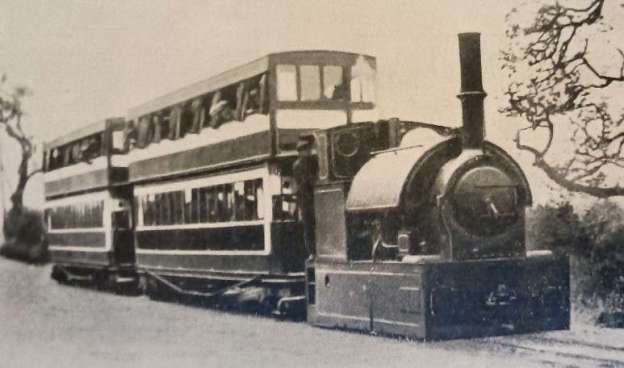
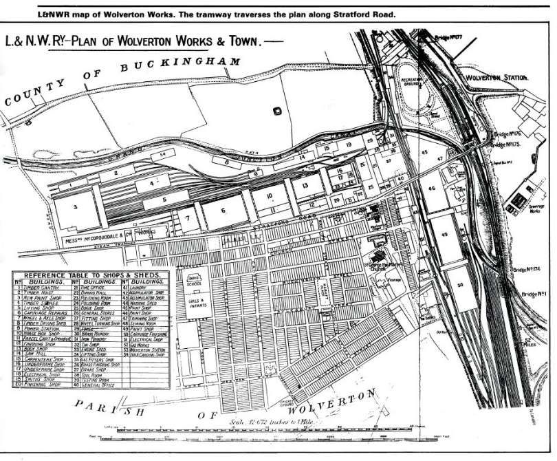
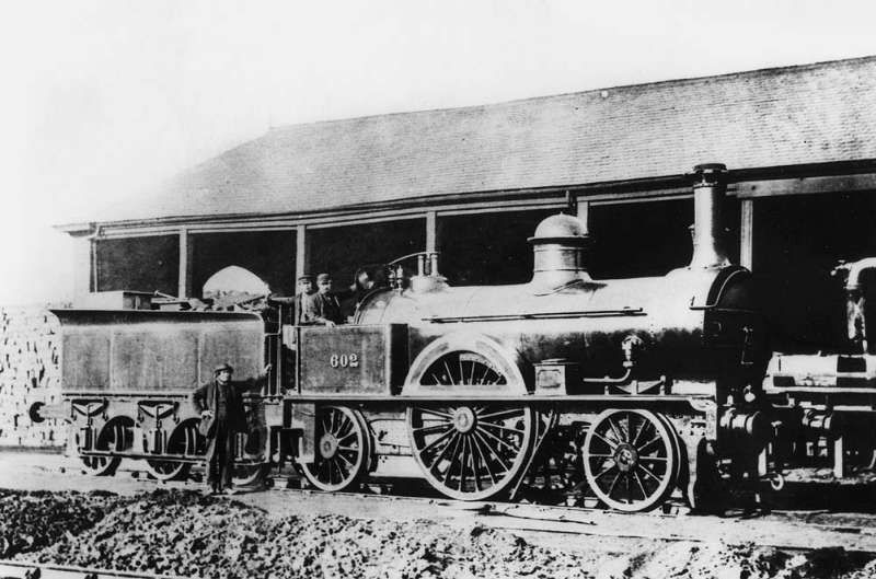
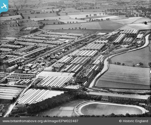
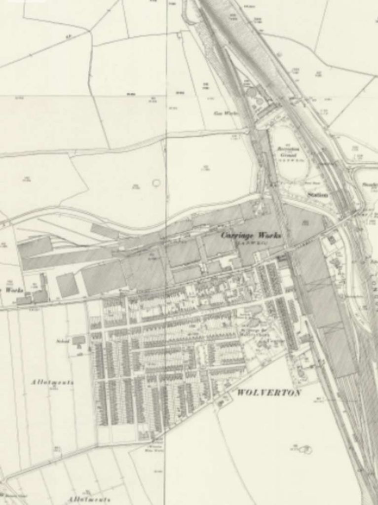
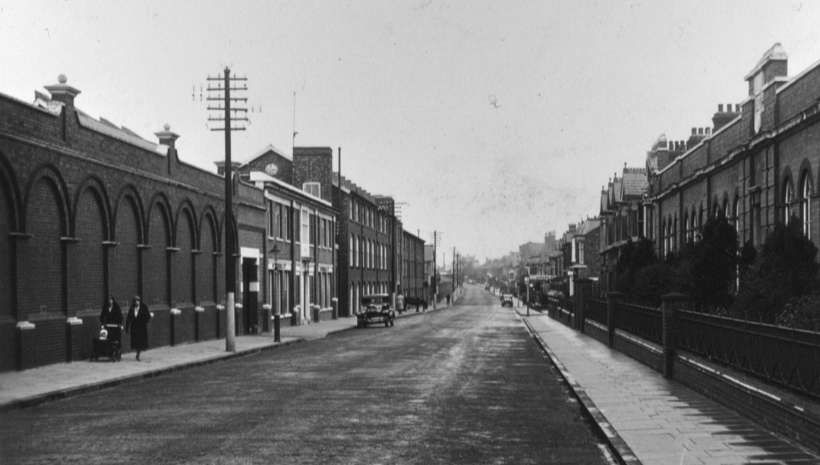
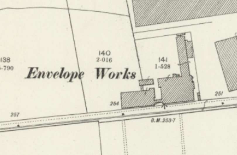

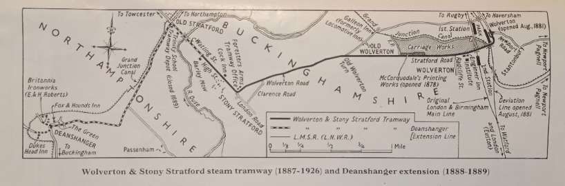
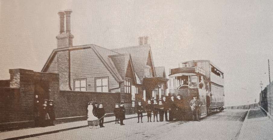
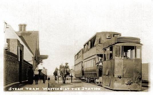
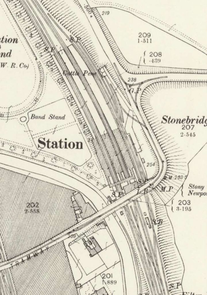
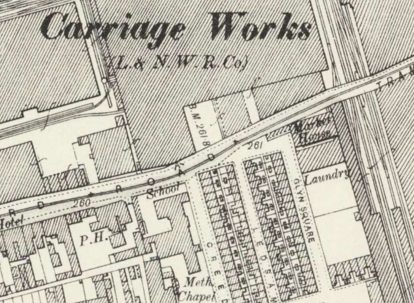
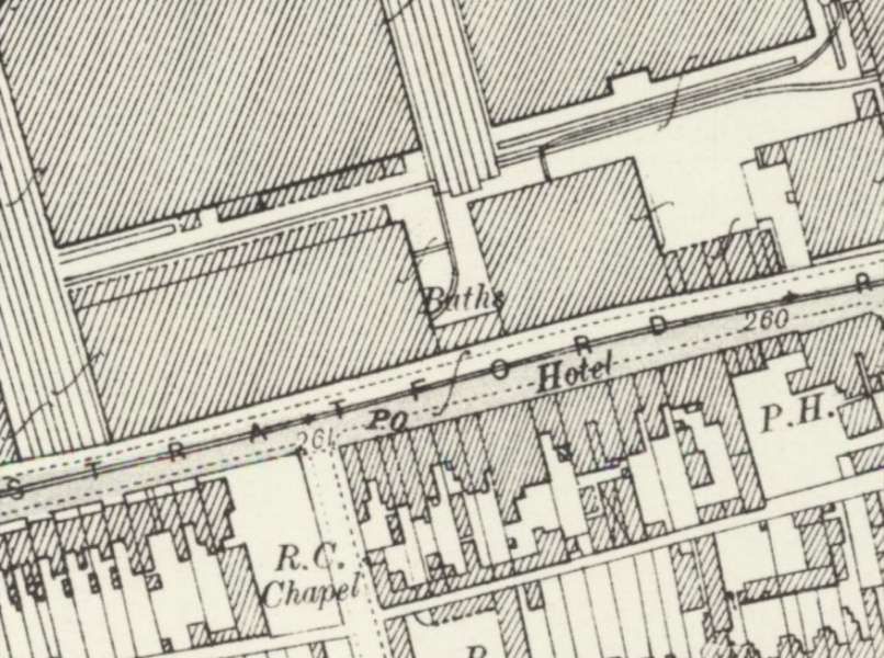
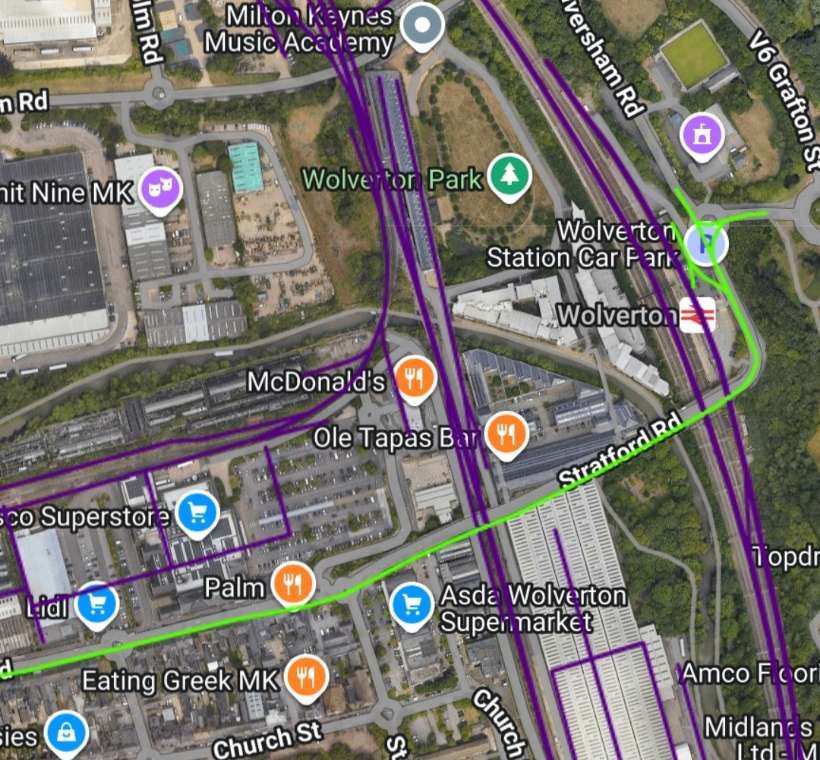
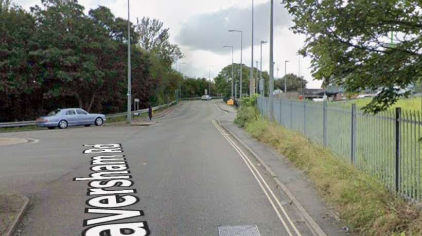
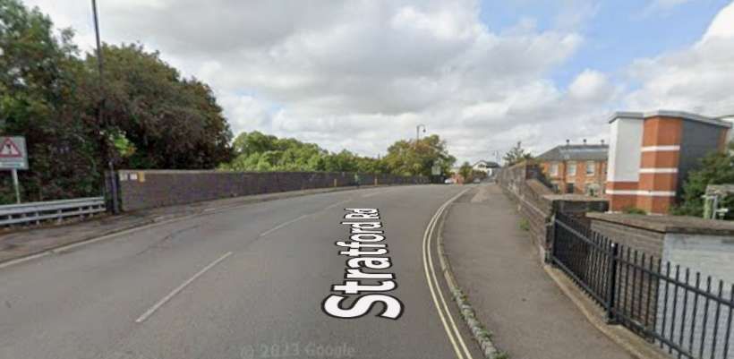
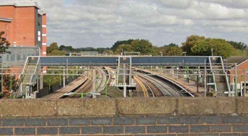
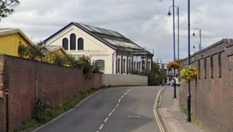
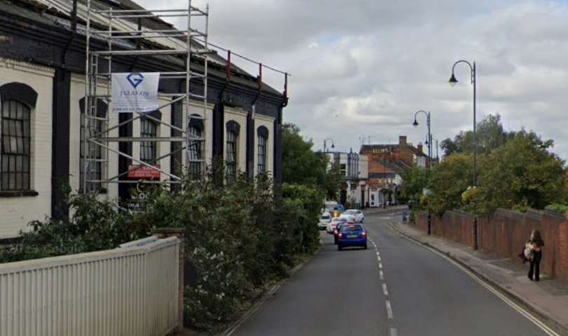
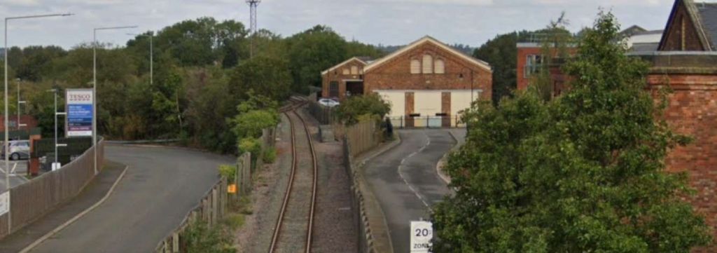
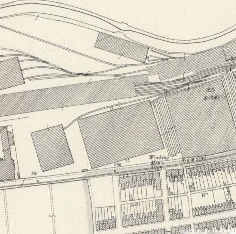
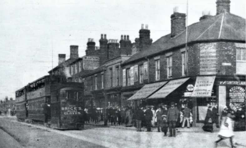
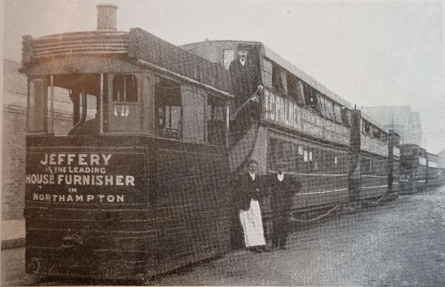
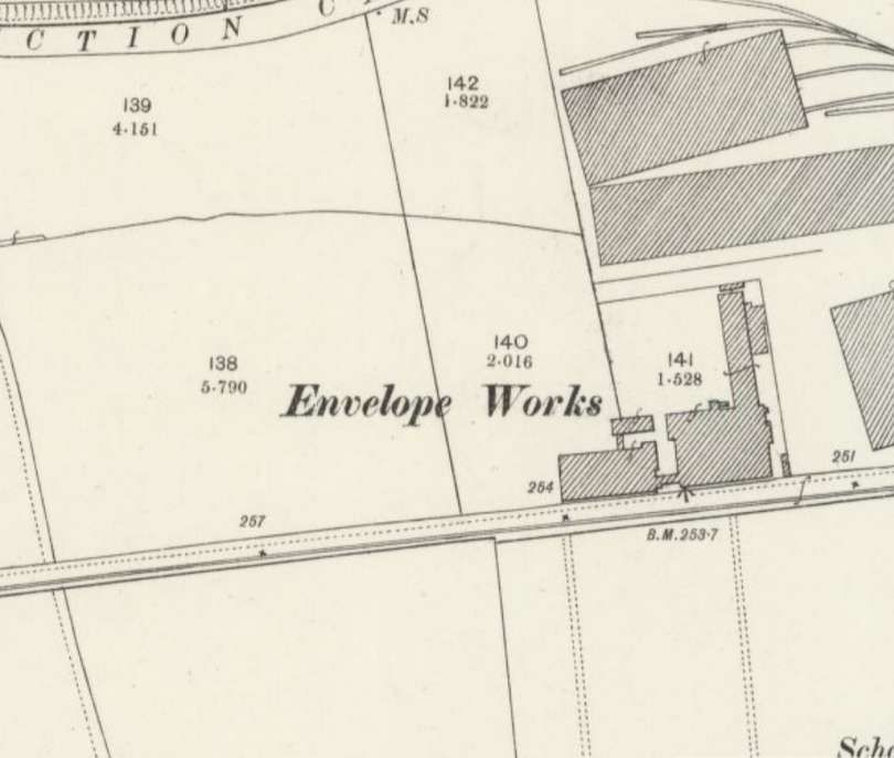
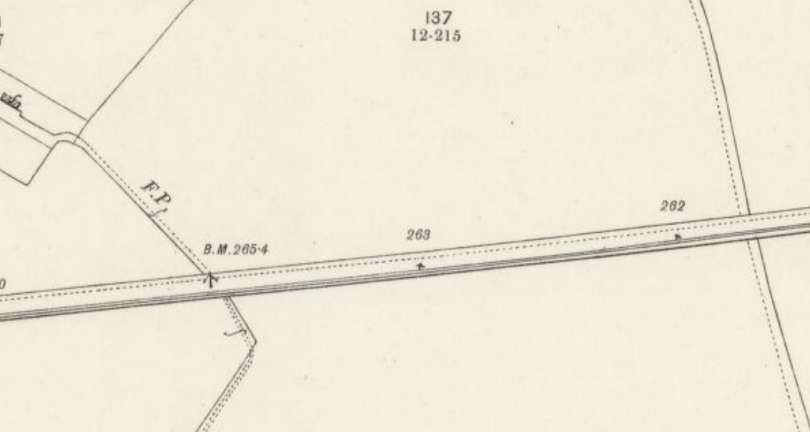
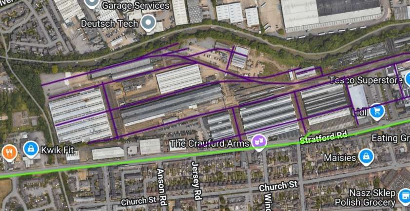
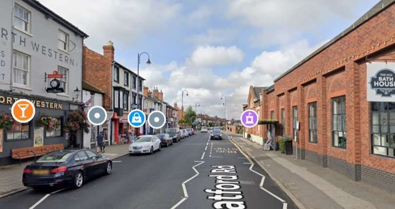
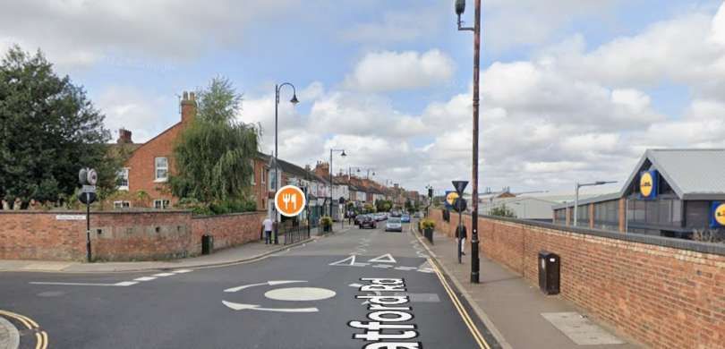
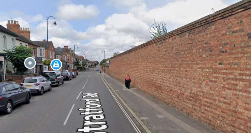
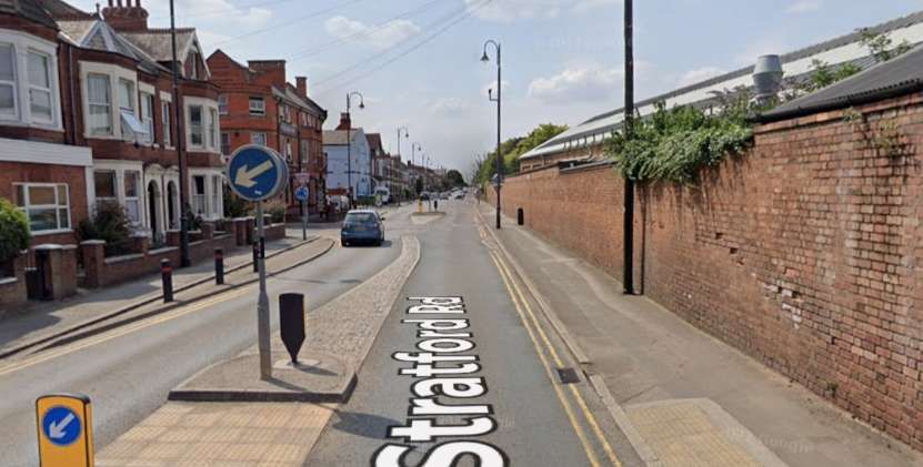
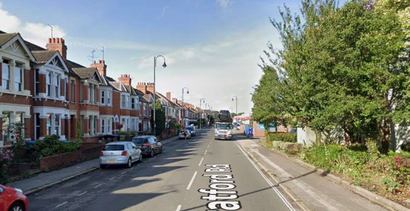
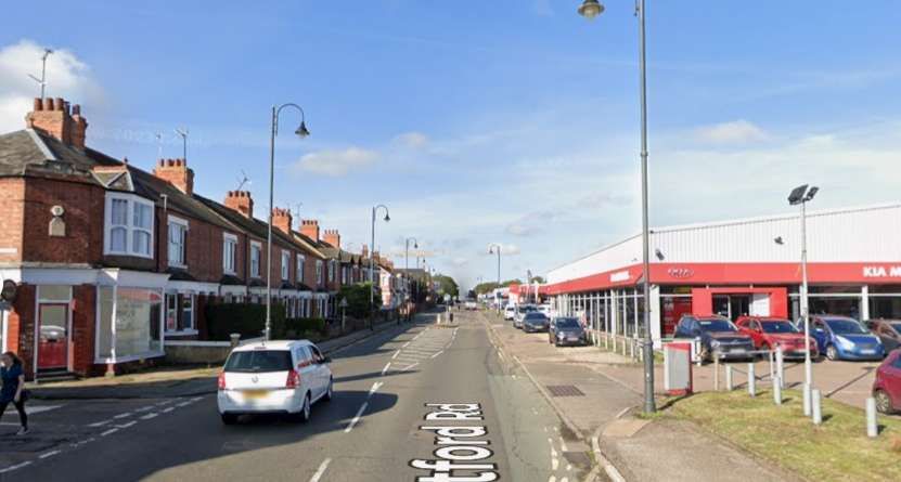
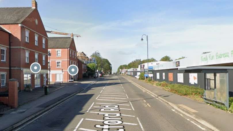
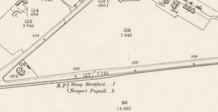
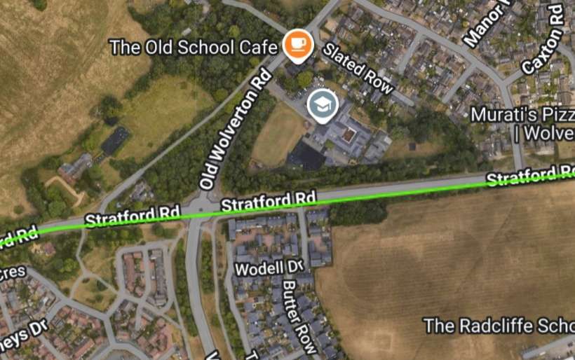
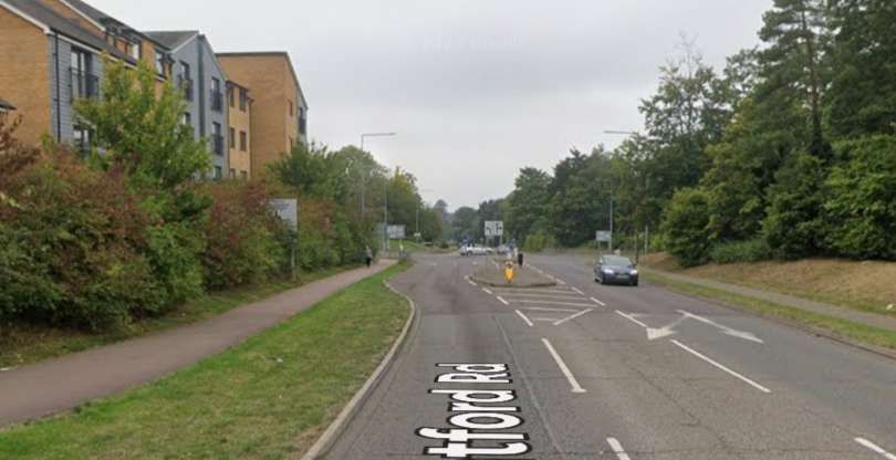
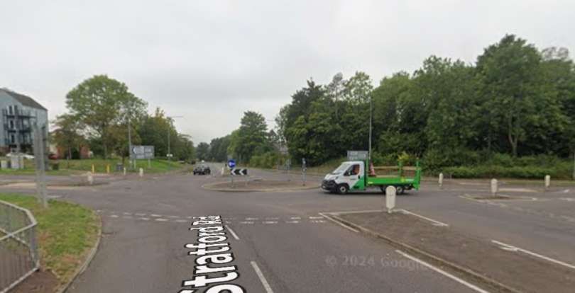
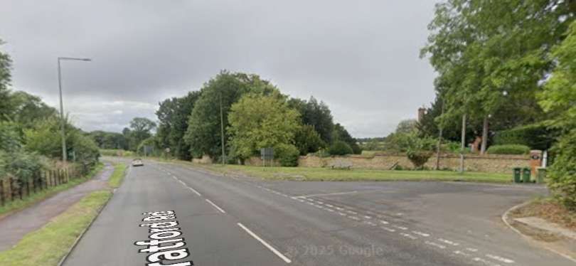
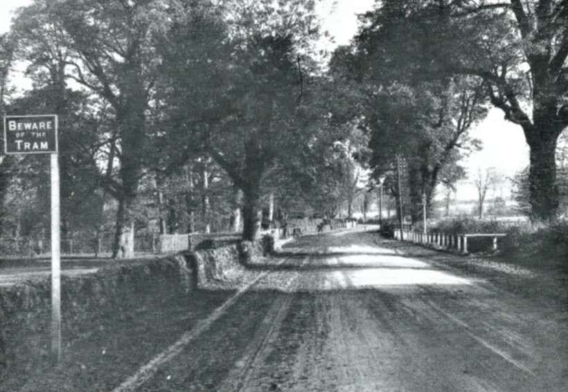
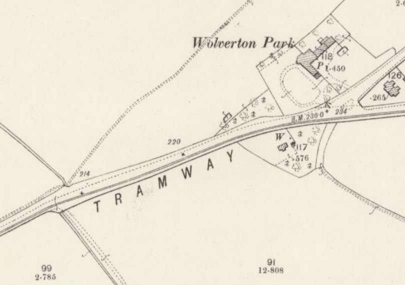
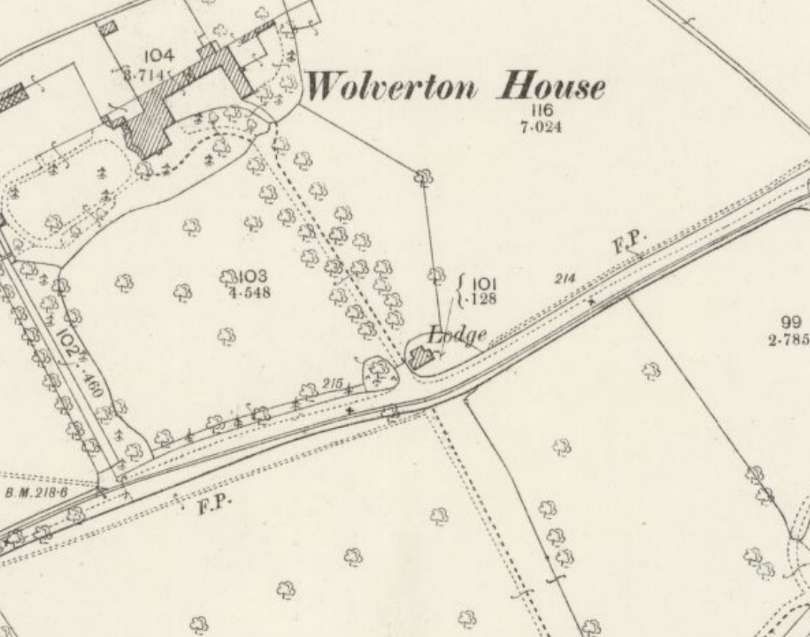
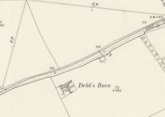
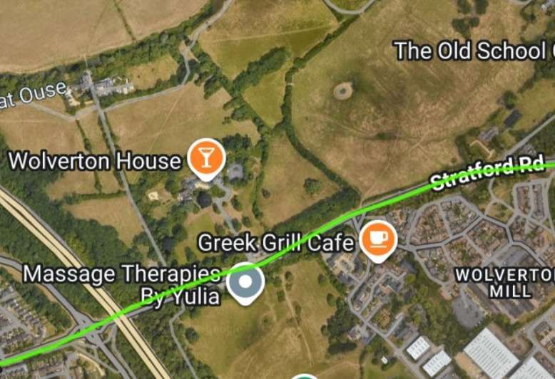
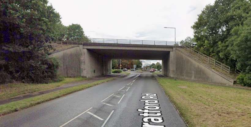
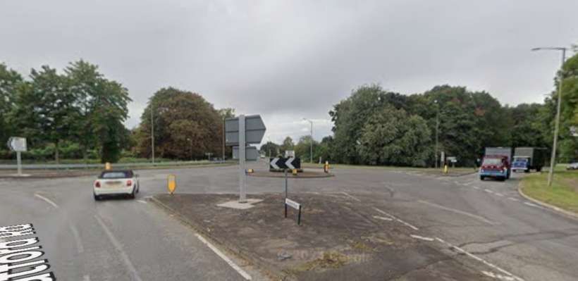
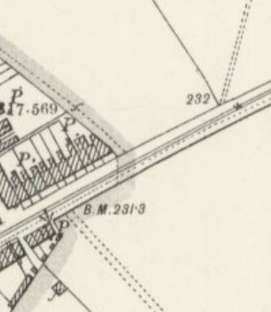

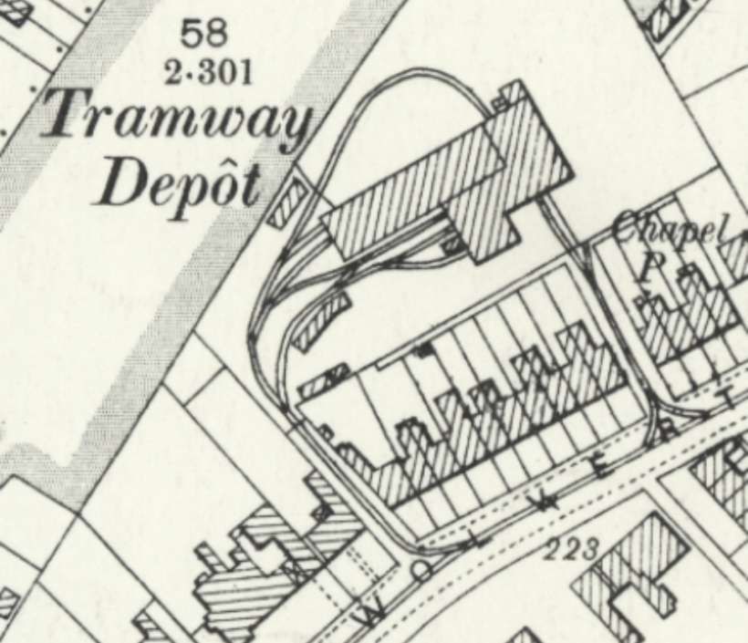
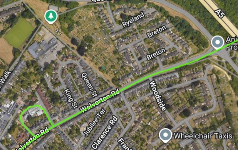

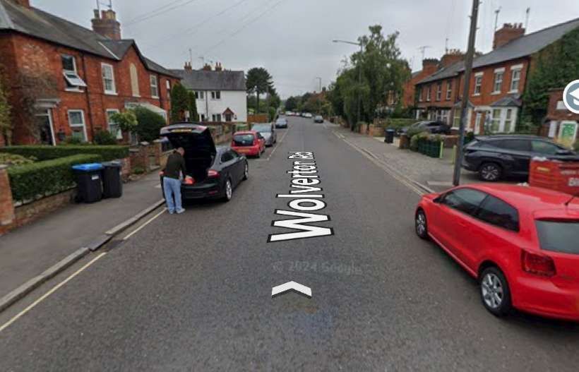
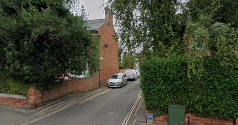
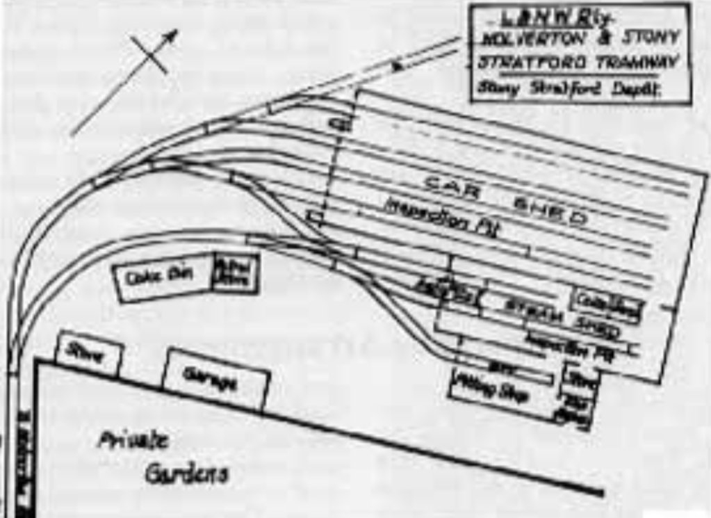
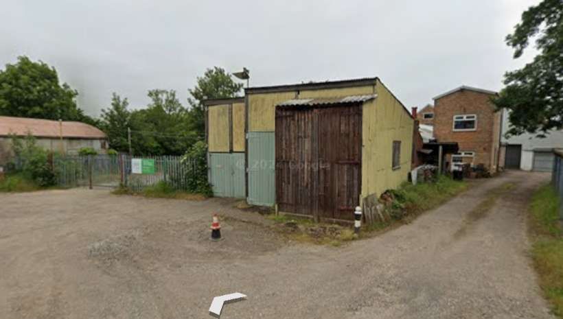
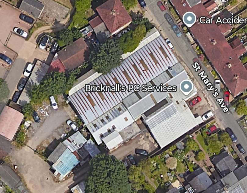
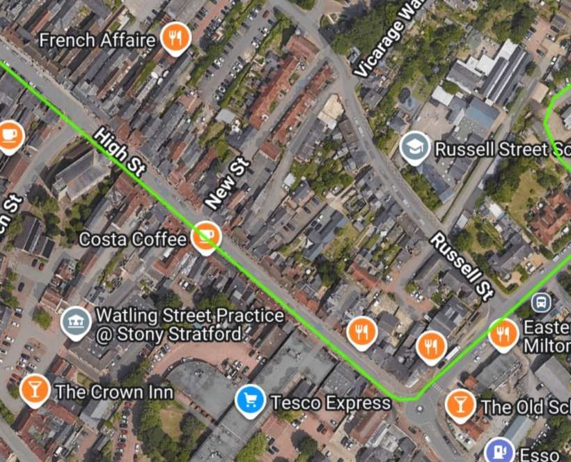
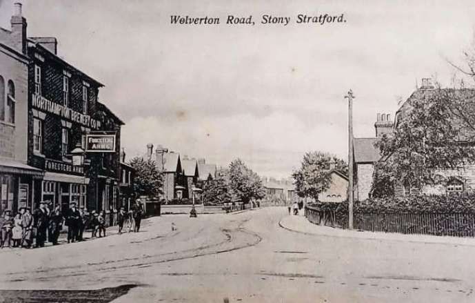
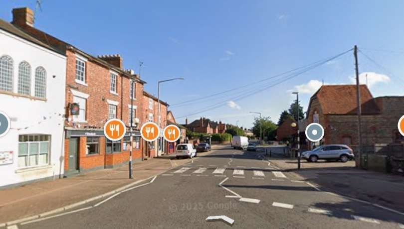
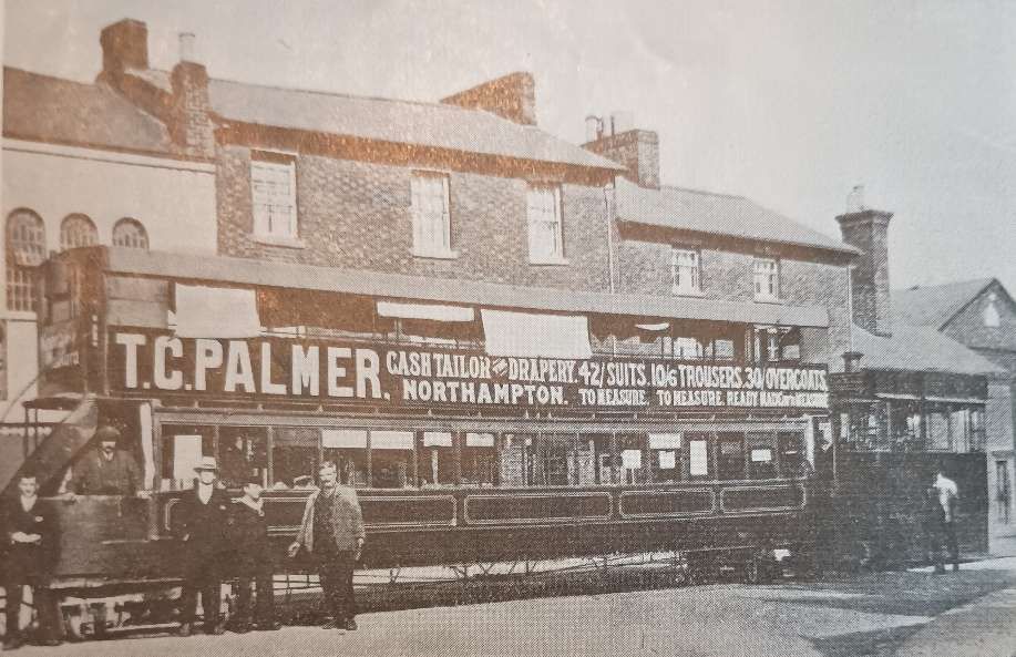
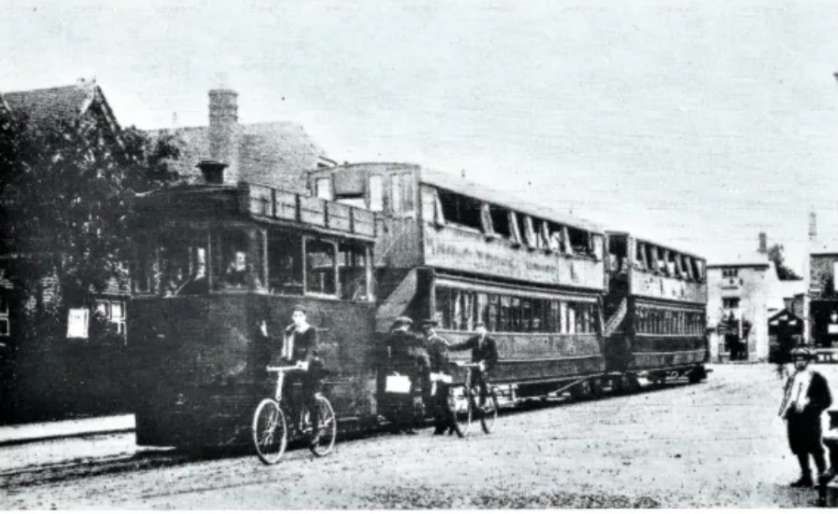
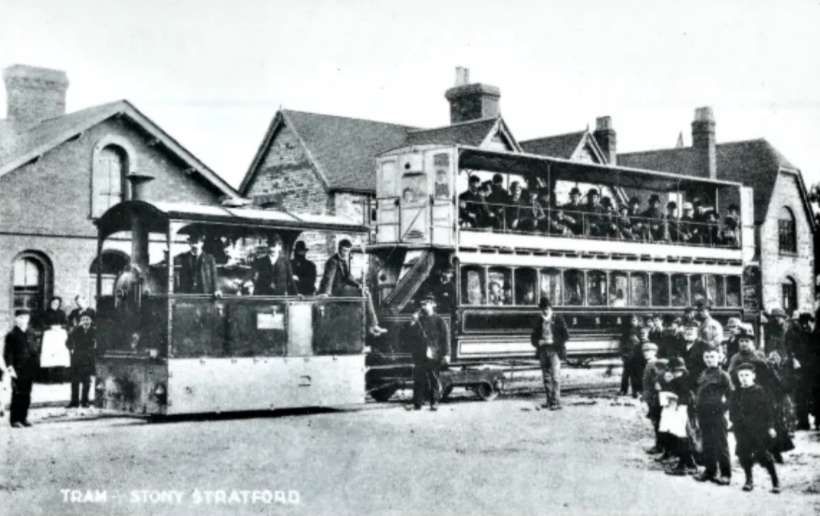
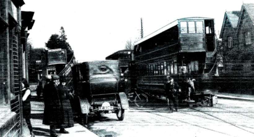
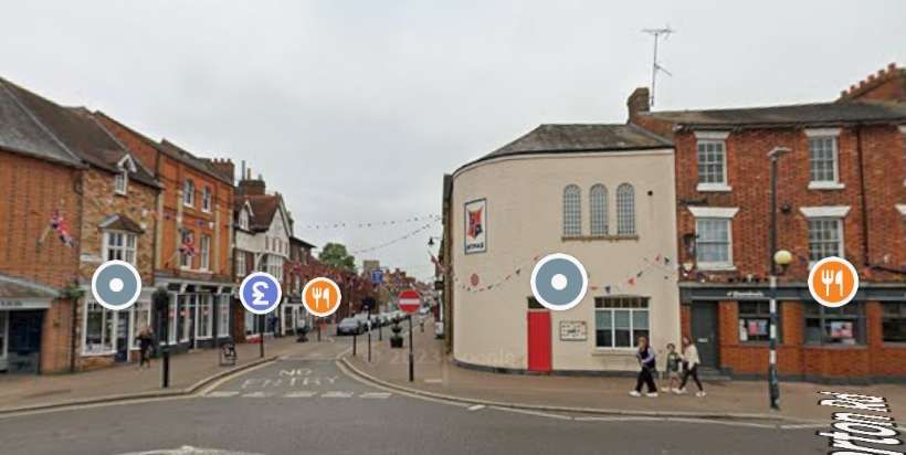
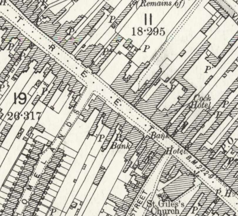
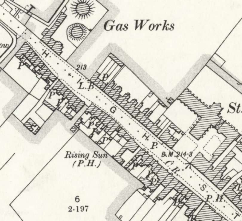
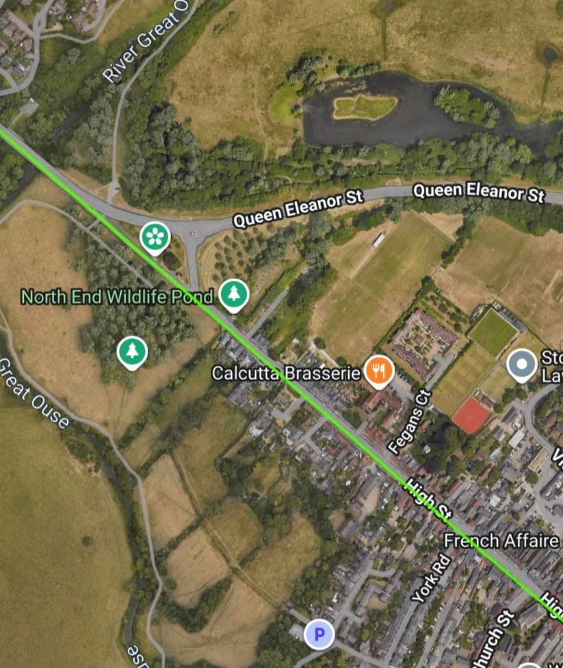
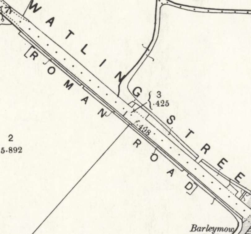
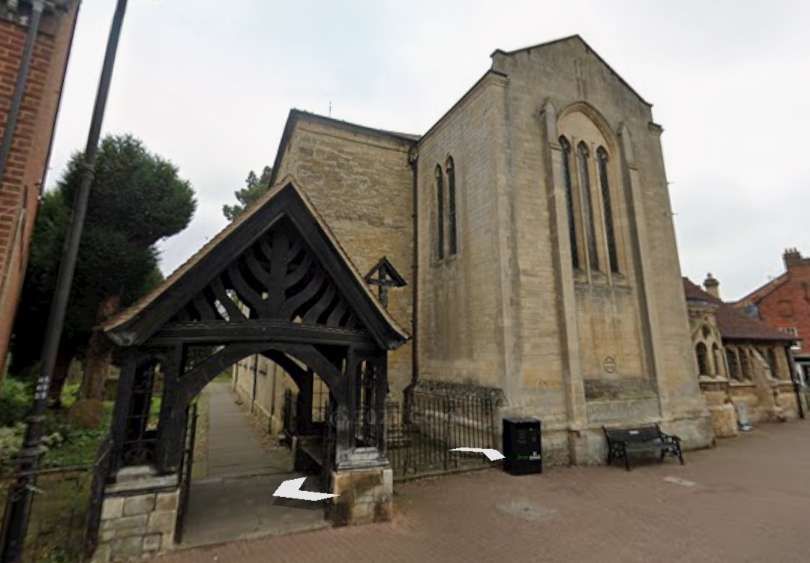
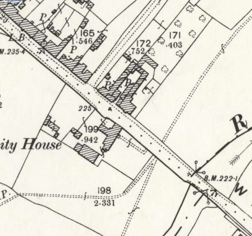
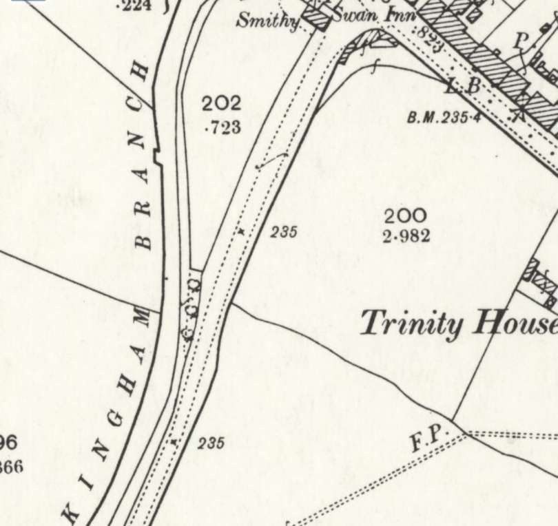
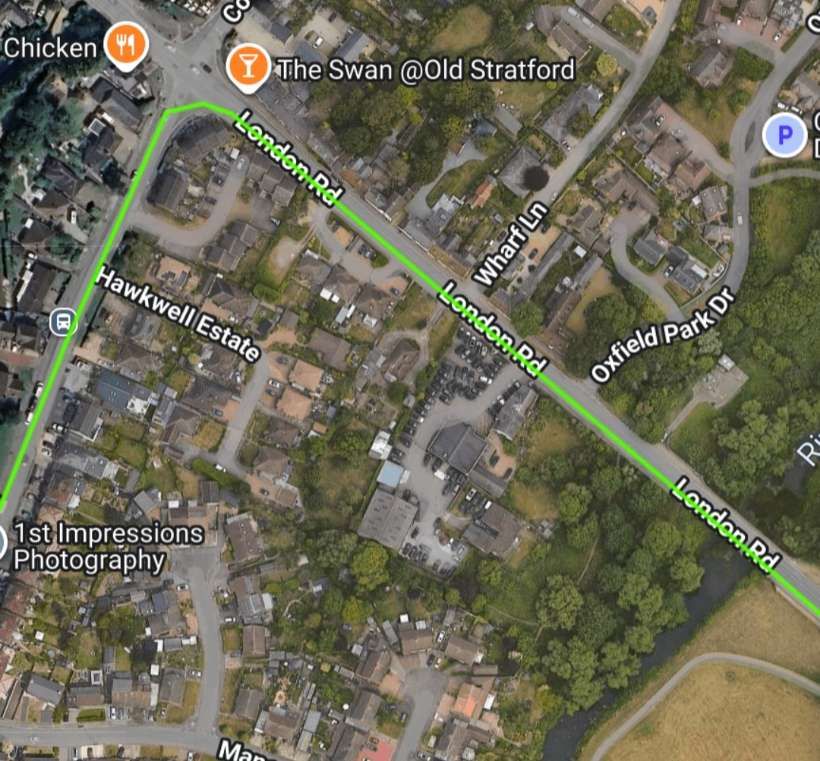
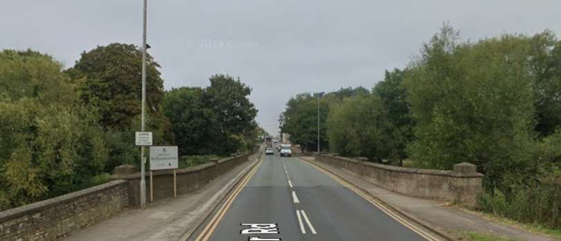
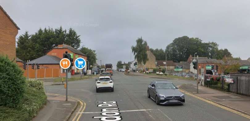
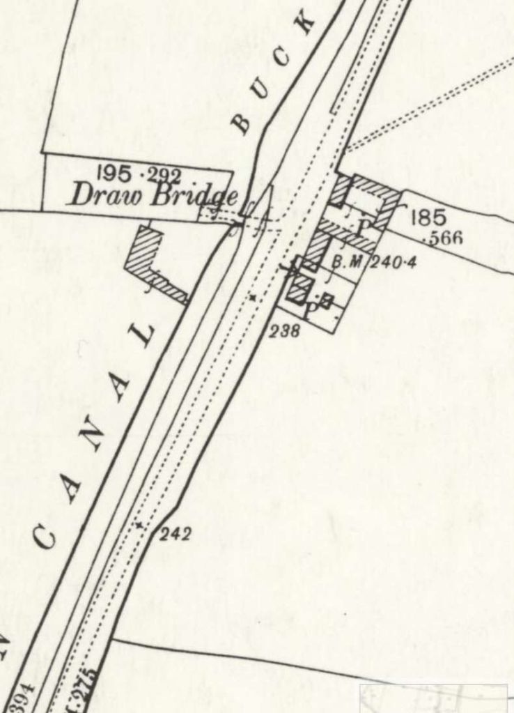
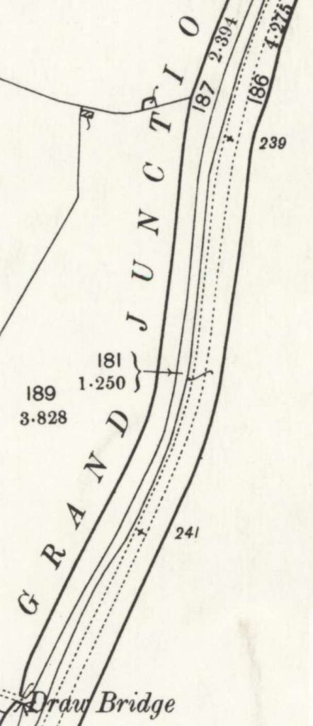
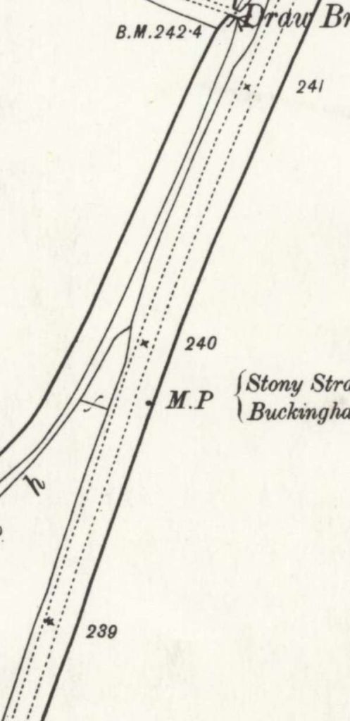
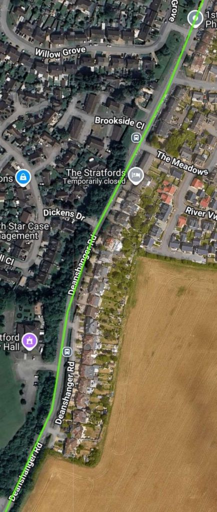
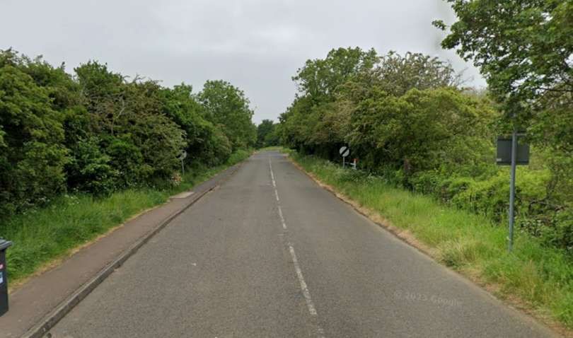
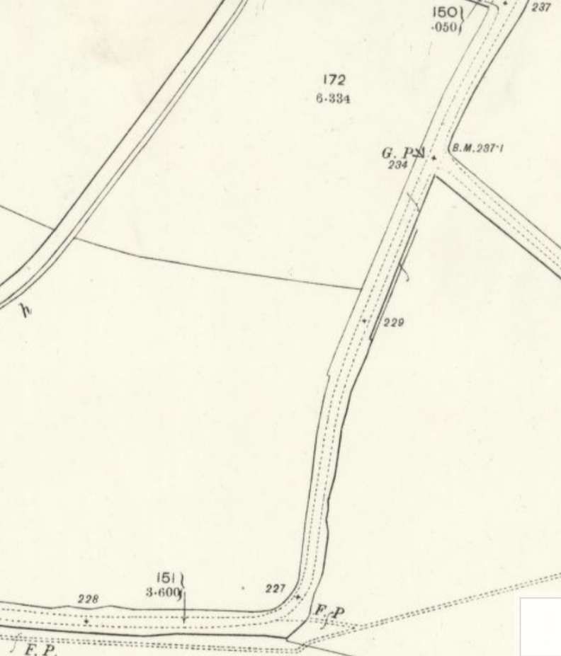
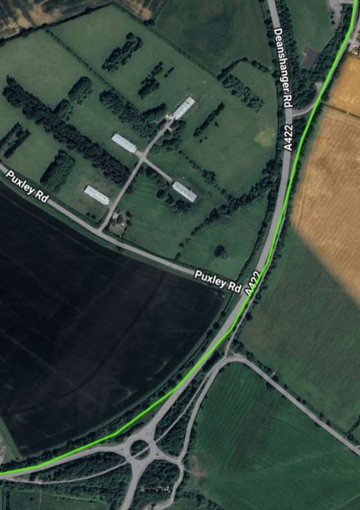
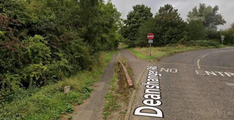

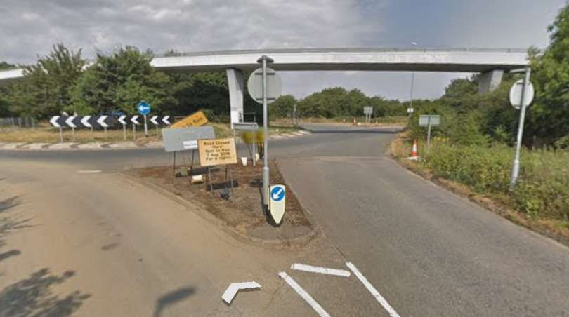
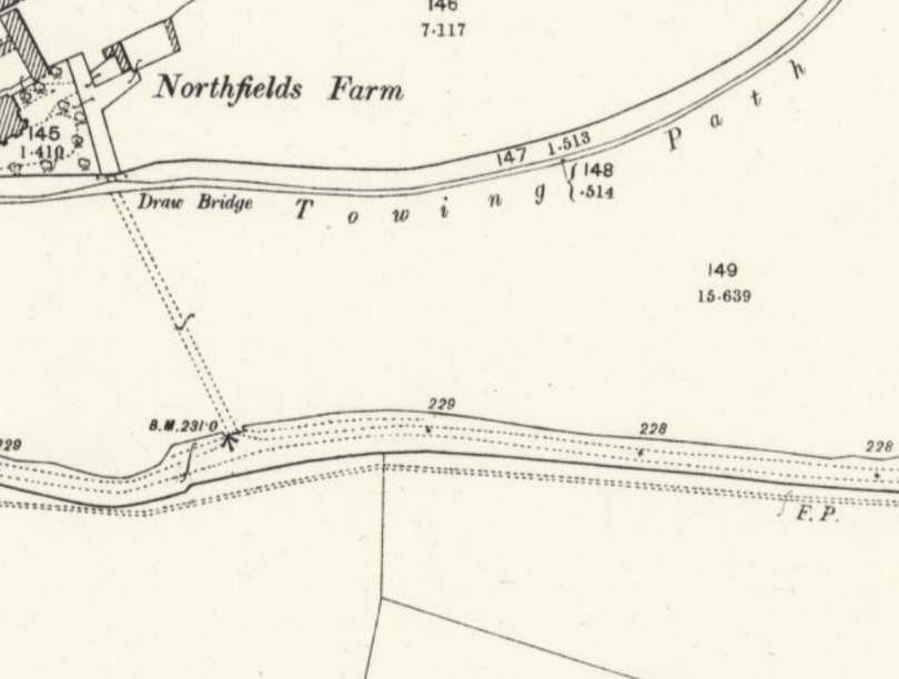
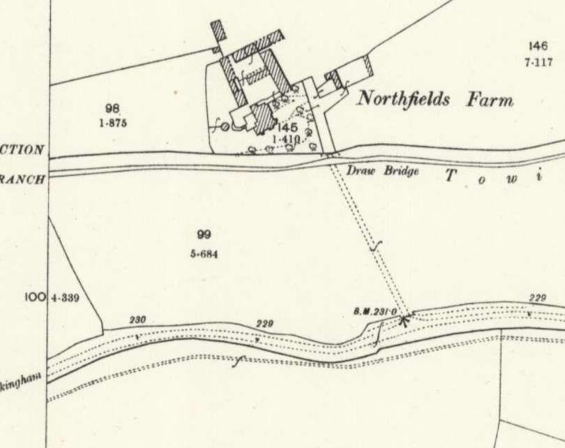
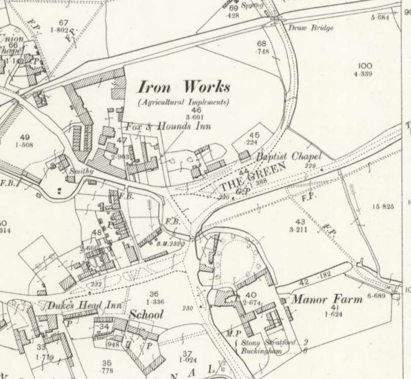
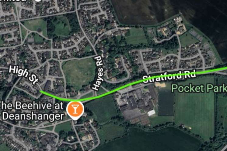
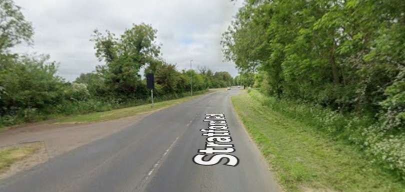
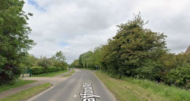
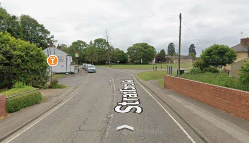
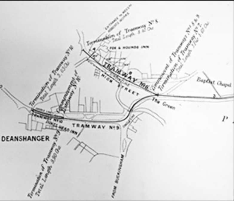
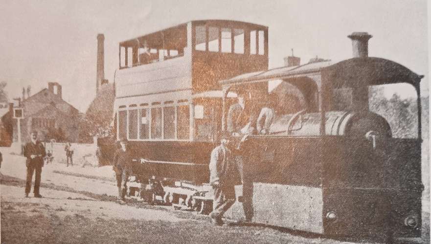
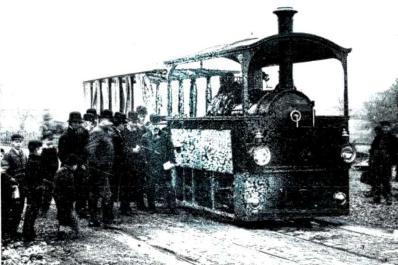
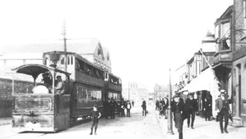
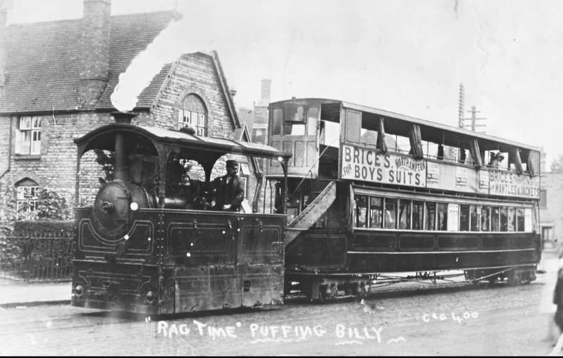
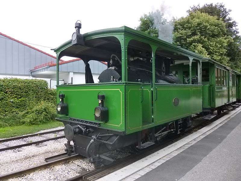
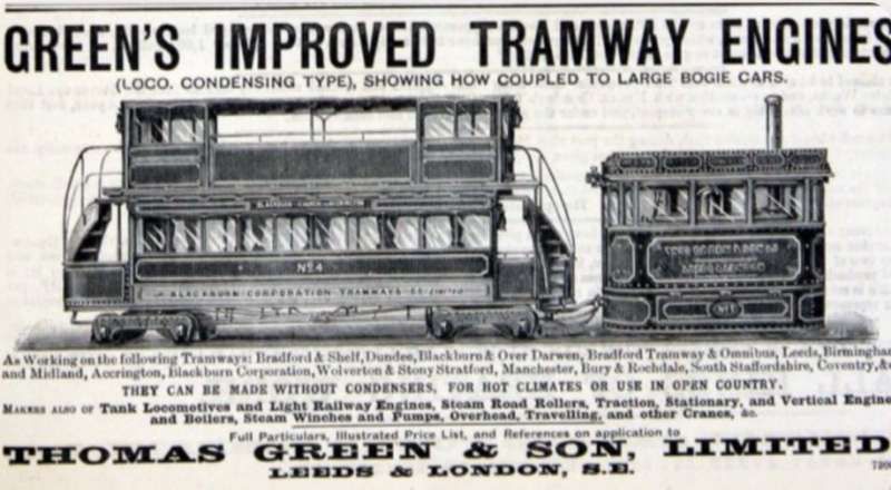
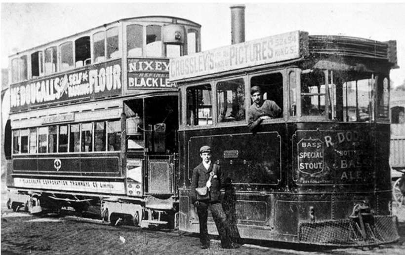
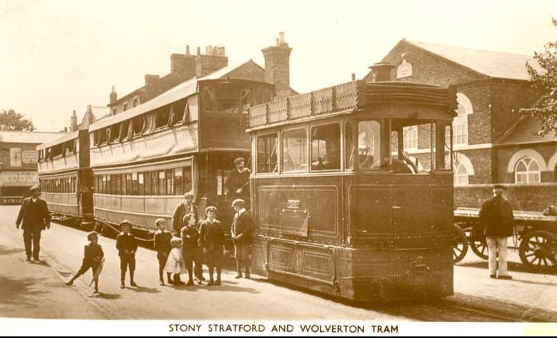
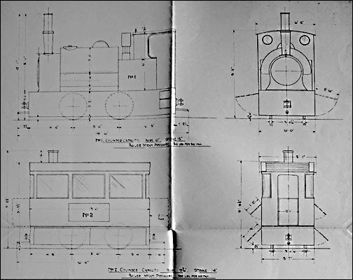
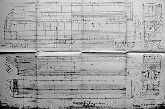
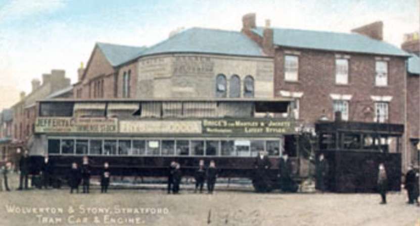
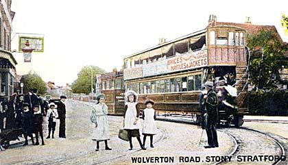
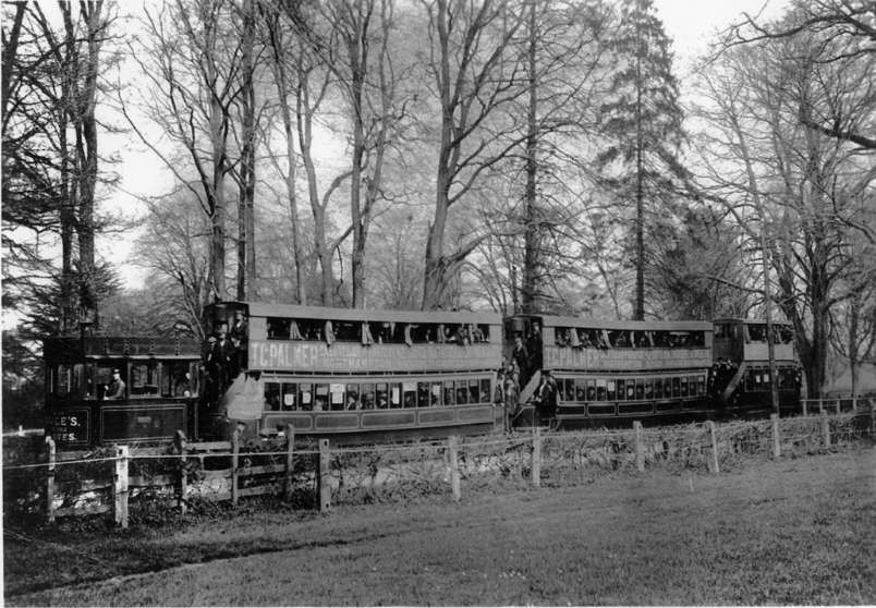
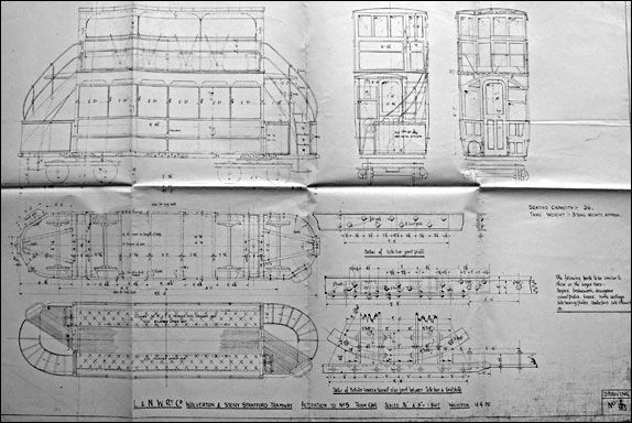
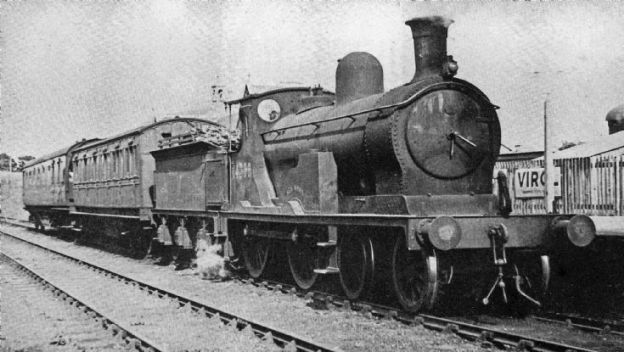
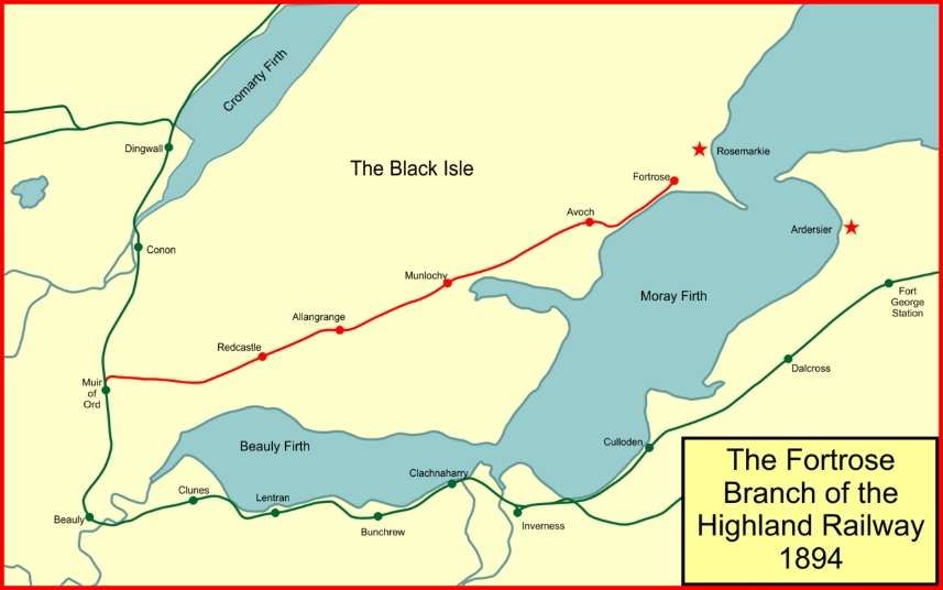
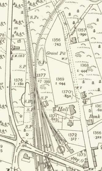

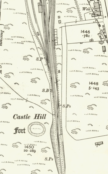
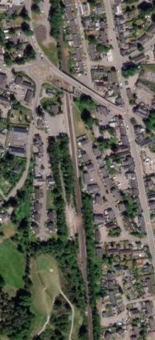
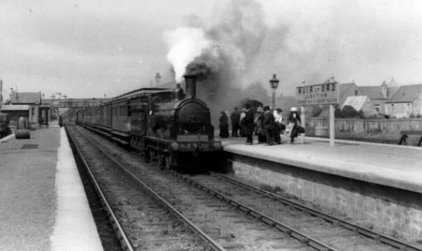
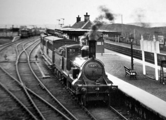
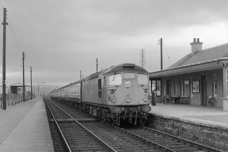

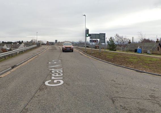
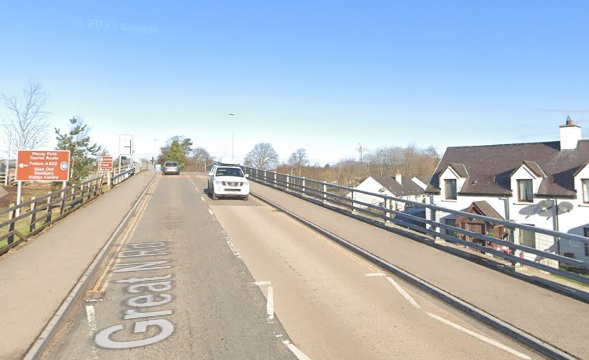
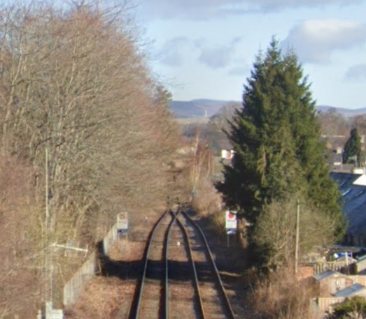
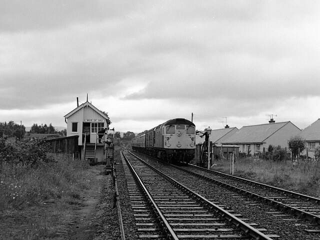
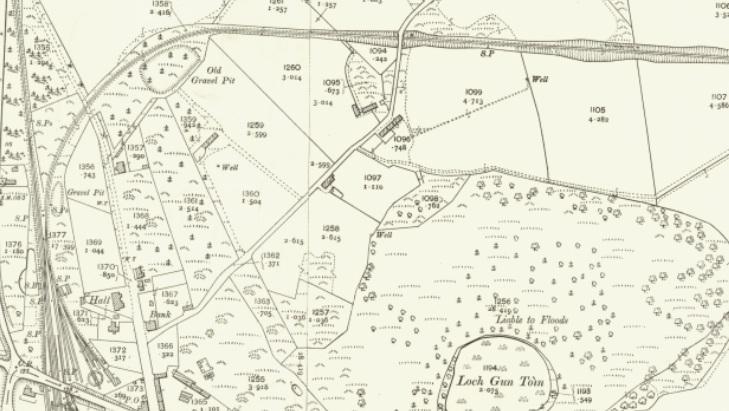
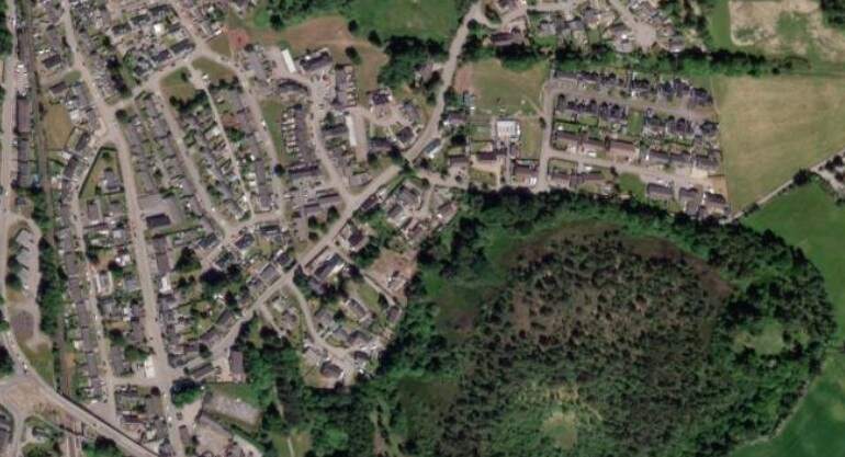
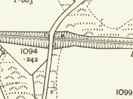
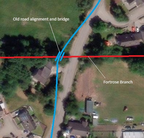
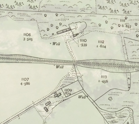
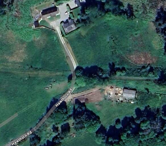
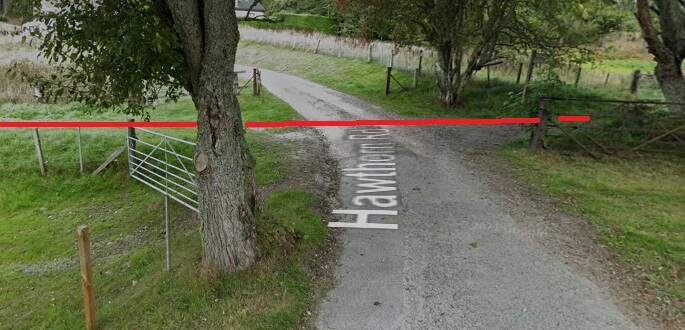
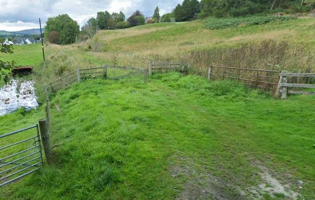
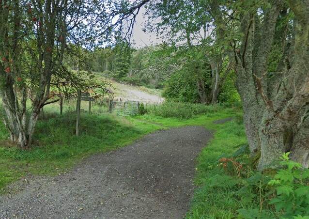
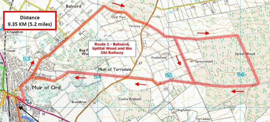
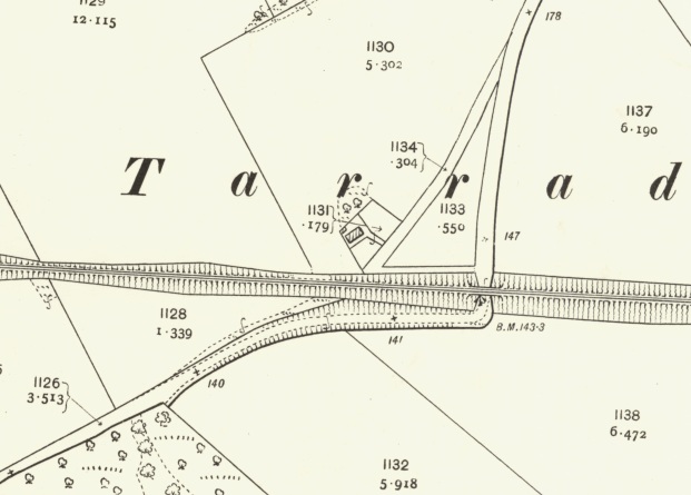
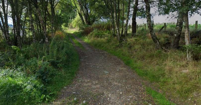
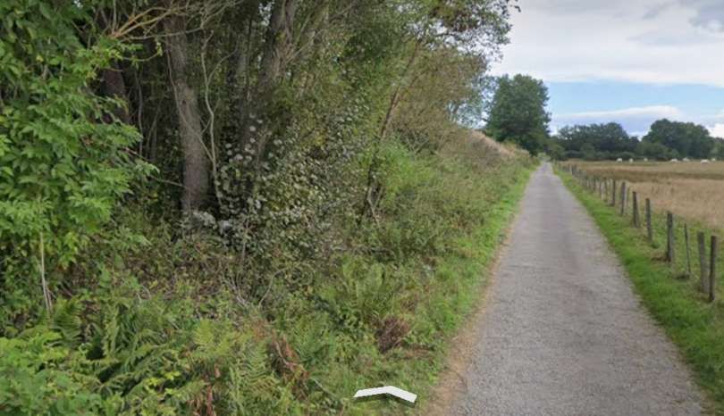
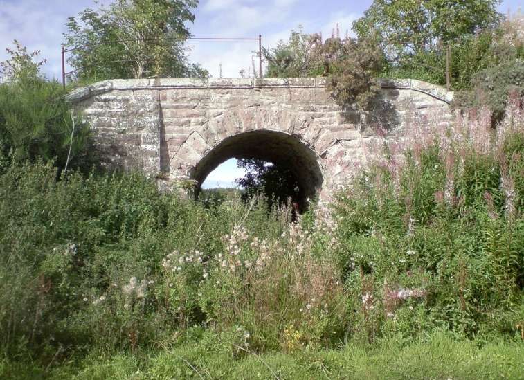
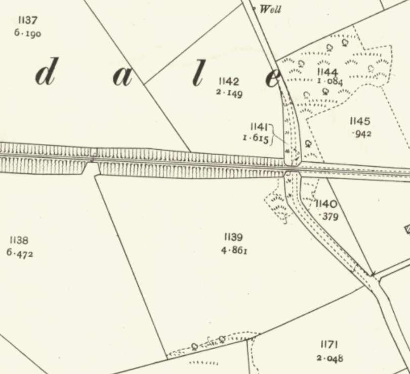
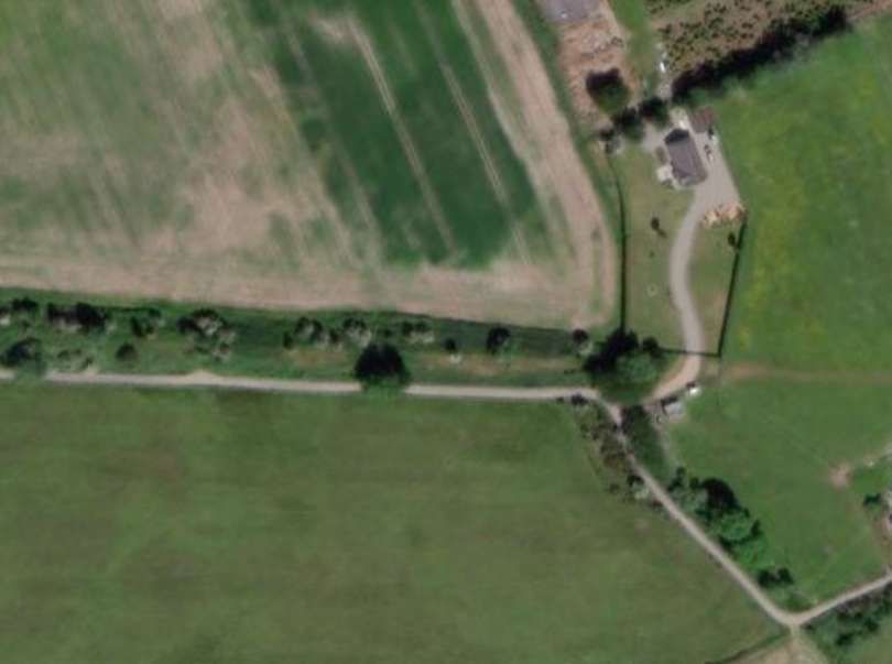
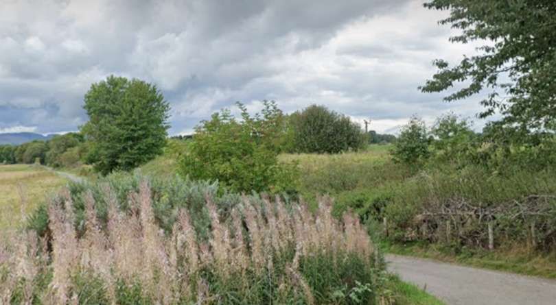
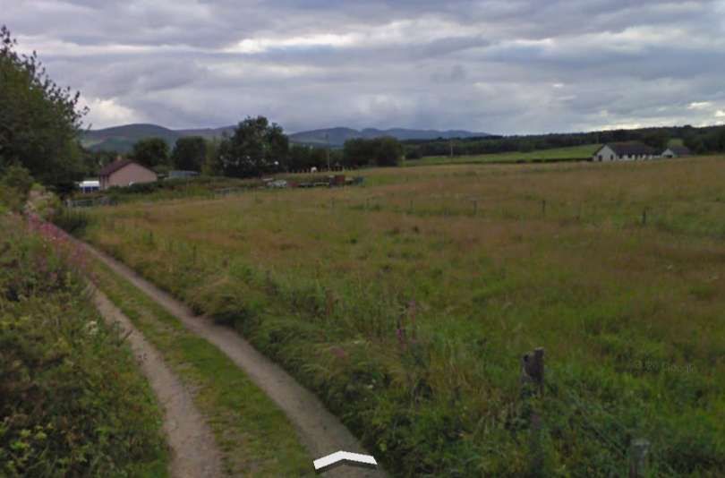
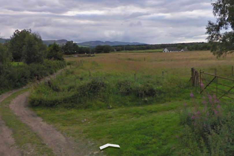
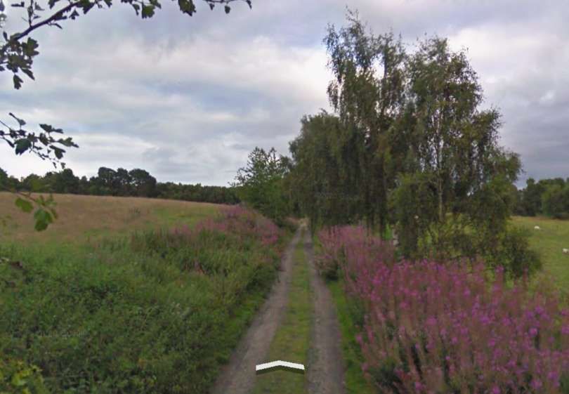
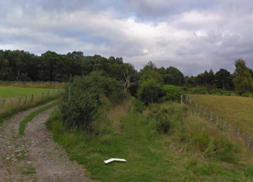
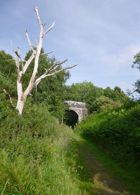
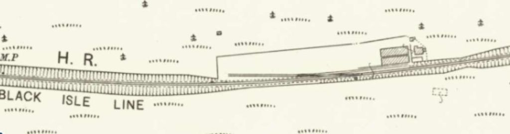
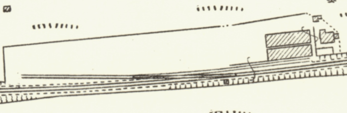
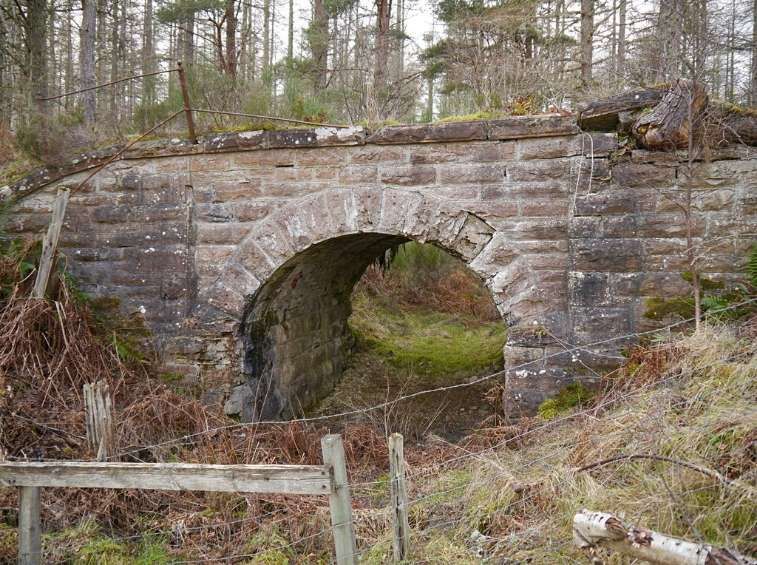

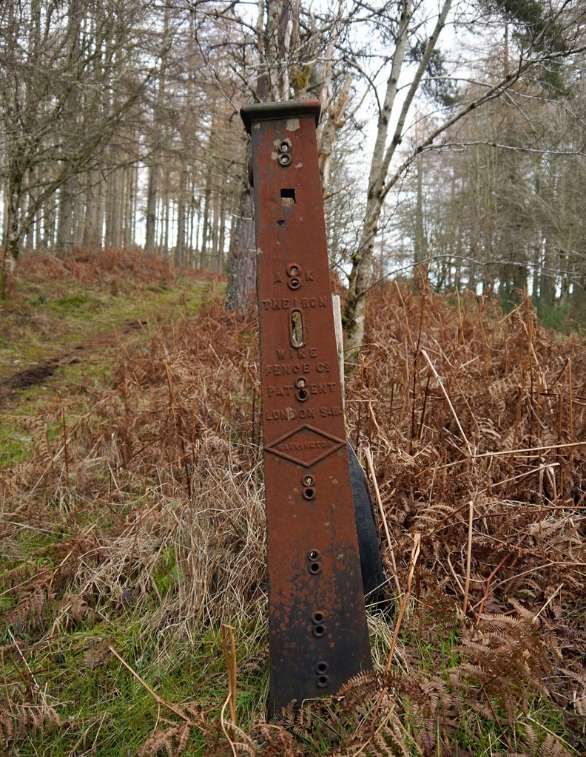
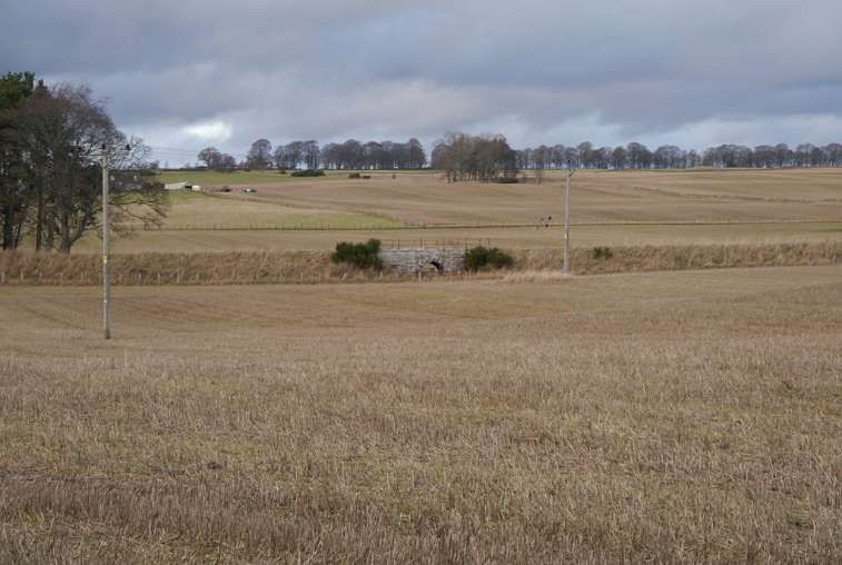
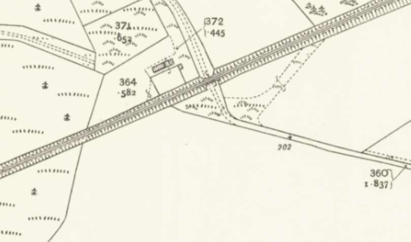
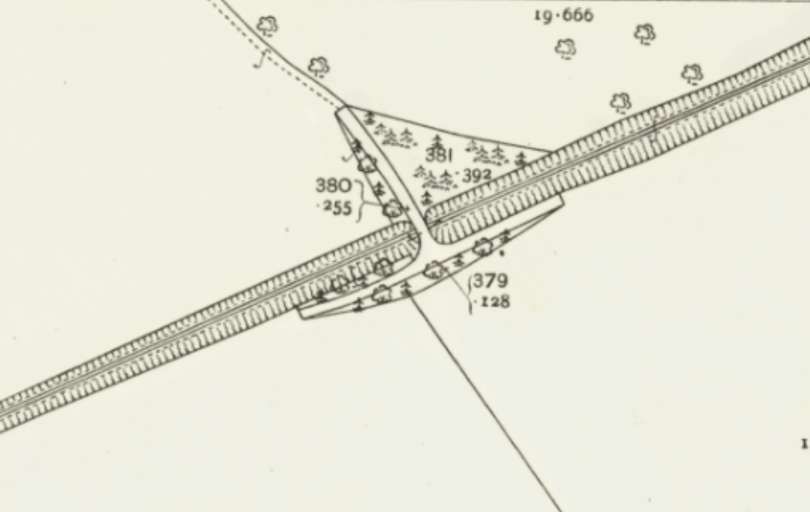
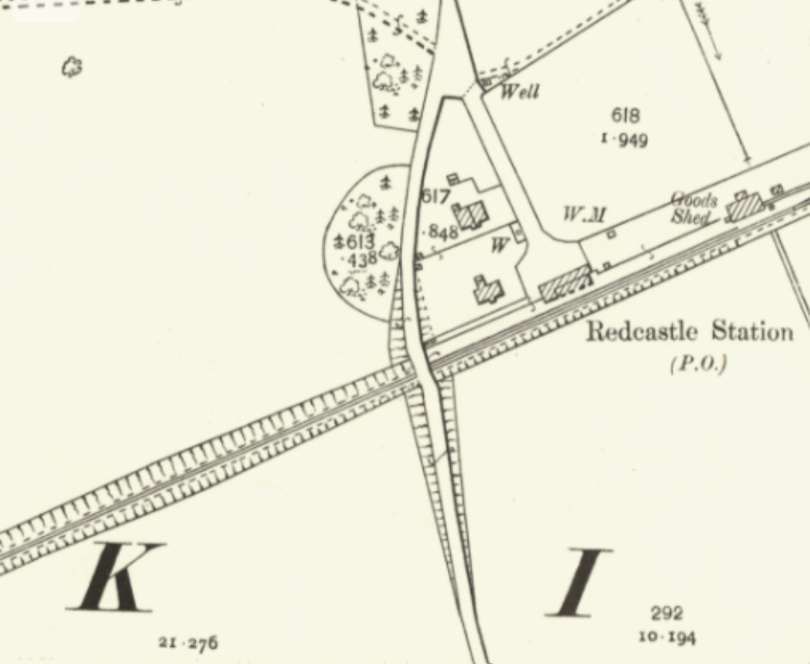
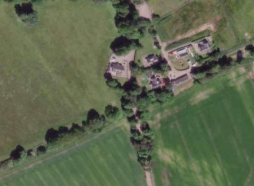
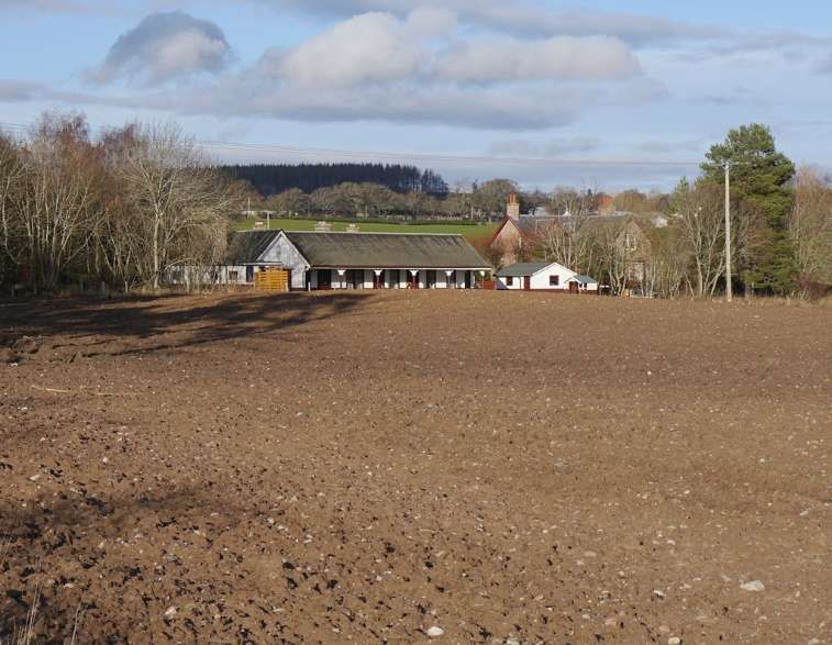
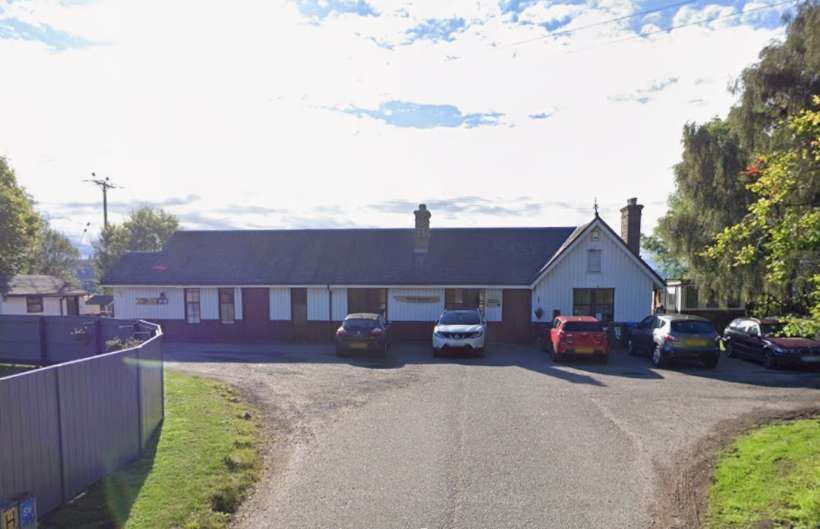
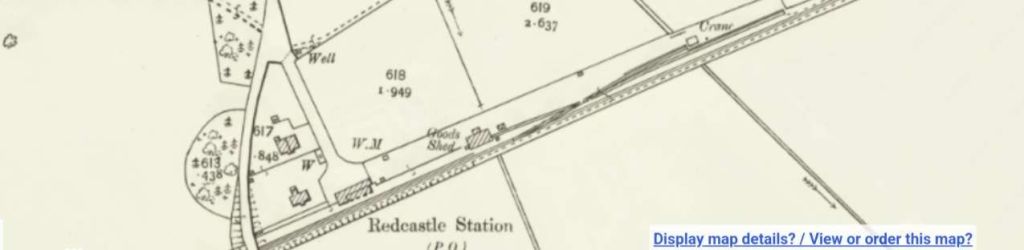
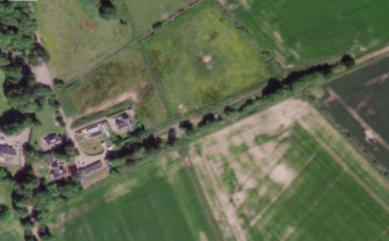
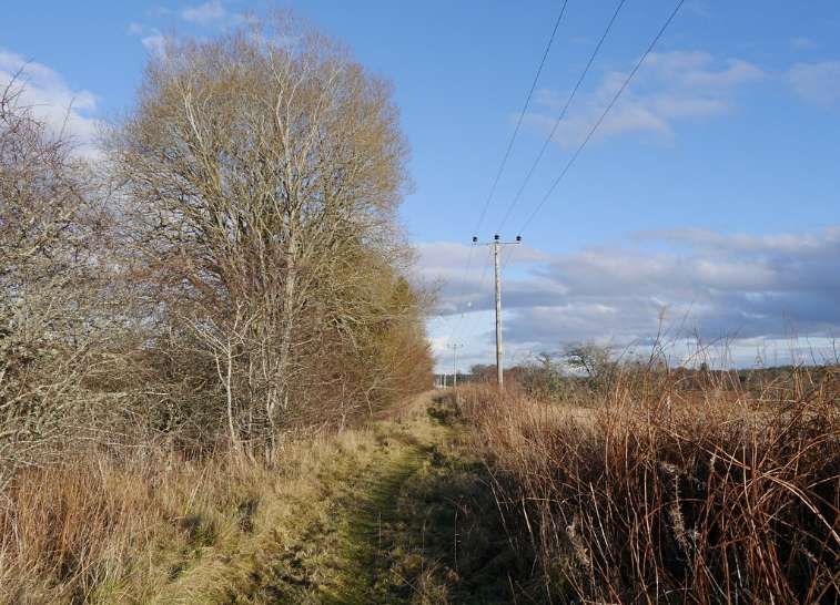
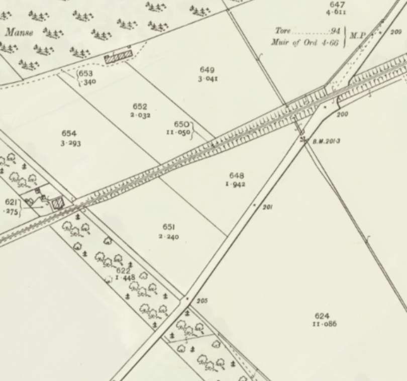
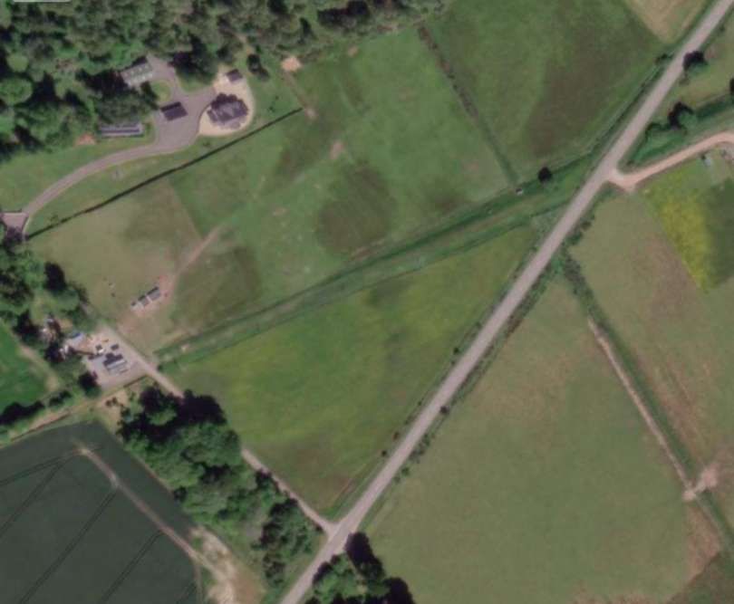
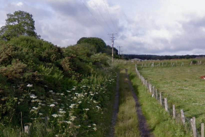
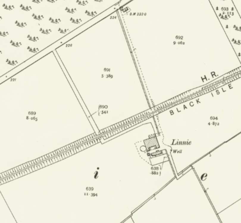
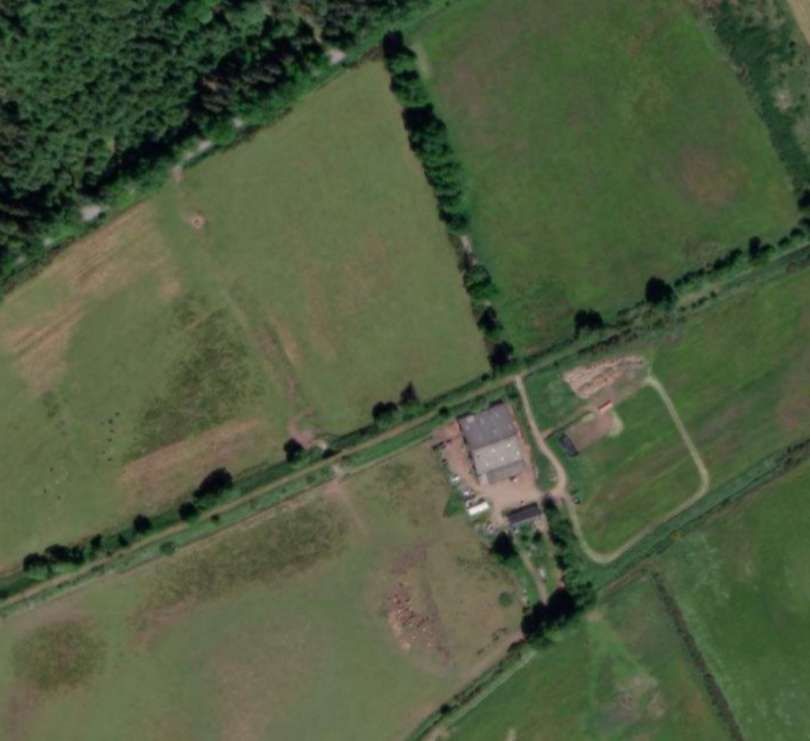
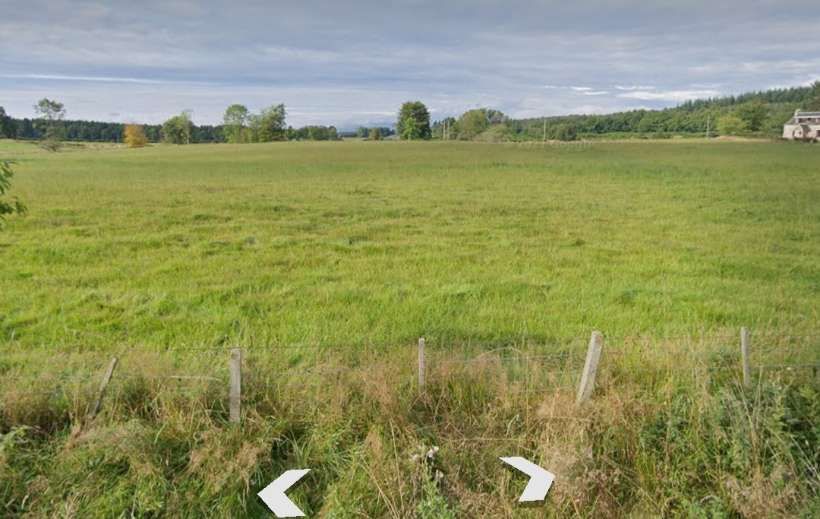
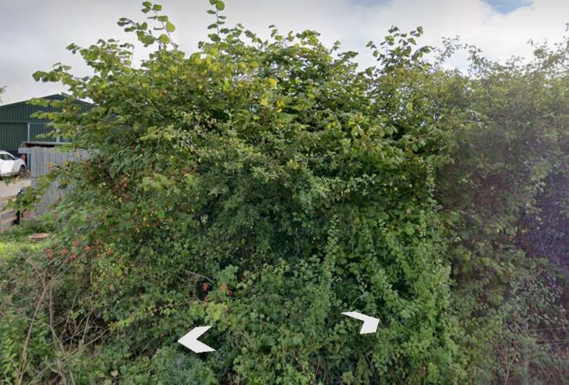
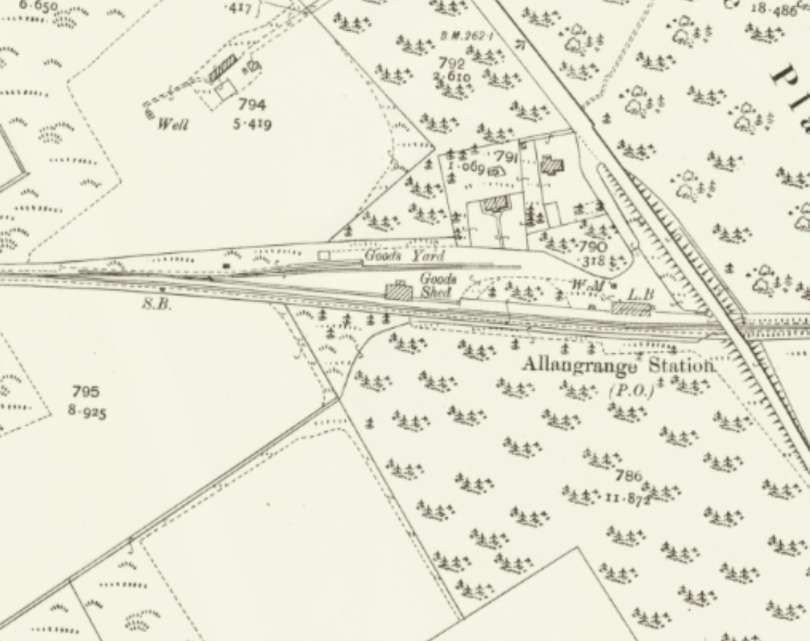
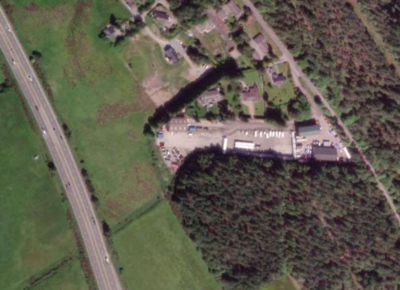
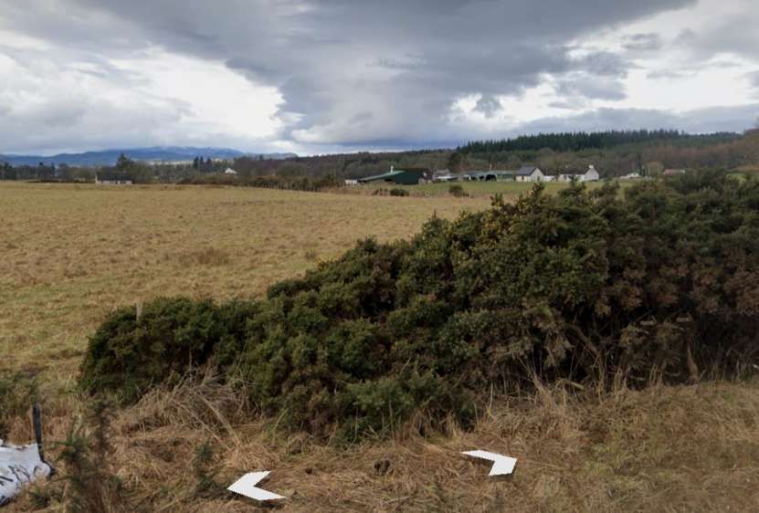
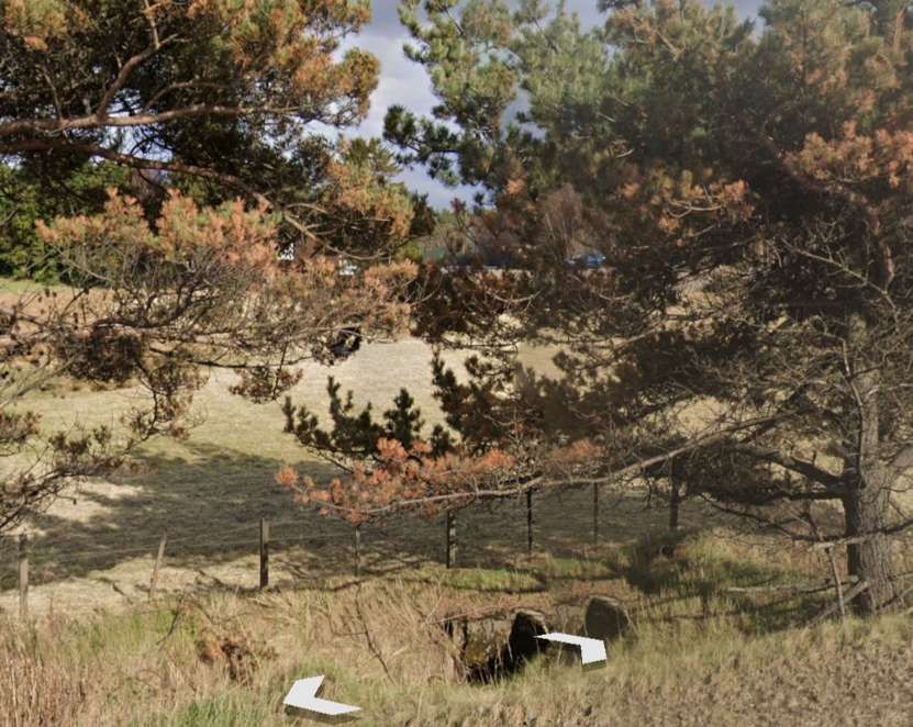
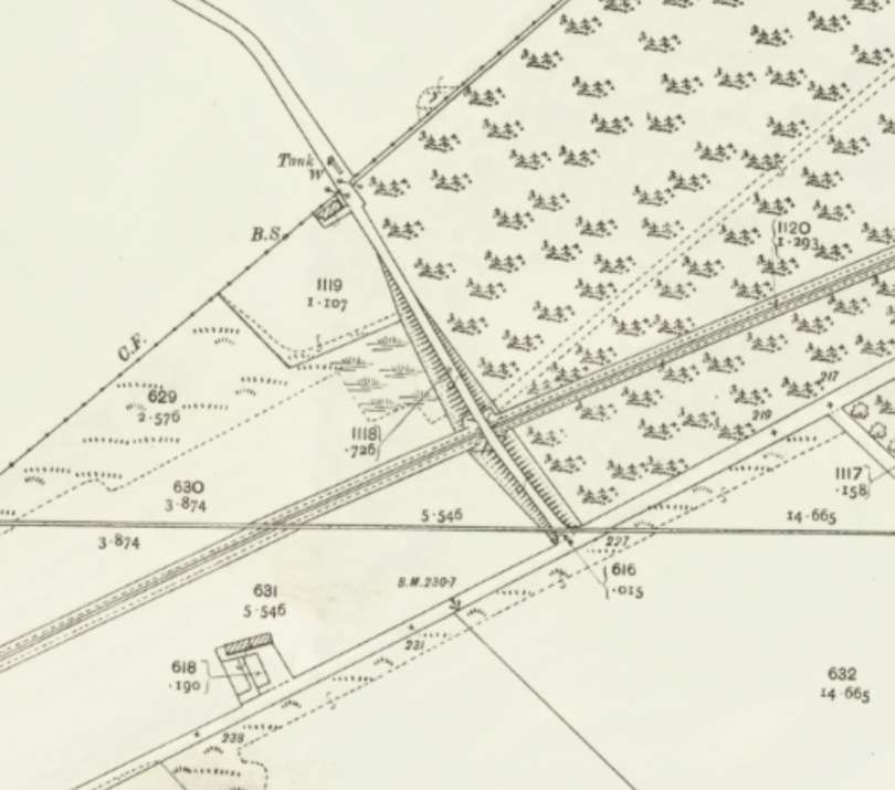
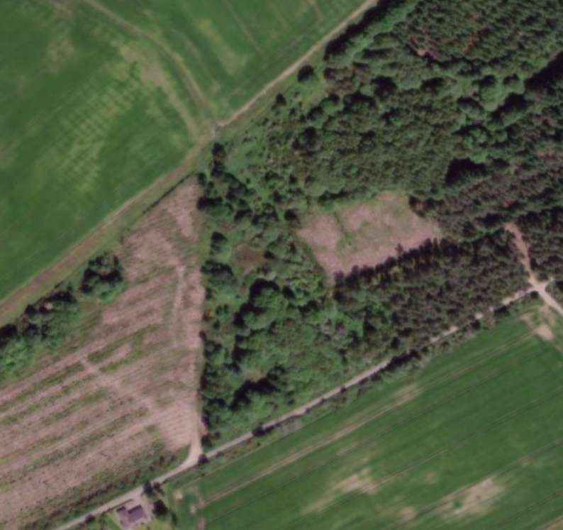
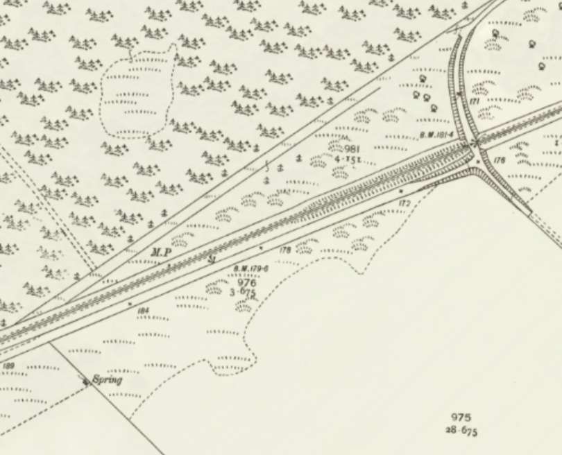
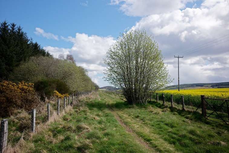
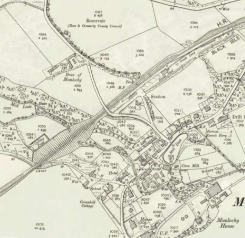
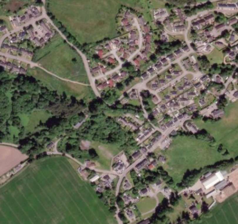
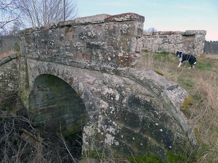
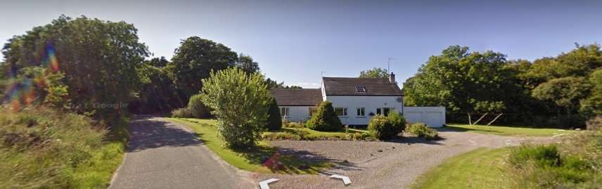
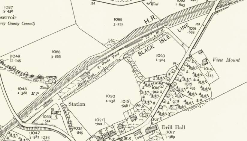
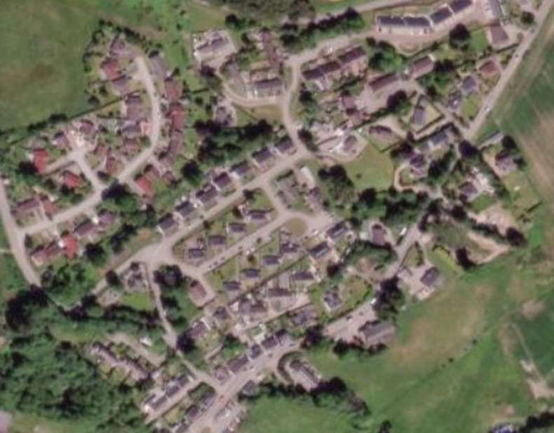
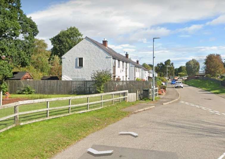
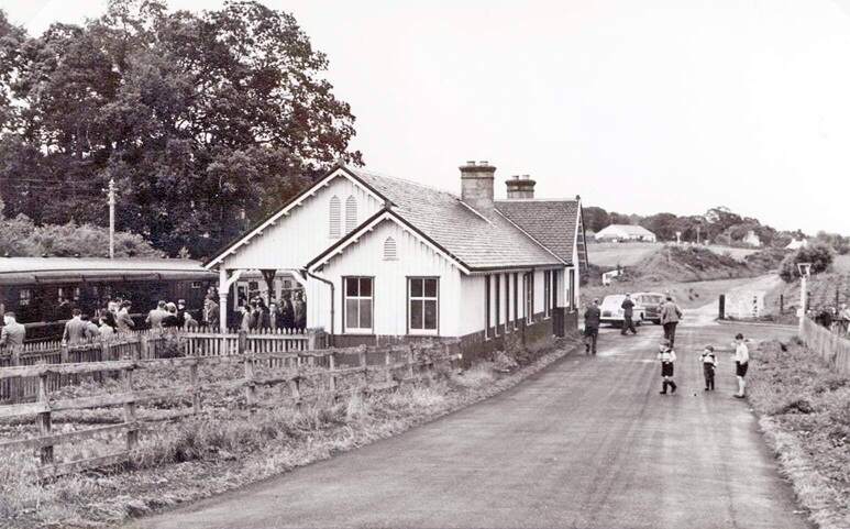
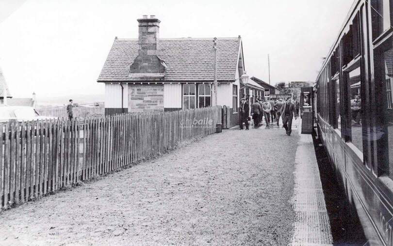
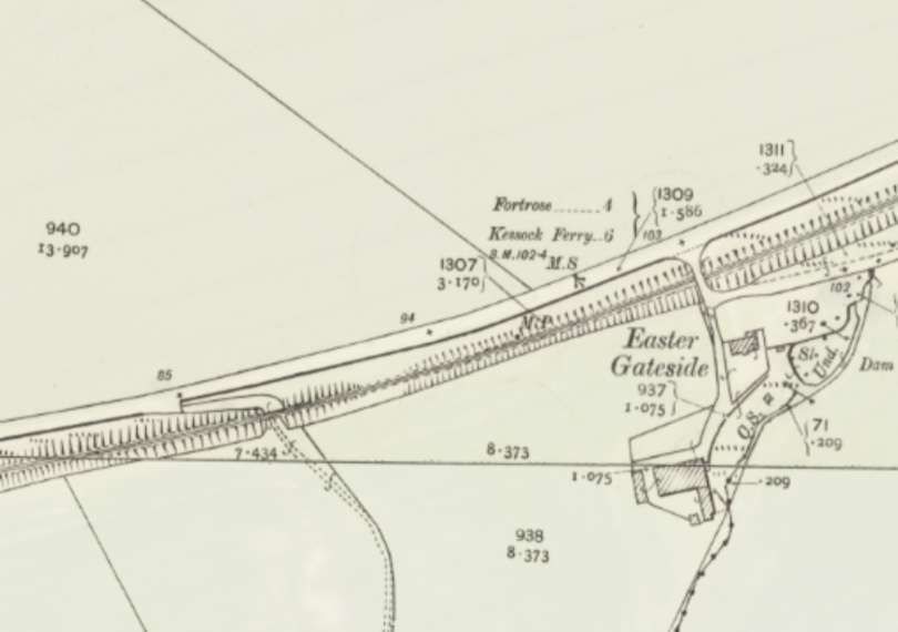
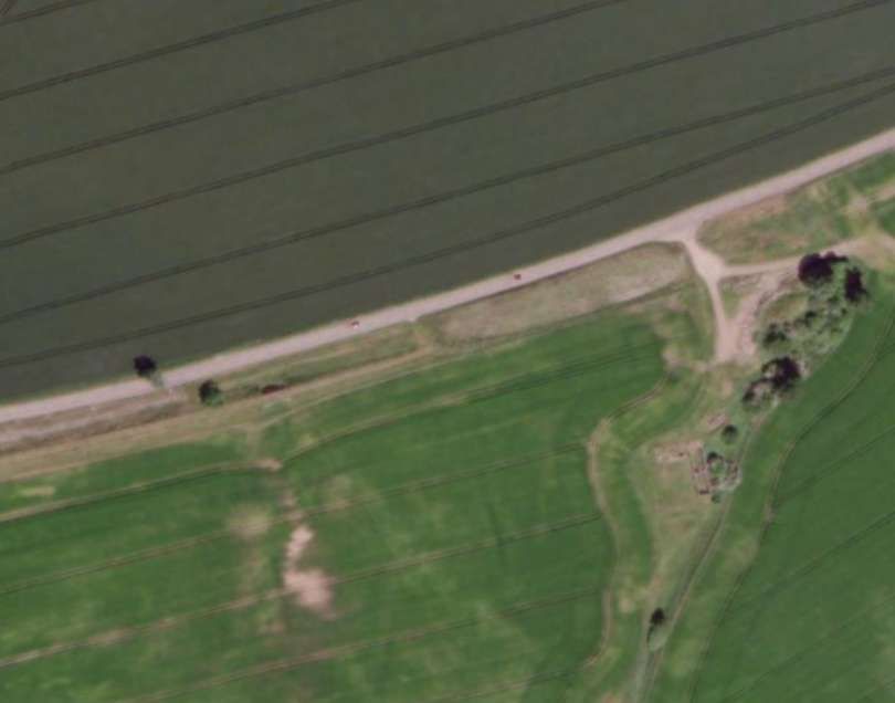
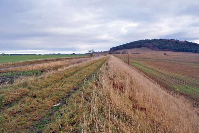
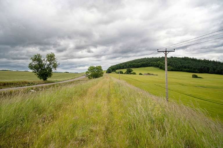
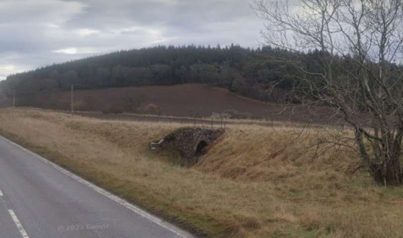
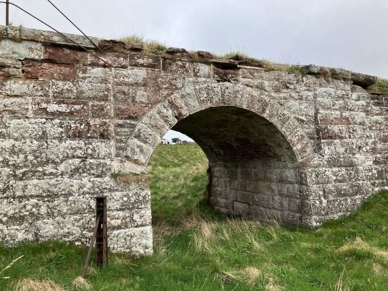
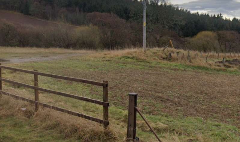
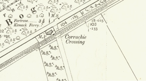
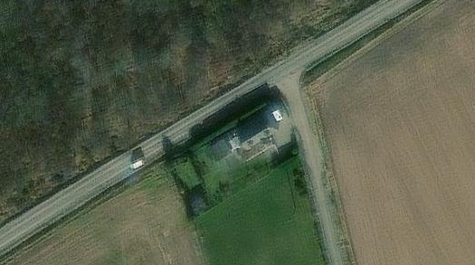
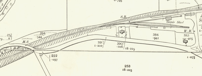
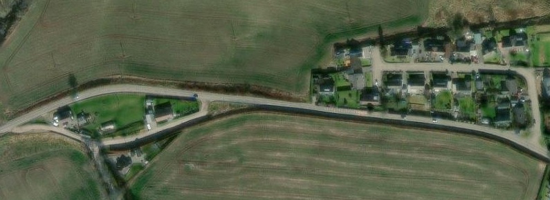
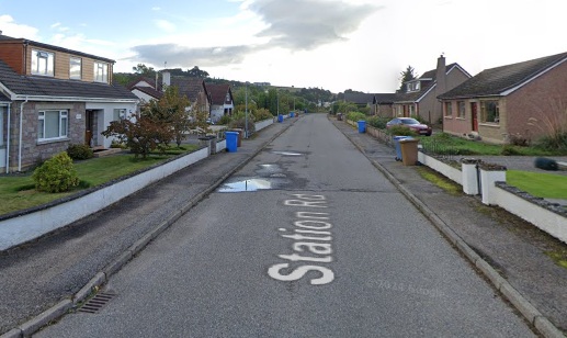
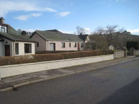
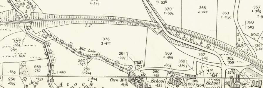
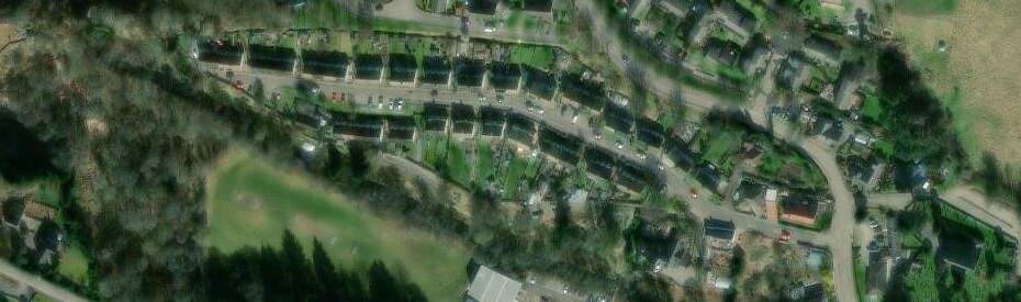
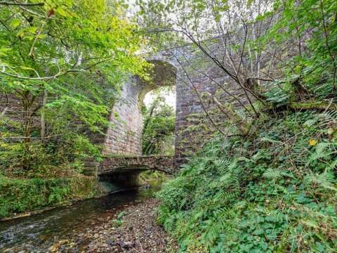
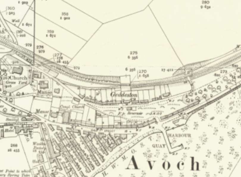
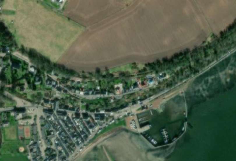
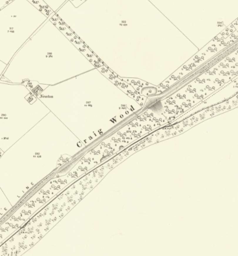
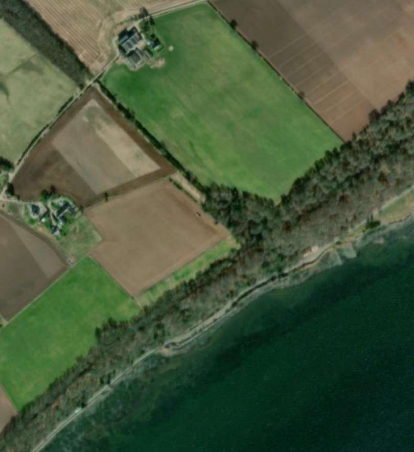
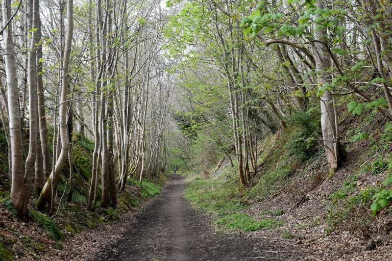
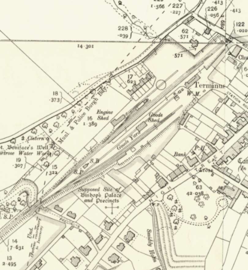
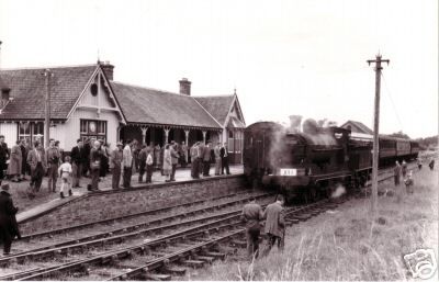
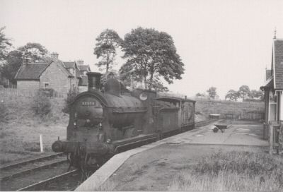

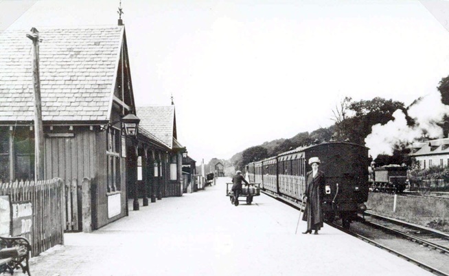
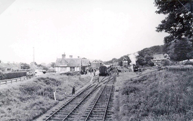
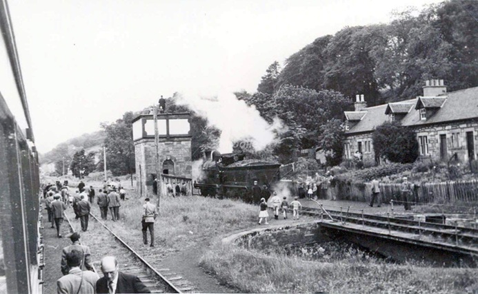
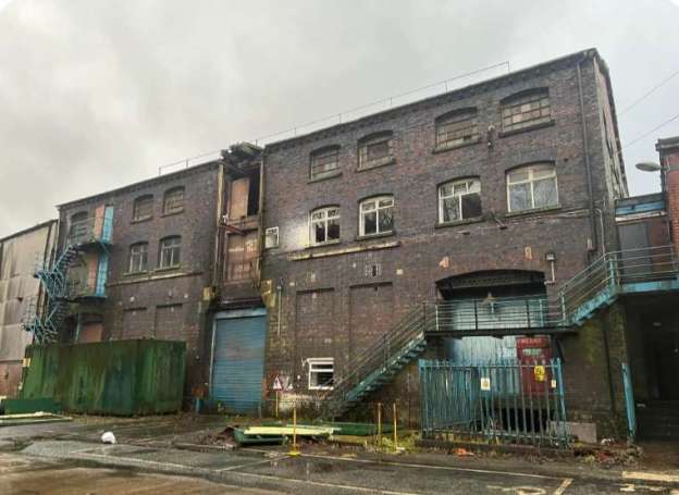
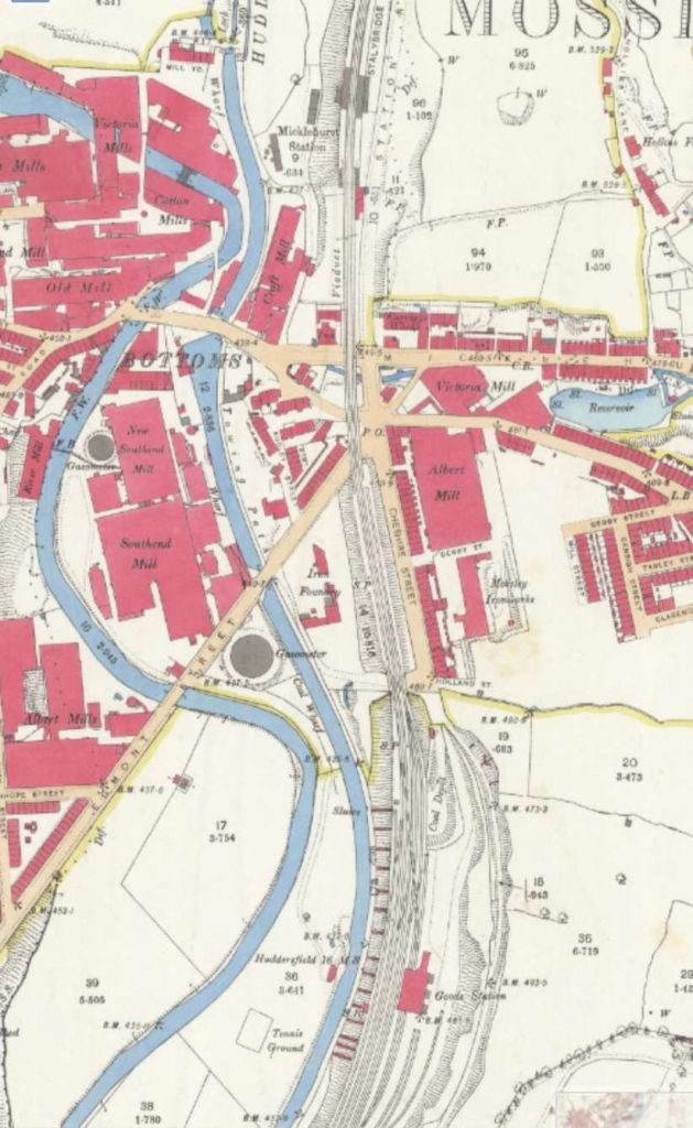
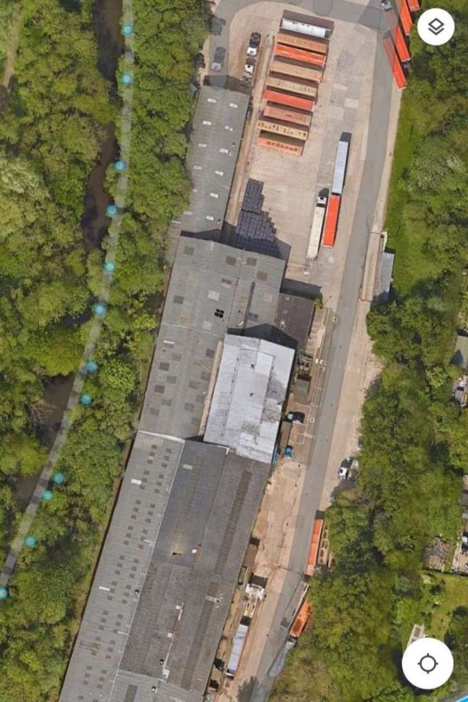


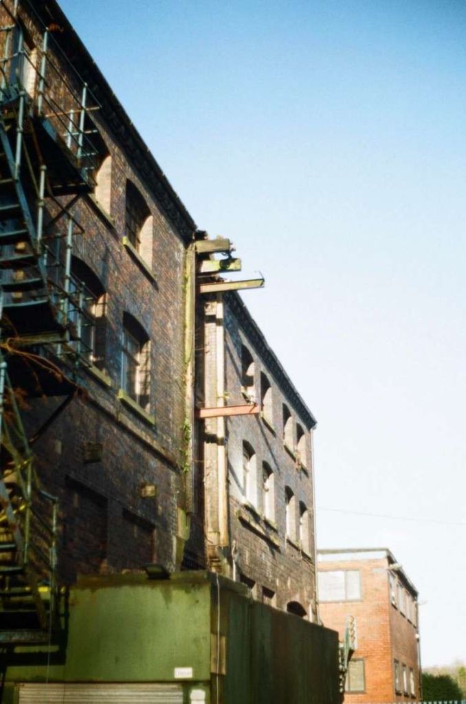
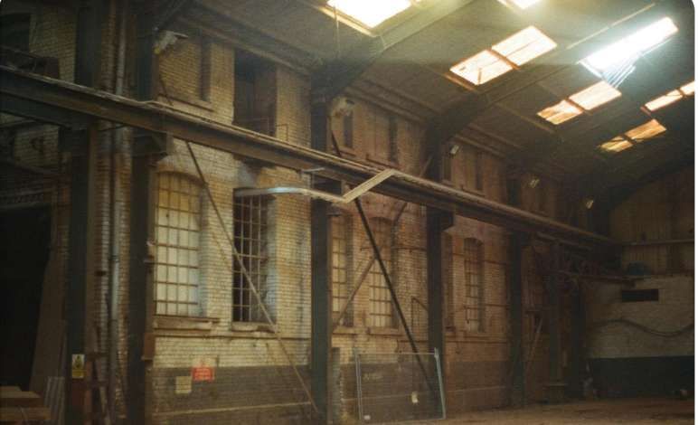
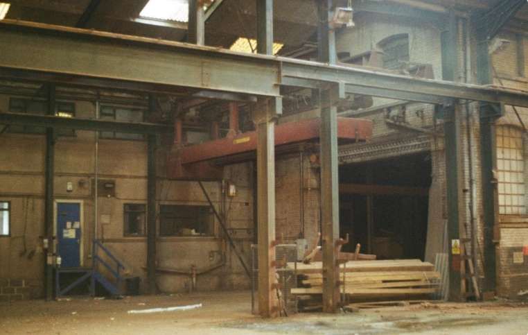
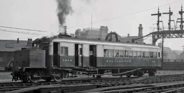
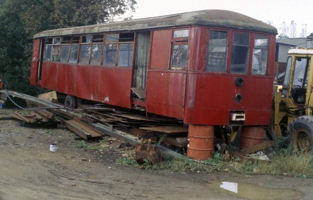
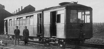
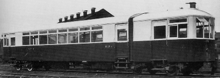
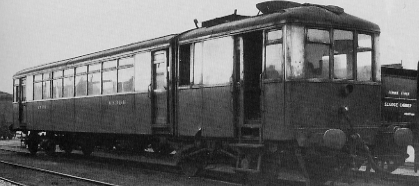
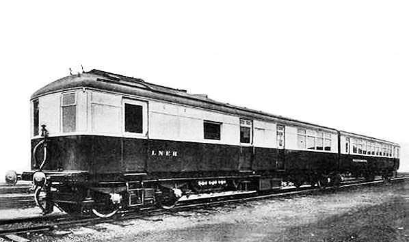
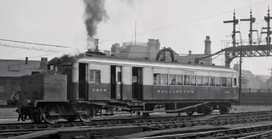
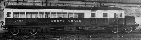
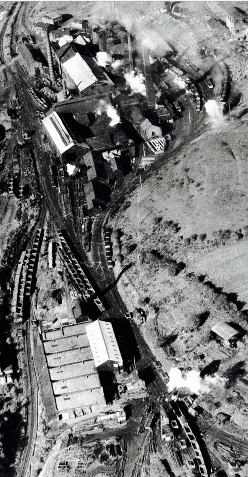


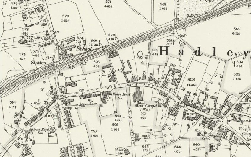


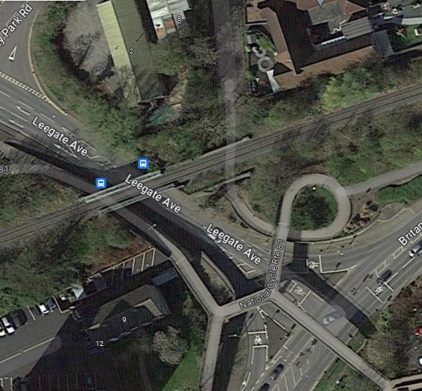
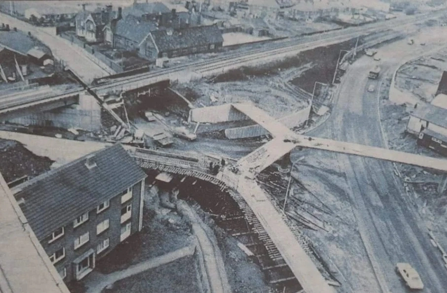
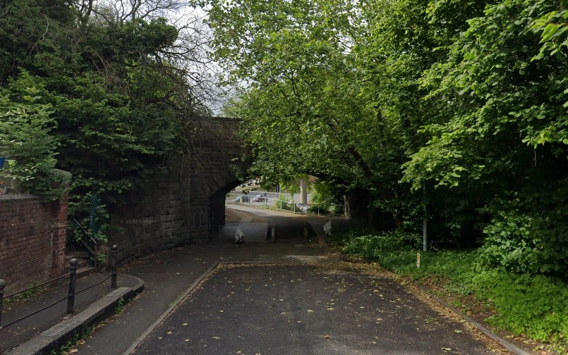

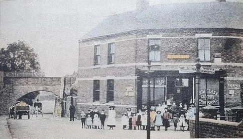

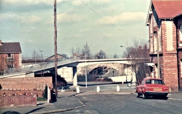
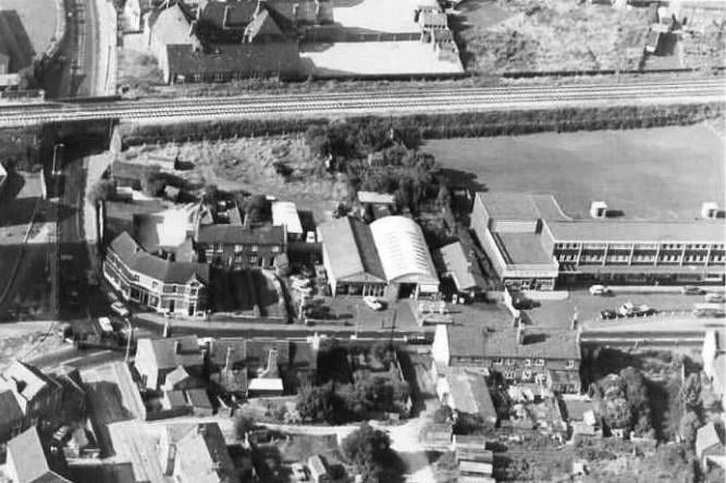
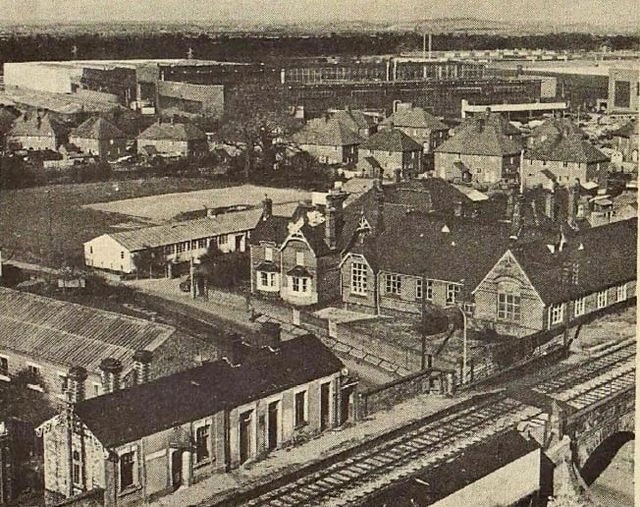

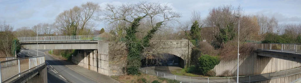
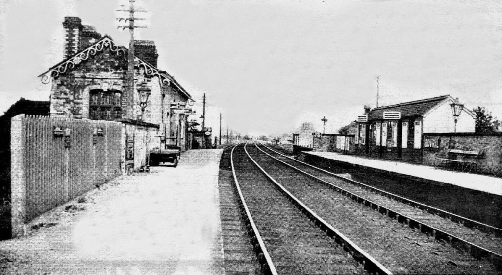
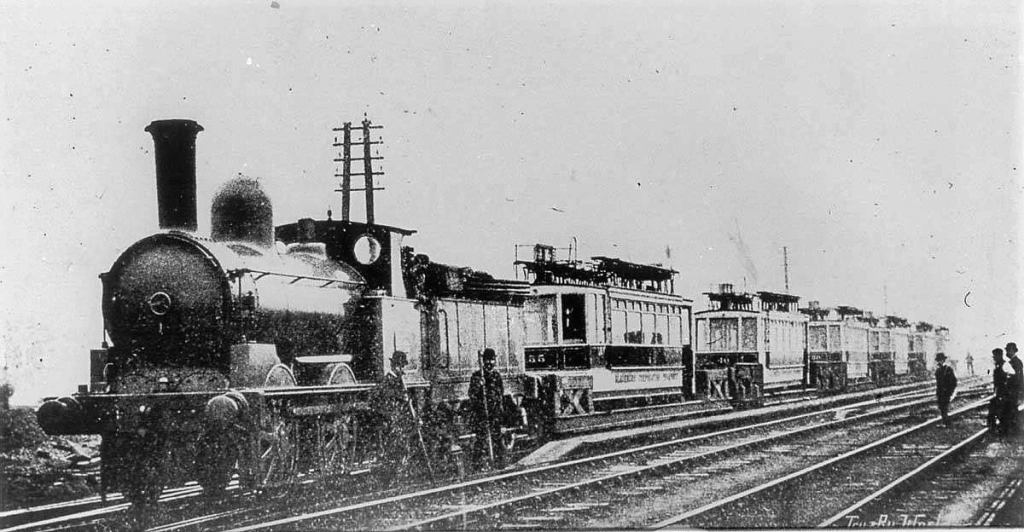
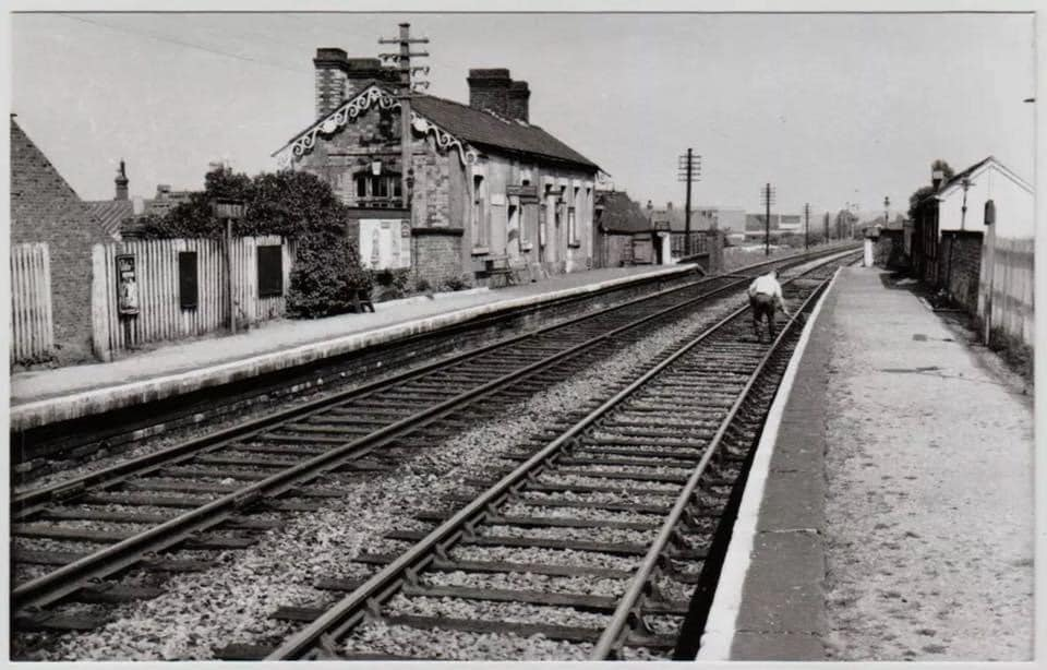


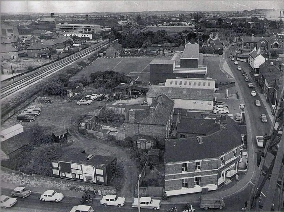


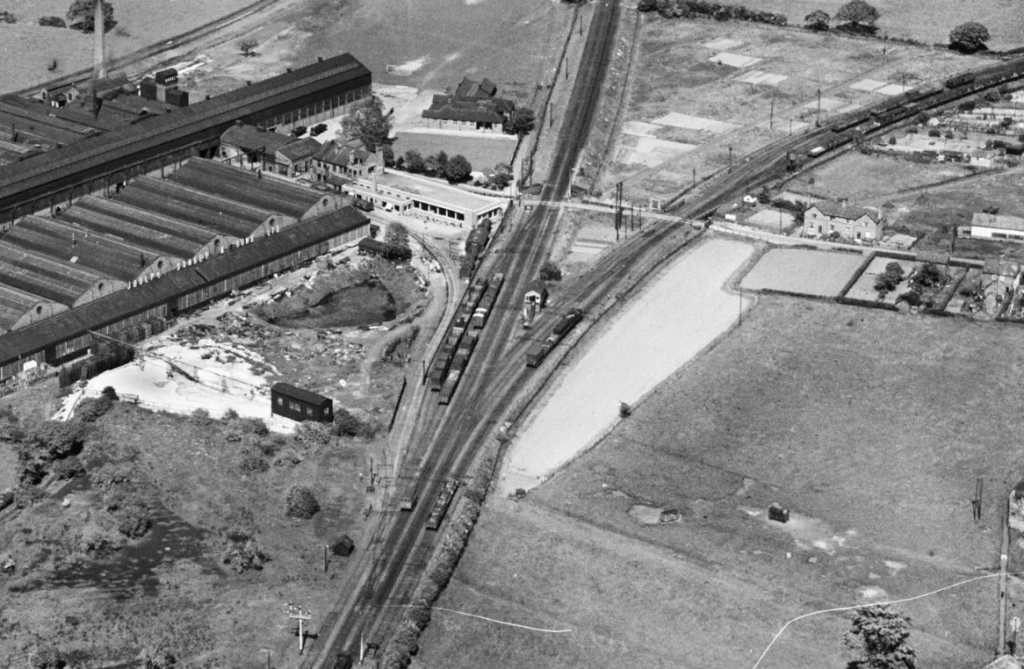
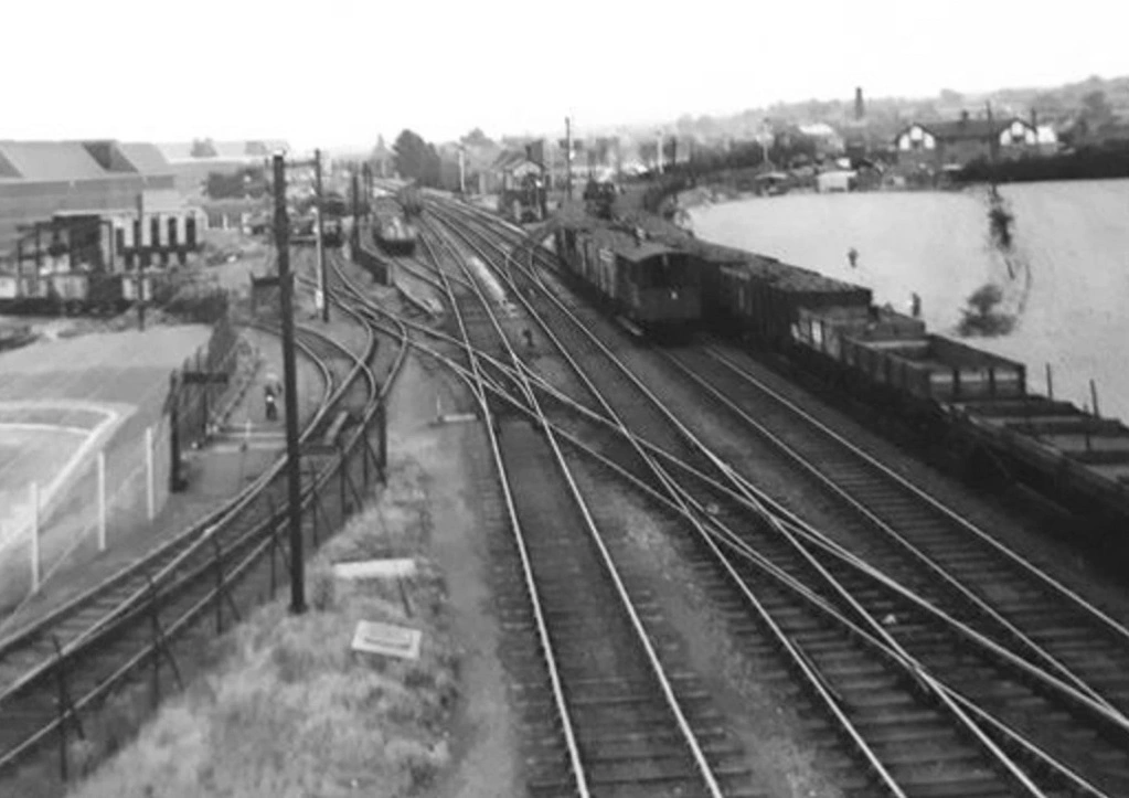
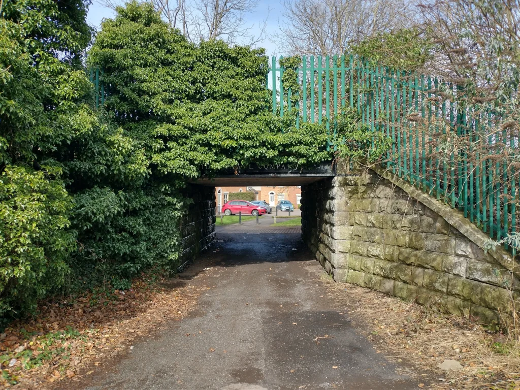

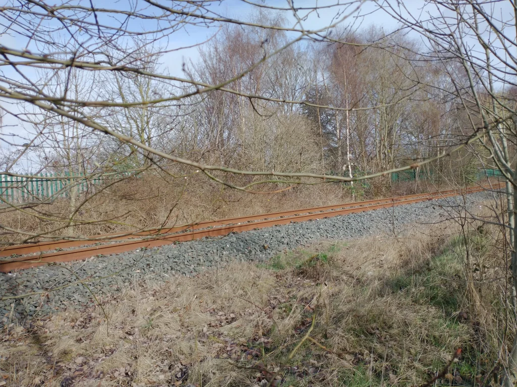
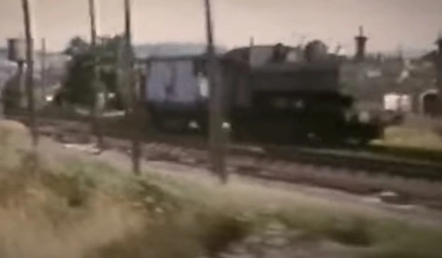
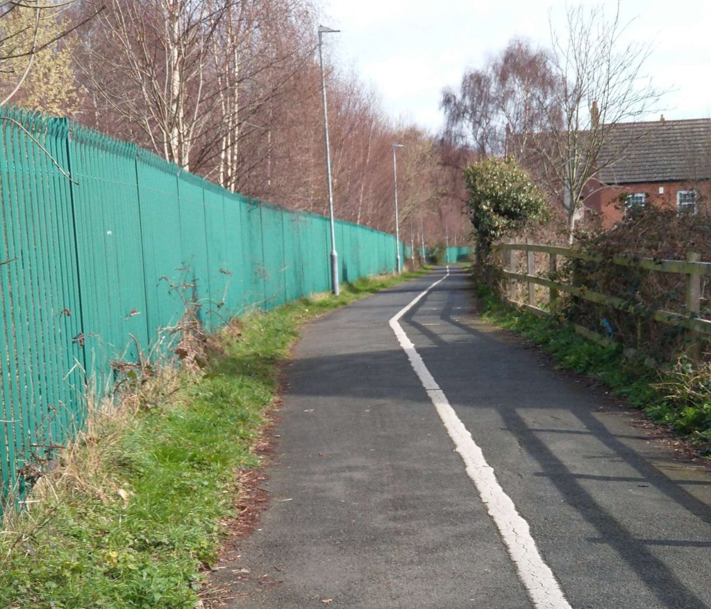
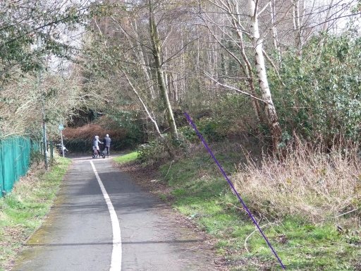
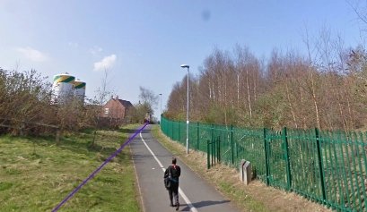

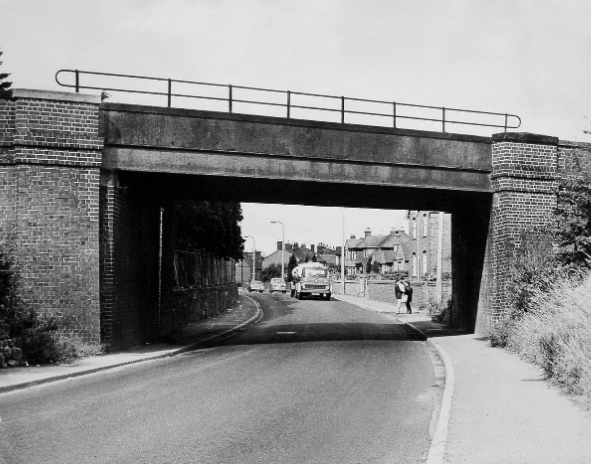
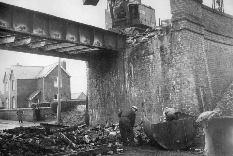
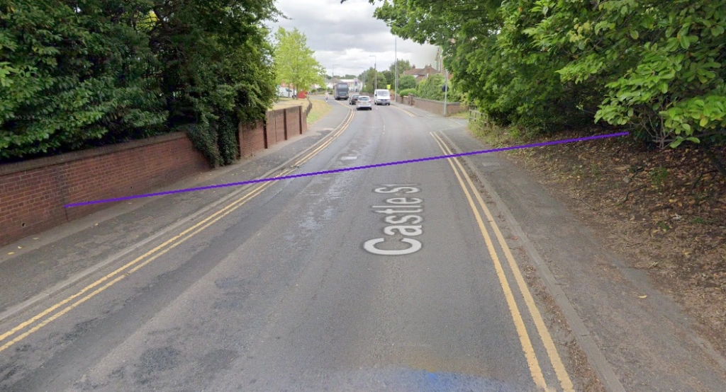
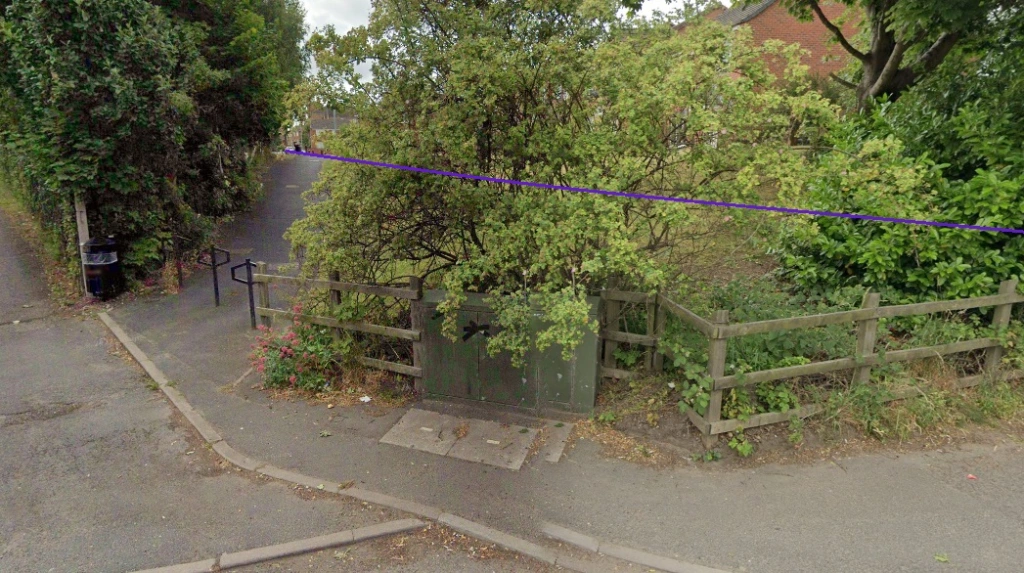
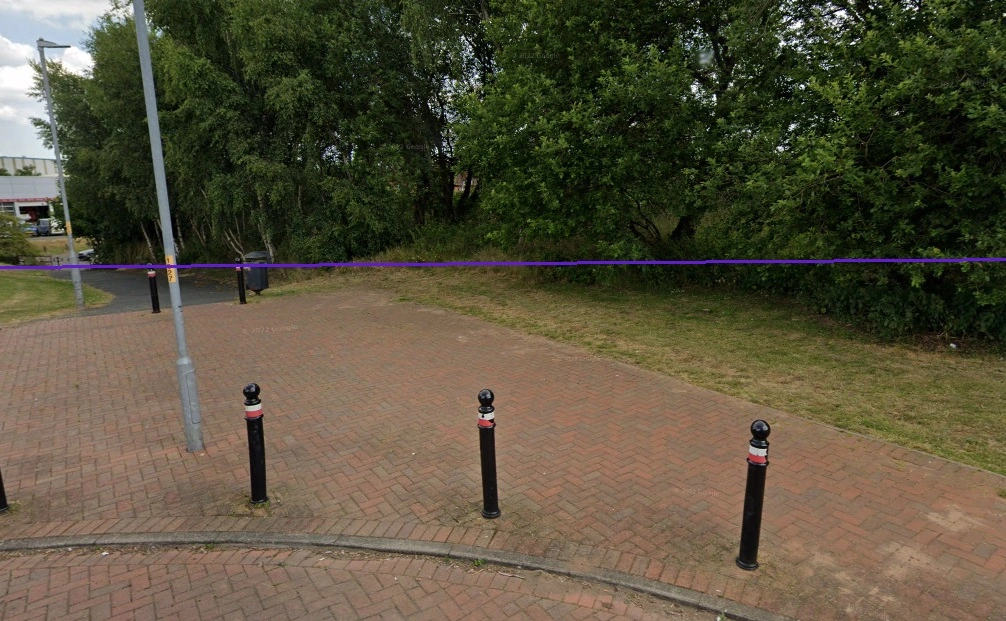


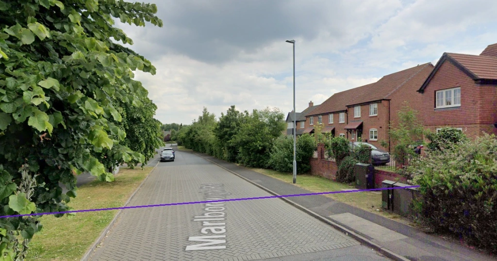

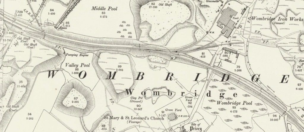
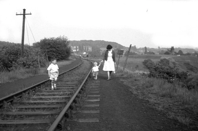

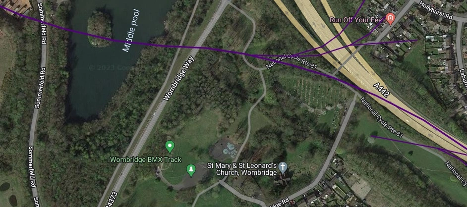
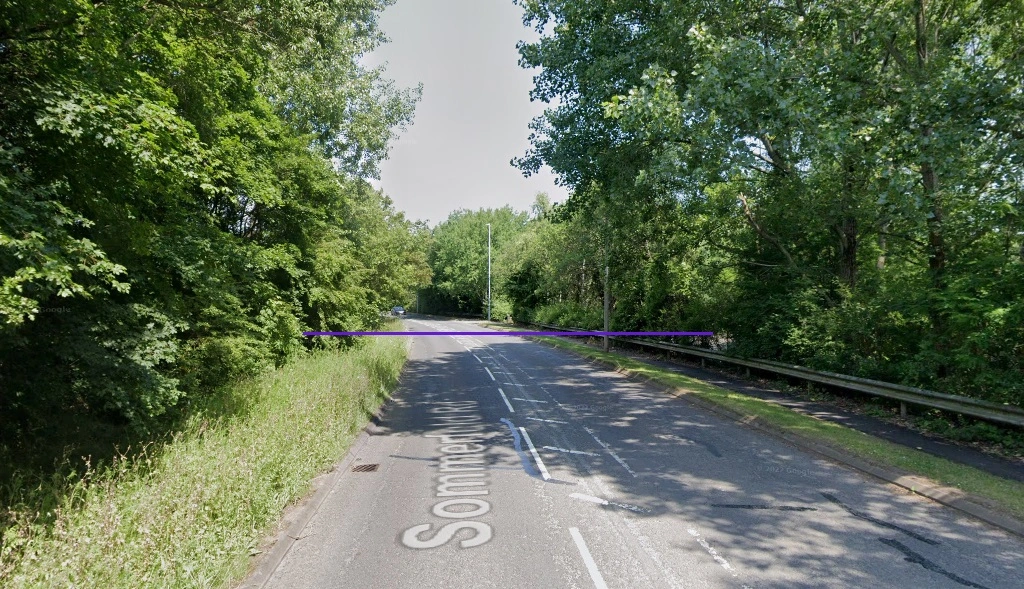
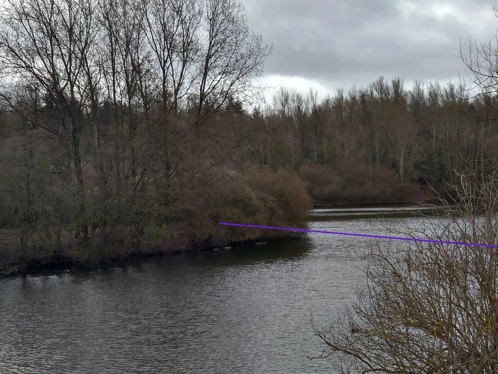


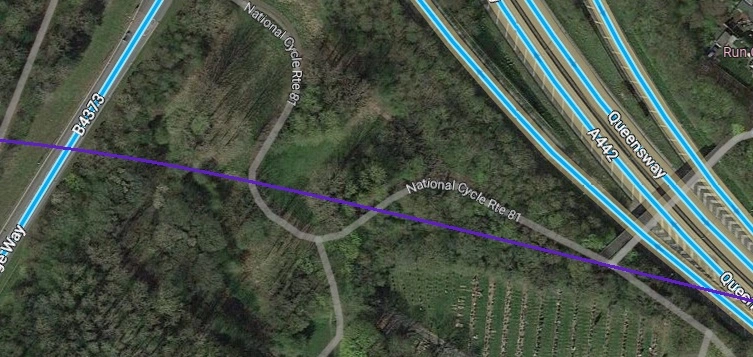
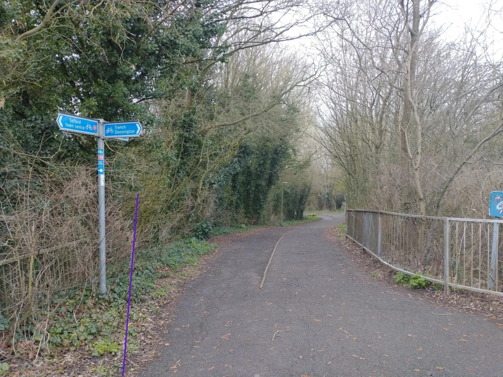
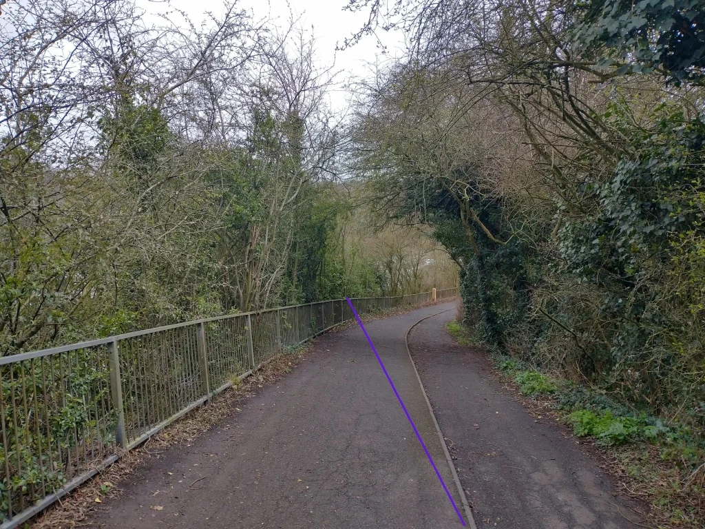
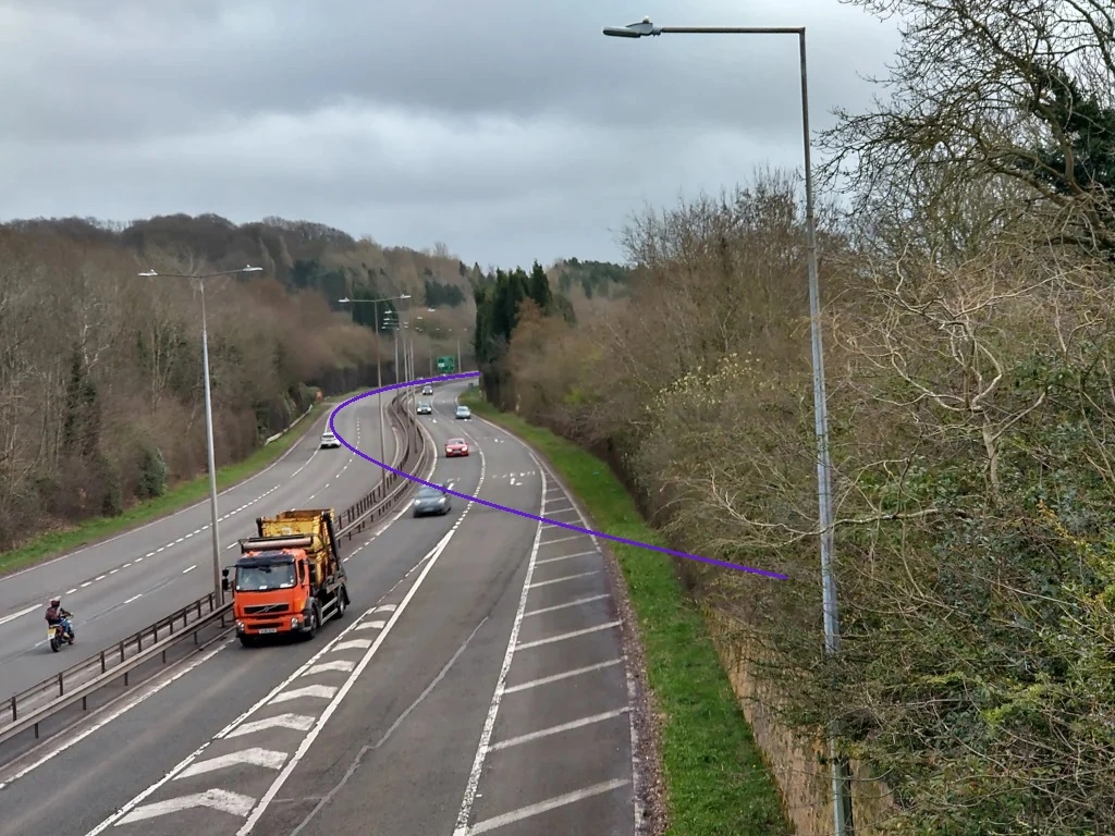
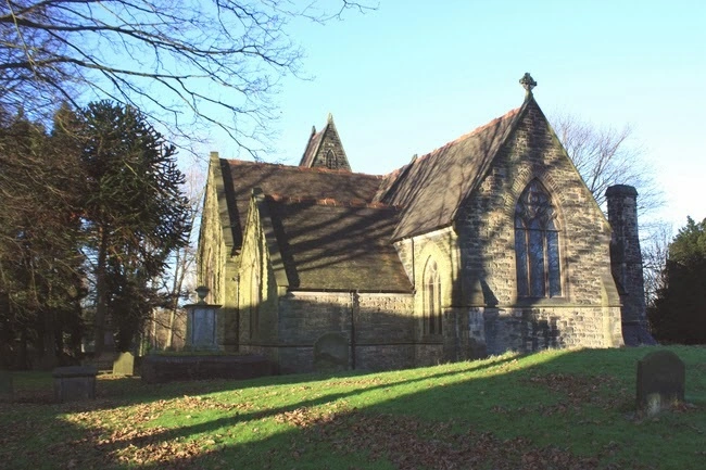


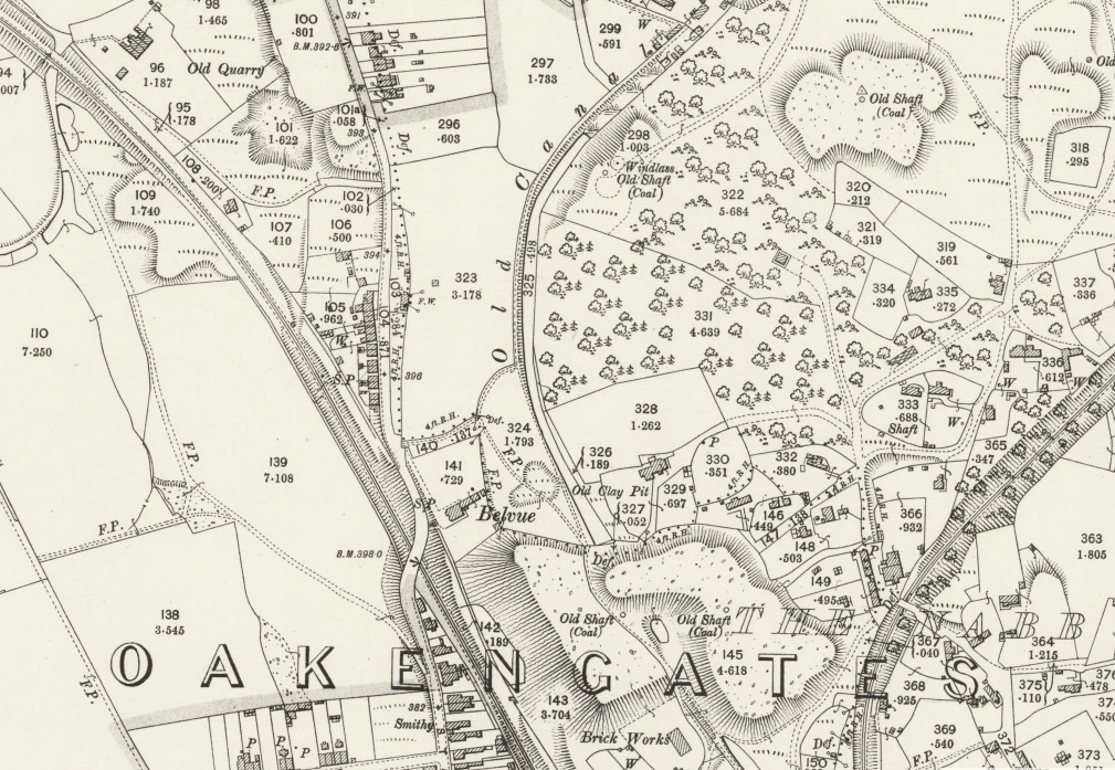

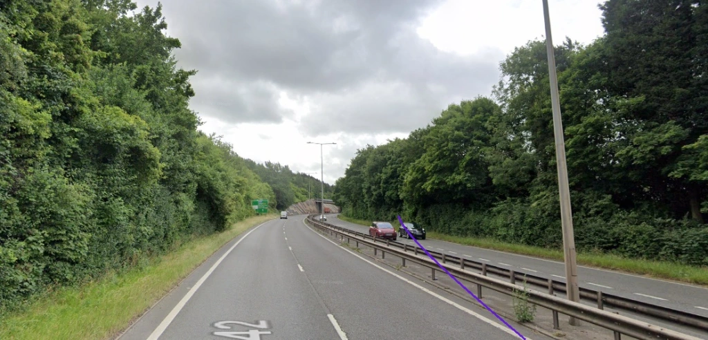
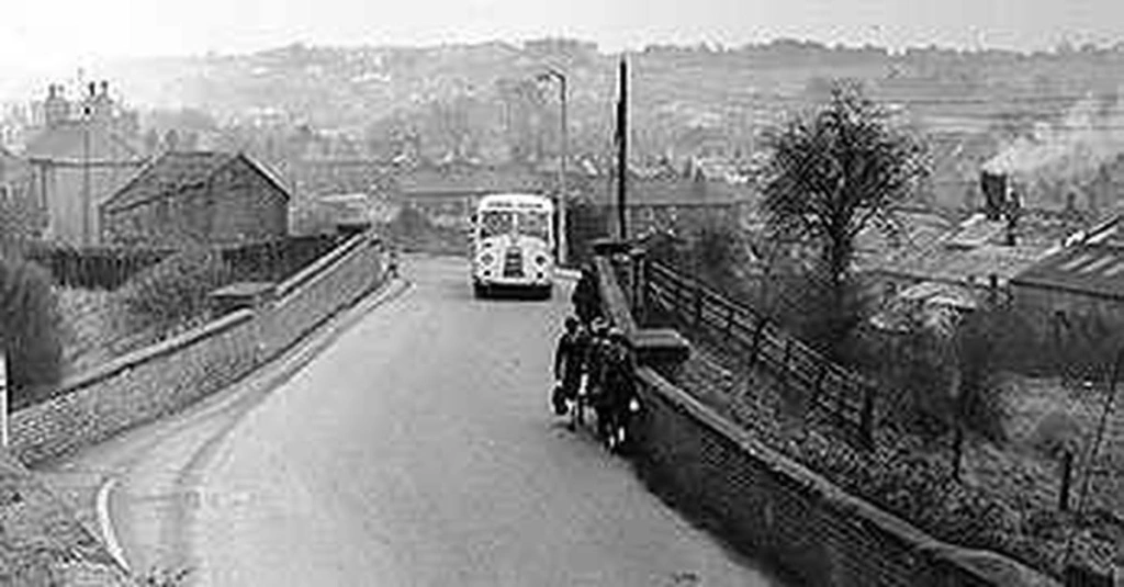

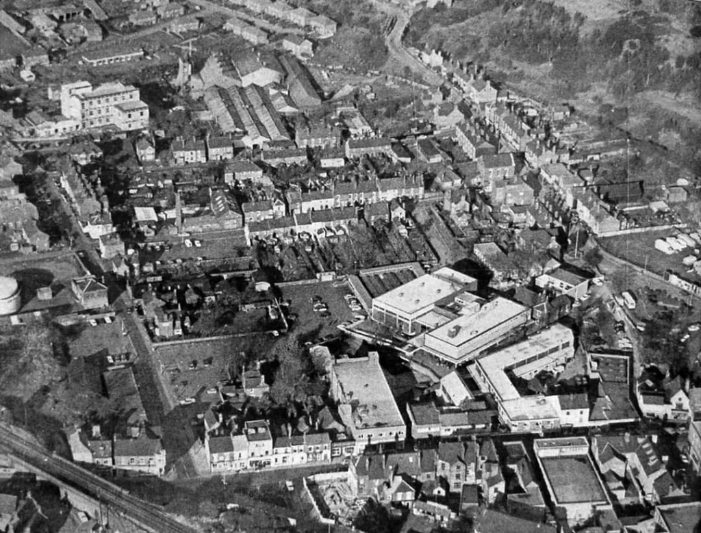
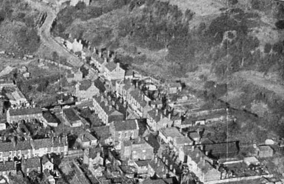
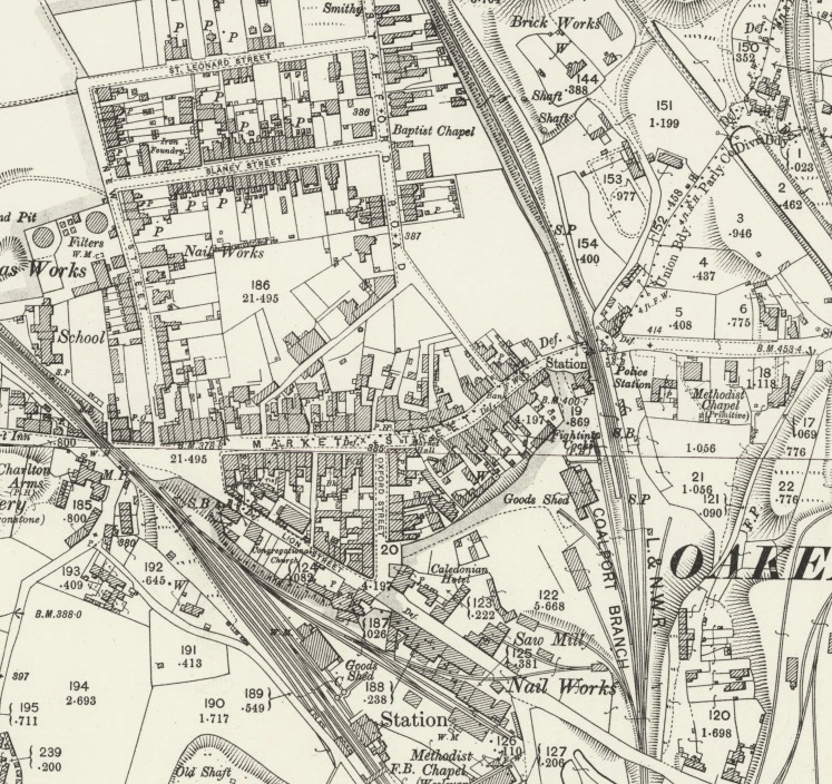
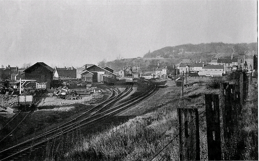
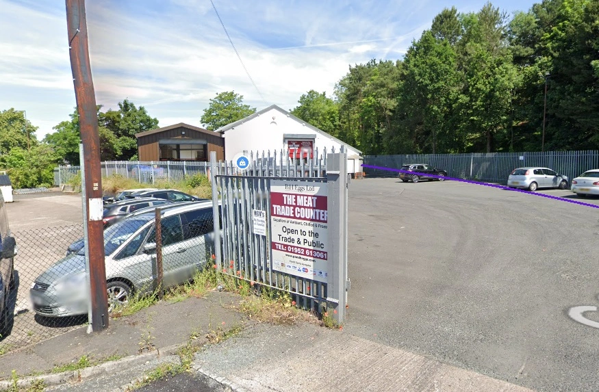
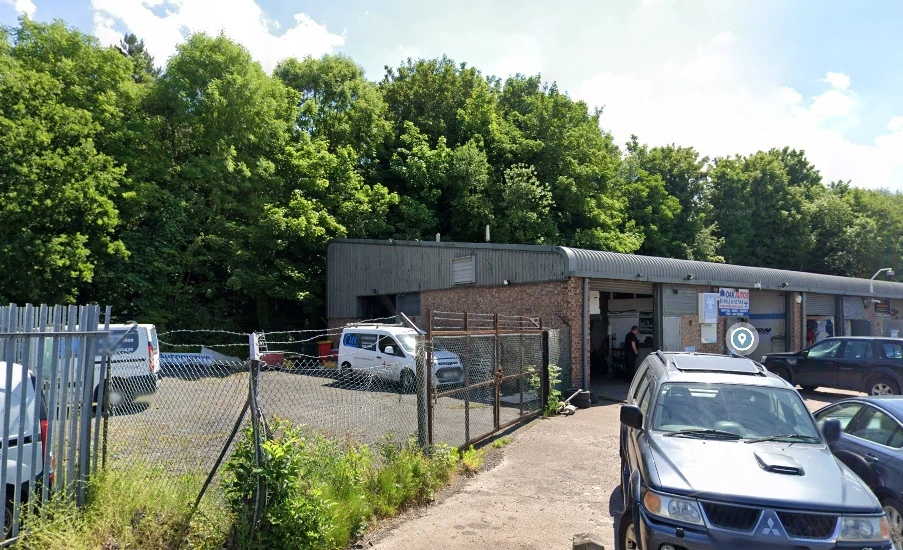
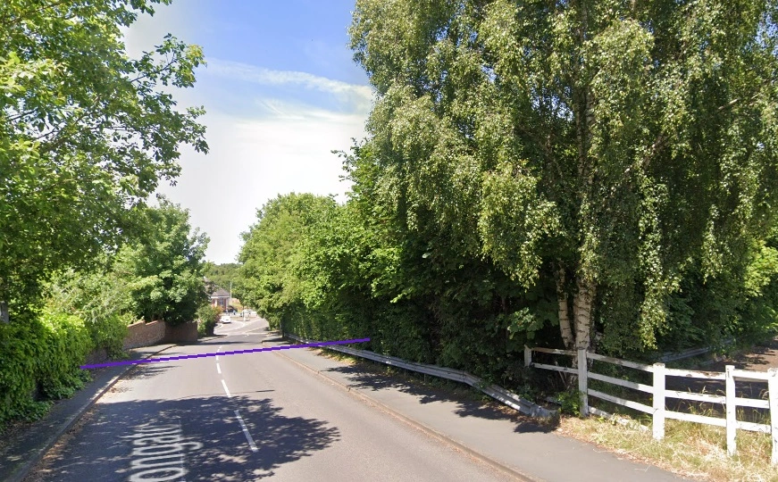


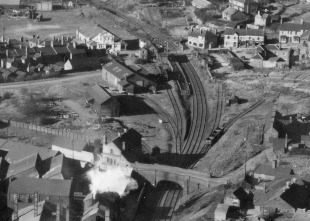
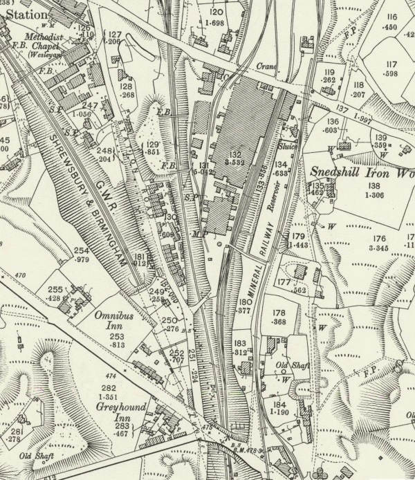

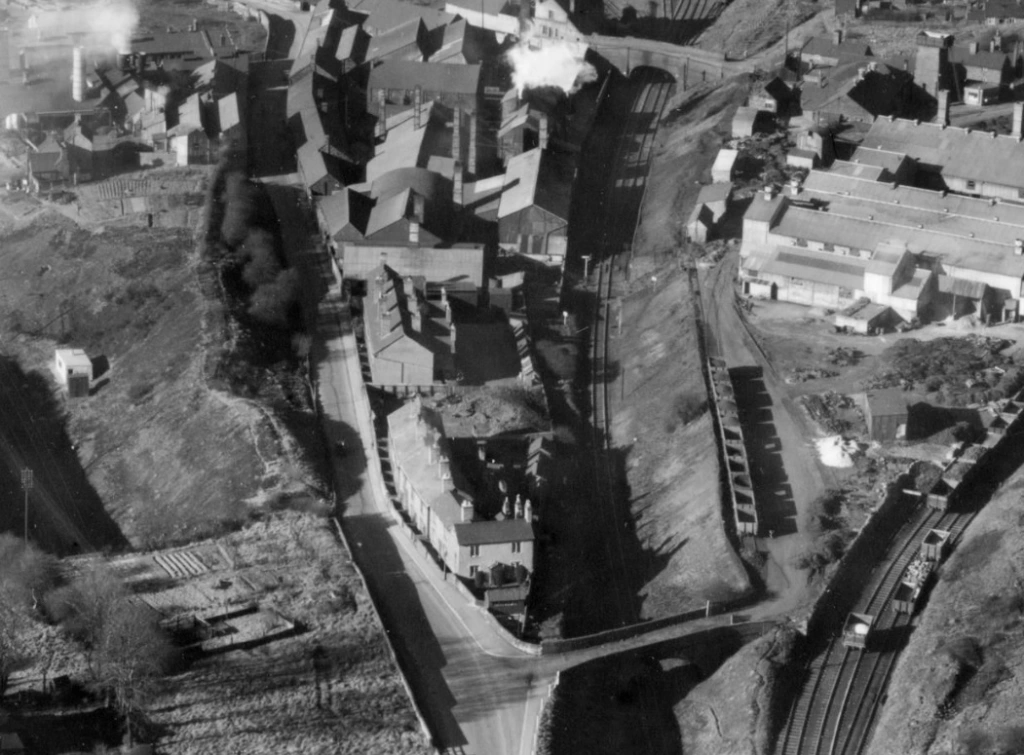
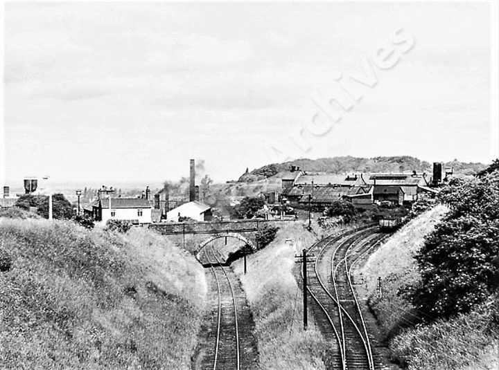

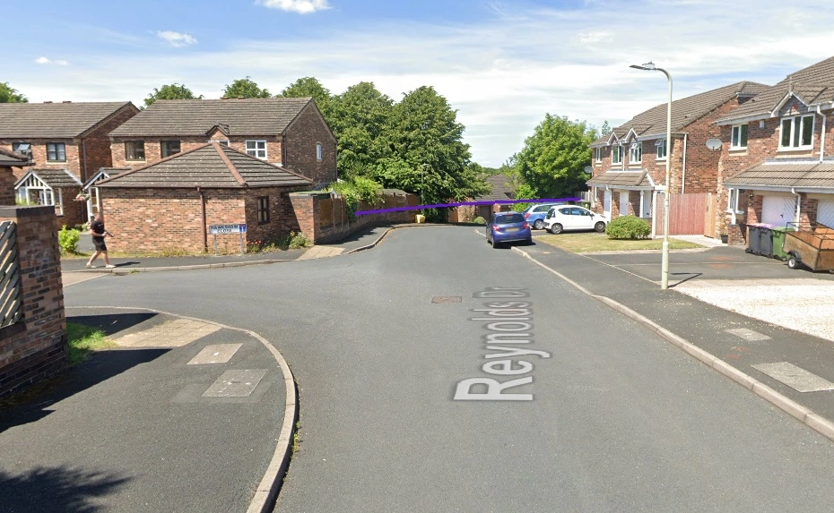
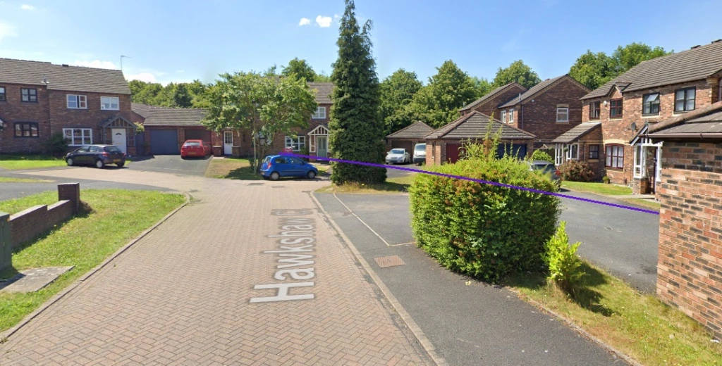
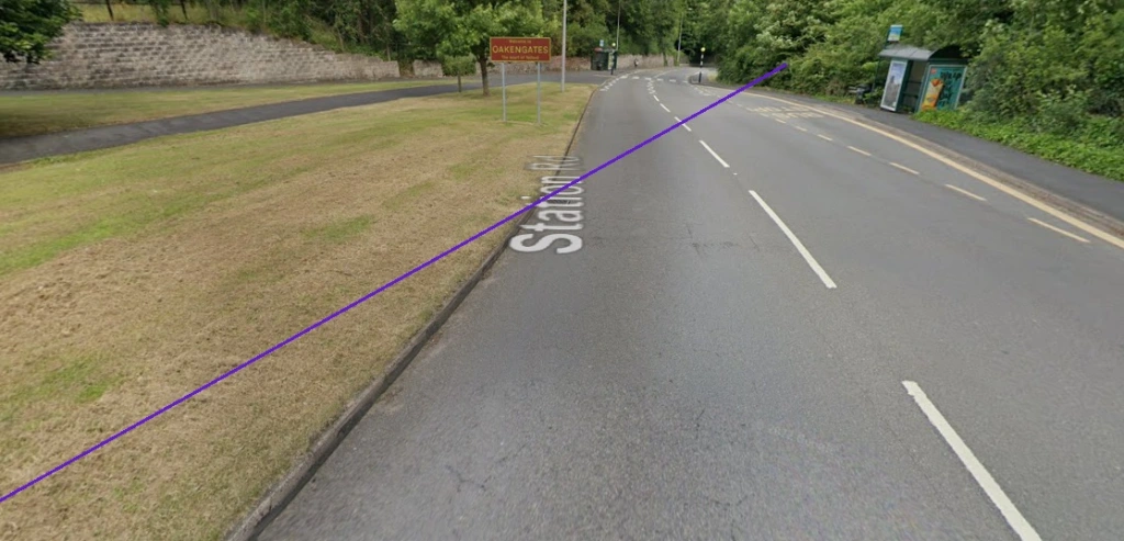
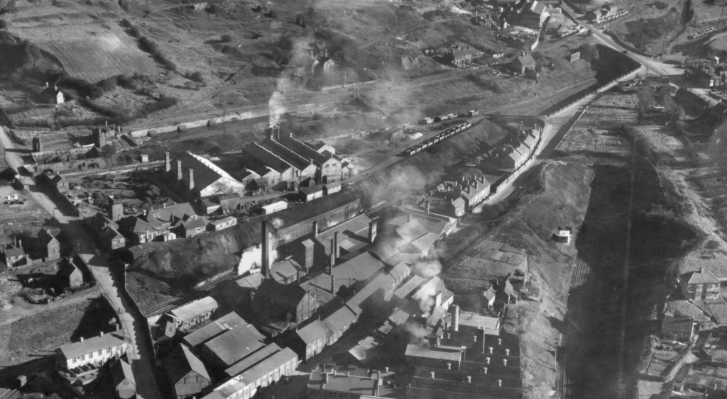
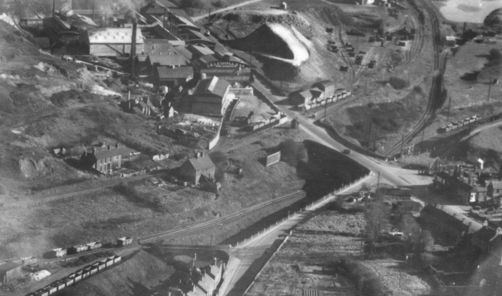


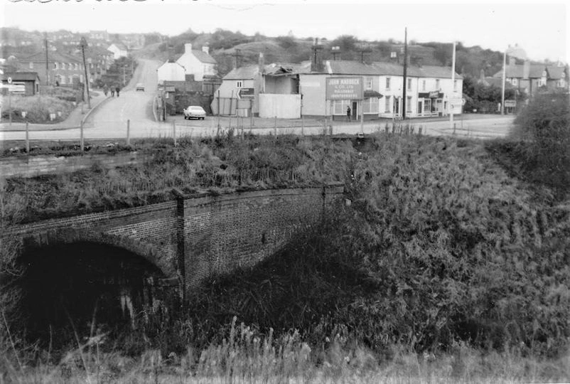


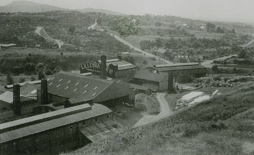


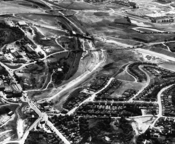


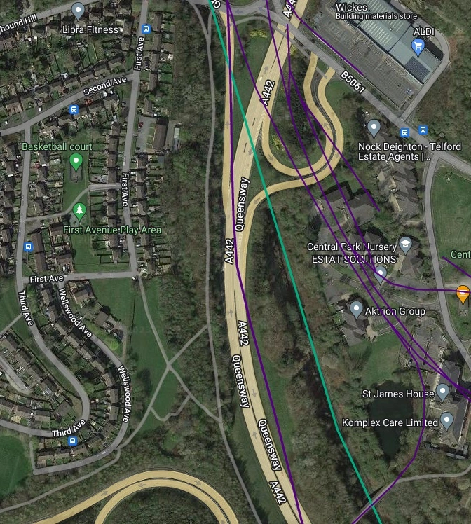
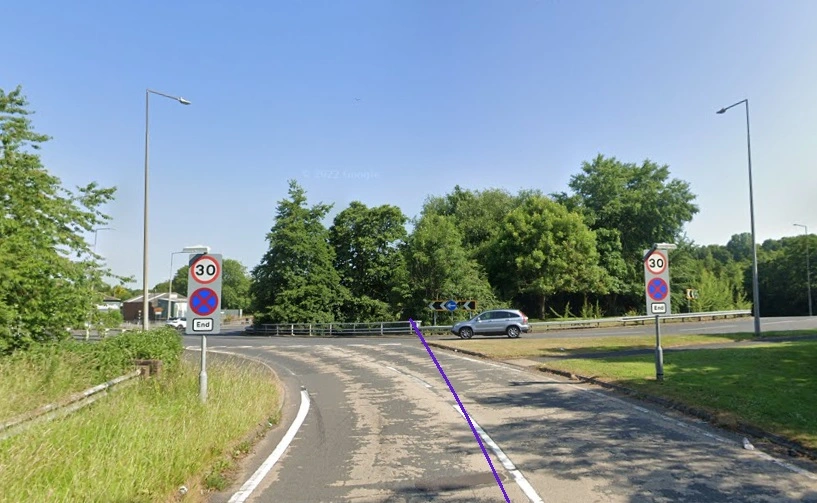
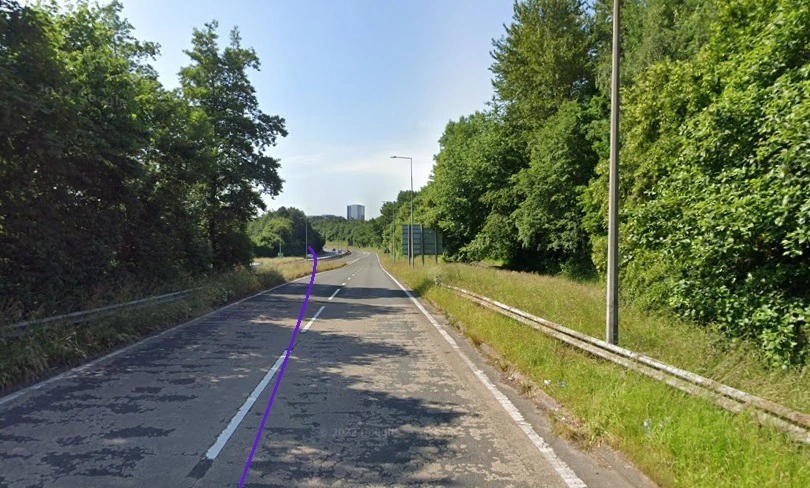
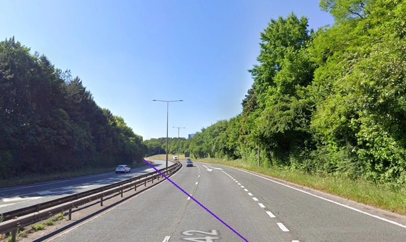
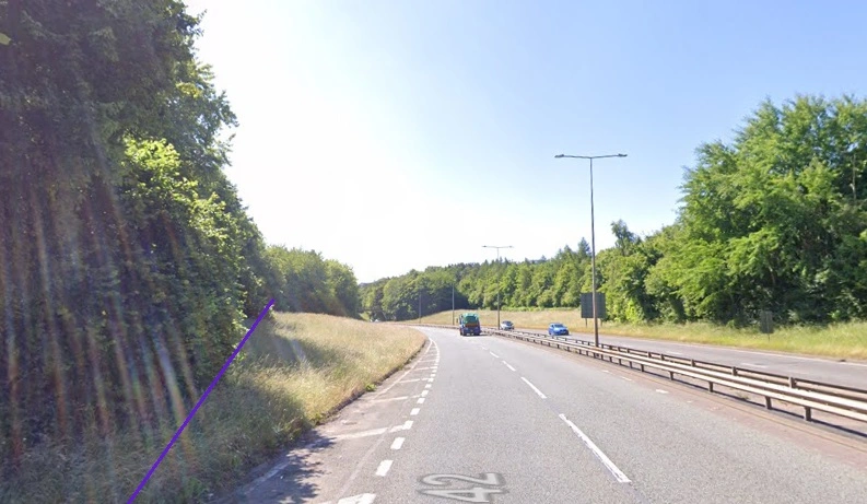
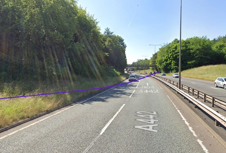
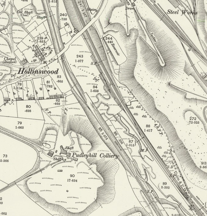

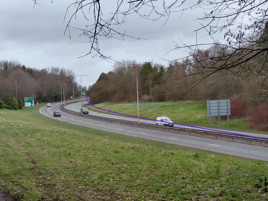
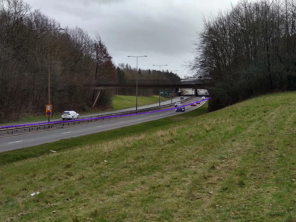
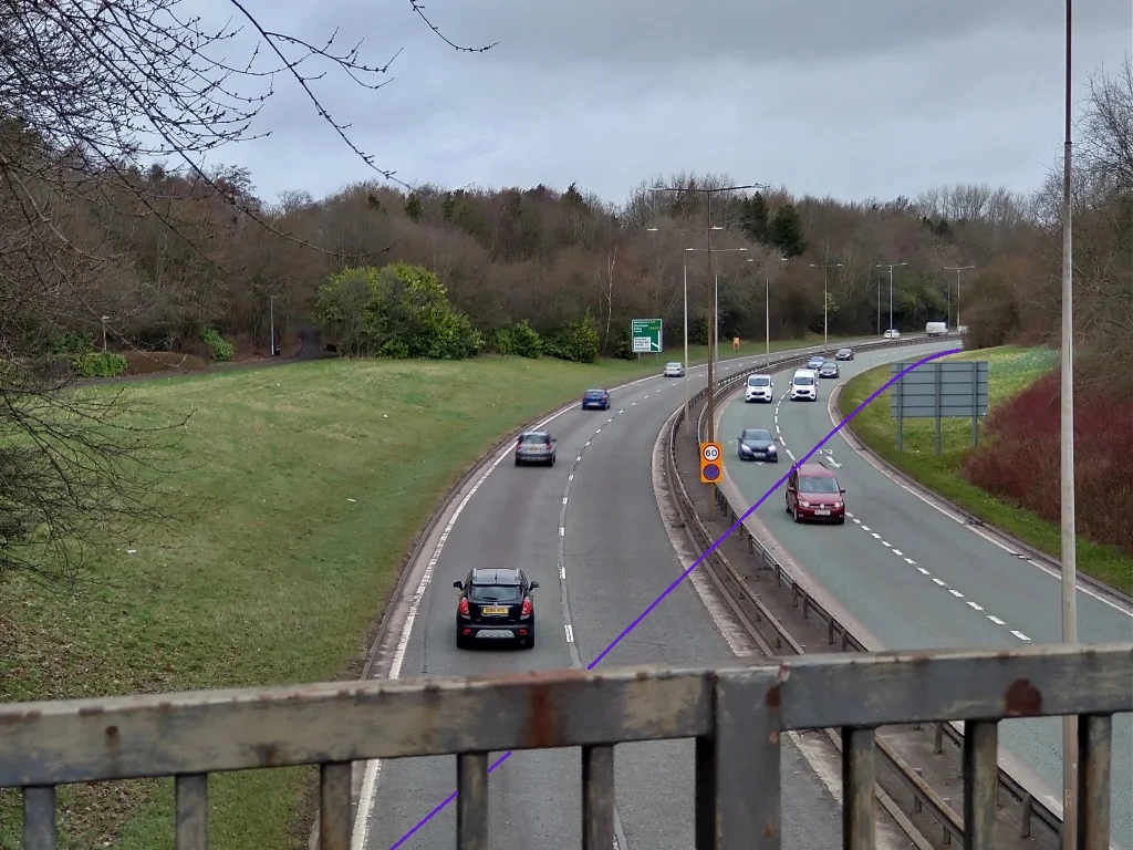

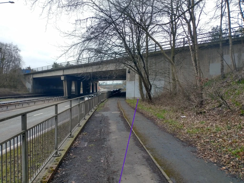

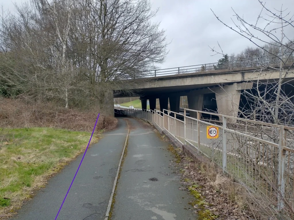
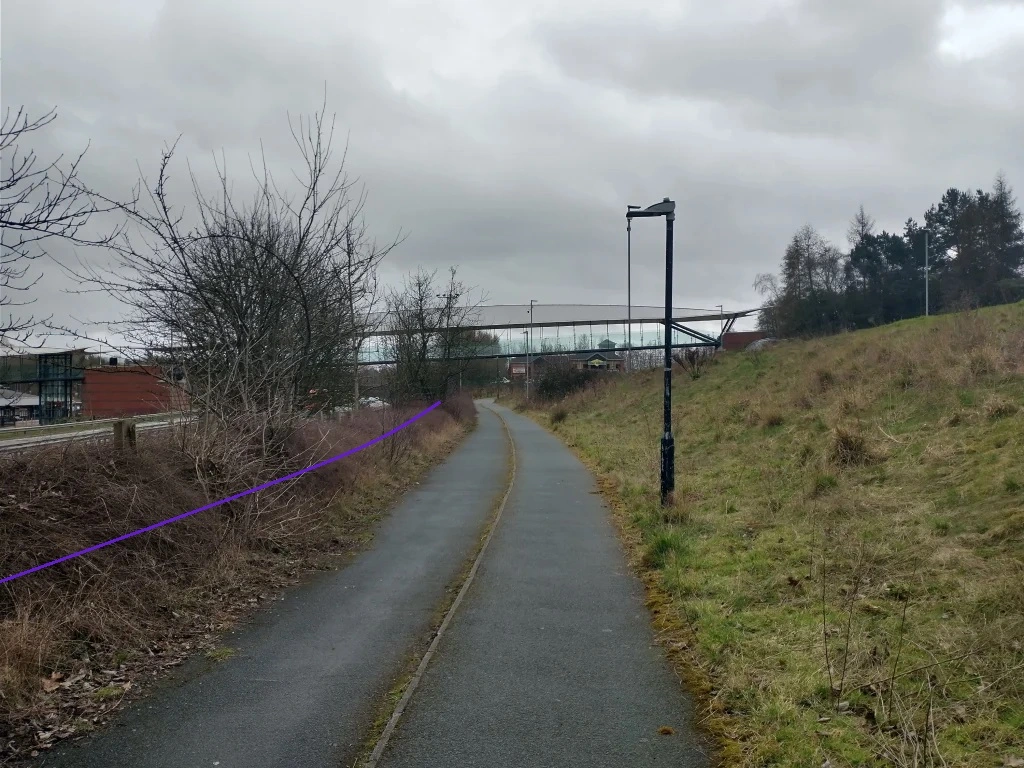


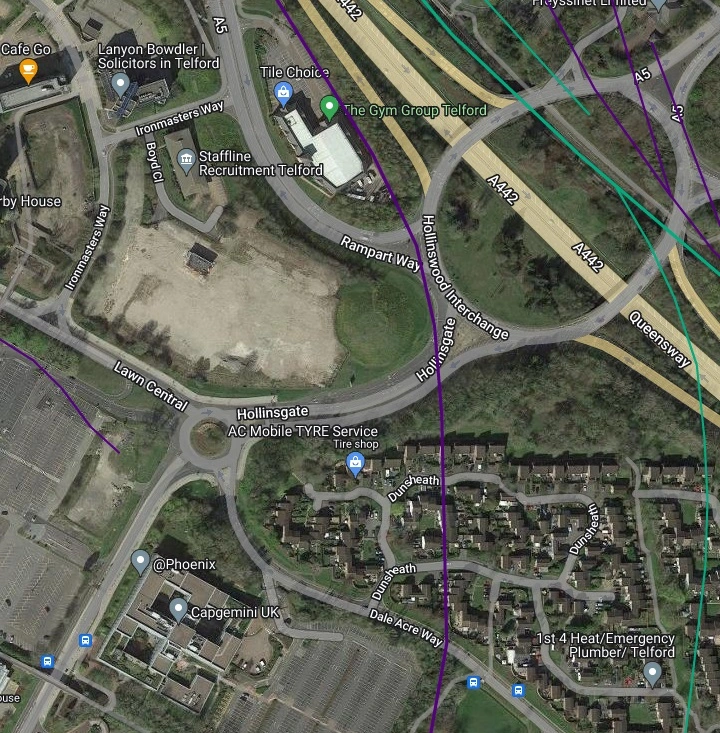
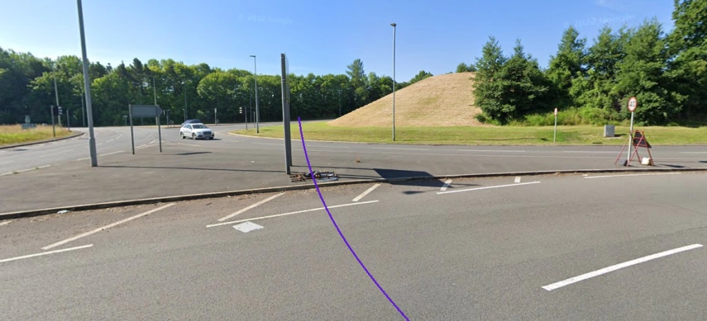
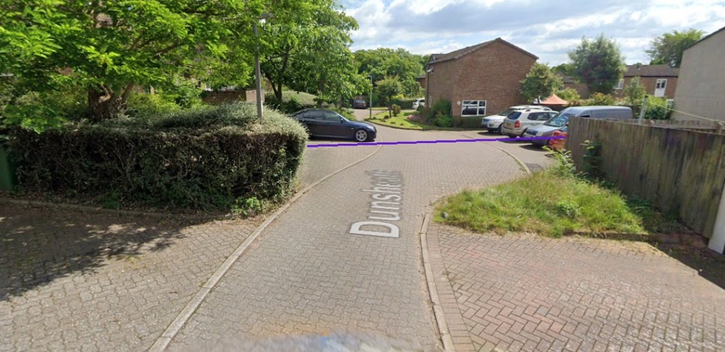
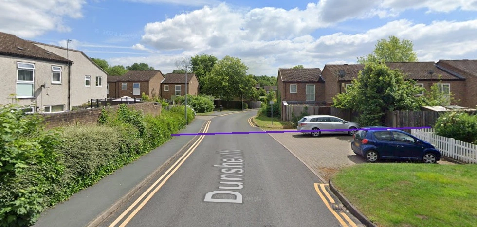
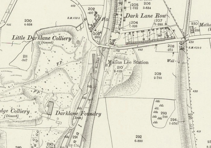
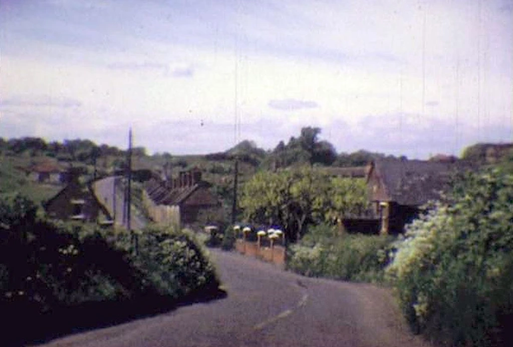
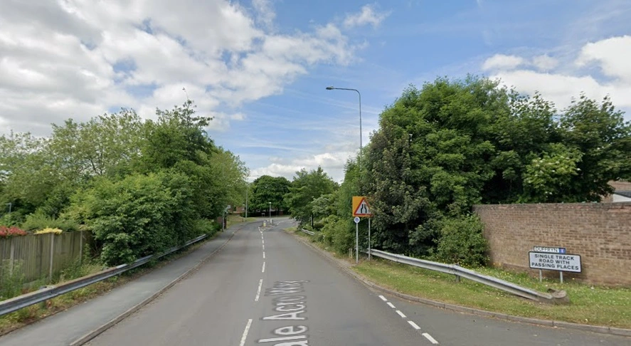


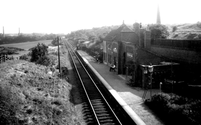

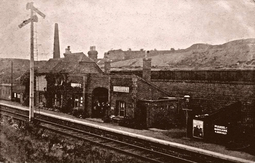
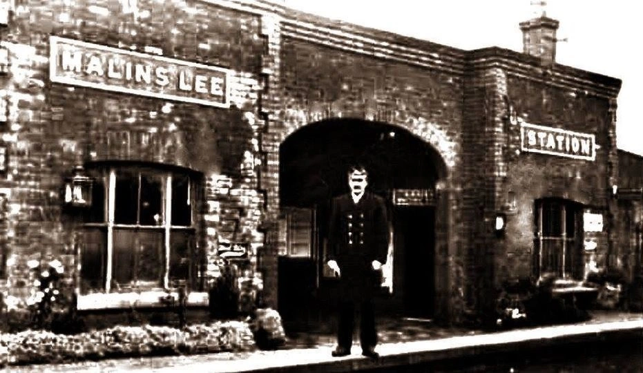


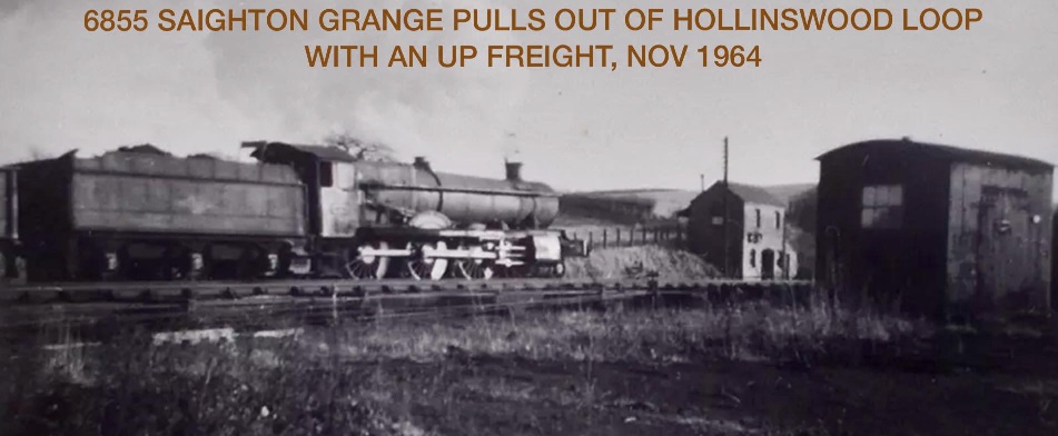
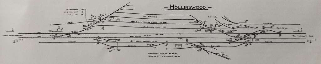


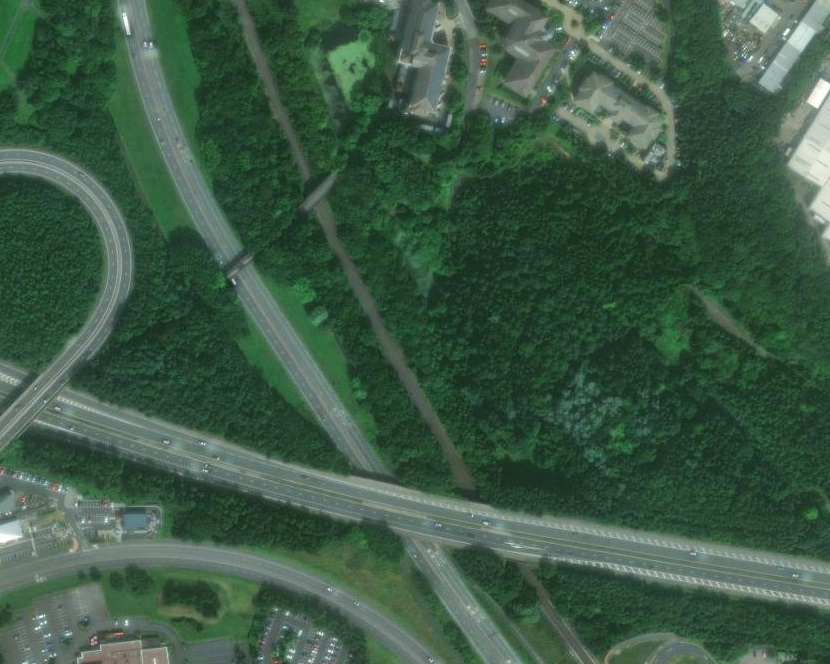
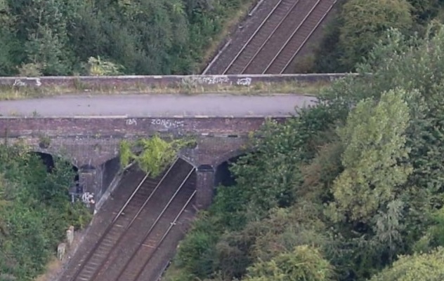
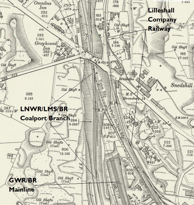

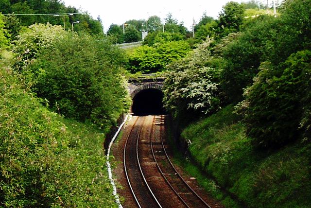
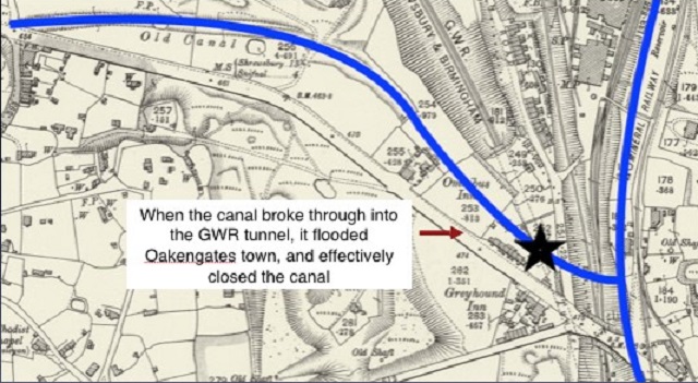
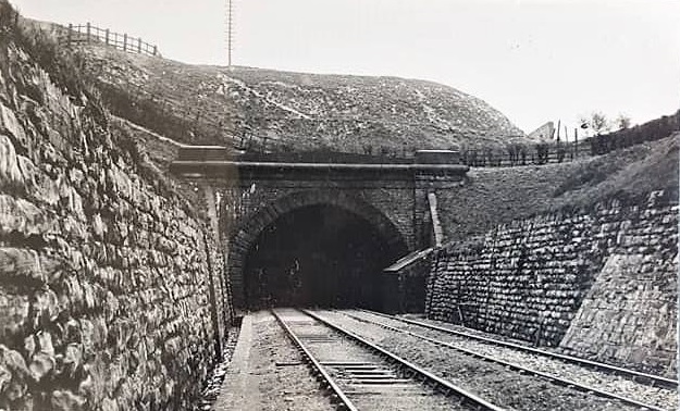
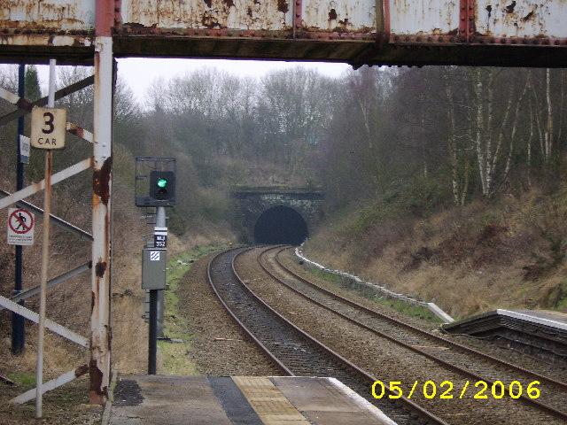
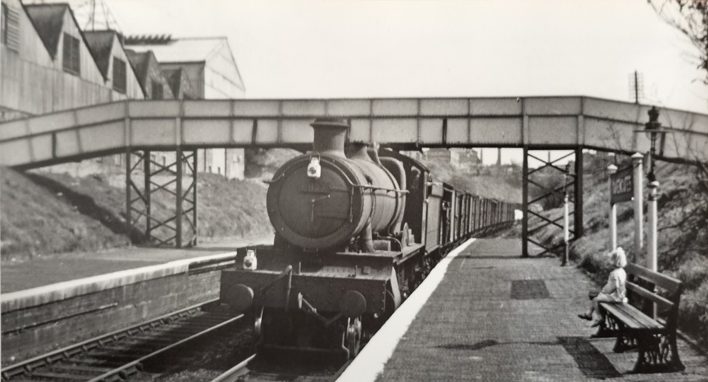
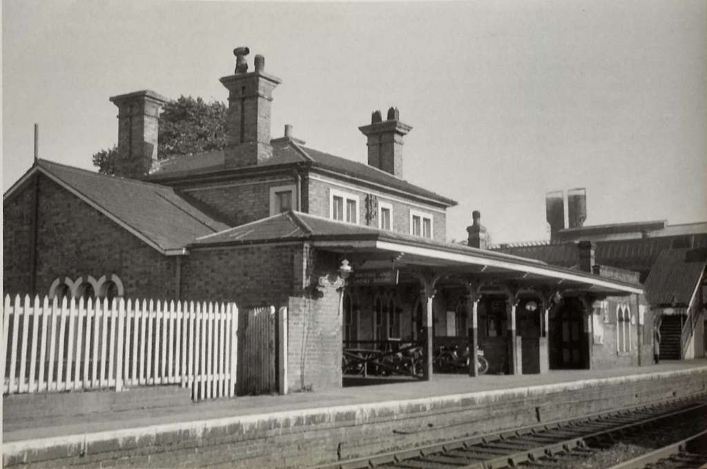

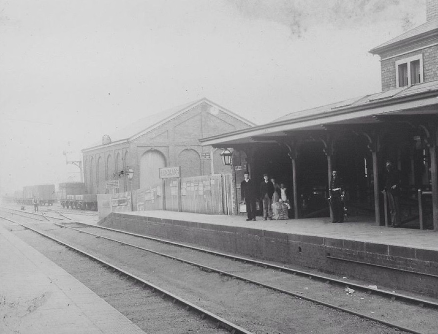
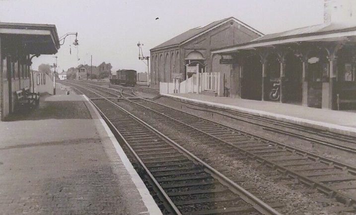
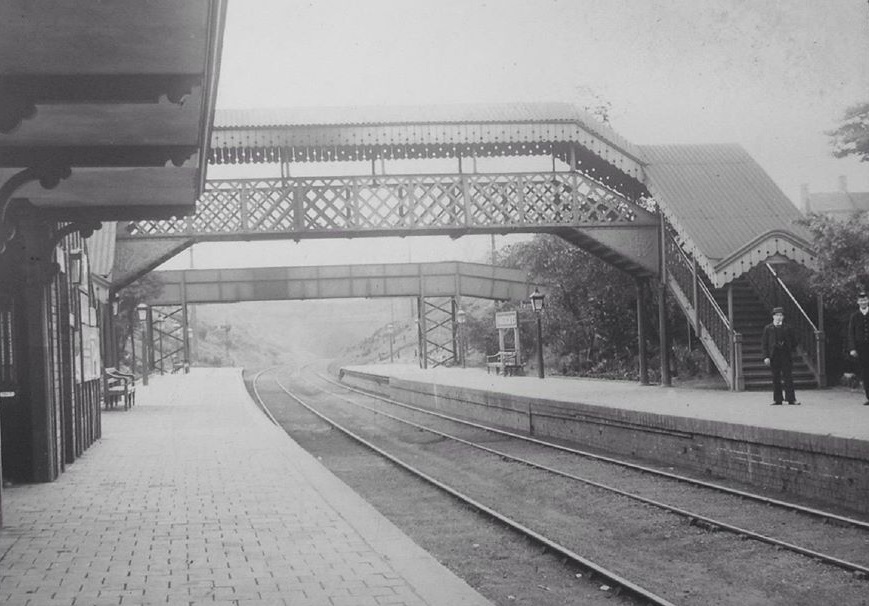
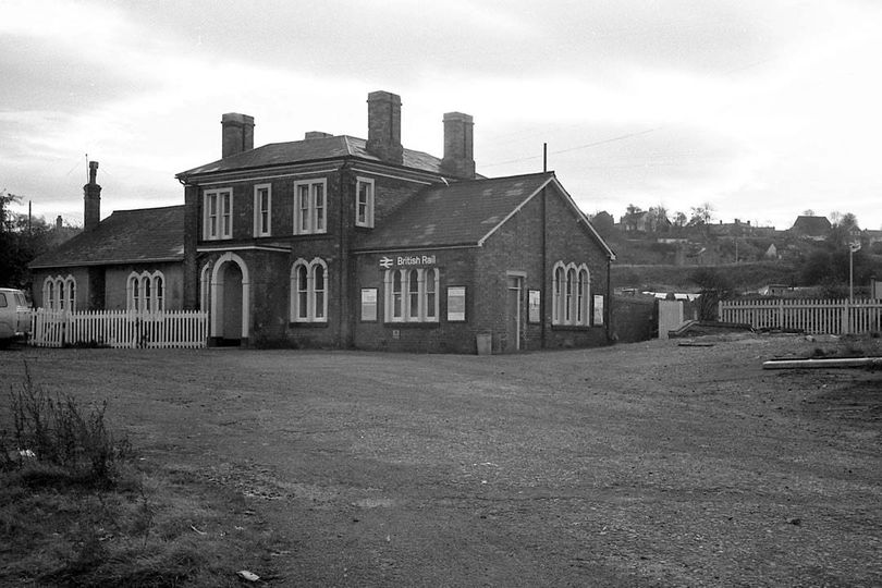
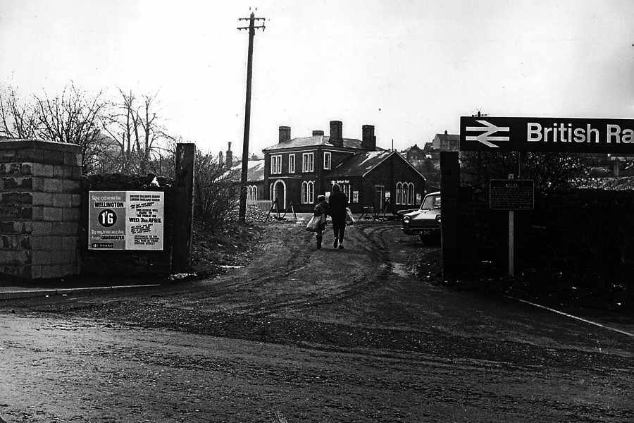
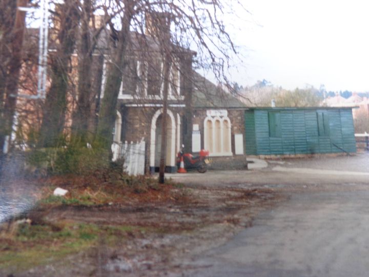

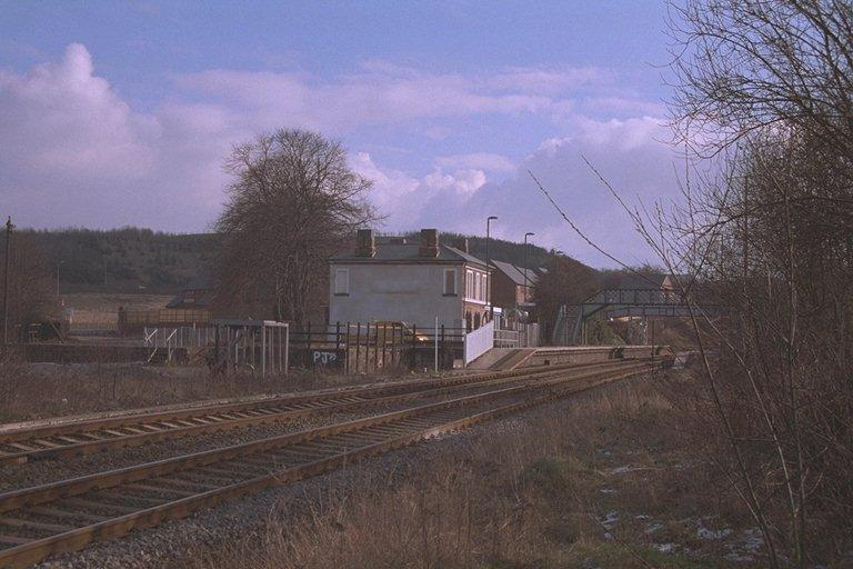
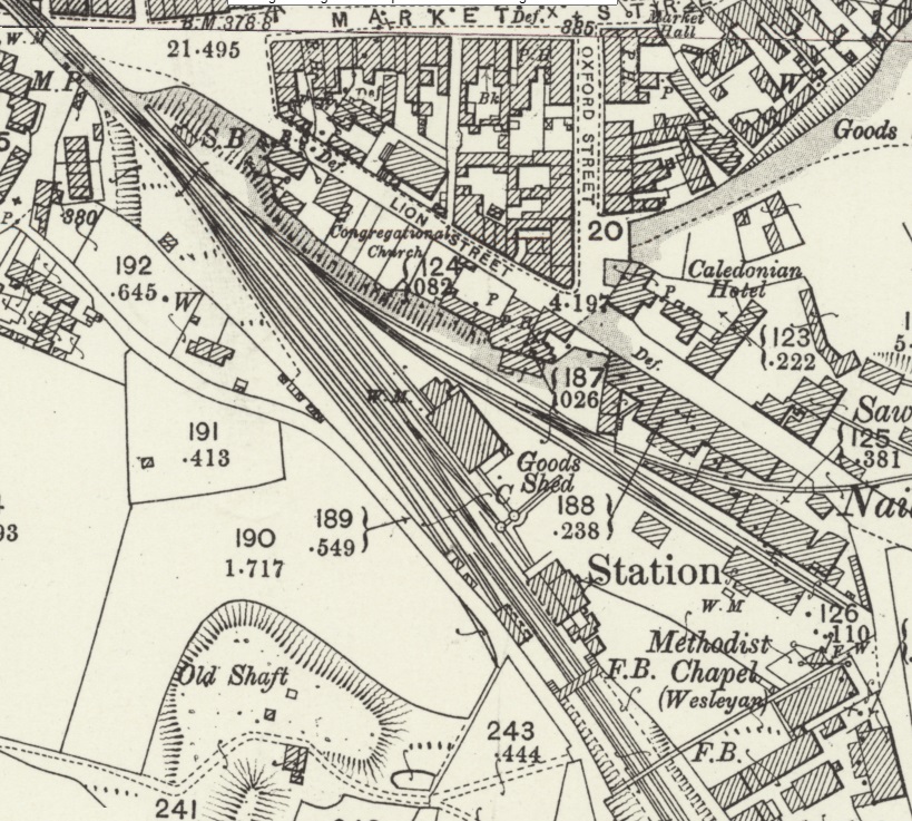


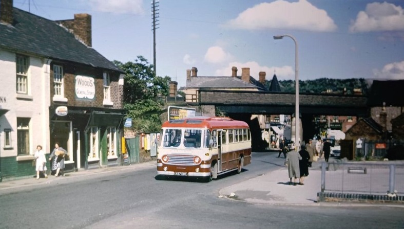

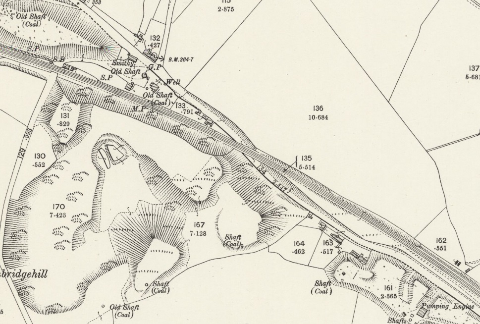

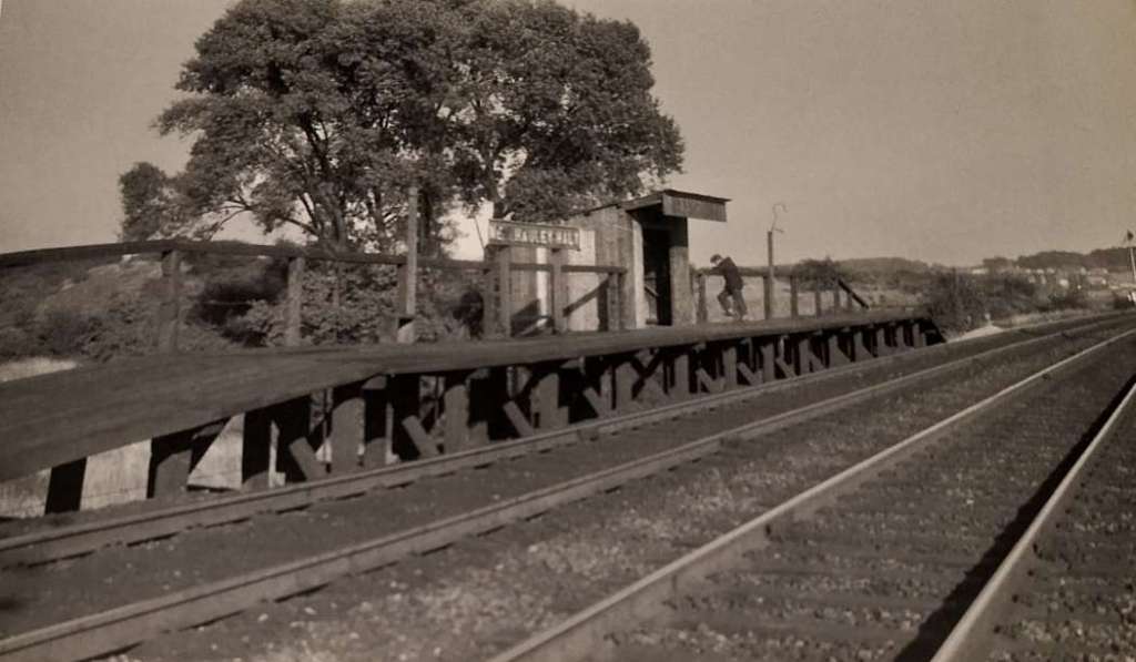


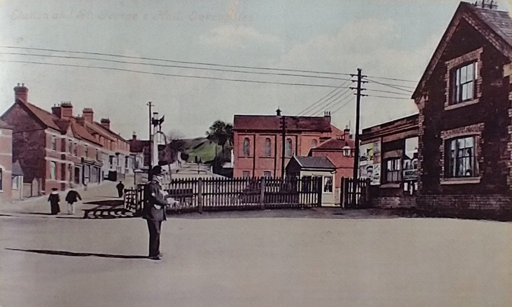
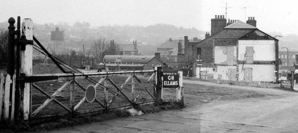

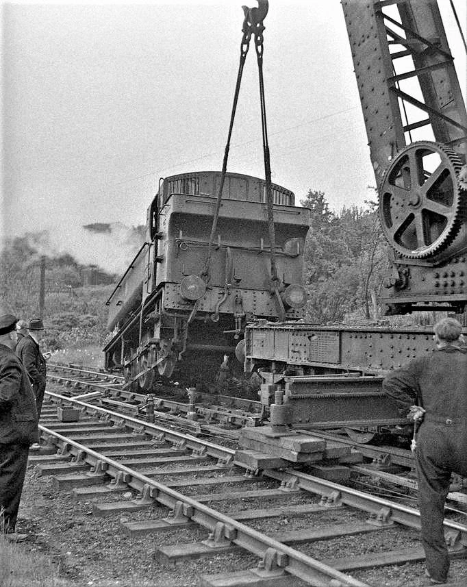

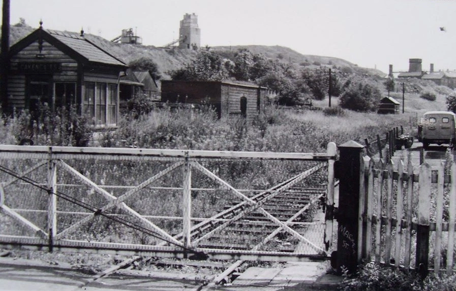
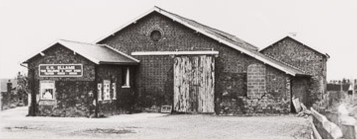
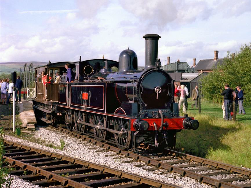
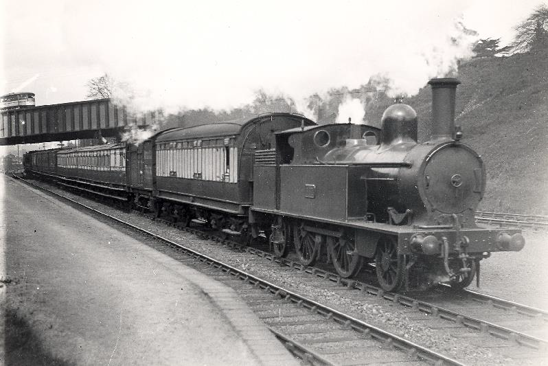


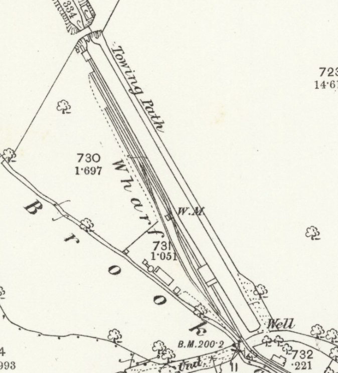
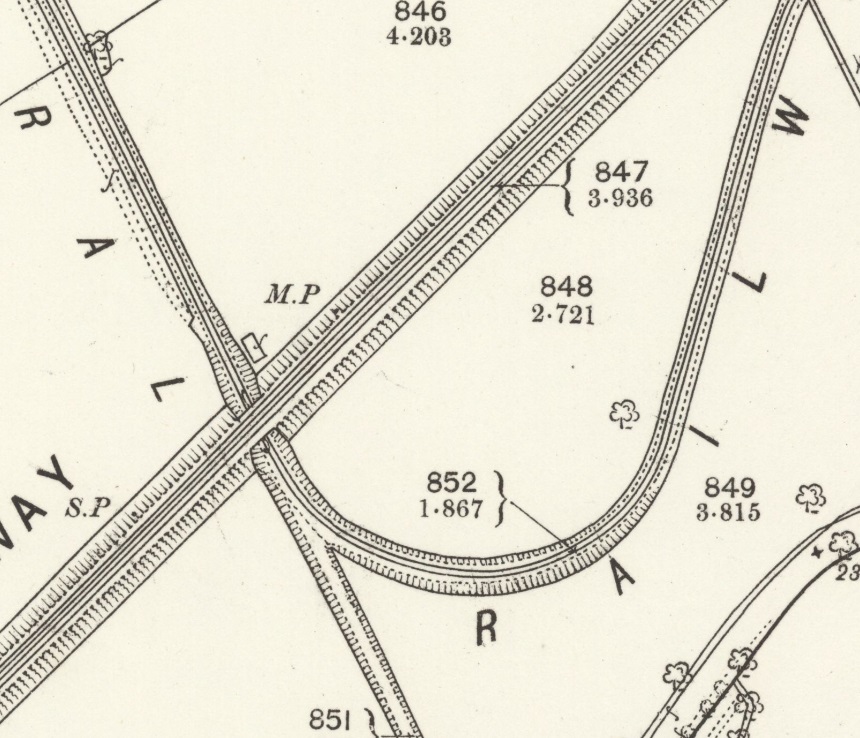
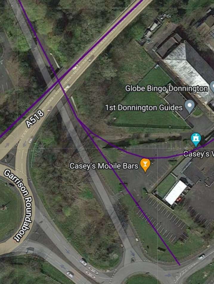
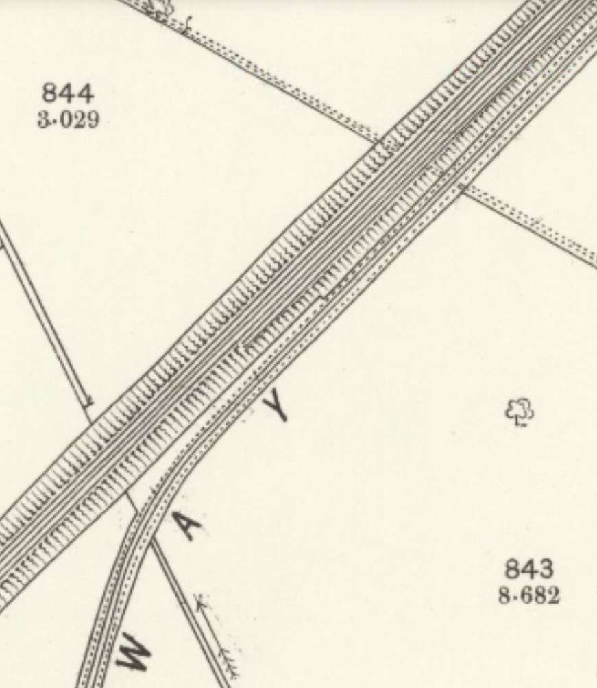

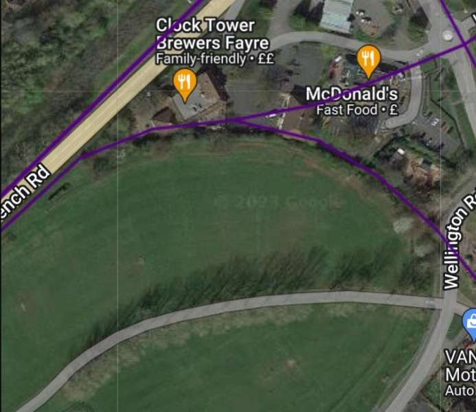

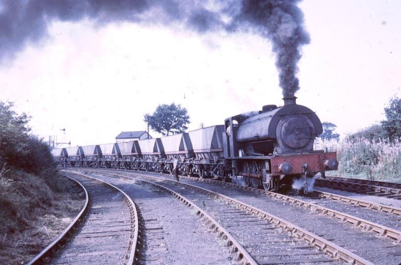
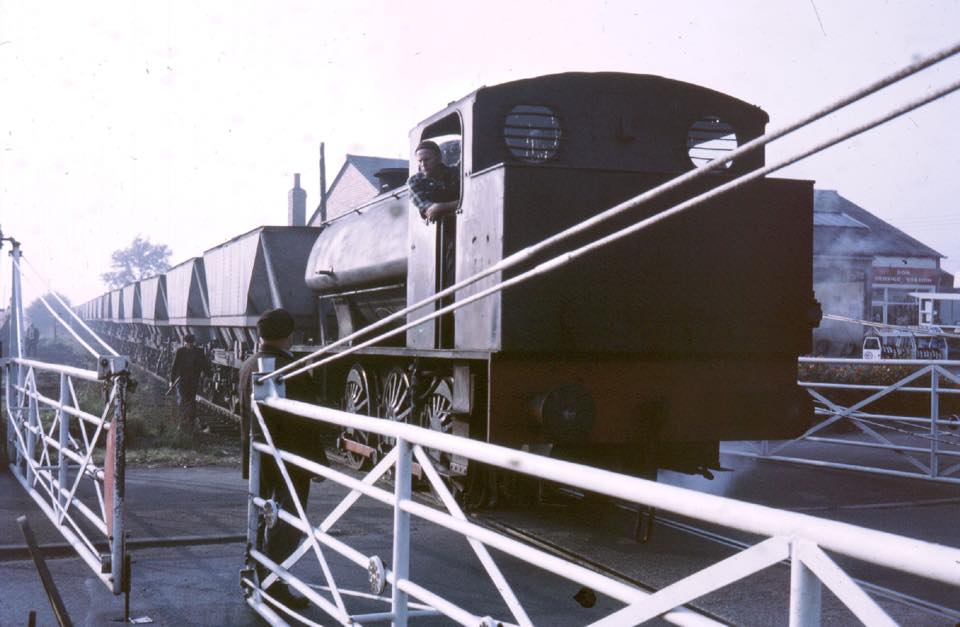


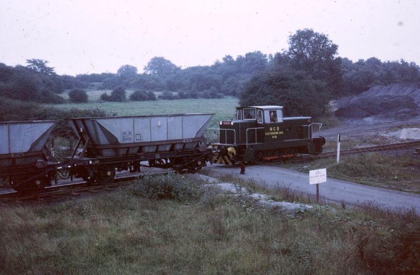

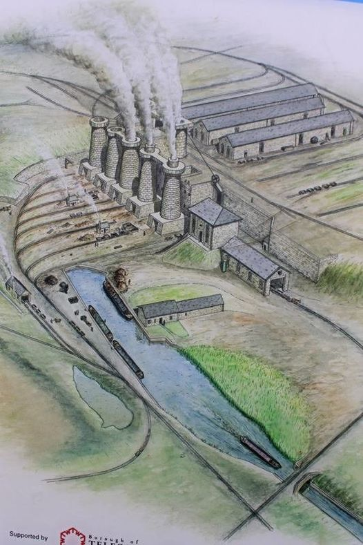
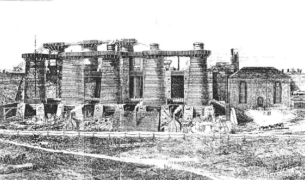
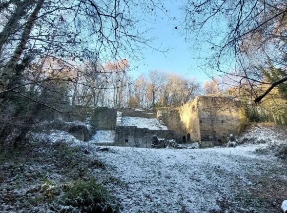
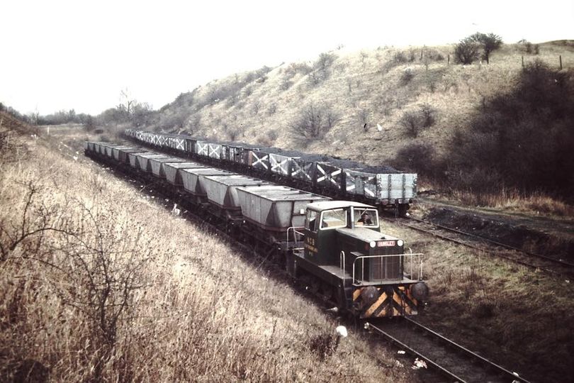
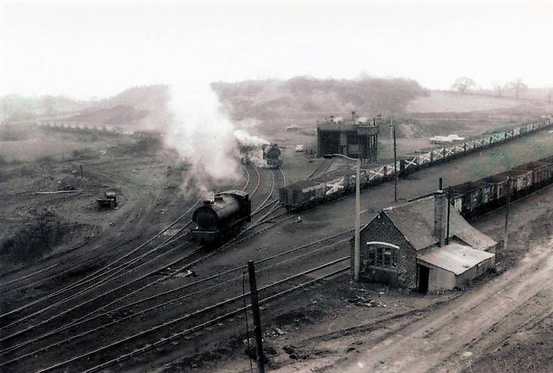

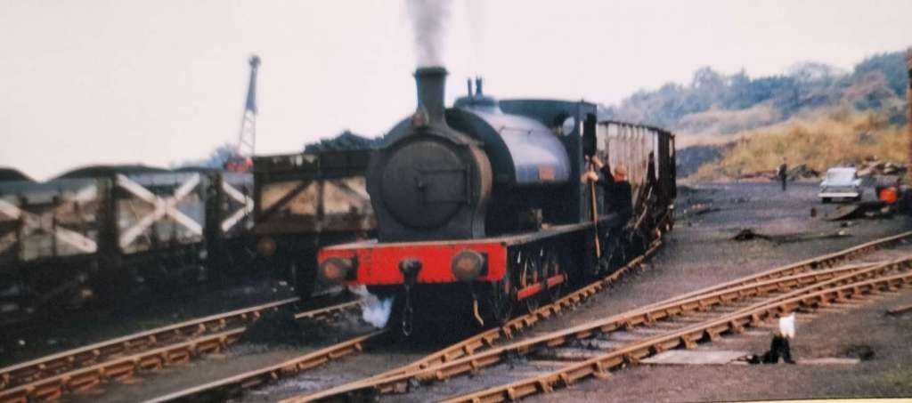
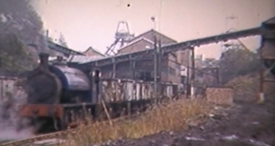
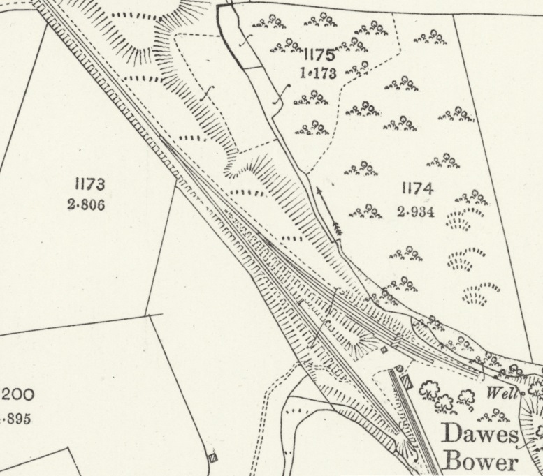
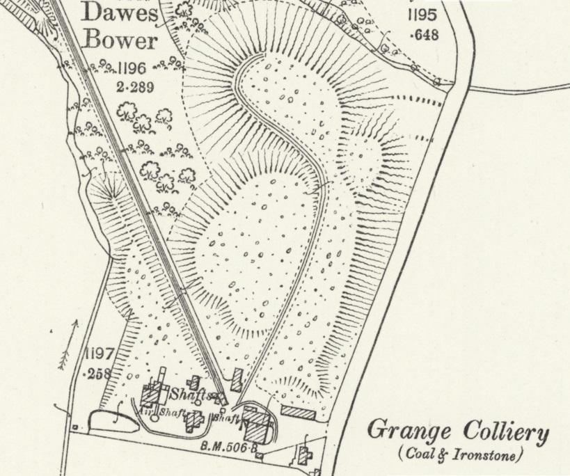


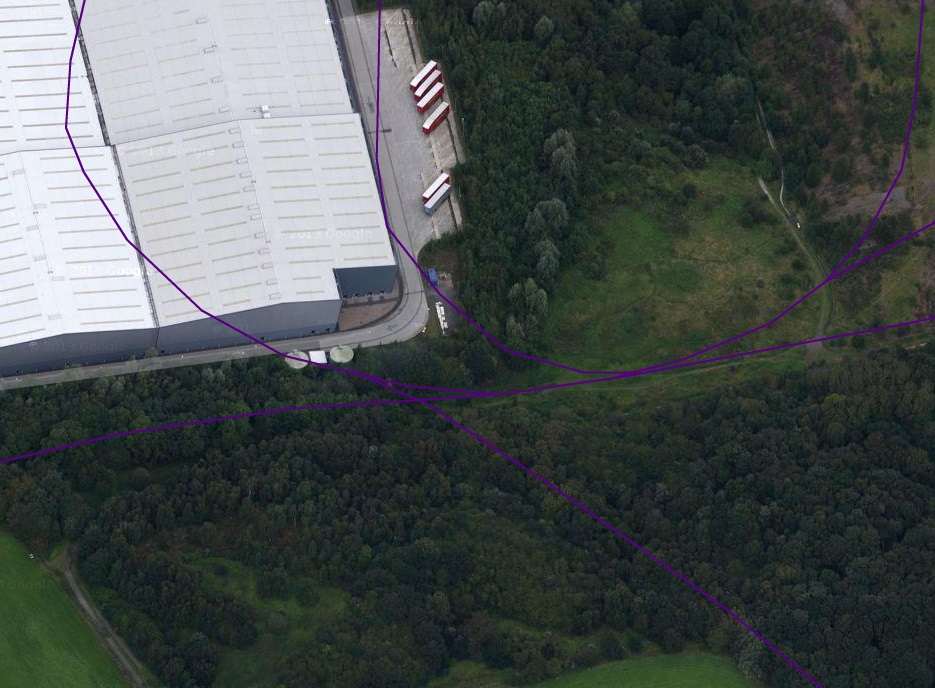


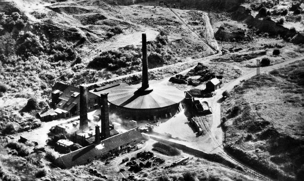

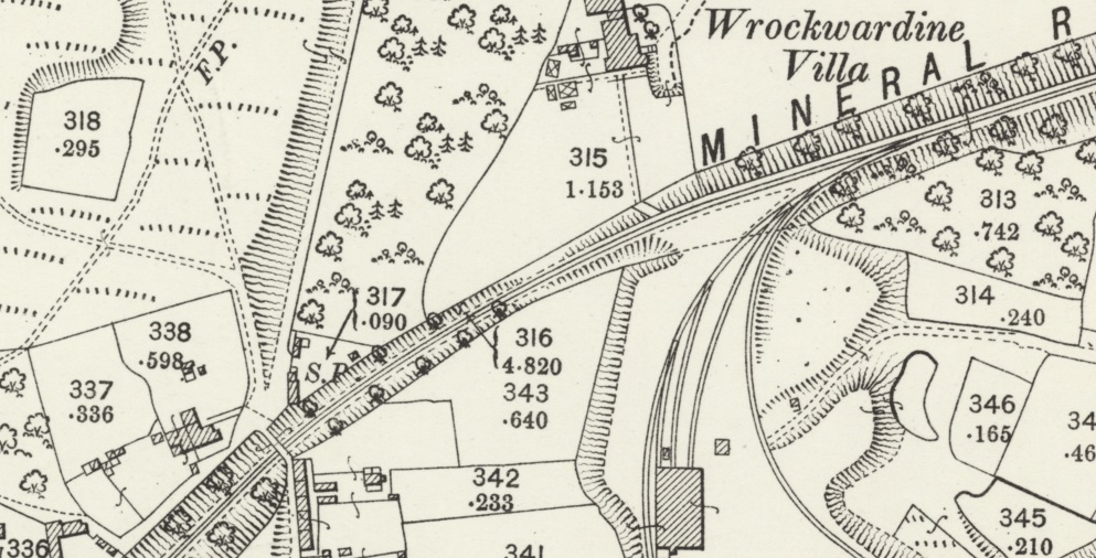
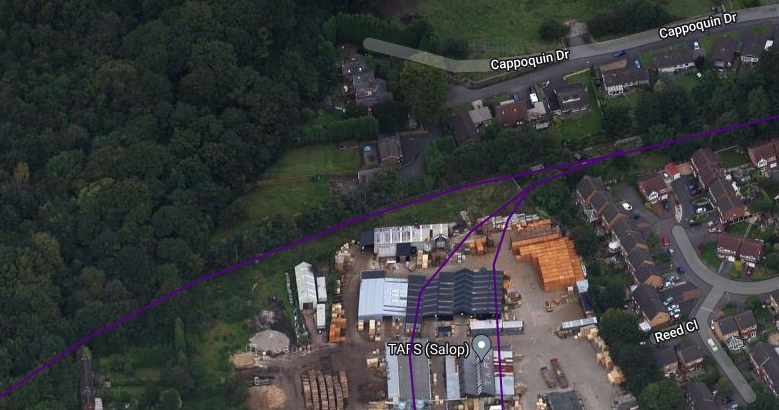
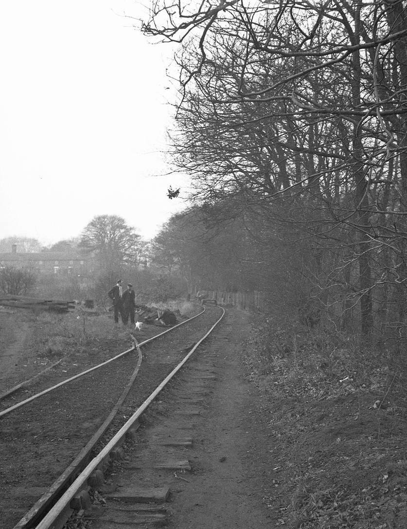

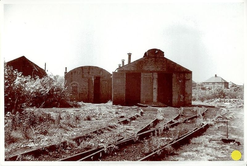
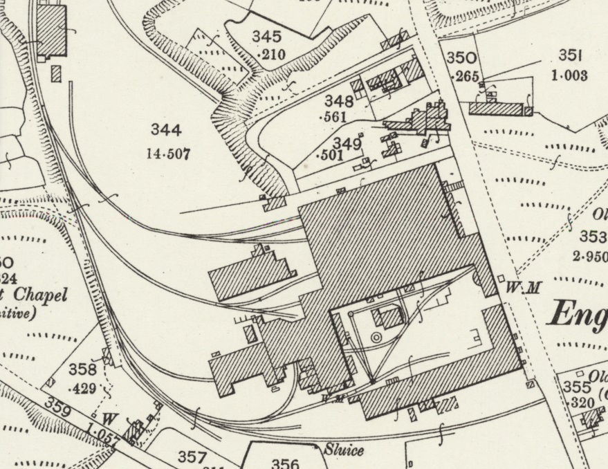
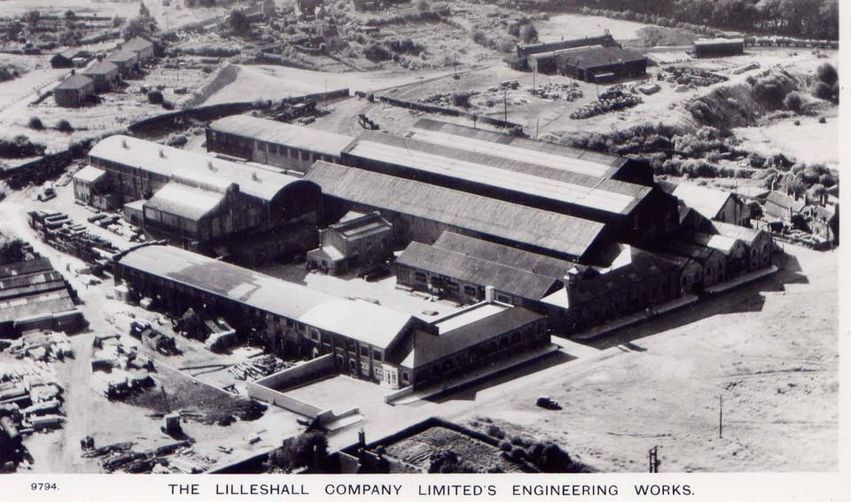
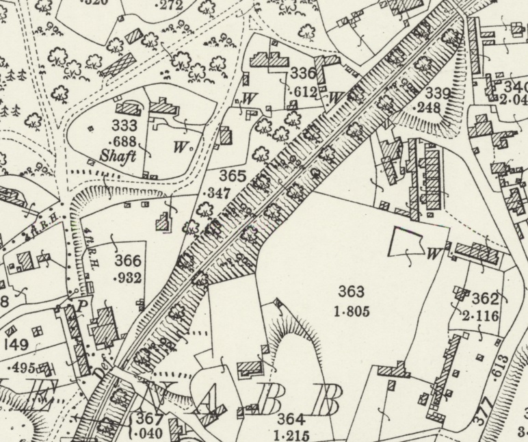
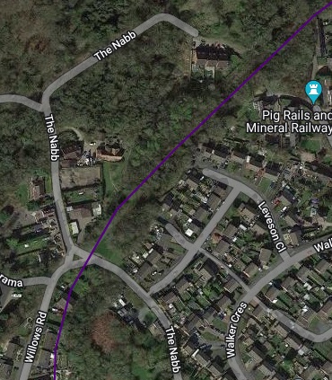
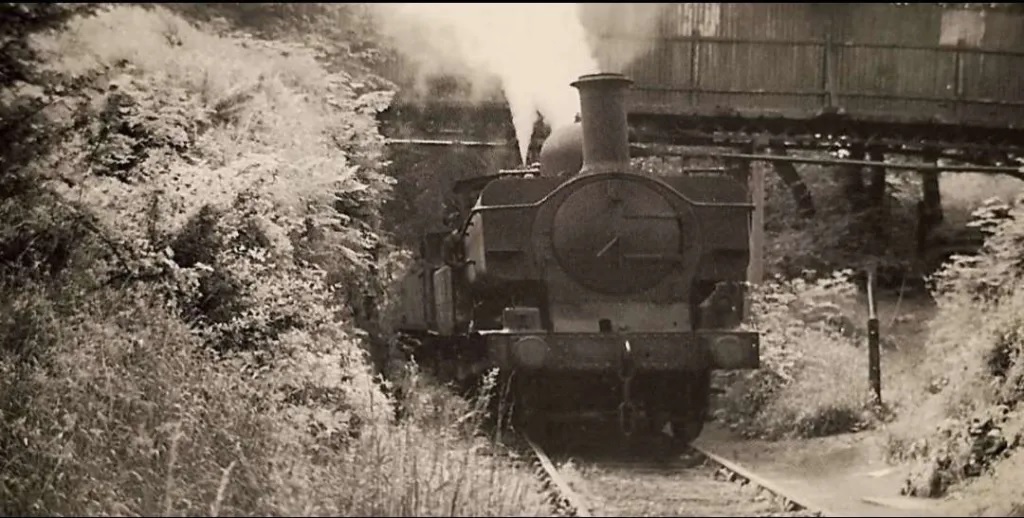
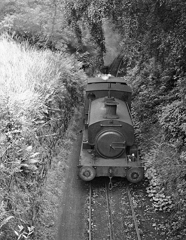
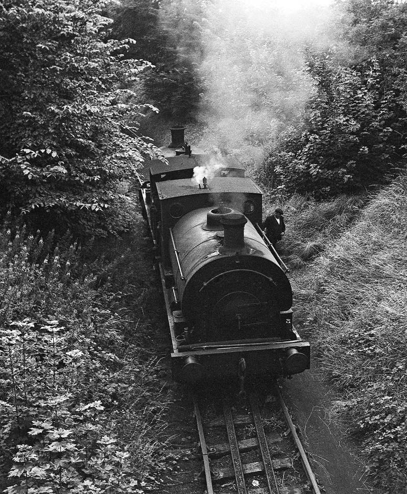
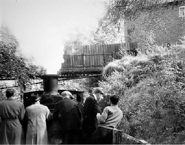

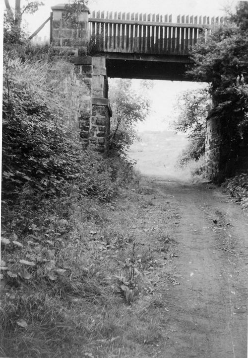
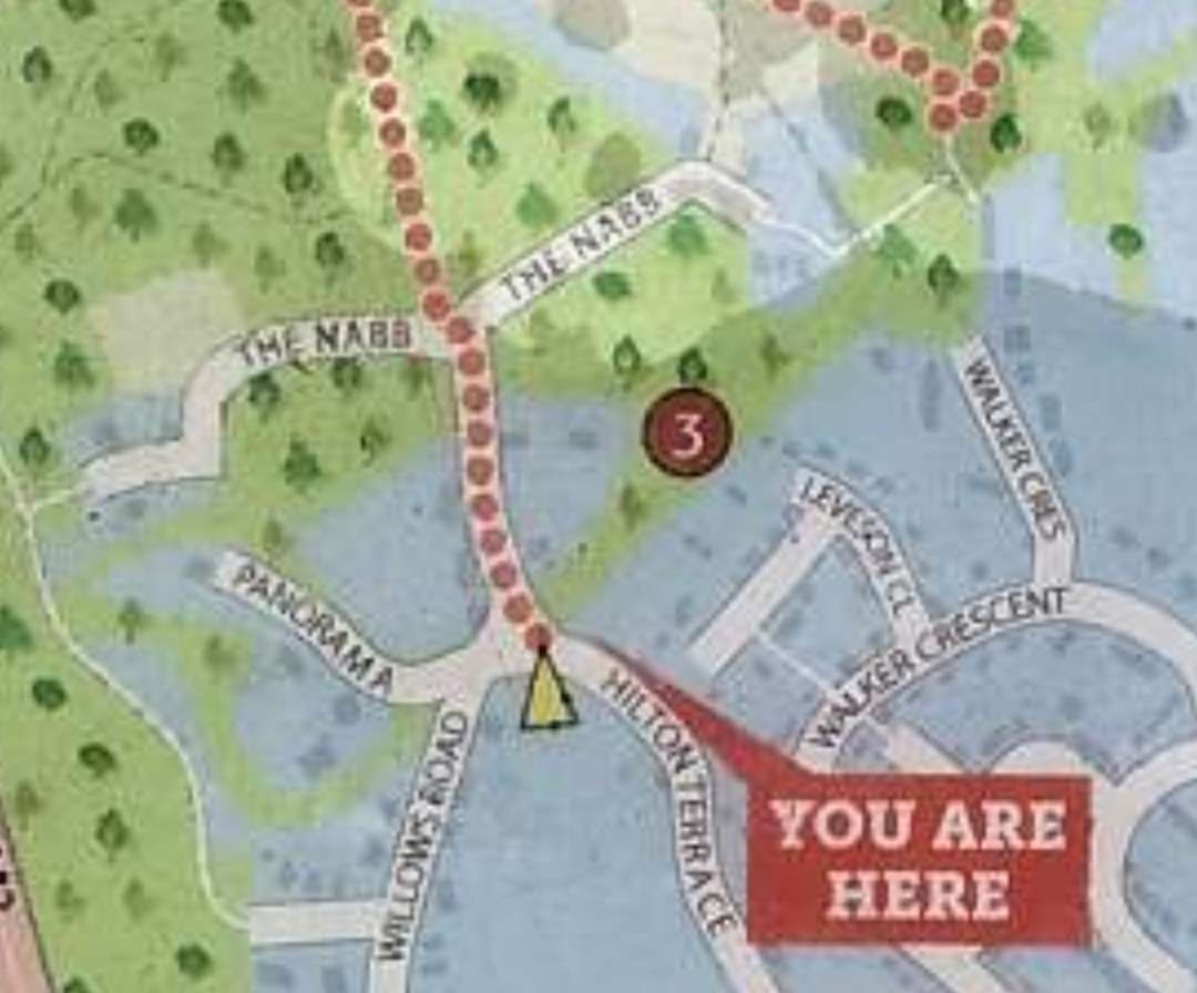


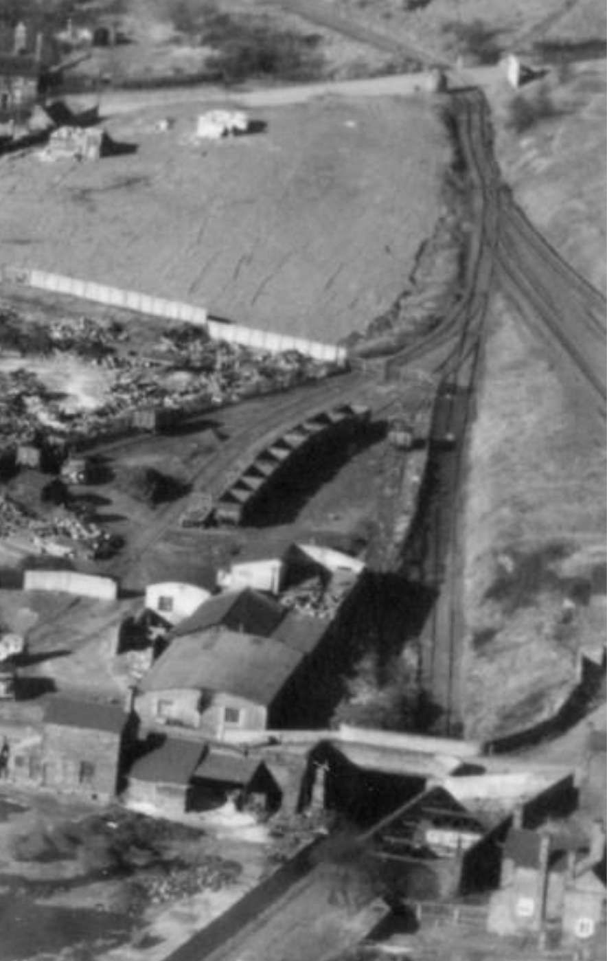
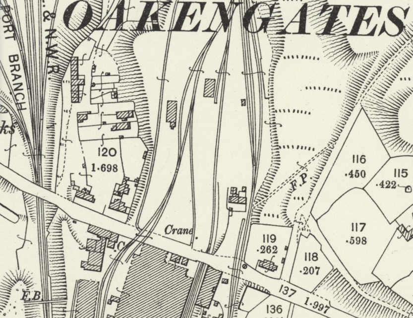
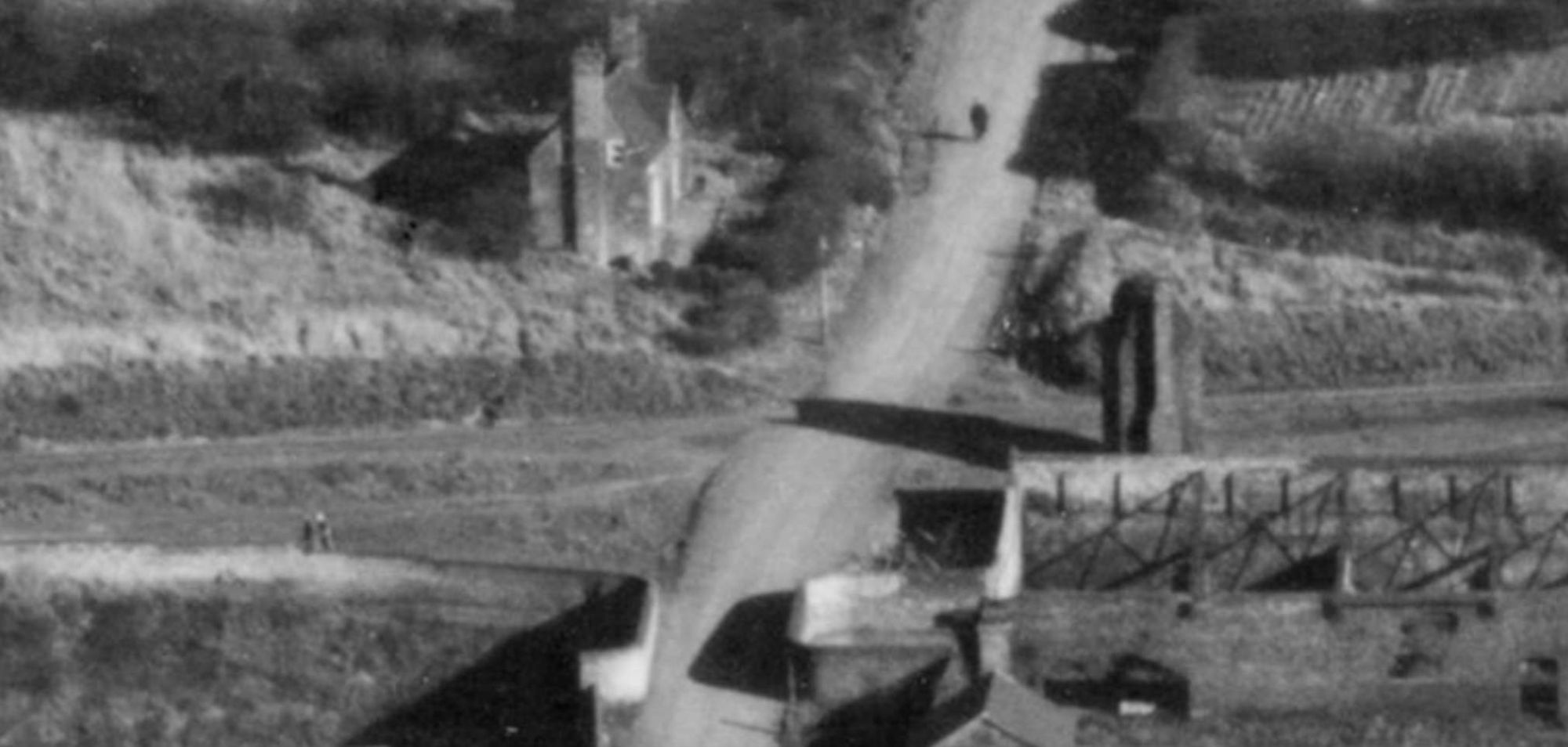

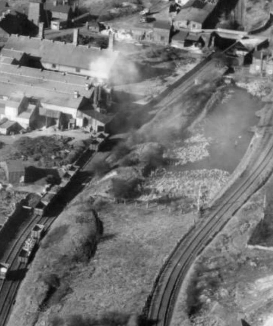
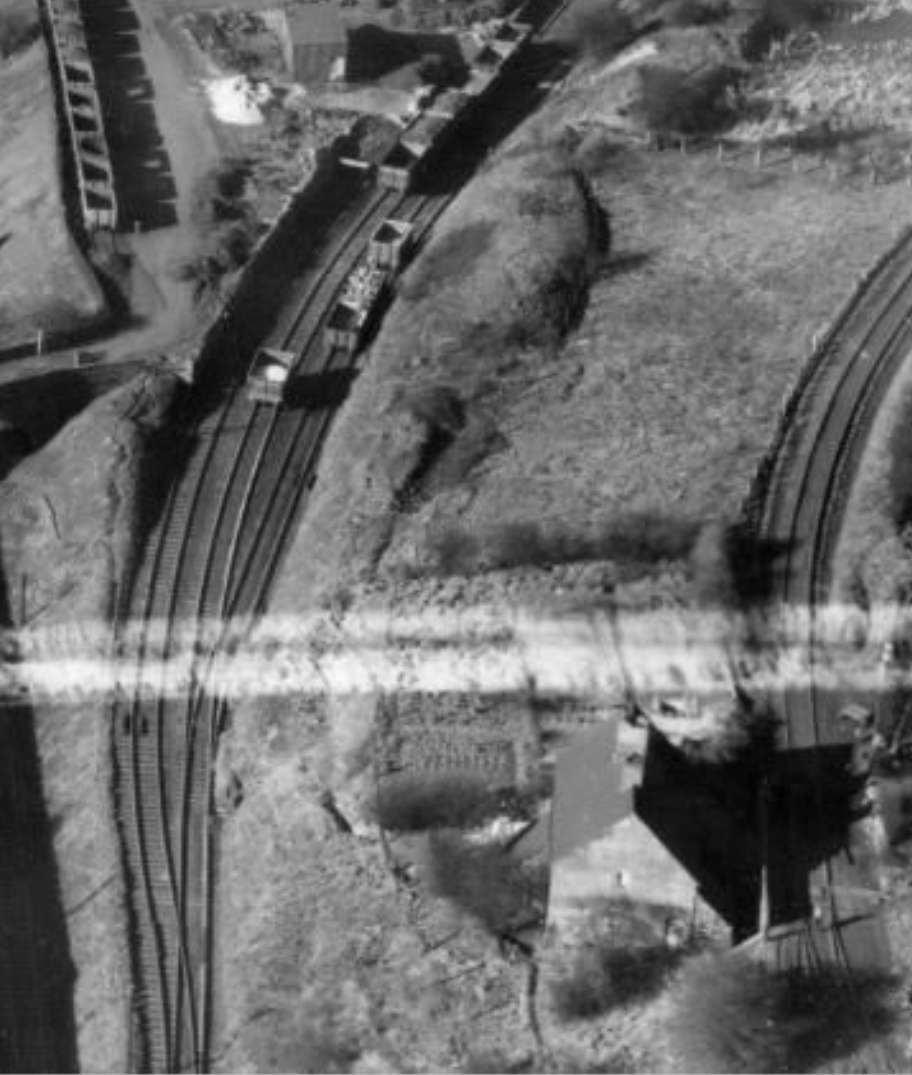

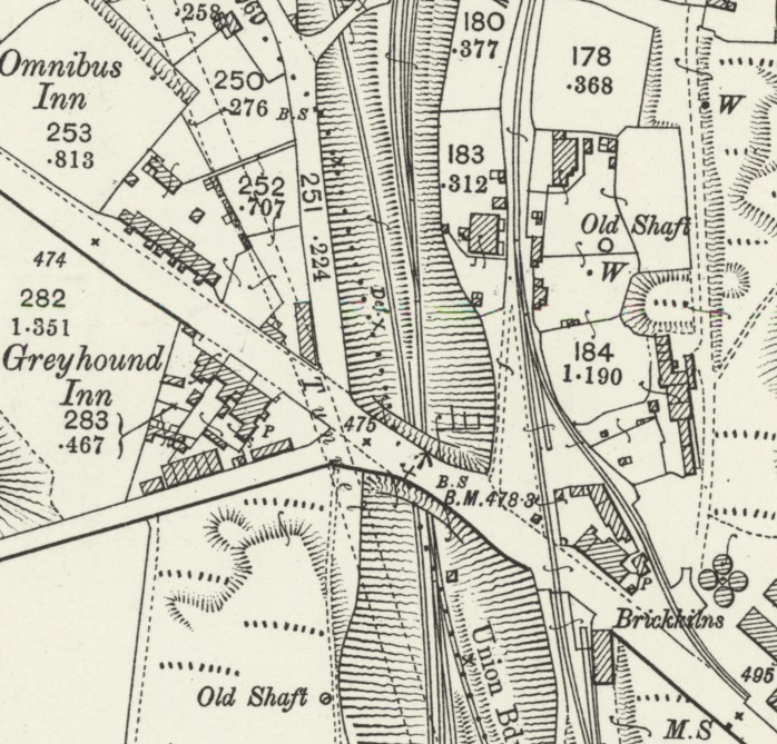
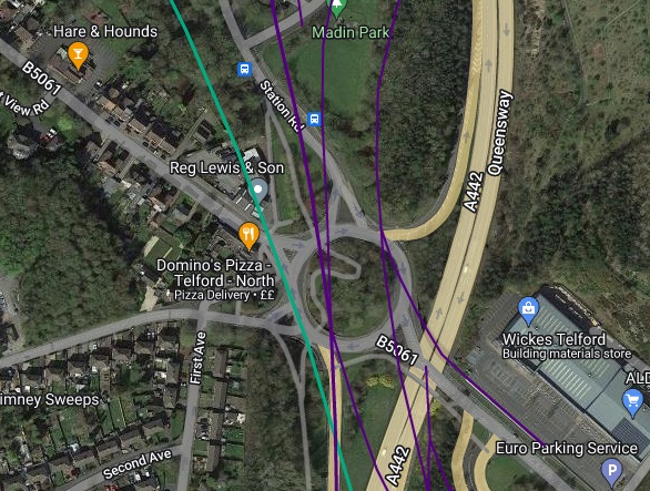
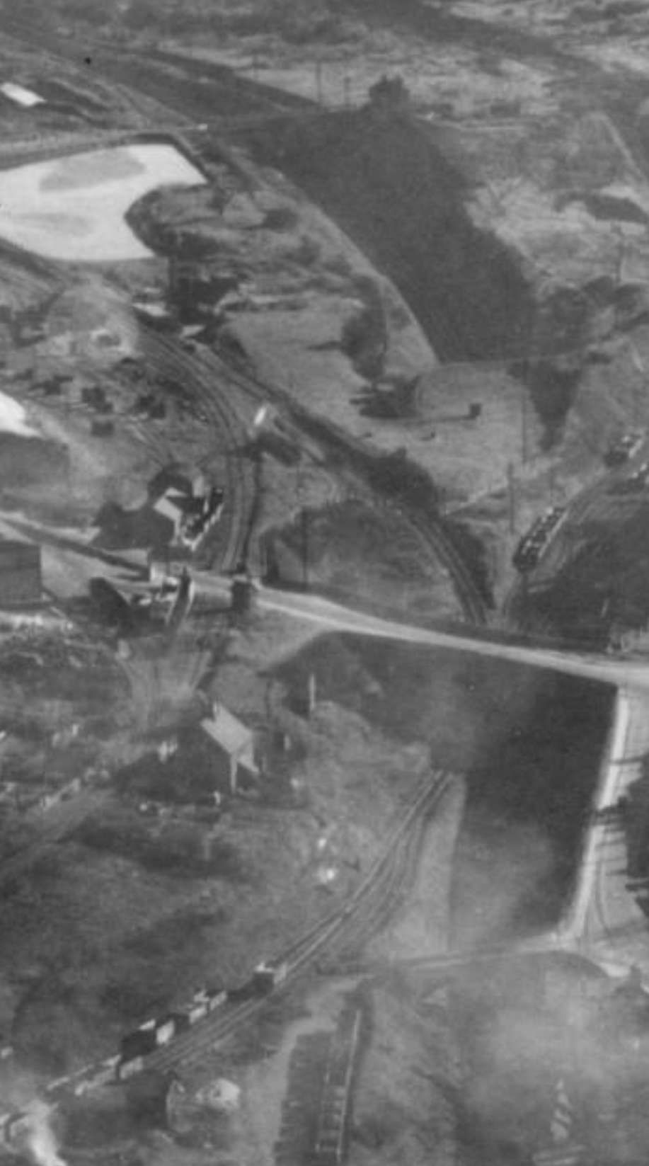
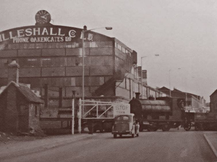
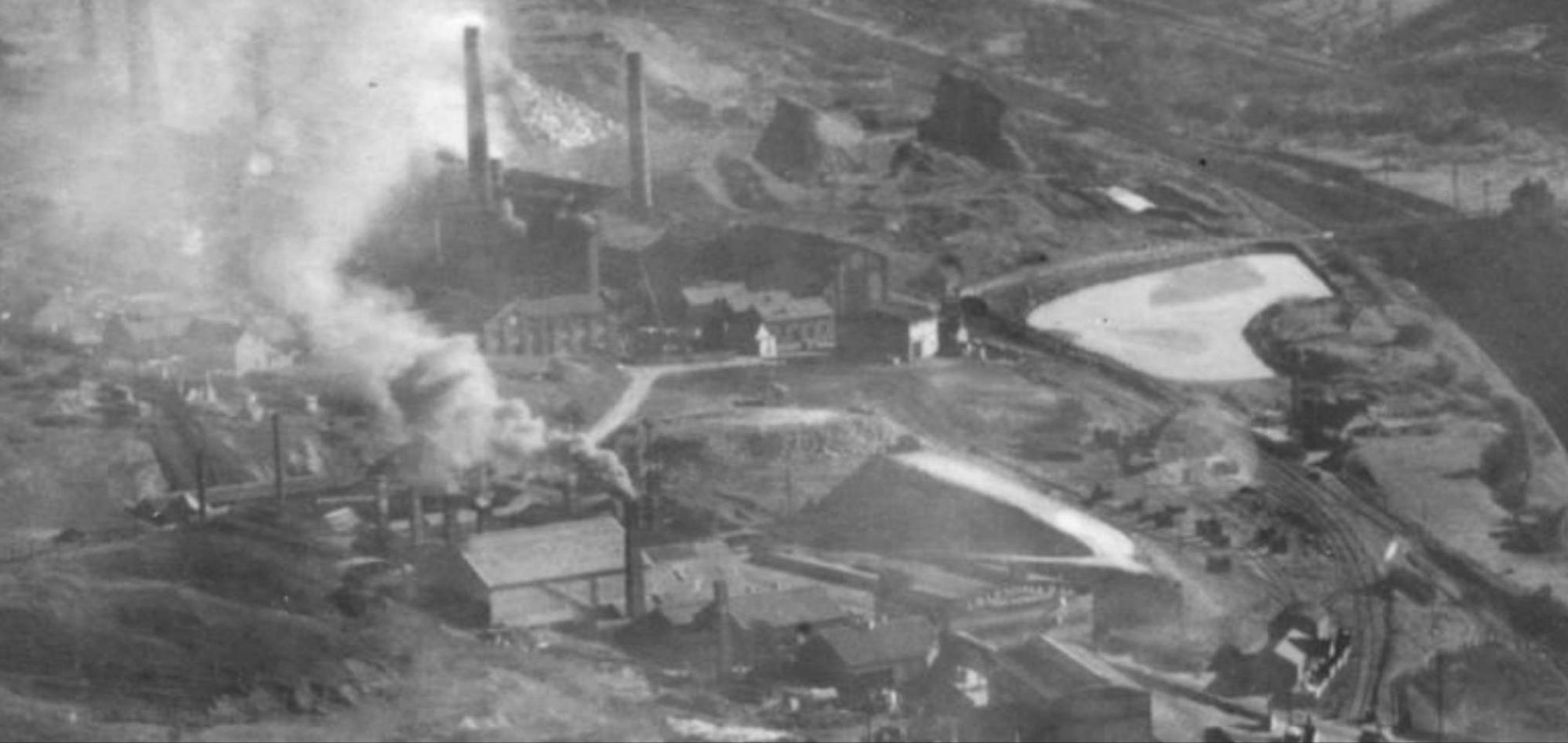


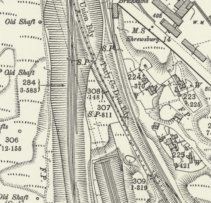

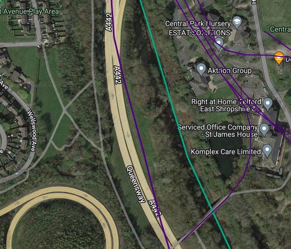
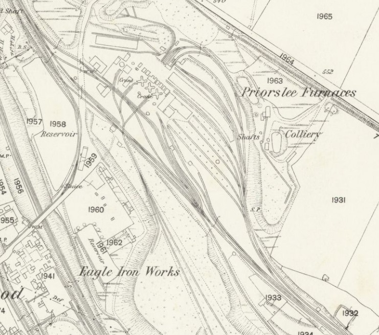


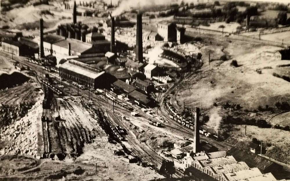

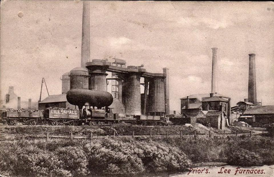
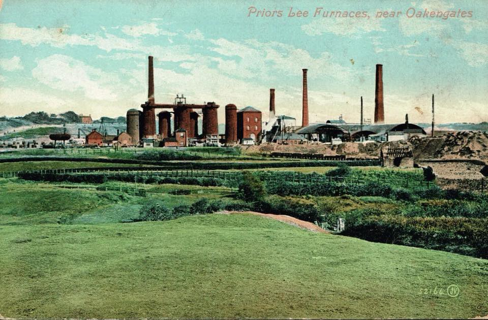
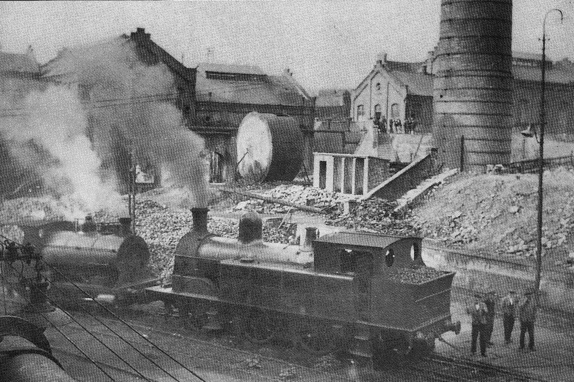
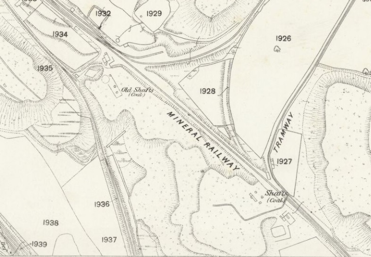
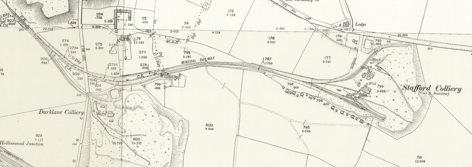
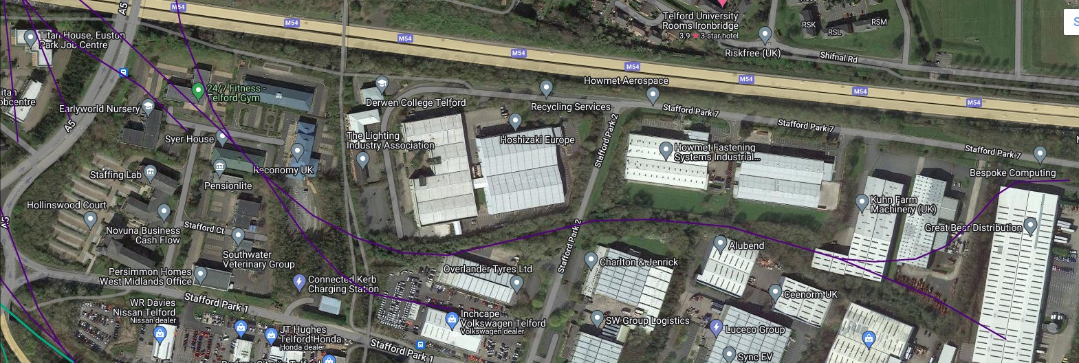


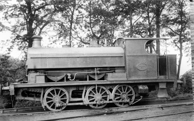
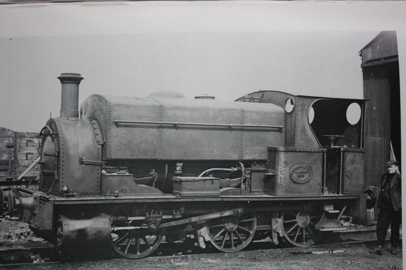

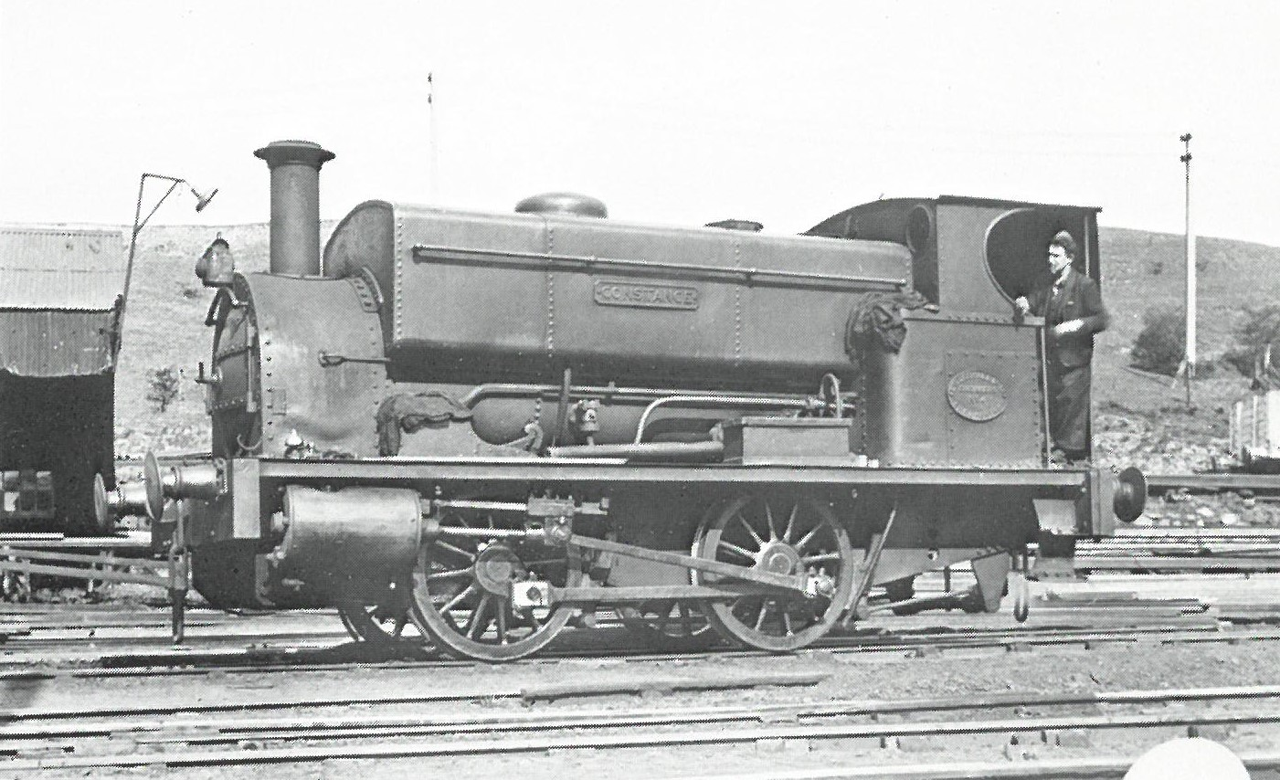
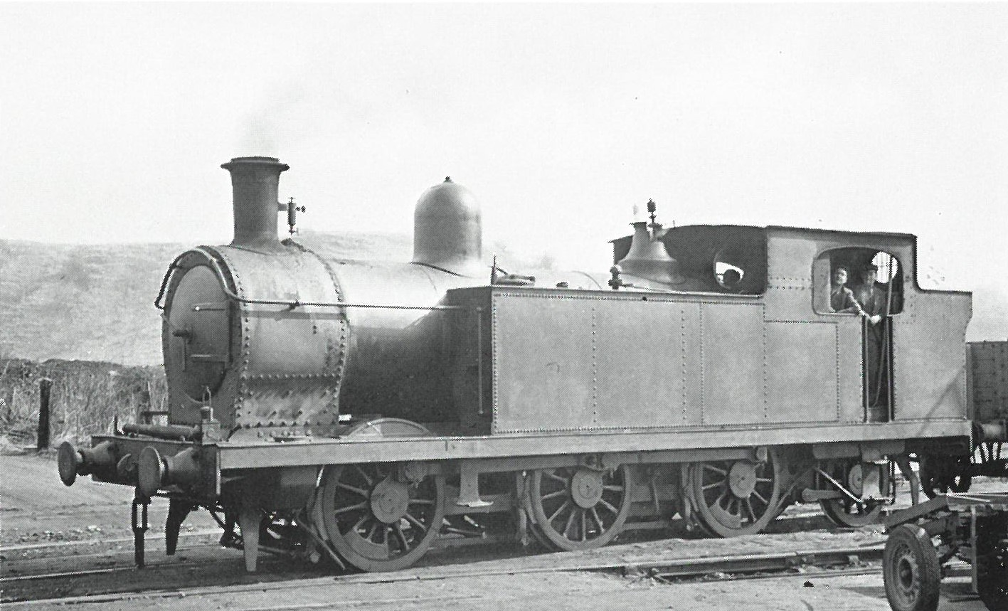

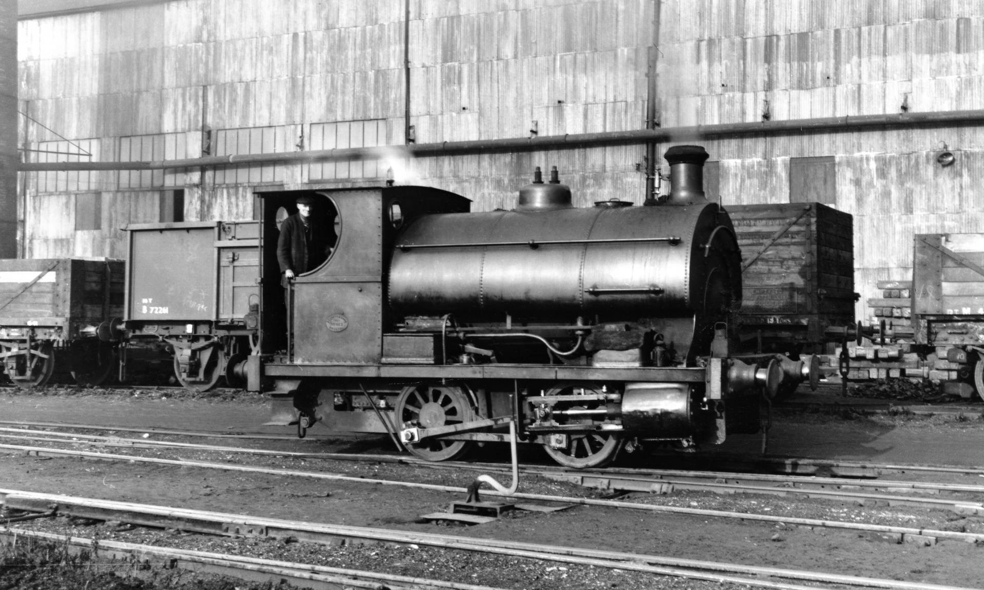
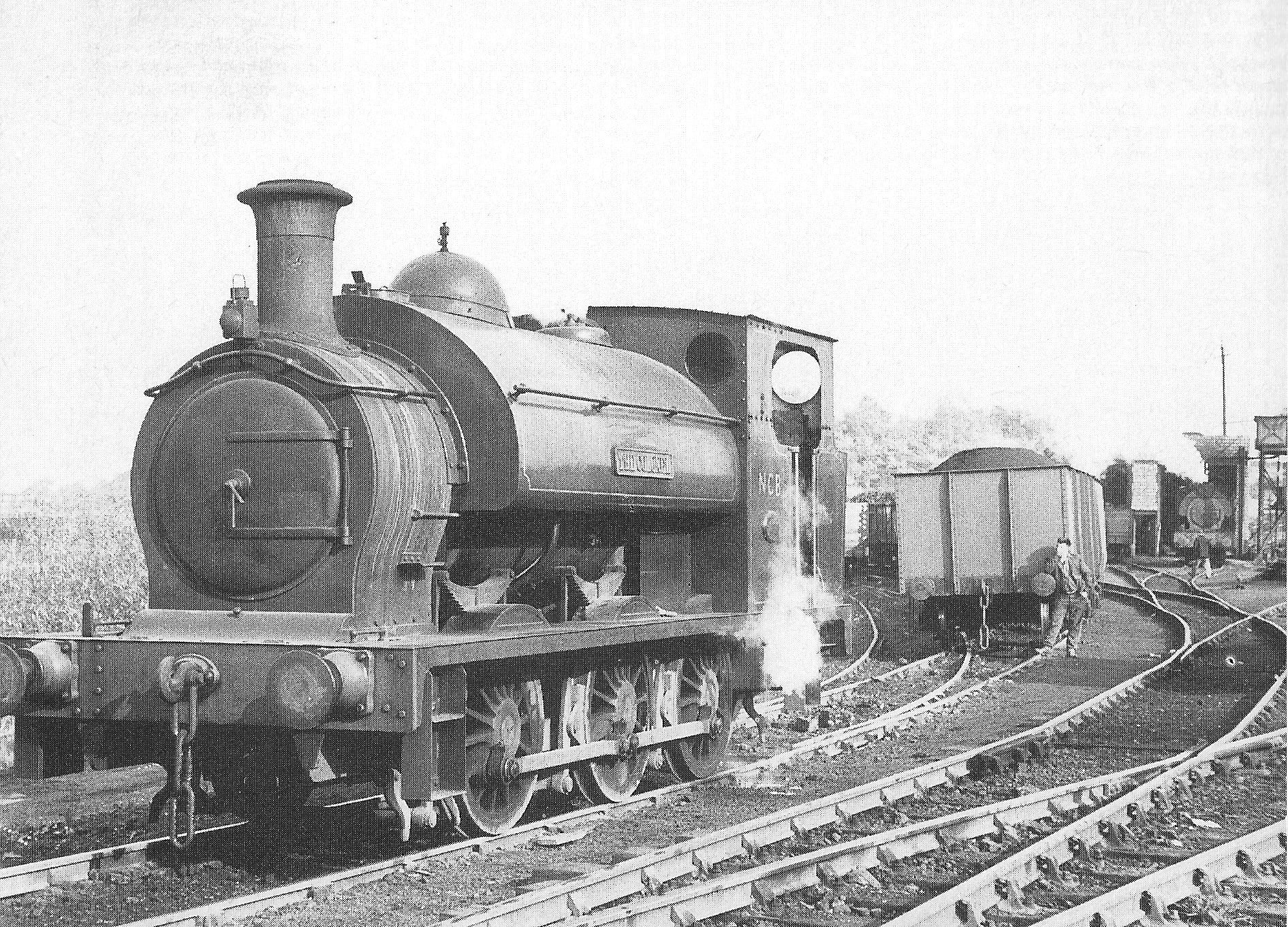
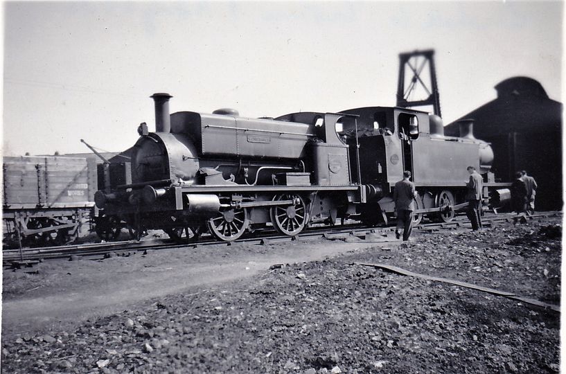

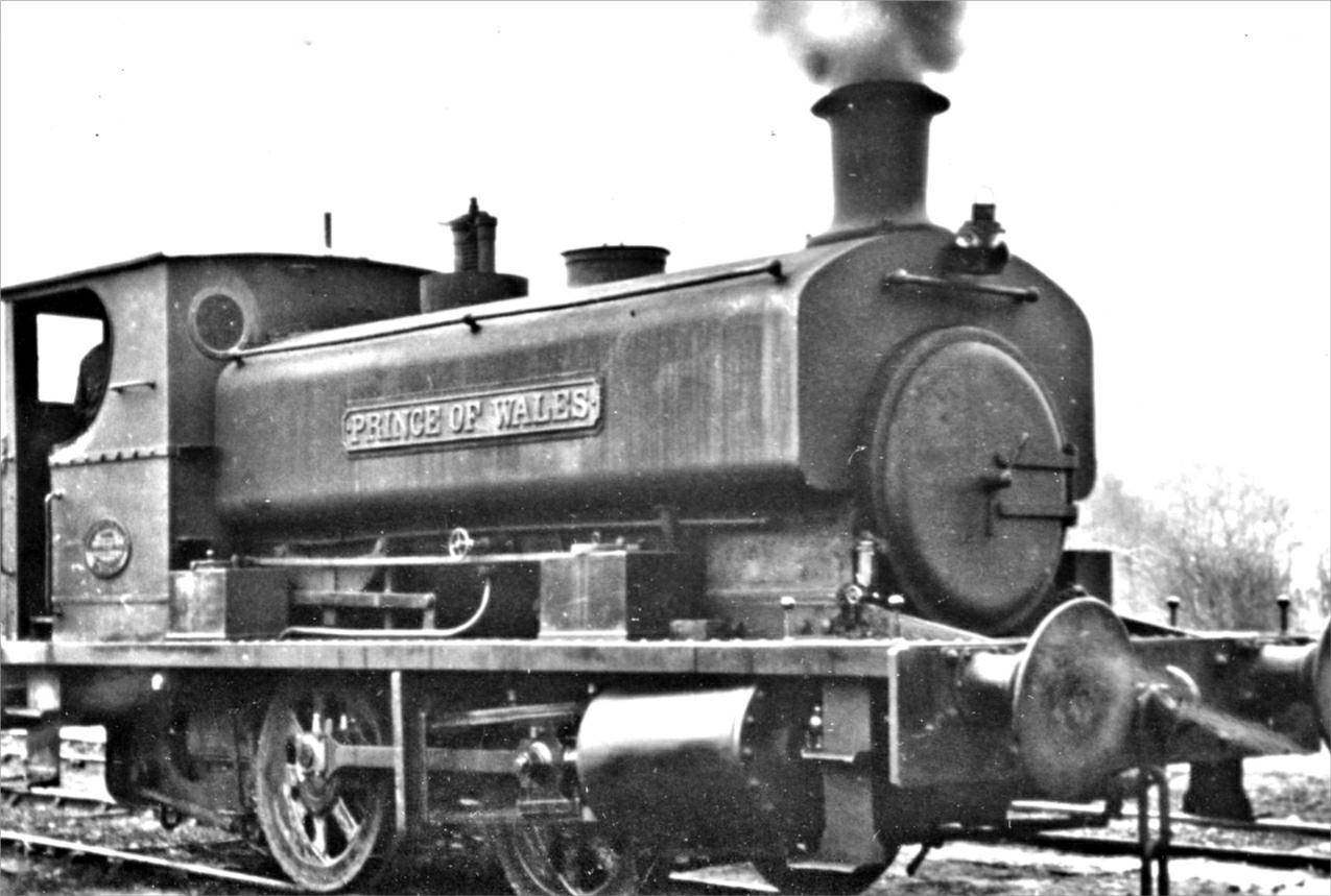

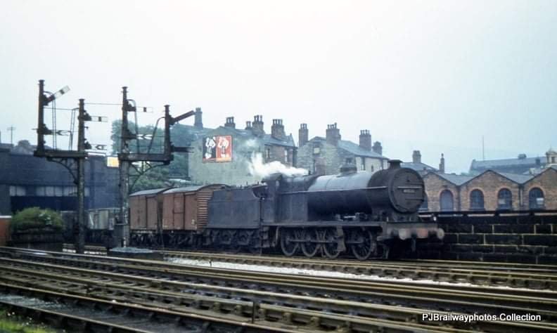

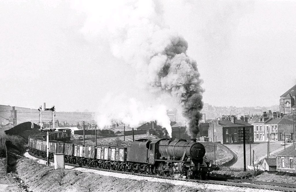

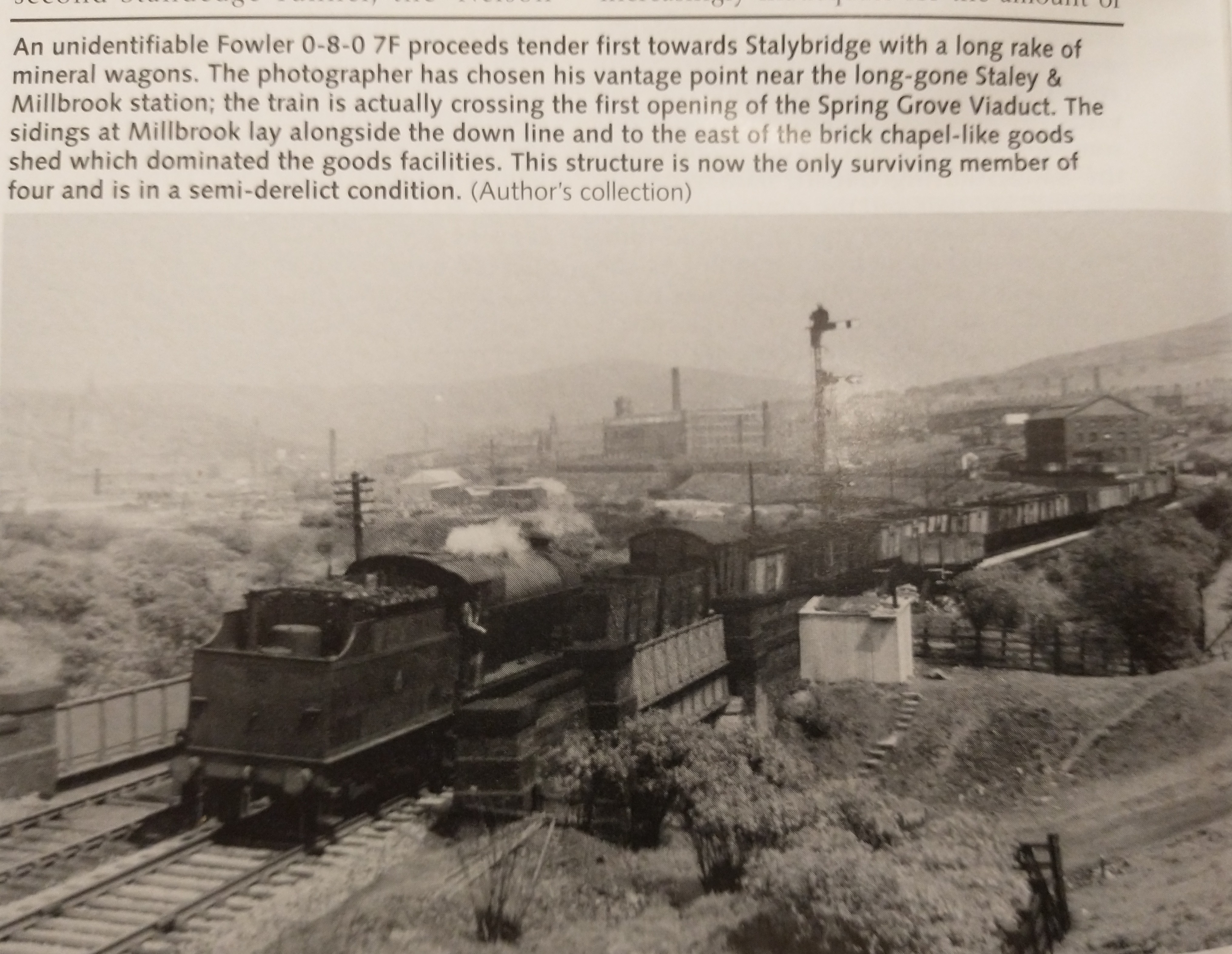
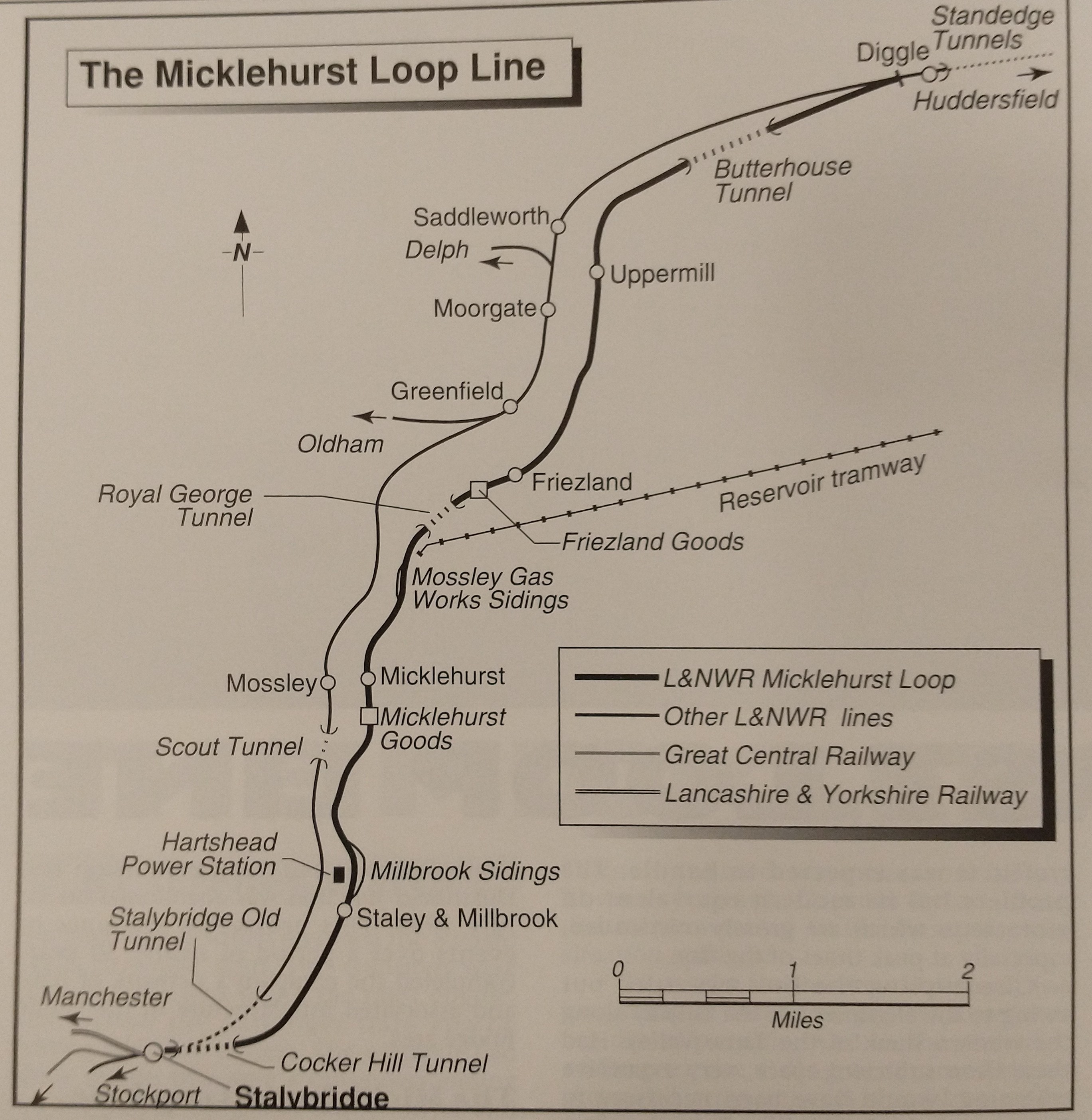
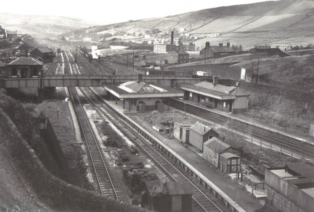
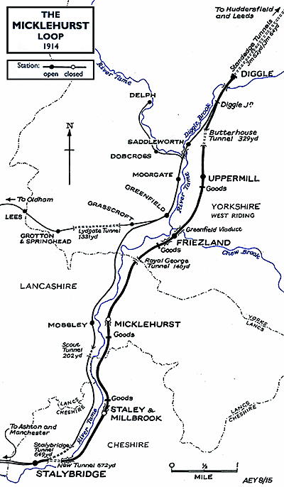
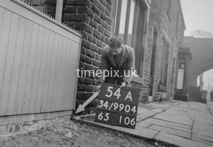
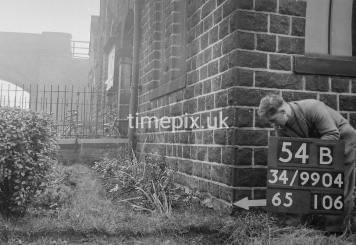
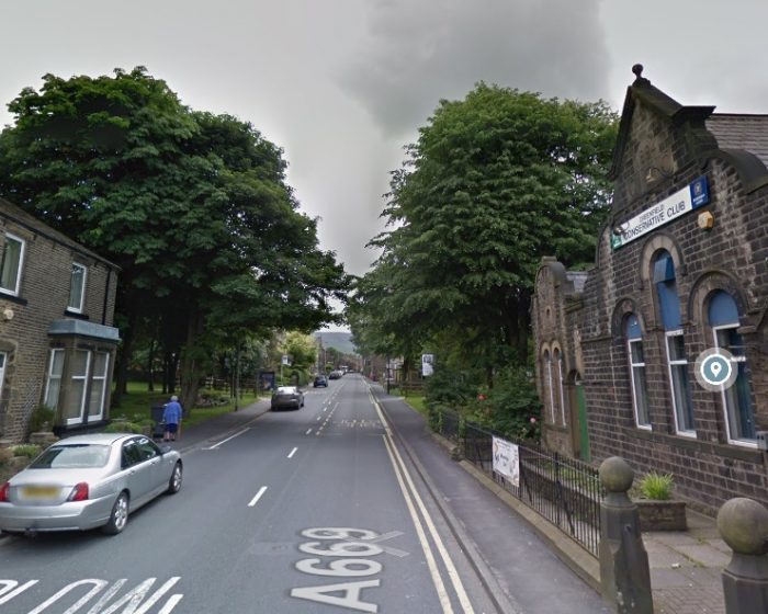
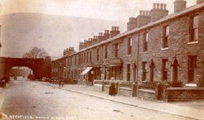 The adjacent image looks from the Southeast along Chew Valley Road. [16]
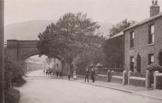
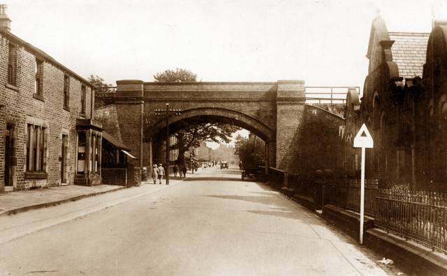 The third, below, is taken from the Northwest and shows the Conservative Club on the right side. [18]
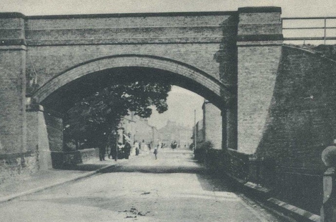
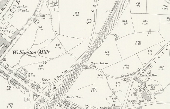
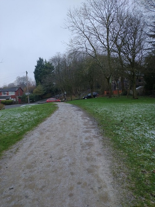
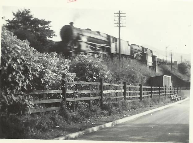
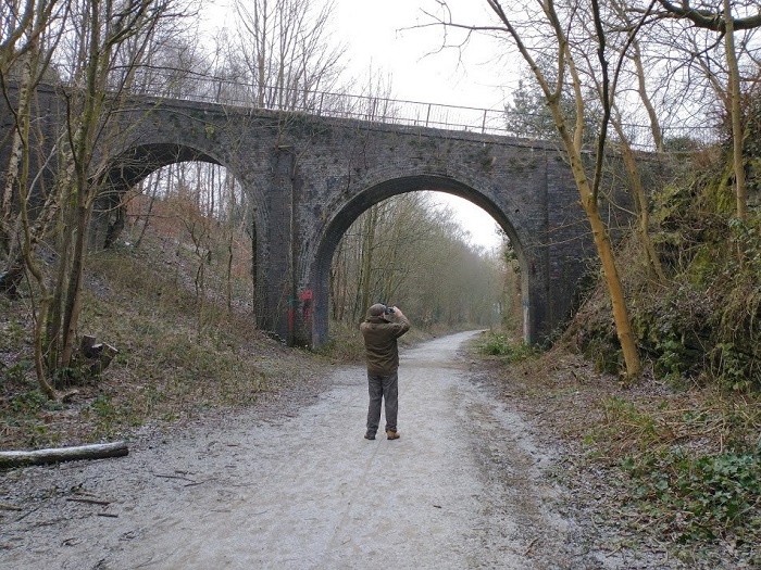
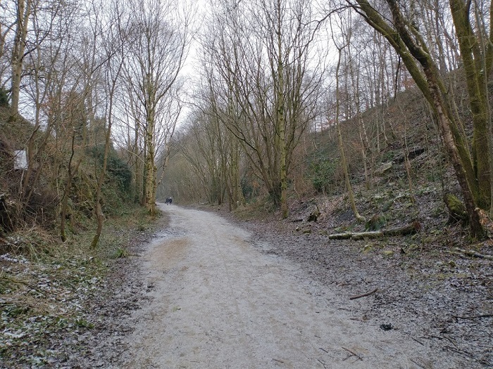
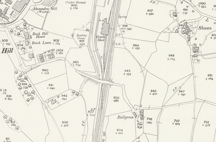
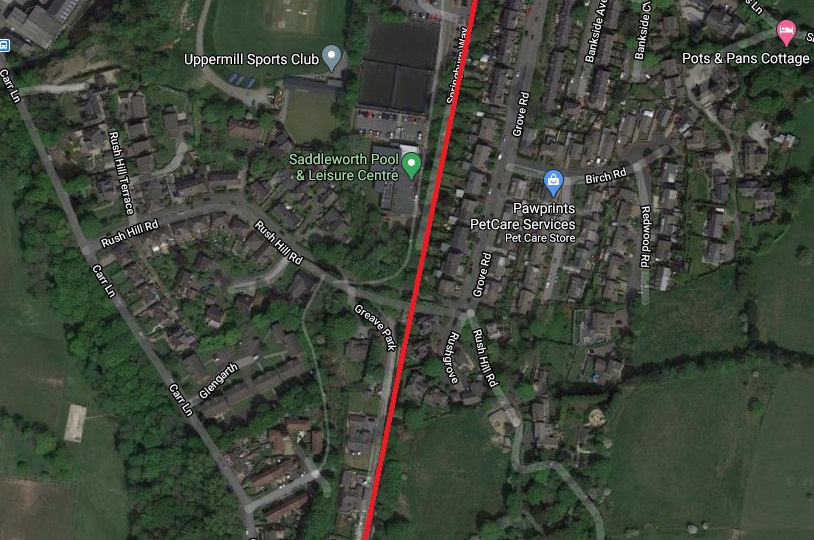
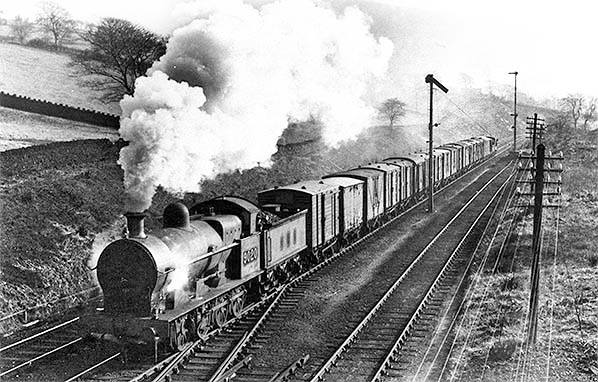
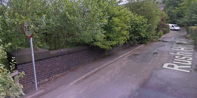
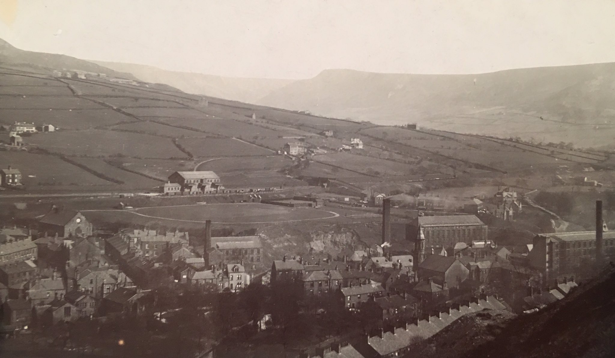
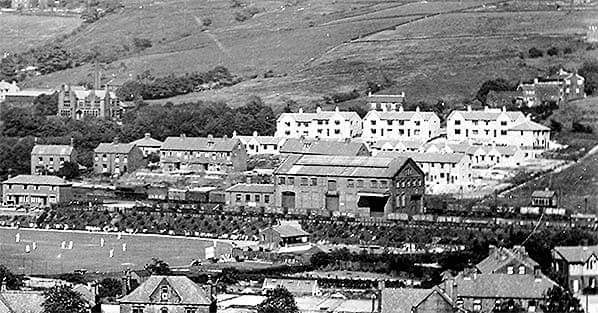

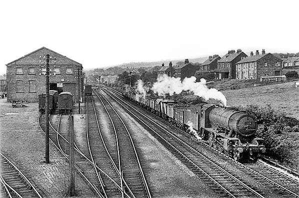
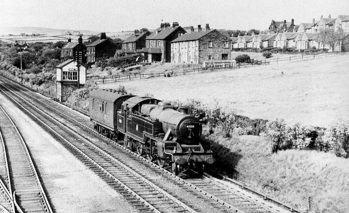
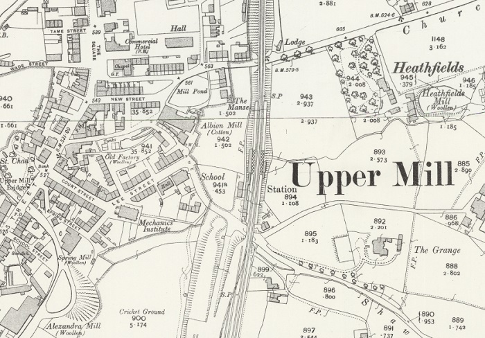
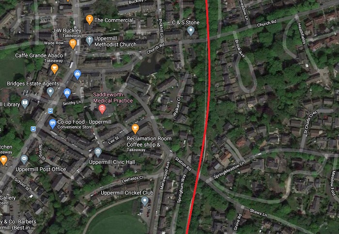
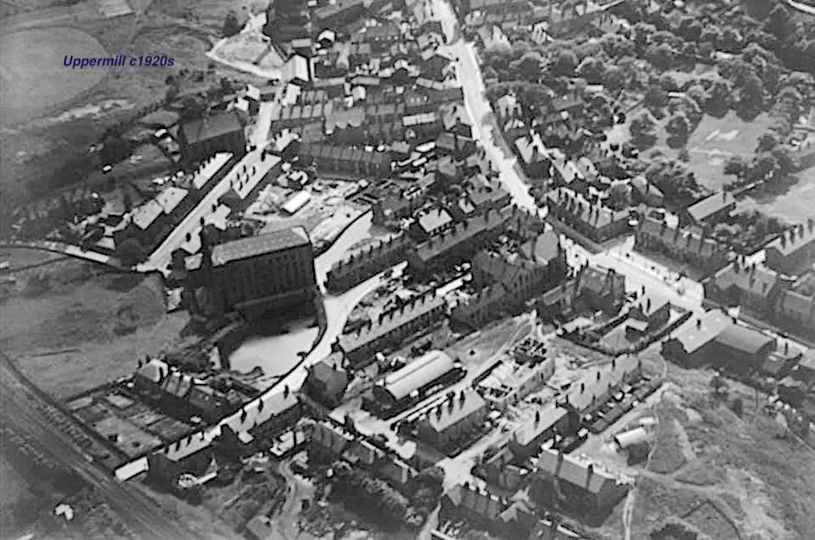
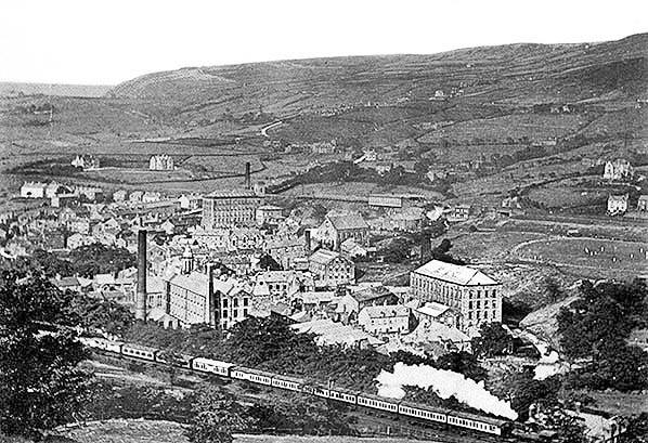
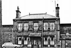
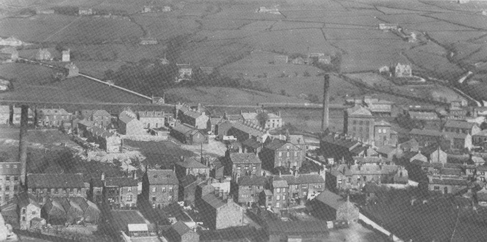
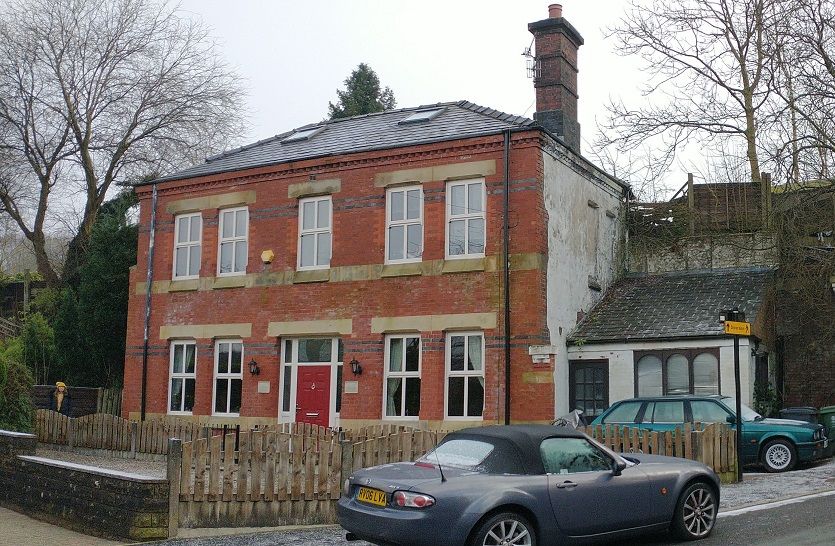
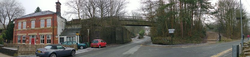
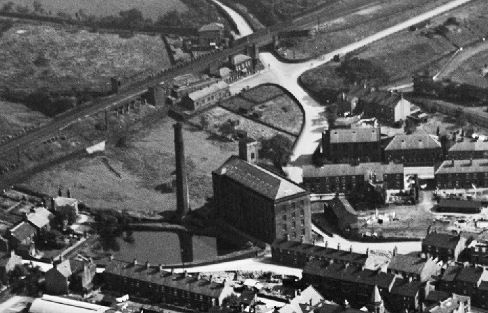
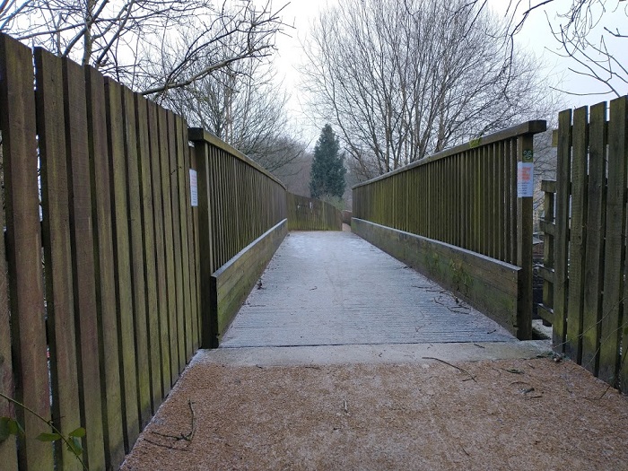
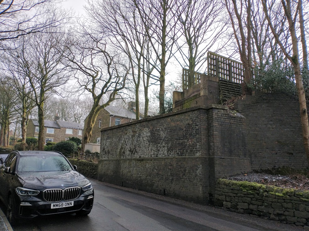
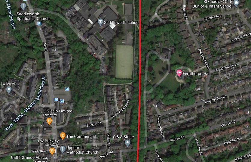
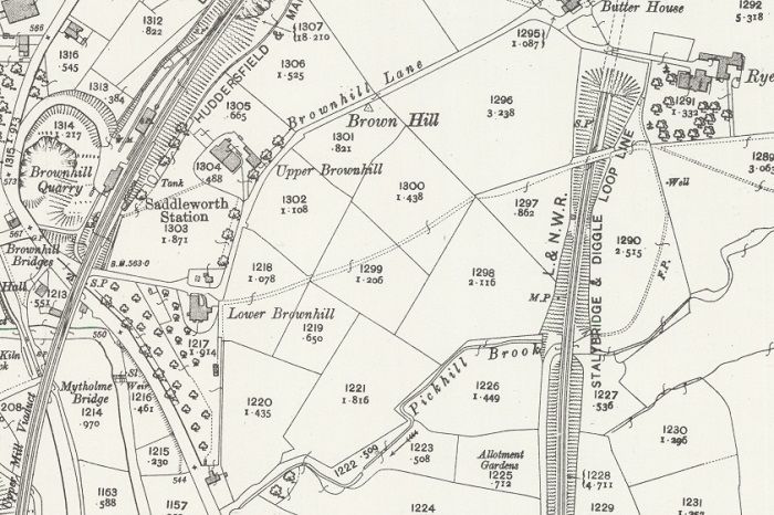
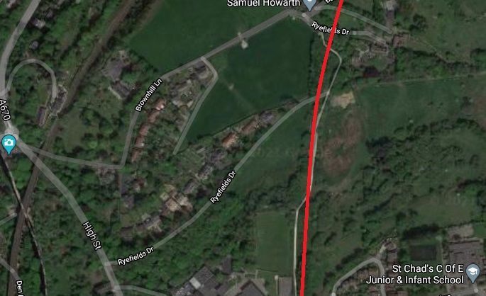
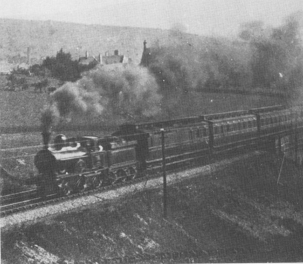
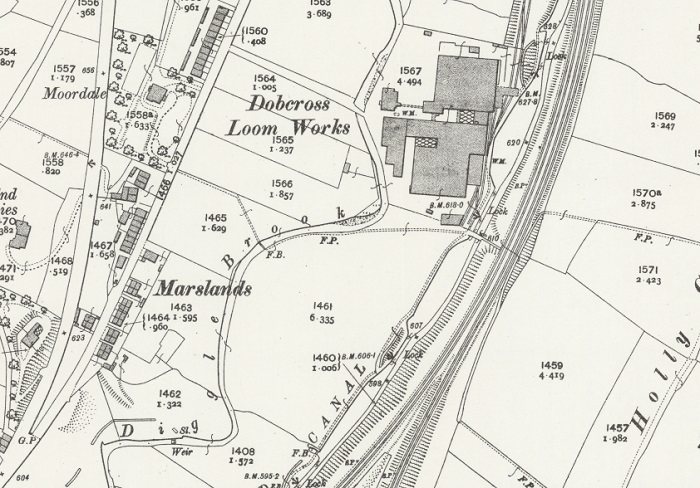
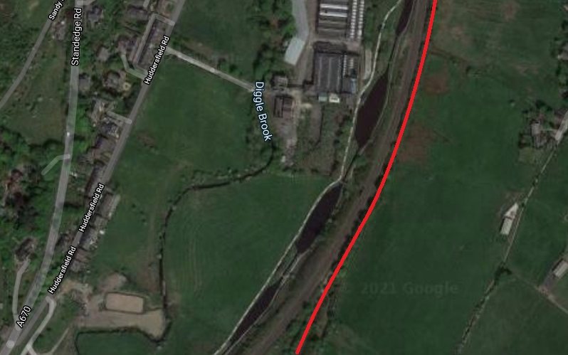
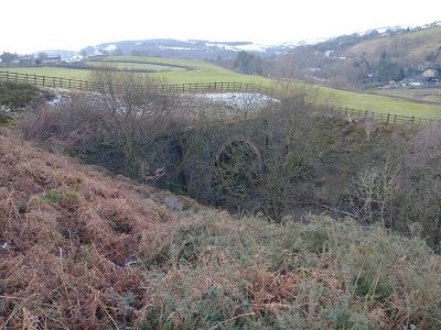
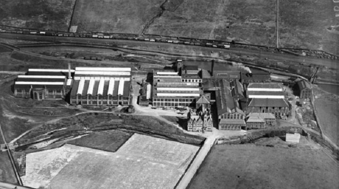
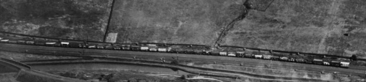
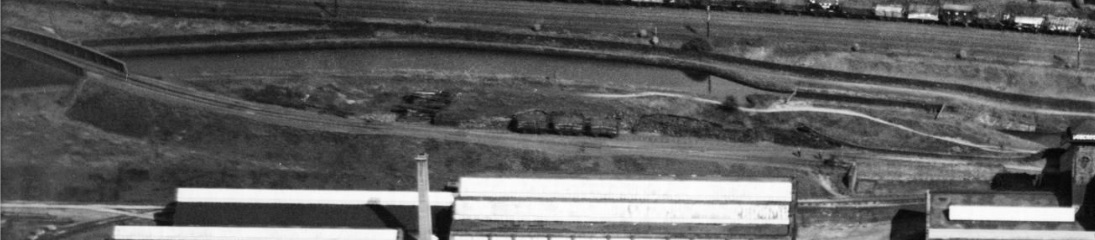

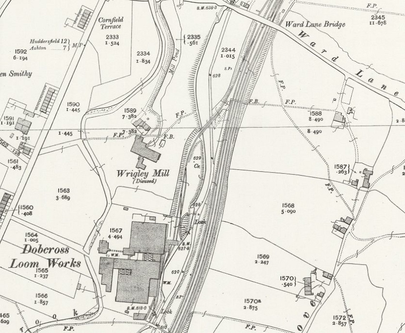
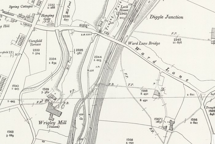
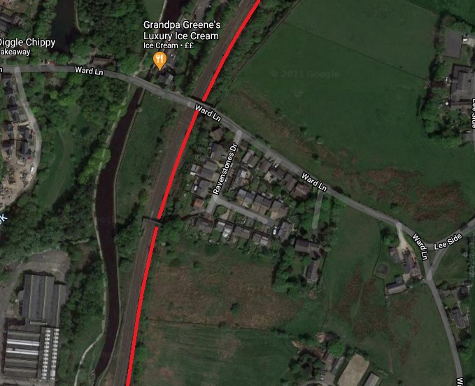
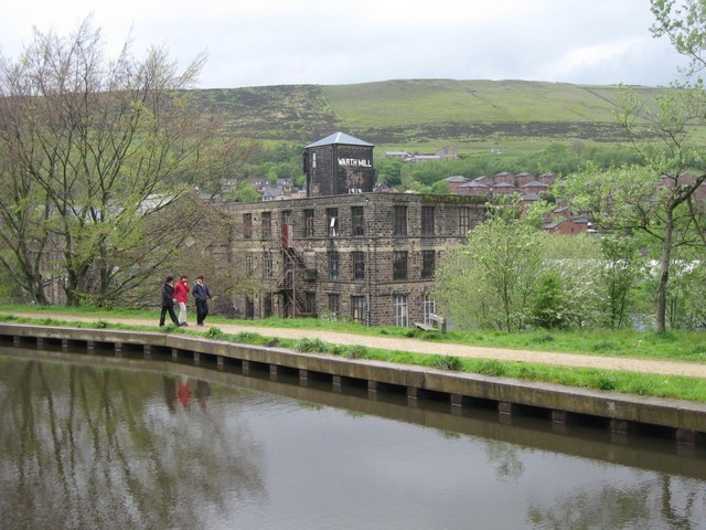
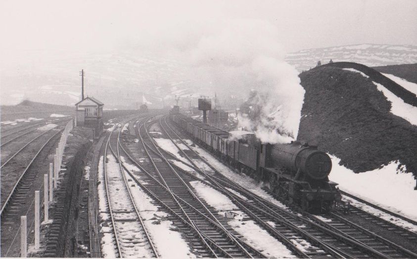
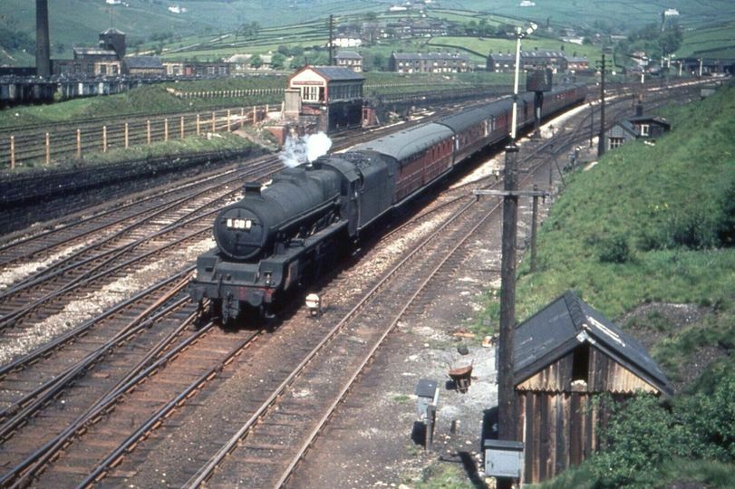
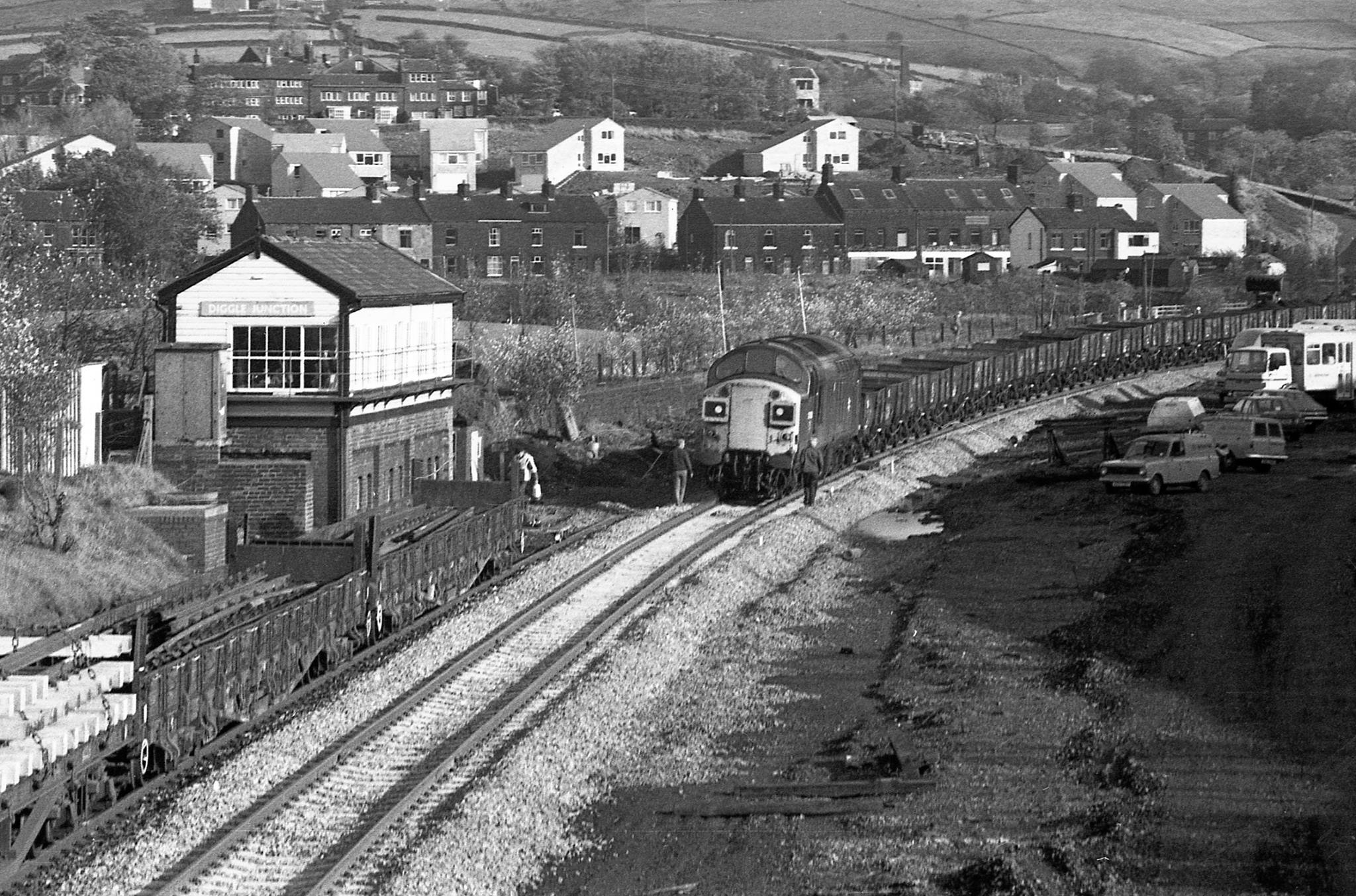
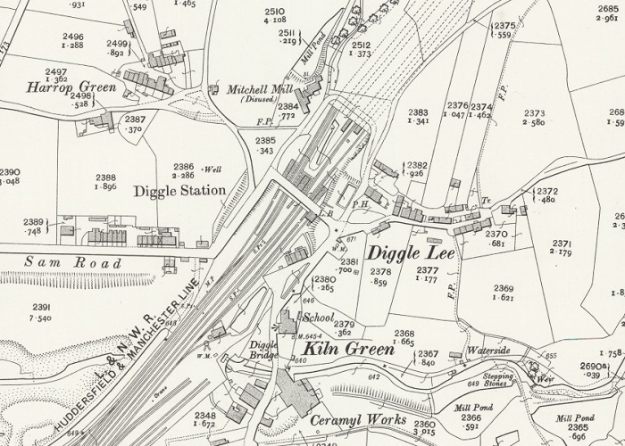
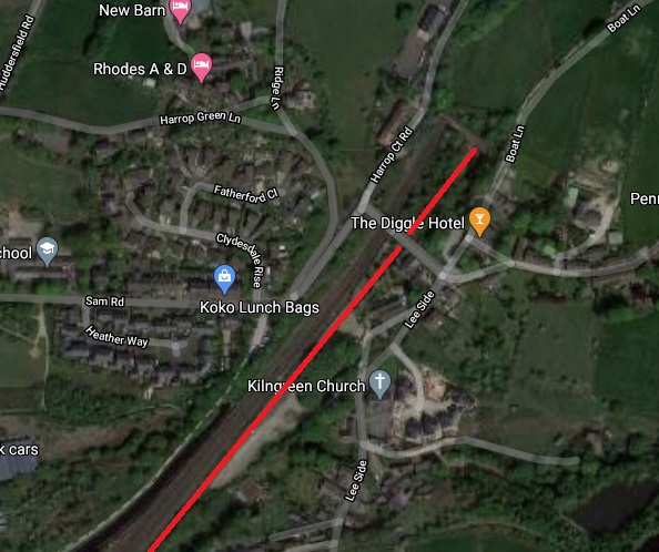
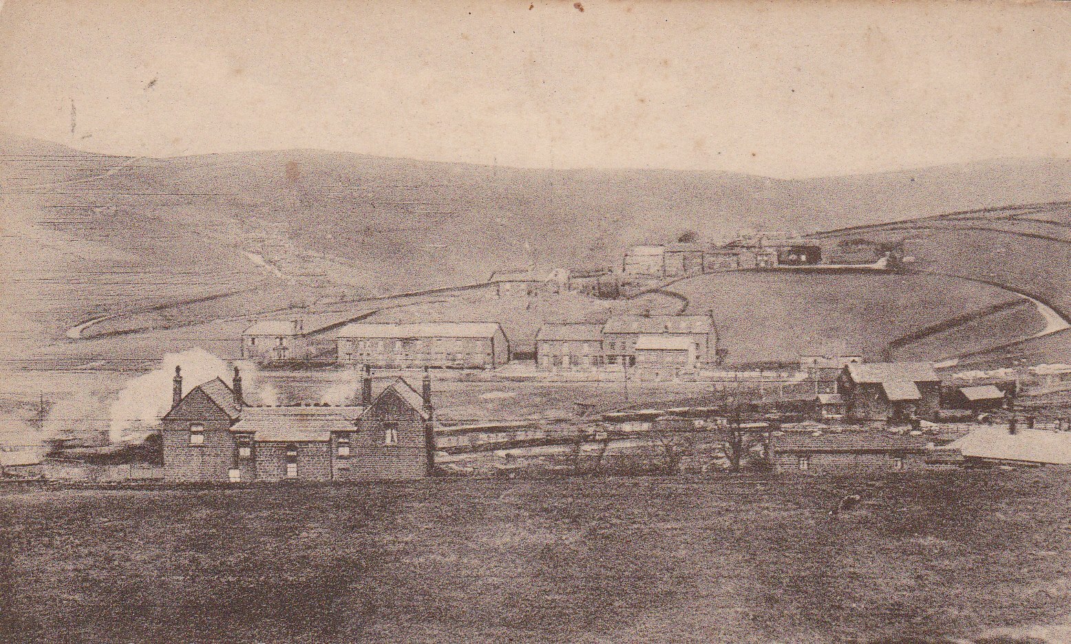
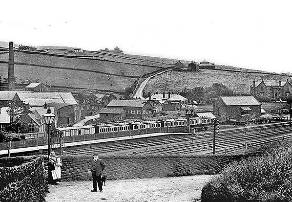

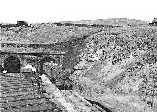
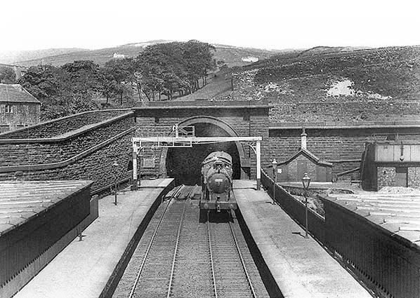
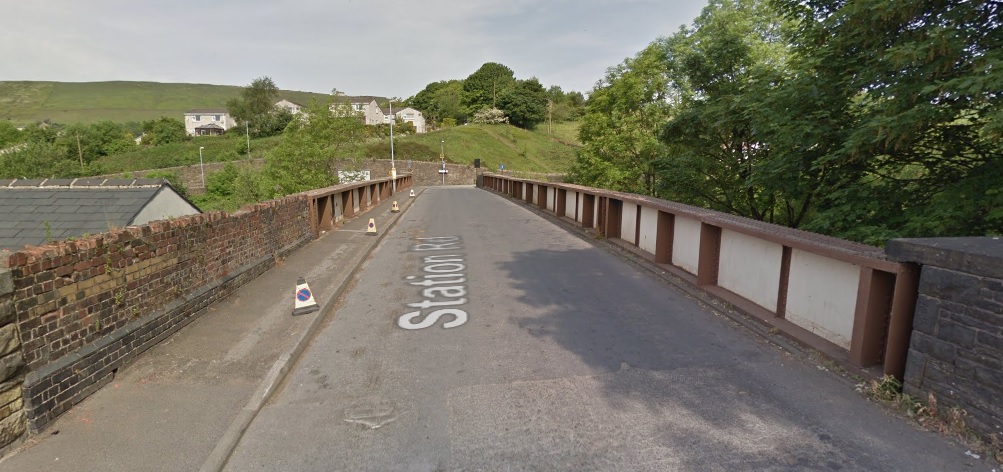
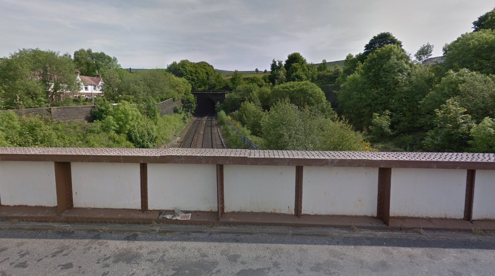
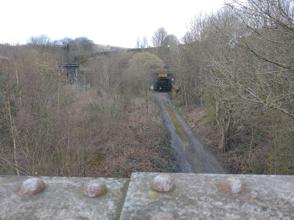
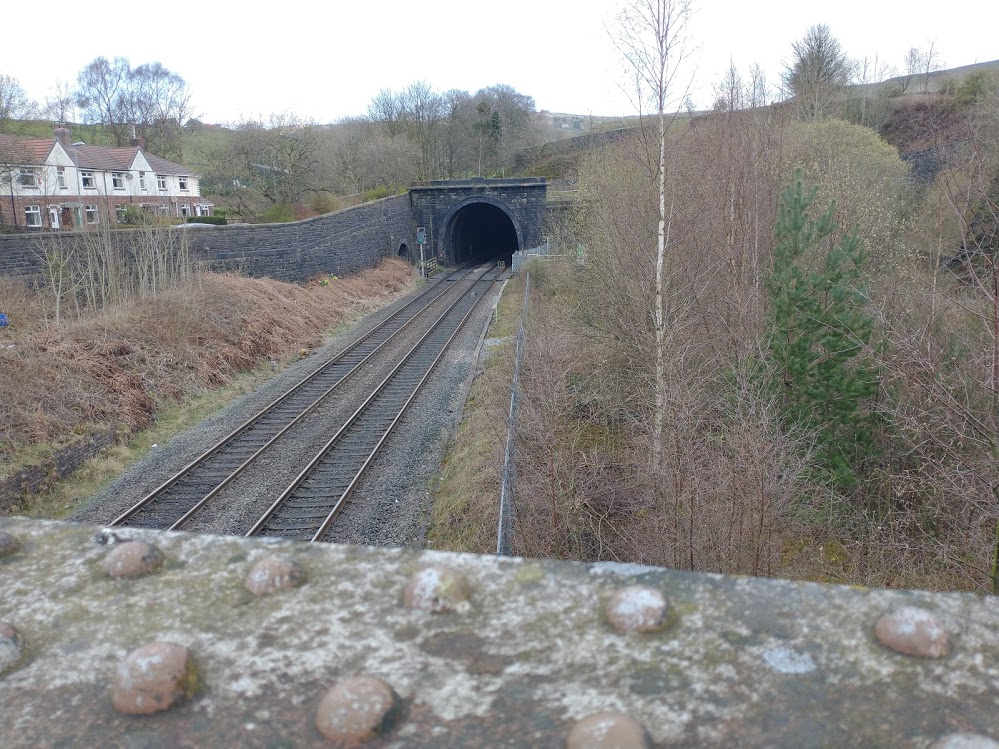
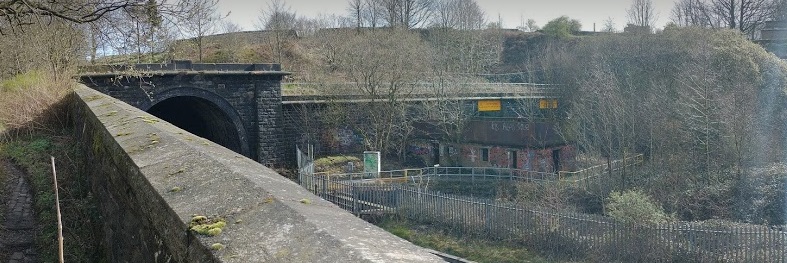
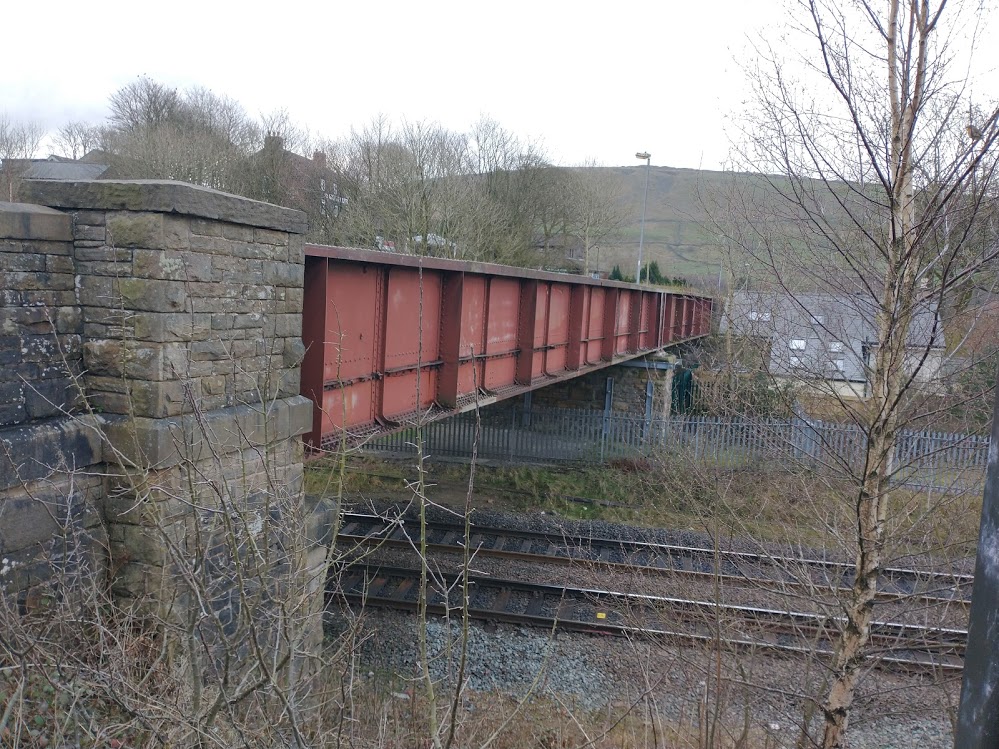
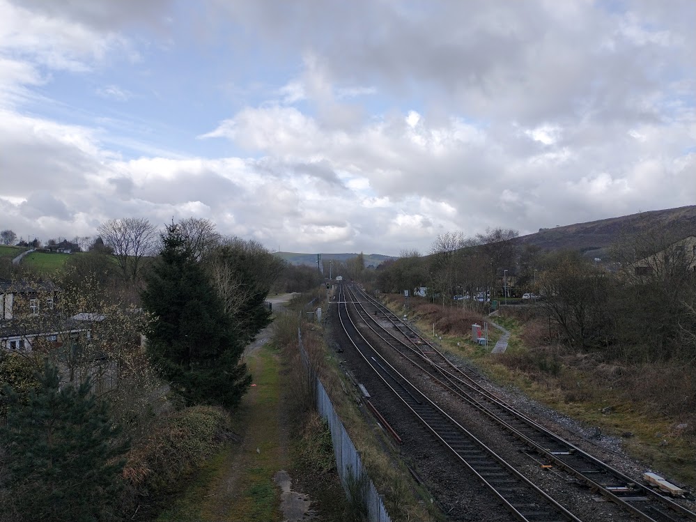

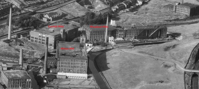
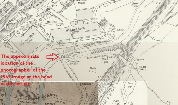
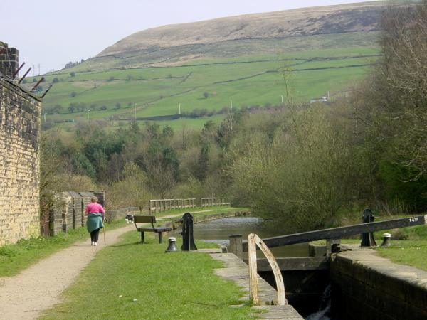
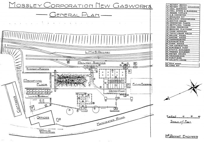

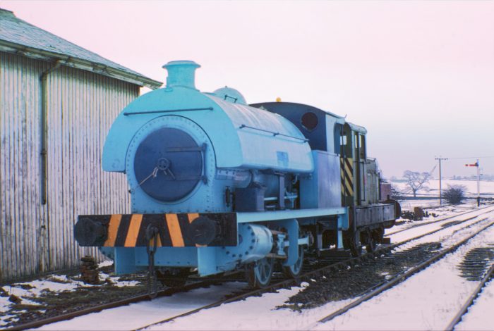
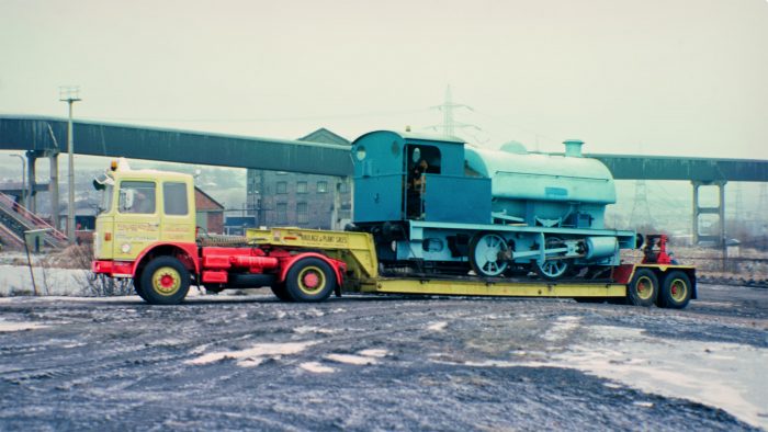
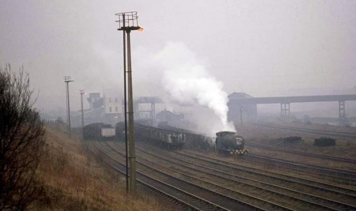
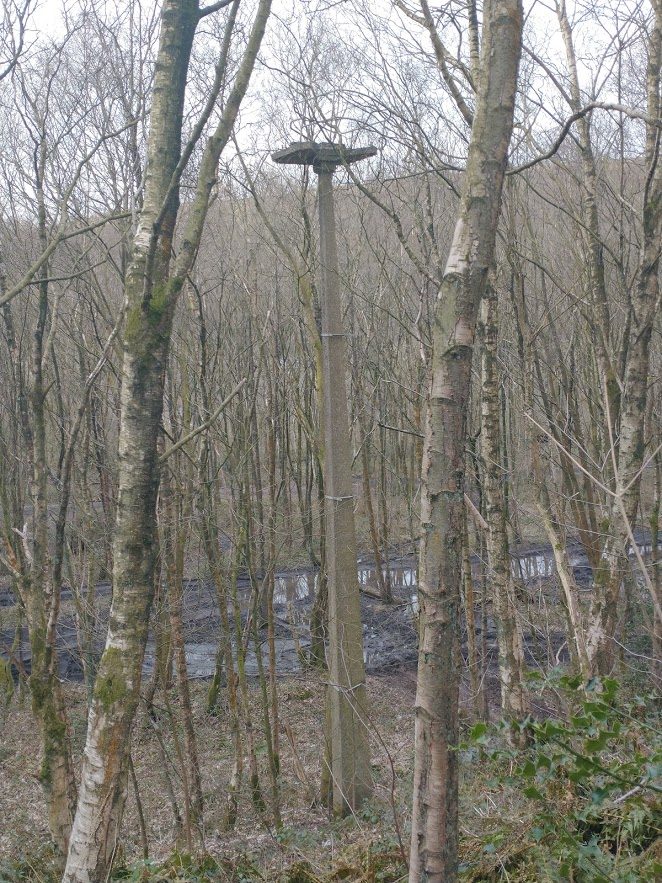
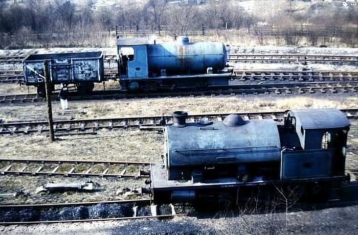
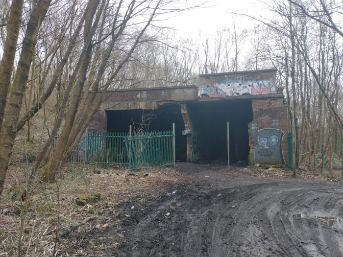

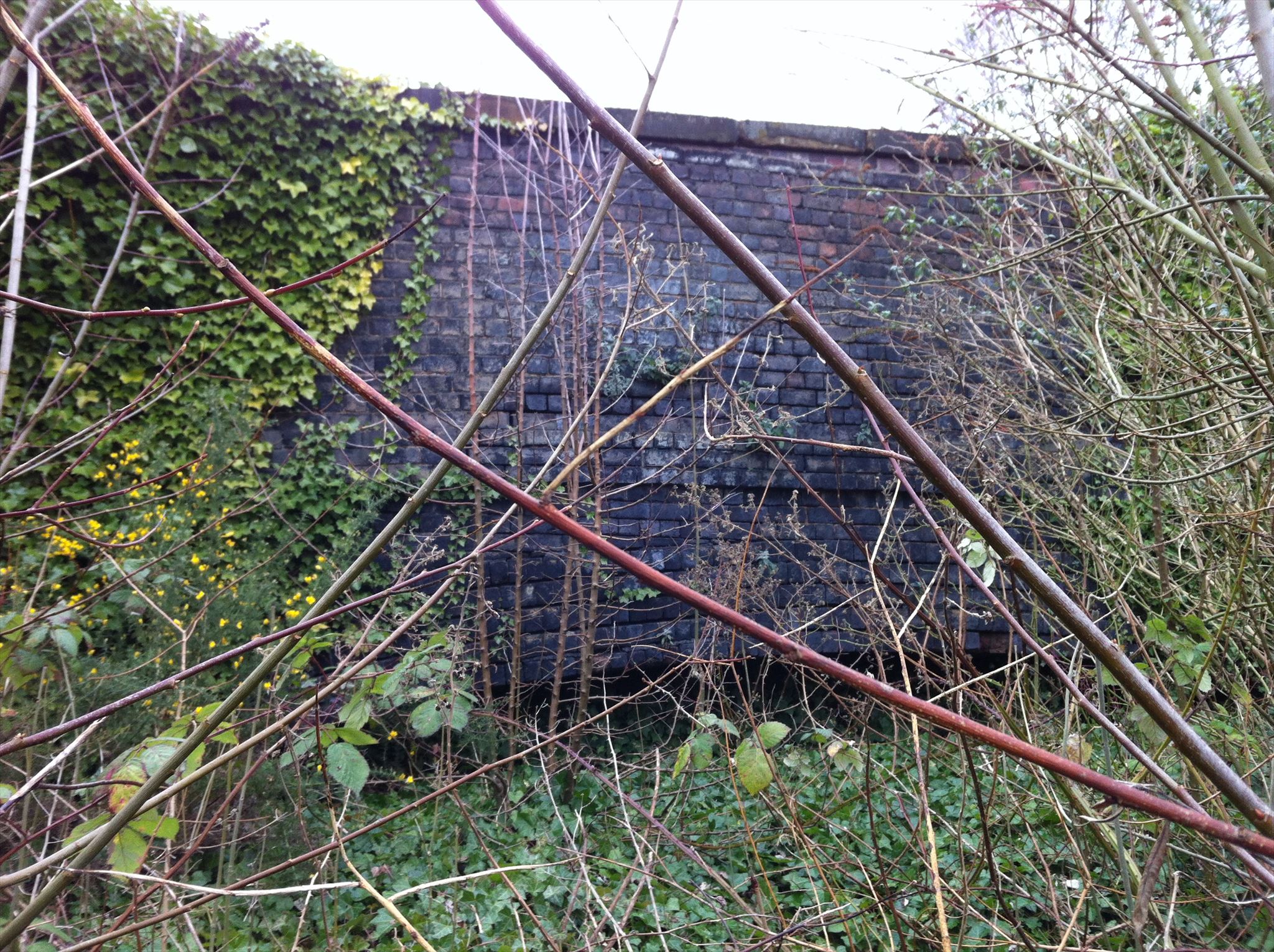