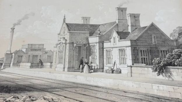
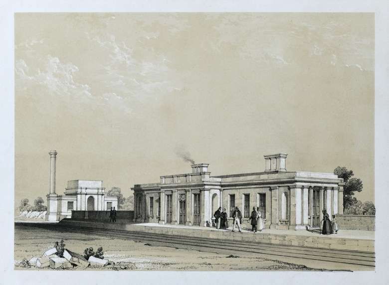
The featured image for this article is a lithograph created by Samuel Russell of the North Midland Railway Station in Chesterfield. [1][17] For the short note about the shady dealings preceding the formation of the Midland Railway, please see the last paragraphs before the References at the bottom of this article.
The BBC reported on 11th October 2026 that lost artwork of former stations on the North Midland Railway had gone on display at the recently-restored Grade II* listed Wingfield Station.
The artwork was commissioned by Francis Thompson and graced the boardroom of North Midland Railway in Derby, the artworks were removed during a 19th Century refurbishment and stored for more than a century at Derby Loco Works.
When the loco works closed and were cleared in the early 2000s to become Derby College’s Roundhouse Campus, the artworks passed to the Midland Railway Society at the Silk Mill in Derby.
I guess that means that they were not actually lost! Rather that they were not on public display.
The Midland Railway Society has now refurbished the lithographs and loaned the collection to Wingfield Railway Station. The original metal etchings from 1841 have now been placed on display at Wingfield, the sole survivor from the original 16 stations on the North Midland Railway.
The railway was engineered by George Stephenson and opened in 1840. It linked Derby to Leeds via a main line which followed river valleys. “Along its route, a series of ornate and unique station buildings were designed by architect Francis Thompson – from a palatial 1,000ft frontage with a piazza and fountains at Derby, to a miniature Italianate design at Belper, to Jacobite-style buildings at Ambergate and Chesterfield.” [1]
Thompson commissioned artist Samuel Russell to produce the lithographs. Volunteers who have restored Wingfield Railway Station were delighted that after their restoration they had been offered on loan to the station at Wingfield.
Derby
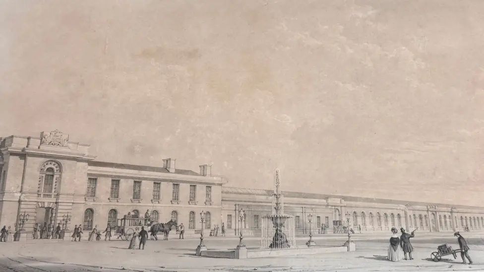
“One lithograph showcases Derby’s original station, which stood before the gothic building replaced in the 1980s by the current Derby Midland station.” [1]
Derby’s first railway station was said to be the biggest in the world when it opened! [1]
“When it opened in 1840, … Derby was the biggest station in the world. … It was quoted as being the grandest railway station in the world, … it was quite early on in the history of the railways, none of the big London stations had been built at that stage as we know them today.” [1]
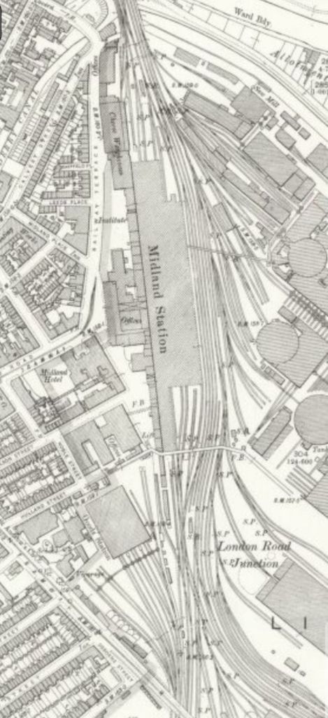
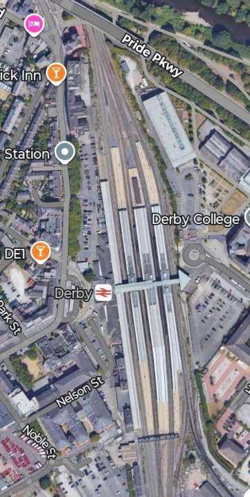
Derby Railway Station in the 21st century. [Google Maps, October 2026]
When the original buildings on the North Midland Railway were built, railway stations were ‘statement’ buildings and were often the highest quality buildings that the new railway companies could afford. They were designed “to impress their passengers as well as their shareholders with the quality of their product.” [1]
They contrast with many of today’s railway stations which are utilitarian in nature, “in those days they were built as signatures and statements.” [1]
However, this practice was not universally well-received as this short paragraph from one critic suggests: “we cannot but deplore the growing evil of expending large sums of money on railway appendages. Instead of cottage buildings, which, for the traffic of most of the intermediate stopping places on this line, would have been amply sufficient, we find the railway literally ornamented with so many beautiful villas, any one of which would grace the sloping lawn of some domain by nature highly favoured.” [2][3]
Belper
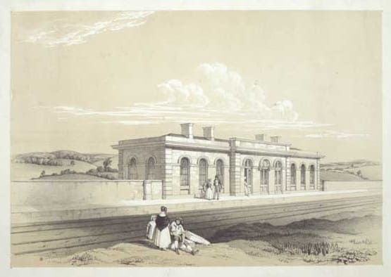
Belper’s railway station echoed the design of the railway’s terminus in Derby. [28]
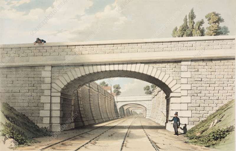
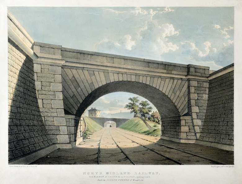
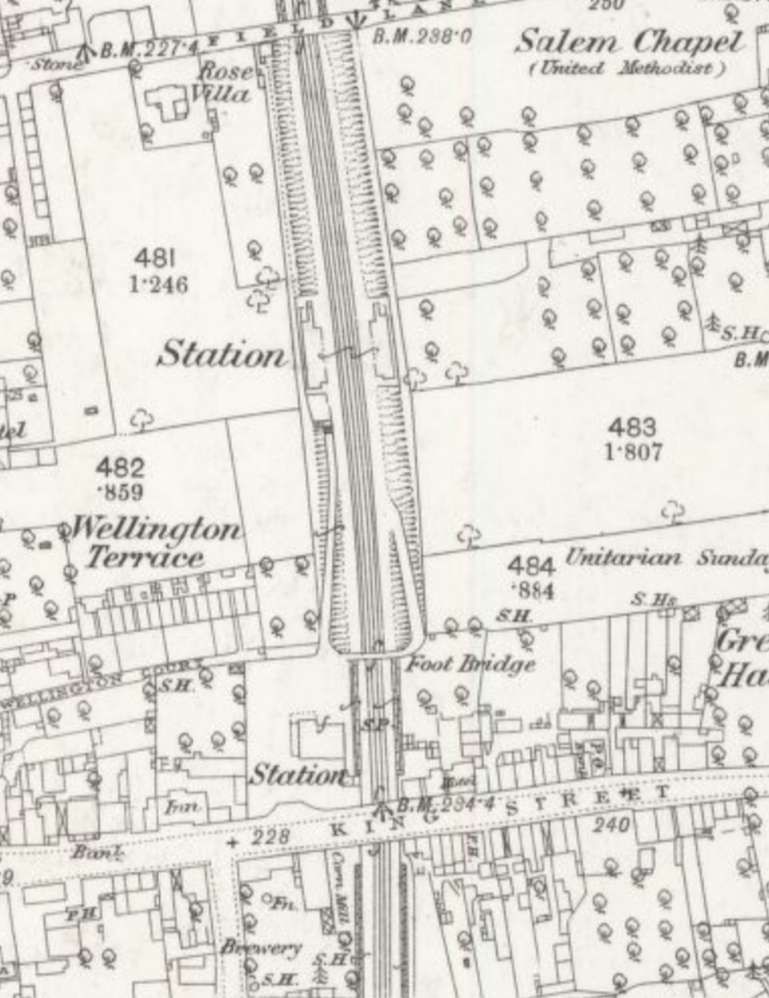
The first station at Belper is shown in the engraving above. It was built south of the Derby Road bridge. The local Strutt family (owners of the cotton mills) opposed routing it closer to the town centre out of fear it would disrupt water supplies and views. The result was an expensive deep cutting running North-South through the town.
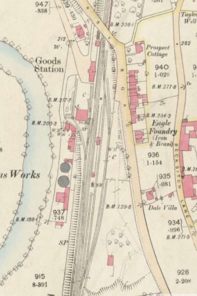
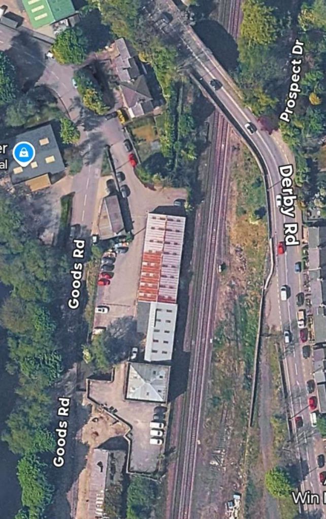
The original station was moved to its current town-centre site off King Street because the old location was too inconvenient. As we have already seen, the original site became a goods-only station.
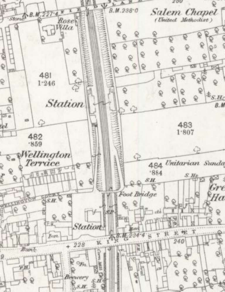
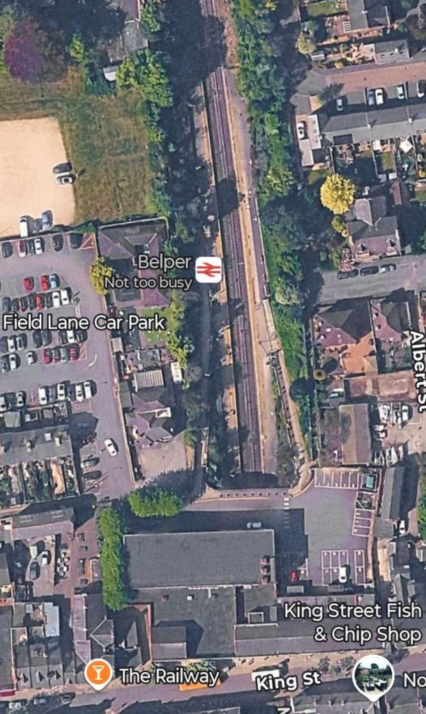
In the 1960s, Belper Station was slated for closure but plans were halted because local MP and Deputy Prime Minister George Brown refused to close a station in his constituency. By 1973, however, the original King Street station buildings were removed, making way for commercial development (such as a supermarket). The old goods station finally closed down in 1979. [20] The station was refurbished in 2005 and adopted by local community groups in 2012. [21]
Derwent Viaduct
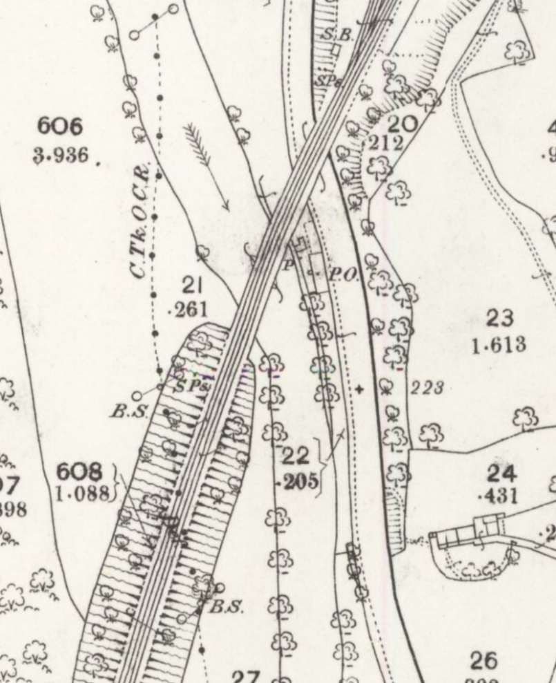
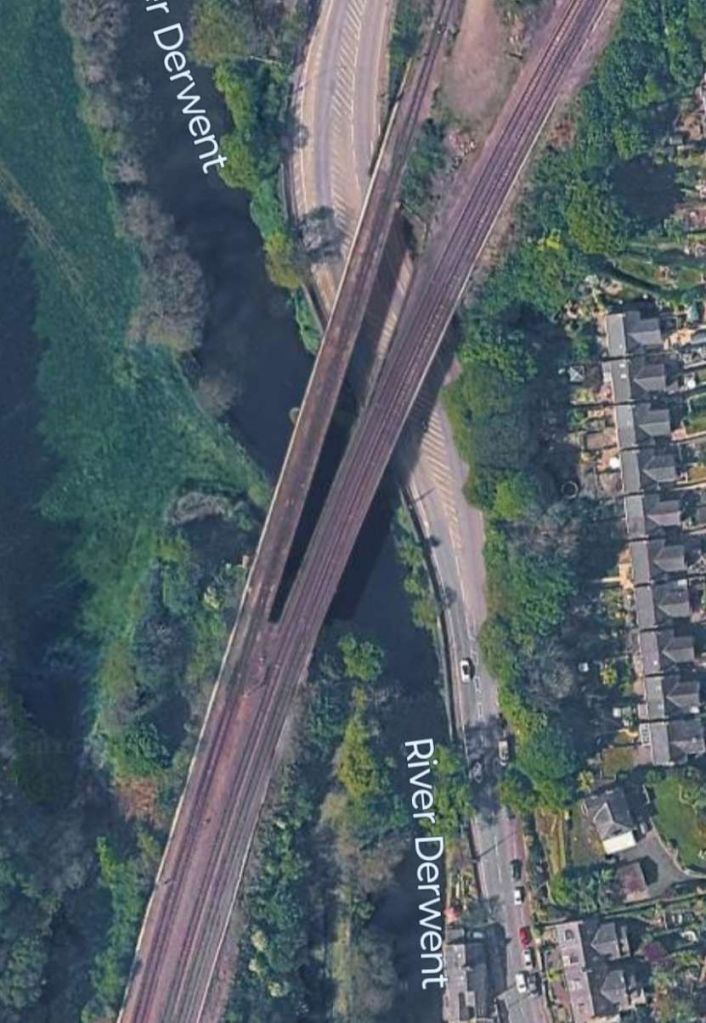
On the approach to the next station – Ambergate – a viaduct carried the North Midland Railway over the River Derwent and the Matlock road.
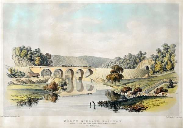
This is Samuel Russell’s lithograph of the viaduct, seen from the North with the Matlock road on the left. [54]
Ambergate
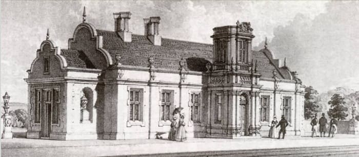
Ambergate Railway Station Building which opened in 1840. This is another of Samuel Russell’s lithographs, © Public Domain. [22]
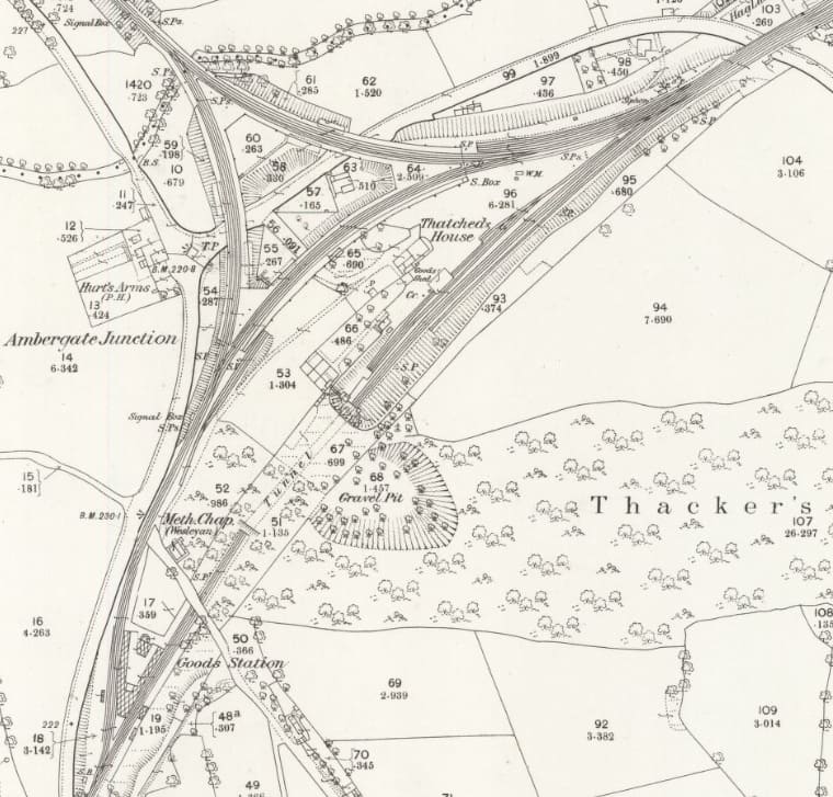
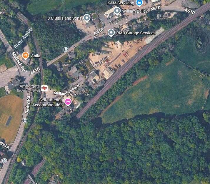
From Belper, the North Midland Railway ran along the Derwent Valley, along a stretch called Broadholme with four bridges across the river; it continued through Longlands Tunnel, across the River Derwent and Derby Road with a five-arch viaduct. It then entered Hag Wood Tunnel as it turned towards the Amber Valley. The station building was just north of this tunnel.
In 1849, the branch from Ambergate to Rowsley was built by the proposed Manchester, Buxton, Matlock and Midland Junction Railway, with a west to north connection between the lines at the original Ambergate Junction. When a south to west connection was made, for trains from Derby to Rowsley, the station building was rebuilt in 1863 adjacent to the new Ambergate South junction. The original bridge was also widened at its northern end to accommodate the new junction. [24]
In 1867, the Rowsley line had reached New Mills, which meant that the Midland Railway could operate from London to Manchester and Liverpool.
In 1875, Ambergate to Pye Bridge Line was opened from Crich Junction, near Bullbridge, which ran through Butterley to Pye Bridge, near Ironville on the Erewash Valley Line. Much of its business was coal traffic from Nottinghamshire to Manchester and Liverpool, avoiding Derby. [24]
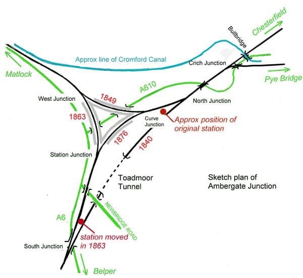
In 1876, a loop was built passing the west side of Hag Wood Tunnel, as a diversion from the original line to a third platform, which allowed for Derby to Sheffield stopping trains. The station was completely rebuilt, with the old building remaining in use as a plans store. This third and final station was a triangular one, making it one of the four triangular stations in the UK, (c) Chevin and licensed for reuse under a Creative Commons Licence (CC BY-SA 3.0). [23][24]
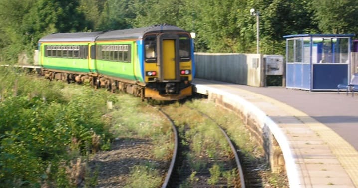
The curved platform at Ambergate Railway Station in 2005, (c) R. Howarth and licensed for reuse under a Creative Commons Licence (CC BY-SA 3.0). [24]
All that is left now is one platform on a single track to Matlock; the original main Derby to Sheffield line passes to the east through Hag Wood (Toadmoor) Tunnel and onwards to Clay Cross and Chesterfield. The original listing of Ambergate station for closure under the Beeching Axe led to its mention in the song “Slow Train” by Flanders and Swann. [24]
The Cromford Canal
A short distance from Ambergate, towards Chesterfield, the next difficulty for the North Midland Railway was the intersection with the Cromford Canal, where the line intersected with the Bullbridge Aqueduct, before it carried on through a station at Wingfield to Stretton.
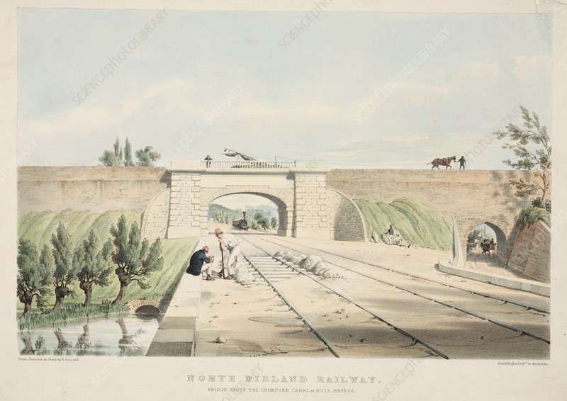
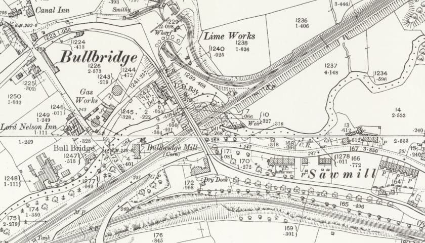
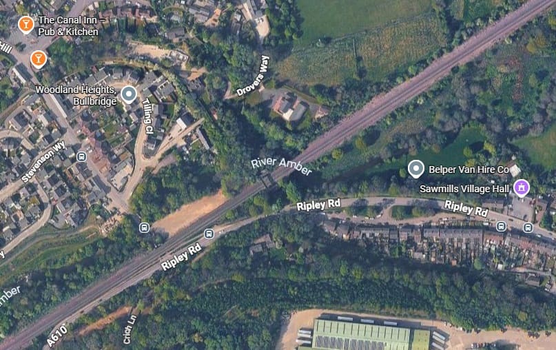
The Aqueduct was approximately 150 feet long, 9 feet wide, and 6 feet deep in its iron trough section. The canal went out of use in the 20th century and the aqueduct was ultimately demolished in 1968 to accommodate road improvements. [27]
Wingfield
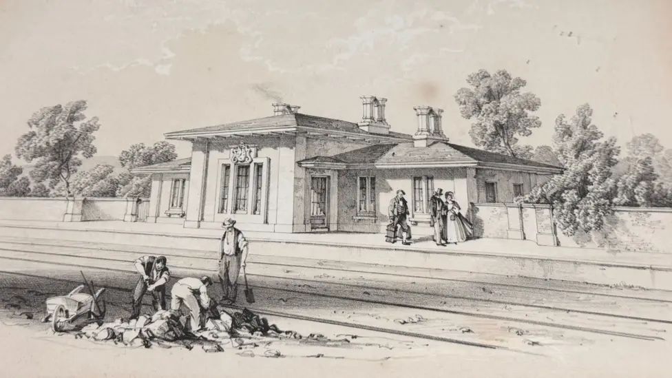
Wingfield’s railway station, wrongly attributed by the BBC article to Belper. [1]
Wingfield Station building was designed in the Grecian style by the architect Francis Edward Thompson and is a remarkable survivor from the very earliest days of the railways.
The station is important as it is: the last surviving North Midland Railway station building; the best surviving work of its architect; and it is the oldest surviving completely original railway station building in the World. The building is simple and symmetric but constructed to the highest quality from hand-carved local Ashover stone beneath pitched roofs made from Welsh slate. The building has large overhanging eaves and concealed, recessed guttering to maintain simplicity of form. [29]
“After opening in 1840, the station remained unaltered throughout its operational life and, after closure in 1967, was let as commercial premises by British Rail until being sold into private ownership in 1977. Over the next 5 decades, the station became neglected and derelict, but crucially was also never altered in any way, meaning all its original features survived. After local campaigning, the listing status of the station was upgraded from Grade 2 to Grade 2 Star in 2015, and compulsory purchase legal action was completed in 2019 by Amber Valley Borough Council. The Council then transferred legal ownership to Derbyshire Historic Buildings Trust, who undertook the restoration of the building and site, which was completed at the end of 2023. The station has been restored as close as possible to its original 1840 opening condition and appearance.” [29]
In September 2024, two local benefactors leased the whole station site and opened as a heritage centre, tearoom, local community amenity, event space and private hire venue. The operation is branded “Wingfield Station 1947” and a limited company Midland Heritage Partners has now been formed as the legal entity to operate the site as a not-for-profit community business. [29]
Chesterfield
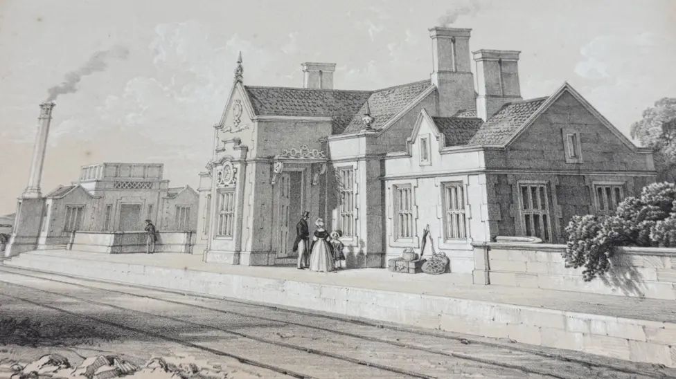
Each station, like the Jacobite design at Chesterfield, was a unique design. Chesterfield’s first station building was swept away in works to construct a direct line to Sheffield, which was opened in 1870. Today’s main-line railway station stands roughly on the same site. [1][17]
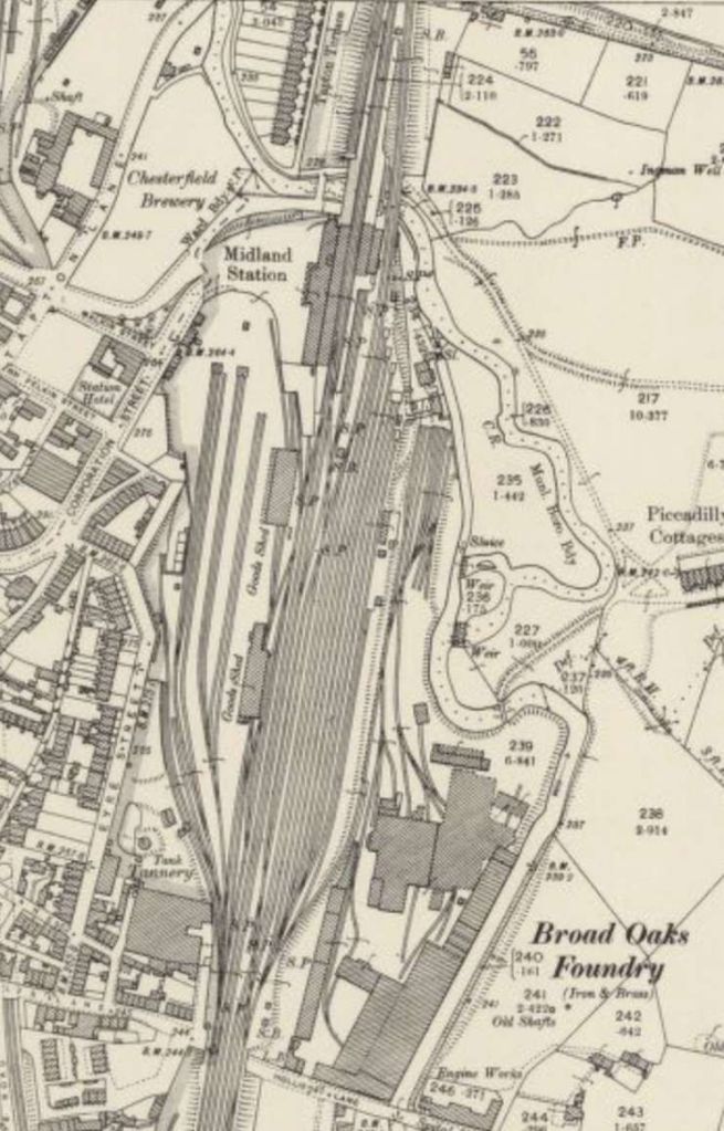
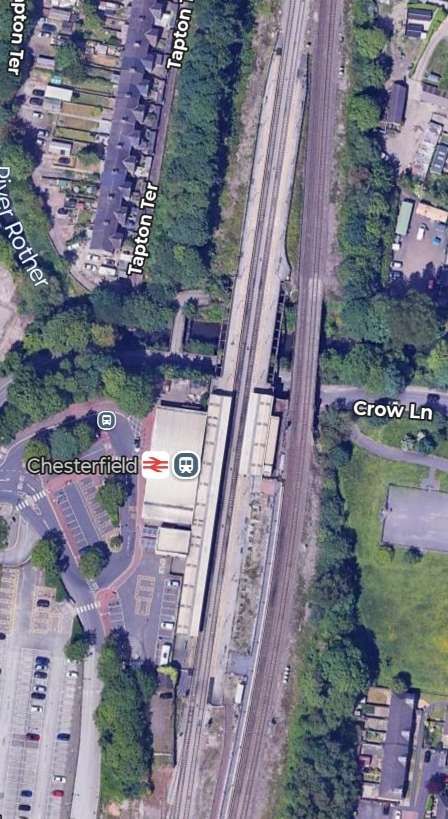
Chesterfield Railway Station in the 21st century. Today’s station carpark and the isolated ‘North Midland House’ (just off to the left of this satellite image) sit approximately where Thompson’s original station once stood. The railway was realigned to suit the needs of the 1870s. [Google Maps, October 2026][17]
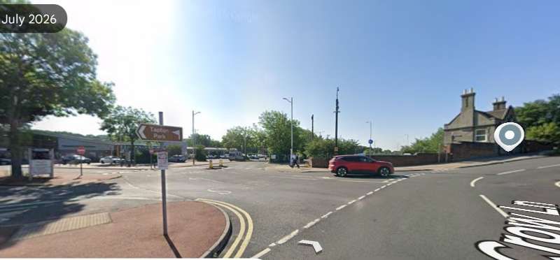
Eckington
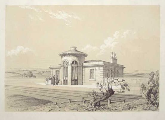
Eckington Railway Station as built in 1840 – another lithograph attributed to Samuel Russell, (c) Public Domain. [30]
The original station of 1840, shown above, was reconstructed in 1874 and then renamed Eckington and Renishaw in 1886. It closed to passenger traffic on 1st October 1951.
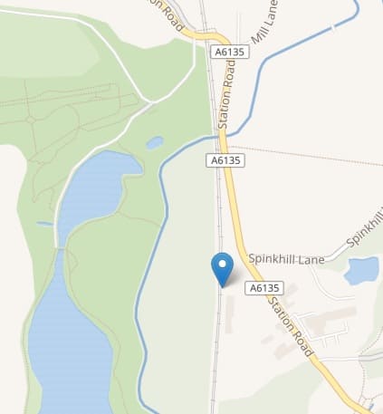
The location of Eckington Railway Station is marked by the blue flag on the adjacent map extract. [35]
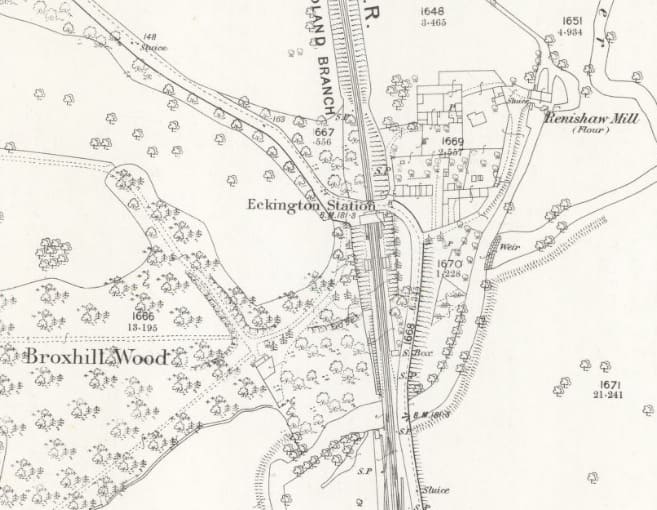
Ecklington Railway Station as it appears on the 25″ Ordnance Survey undertaken between 1874 and 1885, published in 1897. [36]
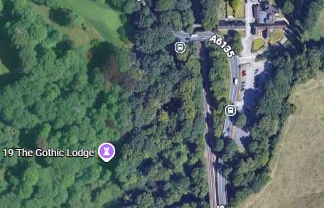
The location of Ecklington Railway Station in the 21st century. [Google Maps, October 2026]
Beighton
Beighton station existed on three sites at different times – the first station, built and opened with the line in 1840, was apparently little more than a halt and appears not to have been included in the series of lithographs produced by Samuel Russell.
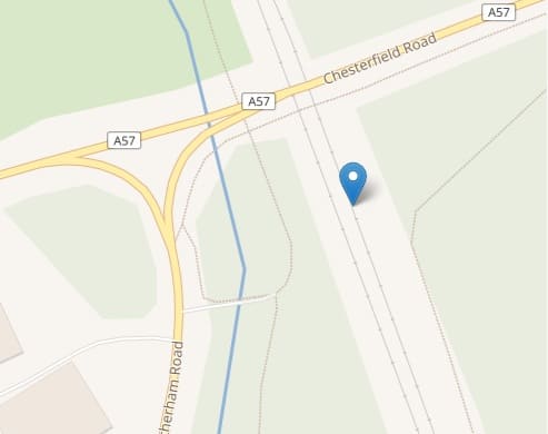
The first station was located 1 1⁄4 miles (2.0 km) south of Woodhouse Mill, approximately halfway between what is, in the 21st century, Beighton Junction and the overbridge, which still carries passenger trains east–west between Sheffield and Worksop. The location proved to be too far from the village of Beighton, and the station/halt was closed in January 1843. [32]
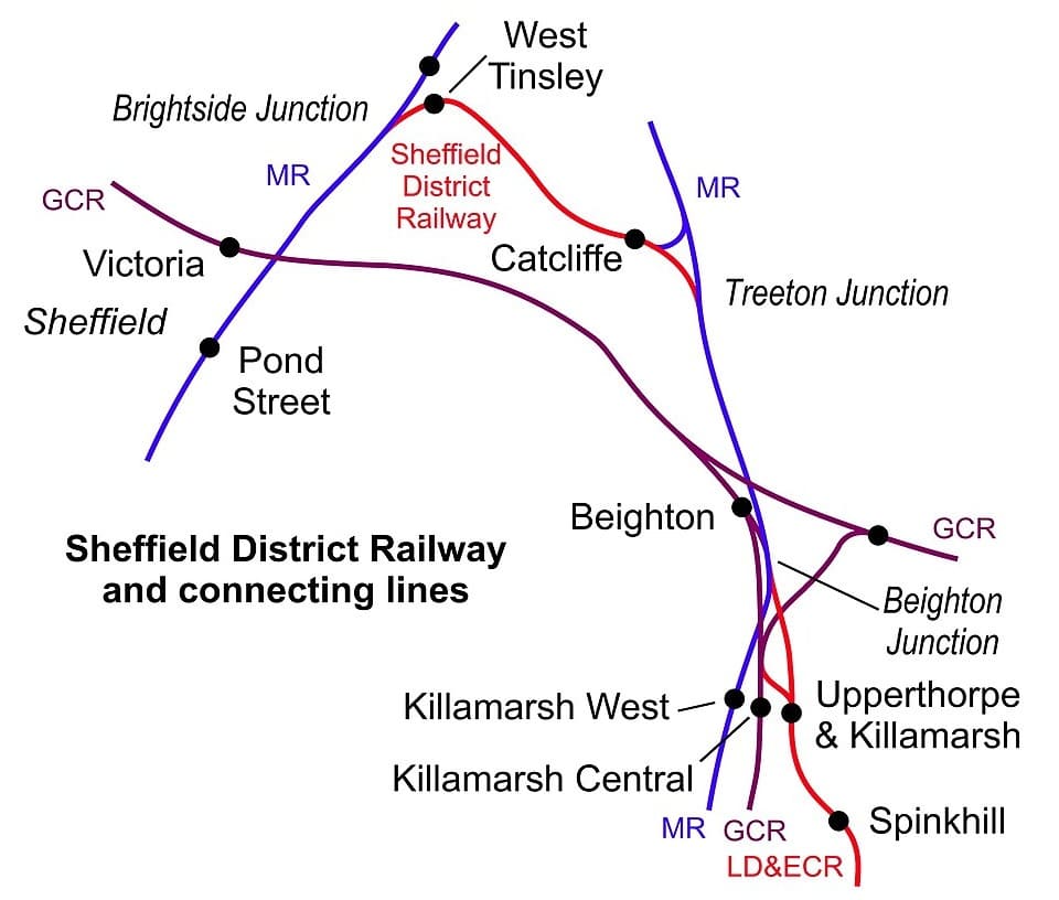
The approximate location of the later two stations is shown on this CAD drawing. The original station sat on the purple line to the East of the location marked, (c) Chevin and licensed for reuse as ‘Public Domain’. [32]
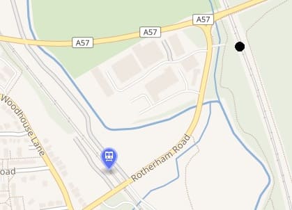
The blue flag in this image shows the location of the later two stations, the black dot marks the location of the original station. [32]
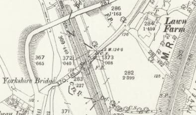
The original location of Beighton Station/Halt as it appears on the earliest Ordnance Survey that we have access to – the 25″ survey of 1875-1890, published in 1892. [34]
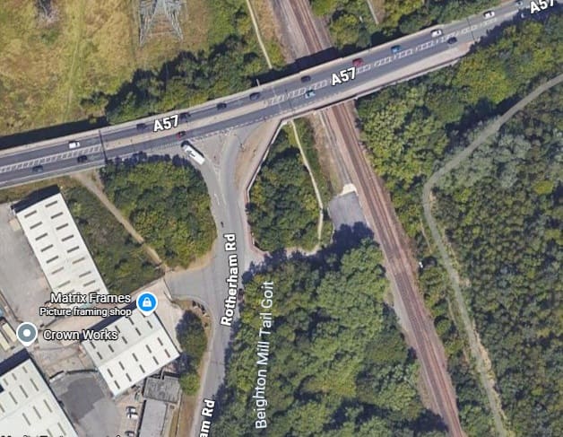
The same location in the 21st century. [Google Maps, October 2026]
“In 1849, the Manchester, Sheffield and Lincolnshire Railway (MS&LR) completed its Sheffield to Worksop line, which included a branch from just east of Woodhouse to join the North Midland line at what became known as Beighton Junction. They built Beighton’s second station at a site on their line only, close to, but not on, the junction. … This second station closed temporarily from 1852 to 1854, then continued in use until 1892.” [32]
“In 1892, the MS&LR opened its “Derbyshire Lines” route near Beighton. This would eventually become part of the Great Central Main Line. On 1stNovember 1893, the MS&LR closed Beighton’s second station, and opened its third and final station at a site 132 yards (121 m) north west of the second site, immediately north of the Rotherham Road level crossing.” [32][33: p33]
Masborough
We have already noted that the route followed the river valleys from Derby to Leeds, with minimal gradients and large radii curves. It therefore bypassed Sheffield, but met the Sheffield and Rotherham Railway at Masbrough (Masborough).
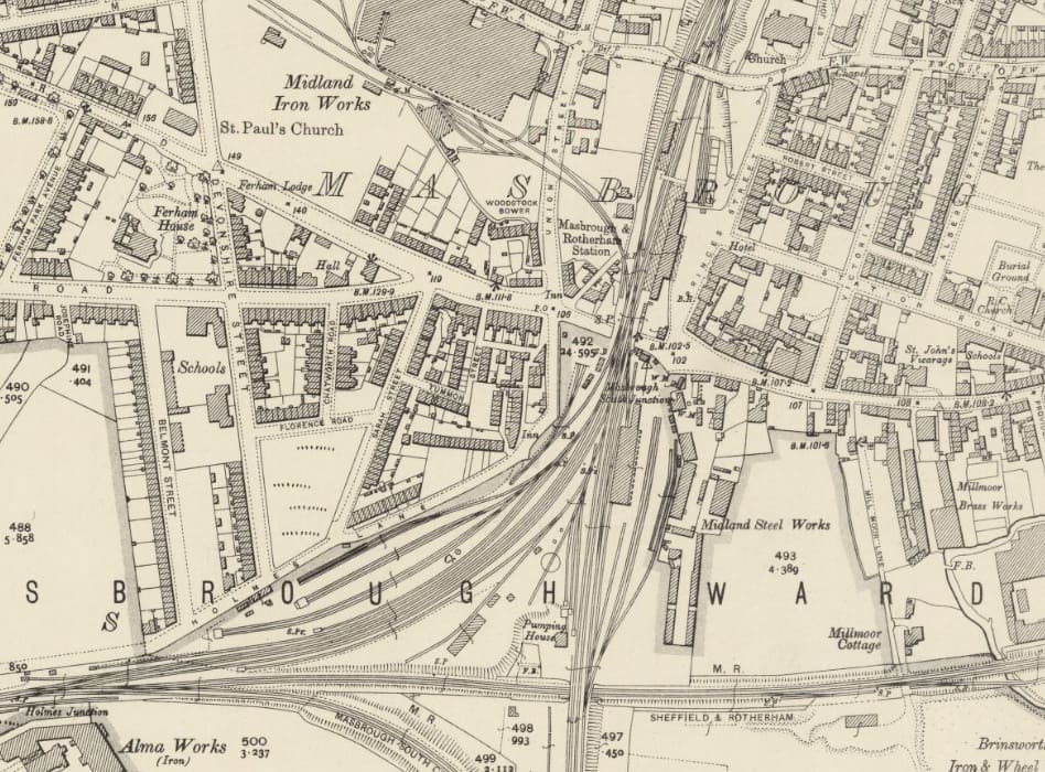
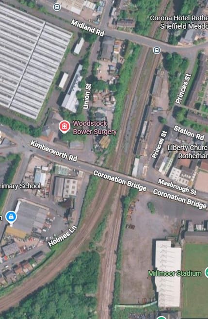
The site of Masborough Railway Station in the 21st century. [Google Maps, October 2026]
Masborough Railway Station opened with the North Midland Railway in 1840, as Masbrough. It initially feature only two platforms. The Midland Railway enlarged and rebuilt the station late in the 19th century or early in the 20th century. The new station featured four platforms, a large sandstone building on Platform Four, iron and glass canopies, a fully enclosed footbridge, and wooden waiting rooms. Through the years it saw a number of name changes: Masbrough (1840); Masbrough & Rotherham (1896); Rotherham Masborough (1908); Rotherham (1969); Rotherham Masborough (in the period before closure).
Closure occurred (1987–1988) after the newly renovated Rotherham Central reopened in 1987. Most of the station buildings were demolished in the 1990s. The brick-built station building was converted into an Indian restaurant (historically known as The Orient Express), and while the platforms and through-lines remain active for freight and express trains, it is no longer a public stop.
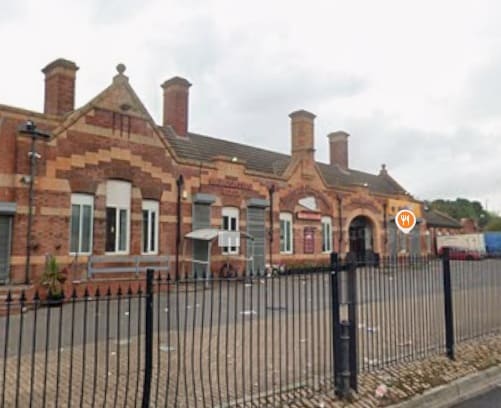
The remaining station building at Masborough Station. This is nothing like the original 1940s structure. It was built when the Midland Railway considerably enlarged the station. [Google Streetview, August 2022]
Swinton (for Doncaster)
Old Town Station was Swinton’s first passenger station. It opened with the North Midland Railway in 1840 and stood on the same site as the 21st century Interchange. It was built in a classical style by the North Midland Railway. Goods facilities occupied what, in the 21st century, is the station car park.
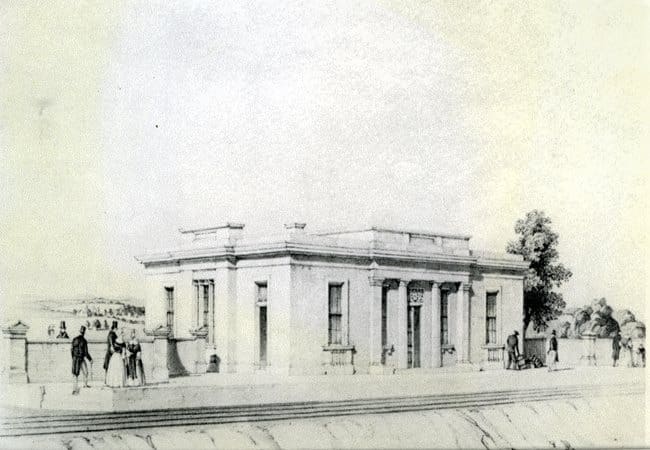
Swinton, South Yorkshire’s Railway Station built in 1840. This is another lithograph made by Samuel Russell, (c) Public Domain. [37]
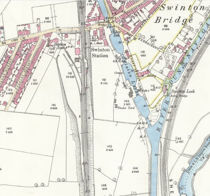
Swinton railway Station as it appears on the 25″ Ordnance Survey of 1890, published: 1892. [38]
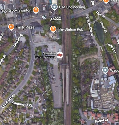
Swinton Railway Station in the 21st century. [Google Maps, October 2026]
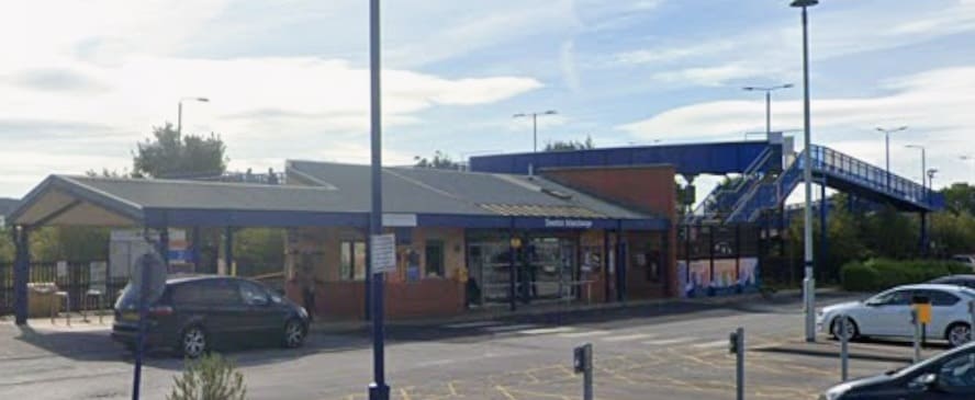
Swinton Railway Station in the 21st century. [Google Streetview, August 2024]
Darfield
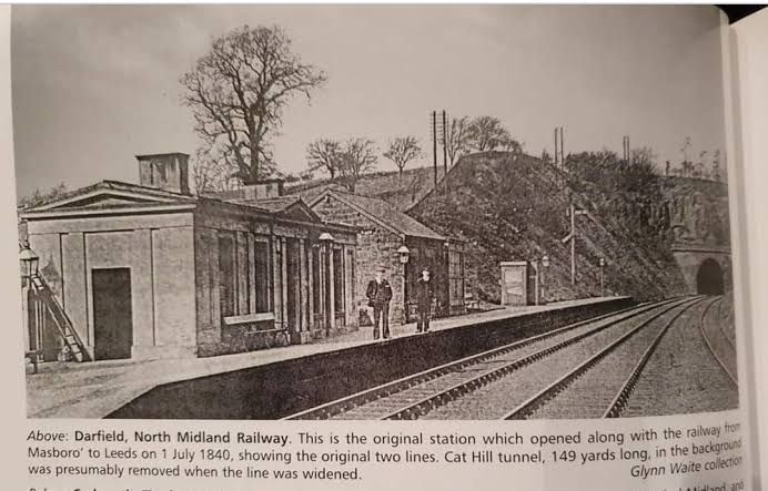
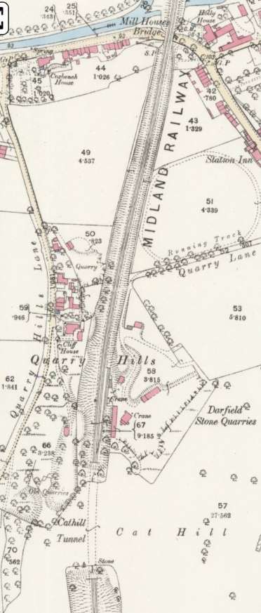
Two extracts from the 25″ Ordnance Survey of 1890, published in 1892, show the original Darfield Station and, to the North, Cat Hill Tunnel which were constructed under George Stephenson’s supervision. Further North still was Millhouses Bridge. [42]
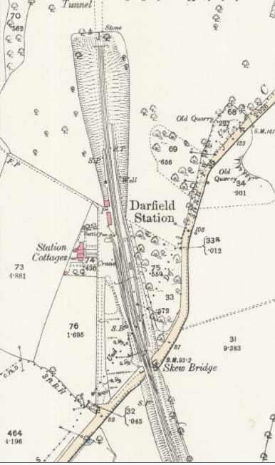
George Stephenson’s station and the nearby Cat Hill Tunnel were swept away in the improvements to the railway line at the turn of the 20th century. By 1901, a new station had been built closer to Mill Houses Bridge. As part of the works an additional bridge across Doncaster Road was built alongside the original. This meant that four lines ran North from the new Darfield Station.
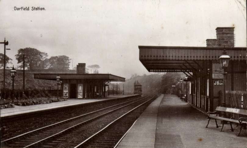
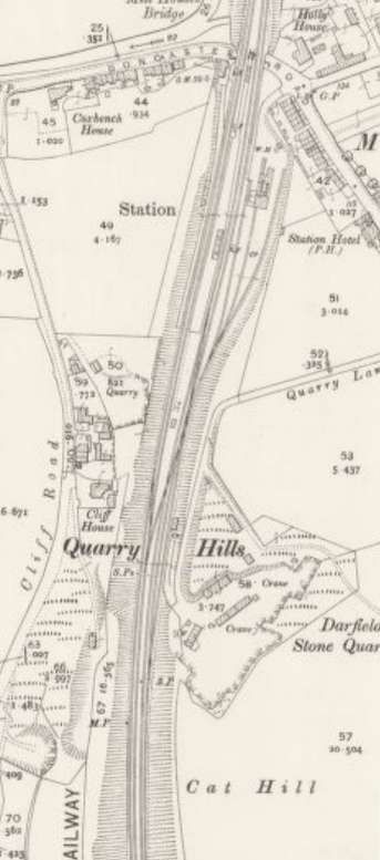
This next map extract comes from the 25″ Ordnance Survey of 1904, published in 1906. It shows the enlarged railway station sited closer to the bridge over Doncaster Road. The tunnel through Cat Hill has been replaced by a deep cutting. [43]
The station has significantly improved facilities, extended platforms and a goods yard.
As will be evident on the satellite image below, none of this infrastructure remains! The line closed permanently to passengers in June 1963, and completely in 1988, due to colliery closures and mining subsidence.
Wkipedia says that, “In 1901, … the new station had typical Midland Railway timber panelled buildings. The new goods lines passed to the east. These had access to three major collieries Grimethorpe, Dearne Valley and Houghton Main – and connected to the GCR and L&Y lines.” [44][45]
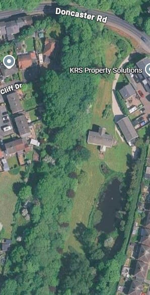
The location of the second Darfield Station as it appears on modern satellite imagery. [Google Maps, October 2026]
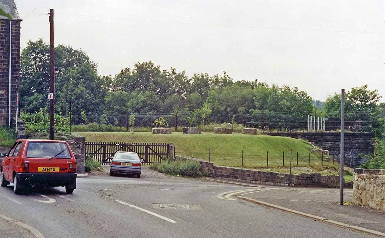
Barnsley
Samuel Russell completed a lithograph of what was at the time Barnsley Railway Station. It sat close to Cudworth, 2.5 miles from Barnsley. As a result other railways found ways into Barnsley and took the majority of trade as a result. The station was renamed Barnsley for Cudworth in 1854, and later shortened simply to Cudworth in 1870. For decades, the station remained an important junction. It was extended in 1885 for the Hull and Barnsley Railway. In the 1860s/1870s, the Midland Railway built a branch line from Cudworth South Junction into Barnsley, opening Regent Street / Barnsley Court House railway station to give the town a direct Midland connection.
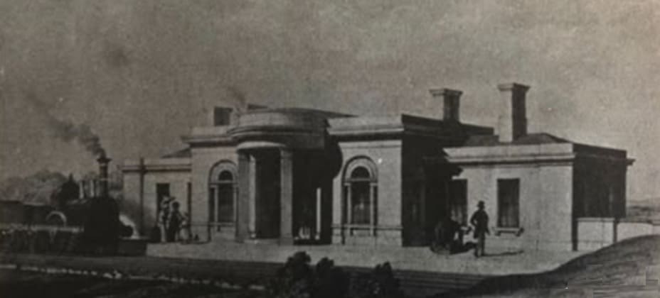
Samuel Russell’s lithograph of Barnsley Station. [47]
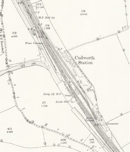
Cudworth Railway Station – the original Barnsley Railway Station – as it appears on the 25″ Ordnance Survey of 1890, printed in 1893. [48]
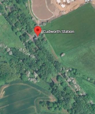
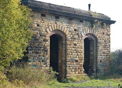
The remaining brick structure at Cudworth Railway Station in October 2022, (c) Jim Lucas. [Google Maps, October 2026]
Oakenshaw
There was a station between Barnsley and Oakenshaw – Royston and Notton – but this did not open with the line in 1840 and so was not included in the lithographs produced by Samuel Russell. Oakenshaw did feature and its lithograph appears below.
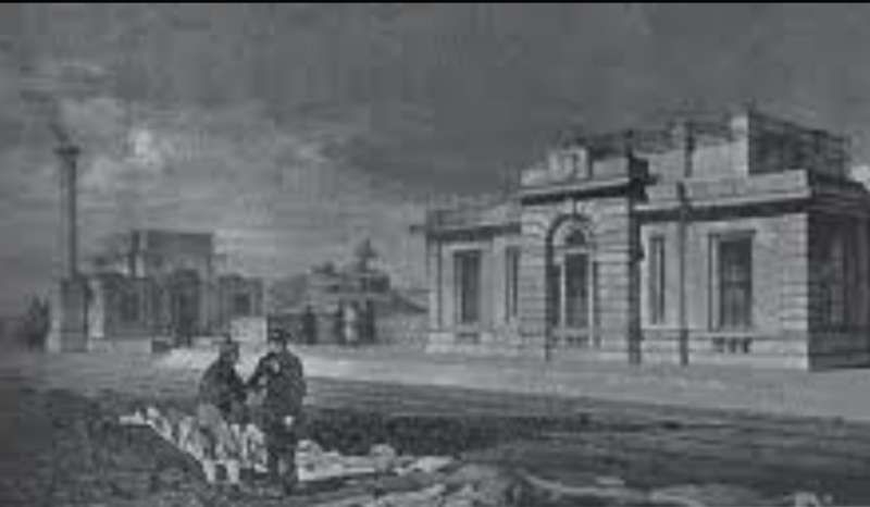
Oakenshaw (for Wakefield) Railway Station which opened with the North Midland Railway in 1840 and closed in 1861. [39]
Oakenshaw Railway Station was located about two miles south-east of Wakefield. Originally built to serve Wakefield by omnibus, it had suitably ornate buildings, but was closed by the Midland Railway in 1870 when the station at Sandal and Walton was opened instead. [49]
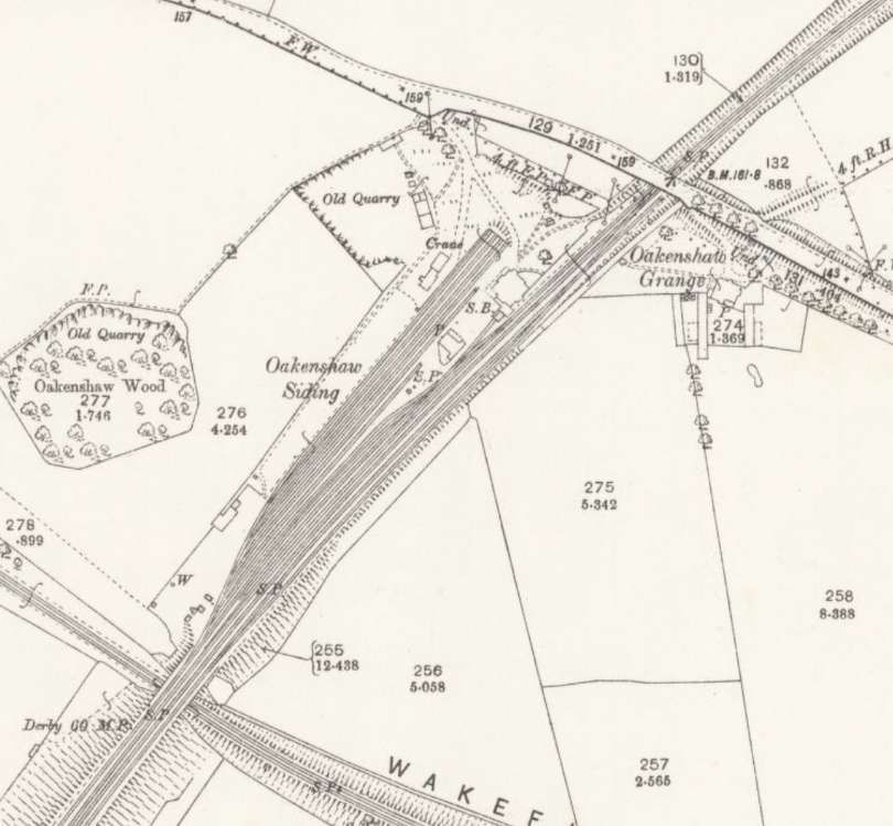
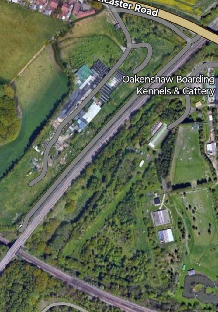
Kirkthorpe Junction
Samuel Russell created a lithograph showing a train on the North Midland Railway at this location. I have not been able to locate a copy of the lithograph online. The lithograph should be included in those on display at Wingfield Railway Station.. [55]
Normanton
I have not been able to locate a lithograph by Samuel Russell of Normanton Railway Station. So here is the next best thing! … Arthur Fitzwilliam Tait created a lithograph in 1845, just five years after the Station opened.
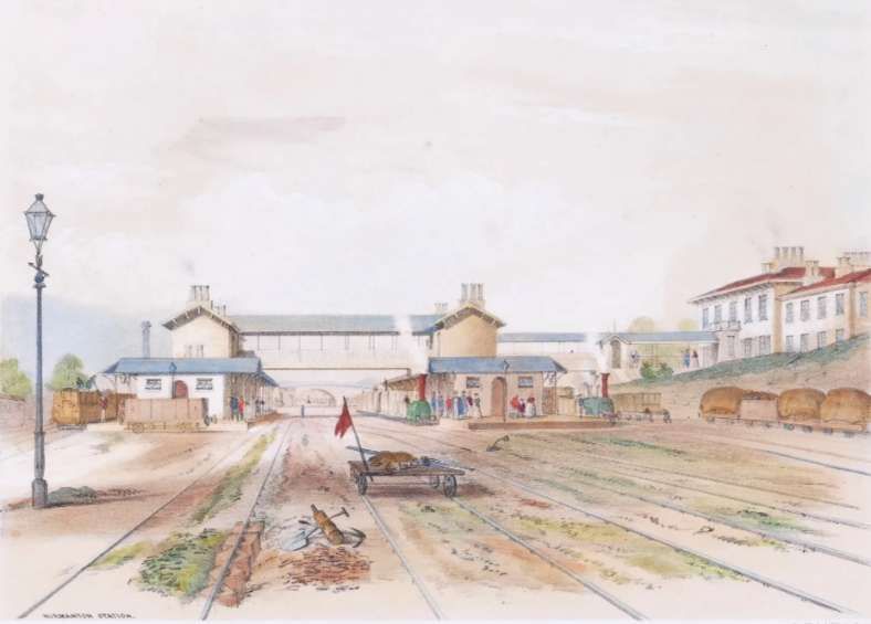
The station was built by George Stephenson as a junction between the Manchester and Leeds, the North Midland, and the York and North Midland railways, making it at one time the most important station in the North of England, such was its role in the transport network serving regional industries.
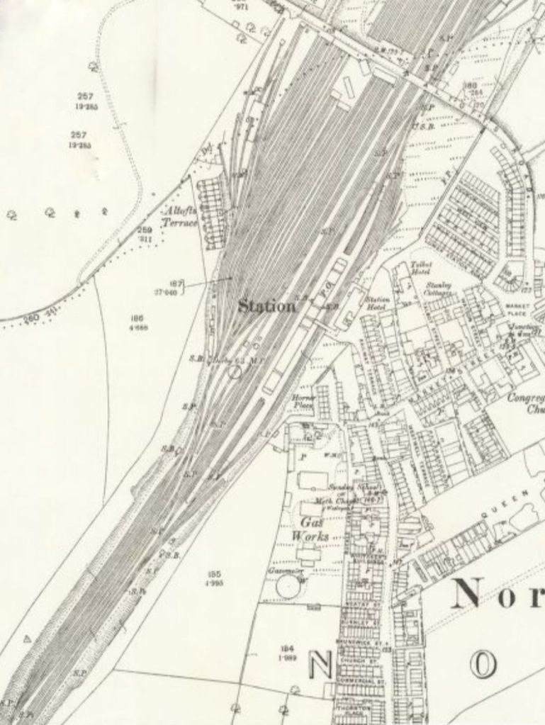
The original station was opened by the North Midland Railway (NMR) on 30th June 1840 (this was one day before nearby Castleford Railway Station which opened on 1st July 1840) on their main line towards Leeds, creating an interchange station between the North Midland Railway (NMR), the York and North Midland Railway (Y&NMR) and the Manchester and Leeds Railway (M&LR) – establishing the three company junction that is noted above. [53]
Wikipedia goes on to say that “The station lost many of its services in the aftermath of the Beeching Report, with both express and local trains on the NMR main line ceasing to call in 1968 and trains to York ending in 1970, leaving only Hallam Line trains to serve the station. The NMR was closed completely in 1988 south of the former Goose Hill Junction (where it diverged from the M&L line to Wakefield) although part of the route further south remains open to serve a glassworks at Monk Bretton, near Barnsley. This has led to much of the railway infrastructure becoming redundant and being removed – the main buildings have been demolished, the sidings and goods lines lifted, the bay platforms filled in and the main island shortened considerably. The old Station Hotel still stands, but it has been converted into residential apartments.” [53]
Woodlesford
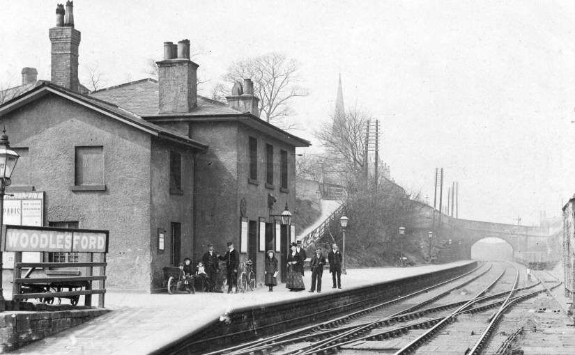
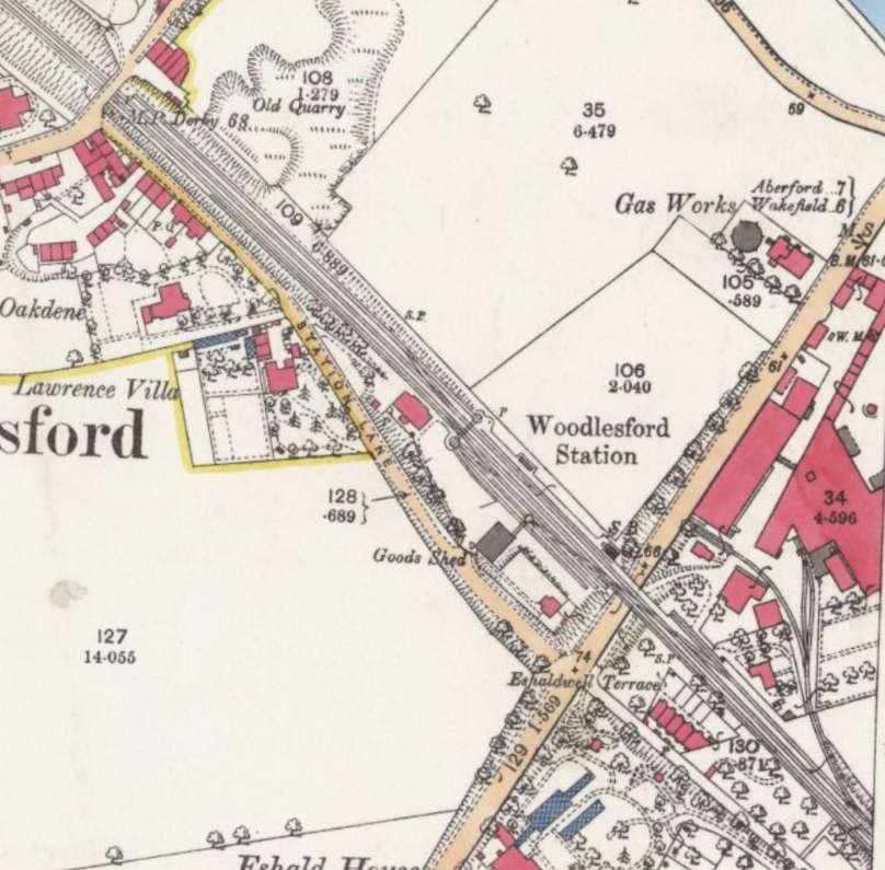
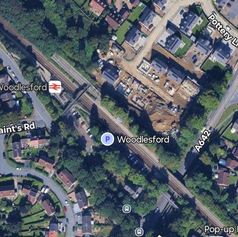
Although Woodlesford Railway Station was one of the original stations on the North Midland Railway, there is no record of Samuel Russell creating a lithograph of the station. Woodlesford appears not to be included in his surviving collection.
Leeds
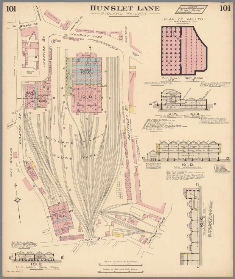
The northern terminus of the North Midland Railway was in Leeds. Situated at Hunslet Lane in Leeds (now the site of Crown Point Retail Park, which opened in 1989). It was designed by Francis Thompson, featuring an iron four-span roof, five track lines, and 300-yard-long platforms. [58]
Three of the lines were used for stabling carriages not in use under the central span, and each outer span had one line with a platform. Turntables were provided at each end and the offices on the western side were fronted by an arcade with an arch surmounted with the arms of Leeds, Sheffield and Derby. It was shared by the Manchester and Leeds Railway, which ran on the NMR tracks from just north of Normanton since Parliament had refused to sanction two lines running side by side. [58]
The station was replaced by the Midland Railway in 1846 by Leeds Wellington railway station[3] and became a goods depot which closed in 1972. [58]
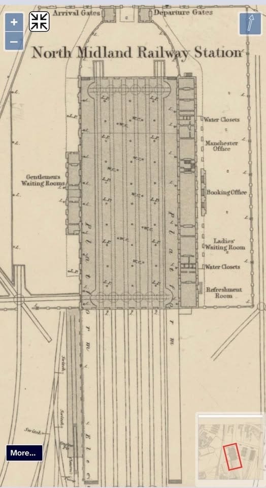
The 1840-built North Midland Railway Station in Leeds which was closed by 1846 becoming the Hunslett Goods Yard – few records seem to have survived. [31]
It is possible that Samuel Russell created a lithograph of the original Leeds Railway Station. I have not been able to locate a copy of the lithograph online. If it exists, the lithograph should be included in those on display at Wingfield Railway Station.. [55]
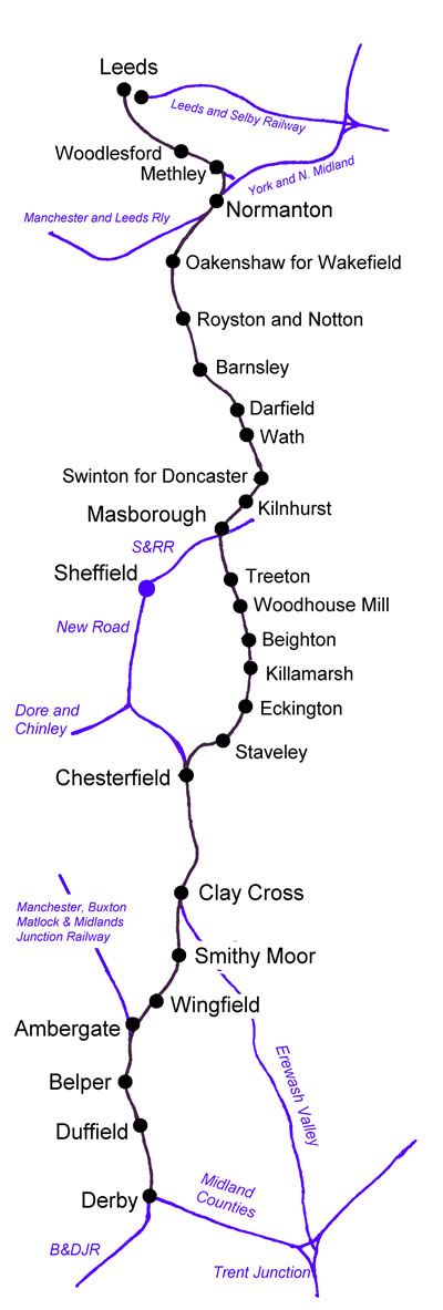
Wikipedia provides this map of the North Midland Railway’s line, © Public Domain. [2]
Not all of the stations shown on the route map were opened with the line. The original intermediate stations were Belper, Amber Gate, Wingfield, Chesterfield, Eckington, Beighton, Masbrough, Swinton, Darfield, Barnsley, Oakenshaw, Normanton and Woodlesford. All were designed by Francis Thompson. [2]
Stephenson’s practice when building the line had the advantage that industrial customers would in most cases, “be transporting their goods downhill from the mines and quarries to the railhead. It should be said, however, that the North Midland was among the first of the new breed of railway conceived as a means of improved passenger travel between the great cities, particularly London, rather than, like the Midland Counties and earlier lines, an adjunct to coal mines and quarries. Indeed, the rise in the coal trade, which was to become so important to the railways, had barely begun and, even a few years later, directors of the Midland Railway were questioning whether the revenue made it a worthwhile market to pursue.” [2]
Stephenson followed his usual practice of following river valleys as far as possible. The people of Sheffield engaged Joseph Locke to argue for them (his belief was that lines should pass through towns, proceeding along hills, if necessary, with bridges, embankments and cuttings. Stephenson and Locke “represented two opposing schools of thought at the time and, in this case, Stephenson had his way.” [2]
By 1870, economics were different, what was once very costly in terms both of construction and operation had become economically feasible. The Midland Railway opened a diversion through Dronfield and Sheffield, which became known to railwaymen as the “New Road”, as opposed to the “Old Road”. [2]
But, the terrain traversed by the old road was more difficult than for the other two railways which served Derby, “requiring 200 bridges and seven tunnels, and an aqueduct for the railway to pass underneath the Cromford Canal. By that time, Stephenson, who was wishing to concentrate in exploiting the coal around Ashby-de-la-Zouch, delegated the responsibility for almost the entire work of its design and construction to his engineer Frederick Swanwick.” [2]
Wikipedia tells us that, “The major bridges were at Oakenshaw, over the Barnsley Canal, and the Calder and Chevet Viaducts. In addition there were massive stone retaining walls for the cutting through Belper and the embankment north of Ambergate. Although the general radius of curves was one mile (1.6 km), gradients were as steep as 1 in 264 and practically the whole length was embanked or in cuttings, when not proceeding through a tunnel. The number of men employed [on the construction] was 8,600, with eighteen pumping engines providing drainage. It was tough work and a number of people died, particularly in the boring of the Clay Cross Tunnel.” [2]
The line was completed to Masbrough on 11th May 1840, [5] and to Leeds on 1st July 1840. [6]
There is a shady story to tell about the life of the North Midland Railway and the behaviour of shareholders, including, principally George Hudson in the years before the Midland Railway was formed by the amalgamation of other companies.
George Hudson and ‘Shady’ Manoeuvring at Board Level
From their inception, there was intense competition between the Birmingham and Derby Junction Railway and the Midland Counties Railway for traffic into London. … Though this did not directly affect the North Midland, it had financial problems of its own. With so many earthworks it had been extremely expensive to build, and its station and other buildings were arguably extravagant. Moreover, by the time it opened, the country had entered an economic depression. In the first two years, dividends were as low as 3.5%, compared with 10% for the London and Birmingham Railway. Economies were put in place but in 1842 the dividend was a mere 1% and shareholders of the North Midland Railway called for a Committee of Enquiry. [2][4]
George Hudson was one of these shareholders, and after a tour of the complete network, he insisted on drastic measures. Against the wishes of the Derby directors, Hudson and others from Lancashire & Yorkshire insisted on halving expenditure. At a meeting on 16th November 1842 in Leeds, Hudson’s group had their way. “On 30th November 1842 at a meeting in Derby, John Walbanke Childers MP, Mr. Pickersgill, Hatton Stansfield, T. B. Pease, F. Carbutt, and Mr. Hall retired from their positions as directors, and W. L. Newton (chairman), A. Titley (deputy-chairman), Mr. Laycock, Mr. Lee, Mr Cox and J. Holdsworth remained. Six of the Committee of Inquiry, P. W. Brancker, J. T. Alston, George Hudson, George Wilson, John Waddingham and William Murgatroyd, forced their way onto the board.” [2][7]
The new directors forced through a number of measures: the closure of Beighton, Killamarsh and Kilnhurst stations from 1st January 1843; boys, instead of men, would work points at junctions; services were reduced, fares raised and a number of carriages were sold. [2]
But things got considerably worse: a quarter of the footplate staff were sacked. The remainder (43 enginemen, stokers and turners) protested over the lower wages, and were sacked as well, on Christmas Eve 1842, without pay in lieu of notice. Hudson “employed in their place, enginemen he described as ‘skilled replacements’ who included in their number a platelayer, a fireman, a stonemason, two had been sacked for drunkenness and one who had been sacked for overturning a train of wagons. [2]
Unsurprisingly, “the result was chaos, with trains running late or erratically, and the remainder of the workforce demoralised. Finally a luggage train, with an elderly driver of only three weeks experience, collided with the rear of a stationary train at Cudworth in fog on 12th January 1843. [8] The inquest sent the … driver, Edward Jenkins, to the York Assizes for trial and criticised the cutbacks. … There was wide publicity about the trial of the driver for manslaughter. The jury at the York Assizes acquitted Jenkins and censured the directors. Meanwhile, the Board of Trade was also extremely critical and the directors made somewhat grudging improvements to working practices.” [2]
“Meanwhile, the situation between the Birmingham & Derby and the Midland Counties was becoming steadily worse. Hudson’s first approach was to the Midland Counties in 1843. He then negotiated a secret amalgamation with the Birmingham and Derby which would remove all the Midland Counties’ trade and, in August, returned to the latter with an ultimatum. Finally, on 22nd September 1843, at a meeting in Derby [a] triple merger was agreed.” [9]
The Midland Railway Consolidation Bill was placed before Parliament, and was passed as the Midland Railway Consolidation Act 1844 (7 & 8 Vict. c. xviii), and from May of that year the Midland Railway came into being. [2][10: p308]
References
- Isaac Ashe; Long-lost artworks of former stations go on display; BBC local News, Derbyshire, 11th October 2926; via https://www.bbc.co.uk/news/articles/c6y93q5gp000o?app-referrer=deep-link, accessed on 12th October 2026.
- https://en.wikipedia.org/wiki/North_Midland_Railway, accessed on 12th October 2026.
- Francis Whishaw; The Railways of Great Britain and Ireland practically described and illustrated (2nd ed.); John Wesley, London, 1842; (1840 1st ed., Simpkin, Marshall & Co.); via . http://archive.org/stream/railwaysgreatbr00whisgoog#page/n0/mode/1up (requires login details to access).
- Railways; Liverpool Mail. England. 30th August 1842; via British Newspaper Archive, https://www.britishnewspaperarchive.com/image-viewer?issue=BL/0001300/18420830&page=0001 (requires login details to access).
- Opening of the North Midland Railway; The Evening Chronicle. England. 11th May 1840; via British Newspaper Archive; (requires login details to access).
- North Midland Railway. Opening of the Line from Derby to Leeds; Derby Mercury. England. 1st July 1840; via British Newspaper Archive; (requires login details to access).
- North Midland Railway; Lincolnshire Chronicle. England. 2nd December 1842; via British Newspaper Archive, https://www.britishnewspaperarchive.com/image-viewer?issue=BL%2F0000354%2F18421202&page=1; (requires login details to access).
- Fatal Railway Accident; Yorkshire Gazette. England. 14th January 1843; via British Newspaper Archive, https://www.britishnewspaperarchive.com/image-viewer?issue=BL%2F0000266%2F18430114&page=8; (requires login details to access).
- North Midland Railway Company; Derbyshire Courier. England. 23rd September 1843; via British Newspaper Archive, https://www.britishnewspaperarchive.com/image-viewer?issue=BL%2F0000395%2F18430923&page=2, (requires login details to access).
- E. G. Barnes;(1969). The Rise of the Midland Railway 1844–1874; Augustus M. Kelley, New York. 1969.
- https://artuk.org/discover/artworks/north-midland-railway-view-of-new-street-bridge-etc-in-belper-looking-south-338356, accessed on 12th October 2026.
- https://artuk.org/discover/artworks/masborough-station-338358, accessed on 12th October 2026.
- https://www.sciencephoto.com/media/1481296/view, accessed on 12th October 2026.
- https://www.sciencephoto.com/media/1481295/view, accessed on 12th October 2026.
- https://maps.nls.uk/view/114590384, accessed on 12th October 2026.
- https://maps.nls.uk/view/114587858, accessed on 12th October 2026.
- https://derbyshirevch.org/2022/11/chesterfields-railway-stations-a-short-history, accessed on 13th October 2026.
- https://maps.nls.uk/view/114589343, accessed on 13th October 2026.
- https://maps.nls.uk/view/114589706, accessed on 13th October 2026.
- https://www.derwentvalleymills.org/b14, accessed on 14th October 2026.
- https://en.wikipedia.org/wiki/Belper_railway_station, accessed on 14th October 2026.
- https://www.facebook.com/belperandproud/posts/the-original-ambergate-station-opened-in-1840-first-regular-trains-ran-from-may-/1407511364754845, accessed on 14th October 2026.
- https://en.wikipedia.org/wiki/Ambergate_railway_station#/media/File:Ambergate_junction.jpg, accessed on 14th October 2026.
- https://en.wikipedia.org/wiki/Ambergate_railway_station, accessed on 14th October 2026.
- https://maps.nls.uk/view/114589253, accessed on 14th October 2026.
- https://maps.nls.uk/geo/explore/#zoom=17.0&lat=53.06659&lon=-1.46390&layers=168&b=ESRIWorld&o=100, accessed on 14th October 2026.
- https://en.wikipedia.org/wiki/Bullbridge_Aqueduct, accessed ion 14th October 2026.
- https://www.grosvenorprints.com/stock_detail.php?ref=57107, accessed on 14th October 2026.
- https://www.wingfieldstation1947.co.uk/wingfield-station-1947-1, accessed on 14th October 2026.
- https://www.grosvenorprints.com/stock_detail.php?ref=57108, accessed on 14th October 2026.
- https://www.facebook.com/photo/?fbid=912311838128653&set=gm.34533848262869100&idorvanity=1730959503584733, accessed on 15th October 2026.
- https://en.wikipedia.org/wiki/Beighton_railway_station, accessed on 15th October 2026.
- G. Hurst; Great Central East of Sheffield Volume 1; Milepost Publications, Worksop, 1989.
- https://maps.nls.uk/view/114586835, accessed on 15th October 2026.
- https://en.wikipedia.org/wiki/Eckington_and_Renishaw_railway_station, accessed on 15th October 2026.
- https://maps.nls.uk/view/114587363, accessed on 15th October 2026.
- https://www.travelsouthyorkshire.com/en-gb/newsupdates/swintons-four-stations, accessed on 15th October 2026.
- https://maps.nls.uk/view/1256500s03, accessed on 15th October 2026.
- https://www.wakefieldhistoricalsociety.org.uk/wakefield-history/reports-on-lectures, accessed on 15th October 2026.
- https://ebay.io/m/zhvd9o, accessed on 22nd October 2026.
- https://share.google/0Fzv5THBXRNAyZJXs, accessed on 22nd October 2026.
- https://maps.nls.uk/view/125649228, accessed on 22nd October 2026.
- https://maps.nls.uk/view/125649231, accessed on 22nd October 2026.
- B. Pixton; North Midland: Portrait of a Famous Route; Runpast Publishing, 2000.
- https://en.wikipedia.org/wiki/Darfield_railway_station, accessed on 22nd October 2026.
- https://www.geograph.org.uk/photo/3402608, accessed on 22nd October 2026.
- https://www.facebook.com/groups/1614960195255335/posts/5367345266683457, accessed on 22nd October 2026.
- https://maps.nls.uk/view-full/125649110, accessed on 22nd October 2026.
- https://en.wikipedia.org/wiki/Oakenshaw_railway_station, accessed on 22nd October 2026.
- https://maps.nls.uk/view/125646363, accessed on 22nd October 2026.
- https://roberthall.pictures/gallery/tait-arthur-fitzwilliam-normanton-station, accessed on 22nd October 2026.
- https://maps.nls.uk/view/125644705, accessed on 22nd October 2026.
- https://en.wikipedia.org/wiki/Normanton_railway_station, accessed on 22nd October 2026.
- https://artuk.org/discover/artworks/north-midland-railway-bridge-over-the-river-derwent-and-the-matlock-road-near-amber-gate-338353, accessed on 22nd October 2026.
- https://www.facebook.com/share/p/19wEs2uvkt, accessed on 24th October 2026.
- https://newwoodlesford.xyz/uncategorized/woodlesford-the-story-of-a-statio, accessed on 24th October 2026.
- https://maps.nls.uk/view/125642578, accessed on 24th October 2026.
- https://en.wikipedia.org/wiki/Leeds_Hunslet_Lane_railway_station, accessed on 24th October 2026.
- https://dn710205.ca.archive.org/0/items/dr_101-hunslet-lane–midlane-railway-leeds-c-arriers-warehouses–first-sh-13564004/13564004.jpg, accessed on 24th October 2026.


