In this addendum to the previous four articles about the Gloucester and Cheltenham Tramroad we return to the head of the line and to the quarries on Leckhampton Hill.
While on holiday in the Forest of Dean in September 2021, I picked up a secondhand copy of “Gloucestershire Railways in the Twenties” by Humphrey Household. [1] It consists of a review of the development of the railways in Gloucestershire supported by a series of photographs which were predominantly taken in the 1920s by Humphrey Household. The photos are a significant resource. The text of the book is well-written. Its final two chapters were of real interest to me.
The chapters are entitled “Leckhampton Quarries” and “The Forest of Dean.” The second of these two chapters warrants discussion elsewhere. The first provides some significant additional material relating to the Tramroad (or should it be called a tramway?) and some important and delightful pictures showing the quarries, their transport links and construction work in the 1920s.
Interestingly, Household highlights the way in which Cheltenham’s street layout has been significantly influenced by the presence of the tramway. He points to the shape or alignment of “Queen’s Road from Lansdown, where the branch left the Gloucester-Cheltenham tramway line close to the Midland Railway station; the triangular Westall Green in Tivoli, so shaped to accommodate sidings and a depot; the narrow Norwood Street running at a curious angle to meet the Leckhampton Road; a length of sunken pavement on the west side of that road which had been a shallow cutting to ease the gradient; the yard at the foot of the hill where caravans were later built.” (p95-96)
Accompanying the text are a series of photographs taken in both 1911 and 1923 and show the tramway at work. It is clear from the pictures that by 1923 the condition of the tramway was deteriorating and was no longer in constant use. Household comments: “from my very early years the tramways were an unceasing source of interest. From the upper windows of a house in The Park, I could see Top Incline, and the rare occasions when I spotted it in use caused considerable excitement! Bottom Incline was secluded in a privacy jealously preserved … But the steep public footpath alongside the … Middle Incline was one we often used; it emerged amid the junctions on the rough plateau whence Top Incline ascended with awe-inspiring abruptness.” (p97)
Household goes on to express his delight as a young boy when invited, on occasional weekday visits, by a friendly quarryman to ride in a wagon of a horse-drawn train. And once even to being allowed to ride up the incline! An early case of ‘joy-riding’, says Household.
In this chapter, Household provides a relatively detailed description of the operation of the line and each of the inclines. The 1911 photographs were taken by his father, those of 1923, by Household himself.
Household reflects on the fact that by 1923 the tramway had reached very much the end of its value to the quarries. This happened because in the closing months of 1922, a new standard-gauge railway line was constructed. His keen interest in railway matters led to him photographing extensively the progress of the work. His records show that ,”during the two years before the railway and its associated works were finished, [he] took well over a hundred photographs. … Fortunately [he] recorded details on the leaves of the album when [he] mounted the pictures.” (p101)
The new works were prompted by the formation of a new company “to exploit the resources of Leckhampton Hill, primarily in the production of lime, and a prospectus issued in July 1922 enthusiastically stressed the great quantity of stone that was easily accessible and the substantial profit expected to accrue from large scale extraction.” (p101-102)
A single photograph is reproduced below.It was taken in 1924 and illustrates the magnitude of the change which took place in the early 1920s.
“Leckhampton Hill: the lime kilns and the standard gauge railway built 1922-1924. Almost the whole course of the line can be traced in this photograph: the incline, the bridge carrying Daisy Bank Road, the passing loop, the incline foot, the track curving from it past Southfield Farm to the level crossing of Sandy Lane (whose white gate posts are just visible between two groups of treetops), the grey line of cutting stretching almost to Charlton Kings GWR station. To the left of the kilns are the winding drum used to lower tip wagons while the embankment was being built, and the shed covering the machinery at the head of the old tramway’s Middle Incline.” (p102)
Household goes on to say that
“The steepness of the ascent from the Leckhampton Road, and the impossibility of making connection with the main railways through the built up area of the town, meant that an entirely new route had to be found, and the promoters decided on a line some one-and-a-quarter miles long descending to the Great Western’s Banbury & Cheltenham Railway at Charlton Kings, part of which was to be a cable-worked incline two-thirds of a mile in length to overcome a fall of nearly 400 feet.” (p102)
Household provides details of the kind of contractor’s wagons used on the project and details of the process of building the necessary embankment for the new line, complemented by his own photographs. The contractors were Caffin & Co. of London and they made extensive use of manual labour supported by a government loan to the project to support local employment.
The construction of the embankment took the best part of a year! While this work was progressing slowly a cutting was being excavated between Sandy Lane and Charlton Kings GWR station. Household provides pictures of the Ruston steam navy at work and of the contractor’s locomotive, 0-6-0ST Fashoda, built by Manning Wardle & Co. of Leeds in 1898. He also provides a detailed commentary on the works as they progressed. Fascinating photographs back up the text of the chapter.
As part of the work, “A footbridge had to be built for a field path close to the junction at Charlton Kings, and an overbridge to carry Daisy Bank Road across the track just over half way up. Both were formed of steel girders between abutments of neat stone walling.” (p110)
It may also be of interest to note that the new incline was not to be a simple self-acting incline. Power was required, “supplied by an eighty horse-power electric motor geared to the winding drum, and electricity was generated by a plant installed at Southfield Farm. Here,” says Household, “there were duplicate sets, each consisting of a Sandycroft 440 volt, 262 ampere alternator driven by s four-cylinder Premier Gas Engine developing 250 to 300 horse-power, fed by a Crosslet suction gas plant. Transformers stepped up the voltage to 2,200 for transmission to the top of the hill where it was reduced before being distributed via the switchboard to the winding motor, the lighting circuits and the fans at the kilns.” (p114-116)
The new kilns, 4 in number, were 77ft tall and became dominant features on the hill. They were “supplied by Priest Furnaces and erected on a stone-revetted platform so that lime could be fed by gravity into railway wagons alongside, and the kilns themselves were also fed by gravity from narrow gauge tip-trucks run out across a bridge from the quarry gallery.” (p116)
A 0-4-0ST locomotive Lightmoor built by Peckett & Co. in 1902 was purchased by the company to work between the foot of the new incline and the sidings which had been constructed at Charlton Kings.
Household reports that, while blasting had long been practised in the quarries it had been on a small scale, the need both to produce construction stone and much smaller pieces for burning meant that blasting was vastly increased. He notes that, “thunderous reverberations disturbed the town and were particularly distressing to the well-to-do and influential inhabitants. … When to the annoyance there was added the danger of windows broken by concussion and flying fragments, complaints were voiced in the local press, an action committee was formed, and there was threat of an application for an injunction.” (p123)
In fact, the project was foundering anyway, profit projections had not been realised, the company was on the verge of bankruptcy. The national treasury appointed receivers and ultimately work ceased in November 1926, only a couple of years after completion of the incline, kilns and infrastructure.
The project had cost £270,000. At auction, in August 1927, only £8,000 was raised when material and plant was sold. Ultimately, the town council was able to buy the land at a very cheap price and the Hill became an open space available to all!
References
Humphrey Household; Gloucestershire Railways in the Twenties; Alan Sutton Publishing Ltd., Gloucester, 1984 (reprinted 1986) …. the relevant chapters can be found from p93 onwards.
While on holiday in September 2021, I was reading older copies of the magazine BackTrack from the turn of the millennium, from, at that time, Atlantic Publishers. (More recent editions are published by Pendragon Publishing.)
Volume 14 No. 3, March 2000 included an article by Jeffrey Wells [1] about the Micklehurst Loop (p142ff). Wells highlighted the congestion which led to the development of the LNWR line between Huddersfield and Stalybridge which was opened in 1849. The single-line ‘Nicholson Tunnel’ was the first impediment to the free flow of traffic. This was rectified with the construction by 1870 of the ‘Nelson Tunnel’. “Both tunnels were in use by 24th April 1871 following a period extending from the previous February when only the ‘Nelson Tunnel’ was in use during repairs to the ‘Nicholson Tunnel’.” ( p142)
Wells goes on to explain that ongoing problems with congestion between Stalybridge and Diggle led to alleviating alternatives being considered. Quadrupling of the line was ruled out on grounds of inadequate space.
The LNWR first addressed the length of line to the West of Stalybridge when it opened (in 1876) a line from Heaton Norris to Guide Bridge. It then decided that the construction of an alleviating relief line between Stalybridge and Diggle was the only feasible solution to congestion. The Act authorising the construction of the relief line received authorisation on 3rd July 1879. The route was in two parts – Railway No. 1 was the Hooley Hill Line “which left Denton Junction and joined the MSLR at Dukinfield Junction and Railway No. 2, the Micklehurst Loop Line stretching from Diggle to Stalybridge.” (p143)
Later, the LNWR opened its Stalybridge Junction Railway (1st August 1893) which provided a first link from Heaton Norris to Stalybridge.
The cost of the Micklehurst Loop was estimated at £213,000. The successful tender from Messrs. Taylor and Thomson of Manchester was £177,949 8s 2d. The work was completed and the line opened on 1st May 1886.
Wells talks of three utilities being connected to the Loop. …
The first was a 3ft gauge tramway which served the construction of high level reservoirs. Exchange sidings and the tramway were completed in 1908, “six contractor’s locomotives plied between the sidings at Roaches and a suitable stopping place short of the site.” (p146)
The second was the allocation, in 1916, of 26 acres of land between Stalybridge and Mossley for the construction of a power station. The plant finally opened in January 1927 and Millbrook Sidings were enlarged to accommodate a number of sidings. In addition, “In the 1930s the coal was moved from the sidings by a conveyor which passed under the line. This was later followed by an overhead steel-braced conveyor which stood on tall concrete piers.” (p146) In the summer of 2021 part of the conveyor structure remains standing as does the cavernous goods she’d which graced the sidings. In 2021, the sidings area at Millbrook was heavily overgrown with substantial trees having colonised the site. Plans were afoot for redevelopment of the area and some clearance and regrading had taken place.
The final utility which Wells points out was connected to the Loop was Mossley Corporation Gas Works. “The Works had its own internal rail layout and a complement of small standard gauge locomotives.” (p146) Movements in and out of the site were controlled by Friesland Gas Sidings signal box.
Some excellent monochrome photographs accompany the article, one of which is included here.
This excellent black and white study shows a Fowler 0-8-0 7F tender locomotive proceeding tender first towards Stalybridge. The caption above misidentifies the location. The goods shed visible on the right of the image is actually Micklehurst goods shed. It remains visible today on the site of a pallet works which occupies the old railway sidings. Two of these large goods sheds remain standing, this at Micklehurst and the one referred to in the caption above at Millbrook. As noted by Wells, the Millbrook shed was in a parlous state in 2021.
The article is also accompanied by two diagrammatic representations of the Loop line and the other lines referred to in the text. One of these maps is included here.
In a letter to BackTrack magazine carried in the June 2000 edition Vernon Heron points out that the reservoir tramway shown meeting the Loop line North of the Gas Works actually served exchange sidings near to half a mile South of the Gas Works. [2]
To finish his article, Wells points out that the Loop line suffered a gradual demise with passenger stations closing in the years prior to the end of the Great War. Rumours of final closure attended every significant maintenance problem on the line as the condition of the line’s brick bridges and viaducts began to deteriorate. The last train was to run on Sunday 30th October 1966 with the line gradually being dismantled in the following ten years. The final portion closed when Hartshead Power Station closed. That portion was dismantled in the late 1970s, 1980s and 1990s.
Jeffrey Wells completed his study of the line in the next edition of the magazine with a short series of pictures of Diggle Station which stood at the Western end of the Standedge tunnels. [3]
References
Jeffrey Wells; The Micklehurst Loop Line; in BackTrack Vol. 14 No. 3, Atlantic Transport Publishers, March 2000, p142ff.
Vernon Heron; The Micklehurst Loop; in Readers’ Forum in BackTrack Vol. 14 No. 6, Atlantic Transport Publishers, June 2000, p370.
Jeffrey Wells; Through the Lens at Diggle; in BackTrack Vol. 14 No. 4, Atlantic Transport Publishers, April 2000, p235ff.
Two more books which are worth taking with you on holiday.
Chris Arnot; Small Island by Little Train; ISBN 978-0-7495-7849-7.
Tom Chesshyre; Slow Trains to Venice; ISBN 978-1-78783-299-2.
The first of these two books, by Chris Arnot, is the story of a meandering journey round some of the narrow-gauge railways of the UK. It is published by the AA in hardback. The dust jacket says: “From stalwart little locomotives of topographical necessity to the maverick engines of one man’s whimsy. Britain’s narrow-gauge steam trains run on tracks a world apart from it regimented mainlines. They were built to carry anything from slate to milk churns, and go where mainline trains could not go – around sharp bends, up steep gradients, or rolling downhill for miles all the way to the sea. And they have not just survived against the odds, but thrived.”
Chris Arnot has been a freelance journalist and Author for around 30 years, writing for the Guardian on everything from arts and travel to education and social issues. His material has also appeared in most of the other broadsheets and he has written a number of books of his own. In this book he provides a delightful, gently observed commentary on his own journeys along narrow-gauge lines around the UK. The most northerly line he visits is the Leadhills and Wanlockhead Railway in Lanarkshire, the most southerly, the Romney, Hythe and Dymchurch Railway. Five chapters cover lines in Wales. A short chapter covers a day visit to Graham Lee’s amazing private 2ft/2ft 6 inch dual gauge line, the Statfold Barn Railway, with his extensive collection of narrow-gauge locomotives.
Two long-lost favourites warrant a chapter each – the Leek and Manifold Railway and the Lynton and Barnstaple. As do the South Tyndale Railway, the Bure Valley Railway (Wroxham to Aylsham in Norfolk) and the Southwold Railway.
The Bure Valley Railway is in private ownership and now returns a significant profit. The Southwold Railway continues to look forward to a day when a line can be relaid between Southwold and Halesworth but has managed to create Steamworks, a Visitor Centre building with cafe, shop, toilets, museum and engine shed, a 7¼ inch gauge miniature railway plus 11 chains of three foot gauge track, including a run parallel and close to the site of the original track as it approached Southwold Station. [1]
Map of the Southwold Railway drawn by John Bennett. [2]
Arnot comments: it is easy to think “that the UK is becoming more uniform. But trundling around its more remote parts has proved to be a way of reminding myself that … This small island was anything but uniform. It remained a place of infinite variety, and its contrasts, from Devil’s Bridge to Dungeness, Wroxham to Ravenglass, were best savoured through the window of a sedately paced narrow-gauge railway.” (p251)
Arnot further reflects: “I’d seen a desire to get close to those [narrow-gauge] engines among many who’d visited these railways, and not just among those old enough to remember when steam trains ran on the main line. … [I] met people of all ages and both sexes who’d become fascinated by a precious part of our history. And while I may have sometimes cursed the lengthy journeys to visit those lines, I’d revelled in meeting most of their passengers as well as the volunteers and indeed the paid staff who kept them running. … Just as enjoyable had been sitting back to savour the scenery beyond the windows confirmation that, when viewed from a little train, this small island still has breathtaking variations in landscape, a marked contrast to the corporate and municipal uniformity that has taken hold of large parts of our towns and cities. But then, unlike so many of our towns and cities, rurallandscapes have remained largely unscathed. … And those parts of the landscape that were ‘scathed’, particularly by mining, have largely blended back into their natural surroundings, adding layers of fascinating industrial history in the process.Those contrasts in landscape … struck me forcibly. … Were we still on the same small island?“
In the second of these two books, Tom Chesshyre heads abroad, seeking to wander his way through Europe to Venice with his route dictated by whim and the availability of trains. This ends up being a 4,000 mile adventure. “Escaping the rat race for a few happy weeks, … [he] indulges in the freedom of the tracks. From France ( dogged by rail-worker strikes), through Belgium, the Netherlands, Germany and Poland, he travels as far east as Odessa by the Black Sea in Ukraine.” He then heads back, “via Hungary, the Balkans and Austria. Along the way Tom enjoys many an encounter, befriending fellow travellers as well as a conductor or two.”
Simon Calder (The Independent) says that Tom, “relishes the joys of slow travel and seizes every opportunity that a journey presents: drifting as a flaneur in Lille, following in the tracks of James Joyce in a literary exploration of Ljubljana, cosseted in luxury on a trans-Ukranian express, all decorated with a wealth of detail and intrigue.”
I enjoyed his humourous reflections on his encounters. I found the manifest nationalism (if that is the right word) of some countries enlightening. Most of all, however, I found that I discovered a sense of freedom in following his meandering tale. An entirely appropriate thing while on holiday myself!
And finally. …. One short section of the book took me back to a holiday in Slovenia quite a few years ago. We were staying in Bled, not far from Lake Bled which Tom Chesshyre missed out on. We travelled a few times to Ljubljana. On one of those occasions, we found our way to the Railway Museum of Slovenian Railways which Tom Chesshyre also stumbles across. We arrived at the gates of the museum, which happened to be open even though the museum seemed closed, and decided to try our luck and ambled in. After a short while, we came across someone who invited us to wander round the whole site. We managed to get through every door that we tried but we did not get chance to speak to the Professor!
The Hay Inclined Plane at Coalport, Shropshire – a 2021 addendum. …
In March 2021, Tony Jervis, an on-line acquaintance, sent me some photographs from visits that he made over the years to the inclined plane at Coalport. These are shared below with his kind permission. [1]
Tony comments: “The site has been tidied up somewhat since I was first there, with more clearance of overgrowth at the summit, but has there been a landslip pushing the tracks sideways partway down? The Gorge area has been prone to landslips for years. ….. Much work has been done in recent years to landscape and stablilise the area.”
The pictures are shown annotated as Tony sent them to me.
1974
A 278-08 19-285 29 May 1974 SJ 695028 ESE Ruins of engine house and chimney at top of The Hay Inclined Plane, Old Shropshire Canal
A 278-09 19-286 29 May 1974 SJ 695028 NE Summit of The Hay Inclined Plane, Old Shropshire Canal
1979
555-11 42-112 16 Sep 1979 SJ 695028 NE Top of Hay Inclined Plane, Old Shropshire Canal, Ironbridge Gorge Museum
555-12 42-113 16 Sep 1979 SJ 695028 SSW The Hay Inclined Plane, with re-laid tracks, Old Shropshire Canal, Ironbridge Gorge Museum
555-13 42-114 16 Sep 1979 SJ 695027 SSW The Hay Inclined Plane, with re-laid tracks, Old Shropshire Canal, Ironbridge Gorge Museum
2005
ASH-22 39-264 1 Apr 2005 SJ 693025 SE Coalport Canal at bottom of Hay Inclined Plane
ASH-23 39-267 1 Apr 2005 SJ 694025 NNE Coalport High Street bridge over Coalport Canal at foot of Hay Inclined Plane
ASI-20 15-093 4 Apr 2005 SJ 694026 NNW Hay Incline bridge over ex-L&NWR line west of Coalport
The February 1963 edition of the Railway Magazine included a photograph of a Steam Tram which used to serve Heywood. [1] Until coming across the image above, I had no idea that steam trams served boroughs in the Manchester conurbation.
This postcard by an unknown publisher shows the final days of the Heywood Corporation steam tramway in 1905. Just behind is Rochdale Corporation electric car 29 at the borough boundary south-west of Rochdale at the Sudden terminus where Rochdale Road and Bolton Road meet.The postcard bears the title “For Auld Lang Syne”, thereby clearly indicating the imminent demise of the steam tram service. [2]
Heywood, sits about 8 miles north of Manchester, 3 miles east of Bury and 4 miles south-west of Rochdale, and only a couple of miles from where I served my curacy in Middleton.
John R. Prentice says that “the Manchester, Bury, Rochdale and Oldham Steam Tramways Co. Ltd. (MBRO, founded c.1883) became the second largest steam tramway operator in Britain with over 90 tram engines, 80 double-deck passenger trailers and 30 miles of routes. Of all these, two-thirds of stock and track were narrow gauge (3ft 6ins), including the section between Bury and Rochdale, through Heywood.
The MBRO system was split into three areas: “standard gauge southwards from Bury (to Whitefield, Prestwich and Kersal) and from Royton (to Oldham and Hathershaw), but everything else between these points (i.e, nearly all the lines in Bury, Rochdale and their environs) built to a gauge of 3ft 6ins.” [3]
By 1896, “it was clear that several of the local authorities intended to build municipal electric tramways, and that the company’s days were numbered.” [3]
Ashley Birch says that, “Oldham took control of its lines (which it had always owned) in June 1902, and a year later, in June 1903, initial agreement was reached between the remaining various local authorities and the company on a sale. … The parties eventually signed a binding agreement on the 24th February 1904, so that work on electrification could progress, with a price being set by an independent referee.” [3]
The last steam tram ran “in Royton … on the 30th May 1904, the last tram in Bury on the 10th July 1904, and the last tram in Rochdale, probably on the day before the company’s assets were sold … 12th October 1904.” [3]
After nearly 20 years of operation, the MBRO network was no more. The withdrawal of steam tram services generally coincided with the electrification of the lines and the inauguration of an electric tram service. This was true for the Bury Corporation service to Heap Bridge (west of Heywood) But when Rochdale Corporation replaced its steam trams with standard gauge electric cars, it only did so “as far as the district of Sudden, a three-quarters of a mile walk to and from the Heywood borough boundary and the steam tram terminus. In December 1904, Heywood Corporation decided to run its own steam tram service by buying 13 tram engines and 10 trailers (by then, 20 years old) from the former MBRO company when it closed down.” [2]
Peter Gould says that, “On the 20th December 1904 the main line across Heywood was re-opened to the steam trams. On the 22nd December the service on the Hopwood branch was re-instated. … The locos and trailers retained their former brown and cream livery and fleet numbers, although from 24th March 1905, the legend ‘Heywood Corporation Tramways’ began to appear on the sides of locos.” [4]
Gould continues: “The initiative was not a great success and began to flounder when Rochdale initially refused permission for the trams to use the stretch of line between the Heywood boundary and Sudden, where their electric trams currently terminated, leaving a gap of around 1 mile for weary passengers to trudge. … Although Rochdale later relented, the conditions they sought to impose were unacceptable to Heywood and the steam trams continued to terminate at the Heywood boundary.” [4]
However, by April 1905, “Rochdale extended its electric service at Sudden to the Heywood boundary in Bolton Road to establish a direct transfer to the Heywood steam trams. Later the same year, on September 20th 1905, the last steam tram ran and the through service was converted to standard gauge electric operation using Rochdale and Bury cars. Thus, as a tram operating municipality, Heywood Corporation Tramways was very short-lived and lasted less than a year; something of a record in British tramway history.” [2]
References
Alan P. Voce; A Relic of the Steam Tram Era; Letter in The Railway Magazine, February 1963, p137
I am indebted to Alan Young for a number of the images in these articles about the Micklehurst Loop. This is his drawing of the Loop which appears at the head of his article about the Loop on the Disused Stations website. It is used with his kind permission, (c) Alan Young. [7]
During January 2021, my wife and I walked the majority of the length of the Micklehurst Loop from Stalybridge to Diggle. This was the goods relieving line for the main Stalybridge to Huddersfield railway line. It had been hoped to alleviate congestion by making the mainline into a 4-track railway but the geography mitigated against this and a route on the other side of the Tame Valley was chosen instead.
The maps used in this sequence of articles are predominantly 25″ OS Maps from 1896 through to 1922 and have been sourced from the National Library of Scotland. [1] There are a number of websites which focus on the Loop which are excellent. The sites concerned are noted immediately below and the relevant link can be found in the references section of this page or by clicking on the highlighted text here:
The most detailed treatment of the line and its stations can be found on the Disused Stations – Site Records website. The particular pages on that site which cover the Loop were provided by Alan Young. One page covers the route and pages covering each of the stations can be accessed from that page. [7]
Particularly good for old photographs of the Loop is the Table 38 webpage about the railway. [9]
The first articles about the Micklehurst Loop can be found at:
There is a series of addenda to these articles which include additional material found or shared with me after the drafting of the relevant article. These can be found on the following links:
In my perambulations around the internet, I have also encountered a series of videos (on YouTube) which start from the Northern end of the line. 5 videos cover the length of the line in 2020 and a separate video covers some of the structures on the line. These videos are easily available on YouTube. This is the first [3] in the series:
Part 4 – Chew Valley Road, Greenfield to Diggle
We continue our journey travelling North from Chew Valley Road. The images immediately below appear at the end of the last article about the line which finished at Chew Valley Road. …………..
Man marking Ordnance Survey minor control revision point with an arrow on Chew Valley Road in Greenfield. The photograph looks Southeast along the Northern pavement of the road with the arch-bridge which carried the Micklehurst Loop visible in the background, (c) Manchester Libraries. [2]
Corner of Greenfield Conservative Club, converted to housing in 2019. The bridge visible carries the Micklehurst Loop line over Chew Valley Road. This view is also looking to the South east but on the opposite side of Chew Valley Road, (c) Manchester Libraries. [3]
Greenfield Viaduct. [4]
We finished the last length of the Micklehurst Loop at Chew Valley Road in Greenfield.
In concluding, we saw a couple of older postcard images of Greenfield Viaduct, the second of which looks along Chew Valley Road towards the Southeast, and a 21st century Google Streetview image of the point at which the Loop crossed Chew Valley Road.
Old Postcard Image looking past Wellington Mills and along Chew Valley Road to the Southeast. Greenfield Viaduct appears on the right side of the image, there is then a short section of embankment before the arched bridge over Chew Valley Road. Bentfield Mill sits behind the Viaduct. The line was on embankment to the Northeast of Chew Valley Road, to the left of this image. [5]
Chew Valley Road at the point where the Micklehurst Loop crossed the road by means of an arched bridge. The trees sit where the bridge abutments once sat! (Google Streetview.)
We get ready to set off on this last length of the Loop by looking at a few images of Chew Valley Road Bridge which I found on the “Greenfieldgoneby” Facebook group. [15]
The adjacent image looks from the Southeast along Chew Valley Road. [16]
The second image is taken from the same direction and a little closer to the bridge. The first was a winter-time shot, the second was taken in the summer. [17]
The third, below, is taken from the Northwest and shows the Conservative Club on the right side. [18]
This final image of the bridge before we begin our journey, is also taken from the Northwest, but from much closer to the bridge. [19]
An extract from the 25″ OS Maps from the early 20th Century. Chew Valley Road appears in the bottom left of the extract. [1]
Satellite image of approximately the same area in the 21st century (Google Maps).
Looking Northeast from Chew Valley Road in the 21st century along what would have been the line of the Micklehurst Loop (My Photograph – 25th January 2021)
Wellington Mills – the postcard above and the extract from the OS Mapping show Wellington Mills to the West of the railway in Greenfield. The mills were built in 1852 for Shaw, Son and Lees cotton Spinners who traded until 1858 and were succeeded by N. Broadbent and Sons. When Broadbent ceased trading the mills were left unused for 6 years (from 1932 to 1938). 1938 saw part of the buildings used as a general engineering works and in 1941 the rest of the premises were opened up with the installation of 362 looms by the fabric weaver B. Kershaw. [6]
The railway embankment between Chew Valley Road and Higher Arthurs has been regraded to tie in with surrounding land. (My photograph – 25th January 2021).
In the years up to 1946 the engineering section of the mill produced engine parts for bombers. It was then used for storage, first by the Navy and then by the British Wool Board. In 1946 the buildings and land were purchased by William Oddy. He transferred his woolen carding and mule spinning operations form Shipley to Greenfield. The Knoll Spinning Company was formed at this time. It seems that 362 looms were installed at this time. The company ceased trading in the 1990s and the mill again became vacant. [8]
The approach to Higher Arthurs in the 21st century – the original bridge has been removed. The railway embankment can be see rising ahead (My Photograph – January 2021).
Huddersfield Narrow Canal – along this stretch of the Loop the Canal is conspicuous by its absence. Having followed the Eastern valley side and hence having been very close to the Loop at times on the way up from Stalybridge, the Canal crossed both the Tame valley and the River Tame in the Friezland area. Through Greenfield and Uppermill it followed the line of the older mainline railway on the West side of the valley. The River Tame can just be made out in the Northwest corner of the map extract above running on the Southeast side of Frenches Dye Works. The Canal was on the northwest side of the Works.
Frenches Dye Works – Owen Ashmore, in The Industrial Archaeology of Northwest England, notes the existence of this Dye Works but as having been closed at the time of his survey – “At Frenches … is [the] site of [a] former Dye Works built on [the] site of [an] early 18C fulling mill.” [10: p130]
Our walk along the line of the Micklehurst Loop took us across Chew Valley Road and Higher Arthurs on 25th January 2021. Just to the north of Higher Arthurs, we had to choose between scrambling up the embankment face seen just beyond the dwarf wall which is all that is left of the abutment of the bridge which carried the Loop over the lane, or a short walk along Carr Lane to access the track-bed along the approved walking route. We chose the latter and joined the route of the old line a few tens of metres ahead of the steep track shown in the picture.
This slightly blurred image from the Saddleworthgoneby Facebook Group shows the bridge which carried the Loop over High Arthurs. A double-headed mineral train is travelling North on the Loop. The road in the foreground is Carr Lane. The photographer is not known. [60]
The old railway continued Northeast from Higher Arthurs curving gradually round towards a Northerly direction. At the time the map below was drawn, there was a footbridge carrying a footpath from Wellington Terrace across to Kinders Lane and Fur Lane Farm. This footbridge was a narrow blue-brick arched bridge. It remains in place in the 21st century. These next two pictures show it from track-bed level.
The footbridge is a two span blue-brick arch bridge. This picture is taken looking North toward Uppermill Station, (My photograph – 25th January 2021).
The footbridge again, this time looking South towards Greenfield, (Photograph taken by Jo Farnworth – 25th January 2021).
The track-bed continues to curve round towards the North.
The Micklehurst Loop track-bed approaching Uppermill Goods Yard, (My photograph – 25th January 2021).
An extract from the 25″ OS Mapping of the early 20th century. [1]
The same area on modern satellite imagery, (Google Maps). The encroachment of modern housing in significant.
The next map extract shows the immediate approach to what was Uppermill Goods Yard. The goods yard was protected on it southern boundary by another accommodation bridge which provided access to Ballgrove from Uppermill. On Google maps this bridge can be seen to carry Rush Hill Road.
This next extract from the 25″ OS Mapping shows the approach to Uppermill Goods Yard from the South. [1]
The same area as the map above, shown on modern satellite imagery. The site of the Goods Yard has been replaced by Uppermill Sports Club.
Northbound Goods approaching Rush Hill Road Bridge to the South of Uppermill Goods Yard. [25]
This image also appears on the ‘Disused Stations’ website, where Alan Young comments: “In the late 1940s a Leeds-bound goods train is seen from Rush Hill Road bridge approaching the goods station at Uppermill. The locomotive is Bowen-Cooke-designed ex-LNWR 7F 0-8-0, built at Crewe works in August 1896. Numbered 9020 by the LMS, and previously 2540 in LNWR ownership, she continued to work as British Railways No.49020 until October 1961 when she was withdrawn from 10A, Wigan Springs Branch shed, and cut up the same month at Crewe works – Photo by Jim Davenport.” [26]
A view from the East of Rush Hill Road as it crosses the line of the Micklehurst Loop – the blue brick parapets are almost hidden by summer vegetation, (Google Streetview).
Rush Hill Road Bridge Northern parapet taken from the Western end of the bridge, (Google Streetview).
Rush Hill Road Bridge was strengthened using and Armco Arch with stone backfill when the route of the line was turned into a linear walkway, This view looks forward into the former Uppermill Goods Yard, (My photograph – 25th January 2021).
Looking north along the route of the Micklehurst Loop from Rush Hill Road Bridge, (My photograph – 6th April 2021).
Looking back to the South along the line of the Micklehurst Loop through Rush Hill Road Bridge, (My photograph – 25th January 2021).
Once closed, Uppermill Goods Shed was demolished and the tracks were lifted. In the 21st century, the site is used for a variety of sporting interests. The route of the old line crosses the carpark facilities of the sports centre and continues to the North. Before following it, we take a look at some images of the goods facilities on the Loop at Uppermill.
Uppermill Goods Shed from across the Tame Valley [11]
The Uppermill Goods Yard from the West. In front of it there is a game of cricket taking place – from the “Saddleworthgoneby” Facebook group. [20]
This image also appears on the ‘Disused Stations’ website, where Alan Young comments: A view of “Uppermill goods station looking east c1937. A cricket match appears to be in progress on the ground to the left. The goods warehouse dominates the scene, built on a generous scale, as were those at the other Micklehurst Loop stations. The single storey section of the warehouse contains offices and toilet facilities. The sidings are occupied by numerous wagons. New houses can be seen beyond the railway, on Bankside Avenue – Photo from Peter Fox ‘Old Saddleworth’ collection.” [26]
The Uppermill Goods Yard taken from the Southeast. Saddleworth Viaduct can be seen to the right side of the image. This picture was also sourced from the “Saddleworthgoneby” Facebook group. [21]
The above image also appears on the ‘Disused Stations’ website. On that site Alan Young comments: This is “Uppermill goods station, looking north-west from near Ballgrove. This view (circa 1905) highlights the goods warehouse, a commodious structure in engineering brick. Some rakes of goods and mineral wagons occupy the sidings. A traction engine is standing in the yard (left). Uppermill (or Saddleworth) Viaduct is seen on the original Huddersfield-Manchester route which runs parallel to the Micklehurst Loop. Den and Ladcastle quarries, both in operation at this time, are excavated into the distant hill – Photo from Peter Fox ‘Old Saddleworth’ collection.” [26]
The Micklehurst Loop was designed to take pressure of the original line in the Tame Valley by separating Goods from Passenger traffic. This relatively shorts goods train is travelling South past Uppermill Goods Yard and Shed. Another image from the “Saddleworthgoneby” Facebook Group. [22]
The above image also appears on the ‘Disused Stations’ website. On that site Alan Young comments: “At all four stations on the Micklehurst Loop the passenger and goods facilities were some distance apart. This northward view from Rush Hill Road bridge is of the goods yard at Uppermill, and the passenger station is ahead but out of sight. The tall, brick-built warehouse on the left was a standard feature of these goods stations. On 5 June 1958 ex-WD 2-8-0 No.90671 is hauling loaded coal wagons southbound from Diggle (dep 5.55pm) to Heaton Norris (Stockport). The Riddles-designed locomotive was produced from 1943 for the War Department and entered British Railways service in 1948, based initially at 73C, Hither Green shed in Kent. She was withdrawn from 26F, Lees Oldham shed, on 30 September 1963 and cut up at Crewe works the following December – Photo by B Hilton.” [26]
A short parcel working passes Uppermill Goods Yard travelling South. The photograph includes an excellent shot of the Yard Signal Box. Another image from the “Saddleworthgoneby” Facebook group. [23]
An OS 25″ Series Map extract from the turn of the 20th century which centres on the Station building at Uppermill. [1]
Approximately the same area from satellite imagery in the 21st century, (Google Maps).
Uppermill in the 1920s. The Loop Line intrudes onto the photograph in the bottom left. The Passenger Station was just off the image to the left The Mill in the foreground adjacent to the Mill Pond is Albion Cotton Mill which appears on the 25″ OS Map extract above. Station Road leave the left side of the image beyond Albion Mill. Church Road runs under the bridge in the bottom left of the picture. [13]
Looking East across the Tame Valley from above the main line with the Loop Line visible in the distance. Uppermill Station and platforms can be made out just to the right of centre and just above mid-height in the image. [14]
Uppermill Railway Station building in the late 20th century. Another image from the “Saddleworthgoneby” Facebook group. [24]
Uppermill Passenger Station sat adjacent to the Station Road Bridge but at low level. Steps led up to wooden platforms which were sited to the North of the brick-built Passenger facilities. That arrangement can be picked out on the large image immediately above. The solid wooden area which looks a little out of place is the rear of the platform shelter on the Northbound side of the Loop.
The larger image above also appears on the ‘Disused Stations’ website. Alan Young, on that site comments: This is “a panoramic view eastwards across the old Diggle-Stalybridge line (with train) towards Uppermill c1910. In the village are Victoria Mill (cotton), lower left, with Alexandra Mill (cotton) on its right and Dam Head Mill (cotton spinning) in its dominant position beside Church Road. A little right of centre in the distance the platforms and waiting sheds of Uppermill station on the Micklehurst Loop can be seen, with the station building to the right, at a lower level close to the railway bridge. … Photo from Peter Fox ‘Old Saddleworth’ collection.” [26]
In this view from the West across Uppermill, Buckley Mill and Damhead Mill can be seen on the left and right of the image respectively. Behind Damhead Mill, the platform structures of Uppermill Station can be picked out. [31]
Uppermill Passenger Station Building, Station Road, Uppermill in the 21st century, (My photograph – 25th January 2021)
The Passenger Station Building was of the same design as others on the Loop Line. The front faces of these buildings were built in red-brick the side and rear walls in blue engineering brick. The building is in private hands. Station Road passed under the Loop Line immediately adjacent to the Station building as shown on the panorama below.
Uppermill Passenger Station building sat immediately next to Station Road in Uppermill. The line was originally carried across Station Road on a girder bridge. In this view in 2021 the modern footpath/cycleway is carried across Station Road on a laminated hardwood timber structure, (My photograph – 25th January 2021).
An extract from EPW016500, an image held by ‘Britain From Above’ on their website. The Loop Line and Uppermill Station can be seen at the top of the image. The remains of the ramp structures leading to the platforms can be made out on this photograph. The building at the bottom centre of the image is Albion Mill, (c) Britain From Above. [27]
Station Road Bridge in the 21st century, (My photograph – 25th January 2021).
In the text above a number of mills are mentioned:
Church Road Bridge in the 21st century. By January 2021, the footbridge crossing Church Road was removed because of defects, (My photograph).
Albion Mill – was a cotton mill, built circa 1854 [28] which is listed in the ‘1891 Worrall’s Cotton Spinners Directory’ along with Spring Hill Mill, Waterhead as belonging to John Lees. [29] The Mill has been converted to apartments.
Alexandra Mill – was a cotton mill “built in 1860 by flannel manufacturers J.Bradbury & Co. This four-storey stone built mill has had many uses over the years. In the mid 1980s it was a craft centre which was divided into small units. Today the mill, on the banks of the River Tame, has been converted into stylish living apartments. For reference, a 2-bedroom fourth floor flat was on the market for £199,950 in March 2009.” [28]
Church Road Bridge North abutment, (My photograph – 25th January 2021).
Dam Head Mill – was also known as Willow Bank Mill. [28] Neither this mill nor Alexandra Mill seem to be listed in the ‘1891 Worrall’s Cotton Spinners Directory’. [29]
Victoria Mill – was a cotton mill and housed Ellis Meanock, cotton spinners and manufacturers. [29] The mill has been demolished but what were outbuildings remain and house the Saddleworth Museum and Art Gallery. [28][30]
Church Road Bridge – South abutment, (My photograph – 25th January 2021).
Continuing North from Uppermill Station, the Line passed two further Mills and two relatively large houses.
Buckley Mill and Buckley New Mill sat either side of Uppermill High Street, neither is mentioned by Wikipedia [28] or Grace’s Guide [29]. They were owned by the Kenworthy family and produced flannels and shawls.
Two larger private dwellings stand out on the 25″ Map below and are relatively typical of a number of properties around Uppermill.
Another extract from the 25″ OS Survey maps from around the turn of the 20th century. Buckley Woollen Mill and Buckley New Mill (with buildings straddling the River Tame) can be seen to the West of the Loop Line. Fernthorpe and Hawthorpe Halls can be picked out to the East of the line. [1]
Fernthorpe Hall, Uppermill
Fernthorpe Hall – is now a series of luxury apartments.
Hawthorpe Hall, Uppermill
Hawthorpe Hall – is now two separate semi-detached family homes.
They both can be made out on the satellite image below.
It is now only a short distance to what was the mouth of Butterhouse Tunnel, named after Butter House which sat almost directly over the tunnel.
The next 25″ Map extract shows the tunnel mouth and also shows how the mainline and the Loop are now gradually moving towards each other as they travel North by Northeast. Brownhill Quarry and Saddleworth Station can be seen on the left side of the extract.
The Northern part of Uppermill which includes Saddleworth School. Both Fernthorpe and Hawthorpe Halls can be seen among trees and lawns to the East of the Loop Line, (Google Maps).
Another 25″ OS Map extract shows the last section of the Loop to the South of Butterhouse Tunnel. Saddleworth Station on the Mainline can also be seen on the left of the extract. [1]
North of Uppermill the Loop line began to curve round towards the Northeast and entered Butterhouse Tunnel. The most southerly portal of the tunnel has been infilled, (Google Maps).
The Micklehurst Loop Line in 1900 – this picture shows the line just before it entered Butterhouse Tunnel. In the background is Pickhill Clough. Photographer not known. [12]
The formation of the Micklehurst Loop North of Church Road, (My Photograph – 25th January 2021)
Google Maps satellite image in the vicinity of the South Portal of Butterhouse Tunnel. The line of the Micklehurst Loop through the tunnel is marked in red, the footpath/bridleway route in light blue.
North of Church Road we regained the old railway formation and walked North past Saddleworth School.
A short trek beyond Saddleworth School along the gentle gradient of the old Loop and approaching Ryefields Drive the public bridleway is forced away from the Line of the Micklehurst Loop as first the cutting and bridge under Ryefields Drive and then the tunnel portal have been infilled.
Once the footpath/bridleway separated from the old line and our walking route took us across Ryefields Drive at road level and then on towards Brownhill Lane. A left turn before reaching the junction of Brownhill Lane and Butterhouse Lane and Butter House.
It can be seen on the adjacent satellite image that two roadway lengths bear the name Ryefields Drive, both of which provide access to Rye Fields and that these are linked by the bridleway which also bears the name Ryefields Drive.
Rye Fields which sat above the Old Loop to the East is still occupied today. It is a Grade II listed 18th century structure. [32]
Butter House is similarly a Grade II 18th century property. [33]
But we are getting ahead of ourselves. …. The lower arm of Ryefields Drive crossed the Loop on a girder bridge, very soon after this the old railway entered Butterhouse Tunnel. I have so far only found one image relating to either of these structures. It is not reproduced hear for copyright reasons. It can be found in a short article carried on the Saddleworth Independent website in an article by Peter Fox entitled “History: Saddleworth by Rail – Part 2.” [43] The second image in the article on that webpage is a view taken from inside the South Portal of Butterhouse Tunnel looking towards the bridge which carried Ryefields Drive.
We then walked along Butterhouse Lane before following a footpath which led off the the left which brought us out close to the Northeastern portal of Butterhouse Tunnel. That portal is still open and the tunnel can be accessed from the track-bed if desired. [34]
Butterhouse Tunnel appears on this next extract from the 25″ OS Map series from the turn of the 20th century. [1]
Roughly the same area as in the map extract above, (Google Maps).
25″ OS Map extract from the turn of the 20th century, the main Huddersfield Line and the Loop run side by side towards Diggle. The point at which the footpath crossed under the rail lines appears just to the Soputh of the Works [1]
The Micklehurst Loop ran alongside the mainline towards Diggle Junction, (Google Maps)
This image comes from the Saddleworthgoneby Facebook Group and shows the point at which the Micklehurst Loop (on the left) meets the Mainline. Photographer not known. [47]
Butterhouse Tunnel North Portal, (My photograph – 25th January 2021).
The footpath that we used can be seen entering the above map extract from the bottom right and then turning North-northeast to run parallel to the railway. We left the footpath at the point where it turns North and wandered South toward the Tunnel portal.
North of the tunnel portal, the Loop left its cutting behind and ran alongside the main Huddersfield Line towards Diggle.
What was a 4-track line was (and is) closely followed by the Huddersfield Narrow Canal over this next length.
The 25″ OS Map extract above shows that at the time of its drafting the Dobcross Loom Works were rail served. The Dobcross Loom Works was built in 1860 and was set over a 22-acre site. [40] It still features a Grade II Listed building known locally as ‘The Cathedral’ which houses a Gothic clock tower. [35]
During the Great War, the factory doubled up as a munitions factory to assist with the war effort. Later, during the Second World War it helped create parts for Russian submarines to help counter the U-boat threat. [35]
The Loom Works closed in 1967 [35] and was then (in 1969) used for 37 years until 2006, as the home of Shaw’s Pallet Works, reputedly one of the largest pallet works in Europe. [40]
The Daily Mail [35] reported on the site just before it was demolished to make way for a new secondary school – Saddleworth School. Their report is online and includes some excellent picture of the works and its interior prior to demolition. Further excellent pictures can be found on the www.28dayslater.co.uk website. [36]
The works are shown from the air on the monochrome aerial photograph below in 1926. They have been significantly extended compared to the buildings on the 25″ OS Mapping.
The Micklehurst Loop, the mainline to Huddersfield and the Huddersfield Narrow Canal can all be seen behind the Works and careful inspection also reveals the Works sidings. There is an added bonus of a goods train on the Northbound Loop line. Diggle Brook meanders in front of the Works.
There are a sequence of extracts from that image which focus on specific elements: The mainline railway; the canal and sidings and finally a grainy picture of private owner wagons in the Works sidings.
rail-online.co.uk carries an excellent photograph of the 4-track railway line to the North of the Loom Works in around 1964. It shows the siding drifting away to the west of the mainline and on the right side of the image the bridge over the Huddersfield Narrow Canal which gave access to the Works can also be seen. [39]
An extract from photograph EPW016481 held by Historic England – Dobcross Loom Works in 1926 looking across the site from the West. The Micklehurst Loop, the mainline to Huddersfield and the Huddersfield Narrow Canal can be seen behind the Works and careful inspection also reveals the Works sidings. There is a goods train on the Northbound Loop line, (c) Britain from Above. [38]
An extract from the image above which focusses on the Goods train on the Loop. It must have been a colourful sight with a significant range of different wagon liveries. Sadly the locomotive is not visible, (c) Britain from Above. [38]
Another extract from EPW016481, this time focussing on the Works sidings and the Canal. The bridge to the sidings from the mainline can be seen on the left of the extract. Three private owner wagons sit centre stage on the apparently sloping siding, (c) Britian from Above. [38]
Sadly, the photo-definition is not good enough to make out the livery on the wagons, (c) Britain from Above. [38]
There is an excellent short illustrated article about the small locomotive employed at the Loom Works. It is written by Peter Fox and appears in the Saddleworth Historical Society Bulleting Volume 49 No. 4 p128-129. The locomotive was nicknamed the Dobcross Donkey and arrived at the Works in 1931 to replace horse-drawn shunting operations. Parts of the locomotive seem to have been in use in the years prior to the purchase on 3ft gauge lines in Ireland (the Clogher Valley Railway and the Donegal Railways). [49]
Dobcross Loom Works and the Works sidings as shown on the 25″ OS Map from the run of the 20th century. [1]
Ward Lane and Diggle Junction on the 25″ OS Maps from the turn of the 20th century. There was a footbridge crossing the main line a little to the south of Ward Lane. It carried a footpath access from the East to the Canal towpath, immediately to the South of the bridge for the Works sidings. [1]
A similar area to that shown on the 25″ map extract above. The footbridge can still be made out to the southwest of Ravenstones Drive. Grandpa Green’s is a very popular destination which can create significant car traffic, (Google Maps).
There is an excellent monochrome image in the Brian Hilton collection which looks North from the footbridge on the 25″ OS map extract above and visible in the image below and shows the junction between the Works siding and the mainline and provides an excellent view of Ward Lane Bridge and has a hint of the pointwork of Diggle Junction beyond. Not included here for copyright reasons. [48]
This image comes from the Saddleworthgoneby Facebook Group. [46] Rebuilt Patriot approaches Diggle Junction on the mainline passing a L&Y ‘A’ Class idling in a siding adjacent to the Loop lines. The footbridge visible on both the 25″ OS map and the satellite image can be seen clearly against the haze. The bridge carrying the Works siding over the Huddersfield Narrow canal can be made out in the middle distance above the train. The photographer is standing on Ward Lane Bridge. Photographer not known. [44]
Also from the Saddleworthgoneby Facebook Group but now in the blue-grey livery era and with the Loop line lifted this view is taken from the footbridge in the image above. Photographer not known. [45]
Diggle Junction was the site of a significant accident in 1923. This photograph is taken from Ward Lane Bridge. There seem to be a lot of people watching the recovery operation! The footbridge South of Ward Lane can be seen on the right of the image. The photographer not known. [64]
Diggle Junction was the point at which the Loop joined the main Huddersfield line before passing through Diggle Station and on into Standedge Tunnels. There was a relatively complex series of points which allowed access to the different lines to the North, and into the Works sidings to the South. Ward Lane spanned the tracks at this point. Diggle Junction was the scene of a significant rail accident in 1923, one picture of the aftermath of the accident is shown above. Full details of the accident can be found in an article by Alan Schofield in the Saddleworth Historical Society Bulletin Volume 43 No. 1 of Spring 2013. [41]
The complexity of Diggle Junction can be seen on this 25″ OS Map extract from the turn of the 20th Century. [1]
As far as the railway layout is concerned, things are far less complex in the 21st century, (Google Maps).
Another photograph from Saddleworthgoneby Facebook Group. A view Northwest from Ward Lane Bridge. The chimney is that of Warth Mills which appear on both the 25″ and 1:2,500 OS map extracts (above and below). The buildings are still standing in 21st century. Photographer not known. [50]
Warth Mill in the 21st century, (c) Paul Anderson (Warth Mill Diggle – CC BY-SA 2.0). [52]
An early image, also from Saddleworthgoneby. Warth Mill is centre stage and the railway can be seen running right to left Southwest to Northeast roughly halfway up the image. Sadly the resolution is not good enough to focus in on the railway. Photographer not known. [56]
Warth Mill was constructed in 1919 in its present form, although there was an earlier, smaller mill on the site beforehand. It was acquired by the Tanner family in 1928 and in its prime was producing 50 tons of tyre fabric for the automotive industry every week. The building is now in use by a range of small industrial concerns – a café and a catering school are of most interest to me! Until recently Wooly Knits had a factory shop int he building, [61]
This 1:2,500 OS Map extract from 1932 shows that between the turn of the 20th century and the 1930s the number of sidings provided at Diggle increased significantly on both sides of the running lines. This map comes from the Disused Stations Website and is used with the kind permission of Alan Young. [51]
Another image from Saddleworthgoneby. A short distance along the line from the last monochrome image was Diggle Junction Signal Box. [53]
Another image from Saddleworthgoneby. An Austerity 2-8-0 in charge of a train of mineral wagons comes out of the gloom adjacent to Diggle Junction Signal Box. Photographer not known. [54]
Also from Saddleworthgoneby. The same location again, this time in colour in the mid- to late1960s with a Jubliee in charge of a rake of marron stock. The first coach appears to be LNER Gresley stock. The others appear to be Mark 1 stock. Photographer not known. [55]
Saddleworthgoneby again – although monochrome this is a much later image. The Sidings on both sides of the main line and the Micklehurst Loop lines have seemingly recently been removed. Photographer not known. [57]
A final 25″ OS Map extract shows Diggle Station and the Tunnel mouths of Standedge Tunnels – a double bore carries the modern mainline and two single bores used to carry two other lines under the Pennines. [1]
And in the 21st century, (Google Maps)
Saddleworthgoneby again, a very early image looking across the railway towards Sam Road with Harrop Green behind. The photograph was taken from the South. The photographer is not known. There appears to be a goods shed in the sidings on the near side of the mainline which does not appear on either of the OS Map extracts of the location. [58]
Another early image also from Saddleworthgoneby. It is a view from Station Road across the throat of Diggle station from the North. The shows the good shed to better advantage. The buildings beyond the railway make up the hamlet of Kiln Green. The mill chimney is on the left of the image. The photographer is not known. [59]
Kiln Green Mill was a Works that produced Ceramyl. It is marked as such on the 25″ OS Map from the turn of the 20th century. Ceramyl appears to be a hard synthetic product used in bathroom fittings – mainly basins and baths. Most modern references to the product on the internet are from Europe or North America. The word does not appear in the majority of on-line English dictionaries, but it was clearly being produced in Kiln Green early in the 20th century.
Diggle Station sat at the mouth of the Standedge Tunnels. 4 tracks ran through the Pennine Hills in Tunnel between Diggle and Marsden in West Yorkshire. The first tunnel was completed in 1848 and was large enough for just one railway track. The second was completed in 1871 and was also single-bore. The third tunnel was large enough for two tracks and was completed in 1894. It is the double-track tunnel which remains open in the early 21st century. [62]
Diggle Station was “opened in 1849 along with the first rail tunnel and closed to passenger traffic in 1968. The station features on the Diggle Community Association Website. [65]
This photograph is carried by the Diggle Community Association Website. In addition to facts about the station, their comments include the following: “There is an indication of how small Diggle used to be. In the background, the fields below Harrop Edge are obviously used for farming. Today there are houses along Devon Close and Dorset Avenue. Note also the chimney at Wharf mill. The bridge crossing the railway is still in use today and a car has just turned round the corner at the top of Sam Road. The fields to the right of the car are now occupied by houses on Clydesdale Rise. Just to the right of the steam train is an expanse of water, which is the canal lagoon used for turning barges around.” [65]
In its heyday, the station had platforms serving all four lines but little trace remains of it today—all of the buildings and much of platforms having been demolished.” [63]
The next two monochrome photographs were carried by the Saddleworthgoneby Facebook group. They show trains leaving two of the different tunnel bores, with the third bore visible in the first of the two images.
An image rom the Saddleworthgoneby Facebook Group. It shows a goods train emerging from one of the two single-bore tunnels and immediately into Diggle Station. The photographer is not known. [66]
Another Saddleworthgoneby Facebook Group photograph. This one shows a passenger train breaking out into the summer light from the double-bore tunnel which is still in use in the 21st century. The platforms of Diggle station begin at the tunnel portal. Again, the photographer is not known. [67]
And another Saddleworthgoneby Facebook Group image which shows the southwest end of the platforms. The picture was taken from a point just to the Southwest of the station footbridge which was, in turn, just to the the Southwest of the road bridge. On the left of the image the goods shed can be seen behind a row of mineral wagons. The photographer is not known. [68]
Saddleworthgonebay Facebook Group also provided this photograph taken from the station approach road (Station Road/Sam Road) which shows the footbridge and road bridge and also shows the small station building at high level next to the road and carried on girders over the most easterly of the tracks at the station which was a terminus line. The photographer is again not known. [69]
The next sequence of photographs were taken in April 2021 and show the condition of the station site in the 21st century. The first three pictures are from Google Streetview. The subsequent images are my own photographs.
Looking Southeast across Station Road bridge in Diggle, (Google Streetview).
Looking Northwest along Station Road Bridge in Diggle, (Google Streetview).
Looking Northeast towards the double-bore tunnel still in use, (Google Streetview).
A similar view of the single-bore tunnel but this time taken in the 21st century, (My photograph – 9th April 2021).
The double-bore tunnel on 9th April 2021, (My photograph).
A panorama which shows the relative positions of the three tunnel bores. The two single-bore tunnels are marked by the yellow panels, (My photograph – 9th April 2021).
A 21st century view along the line of the old station footbridge, (My photograph – 9th April 2021).
The view Southwest along the railway on 9th April 2021, (My photograph).
While I was writing the second article about the Micklehurst Loop I was contacted by Keith Norgrove. He sent me two pictures which came from a cycle ride along the Huddersfield Narrow Canal Towpath in 1963, one of which was relevant to the length of the Loop covered by my first article. The second image showed the Canal with a view of the Micklehurst Loop including a train climbing towards Diggle with the Saddleworth Moors behind. [1] As far as I can tell, this location is adjacent to the Woodend Mills North of the centre of Mossley.
This picture was taken in 1963 by Keith Norgrove while he was on a cycle ride along the Huddersfield Narrow Canal towpath. The photograph predates by some years the renovation work which took place on the canal. At that time the lock alongside the Woodend Mills in Mossley has been allowed to become nothing much more than a weir on the canal. This view of the old Micklehurst Loop is no longer available because of tree growth, but the Canal has been fully renovated. It has outlasted the Micklehurst Loop and now carries pleasure craft up to the tunnel at Diggle, (c) Keith Norgrove. [1]
Woodend Mills – were built by 1848 by Robert Hyde Buckley, close to his father’s mills. These buildings made up an integrated cotton mill, built in several phases. Historic England say that they are “a near complete example of a first generation integrated cotton mill site, where both weaving and spinning processes were planned from the outset. Before this the two processes had been done on separate sites.” [3]
The close association of mills in the immediate area can be seen on the aerial image below. The lock in the 1963 image above can be seen in front of Woodend Mills.
The layout of the mills as seen in 1947 from the air to the South. Winterford Road Bridge is on the right of the image. The lock in the 1963 photograph is immediately in front of Woodend Mills. [2]
An extract from the 25″ OS Maps showing Woodend Mills and the probable location from which Keith Norgrove took the 1963 picture. [4]
The lock adjacent to Woodend Mills. This picture is taken from a similar location to the one from 1963. The route of the Micklehurst Loop is hidden in the trees ahead. The Moor still looms large. [5]
Mossley Gas Works
Two additional pieces of information on the Gas Works:
First, from an email discussion forum
David Beilby on the IndustrailRailwaySociety@groups.io email discussion group quotes the following from a booklet on the inauguration of the new works by the Rt. Hon. The Earl of Derby K. G. on 22nd June 1931 about the Gas Works which feature in Part 3 of these articles about The Micklehurst Loop.
“The original gasworks was built by the Stalybridge Gas Company in 1862 and located alongside the canal. … In 1884 an agreement was made for the Corporation of Stalybridge and the Mossley Local Board to jointly purchase the company. The Mossley Local Board became Mossley Corporation when Mossley became a Borough in 1885 (and lost its status of being in three counties – Lancashire, Cheshire and Yorkshire). In addition to Mossley the works also supplied much of Saddleworth with gas as well. In 1925 the Borough’ Gas Engineer reported that the best way to improve the plant and increase output was to move to a new site, with rail access also removing the need to transport raw materials and by-products by road to Mossley station.” [6]
He also mentions that the booklet contains “details of a 2′-0” gauge line which was used to move excavated material from site to a central loading point whence it was conveyed by an “Breco” aerial ropeway to the tipping site, the ropeway being 720 yards long. The booklet notes that the railway was worked by petrol locomotives. No contractor is mentioned , despite many suppliers of equipment being acknowledged. It would seem the work was project managed in-house, certainly much of the design work is credited to the gas department.” [6]
“For information, the retorts were horizontal. … It was believed the cubic capacity of these retorts was the greatest in the world at the time. The works were, later, extended. This was anticipated at the design stage as the end wall of the retort house was built using corrugated asbestos.” [6]
“Wagons were unloaded using a rotary wagon tippler supplied by Messrs. Strachan and Henshaw of Bristol which had the patented “Whitehall” clamping mechanism.” [6]
Second from the Saddleworth Historical Society Bulletin
There is an article about the Gas Works in the Summer 1996 edition of the Saddleworth Historical Society Bulletin (Vol. 26, No. 2, p1-5). Sadly, the scanned .pdf of that edition of the bulletin on their website omits two of the 5 pages of the article. [7] The article is by Jeffrey Wells and includes a sketch plan of the Gas Works site. [7: p4]
Mossley Gas Works Sketch Plan, (c) Jeffrey Wells. [7: p4]
References
Keith Norgrove is a contributor to the RMWeb Forum under the pseudonym ‘Grovenor’. Keith’s two pictures (one of which is included here) were a response to my articles about the Micklehurst Loop on that Forum: https://www.rmweb.co.uk/community/index.php?/topic/161854-the-micklehurst-loop, accessed on 15th February 2021.
The Staley and Millbrook Goods Yard in the 21st century, (Google Maps).
Since publishing the first three articles about the Micklehurst Loop. I have had a trickle feed of comments, particularly about the Staley and Millbrook Goods Yard. This short addendum to the first article seeks to bring those items together in one place. It is the fourth addendum to that first post. [1][2]
The adjacent satellite image extracted from Google Maps satellite images shows the Goods Yard and notes some of the key features still on the site in the 21st century. For more comments, please see the notes which follow.
I visited the site again on 5th March 2021 and wandered around among the trees for over an hour.
There is an excellent survey of the Staley and Millbrook Goods Yard and the Hartshead Power Station on the website http://www.28dayslater.co.uk. A number of superb photographs have been collated there. [7]
Further Images of BEA No. 2 0-4-0ST ‘BEANO’
Gerv Wright has kindly sent me two further images of BEA No. 2 0-4-0ST at the end of its working life in 1977 being prepared for and being transported off site. ‘Beano’ was its nickname!
BEA No 2, Jan 1977 (c) Gerv Wright. [3]
BEA No 2, Hartshead, Jan 1977 (c) Gerv Wright. Of additional interest in this picture is the backdrop. The view is taken from the Micklehurst end of the site In front of the good shed is the coal conveyor still apparently at its full extent. Also visible, to the left of the picture, is one of the lighting towers which feature later in this post. [3]
Yard Lights – Concrete Lighting Columns
An on-line acquaintance, Ben Hampson, sent me an image of the Goods Yard via a Facebook group, ‘The History of Mossley (Tameside)’. [4] That image is an excellent view across the site of the Goods Yard when it was still in use and shows three concrete lighting towers as well as the fireless loco in operation. At the back of the scene, the coal handling facilities, the conveyor and the goods shed can be seen peeking out of the gloom. Ben sourced that image via Gary Taylor on ‘The Real Mossley’ Facebook group. [10]
The Staley and Millbrook Goods Yard min operational days. Of interest are the lighting columns and the fireless locomotive, the goods shed, the coal handling facilities and the coal-conveyor, copyright unknown, sourced via Ben Hampson and Gary Taylor from ‘The Real Mossley’ Facebook Group. [11]
A visit to site on 6th March allowed me to see the three towers shown on the above image. These next three photographs were taken on 6th March. They show the towers and give an excellent idea of the appearance of the Yard in 2021!
This is tower No. 1 as identified on the satellite image at the start of this post. The small body of water can be made out immediately beyond the tower. (My photograph – 6th March 2021).
Tower No. 2 on the satellite image above. This photograph is taken from the top of the bank to the South east of the old yard and looks down on the Yard. (My photograph – 6th March 2021).
This photograph shows Tower No. 3 which is close to the remains of the engine shed. The photograph is again taken from the bank above the Yard, (My photograph – 6th March 2021).
The Engine Shed
Ben also asked why I had not included anything in previous posts about the Engine Shed which accommodated the two shunters which worked the site. My only excuse is that I walked past it without working out what it was. So, on 6th March a took a bit of time to pick it out and take photographs.
Reddit.com carries a monochrome photograph of the fireless loco exiting the engine shed, which appears to have been sourced from the Transport Library. I am not certain of the copyright position on this image, so was not planning to include it here, however, when I copy and paste the link it automatically embeds in this post. Clicking on the image takes you directly to the source. [6][8]
Hartshead Power Station owned two locomotives for shunting the yard accessed via the Micklehurst Loop, both are mentioned in the text above. I believe that the 0-4-0ST stands on one of the lanes giving access to the engine shed which is off this image to the left, (c) J. Sutherland. [9]
The next few images are pictures taken on 6th March 2021 which show the engine shed as it is is the 21st century.
This first panorama shows the site of the engine shed from the bank above the old Goods Yard close to the lighting tower (no. 3 above), (My photograph – 6th March 2021.
This second panorama shows the site of the engine shed from track-bed level, (My photograph – 6th March 2021).
A closer shot of the Engine Shed from track-bed level. The churned ground in the foreground is typical of much of the Goods Yard site, which appears to have been used recently as an off-road vehicle playground, (My photograph – 6th March 2021).
Demolition of the Chimneys and Cooling Towers at the Power Station.
A short section of the video below (from 15 minutes to 17 minutes into the video) shows the demolition of the Cooling Towers and Chimneys of Hartshead Power Station. [12]
A check on the copyright of these images on the J.W. Sutherland Collection Site (http://sutherland.davenportstation.org.uk) has been undertaken – they are free to use provided the photographer is credited.
I am indebted to Alan Young for a number of the images in these articles about the Micklehurst Loop. This is his drawing of the Loop which appears at the head of his article about the Loop on the ‘Disused Stations‘ website. It is used with his kind permission, (c) Alan Young. [7]
During January 2021, my wife and I walked the majority of the length of the Micklehurst Loop from Stalybridge to Diggle. This was the goods relieving line for the main Stalybridge to Huddersfield railway line. It had been hoped to alleviate congestion by making the mainline into a 4-track railway but the geography mitigated against this and a route on the other side of the Tame Valley was chosen instead.
The maps used in this sequence of articles are predominantly 25″ OS Maps from 1896 through to 1922 and have been sourced from the National Library of Scotland. [1] There are a number of websites which focus on the Loop which are excellent. The sites concerned are noted immediately below and the relevant link can be found in the references section of this page or by clicking on the highlighted text here:
The most detailed treatment of the line and its stations can be found on the Disused Stations – Site Records website. The particular pages on that site which cover the Loop were provided by Alan Young. One page covers the route and pages covering each of the stations can be accessed from that page. [7]
Particularly good for old photographs of the Loop is the Table 38 webpage about the railway. [9]
The first articles about the Micklehurst Loop can be found at:
There is a series of three addenda to the first of those two articles which include a series of photographs relating to the first part of the line from the 1950s, 1960s, 1970s, 1980s and 1990s. These can be found on the following links:
In my perambulations around the internet, I have also encountered a series of videos (on YouTube) which start from the Northern end of the line. 5 videos cover the length of the line in 2020 and a separate video covers some of the structures on the line. These videos are easily available on YouTube. This is the first [3] in the series:
Part 3 – Micklehurst Station to Chew Valley Road, Greenfield
We continue our journey travelling North along the Micklehurst Loop. We start from the site of Micklehurst Station. Our first picture shows the view back along the line that we have already travelled from close to the southern wall of the Micklehurst Station House. It looks back through the line of Micklehurst Viaduct.
A 21st century view South the location of Micklehurst Passenger Station, taking in the location of the Micklehurst Viaduct. The old line is shown approximately by the red line. We are standing next to the pavement on Station Road and Cheshire Street can be seen in the far distance. (My photograph, 22nd January 2021.)
An extract from Britain from Above’s image EAW010809. [2]
Our second image shows an aerial view of the line ahead in 1947,stretching away in the distance to the Royal George Tunnel. Micklehurst Passenger Station building can be seen to the right of the viaduct in the bottom-right of the image.
The next image shows that building in January 2021. The canopy that graced the lower portion of the building (the ticket office) was gone even as early as the late 1940s.
Protected by a five-bar gate immediately adjacent to the Station building, the linear walkway following the line recommences. We had to leave it further South as the Micklehurst Goods Yard is in private hands.
The passenger station building is also in private hands. The platforms were not adjacent to the station building as the railway was still on viaduct as it passed the back of the station house. A covered ramp led up towards wooden platforms a little distance to the North of the Station building. They were located in the position pointed to by the top of the chimney in the adjacent aerial image. Over a few tens of yards, the modern path rises from the road level to track-bed level and then levels out to follow the track-bed.Micklehurst Station Building in January 2021. (My photograph 22nd January 2021.)
The railway walk continues. (My photograph, 22nd January 2021.)
The information board at the five-bar gate. (My photograph, 22nd January 2020.)
Looking back to the South along the back of the Station building towards Stalybridge. Note the blue brick construction of the back wall which would have been hidden by the Viaduct Wall. (My photograph, 22nd January 2021.)
The 25″ OS Map from the turn of the 20th century again. The station building just creeps into this extract on its bottom edge, the station platforms and shelters are shown. The line is curving to the Northeast through the platforms. Visible on the top-right of the extract is the accommodation bridge which carried a lane from Bottom Mossley to Micklehurst. [1]
A satellite image of the same area as in the 25″ Ordnance Survey Map in the 21st century. (Google Maps)
The next few images focus on the bridge shown in the top-right of the map extract above. The first comes from the aerial image above. [2]
The lane carried by the bridge has the name Winterford Road on the adjacent satellite image.
As can be seen in the pictures below, the bridge was constructed in blue engineering brick, like many of the structures and buildings on the Mickelhurst Loop.
The first picture shows the bridge at the time the Micklehurst Estate was being built after the Second World War.
The Micklehurst estate was under construction when this 1947 picture was taken. [2]
The same structure approached from the South in January 2021, (My photograph, 22nd January 2021).
Continuing to approach the bridge, (My photograph, 22nd January 2021).
South Elevation of Bridge, (My photograph, 22nd January 2021).
Northern Elevation of the bridge, (My photograph, 22nd January 2021).
If you plan to walk the route, it is worth knowing that there is an Allotment Café beyond the Mills which are encountered if you walk down Winterford Road towards the River Tame and the Huddersfield Narrow Canal. The Mills are shown on the next OS Map extract below. By the turn of the 20th century, Cheshire Side Mill was disused but Carrhill and Woodend Mills were active.
25″ OS Map Extract from the turn of the 20th century. [1]
Cheshire Side Mill had by 1916 been replaces by Milton Mill (25″ OS Map drafted in 1916, published in 1922. [12]
Cheshire Side Mill – was disused at the time the 1898 25″ OS Map was being drafted. However, by 1916 it had been replaced by Milton Mill
Carrhill Mills – were owned in 1891 by Nathaniel Buckley and Sons, and had 84,600 spindles. [4][5: p117]
Woodend Mills – were built by 1848 by Robert Hyde Buckley, close to his father’s mills. [8] These buildings made up an integrated cotton mill, built in several phases. Historic England say that they are “a near complete example of a first generation integrated cotton mill site, where both weaving and spinning processes were planned from the outset. Before this the two processes had been done on separate sites.” [6]
Milton Mill – was actually built in 1892 but did not feature on the 1898 OS 25″ Map but was included on the following series as the small extract above shows. The Architects were A H Stott & Sons and the mill was built for the Milton Spinning Co. Ltd. [11][5: p118]
The layout of the mills as seen in 1947 from the air to the South. Winterford Road Bridge is on the right of the image. [2]
The area of Woodend in the 21st century, (Google Maps).
A lane used to run from the point where Winterford Road meets the Canal running in just North of an easterly direction. It was given the name Winterford Lane. It can just about be picked out among the trees in the satellite image above. It crossed the Micklehurst Loop on a bridge which has all but been erased from the map in the 21st century. It can be seen on the next aerial image extract in the top-right corner. Unlike its near neighbour the Winterford Lane Bridge has not survived, probably because it was a girder bridge rather than an arch.
Accommodation bridges over the line at Winterford on the north side of Micklehurst. [2]
Man marking Ordnance Survey minor control revision point on the parapet corner of the first bridge North of Micklehurst Station – Winterford Road Bridge. Winterford Lane Bridge can be seen beyond, (c) Manchester Libraries. [24]
This photograph shows the location where the modern footpath which follows the line of Winterford Lane meets the track-bed of the Loop line. (My photograph, 22nd January 2021.)
Beyond Winterford Lane, the Loop line curved gradually back to the North before encountering another accommodation bridge.
The images immediately below show that length of the track-bed in January 2021.
The line then began another gentle curve towards the Northeast. and passed under a series of three structures. First an arch bridge of similar construction to the first bridge out of Micklehurst Station. Then a footbridge spanning the two track mainline and then a longer footbridge which spanned the running lines and the Gas Works sidings.
Looking North from the point that Winterford Lane crossed the Loop Line. (My photograph, 22nd January 2021.)
A little further North. (My photograph, 22nd January 2021)
An extract from the 25″ OS Map series from the 1920s. which shows Roughtown which sat on the valley side above the river to the West and Woodend in the Valley floor. Both the original mainline and the Micklehurst Loop can be seen. Stamford Mill sits at the centre of the extract. [1]
The same area as in the 25″ OS Map extract above. Stamford Mill has been replaced by Roughtown Court. The track-be of the Loop is marked with the read line. (Google Maps.)
Stamford Mill and Roughtown Mill as they appear on image EAW010809 from the Britain From Above website. [2]
Both Stamford Mill and Roughtown Mill were built and owned by Robert Hyde Buckley (c1813-1867) who was the youngest son of Nathaniel Buckley. [14]
The next map extract shows the two railway lines with Roaches Bridge in the bottom left quadrant and two further mills:
Bank Mill – which was owned by Nathan Meanock, Grace’s Guide tells us that it had 13,500 spindles, 128/328 twist and that pay day was the second Wednesday; [16] and
Union Mill – which was owned by Hilton and Hopkins and had 12,000 spindles, 3011/40′ twist and the same pay day. [16]
All three of the bridges mentioned in the text above no longer exist. The Mills here have gone and Mossley Gas Works are also long-gone, swept way after the change from Town Gas to North Sea Gas with the development of those offshore Gas fields.
A 25″ OS Map extract from 1894 which shows the location of the Roaches, Bank Mill and Union MIll. [15]
The same area in the 21st century, (Google Maps).The two bridges over the Loop which can be seen on the OS Map extract are no longer visible in the 21st century. One was substantial enough to provide farm access across the Loop, the other was a footbridge.
Not too far Northeast of Roaches Bridge (where the Roaches pub sits in the 21st century), was the site of Mossley Gas Works. The area was still known as the Roaches but the pub beside the Canal Bridge was (and is) the Tollmache Arms. The first map extract below comes from the late 1800s. At that time the Gas Works occupied a single site to the West of Manchester Road between it and the River Tame.
25″ OS Map extract from the end of the 1800s. The Gas Works occupies only one site at this time and no sidings are provided on the Micklehurst Loop. [15]
An extract from the OS 1:10,560 series maps of the 1950s. The Gas Works have by this time reached their full extent and the sidings are shown on the Micklehurst Loop as well. [17]
The same area in the 21st Century, (Google Maps).
Spring Mill was owned by Buckley and Lees, Grace’s Guide says that it had 46,000 spindles, 30’/50′ twist. [16] It was positioned on the North side of the original Gas Works site as can be seen in the two map extracts above.
Mossley Gas Works – were first established in 1829 at Micklehurst, they belonged to the Stalybridge Gas Co. Ltd. In 1884, an agreement was made between Stalybridge Corporation and The Local Board of Mossley for the purchase of the Stalybridge Gas Co. and in 1885 the undertaking was divided between the two authorities and run jointly. [18]
By 1925 however, the works were too small and inefficient to satisfy demand and proposals were made for a new gasworks to supply Mossley Corporation. Objections were raised by Saddleworth UDC but were rejected in the House of Lords. The new site was at Roaches and required a great deal of leveling and alteration before the works could be built. The works at Roaches opened in 1931. In 1934 Mossley Corporation sold the undertaking to the newly formed Mossley and Saddleworth Gas Co Ltd. which was then absorbed by the holding company Gas Consolidation Ltd (Severn Valley Gas Corporation Ltd and Palatine Gas Corporation Ltd). In 1949, the undertaking vested in the North Cheshire Group of the NWGB. [18]
The opening ceremony in 1931 took place on 22nd June. The Works were inaugurated by the Rt. Hon. The Earl of Derby, K. G. [19]
A further enlarged extract from EAW010809 from the Britain From Above website. This shows the three bridges on the Micklehurst Loop alongside Mossley Gas Works and before the Line entered the Royal George Tunnel. [2]
Man marking Ordnance Survey minor control revision point with an arrow on the bridge parapet of the bluebrick bridge across the line which appears in the aerial image above. The Gas Works can be seen in the distance beyond the fragile looking footbridge in the nearer distance, (c) Manchster Libraries.[23]
An extract from photograph EAW035919 from Britain From Above website. This view looks from the Northwest across the top of Mossley Gas Works and the Gas Works sidings towards the Micklehurst Loop Line. The three bridges referred to above are evident over the line as it enters the picture in the top-right coming from Micklehurst. Note the small engine shed towards the top-right of the image, (c) Britain From Above. [13]
We have already established that all three of the bridges mentioned in the text above and shown in the images above no longer exist. These aerial images of the Gas Works are intriguing. A lot of detail can be picked out. The image focusses specifically on the Gas Works.
An extract from another photograph (EAW035924) from the Britain From Above website. This image focusses on Mossley Gas Works. [10]
This first extract shows the Gas Works Locomotive maneuvering wagons under the coal lift at the plant. [10]
The Gas Works were located North of Mossley along the Tame Valley and situated on either side of both the Huddersfield Narrow Canal and Manchester Road. The site was bounded on the West by the River Tame. Closer inspection of this image is feasible with membership of the Britain From Above Website. Although a little blurred it is possible to focus-in enough (as can be seen in the adjacent image) to be able to observe the Works Saddle Tank Locomotive at work placing wagons beneath the coal lift. In the extract immediately below two different types of tank wagon are visible, there are plenty of private owner wagons. Of interest too, is the complexity of the internal point-work – a double-slip takes centre stage in this image. The boundary fence between the Micklehurst Loop and the private coal sidings of the Gas Works can also be seen.
Another extract shows some interesting detail. The site boundary can be picked out, a double slip is visible on the internal Works railway and, in 1951, plenty of private owner wagons and two different types of tank wagon. [10]
I believe that the Gas Works Loco was an 0-4-0 ST locomotive but I was unable to find any details or pictures beyond the glimpse visible in the aerial photograph above. David Beilby on the IndustrailRailwaySociety@groups.io site says: “My father worked there and I remember the loco well – being a small green saddle tank it inevitably got nicknamed “Percy” by a youngster such as myself. In fact it was a Peckett 0-4-0ST named “Roaches”, works no 1822 of 1930.” [42]
Photograph EAW058239 from the Britain From Above Website, shows the Gas Works site from the West with the River Tame in the foreground. [20]
The next feature on the Micklehurst Loop after Mossley Gas Works was the Royal George Tunnel. Both the next images are taken from the same photograph on the Britain from Above Website. [21]
The Southern Portal of the Royal George Tunnel on the Micklehurst Loop was very close to the Gas Works. [21]
The Royal George Tunnel Southern Portal – the portal and Wingwalls were made of blue engineering brick, like other structures on the Line. [21]
Looking towards the location of the Royal George Tunnel Portal from a point alongside the location of the old Gas Works. The path climbs from the cutting floor at track-bed level up to meet Huddersfield Road ahead. (Photograph by Joanna Farnworth on 15th January 2021.)
This picture gives a better impression of the level difference. It is taken from close to Huddersfield Road and looks back towards Micklehurst. (My photograph, 15th January 2021.)
The Royal George Tunnel was named for the pub which stood over it at the junction between Manchester Road (A635) and Huddersfield Road/Well-i-Hole Road (B6175). The tunnel was 140 yards (128 metres) long. Immediately at its Northeastern end, the A635 was carried over the Line on a simply supported span.
A further extract from the OS 1:10,560 series maps of the 1950s. The Royal George Pub and Tunnel are in the bottom left of the extract. The Goods Shed which features towards the top right was Friezland Goods Shed. [17]
The same location on the 25″ OS Map series from the middle of the 20th century. [22]
The same location in the 21st century. This time it is a satellite image. With the closure of the line it was possible to realign the A635 to remove the tight bends which kept it close to the tunnel mouth. (Google Maps.)
Just to the North of the Loop, on the West side of Well-i-Hole Road close to the farm was Royal George Mill. It belonged to R R Whitehead and Brothers Limited. They traced their origins back to the seventeenth century, when their farming ancestors began to act as woollen merchants. In 1822, William Whitehead joined his brothers, John Dicken and Edward at Oak View Mill, also in Greenfield. In 1837, William’s four sons, Ralph Radcliffe, James Heywood, Francis Frederick and John Dicken, established a partnership under the name of R R Whitehead and Brothers to carry on business as woollen manufacturers and general traders and moved into the Royal George Mills, Greenfield. [32]
They specialised in the production of felts produced from wool, and also in the manufacture of flags. In 1932, they became part of Porritts and Spencer of Bury, who were, in turn, taken over by the Scapa Group in 1969. In 1980, further amalgamation took place with Bury Masco Industries and Cooper and Company, both of Brynmawr, South Wales. These concerns later closed. During the twentieth century, the Royal George Mills specialised in producing two types of felt; Taper Hammer Felt and Technical Felt. Taper Hammer Felt was used on the hammers in pianos, and the Royal George Mills were renowned for it throughout the world, exporting to Japan, Korea, China and Germany. Technical Felt was used throughout industry in a wide range of machinery. Work at the Royal George Mills gradually decreased throughout the 1990s and they finally closed in 1999. The site has been developed into housing by Wiggett Homes. [32]
A view from the East on the A635. Man marking Ordnance Survey minor control revision point with an arrow on the corner of the parapet of the bridge which took the A635 over the Micklehurst Loop. In this image the road bridge can be seen crossing the railway just in front of the higher tunnel portal parapet. The Royal George Inn is in the background, (c) Manchester Libraries. [24]
An enlarged extract from the 25″ OS Map above which shows the arrangement of the tunnel portal and the road bridge at the Royal George Inn junction. [22]
Looking South from the bridge over the path to Manchester Road. both this and the next picture are taken at the subway to the East of the Royal George Inn junction, (c) Manchester Libraries. [25]
Looking North from the bridge over the path to Manchester Road, (c) Manchester Libraries. [26]
25″ OS Map extract from 1950s. [22]
The two photographs above are taken at the East end of the parapets of the subway bridge shown in the top-right of the adjacent 25″ OS Map extract. [22]
On the South side of the Loop Line and also of Manchester Road was Dacres Hall.The hall is a former working farm, the vicarage of Bartholomew Dacre, who was vicar of St George’s Church in Mossley. He had to make a living from the farm since his stipend wasn’t nearly enough to keep his family. Years later, a local industrialist and self-taught amateur architect, Tom Shaw, acquired the property and the hall came into being. [33]
Just a short distance further along the Micklehhurst Loop and Manhester Road from the entrance to Dacres Hall was the Friezland Goods yard and Goods Shed/Warehouse. The next few pictures focus on that site.
Man marking Ordnance Survey minor control revision point with an arrow on Manchester Road (A635) in Friezland. In the background, Friezland Goods Shed appears out of the mist, (c) Manchester Libraries. [27]
A 21st century view of the location of Micklehurst Goods warehouse from a similar position to the image immediately above (15th August 2015, Google Streetview). The site is now occupied by the Oldham & District Riding Club’s Friezland Arena.
Man marking Ordnance Survey minor control revision point a little further to the East on the A635, (c) Manchester Libraries. [28]
Friezland, railway goods warehouse. The photograph is taken looking from the West at the NorthWest corner of the Goods Shed, (c) Manchester Libraries. [29]
Man marking Ordnance Survey minor control revision point close to Friezland Goods Shed. The picture is taken looking to the West from a point directly opposite the Goods Shed along the North side of the MIcklehurst Loop. The signal box is visible in the middle-distance, (c) Manchester Libraries. [30]
Passing the location of Friezland Goods Yard on 22nd January 2021. (My photograph.)
Following the track-bed of the mainline of the old Micklehurst Loop as it ran alongside the Friezland Goods Yard. (My photograph, 22nd January 2021).
These next two pictures were taken on 22nd January 2021 as we walked away from the Royal Goerge Inn along the old line. They must be at approximately the location of the old Goods Yard.
We passed the Oldham & District Riding Club’s Friezland Arena on our right.
it was not far beyond this point that we had to leave the old track-bed as it would have sat on the now demolished Friezland Viaduct.
Off to the left of these pictures, the River Tame swings closer to the route of the line and sits almost immediately next to the Viaduct ahead, before swinging away once more to its confluence with Greenfield (or Chew) Brook.
The Hudderfield Narrow Canal which once followed the route of the old Loop Line very closely has been carried over the line of the River Tame on an Aqueduct to the West of The Royal George Inn and now follows the Northern flank of the Tame Valley running close to Friezland Church and then on into Uppermill beneath, first the B6175 and then the A6051 (Chapel Road).
Not much further East of Greenfield Station on the mainline, the Canal passes to the North side of Frenches Wharf Marina.
25″ OS Map extract which shows the Good Shed, Viaduct and Station at Friezland in the 1950s. [31]
This satellite image shows the same area in the 21st century. The redline is an approximation to the route of the Loop, (Google Maps)
Dacres (or Friezland) viaduct on the Micklehurst Loop line, demolished at the end of 1970. The footbridge in the distance is at Friezland station. Although the station closed in 1917 the building (obscured by the telegraph pole) still stands in 2020, (c) Manchester Libraries.[35]
This picture shows the Southwest parapet pilaster of the Friezland Viaduct. The image immediately above shows the Northwest pilaster of the Viaduct. The building in the distance is the passenger station building at Friezland Station, (c) Manchester Libraries. [36]
The public footpath dropped off the embankment of the old railway and followed the valley floor, meeting Waters Edge and Croft Edge before crossing Greenbridge Lane (Google Streetview.)
The footpath following the old line crossed Greenbridge Lane at road level and then continued along the path visible ahead which probably is below what was the platforms of Friezland Station. (Google Streetview.)
Man marking Ordnance Survey minor control revision point with an arrow on Friezland Viaduct. This picture is taken close to the Northeast pilaster at the end of the viaduct parapet and shows the location of Friezland Station in the 1950s. The station house still stands, as does the footbridge but it appears that the platforms have been removed, (c) Manchester Libraries. [37]
Man marking Ordnance Survey minor control revision point with an arrow on the Southeast pilaster of Friezland Viaduct. The photograph is taken looking along the Loop Line to the West, (c) Manchester Libraries. [38]
A 25″ OS Map extract from the 1950s shows the length of the old line from Friezland Station to Chew Valley Road. [44]
The same area in a satellite image in the 21st century. Friezland Passenger Station still stands, much altered, as a private home. It can be seen just below the red line at the bottom left of the image. (Google Maps.)
Friezland Railway Station building. (Google Maps.)
The adjacent image shows Friezland Station Building from above. It is in private hands and has been altered significantly. The facia’s have been painted. Alan Young has photographs of the building on the Disused Stations Website which were taken in 2015. [34]
There was a viaduct at each end of Friezland Station as the image below shows. Friezland Viaduct, of twelve brick arches and 187 yards long, was to the West of the Station. Greenfield Viaduct was longer, it was a 16 brick-arch viaduct of 242 yards length with a large span over Chew Brook. Very soon after leaving the Greenfield Viaduct trains would have crossed another arch bridge of brick constriction which spanned Chew Valley Road. [43]
Friezland Station sat between two viaducts. In this view from across the Tame Valley the erstwhile Friezland Viaduct can be seen on the right. The Greenfield Viaduct creeps onto the left of the picture. The wooden platforms and shelters of the Station are at the centre of the image. This image is included here courtesy of Alan Young. He comments: “Looking south-east towards Friezland station from a point close to Greenfield station c1910. Friezland station is seen between Friezland Viaduct (right) and Greenfield Viaduct (left), with the rear of the down platform shown clearly. The waiting room block and down platform are both constructed of timber. The footbridge connecting the platforms is visible in front of the station building, which adjoins the up platform. It is assumed that this platform was also of timber construction, like all others on the Micklehurst Loop. Left of the station, the large building with the chimneystack is Haybottom’s bleaching mill. The desolate heights of Saddleworth Moor provide a dramatic backdrop.” The photograph comes from the Peter Fox ‘Old Saddleworth’ collection. [34]
There were three mills close to the Micklehurst Loop, situated either side of Chew Brook. Haybottom’s Mill, Bentfield Mill and Andrew Mill.
Haybottom’s Mill – was a bleaching mill. It was immediately adjacent to Friezland Station. I have not been able to find any further details about the mill.
Bentfield Mill – was at different times a cotton mill and a woolen mill. Notes: Built originally at as a woolen mill in around 1790, it was rebuilt as a Cotton Mill by Robinson Brothers in 1868. It reverted to wool in 1892. Chew Brook Drive and its housing is built on the site.
Andrew Mill – appears on the 6″ OS Map extract below. I have not been able to find any further details about the mill.
An extract from the 6″ OS Map published in 1909. [45]
Man marking Ordnance Survey minor control revision point with an arrow on what I believe is Greenbridge Lane on the North side of Greenfield Viaduct (confusingly identified as ‘Friezland Viaduct’ on OS plans) looking to the West, (c) Manchester Libraries. [39]In this image, also used here courtesy of Alan Young, we are looking north-east circa 1906 towards Greenfield Viaduct (confusingly identified as ‘Friezland Viaduct’ on OS plans) on the Micklehurst Loop (between Uppermill and Friezland stations). The Mill which can be seen behind the Viaduct is Bentfield Mill, a cotton and woolen mill. The photograph again comes from the Peter Fox ‘Old Saddleworth’ collection. [34]
Man marking Ordnance Survey minor control revision point with an arrow on Chew Valley Road in Greenfield. The photograph looks Southeast along the Northern pavement of the road with the arch-bridge which carried the Micklehurst Loop visible in the background, (c) Manchester Libraries. [40]
Corner of Greenfield Conservative Club, converted to housing in 2019. The bridge visible carries the Micklehurst Loop line over Chew Valley Road. This view is also looking to the South east but on the opposite side of Chew Valley Road, (c) Manchester Libraries. [41]
Greenfield Viaduct. [46]
We finish this length of the Micklehurst Loop at Chew Valley Road in Greenfield.
In concluding, we see a couple of older postcard images of Greenfield Viaduct, the second of which looks along Chew Valley Road towards the Southeast, and a 21st century Google Streetview image of the point at which the Loop crossed Chew Valley Road.
Old Postcard Image looking along Chew Valley Road to the Southeast. Greenfield Viaduct appears on the right side of the image, there is then a short section of embankment before the arched bridge over Chew Valley Road. Bentfield Mill sits behind the Viaduct. [47]
Chew Valley Road at the point where the Micklehurst Loop crossed the road by means of an arched bridge. The trees sit where the bridge abutments once sat! (Google Streetview.)
I am indebted to Alan Young for a number of the images in these articles about the Micklehurst Loop. This is his drawing of the Loop which appears at the head of his article about the Loop on the ‘Disused Stations‘ website. It is used with his kind permission, (c) Alan Young. [7]
During January 2021, my wife and I walked the majority of the length of the Micklehurst Loop from Stalybridge to Diggle. This was the goods relieving line for the main Stalybridge to Huddersfield railway line. It had been hoped to alleviate congestion by making the mainline into a 4-track railway but the geography mitigated against this and a route on the other side of the Tame Valley was chosen instead.
The maps used in this sequence of articles are predominantly 25″ OS Maps from 1896 through to 1922 and have been sourced from the National Library of Scotland. [1] There are a number of websites which focus on the Loop which are excellent. The sites concerned are noted immediately below and the relevant link can be found in the references section of this page or by clicking on the highlighted text here:
The most detailed treatment of the line and its stations can be found on the Disused Stations – Site Records website. The particular pages on that site which cover the Loop were provided by Alan Young. One page covers the route and pages covering each of the stations can be accessed from that page. [7]
Particularly good for old photographs of the Loop is the Table 38 webpage about the railway. [12]
The first article about the Micklehurst Loop can be found at:
There is a series of three addenda to that first article which include a series of photographs relating to the first part of the line from the 1950s, 1960s, 1970s, 1980s and 1990s. These can be found on the following links:
Part 2 – Staley & Millbrook Goods Yard to Micklehurst Station
We continue our journey North along the Micklehurst Loop. We start from the Staley and Millbrook Goods Shed which is still standing and which is covered in the articles above. The old loop is still closely following the River Tame and the Huddersfield Narrow Canal. On the map extract below the original Staybridge to Huddersfield line can be seen on the left of the map extract.
An early 25″ OS Map Extract showing the length of the Loop immediately North of the Staley and Millbrook Goods Shed. [1]
The next map extract is from the 1:25,000 OS Map series and was published in 1951. It shows the Power Station and the much extended railway sidings.
Map extract from the 1:25,000 OS Map series which was published in 1951. The earliest arrangement for coal transfer which bridged the canal and river and stopped to the West pf the Loop is shown. Built later and at a higher level a conveyor bridge spanned across the sidings and the river and canal, extending to coal transfer faculties which were constructed on the Northeast side of the sidings. The map extract below shows the new arrangements. There are photographs of the location taken soon after closure on this link:: https://rogerfarnworth.com/2021/02/05/the-micklehurst-loop-part-1a. [2]
An extract from the 1964-65 1: 1,250 OS map. This shows the coal transfer facilities at their fullest extent. This is an extract from an image on the Disused Stations Website and is used here with the kind permission of Alan Young. [3]
The satellite image below shows the same area in the 21st century – woodland has encroached into the area around the goods shed to the South of extract. One remaining length of the coal transfer conveyer bridge has also remained in place, and can be seen immediately to the Northwest of the shell of the goods shed. The remainder of the coal transfer facilities have been removed.
Google Maps satellite image (21st century).
A long-distance view of the goods shed and coal conveyor taken from the footway on Wakefield Road, (My photograph 21st February 2021).
Two telephoto views of the coal conveyor and goods shed, taken from Wakefield Road on the West side of the Tame Valley, (My photographs, 21st February 2021).
The view South from alongside the Good Shed in 2021shows how much the woodland has encroached around the Goods Shed in the years since closure. (My Photograph, 18th January 2021).
The view North from the same point, looking along what was the old track-bed (My photograph, 18th January 2021).
The satellite image, a few images above, shows the alignment of the old railway in red with the relative locations of the remaining span of the coal conveyor and the shell of the goods shed.
Underfoot the ground along the track alignment was in parts waterlogged but we managed to follow it Northwards in January 2021. A couple of images of the site from January 2021 show just how much the woodland has encroached across the site. These pictures were taken on my mobile phone camera.
Heading North from Staley & Millbrook Goods Shed, the old Loop line curved gradually round following the contours of the East side of the Tame Valley. It first curved a little to the West before swinging back to the Northeast.
Opposite Black Rock on the West side of the Tame Valley, there was an accommodation bridge carrying a lane above the Loop. It can be seen towards the bottom of the first OS Map extract below. It appears to have given access to the land between the Loop and the Canal. It appears close to the lettering “Crows i’th’ Wood.”
The accommodation bridge appears on both map extracts below but seems no longer to be in place in the 21st century.
We walked along this section of the line and found no evidence of the bridge or its abutments.
25″ OS Map extract showing the accommodation bridge just to the Northwest of the ‘Crows i’th’ Wood’ lettering. [1]
An extract from the 1:25,000 OS Series maps published in 1951. The accommodation bridge shows up more obviously on this extract. [2]
Google Maps Satellite Images extract (21st century).
Slightly further up the Tame Valley there were two Cotton Mills – Weir Mill and Scout Mill – both sat on the West bank of the river. Adjacent to Scout Mill was the hamlet of Scout just a short series of terraced houses also sitting on the West bank of the River Tame. Two tunnels were named after the hamlet, one on the main Stalybridge to Huddersfield Line, the other took the Huddersfield Narrow Canal under an outcrop which was used as a quarry. The Micklehurst Loop sat away to the East and after passing under an accommodation bridge curved round through a cutting. That bridge can be seen at the bottom of the map extract below.
25″ OS Map extract. [1]The South facing elevation of the accommodation bridge across the valley from Weir Mill, (My photograph).The same bridge looking from the North (My photograph).The Loop remained in cutting for some distance North of the accommodation bridge (Photograph – Jo Farnworth)
After the length of cutting the line passed onto an embankment for a short distance before crossing a lane which shows up most clearly on the 1:25,000 Map extract below. The line continued Northeast on embankment.
An extract from the 1:25,000 OS Series maps published in 1951. The extract is centred on the Canal Tunnel – Scout Tunnel. [2]
The next image is the only one that I have been able to find of an ‘action shot’ featuring the railway bridge which crosses the lane in the top right of the map extracts when it was in use. It appears on the Google Maps satellite image below as a single abutment on the South side of the lane.
Alan Young notes this bridge as being over a track near Kershaw Hey. He believes that the photograph was taken in the 1950s. Alan Young says: “The Micklehurst Loop continued to carry passenger traffic long after the local stopping trains were withdrawn and closure of the intermediate stations before the end of the First World War. Here, an excursion train to North Wales is seen between Micklehurst and Staley & Millbrook stations, with the warehouse of Micklehurst goods station in the distance, top right. No.45201, a Fowler-designed ‘Black Five’ 4-6-0 locomotive,” is in charge of the train. … “In the distance No.49668, a Fowler-designed 7F 0-8-0, is held with its load of empties at the signals at the southern end of Micklehurst goods yard.” The photograph is included with the kind permission of Alan Young, (c) K. Field. [23]An extract from Google Maps satellite imagery showing the locations of the two Mills and the Bridge referred to in the text.
The next two photographs are taken from the farm track close to the bridge abutment.
The remaining bridge abutment. The view is taken looking to the South towards Stalybridge, (My photograph).
Looking forward along the line towards Micklehurt Station from the same location as the photograph above, (My photograph). The Canal is down to the left of the picture.
The final two pictures at this ;location are monochrome images from the OS Survey in 1952.
Man marking Ordnance Survey minor control revision point on the Micklehurst Loop at the bridge South of Micklehurst Good Shed. The shed can be seen in the picture, (c) Manchester Libraries. [26]Man marking Ordnance Survey minor control revision pointon bridge wingwall South of Micklehurst Goods Yard in 1952, (c) Manchester Libraries. [26]
Weir Mill: was a Cotton Mill. Its owners were listed as ‘cotton spinners and manufacturers’ in the 1891 Mossley Directory. [8]
A view of Weir Mill in the 21st century from Manchester Road south of the Mill. (Google Streetview)
A view of Weir Mill in the 21st century from Manchester Road to the North. (Google Streetview)
Satellite Image of Weir Mill, (Google Maps).
I have not been able to find any older pictures of Weir Mill, so the final image of the mill is a modern satellite image. In 21st century the mill is tenanted out to a number of different organisations, including: The Vault [11]; Pampered to Pawfection Dog Spa Ltd [13]; Weir Mill Ranges [14]; Masquerade Tattoo Studio [15]; North of Winter; Twenty Five Yards Ltd.
Scout Mill: was also a Cotton Mill. It was owned by John Mayall of Mossley along with Britannia, Southend and Bottom Mills. Together, these mills had 420,000 spindles, they are listed in the 1891 Mossley Directory, and noted by Grace’s Guide as follows: 32’/60′ twist. Pay day second Wed. Telegrams, “Mayall, Mossley.”[9][10] It is shown in its prime in the monochrome image below.
Scout Mill sits in the foreground of this image with the mainline from Stalybridge to Huddersfield entering Scout Tunnel adjacent to the Mill. Close to the Mill, is the small hamlet of Scout and immediately above that, the large Micklehurst Goods Shed on the Micklehurst Loop can be picked out on the far side of the valley. Also visible in this image is a tram running down the centre of Manchester Road and a horse and trap heading for Mossley, (c) Tameside Archive Library. [4]
The image above is significant for the view it gives us of the Goods facilities in the middle distance. The large Goods Shed is typical of those built along the Micklhurst Loop . The builders clearly anticipated a significant volume of goods traffic from the mills in Mossley.
The adjacent image is an early photograph showing Scout Mill from the river bank a little to the right of the edge of the image immediately above. Scout tunnel on the mainline can be picked out centre-top in this image. The foot bridge which appears in the foreground of this image can be seen on the 25″ OS Map extract above. [9][10]
The next three images show the site of Scout Mill in the 21st century. All are from Google Maps/Google Streetview. Modern structures seem to pale into insignificance alongside those built in the past!
A view of ‘New Scout Mill from just to the South along Manchester Road. The tunnel portal is just visible above the modern buildings and to the left, (Google Streetview).
The same buildings but this time from just to the Northeast on Manhcester Road, (Google Streetview).
Satellite image of New Scout Mill, (Google Maps).
Having explored the buildings in the Tame Valley South of Mossley we return to our walk along the Micklehurst Loop.
To the north of the erstwhile bridge over the lane the route of the line entered thick undergrowth and then encountered the boundary fence of R. Plevin & Sons (wood processing and recycling company). which now occupies the site of the Micklehurst Goods Yard. [17] Our walking route was, as a result, along the towpath of the Huddersfield Narrow Canal. In fact, along the length shown in the next monochrome image.
Man marking Ordnance Survey minor control revision close to Micklehurst Goods Yard on the Huddersfield Narrow Canal. The Goods warehouse/shed and the signal cabin are visible, (c) Manchester Libraries. [26]
We walked along the towpath of the Huddersfield Narrow Canal. The embankment and retaining structures on the right are those which supported the Loop Line and the Micklehurst Goods Yard above the canal. The location is just to the North of the monochrome image above, (My photograph, 18th January 2021).
Man marking Ordnance Survey minor control revision point on Huddersfield Narrow Canal towpath, (c) Manchester Libraries. [26]
The next extract from the 25″ OS Maps from close to the turn of the 20th century shows Scout Mill and its hamlet of terraced houses in the bottom left. It shows Scout Railway Tunnel on the mainline (to the left of the image) and the sidings to the south of Mossley Station on that line. Across the River Tame and the Canal the widening of railway land has allowed the construction of Micklehurst Goods Shed with a Signal Box to the West immediately adjacent to the Canal. The railway was significantly above the Canal at this point
An extract from the 25″ Series of OS Maps from around the turn of the 20th century. [1]
The next length of the line North of Micklehurst Good Shed. [1]
Micklehurst Goods Shed in 2021. This photograph was taken from the closed gates of Plevin’s yard on Sunday 21st February 2021, (My photograph). This shows the gable end of the Shed that is visible in the aerial image below.
Micklehurst Goods Shed again, this time from inside Plevin’s Yard, (c) Alan Young. Alan comments: “The former Micklehurst goods warehouse, looking south-west in October 2015. It is constructed of the sombre blue engineering brick used by the LNWR for most of the major structures of the Micklehurst Loop, although red brick was preferred for the passenger station buildings. Part of the gable end of this warehouse is of red brick, perhaps evidence of repair. The warehouse is … is flanked by modern buildings. On the western elevation a wooden structure projects from the upper storeys which probably contained a hoist. [23]
The next two images show OS Survey points being marked at Micklehurst Goods Shed in the 1950s. The second includes the signal cabin which sat above the Canal.
Man marking Ordnance Survey minor control revision point at Micklehurst Goods Shed in July 1952, (c) Manchester Libraries. [26]
Man marking Ordnance Survey minor control revision point at Micklehurst Goods Shed in July 1952, (c) Manchester Libraries. [26]
The next three images show the location, in February 2021, of the bridge where Holland Street/Crown Hill passed under the railway. These are then followed by the aerial images referred to above.
The remaining abutment of the Holland Street bridge taken from the Northeast, (My photograph, Sunday 21st February 2021).
The same bridge abutment from the North West, (My photograph, 21st February 2021).
The railway embankment continued North alongside Cheshire Street, (My photograph, 21st February 2021).
An extract from an aerial image showing Micklehurst Goods Yard. The bridge which is shown being crossed by the Loco No.45201 is in the very top right of this 1947 image. Most of this area is now a part of Plevin’s yard. The image is shared courtesy of BritainFromAbove.org and is from their image reference EAW010807. [16]
A second extract from Britain From Above’s aerial image No. EAW010807. The mill is Brunswick Mill. The line continued North from Micklehurst Goods Yard and onto a viaduct. [16]
Micklehurst Passenger Station Building appears at the bottom of this extract. By 1947, the platforms which were further to the North of the Station Building (off the bottom of this image) had been removed, as had the canopy which was on the road side of the ticket office (the lower section of the building). [16]
The The site of Micklehurst Goods Yard in the 21st century, now occupied by R. Plevin & Sons (wood processing and recycling company) [17] (Google Maps).
The line continued North. Thismodern staellite image shows the length to Micklehurat Passenger Station, (Google Maps).
These three images, all taken from on aerial photograph show the line in 1947, surprisingly devoid of moving traffic. The last of the sequence shows the passenger building of Micklehurst Station devoid of the canopy which cover the entrance to the ticket office. The station platforms which had been removed by 1947 were sited North of the building – off the bottom of the image.
Alan Young on his pages about the line on the ‘Disused Stations’ Website [23] carries two pictures taken by Jim Davenport which show:
a northbound goods train passing the Goods Yard in the 1950s with a Stanier-designed Class 8F 2-8-0 locomotive No. 48552 in charge; and,
A southbound freight, also in the 1950s, pulled by a Fowler F7 0-8-0 locomotive No.49662. The mill in the background of this image is Brunswick Mill.
The line North from Micklehurst Good Yard continued across the westerly extension of what is now Crown Hill which at the time was called Holland Street. The unmade road beneath the bridge provided access to a parcel of land between the canal and the railway which was at one time used as an iron foundry. The road parallel to the line on its East side was (and is) Cheshire Street.
Access to Plevin’s modern site is gained from the junction of Crown Hill and Cheshire Street.
Cheshire Street was flanked on its West side by the railway embankment and on its East side by terraced housing, which is still present in the 2020s. The Micklehurst Loop was carried over Egmont Street adjacent to its junction with Cheshire Street by the first span of a viaduct.
Brunwick Mill stood behind the terraced housing on Cheshire Street. It is long-gone and its site has been redeveloped as a housing estate.
Brunswick Mill was a cotton-spinning mill constructed in 1886/1887. It was finally demolished in 1990. [19] Its location can be picked out on the extracts from the 25″ OS Maps both above and below. The housing estate which sits on its site is known as ‘The Spindles’.
Mossley had a significant number of mills which we cannot cover in any detail in this article. However, Southend Mill, River Mill and Albert Mill also stood close to this length of the Loop Line and can be seen on the OS Map extracts on the opposite side of the Huddersfield Narrow Canal.
Southend Mill and River Mill sat adjacent to each other between the River Tame and the Canal. They were owned by John Mayall (along with Bottom Mills just further to the North).
Albert Mill was slightly further to the Southwest along Egmont Street, on the West side of the River Tame.
The River Tame and the Canal threaded their way through what was a heavily industrialised town. Many of the mill buildings have gone. The first monochrome image after the extract from the OS Maps below, gives an impression of what the Micklehurst and Mossley area was like in the early to mid-20th century. The Loop line can be seen at the centre of that image.
A further extract from the 25″ OS Maps published at around the turn of the 20th century. Micklehurst Station is visible in the top right with its platforms extending off the top of the extract. [1]
AN 1890s view of Micklehurst looking from Mossley along the line of Micklehurst Road. Brunswick Mill can be seen to the right beyond the railway. [22]
Two images on the Table 38 Steam Railways Webpage show the arched viaduct span over Micklehurst Road. I cannot be sure of the provenance of those images and so note them here:
Part of the viaduct over Micklehurst Road, looking West with Station Road on the right just before the span. This picture appears to have been taken as a record of one of the Whit Walks processions; [20] and,
The same span looking East. [20]
The images below show the Southern half of the Viaduct carrying the Loop Line.
This excellent view of Brunswick Mill is an extract form an aerial image from 1947 available on the ‘Britain From Above’ website. It shows the railway viaduct with its first span across Egmont Street. [18]
An enlarged view of the railway viaduct taken from the same image. Egmont Street enters from the bottom right, Cheshire Street runs on the far side of the Loop Line, between it and Brusnwick Mill. Micklehurst Road enters from the bottom left. [18]
The Northern half of Micklehurst Viaduct taken from the East. Another etract from a Britain From Above aerial Image (EAW010805). [21]
The next couple of images show the junction between Cheshire Street, Egmont Street and Micklehurst Road in the 20th century.
Egmont Street looking from the West at the remains of the abutment to the first span of the Micklehurst Viaduct. The blue brick wall is what is left of the bridge abutment. The road to the right, immediately beyond the abutment wall is Cheshire Street, (My photograph, 18th January 2021).
Looking from the West again, this time along Micklehurst Road towards the location of the Viaduct. An arch span carried the Loop over this road just beyond the New Bridge Inn where the trees are visible on the left side of the road. Station Road goes off to the left just after those trees, (My photograph, 18th January 2021).
We finish this leg of the journey at Micklehurst Passenger Station. First with two images courtesy of Alan Young [23] which he sourced from Tameside Libraries Archives. These are then followed by two modern pictures of the station building which show it as it is today.
Micklehurst Station in 1911, courtesy of Alan Young, (c) Tameside Libraries. [23] Alan comments: “The station closed in 1907. The view is north-west across Station Road. The substantial brick villa is in the style used at all four of the Loop’s stations. In contrast the platforms and their associated buildings are of timber. The use of timber, rather than masonry, for the platforms and their buildings reduced the load that the embankment carried. A generous awning extends over the passenger entrance to the booking hall, with a more modest one over the door of the station house. The stairway up to the platform is covered, and awnings are provided in front of both of the platform buildings. The up platform building (right) was reconstructed after being severely damaged by a fire in 1893 thought to have been caused by a spark from a passing locomotive.” [23]
Micklehurst Station Platform Buildings seen from the West across the Tame Valley in around 1911, courtesy of Alan Young, (c) Tameside Libraries. [23] All Saints’ Church which is now a private dwelling (2021) can be seen behind the platform structres.

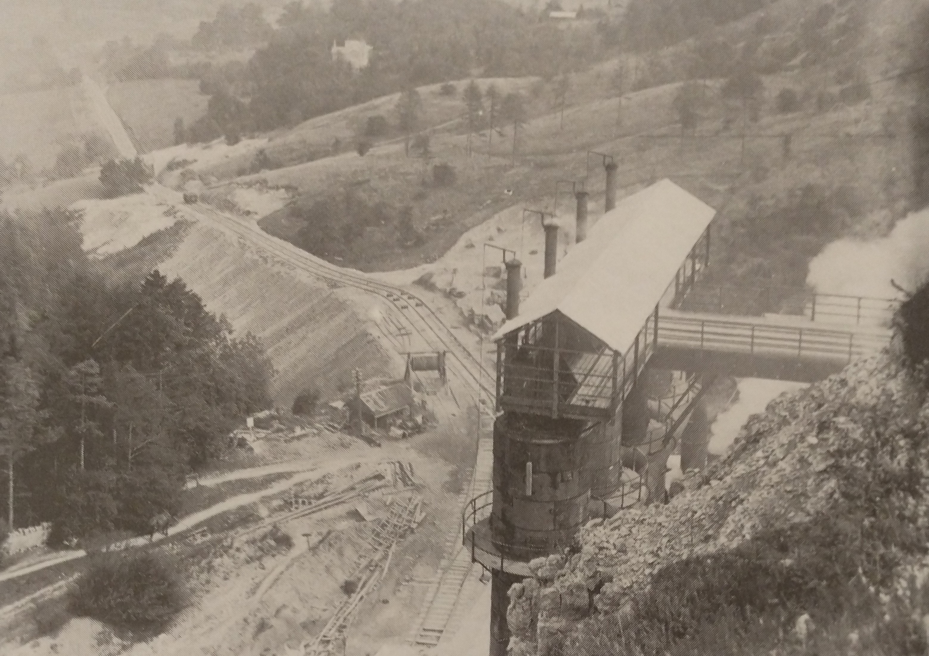

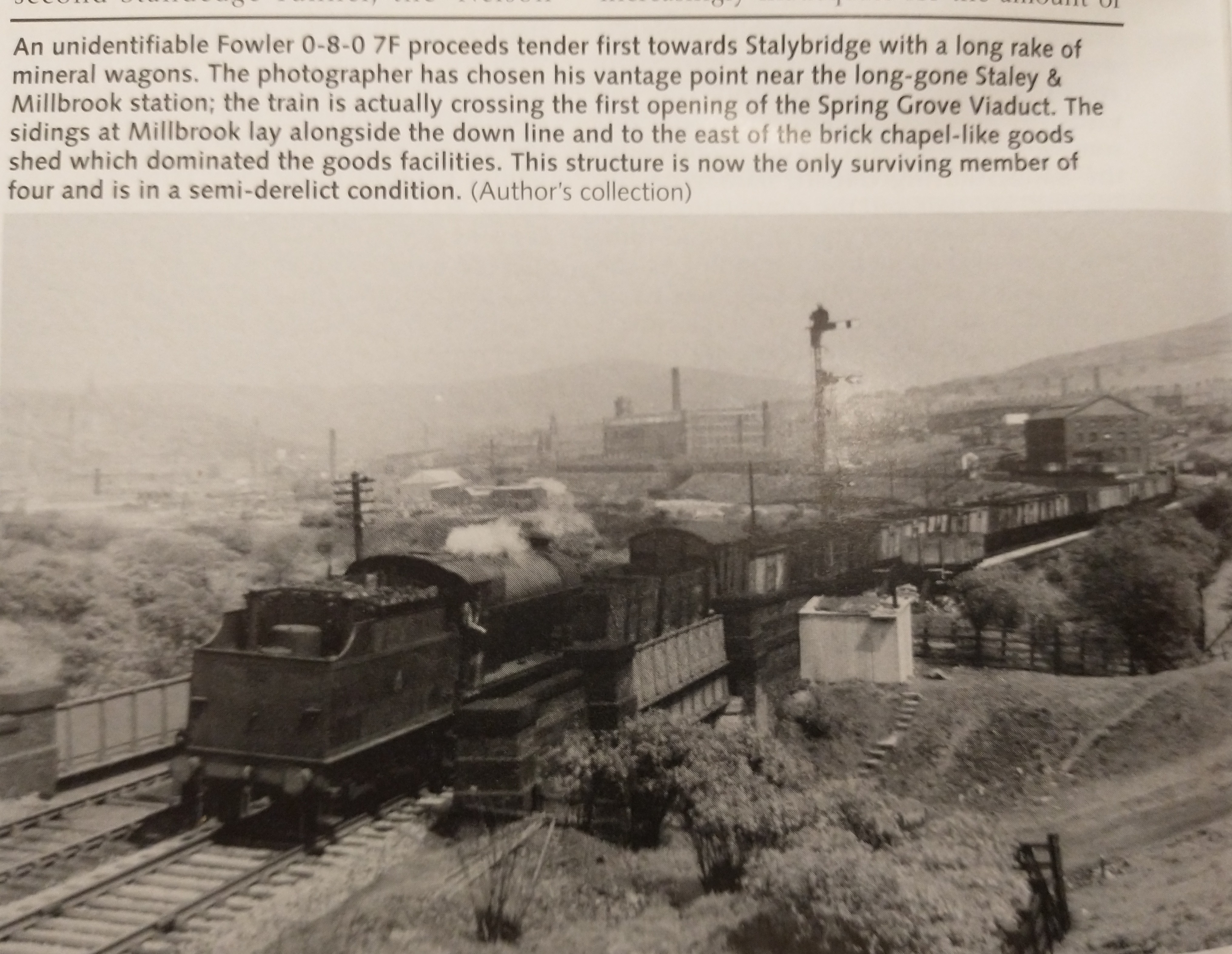
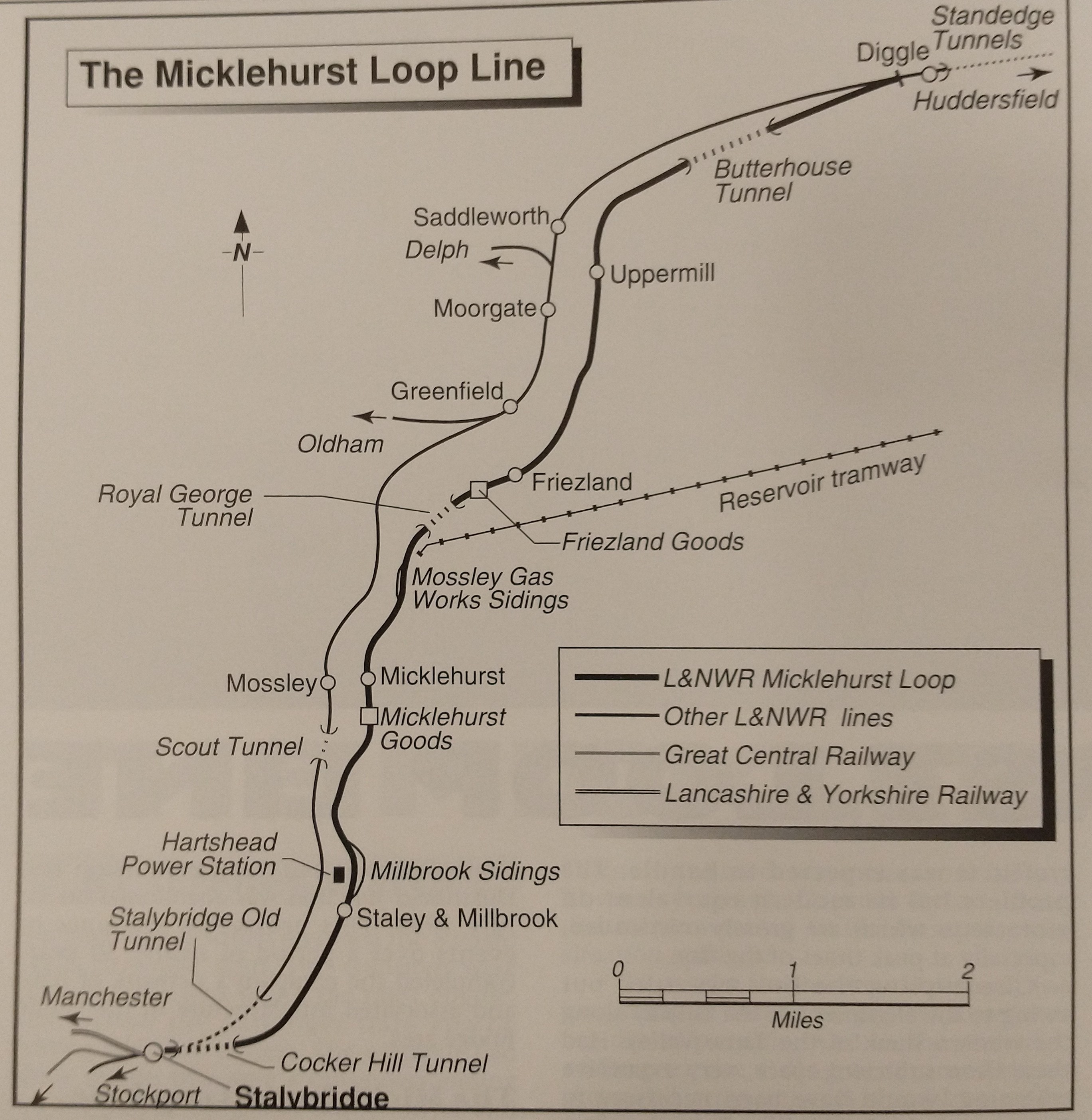


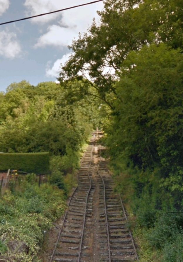
 A 278-08 19-285 29 May 1974 SJ 695028 ESE Ruins of engine house and chimney at top of The Hay Inclined Plane, Old Shropshire Canal
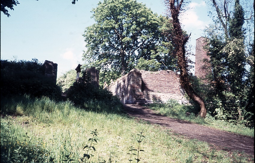 A 278-09 19-286 29 May 1974 SJ 695028 NE Summit of The Hay Inclined Plane, Old Shropshire Canal
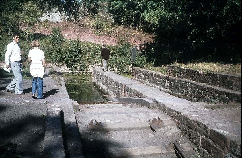 555-11 42-112 16 Sep 1979 SJ 695028 NE Top of Hay Inclined Plane, Old Shropshire Canal, Ironbridge Gorge Museum
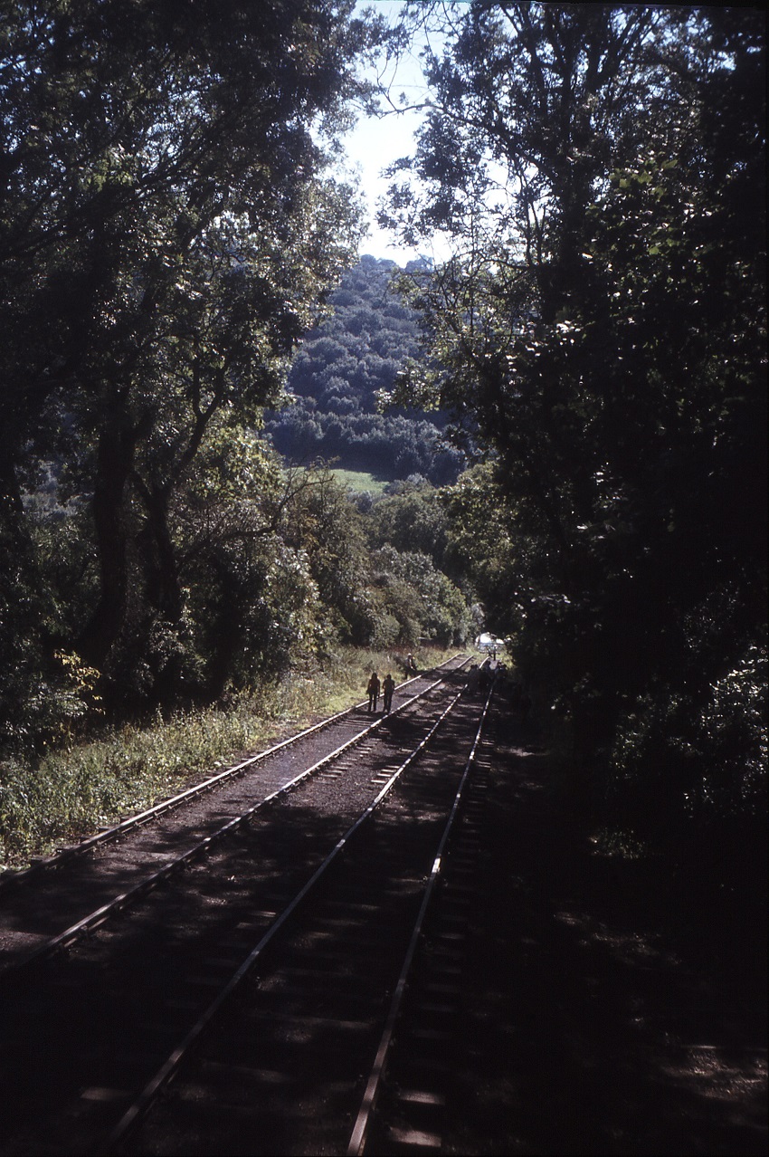 555-12 42-113 16 Sep 1979 SJ 695028 SSW The Hay Inclined Plane, with re-laid tracks, Old Shropshire Canal, Ironbridge Gorge Museum
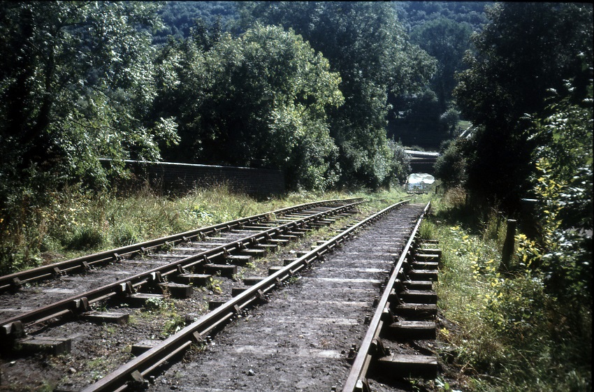 555-13 42-114 16 Sep 1979 SJ 695027 SSW The Hay Inclined Plane, with re-laid tracks, Old Shropshire Canal, Ironbridge Gorge Museum
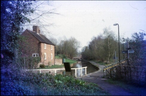 ASH-22 39-264 1 Apr 2005 SJ 693025 SE Coalport Canal at bottom of Hay Inclined Plane
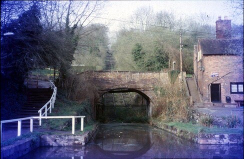 ASH-23 39-267 1 Apr 2005 SJ 694025 NNE Coalport High Street bridge over Coalport Canal at foot of Hay Inclined Plane
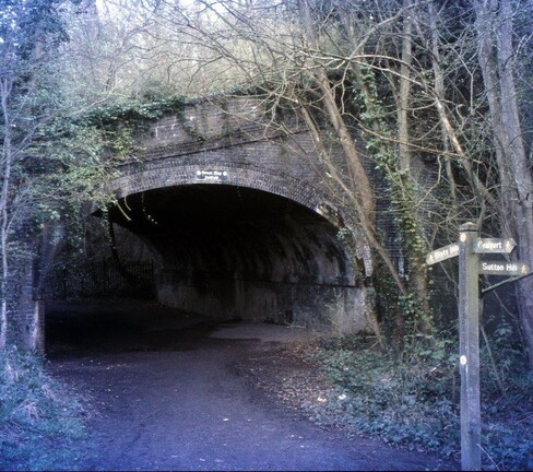 ASI-20 15-093 4 Apr 2005 SJ 694026 NNW Hay Incline bridge over ex-L&NWR line west of Coalport
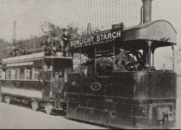
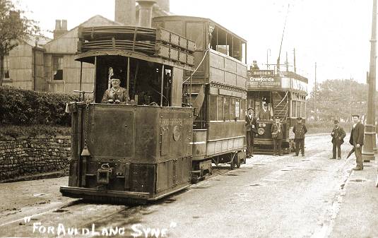
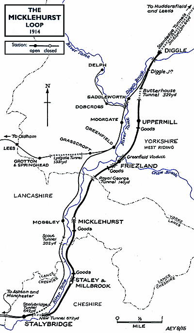
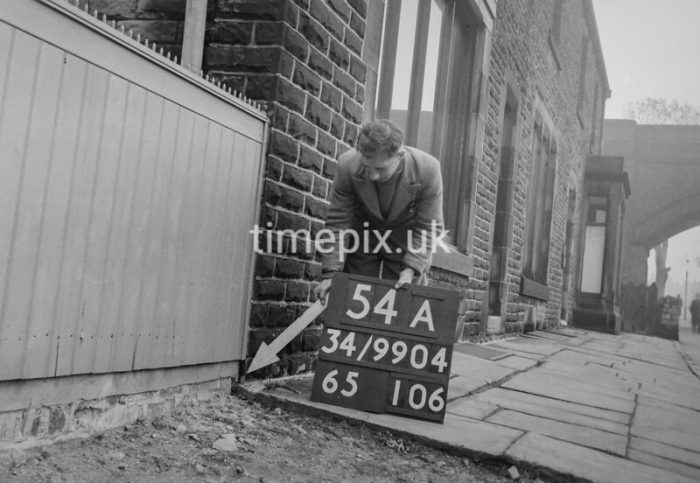
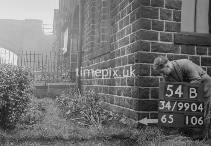
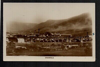
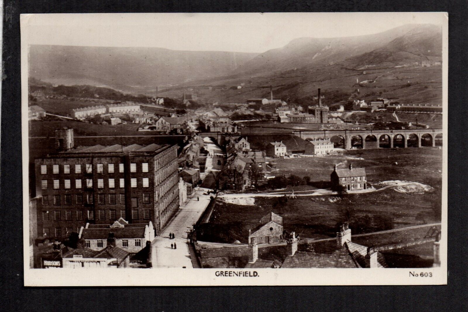
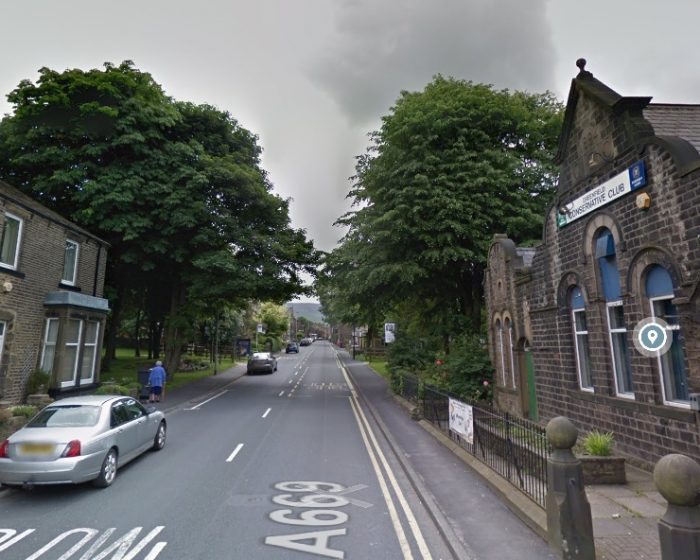
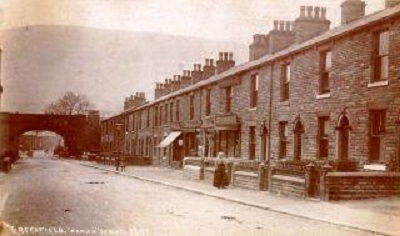 The adjacent image looks from the Southeast along Chew Valley Road. [16]
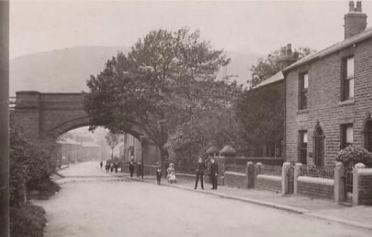
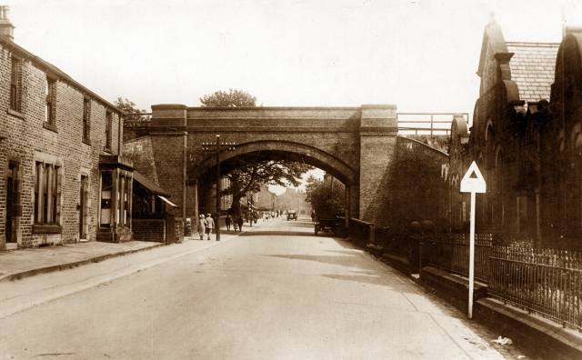 The third, below, is taken from the Northwest and shows the Conservative Club on the right side. [18]
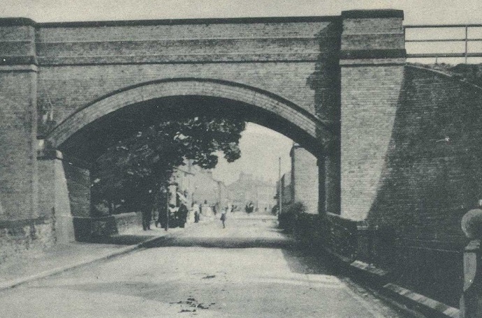
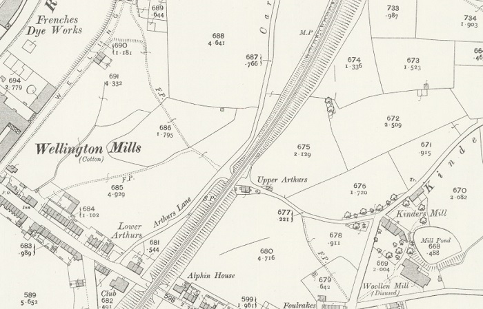
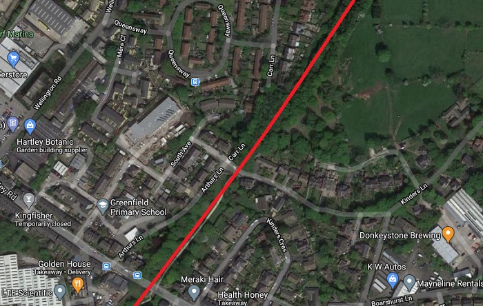
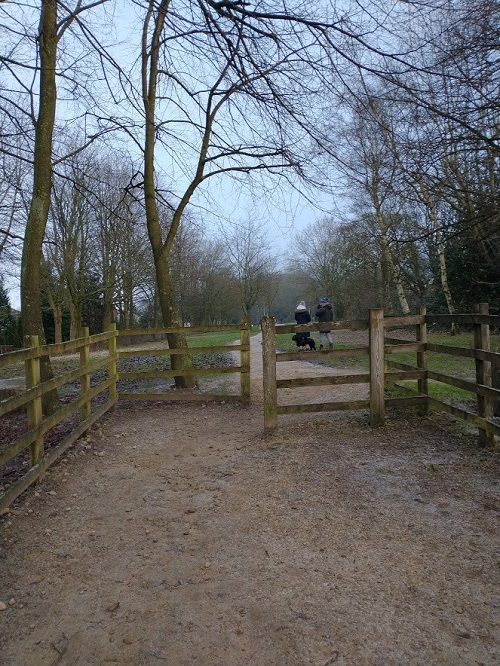
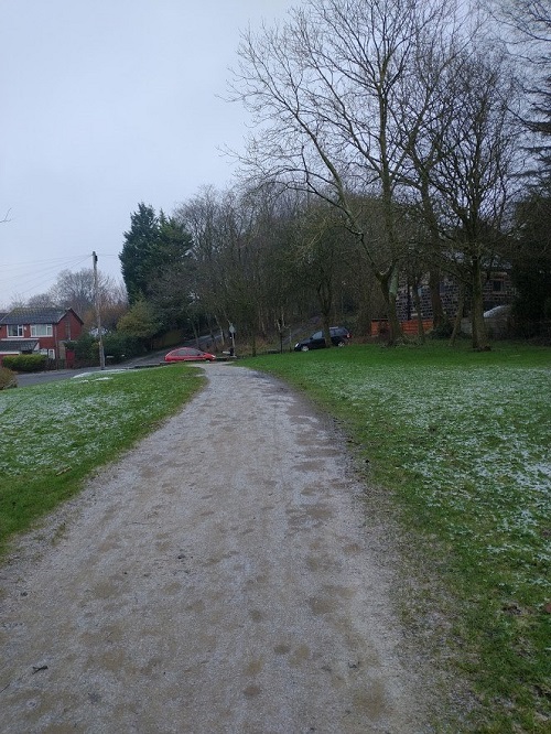
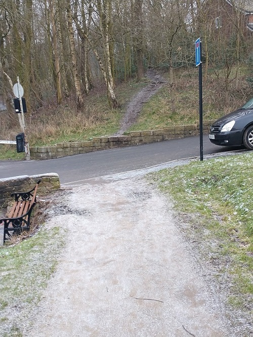
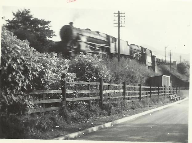
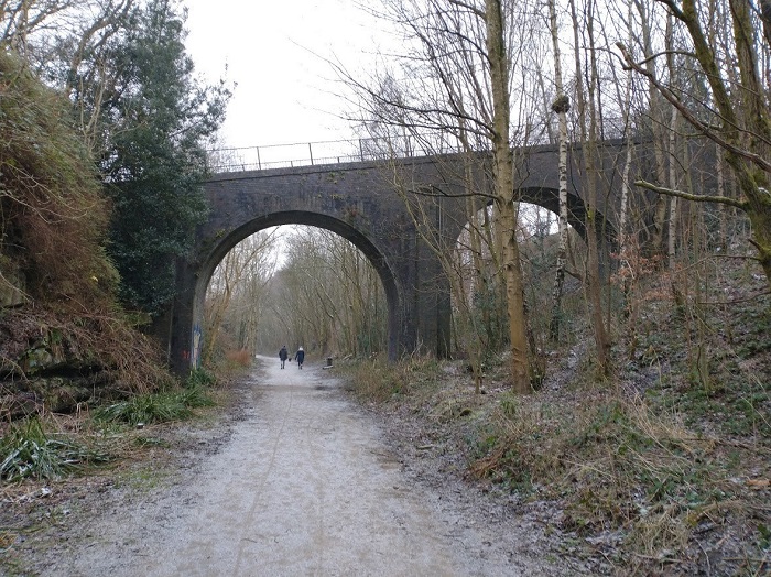
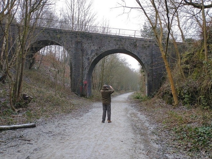
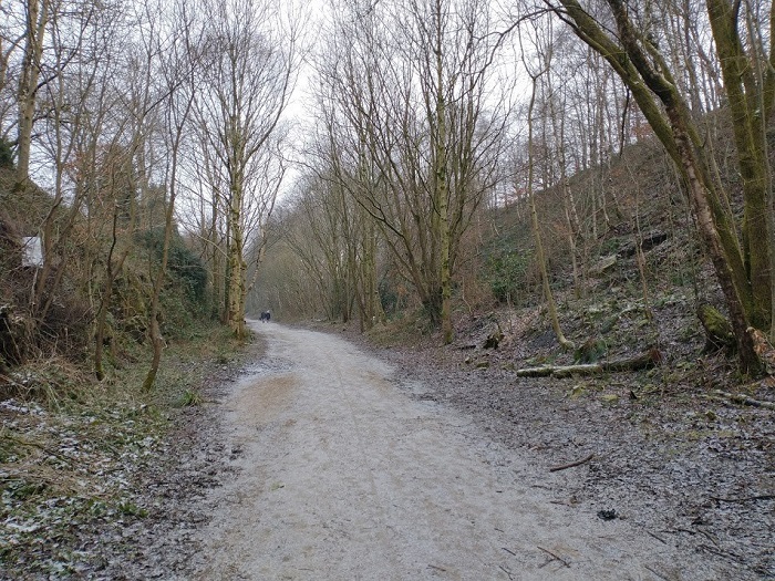
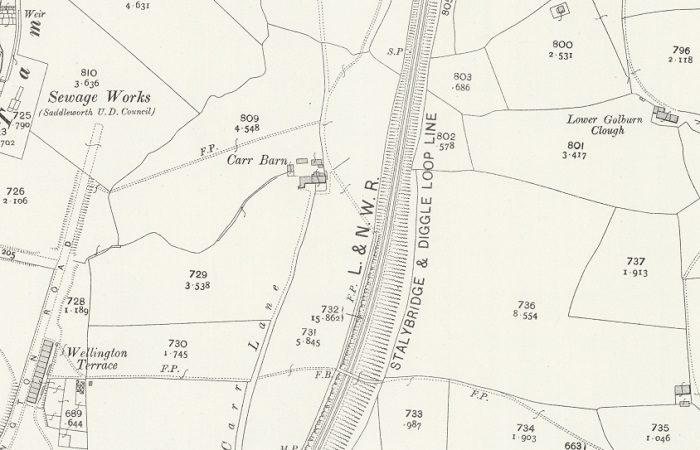
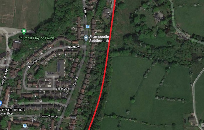
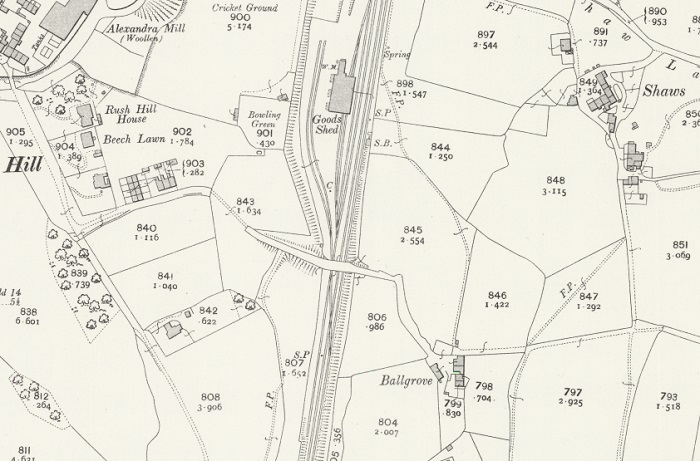
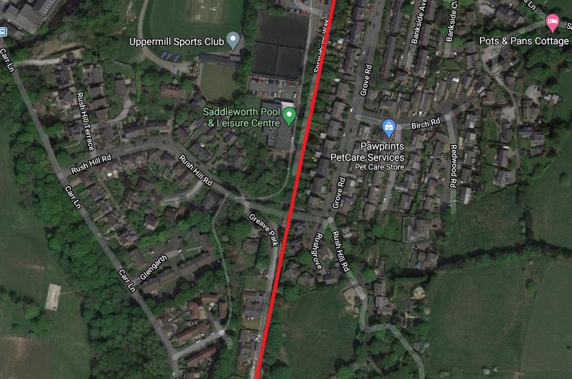
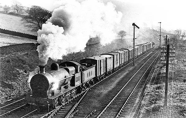
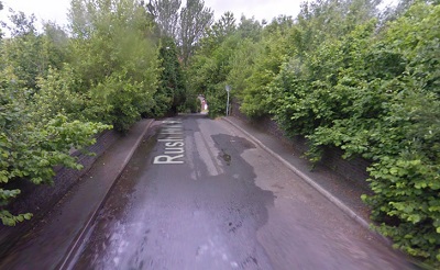
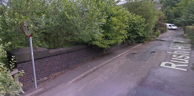
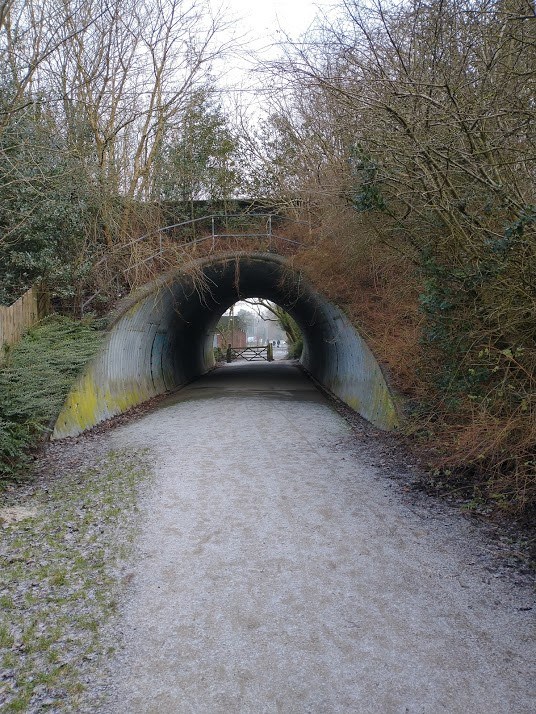
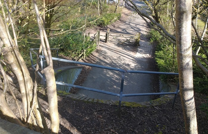
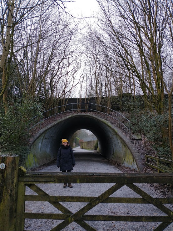
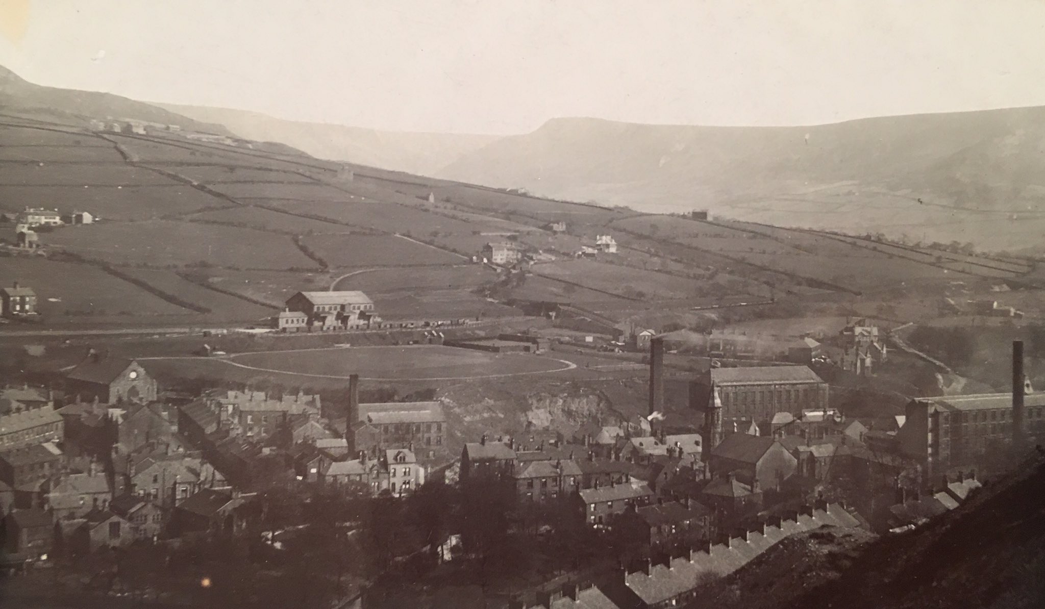
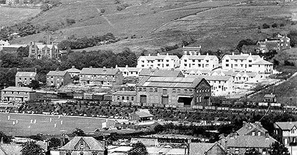

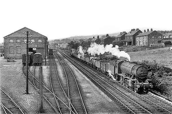
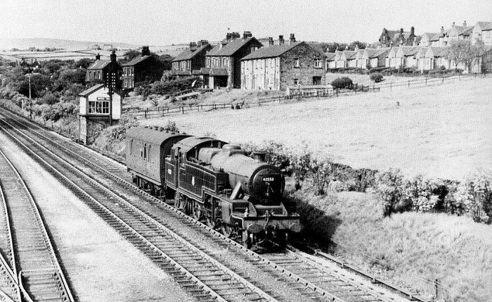
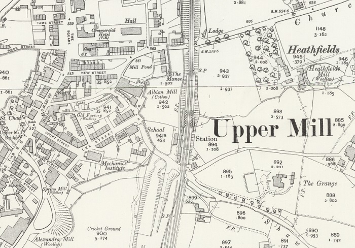
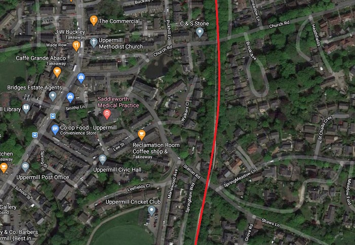
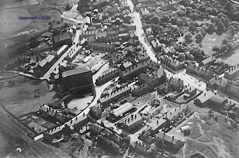
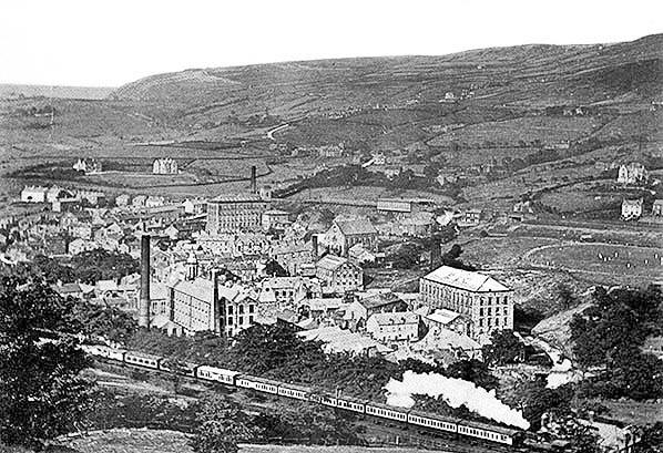
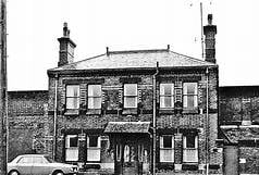
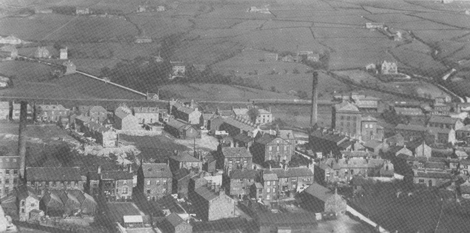
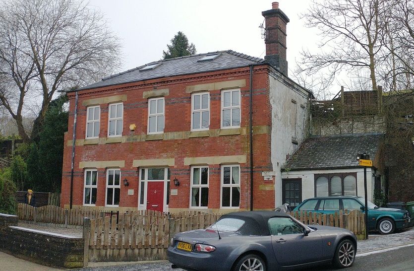
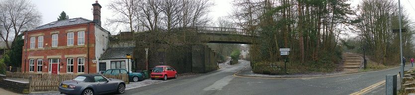
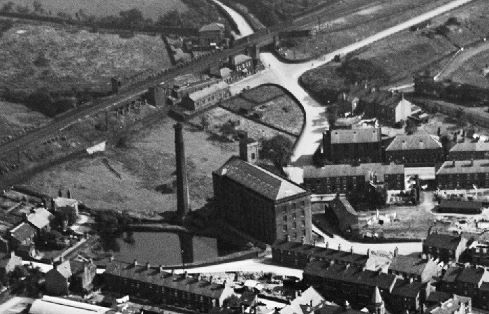
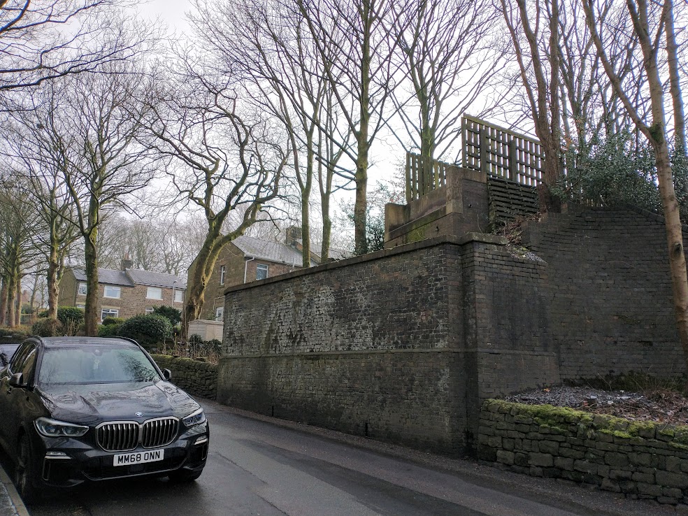
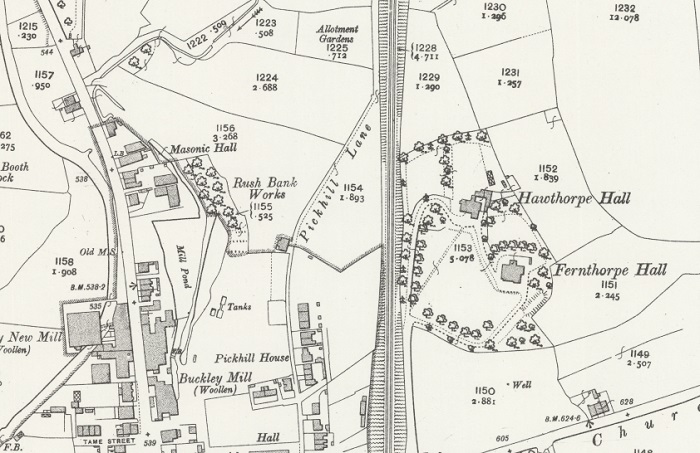
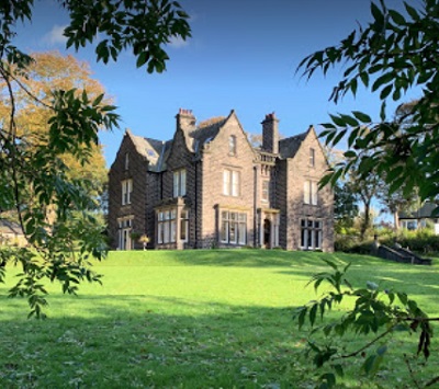
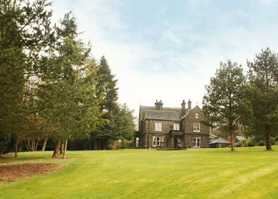
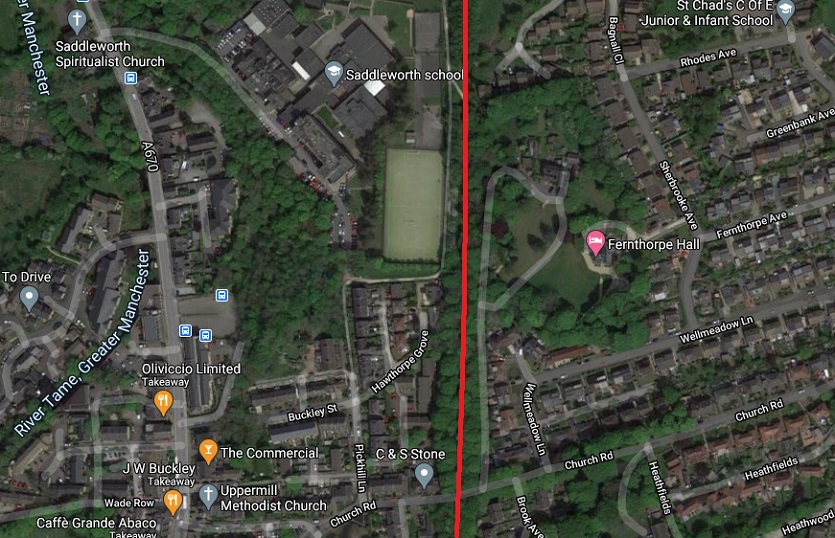
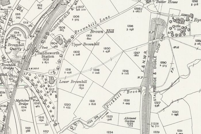
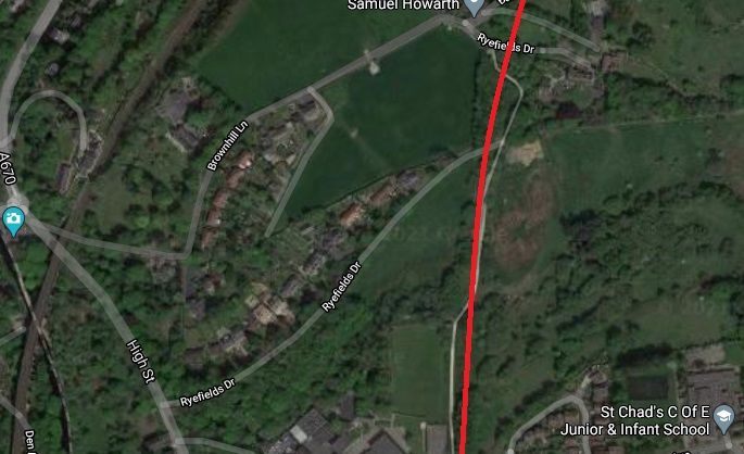
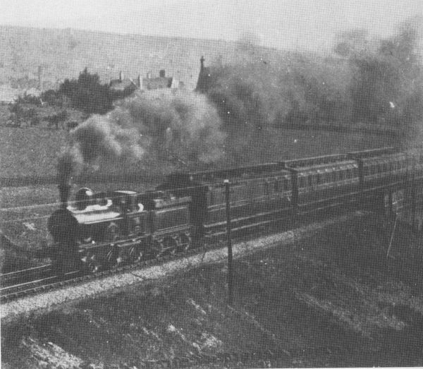
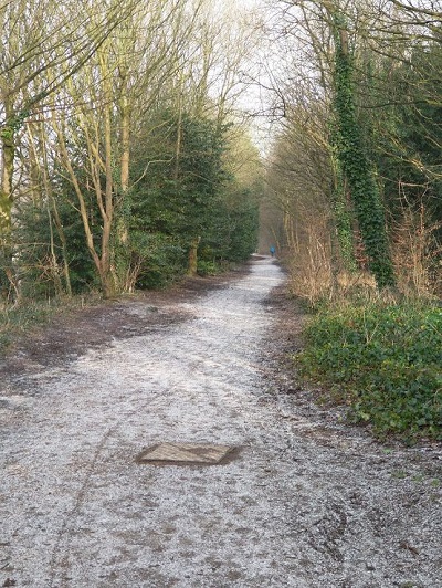
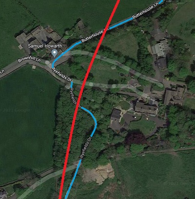
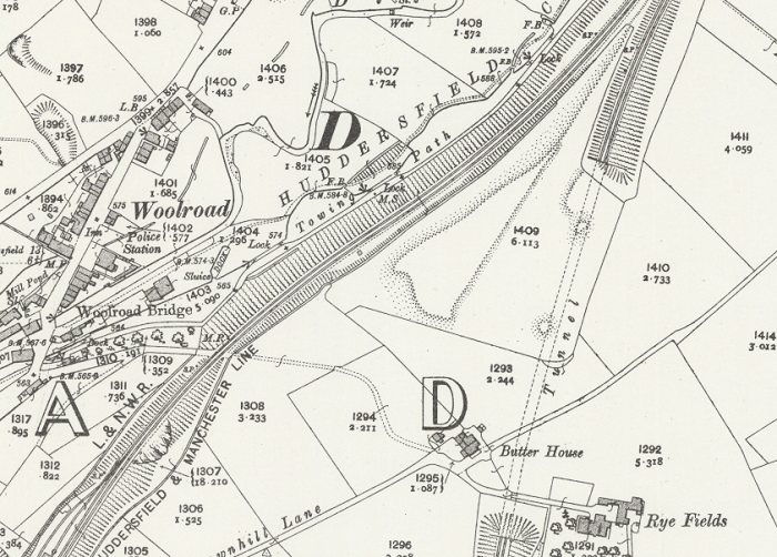
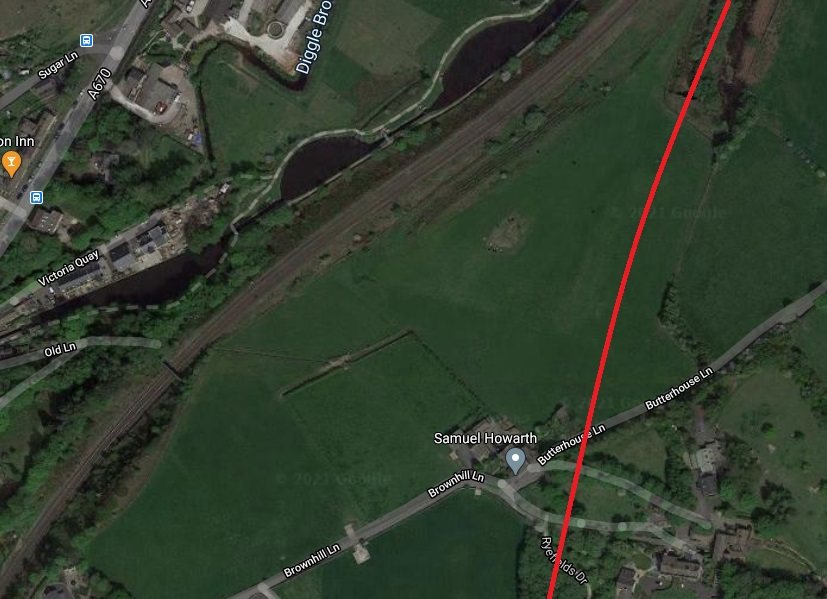
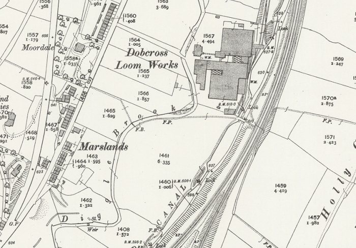
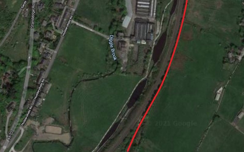
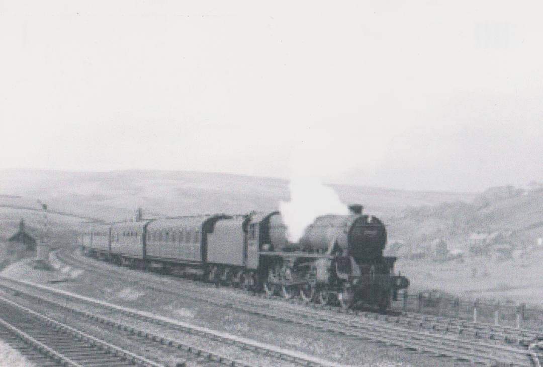
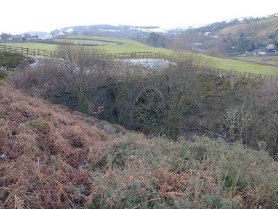
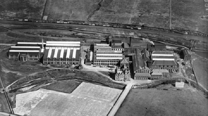
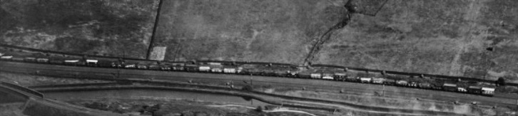
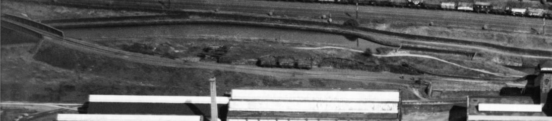

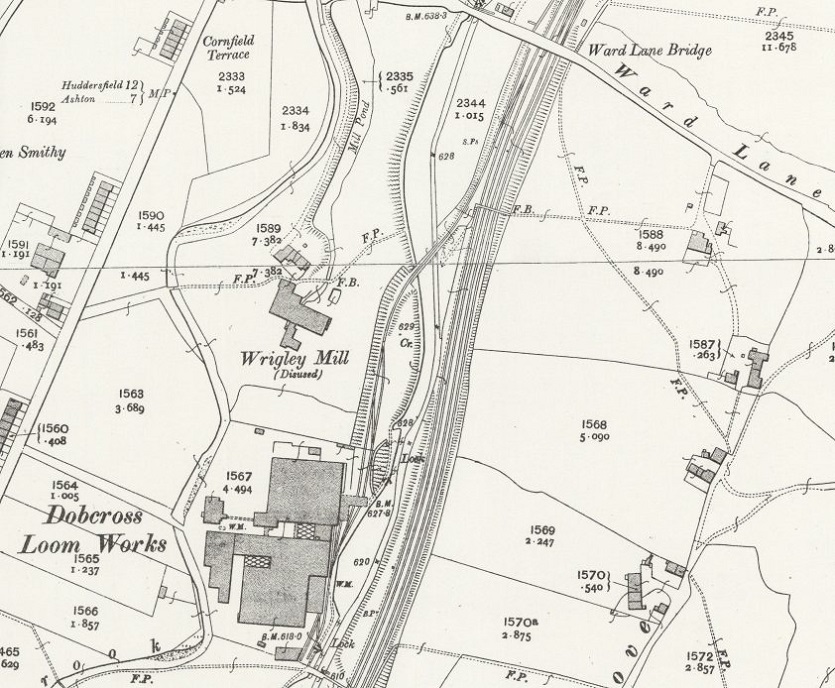
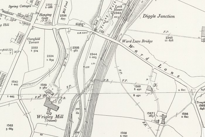
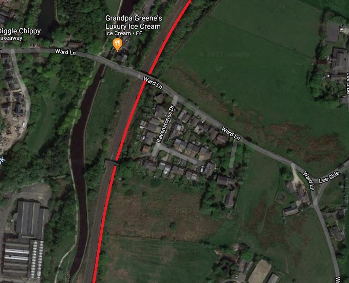
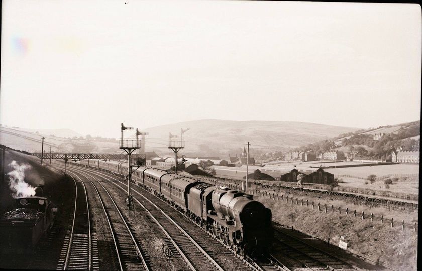
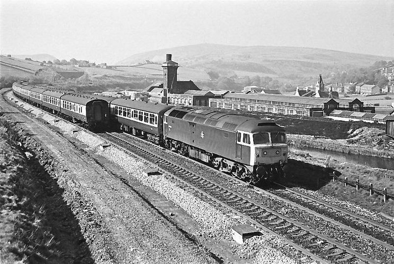
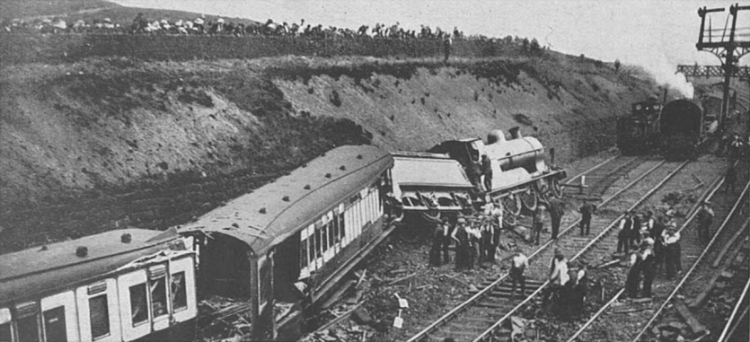
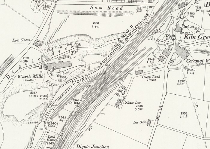
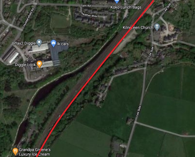
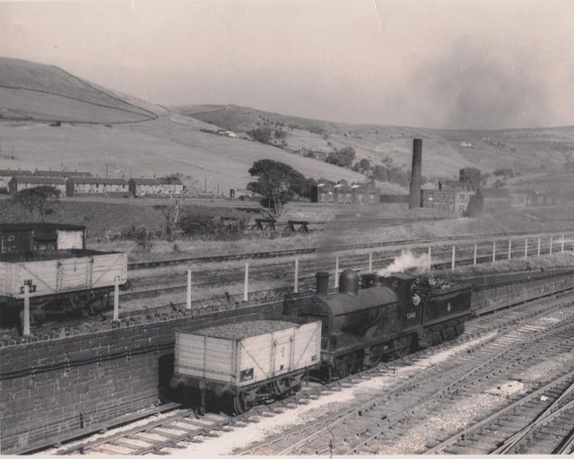
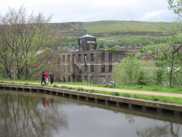
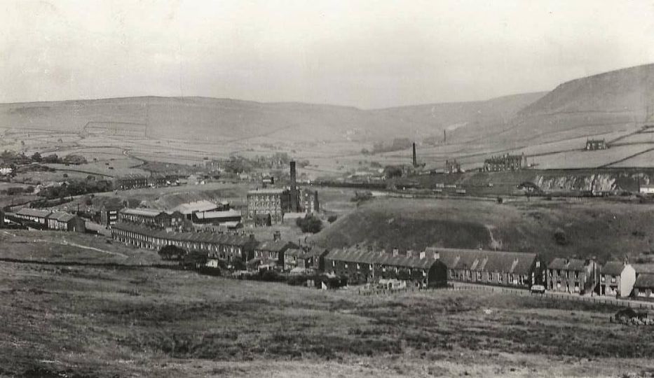
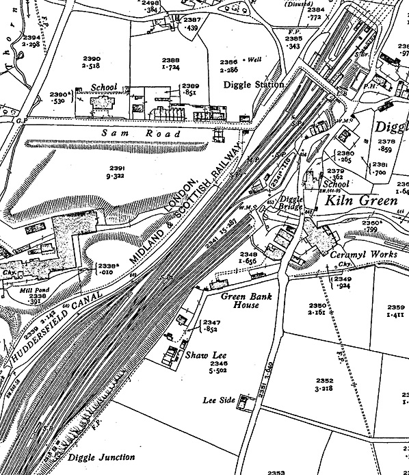
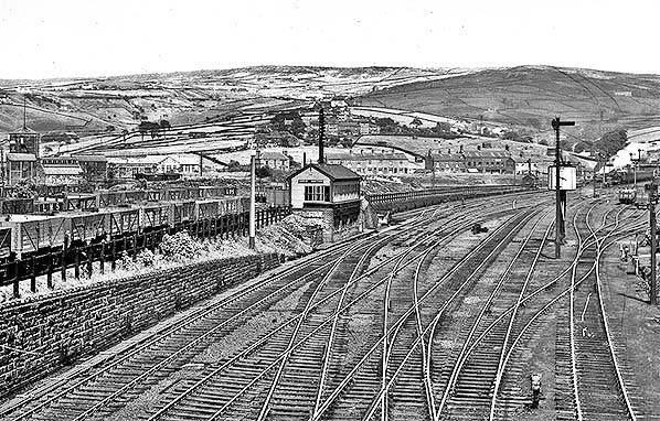
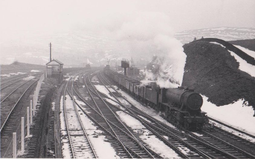
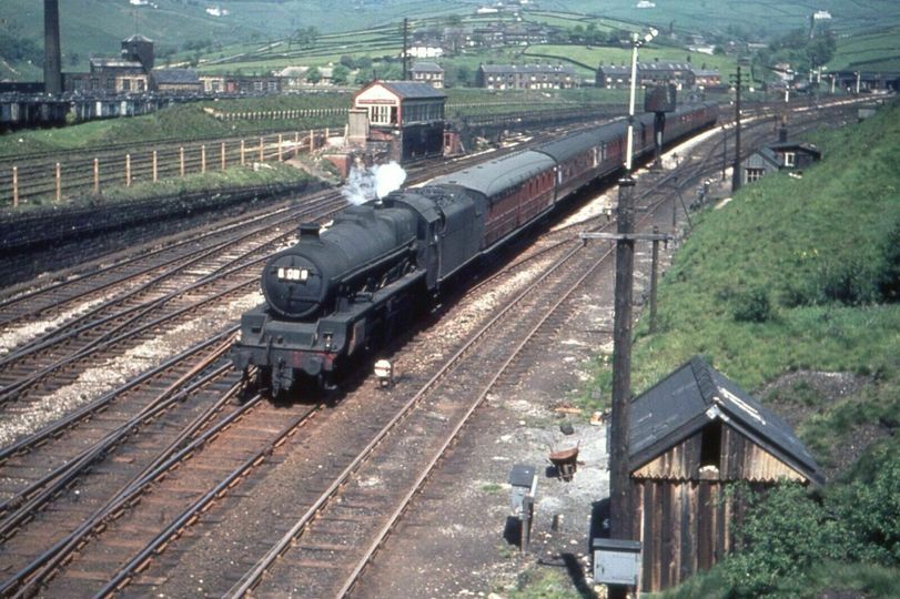
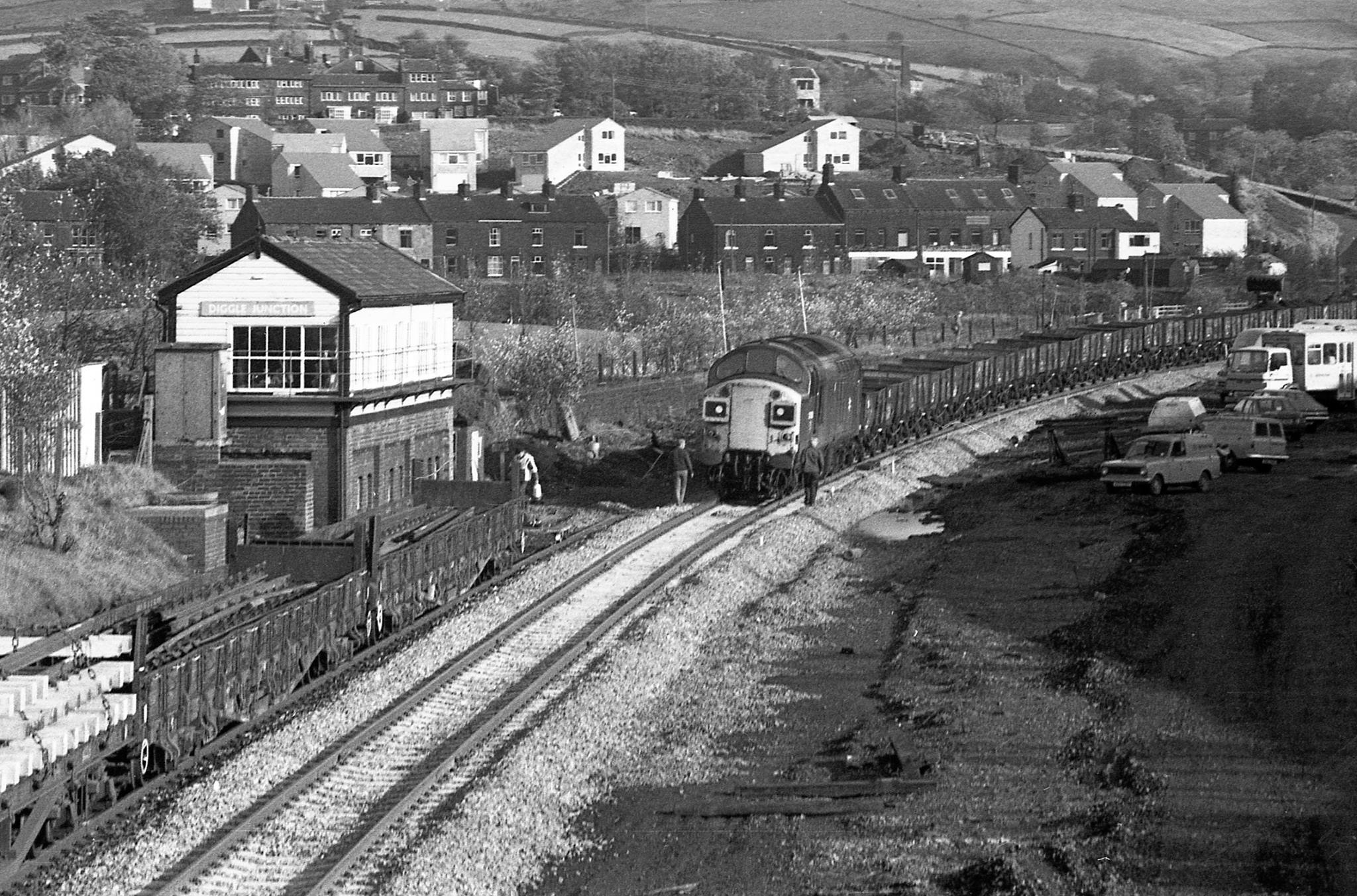
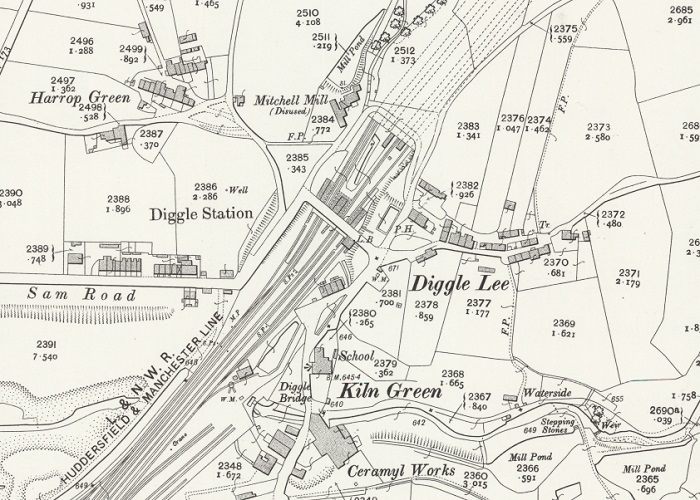
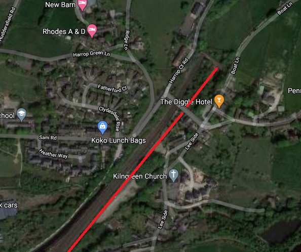
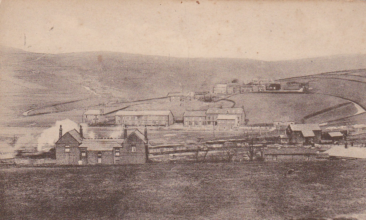
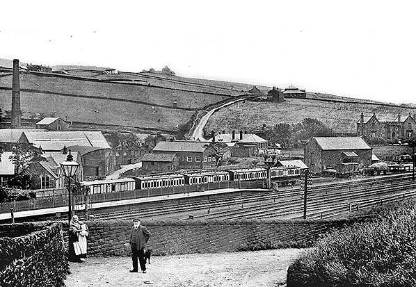

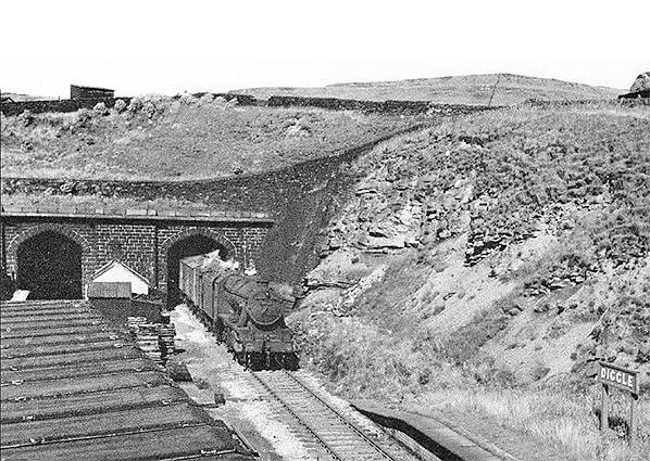
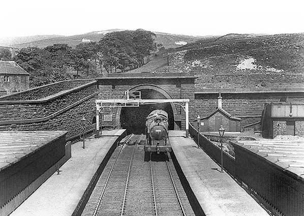
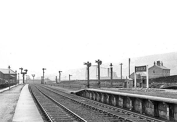
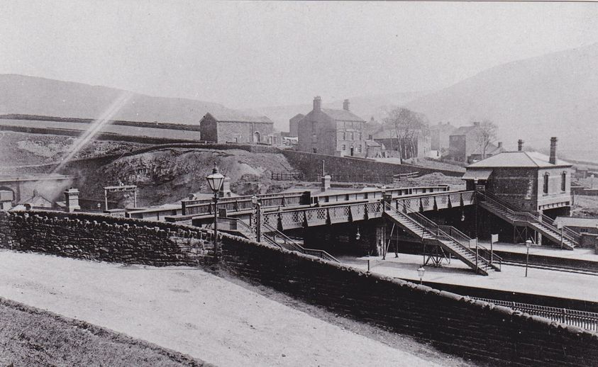
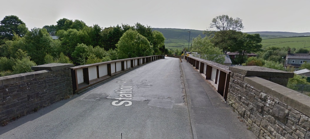
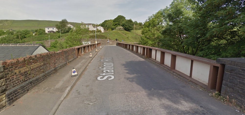
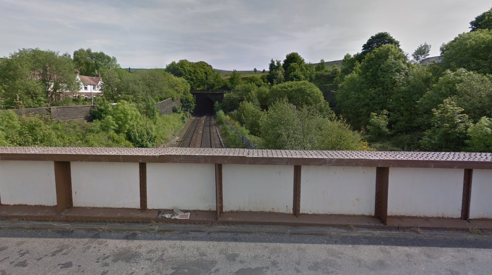
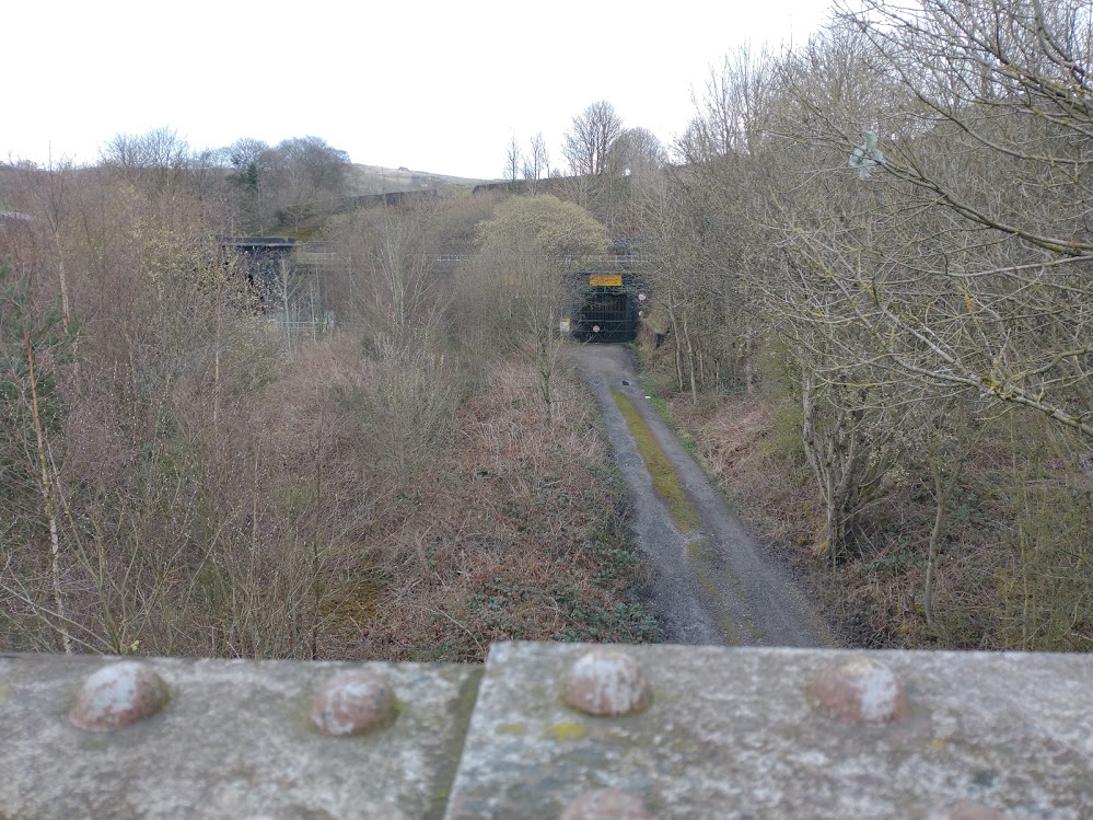
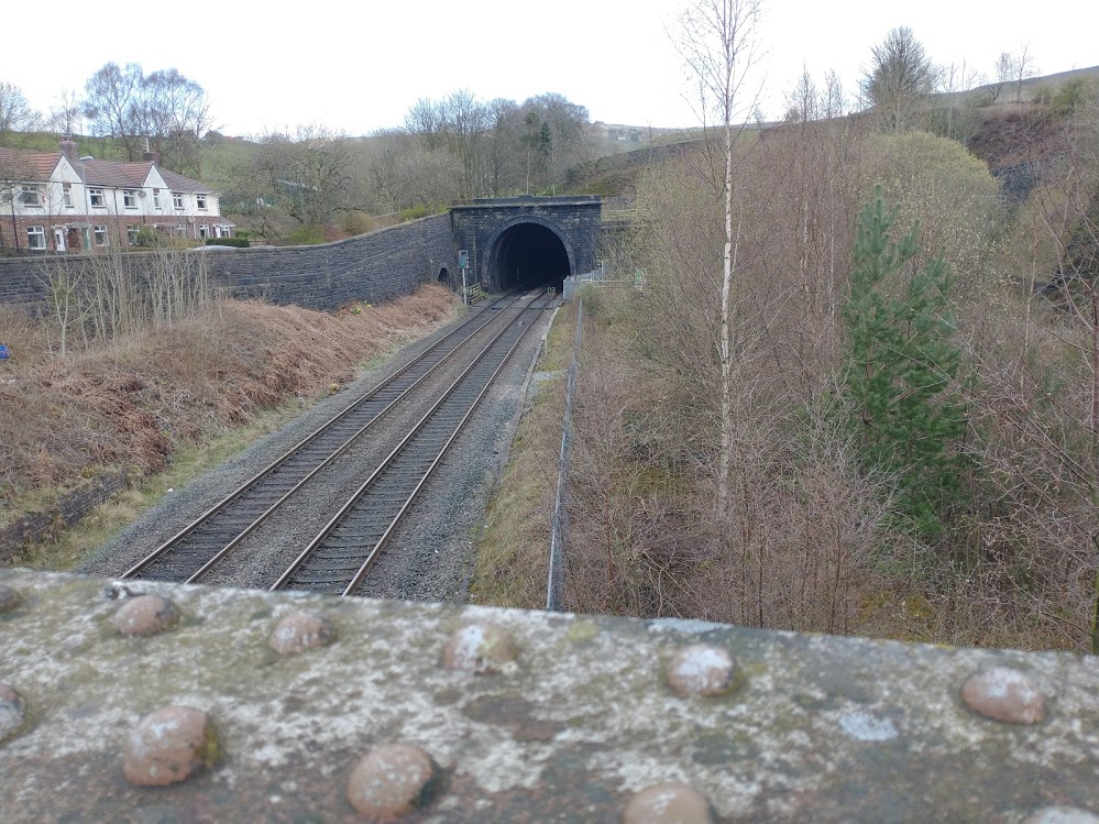
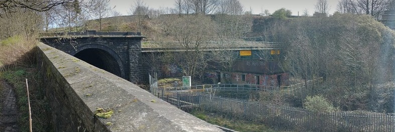
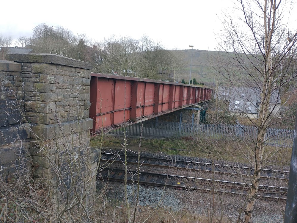

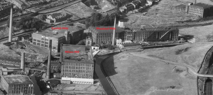
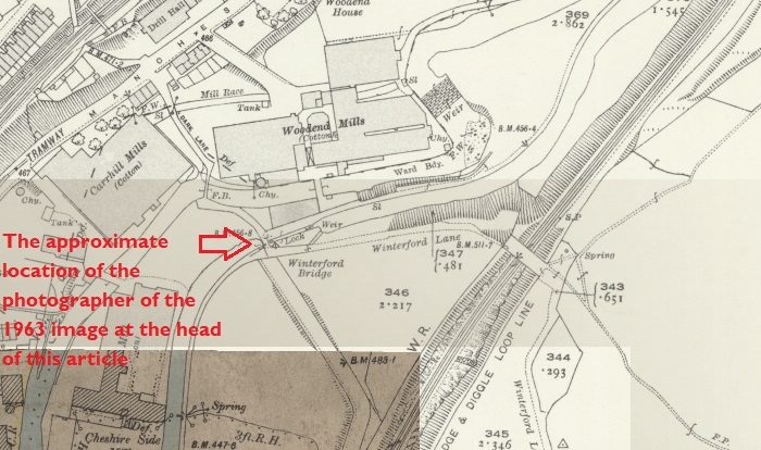
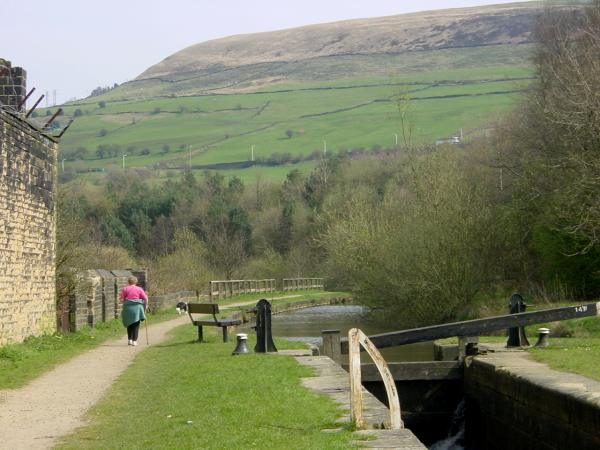
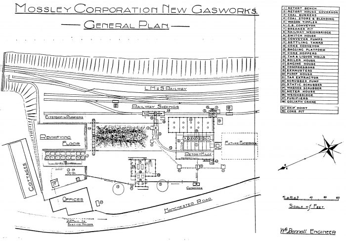

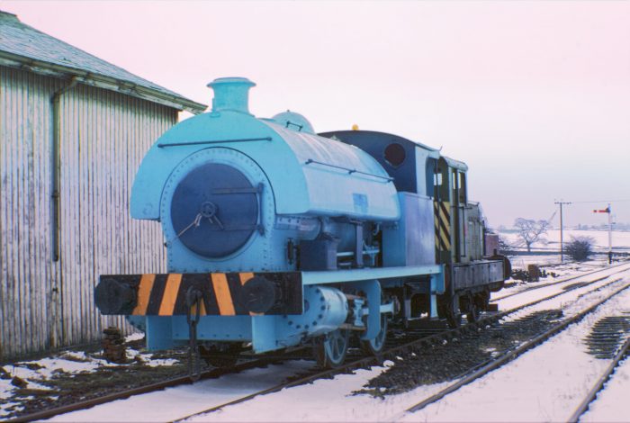
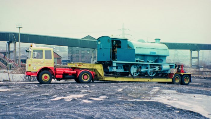
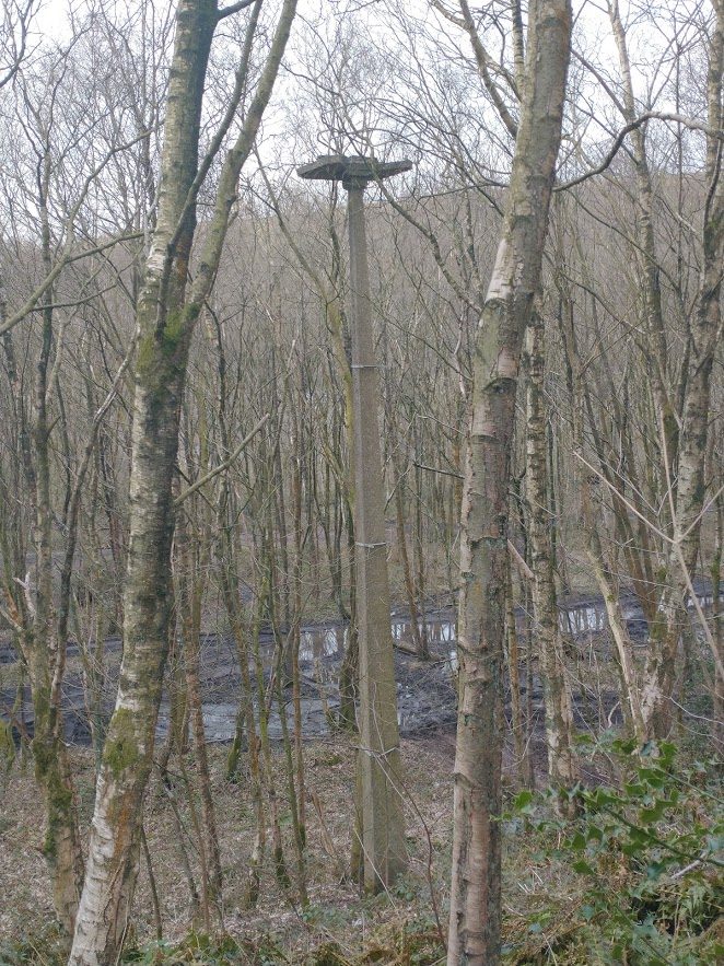
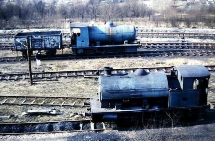
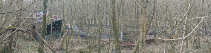
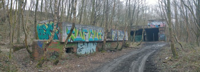
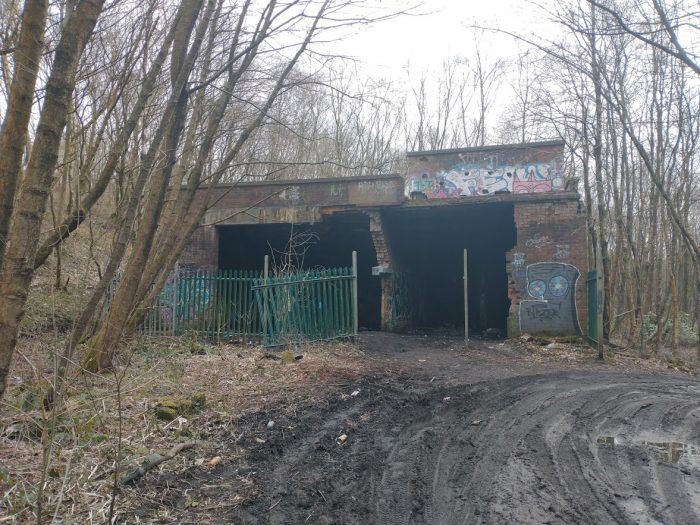
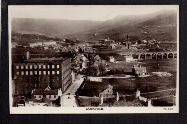
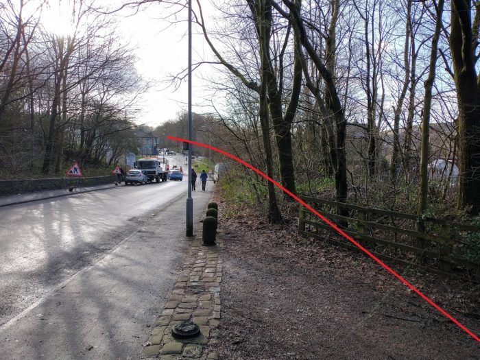
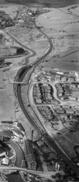
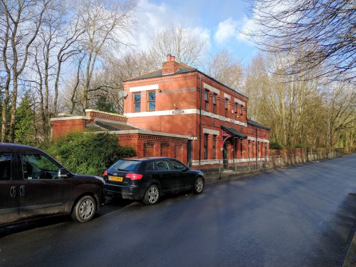
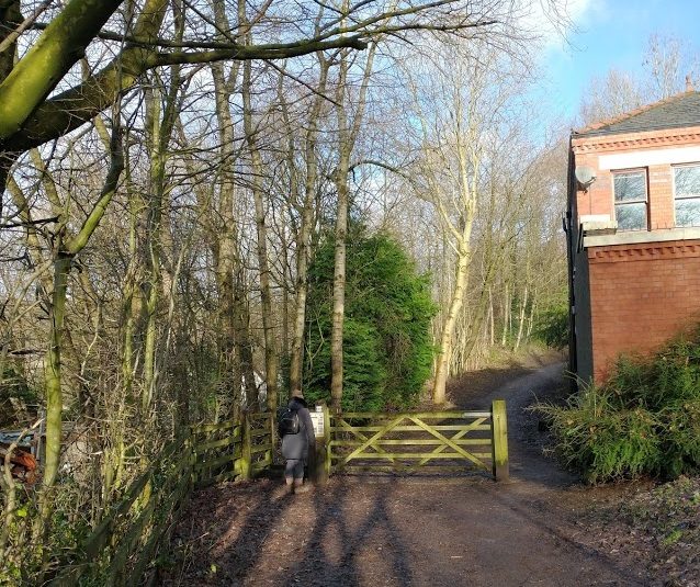
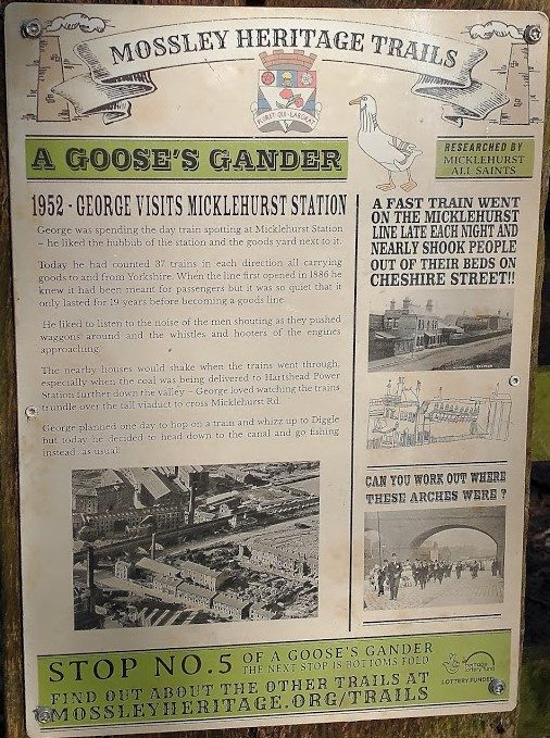
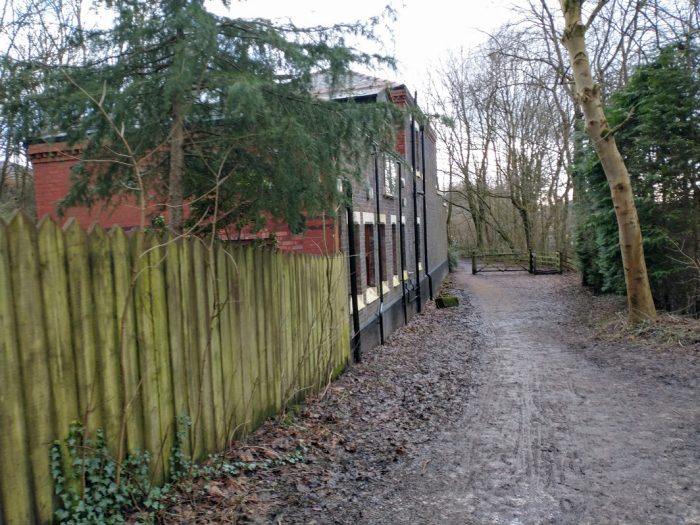
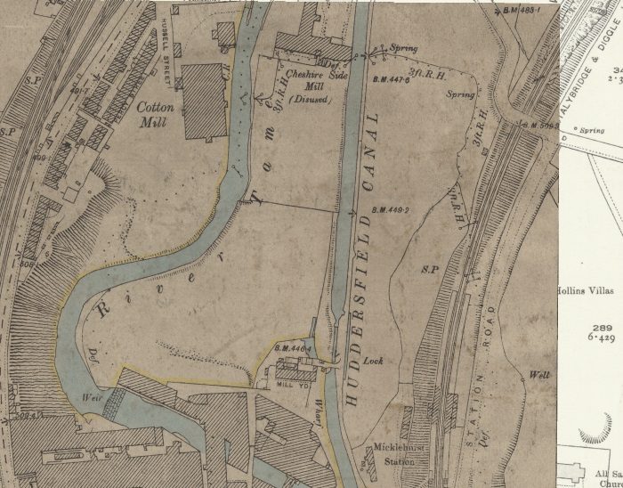
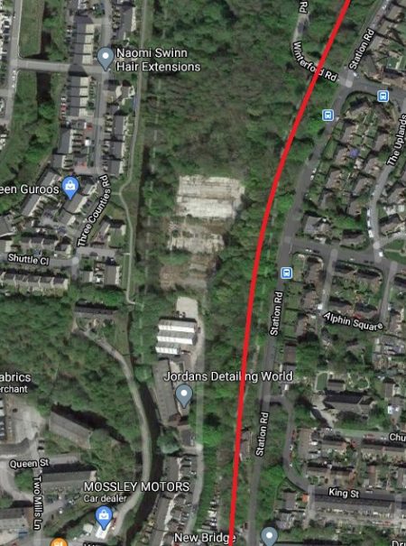
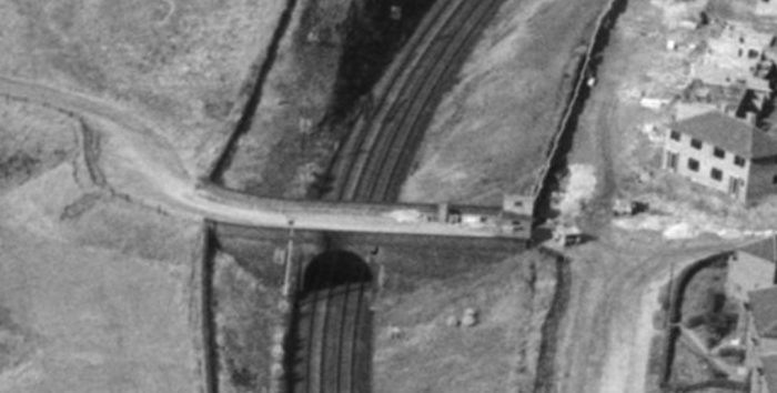
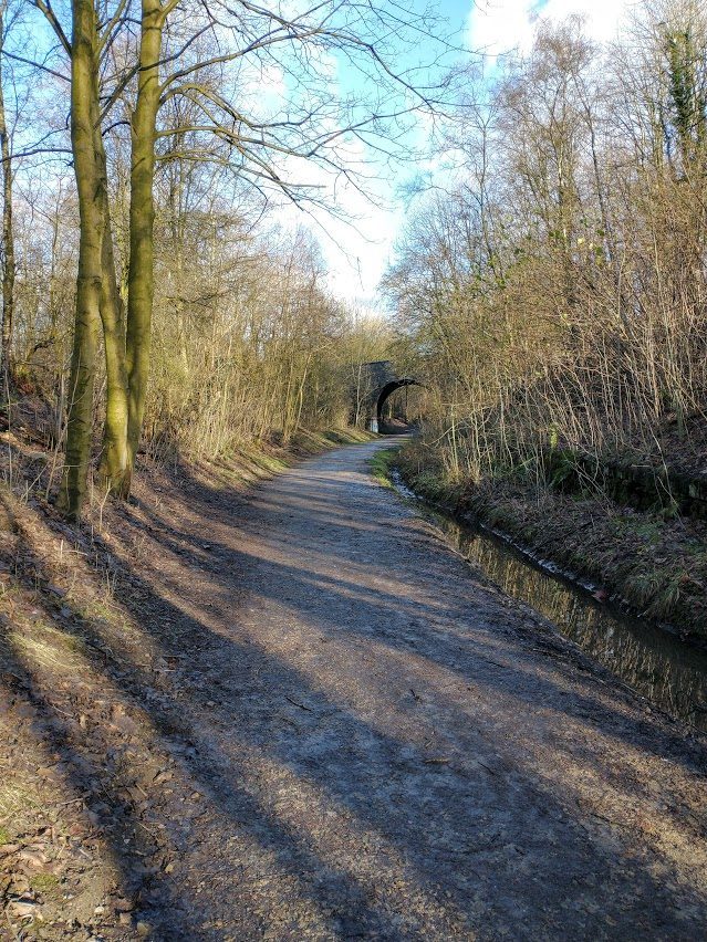
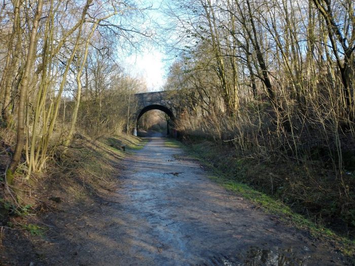
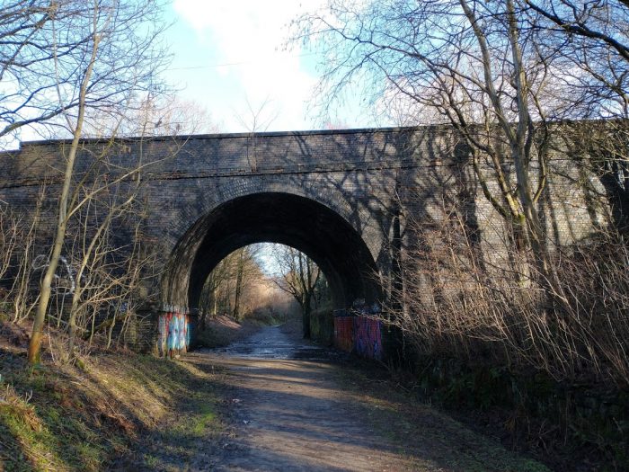
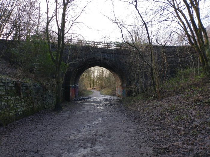
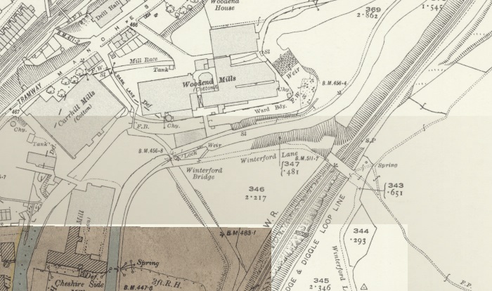
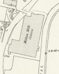
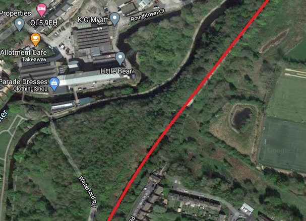
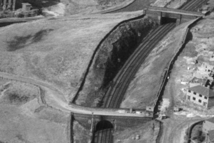
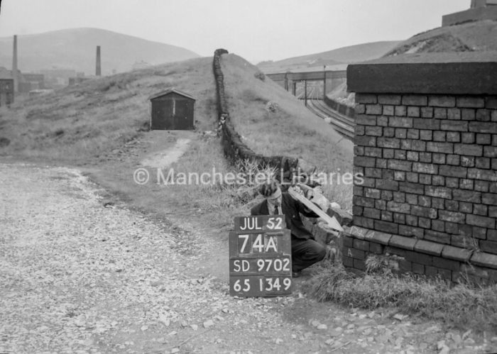
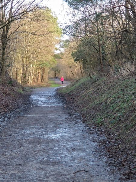
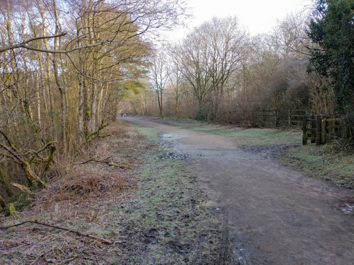
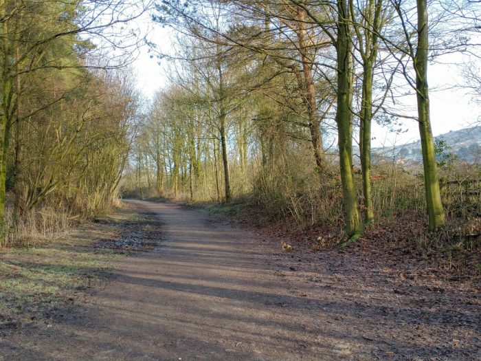

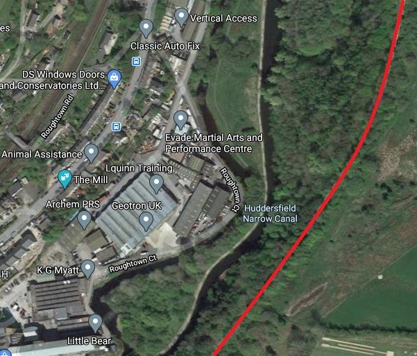
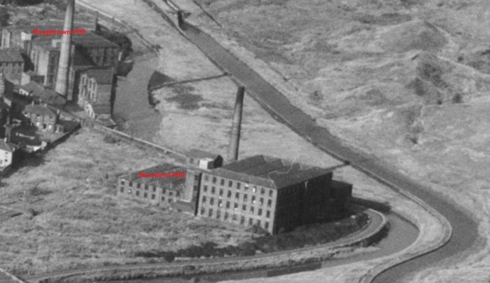
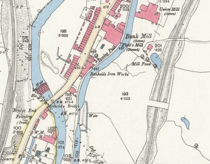
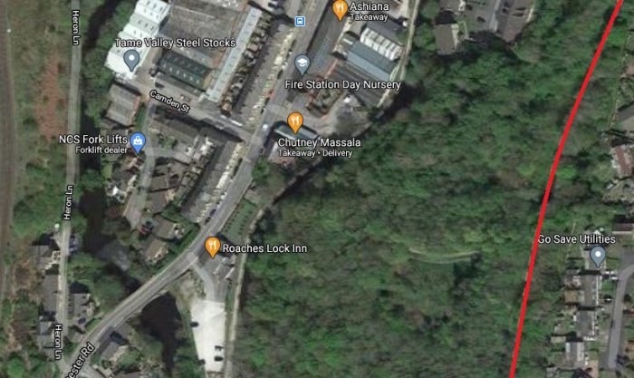
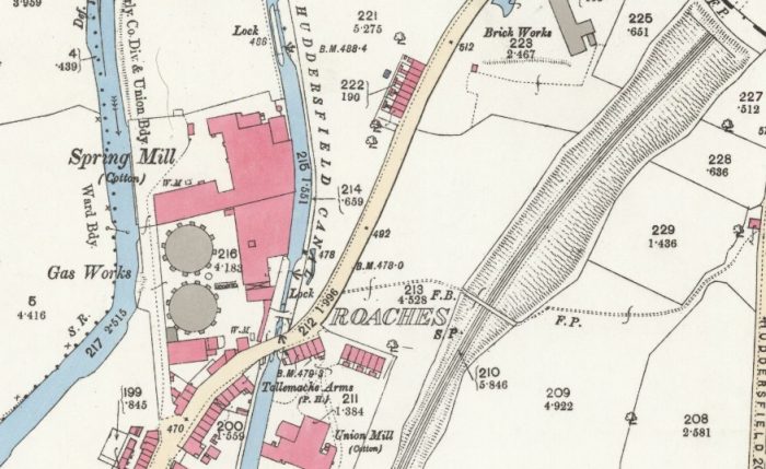
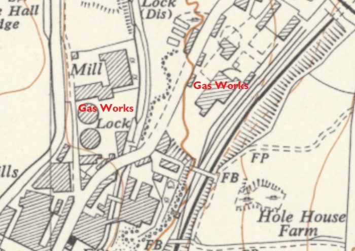
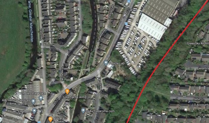
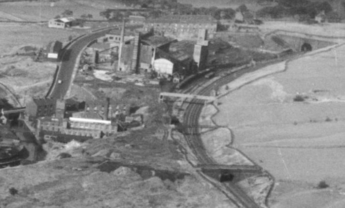
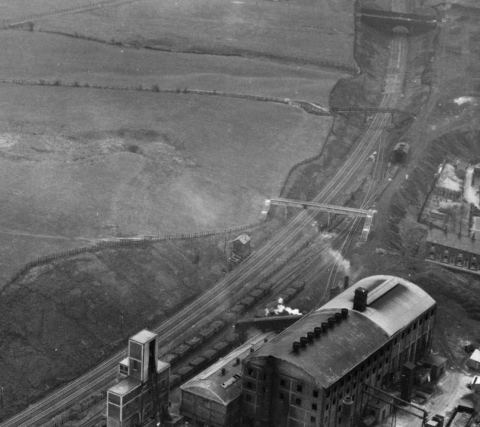
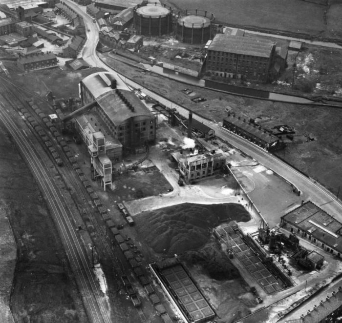
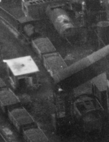
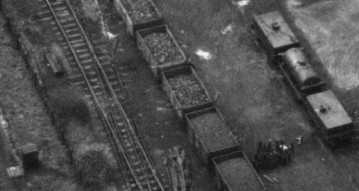
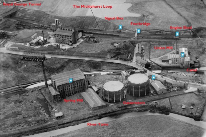
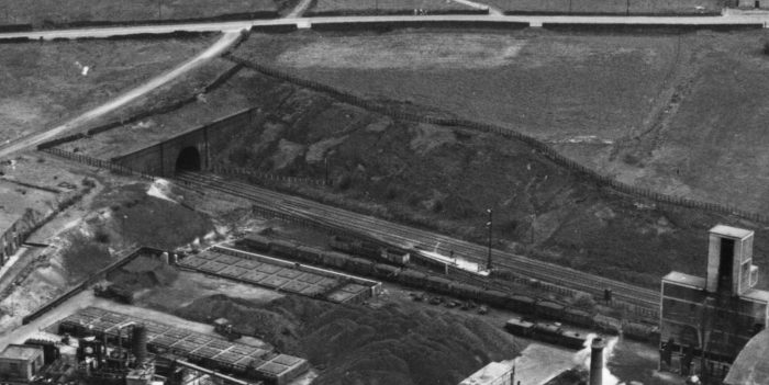
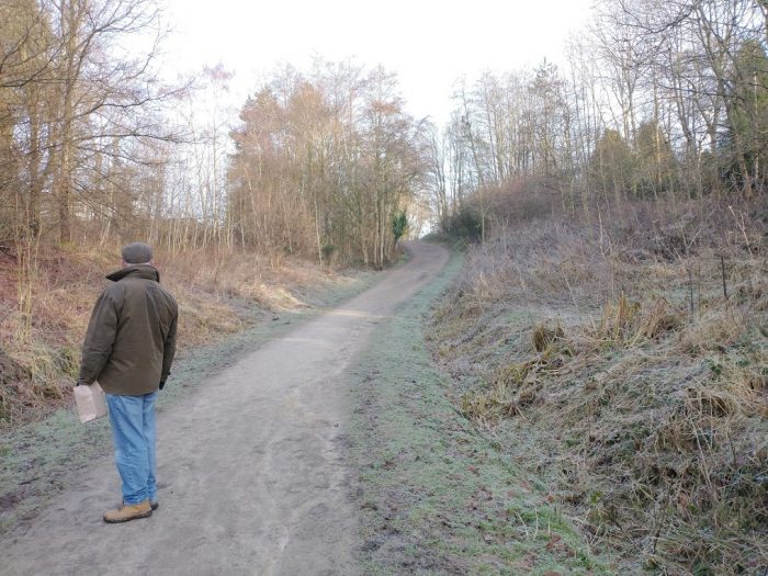
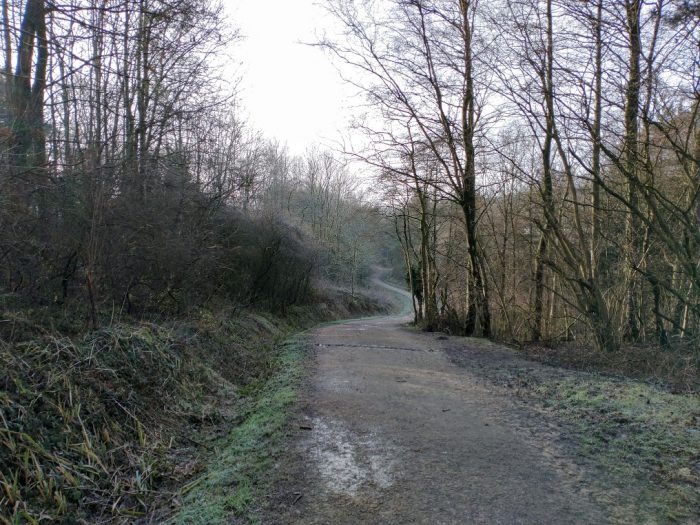
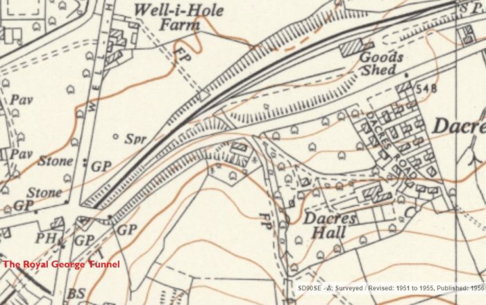
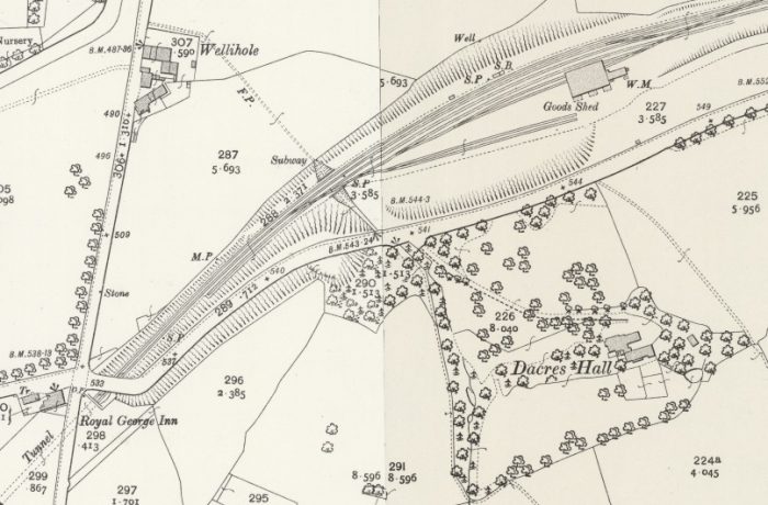
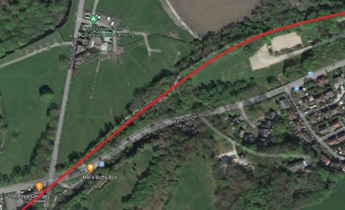
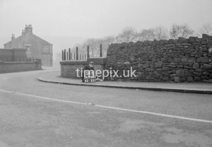
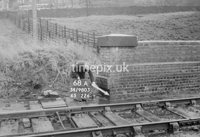
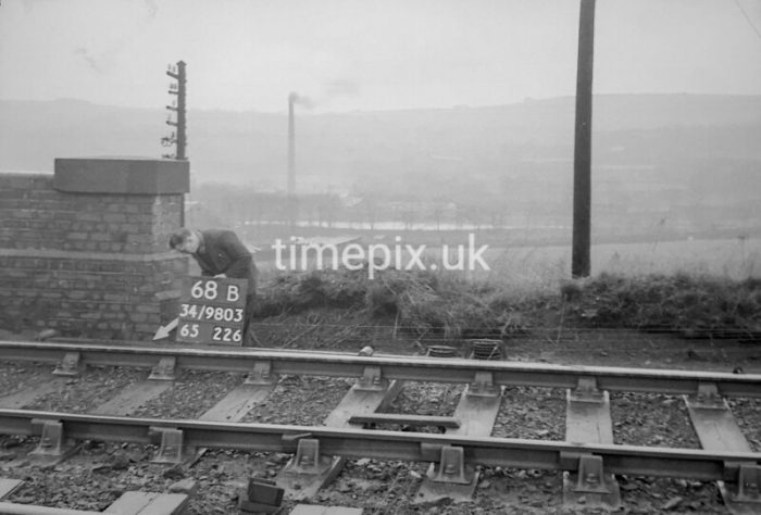
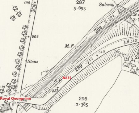
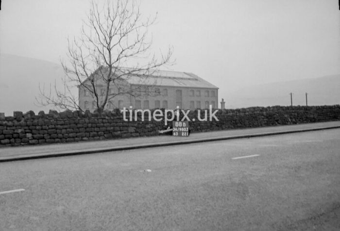
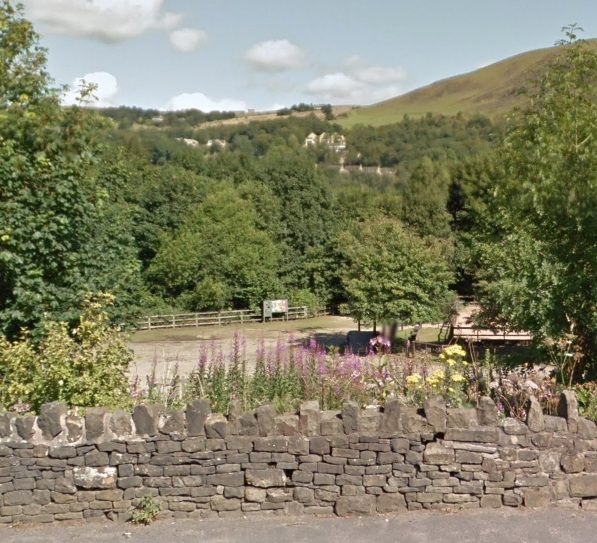
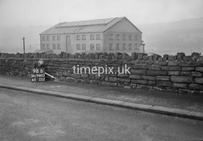

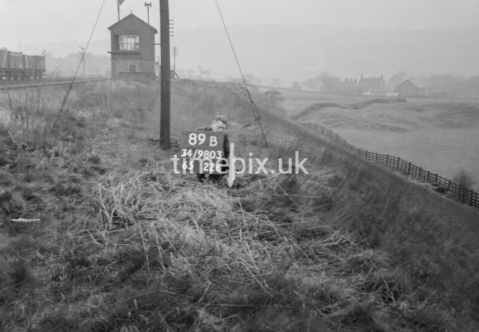
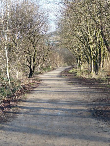
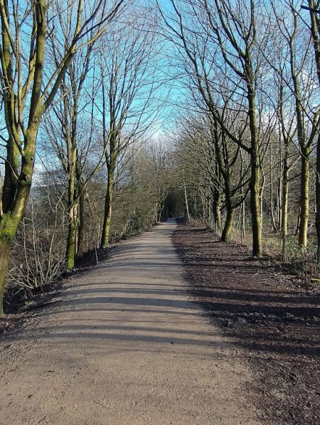
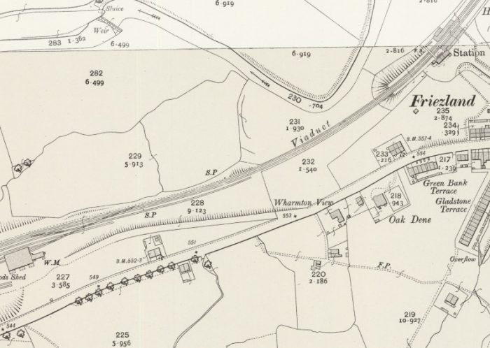
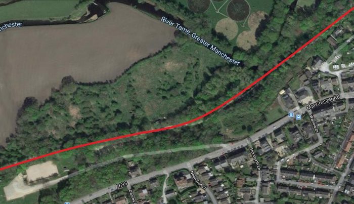

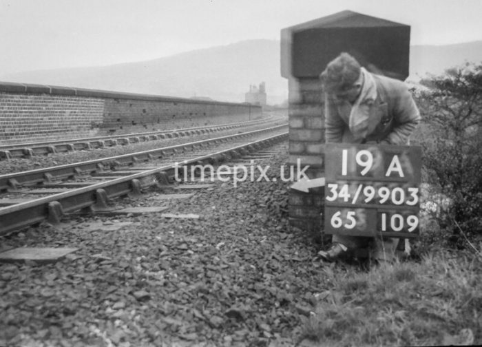
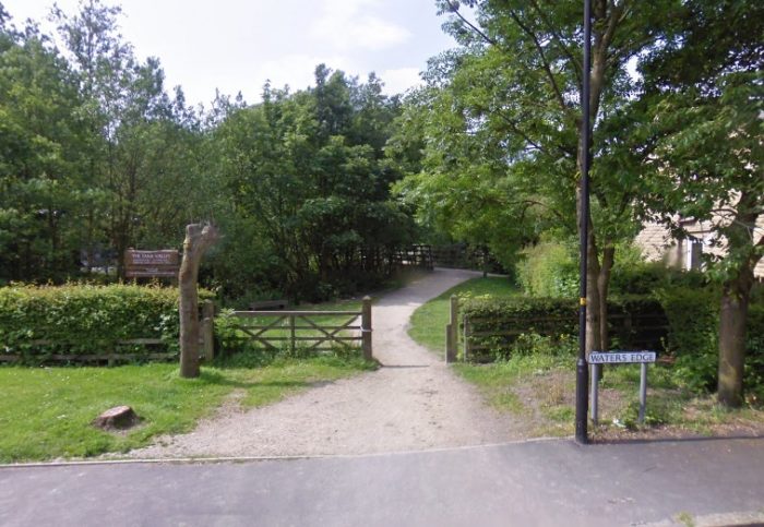
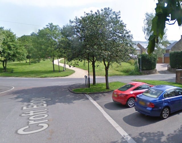
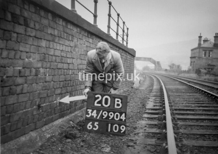
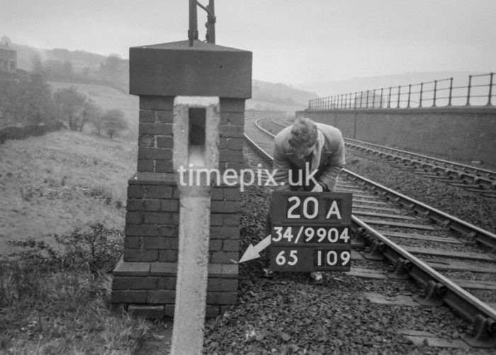
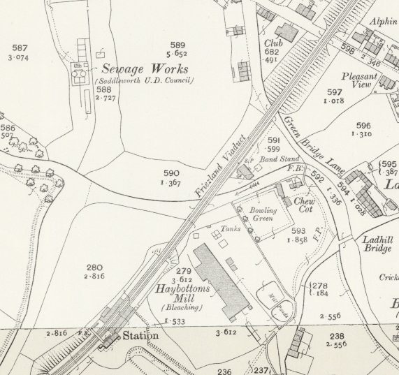
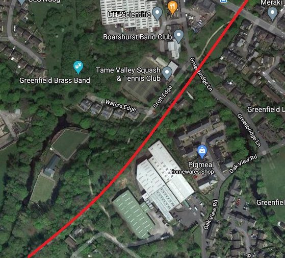
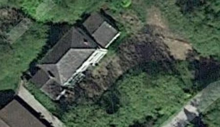
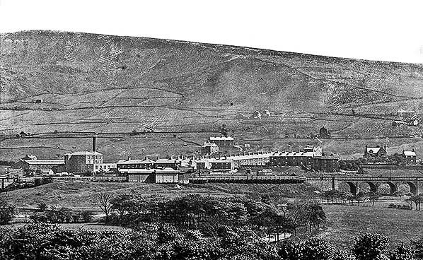
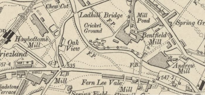
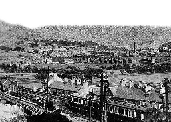
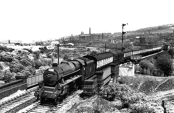
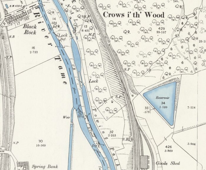

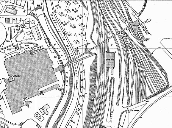
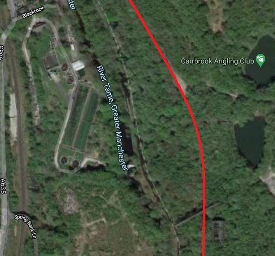
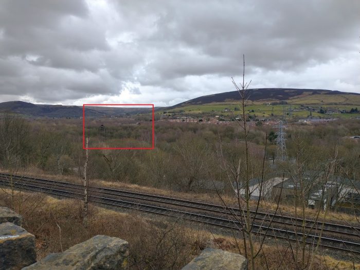
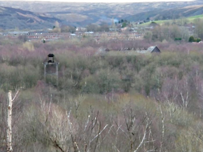
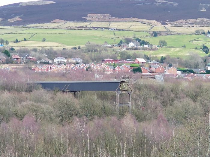
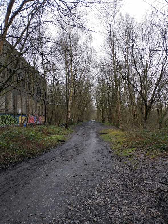
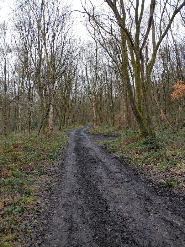
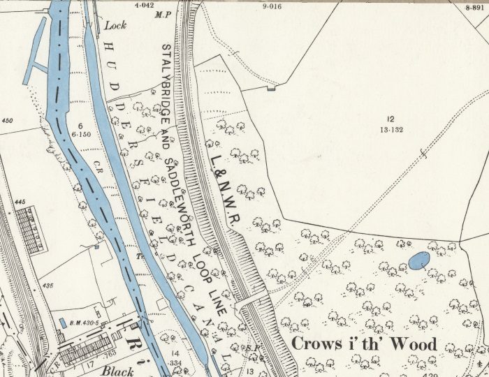
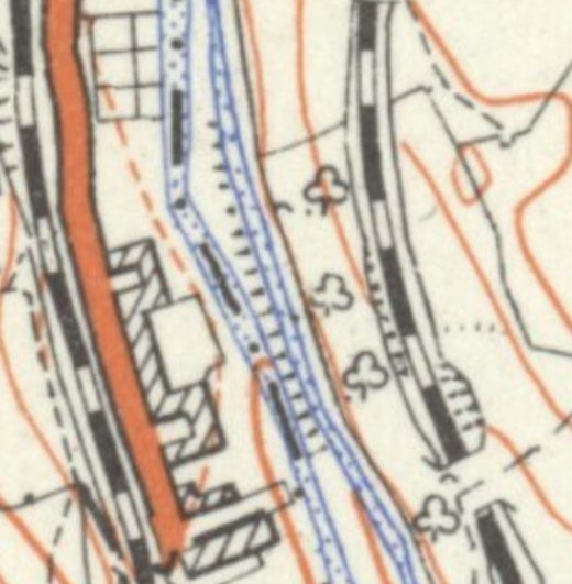
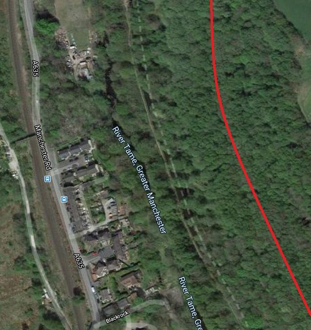
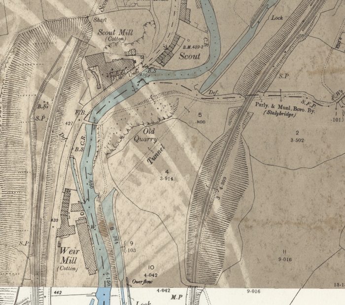
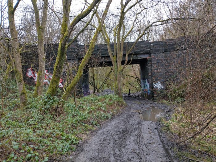
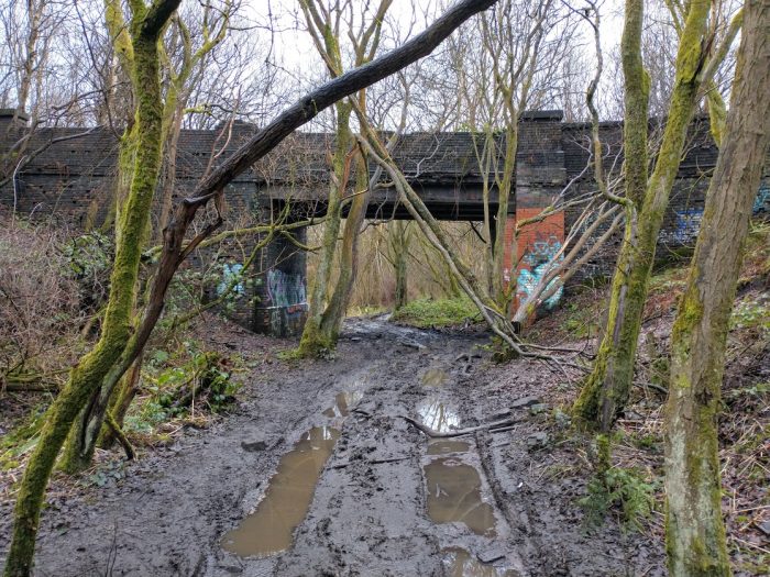
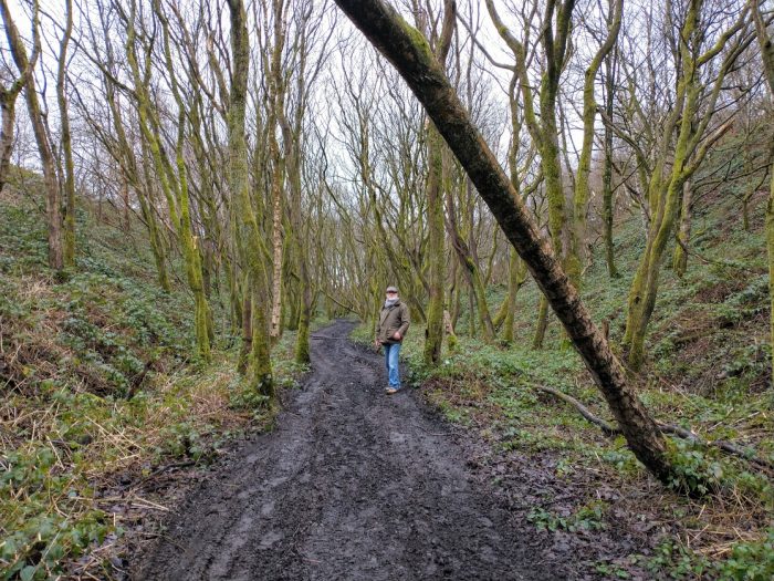

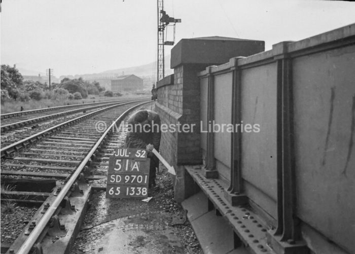
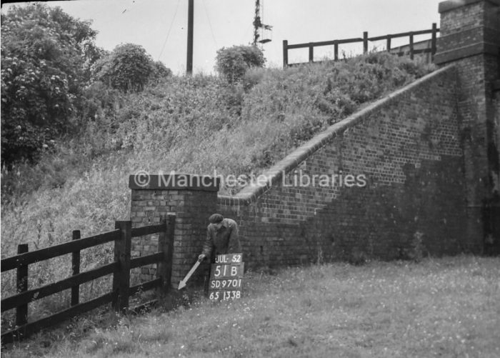
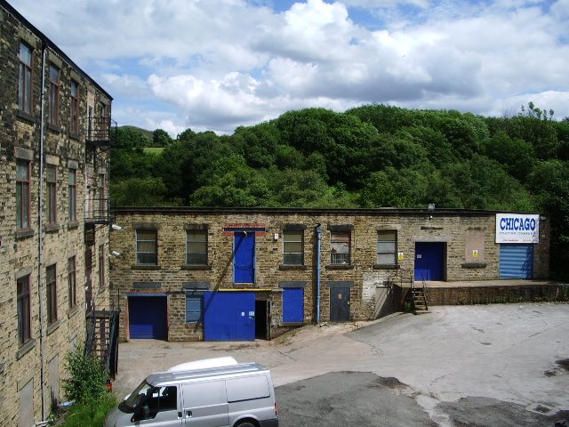
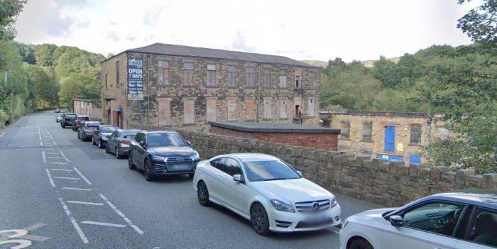
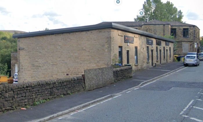
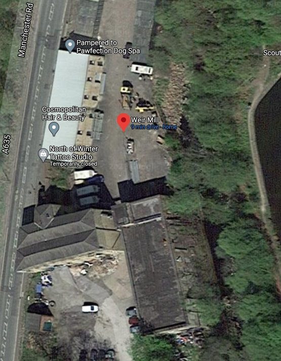
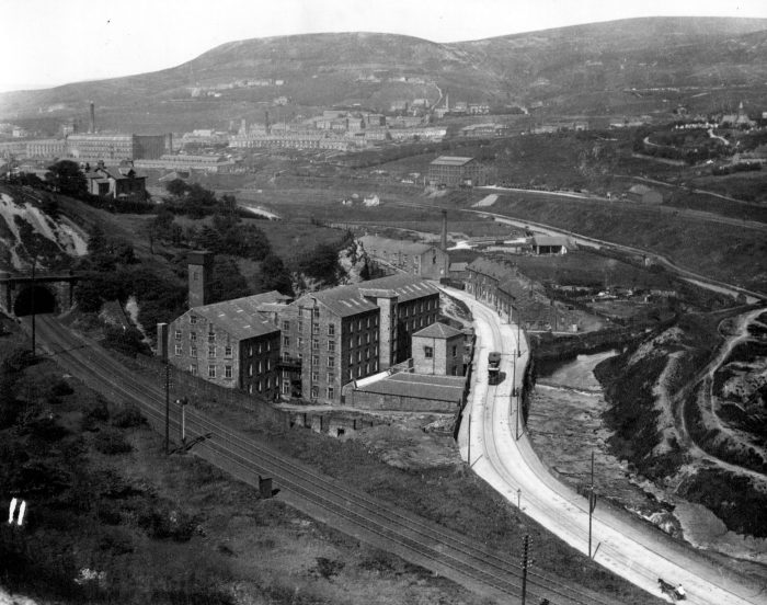
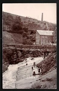
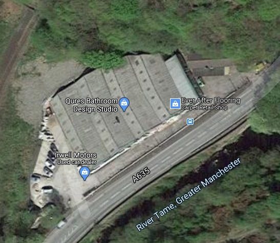
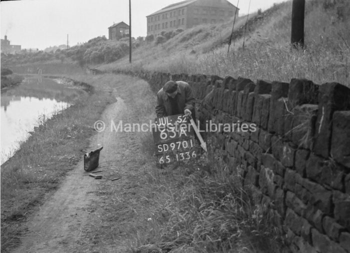
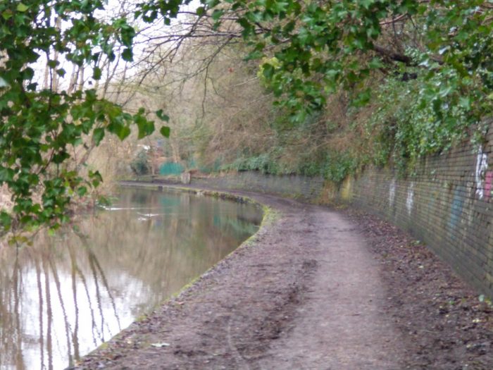
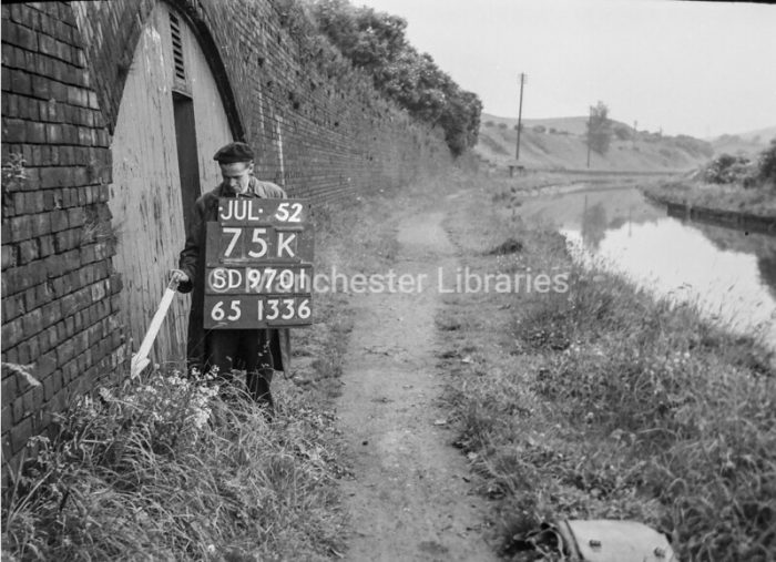

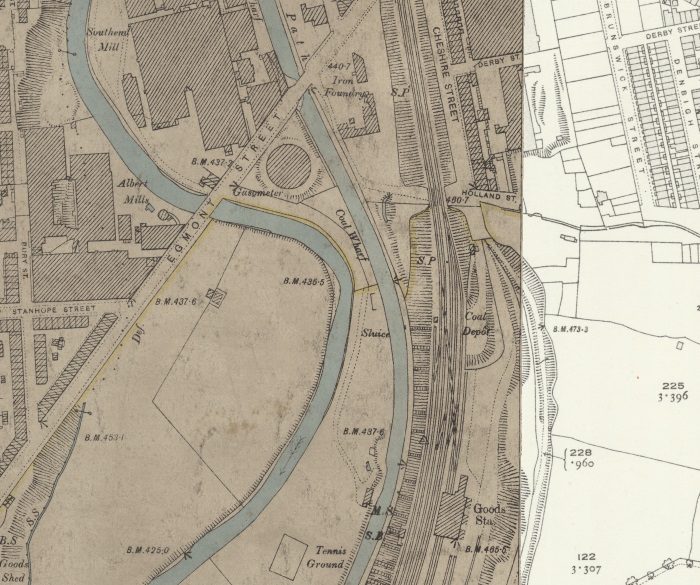
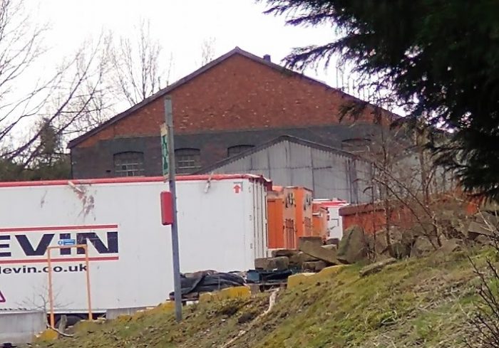
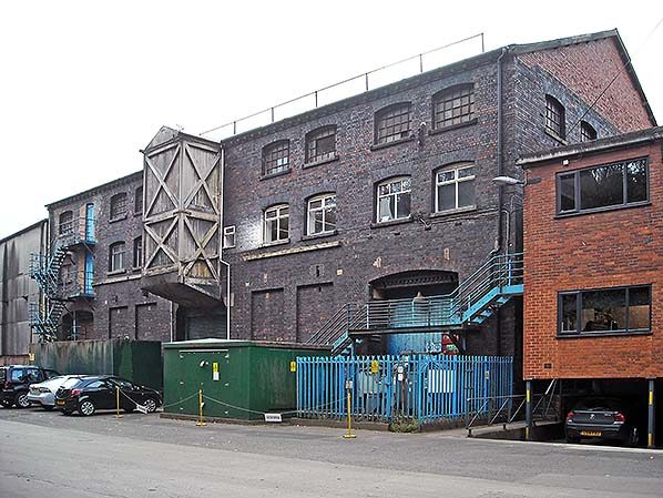

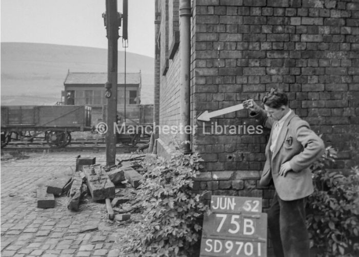
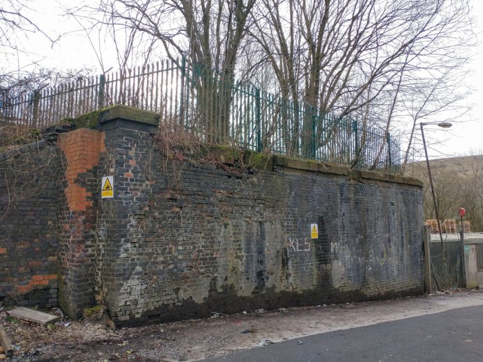
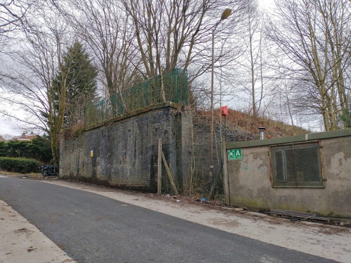
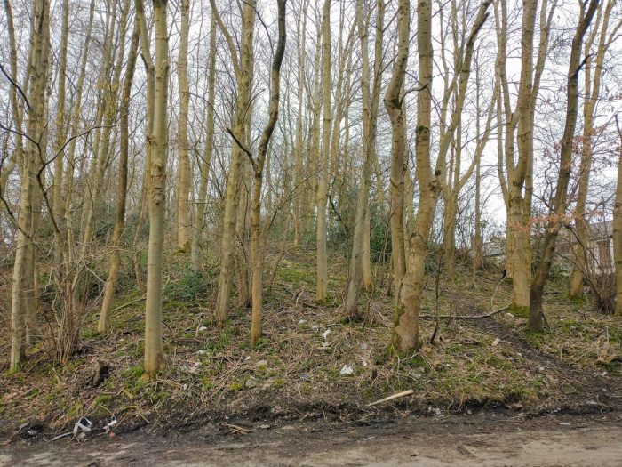
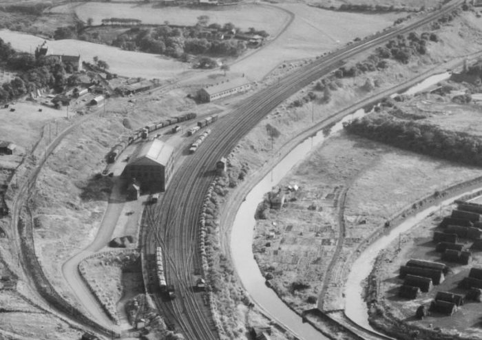
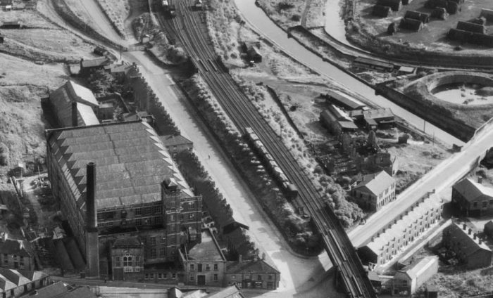
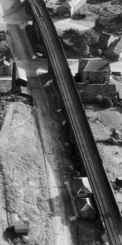
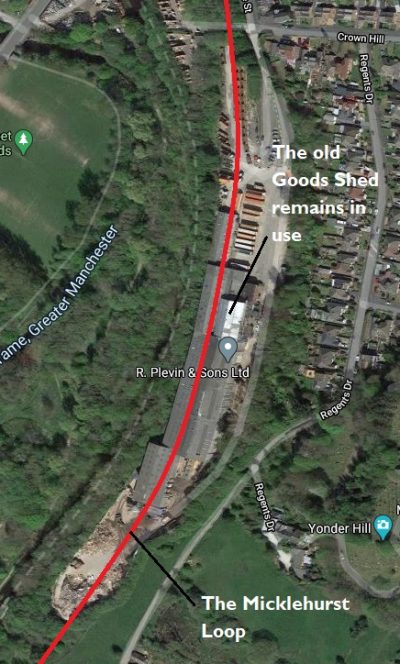
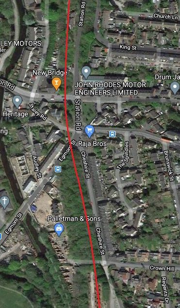
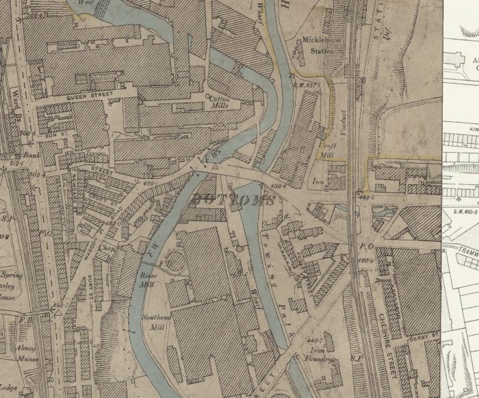
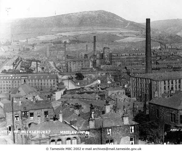
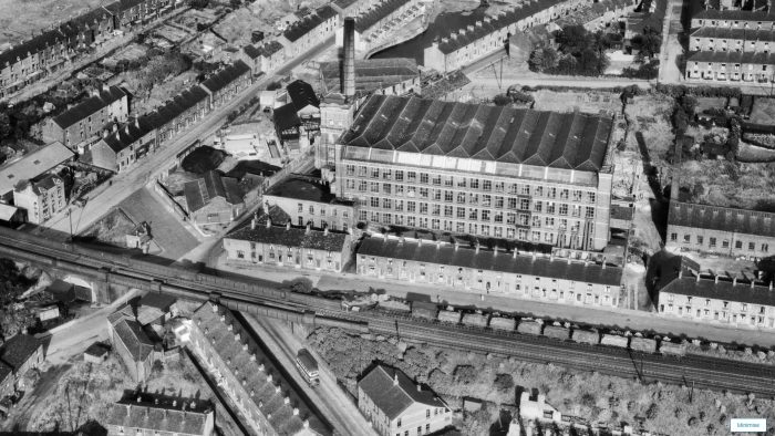
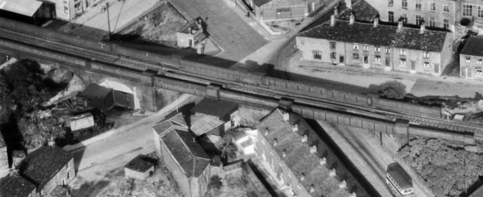
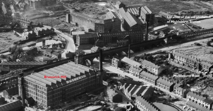
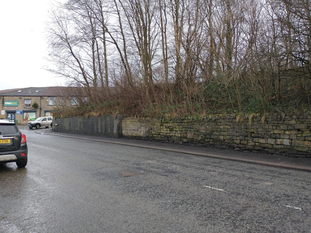
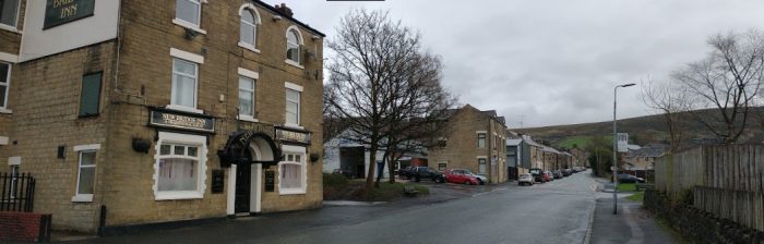

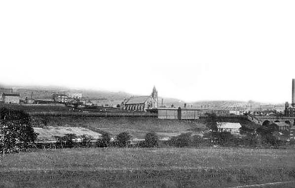
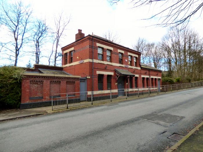
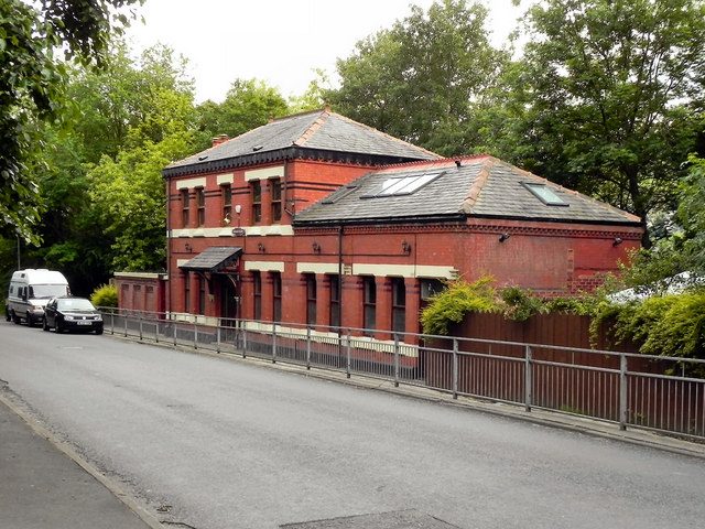
