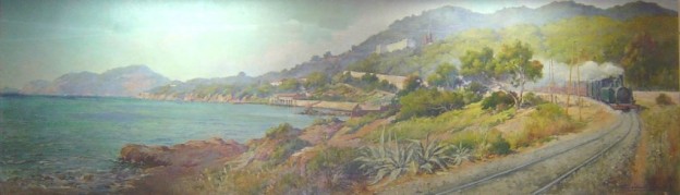
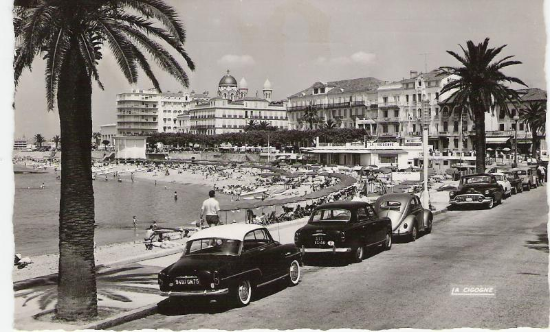
PAUL LÉVERÉ (Oil on canvas)[11]
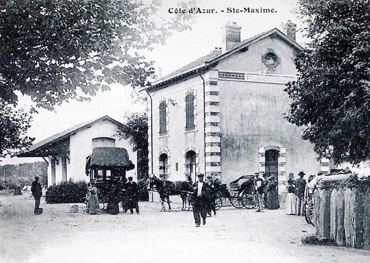
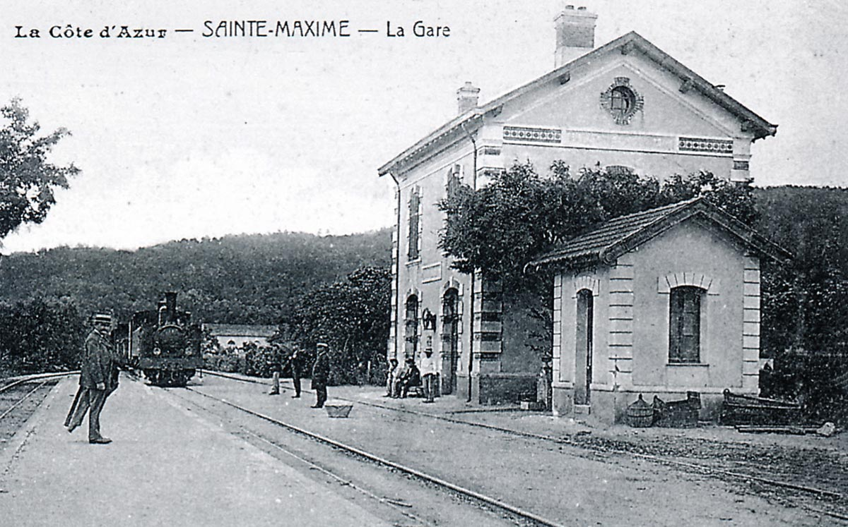
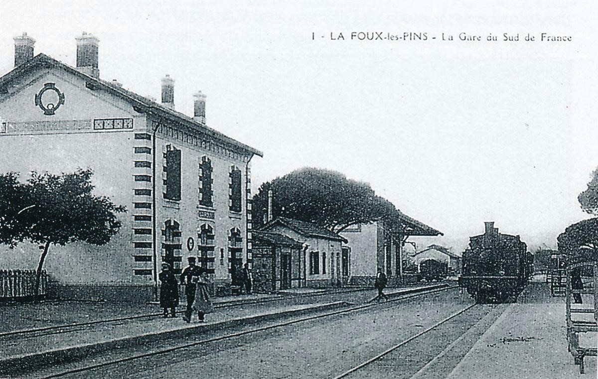
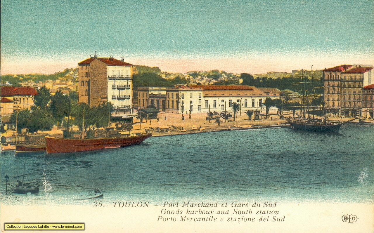
Paul Levéré (1875 -1949), landscape painter of Toulon was also official painter for the Navy. He painted this large painting in 1909 – (it measures several metres long: at the sight of about 4.50m to 5.00m x 1.50m). It decorated the main hall of the Chemins de Fer du Sud Station in Toulon.
After the war, when the demolition of the station (which had been badly damaged by the bombing of 1944) was due to proceed, this painting was saved by the Society of Friends of Old Toulon. The painting figures prominently in the Musee du Vieux Toulon located in Cours Lafayette.
Locomotives and Rolling Stock
At the height of its powers, between 1888 and 1908, Le Chemins de Fer du Sud de la France network had:
• 23 steam locomotives.
• 42 passenger coaches: 3 in 1st class A series; 21 mixed 1st and 2nd class series AB; 6 in 2nd class B series; 2 mixed 2nd class + van series BD and 10 open coaches called ‘jardiniers’ series AC and C. These were sourced from various manufacturers: the Foundries and Forges of Horme Company, Chantiers de la Buire in Lyon; the Desouche and David workshops in Pantin; the Hanquet-Aufort and Company in Vierzon; the establishments De Dietrich in Lunéville; and the ‘jardiniers’ came from a network of steam trams – the Raincy-Montfermeil in the northern suburbs of Paris.
• 12 luggage and post office vans: 10 luggage vans with DD series postal compartment and 2 DS series emergency vans. Their manufacturers were as follows: 6 Buire vans, 4 De Dietrich vans, 2 Hanquet-Aufort vans.
• 219 goods wagons: built by Horme and Buire, Hanquet-Aufort, De Dietrich, and Magnard and Decauville.
Later, there was a concerted effort to modernize the network between 1934 and 1938. This resulted in the purchase of:
• 16 diesel-electric multiple units: Brissonneau and Lotz railcars.
• Two locotractors (shunters) from the same manufacturer were added to the inventory.
A. Steam Locomotives
Between 1889 and 1894, 19 steam locomotives were put into circulation on the network of South France; divided between 3 manufacturers: 8 SACM, 8 Pinguely and 3 Corpet-Louvet.[11]
Later, between 1902 and 1904, four locomotives were purchased for the Toulon-Hyères line (Corpet, Krauss and JF Cail). Three locos were also lent by the Alpine network in 1905, 1925 and 1931.[11]
Pinguely Locomotives
The Pinguely company was formed by Benoit Alexandre Pinguely in Lyon, France in 1881. He was born on 20th April 1849.[1] In 1881 he took over a company run by the Gabert brothers which had specialised in bucket dredgers.[2]
 At first they made steam locomotives, but diversified into making other equipment. In 1892, they supplied a locomotive to the Chemins de Fer de St Victor à Thizy.[3] In 1895, Pinguely supplied seven locomotives to the Voiron – Saint-Béron railway.[4] Pinguely was not a major locomotive manufacturer in terms of numbers produced.[5]
In 1930, Pinguely supplied a steam tram locomotive to the Chemins de Fer du Haut-Rhône.[6] By 1932, Pinguely was also making steam shovels.[7]
Production of steam locomotives was stopped in the 1930s, and the company concentrated on manufacturing earthmoving equipment and mobile cranes.
The majority of the locomotives produced by the company were 0-6-0T locos although as we will see the company also produced a range of other locomotives and some steam railcars. [8]
In addition to the Chemins de Fer du Sud de La France their clientele included: The tramway of Pont-de-Beauvoisin, The railways of Dauphiné, The West Tramway du Dauphiné, The railways of the Drôme, The trams of the Dordogne, The Camargue railways, The trams of the Indre, The Regional Railways of Rhône et Loire, The Departmental Board of Railways Bouches-du-Rhone.[8]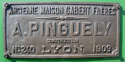
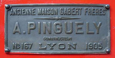
The French railway system worked on a series of metre gauge feeder railways connecting to the standard gauge main lines. Pinguely locomotives were used on many of these feeder lines. There are a number of these locomotives in preservation today as across France, metre gauge railways are ripe for preservation. Many of these lines, like those in Provence, still have the majority of their formation/route in public ownership. The two plaques shown alongside the text are from Pinguely locomotives on Le Réseau du Vivarais.
Pinguely Locomotives on Le Chemins de Fer du Sud Littoral
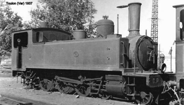
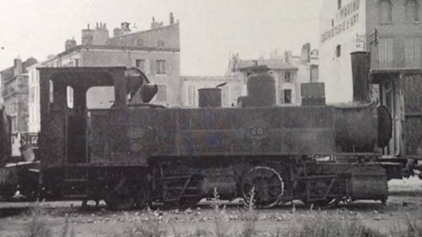
1. Pinguely 2-6-0T (ex 0-6-0T) [11]
In 1902, as soon as the Toulon-Hyères line was opened, the Chemins de Fer du Sud management decided to order 4 0-6-0T locomotives designated “Type 18” by the Albert Pinguély works. Modifications were requested by the company to increase the power and speed of these machines, which were considered too slow and too little nervous: these machines were given the same stroke of pistons, the diameters of cylinders and wheels of the 4-6-0T SACM Locomotives (see below).
The diameter of the coupled wheels increased from 90 cm to 1.20 m, the wheelbase from 2.15 m to 2.70 m, the diameter of the cylinders from 35 cm to 38 cm. The net weight (empty) was increased as a result from 23.1 tonnes to 25 tonnes and the gross weight in running order from 27.8 tonnes to 31.7 tonnes.
Very quickly, it was found that these new machines had major defects. They were highly unstable when they exceeded 25 km/hr. The instability was likely to cause breakdown of the suspension, movement in track alignment and derailments.
As early as 1906, Jacques Henry, the engineer, studied the possibility of transforming these locomotives into 2-6-0T locos by adding a steering axle to the front. The modification was carried out by the Fréjus workshop from December 1906 onwards and everything was completed in 1908.
The increased tare of 6 tons and the new front axle considerably improved the road holding and the grip and they gave satisfaction until the period of the 2nd World War. Some weaknesses of the boiler were however reported as early as 1921.[11]
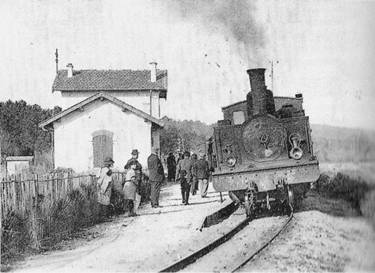
 A 2-6-0T Pinguely series 41 to 44 arrives at the stop of Saint-Jean du Var whose small building is characteristic of the stops of the suburbs of Toulon (Collection: Renaud Semadé).
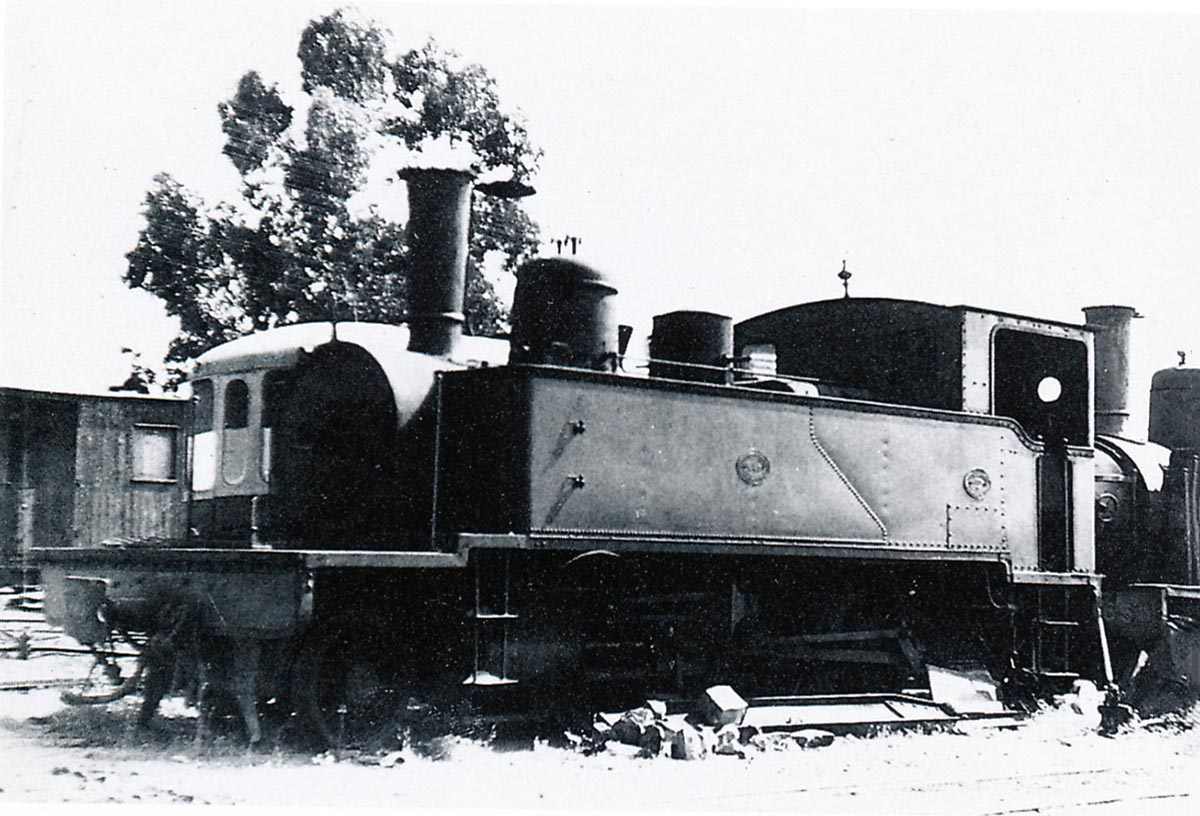
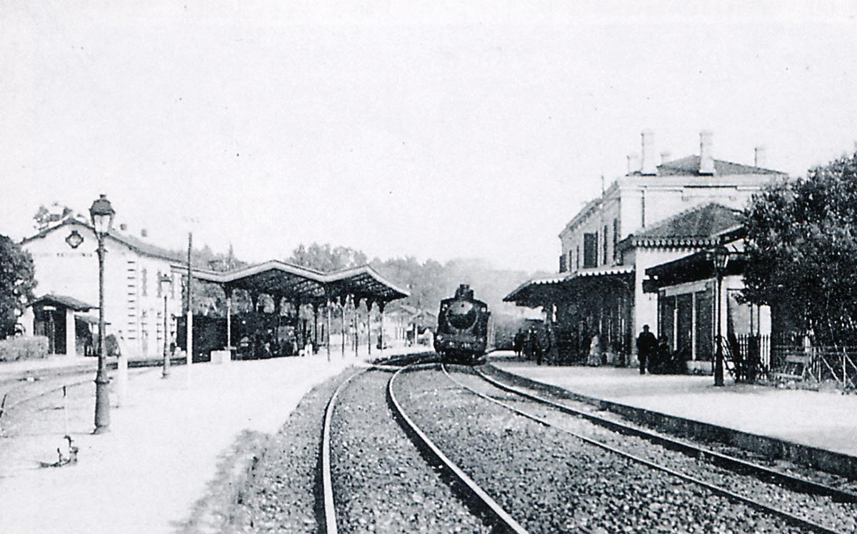
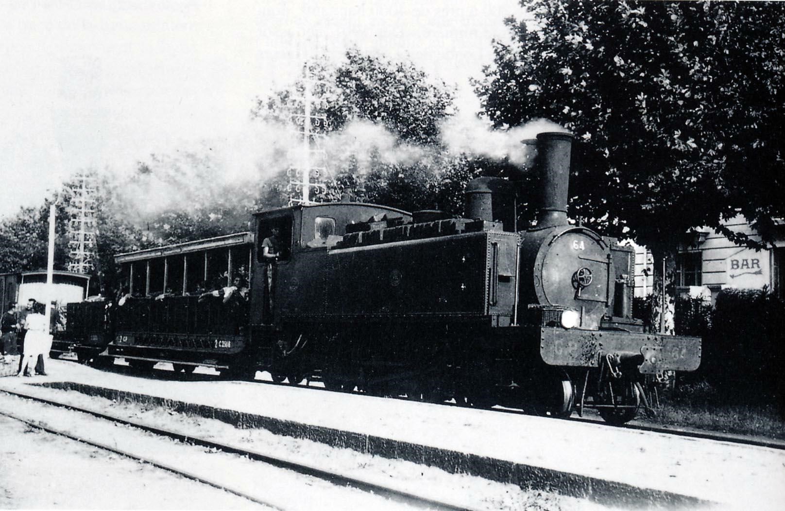
 Pinguely 2-6-0T locomotive at Toulon Sud-France station awaiting clearance to head for St. Raphael. The photo dates from the years 1925-1930 (Collection: Gérard Bernaud).
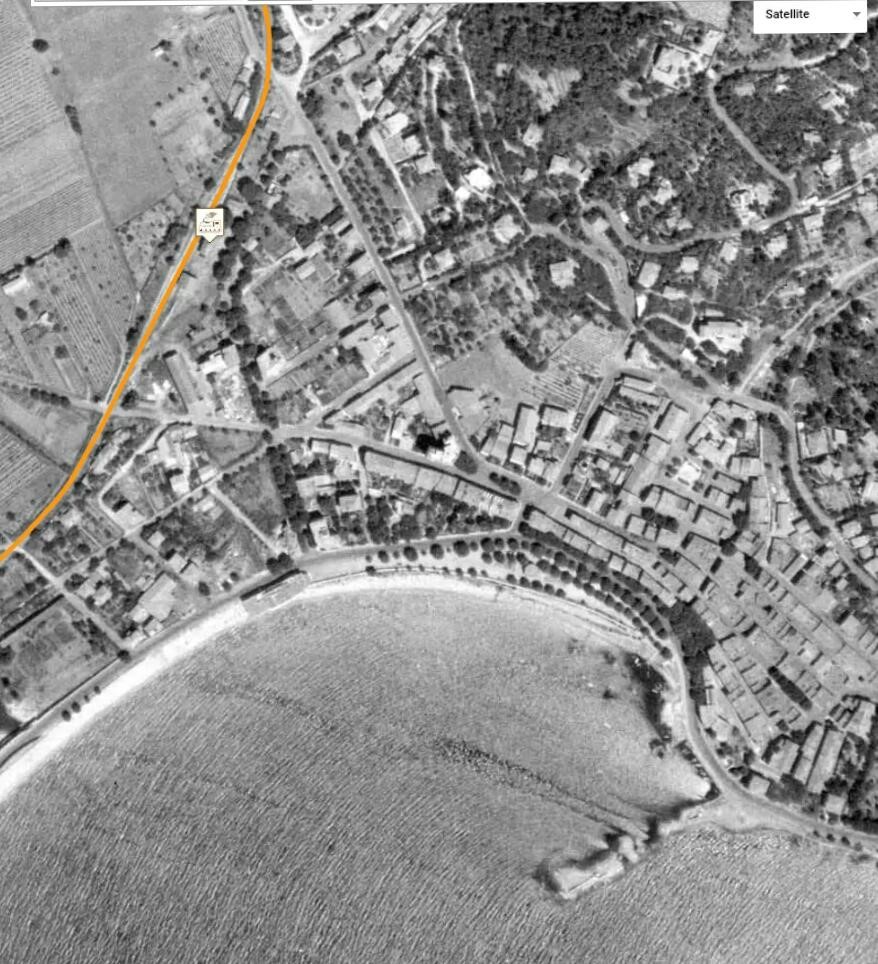
 A train pulled by a 2-6-0T Pinguely, stops at Warvieille-Beauvallon near Sainte-Maxime. The station house is identical to that of the gatekeeper’s but it is completed with a desk and a waiting room. Note the super-elevation of the line. (Collection: Edmond Duclos).
| MAIN CHARACTERISTICS OF 2-6-0T PINGUELY | |||
| Type: | 0-6-0T then 2-6-0T | Usable track type: | Metre gauge |
| Builder: | Albert Pinguely Works in Lyon | Driving Cab: | Closed – with 4 rectangular portholes |
| Year of construction: | 1904 | Date of commissioning: | 03-1905 |
| Number on the South France Railway network | 4 | Coupled axles: | 3 |
| Rigid wheelbase: | 2.70 m | ||
| Factory number: | 174 to 177 | Diameter of driving wheels: | 1.20m |
| Numbered: | 41 to 44 | Diameter of carrying wheels: | 0.82 m |
| Unloaded weight; | 31.10 tons | Cylinders: | 2 with plan drawers |
| Weight in working order: | 37.80 tons | Valve Gear: | Walschaerts |
| Total length:
|
8,982 m | Average speed in tests: | 38 km/hr |
| Total width: | 2.50 m | Water Tank Capacity: | 3500 litres |
| Total height: | 3.59 m | Coal Capacity: | 0.94 ton |
| Usage: | Nos. 41, 42 and 44 were taken out of use in around 1938; No. 43 in around 1944. The locos were scrapped only after the closure of the network. | ||
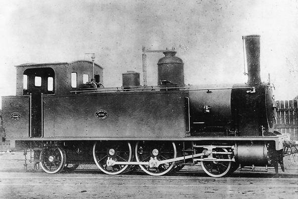
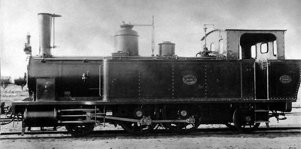
2. Pinguely 4-6-0T [11]
The 4-6-0T Pinguely locomotives are almost twin sisters to the 4-6-0T SACMs numbered 61 and 62 -The difference is at the rear: a straight and closed cabin for the Pinguely, an overflowing charcoal hood and an open cabin for the 4-6-0T SACM. The shape of the side window was different as well.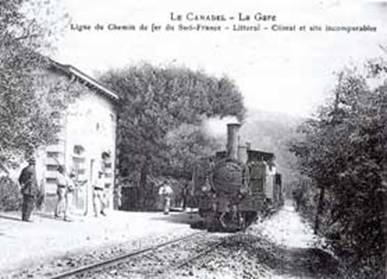
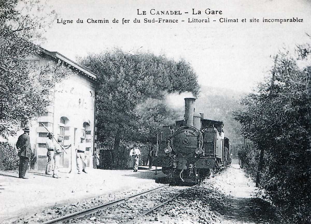
Here at Canadel Halt, 4-6-0T Pinguely No. 65 arrives at the head of a mixed train.
Delivered between January and July 1906, the Pinguely were assigned to the heaviest trains.
These machines had a weak point: the bad behaviour of their boiler.
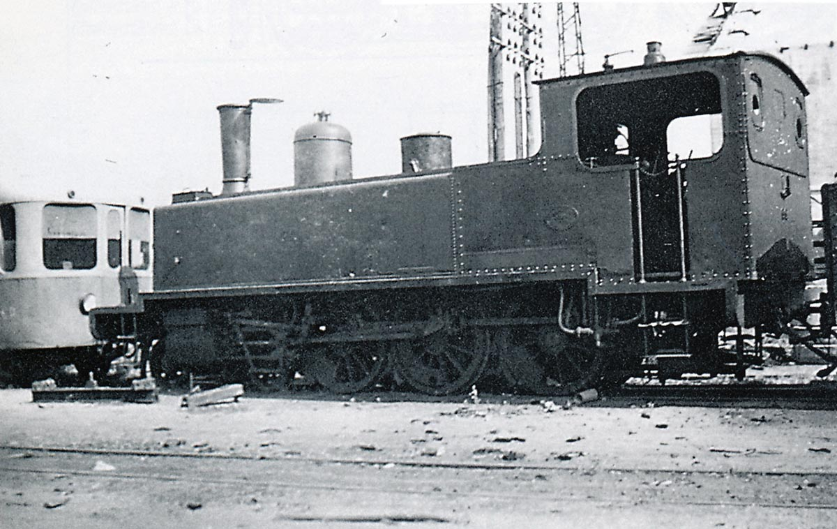
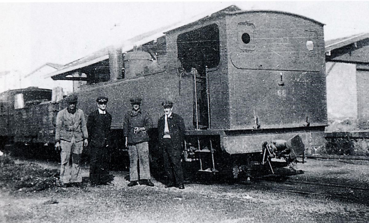
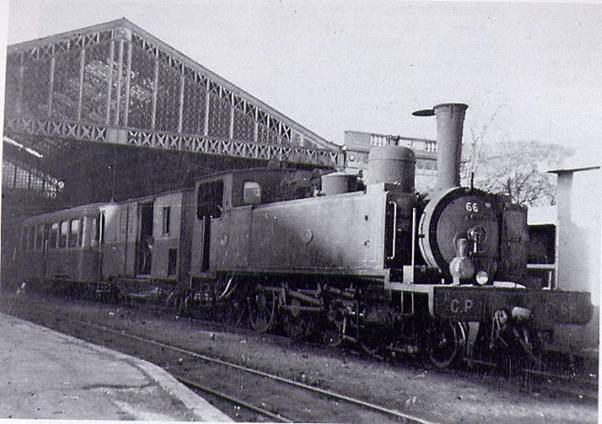 Pinguely 4-6-0T No. 66 at Le Chemins de Fer du Sud Station of Toulon in around 1941-1943; at that time there are only 3 steam engines left on the network. An electric headlight powered by a turbo-dynamo has been added to the right side of the original oil lantern (Collection: GECP)
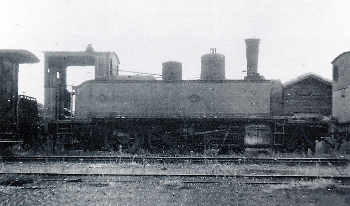
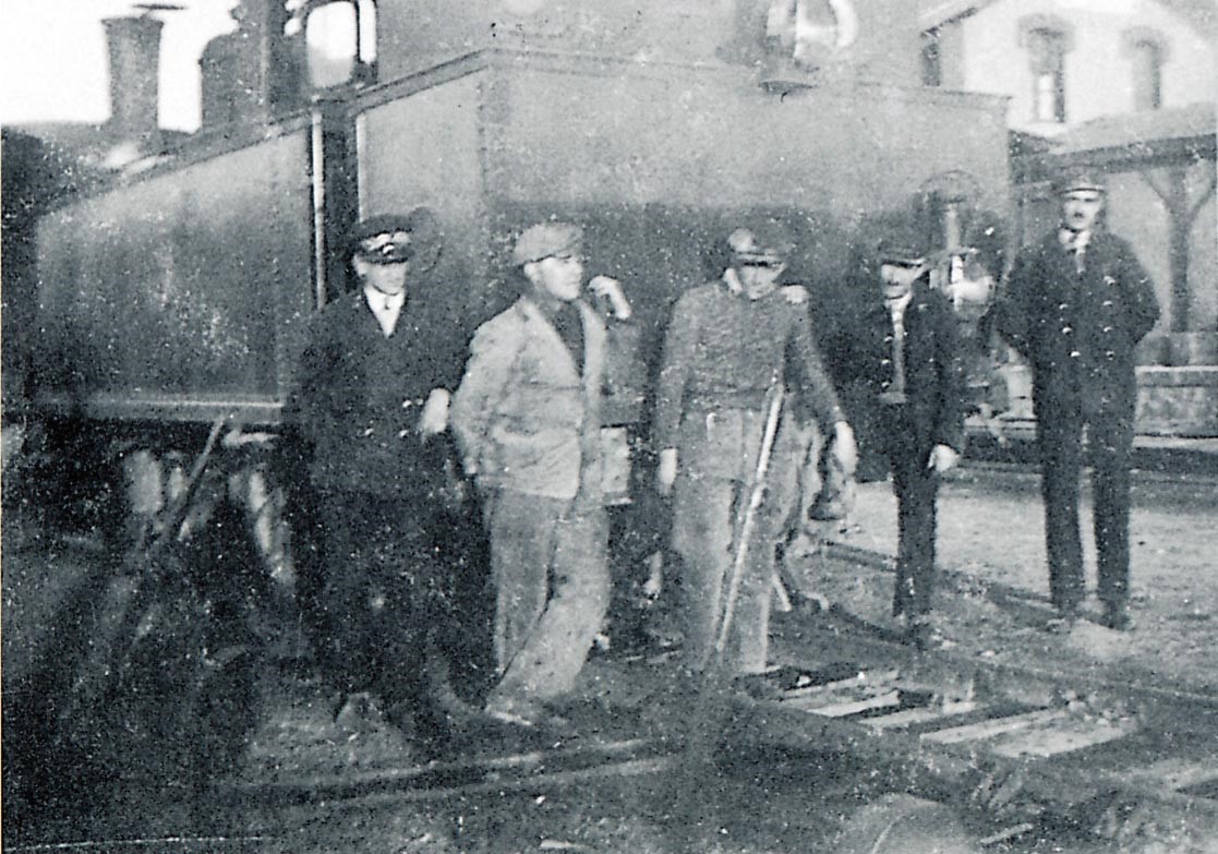
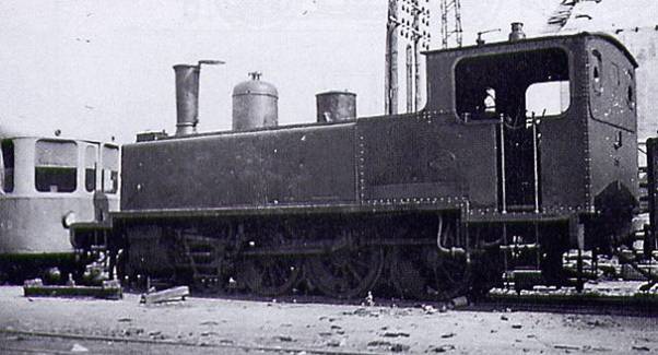 This time seen from behind, 4-6-0T Pinguely No. 66 is stabled at the Fréjus depot. Note at the back of the cab, the 2 small circular openings not original, which give light and a little visibility in the cabin. Originally there were 2 more large windows that were closed with sheet metal plates. These probably were broken regularly be the charcoal shovel and furnace tools.
 The 4-6-0T No. 63 is stabled on the No. 3 siding at Toulon station ready to refuel with coal briquettes (Collection: Bernard Rozé).
MAIN CHARACTERISTICS OF 4-6-0T PINGUELY |
|||
| Type: | 4-6-0T | Usable track type: | Metre Gauge |
| Builder: | Albert Pinguely Works in Lyon | Driving Cab: | Closed |
| Year of Construction: | 1906 | Delivery date: | 1906 |
| Number on the South France Railway network: | 4 | Coupled axles: | 3 |
| Wheelbase: | |||
| Factory number: | 203 to 206 | Diameter of driving wheels: | 1.20m |
| Numbered: | 63 to 66 | Valve Gear: | Walschaerts |
| Unloaded weight: | 28.4 tons | Cylinders: | 2 with plan drawers |
| Weight in working order: | 36.8 tons | Estimated power: | |
| Total length:
|
9.39 m | Estimated maximum speed: | |
| Total width: | 2.50 m | Water tank capacity: | 4500 litres |
| Total height: | 3.60 m | Coal capacity: | 1.2 ton |
| Usage: | No. 63 and 66 set aside in 1948 and then scrapped in 50-51 – No. 64 and 65 set aside in 1944 | ||
Preserved Pinguely Locomotives
Locomotives working on preserved lines or preserved in a non-working condition include:[8]
a) 0-6-0T Locomotives (metre gauge)
No. 38 of 1897, Trams of the Drome No. 16 – entrusted by an individual to the Association of Friends of Petit Anjou
No. 1899, Beaujolais Railway (CFB) – Association of Friends of Petit Anjou
No. 112 of 1901, CFD 81, 1949 transformed into locotractor, CFDT, CP 52 – Railways of the Velay
No. 143 of 1903, Railway of Morbihan “14” – monument in Korofina (Mali)
No. 165 of 1905, Railways of Morbihan “No. 101” – entrusted by the FACS to the railway of the Bay of Somme . In service.
No. 167 of 1905, Railways of Morbihan “No. 103” – Train of Bas-Berry. [9]
No. 240 of 1909, Tramways of the West of Dauphiné “No. 31” – Railway of Vivarais. [10]
b) 0-4-0T Locomotive (600 mm gauge)
No. 368 of 1922, Tuilerie de la Rochefoucaud (Charente) – Maurice Dufresne Museum, Marnay. then Azay-le-Rideau (Indre & Loire).
SACM Locomotives
The Alsatian mechanical engineering company (Société Alsacienne de Constructions Mécaniques (SACM)) based in Mulhouse was a flagship of French industry. It produced a lot of locomotives.
In 1839, André Koechlin, after producing textile machines since 1826, opened a locomotive construction workshop in Mulhouse in Alsace.[15] The business grew rapidly but in 1871, the annexation of Alsace-Lorraine by Germany, brought about the transfer of some production to Belfort in France. In 1872 the company merged with the Graffenstaden company of Illkirch-Graffenstaden (a suburb of Strasbourg) to form SACM.
The new company diversified into the production of boilers, steel equipment, printing equipment, compressors, firearms and other engineering products growing to 4500 employees by 1910.[16]
A new foundry was built in 1922 for textile machinery. In 1928 the Thomson-Houston Electric Company merged with the Electrical Engineering division of SACM to form a new company named Alsthom, (Alsace-Thomson), later changed to Alstom.
Production of steam locomotives was originally carried out at Mulhouse and Graffenstaden (for German production), and Belfort for the French production. The plants also exported models. However, after the First World War, Mulhouse and Graffenstaden built French steam locomotives, and Belfort specialized in the construction of electric locomotives.
During the 1890s the company was particularly noted for its fast and efficient compound locomotives designed by Alfred de Glehn.
A whole series of different locomotive types were constructed by SACM, two were present on Le Chemins de Fer du Sud.
SACM Locomotives on Le Chemins de Fer du Sud Littoral
1. SACM 2-4-2T Series No. 51-56
 2-4-2T Locomotive No. 56 series 51 to 56 built by SACM in Belfort for Le Chemins de Fer du Sud network (Collection: Bernard Rozé).
 2-4-2T SACM No. 53, one of six locomotives of the series numbered 51 to 56 delivered between April 1889 and March 1890, they allowed the opening of the section St-Raphaël – La Foux in September 1899. They were attached to the depot of Fréjus. These machines had 1 carrying axle at the rear, one at the front (small wheels) and 2 coupled axles (driving wheels) – One of these machines was presented at the World Fair of 1889 before leaving for the Var (Collection: Bernard Rozé).
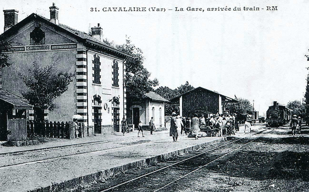
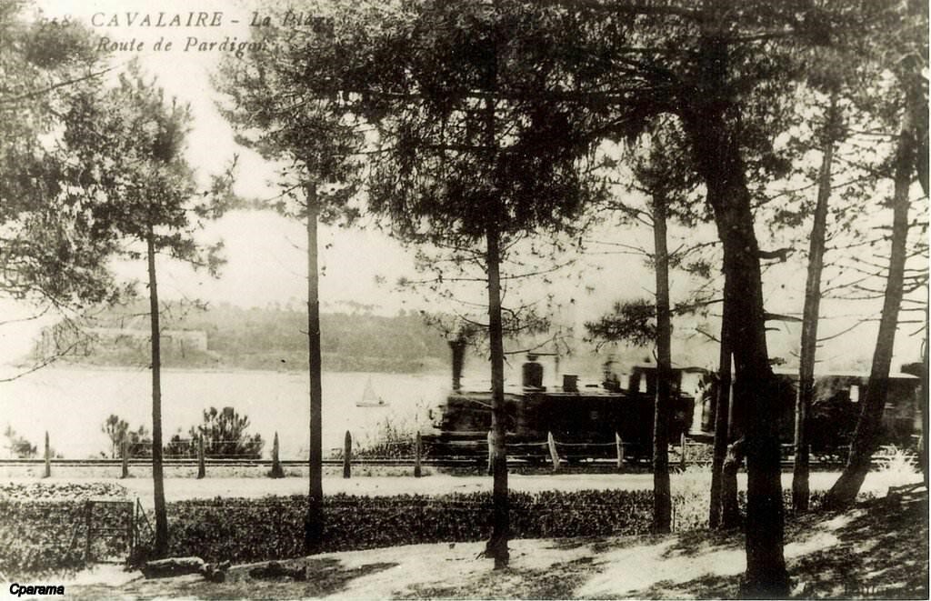
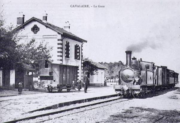 A mixed train St-Raphaël-Hyères pulled by the 2-4-2T No. 51 enters Cavalaire station. It was this locomotive that represented Le Chemins de Fer du Sud de la France at the World Fair in Paris in 1889 (Collection: Edmond Duclos).
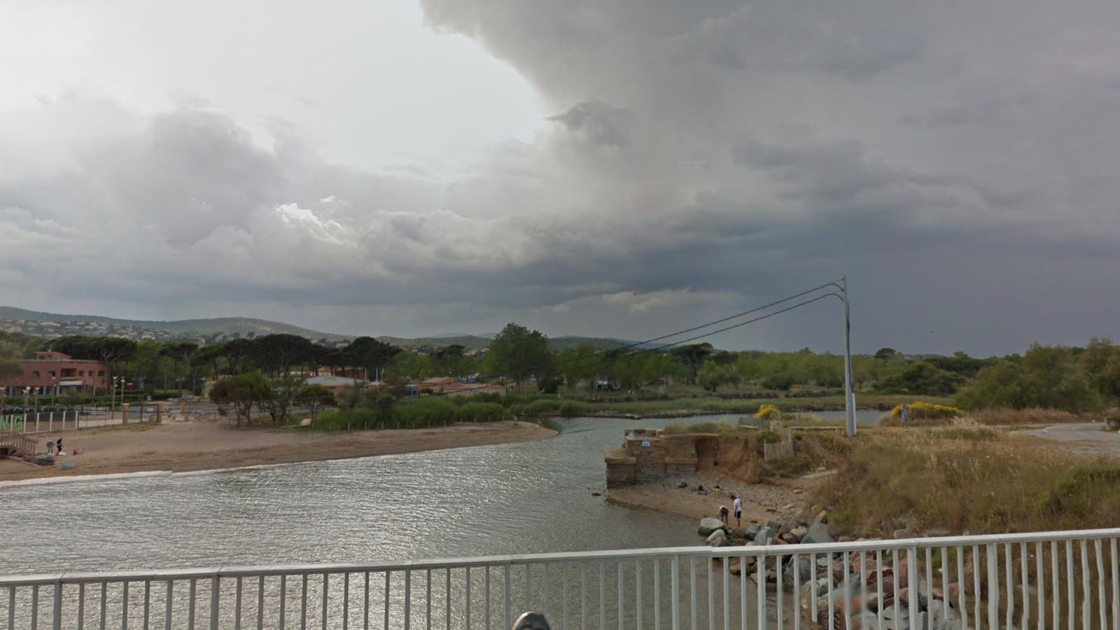
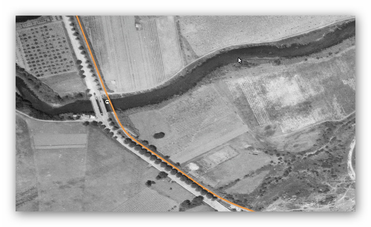
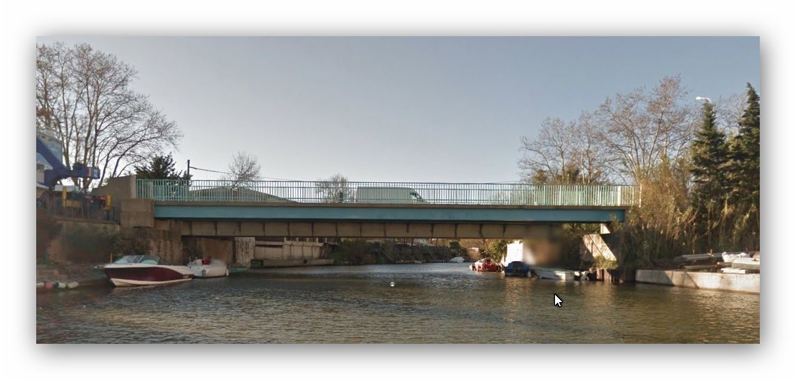
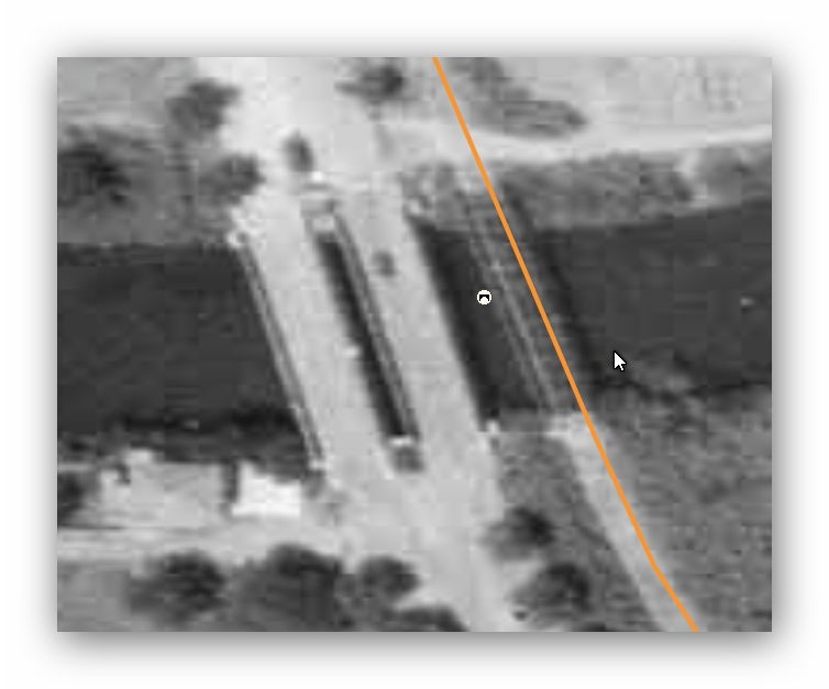
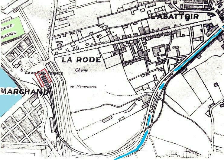
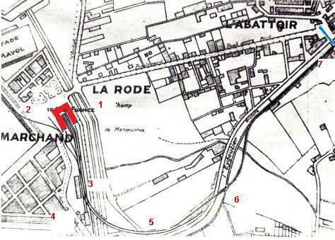
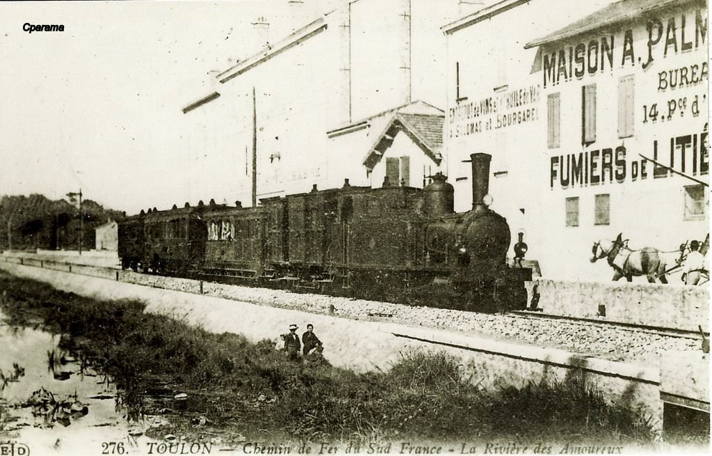
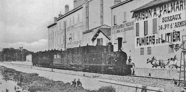 A 2-4-2T SACM locomotive at the head of a Hyères-Toulon passenger train running along the Eygoutier wharf, a small river to which the Toulonnais give the poetic name of “River of Lovers.” The photo is taken towards the slaughterhouse bridge at the entrance of the Rode (this bridge still exists today, crossing the river). A level crossing allowed to cut at right angles Rue de Cap Brown (nowadays Avenue Resistance) and to cross the tracks of the tram (Line 7 – to Magaud). In the background, are the laboratories and warehouses of Castel-Chabre and the Palmary house selling litter manure for gardens (Collection: R Renaud Sémadéni Corfund).
| MAIN CHARACTERISTICS OF THE 2-4-2T SACM | |||
| Type 85 for the manufacturer: | 2-4-2T Loco | Usable track type: | Metre-gauge |
| Builder: | SACM (Alsatian Society of Mechanical Engineering in Belfort | Driving Cab: | closed with charcoal bunker at the back |
| Years of construction: | 1889-1890 | Delivery date: | between 1889 and 1890 |
| Number on the South France Railway network: | 6 | Coupled axles: | 2 |
| Wheelbase: | 1.30 m | ||
| Factory number: | Diameter of the coupled wheels: | 1.20m | |
| Numbered: | 51 to 56 | Valve Gear: | Allan sliding system |
| Unloaded weight: | between 25.5 and 25.86 tonnes | Cylinders: | planar drawers |
| Weight in working order: | 33.55 tonnes | Estimated power: | |
| Total length:
|
8.64 m | Estimated maximum speed: | |
| Total width: | 2.50 m | Water Tank Capacity: | 4000 litres |
| Total height: | 3.54 m
|
Coal Capacity: | 1 ton |
| Usage: | June 1926: numbers 51 and 56 were scrapped. In 1935 the remaining locos were withdrawn following the putting into service of the railcars. Nos. 52 and 55 were sold for scrap in October 1937, Nos. 53 and 54 in 1939 – They still had a career of some 50 years. | ||
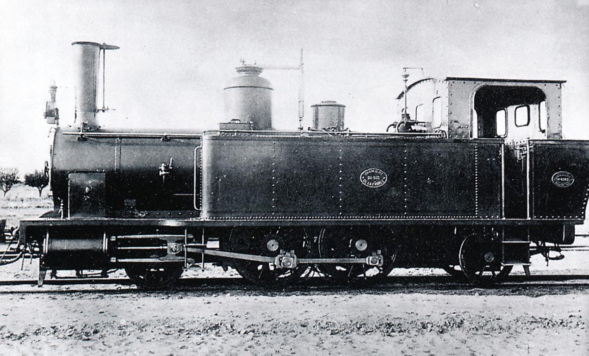
2. SACM 4-6-0T Series No. 61-62
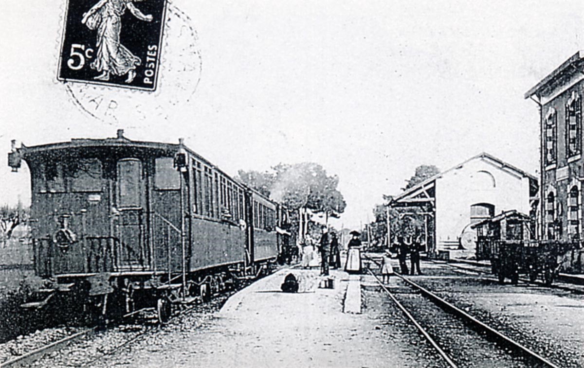
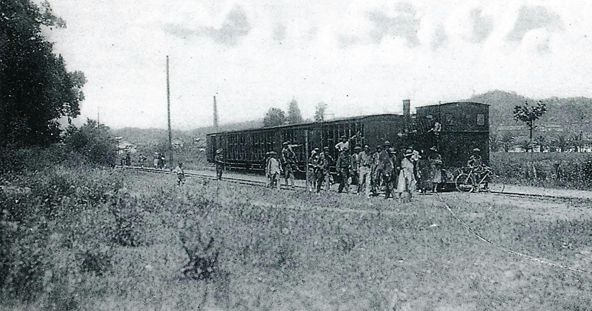
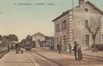 SACM locomotives numbered 61 and 62 were almost twin sisters of the 4-6-0T Pinguely, the differences are at the rear: the coal hood and open cabin for the 4-6-0T SACM, with the cabin straight and closed for the Pinguely. The shape of the side window is different as well. In this image a SACM 4-6-0T in charge of a train from St. Raphael to Toulon enters La Londe Station.
 Locomotive 4-6-0T No. 61 of the Littoral network is seen on display just after out-shopping at the SACM factory in Belfort in June 1900, it is the first of a long line of 124 units delivered to France, Spain and the colonies of French West Africa (Collection: Bernard Rozé).
| MAIN CHARACTERISTICS OF THE 4-6-0T SACM | |||
| Type: | 4-6-0T Loco with open cab. | Usable track type: | Metre-gauge |
| Builder: | SACM (Alsatian Society of Mechanical Engineering in Belfort (90) | Driving Cab: | Open at the back |
| Year of construction: | 1900 | Delivery date: | 20th June 1900 |
| Number on the South France Railway network: | 2 | Coupled axles; | 3 |
| Factory number: | 4963 – 4964 | Diameter of the coupled wheels: | 1.20m |
| Numbered: | 61 and 62 | Valve Gear: | Walschaerts |
| Unloaded weight: | 28,400 tons | Cylinders: | 2 |
| Weight in working order: | 36,800 tons | Estimated power: | 375 hp |
| Total length: | 9.39 m
|
Estimated maximum speed: | 60 km/hr |
| Total width: | 2.50 m | Water tank capacity; | 4500 litres |
| Total height: | 3.60 m | Coal capacity; | 1,200 tons |
| Usage: | No. 61 decommissioned around 1944 – No. 62 in 1948 | ||
Corpet-Louvet Locomotives on Le Chemins de Fer du Sud Littoral[11]
Corpet-Louvet is the name of a company known particularly for its production of steam locomotives. It was a family business with a focus on motive power for the secondary railway network in France and elsewhere. It had a history of nearly 100 years in railway infrastructure and motive power, although during this period it went through a number of different legal entities. It was active from the second half of the nineteenth century throughout the first half of the twentieth century, with the end of railway production in 1952.
Founded in 1855 as Anjubault, based in the Avenue Phillippe-Auguste in Paris, the firm was taken over by Lucien Corpet in 1868. Corpet’s daughter Marguerite married Lucien Louvet, the engineer of the Compagnie Meusienne des Cheminss de Fer, which used Corpet locomotives. Corpet died in 1889, and the management of the firm was taken over by Louvet. In 1912, the firm moved to new premises at La Corneuve, and a limited liability company, Corpet, Louvet et Compagnie was formed. The last steam locomotive was built in 1953, but the company is still in business, manufacturing ‘Caterpillar’ earth moving equipment under licence.
Corpet-Louvet, could not be ranked with the large locomotive building companies: Schneider et Cie; the Batignolles Construction Company; JF Cail et Cie, the Compagnie de Fives-Lille; André Koechlin & Co. and the Graffenstaden Society. It was a family-size railway manufacturer, which nevertheless satisfied its customers with simple, well-built and robust machines.
Corpet-Louvet locomotives are regularly cited as emblematic of the secondary railways in France. From 1855 until 1952, the plant produced 1962 locomotives. The majority of them were metre-gauge tank locos.
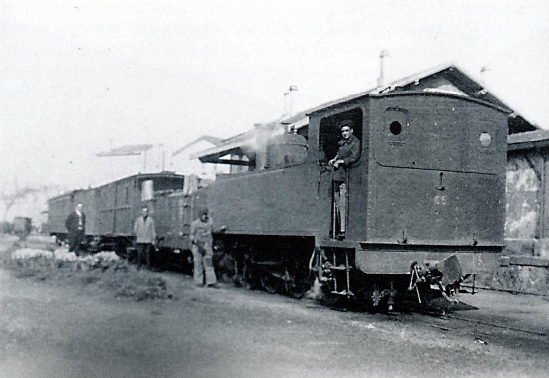
1. Small 0-6-0T Locomotives
Three 0-6-0T Corpet-Louvet series 70 to 72 locomotives were ordered by the company for the line between Cogolin and St Tropez. These 0-6-0T locomotives were of a light weight, suitable for the branch tramways either side of La Foux. The three locos provided this service with two active and one in reserve at all times.
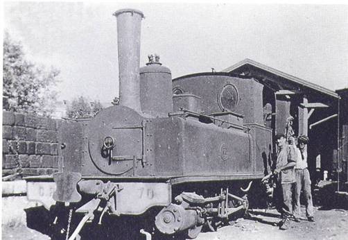 0-6-0T Corpet-Louvet No. 70 stabled at the fuel depot at Toulon Station in around 1930 (Collection GECP).
 0-6-0T No. 72 taken at the time of out-shopping at the Corpet-Louvet factory in February 1894. The photo may have been used in a commercial catalogue (Collection: GECP – Pierre Virot – Bernard Rozé).
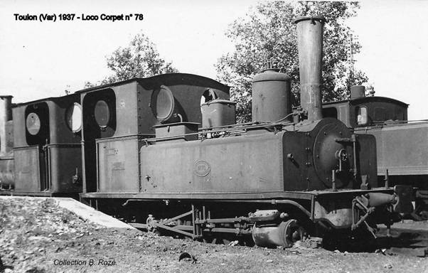 A few years later, in Toulon, in 1937 0-6-0T Corpet-Louvet N ° 70 awaits disposal for scrap. To the left, No. 71 already has its water tanks removed and is awaiting the same sad fate (Collection: Bernard Rozé).
| MAIN CHARACTERISTICS OF THE 0-6-0T CORPET-LOUVET | |||
| Type: | 0-6-0T | Usable track type: | Metre-gauge |
| Builder: | Corpet-Louvet
Works in Paris |
Driving Cab: | closed, lit by 2 oval portholes and equipped with a door opening at the back |
| Year of construction: | 1894 | Delivery date: | February 1894 |
| Number on the South France Railway network: | 3 | Coupled axles: | 3 |
| Total wheelbase: | 1.70 m | ||
| Factory number: | 591 to 593 | Diameter of driving wheels: | 0.80 m |
| Numbered: | 70 to 72 | Valve Gear: | slider and double eccentric Stephenson system |
| Unloaded weight: | 11,540 tons | Cylinders: | 2 outside planar drawers |
| Weight in working order: | 15,180 tons | Estimated power: | |
| Total length:
|
5,997 m | Estimated maximum speed: | 20 km / h in ramp of 25 with a load of 40 t |
| Total width: | 2.50 m? | Water Tank capacity: | 1640 litres |
| Total height: | 2,840 M | Coal capacity: | 0.445 tonnes |
| Usage: | In October 1937, No. 70 and No. 71 were set aside and sold for scrap then it was the turn of the No. 72. | ||
2. Mikado Locomotives and Other Temporary Residents
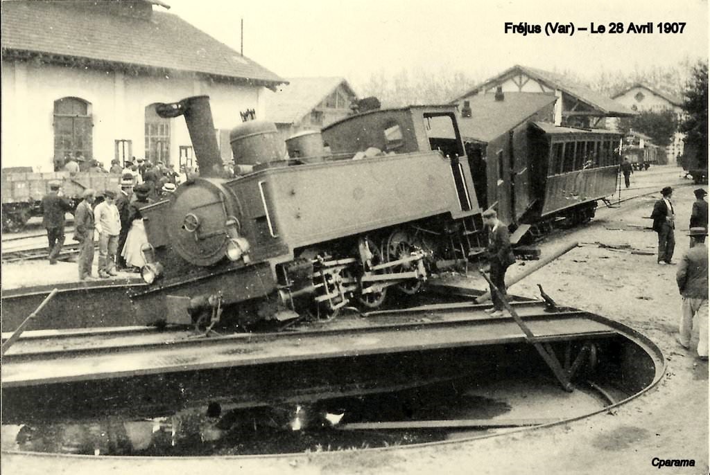
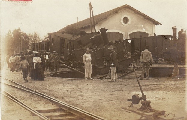
During the Second World War, the Littoral network received reinforcement from the largest steam locomotives that had ever been in regular service on a metre-gauge track in France. They were imposing type 2-8-2 tender locomotives (or Mikados). These machines were to be delivered to Senegal but their delivery was blocked. In the spring of 1943, 6 Mikado locomotives were allocated to the company’s network in the Alps and 3 others, numbered 21, 22 and 30 to the Littoral network.
They started service at the end of the summer of 1943. From the end of January 1944, No. 30 was transferred to another network. Only No. 21 and No. 22 ran on the coast line. Because of the worn state of the track, the relatively tight curves and the light rails, there were several derailments. The 2 Mikados left Toulon in 1945, underwent an overhaul by Corpet-Louvet then were sent to Africa, where their service did not last more than a decade before dieselization.
Their sojourn on Le Chemins de Fer du Sud was short and there are very few photographs.
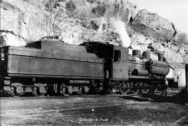 Corpet-Louvet Mikado 2-8-2 locomotive “Dakar-Niger” with its 16m3 bogie tender seen on the Littoral (Collection: Bernard Rozé).
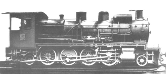 Chemins de Fer Dakar-Niger, Corpet-Louvet 1736 of 1927, was typical of a large number of metre gauge 2-8-2 tender locomotives built for service with the railways of French West Africa. Cylinders: 450mm x 550mm. Coupled Wheels: 1200mm. This is the same class of loco as those used on Le Chemins de Fer du Sud.
The Mikado Locos were not the only temporary residents on the Littoral Network. A BB Mallet locomotive was seen on the network during the occupation in the Second World War. Its sojourn was not a great success nd it was discovered languishing on depot after the German troops withdrew. The Locomotive was built by SACM and served elsewhere in France before being requisitioned for the Chemins de Fer du Sud.
 It was requisitioned in July 1943 and then shipped to Toulon. It was first used on behalf of the occupation authorities before being found at the liberation in 1944 stored in the naval workshop near La Londe. Requiring major repairs and no longer serving the needs of the network, the loco was taken to Toulon to be scrapped in 1947.
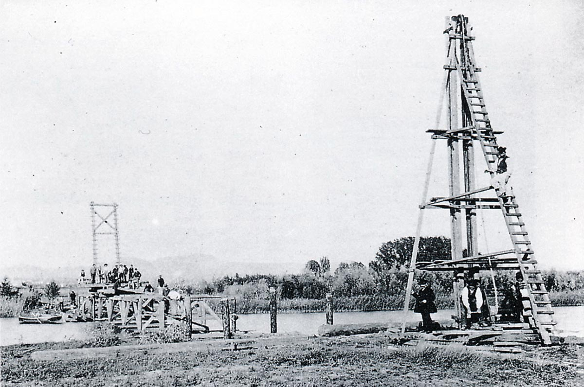
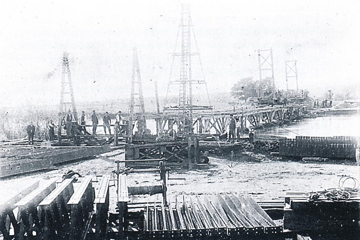
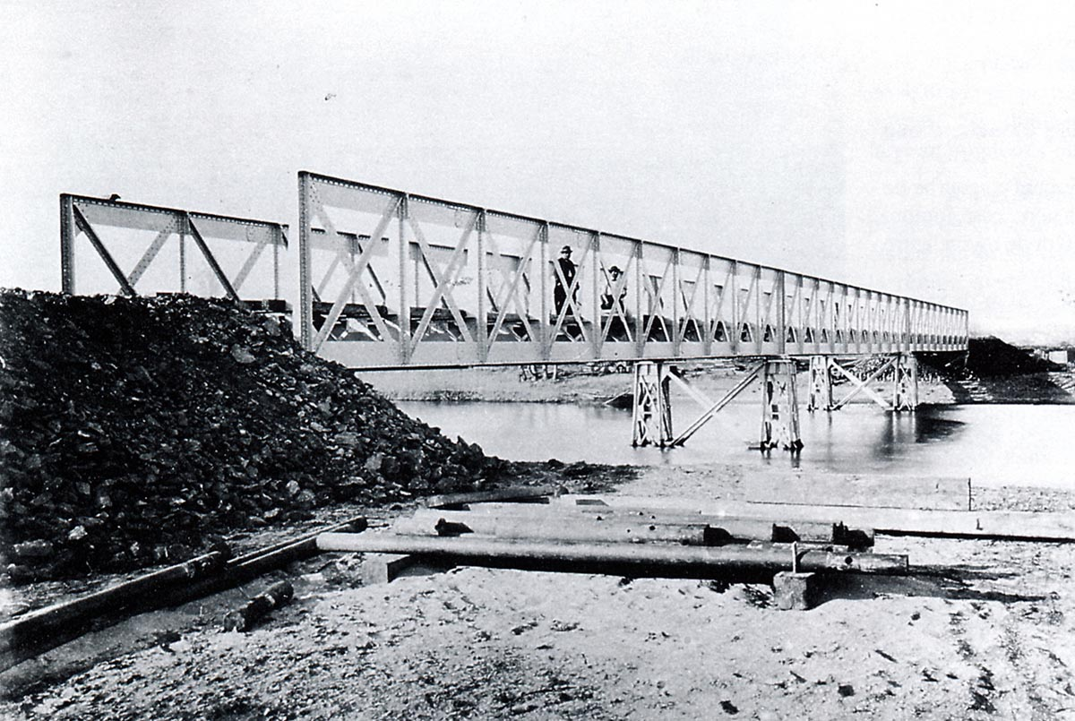
Interestingly there is a picture of a Mallet Loco (see below) being moved from St. Raphael to the Alpine network on 17th January 1935 which suggests that the loco, or another similar one, served on the network before the war.
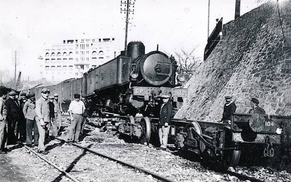 The embarkation of locomotive 020 + 020T SACM n ° 32 on wagon PLM at St.Raphaël January 17, 1935, for restitution to the network of general interest of the Alps. The chimney, the valves, the steam dome casing and the cabin were dismantled so as not to exceed the loading gauge (Photo Marcel CAUVIN – G. E. C. P. Collection).
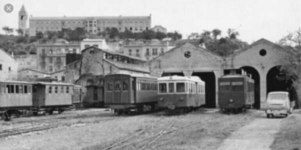
B. Railcars
All the railcars on the Chemins de Fer du Sud Littoral were supplied by one company – Brissonneau et Lotz.
Brissonneau et Lotz
Brissonneau et Lotz [19]was a French locomotive engineering company, engaged in the manufacture of railway locomotives and wagons.[20] The company was also a supplier of rolling stock to the Paris Metro, constructing in 1951 the first metro trains in the world to be equipped with rubber tyres.[20]
In 1837, Etienne Lotz and Paul-Henri Renaud founded an engineering company that quickly became very successful. In 1849, they were the first in France to manufacture locomotives and became the leading manufacturers of agricultural steam engines.
 Meanwhile, in 1841: Mathurin (1814-1897) and Joseph (1817-1900) Brissonneau created the engineering company Brissonneau in Nantes, rue du Chapeau Rouge. At the time, they worked for the sugar industry and in shipbuilding. They patented and improved a number of industrial machines.
In 1862, Etienne Lotz left the company he had founded with Renaud and entered, with his son Alphonse (1840-1921) into the service of their main competitors: Brissoneau.
In 1866, Alphonse Lotz, married the daughter of Mathurin Brissonneau. In 1878, Brissonneau Frères became Brissonneau and Lotz and moved from Launay Street to Doulon. By 1908, the company had diversified into boilermaking, refrigerating installations, machine tools, and wagons. At this time Brissonneau and Lotz employed more than 400 skilled workers.
In 1920 they created a factory located sixty kilometres north of Paris in Montataire, the industrial suburb of the city of Creil and decided to build railcars (autorails) primarily for the metre-gauge secondary railways in France and for export.[21]
In 1972, Brissonneau & Lotz was absorbed into Alstom, becoming Alsthom Groupe Brissonneau. The company was founded in Nantes where it had many of its main facilities, but by the time it lost its independence it had acquired or established factories and workshops in many parts of France.[19]
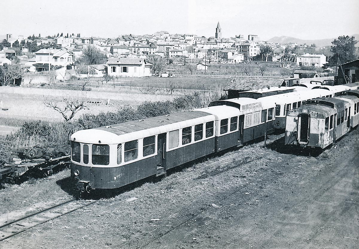
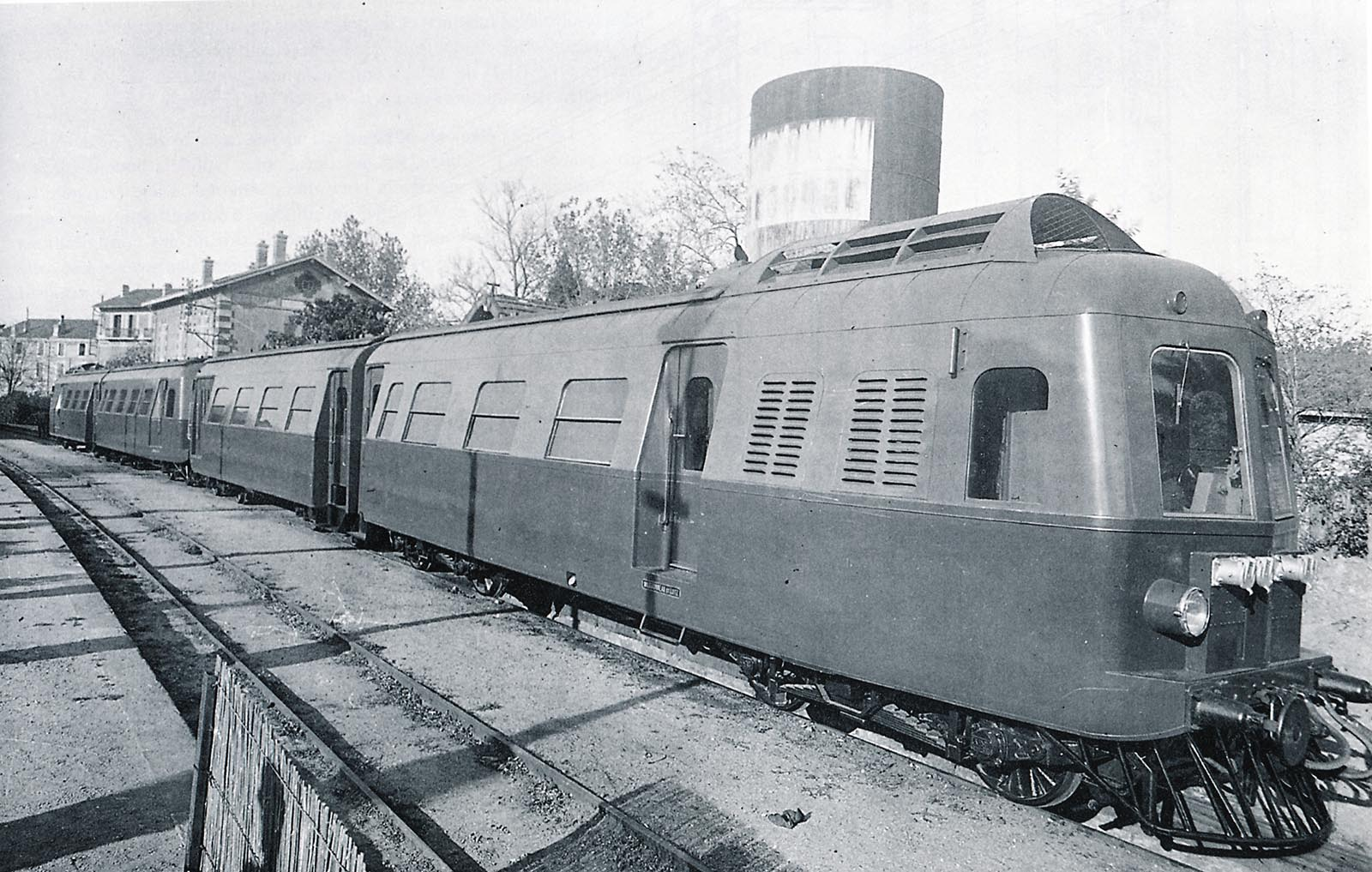
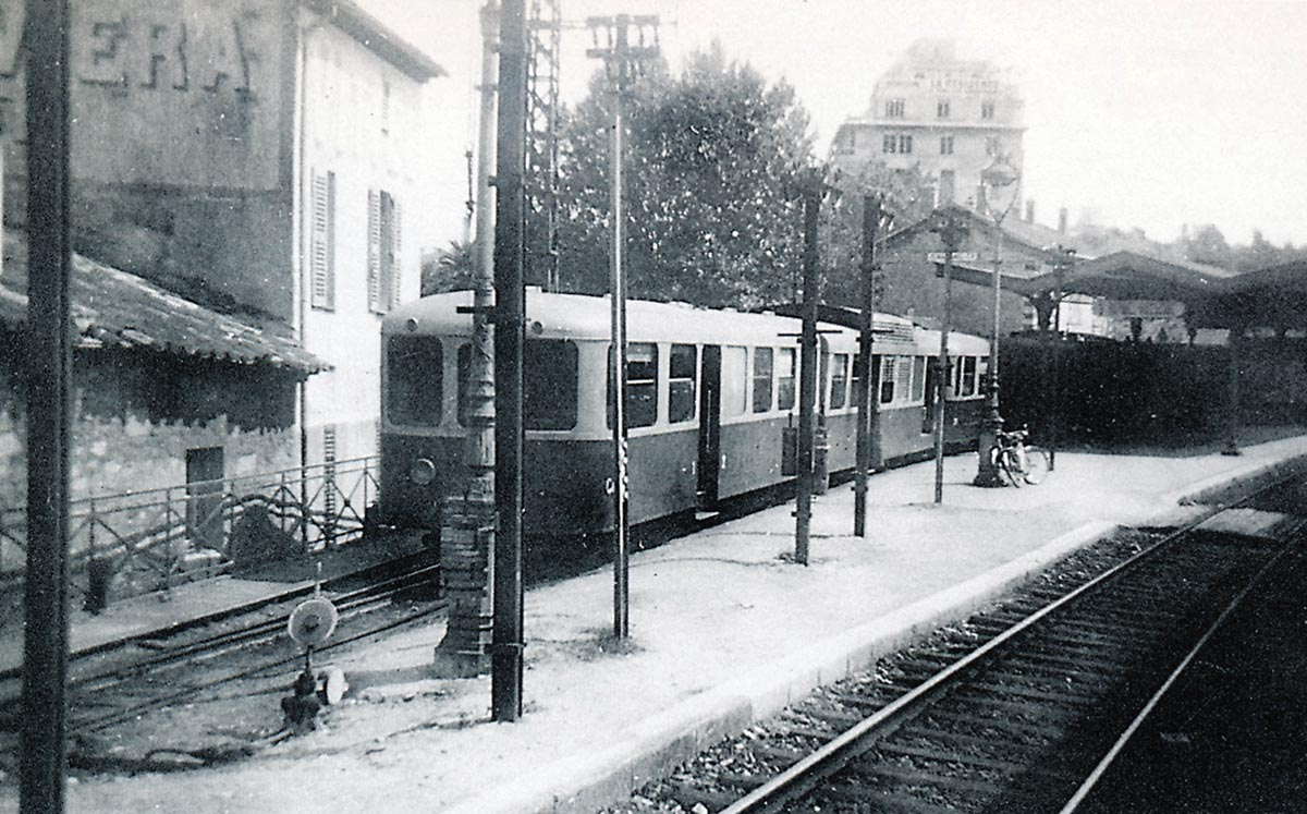
Diesel traction made its appearance on the Chemins de Fer du Sud in Provence in 1935. The diesel service continued until the closure of the line in the late 1940s, apart from the period of the Second World War (1939-1945) during which steam was brought back onto the network.
Trains usually composed a motor unit and a trailer unit, independent bogie coaches but permanently coupled. 10 combined units went into service in 1935 and a further 6 were purchased and in service by 1938. Two of the original batch were destroyed by fire at Frejus.
 Steam operation in the 1920s was beginning to prove expensive and the Company was seeking ways to reduce operating costs. Electic traction was seriously considered before the decision was taken in October 1933 to acquire the 10 diesel units. The motor units were 270 horsepower. The order was placed on February 16th, 1934.[11]
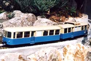
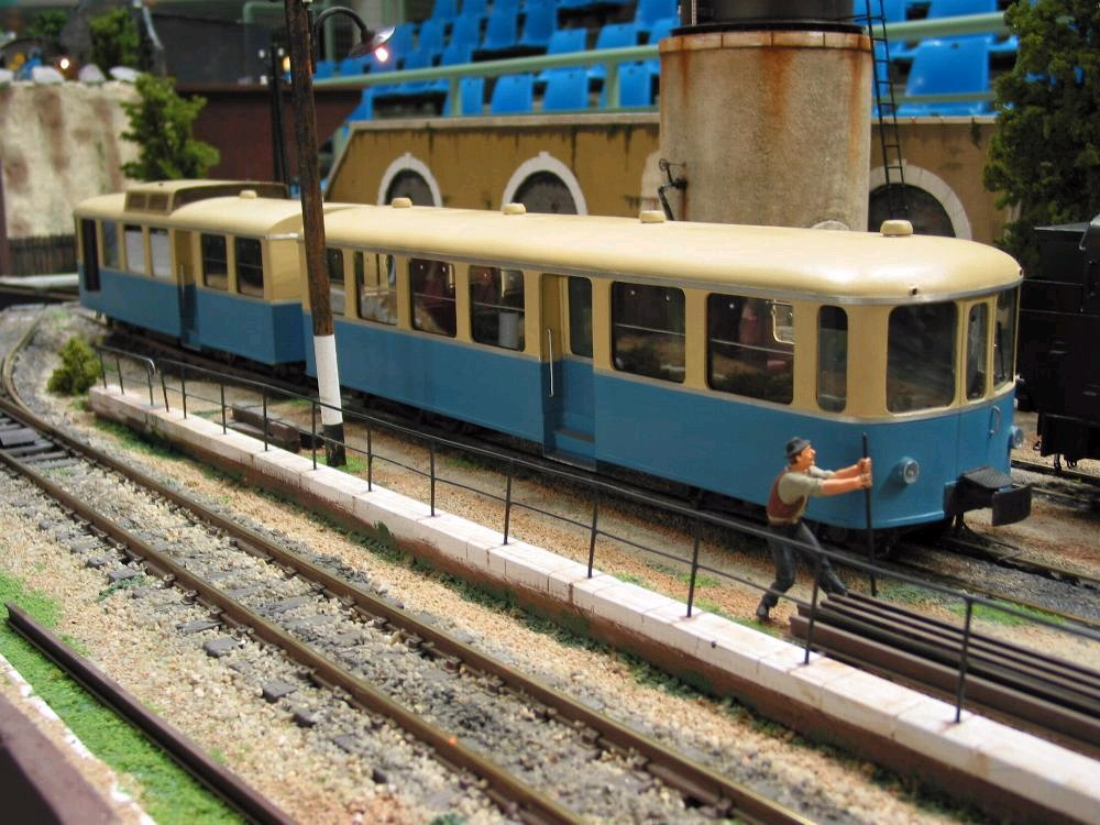
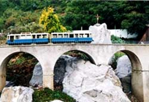 These two pictures show models of the units in use from 1935. The models were produced by Ardèche Miniatures and are shown on a garden railway.
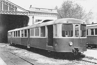
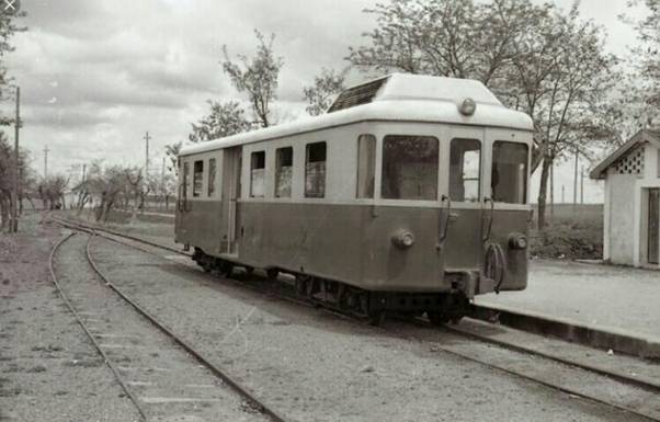
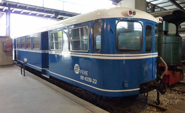
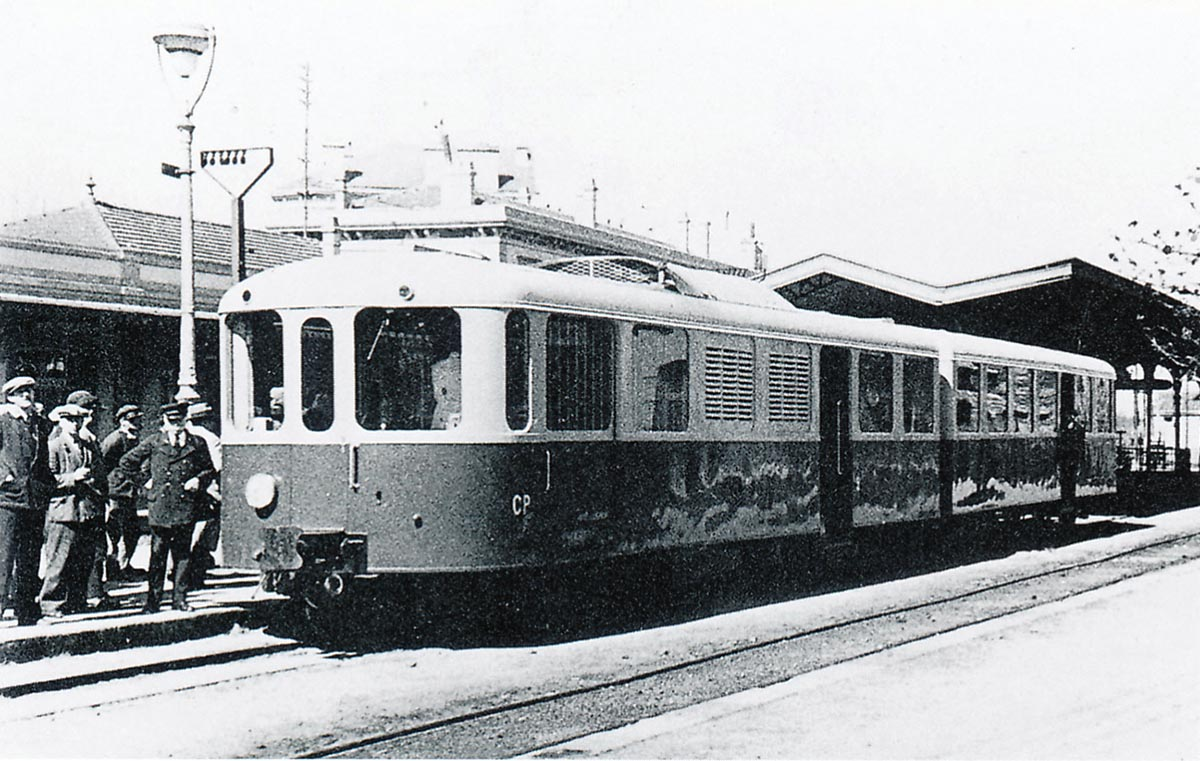
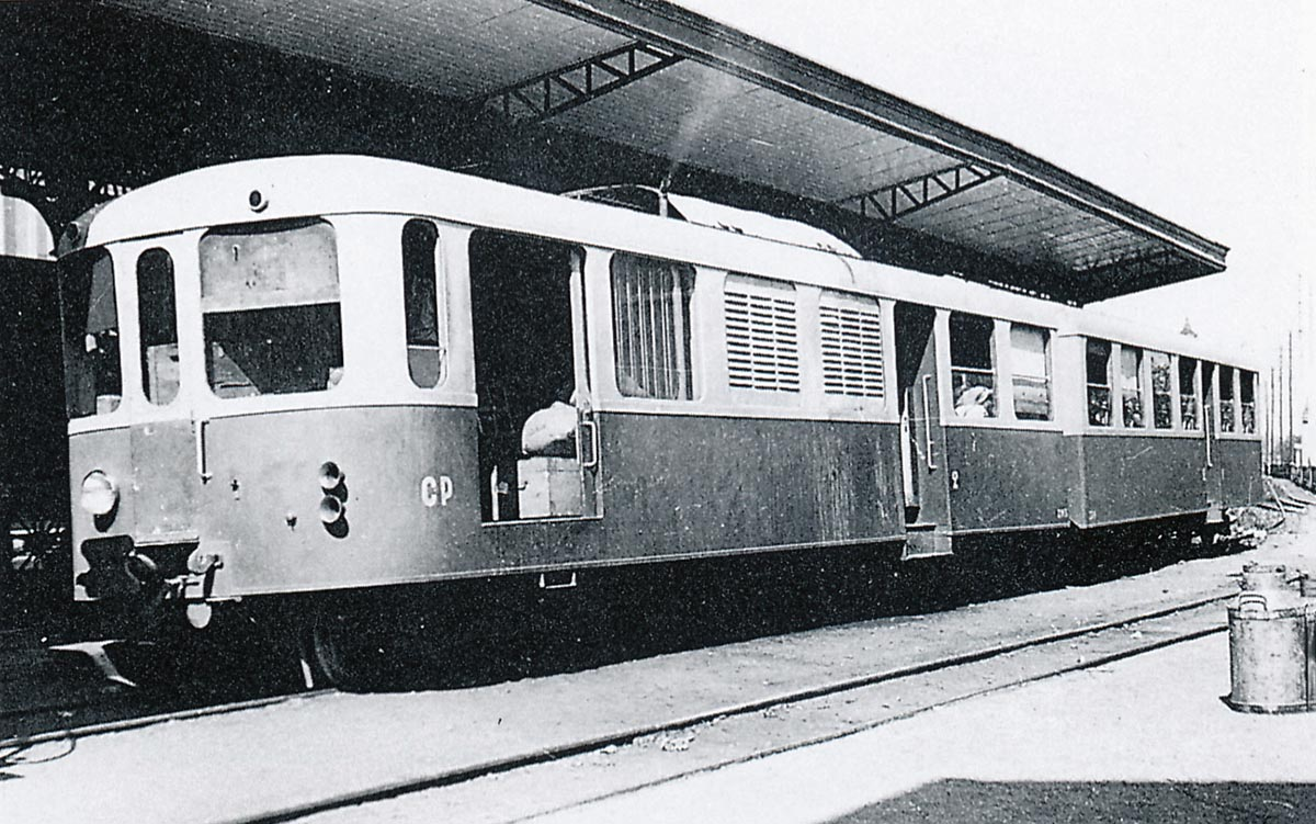
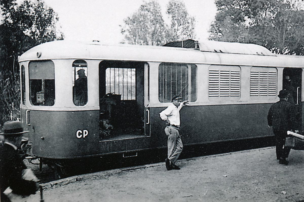
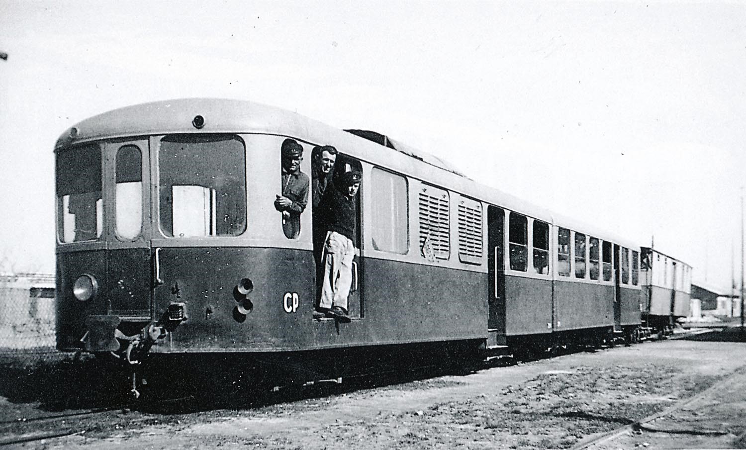
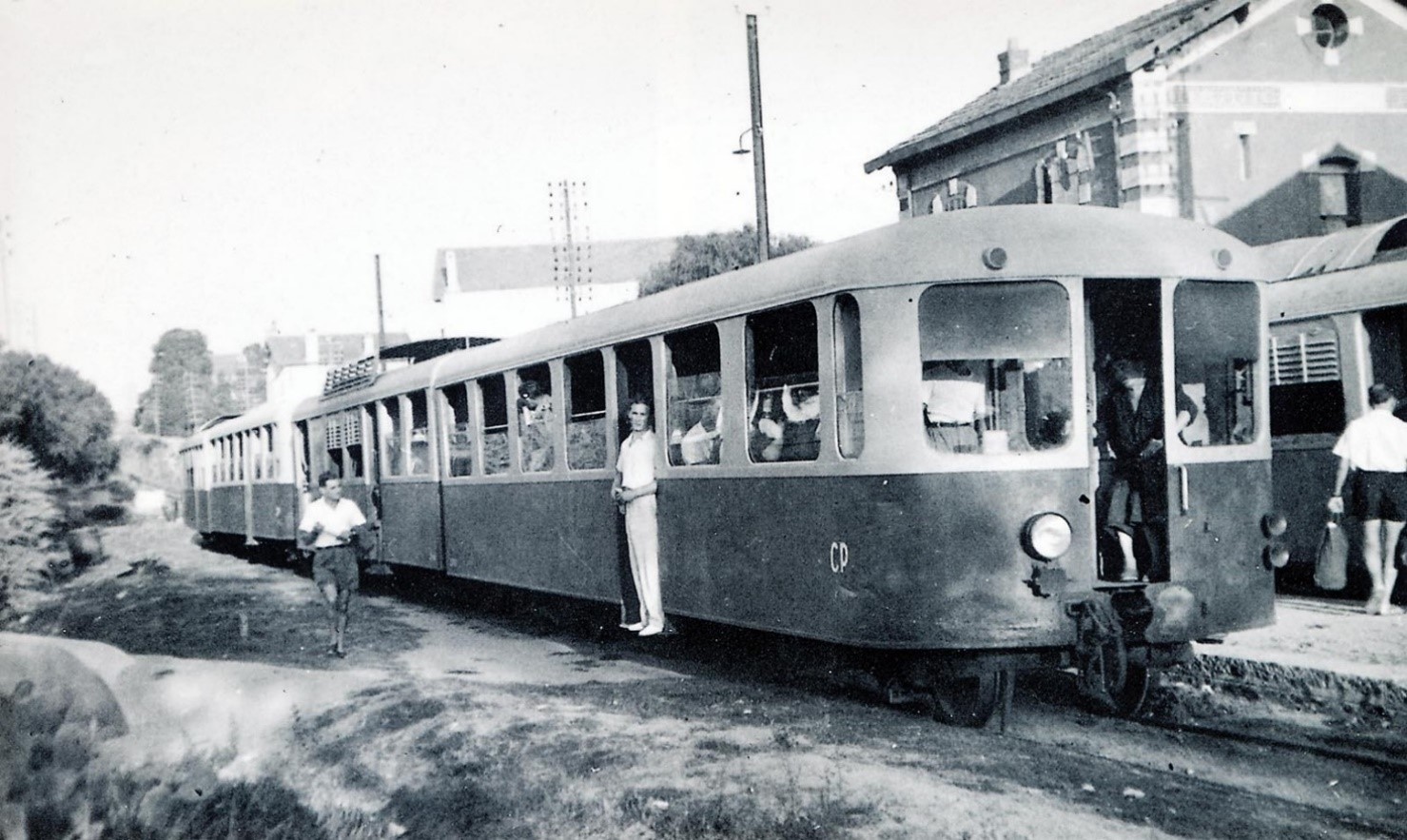
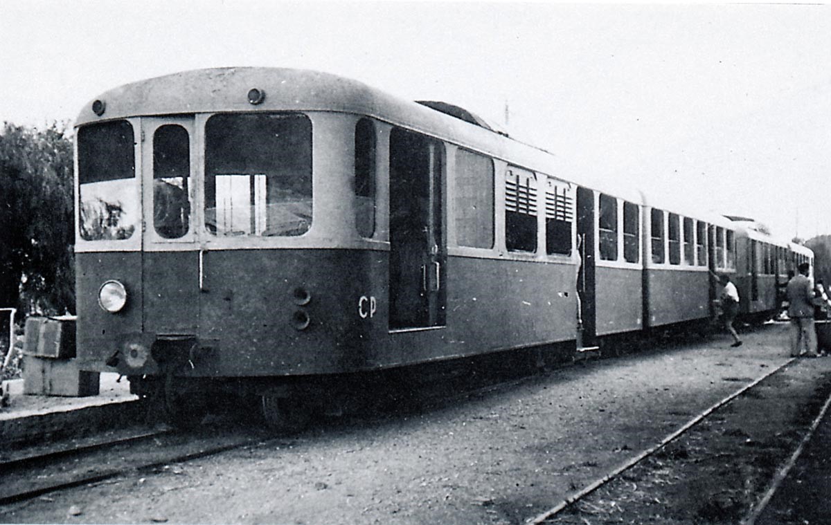
Brissonneau & Lotz railcars on the Chemins de Fer du Sud Littoral were painted grey and blue rather than cream and blue.
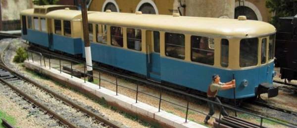 Brissonneau-&-Lotz in the colours of the Railways of Provence: it is a magnificent model (probably at 1/22.5) made by Jean-Pierre Minard of Le Sarthe, and presente at an amateur meeting about garden trains organized by Ardèche Miniatures in September 2002. The railcar is powered by Aristo-Craft engines/bogies.[22]
The first 10 sets were numbered ZM-1+ZR-1 to ZM-10+ZR-10. The further six sets delivered in 1938 went into service, two to replace ones destroyed by fire and four which became ZM-11+ZR-11 to ZM-14+ZR-14. One was delivered to Draguignan on the Alpine system in 1940 by SNCF, but was returned to St Raphael without being unloaded. There were plans in 1948 to move two to four sets to replace the steam locos on the remaining sections of the Nice-Meyrargues line (which had been badly damaged in the war). Instead, the whole line was abandonned and the coastal railcars were sold for use on the metre-gauge lines of northern Spain. One set is preserved in the narrow gauge museum at Gijon, as shown in the image below the data table. Another set ZM-8+ZR-4 returned from Spain to the Chemins de Fer du Vivarais.
| MAIN CHARACTERISTICS OF BRISSONNEAU & LOTZ AUTORAIL | |||
| Type: | diesel-electric railcar (or self-propelled) | Usable track type: | Metre-gauge |
| Builder: | Brissonneau and Lotz in Creil | Colours: | Blue and pale gray. |
| Year(s) of construction: | 1st series 1934 – 1935
2nd series: 1938 |
Delivery date: | from March 1935 to July 1935 – 2nd delivery of 4 railcars in April 1938 |
| Number on the South France Railway network: | 14 | Formation: | 2 boxes permanently coupled by a rigid hitch |
| Number of seats: | 60 including 16 in 1st class and 44 in 2nd class | Bogies: | Bril type 84-E |
| Number of standing places: | 48 | Engine: | 2 Berliet MDK 2C diesel engines Ricardo license 2 x 135 hp = 270 hp |
| Unloaded weight: | 35 tons (24 + 11) | Engine characteristics: | 4 stroke -6 cylinders in-line direct injection |
| Weight in working order: | 41 tons
(26.7 + 14.3) |
Power developed by the generators: | 90 kwh or 122 hp |
| Total length:
|
2 x 12.08 m
= 24.16 m |
Electric motors: | 4 Brissonneau engines of 45 kw or 180 KW = 245 hp |
| Total width: | 2.70 m | Power: | 135 hp at maximum speed of 1500 rpm |
| Total height: | Diesel tank capacity: | 425 litres | |
| Pivot centre distance: | 7.44 m | Wheelbase of bogies: | 2.00 m |
| Total wheelbase: | 9.44 m by car | Wheel diameter: | 0.70 m |
| Maximum speed reached: | about 95 km / h | Numbering: | ZM 1 to 14 for motor and ZR 1 to 14 for trailers |
| Usage: | 2 railcars were destroyed by a fire in November 1937 – In 1946, the train ZM 9 caught fire at St-Tropez station, in January 1947 it was the turn of the ZM 5 which caught fire on the run near Cavalaire then the ZM 2 was badly damaged in a collision. Sale of the remaining cars was agreed at the closure of the network but did not take place until 1951. | ||
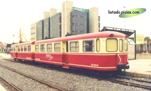 Brissonneau and Lotz EA MAZ 1 former property of Ferocariles Económicos de Asturias. Oviedo Sto- Domingo. Museum of Gijón (Asturias). Daniel P. Lanuza – © listado.pizias.com.
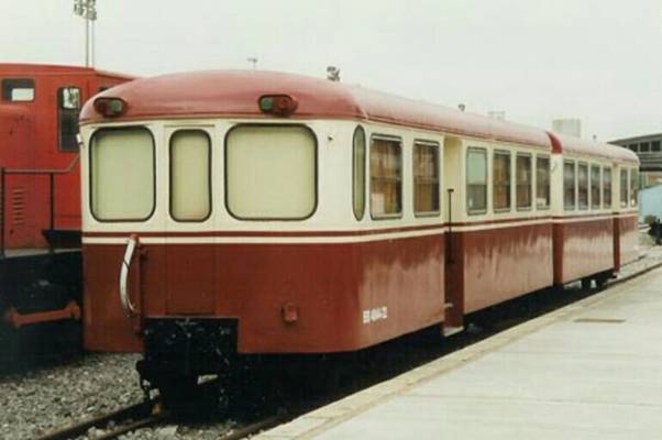 The railcar is painted in the colours it was given when in use in northern Spain.
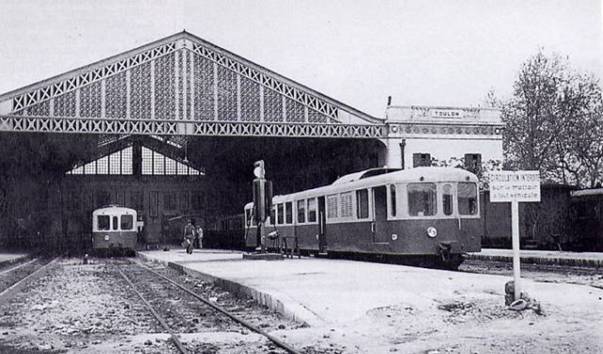
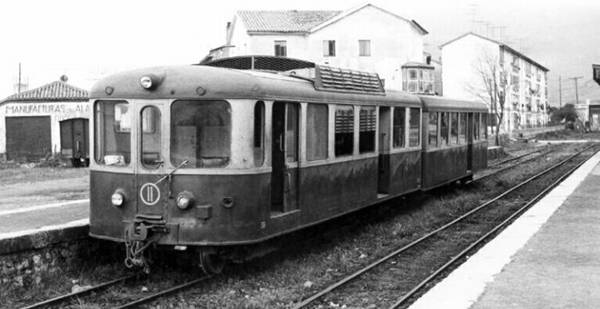
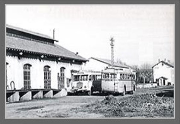
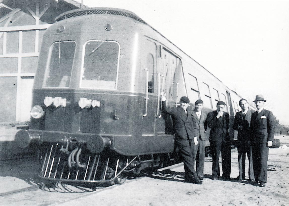
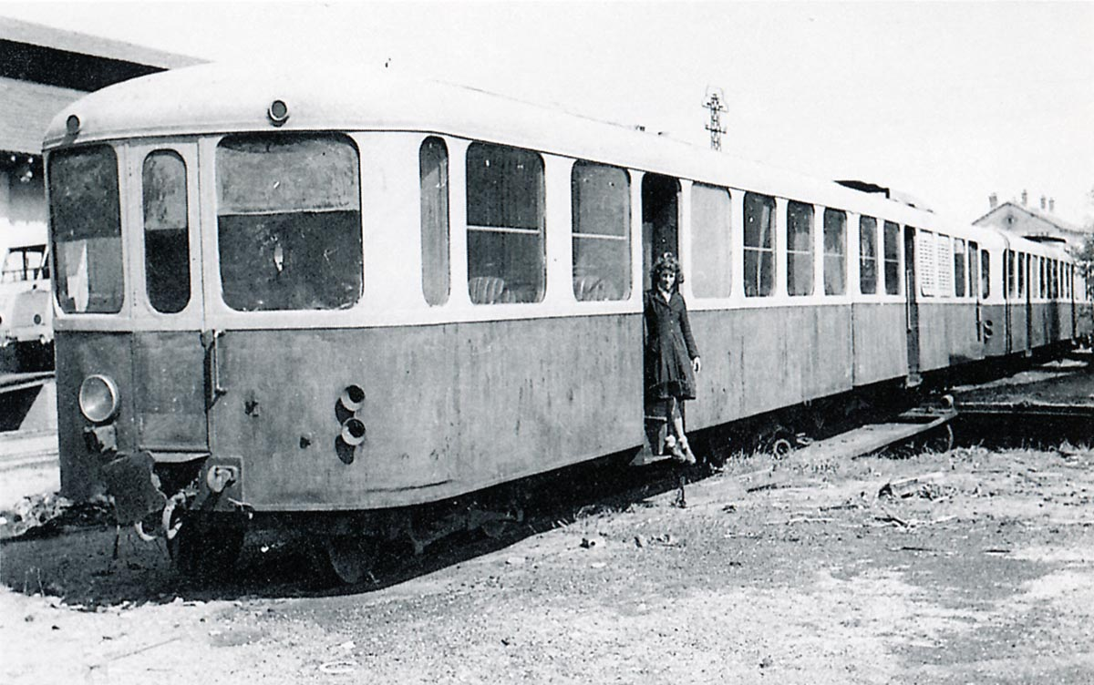
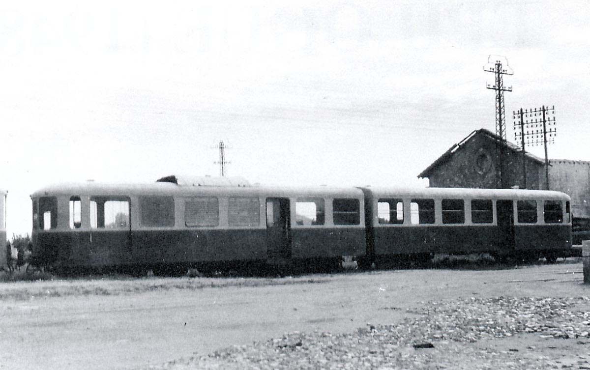
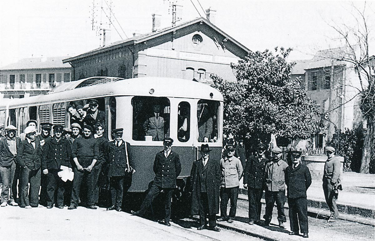
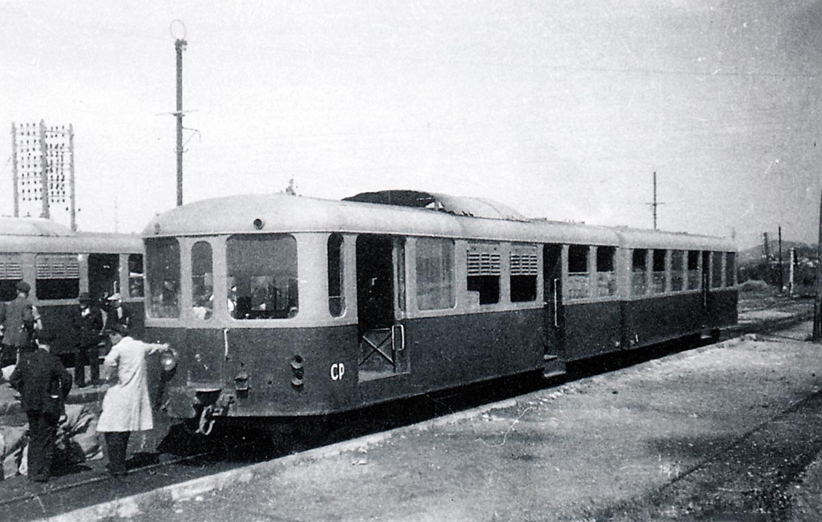
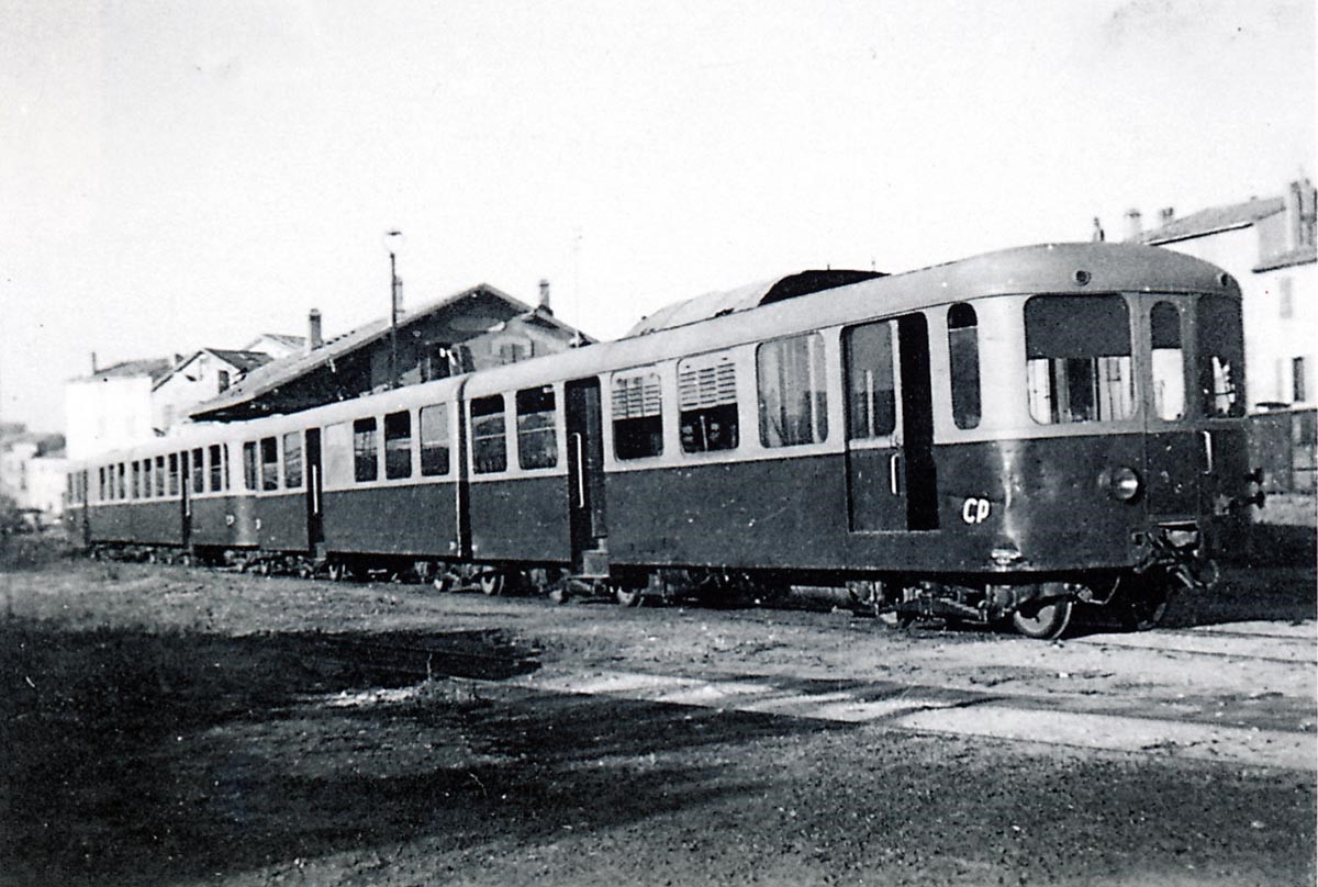
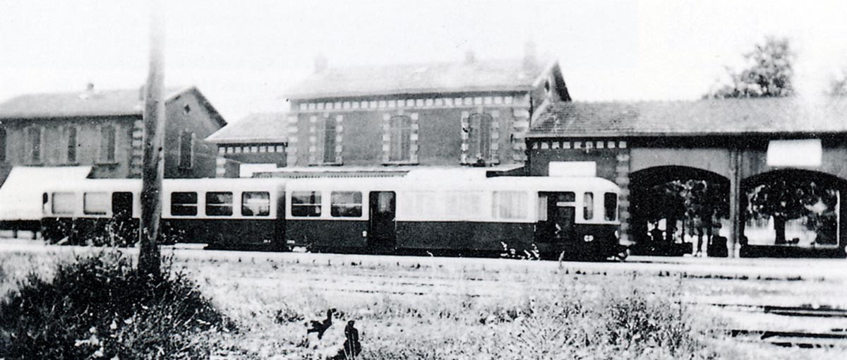
In April 1936, 2 railways Brissonneau and Lotz railcars are shown below at Toulon Station. In the middle of the central platform, we can seen the diesel pump from which the railcars were refueled (Photo by Jacques Chapuis – Collection: FACS-UNECTO)
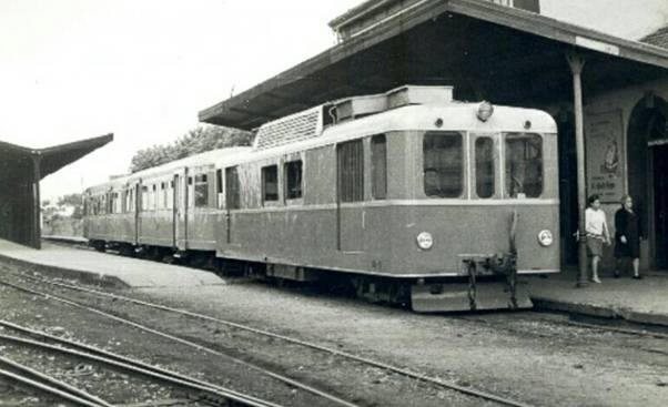
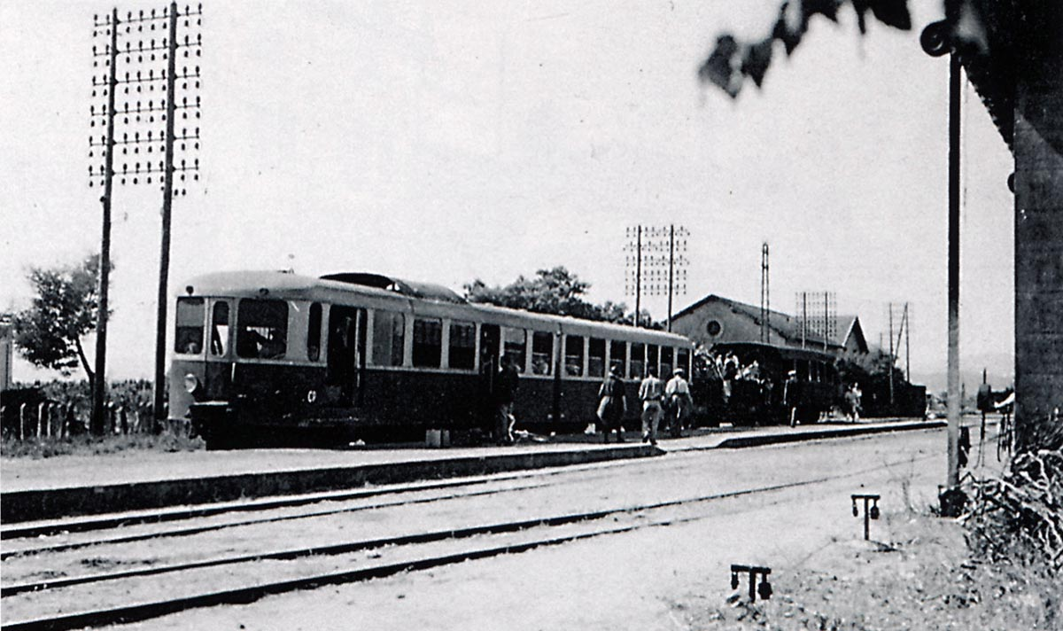
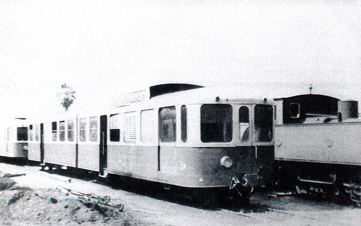
 In August 1937, 2 Brissonneau and Lotz railcars at Toulon Station (Collection: FACS-UNECTO).
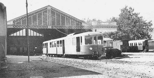
 At Toulon station: the train includes a 1st Class and a 2nd Class coach with a luggage compartment.
The coaches were connected by a gangway to allow the conductor to pass between the coaches. The raised area on the roof housed the engine cooling elements.
The driver did not have a fixed seat at his disposal, a simple wooden stool was delivered with the units. This was quickly replaced in each case by a more comfortable chair. The comfort of the driver was not a priority. There was a toilet on board (1 WC + 1 sink) located in the trailer. This was a good development, the earlier coaches on the system were not equipped with these facilities and passengers had to rely on the frequent station stops to relieve pressing need.
During the war, from 1941 onwards, fuel shortages almost closed the network. Old steam locomotives had to be brought out to sustain the service. Shortly after the liberation, the service resumed with tired old railcars; some damaged by bombing (MZ 1, 5, 7 and 14). The speed limit was reduced from 75 km/hr to 60 km/hr.
At the closure of the network, railcars were sold, where possible. Some found a new life in northern Spain.
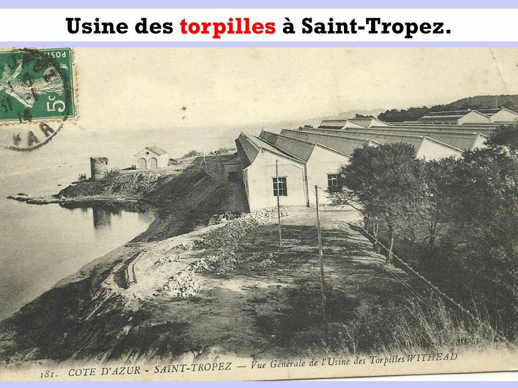
A train (ZM 12 + ZR 12) was set aside in 1943 in Creil because there was no money to pay for repairs. The network did not recover after the War. The line closed in June 1948. Some traffic continued between Toulon and Hyères to ensure the workers shuttles, until October 18, 1948. Another train continued running from La Foux towards St. Tropez to cover workers access to the Bertaud torpedo factory. It operated until 4 June 1949. 5 units were set aside immediately at the Fréjus depot awaiting sale.
After many visits from various representatives of other networks, estimates and various consultations, sale was agreed in 1951 to 3 Spanish companies operating metre-gauge lines in the north of the country.
The Ferrocaril Santander – Bilbao (SB) bought 10 units that received new equipment (buffers, hitches, recessed lights) and a green and silver livery with yellow nets. They served the Bilbao-Valmaseda and Bilbao-Santander lines.
Ferrocaril Cantabrico (FC ) commissioned a single train for the Santander – Llanes line.
Ferrocariles Economicos de Asturias (EA ) received a train that covered the Oviedo – Llanes line and an extension beyond on the line of the FC to Santander. The last units continued in operation until 1985.
I have struggled to find images of these Brissoneau and Lotz railcars in service in Spain. Very similar vehicles show up well in photographs. For instance, the first two pictures below show very similar Billiard A 150 D 7 railcars. Friends on the Passions Metrique et Etoile Forum have commented that these were much better vehicles to travel in than the Brissonneau and Lotz autorails.
 These three images above show various units operating on the Ferrocaril Santander-Bilbao, only the third of these shows a Brissonneau and Lotz railcar. It is operating in the vicinity of Liérganes and Balmaseda. (Photograph: Ferrán Llauradó. Collection: EuskoTren Archive / Basque Railway Museum).[23] As we have already noted, the middle image above shows a Billiars A 150 D 7 unit on the Reus-Salou line.[24] The top image shows one of the Billiard units on depot.[25]
 The image above shows a Brissonneau & Lotz diesel-electric locomotive from the Littoral network (these are covered later in this blog – it is either ZT51 or ZT52) in northern Spain, this time in Asturias. The locotractor was probably numbered EA-MAZ-1 on the Spanish system. The vehicle being towed my be a MAN trailer.
 Another unit on the Ferrocariles Economicos de Asturias.
There are a few units in preservation. We have already seen images of one of the preserved units at the Museum of Gijón (Asturias). Another is shown in blue livery below in 2009 at the same museum.
There are enhanced Cine Film Videos of these units in action in Spain. These include the Video on these links: https://youtu.be/7TaTCFvv8iM, https://youtu.be/45dCddESOu4
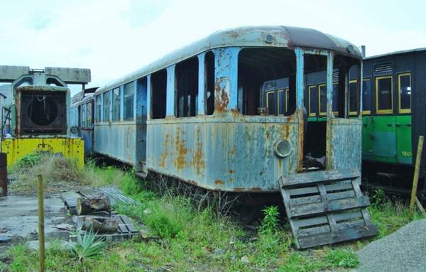 In February 1983, the Vivarais Railway (CFV) bought the MCD-8 and the RC-4 trailer and repatriated them to France, despite their poor condition. Currently, it has still not been restored. Here is a picture seen on a forum of http://www.passion-metrique.net/forums (Photo Malletslm -Tournon May 2007).
In addition to these railcar units the Chemins de Fer du Sud had two diesel shunter units – locotractors. These were also supplied by Brissonneau & Lotz.
C. Shunter Units
The ZT 51 and 52 Brissonneau and Lotz Shunters
The electric diesel transmission: one of the unique features of Brissonneau and Lotz railcars and shunters was the use of diesel-electric transmission. This consisted of a diesel engine that drives a generator supplying direct current to electric motors directly driving the wheels of the vehicles.
From 1930 onwards diesel-electric railcars and shunters were built by the Company for a whole series of secondary networks including: the railways of Anjou; the network of the Var; the railways of Provence; the railways of Morbihan; the railways of the Charentes; the railway of the valley of Celles in the Vosges; the railways of Madagascar; the railways of the Port of Reunion (Reunion Island). In 1937, Brissonneau and Lotz built for 16 tramway cars for Lille, intended for. They are intended for the ELRT network (Électrique Lille – Roubaix – Tourcoing). In 1950, a further order was placed by the same network for 28 engines. The Company was also responsible for a large part of the equipment of the Metro in Paris and for networks in Lyon, Marseille, Brussels, Caracas.
Later, in 1949, Brissonneau & Lotz built a series of 10 tractors type 600 CV:
for the Railways of Provence, No. 51-54
for the Railways of Corsica, No. 401-402
for the railways of Dauphine, No. 1 to 4.
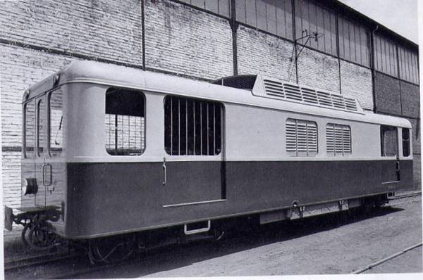 ZT-51 locomotive when it left the Brissonneau & Lotz factory in Creil in the spring of 1938 (Collection: José Banaudo). Colours were blue and light gray.
| MAIN CHARACTERISTICS OF THE TRACTOR ZT | |||
| Type: | Shunter | Usable track type: | Metre-gauge |
| Builder: | Brissonneau and Lotz in Creil | Colours: | Sill: blue; pale gray topside |
| Year of construction: | 1938 | Delivery date: the 1st was delivered on the 27/06/1938 and the second on the 01/08/1938 | spring 1938, the tests took place on July 22, 1938 |
| Number on the South France Railway network: | 2 | ||
| Number of seats: | 0 | Number of standing places: | 0 |
| Unloaded weight: | 25 tonnes | Engine characteristics: | 4 stroke -6 cylinders in-line direct injection |
| Weight in working order: | 28 tonnes | Power: | 245 ch |
| Total length:
|
12,440 m and 12,320 m off buffers | Total width: | 2.70 m |
| Total height: | 3.565 m | Diesel tank capacity: | 425 litres |
| Total wheelbase: | 9.440 m | Wheelbase of bogies: | 2.00 m |
| Bogies: | 2 Brill bogies | Baggage compartment: | 7.5 m2 |
| Bogie spacing: | 7.440 m | Wheel diameter: | 0.70 m |
| Generators: | 2 Berliet-Ricardo MDK 2 C of 150 HP each with 6 cylinders in line | Generator: | Brissonneau of 90 Kwh |
| Traction motors: | 4 electric motors Brissonneau of 40 Kwh | Braking: | vacuum + rehostatic type brake |
| Maximum speed reached: | about 60 km / h | Numbering: | ZT-51 and ZT-52 |
| Usage: | ZT-52 damaged by a fire in 1943 but eventually brought back into service. ZT-51 taken out of service in 1951. These units were broken up in 1983 and 1988. | ||
In the autumn of 1936, in the face of the growing success of the railcars, the company and the department decided to order two 300-horsepower locomotives to ensure the traction of freight trains as well as additional passenger trains. In 1943 the ZT-52 caught fire following tests conducted by Brissonneau & Lotz to improve the electric circuit and after a time was brought back into service. ZT-51 remained in service until the closure of the network.
After a period in storage after the line closed, both shunter units were sold for ongoing use in Spain. In 1951 they served for a few days carrying equipment sold to Spain, from Fréjus to St-Raphaël. Once they reached Spain they were remotorized with Renault type 561-B diesel engines and modified to meet local standards.
One was commissioned on Ferrocaril Cantabrico (FC) under No. MD-1; renovated in 1980, it was scrapped in 1983.
The other was used by Ferrocariles Economicos de Asturias (EA) under No. MA-2, Renovated in 1985, it was scrapped in 1988 (50 years after its commissioning).
D. Coaches
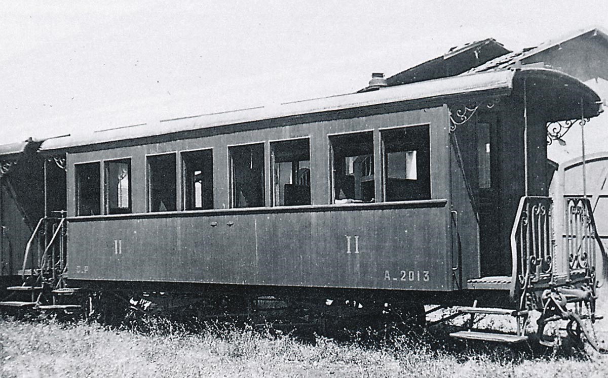
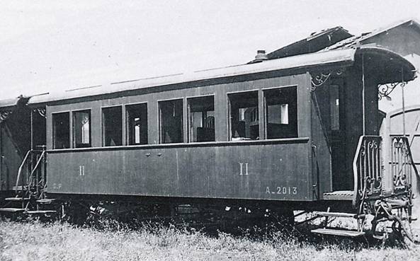 Taken in 1937 at Hyeres, this is a two-axle 2nd Class A-2013 Decauville (José BANAUDO Collection).
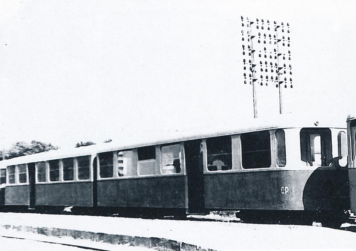
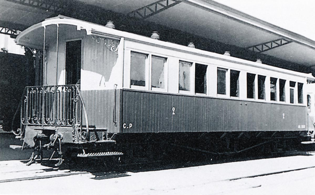 Mixed car AB-2531 (ex-1031) Hanquet-Aufort seen in 1937 at St. Raphaël was repainted in blue and grey to be used as a trailer behind the railcars Brissonneau & Lotz (José BANAUDO Collection).
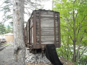
Very little of the rolling stock from the line entered into preservation, but a few items did the following photos from the 21st Century provide good details for those who are interested.
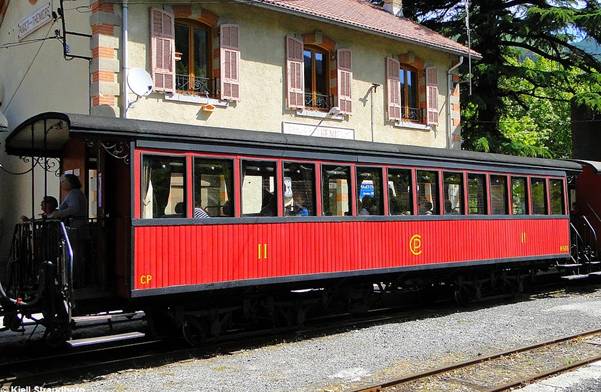
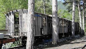
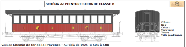
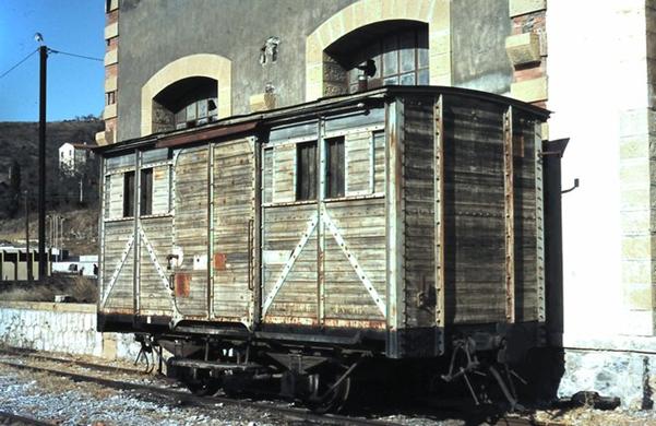
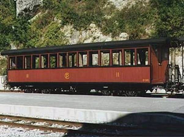 One of 2 authentic coaches from Le Chemins de Fer du Sud de la France preserved today. They are used with the steam train managed by the GECP on the Puget-Théniers-Annot route. They are 2nd class bogie coaches, with wooden bodywork, built by Desouches and David (factory in Pantin) in 1892. They were numbered B74 and B77 by the Chemins de Fer du Sud and were renumbered B505 and B508 at the creation of Les Chemins de Fer de Provence in 1925. They are currently in the traditional colours for coaches on the network – a brown / red colour known as Brown-Van Dyck, with the window surropunds and roof in black. The symbol CP of the Railways of Provence o-is on the panel side of the coach together with the Class shown in Roman numerals (Collection: GECP).[11].
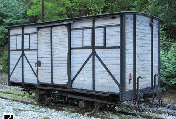
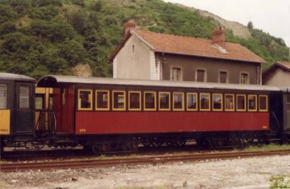 Coach AB 506 constructed by Desouches & David, which served originally on Les Chemins de Fer du Sud before being transferred elsewhere. It is now part of the stock of the Vivarais Railway (CFV) – No coaches had a toilets! Only stops in stations allowed passengers to relieve themselves (Photograph: Pierre Virot, 2003).[11]
 B-505 is 12.3 m (40.35 ft), its height 3.25 m (10.66 ft), its weight 10.5 t. The seating capacity is 52 passengers. During WWI it was requisitioned for use by the French Army. In June 1915, it was sent to Chemins de Fer de la Camargue (Camargue Railway), and used to transport workers to and from the gunpowder factory in Salin-de-Giraud (near Arles, NW of Marseille). In March the following year it left Camargue and was sent to the war zone near Verdon, to the 10ème Section des Chemins de fer de Campagne, a French military railway unit. It was used for military transport on the narrow gauge line “Le Meusien” (owned by Compagnie Meusienne de Chemins de Fer) in the French department of Meuse. [11]
 After the war, it was returned to SF on April 12, 1919. However, the years of military service had left it in a poor condition. It took two years to get it back to operational condition, on 2nd April, 1921. It then served on the network for another 30 years or so. When the use of steam engines ceased after WWII, it escaped being scrapped. It was instead reordered to be used as a service vehicle for railway line maintenance. For this purpose, the interior was gutted to make space for various tools and supplies. Even a sliding door was installed on its side to allow loading of bulky items. It served in this capacity for about a decade, until it was retired during the second part of the 1960s.
With the advent of the preservation movement, B505 was rescued by the GECP and put into service behind its steam engines in Provence. B508 was added to it and restored.
Further restoration work is ongoing at the Puget-Thenier workshops. Pictures follow: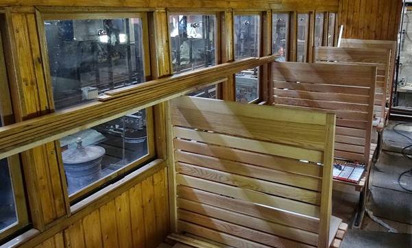
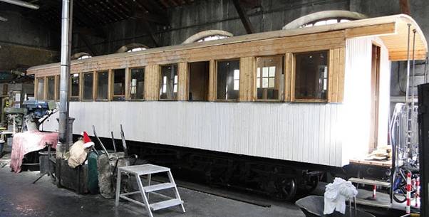
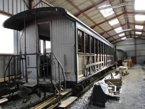
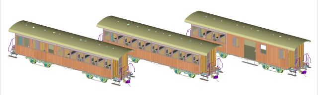
 Three coaches shown in different states of repair.
A number of modellers have sought to reproduce these coaches, usually in HOm scale.
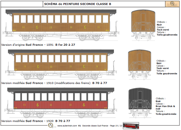
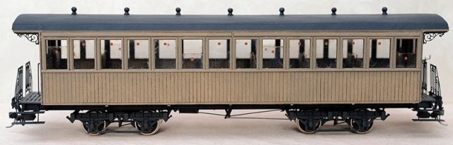 Photo Aubertrain – Model of a 2nd class coach, Desouches & David du Sud France – At the beginning of the operation, the car bodies were made of teak wood simply painted with the car number, the class indication in figures Romans and the monogram of South France, SF painted in yellow.
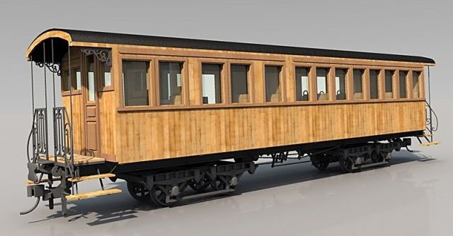 Model of a mixed coach of 1st and 2nd class Desouches & David of South France. Photo AuberTrain
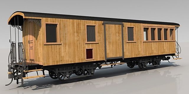 Photo Aubertrain – Model of a mixed car of 1st and 2nd class Desouches & David of South France.
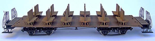 Photo Aubertrain – Interior of a passenger car Desouches & David du Sud France
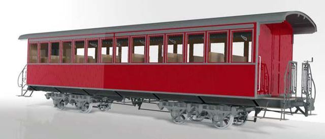 Photo Aubertrain – Model in Om of a mixed car of 1st and 2nd class Desouches & David with the new colors set up on the South France from 1898: for the box: brown-red Van Dyck and black for the roof.
 Bogie coaches from the series AB-501 to 508 made by Desouches and David. in HOm (Photo: Metrique43).
Paint schemes are shown below. These are provided by a kit building firm, AuberTrain. [27]
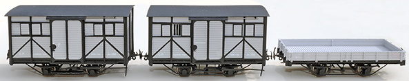
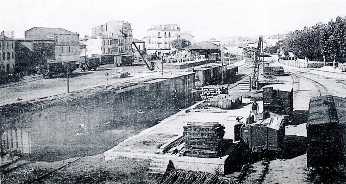
E. Wagons
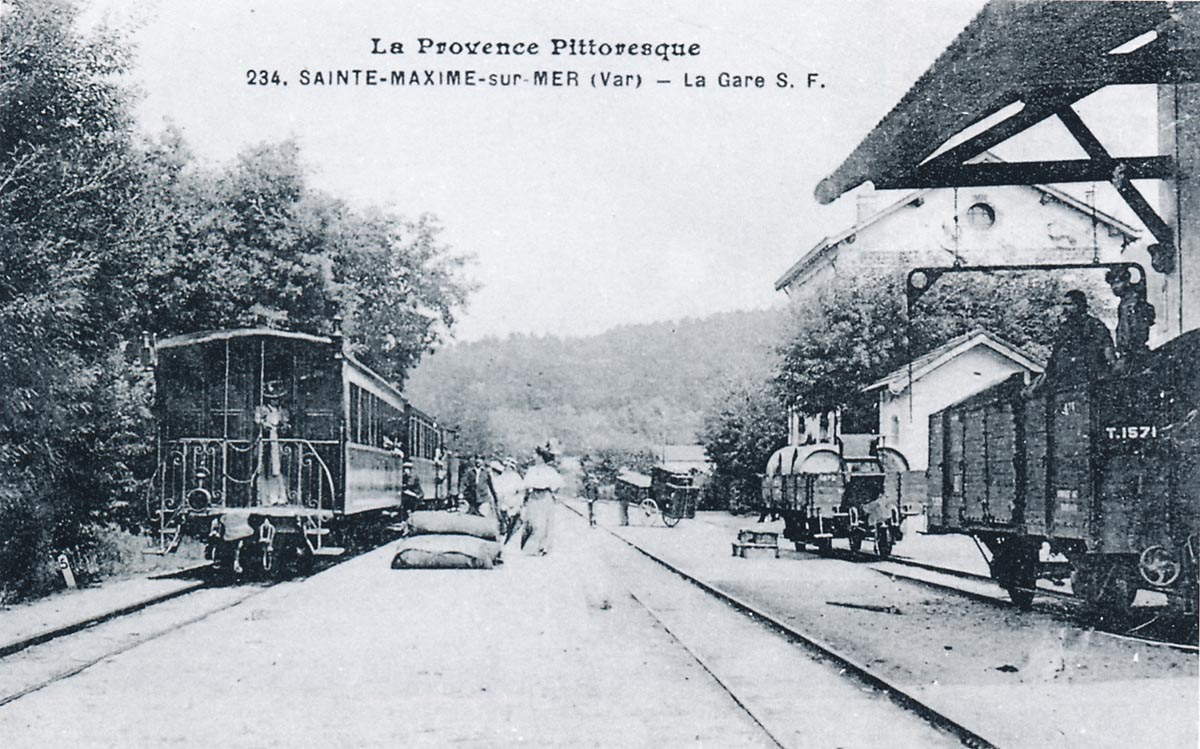
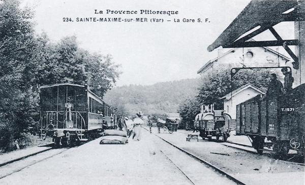 This image is taken in around 1910 and the station is busy. On the left is a short passenger train from La Foux – St.Raphaël. To its right, we see bags piled up on the platform, a cart loaded with furniture, barrels of wine on an open wagon (Buire X-147) which is equipped with a seat for the brakeman. We also can see, on the left of the picture, workers unloading a De Dietrich wagon No. T-1571 under the canopy of the goods shed (Pierre VIROT Collection).
 This image is taken at St. Raphael Station It shows the trans-shipment yard with wagons from Les Chemins de Fer du Sud on the right. Those of the PLM are on the left (Raymond BERNARDI Collection).
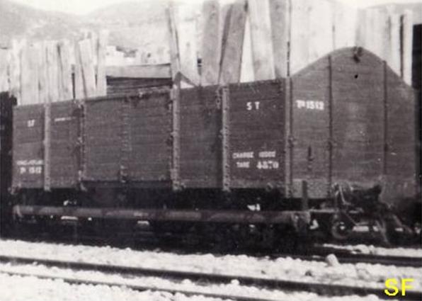
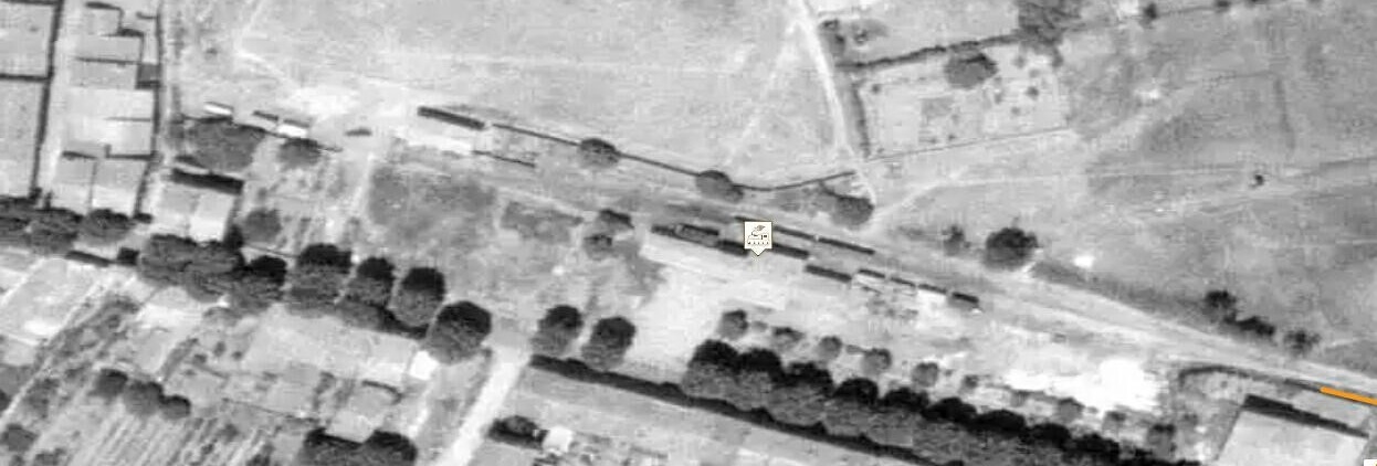
 Two open wagons stand in the foreground of this picture, parked at Cogolin-Grimaud station around 1910: on the left a T-1522 with interchangeable sideboards (construction Hanquet Aufort in 1899), on the right a T-1563 (construction Magnard in 1901). Both are equipped with the hand turned screw brakes, whose steering wheel is visible at the end of the chassis (Edmond DUCLOS Collection).
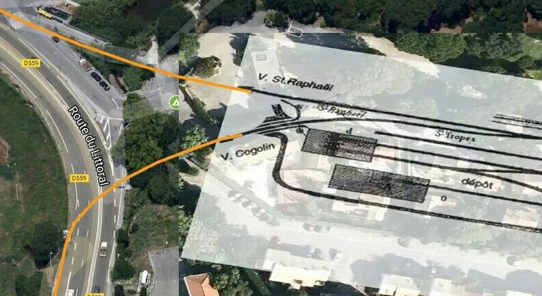
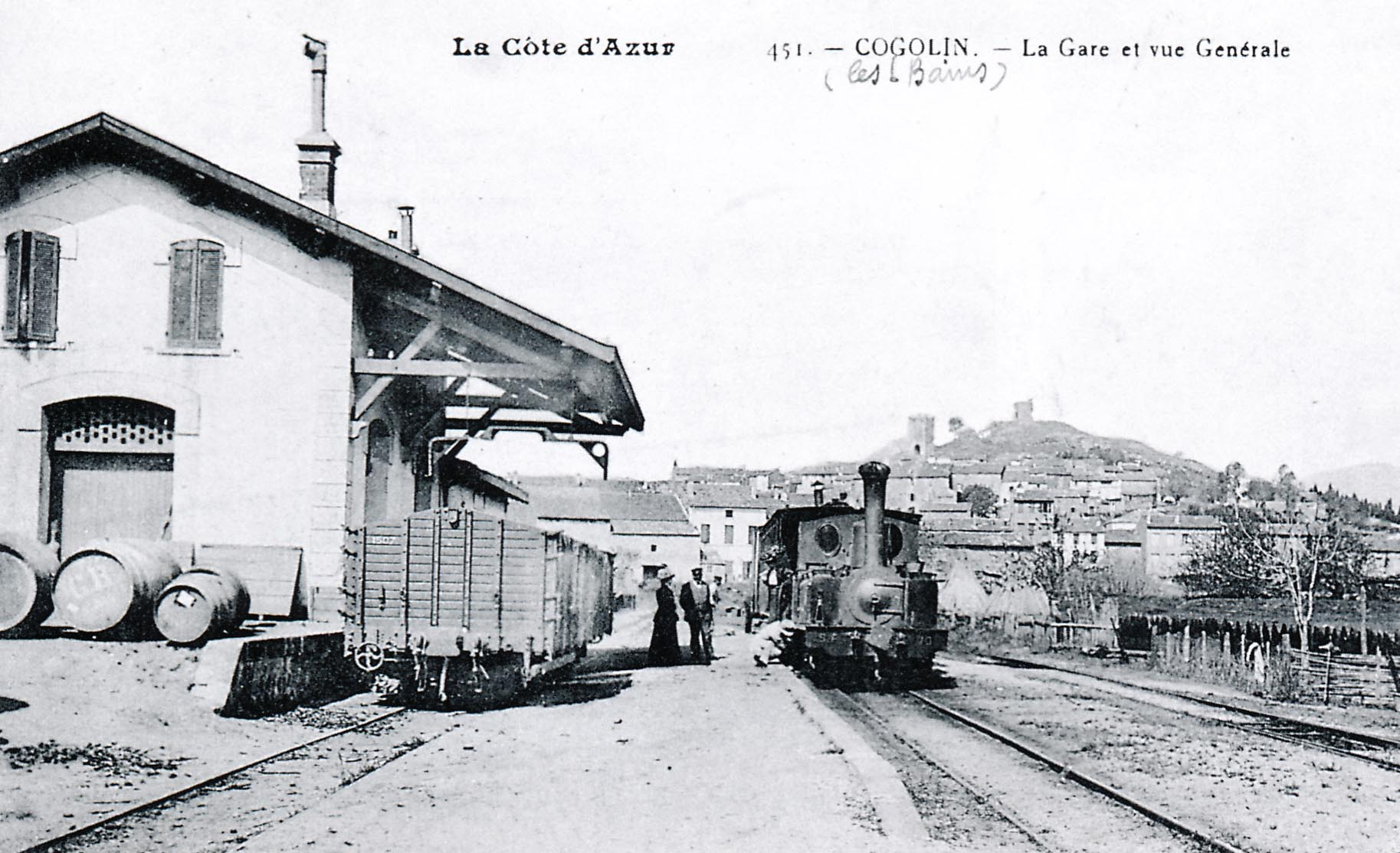
 Cogolin-Grimaud station around 1910 with an 0-6-0T Corpet-Louve series 70 to 72 ready for departure to La Foux and St. Tropez; on the left, a Hanquet – Aufort series TM-15O1 to 1516 open wagon with removable sides (René CLAVAUD collection).
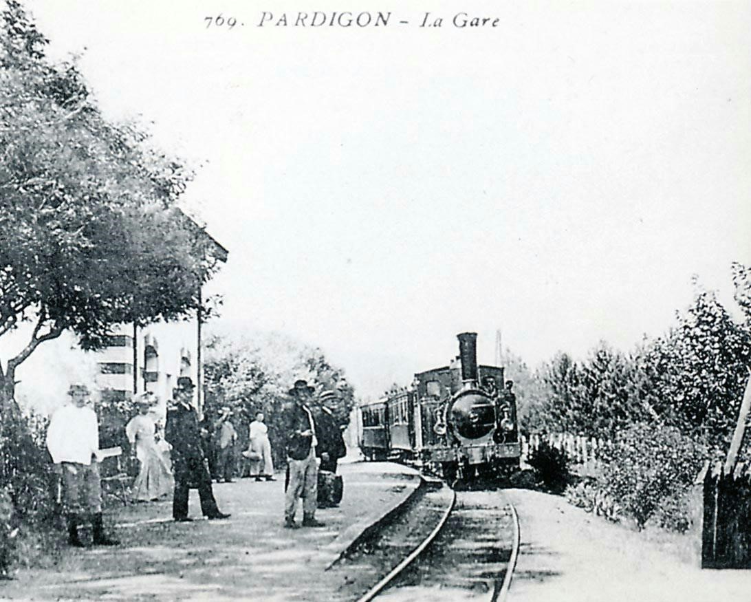
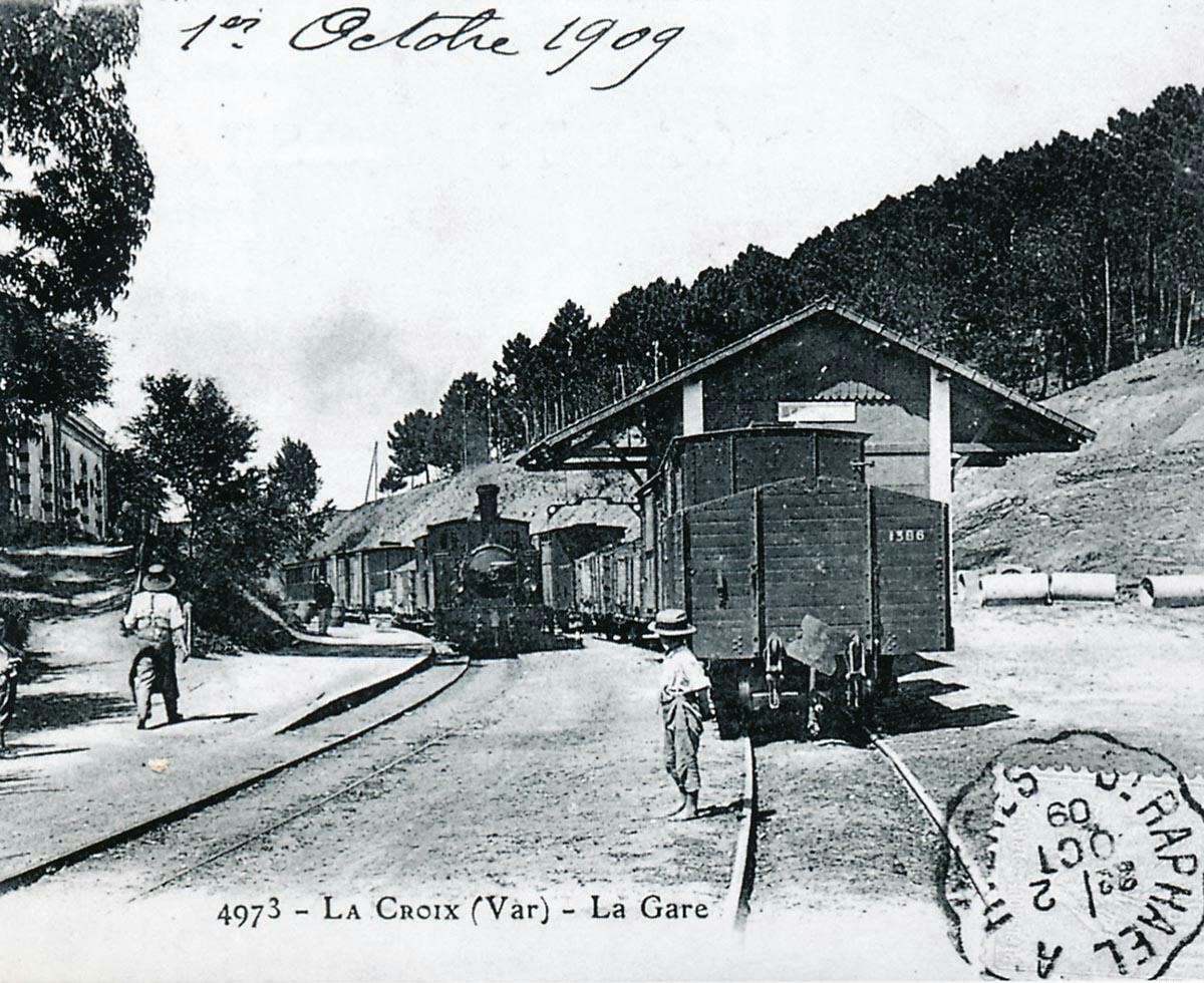
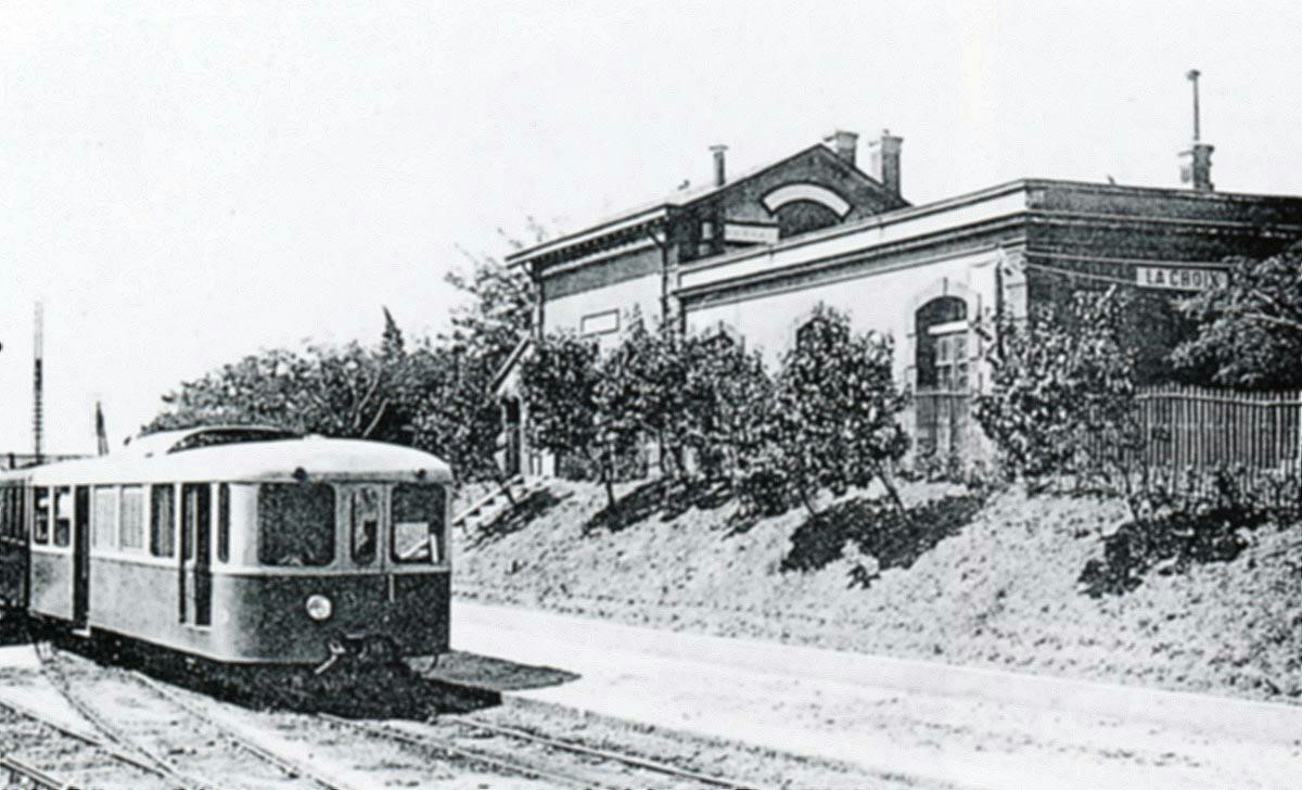
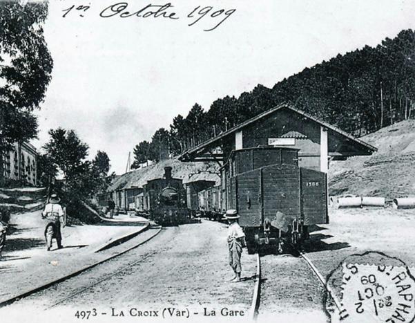 This picture shows a mixed train from St. Raphael to Toulon, pulled by 2-4-2T SACM No. 56 stopping at La Croix. A line of wagons is stabled in the goods siding. Note the buffer, couplers and coupling for the vacuum brake of the Buire T-1386 open wagon (Philippe LEPINE Collection).
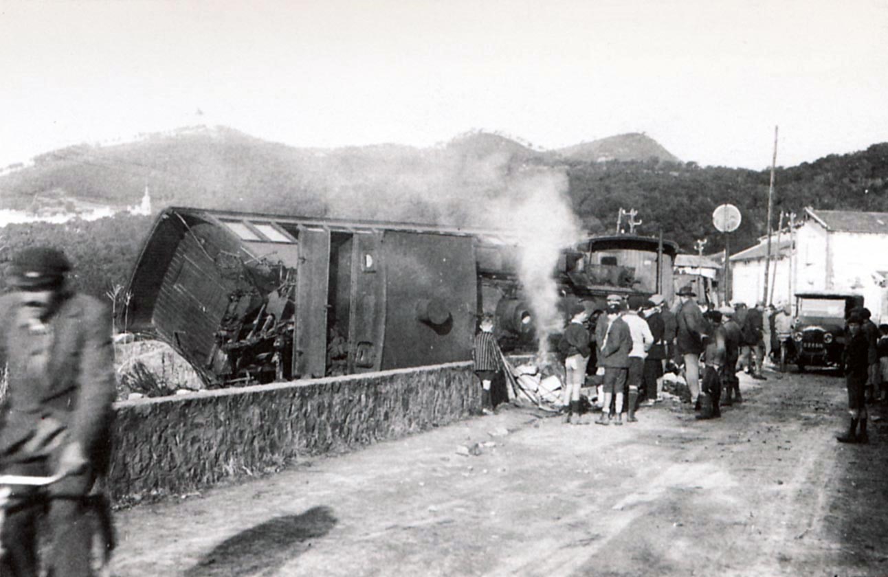
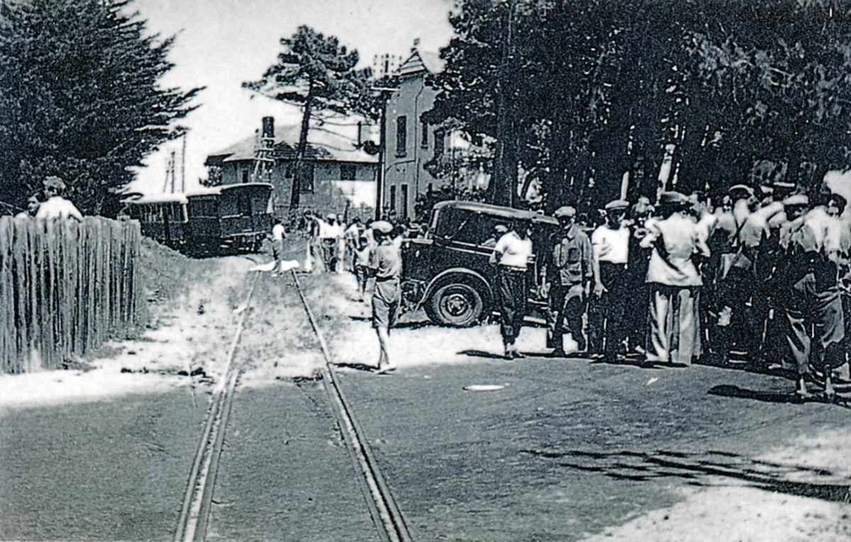
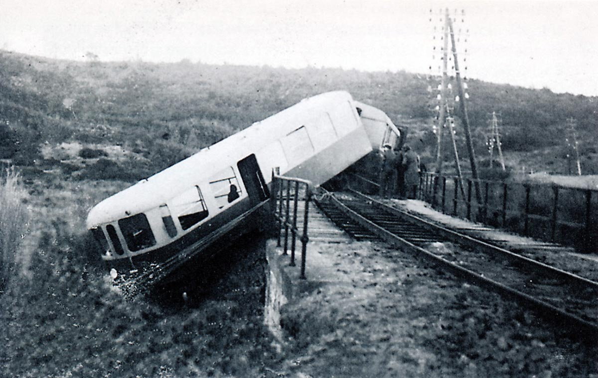
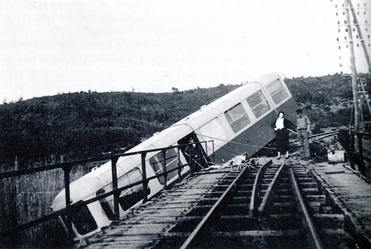
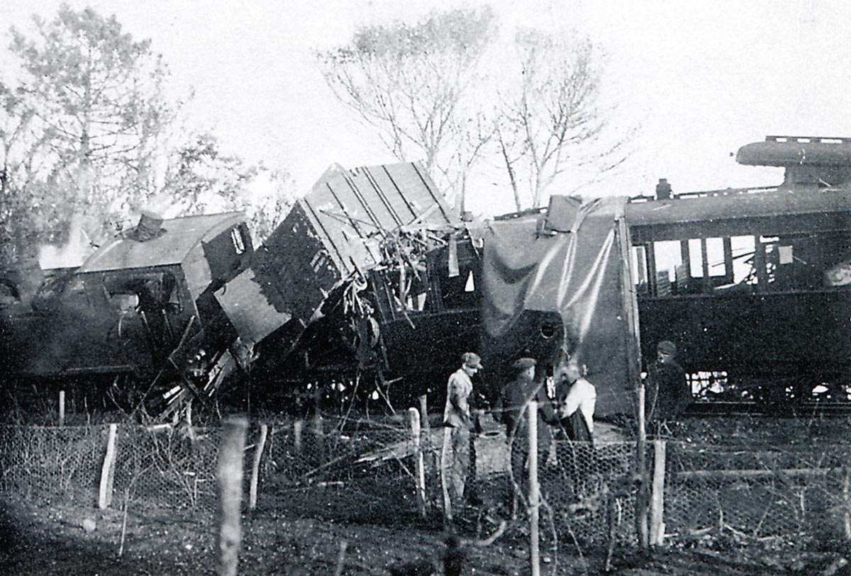
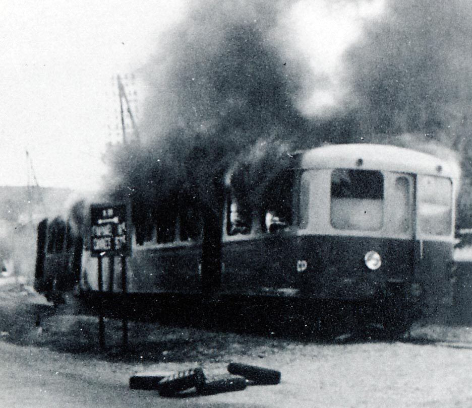
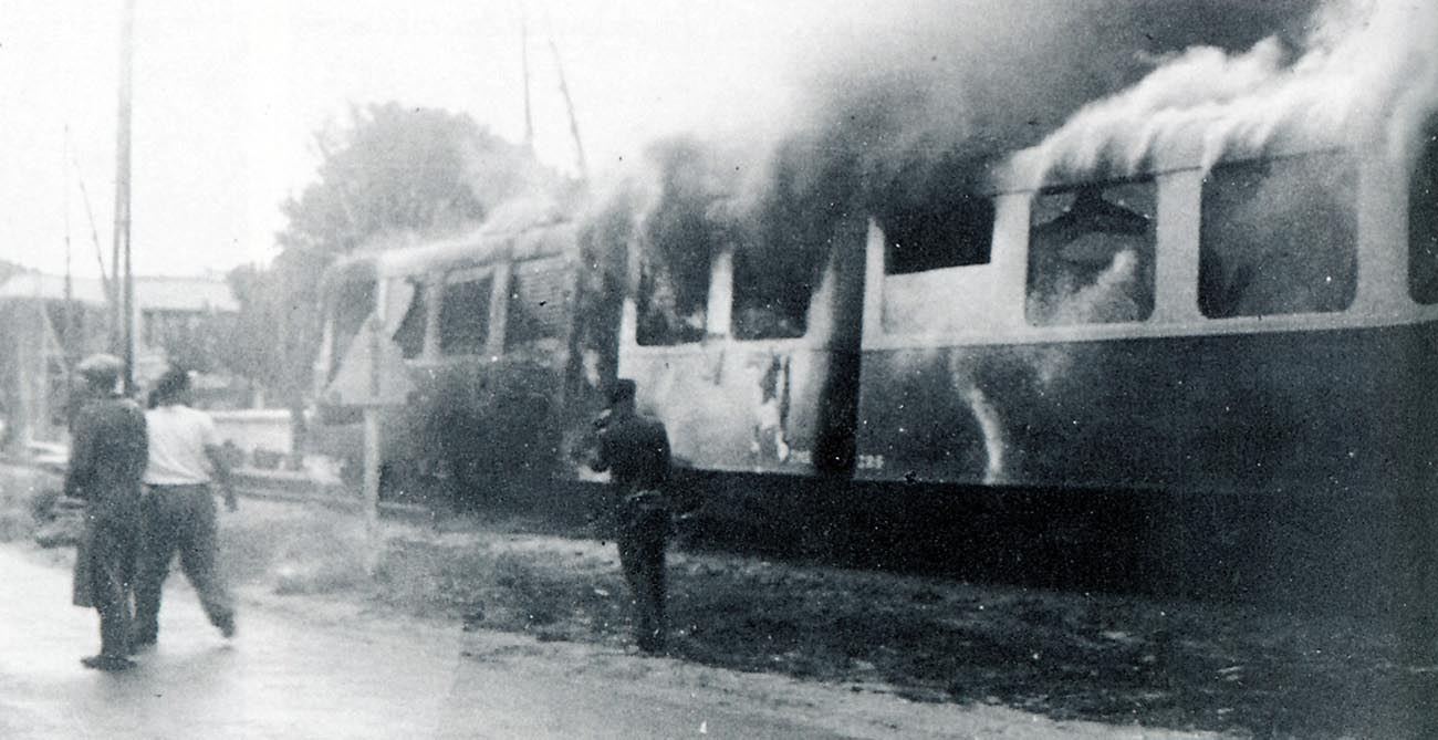
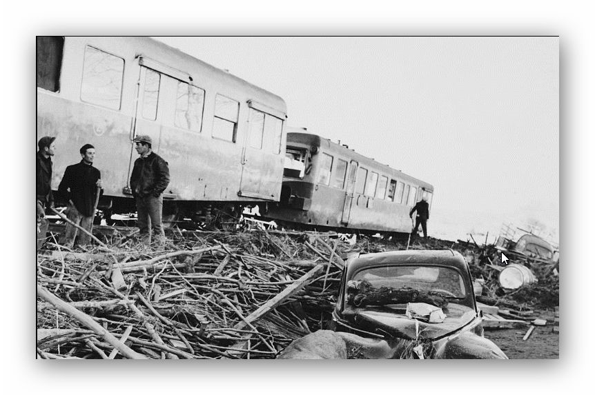
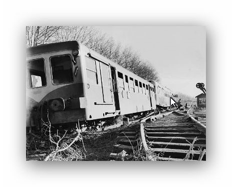
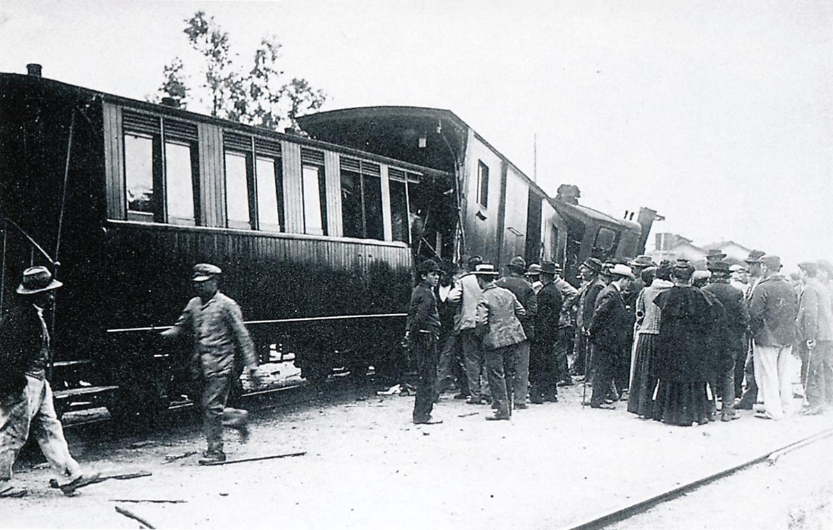
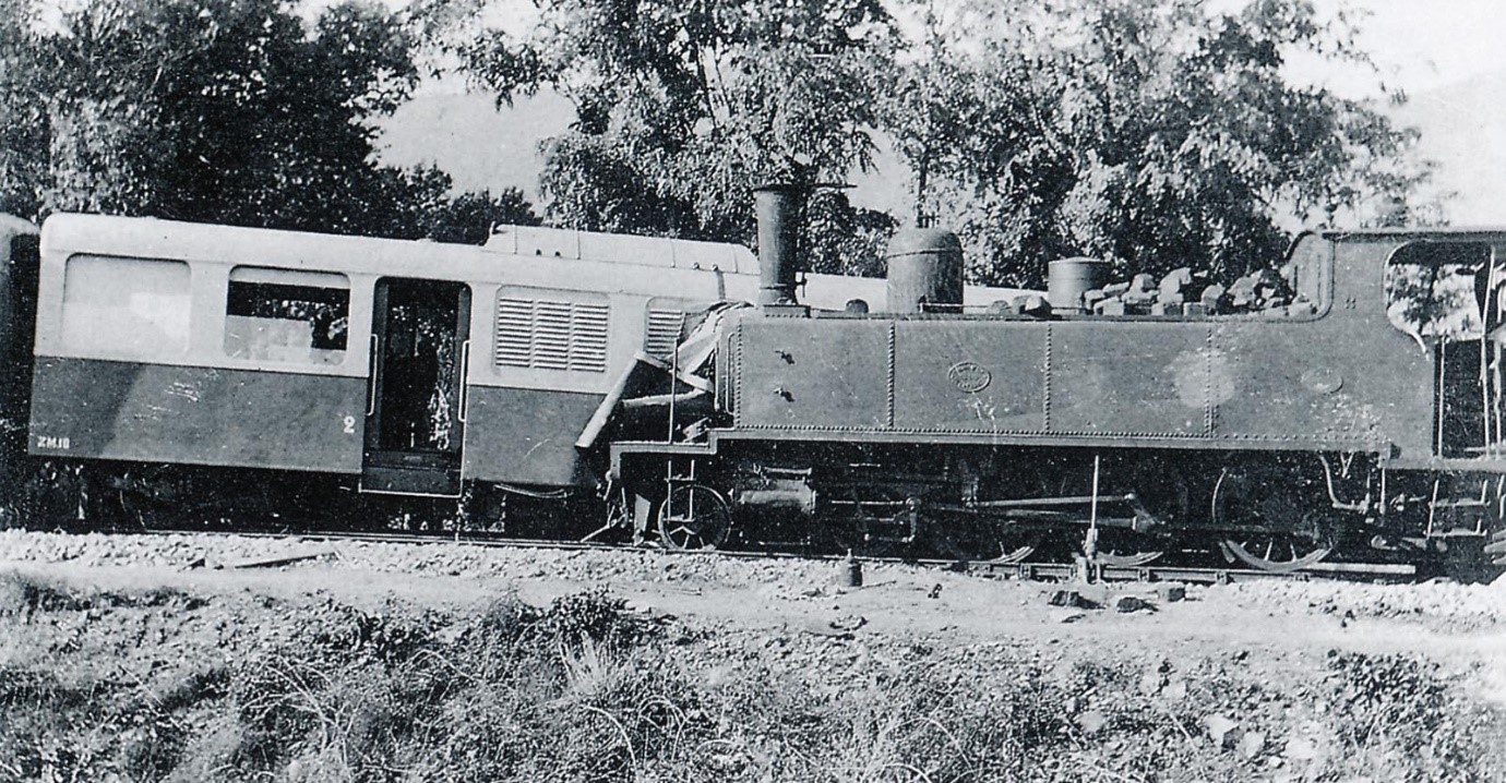
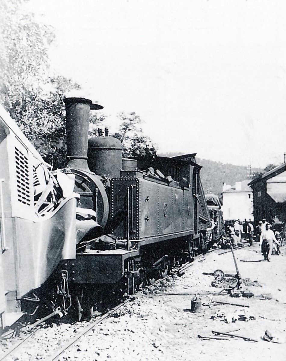
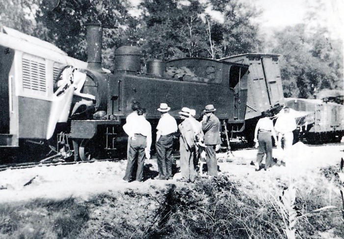
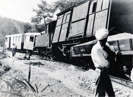 Locomotive Pinguely 4-6-0T No. 62 failed to brake effectively and passed the stopping position in Cavaliere station and struck the Brissonneau & Lotz ZM-10 railcar, train 103, Toulon to St. Raphael. They would usually have passed at this station.
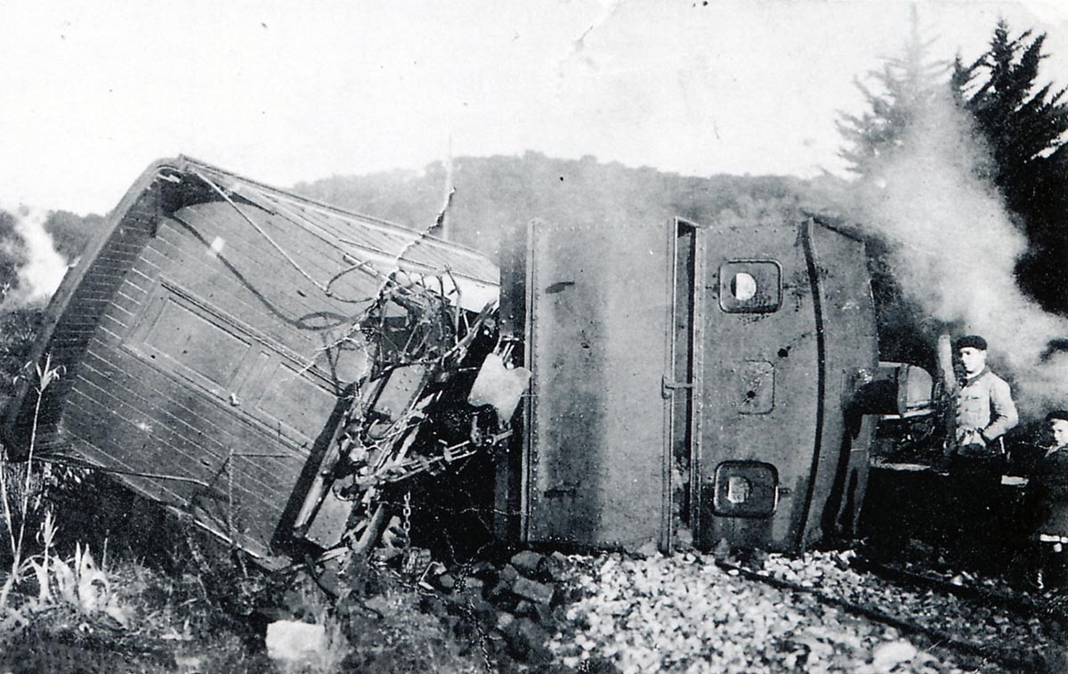
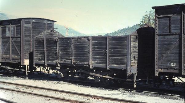
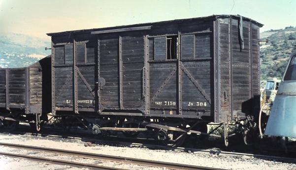
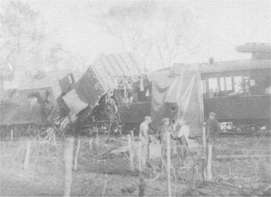
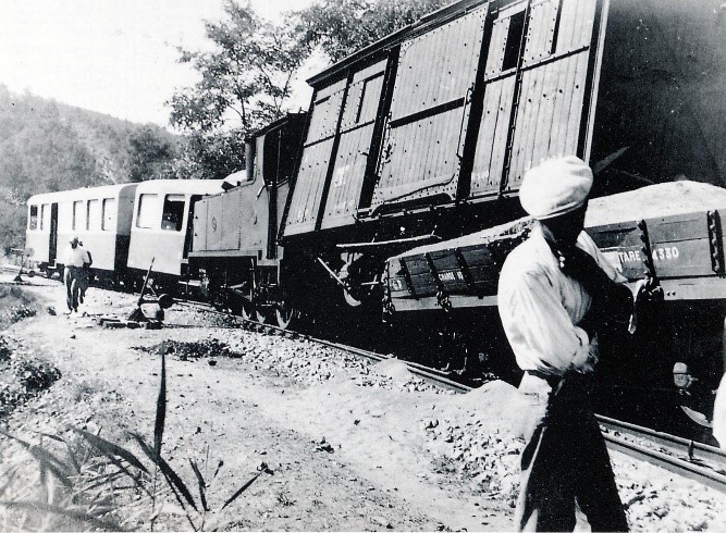
Among the derailed vehicles of the freight train 182, depicted covered wagon J-2141 De Dietrich and a flat V series wagon loaded with sand.
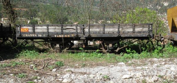
 2-axle wagon as used by Les Chemins de Fer du Sud de la France (Photo: Clive Lamming). It compares well with the photos above.
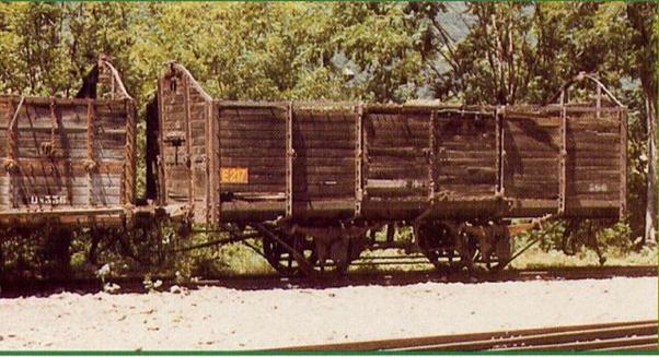
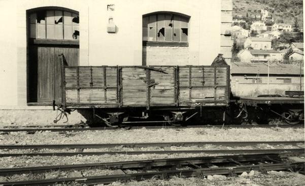
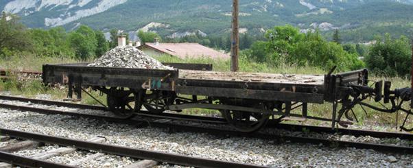
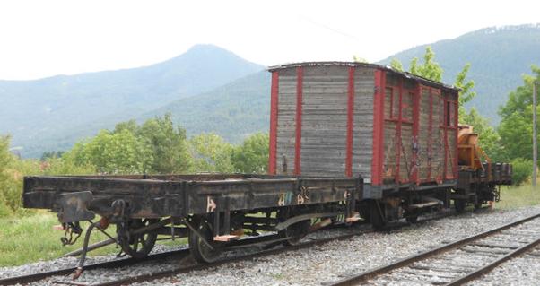
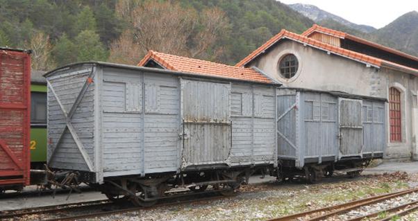
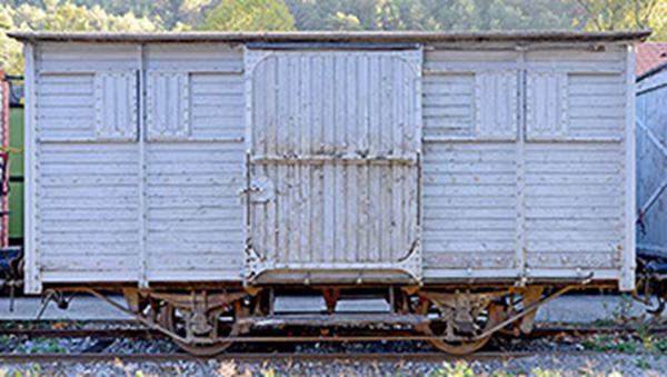
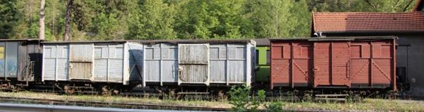
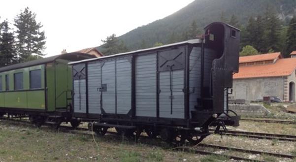
A series of photographs culled from the forum http://www.passion-metrique.net showing older wagons from the network which are still in use, renovated or in sidings waiting for work to be undertaken.[28]


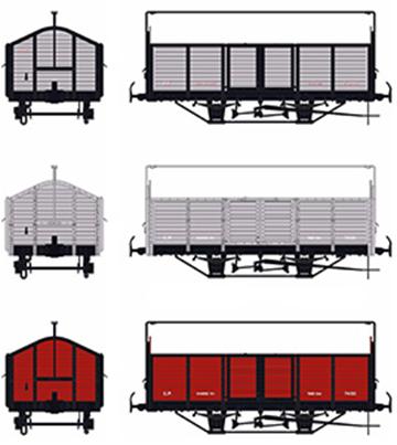
The remaining images show some models made of the goods wagons on Les Chemins de Fer de Provence.
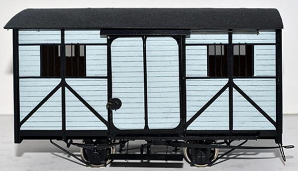
This last image shows the paint schemes used on these wagons.
References
1. Les Racines de Leurs Vies; http://lesracinesdeleursvies.over-blog.com/article-644638.html. Retrieved 20th January 2018.
2. Philippe Mioche & Jacques Roux; Henri Malcor: Un héritier des maîtres de forges; Editions du CNRS, 1999.
3. Corpet-Louvert, Chapter 2, The Classic Six-Coupled Tank; Industrial Railway Society; http://www.irsociety.co.uk/Archives/27/CL_3.htm. Retrieved 20th January 2018
4. P. E. Clegg; The Railroad Runs Through the Middle of the House; (.pdf), retrieved 20th March 2008.
5. History of Pinguely-Haulotte SA; http://www.referenceforbusiness.com/history2/58/Pinguely-Haulotte-SA.html; Retrieved 20th January 2018. Which says:“Pinguely had been a manufacturer of steam locomotives, producing more than 25 steam locomotives in the years around the turn of the 20th century.” Other references suggest that the number made was over 360 locomotives between 1881 and 1932. See reference [8].
6. The Train Tram Concept, Part 1 – Historical Context; The Locomotive & Carriage Institution; https://web.archive.org/web/20080308084631/http:/www.lococarriage.org.uk/train_tram.htm. Retrieved 20th January 2018.
7. When our past legitimises our future; (.pdf), Haulotte Group Magazine 13th October 2007; https://web.archive.org/web/20071013183546/http:/www.haulotte.com/CMS/Files/HaulotteTime/8/Haulotte%20time%208-uk.pdf; p5. Retrieved 20th January 2018.
8. Pinguely; Wikipedia; https://fr.m.wikipedia.org/wiki/Pinguely. Retrieved 20th January 2018.
9. Arrivée de la PINGUELY 030 No. 103; Le Train du Bas-Berry http://www.traintouristiquedubasberry.com/arrivee-de-pinguely-030-n103. Retrieved 21st January 2018.
10. Notice No. PM07000324 , Protection des droits des auteurs de la base Palissy , French Ministry of Culture; http://www.culture.gouv.fr/public/mistral/palissy_fr?ACTION=CHERCHER&FIELD_1=REF&VALUE_1=PM07000324. Retrieved 21st January 2018.
11. Roland Le Corff; http://www.mes-annees-50.fr/Le_Macaron.htm. Retrieved 13th December 2017.
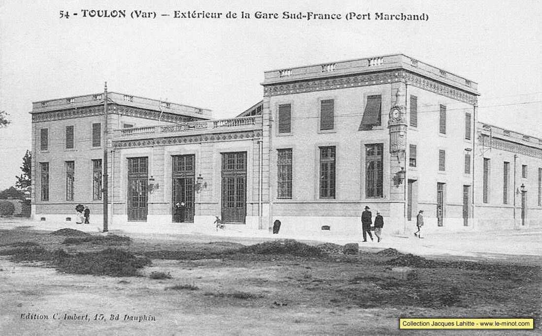
12. Marc Andre Dubout; http://marc-andre-dubout.org/cf/baguenaude/toulon-st-raphael/toulon-st-raphael3.htm. Retrieved 4th January 2018.
13. Jean-Pierre Moreau; http://moreau.fr.free.fr/mescartes/ToulonGareSudFrance.html. Retrieved 24th December 2017.
14. José Banaudo; Histoire des Chemins de Fer de Provence – 2: Le Train du Littoral (A History of the Railways of Provence Volume 2: The Costal Railway); Les Éditions du Cabri, 1999.
15. Société Alsacienne de Constructions Mécaniques; https://www.revolvy.com/main/index.php?s=Soci%C3%A9t%C3%A9%20Alsacienne%20de%20Constructions%20M%C3%A9caniques. Retrieved 21st January 2018.
16. Société Alsacienne de Constructions Mécaniques; https://en.wikipedia.org/wiki/Soci%C3%A9t%C3%A9_Alsacienne_de_Constructions_M%C3%A9caniques. Retrieved 21st January 2018.
17. Corpet-Louvet; Wikipedia; https://en.m.wikipedia.org/wiki/Corpet-Louvet. Retrieved on 22nd January 2018.
18. C. W. Clingan; Corpet-Louvet: Locomotive Builders; The Industrial Railway Record. The Industrial Railway Society. 3 (27). December 1968, http://www.irsociety.co.uk/Archives/27/CL_1.htm, p129-153. Retrieved 22nd January 2018.
19. Brissoneau & Lotz; Wikipedia; https://en.m.wikipedia.org/wiki/Brissonneau_and_Lotz. Retrieved 20th January 2018.
20. René Bellu; Automobilia. Toutes les voitures françaises 1959 (salon Paris Oct 1959). Paris: Histoire & collections. 21: 14, 2002.
21. L’Usine de Creil; (Brissoneau & Lotz); http://fccdf.free.fr/article.php3?id_article=13&lang=fr. Retrieved 23rd January 2018.
22. Ardèche Miniatures; http://ardecherail.blogspot.fr, retrieved 18th March 2018; and http://www.jardin-des-trains.com, retrieved 23rd January 2018.
23. Historias del Tren; http://historiastren.blogspot.co.uk/2014/10/el-ferrocarril-de-santander-bilbao.html. Retrieved 23rd January 2018.
24. Quaranta Anys Sense el Carrilet; http://reusdigital.cat/noticies/reus/quaranta-anys-sense-el-carrilet. Retrieved 23rd January 2018.
25. Carrilet Tortosa – Amposta -La Cava; https://www.todocoleccion.net/postales-cataluna/carrilet-tortosa-amposta-la-cava-542-7-fesa~x20678367. Retrieved 23rd January 2018.
26. Pasando Pagina; http://vitorino-pasandopagina.blogspot.co.uk/2013/07/historia-de-feve.html, 29th July 2013. Retrieved 23rd January 2018.
27. AuberTrain; http://www.aubertrain.com/DOWNLOADS/INS-S.pdf. Retrieved 25th January 2018.
28. Les Chemins de Fer de Provence; Les Forums de Passions Métrique et Etroite; http://www.passion-metrique.net/forums/viewtopic.php?f=2&t=4143&sid=4bb1d3e27f39656eb05c8d08b7a7801d. Retrieved 25th January 2018.
Bibliography
1. Henri Domengie, Les petits trains de jadis – Sud-est de la France, ed. du Cabri, 1985.
2. Claude Wagner , “Les locomotives Pinguely 030T type 107 : et types proches,” Chemins de fer régionaux et urbains, vol. 1997/1, no 259, 1997, p. 5-20 (ISSN 1141-7447).
3. Frédéric Toublanc, Tacot et galoche en Roannais et Forez : Histoire des Chemins de fer départementaux de la Loire, editions de l’Ormet, 1993 (ISBN 2-906575-17-8, notice BnF No. FRBNF35671053).

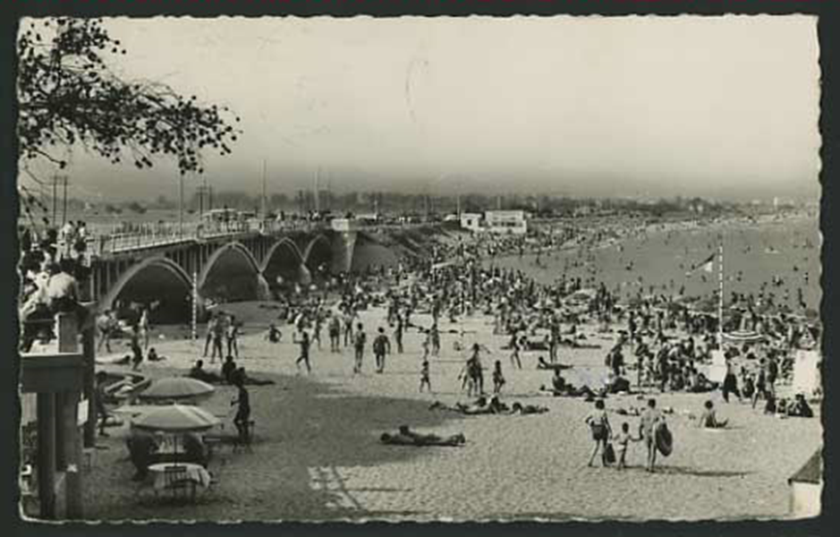
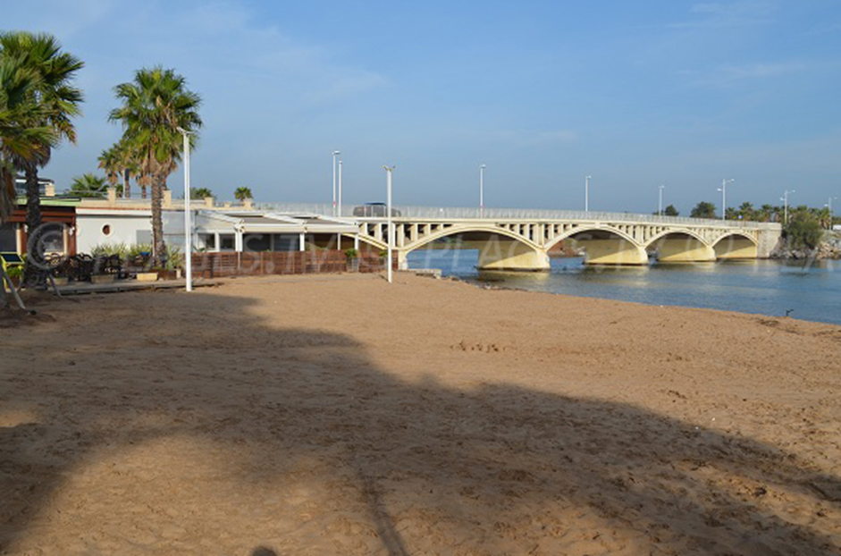
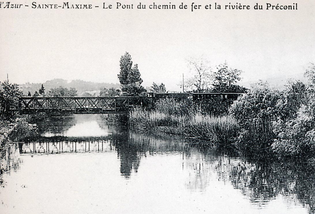
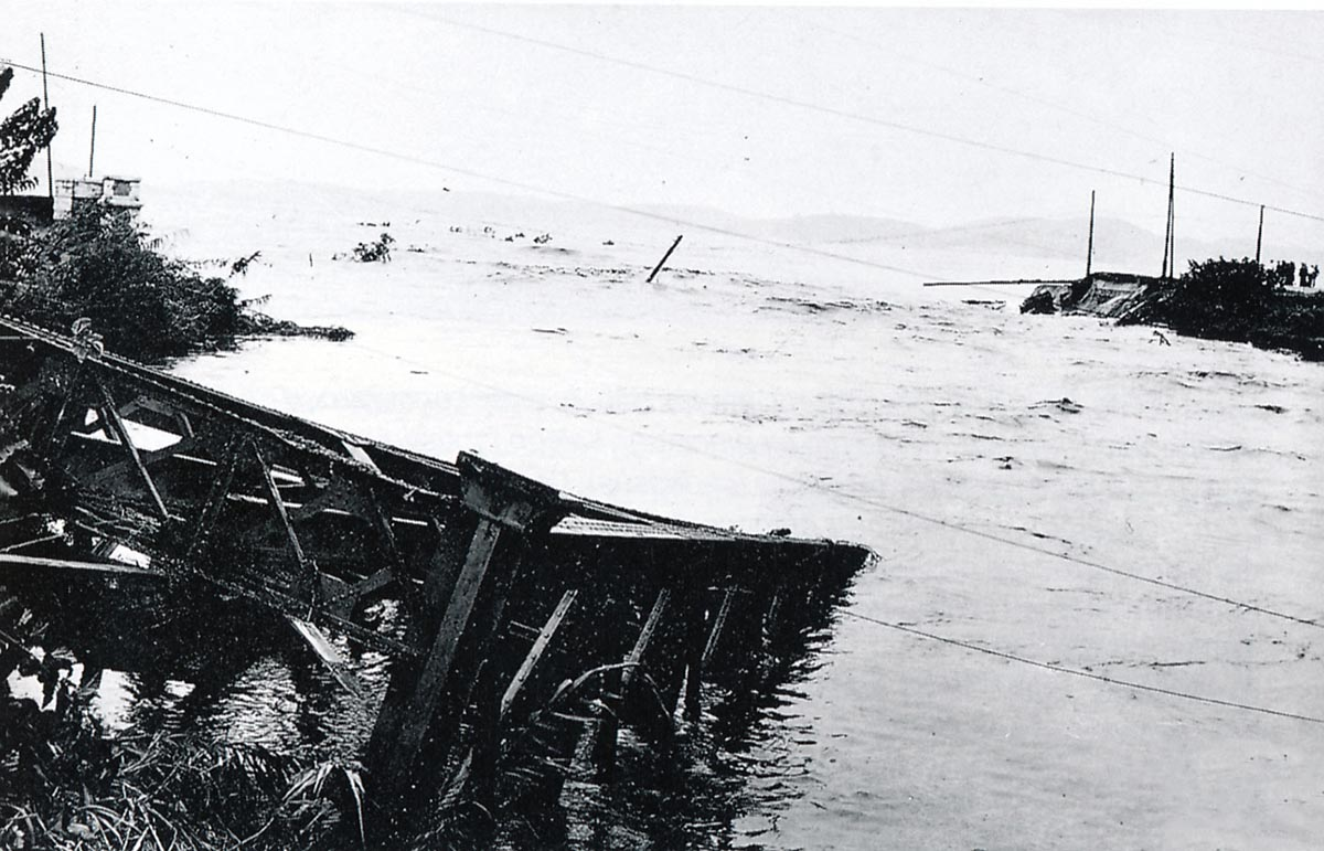
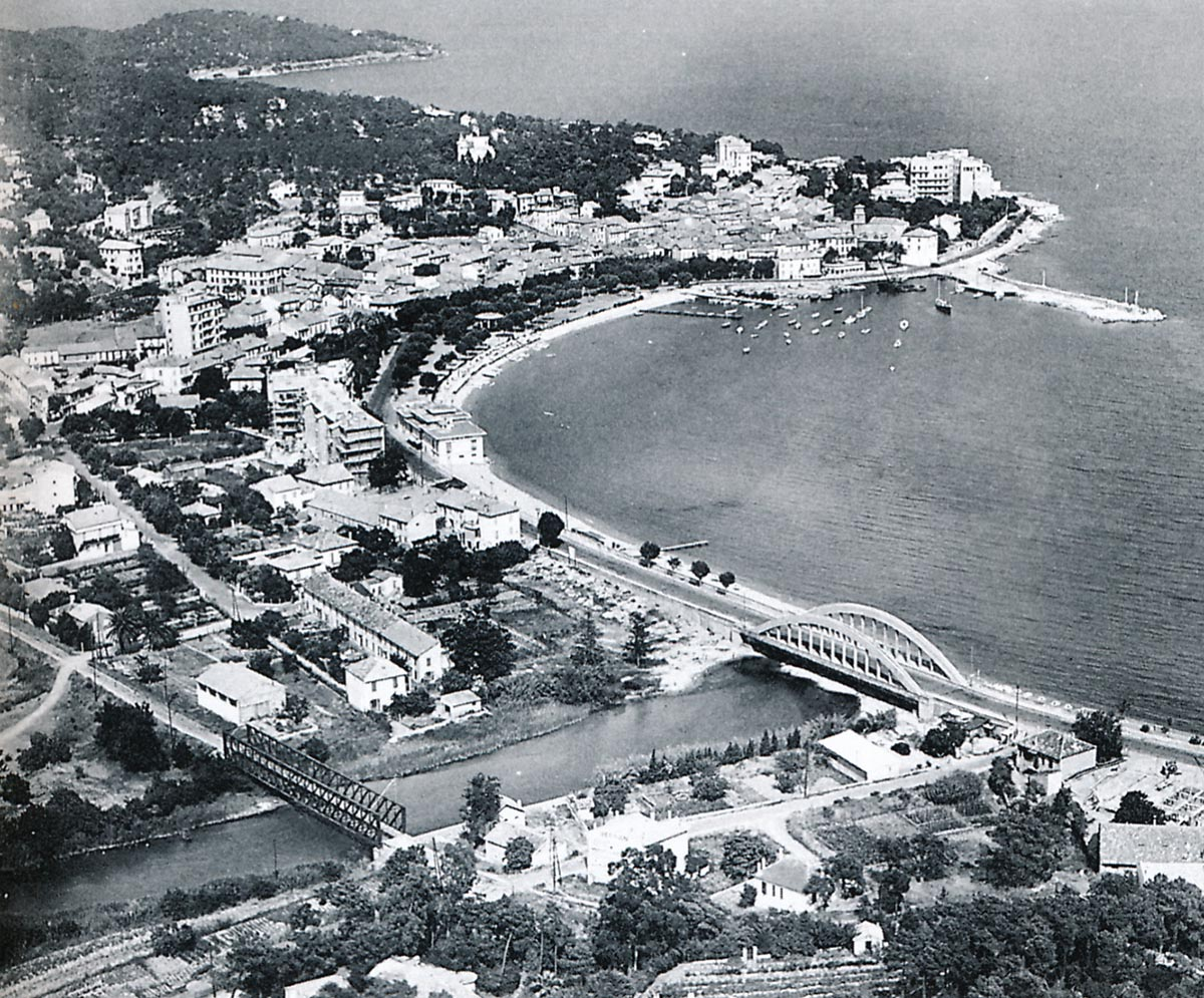
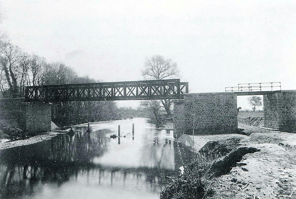
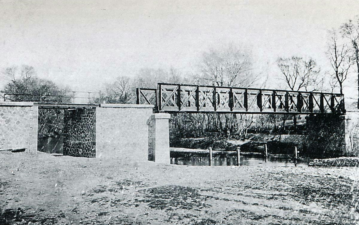
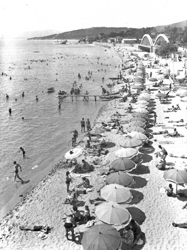 The beach at Sainte-Maxime in 1938. The new road bridge is visible in the top right of the picture. This scene would change dramatically over the next few years and ultimately this would be one on the invasion beaches in 1944.


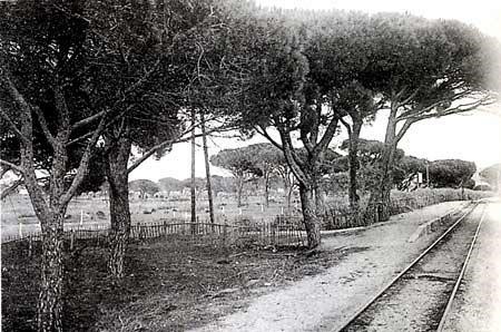
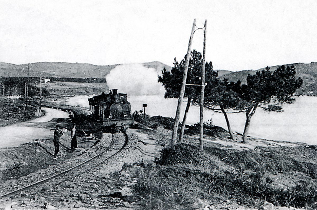
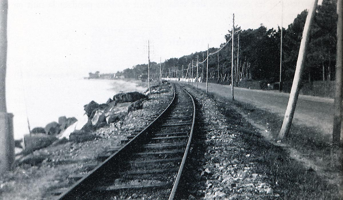
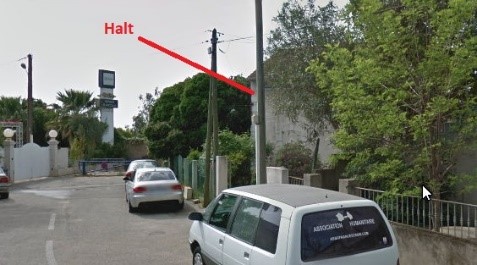
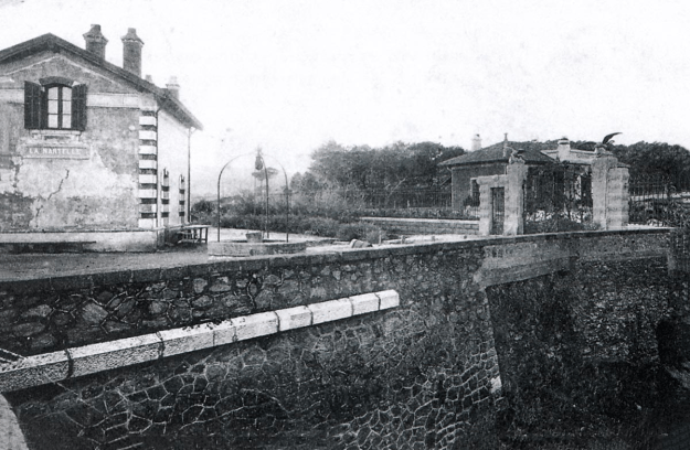 The halt was very close to the sea wall, as this image makes clear. The gates to the right of the picture have long-gone but gave access onto an estate which was owned by a German family – the Kronprinz estate. The railway continued off to the right of the picture above the sea wall.


 A 0-6-0T Corpet – Louvet 70-72 locomotive pulls two bogie cars usually used on the main line, on the shuttle on the branch/tramway. The increased passenger traffic necessitated this sharing of resources (Edmond DUCLOS Collection).
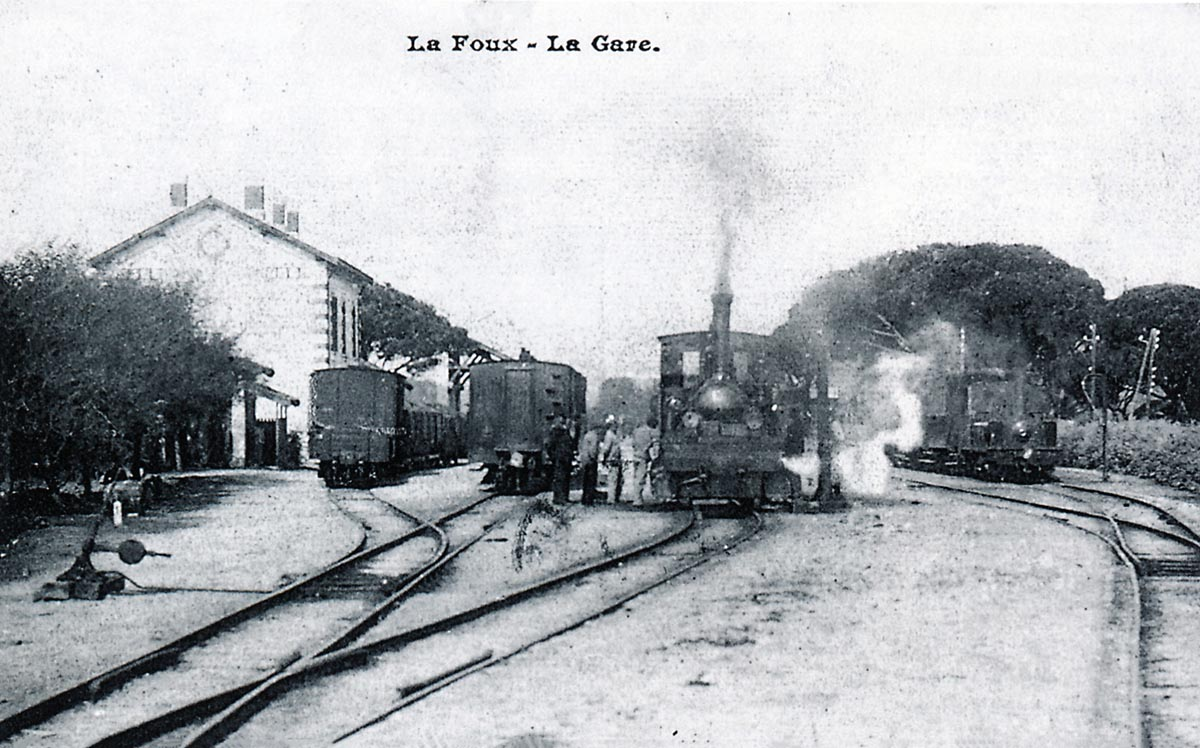


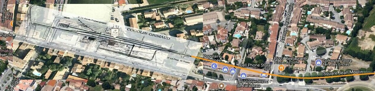
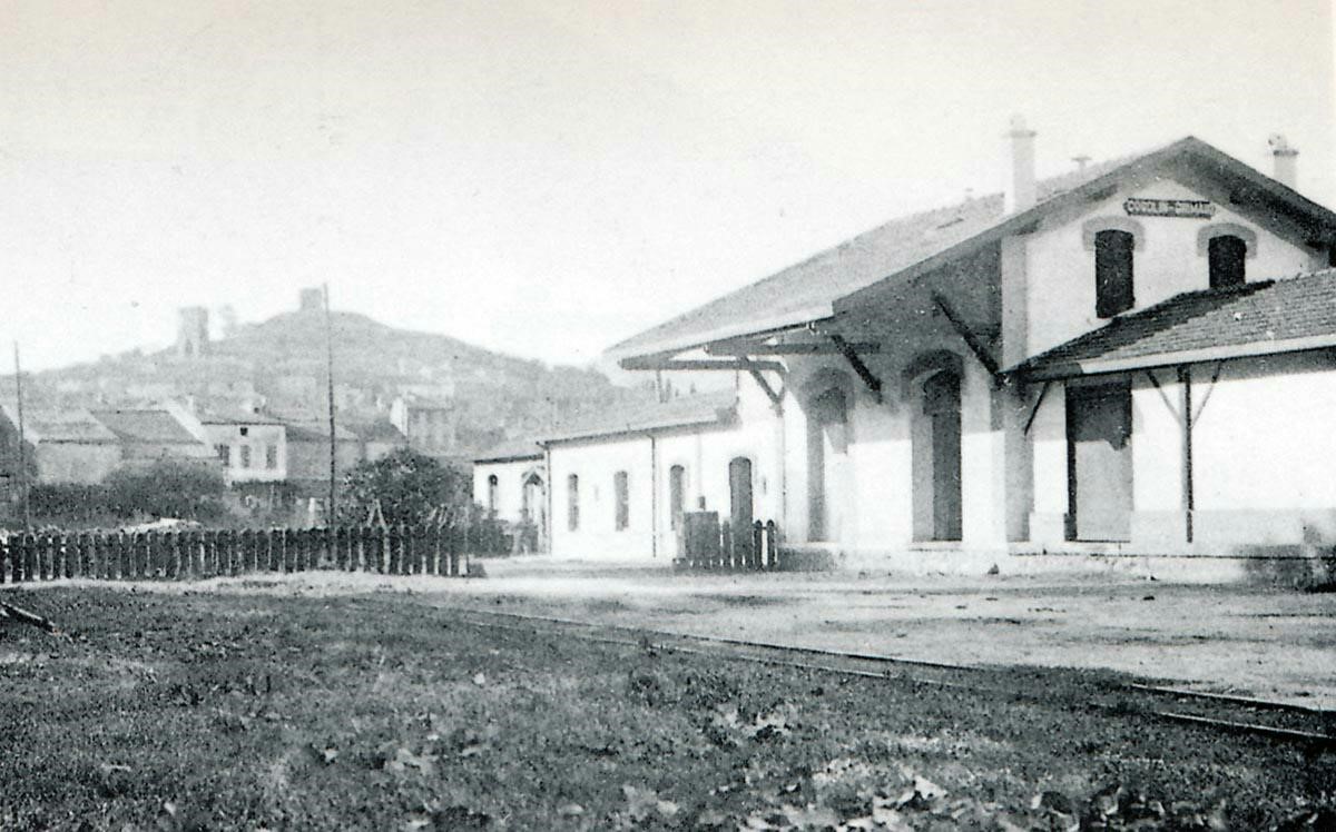
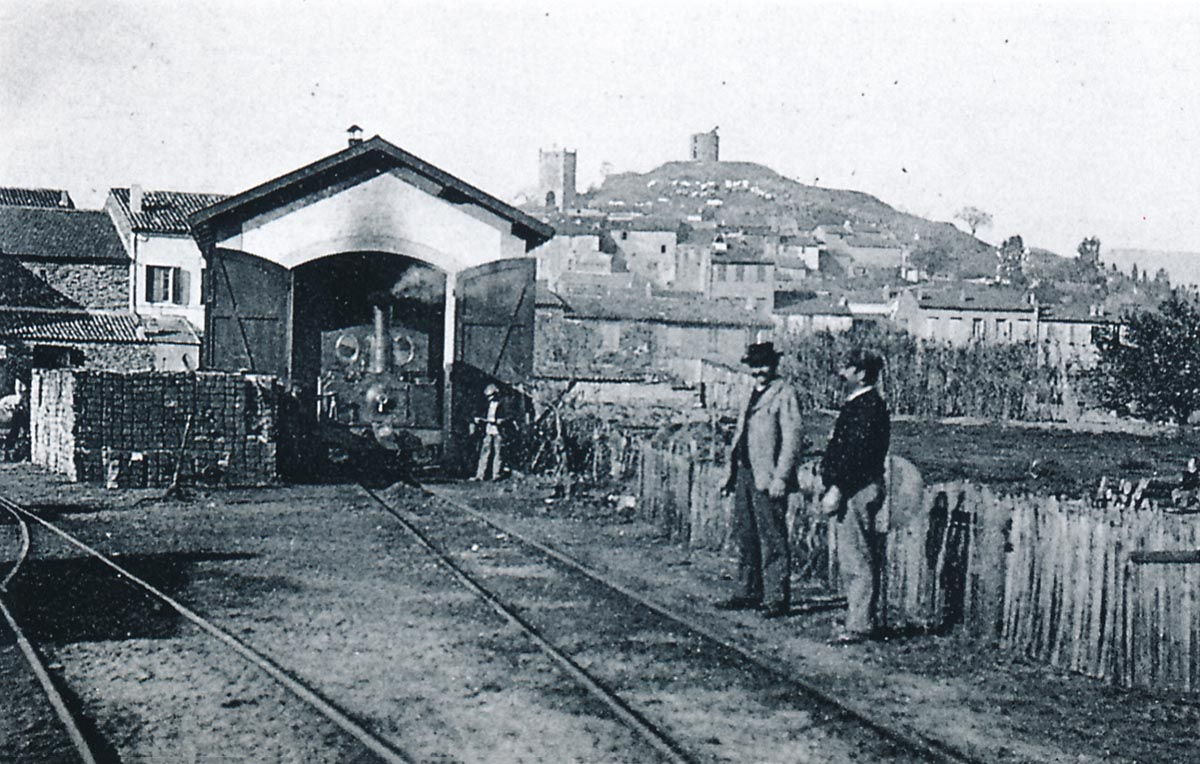
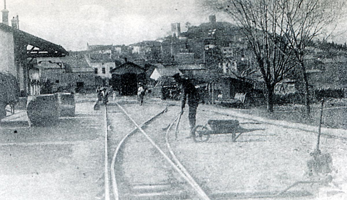
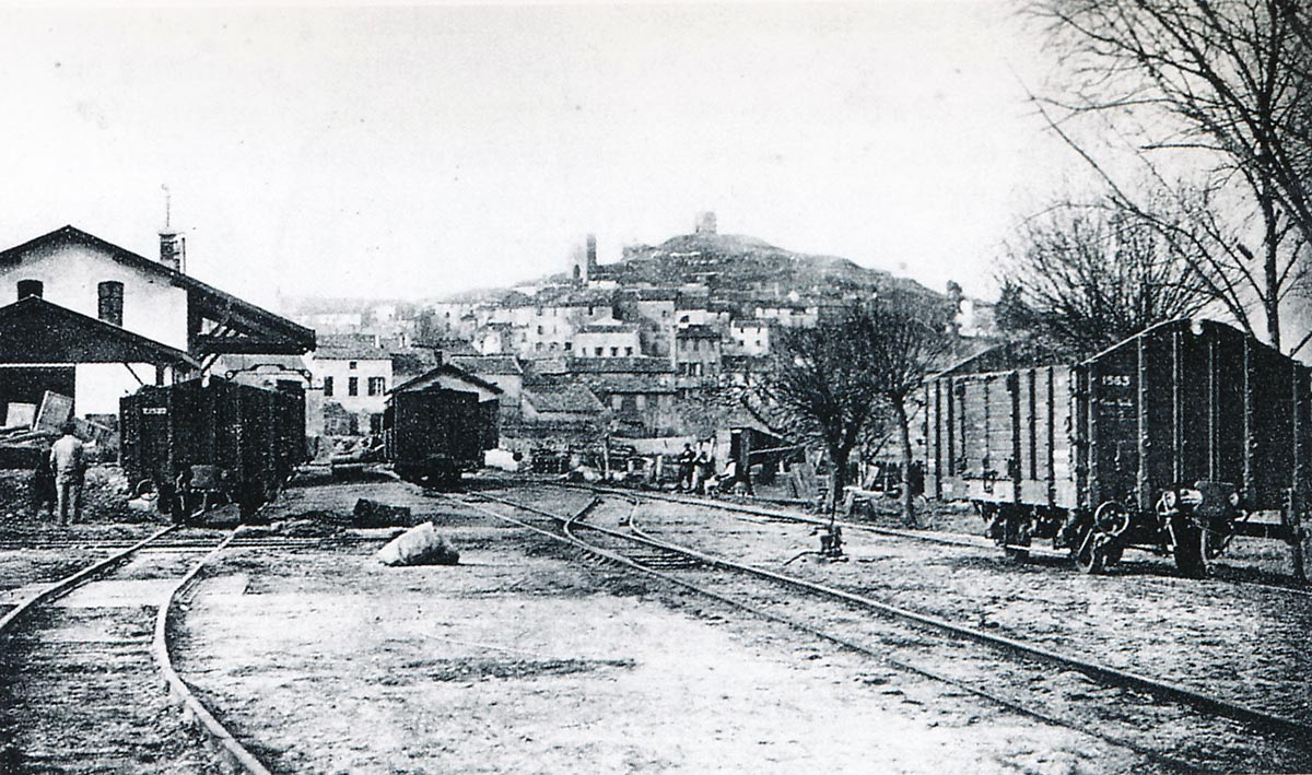
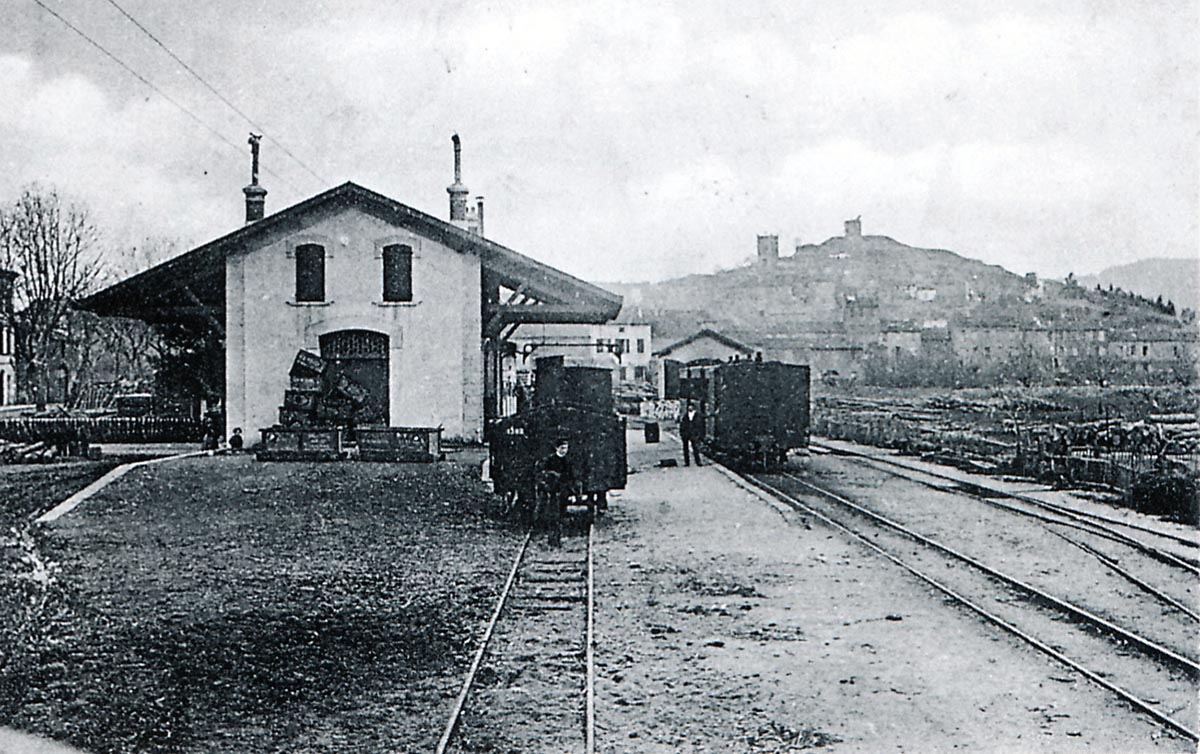

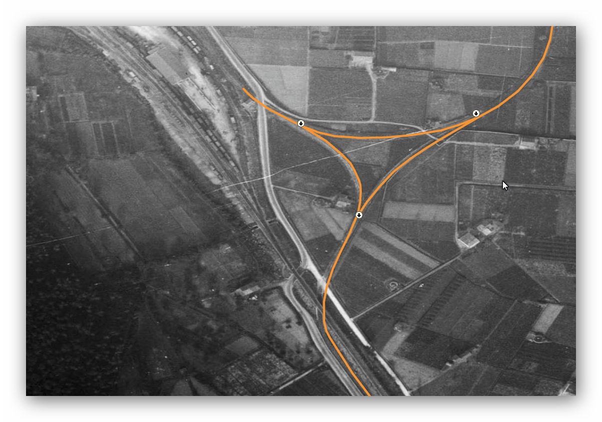
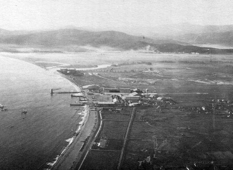
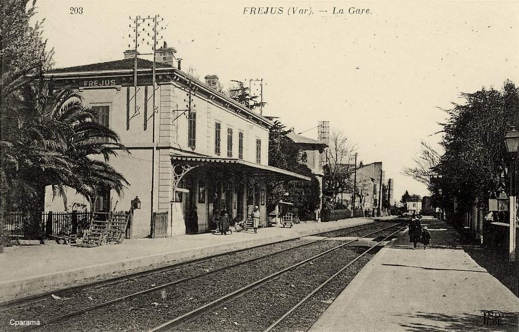
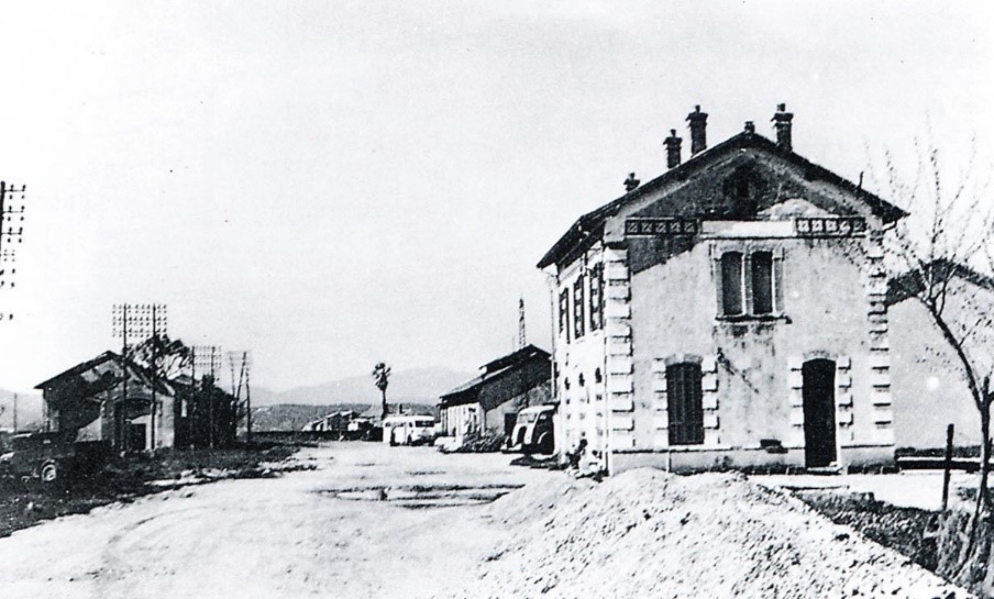
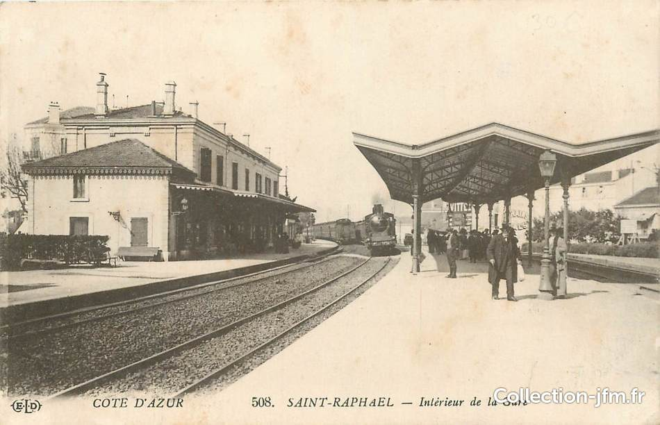
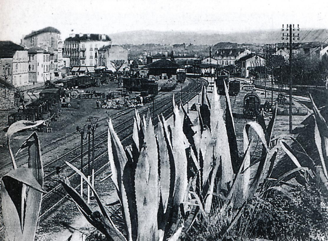
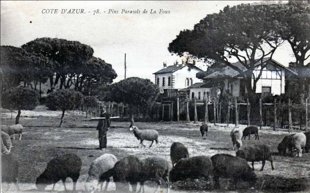
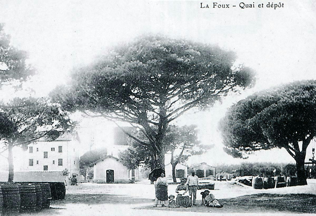
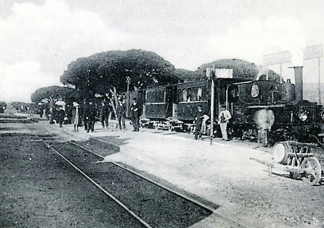
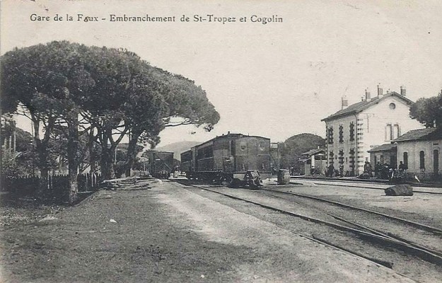
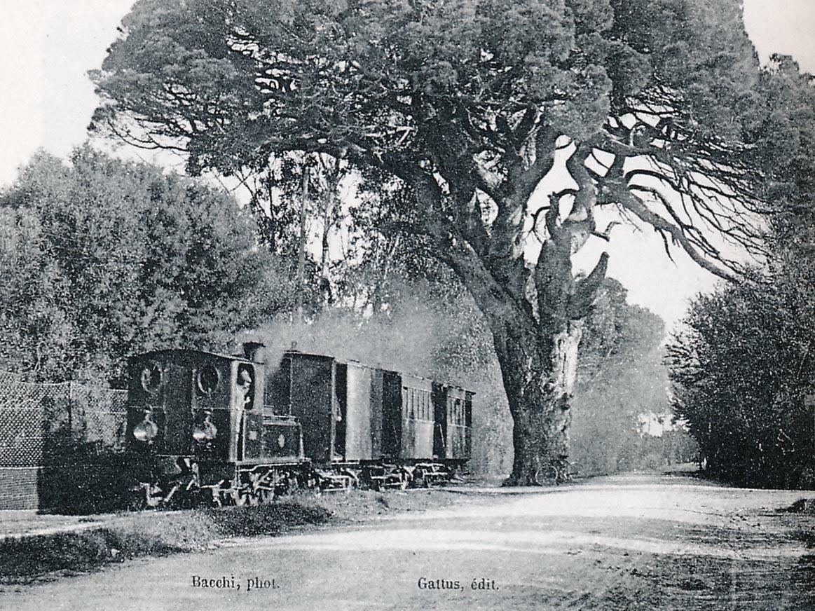
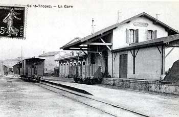
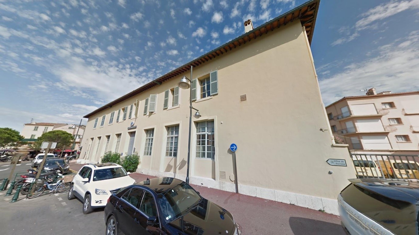
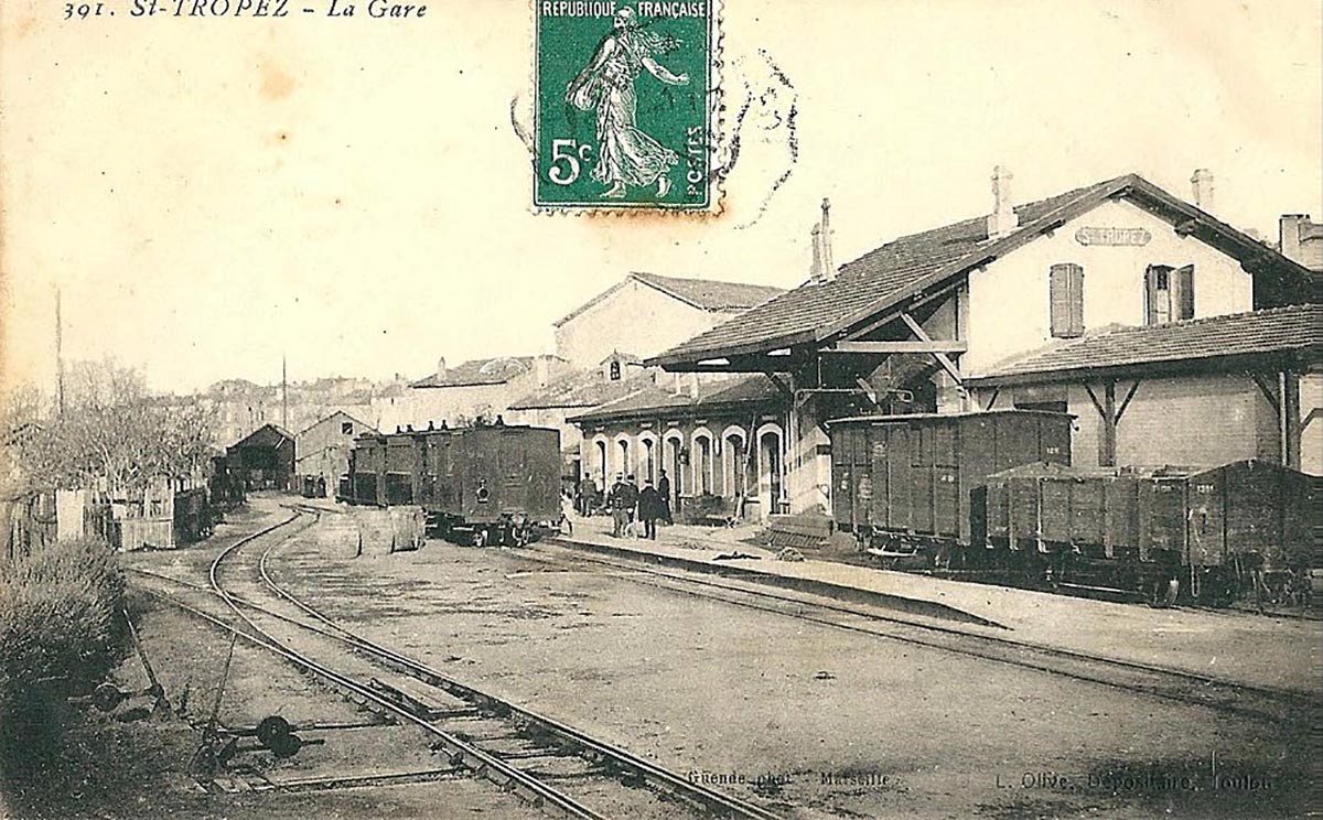
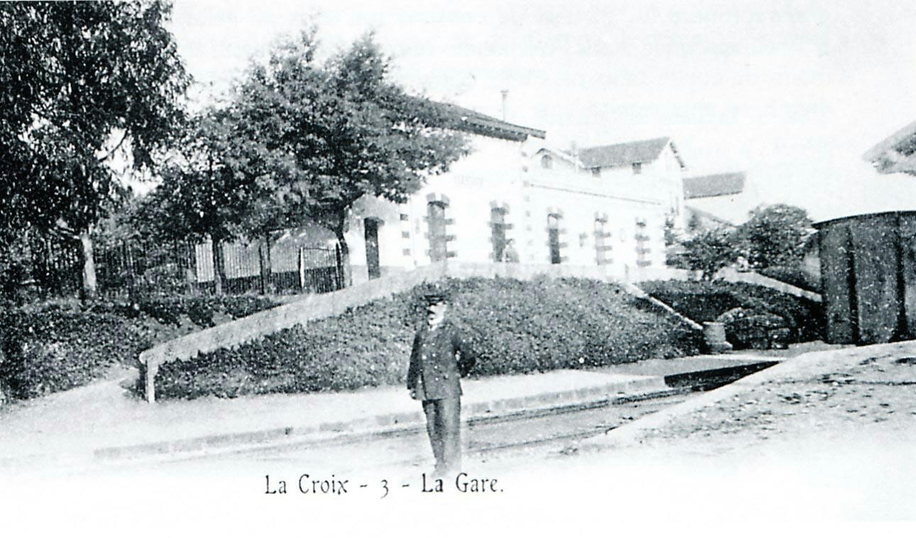
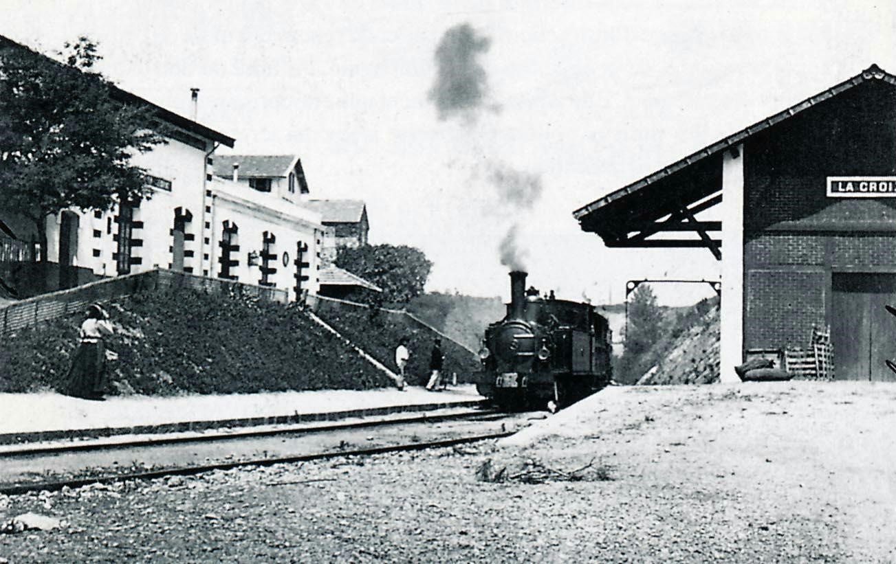
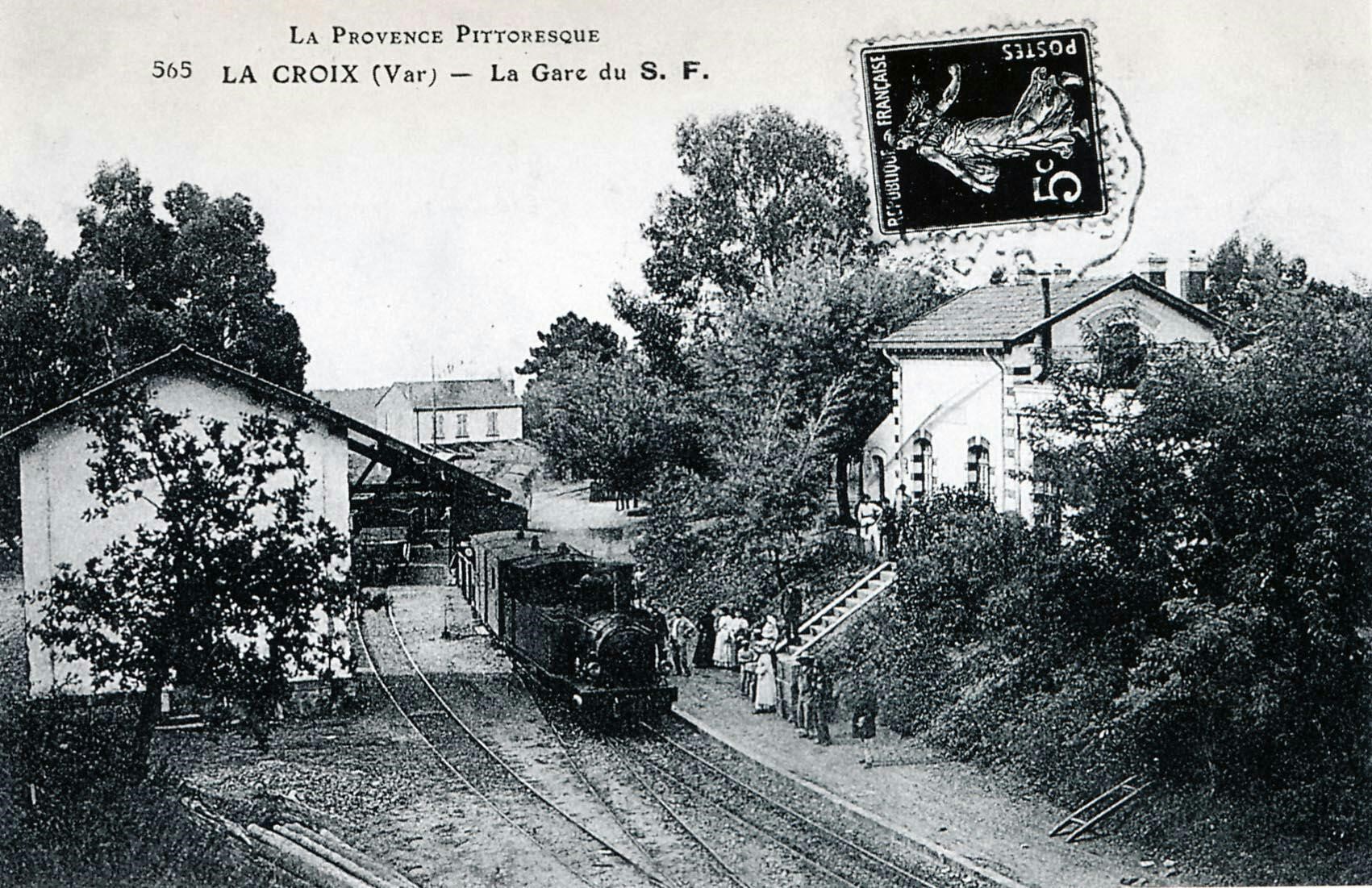
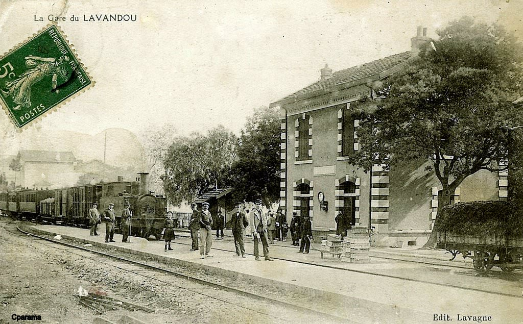
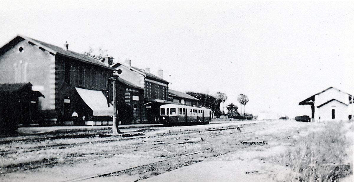
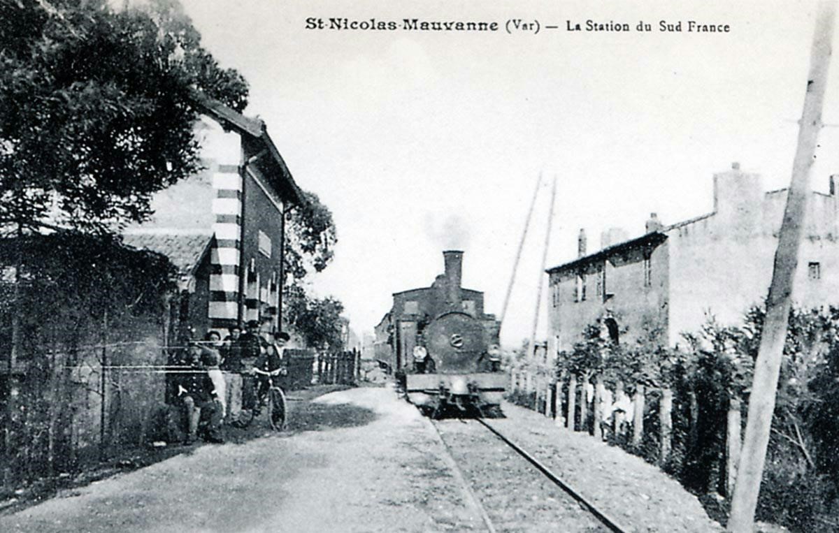
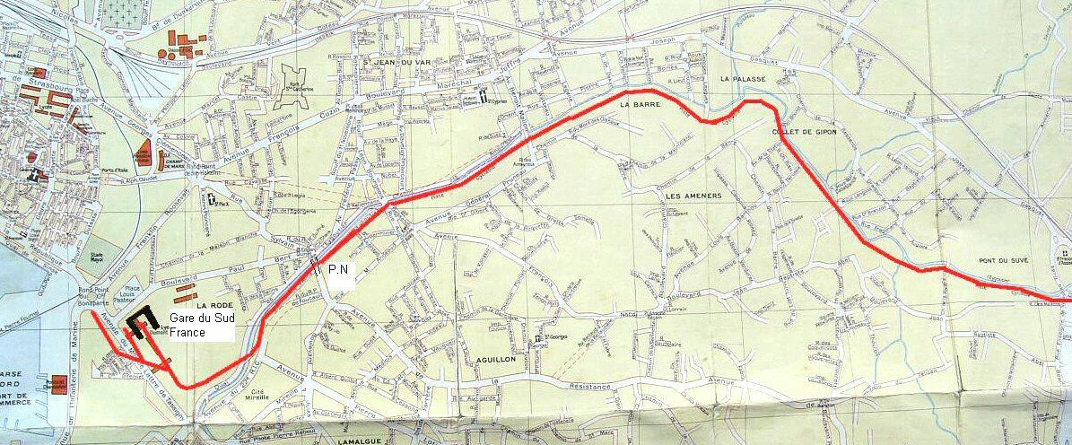
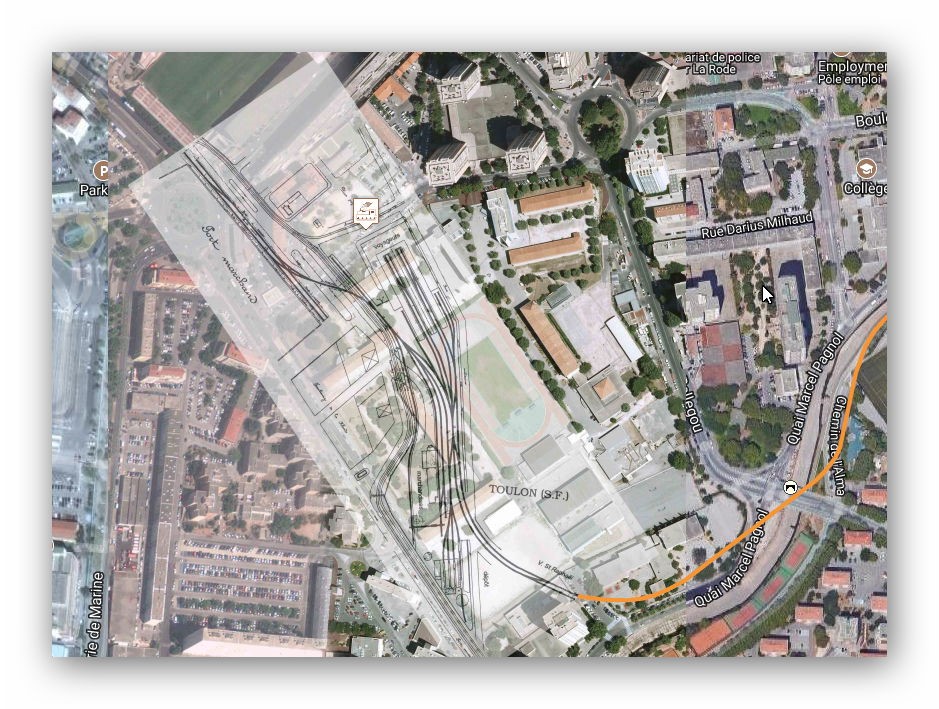
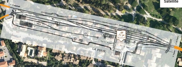 The station was one of the most significant on the line between Saint-Raphael and Toulon and one of the busiest. The line to Saint-Tropez left from the South-east end of the station and ran parallel to the single line to Toulon for a few hundred metres. The two lines separated with the Toulon line turning South and the Saint-Tropez line turning East.
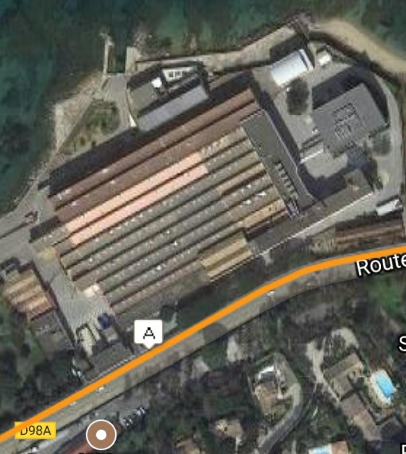
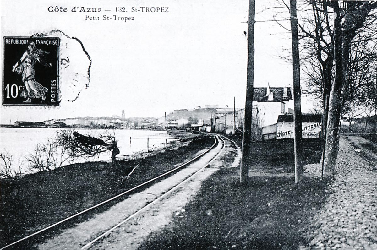
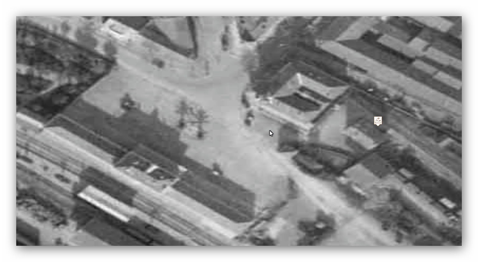
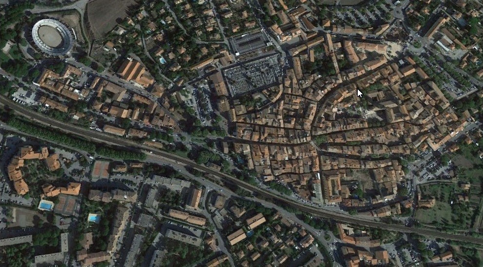
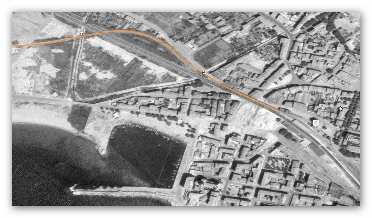
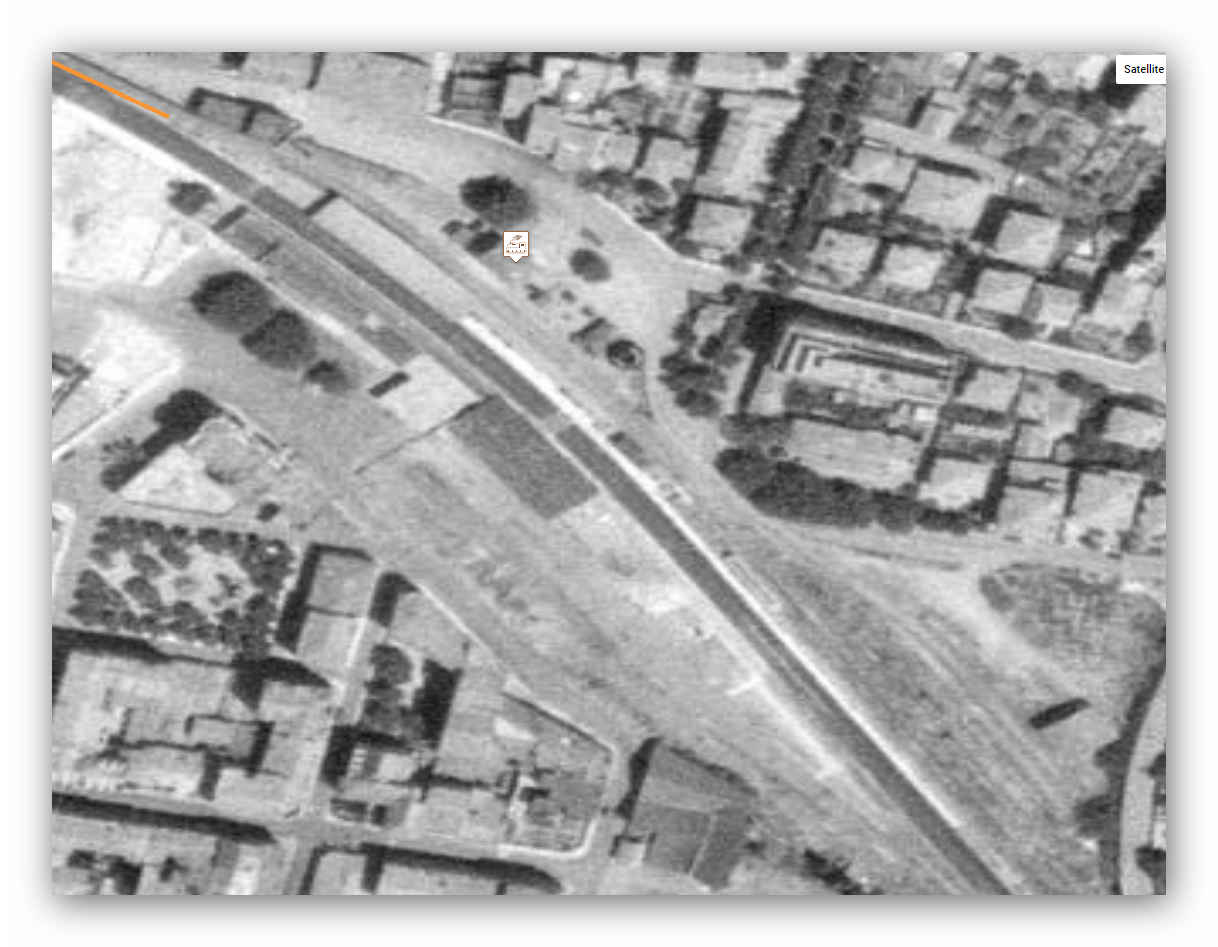
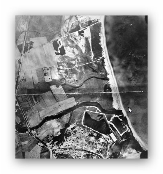
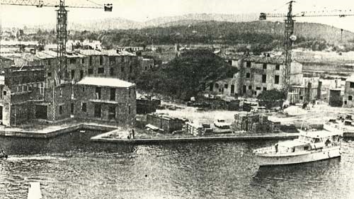
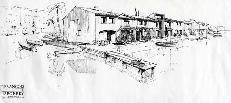
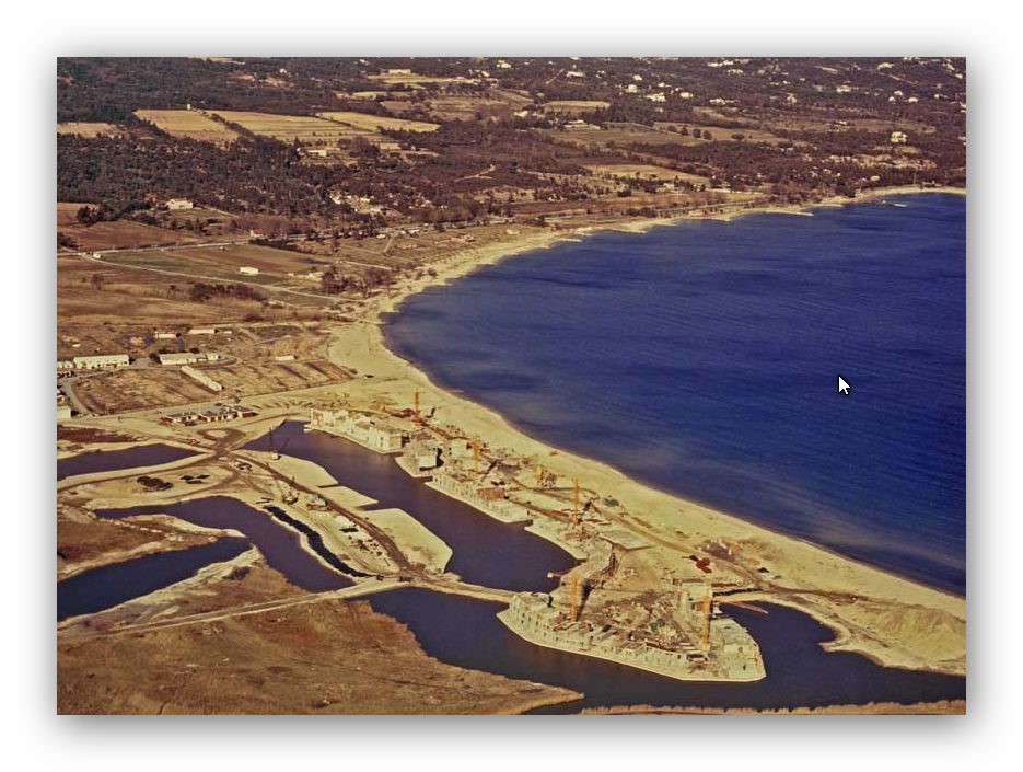
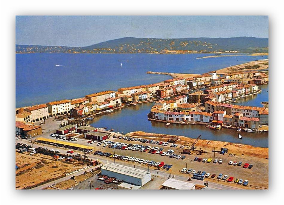
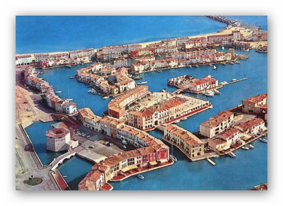
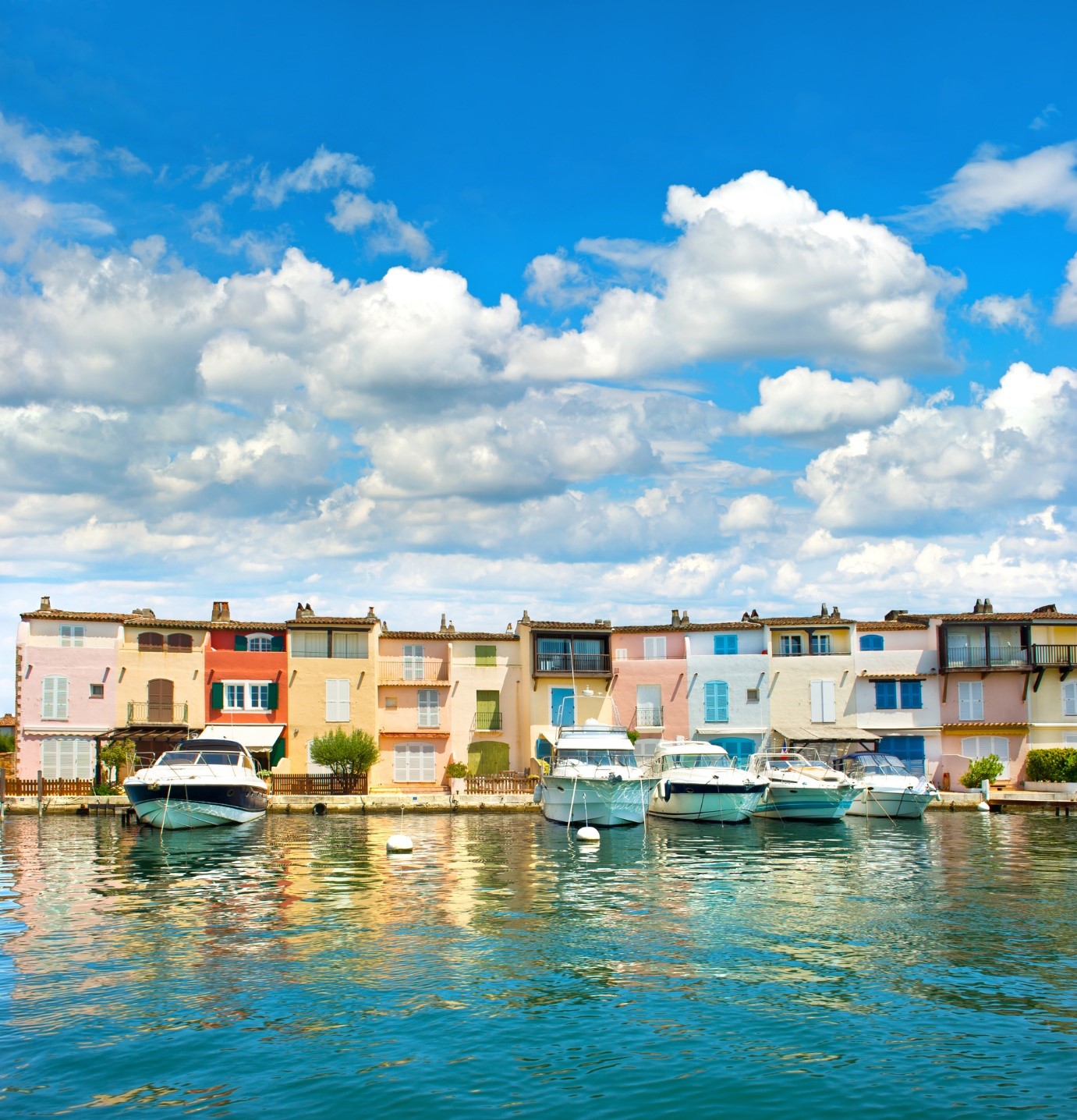
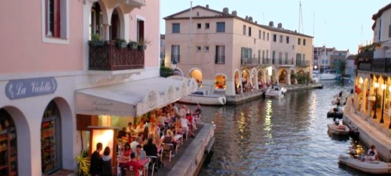
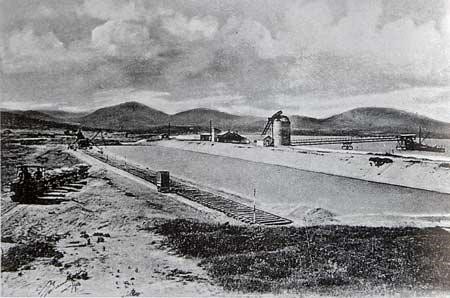
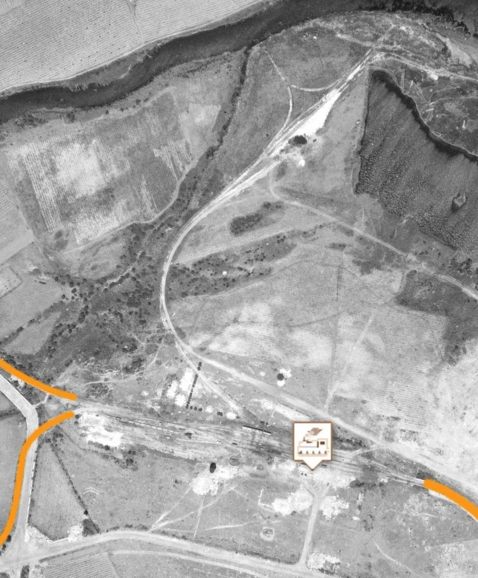
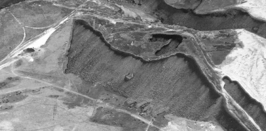
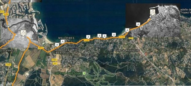
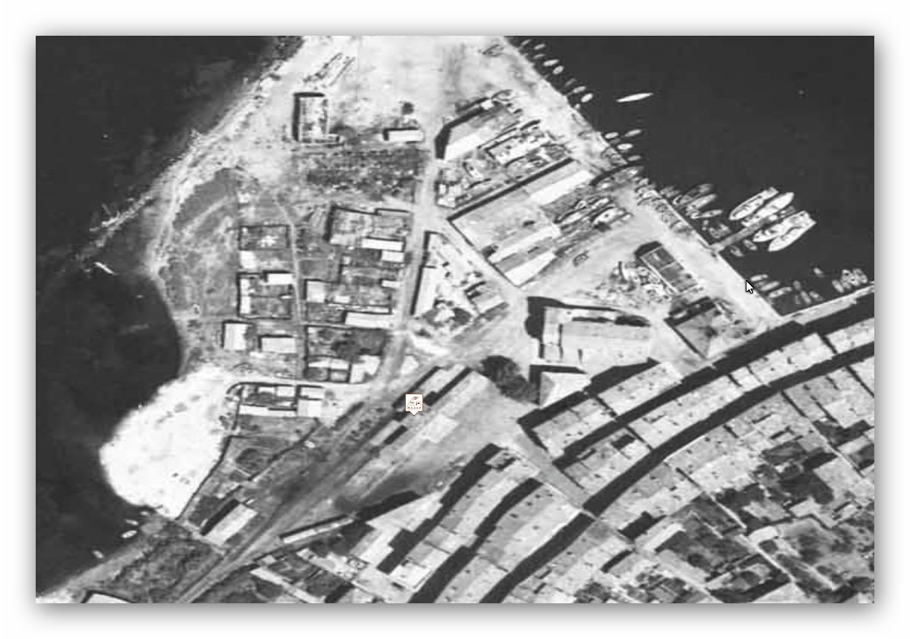
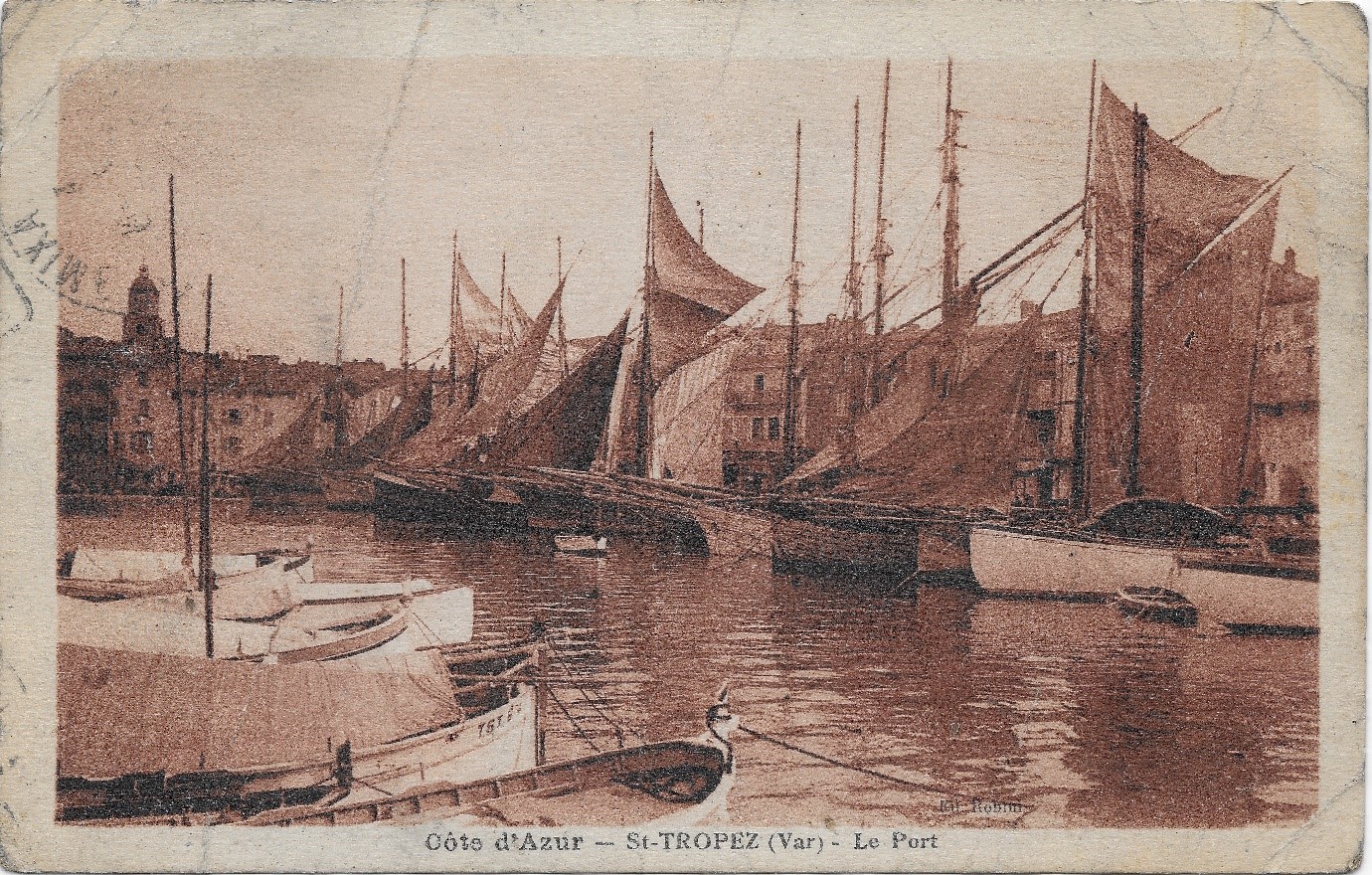
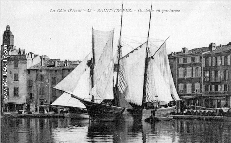
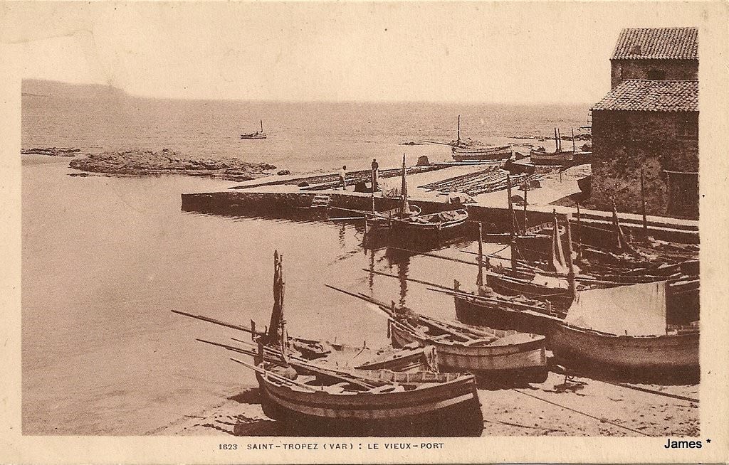
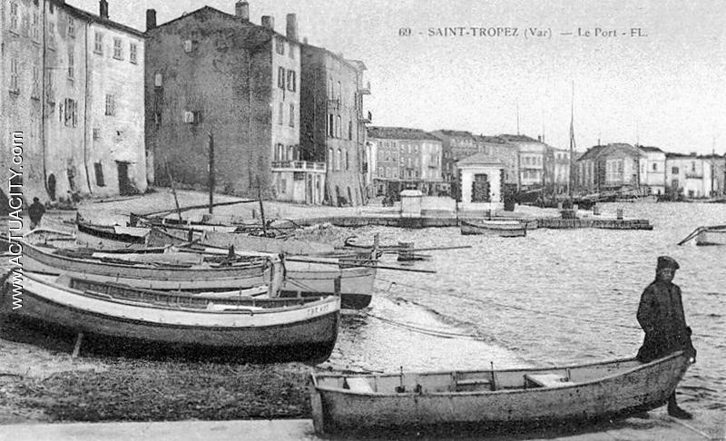
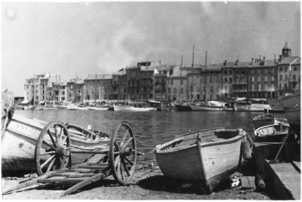
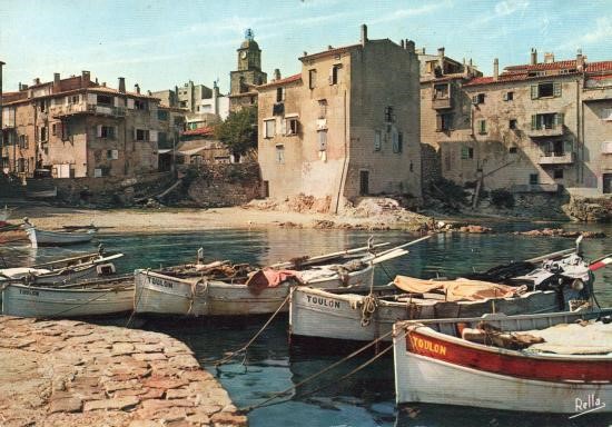
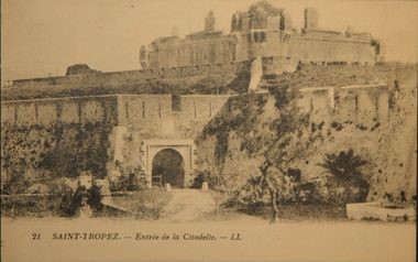
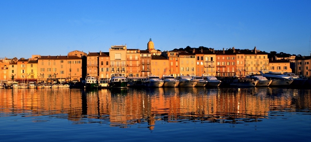
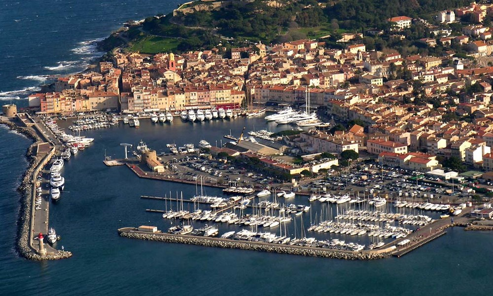
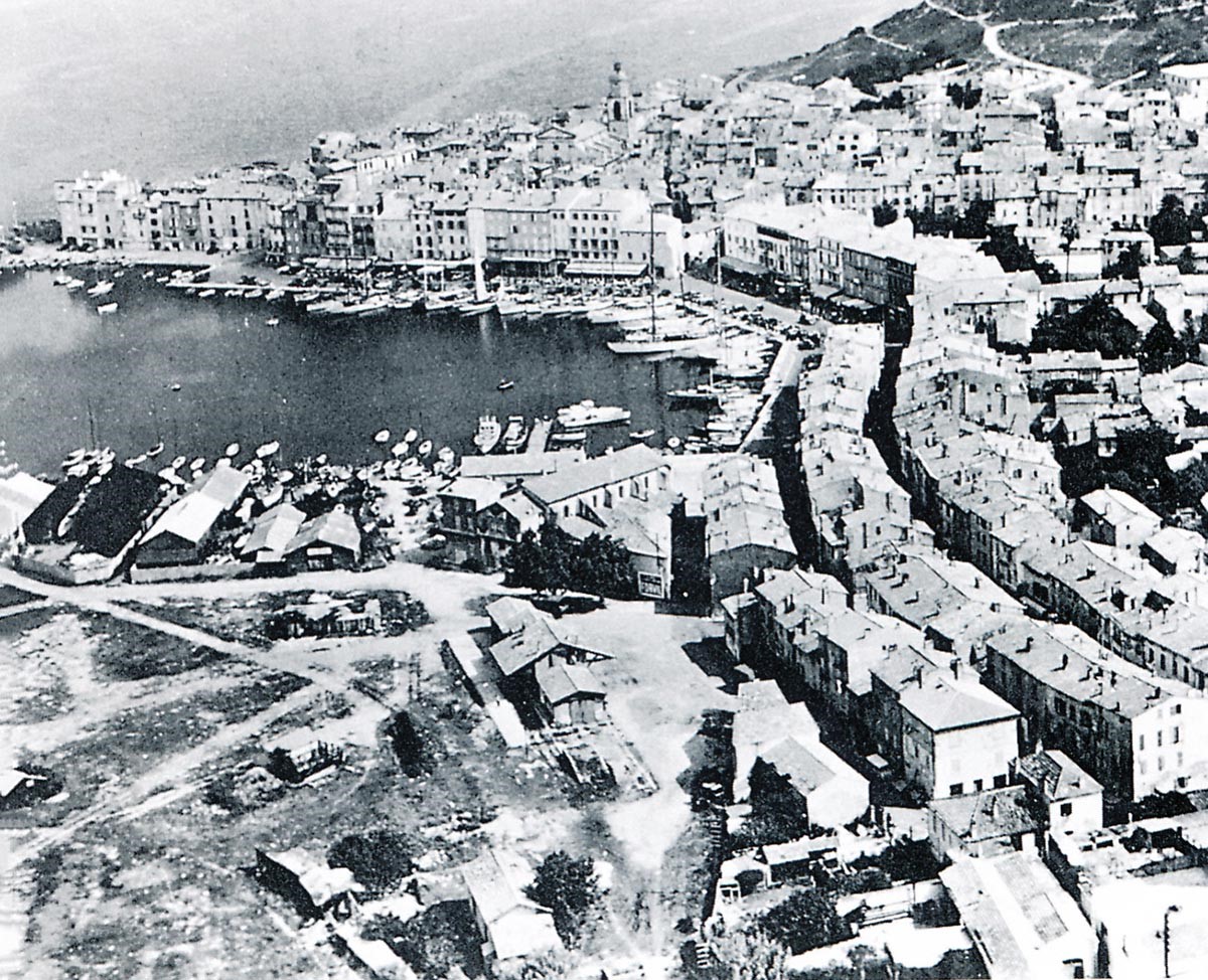
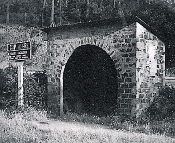
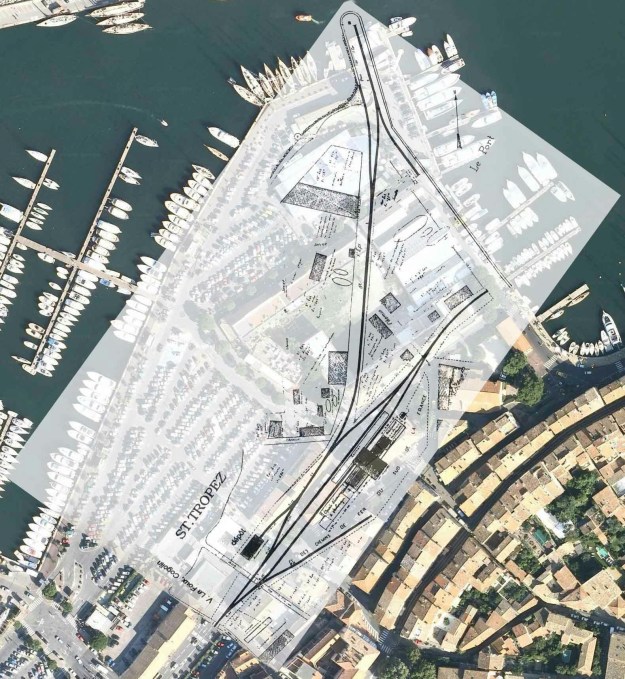 As can be seen in the above image, the original harbour at St. Tropez is much changed and there has been significant land reclamation to enlarge facilities at the port. The aerial photographs below show the port in the time around the closure of the line. Those images are followed by a sequence of photographs culled from the research of Jean-Pierre Moreau [3].
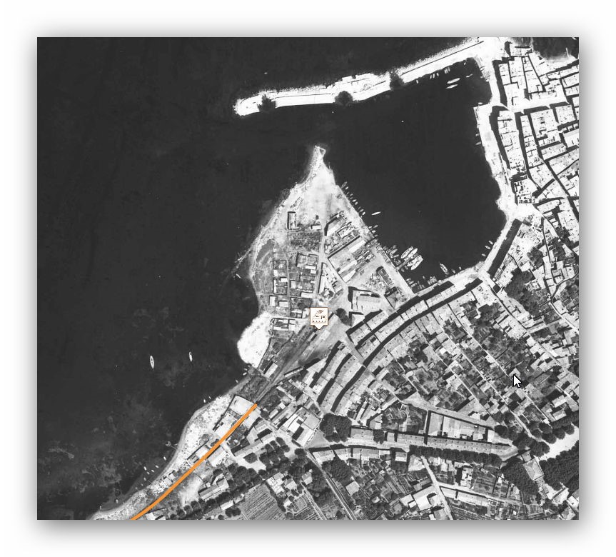
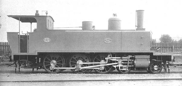
 4-6-0T SACM Locomotive No. 62 (Edmund DUCLOS collection).
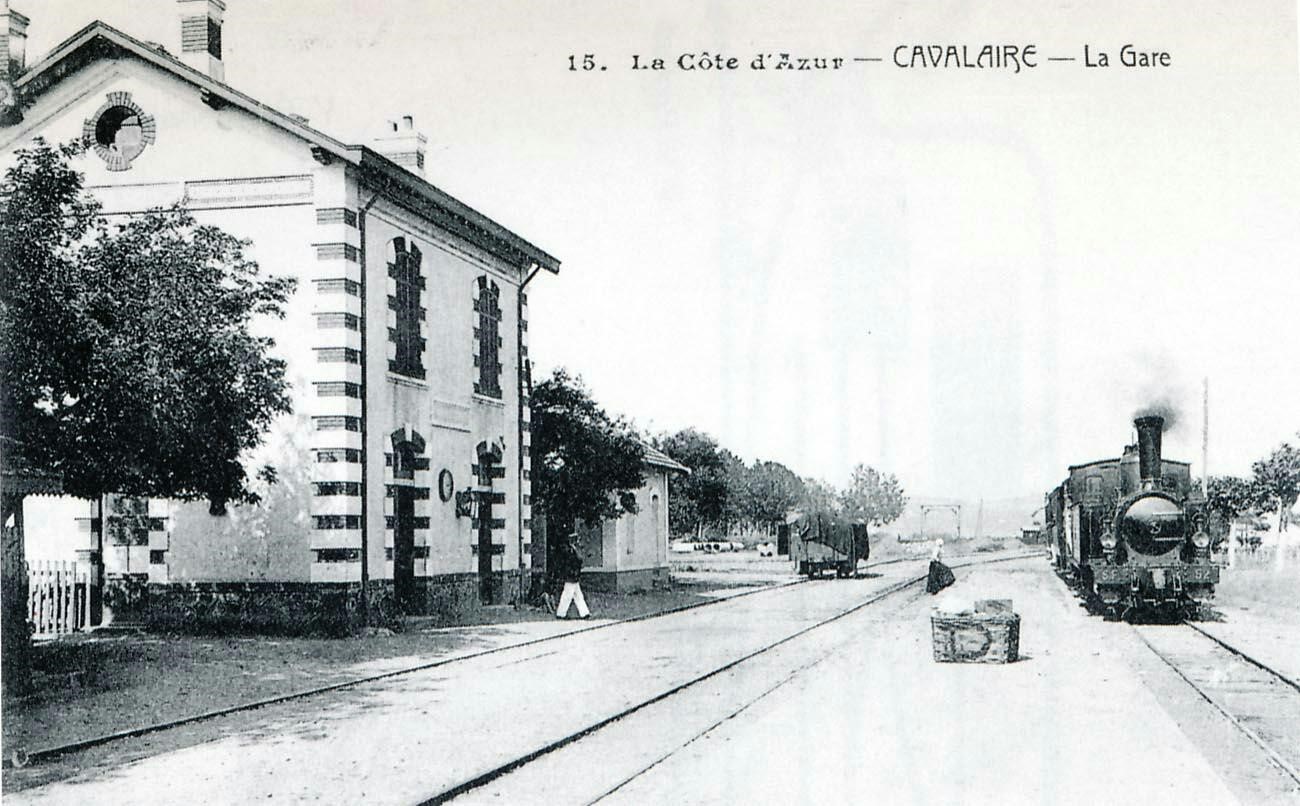
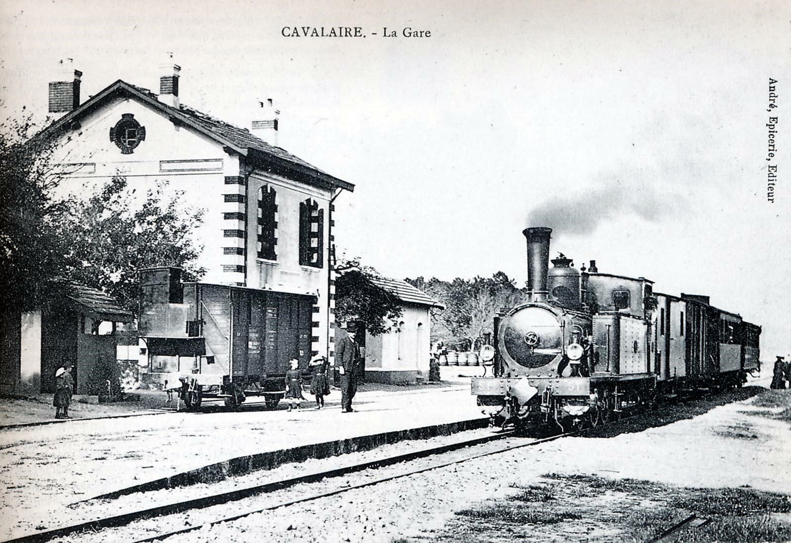
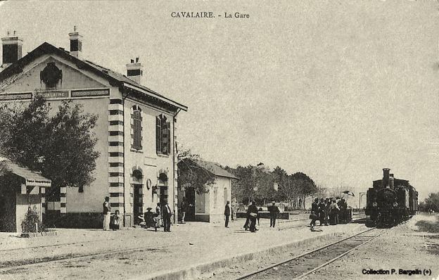
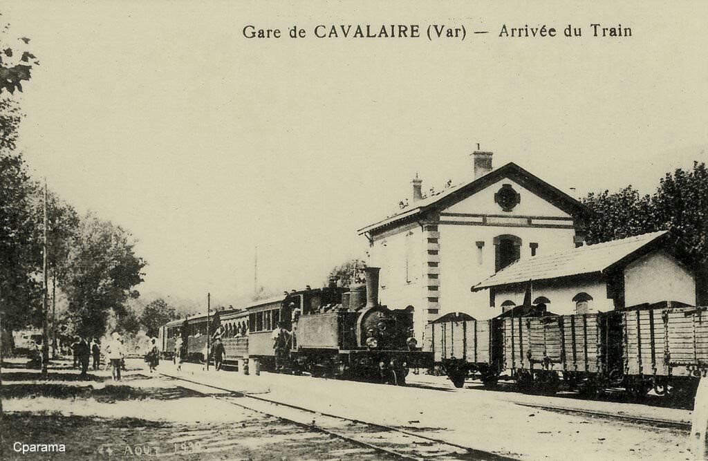
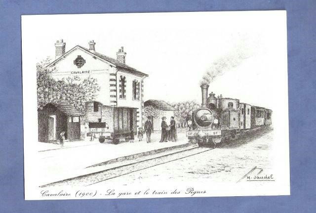
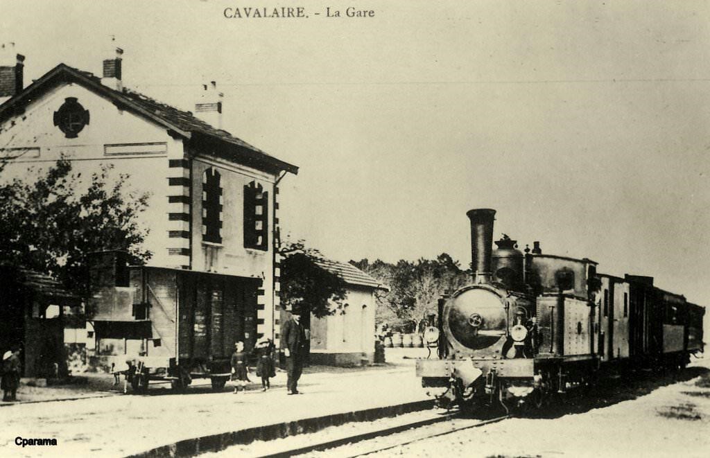
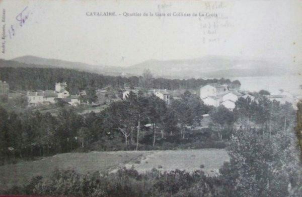
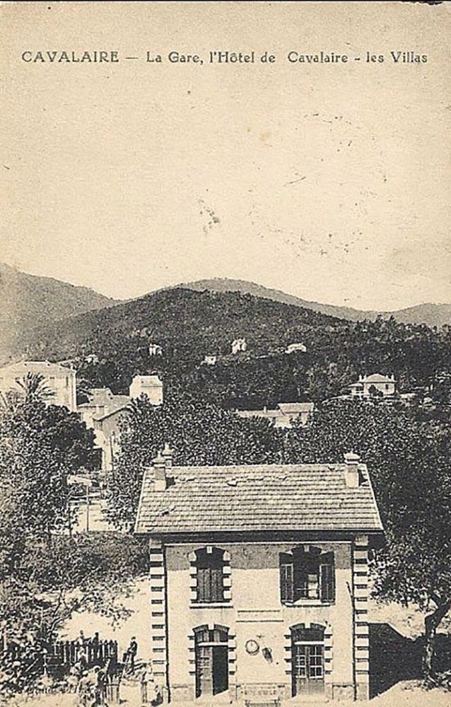
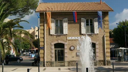
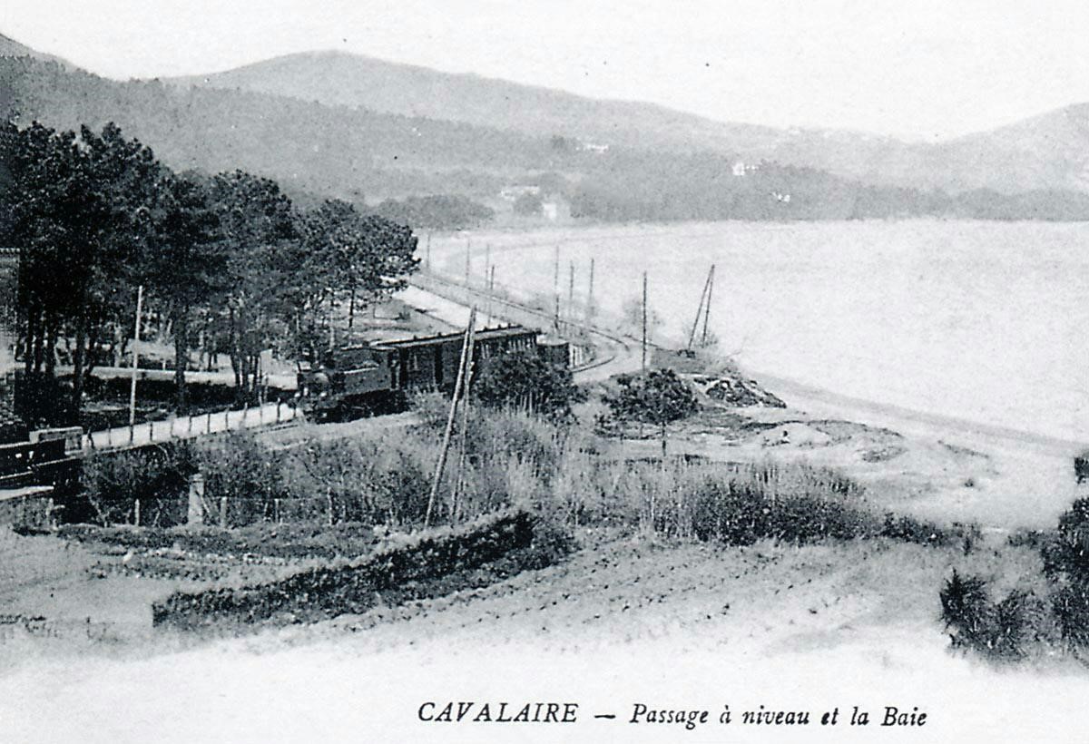
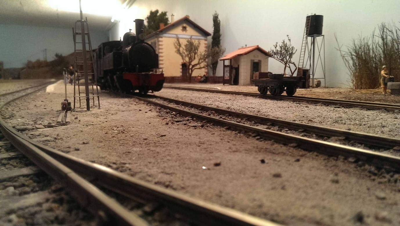
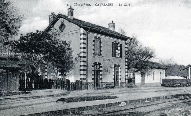 Cavalaire Station sometime between 1925 and 1930. On the platform there is a ladder used to load and unload barrels from van (Jean-Pierre VIGUIE Collection).
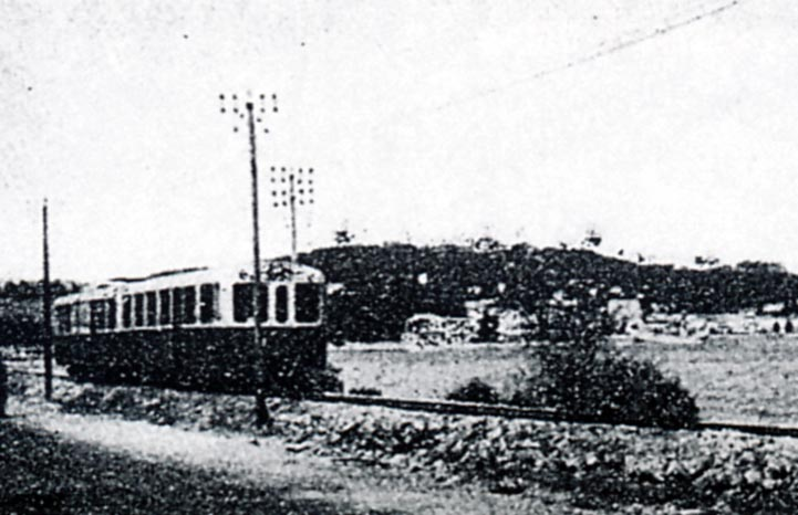
 Autorail Brissonnea
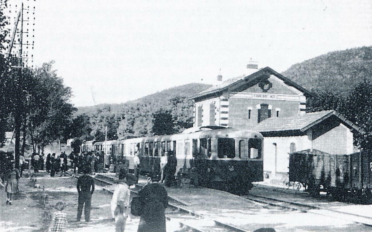
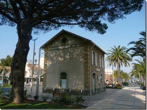
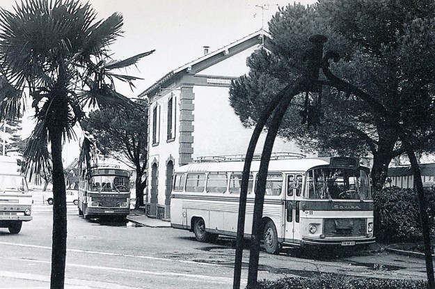 By 1978, Cavalaire Sta
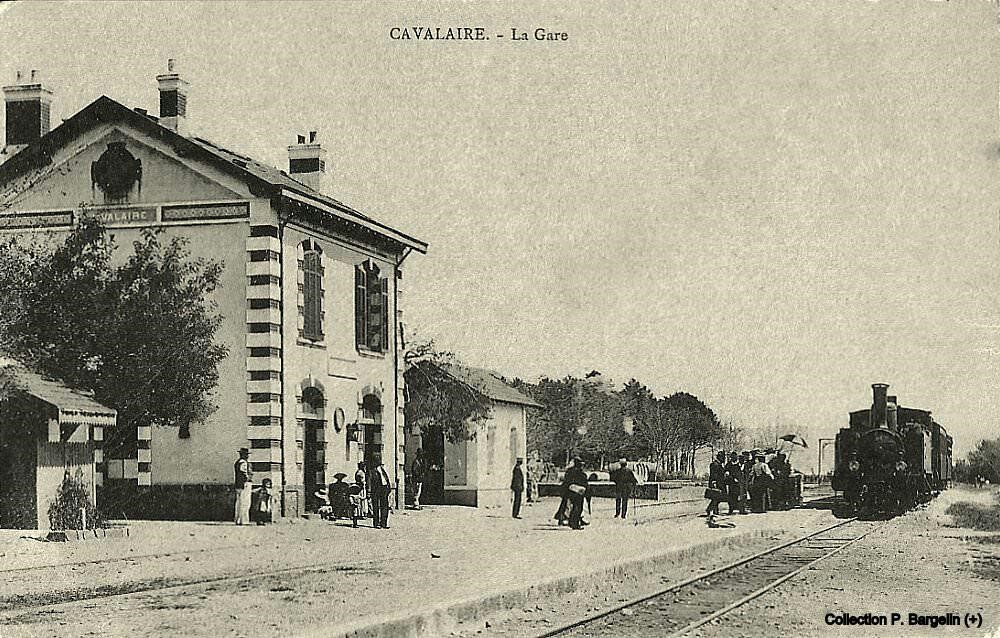


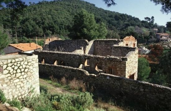
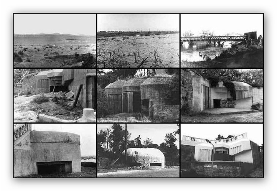
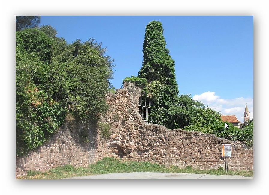
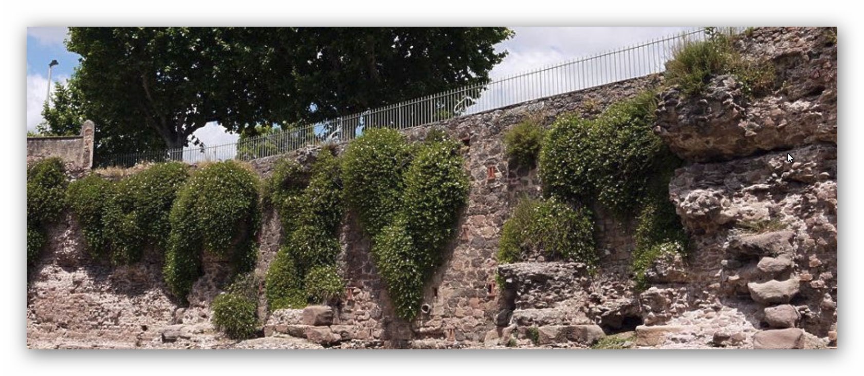
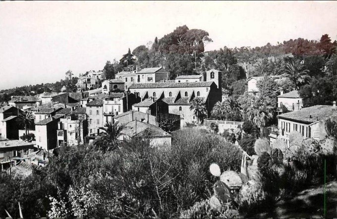
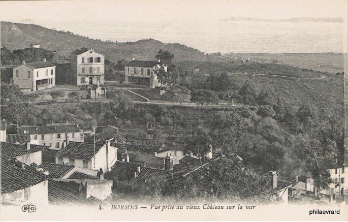
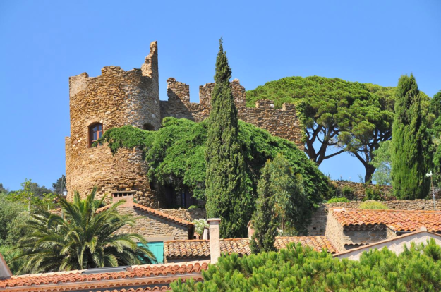 The ruins of the castle of the Lords of Fos.
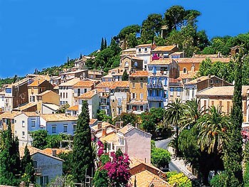
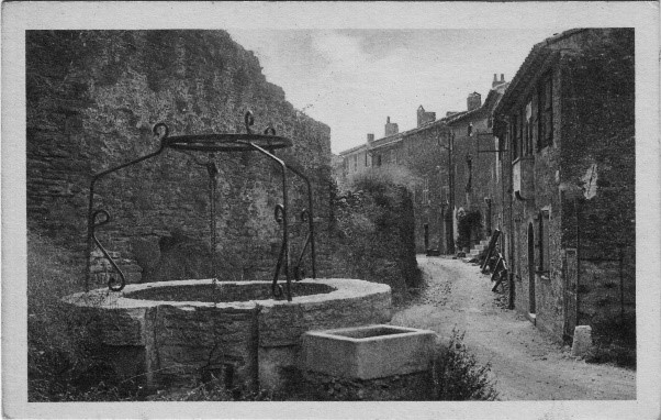
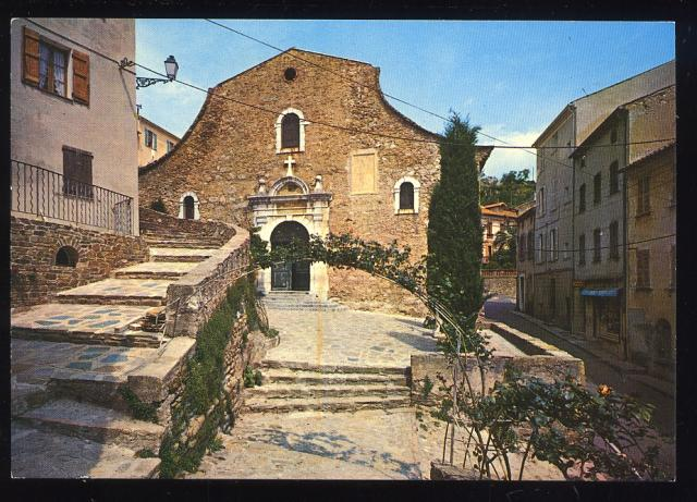
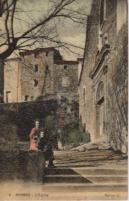
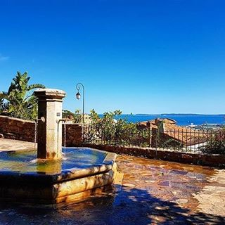 There are squares with fountains, nice shops, art galleries and workshops. We take in the Square of L’Isclou d’Amour, Lou Poulid Cantoun square, square Figuier and des Amoureux square. The old
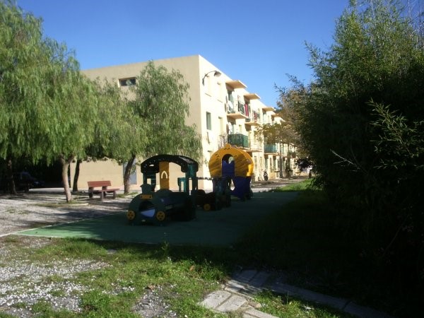
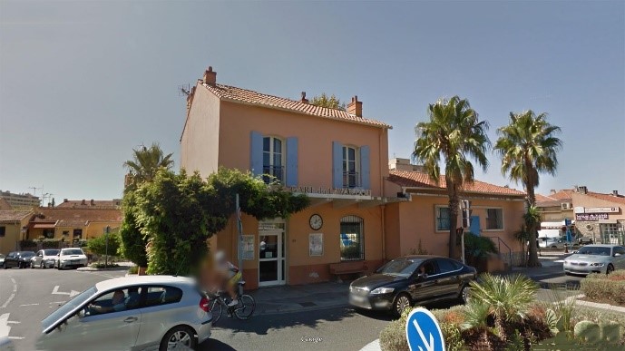
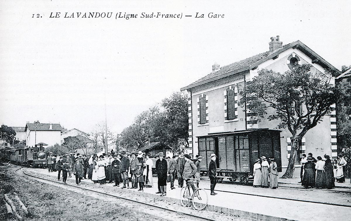
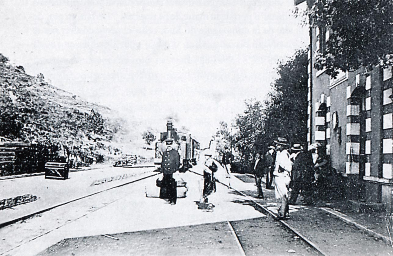
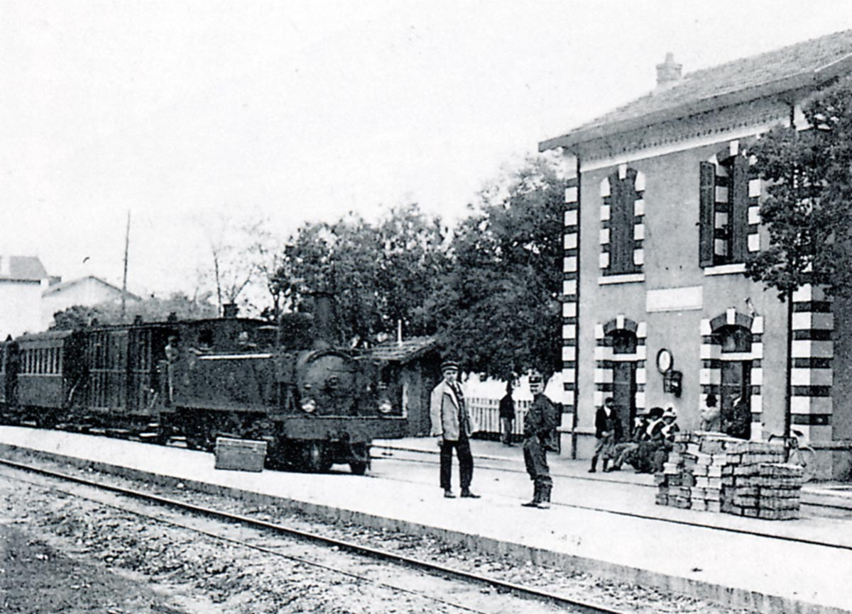
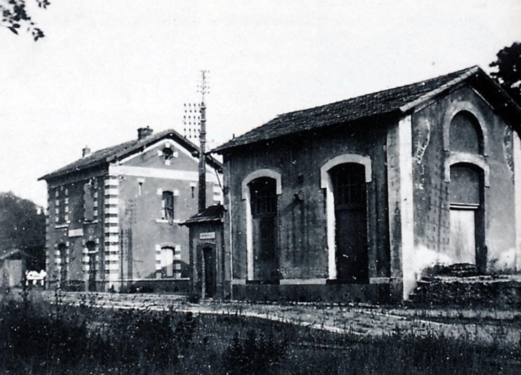
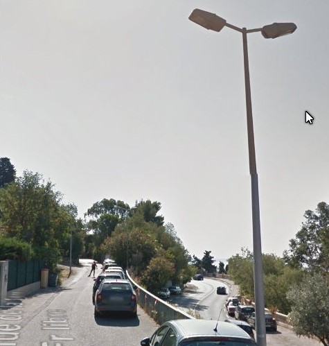
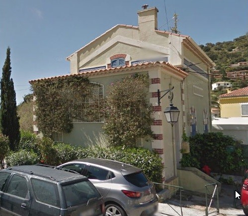
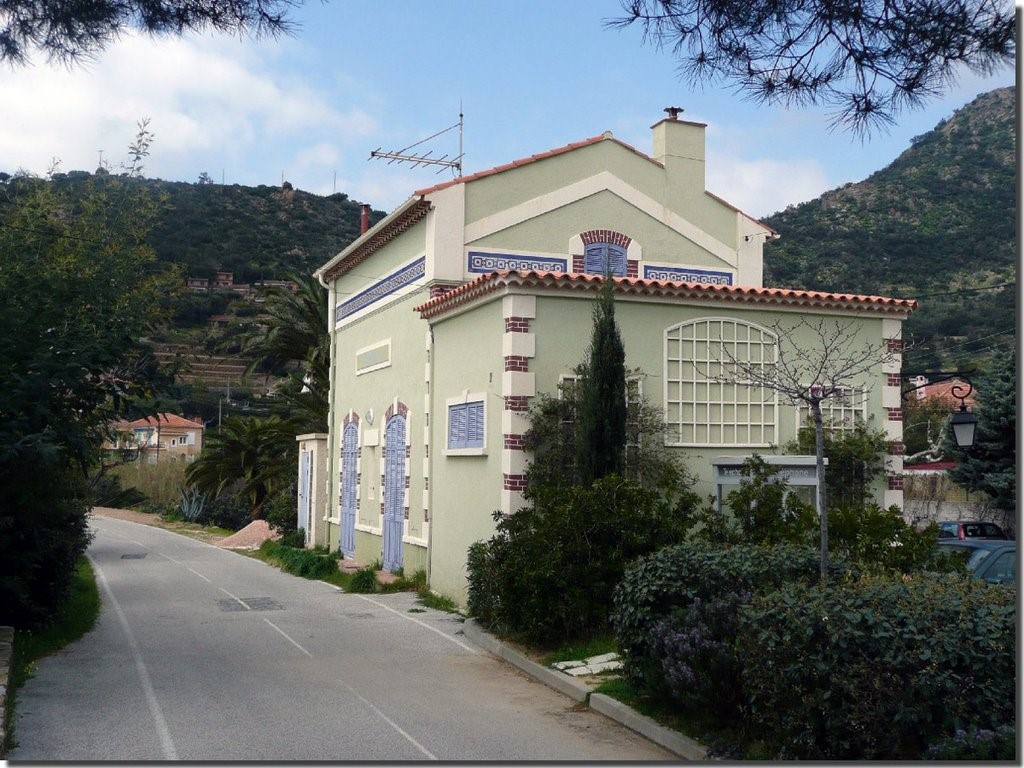


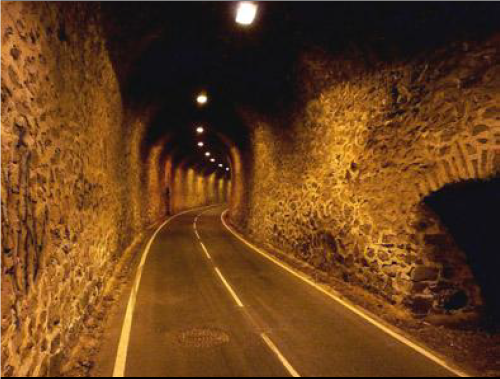
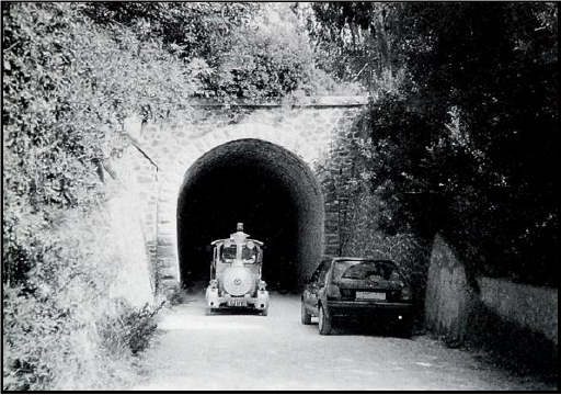
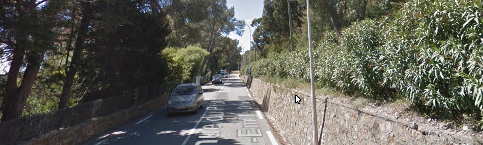
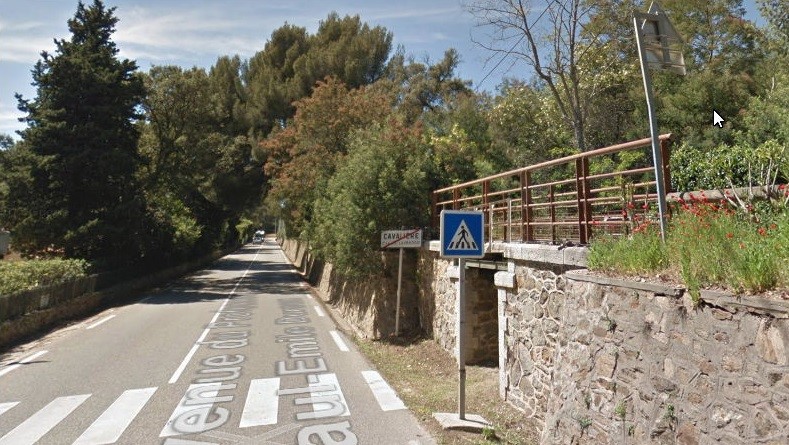
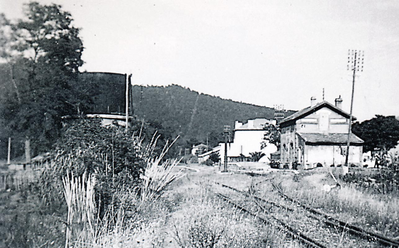
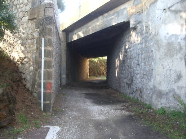


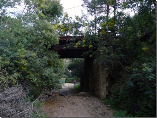
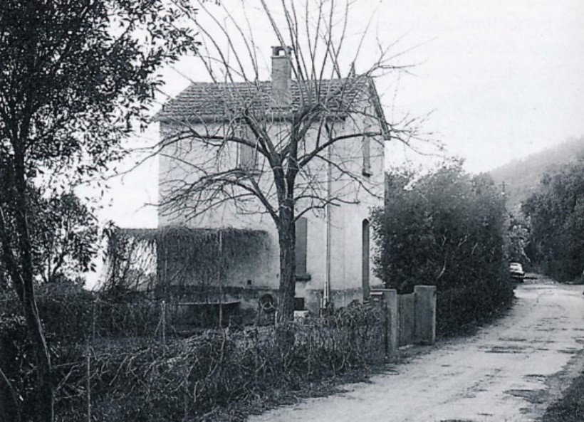


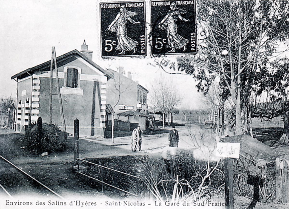
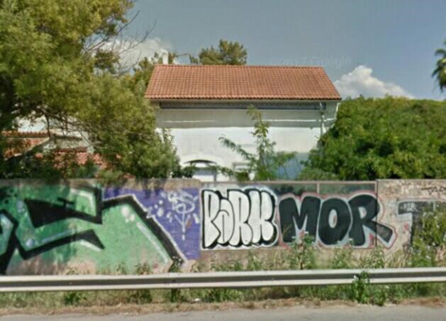
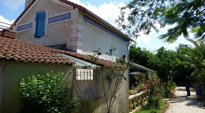
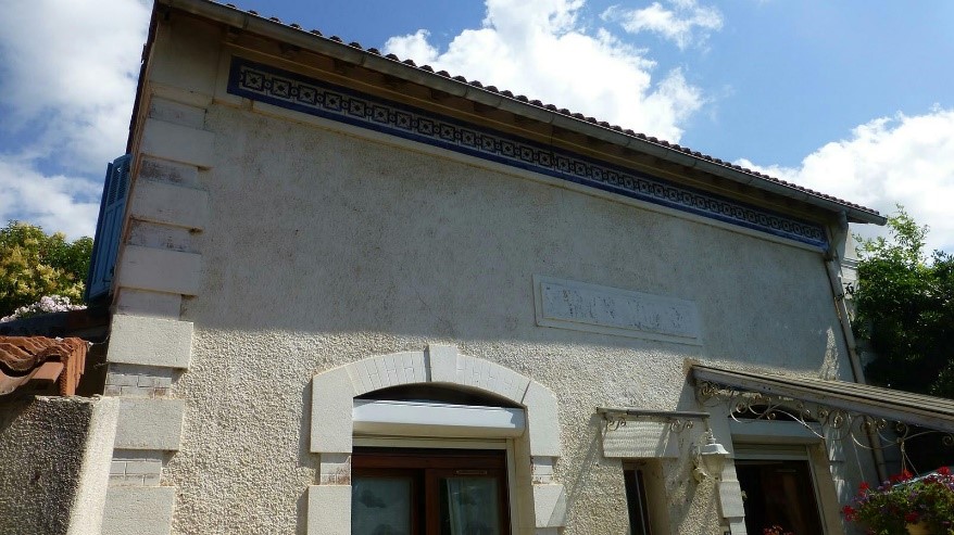
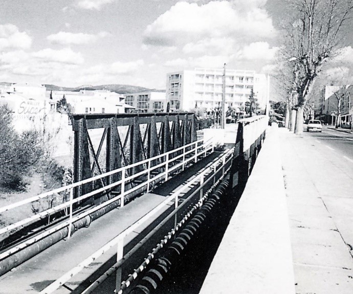
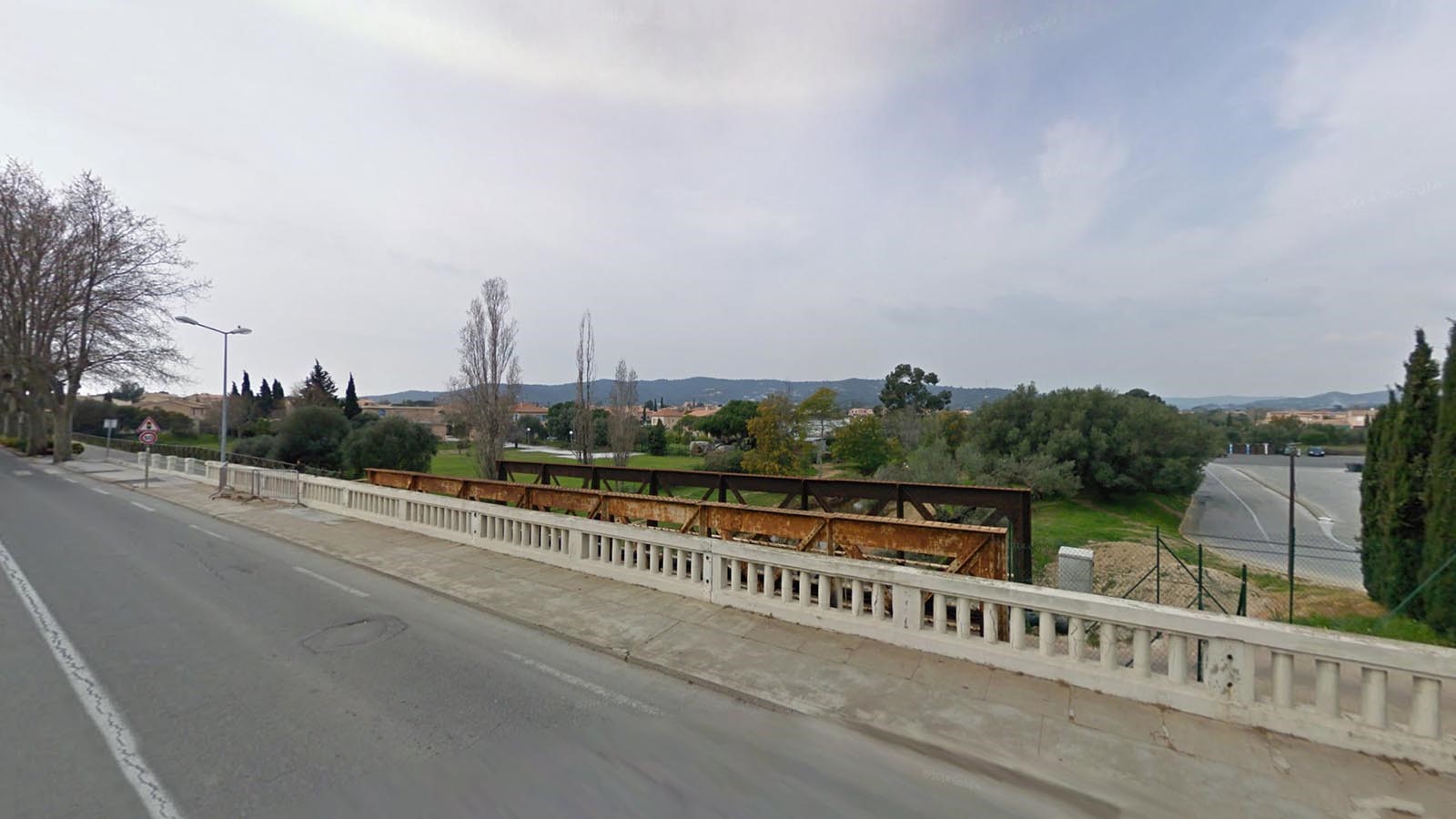
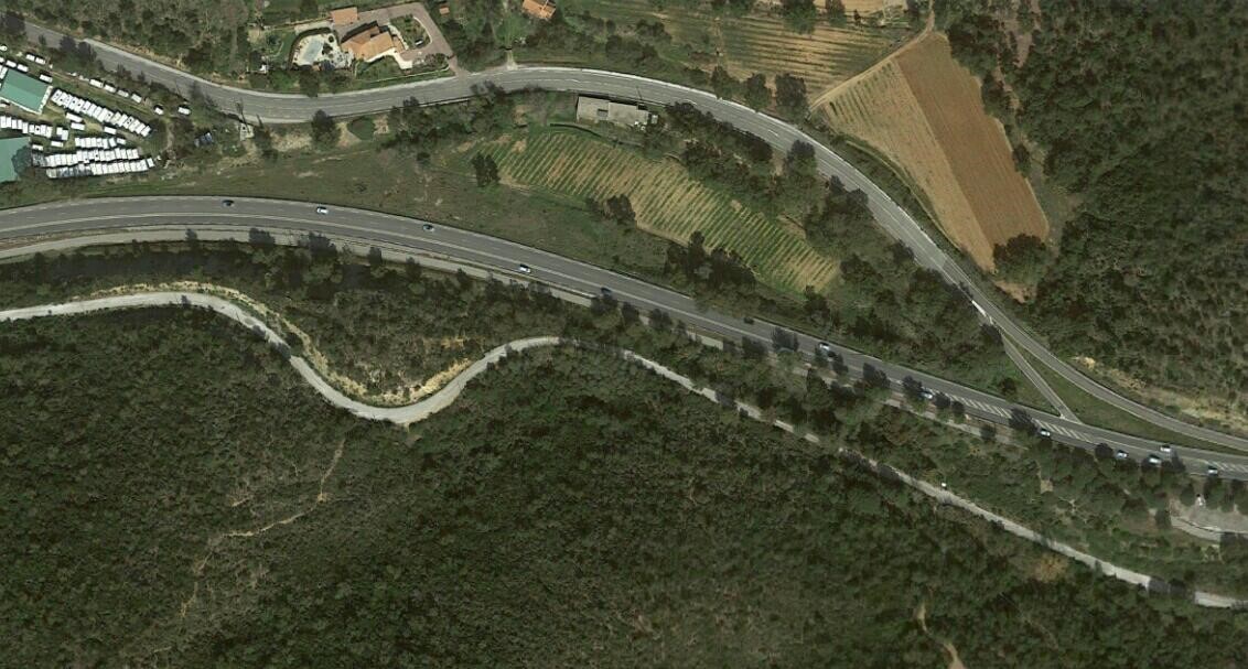
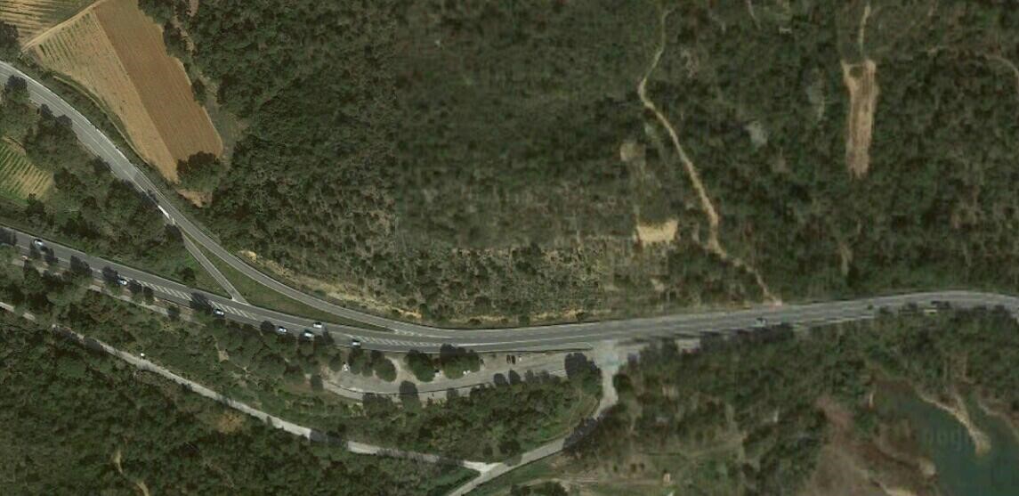
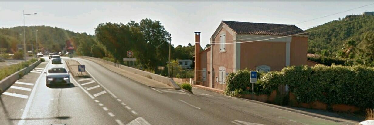
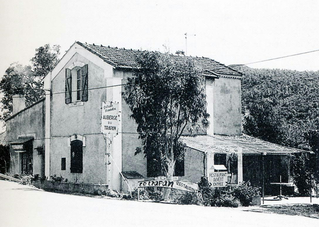
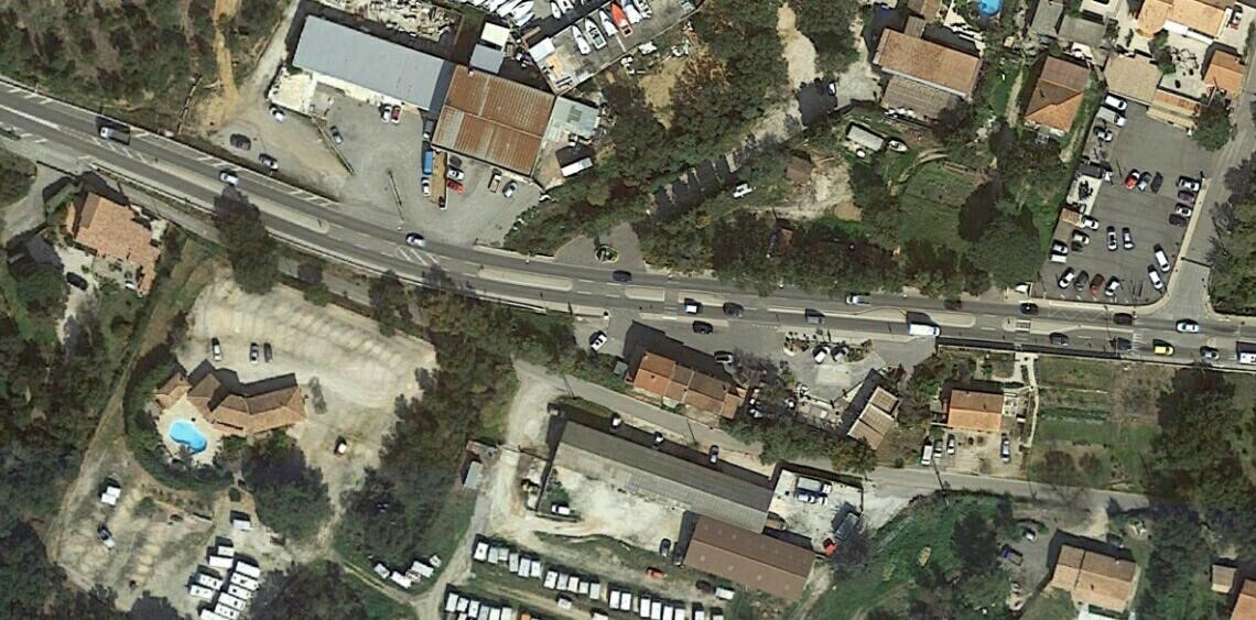
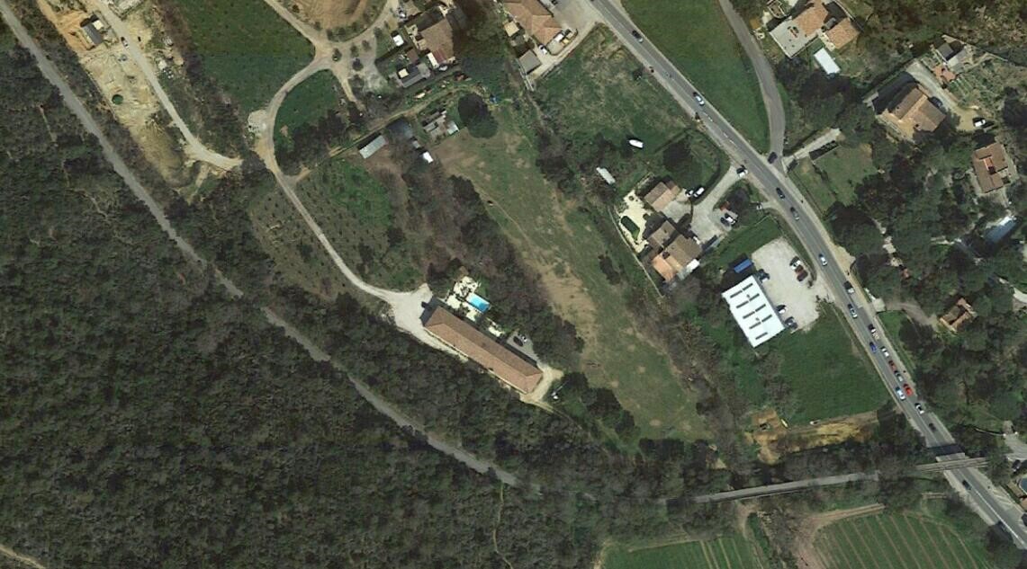
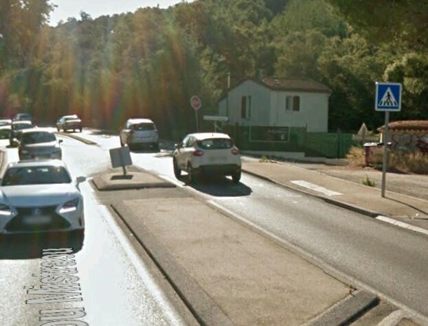
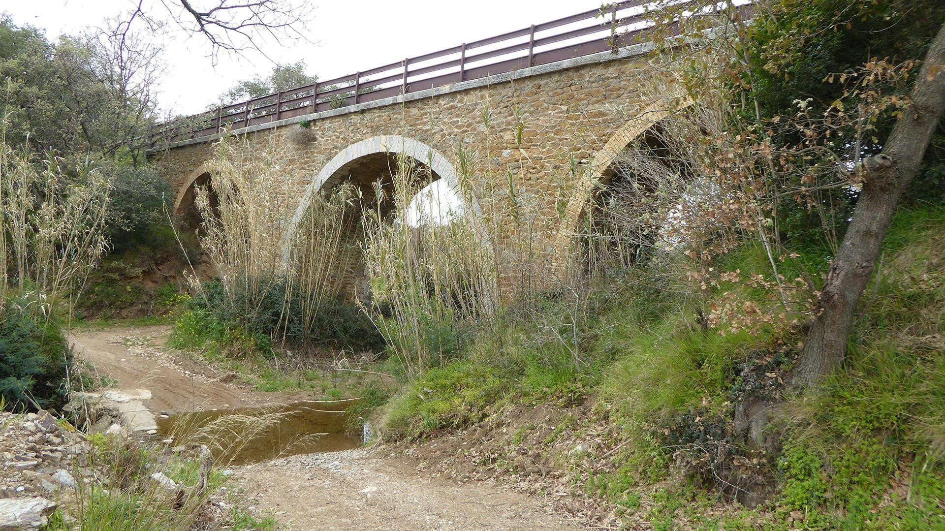
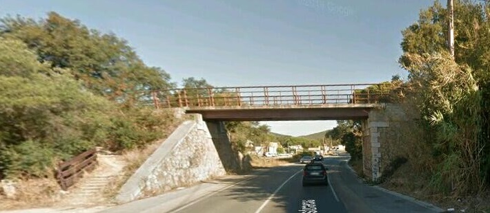


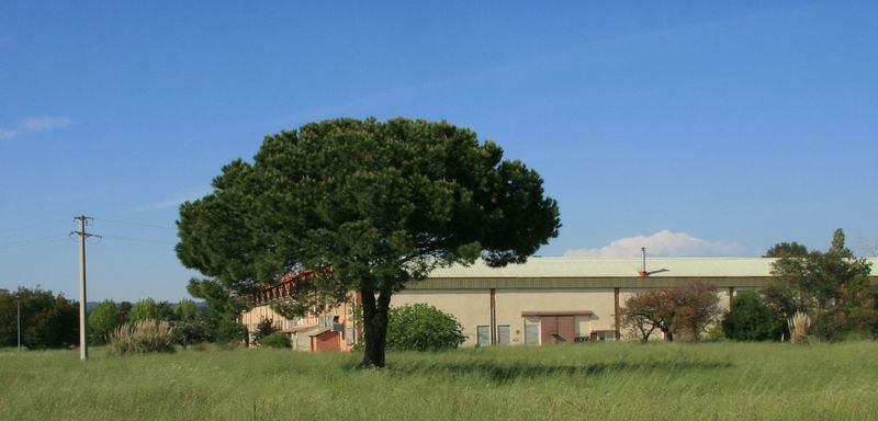

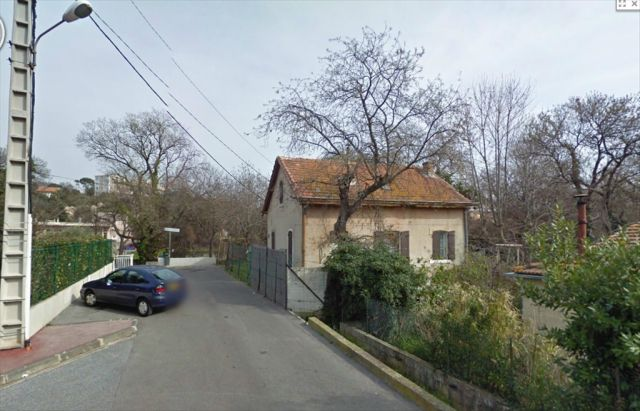
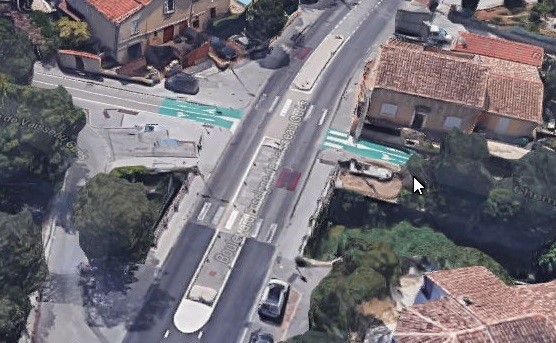
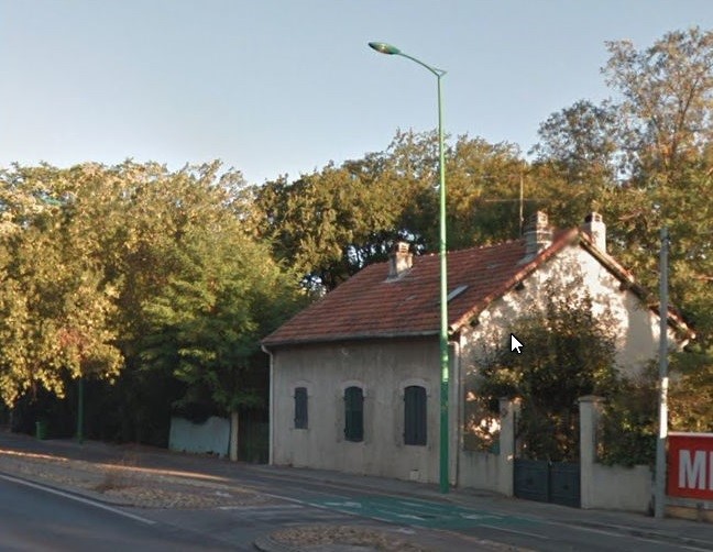
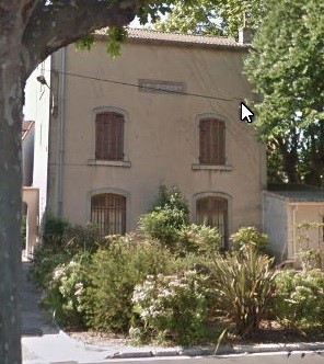
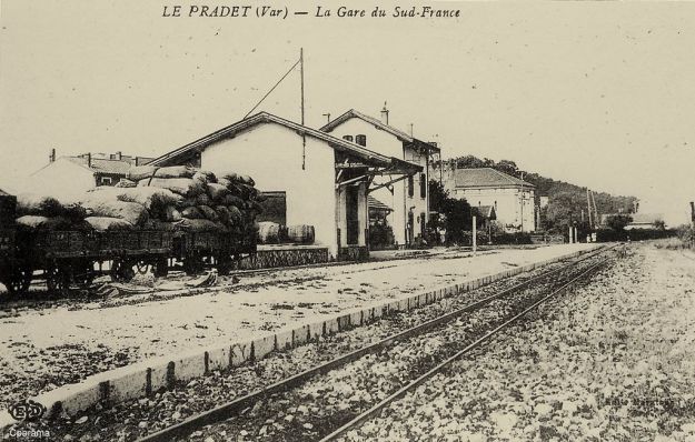
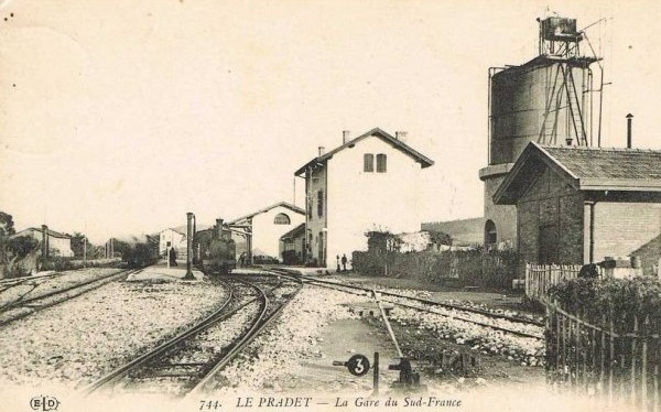
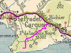
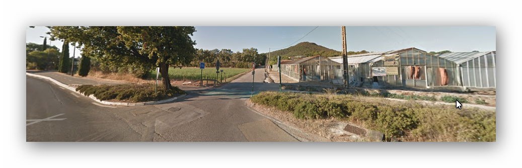
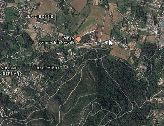
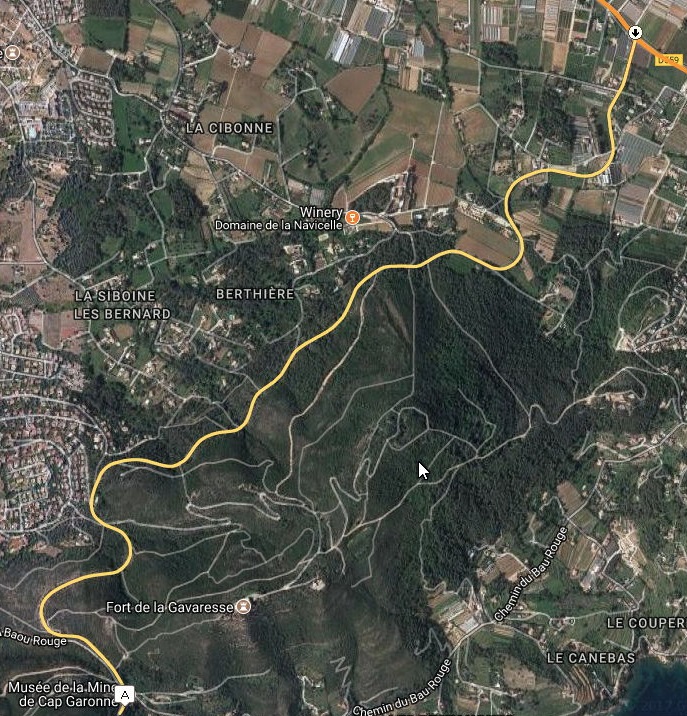
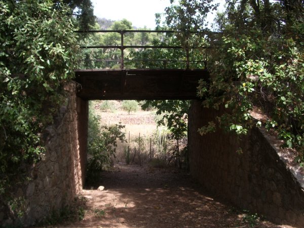
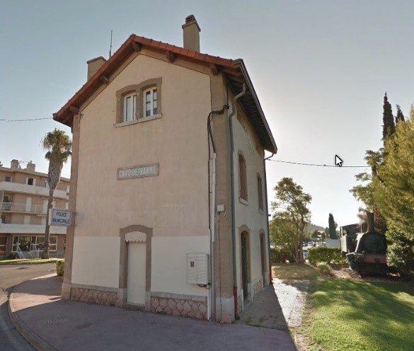
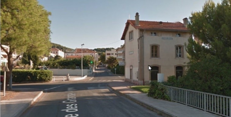
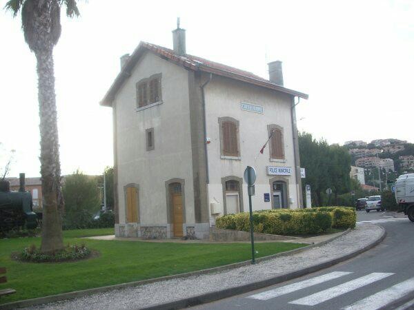
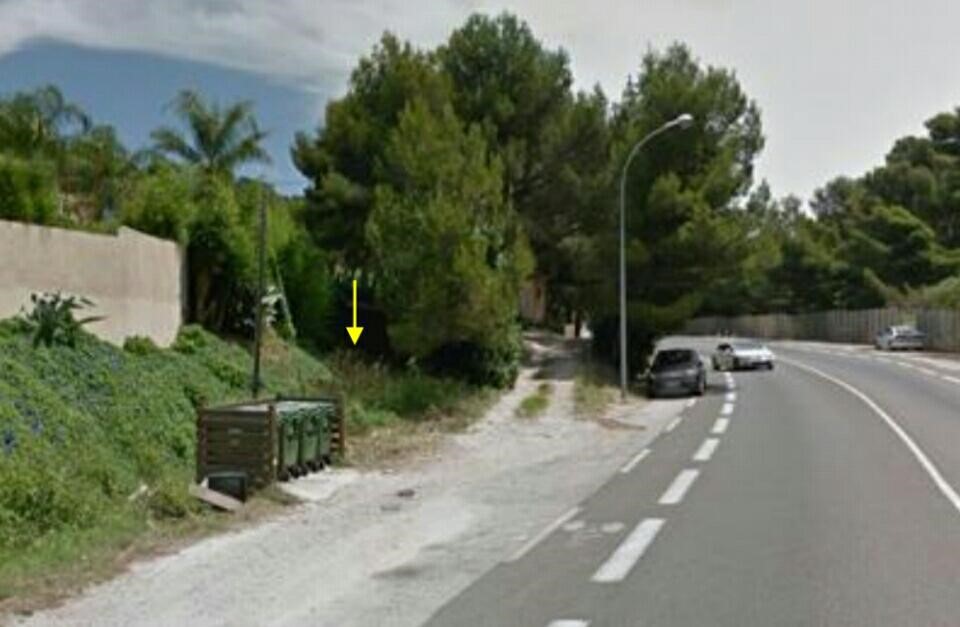
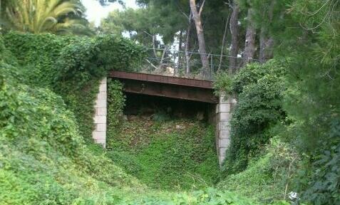
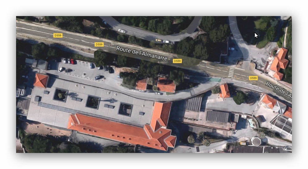
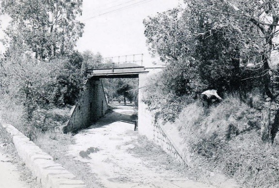
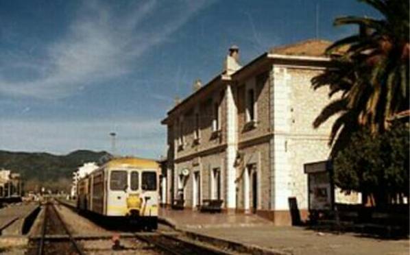
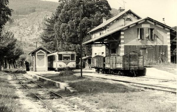
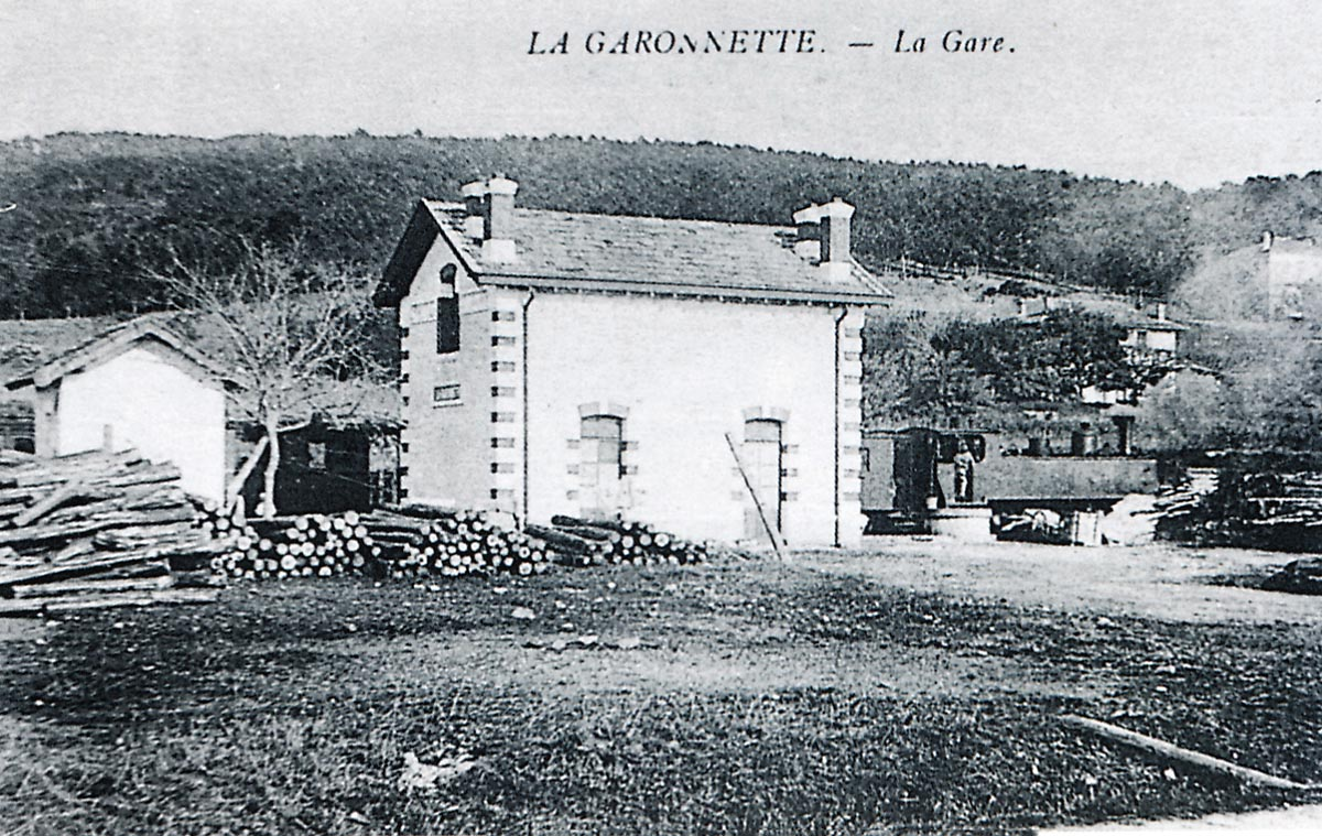
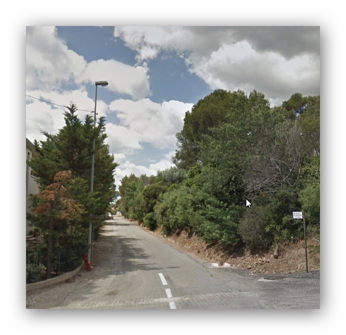
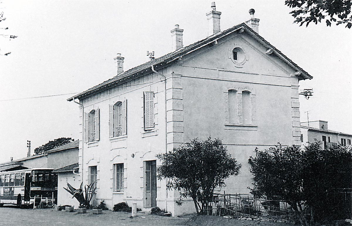
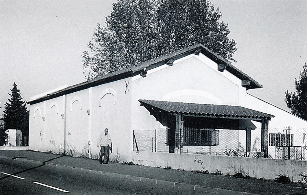
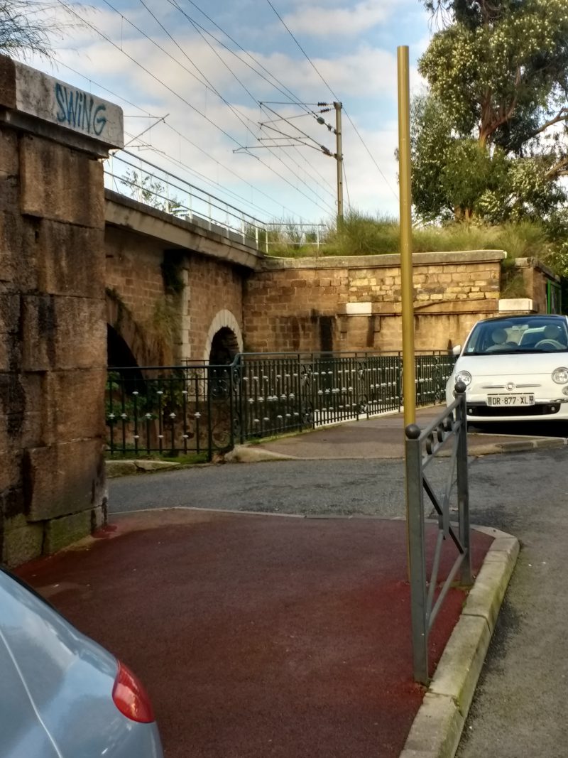
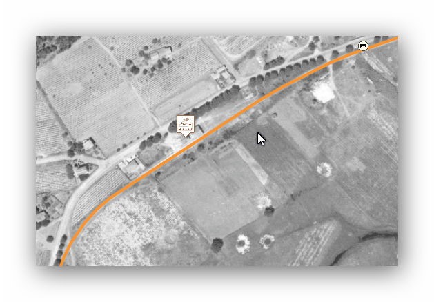
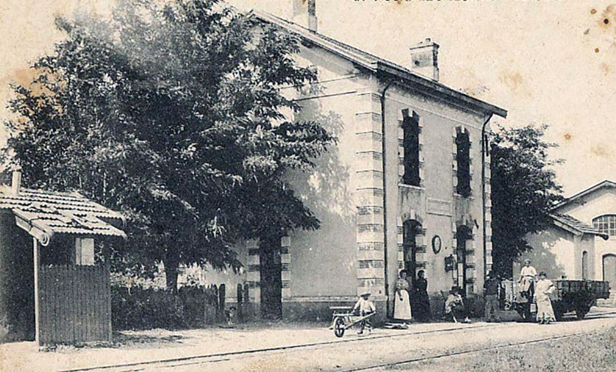
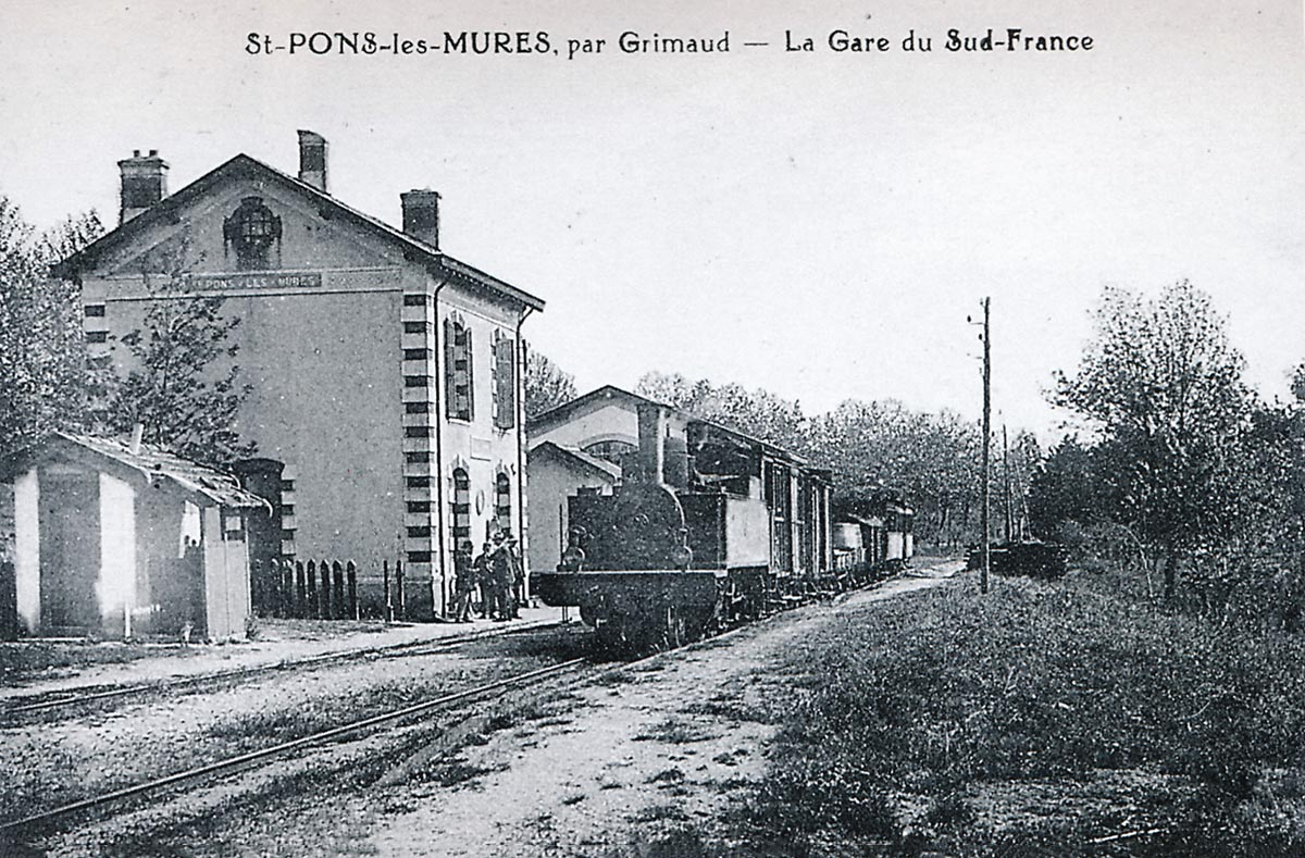
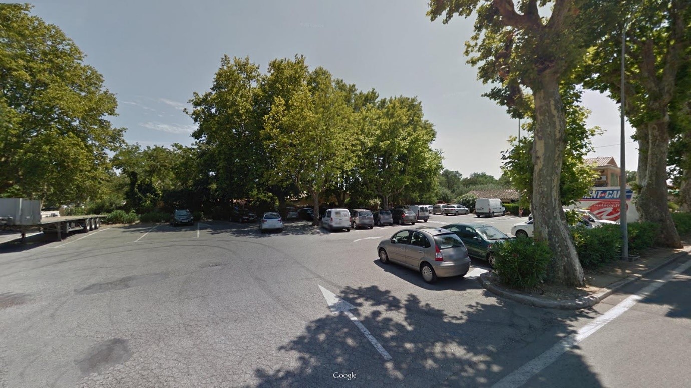
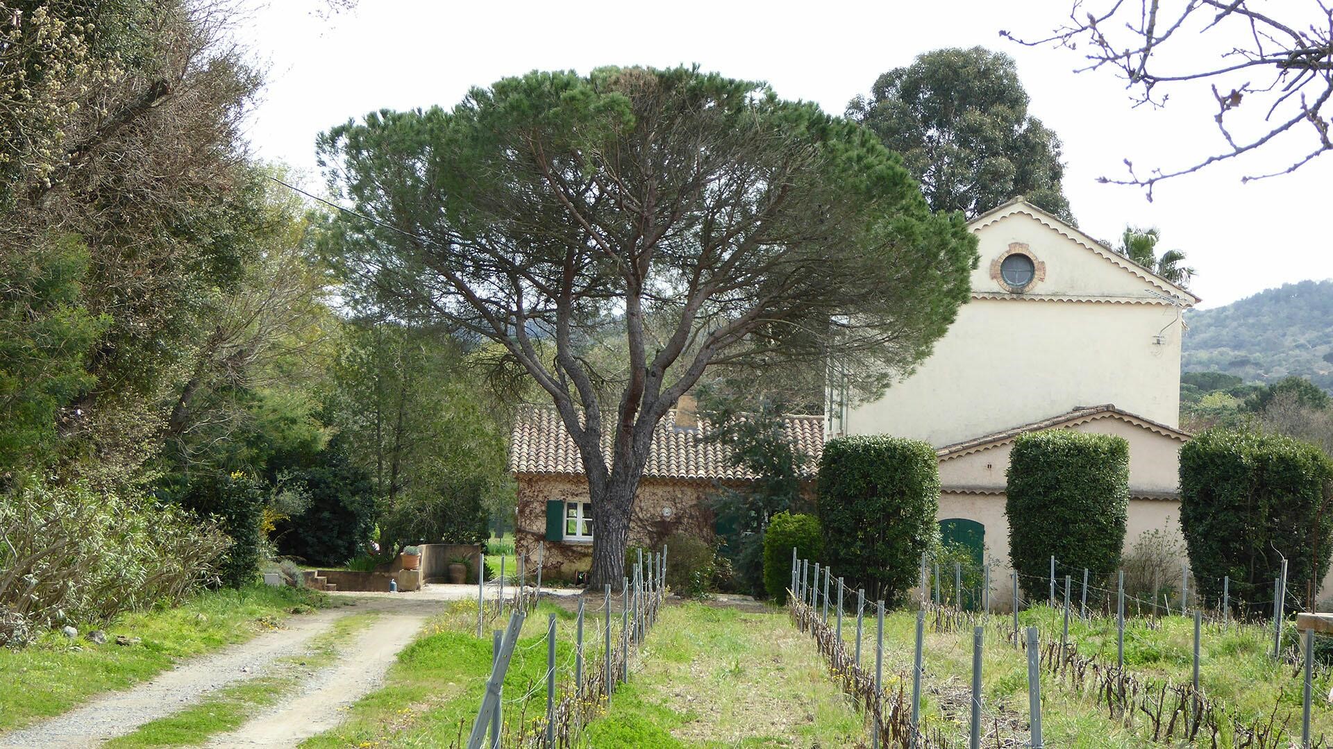
 8.7 kilometres from The Gare du Sud in Toulon we arrive at La Pradet Station. It was a more significant stop on the line with passenger facilities, a goods shed, two goods sidings, a passing loop serving two platforms, a 50 cubic-metre water tower and three hydraulic cranes. The Station building still exists, converted into housing it sits close to a cultural centre – “Espace des Arts”, effectively enveloped by it! Little else of the site remains. The first image was taken in 2004 by Jacques Lahitte. The second modern image was taken from Google Streetview in 2017.