
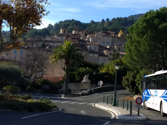
On 20th November 2018, my wife and I visited a few small villages near Fayence. This included an hour or two in and around Seillans.
In December 2017, I completed a blog about the metre-gauge Central Var line of the Chemins de Fer du Sud de la France. The full story can be found on my blog. Two posts covered the line close to Seillans:
Ligne de Central Var – Part 7 – Tanneron to Seillans (Chemins de Fer de Provence 27)
Ligne de Central Var – Part 8 – Seillans to Claviers (Chemins de Fer de Provence 28)
That blog focussed on a journey along the line from Nice to Meyrargues travelling from East to West. What pictures I was able to take in November 2017, were limited to those accessible from a vehicle in a single day trip.
This blog post looks at a very short length of the line to the West of the station at Seillans which we explored after lunch close to the Chappelle de Notre Dame de l’Ormeau which is marked in blue below and just happens to be close to the old station at Seillans which is itself a couple of kilometres from the village of Seillans.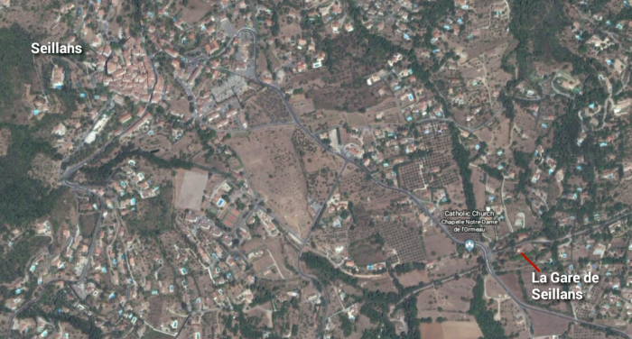
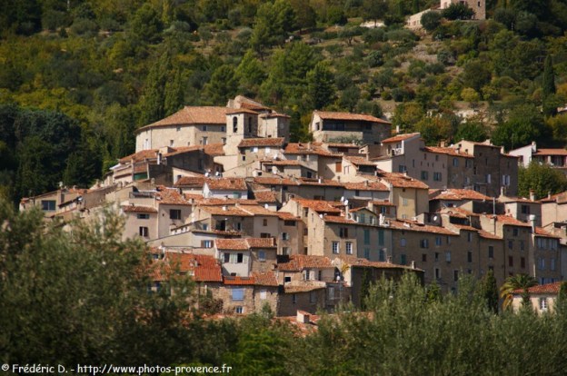
 Seillans village on 20th November 2018.
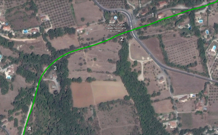 The area of our walk on 20th November 2018. The green lone approximates to the route oif the railway line.
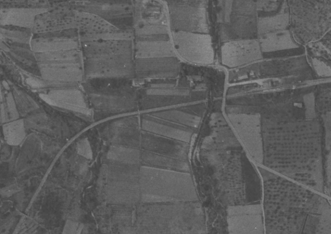 Approximately the same area, but this time in an aerial image from 1944. The railway was in use in the period immediately after the war and Seillans Station can be seen with track in place an an access road from the Fayence to Seillans road.
The pictures below show a stroll from East of La Gare to beyond the accommodation bridge in the bottom right of the satellite image above and a return journey along the same route.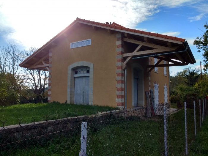 Approaching Seillans station building from the East on 20th November 2018. The station building (1) is in private hands. The picture is taken from the adjacent road with the old metre-gauge line and yard beyond the station building on its South side.
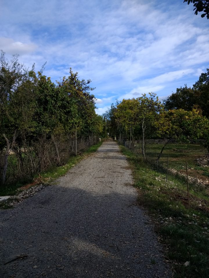
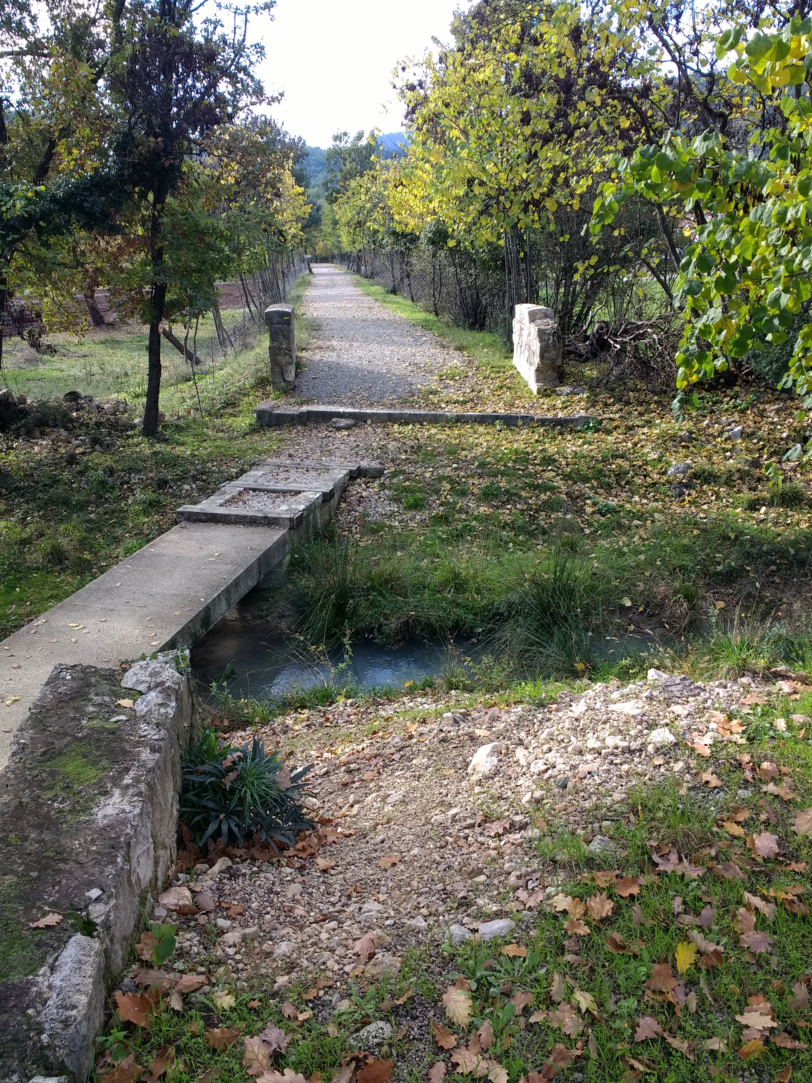 Immediately to the West of the Route de Fayence (D19), the railway crossed a small stream. The bridge is long-gone although the three ends of the parapets remain (2). The bridge has been replaced by a small footbridge. The route of the railway can be seen disappearing into the distance, (20th November 2018).
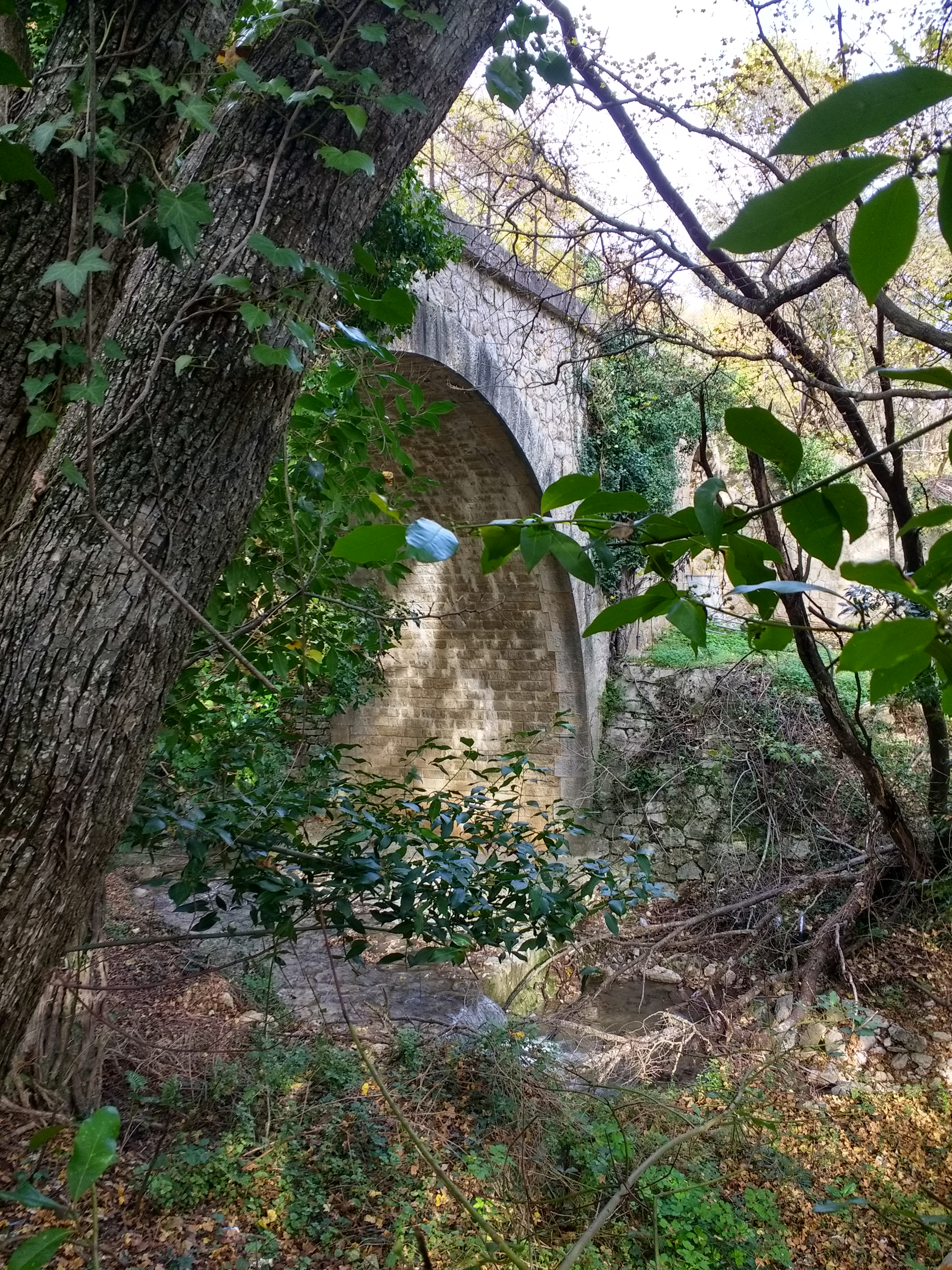 After a short straight section, the railway turned through a slight curve and crossed another, larger stream, adjacent to what are now the village sewage works. The structure was significant (3). This picture was taken after scrambling down the steep embankment, (20th November 2018).
Beyond the stream the footpath following the railway route becomes the road access to the treatment works and is a tarmacked single lane road. All the images below were taken on the 20th November 2018 unless staed and referenced otherwise.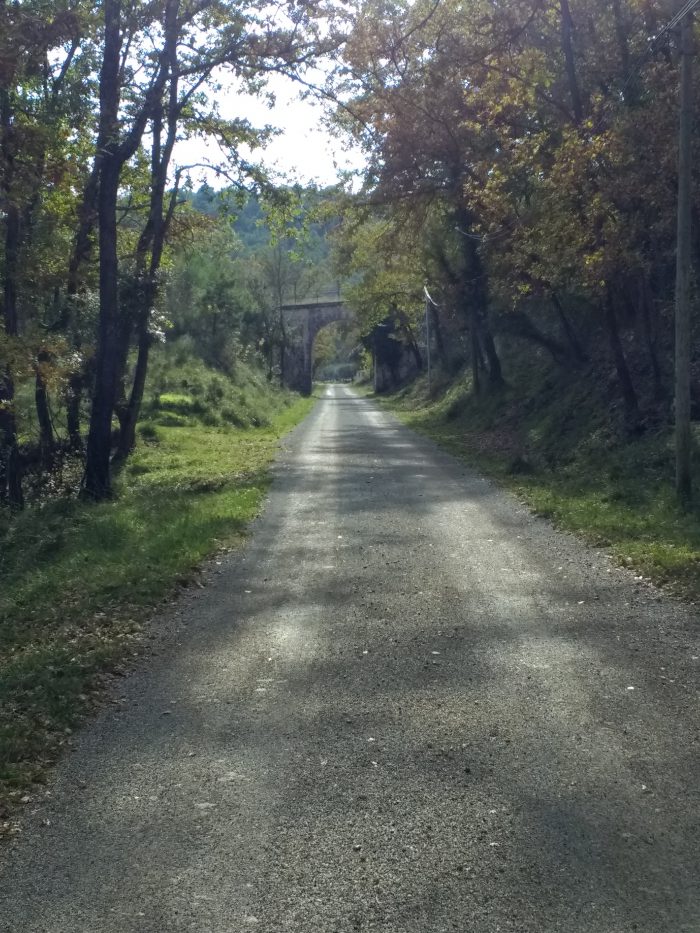 The accommodation bridge in the distance is that marked (4) on the satellite image.
A short distance after reaching the bridge in the image above, we returned to the Station and our car which was parked at the Chappelle de Notre Dame de l’Ormeau.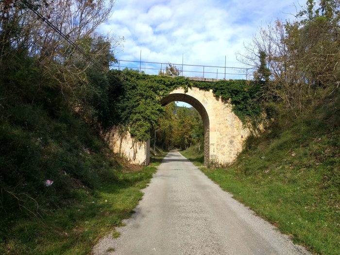 Looking Northeast along the line, back towards Seillans Station.
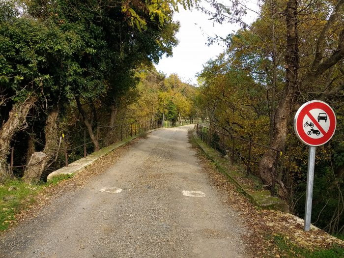 Looking Northeast at the point where the railway began to turn eastwards, this picture shows the parapets of the bridge adjacent to the sewage works (3).
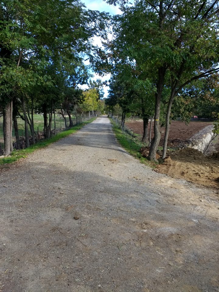
 Two pictures taken on the walk back towards Seillans Station.
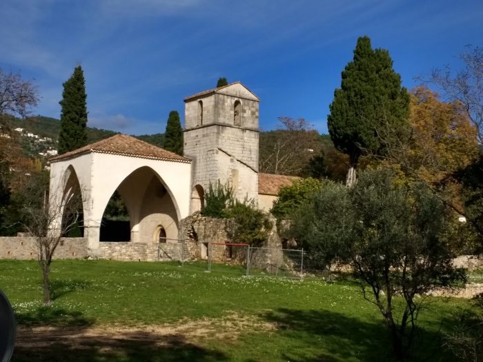
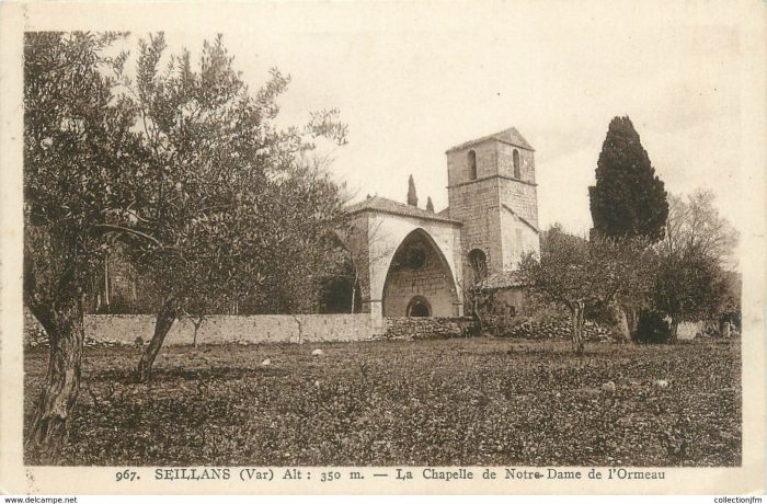 The view of the Chappelle de Notre Dame de l’Ormeau which would have been seen from the train. A picture taken by me, and a postcard image from the early 1900s. [1]
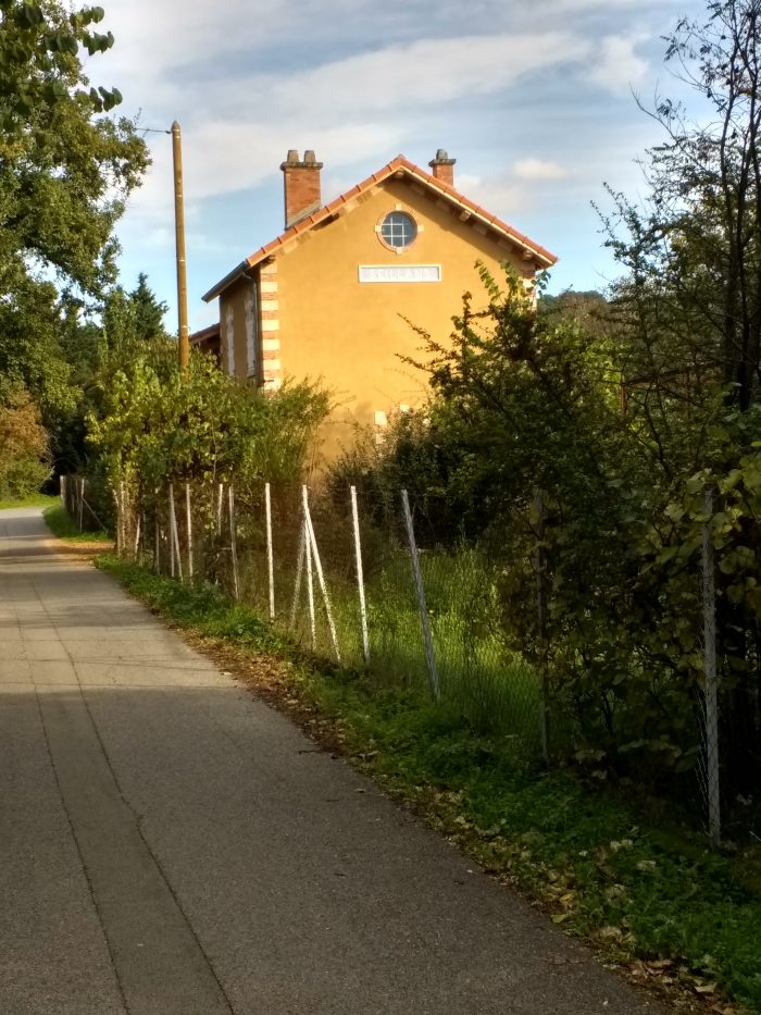 Two pictures of the station building taken from the West.
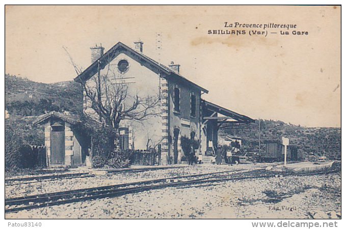
The station building taken from the Southwest.
References
1. https://www.delcampe.net/fr/cartes-postales/europe/france/83-var/autres-communes?f=keyword:seillans, accessed on 20 the November 2018.
