There are many who believe that this cannot possibly be the case in the light of a number of specific texts in both the New and the Old Testament which appear to be conclusive.
Others argue that a careful reading of the Scriptures will lead anyone with an open mind to the conclusion that the Bible does not condemn faithful, monogamous same-sex relationships.
While so many in the Anglican Communion agree about so much and even when we disagree we seem generally to be able to hear other people’s perspectives. This is the one issue that we make into the contemporary test of orthodoxy and seem unable to make room for difference. It is an issue which “is not in any early church statement of faith, and it is absent from the Reformers’ great debates. Luther did not make any great play on this. Calvin didn’t seem to care. The Westminster Shorter Catechism forgot to focus here. …” [1: p19] But this has become the touchstone in our assessment of each other.
It seems that neither side in the debate finds it easy, or even possible, to acknowledge the integrity and scriptural loyalty of the other. So, we sit at a crossroads with different parts of the church pulling in different directions, and, no doubt, many in the church looking back and forward between the two, not sure which way to turn.
“Somewhere between the extremes of these polarized sentiments probably lie the vast majority of churchgoers, with people uncertain what to make of it all, or people opposed to a change or supportive of it, who nevertheless do not regard it as a church-breaking issue.” [2: p1]
In the light of this ‘stalemate’ it seems likely, to me at least, that there will be a significant and possibly permanent split in the Anglican Communion unless things change significantly.
Duncan Dormor and Jeremy Morris comment that “the possibility of a permanent split [hangs] over the Anglican Communion. … These divisions are not of course confined to Anglicanism. They can be found in Methodism, in churches of the Reformed and Lutheran traditions, and in Roman Catholicism. But they have perhaps never been as bitter there, or as destructive, as they have in Anglicanism. Advocates of a change in the Church’s policy towards homosexuality and their opponents have traded insults and claimed the moral high ground.” [2: p1]
The Archbishop of Canterbury’s speech at the Lambeth Conference 2022 included a reminder of the reality of the current situation, and the need to care for each other: “So let us not treat each other lightly or carelessly. We are deeply divided. That will not end soon. We are called by Christ himself both to truth and unity.” [3]
My linked article (below) tries to address, carefully, the question raised in the title to this short blog. It shows that it is possible, depending on your approach to Scripture to argue with integrity for both the traditional position and the progressive position when approaching Scripture. It highlights the importance of listening to modern knowledge, experience and culture and then returning to the text of Scripture with an open mind. When we do this we engage in a similar process to that which Peter and the early Church encountered, led by the Holy Spirit which we have received, in the middle chapters of the Acts of the Apostles in the New Testament.
I do believe that it is possible to remain faithful to Scripture and affirm faithful, monogamous, same-sex relationships.
However, I also believe that this should not be an issue over which the Church of England should allow itself to become divided. This is a matter of interpretation of Scripture, rather than one about loyalty to Scripture.
We are called to be ‘one’ (John 17), whether or not we agree. The Anglican Communion is deeply divided, but we are called to unity and we are called to truth. Integrity and Unity. It is our love for each other, even in the midst of the greatest disagreement, that will draw others to faith. At least that seems to be what Jesus believed!
“By this everyone will know that you are my disciples, if you love one another.” (John 13:35)
I offer the linked article below as a careful wide-ranging discussion of the arguments which surround this important question. It is not a light read.
I greatly appreciate the way in which Living in Love and Faith [4] has been presented. Of the different books that I have read recently, this is the one which best allowed me to engage openly with the issues.
I feel happier with where my instincts have lead me over recent years. I feel affirmed in my desire for a fully inclusive Church which is truly so, accepting and valuing each other even when we strongly disagree.
So, this is who I am. This is what I believe. Inclusion is a Gospel imperative. If we fail to include all, we fail in following our Lord. Even then God’s grace is sufficient, he still loves and accepts us when we struggle to be inclusive. God includes all, everyone, within the scope of God’s love.
Being inclusive is the very embodiment of the Gospel. We are all sinful and we all sin, we all struggle to love as God loves us, we are all defensive at times, we are all selfish at times. Often unconsciously, we can all be biased against someone different from us. We are all called to grow more into the character and nature of our Lord.
Towards the end of Living in Love and Faith, there is a series of encounters with different churches in the UK. The examples used are actually all attractive in their own way, but the one that I warm to most is St. Mildred, Upper Mallowpool:
“St Mildred’s Church serves the small town of Upper Mallowpool with a population of nearly 15,000. Six parishioners had gathered at the back of the church to take part in the conversation: Richard, the vicar; Duncan and Miriam, an older couple who also attend a Baptist church; Jenny, a lesbian woman in a partnership; Owen, a gay youth worker; and Noah, a heterosexual married man. In the background a group was clearing up after the midweek coffee and craft session.
Richard got the conversation going. ‘So, my theology has changed over time. As an evangelical, I’m quite clear on the need for the Scriptures to lead the way. But my thinking has changed. Being divorced and remarried, the theology I take for myself on divorce is that divorce is not God’s ideal plan but that when I read the Scriptures, it’s allowable. And when I look at the Scriptures’ teaching on sexuality, the conclusion I’ve come to is that same-sex relationships are not God’s ideal plan, but that they are allowed. And so, I feel like I’m in a position to say that because I’m willing to criticize myself over divorce and remarriage. That has enabled me to reach out so we have gay people involved in positions of responsibility within our church family. We have to find a way, though, of including those who see it differently. Noah chipped in, ‘It’s interesting, we’re not out for overt inclusion. But we welcome anybody. and we don’t exclude anybody.’
It soon became apparent that not only did everyone agree that being truly inclusive meant including people with opposing views, but this little group embodied this very reality. Although Duncan and Miriam were clear that same-sex marriage was not an option, they were happy to join in the conversation – a conversation that combined deep and overt affection with spontaneous honesty.
Owen pitched in with his story: ‘As someone who is gay, my theology has been left, right and centre. I’ve gone, is abstinence the correct way? But then, come to the conclusion that if God is love, then it says, “Whoever does not love, does not know God.” And therefore, I must be able to love, to know God. But yeah, I can understand both sides, because my theology has gone all the way round. I love this sort of conversation.’
Jenny spoke movingly about how difficult she had found it to cross the threshold of the church eight years ago and what it meant for her to be welcomed in by Richard. She had been thrown out of her Christian family home at the age of 16 when she came out. Even now, only one sister is willing to be in touch with her.
But the conversation kept coming back to how each of them had come to their convictions. ‘Is there actually any gender in the afterlife, in heaven? Is gender only a concept for a tiny fraction of our existence? And that, maybe, puts it a little bit in perspective,’ said Noah. ‘By trying to say that we know all of the rights and wrongs, I’d say we’re putting ourselves almost in the position of God over humanity. God tells us to let him judge, because it’s in our nature to get things wrong.’ Richard agreed: ‘But he will judge, and, therefore, it’s important that if we become convinced that something we thought before wasn’t right, then we must change. As long as we’re open to the possibility that we might be wrong, then I think that’s what will qualify us, when we meet God.’“[4: p417-418]
References
Marcus Green; The Possibility of Difference: A biblical affirmation of inclusivity; Kevin Mathew, Stowmarket, Suffolk, 2018.
Duncan Dormor and Jeremy Morris; Introduction; in Duncan Dormor and Jeremy Morris (eds); AnAcceptable Sacrifice? Homosexuality and the Church; SPCK, London, 2007.
A great Christmas purchase from Rossiter Books in Leominster! (£12.99, ISBN 978-1-910839-60-7, Paperback, 176 pages, 242 x 171mm).NB: The images in this article are sourced from the internet.
Horse-Drawn Tramways of the Wye Valley [1] by Heather Hurley, published by the Logaston Press in Novber 2022, is an excellent introduction to the early tramways in the Wye Valley. A short-lived transport system of horse-drawn waggons on rails, operating from the late eighteenth century to the introduction of steam locomotives in the middle of the nineteenth century, primarily used for transporting goods such as coal and wood.
Heather Hurley explores all of the tramways known to have existed in and around the Wye Valley from Kington, through Brecon and Hay to Abergavenny, Monmouth, the Forest of Dean and Hereford; the routes taken, the companies that built and ran them, and the people who used them. She draws on extensive research of Tramway Company archives, Acts and ledgers, maps and plans, newspapers and journals, archaeological reports, books and illustrations, as well as detailed fieldwork.
As the back cover states, Hurley’s book is richly illustrated and offers captivating insights into early nineteenth-century transport history, trade routes and the beginnings of the steam railways on the Welsh border.
Heather Hurley has a keen interest in local history. She has written several books, including ‘The Scudamores of Kentchurch and Holme Lacy’, ‘The Story of Ross’ and ‘Landscape Origins of the Wye Valley’. She is planning to produce a parallel volume about the railways of the Wye Valley in due course.
Horse-Drawn Tramways of the Wye Valley is an easy to read but well-researched introduction to tramways in the Southern Marches. Evidence of Hurley’s detailed research can be found in the extensive notes which support each chapter. Solid research does not, however, mean that this is primarily a dry academic book. It is accessibly produced with appropriate illustrations and a confident narrative.
The first chapter gives an overview of transport systems which predated the introduction of tramways. A chapter is devoted to the development of the horse-drawn tramways which includes an important section focussing on the horses used, before the more usual engineering matters of waggons, rails and stone ‘sleepers’ are covered.
Two further chapters cover some local tramways of interest and the coming of steam-power.
The history of each of the major lines is recounted is some detail, each route is surveyed and details of goods carried are provided. For each line, some notes are provided on remains visible in the 21st century and on where documents recording its life can be found.
The extent of the coverage in a paperback book of 176 pages is to be commended. No doubt some readers will want to look at one or more of the routes portrayed in more detail than is possible in a book of this nature. The book might have benefitted from the addition of maps to support the detailed route descriptions provided towards the end of each of the major chapters. The book is, however, a wonderful introduction to its subject and has been an excellent post-Christmas read!
I wholeheartedly recommend this book to anyone interested in the industrial history of the Welsh Marches and the Forest of Dean. Anyone interested in the history of tramways/tramroads in the UK would do well to purchase a copy, not only for the informative narrative and illustrations but also for the detailed endnotes.
The Logaston Press takes its name from the hamlet of Logaston, in the beautiful countryside of rural north-west Herefordshire. It was here that Logaston Press was set up by Andy Johnson in 1983, and later run by Andy together with his wife Karen.
In 2018 Andy and Karen handed over the reins to Richard and Su Wheeler, who now run Logaston Press from the nearby village of Eardisley.
Logaston Press publishes books on local history, landscape, archaeology, architecture, and a range of walks guides – all focussed on the ‘Logaston heartlands’ of the Southern Marches: Herefordshire, Shropshire, Worcestershire and Gloucestershire, Radnorshire, Breconshire and Montgomeryshire.
In almost four decades, Logaston Press has published more than 350 titles, with more than 100 books currently in print. Its books are beautifully produced, ethically printed and reasonably priced. They are are a pleasure to own.
Logaston Press is rooted in the people and places of the Southern Marches and is dedicated to publishing books that explore and illuminate this extraordinary part of the world.
References
Heather Hurley; Horse-Drawn Tramways of the Wye Valley; Logaston Press, Eardisley, 2022.
A short history of the line is followed by some information about the locomotives used on the line. This first article then focusses primarily on the horse-powered tramroad which preceded the later Penrhyn Quarry Railway.
Penrhyn is the Welsh word for ‘promontory’.
“The history of Port Penrhyn can be traced back as early as 1713 when it was recorded that 14 shipments totalling 415,000 slates had been sent to Dublin. In 1720, another 8 shipments totalling 155,000 slates were sent to Dublin, two to Drogheda (20,000) and one to Belfast (35,000). Two years later, a shipment of 80,000 slates were sent to Dunkirk. After these few shipments only coastal traffic left from Aber-Cegin (Port Penrhyn) until Richard Pennant took over the ownership of Penrhyn Estates and appointed Benjamin Wyatt in 1786 as agent.” [23]
Porth Penrhyn in the mid- to late- 19th century. [23]
The Penrhyn Railway opened as a tramroad in 1801 which ran from quarries a few miles inland from Bangor in North Wales to the coast at Port Penrhyn. The gauge of the tramroad was 2ft 0.5in. It was constructed by Lord Penrhyn at a cost of around £175,000. [1][2] The alignment was as shown on the map immediately below.
The Penrhyn Railway 1801 to 1878: rendered with Maperitive, text and integration: Pechristener Wales in United Kingdom.svg: TUBS United Kingdom location map.svg: NordNordWest • CC BY 3.0. [1]
It was thought that there was an earlier line which ran between Port Penrhyn and Llandegai. That tramway, if it existed, was constructed in 1798. Its route paralleled that of the northern end of Lord Penrhyn’s tramroad. One theory is that this earlier tramway was operational until 1831. [1] There appear to have been two inclines on the Llandegai Tramway, one close to the port and the other directly adjacent to Llandegai Penlan Mill at Llandegai at the Southern end of that line. Both are shown on the image below.
The Llandegai Tramway: rendered with Maperitive, text and integration: Pechristener Wales in United Kingdom.svg: TUBS United Kingdom location map.svg: NordNordWest • CC BY 3.0. [1]
Research in 2021 suggests that the earlier tramway did not exist. [2]. If it did, it is likely that it was subsumed into the tramroad built by Lord Penrhyn. There is also research, undertaken in 2019, which suggests that a tramway was probably constructed in 1798 in connection with the Penrhyn Mills on the lower Ogwen. [35] My thanks to David Elis-Williams for providing a link to this research by Barrie Lill.
Lill comments that the Penrhyn Mills at Llandegai had a part in the development of the tramway/tramroad which eventually served the Penhryn Quarry: “The mill had what David Gwyn believes to be part of the first iron-railed overland edge railway of any length in the world, and the first iron edge railway built for the mass movement of stone. However, whereas James Boyd conjectures that originally the Penlan railway only extended from Port Penrhyn to the mill at Llandegai, pre-dated the Penrhyn Quarry Railway by three years, and was only later extended to the Quarry, [36] Gwyn does not agree. Instead he believes that the Penlan line merely was an off-shoot from the Quarry Railway. [37] At present there is no available evidence to confirm either theory, although there is a belief that prior to publishing his book on the Penrhyn Quarry Railways, Boyd had obtained supporting documents which no longer are publicly available. Irrespective of the above it seems unlikely that the mill would have opened without an adequate transportation system such as some simple form of tramway being in place, and in this scenario it is likely that the problems encountered with the working of this system are what prompted Wyatt to adapt the system and introduce the iron-railed edge railway to which David Gwyn refers.” [35]
Lord Penrhyn was persuaded by William Jessop to build the tramroad. “Jessop and his partner Benjamin Outram were then constructing the Little Eaton Gangway in Derbyshire. Samuel Wyatt was also involved in the construction of the gangway, and his brother Benjamin was the Penrhyn estate manager.” [1][2]
“Benjamin Wyatt was put in charge of building the tramway. Construction started on 2 September 1800, with the first slate train travelling on 25 June 1801. … The track used oval rails designed by Benjamin Wyatt, and their quoted gauge of 2 ft 1⁄2 in (622 mm) was measured between the centres of the rails. The railroad was operated by horse power along with gravity and three balanced inclines – “Port” (sometimes called “Marchogion”), “Dinas” north east of Tregarth and “Cilgeraint” a short distance north of Coed-y-Parc workshops in Bethesda. The longest was 220 yards (200 m).” [1]
Before the tramroad was constructed, slate was transported to the port by horses along mountain paths. After the tramroad was brought into service the local costs of transport fell from 4 shillings/ton to 1 shilling/ton. [1][4: p42-43]
In 1832, “Wyatt’s oval rails were replaced with more conventional … rails. The gauge of this new track was 1ft 10.3⁄4in (578 mm), measured between the inner edges of the rails – the conventional way of measuring track gauge.” [1][3]
In 1876 the tramroad was “rebuilt on a new course with steel rails laid on wooden sleepers. Steam locomotives were introduced, supplied by De Winton & Co. Engineers of Caernarvon.” [5]
Thomas Middlemass tells us that De Winton supplied ten locomotives to the line. “Seven were to be used at the quarries, three were to work the ‘main line’ to the coast, and all* were vertical-boilered 0-4-0 tanks.” [6: p16] They had two cylinders secured below the running plate with direct drive to one axle. The total weight varied between 4 and 5 tons. [7]
* … It appears that Middlemass has overlooked the fact that 3 of the 10 locomotives were fitted with horizontal boilers and were 0-4-0ST locos. They were named ‘Edward Sholto’, ‘Hilda’ and ‘Violet’, and were supplied in 1876, 1878 and 1879 respectively. [34]
Between 1882 and 1909 the Hunslet Engine Company of Leeds supplied sixteen four-wheeled locomotives for use in the quarry and on the line to Port Penrhyn.” [5]
One surviving Penrhyn locomotive is 0-4-0 vertical-boiler tank engine “George Henry,” which was built in 1877 and still looks good 140 years later at the Narrow Gauge Railway Museum in Tywyn, Wales.
The new route to suit steam-power obviated the need for the inclined planes, maintaining the easiest possible gradients. “Between coast and quarry it rose 550 feet, and, allowing for a stretch of 1/4 mile at 1 in 37 and 3 miles at 1 in 40, the average gradient emerged as 1 in 91. Flat bottomed rails were laid at first, but these were replaced in 1894 by the 50 lb bullhead variety.” [6: p15-16]
The new route of the Penrhyn Railway which opened in 1879: rendered with Maperitive, text and integration: Pechristener Wales in United Kingdom.svg: TUBS United Kingdom location map.svg: NordNordWest • CC BY 3.0. [1]
“The first locomotives used on the new railway were three De Winton’s. … Although successful, these locomotives were not powerful enough for the substantial traffic that passed down the line.” [1]
In 1882 the railway ordered ‘Charles’, a large 0-4-0ST from Hunslet. Charles proved very successful and was followed by ‘Blanche’ and ‘Linda’ in 1893 to the same basic design. These locomotives were the mainstay of the railway for the rest of its life.
In 1882 Penrhyn switched to more conventional locomotion, ordering “‘Charles’, a large 0-4-0ST from Hunslet. Charles proved very successful and was followed by ‘Blanche’ and ‘Linda’ in 1893 to the same basic design. These locomotives were the mainstay of the railway for the rest of its life.” [1]
“Between then and 1909 a positive spate of tank locos flowed, new, from Hunslet Engine Co. All were 0-4-0 saddle tanks, with weight and power variations introduced to meet specific Penrhyn requirements. Three were designed to work the ‘main line’, three were employed shunting at Port Penrhyn. Four of the smallest were confined to quarry work, and these were supplemented a few years later when six larger tanks arrived. As it happened, the latter were the last new purchases by Penrhyn.” [6: p16]
Among the Hunslet locomotives were the Penrhyn Port Class of three locomotives “built for the Penrhyn Quarry Railway (PQR). These locomotives were built by the Hunslet Engine Company between 1883 and 1885 and supplied specifically to work at Port Penrhyn near Bangor, North Wales. They were a variant of the standard Dinorwic Alice Class design.” [8]
“The Penrhyn Main Line class was a class of three narrow gauge steam locomotives built for the Penrhyn Quarry Railway (PQR). These locomotives were built by the Hunslet Engine Company between 1882 and 1893 and supplied specifically to work the railway that connected the Penrhyn Quarry near Bethesda in north Wales to Port Penrhyn on the Menai Strait.” [9]
“All three locomotives were preserved after the closure of the PQR. Charles was donated to the Penrhyn Castle Railway Museum. Linda was loaned to the nearby Ffestiniog Railway in July 1962. For the 1963 season the locomotive was re-gauged to the Ffestiniog’s 1 ft 11.5 in (597 mm) and purchased, along with Blanche at the end of the year. Both have since received extensive modifications including tenders, pony trucks and superheating.” [9]
The post-First World War years brought such economic instability that second-hand locos were not hard to find. Penrhyn bought 15 such from 1922 onwards. [5]
In 1923, three ex-US Army Baldwin 2-6-2Ts were also imported for ‘main line’ use, but, as happened elsewhere in Britain, they were never popular, and their working life was short.
The railway was private, providing no public service for either goods or passengers. Quarrymen’s trains were run, paid for by the quarrymen themselves.” [5]
“Today Porth Penrhyn in Bangor still serves the Penrhyn Quarry at Bethesda. Although today slate production and exports are not at 19th century levels it continues to be a key part of the business of slate. Exports of crushed slate (aggregate) by Penrhyn Quarry, through Porth Penrhyn currently to Rotterdam, or ports along the south coast of England, have grown to become a significant proportion of Welsh Slate sales in addition to several containers of roofing slates being shipped every month to Australia alone (taking approximately 45 days).” [23]
“Welsh slate is now covering the roofs of buildings as prestigious as the New South Wales Supreme Court and historic as Unwin’s Stores, both in Sydney Australia, as well as the Arts Centre in earthquake-hit Christchurch, New Zealand 2012. Europe also is a prime destination for Welsh slate with shipments of slate and decorative aggregate within Europe continuing to grow and evolve in particular.” [23]
All rail connections to the quarry disappeared in the mid-20th century under competition from road transport
The Post-1879 Route of the Railway
We start at the North end of the old railway at Porth Penrhyn. Porth Penrhyn) is a harbour located just east of Bangor in north Wales at the confluence of the River Cegin with the Menai Strait.
We follow the route on the Ordnance Survey 6″ Maps from around the turn of the 20th century as supplied by the National Library of Scotland (NLS). [10]
Before the future A5 was developed as a turnpike in 1820, the tramroad ran within the width of the old highway from this point for a few hundred yards. When the turnpike was created, the road level was lifted and the tramroad crossed beneath the renewed highway and ran along the Southwestern side. The sketch below shows this.
The old tramroad which was operational until 1879 was diverted to accommodate the construction of the turnpike. We start following the route of that old Tramroad. This sketch is based on a drawing in James Boyd’s book. [36: p11] He refers to the diversion in the text of the book as well.[36:p22]In this extract from the 6″ Ordnance Survey from around the turn of the 20th century, the short standard-gauge branch meets the mainline. The route of the old tramroad has now crossed the A5. The Penrhyn Quarry Railway only appears fleetingly in the top left corner if the map extract. [24]The same area as shown in the 6″ OS map above, as recorded on the ESRI satellite imagery provided by the NLS. The colour coding remains the same as in previous satellite images. [24]
A. The old tramroad
Beyond this point, we first follow the line of the old Tramroad to Penrhyn Quarries. …..
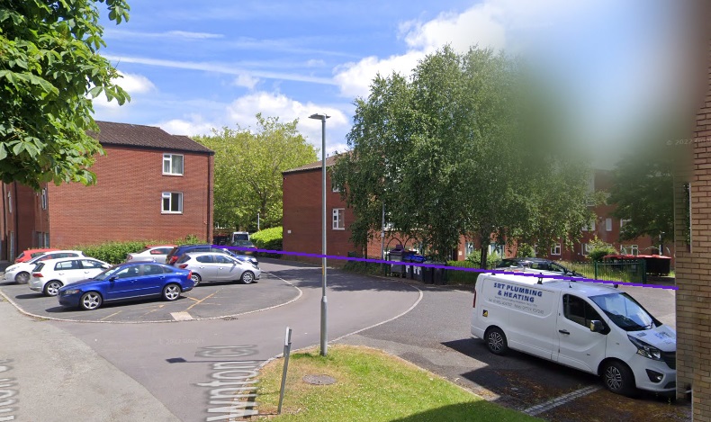
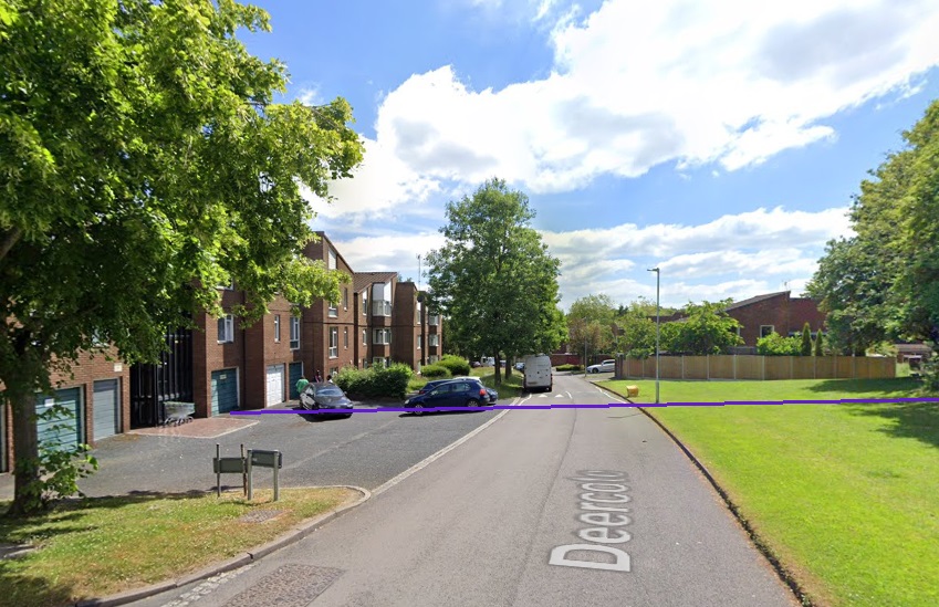
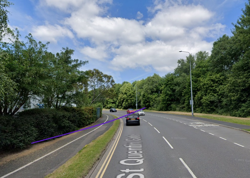
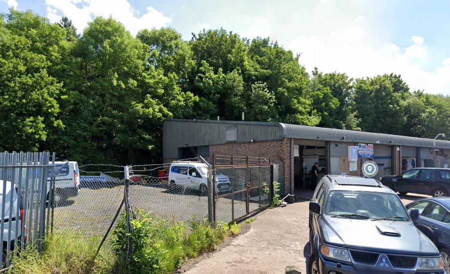
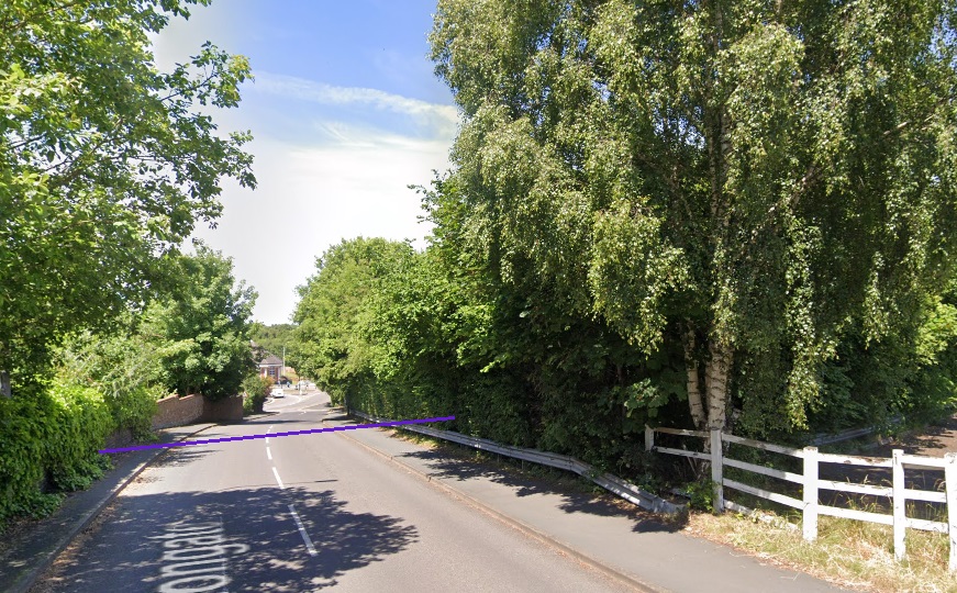
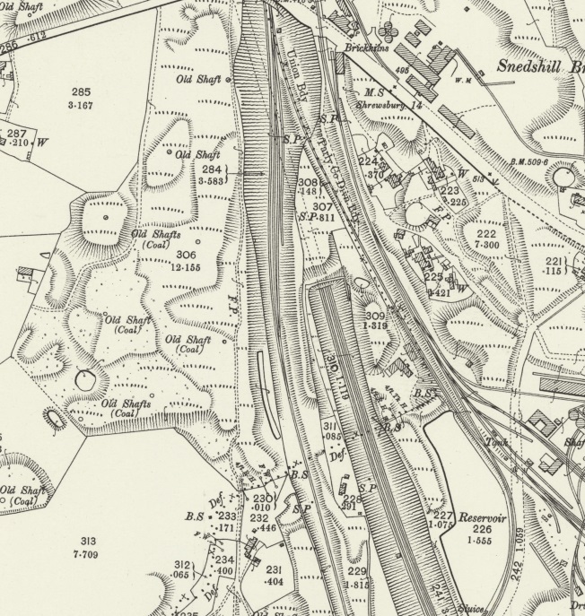
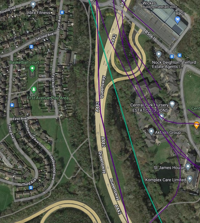
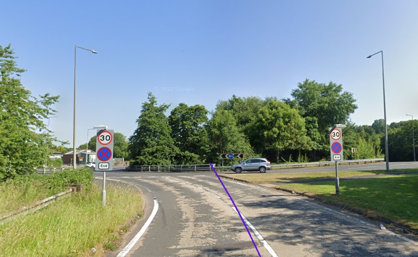
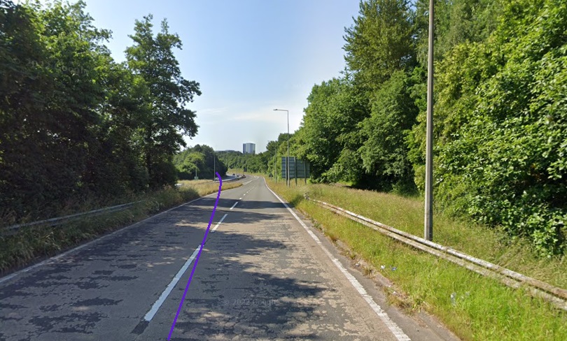
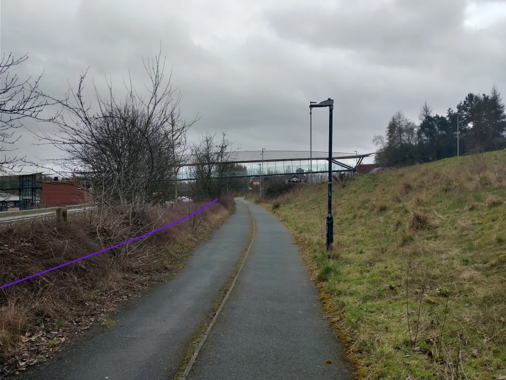
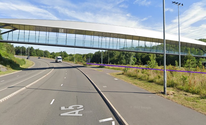
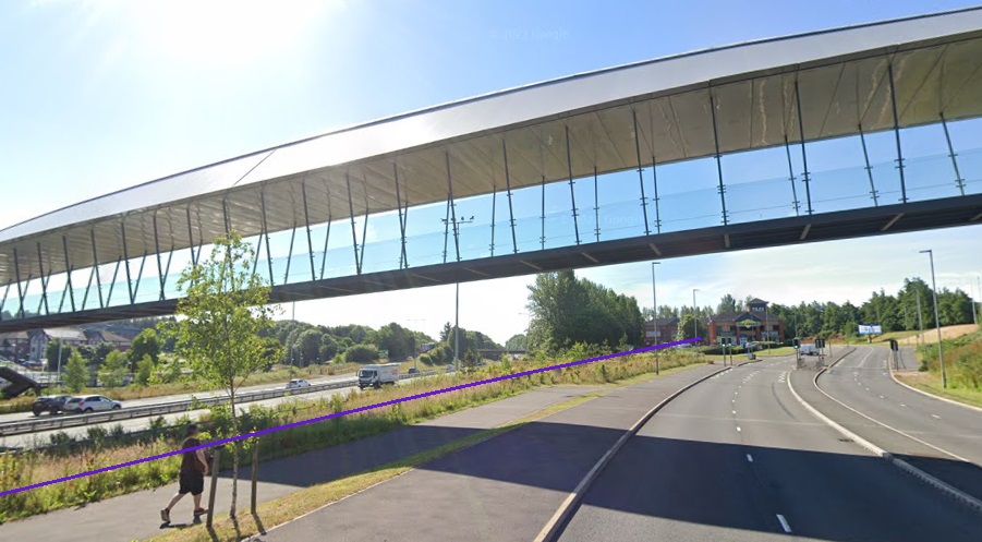
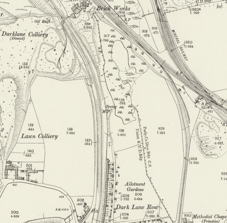
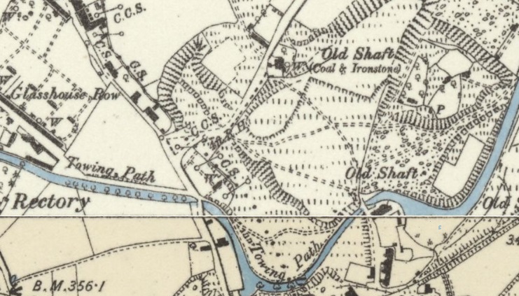
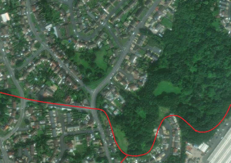
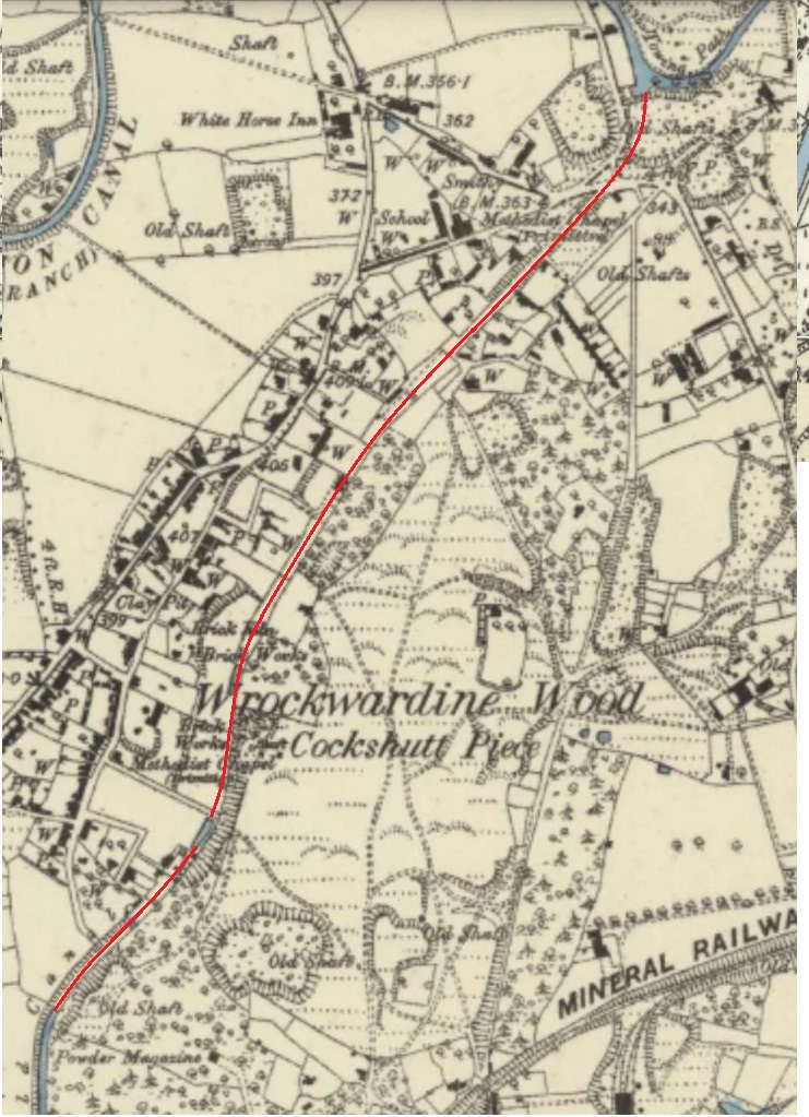
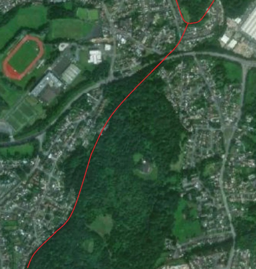
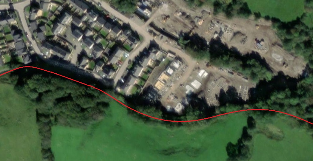
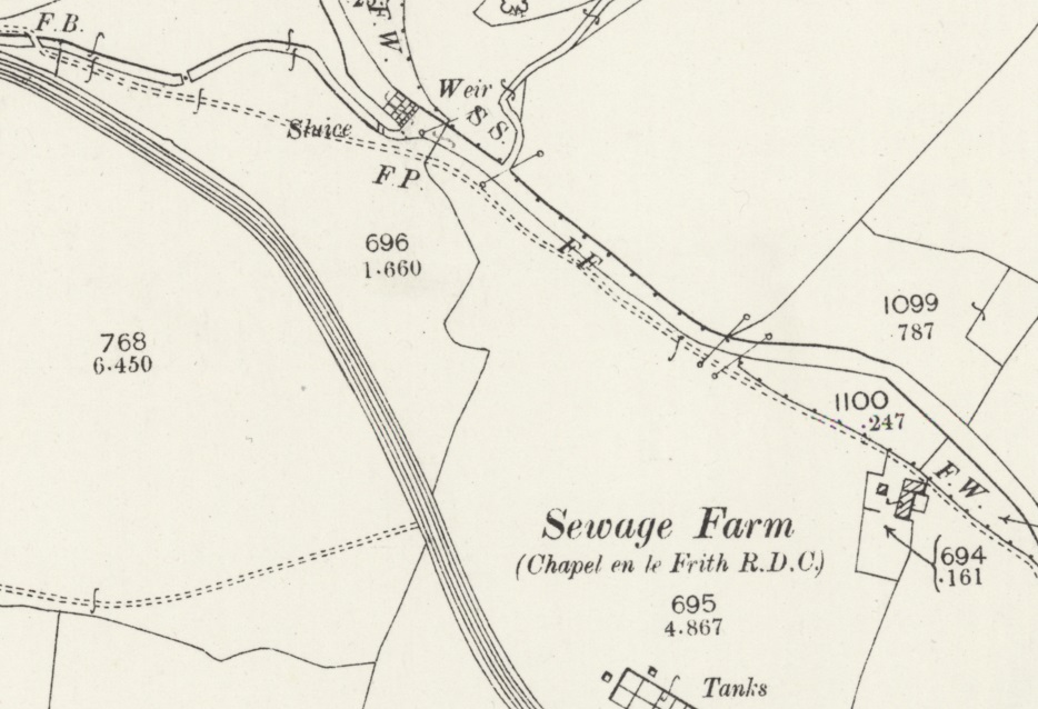
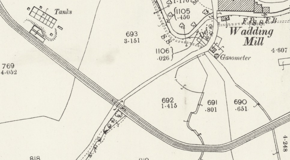
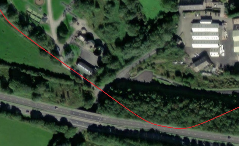
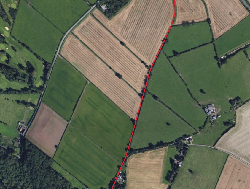
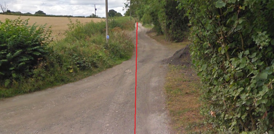
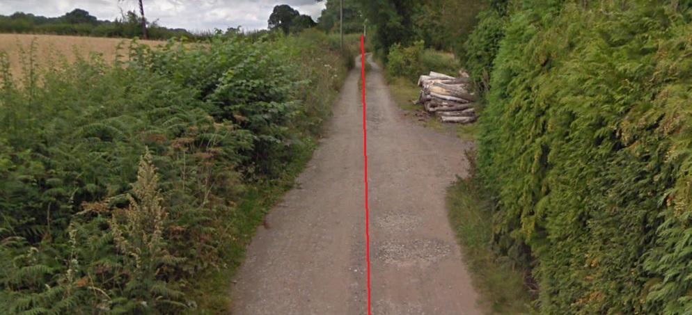
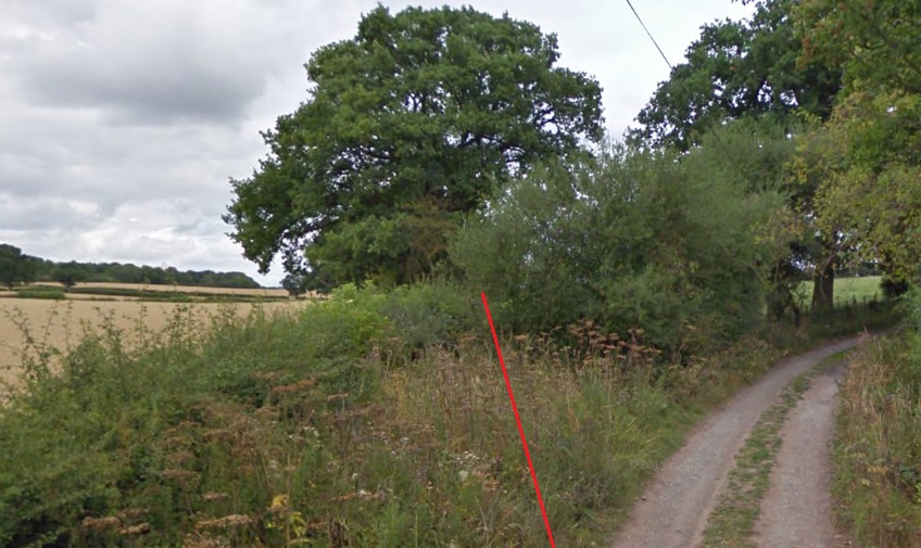
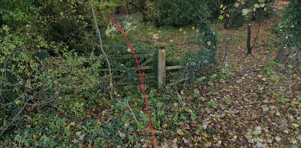
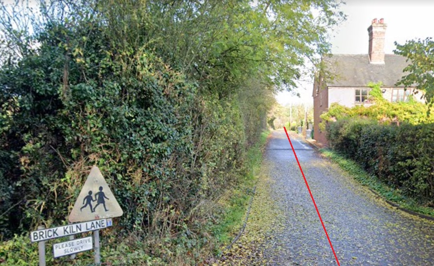
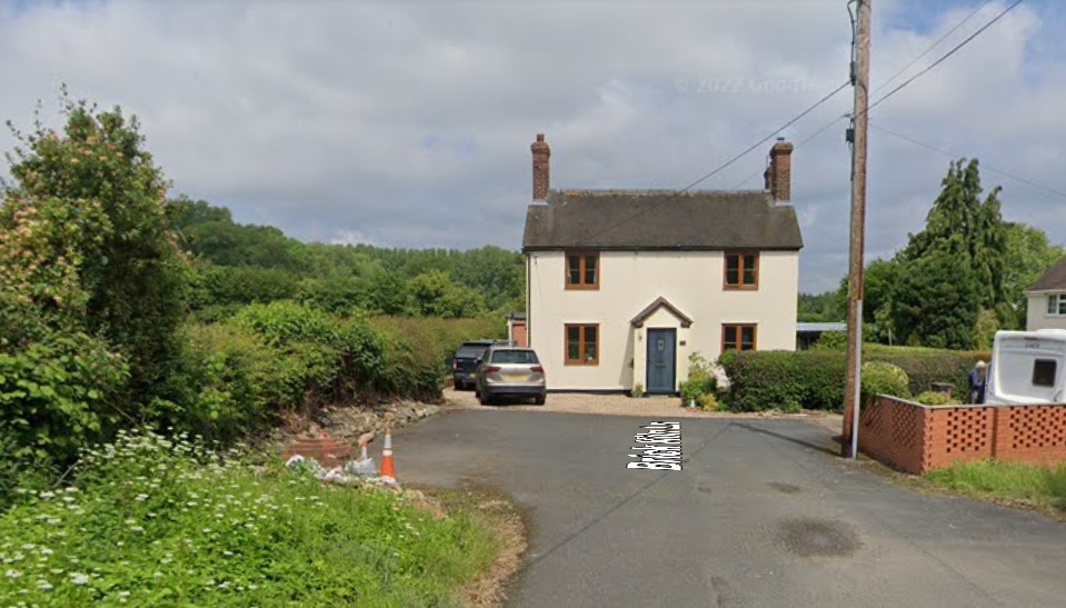
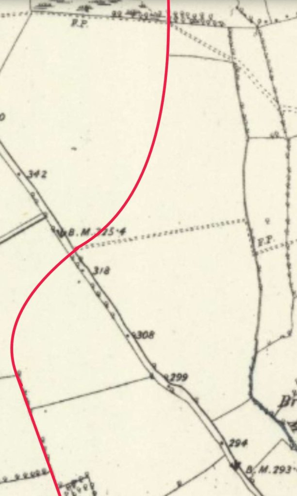
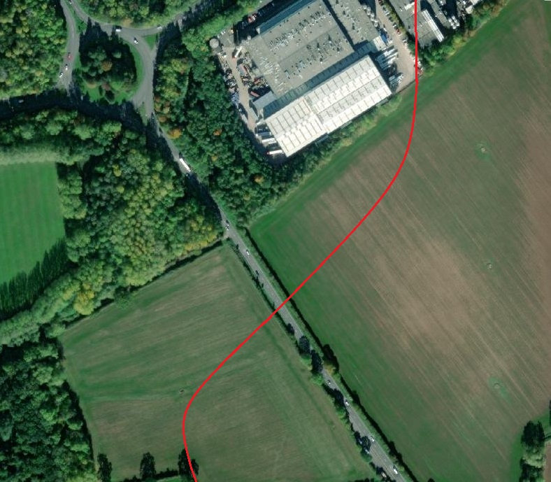
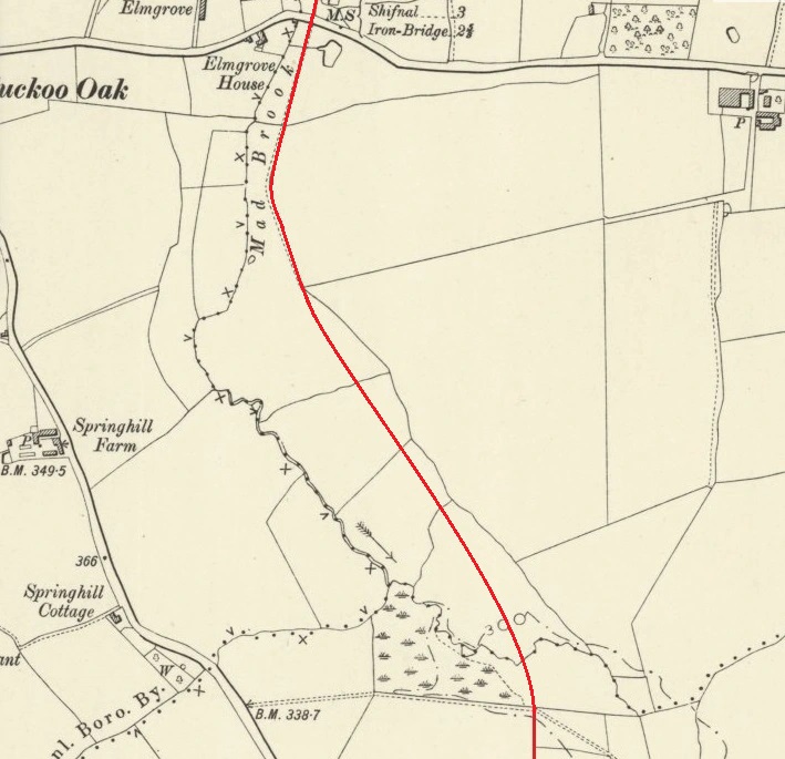
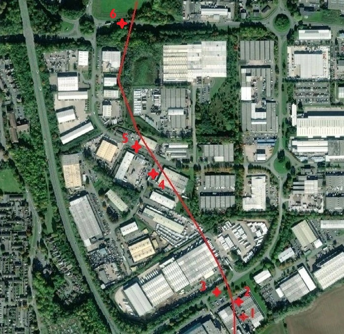
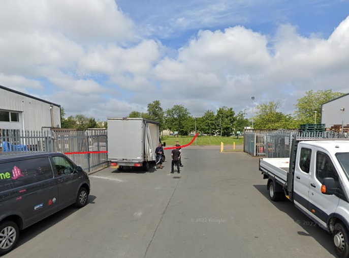
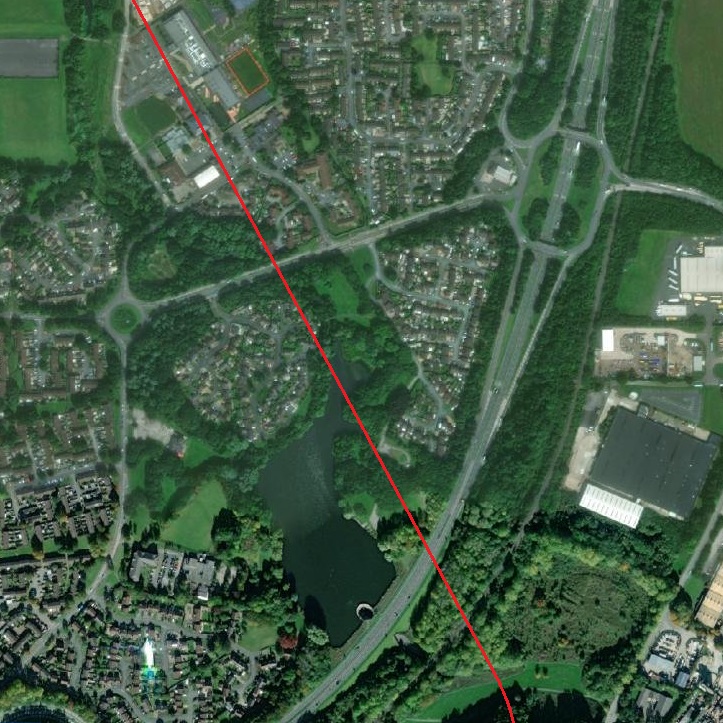
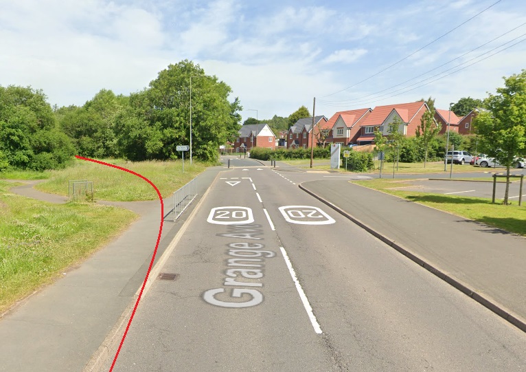
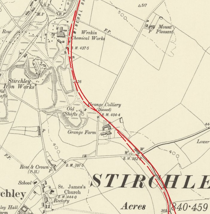
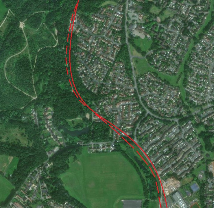
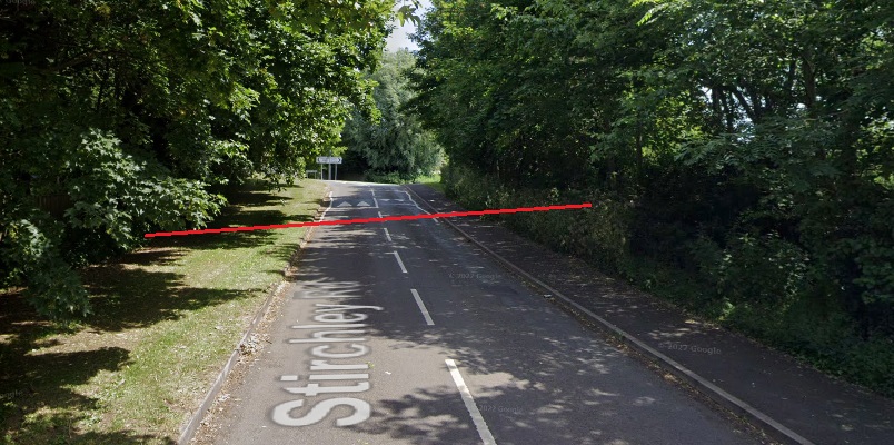
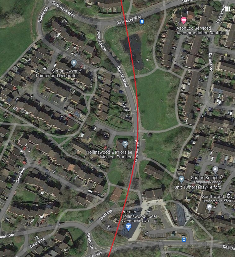
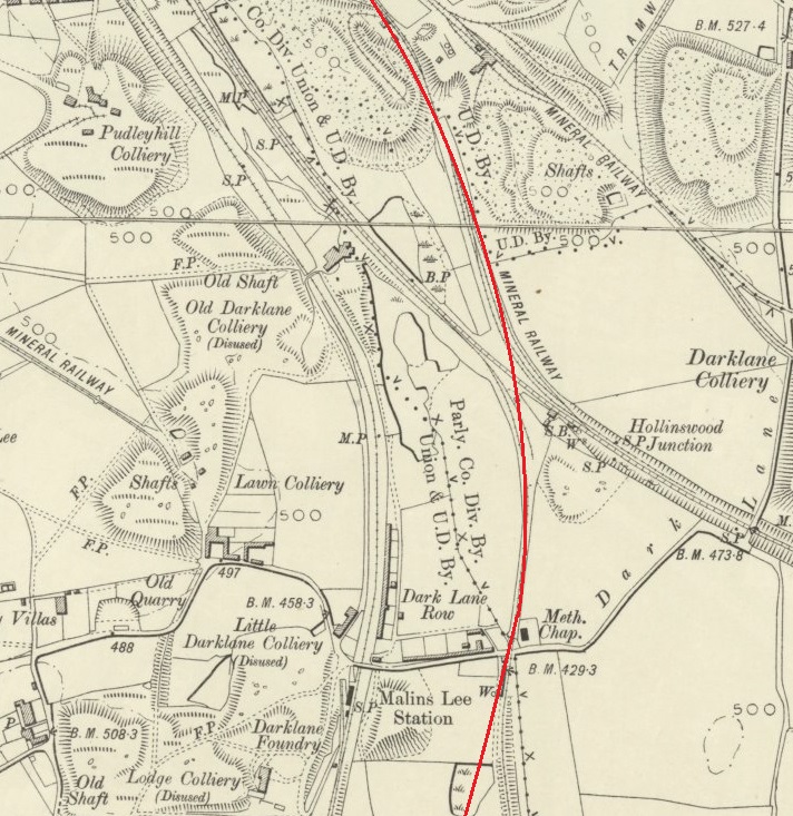
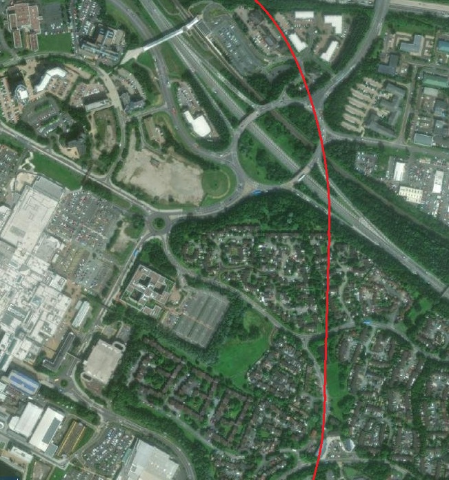
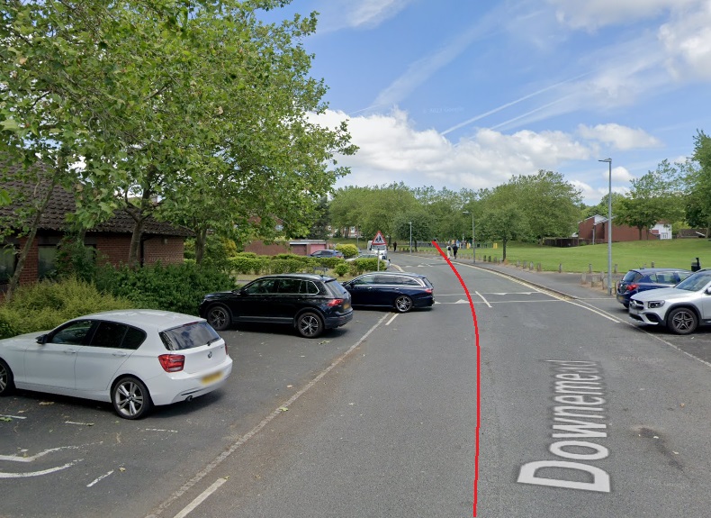
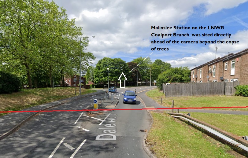
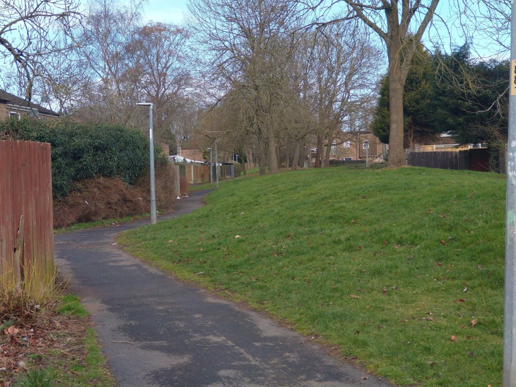
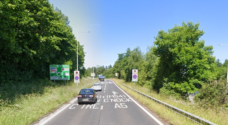
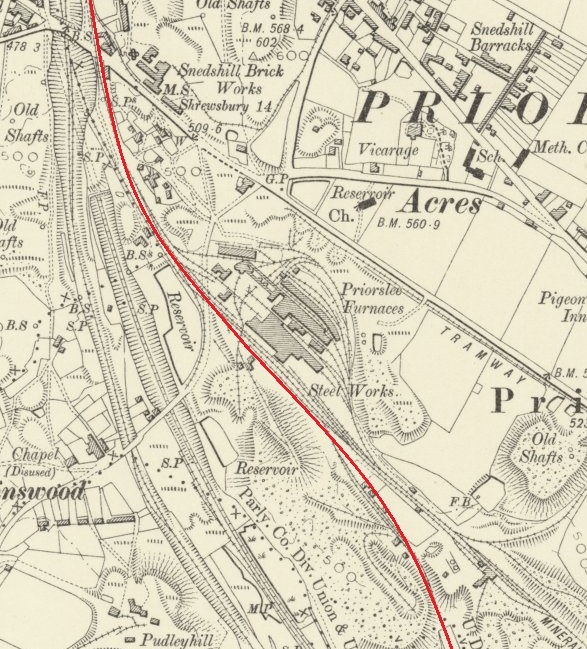
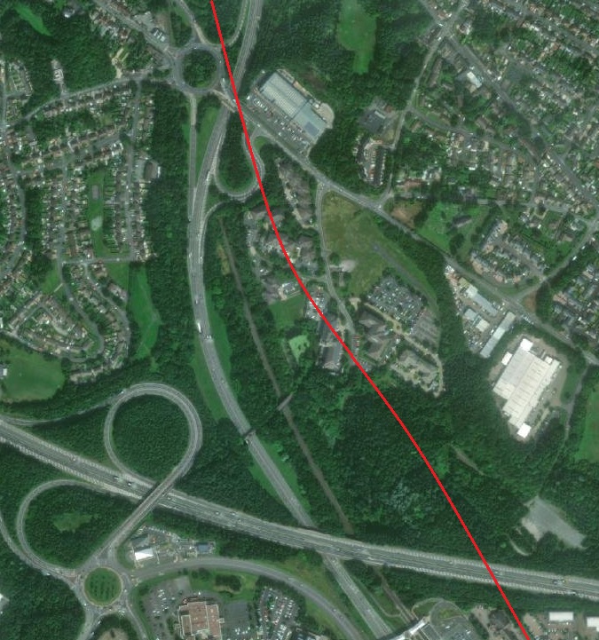
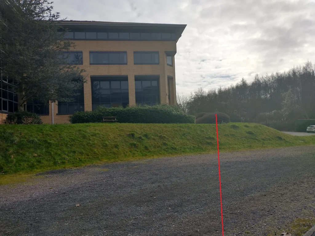
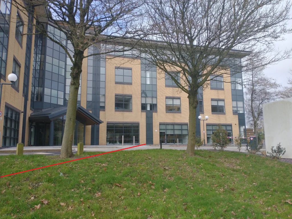
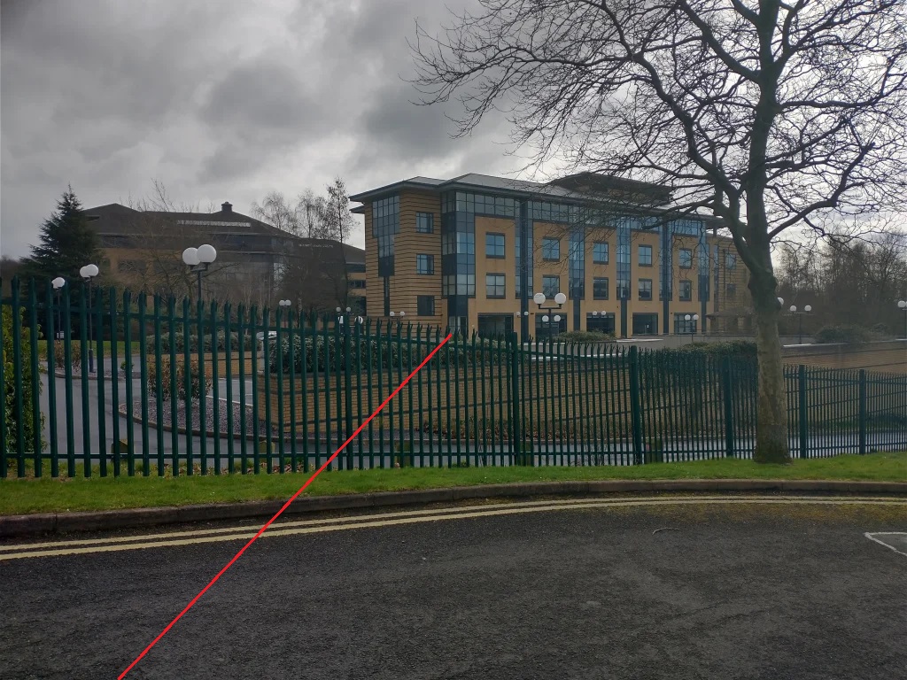
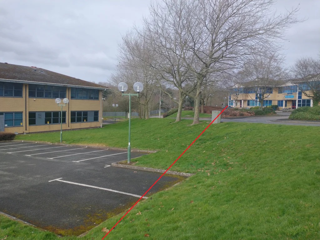
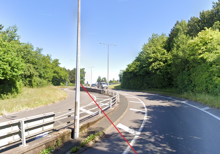
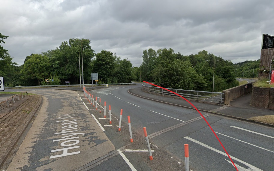
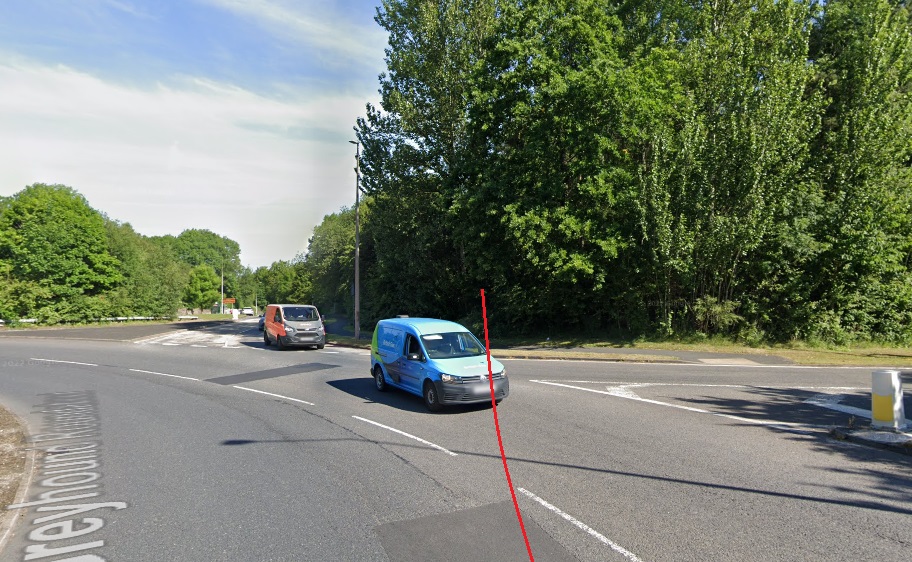
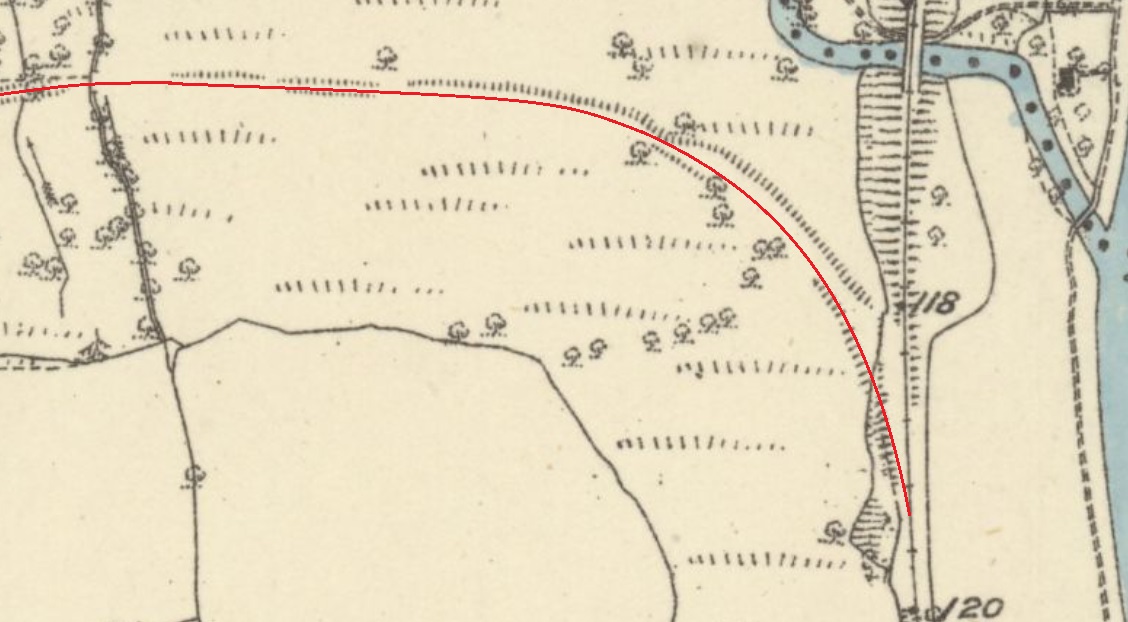
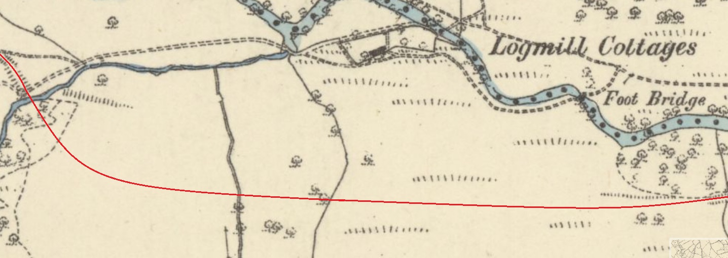
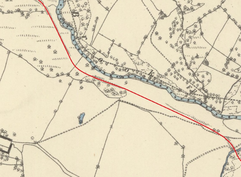
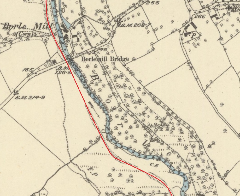
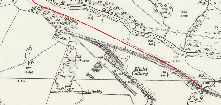
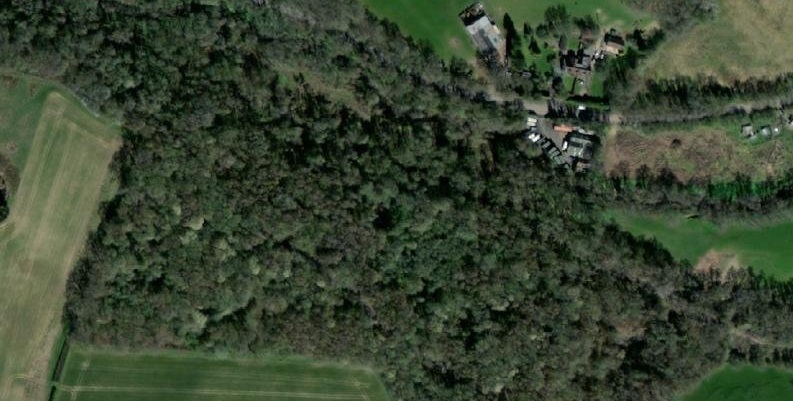
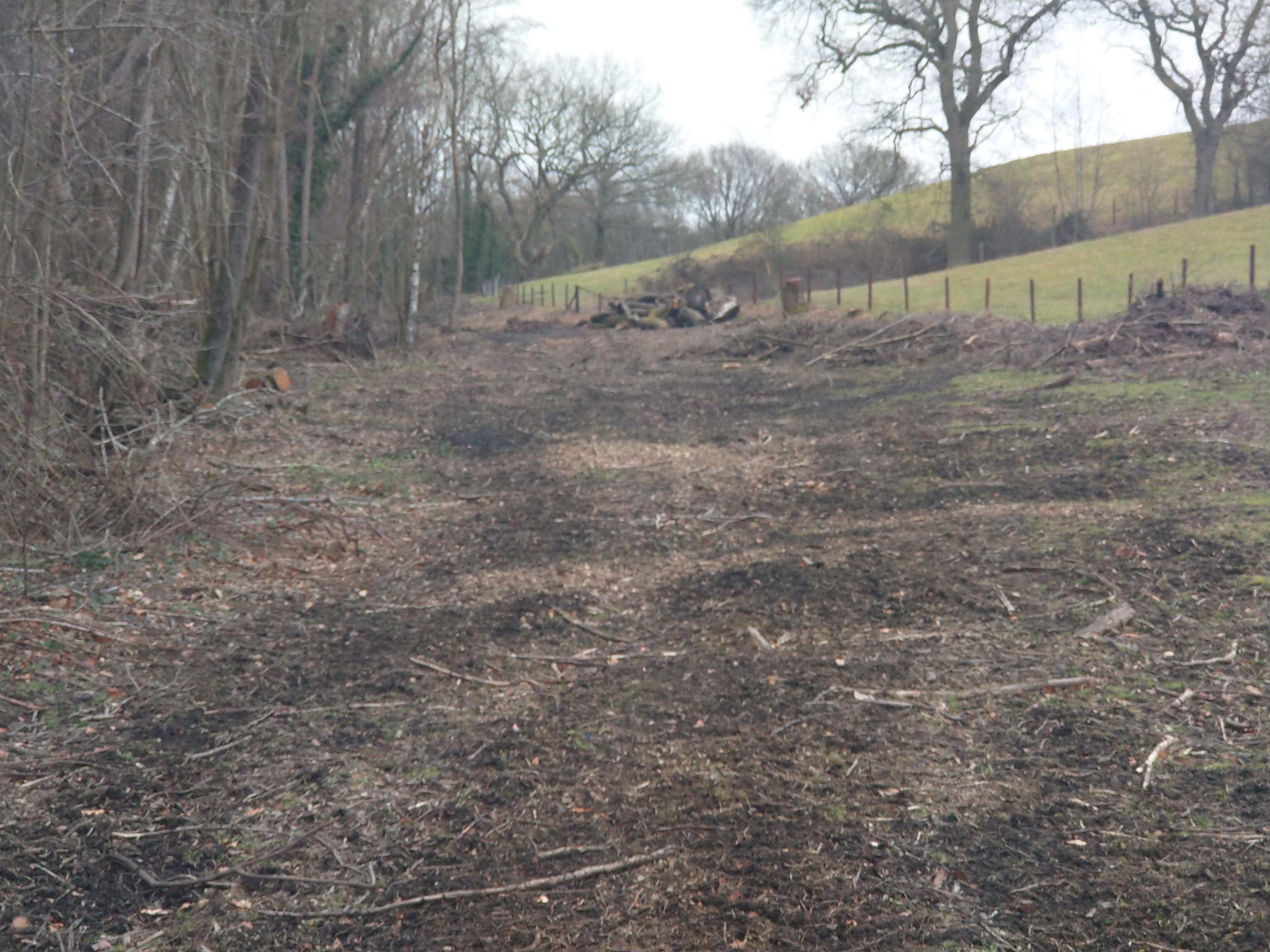
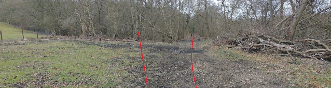
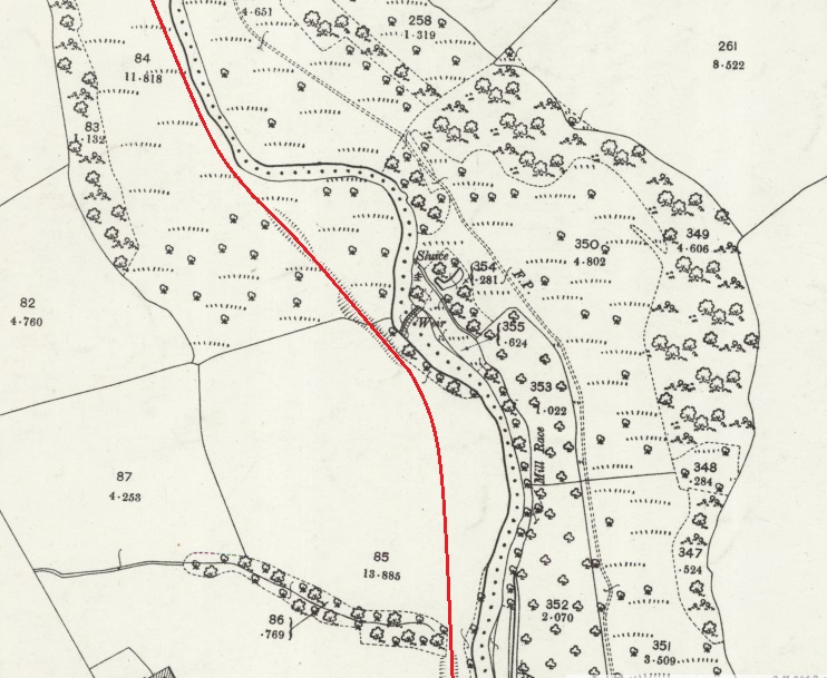
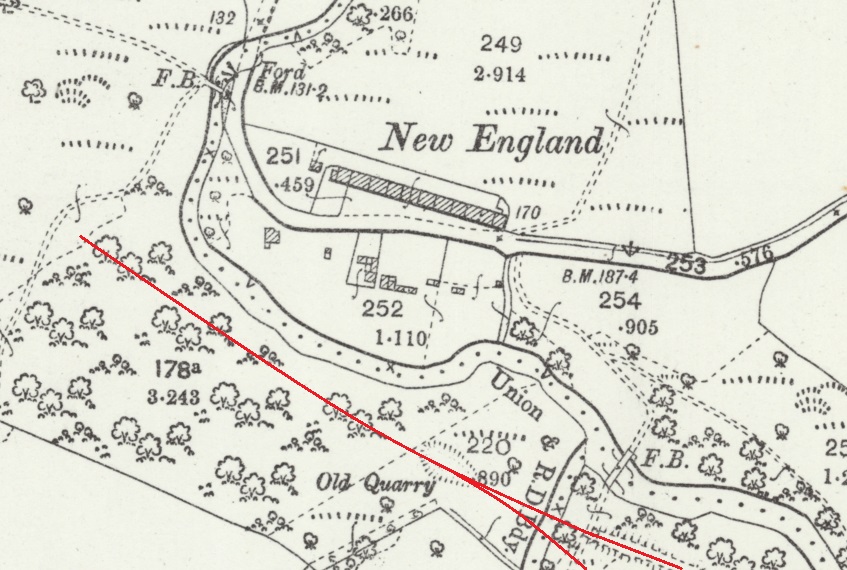
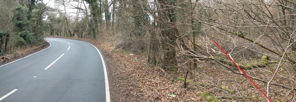
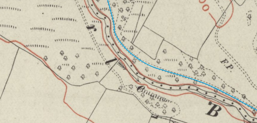
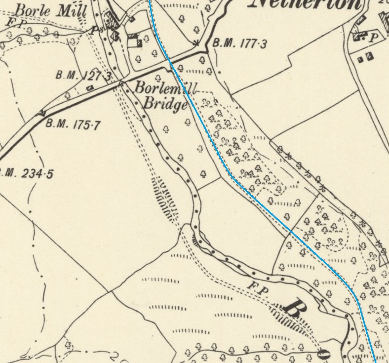
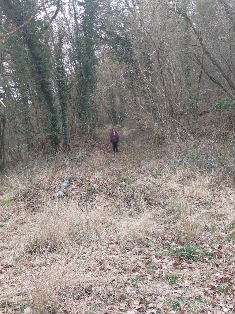
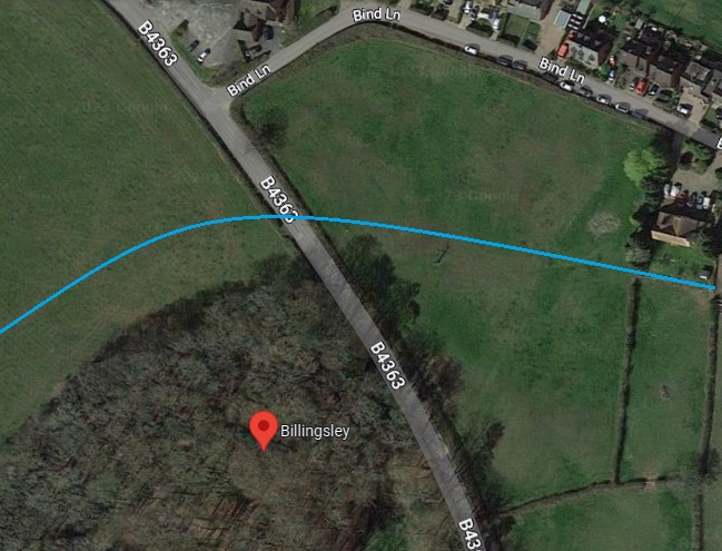
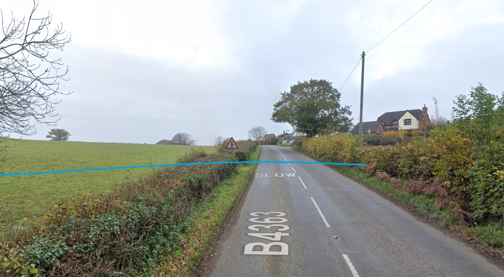
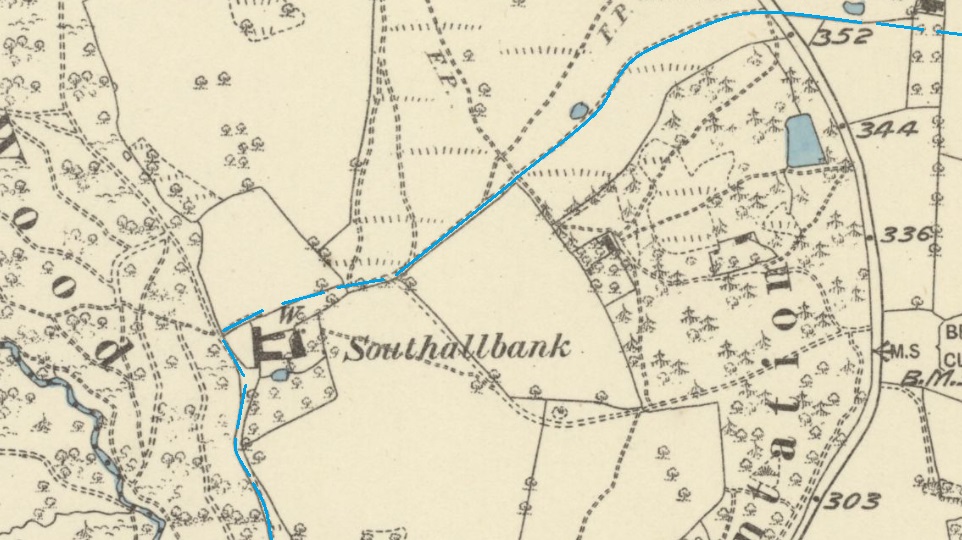
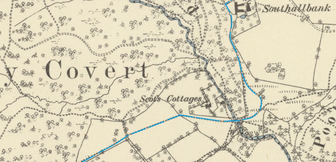
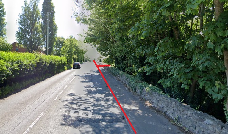
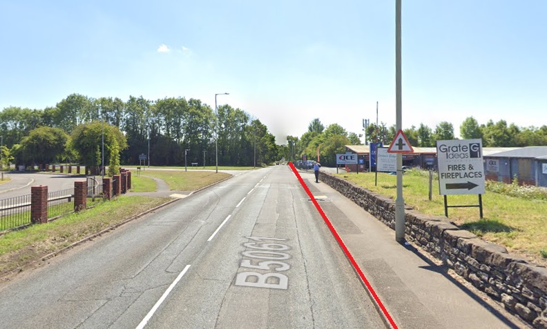
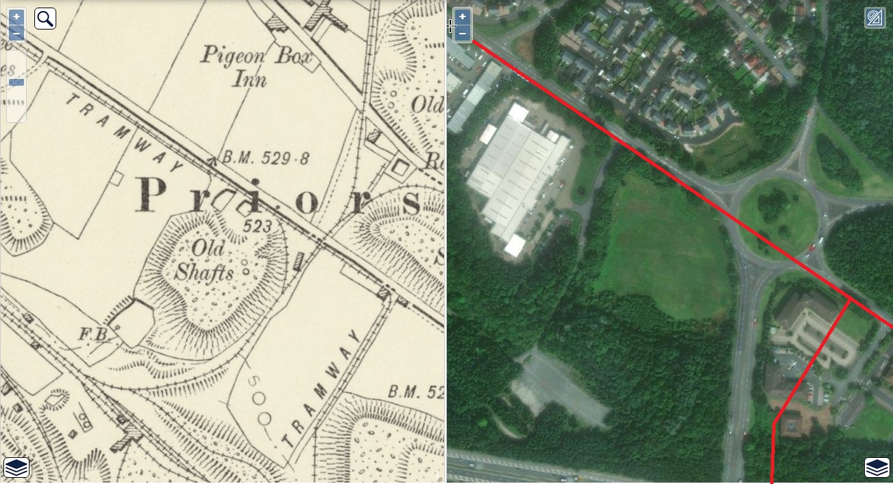
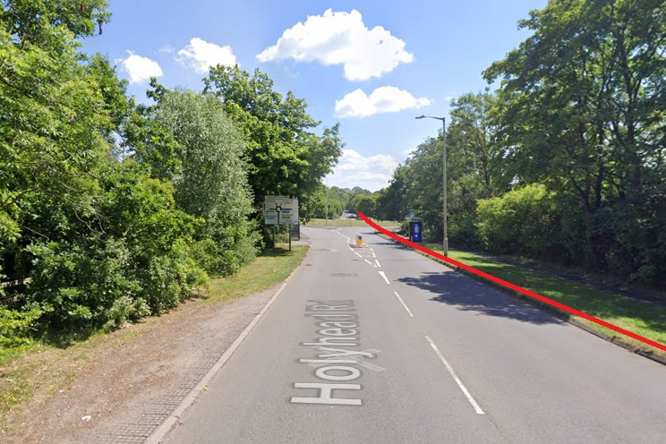
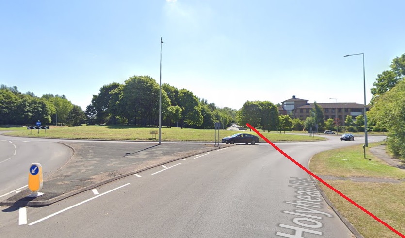
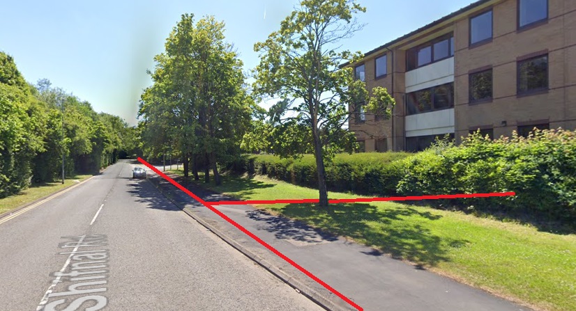
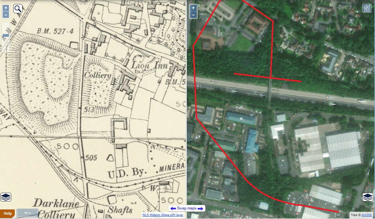
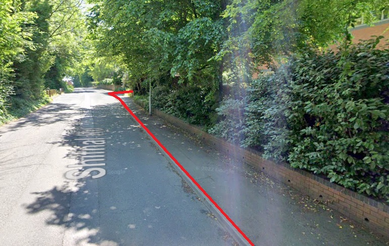
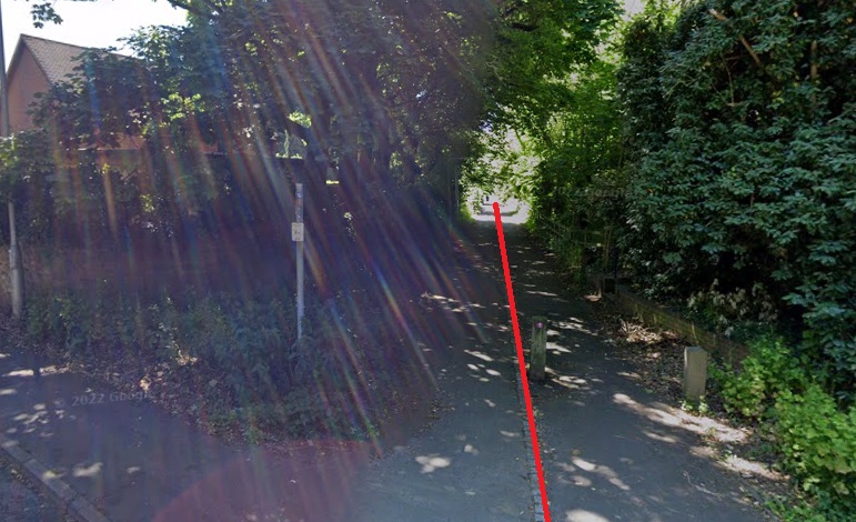
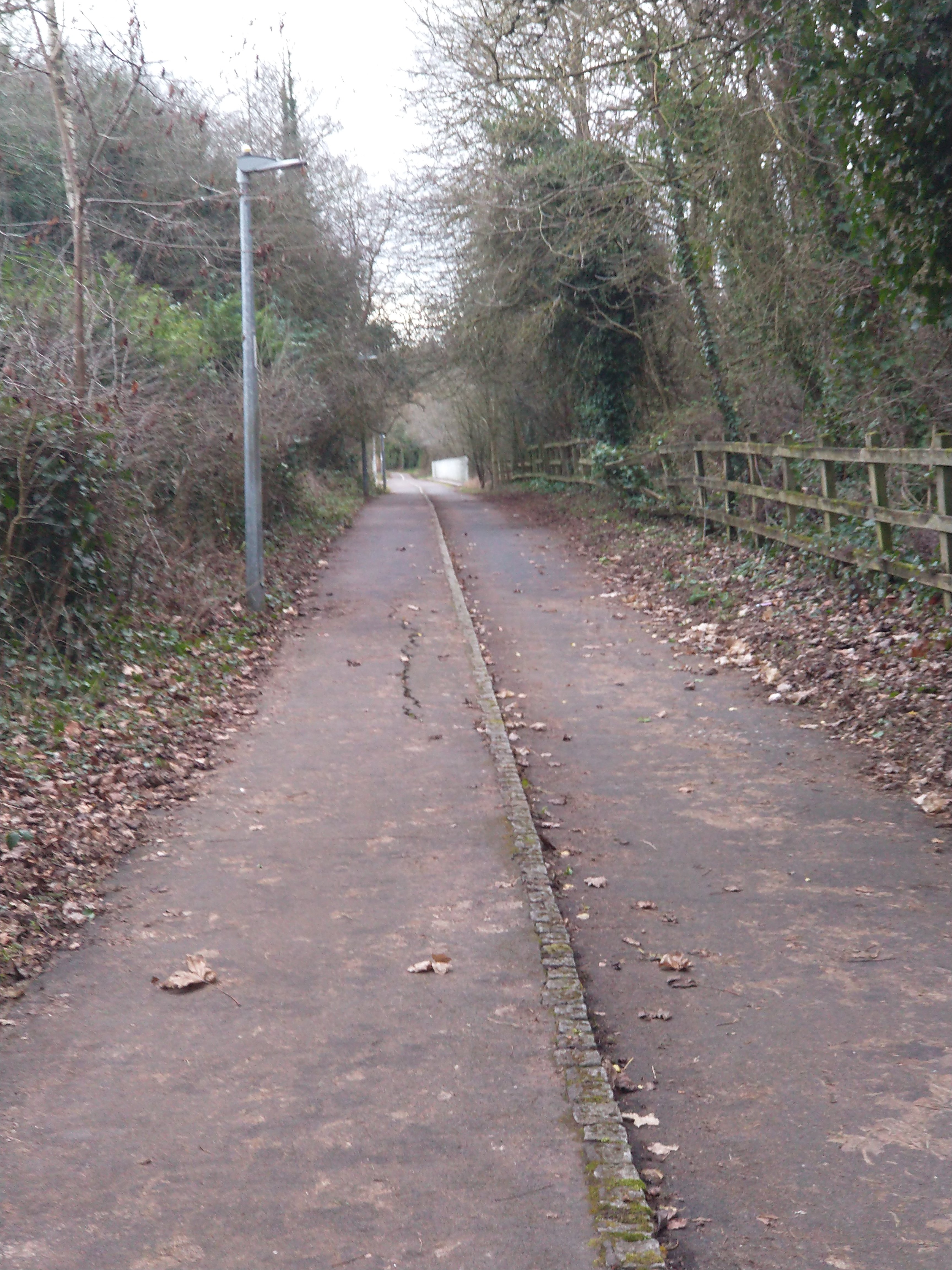
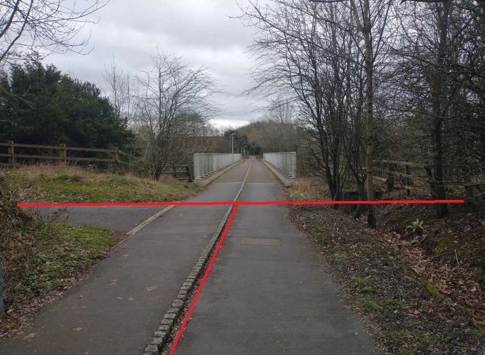
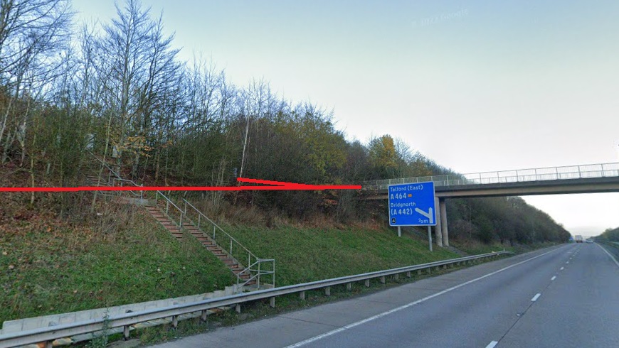
This next extract from the 6″ Ordnance Survey shows the route of the old tramway flanked by walls and passing in front of the Grand Lodge of Penrhyn Castle at Llandegai. [25]The same area now shown on the ESRI satellite imagery provided by the NLS. The lodge can be made out just to the Northeast of the red line which shows the approximate route of the old tramway crossing the roundabout on the A5 at Llandegai. [25]The approximate route of the old tramway is marked on this picture, as before, with a red line. The photograph is taken from the roundabout on the A5 at the entrance to Llandegai Industrial Estate which is in the top left of the satellite image above. The line ran just a few metres to the Southwest of what is now the A5. [Google Streetview]The approximate line of the old tramway runs across the next roundabout on the A5 before curving round to the South. [Google Streetview]Looking along the line of the old Tramroad from the modern roundabout, with the A5 heading South on the right. [Google Streetview]This is a repeat of the sketch shown earlier which is based on a drawing from James Boyd’s book. [36: p11] After being diverted from its original route, the tramroad ran on the Southern side of the highway before turning away to the South. The Smithy shown in the sketch appears on the 6″ map extract below. Just to the North of the Smithy there was a branch from the old tramroad which served the bottom of the Llandegai Incline which connected the Upper Penrhyn Mill to the tramroad. There were two level crossings at this location, one of which became an over ridge when the turnpike was built in 1820.The route of the old tramway continues on this next extract from the 6″ Ordnance Survey. At the top of the extract it is just to the left (West) of the Smithy. It crosses the standard-gauge line which is in tunnel at this point the Llandegai Tunnel). Further the south the formation, at the time of the survey was being used as an accommodation road to access ‘Bryn’ and then even further South, it was being used as a footpath. [26]This is an extract from ‘RailMapOnline’ which shows the route of the old railway plotted on modern satellite imagery. The purple line close to the top of the image is the line of the Llandegai Tunnel on the standard-gauge mainline. [27]Just to the South of the underground route of the standard-gauge mainline (Llandegai Tunnel), the old tramroad alignment crosses the access road to the A5 and runs South along the accommodation road visible to the left of the road in this image. [Google Streetview]The old tramroad route followed this lane South. [Google Streetview]At the end of the lane, a footpath can be seen running South. The hedge ahead in this image partially blocks the route but allows pedestrian access. [Google Streetview]The route of the old tramroad and the later footpath remain on the same alignment as far as the top corner of the woods shown in this map extract. From that point southwards the Tramroad route crossed the fields in a Southeasterly direction. [28]The same area as shown on the 6″ Ordnance Survey extract above. The North Wales Expressway is the notable modern addition to the image [27]The obvious features on this next extract from the 6″ Ordnance Survey which mark the line of the tramroad are the walls to the rear (West) of the cottages at Tyddyn-Iolyn. South of these properties the tramroad ran alongside the road for a very short distance. After which it curved away to the Southwest before curving back towards the Southeast to a point to the South of Llan-isaf Cottage. [29]The route described in the notes to the 6″ map extract immediately above are illustrated on this satellite image. [27]Facing South along the lane to the South of Tyddyn-Iolyn, showing the approximate line of the old tramroad in red. [Google Streetview]Looking back to the North along the lane to Tyddyn-Iolyn showing the point at which the old tramroad crossed the line of the lane. To the East of this point the Tramroad turned to the South and then to the West. [Google Streetview]The walled route of the Tramroad can still easily be picked out on the 6″ Ordnance Survey. After a short distance travelling in an West to East direction and before reaching the banks of the Afon Ogwen at a point to the North of Tyddyn-Dicwn it turned once again towards the South. [30]On the modern satellite imagery from RailMapOnline, the tramroad route appears to be within the width of the modern A5. There are signs that the actual formation of the old tramroad runs through the woodland to the South of the A5. Boyd shows this diversion on his map of the route. [36: p11] Its route can be picked out some metres to the South of the A5 but then rather than following a curving hedge line to the North and the East of Tyddyn-Dicwn at the bottom right of this satellite image. It continued towards the road junction, crossing the Southbound road just to the South of the junction. [27]The probable route of the old tramroad at the point where it crossed the road South towards Tregarth. From this point it travelled South between the road and the Afon Ogwen for a few hundred yards. [Google Streetview]The route of the old tramroad can again be picked out easily on the West Bank of the Ogwen passing an old quarry and then running immediately adjacent to Pen-isa’r-allt and on to meet Lon Ddinas. [31]RailMapOnline shows the tramroad crossing fields to the South of Lon Ddinas to join the route of the later Penrhyn Quarry Railway. This extract shows that route. Looking at the gradients involved and the 6″Ordnance Survey, it seems possible that this was the case only if an incline was used. There is no evidence of this on the ground. It seems more likely that Lon Ddinas runs along the line of the old Tramroad and may well, in times past have shared the same formation. The gradient along Lon Ddinas would have been much more suitable. However, records indicate that there was an incline at this location – known as the Ddinas Incline. [27]The lane which can easily be confused with the route of the old tramway is clearer on the 6″ Ordnance Survey. However, the Ddinas Incline followed the present field boundaries from close to Ddinas Farm up the relatively steep escarpment to meet the later Penrhyn Quarry Railway route. [32]
“The Ddinas Incline was one of three gravity-worked inclines on the original line of the Penrhyn Railway, built 1800-1801 to transport slate from the Penrhyn quarries to Port Penrhyn. … About half-way up the incline was an overbridge carrying a minor road, now widened and straightened at this point. To the north a cutting can still be seen, but the lower part of the incline has been destroyed by construction of a sewage works. To the south the line is visible as a terrace in the field. A ruined wall constructed of large roughly squared stone blocks near the top of the incline may be a surviving fragment of the winding house.” [33] W J Crompton, RCAHMW, 5 November 2009.
From this point on, the old Tramroad and Penrhyn Quarry Railway followed approximately the same route. The second article about these lines will follow the Penrhyn Quarry Railway to this point at Tregarth.
Dan Quine; The development of Port Penrhyn, Part One: 1760-1879; Archive. No. 110. Lightmoor Press, June 2021.
James I.C. Boyd; Narrow Gauge Railways in North Caernarvonshire, Volume 2 The Penrhyn Quarry Railways; The Oakwood Press, Usk, 1985. (The British Narrow Gauge Railway No. 5.)
Susan Turner; The Padarn and Penrhyn Railways; David & Charles; Newton Abbot, 1975.
I have long felt that, in understanding God’s call on our lives, the pivotal passage in the New Testament of the Christian Bible is John 17.
I have discovered more recently, in early retirement, just how significant that chapter of the Bible is for me personally. In discussions around difficult issues I have found myself returning to Jesus’ prayer in John 17. The call for unity embodied in that prayer pulls at my heart strings and provokes a surprisingly strong emotional response. …
Professor David Ford seems to have a similar sense of the profound importance of that chapter to the overall message of John’s Gospel, and, as a consequence, to the whole New Testament story. He speaks of John 17 as the point at which John’s Gospel, “sounds its greatest depths, reaches its greatest heights, opens up its innermost secret of intimate mutual indwelling, and orients the desires of readers toward union with the ultimate desire of Jesus.” [1: p9]
If we are to take Jesus’ prayer in John 17 seriously, that ‘we will be one, as he and the Father are one’, we have to take our differences over many issues seriously, address them and, in the midst of our disagreement, then seek unity — that is the challenge of John 17.
In this respect, Loveday Alexander writes that: “We shall need (as Pilling frequently reminds us in the report about human sexuality, [2]) ‘a complex process of theological discernment, a process that begins with the discipline of listening, which requires the ability to move outside the limitations of our own experience to pay attention to what God is doing in the experience of others.’” [3: p48]
Let’s take this particular issue as an example of the challenge posed by the prayer of Jesus in John 17. Loveday Alexander was writing in 2014 about the ongoing debate within the Church of England over human sexuality. We are now, at the time of writing, in 2022, and that process of listening in relation to human sexuality has been going on in the Church of England over the past 8 years.
We are probably more aware of the issues, in this particular context, than we ever were, but as far as I can see, we are no closer to a way forward that will hold us all together in unity and that will satisfy, not only those with different views within the Church of England, but also those in the wider Anglican Communion.
Indeed, a number of us in the wider Anglican Communion still see the very process of listening to be too great a compromise. For some of us, Scripture is clear, the matter is determined by the text of Scripture and the traditional teaching of the church. There must be no equivocation over the issues involved. The firm belief of parts of the Anglican Communion is that the Church of England and a number of other provinces in the Anglican Communion need to repent and return to the tenets of Scripture. That view, held with great integrity and commitment, says that unity is just not possible while parts of the Communion are so manifestly in error.
Others of us cannot accept that position. For us, a careful study of Scripture and the cultures in which it was written and our own lived experience lead us to a very different conclusion. Many in this other part of our church family are just as resolute as those in the first group.
In reality, we are not united but divided, and it seems that we hold each other to account as responsible for that division.
And yet, in this particular context, we are not so very far apart. We see many of the of the possible perversions in all sexual relationships as sinful. We are not happy to condone engagement in physical sexual acts outside of committed, faithful, monogamous relationships. We strongly condemn abuse in all its forms whether inside or outside of a marriage and family life. We see no place for promiscuity, no place for selfishness. I hope we also have a strong commitment to mutuality in marriage and in relationships.
But, we do not agree on one key issue relating to who can participate in a committed, faithful, monogamous sexual relationship. And for so many of us, on whichever side of the argument we sit, this matter is essentially insurmountable, either because of our view of about what scripture says, or because of our essential identity as human beings. It seems as though neither side in the debate can see any grounds for hope and both seem to agree that this issue takes us beyond the remit of Jesus’ prayer for unity in John 17.
As I have already said, that prayer in John 17 is, for me, a pivotal point in scripture. And it provides the context for Jesus’ later commission in John 20:21-22. “Peace be with you. As the Father has sent me, so I send you.” When he had said this, he breathed on them and said to them, “Receive the Holy Spirit…”’ (John 20:21-22)
As we have noted, Professor David Ford (the author of a new (in 2022) commentary on St. John’s Gospel [1]) agrees with this assessment. He talks of Jesus’ prayer in John 17 being “the most profound and far-reaching chapter in the Bible” [4]. Jesus “prays (John 17:18) about what he later does in the pivotal verse John 20:21, and pours out his ultimate desire for all of us later believers: that we be united in love with each other and with him, ‘as’ he is united in love with his Father, and that this might overflow into the world God loves (John 17:20-26). It is a mission of inspired loving, for the sake of the whole world, including (since Jesus is the one through whom ‘all things came into being’ – John 1:3) the whole of creation.” [4]
“All through John’s Gospel readers have been prepared for the death of Jesus (beginning with John 1:29), and for the resurrection of Jesus (beginning with John 2:22), and for the giving of the Holy Spirit (beginning with John 1:33). Now, climactically [in John 20:21-22], the crucified and resurrected Jesus actually gives the Holy Spirit. The words that accompany this give all of us Christians our core vocation and mission. We are sent ‘as’ Jesus was sent.” [4]
“But,” says Ford, “the ‘as’ does not mean exact repetition. We are not in first century Palestine. His Spirit is breathed into us so that we can both learn from how he was sent and also improvise endlessly upon it. We are to be inspired in our learning together (the Holy Spirit guides us into ‘all the truth’ – John 16:13, so our learning is never to stop), in our loving like Jesus, and in our praying like Jesus (try praying the Lord’s Prayer in the light of John 17!).” [4]
In his commentary, Ford says that the thrust of John’s Gospel is towards “doing life-giving signs for all who are in need, daringly crossing deep divisions, seeking more and more truth, engaging critically and constructively with the civilization of which it is a part, prophetically challenging the pathologies of power, modeling servant leadership, and building communities of prayer, love, and friendship that serve God’s love for all people and all creation, seeking to be part of the fulfillment of the desire of Jesus in his final prayer.” [1: p11]
“The essentials,” he says, “are summed up in John 20:21-22. Jesus gives us the deep ‘peace’ of knowing we are utterly loved, at home abiding in the love at the heart of all reality; the deep purpose of being ‘sent’ to love as he was sent by his Father; and, amazingly, the ‘Holy Spirit’—breathed into us minute by minute as he lives in us, we live in him, and we are energised and inspired to learn, pray, love, and serve as never before.” [4]
One significant element of John’s gospel message is the way in which “it nurtures in readers a global horizon that can unite them with the desire of Jesus for an ultimate unity of all people and all creation in love and peace.” [1: p11]
This means, as we have already noted, that we are to be inspired in our learning together, in our loving like Jesus, and in our praying like Jesus. … Jesus prayer is pivotal to our corporate life as his Church.
As Professor David Ford says: we are to be inspired by Jesus’ prayer in John 17 which calls us to a unity with each other which reflects the unity of the Godhead. We are called to reflect in our relationships the “innermost secret of intimate mutual indwelling,” [1: p9] that characterises the relationship between the three members of the Trinity. Indeed, Ford entitles the chapter in his commentary which focusses on John 17, ‘The Summit of Love’.
Our missionary calling as disciples of Jesus is a call, primarily, to unity. This is to be one of our ultimate values, it is to define us as followers of Jesus. It is to be at the very core of who we are. For me, this increasingly means an emotional, almost visceral, commitment to unity.
Whatever our differences in theology and practice, whatever different denominations we might form, we are called first and foremost to a loving unity which surmounts all barriers. We are to be ‘like Jesus’ who prayed, with what was close to his dying breath, that we would be one ‘as he and the Father are one’.
“John’s gospel is indeed irrefutable in its clear, concise and transparent yearning for authentic Christlike discipleship today and always, to exemplify human love one for another, unconditionally, non-selectively, non-judgementally – just as Jesus did, so also should we do similarly.” [5: p24]
While commenting on John 1:29, Ford offers us a definition of sin: “This also is a pointer to the meaning of the sin of the world. [John 1:29] The basic sin indicated in the Gospel of John is lack of faith/trust/belief, inevitably involving lack of love. The desire/will of God is for a love inseparable from trust. The ultimate desire of Jesus, expressed above all in his climactic prayer in John 17, is for people to be united in trust and love with God and one another through him, a unity in which the whole of creation is embraced. This is the “summit of love,” the joy, the “eternal life,” the peace, for which people are created and into which they are invited, and whatever prevents or distorts or falsifies or opposes this is sin.” [1: p48-49]
Essentially, nothing pertaining to our faith should be allowed to take us outside of the scope of Jesus’ prayer for unity. Historically, the Church has allowed many things to take priority over that prayer. In doing so, each time, it places itself outside of Jesus’ desire for it.
At the moment, I find it nigh impossible to envisage the reconciliation of people holding divergent views on human sexuality within the Church of England and the Anglican Communion. I am grateful that others are ultimately responsible as the guardians of our unity and our faithfulness to the canon of scripture. My fervent prayer is that the Spirit will continue to lead us into all truth and that we will be able to fully accept our differences and fully embrace the unity for which Jesus prayed.
References
Professor David Ford; The Gospel of John: A Theological Commentary; Baker, Grand Rapids, Michigan, 2021.
The Pilling Report was published by Church House publishing on 28/11/2013. Its full title is The Report of the House of Bishops Working Group on Human Sexuality.
Revd Canon Professor Loveday Alexander; Homosexuality and the Bible: Reflections of a Biblical Scholar; in Grace and Disagreement: Shared Conversations on Scripture, Mission and Human Sexuality; The Archbishops’ Council, 2014, p24-51.
Jenny Plane Te Paa; Theology and the Politics of Exclusion: An Indigenous Woman’s Perspective; in Terry Brown .ed; Other Voices, Other Worlds; Church Publishing, New York, 2006, p15ff.
This post is a short addendum to my post about the pre-railway age and the tramways of Pembrokeshire. In that post there was a section about the Porthgain to Abereiddi Tramway. In writing about that tramway, I failed to include details of the 3ft-gauge clifftop tramway which linked the slate quarry at Pen Clegyr Point with Porthgain.
I also failed to note the detail of the tramway tunnel between St. Bride’s Quarry and Porthgain Harbour. The original post can be found here:
Much of this current post about the Clifftop Tramway is summarised from a book by R.C. Jermy – “The Railways of Porthgain and Abereiddi,” which is an excellent study of the location. [2]
The 1906 6″ OS Map shows the clifftop tramway. [1]By the time the 1906 survey was undertaken the tramway tunnel and St. Bride’s Quarry were abandoned and the tramway rails through the tunnel had been lifted. The two short branches of the clifftop tramway can be seen to good effect on this map extract. [1]
By 1906, lines which linked St. Bride’s Quarry with the harbour via two inclines had been removed. The later tramway tunnel was also redundant and the tramway rails had been lifted. “Traces of the earthworks and inclines, including the lines to the spoil tips, are the only remains on the 1906 map. There remained on the clifftop just the lines of the horse-drawn tramway fetching stone from the quarries at Pen Clegyr Point. From loading sidings in the quarry the line entered a shallow cutting passing a small smithy on the right, after which maps indicate a short passing loop. The line then climbed upwards towards the summit close to Pentop Gate at which point it curved right, passing the weighing machine which measured the wagon weights. The line then forked into two, one track leading to each of the stone crushers located above the storage hoppers. Small passing loops were located on each of these tracks.” [2: p17]
There is, for me, an interesting connection between this area and the Forest of Dean. In 1900, the Forest of Dean Stone Firms were registered in Bristol.”This concern took over the harbour and mining interest at Porthgain but after November 1909, and until it was finally wound up in 1922, its interests were managed by United Stone Firms, another Bristol-registered Company. This firm raised a mortgage of £200,000 on the Dean Forest and Porthgain interests in 1910 and indeed this was the time when the crushed stone demand was reaching its peak. Sailing ships and powered vessels called regularly, the quarry and harbour railway systems were well developed and the Company ran its own fleet of steam coasters, each of about 350 tons.” [2: p10]
However, by 1913, despite the success of its Porthgain operations the parent company passed into the hands of the receiver. It remained so until 1926 “when it was reorganised and taken out of receivership by Walter Bryant of Coleford, Gloucestershire, who formed United Stone Forms (1926) Limited.” [2: p10]
However,by July 1931, that company became insolvent and was closed by 31st August 1931.
The 1948 revision of the 6″ Ordnance Survey was published in 1953. As far as the map extract is concerned all remnants of the clifftop railway have disappeared. This seems to be an over simplification of the situation as a number of remnants were still present even if not recorded. [5] The line of the track can still be traced as a levelled strip on the clifftop, adjacent to the path to Porthgain harbour. [4] R. C. Jermy includes a number of photographs, taken in 1951 by H. Townley, which show the engine shed (with ‘Newport’ gently rotting away on one of the roads) and the remains of two traction engines, ‘Daisy’ and ‘Dinah’. Dinah was sited at Pen Clegyr and was used as a winding engine. Daisy sat on the clifftop. [2: centre-pages]
Jermy notes that “by 1908 the demand for roadstone had increased and the Forest of Dean Stone Firms made the decision to invest in a steam locomotive for operating the clifftop system. … It was realised that with the arrival of a heavy locomotive complete relaying with heavier track would become a necessity. Accordingly 200 sleepers were ordered … and … between 20th and 22nd January, 1909 the tramway was [re-laid] with heavy rails and sleepers from Pentop Gate by the water tank to the winding engine house at the top of the incline leading from the lowest quarry levels. A new engine shed was constructed, the roof over the single road being completed just six days after the arrival of the first locomotive! An inspection pit was located between the rails in the shed. Later, in November 1909 a ten ton weighbridge was installed in a brick building close to the water tower.” [2: p18]
Later, two further locomotives arrived at Porthgain necessitating the addition of a second road to the engine shed.
Records appear to show that one of these locomotives, Singapore, was too heavy for the tramway rails in place when they arrived and as a result in some expenditure was necessary to upgrade the tramway. In fact, the prevailing weather conditions and the weight of the locomotives seem to have resulted in a significant regular maintenance programme being implemented.
Jermy shows two plans of the railway – the first shows it much as on the 1906 6″ Ordnance Survey. He dates his sketch plan to 1905. [2: p20]. The second is the result of a survey of the line by Jermy in the 1980s which seems to show the small network at its fullest extent in around 1925. [2: p21] This sketch plan shows the engine shed in its position on the Northeast side of the St. Bride’s Quarry, three roads serving the crushers and hoppers, a small Yard on the North side of St. Bride’s Quarry, a weighbridge and water tank to the Northwest of the Yard, a long straight length of line with two tracks, one known as ‘The Cutting’, the other as ‘Jerusalem Road’. These two line led to the Upper Level of Pen Clegyr Quarry and, via a cable-worked incline to the lower level of the quarry. [2: p21]
Locomotives
The first locomotive was named ‘Portgain‘. It was built in 1909 by Andrew Barclay in Kilmarnock. It was Works No. 1185. … No. 1185 was an 0-6-0T with 7″ x 13″ outside cylinders, 2ft 2½in wheels 3ft gauge. … Despatch Date: 26th July 1909. [2: p23][3] This locomotive was out of use by 1929 and was scrapped on site shortly after 1931. [4]
The second, ‘Charger‘ was built in 1891 by W.J. Bagnall in Stafford and had the Works No. 1381. It had a copper firebox, brass tubes and two 5½in x 10in outside cylinders. It passed through a number of ownerships before, in September 1912, it was moved to Porthgain. [2: p29-30] This locomotive was scrapped shortly after 1931. [4]
The third, ‘Singapore‘, was a 0-4-2 saddle tank built at the Kerr-Stuart works in Stoke-on-Trent and had Works No. 659. It had 9½in x 15in outside cylinders. It was built in 1899. It was first bought by the contractor G. Pauling and Co. It was shipped to Ireland and was used on the Burtonport Extension contract which Pauling’s were undertaking for the Londonderry and Lough Swilly Railway. Sold in 1903, it went to Scotland and remained there until 1912 when it was transferred to Porthgain. [2: p31-33] This locomotive was out of use by 1929 and was scrapped on site shortly after 1931. [4]
The fourth locomotive was ‘Newport‘, a 0-4-0T loco. It was built by Hudswell, Clarke and Company of Leeds. It was originally built as a 2ft 10in gauge loco with Works No. 311 in 1889. In 1900 it was owned by Kellett & Sons who worked on the Hagley to Frankley section of the Elan Valley Aqueduct. It went through a number of ownerships after this before entering service at Porthgain in May 1929 after an overhaul. [2: p33-36] This locomotive remained in the Porthgain Railway Locomotive Shed after closure until scrapped in 1953. [4]
This post includes a selection of news items about Kenya Railways in the period from 2018 to the Autumn of 2022. The items included are by no means exhaustive but they might be of interest! ……..
The Birth of a Nation: preserving records on the Kenya-Uganda railway line (EAP1143)
In 2018 the British Library funded a small pilot project undertaken in Nairobi Railway Museum’s archive. This was a low cost 6 month pilot which identified the condition of the archived documents and photographs and improved storage and access to them.
The photographs which were digitised all seem to predate the construction of the railway and document the life and times of people who lived on its route. [1]
The Standard-Gauge Line
In 2018, NPR reported that the “Standard Gauge Railway station in Nairobi is easily the most impressive public building in Kenya.” [8] The station is “adventurous. It’s all gray and modern. Geometric shapes form an abstract locomotive, and red neon announces the “Nairobi Terminus.”” [8]
The Standard-gauge Railway Station at Nairobi. [8]
NPR continues: “The train runs 293 miles from Kenya’s capital city to the port of Mombasa and back twice a day and represents the biggest infrastructure project since Kenya’s independence 54 years ago. The Chinese financed it; a Chinese company built it; and the Chinese will operate it for many years to come. … The project, which launched in the summer of 2017, has not only come to signify Kenya’s ambitions, but also China’s ambitions on the African continent. In the past decade, China has become the biggest lender to governments in Africa. The money has helped build ports, roads, bridges, airports and trains. But critics warn the loans are full of traps that could leave African countries in the lurch. Kenya alone owes $5.3 billion to China.” [8]
On 16th October 2019, VOA News reported that Kenya opened the second phase of the Standard Gauge Railway Project: “Kenya’s President Uhuru Kenyatta officially opened on Wednesday the second phase of his flagship infrastructure project: a Chinese-funded and built railway that will eventually link the port of Mombasa to Uganda. … The latest stretch of track cost $1.5 billion and runs from Nairobi to the Rift Valley town of Naivasha.” [9]
After the official opening, the president then joined the first ride along the line. … “The train stopped at every station, where a cheering crowd awaited the president. He promised them that the new railway will bring prosperity. … Kenyatta said that if the railway comes here, development also comes here.” [9]
The new track is 120 kilometers (75 miles) long and has 12 stations. Passengers can ride the trains, but the railway is mainly for cargo. The track will eventually lead to an inland container depot, (see below) from where containers will be distributed to Uganda and Rwanda, and to South Sudan. [9]
On 20th August 2021 the Ugandan newspaper, ‘The Independent’ reported that Kenya’s Standard-gauge railway line transported 2.31 million tons of cargo between January and the end of May that year: “an increase of about 45 percent from the similar period in 2020, according to data released on Thursday from the Kenya Railways Corporation.” [10]
“The rise in cargo volumes saw an increase in revenue generated during the months to 6.2 billion shillings (about 57 million U.S. dollars), up from 41.4 million dollars generated from January to May in 2020, it said. … The number of passengers using the train during the first five months of 2021 nearly doubled amid COVID-19 pandemic. … Some 601,201 passengers were ferried between the capital Nairobi and the coastal city of Mombasa during the period, up from 330,232 in 2020 when the country grappled with COVID-19 pandemic, the corporation said. … This generated revenue of 5.9 million dollars, up from 3.3 million dollars generated between January and May in 2020.” [10]
Refurbishment of Nairobi Central Station
Major renovations at Nairobi Central Station began on 27th July 2020. By January 2021, the work was well-advanced. Kenya Railways reported that the work would facilitate the use of the new DMUs due to arrive in the country.
Renovation work at Nairobi Central Station in January 2021. [5]
Kenya Railways stated on 13th January 2021 that, “as the rehabilitation works continue[d], stringent measures [were] put in place to safeguard daily commuters as they access[ed] the station.” [5]
Designated boarding points were set for various trains to facilitate safe movement of passengers within the Nairobi Central Station. For instance, Kikuyu and Ruiru trains, the boarding point was designated on the Western end of the Nairobi Central Station and it was to be accessed from Railways Police station. While passengers boarding Syokimau & SGR Link trains boarded the trains from the Eastern end of the station with the access point being adjacent to Guava restaurant.
Kenya Railways stated that, “The rehabilitation of Nairobi Central Station will not only give it a new face but also show KR is dedicated in making transportation better.” [5]
Plans for the full renewal of Nairobi Central Station were published in May 2022. The project has been sponsored by both the British and Kenyan Governments.
Design office view of the proposed renewed Central Station. [6]
THE British and Kenyan governments unveiled the final design of Nairobi’s new Central Railway Station and surrounding public area, which has been developed as part of the Nairobi Railway City redevelopment programme. [6]
The IRJ reported that, “The design was developed by SNC-Lavalin subsidiary Atkins and submitted to Kenya Railways and the Ministry of Transport. … The station is designed to accommodate up to 30,000 passengers per hour at peak periods, and will have 6000m2 of concourse space. The station will offer a new covered public space for the city with retail outlets and other amenities …. It features separate entrance and exit routes to avoid conflicting flows and ensure passengers can get to and from the platforms efficiently. … Three existing platforms will be joined by six additional passenger platforms, and four dedicated freight lines will be built. Two platform bridges will be built, with one for passengers entering the station and one for passengers exiting.” [6]
A few design office perspective views are shown below:
The SGR to MGR link at Naivasha
In July 2022, President Uhuru Kenyatta officially commissioned the Standard Gauge Railway – Metre Gauge Railway Passenger Rail Link at the Kenya Railways Mai Mahiu Station in Naivasha, Nakuru County. The ceremony took place on Tuesday, 26th July 2022.
The 5km link will enable passengers traveling to Western Kenya by train to switch from the standard-gauge service to that of the metre-gauge and vice versa. Kenya Railways reported that it would as a result be possible to travel exclusively by rail from Mombasa through Kilifi, Kwale, Taita Taveta, Makueni, Machakos, Kijiado and Nairobi onwards to Nakuru, Kisumu, Eldoret, Kitale, Nyahururu, Nanyuki, Malaba and Bungoma. [2]
Naivasha Inland Container Depot
On the same day (26th July 2022) the Naivasha Inland Container Depot (ICD) was officially opened by President Uhuru Kenyatta.
The Naivasha ICD facility which incorporates both the Standard Gauge Railway and the Metre Gauge Railway line will handle mainly transit cargo to the Great Lakes Region including Uganda, South Sudan, DR Congo, Northern Tanzania, Rwanda, and Burundi, which account for around 30% of imports and exports through the Port of Mombasa.
The SGR/MGR Link referred to above will greatly facilitate the transshipment process. All Transit cargo can now be delivered to the facility straight from the Port of Mombasa as either Through Bill of Lading (TBL) or merchant haulage (Non-TBL), while exports and empty containers can also be consolidated at the Naivasha ICD and railed to the Port of Mombasa for onward shipping.
Kenya Railways reported that, “The depot is linked to the Mombasa Port container terminal by a rail-tainer service on the Mombasa to Suswa Standard Gauge Railway line. It will serve to bring port services closer to customers and reduce congestion at the Port of Mombasa, Nairobi Inland Container Depot and on the roads. It is convenient for East African partner states who will not have to cover an entire 572 kilometres by road between Mombasa and Naivasha. From Naivasha ICD to Malaba Railway Yard, cargo will be transported over 36 hours and it will cost $860.”
Kenya Railways also affirmed that, “The Naivasha ICD includes a one-stop centre for ease of operations and efficient service delivery. The port houses all the Government agencies involved in handling of cargo namely Kenya Railways, Kenya Ports Authority, Kenya Revenue Authority, Kenya Bureau of Standards, Port Health (Public Health) and Revenue Authority officers from partner states of Uganda, Rwanda and Tanzania.” [3]
Nakuru Railway Station
President Uhuru Kenyatta officially commissioned the revitalized 217km Nakuru-Kisumu Metre-Gauge Railway (MGR) and the 465km Longonot–Malaba segment as well as the refurbished Nakuru Railway Station.
Kenya Railways reported on 28th July 2022 that the re-commissioning had taken place: “The iconic Nakuru Railway Station is a key transit station for cargo and passenger train services to and from Western Kenya, and is the aggregation hub for farm produce from the agriculturally rich Central Rift region for onward freight to the Coast for export.” [4]
“Nakuru town started as a railway station on Kenyan-Uganda railway line at the turn of 20th century. It was built in 1900 and later expanded in 1957. It sits on the east side of the centre of Nakuru. The town is part of the famous ‘White Highlands settlement’ areas established by the British during the colonial era. The areas surrounding Nakuru town are mainly known for their vast agricultural potential especially cash-crop farming i.e wheat, barley, pyrethrum, sisal, maize and beans. Nakuru Railway Station was built in order to serve the rapidly growing economy of the town.” [4]
Refurbished Nakuru Railway Station [7]
“Later branch lines were built to link the station to farming areas. Among these was the line linking the station to the sisal producing Solai area. Just 6.9 kilometres from Nakuru town lies Nakuru Junction station. This is the point at which the lines to Malaba and Kisumu diverge.” [4]
Suburban Services in Nairobi
Nairobi Commuter Rail Services now run regularly to Ruiru, Embakasi Village, Limuru, Syokimau and Lukenya in Kitengela. There is also a Madaraka Express Commuter Service that operates between Nairobi Terminus and Ngong station and a link service between Nairobi Central Station and the Standard-gauge Station runs at 0630hrs, 1200hrs and 2010hrs each day. [11]
A holiday in West Wales in the early Autumn of 2022 led to a little research on the railways in the area.
This is the sixth article about Pembrokeshire’s Railways. The first focussed on the pre-railway age, the second focussed on the mainline railways of the county. The third article focussed on the industrial railways in the vicinity of Milford Haven. The fourth and fifth on the Saundersfoot Railway in Pembrokeshire. The links to these posts are provided below. This article concentrates on the railways associated with RNAD Trecwn (the Royal Navy Armaments Depot at Trecwn).
TheRoyal Navy Armaments Depot at Trecwn (RNAD Trecwn)
RNAD Trecwn is, in the 21st century, a decommissioned Royal Navy Armaments Depot, south of Fishguard in the village of Trecwn, Pembrokeshire, West Wales.
It was built in 1938 to store and supply naval mines and munitions ordnance to the Royal Navy. The depot apparently came into its own during the cold war. During those times 400 permanent workers were employed at the site, housed in an MoD built small town. The site had an on-site, 2ft 6in (762mm) narrow gauge railway, built using copper to reduce sparks. Weapons were both delivered to the site and then distributed using standard gauge rail to Fishguard, Neyland for Milford Haven, and latterly Pembroke Dock. [56]
Trecwn as shown on the 1948 revision of the 6″ Ordnance Survey published in 1953. A series of three sidings are shown to the South of the main RNAD site. [57]
The Standard-gauge Branch Line and Sidings – Just south of the main entrance to RNAD Trecwm and the main security fence to the site was a single railway platform, for workers access to the depot. Within the security fence, a marshalling yard of 8 parallel loops existed, shunted by a dedicated MoD diesel hydraulic shunting locomotive. The line then extended on down the valley, through a gauge exchange shed for access to the narrow gauge network, and then provided direct access to the 58 cavern storage chambers via a series of herring-bone shaped sidings. [59]
Supply trains would run along the dedicated branch-line from the site: to Fishguard Harbour; to Neyland for Milford Haven; and Pembroke Dock. At Fishguard the line extended beyond the ferry terminal at Fishguard Harbour railway station, continuing along the breakwater to a single line spur, allowing for transfer of munitions to Royal Navy ships. [59]
These next few images show the Trecwn branch-line. The first shows its junction with what was the GWR line to Fishguard from which the branch runs Northeast towards Trecwn …
The Trecwn branch-line junction with the old GWR as shown on the 1951 1:25,000 Ordnance Survey. [60]The ESRI satellite image from the National Library of Scotland has the route of the Trecwn Branch-line imposed on it. [80]The view at the junction from a train window in 9th August 2007, (c) Ceridwen, authorised for use under a Creative Commons Licence (CC BY-SA 2.0). [238]A little to the South of the junction, a lane crosses the branch. This photograph looks along the line to the accommodation crossing on 5th May 2010, (c) Ceridwen, authorised for use under a Creative Commons Licence (CC BY-SA 2.0). [239]The view East along the line on 23rd July 2006. (c) Stephen McKay, authorised for use under a Creative Commons Licence (CC BY-SA 2.0). Stephen comments: “Taken from an accommodation level crossing looking along what was once a meandering branch to Clunderwen. [241] That route was abandoned in the 1940s, but a stub was retained to give access to the Royal Naval Armaments Depot at Trecwn.” [240]The view from the North along the A40 of the bridge carrying the branch over the road. [Google Streetview, March 2022]The view of the same bridge from the South [Google Streetview, March 2022]After a short distance running Northeast, the standard-gauge line runs adjacent to the main gates of Trecwm on an East-West axis before turning South and the East again. [60]
The depot was decommissioned in 1992. All 58 cavern storage bunkers and the extensive above ground network of storage sheds and other military buildings remain in place. Ownership of the site was transferred from the Ministry of Defence to Anglo-Irish consortium Omega Pacific in 1998, and then by court order to the Manhattan Loft Corporation in 2002. The site is being redeveloped as an industrial park. [56]
Dashed-red lines show the approximate route of the old standard-gauge line which was lifted in the early 21st century. [82]The remaining length of the Trecwm branch-line as shown on the 1951 1:25,000 Ordnance Survey. [60]The same area as shown in the OS Map above[230]Coflein provides this map of the main site in 2021. Careful inspection will show that the standard-gauge branch-line has been lifted by the date of this Ordnance Survey edition. [61]The 1906 6″ Ordnance Survey shows no sign of either the standard-gauge branch nor the infrastructure that made up RNAD Trecwn. [231]The same area on modern satellite imagery shows much of the infrastructure of the Depot remaining after closure. The standard-gauge sidings remain at the date this image was produced. [231]Just before reaching Trecwm, the line passed under the lane which can be seen at the left side of the satellite image above. The bridge parapets have been extended upwards for safety reasons using galvanised metal fencing. [Google Streetview, October 2021]The concrete bridge carrying the standard-gauge branch-line over a local road just prior to its entry into the Depot. [Google Streetview, March 2022]The same structure viewed from the North. [Google Streetview, October 2021]Google Maps in 2022 still shows the sidings in place in RNAD Trecwn. No doubt this will get updated in due course. [Google Maps, 29th September 2022]The site extends across the join between two OS Maps. This 1948 revision of the 6″ OS Mapping shows the West end of the Depot. The map was published in 1953. [232]At approximately the same scale, the next OS Sheet shows only the standard-gauge line and not the internal narrow-gauge lines. It is shown terminating at the same location as the mapping further above. [233]The fan of standard-gauge sidings just inside the Depot fencing, (c) Dave Mansell, taken in 2003. This image is used with the kind permission of the Subterranea Britannica website. [234]
Three aerial photographs are provided by the Fishguard and Goodwick Local History Society. Posted by Ian Evans, they are used here by kind permission.
The first one shows the main entrance to the depot at it’s southern end. It can be dated to the mid-1950’s. “At the bottom right of the image can be seen the main railway line into the valley, leading to the railway sidings. The buildings to both sides of the railway sidings included a number of specialist workshops and storage facilities, there were no live explosives handled in this area.” [247]
This aerial photograph looks from the West along the valley of the Afon Aer. To the right of centre, the fan of standard-gauge sidings can be made out. An enlarged image taken from this picture follows below. The picture was taken in 1955 and is used with the kind permission of Ian Evans and the Fishguard & Goodwick Local History Society. [247]An enlarged section of the photograph above which shows the bridge which carries the line over a minor road close to the Depot gates, in the bottom-right. The fan of sidings feature prominently towards the top of this extract. The branch beyond the sidings first curves away to the South [247]
The second “shows the workshops and stores buildings in more detail. The building at the bottom right with the tall chimneys was the southern boiler house which supplied steam to most of the buildings seen here. It was in this area that the narrow gauge railway system started, it extended right up the north end of the site.” [247]
Of interest, to me at least, is that when I load Google Earth onto my desktop I automatically get the railway tracks at Trecwn added. I am not sure how that happened, but it is useful for this article. ….
A Google Earth extract with the network of lines in the valley of the Aer shown in black. This is the first length inside the Depot. [Google Earth, 29th September 2022.The remaining length of the Depot in the Aer Valley. [Google Earth, 29th September 2022]
The third of three aerial images from the mid-1950s appears below. It “shows the red area where live explosives were handled and stored, everything from .303 Rifle bullets to 1 Thousand pound bombs were processed here and stored in 58 Magazines built into each side of the valley, If you zoom in you can see a number of the tunnel entrances quite clearly. A lot of the smaller buildings have blast walls surrounding them. The complex extended further north from this photo to the north end Boiler House and security gates.” [247]
The remaining length of the Depot taken from the air looking North along the valley of the Aer. Again, the picture was taken in 1955 and is used with the kind permission of Ian Evans and the Fishguard & Goodwick Local History Society. These images can be found at http://www.hanesabergwaun.org.uk/ [247]These two images are enlarged extracts from the last of the three aerial images above. It is possible to see something of the network of lines which existed in the valley. [247]
The OpenRailwayMap [235] is also of great help in establishing what railways existed inside the Depot. It is clear that the standard-gauge line extended much further to the Northeast along the valley of the Afon Aer than the Ordnance Survey mapping records.
To complete this section on the Standard-gauge line, I have included a series of screen-dumps from the OpenRailwayMap [235][236]. Having them at this point in the article should hopefully minimise scrolling when we look at the Narrow-Gauge network at the depot. The sequence of the map extracts runs from the Depot gates in the West, closest to the hamlet of Trecwn, eastwards to the point where the valley turns to the North and then follows the valley northwards.
This final image is the key/legend provided by the OpenRailwayMap [235][236] editors. The Trecwn branch as far as the depot gates is shown in yellow above. The standard-gauge lines within the Depot are deemed industrial lines and are therefore shown as thin brown lines. The length of these line inside the Depot is significantly longer that that shown on the Ordnance Survey maps. Abandoned standard gauge lines are shown as thick dashed brown lines (not grey as in the key).
The narrow gauge lines are shown as thin dashed brown lines. It is possible that by the time the mapping was undertaken these had been abandoned and are hence shown dashed. There are a very few lengths of narrow-gauge track shown solid brown.
The extent of the network of these lines is, for me, the most engaging element of this mapping. RNAD Trecwn had a very significant internal narrow-gauge network. …
The Narrow Gauge (2ft 6in) Lines – A 2ft 6in (762 mm) gauge network traverses the entire site, with direct access to the 58 cavern storage chambers. All rail infrastructure was built in copper to reduce the risk of sparks. Serviced via its own on-site locomotive shed and works, the line was equipped with a series of specially provided wooden enclosed wagons, with sliding roof covers. This allowed sea mines and other munitions to be directly placed within the wagons from overhead gantries, and transported over the entire site without access via any form of side door, hence enhancing safety. The narrow gauge line therefore became the main method of on-site distribution, with standard gauge rail or road the off site access method. [56]
The next few aerial images can be found on the Coflein website and show elements of the narrow-gauge system running along the site. In places the standard-gauge and narrow -gauge sit side-by-side.
This next aerial image comes from before the narrow-gauge tracks were lifted. The most obvious lines are standard-gauge lines but careful inspection will show the narrow-gauge network as well. This photograph was taken in 2006. [61]Turning through 180° this next aerial image from 2009 comes from the time when large parts of the narrow-gauge system had been lifted but before the narrow-gauge tracks at locations crossing site roads or standard-gauge lines were lifted. Careful inspection will identify a number of such locations. [61]View from the North in 2006 looking down on the upper area of the Depot with both standard-gauge and narrow-gauge lines visible. [61]Also taken in 2006 from the North, this view shows a number of the storage bunkers on site and the rail system. [61]Again taken in 2006, this photograph looks from the Southeast showing more of the bunkers in the northern length of the Depot. [61]
In 2003, David Mansell, writing about the site commented: “About a mile into the site the narrow gauge railway facilities commence with maintenance sheds and a covered transfer building. There are a total of 58 storage chambers, each extending into the hillside for 200 feet, arranged in a herringbone formation along both sides of the valley. Each one has alarmed steel doors with its own siding off the narrow gauge railway.” [234] … His opinion at the time, was that RNAD Trecwn was “a railway enthusiasts dream with both standard and narrow (2ft 6in) gauge lines. The depot has its own branch off the Fishguard to Carmarthen line and after a small platform area outside the depot for staff the line enters the site via lockable steel gates into the main marshalling yard where the line splits into 8 parallel loops. The standard gauge line then travels the entire length of the valley alongside the narrow-gauge line which has points for the siding to each storage chamber.” [234] …
The narrow gauge rolling stock then consisted of the “well known ‘Trecwn’ wooden wagons with sliding roofs to enable mines to be lowered in and flatbed trucks for other munitions. Some of the stock can now be seen on the Welsh Highland and [Welshpool and] Llanfair light railways.” [234]
At the time Dave Mansell was writing, there was still a substantial amount on site. Locomotives included small diesel shunters and battery units; some derelict examples of which were still on the site in 2003. Points on both gauges were manually operated and still well greased. [234]
The next few photographs were all taken early in 2003 by Dave Mansell and are shared with his kind permission and that of Subterranea Britannica…..
Locomotives – a series of narrow-gauge locomotives were employed at the site. These are surviving examples:
Ruston & Hornsby 187069 – was a Class 25/30hp locomotive with a Ruston 3VSO engine and weighing 3.25 tons. It left the works on 28th October 1937. “It was one of forty of that type working on the Nuttall-Pauling Consortium contract to build the … Depot at Trecwn. … Construction was complete by 1941 but this locomotive was evidently still in the West of Wales in 1950, because a spares order was placed by Pauling on 26th May 1950 to be sent to Geo Bros Ltd., East Burrows Yard, Swansea, which may have been repairing it. In 1951 it was noted at Pauling’s Park Royal plant depot, Middlesex, numbered P250 in the Pauling list. It was later sold or scrapped at an unknown date. [229: p1-2]
Baguley-Drewry Locomotives – Baguley-Drewry of Burton-on-Trent built a number of locomotives for this narrow gauge network.
The Talyllyn railway purchased two of Trecwn’s narrow-gauge locomotives …. Diesel No.11 “Trecwn” & No.12 “St Cadfan” were purchased by Talyllyn volunteers from RNAD Trecwn in 2008. The names were decided by ballot in 2014 by the group that originally purchased the locomotives for the Talyllyn. Both Locomotives were re-gauged from 2ft 6in to the Talyllyn’s 2ft 3in Gauge. Talyllyn members also purchased over a mile of track from RNAD Trecwn complete with rail, sleepers, spikes and fishplates in June 2008. [251]
The Talyllyn’s Facebook Page provided photographs of these locomotives. These two images were included. [251]
32. D S M Barrie, revised Peter Baughan; A Regional History of the Railways of Great Britain: volume 12: South Wales; David St John Thomas, Nairn, 1994.
36. Wing Commander Ken McKay; A Vision of Greatness: The History of Milford 1790-1990; Brace Harvatt Associates, 1989.
236. OpenRailwayMap (previously called “Bahnkarte”) is a detailed online map of the world’s railway infrastructure, built on OpenStreetMap data. It has been available since mid-2013 at openrailwaymap.org. This project was founded in December 2011 in order to create a world-wide, open, up-to-date and detailed map of the railway network, based on OpenStreetMap. The domain was registered on April 27th, 2013 and the corresponding website was launched in mid 2013. Since then it has received constant improvement. In February 2014 the project moved to a new server. In April 2014 a dedicated map for mobile phones was launched. [237]
The OpenRailwayMap includes all rail-mounted and automotive vehicles, e.g. railways, subways, trams, miniature railways and funiculars. The map does not include aerialways, monorails, and maglevs. The name OpenRailwayMap mostly refers to the online map, but the project also aims to support railroad-related data in OpenStreetMap. By developing a consistent data model, providing a mailing list for discussions, developing editor plugins, etc. the collection of these data is boosted and the data are made usable for other applications and developers. [237]
241. This statement needs a minot clarification. The Trecwn Branch used to leave the line between Fishguard and Clynderwen just South of where that line diverged from the route from Fishguard tthrough Clarbeston Road. The North Pembrokeshire line was lost many years before the Trecwn branch closed. The tracks visible in the image above led only to Trecwn.
This plan appears at the head of the article on the Disused Stations website about the Fishguard to Clynderwen route – a.k.a the North Pembroke shire and Fishguard Railway. it shows the Trecwn branch leaving this railway just South if its junction with the line through Clarbeston Road. [242]
John J. Pilch in ‘Introducing the Cultural Context of the Old Testament’ focuses on Wisdom literature, and to help his readers understand how important honour and shame were in Ancient Israel, Pilch takes them on a journey of discovery around the book of Proverbs (Pilch: pp49-70). He comments: “The core values of Mediterranean culture are ‘honor and shame’” (Pilch: p49). He explains it like this:
“The central or core value of our Mediterranean ancestors in the faith is ‘interpersonal contentment’. This value dictates that people should be content with what they have and not worry about getting ahead of others, achieving more than others, or being better than others. This, in fact, is what Mediterranean people are ‘anxious’ about: not to infringe on others, and not to allow others to infringe on them.
“Such anxiety revolves especially around the value feeling of ‘honour’ and ‘shame’. Whatever the status into which a person is born is ‘honourable’ and must be maintained throughout life. Indeed, being born into honour is the chief way of getting it. The reason for genealogies in the Bible is to let the reader know that the person to whom this genealogy is applied is honourable because the entire ancestral line is full of honourable people.” (Pilch: p52.)
Pilch then goes on to help his students reflect on a whole series of different verses from Proverbs (3:9, 16, 35; 4:8; 5:9; 6:33; 8:18; 11:16; 13:18; 14:31; 15:33; 18:3, 12; 20:3; 21:21; 22:4; 26:1, 8; 27:18; 29:23). His asertion is that these proverbs are intended to direct and control people’s behaviour and to do so they include sanctions and rewards. It seems as though the writer of Proverbs ‘carrot and stick’ (my words) are honour and shame. Take Proverbs 13:18 as an example:
“He who ignores discipline comes to poverty and shame,
But whoever heeds correction is honoured.”
“Honor is contrasted with disgrace (shame). … Honor results from heeding instruction, particularly reproof (discipline). The book of Proverbs is … ‘wisdom literature’ which is practical, down-to-earth advice on successful living. Such wisdom helps a person maintain honor” (Pilch: p57), and avoid being shamed.
Pilch then encourages his readers to look at references to shame in Proverbs ( which include: Proverbs 10:5; 12:4; 13:5; 14:35; 17:2; 18:3; 19:26; 25:8-10; 28:7; 29:15). Shame, he says, “in a positive view, is a sensitivity to one’s honor and a determination to guard and maintain it. In a negative view it is the result of a loss of honor” (Pilch: p61). Consider Proverbs 28:7 as an example:
“He who keeps the law is a discerning son,
but a companion of gluttons disgraces his father.”
“Gluttony bespeaks having more than enough. The Mediterranean cultural obligation when one has more than enough is to share with those who do not have enough. To be capable of gluttony means one has refused to share, and this is shameful. Notice who bears the shame. The father is tainted by the son’s misbehaviour.” (Pilch: p63). Pilch goes on to explain that shame and honour are never purely personal matters. The son shames the father, the father bears that shame as a deep pain negating his honour, his place in the community, he is reduced as a person.
Shame in Proverbs, then, is a sanction. It seems to as much affect the family of a miscreant rather than necessarily just the miscreant him/herself. For those who are shamed, there is little they can do to change the circumstances. Shame overwhelms them but they have nowhere to turn to resolve their predicament. Their honour has been taken away.
References:
Please see the bibliography on Honour and Shame on this blog.
It is only days now before I am back in Uganda again. It will be three short weeks and Jo, my wife, will not be with me as she has to continue to work in the UK. I have just been thinking back to my first visit to Uganda in 1994. …….
Proverbs 8: 1-3 (ESV)
Does not wisdom call? Does not understanding raise her voice? On the heights beside the way, at the crossroads she takes her stand; beside the gates in front of the town, at the entrance to the portals she cries aloud.
When I first went to Uganda in 1994, I travelled by train from Mombasa. A beautiful journey travelled at a snail’s pace in some ancient but well kept carriages and with silver service for meals and attendants who made up beds for passengers. The journey took for ever and included an unscheduled stop in Jinga because of a freight train derailment closer to Kampala. Our train waited 6 hours in Jinga!
On the last leg of the journey to Kampala, I was reading from Proverbs 8 – the passage above. It was as we came into the suburbs of Kampala that I looked up from reading to notice on the skyline a number of different religious buildings. I remember seeing two cathedrals, a Bahai temple and a mosque (I think). Here were various claims to wisdom calling out from the heights, ‘Listen to me!’
Kampala is a city of many hills and it seemed to me, on that first day that I saw it, to have a religious building on the top of each one.
I travelled down in a car from Kampala to Kisoro, a long journey, really long. Half way through the last leg of the journey, travelling over dirt roads, I caught a glimpse of Mt. Muhabura. It was the dry season and the dust in the air meant that I did not see it again until leaving Kisoro when I travelled back over the same road to Kabale.
Mount Muhabura, also known asMount Muhavura, is aninactive volcanoin theVirunga Mountainson the border betweenRwandaandUganda. At 4,127 metres (13,540 ft) Muhabura is the third highest of the eight major mountains of the mountain range, which is a part of theAlbertine Rift, the western branch of theEast African Rift. Its summit contains a smallcrater lake. The limited evidence for this volcano suggests that it last erupted some time in theHolocene, but the exact date is not known. Muhabura is partly in theVolcanoes National Park, Rwanda and partly in theMgahinga Gorilla National Park, Uganda. [1]
Anyone from Kisoro will tell you what the name of the mountain means and hence why the Diocese is named after it. Muhabura is ‘the guide’, the ‘one who leads me home’ – a mountain visible for miles around calling the people back to their homeland.
It strikes me again now, as it did back in 1994, that ‘Muhabura’ is an excellent name for a diocese. It is our Christian calling to be people who call others back to faith, back to where they belong. The wisdom of the Christian faith is not primarily intellectual, it is not ‘clever’, per see. Christian wisdom is primarily about relationship, about knowing God.
Someone is truly wise in God’s eyes when they are one of his people, in relationship with him, listening to his word, and full of his all-embracing inclusive love. When we gather together as Christians we aspire to be those in whom God’s wisdom dwells, to be a community faithfully drawing those around us back home, back to God. So we should be like Mt. Muhabura, a true and faithful guide, in an uncertain world.
Proverbs 8:1-3 has more for us than this. … Wisdom stands at the crossroads; …….. beside the gates in front of the town, at the entrance to the portals she cries aloud.
Proverbs 8:1-3 also encourages us to count on God’s wisdom at the crossroads, at the place of decision, the place where we have to make choices. And it encourages us to seek wisdom in the gates of the city. The place of business for any community in Old Testament times was the gates of the city. It was where the village elders met, it was often the market place. God’s wisdom is not just spiritual wisdom but practical wisdom, and available to us as we go about the daily business, decusion-making and transactions of our working lives.
The featured image above shows the Locomotive Bulldog which was used on the length of the line between the Inclined Plane and Reynalton Colliery.
This is a follow-up to the first article about the Saundersfoot Railway. The first article covered the history of the Railway and then went on to look at the route of the line from Saundersfoot Harbour via Wiseman’s Bridge to Stepaside. That is the arm of the Railway shown on the right-hand side of the image below.
The first article can be found by following this link:
These articles are part of a series looking at the railways of Pembrokeshire. Full details of that series can be found in the first article about the Saundersfoot Railway.
This map of the Saundersfoot Railway was shared on the Tenby and Saundersfoot Through Time Facebook Group by Mark Davies on 26th November 2015. [148]
This article follows the line running West from Saundersfoot Harbour under Saundersfoot Railway Station to Reynalton at the left side of the map above.
Saudersfoot Harbour to Reynalton Via Saundersfoot Tunnel (Kingsmoor Tunnel)
We start this journey with some of the pictures from the first article of Saundersfoot Harbour. We begin with two very early views of the harbour and its tramroad.
This picture showing coal being loaded onto a vessel at Saundersfoot Harbour was shared on the Saundersfoot & District Historical Society’s Facebook Group on 25th May 2020 by Gillian Hibberd.[141]
This picture showing Saundersfoot Harbour was shared on the Saundersfoot & District Historical Society’s Facebook Group by Gillian Hibberd on 24th May 2020. Note the railway tracks leading onto the North Harbour Wall. [225]A 1936 image of Saundersfoot Harbour looking Southeast from the North wall with the railway in the foreground. This image was shared by Gary Davies on 15th September 2019 on the Tenby and Saundersfoot Through Time Facebook Group. Gary Davies writes that there appears to only be “one coal wharf operating to fill the hold of this steamer the industrial era of the Harbour is coming to an end. As Bonvilles Court Colliery had closed in 1929 and the screens there were washing coal from Broom and Kilgetty Collieries. It wasn’t to long before the coal was sent out on the mainline branch of the GWR via the siding at Bonvilles Court Colliery. This would have been one of the last few coal steamers to come into the Harbour to load coal as by 1939/40 the export of coal from the Harbour had ceased.” [159]This image shows Rosalind heading away from the South quay at Saundersfoot Harbour. She is heading for Railway Street (The Strand) with the Miner’s Express. If she were to be travelling on Milford Street she would be turning left just behind where we are standing. [187]1906 6″ Ordnance Survey [199]Modern satellite imagery of the same area with the railway alignment shown as a red line. [199]Looking West along Milford Street, Saundersfoot in the 21st century. [Google Streetview, March 2022]Looking West along Milford Street, Saundersfoot in the 21st century. The railway ran approximately on the red line, heading off Milford Street (which turns to the right) down what is now called Brookland Place. [Google Streetview, March 2022]Looking back East along Milford Street from Brooklands Place. The railway ran approximately on the red line. [Google Streetview, August 2021]Looking West along Brookland Place. The road has been laid over the line of the old railway. [Google Streetview, August 2021]The view West from the end of Brookland Place looking along what is in the 21st century known as ‘The Incline’. The footpath follows the line of the old railway. [Google Streetview, August 2021]Looking back East along ‘The Incline’ towards Saudersfoot Harbour. [Google Earth, August 2021]Looking West along ‘The Incline’. The footpath continues to follow the line of the Saundersfoot Railway. [Google Streetview, August 2021]The route of the old railway crosses Westfield Road. [Google Streetview, August 2021]This enlarged view of the 6″ OS Map of 1906 shows the area around the bottom of the Inclined Plane. [199]The key buildings on the map above are highlighted on this NLS supplied satellite image of the same area. All of the buildings have been adapted for modern living. One, Incline Villa, is identified as a holiday let in the 21st century. [199]Incline Villa as advertised as a holiday let. The two storey element of the building has been expanded by the single storey extension. [205]The photograph was taken at approximately the point where the railway crossed what is now Westfield Road. It was shared on the Tenby and Saundersfoot Through Time Facebook Group by Mark Davies on 26th November 2015. [151]Beyond Westfield Road the footpath follows the line of the old railway. [Google Streetview, August 2021]Looking back towards Saundersfoot Harbour towards the line of the old railway from the East end of Incline Way. This footpath links to the line of the old railway. [Google Streetview, March 2022]The east end of Incline Way almost meets the line of the old railway which is shown in red and which continues to be a footpath in 21st century. At this point the incline is carrying the railway up onto the escarpment behind Saunderfoot. [199]Two pictures taken at different points along the Incline in November 2021 by Jonathan Kedward and shared by him on the Ancient Monuments UK’s website. [204]
This small extract from the 1906 6″ Ordnance Survey shows the same are as appears in the satellite imagery immediately above. As can be seen, very close to this location the three rails of the incline separated into four to allow wagons to pass. [199]
This extract from the 6″ Ordnance Survey shows the full length of the Incline. As can be seen there was a passing loop at half-height, referred to above, and a passing loop at the head of the incline. The building at the head of the incline shown below does not appear on the 1906 Survey, but does appear on the 1887 Map. [199]
The 1887 6″ Ordnance Survey shows the building at the head of the incline and a second loop closer to the highway which does not appear on the 1906 Survey. The existence of remains of the winding house in 2021 (see below) suggests that the building was missed off the 1906 survey. [201]
The photograph was shared on the Tenby and Saundersfoot Through Time Facebook Group by Mark Davies on 26th November 2015. It shows the passing loop at the head of the Incline. The photograph was taken facing Southeast towards Saundersfoot Harbour. [151]The remains of the winding house in November 2021. This photograph was taken by Jonathan Kedward and shared by him on the Ancient Monuments UK website. [204]The excellent information board at the Winding House pictured above. [206]The photograph was shared on the Tenby and Saundersfoot Through Time Facebook Group by Mark Davies on 26th November 2015. It shows the top of the Incline, facing Southeast, after closure and was probably taken from the location of the winding house shown in the picture above. [151]
Coflein records the Inclined Plane as follows: “The main line of the Saundersfoot Railway … opened in 1832 between Saundersfoot Harbour … and Thomas Chapel. It was built to a gauge of 4ft 0 3/8in and originally worked by horses. A self-acting incline, some 300m long and on a gradient of 1 in 5, lay about 800m west of the harbour. At the foot was a siding and hut whilst at the summit was a winding house. The track on the incline was double with a shared inner rail, widening to a loop midway allowing wagons to pass.” [203]
The incline was 363 metres long. Ancient Monuments UK’s website records the site as follows: “The monument consists of the remains of a complete tramroad incline formation from an important horse-drawn tramroad built in 1832, including a former counterbalance drum housing and marshalling areas at top and bottom. The monument is of national importance for its potential to enhance our knowledge of 18th and 19th century industrial and transportation practices. It retains significant archaeological potential, with a strong probability of the presence of associated archaeological features and deposits. The structure itself may be expected to contain archaeological information concerning chronology and building techniques. A drumhouse may be part of a larger cluster of monuments and their importance can further enhanced by their group value.” [204]
Looking back Southeast towards the Incline from ‘The Fan Road’, the modern road which follows the line of the old railway. Valley Road enters from the right in this image. [Google Streetview, March 2022]Looking Northwest, The Fan Road follows the line of the Saundersfoot Railway. [Google Streetview, March 2022]The Saundersfoot Railway’s branch into the Bonville’s Court Colliery. [Google Streetview, August 2018][201]The 1906 Ordnance Survey shows the branch-line from the Great Western Railway which was installed around the turn of the 20th century after a long campaign by Boneville’s Court Colliery’s owner. It finally superseded the Saundersfoot Railway and its access to the mainline at Saundersfoot Railway Station, see below. [202]The modern satellite image has the key features mark in red and ochre. [202]The Locomotive Bulldog sits taking water close to the entrance to the colliery. This image was shared by Gary Davies on the Saundersfoot and District Historical Society Facebook Group on 10th November 2018. [180]Bonvilles Court Colliery, which was active between 1842 and 1930; it was served first by the Saundersfoot Railway (and then from 1896 by a branch from the Pembroke & Tenby Railway (GWR). Following closure, part of the site was converted into a screening plant and storage yard. This picture was shared on the Tenby and Saundersfoot Through Time Facebook Group by Kenneth Townsend on 12th July 2019. [156]Two more photographs of the Colliery. [209][208]The photograph was shared on the Tenby and Saundersfoot Through Time Facebook Group by Mark Davies on 26th November 2015. [151]Looking North-northwest along The Fan Road, beyond Bonville’s Court Colliery, which follows the line of the old railway. [Google Streetview, March 2022]The 1906 6″ Survey shows the Saunders foot Railway snaking across the fields towards Saundersfoot Station. [200]Modern satellite imagery confirms that The Fan Road follows the alignment of the old railway to reach the B4316. The trees on the North side of the B-road hide the alignment of the old railway as it approached Saundersfoot Station along an alignment separate from but parallel to the B4316. [200]Saundersfoot Railway Station as shown on the 1906 6″ Ordnance Survey provided by the NLS. Both the transshipment siding and the line down to the tunnel have been added as red-lines. [210]The same area on the modern ESRI satellite imagery provided by the NLS. The area of the siding as theaccess to the tunnel are shown heavily wooded. In around 2018 the undergrowth was cutback to reveal the man-made embankment and rail routes. Please see the photograph below. [210]The same location on the 1887 6″ Ordnance Survey. By this time, the tunnel already appears dis-used. However, at a later date, 1915 or so, the line was opened up again and the locomotive Bulldog was purchased to supply the colliery at Reynalton. Sadly that period of operation is not picked up by the Ordnance Survey as the next revision took place in 1948 after closure of the line. [211]from the site of Saundersfoot Railway Station in 2018, this view shows the alignment of the Saundersfoot Railway. The B4316 is on the right of the image. This photograph was shared on the Tenby and Saundersfoot Through Time Facebook Group by Gary Davies on 15th April 2018. He commented at the time: “Now the trees have been cut its … possible to see the route of the Saundersfoot railway. On the left side is the route to the Kingsmoor tunnel and on the right is the embankment siding for discharging coal from the Saundersfoot railway onto coal wagons of the Main Pembroke Dock to Whitland Railway via the exchange siding which came in behind Saundersfoot Station.” [164]Saudersfoot Railway Station. This picture was shared on the Tenby and Saundersfoot Through Time Facebook Group by John Stoot on 16th December 2017. [162]Saundersfoot Railway Station in 1914. This photograph was shared on the Tenby and Saundersfoot Through Time Facebook Group by Penny Brace on 13th February 2020. [163]Saundersfoot Railway Station. This photograph was share by Sarah Whiddett on the Saundersfoot & District Historical Society’s Facebook Group on 3rd March 2020. [207]Saundersfoot Station Bridge. Mark Davies shared this image on the Tenby and Saundersfoot Through Time Facebook Group on 26th November 2015. [165]
The tunnel under Saundersfoot Railway Station was constricted in size and as a result dictated the size of any locomotive which could be used. Bulldog was purchased in 1915. Full details of the loco can be found on the first post about the Saundersfoot Railway. There is a picture of it above at the entrance to Bonville’s Court Colliery. [213]
Coflein records the tunnel as follows: “The main line of the Saundersfoot Railway opened in 1832 between Saundersfoot Harbour and Thomas Chapel. It was built to a gauge of 4ft 0 3/8in and originally worked by horses. King’s Moor Tunnel carried the line under rising ground below the hamlet of Hill and the site of the 1866 Saundersfoot Station on the Whitland extension of the former Pembroke & Tenby Railway. The tunnel is 450m long, 2.44m wide and approximately 2.6m high with a semi-circular arch.” [214] The route of the tunnel appears most clearly on the 1948 revision of the 6″ Ordnance Survey. …
28dayslater comments that the tunnel “is very wet and very muddy in places due to the years of neglect and non-use but is a very important part of Welsh industrial history.” [167]
To the North of the tunnel the line was in cutting for 200metres or so. It then traversed open country until passing on an embankment and bridge over New Road (it’s present name).
The 6″ 1906 Ordnance Survey shows the line continuing in a generally northwesterly direction [215]A thind red line shows the route of the old railway on this ESRI satellite image. Modern roads seem to make the most impact on the landscape although there is a caravan site sitting over the line of the railway in the bottom right quadrant of the satellite image (Kingsmoor Caravan Site). [215]Looking East along the A477 at the approximate location where the old railway route crosses the main road. It appears that it enters the caravan site (on the left) just at the Eastern edge of the entrance road. [Google Streetview, March 2022]As we have just noted, it appears that the route of the old railway enters the caravan site just at the Eastern edge of the entrance road and then runs roughly parallel to the road through the site but perhaps 50 to 100 metres to the Northeast. [Google Streetview, March 2022][215]The point at which the Saundersfoot railway crossed New Road, Begelly. Note the relatively large bungalow with its wall running parallel to the old railway. It would seem that the property boundary followed the line of the embankment![215]The location of the old railway in relation to New Road can be fixed by the bungalow shown to the left of this image, of which part seems to straddle the route of the old railway. [Google Streetview, March 2022]Begelly Railway Bridge over what is now New Road. This picture looks through the bridge to the West. The photograph was share on the Tenby and Saundersfoot Through Time Facebook Group by Ron Powell on 24th January 2017. [166]North of New Road a public footpath follows the old railway line as far as the West end of Parsonage Lane. [Google Streetview, March 2022]The route of the Miner’s Walk Path is shown here in mauve. It follows the old railway which is now a bridleway. [218]The path as it approaches Parsonage Lane, (c0 Two Dogs and an Awning. [217]The view West from the end of Parsonage Lane. The gated track is met by the old railway route coming in from the left and the track then follows the Saundersfoot Railway formation. [Google Streetview, March 2022]Bulldog at the head of a train of wagons North of Kingsmoor Tunnel. This picture was shared by Gavin Thomas on the Saundersfoot & District Historical Society Facebook Group on 17th October 2018. I am not sure of the location of this photograph but it is possible that is in the length that we are currently looking at. If so, Parsonage Lane runs just to the left and the buildings visible beyond the train are at Parsonage Green. [140]This extract from the 6″ OS Map published in 1889 is of what I consider to be the likely location of the photograph above. The rectangle shows the suggested location, with the train facing East towards the bridge at what is now called New Road. If I am right, the original building in the photograph no longer exists, it has been replaced by a bungalow. [219]
The line continued across the fields before it approached Thomas Chapel. We do know that there was a short branch to Broom Colliery. Its existence is recorded by Coflein: “An earthwork linear feature, probably a relict tramway, runs for c.400m NE-SW from SN11220814, at Broom Pit, … to SN10900788, where it effects an apparent junction with the Saundersfoot Railway . … It is not depicted as a railway on Ordnance Survey County series 25inch mapping of 1889 as it was disused by this time. … Broom Colliery was re-constructed and re-opened in 1933 and improvements included a 600-yard electrically-hauled narrow-gauge tramway to carry coal to the Saunderfoot Railway.” [228]
That statement from Coflein is supported on their website by an Ordnance Survey extract which is reproduced here and annotated with the key features. [228]
Thomas Chapel on the 62 Ordnance Survey of 1906. The Saundersfoot Railway can be seen approaching from the South. [220]Approximately the same are as on the map extract above. The red line on the satellite image shows the route of the old railway. [220]
The lane serving Honeywood Cottage and other deellings runs across the top-half of the map and satellite image above. Just left of, and above the centre of, the image it is crossed by the old railway. The location is marked with a red arrow. It is of interest because there appears to be a remnant of the Saudersfoot Railway just at this point. I am not entirely sure that this is the case. However, if it is then is fixes the route of the line beyond here to Reynalton. I’d be interested to know whether anyone can provide details of what it ia that appears in the photograph below.
The location of the Reynalton Cooliery and the New Reynalton Colliery as indicated by Coflein. [221]
Urbex tells us that the railway “was extended for about one and a half miles beyond Thomas Chapel to serve a new colliery at Reynalton. To avoid heavy expenditure on earthworks and bridges, the line followed a somewhat circuitous course through open country. The existing railway from Thomas Chapel to Saundersfoot was relaid.” Horse traction was finally abandoned, and all traffic between Reynalton and the head of the incline was worked by 0-4-0ST Bulldog. Bulldog was slightly larger than than Rosalind which worked the line between Stepaside and the harbour. “It had 9inch by 15inch outside cylinders, 2feet 6inch wheels, and weighed 12 and a half tons in working order. To enable it to pass through the tunnel under the Great Western Railway to Saundersfoot, the maximum height and width had to be restricted to six feet nine inches respectively.” [227]
Coflein comments that the colliery site at Reynalton was a former anthracite drift mine. “Reynalton Colliery was opened by 1906. It was rebuilt in 1914 under the New Reynolton Anthracite Colliery Co., and served by an extension of the Saundersfoot Railway. … The mine closed in 1921 and the site was cleared, the only survivors being a brick-built winding house, six houses in the village and some railway embankment. There are various shafts and pits shown on the 1948 OS 6inch map. A cinder and slag heap near the church was removed during the Second World War to assist with the construction of Templeton airfield, … 2km to the north. [217]
Reynalton Bridge Abutments. This photograph was taken and shared by Dewi H. Davies on 7th October 2015 (c) People’s Collection Wales and used here under the Creative Archive Licence. [222]View from the SouthView form the North[223]We know that the Reynalton extension was constructed with frugality in mind, that it sought to follow the contours as much as possible and avoided building embankments, cuttings or structures as much as possible. With these factors in mind the red line shown on this satellite image is an estimation of the likely route which roughly follows the contours of the land and picks up on features that exit in the 21st century. A solid red line has been used where I have reasonable confidence over the alignment of the railway, the red-dotted line where I have a greater uncertainty but feel that showing the probable line is warranted.
We have already identified the two bridge abutments alongside the road South of Reynalton and it is possible (see below) to pick out the line of the railway either side of that for a couple of hundred yards at most. Closer to the line to Thomas Chapel there is a linear section of woodland which is in the shape of an upturned ‘U’ which closely follows the contours of the land. Between these two lengths the presumed route does approximately follow the contours and existing features, specifically, a lane to the East of the modern tarmacked road running North-South at the centre of the picture and an obvious lane running to the West of that road which does not appear on any of the revisions of the OS mapping carried by the NLS.
This leaves us with a question about the line’s approach to Reynalton colliery. The blue flag on the Coflein map above locates the colliery with reasonable accuracy. That position is shown again below and is marked on this satellite image as an ochre-coloured circle. At the moment the line approaching the colliery is shown in ochre as well and dashed because I have little certainty over its exact line. I hope to be able to clarify this further as time goes by. [223]Coflein provides two aerial photographs looking from the North across Reynalton to the most visible remains of the Saundersfoot Railway extension to Reynalton Colliery. The remains can be picked out towards the top of this image. A tree-lined curve runs from the West to two bridge abutments and the line can then be seen as a straight line running East through the first two fields East of the highway. The photograph was taken taken on 11 January 2006 by Toby Driver. [224]The location of Reynalton Colliery. An enlarged version of the map as shown by Coflein. [221]
This last satellite image taken from Google Earth shows that my presumptions about the line of the railway close to the colliery may be right. The field which is centre-right on this image has an area of curved land which appears to have retained water differently to the rest of the field and which is as a result greener. [Google Maps, September 2022]
Writing about the Reynalton extension to the Saundersfoot Railway, Coflein says: “The main line was extended to serve Reynalton Colliery … in 1915. The colliery closed in 1921 and the extension was abandoned, the whole Saundersfoot Railway closing finally in 1939.” [226] Some detailed reasoning for my proposed alignment for the extension is given in the comments under the satellite image above. I am hoping that at some time I may be able to find further information on the alignments that I have shown and would be very happy for someone to correct my assumptions.
Making the assumption that I have the correct alignment a few more photos on the line of the old railway can be offered. …
A telephoto image looking along the line of the railway to the East from the lane at the centre of the satellite image above. [Google Streetview, August 2021]A wider view of the probable line of the old railway taken from the same lane, looking East. [Google Streetview, August 2021]This time looking ahead along the probable line of the Saundersfoot Railway Extension. [Google Streetview]
It goes without saying that if anyone has photographs from along the routes shown, and is prepared to share them, I would be delighted to include them properly referenced in this article.
One final note: OpenRailwayMap [235] is usually an excellent source for following rail lines throughout the UK and abroad. Sadly the only length of the Saundersfoot Railway covered is a short length either side of Saundersfoot Railway Station. That length include the tunnel under that station. [235]