Immediately after publishing the article about the most southerly length of the Branch (Part 3), I was contacted by Ian Turpin who built a model of Coalport East Railway Station some years ago. He sent me a copy of the 1″ 1833 Ordnance Survey (revised in the second half of the 19th century to show the railways of Shropshire) which covers the Branch.
In addition, as part of his research for his model railway project he took a number of photographs in and around both Madeley Market Station and Coalport East Station in the late 1980s. This addendum catalogues the pictures that he took. My thanks to Ian for providing these photographs, some of which show scenes which have disappeared since they were taken.
At the end of this article are pictures of Ian Turpin’s layout which he kindly sent to me.
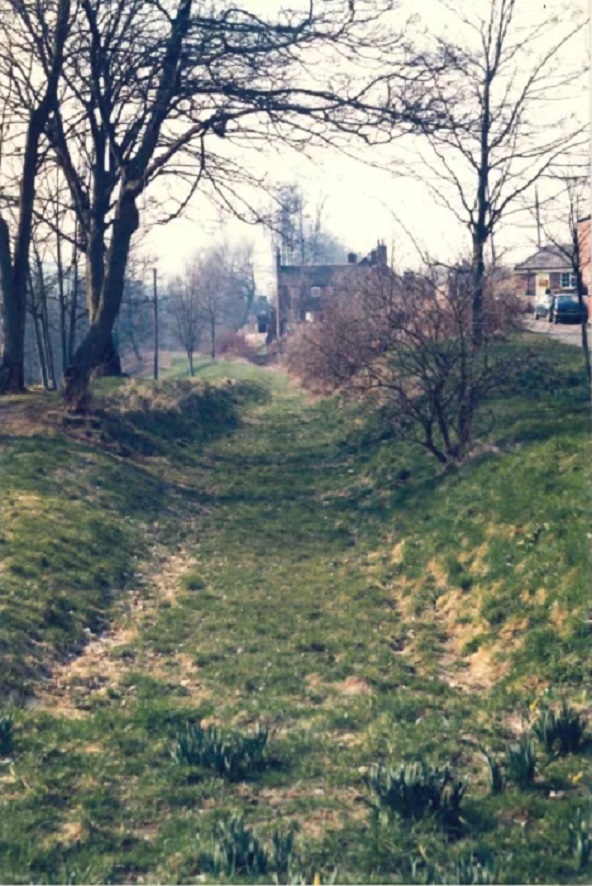
But first, a series of pictures associated with the Branch which have come to light since the three articles were completed. ….
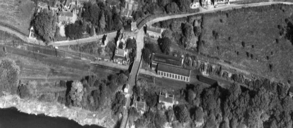
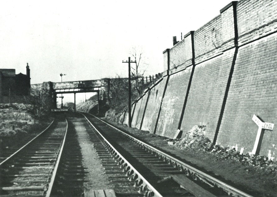
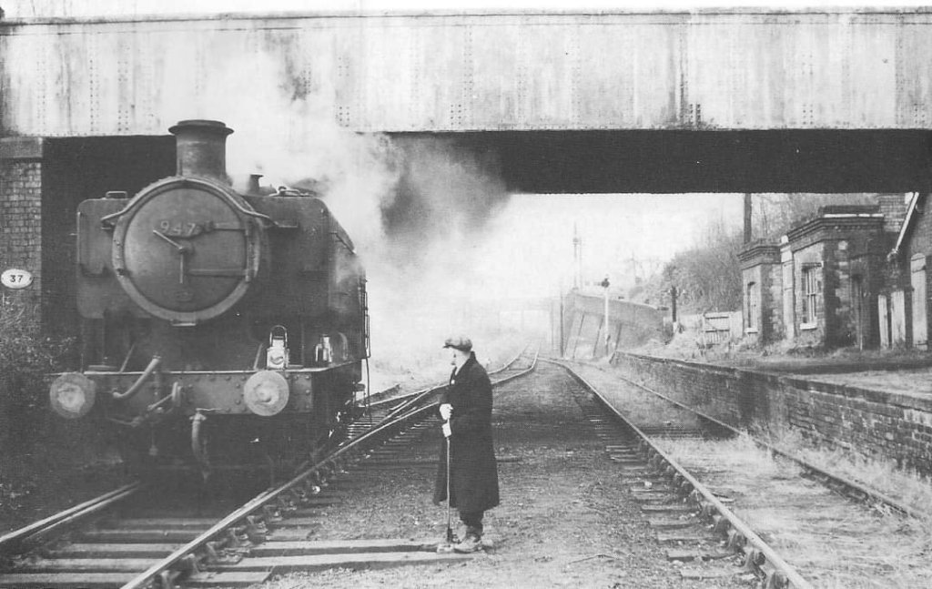
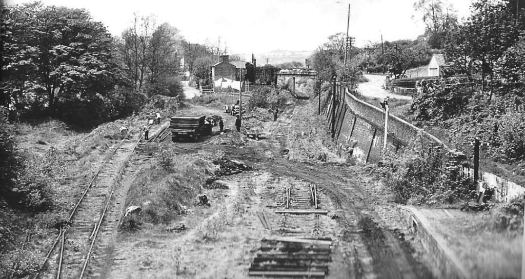
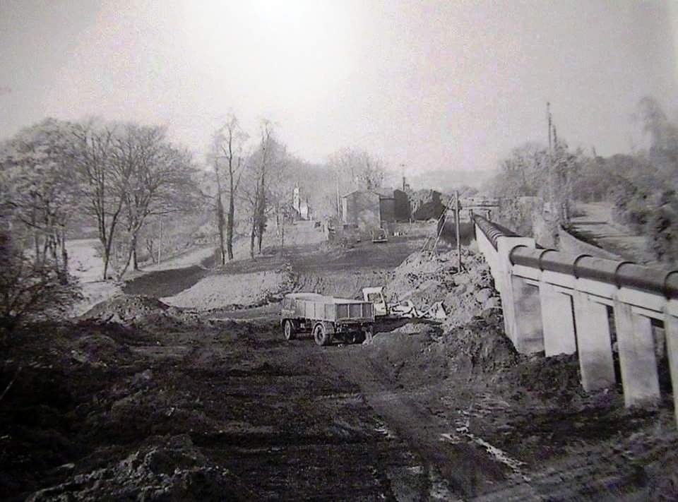
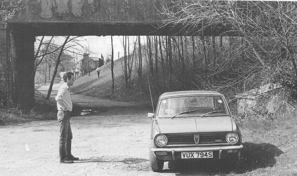
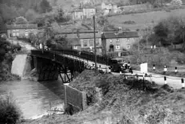
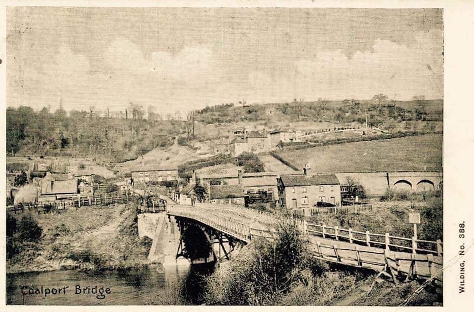
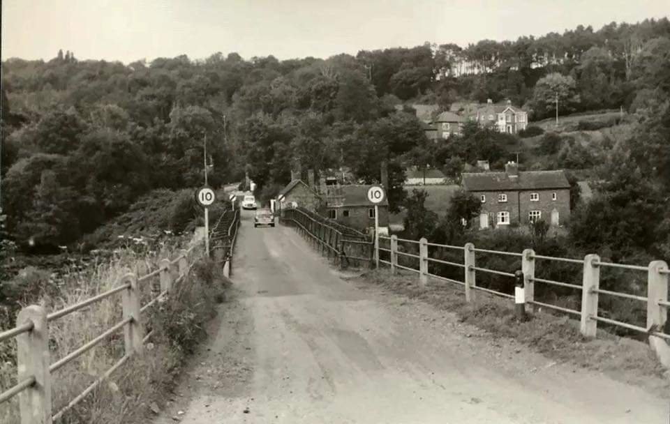
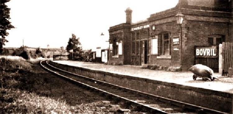
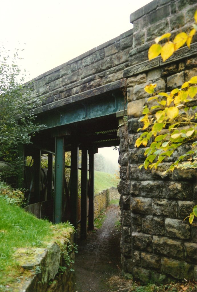
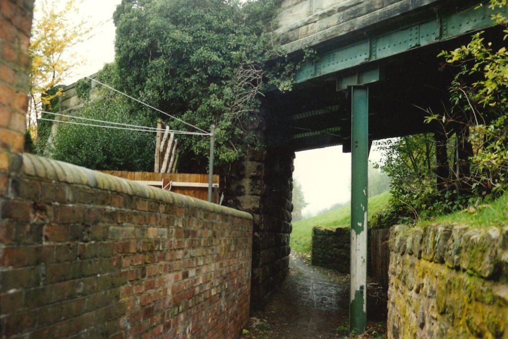
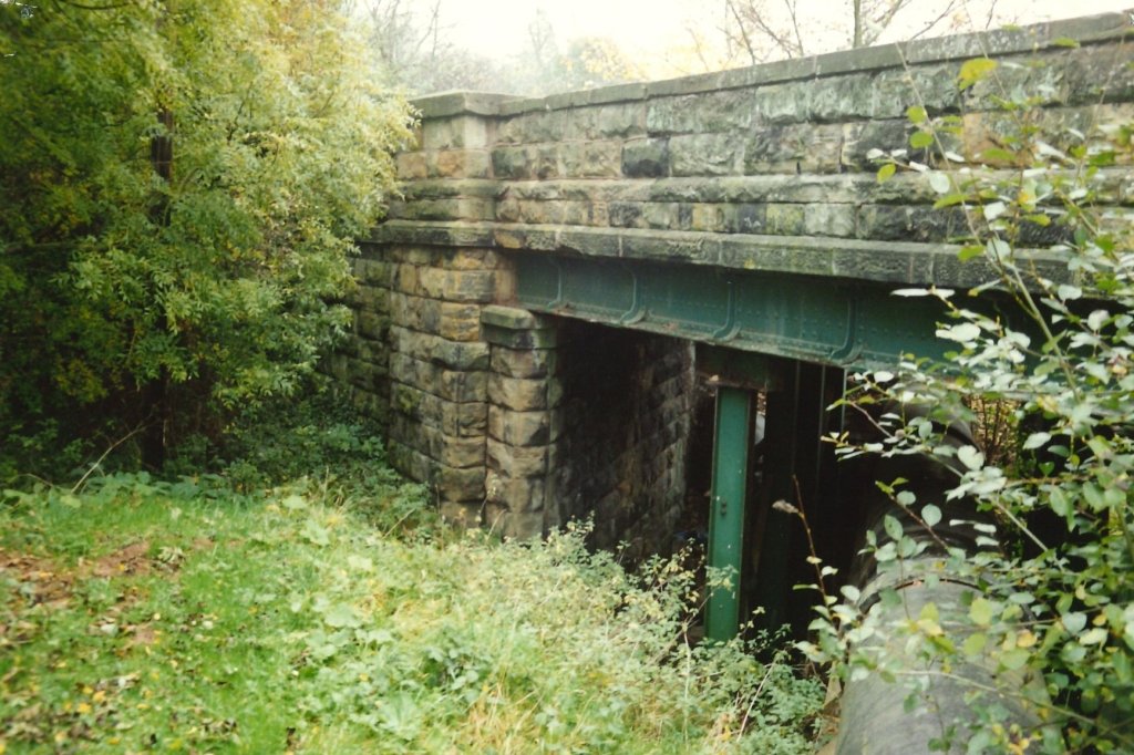
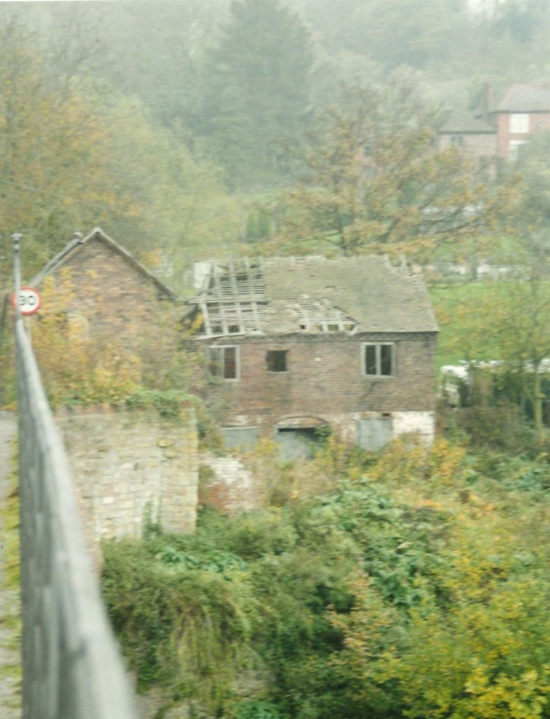
An aerial view of Coalport (East) Railway Station extracted from a larger aerial image included by Heritage England on the Britain from Above website. The view is from the South across the River Severn in 1948, (EAW019495) [1]This view looks to the West along the Branch from Coalport (East) Station. It emphahsises the gradients on the line. The gradient started immediately at the station throat as the gradient marker indicates. After passing under the overbridge trains encountered even steeper gradients. Looking through the bridge the increased grade can be seen. The bridge in this picture carries Coalport High Street and remains today to allow the Silkin Way and a rainwater sewer main to pass under. Pictures below show the propping required to allow the bridge to continue to carry road loading. [National Railway Museum]A picture of Coalport East Station in 1958, only a couple of years before final closure. This view looks West under the road bridge which spanned the Station. It was shared by Metsa Vaim EdOrg on the Telford Memories Facebook Group on 9th November 2020. [2]The dismantling of trackwork at Coalport East Station after the closure of the Branch. This picture was shared by Metsa Vaim EdOrg on the Telford Memories Facebook Group on 11th December 2021.[3]After the removal of the Branch trackwork, the route of the old railway was commandeered to provide a route from Telford New Town to the River Severn for the rainwater drainage main sewer. During construction,. the sewer was very prominent. After construction and with landscaping in place, only short section of the sewer pipe remained visible. Much of the length is now below the Silkin Way and in earlier articles we have seen evidence of its presence. This picture was shared in a comment on the image above by Geoff Martin on 12th December 2021. [3]A picture of the site of Coalport East Station in 1987. This view is taken from the same location as the photograph of 1958 above. It looks West under the road bridge which once spanned the Station. It was shared by Metsa Vaim EdOrg alongside the 1958 image on the Telford Memories Facebook Group on 9th November 2020. It illustrates the way in which the site has changed with the introduction of the main rainwater sewer. It precedes the pictures taken by Ian Turpin by only a year or two. [2]This photograph from the 1930s shows Coalport Bridge in the foreground. The Carriage Shed at Coalport Station can be seen immediately above the bridge. This image was shared by Marcus Keane on the Telford Memories Facebook Group on 18th March 2014. [4]Lin Keska shared this postcard image of Coalport Bridge in the comments about the above image on the Telford Memories Facebook Group on 26th February 2019. The passenger facilities can be seen to the left of the bridge. The carriage shed is again visible above the bridge and the high retaining wall behind the station site can be picked out to the right of the image. [4]Lin Keska also shared this image in the comments on the same post on 26th February 2019. This picture was taken in the 1960s. The site of the passenger station is now overgrown and the Carriage Shed has also been removed. [4]This photograph shows the front of the passenger facilities at Coalport East Station after closure of the passenger service in the 1950s. It was shared by Marcus Keane on the Telford Memories Facebook Group on 26th August 2015. [5]
Secondly, Coalport River Severn Warehouse
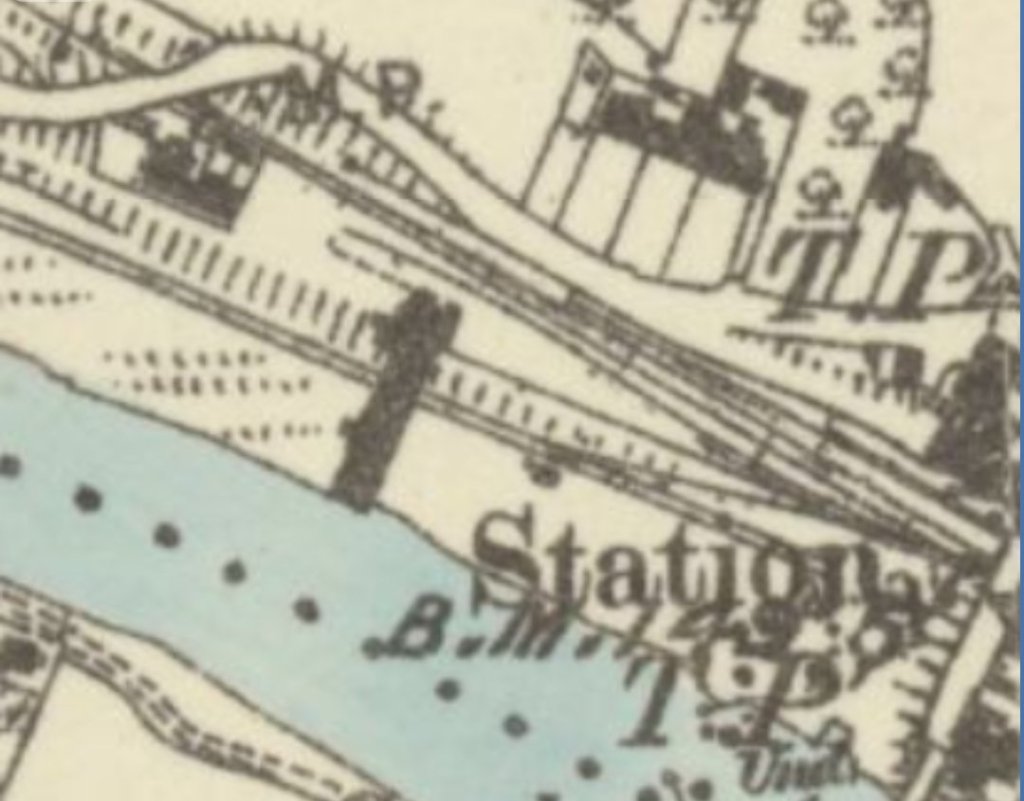
A close inspection of the 1881 6″ or 25″ Ordnance Survey will show a building straddling two of the sidings in the goods yard to the West of Coalport Station.
The 1881 6″ Ordnance Survey [6] shows a warehouse building alongside the River Severn to the West of the passenger facilities at Coalport East Station. This was the River Severn Warehouse noted fleetingly by Bob Yate in his description of the Branch. [7: p183]
Yate notes this warehouse in his shirt description of Coalport East Station: “Two run-around loops gave access to a small goods yard, and to the goods warehouse alongside the River.” [7: p183] By the time of the 1901 Ordnance Survey, the main warehouse element of the building had been demolished, leaving only a truncated section which acted as a good shed. The only picture that I have found of the building dates from after it had been partially removed.
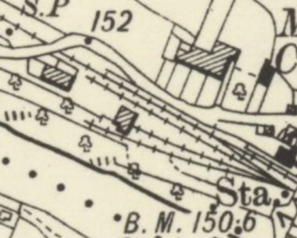
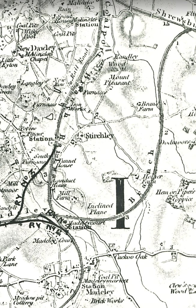
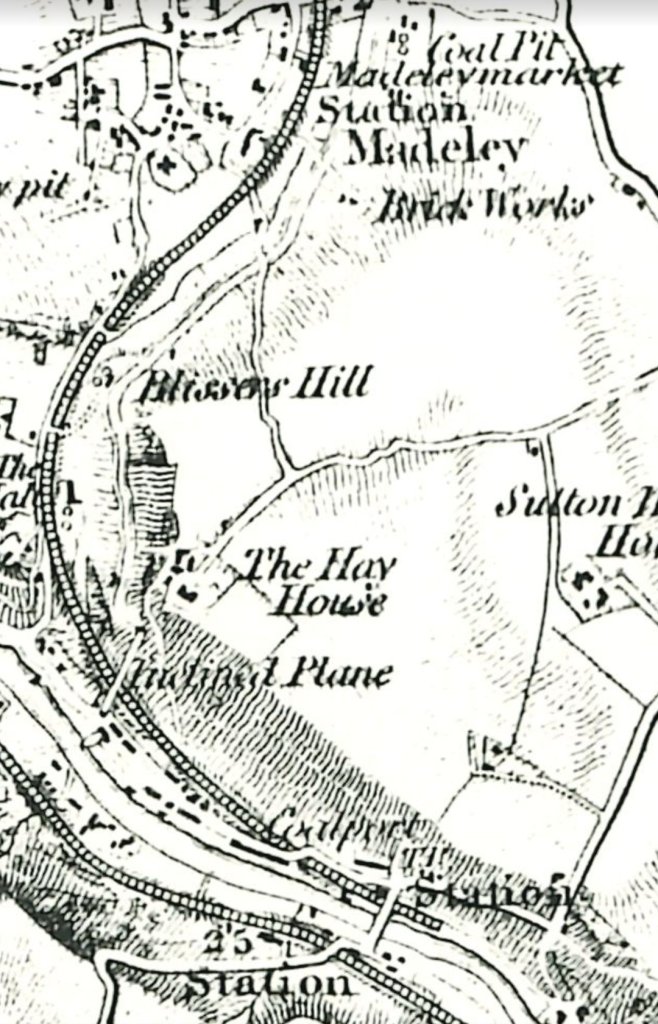
Third, the relevant parts of the 1″ Ordnance Survey of 1833(revised to show rail routes). …
This first extract from the 1″ Ordnance Survey shows the length of the Coalport Branch covered in my first article about the line, Hadley Junction to Malinslee Station.This extract shows the length covered in Part 2 – Malinslee Station to Madeley Market Station. The thick black lines drawn on the map represent possible schemes to line the different rail routes in the immediate area.This extract shows the length of the Branch covered by the third article, from Madeley Market Station to Coalport Station (Coalport East Station).
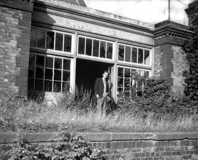
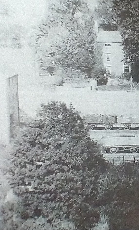
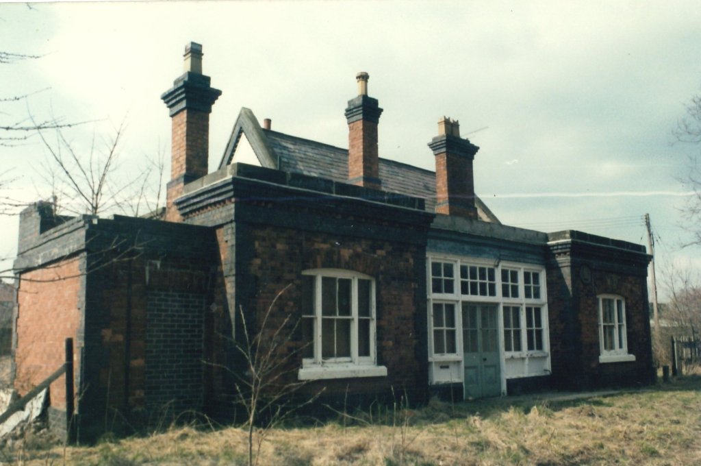
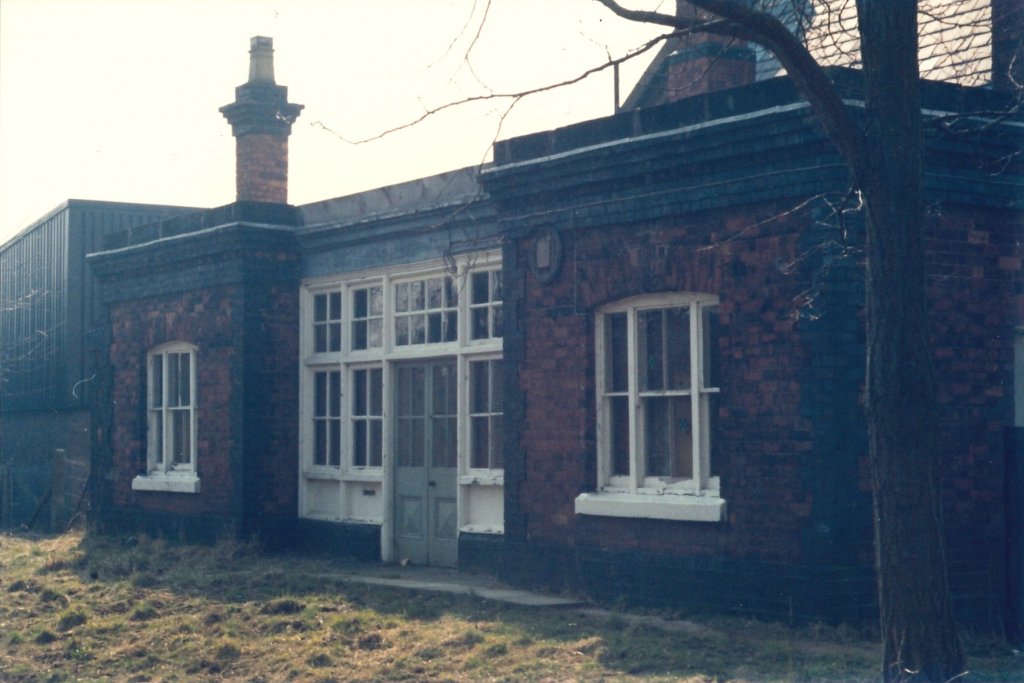
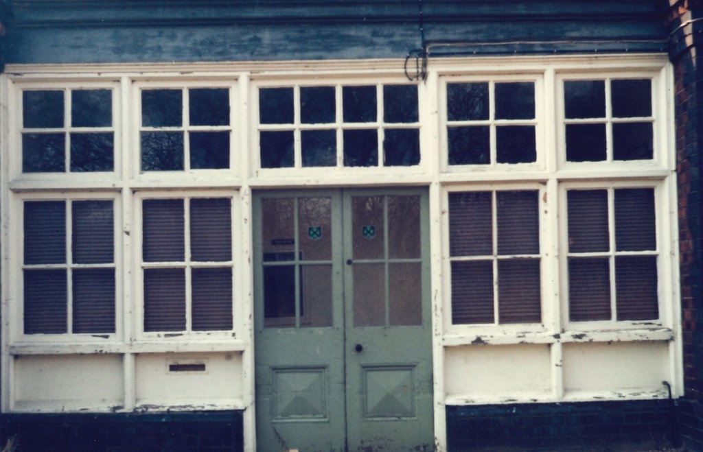
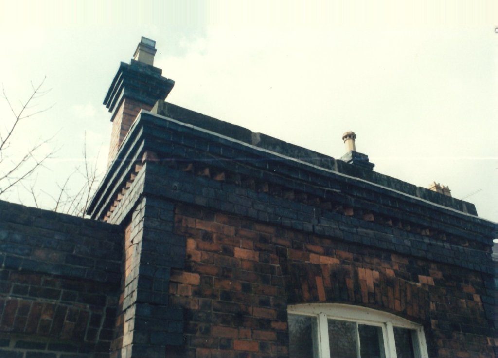
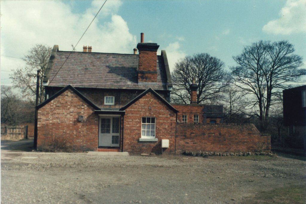
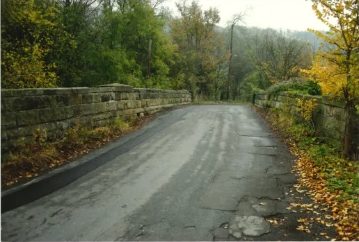
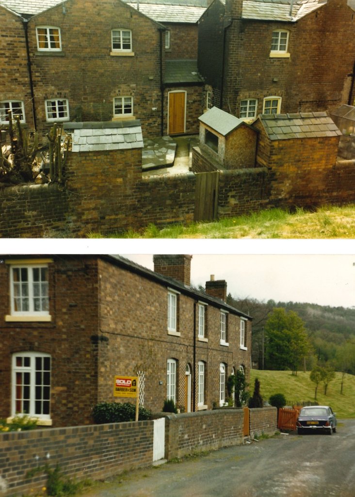
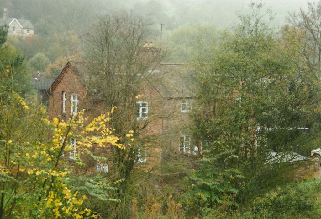
Fourthly, Ian Turpin’s photos of Madeley Market Station. … Madeley Market Station Building seemed a little isolated and forlorn back in the late 1980s, although it seems not to have suffered any significant vandalism. The pictures were taken with a mind to being able to recreate the facilities at Coalport in model form as the buildings were of similar construction.
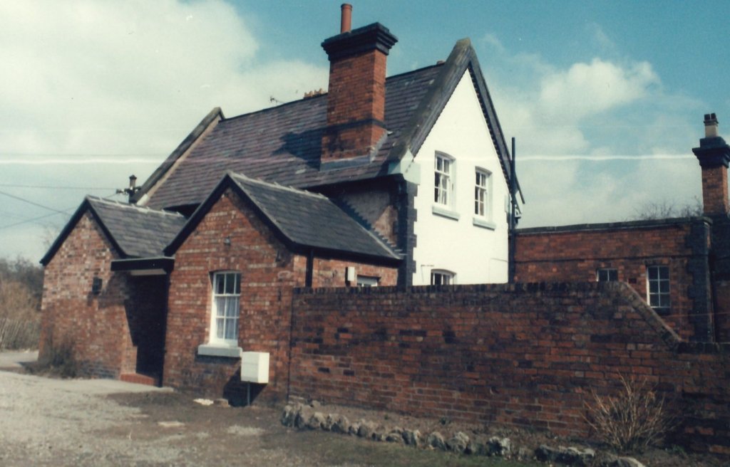
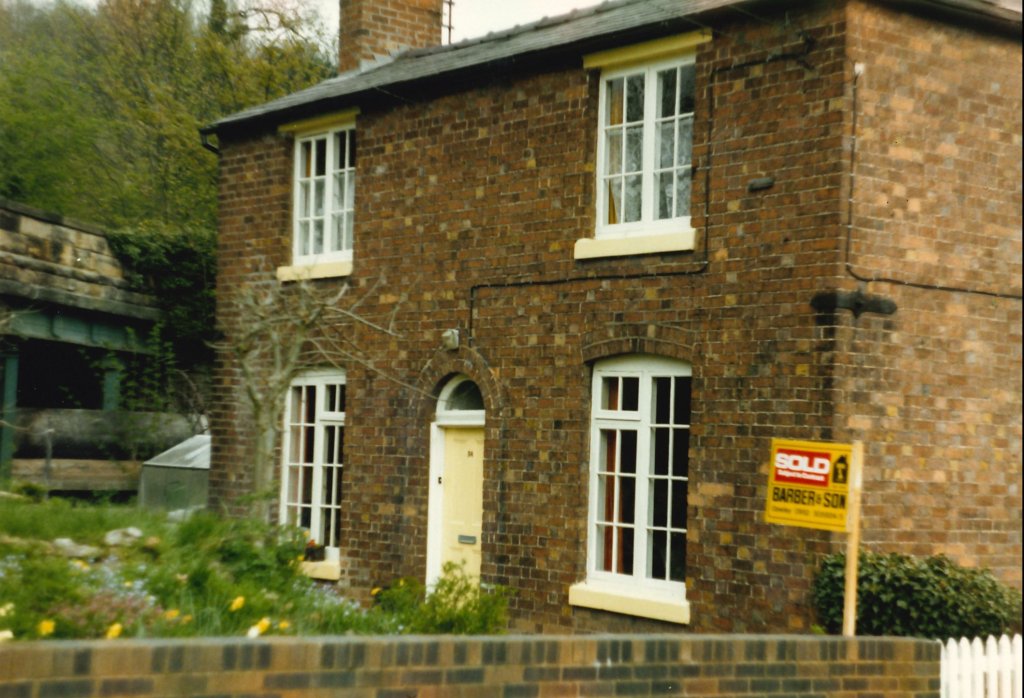
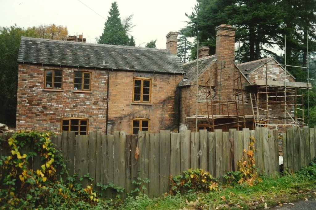
The Bridge Toll House at street level in the 21st century. The building originated as a warehouse (1793-1808), was in use as house by 1815 and as tollhouse from 1818, when the adjacent Coalport Bridge underwent major repairs. Shropshire County Council became owners in 1922, and it was restored after it passed to the Buildings at Risk Trust in 1994. [9]
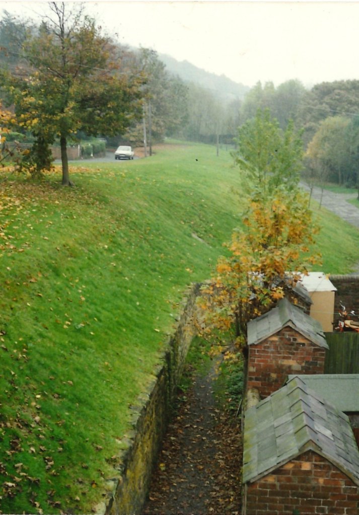
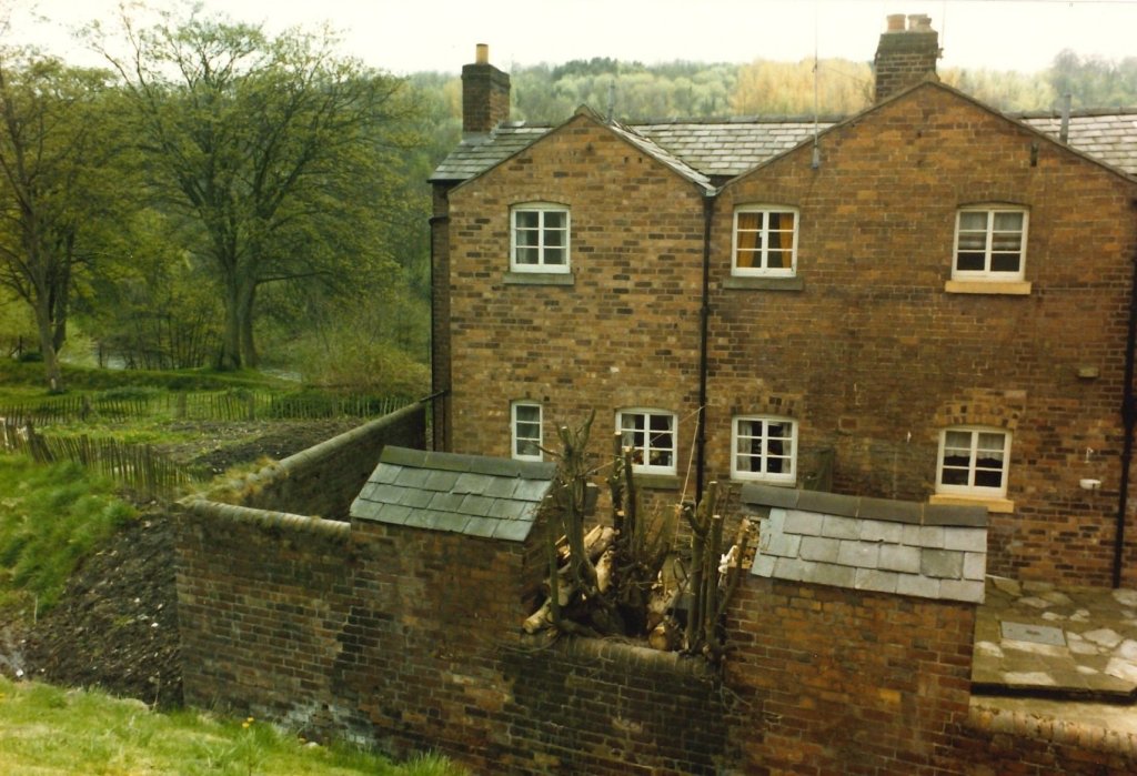
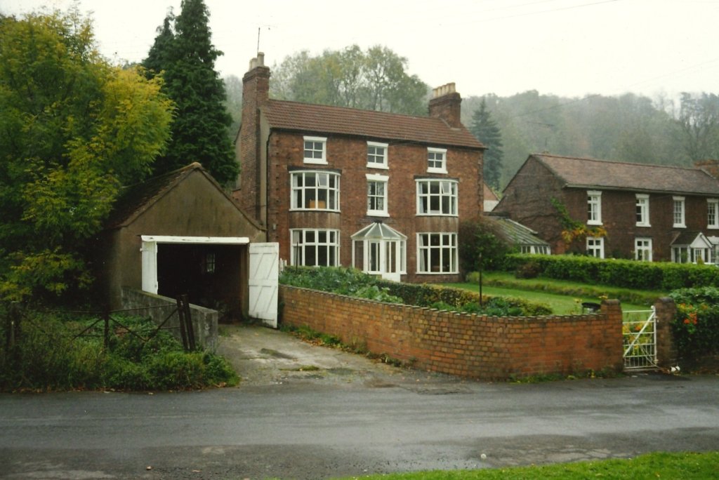
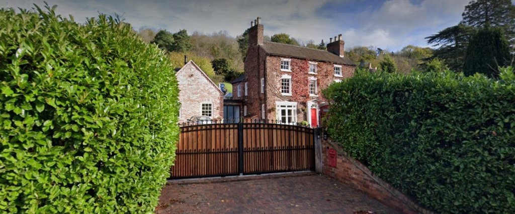
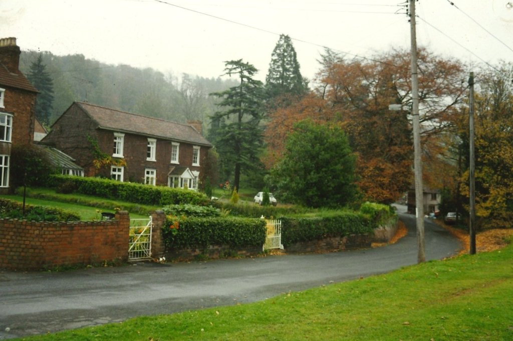
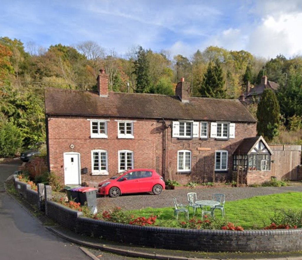
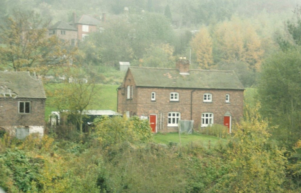
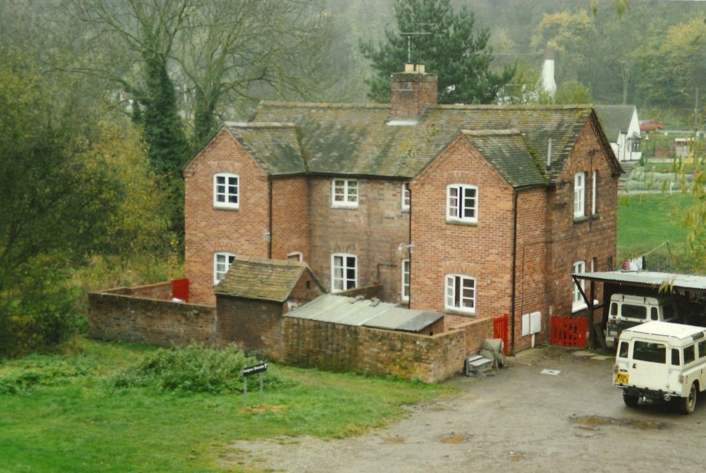
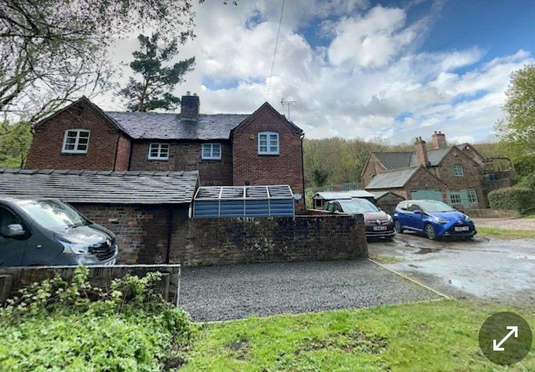
The cottages to the North of the river and to the South of the Station site. The next two photographs show the same cottages from the NorthThe same cottages as shown on Google Streetview with the Bridge Toll House on the right. [Google Streetview, April 2023]
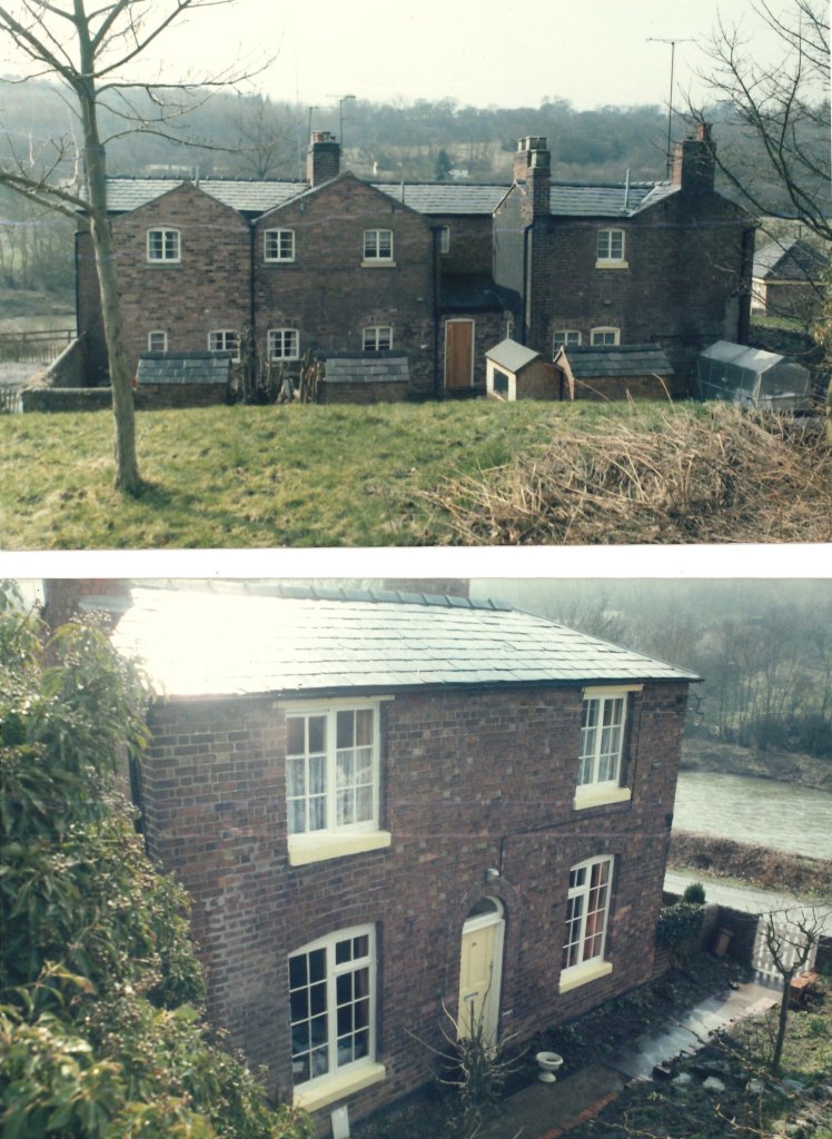
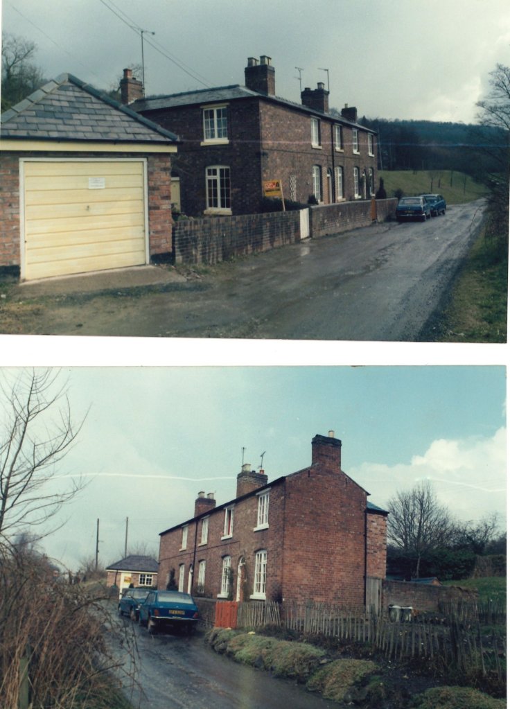
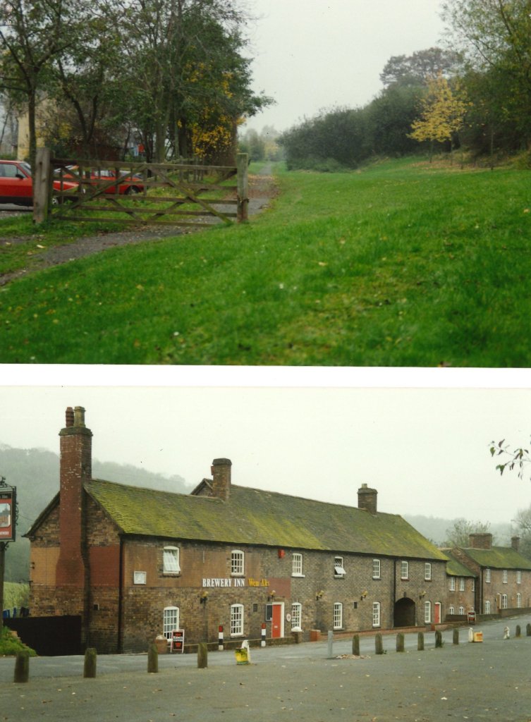
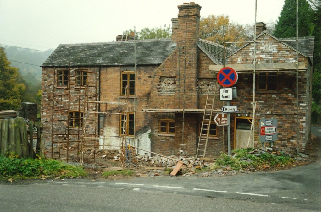
The photographs taken by Ian Turpin were all used as background material for the construction of a model railway centred on Coalport (East) Railway Station. The pictures were taken in the period before the road-bridge across the Severn was renovated.
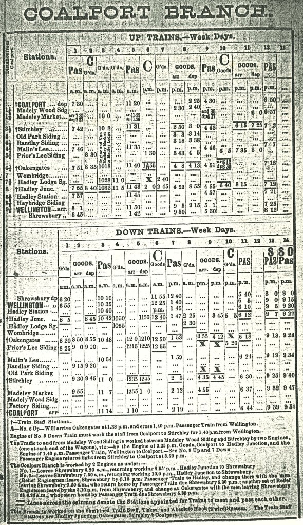
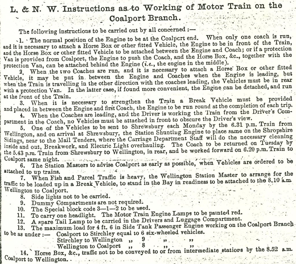
And, before we turn to the photographs of Ian Turpin’s layout, …. two extracts from LNWR publications. The first of these shows the 1905 timetable for the Branch, the second is the LNWR working directions of 1917 for operating Motor Trains on the Branch. Both of these were forwarded to me by Ian Turpin. The working timetable shows that the Branch was worked by two engines. A two-coach motor-train worked the branch from May 1910 until sometime after the grouping with 50ft x 8ft arc roof stock (converted from ordinary non-corridor stock). The Branch was by this time rated third class only. Of the two coaches, one was LNWR No.103 (LMS No. 53450 and the other was LNWR No. 1815 (LMS No. 5338).
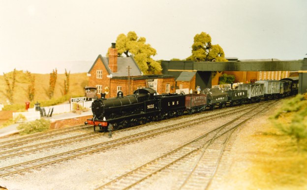
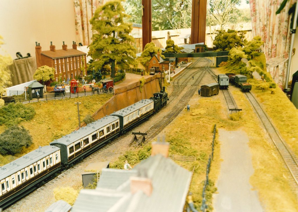
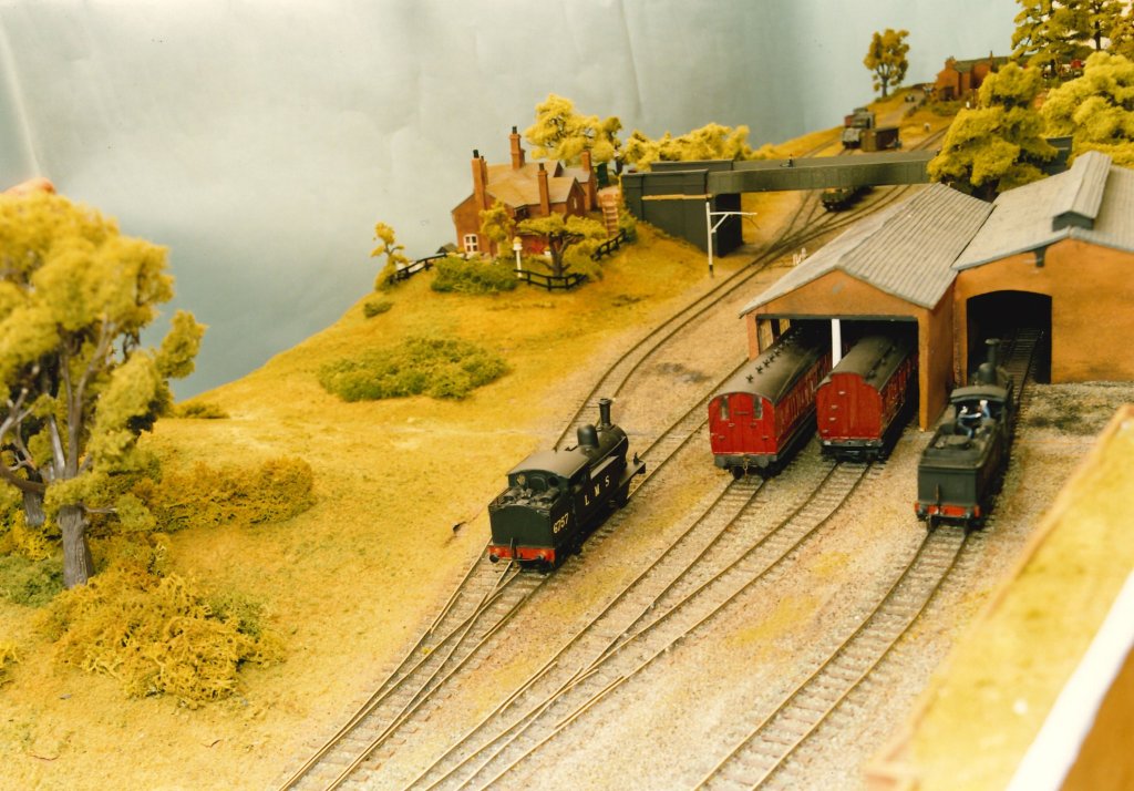
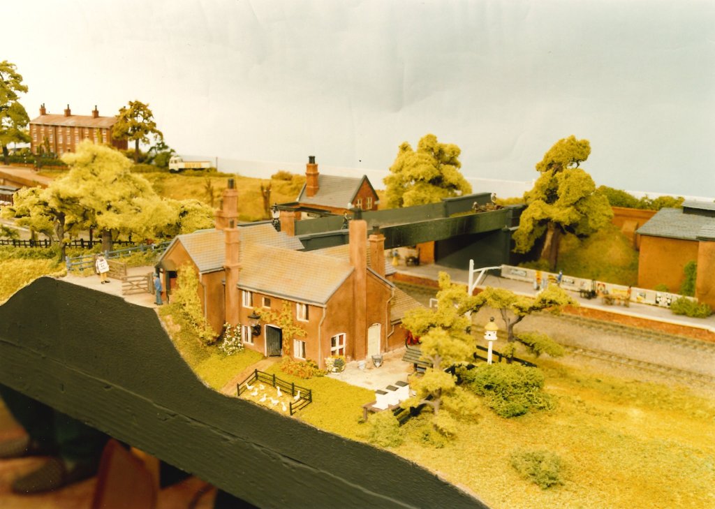
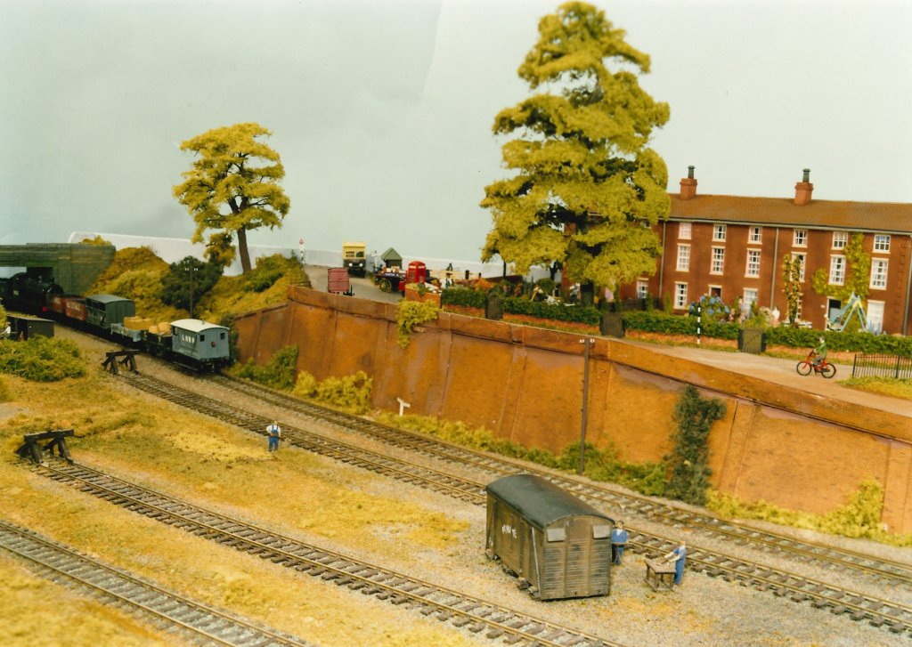
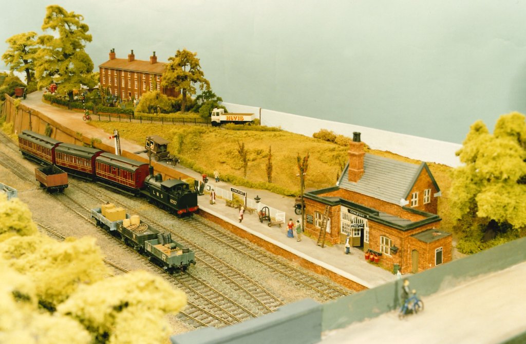
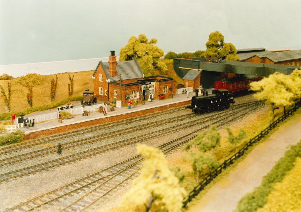
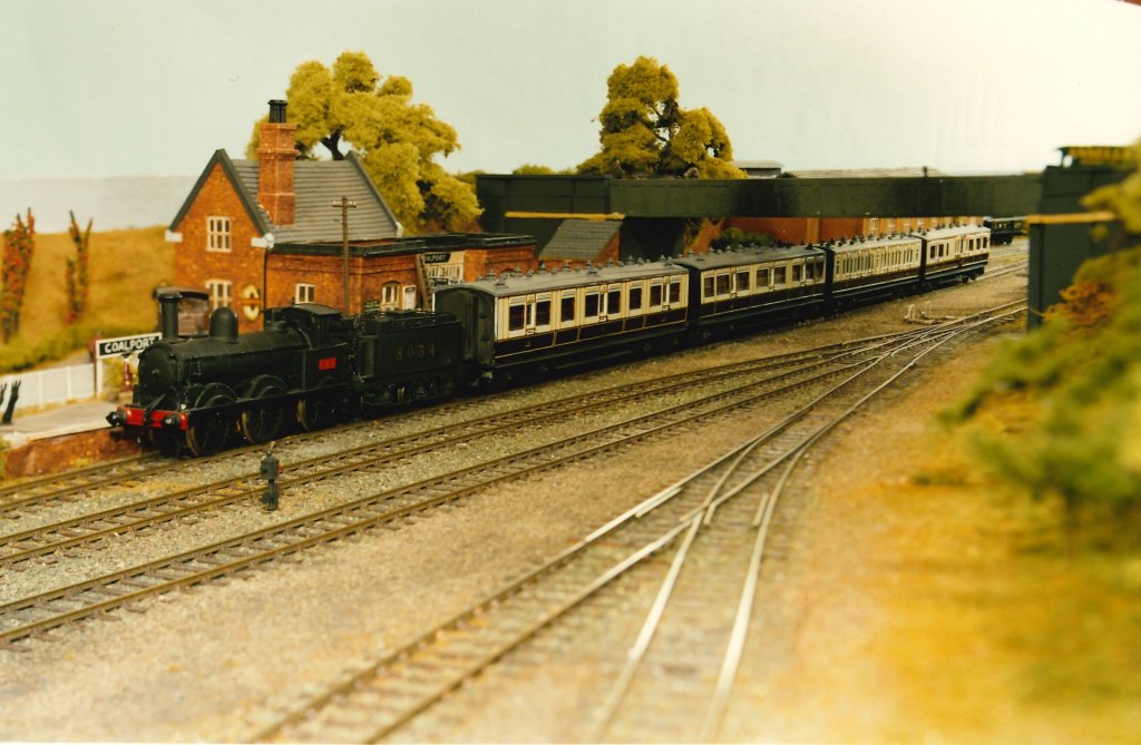
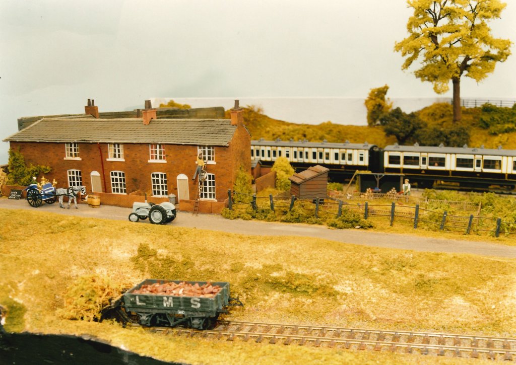
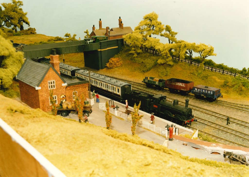
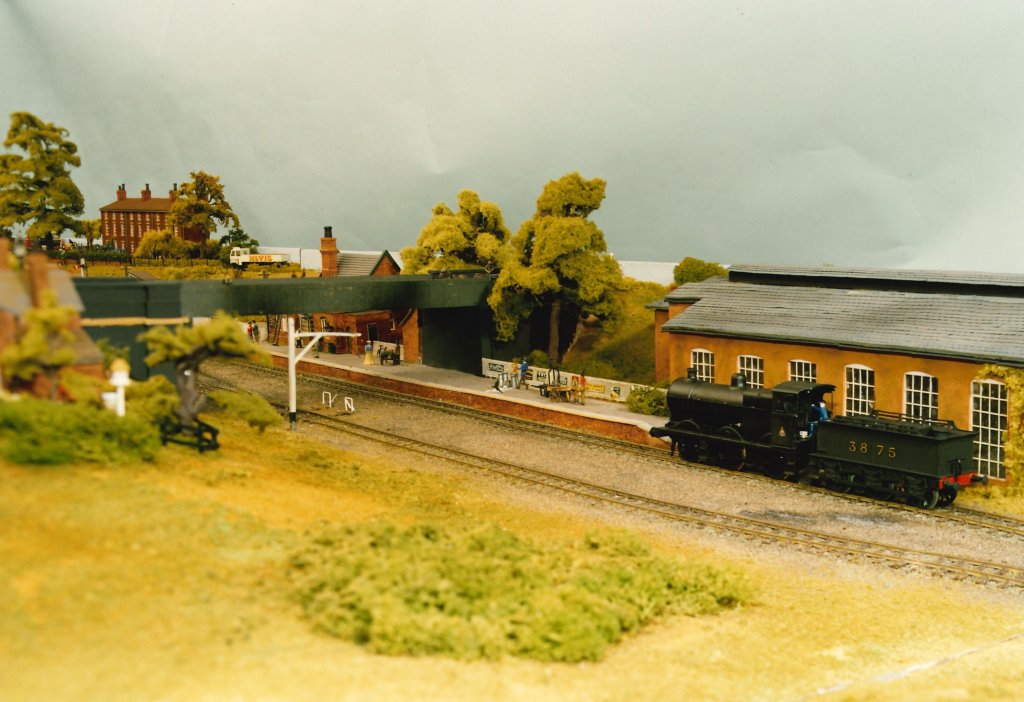
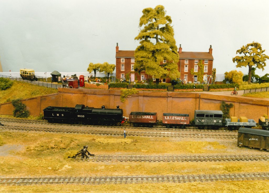
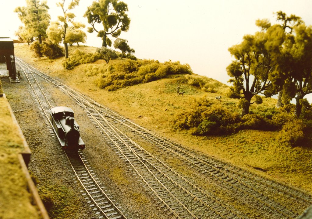
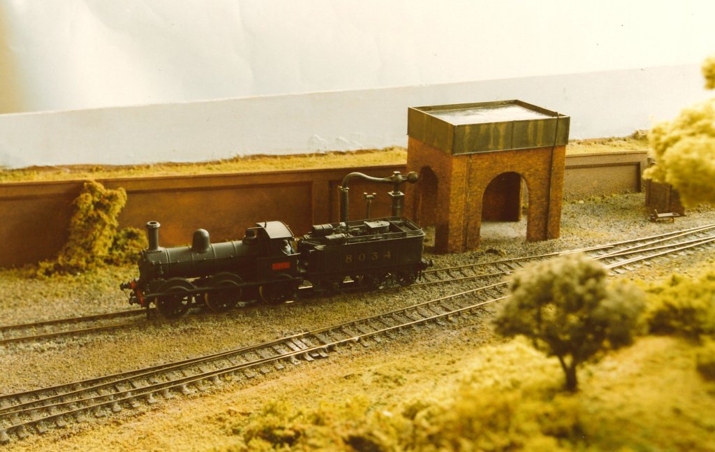
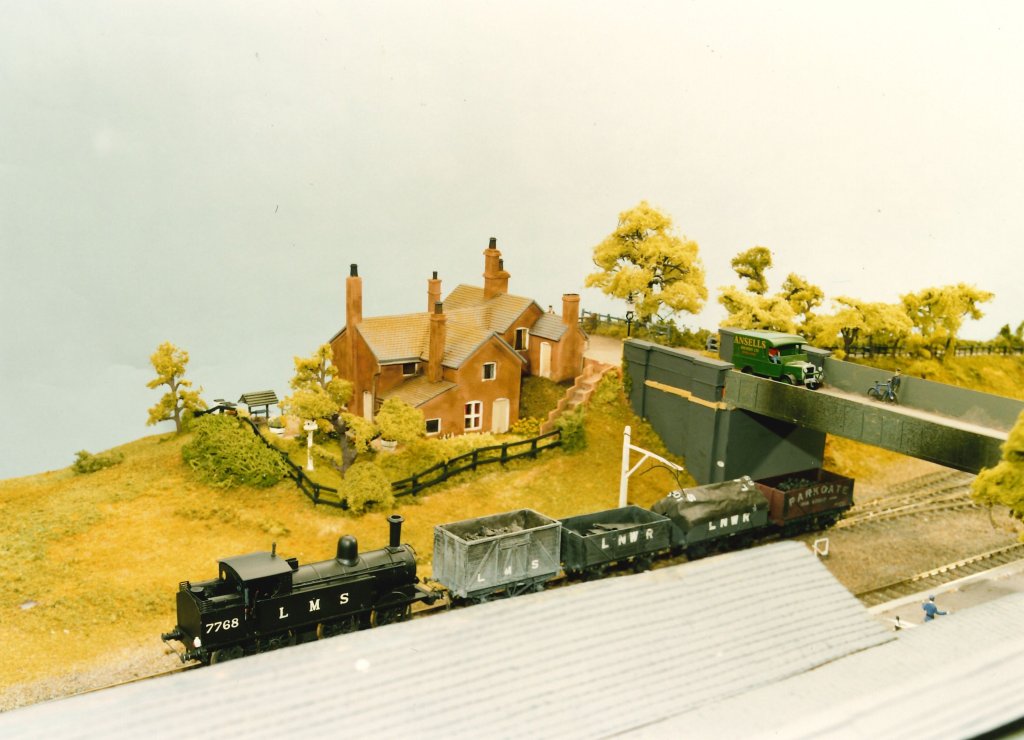
Ian Turpin’s layout which featured in The Railway Modeller in the 1990s.
Ian Turpin sent me the superb photographs of his excellent model below. They were taken for an article about his layout which was published in the Railway Modeller in the 1990s. He has very kindly agreed to their inclusion here.
Bob Yate; The Shropshire Union Railway: Stafford to Shrewsbury including the Coalport Branch; No. 129 in the Oakwood Library of Railway History; The Oakwood Press, Usk, Monmouthshire, 2003.
6 thoughts on “The Railways of Telford – The Coalport Branch – Part 3A”
Damien
Hi Roger, thankyou do much for this article. I live in the Toll House and have been looking for a picture of the house from the railway yard for several years to no avail, now I have one!
Just a note that the article refers to our house as the Old Toll House which is not correct (At least by todays names). The Old Toll House is the house opposite to No. 3 at the bottom of Sutton Bank with our address being Coalport Bridge Toll House.
hi – I have heard mention of a 2WW pill-box/ gun emplacement protecting Coalport East – Station. Do you know if it still exists or where it was placed please?


Hi Roger, thankyou do much for this article. I live in the Toll House and have been looking for a picture of the house from the railway yard for several years to no avail, now I have one!
Just a note that the article refers to our house as the Old Toll House which is not correct (At least by todays names). The Old Toll House is the house opposite to No. 3 at the bottom of Sutton Bank with our address being Coalport Bridge Toll House.
Thanks again for a great piece of work.
Thank you Damien, and you are welcome!
I think I have now changed the relevant notes under the photographs.
Thankyou
hi – I have heard mention of a 2WW pill-box/ gun emplacement protecting Coalport East – Station. Do you know if it still exists or where it was placed please?
Sorry Martin, I do not know anything about this.
thanks for speedy response – appreciated