
The Zeal Tor Tramway was “also known as Redlake Peat Tramway. Built for Messrs. Davy and Wilkin of Totnes, 1847-1850, for carrying peat from Redlake Mire to Shipley Bridge. The tramway was constructed from wooden rails bolted to granite blocks, along which the peat was transported in horse-drawn trucks. The business only continued for a few years and ended in 1850.” [1]
“The men who worked in the peat-cutting at Redlake used to stay out there during the week and they built a house of sorts on Western White Barrow and lived largely on rabbits poached from nearby Huntingdon Warren.” [2]
“Much of the route of the old tramway can be seen. The lower part of it was later, in 1872, used by the Brent Moor Clay Company, as also was the building at Shipley, now abandoned.” [2]
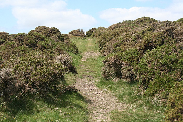
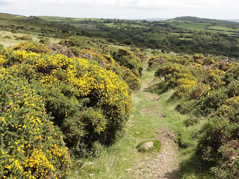
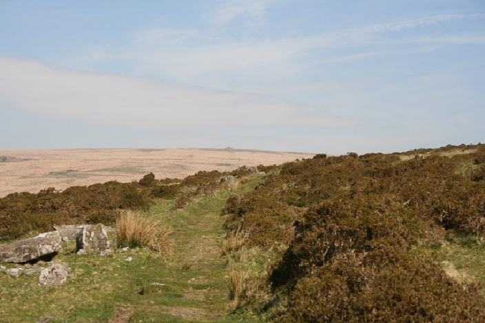
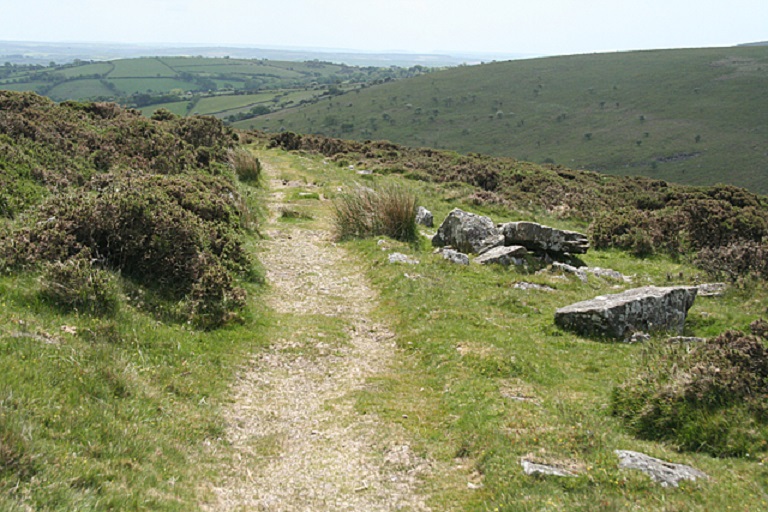
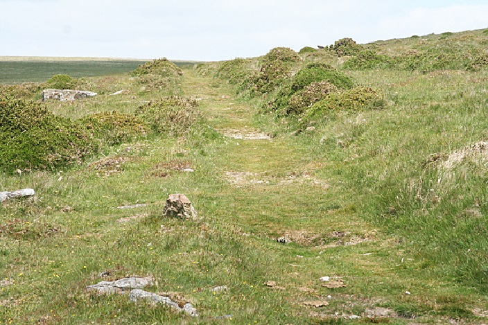
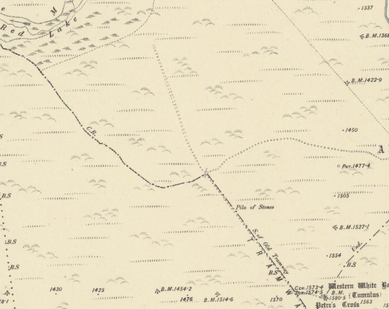
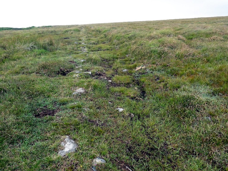
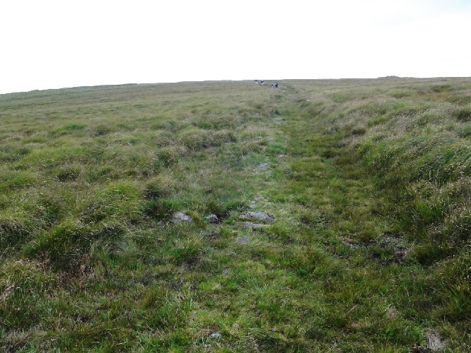
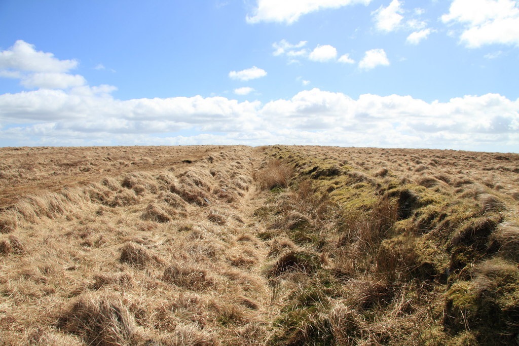
“The wooden rails and granite blocks have disappeared. The track line, clean turf not overgrown, is clearly defined. From ‘the crossways’ in the north the track keeps to the west of Western Whitebarrow and continues down the south side of the hill in a south-easterly direction to the Brent parish boundary.” [2]
Wade says: “Leyson Hopkin Davy and William Wilkins of Totnes established the South Brent peat and peat charcoal works at Shipley Bridge in 1846. In order to transport raw peat to Shipley Bridge the Zeal Tor Tramway was constructed 1847. It was horse drawn, built with wooden rails bolted to granite sleeper blocks. The gauge was between 4ft 6 inch and 5ft (judged from places where sleepers still exist).” [3: p11]
The Partnership was dissolved 1850 and the tramway left to decay until 1872. “The Brent Moor Clay company was formed by Messrs Hill and Hall, who sought to produce clay. … The site was half way along and close by the course of the old tramway, to which a connection was built. The tramway was then used for transporting materials between Petre’s pit, as it became known, and the old naphtha works at Shipley Bridge which was converted to clay dries.” [3: p11-12] … However, the clay was of too poor quality for anything but pottery, and the 1870s marked a depression in the china clay industry. Petre’s pit closed and the Company abandoned works by 1880 and the tramway was … left to rot.” [3: p13]
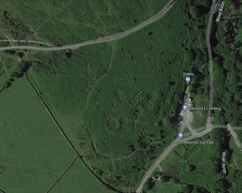
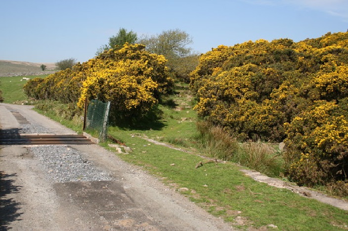
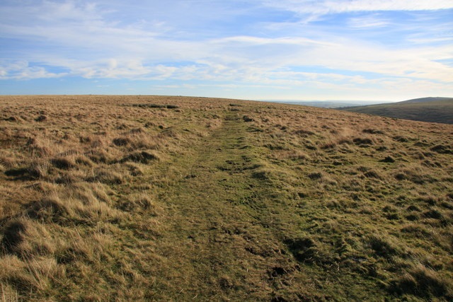
“The trackbed of the dismantled tramway provides great access to the high south moor from the car parking area at Shipley Bridge.” [4]
The Route of the Tramway
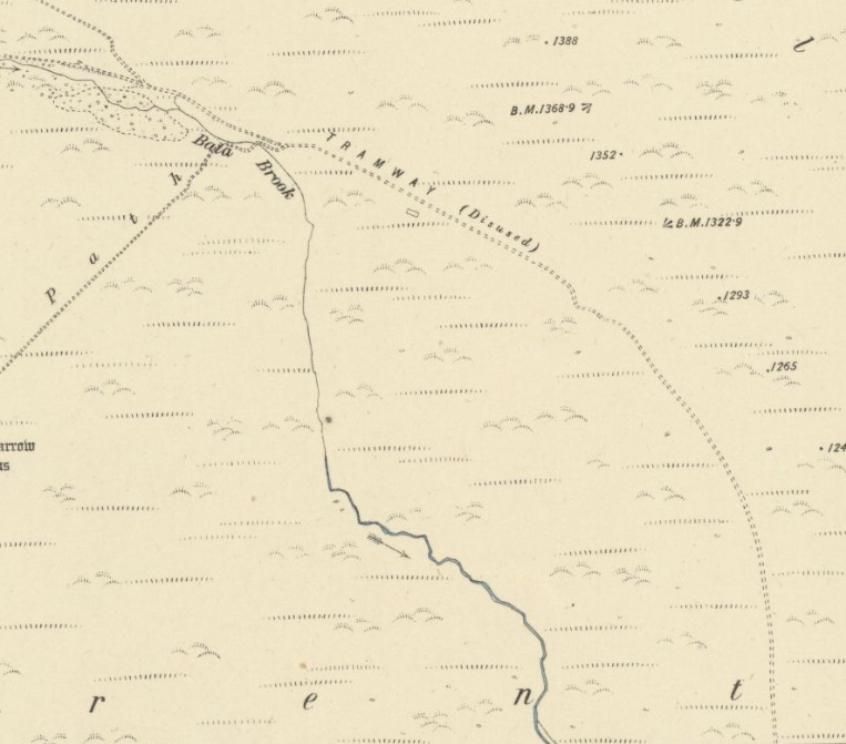
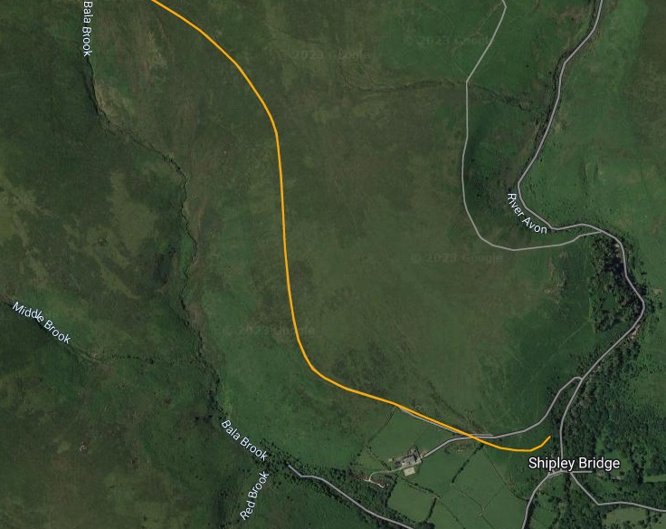
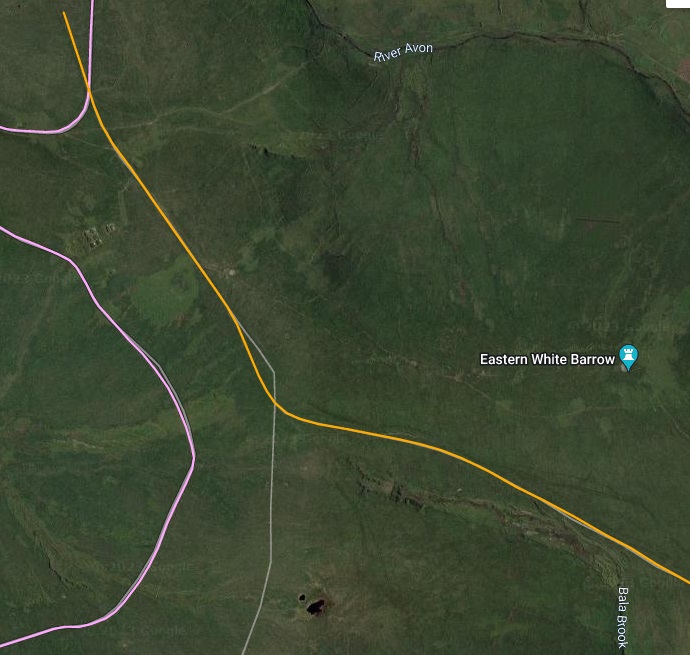
We start our exploration of the route of the old tramway in Shepley Bridge on the River Avon, which can be seen on the right of the map extract below and in the bottom-right of the satellite image from railmaponline.com which follows a little further down the article.
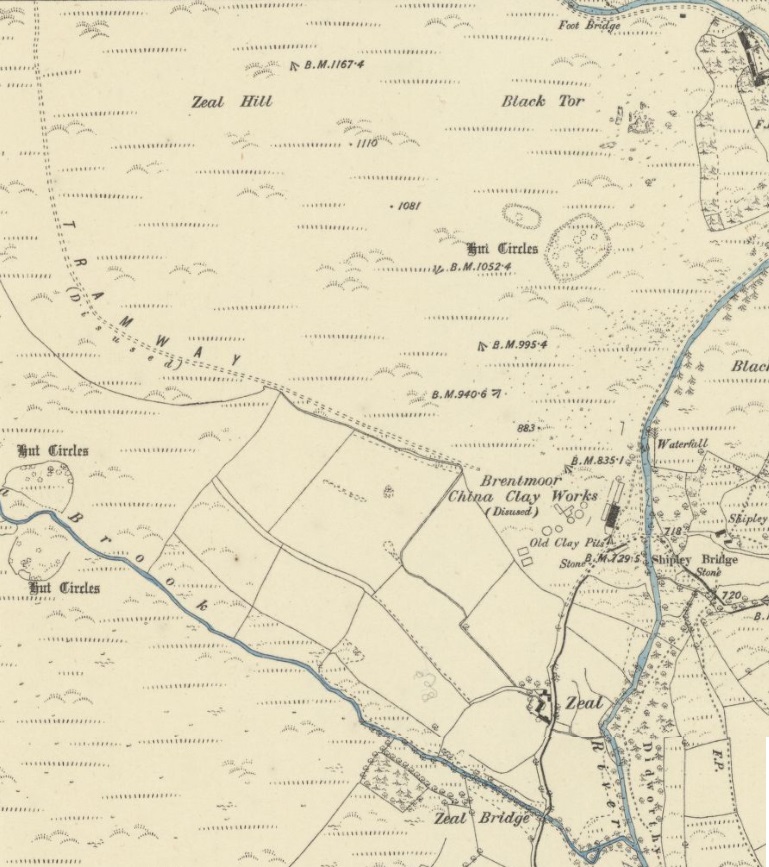
The next image is an enlarged extract for the 6″ Ordnance Survey mapping showing the site of Shepley Bridge.
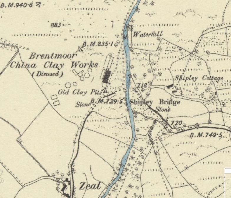
The remains of the works at Shepley Bridge are covered in some detail on a webpage on the Dartmoor Explorations website. [27]
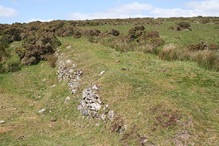
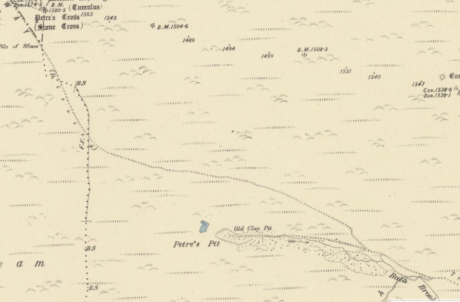

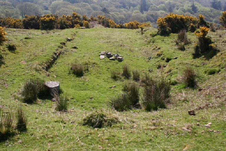
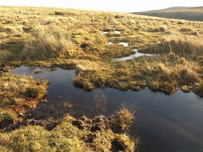
At this location a branch tramway ran West to Petre’s Pits. There are remnants close to this location of ancient huts, [25] tin was excavated here and later clay extraction occurred for a short period. It was the clay extraction works which resulted in a link to the Zeal Tor Tramway being constructed. As we have already noted, the quality of the china clay produced was very poor and the venture did not succeed. [3: p12]
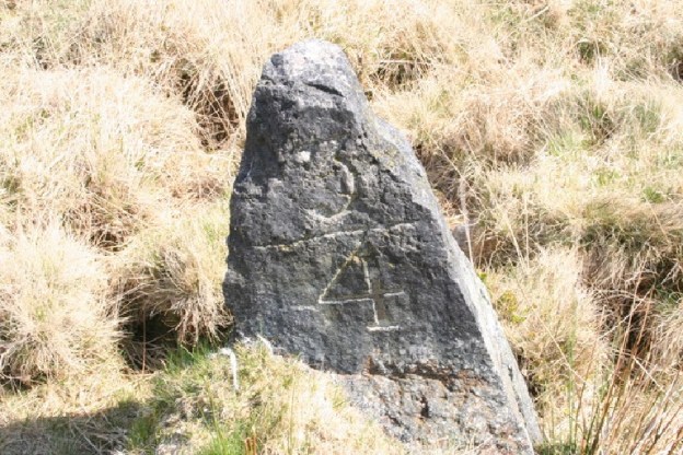
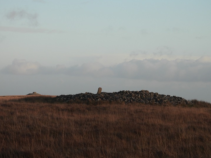
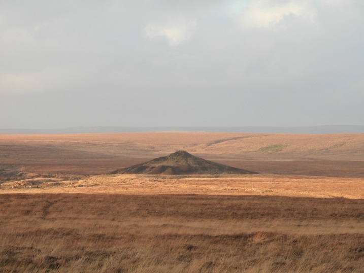
Petre’s Cross is located in the centre of the summit cairn on Western White Barrow
(O/S Grid Ref: SX/65361/65493). It was one of four crosses, erected in the 16th Century, by Sir William Petre to mark the boundary of the Manor of Brent. It is about 1.14 metres. It is about 0.36 metres wide and about 0.18 metres thick. [21]
“Sir William Petre was one of the signatories to the dissolution of Buckfast Abbey in 1539, when it was valued at the sum of £464 – 11s – 2d. He then promptly went out and bought the land belonging to the former Abbey and incorporated it into his estate. This cross was one of four that he later utilised, or had erected, to mark the extended boundary of his Manor of Brent. The other three crosses were sited at Three Barrows, Lower Huntingdon Corner and Buckland Ford, although the latter is now missing.” [21]
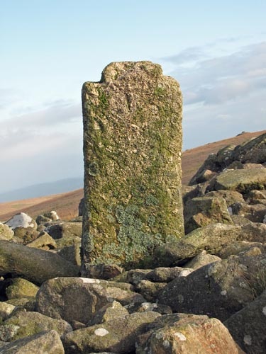
This cross “was badly mutilated in the mid 1800’s by the nearby Redlake peat cutters who built themselves a shelter out of the stone of the summit cairn. The arms were knocked off the shaft, with one arm also taking a part of the head. The shaft was then used as a chimney support for the fire built into the shelter.” [21]
“Although the shelter was later demolished and the cairn rebuilt, the outline of the house is still visible. The entrance doorway is in the east wall and the fireplace is directly opposite the door. The shaft of the cross is now set into the top of the cairn, outside the house and in an upside down position. The chamfered base of the shaft, which once fitted into it’s socket stone, is clearly visible at the top. The shaft also now bears the Ordnance Survey benchmark.” [21]
North of this point the Zeal Tor Tramway route was crossed by the later Red Lake Tramway and beyond that crossing point the Zeal Tor Tramway spread out into a series of portable lines across the peat beds. [3: p13]
References
- https://www.heritagegateway.org.uk/gateway/Results_Single.aspx?uid=MDV5158&resourceID=104, accessed on 9th April 2023.
- H. Harris; 1968, Industrial Archaeology of Dartmoor; 1968, p95, 109, 221; via https://www.heritagegateway.org.uk/gateway/Results_Single.aspx?uid=MDV5158&resourceID=104, accessed on 9th April 2023.
- E.A. Wade; The Redlake Tramway and China Clay Works, published by Twelveheads Press, Truro, 2004.
- https://holidayindartmoor.co.uk/south-brent/zeal-tor-tramway-dismantled-36426.html, accessed on 9th April 2023.
- https://maps.nls.uk/view/101445388, accessed on 8th April 2023.
- https://maps.nls.uk/view/101445223, accessed on 8th April 2023.
- https://www.railmaponline.com/UKIEMap.php, accessed on 8th April 2023.
- https://www.geograph.org.uk/photo/988983, accessed on 9th April 2023.
- https://www.geograph.org.uk/photo/2417770, accessed on 9th April 2023.
- https://www.geograph.org.uk/photo/988992, accessed on 9th April 2023.
- https://www.geograph.org.uk/photo/2417797, accessed on 9th April 2023.
- https://www.geograph.org.uk/photo/2840449, accessed on 9th April 2023.
- https://www.geograph.org.uk/photo/988968, accessed on 9th April 2023.
- https://www.geograph.org.uk/photo/2417784, accessed on 9th April 2023.
- https://www.geograph.org.uk/photo/2417801, accessed on 9th April 2023.
- https://www.geograph.org.uk/photo/1052297, accessed on 11th April 2023.
- https://dartefacts.co.uk/dartefact/petres-pits, accessed on 11th April 2023.
- https://www.geograph.org.uk/photo/2840493, accessed on 11th April 2023.
- https://www.geograph.org.uk/photo/791621, accessed on 11th April 2023.
- https://www.geograph.org.uk/photo/2840548, accessed on 11th April 2023.
- http://www.dartmoor-crosses.org.uk/petre’s.htm, accessed on 11th April 2023.
- https://www.geograph.org.uk/photo/3419270, accessed on 11th April 2023.
- https://www.geograph.org.uk/photo/1088697, accessed on 11th April 2023.
- https://www.geograph.org.uk/photo/1052325, accessed on 11th April 2023.
- https://historicengland.org.uk/listing/the-list/list-entry/1004557, accessed on 11th April 2023.
- https://www.facebook.com/groups/370152633365720/permalink/1798788957168740, accessed on 11th April 2023.
- https://dartmoorexplorations.co.uk/shipley-bridge-between-the-c-county-stones, accessed on 11th April 2023.

Very interesting. LH Davy led an busy life:
https://en.m.wikipedia.org/wiki/Lleyson_Hopkin_Davy