
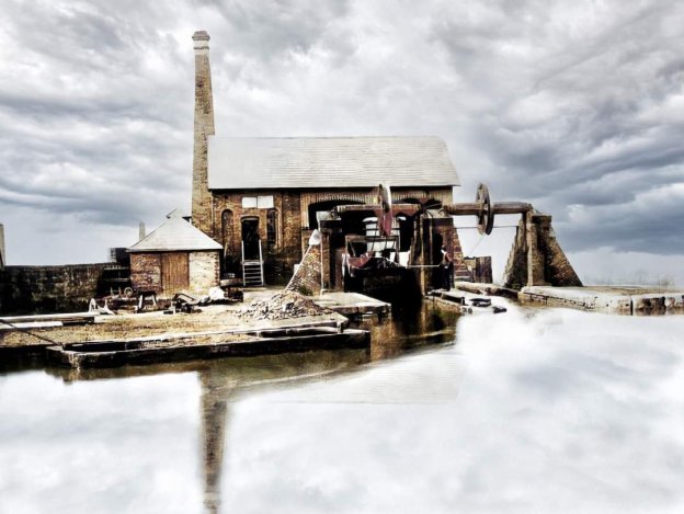
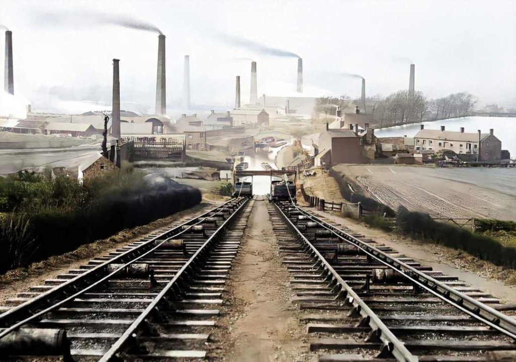
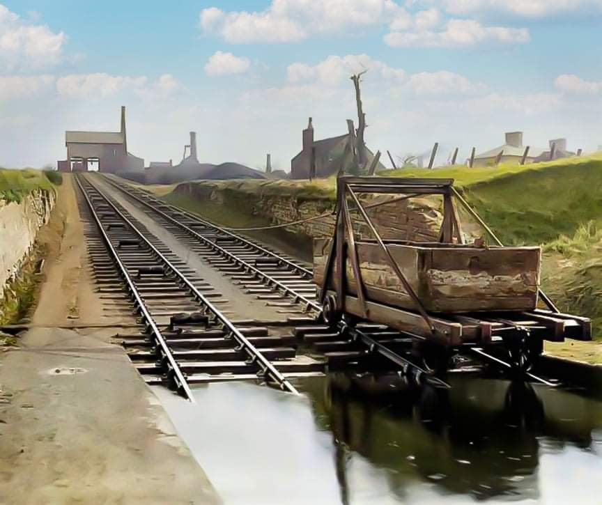
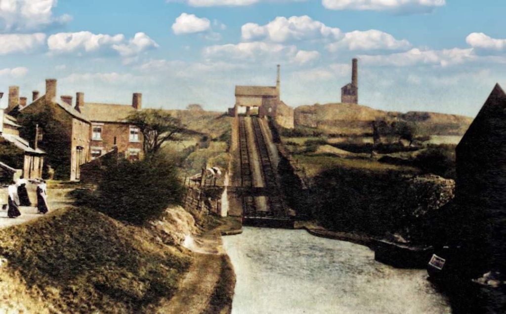
The featured image above was colourised by Simon Alun Hark. It makes the engine house and the mechanisms associated with the inclined plane so real. [14]
P. Whitehead [11] provides approximate statistics for the inclined planes on the Shropshire Canal as follows:
- Trench Inclined Plane: 227yds long, 73ft 6in rise.
- Wrockwardine Wood Inclined Plane: 350yds long, 120ft rise. Or 316yds long, 113ft 2in rise.
- Windmill Inclined Plane: 600yds long, 125 ft rise.
- Hay Inclined Plane: 300yards long, 213ft rise.
- Ketley Inclined Plane: 59yds long, 73 ft rise. Or, 65 yds long, 73ft rise.
- Lilleshall Inclined Plane: 123 yds long, 43 ft. This replaced an earlier vertical lift in a shaft and tunnel system. [11]
I first came across an example of these inclined planes before moving to East Shropshire. We drive past the Hay Incline when travelling by a circuitous route from Manchester to Ludlow. At the time I wrote a couple of short articles for my blog:
- https://rogerfarnworth.com/2020/10/21/coalport-incline-ironbridge
- https://rogerfarnworth.com/2021/06/10/coalport-incline-ironbridge-addendum-2021
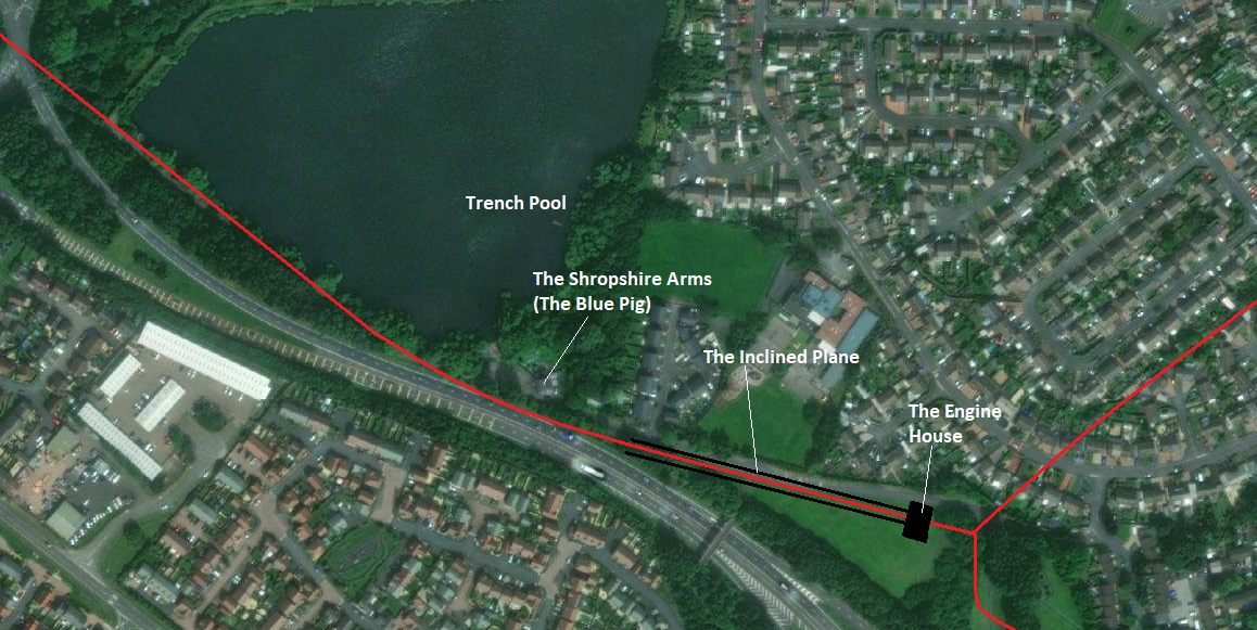
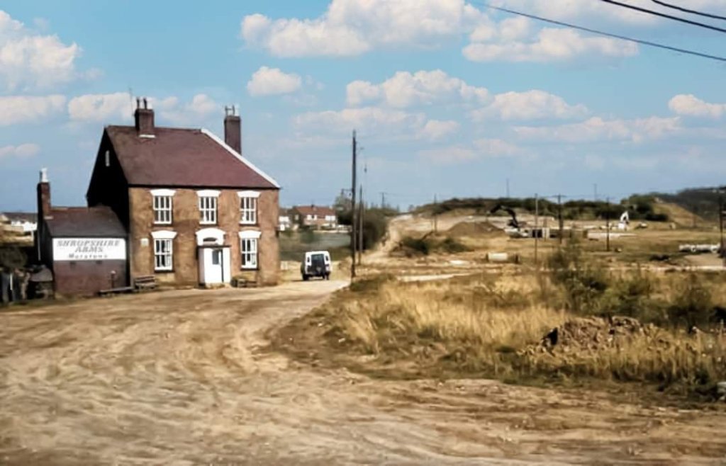
This article focuses on the Trench Inclined Plane which was built by the Shrewsbury Canal Company in 1792 after it took over the Wombridge Canal. The Wombridge Canal was a tub-boat canal in Shropshire, England, built to carry coal and iron ore from mines in the area to the furnaces where the iron was extracted. It opened in 1788. Trench Inclined Plane remained in operation until 1921, becoming the last operational canal inclined plane in the country. The canal had been little used since 1919, and closed with the closure of the plane. [15] [16]
The Inclined Plane consisted of twin railway tracks, each with a cradle in which a single tub-boat was carried. An engine and engine house were built at the top of the incline to provide power to the Incline. It was supplied by the Coalbrookdale Company and was replaced in 1842 by a new engine that lasted for 79 years, until the final demise of the incline on 31 August 1921. The remaining structural elements of the incline were remove in 1968 as part of the Telford New Town developments. [15][17]
The engine’s main function was to lift the tub boats I cradles out of the canal at the top of the incline over the end wall of the canal. The rails of the inclined plane ran up out of the canal and then down the main length of the Inclined Plane. Generally, the working traffic was in the downward direction of the incline, and was counterbalanced by empty tub-boats returning up to the top level. [17] This meant that little power was needed for the operation of the main length of the incline.
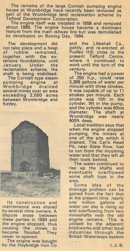
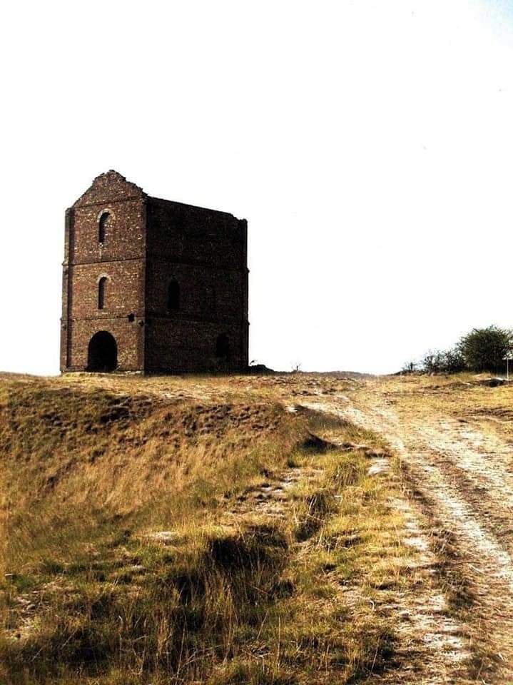
Incidentally, “a prominent feature near the top of the incline was the Wombridge Pumping Engine house. This was a Cornish type, with a tall chimney, and was erected in 1858, to pump water from the mines. The main cylinder was 60 inches (150 cm) in diameter, with a 10-foot (3.0 m) stroke, and it lifted water from a depth of around 600 feet (180 m). The engine developed 250 hp (190 kW) and normally ran slowly, raising 3,338 imperial gallons (15.17 m3) of water per minute, in three strokes. When running at maximum speed, it could achieve eleven strokes per minute.” [18]
Maps and Illustrations of the Inclined Plane
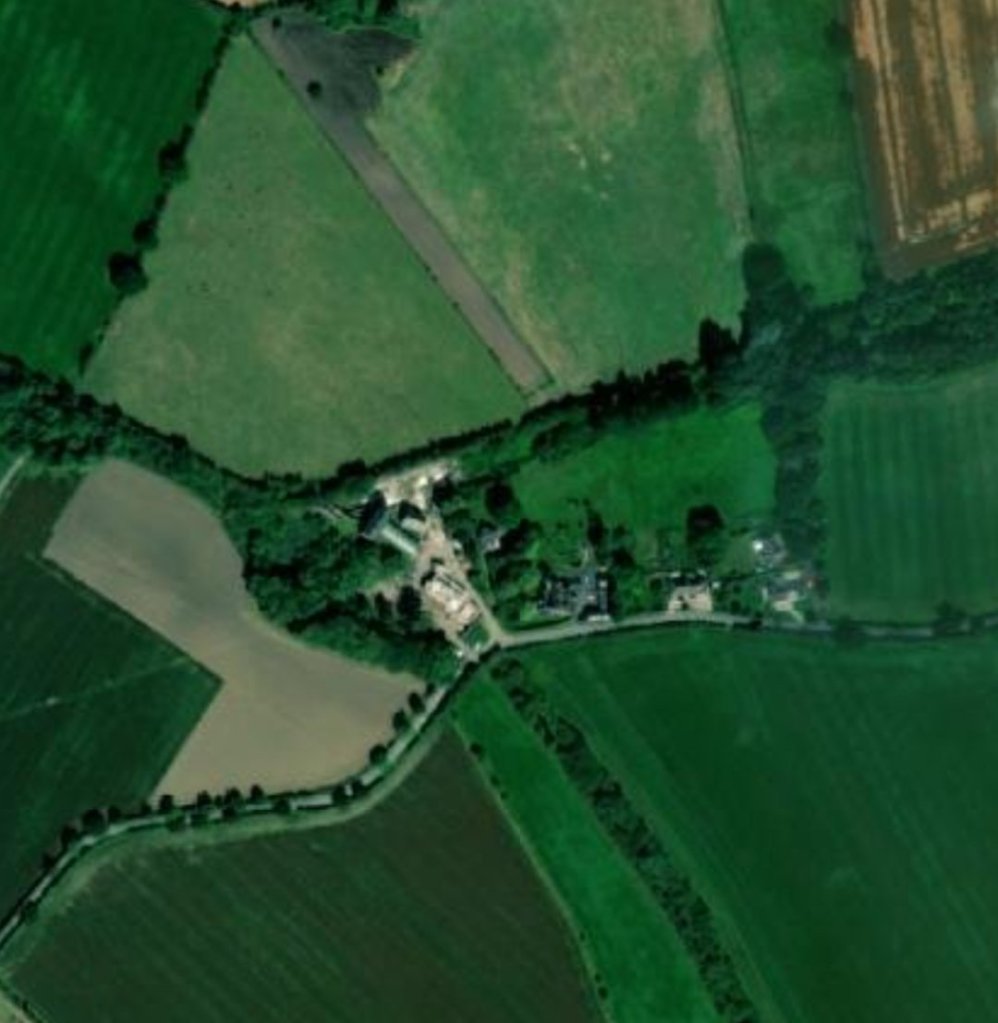
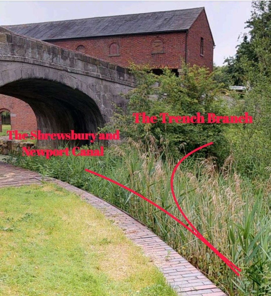
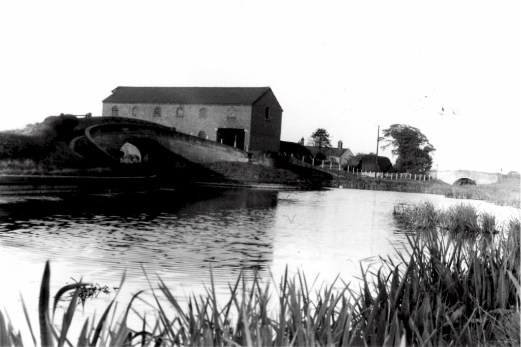
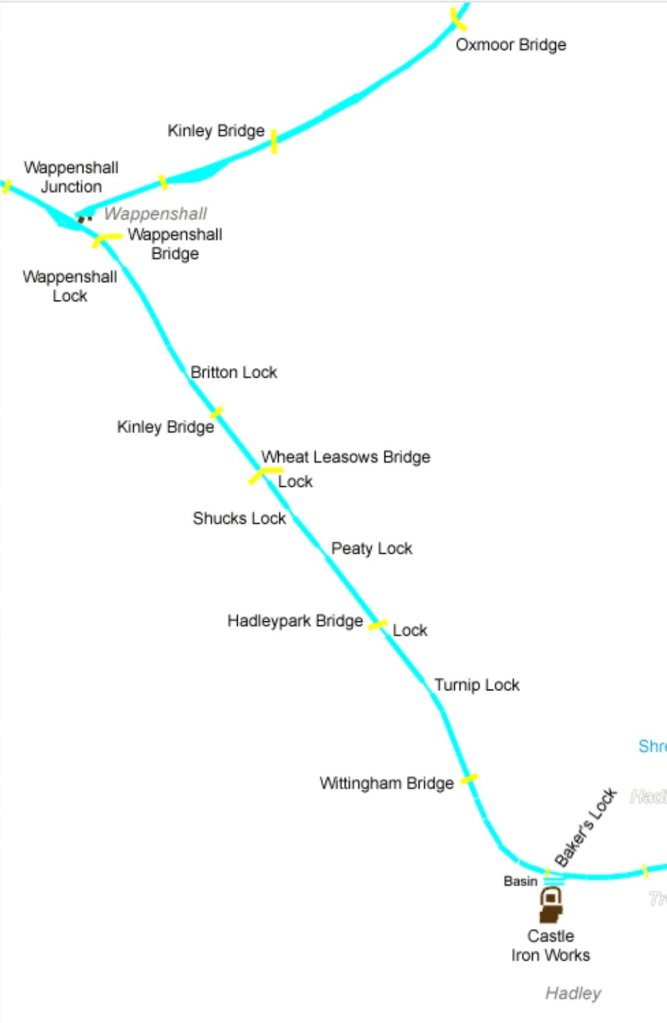
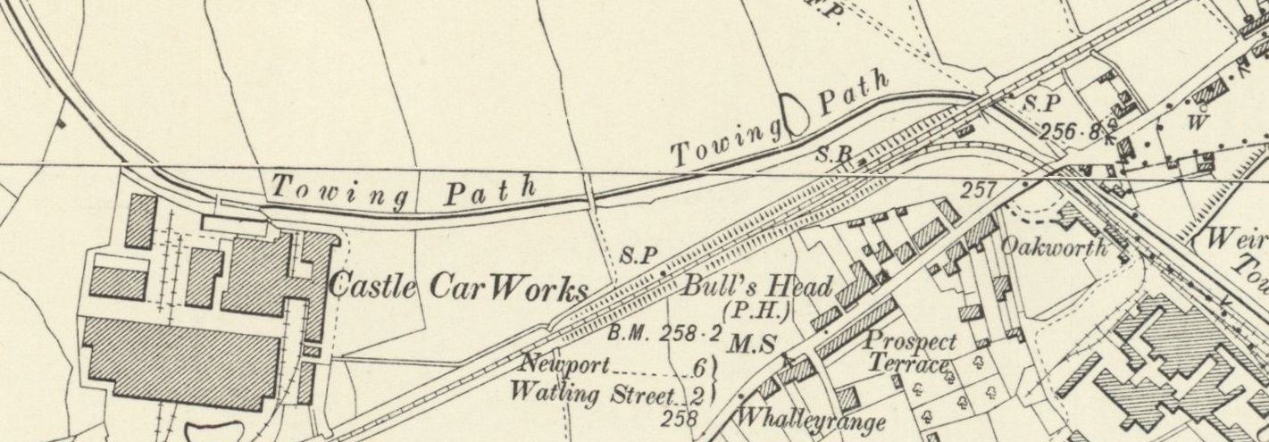
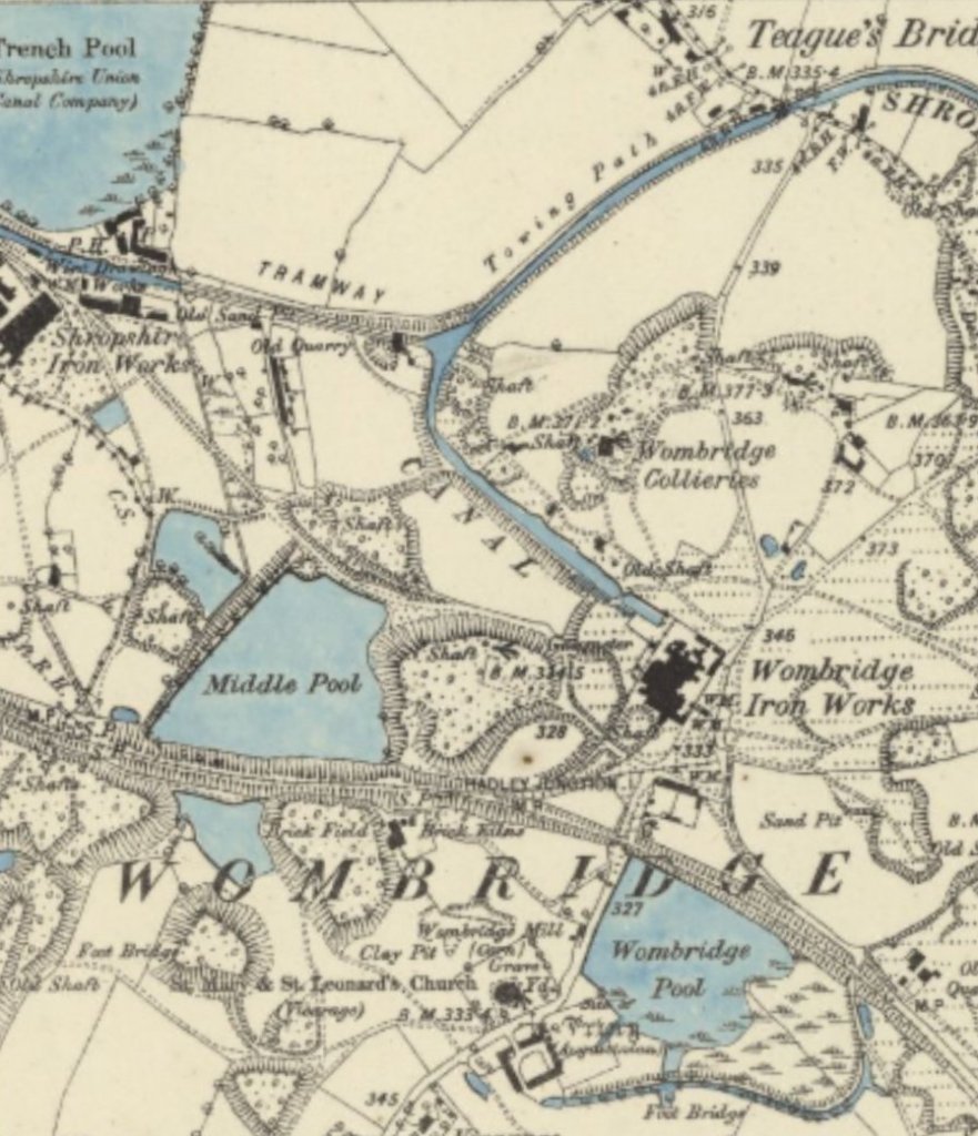
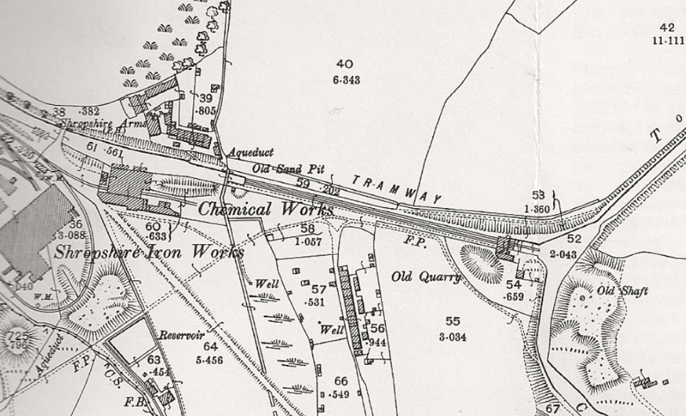
The Trench Branch Canal left the Shrewsbury and Newport Canal at Wappenshall Junction.
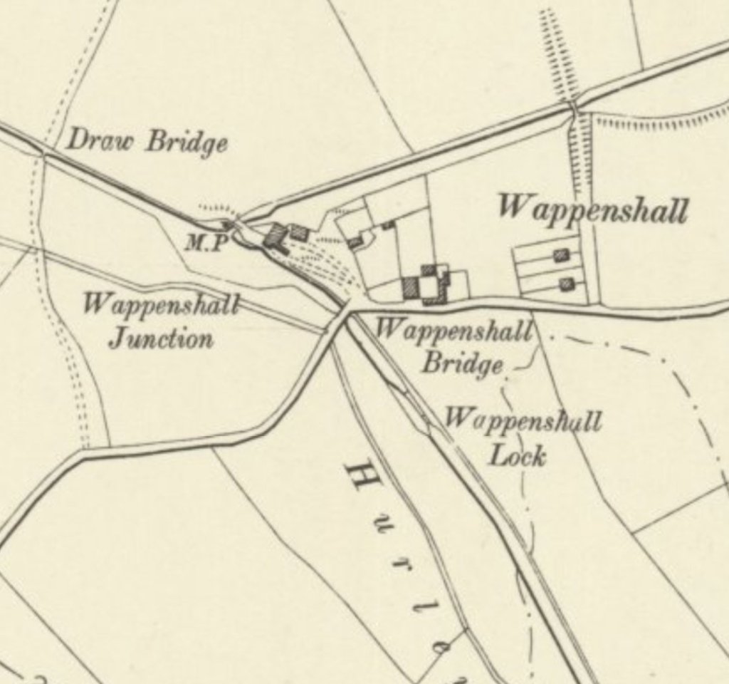
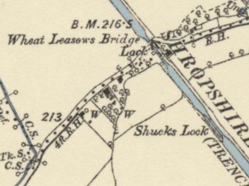
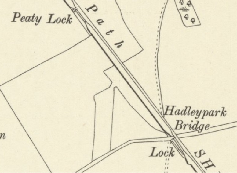
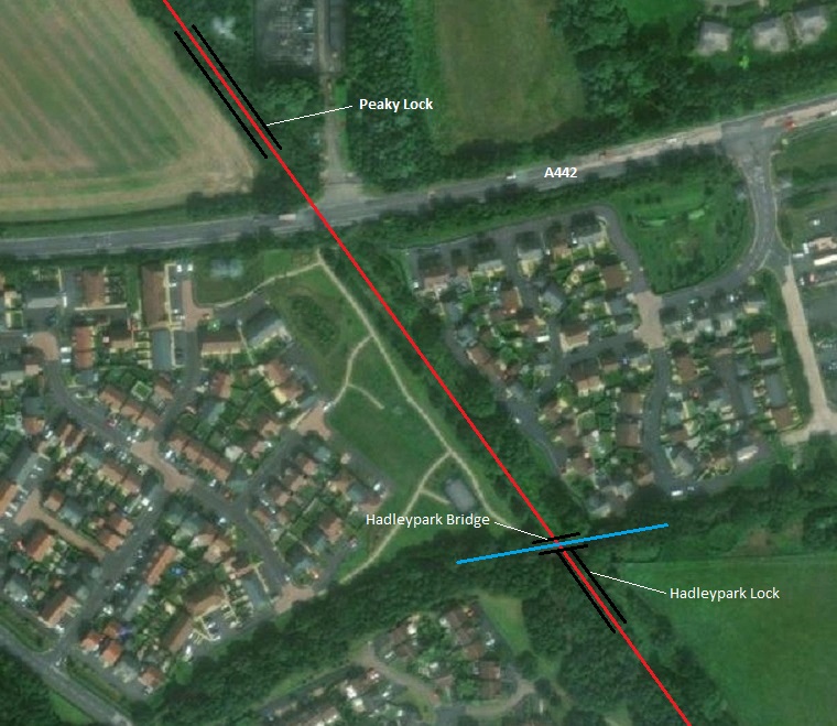
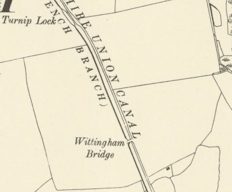
The Trench Branch ran across open fields until it reached the industrial areas near Trench. The first length passed under Wappenshall Bridge, through Wappenshall and Britton Lock, Kinley Bridge, Wheat Leasows Bridge and Lock, Shucks and Peaty Locks, Hadleypark Bridge and Lock, Turnip Lock and Wittingham Bridge before reaching Baker’s Lock/Basin and Castle Iron Works, Hadley.
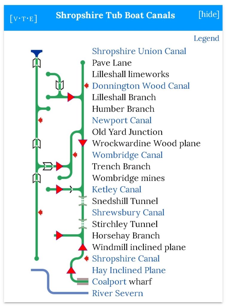
Richard Foxcroft provides a plan of the Shropshire Canals on ‘Exploring Telford’ a website which focusses on the industrial history of the area which is now Telford, particularly the canals and railways. An extract is shown below. [23]
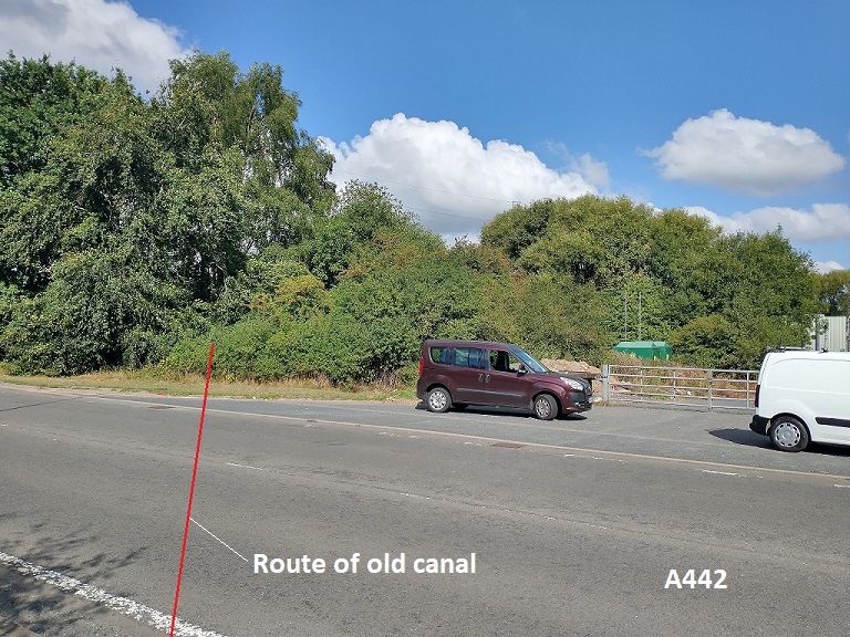
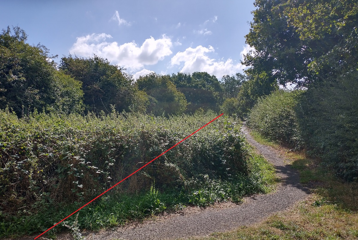
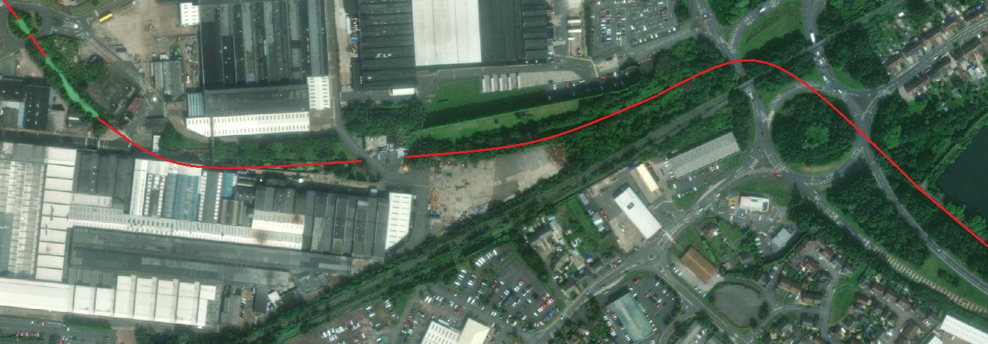
I followed this length or the Trench Branch on the morning of 31st August 2022. Much of the route is on private land and where this is the case, the old canal has been reintegrated into its surroundings.
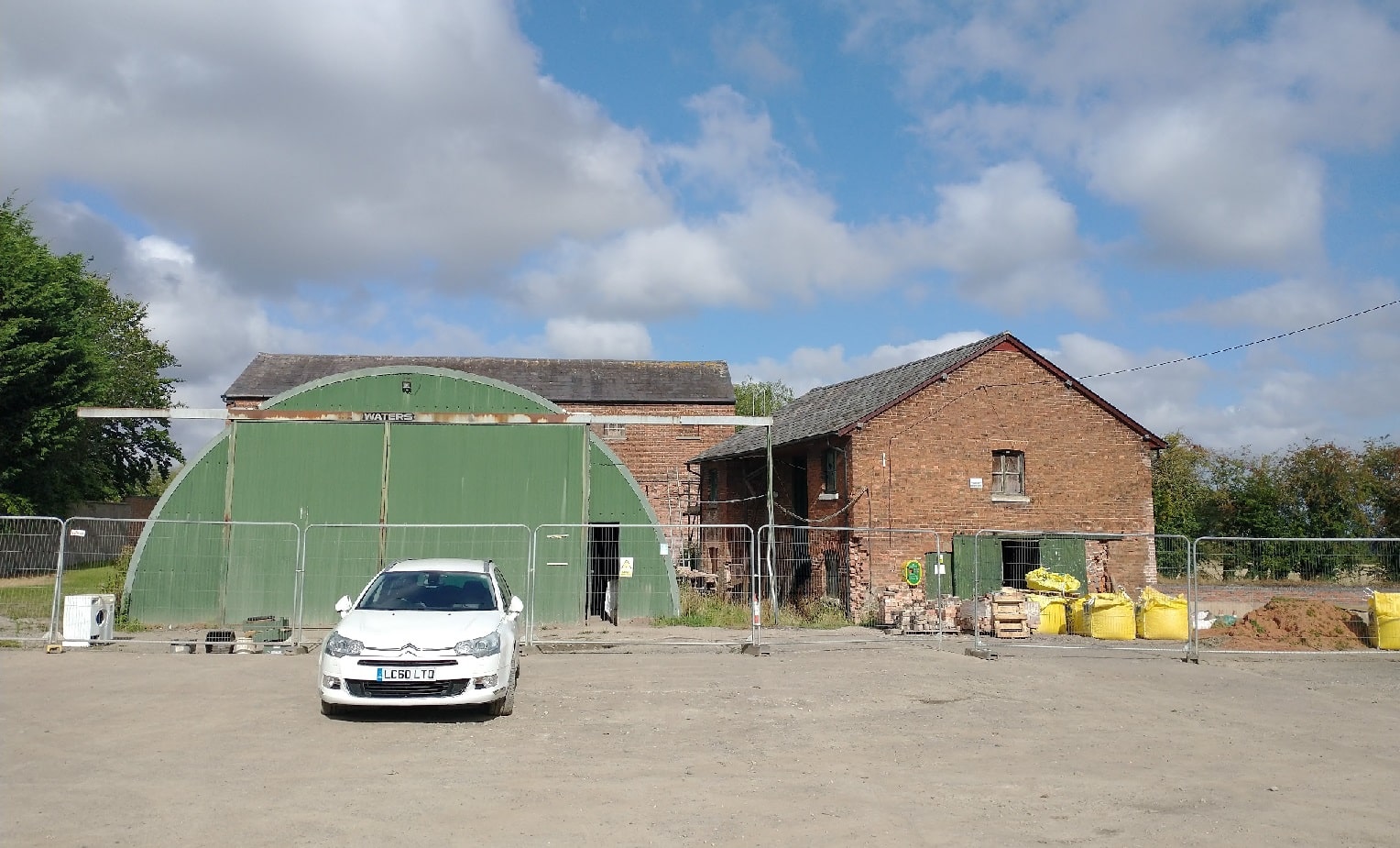
Access to the canal basin at Wappenshall Junction is at present restrict to site personnel only as the basin and associated structures are under going restoration.
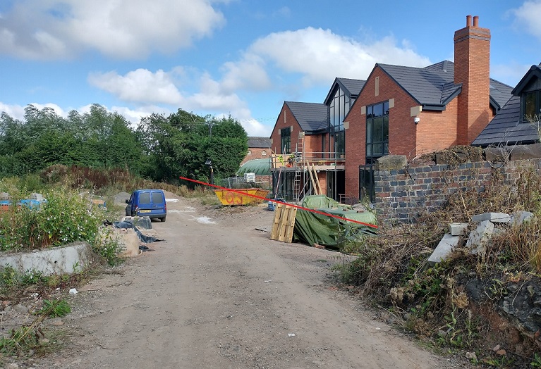
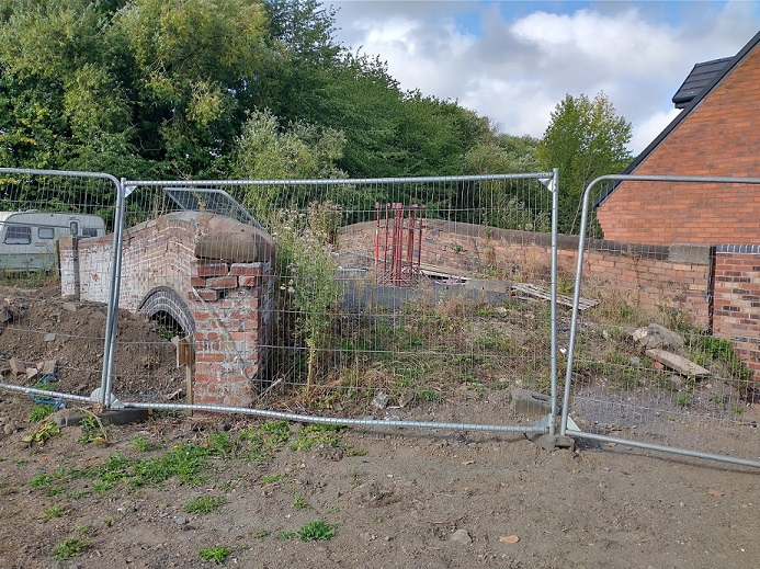
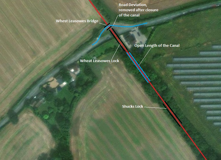
South of Wappenshall was the Wappenshall Lock. Access to the lock was not possible. No access was possible to Britton Lock nor to Kinley Bridge. The location of Wheat Leasowes Bridge and Lock were easily found as they lie on the road between Preston upon the Weald Moors and Leegomery Round-about on the A442, ‘Queensway’.
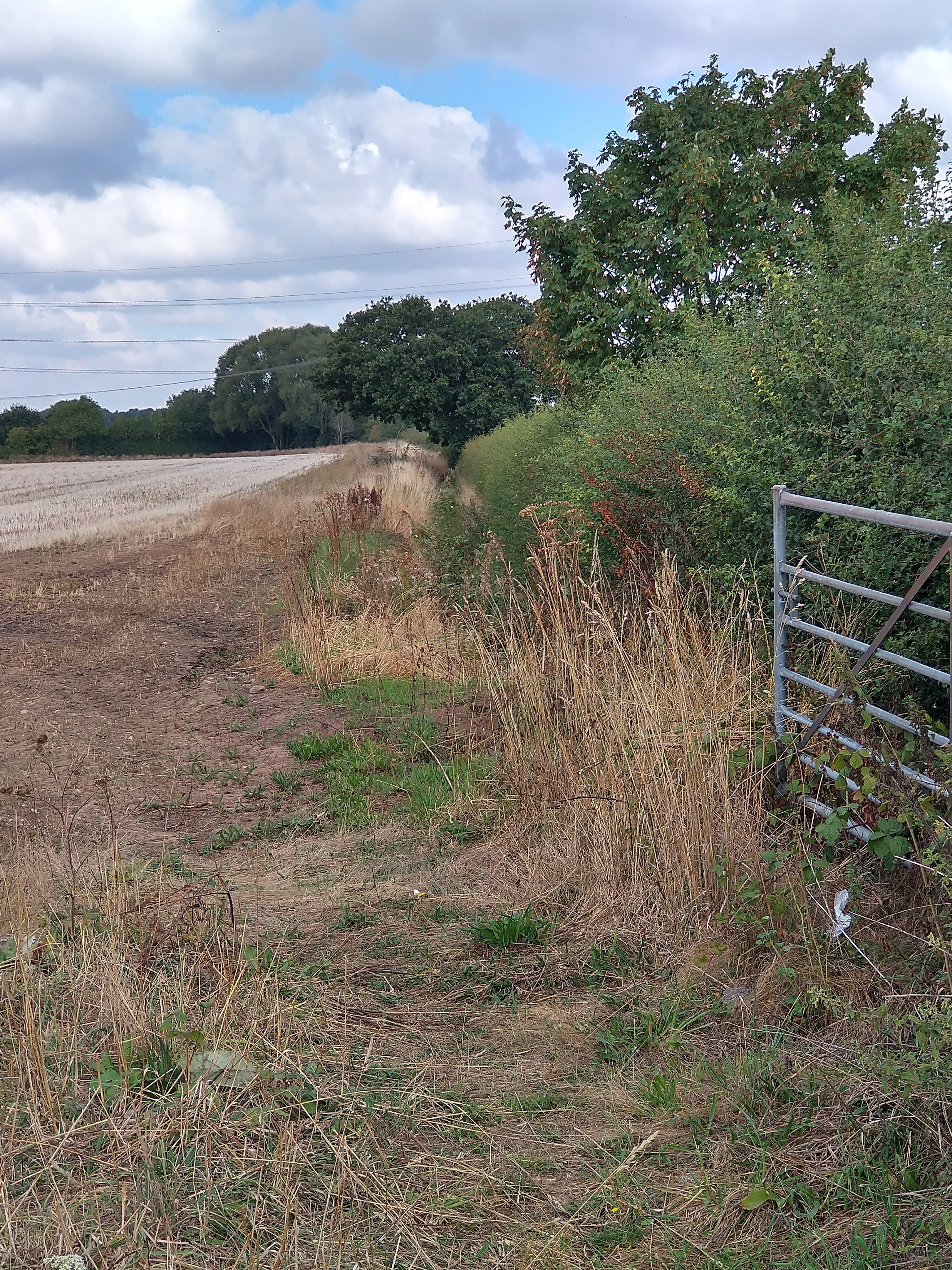
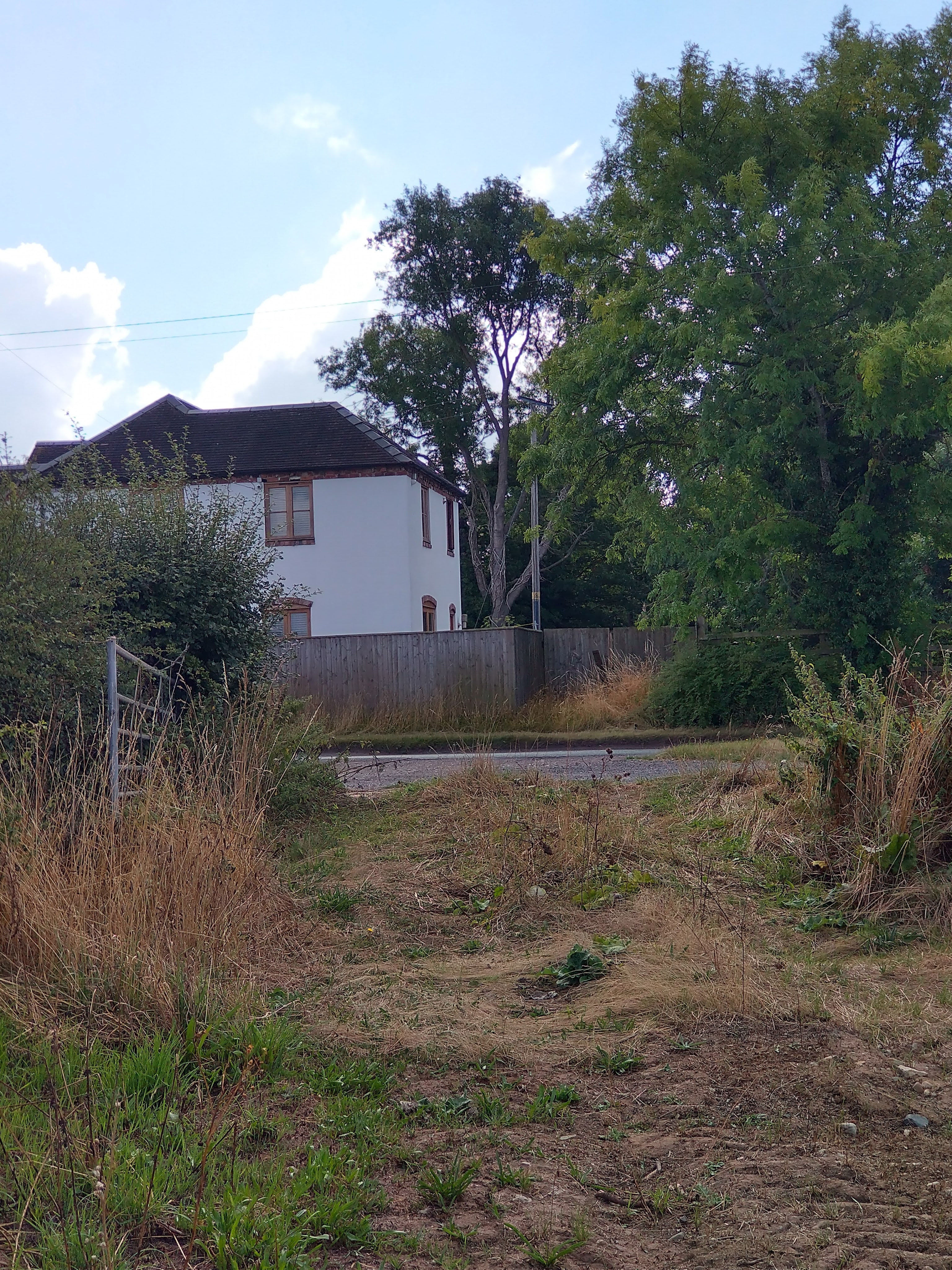
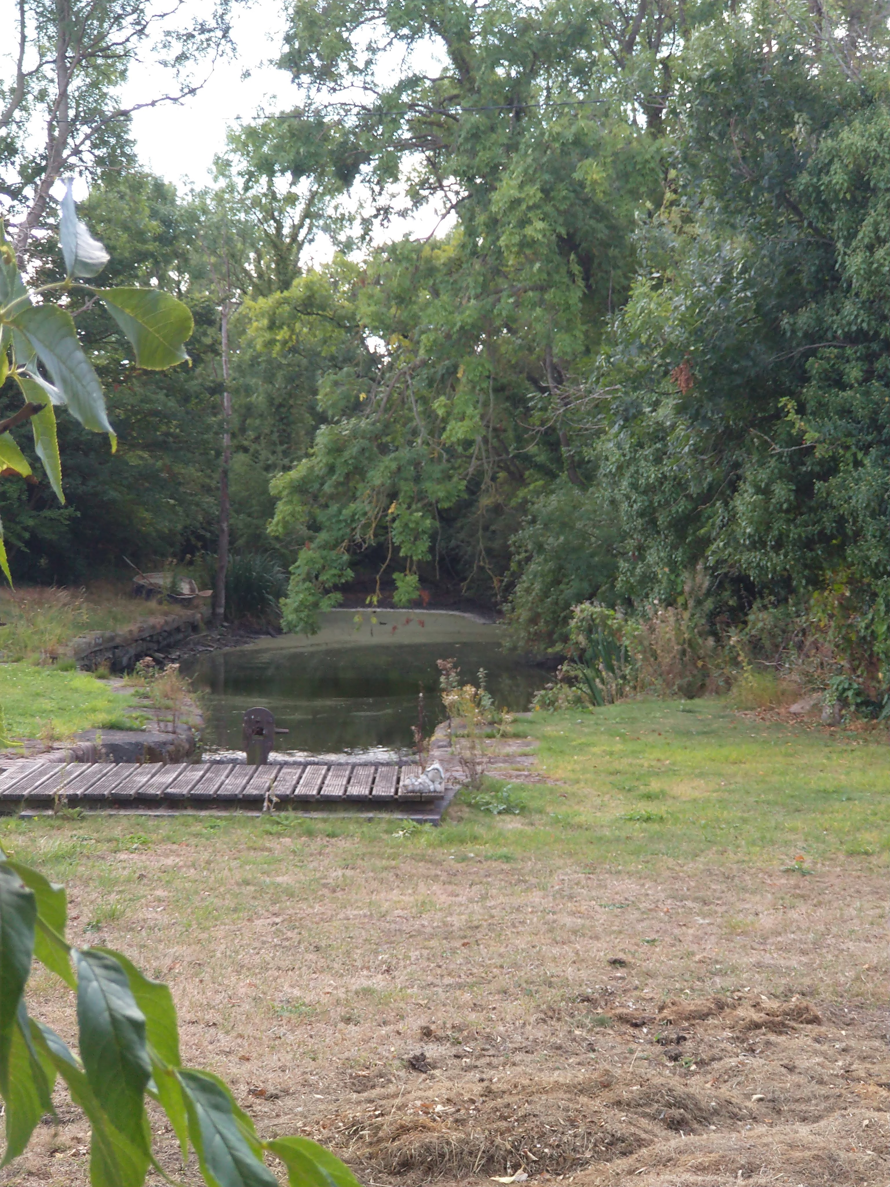
The three images above were all taken on 31st August 2022. In sequence, they show: the view North along the line of the old canal which is marked by the field-ditch which remains alongside the hedge in this image; the view South across the road; and finally a view which shows a length of the old canal which is now in the garden of the property in the second image and which still retains water. [My photographs, 31st August 2022]
The length of canal visible in the garden of the property above was the length between the two locks, Wheat Leasowes Bridge Lock and Shucks Lock. The property concerned appears to be an extended lock-keeper’s cottage.
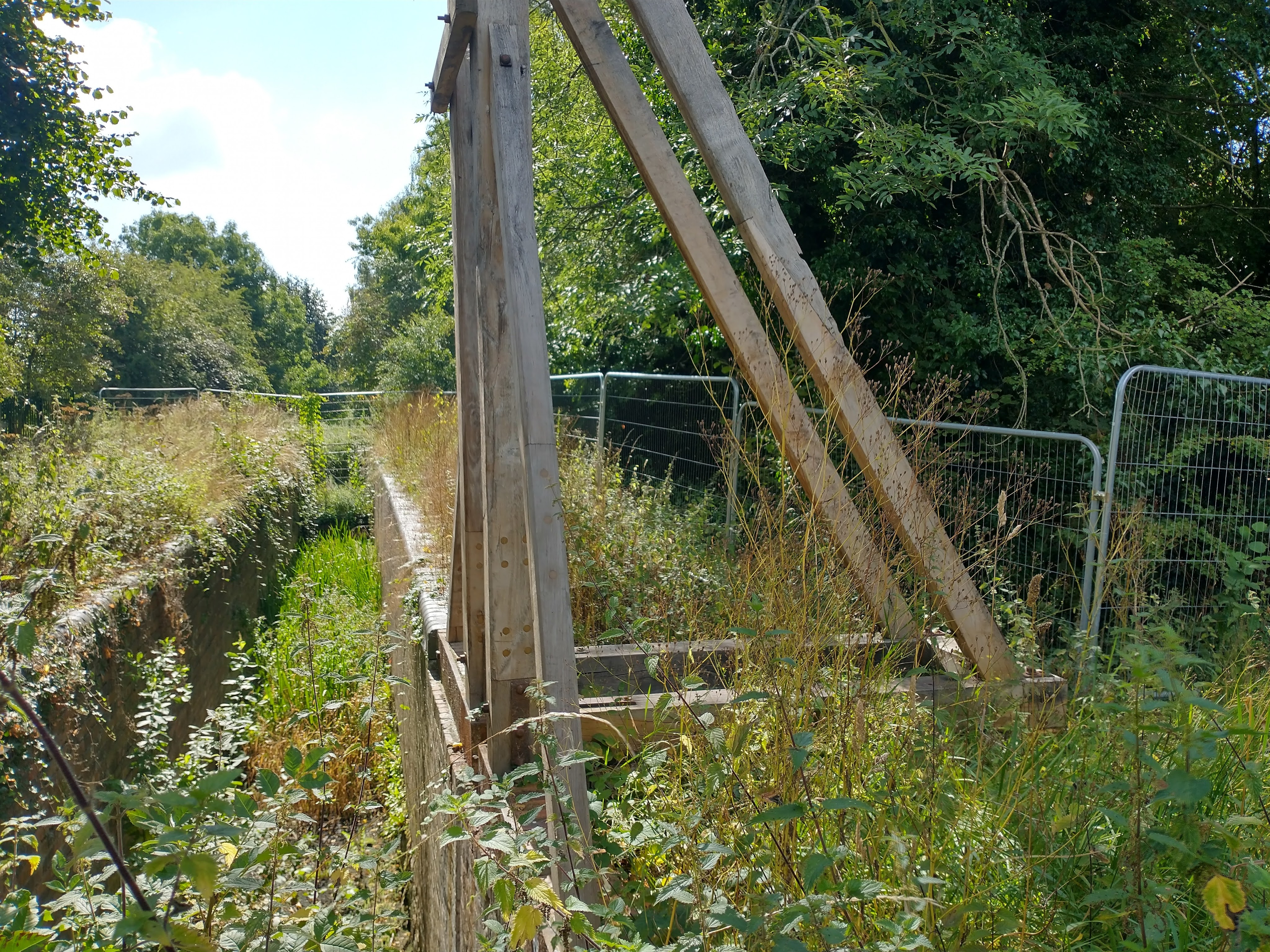
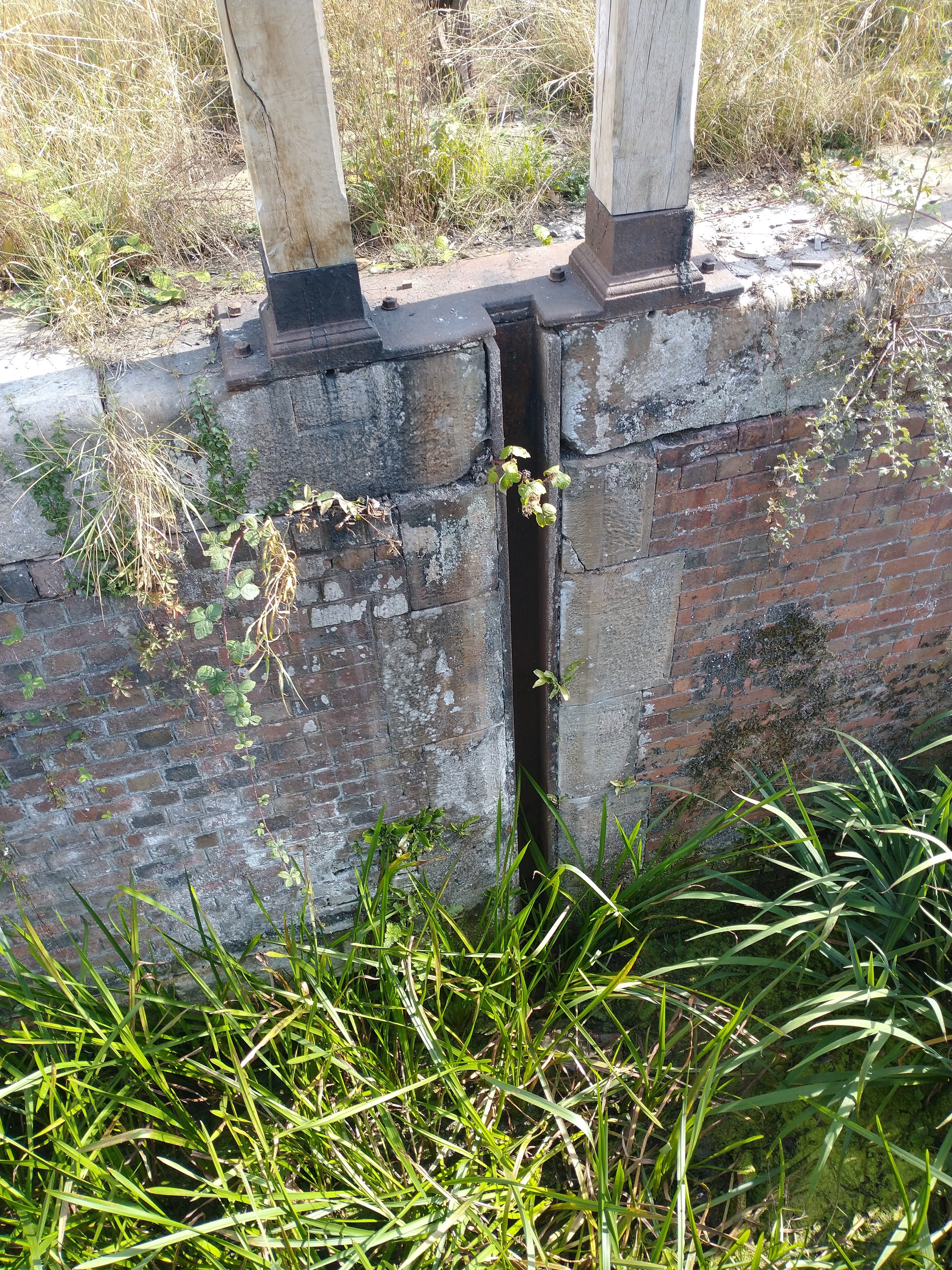
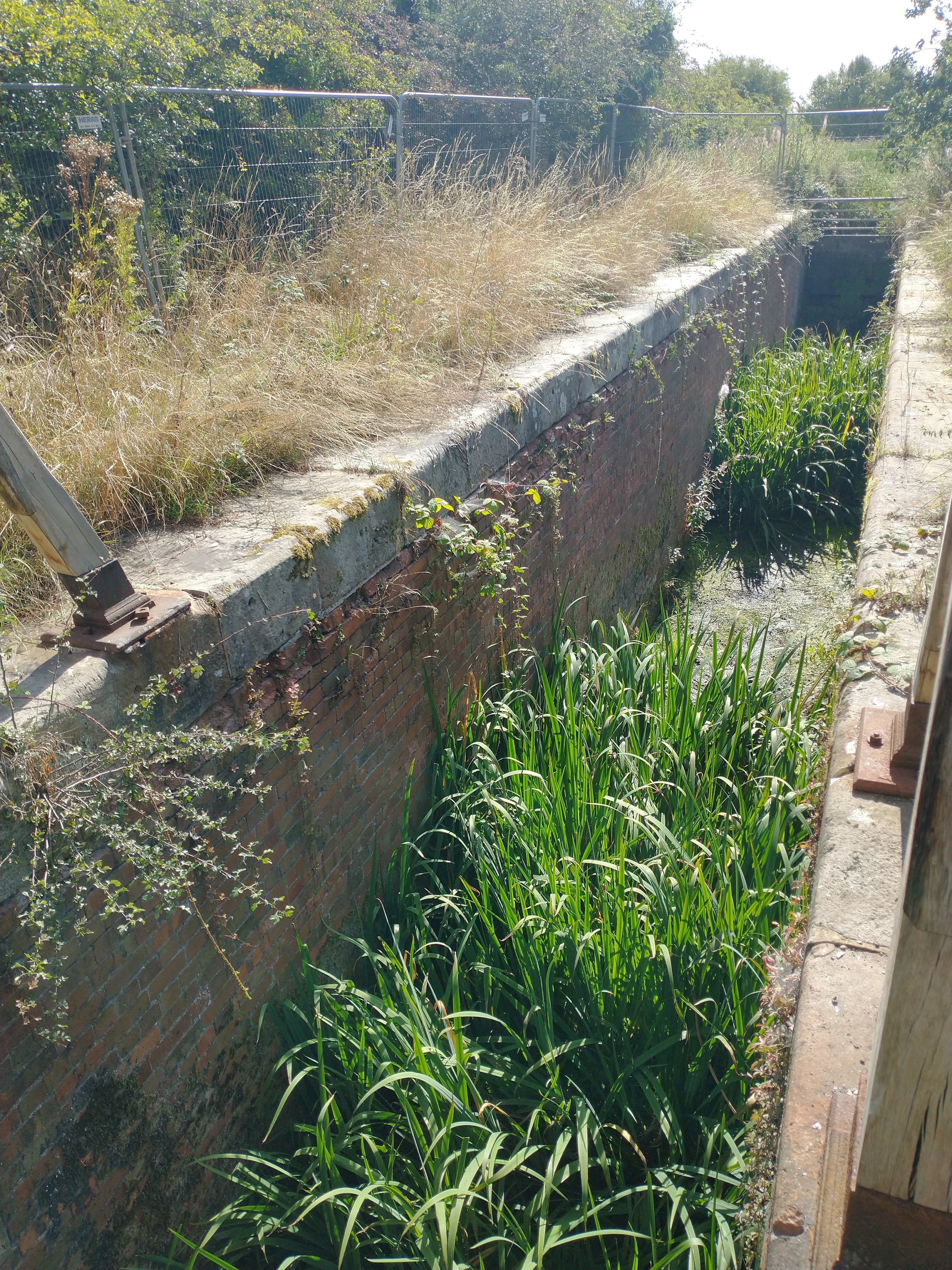
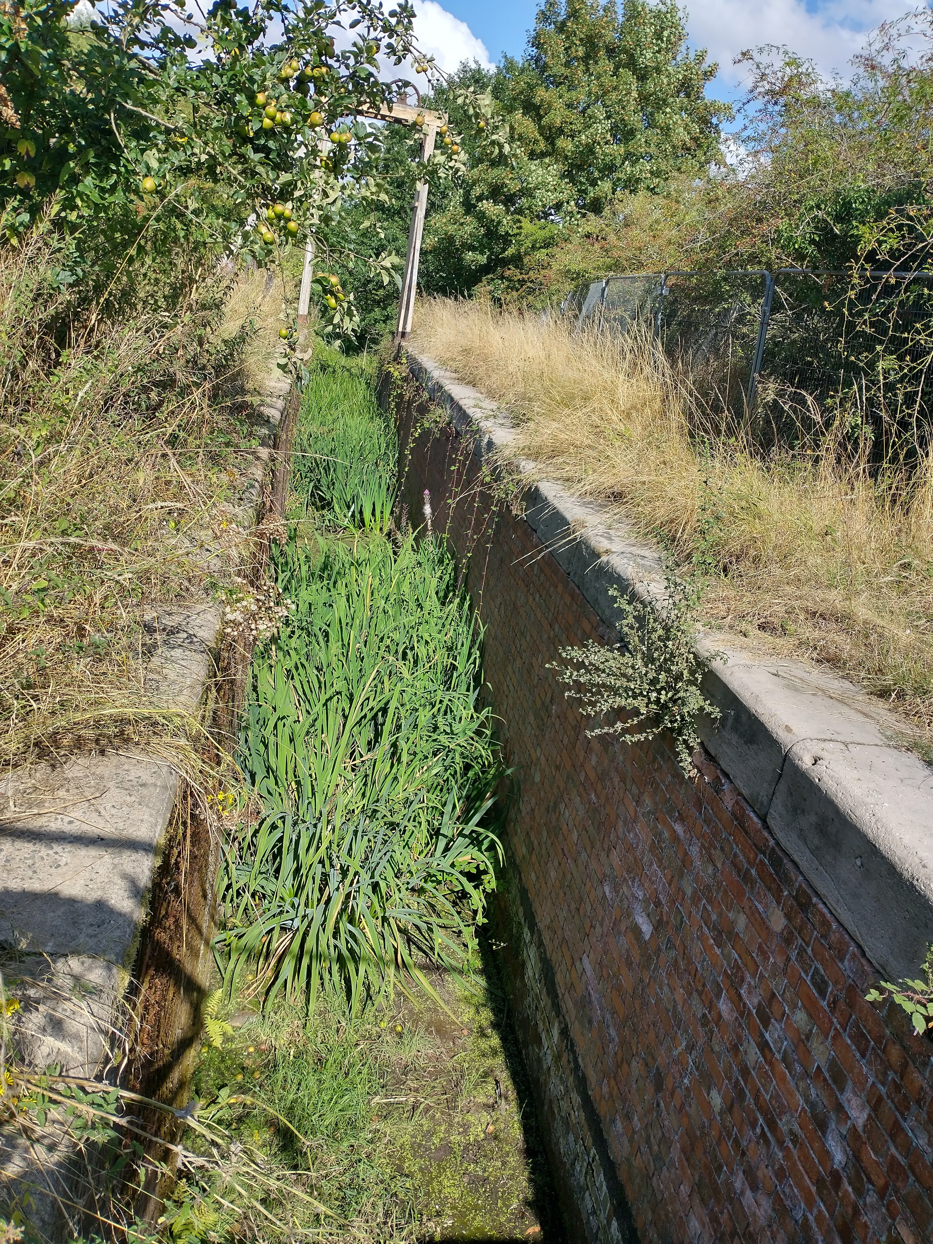
These three images also come from Turnip Lock. The first shows the recess in the locak wall down which the gate slides. The remaining two images show the lock walls, first looking South towards Trench and then looking North towards Wappenshall. [My photographs, 31st August 2022]

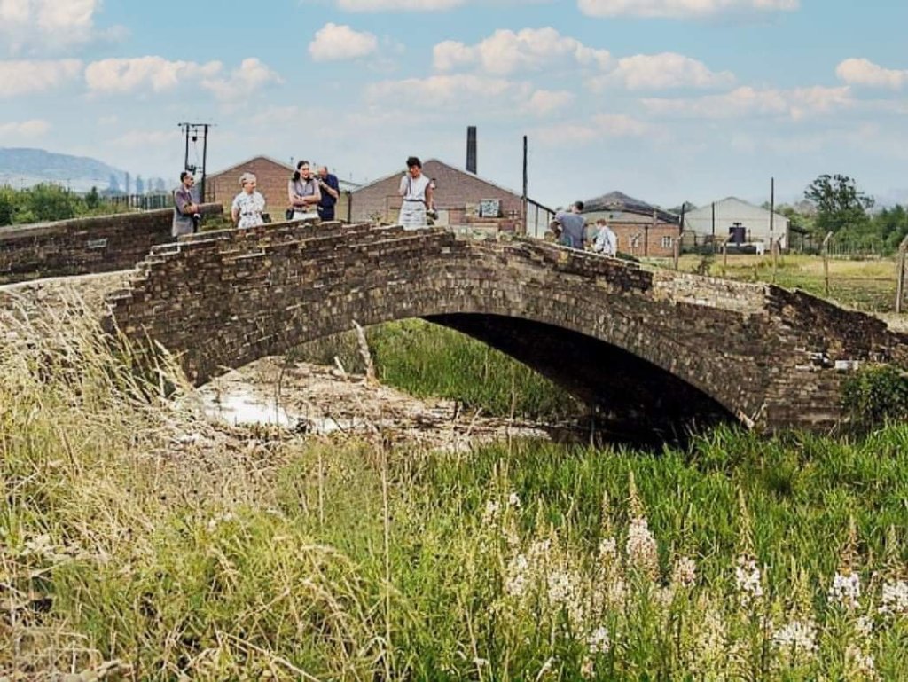
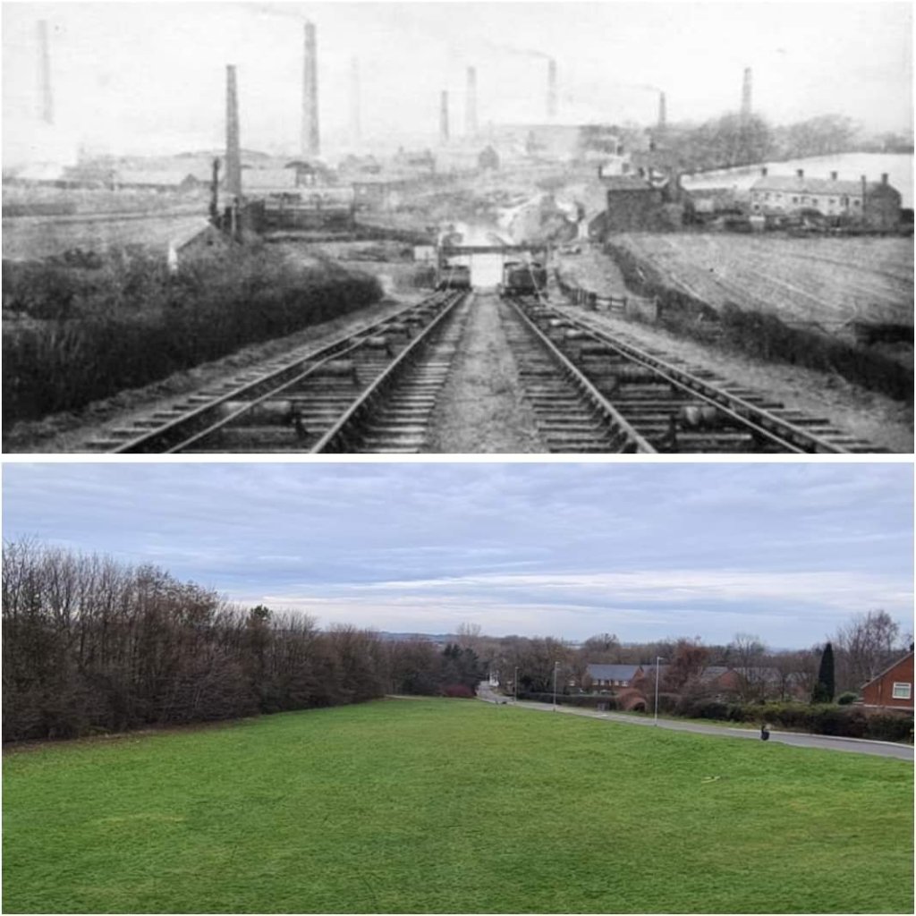
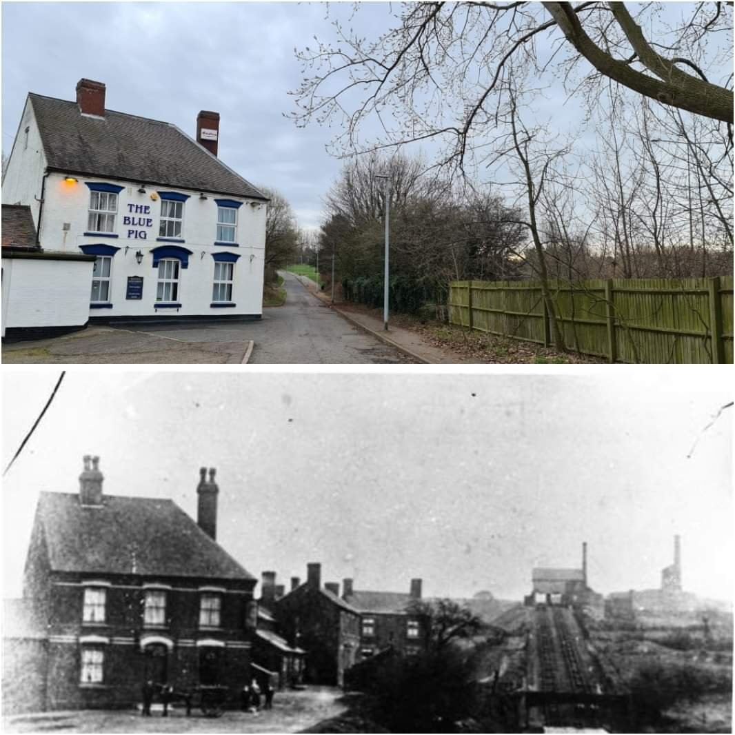
The following colourised photographs give an excellent idea of what the Inclined Plane was like and how it worked. They have been colourised by Simon Alun Hark.
©Copyright Dr. Neil Clifton authorised for reuse under a Creative Commons Licence (CC BY-DA 2.0).[6]


References
- https://www.facebook.com/groups/626088212102853/permalink/626338268744514, accessed on 1st July 2022.
- https://m.facebook.com/groups/794448773917764/permalink/5752898211406104, accessed on 1st July 2022.
- https://m.facebook.com/groups/disusedrailways/permalink/2449041828583682, accessed on 1st July 2022.
- https://m.facebook.com/groups/261490703946559/permalink/1602948176467465, accessed on 1st July 2022.
- https://m.facebook.com/groups/261490703946559/permalink/2590798741015732 accessed on 1st July 2022.
- https://www.geograph.org.uk/photo/250148, accessed on 1st July 2022.
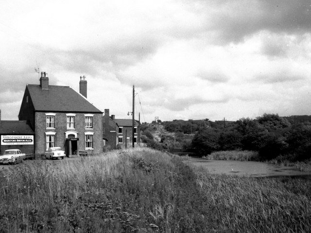
- https://commons.wikimedia.org/wiki/File:%27Shropshire_Arms%27_and_Trench_Inclined_Plane_-geograph.org.uk-_343711.jpg, accessed on 1st July 2022.
- https://maps.nls.uk/geo/explore/#zoom=16.869946463025816&lat=52.70720&lon=-2.46138&layers=168&b=1, accessed on 1st July 2022.
- https://maps.nls.uk/view/101594308ps://maps.nls.uk/view/101594308, accessed on 10th July 2022.
- https://www.wikiwand.com/en/Wombridge_Canal#/google_vignette, accessed on 26th July 2022.
- http://www.pittdixon.go-plus.net/shropshire-tbc/shropshire-tbc.htm, accessed on 28th August 2022.
- https://m.facebook.com/groups/674238619260811/permalink/6197574766927141, accessed on 29th August 2022.
- https://www.facebook.com/groups/964857310243999/permalink/5490412487688436, accessed on 30th August 2022.
- https://www.facebook.com/groups/964857310243999/permalink/5487407237988961, accessed on 30th August 2022.
- https://en.m.wikipedia.org/wiki/Wombridge_Canal, accessed on 30th August 2022.
- Michael E Ware; Britain’s Lost Waterways. Moorland Publishing, 1989.
- https://web.archive.org/web/20170927203722/http://search.shropshirehistory.org.uk/collections/getrecord/CCS_MSA2197/, accessed on 39th August 2022.
- Ivor Brown; Some Notes on the Mines of the Lilleshall Company No. 5; in the Autumn Issue No. 2010.3). Journal of the Shropshire Caving & Mining Club Autumn Issue No. 2010.3, 2010; https://web.archive.org/web/20170927160003/http://www.shropshirecmc.org.uk/below/2010_3w.pdf, accessed on 30th August 2022.
- https://www.facebook.com/groups/964857310243999/permalink/5490384047691280, accessed on 30th August 2022.
- Both images can be found by following the discussion on this link: https://www.facebook.com/groups/964857310243999/permalink/5487407237988961, accessed on 30th August 2022.
- https://maps.nls.uk/geo/explore/#zoom=16&lat=52.72775&lon=-2.49957&layers=6&b=1, accessed on 30th August 2022.
- https://www.wellingtonla21.org.uk/along-the-moors-wappenshall, accessed on 30th August 2022.
- http://www.telford.org.uk/index.html, accessed on 30th August 2022.
- https://sncanal.org.uk, accessed on 31st August 2022.
- https://maps.nls.uk/view/101594272, accessed on 31st August 2022.
- https://maps.nls.uk/geo/explore/#zoom=15&lat=52.72173&lon=-2.49288&layers=6&b=1, accessed on 31st August 2022.
- https://maps.nls.uk/geo/explore/#zoom=17&lat=52.71727&lon=-2.48896&layers=6&b=1, accessed on 31st August 2022.
- https://maps.nls.uk/geo/explore/#zoom=17&lat=52.71339&lon=-2.48241&layers=6&b=1, accessed on 31st August 2022.
- https://www.moveero.com, accessed on 31st August 2022.
- https://www.shropshirestar.com/news/business/2022/04/29/business-leader-welcomes-20million-gkn-telford-deal, accessed on 31st August 2022.
- https://maps.nls.uk/geo/explore/#zoom=17&lat=52.70921&lon=-2.47492&layers=6&b=1, accessed on 31st August 2022.
- https://maps.nls.uk/geo/explore/#zoom=17&lat=52.70822&lon=-2.46198&layers=6&b=1, accessed on 31st August 2022.

My, you have been busy today. A fantastic piece of work.
Just a couple of things: Any section of canal between two locks is called ‘a pound,’ not a length, as I’m sure you know. Also, the guillotine mechanism was to operate a ‘Stop Lock’ used to isolate any pound and not to raise or lower boats.
Keep up the good work,
Stuart.
Hi Stuart, there were a lot of locks on the Trench Branch, all were guillotine locks. Are you sure that these did not lower/raise boats? This type of lock was used elsewhere to do so. …..
https://en.m.wikipedia.org/wiki/Guillotine_lock
Roger you are correct. The guillotine locks were used extensively on the Trench Branch and the Shrewsbury Canal to raise/lower the tub boats.
Pingback: The Coalport Branch of the Shropshire Canal – Part 2 – The length from Stirchley Iron Works to the River Severn | Roger Farnworth
Hi I’m so happy I found this article amazing historical value of the canals and beautiful.Is so sad no one cares anymore about them .I’m leaving next to Trench Branch in Telford and can’t believe how bad all is keep .Local council doesn’t care about the canal and locks was taking down for maintenance a year ago all was fenced and now for a year is all overgrown and few meters from locks GKN factory put development planing for 5 massive industrial buildings.All species and biodiversity will be devastated!!!Please help protect this place.