Just a snap shot of the things appearing in the March 1959 issue of The Railway Magazine. [1]
1. There were adverts on the inside of the front cover – 5 of them. …. [1: pii]
Page ii of the March 1959 Railway Magazine.
The 34th Model Railway Club Model Railway Exhibition was due to take place in Easter Week. It would run from Tuesday March 31st to Saturday April 4th at Central Hall Westminster. On Tuesday provision appears to have been made for the final setting up of layouts, with the exhibition not opening until 12 noon, but the show was to be open until 9.00 pm each evening with an opening time of 10.30am for the remainder of the week.
I wonder what today’s exhibitors and exhibition managers would feel about a show that was 5 days long and a total of 52 hours of operating time? Much of the work setting up for the exhibition must have taken place on the Bank Holiday Monday and dismantling may well have taken place on the Sunday. There must have been quite a few people who gave up a full week’s leave for the sake of the show! Think too of the logistics of providing refreshments for a week-long show!
Getty Images hold a picture of two young boys enjoying a close interaction with some large scale model trams. The image can be found here. [2]
Three of the five adverts on page ii of the magazine related to books. One was for Foyles Bookshop and their newly opened travel bureau in London. Another was for the 5th Edition of ‘World Railways’ – 1,500 railways in 100 countries, 33 underground systems, 291 major manufacturers – published by Sampson Low, London. [3]
Just published in 1959 was O. S. Nock’s, ‘Historical Steam Locomotives’ – An illustrated history of British Locomotives down to the time of the grouping. [4]
And the remaining advert was for the Railway Correspondence & Travel Society’s ‘The Railway Observer’. The advert also highlighted the activities of the RCTS – branches throughout the country, a rail tours library, visits to depots and installations, affiliations to societies overseas and photographic & technical sections!
2. Metrovick Diesel-Electric Traction
Metropolitan Vickers Electrical Co. Ltd took out a full page advert for their new Co-Bo Diesel Electric Locomotive under a banner headline of “Chosen for Midland Region Modernisation.”
The Metrovick Co-Bo Locomotives were assembled at the Company’s Trafford Park works. The motors, generators and auxiliaries were made at their Sheffield works, the control gear at Trafford Park and mechanical parts at the Metropolitan-Vickers-Beyer-Peacock-Ltd., Stockton-on-Tees. [1: piv]
3. Editorial Notes highlight some of the concerns over the readership at the time and changes in the railway world. These included:
Open-Type Coaches on BR – In the correspondence columns of the January issue of the magazine there was a letter critical of the British Transport Commission decision to build no more corridor-compartment stock. The March editorial reflects the magazine’s post bag which asks BR to think again! [1: p147] Wikipedia suggests that the corridor stock was still being built until the mid-1960s, so perhaps campaigners were successful. It is also interesting to note that the Mk 1 corridor-compartment stock were in use on BR lines well into the 1980s and are still in use on heritage lines. … “The British Railways Mark 1 SK was the most numerous carriage design ever built in the United Kingdom. The original number series carried was 24000–26217. From 1983, those carriages in the 25xxx and 26xxx series were renumbered 18xxx and 19xxx. … There were two variants, those built for the Midland, Scottish, and Eastern / North Eastern regions had six seats per compartment, with fold-up arm-rests which folded into the seat-back, while those built for the Southern and Western regions, with their heavy commuter loadings into London, had eight seats in each compartment, and no arm-rests. Seating was of the interior sprung bench type.” [5]
Reservation of Sleeping Berths – apparently, by 1959, it had become common practice for passengers to reserve berths on a number of different sleeper services on British Railways, before finally deciding which service to use. Br brought in revised arrangements on 1st February 1959 which were designed to eliminate disappointment for those who were definitely planning to use a specific service. From February 1959, “Reservations [were] made only on payment of the full fees for the berths required, and three-quarters of this amount [would] be refunded to those who cancel before 4 p.m. on the day before that for which the berths have been booked. No refund [was] be made if cancellations [were] received after that time, except to those whose names [had] been placed on the waiting list, and from whom fees [had] been accepted subject to accommodation being available. Full repayment [was] made to those travellers if berths [did] not become vacant. … The new arrangements [ended] the selfish practice of making alternative reservations on different trains or days.” [1: p147]
London Midland Region Freight Traffic – “At the end of 1958, two-thirds of the business of the London Midland Region of British Railways [was] derived from freight. To attract new – and regain lost – traffic, a comprehensive short-term plan [was] evolved to streamline the whole of its freight transport. [It was planned that, before the mid-1960s, freight handling would] be speeded by [a] reduction in the number of marshalling yards, … from the [then] 111 to 46, and of depots for traffic from 170 to 48; many of those remaining [would] be extensively modernised. The value of the growing door-to-door service, with railhead collection and delivery by road vehicles, [would] be enhanced by the implementation of the plan. There already [were] about 600 regular overnight express freight trains in the Region, and movement [would] be further accelerated as more wagons [were] fitted with vacuum brakes, and diesel locomotives introduced. [It was thought that] if traders and manufacturers [could] be assured of new standards of service and reliability, the plan should show an early and satisfying financial return.” [1: p147] At a similar time, containerised freight was being developed. Wikipedia tells us that “the marshalling yard building programme was a failure, being based on a belief in the continued viability of wagon-load traffic in the face of increasingly effective road competition, and lacking effective forward planning or realistic assessments of future freight.” [6][7]
Handling of Mail/Parcels at Euston – in March 1959 structural alterations were underway which would love facilities for handling outward parcels traffic at Euston Station. By the end of 1959, passengers would be able to approach the booking offices and departure platforms without being delayed/impeded by long trains of barrows. Post Office lettermail , under new arrangements would be brought direct to the parcels office on No. 11 platform for loading into vans. The Railway Magazine reported that “A new building [was] to be provided above the station for the sorting and despatch of railway parcels, which [would] be sent by overhead lifts to the platforms for loading. An overhead conveyor, spanning the main departure lines, [would] take parcel post to the platforms from a new G.P.O. sorting depot.” [1: p148] One wonders whether the proposed arrangements would be similar to the ‘telpher‘ which for a time served Manchester Victoria Station. [8]
Diesels for Scotland – the editor also heralded and welcomed Diesel motive power on the East Coast Main Line North of Newcastle. The welcome was based on the likely acceleration of many services in the Scottish Region. “Between Edinburgh and Aberdeen, for example, almost every start from the principal intermediate stops has to be made up a sharply rising gradient, on which the high starting tractive effort of diesel locomotives would be most welcome. The maximum mileage for diesel power could be obtained by basing the locomotives on Edinburgh, and using them at night for the heavy traffic to and from Newcastle. By day they could work on the Newcastle and Aberdeen services, and perhaps between Edinburgh, Perth and Inverness. The last-named, with its long and steep gradients, is yet another route on which the high tractive effort of diesel locomotives could be used to advantage.” [1: p148]
Improvements to the Hertford North Line – work that could well have taken two or three years had been condensed into the first half of 1959, with a likely completion date in June 1959. Off-peak services between Wood Green and Hertford North had been replaced by buses. Work was phased so that the 6.5 miles from Wood Green to Crews Hill was undertaken in March, the next 8 miles to Hertford being worked on in April, May and June. All services on the branch would then be DMU.s or diesel-hauled “and maximum speeds of 70 mph … permitted. Improvement of the track is an essential preliminary to electrification.” [1: p148]
London Underground – apparently delays to some services had been caused by passengers refusing to move from one train to another when equipment failure has occurred or because a train was running far behind schedule. Lack of information was cited as the cause. London Underground was, in March 1959, installing new train information systems, a move welcomed by The Railway Magazine. [1: p148]
1910 – Rail versus Air – the editor also looked back to 1910 and specifically to the fist flight between London and Manchester. Which was a competitive exercise with a large prize of £10,000 offered by The Daily Mail. The two competitors, Louis Paulhan and Claude Grahame-White, chose to follow the LNWR main line. The company assisted by painting distinctive marks on sleepers to show where branch lines diverged (presumably to ensure the aeroplanes continued on the main line). Apparently, The Railway Gazette at the time said: “The flying machine may possibly become a serious competitor of the railway before very many years. … Both the aviators have been aided and abetted by the Premier Line in such ways as the provision of inspection cars in which to travel over the route beforehand, whilst a special train followed Mr. Paulhan all the way.” [1: p148][1: p167-168, 200]
The route of the London to Manchester flight – along the LNWR main line. [1: p167]
4. Railbuses on Western Region Branches
A short note appeared at the bottom of the pages proceeding the central photographic pages of the magazine. That note marked the introduction of diesel railbuses on the Kemble to Cirencester and Kemble to Tetbury branches of the Western Region on 2nd February 1959. These were the first sections of the Western Region to be served in this way. The railbuses accommodated “48 passengers with a small area for luggage. The services over both branches [had] been intensified. In addition, new halt facilities [were] afforded at Chesterton Lane on the Cirencester branch, and at Church’s Hill, Culkerton and Trouble House on the Tetbury branch.” [1: p172]
The Railway Magazine of March 1959 also included substantial articles:
The Railways of Barrow by Dr M.J. Andrews, [1: p149-157, p200];
Farewell to the ‘Leicesters’ by R.S.McNaught, [1: p158-160, p192];
The first part of Reminiscences of a Locomotive Engineer by George W. Mcard, [1: p161-165]; With 4 ft 7.25 in Wheels by K. Hoole, [1: p168-172];
British Locomotive Practice and Performance part of a long series by O.S. Nock, [1: p185-192];
The second part of Railway Development in Liverpool by M.D. Grenville & G.O. Holt, [1: p193-200];
New Railways in Quebec, [1: p201-203, p206]; and
A full list of British Railways Motive Power Depots. [1: p204-206]
6. Notes and News
Notes & News fill eight pages [1: p210-217] after three pages of letters. [1: p207-209] The Railway Magazine reported that:
Cheaper first class fares on Saturdays would be extended, after an experimental period on services between London and Manchester, to journeys between London and Liverpool, London and Glasgow and London and Edinburgh until the end of April. Return journeys could only be made on the next day or the following Saturday with no breaks in journeys permitted. [1: p210]
Little still remained, in 1959, of the Saundersfoot Railway other than tunnels and a few ruined buildings. Reference was made to an article in The Railway Magazine’s November-December 1946 issue. More can be found about this narrow gauge line in two articles, here [10] & here. [11] There is also a note about the Cambrian Hotel at Saundersfoot. The hotel’s sign bore a shield which contained a gold 2-2-0 tender loco with a wagon on a red background. [1: p210]
Construction work had just commenced on the new Oxford Road Station in Manchester [1: p210-211] and on major alterations to Dover Marine Station in Kent. [1: p211]
Some Western Region Train Services had seen timetable alterations as of January 1959. [1: p211]
More Diesel Services on the North Eastern Region – January 1959 saw the introduction of many additional diesel-powered workings on local services. The early 1959 introductions meant that the switch from steam to diesel on local services was almost complete. [1: p211]
From 2nd February, the 8.15 am up and the 4.45 pm down services between St. Pancras and Nottingham Midland Station were named the ‘Robin Hood‘. [1: p211]
2nd February saw five station closures on the Eastern Region: Offord & Buckden, near Huntingdon; Sturton, and Blyton, between Retford and Barnetby; and Haxey & Epworth, and Walkeringham, between Doncaster and Gainsborough. Greenock Princes Pier and Greenock Lynedoch Stations on the Scottish Region also closed on 2nd February. As did the Upper Port Glasgow goods depot. In the North Eastern Region, from 16th February, Gristhorpe Station, on the Hull-Scarborough line, was closed. On 28th February, the service from Acton Town to South Action was withdrawn and the Station at South Acton was closed to passengers. [1: p211, p212]
The South Wales Transport Bill permitting the closure of the Swansea & Mumbles Railway had its second reading in the House of Lords in February. [1: p212]
The 3 ft gauge Cavan and Leitrim Railway would close on 1st April. More about this line can be found here, [12] here, [13] here, [14] here, [15] here, [16] here, [17] here, [18] here, [19] here, [20] and here. [21] [1: p212]
The Bluebell Line – efforts were being made to establish a preservation society to reopen the Lewes to East Grinstead branch. Volunteers were being sought and an inaugural meeting arranged on 15th March in Haywards Heath. [1: p212] The Bluebell Line became the UK’s first preserved standard-gauge line in 1960, starting with the Sheffield Park to Horsted Keynes section, and later extended to East Grinstead. The first public service ran on 7th August 1960. [22]
Other items included details of: an educational tour by the Scottish Region’s Television Train, [1: p212]; new Electrically-Operated Train Departure Indicators at Shenfield [1: p212-213]; the LNWR Royal Saloon which had been on display at the Furniture Exhibition (January 28th to February 7th) at Earls Court, [1: p213]; the Golden Jubilee of the Stephenson Locomotive Society, [1: p213]; the AGM of the Festiniog (STET) Railway Society and the special trains being organised across the country to get delegates to and from the meeting, [1: p213]; Railway Enthusiasts’ Club Tours, [1: p213-214] news associated with Locomotives. [1: p214-217]
7. The Why and the Wherefore [1: p218-219] includes a series of replies to readers’ letters, particularly:
The North Sunderland Railway – which opened in August 1898 for goods and December 1898 for passengers, and closed on 27th October 1951. [1: p218] The branch ran from Chathill to Seahouses, with an intermediate station at North Sunderland. Chathill was on the main line of the North Eastern Railway between Morpeth and Berwick. The branch was four miles in length and standard-gauge single track. [23]
Water Troughs on the Southern Region – the former Southern Railway had no water Troughs as none of its non-stop runs were long enough to warrant replenishment of water levels. [1: p218-219]
Chalvey Halt (GWR) – was on the G.W.R. branch from Slough to Windsor. It had only a short life: opened on 6th May 1929, and closed on 7th July 1930.
Proposed New Branch to Looe – “a new seven-mile branch from St. Germans to Looe was projected by the Great Western Railway under the £30 million Government scheme of November, 1935, for the construction and improvement of railways, to alleviate unemployment. The branch was to leave the main line to Penzance about 13 miles west of St. Germans Station, and terminate at a station on the high ground at East Looe. The engineering works were heavy, and included a tunnel 2,288 yd. long, west of Downderry, two shorter tunnels, and long viaducts at Keveral and Mildendreath. The construction of the four miles from Looe to Keveral (which included both viaducts and the long tunnel) had been begun by the autumn of 1937, but this section was far from complete, and the remainder of the line had not been begun when the outbreak of war, in September, 1939, caused the works to be suspended.” [1: p219] Early in 1959, construction had not been resumed, and there appeared to be little prospect that the scheme would be revived. The new line was intended to replace the existing line from Liskeard to Looe. [24]
TheStirling & Dunfermline Railway – “was authorised on 16th July 1846, and was opened from Dunfermline to Alloa on 28th August 1850, and from Alloa to Stirling on 1st July 1852. Powers for branches from Alloa to Tillicoultry and to Alloa Harbour were included in the Act of Incorporation, and these lines were brought into use on 3rd June 1851, the former to a temporary terminus at Glenfoot, about half a mile short of Tillicoultry. The line probably was completed in December 1851, but a record of the exact date of opening to Tillicoultry Station does not appear to have survived. The Alloa Harbour branch had passenger services (to Alloa Ferry) only from its opening until the main line was completed to Stirling, some twelve months later. Provision was made in the Act of 1846 for the Stirling & Dunfermline Railway to be leased by the Edinburgh & Glasgow Railway … the lease came into effect on 5th December 1850. The Stirling & Dunfermline Railway was vested in the Edinburgh & Glasgow as from 4th June 1858, under powers obtained on the 28th of that month.” [1: p219] The line was completed throughout in 1952. “A predecessor line, the Alloa Waggonway, had been developed as a horse-operated waggonway in the 18th century, bringing coal from the hinterland to Alloa and Clackmannan harbours; in its day th[at] line was technologically advanced, but it was eclipsed by the modern Stirling and Dunfermline line.” [25]
Closure was a drawn out affair – passenger trains on the Alva branch ceased to run from 1st November 1954. A limited service to Menstrie continued until complete closure on 2nd March 1964. The S&DR Tillicoultry branch, by then regarded as part of the Devon Valley line, closed to passengers on 15th June 1964 and to goods traffic on 25th June 1973.
NBR route passenger trains over the Alloa Viaduct were withdrawn from 29 January 1968, and through goods train operation ceased in May 1968. A limited goods service to supply coal to the stationary steam engine that operated the Forth Swing Bridge from Alloa continued until May 1970.
Passenger services on the Stirling to Dunfermline main line were closed on 7th October 1968; through goods services were closed on 10th October 1979. West of Dunfermline, the line through Dunfermline Upper station served Oakley Colliery until 1986 when the pit closed. The line remained in place as far as Oakley until 1993, but subsequently the majority of the route became Cycle paths in 1999 as National Route 764. Shortly afterwards, studies began for the reopening of the western end of the line from Stirling to Alloa, as part of the Stirling-Alloa-Kincardine rail link. [25]
Enginemen’s Wages and Duties – In March 1959, wages of a first class driver and fireman on British Railways were £11 9s and £9 10s respectively. These rates were the same inside London as outside the London area. “A good day’s work for an engine crew [was] considered to be 140 miles, and on stopping trains most men did] considerably less. If they [did] more than 140 miles, they receive[d] an hour’s pay for each additional 15 miles. They also receive[d] overtime at the usual rate of time-and-a-quarter for time worked over their normal hours of duty, and night pay at time-and-a-quarter, and Sunday pay at time-and-three-quarters, if applicable. The standard basic turn of duty [was] eight hours. At all main-line depots, the duties of drivers and firemen [were] arranged in links, progressing from junior work, such as shunting, to express passenger trains. On the West of England line of the Western Region … a typical example of a week’s roster for a driver [was]:- Monday: 9.30 a.m., spare; Tuesday: 3.30 p.m., Paddington to Plymouth; Wednesday: 8.30 a.m., Plymouth to Paddington; Thursday: 3.30 p.m., Paddington to Plymouth; Friday: 8.30 a.m., Plymouth to Paddington; Saturday: 9.30 a.m., spare. The driver therefore works between Paddington and Plymouth, 225 miles.” [1: p219] £11 9s had the same buying power as approximately £234.50/wk (£12,194/annum) in 2025. [26] (Train driver pay in the UK for 2025 varies significantly by operator, but generally falls between £30,000 and £80,000 annually, with averages around £50,000-£70,000, influenced by experience and location, with London roles and newer deals (like TfL’s £80k for Tube drivers) pushing higher! [27]
References
The Railway Magazine, Tothill Press Ltd, London, March 1959.
Société des Chaudières et Voitures à Vapeur système Scotte was a French manufacturer of steam-powered trucks, tractors, and omnibuses in Paris from 1893 to circa. 1914. The company also built the Train Scotte, an early road train for passenger or freight transport. [1]
I first encountered the Train Scotte when reading about the Cuneo-Ventimiglia-Nice international railway line in a book by Jose Banaudo, Michel Braun and Gerard de Santos; Les Trains du Col de Tende Volume 1: 1858-1928. [2] The partial opening of the that railway from Cuneo to Vievola in October 1900 left travellers heading for the Mediterranean in the middle of nowhere!
An experimental steam road train was trialled on the roads from Vievola to Ventimiglia. It was supplied by Société des Chaudières et Voitures à Vapeur système Scotte.
At this time, Vievola was a railway terminal for traffic to and from Piedmont and a hub for road connections onwards to Nice and Liguria. Banaudo et al point us to a magazine published in 1899, which mentions a trial of a steam-powered road vehicle which it was hoped would provide a service to Nice and the coast until such time as a railway was built. [1: p40][37] The service was a trial organised by the House of Ascenso et Cie, and ran from Vievola to Ventimiglia. The journey, lasted a total of six hours, including a 43-kilometre climb. The vehicles used were Scotte trains. The car wagon carried a 27-horsepower engine and seated 16 passengers; it also towed a second 24-seater wagon. [2: p40]
Industrialist Joanny Scotte, [10] originally from Epernay in the Marne department, began his business in the mid-1880s producing steam-powered cars. From 1897, he offered road trains consisting of a tractor or a steam-powered car, pulling one or more trailers designed for the transport of passengers or goods. These vehicles travelled on roads using solid tires. They never really went beyond the experimental stage due to their slowness, the difficulties of driving the vehicles on the narrow roads of the time and the damage caused to the cobbled and cylindered roads. [2: p40] Scotte road train services were reported in the last decade of the 19th century in the Île-de-France region (Fontainebleau, Pont-de-Neuilly, Courbevoie), in the Aube region (Arcis-sur-Aube – Brienne-le-Château), in the Manche region (Pont-l’Abbé-Picauville – Chef-du-Pont), in the Drôme region (Valence – Crest), and for military use. Scotte partnered with the Lyon-based car manufacturers Buire and Audibert-Lavirotte to produce some of its vehicles. [2: p41]
1. A power car (steam omnibus) capable of carrying fourteen passengers and the two engine crew; Weight of the empty car with all equipment: Motor: approximately 3,500 kg; Total length: 5m 20 cm; Width at the waist: 1 m 80 cm; and
The wikipedia webpage relating to the ‘Train Scotte’ provides a series of photographs and drawings of the company’s products, including one advertising poster. All are in the public domain and are shown below:
The tractor was equipped with a vertical Field system boiler, 600 litres of water for which were stored under the passenger seats, and a 14 horsepower, 2-cylinder engine. Coke or coal was its fuel (200 kg for 4 hours of operation). The movement was transmitted to the rear axle by a chain. The trailer was coupled to the tractor by a pivoting front axle. To stop, the steam omnibus had a quick brake operated by a pedal, a screw brake operated by a flywheel and, in an emergency, could work on the gear change. Steering was provided by a steering wheel. [9]
The Train Scotte train ran on wooden spoked wheels with iron tires. The seats were also made of wood, passengers needed to bring a cushion. The machine was quite noisy. It could be heard coming from afar and some houses shook as it passed. Its speed wasn’t very high, 12 to 15 km/h, so there was time to admire the scenery.
When carrying only goods, up to 5 to 6 tons, its speed was reduced to 6 to 7 km/h.
The experiment failed. The attempt to use the ‘Train Scotte’ between Vievola and Ventimiglia was abandoned quite quickly, probably no more than a few weeks after it commenced: driving was difficult, damage to road surfaces occurred, the road gradients were steep. [2: p41]
Elsewhere, experimental journeys had mixed success. Steam road vehicles were slow and they faced serious competition from similar vehicles with internal combustion engines. For a very short time around the turn of the 20th century, these vehicles seemed to have a future but ultimately the experiment failed!
Jose Banaudo, Michel Braun and Gerard de Santos; Les Trains du Col de Tende Volume 1: 1858-1928; FACS Patrimoine Ferroviaire, Les Editions du Cabri, 2018.
What is France Doing: Fully Illustrated Account of Trails Now in Progress; in Commercial Motor; August 1905, p8-15. The report seems to relate, at least in part, to trials in 1897.
Contrary to what one might think, the name Scotte is not of English origin, but entirely French. Mr. Scotte was previously called Mr. Crotte. Tired of the dubious jokes, he had an S added before the C, then removed the R from the patronymic spelling of his name. [9]
Huddleston looks at a number of different sections of the network and after looking at what he has to say about each we will endeavour to follow those railway routes as they appear in the 21st century. We will go into quite a bit of detail on the journey along the Kalka to Shimla narrow-gauge line. The featured image at the head of this post was taken at Taradevi Railway Station on the Kalka to Shimla line, (c) GNU Free Documentation Licence Version 1.2. [29]
Shikohabad to Farrukhabad
This branch line had, in 1906, recently been opened. Huddleston describes it as being 65 miles in length, running through the district of Manipuri from Shekoabad [sic] to Farukhabad on the River Ganges. Until 1906, Farukhabad [sic] had “only been served by the metre gauge line which skirts the river to Cawnpore.There was lots of traffic in the district and both the broad and metre gauge lines completed for it, whilst the river and canals and camels compete with the railways.” [1: p40]
The journey from Shikohabad to Farrukhabad. Indian Railways spellings of the two locations differ from those used by Huddleston in 1906. [4]
We start this relatively short journey (of 63 miles) at Shikohabad Junction Railway Station. “The old name of Shikohabad was Mohammad Mah (the name still exists as Mohmmad mah near Tahsil and Kotwali). Shikohabad is named after Dara Shikoh, the eldest brother of Emperor Aurangzeb. In its present form, the town has hardly any recognisable evidence of that era. Shikohabad was ruled under the estate of Labhowa from 1794 to 1880.” [5] “Shikohabad Junction railway station is on the Kanpur-Delhi section of Howrah–Delhi main line and Howrah–Gaya–Delhi line. It is located in Firozabad district in the Indian state of Uttar Pradesh.” [6] The station opened in1866. “A branch line was opened from Shikohabad to Mainpuri in 1905 and extended to Farrukhabad in 1906.” [7]
Shikohabad Junction Railway Station, Uttar Pradesh. [Google Maps, October 2024]Shikohabad Junction Railway Station (c) Mohit Yadav. (2022)Shikohabad Junction Railway Station (c) Anshu Yadavv. (2021)
Trains from Shikohabad set off for Farrukhabad in a southeasterly direction alongside the Delhi to Kolkata main line. In a very short distance as the railway passed under a road flyover (Shikohabad Junction Flyover) the line to Farrukhabad moved away from the main line on its Northside.
The rail bridge carrying the Farrukhabad line over the Lower Ganga Canal seen from a point to the North alongside the canal. [Google Streetview, May 2023]Looking East-Northeast along the railway towards Farrukhabad from the AH1 Flyover. [Google Streetview, May 2023]Basdeomai, Uttar Pradesh. The covered way either side of the underpass is typical of many locations where local roads cross railways. This view looks Northwest across the railway. [Google Streetview, May 2023]looking Southwest along the railway. [Google Streetview, May 2023]Looking Northeast along the railway [Google Streetview, May 2023]
The first stopping point on the line is at Burha Bharthara. As can be seen immediately below, it is little more than a ‘bus-stop’ sign!
Burha Bharthara, (c) Dev Kumar. (2018)Burha Bharthara. [Google Maps, October 2024]
Very soon after Burha Bharthara, trains pull into Aroan Railway Station which is a little more substantial that Burha Bharthara having a single building with a ticket office.
Aroan Railway Station, (c) Rajput Boy. (2019]Aroan Railway Station. [Google Maps, October 2024]
Takha Railway Station is next along the line.
Takha Railway Station. [Google Maps, October 2024]The view East-northeast from Takha Railway Station, (c) Ketan Gupta. [October 2021 – Google Maps]
A couple of hundred meters short of Kosma Railway Station, the line crosses the Karhal to Ghiror Road at a level-crossing.
The level-crossing which takes the line across the Karhal to Ghiror Road, seen from the South. [Google Streeview, October 2023]Looking East from the level-crossing towards Kosma Railway Station. [Google Streetview, October 2023]
Kosma Railway Station provides a passing loop to allow trains travelling in opposite directions to cross.
Kosma Railway Station. [Google Maps, October 2024]Kosma Railway Station, (c) Rajat Singh, April 2023. [Google Maps, October 2024]The railway bridges an irrigation canal, (another arm of the Lower Ganga Canal (?)), a little to the East of Kosma Railway Station. [Google Maps, October 2024]
A short distance further to the East is Tindauli Railway Station, after which the line crosses another arm the Lower Ganga Canal.
Tindauli Railway Station. [Google Maps, October 2024]Another arm of the Lower Ganga Canal. [Google Maps, October 2024]
Further East the line crosses a number of roads, most now culverted under the line.
This is a view East from one of the more minor crossing points near Auden Padariya (not far West of the junction on the approach to Mainpuri) which has yet to have an underbridge constructed and still had its crossing gates in 2023. [Google Streetview, May 2023]Passing under the Auden Mandal- Kharpari Bypass, the line meets the line from Etawah before running into Mainpuri Junction Railway Station. [Google Maps, October 2024]Mainpuri Junction Railway Station. [Google Earth, October 2024]Mainpuri Junction Railway Station, (c) Surabhl Study. (2022)Mainpuri Junction Railway Station, (c) Narendra Singh Chauhan. (2023)Mainpuri Railway Station seen from the level-crossing on the Mainpuri-Kishni Road at the station limits. [Google Streetview, May 2023]
To the East of Mainpuri Railway Station, the next station is Mainpuri Kachehri Railway Station, just to the East of the Sugaon to Husenpur Road.
Mainpuri Kachehri Railway Station. [Google Maps, October 2024]Mainpuri Kachehri Railway Station, (c) Protkarsh Kumar – still from video (2022), [8]Mainpuri Kachehri Railway Station, (c) Protkarsh Kumar – still from video (2022), [8]
The next station was Bhongaon Railway Station which had a passing loop to allow trains to cross.
Looking East towards Bhongaon Railway Station from a couple of hundred metres to the West of the Station. [Google Streetview, May 2023]Bhongaon Railway Station. [Google Maps, October 2024]Bhongaon Railway Station. [9]Bhongaon Railway Station. [9]Just at the East end of the station site the Aligarh-Kanpur Road (Grand Trunk Road) crosses the line at level. This is the view from the level-crossing, East towards Farrukhabad. [Google Streetview, May 2023]A short distance further East the line passes under the newly constructed Bypass. This view looks back under the modern viaduct towards Bhongoan Railway Station. [Google Streetview, May 2023]
Continuing on towards Farrukhabad, it is only a matter of a few minutes before trains pass through Takhrau Railway Station, where facilities are basic, and Mota Railway Station where facilites are a little more substantive.
Takhrau Railway Station building. (c) Pankaj Kumar, August 2017. [Google Maps, October 2024]Mota Railway Station, (c) Vinod Kumar, May 2023. [Google Maps, October 2024]
The Railway then bridges the Kaali Nadi River and passes through Pakhna Railway Station.
The railway bridge over the (c) Shiv Shankar, January 2020. [Google Maps, October 2024]Pakhna Railway Station. [Google Maps, October 2024]Pakhna Railway Station, (c) Gaurav Singh. (2021)Pakhna Railway Station, (c) Gaurav Singh. (2021)
The next stop is at B L Daspuri (Babal Axmandaspuri) Station.
Babal Axmandaspuri Railway Station. [Google Maps, October 2024]Babal Axmandaspuri Railway Station, (c) Rajat Singh (September 2023). [Google Maps, October 2024]
Another short journey gets us to Nibkarori Railway Station.
Nibkarori Railway Station. [Google Maps, October 2024]Nibkarori Railway Station seen from the Northeast, (c) Rakesh Verma (July 2021). [Google maps, October 2024]
The next stop is at Ugarpur Railway Station.
Ugarpur Railway Station. [Google Maps. October 2024]Ugarpur Railway Station, (c) Desh Deepak Dixit (December 2017). [Google Maps. October 2024]
Not much further along the line we enter Shrimad Dwarakapuri Railway Station.
Shrimad Dwarakapuri Railway Station. [Google Maps, October 2024]
As the line reaches the town of Farrukhabad it turns sharply to the North.
On the South side of Farrukhabad the line turns to the Northwest. [Google Maps, October 2024]
It then enters Farrukhabad Junction Railway Station from the Southeast.
Farrukhabad Junction Railway Station. [Google Maps, October 2024]Farrukhabad Railway Station (c) Anil Yadav7883 (2022)Farrukhabad Railway Station (c) Qazim Khan (2022)Farrukhabad Railway Station (c) Provas Rautroy (2021)
Farrukhabad sits on the River Ganges. It is a historic city with a rich culture defined by the traditions of Ganga-Jamuni Tehzeeb (Ganges-Yamuna Culture), [10] which amalgamates aspects of Hindu and Muslim cultural practices, rituals, folk and linguistic traditions. [11] The city was begun in 1714, and Mohammad Khan Bangash (a commander in the successful army of Farrukhsiyar, one of the princely contenders for the Mughal throne, who led a coup which displaced the reigning emperor Jahandar Shah) named it after Farrukhsiyar. It soon became a flourishing centre of commerce and industry. [12]
Initially, under the colonial state of British India, Farrukhabad was a nodal centre of the riverine trade through the Ganges river system from North and North-West India towards the East. [12] Farrukhabad’s economic and political decline under British rule began with the closure of the Farrukhabad mint in 1824. [11]
Farrukhabad, according to the 2011 census had a population of 1,885,204. This was just under four times its size in 1901. Its population is predominantly Hindu. [13]
At the time of the 2011 Census of India, 94.96% of the population in the district spoke Hindi (or a related language) and 4.68% Urdu as their first language. [14]
Tundla to Agra
“From Shekoabad, it is only a matter of 22 miles to Tundla but very few people would ever hear about Tundla, if it was not for the fact that it is the junction for Agra. …Agra would have been on the main line if the East Indian Railway had the original intention been followed of taking the line across the Jumna river at Agra and then following its right bank into Delhi; but, instead of doing this, it was decided … to build only a branch to Agra, and to run the main line on the left side of the Jumna. … If we want to visit Agra, we must change at Tundla and go along the 14 mile of the branch line.” [1: p41]
Huddleston tells us that:
“Approaching Agra … from Tundla you see [the Taj Mahal] first on your left-hand side, wrapped in that peculiar atmospheric haze that adds charm to every distant object in the East, a charm even to that which needs no added charm, the marvellous and wonderful Taj Mehal [sic]. As you rapidly draw nearer it seems to rise before you in solitary dazzling grandeur, its every aspect changing as the remorseless train, which you cannot stop, dashes on. Once catch your first glimpse of the Taj and you have eyes for. nothing else, you feel that your very breath has gone, that you are in a dream. All the world seems unreal, and the beautiful construction before you more unreal than all. You only know it is like something you have heard of, something, perhaps, in a fairy tale, or something you have read of, possibly in allegory, and you have hardly time to materialise before the train rattles over the Jumna Bridge, and enters Agra Fort station.
There on one side are the great red walls of the fortress within a few feet of you, and there on the other side is the teeming native city, with its mosques and domes and minarets, its arches and columns and pillars. its thousand and one Oriental sights, just the reality of the East, but all quite different to everywhere else. … There are things to be seen in Agra that almost outrival the Taj itself, such, for instance, as the tomb of Ihtimad-ud-Daula, on the East bank of the river, with its perfection of marble carving, unequalled in delicacy by anything of the kind in the world. There are delightful places nearby of absorbing interest, as, for example, Fatehpur Sikri, and its abandoned city of palaces; there is enough in Agra and its vicinity to glut a glutton at sight seeing, but we must go back to the railway and its work. The Jumna Bridge, of which we have talked, belongs to the Rajputana Railway; the rails are so laid that both broad and metre gauge trains run over it, and above the track for trains there is a roadway.
But this is not sufficient for the needs of Agra, though supplemented by a pontoon bridge which crosses the river half a mile further up the stream. The trade of Agra first attracted the East Indian Railway, then came the Rajputana Malwa, and then the Great Indian Peninsular. Each of the latter two lines wanted a share, and the East Indian had to fight for its rights; to do its utmost to keep to the Port of Calcutta what the rival lines wanted to take to Bombay. Another railway bridge became a necessity, a bridge that would take the East Indian Railway line into the heart of the native city instead of leaving it on its outskirts, and the East Indian Railway began to construct it.” [1: p42-43]
In 1906 the new bridge over the River Jumna was under construction, due to be completed in early 1907. Huddleston describes the bridge under construction thus:
“The bridge will consist of nine soane of 150 ft., and there will be a roadway under the rails; the bridge is being built for a single line, and all the wells have been sunk to a depth of 60 ft , or more. The work … commenced in September [1905], and it is expected that the bridge will be completed in March 1907. It need only be added that the site selected for this new connection is between the existing railway bridge and the floating pontoon road bridge, and the chief point of the scheme is that, when carried out, the East Indian Railway will have a line through the city of Agra, and a terminus for its goods traffic in a most central position, instead of being handicapped, as it now is, by having its goods depôt on the wrong side of the river. Mr. A. H. Johnstone is the East Indian Railway engineer-in-charge of the work.” [1: p43]
We start the journey along this short branch in the 21st century at Tundla Junction Railway Station.
Tundla Railway Station. [Google Earth, October 2024]Tundla Railway Station (c) Amit Kumar (2023)Tundla Railway Station (c) Bikram Dhara (2022)
We head Northwest out of the station alongside the main line to Delhi.
Looking West towards Tundla Junction Railway Station from the South side of the lines. The closest rail line is the branch to Agra. [Google Streetview, July 2023]
The first station along the branch was Etmadpur Railway Station.
Etmadpur Railway Station. [Google Maps, October 2024]Etmadpur Railway Station, (c) Harkesh Yadav, March 2021. [Google Maps, October 2024]
The line to Agra next passes under the very modern loop line which allows trains to avoid Tundla Station.
Looking West, back towards Etmadpur Station under the modern relieving line bridge. [Google Streetview, June 2023]
The next photograph shows the older single track metal girder bridge a little further to the West of Etmadpur with the more modern second line carried by a reinforced concrete viaduct.
Seen from the North side of the line looking South, the older single track metal girder bridge with the more modern second line carried by a reinforced concrete viaduct. [Google Streetview, June 2023]
The line curves round from travelling in an West-northwest direction to a West-southwest alignment and then enters the next station on the line, Kuberpur Railway Station.
Kuberpur Railway Station. [Google Maps, October 2024]Kuberpur Railway Station seen from the approach road to the North. [Google Streetview, June 2023]Kuberpur Railway Station building seen from the platform, (c) sanjeev kumar, May 2018. [Google Maps, October 2024]A low definition view of the line heading West towards Agra as seen from the modern concrete viaduct carrying what I believe to be Agra’s Ring Road (a toll road). [Google Streetview, June 2023]
As we head into Agra, the next station is Chhalesar Railway Station.
Chhalesar Railway Station. [Google Maps, October 2024]Chhalesar Railway Station (c) Sabha Shankar, June 2018.Chhalesar Railway Station (c) Rohit Jaiswal, August 2023.
From Chhalesar Railway Station the line continues in a West-southwest direction towards the centre of Agra. The next station is Yamuna Bridge Railway Station.
Yamuna Bridge Railway Station Agra. [Google Maps, October 2024]Yamuna Bridge Railway Station, Agra, (c) Ashish Yadav, February 2022.Yamuna Bridge Railway Station, Agra, (c) Hasharema International Private Limited, September 2024.
South West of Yamuna Bridge Railway Station a series of bridges cross the River Yamuna.
Bridges across the River Yamuna. [Google Maps, October 2024]
The ‘Yamuna Railway Bridge’ crossing the River Jumna/Yamuna at Agra was opened in 1875, and connected ‘Agra East Bank Station’ to ‘Agra Fort Station’. The bridge carried the Bombay, Baroda and Central India Railway (BB&CIR) Metre Gauge ‘Agra-Bandikui Branch Line’, the East Indian Railway (EIR) and ‘Great Indian Peninsula Railway (GIPR) Broad Gauge lines. [18]
The first bridge over the Yamuna River at Agra. It is the more southerly of the two bridges shown on the 1972 map of Agra below. [17]A map of Agra in 1962 which shows the two Yamuna River Bridges in place by then. Some of the significant features of the city can be identified clearly on this map: Agra Fort and its adjacent railway station appear close to the first Yamuna Bridge; the Taj Mahal is to the South East of the bridge on the South bank of the river; the Tomb of Itmad-ud-Daulah can be seen to the East of the river just North of the Strachey Bridge; a number of railway stations can also be picked out around Agra City. [20]
The ‘Strachey Bridge’, to the North the older bridge at Agra, was opened in 1908. It was a combined Road and Railway bridge and constructed by the ‘East Indian Railway Company’ (EIR). The bridge was named after John Strachey who planned & designed the bridge. The 1,024 metres (3,360 ft) long bridge was completed in 1908, taking 10 years to complete since its construction commenced in 1898. The ‘Agra City Railway Station’ was thus connected by the bridge to the ‘Jumna Bridge Station’ on the East bank. This Broad Gauge line became the ‘EIR Agra Branch Line’. [18]
The Strachey Railway bridge over the Yamuna River, The two-tiered bridge facilitated simultaneous movement of road traffic at the bottom level and rail transport at the upper level. Though the bridge is still in use today, it’s closed for road traffic and is used only by railways. This bridge appears on the satellite image above, on the South side of the Ambedkar Road Bridge. [19]
Once the Strachey Bridge (this is the one about which Huddleston speaks at length above) was opened in 1908. The EIR had access to the heart of the city and particularly to Agra City Station. We will look at City Station a few paragraphs below. But it is worth completing a look at the bridges over the Yamuna River with the bridge which replaced the first Yamuna River railway bridge.
Huddleston comments: “Delhi is one of the most important junctions on the East Indian Railway. The Rajputana Malwa, the North Western, Southern Punjab, Oudh and Rohilkhand and Great Indian Peninsular Railways all run into Delhi. There is a regular network of lines in and around, and the main passenger station is that belonging to the East Indian Railway. All the railways run their passenger trains into the East Indian Railway station, and most of the goods traffic passes through it also. For some years past Delhi has been in a state of remodelling; the work is still going on, and it will be some time before it is completed.” [1: p43]
He continues: “When you alight on one of the numerous platforms at Delhi station, there is a feeling of elbow room; the whole station seems to have been laid out in a sensible way. You are able to move without fear of being jostled over the platform edge, everything looks capacious, and especially the two great waiting halls, which flank either side of the main station building. These are, perhaps, the two finest waiting halls in India; passengers congregate there, and find every convenience at hand, the booking office, where they take their tickets, vendors’ stalls, where they get various kinds of refreshments, a good supply of water, and, just outside, places in which to bathe; a bath to a native passenger is one of the greatest luxuries, and he never fails to take one when opportunity offers.” [1: p44]
Wikipedia tells us that “Delhi Junction railway station is the oldest railway station in Old Delhi. … It is one of the busiest railway stations in India in terms of frequency. Around 250 trains start, end, or pass through the station daily. It was established near Chandni Chowk in 1864 when trains from Howrah, Calcutta started operating up to Delhi. Its present building was constructed by the British Indian government in the style of the nearby Red Fort and opened in 1903. It has been an important railway station of the country and preceded the New Delhi by about 60 years. Chandni Chowk station of the Delhi Metro is located near it.” [21]
Delhi junction Railway Station was the main railway station in Delhi at the time that Huddleston was writing his articles.
Delhi Junction Railway Station. [Google Maps, October 2024]Delhi Junction Railway Station as it appears on OpenStreetMap. [21]Delhi Junction Railway Station. [22]The Red Fort, Delhi (c) M F Music. (2023)Jama Masjid, Delhi (c) Md Asif. (2022)New Delhi Railway Station is marked on this OpenStreetMap extract with a blue flag, it is just a short distance Southwest of Delhi Junction Railway Station which is marked by a grey train symbol to the top-right of the map extract and named ‘Old Delhi’. [23]
Delhi, Ambala (Umbala) and Kalka
The East Indian Railway proper terminated at Delhi Junction Railway Station but the railway company also operated the independently owned Delhi-Umabala-Kalka Railway.
“A railway line from Delhi to Kalka via Ambala was constructed by the Delhi Umbala Kalka Railway Company (DUK) during 1889 and 1890 and operations were commenced on March 1, 1891. The management of the line was entrusted to the East Indian Railway Company (EIR) who were able to register a net profit in the very first year of operation. The Government of India purchased the line in 1926 and transferred the management to the state controlled North Western Railway. After partition, this section became part of the newly formed East Punjab Railway and was amalgamated with the Northern Railway on 14th April 1952.” [3]
The terminus of this line is at Kalka, 162 miles from Delhi. Huddleston tells us that, “In the beginning of the hot weather, when the plains are becoming unbearable, Kalka station is thronged with those fortunates who are going to spend summer in the cool of the Himalayas, and, when the hot weather is over, Kalka is crowded with the same people returning to the delights of the cold season, very satisfied with themselves at having escaped a grilling in the plains. Therefore, nearly everyone who passes Kalka looks cheerful, but, of course, there is the usual exception to the rule; and in this case the exception is a marked one. All the year round there is to be seen at Kalka station a face or two looking quite the reverse of happy, and, if we search the cause, we find it soon enough. The sad faces belong to those who have reached Kalka on their way to the Pasteur Institute, at Kasauli; Kasauli is in the hills some ten miles from Kalka. It is at Kasauli that Lord Curzon, when Viceroy, established that incalculable boon to all the people of India, a Pasteur Institute. Formerly, when anyone was bitten by a mad dog, or by a mad jackal, and such animals are fairly common in the East, he had to fly to Paris, and spend anxious weeks before he could be treated-some, indeed, developed hydrophobia before they could get there, or got there too late to be treated with any hope of success. Now, instead of going to Paris, they go to Kasauli.” [1: p44-45]
The western approach to Deli Junction Railway Station. The station is on the right of this satellite image. The lines to the New Delhi Railway Station leave the image to the South, to the left of centre. The line to Kalka leaves the image towards the top-left. [Google Maps, October 2024]The view West from the bridge carrying Pul Mithai over the railway. The lines entering the photograph from the left are those from New Delhi Railway Station. Those ahead begin the journey to Kalka. [Google Streetview, February 2022]Looking West from Rani Jhansi Road/Flyover. It may be difficult to make out, but the line to Kalka curves away to the right. [Google Streetview, February 2022]
The first station beyond the junction shown in the photograph above is Sabzi Mandi Railway Station.
Heading North-northwest out of Delhi, trains pass through Delhi Azadpur Railway Station, under Mahatma Gandhi Road (the Ring Road), on through Adarsh Nagar Delhi Railway Station and under the Outer Ring Road.
Looking North-northwest from Mahata Gandhi Road. [Google Streetview, April 2022]Looking North-northwest from the Outer Ring Road. [Google Streetview, April 2022]
Outside of the Outer Ring Road the line passes through Samaypur Badli Railway Station which is an interchange station for the Metro; across a level-crossing on Sirsapur Metro Station Road; through Khera Kalan Railway Station and out of the Delhi conurbation.
Looking North-northwest from Sirsapur Metro Station Road Level-Crossing. [Google Streetview, April 2022]
The line runs on through a series of level-crossings and various stations (Holambi Kolan, Narela, Rathdhana, Harsana Kalan) and under and over modern highways before arriving at Sonipat Junction Railway Station.
A typical view from another level-crossing looking North-northwest along the line.[Google Streetview, April 2022]
Sonipat Junction Railway Station provides connections to Gohana, Jind and Palwal. [24]
(c) Mohit, March 2022. (c) Arvind, August 2021.(c) Rahul Singh, February 2019.
Northwest of Sonipat Railway Station a single-track line diverges to the West as we continue northwards through Sandal Kalan, Rajlu Garhi (North of which a line diverges to the East), Ganaur, Bhodwal Majri, Samalkha, Diwana Railway Stations before arriving at Panipat Junction Railway Station.
Panipat Junction Railway Station was opened in 1891. It has links to the Delhi–Kalka line, Delhi–Amritsar line, Delhi–Jammu line, Panipat–Jind line, Panipat–Rohtak line connected and upcoming purposed Panipat–Meerut line via Muzaffarnagar, Panipat–Haridwar line, Panipat-Rewari double line, via Asthal Bohar, Jhajjar or Bypass by the Rohtak Junction Panipat-Assoti Double line via Farukh Nagar, Patli, Manesar, Palwal. 118 trains halt here each day with a footfall of 40,000 persons per day. [25]
(c) Pintoo Yadav, May 2021.(c) Sunil j, January 2023.
Just to the North of Panipat Junction Railway Station a double-track line curves away to the West. Our journey continues due North parallel to the Jammu-Delhi Toll Road.
A view North along the line from one of the access roads to the Jammu-Delhi Toll Road. [Google Streetview, June 2023]
North of Panipat the line passed through Babarpur, Kohand, Gharaunda, Bazida Jatan Railway Stations while drifting gradually away from the Jammu-Delhi Toll Road.
Kohand Railway Station (c) Vikas Haryana (2012)Gharaunda Railway Station (c) Rohan Khodlyan (2021)
Beyond Bazida Jatan Station, the line turns from a northerly course to a more northwesterly direction before swinging back Northeast to a more northerly route. It then passes through Karnal Railway Station before once again swinging away to the Northwest and crossing a significant irrigation canal, passing through Bhaini Khurd, Nilokheri, Amin Railway Stations and then arrives at Kurukshetra Junction Railway Station.
North of Kurukshetra Junction the line passes through Dhoda Kheri, Dhirpur, Dhola Mazra, Shahbad Markanda (by this time running very close to the Jammu-Delhi Toll Road again), and Mohri Railway Stations before it bridges the Tangri River.
The Tangri River Railway Bridge seen from NH44, the Jammu-Delhi Road. The photograph is taking facing Northwest. [Google Streetview, June 2023]
Not too far North of the Tangri River the line enters Ambala City and arrives at Ambala Cantt Junction Railway Station.
Ambala Cantt Junction Railway Station. [Google Maps, October 2024]Ambala Cantt Junction Railway Station (c) Charan Singh (2021)Ambala Cantt Junction Railway Station (c) Ashish Jha (2022)
Ambala (known as Umbala in the past – this spelling was used by Rudyard Kipling in his 1901 novel Kim) is “located 200 km (124 mi) to the north of New Delhi, India’s capital, and has been identified as a counter-magnet city for the National Capital Region to develop as an alternative center of growth to Delhi.” [26] As of the 2011 India census, Ambala had a population of 207,934.
Travelling further North towards Kalka, trains start heading Northwest out of Ambala Cantt Railway Station. and pass through Dhulkot, Lalru, Dappar, Ghagghar Rauilway Stations before crossing the Ghaggar River and running on into Chandigarh.
The Ghaggar River Railway Bridge seen from the Ghaggar Causeway to the Northeast of the railway Bridge. [Google Streetview, June 2022]
Chandigarh Junction Railway Station sits between Chandigarh and Panchkula. it is illustrated below.
North of Chadigarh the flat plains of India give way to the first foothills of the Himalayas. What has up to this point been a line with very few curves, changes to follow a route which best copes with the contours of the land. Within the city limits of Chandigarh, the line curves sharply to the East, then to the Southeast as illustrated below.
The route of the railway between Chandigarh and Kalka to the immediate North of Chandigarh Railway Station. [Google Maps, October 2024]
The line then sweeps round to the Northeast.
The route of the line is again marked by the thick blue line on this next extract from Google’s satellite imagery. [Google Maps, October 2024]It is possible to glimpse the line from the Chandigarh-Kalka Road (NH5) at various points. This image looks from the road into Chandimandir Military Station. The bridge over the access road which can be seen above the gates carries the line to Kalka. [Google Streetview, June 2022]
The next railway station is that serving the military base, Chandi Mandir Railway Station. The line continues to the Northeast, then the North and then the Northwest before running into Surajpur Railway Station.
A glimpse of the railway North of Surajpur. The camera is facing West across the railway which is on a low metal viaduct. Kalka is some significant distance away off the right of this photograph. [Google Streetview, June 2023]
The line continues to sweep round to the Northeast before crossing the Jhajra Nadi River.
The Jhajra Nadi River Bridge seen from the Southeast on Jhajra Nadi Road. [Google Streetview, June 2023]
The line then runs parallel to the Jhajra Nadi River in a Northeasterly direction on its North bank before swinging round to the Northwest and entering Kalka Railway Station.
Kalka Station. [1: p40]An East Indian Railway Mail Train leaving Kalka. [1: p43]Kalka Railway Station. [Google Maps, October 2024]Kalka Railway Station as illustrated on the IndiaRailInfo.com website, (c) Shubh Mohan Singh. The train on the right is, I believe, the ‘Himalayan Queen’.Kalka Railway Station, (c) Saumen Pal (2022)The end of the broad gauge at Kalka Railway Station, (c) Janet Hartzenberg (2022)
The broad gauge terminates at Kalka and the journey on into the Himalayas is by narrow-gauge train.
Kalka to Shimla
Huddleston comments: “Simla [sic] is full of hill schools, and Kalka often sees parties of happy children returning to their homes; a common enough sight in London, perhaps, but in India quite the reverse. In India, European school children only come home for one vacation in the year, and that, of course, is in the cold season when they get all their holidays at a stretch. Many of them have to journey over a thousand miles between home and school. Needless to say, the railway is liberal in the concessions it grants, and does all it can to assist parents in sending their children away from the deadly climate of the plains. … At Kalka you change into a 2 ft. 6 in. hill railway, which takes you to Simla, the summer headquarters of Government, in seven hours. If you are going up in the summer, don’t forget to take thick clothes and wraps with you, for every mile carries you from the scorching heat of the plains into the delightful cool of the Himalayas, and you will surely need a change before you get to the end of your journey. … Kalka is 2,000 ft. above sea level, Simla more than 7,000 ft., therefore, the rise in the 59 miles of hill railway is over 5,000 ft., and the fall in the temperature probably 30 degrees Fahrenheit.” [1: p45]
Train of Bogie Coaches about to leave Kalka for Shimla. [1: p44]A portion of the sinuous course of the Kalka-Shimla line’s climb into the Himalayas. [1: p45]
The plan is to try to follow the line of the railway as it climbs away from Kalka Railway Station. First a quick look at the narrow gauge end of Kalka Railway Station.
The North end of Kalka Railway Station is devoted to the narrow-gauge line to Shimla. [Google Maps, October 2024]The narrow-gauge platforms at Kalka Railway Station seen from the Northwest. [Google Streetview, January 2018]The Kalka-Shimla Line. Kalka station throat looking Southeast into the station complex. [Google Streetview, January 2018]
The two views above were taken from the rear of a Shimla-bound train. This will be true of many subsequent photographs of the line.
Looking back towards Kalka Station from alongside the Diesel Shed. [Google Streetview, January 2018]The Kalka-Shimla line winds its way through Kalka. [Google Maps, October 2024]The line continues to switch back and forth on its way to the first station at Taksal. [Google Maps, October 2024]Taksal Railway Station. [Google Maps, October 2024]Taksal Railway Station looking West. [Google Streetview, November 2017]Taksal Railway Station looking East. [Google Streetview, November 2017]From Taksal Railway Station the line continues to wander around following the contours, gaining height as it does so. The route can relatively easily be picked out on this satellite image. One length of tunnel has been highlighted in red. [Google Maps, October 2024]The Western Portal of the tunnel marked above. [Google Streetview, January 2018]The Eastern Portal of the tunnel marked above. [Google Streetview, January 2018]The line continues towards Shimla following the contours and continuing to rise into the hills. Its course runs relatively close to National Highway No. 5 (NH5)
Koti Railway Station and tunnel portal just at the northern limits of the station. [Google Maps, October 2024]
Train arriving at Koti from Kalka (c) Meghamalhar Saha. (May 2024)The tunnel portal at Koti (c) Divyansh Sharma. (April 2021)
Koti Tunnel (Tunnel No. 10) is 750 metres in length. Trains for Shimla disappear into it at the station limits at Koti and emerge adjacent to the NH5 road as shown below.
Koti Tunnel (Tunnel No. 10). [Google Maps, October 2024]The Northeast portal of Tunnel No. 10(Koti Tunnel). [Google Streetview, January 2018]Leaving the tunnel the line runs on the West side of the Kalka-Shimla Road (NH5). It can be seen here a couploe of metres higher than the road. [Google Streetview, June 2023]
For some distance the line then runs relatively close to the NH5. on its Northwest side and increasingly higher than the road. The central image below shows road and rail relatively close to each other. The left image shows the structure highlighted in the central image as it appears from the South. The right-hand image shows the same structure from the North. The structure highlighted here is typical of a number along the route of the railway.
For a short distance the line has to deviate away from the road to maintain a steady grade as it crosses a side-valley.
The line runs away North of the NH5 to allow gradients to remain steady. Top0-left of this image is a wayside halt serving the communities in this vicinity and as the line turns to cross the valley and return towards the NH5, there is a bridge carrying the line over the valley floor. [Google Streetview, October 2024]
The Halt and bridge shown in the image above on an enlarged extract from the satellite imagery. [Google Maps, October 2024]
The Halt. [Google Streetview, January 2018]The stone-arched viaduct to the Northeast of the Halt, seen from the platform. [Google Streetview, January 2018]
Tunnel No. 12 is only a short tunnel relatively close to the NH5. This is the West portal. [Google Streetview, January 2018]The East Portal of Tunnel No. 12. [Google Streetview, January 2018]Tunnel No. 13. [Google Maps, October 2024]Tunnel No. 14. [Google Maps, October 2024]
The sort tunnels above are typical of a number along the line. Tunnel No. 16 takes the railway under the NH5.
The NH5 climbs alongside the railway line which can be seen on the left of this image. around 100 metres further along the line Tunnel No. 16 takes the railway under the road. [Google Streetview, August 2024]The line crosses under the NH5 at the bottom left of this satellite image and can be seen following the contours on the Southside of the road across the full width of the image, leaving the photo in the top-right corner. [Google Maps, October 2024]Looking back down the line towards Kalka through Sonwara Railway Station. [Google Streetview, January 2018]Again looking back towards Kalka the structure that the train has just crossed is given its own sign board. It appears to be a 4 span stone-arched viaduct. [Google Streetview, January 2018]
The next tunnel on the line (No. 18) is a semi-circular tunnel.
Tunnel No. 18The first portal , facing Southwest, encountered by Shimla-bound trains.The exit portal also facing Southwest.
Tunnels No. 21 and No. 22 are shown below. The first image in each of these cases is the line superimposed on Google Maps satellite imagery (October 2024). The other two images, in each case, are from Google Streetview, January 2018.
Immediately beyond the station the line is bridged by the NH5 and then enters another tunnel.
The short tunnel to the North of Dharampur Himachal Railway Station which perhaps carried the original road, (c) Balasubramaniam Janardhanan. (Video still, April 2022) {Google Maps, October 2024]The same bridge and short tunnel. [Google Streetview, January 2018]The line running North beyond the tunnel. [Google Streetview, January 2018]
After a deviation away to the North, the railway returns to the side of the NH5. Tunnels No. 27 and 28 take the line under small villages. Another tunnel (No. 29) sits just before Kumarhatti Dagshai Railway Station.
Kumarhatti Dagshai Railway Station. [Google Maps, November 2024]Kumarhatti Dagshai Railway Station, (c) Faizan Ahmed. (2020)Kumarhatti Dagshai Railway Station, (c) Bhushan Saini. (2023)Kumarhatti Dagshai Railway Station building. [Google Streetview, January 2018]
As trains leave Kumarhatti Dagshai Railway Station, heading for Shimla, they immediately enter Tunnel No. 30.
Tunnel No. 30 is a short straight tunnel which takes the railway under the village and NH5. [Google Streetview, January 2018]
Two short tunnels follow in quick succession, various tall retaining walls are passed as well before the line crosses a relatively shallow side-valley by means of a masonry arched viaduct.
A short viaduct to the East of Kumarhatti Dagshai Railway Station. [Google Streetview, January 2018]
Tunnel No. 33 (Barog Tunnel) is a longer tunnel which runs Southwest to Northeast and brings trains to Barog Railway Station.
Barog Tunnel, Southwest Portal. [Google Streetview, January 2018]Barog Tunnel Northeast portal opens out onto Barog Railway Station. [Google Streetview, January 2018]Barog Railway Station. [Google Streetview, January 2018]
Now back on the North side of the NH5, the line continues to rise gently as it follows the contours of the hillside. Five further short tunnels are encountered beyond Barog (Nos. 34, 35, 36, 37 and 38) before the line runs into Solan Railway Station.
Solan Railway Station. [Google Maps, November 2024]A railcar at Solan Station, (c) N Nozawa. (2023)Solan Railway Station, (c) Vikas Chauhan. (2021)
Immediately to the Eat of Solan Railway Station trains enter Tunnel No. 39 and soon thereafter Tunnels Nos. 40, 41 and 42 before crossing the NH5 at a level-crossing.
Level-crossing on the main Kalka-Shimla Road. [Google Streetview, January 2018]
Further tunnels follow on the way to Salogra Railway Station.
Salogra Railway Station was oriented North-South approximately.
Looking North through Salogra Railway Station. [Google Streetview, January 2018]Salogra Railway Station buildings seen from the South. [Google Streetview, January 2018]Salogra Railway Station sign, (c) Travel More. (2015)
A further series of relative short tunnels protects the line as it runs on the Kandaghat Railway Station.
Tunnel No. 51, typical of many short tunnels on the line. [Google Streetview, January 2018]Approaching Kandaghat Railway Station. [Google Streetview, January 2018]Kandaghat Railway Station. [Google Streetview, January 2018]The stone-arched viaduct carrying the line over the NH5 (Kalka-Shimla Road) at the North end of Kandaghat Railway Station. [Google Streetview, July 2024]
Tunnels Nos. 56 and 57 sit a short distance to the East of the viaduct above. the line now accompanies a different highway which turns off the NH5 close to the viaduct.
The next significant structure is the galleried arch bridge below.
More tunnels, Nos. 58 to 66 are passed before the line crosses another significant structure – Bridge No. 541 – and then runs through Kanoh Railway Station.
Bridge No. 541 seen from the aine approaching it from the South. [Google Streetview, January 2018]Bridge No. 541 seen from its West end. [Google Streetview, January 2018]Kanoh Railway Station. [Google Maps, November 2024]Kanoh Railway Station, (c) Saumen Pal. (April 2022). [Google Maps, November 2024]
After Kanoh Station the line passes through a further series of short tunnels (Nos. 67-75) before meeting its old friend the NH5 (the Kalka to Shimla Road) again.
The Kalka to Shimla Railway line viaduct seen from the Southwest on the adjacent NH5 (Kalka-Shimla Road). [Google Streetview, July 2024]
Beyond this point the line passed through Tunnels Nos. 76 and 77 before arriving at Kathleeghat Railway Station.
Kathleeghat Railway Station.
Kathleeghat Railway Station. [Google Streetview, January 2018]Kathleeghat Railway Station. [Google Streetview, January 2018]Kathleeghat Railway Station. [Google Streetview, January 2018]
Immediately the Northeast of Kathleeghat Station the line enters Tunnel No. 78 under the Kalka-Shima Road (NH5) and soon heads away from the road plotting its own course forward toward Shimla through Tunnels Nos. 79 and 80, before again passing under the NH5 (Tunnel No. 81). Tunnels Nos 82 to84 follow and the occasional overbridge before the next stop at Shoghi Railway Station.
Shoghi Railway Station. [Google Maps, November 2024]Shoghi Railway Station, (c) Muhammed Riyas. (2022)Shoghi Railway Station, (c) Abhishek Dhiman. (2020)
North East of Shoghi Station the line turns away from the NH5 and passing though a series of short Tunnels (Nos. 85-90) finds it own way higher into the hills before passing through Scout Halt and into a longer Tunnel (No. 91).
Tunnel No. 91, seen from the track alongside Scout Halt, (c) Iqbal Singh. (2019)Scout Halt, seen from the South Portal of Tunnel No. 91. [Google Streetview, January 2018]The North Portal of Tunnel No.91. [Google Streetview, December 2017]
North of Tunnel No. 91, the line enters Taradevi Railway Station which sits alongside the NH5.
Immediately North of the station the line passes under the NH5 in Tunnel No. 92 and then runs on the hillside to the West of the road. It turns West away from the road and passes through Tunnels 93 to 98 before entering Jutogh Railway Station.
Jutogh Railway Station. [Google Maps, November 2024]Jutogh Railway Station. [Google Streetview, January 2018]Jutogh Railway Station, (c). Manoj Rai. (2022)
Leaving Jutogh Railway Station, the line turns immediately through 180 degrees and runs along the North side of the ridge on which the town sits. Tunnel No. 98 is followed by a short viaduct.
This viaduct sits just east of Tunnel No. 98, above the Shima-Ghumarwin Road. Just a short distance towards Shima, the same road climbs steeply over the railway which passes under it in Tunnel No. 99. [Google Streetview, January 2018]
east of the road, Tunnel No. 100 is followed by a long run before an overbridge leads into Summer Hill Station.
Summer Hill Railway Station looking back towards Jutogh Station. [Google Streetvoew, December 2017]Summer Hill Railway Station looking towards Shimla. [Google Streetvoew, December 2017]
Beyond Summer Hill Station, the line immediately ducks into Tunnel No. 101 which takes it under the ridge on which Summer Hill sits and then returns almost parallel to the line whch approached Summer Hill Station but to the East of the ridge. It runs on through Tunnel No. 102 to Inverarm Tunnel (No. 103) which brings the line into Shimla.
Inverarm Tunnel (No. 103) Western Portal. [Google Streetview, January 2018]Inverarm Tunnel (No. 103) Sotheast Portal. [Google Streetview, January 2018]The incline on the approach to Shimla Station. [Google Streetview, January 2018]The incline on the approach to Shimla Station. [Google Streetview, January 2018]Shimla Railway Station. [Gpgle Streetview, January 2018]Shimla Railway Station. [Google Maps, November 2024]Shimla Railway Station, (c) Agrim Maurya. (2022)Shimla Railway Station, (c) Shishu Ranjan. (2022)
Shimla is the end of this journey on first the East Indian Railway and its branches and then the line to Kalka before we travelled the narrow gauge Kalka to Shimla Line.
Wikipedia tells us that “the Kalka–Shimla Railway is a 2 ft 6 in (762 mm) narrow-gauge railway. … It is known for dramatic views of the hills and surrounding villages. The railway was built under the direction of Herbert Septimus Harington between 1898 and 1903 to connect Shimla, the summer capital of India during the British Raj, with the rest of the Indian rail system. … Its early locomotives were manufactured by Sharp, Stewart and Company. Larger locomotives were introduced, which were manufactured by the Hunslet Engine Company. Diesel and diesel-hydraulic locomotives began operation in 1955 and 1970, respectively. On 8 July 2008, UNESCO added the Kalka–Shimla Railway to the mountain railways of India World Heritage Site.” [28]
References
G. Huddleston; The East Indian Railway; in The Railway Magazine, July 1906, p40-45.
A report from The EastAfrican, 21st October 2024. [1]
On Monday 14th October 2024, Uganda signed a deal with Turkish firm Yapi Merkezi for the construction of the standard gauge railway (SGR) from Malaba to Kampala, after a 16-year wait.
When completed, the $2.9 billion-dollar electric rail project is expected to reduce transportation costs and increase the efficiency of the rail transport system in Uganda.
Construction of Uganda’s 273km SGR line, expected to be completed in four years, has started without a lender bankrolling the project, and authorities say it will be commissioned in the first week of November.
The EastAfrican has learnt that in this financial year, the SGR was allocated $40.8 million for compensation of project-affected persons. Canon Perez Wamburu, coordinator of Uganda’s SGR Unit, said the total budget is close to $49 million.
The Finance ministry has identified American lender Citi Bank to syndicate a loan of about $3 billion.
Uganda is under pressure from Tanzania and Kenya, which have SGR systems, to build its section to facilitate a synchronised regional rail network. Kenya is also working on extending its SGR line from Naivasha to Kisumu and on to Malaba.
“The two systems will be connected and will be seamless. We support our Kenyan friends in doing that. And the timelines agreed on with the Kenya brothers will be met,” said Gen Katumba Wamala, Uganda’s Works and Transport minister.
He explained that the two countries agreed that by the time the Malaba-Kampala SGR section reaches Kampala, the Naivasha-Kisumu-Malaba section will also be ready.
Uganda plans to develop 1,700km of SGR network covering Tororo to Gulu and Nimule at the South Sudan border, with a spur from Gulu to Pakwach and Vurra at the Democratic Republic of Congo border.
A western line will run from Kampala to Bihanga and Kasese-Mpondwe at the DR Congo border, with a spur southward from Bihanga to Mirama Hills at the Uganda-Rwanda border and another to Muko, Kabale.
Wikipedia tells us that the Ugandan SGR network will be part of a much wider SGR rail network in East Africa:
“The Uganda Standard Gauge Railway is a planned railway system linking the country to the neighboring countries of Kenya, Rwanda, Democratic Republic of the Congo and South Sudan, as part of the East African Railway Master Plan. The new Standard-gauge railway (SGR), is intended to replace the old, inefficient metre-gauge railway system. The entire 1,724 kilometres (1,071 mi) SGR in Uganda will cost an estimated $12.8 billion.” [3]
“This 1435 mm (4 ft 8 1⁄2 in) railway line is intended to ease the transfer of goods between the port of Mombasa and the Ugandan capital of Kampala, and subsequently to Kigali in Rwanda, and to Beni in the Democratic Republic of the Congo and to Nimule and Juba in South Sudan. Goods would travel from Mombasa along the Kenya Standard Gauge Railway to Malaba, at the border with Uganda, and transfer on to this railway system.” [2]
“In March 2019, during a state visit to Kenya, President Yoweri Museveni of Uganda and his host, President Uhuru Kenyatta of Kenya, jointly publicly committed to extend the Kenyan Standard Gauge Railway to Uganda. Completing the critical missing link to the Kenyan SGR would then unlock the funding for Uganda’s Malaba–Kampala line. As of October 2023, the Naivasha–Malaba section of Kenya’s SGR has not been constructed.” [2] It seems that, in October 2024, a renewed commitment has been made to complete the SGR to the border with Uganda.
In Uganda the SGR network will consist of four main sections:
“Malaba–Kampala Section
Also referred to as the Eastern Line, this section will stretch from the border with Kenya at Malaba, through Tororo and Jinja, to end at Kampala. The distance of this section is approximately 219 kilometres (136 mi).[5] The entire Malaba–Kampala section, measuring 273 kilometres (170 mi) with associated train stations and railway yards, is budgeted to cost US$2.3 billion. Once funding is secured, the construction of the Eastern Line is expected to last 42 months.
Tororo–Gulu Section
Also referred to as the Northern Line, this section will extend from Tororo, through Mbale and Lira to Gulu, a distance of approximately 367 kilometres (228 mi). From Gulu, one spur will continue north to Elegu and on to Nimule and Juba in South Sudan. The section in Uganda measures approximately 106 kilometres (66 mi). Another extension stretches from Gulu southwestwards through Pakwach to end at Goli at the Border with the Democratic Republic of the Congo, a distance of approximately 187 kilometres (116 mi).
Kampala–Mpondwe Section
This is referred to as the Western Line. It will start in Kampala and pass through Bihanga in Ibanda District, continuing on to Mpondwe at the border with DR Congo, a distance of about 430 kilometres (267 mi).
Bihanga–Mirama Hills Section
This is also referred to as the Southwestern Line. It will stretch from Bihanga through Ibanda and Mbarara to end at Mirama Hills, at the border with Rwanda, a distance of about 191 kilometres (119 mi).” [2]
The Wikipedia article continues:
“The construction was expected to be financed by the government of Uganda, using borrowed money from the Exim Bank of China. However, the lender has been unwilling to approve the loan until Kenya finalizes the funding arrangement for the Naivasha–Kisumu–Malaba section of its SGR.
In January 2023, the Ugandan government terminated the contract that it had signed with China Harbour Engineering Company (CHEC) to build the Kampala–Malaba section of the Ugandan SGR, on account of ‘failure to execute’ for eight consecutive years.
In May 2023, the government identified Yapı Merkezi Group from Turkey as the new engineering, procurement and construction (EPC) contractor. Funding is expected to be sourced from European banks. Works are expected to commence in 2024 starting with the 273 kilometres (170 mi) Kampala–Malaba section. The funding bank was later identified as Standard Chartered Plc of the United Kingdom.
In July 2023, the Ugandan and Kenyan cabinet ministers of transportation met in Mombasa. The communique issued at the end of the two-day consultations announced that going forward, the two countries will jointly explore funding sourcing for the Naivasha–Kisumu–Malaba portion of the Kenya Standard Gauge Railway. Together, the two countries are seeking at least $6 billion in new funding for their SGR projects from financiers in Europe and the Middle East.
In February 2024, both countries reaffirmed their commitments to build the Naivasha-Kisumu-Malaba section in Kenya and the Malaba-Kampala section in Uganda, starting in 2024. The Ugandan government has contracted the Yapı Merkezi Group from Turkey to build the 273 kilometres (170 mi) section between Malaba and Kampala at a contract price of US$2.9 billion. Work was expected to start in August 2024. As of August 2024, the Uganda government was working on finalizing the engineering, procurement and construction (EPC) documentation and obtaining approvals from relevant government bureaucrats. The construction distance from Malaba to Kampala is now reported as 332 kilometres (206 mi). Construction is expected to begin in [late] 2024.
On 14th October 2024, the government of Uganda signed the EPC documents with Yapı Merkezi to build the Malaba-Kampala section of the Uganda Standard Gauge Railway at a contract price of €2.7 billion (approx. USh10.8 trillion). Construction is expected to take four years and conclude in [late] 2028.” [2]
The Cross-Cultural Foundation of Uganda (CCFU) a non-governmental, not-for-profit organisation that promotes and appreciation of culture as vital for human development that responds to our diverse identities, with support from the European Union and SOGEA SATOM and the Uganda Railways Corporation established the Uganda Railway Museum. [4]
The museum highlights the important role that railways played in Uganda’s history and nation building. It is located along the Jinja-Iganga Highway at the Railway Station in Jinja City. It offers a varied programme that includes heritage theme nights, exploring a locomotive and coach, film recollections/stories, guided tours and access to a cafeteria. Part of the museum has been designed with young people in mind to support their learning and appreciation of Uganda’s history.
Welcome to Uganda’s Railways Museum! This image was posted on the Museum’s Facebook Page on 17th September 2024. [11]
The Museum’s formal opening ceremony took place in March 2022. It is now open for public visits every Tuesday to Sunday, 11:00am – 6:00pm at 5000 Ugandan shillings for adults and 2000 shillings for children.
While there are ongoing government efforts to revamp the railway transport with the rehabilitation of the northern line and the construction of the Standard Gauge Railway. The establishment of the railway museum complements the government of Uganda’s efforts to highlight the importance of railway transport by reinvigorating its interest among Ugandans.
B. Ugandan Old Railway Line Rehabilitation on Track
In January 2024, The EastAfrican reported that Uganda’s planned overhaul of the metre gauge railway to cut transport costs on the Northern Corridor and improve trade competitiveness had entered its final stages, even as the country faced a shortage of equipment, wagons, and trains.
The EastAfrican reported in January 2024 that Spanish firm Imathia Construction had completed replacing steel sleepers with concrete sleepers on the Namanve-Kampala section of the line, which was handed over to the Uganda Railways Corporation (URC) at the beginning of 2024. The contractor then embarked on the final section, Namanve-Mukono.
This would be the second section of the track to be completed after rehabilitation of the Tororo-Namanve line, including the line to Jinja Pier, which was completed a year ago.
While the Malaba-Namanve metre gauge track is now in fair condition, importers, exporters, and shippers remain sceptical about switching to rail, citing a shortage of rolling stock and inefficiency, which has resulted in 90 percent of traffic on the Northern Corridor being carried by road and only about seven percent is carried by rail because of the poor state of rail infrastructure. [5]
Uganda’s General Motors GL30 Locomotives
C. Restoring Uganda’s Railways: The Long Road Ahead.
Rothschild Jobi; Restoring Uganda’s Railways: The Long Road Ahead; in Infrastructure, Travel and Tourism, Uganda, 9th August 2024. [10]
“The Uganda Railways Corporation (URC) is now focusing on restoring railway infrastructure in up-country areas, a step taken months after the successful resumption of limited passenger services on the Kampala-Mukono route. This move comes as part of an effort to address the deteriorating state of the country’s railway system.
Table: Status of Uganda’s main railway lines in August 2024.
In April, the Kampala-Mukono route was reopened, offering passengers a 40-minute journey from Namanve to Kampala in the morning, with a return trip available in the evening. This was seen as a positive development, but it also highlighted the need for broader improvements across the railway network.
URC’s Head of Communications, Mr. John Linnon Sengendo, stated in an interview on Monday that the focus is now shifting to the up-country lines. He emphasized that the aim is to complete the railway network by restoring these lines, which have suffered from neglect over the years.
One such line is the Pakwach railway, which was originally constructed in 1964. It played a crucial role in transporting goods and passengers from Nebbi District. However, by the 1980s, the line fell into disrepair. Despite plans announced in 2005 to repair the Gulu-Pakwach line, it remains overgrown with vegetation, and the infrastructure has deteriorated significantly.
Mr. Daudi Onencan, a 68-year-old farmer in Pakwach, reminisced about the line’s past significance. He noted that the railway provided a cost-effective way for farmers to transport goods to markets in distant districts.
Pakwach District Chairperson, Mr. Robert Omito Steen, highlighted ongoing efforts to revive the railway line due to its importance for transporting bulky goods. Discussions with various line ministries have been ongoing, with the hope that these efforts will lead to the line’s restoration.
In 2016, feasibility studies and bush clearance were carried out to assess the state of the railway lines. These efforts raised hopes for the line’s revival, but the overgrowth has since returned.
Mr. Sengendo mentioned that the study results will inform the government’s next steps. He noted that the Ministry of Works and Transport has sanctioned a company to undertake the study, and the restoration of the railway line is a key objective. The broader SGR (Standard Gauge Railway) project also includes the Tororo-Gulu-Pakwach line.
In Mityana District, residents in several villages are resisting eviction from the railway reserve despite numerous warnings. The railway reserve, now occupied by residential and commercial buildings and gardens, faces challenges as some residents claim they unknowingly purchased land in the reserve from individuals who have since relocated.
Mr. Ssande Kafunda, Chairperson of Bbuye Village, reported that affected residents are seeking advice on how to handle the situation, as they were misled about the land’s status.
Mityana municipal mayor, Mr. Faustine Mukambwe, supports the railway rehabilitation and believes it will boost local development. He urged residents to embrace the project and mentioned that the municipal council is exploring new land for constructing a new abattoir, as the current one is situated in the railway reserve.
In 2014, over 80,000 encroachers on railway reserves in various areas were given 28 days to vacate to allow for railway transport revitalization. Despite these orders, many encroachers remain, although some have relocated.
Progress is being made on the Tororo-Gulu line, with rehabilitation efforts underway. The previously non-existent track is now being upgraded with new tracks, improved drainage systems, and enhanced level crossings.
Regarding the Eastern route, Mr. Sengendo indicated that there are no immediate plans to work on this line but assured that the public will be informed if the need for restoration arises.
Mr. Sengendo also mentioned that the government, through URC, is committed to enhancing both land and water railway infrastructure to improve service for Ugandans. The aim is to reduce transportation costs for both exports and imports, thereby lowering prices for goods and increasing export earnings.
Passenger services are nearing completion on the Kampala-Mukono route, which is expected to be fully operational by September. Work will soon commence on the Kampala-Kyengera and Port Bell routes, funded by the African Development Bank.
For cargo transport, new locomotives and wagons are being acquired to support the expanding network. Plans include procuring multipurpose wagon ferries for routes between Kisumu and Mwanza. The goal is to have both the Metre Gauge Railway and Standard Gauge Railway networks complement each other, as part of the East African Community’s efforts to improve the railway system.
In the Teso Sub-region, Kumi Resident District Commissioner, Mr. Ahamada Washaki, stressed the importance of rehabilitating the railway line. However, much of the railway line in Teso remains vandalized, with key stations deserted. URC’s Mr. Sengendo explained that the line has been non-operational for over 30 years, contributing to its current state. Rehabilitation work by China Road and Bridge Corporation is ongoing on a 375km stretch, with completion expected in two years.” [10]
Uganda Railways Corporation locomotive. [13]
D. Uganda Railways Projects to be Implemented in the Financial Year 2024/2025.
On 21st June 2024, infrastructure.go.ug [6] reported that the Ugandan government was working on their objective of reducing the cost of doing business in Uganda by making improvements to the rail network.
They note the then imminent completion of the Kampala-Namanve project. They highlight ongoing work on the line between Tororo & Gulu, funded entirely by the Ugandan government. They talk of work on the African Development Bank project, which will address some of the unfinished portions of the Kampala-Malaba route. They mention work on the route between Port Bell and Kyengera in Kampala and plans for the acquisition of better passenger carriages and locomotives.
URC board technical committee chairperson, Andrew Muguluma commented in an interview with New Vision that, “Even though Uganda is developing its standard gauge railway at a different pace than other countries, … the country is catching up to the current infrastructure.” [6]
The article on infrastructure.go.ug’s website continues:
“The government has made significant investments in the rail industry, according to Leonard Kerezya, senior principal auditor in the Office of Auditor General, who urged URC top management to conduct engineering audits in order to address risks.n … KAccording to him, due to inadequate infrastructure driving up transportation costs along the northern corridor (the Malaba-Kampala rail line), only 7% of traffic in Uganda travels by rail. This means that over 90% of traffic in Uganda moves by road.” [6]
“The government committed to building a multimodal transportation infrastructure as part of NDP III (FY2020–2025) in order to increase the nation’s competitiveness through investments in better and more affordable transportation.” [6]
In respect of the SGR, they say:
“The Democratic Republic of the Congo, Uganda, Kenya, Rwanda, and other partner states of the Northern Corridor Integration Projects (NCIP) decided last month (May 2024) to pool resources to expedite the Standard Gauge Railway (SGR) project’s development. … The Joint Ministerial Committee on SGR met in Mombasa, Kenya, and decided to take this action. … The transportation ministers restated their determination to finish the remaining SGR portions as soon as possible, from Kenya’s Naivasha to Rwanda, Uganda, South Sudan, and the Democratic Republic of the Congo.” [6]
“Kenya pledged to restart building on the Naivasha-Kisumu-Malaba and Kisumu-Malaba SGR sections, respectively, beginning in July and September of 2024. … Subject to the availability of resources, Uganda is also anticipated to begin building on Malaba-Kamppala in September. The country is currently nearing the conclusion of discussions with Yapi Merkezi, the prospective contractor.” [6] An agreement which, in October 2024, now appears to be in place.
URC is a business entity that answers to the Ministry of Transportation and Works. It was founded to carry out railway, marine, and road services for the carriage of goods and passengers both inside and outside of Uganda, as required by the Uganda Railways Corporation Act, Cap 331. URC’s network of tracks spans 1,266 kilometers in total.
E. Uganda Railways Brochure
Uganda Railways Corporation has produced a glossy 4 page .pdf brochure. [7]
F. A Journey on Kampala’s Newly Reopened Commuter Train
By Kabona Esiara, Correspondent in Kampala, Uganda Nation Media Group [8]
“Five O’clock found me at the station ready for the 5.30pm train, which leaves Kampala city heading eastwards to Namanve, 16 kilometres away.
The Kampala train station, established in the 1920s, hosts the offices, service centre, and waiting and boarding areas, and has worked as the main office for passenger and cargo trains over the years.
Located in the central business district convenient for departing and incoming goods and passengers the station has recently become a beehive of activity after the return of the train.
Booking for tickets is done here. Mornings and evenings are busy, as dozens of passengers throng the station to get a trip worth Ush2,000 ($0.52), much cheaper than the fare of the commuter taxis for the same journey, which is Ush4,000 ($1.05) or more.
On the day I took the train, the line was long and the ticketing officers were picking out people who had smaller denominations of the Ugandan currency – 1,000; 2000 and 5,000 leaving those with big ones to wait.
As 5.30pm approached, the train hooted, sending an echoing sound into the city and signalling the start of the journey. The people in the queue rushed in to find seats.
Inside the coach, the once-tattered seats are now covered in brown leather and thin-inch sponge cushions making them more comfortable than the metal seats of the past.
The fans mounted above the dash of the coaches have been fixed, sending fresh air circulating and improving travellers’ experience. Before they were fixed, a frequent rider on the train says the heat in the coaches was unbearable.
The old, five-coach train snaked through Nakawa, Kireka, Namboole and terminated at Namanve.
For the 16km ride to Namanve, the train spent only 45 minutes, a huge difference from an average of two hours that vehicles, especially public commuter taxis, spend from the CBD to Kazinga near Namanve.
However, Uganda Railways Corporation (URC) is operating old rolling stock, and most of it is in disuse.
There are only five coaches to transport passengers in a city of four million people.
In order not to miss the train, many passengers reach the station early, some by 5.00am for the morning trip and 4.00pm to catch the train that departs at 5.30pm for the evening return journey.
With the market yearning for train services and Kampala struggling to achieve its ambitious plan to shift 20% of the freight and passenger bases to rail, Paul Power, a transport sector commentator based in Kampala, says the city needs $200 million to invest in rail passenger transport.
The money will be pumped into buying rolling stock, constructing stations and improving the safety and security of the railway system in the Kampala commuter railway networks.
‘My understanding is that at least 20% of the market share for rail transport is needed to make the planned standard gauge railway project viable and bankable. I don’t know the latest cost estimate, but I have heard anything from $3 billion to over $12 billion, with electrification’, Mr Power said.
He, however, noted that achieving a 20% market share for railway transport would be challenging, as currently rail transport on the metre gauge railway is less than one per cent of the freight transport market, and passenger services resumed on 1st May 2024, after almost a one year of absence due to track rehabilitation.
‘The rolling stock needed to transport 20 percent of the freight and passenger markets by rail is enormous’, he said.
The government has also to come up with deliberate policies to encourage private investment in the railway to achieve the significant shift from road to rail transport, some of which include subsidies, enforcement of tighter road weight restrictions, restrictions on the type of goods that can be transported on roads.
Uganda’s railway sector is described as not well organised. There is no safety regulator. Laws need to be updated, and there is no sustainable funding model for implementing a modern rail transport system.
According to Power, in Uganda, a strategic direction for the sector is missing, sector targets and objectives need to be defined, and a need to separate infrastructure management from train operations and safety regulation.
‘These challenges are mostly ‘soft.’ Institutional and private investors need clarity on the ‘operating environment’ – that is, rules – before significant investor interest can be mobilised’, he explained.
Uganda’s plan to grow rail freight and passenger traffic got a boost recently, when Italian investors, led by Ambassador Mauro Massoni, expressed interest in constructing a 64km railway line from Tororo to Majanji.
This alternative route on the Northern Corridor is meant to reduce congestion and increase efficiency in the region’s transportation network, as it links to water, railways, and roads.
The planned investment complements the SGR linking Kenya to Kampala, whose construction works are yet to begin. The details of the investment in the proposed route, funding, and implementation timelines have not been made public.
President Yoweri Museveni welcomed the proposal, highlighting the potential for the railway line to cater to traffic from northern Uganda and neighbouring countries, bypassing Kampala.
‘That traffic doesn’t have to come to Kampala. It can go straight either to Kenya or to Tanzania’, the President said, emphasising the project’s strategic importance.
The Italian investors also proposed establishing an academy to train Ugandans in cutting-edge railway construction and maintenance technology, ensuring skills transfer and job creation for the local workforce.
But, amid the challenges, signs that URC is fighting for a piece of the big commuter transport market share are clear. Lately, the train and coaches have been repainted.
Margret Nantume, one of the frequent users of the commuter train, said many people have not embraced the train because of the cost.
‘While I use the train to escape the daily traffic gridlock on the Kampala-Jinja highway, the increase in the train ticket from Ush1,000 ($0.26) to Ush2,000 ($0.52) for every stop is discouraging passengers’, she said.
‘Many people are opting for taxis and boda boda, which are flexible in pricing and charge fares per stop, while others walk to their destinations’.
Recently, URC acting managing director David Musoke Bulega revised the fares upwards to hedge his ticket sale revenues against fuel costs.
The train stops are located at far distances from the main road, which inconveniences passengers and adds to the transport costs to their destinations.
Passengers who live in Seeta and Mukono incur an additional Ush2000 ($0.52) to reach their destinations by taxi, in addition to the train ticket of the same amount, bringing the total to Ush4,000 ($1.05).
Besides, they have to walk 500 metres from the Namanve railway station to the nearest taxi stage.
The walk-to-work measure many households in Uganda have adopted to reduce pressure on their home budgets is also contributing to the reduced number of passengers travelling by train.
When the train stops at Namanve railway station, factory employees in Kampala’s Business and Industrial Park walk for either night shifts or to their homes. A 2021 study commissioned by Friedrich-Elbert-Stifting says 50 percent of workers in Uganda walk to and from work.
But John Leon Sengendo, URC publicist, says every inch of the train coach will be occupied in the coming days, when schools open for the second term.
He also expects passengers who opted for other transport modes to return and new ones recruited, especially when the Namanve-Kyetume line is completed in August [2024].
The Namanve-Mukono section will be the third track to be completed, after the rehabilitation of the Tororo-Namanve line, including the line to Jinja Pier, which was completed two years ago. The Namanve-Kampala section, which was handed over in January this year, was the second to be completed by Spanish firm Imathia Construction, after replacing steel sleepers with concrete beams.
After Uganda Transport Company, a public passenger transportation firm, folded in the 1980s, Kampala was plunged into a disorganised and unreliable transport service run by unprofessional private players.
The government, under pressure to reduce traffic gridlocks, is betting on an efficient railway system to address this challenge. A 2017 World Bank study estimated that traffic jams cost Uganda more than $800 million annually in lost productivity, wasted fuel and increased emissions.
The ultimate plan of URC is to extend passenger services to Mukono, Kyengera, and Port Bell Kampala.
‘We want to alleviate the problem and stress people face with road transport. Our roads are still highly congested, and people spend a lot of time in traffic jams for short distances. With the train service, it will be far smoother and faster. It is a worthwhile endeavour’, said Minister of Works and Transport Katumba Wamala. [8]
F. Uganda Railways Rules Out Electric Locomotives For Now
URN – 24th October 2024. [9]
“The Uganda Railways Corporation (URC) has no immediate plans to deploy electric trains, despite growing calls for a more modern railway system.
Instead, the focus remains on restoring the existing rail network and expanding services, particularly with diesel-powered trains, as part of the country’s railway revitalization strategy according to John Lennon Sengendo, URC’s senior public relations and communications officer.
URC recently completed upgrades on the Kampala-Mukono Meter Gauge Railway (MGR), primarily catering to passenger services. Plans are underway to introduce cargo services soon, while ongoing projects, including the Tororo-Gulu line, aim to enhance the rail system across key regions like Mbale, Kumi, Soroti, and Lira, culminating at the Gulu Logistics Hub.
Additionally, there is significant progress toward the construction of the Standard Gauge Railway (SGR) line between Kampala and Malaba, which will eventually extend to borders with the Democratic Republic of Congo, Rwanda, and South Sudan.
Unlike the planned SGR project, which will be electric, all upgrades on the MGR will continue using diesel-powered trains. According to URC, procurement is underway for diesel multiple units (DMUs), which are trains powered by onboard diesel engines and do not require a separate locomotive.
This decision has sparked debate, particularly as Uganda now generates electricity far beyond current demand. Many question why the country isn’t transitioning to electric trains, given its increased electricity capacity.
“For the improvements we are doing on the MGR network, specifically for the passenger service component, there will not be electrification, at least for now. Electrification will be purely on the SGR,” said Sengendo.
He emphasized that DMUs and electric multiple units (EMUs) are the same. The only difference is that one is electric and the other is Diesel,” he says, adding that the DMUs to be deployed will be able to move at speeds of 120 kilometres per hour, “which is relatively good.”
Furthermore, Sengendo pointed out that cost is a major factor behind the preference for DMUs. While Uganda has abundant electricity, the infrastructure needed for electrification is expensive. “A lot of work and money goes into the installation of the infrastructure, which may not make sense to do on the MGR, yet the government is constructing an SGR, which will be electric,” he explained.
Uganda plans to incorporate feedback from citizens to ensure the DMUs offer both comfort and efficiency, with the manufacturer tailoring them to the country’s specific requirements.
A potential challenge to seamless rail transport across the region lies in Kenya’s SGR, which remains diesel-powered. This could hinder smooth operations between Mombasa and Kampala. Sengendo, however, expressed optimism that by the time Uganda’s SGR is complete, the two countries will have aligned their strategies, possibly considering hybrid rolling stock that can operate on both diesel and electric tracks if Kenya doesn’t electrify its SGR.
Many countries worldwide continue to use DMUs, including the USA, Canada, the UK, Australia, Japan, and several European nations like Germany, Belgium, and Russia. Recent technological advancements have produced diesel-hydraulic engines, which can alternate between diesel and hydraulic power, reducing emissions, noise, and fuel consumption.
Experts note that DMUs offer more flexibility since they can run on electrified tracks, whereas electric trains can only operate on dedicated electric railways. While electrified systems may prove more cost-effective in the long run – typically after about 30 years, depending on electricity costs – DMUs remain a practical and affordable solution for Uganda’s immediate rail needs.” [9]


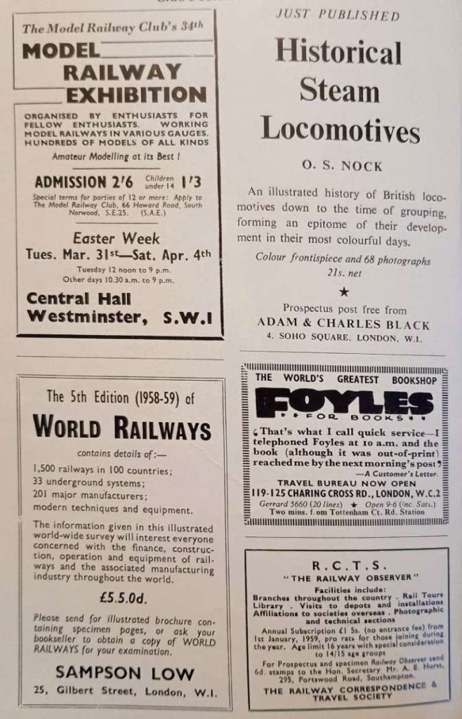

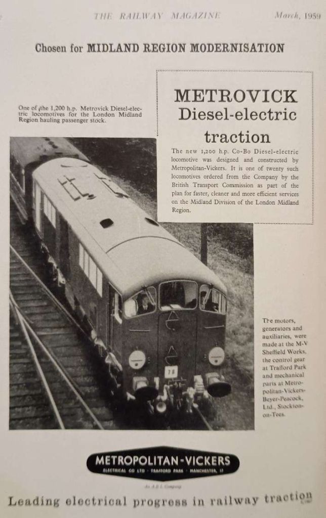

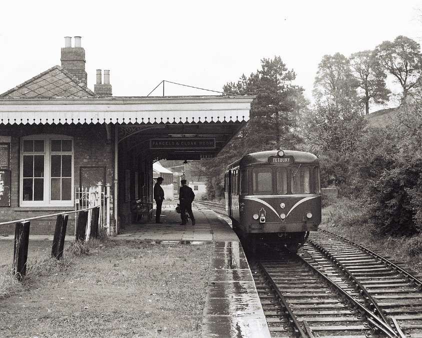
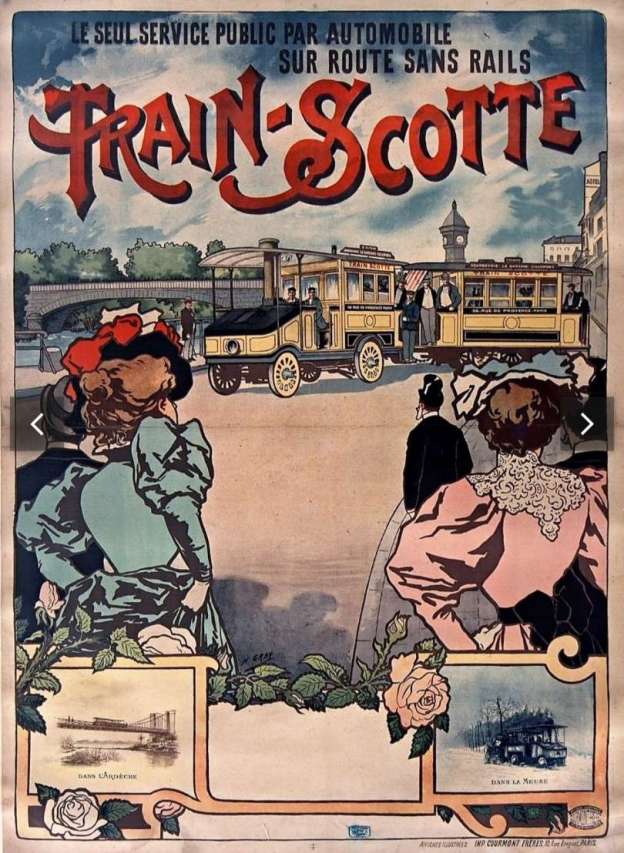
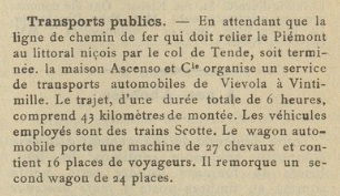

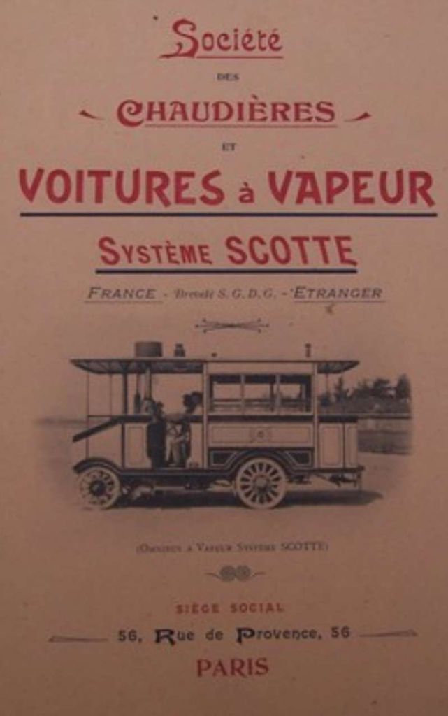
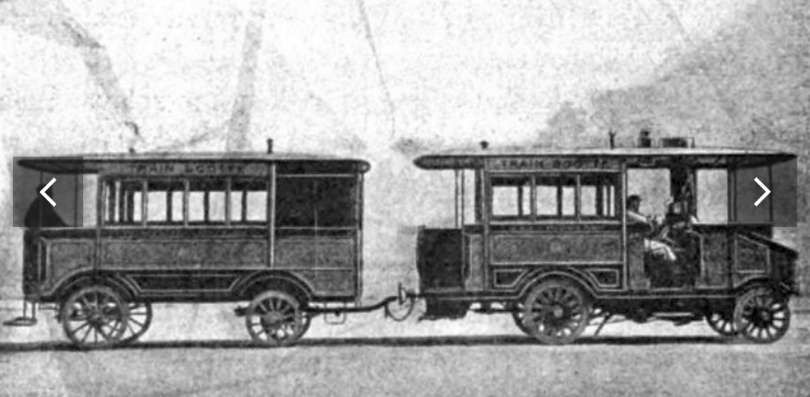
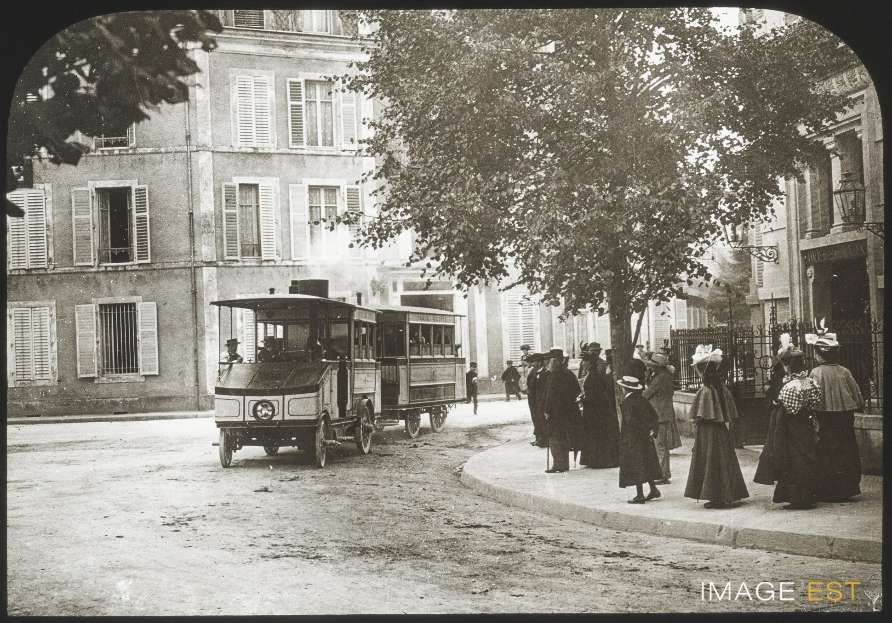
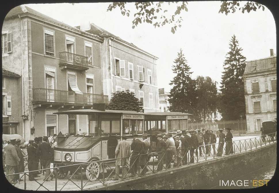
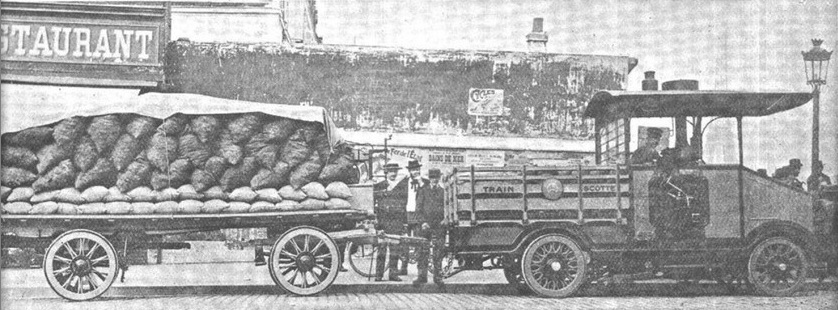
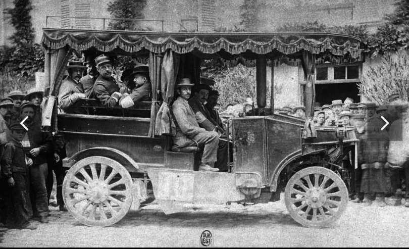
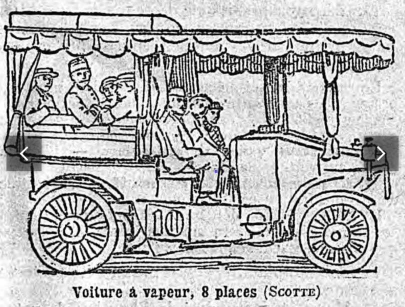
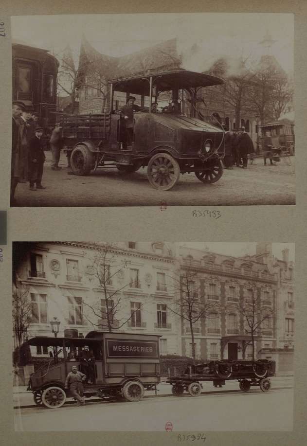
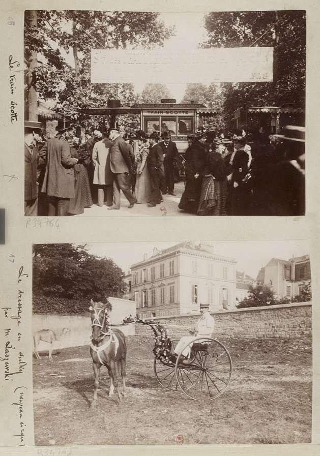
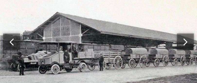

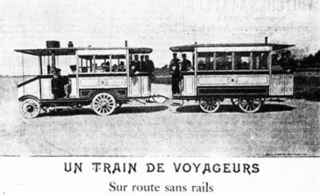
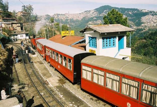
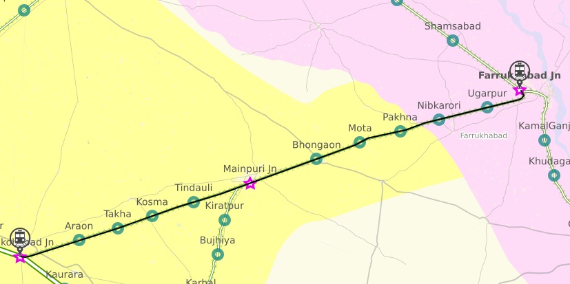
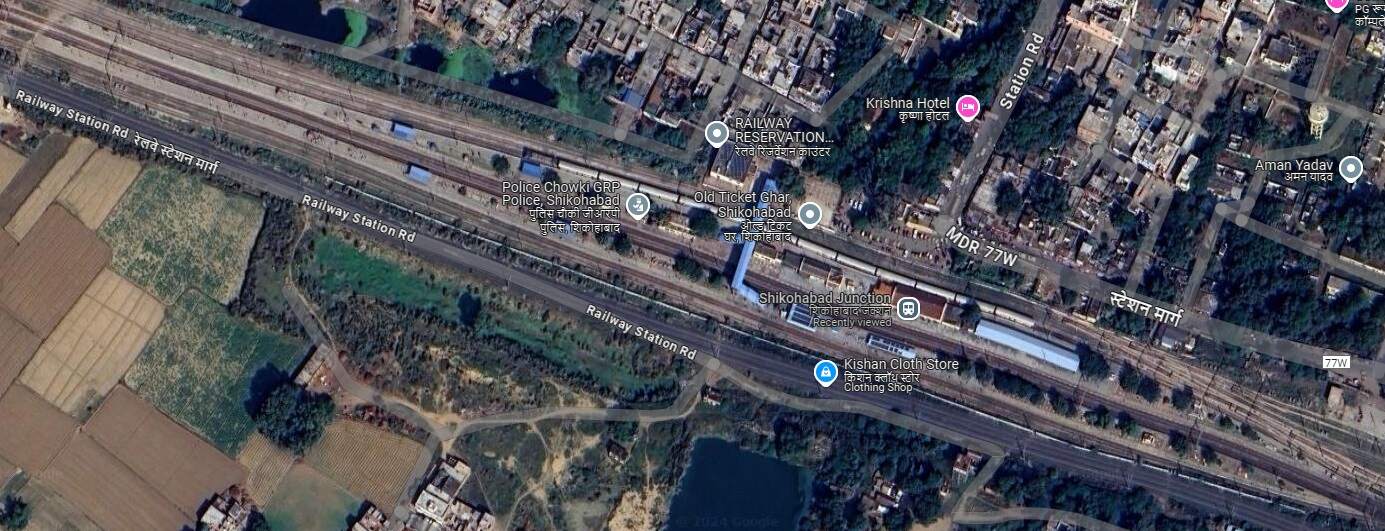
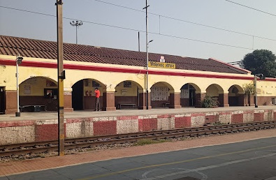
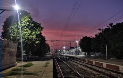
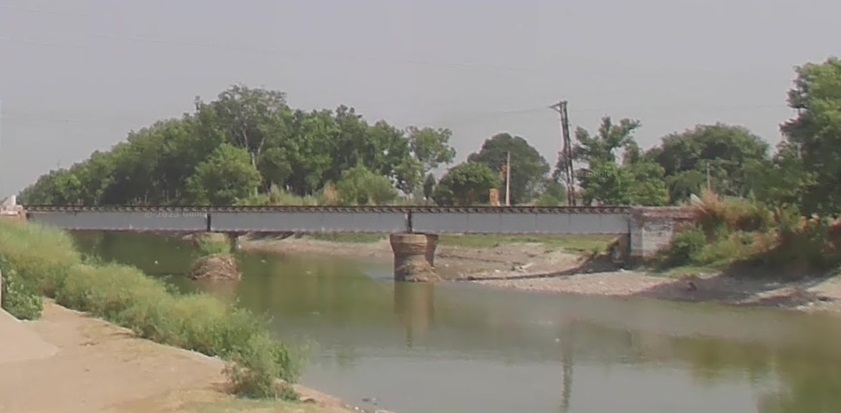
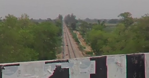
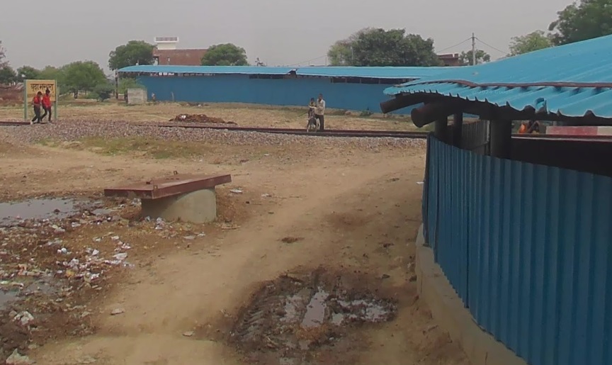
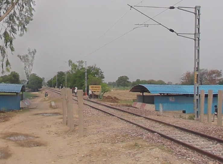
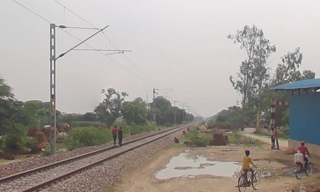
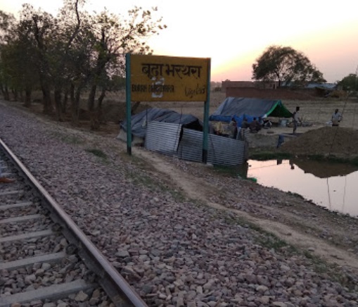
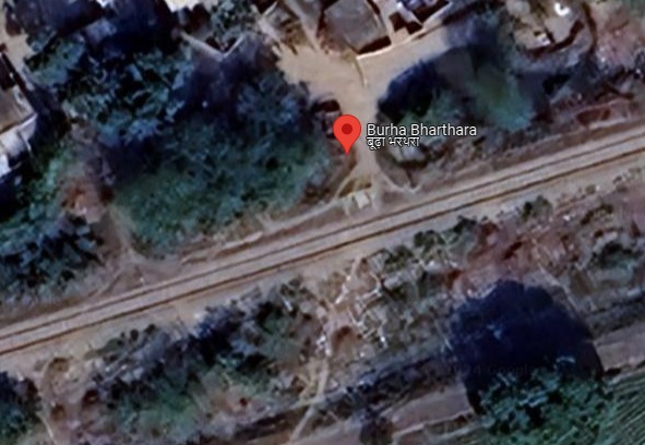
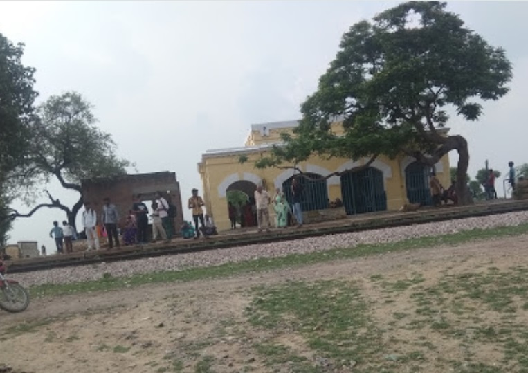
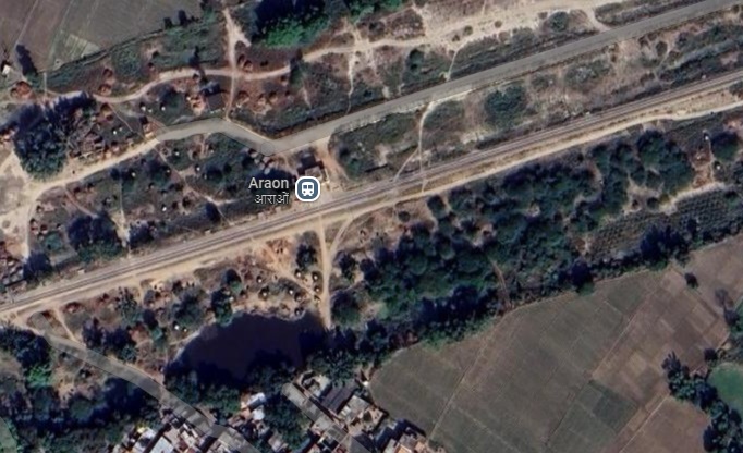
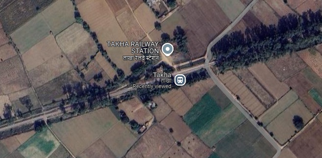
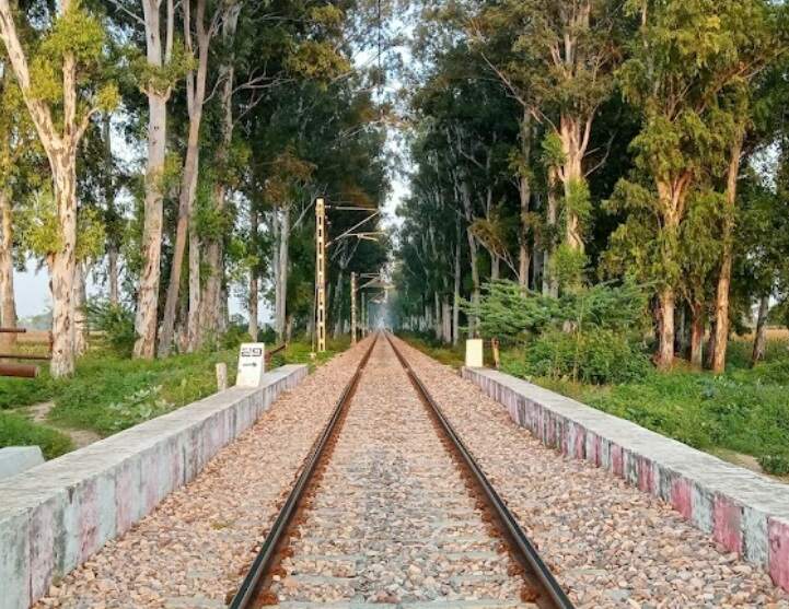
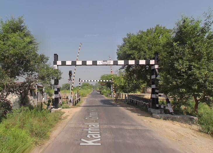
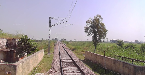
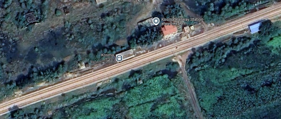
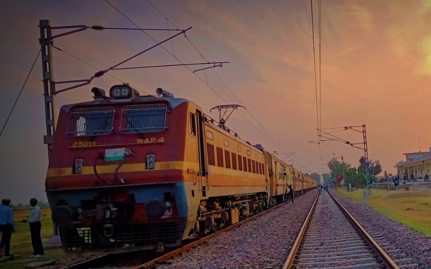
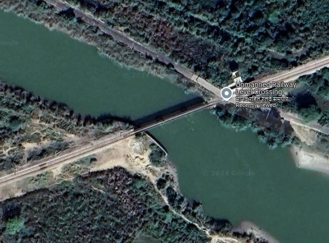
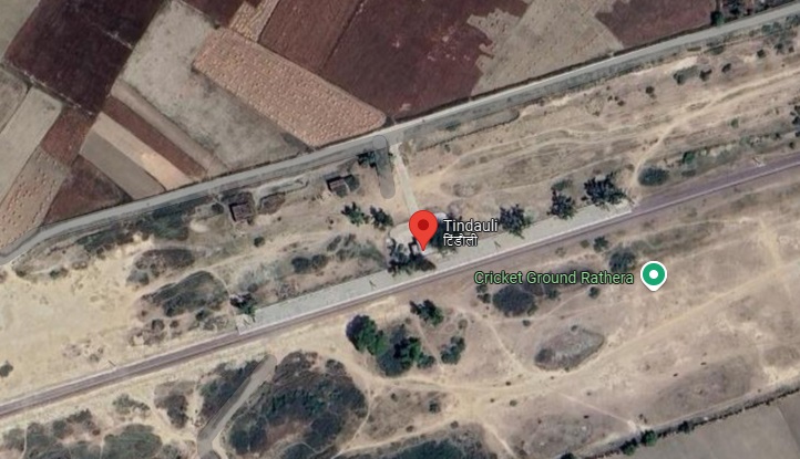

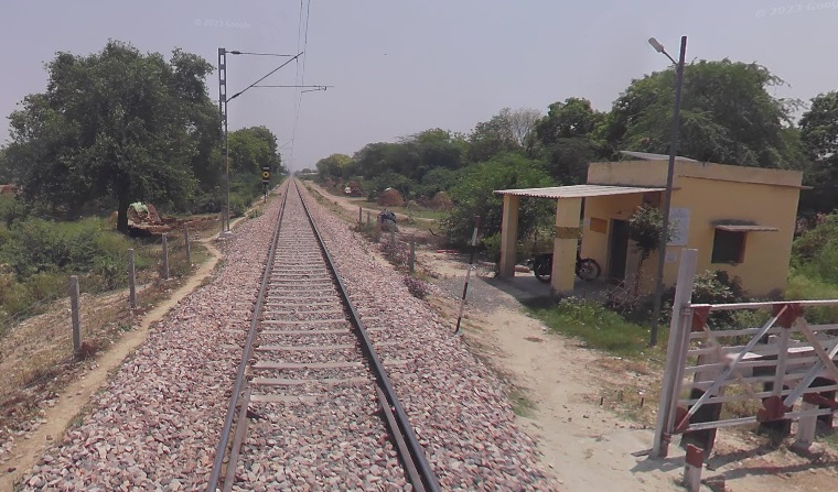
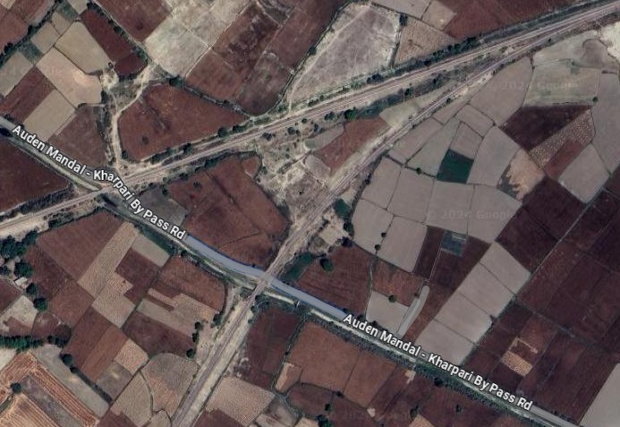
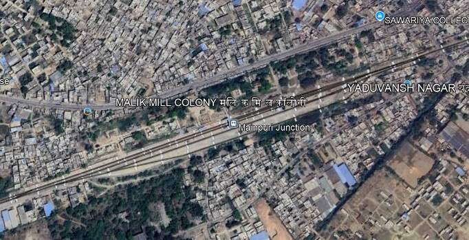
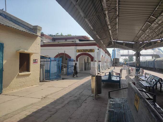
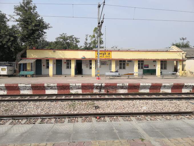
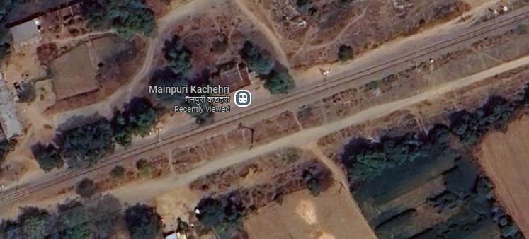
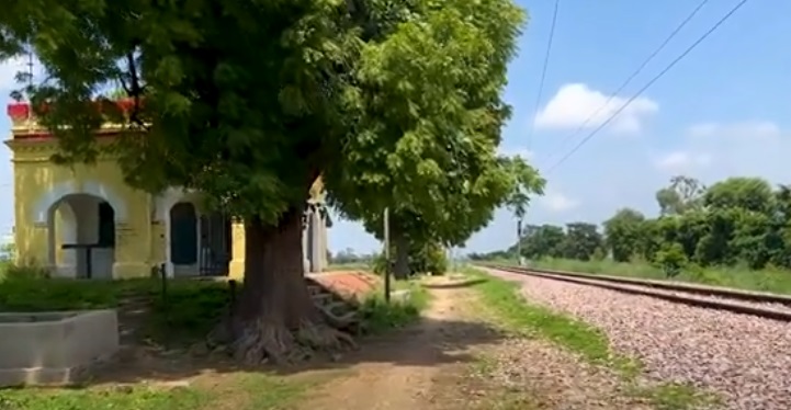

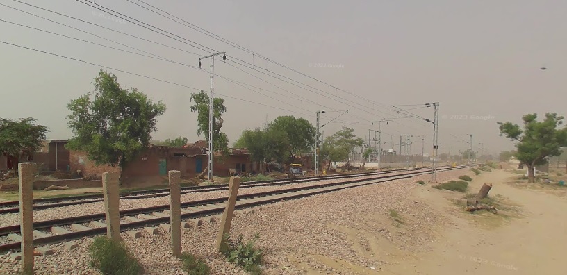
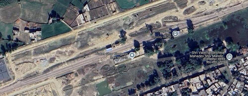
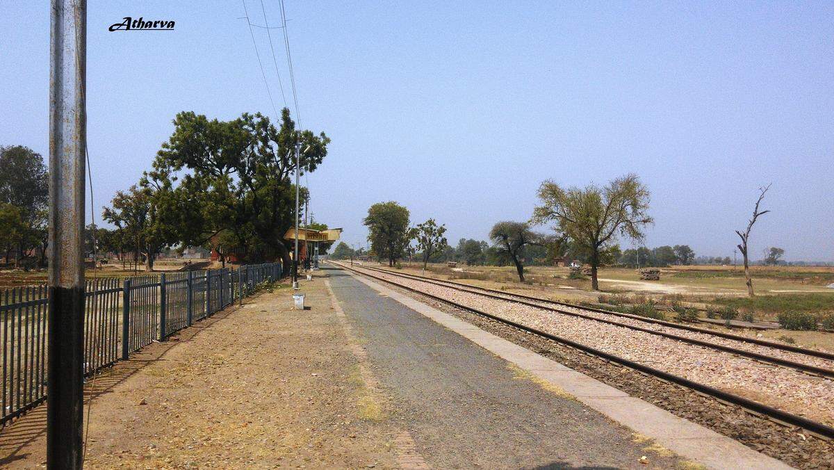
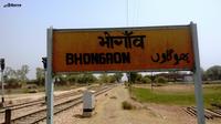
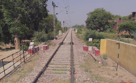
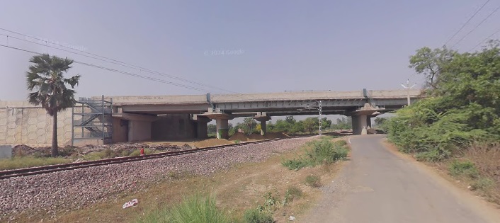
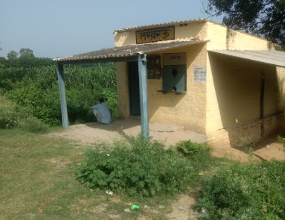
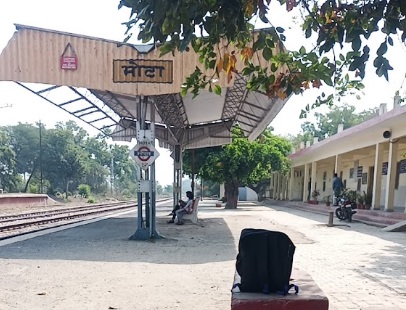
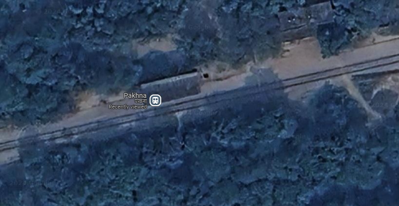
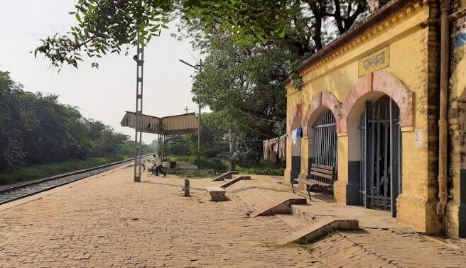
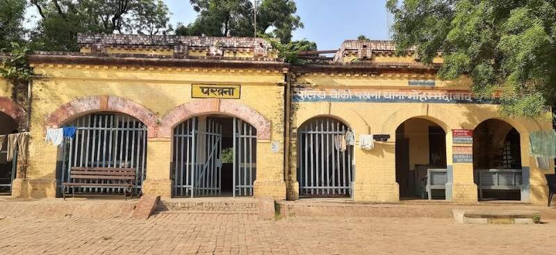
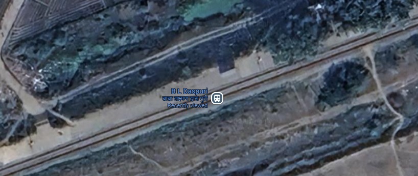
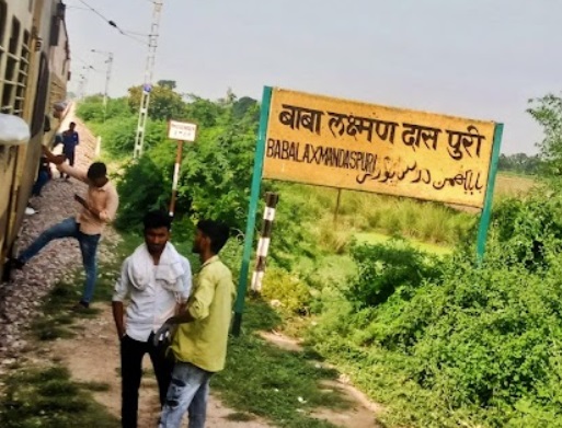
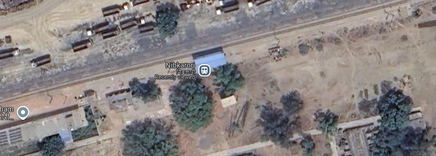
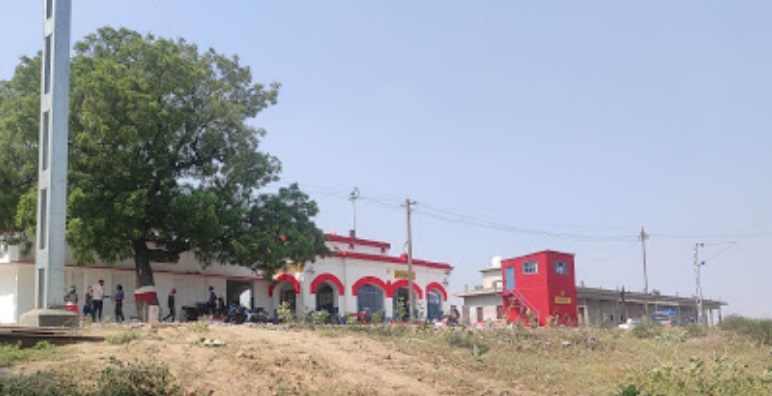
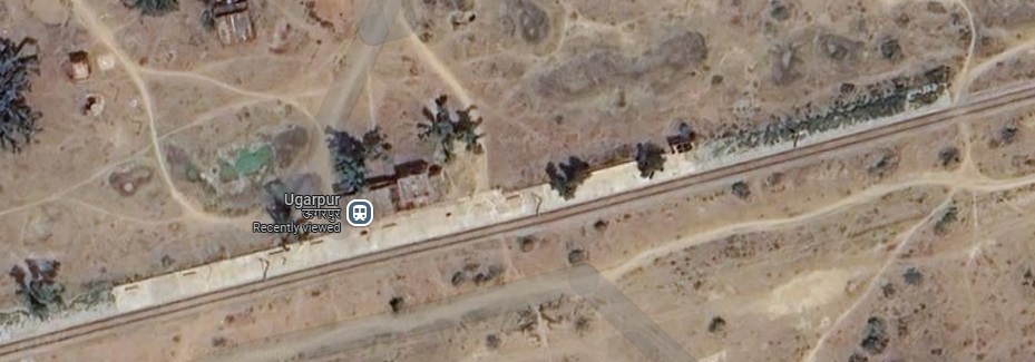
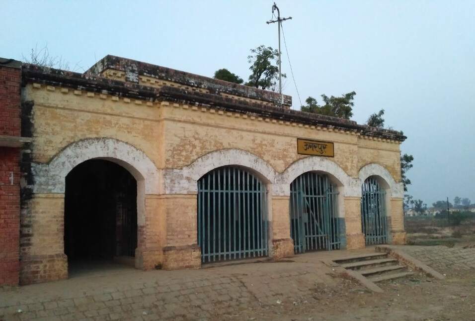
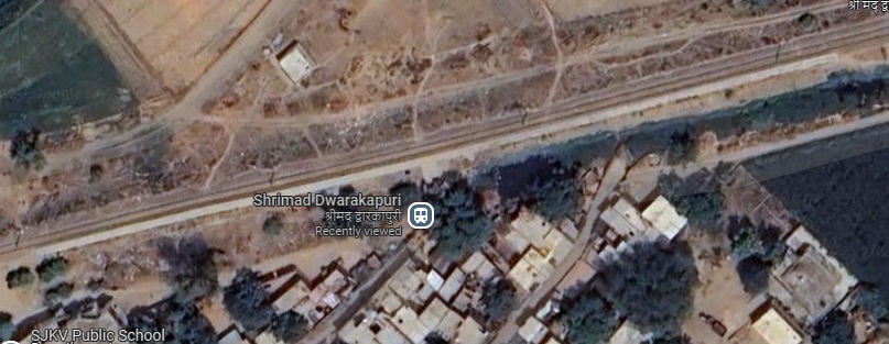
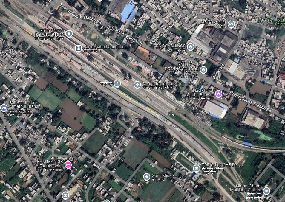
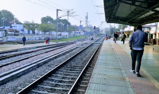
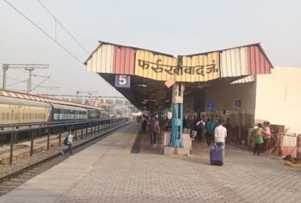
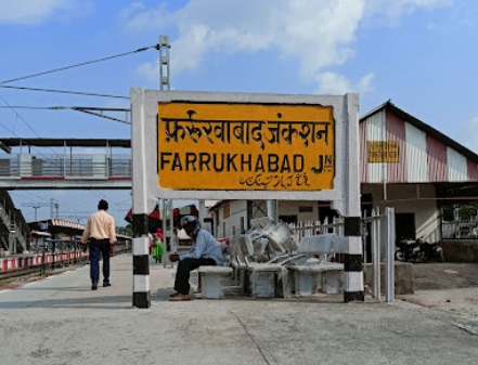
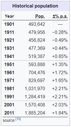
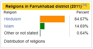
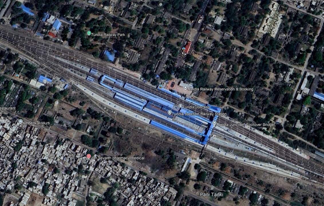
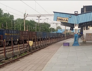
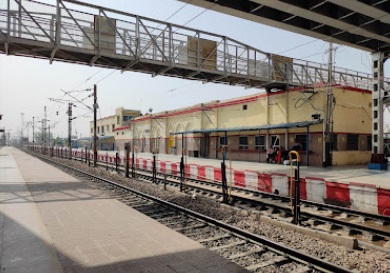
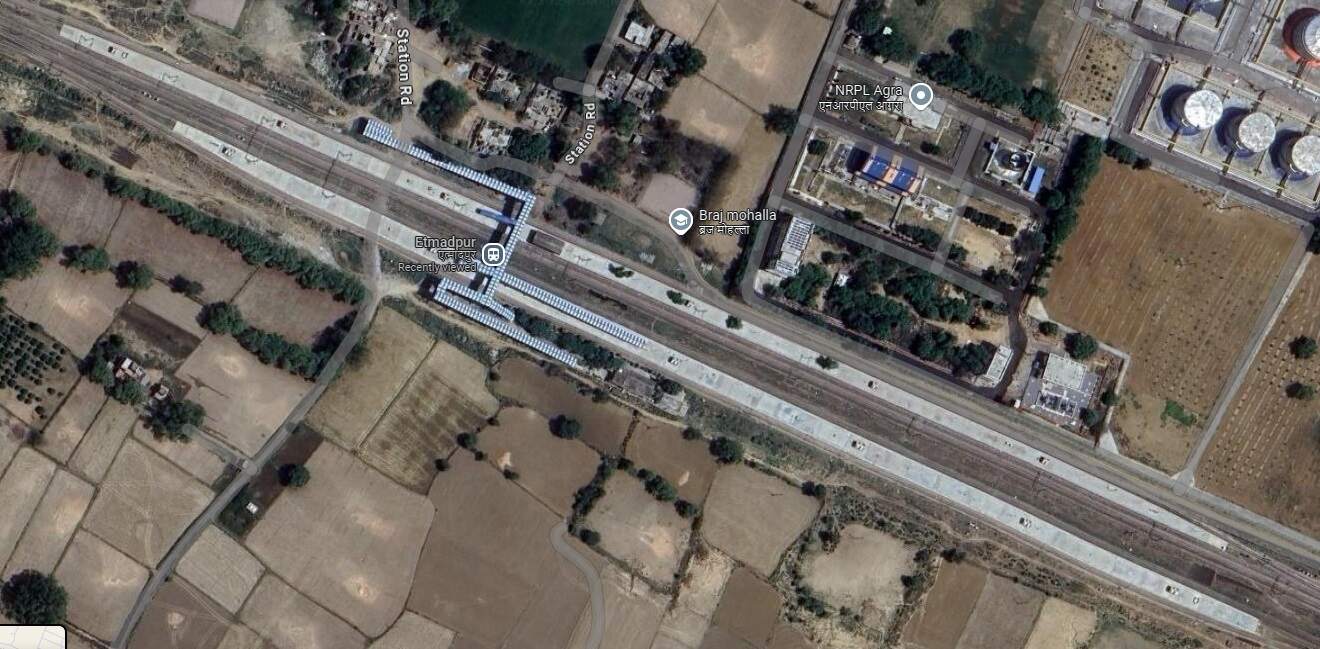
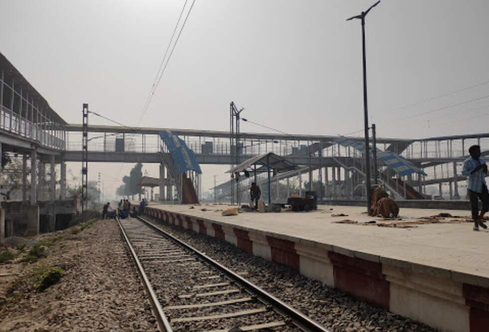
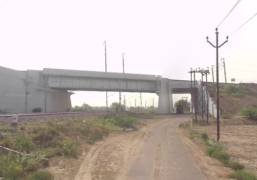
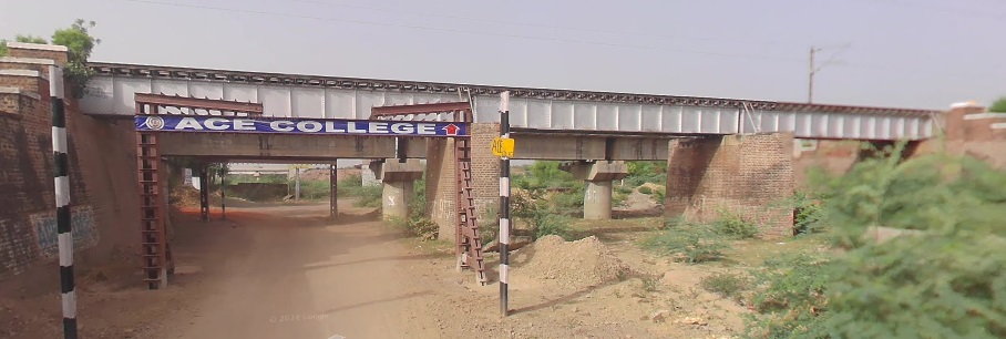
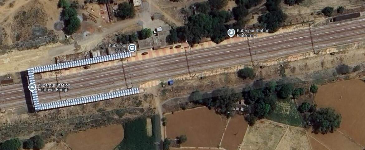
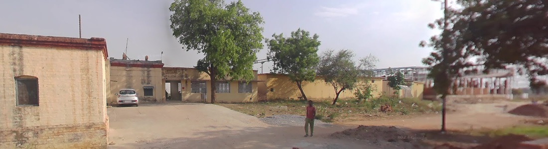
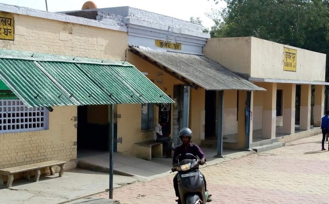
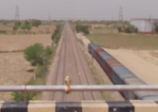
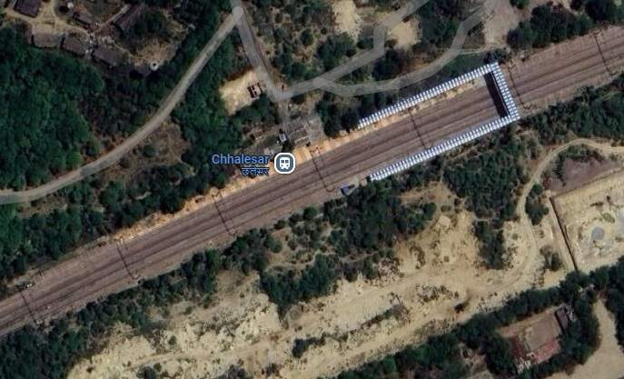

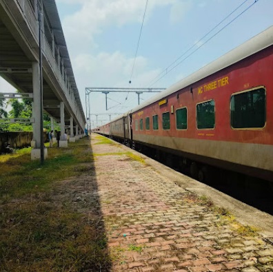
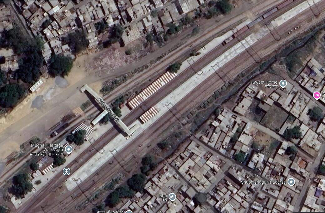
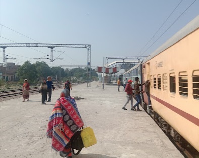
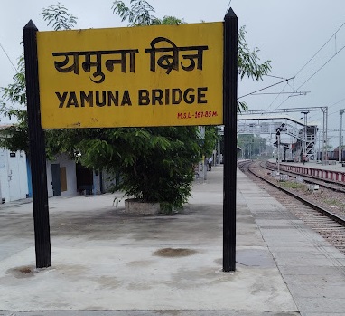
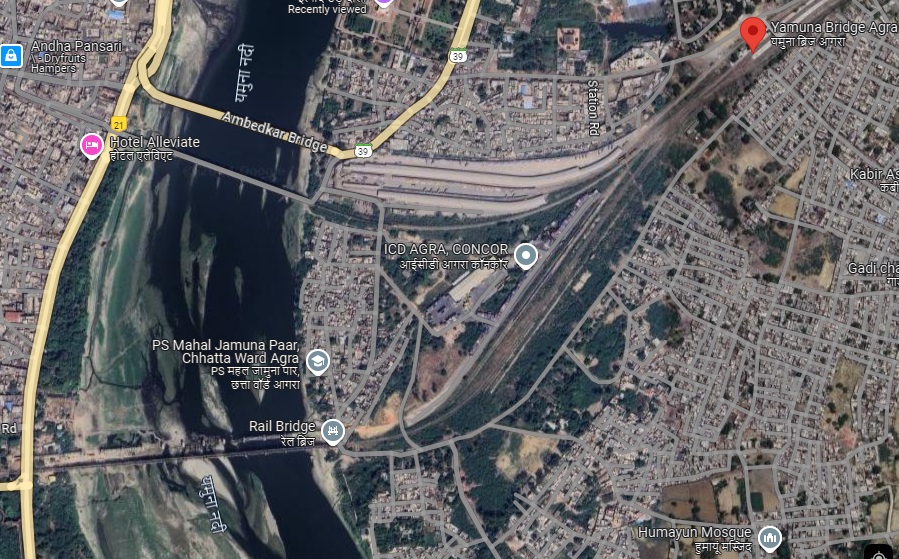
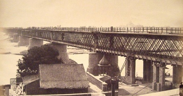
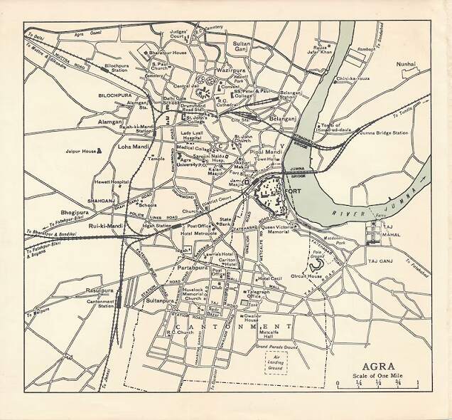
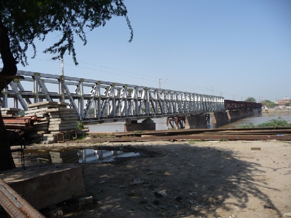
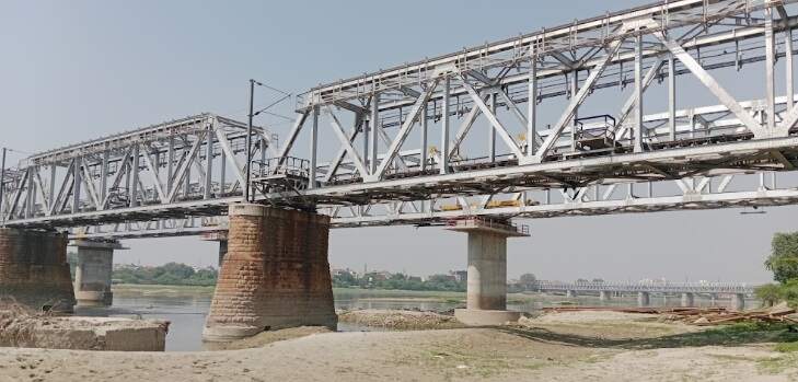
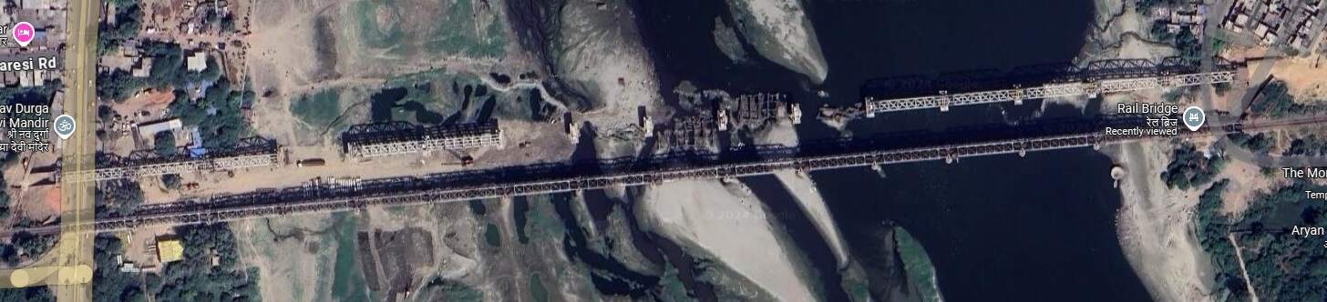
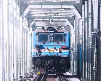

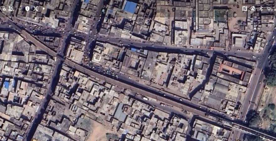
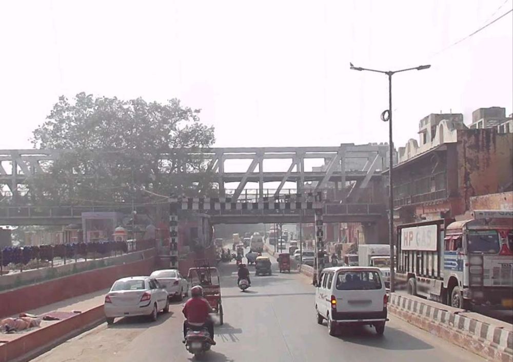

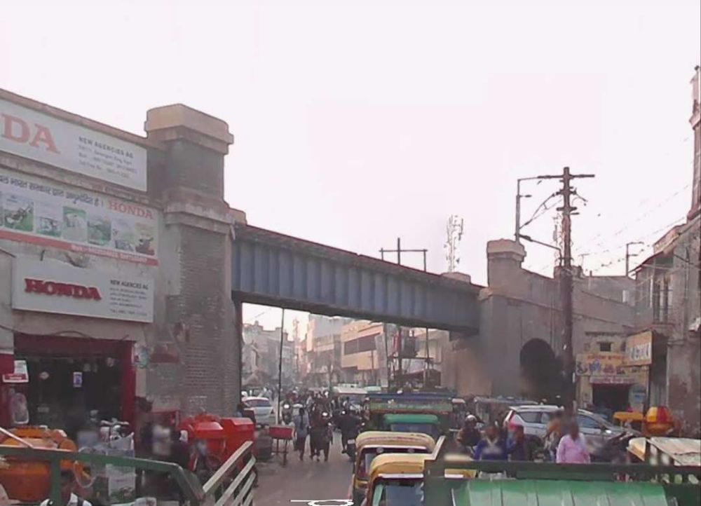
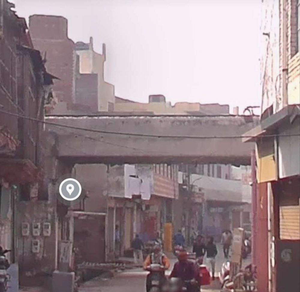
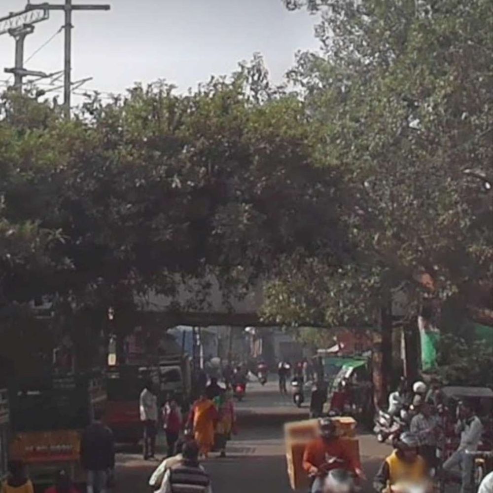
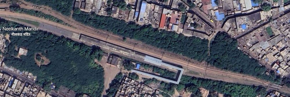
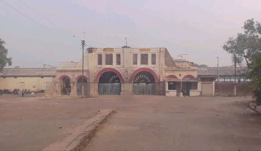
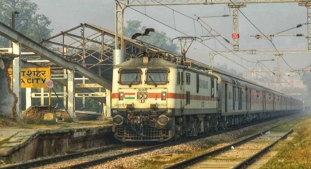
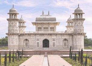
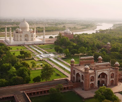
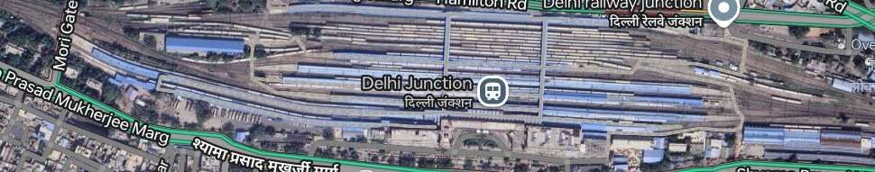
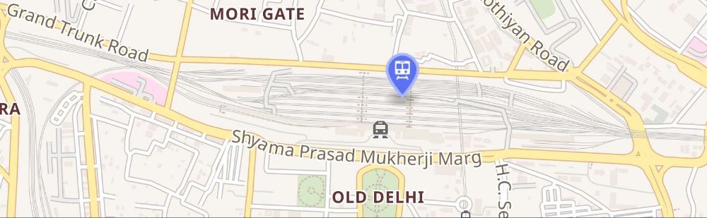
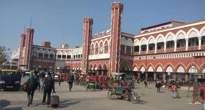
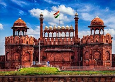
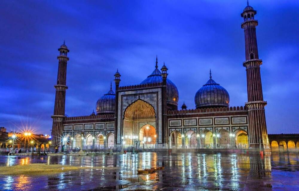
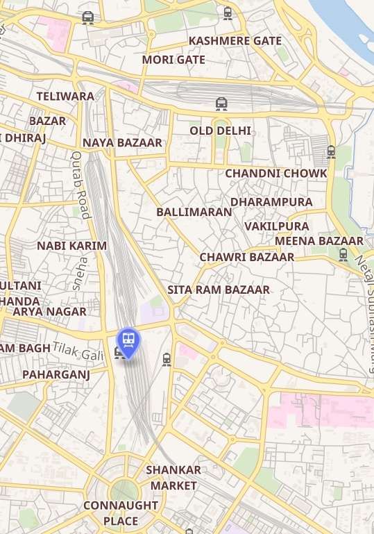
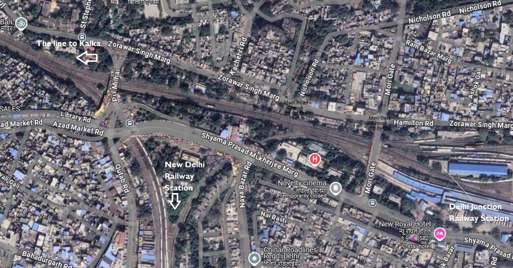
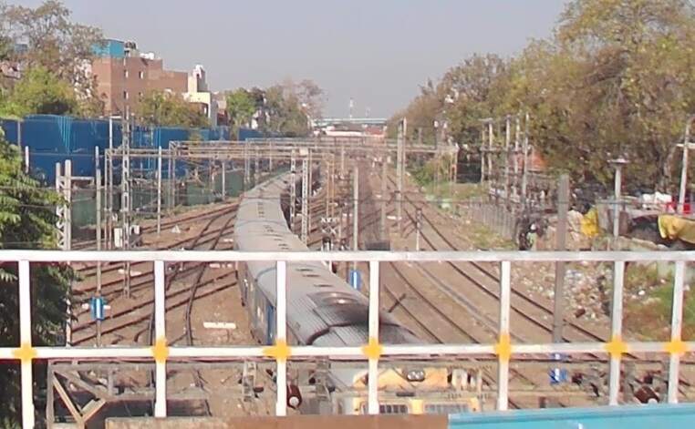
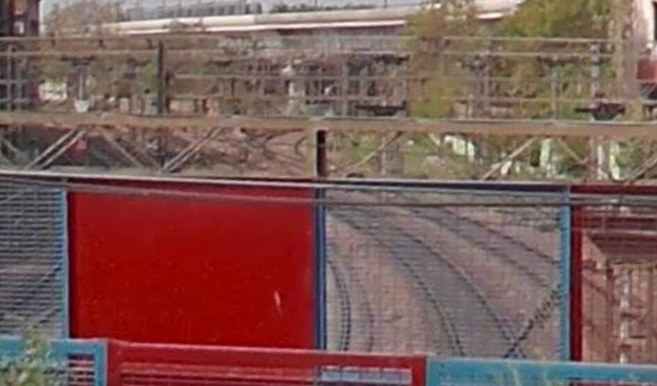
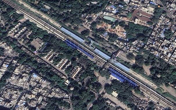
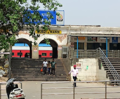
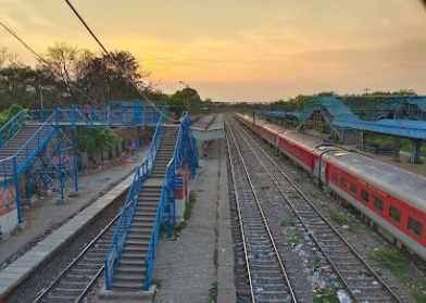
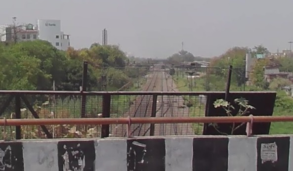
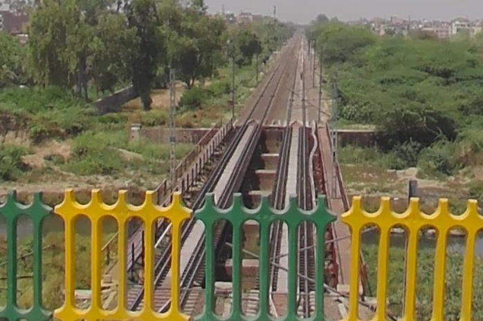
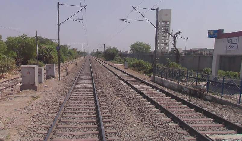
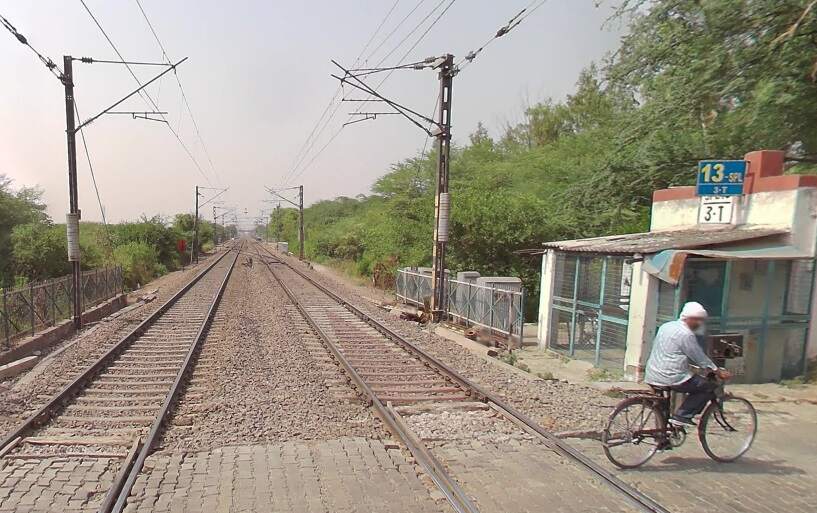
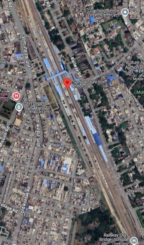
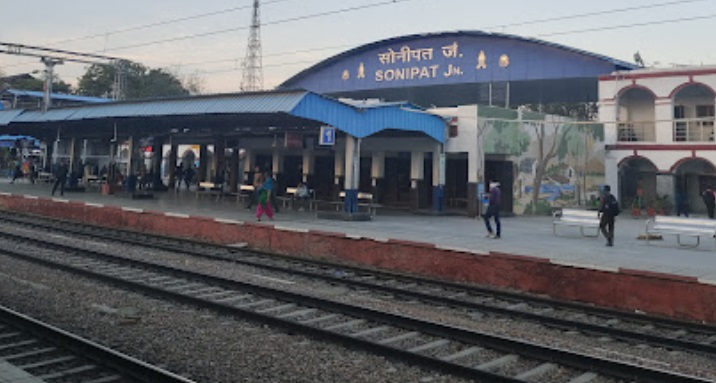
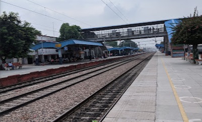
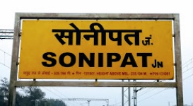
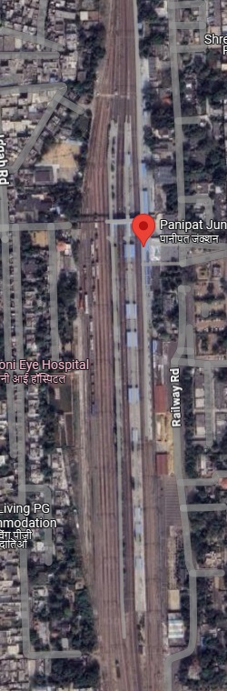
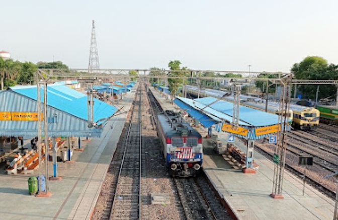
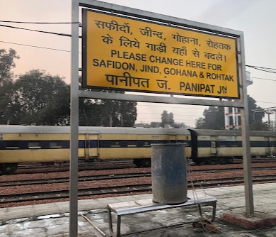
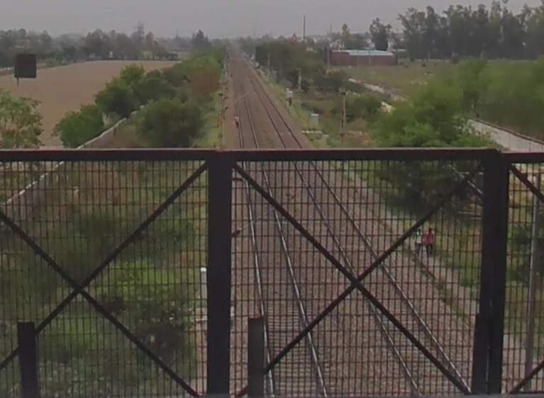
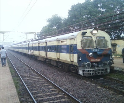
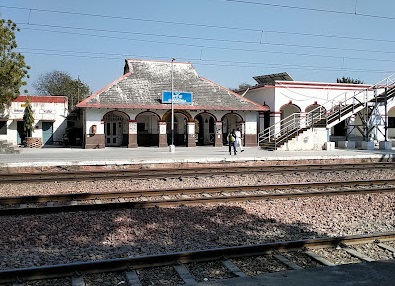
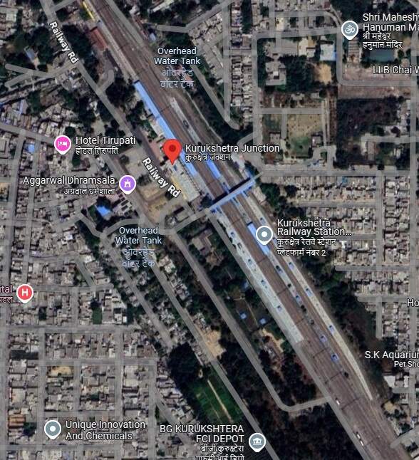

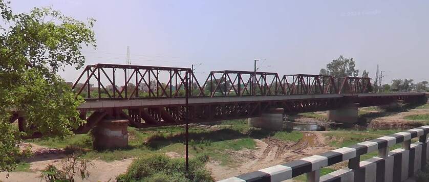
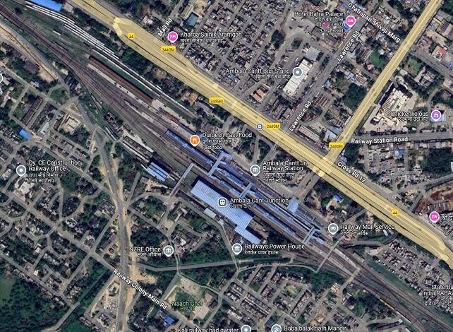
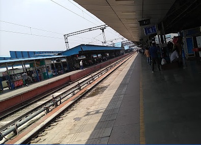

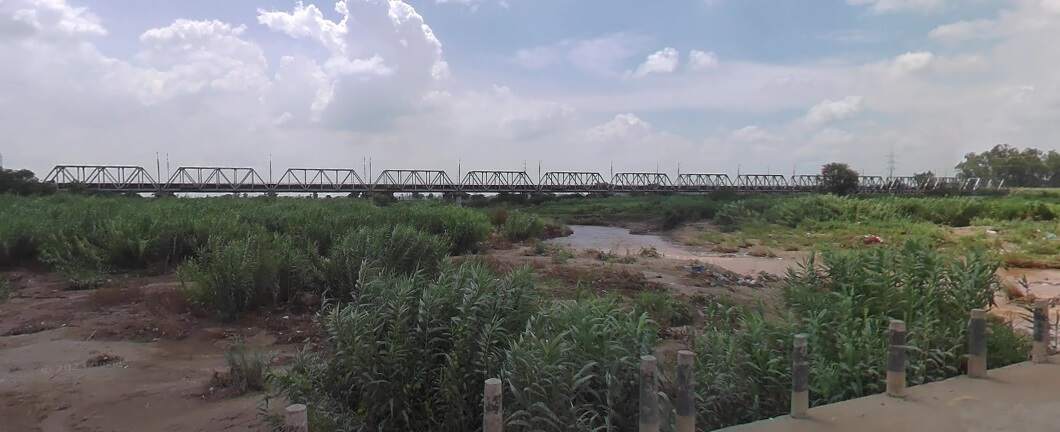
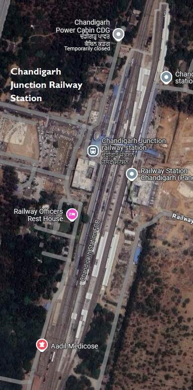
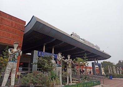
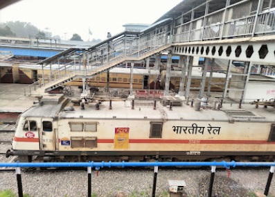
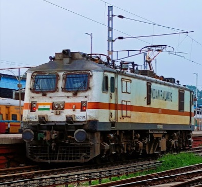
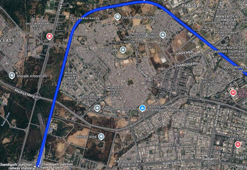
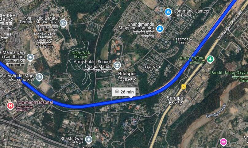
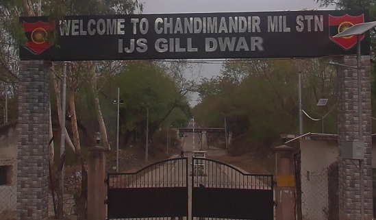
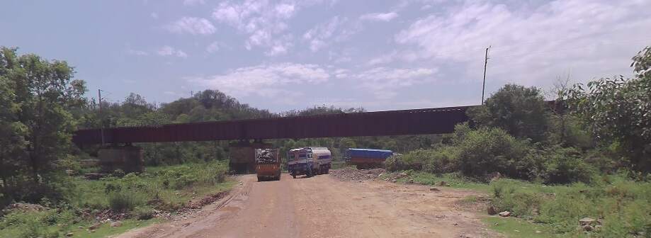
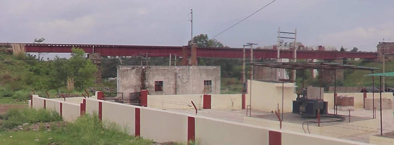
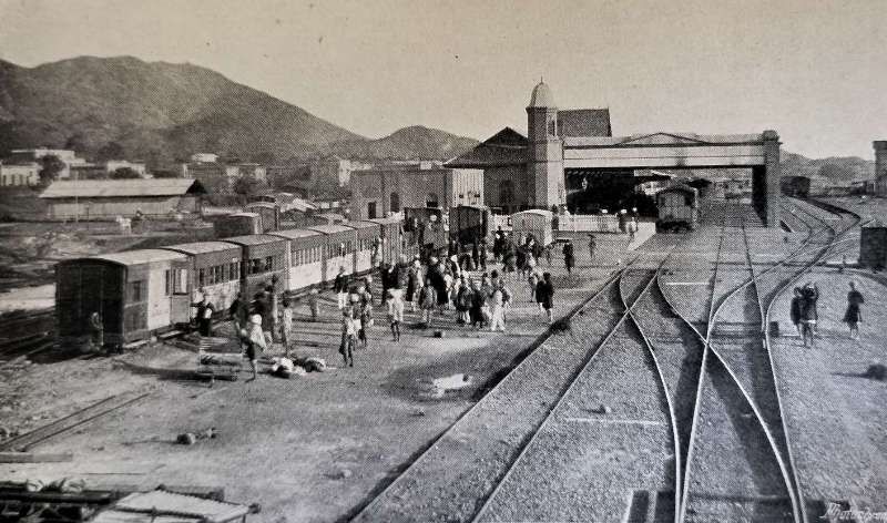
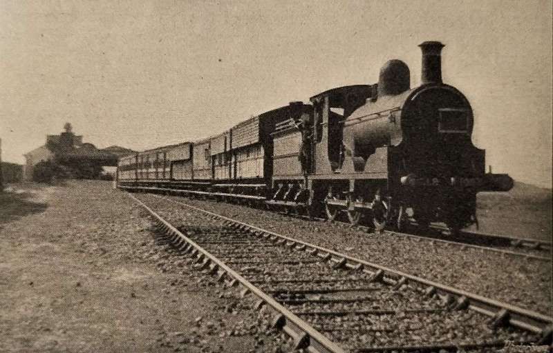
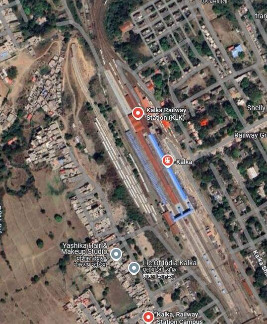
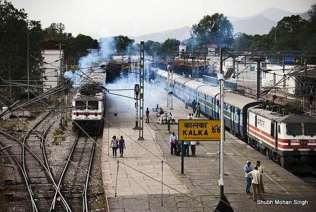
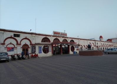
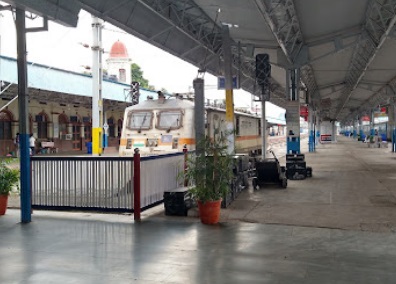
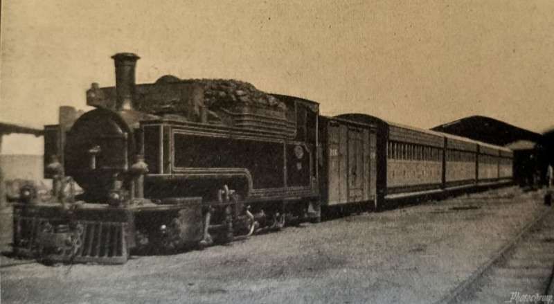
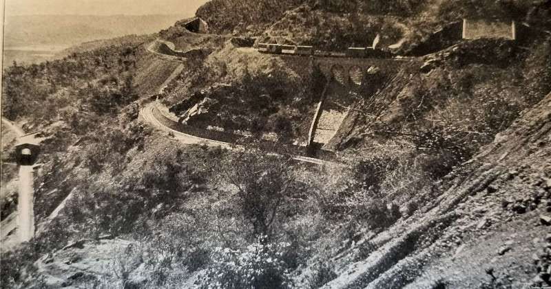
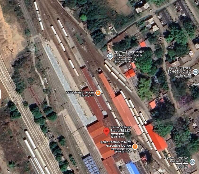
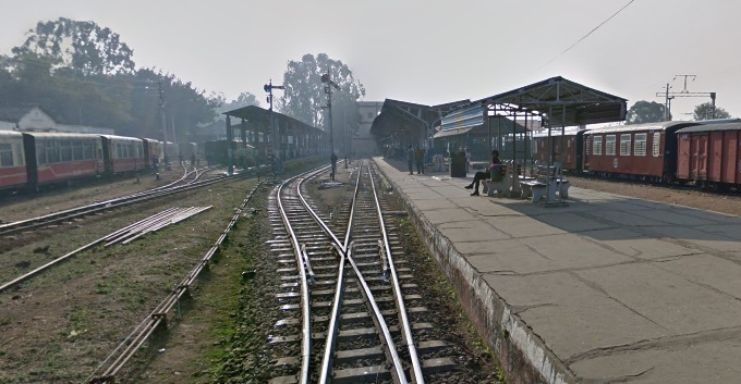
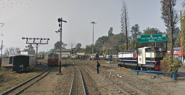
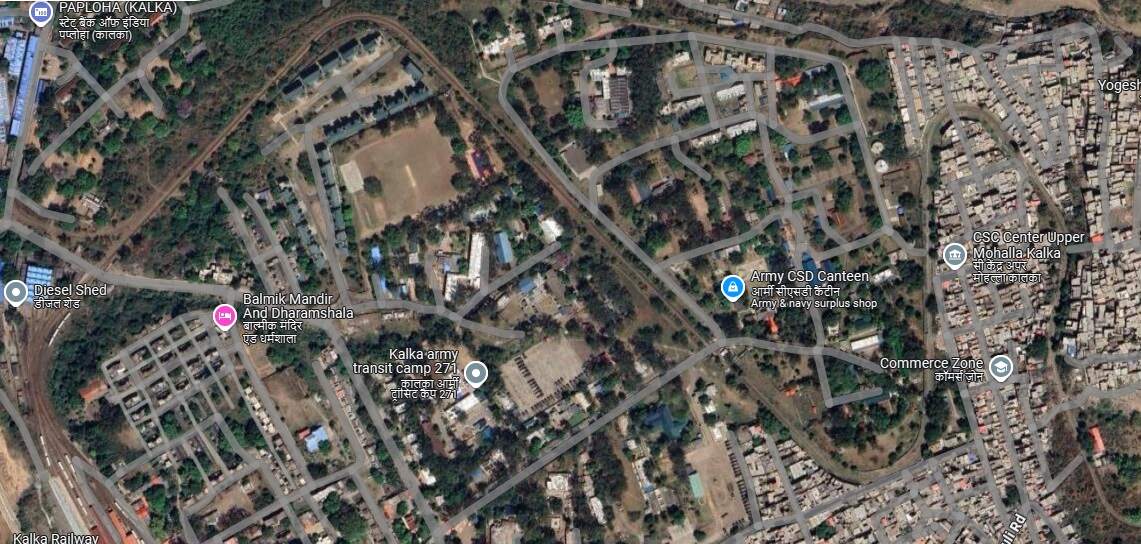
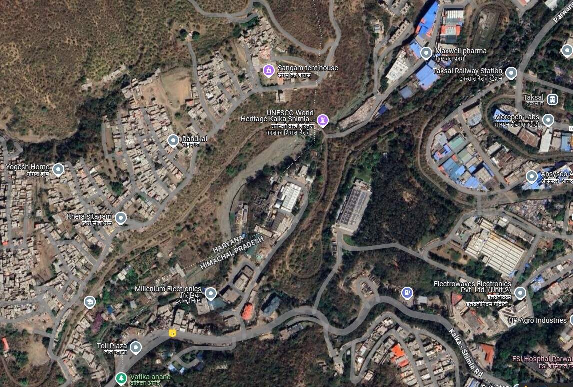
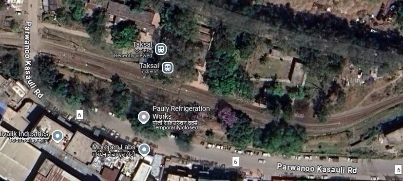
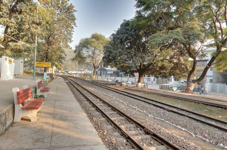
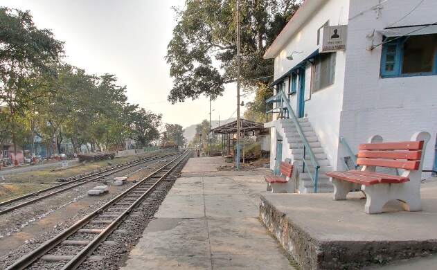
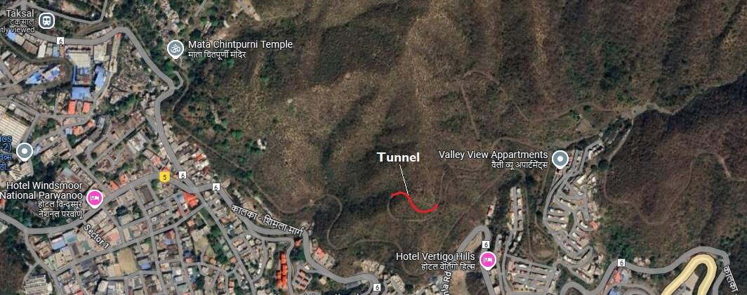
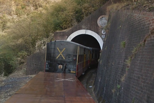
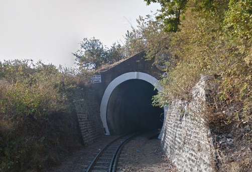
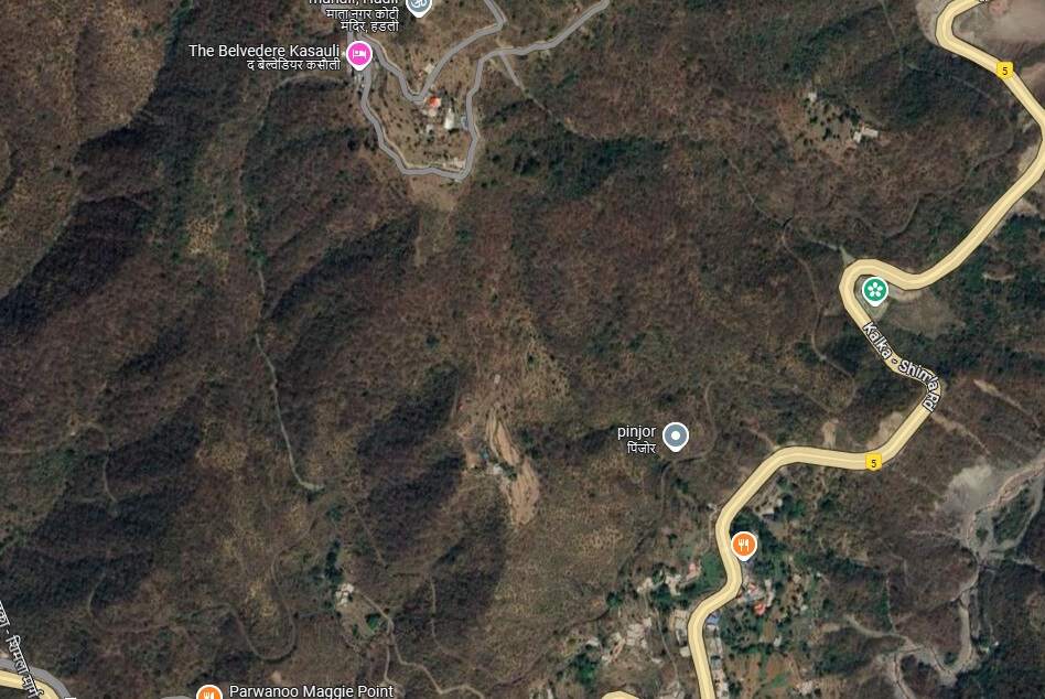
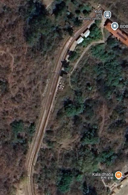
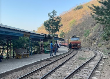
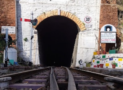
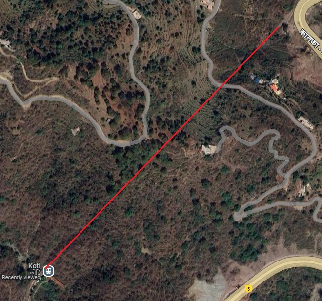
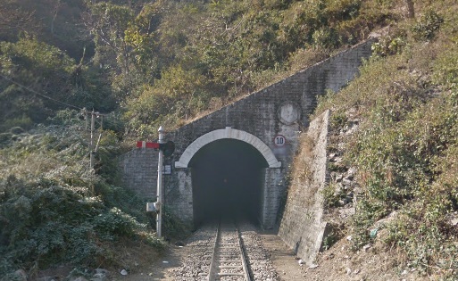
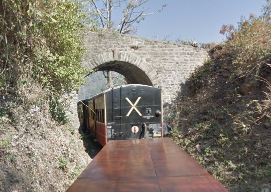
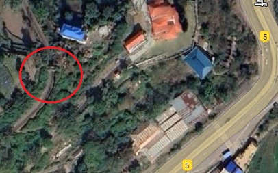
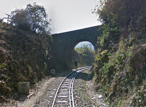
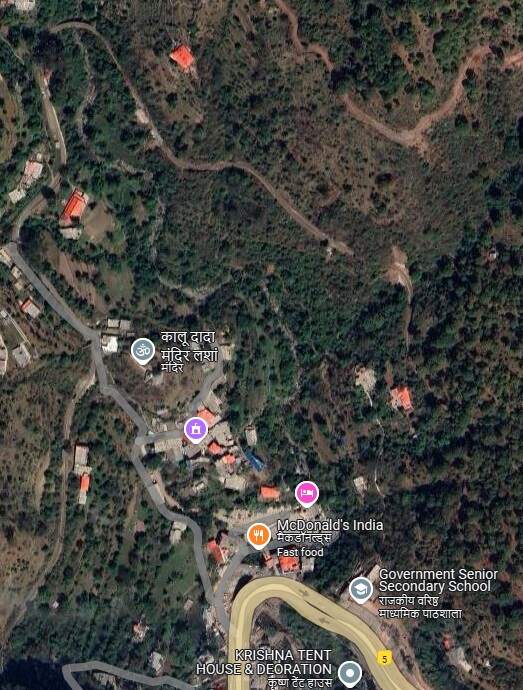
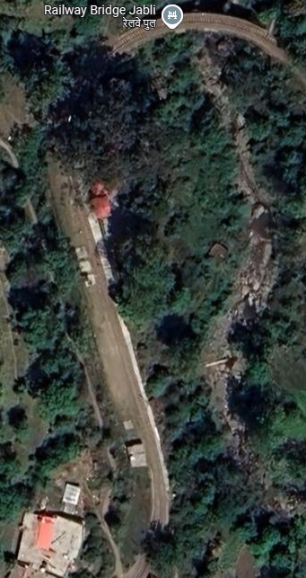
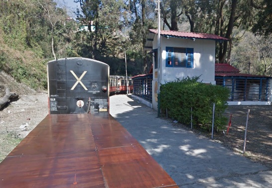
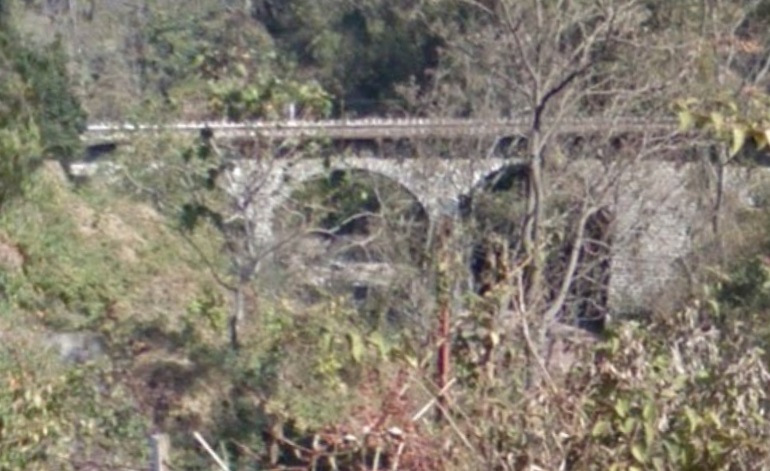
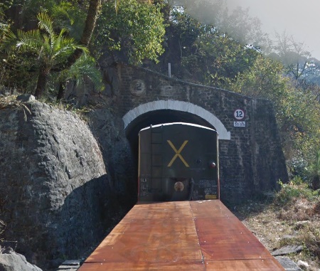
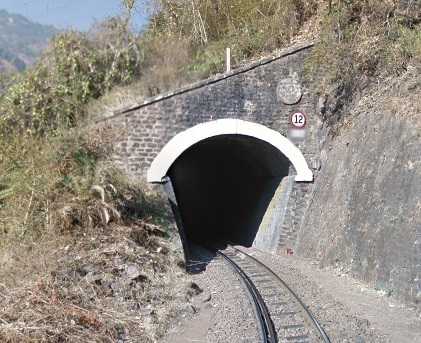
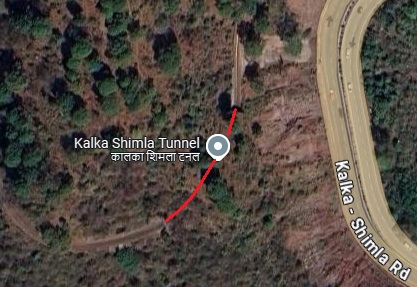
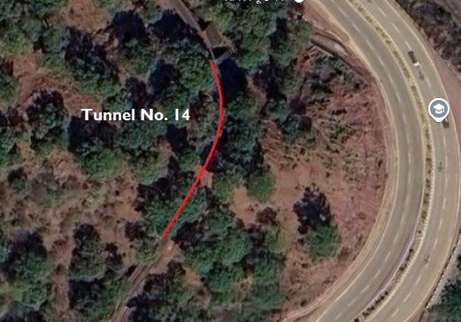

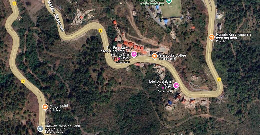
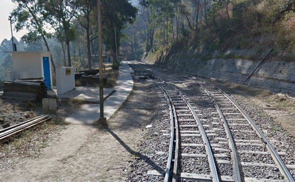
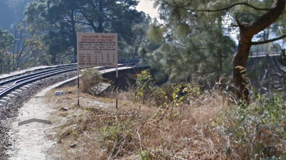
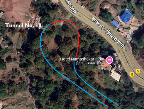
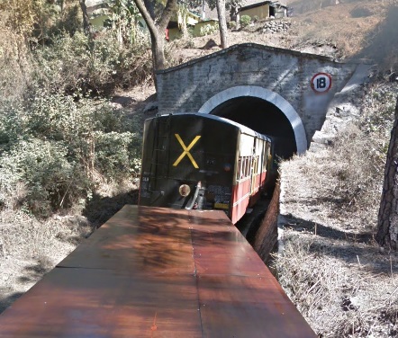
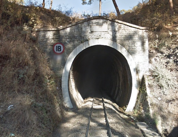
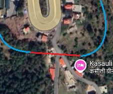
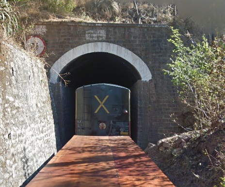
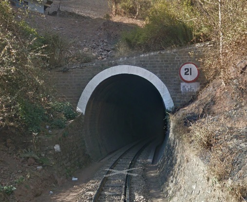
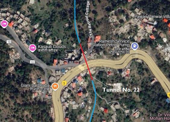
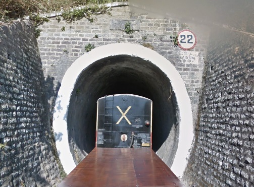
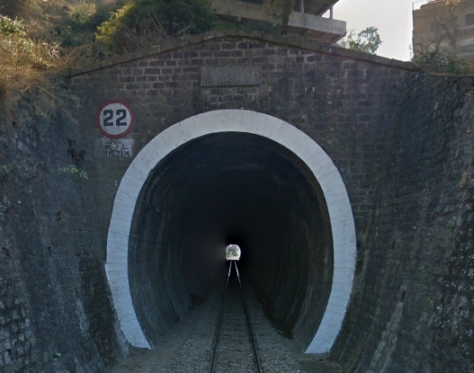
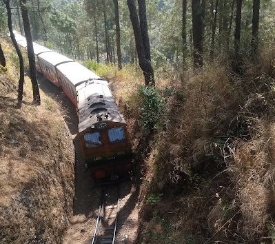
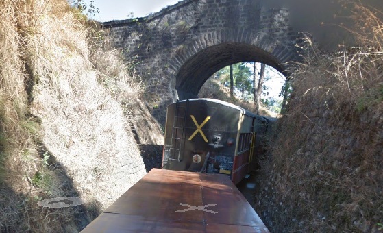
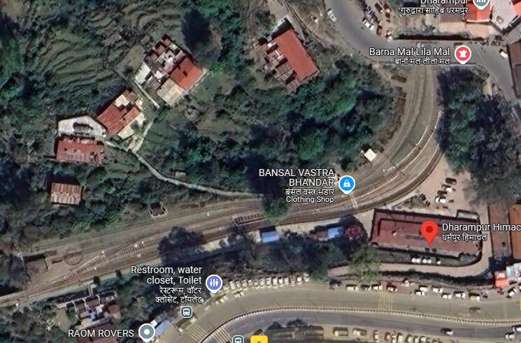
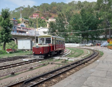
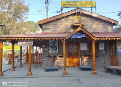
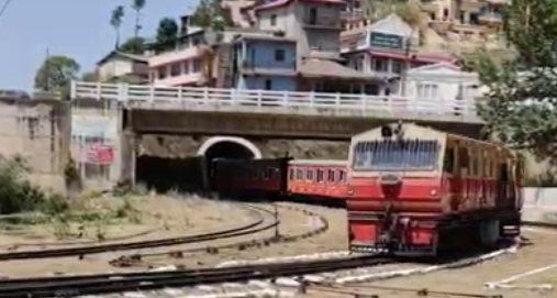
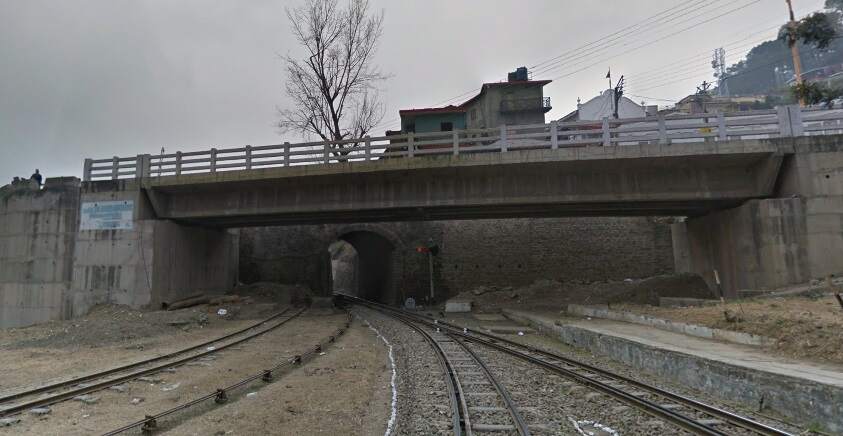
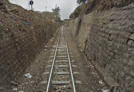
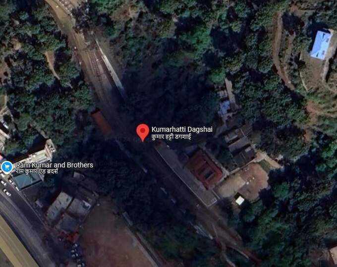
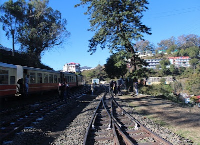
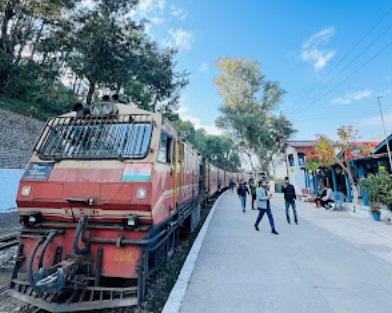
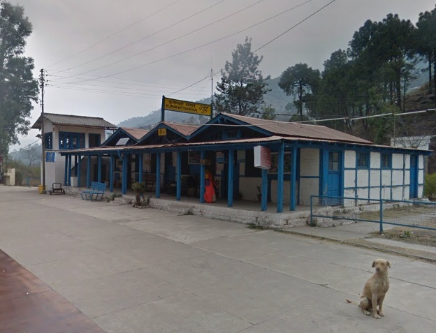
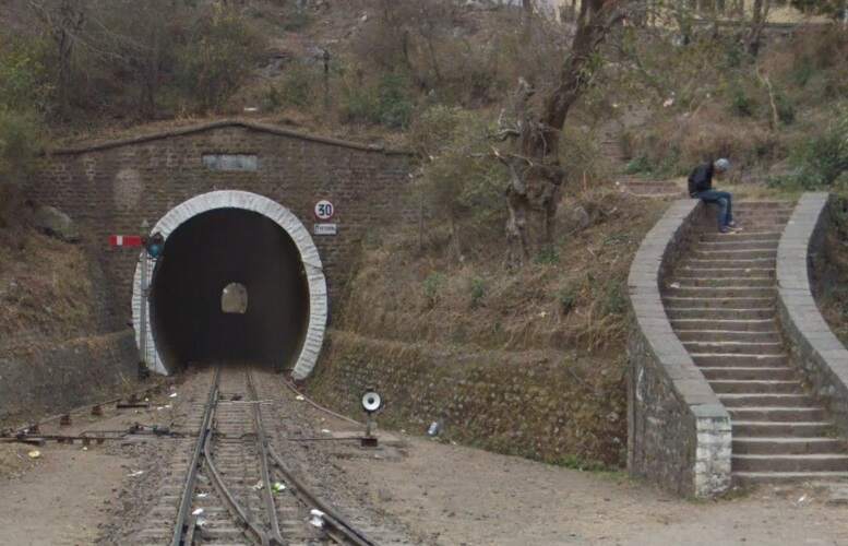
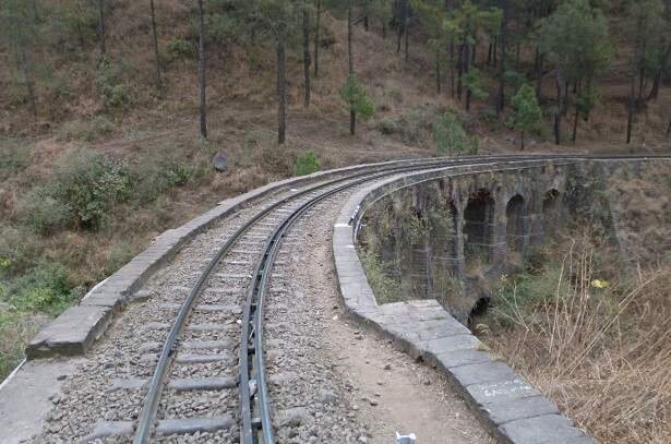

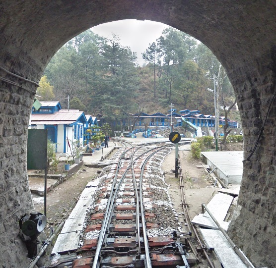
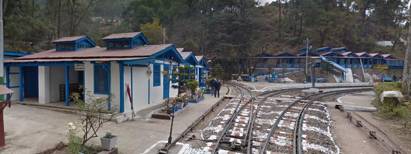
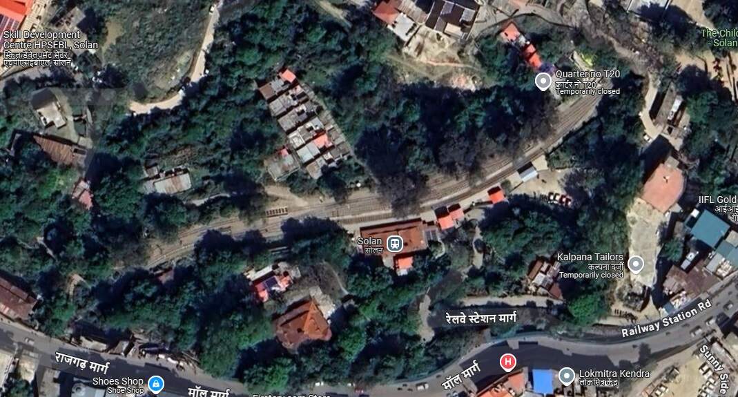
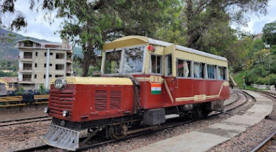
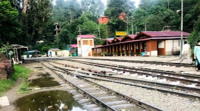
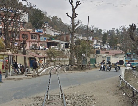
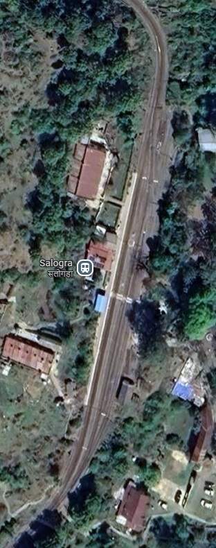
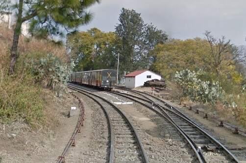
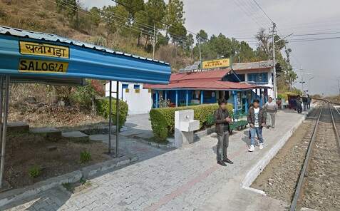
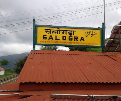
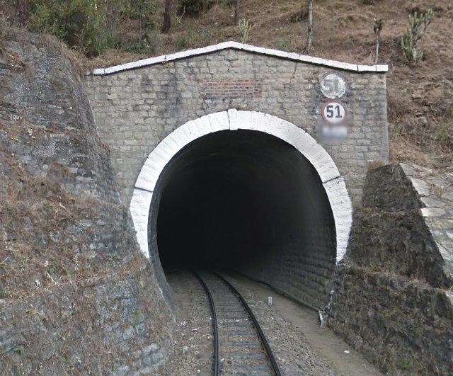
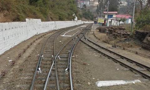
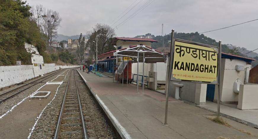
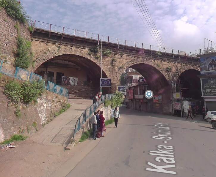
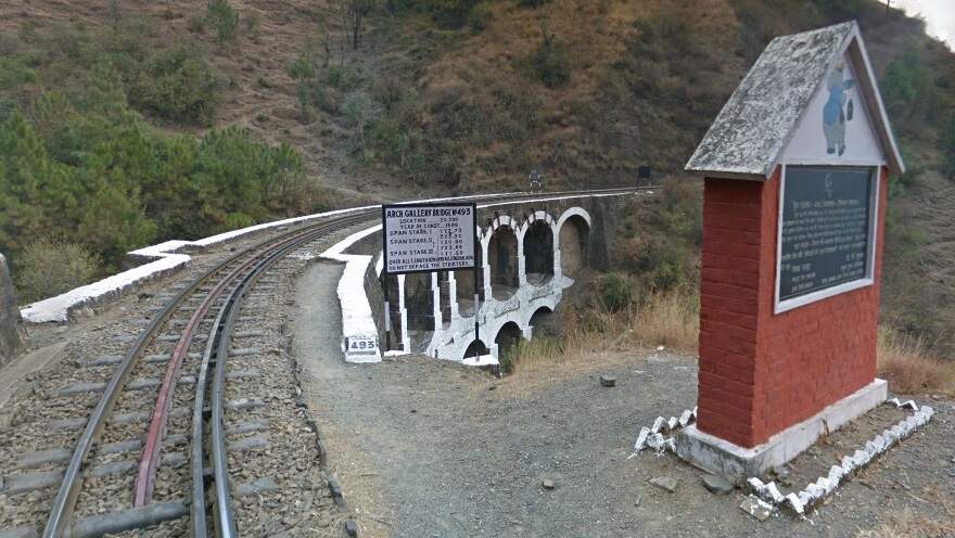
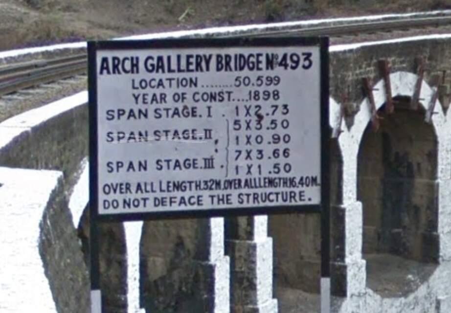
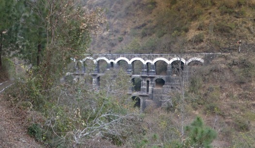

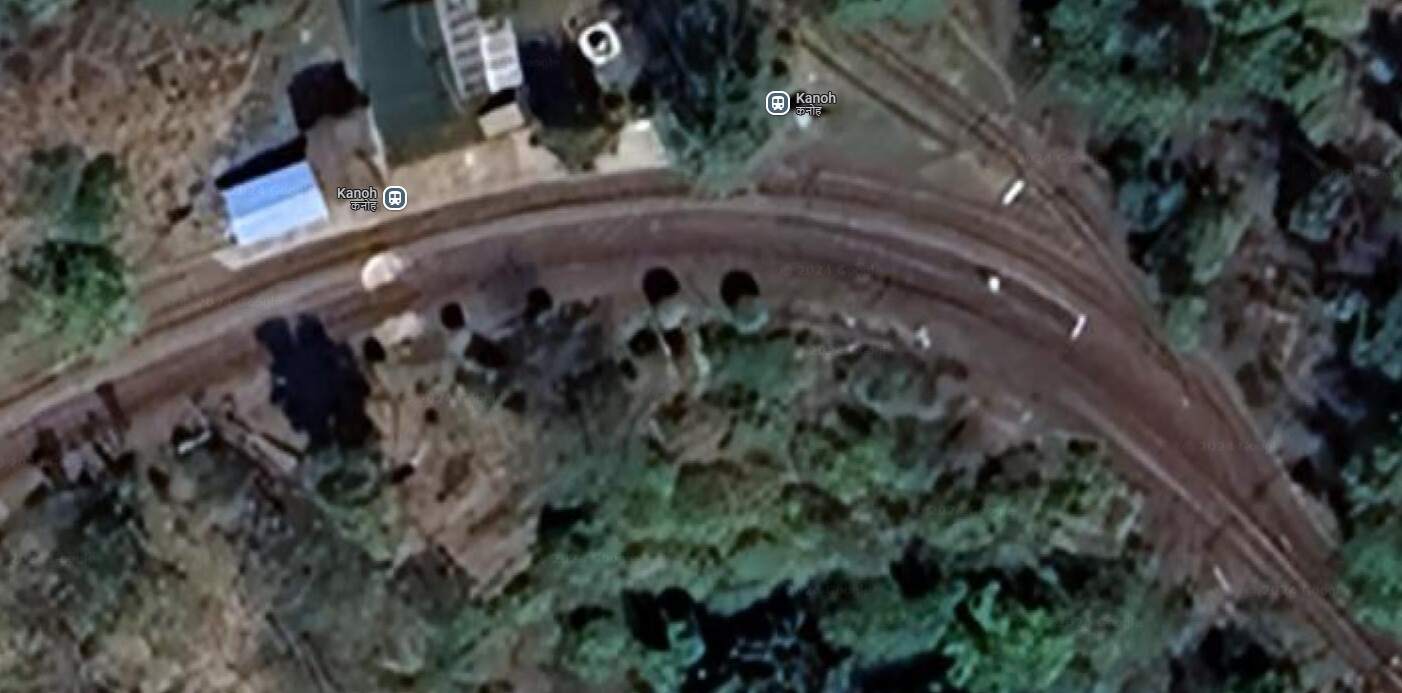
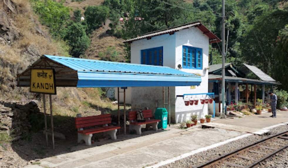
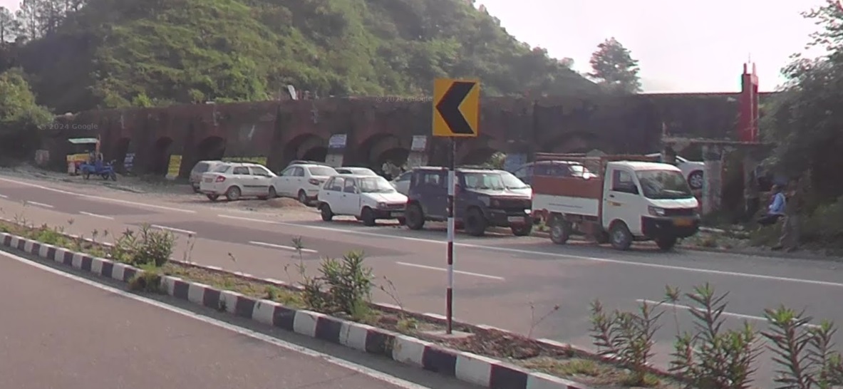
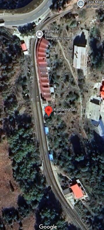
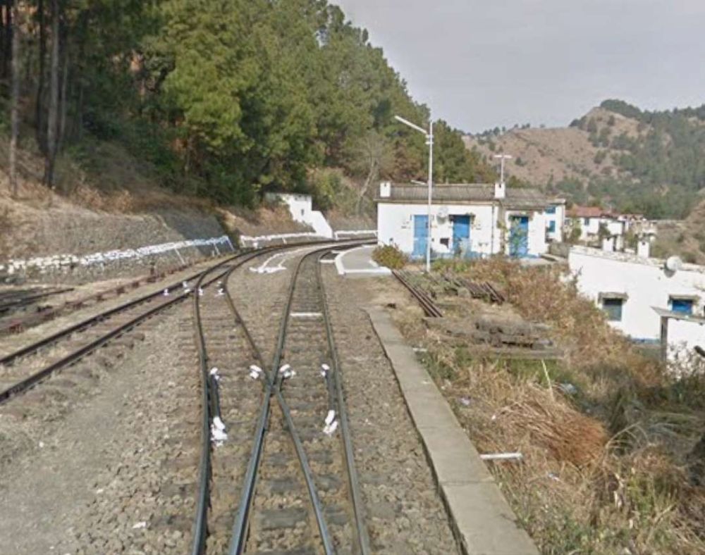
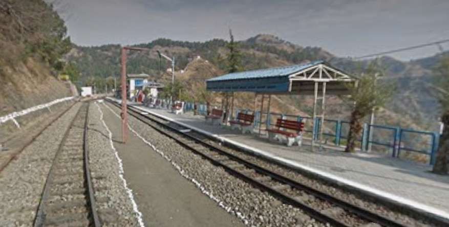
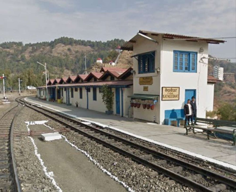
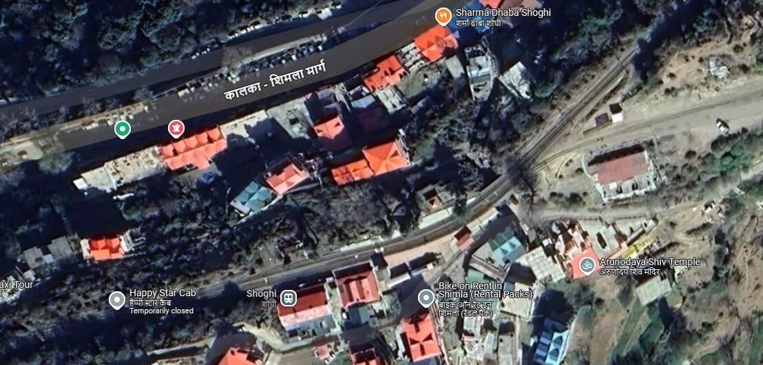
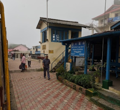
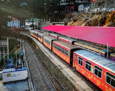
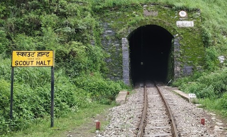
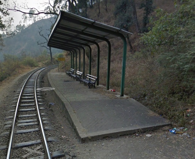
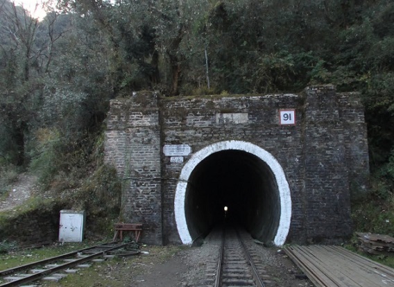
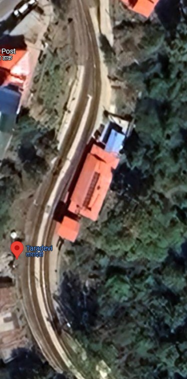
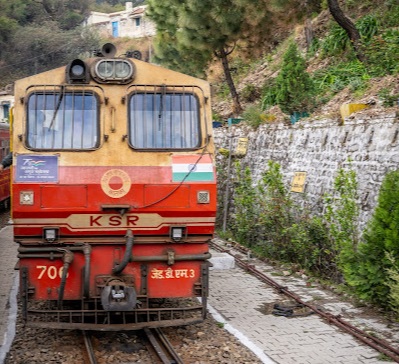
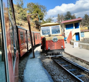
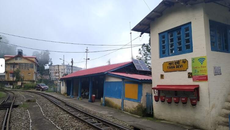
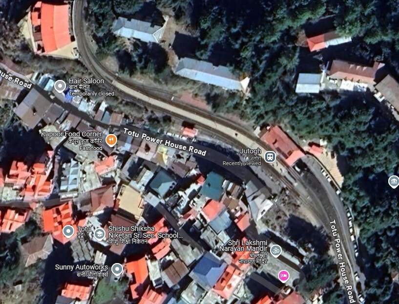
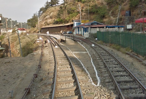
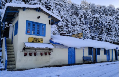
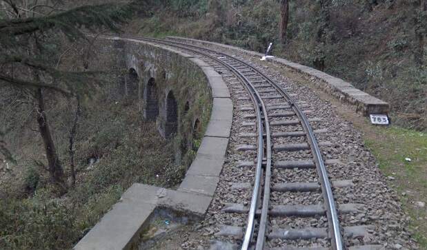
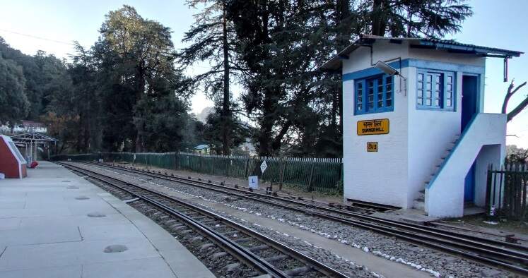
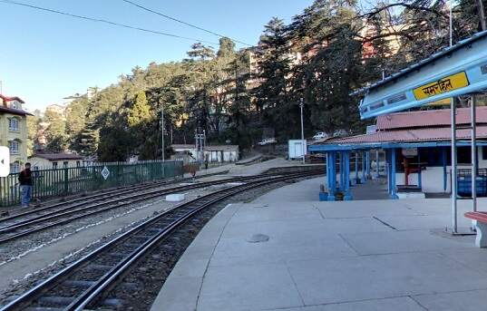
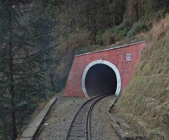
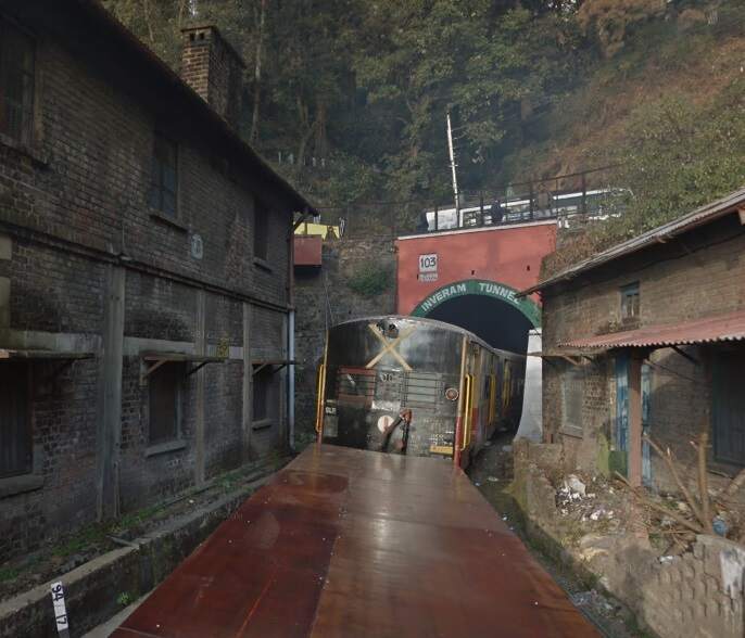
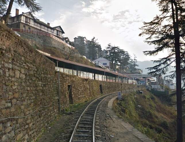
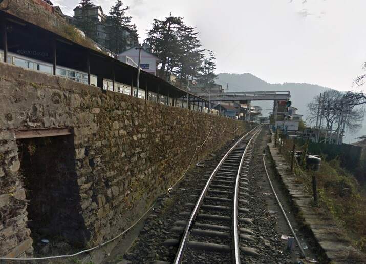
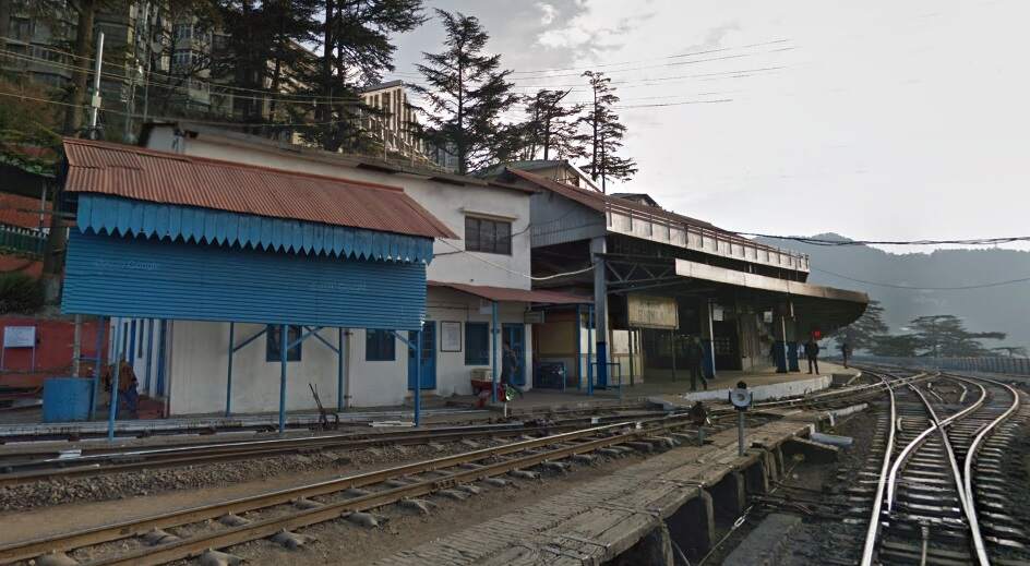
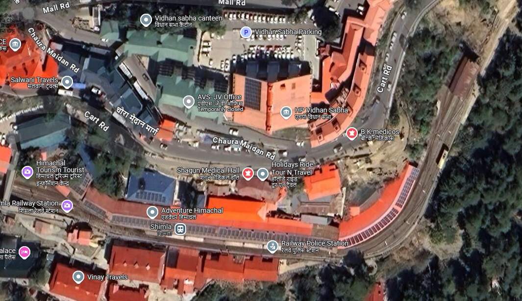
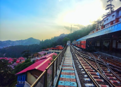
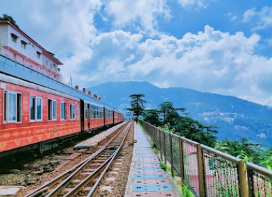
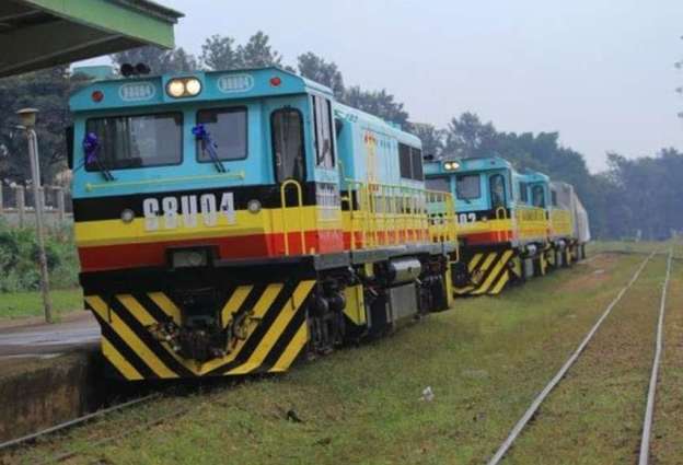
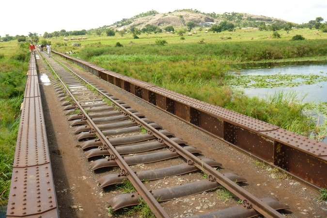
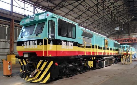
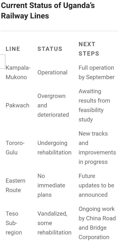
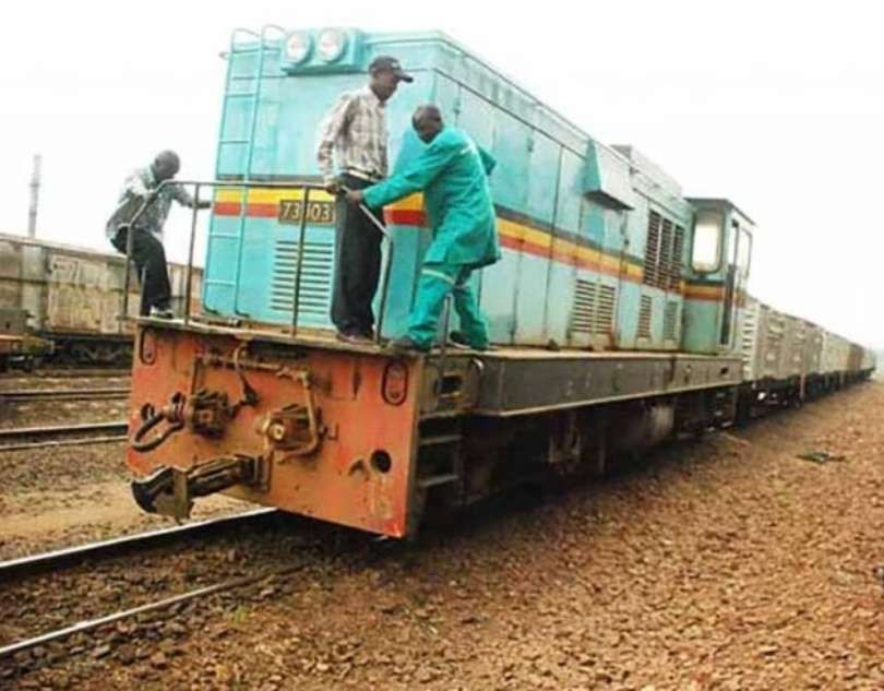
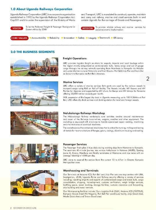

.JPG)
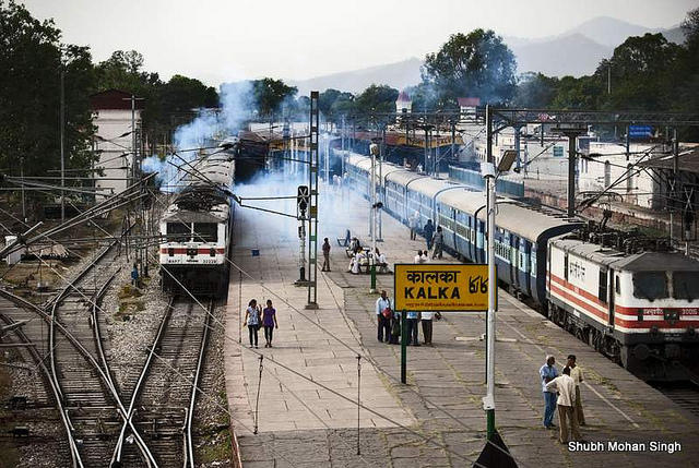
.jpg)