
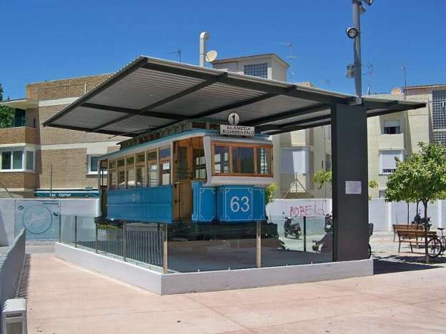
Málaga’s historic tram network operated from 1881 until 31st December 1961. It was a 1350mm-gauge network.
The featured image for this article is the memorial monument dedicated to the last tram service in Málaga. The last journey made by trams on the old network took place on 31st December 1961. Tram No. 63, built in Charleroi (Bélgium) in 1922, was saved from being scrapped because it was set aside and sent to Almeria to have a role in the filming of the 1962 film ‘Lawrence of Arabia’. [1][2]
A Short History of Málaga‘s Old Tram Network
The city ran its first horse/mule-drawn tram line in 1881. The Museo del Transporte Urbano de Málaga tells the story of a network that predated its own ‘founding’ company: Málaga ran its first tram in 1881, a decade before The Málaga Tramways Co. Ltd. — the, somewhat surprisingly, Birmingham-registered firm usually credited with building the network — was even established.
The first line entered service after a number of proposals were considered. The earliest of which appears to have been submitted in 1854 by Alphonse Loubat – an attempt to establish a tramway between Granada and Málaga. The second was a proposal made by José Joaquín Carreras in May 1871. [10]
Juan Peris Torner tells us that the early history of the network is quite confusing. He says that four further unsuccessful proposals were submitted. The first was presented by a “well-known civil engineer and urban development entrepreneur Arturo Soria y Mata, … on 6th May 1875. … [His] request contemplated a tram from the centre of Malaga, starting from the lemon grove where the garages would be located, reaching the Paseo de Reding, Cortina del Muelle, Alameda, Puente de Tetuán, and through Calle Cuarteles, [and] would reach the station of the Railway of the Andalusian Company.” [10] This proposal envisaged the use of 50 horses, circa. 3.6km of double-track (except for 184 metres in Matadero) “It called for the use of Loubat-type rail weighing 19 kg/m, and the deployment of four cars and four open-sided carriages.” [10]
Torner mentions three further applications presented by:
– Francisco Sabino de Freitas in 1876;
– Diego Ruíz Blasco in 1879, of a line between the Andalusian Railways station to El Palo;
– José García Segovia and Carlos Francuelo Romero, from Plaza de la Victoria to the centre of Malaga.
None of these proposals came to fruition – but they were not the last to be submitted!
Torner goes on to talk of concessions made by the local authority for other schemes:
- Málaga to Vélez-Málaga and El Palo – a concession was awarded to Salvador Bueno Mesa, based on a project presented on 30th October 1881, with the terms and conditions of the concession accepted on 16th February 1883. It was conceived as a mule-drawn tramway. Initially, the concession extended to Vélez-Málaga, but ultimately only ran between Arroyo de la Caleta and El Palo, connecting to the Málaga to Arroyo de la Caleta line. This concession was transferred to John Tell on 3rd March 1885. [10]
- Railway Station to the Port of Malaga presented by the Andalusian Railways Company on 13th January 1883, being authorized, subject to a report from the Board of Works of the Port of Malaga, whose facilities the tram should cross. [10]
- An Urban Tramway Concession granted initially to Alberto Ripoll de Castro in 1883. In 1884, he requested an extension for its construction from the City Council, which granted it. This concession was to be managed by the City Council of Málaga and was to serve the following route: Railway Station, Calle Cuarteles, Pasillo de Atocha, Pasillo de Santa Isabel, Calle Torrijos, Calle Alamos, Plaza de la Merced, Calle Granada, Calle Molina Lario, ending at the Boquete del Muelle, where it would connect with the Málaga-Arroyo de la Caleta-El Palo line. [10]
- Málaga to La Caleta Stream – this was requested by Alberto Ripóll de Castro, based on a project approved by the Royal Order of 23rd February 1884. The concession was auctioned on 25th April 1884, but no bidders came forward. So it was directly awarded to Alberto Ripóll de Castro, as the project owner. He accepted the terms and conditions of the concession, which included the requirement of a deposit of 23,000 pesetas, equivalent to 5% of the budget, estimated at 460,000 pesetas. The concession was granted for 60 years, and he was given an 18-month period for its execution. Construction was postponed due to force majeure caused by an earthquake in the area. By 1889, work had not yet begun, and in December of that year, an extension was requested. and granted. The works were eventually completed on 11th April 1891, and the line entered public service. [10]
The process of establishing a city-wide tramway in Malaga began with the creation on 26th March 1889, of The Malaga Tramway Co. Ltd., an English company with offices in Birmingham. It had a capital of £80,000 distributed in 16,000 shares of £5 each, and its founding partners were: John Tell; John Lecke; Joseph Hunt; John Riksen; Adolfo E. Pries Scholtz von Hermensdorf (Count of Pries); Ricardo Larios; and Eduardo Palanca. Its early activities, from 14th February 1891 were dedicated to bringing the existing concessions, mentioned above, into its orbit. It also purchased 2,300 square metres of land from Doña Carlota Hernández de Molina y Albriola, on which it constructed its stables and depot. [10]
The land on which the tramway depot was built was on Maestranza Street with a capacity for 180 horses.
In 1898, the tramways were acquired by Tramways de Malaga Société Anonyme, a Herman-Belgian firm. In 1901, that company was authorised to make the change to electric traction. In 1923, with 37 units, it served six lines: Alameda-El Palo, Alameda-Estación, La Victoria-Huelin, Alameda-Bellavista, Alameda-Baños del Carmen, and the circular Alameda-Molina Lario-Granada-Victoria-Cristo de la Epidemia-Capuchinos-El Molinillo-Pasillo de la Cárcel-Pasillo de Santa Isabel-Alameda..
After the Civil War the municipal government took over the operation in 1949 and began phasing in buses, and the last trams ran on 31st December 1961. The infrastructure was removed and nothing remains of the old network.
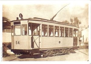
Málaga Tram No. 54. [6]
At 11 am on Sunday, 31st December 1961 , a caravan of trams made the journey between La Misericordia and Cervantes Street, where they were taken to the La Malagueta tram depot. The last one of the parade was No. 59. Despite the unsettled weather and heavy rain on the Saturday, many people from Malaga gathered in Huelin, the station esplanade and other points along the route to say goodbye to the trams.
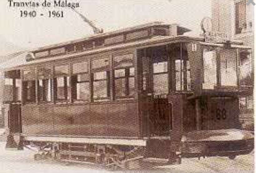
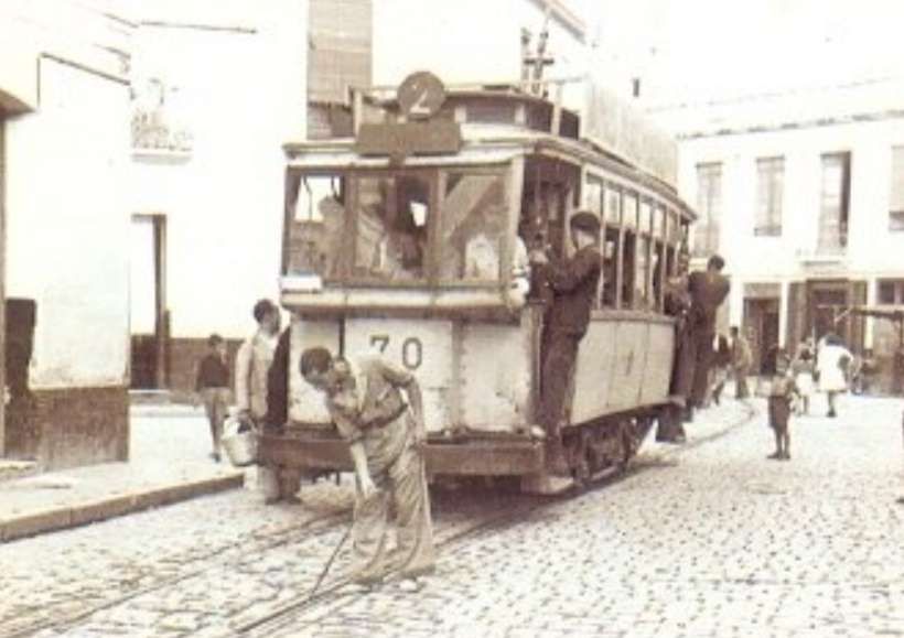
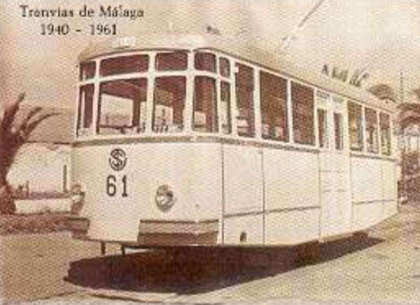
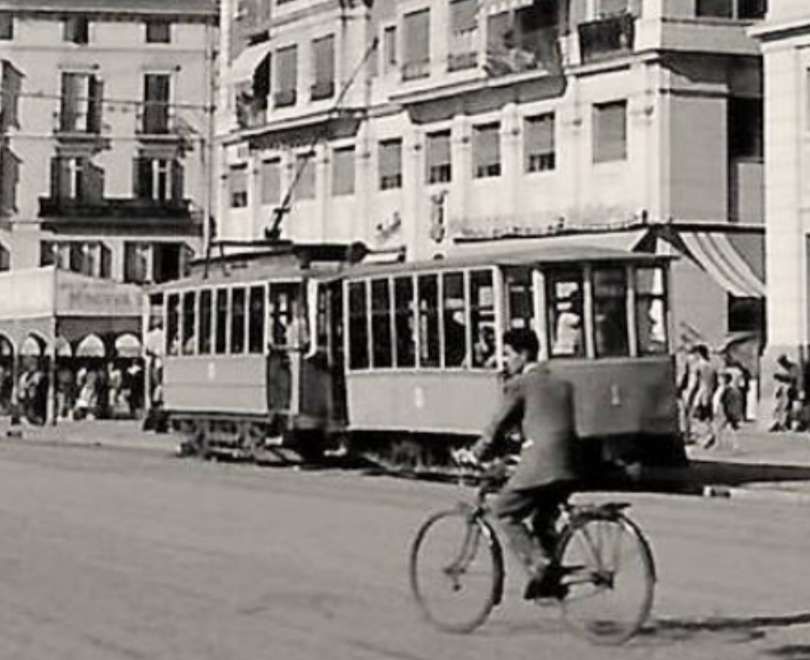
Tram No. 63 was the last surviving Málaga tram. It sat for decades, displayed on the Pablo Ruiz Picasso promenade. After a major restoration it now is displayed at Plaza Manuel Díaz Millán.
There has been debate over what livery the trams had when in use. One faction believes that the trams were painted yellow. The truth is that Tram No. 63 was painted yellow when in Almeria for use in the film, ‘Lawrence of Arabia’.
Prior to its transfer to Almeria, Tram No. 63 was painted blue. It was decked out this way along with eleven other units in 1951, two years after the City Council took over the network.
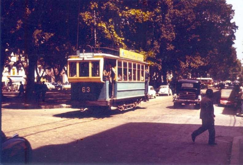
Apparently, in December 1967, Francisco Blanco Escobar offered 5,000 pesetas for the tram, but the city’s transport authority refused to sell as by then the vehicle was already considered historic. However, the tram did not emerge from storage until 15 years later, in 1982. By then, Mayor Pedro Aparicio had finished the construction of the large esplanade of ‘El Morlaco’ and was looking for something special to adorn it. He asked the manager of the EMT (Municipal Transport Company), Rafael Fernández Barrera, to provide a suitable monument. He offered the old tram. [2]
The tram was placed on El Morlaco’ on 23rd December 1983 in the midst of a large children’s party. Apparently, the children arrived in three buses, each named after one of the Three Wise Men; the decorated tram was on a ‘gondola’ from Grúas Cabeza and there were also twelve classic cars in the parade and even the fire station’s ladder truck from the 1920s. [2]
The tram remained at that location in El Morlaco for a quarter of a century. However, it deteriorated, not only due to its proximity to the sea, which was detrimental, but also because of vandals who covered it in graffiti. In 2007, the Tran-Bus Association requested permission from the Mayor to transfer ownership of the tram so they could restore it. [2]
The City Council removed No. 63 from the seafront in November 2008 and throughout 2009 the restoration took place in a space in the EMT garages, on the Camino de San Rafael. [2]
The work was carried out by four people, two of whom, José Ramón Rodríguez and Antonio Fernández Arce, were EMT employees and members of the Tran-Bus board. Cristóbal Salazar Montiel (master carpenter) and Antonio Sánchez Godo (master coachbuilder) also participated in the restoration. [2]
Along with graffiti, rust, as well as rotten panels and beams, the vandals had set fire to the interior and left a large hole in the floor. The restoration also had to contend with a tornado on 1st February 2009, which knocked down the tent protecting the tram.
The team, working outside their regular hours, managed to complete the restoration. The president of Tran-Bus lamented the lack of support from the EMT, which he considered unsupportive of the group’s efforts to restore historic trams and buses in Malaga. There were no labour or financial incentives, the city’s leaders said that what was being done was very important, but they did not help at all. [2]
The tram was restored and placed in the Plaza de la Marina in 2010, but it was not until the end of 2014 that it was placed where it still remains, in the Plaza Manuel Díaz Millán, the site of the old Pedregalejo coach houses. It is now, apparently a much-loved symbol of Málaga. [2]
Old Tram Routes in Málaga
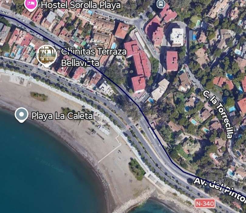
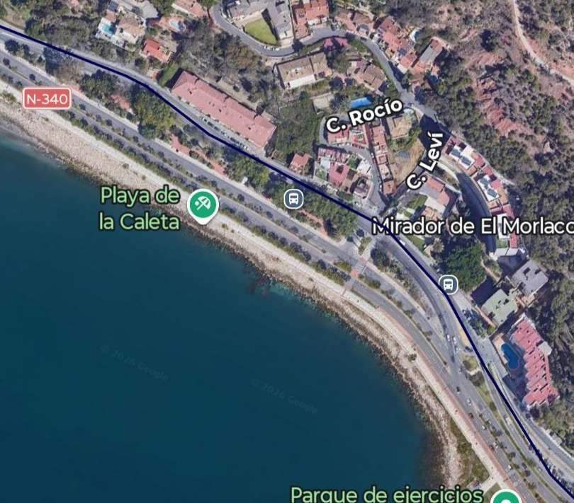
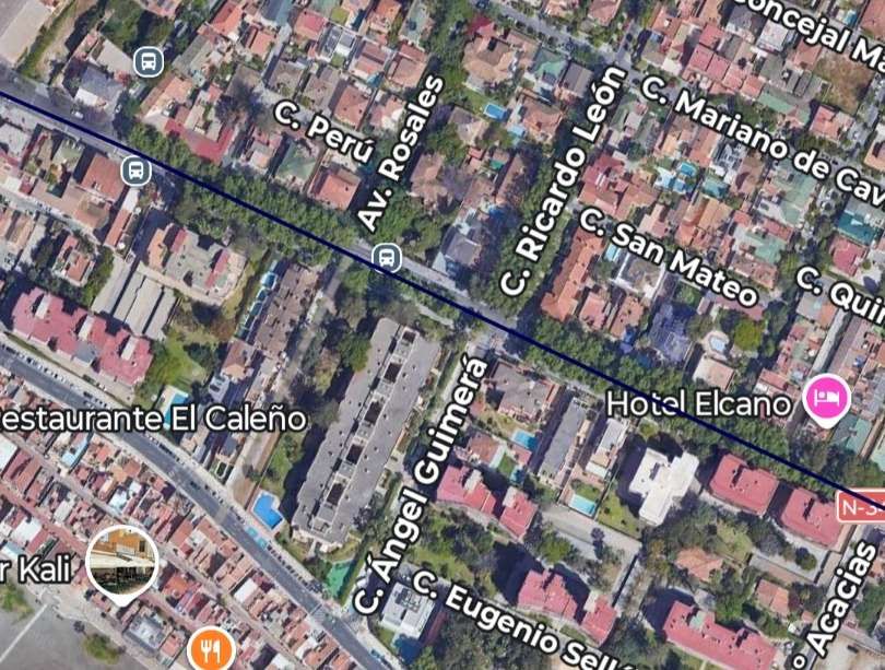
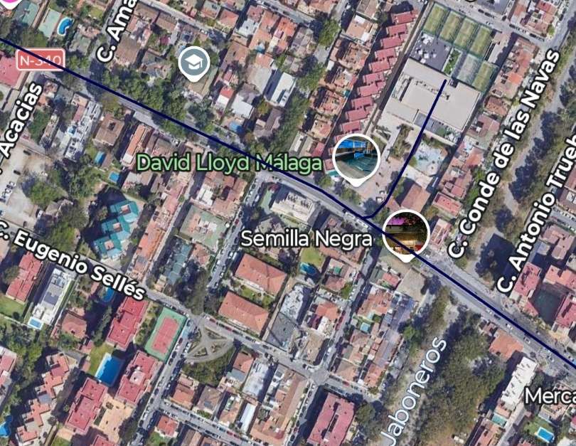
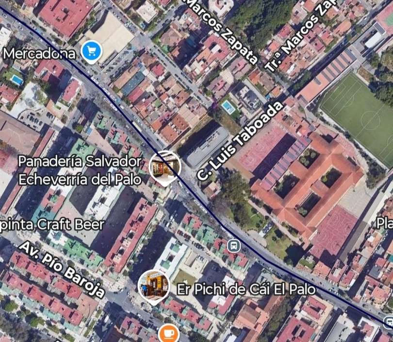
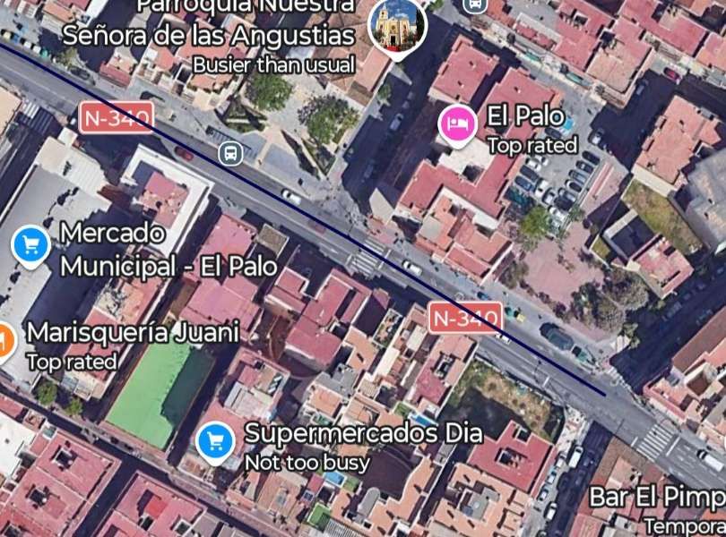
The old tram routes in Málaga have been plotted in Google Maps as Tranvías interurbanos de Málaga. [8]
We will now explore these routes using older maps of Málaga, old photographs, enlarged Google Maps images and modern Streetview images. ….
We begin at the most westerly point on the network. ……
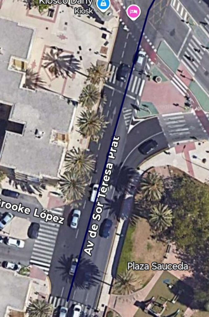
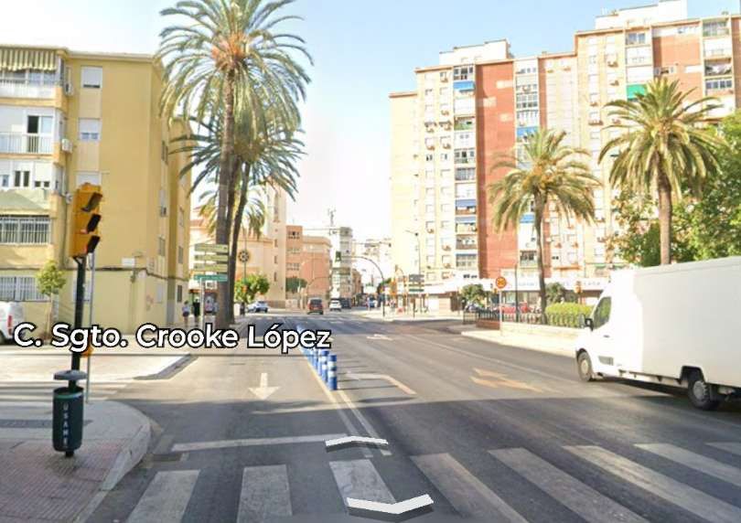
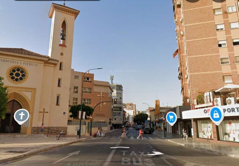
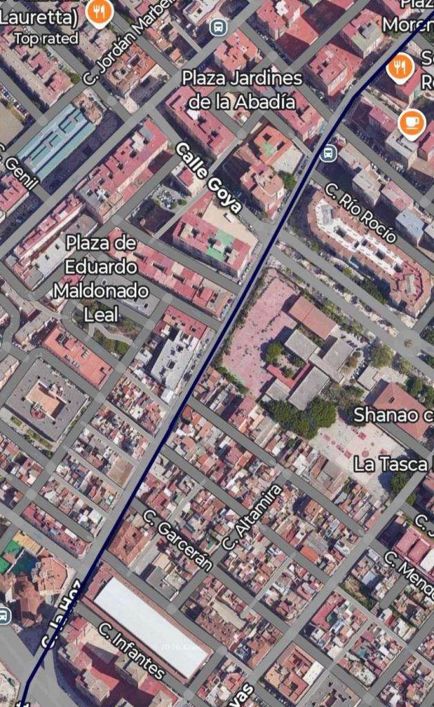
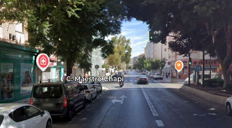
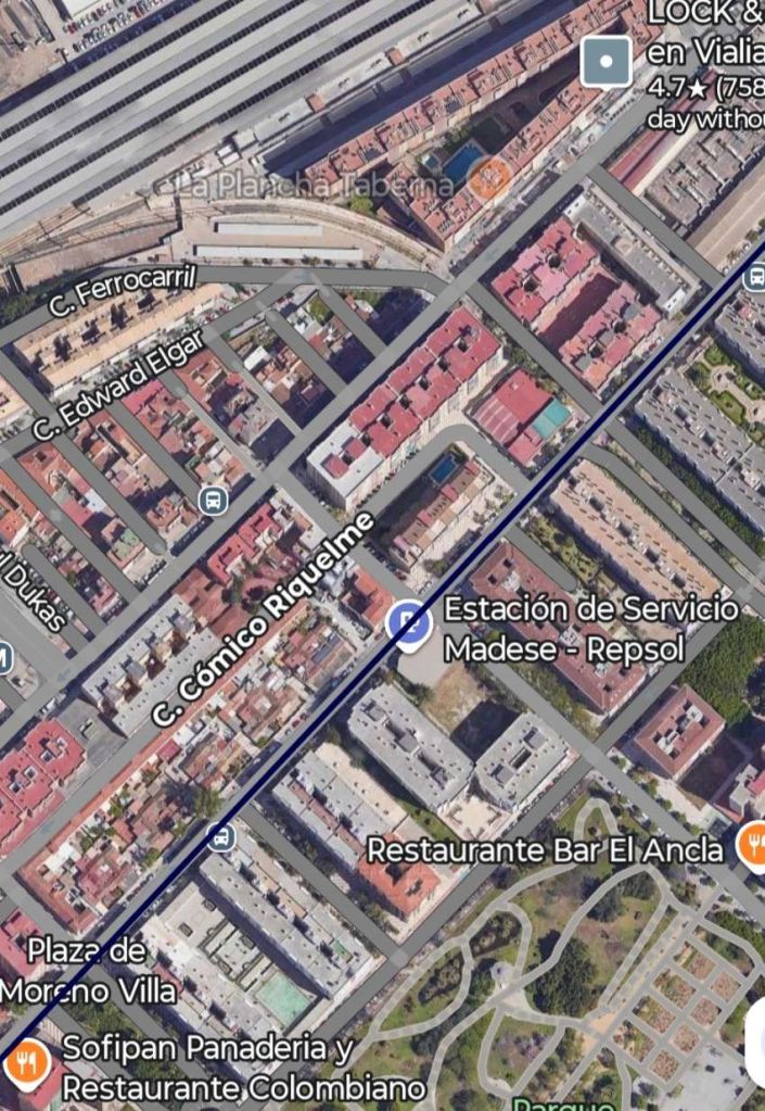
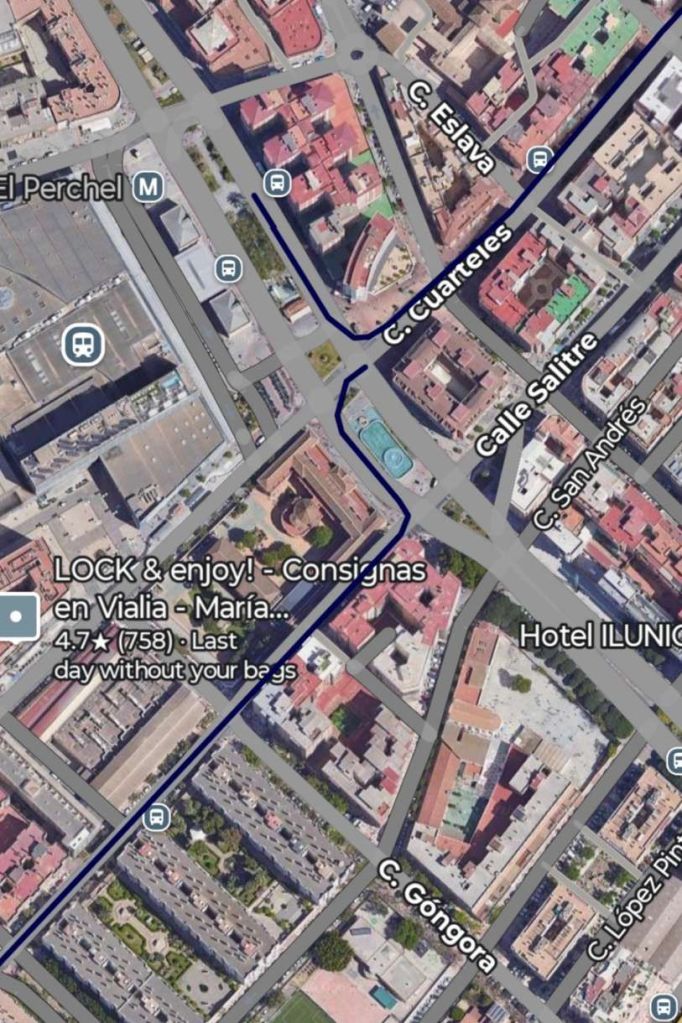
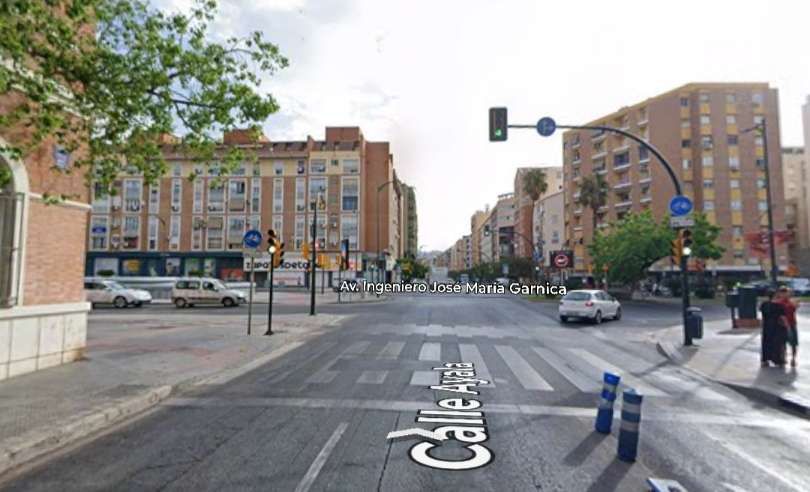
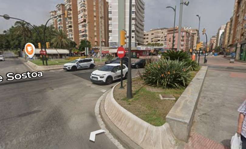
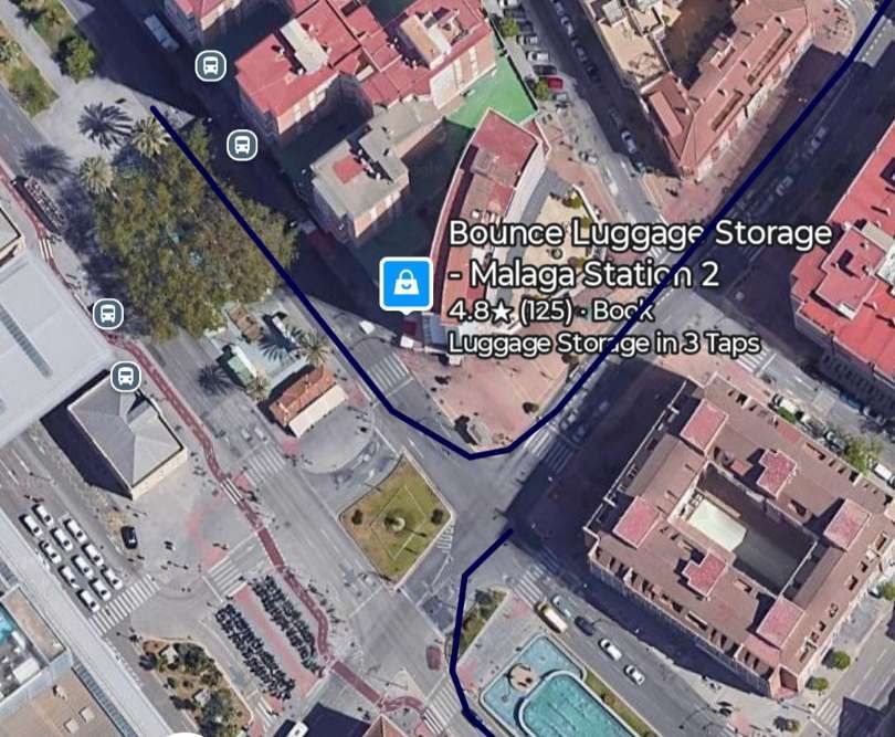
The map shown below comes from O’Shea’s Guide to Spain and Portugal.
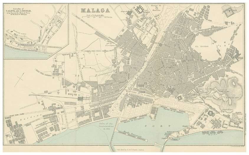
A series of seven enlarged extracts follow from the 1895 map above show the routes in use at that time. These are interspersed with some vintage photographs and modern photographs from along the routes. …
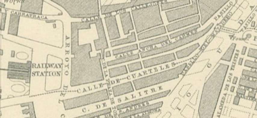
A line headed Northeast along the East bank of the river, and a line ran East along Paseo de la Alameda. [3]
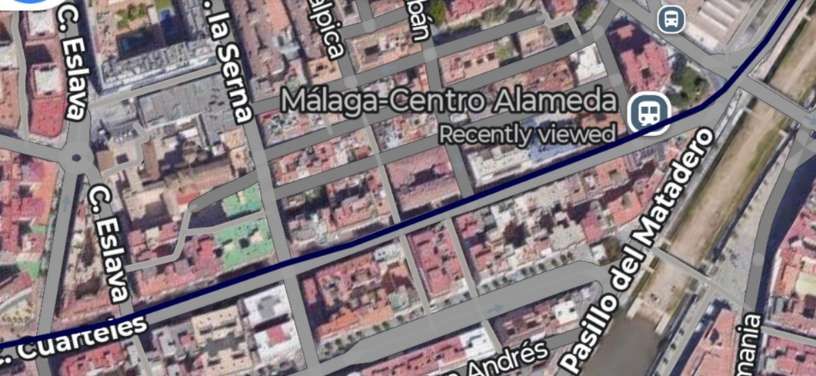
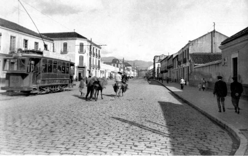
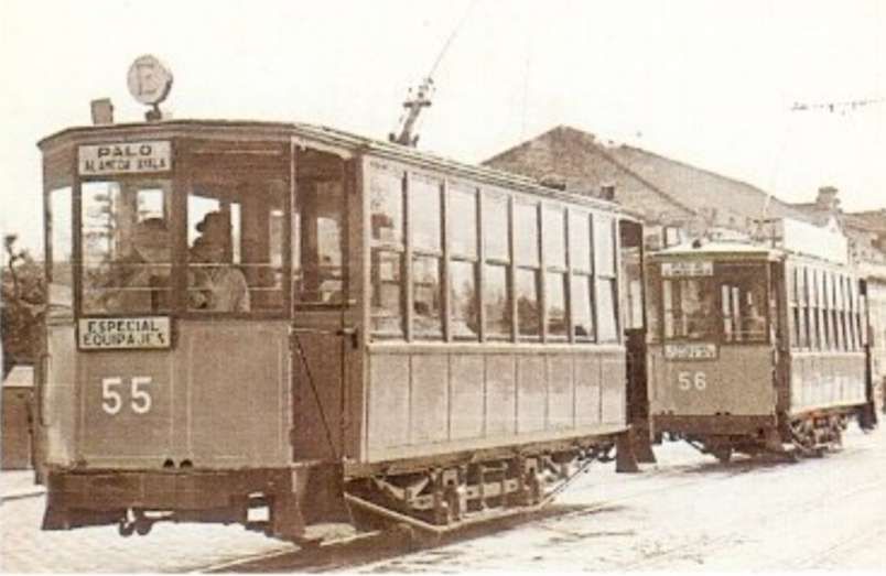
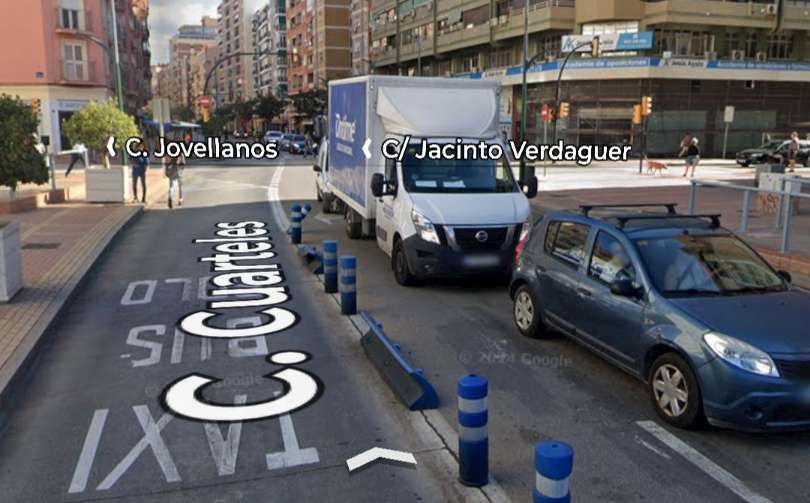
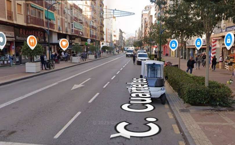
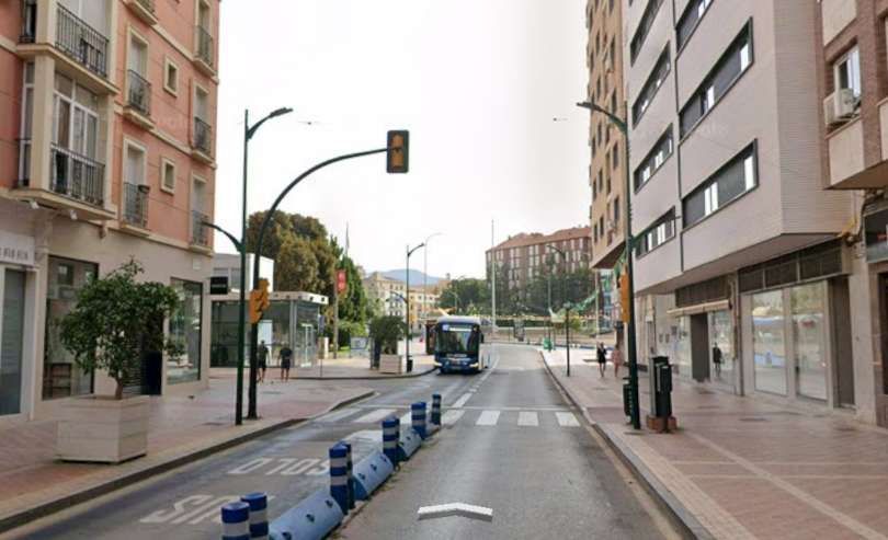
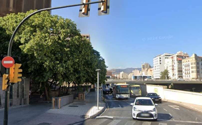
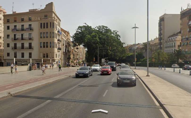
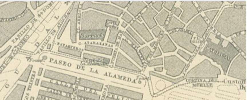
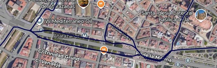
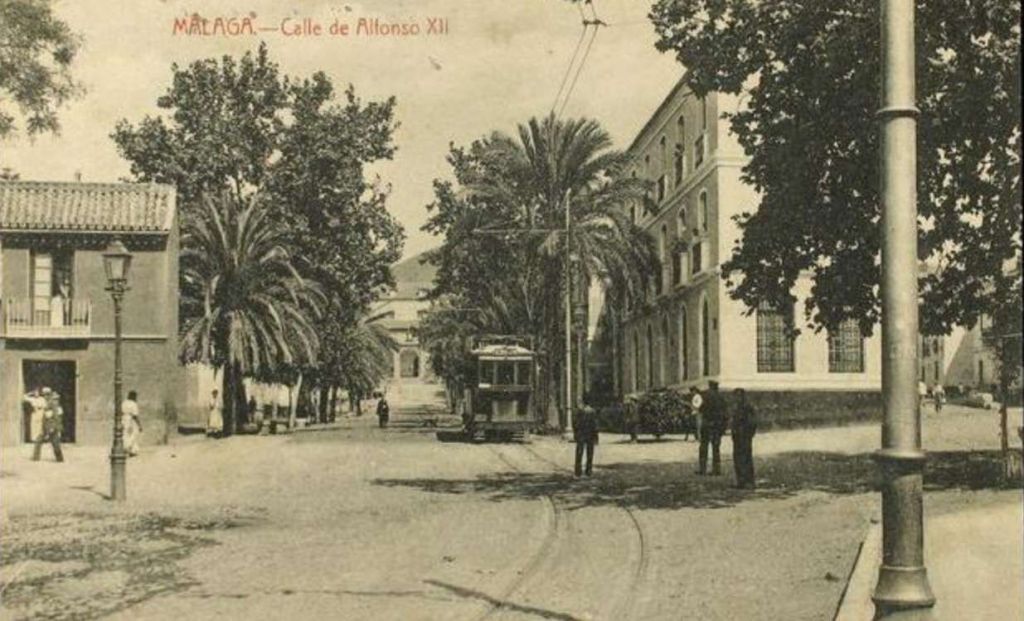
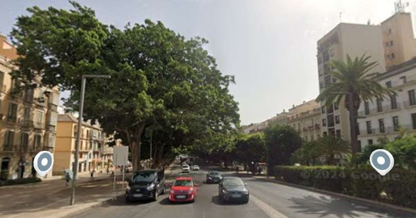
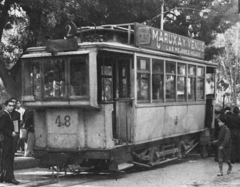
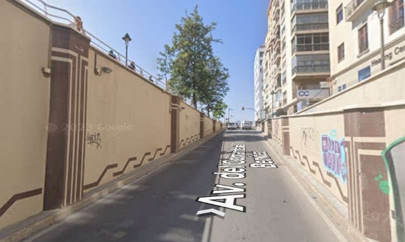
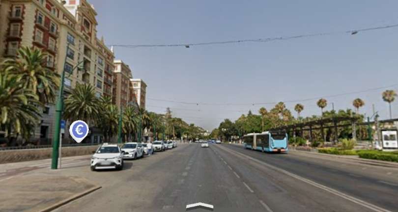
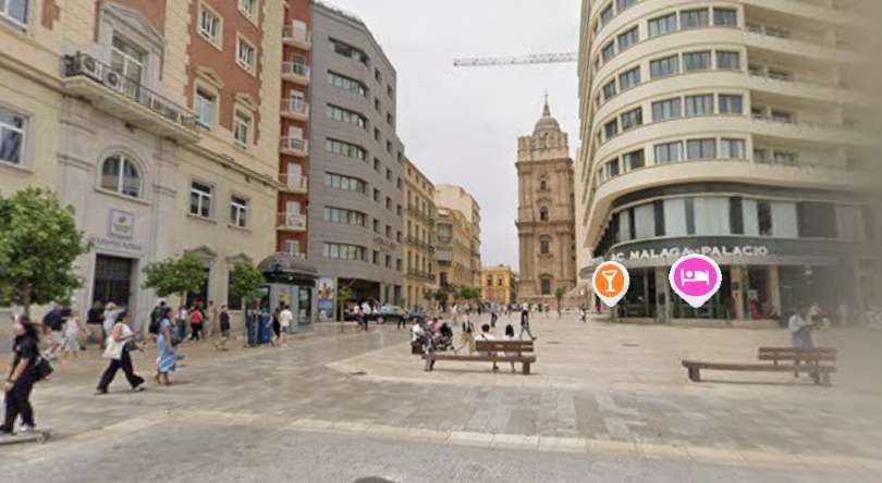
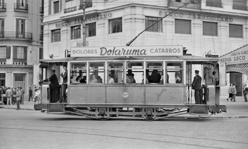
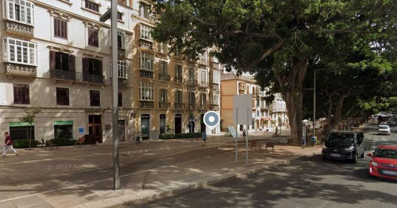
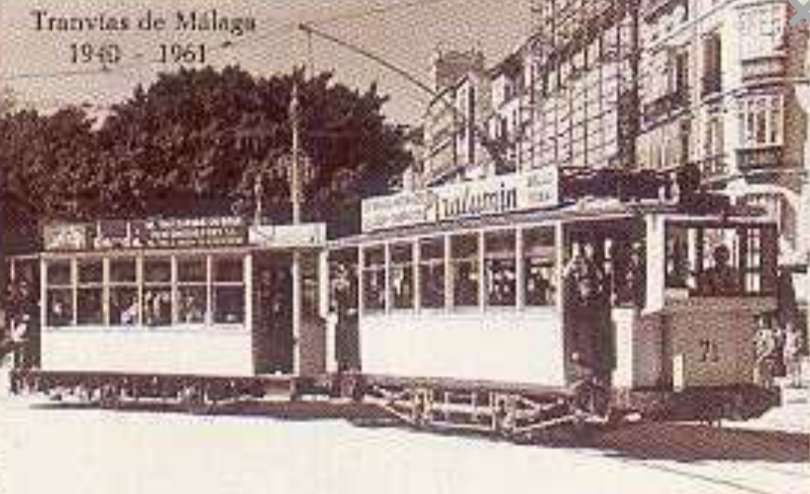
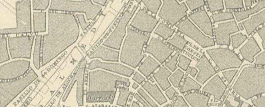
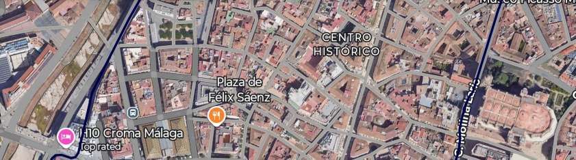
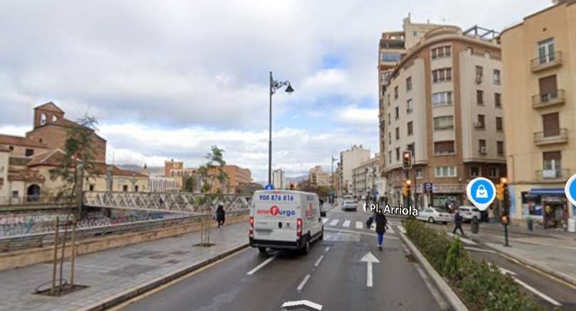
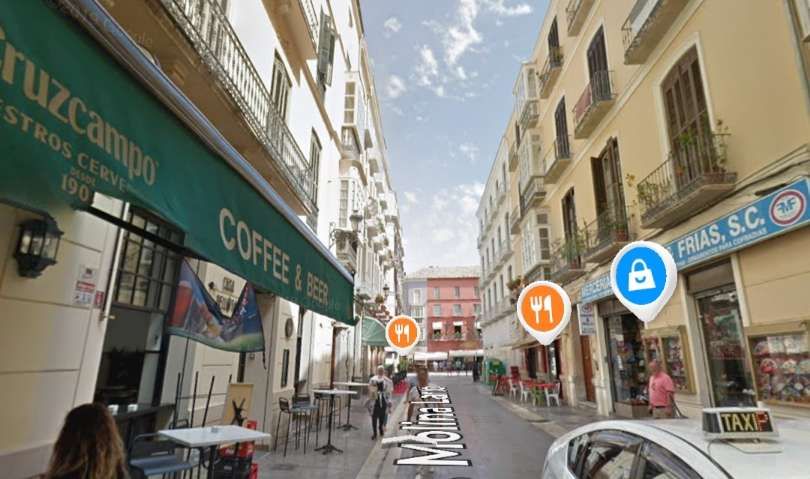
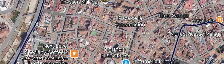
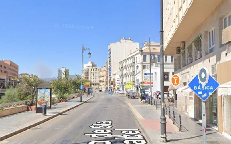
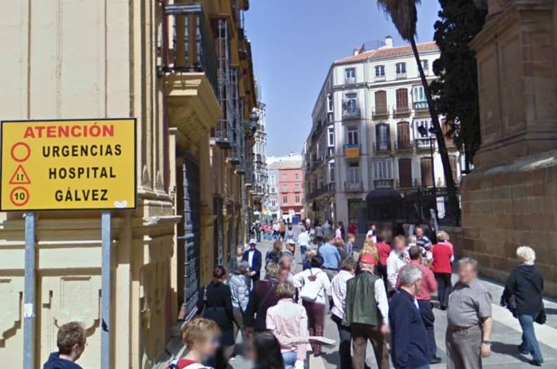
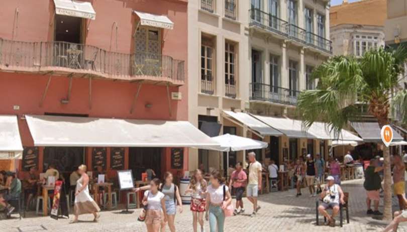
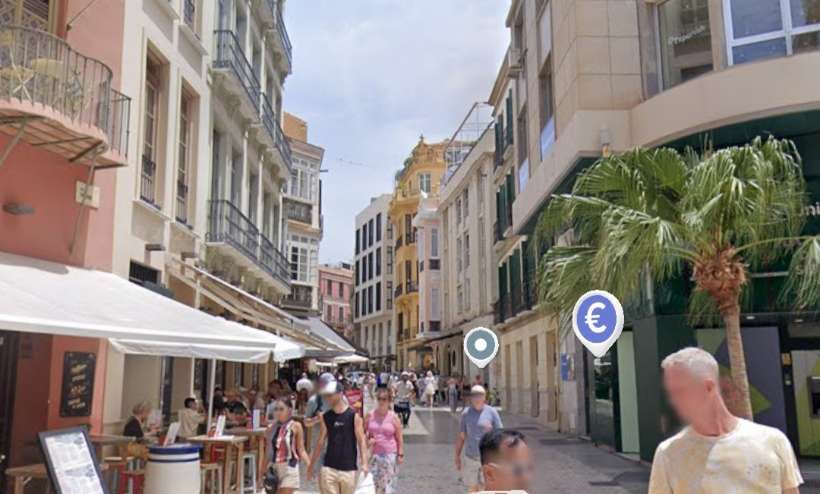
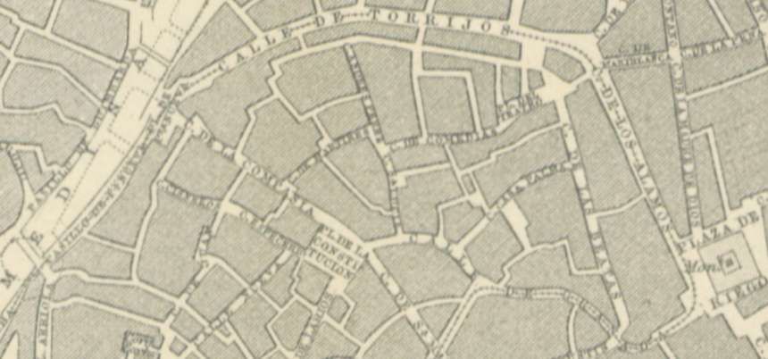
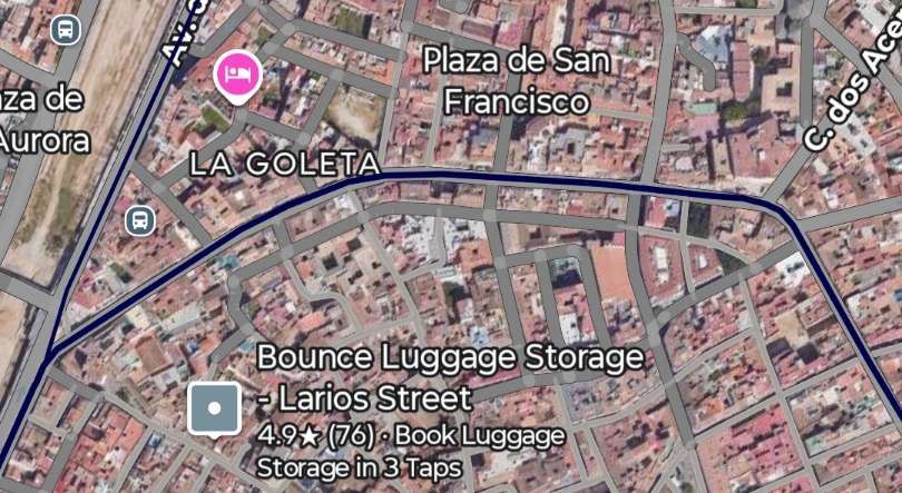
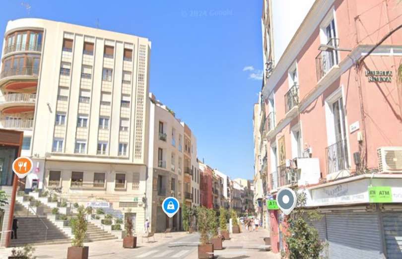
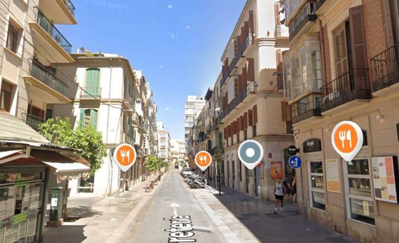
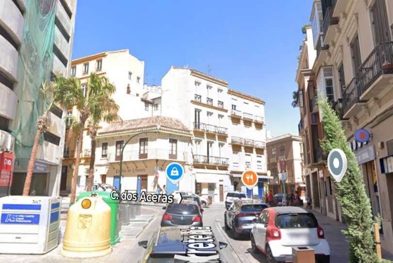
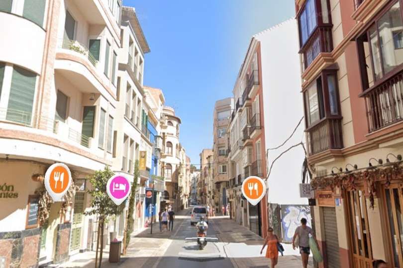
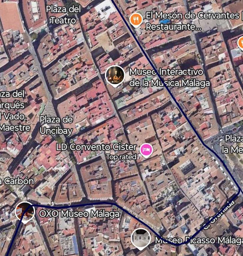
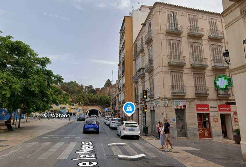
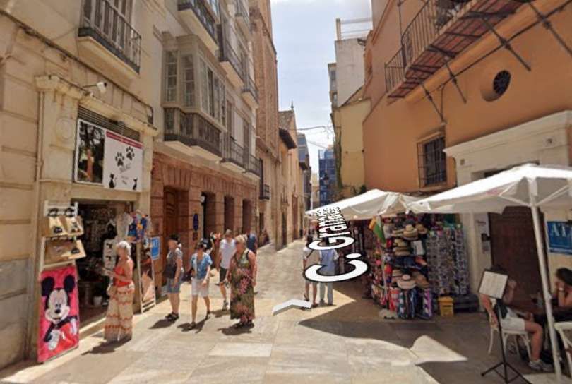
The remaining tramway that we need to follow which was in operation by 1895 was that heading East away from the centre of Málaga and which is shown on the next three extracts from the map in O’Shea’s 1895 Guide to Spain and Portugal. [3]
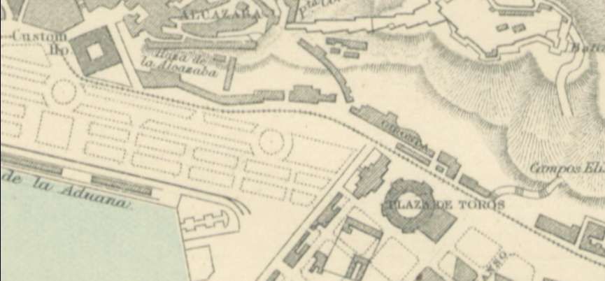
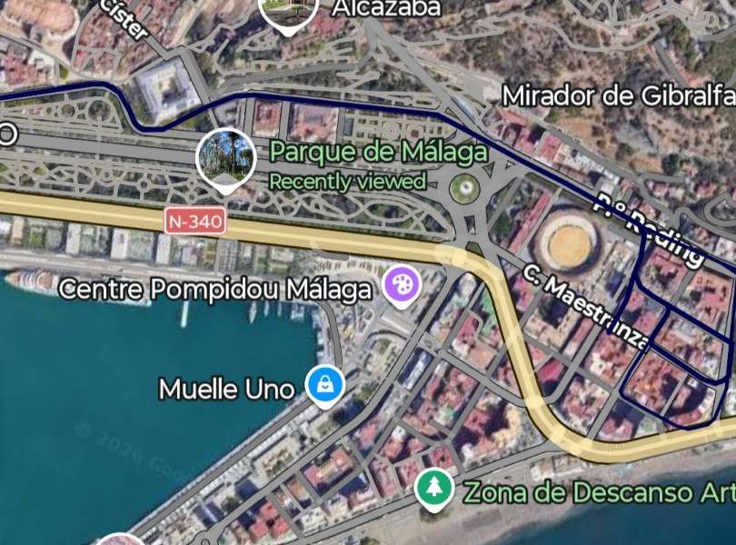
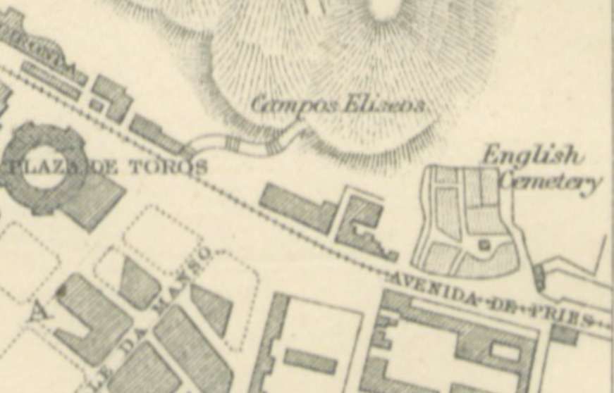
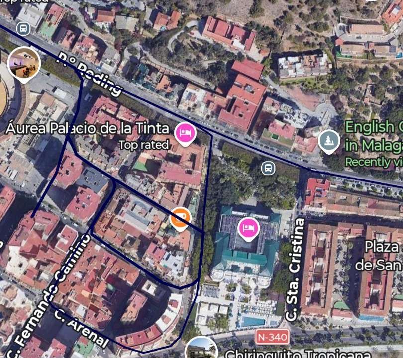
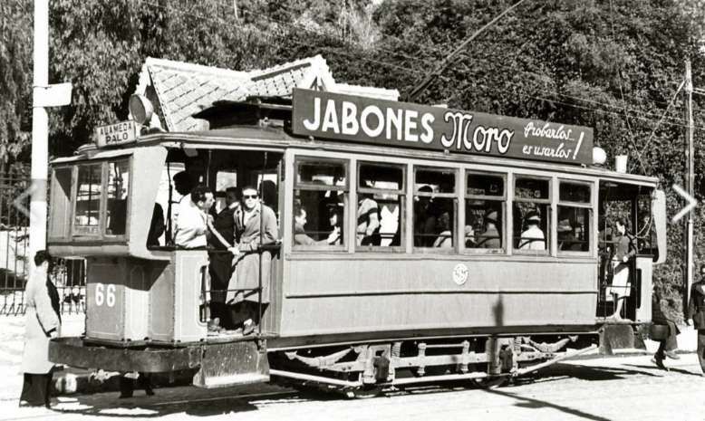
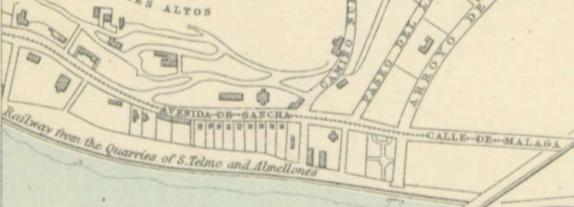
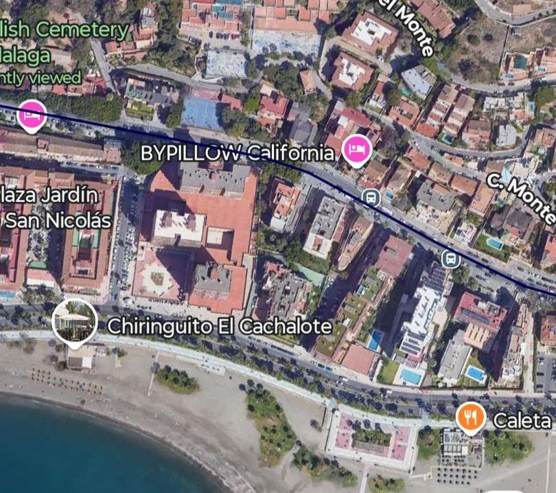
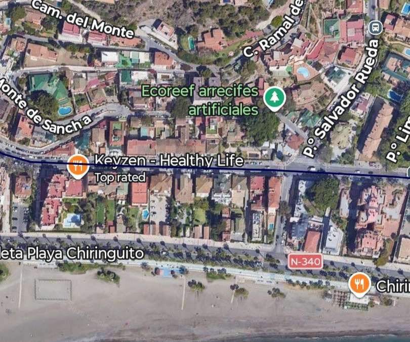
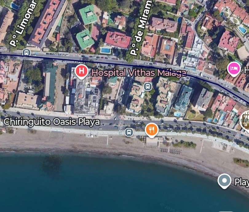
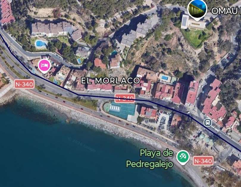
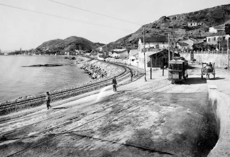
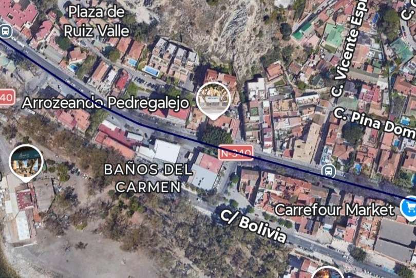
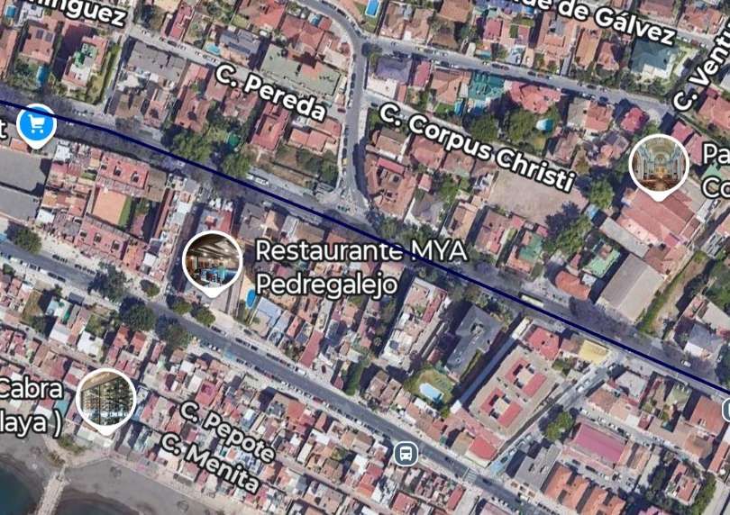
The remaining extracts from the satellite imagery show the line running to the terminus in El Palo via El Morlaco.
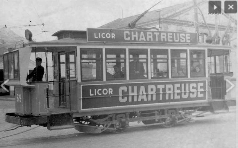
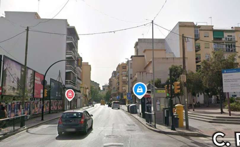
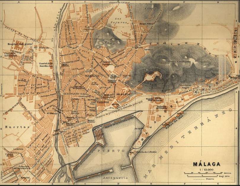
The map below shows Málaga in 1901 and comes from the Baedeker Guide of 1901.
The map below is the Carte de Málaga contained in the Guide Joanne d’Espagne et Portugal de 1906.
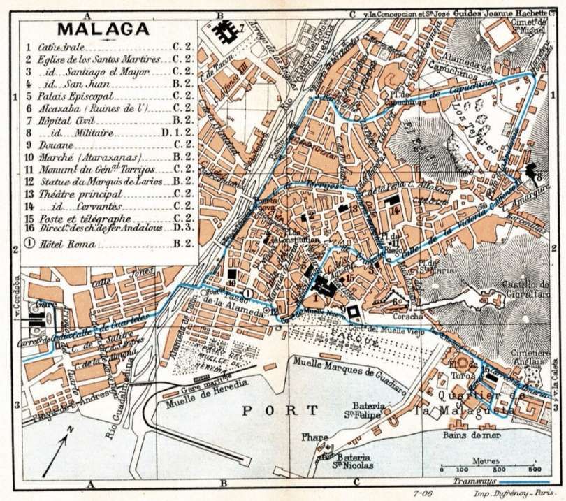
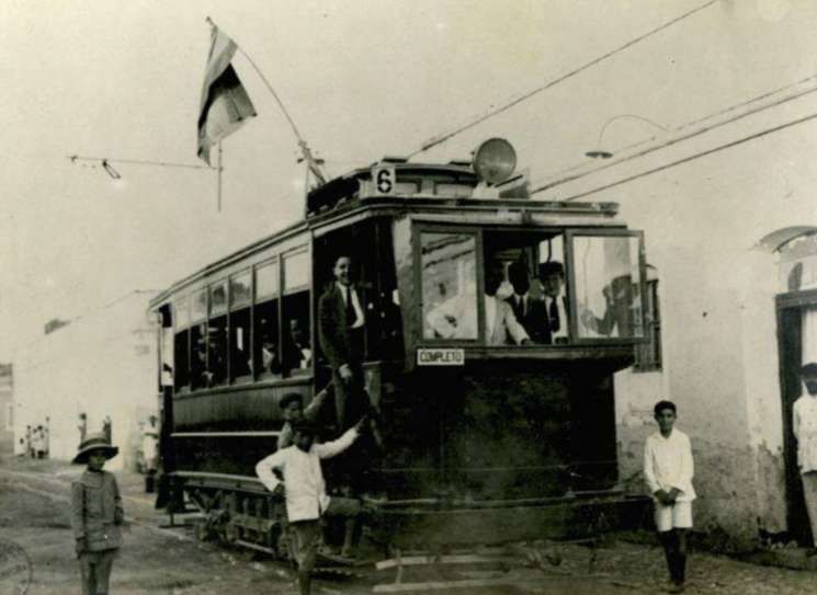
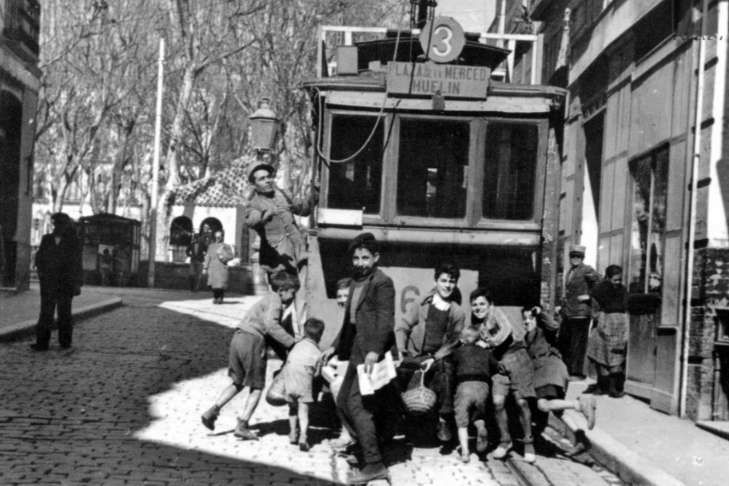
Two larger scale extracts appear below: …..
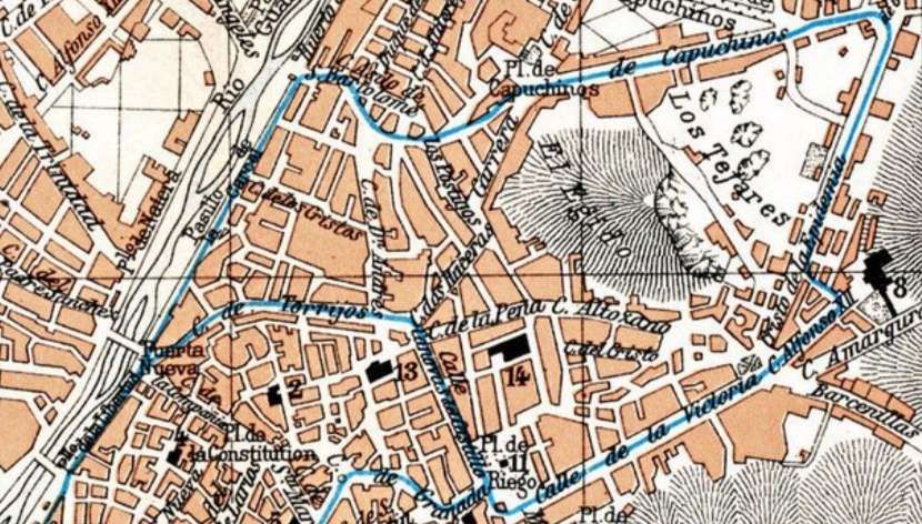
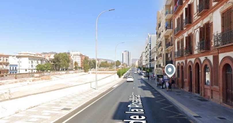
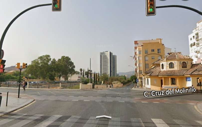
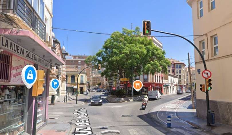
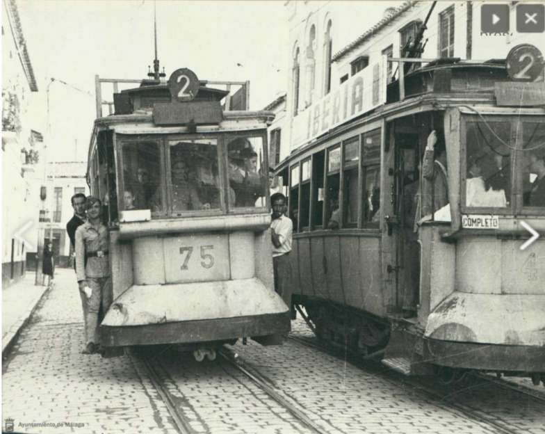
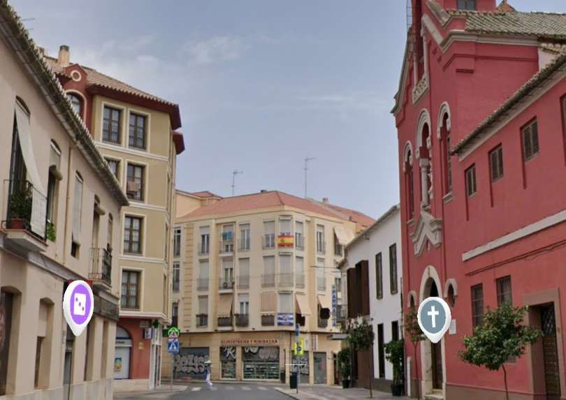
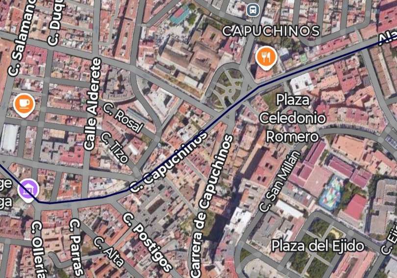
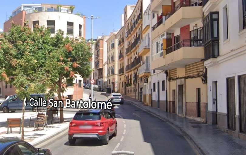
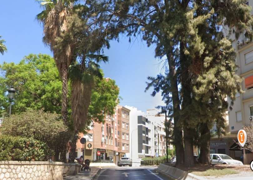
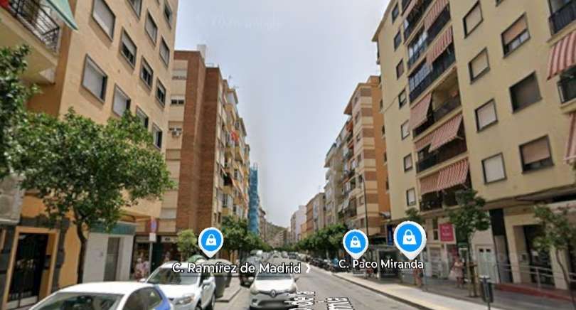
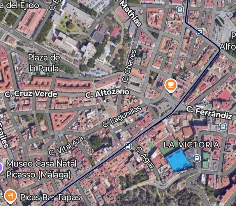
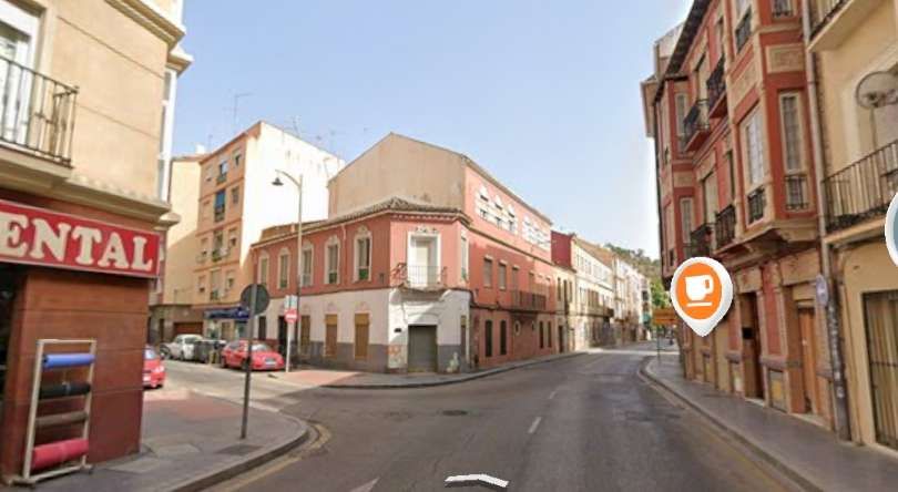
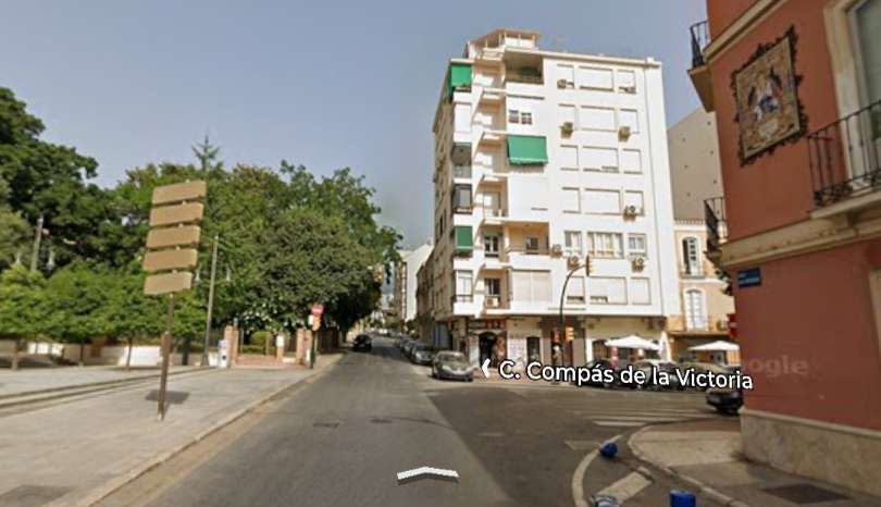
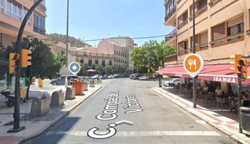
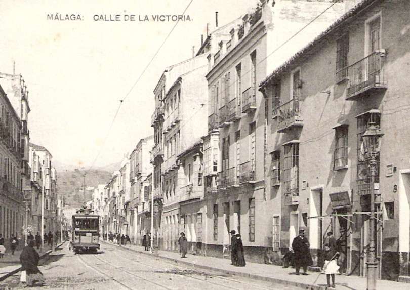
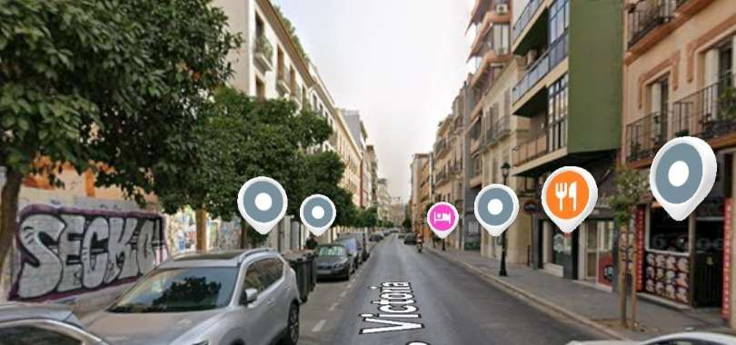
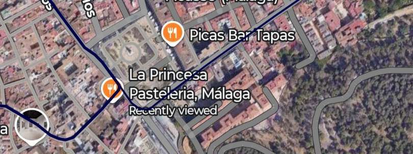
These next few images relate to the additional line which can be seen on the map above running alongside the River Guadalmedina on the left of the image before running in a predominantly easterly direction to the top-right of the map extract before turning South to meet Valle de la Victoria and returning Southwest to Plaza de la Merced and into the city centre.
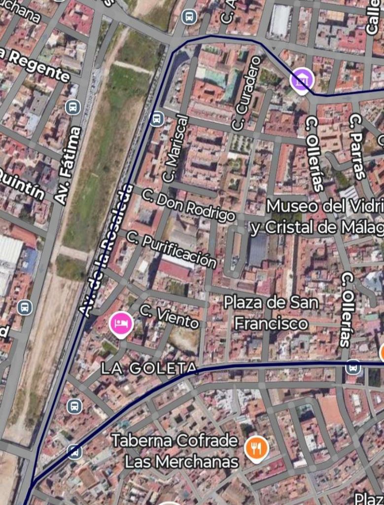
Starting at the West side of the map extract above the tramway ran North-northeast alongside the river along Avenida de la Rosaleda. ……
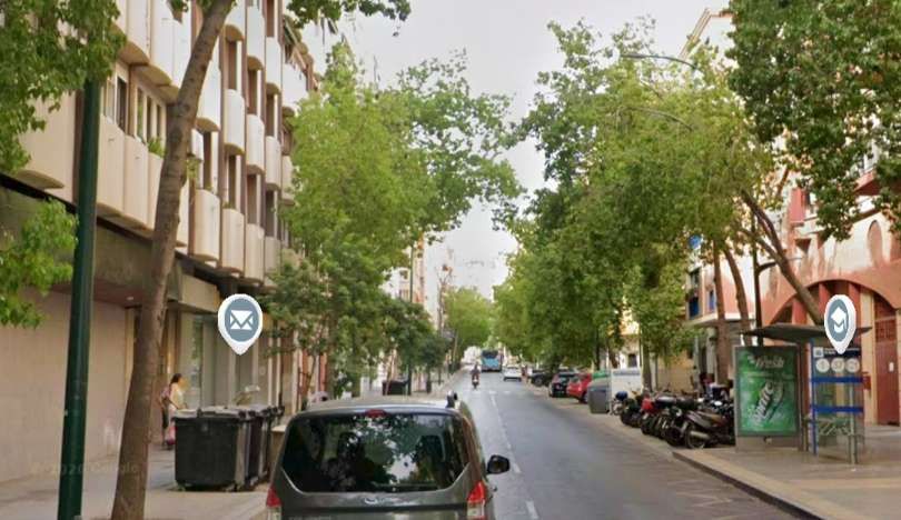
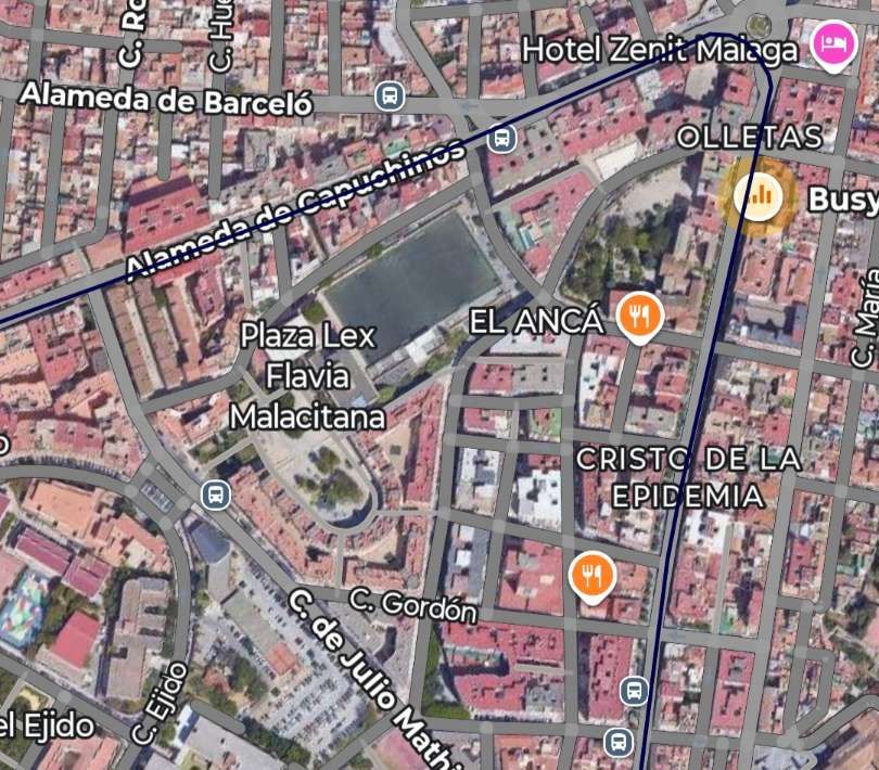
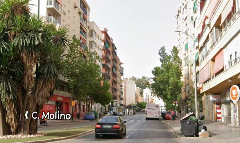
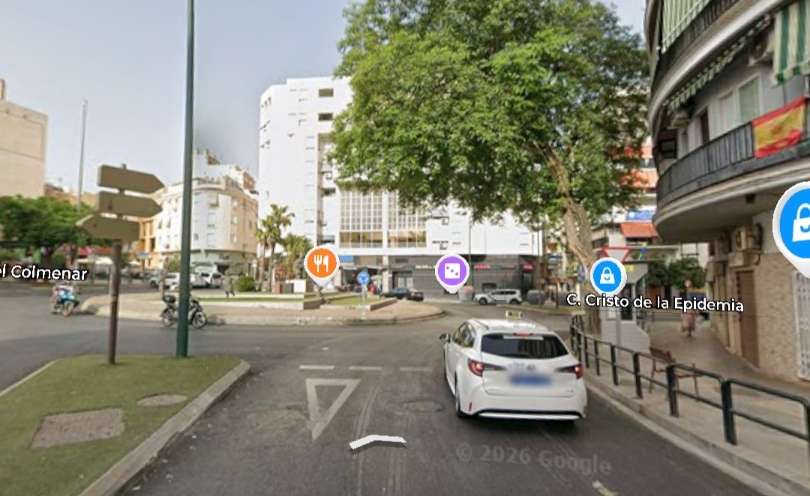
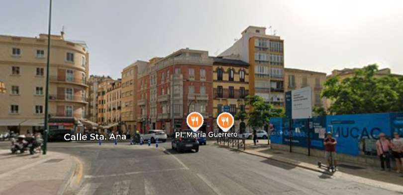
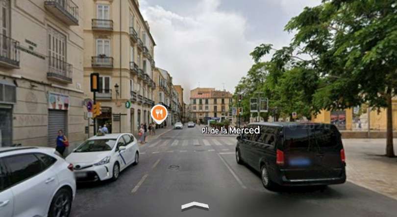
Another addition to the 19th century network in the 20th century was the loops in Quartier de la Malagueta. These are shown below as they appear on the 1906 map in the Guide Joanne – Espagne et Portugal. [5]
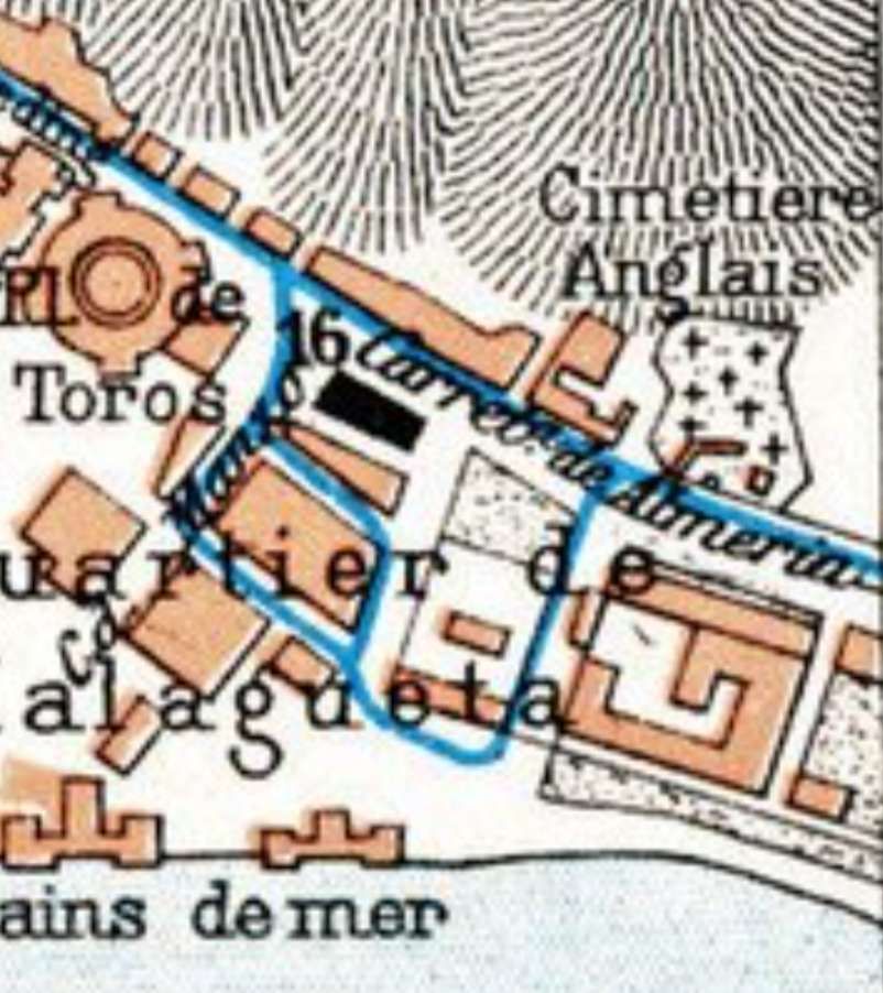
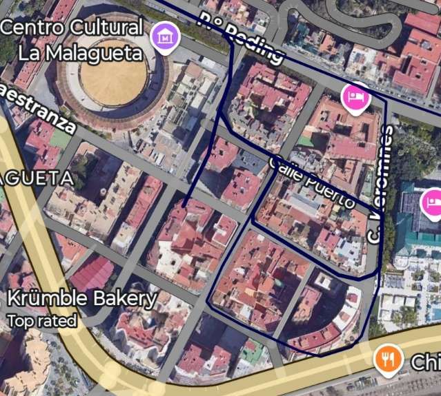
The historic tram depot in the La Malagueta neighborhood of Málaga was constructed around 1890–1892 on Calle Maestranza (occupying a large plot between Calle Cervantes and Calle Maestranza, which sat to the South of Pasillo Reding). It was built for the Málaga Tramways Co. Ltd. and originally functioned as stables and sheds with capacity for up to 180 horses when the system relied on horse-power.
During the 19th century, it sat immediately adjacent to the Málaga Electricity Company power plant. This plant, in the 20th century, supplied the high-voltage current which was then converted inside the tram sheds.
In the early 1900s, when the network transitioned to electric power, the Malagueta depot housed motor-dynamos to convert high voltage electricity for use on the tram lines. Designed by civil engineer Manuel López Martín, the depot was part of La Malagueta’s industrial character at the turn of the 20th century — a stark contrast to the modern, high-density residential and cultural area it is in the 21st century.
Juan Peris Torner writes of developments in the La Malagueta district and the wider network:
“In 1905, the Sociedad Hidroeléctrica del Charro, supplier of energy to the trams of Malaga, installed in Malaga a power plant with two 1000 hp generator sets, each with steam turbines, intended to ensure supply in the case of droughts. … At the start of [its] operations, on 1st April 1905, the company Tramways de Málaga Societé Annonyme operated the original concessions, with 21,651 metres of urban lines, established with a track gauge of 1350mm. The company requested a concession for an electric tramway from Alameda de Colon along the port’s ring road, connecting via a branch line at Plaza de Figueroa with the Málaga to El Palo line, continuing along Paseo del Faro and the streets Velez-Málaga and Fernando Camino, until linking with the line to the Malagueta neighborhood. …..
“The line was granted on 7th October 1905 … as an electric tramway running from Paseo de Reding along Fernando Camino, Arenal, and Fábricas streets in the Malagueta neighborhood … [to the] Tramways de Málaga Societé Annonyme. …. The first electrified line was established between the Córdoba Station and the Arroyo de la Caleta.” [10]
It appears clear that during the line by line electrification process which required some significant investment work was done to link the factories in La Malagueta to the electrified network. Torner reports that a number of lengths of the tramway became electrically operated in 1904/1905: “The …. operation of the tram from Reding to the factories of the Malagueta neighbourhood, whose length was 1,016 metres; the one from Plaza de Riego to Puerta Nueva, of 2,896 metres; and the one from the railway station to the working neighborhood of Huelin, of 1390 metres.” [10]
The 1,016 metres of tramway in the Malagueta neighbourhood which are illustrated above served as industrial rather than passenger lines.
References
- https://commons.wikimedia.org/wiki/File:Memorial_Last_Tram_in_Malaga.jpg, accessed on 16th November 2026.
- https://www.laopiniondemalaga.es/malaga/2020/03/29/historia-transporte-salvo-david-lean-27598040.html, accessed on 16th November 2026.
- Henry O’Shea; Guide to Spain and Portugal; John Lomas (ed.); 1895, p454; via https://commons.wikimedia.org/wiki/File:O%27SHEAS_(1895)_p454_MALAGA.jpg, accessed on 16th November 2026.
- K. Baedeker; Spain and Portugal: handbook for travellers Year 1901; K. Baedeker, London, 1901, p414; via https://commons.wikimedia.org/wiki/Category:Old_maps_of_M%C3%A1laga#/media/File:Spain_and_Portugal-_handbook_for_travellers_(1901)_(14796527223).jpg, accessed on 16th November 2026.
- Paul Joanne & Ernest Franco; Guide Joanne – Espagne et Portugal; Hachette, 1906; via https://commons.wikimedia.org/wiki/File:1906_Malaga.jpg, accessed on 16th November 2026.
- https://colnect.com/en/pocket_calendars/list/country/199-Spain/location/26356-M%C3%A1laga/year/2001, accessed on 16th November 2026.
- https://elferrocarrilenandalucia.es/fototeca/infraestructuras/lineas-y-ramales/travias-y-metros/malaga, accessed on 16th November 2026.
- https://goo.gl/maps/Qcfv49iLeS6XhquX9, accessed on 17th November 2026.
- https://encrypted-tbn0.gstatic.com/images?q=tbn:ANd9GcRTRfpQSUgMaeq22FyWd3nTIBLCZ59EZJ9RUQ&s, accessed on 18th November 2026.
- https://www.spanishrailway.com/tranvias-de-malaga, accessed on 18th November 2026.
- https://la-mirada-del-lobo.blogspot.com/2012/10/tranvias-malaguenos.html?m=1, accessed on 18th November 2026.


