The article is interesting even if just for an insight into the relative value of money in 1951 compared to 2026.
In 2026, an adult single bus fare for a 5-mile journey in Glasgow is typically between £2.90 to £3.25. Using First Bus Tap On Tap Off (contactless), a 4–5 mile journey is listed at £2.90, while a standard on-bus ticket can be higher. Prices vary between operators, with First Bus and McGill’s being the primary carriers.
Back in 1951, a 5 mile journey on Glasgow’s trams would set you back 3d, about 1.25p.
£1 in 1951 is equivalent in purchasing power to approximately £40.77 in early 2026, according to the UK Inflation Calculator, [2] 1.25p on the general inflation index would, in 2026, be worth about 51p. This means that when general inflation is taken into account, today’s traveller on public transport is paying the equivalent of around 6 times as much as a traveller on Glasgow’s trams at the start of the 1950s!
F. J. Mayhew wrote:
“In 1872, the first tramway route was opened between St. George’s Cross and Eglinton Toll on which the through fare was 2d. with a 1d. stage from either end to the top of Union Street. On the steam tramway between Paisley Road Toll and Govan the fare inside was 2d. but it was only 1d. on the top, with the doubtful pleasure of cinders and smoke.
“When Glasgow Corporation took over the tramways from the Glasgow Tramways & Omnibus Company and commenced operating in 1894, the fares were soon reduced and were extremely reasonable. The following examples are taken from the 1914 list: for [a half-penny] one could travel 1.15 miles or 2 stages, a penny fare doubled the distance, 1.5d. fare carried you 3.75 miles, and the fares increased by [a half-penny] for every 2 stages right up to a fare of 7d. for 14.48 miles.
“After the first world war the fares were revised with a minimum of Id. for 2 stages and rising by [a half-penny] every two stages. The Corporation issued a 1d. token which cost 9d. [per] dozen and entitled one to travel 2 stages, and it was a very useful concession.
“In 1926, owing to severe competition by private buses the Corporation took the drastic action of introducing a maximum fare of 2d. on 1st July, 1926, for any distance, so that there were only three fares in operation, 1d. for 2 stages, 1.5d. for 4 stages, 2d. over 4 stages, and these fares applied all day without restriction. It was an immediate success and the trams were packed to capacity. This is the nearest to a simple system of fare collection ever tried out in Glasgow. The maximum of 2d. was not a mere experiment as it lasted for 5 years and on 31st January, 1932, the maximum was increased to 2.5d. with a new fare of 2d. covering 8 stages. This new maximum lasted till the commencement of the second world war when the new maximum was 3d.
“The rising costs of war years and after have made various alterations necessary. and the maximum was fixed at 4d. for over 10 stages and decreasing by [a half-penny] for every two stages down to the minimum fare of Id. for two stages. A popular fare of 1.5d. for 4 stages was an early casualty as it was first reduced to 3 stages and then abolished altogether.
“On 31st December, 1950, Glasgow Corporation abolished the 1d. ticket which has been the backbone of the fare system with the exception of two periods when a [half-penny] fare was in operation. The scale today is 2 stages 1.5d., 3 stages 2d., 6 stages 2.5d., 9 stages 3d., and over 9 stages 4d.
“In Glasgow, the fare system did not allow of concessions to workers at special rates as the whole scale of fares was very low. The same scale of fares applied to all routes, without the annoying exceptions some cities have for various routes and this has contributed in no small measure to the esteem in which the tramways are held by the travelling public. …
“All stages are clearly marked by the sign ‘Fare Stage’ painted red and by a red band on the pole; a small plate is fastened to the sign indicating the number of the stage. The stages are so numbered that where services converge together in the city the same number applies to the fare stage for all services. In the case of circular services or services not proceeding through the city centre, the stage numbers are apt to vary from the through routes. It is interesting to know that No. 1 stage is at Renfrew Ferry, as trams could run through from there to Milngavie, via Paisley, Barrhead, Shawlands, Glasgow, Hillfoot, and the stage number at Milngavie terminus is No. 41, a distance of 22.73 miles. Unfortunately, this through route has been severed between Paisley and Barrhead at Glenfield a short time ago. The stages in the city centre run between numbers 25 and 30 and either decrease in the east and south routes or increase in the west and north routes. The stage numbers are shown against the appropriate names of streets which are shown on the fare lists inside the trams on both decks and the fare between any two points can be very easily ascertained.
“Prior to the second world war 6d. evening tourist tram tickets were available on all tram services from 5 p.m. to midnight on any weekday, and on Sundays a 1s. ticket all day took in the bus services and underground as well. In 1950, an experimental 1.5d. voucher was issued for use between 10 a.m. and noon and 2.30 p.m. and 4.30 p.m. for any distance, valid from Monday to Friday, to encourage travel at off-peak periods. This was withdrawn after a six months trial, but a new 2d. voucher is to be introduced shortly for any distance, from Monday to Friday, between 10 a.m. and noon and 2.30 p.m. and 4 p.m. Thus the 2d. maximum fare returns after twenty years although restricted to set times.
The Transport Committee are investigating the collection of fares so as to minimise the considerable loss caused through uncollected fares every day. The red box is fitted to all trams on the platforms to allow passengers to pay their uncollected fares when leaving the tram, but unfortunately many citizens fail to realise that by not placing their uncollected fares in the boxes they are injuring their own transport system.” [1: p60-61]
In 1951, Glasgow’s extensive tram network was still a dominant, well-loved, and bustling part of city life, despite a report in October of that year signaling its eventual decline. There were sleek, new-looking trams on routes like the Service 14 to Speirsbridge and busy, often crowded, scenes in central areas such as Renfield Street and Paisley Road. [3]
Glasgow Corporation Tramways were heavily used and, in 1951, remained an essential, iconic part of the city’s transport infrastructure, even as city officials began planning for their replacement. [3]
Although the system was in the early stages of a phased transition towards buses, it still operated a vast network, including high-traffic routes like the ‘Goldmine’ service.
Photographer Peter Mitchell captured over a thousand images of the city’s trams during this period (1951-1962), showcasing Standards, Coronations, and Cunarders in operation. [4]
Tramcars in service also included in operation also included the ‘Kilmarnock bogies’ (built 1927/28). These trams were a batch of 50 maximum-traction, eight-wheeled trams (Nos. 1091–1140) featuring bogies supplied by the Ayrshire-based Kilmarnock Engineering Company. Though technologically advanced with wider interiors, they were prone to derailing on tight curves and were restricted to flatter, straighter east-west routes. [6]
References
F. J. Mayhew; Glasgow Tramways Fare System; in The Modern Tramway, Volume 14, No. 159, March 1951, p60-61.
Following on from an article written in May 2023, after a visit to Howth, which can be read here, [1] I found an article about the Tramway by C. L. Fry in the March 1951 issue of The Modern Tramway. [2]
The May 2023 article covers the route of the line in some detail.
“A very delightful summer outing can be had by availing oneself of the excellent service operated by the Great Northern Railway (Ireland) on its Dublin local line from Amiens Street Station to Howth. Perhaps the best way would be to leave the train at Sutton Station and there board a G.N.R. Hill of Howth tram which leaves Sutton Station, and winds its way round and over the Hill. The tramway at its summit reaches a height of 350 feet above sea level. From the top of the Hill, and the tramway goes almost to the top (560 ft.) it is possible to see the Mountains of Mourne on the north side, the Wicklow Hills on the south side, and the wonderful view of Dublin Bay and Bray Head. The view at night time, with the reflection of millions of lights glittering in the sea across the bay is equally marvellous. For 1s. 6d., a ticket may be purchased to include a trip by railcar to the tramway terminus and then by the tramway round and over the Head, and back to Dublin by diesel railcar.” [2: p50]
“The tramway, which is single line throughout, runs mainly in a reserved right-of-way, about one-third of this being on the side of the road. The track is laid with standard type bull head rails, with the wooden keys on the inside so that it is only necessary for the milesman to walk the line once to see if all the keys are tight. There is, however, about a half-mile of standard tramway grooved rail from Sutton Cross to the foreshore near St. Finton’s – one of the first calling places after Sutton Cross. This track, of course, is sunk in the carriageway. There are many passing-places on the line, and each one of these is signalled to the next passing-place by the driver, thereby preventing a car from the opposite direction entering the single line section, though cars may follow in the same section. The line is 5.25 miles long and starts from the railway station at Sutton and ends at Howth railway station.
“It is at Sutton that the car sheds, fitting shop, and former power station are situated (power is now taken from the Electricity Supply Board); the voltage is 550 d.c. The car shed has three lines side by side and a point of interest is the fact that there is a 3-way overhead frog with a moveable tongue, which is hand-operated from the base of the post, so that the trolley will take the correct wire to go into the sheds.
“This tramway was opened on 7th June 1901, and is now the only electric tramway in the Irish Republic. Within a couple of years of the opening day, the Company had eleven bogie tramcars, all of which are still working more or less in the same condition as when first built. Nos. 1-8 were built by the Brush Engineering Co., are mounted on Brill maximum-traction trucks, and have vestibuled platforms. They are 31ft. 4in. long by 7ft. 6in. wide, and carry 30 passengers in the saloon, and 37 on the upper deck. They are painted blue and cream. Nos. 9 and 10 were built by Milnes, are rather larger, and are mounted on Peckham maximum-traction trucks. They are painted in the standard mahogany colours of the G.N.R.(I) carriages. These cars are unusual, insofar as they have a combination of ‘knife-board’ and transverse seats downstairs, to enable people to admire the beautiful scenery to be seen on this journey. Seating capacity is 33 in the saloon, and 40 on the upper deck: the cars have vestibule ends, and are 33ft. long and 7ft. 6in. wide. All ten cars on this tramway have open tops. The trolley poles are mounted on the extreme side (the sea-side) of the tramcar. Car No. 11 is a works vehicle; it is really a wagon with a tower at one end used for repairing the overhead. The trolley in this case is mounted on the centre line of the roof at the opposite end from the tower. This car is mounted on Brill maximum traction trucks, and is 24ft. 3in. long and 7ft. 3in. wide.” [2: p50-51]
“All the passenger trams are fitted with air brakes, which are charged with compressed air to 75lb. per square inch at the car sheds every morning. They also have regenerative and hand brakes for control on the very steep hills on which they operate, the gradings being as steep as 1 in 16.25. Nos. 1-8 are fitted with electric heaters downstairs.
“While the Dublin United Tramway [D. U. T.] Company’s line was operating to Howth, there were two extremely unusual features:
“(1) Although both tramways were built to the standard Irish railway gauge of 5ft. 3in. and at Sutton Cross cars of the G.N.R. tramways crossed the D.U.T. on the same level, there was no point or other physical connection to enable cars of the two Companies to interchange. The G.N.R. single overhead wire was fitted with insulators on both sides of the two D.U.T. overhead wires at this crossing, the actual length of G.N.R.(I) wire taking D.U.T. current being about 6ft.
“(2) At Howth the G.N.R. Tramway again crossed the D.U.T., but this time on an over bridge, the G.N.R.(I) descending to the level of the D.U.T. Again there was no physical connection.
“Incidentally, of course, this is the level of the railway station at Howth. The tramway is on one side of the railway platform. The railway journey from Sutton is but 2 miles” [2: p51-52]
“Another item of interest in the fact that the overhead consists of a single wire from the Summit to Howth while it is double all the way (with the exception of the old D.U.T. crossing already referred to) in the other direction to Sutton.
“The tramway has, on the whole, been very well maintained by the G.N.R. Extensive renewals of track have taken place quite recently and overhead posts which have corroded owing to the action of sea air have had steel bars inserted and have been filled with concrete.
Some ten years or so ago buses were operated for a short time but were withdrawn as the tramway service was more suitable owing to the hilly nature of the line. Today, the position unfortunately is rather uncertain, and while a splendid service is operated in the summer, the number of passengers using the service in the winter enables only a skeleton service to be operated.
“Regarding the future of this delightful tramway, one thing is certain, that Mr. G. B. Howden, General Manager, G.N.R.(I) and also General Manager of Coras Iompair Eireann, who has done his best to maintain every branch line, will, I have no doubt, do all in his power to keep this line open as long as traffic warrants it.” [2: p52]
The featured image for this article is a line drawing of a drive system from a Hamburg Metro Car, an SKF DT4. [5] … AC traction motors (commonly induction motors) are the standard for modern trams, replacing older DC motors to provide higher efficiency, better reliability, and reduced maintenance. These motors, often running at 60–200 kW, power the bogies and enable regenerative braking to feed energy back into the overhead line. They are controlled by variable-frequency inverters for smooth acceleration.
The Modern Tramway of February 1951 carried an article by ‘Eltee’ entitled ‘Traction Motor Trends’ about the recent changes in electric motors in trams. [1: p33-34]
“The present trend towards the use of lightweight high-speed electric motors for traction purposes, a trend exemplified at its best by the motors used in in the P.C.C. cars in America, and those of similar design now being introduced at Blackpool and and Glasgow and on the Continent, justifiably prompts the query as to why motors were not, in the past, built as they are today. There are actually several reasons for this, some highly technical, but one of the more important is that the need for efficient ventilation of motors was not sufficiently appreciated in the early days.
“When a motor is running and current is passing through its conductors these conductors are heated by the passage of current, just as are the conductors of an electric stove though much less so. The power represented by this heat is lost to the motor, and called the ‘copper loss’. Another source of loss is the rotation of the armature in the motor magnetic field; the alternating magnetism through the armature caused by its rotation brings about power losses in armature iron, which also appear as heat. In running, then, the motor gets heated, and if there were no means of dissipating this heat the motor would get hotter and hotter until something melted.
“In practice this does not happen, as the motor casing is in contact with the air around it, and when the casing is hot it loses heat to this air, doing so all the more readily when the car it is driving is moving and there is a certain amount of draught. Many years ago this was the only way of cooling the tramway motor, hence a large motor had to be used simply to ensure that there was enough casing area to dissipate the heat generated. Some additional armature cooling was given by the provision of axial ducts in the armature, aided by a few radial ducts. In this way some slight fanning action was given by the moving armature, swirling the air in the motor casing and conveying the heat from the armature more readily to the outside casing for dissipation into the atmosphere.
“A later development introduced what is now known as ‘series ventilation’, the self-ventilated motor being introduced about 1910. In such a motor a fan is mounted on the non-commutator end of the armature, and two sets of openings are made in the same end of the motor casing. The fan draws air through the armature axial ducts when the motor is running and expels it through one of the casing openings; this assists to keep the armature cool. This air, in the first place, is drawn in through the other set of openings and over the field coils before turning round and entering the armature ducts; in this way the field also is kept cool, but the ventilation of the armature suffers because the air is already somewhat warmed by its passage over the field coils.
“A further development, common from about 1920 onwards, is known as ‘parallel ventilation’, in which there are two parallel air streams through the motor. A twin fan is fitted to the non-commutator end of the armature, and openings made in both ends of the motor casing. The fan draws a stream of cool air over the commutator, round the armature surface and over the field coils before expelling it. The other half of the fan draws an air stream under the commutator and through the armature axial ducts, thus keeping the interior of the armature cool and dissipating most of the iron losses effectively.
“With a motor as efficiently ventilated as this it is possible to ‘force’ the motor more without its getting too hot; that is, in more technical language, a motor can have a higher rated power. Consideration of the above method of ventilation readily shows that if the motor armature rotates more quickly the attached fan will draw more air through it, ventilate it even more thoroughly, and permit even more ‘forcing’ by the passage of greater currents. This, in essence, explains the present trend towards motors of high rotational speed; the efficient ventilation possible on such motors permits more power to be passed through them than through motors of similar size with less effective ventilation.
“The above being understood, two further points are worthy of emphasis. One is that the greatest losses occur in a motor when it is starting and running slowly; the best ventilation occurs when it is running quickly. Cars on a town route will thus need bigger motors than similar cars on an interurban route on which there is a lot of free running, providing their maximum speeds are equal. The second point is that, if motors have been used on a service on which their capabilities are being fully employed the gear ratio must not be altered, because, although the speed of the cars can thereby be improved, such a measure will not only increase the currents passed through the motor (for more power will be required from the motor) but will also decrease the average speed of rotation of the motor. resulting increased “losses” and impaired ventilation will both tend to raise the operating temperature of the motor. and so reduce its life, unless it was known that hitherto it had been used well below its capacity and was operating at relatively low temperatures.” [1: p33-34]
Since ‘Eltee’ was writing at the beginning of the 1950s, much has changed!
Improvements in the ventilation of tramcar electric motors since 1950 have centred on a move away from traditional forced-air cooling in direct current (DC) motors to advanced, sealed, and integrated systems used with modern AC traction, enhancing reliability and reducing maintenance. [2][3]
Modern three-phase AC motors allow for lighter, more compact, and more powerful motors. These motors are often less sensitive to heat and easier to cool than older designs. [2][3]
Modern tram design integrates motors directly into the bogies, with ventilation systems designed as part of the overall low-floor, compact carriage architecture, ensuring better cooling airflow in restricted spaces. [3]
Many modern motors are now completely enclosed, utilizing improved heat sinking and specialized cooling fan designs rather than drawing in outside air, reducing the impact of dust and water on electrical components. [2][3]
The use of GTO-inverters and modern power electronics reduces motor heat generation compared to older resistor-controlled DC motors, reducing the load on ventilation systems. [2][3]
Improved insulation materials allow motors to operate safely at higher temperatures, reducing the strain on the cooling systems and improving longevity. [2][3]
Modern electric trams utilize motors to generate electricity during braking, returning power to the grid or charging on-board batteries/supercapacitors. The use of battery-power and on-board storage can allow trams to pass through city centres or other sensitive areas without overhead wires. [3][4]
Electric motors are ideal for rapid urban transport because their higher torque at low speeds allows speedy departures from stops on a network. It also allows tramcars to handle hilly terrain better than internal combustion engines.
Electric motors are roughly 90% efficient at converting energy into motion. In contrast, diesel engines lose about 60-70% of fuel energy as heat. [4]
Additionally, unlike internal combustion engined vehicles that consume fuel while stopped, electric trams use virtually no power when stationary. [4]
AC motors have been shown to improve reliability and decrease downtime compared to traditional DC motors. But they have significantly lower maintenance needs than internal combustion engines, having far fewer moving parts and not needing oil changes, spark plugs, filters, and complex exhaust systems. The high torque of electric motors at low speeds eliminates the need for heavy, expensive multi-stage gearboxes common in internal combustion engined vehicles. [4]
Trams typically have a service life of about 30 years, roughly double that of diesel-powered buses. They typically produce no local pollutants like nitrogen oxides or particulates, which is critical for city air quality and meeting climate targets. Electric propulsion is significantly quieter than internal combustion engines, reducing noise pollution in densely populated areas. In addition, electricity can be generated from various sources, including renewable energy (wind, solar, hydro), making the system future-proof as the power grid decarbonizes. [4]
Increasingly in an urban environment public transport is heading underground. Because they emit no exhaust fumes, electric trams can safely operate in tunnels and underground stations where diesel engines cannot.
Internal flexibility is increased as the need for bulky and heavy engines and fuel tanks is eliminated. The net gain is a more friendly user experience, faster loading and unloading at stops and increased passenger capacity. [4]
It is not surprising that many cities around the UK, and across the world, are seeking to reintroduce trams and to increase the size of their networks.
References
‘Eltee’; Traction Motor Trends; in The Modern Tramway Volume 14 No. 158; The Tramway and Light Railway League, February 1951, p33-34.
The featured image for this article is Brno Tramways No. 131 with Trailer No. 310, which early in 1951 was newly delivered to Brno. [1: p21]
Gerald Deuce reported in February 1951 on a series of new tramcars being delivered to Brno in what is now the Czech Republic. [1: p25-26]
He writes that these tramcars:
“are uni-directional single truck motor-cars with trailers of similar design and are intended for PAYE [Pay As You Enter] operation with the entrance at the rear. All the doors except the leading set of the motor-car, are under the control of the respective conductor.
“The cars are heated by electric radiators fitted under the transverse seats, and lighted by a fluorescent tube strip along the ceiling.
“Brno is the capital of Moravia and has a population of just over 273,000. It is situated about 130 miles south-east of Prague, and is the centre of the Czechoslovak textile industry and an important tourist centre.” [1: p25]
Their ‘vital statistics’ were: ….
In this table, the first column of figures relates to the motorcar the second column of figures relates to the trailer. [1: p25]As far as I can tell the trams introduced in 1950/51 in Brno were KPS Brno 4MT trams and the trailer is a vv4 trailer car. Deuce does not give full details. [1: p25]
In 1950, the Královopolská strojírna plant in Brno manufactured new tram cars, including the KPS Brno 4MT2 motor tram and a vv4 trailer, which served the city. This period focused on modernizing existing infrastructure, with four-axle T-series trams and K-series cars introduced during the 1950s/60s. The KPS Brno 4MT2 tram, manufactured in 1950, was later used in the 1970s by the Technical Museum. [9]
Deuce continues:
“The tramway system is of standard gauge, the lines all rising from the railway station, near the centre of the town, with a total route mileage of about 23. The main depot and workshops are at Pisarky, approached by a long sleeper-track section. This line also serves the exhibition grounds, where there is a special four-track layout. There is an interurban line to Lisen, 5.2 miles long and nearly all on private right-of-way; most of this line is single-track with passing loops, with automatic colour-light signals.
“The higher number indicated against the first three services refers to a short working over the central portion of the route. Services 5 and 9 run together for most of the distance. Frequent services with trailers are operated on all routes. The through trains on the Lisen line usually consist of a motor-car and two trailers, and run at intervals varying between 15 and 40 minutes; there are additional short workings.
“The Brno tramway network (Czech: Tramvajová doprava v Brně, simply Tramvaje v Brně) was the first network of its kind to be put into operation in what is now known as the Czech Republic with its horse tram lines dating back to 1869. [In the 21st century], Brno is the second largest city in the Czech Republic, after Prague, and its tram network is also the second largest in the country.” [5]
At different times, three different modes of propulsion were used on the network: from 1869, horse-power was in use; from 1884, steam-power was in use; and from 1900 electric trams were introduced. [5]
Brno hosts a tram parade in June each year. The three images below come from that parade: ….
These next paragraphs come from a webpage written in 1998/99 by Richard Bilek from the Czech Republic, who died in 2001 (R.I.P.). Translated from Czech, that have in places been paraphrased to read more easily. They are a ‘snapshot’ of the tramway network in Brno in 1998/1999 and a potted history of developments from the 1950s to the late 1990s. [2]
“In 1951, Brno had 62 km of network. In 1948, the last two-axle tramcars from Zbrojovka Zidenice were delivered. In the 50s, the city renewed their tramcars with new progressive tramcars of class T2. 94 tramcars of this type were delivered till 1961. No T1 type tramcars were purchased by the city.
“In 1963 new tramcars of T3 arrived. The city wanted tramcars with bigger capacity. Tatra Works developed articulated tramways of type K2 in the mid of 60s. First prototypes were tested here in 1965, and between 1966 and 1977, the City purchased 132 tramcars of this type, so they operated the largest fleet of K2 tramcars in the Czech Republic. These tramcars were still most typical for Brno at the end of the 20th century.
“All Czech cities except Brno at the end of 60s shortened their network at the end of the 1960s. Brno was the only city with uninterruptable expansion of track after WW2 through until the turn of the 21st century. New housing estates in Brno also were connected with the tramway and later, with trolleybuses. The last major expansion, a new line, was opened in 1989, a further short connection line was opened in 1994. An additional 2.2 km was under construction in 1998/1999. The city purchased new KT8D5 tramcars at the turn of the 21st century, 28 cars entered service. Further renewals were also planned – T6B5 type. and low-floor tramways of RT6N1 type.
“The city was operating the following tramcars just prior to the turn of the 21st century:
1470+1462 Last units of T2 tramcars of T2 type. These two vehicles were due to be scrapped in 1998. 1495..1668 Tramcars of T3 or T3SUCS. Mostly in service 1001..1132 Articulated tramways of K2. 126 still in service 1701..1728 KT8D5 Tramcars. One withdrawn after an accident 1201..1220 New T6B5 tramcars, delivered 1995 and 1996 1729..1735 KT8 tramcars with low-floor mid section 1801-1804 RT6 low floor tramcars
“The city also sought to renew these old tramcars:
“Tramcar T3 no.1615 was rebuilt in 1993-1994 to new type T3MB with new body, renewed electricity, etc. There was a hope to rebuild approx. 70 tramcars to this state, but only 11 had been renewed by the end of 1997.
“Also, K2 tramcars were intended for renewal in this way. First prototype was rebuilt in Pars DMN Sumperk works (small city approx. 120 km norhtern from Brno) and was placed in service in Brno. An additional batch of 6 similar tramcars was renewed later.
“There were plans to order new KT8 tramcars (for a new line to Lisen). They were due to be delivered with a low-floor middle section in 1998/1999.” [2]
The Modern Tram Network
As we have already noted, Brno is the second largest city in the Czech Republic, after Prague, and its tram network is also the second largest in the country.
Scribble Map of Brno’s 21st century tram network on OpenStreetMap.com base map. Follow this link to the interactive map. [3]
The urbanrail.net webpage has a more detailed map and plenty of images of trams in service on the network. [4]
The Brno tram system comprises 12 lines, with a total operational track length of 139 kilometres (86 miles) and a total route length of 70.4 kilometres (43.7 miles). The lines not only serve the urban area, but also lead to the neighboring town of Modřice located south of Brno. Before construction began on the final leg of the extension in 2008, the entire network was made up of 69.7 km of track. [5][9]
Further details of the modern network and the trams in service in the mid-21st century can be found here. [5]
References
Gerald Deuce; New Cars for the Brno Tramways; in The Modern Tramway, Volume 14, No. 158; The Light Railway Transport League, February 1951, p25-26.
I have a few older copies of Modern Tramway which I had not yet read. The first of these is the January 1951 issue, this is a third reflection from that copy of the Journal.
The Brisbane City Council Transport Department Tram Network in 1950. [1: p17]
“Brisbane, the capital of Queensland, Australia, was first settled in 1824. From that date it grew steadily, expanding round the broad winding Brisbane river to become the great city and seaport it is today. Horse trams were introduced by the Metropolitan Tramway and Investment Company in August 1885, and these gave way to electric cars in 1897 and 1898. At the same time, the Brisbane Tramway Company was formed to take over operation of the electric lines and this company built many extensions to the system to match the needs of the fast-growing city. In 1923 the tramways passed into the hands of the Brisbane Tramways Trust, a government board representing Brisbane ratepayers; this Trust was only a temporary body, and when the Greater Brisbane City Council was formed in 1925, the tramways and all city transport became the concern of the Brisbane City Council Transport Department.
“When the public authority took over in 1923, the fleet consisted of 195 cars: today [1950] the Department operates 420 tramcars and 154 single-deck diesel buses. The old B.T.C. cars, many of which are still running, are of great variety and include 4-wheel and bogie “toast racks” and 4-wheel and 8-wheel end-loading saloons, known as ‘Dreadnoughts’. These cars appear only during peak hours and they present an odd appearance against the modern streamliners. … The first new tramcar design developed by the B.C.C. was the ‘drop-centre’ type of which 204 were built, numbered from 196 to 399. These cars have a plate frame, reversed maximum-traction trucks, open centre compartment with eight transverse benches and two closed end compartments. They seat 64, have a maximum capacity of 110, and are 45ft. 6in. long.
“In 1938, a second new type was evolved, later to become known as the ‘400’ or ‘Streamliner’ class. Of these cars, 108 have been built to date [1950], the prototype, No. 400, differing slightly in appearance from its successors. These fine cars are 49ft. in length, seat 64 with a total capacity of 110, and are very fast. The post war version, numbered 473-508 is an improved type with sliding doors: 483-508 have Dunlopillo seating and panelled bodywork; 497, 498, 499, 505, 506, 507 and 509 are fitted with resilient wheels and a multi-notch controller. Other noise-reducing features not yet introduced include rubber inserts in the trolley head. A further 50 of the improved “400” class are yet to be built. Other features of these cars are:
– Integral construction, the whole of the frame and panels being of steel with no separate under-frame.
– Interior lined with varnished natural timber, ceiling of white-enamelled masonite.
– Sashless windows operated by Young full-drop window balancers.
– Motorman’s windows of armour-plated glass and fitted with air-operated windscreen wiper.
– Bogie trucks equipped with GE 247A motors of 40 h.p. each and air brakes.
– Double helical driving gears.
– Air compressors and trolley base mounted on special rubber fittings to reduce noise and vibration.
“The B.C.C. livery is silver with blue lettering.
“The general condition of the track is good, all new track being laid in solid concrete to the top of the rails. On straight track 82 lb. railway rail is used without guard rails, the groove being formed in the concrete. Curves are laid with British Standard 6C tramway rail. There are reserved and private-right-of-way sections on the Chermside, Salisbury, Belmont, Rainworth and Ascot routes. The Chermside extension, opened in 1947, is a model layout with rails laid in concrete and flower beds on either side of the tram track separating it from the motor road: the poles supporting the overhead are at the side of the road.
“Since the war ended in 1945, extensions of three lines have been opened: to Belmont (31st July 1948), to Chermside and to Enoggera (13th August 1949). An extension from Holland Park to Mount Gravatt (1 3/4 miles) is at present under construction and two more extensions are provided for during the current financial year. The Holland Park line now under construction is a street line, and will serve a new housing area. The new lines completed since the war, together with the Mount Gravatt extension, total about six route miles. On 30th June 1949, the total route mileage was 65 miles 60 chains (track mileage 119 miles 75 chains). Of particular interest is the new Ann Street diversion. Formerly all routes [that] passed through the city centre (with one exception) converged at an awkward bottleneck in Petrie Bight. As had been long feared, an accident occurred at this point during a Saturday midday peak with resultant dislocation of traffic. To avoid any recurrence, the Tramway Department constructed a line in Ann Street (about 1/8 mile) from Wharf Street to Petrie Bight in 1946. Of single track with double track junctions, the new line, used only for emergencies, is of standard concrete construction with double overhead wire. It is planned to place tram tracks underground at the inter-section of Ann and and Queen Streets as a first move in a more extensive future city centre subway plan to relieve surface traffic and speed up street transport. When this plan takes shape, Brisbane will be the first Australian city to have tramway subways (the Wynward line in Sydney was built by the Railway Department and is only on loan to the tramways until the underground railway proper is constructed).
“On weekdays the fares start at 2d. for one section and an additional penny for each section, but there are zone fares to and from the city at a reduced rate, and on some routes these work out at about a penny a mile. On Saturdays and Sundays after 6.30 p.m. the fares are increased by a penny with the exception of the first section which remains at 2d. From Monday to Friday concession tickets sold in books of eight for a shilling may be used at the rate of one ticket for each section and are much in demand. On Sundays excursion tickets are sold at 1s. 6d. for adults and 3d. for children; they allow the holder to travel anywhere on the system between 8 a.m. and 2 p.m. or between 2 p.m. and 10 p.m.
“The only tramway that has been abandoned in Brisbane is the short length between the Botanical Gardens and Queen Street and from Queen Street to Gregory Terrace, all in the city centre and operated as two short shuttle services until 1948. This route from the the Gardens to Gregory Terrace will form part of Brisbane’s first trolleybus route (the remainder of the route along Coronation Drive to the University at St. Lucia has never been a tram line) and bodies are now being constructed on 30 Sunbeam trolleybus chassis; it is anticipated that these 44-seater all-steel trolleybuses will be in operation before the end of 1950.
– St. Paul’s Terrace – Enoggera. – West End – New Farm Park. – Dutton Park – New Farm Wharf. – Belmont/Cavendish Road/Holland Park – Wharf Street or Valley Junction.
– Valley Junction – South Brisbane Station.
(Special and short workings are not included in the above list.)” [1: p15-16]
In practice, “Brisbane’s historic tramway network operated from 1885 to 1969, serving as a vital transport link before being replaced by buses. Known for its iconic, largely open-design ‘toastrack’ trams, the network reached a peak of 109 km in 1954, connecting suburbs like Paddington, Ascot, and Toowong. The system officially closed on 13th April 1969.” [2] The horse-car era lasted from 1885-1899, the electric-car era from 1899 to 1969.
Trams “ran on standard gauge track. The electric system was originally energised to 500 volts, and subsequently increased to 600 volts. All tramcars built in Brisbane up to 1938 had an open design. This proved so popular, especially on hot summer nights, that the trams were used as fundraisers and often chartered right up until the last service by social groups.” [2]
Brisbane was the last capital city in Australia “to close its tram network. Despite the decision to shut down the network, Brisbane’s trams were held with great affection by locals, and one commentator described their removal [as] ‘one of the most appalling urban planning mistakes in the city’s history’. [3] There have been ongoing proposals since the early 1990s to reinstate a functional tram network.” [2]
In the 21st century, Brisbane has its own ‘Metro’ but it is not a tramway network. “Since the 1990s, busways were considered as one of the options when the Queensland Government developed the 25 year Integrated Regional Transport Plan. It was recommended that a 75 km (47 mi) network of busway corridors to complement the existing Queensland Rail City network,” [4][5] should be built.
The first section of busway, opened in September 2000, with the rest of the South East Busway opening in April 2001 at a final cost of over $600 million. [6] Planning and construction of the Northern and Eastern Busways began soon after the success of the first section, increasing bus commuter statistics. As of 2025, the city had three busways, spanning 29 kilometres, including 28 stations and 20 tunnels. [4][7]
As of 2007, 294 buses per hour (one way) – 1 bus every 12 seconds – passed through the busway network’s busiest point (a section of the South East Busway north of Woolloongabba station). Further, capacity issues occurred at other locations in the city. [4]
“In order to meet the capacity bottlenecks of the busway system, various solutions [were] proposed, including conversion to light rail, the BaT tunnel, a second Victoria Bridge, bus route changes, and later, Brisbane Metro.” [4][8]
The initial proposals for a rubber-tyred metro of 2016 were adapted to meet specific concerns. Bi-articulated buses were chosen. The buses would operate on two routes. The business case released in November 2017 costed the project at AUS$944 million. By April 2018, the federal government had agreed to contribute AUS$300 million.
In November 2019, BCC announced that a consortium of Hess, Volgren and ABB had been awarded a contract for 60 buses. The buses were to be fully electric via overhead wireless charging that will charge at the end of each route for less than six minutes. [4][9]
“A pilot bus was built and tested in Europe in 2021, arriving in Brisbane for testing in early 2022. Following successful testing, an order was placed for the remaining 59, with close to 1000 modifications based of the original pilot vehicle. [10] The 60 vehicles cost AUS$190 million, an increase of $100 million compared to more traditionally powered vehicles, with deliveries beginning in late 2023. As of 2026, the full 60 ordered are still being delivered.” [4][11]
“The system consists of two routes over 21 km (13 mi) of busways. The routes serve Brisbane CBD every five minutes during peak times, extending as far as Eight Mile Plains, the Royal Brisbane and Women’s Hospital and the University of Queensland respectively. Route M2 began service on 28th January 2025. Route M1 began service on 20th June 2025.” [4]
A route map for the Metro can be found here. [12] Route M1 connects with the South East Busway services. Route M2 connects with the Northern Busway services. [12]
I have a few older copies of Modern Tramway which I had not yet read. The first of these is the January 1951 issue, this is a second reflection from that copy of the Journal.
As the London network began to close a significant number of trams were sold. This copy of Modern Tramway notes that the remaining ‘Felthams’ were sold to Leeds City Transport.
By the late 1920s trams operated by both the Metropolitan Electric Tramways and the London United Tramways were increasingly aged. The two operators co-operated in the development of a new tram design – the ‘Feltham’. Conceived following detailed research and the construction of a number of prototype cars, the production ‘Felthams’ all entered service by the early 1930s. However, the LPTB’s plans for converting tram routes to trolleybus operation soon saw these modern cars transferred from north of the River Thames to south of the river. Here the production cars mostly survived until the final conversion programme. This was not the end of the story, however, as the majority were sold for further service to Leeds, where the last survivors were to see the final closure of the West Riding system in November 1959. The book explores the story of the ‘Felthams’ in London, Leeds and Sunderland. [2]
“In 1929 the Metropolitan Electric Tramways (MET) placed into service an experimental tramcar, No. 320, manufactured by the Union Construction Company which was located in Feltham. This tram was of a significantly more advanced design than other experimental cars that the MET had trialled in the previous few years, and was the first of three prototypes that led to the final design of what became known as the “Feltham” trams. Two more experimental tramcars were then constructed: MET No. 330 later the same year, and No. 331 the next. After experience in passenger service was assessed, the best features of each were combined to form the final design.” [3][4]
After service in London until 1949 and into the very early 1950s, 92 of these trams were to be purchased by Leeds City Transport. In January 1951, Modern Tramway reports:
“The purchase of the remaining 92 London ‘Feltham’ type cars by Leeds City Transport at a cost of £500 each is a wonderful bargain for the latter city; a bus with the same expectation of life as one of these still very modern cars would cost about £4,000, and a new bogie tram at least £7,000.
“On arrival at Kirkstall Works the trucks are completely stripped and all worn parts are replaced. The hornways where worn are built up by a welding process. It has been found necessary to replace the rubber blocks used in the driving-wheel hornways in London by the correct springs, and the tyres are turned to the standard Leeds profile.
“It was found that the car bodies were structurally quite sound on arrival from London; all that it has been necessary to do to the exterior has been to replace damaged panels and to remove dents in the dash; internally, all the woodwork has had the old varnish removed and has been repolished with a light oak finish, all interior panels being finished in light brown. The seats are removed from the cars and the upholstery thoroughly cleaned. Any cars that are received with seat coverings in poor condition will be re-upholstered in the standard Leeds red leather. A combined route-number and destination blind has been fitted, the apertures used in London for displaying the service number having been painted out; a lower saloon side indicator-blind is also provided. The front exit has not been restored for passenger operation, the air-operated front door being used solely for perambulators and luggage.
“The cars, which are arriving at the rate of two a week, are being numbered from 501 upwards in the order of arrival from London, up to 515 having been received at the time of writing and up to 504 being in passenger service. Arrangements have been made with London Transport for the ex-Metropolitan cars with B.T.H. equipment to be despatched first, to be followed by the ex-London United cars with G.E.C. equipment. The ex-Metropolitan and ex-London United cars will be classified in Leeds as types UCC/1 and UCC/2 respective’y.
“The livery finally decided upon for these cars is ‘British Electric Traction’ red all over, relieved by a cream band below the upper saloon windows and a cream panel above the lower saloon windows. The cars are lined out in gold and the roof, trucks and lifeguards are painted Brunswick black. Car No. 503 lacks the cream bands, whilst car No. 501 is still in London Transport livery.
“The cars have proved very satisfactory in service and are popular with the passengers. Those at present in service operate from Torre Road Depot which will eventually operate ‘Felthams’ exclusively. The riding qualities of these cars on the long reserved-track routes to Crossgates and Templenewsam are good. The Leeds undertaking is to be congratulated on obtaining and reconditioning these fine cars.” [1: p6]
The ‘Felthams’ served in Leeds until the closure of that city’s network in 1959. Wikipedia talks of 90 rather than 92 of these trams operating in Leeds. [3] The Seashore Trolley Museum in Maine, USA agrees with this assessment. [5]
The Seashore Trolley Museum reports:
“Car No. 341 was one of this class known as the ‘Felthams’ (after their place of construction). The ‘Feltham’ cars were the result of a complete vehicle redesign similar to the development of the PCC car in the USA at about the same time. No. 341 was one of 54 cars built for the MET which served London’s northern suburbs. At over 40 feet long, the ‘Felthams’ were relatively long and had a tapering body, large entrance/exit vestibules and a low floor height. A distinctive feature was the higher floor for the operator’s cab. Rather than using overhead wires, London trams (including the MET trams) drew power from an underground conduit, similar to systems in Washington, DC and New York City. When the London Passenger Transport Board acquired the Metropolitan Electric in 1933, No. 341 became No. 2085. The car survived the World War II blitz, but the LPTB’s policy was to replace trams with trolley buses and expanded underground lines. The ‘Felthams’ were the last new trams purchased for London. After 1938, most of LPTB’s remaining tram lines were in South London. In 1948, LPTB was nationalized and became the London Transport Executive. The last London tram ran in 1952. The tram system in Leeds acquired 90 ‘Felthams’ from London Transport in 1950, including No. 2085, which became No. 526 at Leeds. Leeds painted its trams red and used overhead bow collectors rather than trolley poles. Leeds abandoned its trams in 1959.” [5]
Two other ‘Felthams’ have been preserved:
Car No 331 (LTPB No. 2168) which was transferred to Sunderland. This tram was a central entrance prototype which was numbered 100 when in service in Sunderland. It now is part of the National Tramway Museum, Crich, collection. [3]
Car No. 355 (LTPB No. 2099, later Leeds No. 501) is now part of the collection at London Transport Museum, Store, Acton, London. [3]
I have a few older copies of Modern Tramway which I had not yet read. The first of these is the January 1951 issue.
The editorial for this issue of Modern Tramway was a long update on Birmingham’s tram-scrapping programme. An update that railed against the dominance of the bus! It was clearly written by someone who knew the centre of Birmingham at the start of the 1950s very well.
“Birmingham Corporation Tramways operated a network of tramways in Birmingham from 1904 until 1953. It was the largest narrow-gauge tramway network in the UK, and was built to a gauge of 3 ft 6 in (1,067 mm). It was the fourth largest tramway network in the UK behind London, Glasgow and Manchester.” [2]
“As Birmingham’s tram-scrapping programme continues it becomes increasingly clear how great a part has hitherto been played by the tramways in keeping city centre congestion within bounds. Birmingham has an awkward arrangement of central streets, and for many years now a large number of bus services, some of them cross-city, have followed a loop route through the central streets (Victoria Square, New Street, Corporation Street, Bull Street and Colmore Row). This is an admittedly convenient arrangement for cross-city passengers, but the very large number of buses traversing these streets adds considerably to the congestion; it could just be done, however, with the existing number of bus services and aided by the desperate expedient of the world’s most complicated one-way scheme, formulated in 1933.
In 1933, however, most of the traffic to the city was catered for by tramways terminating on the fringe of the central loop area; their terminal arrangements were far from ideal in many cases, but the quick turn-round possible with trams at such places as Hill Street and Steelhouse Lane did materially aid matters, as did the arrangement by which the Martineau Street trams (services 3, 3X, 6, 8 and 10) followed the one-way routing by a single track in Corporation Street from Martineau Street, then passing through a central island at the Corporation Street – Bull Street corner (where other traffic turned left and right) and across what may be described as a ‘one-way watershed’ alongside Lewis’s building, to rejoin the Corporation Street traffic where two-way traffic commences at Old Square. This arrangement was severely criticised on the ground that it involved the running of trams against the one-way traffic for one block alongside Lewis’s, but this feature could very easily have been rectified by extending the already rather complicated island at Bull Street corner up to Old Square, so as to keep the tramway traffic on a reservation throughout the very short stretch where it conflicted in direction. with the road traffic. This would not have caused any additional congestion, for traffic along Corporation Street from Old Square towards Bull Street has in any case to be split into two streams (right and left) at the Lewis’s island, and to do this in advance of the corner would probably have assisted traffic flow rather than otherwise, while the single track is no wider than other islands in Corporation Street erected as traffic aids, including a long one opposite Cherry and Union Streets which directly continues the line of the track.
There need therefore have been no difficulty in running trams along Corporation Street, whilst doing so did have the immense advantage of directing the traffic from Martineau Street terminus into a path which short-circuited the very congested détour via Bull Street and Steelhouse Lane which was the only alternative.
The tramway abandonments which have occurred since 1933, however, have in most cases had the effect of upsetting these arrangements and causing further invasions of the already congested central ‘loop’. Thus the Ladywood changeover brought an additional bus service into Victoria Square and Paradise Street, and the Moseley Road changeover two more, owing to the lack of flexibility of buses, whereby they must have central streets to loop round, instead of simple reversal as was possible with the trams in Hill Street. The Transport Department was evidently anxious to keep the additional buses to a minimum, for the former Cannon Hill service was eliminated altogether, and many thickly populated streets in the Balsall Heath area left for the first time in fifty years without service, in a desperate attempt to eliminate one service at all costs and thus limit the mischief. As it is, Paradise Street is now a solid mass of bus loading stations (incidentally without weather protection, which the tram termini had), and scenes at rush hours beggar description.
The next step was the abandonment of the Witton and Perry Barr routes operating from Martineau Street. As the replacing buses could not, of course, use the ‘watershed’ at Lewis’s, these two services (33a and 39) were compelled to go via the Bull Street and Steelhouse Lane detour, bringing additional buses to this very congested area; a recent traffic census showed this part of Bull Street to carry the heaviest volume of traffic in Birmingham.
Then, in October last, the remaining Martineau Street tram routes were scrapped. It had evidently been decided on this occasion that no further traffic could possibly be added to upper Bull Street, for some very awkward expedients were adopted to avoid this. The buses (55b) replacing the service 8 trams were brought into the city by the former outward route and terminated by reversal in Old Square (short of Bull Street); this, besides depositing passengers some distance short of the former central terminus, has meant additional vehicles turning right out of Corporation Street into Old Square, causing considerably more obstruction than the former tramway arrangement at this point, for the trams merely separated the two streams of traffic, while the buses intersect them. The Washwood Heath service (56) replacing tram 10 has been routed still more awkwardly; it comes into Martineau Street by the former route, and turns into Corporation Street, but at the Lewis’s island turns right down lower Bull Street, and rejoins the outward route at an extremely awkward narrow hairpin bend at the foot of Bull Street, where a double line of buses has to be squeezed between the blind corner and a central lavatory island. The change from one-way to two-way traffic, in fact, occurs at the narrowest peak (STET) of the whole loop! Local tramway students prophesied trouble at this point as soon as the plans were known; a single traffic bollard was planted in this narrow ‘throat’ to separate the two lines of traffic, but a Belisha Beacon on the corner became a casualty on the first day of operation, and a day or two afterwards an elevated kerb and guard rails were very hastily erected to protect the blind corner. Notwithstanding these precautions a skidding bus tore through the guard rails and caused a fatal accident on the morning of 10th November, less than six weeks after the changeover. At the inquest on the victim of this accident, the jury added a rider saying: (a) that the wood block paving was dangerous and (b) that they did not agree with the route followed by bus service 56 (round the Bull Street Dale End hairpin bend). When asked if they would be satisfied if a non-skid surface were laid, they replied in the negative and said they still thought the route was wrong. A non-skid surface has since been laid very hastily, but the route of the 56 bus remains unchanged.
On Wednesday, 1st November [1950], the Chairman of the Traffic Advisory Com mittee stated that ‘removal of trams in Corporation Street had greatly eased the stress there and in Lancaster Place’. Statements to this effect are regularly made in Birmingham, but few now believe them, and unfortunately for the Chairman, the very worst traffic jam ever experienced in Birmingham occurred on the afternoon following his self-congratulatory speech, and had Lancaster Place for its centre! The subsequent highly-embarrassed official explanations blamed everything which could be thought of (including a collision near Five Ways, over two miles away on the other side of the city!) but there is little doubt that the trouble was directly caused by the new bus arrangements, for any hitch at the foot of Bull Street quickly dams traffic back along the short length of lower Bull Street to Lewis’s corner, and this in turn blocks Corporation Street both ways, with inevitable trouble at Lancaster Place.
There was a much better case for anticipating an improvement at Perry Barr terminus after the changeover, for the tram terminus at Perry Barr was admittedly in an awkward place, and with the replacing 33A buses extended to Boar’s Head, no vehicles of any sort now terminate at Perry Barr. Nevertheless, queues of traffic extending nearly a mile from Perry Barr to Heathfield Road can be seen any evening and it is the considered opinion of many that the chaos there is much worse than before.
Such are the results of tram-scrapping so far in Birmingham. It may be said that besides the points already mentioned, there are many other traffic plague-spots, all tramless, such as the notorious instance of Digbeth and Deritend. Remaining to be ‘converted’ are the two groups of services following the Bristol and Lichfield Roads (36, 70, 71; 2, 78, 79), which at present are among the busiest, though least congested, thoroughfares in Birmingham. Abandonment of the Bristol Road tramway will involve removing an exceptionally heavy traffic load (including Austin Motor Works industrial, and Lickey Hills holiday traffic) from the present reservations, and the consequent invasion of the adjoining carriageways by hundreds of additional vehicles, with results which may be imagined (or seen, at Kingsway, Manchester). Abandonment of the Lichfield Road services will mean the loss of a good deal more reservation (especially in Tyburn Road) and perhaps more important in this particular case, will involve finding turning circles and loading places in the city for three extremely heavily-trafficked routes. It is difficult to see, in fact, how this can possibly be done. Looping via Corporation Street, Bull Street and Steelhouse Lane would put an intolerable extra burden on the busiest section of Bull Street and add more turning traffic to the Snow Hill corner; there is certainly no more room in the Old Square, and though Martineau Street is not now fully utilised, any more buses there mean Bull Street again, either to the left (already chock-a-block) or to the right (where the recent fatality occurred). The authorities have so far kept very quiet as to what is proposed for these routes, and one suspects that they are to be quietly cut back to Lancaster Place, with a nice half-mile walk to the city centre for all passengers. But as these are scheduled as the last routes to go, it will then be too late for anyone to protest!” [1: p2-3 & 5]
There is no doubting that these are the partisan words of a lobbying group opposed to the removal of Birmingham’s trams. But the increased congestion which would inevitably occur with the introduction of a significant number of additional buses should have been foreseen and have been better planned.
In more modern times the retention and refurbishment of the tram network would perhaps have been seen as the better option along with the pedestrianisation of much of the central area of the city.
But the early 1950s were not the 2020s. The internal combustion engine was seen as the future for transport and the electric trams were seen as leftovers from another era.
References
Birmingham’s Bustigestion; in Modern Tramway Volume 14 No. 157; The Light Railway Transport League, London, January 1951.
P.W. Gentry wrote about Stockport’s trams in the July 1949 issue of Modern Tramway.
He says: “Besides possessing several interesting features of its own, the Stockport system today commands added attention as the last last surviving member of that once network of standard gauge undertakings encircling Manchester. It is an unusually pleasing system by virtue of its compact and simple arrangement, its focal point being Mersey Square.” [1: p123]
The article in Modern Tramway caught my attention because for about 9 years I worked in Stockport as a highway engineer.
This is a second article looking at Stockport Corporations Tramways. The first article which looked at the history of the network and followed one axis of that network can be found here. [2]
Mersey Square was the main hub of Stockport’s tramway network and appeared as a schematic plan in Gentry’s article in The Modern Tramway. …
Before looking at the remaining tram routes operated by Stockport Corporation it is worth noting the trams which Stockport Corporation used to operate the network. P.W. Gentry listed these as follows:
This table is taken from Gentry’s article. [1: p126]
Edgeley to Mersey Square and Mersey Square to Reddish andGorton
This first axis of the network was covered in my first article about Stockport Corporation Trams, here. [2] Two further axes are worth our attention: the first, below, that between Gatley and Bredbury; the second that between Manchester and Hazel Grove.
Gatley to Mersey Square and Mersey Square towards Bredbury
Tram services entered Mersey Square and crossed the Mersey. Services to the West of the town commenced here and ran along Princes Street to Bridge Street. That length of the network is covered in an earlier article which can be found here. [2]
We resume this article at the Northeast end of Princes Street and its junction with Bridge Street and then follow the route to Hyde.
This completes the length of the tramway from Stockport to Hyde. The next article in this short series will cover the line from Manchester to Hazel Gri
References
P.W. Gentry; Stockport Corporation Tramway; Modern Tramway, Vol. 12 No. 138, June 1949, p123-126.
Harry Postlethwaite, John Senior & Bob Rowe; Super Prestige No. 14, Stockport Corporation; Venture Publications, Glossop, Derbyshire, 2008. This document is made freely available by MDS Books as a .pdf: https://www.mdsbooks.co.uk/media/wysiwyg/Stockport_Download_1.pdf, accessed on 14th January 2025.
The Modern Tramway reported in December 1950 on the purchase by the Sudan Light & Power Company of the new 4-motor bogie tramcars. The bogies and equipment were being “supplied by the English Electric Company and the underframes and bodies by Charles Roberts and Company Ltd., under sub-contract to the English Electric Company. All motor tramcars and trailers [were to] be fitted with air brakes. As will be seen from the drawing reproduced, the body design [was] a pleasing example of modern British practice. The trailer cars [were] of similar outline.” [1: p270]
I published an article about the railways/tramways of Sudan in May 2022. That article can be found here. [7] This present article should be seen as an addendum to that article.
The image is embedded from Getty Images. It is a high-angle view of pedestrians, cars and an EEC tram &n trailer at the tram terminus in Omdurman, Sudan, circa 1955. The tramline connects Omdurman, on the west bank of the River Nile, with Khartoum. (Photo by Three Lions/Hulton Archive/Getty Images). [4]
The Modern Tramway continues:
“Electric tramway operation in Khartoum began on 16th January, 1928 when the line from Khartoum North to Omdurman via Khartoum and the White Nile Bridge was opened. The Khartoum Tramways were the first electric tramways in the Sudan and transport in the city and outskirts had been previously provided by two steam tramway lines, which were closed on the opening of the electric line.” [1: p270]
The Modern Tramway describes the electric tramway which replaced the steam-powered trams:
“The present rolling stock of the 3ft. 6 n. gauge Khartoum tramways consists of 16 single-truck motor trams, 15 4-wheel trailers, one 4-wheel electric locomotive and 30 goods trucks. All the stock was built by the English Electric Company Ltd. Four passenger services are operated, viz:
Khartoum Central Station Omdurman Central Station (5 miles).
Khartoum Central Station Khartoum North (3) miles).
Omdurman Central Station Abu Rouf (14 miles).
Circle (12 miles).” [1: p270]
“Headways are 18, 20, 20 and 30 minutes respectively. In addition a freight service is operated between Khartoum railway station and Omdurman. The main Iine begins at Khartoum North (where it made end on junction with a steam tramway to Shabat Reach, a service now operated by motor buses) and shortly turns south to cross the Blue Nile; on gaining the other bank, the line turns east, passing through the main part of Khartoum and running parallel to the Blue Nile. On this section there is the main depot and a large loop which runs round to the Central Station and the back of the city before turning north to rejoin the main line. At Mogren Point, the main line crosses the White Nile and immediately turns north towards Omdurman; this city stretches for 6 miles along the river and during the régime of the Mahdi it became the capital of his empire. The city is memorable for the battle fought outside its walls in 1898 between the followers of the Mahdi and the British. Some distance after turning north, there is another depot at Zaptia, on the western side of the line. At Omdurman Central Station the tramway turns east, back towards the river Nile, which it reaches at Abu Rouf, the final terminus. From this point, there is a ferry service to the terminus of the former steam tramway at Shabat Reach on the other side of the Nile. The tramways are all single-line-and-loop and there are several goods sidings. In 1948, 8,883,851 passengers were carried, whilst goods traffic averages 12,000 tons yearly.” [1: p270-271]
“At the time of the inauguration of the electric tramways it was thought that due to the very dry nature of the ground in Khartoum, satisfactory earth points could not be obtained for earthing the track for a track return system. It has since been established that it is possible to provide earth points, and the new trams will operate on the normal single overhead and track return system.” [1: p271]
The Modern Tramway acknowledged the help of the Sudan Light and Power Company Ltd., who provided the information on which these notes are based.
References
Modern British Tramcars for Khartoum; in The Modern Tramway Vol. 13 No. 156, London, December 1950, p270.
P.W. Gentry wrote about Stockport’s trams in the July 1949 issue of Modern Tramway.
He says: “Besides possessing several interesting features of its own, the Stockport system today commands added attention as the last last surviving member of that once network of standard gauge undertakings encircling Manchester. It is an unusually pleasing system by virtue of its compact and simple arrangement, its focal point being Mersey Square.” [1: p123]
This article in Modern Tramway caught my attention because for about 9 years I worked in Stockport as a highway engineer.
We know that tramways arrived in Stockport in the 1880’s from the Manchester direction when “the Manchester Tramways and Carriage Co, Ltd., [opened] a horse-car service into Mersey Square via Levenshulme.” [1: p123]
In 1889, the Stockport and Hazel Grove Carriage and Tramway Co. Ltd. was formed and “instituted horse car services southwards to Hazel Grove and Edgeley at Easter 1890.” [1: p123]
Stockport tramcar No. 5, dating from 1901, is preserved at the Heaton Park Tramway. The lower saloon of tramcar No. 5 was recovered from a field, where it had been used as a hen house, in 1971. It was restored by the ‘Stockport 5 Tramway Trust’. It now runs on the Heaton Park Tramway, a tramway museum in Heaton Park, Manchester. [2]
Stockport Corporation began tramway operations when, in 1890, “an Order under the Tramways Act was obtained for the construction and operation of electric tramways. Work commenced in Sandy Lane on 12th February 1901 and the three routes projected were opened in stages.” [1: p123]
Woodley Route: to Woodley Station by 26th August 1901; and Pole Bank by 30th May 1902.
Reddish Route: to Sandy Lane by 3rd September 1901; to Holdsworth Square by 30th May 1902; and to the Bull’s Head in Reddish by 25th November 1903.
Cheadle Route: to the Robin Hood on Brinksway by 23rd January 1902; to Cheadle Heath Bridge by 25th July 1903; to Cheadle Green by 5th May 1904; and to the Horse & Farrier, Gatley Green by 24th May 1904.
In parallel, negotiations secured the purchase of the horse tramways. First, the Levenshulme line (which was electrified by Manchester Corporation by 1903 and maintained by them). The Stockport & Hazel Grove undertaking was purchased in 1994 for £14,000 and electrified by 5th July 1905.
Tram service No. 35 was by then running from Manchester to Hazel Grove.
Mersey Square was the main hub of Stockport’s tramway network. …
The National Library of Scotland retains three digital versions of the OS 25″ mapping:
An extract from Map: Cheshire X.15; Ordnance Survey, 25 inch to 1 mile; revised: 1907; published: 1932 which shows Mersey Square as it was in 1907. It seems as though publication of this map was delayed for 25 years! [6]An extract from Map: Lancashire CXII.9; Ordnance Survey, 25 inch to 1 mile; revised: 1917; published: 1922, which shows Mersey Square as it was in 1917. [7]An extract from Map: Lancashire CXII.9; Ordnance Survey, 25 inch to 1 mile; revised: 1934; published: 1936, showing Mersey Square as it was in 1934. The tram depot has been enlarged and the additional depot on Heaton Lane constructed. Heaton lane Depot is accessed via the branch West off Wellington Road. [8]
The sequence of extracts from the Ordnance Survey’s 25″ series of maps shows the development from 1907 to 1934. The most significant changes in that period were: the dualling of the trackwork on the A6 South of the Square; and the development of the Tram Depot. As can be seen from the map extracts, the main depot building was widened to reach the river bank and then extended Southwest towards Mersey Square. A surprising change appears in the latest extract – the conversion of the dual track work on Chestergate where it passes under the A6, Wellington Road to a stretch of single track.
Mersey Square in 1932, seen from the West. This image was shared on the Memories of Stockport Facebook Group on 19th January 2021 by Chris Paul. [13]
The 1930s to the 1970s saw major changes to the centre of Stockport. The River Mersey was culverted from Mersey Square, Northeast to Bridge Street and a dual carriageway road was created along the line of the River Mersey. This new road was not used by trams but it altered traffic arrangements at Mersey Square while it was in use.
The construction of Merseyway in the 1930s is nearing completion in this photograph which was shared on the Memories of Stockport Facebook Group on 18th October 2020 by Dave Moran. [12]The view Southwest from Bridge Street, showing the dual carriageway over the River Mersey in the mid-20th century. This image was shared on the Memories of Stockport Facebook Group on 26th June 2020 by Julian Ryan. [9]Merseyway was built on a series of reinforced concrete portal frames spanning the river. Given the positioning of the vehicles on the structure, this image probably comes from while the road was closed. The image was shared on the Memories of Stockport Facebook Group on 26th September 2018 by Marilyn Ann Cronshaw. [11]Merseyway is seen from the Southwest, looking Northeast in the mid-20th century. The tram depot is on the left. This image was shared on the Memories of Stockport Facebook Group on 10th August 2020 by Keith Povey. [10]A final view of Merseyway as a road across the roundabout at its Southwest end in Mersey Square. The photograph was taken from Wellington Road and it was shared on the Memories of Stockport Facebook Group on 6th October 2020 by Mark Lloyd. [14]Mersey Square seen from the Southeast in 1948. The oddly shaped roundabout at the end of Merseyway is on the right with the old fire station above it. This image was shared on the Memories of Stockport Facebook Group on 28th August 2023 by Michael Sidebottom. [15]Traffic emerging from Mersey Square onto Wellington Road (A6). Manchester is away to the right, Hazel Grove to the left. Heaton Lane Tram Depot is beyond Wellington Road on the right of the image. This photograph was shared by Marilyn Ann Cronshaw on 24th June 2015. [16]Mersey Square, Stockport in the 21st century. [Google Maps, January 2025]
By July 1905, the network was “in its final shape, with a total route mileage of 19.46. Of this, however 2.51 route miles (Vernon Park Pole Bank) was the property of Bradbury and Romiley Urban District Council, 1.64 miles (Cheadle Heath Bridge Gatley Green) belonged to Cheadle and Gatley U.D.C. and 0.88 miles to Hazel Grove and Bramhall U.D.C., all these sections being leased to Stockport Corporation for operating purposes. The total length of track over the system as a whole was 34.03 miles, and the cost of track construction averaged the modest figure of £7,227 per route mile.” [1: p124]
In addition to joint working with Manchester Corporation, a similar arrangement was made with “The Stalybridge, Hyde, Mossley and Dukinfield Transport and Electricity Board, Pole Bank being the point of connection between the two systems. Stockport cars were operated through to Hyde Town Hall from 1st January, 1903, when the Pole Bank Hyde line was the property of the Oldham, Ashton and Hyde Electric Tramways, Ltd., a B.E.T. subsidiary, but it was not until 1923, when this undertaking sold out to local authorities and the Hyde – Pole Bank section was taken over by the Joint Board, that mutual through running could be started. A joint S.H.M.D.-S.C.T. service was introduced in March 1925, between Hyde and Edgeley via Mersey Square and continued until the Joint Board ceased to operate trams on 26th May, 1945. Thereafter, Stockport maintained the service unaided until 2nd March, 1947, when buses took over and the trams were cut back to Vernon Park.” [1: p124]
The withdrawal of the through services into Manchester occurred in the late 1940s but, Gently says, “luckily, only one section of the purely local system [had] suffered likewise, that being the Cheadle-Gatley section, on which buses were substituted on 21st September 1931. An early trolleybus route to Offerton was given up as impracticable many years [earlier].” [1: p124]
Wikipedia tells us that the fleet of tramcars steadily increased, with the Corporation owning a total of 87 double-deck electric tramcars through the life of the system, [3] although the highest number at any one time was 85 [4] and numbers settled down at 82, “all of which [were] of the single-truck top-covered vestibuled type with an average seating capacity of 60. Only 26 cars [had] open balconies, and these [were] used only at peak periods; ten of them [had] reversed staircases. The 56 totally enclosed cars [included] 30 which [were] fully upholstered on both decks, the seats being particularly deep and comfortable. The car [equipment comprised] Westinghouse, DK.30 or DK.35 motors and Dick, Kerr DB.1 (form K3) controllers, and hand-operated track brakes [were] fitted on account of the steep gradients. In 1944, the fleet numbering was re-arranged with the primary object of grouping together between 1 and 29 all those cars which, on account of a low bridge near Bredbury, had low-built top-covers, these being identified by a large H (denoting “Hyde,” the route concerned) on either side of the headlamp.” [1: p124] This was needed until abandonment of the lines beyond Vernon Park rendered this unnecessary. [5]
Most of the network survived the Second World War but was progressively closed in 1950 and 1951, only surviving for a short while after the Modern Tramway article of 1949. … “The Crossley Road to Hazel Grove route was the first to go, on 14th January 1950, followed by the Edgeley to Vernon Park route on 3rd March 1951, the Cheadle route on 10th April 1951 and finally the Reddish line on 25th August 1951.” [3]
Wikipedia also explains that: “The Corporation also ran a small trolleybus line, using three vehicles which collected current from the overhead lines using the German Lloyd-Kohler system, the only use of this system in Britain. The route opened in 1913, but the onset of the First World War made obtaining spare parts from Germany impossible, and it ran intermittently, due to maintenance problems. It was replaced by motor buses in 1920.” [3]
It is interesting to note that the deals made with adjacent networks “allowed long journeys to be made by tram, with the route from Hazel Grove to Seaforth Sands near Liverpool being 51.5 miles (82.9 km). One lady is known to have travelled between Liverpool and Stockport for pleasure on several occasions, although it took almost a whole day to reach her destination.” [3]
Gentry noted that Stockport’s track was “double throughout on the Levenshulme, Cheadle Heath, Edgeley and Hazel Grove routes and mostly so on Reddish except between the top of Lancashire Hill and Clare Road; this latter section, together with Princes Street and most of the Vernon Park route [was] single-and-loop. The rail used [weighed] 101 lbs. per yard. The chief depot [was] located in Mersey Square, with a subsidiary depot nearby in Heaton Lane.” [1: p124]
Trams ran through St. Peter’s Square and down the ramp into Mersey Square. The tram stop was in the centre of the paved area with both the Tram Depot and the Fire Station close by.
Reddish Road then turns to the North and later to the Northwest.
Another extract from the 25″ Ordnance Survey of 1934 (this sheet published in 1935). The tram tracks turned with Reddish Road as the road ahead led to Reddish Station forecourt. [36]As this next extract from the 25″ Ordnance Survey of 1934 shows, trams followed Reddish Road over the railway via Reddish Bridge and on to Holdsworth Square. [36]North of Holdsworth Square trams ran North along Gorton Road crossing the LMS & LNER Joint Railway between Manchester and Hayfield adjacent to that line’s Reddish Station. The location is shown on this extract from the 1934 25″ Ordnance Survey. [37]
The next map extract and photograph show the terminus of the route we have been following from Mersey Square to Gorton. …
This first article has looked at the history of Stockport Corporation’s Tramways and has highlighted two of the tramway routes operated by Stockport Corporation. The line from Edgeley to Mersey Square and the line from Mersey Square to Gorton. Subsequent articles will look at other routes operated by the Corporation.
References
P.W. Gentry; Stockport Corporation Tramway; Modern Tramway, Vol. 12 No. 138, June 1949, p123-126.
Harry Postlethwaite, John Senior & Bob Rowe; Super Prestige No. 14, Stockport Corporation; Venture Publications, Glossop, Derbyshire, 2008. This document is made freely available by MDS Books as a .pdf: https://www.mdsbooks.co.uk/media/wysiwyg/Stockport_Download_1.pdf, accessed on 14th January 2025.

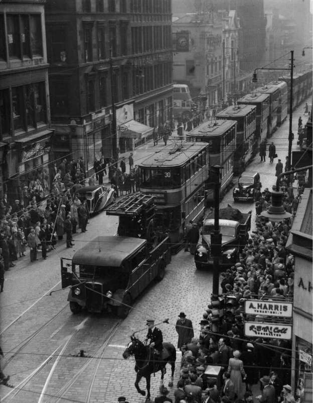
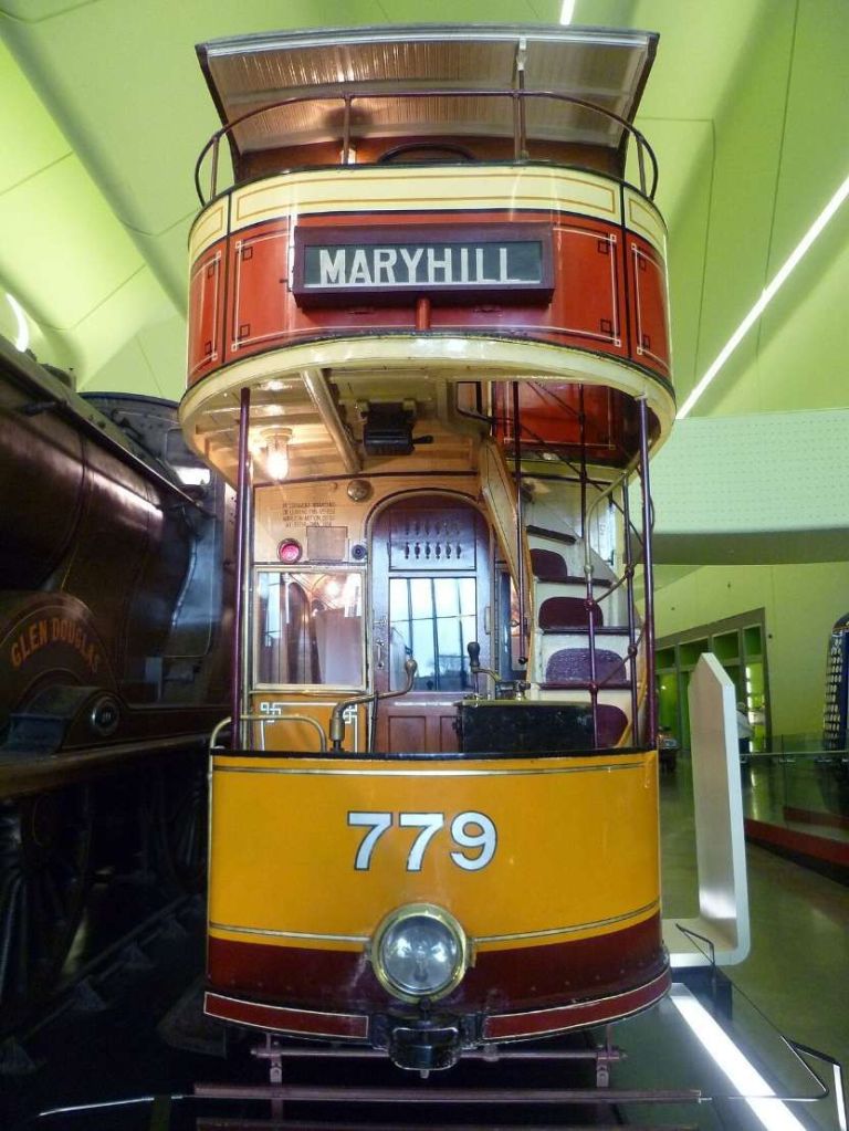
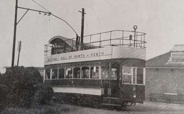
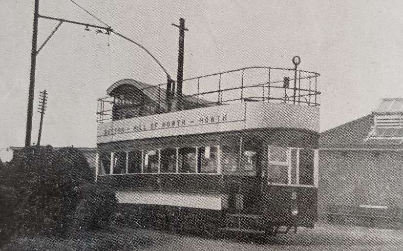
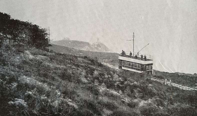
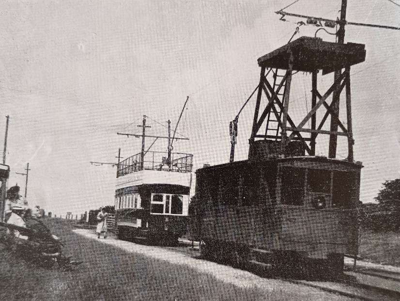
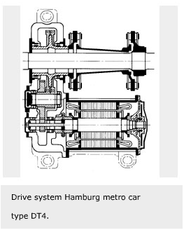
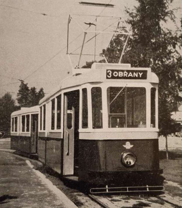
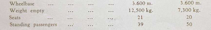
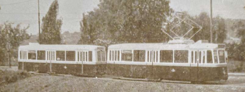
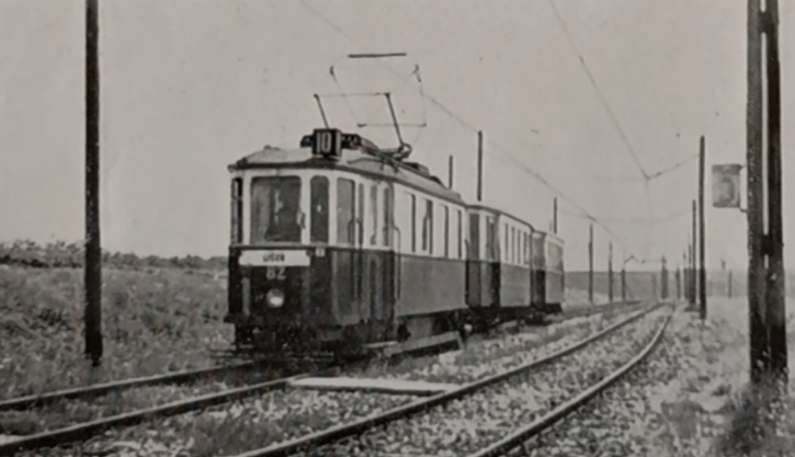
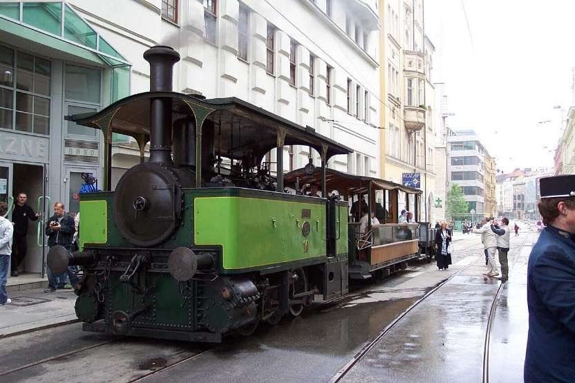
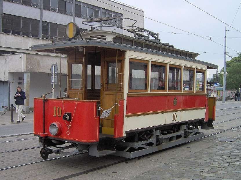
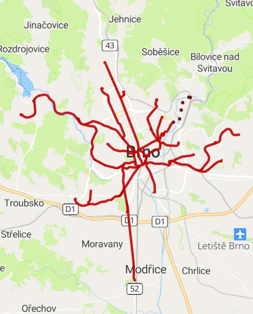
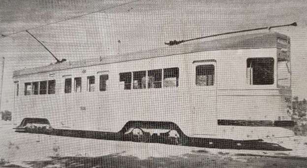
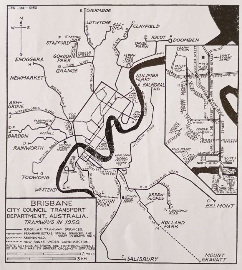
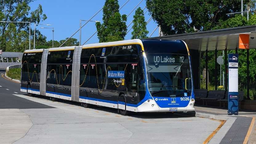
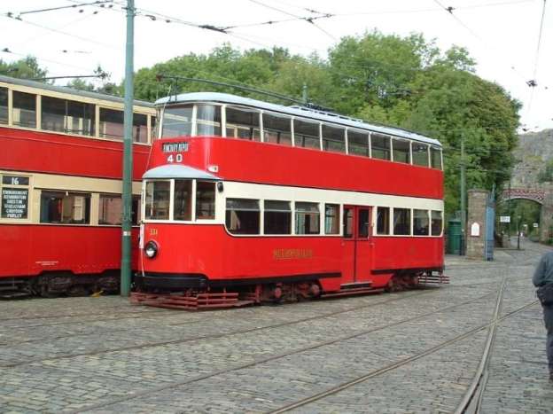
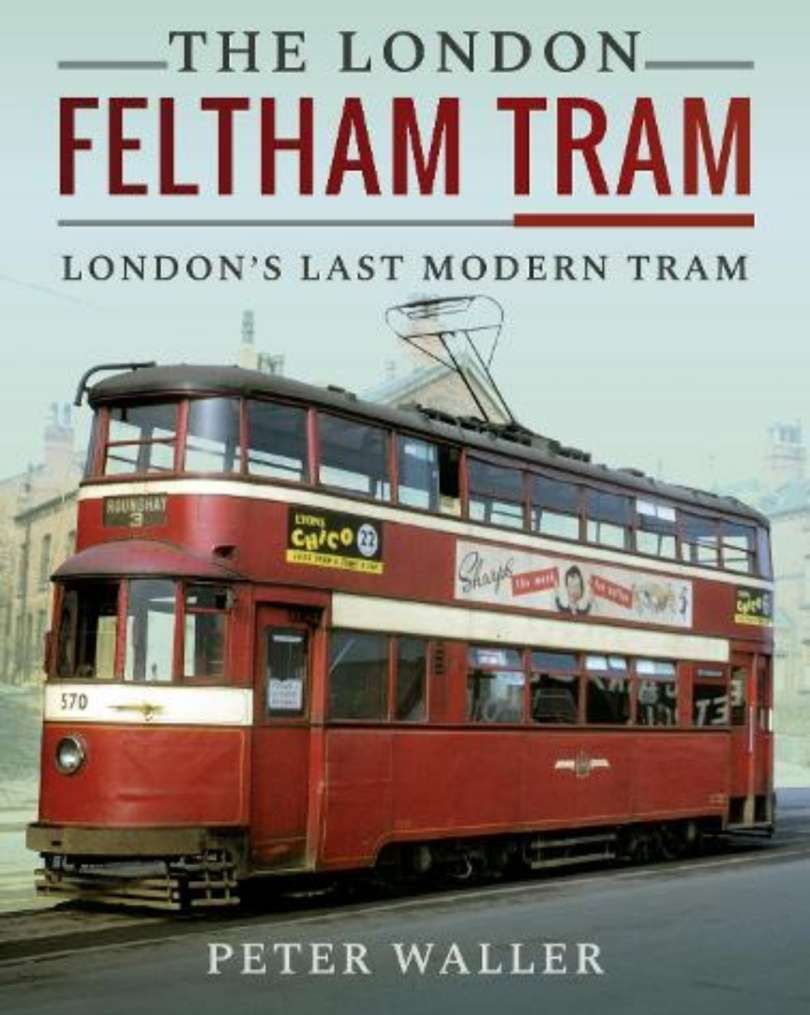
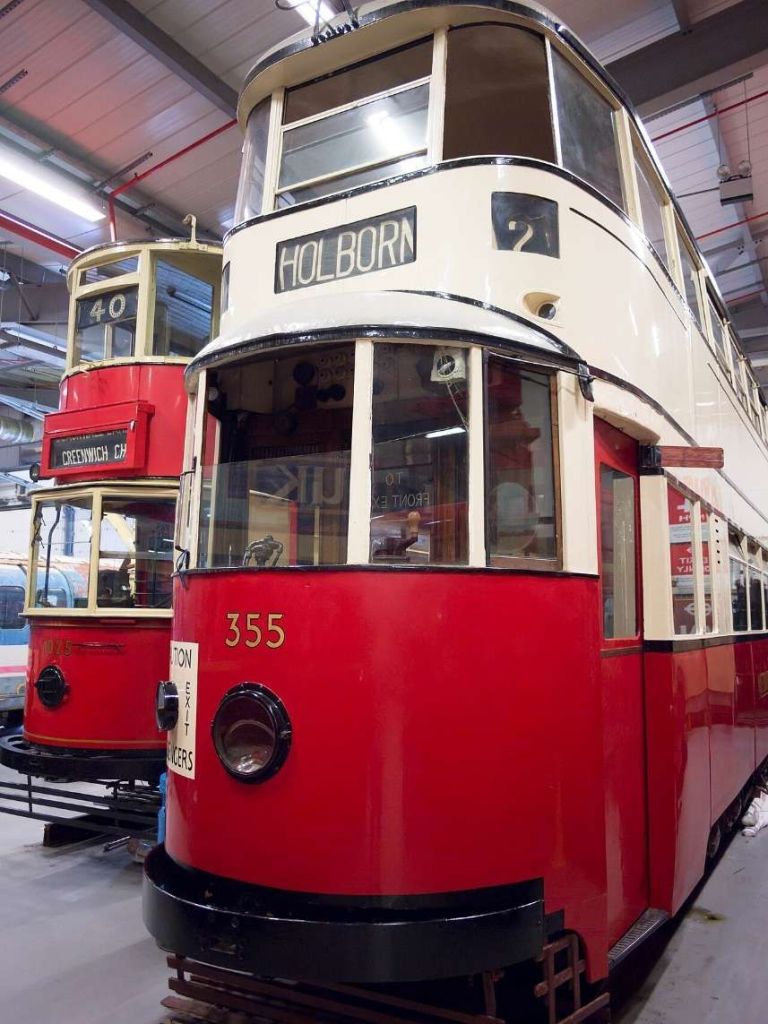
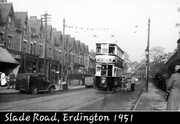
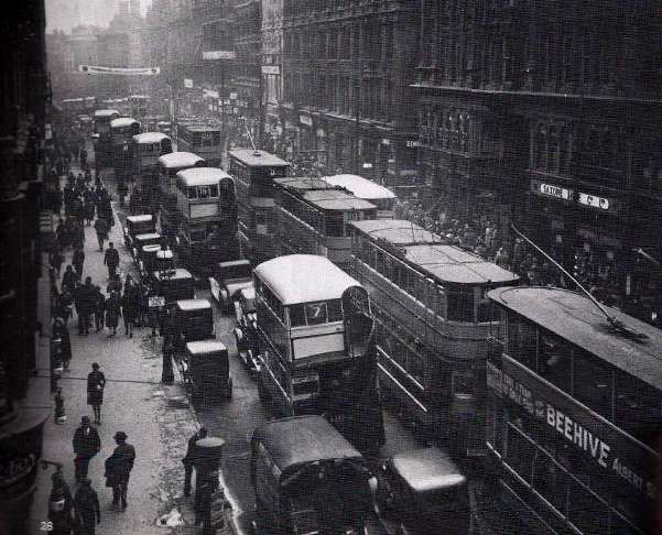
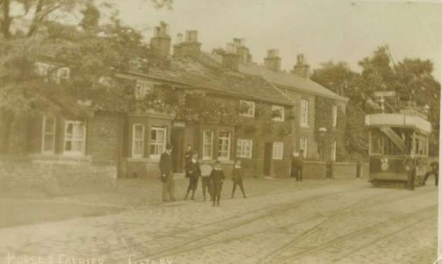
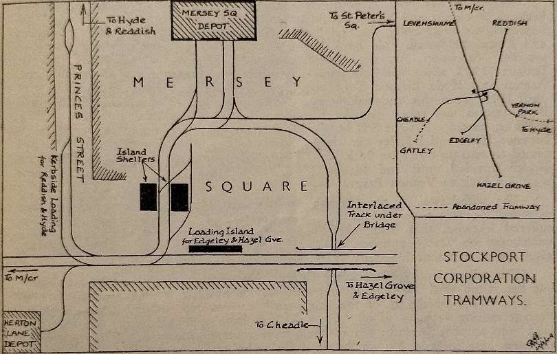
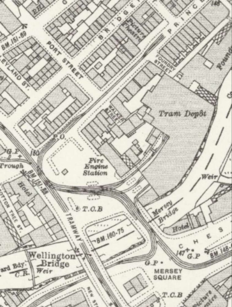
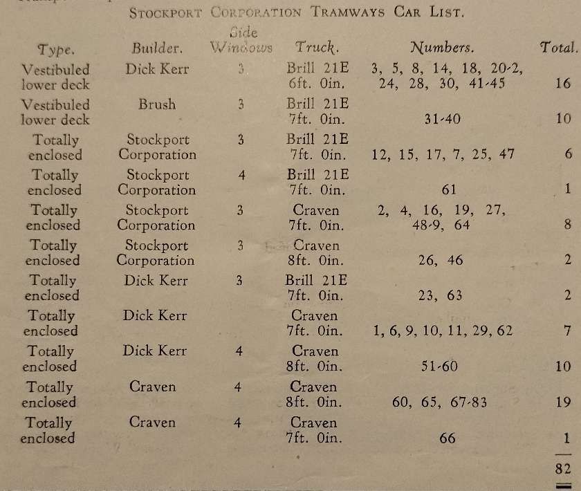
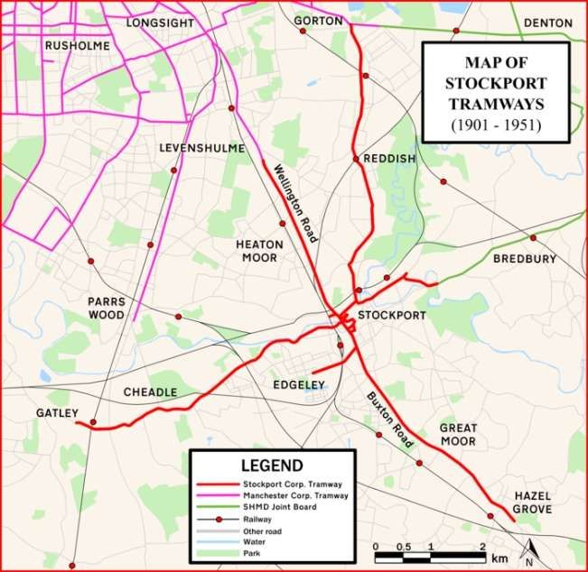
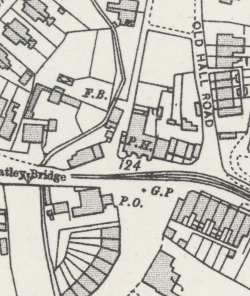
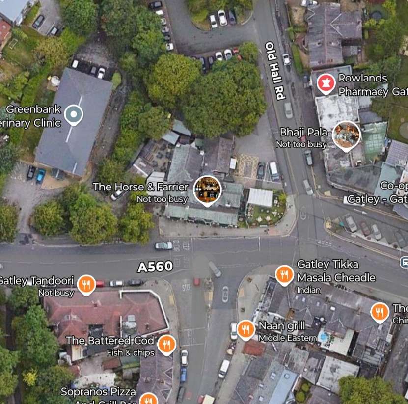
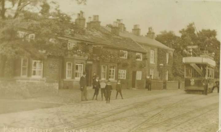
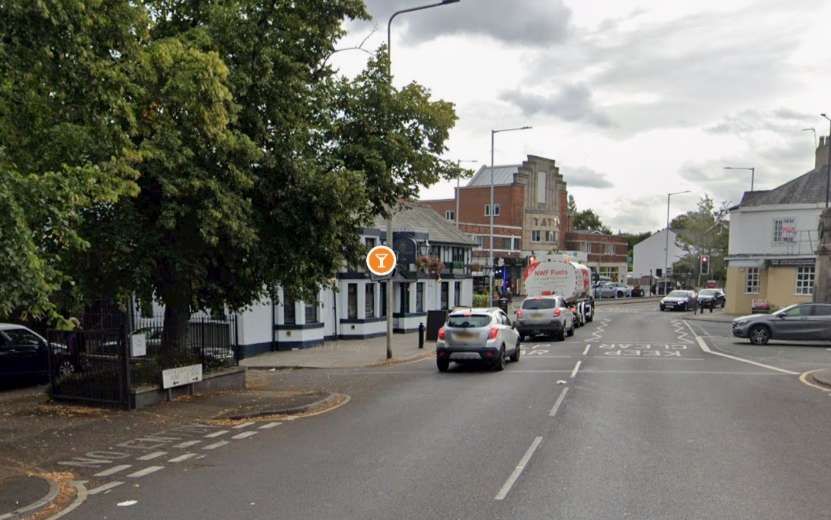
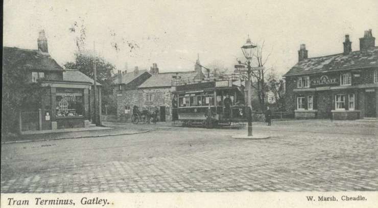
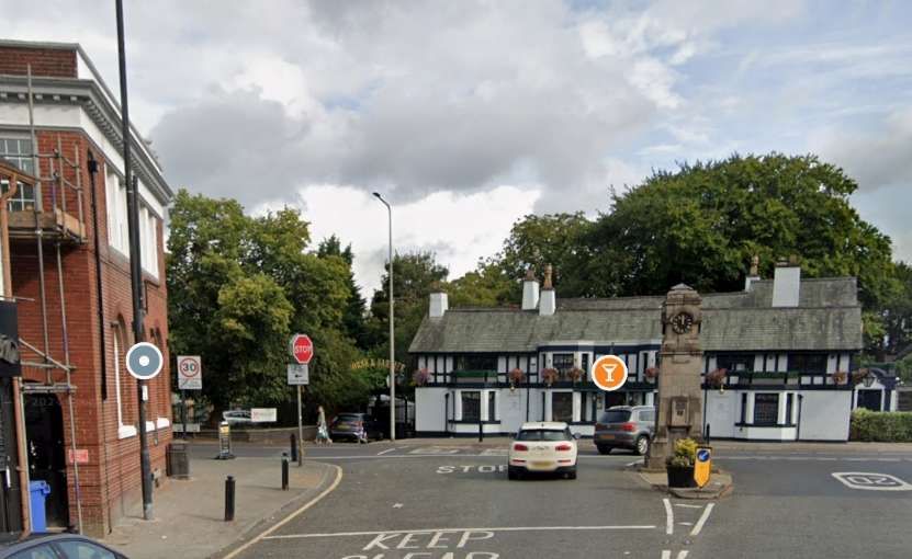
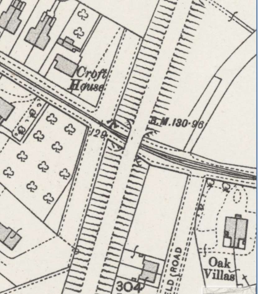
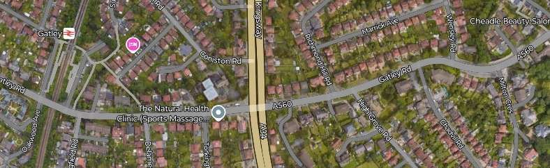
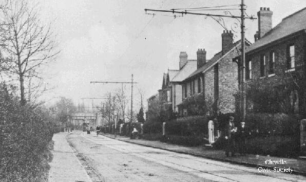
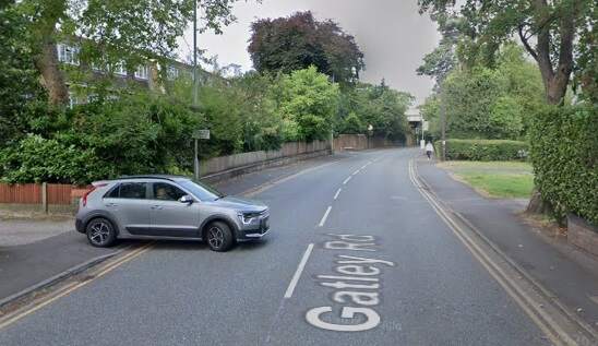
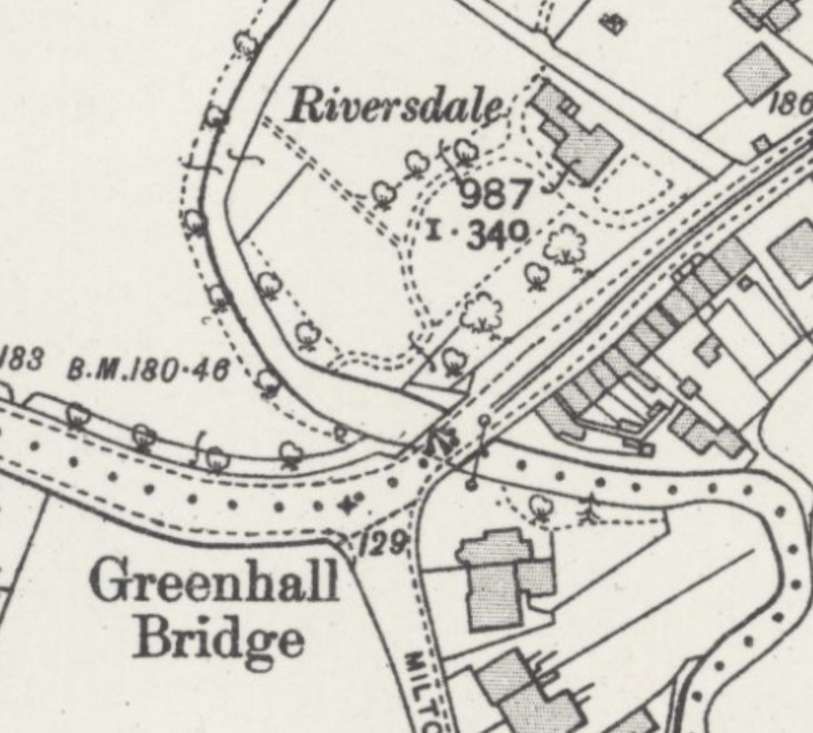
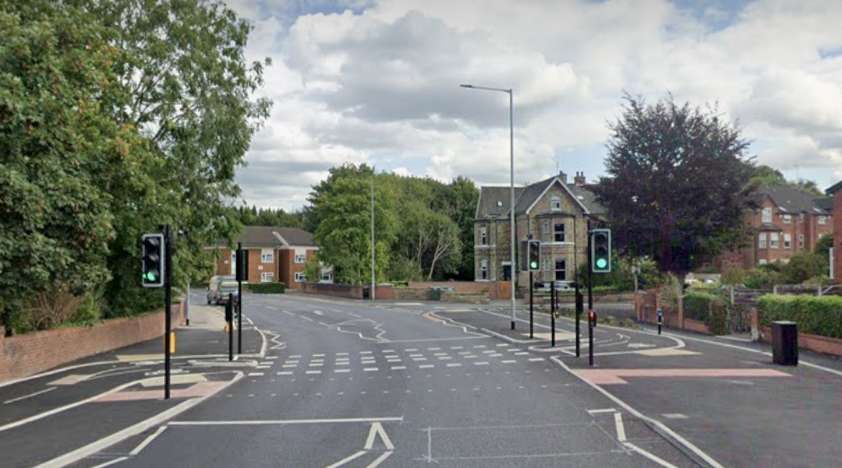
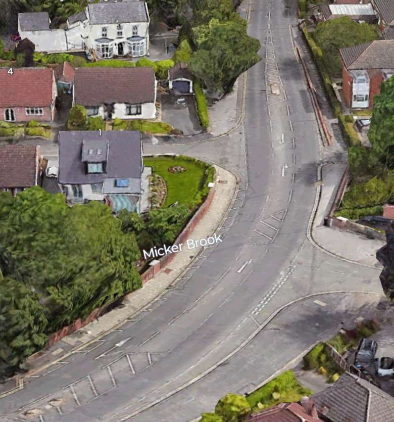
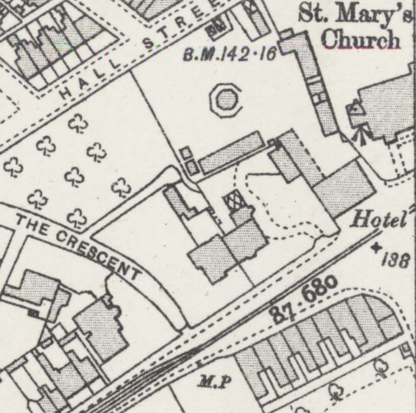
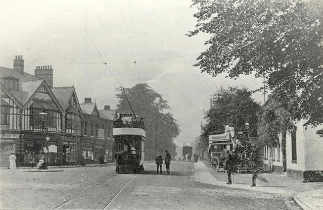
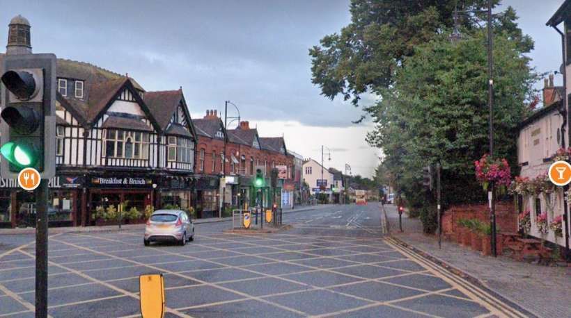
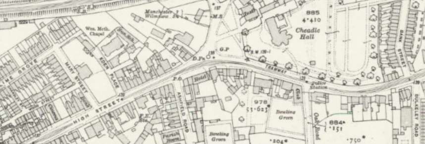
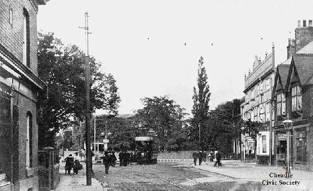
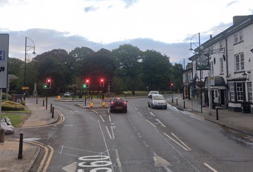
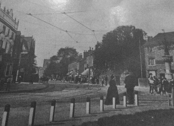
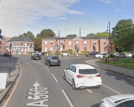
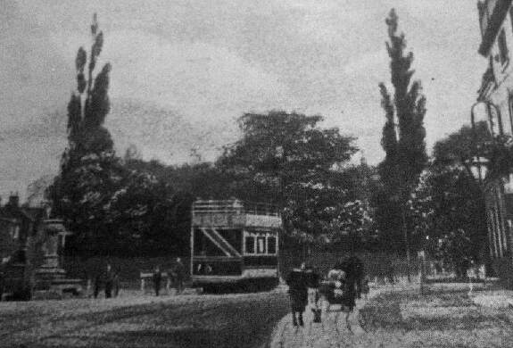
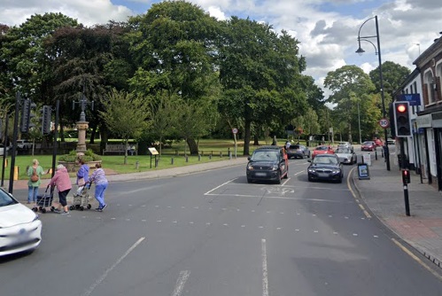
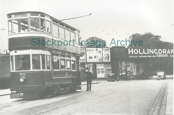
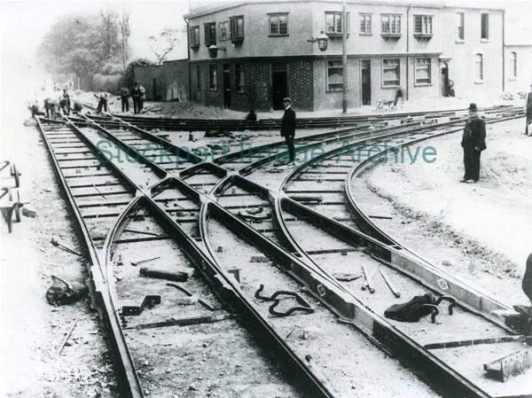
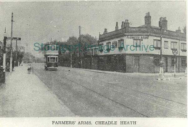
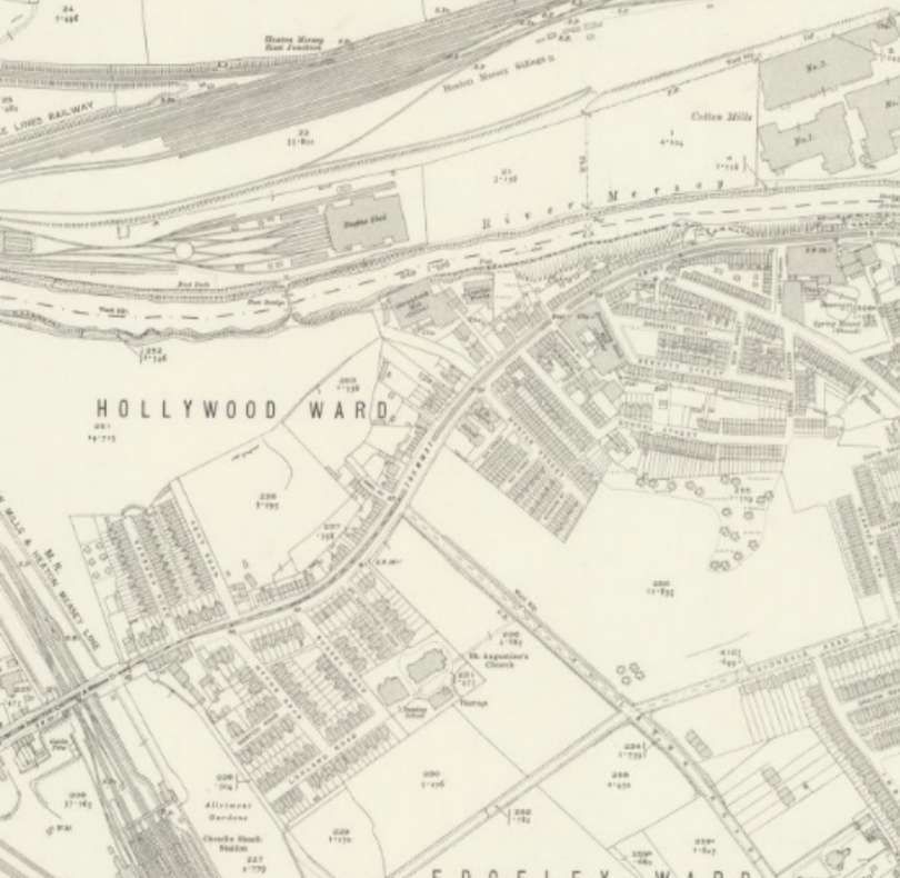
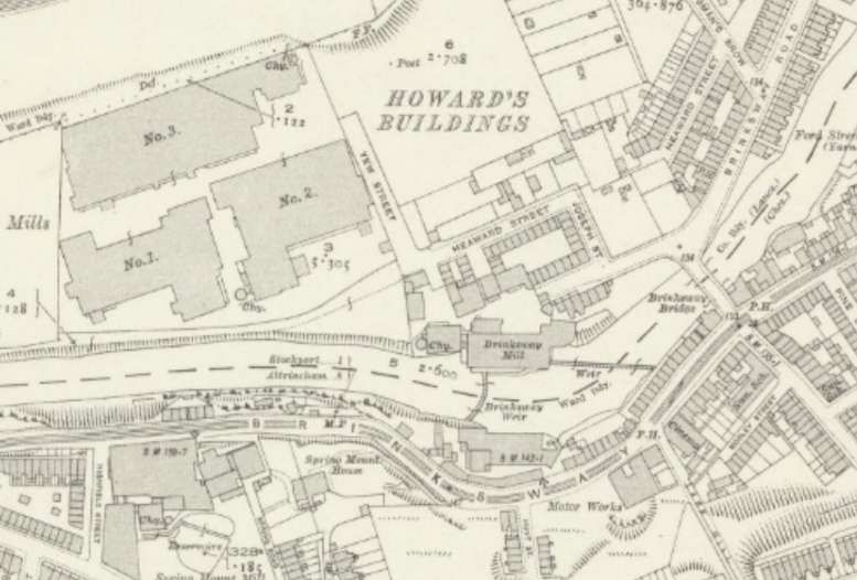
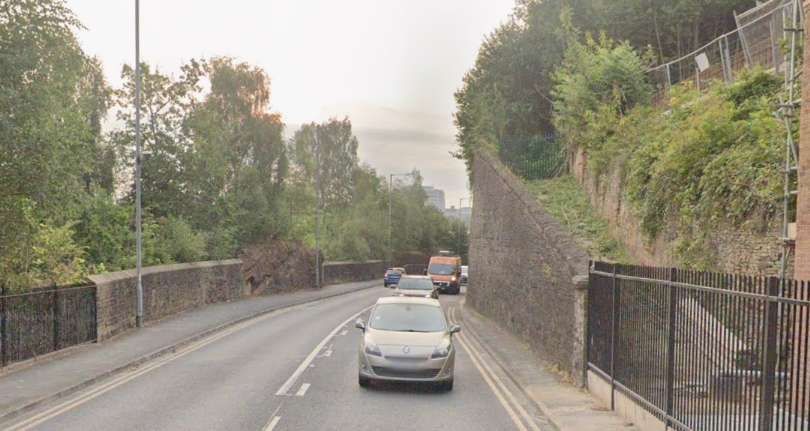
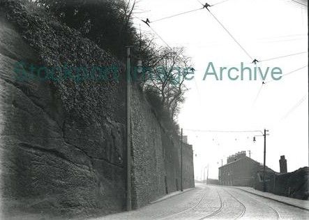
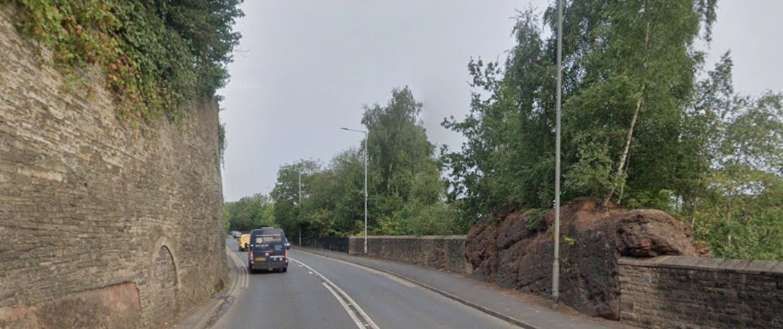
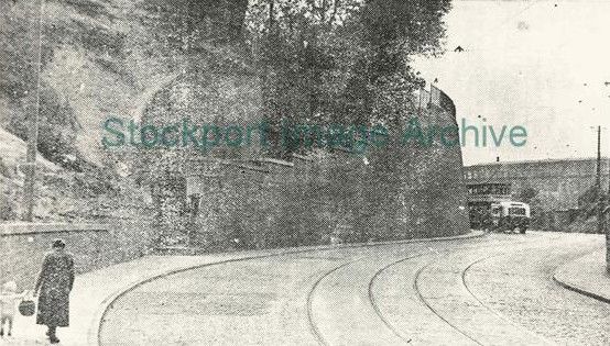
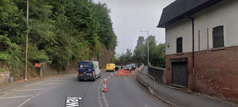
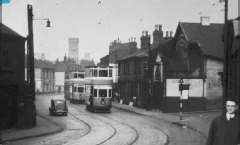
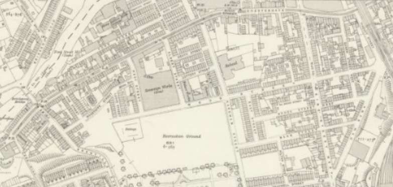
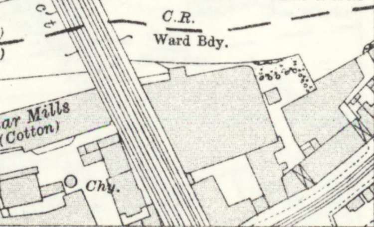
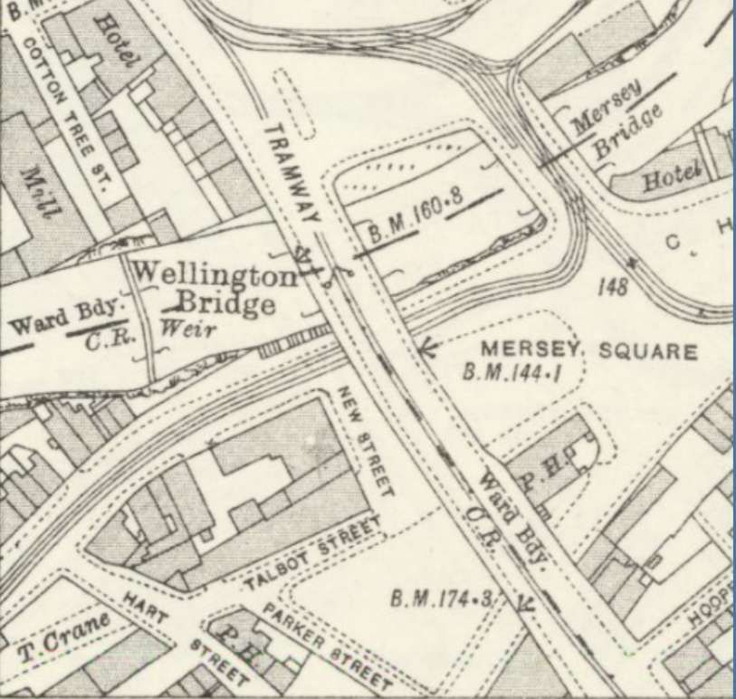
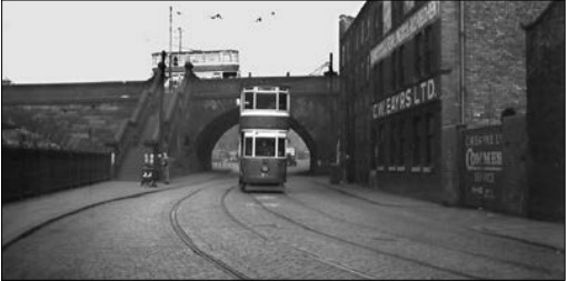
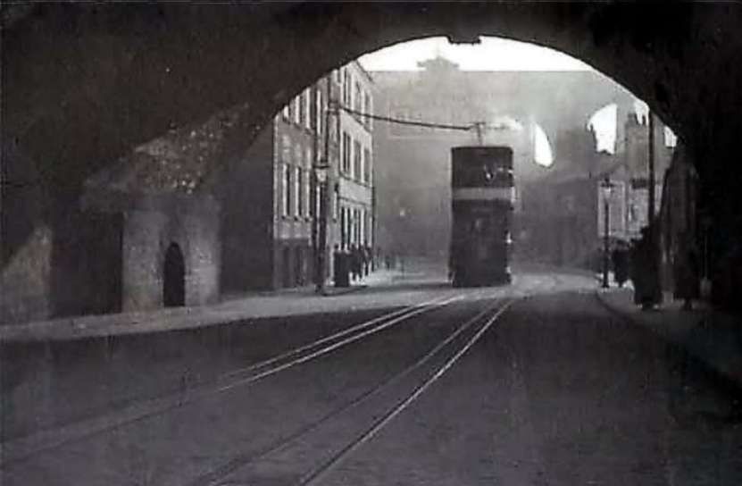
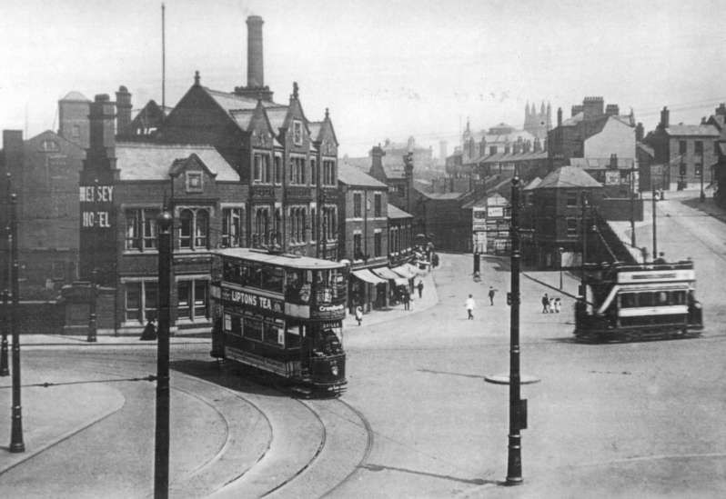
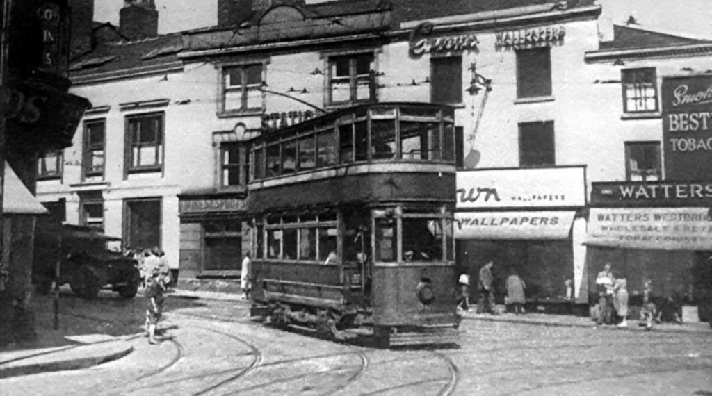
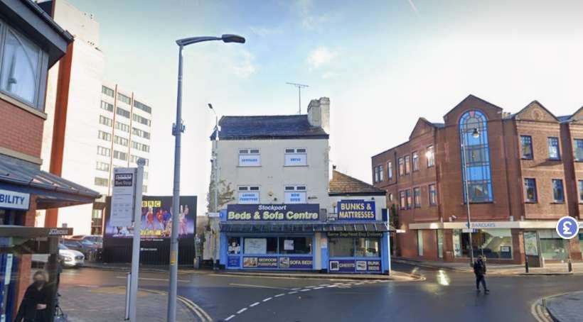
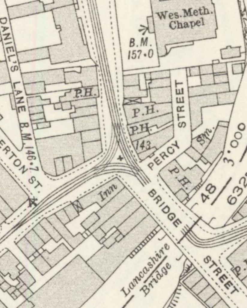
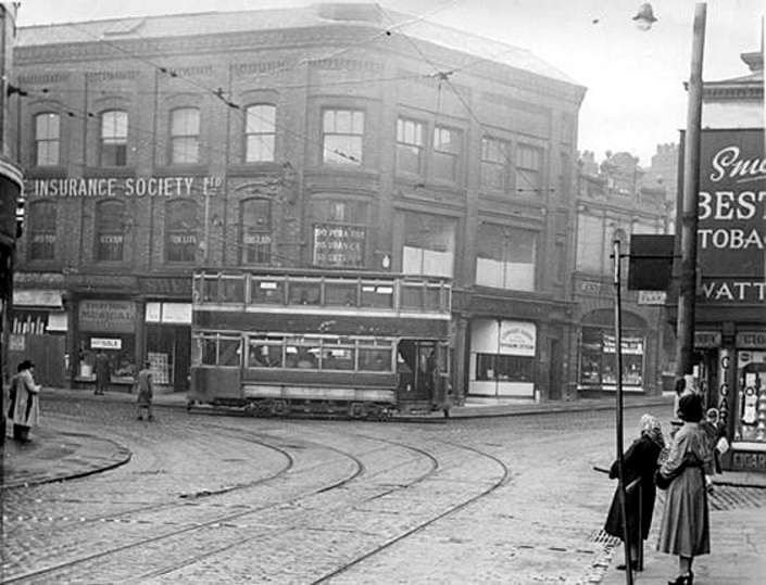
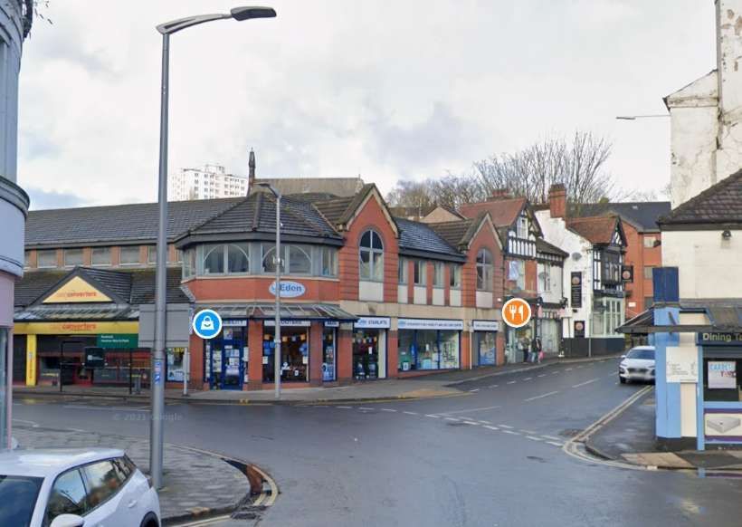
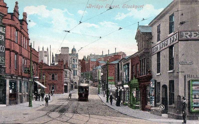
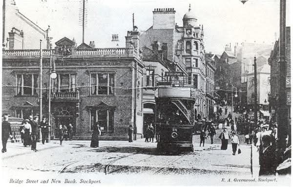
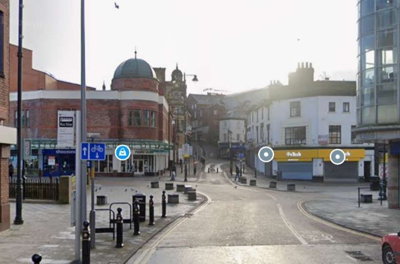
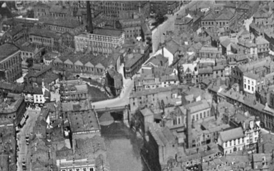

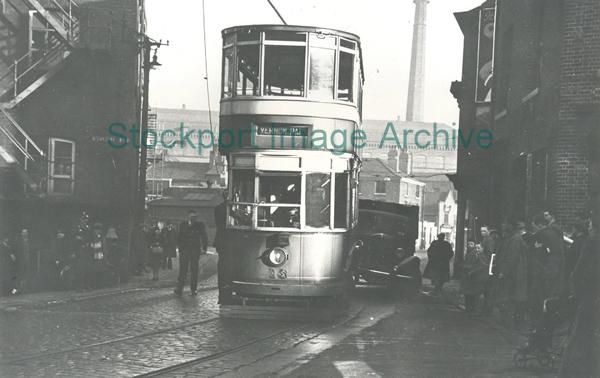
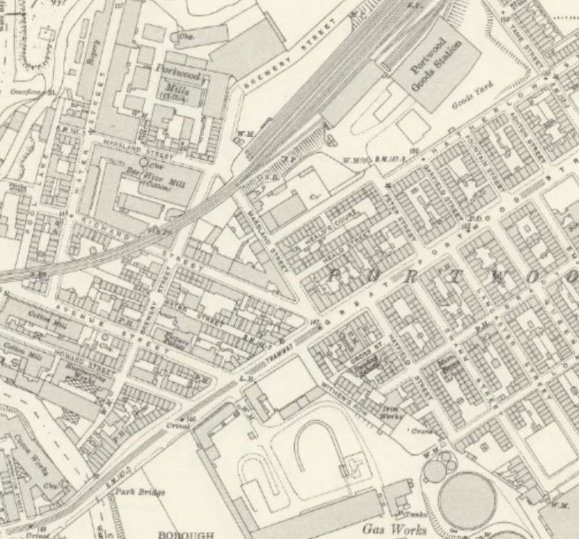
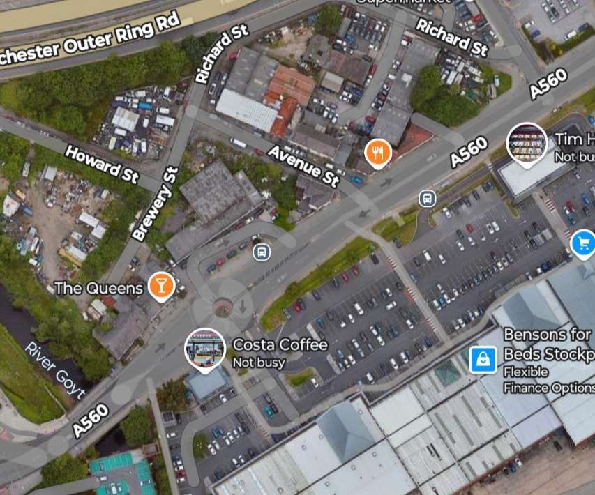
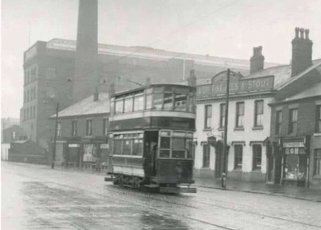
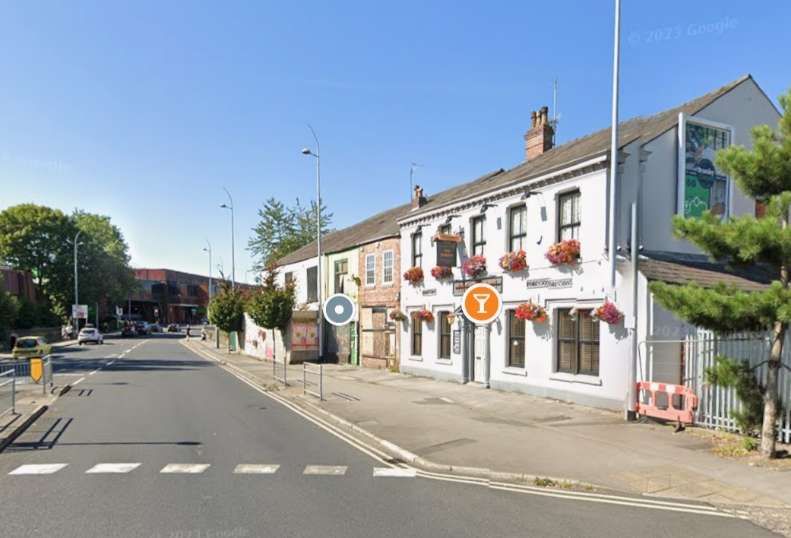
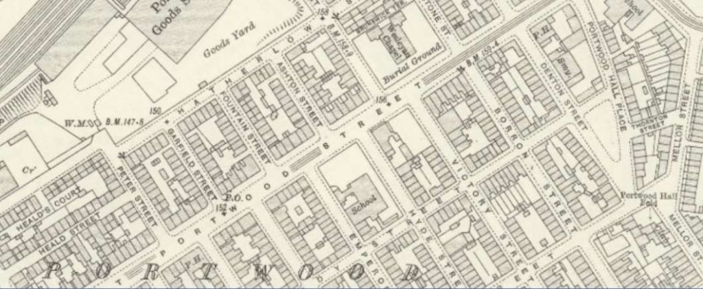
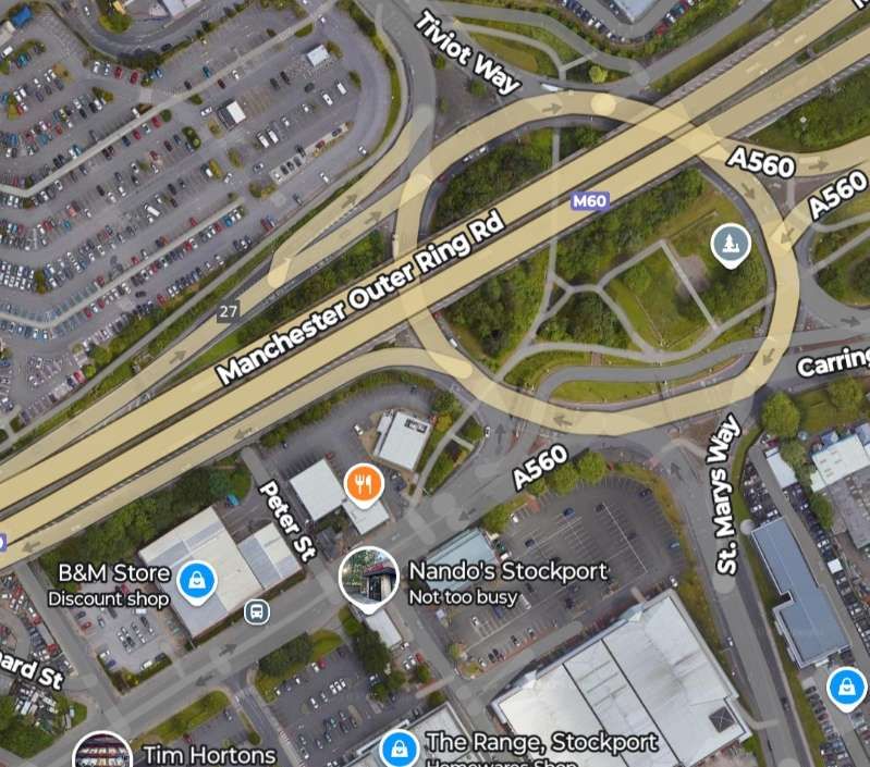
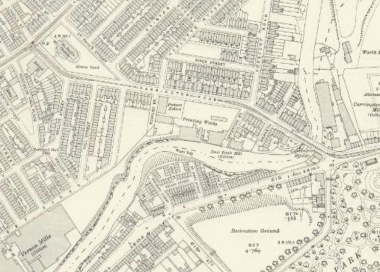
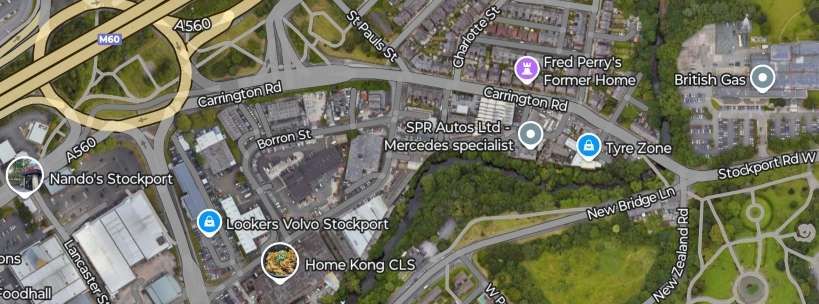
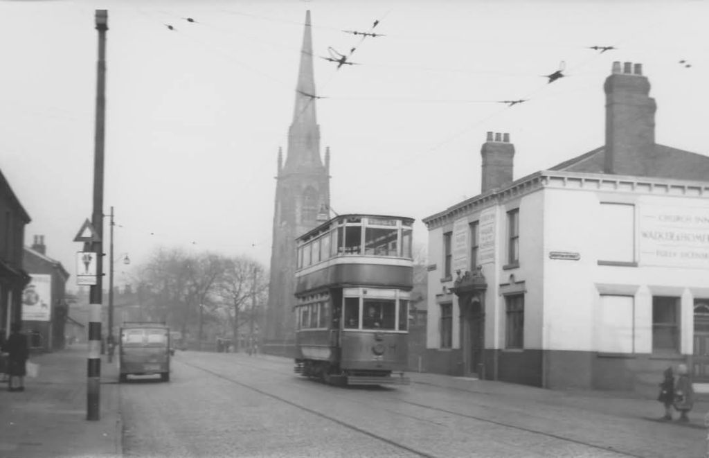
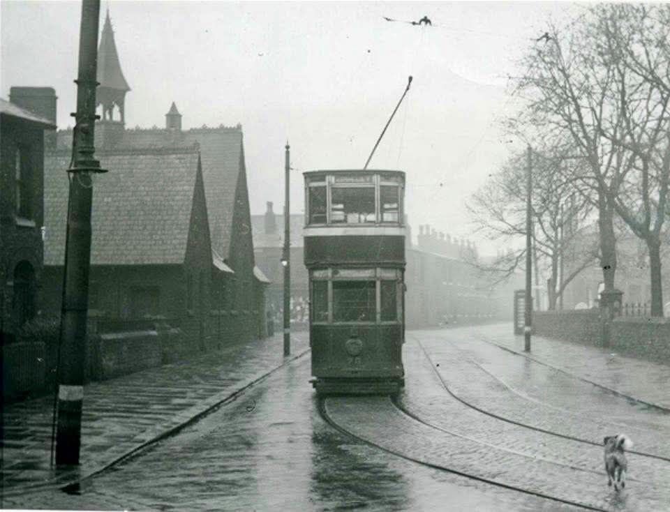
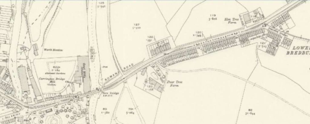
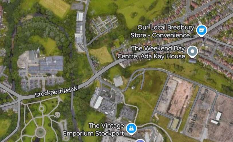
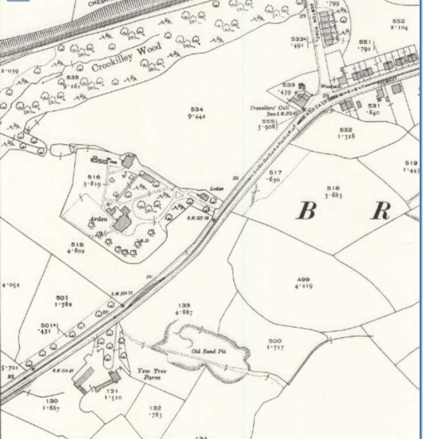
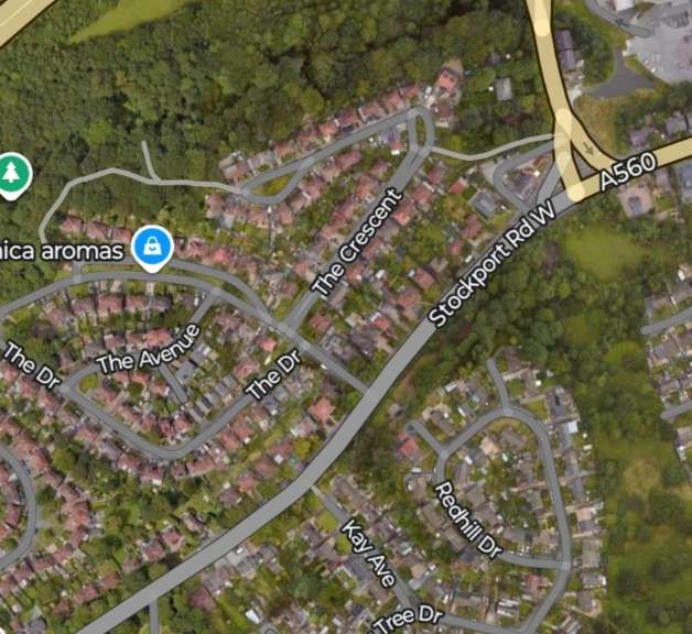
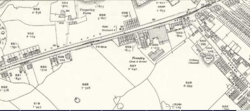
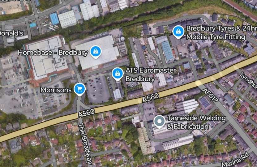
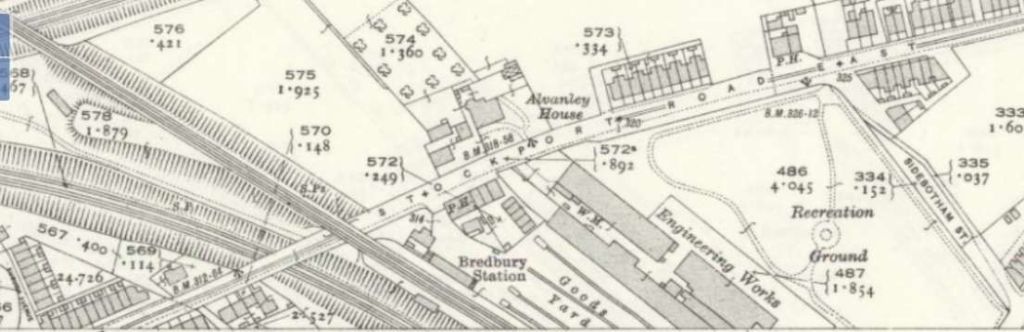
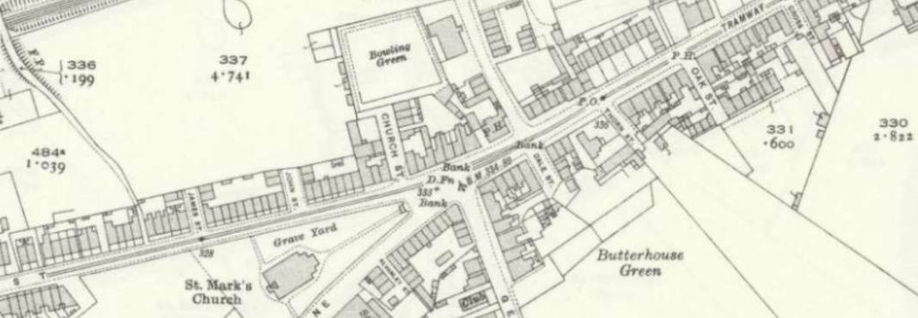
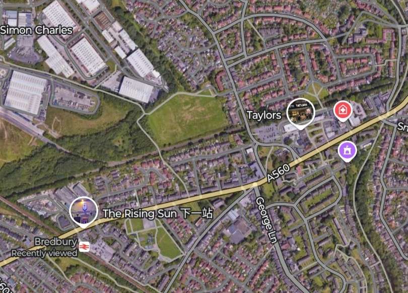
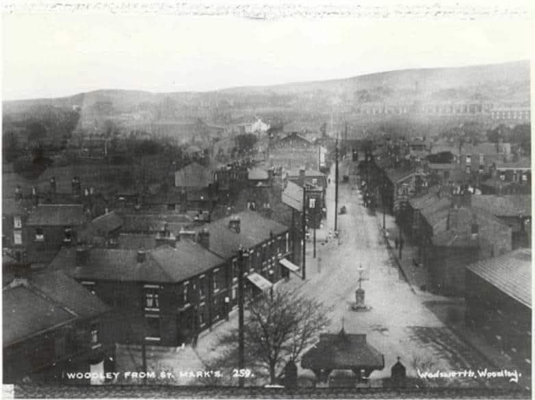
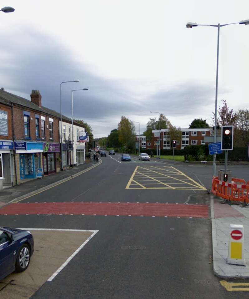
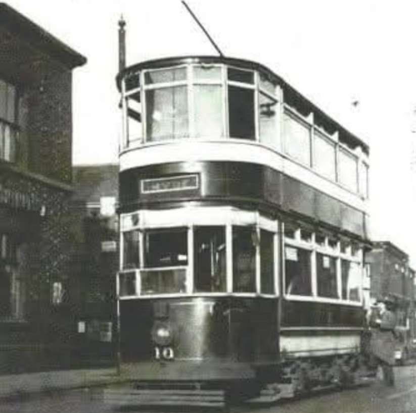
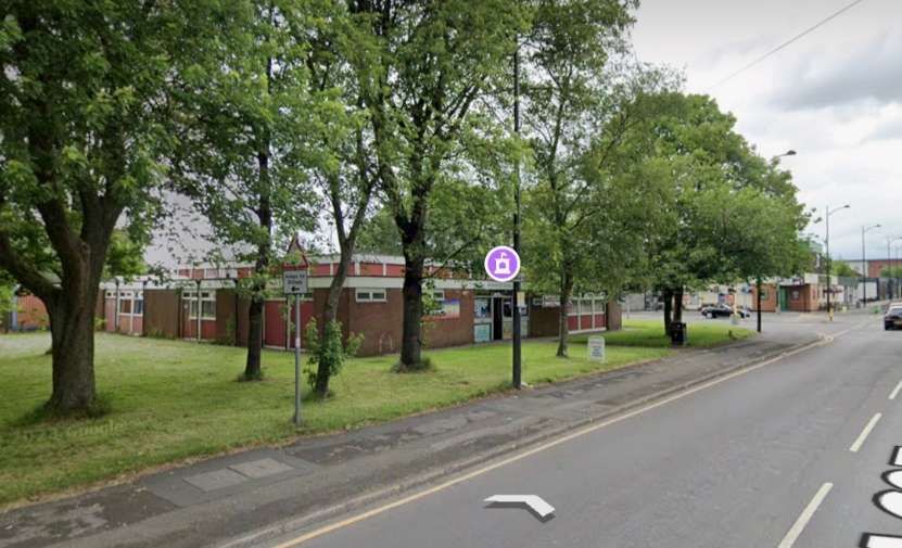
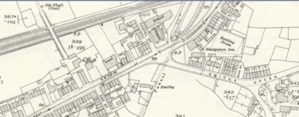
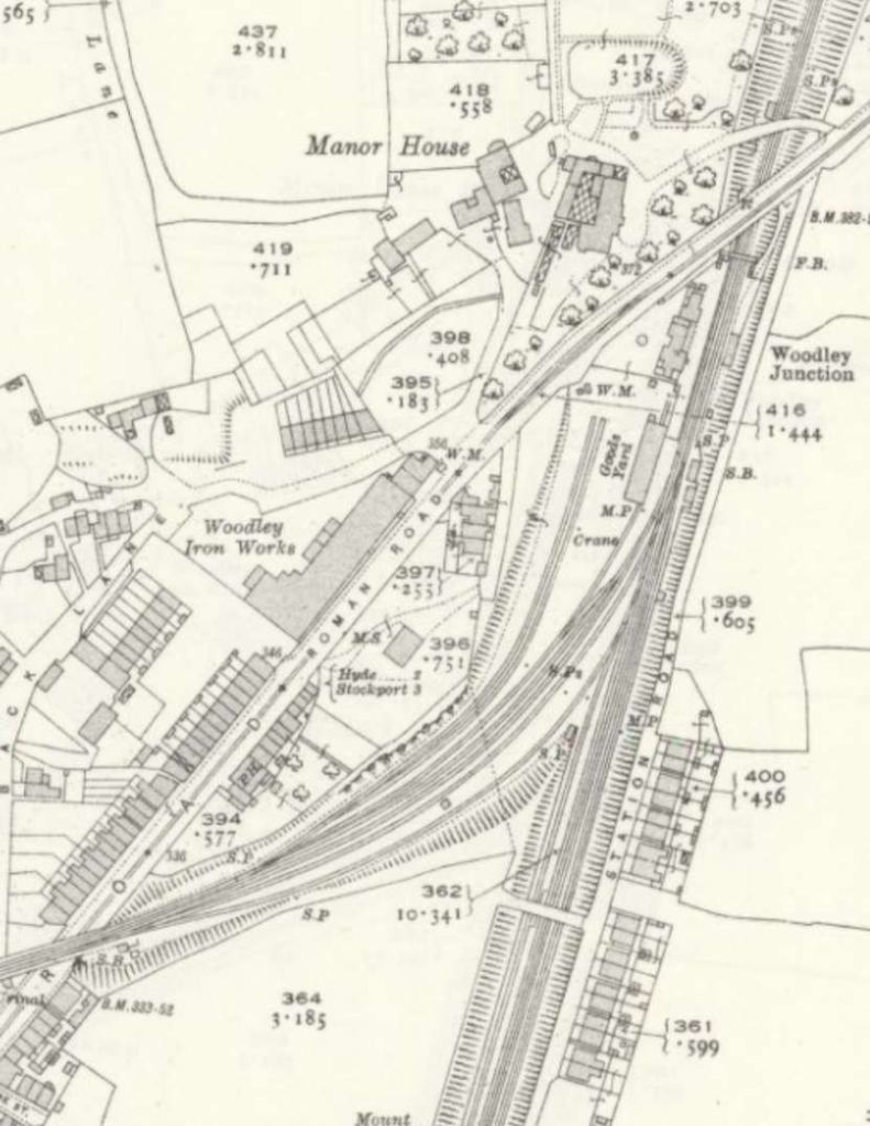
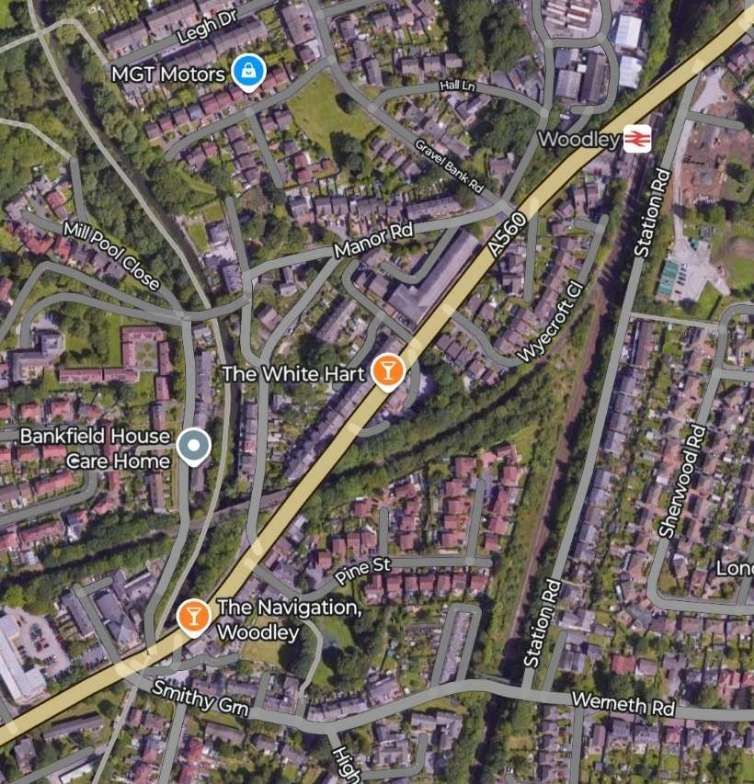
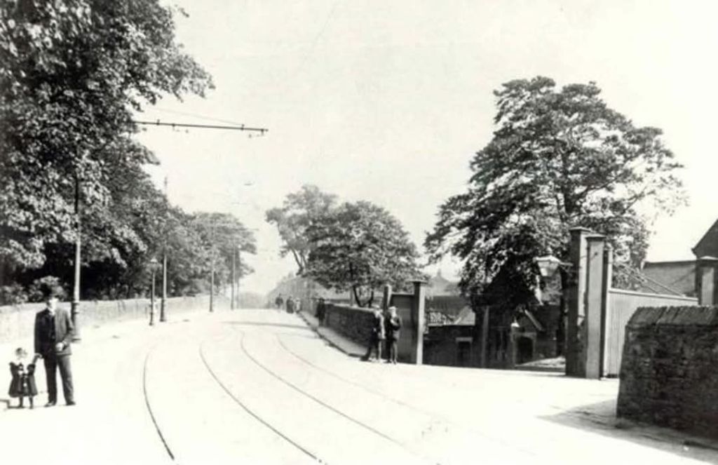
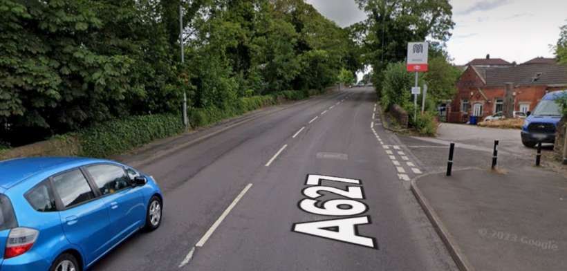
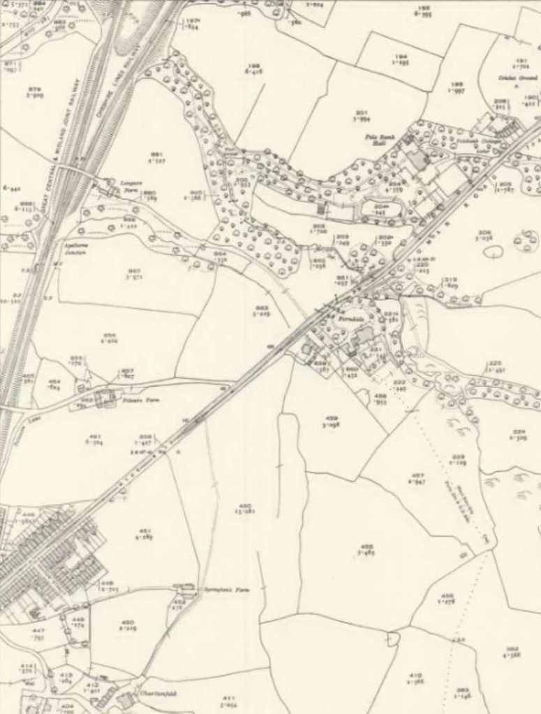

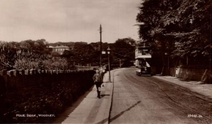
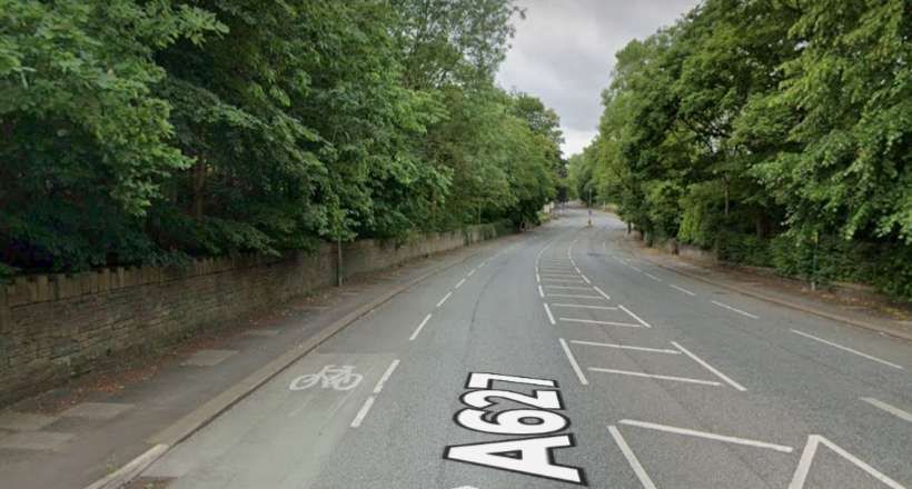
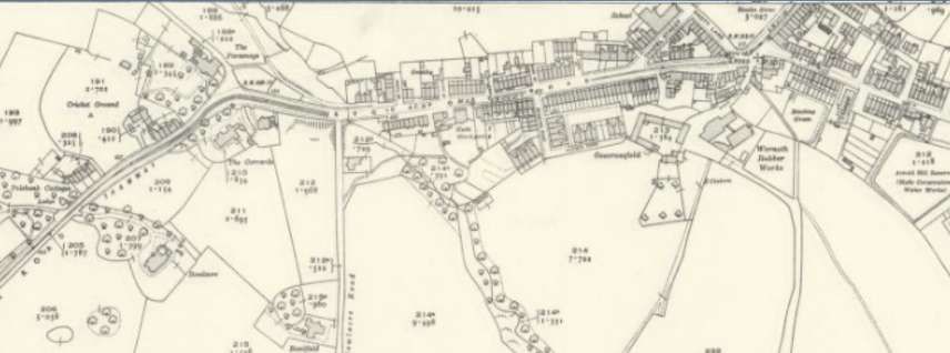
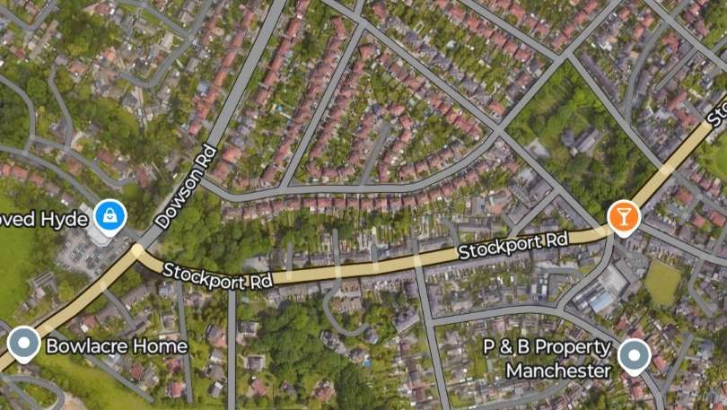
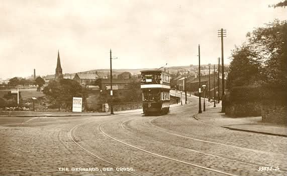
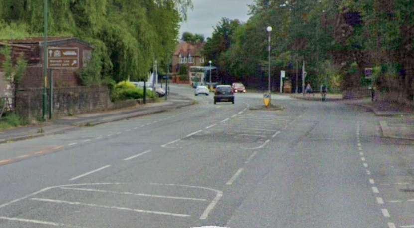
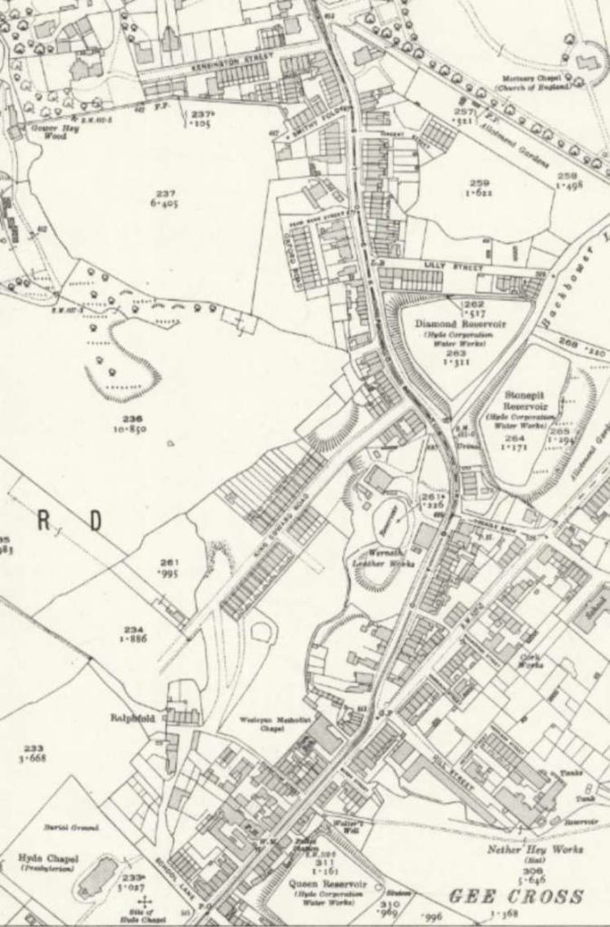
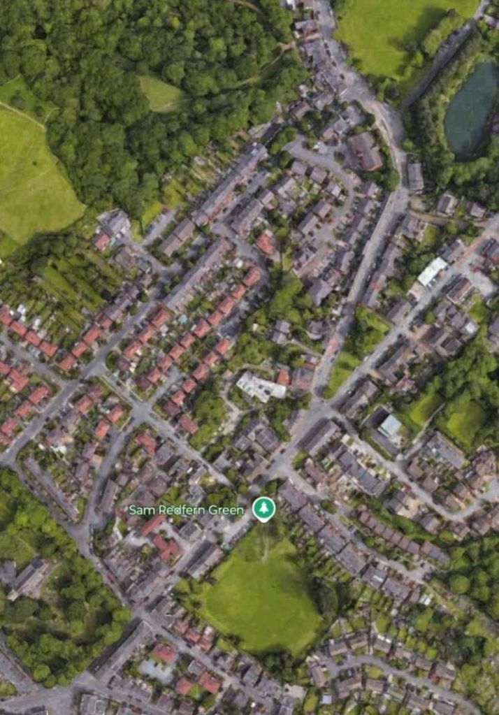
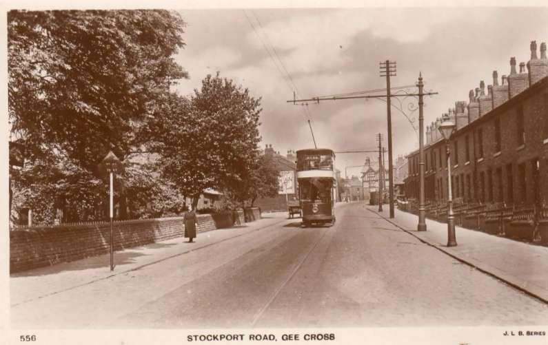
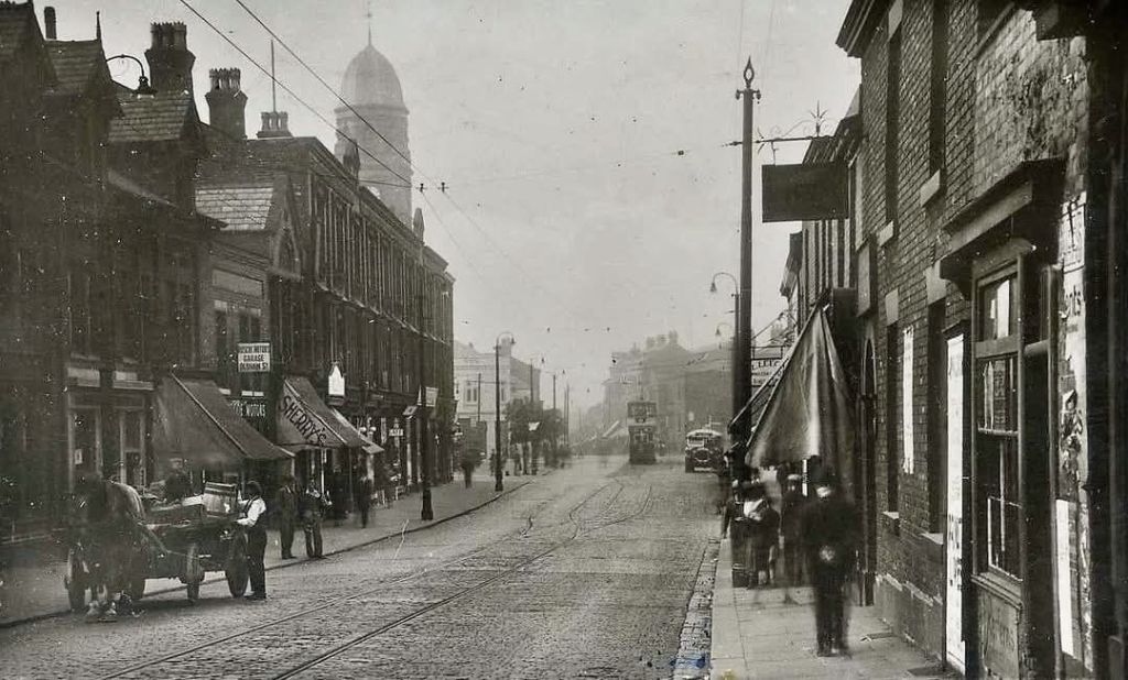
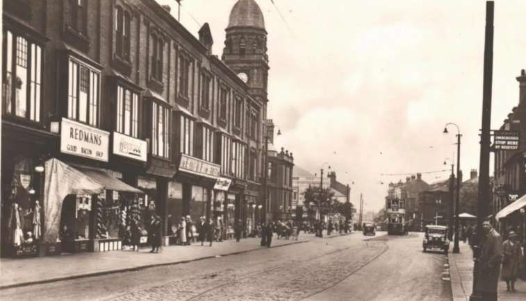
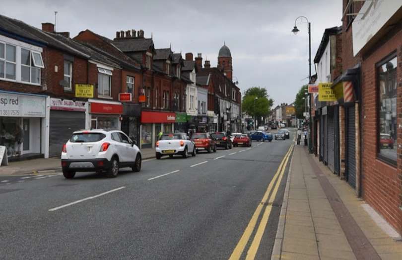
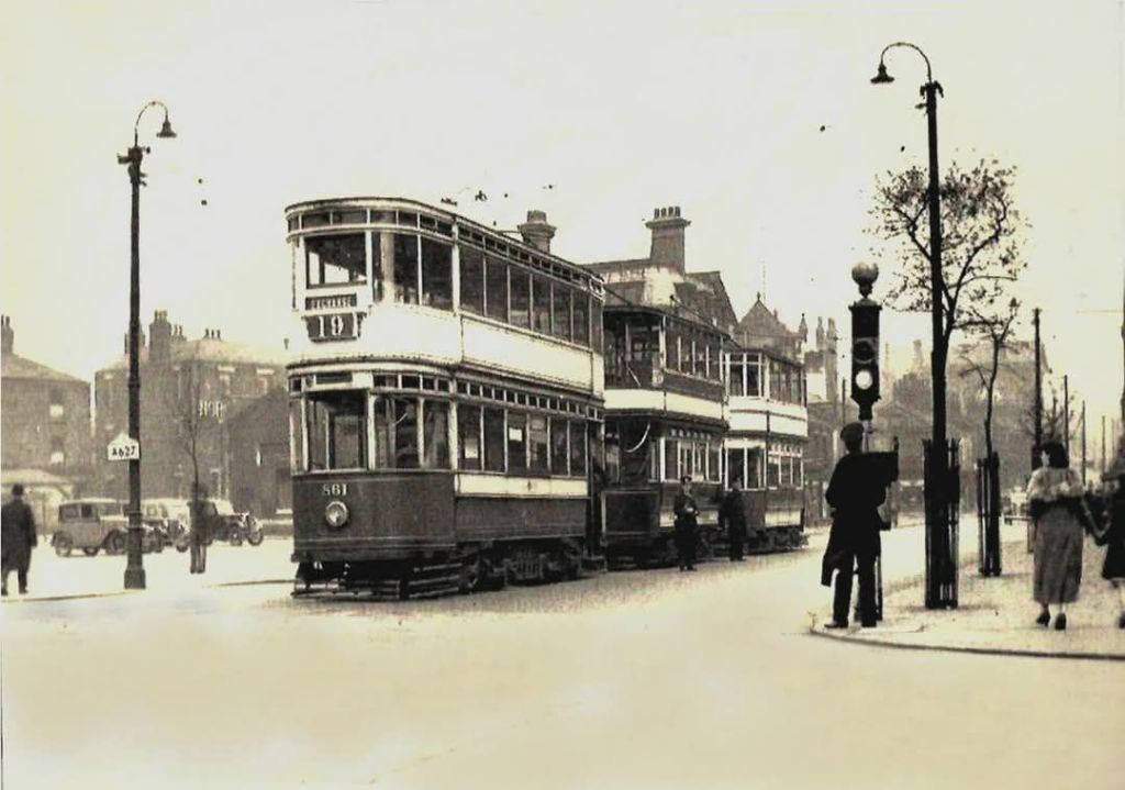
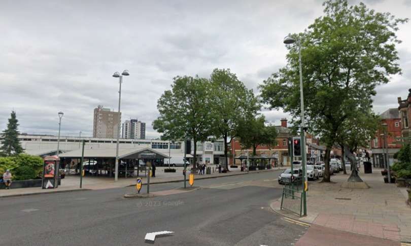
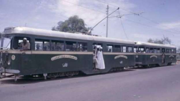
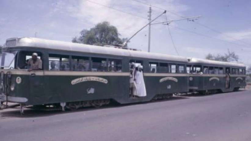
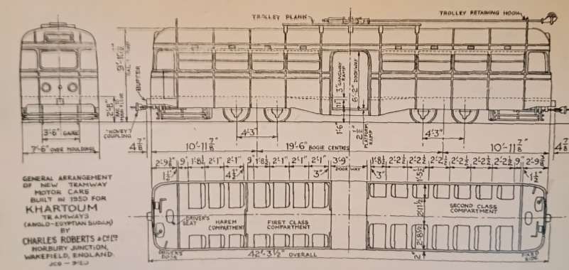
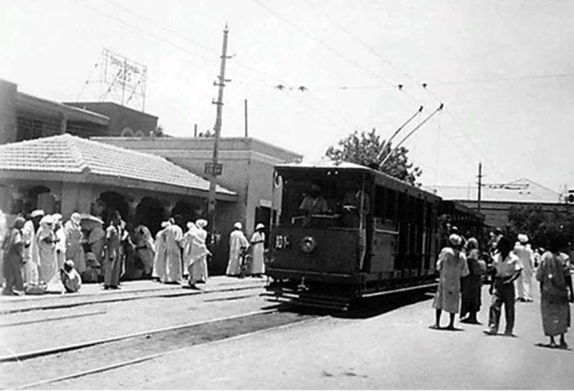
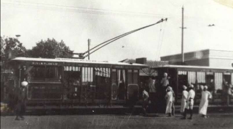
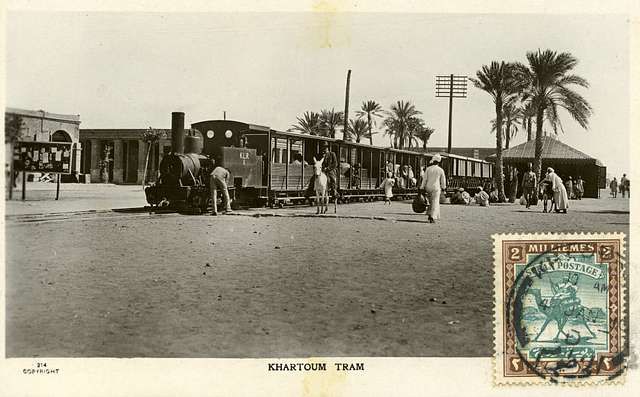
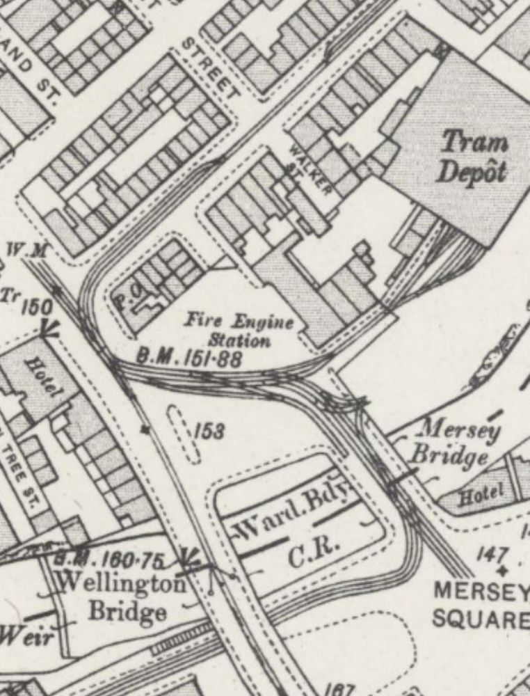
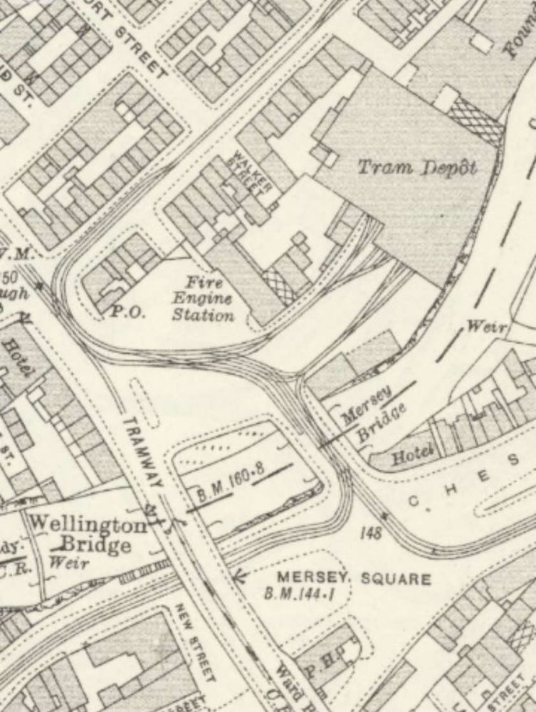
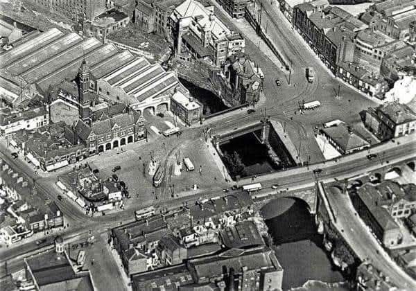
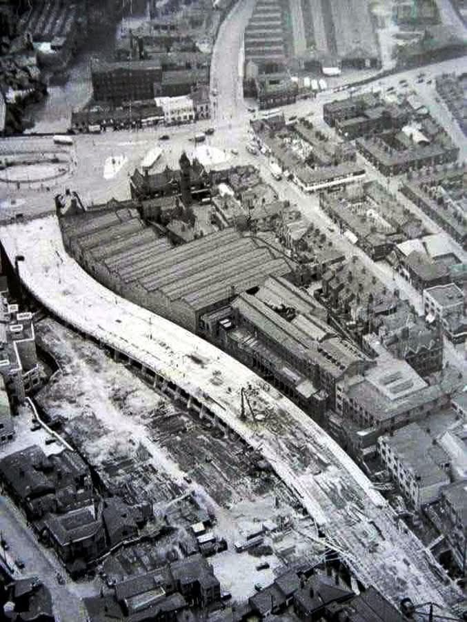
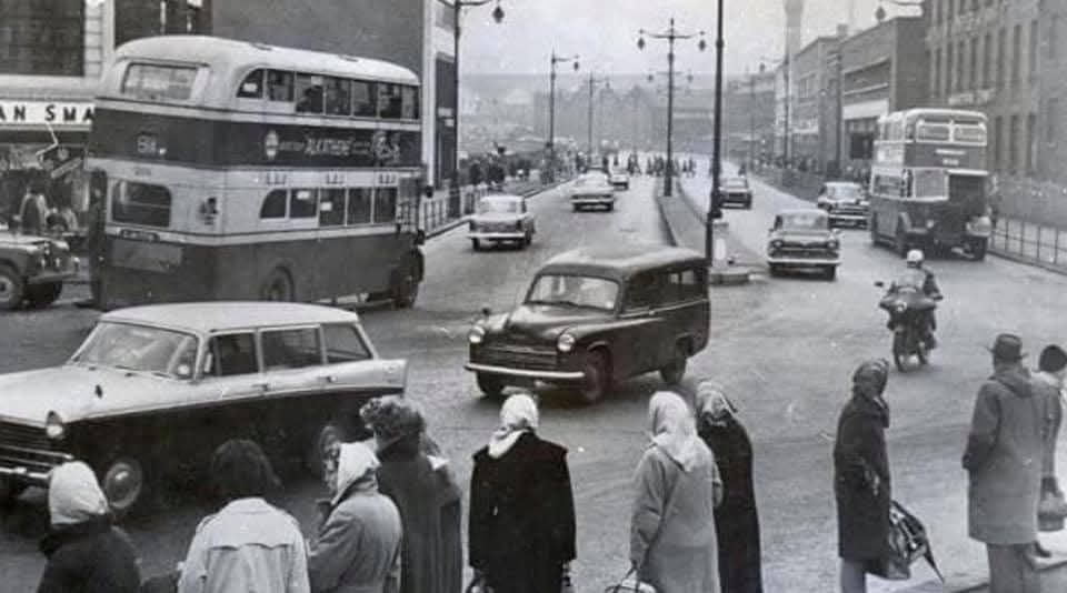
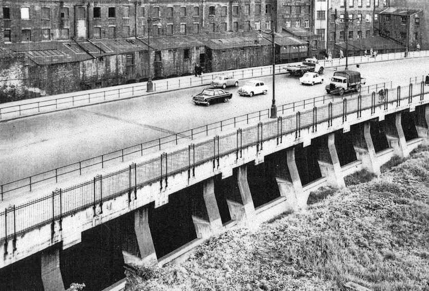
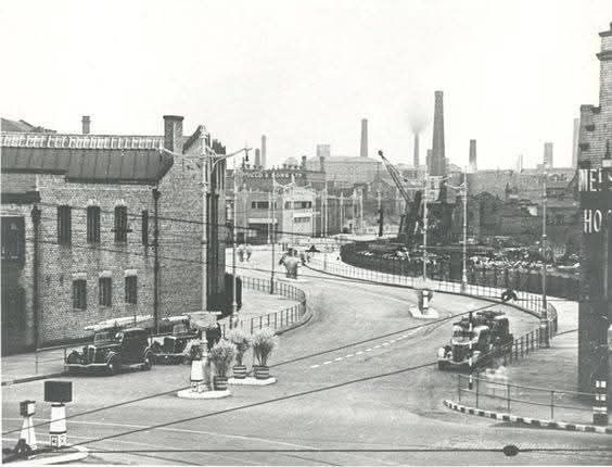
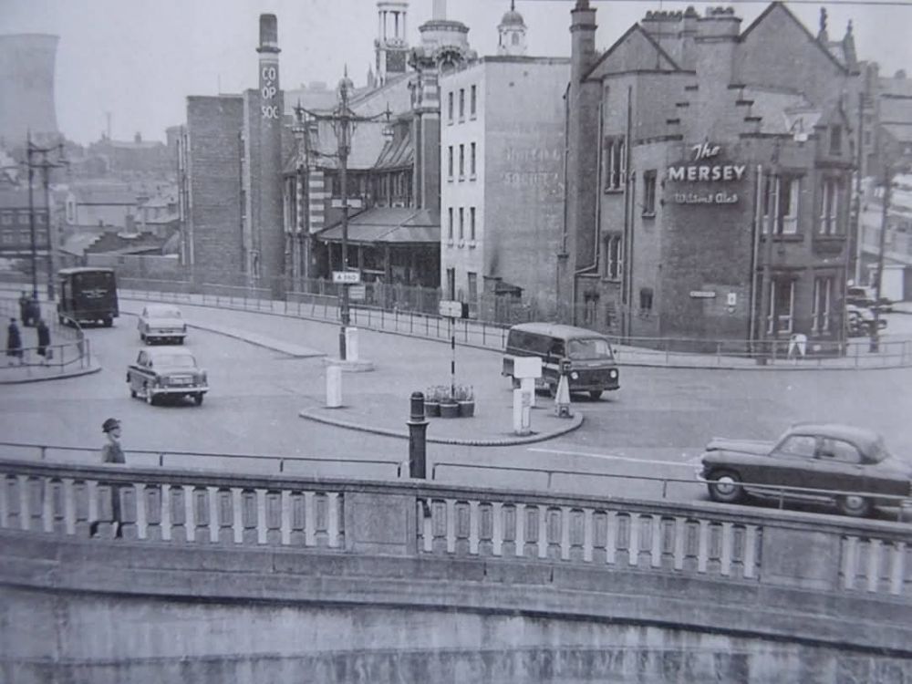
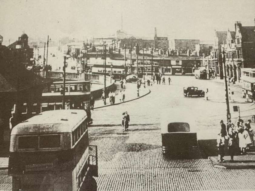
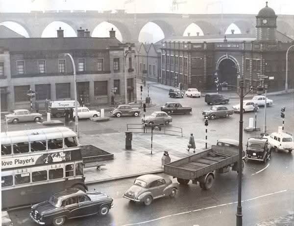
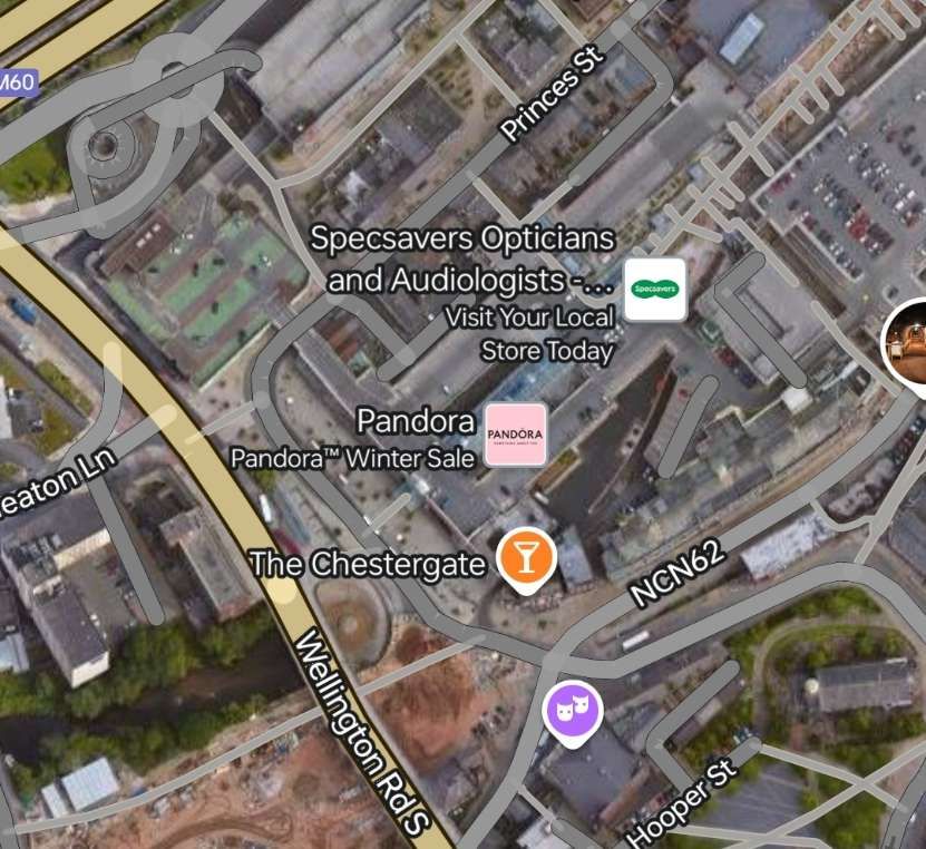
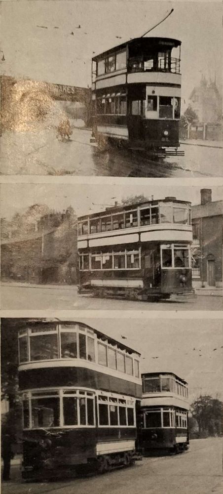
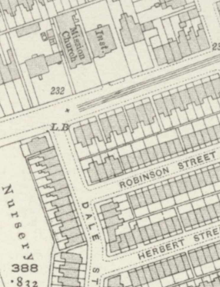
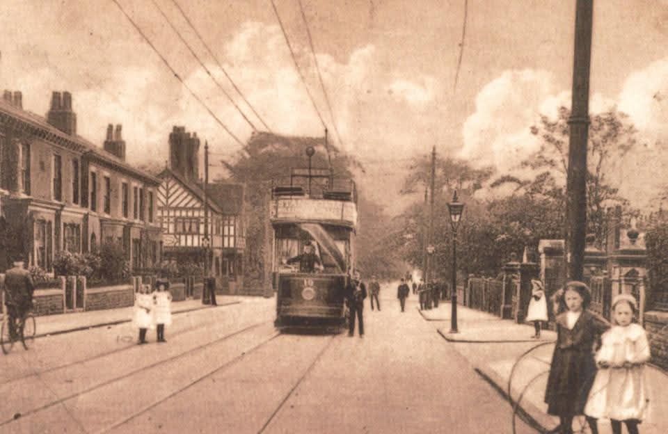
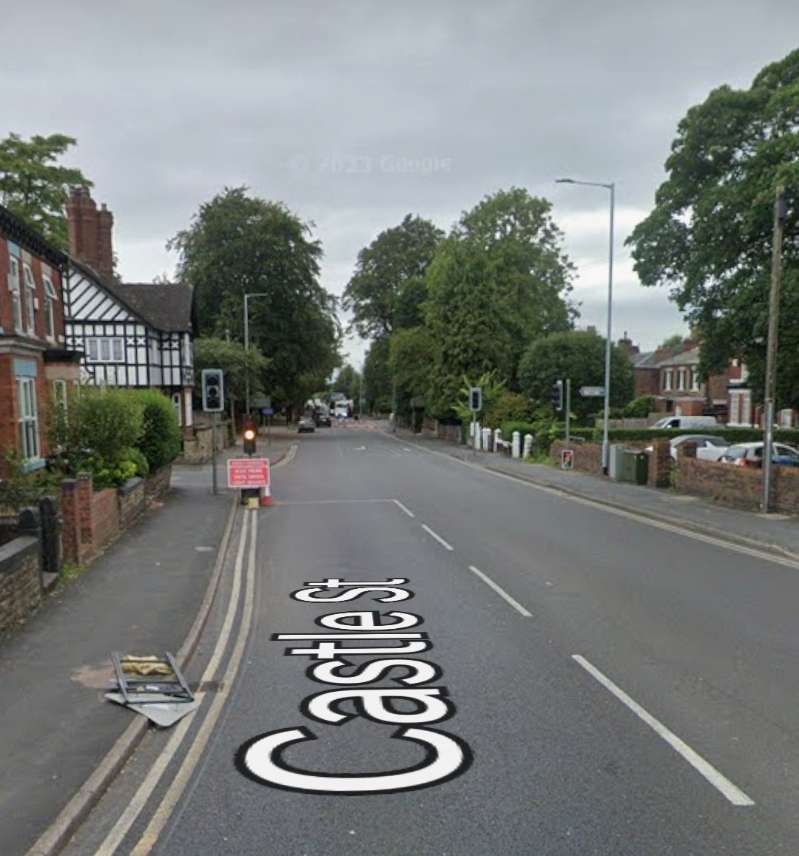

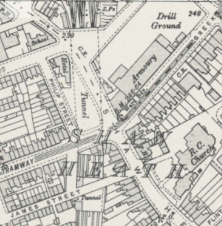
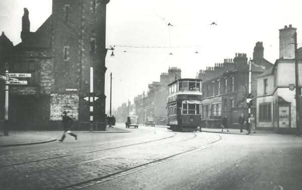
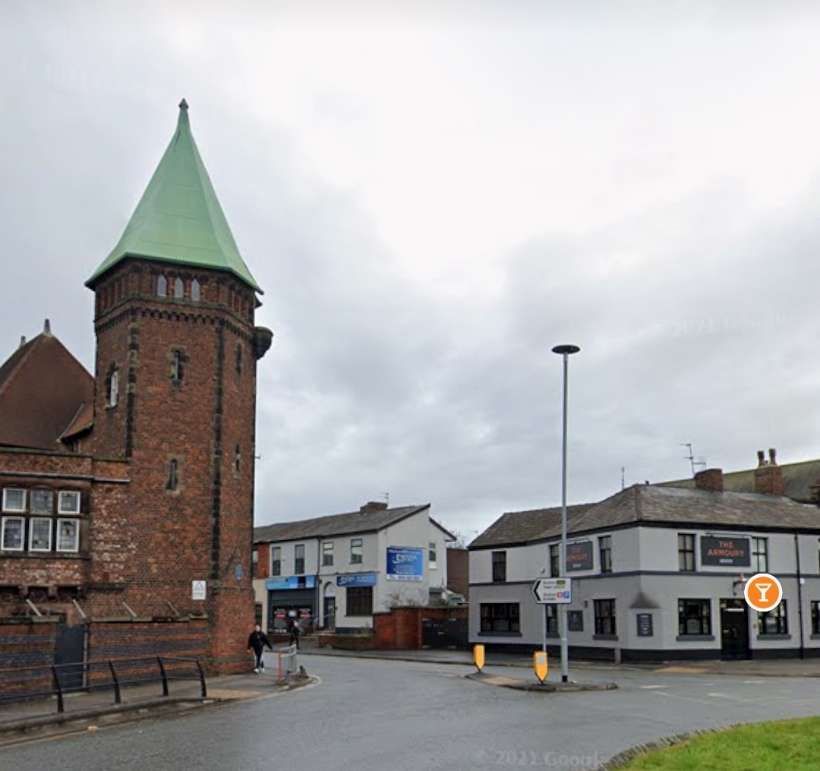
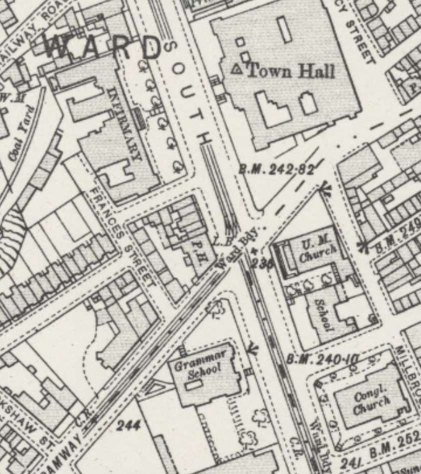
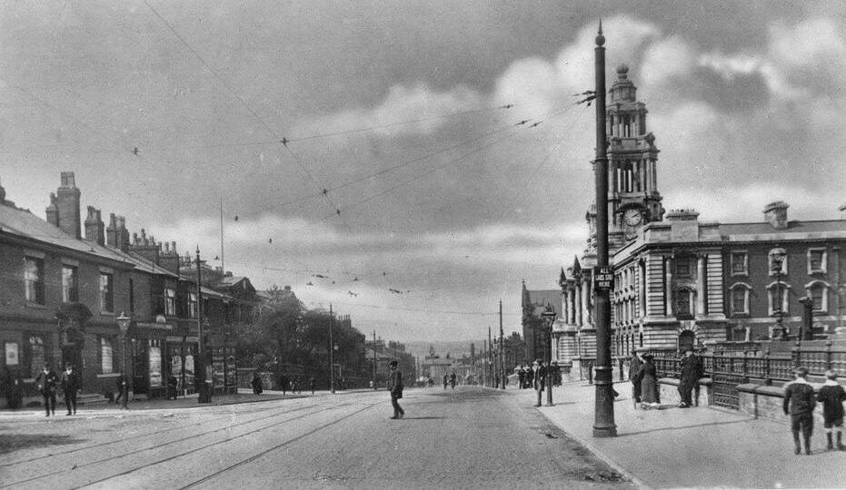
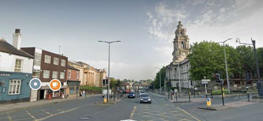
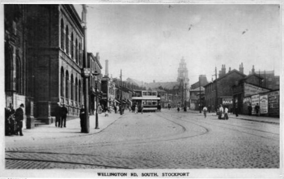
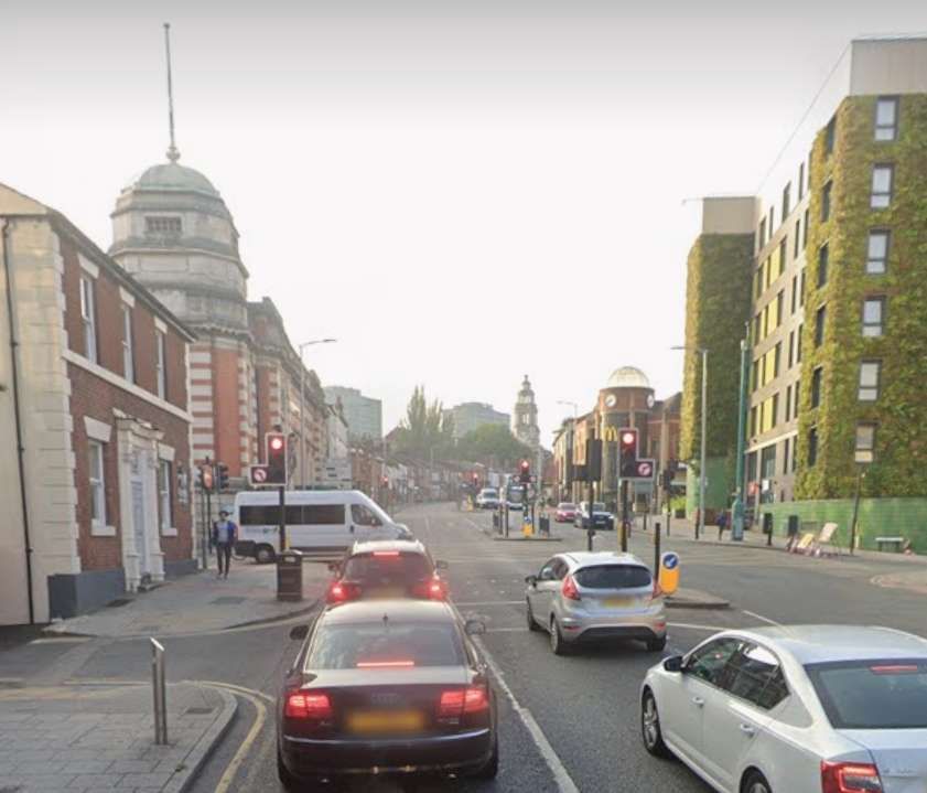
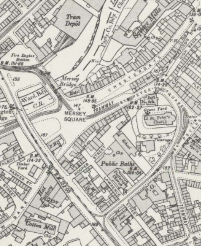
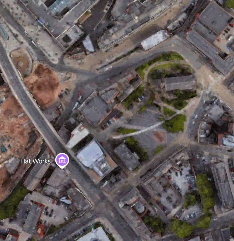
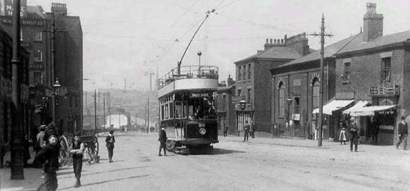
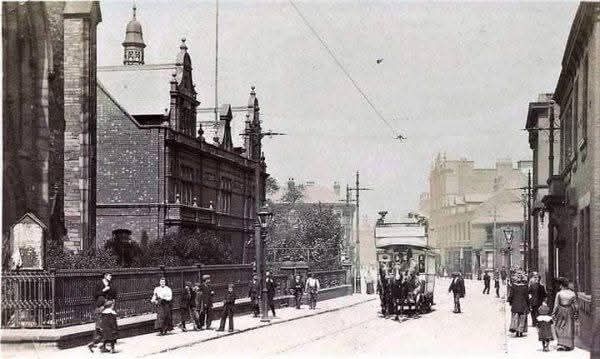
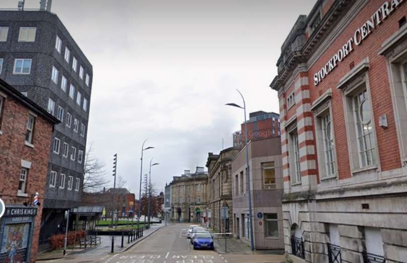
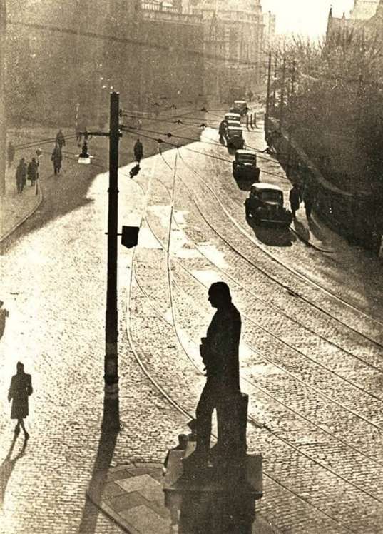
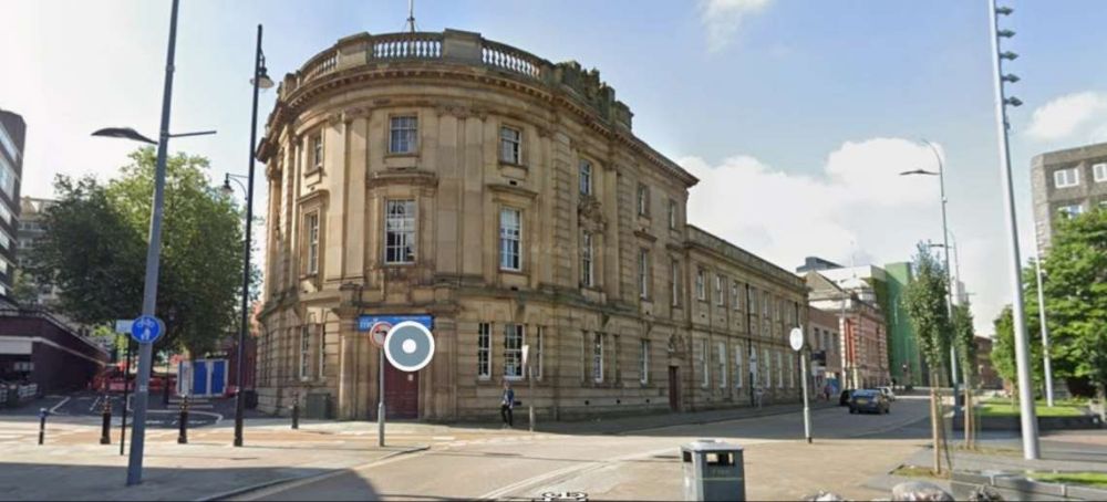
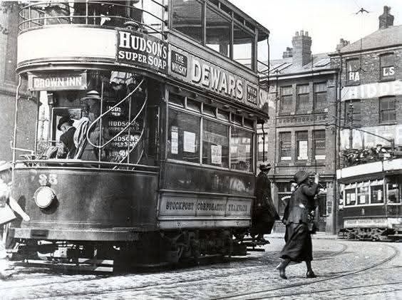
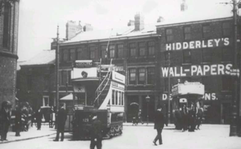
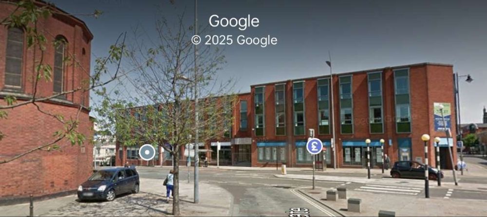
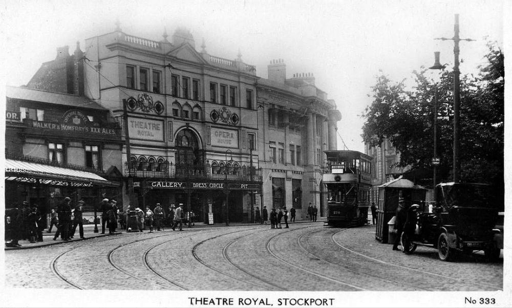
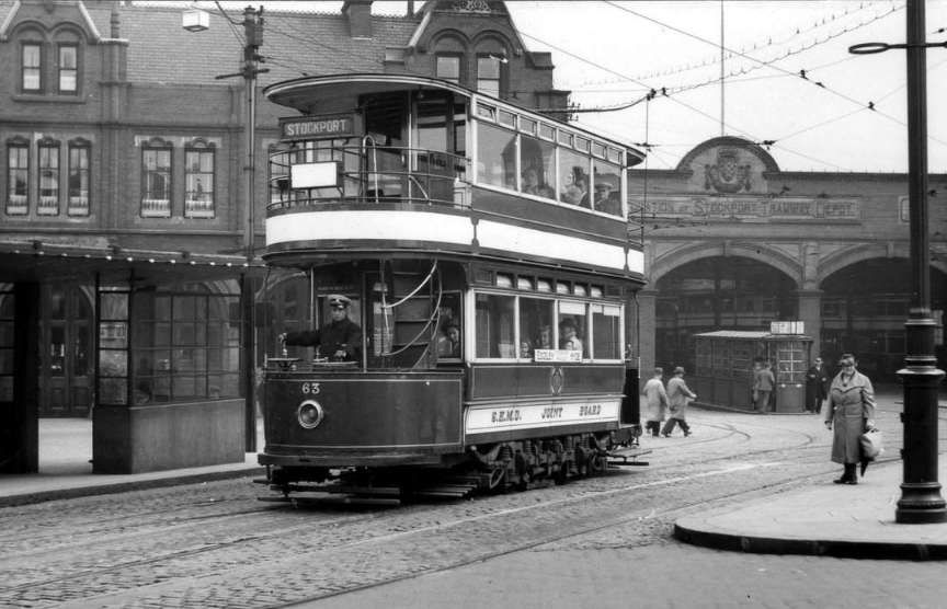
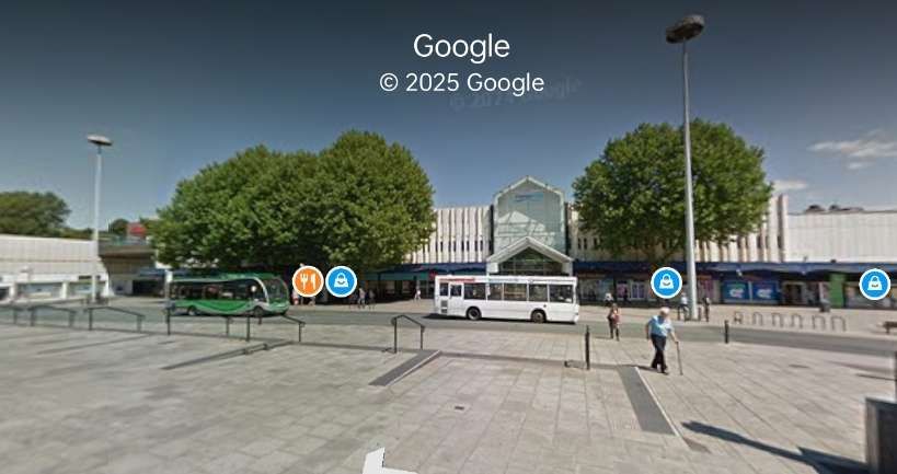
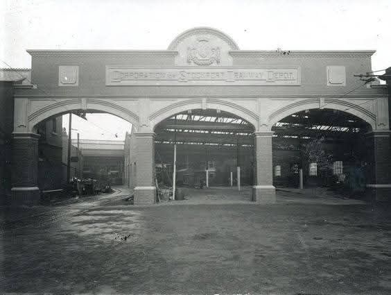
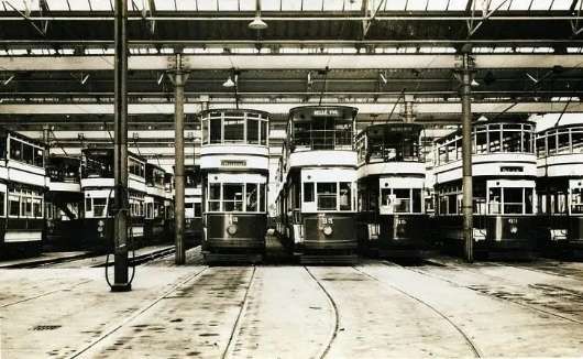
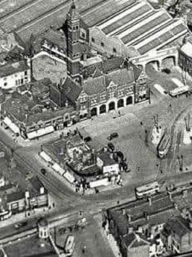

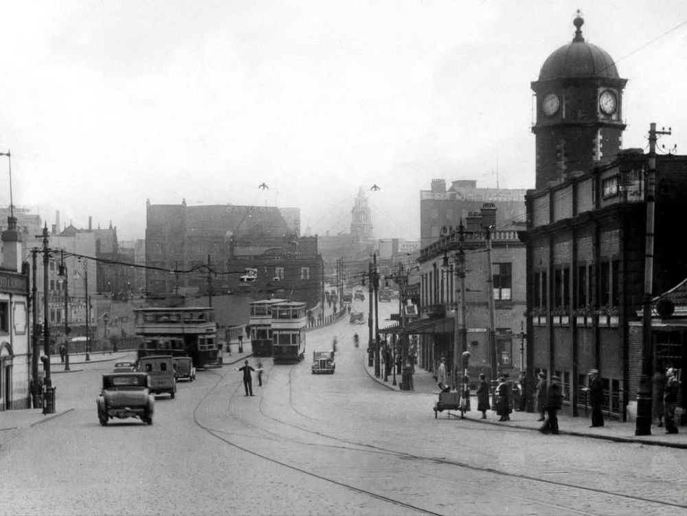
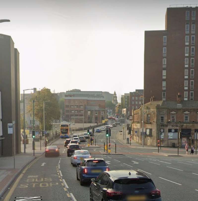
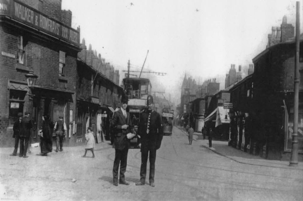
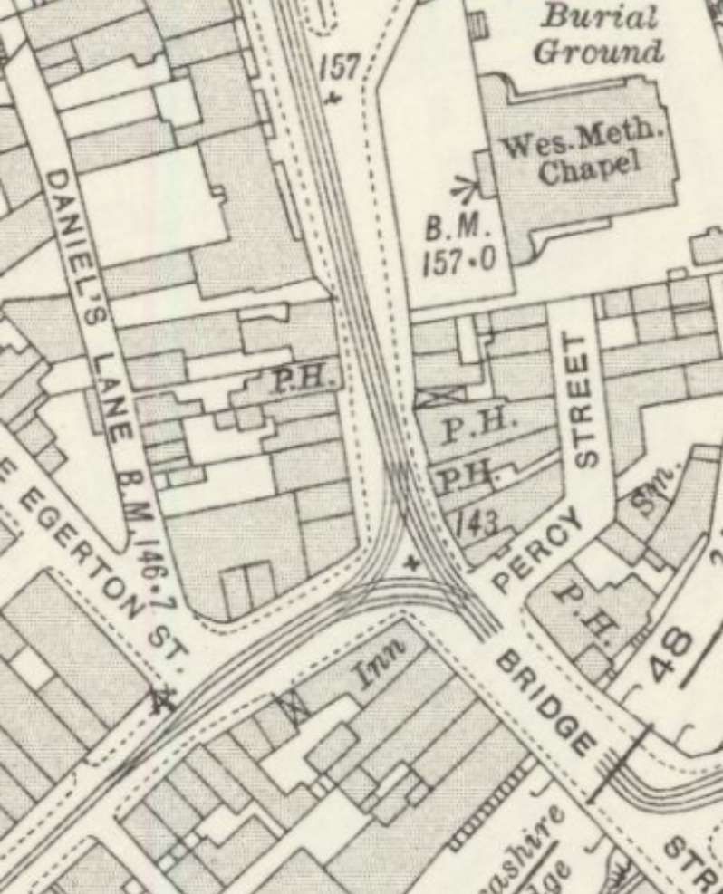

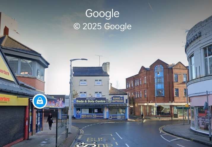
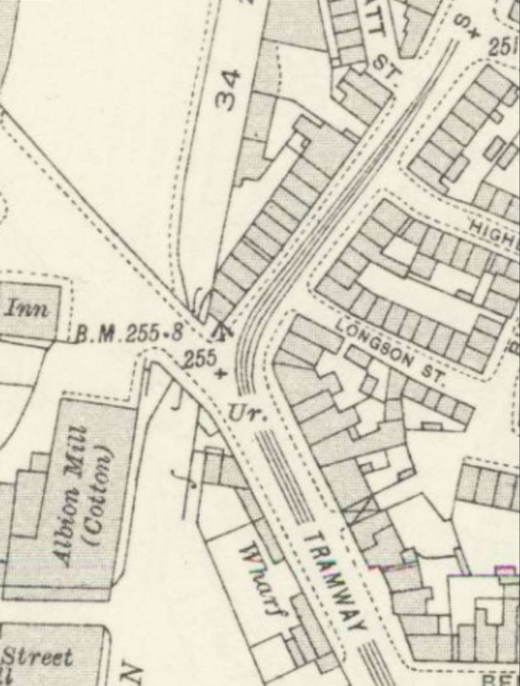
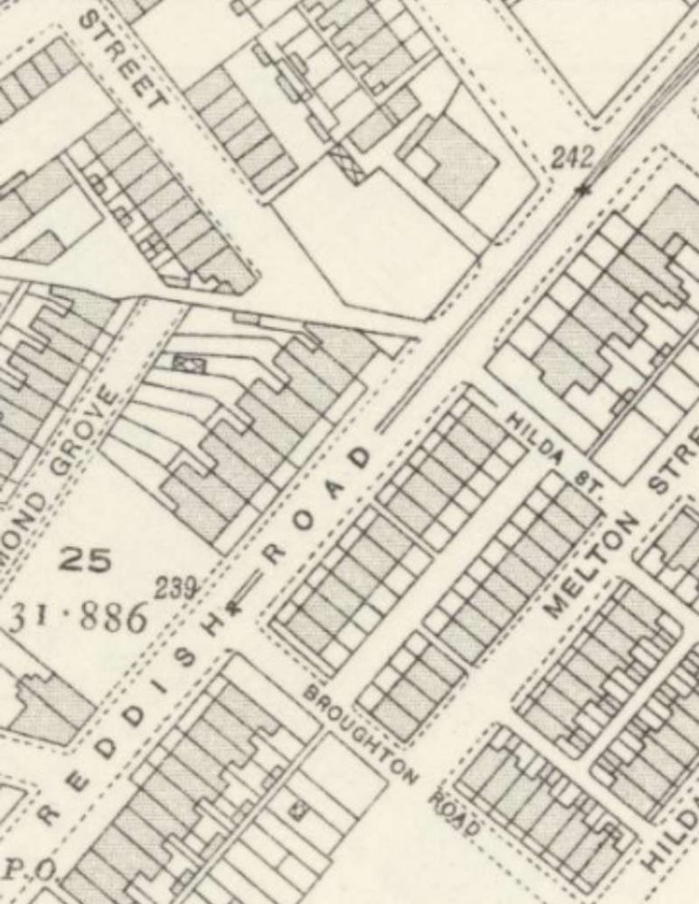
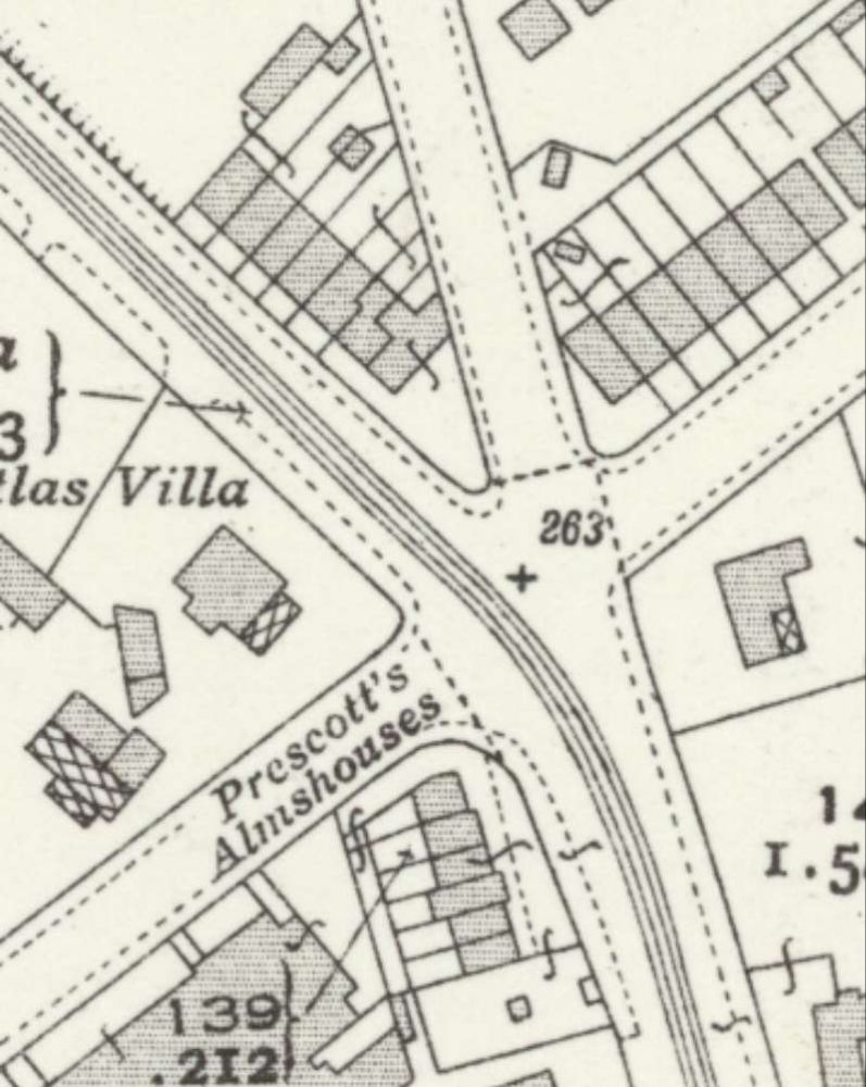
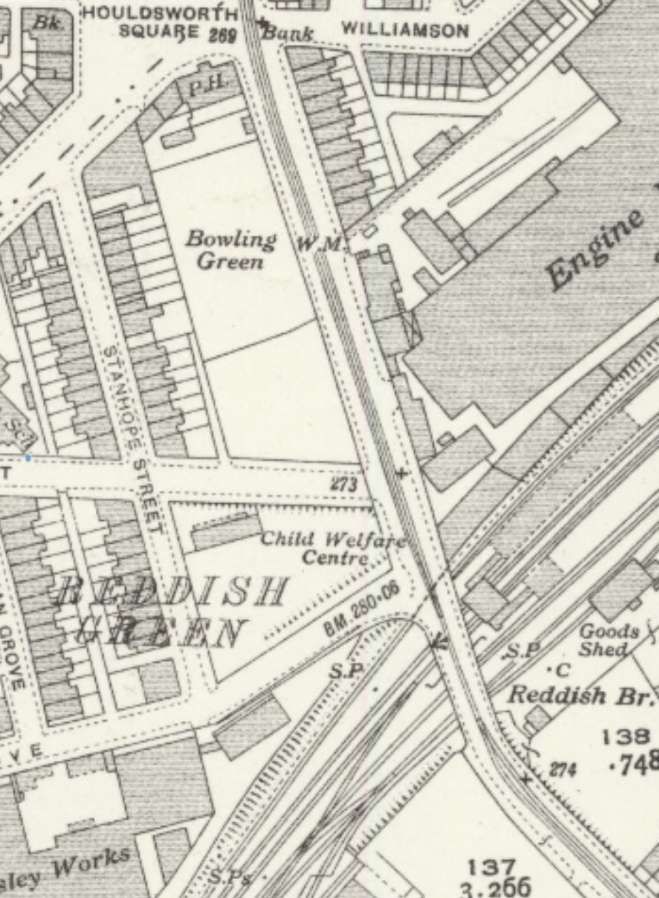
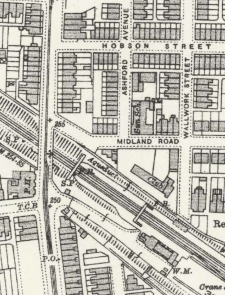
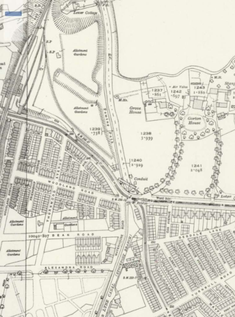
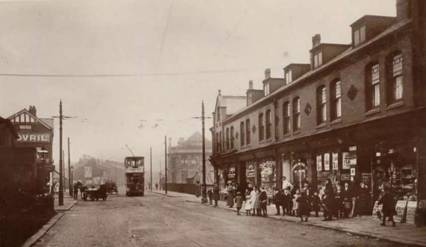

,_N%C3%A1dra%C5%BEn%C3%AD,_10.jpg)
_-_cropped.jpg)
_-_Flickr_-_James_E._Petts.jpg)
.jpg)