Monthly Archives: Jul 2023

‘Modern Tramway’ – Blackpool: The Marton Experiment …

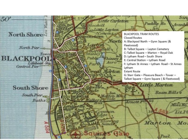
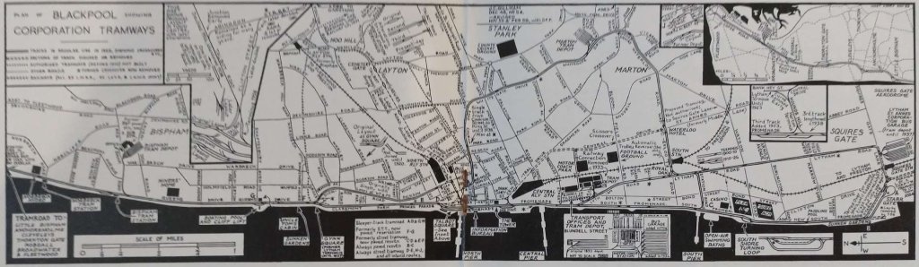
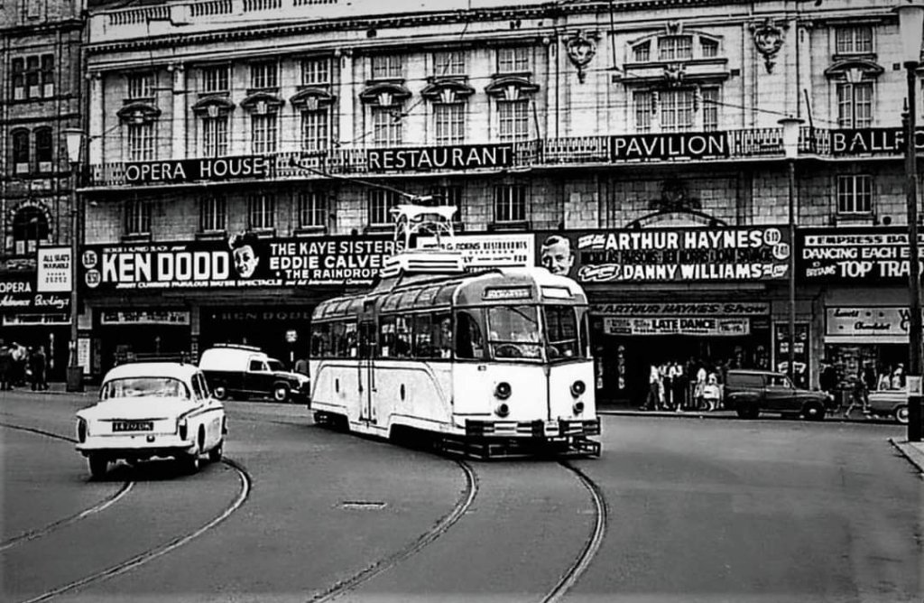
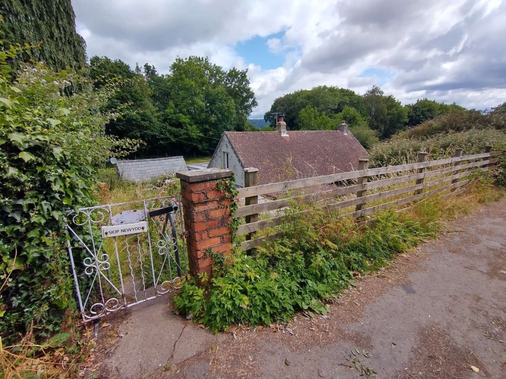
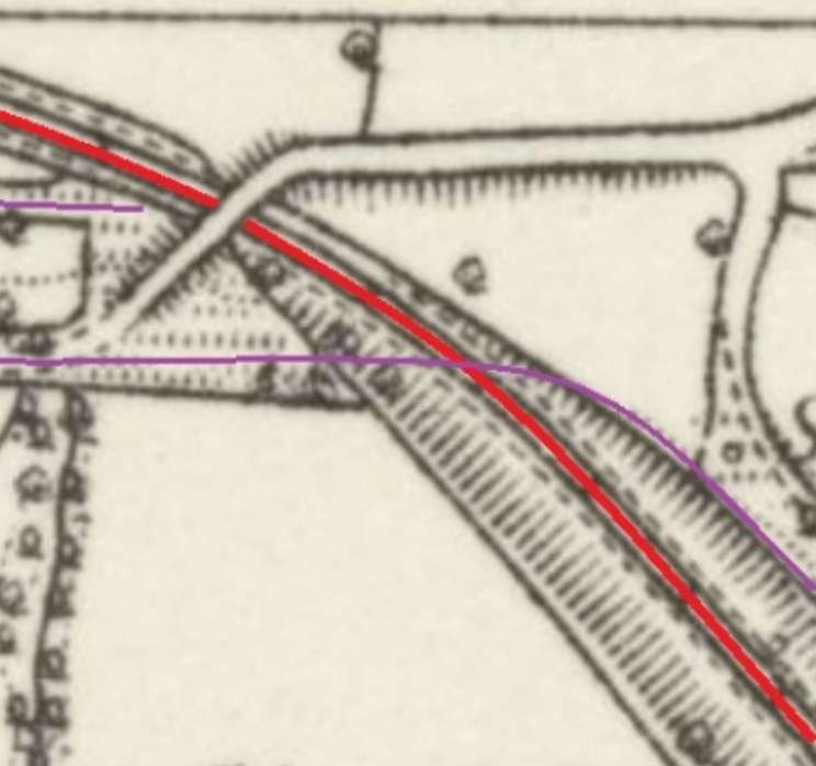
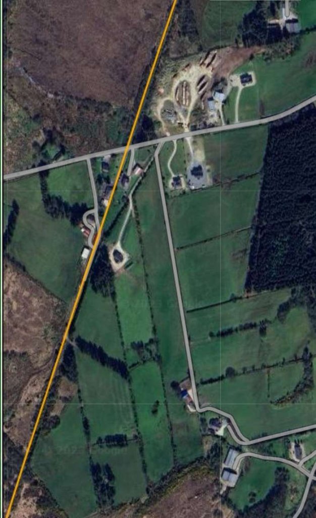
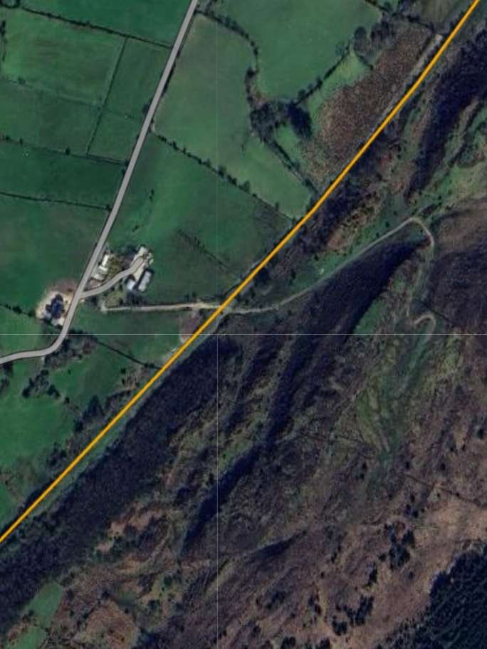
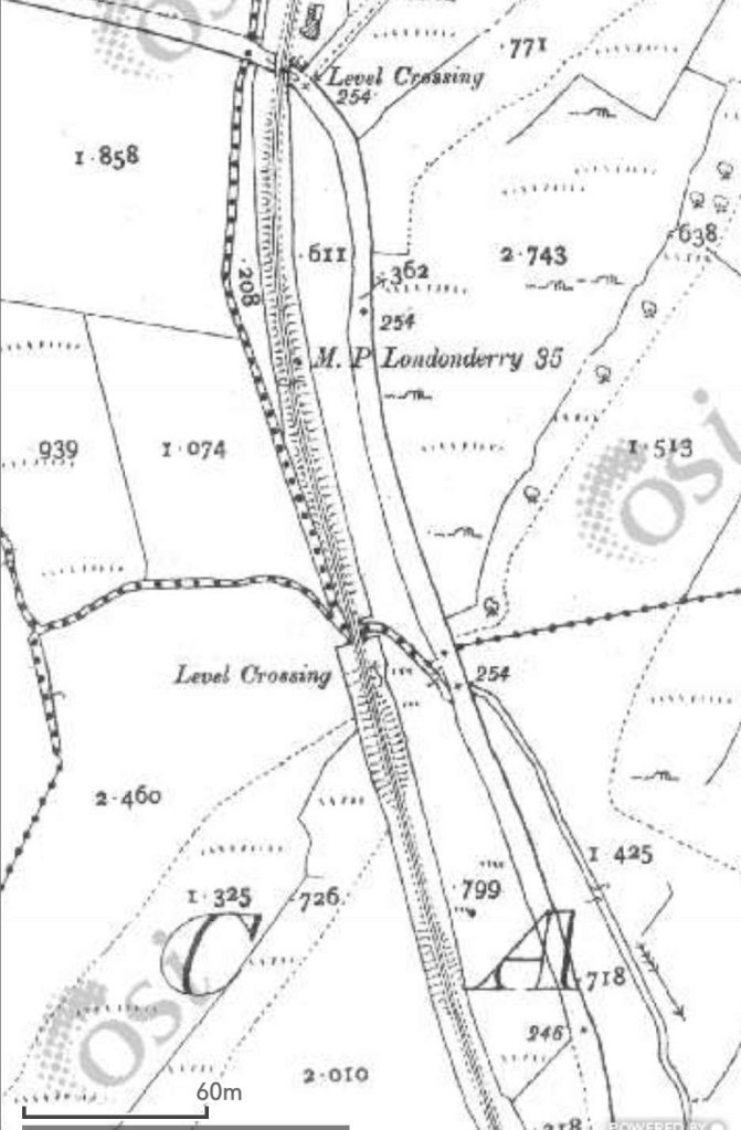
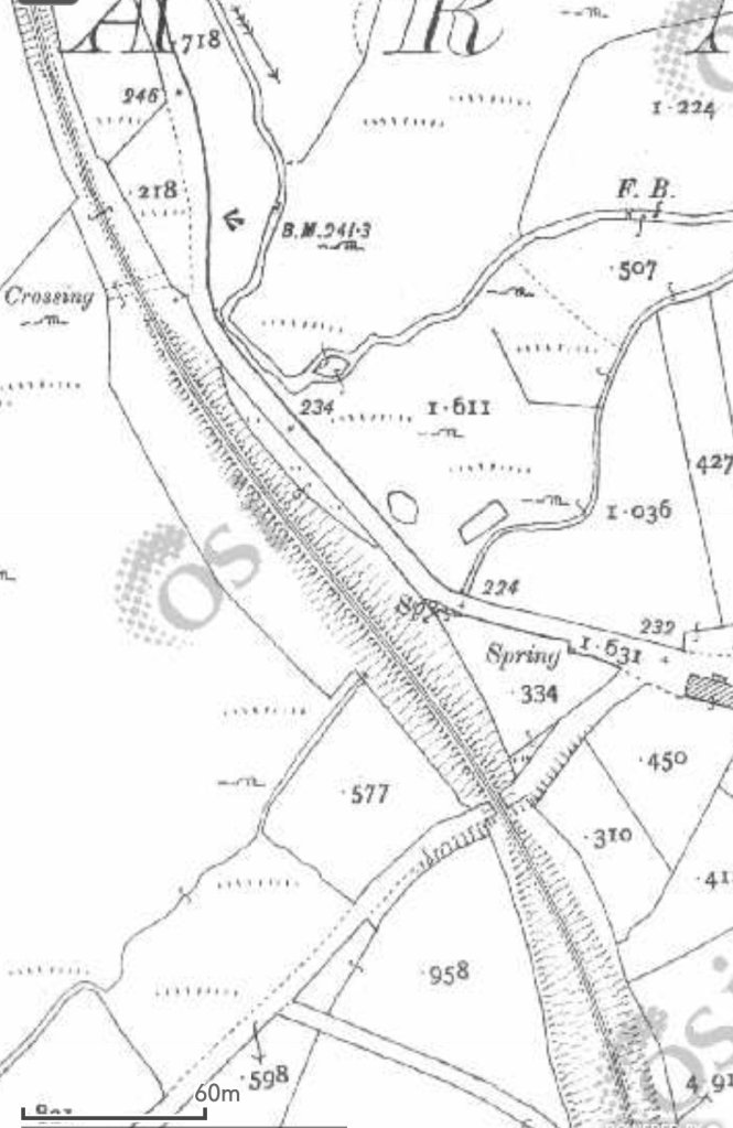
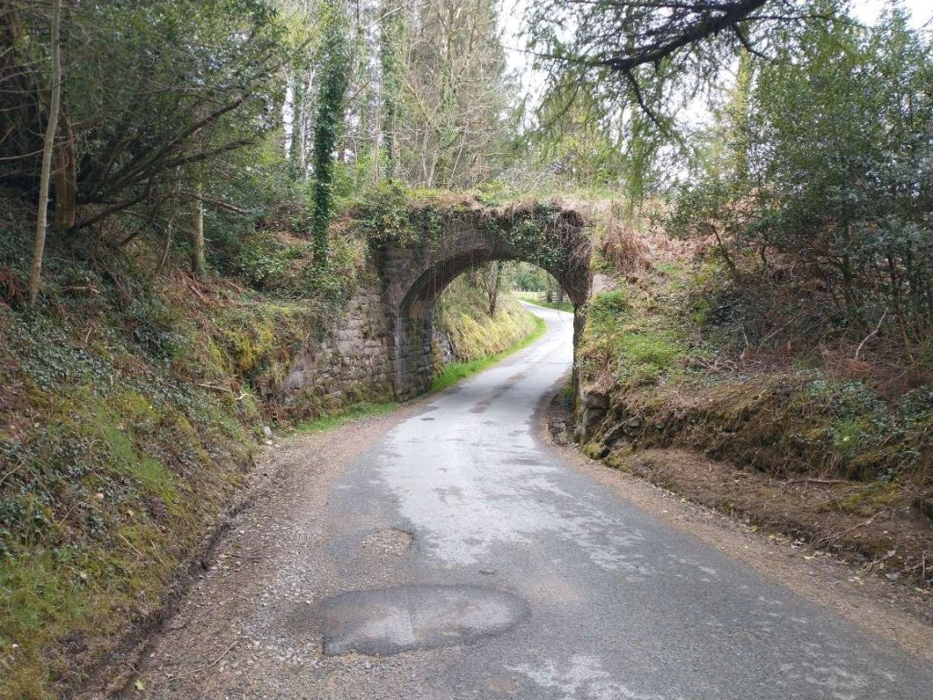
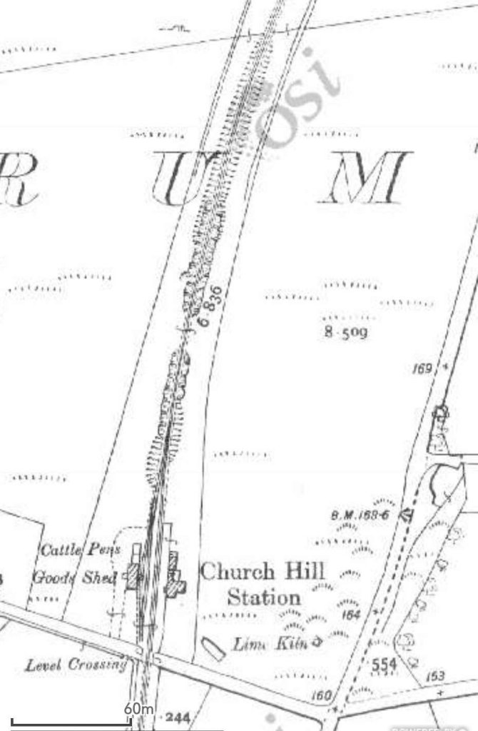
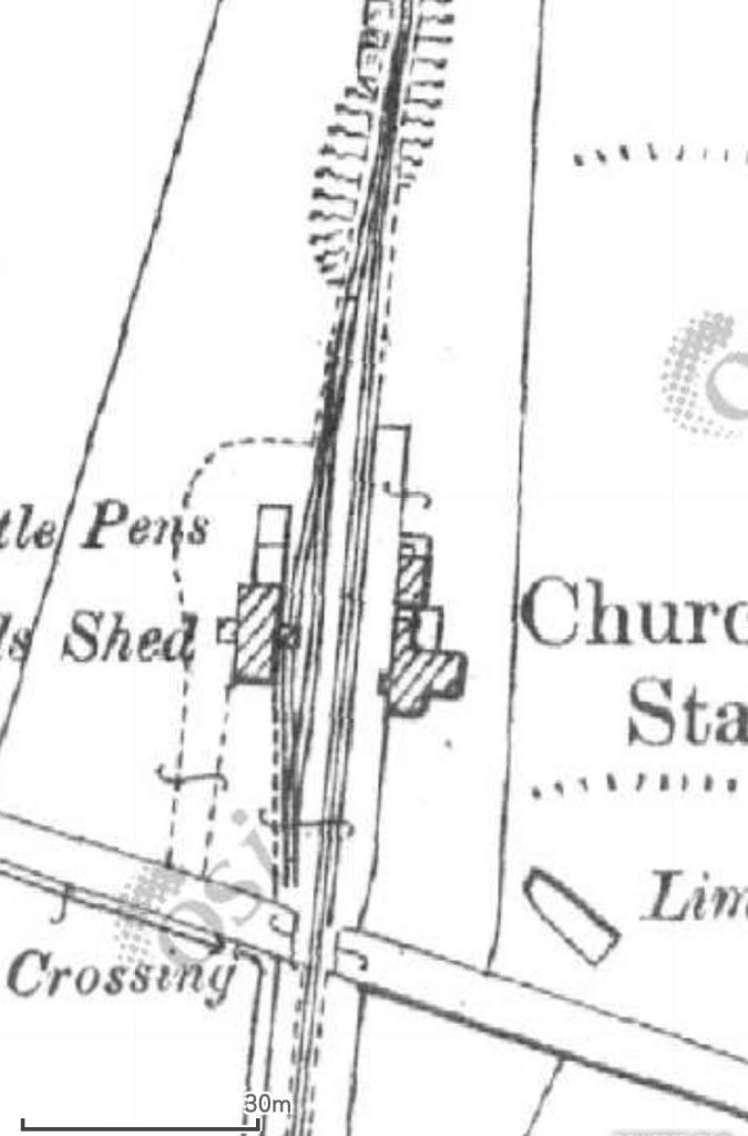
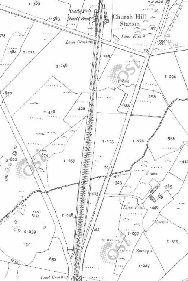
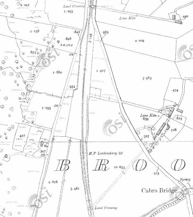
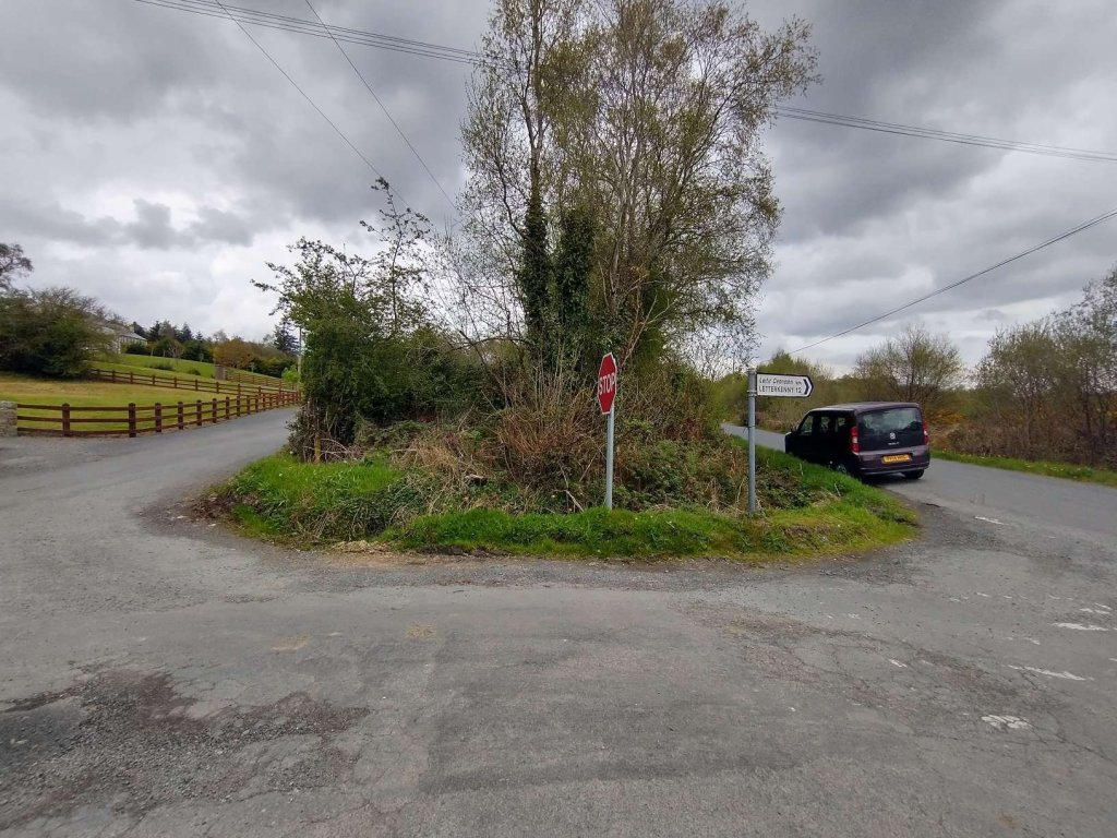
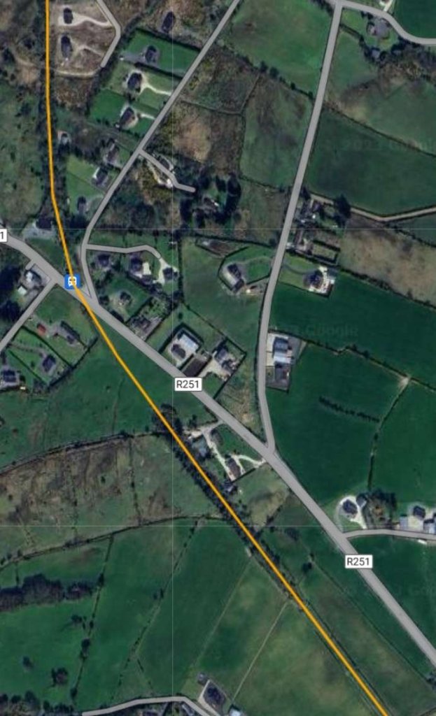
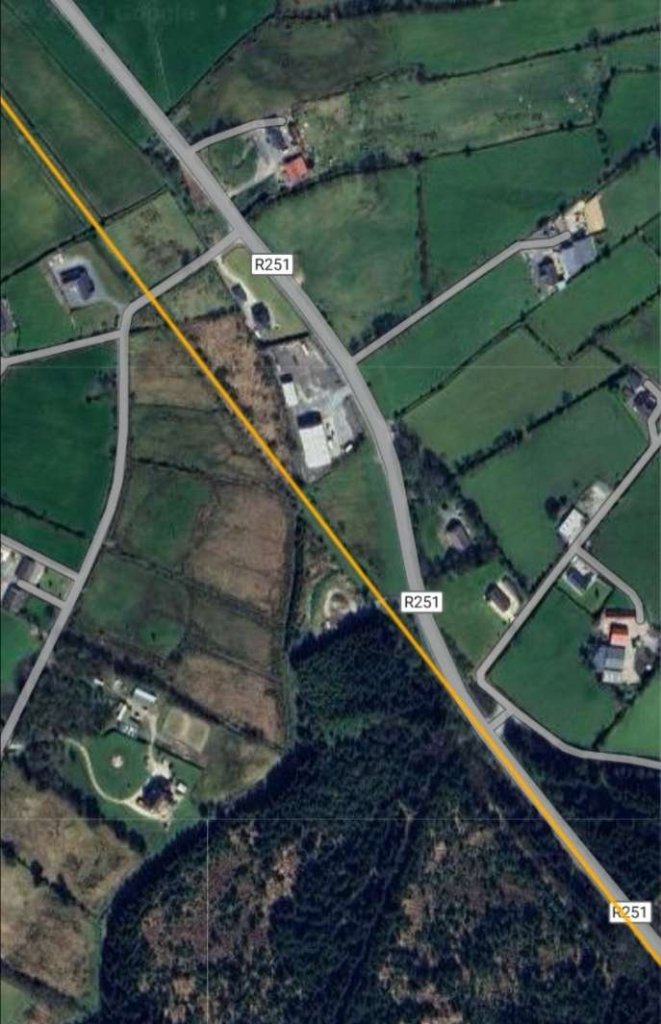
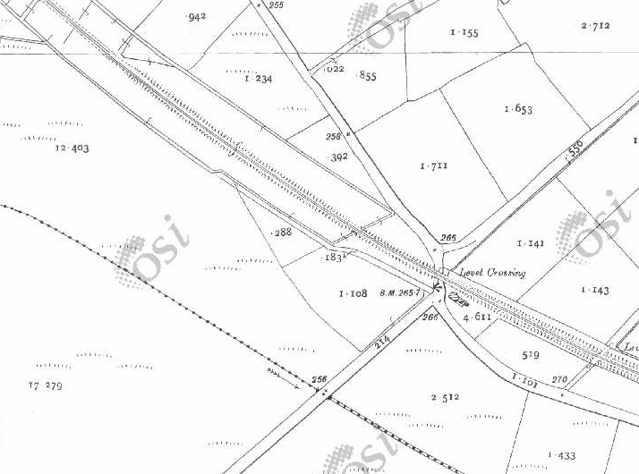
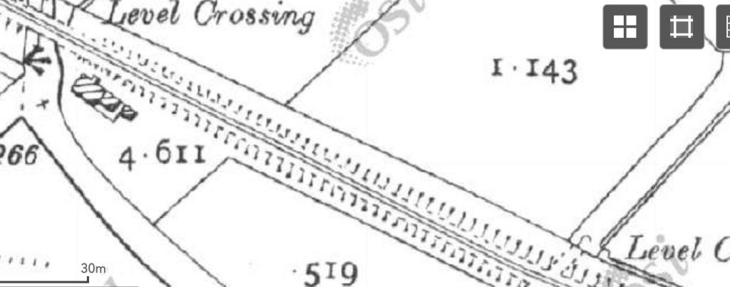
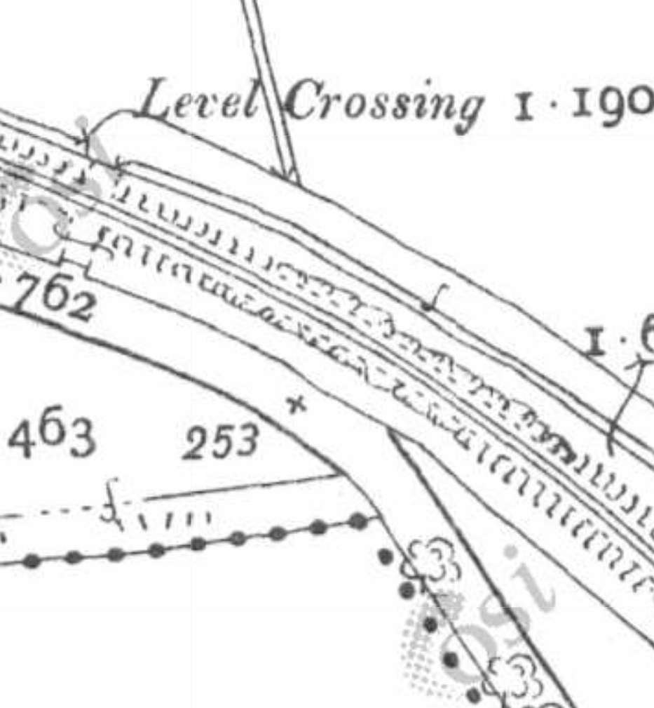
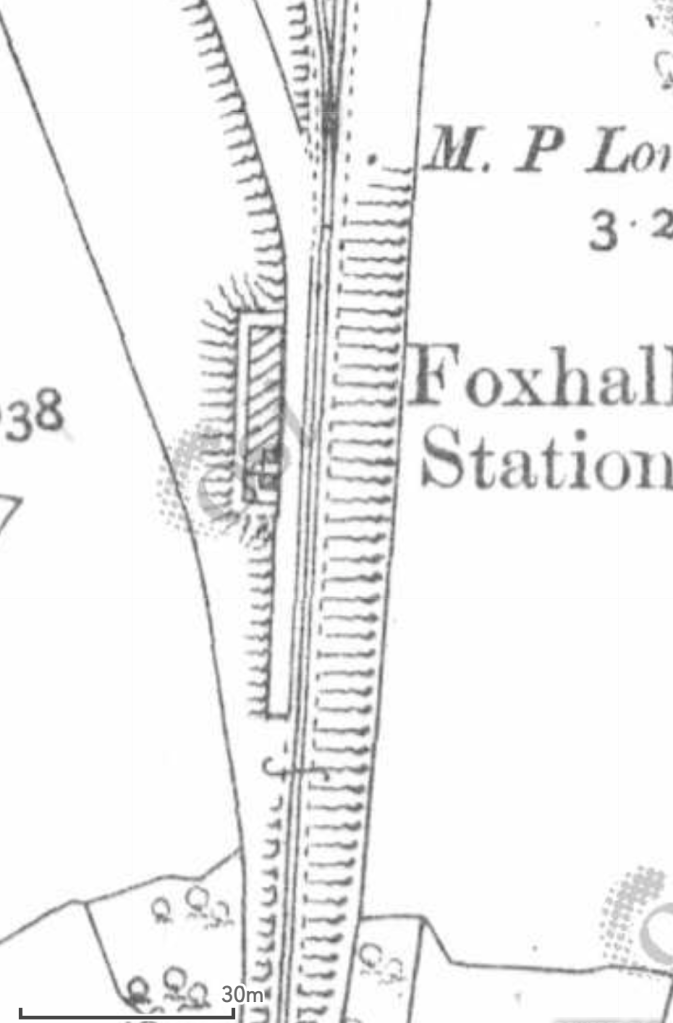
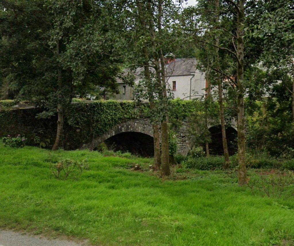
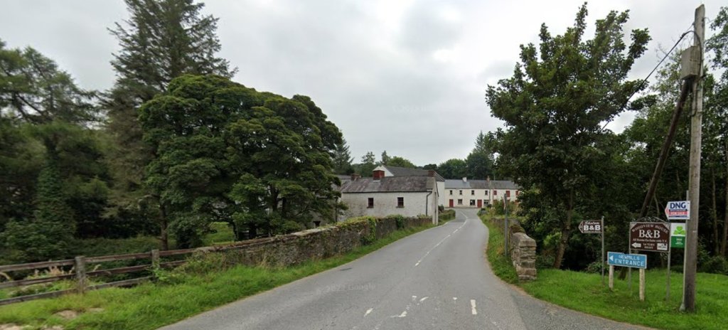
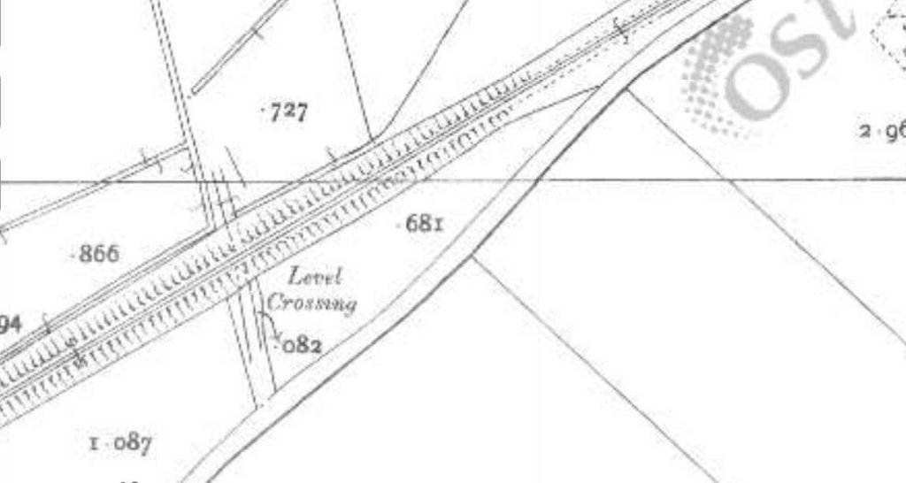
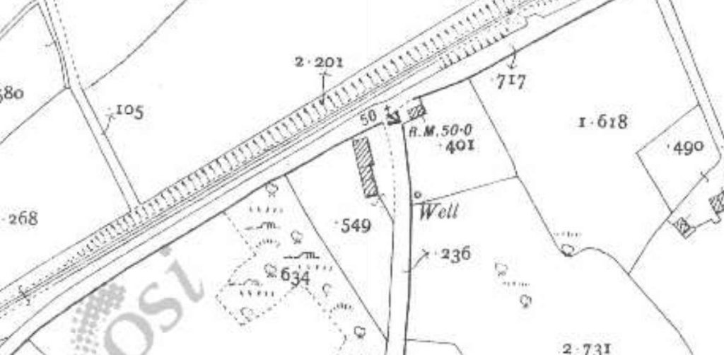
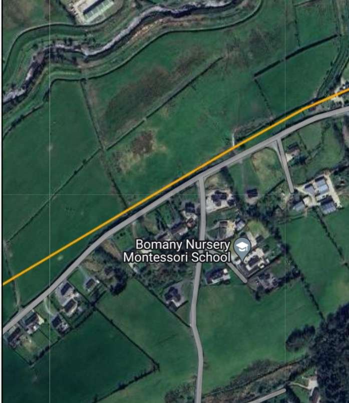
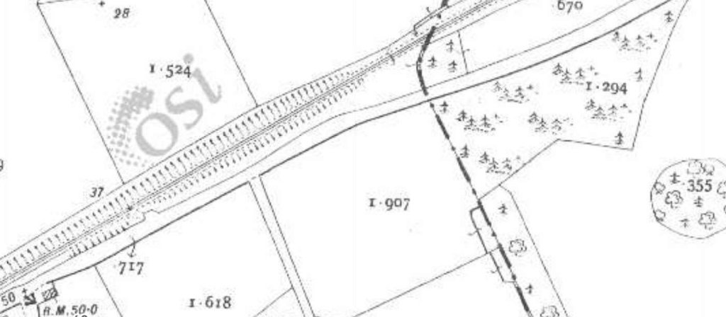
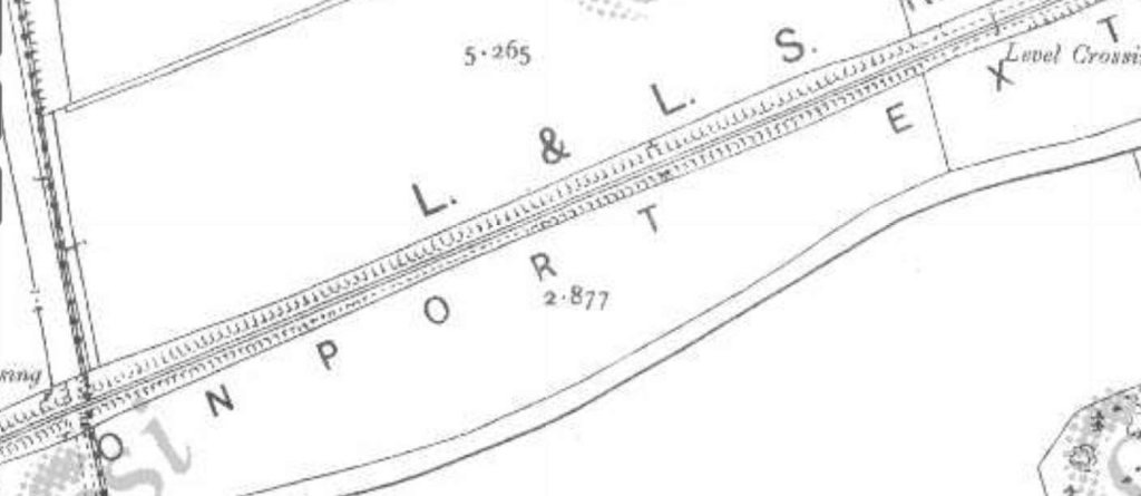
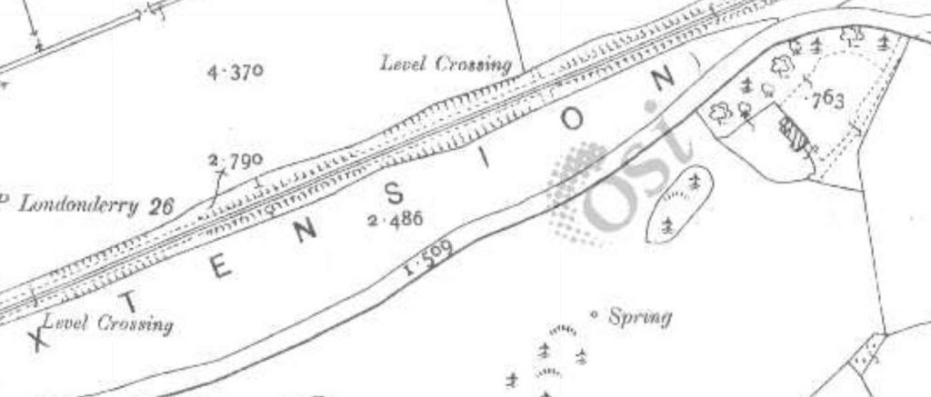
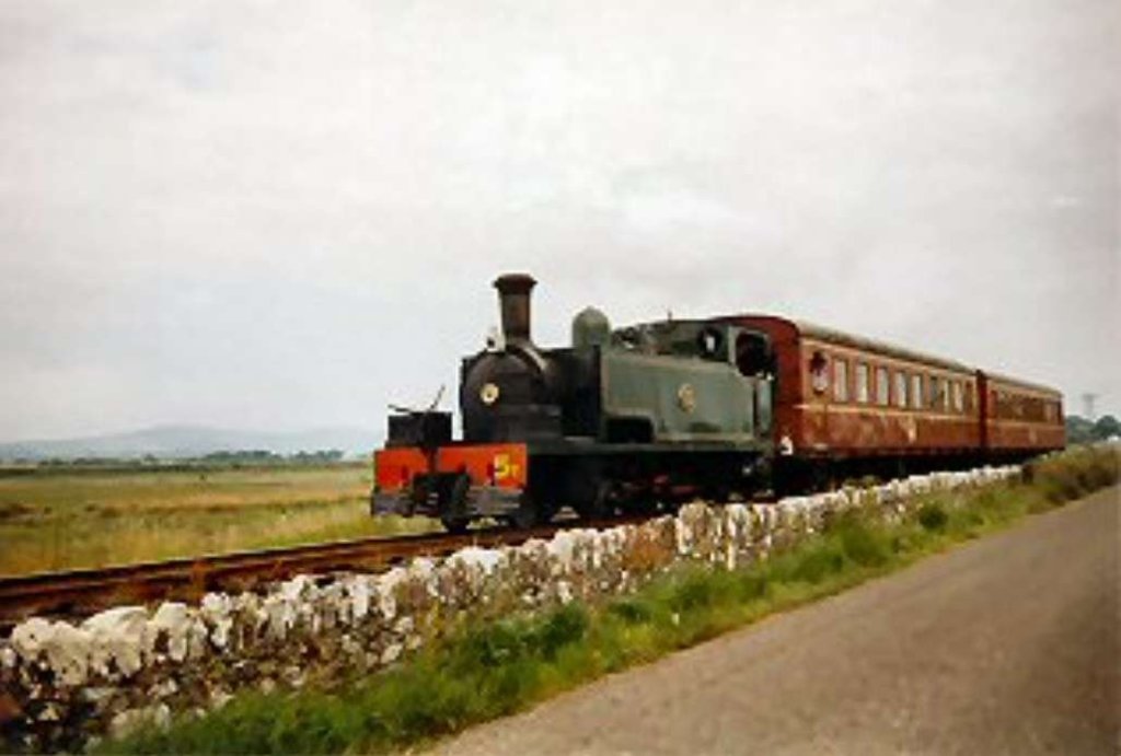
The ‘Modern Tramway’ reported in January & February 1963 on a relatively short lived experiment on Blackpool’s trams. The Marton route was an inland route through Blackpool which complemented the promenade route. It is route ‘C’ on the featured image above. [11]

The two articles were written by F.K. Pearson who suggested that his articles could perhaps have been entitled, ‘The Experiment That Didn’t Quite …‘ [1]

The Marton Route opened in 1901 but by 1938 it was approaching the end of it’s useful life, needing relaying and requiring a new fleet of 15 trams. A decision to undertake the work was deferred by Blackpool Town Council. War intervened and the existing trackwork was patched up to last a few more years.”By the time relaying could be considered again, technical progress had rendered the 1938 plan out of date, and the Marton route was chosen for one of Britain’s most interesting public transport experiments, the only attempt ever made to provide a tram service which by its sheer frequency, comfort and riding qualities could compete not just with the bus but with its future competitor, the private car.” [1: p14] Pearson’s article reports on that experiment, how near it came to success. and where it eventually failed.

Pearson continues:

“The story begins with the acquisition in 1945 by Crompton Parkinson Ltd. of a licence to manufacture in Britain certain equipment similar to that in the American PCC-car, the patents of which were held by the Transit Research Corporation in the USA. The experiments which followed were aimed at producing a vehicle which in silence, comfort, performance and soothness of riding would outshine any existing public service vehicle and rival that of the best private car. Blackpool already had modern trams, plenty of them, designed for the straight, open, track on the Promenade where even orthodox cars could give a smooth and quiet ride, but what was promised now was a tram with silent ‘glideaway’ performance even on grooved street track with frequent curves These route conditions, frequently met with in other towns, existed in Blackpool only on the Marton line, and Mr. Walter Luff the Transport Manager, made no secret of the fact that he hoped to persuade the Town Council to let him use the Marton route for a large-scale experiment that might have considerable repercussions on the future of tramways elsewhere in Britain; in short, to make it a show-piece.

The question of relaying the route was reopened as soon as the war ended, and the Town Council asked for comparative estimates for trams, buses and trolleybuses. Mr. Luff reported that to keep trams would cost £136,380 (£61,360 for new track £75,000 for 15 new cars), buses would cost £56,940 including road reinstatement and depot conversion, and trolleybuses would cost £87,360. He made no secret of his belief that the experiments then in progress would result in a vehicle superior to be existing tram, bus or trolleybus, and the Town Council, wishing to await the outcome of the trials, postponed a decision and asked that the track be patched up for a few more months.

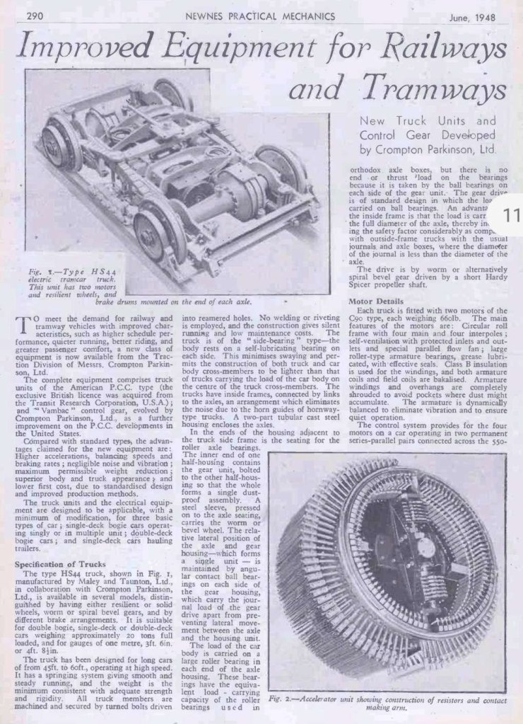
The first objective of the new equipment was silent running on grooved street track. This was achieved by using resilient wheels with rubber sandwiches loaded in shear between the tyre and the wheel hub, which would absorb small-amplitude vibrations arising from irregularities in the track instead of transmitting them through the springing to the rest of the car, and in the process would achieve virtual silence. Furthermore, the resilient wheel allows slight lateral flexibility and reduced side friction between flange and rail, eliminating the usual scrub on curves and incidentally reducing flange wear to an extent which eliminated the need for re-turning the tyre profile between successive re-tyrings. These rubber-sandwich wheels could be unbolted and changed like those of a bus, necessitating a newly-designed inside-frame truck (type H.S. 44) produced by Maley & Taunton, Ltd., who also designed and supplied a “silent” air-compressor to eliminate another source of noise. The experimental trucks were placed under car No. 303, and on 26th April 1946, the B.B.C. took sound-recordings on street track on this and an older car, with the microphone only three feet from the wheels.

With the old-type car the noise was considerable but with No. 393 it was practically nil.

Another traditional source of tramcar noise is the straight spur-gear drive, and this was replaced in the new truck by a right-angle spiral bevel drive, completely silent in operation, and requiring the two motors to be placed fore-and-aft in the truck. In many towns this alone would have led to a remarkable reduction in noise level, but Blackpool also knows how to keep spur gears quiet, and one wonders whether a right-angle drive (less efficient mechanically) can be justified by noise reduction alone. However, these and similar gears had been developed to such a pitch of efficiency for motor vehicles by their manufacturers (David Brown, Ltd.) that their use in a tram presented little difficulty. The technical and metallurgical problems had long since been overcome, and the only question was that of expense.

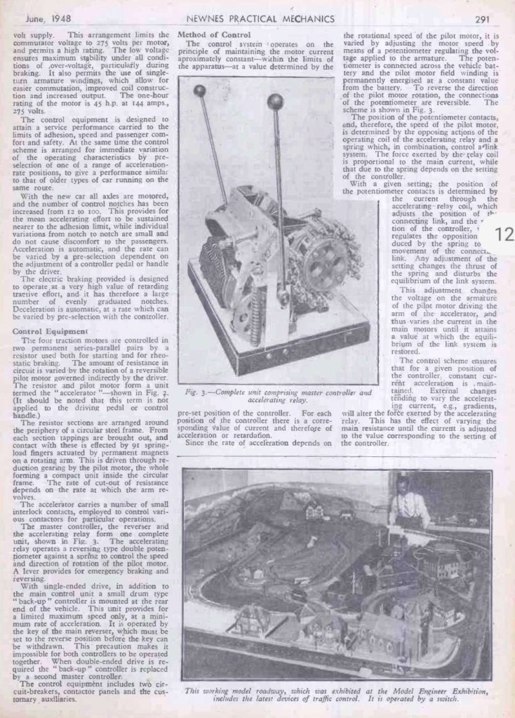
The other main objective was complete smoothness of acceleration and braking with private-car performance, and for this experiments were carried out by Crompton Parkinson, Ltd., using Blackpool car No. 208 to which the experimental trucks were transferred from No. 303 later in 1946. All four axles were motored, giving a possible initial acceleration rate of 3.5 mph. per second, and a smooth rate of change was achieved by arranging the motors in permanent series-parallel pairs and feeding them through a resistance having 94 steps instead of the usual eight. This resistance, mounted on the roof for ease of ventilation, was built around a circular steel frame with contacts on a rotating arm, turned by a small pilot motor, and the master control was by a joystick control by which the driver could select the rate of acceleration or braking required. Acceleration was automatic, for if the lever were left in a constant position the traction motors would accelerate or decelerate at constant current, yet it could also be varied by moving the stick, which explains the trade-name “Vambac” (Variable Automatic Multi-notch Braking and Acceleration Control) used for this equipment. Although inspired by that of the American PCC-car, it differed in several important respects, notably in that it enabled the car to coast. A car with this equipment, operating at the limit of its potential, was expected to consume about 4.5 units per car per mile (about 2.5 times the Blackpool average), but provision was also made to give a lower performance comparable to that of older trams if the two had to provide a mixed service on the same route. This reduced performance later became the Blackpool standard.” [1: p14-15]

Two pages from Newnes Practical Mechanics which give details of the type H.S. 44 bogies produced by Crompton Parkinson Ltd. and Maley & Taunton, Ltd. [4]

It transpired that the complete car was ready to begin trials in December 1946, and the Town Council were very soon invited for a demonstration. The track was now in an awful condition requiring a relay or abandon decision.

“After considerable debate, the Transport Committee recommended that it be relaid, and the Town Council on 8th January, 1947, decided by the narrow margin of 25 votes to 21 to instruct the Borough Surveyor to proceed with the reconstruction of the track. Blackpool Town Council, then as now, included some shrewd business-men, and the fact that they were prepared to spend twice as much on keeping trams than would have been needed for buses is the most eloquent testimonial to car No. 208 and the impression which its revolutionary equipment and performance had made. For the first time, they realised, it was possible for a public service vehicle to offer a performance as good as the private car, and it was bound to be popular.

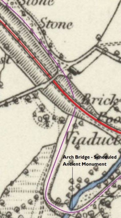
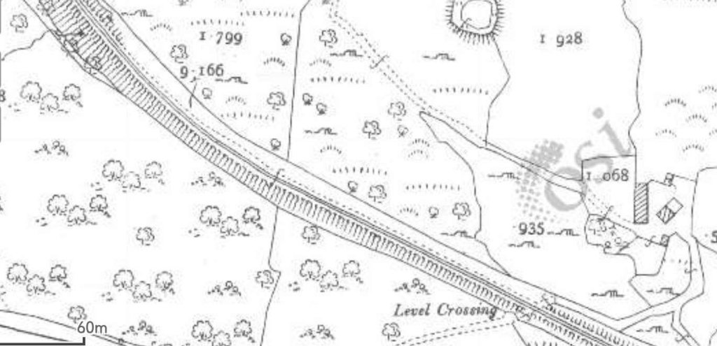
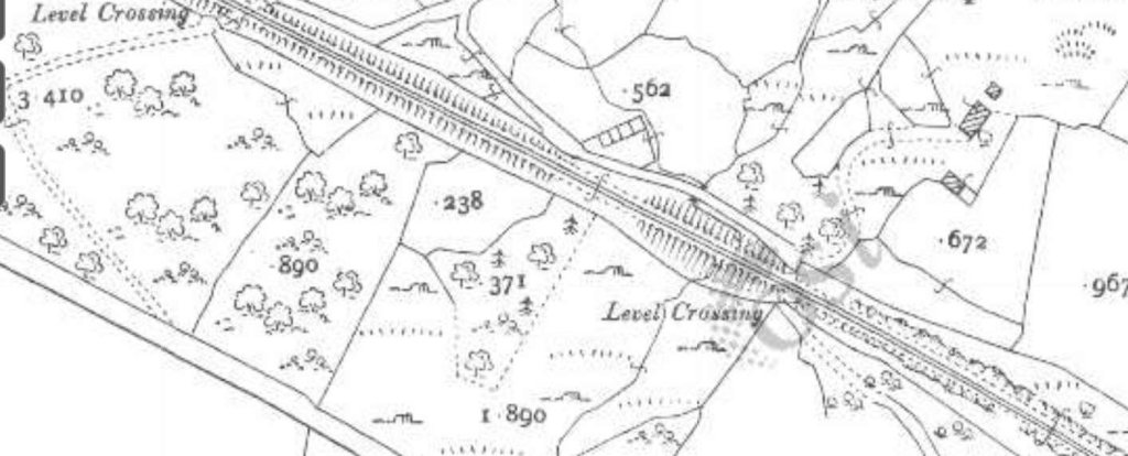
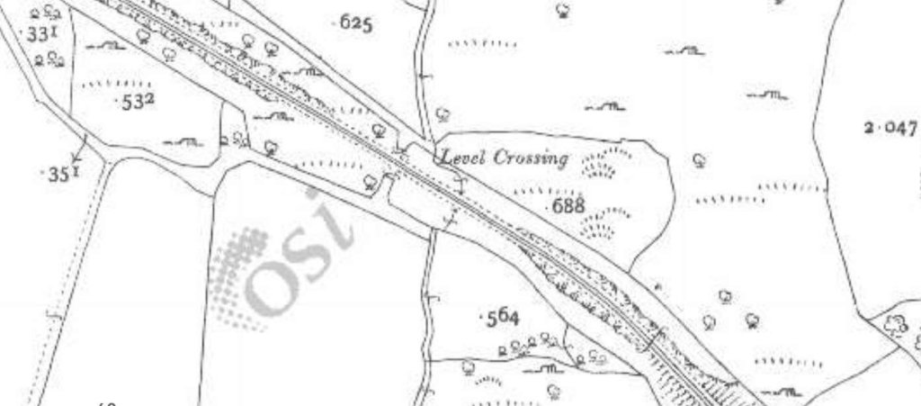
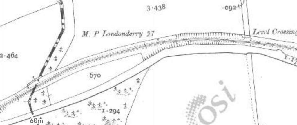
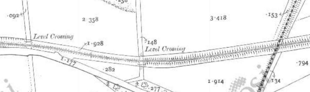
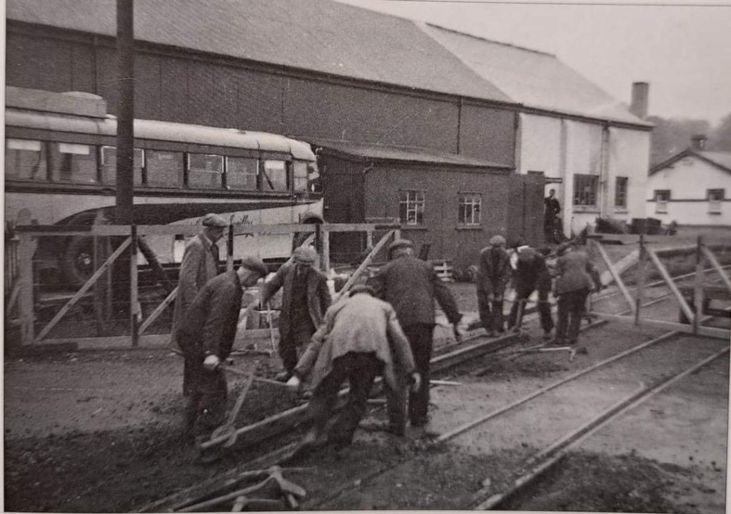
Work began straight away, using rail already in stock, followed by 600 tons of new rail and Edgar Allen pointwork to complete the job. Other traffic was diverted, with single-line working for the trams, and by the autumn of 1948 new Thermit-welded asphalt-paved track extended throughout the 3-mile route, save only for a short section held back until 1950 because of an anticipated new road layout. …

Meanwhile, the experiments with prototype car No. 208 continued, and by mid-1947 the car (specially equipped with fluorescent lighting) was ready for regular service, though frequently in demand for demonstration runs with visitors from other undertakings. The car was not used on Marton, for the Marton schedules were based on 78-seat instead of 48-seat cars, and for its first three years the new Marton track was traversed by the same cars that had worked the service since the mid-twenties, the gaunt, upright standard-type double-deckers, some of them with open balconies. These had no part in the Marton Experiment, and were due to disappear as soon as the heralded 15 new cars made their appearance.

At this point, compromises were made. Inflation meant that the planned new cars could no longer be obtained at anything like the estimated figure. Blackpool decided, for the sake of economy, to fit the new equipment to existing trams. Twelve surplus modern single-deckers were seen as suitable.

One of the twelve cars that were. Built cheaply in 1939 for use during the holiday season. It had a sunshine roof, secondhand electrical equipment, wooden seats, no partition between driver and passengers, the minimum of interior lighting, waste-high sliding doors, and the upper half of the windows permanently open. The twelve cars were originally built by English Electric. This photograph, which was included with Pearson’s article, shows the tram on 30th August 1939. It shows both the sunshine roof and the wooden seats to good advantage, © Fox Photos Ltd. [1: p17] The copyright of the photograph is now held by ‘Getty Images’ and a link to the original photograph can be found here.

“These cars (10 to 21) had been built cheaply in 1939 for use during the holiday season only, with second-hand electrical equipment, wooden seats, no partition between driver and passengers, the minimum of interior lighting, waist-high sliding doors, and the upper half of the windows permanently open. … Scarcely had they entered service than war intervened and they were put in store, emerging in 1942 with full-length windows, doors and cabs for use on extra workings such as troop specials.

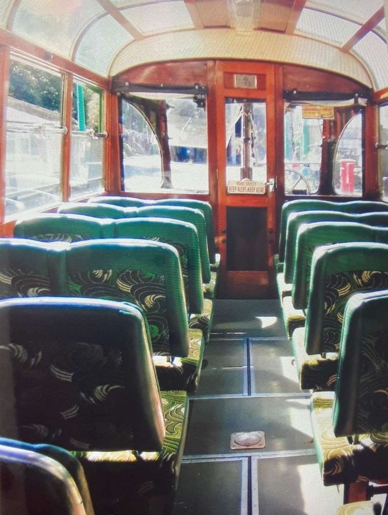
Late in 1947, the Corporation ordered 18 sets of H.S. 44 trucks and Vambac equipment, to enable them to equip sufficient cars to work the entire Marton service, including spares. Rigby Road Works set to work rebuilding the 10-21 series into a new silent-running fleet, soon to become known as the ‘Marton Vambacs’. … Internally, the cars were given soft fluorescent lights, comfortable seats upholstered in brown moquette, new floor-coverings, and tuneful bells. The first car, No. 21, appeared in December, 1949, and its lack of noise when running was quite uncanny, the only remaining sounds being the soft buzz of the “silent” compressor, the hissing of the motor brushes, the clicking of the accelerator contacts, and the sound of the trolley wheel. Even this latter was to have been eliminated in due course, for when the Marton overhead next needed renewal the round wire was to be replaced by grooved wire suitable for use with silent-running carbon skids, of the type used on trolleybuses.” [1: p17-18]

Pearson tells us that, “Conversion of the 12 cars, took just over two years, and during this period the “new” cars could be seen side by side with the older double-deckers. In the eyes of the tramway enthusiast, the “vintage” year of the Marton route was undoubtedly 1951, when about half the service was still in the hands of the venerable but never decrepit standard cars, and mingled with these like gazelles among heavier quadrupeds (a purist might say ‘octopeds’) were the first half dozen Marton Vambacs’.” [1: p18-19]

The map of Blackpool’s trams included in Pearson’s article. [2: p54-55]

In the second installment of the story, Pearson moves on from the Autumn of 1951 to the early months of 1952, when conversion of trams No.10-21 was complete. With No. 208, this meant that there were 13 tram cars serving the Marton route which had to be supplemented at times by older double-deckers. The Council’s resources were by this time dedicated to introducing Charles Roberts cars on the Promenade.

Two of the Marton Vambac trams in Blackpool South. The nearest Vambac Railcoach No. 208 was prototype test bed for the new type of controller & inside frame bogies. Behind is one of the twelve Marton Vambac’s, rebuilt from 1939-built sun saloons. This image was shared on the History of Blackpool Facebook Group on 6th February 2021 by Pete Dumville. [5]

From 1954, when the double-deckers had been withdrawn from service. The Marton route was worked by the 13 Vambac cars and, usually, three pre-war English Electric rail coaches.

It was unfortunate that rising crew costs began to become a significant issue for the Council.

“It may perhaps have been overlooked that the success of the PCC-cars on the street routes in the USA was nearly always coupled with one-man operation. … If passengers were satisfied with the new equipment, so we’re the platform staff.

The manufacturer’s claims were fully borne out, for the automatic acceleration and the provision of simple joystick and pedal control made the cars delightfully simple to drive, reducing fatigue to a minimum and eliminating some of the finer points of instructional training, since “notching up” no longer depended on the driver’s skill. However, it was rather curious to observe the use which different drivers made of the two braking systems, due, perhaps, to the admixture of pre-war and Vambac cars. The Vambac equipment provided a smooth and reliable brake effective down to a speed of less than two miles per hour, and was intended as the main service brake, the air brake being used only for the final stop, brake-shoe life being increased accordingly. This theory can be seen in everyday application on the Promenade, with the post-war cars, yet on the Marton Vambacs many drivers seemed to prefer the familiar air brake for service use, leaving what they termed the “stick brake” in reserve for emergencies. The smoothness of braking was thus dependent once again on the skill of the driver, and the smooth automatic deceleration purchased at such expense was wasted. Other drivers would use the Vambac brake to commence deceleration but would then change to air at a speed higher than intended by the designers for the final stop, and at least one journey made by the writer was marred by the Vambac deceleration being “interrupted” each time while the driver remembered to “put on the air.” One wonders why they were so fond of the air brake, but a possible reason lies in the fact that both terminal approaches were on slight gradients, where the air brake had in any case to be applied to hold the car on the grade, unlike the flat expanses of the Promenade.” [2: p51-52]

Another factor associated with the trial was that of maintenance of the tram cars.

On the one hand, the provision of automatic acceleration and electric braking with minimum and controlled current peaks certainly eliminated the possibility of mishandling the electrical equipment, and must have reduced routine maintenance on the control gear, while the use of cardan shafts and totally-enclosed spiral bevel drives eliminated the troubles associated with the servicing of motor-suspension bearings and reduced the shopping periods. The service availability of the Vambac cars, judging from their daily appearances has been quite as high as that of the orthodox cars, and from this one can safely say that the new equipment must have been fully adequate in avoiding excessive servicing requirements. Moreover, while new and somewhat revolutionary equipment in any field has to cope with the burden of tradition on the part of older generation staff (human nature being what it is), this hurdle seems to have been surmounted with conspicuous success. On the other hand, obtaining spare parts must have been very awkward quite apart from the cost aspect for apart from Blackpool’s own 304-class cars no one else used the same equipment, despite all the hopes that were placed in it. In 1947 the potential British market for modern tramway equipment still included Leeds, Sheffield, Glasgow and Aberdeen, and anyone who had sampled the new equipment could be forgiven for seeing in it a germ of resurgence for tramways and a hope of further orders; but this was not to be. From this aspect, one begins to understand why the five extra sets of trucks and equipments were used as a source of spares rather than to equip further cars.” [2: p52, 54]

An interesting claim made for the new resilient-wheeled trucks was a saving in track costs. Although the track was abandoned before claims of a 30-year life could be tested, the track, “certainly stood up very well to 15 years’ life, and even at the end much of the track and paving was still of exhibition standard, Some of the sharper curves had been renewed, but this was only to be expected, for grooved rail generally lasts four times as long on straight track as on curves. On the sections with non-welded joints (usually) curves), there has been none of the usual deterioration of joints through hammer-blow … [found in] towns using heavy double-deck cars. The one unexpected phenomenon [was] the appearance of a few patches of corrugation.” [2: p54]

Pearson spent a short while alongside a corrugated stretch in Whitegate Drive, listening to sounds made by different types of car. He comments: “The passage of a Vambac car, even on the corrugations, was a process of exemplary quiet, but the occasional pre-war solid-wheeled car produced a roaring noise that told its own story.” [2: p54]

In his opinion, it was the “periodic traverse of the Marton tracks by these few pre-war solid-wheeled railcoaches (and by cars going to and from the Marton depot) that ha[d] given rise to the corrugations, and Whitegate. Drive residents who wrote to the papers in complaining terms can only have had these cars in mind. From the track aspect, it is therefore a pity that the original plan to equip 18 cars was not carried out, for the pre-war Blackpool cars, lacking track brakes, beget corrugations wherever they encounter solid foundations.” [2: p54-55]

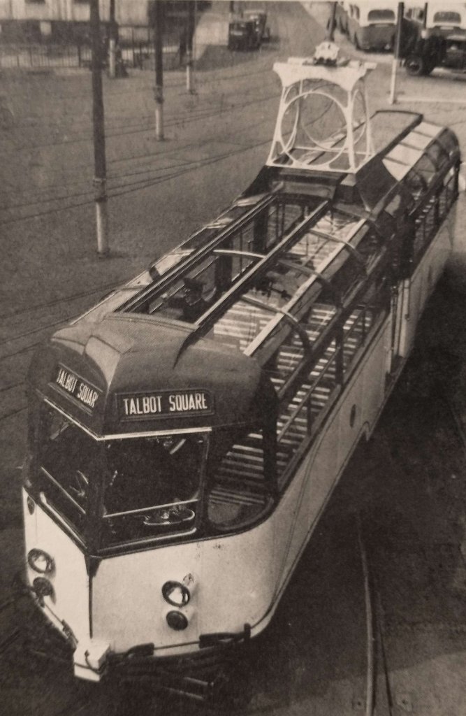
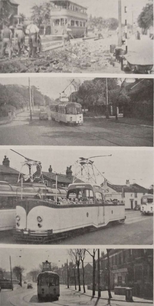
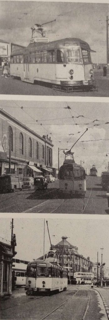
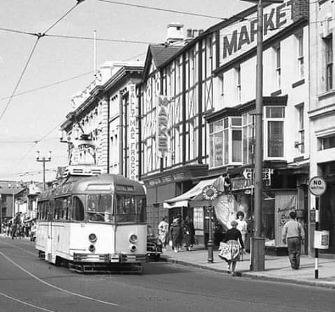
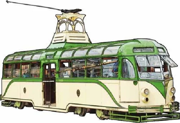
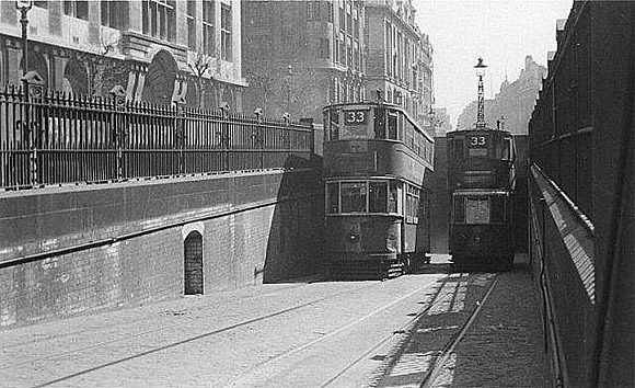
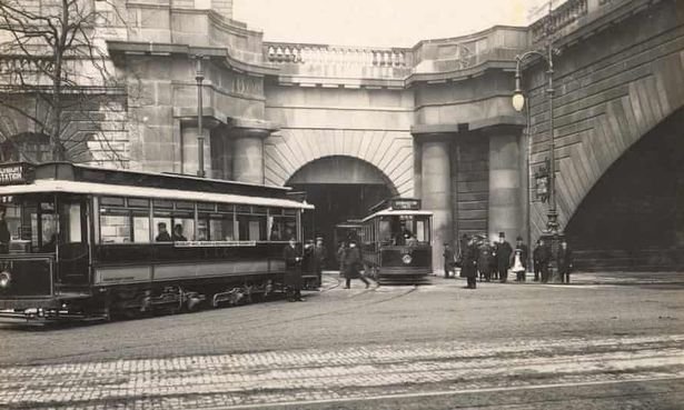
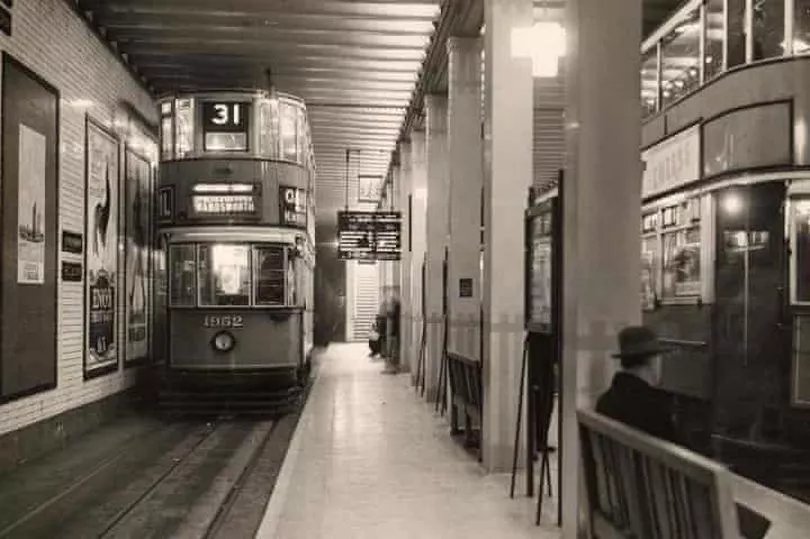
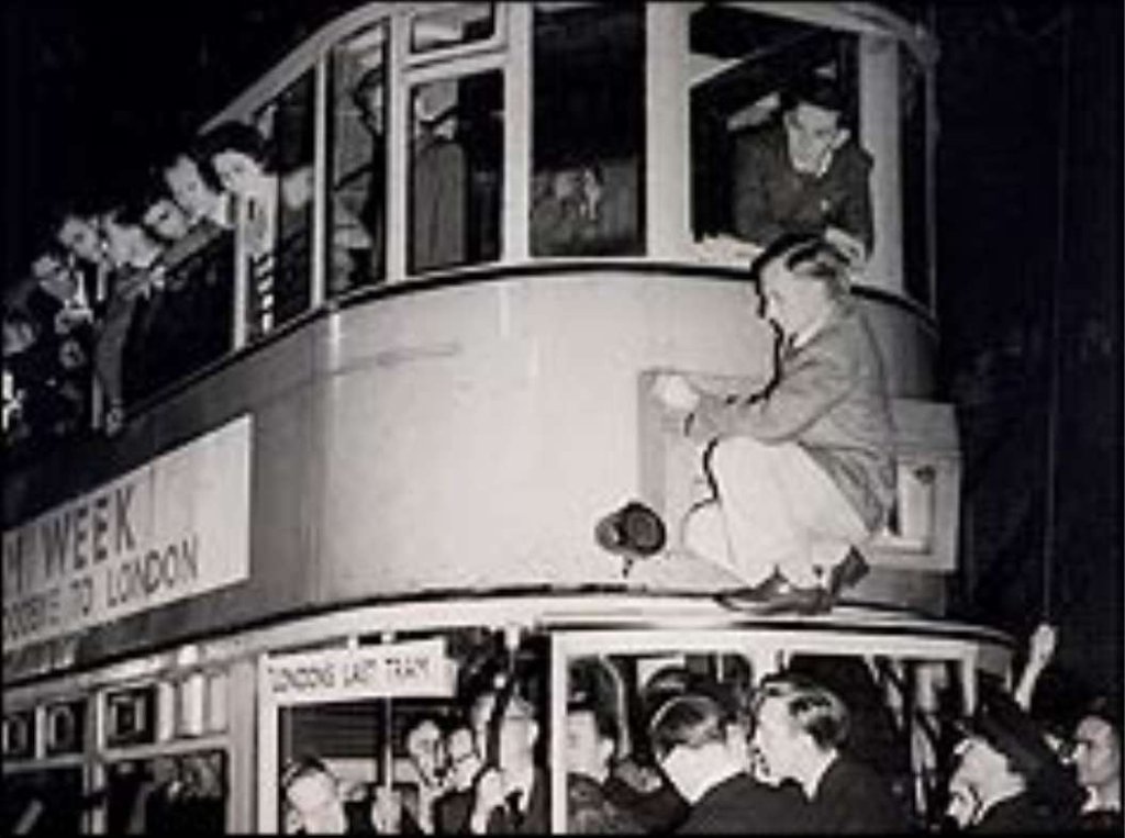
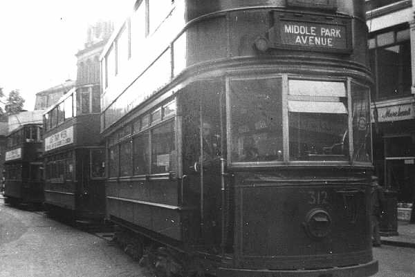
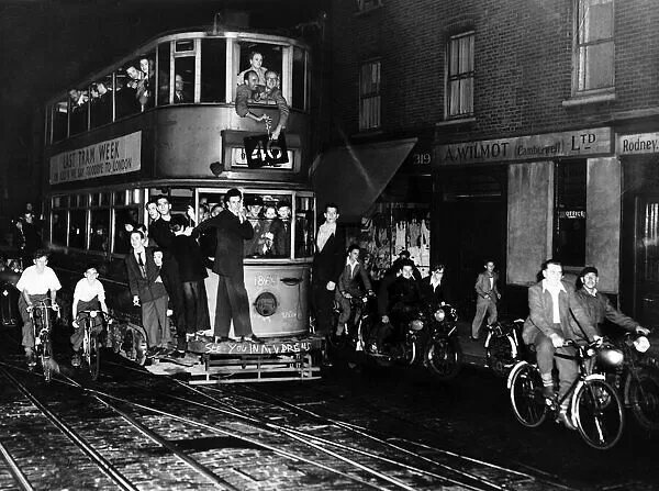
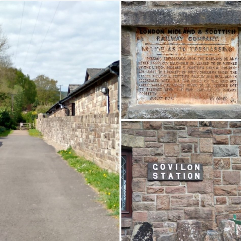
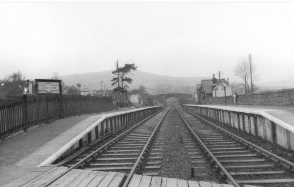
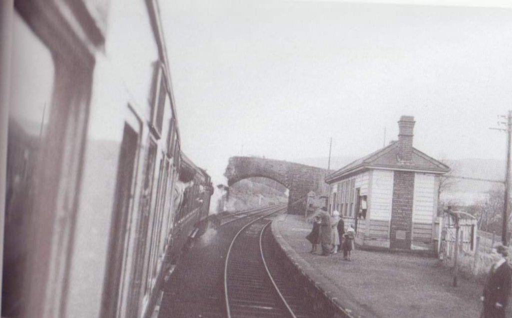
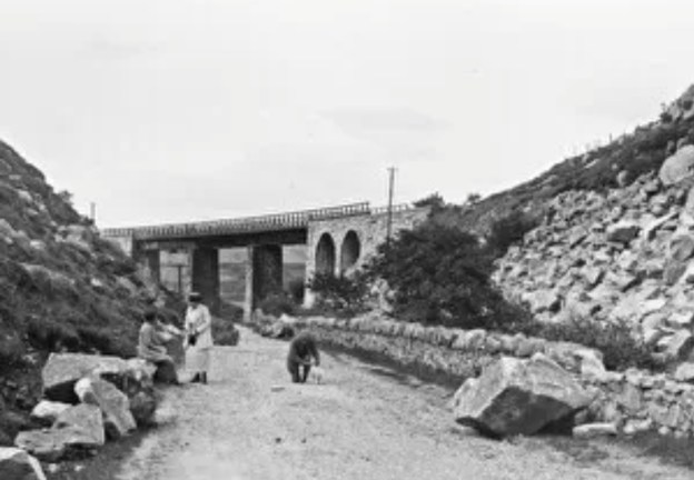
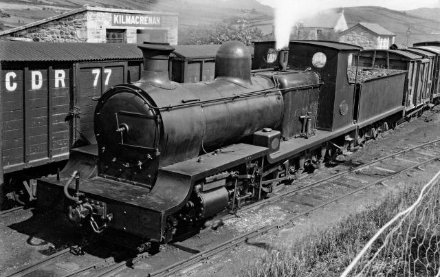
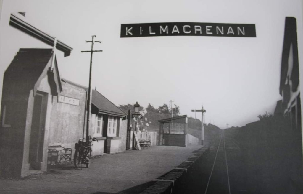
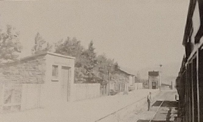
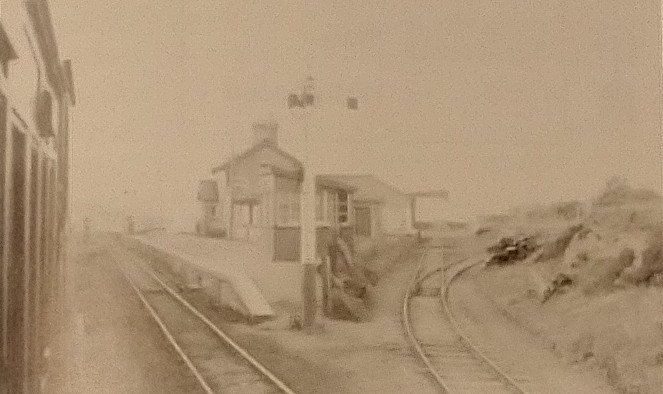
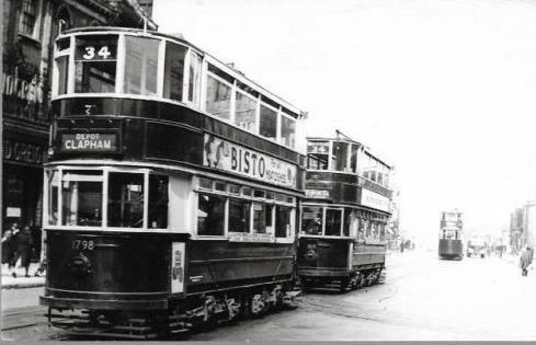
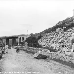
A sequence of monochrome photos which were published as part of Pearson’s articles are shown below. The first four show something of the lifespan of the experiment. The following three show Marton Vambac trams at the various termini of the Marton Route.

The four pictures above span the life of the experiment (1947-1962). The top photograph, taken in 1947, shows the new outward track being laid in Whitegate Drive, with balcony car No. 144 passing on the wrong track. The second photograph shows the finished job some years later, with a Vambac car not far from the same spot, and the third shows one of the pre-war solid-wheeled cars which Pearson blamed for the Whitegate Drive corrugations – 1934 open “boat” car No. 227 on the Circular Tour duty at Marton Depot in 1959, one of the two post-war seasons in which the Department ran a genuine “Circular Tour” via Squires Gate Lane and Marton, loading in Talbot Square. The fourth view, taken only a few weeks before abandonment, shows the track and paving at Devonshire Square, still in good-as-new condition. © C. G. Stevens, R. P. Fergusson, C. E. Macleod. [2: p53]
The three pictures above show the three termini of Blackpool’s Marton route, showing 10-21 series Vambac cars. Top, No. 16 at South Pier, the point to which the service was extended in summer (until 1961). Centre, a car reverses on the crossover at Royal Oak in 1960. Bottom, the town-centre terminus at Talbot Square, © K. M. Chadbourne. [2: p52]

Pearson states that:

“From the various engineering aspects – performance, silent running, case of control, routine maintenance, track wear, and availability – the Marton Experiment was therefore a success, even though it did not induce any other tramways to invest in similar equipment. The new equipment did all that the manufacturers claimed for it, and once the teething troubles were overcome ha[d] continued to function smoothly and efficiently for more than 10 years, with no further modifications of any importance. The Crompton Parkinson/Maley & Taunton Vambac/H.S.44 combination represented the ultimate development of street tramway practice in this country.” [2: p55]

Pearson considered that the VAMBAC trams had infinitely superior qualities both in riding and silence, so far as solid track was concerned. They were popular with the public – when abandonment was first proposed there was a significant outcry from customers who said that the VAMBAC trams were the finest transport service they had known. “Marton residents organised a massive petition to the Town Council for its retention, without any prompting from tramway-enthusiasts, in fact without their even knowing of it. The campaign was headed by Alderman J. S. Richardson, now the Mayor of Blackpool, and it is a sad coincidence that in his mayoral capacity Alderman Richardson himself had to preside at the closing on 28th October, 1962.” [2: p55]

It is Pearson’s view that the main reason for the failure of the experiment and the closure of the Marton tram route was the economic impossibility of two-man operation with only 48 seats per tram. While this was the main reason, there were at least three subsidiary factors: the cost of spare parts; the high energy cost of starting from rest; awkward relationships with other road users as visiting road users were no longer used to mixing with trams in their own communities.

He notes that crew costs in the 1960s accounted for an average of about 75% of a transport budget. Tram costs were higher than buses, the only way to offset that difference was to maximise the customer load-factor (this was effective on the Promenade) or to use tramway units of higher capacity than the largest available bus, so as to bring the cost per seat-mile down to a competitive figure. Had articulated cars been available that would have addressed the issue. “The 48-seat Marton Vambacs were below the minimum economic size … and throughout the experiment the route … had to be increasingly subsidised from the receipts of others. The Marton residents … enjoyed a superb service at considerably less than cost, and were naturally loth to lose it, but any suggestion of passing on the cost by raising the fares to a scale above that of the inland bus routes (as is done in summer on the Promenade) would clearly have been politically out of the question.” [2: p56]

Pearson’s own opinion, expressed in his article, is that the 12 year experiment proved that “revolutionary new concepts in tramway engineering [could] be applied to a normal street route as well as on the special field of the Blackpool Promenade, and Marton’s disappearance [was] a sad occasion for all who [saw] in the tramcar a still only partially-exploited form of transport. Looking back, it seems a repeat of a sadly familiar pattern; the engineering profession has delivered the goods, but the confused pattern of public transport in this country has never made full use of the potential made available by the engineers, electrical and mechanical, who gave practical expression to what [was], for most of us, still a composite dream.” [2: p56]

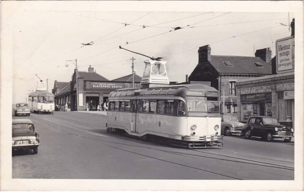
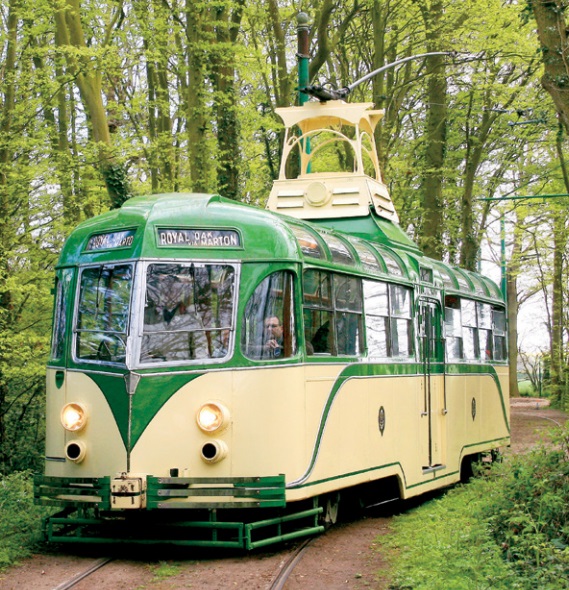
The Blackpool Trams website tells us that, “the first VAMBAC was withdrawn in 1960 as car 10 suffered accident damage and was scrapped soon after. The second VAMBAC withdrawn was 21 in 1961, which was withdrawn as a source of spare parts for the remaining trams, while 14 was also withdrawn for use as a driver training car. The writing was on the wall for the Marton Route, which had been isolated and lost it’s summer services to South Pier following the closure of the Lytham Road route in 1961, however, the remaining VAMBACS remained in use until October 1962 when the Marton route closed, with 11, 13, 15, 17 and 18 operating on the last day. The VAMBACS remained in Marton Depot and were joined by other surplus trams for scrapping in 1963. … One VAMBAC did manage to survive however, VAMBAC 11 was requested for a tour of the remaining parts of the tramway early in 1963 and was extracted from Marton Depot and made it’s way to Rigby Road. Following the tour, 11 was eventually preserved and found its way into preservation and is now at the East Anglia transport museum, where it still sees regular use today.” [3]

One of the Martin Vambacs in service in Blackpool in the late 1950s or early 1960s. This image was shared on the History of Blackpool Facebook Group on 7th April 2017 by Tony Latham. [6]
Another Marton Vambac outside Abingdon Street Market. This photograph was shared on the History of Blackpool Facebook Group on 18th May 2023 by Jess Tulloch. [8]
The interior of Marton Vambac No. 11 in its preserved condition at the East Anglia Transport Museum near Lowestoft. This image was shared on the History of Blackpool Facebook Group on 23rd February 2023 by Col Macloud. [7]
A composite image of Marton Vambac No. 11 as used by ‘Videoscene’ in their range of transfers applied to mugs. [9]
Marton Vambac No. 11 at its present home – the East Anglia Transport Museum. [10]

References

  1. F.K. Pearson; The Marston Experiment; in Modern Tramway, Volume 26 No.301; Light Railway Transport League & Ian Allan, Hampton Court, Surrey, January 1963, p14-19.
  2. F.K. Pearson; The Marston Experiment …. ; in Modern Tramway, Volume 26 No.302; Light Railway Transport League & Ian Allan, Hampton Court, Surrey, February 1963, p51-56.
  3. https://blackpool-trams.yolasite.com/vambac-trams.php, accessed on 28th July 2023.
  4. Newnes Practical Mechanics June 1948, p290-291; via., https://www.google.com/url?sa=t&source=web&rct=j&opi=89978449&url=https://worldradiohistory.com/UK/Practical-Mechanics/40s/Practical-Mechanics-1948-06-S-OCR.pdf&ved=2ahUKEwiRjbjumbKAAxVUmFwKHYifAcUQFnoECB0QAQ&usg=AOvVaw24PI5xxITo516frkIf-ZsM, accessed on 28th July 2023.
  5. https://m.facebook.com/groups/blackpoolhistory/permalink/1632707573581243, accessed on 29th July 2023.
  6. https://m.facebook.com/groups/blackpoolhistory/permalink/691364481048895, accessed on 29th July 2023.
  7. https://m.facebook.com/groups/blackpoolhistory/permalink/2196698053848856, accessed on 29th July 2023.
  8. https://m.facebook.com/groups/2251377838346012/permalink/2713552708795187, accessed on 29th July 2023.
  9. https://www.videoscene.co.uk/blackpool-tram-mug-collection-2011-vambac-11, accessed on 29th July 2023.
  10. https://www.eatransportmuseum.co.uk/wp-content/uploads/2021/04/Leaflet2021Web.pdf, accessed on 29th July 2023.
  11. https://www.skyscrapercity.com/threads/blackpool-tram-system-u-c.572141/page-33, accessed on 29th July 2023.

‘Modern Tramway’ in the early- to mid-1960s – February 1963 – The Strange Tale of No. 2

As part of a batch of magazines from the 1950s and 1960s I picked up a number of editions of ‘Modern Tramway’ from 1963 into 1964. ‘The Modern Tramway’ was the journal of the Light Railway Transport League (LRTL). By 1963 it had dropped the ‘The’ and was published jointly by Ian Allan and the LRTL. Its formal title was ‘Modern Tramway and Light Railway Review’.

The February 1963 edition of the journal was priced at 2s 6d.

Among a number of articles in the journal was a piece by G. Hyde, The Strange Tale of No. 2.

This No. 2 was Beyer Peacock steam tram engine No. 2. It is shown in the featured image above in which it is seen at Beyer Peacock’s works in Gorton, Manchester. [2]

It was originally built to a Wilkinson patent for the New South Wales Government tramways in 1885 and shipped to Australia in April of that year. It made several trial runs on the Redfern Station line of the Sydney steam tramways, but it evidently did not compare favourably with the Baldwin locomotives then in use there. Hyde says that, “It was reputed to have a heavy fuel consumption. and Beyer Peacock’s received complaints about the difficulties in maintaining a sufficient head of steam, but the engine hardly had a fair trial as only short runs were made with it, and the drivers’ inexperience may have contributed to its shortcomings. The trials were invariably carried out after midnight so no photographs were taken of the engine in service; neither was it ever incorporated into the Sydney tramway stock, consequently it never had a fleet number. Whilst in Australia it was referred to as ‘John Bull’.” [1: p48]

After its short unsuccessful trials in Sydney, John Bull was shipped to the small port of Wollongong and worked the isolated Wollongong-Clifton section of the New South Wales Government railways. It stayed there until the section was connected to the main coastal line in 1886.

Hyde commented that at this point “John Bull” disappeared. “Nothing further is known about it until it turned up again at Manchester in 1890, when it featured in Beyer Peacock’s stock list as yard engine No. 2. The mystery of this missing four years is heightened by the fact that Beyer Peacock’s records refer to the engine as having been salvaged, and returned to their works. This led to the rumour which persists in the Gorton works that No. 2 fell into the sea at one point during its travels round the world.” [1: p48]

In 1890 the loco was modified, the duplicate controls were removed, as also were the wheel curtains, then railway type buffers and drawgear were fitted.

In 1915 a steam brake was fitted, then in 1930 a new boiler was installed and in 1958 a new steam dryer was fitted. It was ultimately withdrawn from service in early 1959.

Hyde asserted that No. 2 was “certainly the biggest tramway engine ever built to Wilkinson’s patent, and was one of the most powerful steam tramway engines ever to be built in this country Its gross working weight of 16 tons compares with the 12 tons of the heavy 83-86 class Wilkinson engines of the Manchester, Bury, Rochdale & Oldham tramway, one of which is being kept by the British Transport Commission.” [1: p49]

Hyde provided detailed information about No. 2. … It had two simple cylinders, 9.5 in. diameter by 12 in. stroke. The crank axle had a pinion in the centre with 20 teeth geared to a spur wheel on the driving axle having 33 teeth, thus having a ratio of 1.65 to 1. It was fitted with a Stephenson type link motion. The four coupled driving wheels were of 30 in. diameter, with a wheelbase of 6 ft. 8 in. The water capacity was 225 gallons and there was a fuel space of 11 cubic feet. The vertical boiler was of the Field type, and had 121 tubes, each with an outside diameter of 2.13 in. The tubes, which project down into the firebox, were between 19 and 27 inches long, and had fitted concentric open-ended internal tubes known as circulating tubes. The working pressure is 150 lb. per sq. in., and the total heating area was about 184 sq. ft. with a total fire grate area of 10.8 sq. ft. The engine has an overall length of 13 ft 6 in. and an overall width of 7 ft.

“For close on 70 years, No. 2 trundled round the Gorton works of Beyer Peacock’s being affectionately known there as Old Coffeepot,” and it is hoped that it will now see many more years of active life at the Crich Tramway Museum. In the erecting shops at Beyer Peacock’s the wheels were re-tyred and the new tyres turned down to tramway standards. Then, after boiler inspection and insurance formalities had been completed, it was despatched to join the T.M.S. fleet at Crich as the only working British steam tram engine.” [1: p49]

Hyde noted that “Project Steam Tram” would involve the Tramway Museum Society in some heavy capital outlay, and that the Society was appealing to tramway enthusiasts to take an interest in the project and support it with donations. [1: p49-50]

More recent research has filled in some of the unknowns which Hyde commented on in 1963. It was Beyer Peacock Works No. 2464 and carried an operational number of 47 in Australia. In the missing years the locomotive is thought to have spent time working in Illawarra between 1887 and 1888 prior to returning to the UK in 1889. That it was at Illawarra may be a reference to its work on the Wollongong-Clifton section of the New South Wales Government railways. If so then it remained in New South Wales longer than the article in ‘Modern Tramway‘ suggested. [2][3]

As a works shunter, the tram operated in the firm’s large works complex towing huge Beyer-Garrett locomotives from one shed to another.

No. 2 in 1962 at Gorton Works just prior to its journey to the Crich Tramway Museum, © Crich TMS Archives. [3]

After arriving at Crich in 1962, No. 2 “was operated under steam for some years from 1966. A period of off-site storage between 1971 and 1978 was followed by a return to steam in the 1980s, during which it even performed on the Santa specials. However, the work involved in firing it up, supplying it with coal and clearing away the ash helped to explain why steam traction gave way to electricity on Britain’s tramways in the early years of the twentieth century.” [3]

Beyer Peacock steam tram No. 2, New South Wales Government Steam Tram No. 47 at the Crich Tramway Village, © John Huddlestone and shared by him on The Tramway and Light Railway Society Facebook Group on 15th May 2022. [4]

Crich Tramway Museum’s website tells us that, “because it was destined for export and as it was expected to be pulling much heavier loads it was much larger than those built for the home market. With 30 inch driving wheels and weighing almost 16 tons it was a true giant of a tram engine, though it did boast a number of features in common with other road-going locomotives including the fully enclosed wheels and a mechanism – in this case a “Wilkinson Patent” exhaust superheater – that was designed to reduce the amount of smoke emitted.” [3]

References

  1. G. Hyde; The Strange Tale of No. 2; in Modern Tramway Volume 26 No. 302, LRTL  and Ian Allan, Hampton Court, Surrey; February 1963, p48-50.
  2. https://preservedbritishsteamlocomotives.com/beyer-peacock-company-works-no-2464-no-47-john-bull-0-4-0vb-tram, accessed on 26th July 2023.
  3. https://www.tramway.co.uk/trams/new-south-wales-47, accessed on 26th July 2023.
  4. https://m.facebook.com/groups/www.tlrs.info/permalink/557174155756970, accessed on 26th July 2023.

Leviticus 18:22 and Leviticus 20:13

How are we meant to read Leviticus 18:22 and 20:13?

The later part of this article attempts to understand the nuances in different arguments about the actual meaning of these two texts. Attempting to do this is, of necessity, complex and really requires a far greater understanding of Ancient Hebrew than I can aspire to, having only followed a relatively short course at theological college. They say that a little knowledge can be a dangerous thing. Nowhere is this more true than in the area of ancient texts and their meaning. Any misunderstandings of the arguments made by others and covered in this article are solely mine.

The traditional view and the approach of much of the English-speaking international church to these two verses is to continue to use what have been accepted English translations of the texts. So, we have these translations:

Leviticus 18:22: You shall not lie with a male as with a woman; it is an abomination.

Leviticus 20:13: If a man lies with a male as with a woman, both of them have committed an abomination; they shall be put to death; their blood is upon them.

In order to get to grips with these two verses we need, first, to understand their context and then look at the meaning of the original Hebrew text. As part of doing so we may also need to look at similar uses of the words used in these two texts.

In addition, we will need to ask what status these texts have for Christians who now live under ‘grace’ rather than under ‘the law’. Romans tells us, “‘sin shall no longer be your master, because you are not under the law, but under grace.’ [Romans 6:14] … In the New Testament (NT), the Old Testament (OT) law is described as something that ‘proved to be death’ to us [Romans 7:10], ‘came to increase trespass’ [Romans 5:20], and held us ‘captive’ and ‘imprisoned’ [Galatians 3:23].” [3]

However, we cannot just dismiss ‘the law’. “In Matthew 5:17, Christ teaches that he is indeed not progressing away from the law: ‘Do not think that I have come to abolish the Law or the Prophets; I have not come to abolish them but to fulfill them.’ … [and] … Romans 3:31 says: ‘Do we then overthrow the law by this faith? By no means! On the contrary, we uphold the law.’” [3] If this is also true, how do we live not under ‘the law’ but under ‘grace’? How do we interpret OT law in a NT age?

First, context! …

The Holiness Code

The section of Leviticus in which the two verses fall (Leviticus 17 to 26) is often referred to as the Holiness Code. The emphasis, throughout these chapters is “on holiness, on being holy, on being pure. And so what you eat, what you do, what you are, all these things can affect how holy you are, how pure you are.” [2]

And so,” says Jonathan Tallon, “eating the wrong food makes you less holy [Lev. 20:25]. Having a tattoo makes you less holy [Lev. 19:28]. Wearing clothes from different fibres – like wool and linen together – makes you less holy [Lev. 19:19]. Even having a physical disability makes you less holy [Lev. 21:16-23].” [2]

In part, the holiness code encouraged Israelites to be pure, separate from, different to their pagan neighbours. Everyday life became a symbol of that purity. Israelites were not to assimilate to surrounding cultures, just as different types of fibres shouldn’t be in the same cloth.

It is reasonable, therefore, in thinking about the meaning of the verses which make up the ten chapters of the ‘Holiness Code’, to ask what the prevailing cultural norms of those other cultures were. How were Israelites to be different from their neighbours?

It is probably also reasonable to note that there is no mention in Leviticus 18:22 & 20:13 of the actions/roles of two women.

But perhaps we are getting ahead of ourselves. Let’s look at the two chapters in Leviticus first.

Leviticus 18 and 20

I have found an article by Susan Day Pigott helpful as an introduction to these chapters. [25]

“Leviticus 18 and 20 forbid all sorts of sexual activity as well as foreign cult practices. In both, the purpose of the laws is clearly stated in the context of avoiding the practices of other nations. Lev. 18:3: “You shall not do as they do in the land of Egypt, where you lived, and you shall not do as they do in the land of Canaan, to which I am bringing you” (NRSV). Lev. 20:23: “You shall not follow the practices of the nation that I am driving out before you. Because they did all these things, I abhorred them” (NRSV). Thus, the first thing we should notice is that the laws of Leviticus 18 and 20 are about avoiding the practices of other nations—nations which worshiped other gods.

Leviticus 18 and 20 differ in the order and in some of the practices they list. Leviticus 18 simply cites the practices and sometimes labels them as abominations or other such things. Leviticus 20 tends to cite the practices and also commends punishments for each one. Often the penalty is death.

Both Leviticus 18 and 20 emphasize avoiding the worship of Molech, a foreign deity, especially in regard to child sacrifice (Lev. 18:21; Lev. 20:2-5). This is another clue that these laws revolve around avoiding the practices of other nations. Interestingly, the law forbidding sacrificing children to Molech appears immediately prior to the oft-prooftexted 18:22, usually understood to forbid homosexuality.

Most of the laws of Leviticus 18 forbid sexual relations amongst family members (Lev. 18:6-18). One verse warns against having sex with a menstruant (Lev. 18:19; cf. Lev. 20:18 which states that both the man and woman will be cut off from their people!). One verse forbids adultery (Lev. 18:20). And the next forbids sacrificing children to Molech (Lev. 18:21). Next comes our … verse (Lev. 18:22), followed by a verse forbidding bestiality (Lev. 18:23). The remaining verses emphasize that such practices are forbidden because the “defiled” nations practice them (18:24-30).

The laws of Leviticus 20 are more diverse. The chapter begins with the laws forbidding worship of Molech (Lev. 20:1-5). This is followed by forbidding the use of necromancers (Lev. 20:6), admonitions to remain holy (Lev. 20:7-8), and a warning against cursing one’s father or mother lest one be put to death (Lev. 20:9). The laws that follow focus on forbidden sexual relations, including our other … verse (v. 13) (Lev. 20:10-21). The chapter concludes with a restatement of the importance of making a distinction between Israel and the other nations (Lev. 20:22-26) and a final verse forbidding the consultation of necromancers (Lev. 20:27).” [25]

Tallon helps us to understand the prevailing culture in nations surrounding Israel in OT times: “In the surrounding cultures, the major socially acceptable form of same-sex activity was with male shrine prostitutes as part of temple worship to pagan gods and goddesses. And there is repeated rhetoric against these shrine prostitutes at different parts of the Hebrew Bible [see Deut. 23:17; 1 Kings 14:24 (linked with abomination), 15:12, 22:46, 23:7].” [2]

Susan Day Pigott draws attention to Leviticus 18:21 where pagan Molech worship is explicitly referenced and points to a passage in Isaiah:

Upon a high and lofty mountain you have set your bed, and there you went up to offer sacrifice. Behind the door and the doorpost you have set up your symbol; for in deserting me, you have uncovered your bed, you have gone up to it, you have made it wide; and you have made a bargain for yourself with them, you have loved their bed, you have gazed on their nakedness. You journeyed to Molech with oil, and multiplied your perfumes; you sent your envoys far away, and sent down even to Sheol.” (Isa. 57:7-9 NRSV).

Susan Day Pigott comments: “Clearly, in this text, setting up your bed is a symbol for worship of Molech. Perhaps the same is true in Leviticus. And since both Levitical verses speak of lying with a male on the beds of a woman, perhaps the issue is sacred prostitution, not homosexuality.” [25]

More widely in the ancient Near East there were cultures like Ancient Greece, where the dominant form of male-male intercourse was (usually married) men with boys – pederasty. Perhaps is is significant, then, that the translation of Leviticus 20:13 above, talks of a man lying with a male (a boy or a man).

This means that we have two areas of ancient pagan life from which the Israelites were called, in the Holiness Code, to be different – pagan temple coupling between males and pederasty. These two things are manifestly different from faithful, loving, committed relationships. Tallon provides a helpful image to help us visualise this:

This simple Venn diagram helps us to understand that what was condemned in Leviticus was different from the matters we are discussing in the church today. Some overlap is reasonable – all relationships can go wrong and become sinful. [2]

If we are to take these two verses from Leviticus seriously, we have to engage with their context.

Second, we need to ask what status these verses have for people who follow Jesus.

Status of the Holiness Code in a Christian’s Life

We touched on this earlier in this article. This is a serious question which relates to the applicability of OT passages in our own context. We cannot just say that we write-off the OT and particularly the Holiness Code as inapplicable to Christians. Jesus, himself, does not do this. Rather than negating or dispensing with the OT law, Jesus reinvigorates it. In the Sermon on the Mount, he takes external rules and applies them internally to our hearts, thoughts and lives. So, for example, he says: “You have heard that it was said, ‘You shall not commit adultery. ‘ But I tell you that anyone who looks at a woman lustfully has already committed adultery with her in his heart.” [Matthew 5: 27-28]

Here, I have to part ways with Jonathan Tallon. His argument is that, “Christians don’t have to keep the Law. Why not? Because, with the arrival of the Messiah, Jesus, the time of the Law has come to an end. [Romans 10:4; Galatians 3:24-26]. We have been given a new law – the law of love. Love God, and love your neighbour [Galatians 5:14]. So it doesn’t matter whether you get a tattoo, or wear a cotton-polyester blend, or work on a Saturday (which is the Sabbath). The only thing that matters is whether what you are doing is loving.” [2]

I think that he overstates his case. It is true that as Christians, we are not under ‘the law’ but under ‘grace’. It is not true that we can, as a result, ignore what the OT scriptures say. Evangelical Christians believe that all scripture is ‘God-inspired’, breathed out by God. Not only does that mean that we have to treat it with respect, which we manifestly need to do, but also we need to listen to it and allow it to speak into our lives. That is actually what Tallon was doing as he helped us to understand the context in which these verses were written. It is also what Tallon was doing as he helped us to listen more carefully to the message of these passages from Leviticus. He is actually acknowledging that these OT passages do have something to say to us about what it means to be ‘loving’ and to live under ‘grace’.

How should we apply these verses (and others from Leviticus)? Taking them literally will mean that we have to accept the death penalty for homosexuality. [Leviticus 20:13] We will also need to accept that adultery is punishable by death. [Leviticus 20:10] It will mean that a person who gets a tattoo should be cut off from the community. [Leviticus 19:28] It will also mean that we cannot have mixed-fibres in our clothes nor mix food on our plates. [Leviticus 19:19] Or we take all these passages literally but ignore the bits we say no longer matter – we pick and choose.

While it is true that there is significant problem with taking these passages, as we read them today, primarily in translation, literally. We must also acknowledge that a significant number of the things written about in the Holiness Code are still seen, and must ever be seen, as wrong – incest is a prime example.

So, rather than taking these scriptures literally or saying that they no longer apply to us, we are, I think, intended to think these things through carefully, to understand the original point being made and then to apply these scriptures to help us understand what it means to be under ‘grace’ and living according to a ‘law of love’.

There is a sense in which our discussion so far has not yet delved deeply into the meaning of these passages. We have noted the context and the contrasts being made with the pagan world around Israel in OT times. In doing so we have focussed to a great extent on the verses translated into English.

What happens if we try to focus primarily on the Hebrew text? Is the position the same, or do have to look agin at out thinking?

Lost in Translation?

How sure are we that the English translation of the verses we are looking at are a fair and accurate translation of the original text?

Perhaps we should start by trying to understand the process of translation and then try to consider the original texts. …

Translation from Hebrew into English (or any other modern language is not simple. The original Hebrew text had to be interpreted by later readers to add what we would call vowels to the original words. Wikipedia is not necessarily the best authority to turn to but it is of general assistance. Wikipedia tells us that:

“Biblical Hebrew has been written with a number of different writing systems. From around the 12th century BCE until the 6th century BCE the Hebrews used the Paleo-Hebrew alphabet. This was retained by the Samaritans, who use the descendent Samaritan script to this day. However, the Imperial Aramaic alphabet gradually displaced the Paleo-Hebrew alphabet after the exile to Babylon, and it became the source for the Modern Hebrew alphabet. All of these scripts were lacking letters to represent all of the sounds of Biblical Hebrew, although these sounds are reflected in Greek and Latin transcriptions/translations of the time. … No manuscript of the Hebrew Bible dates to before 400 BCE. … Vowel and cantillation* marks were added to the older consonantal layer of the Bible between 600 CE and the beginning of the 10th century. The scholars who preserved the pronunciation of the Bibles were known as the Masoretes.” [4]

* Cantillation is is the manner of chanting ritual readings from the Hebrew Bible in synagogue services. The chants are written and notated in accordance with the special signs or marks printed in the Masoretic Text of the Bible, to complement the letters and vowel points.

This does not necessarily mean that meanings were changed in this process. As writing systems changed and as pointing was introduced and developed, the scholars of the time were seeking to preserve pronunciation, not to change it. But that process means a that an inevitable layer of interpretation occurred over a period of perhaps four centuries. We only need to think of the differences between 17th century English and 21st century English to realise that in four centuries a great deal of change can and does occur over time in pronunciations, in the meaning of specific words and in the way in which letters make up words.

In addition, Ancient Hebrew sentence structure is different from modern English. It is not just written from right to left, rather than our English practice of writing from left to right. In sentences, verbs nouns, etc are placed differently. There is perhaps also a greater sense that the meaning of particular words sometimes has to be determined by the context in which they are used. In modern English, these words are called ‘Homographs’ (words spelt the same but with different meanings). Examples in English include: Content (‘satisfied’ or ‘what is contained in something’); Does (‘female deer’ or ‘the third person singular form of the verb ‘to do”; Desert (‘a course in a meal’ or ‘a hot, arid region’; Minute (’60 seconds’ or ‘tiny’). These may be pronounced the same or differently, but they are spelt the same. We determine their meaning either by the context or by the pronunciation.

All these factors mean that we have to accept that the process of translation, almost inevitably, can distort the original meaning of a sentence. We have to rely on the best efforts of those who do the translation and it is why, often, translation is done by teams of scholars rather than by individuals. It is still possible that those teams of scholars will be culturally influenced and share the assumptions of the prevailing cultures in which they live. Or that they may choose to “dispel ambiguity by making the translation as simple as possible.” [1: p240]

Susan Day Pigott says: “The problem with all [English] translations is they don’t reflect what the Hebrew actually says.” [25]

Is she right?

In the case of Leviticus 18:22, Lings suggests “that the translators’ attempts to clarify the Hebrew text presents a reading that is not only harmful, but incongruent to the context of Leviticus.” [1] Particularly, Lings focusses on two primary things: the introduction of propositions by English translators; and the use of the rare Hebrew word miškevē.

In Hebrew, Leviticus 18:22 says:

ואת־זכר לא תשכב משכבי אשה תעובה הִוא

 wĕʾet-zākār lōʾ tiškab miškĕbê (miškĕvê) tôʿēbâ hiw

A literal translation is: ‘With (a) male you shall not lie (the) lyings (or beds) of a woman. (An) abomination (tôʿēbâ) is that.’ [1: p231][5]

The Septugint reads thus:

καὶ μετὰ ἄρσενος οὐ κοιμηθήσῃ κοίτην γυναικός, βδέλυγμα γάρ ἐστιν.

The NRSV translation says: ‘You shall not lie with a male as with a woman, it is an abomination.’

In Hebrew, Leviticus 20:13 says:

ואיש אשר ישכב את־זכר משכבי אשה תעובה עשו שניהם מות יומתו דמיהם בם

wĕʾîš ʾăšer yiškab ʾet-zākār miškĕbê (miškĕvê) tôʿēbâ ʿāśû šĕnêhem môt yûmātû dĕmêhem bām

The Septuagint reads thus:

καὶ ὃς ἂν κοιμηθῇ μετὰ ἄρσενος κοίτην γυναικός, βδέλυγμα ἐποίησαν ἀμφότεροι, θανατούσθωσαν, ἔνοχοί εἰσιν

English (NRSV):

If a man lies with a male as with a woman, both of them have committed an abomination; they shall be put to death; their blood is upon them.

First, then, in Leviticus 18:22, English translators have added the prepositions as and with to give sense to the verse. There is an assumption made in that decision. That assumption is that the verse is making a comparison between a ‘normal’ action and a ‘deviant’ action. [1: p246-247] Lings points out that this assumption is not warranted by the verse. “To substantiate such a translation, the Hebrew equivalent for as () must be connected directly to miškevē (“lyings”) since the Hebrew preposition attaches grammatically to either a noun or an infinitive.” [1: p236-237] That does not occur in the verse. Instead, “miškevē is the direct object of the verb tiškav (you shall not lie).” [1: p237] “Similarly, another grammatical construction that validates the English translation “with a woman” involves the Hebrew preposition ‘eth appearing a second time in front of ’iššâ.” [1: p237] This construction does not exist in Lev. 18:22.

“The Hebrew phrase kӗšōkhēv’eth (“as one lies with”) also conveys the same meaning that traditional English translators seek, but it is not present within the original text.” [1: p237] The absence of an equivalent preposition in Hebrew casts doubt on an assumption that the verse compares “normative” and “deviant” sexual actions.

Secondly, “the plural word miškevē is a rare biblical word. Therefore, it warrants careful scrutiny. In fact, miškevē only occurs one more time in the entire Bible besides its parallel occurrence in Lev. 20:13. [1: p245, p241] In Gen. 49:4, the verse explicitly refers the incestuous activity of Reuben with his father’s concubine, Bilhah. While “lyings”, “acts of lying down,” or “beds” are possible translations for the word miškevē, the comparison to the Hebrew singular word for bed, yātsūa, suggests that the two Hebrew words are not interchangeable. [1: p240] Lings asserts that the plural miškevë may focus on the deviant nature of Reuben’s incestuous relationship with Bilhah. [1: p241] The philological nuance implies that miškevē means rape of a family member.” [1]

If Lings is right, the incestuous connotation of the word miškevē may make more sense in the context of Leviticus 18 as much of that chapter relates to divine condemnation of incest but the connection is not as clear there as it is in Leviticus 20 which focusses primarily on incest . In Leviticus 20:13, “the miškevē ‘iššâ is an act that is punished identically to other acts that are clearly incestuous. Therefore, the likely meaning of miškevē ‘iššâ refers … to incestuous male-male rape.” [1] If Lings is right, this certainly means that it is less easy to apply miškevē ‘iššâ it to all erotic, same-sex relationships.

Lings’ reading of the Hebrew text suggests that Leviticus 18:22 clearly condemns incestuous, same-sex rape. It is far less sure that it can be used to condemn all same-sex relationships.

מִשְׁכְּבֵי אִשָּׁה (miškevē ‘iššâ)

Are things really as simple as Lings suggests?

Scholars cannot agree on the right way to interpret Leviticus 18: 22 and 20:13. There are a significant number who argue for a traditional interpretation. Mark Preston Stone highlights many of these in the introduction to his paper which was published in the journal Currents in Biblical Research. [5]

The earliest of those on Stone’s list were arguing their point before there was any recognition of the possibility of faithful loving homosexual relationships and show little or no differentiation between varying forms of homosexual actions and relationships.

In 1994, Saul M. Olyan published an article which carefully considered philological issues (‘philology’ being the study of the structure, historical development, and relationships of a language or languages) which the two verses and their contexts raise. [6]

Oylan’s conclusion was that the verses related to male-to-male anal sex. Together with two other papers published in 1994 and 1995, Oylan’s essay heralded a new era in research into the two verses in Leviticus.

Since 1994, there have been 21 different scholarly studies which have been reported in French, English and German, all of these have differences of approach. Mark Preston Stone [5] has surveyed the papers produced and in doing so concluded that those which are still considered viable have 5 different main themes. Papers by Olyan [6], Dershowitz [7][8][9], Stewart [10][11], Töyräänvuori [12], and Wells [13] are representative of the main perspectives espoused by those studies.

“Much of the disagreement stems “from the Hebrew phrase משכבי אשה. English translations tend to gloss this as analogical, ‘as one lies with a woman’ … but literally we have … ‘And with a male you shall not lie down the beds of a woman’ … Many interpreters have assumed that משכב connotes ‘the act of lying’ … This may be possible but, as Wells [13] insists, the primary meaning of the noun is ‘bed’. What could this mean, and why is it worthy of proscription? We can see that all translations are freely interpretive in their understanding of משכבי אשה, so the question before us is whether such translations are justified or whether another rendering is preferable.” [5]

Oylan compares משכבי אשה with a similar, but male, reference in Number 31:17 and Judges 21:11-12, משכב זכר (‘the lying down of a male’) which, in both those contexts, refers to a woman who is a virgin (who has not know male vaginal penetration). [5][6: p184] Oylan argues that it is reasonable to assume that since משכב זכר has a restricted usage, it is likewise reasonable to assume that משכבי אשה must also have a very specific meaning. But we must note that משכב זכר is singular and that משכבי אשה is plural. Oylan considers that in Hebrew thought, male anal penetration was seen as analogous to vaginal penetration and that משכבי אשה is aimed at the penetrator rather than the one penetrated. [5][6: p186-188]

In commenting on Oylan’s paper, others, including Jerome Walsh [14] have argued that the one addressed is the one penetrated rather than the penetrator. Both agree on the link with Numbers 31:17 and Judges 21:11-12.

If we accept Oylan’s and Walsh’s working hypothesis that both Leviticus 18:22 and 20:13 proscribe male same-sex anal intercourse, we have to ask, why? Why might this have been an issue in ancient Israelite society?

Stone cites a list of those who see this as a blanket ban on all same-sex erotic behaviour. The actual references are not necessarily as important as the number of references: Smith (1967), Wenham (1979), Niditch (1982), Greenberg (1988), Alpert (1989), Levine (1989) Eilberg-Schwartz (1990), Biale (1992), Gagnon (2001), Kiuchi (2007), Zehnder (2008), Himbaza, Schenker & Edart (2012). [5]

A more restricted variant sees this prohibition as referring only to physical same-sex activity. Stone calls these views ‘traditional’. Stone tells us that, “the first explicit articulation of this broad reading can be traced to the late 4th century CE Apostolic Constitutions (linking it to Sodom in Gen. 19), it did not become the mainstream Christian reading until the Middle Ages with Peter Damian, Peter of Poitiers, and Peter Cantor. … Early Jewish views [were] similarly diverse and complicated … Both the uncertainty with and popularity of this view can be glimpsed in some of the earliest English translations. Wycliffe’s 1382 translation, for instance, offered two different renderings: ‘Thou shalt not be meddled with a man, by lechery of a woman, for it is an abomination. (Thou shalt not be mixed together with a man, like in a fleshly coupling with a woman, for it is an abomination)’.” [5][15: p217-18]

Stone also wants us to note that if Leviticus 18:22 & 20:13 can be accurately described as articulating a universal ban on homosexual behaviour, “then it would constitute the only known ban of this sort among ancient Near Eastern and Classical sources, which are typically concerned with issues of class, incest, and violence (see Olyan 1994 for a brief survey).” [5]

He further comments that, “if one insists that the opaque Hebrew of Lev. 18.22/20.13 really does represent an unprecedented ban on all male same-sex intercourse, the burden of proof remains high: The laws of Leviticus come from literate cultural producers, and the views found there do not always necessarily reflect Israelite culture as a whole but a limited segment (see Albertz and Schmitt 2012: p1-56) [5][16]. Even if we were to conclude that the most reasonable understanding of Lev. 18.22/20.13 was a blanket prohibition against ‘homosexuality’—certainly now the minority view among specialists—there is no obvious reason to assume this view would have carried the same weight in every context. The most we could say is that it represents one particular view from one segment of society. Many scholars have noted the contradictory views of sexual ethics by comparing the following: Lev. 18.9 and 20.17 forbid sex and marriage, respectively, with one’s sister. And yet in Gen. 20, we encounter Abraham’s marriage to Sarah, his half-sister, with no hint of censure. In Lev. 18.6 and 20.21, a man is forbidden from marrying the wife of his brother—in stark contradiction to the law of Levirate marriage in Deut. 25. Or compare Lev. 18.18, which forbids marriage to two sisters, with Jacob’s marriages to Leah and Rachel. We should reemphasize here not only the uniqueness of Lev. 18.22/20.13 within the biblical literature, but also—if one insists it articulates a blanket prohibition against either ‘homosexuality’ or even male same-sex anal intercourse in general— its sui generis character compared with ancient Mediterranean and Near Eastern cultures. On the other hand, laws against incest (Deut. 22.30, 27.20-23), adultery (Exod. 20.14; Deut. 5.18, 22.22-27; Num. 5.11-31; Ezek. 18.6-11, 33.26) and bestiality (Exod. 22.19; Deut. 27.21) are found elsewhere.” [5]

Stone also notes (as per Lings [16]) that the comparative particle ‘as‘ (not present in the Hebrew) has to be worked quite hard and has the potential to mean other things than most translators might intend. (For instance ‘as’ might be taken to mean ‘in the same way as’ which could give freedom for bisexual relationships provided the participant(s) do not use the same erotic practices with men as with women.)

An alternate traditional view which dates back as far as Philo of Alexandria (first century CE) is that Leviticus 18:22 & 20:13 should be seen as referring particularly to pederasty. Luther’s translation reflects this (‘Du sollst nicht beim Knaben liegen wie beim Weibe; denn es ist ein Greuel’, ‘Knaben’ = ‘boys’). While we today would condemn these relationship due to their predatory power differential, in antiquity they were condemned for their feminisation of boys, the squandering of sperm and the absence of procreative intent. [5][17]

Some commentators argue that Leviticus 18:22 and 20:13 specifically allude to Genesis 1-3. People can be found on the traditional side of the debate and on the more liberal side, that use an assumed link to Genesis 1-3 to argue their case. [5]

Comparative evidence from antiquity has also played a significant role in the debate. Stone notes that the available material is sparse, at best. It does exist in Hittite Laws and in the Egyptian Book of the Dead. [5]

In antiquity ‘active’ and ‘passive’ roles were seen differently depending on the prevailing culture. Oylan sees there as gendered [6: p189], ‘male’=active, ‘female’=passive. In other cultures the concerns about active and passive roles revolved around other factors such as class, social role and age. Walsh argues that since the Levitical laws are addressed in the first instance to the free male Israelite citizen, “The central issue in both laws is not gender confusion in general, but precisely gender confusion wherein the free male citizen takes on the “female” role….The male sexual role is to be the active penetrator; the passive role of being penetrated brings shame to a man (at least to a free adult male citizen) who engages in it and, in the later redactional stratum, also to the one who penetrates him. Apart from this situation, the Hebrew Bible is silent.” [14: p207-208]

Stone goes on to assert that “When scholars appeal to the evidence from the comparative material they broadly agree that the anxiety reflected cannot be reduced to a broad taboo against male same-sex erotic behaviour. On the contrary, sex acts between men of different status were not only allowed but even taxed (e.g., Greco-Roman pederasty) or at the very least broadly institutionalized and incorporated into specialized priestly roles. Some roles intentionally blurred the gender boundaries and seem to have involved some form of sex work (e.g., the Assyrian assinnu, kurgarrû, kuluʾu, and kalû) (see eg. [18: p28-36] [19]). [5]

It seems that across the ancient near- and middle-east ‘homosexuality’ was not a real concern and where these matters do appear, they are rare and cannot easily be mapped onto modern conceptions of sexuality. They seem to be concerned “with issues of power and social class, ancient conceptions of appropriate gender roles, and maintaining proper boundaries between these categories. … Sex benefitted the active/penetrative party, not the passive/penetrated. Note, too, that these ancient anxieties around male same-sex anal intercourse are largely premised on misogyny.” [5] what does seem to be a shared concern is male to male sex between parties of the same class which is effectively seen as rape by the penetrator. if this argument is followed then the better translation of Leviticus 18:22 would be “Sex for the conquest, for shoring up the ego, for self-aggrandizement, or worse, for the perverse pleasure of demeaning another man is prohibited. This is an abomination.” [20: p206 & 21: p132-33] It does not seem unreasonable to postulate that a concern for the social standing of the participants referred to in Leviticus 18: 22 & 20:13 is at least a part of reason for its consideration as tôʿēbâ.

A parallel possibility which must carry some weight in out thinking is what has often been referred to as ‘cult prostitution’. There is debate about whether this existed and in what form but a considerable number of scholars are listed by Stone as considering that activity as the focus of Leviticus 18:22 & 20:13. In concert with these views are a number who relate the principal concern of the two verses to ‘idolatry’. Stone quotes Deuteronomy 23:17-18 here:

None of the daughters of Israel shall be a temple prostitute; none of the sons of Israel
shall be a temple prostitute. You shall not bring the fee of a prostitute or the wages of a male prostitute into the house of the LORD your God in payment for any vow, for both of these are abhorrent to the LORD your God
.” (NRSV)

He notes, however, that there is nothing in the broader context of Lev. 18 and 20 that would suggest a restriction to the cultic sphere. [5]

There is also a possibility, argued for by Dershowitz [7] that the earliest textual version of Leviticus 18 did not include verses 18-23. This is a particularly technical proposal based on an apparent contradiction in the structure of the chapter which suggests additions by an editor. [5] [7]

Stone then concentrates on three specific hypotheses about Leviticus 18:22 & 20:13.

a. Töyräänvuori (2020) [12] “has recently proposed the novel view that male same-sex
intercourse is not even addressed in these verses. Instead, the law is concerned about ambiguous paternity resulting from a male-male-female threesome.” [5] In this scenario it is what is conceived in the womb that is an abomination (tôʿēbâ). “The children resulting from such situations would have unclear social roles, and ‘the statutes aim to prevent the creation of illicit and potentially abominable offspring. The creation of such offspring would be considered as disruptive to the social order, but ultimately it is questions of inheritance that the statutes aim to resolve’ [12: p249 & 250].” [5]

b. Stewart (2000, 2006) [10][11] “has argued that the laws are concerned only with male same-sex incest.” [5] His hypothesis has been picked up and expanded by Lings [1][15: p231-250] and Milgrom [22: p1786] Stewart’s argument revolves round משכב זכר (‘lying of a male’ – in Stewart’s argument this means ‘vaginal penetration’) and משכבי אשה (‘lyings of a woman’ – ‘vaginal receptivity’) Stewart points to Genesis 49:4 whereאביך משכבי (‘the bed of your father’ talks of Reuben’s sexual activity with one of Jacob’s wives – incest) and he argues that “The lyings-of-a-woman still presumes the agency of a male but refers to an act with another male by a kind of literary gender play. Just as the ‘lyings-of-your-father’ refers to a usurpation of the father’s bed by the son, the ‘lyings-of-a-woman’ metonymically refer to a male as incestuous object—a metonym because elaboration of the incest category has been (primarily) in terms of female objects (Lev. 18.7-16).” [11: p97]

Stewart also argues that the “singular משכב indicates licit sex, whereas the plural משכבי is a technical term indicating illicit sex. What is illicit? Incest, and in the particular case of Lev. 18.22, all the ‘male versions’ of prohibitions just enumerated [11: p74]. It is a catch-all phrase … tacked on ‘to make sure that the general prohibition against incest applies in all directions’ [1: p245].” [5] So, incest is the target of Leviticus 18:22 & 20:13, rather than male same-sex activity in general.

c. Wells (2020) [13] “has proposed that the issue is … that of prohibiting sexual intercourse with an ‘unavailable’ man—either due to his being married to a woman (i.e., adultery) or his being a younger male under the authority of another woman.” [5] He notes elements missing from both Leviticus 18:22 & 20:13, particularly that neither qualify the זכר ‘male’ with כל ‘all/every’. … “This is significant because the pattern elsewhere is to identify the illicit sexual partner, typically preceded by another word (e.g., ‘nakedness’) or a preposition, and אשה is always qualified so as to limit the prohibition to a certain woman or situation. Given this pattern, every illicit sexual partner in Lev. 18 is restrictively qualified unless we find כל or a similar all encompassing reference (e.g., 18.23). Since we lack any such indicator in 18.22 or 20.13, we should infer that the prohibition is similarly restricted to a particular person or situation. For Wells, this qualifier is משכבי אשה. … The second missing element is … the almost universal choice to translate [using] analogy, but we are missing a Hebrew particle of comparison.” [5] We have already noted this factor.

Given these two things, the missing ‘all/every’ and a missing analogy, Wells insists that משכב should in this context mean a ‘location’ rather than an ‘action’. He concludes this on the basis of the usage of the verb שכב elsewhere. “Outside of Lev. 18.22/20.13, there are eleven other uses of the verb שכב with an adverbial accusative. In eight of these, it is clearly an adverbial accusative of location (2 Sam. 4.5, 11.9, 12.16, 13.31; Mic. 7.5; Ps. 88.6; Ruth 3.8, 14). Wells draws an analogy to the modern English idiom, ‘I found the two of them in bed together’ [13: p129]. The remaining three are Priestly texts with an adverbial accusative of ‘manner’ (Lev. 15.18; 19.20; Num. 5.13), namely, שבכת זער ‘a lying of seed’ (i.e., seminal emission). ‘This use’, says Wells, ‘shows that the priestly authors…already had an expression at hand that they could use to convey the sexual nature of an act, and this expression does not occur in [Lev. 18.22 and 20.13]’ [13: p129].” [5]

Wells presents a carefully argued linguistic analysis/critique to support an understanding of ‘location’ rather than ‘manner’. This results in a relatively straightforward translation of the text of Leviticus 18:22 into English – ‘And with a male you shall not lie on the beds of a woman; it is an abomination’. He then goes on to consider why ‘lying on the beds of a woman’ might be worthy of censure. He starts by considering the particular form of the plural משכבי. Hebrew nouns can take different forms The normal plural form of משכב would be משכבות , “but the construct plural in משכבי אשה corresponds to the alternative form משכבים*. Besides Leviticus 18:22 & 20:13 there are very few other ancient Hebrew texts with this plural form.” [5]

I am not confident enough of what little I understand of ancient Hebrew to comment on the quality of Wells arguments. I have to rely on Stone’s analysis. Wells notes the parallel use in Genesis 49: 4, which we have already encountered, and a use in intertextual material (1QSa I, 8-10). “Wells concludes that these four occurrences (Gen. 49.4; Lev. 18.22, 20.13; 1QSa I, 10) … all refer to illicit sex [13: p139] In each case the noun related to the plural construct represents the opposite gender of the sexual partner. … Wells seeks to provide an interpretation that can incorporate both Gen. 49.4 and 1QSa I.10, the latter of which is clearly not about incest. This is an important point, but Wells’ discussion muddies things a bit by incorrectly describing the idiom in 1QSa I.10 as connoting an inherently illicit sexual act … Regardless, the more salient point is Wells’ broader conclusion, which does not require the assumption that the act is necessarily illicit: ‘In this way, I arrive at my proposal that משכבי [or] משכבים* is an abstract plural that communicates the notion of someone’s lying-down area or zone. We might even say that it stands for an individual’s sexual domain’ [13: p140].” [5] Stone carefully observes possible objections to this notion and, again, I have to defer to his capacity to engage with the detailed arguments put forward by Wells and the cogency of Wells’ conclusions. Nonetheless, in context, Wells’ conclusion is that no general prohibition is intended in our two passages but rather men who legitimately were not free to have such relations – those already married or those who, though single, fall under the guardianship of an Israelite woman. Stone comments: “As for who is left for licit male same-sex activity, the implication would be that male slaves, foreign travelers (but not a resident foreigner, גר), and possibly male prostitutes were permissible [13: p147-148]. The primary drivers include purity issues, but more pertinent are concerns to maintain social cohesion while ensuring the community behaves differently from certain groups of foreigners [23: p39]. Since there is no other legal material in the Pentateuch that comes close to speaking of such concerns, Wells also thinks the specific regulations found in Lev. 18.22 and 20.13, along with a handful of others, were ‘comparatively new’ additions [13: p154-56].” [5]

Conclusion

Stone’s conclusion, it seems to me, is very significant: “The sheer variety of proposals about Lev. 18.22/20.13 should lead us to emphasize the tentative nature of any hypothesis. While we might find some arguments more compelling than others, all are ultimately more suggestive than decisive. At present, no clear consensus exists, but research trends reflect a growing resistance to understanding the law as a blanket condemnation of ‘homosexuality’. As the survey has shown, many now find this to be an unacceptable category error and opt for alternative proposals related to issues of power and social class, ancient conceptions of appropriate gender roles, and maintaining the proper boundaries between these categories.” [5]

This ‘provisionality’, it seems to me, has to extend to the more conservative approaches to these two texts. Stone quotes Seow: “We must move beyond the explication of texts. The issue of homosexuality is not merely an exegetical one—that is, it is not merely a question of what the ancient texts ‘meant’. It is, more importantly, a hermeneutical issue, a question of how we understand the texts and appropriate them for our specific contexts.” [24: pX]

It seems to me that we will never be sure of the meaning of these texts.

There is a lack of clarity in the original Hebrew which has then been compounded by the choices made by translators. The net effect of these two factors is that two texts which are complex in their original form, have been rendered simply in English and have then been built on by others in a way that the original Hebrew probably does not warrant.

However, this conclusion, in itself must also be regarded as provisional. It may well be wrong. For me, personally, I would want to look elsewhere in scripture to form my theology and praxis. The English translation of these texts is not enough, neither is the ancient Hebrew. I would want to allow the New Testament to provide the appropriate theological landscape on which an approach were to be built.

References

  1. K. Renato Lings, The ‘Lyings’ of a Woman: Male-Male Incest in Leviticus 18:22?; in Theology & Sexuality Volume 15, No. 2, Equinox Printing, London, 2009: reported in https://blog.smu.edu/ot8317/2019/04/11/lost-in-translation-alternative-meaning-in-leviticus-1822, accessed on 18th July 2023.
  2. https://www.bibleandhomosexuality.org/does-leviticus-mean-homosexuality-is-an-abomination, accessed on 18th July 2023.
  3. https://openthebible.org/article/three-benefits-of-the-law-for-those-under-grace/#:~:text=We%20read%2C%20%E2%80%9CFor%20sin%20shall,Our%20salvation%20rests%20upon%20this., accessed on 18th July 2023.
  4. https://en.wikipedia.org/wiki/Biblical_Hebrew, accessed on 19th July 2023.
  5. Mark Preston Stone; Don’t Do What to Whom? A Survey of Historical-Critical Scholarship on Leviticus 18.22 and 20.13; in Currents in Biblical Research Volume 20, No. 3, 2022, p207-37; accessed via. https://www.researchgate.net/publication/361182281_Don’t_Do_What_to_Whom_A_Survey_of_Historical-Critical_Scholarship_on_Leviticus_1822_and_2013_Currents_in_Biblical_Research_203_2022_203-233_UNCORRECTED_PRE-PRINT, 25th July 2023.
  6. Saul M. Olyan; ‘And with a Male You Shall Not Lie the Lying Down of a Woman’: On the Meaning and Significance of Leviticus 18:22 and 20:13; in the Journal of the History of Sexuality Volume 5, No. 2, 1994, p179-206.
  7. Idan Dershowitz; Revealing Nakedness and Concealing Homosexual Intercourse: Legal and Lexica Evolution in Leviticus 18; in Hebrew Bible & Ancient Israel Volume 6 No. 4, 2017, p510-26.
  8. Idan Dershowitz; The Secret History of Leviticus; in The New York Times, 21st July 2018. Op-ed.
  9. Idan Dershowitz; Response to: ‘Was There Ever an Implicit Acceptance of Male HomosexualIntercourse in Leviticus 18?’ by George M. Hollenback in Zeitschrift für die alttestamentliche Wissenschaft Volume 131 No. 3, 2019, p464-466; in Zeitschrift für die alttestamentliche Wissenschaft Volume 131 No.4, 2019, p625-628
  10. David Tabb Stewart; Ancient Sexual Laws: Text and Intertext of the Biblical Holiness Code and Hittite Law; Ph.D. dissertation, University of California, Berkeley, 2000.
  11. David Tabb Stewart; Leviticus; in Deryn Guest, Robert Goss, Mona West, and Thomas Bohache (eds.), The Queer Bible Commentary; SCM, London, 2006, p77-104.
  12. Joanna Töyräänvuori; Homosexuality, the Holiness Code, and Ritual Pollution: A Case of Mistaken Identity; in the Journal for the Study of the Old Testament Volume 45, No. 2, 2020, p236-267.
  13. Bruce Wells; On the Beds of a Woman: The Leviticus Texts on Same-Sex Relations Reconsidered; in Hilary Lipka and Bruce Wells (eds.); Sexuality and Law in the Torah; Library of Hebrew Bible/Old Testament Studies No. 675; T&T Clark, Bloomsbury, London, 2020, p123-158.
  14. Jerome T. Walsh; Leviticus 18:22 and 20:13: Who is Doing What to Whom?; in the Journal of Biblical Linguistics Volume 120, 2001, p201-209.
  15. K. Renato Lings, Love Lost in Translation: Homosexuality and the Bible; Trafford, Bloomington Indiana, 2013.
  16. Ranier Albertz & Rüdiger Schmitt; Family and Household Religion in Ancient Israel and the Levant; Eisenbrauns, Winona Lake, Indiana, 2012.
  17. Note, however, that the sex laws in Leviticus 18 and 20 do not seem to consistently address this particular concern as “there are no laws against other genital acts that result in ejaculation without the possibility of conception (e.g., male masturbation, coitus interruptus, necrophilia, male-female anal intercourse, sex with a post-menopausal woman).” [5]
  18. Martti Nissinen; Homoeroticism in the Biblical World: A Historical Perspective (trans. Kirsi Stjerna); Fortress, Minneapolis, 1998.
  19. Saana Svärd & Martti Nissinen; (Re)constructing the Image of the Assinnu; in Saana Svärd and Agnès Garcia Ventura (eds.), Studying Gender in the Ancient Near East; Eisenbrauns, University Park, Pennsylvania, 2018, p373-411.
  20. Steven Greenberg; Wrestling with God & Men: Homosexuality in the Jewish Tradition; University of Wisconsin Press, Madison, 2004.
  21. William Stacey Johnson; A Time to Embrace: Same-Sex Relationships in Religion, Law, and Politics (2nd ed.); Eerdmanns, Grand Rapids, Michigan, 2012.
  22. Jacob Milgrom; Leviticus 17-22; Anchor Bible Commentaries 3A, Doubleday, New York, 2000.
  23. Hilary Lipka; Sexual Transgressions in the Hebrew Bible; Sheffiled Phoenix, Sheffield, 2006.
  24. C.L. Seow; Introduction; in C. L. Seow (ed.), Homosexuality and Christian Community; Westminster John Knox, Philadelphia, 1996, pVII-XII.
  25. Susan Day Pigott; Leviticus Defiled: The Perversion of Two Verses; in a Blog: Scribalishness; 28th February 2014; accessed via. https://wp.me/p4cVdH-2w on 24th July 2023.

London Tramways – 1950, 1951 and 1952

The featured image above shows two No. 33 trams using Kingsway Tunnel which was closed in the early 1950s, © Stories of London. [6]

Robert J. Harley begins his chapter on 1950 with these words:

The dawn of 1950 brought new hope to Londoners. It was an important psychological divide – hardship, war, destruction, austerity and the harsh winters of the 1940s seemed to belong to a more distant age. Prosperity was returning, and the advent of antibiotics, the National Health Service and new employment laws had begun to exorcise the scourges of disease and poverty which had characterised pre-war years. People could look forward to the future, and to the new showcase of British achievement, the Festival of Britain, which was due to open in 1951 on the South Bank opposite Victoria Embankment.

The trams were still running, and indeed the rumble of cars over Westminster Bridge had a deceptive air of permanence. But the reality of tramway abandonment was just round the corner, and the planners at London Transport intensified their efforts to complete the programme within the allotted timespan.” [1: p50]

January 1950 saw the closure of Thornton Heath Depot with trams diverted across Croydon to Purley Depot. Tram Scrapping sidings were laid out next to Penhall Road, Charlton and we’re in use by 12th February.

In February, London Transport (LT) heralded the arrival of 259 new buses to take the place of the first four tram routes, promising shorter queues and more comfort. The closed routes served Wandsworth, Clapham, Battersea and Vauxhall.

New Tramroads, were still being built! It was recognised that the 1951 Festival of Britain would require the diversion and improvement of tramways in the vicinity of County Hall. Harley says that:

Throughout February, the preliminary works in connection with the Festival of Britain roundabout at County Hall were continuing. It was noted that, on a bombed site between Addington Street and Westminster Bridge Road, conduit track and points were taking shape. The opportunity of witnessing the construction of new conduit tracks was not lost on many enthusiasts, and the progress on this, London’s last tramway extension, was subject to much scrutiny. Construction work of another kind had, by 14th February, lowered Wandsworth Depot’s fleet strength to a mere 36 trams.” [1: p53]

In March 1950, damage to Battersea Bridge by an errant coal barge closed the bridge to all but pedestrian use. The result was the early abandonment of that length of Route 34.

As March progressed,

speculation about proposed fare rises was never far from the surface. Public relations people at LT preferred the expression ‘fare adjustments’, but whatever the terminology, it became increasingly obvious that it would be more expensive to ride on a bus or a tram. These changes were set to start on 1st Octo- ber and included, amongst other things, the complete abolition of workmen’s fares. On 7th March, F. K. Farrell wrote: ‘The national press report that London Transport fares are to be increased next October to offset the cost of conversion from trams to buses.’

Local authorities and other organisations representing community interests were also concerned about the issue, and doubts were raised whether passengers would get a fair deal on the replacing buses. It was calculated that those who travelled to work in London would pay another £3.5 million a year for transport. On 22nd March, the TUC joined in the fight and its Special Economic Committee broached the topic of the 4.5 per cent fare rise in a meeting with Sir Stafford Cripps, the Chancellor of the Exchequer.” [1:p54]

The first batch of motormen left Wandsworth on 12th June to train as bus drivers. Those at Clapham depot soon joined them. Most ex-tram men ultimately passed muster for their new roles.

In July it was announced that the first phase of closures would happen on 1st October with a rolling programme of closures following with the last closure expected to take place in October 1952.

A temporary closure of immediately adjacent tram routes allowed the construction of a Bailey Bridge across the Thames to allow better access to the Festival of Britain site on the South Bank.

As a publicity stunt, LT invited the press to a funeral on 28th July 1950. It was actually a cremation. Car 1322 was burnt at Penhall Road. Penhall Road was known locally as the ‘Tramatorium’! Harley says: “It was calculated that almost two trams a day could be disposed of by this method. … Throughout September the tramatorium was made ready. On 6th September, cars 020, 1383, 1385, 1654 and 1762 were noted in the yard. Car 1385 was burnt on the afternoon of 26th September. On the next day, cars 1727, 1744 and accident victim 1396 appeared at Penhall Road.” [1: p57]

At the end of September fare rises were publicised. They came into effect on 1st October 1950. “In general, fare rises look moderate by modern standards; for instance ticket values below 7d went up by a halfpenny, and in the range from 7d to 1s 2d, by a penny. The real blow fell on transfer, workmen’s and return fares, which were abolished. … The last link with the old regime was severed when crews were instructed not to use the word ‘WORKMAN’ on the destination blinds.” [1: p59-60]

Late in October 1950, the new trackwork close to County Hall and St. Thomas’ Hospital was commissioned while contractors were at removing rails in the Wandsworth/Battersea areas. Harley tells that:

As an interim measure tramlines were filled with an asphalt mixture, but the conduit slot was left visible. Depending on the work load, a gang would arrive days or sometimes weeks later to cordon off one side of the carriageway so that either the up or the down track could be lifted. Many frontagers complained about the noise of pneumatic drills as they sliced into large chunks of the road surface. Granite setts were normally lifted with the old surface, but at certain locations track, conduit and setts were all buried under a new asphalt layer. Rails were generally cut up on site and then carted away by lorry to be sold as scrap metal. Pointwork which contained large amounts of recoverable steel was particularly valuable. Wood blocks were sold as logs for open fires. Well tarred, they burnt well! Wandsworth Borough Council was quoted as needing to spend £428,000 on removing 11.5 miles (18.4 km) of track and reinstating the carriageway.” [1: p61]

Late in 1950, LT began their preparations for the second round of closures due in early January 1951. “The process of abandonment had acquired a lethal momentum, and 1951 would see a substantial proportion of the remaining system swept away.” [1: p61]

The final night for routes 2, 4, 6, 8, 10, 20, 22, 24 and all night service no. 1 (between Streatham Library and Victoria Embankment) came on 6th January 1951. 101 trams in total were withdrawn and 20 miles (32km) of track removed. Routes 2 and 4 ran between Wimbledon and Victoria Embankment (via Westminster Bridge and Blackfriars Bridge respectively). Route 6 ran between Tooting and Southwark Bridge. Route 8 was a circular from Victoria Station through Clapham and Streatham.  Route 10 ran from Tooting Broadway to Southwark. Route 20 was the reverse of Route 8. Routes 22 and 24 ran from Tooting Broadway to Victoria Embankment (via Balham/Clapham and Streatham/Brixton respectively.

As the year continued, Harley tells us that February and March saw a number of minor permanent way renewals. 7th/8th April saw the next round of closures, this time in the Croydon area – Route 16 (Purley to Victoria Embankment via Westminster Bridge), Route 18 (Purley to Victoria Embankment via Blackfriars Bridge) and Route 42 (Croydon (Coombe Road) to Thornton Heath).

The Festival of Britain was opened by King George VI on 4th May 1951. Harley tells us that:

London Transport had putout much publicity for visitors, but the men- tion of tram services was only very cursory. The emphasis was now firmly on the bus side and eight special bus routes were inaugurated in connection with the Festival. It was obviously a hectic time for King George and Queen Elizabeth, because on Tuesday 8th May, the King and Queen of Denmark paid a state visit. The processional route caused some disruption to tram traffic, but trams continued to use Vauxhall Bridge Road. In order to shift the crowds afterwards, trams were despatched, fully loaded – 74 seats per car, four at a time. Also at times of street closures for state visits, cars could be turned short on the new County Hall roundabout. This was not without its dangers, as an official notice to drivers explains: ‘Several accidents have occurred recently where Addington Street, Lambeth adjoins Westminster Bridge Road. A Tram Pinch sign has recently been erected in this vicinity, but all drivers, particularly those operating tramcars, are requested to exercise special care when traversing this thoroughfare’.” [1: p80]

The next tranche of tram-route closures took place on Tuesday 10th July when Route 68 (Greenwich Church to Waterloo Station) and Route 70 (between Greenwich Church,  Bermondsey and London Bridge Station) were closed. After these closures, the system had shrunk to 65.5 route miles (104km) and 129 track miles (206km).

Harley tells us that The Star on 2nd August 1951 maintained that, “that the removal of London’s trams had given rise to more congestion, because to match the seating capacity of the trams, more buses were needed. At the same time London Transport had issued a set of figures showing the average speed of trams, including stops, to be 10.25 mph (16 kmh) – just one mile per hour short of the central bus average. [The] Modern Tramway noted that, even under adverse conditions imposed by track layout and age of the rolling stock, London’s trams still held their own in the face of LT propaganda about the alleged greater speeds of the replacing buses.” [1: p82]

Harley comments further that, “On the face of it, the conversion scheme seemed to be going well, and London Transport was in self congratulatory mood, when in the October issue of London Transport Magazine it published a leader on the half way mark of Operation Tramaway. Headed A First Class Job, it mused on the fact that 200 miles (320 km) had been abolished in a year and that everything reflected ‘the high standard of efficiency that London Transport has set for such major traffic operations’.” [1: p85] He says that there were, of course, contrary views. A letter to The Modern Tramway expressed those sentiments:

The buses on service 185 run every ten minutes in off peak periods, whereas the trams had a four minute headway … A London Transport regulator remarked that people are sometimes unable to board vehicles at midday, a state of affairs hitherto unprecedented. A tramcar, he said, acts like a dredger and eliminates the queue. . .’ It would seem from this letter that the RT and RTL type diesel buses were still lacking in their ability to transport crowds and to clear the queues.” [1: p85]

Over 1951, the number of trams operating on the network reduced from 650 at the beginning of the year to 323 by 31st December 1951. [1: p85]

On 5th January 1952, Routes 48 (between West Norwood and Southwark via Elephant & Castle), 52 (Grove Park Station to Southwark), 54 (Grove Park Station to Victoria Station), 74 (Grove Park Station to Blackfriars), 78 (West Norwood to Victoria Station) and night service 5 (between Downham and Victoria Embankment) were withdrawn with the loss of 109 trams. [1: p93]

The state funeral of King George VI took place on 15th February 1952. Later in February, “Lewisham Borough Council revealed that it was having some qualms about tram track removal. John Carr, the Lewisham Borough Engineer, was quoted as saying that it cost £10 to tear up every yard of disused double tram track. He also estimated that the council might have to pay £10,000 for the removal of tramlines in London Road, Forest Hill. Although he went on to state that payment by London Trans-port plus money from the sale of scrap steel would cover the £168,000 Lewisham was obliged to spend on track lifting in the borough, he intimated that the council was still concerned that it would be have to fund any shortfall.” [1: p95]

The entrance to Kingsway Tram Tunnel on the Embankment prior to its alterations to accommodate double-deck trams, © London Transport Museum. [8]

On Sunday 2nd March LT imposed a further fare increase. April 1952 saw the closure of the Kingsway Subway and Routes 33 (between West Norwood and Manor House Station) and 35 (between Highgate (Archway Tavern) and Forest Hill), including the 35 night service (Highgate (Archway Tavern) to Bloomsbury and Westminster).

Among others, Tram Route No. 31 ran through Kingsway Tunnel. This image shows what appears to be Tram No. 1952 stopped at the underground Holborn stop in the Tunnel. The Tunnel was first built to accommodate single-deck trams but was improved to accommodate double-deck trams by the early 1930s, © London Transport Museum. [7]

The remaining routes were lost at the beginning of July 1952. A schedule of route closures is kindly provided on yellins.co.uk/transporthistory, the table is reproduced below:

This schedule of route closures can be found on the yellins.co.uk/transporhistory website. [9]

London’s last tram week, the last full week of operation of London’s first-generation street tram system, from 29 June to 5 July 1952. Wikipedia tell us that “it was the culmination of the three-year programme, known as Operation Tramaway, that saw the replacement of south London’s entire tram network with a fleet of modern diesel buses, at a cost of £10 million. The trams had been very popular among Londoners, and in south London they accounted for the majority of local journeys by public transport. Many people regarded their demise as a particularly momentous event. On the last day of operation, large crowds gathered to see the last trams in service and to take a final ride. On arrival at its depot, the very last tram was ceremoniously received by a group of dignitaries, watched by a large number of spectators.” [2]

Many Londoners regarded the disappearance of the trams as a particularly momentous event. On the final day, the trams were crowded with passengers wanting to take a last ride, with many more people lining the routes to say goodbye to the vehicles. Souvenir hunters stripped everything that could easily be removed from the cars.” [2][3]

Crowds turned out to watch a d travel on the final trams during their last week of operation. [4]

The very last tram was car no. 1951, running on the five-mile Route 40 from Woolwich to New Cross via Charlton and Greenwich. From New Cross to Greenwich it was driven by Driver Albert Fuller. At Greenwich, the Mayor of Deptford, Mr F. J. Morris, took over the controls. And John Cliff, a former tram driver from Leeds who was now deputy chairman of London Transport, drove the car for the final leg of the route into the New Cross depot. The journey was delayed by crowds of cheering spectators (20,000 of them, according to one report) who surrounded it along its route and followed it to the depot.” [2][3][4]

Last tram week in Woolwich New Road the terminus for the Eltham routes 44 and 46. Unlike the two Cars behind it, Tramcar No. 312, an ex-West Ham Car doesn’t have room for the ‘Last Tram Week’ poster on its side panel. [9]
Another of the last trams to run on the network. This appears to be tram No. 1864 on Route 46, overcrowded and thronged by cyclists! [10]

What is, perhaps, surprising about the Wikipedia article is that it talks relatively positively about the removal of the first generation trams with little in the way of caveats. So, the article says, “The withdrawal of tram services in London was generally considered successful in reducing traffic congestion, at least in the short term. According to various press reports, traffic now flowed freely at what had previously been the worst bottlenecks. Some journeys by public transport were also noticeably faster. Lord Latham wrote, ‘The changes in traffic conditions at a number of key points are little short of dramatic.’ A decrease in road accidents was also reported.” [5: p101-103]

Our recent look at articles from editions of ‘The Modern Tramway‘ from the 1950s suggests that the benefits were far from clear, that proper statistical measurement and analysis was not respected by LT not by the press of the day, and that the costs of the transition were probably under-reported. It is also evident that, had LT chosen to invest in trams as part of postwar modernisation of transport in the capital, some considerable benefits to the urban environment would have accrued.

We have discovered, no doubt with the benefit of hindsight, that the change was a relatively ill-conceived decision based on the prevailing dogma of the times that individual freedoms were paramount and that the car was the future. It is also possible that these decisions were made by those who had little understanding of the general public’s needs and who did not depend on public transport for their daily lives.

No doubt some change was necessary and public opinion demonstrated a frustration with the trams (resulting primarily on underinvestment in the network). The conduit system may well have been a significant issue. However, most of the difficulties and objections could have been resolved with a political will to do so.

The demise of trams elsewhere in the UK could be seen as, perhaps, a greater injustice/travesty, partially in places were reserved tracks were in use.

In further articles in this series we will looked at the renamed ‘Modern Tramway‘ of the 1960s which was published jointly by Ian Allen and the Light Railway Transport League.

References

  1. Robert J. Harley; London Tramway Twilight: 1949-1952; Capital Transport Publishing; Harrow Weald, Middlesex, 2000.
  2. https://en.m.wikipedia.org/wiki/London%27s_last_tram_week, accessed on 17th July 2023.
  3. London’s Last Tram; The Times, London, 7th July 1952; https://go.gale.com/ps/anonymous?id=GALE%7CCS35999463, accessed on 17th July 2023.
  4. http://news.bbc.co.uk/onthisday/hi/dates/stories/july/6/newsid_2963000/2963092.stm, accessed on 17th July 2023.
  5. James Joyce; Operation Tramaway; Ian Allan Publishing, 1987.
  6. https://www.strandlines.london/2021/08/18/kingsways-ghost-station, accessed on 17th July 2023.
  7. https://www.ianvisits.co.uk/articles/kingsway-tram-tunnel-to-start-public-tours-in-august-45111, accessed on 17th July 2023.
  8. https://www.timeout.com/london/news/the-london-transport-museum-is-doing-an-underground-tram-tunnel-tour-030822, accessed on 17th July 2023.
  9. http://www.yellins.co.uk/transporthistory/trolley/ltw.html, accessed on 17th July 2023.
  10. https://shop.memorylane.co.uk/mirror/0100to0199-00199/tram-run-london-21484067.html, accessed on 17th July 2023.

A second visit to Govilon – Bailey’s Tramroad and the Heads of the Valleys line – Part 2

The featured image shows Govilon Railway Station looking East with a train approaching from Abergavenny, © R.W.A. Jones . [20]

About 9 months after my first article about Govilon, Richard Purkiss contacted me to offer a wander around the area immediately to the West of my last walk.

That first article can be found here. [1]

The location plan which appears on the information board at Govilon Railway Station. Note the red dotted line which shows the route of Bailey’s Tramroad; the location of Bailey’s Wharf and Govilon Wharf at the right side of the image; the route of the canal shown in blue; and the route of the railway in cream on the right half of the map and in green as part of one of the village trails.

In this second article we explore the route of Bailey’s Tramroad and the adjacent Railway as they are shown on the left side of the sketch map above.

The short section of the Heads of the Valley Line which is part of Govilon’s Forge and Railway Trail is a very easy stroll. Following the route of Bailey’s Tramroad is a much more difficult exercise which requires scrambling around on private land which can only be done with permission. I was very grateful to have Richard Perkiss as my guide while doing so!

The dotted line representing Bailey’s Tramroad on the plans above should be taken as a schematic representation rather than an accurate alignment. It is clear, when walking the route, that the section of the Tramroad close to Forge Car Park actually passed under the location of the viaduct and was for a very short distance on the North side of the later standard gauge line. I will try to show this in the images below which were taken on site.

We start this article back at Govilon Railway Station and looking West along the old standard gauge railway line. ….

Govilon Railway Station

Three pictures of Govilon Railway Station. The larger image shows it as it appeared in 2010, © Wikipedia. [3] The lower lefthand image is a picture of the site in 1987, © Blaenavon Railway Shop [4]. The last of these images is a picture of the station staff in the mid-1950s before the closure of the station. © John Bartlett [5]
Govilon Railway Station in 2022. [My photographs, 25th April 2022]
Govilon Railway Station: A black and white postcard showing general view of Govilon Station taken in 1958. The view looks West along the Heads of the Valleys line. Rokeby Collection Album VII Part 1 , 19a. This image has been downloaded from The People’s Collection Wales under their Creative Archive Licence. [6]
This extract from the 6″ Ordnance Survey from the turn of the 20th century shows Govilon Station and the first overbridge to its West. [
Govilon Railway Station: A view in April 2022 from approximately the same place as the picture above. The overbridge in the distance on the monochrome photograph is camouflaged by vegetation. [My photograph, 25th April 2022]

Govilon Railway Station opened on 1 October 1862, [7: p191][8: p107] a couple of days after the ceremonial opening of the first section of the railway. It was the first station beyond Abergavenny Brecon Road. [9] The 1st October was also the first day of the LNWR’s lease of the line. [10: p112] There is a possibility that Govilon was the first station opened on the line because of its proximity to Llanfoist House, the residence of Crawshay Bailey who by this time was a director of the MTAR. [11: p20]

Wikipedia notes that “Decline in local industry and the costs of working the line between Abergavenny and Merthyr led to the cessation of passenger services on 4th January 1958. [13: p139][14: p68] The last public service over the line was a Stephenson Locomotive Society railtour on 5th  January 1958 hauled by LNWR 0-8-0 No. 49121 and LNWR Coal Tank No. 58926. [13: p139][15: fig. 65] Official closure came on 6 January.” [12][7: p184][16: p55][8: p107][17: p191]

Govilon Railway Station was “situated on a steep 9-mile (14 km) climb from Abergavenny at gradients as severe as 1 in 34. [14: p68][17: p164] A gradient post showing 1 in 80 /1 in 34 was installed on one of the station platforms.” [12][13: p116]

This gradient marker is present on the wall of the old station building. It does not match the gradient marker which was originally present. The original gradient marker highlighted a change in gradient from 1 in 80 to 1 in 34. [My photograph, 25th April 2022]
Govilon Railway Station looking East along the platform for Abergavenny trains, this image was shared by Malcolm Lewis on the Abergavenny Railways History Facebook Group on 16th April 2023. [18]
Govilon looking East along the second platform, for trains for Merthyr Tydfil. Malcolm Lewis shared this photograph on the Abergavenny Railways History Facebook Group on 2nd April 2023.  [19]
The view West from Govilon station along the route of the old railway. It is just about possible to make out the road overbridge in among the trees which surround the route of the old line in the 21st century. [Google Streetview, July 2011]
Looking back towards Govilon Station along the route of the old railway. [My photograph, 5th July 2023]
Turning through 180° we see the first overbridge on this length of the old railway. [My photograph, 5th July 2023]
Looking back to the East through that first overbridge. [My photograph, 5th July 2023]
Looking back East from 100 metres further West along the old line. [My photograph, 5th July 2023]
Looking West along the footpath/cycleway which follows the Merthyr, Tredegar & Abergavenny Railway (The Heads of the Valleys Line) This winter view takes advantage of the vegetation die-back to show the bridge across the line much more clearly. The photograph was taken on 27th November 2010 and the image was shared by Gareth James on the Geograph website on the same day. It is shared here under a Creative Commons Licence (CC BY-SA 2.0). [21]
The view West over the stone parapets of bridge carrying the road over the old line. The footpath/cycleway can just be made out between the trees. [Google Streetview, October 2009]

The plan below shows this length of the Merthyr, Tredegar & Abergavenny Railway leaving the Govilon Station (on the right of the extract), and passing under the road bridge before curving towards the Southwest and then back towards the West. On the North side of the double-track mainline are the sidings at Govilon Railway Station and then further West at the left edge of the extract, the sidings used by Wildon Iron Works.

The railway Station at Govilon and the area to the West of the Station. The base map is the 6″ Ordnance Survey of 1879-1881 which was published on 1888. The steep batter on the South side of the Railway indicates that the land is rising at that point and on the next map extract it will be noted that the level difference between the Railway and the land immediately to its South is significant. The Tramway ran at a lower level than the railway and, in order to follow the postulated route from the sketch map at the Railway Station, would have required a significant grade just off to the left of the map extract had the dotted mauve line been correct. The more likely line follows the contours and so ran across what became the line of the Railway curving to the South as it leaves the extract. Outward bound from the railway station our route follows the old railway as highlighted by the bold red line. Our route of return follows the narrower mauve line where possible. [24]
The same area as included in the map extract above as shown on Google Earth. The route of the Merthyr, Tredegar & Abergavenny Railway is flanked by large trees. The route of Bailey’s Tramroad follows School Lane before running East-West to cross the line of the standard gauge railway. [Google Earth, 20th April 2023]
The standard gauge railway, again shown by the red line, crosses the valley in which Wildon Iron Works was sited. This is another extract from the 6″ Ordnance Survey of 1879-1881 which was published in 1888. Bailey’s Tramroad route is highlighted by the thin mauve line. To the immediate East of the viaduct, the Tramroad’s route was significantly disturbed by the work to construct the Heads of the Valleys Railway. It is difficult to precisely fix the line of the Tramroad over that length but it would have kept to a falling grade towards Govilon and followed the contours as closely as possible. The solid mauve line on the extract does this. The dotted line, which is an approximation to the line drawn on the information board at Govilon Railway Station, does not do so. As the earthworks for the standard gauge line indicate, there was a significant rise in ground levels to the South of the standard gauge line. [24]
The same area as included in the map extract above as shown on Google Earth. The route of the Merthyr, Tredegar & Abergavenny Railway is flanked by large trees apart from the length which ran over the viaduct close to the centre of the satellite image. Its route enters the image in the top-right, curves down through the centre of the image before running Northwest towards the top-left. The route of Bailey’s Tramroad enter from the right edge of this image, crossing the field above the mid-point of that edge of the photo. It crosses the line of the standard gauge railway, running on its North side for a short distance before following the contours of the side valley (lined by trees) and crossing a stone arch bridge before turning sharply to the North, again following the contours, crossing the standard gauge line once again and running alongside it to the North at a higher level. [Google Earth, 22nd April 2023]

The map extract above shows Bailey’s Tramroad deviating away to the South from the line of the more modern standard-gauge railway and following the contours of the valley as it sought a suitable crossing point over the stream which sustained a suitable gradient on the Tramroad. The more modern standard-gauge line crossed the stream valley on a stone viaduct.

The view Northwest across the standard-gauge line’s viaduct. The parapet can be seen easily on the right of the image. [My photograph, 5th July 2023]
A view Southeast towards Govilon Railway Station along the viaduct which carried the old railway over the site of Wildon Iron Works. The photograph was taken on 27th November 2010 and shared by Gareth James on the Geograph website on the same day. It is © Gareth James and is shared here under a Creative Commons Licence (CC BY-SA 2.0). [23]
A similar view looking back towards Govilon in 2023. [My photograph, 5th July 2023]
A view Northeast from the viaduct across the site of Wildon Ironworks. [My photograph, 5th July 2023]
The view North from a little further to the Northwest along the viaduct. [My photograph, 5th July 2023]

The standard-gauge line’s viaduct was flanked by two significant local structures, one of which remains in place, the other of which has been substantially removed.

The Tramroad Bridge is a scheduled ancient monument. It has had some work done to secure it’s future, but is again in need of remedial work if it is not soon to collapse into the stream it crosses. We will see pictures of this bridge later in this article.

Wildon Iron Works closed in the 1870’s. The remains can be viewed from the railway viaduct or, with permission, by walking over privately owned land.

The origins of the works are not documented but pre-date a 1790 entry in Bradney’s History of Monmouthshire. An 1846 map shows a number of workshops and outbuildings. Later this was expanded into a single complex. The site had a small furnace from which wire rod and nails were made from bar iron. It had its own water wheel fed from a large rectangular reservoir, and the site also housed a lime kiln. It expanded in the latter half of the nineteenth century, resulting in the stream being culverted and the addition of a number of buildings including a brick kiln. At this time it was known as Wilden Wireworks and therefore, may have been related to the wireworks of the same name in the Stour Valley, Worcestershire.” [26]

Over the road to the North of the works were 4 small cottages in front of a managers house (whose deeds date from 1675 when the owners were the Prosser family). A cottage and the managers house still remain today. Near the cottages was the works weighing machine, stables and a blacksmiths shop – now 2 private houses. An incline ran down the valley, passing Upper Mill and stopping at the canal ”dry dock”. A branch of Bailey’s tramroad was run into the works, and later this was replaced by a railway siding running from the location of the current Forge car park.” [26]

This map extract from the 1879-1881 Ordnance Survey is a repeat of one shown some distance above. It shows the tramroad arrangement in the Wildon Iron Works referred to in the text below. [24]

The 1879-1881 Ordnance Survey map some distance above is repeated immediately above. It shows the railway siding running into Wildon Iron Works. The track layout immediately adjacent to the buildings suggests that it predated the railway. The curve at the Northwest corner of the buildings it probably too tight a radius for locomotive movements. Shunting on the private siding may well have been undertaken by horses.

To the West of the standard-gauge railway’s Viaduct, the line of the Tramroad, shown on the map extract above, now considerably higher than the later railway, followed a line on the North side of the railway cutting before switching back to the South side of the railway as shown on the next map extract below.

The second overbridge is to the West of the viaduct, with the old railway heading Northwest. The photograph was taken on 27th November 2010 and shared by Gareth James on the Geograph website on the same day. As a winter image it shows the bridge to the best advantage, © Gareth James and is shared here under a Creative Commons Licence (CC BY-SA 2.0). [22]
The second overbridge seen from the East. [My photograph, 5th July 2023]
Looking back at the second overbridge. [My photograph, 5th July 2023]
The third overbridge is a girder bridge on stone abutments. This is the view of the bridge from the Southeast. [My photograph, 5th July 2023]
The same bridge viewed from the Northwest. [My photograph, 5th July 2023]
This map extract is also taken from the 6″ Ordnance Survey of 1879-1881. The Merthyr, Tredegar and Abergavenny Railway is featured prominently again curving round to the West. The route of Bailey’s Tramroad is again marked by the narrow mauve line. Siop-newydd (New Shop) was a smithy and tram workshop for Bailey’s Tramroad. A short length of branch Tramroad fed into the site from the West.
[24]
The same area as shown on the map extract above as it appears in 2023. [Google Earth, July 2023]

At its peak, up to 14 blacksmiths were employed at Siop-newydd for repairs and maintenance. This included shoeing horses used to pull the trams. The tramway sidings are clearly recognisable in the field between the lane and the railway track. [28]

The next few photographs focus on this area. …

Looking East along the old standard-gauge line from a point close to the West edge of the map extract above. [My photograph, 5th July 2023]
Crossing between the old standard-gauge line and the route of the old Tramroad, this is the view East into the land between the standard-gauge line and what was probably a Tramroad yard and possibly exchange sidings once the length of the Tramroad East was closed. [My photograph, 5th July 2023]
Looking North towards the old standard-gauge line from the line of Bailey’s Tramroad which is now a minor road. [My photograph, 5th July 2023]
The view from the gates into the land which was once the Tramroad yard. [My photograph, 5th July 2023]
Looking East along the line of Bailey’s Tramroad which ran across the front of the cottage on the left and down the minor road ahead. The Tramroad yard entrance is the greenway between the cottage and the minor road ahead. The gate(s) in the last two images are just beyond the cottage. [Google Streetview, July 2011]
Looking West along the line of Bailey’s Tramroad. The cottage on the left of the image above is now seen on the right. The access to the Tramroad yard is on the right closer to the camera. [My photograph, 5th July 2023]
Looking East from the same location as the photograph immediately above. [My photograph, 5th July 2023]
Looking West along Bailey’s Tramroad from a point 100, or so, metres to the East of the picture above. [My photograph, 5th July 2023]
Siop-newydd seen from the same location on the minor road which follows the route of Bailey’s Tramroad. [My photograph, 5th July 2023]
The Tramroad yard seen from the minor road. [My photograph, 5th July 2023]
Looking West along the line of the Tramroad. [My photograph, 5th July 2023]
Turning through 180° to look East along the line of the Tramroad. [My photograph, 5th July 2023]
Continuing East for a further 100 metres, this photograph looks along the line of the Tramroad. [My photograph, 5th July 2023]
Still looking to the East along the line of Bailey’s Tramroad. As the minor road now turns to the left to cross a bridge over the footpath/cycleway which follows the old standard-gauge railway, Bailey’s Tramroad continued directly ahead. Its line ahead is cut by the cutting made for the Merthyr, Tredegar and Abergavenny Railway. [My photograph, 5th July 2023]
The mauve line follows the route of Bailey’s Tramroad which was cut by the cutting of the Merthyr, Tredegar and Abergavenny Railway. [24]
For a short distance the formation of the old tramroad was on the North side of the standard-gauge line. It turned South looking for a suitable place to cross the stream valley. [24]
Hopefully this map will not confuse matters. It was very kindly shared with me by Richard Purkiss. On this map North is to the bottom side of the image. The map shows land ownerships after the construction of the standard-gauge railway.
The view Southwest across the road bridge over the Merthyr, Tredegar and Abergavenny Railway. The original route of Bailey’s Tramroad crossed this road on the near side of the bridge. [Google Streetview, July 2011]
Looking South along the line of the old Tramroad as it followed the contours round the stream valley. [My photograph, 18th April 2023]
The line continued, curving round towards a stone-arched bridge. [My photograph, 18th April 2023]
Hidden in the top soil are a series of stone blocks which were the ‘sleepers’ for the Tramroad. [My photographs, 18th April 2023]
The South side of the historic masonry arch which carried Bailey’s Tramroad. [My photograph, 18th April 2023]
The North side of the same arched structure. [My photograph, 18th April 2023]
Looking East along the Tramroad formation over the historic arched bridge. [My photograph, 18th April 2023]

Ancient Monuments UK, is an online database of historic monuments that are listed as being of particular archeological importance. It lists this Tramroad bridge on Bailey’s Tramroad as being scheduled on 3rd January 1980 by Cadw (Source ID: 302, Legacy ID: MM204).

The website records the structure as being to carry Bailey’s Tramroad as it “crossed the steep valley of Cwm Llanwenarth by a loop following the contour of the valley. … The tramroad bridge is a simple single arched structure of excellent quality ashlar masonry. The springings of the arch are set back from the jambs leaving a step, a feature not uncommon on early 19th century industrial structures. … The monument is of national importance for its potential to enhance our knowledge of medieval or post-medieval construction techniques and transportation systems. It retains significant archaeological potential, with a strong probability of the presence of associated archaeological features and deposits. The structure itself may be expected to contain archaeological information concerning chronology and building techniques.” [27]

To the East of the old bridge, the Tramroad turned North following the contours of the valley.

This extract from the 6″ OS mapping of 1879-1881 shows the route of the old Tramroad crossing the later railway and curving to the East. Just to the South of the Merthyr, Tredegar and Abergavenny Railway the dashed-mauve line shows the line if the Tramroad presumed by the noticeboard at Govilon station. That route is shown on the second image below which makes it clear that the gradient involved was too steep. [24]
The Tramroad formation heads North towards what became the line of the Merthyr , Tredegar and Abergavenny Railway. [My photograph, 18th April 2023]
The field-track confused with the line of Bailey’s Tramroad. The Tramroad remained at the level of the land at the left of this image. [My photograph, 18th April 2023]

We have covered much of what is possible relating to railways just to the West of Govilon, with one exception. There is a reference on the Govilon History website to “An incline ran down the valley, passing Upper Mill and stopping at the canal ”dry dock”.” [26] The route of that incline may well be the straight track shown to the North if the stream and Mill Race on the map extract below.

Another extract from the 6″ IS maps of 1879-1881. Upper Mill is close to the centre of the image. The canal can be seen top-left. It is possible that the incline followed the long straight track to the North of the Mill Race. [24]

Bailey’s Tramroad and the Merthyr, Tredegar and Abergavenny Railway West of Siop-newydd

The footpath/cycleway continues to follow the Merthyr, Tredegar and Abergavenny Railway route to the West of Siop-newydd with Bailey’s Tramroad running parallel to it to the South. The route of railway and Tramroad to the West will be the subject of future articles in this short series, as a taster, here is one photo taken further to the West.

Further ahead of this location, the line curves round once again to the West and passes through Gilwern Station some distance ahead.

This image is not strictly relevant here. It shows the last passenger service through Govilon Railway Station which continued on via Gilwern to Merthyr Tydfil. This photograph was taken from the train in January 1958 as it entered Gilwern Station, © Kevin Buck and shared by him on the Govilon and Gilwern Past Facebook Group on 16th April 2013 . [2]

References

  1. https://rogerfarnworth.com/2022/04/27/baileys-tramroad-part-1-the-monmouthshire-and-brecon-canal-and-an-introduction-to-the-heads-of-the-valley-line-or-more-succinctly-a-short-walk-at-govilon.
  2. https://m.facebook.com/groups/gandg1236mths/permalink/440164962745034, accessed on 19th April 2013.
  3. https://en.m.wikipedia.org/wiki/Govilon_railway_station, accessed on 26th April 2022
  4. This picture was a result of a Google search on 26th April 2022 (https://www.google.com/search?q=govilon+railway+station&client=ms-android-motorola-rev2&prmd=minv&sxsrf=APq-WBu4LJDnd981z48Kikjqyx97uz0X_A:1651026323274&source=lnms&tbm=isch&sa=X&ved=2ahUKEwinzY2smLP3AhXMT8AKHalNCcIQ_AUoAnoECAIQAg&biw=412&bih=726&dpr=2.63#imgrc=acn9kC5OQt_5yM) it does not however feature on the Facebook page of The Railway Shop, Blaenavon, to which the photograph is linked.
  5. John Bartlett’s father, Cyril, was Station Master in the period before the closure of Govilon Railway Station. This picture was shared by John Bartlett on the Facebook group ‘Govilon and Gilwern Past’, accessed on 26th April 2022.
  6. http://www.coflein.gov.uk/en/site/403520/images/DI2005_0544.jpg, accessed on 26th April 2022
  7. Michael Quick; Railway passenger stations in Great Britain: a chronology (4th ed.); Railway & Canal Historical Society, Oxford, 2009.
  8. R.V.J. Butt; The Directory of Railway Stations: details every public and private passenger station, halt, platform and stopping place, past and present (1st ed.); Patrick Stephens Ltd., Sparkford, 1995.
  9. https://en.m.wikipedia.org/wiki/Abergavenny_Brecon_Road_railway_station, accessed on 26th April 2022.
  10. M.C. Reed; The London & North Western Railway; Atlantic Transport, Penryn, 1996.
  11. http://www.industrialgwent.co.uk/e22-govilon/index.htm, accessed on 25th April 2022.
  12. https://en.m.wikipedia.org/wiki/Govilon_railway_station, accessed on 26th April 2022.
  13. W.W. Tasker; The Merthyr, Tredegar & Abergavenny Railway and branches; Oxford Publishing Co., Poole, 1986.
  14. Mike Hall; Lost Railways of South Wales; Countryside Books, Newbury, 2009.
  15. David Edge; Abergavenny to Merthyr including the Ebbw Vale Branch; Country Railway Routes; Middleton Press., Midhurst, 2002.
  16. C.R. Clinker; Clinker’s Register of Closed Passenger Stations and Goods Depots in England, Scotland and Wales 1830–1980 (2nd ed.); Avon-Anglia Publications & Services, Bristol, 1988.
  17. James Page; Rails in the Valleys. London: Guild Publishing, London, 1989.
  18. https://m.facebook.com/groups/505407821802279/permalink/524472699895791, accessed on 19th April 2023.
  19. https://m.facebook.com/groups/505407821802279/permalink/516785993997795, accessed on 19th April 2023.
  20. I have lost the full details of the source of this image. If you know anymore about this photograph, please let me know. If you hold copyright for this image please also make contact. As far as I know it is out of copyright but I may be wrong. It can be taken down if necessary.
  21. https://www.geograph.org.uk/photo/2177380, accessed on 19th April 2023.
  22. https://www.geograph.org.uk/photo/2177362, accessed on 19th April 2023.
  23. https://www.geograph.org.uk/photo/2177370, accessed on 19th April 2023.
  24. https://maps.nls.uk/view/101605952, accessed on 19th April 2023.
  25. https://maps.nls.uk/geo/explore/#zoom=17.2&lat=51.81665&lon=-3.06869&layers=6&b=1, accessed on 14th July 2023.
  26. https://history.govilon.com/trails/places-of-interest/ironworks, accessed on 14th July 2023.
  27. https://ancientmonuments.uk/131818-tramroad-bridge-baileys-tramroad-govilon-llanfoist-fawr, accessed on 14th July 2023.
  28. https://history.govilon.com/trails/forge-and-railway/tour, accessed on 15th July 2023.

The Burtonport Extension of the L&LSR (Londonderry and Lough Swilly Railway) – Part 4 – Barnes Gap to Letterkenny. …

The line ran from Derry to Burtonport. Initially constructed from Derry to Letterkenny it was later extended, via a circuitous route, to the fishing village of Burtonport. We have been following the route of the line from Burtonport to Letterkenny in a series of articles of which this is the fourth.

Earlier articles can be found on these links:

The Burtonport Extension of the ‘Londonderry & Lough Swilly Railway’ – Part 1

The Burtonport Extension of the ‘Londonderry & Lough Swilly Railway’ – Part 2

The Burtonport Extension of the L&LSR (Londonderry & Lough Swilly Railway) – Part 3 – Cashelnagor Railway Station to Barnes Gap

This length of the line begins at Barnes Gap (not to be confused with Barnesmore Gap further South on the Co. Donegal Railways network) and travels first in a generally Southerly direction before approaching Letterkenny from the West.

The first length of this part of the route of the old railway begins at Barnes Gap and travels via Kilmacrenan Railway Station to Churchill Station as shown on this extract from the 1″ OSi mapping of the mid-20th century. [2]
Churchill Station is at the top-left of this next extract. The next Station was at Fox Hall at the point where the old railway entered the valley of the River Swilly. A little further to the East was Newmills Station which can be seen in the bottom-right of this image. [2]
The the East of Newmills Station the railway bridged the River Swilly and ran along its South side at far as Old Town in Letterkenny where the line bridged the river once again  and ran on into Letterkenny Station which sat at the right-hand edge of this map extract. [2]

We now look at this section of the Burtonport Extension Railway in more detail, starting at Barnes Gap.

The first image is an excellent view of the viaduct by which the old railway crossed the road at Barnes Gap. It seems as though rock falls may have been a problem at this location, evidenced by the large rocks which sit alongside the road and a large boulder sitting on the right hand edge of the unmetalled carriageway

A view looking North towards the viaduct at Barnes Gap. [3]
Approximately the same view in August 2021. [Google Streetview, August 2021]
Barnes Gap, not to be confused with the Barnesmore Gap further South in Co. Donegal, sits at the top left of this first map extract from the 6″ OSi survey of 1901. Road and rail run close to each other with the road on the valley floor and the railway above. [2]
This extract from RailMapOnline.com’s satellite imagery covers the top half of the map extract above. [4]
A closer view as can be seen on Google Earth, the railway formation can be seen 50 metres or so to the Northeast of the N56. [Google Earth, June 2023]
Taken just to the Southeast of the location of the satellite image immediately above, this photograph looks Northwest along the N56 as the old railway formation, marked by the stone wall to the left of the road, closes in on the line of the road. [Google Streetview, August 2021]
Turning through 180° to look Southeast along the N56, the old railway formation is now at the same level as the road. It runs between the road edge and the rock outcrop its left. [Google Streetview, August 2021]
This next satellite image emphasises how close the road and old railway ran as they headed South and it covers the bottom half of the map extract abovel. [4]
Further to the South and looking South-southeast along the N56. The old railway alignment runs parallel to the road on its Eastern (left) side. [Google Streetview, August 2021]
The road and railway followed each other closely for another kilometre or so until, as this extract from the OSi mapping shows, the railway required a larger radius curve, shown at the bottom-right of the extract. [2]
The road and old railway formation are shown coinciding on this next RailMapOnline image. The reality on the ground is a little different as the next two images show. [4]
This extract from the Google Earth satellite imagery, sowing the road junction at the bottom of the RailMapOnline image above. It also shows that the two forms of transport, road and rail were generally separated by a few metres with them closer where ground features needed them to be. [Google Earth, June 2023]
The view South-southeast along the N56 and the road junction in the satellite image above. The tree line to the left of the road indicates the location of the old railway formation. [Google Streetview]
Here we see the two alignments, road and old railway, diverging as shown on the OSi map extract above. The modern N56 seems to follow the alignment of the old road. [4]
This extract from the 25″ OSi survey shows what was probably an ungated crossing over the lane that linked the crossroads close to Termon School to the main road, now the L5542. The crossing appears in the top-left of the 6″ OSi map extract above. [2]
[4]
The road and the old railway follow separate paths once the valley broadens out. The railway remained, at first, on the North side of the road. [2]
This extract from RailMapOnline shows the majority of the area covered by the 6″ OSi map extract above. [4]
Once it crossed to the South side of the road the line drifted away from the road in a Southeasterly direction and crossed to the South side of the river valley. The line headed Southeast, the road East-southeast. [2]
This satellite image shows approximately the same length of the line as the top half of the map extract above. [4]
This enlarged extract from the 25″ OSi survey from the early 20th century shows the precedence given at the time to rail traffic with the gated crossing requiring traffic to turn to cross the line. [2]
This enlarged image from Google Streetview shows the location of the level crossing in the 21st century. The larger building on the top-left, just North of the road is the crossing-keeper’s cottage. [Google Earth, June 2023]
The view Southeast along the N56 through the location of the level-crossing. [Google Streetview, August 2021]
The view Northwest along the N56 through the location of the level-crossing. The crossing-keeper’s cottage is on the right of the road. The railway ran to the right of the cottage. [Google Streetview, August 2021]
The crossing-keeper’s cottage, the old railway ran to the right of the cottage. [Google Streetview, August 2021]
Looking Southeast along the N56. The old railway formation is the track on the right of this image. [Google Streetview, August 2021]

Barnes Halt was adjacent to the road at this location. This is how it is described on Wikipedia:

Barnes Halt was not a ‘station’ in the ordinary sense. It was simply a stopping point at the level crossing across the Kilmacrennan-Creeslough road, a few miles north of Termon. There was no station building or platforms, only the embankment on which the rail track ran, and the house occupied by the railway employee responsible for manning the level crossing gates.” [5]

This next extract from the 25″ survey shows the bridge which carried the line across the river to the Southeast of the road crossing. The bridge appears at the bottom-right of the RailMapOnline image above. I do not have a photograph of this location in 21st century. However the image below shows that the bridge is still in place in 2023. [2]
This grainy image is an enlarged view of the bridge as it appears on Google Earth. The old railway formation is in use as a moorland access track. [Google Earth, June 2023]
This satellite image shows approximately the same length of the old railway as appears in the bottom half of the 6″ OSi map extract above. [4]
This next extract from the 6″ OSi survey of 1901 shows the line turning from a South-southeast trajectory to a Southerly direction. In this length the line crossed what became two metalled minor roads. The mapping also crossed onto a new map sheet just to the South of the first of those level-crossings. [2]
This image covers the top half of the map extract above. It again comes from the RailMapOnline.com website with the route of the old railway shown as a yellow line. [4]
Looking West along the L5542 through the location of the old level crossing. The track to the right of the image follows the formation of the old railway. The crossing was gated (Gates No. 7), although no crossing-keeper’s cottage was provided. This suggests that train crews would probably have been responsible for opening and closing the gates. [Google Streetview, August 2021]
Looking Southeast at the same location. The Burtonport Extension Railway route is marked by the yellow line. There is a line of conifers at the left side of this image which run along the line of the old railway. [Google Streetview, August 2023]
The extract from the 25″ OSi survey shows two further level crossings. The more northerly of the two provided field access across the railway and would have been ungated. At the more southerly of the two the old railway crossed what eventually became a metalled road, the R255. This map extract ties in with the bottom half of the 6″ OSi map extract and the top left of the next RailMapOnline.com image below. [2]
The old railway continued in a generally southerly direction beginning to turn towards the South-southwest. [4]
A closer view of the location of the old railway crossing. Comparing this image with the map extract from the 25″ OSi survey shows that the carriageway is a little wider. Interestingly, looking back at the map extract from 1901, the road only seems at that time to have narrowed slightly at the crossing rather than turning to allow a crossing at right-angles to the railway. The crossing was gated (Gates No. 6) with train crews again needing to operate the gates. The location of the boundary fences which marked the extent of railway land can easily be seen North of the road. South of the road the railway land has become a woodland corridor. [4]
Looking North at the location of the level crossing. [Google Streetview, August 2021]
Looking South from the R255 at the same locagtion. The old railwayroute runs through the undergrowth directly ahead. The edge of railway land is the edge of the field on the right. [Google Streetview, August 2021]
This and the next map extract are taken from the 25″ OSi survey of 1901 and show the railway heading South-southwest towards Kilmacrenan Station. There were two ungated crossings on this length of the line. [2]
This map extract shows the length of the line just to the North of Kilmacrenan Railway Station. [2]
This satellite image from RailMapOnline.com covers approximately the same length of line as shown on the two 25″ map extracts above. [4]
This map extract shows the layout of Kilmacrenan Railway Station. This was another station with no passing loop at the turn of the 20th century, and where trains would need to lay back into the goods sidings to allow another one to pass. The road crossing on the Northern boundary of the station site would have been gated. The gates probably would have been operated by station staff. [2]
The length of line South of Kilmacrenan Railway Station. [2]
This satellite image covers approximately the same length of line as the two 25″ map extracts above. The line runs on a South-southwest/North-northeast axis. [4]
The approach to Kilmacrenan Railway Station from the North as seen from the minor road at the North end of the station. [Google Streetview, August 2021]
Kilmacrenan Railway Station site in 2021. The station is seen from the minor road at the North end of the Station platform. The goods shed/store is left of centre, the platform edge remains, as does the station house. [Google Streetview, August 2021]

Kilmacrenan Station was to the west of the town, approximately two miles away by road in the townland of Doon. Nearby is Doon well, which was a pilgrimmage venue which generated passenger traffic to the station. The station building and platform were on the Up side with a goods store and two sidings behind this.” [6]

These two photographs show Kilmacrenan Railway Station as it appeared in 2007. The goods shed and the station house are seen above in a photograph taken from the Northeast, just to the South of the road serving the station. [7]
This photograph looks along the line of the sidings at Kilmacrenan Station from close to the location of the buffers. Both this image and that immediately  above were shared on the Londonderry & Lough Swilly Railway Facebook Group on 19th November 2020 by Chris Stewart. [7]
This photograph of 4-8-0 Locomotive No. 12 shows it on a goods train at Kilmacrenan Railway Station. Two trains appear to be passing each other. The picture was shared by the Donegal Railway Heritage Centre on Facebook on 25th March 2022. [8]
This image was shared on Facebook by Donegal County Museum on 17th August 2020. It shows the passenger station building on the left. It seems that, in this picture, two lines ran alongside the platform. The photograph was taken from a train in 1937 by H.C. Casserley. [9]
These two further pictures of the station were also taken by H.C. Casserley in 1937 from the train on which he was travelling. This image looks North, the train appears to be heading South. [1: p64]
This photograph also looks North but from a different train heading North towards Barnes Gap and Creeslough. The photograph was also taken by H.C. Casserley. [1: p63]
These two map extracts show the railway line further to the South of Kilmacrenan Station. The line ran for some distance on a straight course. [2]
This RailMapOnline.com satellite image shows approximately the same length of the line as shown on the two 25″ map extracts immediately above. [4]
The line continues, eventually curving further to the Southwest, through Mile Point 36 (from Londonderry). [2]
And on, passed Cannon’s Lough. [2]
Again, this satellite image covers the same length of the line as the two map extracts above. [4]
This and the next two extracts from the 25″ OSi survey of 1901 take the line as far as Level Crossing No. 5. [2]
These two images cover the same length of the line as the three map extracts above. [4]
Crossing-keeper’s cottage and gates No. 5 appear at the bottom-left of this satellit image.[4]

Crossing Cottage No. 5 has been significantly extended since the demise of the line.

Crossing No. 5, the Keeper’s Cottage sat on the East side of the line, North of the minor road which crossed the line.
Crossing Cottage No. 5 as it appeared in August 2021. The original cottage is much extended. The old railway ran across the image left to right (or vice- versa) in front of the cottage. [Google Streetview, August 2021]
Looking North along the line of the Burtonport Extension Railway from the location of Crossing No. 5. The original cottage is the two storey section of the building closest to the camera. [Google Streetview, August 2021]
The minor road curves sharply to the South on the East side of the crossing and runs roughly parallel to the old railway formation which can be seen running South behind the field gate. [Google Streetview, August 2022]

Being at one of the significant crossings along the line warrants us noting the comments about these crossings made by Bell and Flanders: “These Gates were a regular feature along the route of the line and were much more important than the accommodation crossings. … Whereas accommodation crossings were private accessways for local farmers the Gates were placed where the railway crossed public roads and were always staffed – opened and closed – by railway employees who lived in the adjoining houses.

Accommodation crossing gates [where they existed]were kept open for the railway and closed to the farm tracks until someone needed to cross. Crossing Gates, on the other hand were always kept open for the road and closed to the trains until it was time for a train to pass by.

Being a crossing keeper was a good job as it was a steady income, good living accommodation and, as there were few trains even in the railway’s golden days, the work wasn’t strenuous. But crossing keepers did have to know the railway regulations and any special instructions issued from time to time. Crossing keepers were often the wives of railway gangers who had their length of track to check and maintain each day. As the years went by the gated crossings sometimes became regular, though “unofficial” stopping places for passengers and goods
.” [1: p61]

The old line continues in a South-southeast direction alongside the minor road which leads to Treantagh. [2]
Both these two images are map extracts from the 25″OSi 1801 survey. Close to Treantagh the old railway turned towards the South, crossing a road bridge in the process.
The next RailMapOnline extract shows roughly the same area as the two map extracts above. The route of the old railway continues to be shown by the yellow line. [4]
The building on the right of this image is built across the line of the old railway. This image is taken looking South adjacent to Bridgeburn House B&B flagged on the satellite image above. [Google Streetview, August 2021]
A short distance to the South, the old railway ran along the verge of the road for a short distance, approximately on the line of the boundary wall before heading through what is now a stand of trees which can be seen on the left of this image. [Google Streetview, August 2021]
The line is rising as the road falls away and turns to the left. The trees mentioned above fill the right half of this image. [Google Streetview, August 2021]

A little further to the South the line crossed a different minor road by means of a stone arch bridge.

The bridge shown in the satellite images above. The photograph looks along the minor road from the Northeast. [My photograph, 29th April 2023]
The line continued to the South, curving round towards the Southwest. [2]
The line continues turning to the Southwest, beginning to run alongside another minor road. [2]
Road and rail ran in tight formation heading Southwest. [2]
This satellite image from RailMapOnline.com covers the length of the old line illustrated on the three extracts from the 25″ OSi mapping of 1901. [4]
The route of the old railway is shown on the satellite image above as running through woodland on the North side of the minor road. [Google Streetview, August 2021]
The bungalow on the right of this image is approximately on the line of the old railway. [Google Streetview, August 2021]
This image shows the next bungalow along the minor road which again sits on what was the old railway formation. [Google Streetview, August 2021]
The old railway, while travelling in a Southwesterly direction, was carried over a series of obstacles as this extract from the 25″ OSi 1901 survey shows: a road, a mill-race, the River Lennan, another mill race and then an access road. [2]
This and the next map extract show the length of the line North of Churchill (Church Hill) Railway Station. [2]
Churchill Railway Station appears at the bottom of this map extract. [2]
This satellite image covers the same ground as the map extracts immediately above. [4]
Another minor road leading to Milltown Carrick is spanned by a stone arch bridge, which appears at the top-right of the satellite image above. [My photograph, 29th April 2023]
Looking Southwest along the minor road crossing the River Lennan at Barrack Bridge. The route of the old railway was only a very short distance to the right of the road at this location. In the summer months, the arch bridge carrying the old railway over the River Lennan is shielded from the road bridge by modern vegetation. However, at the time of our visit in April/May 2023 the vegetation was not carrying its full summer weight. [Google Streetview, August 2021]
The railway bridge across the River Lennan is shown in this photograph taken from the road carriageway. [My photograph, 29th April 2023]
A very short distance to the Southwest was a viaduct carrying the old railway across an access road and a mill stream. In the 21st century, the road provides access to Millbrook Salmon Hatchery which is noted on the satellite image above. Originally the road served flax mills downstream. [My photograph, 29th August 2023]

The next location that we have access to is the point at which the old railway crossed the next minor road. That location appears both at the bottom of the satellit image above and the top of the next section of the line, both on the OSi mapping and the satellite imagery below: the location of Churchill (Church Hill) Railway Station.

An enlarged map extract of Churchill (Church Hill) Railway Station as shown on the 25″ OSi survey of 1901. The goods shed/store can be seen on the West side of the line, the passenger facility is on the East side of the line. It appears that in 1901, there was no passing loop at the station. [2]
The location of Churchill (Church Hill) Railway Station as it appears on Google Earth in 2023. [Google Earth 3rd July 2023]
Church Hill Railway Station passenger facilities still stand in the 21st century and are now a private home. This photograph looks at the buildings from the Northwest. [My photograph, 29th April 2023]
This is how the buildings appeared at the turn of the 21st century or perhaps a little later. The photograph looks onto the site from the North-northwest. [10: p164]
This view from the South looks along Ng the old station platform. The Goods Shed is on the left and the station building on the right. [My photograph, 29th April 2023]
The Church Hill Station building as seen from the road which crossed the old line at the South end of the station site. [My photograph, 29th April 2023]
The Goods Shed seen from the North. The platform close to the camera was the location of the cattle pens. [10: p164]
This next extract from the 25″ OSi mapping shows the old railway heading almost due South as it left Church Hill Railway Station. At the bottom of this extract two roads flank the old railway for a short distance. [2]
South of the level crossing the roads diverged from the old railway. [2]
This satellite image provided by RailMapOnline illustrates the convergence and divergence mentioned above. It covers the same length of the old railway as the two map extracts above. [4]
Looking South along the route of the Burtonport Extension Railway from the road which crossed the old railway at the Southern end of Church Hill Railway Station. [My photograph, 29th April 2023]
Looking back North from the level crossing noted above. [My photograph, 29th April 2023]
Turning through 180° to look South along the old railway as it headed towards Letterkenny. In a rural context, the road arrangement at this location must be unusual! [My photograph, 29th April 2023]
The two map extracts above show the old line curving gently from a South-southeast direction to a South-southwest trajectory and following the Glashagh River. [2]
This extract from RailMapOnline.com shows much the same length of line as covered by the two 25″ map extracts above. [4]
The three extracts from the 25″ OSi survey of 1901 show the Burtonport Extension curving back towards the South and bridging the Glashagh River. [2]
This extract from RailMapOnline.com shows the same length of the old railway. [4]
This is the best image that I can provide of the railway bridge crossing the River Glashagh. It can be seen between a quarter and a third of the way up the last image from the bottom, just in from the left margin. [Google Streetview, 4th July 2023]
These three map extracts take the old railway through its crossing over the junction between what are now the R251 and the L63922 roads before taking a Southeasterly path. [2]
Another extract from the RailMapOnline.com satellite imagery which covers the same length of the old line as the three 25″ map extracts above. Note both the location of Crossing No. 3 and that of the accommodation bridge to the Southeast. [4]
The junction between the R251 and the L63922, looking Northwest back along the route of the old railway towards Church Hill Railway Station. The gatekeeper’s cottage is in a state of decay, parts of two of the gateposts remain adjacent to the road number sign for the more minor road. This location was Crossing No. 3 on the Burtonport Extension Railway. [Google Streetview, August 2021]
The road that is now the R251 used to curve round to cross the old railway at right-angles. That curve is visible as th edge of the tarmac highway in the modern pictures of the junction. [2]
This is a wide angle image of the same crossing, also looking Northeast. This image allows the full location of the crossing to be seen. The railway passed to the right of the crossing keeper’s cottage, crossed what is now the R251 at an angle and ran along the line of the trees on the left of this image. Google Streetview, August 2021]
Walking a little to the Northwest, this image looks through the same crossing but is taken looking Southeast. The ruined crossing keeper’s cottage is on the left. The old railway formation passes behind the cottage and crosses the road, heading away along the line of trees/bushes to the right of the road, behind the first telegraph pole. [Google Streetview, August 2021]

Around 200 to 300 metres Southeast of the crossing the old line entered a cutting as the land around it rose. Shortly after it entered the cutting it was bridged by a lane. Both the bridge and the lane appear to remain today.

The cutting and the accommodation bridge mentioned above are shon on this enlarged map extract from the OSi survey of 1901. The road running from the centre-top tp close to the bottom right is now the R251. [2]
The accommodation bridge to the Southeast of Crossing No. 3, as it appears on Google Earth. [Google Earth, 5th July 2023]

A further 700 to 800 metres to the Southeast the old railway crossed a minor road at level. This can be seen in the images below. The R251 and the old railway route run parallel to each other for a distance before the road drifts closer to the old railway and finally runs on the formation of the Burtonport Extension Railway for

This next extract from the 25″ OSi survey shows the old road and the railway coming very close (bottom-right and then the road heads away again from the old railway line. [2]
Google Maps moderna satellite imagery which is used by RailMapOnline shows the  R251 leaving the old road alignment and then running Southeast along the old railway formation. [4]
Looking Southwest along the minor road referred to above. The old railway ran along the line of the fireld boundary and bushes which can be seen on the right of this image. It crossed the road and then ran on in front of the hadge/bushes seen on the left of the image. [Google Streetview, August 2021]
The view Northeast across the old railway line formation, looking along the same road. The Burtonport Extension Railway ran behind the bush shown on the left of this image, crossed the road and continued on the same bearing. {Google Streetview, August 2021]
The road and the old railway formation become closely aligned at the tree line ahead. The old formation can still be picked out running into this photograph from the right. [Google Streetview, August 2021]
Hopefully this enlarged extract from Google Earth shows clearly how the road has been moved to follow the old railway formation. The red line is the old road. The yeallow line is the old railway. The R251 is shown as the wide grey route. [Google Earth, 6th July 2023]
These two map extracts cover the length of the old railway as far as Crossing No. 2, which can be seen in the bottom-right quadrant of the lower image. [2]
This is the same length of line as shown on the two 25″ map extracts above. [4]
An enlarged extract from the 25″ OSi survey of 1901 shows the old road crossing the railway at Crossing No. 2. The crossing keeper’s cottage is at the centre of this image, to the Southeast of the level crossing. [2]
Looking back along the old railway towards Crossing No. 3. The line ran to the right of the tree in the foreground. [Google Streetview, August 2021]
Turning through 180° this image shows the crossing keeper’s cottage. The line ran to the left of the cottage approximately through the shed at the left of the image. [Google Streetview, August 2021]
The crossing keeper’s cottage as seen, in 2021, from the R251. [Google Streetview, August 2021]
These three map extracts show the line continuing towards Foxhall Railway Station in a Southeasterly direction. [2]
This single extract from RailMapOnline.com covers the same length of the old railway as the three map extracts above. [4]
A view North from the R251 towards the route of the old railway. The railway ran approximately on the line of the second hedge in the image. [Google Streetview, August 2021]
Looking Northeast from the R251. The old railway crossed this side road immediately before it turned round to the right. [Google Streetview, August 2021]
Three extracts from the 25″ OSi survey take the old railway to the northern approach to Foxhall Station. [2]
These two extracts show the Foxhall Station site. [2]
South of Foxhall Station the line curved gradually round to a Southeasterly direction. [2]
This RailMapOnline.com satellite image covers the same length of the old railway as do the six map extracts above. [4]
The Goods Shed at Foxhall Station served as a village community centre after the demise of the Burtonport Extension Railway. It is seen here from the R251. [Google Streetview, August 2021]
We are now in the valley of the River Swilly and heading for Letterkenny there are just two more stations before Letterkenny Railway Station, Mill ….. Station and Old Town Station. At this point the line was travelling in a Southeasterly direction to the North of the road which became the R250. The River Swilly is beyond the road to the South. [2]
This extract from the RailMapOnline.com satellite imagery shows the route of the old railway, the R250 and the River Swilly and covers nearly the same length of railway as the map extracts above. [4]
These two map extracts show the line continuing Southwest down the Swilly valley. [2]
This RailMapOnline.com satellite image covers much the same length of the old railway as the map extracts above. [4]
A further two map extracts has the River Swilly, the R250 and the Burtonport Extension Railway in close order still heading Southeast. [2]
This satellite image mage covers a similar length of line to the two map extracts above. [4]
Two more extracts take the line as far as Newmills Station and the cluster of buildings around Newmills Bridge – Flax Mill, Corn Mill and associated buildings. [2]
Newmills and the location of Newmills Station in the 21st century. [4]
A closer view of Newmills Station which was effectively no more than a halt. [2]
Newmills Bridge seen from the R250. The mills are hidden beyond the trees. [Google Streetview, August 2021]
The mills at Newmills seen from the R250. [Google Streetview, August 2021]
Two more map extracts show the old railway bridging both the R250 and the River Swilly. [2]
Again this satellite image covers much the same area as the two map extracts above. [4]
Looking Northeast on the R250 at the remaining bridge abutment on the North side of the road. [Google Streetview, August 2021]
A little further to the East, this view shows trees and undergrowth on the line of the old railway embankment on the South side of the R250. The bridge abutment on the South side of the road would have been off the image to the right but will have been removed when the road was improved. [Google Streetview, August 2021]
A single map extract shows the line travelling Northeast towards Letterkenny. [2]
This RailMapOnline.com satellite image takes the route of the old line to the same point as the map extract above. [4]
The old railway ran on the North side of the minor road between Newmills and Letterkenny, effectively just beyond the hedge line. [Google Streetview, August 2021]
These two map extracts show the line heading on Northeast towards Letterkenny. [2]
This satellite image covers the same ground as the two map extracts above. [4]
These two map extracts show the old railway and the adjacent road back immediately next to each again. [2]
[4]
In this image, taken 200 metres or so to the West of the side road shown in the above satellite image, the route of the old railway was immediately to the left of the hedge line. [Google Streetview, August 2021]
These three map extracts see the old railway running East through Mile Point 27. [2]
Crieve Road and the old railway route run West to East across this satellite image which covers a similar length of line as the three map extracts above. [4]
Further Northeast, the boundary of railway land can be discerned, the parallel hedges to the left of the road delineate the route of the old railway. [Google Streetview, August 2021]
The old line and Crieve Road come close to each other again. [2]
Another satellite image which covers the same area as the map extract above. [4]
This is the view Northeast at the right quarter point of the satellite image above. The hedge which runs in from the left side of the image marks what was the boundary of railway land. [Google Streetview, August 2021]
[4]
[4]
These two further map extracts show the old railway heading Northeast towards Letterkenny. The bridge crossing the River Swilly at Letterkenny Old Town can be seen in the top-right of the lower of these two extracts.. [2]
This satellite image covers the same length of the old railway as the two map extracts above. There is a marked encroachment of the built up area of Letterkenny! [4]
The Burtonport Extension Railway crossed the River Swilly at Letterkenny Old Town on a substantial girder bridge which had stone abutments. This picture was probably taken in the late 1980s. By this time it had not been in use for around 40 years. [1: p60]
A similar view of the bridge in 2023. [My photograph, 29th April 2023]
Another view of the railway bridge, this is taken from the East, from the modern road bridge over the River Swilly. These two pictures show a bridge that is continuing to bear up to the effects of the environment in 2023, some 75 or so years after the closure of the Burtonport Extension Railway. [My photograph, 29th April 2023]
After crossing the River Swilly, trains crossed a level crossing which protected the Western approach to Old Town Station.  Old Town Station was a halt rather than a Station, it had a short single platform adjacent to the level crossing on the road South out of Letterkenny Old Town. [2]
These two map extracts show the old railway line heading Northeast outside the old limits of Letterkenny Town. The level crossing in the middle of the second extract was provided with a crossing keeper’s cottage. The location of the cottage is now a car park. [2]
Letterkenny has developed considerably since the 25″ OSi survey was undertaken at the beginning of the 20th century. The line heading Northeast from Old Town station was once in fields but is, in the 21st century, overwhelmed by modern development. The formation of the Burtonport Extension Railway appears now to be the route of the R250 which runs round the South side of the town centre. This extract from RailMapOnline.com’s satellite imagery covers roughly the same length of line as the three map extracts immediately above. [4]
This is an aerial view from the 1980s of the former Oldtown Railway Station House. In 2005 it was knocked down and rebuilt, opening first as the Ramada Encore Hotel in 2006 before officially being renamed in 2010 as the “Station House Hotel.” This image was shared on the Letterkenny History Facebook Page on 1st July 2023. [11]
This photograph of Old Town Station building also comes from the 1980s when it was a private dwelling. The photograph is taken from the road before the new R250 was built along the old railway formation. [1: p59]
Google Earth provides this satellite image of the old railway bridge over the River Swilly and the Station House Hotel which stands on the site of the old Station House which served Old Town. [Google Earth, 10th July 2023]
This view looks Northeast from the line of the Burtonport Extension Railway and shows the modern Station House Hotel which sits on the site of Old Town Station building which was demolished as noted above. The yellow line is an approximation to the route of the old railway which might have run a little closer to the modern hotel. [Google Streetview, November 2022]
The view Northeast from the R250 towards the location of the crossing-keeper’s cottage, which is shown at the bottom of the map extract below. I have been unable to find a picture of the old railway building. [Google Streetview, November 2022]
Three extracts from the 25″ OSi survey of 1901 show the length of the line from the final crossing-keeper’s cottage on the Burtonport Extension Railway to Letterkenny Railway Station. [2]
The final approach to the location of Letterkenny Railway Station as shown by RailMapOnline.com. The pink line entering from the right is the Co. Donegal Railways line to Strabane. [4]
Looking Northeast along the R250 in November 2022 at what would have been the station throat. The approximate line of the old railway is shown in yellow. The sky-blue building at the centre of the image is the old Co. Donegal Railways station building now in use as a bus station. [Google Streetview, November 2022]
Looking East-northeast into the site of what was the L&LS Railway Station in Letterkenny. The sky-blue building, as we have already noted, was once the Co. Donegal Railways Station building. [Google Streetview, November 2022]
Letterkenny Station in 1901, before the arrival of the Co. Donegal Railways line from Strabane. When the Co. Donegal Railways line from Strabane arrived at Letterkenny, the road running diagonally across the map extract had to be moved over to accommodate the new Station. [2]
At a smaller scale, this extract from the 25″ OSi Survey of 1901 shows the line to the East of Letterkenny as it heads away towards Derry. [2]
Letterkenny Railway Station area and the line to the East as shown by RailMapOnline.com. As noted above, the pink line is the route of the Co. Donegal line to Strabane. [4]

Ernie’s Railway Archive on Flickr has a range of photographs of the L&LS Letterkenny Railway Station site from the 1950s, the links are embedded here below, click on each link to see the image in Ernie’s Railway Archive on Flickr:

https://flic.kr/p/2nMqBvuThe L&LSR Station site from the East in 1952. The carriage shed is closest to the camera on the right of the image. The locomotive shed and turntable are hidden behind the carriage shed. At the centre-top of the image, the Goods Shed can be seen.

https://flic.kr/p/2nM8xYsThe Goods Yard of the L&LSR in 1952. Beyond wagons L&LSR No. 124 and L&BER No. 73 the Goods Shed and the passenger station building can be seen.

https://flic.kr/p/2nWyB5yThe L&LSR Goods Yard in 1952. The side elevation of the Goods Shed is visible beyond the wagons in the yard. Prominent in the picture is L&LSR Wagon No. 71.

https://flic.kr/p/2nCR8dgL&LSR No. 12 is featured in this image from 1952. No. 15 is just poking its nose into the shot on the left.

https://flic.kr/p/2kHNdD9L&LSR No. 8 is being turned on Letterkenny’s turntable on 27th June 1952.

https://flic.kr/p/JoWHRYL&LSR No.15 sits in front of Letterkenny WaterTower in 1953.

https://flic.kr/p/BWoyiF L&LSR No3 at Letterkenny. On the left, the image is framed by the wall of the Goods Shed. The crossing gates at the West end of the station are visible beyond No. 3’s train. The passenger facilities are on the right. Note the coach acting as a brake van for the train. (c) JW Armstrong/ARPT

https://flic.kr/p/BvajsPL&LSR No. 12 in the Engine Shed at Letterkenny, (c) JW Armstrong/ARPT

https://flic.kr/p/2ma5Lo3The L&LSR Station at Letterkenny on 1st July 1959 after the rails had been lifted. The Goods Shed door is closed (on the left) and the station buildings are on the right.

https://flic.kr/p/2k1hGvQ – The L&LSR operated a daily goods service by lorry after the closure of the line. A company rail lorry bearing the number plate IB7024 is shown standing where trains would once have passed, adjacent to the station building at Letterkenny. The photograph was taken on 23rd August 1954.

Other photographs of Letterkenny’s L&LSR railway station can be found on Flickr or elsewhere on line:

L&BER no.3

This image shows 4-6-0T No. 3, probably, in the Yard at Letterkenny station. No. 3 was built by Barclay in 1902. The image was shared by ‘Trainiac’ on Flickr and noted as being in the Public Domain. [12]

Plenty to see in this shot at Letterkenny. No. 12 is facing the photographer and a CDR engine is in the background. Shared by Kerry Docherty on the L&LSR Facebook Group on 1st February 2021. [13]
Another photograph of No. 3, this time at the head of a train, either for Burtonport or terminating at Letterkenny. The image was shared by Letterkenny History on their webpage. [14]
The lifting of the tracks after the closure of the Burtonport Extension Railway. The location is the level crossing at the West end of the station site, © Willie McGowan. This photograph was shared on the Letterkenny and Lough Swilly Railway Facebook Group by Connor Harkin on 12th June 2023. [15]
The last engines to be built for the Swilly were a pair of extraordinary 4-8-4Ts, weighing 58 tons each. No 6, with LSR diamond on the tanks, is outside Letterkenny shed on 15 June 1948. This image was shared on eBay [16]

References

  1. Dave Bell & Steve Flanders; The Londonderry & Lough Swilly Railway: A Visitor’s Guide; County Donegal Railway Restoration Society, The Donegal Railway Heritage Centre, Donegal.
  2. https://osi.maps.arcgis.com/apps/webappviewer/index.html?id=bc56a1cf08844a2aa2609aa92e89497e, accessed on 25th June 2023.
  3. https://www.mediastorehouse.co.uk/sq/164/gap-barnes-beg-north-west-donegal-14354902.jpg.webp, accessed on 21st June 2023.
  4. https://www.railmaponline.com/UKIEMap.php, accessed on 25th June 2023.
  5. https://en.m.wikipedia.org/wiki/Barnes_Halt_railway_station, accessed on 28th June 2023.
  6. http://industrialheritageireland.info/Gazetteer/Locations/Railways/Stations/Donegal/Kilmacrenan.html, accessed on 30th June 2023.
  7. https://m.facebook.com/groups/788818974978955/permalink/963801157480735, accessed on 30th June 2023.
  8. https://m.facebook.com/story.php?story_fbid=pfbid0RLpwpZQ1twFb7s58W7yk8UwVaTyVLT7r2HtevhDnQ33MYCHh2rzNjNteKYKkwHU9l&id=1223882780981294, accessed on 30th June 2023.
  9. https://m.facebook.com/story.php?story_fbid=pfbid0FGE3fgJSLLmR48wHpqLpi5AWimZcYrZkZDiFK9xv14Li6j5TZBehRx73NBqx3Hezl&id=1223882780981294, accessed on 30th June 2023.
  10. Joe Begley, Steve Flanders, Dr E.M. Patterson; The Lough Swilly Railway; Colourpoint Books, Newtownards, 2017.
  11. https://www.facebook.com/profile/100071054418742/search/?q=railway & https://www.facebook.com/stationhousehotelletterkenny, accessed on 10th July 2023.
  12. https://flic.kr/p/2eroVcS, accessed on 13th July 2023.
  13. https://m.facebook.com/groups/788818974978955/permalink/1011585592702291, accessed on 13th July 2023.
  14. https://www.letterkennyhistory.com/the-railways, accessed on 13th July 2023.
  15. https://m.facebook.com/groups/788818974978955/permalink/1572230879971090, accessed on 13th July 2023.
  16. https://www.ebay.co.uk/itm/293669517301?mkcid=16&mkevt=1&mkrid=711-127632-2357-0&ssspo=vFhrxofnRnO&sssrc=4429486&ssuid=afQhrar7TGK&var=&widget_ver=artemis&media=COPY, accessed on 13th July 2023.

The Tralee & Dingle Railway

The Lightmoor Press has developed a reputation for producing a substantial number of high quality railway-interest books. One of their latest has been produced about the Tralee and Dingle Railway in Co. Kerry, Ireland. The author is Michael Whitehouse. [1] It is another excellent publication.

The book is an enlarged and extended version of that written by Michael’s father, Patrick Whitehouse (PWB) in collaboration with John Powell in the mid-1950s.

The Lightmoor Press edition is given the status of a second edition with PWB’s 1954 book called the first edition. [2]

The ‘first edition’ book about the Tralee & Dingle Railway written by P.B. Whitehouse. [2]

Wikipedia tells us the Tralee and Dingle Light Railway and Tramway was a 32 mile (51 km), 3 ft (914 mm) narrow gauge railway running between Tralee and Dingle, with a 6.2 mile (10 km) branch from Castlegregory Junction to Castlegregory, in County Kerry on the west coast of Ireland. It operated between 1891 and 1953; the Castlegregory branch closed shortly prior to the outbreak of the Second World War. [3]

A route map of the Tralee and Dingle Light Railway, ©  Stabilo Boss and included here under a Creative Commons Licence (CC BY-SA 3.0). [3]

It was one of the most westerly railway lines in Europe, but the terminus of the Valentia Harbour branch to the South was further west.

As the Lightmoor Press says,  “The Tralee & Dingle Railway still stirs the hearts and imagination. Many ferro-equinologists, including the author’s father, flocked to the railway, but most only just in time. They saw the last rites of the monthly cattle train serving the Dingle fair in the early 1950s and experienced the thrill of a lifetime riding the narrow gauge train and even the footplates of the steam locomotives as they rushed the steep gradients and flew down the other side, brushing red fuchsias into disarray. All spiced by the general hazards of near-derelict rolling stock running over grass-covered and barely maintained track, often wet from Irish rain and mountain mists and over some of the most frightful curves and gradients ever engineered on a narrow gauge railway.” [4]

The Dingle peninsula has some of the best scenery in Ireland to travel through which is a draw all of its own. Fact and folklore generated by this three-foot narrow gauge railway was all quite remarkable, as was its involvement in the developing Irish political environment.” [4]

In this book, “Michael Whitehouse revisits the story of this remarkable railway using his father’s photographs and research notes, together with considerably expanded text to place the railway in its political, economic and social context.” [4]

Lispole Viaduct was the significant structure on the line, © ‘Felix O’ and used here under a Creative Commons Licence (CC BY-SA 2.0). [3]

The book begins with a series of different prefaces before chapters 1 to 4 cover a history of the line. Chapter 5 relates the story of the short-lived preservation line, the Tralee & Blennerville Railway and the surviving stock from the old railway which found its way to other locations.

The Tralee & Blennerville Railway provided the setting for 5T a 2-6-2T locomotive manufactured by the Hunslet Engine Company in 1892 and restored to run on the short-lived preservation railway, © ‘King Dumb’ and included here under a Creative Commons Licence (CC BY 3.0). [5]

Whitehouse then takes readers on a journey on the line (in Chapter 6), the political and economic environment in which it operated (in Chapter 7), the work of the running department: the men and the locomotives (in Chapter 8). He devotes a chapter to the carriages and wagons used on the line (Chapter 9). Two chapters cover the development of operations and signalling on the line and significant accidents (Chapters 10 & 11). A series of appendices including, among other things, facsimile copies of: the full text of The Tralee & Dingle Light Railway Order, 1888; the Bye-laws & Regulations; and the Working Timetables & Rules which detailed what were the Company’s expectations of its staff.

The book is published on high quality glossy paper held between strong board covers. It is a detailed, well-illustrated and comprehensive account which qualifies admirably as a final word on the Tralee & Dingle Railway.

The costs of publication of specialist, high quality  books is high and is rising. The recommended retail price is £60.00. The Lightmoor Press will supply it direct and it can be bought from other outlets as well.

Highly recommended!

References

  1. Michael Whitehouse; The Tralee & Dingle Railway: 2nd Edition; Lightmoor Press, Lydney, Gloucestershire, 2023.
  2. Patrick B. Whitehouse; The Tralee & Dingle Railway; Locomotive Publishing Co Ltd., 1954.
  3. https://en.m.wikipedia.org/wiki/Tralee_and_Dingle_Light_Railway, accessed on 9th July 2023.
  4. https://lightmoor.co.uk/books/the-tralee-dingle-railway/L9214, accessed on 9th July 2023.
  5. https://en.m.wikipedia.org/wiki/TDLR_5, accessed on 9th July 2023.

Glasgow Tramcar No. 1005

In the 1950s, a tram Glasgow purchased some years before, a ‘one-off’, unidirectional double decker car which it numbered 1005 and which was sometimes known as the ‘Blue Devil’ for its unconventional three tone blue colour scheme, was put forward by the LIght Railway Transport League as an option for trails that the League hoped might happen in London. The tramcar sat on PCC type trucks [1] and was sleek and streamlined. It can be seen in its later standard colour scheme in the bottom-right of the featured image above (Public Domain). [6]

The link to Flickr below takes us directly to Frederick McLean’s page on Flickr which focusses on this tram. Frederick McLean’s notes say that the reverse of the photograph was stamped with the photographer and/or negative owner name C. W. Routh and with the date 25 May 1955. He notes too that, in the photograph, the tram was heading South-east at St. George’s Cross.

https://www.flickr.com/photos/fred_bear/51714105647

The next link to Frederick McLean’s Flickr feed shows Tram No. 1005 on, probably, a tram enthusiast tour, so showing a ‘Reserved’ destination blind.

https://flic.kr/p/2jCYDsr

In Washington DC a conduit system was in use, like that in London, and PCC cars were in use. The Light Railway Transport League (LRTL) proposed a trial on London’s streets of a modern PCC tram. They were even prepared to pay for the exercise.

Glasgow’s No 1005 was one of two cars considered a suitable vehicle for the trial by the LRTL. It was “equipped with up-to-date VAMBAC [3] electronic control, which promised smoother starting and braking, thus allowing higher schedule speeds with safety and comfort for passengers. In addition the trucks were fitted with improved motors, and more importantly, resilient wheels which gave a much quieter ride.” [2: p45]

Sadly the obstacles to the trial in London were too great. Harley lists these: [2: p46]

  • Single-ended cars needed turning loops. There was only one route (between Beresford Square and Well Hall Roundabout on Route No. 44) which might accommodate the trial.
  • Glasgow trams used bow collectors rather than trolley poles and we’re not fitted out for conduit working.
  • The Glasgow network was in fact a narrow-gauge network, three quarters of an inch (19mm) narrower than the standard-gauge in use in London. [5]

With a will to do so, these obstacles might have been overcome at LRTL expense, but ultimately there was no desire among the authorities in London to countenance the trial. Harley quotes the letter sent by the Operating Manager (Trams and Trolleybuses), dated 23rd March 1950: “Work on the replacement of the remaining trams is proceeding rapidly, and it is expected that the first stage of the conversion scheme will be completed before the end of the year, and that the scheme as a whole will be finished within a period of three years. You will see, therefore, that the Executive are committed to a policy of substituting oil-engined buses for the tramway system, a policy which they consider to be right and proper. In these circumstances the Executive regret that they cannot avail themselves of the offer you have made.” [2: p46]

The parallel offer of a similar trial using a, then, modern single deck Blackpool tram was also rejected by the authorities in London. Their minds were fully made up.

In Glasgow, Car No. 1005, foundered in use. Trams Today tells us that “when initially built in 1947 it featured Vambac controllers, a unique livery of three tone blue and was single ended but progressively both the livery and the control equipment had been standardised with the rest of the fleet. This still left the unusual loading arrangements which made 1005 unpopular with the general public amongst a fleet of more than a thousand more orthodox trams. Consequently it had for several years been restricted operation to use only at peak times whilst much older trams bore the brunt of all day service.” [4]

In an attempt to rectify this situation and make better use of 1005 it entered the workshops during 1955 for rebuild that dispensed with the single ended arrangement. A drivers cab and full controls were provided in the rear. …. The work was carried out on a strict budget and, although successful in making 1005 more standardised, it still saw only infrequent use when it tram, generally appearing only during rush hour period until 1962 when it was finally withdrawn and disposed of for scrap.” [4]

References

  1. PCC type bogies were first used on PCC cars in New York. The PCC car was “a revolutionary vehicle – a streamlined, single deck Tramcar which ride on superbly engineered trucks, giving a quiet and comfortable ride. When, on 1st October 1936, Mayor Fiorello H. La Guardia of New York, inaugurated service of Brooklyn and Queens Transit Car 1009, a new era in rail transportation opened. Orders followed from American and Canadian cities and eventually almost 5,000 cars rolled off the production line. This figure was augmented by the 15,000 PCC cars or vehicles built under PCC patents which appeared in Europe and Asia. The concession for England was snapped up by Crompton-Parkinson. They produced an advanced VAMBAC system (Variable Automatic Multinotch Braking and Acceleration Control), compatible with PCC technology, and 42 sets of equipment were used by London Under- ground in the late 1930s. In 1937, W Vane Morland, the Leeds manager, visited Boston to see the new design. He then returned home with the blueprints of the PCC, but the outbreak of war put paid to any more progress.” [2: p45]
  2. Robert J. Harley; London Tramway Twilight: 1949-1952; Capital Transport Publishing, Harrow Weald, Middlesex, 2000.
  3. VAMBAC was the acronym used to refer to Variable Automatic Multinotch Braking and Acceleration Control. It was in use in the UK as early as the late 1930s on London Underground. [2: p45]
  4. Trams Today Facebook Page on 9th January 2016: https://m.facebook.com/144002195699684/photos/a.733720253394539/736060386493859/?type=3, accessed on 8th July 2023.
  5. Glasgow Corporation Tramways; Wikipedia; https://en.m.wikipedia.org/wiki/Glasgow_Corporation_Tramways: “Glasgow’s tramlines had a highly unusual track gauge of 4 ft 7+3⁄4 in (1,416 mm). This was to permit 4 ft 8+1⁄2 in (1,435 mm) standard gauge railway wagons to be operated over parts of the tram system (particularly in the Govan area) using their wheel flanges running in the slots of the tram tracks. This allowed the railway wagons to be drawn along tramway streets to access some shipyards. The shipyards provided their own small electric locomotives, running on the tramway power, to pull these wagons, principally loaded with steel for shipbuilding, from local railway freight yards.”
  6. http://parkheadhistory.com/heritage-transport/images-transport-3, accessed on 8th July 2023.
  7. https://www.flickr.com/photos/fred_bear/51714105647, accessed on 8th July 2023.
  8. https://flic.kr/p/2jCYDsr, accessed on 9th July 2023.

‘The Modern Tramway’ – a quick look back at 1949 in London. ….

The featured image at the head of this article shows trams which served Route 34 in Clapham in 1949, the photographer is not recorded. [2] Route No. 34 ran from Chelsea (Kings Road) via Clapham and Camberwell Green to Blackfriars. [1: p122]

Robert Harley, in his book ‘London Tramway Twilight: 1949-1952 has chapters focussing, among other subjects on the years 1949, 1950 & 1951. [1]

In the chapter which considers 1949, [1: p32-41] Harley tells us that in May 1949, forty members of the Light Railway Transport League (LRTL) undertook a tour in Feltham car No. 2094. “It was noted that this particular car was resplendent in fresh paint and in excellent mechanical condition, having recently passed through Charlton Works. Chief Inspector Perry was ‘on the handles’, and he drove Car 2094 from Victoria to Southcroft Road. Tour participants were then transported to Purley, before returning to Victoria. The journey from Purley to Victoria was timed at 55 minutes.” [1: p36]

Harley goes on to say: “Perhaps many of the 40 members realised that an era of stability was about to end, for on 8th June space was made free in Wandsworth and Clapham depots to allow construction of garage facilities for diesel buses. This work would include filling tramway inspection pits, providing new bus docking pits, sinking fuel oil storage tanks in the ground and installing fuelling points. The old tramway traversers which were used to shift trams sideways, would also go. It was indeed the beginning of the end, and a tangible sign that progress towards the inevitable extinction of electric traction was now unstoppable.” [1: p36-37]

Harley also notes that, ‘The Modern Tramway’ for July 1949 “contained a number of details under the headline ‘London Depot Changes’. According to the correspondent, Wandsworth Depot had been converted to overhead wire and a change pit constructed at the entrance. Removal of the conduit equipment within the depot made for an easier and safer conversion. Fleet changes included seventeen cars of the 1700 series E/1 which were shifted to Clapham Depot to work route 26. Fifty-one other E/1s were transferred from Clapham to Camber- well and New Cross. The 1500 series E/1 cars were now mostly stabled at New Cross. Six E/3 cars were moved from Thornton Heath to Norwood, which also received some rehabs from New Cross. Route 34 was now worked by Camberwell Depot and was operated mainly by E/3 cars, with the odd HR/2 and E/1 taking a turn. New Cross took over route 66 from Camberwell; Norwood worked most of route 10, although Telford Avenue still supplied one Feltham for this route. Telford Avenue took over Clapham’s share of route 10 and part of the allocation of cars on routes 22 and 24.” [1: p37]

The reality was that, from its formation in 1937 by J.W. Fowler to seek the modernisation and retention of electric tramways [1: p42], the LRTL was fighting against entrenched views in London Transport (LT). “Lord Ashfield, Frank Pick, Sir Henry Maybury and the other board members were firmly convinced that the sooner they got rid of the trams there better.” [1: p42]

Although there was a genuine affection for tramways amongst many LT employees, it is safe to say that the attitude of LT, the Labour Government and the TGWU was fairly consistent. New and better road vehicles, in the form of the RT bus, would provide a flexible, more integrated service thus in this sense, the post-war abandon- ment programme was never a party political issue. It was the consensus of transport experts that trams had had their day. Arguments such as the danger of relying on imported oil and rubber found little support in the corridors of power. As for the growth of motor vehicles, it was confidently predicted that the average speed of London’s traffic would increase after the removal of the trams. Parking was not foreseen as a problem, and the use of American style parking meters was discounted as unBritish! Concerns about pollution mainly centred on burning smokeless fuels, which would ease the fog situation. The possible harmful effects of exhaust fumes from the thousand or so new buses were given the same short shrift as American parking meters.” [1: p43]

References

  1. Robert. J Harley; London Tramway Twilight: 1949-1952; Capital Transport, Harrow Weald, Middlesex, 2000.
  2. https://www.ebid.net/ca/for-sale/london-clapham-photo-of-trams-1949-photographer-issued-card-1959-182740294.htm, accessed on 7th July 2023.

The Modern Tramway, May 1957 – Rotterdam’s Trams in the 1950s

This short article could be entitled, ‘The Modern Tramway takes on the Manchester Guardian‘. In. Its May 1957 journal the Light Railway Transport League asks whether its readers had read the Manchester Guardian on 22nd January. The featured image shows trams in Rotterdam in May 1957. [3]

In an article entitled ‘A Twisted Tale’, The Modern Tramway Journal is surprised to see the Manchester Guardian being taken in by the spirit of the current age which was decidedly anti,-Tram. [1: p83]

Did you read the ‘Manchester Guardian’s’ account of the re- building of Rotterdam in the issue of 22nd January? It was a good article, catching the spirit of the modern conception of town planning, and making you feel that the writer had not only visited Rotterdam but had been genuinely inspired by the creat- ive talent of its designers until you got to his last sentence, which pro- vided so violent a contrast that it might have been written by a different person. It read: “It is odd to see trams still clanking through the city and to hear that there is no intention as yet of scrapping them.”

Whatever was the writer [on] about? Rotterdam’s trams are among the finest and most modern in Europe, as well as some of the quietest, a system that conforms to the League’s highest ideals and amply attains its motto of “Vlug, veilig en goedkoop (fast, safe and cheap).””

[1: p83]

As the article goes on to explain, “nothing about a Rotterdam tram could remotely be described as clanking; they run on track entirely free from dropped joints and corrugations, and their noisiest feature is the click of the controller ratchet. As for the town planning aspect, if you have visited Rotterdam during the last 10 years you will have seen how the rebuilding of the city went hand in hand with the rebuilding of the transport system; the tramways in the main streets in the city centre are now sited on central reservations, free from other traffic, and the busiest stops are laid out with a foresight rare else- where, the track dividing so that each group of routes has its own stop and shelter side by side. The service the trams give is one of the finest a city could have, a smooth, effortless flow of high-capacity vehicles operating at the cheapest fares in Holland, and how any trained observer could visit the city and fail to be impressed by it is difficult to understand.” [1: p83]

While it may have been true that the oldest tramcars on the Rotterdam network were contemporaries of the HR2s in London they were actually almost silent! Indeed, The Modern Tramway expressed surprise that the city’s tram company(Rotterdamse Ekectrische Tram (R.E.T.)) considered those vehicles due for retirement. Apparently the company had already ordered a first batch of replacement single, and two car articulated sets. Pointedly The Modern Tramway comments:

As for the other post-war cars, their equipment came from Trafford Park, and the ‘Guardian’s’ outburst is hardly calculated to further the export trade of Metropolitan-Vickers who made them.”

[1: p84]

So, what might have been the explanation for the Manchester Guardian’s faux-pas? The Modern Tramway thought that it had an explanation which might be charitable:

Perhaps the writer, putting his impressions on paper some time after his visit, searched in his mind for the sound of Rotterdam’s trams (and failed, since they are noiseless), and unconsciously completed his mental picture by substituting the tram noises he knew in Manchester, the home of groaning motors, rattling windows, dropped joints, broken check-rail, lifeguard trays tied up with string, four-wheel cars with odd bearings, bogie cars with odd trucks and all the rest of it. Either this, or he deliberately set out to mislead and based his words on three quite erroneous assumptions, to wit:

(a) A modern city with trams is odd;

(b) Trams, including Rotterdam ones, clank;

(c) Rotterdam’s trams will ultimately be scrapped, but not as yet.

We had always looked on the Manchester Guardian as a factual paper with a liberal outlook, a traditional supporter of oppressed minorities, and free of the bigoted outlook that is so often present elsewhere. We did not expect a paper that devoted page after page to the horrors of shipping live horses to Antwerp to show the customary English attitude of ignorance and intolerance towards tramcars; trams, after all, are a persecuted minority without the means of defending themselves.”

[1: p84]

I suspect that The Modern Tramway editor had his/her tongue firmly in his/her cheek as they penned that last paragraph!

The article continues:

If the contributor had written about St. Malo or Douai or Maubeuge or some other of those French towns whose trams were capable of racing a tortoise on equal terms then we might have felt a glimmer of sympathy, but the article was on Rotterdam, and it is possible only to say that the remarks were inappropriate, misleading and absolutely untrue.

Of course, we wrote to the ‘Guardian’; on enquiring among our readers who know Rotterdam, we found that they too had not been slow to refute this smear against the R.E.T., and we believe that some of the Guardian’s’ overseas readers wrote as well. Last (but by no means least), our friend Ir. Bogstra, the General Manager of the R.E.T., was so surprised by the Guardian’s remarks that he sent the paper a set of photographs of the newest trams and a coldly factual analysis of the reasons why Rotterdam prefers trams to buses. From all this, we might have expected to read at least one “Letter to the Editor” disagreeing with the contributor, but all that happened was the appearance of a childish note of defiance in the “Miscellany” gossip-column a fortnight or so later, expressing surprise that there were such things as silent modern trams; because the word “tram” rhymed with “slam” you expected it to be noisy, and so on in the same vein. There are newspapers from which we should have expected unenlightened comment, but we never thought that we should have to include the Manchester Guardian’ among their number.”

[1: p84]

Rotterdam’s Trams remain an integral part of the city’s transport provision. “Opened in 1879, the network currently has nine regular tramlines, and three special or seasonal tramlines. It has been operated since 1927 by Rotterdamse Elektrische Tram (RET). The tram network is the city’s more extensive public transport system, while the rapid transit Rotterdam Metro is the more utilized system.” [2]

Trams in Rotterdam in the 21st century. These two were both built by Alstrom. The image shows two generations of Alstom Citadis trams; the older one is on the left and the newer on the right, © Maurits90 (Public domain). [2]

References

  1. A Twisted Tale; in The Modern Tramway, the Journal of the Light Railway Transport League; May, 1957, p83-84.
  2. https://en.m.wikipedia.org/wiki/Trams_in_Rotterdam, accessed on 1st July 2023.
  3. https://commons.m.wikimedia.org/wiki/File:Centraal_Station_in_Rotterdam,_exterieurs_en_interieurs,_Bestanddeelnr_908-6089.jpg, This is an image from the Nationaal Archief, the Dutch National Archives, donated in the context of a partnership program, © Herbert Behrens/Anefo, it is shared here under the Creative Commons CC-0-1.0 Universal Public Domain Dedication.