
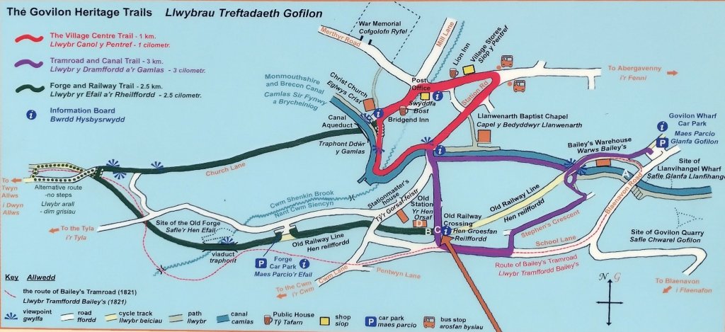
It was actually quite a short walk, I only had just over an hour spare in a trip to Abergavenny. I took the opportunity to have a look at the Wharf at Govilon and the first few hundred yards of Bailey’s Tramroad.
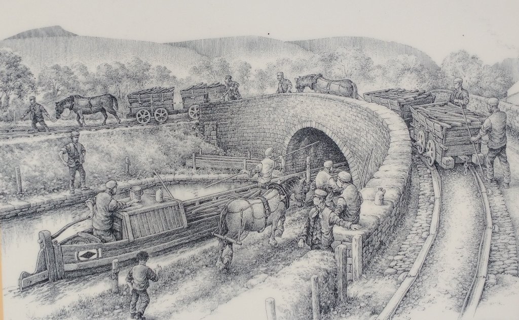
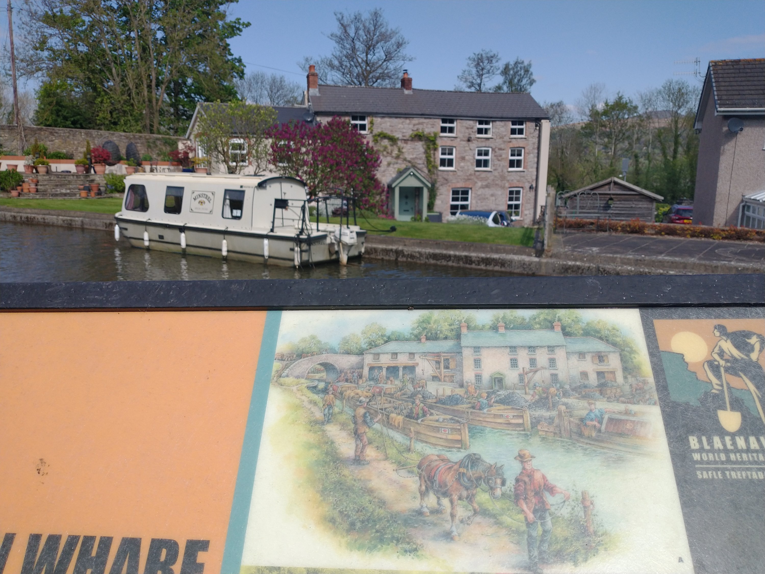
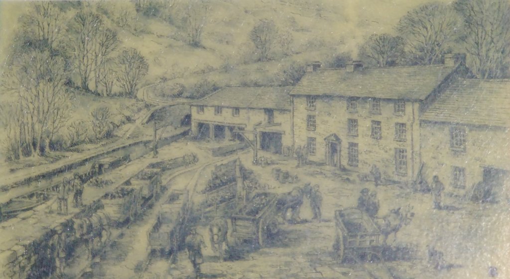
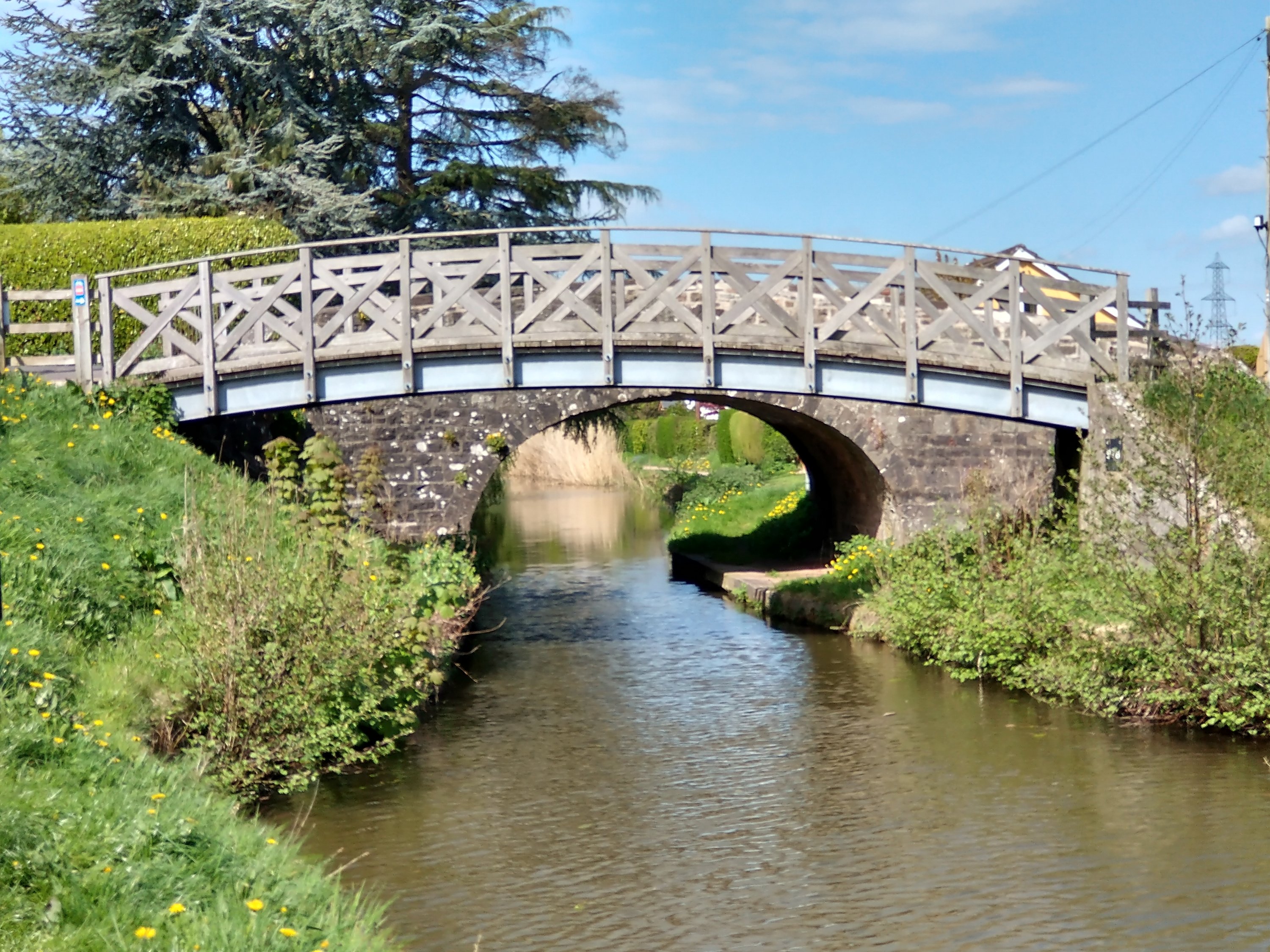
Bailey’s Tramroad from the Nantyglo Ironworks to the Canal at Govilon opened in 1821. Michael Blackmore’s illustration depicts the tramroad as it crosses the canal to enter Govilon Wharf. Here iron, coal and limestone were taken from the horse-drawn trams onto narrowboats bound for Newport and the wider world.
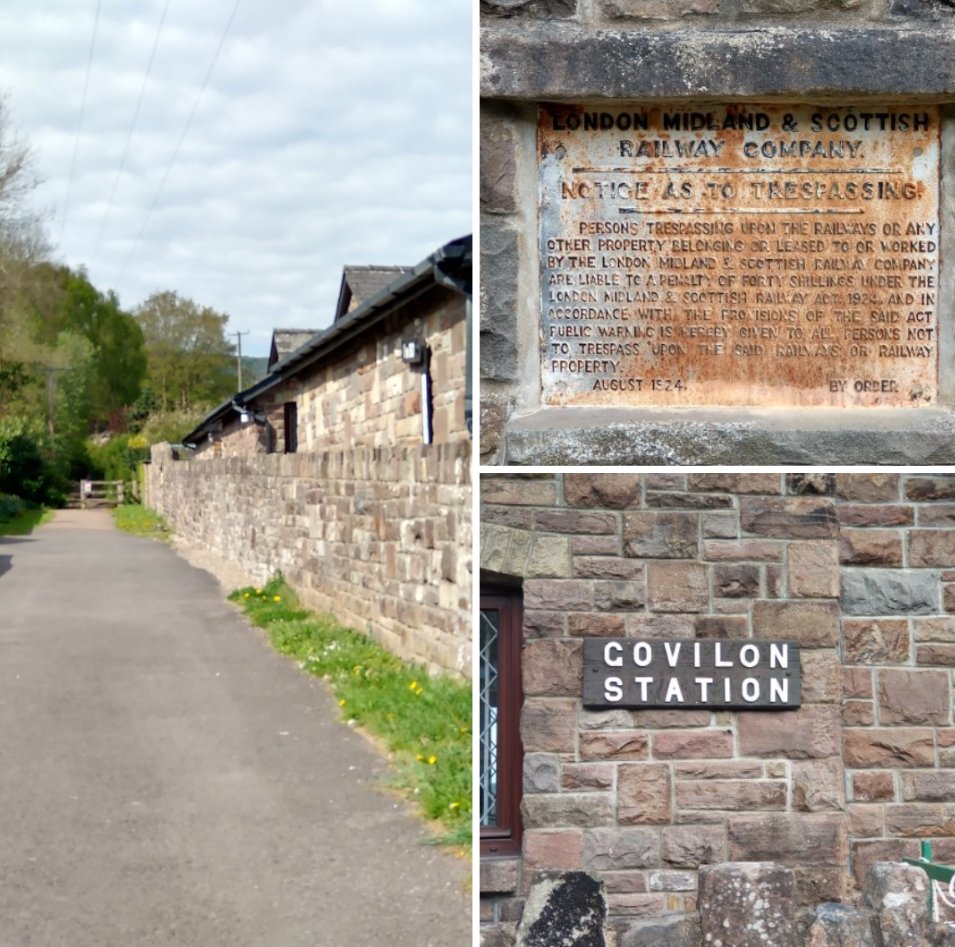
My first port-of-call was Govilon Railway Station and the information board which includes the sketch above. Govilon railway station was a station on the London and North Western Railway’s (LNWR’s) Heads of the Valleys line. After the grouping in 1923 it became part of the LMS.
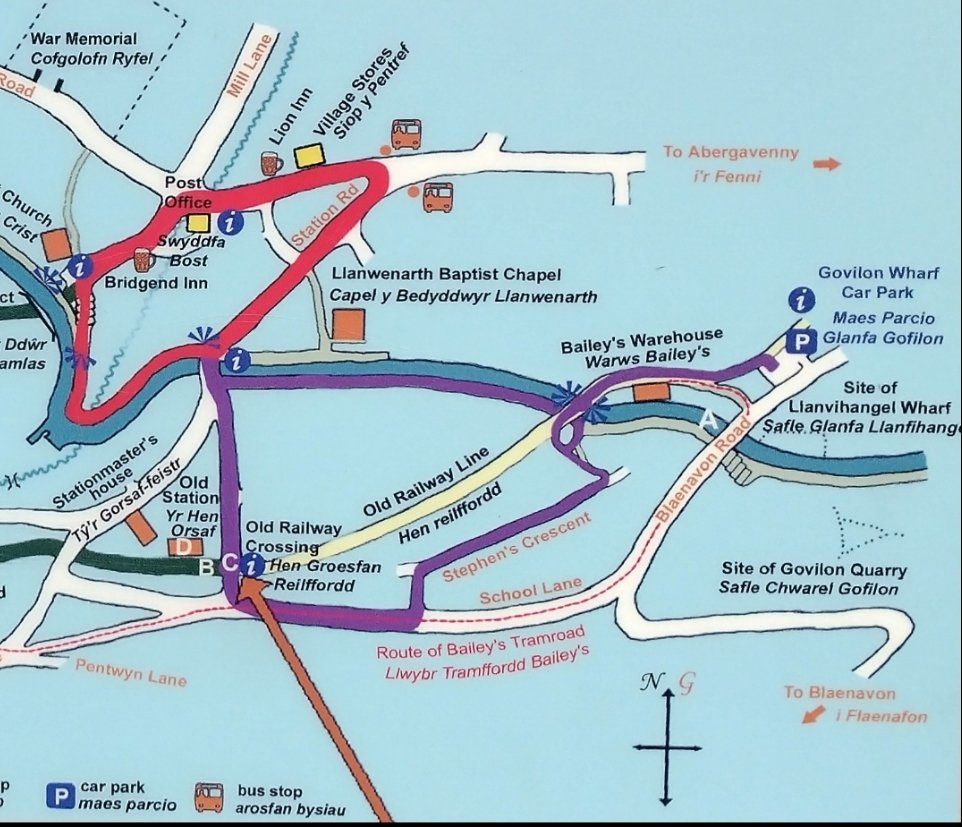
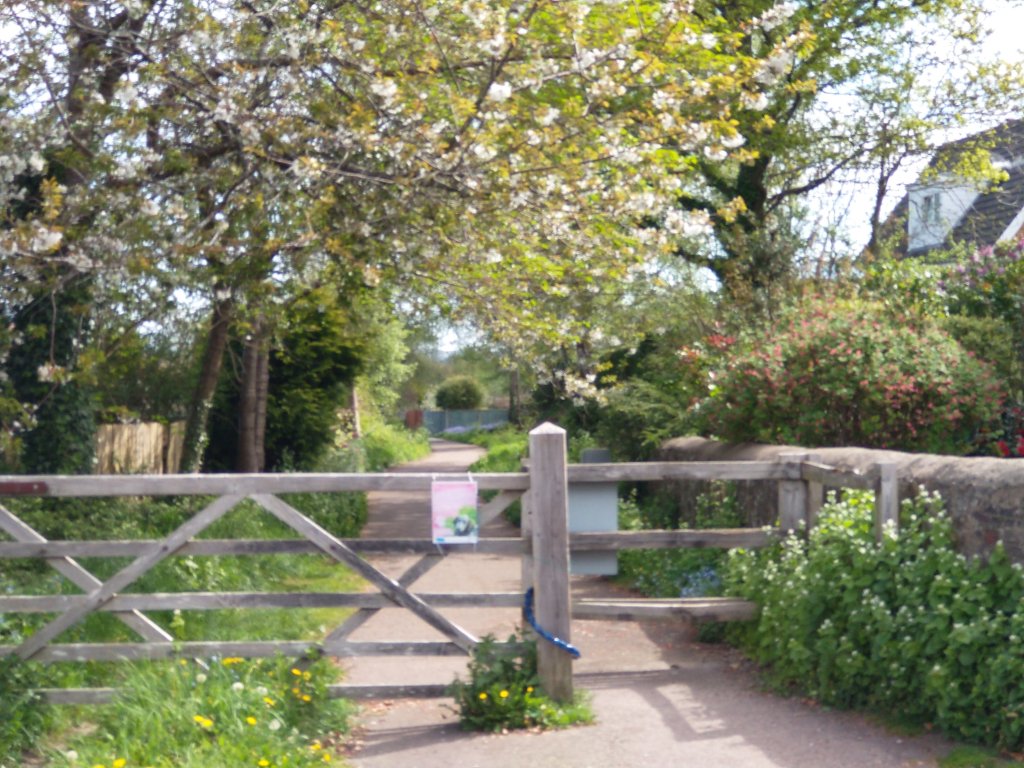
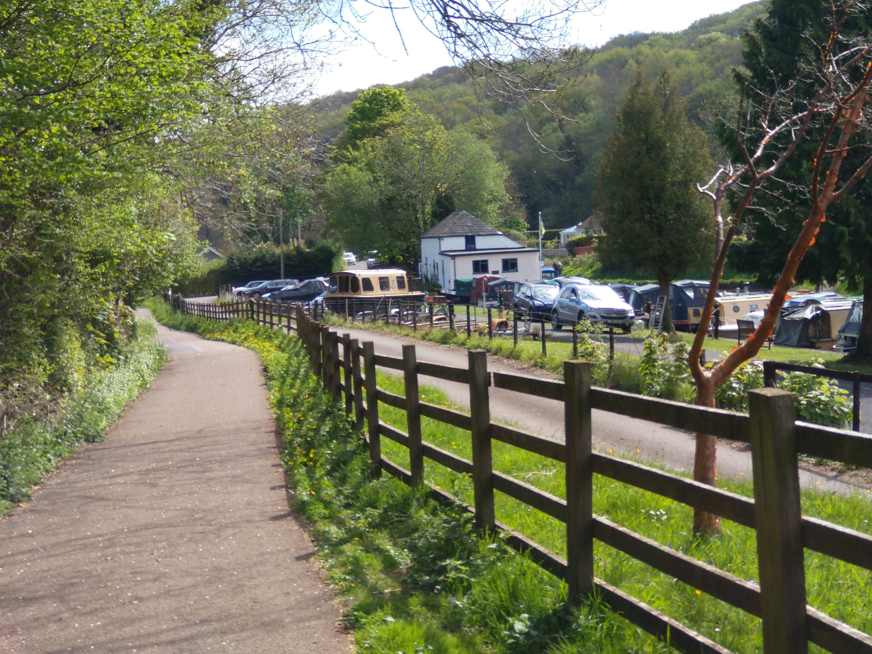
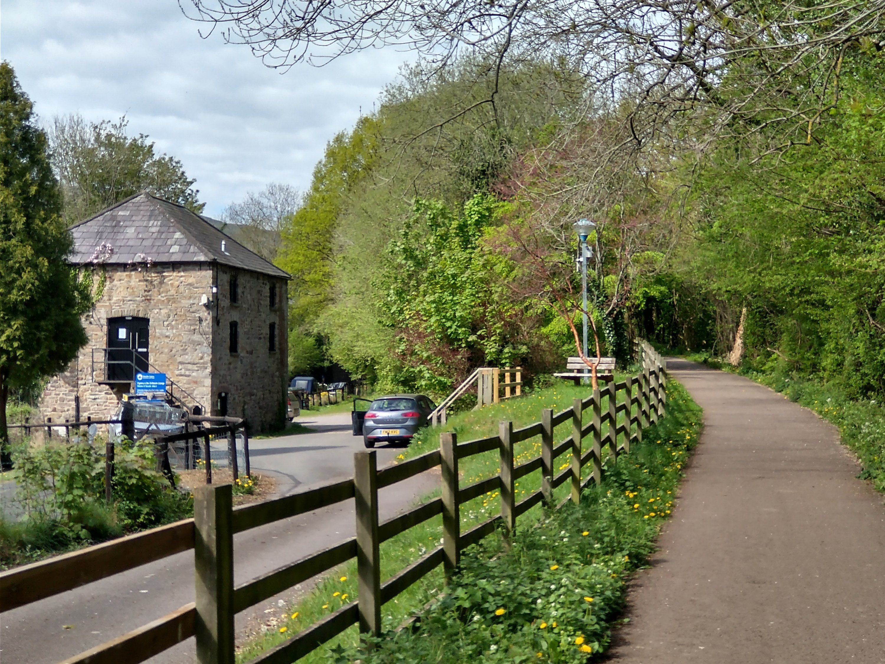
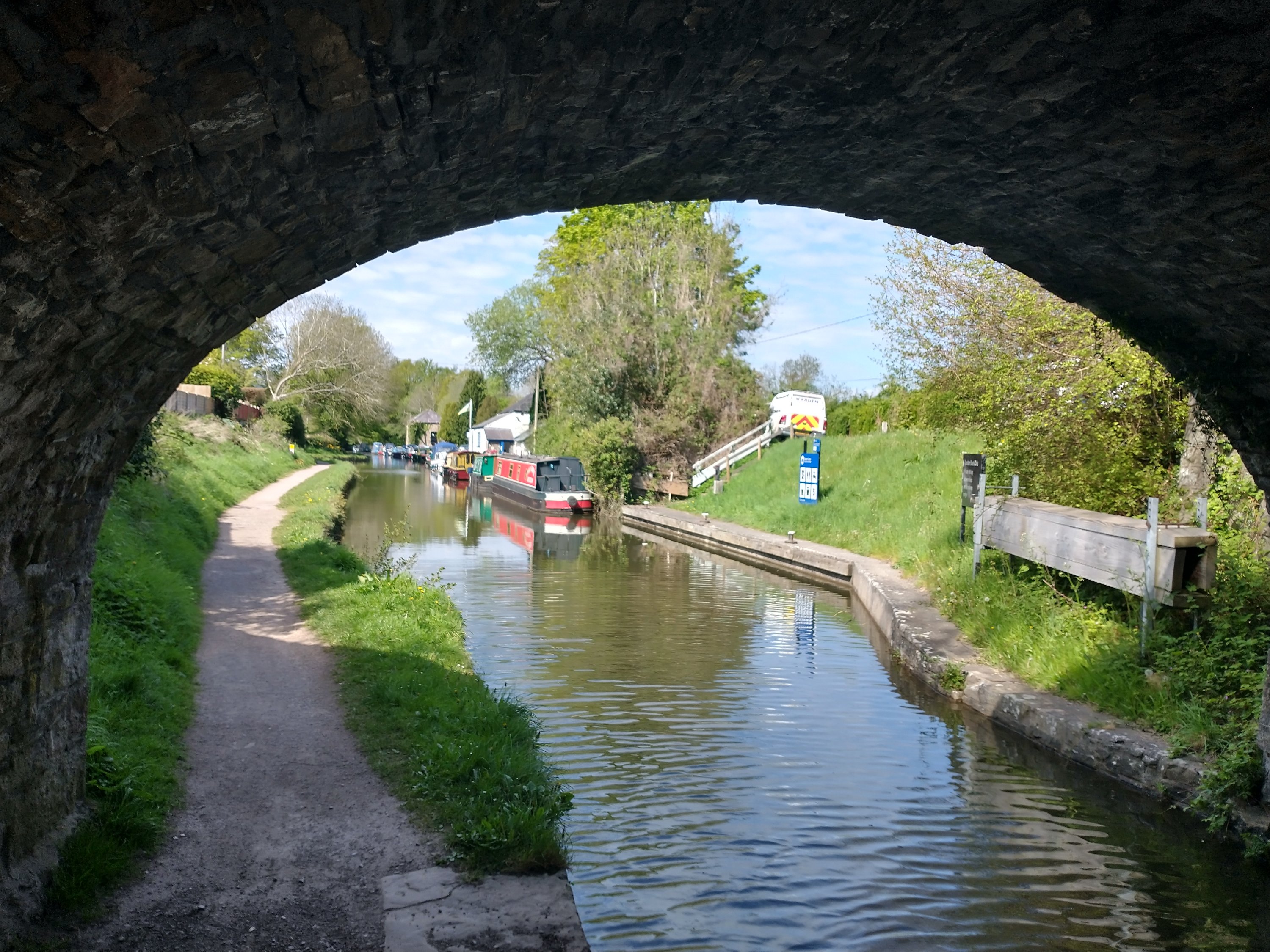
After a quick look at the station site I walked down the railway line to the point where it crossed the canal, then along the back of the site of Bailey’s Wharf. Walking over the canal bridge which is sketched by Blackmore I was the able to spend a short time at Llanvihangel (Govilon) Wharf before walking along the first few hundred yards of what was Bailey’s Tramroad.
Tramroads at Govilon
The Govilon History website tells us that “A network of tramroads were developed in the Govilon area. One of the earliest was the Blorenge Quarries Tramroad built as a plateway around 1795. Due to geological problems the Blorenge Limestone Quarry soon closed and the tramroad fell out of use by 1804.” [1]
The Blorenge Quarries Tramroad was the precursor to three other tramways which were established in the first quarter of the 19th century. Bailey’s Tramroad was one of these.
“In October 1820, Crawshay Bailey applied to the Brecon and Abergavenny Canal Company for the construction of “…a railway from the canal at Llanwenarth to our iron furnaces at Nantyglo”. It took just 7 months to build the twin track tramway. Much of the route into Govilon is still plainly visible with School Lane following the original route. Despite the mountainous route from Nantyglo the tramway managed to keep to a shallow gradient throughout its length. Siop Newydd, just outside the village, was a smithy serving the tramroad. At its peak up to 14 blacksmiths were employed for repairs and maintenance. This included shoeing horses used to pull the trams. The path of the tramway is clearly recognisable here, along with the many sidings to accommodate trams.” [1]
Other highly significant tramways in the area included:
- The Llanvihangel Tramroad which initially ran from Llanfoist to Llanvihangel Crucorney. In 1818 it was extended to Govilon wharf and to Grosmont. Ultimately, this tramroad extended all the way to Hereford.
- The Blaenavon Ironworks Tramroad ran from Pwlldu to the Ironworks. It was completed in around 1815. Worthy of note is a 1.5 mile tunnel as part of the length of the Tramroad connecting Blaenavon with Pwlldu.
Bailey’s Tramroad
Bailey’s Tramroad was of 4′ 4″ gauge, or thereabouts. [2] Later in this article is a description of my walk back along the route of the old Tramroad.
The Heads of the Valley Line and Govilon Railway Station.
The Wikipedia article about Govilon Railway Station [3] tells us that “the first section of the Merthyr, Tredegar and Abergavenny Railway (MTAR) from Abergavenny to Brynmawr was opened on 29 September 1862. [4: p18] The line was leased and operated by the London and North Western Railway (LNWR) which acquired the smaller railway company on 30 June 1866. [5: p93][6: p63] The LNWR was itself amalgamated into the London, Midland and Scottish (LMS) Railway in the 1923 Grouping.” [5: p88-89]

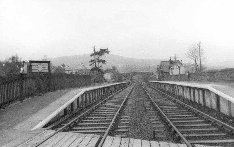
Govilon Railway Station opened on 1 October 1862, [7: p191][8: p107] a couple of days after the ceremonial opening of the first section of the railway. It was the first station beyond Abergavenny Brecon Road. [9] The 1st October was also the first day of the LNWR’s lease of the line. [10: p112] There is a possibility that Govilon was the first station opened on the line because of its proximity to Llanfoist House, the residence of Crawshay Bailey who by this time was a director of the MTAR. [2: p20]
Wikipedia notes that “Decline in local industry and the costs of working the line between Abergavenny and Merthyr led to the cessation of passenger services on 4th January 1958. [4: p139][6: p68] The last public service over the line was a Stephenson Locomotive Society railtour on 5th January 1958 hauled by LNWR 0-8-0 No. 49121 and LNWR Coal Tank No. 58926. [4: p139][11: fig. 65] Official closure came on 6 January.” [3][7: p184][12: p55][8: p107][13: p191]
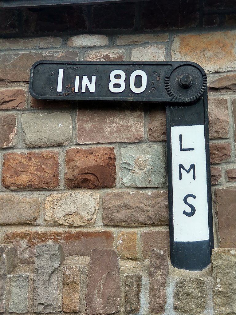
Govilon Railway Station was “situated on a steep 9-mile (14 km) climb from Abergavenny at gradients as severe as 1 in 34. [6: p68][13: p164] A gradient post showing 1 in 80 /1 in 34 was installed on one of the station platforms.” [3][4: p116]
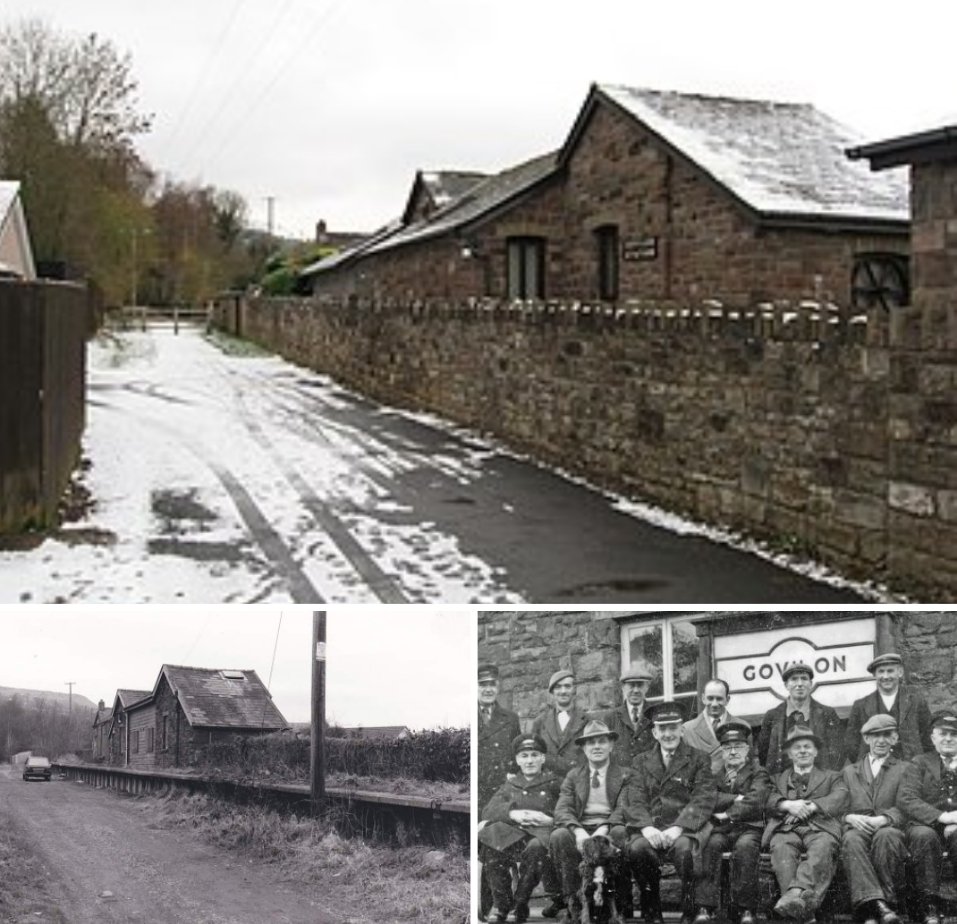
The low stone-built station building was on the Up platform There was a station house behind it. [4: p116][11: fig. 41]. A single siding separated the station building from the station house. It “served a small goods yard until after the First World War” [3][11: fig. 41] Wildon Ironworks was on the opposite side of the main platforms and was served by a siding from 1885 to 1941.[11: fig. VIII]
The Wikipedia article continues: “to the west was a small goods shed and road bridge. [11: fig. 42] A third siding was situated 400 yards (370 m) to the east which led to a wharf on the Monmouth and Brecon Canal until 1953. [11: fig. VII] No. 1 signal box was opened in 1911 near the canal wharf and lasted until c. 1930. [12: fig. 36] No. 2 box was erected at the east end of the Down platform in 1877; it controlled the road crossing to the east of the station.” [11: fig. 38][3]
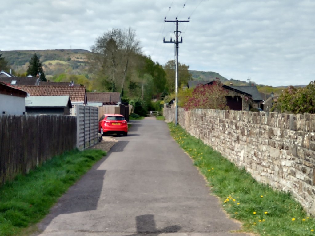
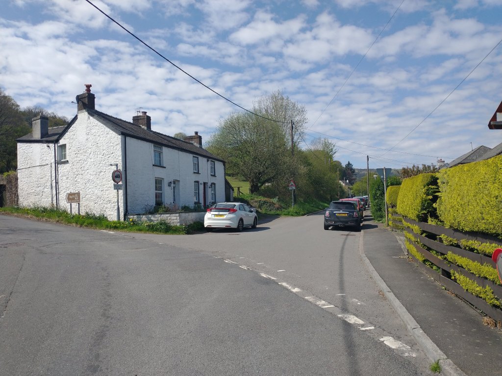
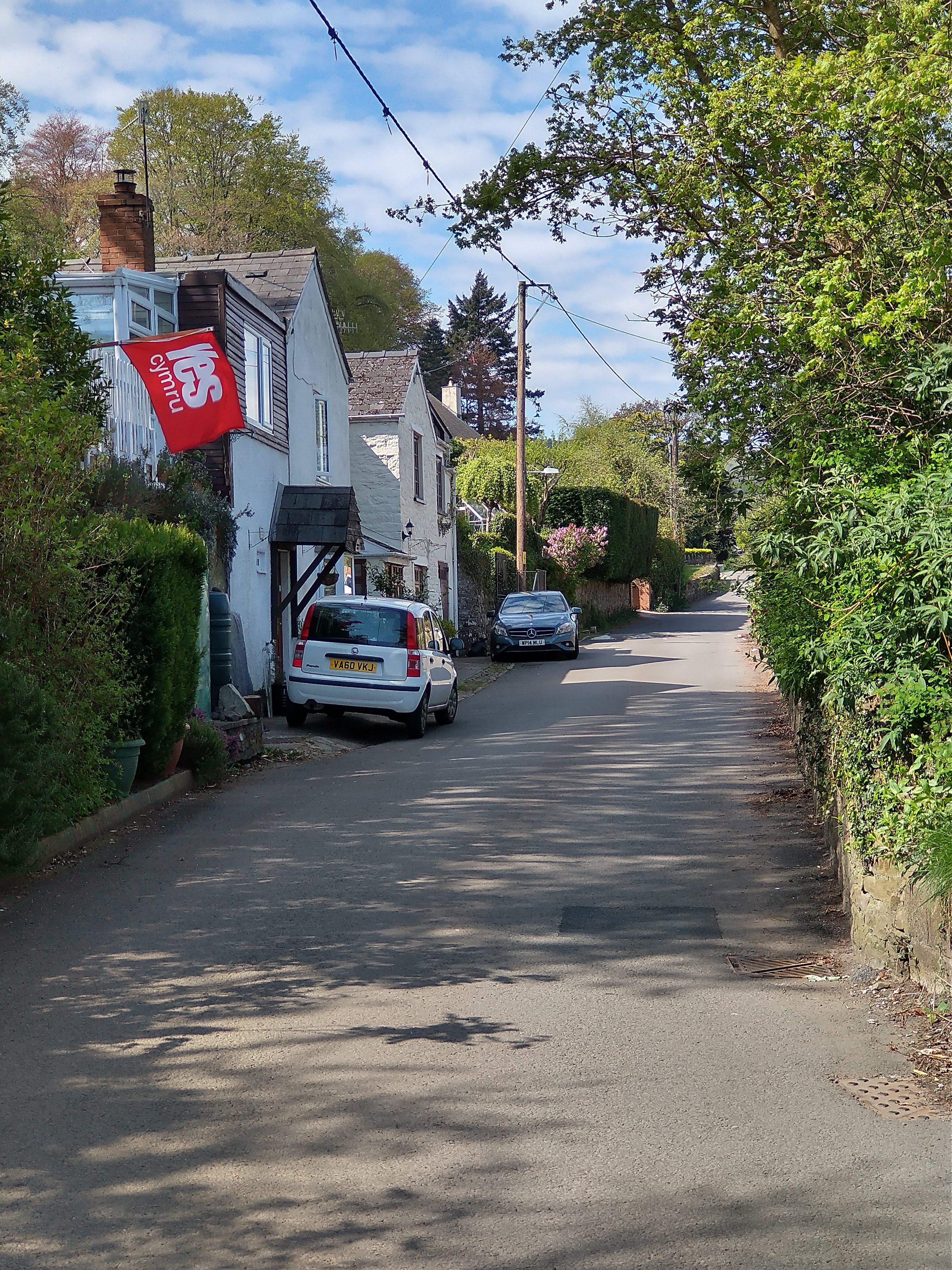
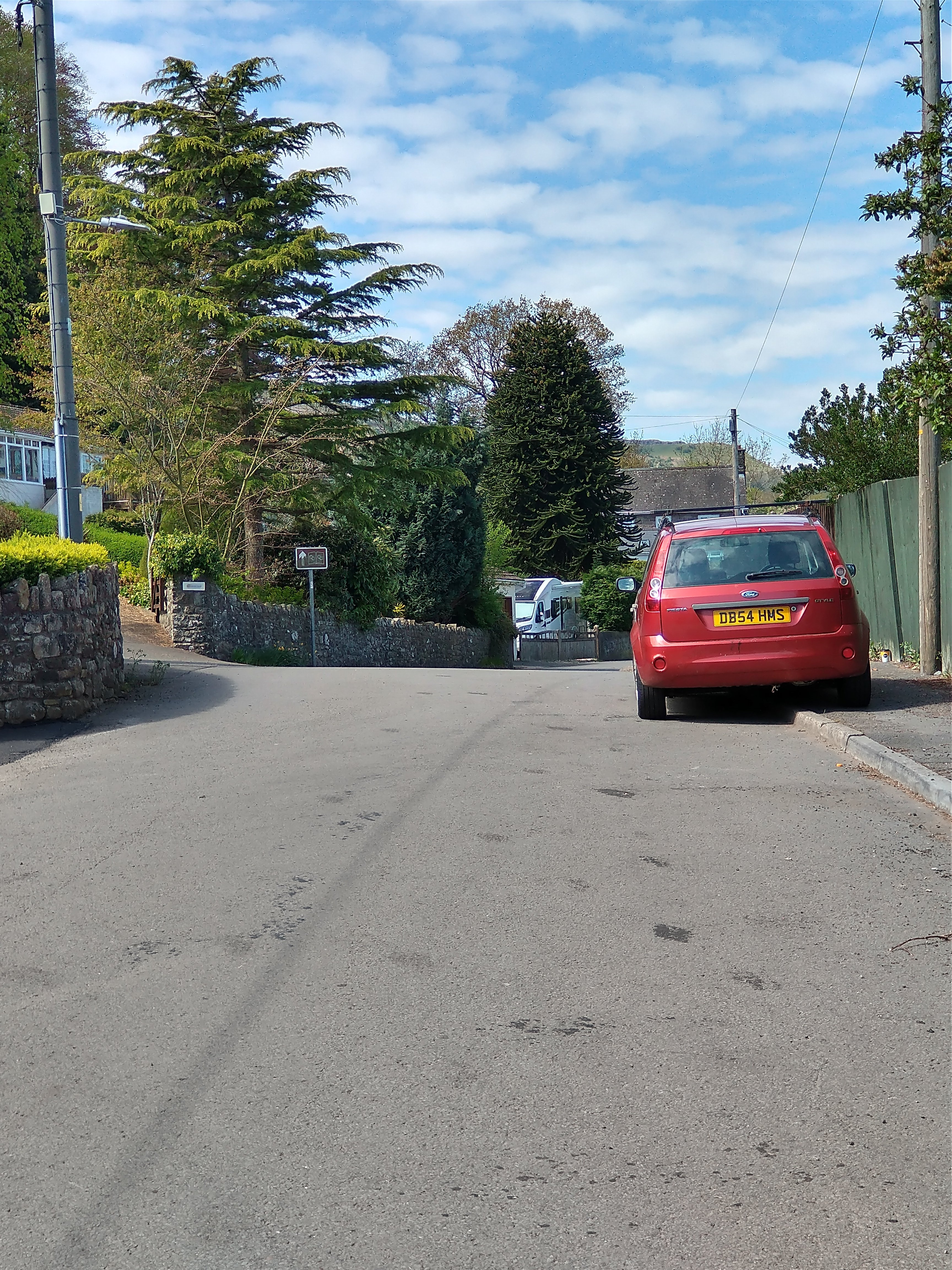
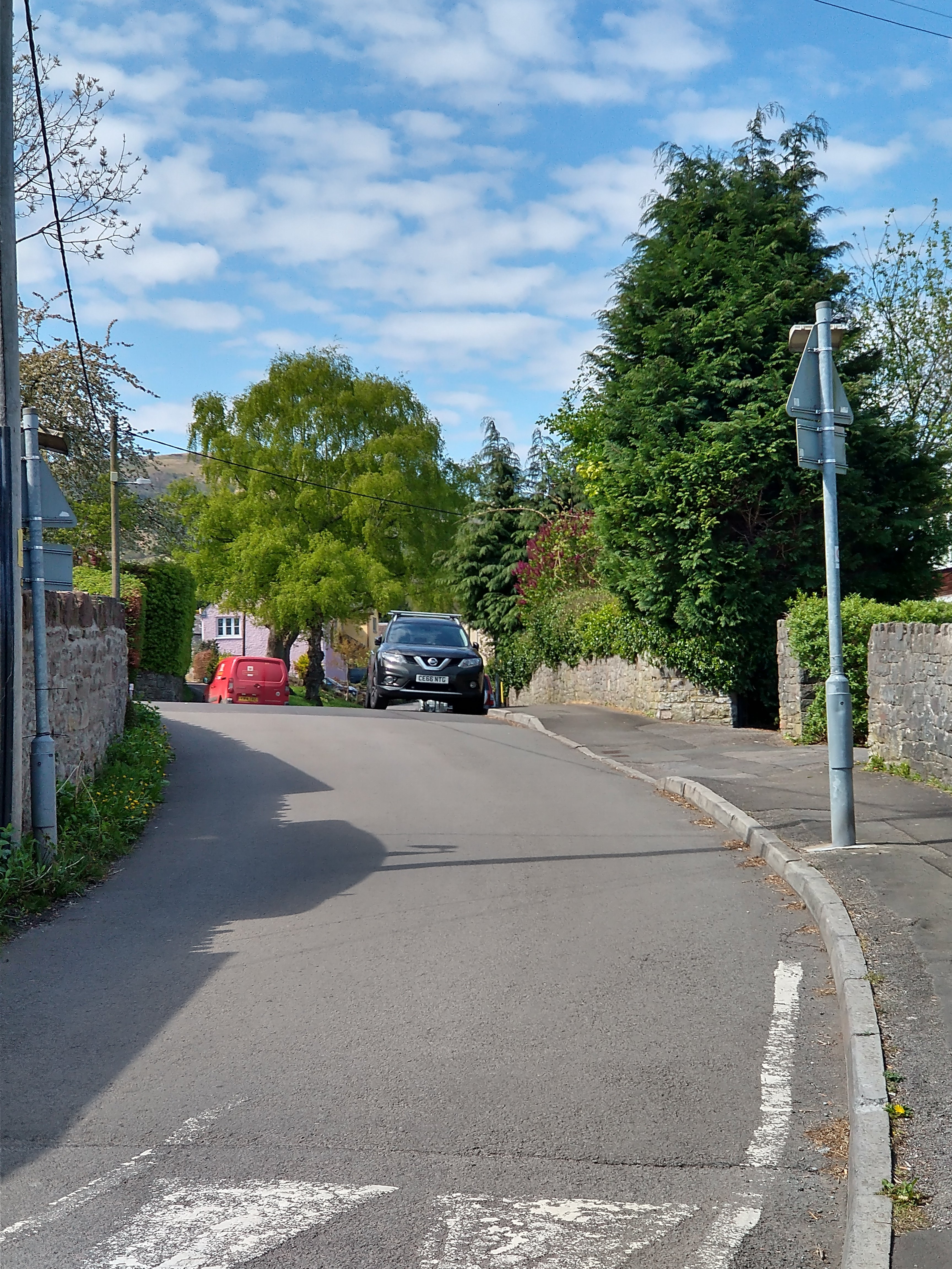
The Walk from Govilon Railway Station to Bailey’s Wharf
The next few pictures were taken on the short walk from the railway station to the wharf.
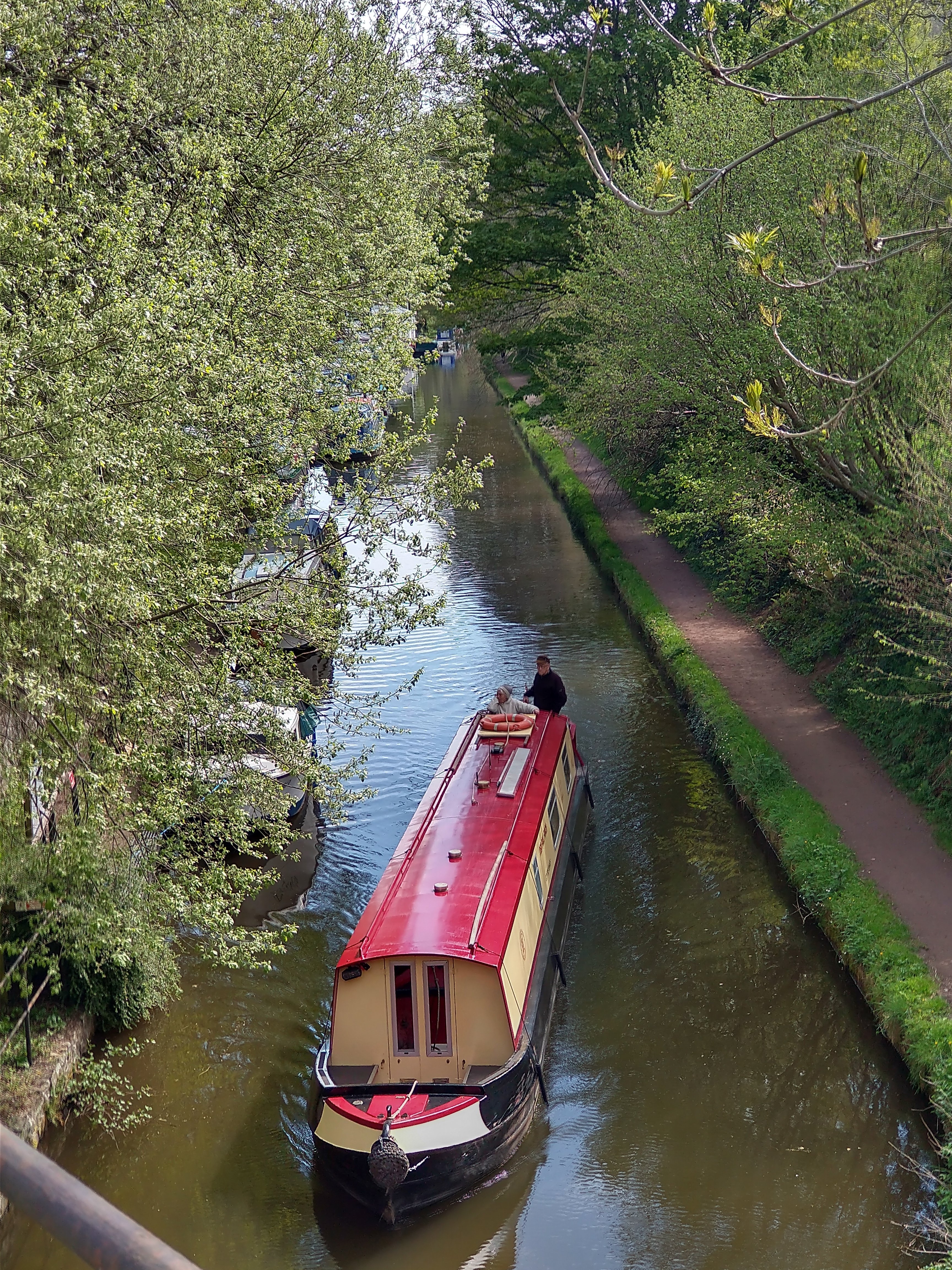
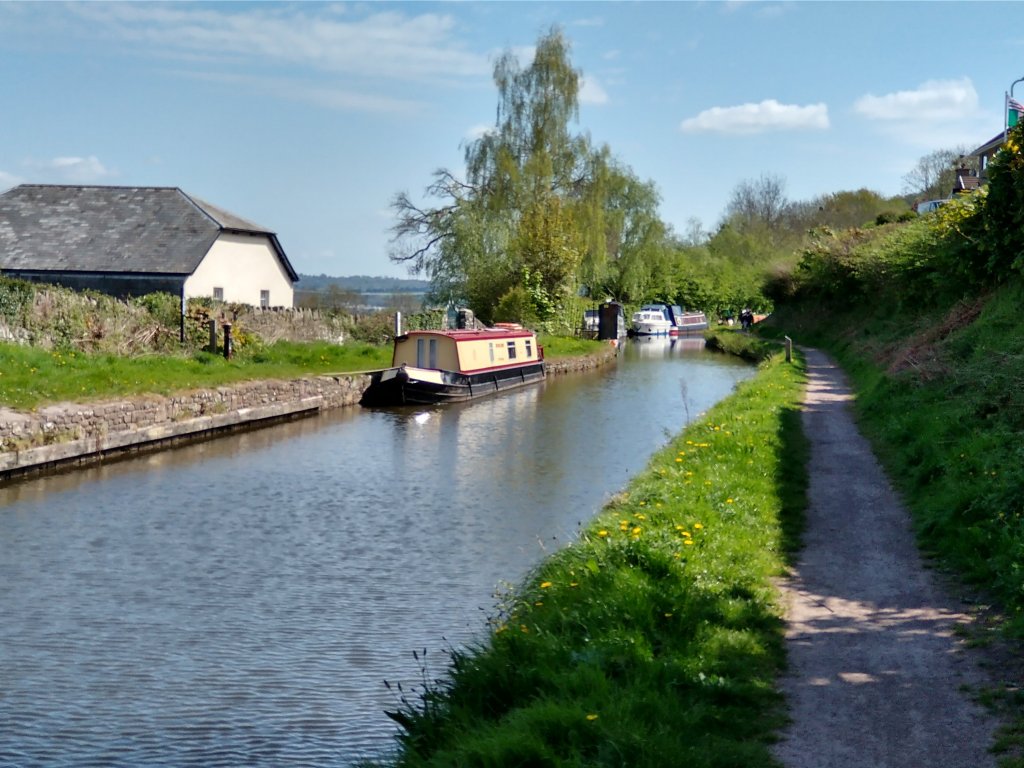
Llanvihangel Wharf
We have already noted that the Llanvihangel Railway was an early horse-drawn railway line. It operated over a 6.25 mile route between the Canal at Govilon and Llanvihangel Crucorney from 1814 until 1846.
Along with two other tramways it created a line that reached all the way to Hereford. In 1846 all three Tramroads were sold in 1846 to the Newport, Abergavenny and Hereford Railway Company. The Llanvihangel Railway fetched a price of £21,750 (equivalent to close to £2.2 million in 2022). [15][16] The company replaced them with a standard-gauge steam railway.[15][17]
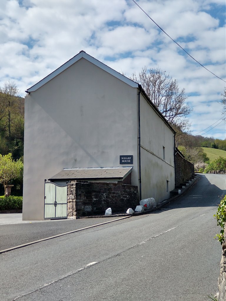
The Llanvihangel Tramroad Wharf was to the East of the road bridge at the East end of Bailey’s Wharf. A short walk from the Heads of the Valley Line, along an access road allows one to each the back of Wharf House immediately to the East of the road bridge.
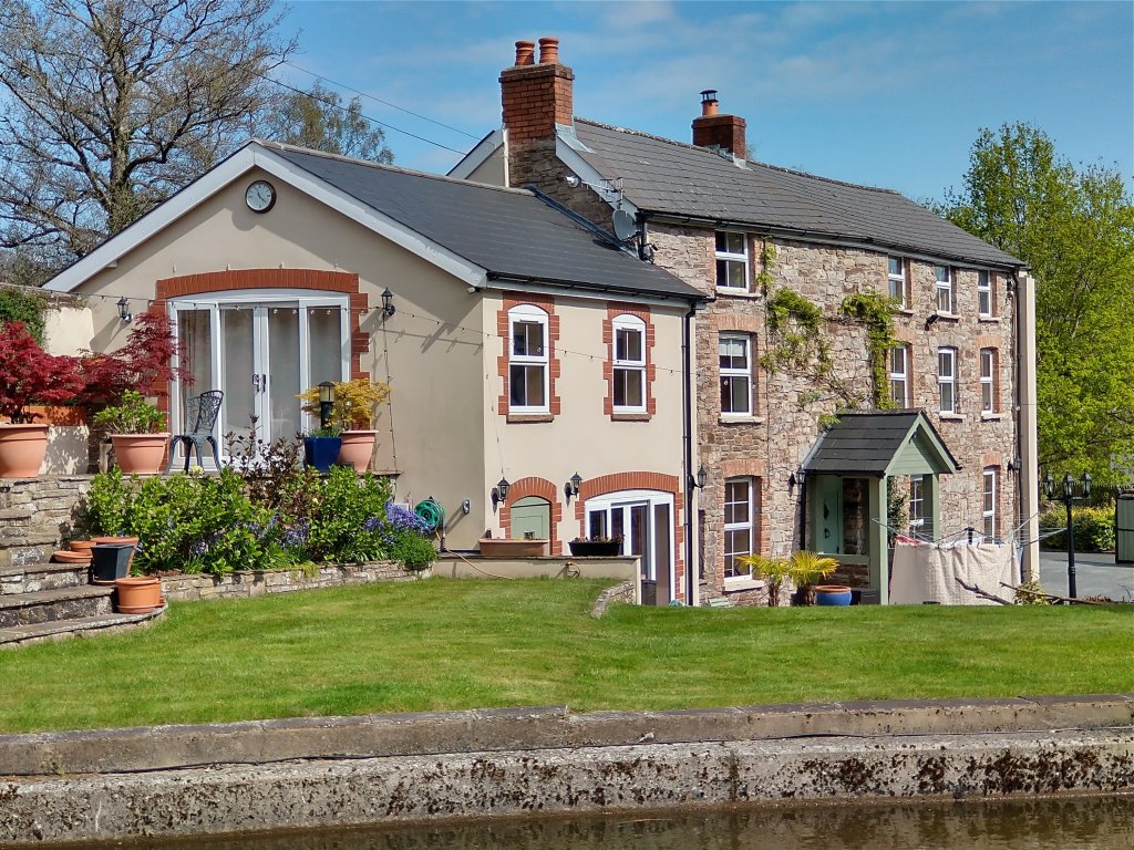
(My photograph, 25th April 2022)

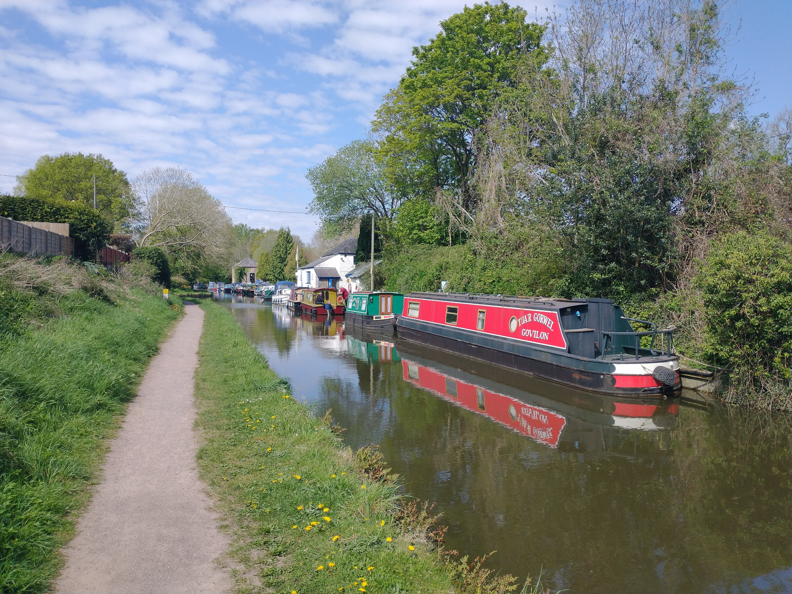
(My picture, 25th April 2022)
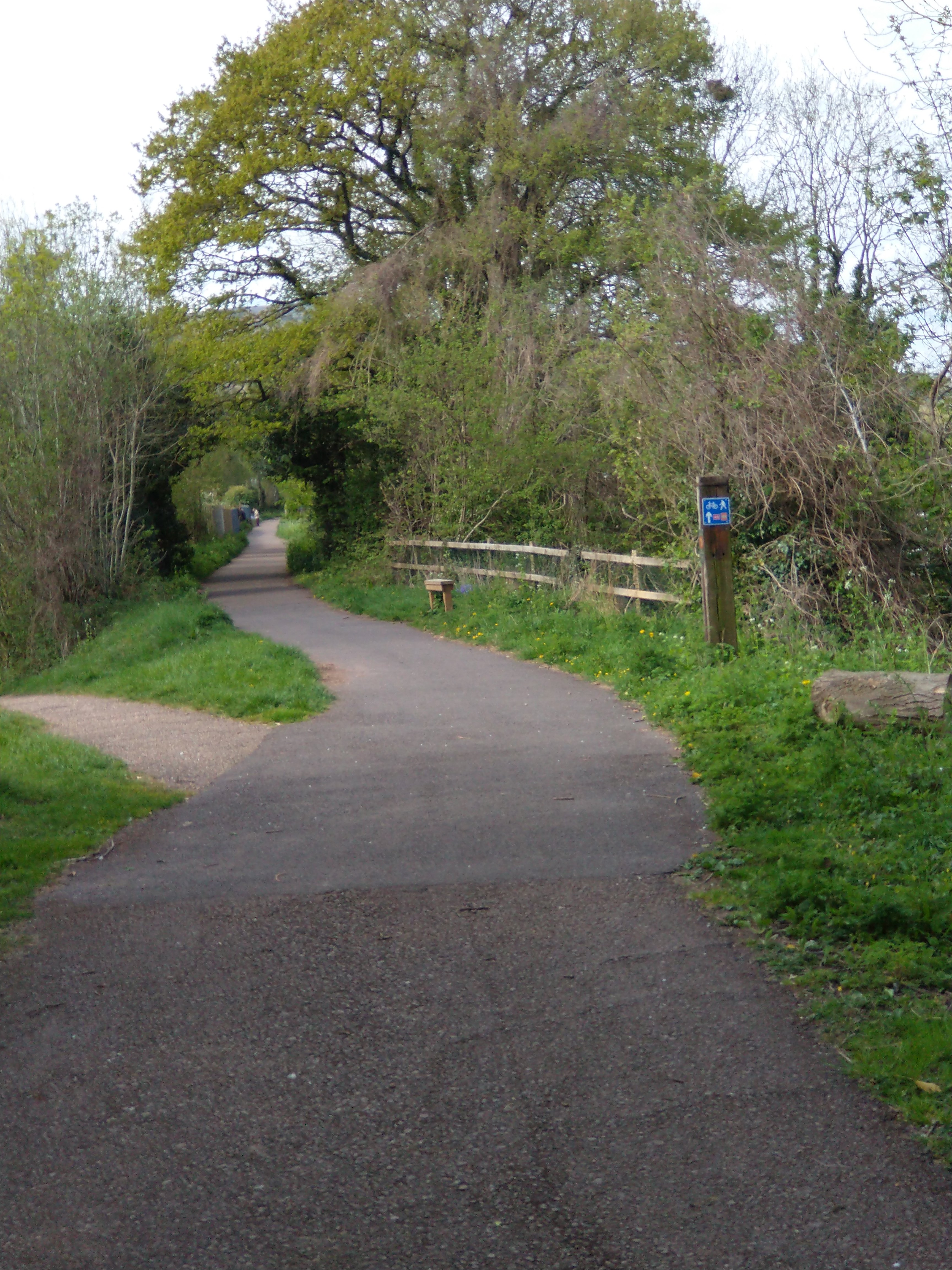
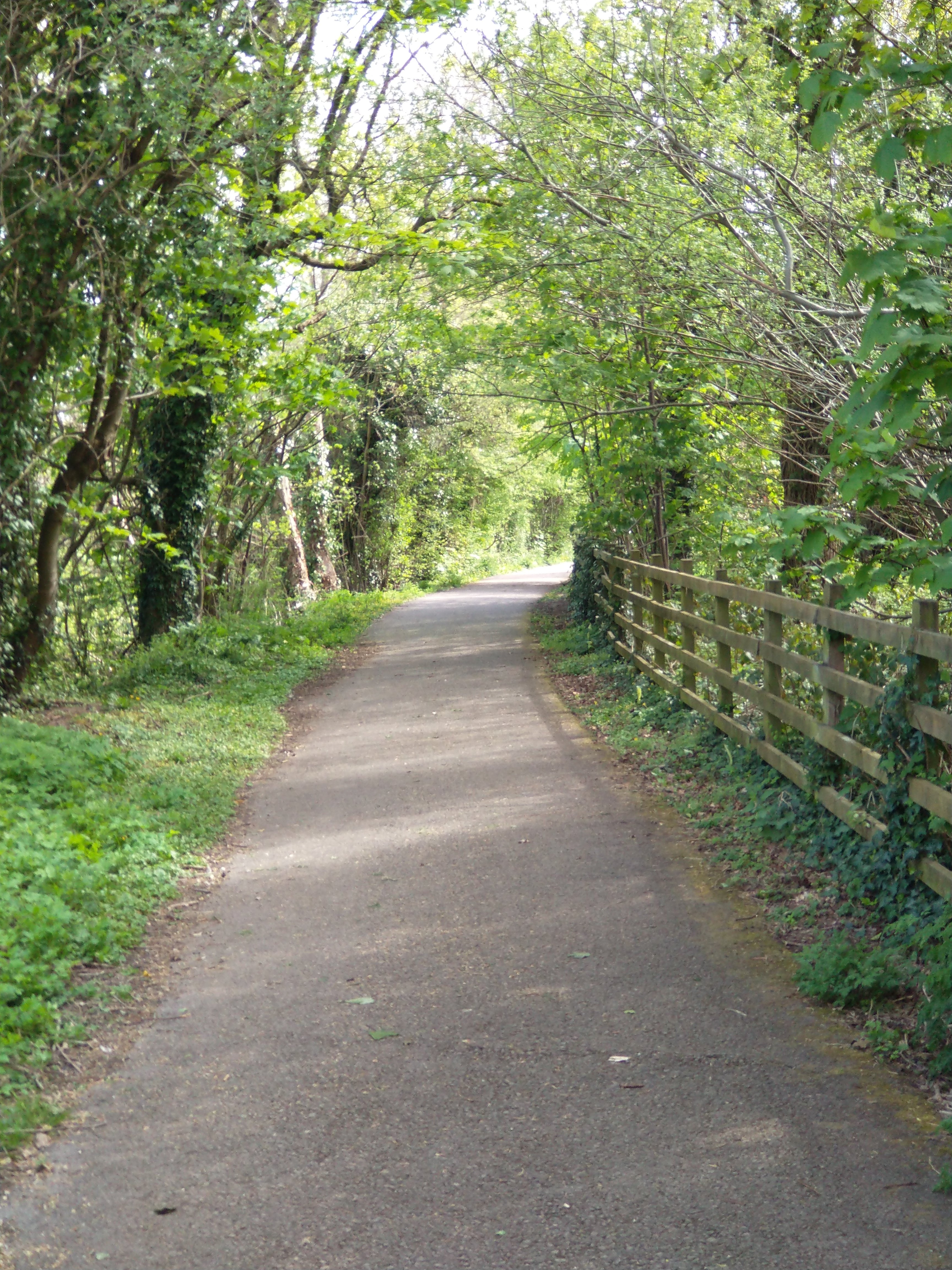
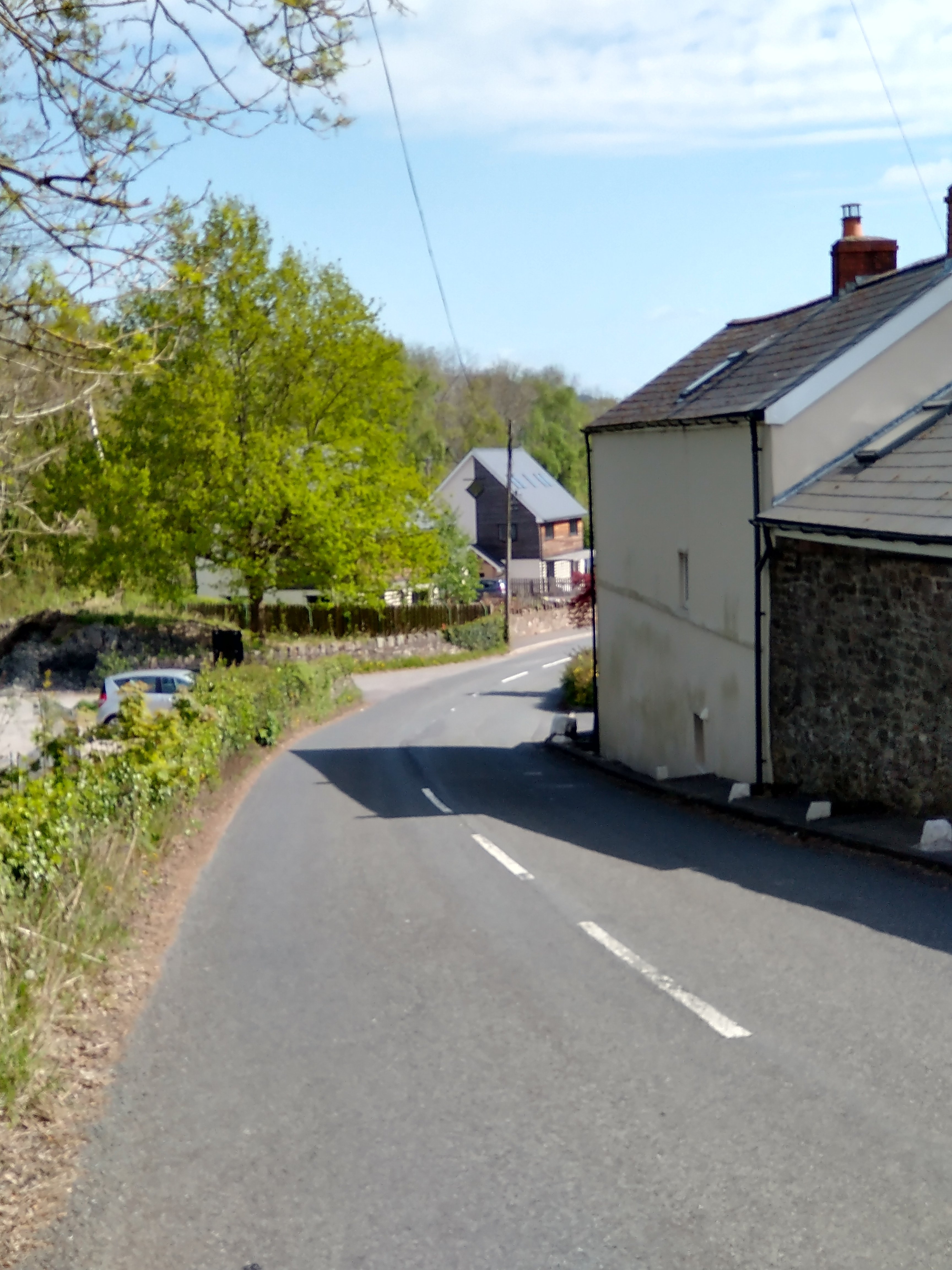
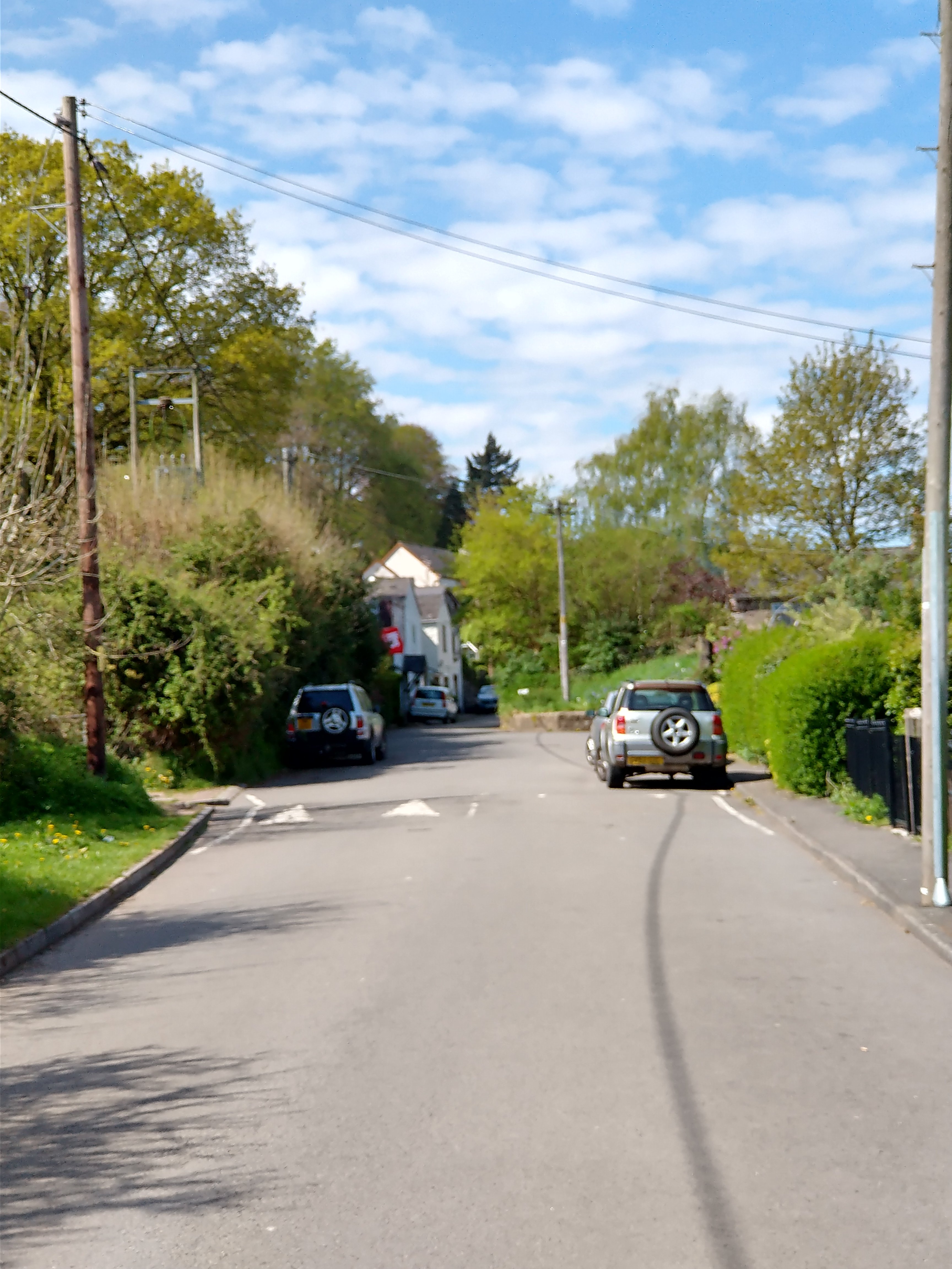
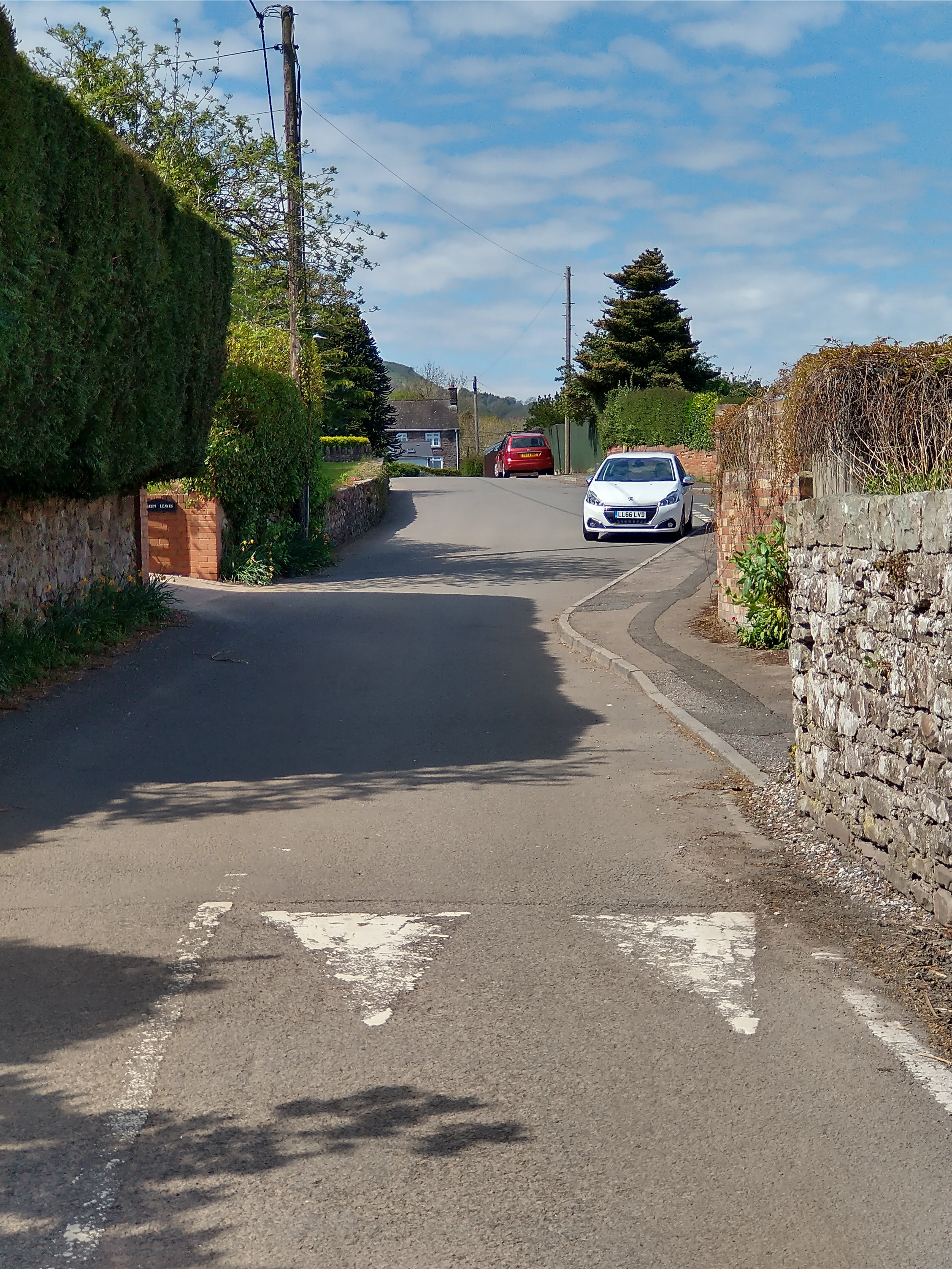
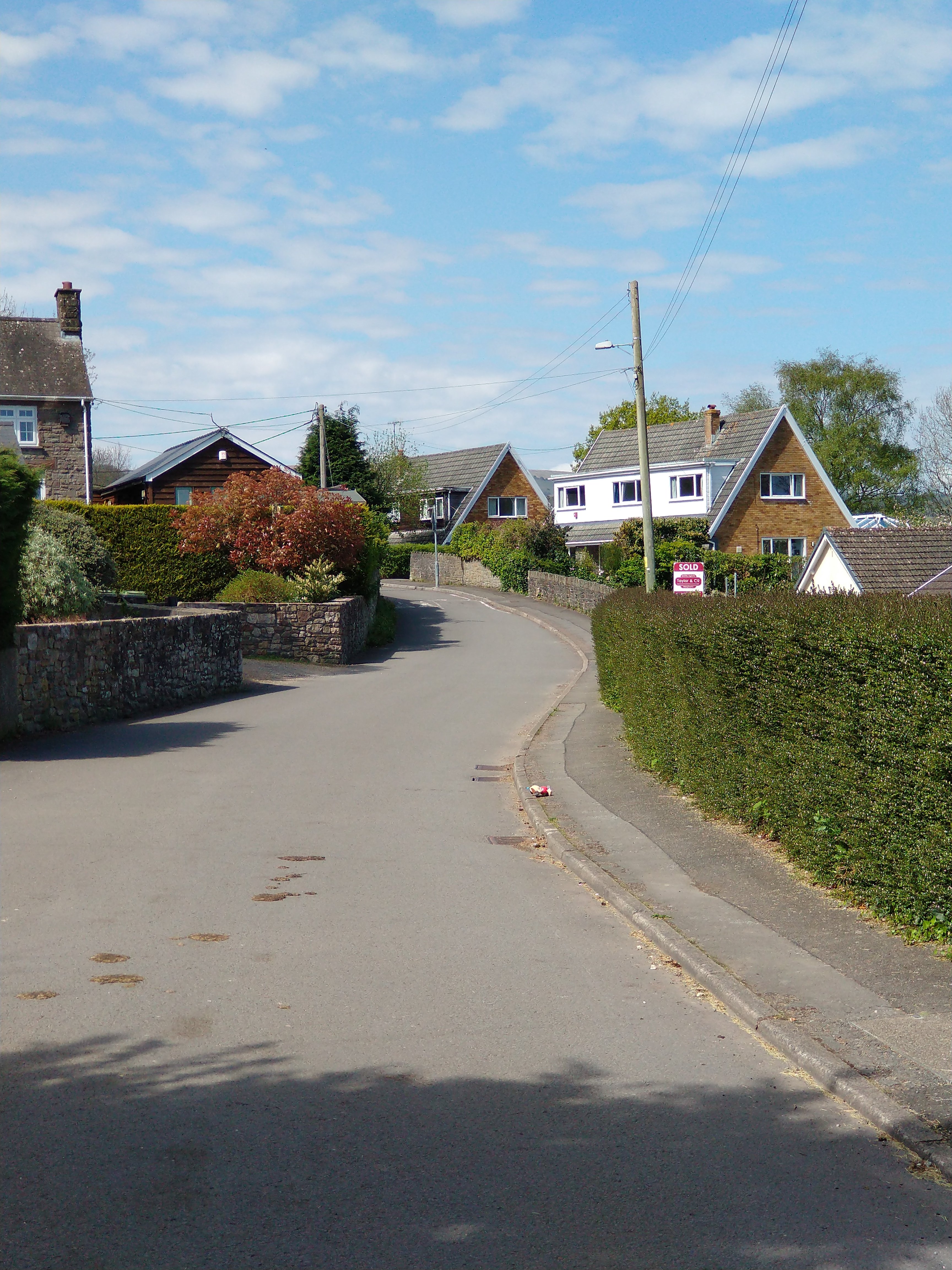
Bailey’s Tramroad, the first few hundred metres. …
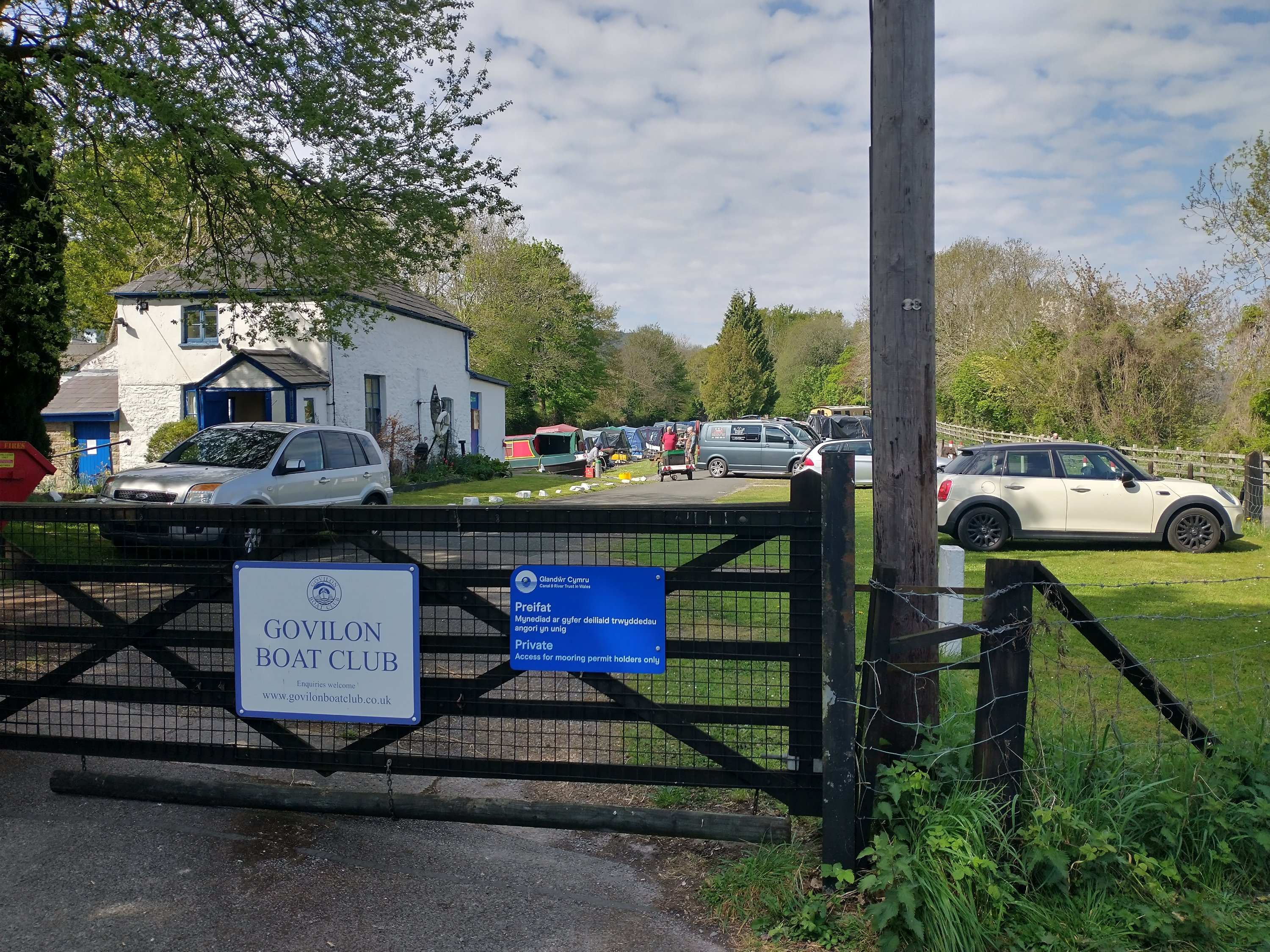
Leaving the site of Bailey’s Wharf, which we have already seen is now occupied by Govilon Boat Club, the double track Tramroad travelled a very short distance to the East before crossing the Canal at a shared road/tramroad bridge. The modern road name is Blaenavon Road.
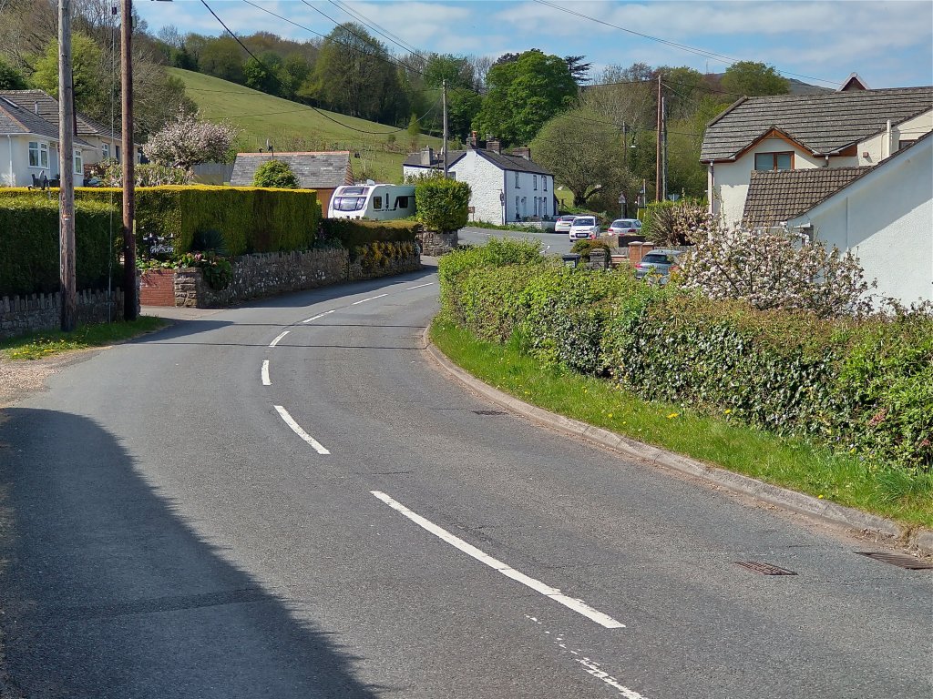
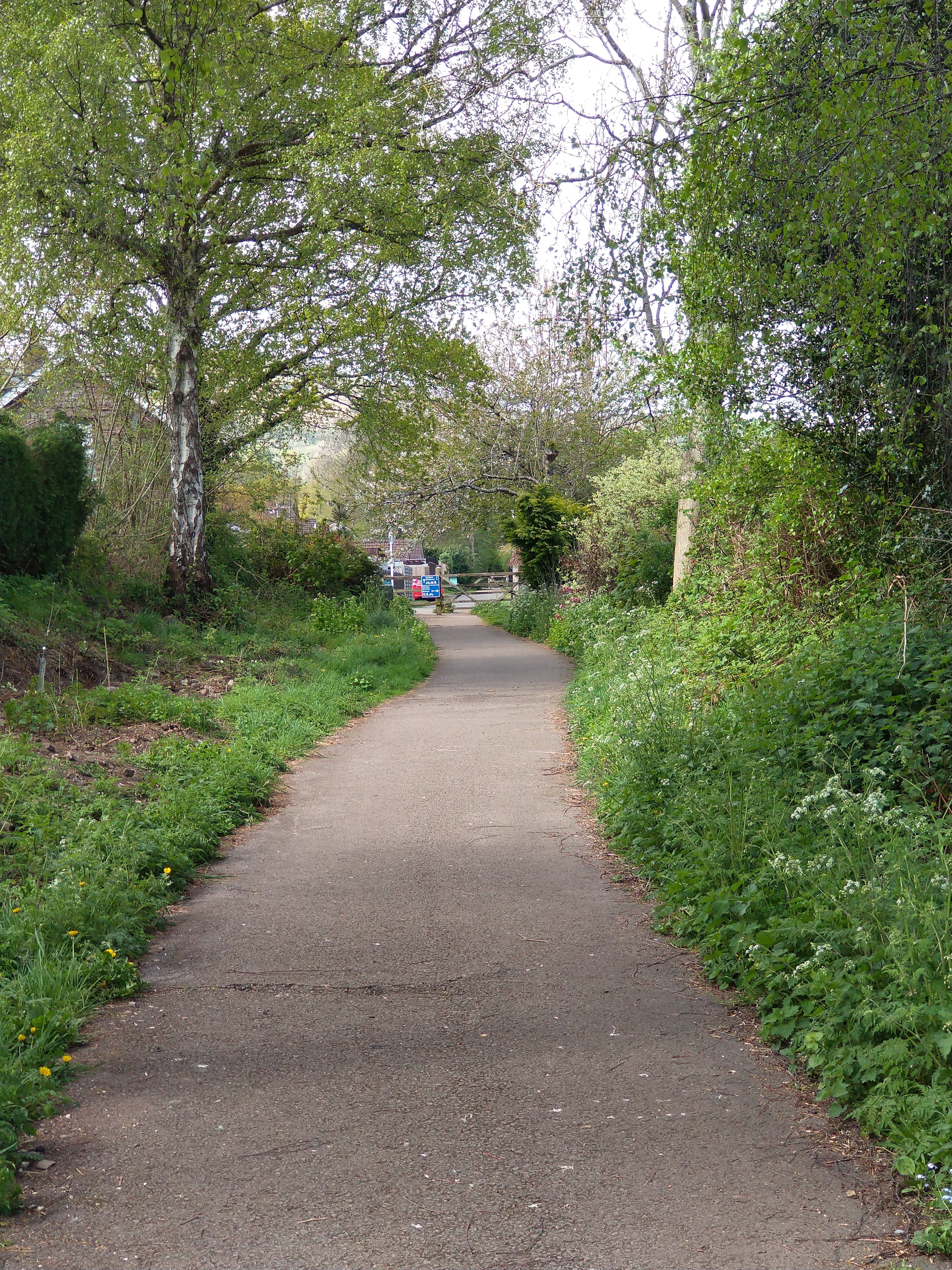
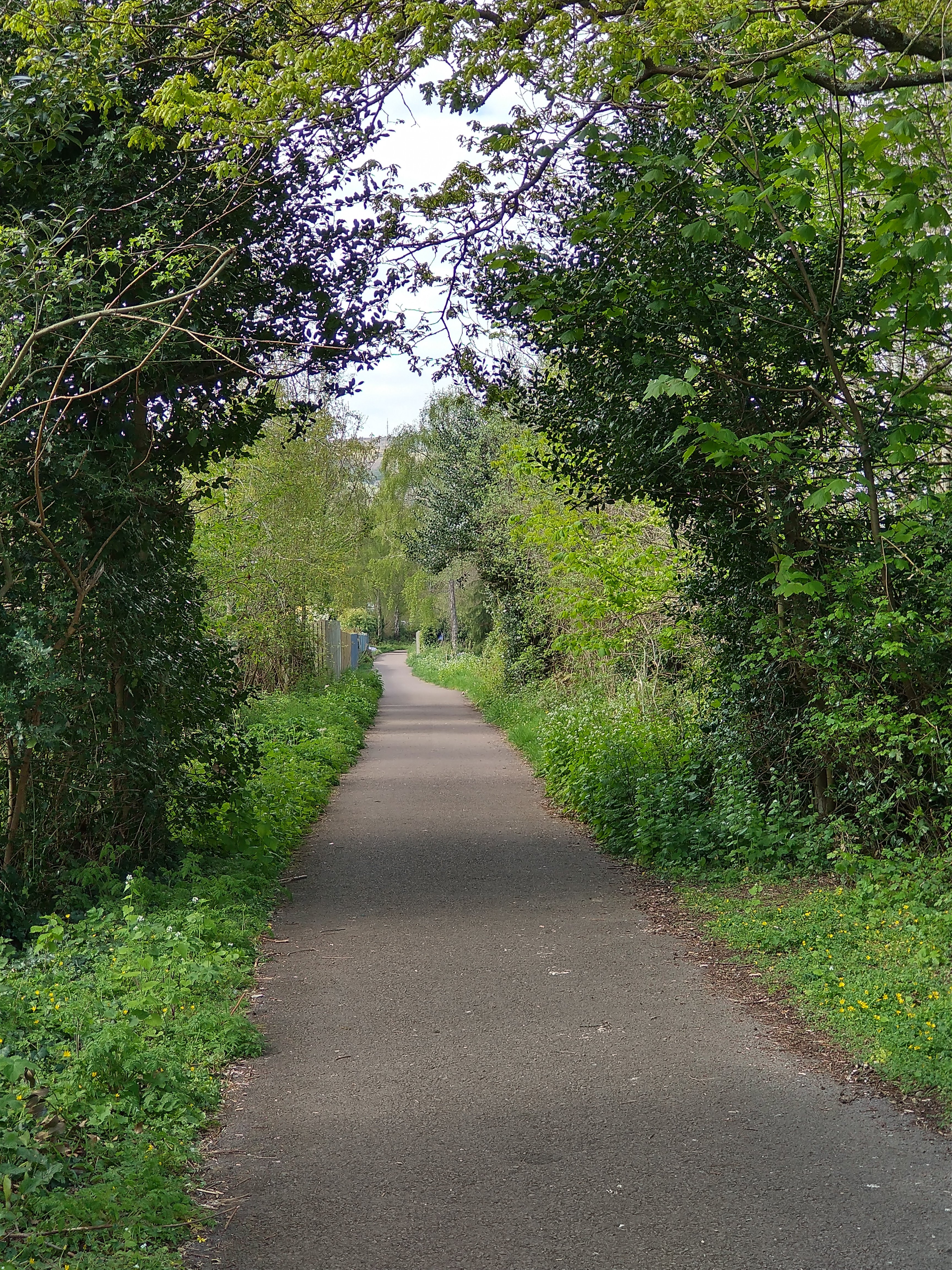
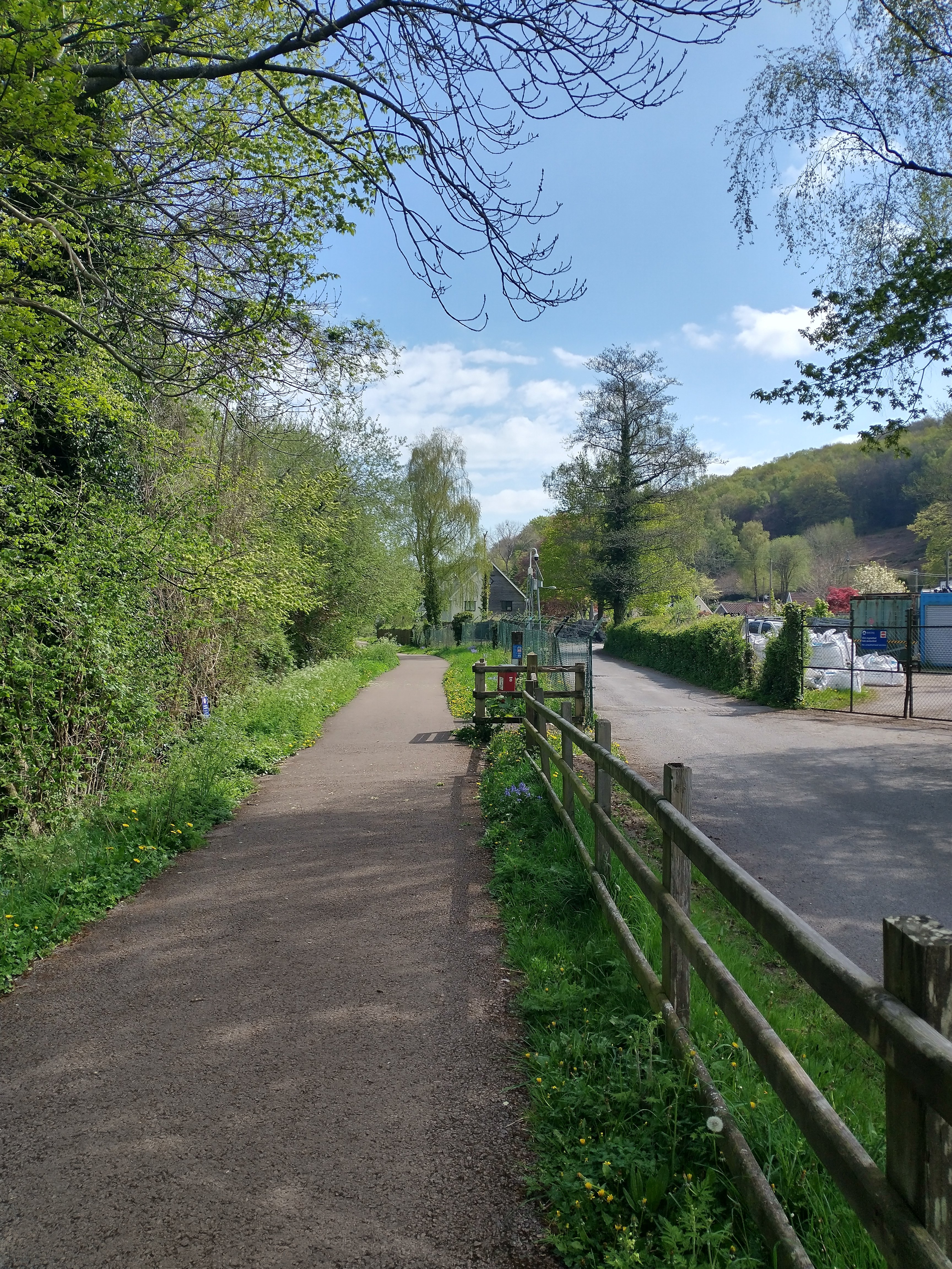
The route of the Tramroad leaves Blaenavon Road as turns sharply to the East. It runs along School Lane back towards Govilon Railway Station.
A sequence of photographs follows, taken on 25th April and showing the Tramroad route along School Lane, Govilon. ….


I hope to be able to follow further lengths of the Tramroad in future visits to Abergavenny.
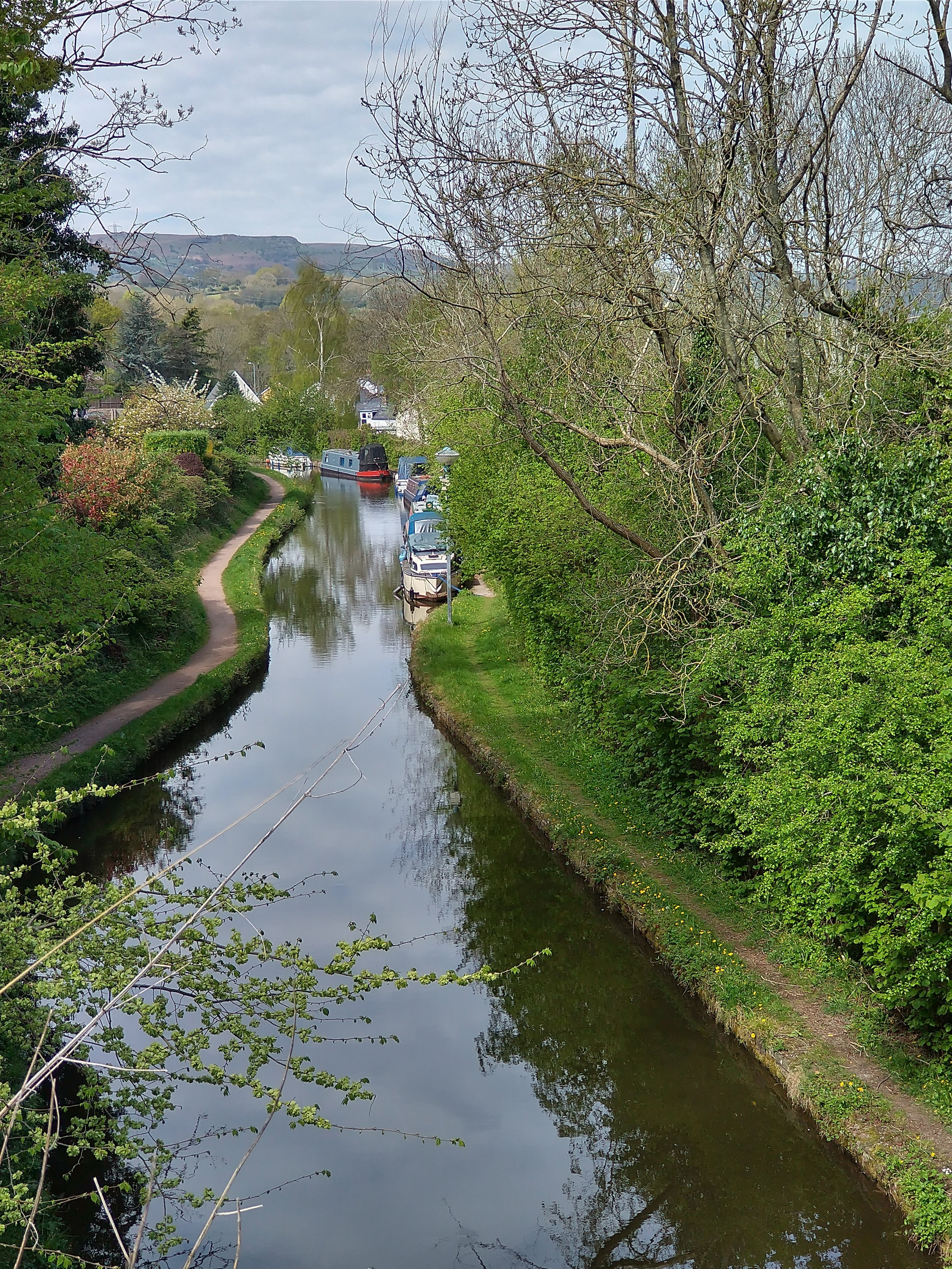
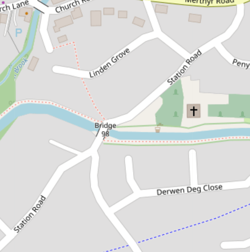
The Monmouthshire and Brecon Canal
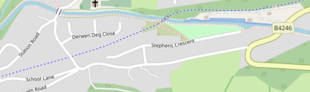
To complete this perambulation in Govilon, I visited the Canal bridge on Station Road in Govilon – Bridge 96 on the OpenStreetMap extract below. …
“The Monmouthshire and Brecon Canal is a small network of canals … For most of its currently (2018) navigable 35-mile (56 km) length it runs through the Brecon Beacon National Park, and its present rural character and tranquillity belies its original purpose as an industrial corridor for coal and iron, which were brought to the canal by a network of tramways and/or railroads, many of which were built and owned by the canal company.” [21]
To conclude …
Govilon provides a relatively unique interchange between canal, tramroad and railway with the routes of each running parallel to each other to the West of the village. Each route would provide a pleasant walk. The village of Govilon brings all three together in what is a very easy and accessible amble.
References
- https://history.govilon.com/trails/places-of-interest/tramroads-and-railways, accessed on 25th April 2022.
- http://www.industrialgwent.co.uk/e22-govilon/index.htm, accessed on 25th April 2022.
- https://en.m.wikipedia.org/wiki/Govilon_railway_station, accessed on 26th April 2022.
- W.W. Tasker; The Merthyr, Tredegar & Abergavenny Railway and branches; Oxford Publishing Co., Poole, 1986.
- Christopher Awdry; Encyclopaedia of British Railway Companies; Patrick Stephens Ltd., Sparkford, 1990.
- Mike Hall; Lost Railways of South Wales; Countryside Books, Newbury, 2009.
- Michael Quick; Railway passenger stations in Great Britain: a chronology (4th ed.); Railway & Canal Historical Society, Oxford, 2009.
- R.V.J. Butt; The Directory of Railway Stations: details every public and private passenger station, halt, platform and stopping place, past and present (1st ed.); Patrick Stephens Ltd., Sparkford, 1995.
- https://en.m.wikipedia.org/wiki/Abergavenny_Brecon_Road_railway_station, accessed on 26th April 2022.
- M.C. Reed; The London & North Western Railway; Atlantic Transport, Penryn, 1996.
- David Edge, David (September 2002). Abergavenny to Merthyr including the Ebbw Vale Branch. Country Railway Routes; Middleton Press., Midhurst, 2002.
- C.R. Clinker; Clinker’s Register of Closed Passenger Stations and Goods Depots in England, Scotland and Wales 1830–1980 (2nd ed.); Avon-Anglia Publications & Services, Bristol, 1988.
- James Page; Rails in the Valleys. London: Guild Publishing, London, 1989.
- http://www.coflein.gov.uk/en/site/403520/images/DI2005_0544.jpg, accessed on 26th April 2022.
- https://en.m.wikipedia.org/wiki/Llanvihangel_Railway, accessed on 26th April 2022.
- UK Retail Price Index inflation figures are based on data from Clark, Gregory (2017). “The Annual RPI and Average Earnings for Britain, 1209 to Present (New Series)”. Measuring Worth, accessed on 2nd December 2021.
- Helen J Simpson; The Day the Trains Came: the Herefordshire Railways; Gracewing Publishing, Leominster, 1997.
- This picture was a result of a Google search on 26th April 2022 (https://www.google.com/search?q=govilon+railway+station&client=ms-android-motorola-rev2&prmd=minv&sxsrf=APq-WBu4LJDnd981z48Kikjqyx97uz0X_A:1651026323274&source=lnms&tbm=isch&sa=X&ved=2ahUKEwinzY2smLP3AhXMT8AKHalNCcIQ_AUoAnoECAIQAg&biw=412&bih=726&dpr=2.63#imgrc=acn9kC5OQt_5yM) it does not however feature on the Facebook page of The Railway Shop, Blaenavon, to which the photograph is linked.
- John Bartlett’s father, Cyril, was Station Master in the period before the closure of Govilon Railway Station. This picture was shared by John Bartlett on the Facebook group ‘Govilon and Gilwern Past’, accessed on 26th April 2022.
- https://www.openstreetmap.org/#map=16/51.8168/-3.0620, accessed on 26th April 2022.
- https://en.m.wikipedia.org/wiki/Monmouthshire_and_Brecon_Canal, accessed on 26th April 2022.

I want to print it out and make a book if your work!
Thanks
Dave
Kansas
Pingback: A second visit to Govilon – Bailey’s Tramroad and the Heads of the Valleys line – Part 2 | Roger Farnworth