
I came across a first reference to a Tramroad in Coalbrookdale in a book by Barrie Trinder published in association with the Ironbridge Gorge Museum Trust in 1977. Trinder collated a series of references to Ironbridge and Coalbrookdale from ancient texts in his book entitled “The Most Extraordinary District in the World.” [1]
Trinder provides an extract from a book written in German by C. von Oeynhausen and H. von Dechen entitled “Railways in England 1826 and 1827” translated by E.A. Forward. [2] in which Oeynhausen and Dechen comment that, “In Coalbrookdale, a cast iron Tramroad runs from the Severn to the lower smelting works of the Dale Company.” [1: p94, 2: p67]
They noted that the Tramroad was a Plateway with rails between 5 and 5ft 6in. in length tied together by cast iron sleepers. Of great interest is their note that, “The tramroads at Coalbrookdale are of two sizes. The smaller one is of 20in. gauge, and the haulage in this is performed with small trucks; it lies in the middle of a larger line of 36in. gauge. Horse haulage is used thereon. It perhaps merits remark that the smallest gauge for horse use employed anywhere is to be found in this district, as on some lines the gauge is only 18 inches …” [1: p94, 2: p67]
The authors go on to note that at Horsehay Ironworks, part of the Dale Company’s holding, there were “tipping wagons with sheet iron bodies on wooden frames, very suitable for the transport of blast furnace slag. The wheels on these wagons [were] from 14 to 18in. diameter, and [had] wider wheel rims than … employed elsewhere in England, and especially in South Wales, namely [1.25 to 1.5]in.” [1: p94,96, 2: p67]
They recorded that the plateway was laid with the vertical flange on the inner side.
Plate 47 in Trinder’s book provides a photograph of a dual-gauge plateway which was uncovered adjacent to Rose Cottage, Coalbrookdale in 1971. [1: p95]
Other references to the Tramroad include its inclusion in the Historic England register; the History Workshop Online.
Historic England Monument No. 72035 Grid Reference: SJ6682404251
Summary: Iron tramroad 1767 (course of)
More information: The first iron tramroad existed at the Coalbrookdale Works.
The Tramroad within the Coalbrookdale works is recorded by Historic England as the first ever iron tramroad. Their record states:
“It being found that the wooden rails of the tramroad of one mile length, laid in 1757, along which coal and iron were conveyed from one part of the works to another as well as to the landing places along the river Severn, soon became decayed or broken, after experiments, the rails were replaced in 1767 by rails of cast iron.” [3]
“A specimen length of rail and a wagon are preserved within the open-air museum at the Coalbrookdale Works at SJ 66780485. The
tramroad terminus together with the quay and offices are at present being restored on the N bank of the river Severn, at SJ 66780363,
by the Ironbridge Gorge Museum Trust.” [3]
“A paving of mortared bricks, with grooves which formerly held planking to which the iron rails were attached, has been uncovered and renovated. The quay, of large stone blocks, has been cleared of silt and the dock offices and a tram shed, housed in a castellated ‘Gothick’ style building of red and yellow brick, are undergoing
restoration at the present time.” [3]
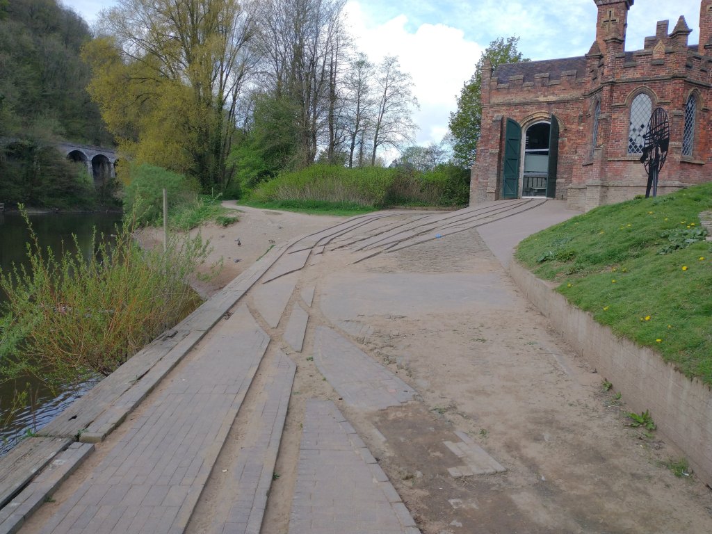
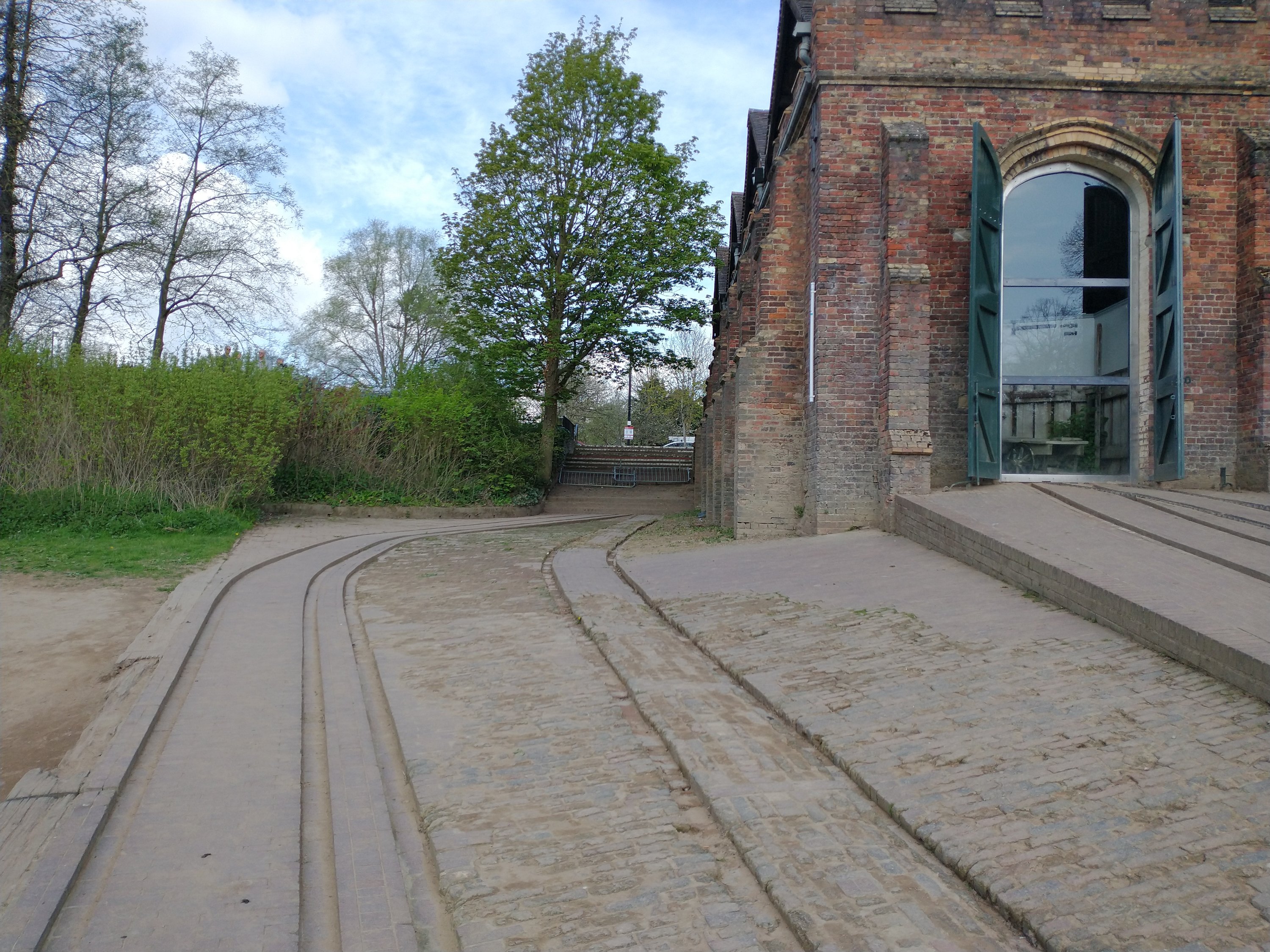
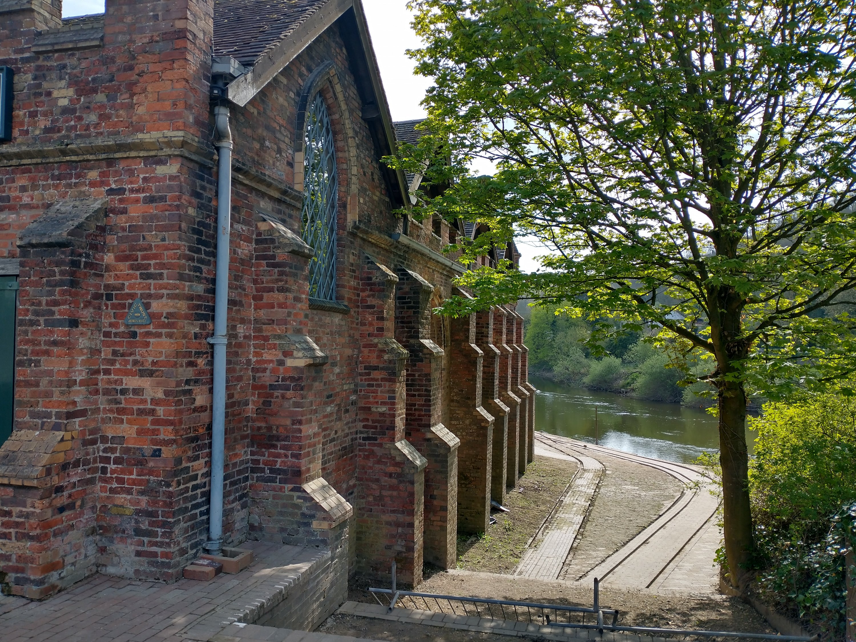
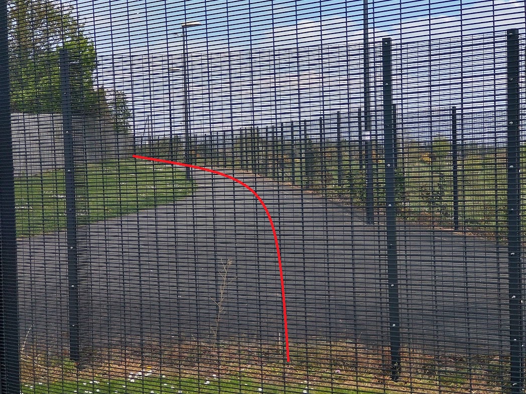
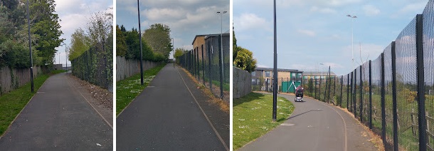
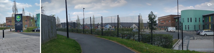
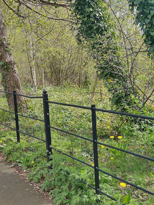
These notes are a little out of date now. Much of the work referred to has been completed. A visitor centre is accommodated in the tramroad goods shed on the Wharf and some of the tramroad sidings at the Wharf have been renovated. The pictures below give an impression of what the Wharf area is like in 2022. …
History Workshop Online (HWO)
HWO comments as follows: “In 1757 Richard Reynolds, son-in-law of Abraham Darby II, took over managing the Coalbrookdale Works and, in 1767, introduced metal rails for transporting coal and iron around the works and down to the river, as wooden rails were easily damaged and costly to repair. This was the first time metal rails had been used anywhere, inspiring tramways to follow suite, and the original metal tram rails can still be seen at the Wharfage in Ironbridge.” [4]
From a short length of Tramroad linking the Coalbrookdale works to the River Severn a larger network of tramroads developed. It is important not to confuse this network centred on Coalbrookdale with the Lilleshall Company’s network which met the Severn at Sutton Wharf, East of Coalport. The Lilleshall plateway was very short-lived. It was operational by 1799 and closed in favour of the use of the Canals in 1815/16. [5: p35] That network is covered in Part 3 of this short series of articles.
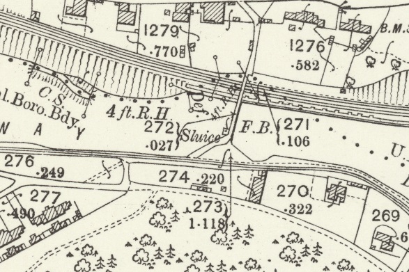
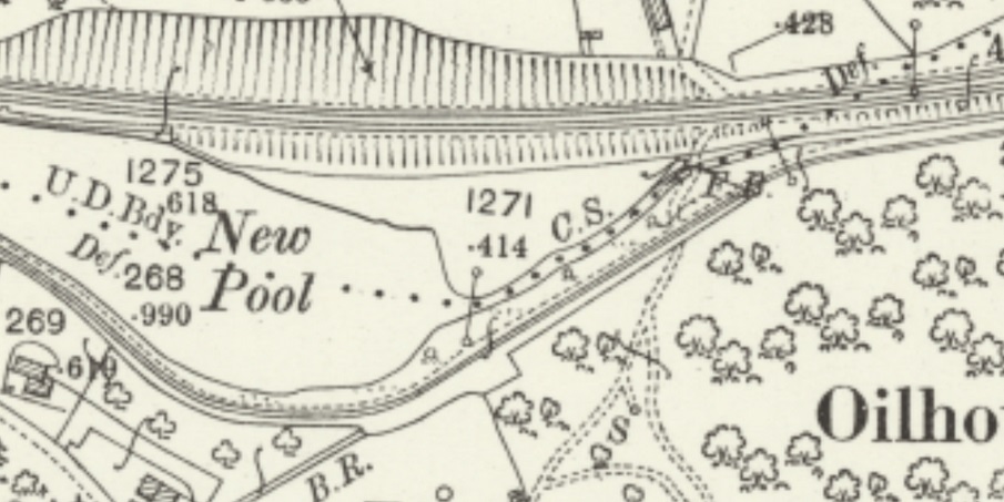
The tramroad in Coalbrookdale met the River Severn at the the bottom of the valley.
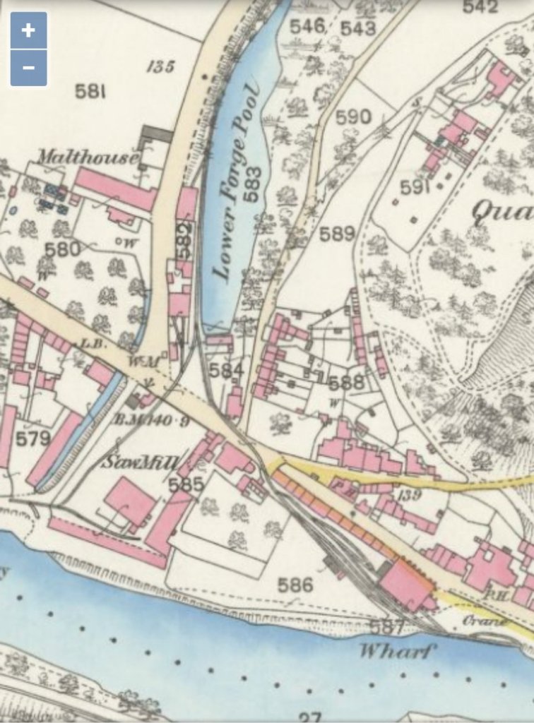
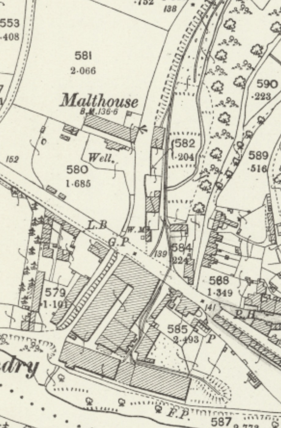
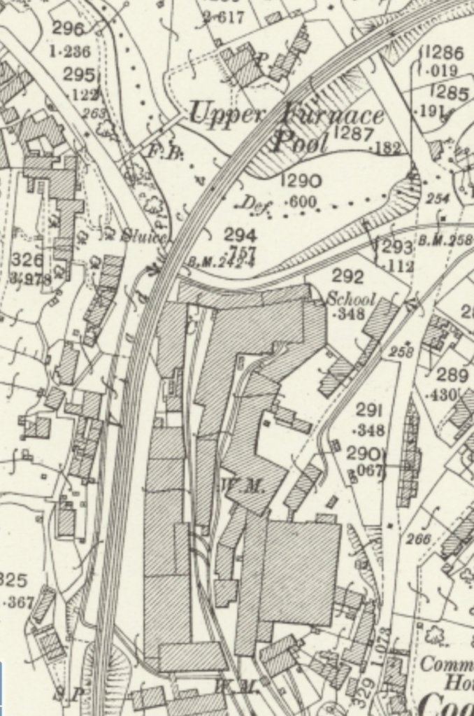
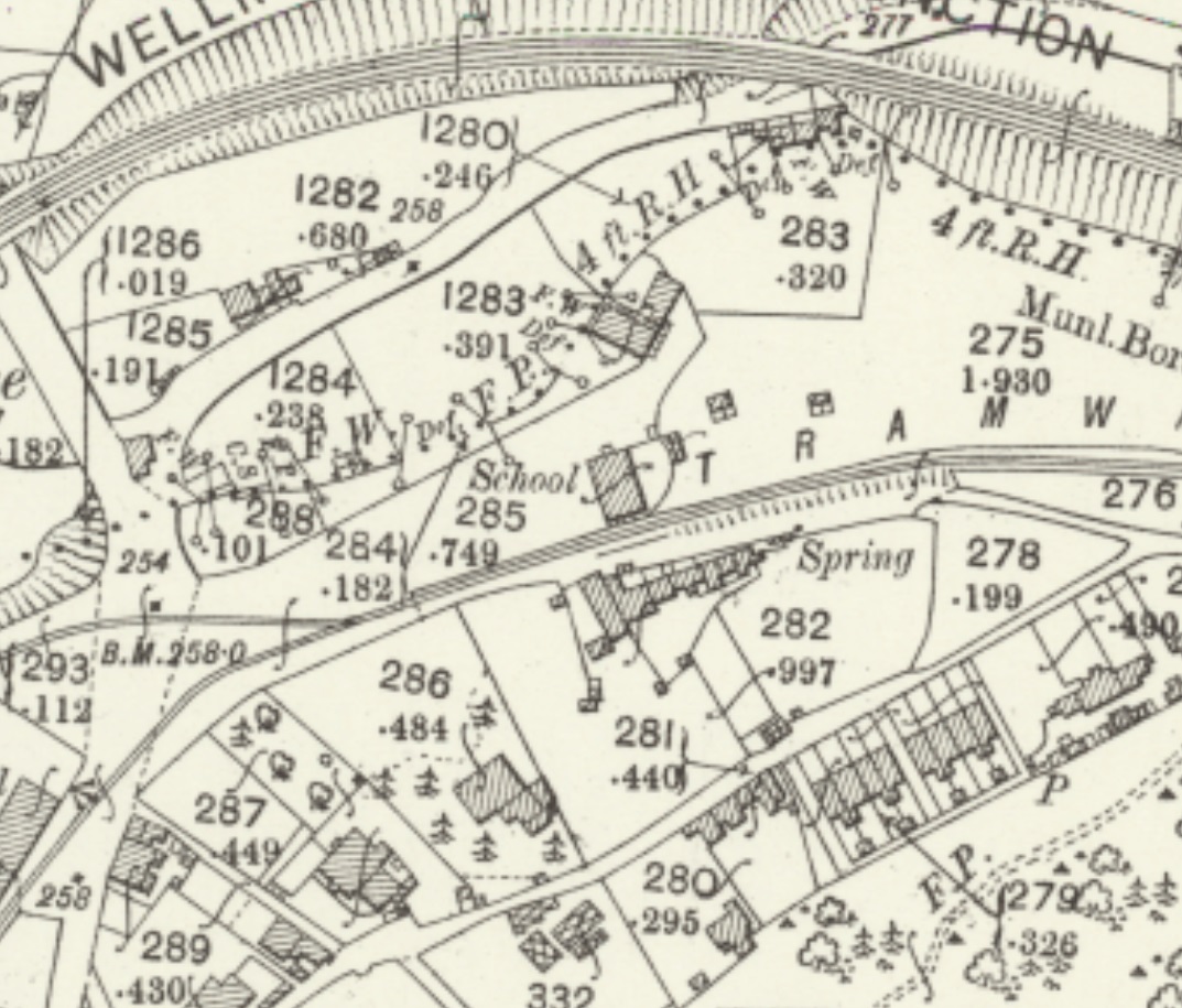
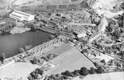
An extract from the 25′ OS Map series of 1883 is shown below. The tramroad wharf appears still to be in use at that time. A transhipment/goods shed is shown on the land just above the River Severn. A sawmill is shown at the bottom of Coalbrookdale below Lower Forge Pool. Interestingly, the Tramroad is shown crossing the road at two locations the line to the wharf was at a very shallow angle.
The extract from the 25″ OS Map series dated 1902 is shown below. At this time there was a foundry at the water’s edge and the tramroad terminated on a high level above the river. The goods shed shown on the map extract above still exists but is just off the view to the east. The sawmill above has been replaced by the Severn Foundry.
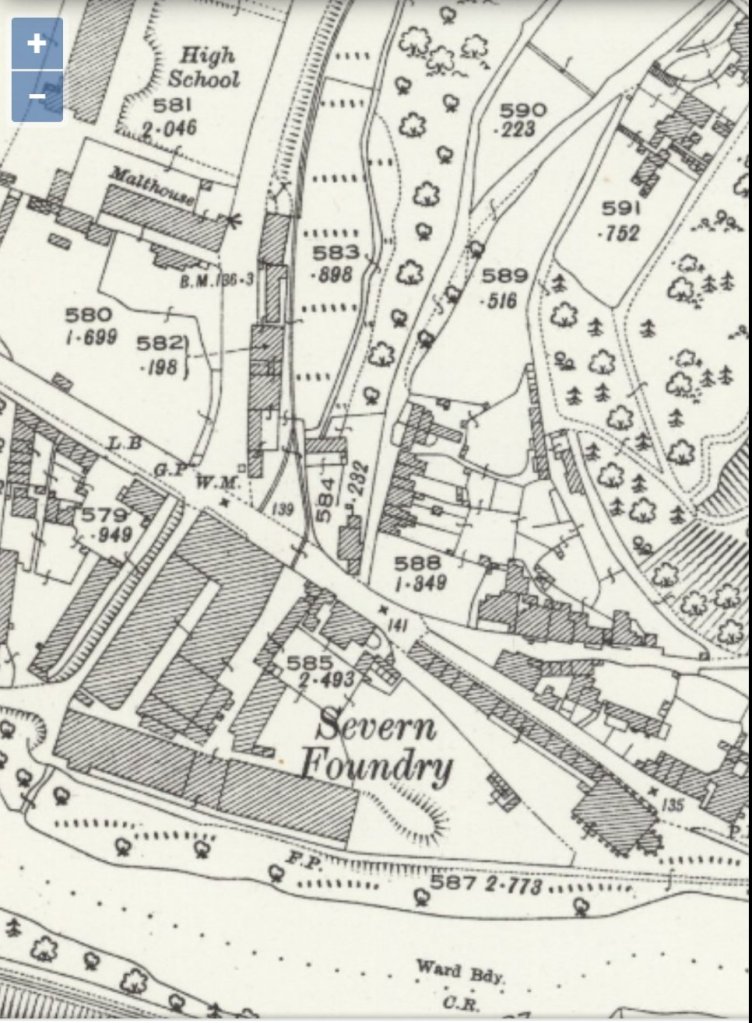
The extract from the 25″ OS Map series dated 1927 no longer shows the tramroad within the site of the Severn Foundry, although it still seems to be present within the road surface!
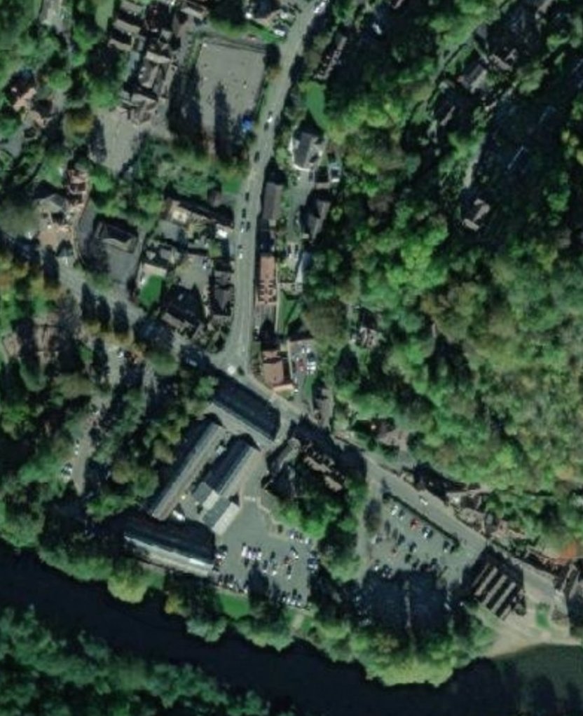
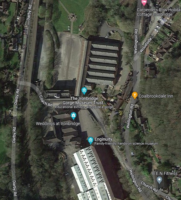
The NLS provides the 25″ OS Maps as an overlay to satellites images from the 21st century. The same area is shown below in an extract from those images. As can be seen the large warehouse to the bottom left of the above extract remains and is in use as the Museum of the Gorge.
Wikipedia notes: “The Museum of the Gorge, originally the Severn Warehouse, is one of the ten museums of the Ironbridge Gorge Museum Trust. It portrays the history of the Ironbridge Gorge and the surrounding area of Coalbrookdale, Shropshire, England.”
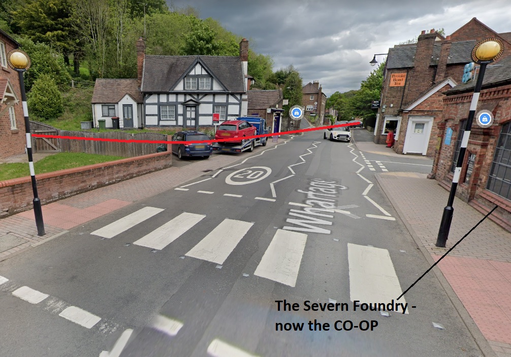
The Foundry complex also remains, although somewhat altered, and is in part a CO-OP supermarket.
A little further north from the Severn, north of the Lower Forge Pool, the Tramroad can be made out running parallel to the GWR Coalbrookdale branch but in the valley floor between the road and the stream. The GWR station can be see in the top left of the extract which is from the 1883 25″ OS Map.

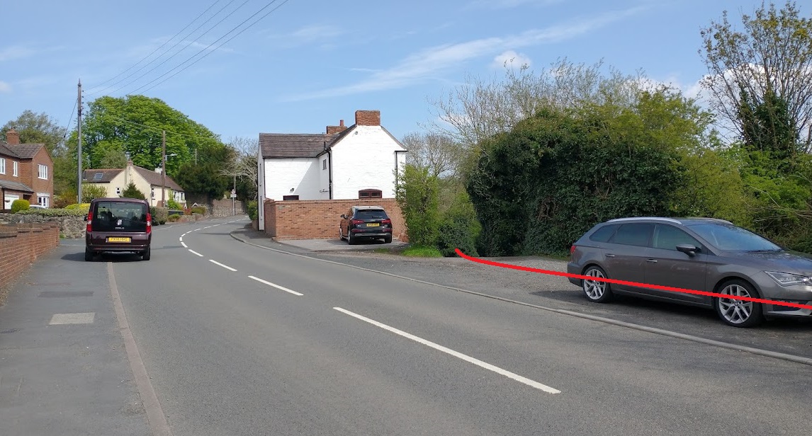
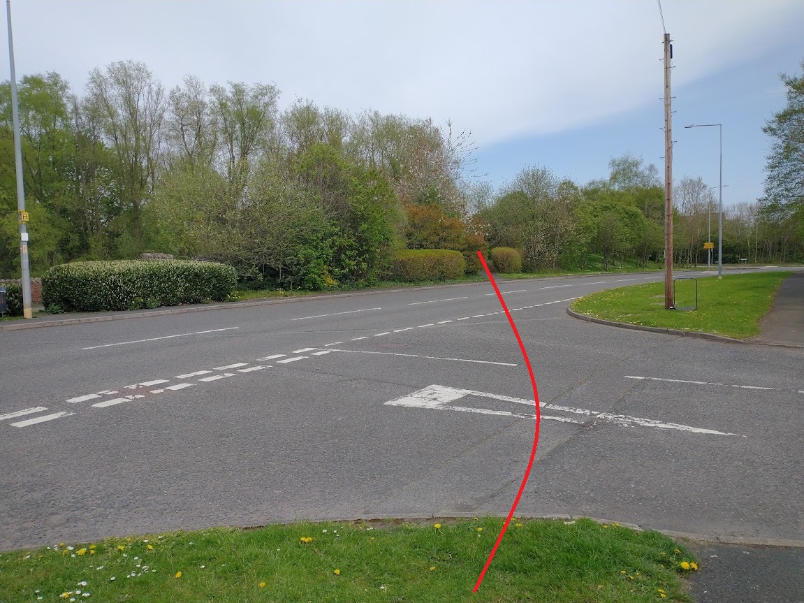
Further North the tramway/tramroad continues to follow the road verge, as below, until it crosses leaves the road adjacent to Upper Forge Pool. …
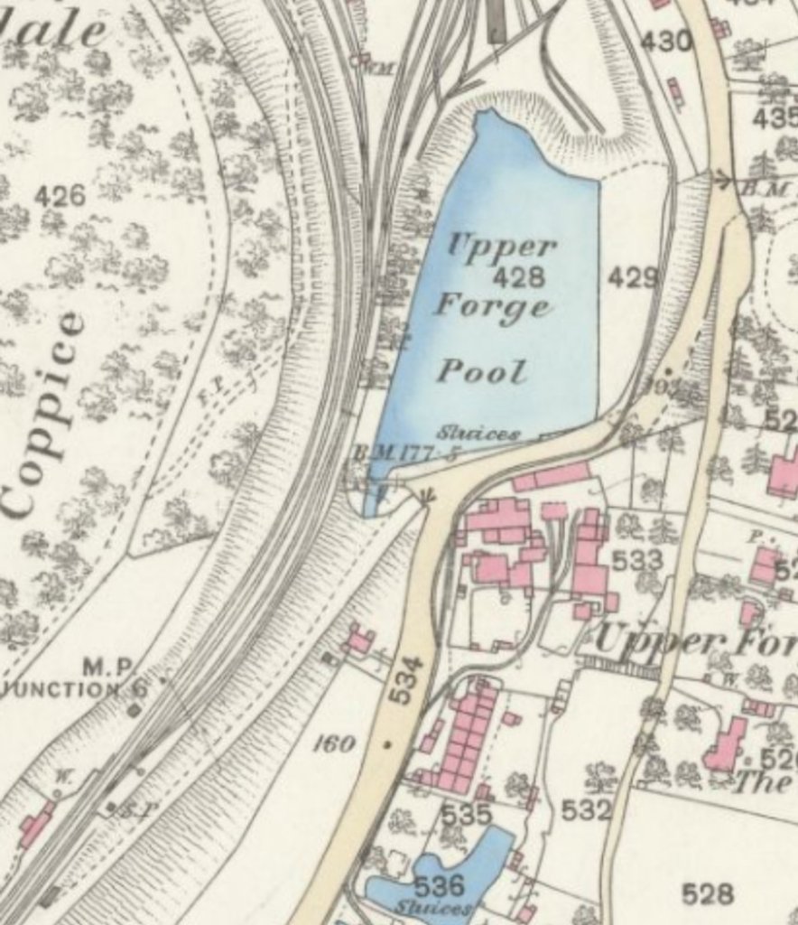
Standard gauge sidings began to dominate the area immediately around the next length of the tramway/tramroad route as can be seen below. The standard gauge tracks originate from the GWR line adjacent to the Upper Forge Pool and are at a higher level than the tramroad. The tramroad mainline ran north-northeast on the west side of the public road. A branch entered the Iron Works site before giving access to the raised area north of the Pool and also under the standard gauge line to the works buildings.
Sadly, north of the top of the extract below the 1st Edition OS 25″ series is not available on the NLS site.
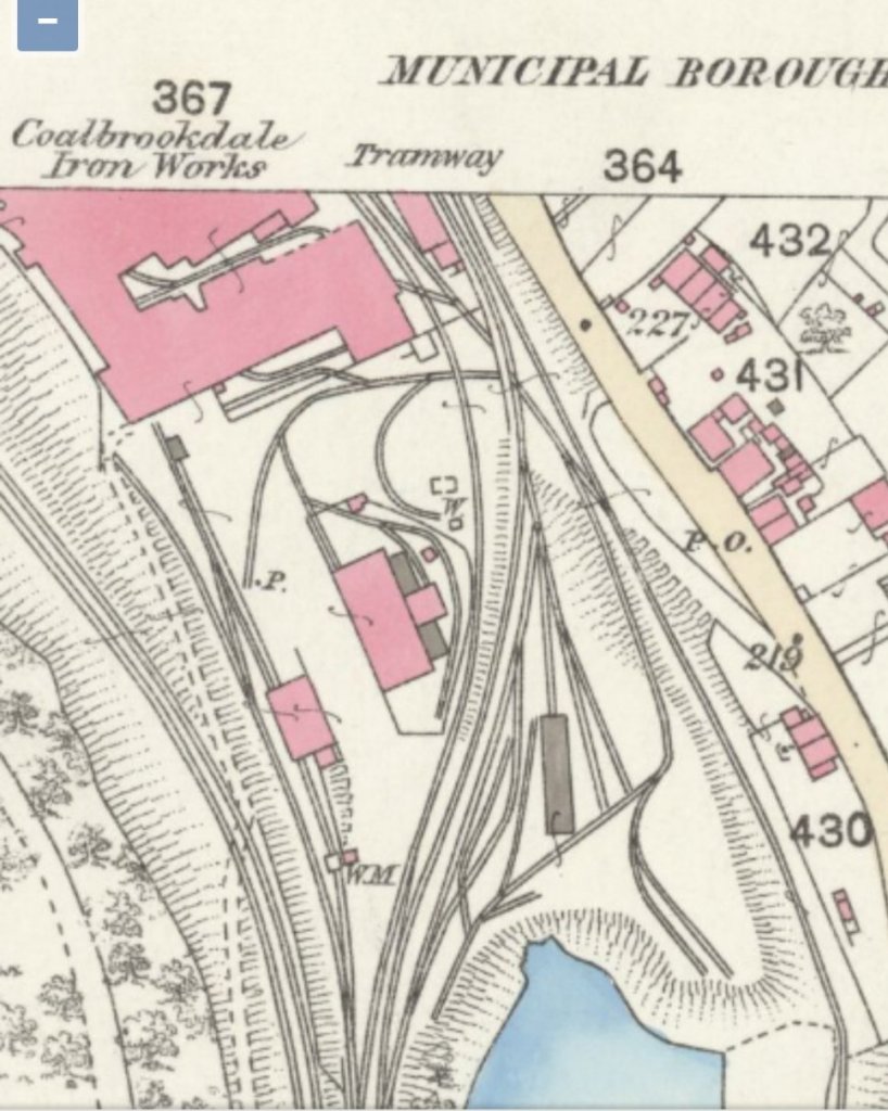
There was a significant network of tramroad tracks within the curtilage of the Coalbrookdale Iron Works. The site was constrained by the narrow valley and was, at its southern end, predominantly sited between the public road and the GWR line. Various sidings served the works in the valley floor, but the main line of the tramway passed under the GWR line at about the same northing as the Commercial Hotel to the east of the road.
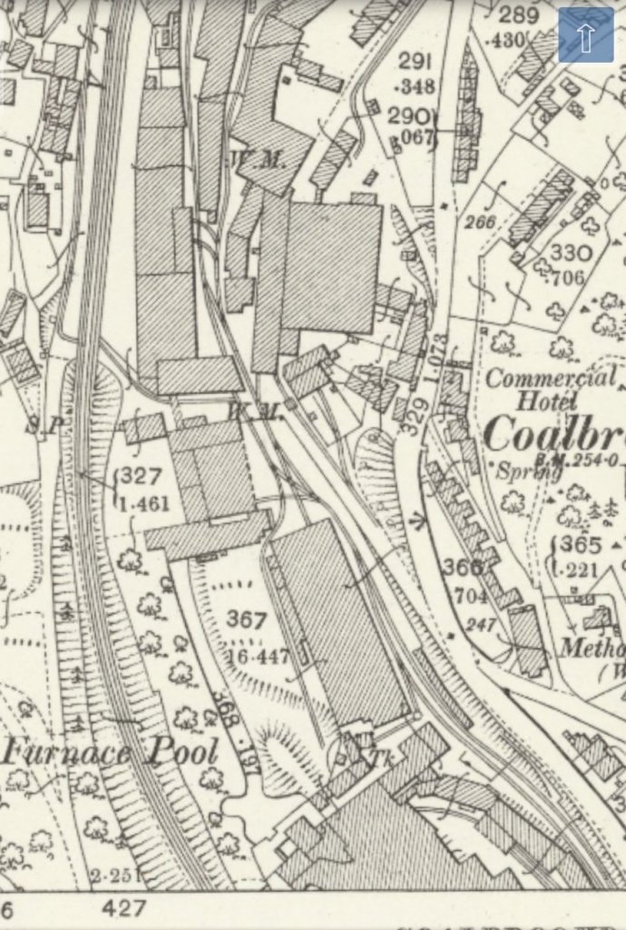
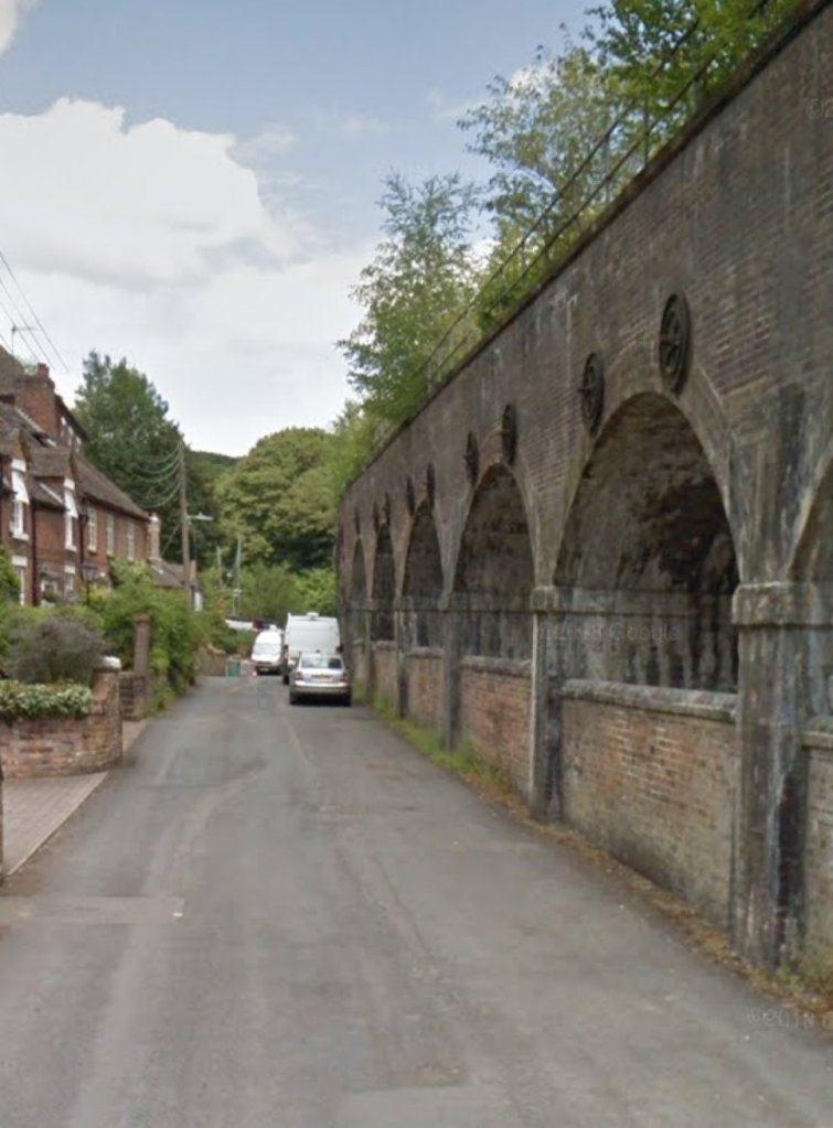
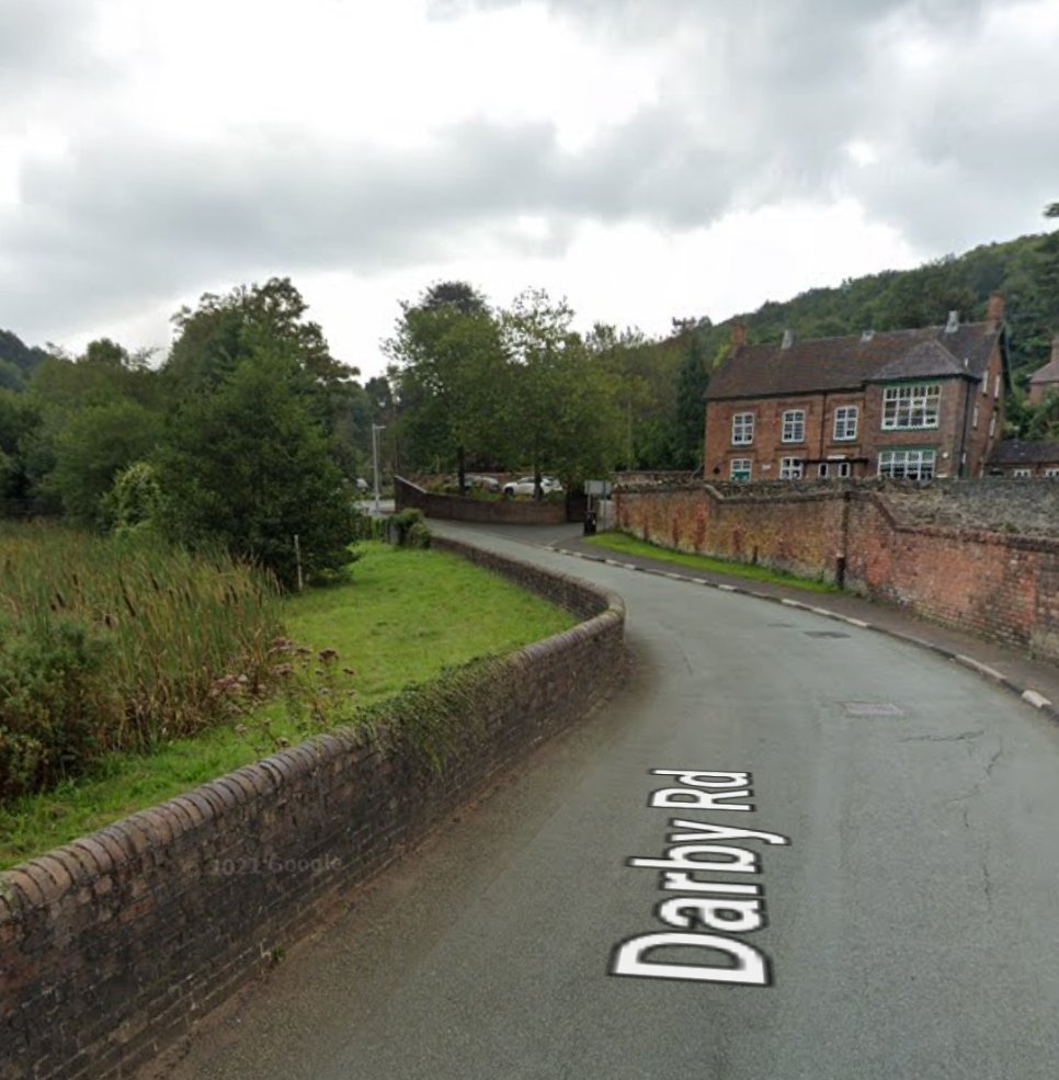
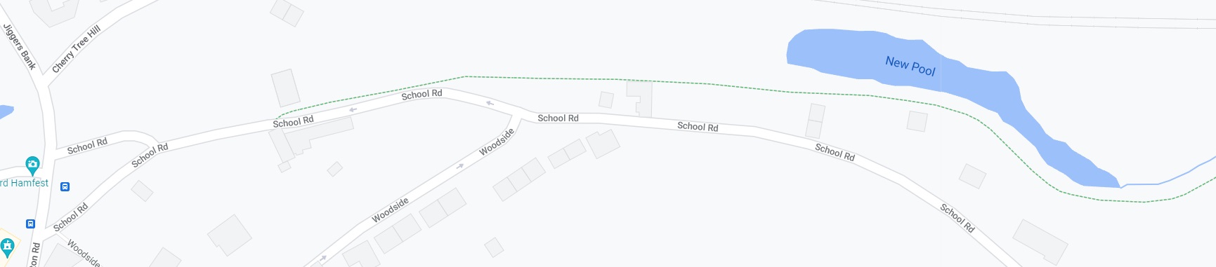
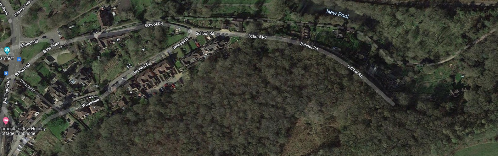
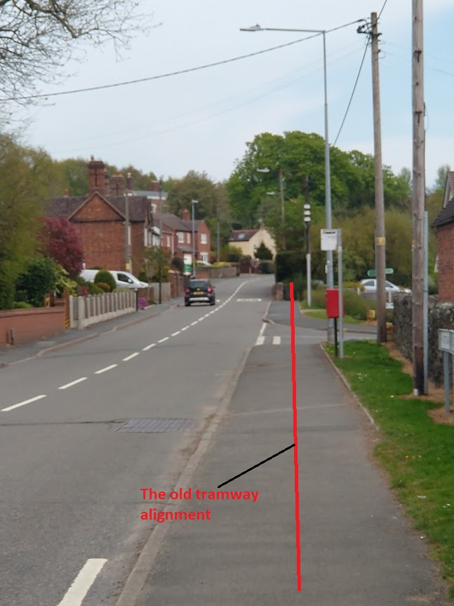
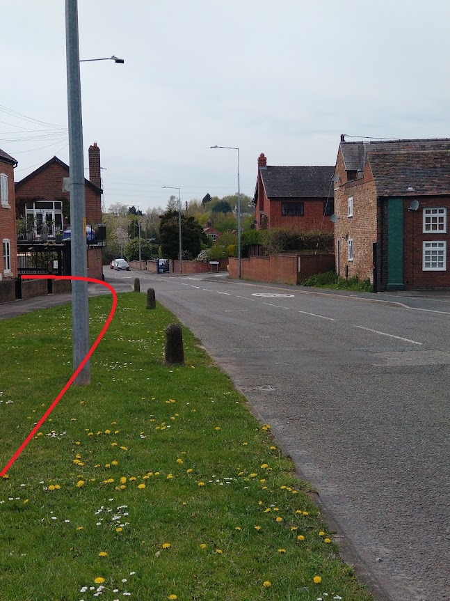
The Tramroad mainline left the gates in the photograph above and passed under the GWR line on what is now named Coach Road. The tramway/tramroad then ran immediately adjacent to that railway line on its West side, along the present Darby Road, for a short distance before crossing back under the GWR line adjacent to the Upper Furnace Pool and then following the South side of Darby Road, crossing the School Road, Wellington Road, Jiggers Lane, Darby Road junction on the level and then heading East along School Road.
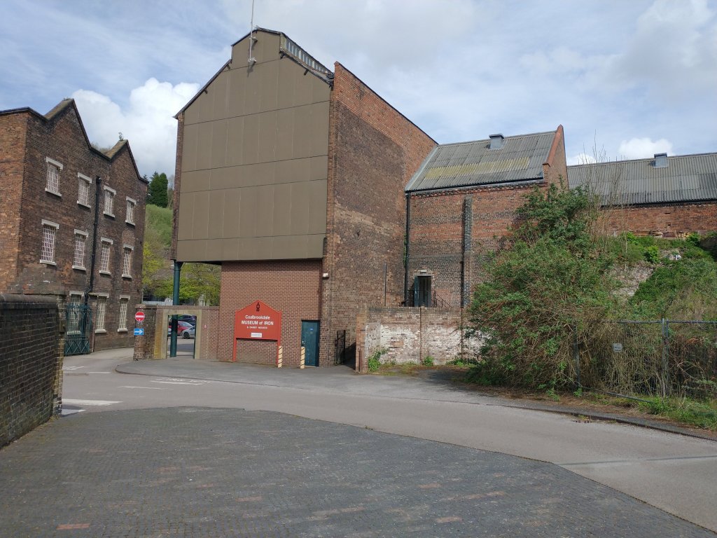
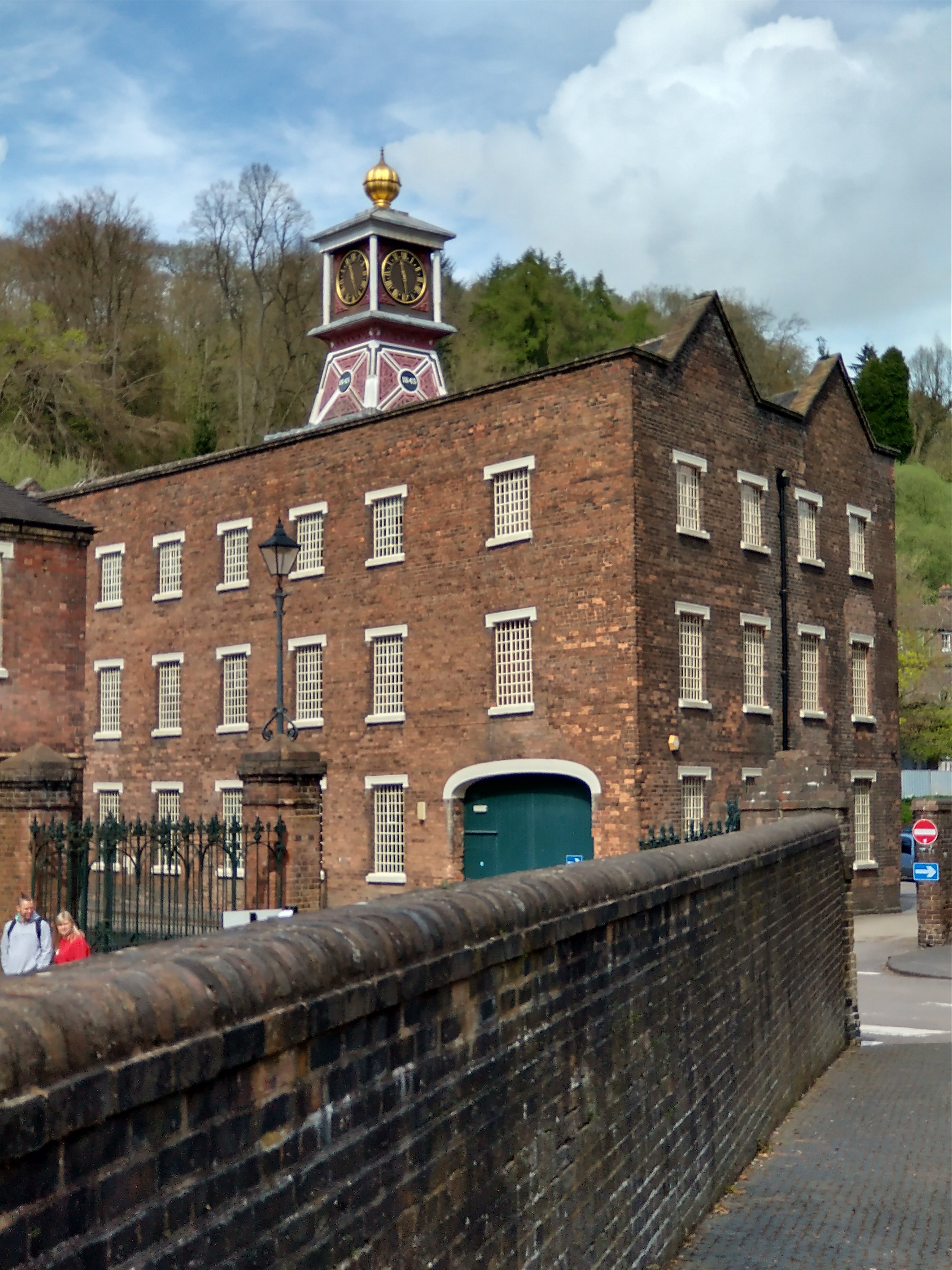
The Coalbrookdale Company’s Ironworks buildings have been given a significant new lease of life by the Ironbridge Gorge Museum Trust. The building to the South of Coach Road is now ‘Enginuity’ and that to the North of Coach Road is the ‘Coalbrookdale Museum of Iron’. ……
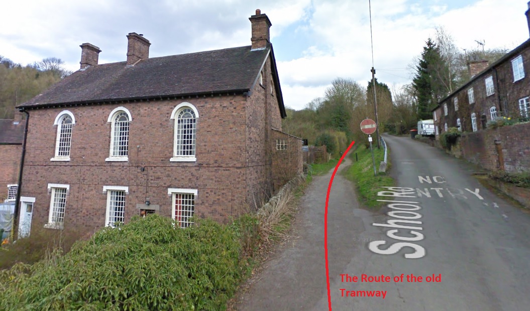
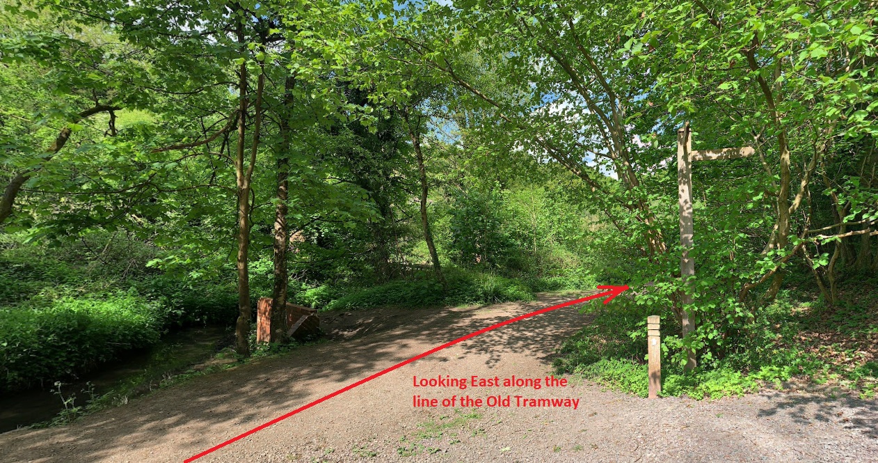
The route of the old tramway appears in the pictures below: first Coach Road, under the railway viaduct; then looking North on Darby Road; and then East along Darby Road from under the railway bridge next to Upper Furnace Pool. …

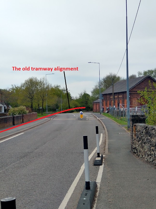
The tramroad/tramway continued East on School Road as shown on the 1901 25″ OS Map Extracts below. It then ran on its own formation parallel to the GWR branch-line. The three OS Map Extracts below show the tramway in place just after the turn of the century. Google Maps shows its route in 2022 as a green-dashed line as can be seen further below.

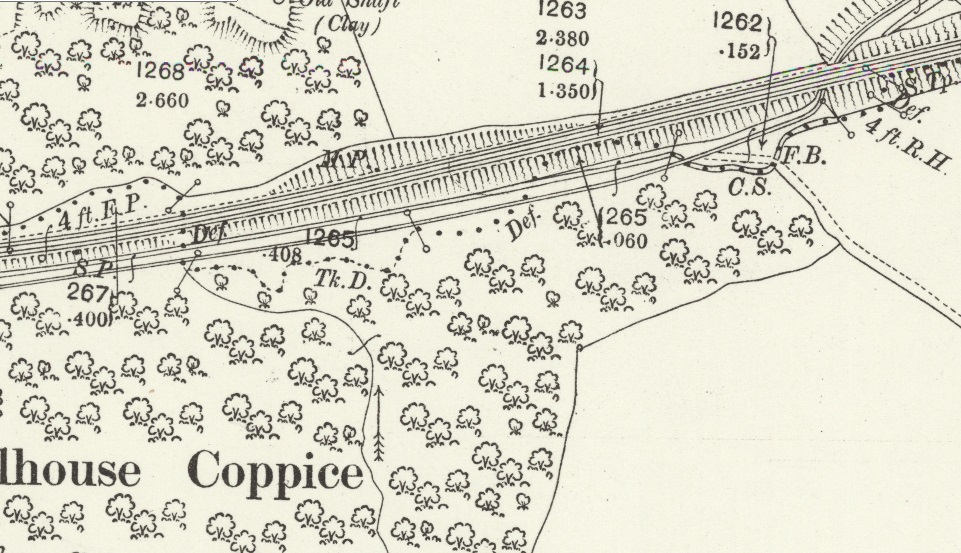
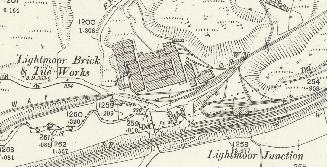
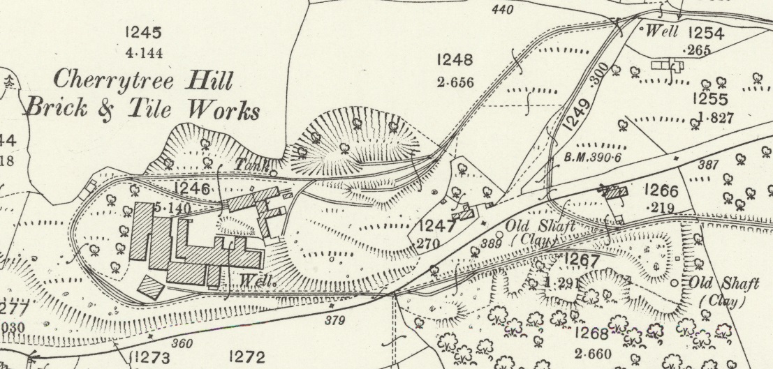
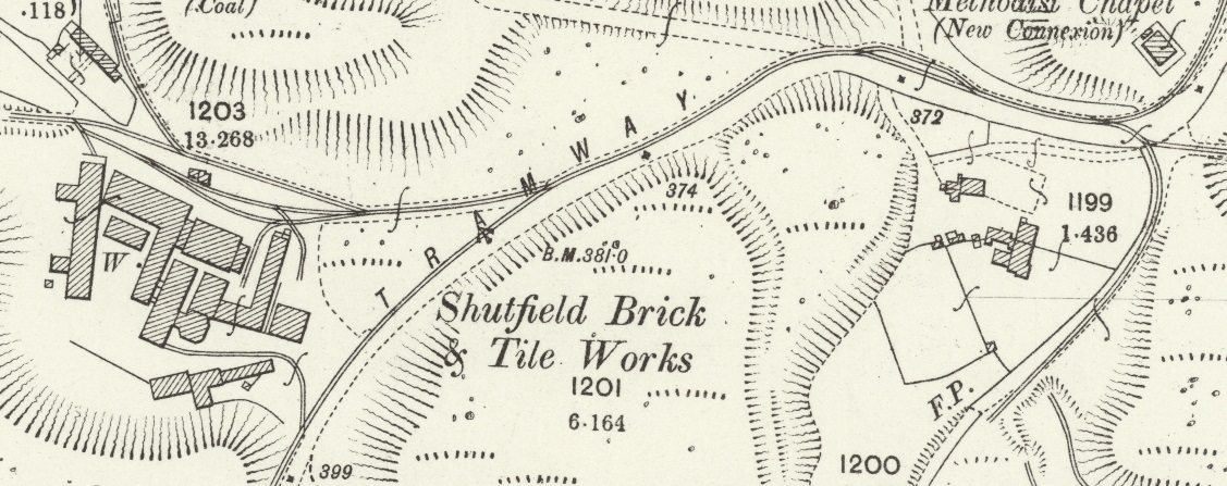
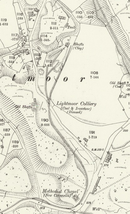
Immediately to the North of the railway line there were a series of Brick & Tile Works which were all served by the tramway. A significant network of lines were in place at the time of the surveying for the 1901 OS Map. The next image is of another extract from the OS mapping of 1901. The scale has been reduced to allow the whole immediate area on the north side of the railway to be seen at a glance.
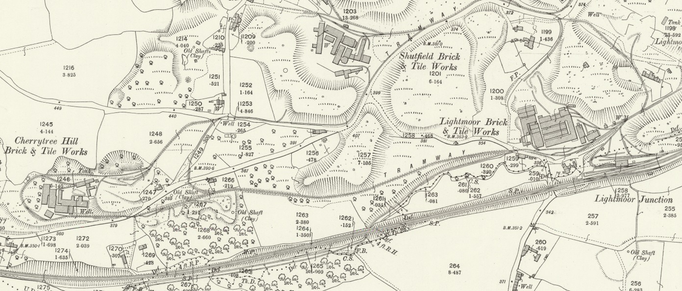
The next three map extracts focus on the three brick & tile works mentioned above.
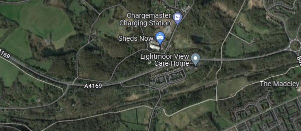
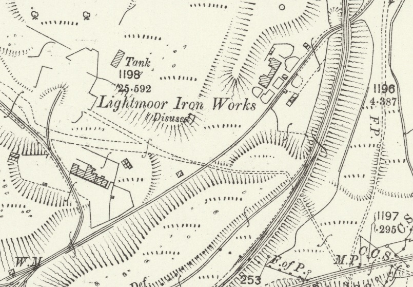
We return to the course of the old tramway mainline. Immediately east of the Lightmoor Brick and Tile Works was the site of the Lightmoor Iron Works which, by the turn of the 20th century, were disused and substantially demolished. After passing though the site of the Iron Works the tramway passed under the standard-gauge line once again.
It is worth pausing at this point in our journey to find out a little more about the Works served by the tramway over the last half-mile or so. …….
Shutfield Brick & Tile Works
The information about the Shutfield site is distilled from the Discovering Shropshire’s History website. [6]
The Works at Shutfield have been given the Historic England Register No. 03871. The Works started out as a Brickworks and was producing bricks from, at least, 1825 until the late 19th century. It commenced making tiles in the mid-19th century and focussed on producing tiles from 1894 onwards. It continued to produce tiles until after the Second World War.
Two categories of tiles were produced, roofing tiles and floor tiles. These were branded with the “Lightmoor Broseley” stamp. The kiln at Shutfield Tileries was an intermittent down draught kiln with drying sheds. . . .Water leaking into the kiln from a stagnant mere less than 15 metres to the west was enough to mean its inevitable closure in 1951.
Cherrytree Brick & Tile Works
The information about the Cherrytree site is distilled from the Discovering Shropshire’s History website. [7]
The Cherry Tree Hill brick and tile works was first recorded in 1761. It closed in the early 20th century. The Works have been given the Historic England Register No. 03872.
The works were the first industry in Lightmoor producing clay products. The produce of the works was basic wares for basic uses. Perforated flooring squares, quarry tiles and roofing tiles were produced on a small scale for general industrial and local use. Bricks and firebricks were also produced both pressed in later times and handmade in the earlier phase of the work’s existence. Originally called Cherry Tree Hill Brickworks, it must have expanded into tile production between 1840 and 1880, when it was titled Cherry Tree Brick and Tile Works. No trace of the kilns in use at the works have survived, although a down-draught intermittent kiln is likely.
Lightmoor Brick & Tile Works
The information about the Lightmoor Brick & Tile Works is distilled from the Discovering Shropshire’s History website. [8]
Lightmoor Brickworks was first mentioned in 1779, when it was owned by John Davies. . . .Its initial base of production was bricks, made by the semi-dry process. This was followed by other basic wares of the early 19th century including flooring bricks, draining pipes, chimney pots, and lightweight roofing tiles.
During the 1860s the diversity of products began to escalate. The next decade heralded a phase of moulded decorative terracotta. . . Which continued until the turn of the century, and the works turned back to brick manufactures. From the 1900s to the closure of the Coalbrookdale Co in 1933, Lightmoor Brickworks supplied them with all the firebrick shapes for their solid fuel appliances. In the fifty years from 1933 to the late 1980s Lightmoor continued to survive on brick manufacture.
Lightmoor Iron Works
The information about the Lightmoor Iron Works is distilled from the Discovering Shropshire’s History website. [9]
Little is known about the the Iron Works, but there were a number of structures (which appear on the 1901 Ordnance Survey extract above) to the east of the location of the furnaces. These were thought to initially be part of the industrial complex of the ironworks, later converted to domestic use.
In 1984 the Ironbridge Gorge Museum Archaeology Unit excavated parts of the Lightmoor Ironworks site in advance of its destruction by the Ironbridge By Pass. Trenches were dug to examine the wall footings of that group of buildings to the east of the furnaces. These buildings had been constructed directly onto coarse pit waste, and stood until recently. The area was badly disturbed after their destruction, which obliterated all traces of floor levels. Nothing was found which would have enabled the different usages thought to have applied to be confirmed.
Lightmoor Colliery
Lightmoor Colliery appears on the Hudson Institute of Mineralogy Mindat.org register as owned by the Coalbrookdale Company and as being active between 1855 and 1885. [10] It should, incidentally, not be confused with the colliery of the same name in the Forest of Dean!
And now continuing to follow the tramway mainline ….
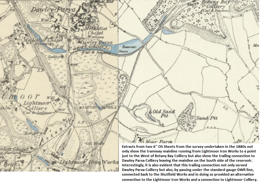
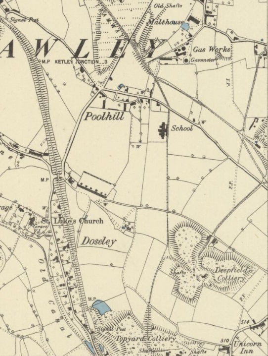
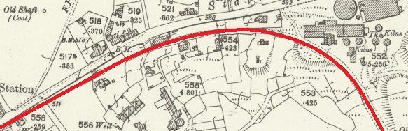
Two further extracts from the 1901 25″ OS Mapping follow. The first shows the tramway providing access to Dawley Parva North of the point where the tramway crossed beneath the standard-gauge line the map extract below shows that the tramway passed to the east of Dawley Parva Colliery. A tailing connection to the tramroad had already been lifted by the time of the survey for this Map series. The colliery was redundant but I was unable to locate any information about it on line. However, the 1880s 6″ series of OS Maps did provide more information.
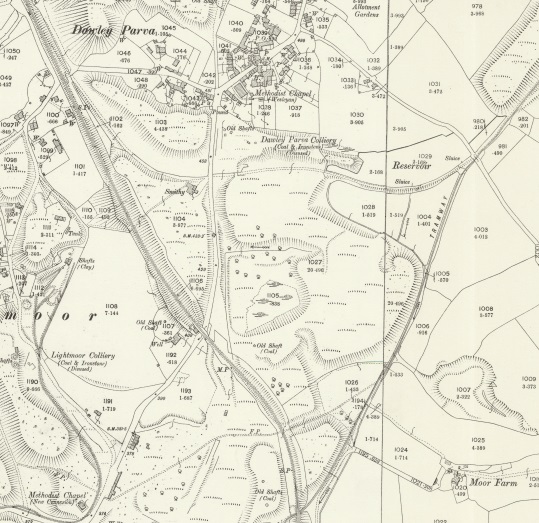
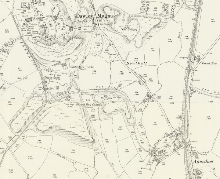
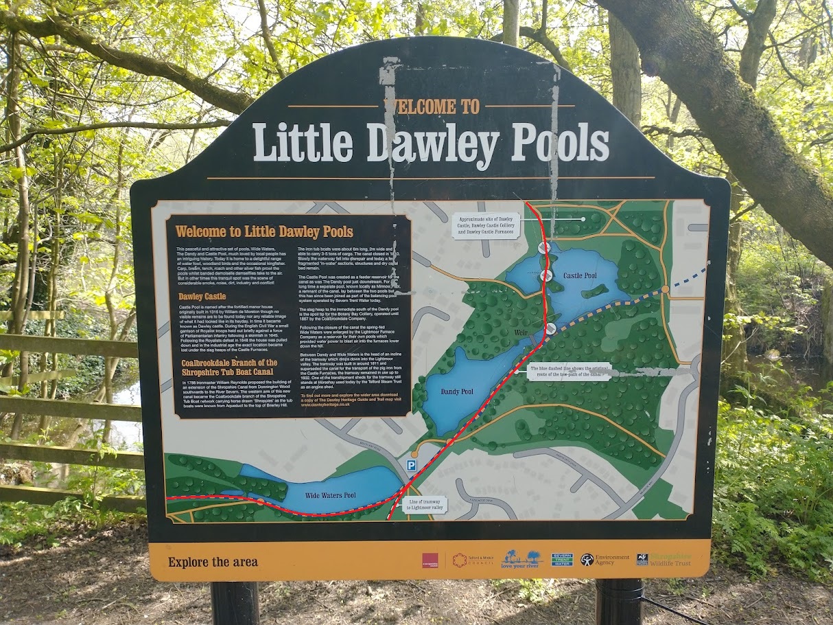
The remaining length of the Tramway on the 1901 Maps is shown immediately below. It originally would have served Dawley Castle Iron Works and provided for transshipment to the canal arm which extended from the Shropshire Canal at the village of Aqueduct passed Botany Bay Colliery to serve the Castle Iron Works.
These short notes, in italics, about the Shropshire Canal are distilled from the Aqueduct village website. [11]
The canal was built following an act of Parliament of 1788, its function being to link the ironworks and mines in the Oakengates area to the River Severn. The waterway was opened in 1792. It ran southwards from Wrockwardine Wood, via Oakengates, through a tunnel at Stirchley and on to Southall Bank whereupon it split into two branches. The western branch was intended to meet the river at Coalbrookdale but was never built beyond Brierly Hill; it was this branch that crossed the aqueduct.
The eastern branch went via a descending inclined plane of 126 feet at Windmill Farm to the wharf at Tweedale and then on through Madeley to meet the river, using the Hay Inclined Plane and a short canal at Coalport.
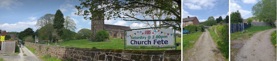
Of interest to me, is the point at which in 1901 the Tramway finished, alongside Holy Trinity Church, Dawley. This is one of the churches in the Central Telford Parish. As I write this article in April 2022, my wife is Rector of the parish.
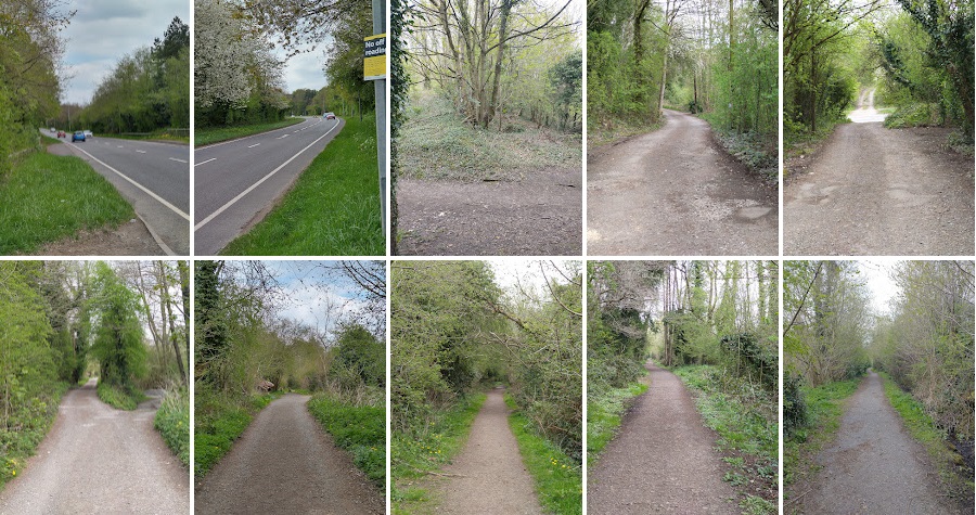
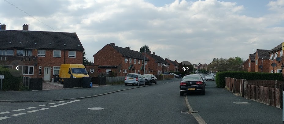
I walked the length of the tramroad from the modern A4169 close to what were Lightmoor Iron Works and the point at which the tramway passed under the GWR standard-gauge line North to Pool Hill on 21st April 2022. I as able to combine this with a walk along part of the GWR standard-gauge route and the tramroad which served Dawley Parva.
First, the mainline from Lightmoor Iron Works to Dawley Castle. ….
(My pictures)
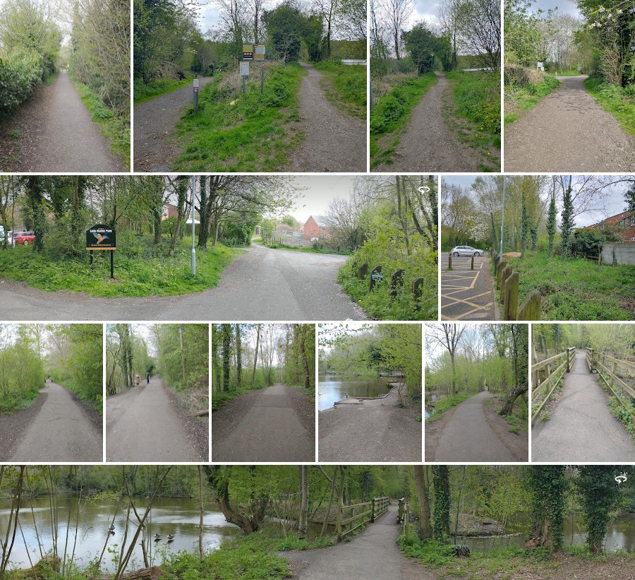
(My pictures)
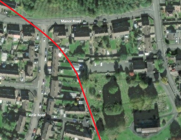
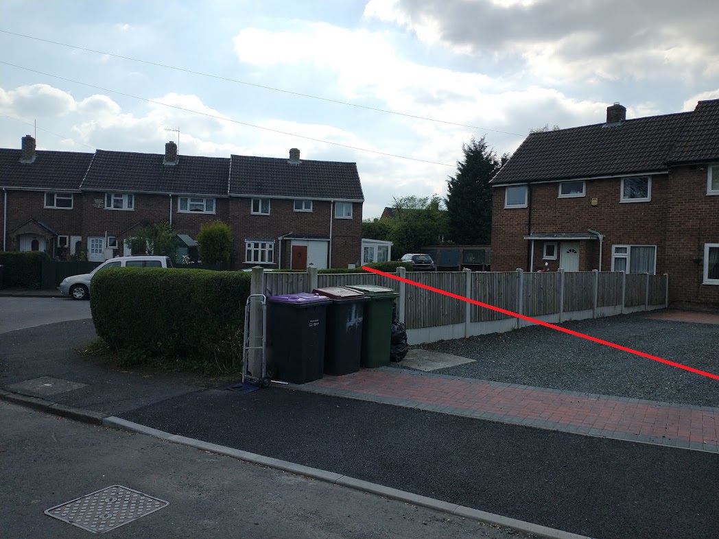
For the next half mile or so, the old tramway route has been built over by housing and amenities. Its approximate line can be plotted on modern satellite images as below.
The 6″ OS Maps of 1888 show the Castle Iron Works in active use, as shown below. The canal arm was already disused by this date but the Tramway extends north beyond the church.
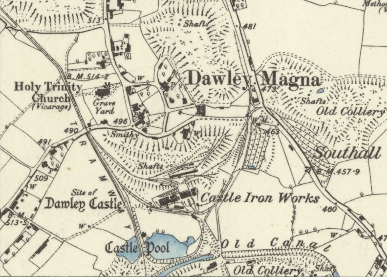
The next OS Sheet published in 1885 shows a significant network to the North of the church. The first map extract below shows the tramway entering from the right side of the map at a triangle of lines which provided access to Deepfield Colliery.
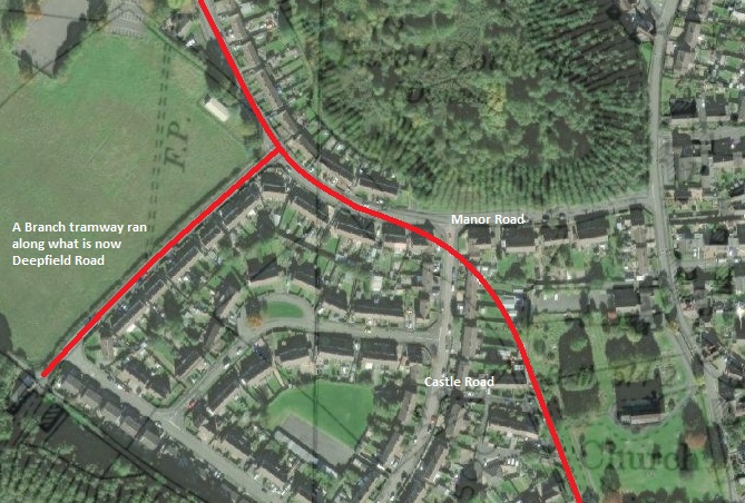
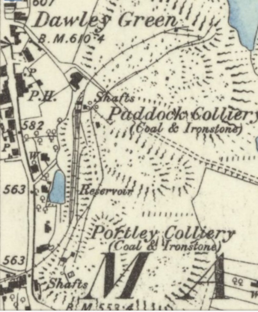
A very short distance beyond the line to Deepfield Colliery a branch heads north-northeast and then East towards two pits – Paddock Colliery and Portley Colliery – both are shown on the second map extract below. They were close to Dawley Green, and as a result relatively close to our Vicarage, just a few hundred yards further north!
Returning to the main line, it continued Northwest. …
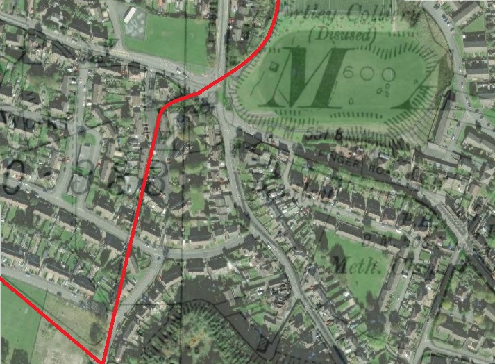
After passing through the modern housing, a trailing connection joined the tramway mainline, it served Topyard and Deepfield Collieries. This is highlighted on the satellite image below.
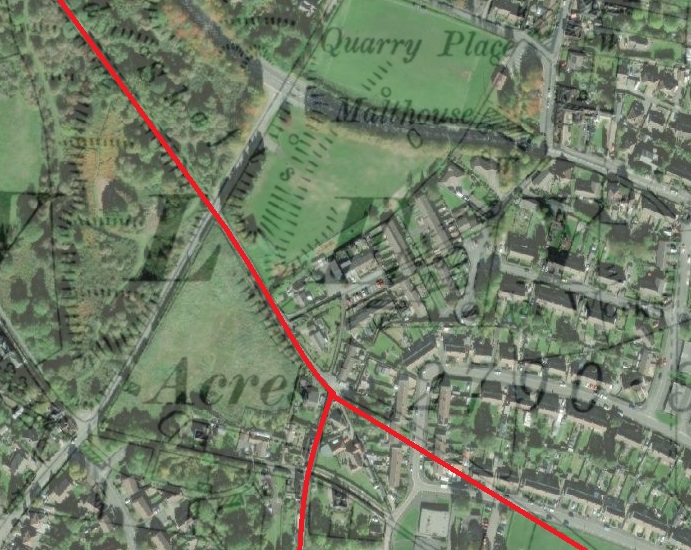
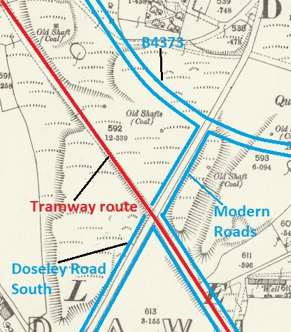
On the 6″ OS Map extract below the tramway passes between the ‘E‘ and ‘Y‘ of ‘Dawley’. That straight length of tramway is the length now under the modern road, Upper Pool Hill. The map extract below
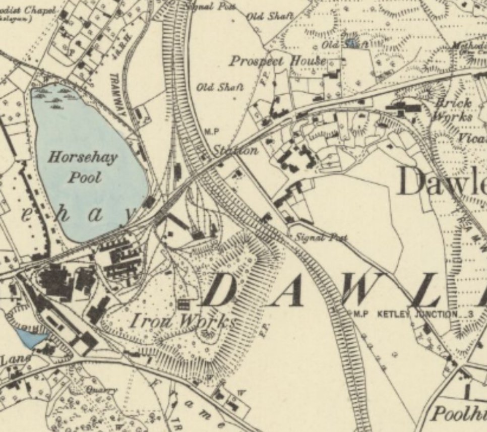
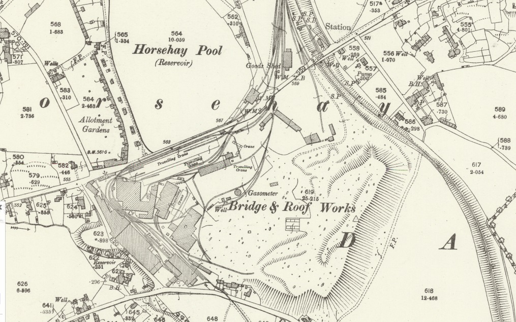
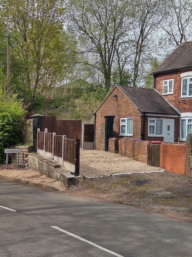
To the West of Dawley village the line split with one branch heading a short distance west on the South side of Prospect House and over the GWR line to get to the Horsehay Iron Works. Out of a significant complex of lines at the Iron Works, two further branch tramways served the Iron Works needs. One to the North, on the east side of Horsehay Pool, in the 1880s, allowed collieries on Horsehay Common to supply the Works. And one to the South led to a quarry at the head of Horsehay Dingle.
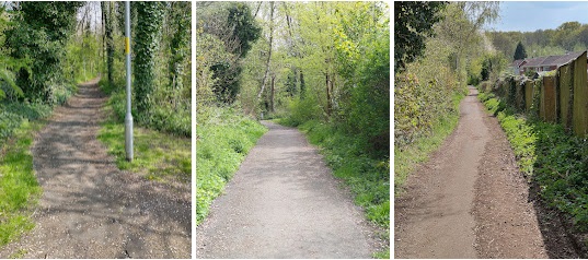
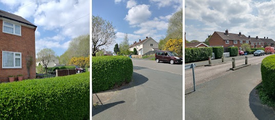
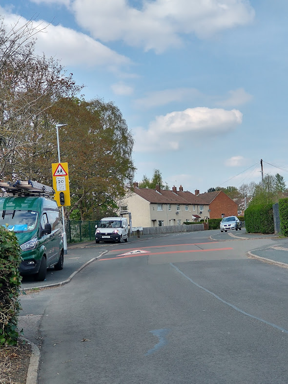
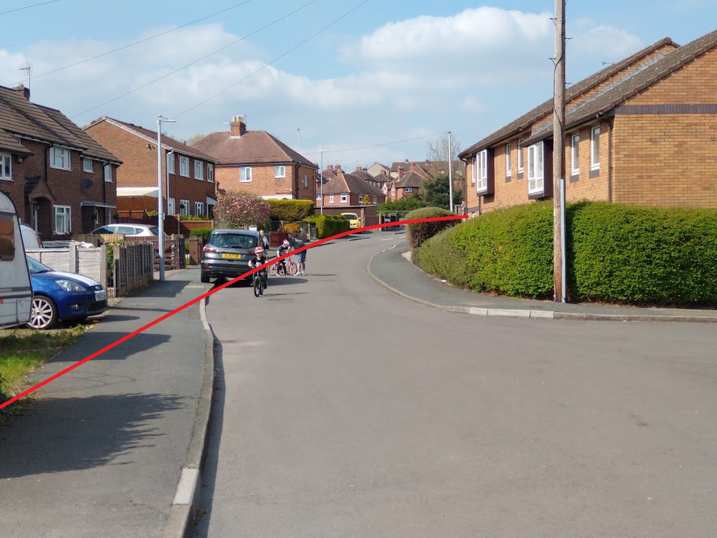
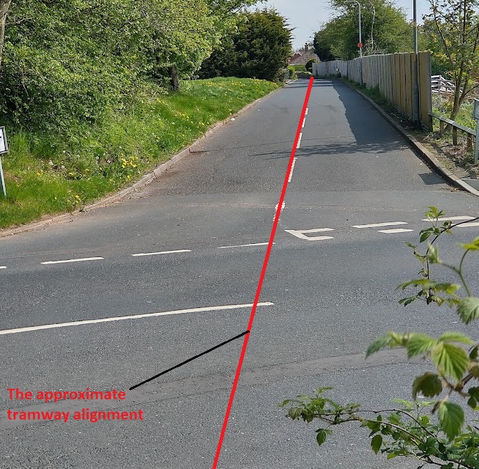
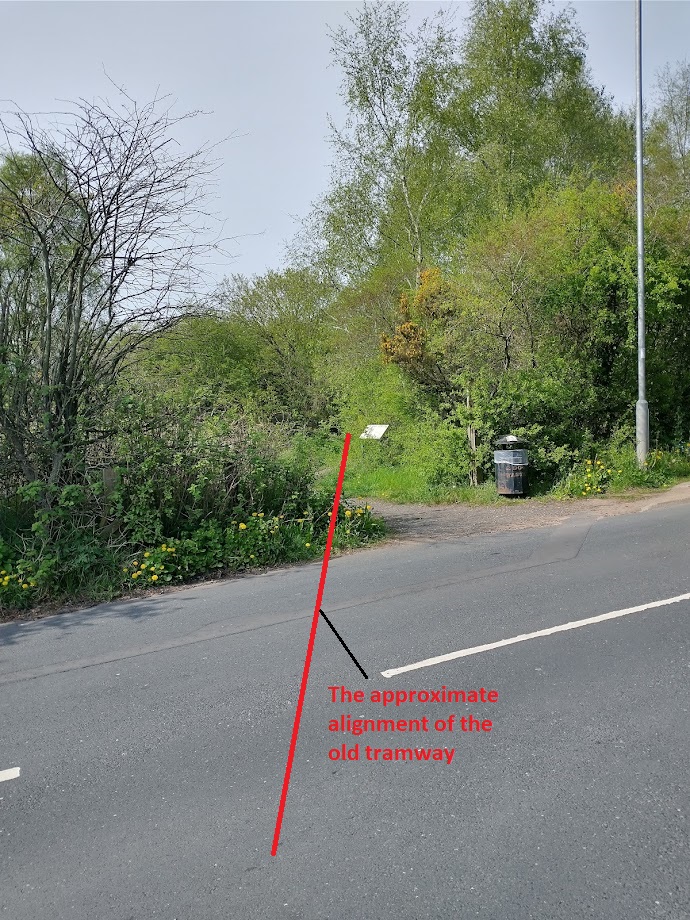
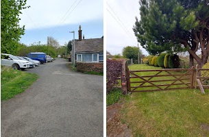
The pictures that follow were all taken as I walked the route on 20th April 2022 and were all taken from public roads. For convenience, I have marked the tramway route onto the 1902 survey map extracts below, and where modern road alignments are not obvious, I have added these. They cover the length of the tramway from Pool Hill to Horsehay.
(My picture)
(My photograph)
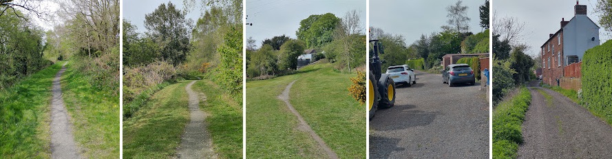
(My photograph)
We noted earlier in this article that two tramway branches left the Iron Works site, one to the North, on the east side of Horsehay Pool, at this time, allowed collieries on Horsehay Common to supply the Works. And one to the South led to a quarry at the head of Horsehay Dingle.
In covering these two tramway arms we cover the extent of the tramways on the 1882/83 survey. We do know that prior to this time waggonways/tramways ran further north through Lawley and Ketley and on to Donnington Wood. These lengths of the network are no longer shown on the 1882/83 OS 6″ Maps nor on the later 25″ Map series. A further article will hopefully be forthcoming covering the lengths of the Coalbrookdale tramways not addressed here.
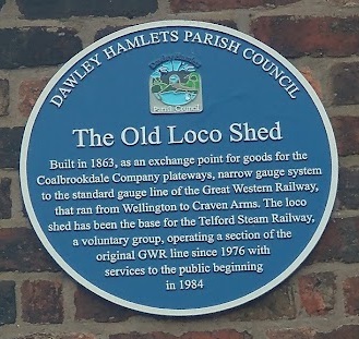
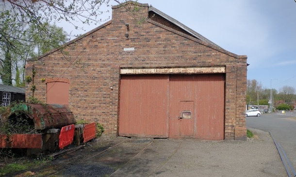
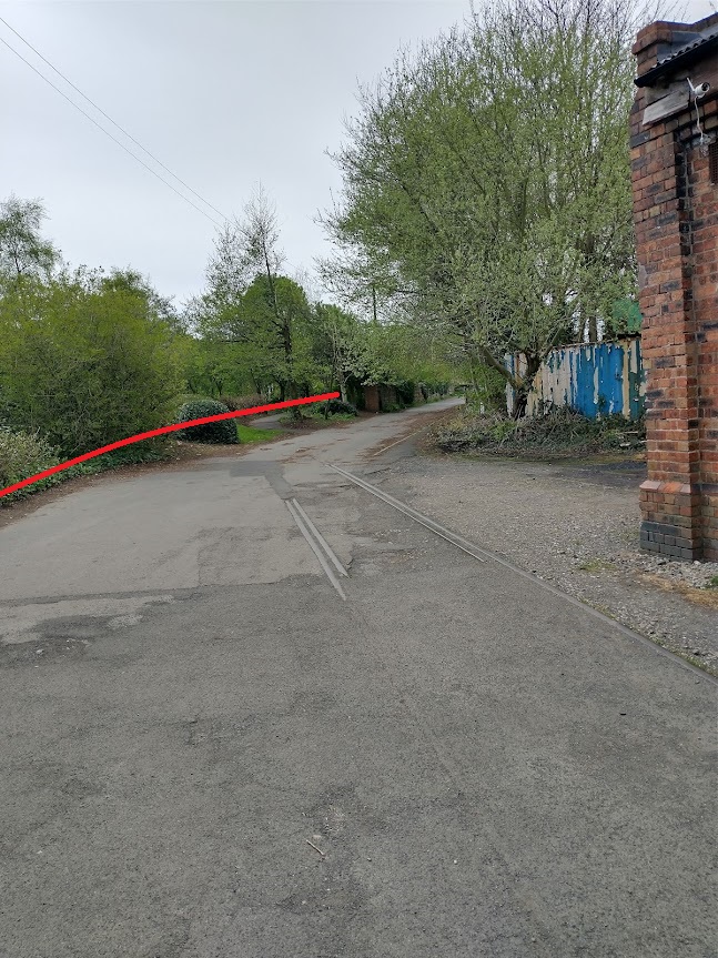
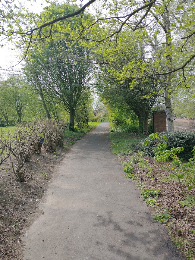
The one to the North left to the East of the Old Loco shed shown above. Pictures of its route are shown below. …

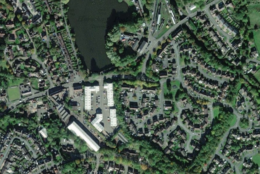
The second of the two branches passed through the Iron Works heading South and left the site at the location shown below. Just two photographs are shown as access onto the Works site was not possible and because, south of Woodhouse Lane, there is a new housing estate in Horsehay Dingle.
Horsehay Iron Works …
I have seen two suggestions as to how Horsehay gained its name:
- It was a staging post and feeding station for the pack horses pulling Ironstone from the canal at Ketley to the Coalbrookdale works. [12]
- Its name is Anglo-Saxon for ‘an enclosure for horses’. [13]
Horsehay was nothing more than a farm, until the 1750s when Abraham Darby II built a blast furnace next to what is now known as Horsehay Pool. The entry on Wikipedia tells that, “The Coalbrookdale Company further developed the area, constructing brickworks and later a pottery in 1838. Coalbrookdale specialised in the smaller and more decorative ironwork pieces, whereas Horsehay produced many larger scale products, including the railway bridge in nearby Shifnal.” [13]
“The furnace at Horsehay came into blast successfully on 5 May 1755.” [13] However, it was not until 1857 that the standard-gauge railway arrived in the area and Horsehay got its own railway station. The Coalbrookdale Company built its own system of tramways/plateways which allowed them to transport goods to and from their main works close to the River Severn and to permit access to markets further afield.
More recently, “A.B. Cranes bought the site … occupied by the ironworks to manufacture some of the largest cranes in Europe until it closed down in 1983. The site has been transformed into both a small factory estate and a housing estate. The houses which were kept for the ironworks employees were clustered around Horsehay Pool in Spring Village, and they are still lived-in today.” [13]
Horsehay works has a history of more than 230 years on the same site!
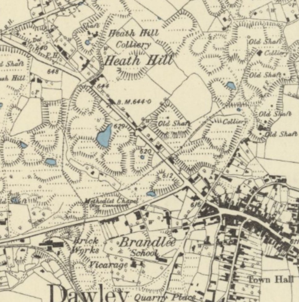
The Heath Hill Area
Returning the the area to the Southeast of Prospect House on the West side of Dawley. The other line, which has been obliterated by modern road construction, ran North to serve two small collieries in the Heath Hill area to the North and Northwest of Dawley village and which is just a few hundred yards from our Vicarage next to St. Leonard’s Church in Malinslee. The collieries can be seen in the OS Map extract below.
References
- Barrie Trinder; The Most Extraordinary District in the World; Phillimore, London and Chichester, 1977.
- C. von Oeynhausen and H. von Dechen; Railways in England 1826 and 1827; translated by E.A. Forward, ed. Charles E. Lee, Newcomen Society, 1971, p67, p73-74.
- https://www.heritagegateway.org.uk/Gateway/Results_Single.aspx?uid=3f055353-3a84-4575-9cf4-945464d26ba7&resourceID=19191, accessed on 15th April 2022.
- https://www.historyworkshop.org.uk/making-history-industrial-revolution, accessed on 15th April 2022.
- Bob Yate; The Railways and Locomotives of the Lilleshall Company; Irwell Press, Clophill, Bedfordshire, 2008.
- http://search.shropshirehistory.org.uk/collections/getrecord/CCS_MSA2541, accessed on 19th April 2022.
- http://search.shropshirehistory.org.uk/collections/getrecord/CCS_MSA2542, accessed on 19th April 2022.
- http://search.shropshirehistory.org.uk/collections/getrecord/CCS_MSA3858, accessed on 19th April 2022.
- http://search.shropshirehistory.org.uk/collections/getrecord/CCS_MSA23530, accessed on 19th April 2022.
- https://zh.mindat.org/loc-379098.html, accessed on 19th April 2022.
- https://aqueductlocalhistory.wordpress.com/about, accessed on 19th April 2022.
- http://www.dawleyheritage.co.uk/unpublished-articles/365/horsehay-works-by-r-corbett, accessed on 21st April 2022.
- https://en.m.wikipedia.org/wiki/Horsehay, accessed on 21st April 2022.
- https://www.dawleyheritage.co.uk, accessed on 21st April 2022.
Other Valuable Reading
David Clarke; The Railways of Telford; Crowood Press, Marlborough, Wiltshire, 2016.
Please check out my review: https://rogerfarnworth.com/2021/12/26/the-railways-of-telford-part-1-a-book-review

Pingback: The Railways of Telford – the Wellington to Severn Junction Railway (W&SJR) – Part 1 – Wellington to Horsehay | Roger Farnworth
Unbelievable good! Well done with all the maps, pictures taken and the drawn lines showing the original tramway. I love this.
Thank you! 🙂
Pingback: The Mother of All Inventions. … | Roger Farnworth