About 9 months after my first article about Govilon, Richard Purkiss contacted me to offer a wander around the area immediately to the West of my last walk.
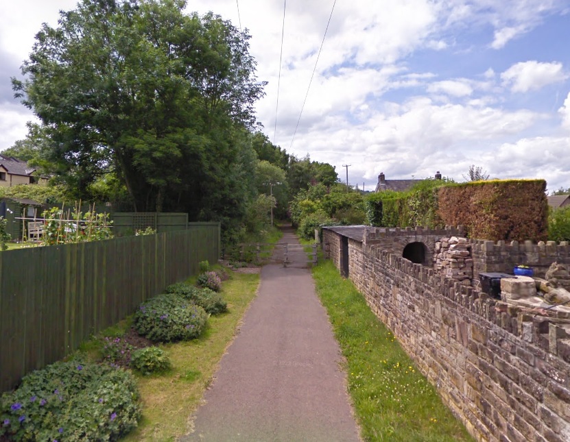
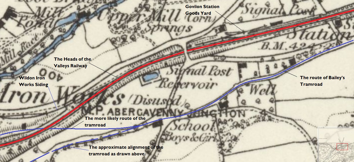
The location plan which appears on the information board at Govilon Railway Station. Note the red dotted line which shows the route of Bailey’s Tramroad; the location of Bailey’s Wharf and Govilon Wharf at the right side of the image; the route of the canal shown in blue; and the route of the railway in cream on the right half of the map and in green as part of one of the village trails.
In this second article we explore the route of Bailey’s Tramroad and the adjacent Railway as they are shown on the left side of the sketch map above.
The short section of the Heads of the Valley Line which is part of Govilon’s Forge and Railway Trail is a very easy stroll. Following the route of Bailey’s Tramroad is a much more difficult exercise which requires scrambling around on private land which can only be done with permission. I was very grateful to have Richard Perkiss as my guide while doing so!
The dotted line representing Bailey’s Tramroad on the plans above should be taken as a schematic representation rather than an accurate alignment. It is clear, when walking the route, that the section of the Tramroad close to Forge Car Park actually passed under the location of the viaduct and was for a very short distance on the North side of the later standard gauge line. I will try to show this in the images below which were taken on site.
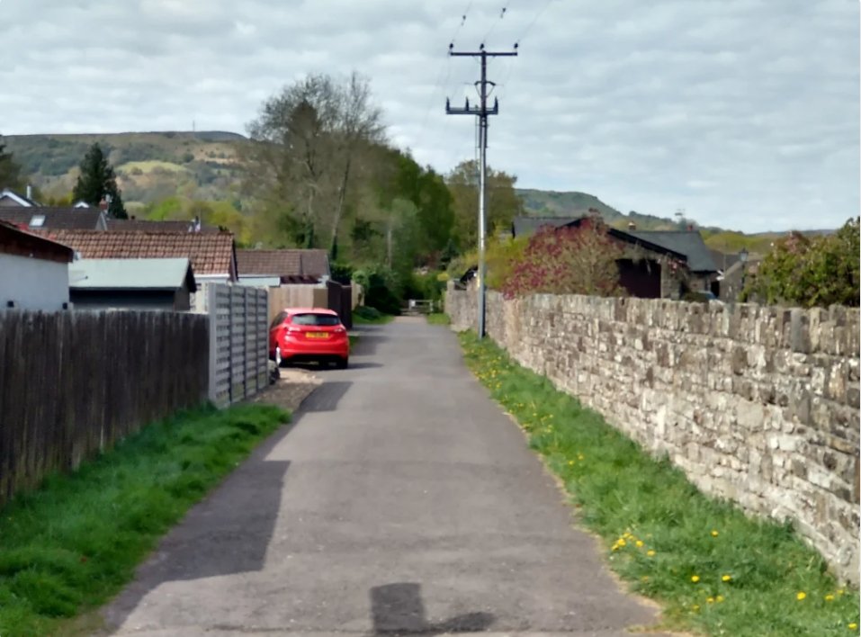
We start this article back at Govilon Railway Station and looking West along the old standard gauge railway line. ….
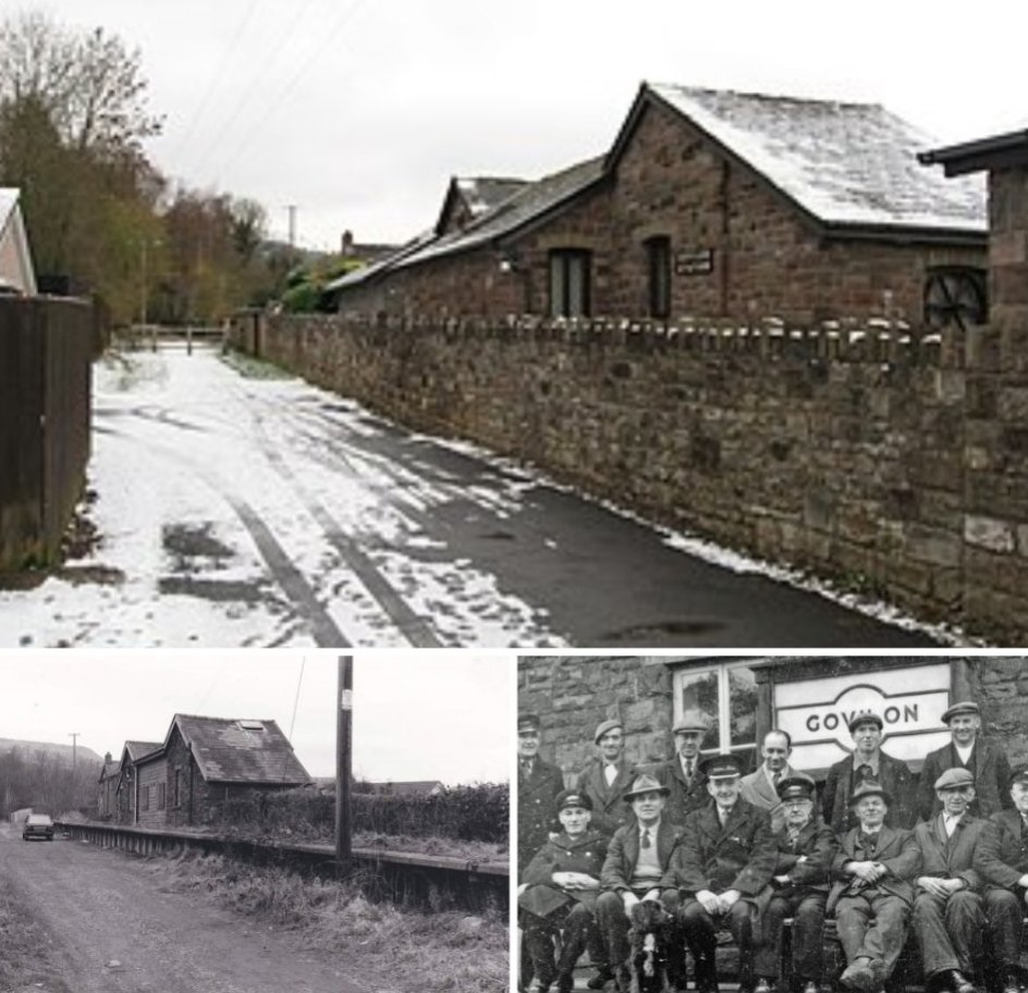
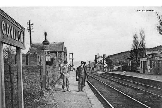
Govilon Railway Station opened on 1 October 1862, [7: p191][8: p107] a couple of days after the ceremonial opening of the first section of the railway. It was the first station beyond Abergavenny Brecon Road. [9] The 1st October was also the first day of the LNWR’s lease of the line. [10: p112] There is a possibility that Govilon was the first station opened on the line because of its proximity to Llanfoist House, the residence of Crawshay Bailey who by this time was a director of the MTAR. [11: p20]
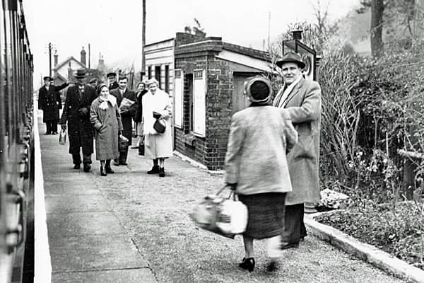
Wikipedia notes that “Decline in local industry and the costs of working the line between Abergavenny and Merthyr led to the cessation of passenger services on 4th January 1958. [13: p139][14: p68] The last public service over the line was a Stephenson Locomotive Society railtour on 5th January 1958 hauled by LNWR 0-8-0 No. 49121 and LNWR Coal Tank No. 58926. [13: p139][15: fig. 65] Official closure came on 6 January.” [12][7: p184][16: p55][8: p107][17: p191]
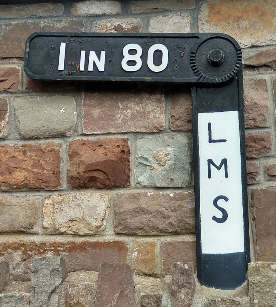
Govilon Railway Station was “situated on a steep 9-mile (14 km) climb from Abergavenny at gradients as severe as 1 in 34. [14: p68][17: p164] A gradient post showing 1 in 80 /1 in 34 was installed on one of the station platforms.” [12][13: p116]
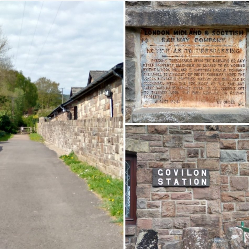
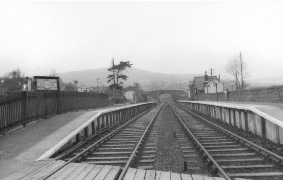
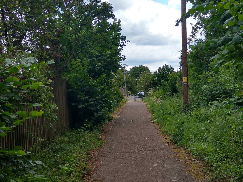
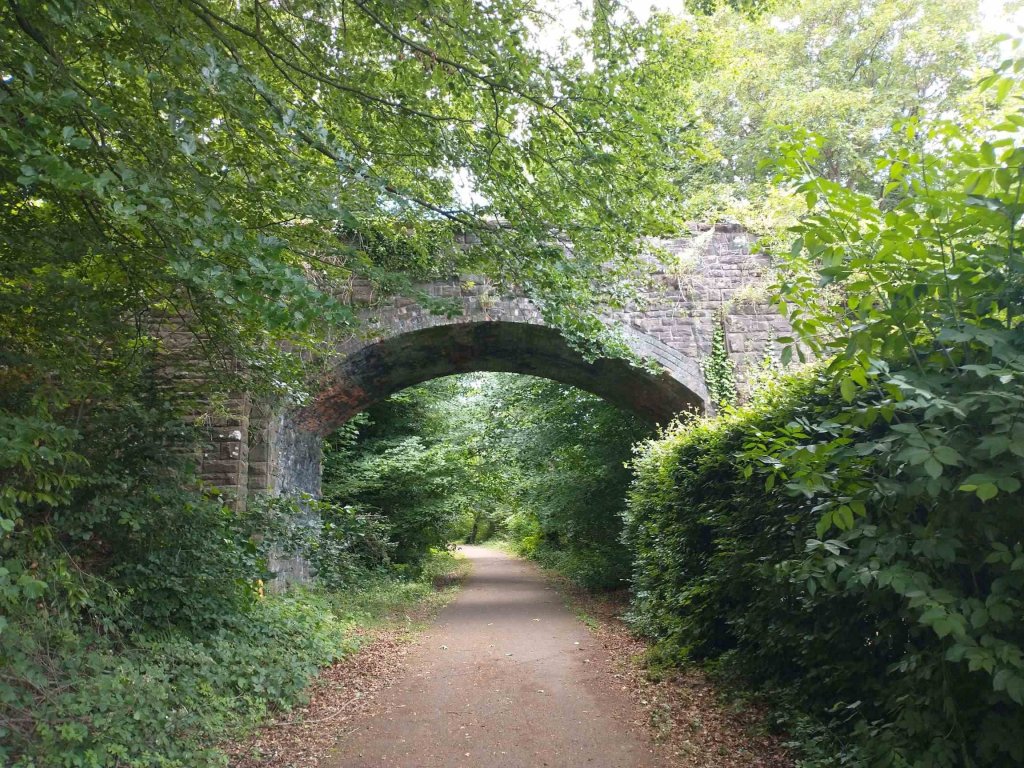
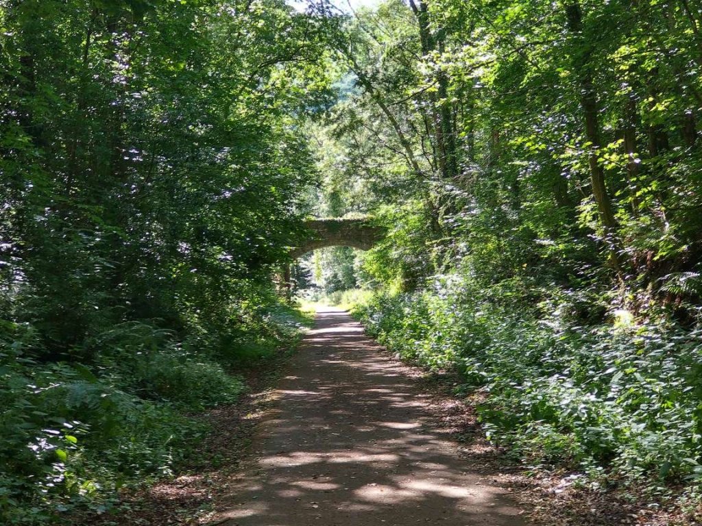
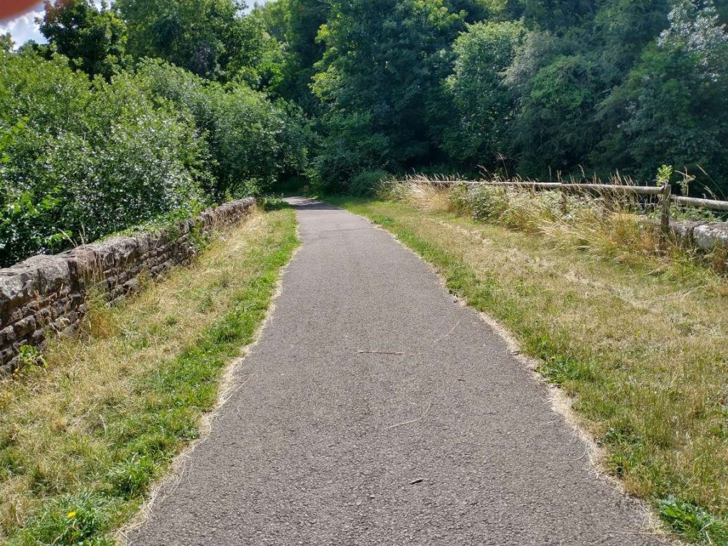
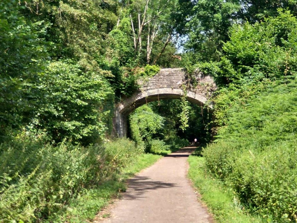
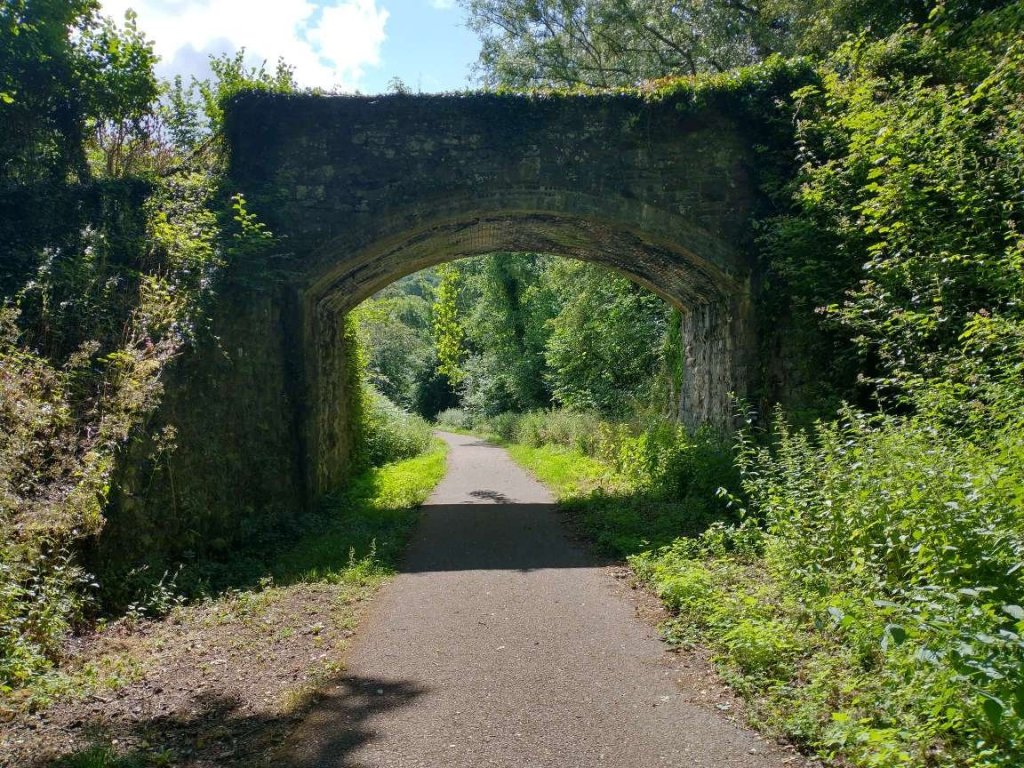
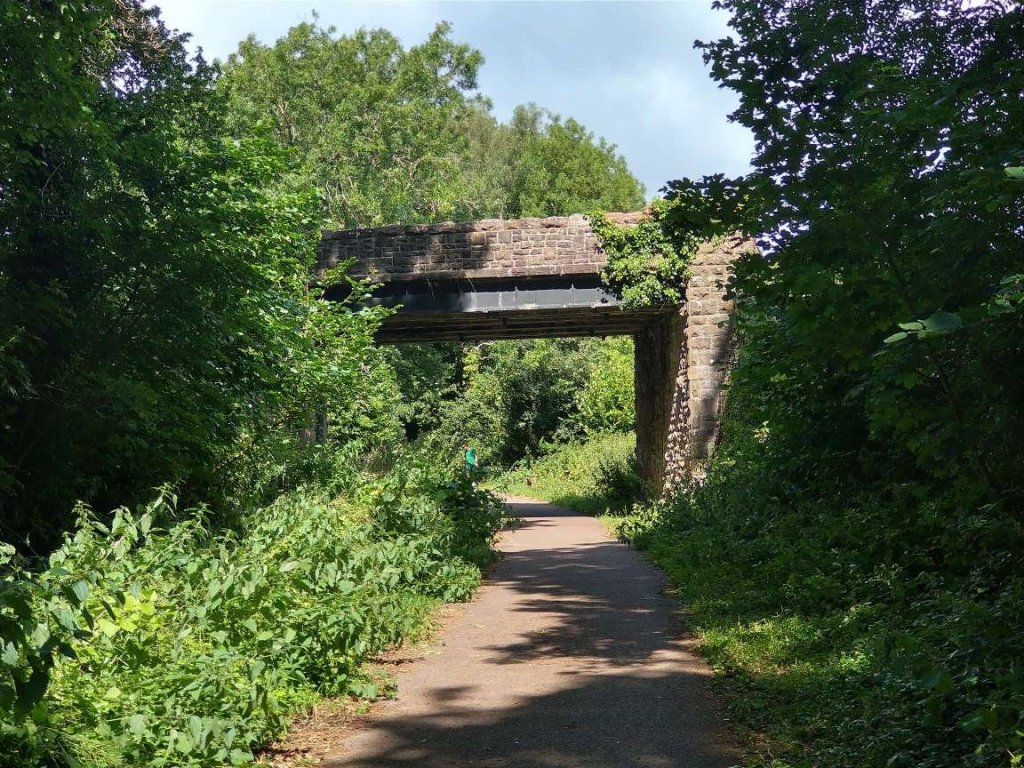
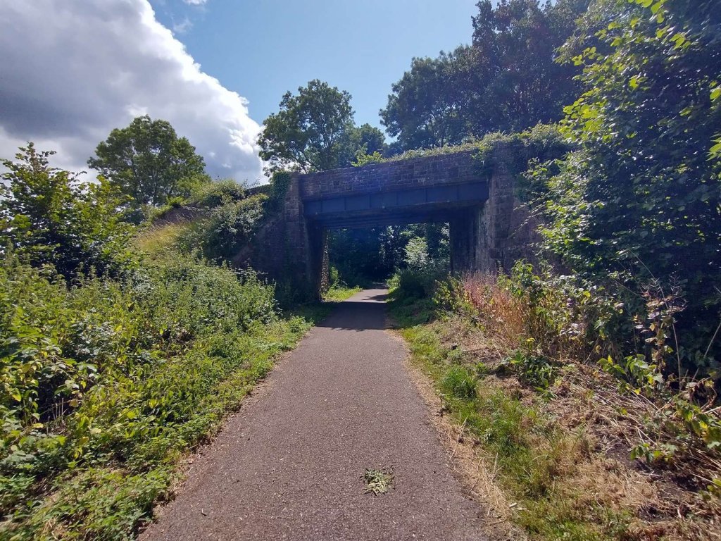
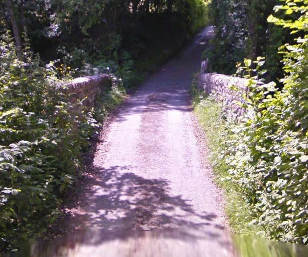
This gradient marker is present on the wall of the old station building. It does not match the gradient marker which was originally present. The original gradient marker highlighted a change in gradient from 1 in 80 to 1 in 34. [My photograph, 25th April 2022]Govilon Railway Station looking East along the platform for Abergavenny trains, this image was shared by Malcolm Lewis on the Abergavenny Railways History Facebook Group on 16th April 2023. [18]Govilon looking East along the second platform, for trains for Merthyr Tydfil. Malcolm Lewis shared this photograph on the Abergavenny Railways History Facebook Group on 2nd April 2023. [19]The view West from Govilon station along the route of the old railway. It is just about possible to make out the road overbridge in among the trees which surround the route of the old line in the 21st century. [Google Streetview, July 2011]Looking back towards Govilon Station along the route of the old railway. [My photograph, 5th July 2023]Turning through 180° we see the first overbridge on this length of the old railway. [My photograph, 5th July 2023]Looking back to the East through that first overbridge. [My photograph, 5th July 2023]Looking back East from 100 metres further West along the old line. [My photograph, 5th July 2023]Looking West along the footpath/cycleway which follows the Merthyr, Tredegar & Abergavenny Railway (The Heads of the Valleys Line) This winter view takes advantage of the vegetation die-back to show the bridge across the line much more clearly. The photograph was taken on 27th November 2010 and the image was shared by Gareth James on the Geograph website on the same day. It is shared here under a Creative Commons Licence (CC BY-SA 2.0). [21]The view West over the stone parapets of bridge carrying the road over the old line. The footpath/cycleway can just be made out between the trees. [Google Streetview, October 2009]
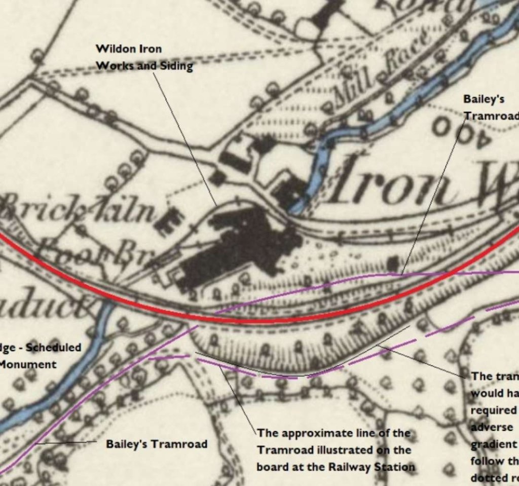
The plan below shows this length of the Merthyr, Tredegar & Abergavenny Railway leaving the Govilon Station (on the right of the extract), and passing under the road bridge before curving towards the Southwest and then back towards the West. On the North side of the double-track mainline are the sidings at Govilon Railway Station and then further West at the left edge of the extract, the sidings used by Wildon Iron Works.
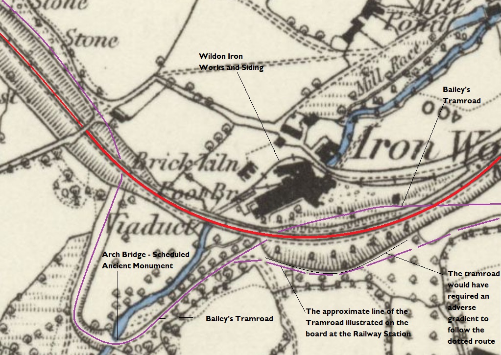
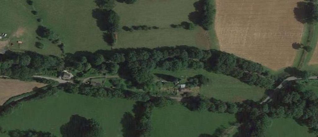
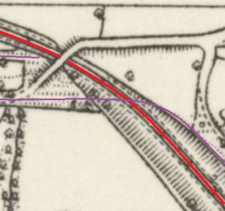
The railway Station at Govilon and the area to the West of the Station. The base map is the 6″ Ordnance Survey of 1879-1881 which was published on 1888. The steep batter on the South side of the Railway indicates that the land is rising at that point and on the next map extract it will be noted that the level difference between the Railway and the land immediately to its South is significant. The Tramway ran at a lower level than the railway and, in order to follow the postulated route from the sketch map at the Railway Station, would have required a significant grade just off to the left of the map extract had the dotted mauve line been correct. The more likely line follows the contours and so ran across what became the line of the Railway curving to the South as it leaves the extract. Outward bound from the railway station our route follows the old railway as highlighted by the bold red line. Our route of return follows the narrower mauve line where possible. [24]The same area as included in the map extract above as shown on Google Earth. The route of the Merthyr, Tredegar & Abergavenny Railway is flanked by large trees. The route of Bailey’s Tramroad follows School Lane before running East-West to cross the line of the standard gauge railway. [Google Earth, 20th April 2023]The standard gauge railway, again shown by the red line, crosses the valley in which Wildon Iron Works was sited. This is another extract from the 6″ Ordnance Survey of 1879-1881 which was published in 1888. Bailey’s Tramroad route is highlighted by the thin mauve line. To the immediate East of the viaduct, the Tramroad’s route was significantly disturbed by the work to construct the Heads of the Valleys Railway. It is difficult to precisely fix the line of the Tramroad over that length but it would have kept to a falling grade towards Govilon and followed the contours as closely as possible. The solid mauve line on the extract does this. The dotted line, which is an approximation to the line drawn on the information board at Govilon Railway Station, does not do so. As the earthworks for the standard gauge line indicate, there was a significant rise in ground levels to the South of the standard gauge line. [24]The same area as included in the map extract above as shown on Google Earth. The route of the Merthyr, Tredegar & Abergavenny Railway is flanked by large trees apart from the length which ran over the viaduct close to the centre of the satellite image. Its route enters the image in the top-right, curves down through the centre of the image before running Northwest towards the top-left. The route of Bailey’s Tramroad enter from the right edge of this image, crossing the field above the mid-point of that edge of the photo. It crosses the line of the standard gauge railway, running on its North side for a short distance before following the contours of the side valley (lined by trees) and crossing a stone arch bridge before turning sharply to the North, again following the contours, crossing the standard gauge line once again and running alongside it to the North at a higher level. [Google Earth, 22nd April 2023]
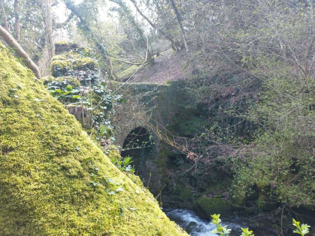
The map extract above shows Bailey’s Tramroad deviating away to the South from the line of the more modern standard-gauge railway and following the contours of the valley as it sought a suitable crossing point over the stream which sustained a suitable gradient on the Tramroad. The more modern standard-gauge line crossed the stream valley on a stone viaduct.
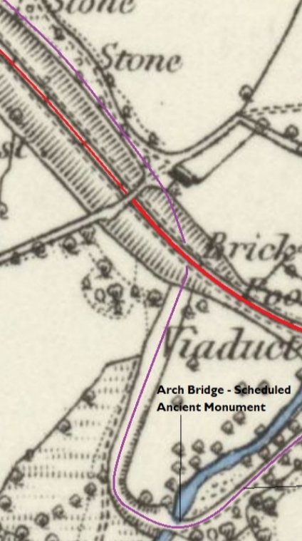
The standard-gauge line’s viaduct was flanked by two significant local structures, one of which remains in place, the other of which has been substantially removed.
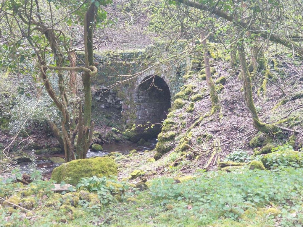
The Tramroad Bridge is a scheduled ancient monument. It has had some work done to secure it’s future, but is again in need of remedial work if it is not soon to collapse into the stream it crosses. We will see pictures of this bridge later in this article.
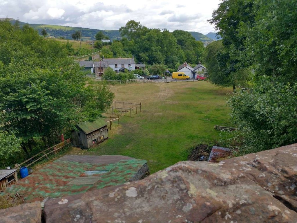
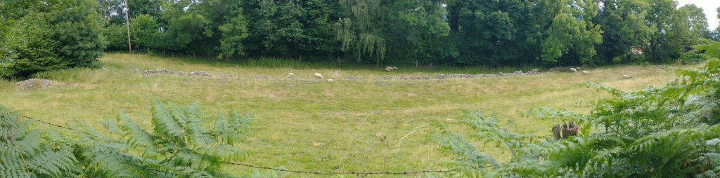
Wildon Iron Works closed in the 1870’s. The remains can be viewed from the railway viaduct or, with permission, by walking over privately owned land.
“The origins of the works are not documented but pre-date a 1790 entry in Bradney’s History of Monmouthshire. An 1846 map shows a number of workshops and outbuildings. Later this was expanded into a single complex. The site had a small furnace from which wire rod and nails were made from bar iron. It had its own water wheel fed from a large rectangular reservoir, and the site also housed a lime kiln. It expanded in the latter half of the nineteenth century, resulting in the stream being culverted and the addition of a number of buildings including a brick kiln. At this time it was known as Wilden Wireworks and therefore, may have been related to the wireworks of the same name in the Stour Valley, Worcestershire.” [26]
“Over the road to the North of the works were 4 small cottages in front of a managers house (whose deeds date from 1675 when the owners were the Prosser family). A cottage and the managers house still remain today. Near the cottages was the works weighing machine, stables and a blacksmiths shop – now 2 private houses. An incline ran down the valley, passing Upper Mill and stopping at the canal ”dry dock”. A branch of Bailey’s tramroad was run into the works, and later this was replaced by a railway siding running from the location of the current Forge car park.” [26]
This map extract from the 1879-1881 Ordnance Survey is a repeat of one shown some distance above. It shows the tramroad arrangement in the Wildon Iron Works referred to in the text below. [24]
The 1879-1881 Ordnance Survey map some distance above is repeated immediately above. It shows the railway siding running into Wildon Iron Works. The track layout immediately adjacent to the buildings suggests that it predated the railway. The curve at the Northwest corner of the buildings it probably too tight a radius for locomotive movements. Shunting on the private siding may well have been undertaken by horses.
To the West of the standard-gauge railway’s Viaduct, the line of the Tramroad, shown on the map extract above, now considerably higher than the later railway, followed a line on the North side of the railway cutting before switching back to the South side of the railway as shown on the next map extract below.
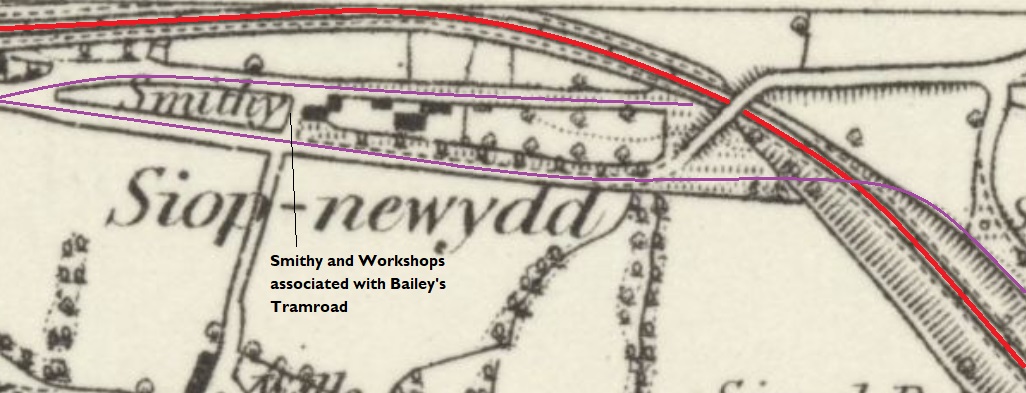
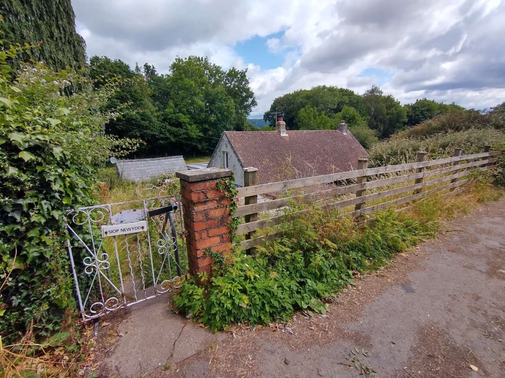
At its peak, up to 14 blacksmiths were employed at Siop-newydd for repairs and maintenance. This included shoeing horses used to pull the trams. The tramway sidings are clearly recognisable in the field between the lane and the railway track. [28]
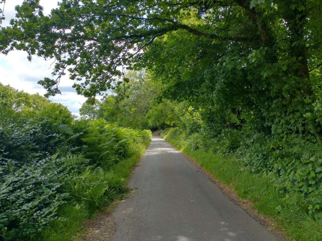
The next few photographs focus on this area. …
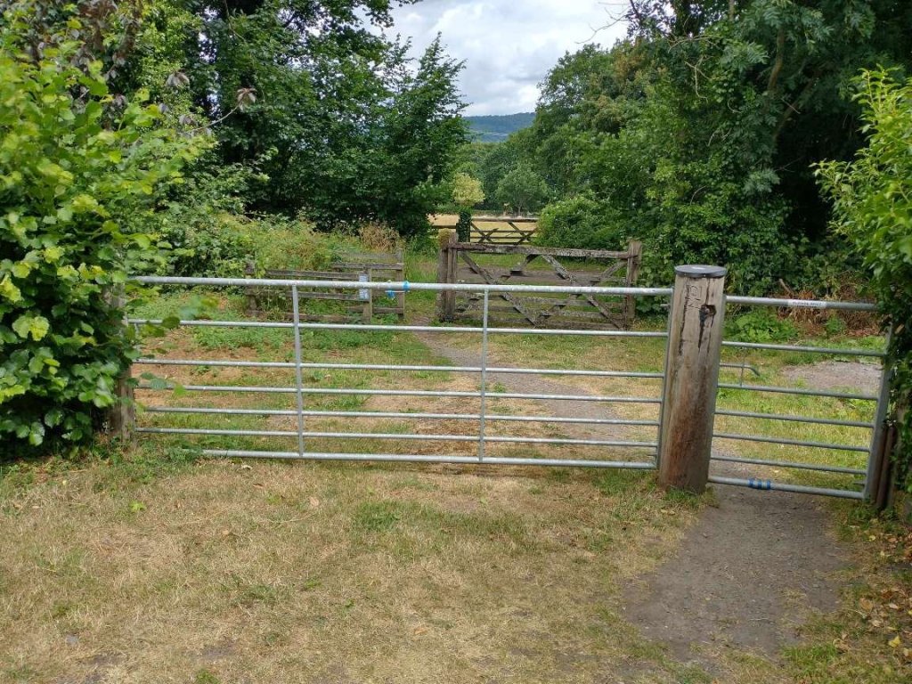
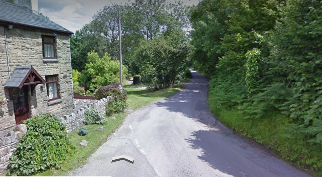
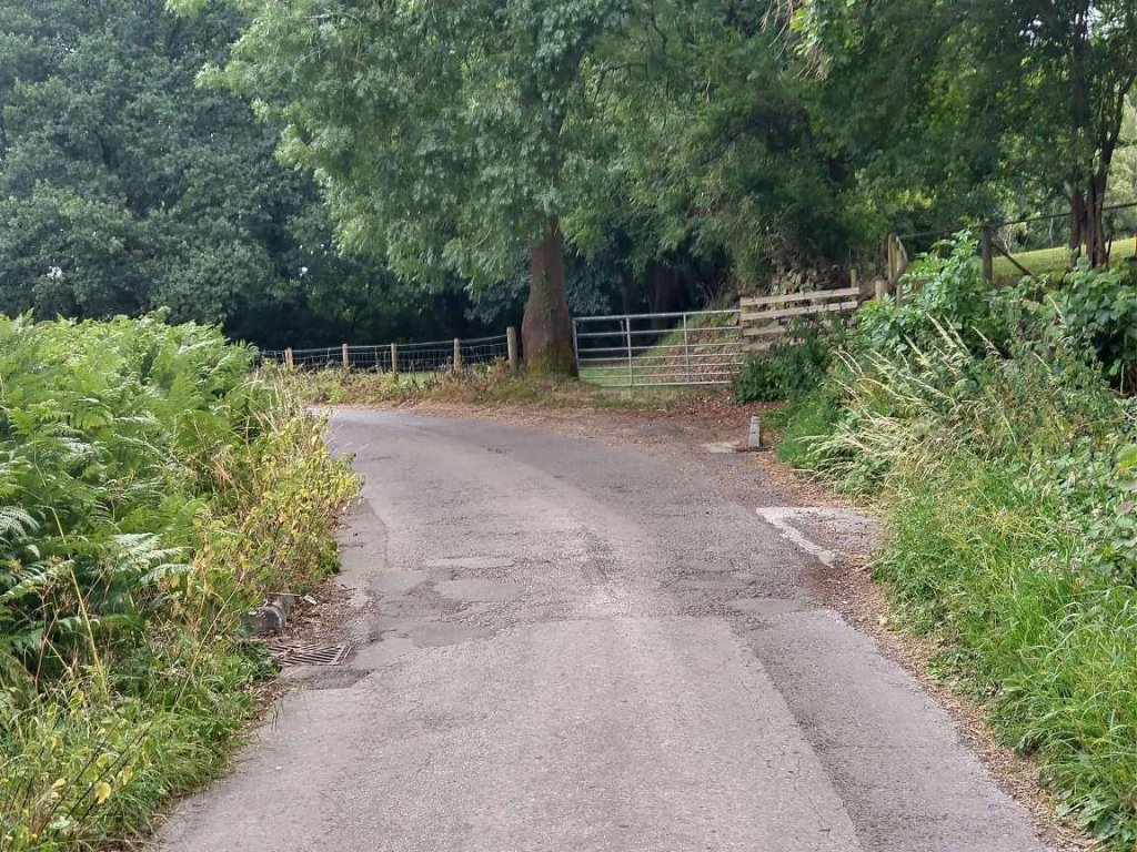
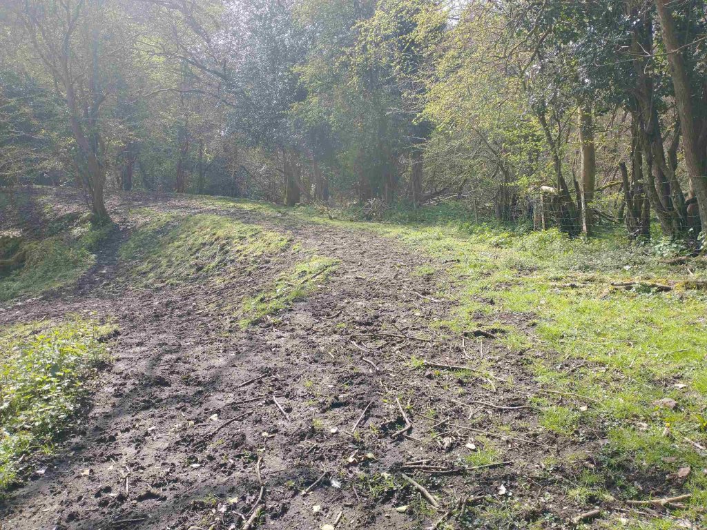
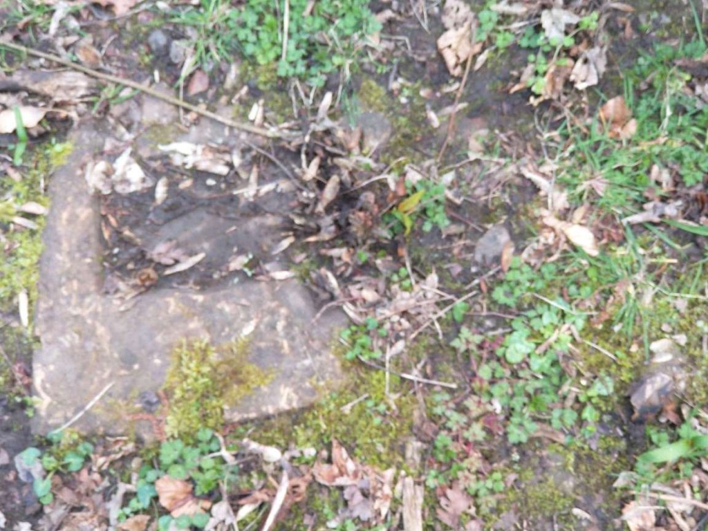
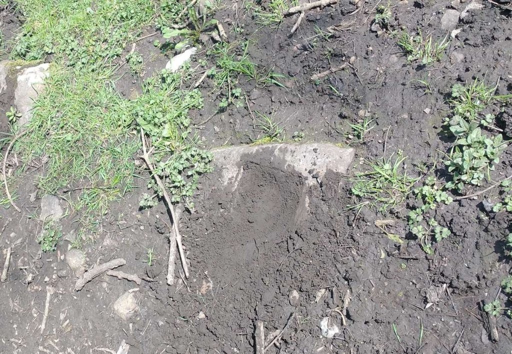
Looking East along the old standard-gauge line from a point close to the West edge of the map extract above. [My photograph, 5th July 2023]Crossing between the old standard-gauge line and the route of the old Tramroad, this is the view East into the land between the standard-gauge line and what was probably a Tramroad yard and possibly exchange sidings once the length of the Tramroad East was closed. [My photograph, 5th July 2023]Looking North towards the old standard-gauge line from the line of Bailey’s Tramroad which is now a minor road. [My photograph, 5th July 2023]The view from the gates into the land which was once the Tramroad yard. [My photograph, 5th July 2023]Looking East along the line of Bailey’s Tramroad which ran across the front of the cottage on the left and down the minor road ahead. The Tramroad yard entrance is the greenway between the cottage and the minor road ahead. The gate(s) in the last two images are just beyond the cottage. [Google Streetview, July 2011]Looking West along the line of Bailey’s Tramroad. The cottage on the left of the image above is now seen on the right. The access to the Tramroad yard is on the right closer to the camera. [My photograph, 5th July 2023]Looking East from the same location as the photograph immediately above. [My photograph, 5th July 2023]Looking West along Bailey’s Tramroad from a point 100, or so, metres to the East of the picture above. [My photograph, 5th July 2023]Siop-newydd seen from the same location on the minor road which follows the route of Bailey’s Tramroad. [My photograph, 5th July 2023]The Tramroad yard seen from the minor road. [My photograph, 5th July 2023]Looking West along the line of the Tramroad. [My photograph, 5th July 2023]Turning through 180° to look East along the line of the Tramroad. [My photograph, 5th July 2023]Continuing East for a further 100 metres, this photograph looks along the line of the Tramroad. [My photograph, 5th July 2023]Still looking to the East along the line of Bailey’s Tramroad. As the minor road now turns to the left to cross a bridge over the footpath/cycleway which follows the old standard-gauge railway, Bailey’s Tramroad continued directly ahead. Its line ahead is cut by the cutting made for the Merthyr, Tredegar and Abergavenny Railway. [My photograph, 5th July 2023]The mauve line follows the route of Bailey’s Tramroad which was cut by the cutting of the Merthyr, Tredegar and Abergavenny Railway. [24]For a short distance the formation of the old tramroad was on the North side of the standard-gauge line. It turned South looking for a suitable place to cross the stream valley. [24]Hopefully this map will not confuse matters. It was very kindly shared with me by Richard Purkiss. On this map North is to the bottom side of the image. The map shows land ownerships after the construction of the standard-gauge railway.The view Southwest across the road bridge over the Merthyr, Tredegar and Abergavenny Railway. The original route of Bailey’s Tramroad crossed this road on the near side of the bridge. [Google Streetview, July 2011]Looking South along the line of the old Tramroad as it followed the contours round the stream valley. [My photograph, 18th April 2023]The line continued, curving round towards a stone-arched bridge. [My photograph, 18th April 2023]Hidden in the top soil are a series of stone blocks which were the ‘sleepers’ for the Tramroad. [My photographs, 18th April 2023]The South side of the historic masonry arch which carried Bailey’s Tramroad. [My photograph, 18th April 2023]The North side of the same arched structure. [My photograph, 18th April 2023]Looking East along the Tramroad formation over the historic arched bridge. [My photograph, 18th April 2023]
Ancient Monuments UK, is an online database of historic monuments that are listed as being of particular archeological importance. It lists this Tramroad bridge on Bailey’s Tramroad as being scheduled on 3rd January 1980 by Cadw (Source ID: 302, Legacy ID: MM204).
The website records the structure as being to carry Bailey’s Tramroad as it “crossed the steep valley of Cwm Llanwenarth by a loop following the contour of the valley. … The tramroad bridge is a simple single arched structure of excellent quality ashlar masonry. The springings of the arch are set back from the jambs leaving a step, a feature not uncommon on early 19th century industrial structures. … The monument is of national importance for its potential to enhance our knowledge of medieval or post-medieval construction techniques and transportation systems. It retains significant archaeological potential, with a strong probability of the presence of associated archaeological features and deposits. The structure itself may be expected to contain archaeological information concerning chronology and building techniques.” [27]
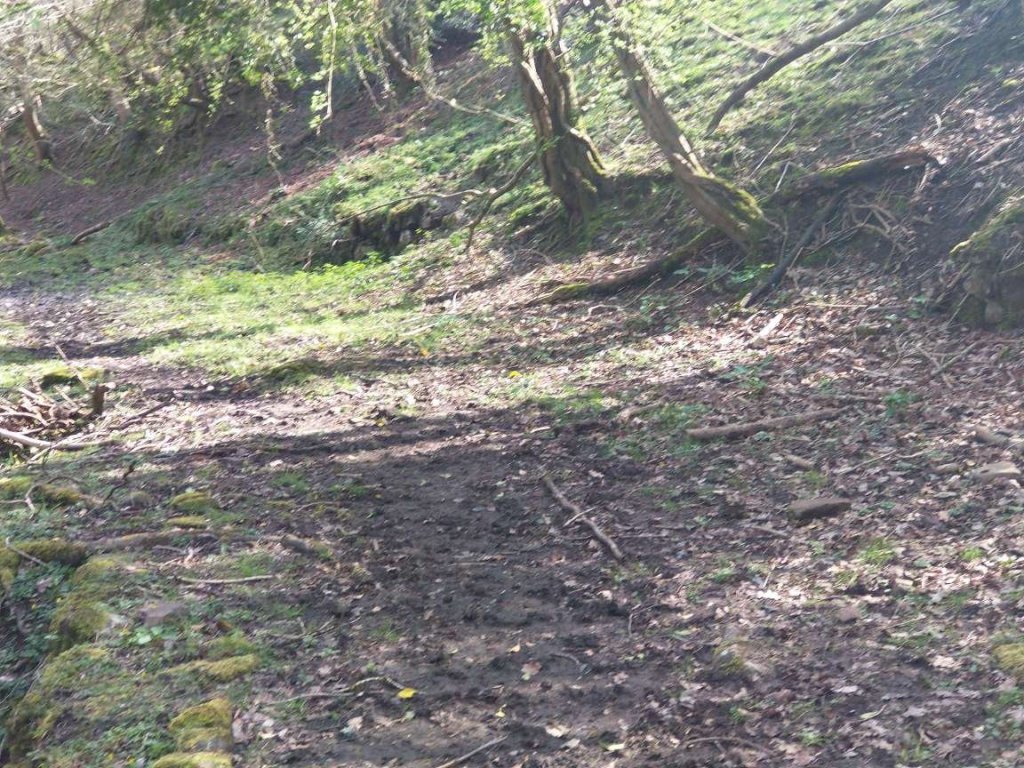
To the East of the old bridge, the Tramroad turned North following the contours of the valley.
This extract from the 6″ OS mapping of 1879-1881 shows the route of the old Tramroad crossing the later railway and curving to the East. Just to the South of the Merthyr, Tredegar and Abergavenny Railway the dashed-mauve line shows the line if the Tramroad presumed by the noticeboard at Govilon station. That route is shown on the second image below which makes it clear that the gradient involved was too steep. [24]The Tramroad formation heads North towards what became the line of the Merthyr , Tredegar and Abergavenny Railway. [My photograph, 18th April 2023]The field-track confused with the line of Bailey’s Tramroad. The Tramroad remained at the level of the land at the left of this image. [My photograph, 18th April 2023]
We have covered much of what is possible relating to railways just to the West of Govilon, with one exception. There is a reference on the Govilon History website to “An incline ran down the valley, passing Upper Mill and stopping at the canal ”dry dock”.” [26] The route of that incline may well be the straight track shown to the North if the stream and Mill Race on the map extract below.
Another extract from the 6″ IS maps of 1879-1881. Upper Mill is close to the centre of the image. The canal can be seen top-left. It is possible that the incline followed the long straight track to the North of the Mill Race. [24]
Bailey’s Tramroad and the Merthyr, Tredegar and Abergavenny Railway West of Siop-newydd
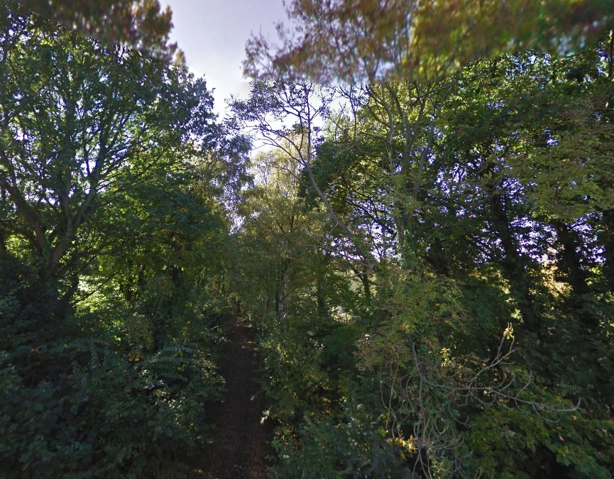
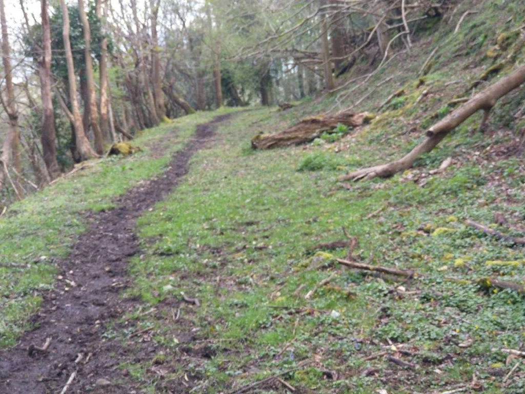
The footpath/cycleway continues to follow the Merthyr, Tredegar and Abergavenny Railway route to the West of Siop-newydd with Bailey’s Tramroad running parallel to it to the South. The route of railway and Tramroad to the West will be the subject of future articles in this short series, as a taster, here is one photo taken further to the West.
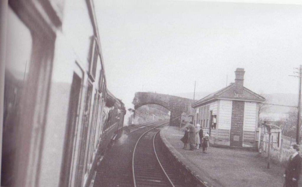
Further ahead of this location, the line curves round once again to the West and passes through Gilwern Station some distance ahead.
John Bartlett’s father, Cyril, was Station Master in the period before the closure of Govilon Railway Station. This picture was shared by John Bartlett on the Facebook group ‘Govilon and Gilwern Past’, accessed on 26th April 2022.
Michael Quick; Railway passenger stations in Great Britain: a chronology (4th ed.); Railway & Canal Historical Society, Oxford, 2009.
R.V.J. Butt; The Directory of Railway Stations: details every public and private passenger station, halt, platform and stopping place, past and present (1st ed.); Patrick Stephens Ltd., Sparkford, 1995.
W.W. Tasker; The Merthyr, Tredegar & Abergavenny Railway and branches; Oxford Publishing Co., Poole, 1986.
Mike Hall; Lost Railways of South Wales; Countryside Books, Newbury, 2009.
David Edge; Abergavenny to Merthyr including the Ebbw Vale Branch; Country Railway Routes; Middleton Press., Midhurst, 2002.
C.R. Clinker; Clinker’s Register of Closed Passenger Stations and Goods Depots in England, Scotland and Wales 1830–1980 (2nd ed.); Avon-Anglia Publications & Services, Bristol, 1988.
James Page; Rails in the Valleys. London: Guild Publishing, London, 1989.
I have lost the full details of the source of this image. If you know anymore about this photograph, please let me know. If you hold copyright for this image please also make contact. As far as I know it is out of copyright but I may be wrong. It can be taken down if necessary.


