Tag Archives: France

The Railway between Nice, Tende and Cuneo – Part 1

The featured image above shows the inaugural train arriving at Breil-sur-Roya in March 1928, © Public Domain, shared by Jean-Paul Bascoul in the Comte de Nice et son Histoire Facebook Group on 25th January 2017. [15]

The railway from Nice PLM Station to Tende was completed in 1928. It was long in the gestation and in construction. The story stretches back more than a century and a half. ‘Le Chemin de fer du Col de Tende’ is historically a significant local and international line. Its inverted Y-shaped layout and its crossing of international borders means that it is known by a number of different names:

  • in Nice it is known as the Nice – Coni Line;
  • generally in Italy it is officially Ferrovia Cuneo Ventimiglia
  • in the Piedmont city of Cuneo’s economic/political circles, sitting at the top of the inverted ‘Y’, it is often referred to as the Cuneo – Nizza line in recognition of good relations with the community of Nice.

Its story is a saga of significant technical achievement: gaining 1000 metres in height ; having a dozen tunnels longer than 1 kilometre (including those of the Col de Tende (8098 m), the Col de Braus (5939 m) and the Mont Grazian tunnel (3882 m), which are among the longest structures on the French and Italian networks); having four complete helical loops,  several S-shaped loops and a multitude of bridges and viaducts (some of which, such as those of Scarassouï or Bévéra, are architecturally significant railway structures. Of a total route of 143.5 km, 6.5 km are on bridges or viaducts and over 60 km are in tunnels. This means that close to 42% of the journey along the line(s) is on or within structures.

The line warrants a comprehensive detailed treatment and Jose Banaudo, Michel Braun and Gerard de Santos have provided just such a work. The 3 volumes of their work cover three distinct periods in the life of the line:

  • Volume 1: 1858 until the completion of construction in 1928; [1]
  • Volume 2: 1929 through to 1974 [2]
  • Volume 3: 1975 to 1986. [3]

The line’s construction spanned over 40 years and as a result a variety of different structural techniques were used. The first length built in Italy in the 19th century has some substantial stone and brick structures. Later work on the length from Nice to Fontane which was built between the two world wars employs much lighter design techniques. Then even later, after sections of the line were destroyed in the second world war, prestressed concrete construction techniques were used in the rebuilding of the line. [1]

The history of the area through which the line has been built has been tumultuous. This meant that the process of developing the line was tortuous. It took more than 75 years for the line(s) to be completed and then after a few short years of operation, the lines usage was disturbed by the machinations of dictatorships and then the second world war literally destroyed the region. Post war recovery was slow but nowhere more so than the length of the line between Ventimiglia and Breil-sur-Roya which was not fully reopened until 35 years after the end of the second world war. [1]

The reopening of the line after the second world war was vital for the economic development of Piedmont, the Riviera dei Fiori, and the Côte d’Azur – between which there was no efficient road connection and where the difficult terrain favored rail access. [1]

The immediate area offered tremendous tourism potential, both the train itself and the region it served. Ski resorts became accessible, particularly Limone, excursion trains came from all over Europe. But, after just a few decades of development the approach of the 21st century saw increased bureaucracy, financial disputes between the increasing number of partners, contradictory regulations and increased journey times. The result was that the line’s value and existence was called into question and that too sparked further conflict. “Paradoxically, European unification, which should have fully promoted this symbolic communication route, marginalized it!” [1: p5]

In 2014, my wife and I stayed in the village of Saorge in the valley of La Roya for the first time. We had travelled by train from Nice to Tende in an earlier year. In 2014, we had a hire car and on one occasion we followed the old road to the Col de Tende. In subsequent years it was not possible to drive up the old road as works on the much more modern tunnel seemed to have blocked access to the old road. On a more recent visit, we stayed in Saorge a year after serious flooding had destroyed much infrastructure in the valley. Travel towards the Col de Tende from Tende was not possible.

Early attempts to create a route from Cuneo to Tende

In 2014, we drove up a road which was constructed by le duc Charles-Emmanuel 1er de Savoie (Duke Charles Emmanuel 1st of Savoy). It seems that he constructed a road over the pass between 1592 and 1616. Of this road, Banaudo et al say that, “the northern road [up to the pass] has about twenty hairpin bends, while access from the south requires an extraordinary … sixty hairpin bends.” [1: p9]

Our hire car was a very small vehicle, but nonetheless needed some careful manoeuvring at each hairpin bend. Once at the top, we were able to walk quite a distance between the different forts that stood on the ridge.

Banuado et al, tell us that since that route was constructed, a series of attempts were made to tunnel from lower points on the pass. Attempts from the North were made: in 1612 (achieved just 75m of tunnel before being halted); in 1781 which was abandoned 3 years later (164m of tunnel was achieved). [1]

In 1784, a carriage managed to traverse the pass for the first time.

Banaudo et al. Tell us that “the public works engineer Deglioli submitted an initial report on 3rd June 1852, supported by the diplomat Francesco Sauli (1807-1893), on the extension of the Marseille-Var railway, then planned in France, to Nice, Ventimiglia, the Roya Valley, and Piedmont, namely Cuneo or Mondovì.” [1: p11]

In 1854, the first train of the Società della Ferrovia Torino Cuneo arrived in Cuneo from Turin (via Trofarello, Savigliano, and Fossano).  The first terminus was built in the Cuneo suburb of “Madonna-dell’Olmo, on the left bank of the Stura below the city.  Ten months later, the time required for the completion of the viaduct over the Stura, Cavour and the Minister of Public Works, Pietro Paleocapa (1788-1869), presided over the inauguration of the new Cuneo platform/station on 5th August 1855, established in a temporary location at Basse-di-San-Sebastiano. The permanent station would not be built until 1870 on the plateau preceding the confluence of the Stura and Gesso rivers.” [1: p11]

In 1856, “Victor Emmanuel II, King of Sardinia, Cyprus and Jerusalem, Duke of Savoy and Aosta, Prince of Piedmont, Count of Nice and Tende, visited [Nice and] personally promised [a] railway to the people of Nice and distributed a lithograph depicting him, ostentatiously bearing a map bearing the dedication ‘Ferrovia  da Cuneo a Nizza. Ai Fedeli Nizzardi’. … The Minister of Public Works commissioned a Roman military engineer, Filippo Cerrotti (1819-1892), to conduct a more in-depth study. On 29th May 1856, Cerrotti submitted a preliminary design for a standard-gauge line from Cuneo, ascending the Gesso and Vermegnana valleys, crossing the Col de Tende through a 6.5 km tunnel accessible by inclined planes powered by hydraulic funiculars, to emerge in the Roya River, which it followed to Airole. From there, two tunnels successively would take it through the Bévéra Valley and then into the Latte Valley, through which it reached the coast, which it then followed to Menton, Monaco, and Nice.” [1: p11]

The Nicois authorities accepted the proposed scheme in September 1856, their counterparts in Cuneo quickly endorsed the plans in principle but asked that an alternative route via the Col des Fenestres and the Vésubie, be explored and that a modification to the initial proposal should be explored, specifically a locomotive-powered line without the use of inclined planes.  The municipality of Nice then commissioned another  survey of alternative routes by Louis Petit-Nispel, but proposals were rejected by the Ministry of Public Works on 4th March 1858. [1: p11, p14]

Nothing happened, so the Nice authorities sent a petition to the Sardinian parliament (16th July 1858) but the request got lost in the midst of political machinations which surrounded the cession of Savoy and the County of Nice to France which was eventually confirmed on 22nd April 1860.

During his first visit to the new border department in September 1860, the French Emperor promised the people of Nice a rapid connection to Marseille and the rest of the country via the Paris-Lyon-Mediterranean Railway Company (PLM) line, whose construction was then well advanced beyond Toulon.” [1: p14]

Nice got its connection to Marseille by 18th October 1864, but hopes for a Nice to Cuneo link were overshadowed by the desire to have a direct link between Marseille and Turin via Sisteron, Gap, Briançon, the Col de l’Echelle, and Bardonecchia – a plan was eventually shelved (even though it was favoured by the French government and the PLM company) as a result of the deal-making associated with the Saint-Gothard line.

In the mid-1860s the Piedmontese railway network became part of the Società per le Ferrovie dell’Alta Italia (SFAI). Its focus became developing internal infrastructure in Italy, with the exception of a very large project …  a 13.7 km (8.5 mile) long tunnel, carrying the Turin-Modane railway line under Mont Cenis, linking Bardonecchia in Italy to Modane in France under the Fréjus. [1: p17][8]

Despite this, economic and political groups in Cuneo remained committed to having a rail link and in 1868 proposed a joint commission of French and Italian engineers. The following year, “the provincial authorities granted a loan of 500,000 lire to the Lombard engineer Tommaso Agudio (1827-1893), who sought to develop the possibilities offered by funicular traction. He, in collaboration with the engineer Arnaud, recommended the construction of a narrow-gauge railway alongside the SS 20 national road, along its entire route from Cuneo to Ventimiglia. This hypothesis suggested curves with a radius of less than 50 m and gradients of 45 mm/m. The Tende Pass was to be crossed by the planned road tunnel, with two access ramps sloping at 87.5 mm/m, on which traction would be provided by a hydraulically counterweighted cable.” [1: p17]

His project was approved by the Italian parliament in 1862 but no progress was made on the French side of the border. The project failed and Tommaso Agudio moved on to other things, “experimenting with his cable traction system in 1874 in Lanslebourg, then by applying it in 1884 to the railway linking the Turin suburb of Sassi to the famous Basilica of Superga.” [1: p17]

With little progress being made on a rail link, road links became paramount, a commission chaired by the civil engineering inspector Sebastiano Grandis (1817-1892) renewed interest in 1870 in a road tunnel under the Col de Tende which Grandis imagined would obviate the need for a railway.

Following the fall of the Empire, France and Italy were finally connected by rail, first through the Fréjus Tunnel, opened between Modane and Bardonecchia on 17th September 1871, and then through the Menton and Ventimiglia on the coast on 23rd February 1872. At the same time, traffic between Piedmont and the former County of Nice was growing at an encouraging pace: the Fontan customs post recorded an annual transit of 22,000 tons of goods and 76,447 head of cattle. Under these rather favorable conditions, Nice’s business community sought to revive discussions with a view to attracting to their port a share of the benefits of the upcoming opening of the Saint-Gothard line, whose traffic, they feared, would exclusively benefit Genoa via the Via Giovi, or Marseille in the event of the construction of the Col de l’Echelle route.  In April 1871, a group of industrialists and politicians from the region, including the mayor of Nice, Auguste Raynaud (1829-1896) and his counterpart from Toulon, Vincent Allègre (1835-1899), founded a Syndicate for the Nice Cuneo Line with the support of the Alpes-Maritimes Chamber of Commerce. On 7th November, the municipal council sent a personal letter to Adolphe Thiers, the new President of the French Republic, to express the desire of the people of Nice to see this project, which had been on hold for some twenty years, realized. On 29th November, the syndicate appointed a study commission headed by engineer Joseph Durandy (1834-1912), … to establish contacts with interested Italian parties and determine the advantages and disadvantages of each proposed route.” [1: p19]

In March 1872, the engineer Henry Lefèvre (1825-1877), a public works contractor and member of parliament for the Alpes-Maritimes, published an ambitious programme comprising two railway lines, Nice – Digne and Nice – Cuneo. They would run as a common trunk up the Var valley to the confluence of the Vésubie; from there, the branch towards Piedmont would follow this river to its source, crossing the Pagari pass under a 7000 m tunnel drilled at an altitude of 1300 m, to then reach Cuneo via the Gesso valley. The gradients would not exceed 35 mm/m, which would however require several reversals from Venanson, as well as the use of articulated Fairlie locomotives.” [1: p19][9]

Lefèvre’s project was based on poor maps and went through areas with a high risk of avalanches and heavy snowfall. Durandy suggested that a longer tunnel (almost 15km long) could be employed, Delestrac suggested following the undulations/contours on the left bank of the Vésubie as much as possible to reduce the number of engineering structures and limit the gradients to 25 mm/m.” [1: p19] Both these suggestions significantly increased the costs of Lefèvre’s 120 km project.

Other projects were proposed:

  • In 1872, Séraphin Piccon proposed a “103 km long narrow-gauge route, crossing the Col de Tende through a 5100 m tunnel at a height of 1150 m. Descending the valley of la Roya to Piena, reaching the Bévéra basin and Sospel through a 1300 m tunnel under the Col de Vèscavo, then heading up the Merlanson valley to pass under Mont Méras through a new tunnel leading to Peille, and thence to Nice through down the valley of the Paillon. Access to the Col de Tende would be via two inclined planes with inclinations of 40 to 85 mm/m totaling a length of 6100 m, while a 60 mm/m gradient over 4700 m would allow the line to gain altitude north of Peille.”  [10] On these steep gradients, traction would be assisted by a rack or an auxiliary central rail (the Fell System). [11][1: p20]
  • Also in 1872, Baron A. Cachiardy de Montfleury of Breil submitted a renewed proposal to the Conseil General, based on the Narrow-Gauge route between Cuneo and Ventimiglia funicular sections developed by engineers Agudio and Arnaud. [12][1: p20]
  • Then in April 1873, Baron Marius de Vautheleret. presented a proposal for a narrow-gauge Cuneo-Ventimiglia line using the planned Col de Tende road tunnel, passing through Briga, then through a 13,000 m tunnel under the Marta peak and then along the Nervia valley to its mouth near Ventimiglia. This route aimed to simplify administrative procedures by bypassing French territory, even if it meant creating a costly underground tunnel to connect the Roya to the Nervia river valleys. Gradients would not exceed 35 mm/m except for 22 km on either side of the Col de Tende, where gradients of 38 to 40 mm/m would require the adoption of a rack or hydraulic funicular. [13][14][1: p20]

These last two projects were discarded, partly because they were narrow gauge and required steep gradients, neither of which would suit the anticipated important international traffic and partly because they only linked two Italian cities while passing through French territory and not serving Nice. Both the protagonists continued to push their case until the end of the 19th century.

The first project proposal by Piccon was also deemed incompatible with heavy traffic flows but in its favour was the intent to link the railway to Nice. The “Durandy Commission preferred this option, subject to significant technical adjustments, such as adopting the standard gauge and replacing the inclined planes with longer base tunnels. On this route, the syndicate hoped for annual freight traffic of 90,000 tons despite a higher cost per kilometre than the routes via the Tinée or the Careï, as well as a revival of passenger traffic.” [1: p20] 

The PLM had little enthusiasm for the proposed line as their experience of lines in the Alps encountered technical difficulties and had profitability problems

In 1878, the Minister of Public Works, Charles de Freycinet (1828-1923), asked regional authorities to consider possible lines  to become part of a network of secondary lines across the country. The Prefect of the Alpes-Maritimes submitted the line ‘from Nice to the Italian border’, running from Nice to Turin via the Paillon Valley, the Col de Nice, L’Escarène, the Col de Braus, Sospel, the Col de Brouis, Breil, the Roya Valley, and the Col de Tende.  This route was registered No. 142 in the network in the law of 17th July 1879, where it appeared alongside the Nice – Digne via Saint-André and Nice – Draguignan via Grasse lines. [1: p21]

While the Cuneo-Nice line was a low priority for the national government in Italy, but Piedmont and Liguria did not give up, encouraged by the interest on the French side of the border. A number of different schemes were considered (from Baron de Vautheleret, Giacomo Pisani and Domenico Santelli).

Renewed interest at a national level led, in April 1876, the ‘conseil superieur des Travaux Publics’ approved the principle of a Cuneo – Ventimiglia railway, following the Roya along its entire course, including crossing French territory. The estimated cost for the 86 km on Italian soil was 38 million lire.

Two years later, while France was preparing its “Freycinet plan”, Italy had its ‘loi Baccarini’ (law 5002) which was passed in parliament on 25th July 1879 and included for a secondary line ‘from Cuneo to the sea’, “leaving all options open South of the Col de Tende so as not to prematurely offend any interests.” [1: p23]

By the end of July 1879, the process seemed well underway but no one allowed for the political machinations that would follow.

The first disappointments emerged in France in 1880 during the budget debates, where the President of the Chamber of Deputies, Léon Gambetta (1838-1882), postponed the vote on construction funding. On 22nd July, the General Council of Bridges and Roads rejected an initial project, which included 30 mm/m gradients and 300 m radius curves, as too costly.  In November 1881, the Ministry of War was even more categorical, formally opposing the extension of the railway beyond Sospel, and demanding that it serve the village of Lucéram from L’Escarène, the supply base for the defensive sector of L’Authion, Turini and Peïra-Cava. In this case, the line would have to adopt even more severe characteristics: 40 mm/m gradients, 150 m radius curves, switchbacks to cross the Col de Nice and helical loops to reach Lucéram…” [1: p24]

In 1882, an important step towards opening up the Haute Roya region was taken with the commissioning of the Col de Tende road tunnel. … This structure, remarkable for its time, was designed for the movement of carts, horses, pedestrians and. cannons, because the defense of the Tenda and Briga area was a major concern for the Italian general staff! The journey now avoided the countless hairpin bends of the pass and the risk of snowstorms and avalanches.” [1: p24]
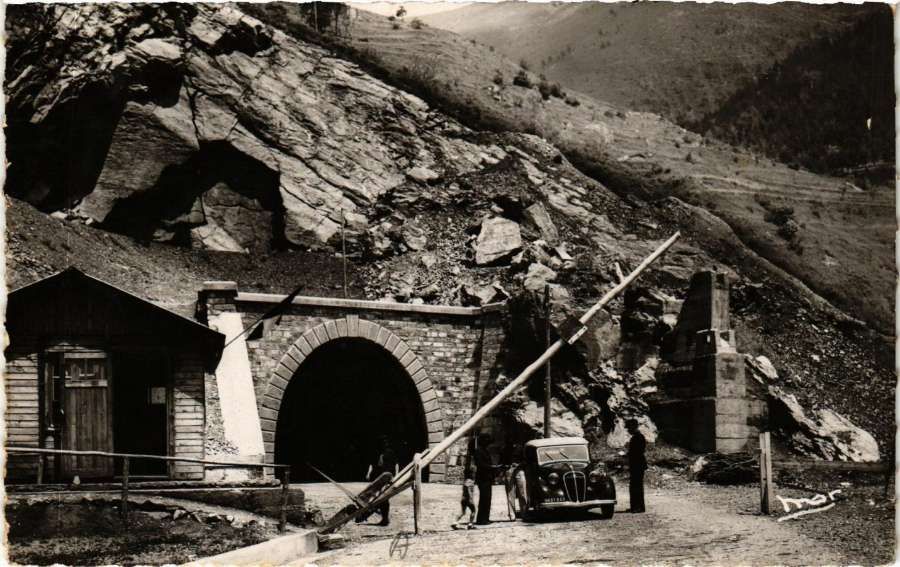
The Col de Tende Road Tunnel and the border between France and Italy. [17]

But while economic and emotional ties remained strong between Cuneo and Nice, they were weakening between Rome and Paris due to political, commercial, and colonial rivalries that would poison relations … for about fifteen years.  The attitude of the city of Marseille was also difficult. The business community in Marseille was hostile to a new rail link between Nice and Italy. Fearing the expansion of the port of Nice at their expense. They lobbied against any possible expansion of the port of Nice, even to the extent of thwarting standard-gauge lines from Nice to Digne and Draguignan, ensuring that the lines were built to metre-gauge (with less transport capacity and obligatory double-handling of loads). [1: p24]

Locally, in Nice, some pushed for the line to be metre-gauge, thinking that might iron out the technical difficulties and strategic objections. [1: p24] Faced by the administrative impasse which stalled the project in France , the French Ministry of Public Works decided to close its Nice design office on 1st September 1887. Italy, however,  worked unilaterally with the intention of opening up the Haute Roya without prejudging the continuation of the route towards France. [1: p24]

From 1882 until 1900 it was the Italians that took the initiative. A delegation from Cuneo secured 29.5 million lire from the Italian Minister of Public Works. The first length of the scheme received local approval on 25th March 1882. Work on site started in April 1882 on the length of the line from Cuneo to Vernante.

The first length of the line – Cuneo to Vernante
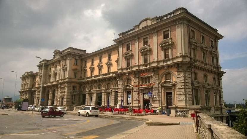
The present passenger station building in Cuneo seen from the East, © Neq00 and licenced for reuse under a Creative Commons Licence,(CC BY-SA 4.0). This railway station was built in the 1939s and opened in 1937 by the Communications Minister, Antonio Stefano Benni. At the same time the new Madonna Olmo–Plateau Cuneo–Borgo San Dalmazzo line was opened. It replaced the old Cuneo Gesso–Boves–Borgo San Dalmazzo line. [18]

The present railway station in Cuneo dates from the late 1930s the older station is known as Cuneo Gesso Statzione. At the time of the building of the Line from Cuneo towards Nice and Ventimiglia, Cuneo’s railway station sat alongside the Gesso River across the town from the present station.
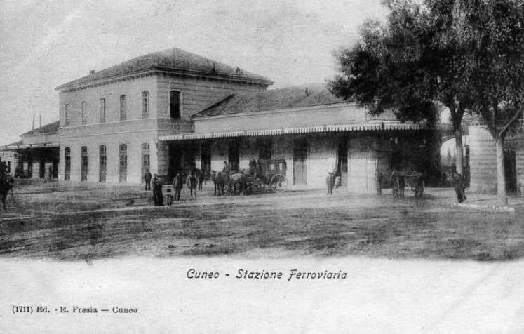
The original Cuneo Railway Station from which the line to Nice and Ventimiglia left in a southerly direction. This image was taken in 1903. It was shared on the Facebook Nel dipartimento della Stura – Cuneo – pagina. [19]
This second photograph of Cuneo’s original railway station which was on the banks of the River Gesso shows both the station building and the bridge which carried the railway over the river. This image was taken in 1905. It was shared on the Facebook Nel dipartimento della Stura – Cuneo – pagina on 16th November 2017. [20]
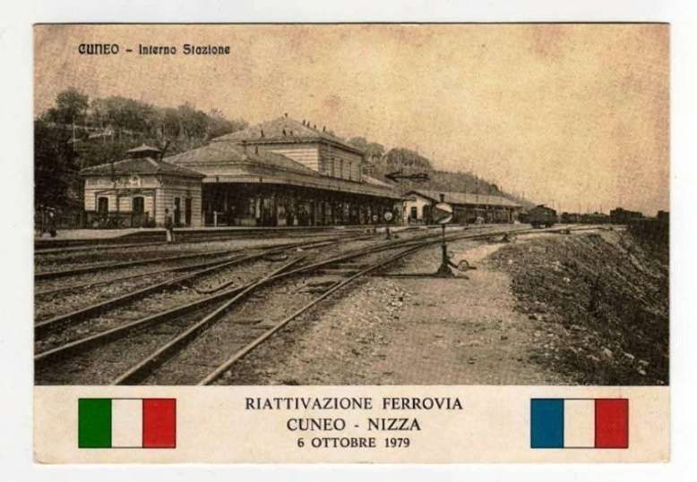
Although dated 6th October 1979 this postcard image originated in the early years of the 20th century. It shows the Cuneo Gesso Station as it was at the turn of the 20th century. The postcard was made to commemorate the reopening of the international railway line that connects the city of Cuneo with the city of Nice. This image was shared on the Facebook Ferrovia Internazionale Cuneo-Ventimiglia-Nizza page on 11th December 2017. [21]

The railway initially arrived from Turin, via Fossano. It came as far as Madonna dell’Olmo opposite Cuneo across the Sturia River on 16th October 1854 where a small building was built to serve as a temporary station. On 5th August 1855 the inaugural train from Cuneo left for Turin. In the same year the municipality built a bridge over the Sturia (at its own expense). After the construction of the bridge over the Stura, a second temporary station was built on an embankment in the San Sebastiano plain (where Giuseppe Garibaldi had arrived to visit his “Alpine Hunters” in 1856). Only in 1870 was a significant edifice completed which became Cuneo’s railway station. It was alongside the Gesso River and it was again built entirely at the town’s expense. [19]
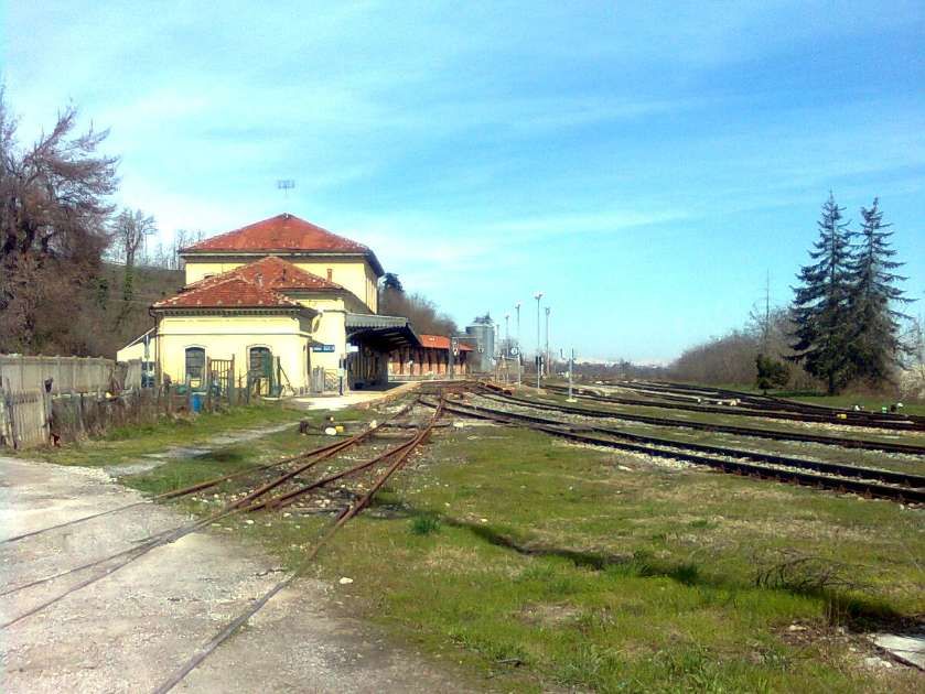
Cuneo Gesso Stazione in 2010, © Luciano Marco and licenced for reuse under a Creative Commons Licence (CC BY-SA 3.0). The lines curving off the right of this photograph head towards the bridge over the Gesso River. [22]

The complete opening of the Cuneo-Ventimiglia line, which took place on 30th October 1928, caused significant logistical problems for both travellers and rolling stock at Cuneo station. The old depot, dating back to 1864, soon became insufficient to house the locomotives of the new line, [23: p41] a hastily built locomotive depot was provided (because of delays creating the new line and new railway station, and in the construction of the large mixed-use viaduct over the Stura di Demonte. [24][25]
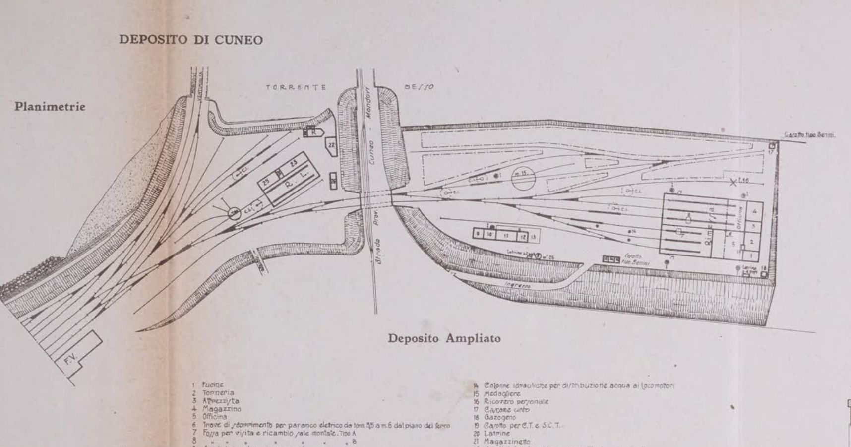
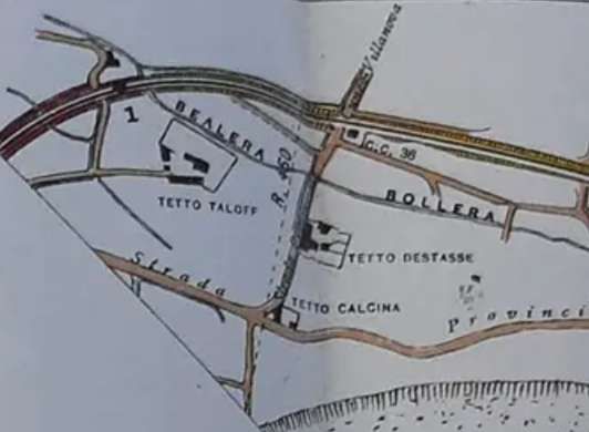
The Locomotive Depot at Cuneo Gesso Station which was used until the new depot close to Cuneo Altipiano Railway Station was opened. The site was repurposed – it became a sawmill. This plan comes from From the December 1929 Technical Magazine of Italiane Ferrovie., It was shared on the Ferrovia Internazionale Cuneo-Ventimiglia-Nizza Facebook Group on 13th February 2024 by Francesco Ciarlini Koerner. [62]

The new depot was placed beyond the embankment of the road to Mondovì. A double track arched bridge took the tracks under the road. [26][27] On 7th November 1937[24] the new Cuneo Altipiano station was opened, located to the west of the city centre and connected to the new locomotive depot built on the right side of the Stura River. [24][25]

Cuneo Gesso quickly lost importance, remaining active only as a stopping point for the lines to Mondovì and Boves , the latter closed to traffic in 1960. [23: p55-57][25]

Near the station was the terminus of the Cuneo-Dronero, [28] Cuneo-Saluzzo [29] and Cuneo-Boves [30] tramways, active for different years between 1879 and 1948 [25][31: p120]. The Cuneo Boves line opened in 1903 and closed in 1935.
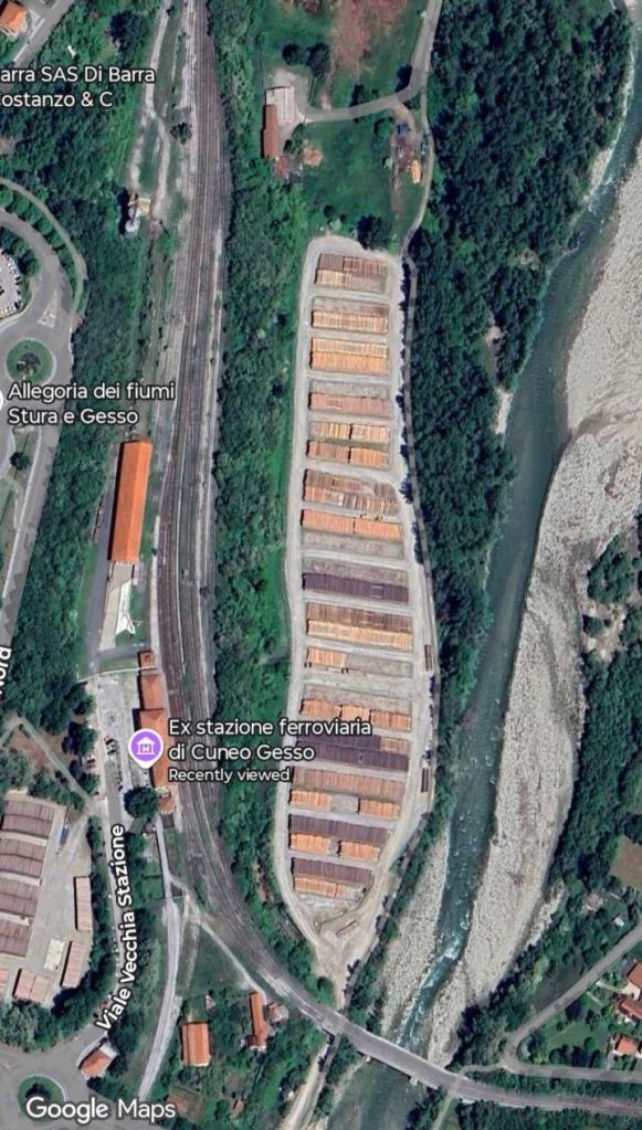
Ex Stazione Ferrovia Di Cuneo Gesso as it appears on Google Maps satellite imagery. he river is the Gesso Torrent and a modern concrete bridge now spans the river. The line heading South from the station originally served a temporary Locomotive depot but now serves the sawmill that replaced the depot. [Google Maps, July 2025]
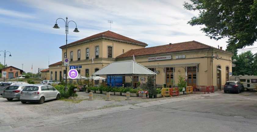
The old station buildings seen from the Southwest. The building is in use as a cafe/bar. Tracks remain in place beyond the building. [Google Streetview, May 2025]
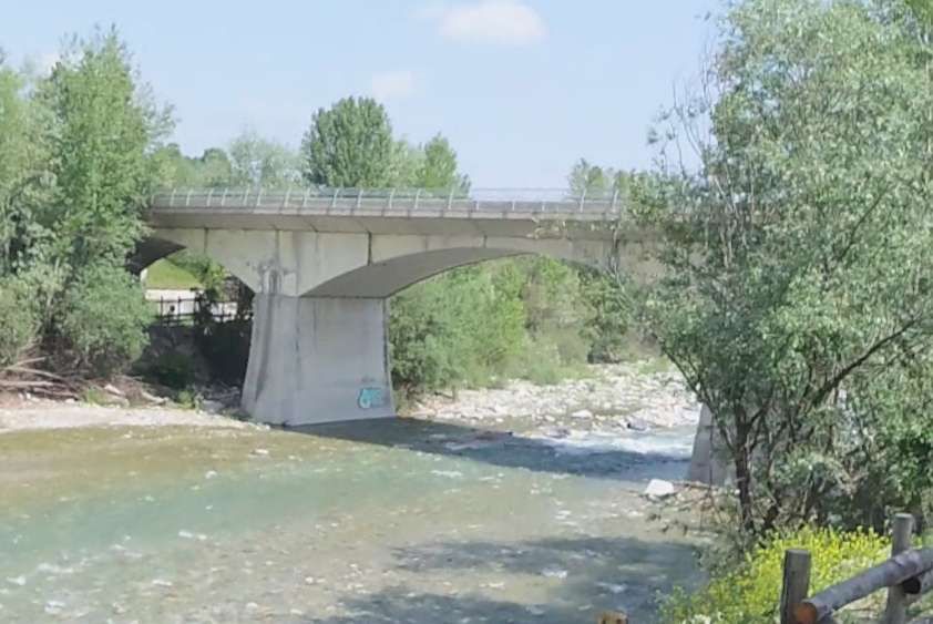
The bridge which now carries the railway over the River Gesso. [Google Streetview, 2022]

Construction of the new line started in 1882, it left the station to the South curving sharply to the left to cross the Gesso River on a 3-arch brick viaduct (each span was 24.8 metres) shared with the line from Cuneo to Mondovi which was under construction at the same time. [1: p25]

The line to Mondovi remains today, but no passenger trains use the line any longer. The line we are following from Cuneo to Vernante, left the line to Mondovi heading Southwest and passing through the villages of Boves and Fontanelle-di-Boves. Provision for freight and passengers was made at Boves, just for passengers at Fontanelle-di-Boves.

Preparing for this article, I found a document from 1904 which included the plans and profiles of the line on the Ferrovia Internazionale Cuneo-Ventimiglia-Nizza Facebook Group. It was shared as a series of photographs by Davide Franchini on 2nd March 2022.
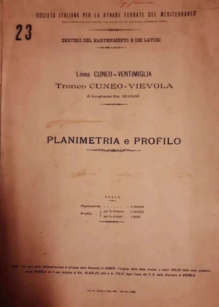
The 1904 document cover. [47]
The first plan shows the bridge crossing the River Gesso with the line heading for Nice and Ventimiglia bearing away from the line to Moldovi. [47]
The line heading South. [47]
The route of the old railway from Cuneo Gesso to Borgo-San-Dalmazzo, (c) Ale Sasso and licenced for reuse under a Creative Commons Licence, (CC BY-SA 4.0). [32]

As far as I can tell, the line to Boves has been built over. It seems to have followed the route of Via del Borgo Gesso South from the river bridge, then Via Bisalta, then Highway SP21 to Boves where the line curved back towards the River Gesso. Boves station was on a relatively sharp curve in the line. [33]
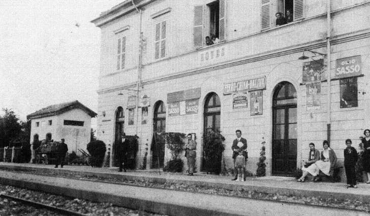
Boves Railway Station building. [35]
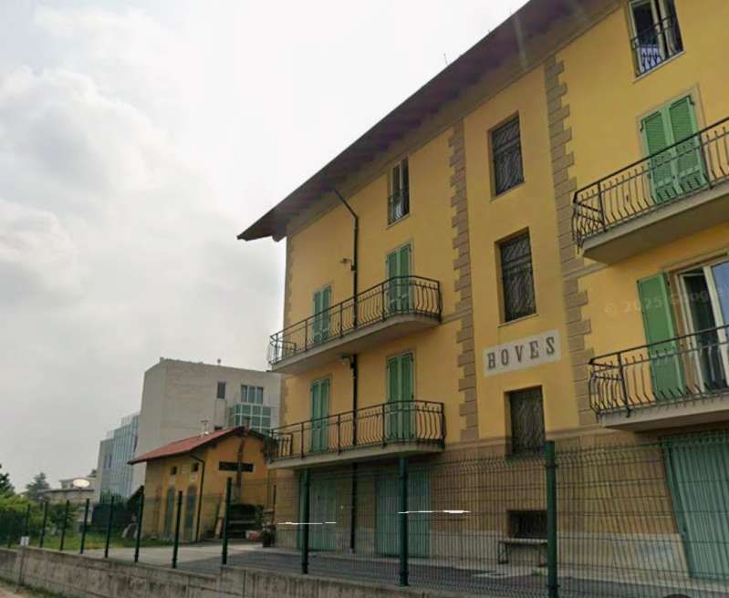
A similar view of Boves Railway Station in the 21st century. [Google Streetview, June 2025]
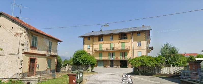
The altered station building as seen from the Southeast. [Google Streetview, 2012]
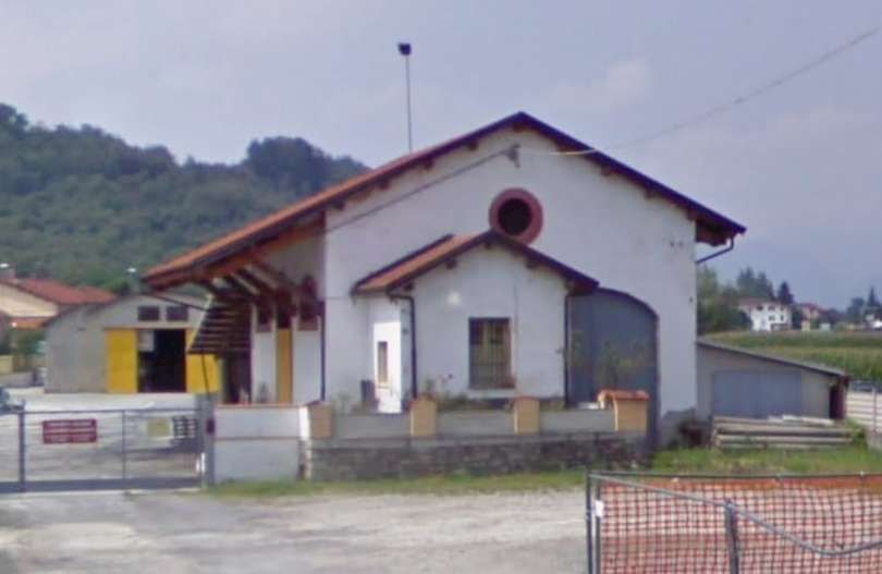
The goods shed/warehouse seen from the East. [Google Streetview, 2012]
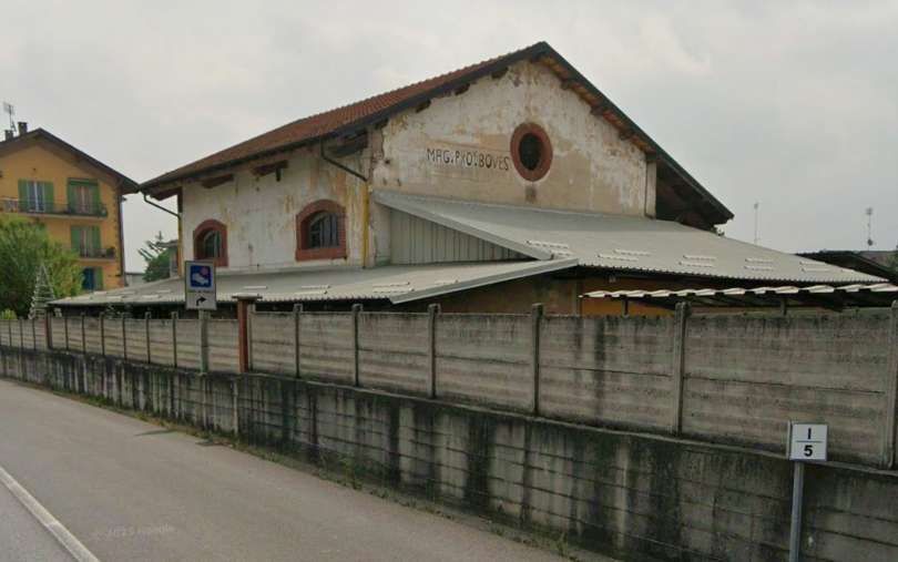
The goods shed at Boves, seen from the West on the SP21. The original station building can be seen on the left of this image. [Google Streetview, June 2025]
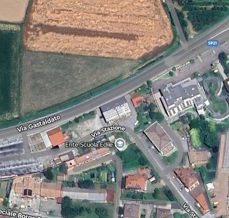
The location of Boves Railway Station in the 21st century. Via Gastalato (SP21) runs along the old railway line. The main station building has a silver coloured roof and sits at the centre of this satellite image. The goods warehouse costs to the West of the main station building and has a red roof. [Google Maps, July 2025]

Boves station had a passing loop and two sidings. The passenger building, converted into residential housing several years ago, was adjacent to a goods warehouse, now used as a provincial warehouse. [35]
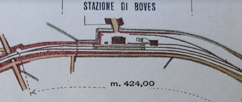
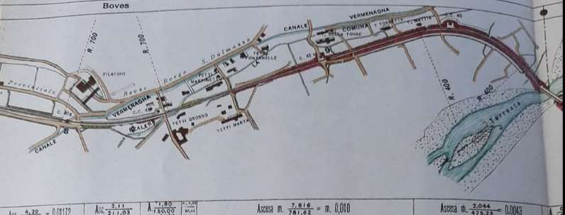
Boyes Railway Station plan. [47]
The line beyond Boves Railway Station ran through Fontanelle di Boves and then crossed the River Gesso again. [47]

The hamlet of Fontanelle di Boves was just a short distance beyond Boves Railway Station. It had its own passenger station which opened in 1942 after the line from here back to Cuneo was replaced by a new line on the other side of the River Gesso which ran into the new station at Cuneo. Just a short distance further down the line was the viaduct which took the line back over the River Gesso. Originally, this was a masonry structure of three 24.8 metre arched spans. [1: p25] The viaduct was overwhelmed and destroyed by a flood of the Gesso on the afternoon of 2nd October 1898. It was then replaced with the current 74 m metal truss girder bridge. [34]
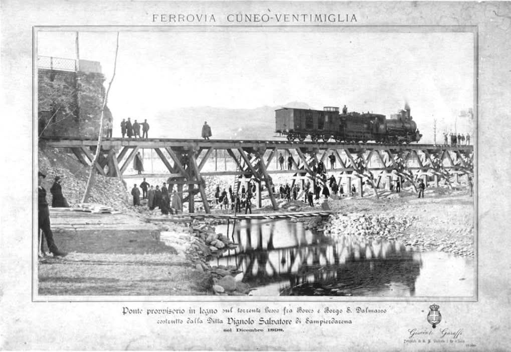
This photograph shows the immediate aftermath of the destruction of the bridge between Fontanelle-di-Boves and Borgo San-Dalmazzo. It was shared on the Ferrovia Internazionale Cuneo-Ventimiglia-Nizza Facebook Group by Mario Zauli on 29th February 2024. As well as appearing on the Facebook Group, Banaudo et al include the picture in their book. They comment: “On 2nd October 1898, the Southern Alps suffered violent floods that swept away the three-arched masonry viaduct over the Gesso between Boves and Borgo San-Dalmazzo, built in 1883. It was rebuilt as a metal truss bridge, but initially trains used a temporary structure on wooden beams. In December 1898, this was tested by the passage of locomotive No. 4333 of type 040, series 4201 to 4493 of the Rete Mediterranea. (Photo Giacinto Garaffi – Diego Garel collection).” [37][1: p26]

The bridge is known as Ponte di Sant’Andrea, a second truss was positioned alongside the railway bridge and together the two bridges now carry the SP21.

After crossing the River Gesso and at about 12 km from Cuneo the line arrived at Borgo-San-Dalmazzo.
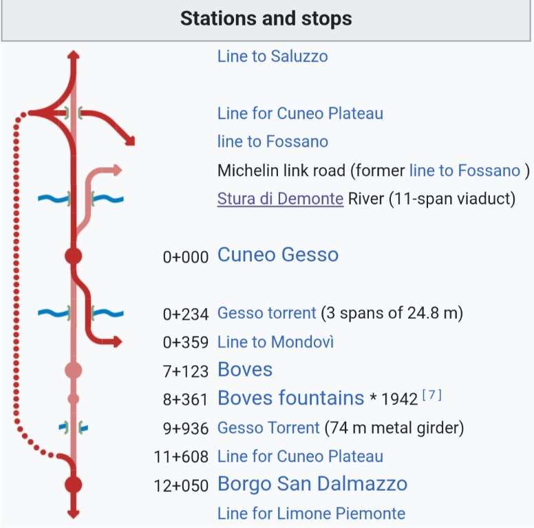
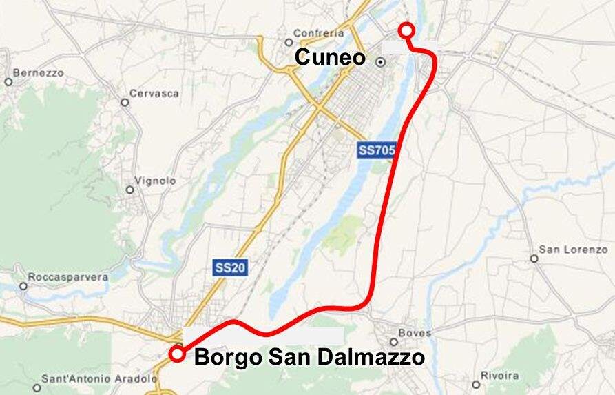
This schematic map shows the two rail routes. The solid line shows the original alignment that we have just been following. The dotted line shows the route built at the end of the 1930s. The two lines met to the West of Pont Sant’Andre. The 1937-built station is on the banks of the Stura River on the West side of Cuneo and on the dotted line. [34]
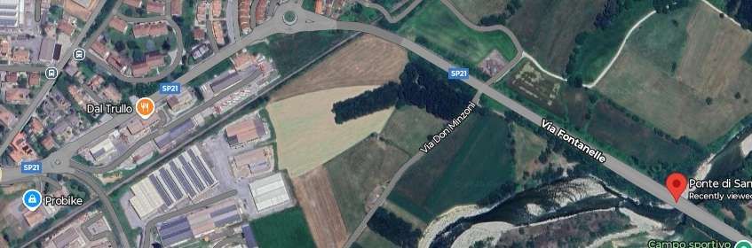
The bridge (Ponte di Sant’Andrea) is flagged in the bottom-right, the newer line from Cuneo enters this image middle-top and runs down to the bottom-left. The older line curved round from the SP21 and its route is marked by the curved field boundary. [Google Maps, July 2025]

Returning to the 1937-built Cuneo Railway Station, the line from that station leaves Cuneo in a South-southwest direction. It is easiest to see the route of the line on a sequence of extracts from global mapping provided by OpenStreetMap. …
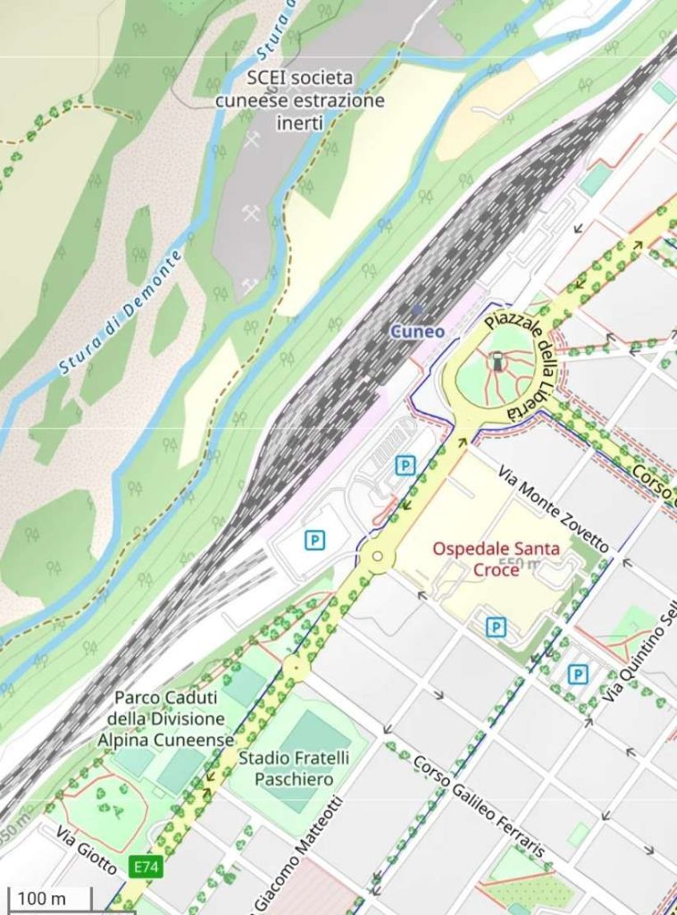
Cuneo’s Railway Station in the 21st century. [OpenStreetMap, July 2025][38]

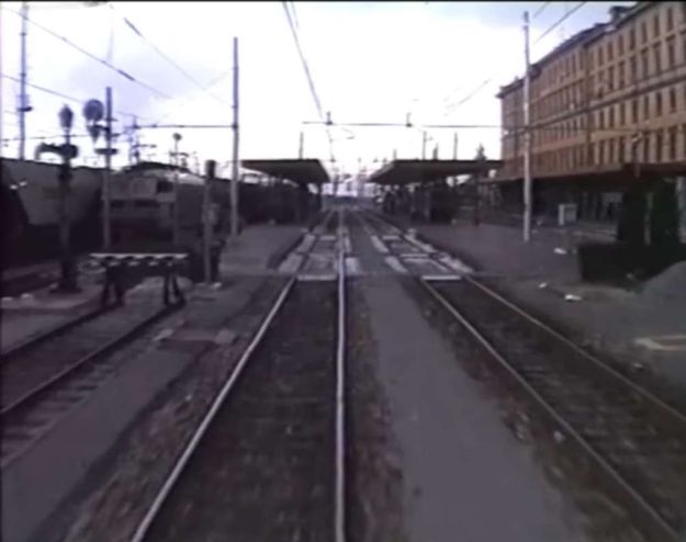
A twilight view of Cuneo railway station taken from the cab of a multiple unit entering the station from the Southwest. [45]
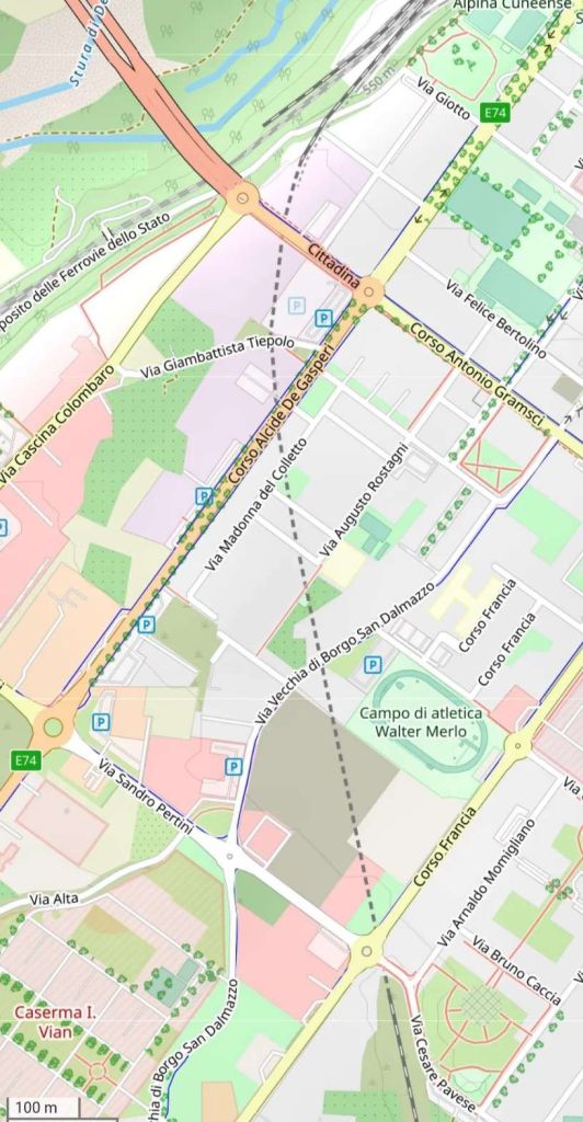
The line runs alongside the locomotive depot to the South of the passenger facilities at Cuneo Railway Station and then enters a tunnel which turns South under the city. [39]
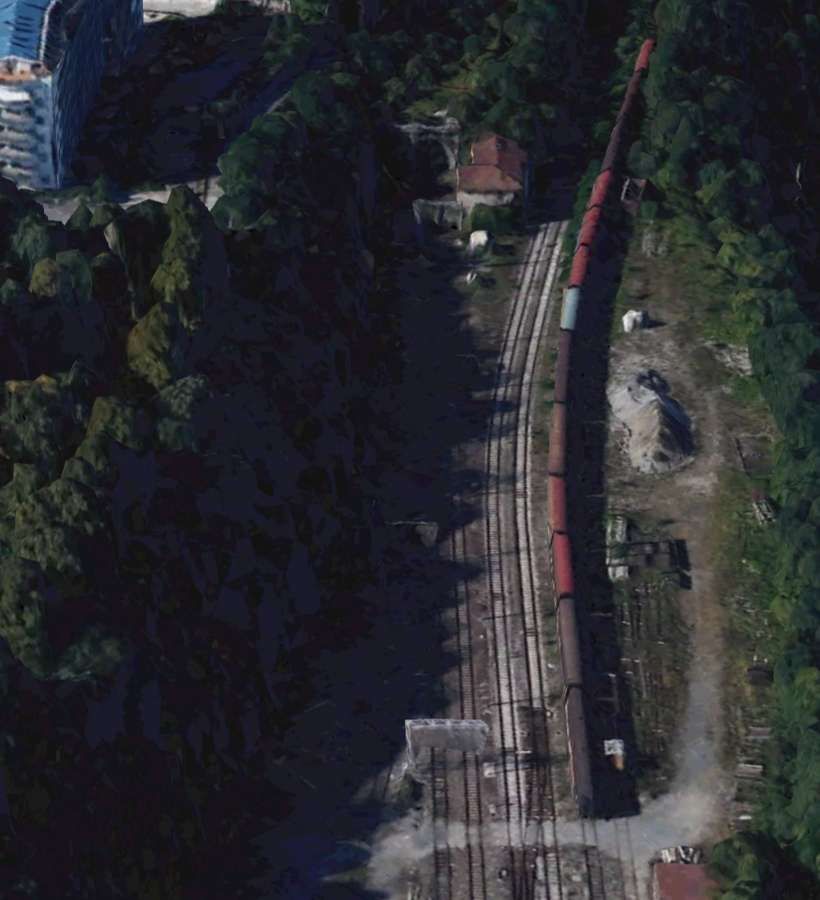
The tunnel mouth to the South of Cuneo Railway Station can be made out at the centre-top of this image. [Google Earth 3D, July 2025]
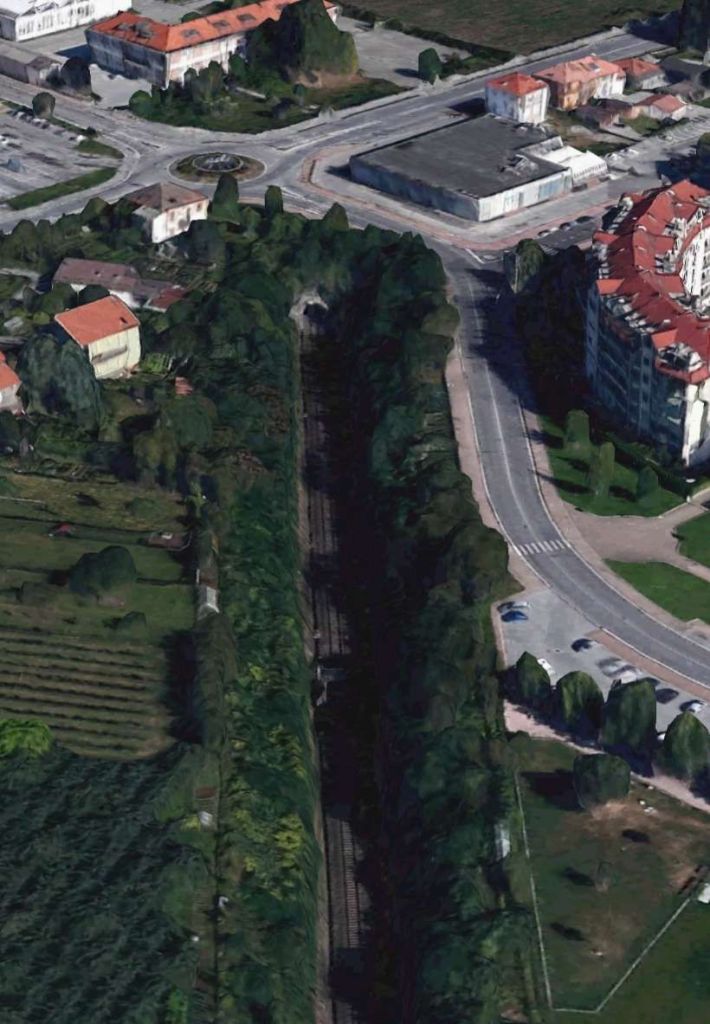
This time looking North, the Southern portal of the tunnel to the South of Cuneo Railway Station can be made out below the roundabout at the centre-top of this image. [Google Earth 3D, July 2025]

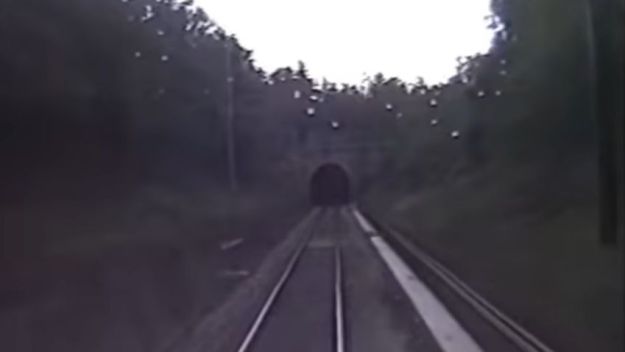
A rain-spattered cab view from the South, taken in the late evening, of the Southern portal of the tunnel which sits to the South of Cuneo Railway Station. [45]
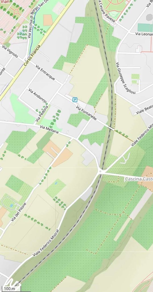
After leaving the tunnel, the line began to curve round to the Southwest passing under Via Fontanelle and then under the roundabout at the junction of Via Mellana and Viale Federico Mistral. [40]

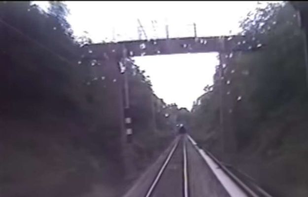
Looking North in the evening light under a footbridge close to Via Giuseppe Scagliosi through the cab widow of a multiple unit on the line. [45]
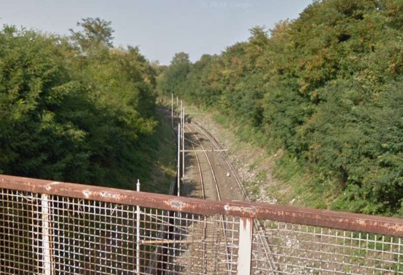
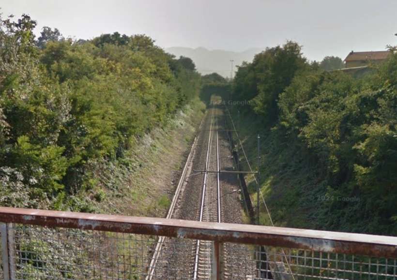
The view North from the bridge carrying Via Fontanelle across the line. [Google Streetview, 2019]
Looking South from the bridge carrying Via Fontanelle over the line. The bridge in the distance sits underneath a roundabout at the junction between Via Mellana and Viale Federico Mistral. [Google Streetview, 2019]

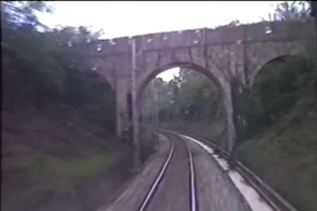
A three arch bridge carries Via Fontanelle over the railway, seen again in the evening light from the South through the rail-spattered cab widow of a multiple unit. [45]
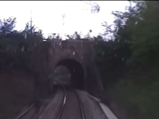
A short tunnel carries the roundabout at the meeting of Via Mellana and Viale Federico Mistral over the railway, seen again from the South through the rail-spattered cab widow of a multiple unit. [45]

Vegetation around the roundabout means that it it not possible to see into the cutting from the road.
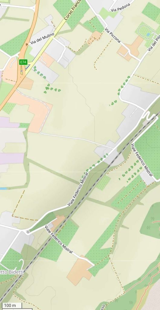
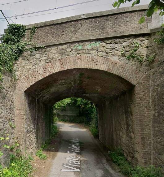
The line continues in a Southwesterly direction running alongside Viale Federico Mistral. [41]

A brick-ringed arch bridge carries the railway over a side road off Viale Federico Mistral. This view is from the Southeast. The structure is at the top-right of the map extract immediately above. [Google Streetview, June 2025]

A very similar arch bridge carries the railway over a further side road off Viale Federico Mistral. The bridge is located in the bottom-left quadrant of the map extract above. [Google Streetview, June 2025]
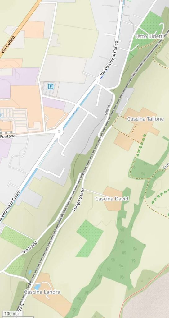
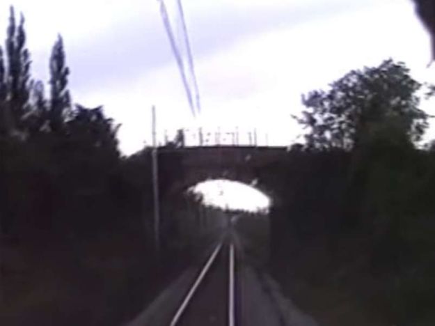
Now on a more Southwesterly course the line passes under a footbridge, obscured on the map extract by the words Tetto Bidetti in the top-right corne of the extract.

Silhouetted in the evening light, this bridge crosses the line carrying a footpath over the railway. The image, again comes from the cab of a multiple unit heading for Cuneo. [45]
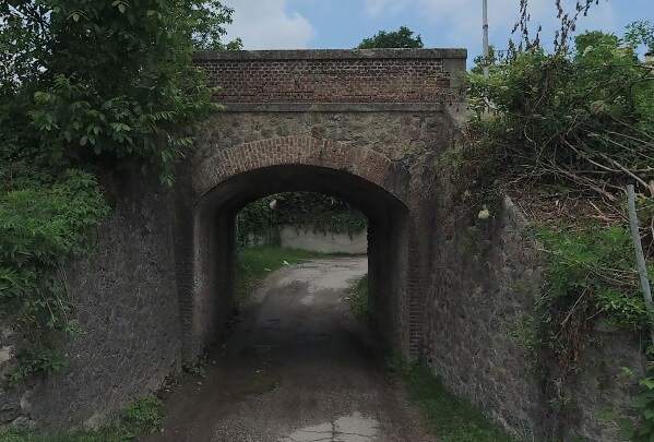
Close to Cascina Tallone, the line crosses Lungo Gesso by means of another brick ringed arch. This view looks under the railway from the Southeast. [Google Streetview, May 2022]
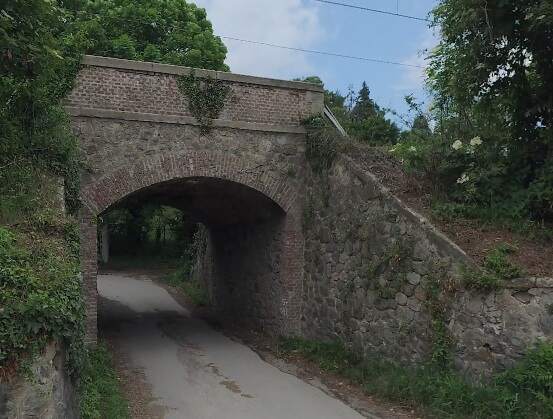
Near Cascina David another brick-arched bridge pierces the railway embankment where Via David passes beneath the railway. Again this view is from the Southeast on Via Sant’Andre. [Google Streetview, May 2022]
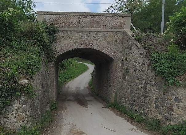
Near Cascina Landra another brick-arched bridge pierces the railway embankment. Again this view is from the Southeast on Via Sant’Andre. Thestructure appeasr bottom-left on the map extract above and top-right on the extract below. [Google Streetview, May 2022]
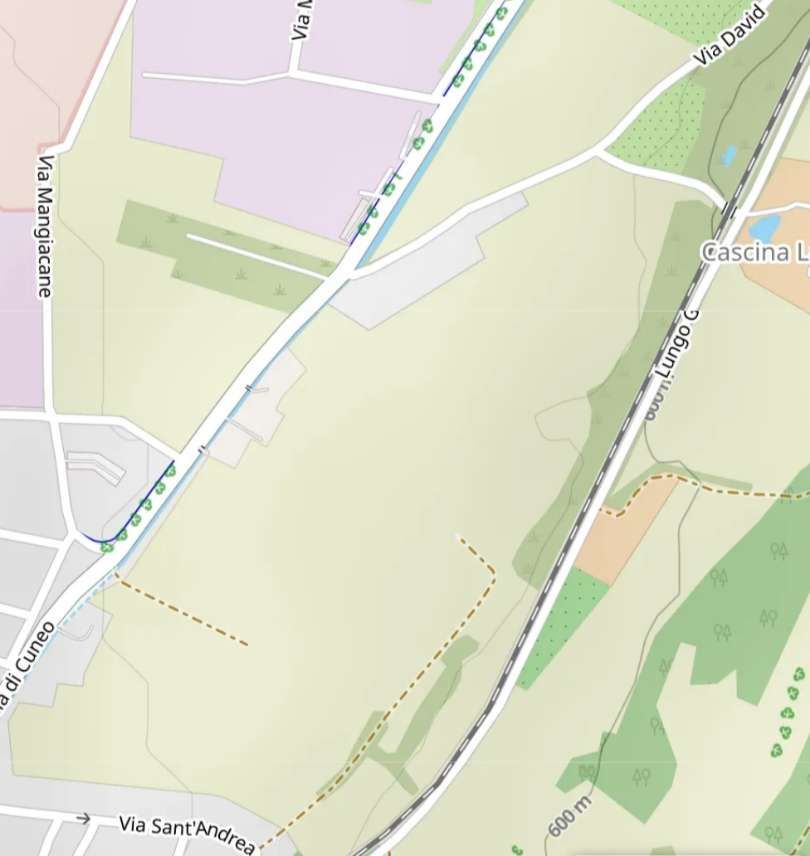
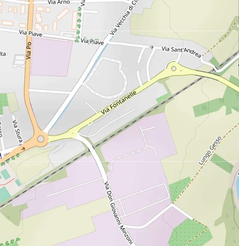
And close to where the line of the older route meets the newer route the line is heading South-southwest and turns towards the Southwest. [43]
Now in Borgo San-Dalmazzo we have reached the point where the older line curved in from the East having crossed the River Gesso. [44]

Via Sant’Andrea passes over the line. This view looks Northeast towards Cuneo. [Google Streetview, May 2022]
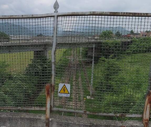
Also taken from the bridge carrying Via Sant’Andrea over the railway, this view looks across the road SP21 towards Borgo San-Dalmazzo. [Goog;e Streetview, May 2022]
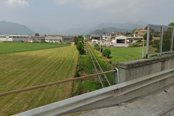
The view Southwest from the bridge carrying the SP21 over the railway. The route of the older line is marked by the field boundary visible to the left of the line. [Google Streetview, June 2025]

The older line curved round to the Southwest and followed a straight course towards Borgo-San-Dalmazzo Railway Station. The newer line has taken its place on the approach to the Station from the Northeast.
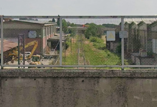
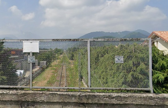
Looking back to the Northeast towards the bridge carrying the SP21 from the bridge carrying Via Don Giovanni Minzoni. [Google Streetview, June 2025]
Looking Southwest towards Borgo San-Dalmazzo Railway Station from the bridge carrying Via Don Giovanni Minzoni. [Google Streetview, June 2025]
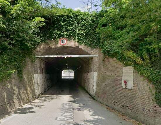
At the Northeast boundary of the Borgo San-Dalmazzo Railway Station site the Via Rocchiuse passes under the station throat by means of this brick-arched subway/tunnel. This is the view from the Southeast through the tunnel. [Google Streetview, June 2025]
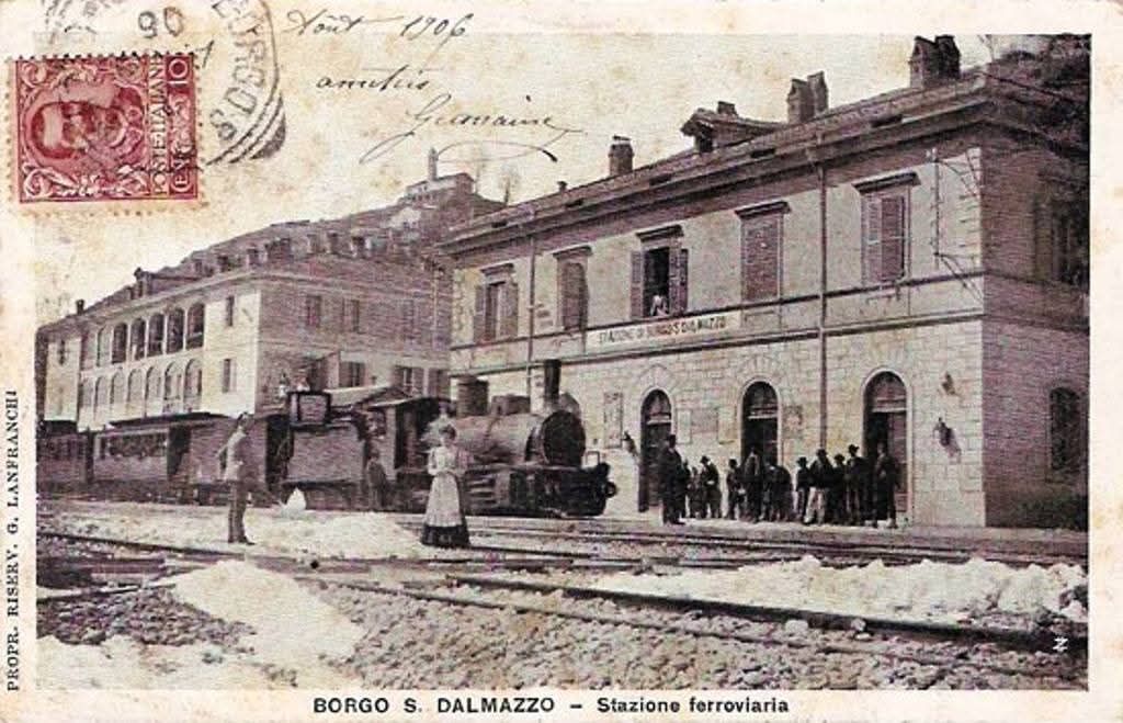
Borgo San-Dalmazzo Railway Station in 1906. This old postcard image was shared on the Ferrovia Internazionale Cuneo-Ventimiglia-Nizza Facebook Group by Mario Zauli on 31st March 2025. [52]
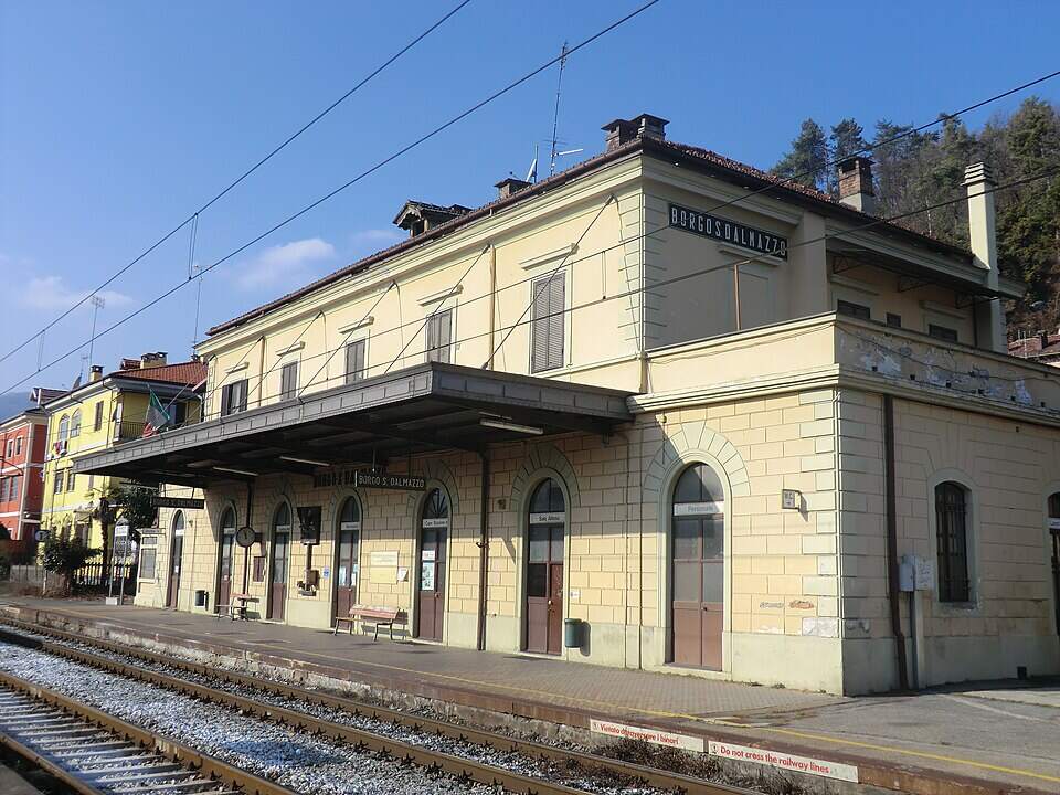
Borgo San-Dalmazzo Railway Station passenger building in 2012, © Luigi Tuby and licenced for reuse under a Creative Commons Licence (CC BY-SA 3.0). [46]
Borgo San-Dalmazzo Railway Station in the 21st century. [Google Streetview, July 2025]
In the plans/profiles that we came across earlier the station is shown with the North point reversed. [47]

San-Dalmazzo is a very old trading town located at the crossroads of three valleys: the Stura, the Gesso and the Vermenagna. The station had three platforms, a goods yard, a 5.50 m turntable and a large overflow yard that could be used for the embarkation and disembarkation of military units deployed in the area. “When the railway arrived in Borgo-San-Dalmazzo, this small town had already had a rail service for several years. In fact, private entrepreneurs Ercole Belloli and Carlo Chiapello opened a 1.445 m gauge horse-drawn tramway between Cuneo and Borgo in 1877, passing through the San-Rocco-Castagnaretta district on the left bank of the Gesso.  Horse-drawn traction was replaced by steam locomotives on this modest 8-km line in 1878.” [1: p27][48]

The Cuneo-Borgo San-Dalmazzo-Demonte tramway linked the cities of Cuneo, Borgo San Dalmazzo and Demonte from 1877 to 1948. In the late 1870s, following the success of similar initiatives in the Turin area, the construction of tramways was pursued in the province of Cuneo. [48] As we have already noted, this was just one of a number of such tramways in the area.

The Cuneo Borgo-San-Dalmazzo tramway was extended in 1914 to Demonte (26.4 km) and converted on this occasion to a 1.10 m gauge to facilitate the exchange of goods with the Compagnia Generale dei Tramways Piemontesi (CGTP) which operated the Cuneo Boves line (8.3 km) from 1903.  The Boves steam tramway disappeared in 1935 and that of Borgo and Demonte in 1948. [1: p28] The story of these tramways seems worth investigating, but their histories are a matter for a different article!

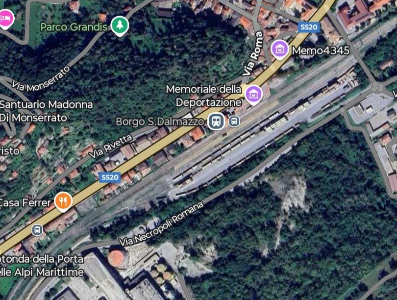
The station had an ignominious place in history. During the Second World War two convoys of Jewish deportees departed from the Borgo San Dalmazzo railway station bound for Auschwitz , coming from the adjacent Borgo San Dalmazzo concentration camp. The first convoy, on 21st November 1943, completed its journey via Nizza Drancy with 329 people on board. Only 19 survived. The second convoy, on 15th February 1944, with 29 people on board, headed instead for the Fossoli transit camp where it was combined with transport no. 8 bound for Germany. Only 2 survived. [49][50]
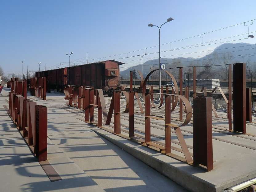
The Deportation Memorial , with a row of cattle wagons similar to those used then (the wagons are from 1953) commemorates the names of the deportees, their age and nationality and their family relationships. [50][51]

Burgo San-Dalmazzo to Robilante: The second construction contract covered the length from Borgo San-Dalmazzo to Robilante. Work began in late 1883. From Burgo San-Dalmazzo the line leaves the plain and begins its ascent up the Vermenagna Valley, heading towards the Tende Pass. The route, was designed to accommodate heavy traffic, so the line does “not include any curves with a radius less than 300 m, with two exceptions: one at the southern end of Cuneo station and one at the exit from Borgo station, where the route curves sharply to the left in a 257-meter curve to reach the left bank of the Gesso River.  There, a 21 m three-arched masonry viaduct, shared by the railway and the SS20 road, crosses this Alpine torrent for the third and final time.” [1: p27]
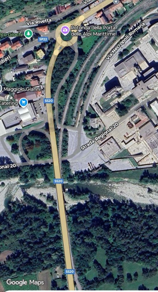
This satellite image shows the sharp curve from the Railway Station at Borgo San-Dalmazzo to the viaduct across the River Gesso. [Google Maps, July 2025]

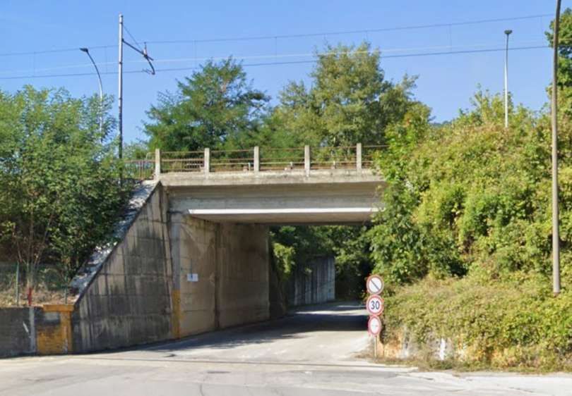
As the railway curves round towards the river its embankments are pierced twice to allow local roads to pass beneath the line.
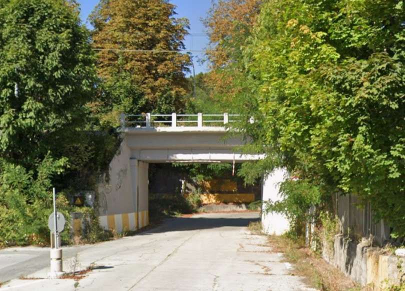
This is the first structure. [Google Streetview, June 2025]
The second structure, closer to the River Gesso. [Google Streetview, June 2025]

The southern approach to Borgo San-Dalmazzo Railway Station, seen from the cab of a multiple unit. The line to the right of the image is a siding which terminates close to the River Gesso. [45]
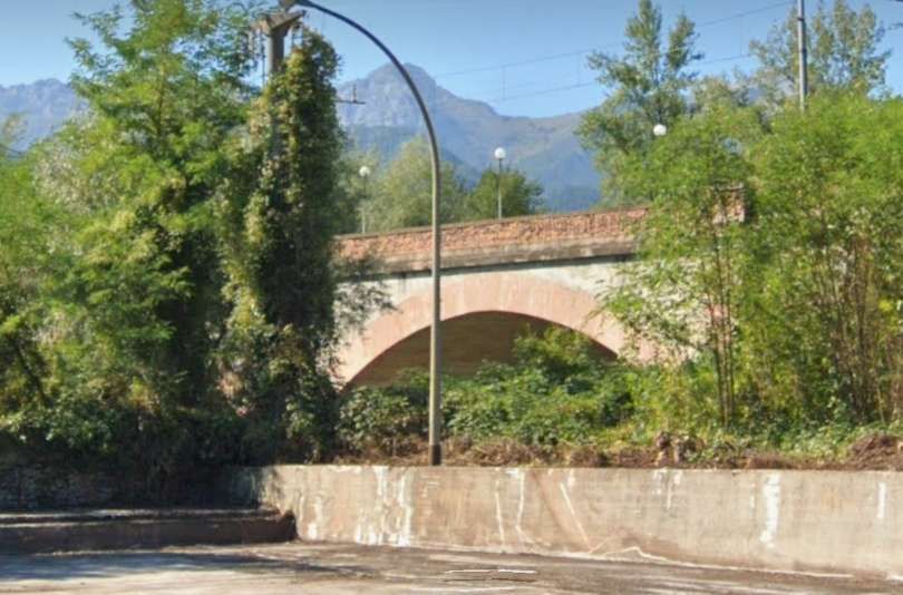
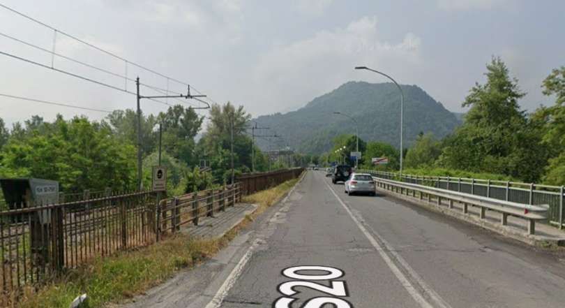
The 3-span viaduct across the River Gesso carries both the railway and the SS20. [Google Streetview, June 2025]
Looking South along the SS20 as it crosses the Gesso. The railway cantenary is on the left with the tracks hidden behind the dividing fence. [Google Streetview, June 2025]

A view from the South showing the road on the left. This is a view from the cab of the multiple unit again. [45]
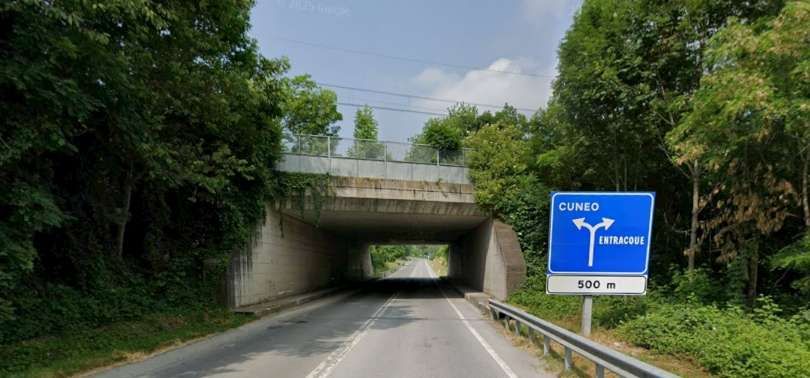
Once over the river the road and railway remain at a high level with an access road to the SS20 passing under both the railway and the road. [Google Streetview, June 2025]

After crossing the river the line ran on through Roccavione. …
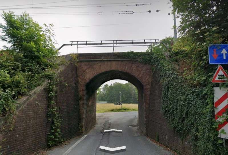
The line bridges a minor road. The brick arch structure is seen from the Southwest. [Google Streetview, June 2025]
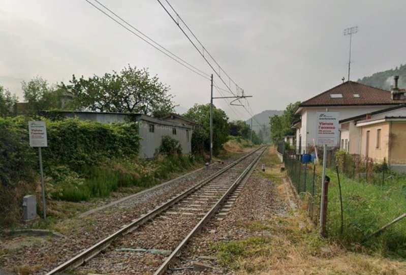
The line crosses Via 8 Agosto at level. The view looks Southwest over the level-crossing. [Google Streetview, June 2025]
The view North-northwest from the level-crossing, looking back along the line towards Borgo San-Dalmazzo. [Google Streetview, June 2025]
The view South-southeast from the level-crossing, looking towards Roccavione Railway Station. [Google Streetview, June 2025]
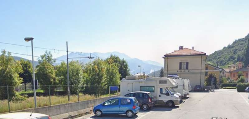
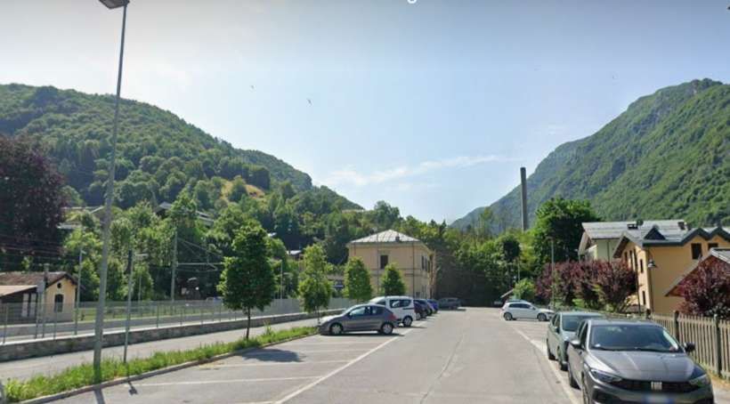
Looking Southeast from Roccavione Railway Station car park. The station building is to the right of centre, the platforms are camouflaged by the fencing to the left of the parked vehicles. [Google Streetview, September 2023]
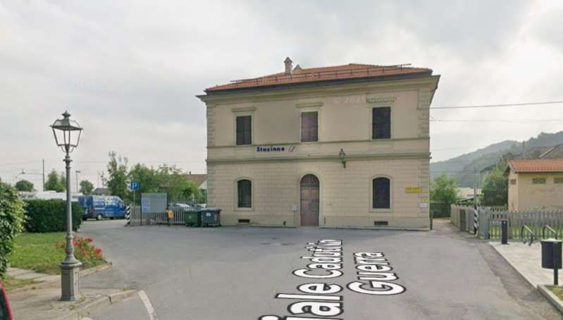
The station building and forecourt seen from the Southwest. [Google Streetview, June 2025]
A view South along the platform of Roccavione
Railway Station © Mattia Vigano. [Google Maps, 2019]

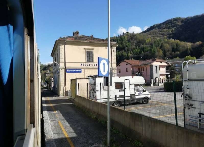
Roccavione Station is a simple station with two public platforms and one track serving a military platform. Another level crossing sits beyond the South end of the station site.
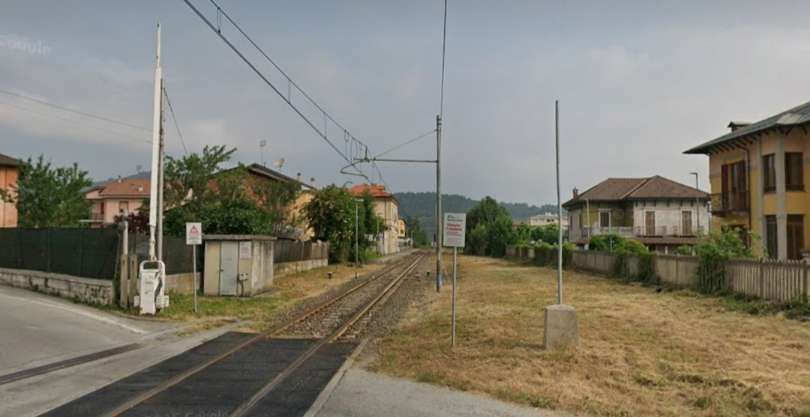
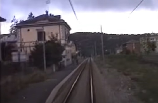
Looking back from the level-crossing at Via Piano Sottano towards Roccavione Railway Station. [Google Streetview, June 2025]

A similar view looking North into Roccavione Railway Station from the cab of the multiple unit. The station has no passing loop. [45]
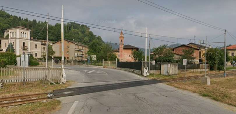
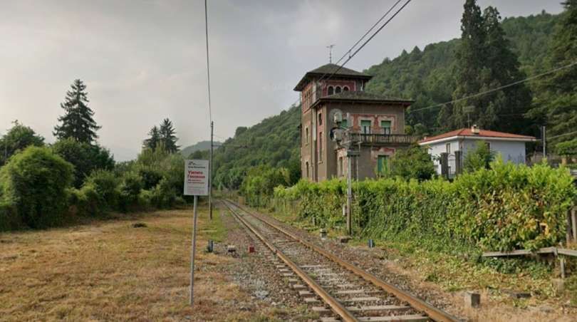
The view Southwest across the level-crossing. [Google Streetview, June 2025]
Looking South-southeast as the line continues up the Vermenagna valley. [Google Streetview, June 2025]

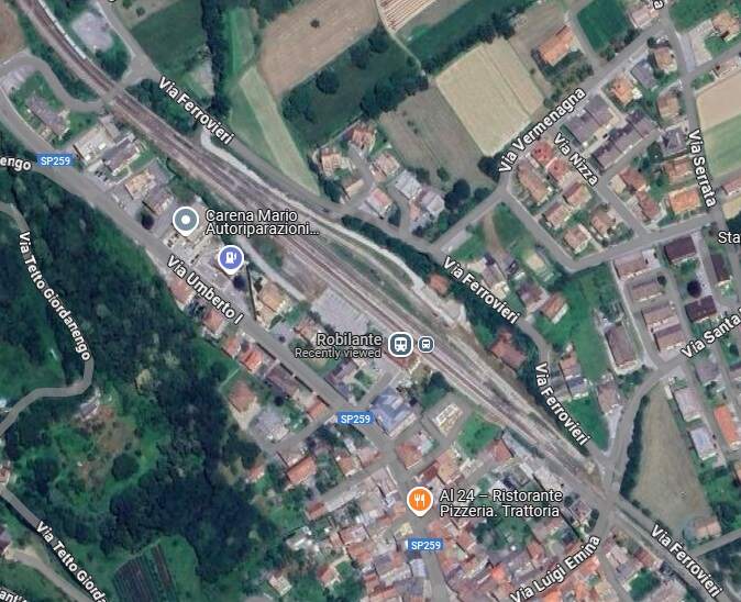
The line follows an easy gradient between the SP259 (which used to be the SS20) and the left bank of the River Vermenagna to Robilante Railway Station. [1: p27]
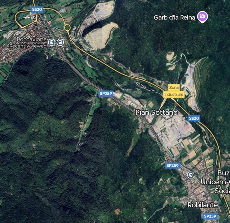
The line runs Northwest to Southeast across this extract from Google Maps satellite imagery. It runs close to the SP259 between Roccavione and Robilante. [Google Maps, July 2025]
A link road under the railway and under the SP259 beyond. It provides access from Via Piano Sottano to the SP259. [Google Streetview, June 2025]
What in the UK we might choose to call an underpass or cattle-creep under the railway. Apologies for the slight distortion of the image which comes from the way in which Google’s algorithm merges the 360° camera photographs. [Google Streetview, June 2025]

Robilante Railway Station had three platform tracks, a small goods yard, a water feed, a 8.50m turntable and an engine shed.  Beyond the station track gradients increased significantly and provision needed to be made for banking engines in steam days. [1: p27]
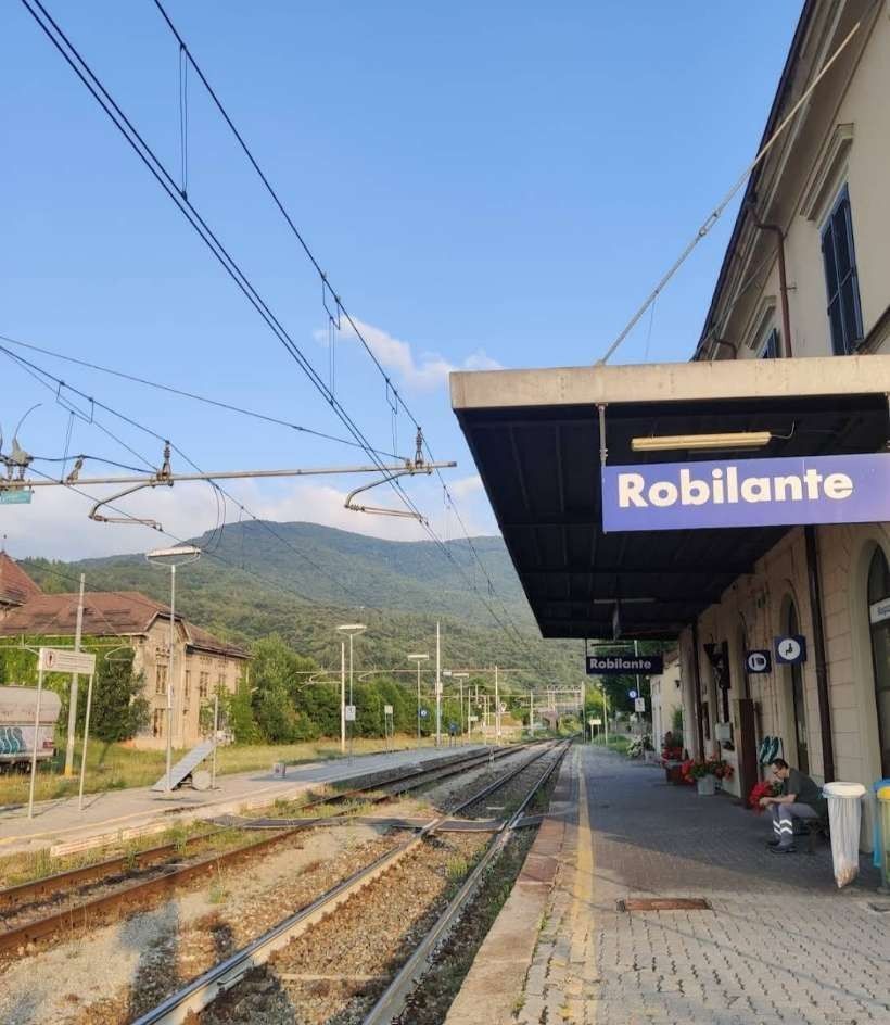
Robilante Railway Station. [Google Maps, July 2025]
The station building sat on the Southwest side of the line, This view looks through the station to the Southeast, (c) Gum Gum. [Google Maps: July 2023]
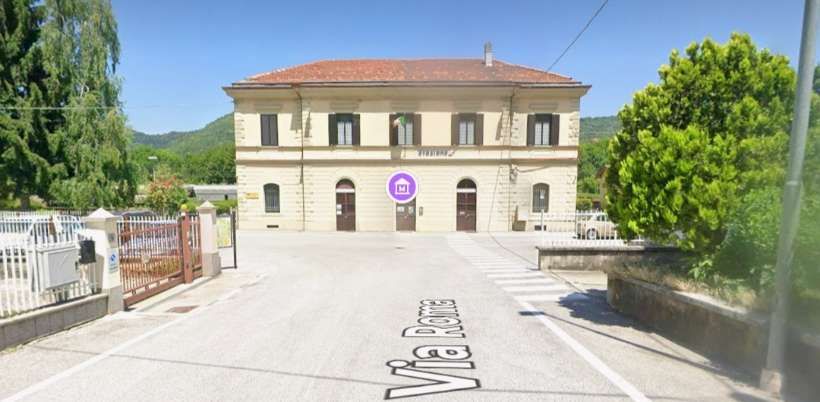
Robilante Station building and forecourt seen from the Northeast on Via Roma. [Google Streetview, June 2025]
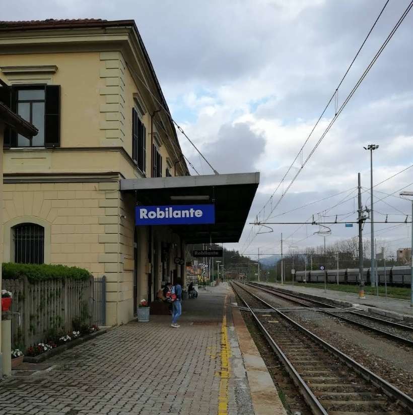
This view looks Northwest through the station towards Cuneo, (c) Mattia Vigano. [Google Maps: April 2019]

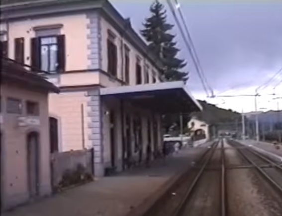
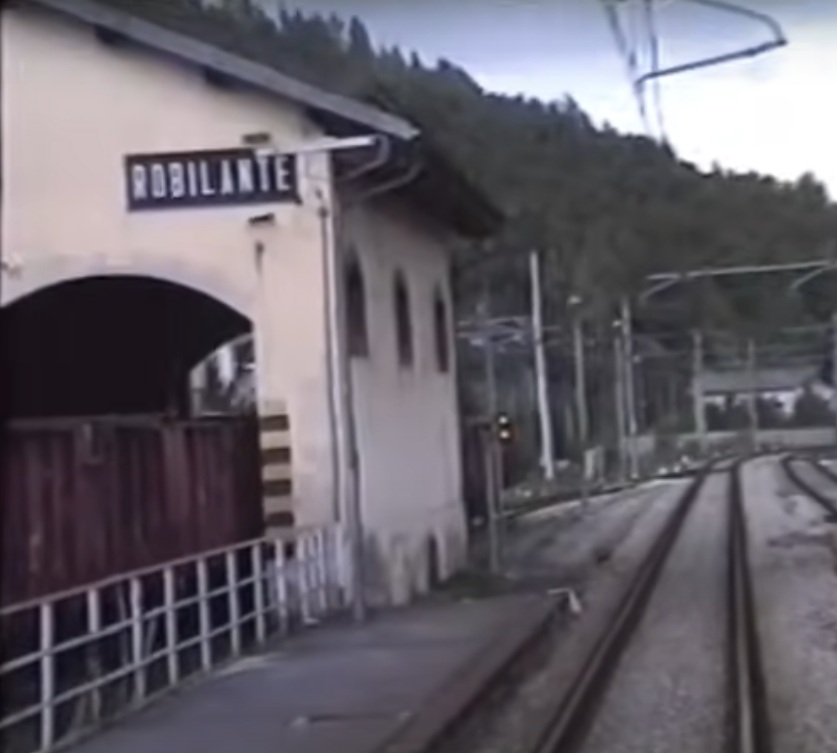
A similar view to that immediately above but taken from the driver’s cab on a multiple unit. In the distance in this image the old goods shed can be seen to the left of the line. The shed is no longer present in the more modern image above. [45]
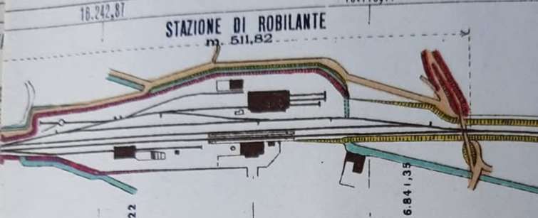
A station plan for the station at Robilante. The line is oriented Northwest to Southeast. The turntable is located at the Northwest end of the yard. The engine shed is opposite the passenger building. The goods shed was Northwest of the passenger facilities and is shown here with a single siding passing through the building. The bridge, shown in images below crosses the station throat at the Southeast end of the station site. Not shown on this early plan are five sidings added for clinker wagons from the Buzzi Unicem cement plant nearby. [47][53]

Robilante Goods Shed seem from the cab of a multiple unit. As noted above, the shed has now been demolished. [45]
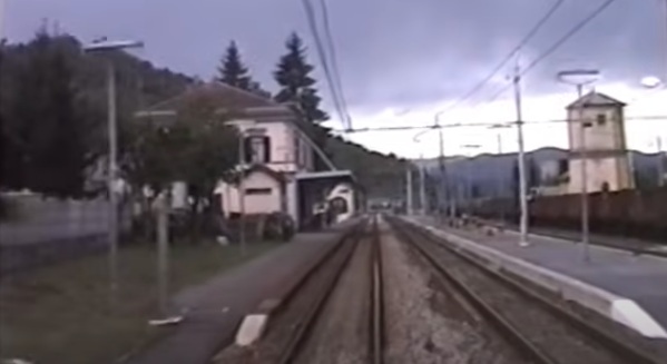
This image taken from the Southeast of the station from the cab of an approaching Cuneo service gives a broader view of the station site. [45]
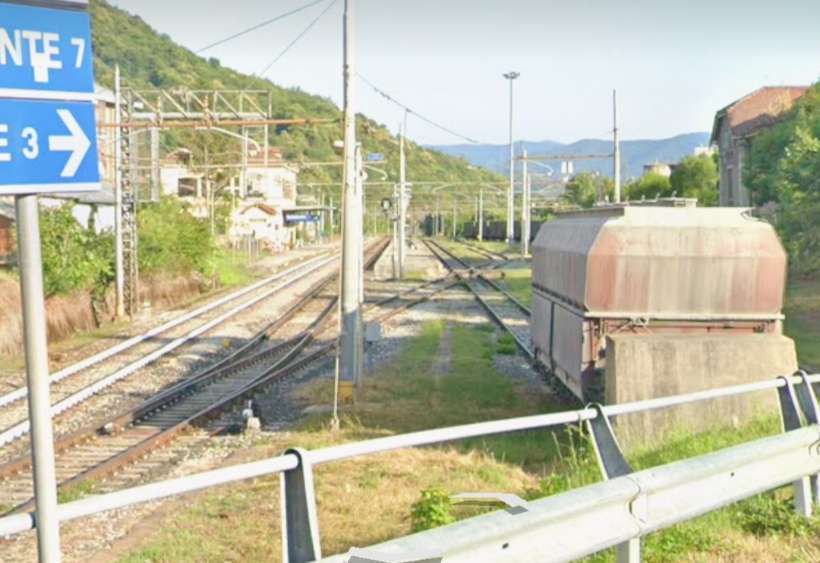
A broader view of Robilante Station taken from a road at the Southeast corner of the station site. [Google Streetview, June 2025]
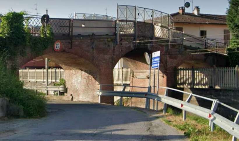
The road overbridge at the Southeast end of the station site. [Google Streetview, June 2025]
The view Northwest from the road bridge which carries Via Luigi Emina over the line. [Google Streetview, June 2025]
The view Southeast from the same road bridge. [Google Streetview, June 2025]
The bridge which carries Via Luigi Emina over the line, seen from the Southeast. [Google Streetview, June 2025]

The second phase of the construction work on the line terminated in Robilante. “The preliminary design for the third phase from Robilante to Vernante was submitted to the Ministry of Public Works on 11th January 1884, and work began the following summer. On this 6,419-meter-long section, the railway crosses the mountain with gradients of 25 mm/m.” [1: p27]
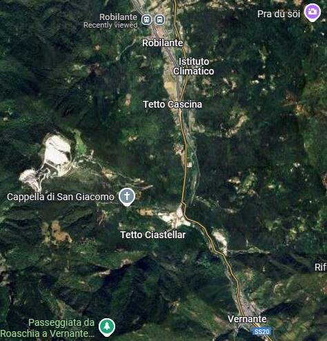
This extract from Google Maps satellite imagery shows the length of the line from Robilante to Vernante
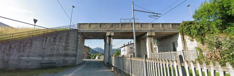
Via Ferrovieri runs immediately adjacent to the railway for some distance, passing under a road over bridge along with the railway. This view looks ahead up the Vermenaga valley. [Google Streetview, June 2025]
The same bridge seen from the Southeast. [Google Streetview, June 2025]

The two images immediately above were taken at the end of a road serving a small industrial area. The first looks Northeast, the second, Southeast. [Google Streetview, September 2023]

After passing under the SS20, the line runs alongside the road for a kilometre or so.
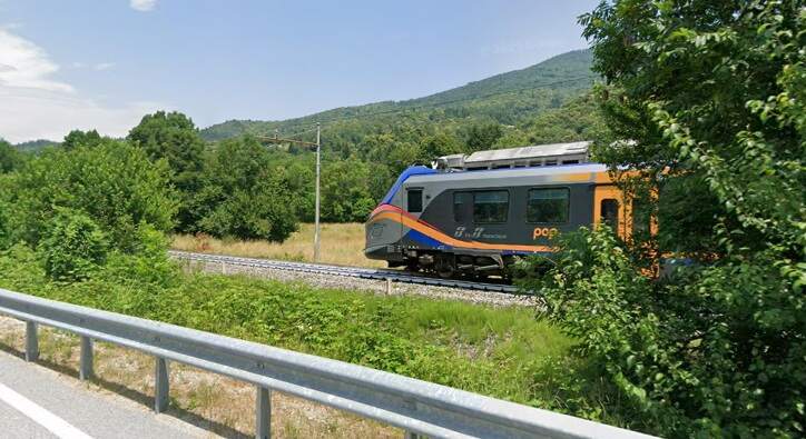
Trains can be seen passing immediately adjacent to the road. [Google Streetview, June 2025]

A short distance further South a side road from the SS20, Via Tetto Pettavino, bridges the line. The two photographs below were taken from the bridge.
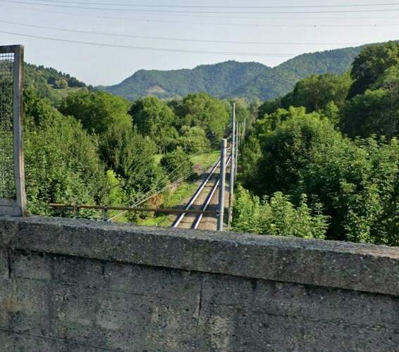
Looking North towards Robilante. [Google Streetview, June 2025]
Looking ahead along the line towards the viaduct over the River Vermenagna. [Google Streetview, June 2025]
The railway crossed the Vermenagna River by means of a viaduct of 5 arched spans – three of 21 metres flanked at each end by an 8 metre span. [Google Maps, July 2025][1: p27]

A photograph of the viaduct over the Vermenagna surrounded by trees can be found here on Flickr. [54]

Banaudo et al tell us that seven further significant structures were included in the contract which covered the line as far as Vernante [1: p27] all of which sit within approximately 3 kilometres along the line:

  • the Rio Vermanera masonry viaduct, with three 8-metre arches;
  • the Ponte Nuovo Tunnel, 425 metres long;
  • the Brunet Tunnel, 161 metres long;
  • the Corte-Soprano Tunnel, 95 metres long;
  • the San Giovanni masonry viaduct, with six arches measuring 7.90 m, three measuring 13.75 m, and one measuring 6 m;
  • the San Giovanni Tunnel, 138 metres long; and
  • the Costa Tunnel, 147 metres long. [1: p27]

The first of these – the Rio Vermanera Viaduct is pictured below.
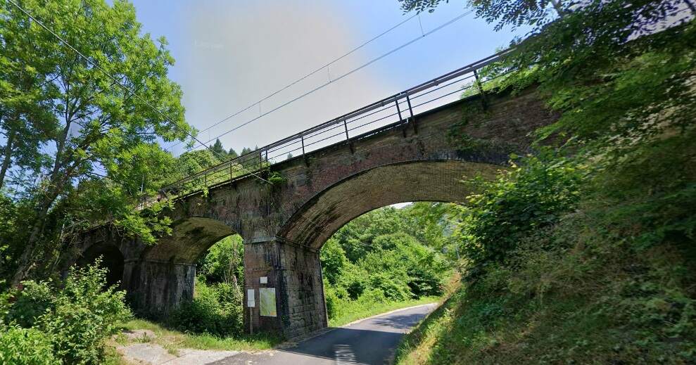
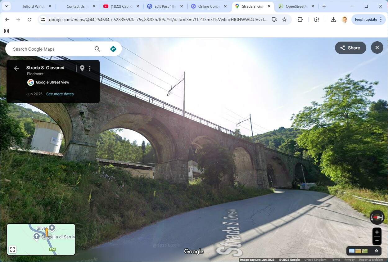
The Rio Vermanera masonry viaduct, seen from the West, one span of which crosses the Strada Vermanera, another spans the Vermaners stream. [Google Streetview, June 2025]

The same viaduct seen from the East. [Google Streetview, June 2025]
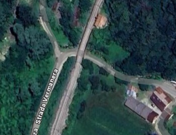
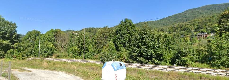
Strada Vermanera provides road access to a number of small hamlets to the East of the railway line. [Google Maps, July 2025]
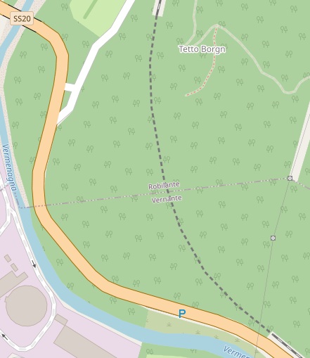
The Ponte Nuovo Tunnel: this extract from OpenStreetMap shows the tunnel curving significantly. It ran from just to the South of the Rio Vermanera Viaduct to open out immediately adjacent to the SS20/E74 but at a higher level. [55]

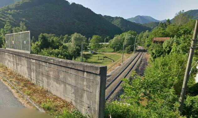
Immediately beyond the southern portal of the Ponte Nuovo Tunnel, a masonry retaining wall supports the railway above the SS20/E74.
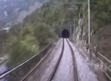
Looking back towards the South portal of the Ponte Nuevo Tunnel the parapet railings of the retaining wall can be seen on the left of this image. [45]
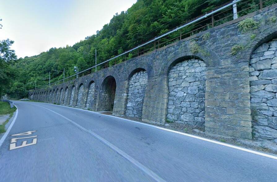
The southern portal of the Ponte Nuovo Tunnel is at the far end of this retaining wall. Immediately at the Southeast end of the retaining wall is the short Brunet Tunnel (161 metres long) [Google Streetview, June 2025]

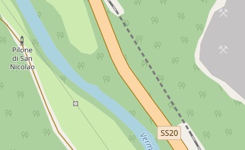
The Brunet Tunnel is shown dotted on this extract from OpenStreetMap. [56]
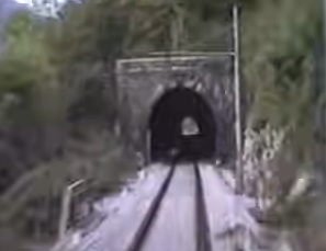
The South Portal of the Brunet Tunnel. [45]
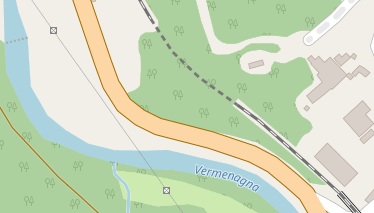
The next tunnel is only 200 metres or so along the line, the Corte-Soprano Tunnel is even shorter at only 95 metres in length. [57]
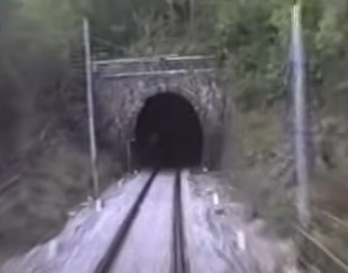
The South Portal of the Corte-Soprano Tunnel. [45]
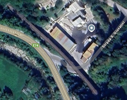
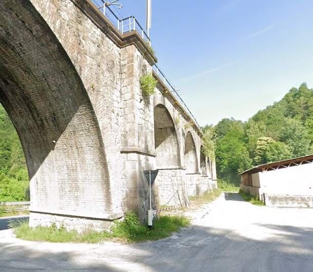
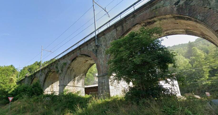
Just to the Southeast of the tunnel portal is the next structure, the San Giovanni Viaduct. masonry viaduct, with six arches measuring 7.90 metres, three measuring 13.75 metres, and one measuring 6 metres. [Google Maps, July 2025]

It is not feasible to get a photograph of the full length of the viaduct. The three images below give a good impression of its length and height.
Two further short tunnels, the San Giovanni Tunnel (138 metres long) and the Costa Tunnel (147 metres long) follow in the next few hundred metres.
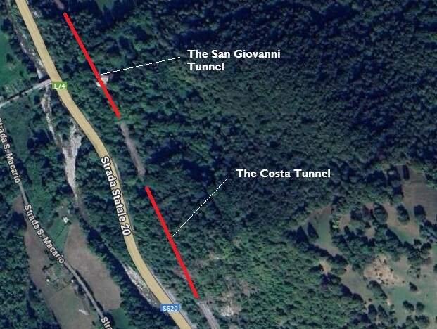
The two tunnels are only separated by a short length of the line. [Google Maps, July 2025]

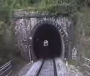
The South portal of the San Giovanni Tunnel. [45]
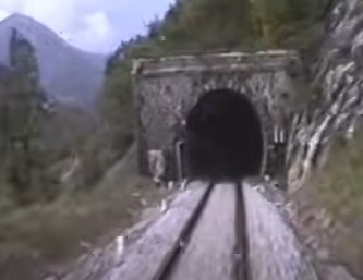
The South portal of the Costa Tunnel. [45]

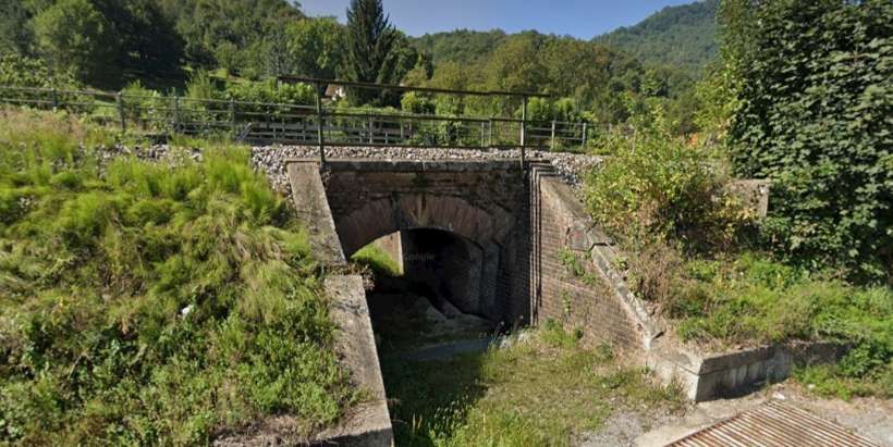
The railway continues to climb higher on the eastern slope of the Vermenagna Valley and reaches Vernante, about 23 km from Cuneo.
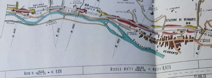
Another of the plans and profiles that we encountered earlier in this article. This one shows the final approaches to Vernante Railway Station. Some of the structures described above can be seen on this plan. [47]

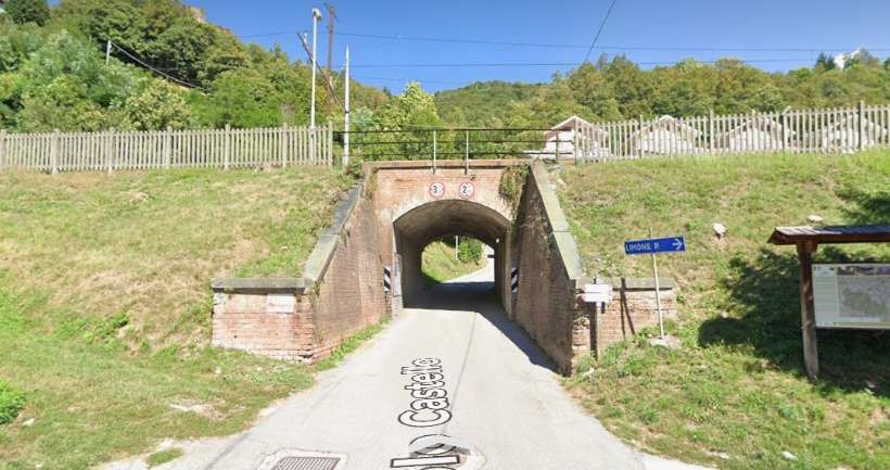
On the final approaches to Vernante Railway Station two further structures can be seen on the plan above. They carry the line over minor roads. The first spans Via La Tina, the second spans Vicolo Castello/Strada da Castello.
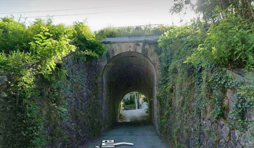
Looking East through the underpass which takes Via La Tina under the railway. [Google Streetview, June 2025]
Looking East through the structure that carries the railway over Strada da Castello. [Google Streetview, June 2025]

Vernante Railway Station was the end of the third tranche of works on the railway. Vernante is “a busy centre of livestock breeding and craftsmanship where renowned knives are produced.  Vernante station … has two platform faces with a passing loop, … [a goods shed] and platform for goods traffic, a 5.50 m turntable and a curious installation, unique on the line, the “binario di salvamento”. This is a counter-slope safety [line which leaves the main running line close to the station throat] on the Limone side. The switch is permanently positioned to provide access to the safety line, so that any vehicle drifting down the 26 mm/m gradient south of the station can enter it, be slowed down by the opposite gradient and then come to a stop. Each descending train must stop before the switch, so that it can be maneuvered on site to allow normal entry into the station. This simple but effective precautionary measure applies to other steep-gradient lines on the Italian network, in the Alps and the Apennines.” [1: p27]
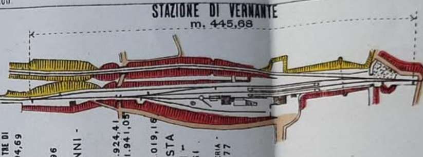
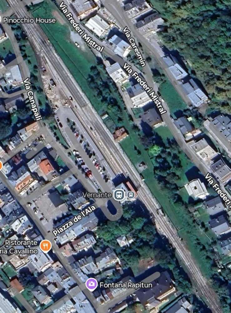
A plan of Vernante Railway Station. [47]
Vernante Railway Station. [Google Streetview, July 2025]
The view Southeast from the station car park, after demolition of the old goods shed. The main station building features at the centre of the image. [Google Streetview, June 2025]
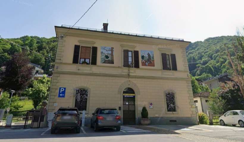
The main station building at Vernante seen from the West. [Google Streetview, June 2025]

Photographs showing the station building and the goods shed prior to its demolition can be seen here. [58] “Inaugurated in 1889, the station served as the terminus for the Cuneo-Ventimiglia line for nearly two years, until it was extended to Limone Piemonte. The passenger building features classic Italian architecture, with two levels. It is square, medium-sized, and well-maintained. Its distinctive feature is the two murals depicting scenes from the Pinocchio fairy tale, adorning its façade. The lower level houses the waiting room and self-service ticket machine, while the upper level is closed.” [58]
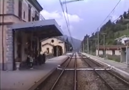
A photograph from the cab of a Cuneo-bound train arriving at Vernante. The passenger building is on the left with the goods shed beyond. [45]

While construction work was underway on the first three tranches (Cuneo to Vernante), the Italian rail network was undergoing a major reorganization. The Law passed on 27th April 1885, placed control of the railways into the hands of “the new Società per le Strade Ferrate del Mediterraneo, more commonly known as Rete Mediterranea (RM), … including the route ‘from Cuneo to the sea’.” [1: p28]

In 1887, the time had come for the first trains! “The Cuneo-Robilante section was inaugurated on Saturday, 16th July 1887, and opened for service on Monday 18th. Less than two weeks later, Francesco Crispi became President of the Council of Ministers, and relations between Italy and France would soon be strengthened. Then came the beginning of the future Cuneo-Mondovi line, which opened on 2nd October 1887, as far as Roccadebaldi. The Roccadebaldi and Robilante lines thus formed a common section for 359 meters, starting from Cuneo [Gesso] station and crossing the Gesso River on the same viaduct. … Two years later, the Robilante-Vernante section was … opened on 1st September 1889.” [1: p28]

As footnotes to this article we note that:

  • Banaudo et al comment: “construction of the Ceva Ormea branch line began in the upper Tanaro Valley. With a terminus about 30 km from Vernante or 25 km from Tenda and Briga, this line would play an important role in the battle of interests that would unfold in the final years of the century to confirm a definitive route to the sea.” [1: p28]
  • They also give details of the locomotives used on the line in these very early years, by Rete Mediterranea (RM). The locomotives were 030s (in the UK 0-6-0s) with tenders and came from the roster of the Turin depot and loaned to the Cuneo-Gesso Locomotive depot. They belonged to just one series: “Nos. 3201 to 3519 RM, which became group 215.001 to 398 at the FS. [The series was built] between 1864 and 1892 based on a model derived from the French “Bourbonnais” locomotives of the PLM. These 450 hp engines were equipped with saturated steam, single expansion, and Stephenson internal distribution.  The [later] Cuneo depot, established in 1907, still had five type 215 locomotives in 1922, mainly operating service trains.” [1: p86] It is also worth noting that some of the locos used on the line after 1899 came from a second series of locomotives (“Nos. 3801 to 3869 RM, later 3101 to 3169, then group 310.001 to 069 at the FS, built from 1894 to 1901 [1: p86]). While these locomotives were old enough to have served in the period from 1887 to 1891, they only arrived on the line during 1901. … I anticipate there being a separate article about motive power on the line in due course.
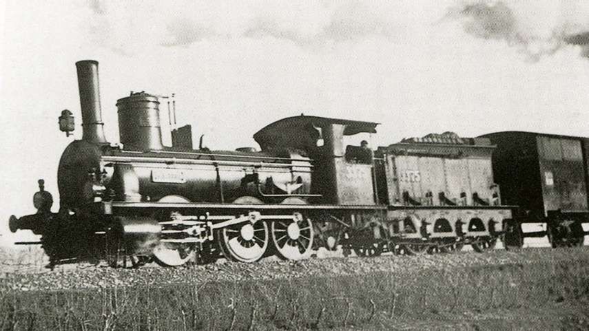
0-6-0 RM Locomotive No. 3375 Pracchia, with three driven axles and a tender, built in 1883 by Vulcan of Stettin. In 1905, it joined the FS fleet as Class 215, known as a Bourbonnais, along with 400 other locomotives with similar characteristics. It ended its career with the Porretta in 1927, © Public Domain. [59][60][1: p87]

We finish this first part of the journey from Cuneo to the sea at Vernante. The next article about the line will begin at Vernante and head South towards Limone and Vievola. It can be found here. [61]

References

  1. Jose Banaudo, Michel Braun and Gerard de Santos; Les Trains du Col de Tende Volume 1: 1858-1928; FACS Patrimoine Ferroviaire, Les Editions du Cabri, 2018.
  2. Jose Banaudo, Michel Braun and Gerard de Santos; Les Trains du Col de Tende Volume 2: 1929-1974; FACS Patrimoine Ferroviaire, Les Editions du Cabri, 2018.
  3. Jose Banaudo, Michel Braun and Gerard de Santos; Les Trains du Col de Tende Volume 3: 1975-1986; FACS Patrimoine Ferroviaire, Les Editions du Cabri, 2018.
  4. https://m.facebook.com/story.php?story_fbid=pfbid0eumWUFwJCPBGQUUtr3Apx72qr5cUhihwxpcFzDbkms3fta5zRXYZZLUozkAMmeKvl&id=1412933345657144, accessed on 5th December 2023. The Facebook Page, “L’Histoire de Menton et ses Alentours,” is the work of Frank Asfaux, https://www.facebook.com/franckasfaux06, accessed on 4th December 2023.
  5. https://m.facebook.com/groups/ciccoli/permalink/1711973335715195, accessed on 15th December 2023.
  6. https://m.facebook.com/groups/ciccoli/permalink/2989582914620891, accessed on 15th December 2023.
  7. https://www.cparama.com/forum/viewtopic.php?f=11&t=14570, accessed on 21st December 2023.
  8. https://en.m.wikipedia.org/wiki/Fr%C3%A9jus_Rail_Tunnel, accessed on 13th July 2025.
  9. The locomotive developed by the Scottish engineer Robert Francis Fairlie (1831-1885) from 1869 on the Ffestiniog narrow gauge railway in Wales, had two boilers connected by a single central firebox. Each boiler supplies steam to a pair of cylinders driving an independent group of axles. This system was developed in France from 1888 by artillery captain Prosper Péchot (1849-1928) and engineer Charles Bourdon (1847-1933), creators of an articulated narrow gauge locomotive widely used by the French army.” [1: p21]
  10. Séraphin Piccon; Etude Comparative de Deux Lignes de Chemin de Fer Entre Nice et Coni; 1872.
  11. The Fell System which created “additional adhesion using a raised central rail, patented by British engineer John Barraclough Fell (1815-1902), was first applied in the Alps in 1868 on the railway running along the Mont Cenis route between St. Michel-de-Maurienne and Susa, pending the completion of the Fréjus Tunnel in 1871.” [1: p21]
  12. A. Cachiardy de Montfleury; Chemin de Fer de Nice a Coni; Imprimerie Cauvan, Nice, 1872.
  13. Marius de Vautheleret; Chemin de Fer Cuneo Ventimiglia – Nice Traversant le Col de Tende; Editions Giletta, Nice, 1874.
  14. Marius de Vautheleret; Chemin de Fer Cuneo – Nice par Ventimiglia et le Col de Tende; Kugelmann, Paris, 1883; Trajet direct de Londres à Brindisi par le Col de Tende; Kugelmann, Paris, 1884; Ligne directe Londres – Brindisi par le Col de Tende; Retaux, Abbeville, 1890; Le Grand Saint-Bernard et le Col de Tende Ligne Ferrée Directe de Londres à Brindisi avec Jonction à la Méditerranée; Malvano & Mignon, Nice, 1897.
  15. https://www.facebook.com/share/p/1CzKYeoPoV, accessed on 17th July 2025.
  16. https://trainconsultant.com/2020/10/09/nice-coni-incroyable-derniere-nee-des-grandes-lignes-internationales, accessed on 17th July 2025.
  17. https://cartorum.fr/carte-postale/466792/tende-col-de-tende-le-porte-frontiere, accessed on 17th July 2025.
  18. https://commons.m.wikimedia.org/wiki/File:Stazione_di_Cuneo_(2).jpg, accessed on 18th July 2025.
  19. https://www.facebook.com/share/1CP5xtb7Yx, accessed on 18th July 2025.
  20. https://www.facebook.com/share/p/17SDzaUV5x, accessed on 18th July 2025.
  21. https://www.facebook.com/share/p/1FsN8Vdact, accessed on 19th July 2025.
  22. https://it.m.wikipedia.org/wiki/Stazione_di_Cuneo_Gesso#/media/File%3AStazione_di_CuneoGesso.png, accessed on 19th July 2025.
  23. Stefano Garzaro & Nico Molino; La Ferrovia Di Tends Da Cuneoba Nizza, L’ultima Grande Traversata Alpina, Colleferro (RM); E.S.T. – Editrice di Storia dei Trasporti, Luglio, 1982, (Italian text)
  24. Ferrovie dello Stato; Circolare Compartimentale del Compartimento di Torino 54/1937, (Italian text).
  25. https://it.m.wikipedia.org/wiki/Stazione_di_Cuneo_Gesso, accessed on 19th July 2025. (Italian text translated into English by Google Translate)
  26. Franco Collidà, Max Gallo & Aldo A. Mola; Cuneo-Nizza: Storia di una ferrovia, Cuneo (CN); Cassa di Risparmio di Cuneo, Luglio, 1982, (Italian text).
  27. The locomotive depot area, left vacant after the opening of the new Cuneo station, was later reused by a sawmill connected by a siding to the Gesso station. [25]
  28. https://it.m.wikipedia.org/wiki/Tranvia_Cuneo-Dronero, accessed on 19th July 2025.
  29. https://it.m.wikipedia.org/wiki/Tranvia_Saluzzo-Cuneo, accessed on 19th July 2025.
  30. https://it.m.wikipedia.org/wiki/Tranvia_Cuneo-Boves, accessed on 19th July 2025.
  31. Nico Molino; Il trenino di Saluzzo. Storia della Compagnia Generale Tramways Piemontesi; Immagini e Parole, Torino, 1981, (Italian text)
  32. https://it.wikipedia.org/wiki/Ferrovia_Cuneo-Boves-Borgo_San_Dalmazzo#/media/File:Cuneo-Borgo_San_Dalmazzo_map.JPG, accessed on 19th July 2025.
  33. https://it.wikipedia.org/wiki/Stazione_di_Boves#/maplink/1, accessed on 19th July 2025.
  34. https://it.wikipedia.org/wiki/Ferrovia_Cuneo-Boves-Borgo_San_Dalmazzo, accessed on 19th July 2025.
  35. https://airascasaluzzocuneo.jimdofree.com/le-altre-ferrovie-cuneesi-dismesse/cuneo-gesso-borgo-s-dalmazzo, accessed on 19th July 2025.
  36. https://www.facebook.com/share/p/15Te6MP6HJ, accessed on 19th July 2025.
  37. https://www.facebook.com/share/p/1Fu9bkbK6Z, accessed on 19th July 2025.
  38. https://www.openstreetmap.org/#map=16/44.38723/7.53585&layers=, accessed on 19th July 2025.
  39. https://www.openstreetmap.org/#map=16/44.37623/7.52866&layers=P, accessed on 19th July 2025.
  40. https://www.openstreetmap.org/#map=16/44.36284/7.52769&layers=P, accessed on 19th July 2025.
  41. https://www.openstreetmap.org/#map=16/44.35447/7.52108&layers=P, accessed on 19th July 2025
  42. https://www.openstreetmap.org/#map=16/44.34602/7.51279&layers=P, accessed on 19th July 2025.
  43. https://www.openstreetmap.org/#map=16/44.33788/7.50627&layers=P, accessed on 19th July 2025.
  44. https://www.openstreetmap.org/#map=16/44.33366/7.50016&layers=P, accessed on 19th July 2025.
  45. https://youtu.be/2Xq7_b4MfmU?si=1sOymKkFjSpxMkcR, accessed on 20th July 2025.
  46. https://commons.wikimedia.org/wiki/File:Borgo_san_dalmazzo_stazione_ferroviaria.jpg, accessed on 20th July 2025.
  47. https://www.facebook.com/share/p/1A6hv4xBsJ, accessed on 20th July 2025.
  48. https://itoldya420.getarchive.net/amp/topics/cuneo+demonte+tramway, accessed on 20th July 2025.
  49. https://it.m.wikipedia.org/wiki/Campo_di_concentramento_di_Borgo_San_Dalmazzo, accessed on 20th July 2025.
  50. https://it.m.wikipedia.org/wiki/Stazione_di_Borgo_San_Dalmazzo, accessed on 20th July 2025.
  51. https://web.archive.org/web/20201006185244/http://comune.borgosandalmazzo.cn.it/citta/monumenti.html, accessed on 20th July 2025.
  52. https://www.facebook.com/share/p/19QHky9Nw2, accessed on 20th July 2025.
  53. https://it.m.wikipedia.org/wiki/Stazione_di_Robilante, accessed on 21st July 2025.
  54. https://flic.kr/p/Yqh8NC, accessed on 21st July 2025.
  55. https://www.openstreetmap.org/#map=17/44.261563/7.519197, accessed on 21st July 2025.
  56. https://www.openstreetmap.org/#map=17/44.257276/7.523800, accessed on 21st July 2025.
  57. https://www.openstreetmap.org/#map=17/44.255493/7.525206, accessed on 21st July 2025.
  58. https://www.stazionidelmondo.it/files/old_website/vernantestazione.htm, accessed on 22nd July 2025.
  59. https://www.rmweb.co.uk/forums/topic/151308-%E2%80%9Cbeyond-dover%E2%80%9D/page/2, accessed on 22nd July 2025.
  60. https://www.fotocommunity.it/photo/locomotiva-3375-rete-mediterrane-roberto-prioreschi/35312169, accessed on 22nd July 2025.
  61. https://rogerfarnworth.com/2025/07/26/the-railway-from-nice-to-tende-and-cuneo-part-2
  62. https://www.facebook.com/share/p/19U2VzU6gT, accessed on 8th August 2025.
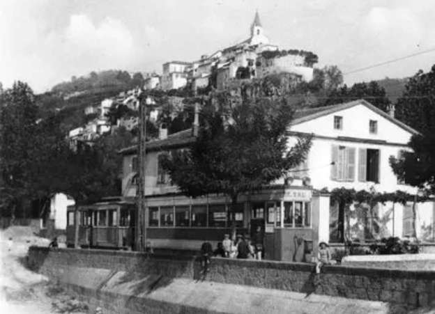
The Tramways of Nice:- Les Lignes de l’Arriere-Pays (The Lines of the Hinterland) Part 1 – First Generation Electric Tramways to Contes, Bendejun and La Grave de Peille, and a planned line to l’Escarene – (Chemins de Fer de Provence/Alpes-Maritimes No. 95)

This article looks at two tramway routes which were built. The first ran from Nice to Bendejun via Pont de Peille and Contes. The second branched of the first at Pont de Peille and ran to along the valley of the Paillon de Peille to La Grave de Peille. It also covers a proposed tramway to l’Escarene which was not constructed.

Nice to Contes and Bendejun

This line was approximately 18.6 km long. The first part of the route (from Nice Place Garibaldi as far as La Trinite Victor) ran along the same rails as the urban service – a length of around 6.5km.Just over 9 km of line (which was deemed to be part of the coastal (littoral) network) brought trams to Contes. The final length of the line was regarded as part of the TNLs ‘departemental’ network and took trams to the terminus at Bendejun.

Only approximately 0.5 km of the line and (as far as Contes) was on the level. The remainder of the line was set at varying gradients with the steepest being 55mm/m. The line rose from 12 metres above sea-level at Place Garibaldi to 189 metres above sea-level at Contes, and 260 metres above sea-level at Bendejun.

The following notes on the significant dates associated with the line are gleaned from Jose Banaudo’s book. [1: p70] …

The line from Garibaldi to Abbatoirs opened to the public on 21st February 1900. On 2nd June of the same year, the line opened from Abbatoirs to Contes. Goods were carried on this section of the line from 1st October 1900.

It was not until 1st February 1909 that passengers could travel between Contes and Bendejun and no goods were carried along that length of the line until 1st January 1911.

After just over a year, in February 1912, subsidence closed the length of the line between Contes and Bendejun. The line opened again in March. During the winter of 1916-1917, the line was closed by snow and landslides.

On 1st January 1923 tram services were given new numbers: Nice to La Trinite or Drap became No. 26; Nice to Contes or Bendejun, No. 27.

Sadly, after further problems with landslides, the line between Contes and Bendejun was permanently closed from 18th November 1926.

On 8th October 1934 renumbering led to the line to La Trinite being numbered 36 and the Nice to Contes service, 37.

A landslide affected the line between the cement works and Contes. It was closed from November 1934 to March 1935.

Late in 1935, the Nice terminus of these services was moved from Place Garibaldi to Rue Geoffredo.

After damage to the electricity substation adjacent to Pont-de-Peille on 12th February 1938, the passenger service from Drap to Contes was curtailed and the No. 37 service was replaced by buses. 

There was opposition to the bus service being provided by a single company. This saw a reopening of the tram service on Ligne 37 on 15th March 1938. There followed a period between 3rd August 1938 and December 1944 when tramway services were interrupted relatively frequently for a variety of reasons which included damage during WW2.

On 23rd December 1944 the tram service resumed from Nice to Pont-de-Peille with a bus service covering the remainder of the route to the North.

On 17th January 1945, goods transport between Contes and Nice resumed and, on 20th January 1945, passenger trams returned to Contes.

In the winter of 1948-1949 bad weather saw the interruption of services North of La Pointe de Contes.

January 1950 saw the closure of the line to passenger services with buses used to replace that service on a permanent basis. In May 1950, the goods service was also closed permanently.

The line to Bendejun followed the left bank of the River Paillon between the centre of Nice and its terminus in Bendejun. Its terminus in Nice was at the Northwest corner of Place Garibaldi, where a wooden kiosk served as its station building. It used the same tracks as the urban services through Abattoirs to La Trinité-Victor.

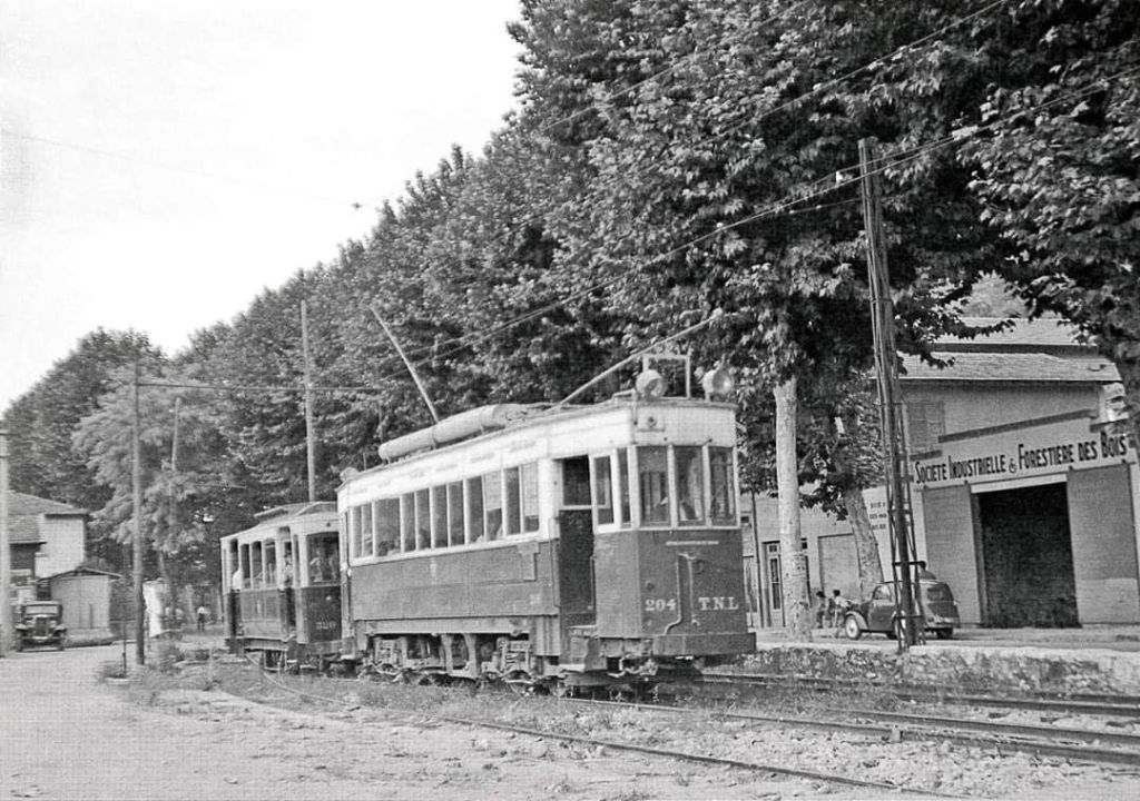
L’Octroi de Turin at Contes was the terminus of Ligne 37 – Thomson-Houston tram No. 204 from l’Octroi sits at the tram stops at Pont Michel in 1949, © P. Laurent from the private collection of Jean-Paul Bascoul. This image was shared by Jean-Paul Bascoul on the Comte de Nice et son Histoire Facebook Group on 10th December 2021. Jean Claude Lehoux commented as follows: This route together with the line to La Grave de Peille were the last TNL non-urban lines to be converted to bus operation. Apparently, before WW2 the line was already predominantly served by buses. During the War, the trams returned but ceased passenger operations in 1947 (La Grave de Peille) and 1949/50 (Contes). The line to Contes, despite still having significant freight traffic, seems to have been completely abandoned around 1951. A similar picture, featuring trams No. 104 and No. 212, taken at the present day Post Michel appears in José Banaudo’s book. In that image, No. 104, heading for La Trinité crosses paths with No. 212 coming from Contes à l’Ancien-Octroi-de-Turin. Banaudo says that at the boundary of Nice, close to the current “Michel Bridge”, this stop had three tracks to facilitate the crossing between urban services, those serving the Paillon valleys and goods convoys. [1: p67]

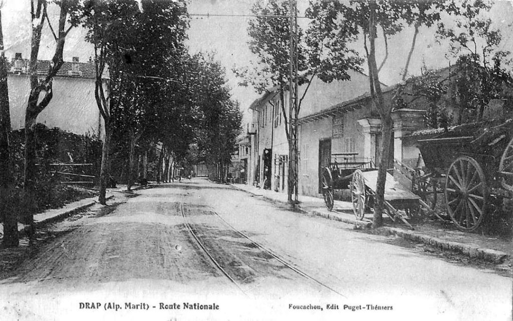
For a short distance trams ran on the verge of Route Nationale No. 204. Stops at Roma and Random (which had a passing loop) were followed by the stop in the village of Drap which was adjacent to the bridge to Cantaron.

The Route Nationale in Drap. Tram tracks can be seen in the centre of the road. This old postcard view was shared on the Comte de Nice et son Histoire Facebook Group by Alain Nissim on 18th May 2022. [4]
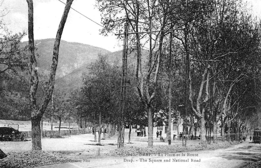
Drap again, this image shows La Place des Ecoles and the Route Nationale. A tram can be seen on the road at the extreme right of the picture. This old postcard view was shared on the Comte de Nice et son Histoire Facebook Group by Alain Nissim on 18th May 2022. [4]
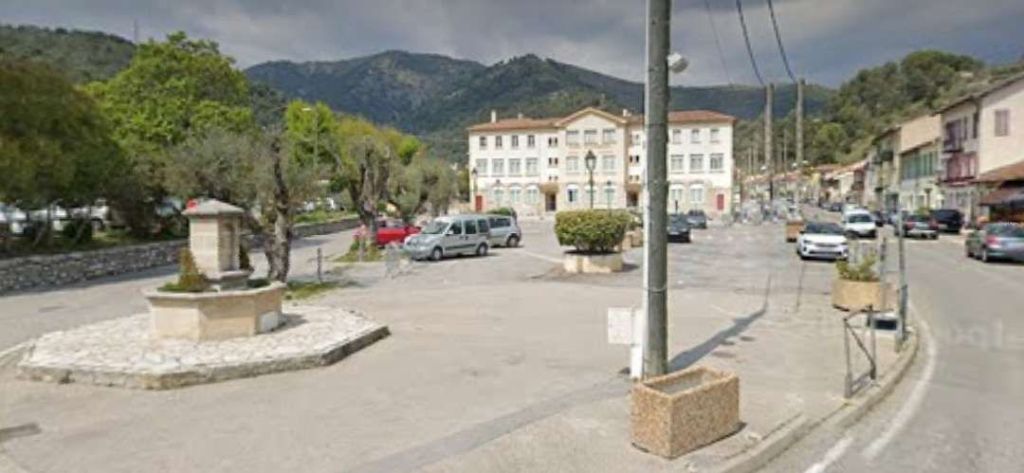
La Place des Ecoles viewed from almost the same location as in the monochrome postcard image above. In the 21st century the Plane trees have gone and cars have taken over from the park that made up much of the square. [Google Streetview, November 2022]
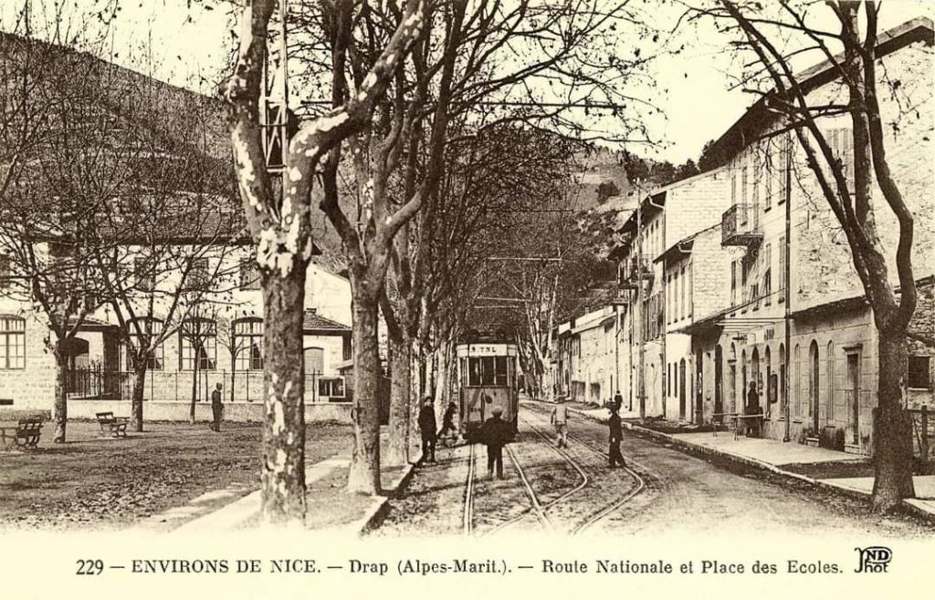
Turning just a little to the right and wandering a little further along the Route Nationale, this image shows the passing loop at the tram stop in Drap. It was shared on the Comte de Nice et son Histoire Facebook Group by Jean-Paul Bascoul on 22nd February 2019, and comes from his private collection. [5] The same photograph appears in José Banaudo’s book. [1: p68]
Approximately the same location as seen in the 21st century. The school on the left has seen its roof raised by the addition of another floor. [Google Streetview, November 2022]

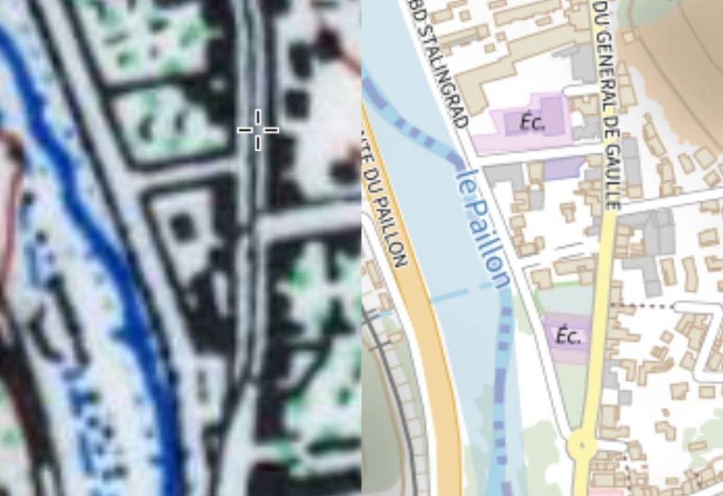
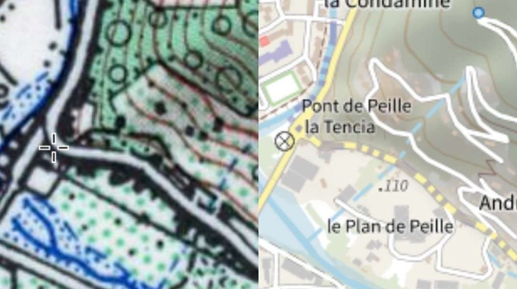
It appears that as late as 1955, the tram track was visible in the road surface in the centre of Drap. The two parallel images from the IGN website show it present on Avenue de General de Gaulle when the map on the left was surveyed in 1955.

The Place des Ecoles in the centre of Drap. The ‘cross’ on the older map on the left is superimposed over the line of the tramway which was in the centre of the road. [11]
A little further North the tramway can be seen leaving the centre of the road in the 1955 map extract. Presumably it ran along the verge between the road and the River Paillon. It might already have been lifted by 1955. The map is of little help with establishing its presence immediately North of this location. [12]

Leaving the centre of Drap, trams then passed under the PLM line between Nice and Cuneo for the third time at Pont des Vernes which also spanned the River Paillon. Trams ran between the river and the road.

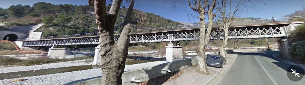
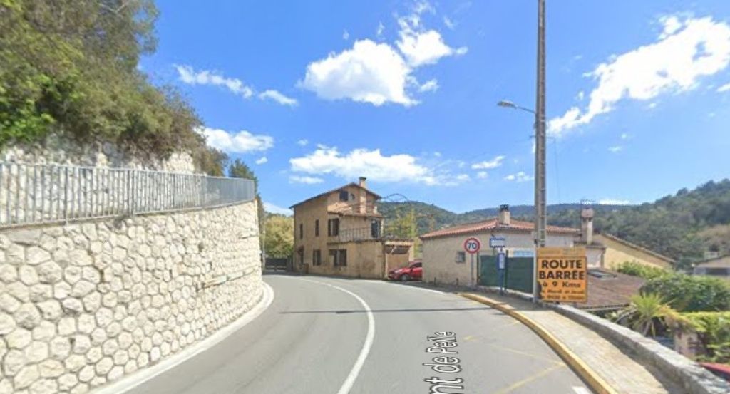
Pont des Vernes in the 21st century. What was the old Route Nationale still passes under the most Easterly span of the truss girder viaduct which also spans the River Paillon. [Google Streetview, 2011]

The confluence of two arms of the River Paillon lay shortly beyond the railway bridge (Paillon de Contes and Paillon de L’Escarène). The Paillon de L’Escarène flowed in from the Southeast from the heights of Peillon, L’Escarène and Lucéram. It was spanned by a five-arched viaduct, some 140 metres in length which carried both the Route Nationale and the tramway. The construction of the bridge was started in the last years of the 18th century. While the bridge may well have been completed within a few years, the construction of the road of which it was a part, between Turin and Nice, was interrupted by conflict and was not completed until 1838. [1: p67]

A postcard view from the Southwest looking towards Pont de Peillon. The old road bridge (and its five arches) sits at the centre of the view. [7]
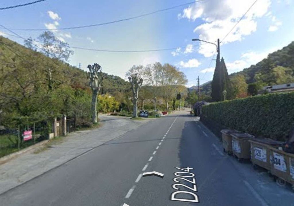
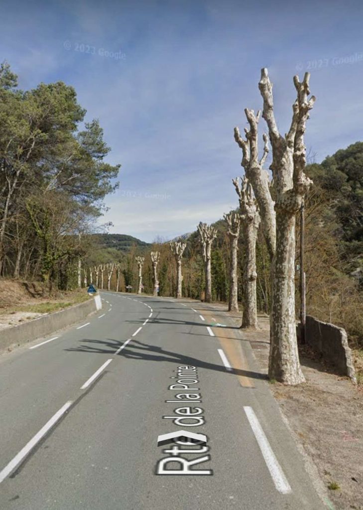
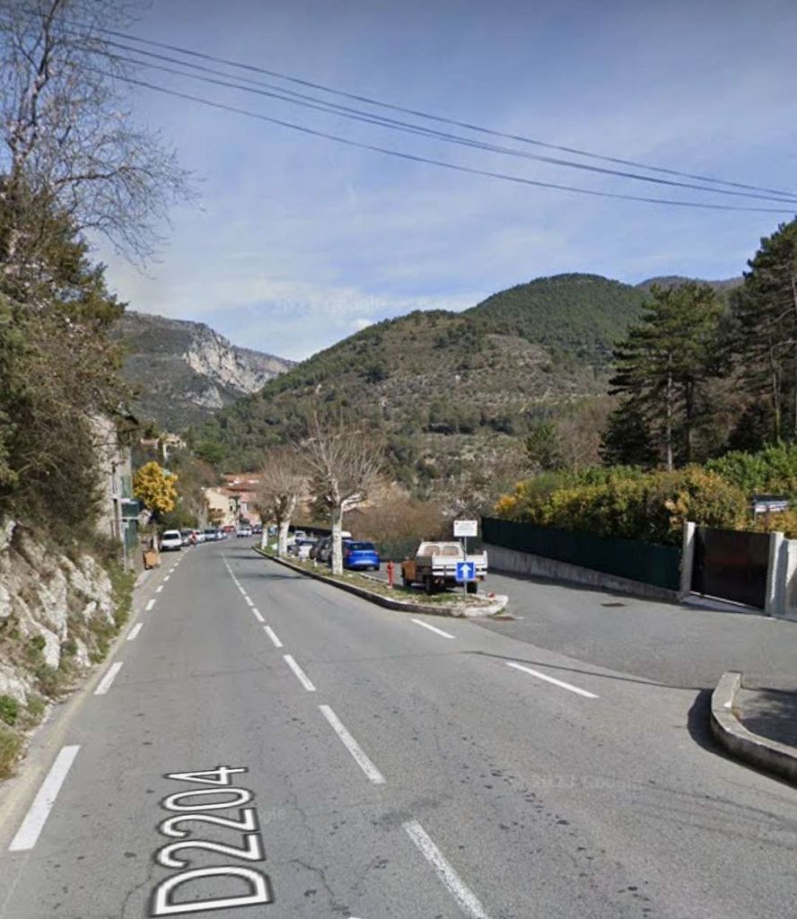
A modern view looking Northeast along the D2204 where it crosses the Paillon de L’Escarene. [Google Streetview, April 2023]
The same bridge, viewed from Chemin du Fontanil de Croves to the Southeast of the bridge. [Google Streetview, May 2019]
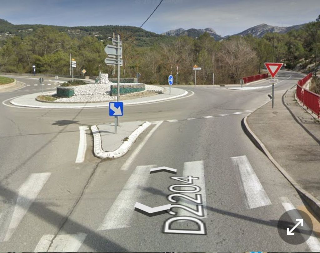
This next extract from the parallel imagery provided by the IGN shows the tramway returning to the centre of the Route National as it crossed the bridge in 1955. It might be inferred from this that from Drap to this point it was still present on the West side of the highway. Again, however, the map extracts cannot be seen as conclusive proof of this. At the centre-top of the 1955 map extract the tramway appears to leave the road carriageway for a short distance for a tram stop and passing loop, which is mentioned in the text below. However Jose Banaudo has a photograph of the location in his book which seems to show the tramway remaining in the carriageway with an electricity substation just beyond it. [1: p69] There is now a roundabout at the junction between the road to Contes/Bendejun and the road East to La-Grave-de-Peille. [13]

Trams faced gradients on either side of the central arch of the bridge – 41mm/m and 34mm/m. Very soon after crossing the bridge in a northbound direction, trams encountered the stop at Pont-de-Peille, “where an electrical substation was located and from which the La-Grave-de-Peille line branched off to the east.” [1: p67]

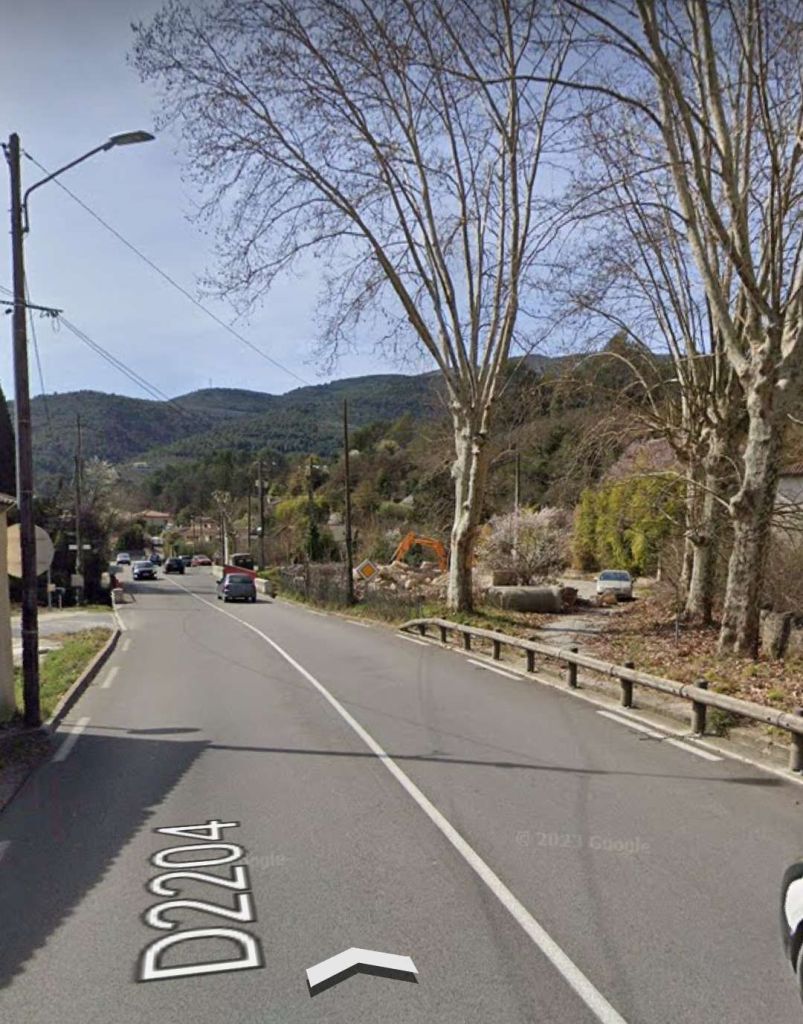
A 21st century view North from the bridge. [Google Streetview, April 2023]
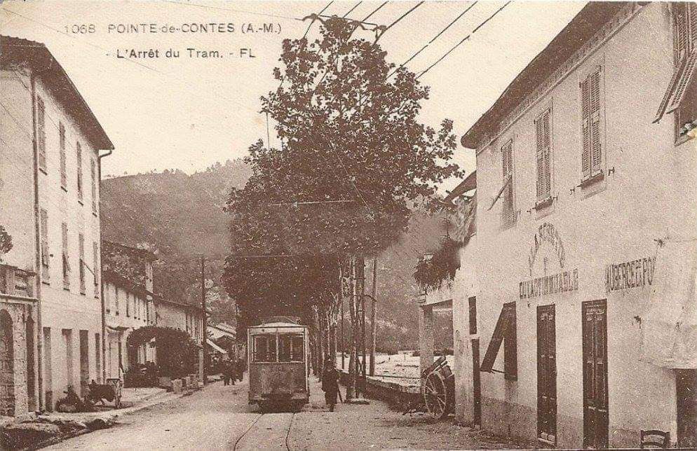
The hamlet of La Pointe-de-Contes was beyond the North end of the bridge over the Paillon de L’Escarene. [3]

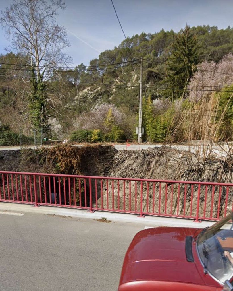
Beyond the hamlet of La Pointe-de-Contes, the line crossed the Ruisseau de la Garde (a tributary to Le Paillon de Contes) on a single-span bridge.

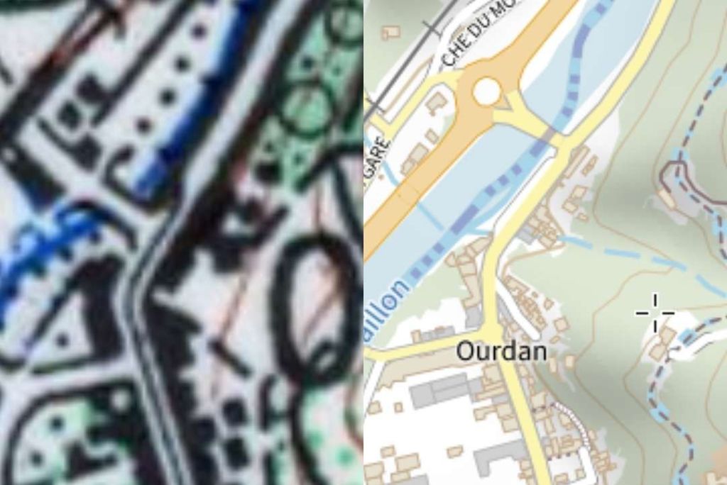
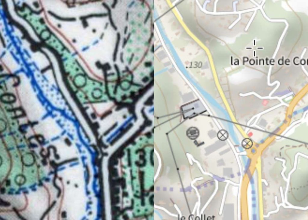
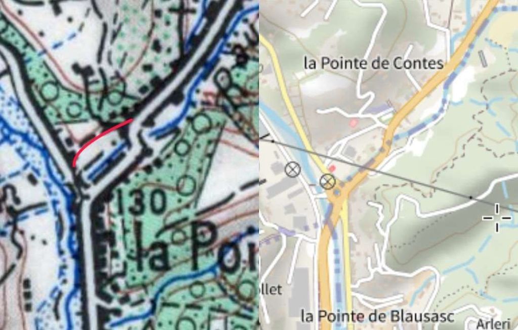
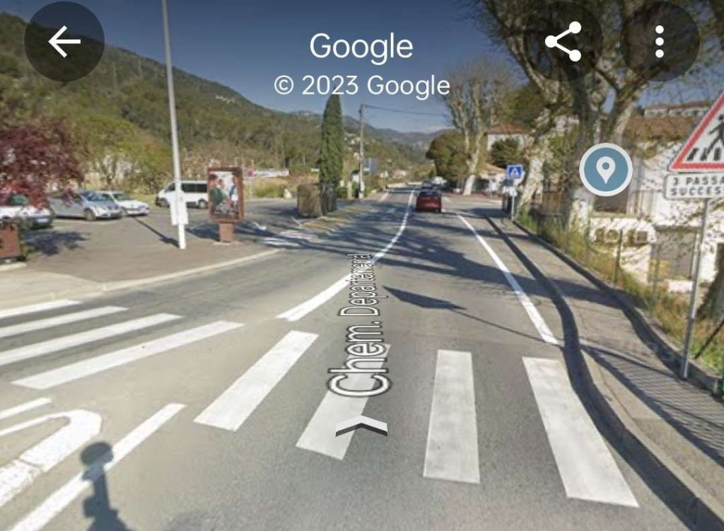
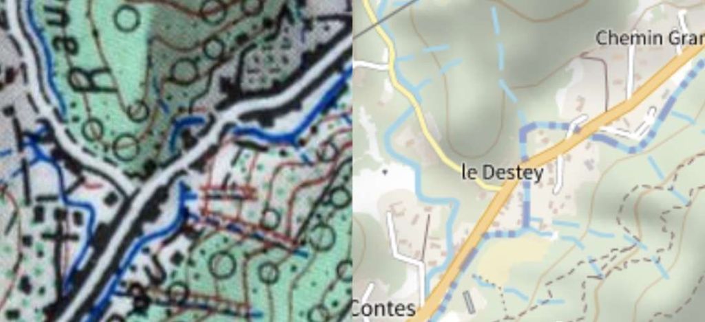
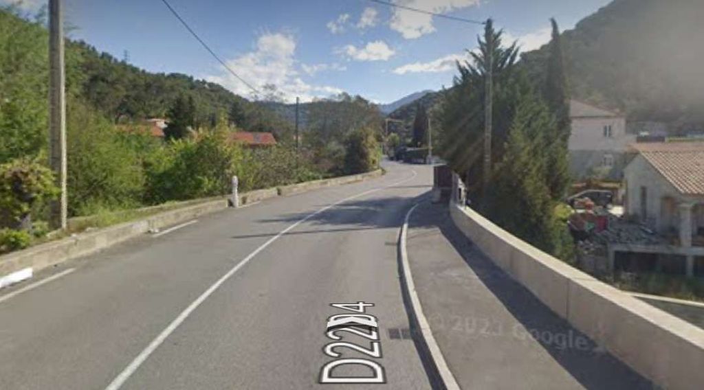
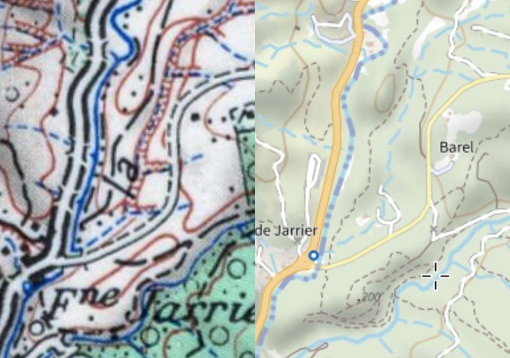
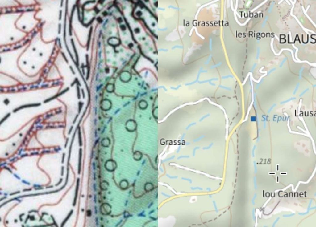
This next extract from the parallel mapping of the IGN shows the highway bridge over the Ruisseau de la Garde. The bridge sits in the bottom half of the two map extracts. The 1955 mapping appears to show tram tracks over the bridge at the centre line of the road. To the South of the bridge, it seems that the tramway was on the West verge of the road. North of the bridge it appears to switch to the East side verge of the carriageway. Only a short distance further North the tramway appears to cross back to the West side of the road. Road realignments in this area have resulted in a roundabout at the location of the old bridge. [14]
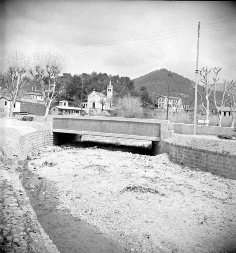
The bridge over the Ruisseau de la Garde at La Pointe de Contes in 1953. The image was shared by Pierre Richert in the Comte de Nice et son Histoire Facebook Group on 31st October 2017 [15]
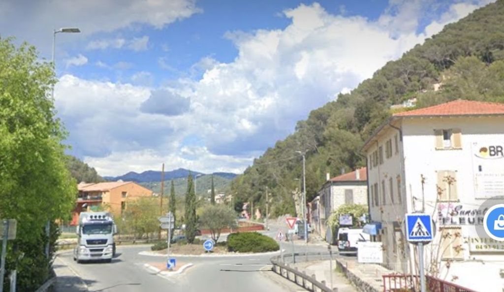
A similar view in the 21st century. [Google Streetview, April 2023.

Banaudo says that the road junction adjacent to the bridge was the point at which the L’Escarene tram line would have branched off the line to Contes. Work on that line wasn’t completed. [1: p67]

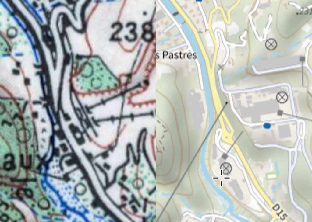
From this bridge, the line to Contes and Bendejun followed RN15 (now D15) North past the Lafarge lime and cement factory.  “This, which was the main reason for the line’s existence, was served by two branches allowing the reception of fuel and the shipment of its products to Nice and its port.” [1: p67]

The location of the Lafarge factory. The 1955 map seems to show the tramway on the West side of the road. There also appear to be at least two sidings on the East side of the road. [15]
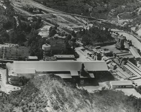
An aerial image of the Lafarge Cement Works at Contes. The River Paillon de Contes is in the background. [10]

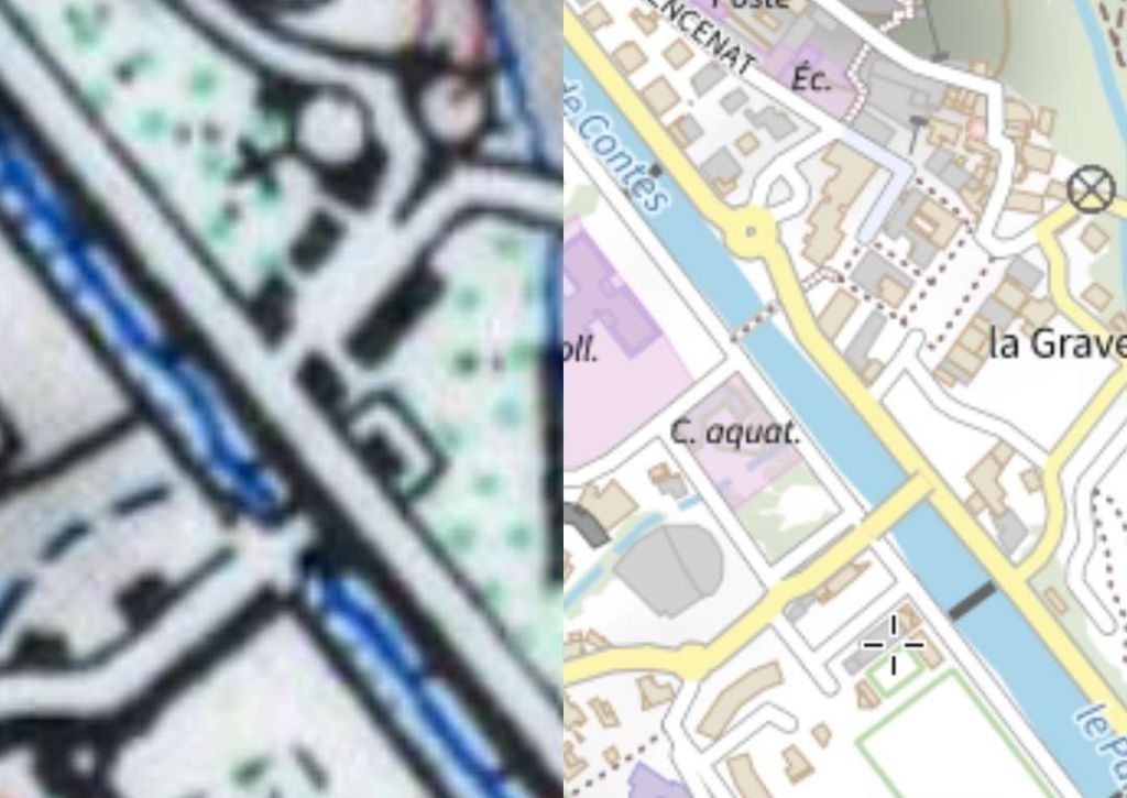
About a kilometre further North, the Contes station was located in the La Grave district adjacent to the footbridge leading to Châteauneuf. 

Another extract from the parallel imagery provided by the IGN. The tramway can be seen, in the 1955 map extract on the left, following the verge of the road and immediately adjacent to the river channel. The bridge shown crossing The river at this point provided access to Chateauneuf which sat above the valley to the West. The tram stop was close to the bridge and a little to the Northwest of it. [17]

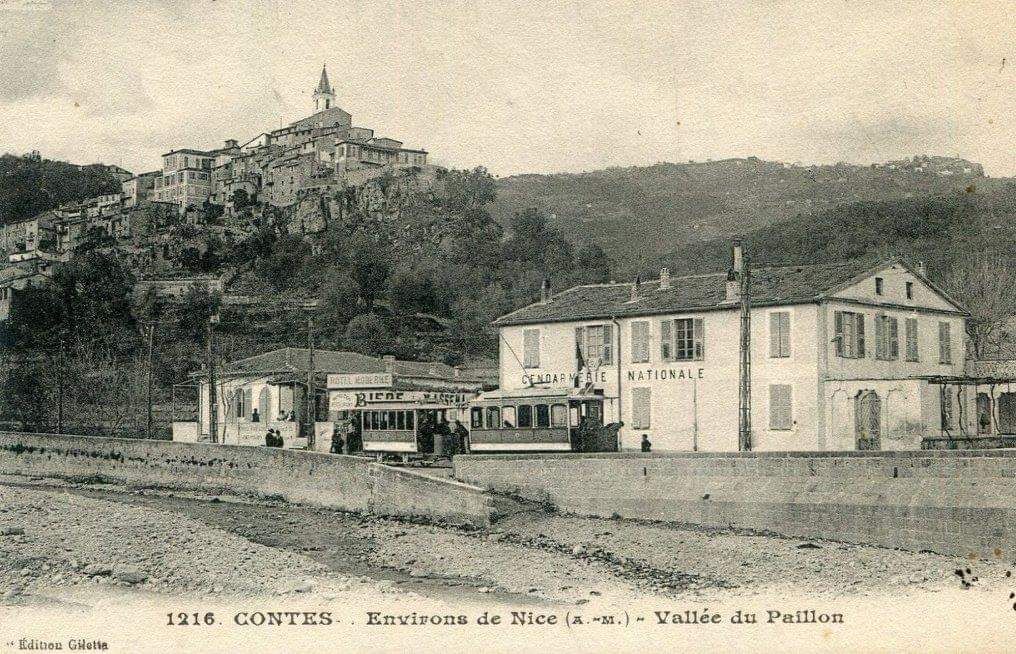
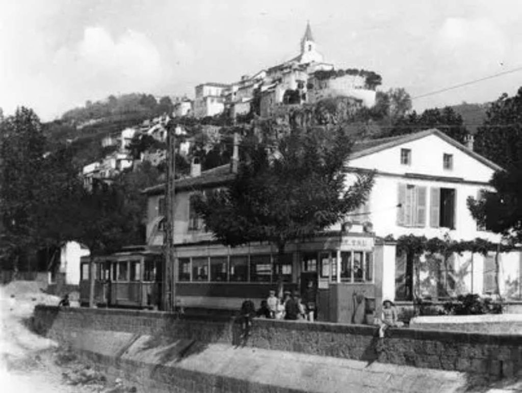
At Contes, the tramway had a small building and a siding by the river beneath the perched village.  

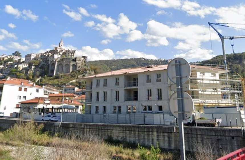
Contes Gendarmerie and tram stop. This image was shared by Pierre Richert on the Comte de Nice et son Histoire Facebook Group on 30th October 2017 as part of an extensive album of postcard views of Contes. [3]
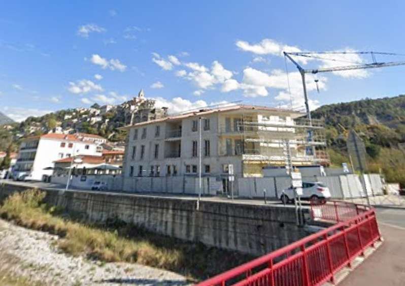
A view from a similar position in the 21st century. The construction  site is on the land once occupied by the Gendarmerie. [Google Streetview, April 2023]
This image from the Jean-Henri Manara collection was colourised and shared by Demian West on the Comte de Nice et son Histoire Facebook Group on 13th December 2022. This original image was included in the comments attached to the colourised image on the Facebook group by Demian West. [16]
A similar view in the 21st century. [Google Streetview, April 2023]
The tram terminus at Contes. This postcard view was shared by Jean-Paul Bascoul on the Comte de Nice et son Histoire Facebook Group on 21st January 2017. It comes from the private collection of Jean-Paul Bascoul. [9]

From there, the line continued up the left bank of the Paillon. Banaudo tells us that there was only one further passing-loop which was in the district of Roccaya, near the Rémaurian footbridge.  “The Bendéjun terminus was in the Moulins district, in a steep site where the road crosses the Paillon and definitively leaves the bottom of the valley to rise in bends towards this village and that of Coaraze.” [1: p67]

The Bendejun terminus of the tramway was in the valley floor close to the mills and alongside the river. There was a bridge just beyond the tram terminus which took the road over the Paillon de Contes and a series of hairpin bends lifted the road quickly up the valley side. This is another extract from the IGN parallel mapping. The map on the left was published in 1955. [18]
The tram terminus at Bendejun, beyond this point the road turns sharply to the left to cross the river and then climbs through a series of hairpin bends to Bendejun and on to Coaraze. This image was shared on the Comte de Nice et son Histoire Facebook Group by Roland Coccoli on 30th May 2023. [19]
A view from a little further South in the 21st century. The properties on either side of the road both remain. That on the East of the road now appears to be rendered. Of interest in this view are what appear to be tram rails in the right foreground. [Google Streetview, April 2023]

We have already noted that the tramway service North of Pont-de-Peille was frequently interrupted by landslides, subsidence and weather events. Banaudo also writes of significant problems with the trailers used for goods services which were often in poor condition or overloaded and as a result caused damage to the relatively light-weight rails of the tramway. [1: p71]

Pont de Peille to La Grave de Peille

Two branch-lines from the tramway to Contes were planned, the first was a line to La Grave de Peille. When built it had a total length of just short of 6.6 km. Its maximum gradient was 39 mm/m and only 360m of the route was on the level. The line ran from 112 m above sea-level to 195 m above sea-level at La Grave de Peille.

The concession for the operation of the line to La Grave de Peille was given to the TNL in June 1904. The line opened to passengers and freight on 12th June 1911. The route was numbered 28 on 1st January 1923 and saw construction traffic for the Nice-Cuneo Railway between 1923 and 1928. The cement works at La Grave was established in 1924.

At the end of 1926 the service was interrupted by a landslide. Work was undertaken between 1926 and 1927 to improve the electrical supply and September 1928 saw the official inauguration of the freight service associated with the cement works.

The Bridges and Roads Authority undertook paving work along the line in the winter of 1928-29. In August 1929, a landslide disrupted the service once again and a deviation was put in place.

On 8th October 1934, the line was renumbered, Ligne 38. The service was interrupted, once again, in November 1934. This time it was by a landslide at Châteauvieux.

The terminus in Nice was moved, along with that of the line to Contes and Bendejun, from Place Garibaldi to Rue Geoffredo in November 1935 and another landslide interrupted the service at Ste. Thecla between December 1935 and December 1936.

This tale of woe continued throughout the next decade with closures due to landslides, floods, the failure of bridges, or deterioration of trackwork. Banaudo provides a full list of these events. [1: p75]Such an unreliable service maintained at significant cost was of little use to users (passengers and goods). Closure became inevitable and it occurred on 1st April 1947.

The route started immediately to the North of the Pont de Peille stop on the line to Contes. Banaudo describes this connection as “une aiguille en rebroussement” (literally, ‘a turning needle’). [1: p72] In context, this appears to be a point which allowed access to the branch-line from the North. Trams from Nice would stop at Pont de Peille and then execute a reversal just to the North of the stop to gain access to the branch. This presumably involved a powered car running round its trailer at the tram stop and then reversing towards Contes. Banaudo provides one photograph of the manoeuvre taking place. [1: p72]

Such an unreliable service maintained at significant cost was of little use to users (passengers and goods). Closure became inevitable and it occurred on 1st April 1947.

The route between Pont de Peille and La Grave de Peille started immediately to the North of the Pont de Peille stop on the line to Contes. Banaudo describes this connection as “une aiguille en rebroussement” (literally, ‘a turning needle’). [1: p72] In context, this appears to be a point which allowed access to the branch-line from the North. Trams from Nice would stop at Pont de Peille and then execute a reversal just to the North of the stop to gain access to the branch. This presumably involved a powered car running round its trailer at the tram stop and then reversing towards Contes. Banaudo provides one photograph of the manoeuvre taking place. [1: p72]

The junction of the D21 and the D15 is shown on the right of these two parallel IGN images. The reverse curve, mentioned in the text about the tramway above, appears to be shown on the image on the left. The cross marks its location. The tramway appears to have run on the South side of the road.[20]
The road to La-Grave-de-Peille and L’Escarene. Tge tramway ran along the verge of the old road or within the width of the carriageway over much of the journey to La-Grave-de-Peille. [Google Streetview, April 2023]

The branch-line followed the valley of the River Paillon de L’Escarène valley, a route also used by the PLM Nice-Cuneo line.  Banaudo tells us that “the tram first took the right bank, sometimes on the shoulder and sometimes on the roadway of Route Nationale No. 21 (now departemental road No. 21).  It passed through the hamlet of Borghéas, then entered the Châteauvieux gorge where a three-arch bridge brought the road and the track over to the left bank.  After passing the pumping station of a spring which supplied part of the city of Nice with drinking water, trams reached the hamlet of Ste. Thecla.” [1: p72]

The location of the three-arched bridge which is mentioned by Banaudo in the quoted text above. [21]
The same location as seen on Google Earth in 21st century. [Google Earth, 18th October 2022]
A 21st century view, looking Northeast across the bridge carrying the D21 over the Paillon de L’Escarene. [Google Streetview, March 2023]
The village of Ste. Thecle sits in the valley floor adjacent to the Paillon de l’Escarene. It hosts a railway station which is named Peillon-Ste. Thecle which serves the two villages. Paillon is high above, and to the East of the village of Thecle. [22]
A view of Sainte Thecle, the mills and Peillon which shows the tramway alongside the road. The view looks Eastnortheast towards Paeillon. Note the kerb marking the limits of the highway. Peillon can be seen high above Ste. Thecle in this photograph. The River Paillon de l’Escarene is below the road and tramway to the left. This old postcard image was shared by Jean-Paul Bascoul on the Comte de Nice et son Histoire Facebook Group on 5th October 2023 and comes from the private collection of Jean-Paul Bascoul. The location of this photograph is difficult to confirm in 21st century. The relative positions of Peillon and the rock outcrops behind make it clear that the location is in Ste. Thecle but changes in the buildings in Ste.Thecle make ascertaining the location difficult. No doubt someone with local knowledge might be able to firm up the position of the camera!  [6]
The tram stop at Les Moulins de Peillon seems to be marked on the 1955 map extract on the left. However, it is worth noting Banaudo’s comments below which seem to suggest that the tramway was on the East side of the road. The tramway is perhaps marked by the single line on the East side of the road. The location is named on the modern map extract to the right. The valley has, by this time, turned to the North. Access to the village of Peillon is via the steep road with hairpin bends in the top right of each map extract. [23]
The village of Peillon sits high above the valley floor. It is a car free mediaeval perched village. [24]

The next stop was in the valley closer to Peillon and set among the mills. This stop provided a passing loop, the only one on the line. Banaudo continues: “On the right, the picturesque village of Peillon stands at 376 m at the top of a rocky spur in a site worthy of a postcard.  Immediately afterwards, the valley narrows once again and forms the narrow Bausset gorge where the tramway line was established over 567 m on its own site overlooking the road, finding it again to cross the Paillon on a single-arch bridge.” [1: p72]

These comments from Banaudo suggest that the line was on the East side of the road, perhaps indicated by the single black line on the 1955 map extract above which crosses the side road to Peillon only a few meters to the East of the main road. It seems that North of this point the tramway was very close to the road but held above it by a retaining wall. Road and tramway came together again at the next bridge over the Paillon de l’Escarene. That bridge is marked on both of the map extracts (1955 and 2023) above. The bridge used by the old road and tramway is marked in grey on the modern map.

Looking East off the modern road bridge, the single masonry arch of the old bridge can be seen in a collapsed state. A modern road realignment at this location removed some dangerous bends and improved traffic flow. [Google Streetview, April 2023]

Beyond this point, with the tramway and the D21 now on the West bank of the river, the valley opens out and the route of the old tramway passes through Novaines before reaching the location of its terminus at La Grave-de-Peille.

The tramway ran along the old Route Nationale No. 21 to La Grave de Peille. As the road turned to re-cross the River Paillon de L’Escarene, the tramway continued for only a short distance to serve a cement works on the West bank of the river. [25]
The terminus of the passenger service at La Grave de Peille. This image was shared on the Comte de Nice et son Histoire Facebook Group by Roland Coccoli on 2nd December 2018. [8]

The terminus of the route was sited at the meeting point of the boundaries of three communes, Peillon, Peille and Blausasc, adjacent to a cement works which was operating from the mid-1920s and had its own branch-line  from the tramway. The cement works became particularly significant in the life of the branch-line once the PLM opened its line between Nice and Cuneo in the late-1920s. Passengers deserted the trams as a much quicker journey to and from Nice was offered by the PLM from its two stations, Peillon-Ste. Thecle and Peille.

The railway station at Peille with the cement works visible in the distance on the right side of the image. This colourised monochrome postcard image was taken with the camera facing towards the Southwest. Trams ran along the valley from/to the lefthand edge of this image as far as the cement works. [26]

Banaudo highlights a particular problem with the line to La Grave de Peille. [1: p74] The tramway was built with minimal investment – just enough to reach its terminus. Rails were the lightest possible; the TNL used existing bridges not designed for the loads imposed by trams and trailers; road carriageway widths were decreased to provide space for the trams, (ather than setting the rails in the roads).

Local protests began as early as 1908, but issues becameore acute after the Great War because of the increased traffic on both the road and the tramway resulting from the construction of the Nice-Cuneo railway and the opening of the cement plant at La Grave. “Neither the road nor the railway were able to withstand this additional load.  On 21st November 1928, the municipal council of Peillon reported that the Bausset bridge was in a lamentable state and, for lack of urgent measures, serious misfortunes occurred during the winter of 1928-29. Despite the protests of the TNL company which rightly feared for the sustainability of its rails, the Bridges and Roads Authority covered the rails with macadam to widen the roadway accessible to cars.  What was predictable happened: insufficiently drained under this coating and tired by high tonnages, the rails were too weak and the already tired sleepers soon began to disintegrate.” [1: p74] 

In 1937 proper maintenance was undertaken between Borghéas and Châteauvieux, “but the alarming state of the track, the insufficient electricity supply and the shortage of wagons led the TNL to provide its passenger service by bus” [1: p74] The cement factory also began to use road vehicles.

WW2 resulted in traffic (both goods and passengers) returning to the rails in the summer of 1940, but by the beginning of 1941 the track had deteriorated to such an extent that all tramway traffic had to be suspended.

Sufficient maintenance was undertaken to allow goods services to resume within a few weeks but the condition of the bridge at Bausset meant that the line North of the bridge could not be used by trams. Lime and cement, “went down by truck to the Peillon stop (Les Moulins),  where it was transhipped on a train of two wagons limited to 6 km/h to Pont-de-Peille… The end-to-end service resumed on 7th July 1941, but it was again interrupted in September 1943 by the destruction of the Pont de Peille then at the end of August 1944 by that of the Pont de Bausset bridge.” [1: p74]

A temporary structure of steel beams and a wooden deck was quickly provided but “the track formed such tight curves on either side of the structure that derailments were not rare.” [1: p74]

Early 1945 saw the reintroduction of passenger and freight services but the following winter saw heavy flooding which destabilised the temporary bridge at Bausset and the line was again closed, this time for two and a half months. Ultimately the increasingly erratic service on the line resulted in its final closure in the spring of 1947.

La Pointe de Contes to l’Escarene

Sadly, this line was never used in earnest. Much was done to create the line but circumstances combined to mean the work done did not come to fruition. Initially, l’Escarene was chosen as the final destination for the tramway from Pont de Peille via La Grave de Peille in 1904. The concession for the line between La Grave and L’Escarene was awarded on 26th June 1904, but it was rescinded early in 1906.

Banaudo tells us that, “after several decades of procrastination, the construction of a Nice-Cuneo railway line had been approved by an international convention, granted to the PLM and made public. As the route of this line was  established by the Paillon de L’Escarène valley which the tramway should have taken.” [1: p76]

The result of that decision was the truncation of the route from Pont de Peille to La Grave de Peille and L’Escarène at La Grave.

Banaudo goes on to explain that “the idea of connecting L’Escarène to the tram network was not abandoned, especially since some were still considering extending a line as far as Luceram and even Peirs Cava, at an altitude of 1400 m.” [1: p76]

In 1910 the Bridges and Roads Authority commenced discussions with the TNL. The steep Gradients likely to be required saw the TNL propose an option of a rack system.

It was not until 1913 that the route from La Pointe de Contes was confirmed. Work began in January 1914. The Great War saw work come to a standstill.

It was 1919, before rearranged contracts saw work recommence on the line. Ok about was in short supply and priority was given to the construction of the PLM line between Nice and Cuneo. In the end, the Departement suspended work on the line in 1926 because costs of materials had risen dramatically.

In 1928, Banaudo tells us, “at the request of the municipality of Blausan, the general council took the decision to develop the length of the tramway formation which was remote from the existing road, from Fuont-de-Jarrier to the Col de Nice which became the departmental road 321.” [1: p76] The planned tramway to L’Escarène was finally abandoned/decommissioned on 29th June 1933.

Had it been built, the total length of the tramway would have been just under 7.6 km with a maximum gradient of 55mm/m. It would have risen from a height of 131m above sea-level at La Pointe de Contes to around 410 m above sea-level at the Col de Nice.

The route was to have been served entirely by a single-track tramway leaving the line to Contes at La Pointe de Contes.

The red line shown on these map extracts provided by the IGN shows the route of the planned tramway as it left the route to Contes and Bendejun. A road now follows that line and appears on the modern mapping on the right. The road is named ‘Chemin du Tram’. The main road towards L’ Escarène leaves both extracts at the top right. [27]
Looking North along the main road towards Contes. Behind the camera the road to L’Escarène heads away to the East. The tram stop for La Pointe de Contes was along this length of road. Just to the North of the tram stop was the point where the tramway to L’Escarène would have set off to the East. [Google Streetview, March 2023]
The tramway to Contes and Bendejun ran ahead along what is now the D15. The route to L’Escarène would have run off to the right at what is now a road junction. [Google Streetview, March 2023]
The route of the planned tramway followed what is now called ‘Chemin du Tram’ which runs directly ahead of the camera. It is the road to the left of the trees at the centre of this image. [Google Streetview, March 2023]
A little further East along what would have been the route of the tramway. [Google Streetview, March 2023]
The planned route ran to the right of the retaining wall before joining the D2204. [Google Streetview, March 2023]
Looking back towards the D15 from the D2204. The tram route followed the retaining wall running away from the camera on the right side of the photograph, and then curved round between the two buildings seen beyond the parked vehicles. [Google Streetview, April 2023]

Initially, it would have followed the Route Nationale No. 204 (now the D2204) up the valley of the Ruisseau de la Garde.

Parallel map extracts, once again, provided by the IGN. The main features, which can be seen on both the 1955 extract and the 21st century extract, are the bridges which carried the road over the Ruisseau de la Garde. [28]
The location of the first of the two bridges. There is little at road level to indicate that it is crossing the stream which passes some metres below the road. [Google Streetview, April 2023]
The location of the second bridge is easier to make out. The modern road has been straightened and a new bridge constructed. The old road which would have been followed by the tramway bears away to the left with the new bridge directly ahead. [Google Streetview, April 2023]
The view from the new bridge across the Ruisseau de la Garde of the old road. [Google Streetview, April 2023]
The view Southwest along the D2204 in the 21st century. The old road can be seen on the right of the picture. [Google Streetview, April 2023]
Further Northeast on the D2204 the verge of which would have carried the proposed tramway. [Google Streetview, April 2023]
Again, further Northeast on the D2204 the verge of which would have carried the proposed tramway. [Google Streetview, April 2023]

At the hamlet of La Fuont-de-Jarrier, the tramway left the road and the valley to embark on a dedicated length of almost 4 km. Banaudo tells us that the route ran through “a landscape of arid hills where only pines managed to grow on ridges of gray marl.  The only locality encountered was the village of Blausasc, below which a stopping point was to be established.  The line continued northwards, passing through a small tunnel at a place called La Blancarde, to join the road approaching the Col de Nice.”  [1: p76]

La Fuont-de-Jarrier was the point at which the proposed tramway diverted from the highway. The formation intended for the tramway became the base for the new CD 321.  The new road is that shown leaving the established road to the right on the 1955 IGN map extract. [29]
The junction between the D2204 and the CD321 in the 21st century. The CD321 follows the formation of the intended tramway to L’Escarène. [Google Streetview, April 2023]
The next length of the CD321. [30]
Over the first few kilometres, the carriageway was wide enough for two full lanes of traffic. [Google Streetview, March 2023]
A further length of the CD321 with Blausasc above the road to the East. [31]
The CD321 continues to follow the planned route of the tramway. This rock cutting was cut for the tramway. The location is at the bottom of the twin maps above.  [Google Streetview, March 2023]
The tramway route (CD321) runs ahead and bears to the right. The road which crosses the route at this location is the D221. [Google Streetview, March 2023]
The red line marks the route of the CD321 which is built on the formation of the proposed tramway. The road crossing it at the staggered junction seen here is the D221 which linked Blausasc to the Route de la Col de Nice. [Google Earth, December 2023]
Looking North-northwest along the CD321 towards the top of the twin map extracts above. [Google Streetview, March 2023]
This next set of two parallel map extracts from the IGN show the Route de la Col de Nice marked by two heavy bold lines and the CD321 above it to the East. [32]

This next sequence of photographs show the road (CD321) running from the bottom of the twin extracts above towards the tunnel which can just about be picked out on the modern map extract above.

This sequence of four images shows the CD321 in the 21st century. Over this length, no attempt to widen the formation built for the intended tramway has been made. Retaining walls, where they exist, will most probably be those constructed by the contractors developing the tramway route. [Google Streetview, March 2023]
An enlarged dual map extract of the area at the top-left of the last twin map extracts from the IGN. Both this, and the last pair of extracts show, on the right-hand, modern extract, the tunnel bored for, but never used by, the planned tramway which is, however, now used by the CD 321 in the 21st century. [34]

This next sequence of three photographs show the CD321 in the vicinity of the tunnel built for the planned tramway.

These three photographs show the Route de Blausasc (the CD321) passing through the old tramway tunnel. [Google Streetview, March 2023]
Another set of twin map extracts from 1955 and the 21st century provided by the IGN. This pair of images provides the reason for the separation of the planned tramway route from the older Route de la Col de Nice. The hairpin-bends shown centre left on each of the images meant that the road would have been completely unsuitable for use by trams. Track curvature and gradient would have been insurmountable obstacles. To the North of the hairpin-bends, both routes converge. [33]
The Col de Nice was the high point in the proposed tramway. The Route de la Col de Nice and the planned tramway met just to the South of the Col de Nice. [35]

North of the tramway tunnel, the last kilometre or so of the CD321 and hence the last length of the independent tramway formation required the construction of a series of retaining walls. These next few photographs illustrate the size of the task undertaken by the contractors in the early 20th century. The four photos follow the Route de Blausasc North towards its junction with the Route de la Col de Nice.

These four photos follow the CD321 North, each shows the size of the retaining structures built for the tramway. [Google Streetview, April 2023]

A few hundred metres before its junction with the D2204, the CD321 runs parallel to it with the two roads gradually reaching the same height above sea level.

The D2204 and the CD321 run parallel with no more than a few metres height difference. [Google Streetview, April 2023]
The planned tramway, now the Route de Blausasc (CD321) meets the D2204 just short of the Col de Nice. [Google Streetview, April 2023]
The Col de Nice in the 21st century. [Google Streetview, April 2023]

Banaudo talks of the tramway running in a cutting below and to the right of the road and then reaching L’Escarène at the end of a steep descent. [1: p76]

This final example of the parallel imagery provided by the IGN shows the D2204 (Rue de Chateau) running down into L’Escarène.

In the first instance, the tramway would have been within the width of the modern highway, but as shown below it did run below and to the right of the road on its way down into L’Escarène.

The view along Rue du Chateau, L’Escarène from the Col de Nice. The tramway formation ran on the right side of the road. [Google Streetview, April 2023]
Heading down into L’Escarène evidence can be seen of the prepared tramway route to the right of, and just below, the highway. [Google Streetview, March 2023]
The separated tramway route, metalled, runs to the right of, and below, the Rue du Chateau much of the way down into the centre of L’Escarène. [Google Streetview, March 2023]
Closing in on the centre of L’Escarène, the proper tramway would have been within the width of the modern highway. [Google Streetview, March 2023]

I have not been able to establish the location in L’Escarène planned for the terminus of the tramway.

This article completes a series of articles about the early 20th century metre-gauge tramways and railways of Nice and its hinterland. Perhaps the next series of articles centred on Nice will look at the standard-gauge line between Nice and Cuneo? ……

References

  1. Jose Banaudo; Nice au fil du Tram: Volume 2: Les Hommes et Les Techniques; Les Editions du Cabri, 2005.
  2. https://m.facebook.com/groups/ciccoli/permalink/3819952794917228, accessed on 14th December 2023.
  3. https://m.facebook.com/groups/ciccoli/permalink/2035313676714491, accessed on 15th December 2023.
  4. https://m.facebook.com/groups/ciccoli/permalink/3394462134132965, accessed on 15th December 2023.
  5. https://m.facebook.com/groups/ciccoli/permalink/3026585994253916, accessed on 15th December 2023.
  6. https://m.facebook.com/groups/ciccoli/permalink/3777927129119795, accessed on 15th December 2023.
  7. https://www.cparama.com/forum/pont-de-peille-t16850.html, accessed on 15th December 2023.
  8. https://www.facebook.com/groups/ciccoli/permalink/2308750299370826, accessed on 15th December 2023.
  9. https://m.facebook.com/groups/ciccoli/permalink/1875504749362052, accessed on 15th December 2023.
  10. https://www.nicematin.com/vie-locale/lafarge-cest-notre-stade-du-ray-la-colere-des-habitants-de-contes-apres-lannonce-de-fermeture-de-lusine-640714, accessed on 16th December 2023.
  11. https://remonterletemps.ign.fr/comparer/basic?x=7.319900&y=43.756498&z=16&layer1=GEOGRAPHICALGRIDSYSTEMS.MAPS.SCAN50.1950&layer2=GEOGRAPHICALGRIDSYSTEMS.PLANIGNV2&mode=doubleMap, accessed on 16th December 2023.
  12. https://remonterletemps.ign.fr/comparer/basic?x=7.320322&y=43.760848&z=16&layer1=GEOGRAPHICALGRIDSYSTEMS.MAPS.SCAN50.1950&layer2=GEOGRAPHICALGRIDSYSTEMS.PLANIGNV2&mode=doubleMap, accessed on 16th December 2023.
  13. https://remonterletemps.ign.fr/comparer/basic?x=7.330307&y=43.766719&z=16&layer1=GEOGRAPHICALGRIDSYSTEMS.MAPS.SCAN50.1950&layer2=GEOGRAPHICALGRIDSYSTEMS.PLANIGNV2&mode=doubleMap, accessed on 16th December 2023.
  14. https://remonterletemps.ign.fr/comparer/basic?x=7.337594&y=43.781496&z=16&layer1=GEOGRAPHICALGRIDSYSTEMS.MAPS.SCAN50.1950&layer2=GEOGRAPHICALGRIDSYSTEMS.PLANIGNV2&mode=doubleMap, accessed on 16th December 2023.
  15. https://m.facebook.com/groups/ciccoli/permalink/3012578788987970, accessed on 16th December 2023.
  16. https://m.facebook.com/groups/ciccoli/permalink/3563932950519215, accessed on 16th December 2023.
  17. https://remonterletemps.ign.fr/comparer/basic?x=7.314738&y=43.809287&z=16&layer1=GEOGRAPHICALGRIDSYSTEMS.MAPS.SCAN50.1950&layer2=GEOGRAPHICALGRIDSYSTEMS.PLANIGNV2&mode=doubleMap, accessed on 17th December 2023.
  18. https://remonterletemps.ign.fr/comparer/basic?x=7.297577&y=43.835103&z=15&layer1=GEOGRAPHICALGRIDSYSTEMS.MAPS.SCAN50.1950&layer2=GEOGRAPHICALGRIDSYSTEMS.PLANIGNV2&mode=doubleMap, accessed on 17th December 2023.
  19. https://m.facebook.com/groups/ciccoli/permalink/3690729567839552, accessed on 17th December 2023.
  20. https://remonterletemps.ign.fr/comparer/basic?x=7.333183&y=43.768166&z=16&layer1=GEOGRAPHICALGRIDSYSTEMS.MAPS.SCAN50.1950&layer2=ORTHOIMAGERY.ORTHOPHOTOS&mode=doubleMap, accessed on 19th December 2023.
  21. https://remonterletemps.ign.fr/comparer/basic?x=7.351098&y=43.766957&z=16&layer1=GEOGRAPHICALGRIDSYSTEMS.MAPS.SCAN50.1950&layer2=GEOGRAPHICALGRIDSYSTEMS.PLANIGNV2&mode=doubleMap, accessed on 19th December 2023.
  22. https://remonterletemps.ign.fr/comparer/basic?x=7.363747&y=43.771203&z=14&layer1=GEOGRAPHICALGRIDSYSTEMS.MAPS.SCAN50.1950&layer2=GEOGRAPHICALGRIDSYSTEMS.PLANIGNV2&mode=doubleMap, accessed on 21st December 2023.
  23. https://remonterletemps.ign.fr/comparer/basic?x=7.372927&y=43.771664&z=15&layer1=GEOGRAPHICALGRIDSYSTEMS.MAPS.SCAN50.1950&layer2=GEOGRAPHICALGRIDSYSTEMS.PLANIGNV2&mode=doubleMap, accessed on 21st December 2023.
  24. https://www.thatonepointofview.com/peillon-france, accessed on 21st December 2023.
  25. https://remonterletemps.ign.fr/comparer/basic?x=7.374619&y=43.788157&z=14&layer1=GEOGRAPHICALGRIDSYSTEMS.MAPS.SCAN50.1950&layer2=GEOGRAPHICALGRIDSYSTEMS.PLANIGNV2&mode=doubleMap, accessed on 21st December 2023.
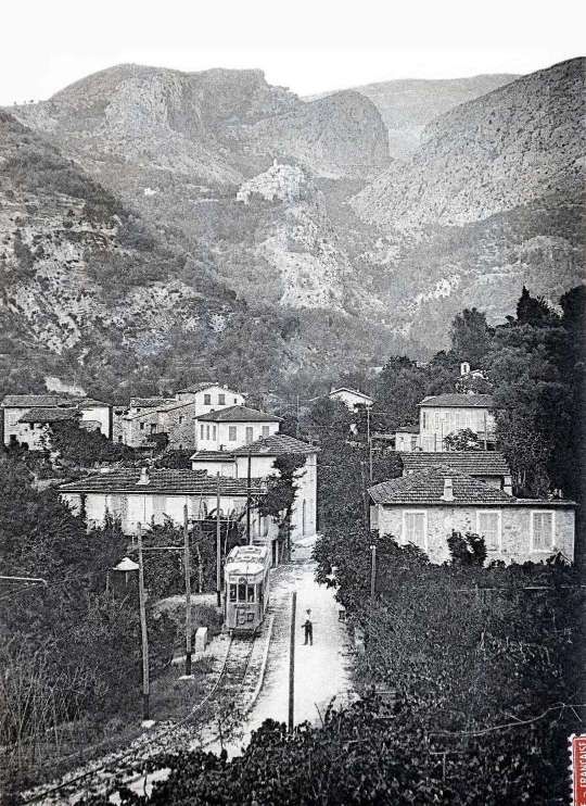
  26. https://www.cparama.com/forum/viewtopic.php?f=11&t=14570, accessed on 22nd December 2023.
  27. https://remonterletemps.ign.fr/comparer/basic?x=7.338814&y=43.782147&z=16&layer1=GEOGRAPHICALGRIDSYSTEMS.MAPS.SCAN50.1950&layer2=GEOGRAPHICALGRIDSYSTEMS.PLANIGNV2&mode=doubleMap, accessed on 26th December 2023.
  28. https://remonterletemps.ign.fr/comparer/basic?x=7.343790&y=43.787018&z=15&layer1=GEOGRAPHICALGRIDSYSTEMS.MAPS.SCAN50.1950&layer2=GEOGRAPHICALGRIDSYSTEMS.PLANIGNV2&mode=doubleMap, accessed on 26th December 2023.
  29. https://remonterletemps.ign.fr/comparer/basic?x=7.354474&y=43.794817&z=15&layer1=GEOGRAPHICALGRIDSYSTEMS.MAPS.SCAN50.1950&layer2=GEOGRAPHICALGRIDSYSTEMS.PLANIGNV2&mode=doubleMap, accessed on 27th December 2023.
  30. https://remonterletemps.ign.fr/comparer/basic?x=7.359935&y=43.800718&z=15&layer1=GEOGRAPHICALGRIDSYSTEMS.MAPS.SCAN50.1950&layer2=GEOGRAPHICALGRIDSYSTEMS.PLANIGNV2&mode=doubleMap, accessed on 27th December 2023.
  31. https://remonterletemps.ign.fr/comparer/basic?x=7.360607&y=43.809370&z=15&layer1=GEOGRAPHICALGRIDSYSTEMS.MAPS.SCAN50.1950&layer2=GEOGRAPHICALGRIDSYSTEMS.PLANIGNV2&mode=doubleMap,vaccessed on 28th December 2023.
  32. https://remonterletemps.ign.fr/comparer/basic?x=7.357550&y=43.814629&z=15&layer1=GEOGRAPHICALGRIDSYSTEMS.MAPS.SCAN50.1950&layer2=GEOGRAPHICALGRIDSYSTEMS.PLANIGNV2&mode=doubleMap, accessed on 29th December 2023.
  33. https://remonterletemps.ign.fr/comparer/basic?x=7.353730&y=43.821348&z=15&layer1=GEOGRAPHICALGRIDSYSTEMS.MAPS.SCAN50.1950&layer2=GEOGRAPHICALGRIDSYSTEMS.PLANIGNV2&mode=doubleMap, accessed on 29th December 2023.
  34. https://remonterletemps.ign.fr/comparer/basic?x=7.355818&y=43.816082&z=16&layer1=GEOGRAPHICALGRIDSYSTEMS.MAPS.SCAN50.1950&layer2=GEOGRAPHICALGRIDSYSTEMS.PLANIGNV2&mode=doubleMap, accessed on 29th December 2023.
  35. https://remonterletemps.ign.fr/comparer/basic?x=7.352163&y=43.826648&z=14&layer1=GEOGRAPHICALGRIDSYSTEMS.MAPS.SCAN50.1950&layer2=GEOGRAPHICALGRIDSYSTEMS.PLANIGNV2&mode=doubleMap, accessed on 29th December 2023.
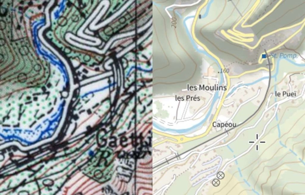
  36. https://remonterletemps.ign.fr/comparer/basic?x=7.353504&y=43.833178&z=14&layer1=GEOGRAPHICALGRIDSYSTEMS.MAPS.SCAN50.1950&layer2=GEOGRAPHICALGRIDSYSTEMS.PLANIGNV2&mode=doubleMap, 29th December 2023.

The Menton to Sospel Tramway Revisited Again! (Chemins de Fer de Provence 61)

The headline image above shows a steam engine on the Viaduc du Caramel – in steam. [3]

My wife purchased two books for me as a birthday present a while back. They are written in French by Jose Banaudo. They cover the tramway network of the TNL, the Tramways de Nice et du Littoral. In the first volume there is a section about the tramways which meandered into the hills behind the Coast, one of which was the tramway from Menton to Sospel.

Among a whole series of different pictures, mainly old postcards, were some pictures of the line showing the operation of steam locomotives on the line and others of goods wagons in use between Menton and Sospel, particularly to deliver material to the construction work on the PLM Nice-Cuneo line..

One shows a small 0-4-0T No. 212. The manufacturer and the owner are not known. The locomotive is pulling a bogie truck and a wagon. Another photograph shows one of several locomotives destined for the construction sites of the PLM Nice-Cuneo line which were transported by tram to Sospel. It shows a German-built 0-6-0T which was partly deconstructed to be transported on a TNL wagon in September 1912.

A further photograph was taken in 1914. In this image the 0-6-0T Orenstein & Koppel steam locomotive No. 6871 of the Francois Mercier Company is about to leave the goods station at Carei in Menton, coupled with the shunter No. 13 of the TNL. This loco was photographed on a number of occasions by Engineer Jacques Schopfer coupled with the shunter No. 13 of the TNL on numerous occasions in 1914 – on the Viaduc de Monti, on the approaches to the Viaduc du Caramel, and stationary on the viaduct.

The Menton-Sospel tramway was used for the transport of material for the construction of the PLM line from Nice to Cuneo. In other pictures in Banaudo’s book we can see shunter No. 7 with a load of tubes on a flat wagon at the goods station at Carel in Menton and shunter No. 13 with a load of rails on two wagons before the stop at Villa Caserta.

The bogie motor-trams of the 213-216 sub-series with more powerful engines and braking systems were also used for goods traffic on the Sospel line: two pictures in the book show: one with a wagon loaded with a small steam locomotive at Castillan; and another with a load of long poles on the Caramel viaduct, from the collections of André Arutur & Jean-Jacques Stefanazzi.


This postcard dates from around 1914 and shows the Caramel Viaduct, with one of the bogie trams pulling a goods van. [2]

Goods trains were a feature of the line from the start, but there was a serious runaway of a goods service at Monti on 12th September 1912 which destroyed tractor 4 and killed its two crewmen. From 16th June 1913 a new service was started with two tractors 6, 7 (and 13 added in 1914) in the form of motorised box cars (known as fourgons in French), which were fitted with the same powerful equipment and brakes as the bogie passenger cars, and which pulled a variety of goods wagons.

Banaudo also tells us that in 1914, four passenger trips and three or four goods trips were made on the line each day, but like the rest of the T.N.L. network traffic fell off in the 1920s. During the building of the P.L.M. main line railway from Nice to Breil via Sospel, the line had a boost of goods traffic carrying many construction materials, but once complete in 1928 there was a huge drop in traffic.

References

  1. Jose Banaudo; Nice au fil du tram Vol.1 published by Les Editions du Cabri, 2004, p59-61.
  2. http://www.tramwayinfo.com/Tramframe.htm?http://www.tramwayinfo.com/Cards/Postc58.htm, accessed on 8th June 2018.
  3. https://excerpts.numilog.com/books/9782903310608.pdf, accessed on 30th November 2023.