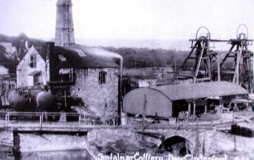
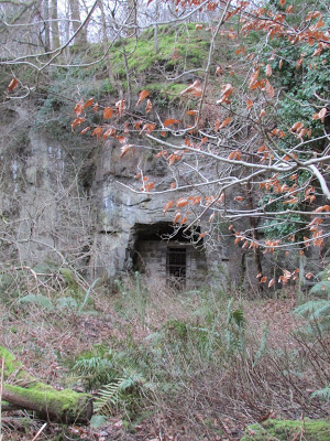
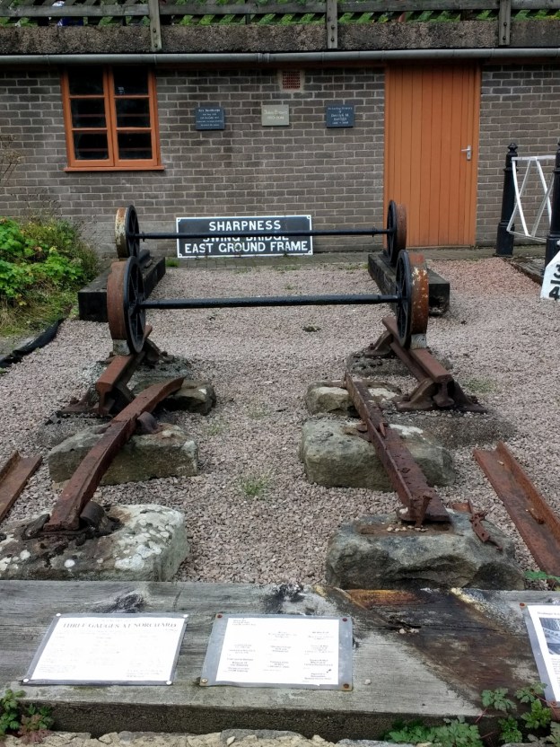
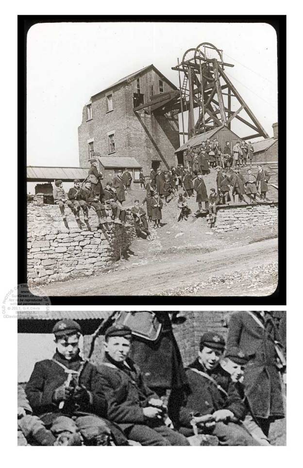
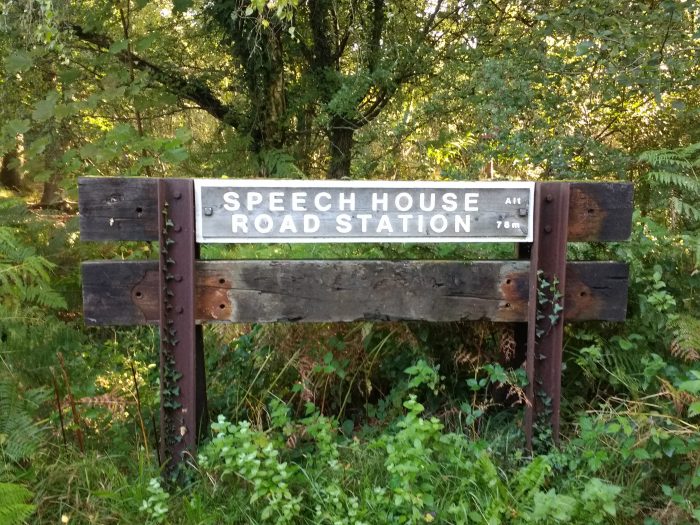
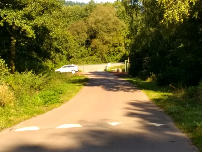
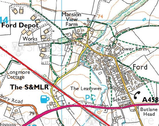
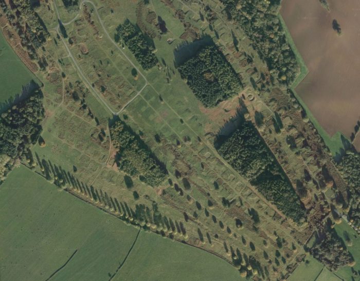
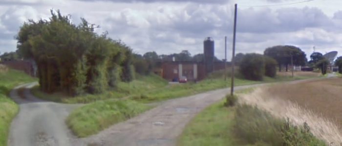
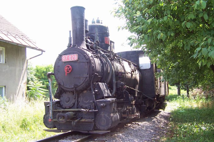
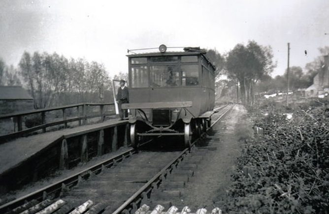
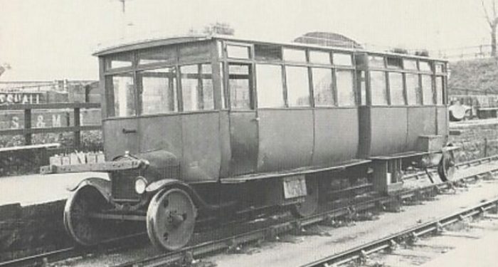
Category Archives: Railways and Tramways Blog

Trafalgar Colliery and Railway

OS Grid Reference: SO625144The featured image above is taken from the Way-Mark site covering the Forest of Dean . [3]

The History of the Colliery and its Tramway and Railway Connections

The Trafalgar gale was leased to Corneleus Brain in 1842, but work does not  to seem  to have  commenced until 1860. After 1867, coal from the adjacent Rose-in-hand gale was also worked. [1]

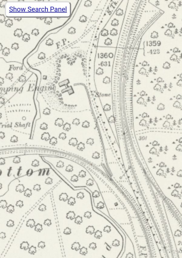
Since at least 1847 Corneleus and Francis Brain had been lessees of the Rose-in-Hand gale and in 1867 they obtained permission from the Crown  to effectively amalgamate the two games into one for the purpose of working the coal which would have been raised via the shafts at Trafalgar.  No record a shaft for the Rose-in-Hand exists. Coal, prior to 1867, was brought to the surface via the Royal Forester gale which ultimately became part of Speech House Hill Colliery. [2]

It seems as though the Brains also acquired the Strip-and-at-it Colliery which lay close to Trafalgar across a small ridge.  Strip-and-at-it had already been worked for some time ,The probably since 1832.  The gale was surrendered to the Crown in 1864 and was then acquired by the Brains. [2]

There were two shafts at Trafalgar, which were worked by the same winding engine. They extended through the Upper Coal Measures (Supra-Pennant Group) down to the Churchway High Delf Seam at a depth of 586 ft. The two shafts were less than 40 yards apart. Coal was lifted up one shaft and empties were taken down the other shaft. [1][2]

The Lightmoor Press website comments as follows :

“One shaft was the downcast, where fresh air went down into the workings, and the other had a kind of bonnet fitted over the tacklers which covered the top of the land pit so that very little air was lost.  The main upcast shaft was called Puzzle, as the pit had been driven up-hill to the surface.

The cage was guided down the shaft by wooden guides running inside metal shoes on the side of the cage.  Wooden guides were used on both pits.  Ten men and boys could ride in each cage.

A report in the Gloucester Journal  in February 1867 tells how in working the ‘large vein of coal’ at the colliery the declavity was so great that the ordinary method of hauling to the bottom of the shaft, presumably horse or man power, was impracticable.  Corneleus’ son, William Blanch Brain, the colliery engineer therefore erected a small winding engine on the surface close to the pit’s mouth in order to draw the loaded carts from the coal face to the bottom of the shaft.  The carts were connected to a long chain which ran to the far extremities of the workings.  Initially the great drawback was the delay in communication between the coal face and the pit bank when hauling was required. So W. B. Brain, who was also an electrician, procured a pair of electric bells and placed one in the winding engine house and the other at the top of the ‘dipple’ or haulage road.  Several tappers were then placed along the road allowing the men in any part of the works to signal for the starting or stopping of the haulage engine.  The bell at the top of the dipple kept the men at pit bottom informed as to what was happening.  The success of the system was such that communication between pit bottom and the main winding engineman was also electrified.  At pit bottom, a pair of tappers, one white and one red, were provided and on touching the white one a bell in the engine room sounded and the words ‘go on’ appeared on the dial plate attached.  On touching the red the word ‘stop’ was shown.

Electrical communication was also used on the surface, enabling W. B. Brain in his office to be kept in touch with the happenings at the pit.  Another snippet mentioned in the article was that a patent pump was in use at the colliery which instead of throwing successive stream of water threw a continuous one.” [2]

It is of interest that in the 1880s, when the Forest of Dean was a highly industrialised area, people were chosing to take a holiday in the forest and choosing too to visit working pits. John Bellows wrote a guide book in 1880 entitled, ‘A Week’s Holiday in the Forest of Dean’. It contains a commentary about the Trafalgar Colliery. The Lightmoor Press website quotes from it:

Before going down (underground) we may as well look at the large sandstone quarry on the premises where stones are cut for supporting the galleries below.  Let us pass through the tramway tunnel, 150 yards long, cut through the ridge of the hilltop, to a shaft on the other side.  This narrow ridge is the outcrop of the measures, and in the tunnel we can examine, rock, clod and duns, and a little thin coal with rock again below it. Having seen this we turn back again, enter the cage, and, closing our eyes to avoid the giddiness, are lowered 600 feet so smoothly, that we are hardly conscious of motion.  At the bottom we go into the underground office, and are supplied with a little brass lamp, and a bunch of cotton waste to wipe our hands upon, and then attended by ‘the bailey’ enter one of the main roadways. … Where necessary, the underground workings are lighted with gas, and one of the partners, Mr. William Brain, is now preparing to adopt the electric light (which is already in use on the surface at night) and also to utilise electricity as a motive power at many of the underground inclines, or dipples, in the colliery, where steam is not available; and thus save many horses.  There are more than forty horses living in this pit.  They never return to daylight until worn out or disabled. Some of them have been down here a dozen years, and are in excellent health.

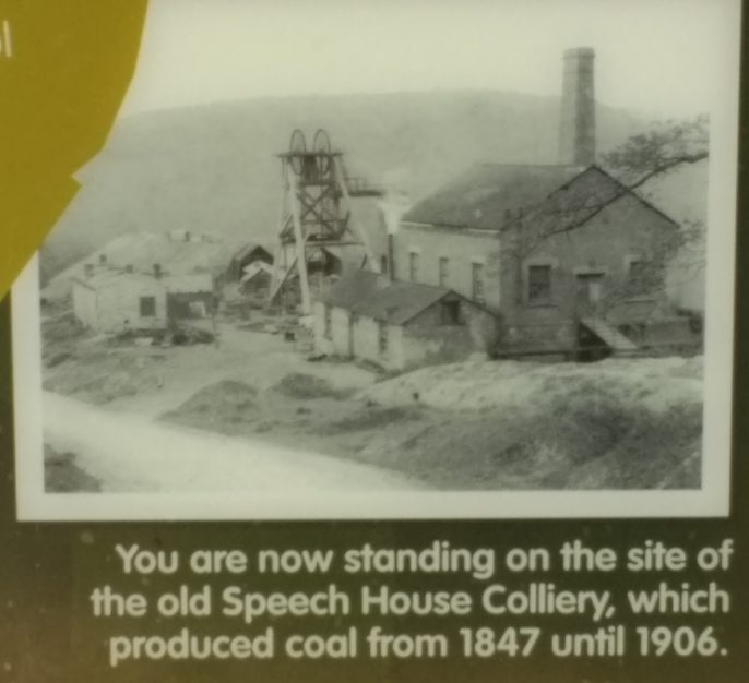
Fire damp is wholly unknown in the Forest of Dean, and miners work with naked lights. Choke damp breaks in rarely, and seldom gives any trouble.  The pit is remarkably free from water, and being furnished with every known appliance, and most admirably kept, is probably one of the best in the Forest, or out of it.  Eleven hundred men and boys are employed here: 600 underground getting coal, and 500 as labourers &c., above ground, and in subsidiary occupations.  Good colliers earn, at present, 3s 8d per day; masons 3s 4d; and labourers, 2s 4d.  One can hardly imagine anything more severe in the way of labour than that of a miner lying on his side in a four foot passage, cutting away with his pick the hard rock encasing the seam. … The output from Trafalgar, at the moment we are writing, which is a dull season is seven hundred tons of coal per day.” [2][4]
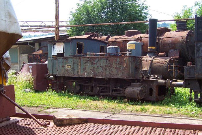
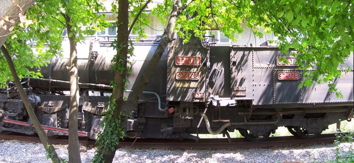
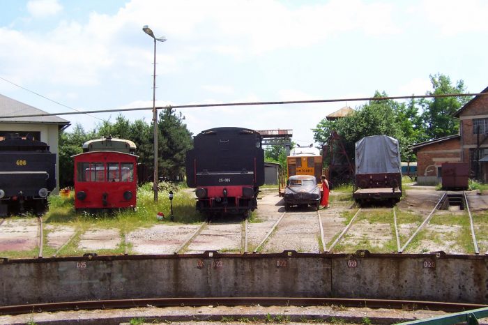
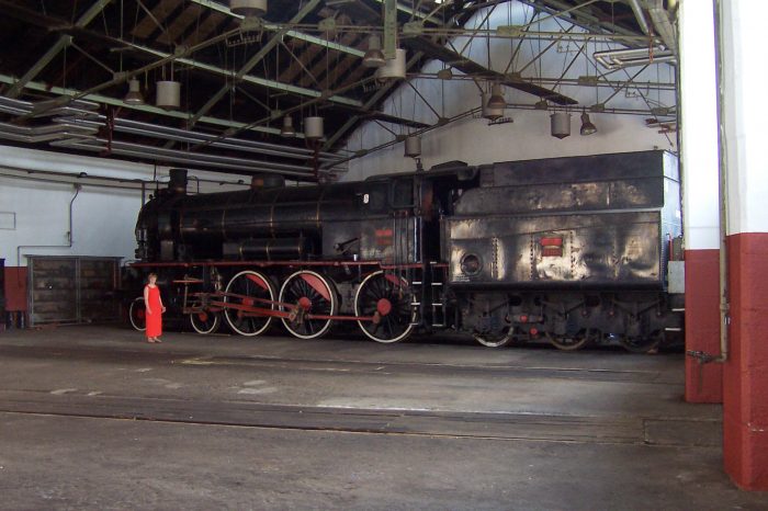
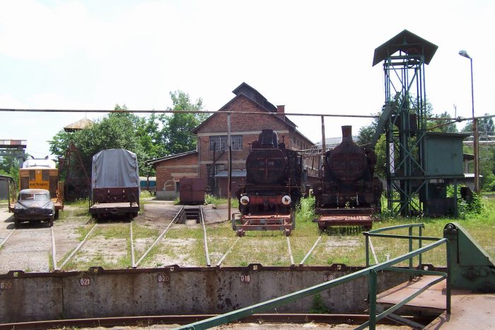
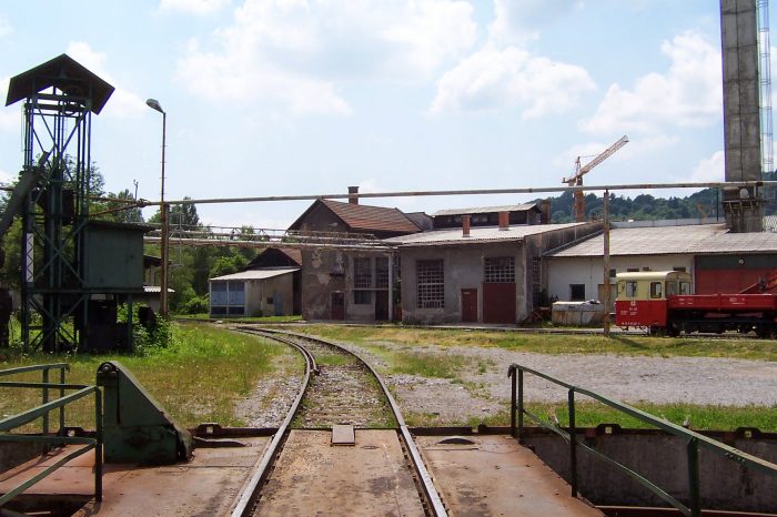
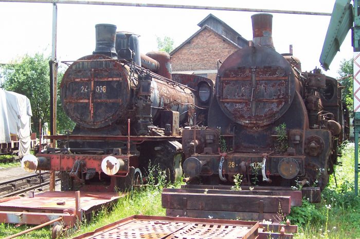
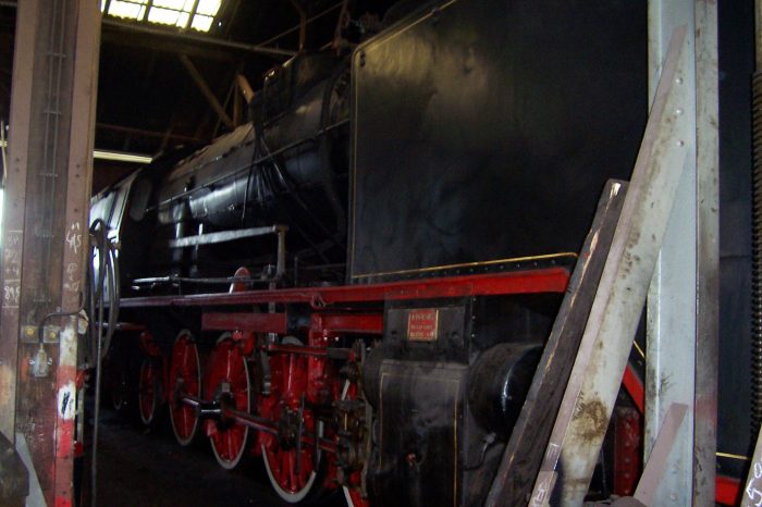
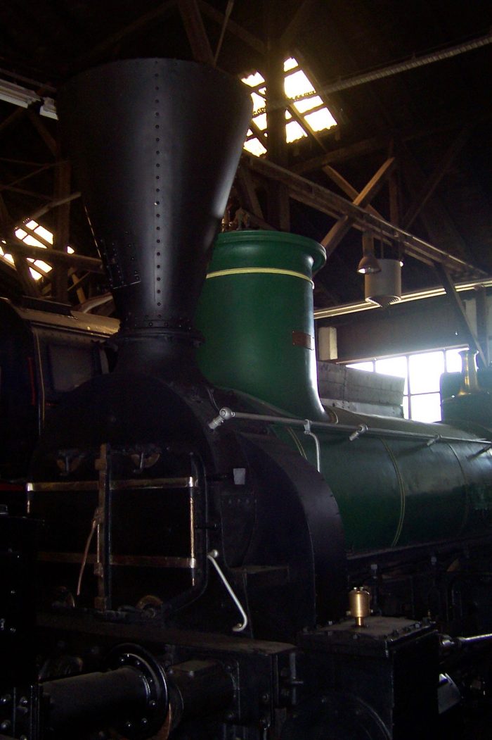
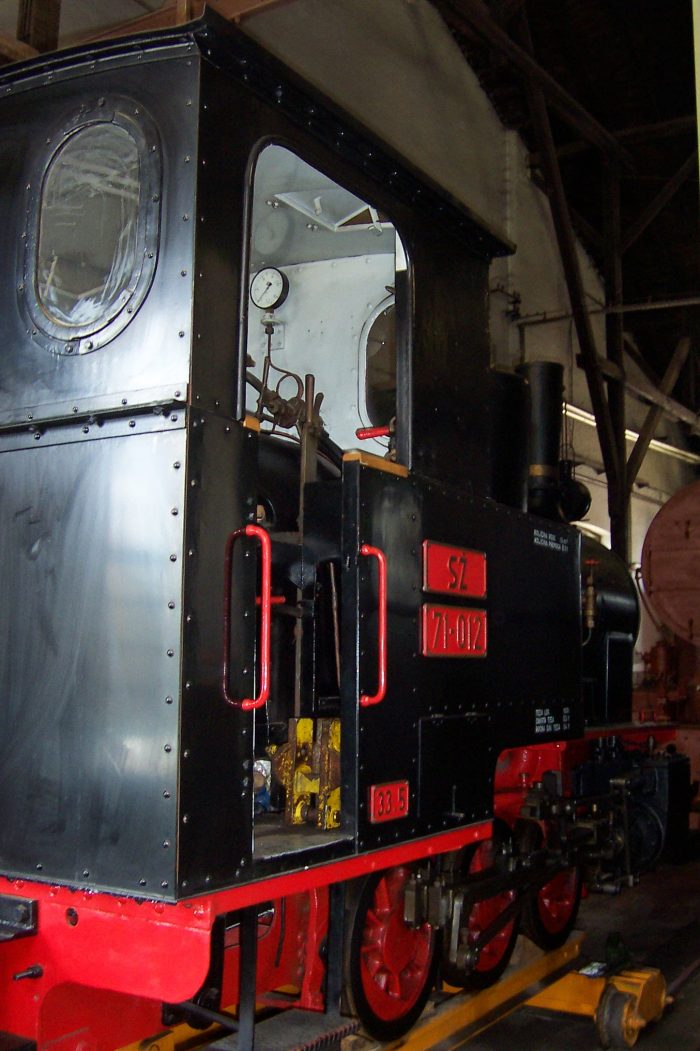
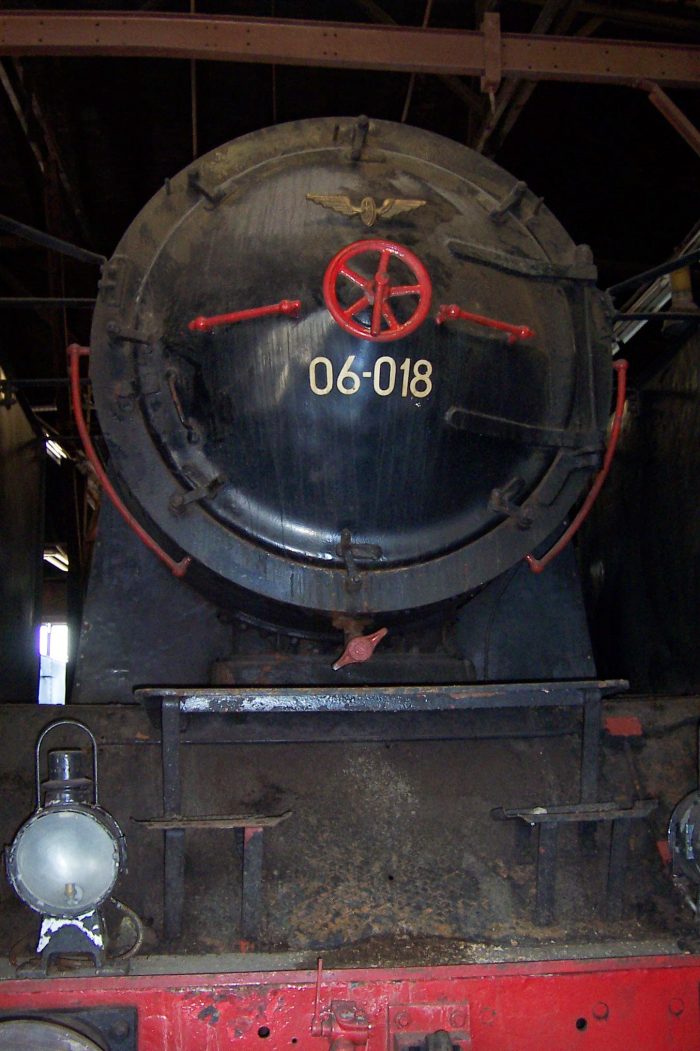
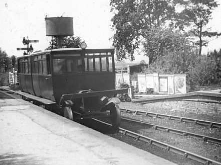
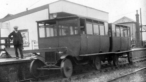
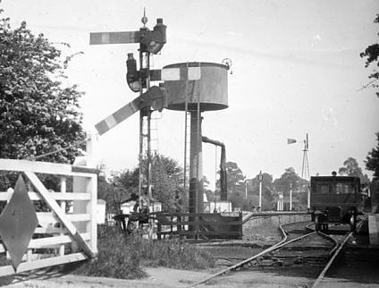
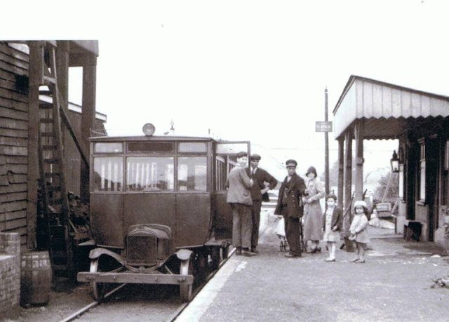
Trafalgar Colliery. [10]Trafalgar Colliery. [11]

The Trafalgar colliery was unique in Dean in being lit by gas, and electric pumps were installed underground in 1882, the first recorded use of electric power in a mine. [1] Gas was forced down the shaft by means of a one horse horizontal engine erected in the gas house at the pit bank. The gas house appears as a building shown on the 1898 Severn & Wye plans containing a circular structure. [2][8] It appears on the 5th map extract below.

Francis William Thomas (Frank) Brain had been associated with the use of electric floodlights on the Severn Bridge in 1879 where they had been used to enable construction work to continue at night to make the best use of the tides. After use on the bridge, the apparatus, consisting of a couple of powerful lamps supplied by a Gramme machine, was re-erected at Trafalgar on the surface to light the colliery yard. The Lightmoor website continues:

Electricity was also used at Trafalgar when the first underground pumping plant was installed in December 1882.  The installation at Trafalgar was the first recorded use of electric power in mines. The equipment consisted of a Gramme machine on the surface driven by a steam engine and a Siemens dynamo used as a 1.5 horse power motor belted to a pump underground. The Gramme machine still exists today, preserved in the National Museum of Wales in Cardiff.  It attained such success that three additional plants were erected in May 1887 and these did the larger part of the pumping.  The last installation consisted of a double-throw nine inch plunger, by ten inch stoke, situated 2,200 yards from the generator and 1,650 yards from the bottom of the shaft.  The pipe main was seven inches in diameter and at its maximum speed of twenty-five strokes a minute the pump lifted 120 gallons to a height of 300 feet.  The current was conveyed to the motor by an 13/16 copper wire carried on earthenware cups.  The E.M.F. was 320 volts and the current required was 43 amperes.  The installation cost of the engine and the electrical plant was £644, whilst the weekly cost for maintenance, including 15% for depreciation and interest on capital was £7 17s. or .002d. per horse power per hour.  The efficiency attained throughout was only 35% but the engine which was an old one lost 6.49 horse power, or 22% alone.  If this was removed from the equation then the efficiency was 45%.” [2]

In the mid-1880s, the Trafalgar Colliery got into some financial difficulty. This was resolved in a way that kept the creditors at bay and left the Brain family in overall control. To do this a new company was formed – the Trafalgar Colliery Co. Ltd. This new company saw the amalgamation of the interests of the Brain family at Trafalgar and the Wye Colliery Co. who leased Speculation Colliery. Both mines came under the control of this new company. [2]

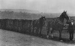
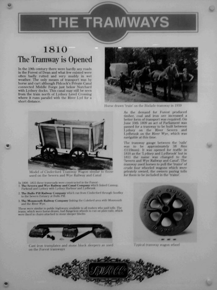
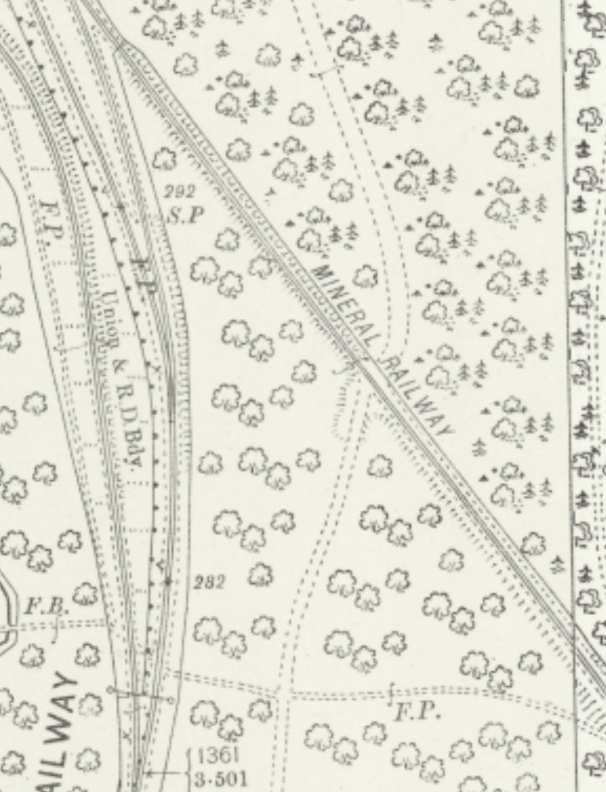
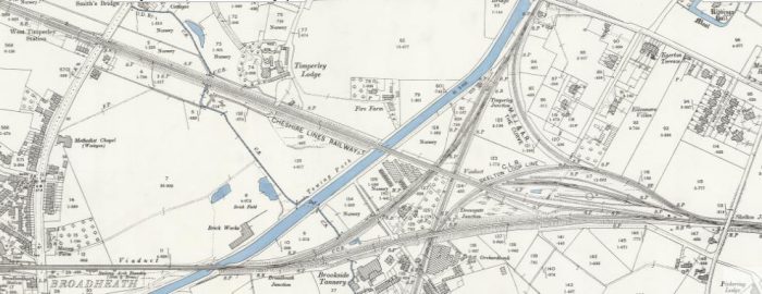
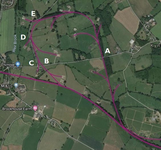
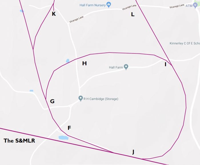
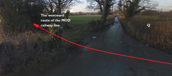
A narrow-gauge tramway (Brain’s Tramway) was built soon after the opening of the colliery to connect to the Great Western Railway’s Forest of Dean Branch at Bilson [1] The single line of 2ft 7.5in gauge utilised edge rails laid on wooden sleepers and ran east from the colliery, turning south-east at Laymoor, and terminated 1.5 miles away at interchange sidings at Bilson. It would appear that the authorisation for its construction was a Crown licence for ‘a road or tramway 15 feet broad’ dated May 1862. The date the line was opened for traffic is unknown as, although the first of three locomotives used on the tramway was built in 1869, it is possible that it may have been horse worked before this date. [2] Brain’s Tramway will, I hope, be the subject of a future post in this series. 
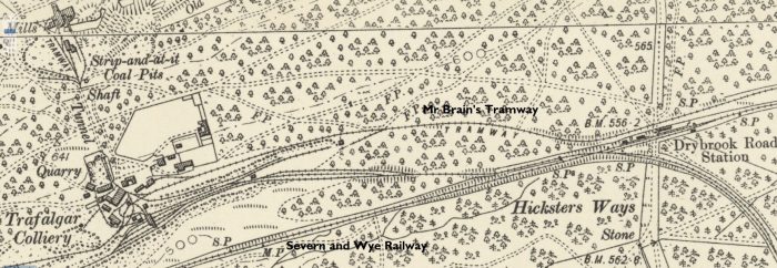
6″ OS Map from 1901 showing both Mr Brain’s Tramway and the standard-gauge sidings of the Colliery and their connection to the Severn & Wye Railway close to Drybrook Road Station. [8]
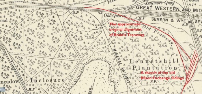
The extent of Mr Brain’s Tramway when first built to the Bilson Exchange Sidings. The point of conflict with the Severn and Wye near Laymoor (as mentioned below) can easily be picked out on the map extract. [8]
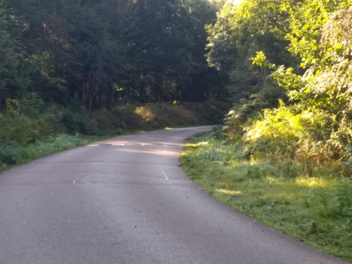
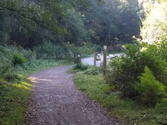
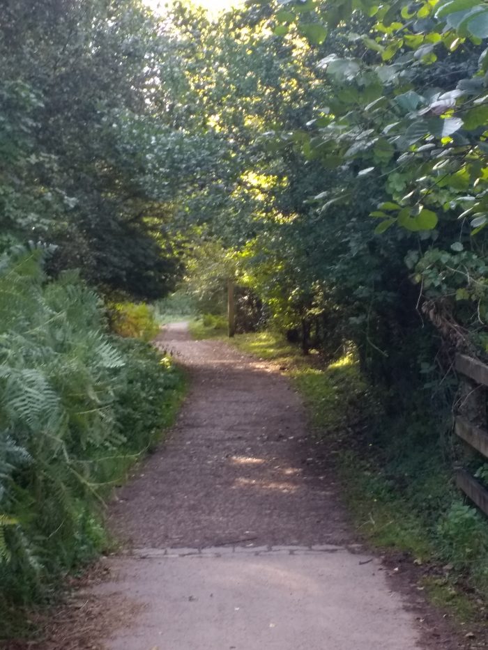
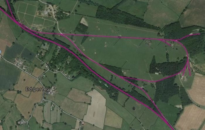
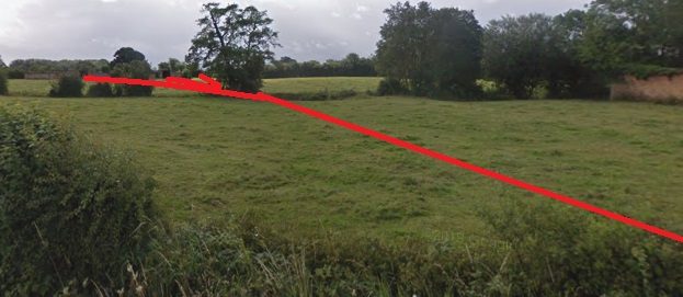
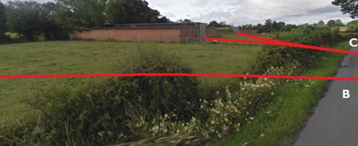
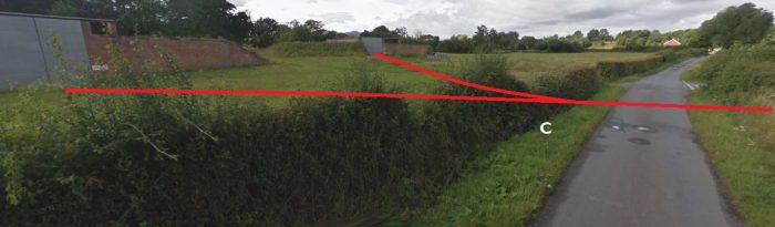
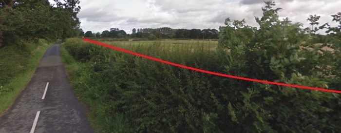
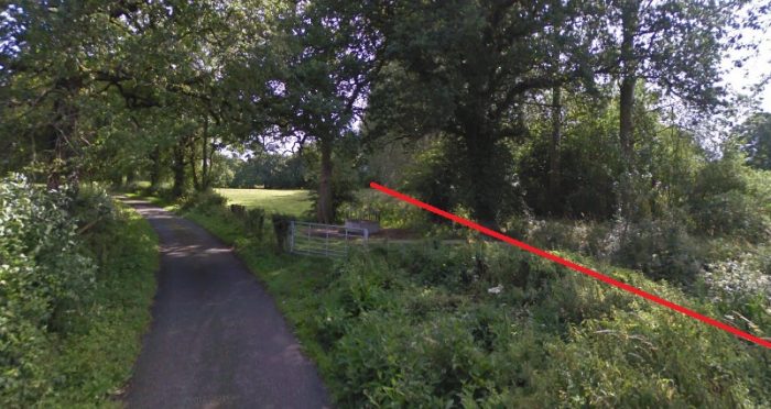
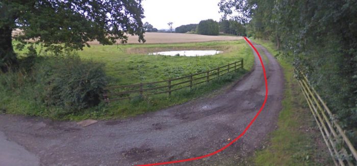
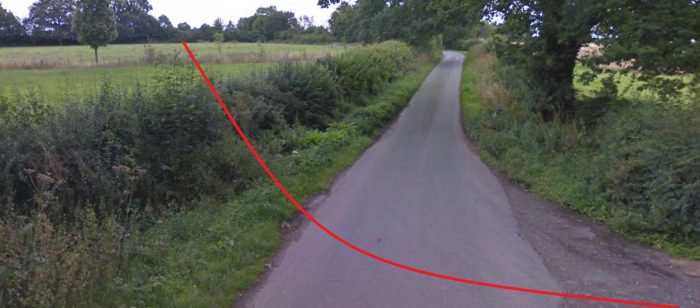
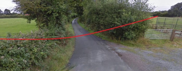
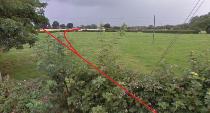
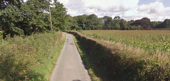
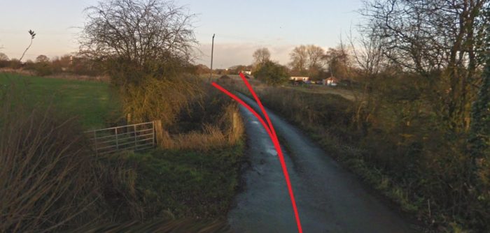
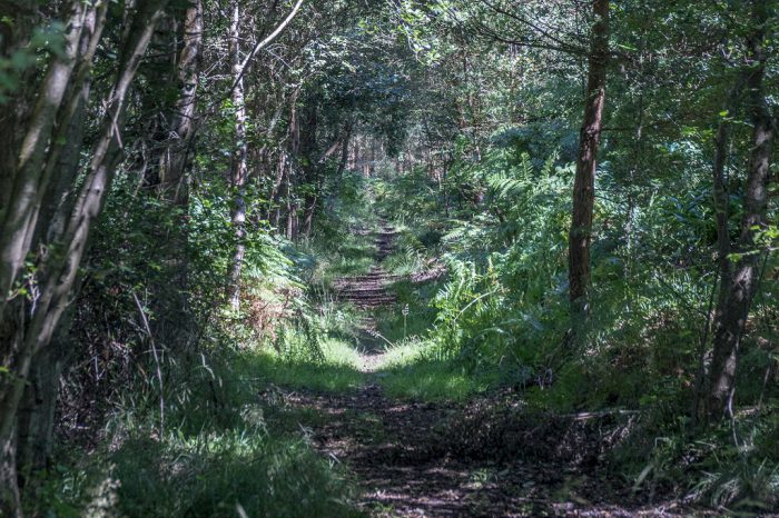
Two pictures above taken along the line of Brain’s tramway – August 2017. [14]

Tramway locomotives hauled trains of 20-25 trams of coal on each trip along Brain’s Tramway to Bilson, until 1872 when the Severn & Wye built their branch to Bilson. This crossed the tramway on the level near Laymoor and resulted in the need for the two companies to negotiate an acceptable coexistence. This became more urgent once the Servern and Wye extended beyond Drybrook Road an when, in 1878, passenger trains began running over the crossing.

Although a connection had been made to the Severn and Wye Railway in 1872 [1] at a point between Serridge Junction and Drybrook Road station, a large element of Trafalgar’s output still travelled along the tramway to Bilson. [2]

In 1872, agreement had been reached between the Severn and Wye and Trafalgar Colliery for sidings to be put in to serve the colliery screens. Soon after the Mineral Loop of the Severn and Wye was completed, a loop off the main line was installed and sidings were laid. However, the Severn and Wye was dismayed to note that Trafalgar was still making heavy use of the tramway.

The Lightmoor Press website comments that:

An approach was made to the colliery company to provide arrangements for loading hand picked nut coal on the Severn & Wye sidings as well as on the Great Western at Bilson. This was rejected at first but by January 1887, after further negotiations, Trafalgar approved a proposal whereby the Severn & Wye altered the sidings and shed whilst the colliery company altered the screens, thus resolving this ‘vexed question’.

Finally, in December 1889, an agreement was entered into between the Severn & Wye and the Trafalgar Colliery Company who, it was said, ‘are desirous of obtaining railway communication to Bilson Junction in lieu of their existing trolley road.’
It was agreed that on or before 31 March 1890 the colliery company would construct new sidings and the railway company would lay in a new junction at Drybrook Road. Although the new junction was a quarter of a mile closer to Drybrook Road than the old sidings, the mileage charge was to remain the same.  The accommodation, on approximately the same level as Drybrook Road station, was to be constructed so that traffic to and from the Great Western would be placed on a different siding to that which was to pass over the Severn & Wye system. For taking traffic to Bilson Junction for transfer to the Great Western the colliery was to be charged 7d per loaded wagon, although empties were to pass free. The transfer traffic also had to be conveyed ‘at reasonable times and in fair quantities so as to fit in with the ordinary workings of the Railway Company trains’.

The new sidings were brought into use on 1st October 1890.” [2]

This agreement resulted in the abandonment of the length of the tramway from Laymoor to Bilson Junction. Two of the colliery’s narrow gauge locomotives were put up for sale, neither sold. [2]

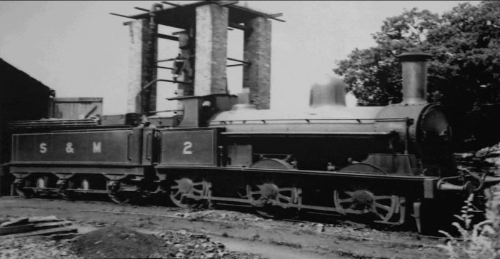
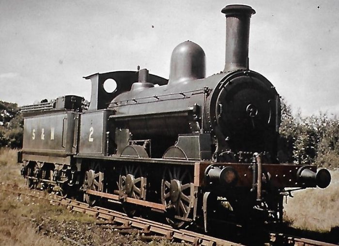
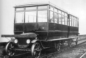
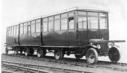
The colliery appears to have owned three locomotives: ‘Trafalgar’ and ‘The Brothers’ were 0-4-2 side-tank locos. The third locomotive was ‘Free Miner’, an 0-4-0 side-tank. Trafalgar continued in use until 1906, working on the northern extension of the tramway, built in 1869, to the Golden Valley Iron Mine at Drybrook. [2]

Trafalgar was one of the larger pits, employing 800 men and boys in 1870, and producing 88,794 tons of coal in 1880 and about 500 tons/day in 1906. [1]

However, by 1913 difficulties were being encountered with water. The managements of both Foxes Bridge and Lightmoor Collieries were worried about the threatened abandonment of Trafalgar. They feared that if pumping ceased, their own collieries might be under threat from the build-up of water within Trafalgar’s workings.  The colliery was offered for sale to Crawshay’s, the owners of Lightmoor and with an interest in Foxes Bridge, but at a figure they would not entertain at that time. [2]

At the beginning of 1919 the main dip roadway at Trafalgar was suddenly, and unexpectedly, flooded.  A report in the Gloucester Journal  on 25 January stated that as a result of the flooding 450 men were temporarily unemployed.  Apparently the electric pump, which had drained the deep workings for over 30 years, failed. [1][2]

The flooding once again led to worries by the Foxes Bridge and Lightmoor managements  about the dangers to their concerns.  Trafalgar was now offered for sale at £16,000. The Foxes Bridge and Lightmoor managements were prepared to offer £10,000 and, in an attempt to meet the difference, the Crown agreed to provide £4,000 should the sale go through.  It was estimated at this time that there was still 2.5 million tons of coal to be worked in the pit and its associated gales which would give the Crown an annual return from tonnage rates of £1,000 for 20 years, certainly paying back the £4,000. Trafalgar was sold in November 1919. It continued to be worked until 1925, producing around 4,500 tons of coal each year. After closure, it may have been that pumping continued for a while but was interrupted by the coal strike in 1926, one report stating that upon the conclusion of the strike the workings were found to be flooded.  The effects of the colliery were sold off by auctions between 1925 and 1927. [1][2][3]

Various Locations around the site of the Colliery

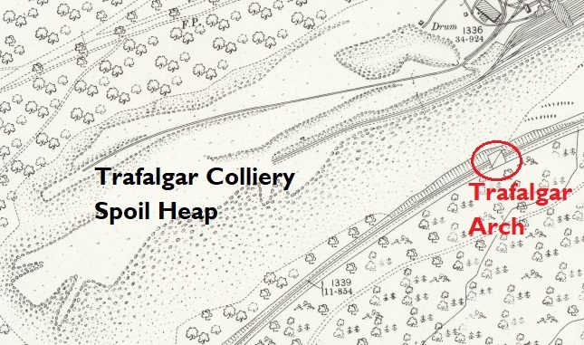
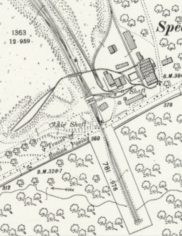
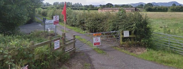
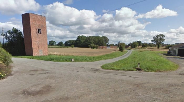
  1. Trafalgar Arch – between Serridge Junction and Drybrook Road, the Severn and Wye Railway ran very close to the large spoil heap of Trafalgar Colliery. The line was protected by a stone retaining wall braced at one point by a brick-lined stone arch. This was built by the S&WR at a cost of about £200 in 1878 or thereabouts, after lengthy negotiations with the colliery company, who wanted to tip spoil on the other side of the line. It is uncertain whether or not the bridge was used for this purpose and tipping appears to have continued on the original site. In 1887 the retaining wall was damaged by a major slip. It was replaced by a stronger one in 1904, but this soon collapsed, and was eventually rebuilt. The bridge was renovated when the old railway track-bed became a cycleway. The arch was restored to as-new condition before October 2001. [9] It is highlighted on the 25″ OS Map extract below. [8] 
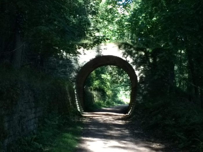
We walked to the colliery location in September 2019 and took the picture of the arch below.

    Trafalgar Arch – taken on 18th September 2019. (My photograph)

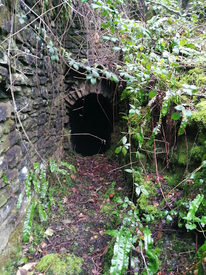
    The Strip-and-at-it end of the Tramway Tunnel [12]The Trafalgar end of the Tunnel. [12]
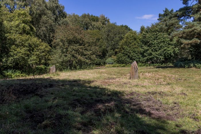
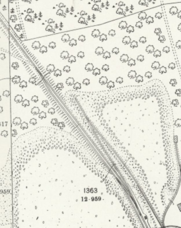
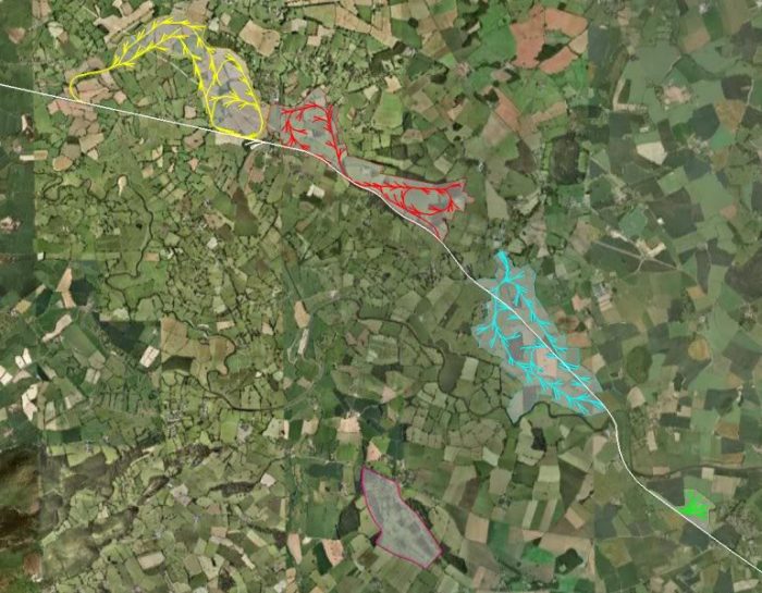
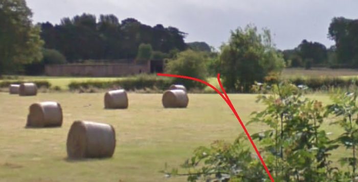
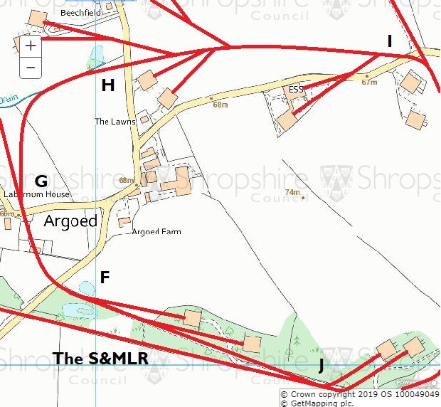
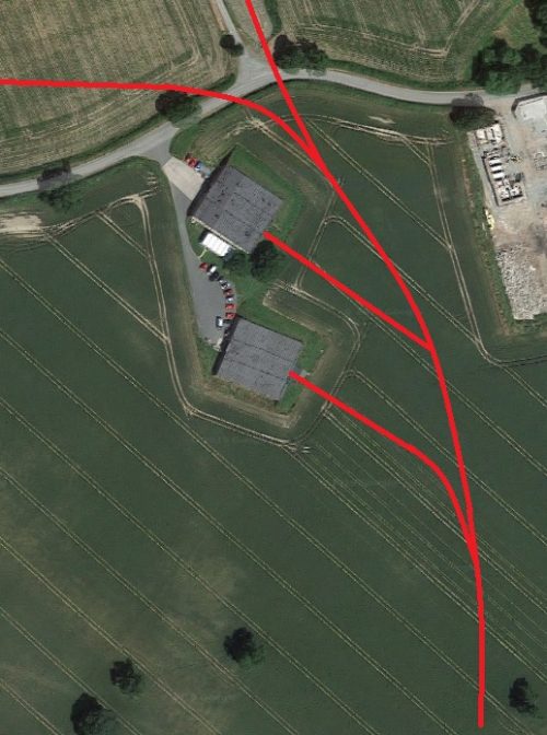
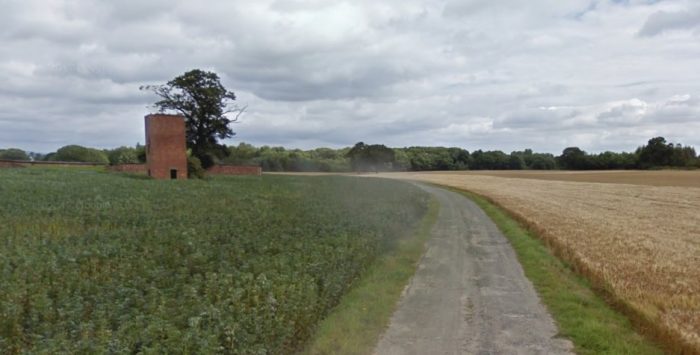
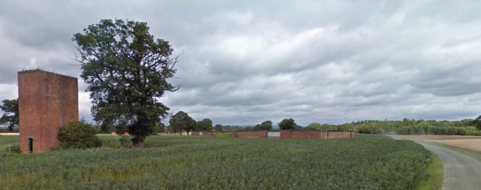
The locations of the two shafts at Trafalgar Colliery. [14]

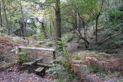
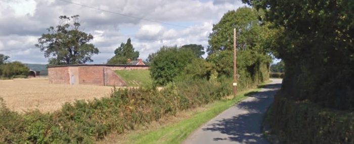
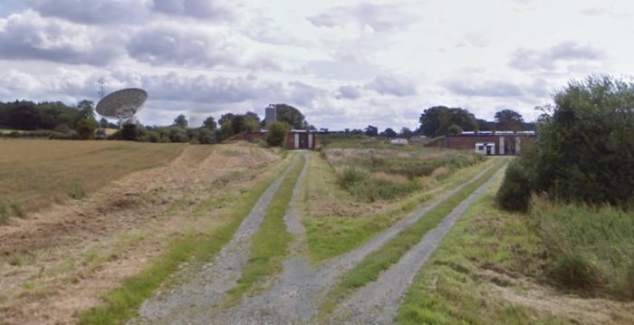
    A view from immediately to the North of the East end of the Spoil Heap at Trafalgar Colliery. [15]

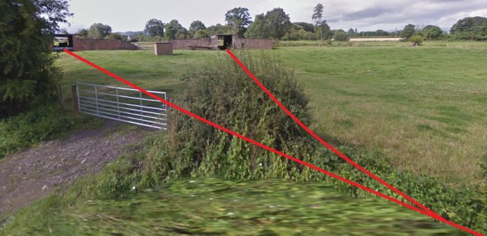
  2. The Disused Tunnel – the tunnel between Trafalgar and Strip-and-at-it Collieries was  cut through a small ridge between the two collieries. It had a very narrow bore as is evident in the adjacent pictures. The north portal, in the first of the photographs, is very difficult to access. The south portal was in the wall of an old quarry facing the site of the Trafalgar Pit.
  3. The Colliery Screens – there are remains of retaining walls from the screens which can still be seen on site, a picture appears below.
  4. The tip – the Colliery spoil heap still exists on the north side of the cycleway which follows the Severn and Wye Railway formation. “The earthwork remains of the Trafalgar Colliery spoil heap are visible as an earthwork on aerial photographs. This massive spoil heap was situated to the south west of the colliery buildings and is centred on SO 6223 1424. It measures 485 metres in length and up to 120 metres in width. North east of the spoil heap at SO 6241 1445 is a quarry where stone was extracted for colliery buildings and shaft linings.” [13] It was later used as the route of the tramway through the tunnel to Strip-and-at-it Mine. The spoil heap material is derived from the Supra-Pennant Coal Measures.
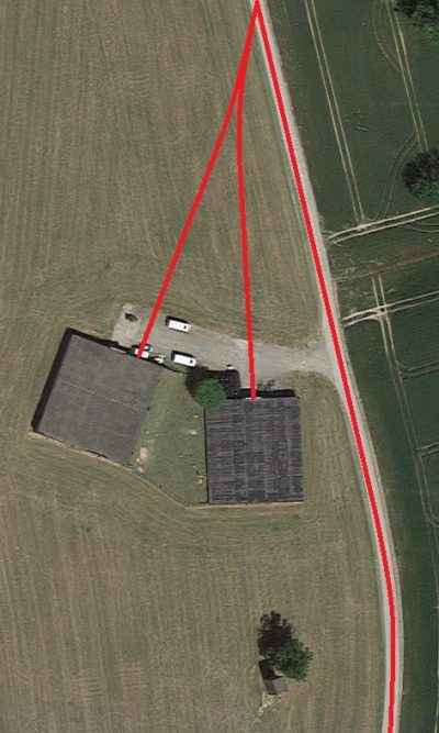
  5. The Shafts – the two shafts are marked in the early 21st Century by two large standing stones, as shown in the adjacent image.
  6. Trafalgar House – the home of Sir Francis Brain is still in use as a private dwelling. Two modern pictures are shown below. These are followed by a small extract from the 25″ OS Map [8] and a picture of the house and tramway which is in an article by Ian Pope in Archive Journal No. 84. [16]

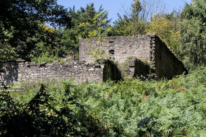
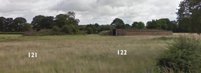
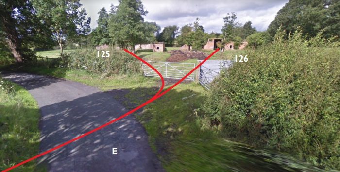
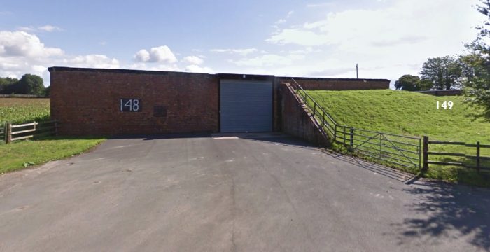
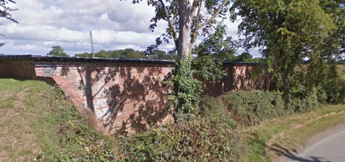
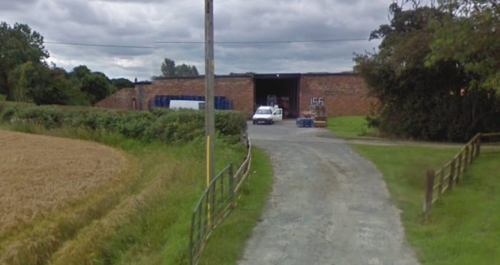
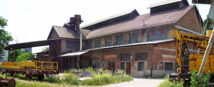
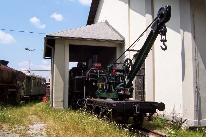
The remaining colliery buildings and screens. [14]

Trafalgar House. [14] ……. (NB: This is actually the next door property, please see comments below)

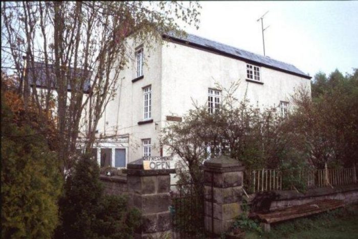
Trafalgar House,. The picture was taken in 2002. [1]

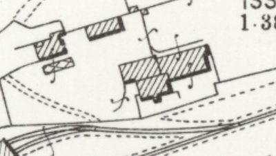
25″ OS Map – Trafalgar House. [8]

Trafalgar House early in the life of the Colliery. [16]

References

  1. https://www.forestofdeanhistory.org.uk/resources/sites-in-the-forest/trafalgar-colliery, accessed on 30th August 2019.
  2. http://lightmoor.co.uk/forestcoal/CoalTrafalgar.html, accessed on 30th August 2019.
  3. http://way-mark.co.uk/foresthaven/historic/trafalgr.htm, accessed on 30th August 2019.
  4. John Bellows; A Week’s Holiday in the Forest of Dean; 1880, replica edition Holborn House, 2013.
  5. Cyril Hart; The Industrial History of Dean; David & Charles, Newton Abbott, 1971.
  6. https://rogerfarnworth.wordpress.com/2017/09/28/the-branch-tramways-and-sidings-of-the-severn-and-wye-tramroad, collated in February 2018. This link gives some background information on all of the branch tramways of the Severn and Wye. I hope to be able to provide some more specific detail on a number of these tramways in the future.
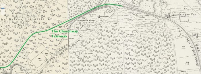
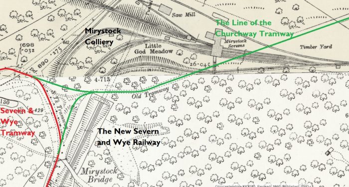
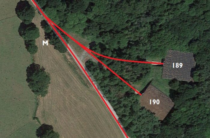
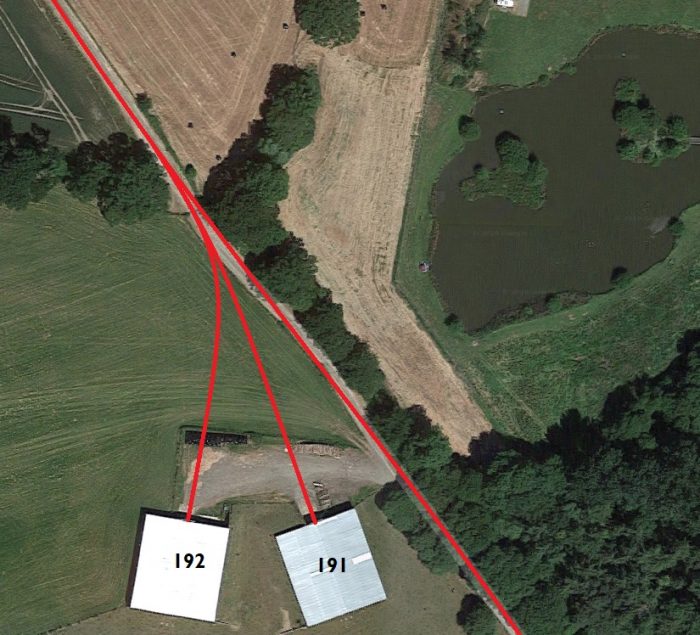
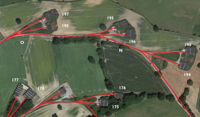
  7. Gloucestershire County Council Historic Record Archive which holds a great deal of source information. Monument No. 5701; https://www.heritagegateway.org.uk/Gateway/Results_Single.aspx?uid=4329&resourceID=108, accessed on 20th September 2019. … The Severn and Wye Co built a branch from Mirystock to Churchway, where a junction was made with the Bullo Pill tramroad in 1812 (This became the GWR Forest of Dean Branch). A short loop line at Mirystock was constructed in 1847 to give better access to the Churchway branch from the south, a second spur to the Churchway branch was constructed in 1865. … The Churchway Tramway closed in 1877 and was lifted almost immediately. I hope that this tramway will be the subject of a future post. The 25″ OS Maps of the time, very fortunately, were drawn over a significant time frame. This means that one part of the Mirystock Mine appears on the maps (below) but not the southern half which was the part which obliterated the junction of the Churchway Tramway with the Severn and Wye Main line. Four extracts from those maps appear below. The first three show the length of the Churchway tramway, the fourth shows the junction with the Severn & Wye Tramroad in slightly greater detail. These are sourced from reference 8 below.
  8. https://maps.nls.uk/os/25inch-england-and-wales, accessed on 20th September 2019.
  9. https://www.forestofdeanhistory.org.uk/resources/sites-in-the-forest/trafalgar-arch, accessed on 22nd September 2019.
  10. http://way-mark.co.uk/foresthaven/historic/hstcin0e.htm, accessed on 22nd September 2019.
  11. https://www.flickr.com/photos/8812089@N06/15926122657, accesed on 22nd September 2019. … Attribution-NonCommercial-ShareAlike 2.0 Generic (CC BY-NC-SA 2.0)
  12. https://aboutangiekay.blogspot.com/2019/04/strip-and-at-it-and-other-reprehensible.html?m=1, accessed on 22nd September 2019.
  13. https://www.heritagegateway.org.uk/Gateway/Results_Single.aspx?uid=8597&resourceID=108, accessed on 24th September 2019.
  14. http://www.industrialgwent.co.uk/wuk12c-fodne/index.htm, accessed on 24th September 2019.
  15. https://www.geograph.org.uk/photo/4957275, accessed on 24th September 2019.
  16. Ian Pope; Mr Brain’s Tramway; in Archive No. 84, Black Dwarf, Lightmoor Press, Lydney, 2014; p3-31.

The Tanat Valley Light Railway and the Nantmawr Branch – Part 1

Llangynog Railway Station in 1930.

The Tanat Valley Light Railway (TVLR) was a 15-mile (24 km) long standard gauge light railway. It ran westwards from Llanyblodwel in Shropshire, about 5 miles (8 kilometres) south-west of Oswestry. It crossed the Wales–England border and continued up the Tanat valley, terminating at Llangynog in Powys. It opened in 1904, providing access to a fairly remote area, and transport facilities for slate production and agriculture. Its promoters were unable to raise the capital to construct the line, but a number of government grants and generosity by the Cambrian Railways company enabled the building of the line. The company was always in debt and in 1921 was obliged to sell the line to the Cambrian Railways. [1] But, in confirming these things, we are getting ahead of ourselves. … Suffice to say, this post looks at the history of the line and the Nantmawr Branch. A subsequent post will look in more detail at the length of the line and its infrastructure.These two plans show the route of the Tanat Valley Light Railway and its place within the local railway infrastructure. [1]

There were several schemes put forward over the years for the construction of a line in the Tanast Valley, but they failed due to lack of interest from subscribers. One ambitious scheme was to extend the West Midland Railway [7] through the region, passing through Montgomery and Bala penetrating the Berwyns by a long tunnel. If this scheme had been successful, it would perhaps have given the Great Western Railway a trunk line to Holyhead; as it was, the Chester and Holyhead Railway was adopted instead. [1]

In 1866 the Potteries, Shrewsbury and North Wales Railway [8] opened from Shrewsbury to the quarries and Nantmawr. That railway was intended to continue through the Tanat Valley to Porthmadog, but it failed to raise the necessary capital. [9]

In 1882 an Oswestry and Llangynog Railway had been authorised by Act of Parliament, but it failed to raise the necessary capital and was formally abandoned in 1889. [10]

The Light Railways Act [11] was passed in 1896, enabling the construction of low-cost railways. This encouraged renewed consideration of a railway in the Tanat Valley, and two alternative schemes were developed. One was for a narrow gauge line from the Llanfyllin terminus of the Cambrian Railways branch. The other was for a standard gauge line from Porthywaen, four miles south of Oswestry. After deliberation, the latter was adopted. [12]

Two months after the passing the of Act, the Oswestry and Llangynog Railway Company met and formed the Tanat Valley Light Railway Company (TVLR). On 5th August 1897 the Company presented its grant bid to the Earl of Jersey who was presiding at the enquiry on behalf of the Light Railway Commission and a grant was awarded. [20]

Wikipedia asserts that, “the Cambrian Railways agreed to work the line for 60% of gross receipts, and a Treasury grant of £22,000 was agreed, as well as an interest-free loan of £6,000. Financial assistance was also made available from local councils; the share capital of the Company was £15,000. The General Manager of the Cambrian Railways, Mr C. S. Denniss, estimated the capital cost of the line at £46,000. Receipts would be £2,950 per annum. After interest and fixed charges, this would enable a dividend of 4% to be paid.” [1] It was noted that the margin for dividends was small.

Wikipedia points out, however, that others saw things differently: alternative figures were “provided by the Town Clerk of Oswestry, Mr J. Parry-Jones. The total capital of the Company was to be £65,500. Local authorities had promised £18,500 in loans or share subscriptions; £18,000 had been promised as a free grant (though with conditions) by the Treasury; £20,000 had been promised by the Trustees of the Llangedwyn Estate, probably as a share subscription; £1,500 in shares by the Earl of Powis, and about £4,000 by other local investors. “The company’s borrowing powers are £12,000, so that towards the £65,500 capital required, they are sure of over £55,900.” [13][1]

The Light Railway Order was granted on 12 September 1899, [14] although modifying Orders were needed in 1904 and 1908 to assist in raising capital.[1]

Cambrian Railways Train operating on the Tanat Valley Light Railway in 1904. [1]

Construction started until July 1901. [14]. The line was inspected by the Board of Trade Inspecting Officer on 21 December 1903; [10] the line was formally opened on 5 January 1904, and the public passenger service started the following day. [9][14]

Industry in the Tanat Valley

The Berwyn Hills are part of the range that begin in Llangollen and end at Cader Idris near Dolgellau. The Western and Northern sides of this range drop steeply into the Dee Valley, but the Eastern side is broken into steep sided channels which form the routes for a number of streams and rivers that begin in the Berwyns. One of these rivers is the Afon Tanat which arises about 5 miles to the West of the small village of Llangynog, flowing eastward past the Llangynog for 12 miles until forced by Llanymynech Hill to flow South to a confluence with the Afon Vyrnwy. [2]

Slate and stone have been quarried across the Berwyn Hills for many years and mining has taken place since prehistoric times. The first documented evidence of mining comes from the latter part of the 17th century. A mine at Craig-y-Mwn was providing considerable amounts of lead but early miners found transporting goods to smelters at Pool Quay by the River Severn, difficult. [2]

Although there is no evidence to show that the South Llangynog Lead Mine was closed because of the inadequacy of the transport system, most authors imply this to be the case for other mines in the area. In 1870, the Craig-y-men Lead Mine closed despite having an annual turnover of £30,000 – a significant sum at the time. [20]

The lead mine at Cwm Maengwynedd and the phosphate mines at Cwm Hirnant and Cwm Gwenen were in a similar situation. Raw materials and supplies sent to Llangynog cost 20s a ton more than at Portywaen. Timber sold at Llangynog raised 7d a foot whereas, at Oswestry, it would sell for 1s a foot. The lack of a railway had limited the industries and was threatening their future. [20]

Joseph Parry, the Liverpool water engineer, reported in 1897 that, without the railway, the Vymwy aqueduct could not be completed. Damage to infrastructe would be too great and repair costs would mean that the venture would have been unprofitable. Industry needed a more sophisticated transport system. The railway was needed for the survival of the industrial life of the valley. [20]

The delay in the coming of the railway meant that the slate mines at Llangynog also found that they could not compete with other areas and gradually declined in importance. The arrival of the Tanat Valley Light Railway came too late to rescue the slate mines as by then the slate industry was in general decline. [2] Only line slate Maine remained open until 1936 (the Rhiwarth Slate Mine). [20]

However, the arrival of the Tanat Valley Light Railway gave new life to other mines in the area. Improved transport made it viable to quarry the granite chippings that abounded and which were being used as surface dressing for roads needed by increased popularity of the car. [2]

At the opposite end of the Tanat Valley there were a number of Limestone quarries which had been enjoying good transport links via the Ellesmere Canal and the associated tramway links for over 100 years. Considering the mineral and ore potential of the Tanat Valley it seems odd that a narrow gauge railway was not considered. [2]

Permission to build the railway had been granted in 1897, yet it was 7 more years before it was completed in 1904. The railway brought a renewed sense of hope to the Tanat Valley which had long been in decline. By 1900, only one of the 19 mines and quarries which had been operating in the valley was still in use. This was the Craig-y-Mwn Mine, 3.5 miles to the north-east of Llangynog. The mine survived because it was closer to the Rhaeadr Valley which had a better road than the Tanat Valley. [20]

By 1913, six mines or quarries had been re-opened. All of them were sited at the western (Llangynog) end of the line and all of them used the TVLR. All were stimulated into new life by the arrival of the railway. Prior to the opening of the line, all of the mines which opened in 1904 had, between 1898 and 1900, been worked by the Belgian Vieille Montage Company. This was one of the most prestigious mining companies of the time but it had been, in every case, unsuccessful in the Llangynog area. [20]

The mines were not workable until the arrival of the railway and the railway, in turn, was the stimulus for the re-opening of the mines. Three of these mines, Craig-y-men, Cwm Orog and Cwm Glenhofen, had closed by 1911, but the others all remained open until at least 1936.  These mines included the Rhiwarth Slate Mine, the West Llangynog Granite Quarry, the Makers Granite Quarry and the Craig Rhiwarth Granite Quarry. [20]

Noticeable remnants of the industrial activity in the valley still remain. Most noticeable are the spoil heaps at Llangynog whilst at the other end of  the valley the limestone quarry remains have mostly been reclaimed by nature. [2]

Agriculture in the Tanat Valley

While the Tanat Valley contained at least 19 mines or quarries, the maiority of its inhabitants worked on the land. A survey carried out on 28th July 1897 showed that 296 vehicles, 777 people and 793 travelled down the valley. Most of this traffic was agricultural in nature. The modes of transport used were old-fashioned and inefficient. [20]

Mark R. Lucas comments: “Many farmers could not afford the time to make these Journeys and were forced to sell the animals at their farms for £2 or £3 less per head than if they had been sold in the open market. The absence of a railway was causing a population decline because farmers could not afford to pay their labourers. [20]

The conditions of the grant that the TVIR applied for stated that the railway must “be profitable to Agriculture.”  As the grant was awarded, we can assume that the Earl of Jersey thought that the railway would “be profitable to Agriculture” [20]

The Tanat Valley Line

Perkins and Fox-Davies described the line in The Railway Magazine of May 1904.

“Passenger trains ran from Oswestry, southwards over the Cambrian Railways line as far as Llynclys, then turning west on the Cambrian Railways Porthywaen branch, leaving that at Porthywaen passenger station, a very small building, and now entering on the Tanat Valley line itself. The track was of much lighter construction now, consisting of Vignoles pattern (flat-bottom) rails [15] dogged direct to the sleepers. The Nantmawr branch of the Cambrian Railways converged from the north. The first TVR station was Blodwel Junction, a single platform station. Blodwel station had been opened in 1866, the terminus of the Potteries line, and known then as Llanyblodwel, part of the mineral branch crossing the path of the TVR. A road crosses the railway by a bridge at Blodwel; this is the only place where there is a bridge crossing of a road.

The next station stop was at Llanyblodwel; a short distance after the station the train stopped for the engine to take water. Glanyrafon was next geographically, but was not yet open when Perkins and Fox-Davies visited, and it was not referred to by them. This section was followed by a crossing into Wales, climbing at 1 in 64. Llansilin Road is the next station, serving Penybont. Llangedwyn station is next, where there was provision for crossing trains on the single line, followed by the small station of Pentrefelin, and then Llanrhaiadr Mochnant, also built as a passing station. A reservoir for Liverpool Corporation Waterworks was built at a location five miles away, and the railway was used for importing some construction materials. The line continues, calling at Pedair Ffordd and terminates at Llangynog. The journey time from Oswestry was 70 to 75 minutes.

The gradients on the line generally rose to Llangynog. It fell with a short section at 1 in 72 to Blodwel Junction, and then rose with a half mile at 1 in 64 but generally more moderate gradients all the way to the terminus. Porthywaen was at 132 feet above Ordnance Datum and Llangynog at 320 feet.” [9]

It seems as though passenger carriages ran with the mineral trains from 1904, but this ended on the first day of 1917. [4] Mineral revenue was about twenty times the value of passenger receipts, and the latter declined further in the 1920s and 1930s as reliable road transport was developed. [1]

From its opening in 1904, the Tanat Valley Light Railway Company was continuously in the hands of the receiver,[17][18] as its income did not enable it to pay the interest on loans. The Cambrian Railways subsidised it, but by 1921 it was obvious that improvements to the track and bridges were required, and this was beyond the financial resources of the bankrupt company. Takeover by the Cambrian was the only way out, and this was authorised by Order of the Light Railway Commissioners. [19]

The Cambrian Railways were themselves taken over by the Great Western Railway the following year. [1]

The passenger train service in 1922 consisted of three trains each way between Oswestry and Llangynog, with an extra train on the first Wednesday of the month. [1] By July 1938 the service was more complicated: successive trains ran from Oswestry to Llangynog respectively on Wednesdays; daily except Wednesday and Sunday; Monday, Tuesday and Friday; Wednesday Thursday and Saturday; daily except Saturday and Sunday; on Saturday only; and on the first Wednesday of every month, but also on 30 July. The return service was a little simpler, running respectively on Wednesday; weekdays only; weekdays only; Monday to Friday; and Saturdays only. [16]

While railways had an inherent advantage in transporting heavy minerals, the line’s viability was dependent on the commercial success of local quarries, and when local quarries output declined the finances of the line became irretrievable. [4]

Passenger services were discontinued on 15 January 1951. The line west of Llanrhaiadr was closed completely in July 1952, a residual goods service continuing as far as that point for the time being. The line closed completely in December 1960. [4]

In the short time that it had served the Tanat Valley, the TVLR had been efficient. regular and useful, but it was no longer needed as the area lapsed back into an agrarian lifestyle The industrial potential of the valley had declined so significantly that the railway could not be sustained. [20]

The seeds of the railway’s failure were sown right at the start of its existence. We have already noted the convoluted arrangements made to finance the line. The opening of the railway was an optimistic and joyous occasion and the then Chairman even announced that a second line between LLanrhaedr and Cwm Maengwynedd would be buikt. This was notbto see the light of day as the TVLR never managed to deal with it own financial difficulties. [20]

In March 1904, the Treasury withdrew all furthwer funding. This left the TVLR with an overdraft of £2,460 and an outstanding contractors bill of close to £14,000. By June 1905, the company owed £20,000 and went into receivership. By 1917, a writ for £40.676 18s 8d issued and six years later the TVLR had to sell its land to the GWR in order to make the repayment. [20] The TVLR was not able to invest in it future. It was in a desperate cycle of financial loss which eventually caused its downfall.

There appears to have been a very significant reduction in all forms of traffic on the line. Agricultural traffic, for some inexplicable reason declined between 1923 and 1938 from 732 wagons per annum to less than 450 wagons per annum. Passenger traffic leached away to the roads. The advent of the motor car and of  parallel bus service were the major factors here, although it is also possible that the condition of the passenger carriages was deteriorating. The close of moist of the mines meant that mineral traffic fell drastically as well as the table below highlights. [20]

Crippling debts and no forecastable traffic inevitably brought about the closure of the line. The Coal Crisis of 1951 was the final straw and after closure because of a lack of coal the line never reopened. [20]

The Nantmawr Branch Line

The Nant Mawr Branch of the Potteries, Shrewsbury and North Wales Railway (The Potts) was opened in 1872 to supply Limestone primarily for road-building and for the manufacturing of Lime. This was a primary incentive for the construction of what became eventually the Shropshire and Montgomeryshire Light Railway.

Access to the Nant Mawr branch was gained using ‘Cambrian’ lines (which the Potteries, Shrewsbury and North Wales Railway had running powers over for this part) these met South of Llanyblodwel station at a twin junction where Nant Mawr traffic then turned northwards onto the actual branch then slowly travelled north-west underneath the Llanfyllin Branch then across the River Tanat by means of a wooden viaduct, underneath the main road bridge and finally across the river once more using a second wooden viaduct and so into Llanyblodwel itself. [3]

The junction was known as Nantmawr Junction until the first world war after which it became the Llanfyllin Branch Junction.

The Nant Mawr branch was on a rising gradient all the way to Nant Mawr, starting from Llanddu it passed under the A495 road-bridge and then across Whitegates crossing which has recently been refurbished. The branch then curved gently to the left, crossing a small stream and finally entered the Nant Mawr quarry complex.

In the early 21st century, only the line from Llanddu to Nant Mawr with a run round loop at each end still exists, there is undoubtedly signs of the former workings buried under the made up land at Nant Mawr, some of which have already been uncovered.

The industrial heritage of the area is to reasonably well documented and like the railway which served it, has a slightly checkered past, in 1860 the Nant Mawr quarry was owned by Mr R France who as main contractor for both the Potts and the Mawddwy railways enjoyed similar interests to Thomas Savin.

Around the same time the Lilleshall Company based at Donnington in Shropshire was finding it difficult to source enough supplies of lime to ensure continuity at its iron furnaces (Lime was used in the fluxing process) and they took a lease on Nant Mawr quarry, after almost 60 years they surrendered the lease sometime in the late 1920’s early 1930’s for by 1938 the quarry was being worked by the Chirk Castle Lime and Stone Company who continued until Amey Roadstone took over in the late 1960’s before the quarry finally closed in about 1977. [3]

Rural passenger use collapsed and the railway closed to passengers in 1951, and completely in 1964. [4]

A new Tanat Valley Light Railway Company was established, and in 2009 opened a heritage railway centre at Nantmawr Lime Kilns, close to the earlier Tanat Valley line. [5][6]

The Nantmawr Lime Kilns

The imposing structure, reputed to be the tallest Lime Kilns in the country, provides a fantastic backdrop alongside the original (now excavated) kiln sidings and the first section of the railway to be restored.

Built in 1870 by a Mr France to service his quarry located further up the valley, the colourful and fractured history of the kilns, the quarry and the railway is only matched by that of Mr France himself who was a Victorian Visionary with a roguish side to his life.

Further work is being carried out in the vicinity of the kilns in order to create a static exhibition of how they would have been worked in their early years. The kilns provided the perfect setting for the return of steam to Nant Mawr in November 2009. [6]

References

  1. https://en.wikipedia.org/wiki/Tanat_Valley_Light_Railway, accessed on 7th September 2019.
  2. http://www.nantmawrvisitorcentre.co.uk/tanat-valley-light-railway/industry-in-the-tanat-valley, accessed on 7th September 2019
  3. http://www.nantmawrvisitorcentre.co.uk/tanat-valley-light-railway/the-nant-mawr-branch, accessed on 7th September 2019.
  4. Peter E. Baughan; A Regional History of the Railways of Great Britain: Volume 11: North and Mid Wales; David & Charles, Newton Abbot, 1980.
  5. Tanat Valley Light Railway; Nant Mawr Visitor Centre; http://www.nantmawrvisitorcentre.co.uk/tanat-valley-light-railway, accessed on 7th September 2019.
  6. Nant Mawr Lime Kilns; Nant Mawr Visitor Centre;  http://www.nantmawrvisitorcentre.co.uk/nant-mawr-lime-kilns, accessed on 7th September 2019.
  7. https://en.m.wikipedia.org/wiki/West_Midland_Railway, accessed on 16th September 2019.
  8. https://en.m.wikipedia.org/wiki/Potteries,_Shrewsbury_and_North_Wales_Railway, accessed on 16th September 2019.
  9. T. R. Perkins and F. E. Fox-Davies, The Tanat Valley Light Railway, in the Railway Magazine, May 1904.
  10. E. F. Carter, An Historical Geography of the Railways of the British Isles, Cassell, London, 1959.
  11. https://en.m.wikipedia.org/wiki/Light_Railways_Act_1896, accessed on 16th September 2019.
  12. C. P. Gasquoine, The Story of the Cambrian: Biography of a Railway, Woodhall, Minshall, Thomas and Co., Oswestry, 1922.
  13. The Wrexham Advertiser: 16 September 1899.
  14. Peter E. Baughan, A Regional History of the Railways of Great Britain: Volume 11: North and Mid Wales, David & Charles, Newton Abbot, 1980.
  15. https://en.m.wikipedia.org/wiki/Rail_profile#Vignoles_rail, accessed on 17th September 2019.
  16. Bradshaws July 1938 Railway Guide, David and Charles Reprints, Newton Abbot, 1969.
  17. C. P. Gasquoine, The Story of the Cambrian: Biography of a Railway, Woodhall, Minshall, Thomas and Co., Oswestry, 1922.
  18. Preamble to the Cambrian Railways (Tanat Valley Light Railway Transfer) Order, 1921.
  19. Cambrian Railways (Tanat Valley Light Railway Transfer) Order, 1921.
  20. Mark R. Lucas; The Industrial History of Llangynog, North Wales; GCE Project, 1986. I came across this paper in the small museum in St Melangell’s Church at Pennant Melangell in August 2019.

Different Railway Gauges in operation the Forest of Dean

In September 2019, my wife and I spent a week in the Forest of Dean. On one day, we visited the Dean Forest Railway at Norchard. [1] Around the site at Norchard are a number of permanent outdoor displays.

The featured image in this post shows three gauges that for a very short time were all in use on the trackbed of the Severn and Wye Railway through the Forest.

The original gauge was the track-gauge used by the Severn and Wye Tramroad. Rails were cast iron and each section was around 1 metre in length. They were held in place not by timber sleepers but by stone blocks placed on the line of the rails. The gauge (or spacing between the two rails) was 3ft 6ins. This gauge was used by many of the branch tramways in the forest.

When the Severn and Wye became a Railway rather than a Tramroad the standard gauge for the Great Western Railway was what we now call ‘broad-gauge’ – 7 ft 14 in (2,140 mm). The Severn and Wye was constructed to the same standards as the Great Western, so avoiding the need for transhipment facilities at railheads such as Lydney Junction.

The Great Western Railway lost the ‘gauge war’  in the UK. Standard-gauge became the gauge first used by George Stephenson – 4 ft ​8 12 in (1,435 mm) gauge. After the decision was made that all future lines in the UK would be built to the standard-gauge, there was period of mixed-gauge operation (tracks were laid with three rails), the Great Western Railway did not complete the conversion of its network to standard gauge until 1892. [2]

All three of these gauges could be found on the formation of the Severn and Wye Railway until 1892.

However, these were not the only track gauges in use in the Forest.  An example of a different gauge in use us provided by Mr Brain’s Tramway which linked Trafalgar Colliery and Drybrook to Bilson Sidings and Transhipment Wharfs. It had a gauge of 2 ft ​7 12 in (800 mm). Brain chose this gauge for his tramway because it matched the gauge used underground within his collieries and so saved an additional transhipment cost at the pithead. [3]The display outlining the use of tramways which is on show in the Dean Forest Railway Museum at Norchard.The display outlining the change of gauge which is on show in the Dean Forest Railway Museum at Norchard.


References

1. https://www.deanforestrailway.co.uk, accessed on 14th September 2019.

2. https://en.m.wikipedia.org/wiki/Standard-gauge_railway, accessed on 15th September 2019.

3. Ian Pope; Mr Brain’s Tramway; Archive No. 84, Lightmoor Press, Lydney, p2-32.


Speech House (Hill) Colliery and Railway

Speech House Hill Colliery was located at OS Grid Reference: SO614119. The featured image above comes from the Sungreen website © Mark Ward. He comments: “This lantern slide shows the Speech House Hill Colliery in c1908; I believe coal winning had ceased some years earlier and it looks as though dismantlement of the engine house had begun.” [2] Elsewhere the colliery is referred to as “Speech House Colliery.”The signboard on the site of the old Speech House Colliery sits close to the climbing wall in the Beechenhurst Lodge area which is maintained by the Forestry Commission in the 21st century.

The Royal Forester Gale was first recorded as being worked in the 1830s and 40s by Richard James [1] of Whitecroft. In April 1832, he applied to the Crown for the gale but it was not granted to him.  Undeterred he erected buildings and commenced work ‘at considerable cost’ and his right to work the gale was confirmed by the Awards of 1841. [3]

It was later bought by the Brain brothers, who had the adjoining Rose-in-Hand gale. [1] It was in January 1847, that Cornelius and Francis Brain, as lessees of the adjoining Rose-in-Hand gale, were applying for an extension of time for beginning work and it was stated that they had bought Royal Forester in order to drive a level through it to drain Rose-in-Hand. [3]

In July 1856 an application was made to the Crown by the registered owners of Rose-in-Hand, Ephraim Brain and John Holingsworth, to make a tramroad connection to the Severn & Wye by means of an incline parallel to the Coleford-Cinderford road.  It would appear, however, that this was not costructed until 1869. [3] The Speech House Hill Colliery Co. had, by this time, taken over the Royal Forester gale. [1]

The Rose-in-Hand gale became part of Trafalgar Colliery and remained in the ownership of the Brain family. [3]

The Speech House Hill Colliery Co. was turn bought out by the Great Western (Forest of Dean) Coal Consumers Co. Ltd (a Crawshay company) in 1873. [1]

Although the tramroad connection was only completed in 1869, it was superseded by a railway connection  to  the Severn and Wye Railway in 1874. [3] The sidings in place in the early 20th century are shown below in the extracts from the OS Maps of the time. [4]This extract shows what was to become the access to the Cannop Colliery heading West from the Severn and Wye Railway. The Severn and Wye runs north-south in the extract. The Speech House Colliery head-shunt is on the right. [4]Rail access to Speech House Colliery involved leaving the Severn and Wye Railway in a Northerly direction and then setting back into the colliery. [4]The approach to Speech House Colliery sidings. [4]The track arrangement at the Colliery. [4]

The organising of the link to the colliery from the Severn and Wye was a matter for serous negotiation. “Crawshay offered the prospect of 100,000 tons of coal traffic per year, but laid heavy emphasis on the expenses to be incurred by the colliery in laying sidings, and intimated that they were considering sinking two pits near the Forest of Dean Central line at Foxes Bridge to avoid a steep underground pitching betwen the coal face and the existing pit bottom.  Concerned at the possible loss of such a lucrative traffic to the Great Western, the S & W agreed to loan rails, sleepers etc. if the necessary earthworks were done by the colliery company.  Following further discussions, it was decided to let the construction of the branch, and by July 1874 J. E. Billups was appointed contractor.  Part of the estimated cost of £3,300 was met by the Severn & Wye whose committee, on 5th April 1875, were conveyed to the colliery where they ‘had the satisfaction to find the Branch Line leading thereto as well as the Colliery Works in good order.  This colliery is now delivering excellent coal upon our line.'” [3]

Yields were not necessarily as good as Crawshay had intimated, 56,976 tons of coal were produced in 1880 from the Supra-Pennant Group (the top part of the Upper Coal Measures). The winding shaft (eventually 420 ft deep) reached the Churchway High Delf Seam (3 ft 3 in. thick) at 393 ft. [1]

The website, http://www.archive-images.co.uk has a series of images of the colliery, one of which is an underground view. These can be viewed, with watermark on their site or purchased for a relatively significant sum for each image. [5]

The colliery had a rather chequered history, passing through a succession of owners, until it was finally bought by Henry Crawshay & Co. Ltd, owners of the adjacent Lightmoor Colliery, in 1903. [1]

The barrier to the latter colliery was opened up and most of the surface works at Speech House Hill, no longer being required, were closed by 1906. [1] Crawshay’s prediction of traffic finding its way to other lines bore fruit some years after it was first intimated.

The main shaft at Speech House was maintained as an emergency exit for Lightmoor until the gale was surrendered in 1937. [1]

The area has been landscaped and now forms the Forestry Commission’s Beechenhurst Picnic Site which is a very popular Forest location. [1]

The pictures below were taken on 20th September 2019 and show the line of the branch off the Severn and Wye Railway which is now a cycle path, the the route of the sidings leading to the colliery screens. Finally some pictures of the location of Speech House Road Station on the Severn and Wye Railway and it’s small goods yard.

Looking South along the old Severn and Wye Railway along what is now the visitor access road for parking at Cannop Ponds.

The view South from what would have been the end of the station platform at Speech House Road Station on the Severn and Wye Railway.

At the midpoint of the old station, the Forestry Commission have provided a station name board.

The view South from a point close to north end of the Station facilities.

The view from the modern highway into the old station site. In taking this picture, I am standing at the location of the old railway crossing.

Looking across the old railway crossing from the North.

Looking North from the same point.

The area of the station goods yard is seen here from the South. The access road to Cannop Ponds runs through the site.

References

  1. https://www.forestofdeanhistory.org.uk/resources/sites-in-the-forest/speech-house-hill-colliery, accessed on 30th August 2019.
  2. https://www.sungreen.co.uk/Beechenhurst/speech_house_colliery.html, accessed on 14th September 2019.
  3. http://lightmoor.co.uk/forestcoal/CoalRoyalForester.html, accessed on 14th September 2019.
  4. https://maps.nls.uk/geo/explore/#zoom=17.072932776256412&lat=51.8093&lon=-2.5670&layers=168&b=1, accessed on 15th September 2019.
  5. http://www.archive-images.co.uk/gallery/Archive-Images-of-the-Forest-of-Dean-Coalfield/pages/4, accessed on 15th September 2019.

Railways and Cycleways No. 1 – A Top Ten?

The headline article in the Guardian Travel supplement on Saturday 31st August 2019 was entitled “Railway Lines Recycled.”

It highlighted 10 former railway routes in different parts of the UK which offer the opportunity for off-road cycling:

1. The Camel Trail, Cornwall: the Guardian asserts that this is the nation’s best-known former railway cyclepath. It is the best part of 20 miles long. It starts at the south-western edge of Bodmin Moor and follows the River Camel through Wadebridge to the coast at Padstow, and us almost entirely off-road.

2. The Callander to Killin Cycle Route, The Trossachs: a challenging route through the Loch Lomond and Trossachs national park following the path of the Callander and Oban Railway through the narrow valley of the River Garbh Uisge, the East bank of the River Balvaig and over the summit before setting down towards Killin.

3. The Bristol and Bath Railway Path, Somerset: A delightful route between Bristol and Bath with splendid views of rural Somerset and Gloucestershire.

4. The Cinder Track, Yorkshire: This route needs a mountain bike. The track is, as it claims, a cinder path.

5. Marriott’s Way, Norfolk: This trail runs between Norwich and Aylsham. It is named for the innovative railway engineer, William Marriot.

William Marriott built and went on to run the Midland & Great Northern Joint Railway (M&GN) for 40 years. Marriott has often been called the “Father of the M&GN”, with just cause, and the Railway gained the title of “Marriott’s Tramway” in some quarters. [2]

6. The Deeside Way, Aberdeenshire: does not always follow an abandoned railway. The old Royal Deeside Railway takes cyclists out of Aberdeen to Banchory. After a section away from old railway, the route returns to railway formation once again for the journey to Ballater in the Cairngorms national park.

7. The Ystwyth Trail, Ceredigion: once upon a time there was a desire among the ‘great and the good’ to promote a railway from Manchester to Milford Haven – the M&MR. It was to link the Cotton Mills of North West England with the Welsh Port. The ambitious scheme failed and only managed to link Milford Haven to Aberystwyth.

Despite its title, the railway planned to connect to other railways at Llanidloes and Pencader, near Carmarthen, and so to achieve the object in its name by connections with other lines, most of which were only planned.

The M&MR had continuous difficulty in raising capital and also in operating profitably, but thanks to a wealthy supporter it opened from Pencader to Lampeter in 1866. Realising that its originally intended route to Llanidloes would be unprofitable, it diverted the course at the north end to Aberystwyth, which it reached in 1867.[3]

The trail links Aberystwyth and Tregaron. It does not always follow the route of the old railway. [4] The cycle path leaves Aberystwyth following the banks of the Afon Ystwyth before dropping south along the Teifi to Tregaron.

8. The High Peak Trail, Derbyshire: follows the line of the old Cromford and High Peak Railway. [5] which linked the Cromford Canal with the Peak Forest Canal at Whalley Bridge

9. The Lanchester Valley Railway Path, Co. Durham: provides fantastic views over rural Co. Durham and the River Browney.

10. The Forest Way, West/East Sussex: is a designated linear country park as well as a cycleway. Leaving East Grinstead, the trail passes through Forest Row, Hartfield and Withyham to reach Groombridge.

The Guardian’s method of selection of these 10 trails is not outlined. There is no doubt that these are beautiful trails with much to be said in their favour. But, are they the best 10 old railway cyclepaths? Or are others better?

Countryfile provided a similar list in 2017. [6] A number of the same routes feature in the Countryfile list. The order is different and there are alternative suggestions for routes to explore. Countryfile’s list includes the following trails in the order shown (using the names from the more recent Guardian article where appropriate):

1. The Camel Trail

2. The Cinder Track

3. The Ystwyth Trail

4. Marriott’s Way

5. The Hornsea Rail Trail, East Riding of Yorkshire: starts in Hull and us mostly flat and is traffic free. [9]

6. The Downs Link, Surrey/ West Sussex: is over 36 miles long, and runs between St. Martha’s Hill, near Guildford, to the coast at Shoreham-by-Sea. The route largely follows the course of the Cranleigh and Steyning Lines, which, like many others on this list, were closed due to the infamous Beeching cuts of the 1960s. A small part of the route includes a main road. [11]

7. The Deeside Way, Aberdeenshire

8. The Formantine & Buchan Way, Aberdeenshire: Like the Deeside Way, The Formartine & Buchan Way starts from Aberdeen. [10] It connects Dyce, in the north of the city, to the coastal fishing ports of Fraserburgh and Peterhead, the latter via a branch line from the village of Maud. The trail was opened in the early 1990s after the railway closed in 1979, and takes in a patchwork of farmland and countryside. It’s very easy to follow, but isn’t completely tarmacked so some sections tend to get very muddy. Horse riders may need a permit for some parts of the trail.

9. The Devon Coast to Coast: At just over half the length of the Tarka Trail, the Devon Coast to Coast route sounds easy. It is still nigh on 100 miles long, and squiggles across Devon from Ilfracombe in the north, to Plymouth in the south. 70% of the route is traffic free, and the trail includes the 31-mile section of the Tarka Trail listed below. The Coast-to-Coast trail takes in the beautiful beaches and estuaries of the north of the county, and passes through luscious green valleys and the western edge of Dartmoor. [12]

10. The Tarka Trail, Devon: At nearly two hundred miles long, the Tarka Trail [8] is by far and away the longest rail-to-trail path in the UK. It is made up of quite a few sections of dismantled railway, and winds its way around Barnstaple and North Devon. One of the sections is an unbroken stretch of 31 miles between Braunton and Meeth, which is free of vehicles, mostly tarmacked and a lovely smooth, flat ride. The trail name comes from the route taken in the ‘Tarka the Otter’ book, and there are a number of audio posts along the trail giving information.

Many of these, and other, routes are owned or maintained by local authorities, Railway Paths Ltd.[13] or Sustrans. [14]

Interestingly, Edinburgh boasts a huge range of continuous, traffic-free cycle paths, many following old railway lines. These are all outlined on the Bike Station’s Innertube map.[15]

Neither of the lists above includes the Forest of Dean, an area that I love. The offer to cyclists and walkers in that Forest of Dean is superb. Most of the designated cycleways are on the formation of the extensive network of former railway lines which served the various former heavy industries of the Forest. A number of website highlight what is available. [16][17][18]

Cycling or walking along abandoned railways is a wonderful way to access the countryside in the UK. There are also usually elements of the old railway infrastructure and industrial archeology from areas served by the railways which provide additional interest.

I have provided introductions to both railway and industrial archeology in the Forest in a series of posts on this blog. [19]

References

1. https://www.theguardian.com/travel/2019/aug/31/top-10-former-railway-cycle-tracks-uk, accessed on 13th September 2019.

2. https://www.visitnorfolk.co.uk/Holt-William-Marriott-Museum/details/?dms=3&venue=0727364, accessed on 13th September 2019.

3. https://en.m.wikipedia.org/wiki/Manchester_and_Milford_Railway, accessed on 13th September 2019.

4. http://www.discoverceredigion.co.uk/English/what/cycling/Pages/Ystwyth-Trail.aspx, accessed on 13th September 2019.

5. http://www.pittdixon.go-plus.net/c+hpr/c+hpr.htm, accessed on 13th September 2019.

6. https://www.countryfile.com/go-outdoors/days-out/britains-best-rail-to-trail-cycling-and-hiking-routes, accessed on 13th September 2019

7. http://www.sustrans.org.uk/ncn/map/route/devon-coast-to-coast, accessed on 13th September 2013.

8. http://www.devon.gov.uk/tarkatrail, accessed on 13th September 2019.

9. http://www.sustrans.org.uk/ncn/map/route/hornsea-rail-trail, accessed on 13th September 2019.

10. http://www.walkhighlands.co.uk/aberdeenshire/formartine-buchan-way.shtml, accessed on 13th September 2019.

11. https://www.westsussex.gov.uk/leisure-recreation-and-community/walking-horse-riding-and-cycling-routes/downs-link, accessed on 13th September 2019.

12. http://www.sustrans.org.uk/ncn/map/route/devon-coast-to-coast, accessed on 13th September 2019.

13. http://www.railwaypaths.org.uk, accessed on 13th September 2019.

14. https://www.sustrans.org.uk/find-a-route-on-the-national-cycle-network, accessed o 13th September 2019.

15. https://thebikestation.org.uk/about/projects/innertube-map, accessed on 13th September 2019.

16. https://www.routeyou.com/en-gb/location/bike/47411951/cycling-in-forest-of-dean-overview-of-all-cycle-routes, accessed on 13th September 2019.

17. http://www.wyedeantourism.co.uk/fct, accessed on 13th September 2019.

18. https://pedalabikeaway.co.uk/trails/familyleisure-cycling,accessed on 13th September 2019.

19. A series of detailed introductions to both railway and industrial archeology in the Forest can be found by following this link: https://rogerfarnworth.wordpress.com/wp-admin/edit.php?s&post_status=all&post_type=post&action=-1&m=0&cat=3177062&filter_action=Filter&paged=1&action2=-1

Ligne de Central Var – Part 13a – Sillans la Cascade to Barjols (Chemins de Fer de Provence 85)

Sillans la Cascade to Barjols

I have been preparing a book about the Central Var line and in doing so have recognised that my original post about this length of the line carries some significant omissions, particularly in relation to Rognette and two mines in close proximity to it. I have reviewed the original post to include details of these mines and to improve referencing of pictures.

We got off our train to Meyraragues to have a look round Sillans and its environs.The town is known for its waterfall which is just to the Southeast of the town. ….

References

  1. http://sillans-la-cascade.fr/blog/page/6, accessed on 19th August 2019.
  2. https://www.provence7.com/portails/villes-et-villages/communes-a-visiter/sillans-la-cascade-a-visiter-83, accessed on 19th August 2019.
  3. https://www.bookmarkplayer.info/sillans-la-cascade.html, accessed on 18th August 2019.
  4. http://www.mgfedayi.info/Pot-Falls-f51f00, accessed on 19th December 2019.
  5. https://www.passion-metrique.net/forums/viewtopic.php?f=2&t=8154&start=60 © J.F. Mc Cameron, accessed on 9th December 2017
  6. https://www.tourinprovence.fr/commerces/commerces-services/2421-mairie-de-sillans-la-cascade.html, accessed on 9th December 2017
  7. https://yasminroohi.com/maison-de-village/maison-de-village-sillans-la-cascade-var-provence, accessed on 1st May 2018.
  8. https://thebesthotels.org/room-photo-sabai-inn-pattaya-ID3385898.htm, accessed on 1st December 2018.
  9. https://sillans-la-cascade.fr/municipalite/sillans-2020, accessed on 17th August 2019.
  10. https://www.pinterest.co.uk/sirpiano/sillans-la-cascade-provenza-francia, accessed on 9th December 2017.
  11. https://en.wikipedia.org/wiki/Sillans, accessed on 9th December 2017.
  12. https://www.cparama.com/forum/sillans-la-cascade-t30688.html, accessed on 9th December 2017.
  13. https://www.passion-metrique.net/forums/viewtopic.php?f=2&t=8154&start=60 © J.F. Mc Cameron, accessed on 9th December 2017.
  14. Jose Banaudo; Le Siecle du Train de Pignes; Les Editions du Cabri, Briel-sur-Roya 1991.
  15. https://www.la-provence-verte.net/accueil/documentation/ftp2/pah-ponteves.pdf, accessed on 17th August 2019.
  16. http://www.inventaires-ferroviaires.fr/hd83/83095.1.pdf, accessed on 17th August 2019.
  17. http://www.inventaires-ferroviaires.fr/hd83/83095.1.pdf, adapted from an IGN aerial image of 1949 and further altered to show modern road alignments, accessed on 17th August 2019.
  18. https://archives.var.fr/arkotheque/navigation_facette/index.php?f=fondsiconographique&mde_present=mosaique&crit1=33&v_33_1=rognette, accessed on 18th August 2019.
  19. Ibid.
  20. http://www.inventaires-ferroviaires.fr/hd83/83095.1.pdf, accessed on 17th August 2019.
  21. Ibid.
  22. https://www.passion-metrique.net/forums/viewtopic.php?f=2&t=8154&start=60 © J.F. Mc Cameron, accessed on 19th August 2019.
  23. http://www.inventaires-ferroviaires.fr/hd83/83128.a.pdf, accessed on 16th August 2019.
  24. I am unable to provide a direct reference for this plan but suspect that it comes from Jose Banaudo; Le Siecle du Train de Pignes; Les Editions du Cabri, Briel-sur-Roya 1991.
  25. https://www.randomania.fr/de-barjols-sur-le-theme-de-leau-a-ponteves, accessed on 9th December 2017.
  26. http://www.waymarking.com/waymarks/WMXNNR_Gare_de_Barjols_Tavernes_Barjols_Paca_France, accessed on 19th August 2019.
  27. https://www.passion-metrique.net/forums/viewtopic.php?f=2&t=8154&start=60,  © J.F. Mc Cameron, accessed on 19th August 2019.
  28. Ibid.
  29. Ibid.

Skelton Junction

I still have a number of older railway magazines to read through. The pile still seems to be growing!

The November 2003 issue of Steam Days has an epic article about Skelton Junction. [1] Skelton Junction is in Broadheath which is just North of Altrincham. I picked up my copy of magazine in August (2019).

Broadheath was my home for the first five and a half years of my life. I can remember the railway at the bottom of the garden and also vaguely remember my grandparents waving to me from their train as I stood in the back garden of our home – 112, Lindsell Road, Broadheath, Altrincham.

The featured image for this post is taken from RailMapOnline. It shows the immediate area to the North of Altrincham. [2] The same website shows, below, the distance of our home from Skelton Junction. [2] … Not that close, but enough to provoke my interest as I read the article.No. 112 Lindsell Road in the early 21st Century (Google Streetview).No. 112 Lindsell Road in the early 21st Century (Google Earth) the disused West Timperley to Glazebrook line is visible to the top right of the satellite image.

Skelton Junction is actually a complex of railway junctions to the south of Manchester in Timperley/Broadheath. Both the Cheshire Lines Committee’s Liverpool to Manchester line, via the Glazebrook East Junction to Skelton Junction Line and the LNWR’s Warrington and Altrincham Junction Railway arrived at the junction from Liverpool in the west. The Manchester, South Junction and Altrincham Railway connected Manchester with  Altrincham. The CLC’s Stockport, Timperley and Altrincham Junction Railway continued east to Stockport. [3]Skelton Junction in 1909. [1: p689]

Railways arrived in the vicinity in 1849. An Act of 21 July 1845 had incorporated ‘The Manchester South Junction & Altrincham Railway’ (MSJ&AR). It opened for traffic on 28th May 1849. I was interested to note that the development of the railway sysytem in this area can be linked back to shared decisions in which The Sheffield, Ashon-under-Lyne and Manchester Railway was involved!

This “line sprang from a desire by the Manchester & Birmingham and the Sheffield, Ashton-under-Lyne & Manchester railways to reach Liverpool. Thus was taken on board by the two companies the so-called South Junction Railway — a line about one mile long from Oxford Road in Manchester to a junction with the Liverpool & Manchester Railway at Ordsall Lane in Salford, immediately west of Liverpool Road station. Given the line’s original concept, the branch west to Altrincham was an afterthought. This new railway would parallel the Bridgewater Canal for much of its course, and inevitably become a competitor for its traffic. Eight miles long, the MSJ&AR could be fairly said to have created many of the suburbs through which it travelled.” [1: p687]

All of the suburbs between Altrincham and South Manchester did not exist before the building of the line – Old Trafford, Stretford, Sale, Brooklands, Timperley. They all only became viable as dormitory areas when public transport became adequate to convey the middle classes into Manchester. The building of this line also acted as a catalyst for the construction of further lines. many of these lines came early in railway development across the country:

  1. The line from Warrington to Timperley (1854) which was extended to Stockport (1865)
  2. The extension of the Altirncham line to Knutsford (1862) and on to Chester (1874).
  3. A line through West Timperley and on via Glazebrook to Liverpool (1873).

“Broadheath, whose only transport focus was once the Bridgewater Canal, would see a myriad of industrial development in the late 19th and early 20th centuries. … The Earl of Stamford, the major landowner in the area, was careful to restrict development in the main to the north bank of the Bridgewater Canal.” [1: p689]

“John Skelton sold some of his … land to the Stockport, Timperley and Altrincham Railway Company in the 1860s to build a link line between Stockport and Warrington, and his name is preserved in Skelton Junction.” [9]

An OS Map extract showing Skelton Junction and Broadheath in 1898. There is no sign of Lindsell Road at this time. [4]

West Timperley Station was about 3/4 mile to the West of Skelton Junction, just off to the Northwest of the map above. It was on the Cheshire Lines Railways’ (CLC) Glazebrook to Stockport Tiviot Dale Line. The length of the line through the station opened to goods from Cressington Junction to Skelton Junction in 1873 with passenger workings beginning later in the same year. The line gave the CLC their own route to Liverpool. Previously they had had to operate over LNWR metals between Skelton Junction and Garston.

Paul Wright, writing on the Disused Stations Website says:

“Partington (and by inference, West Timperley) was served by local trains running between Stockport Tiviot Dale and Liverpool Central with some short workings going only as far as Warrington Central. Express services to London St. Pancreas and other destinations along with a steady stream of goods workings passed through the station.

Situated on an embankment [West Timperley] station had two platforms which linked to the road by slopes. Booking and waiting facilities where located on the platforms with the main facilities on the Stockport platform.

The station remained part of the Cheshire Lines Railway until 1948 when it became part of British Railways London Midland Region. The station closed to passenger services on 30.11.1964. Regular passenger trains continued to pass through the station site until 1966 when Liverpool Central closed to long distance services. The line remained a busy route for goods services until 1984 when the bridge over the Manchester Ship Canal at Cadishead closed. The line was cut back to Partington and singled. Goods services operated along this section of line until the 10th October 1993. Today [2006] the platforms at West Timperley are still extant and the single line remains in situ.” [5]

West Timperley would possibly have been the station my grandparents used when they came to visit!

There is discussion of Skelton Junction and surrounding lines on a number of threads on http://www.railforums.co.uk. [6][7][8]

References

  1. Eddie Johnson; Skelton Junction, Its Traffic and Environs; in Steam Days, Red Gauntlet, Bournemouth, November 2003, p687-702. This article is excellent. Copyright restrictions prevent me copying it as an appendix to this post.
  2. http://www.railmaponline.com/UKIEMap.php?fbclid=IwAR1t7uT66nNlgLdQOfpDOP2lKzJqdua7Y8GZVS6kwbYKQ7kVDj99aA_cObM, accessed on 12th August 2019.
  3. https://en.m.wikipedia.org/wiki/Skelton_Junction, accessed on 14th August 2019.
  4. https://maps.nls.uk/geo/explore/#zoom=16&lat=53.4018&lon=-2.3439&layers=168&b=1, accessed on 14th August 2019.
  5. http://www.disused-stations.org.uk/w/west_timperley, accessed on 15th August 2019.
  6. http://www.railforums.co.uk/showthread.php?t=30909, accessed on 15th August 2019
  7. https://www.railforums.co.uk/threads/skelton-junction.56892 accessed on 19th August 2019.
  8. https://www.railforums.co.uk/threads/skelton-junction-dunham-massey.145504
  9. http://www.mossparkgardens.org.uk/index.php/history, accessed on 19th August 2019.

The Shropshire and Montgomeryshire Light Railway and the Nesscliffe MoD Training Area and Depot – Part 2

On the outbreak of war in 1939 the S&MLR received a letter dated 1st September “informing it that under the Defence of the Realm, Defence Regulations 1939, the railway was now under government control. It was the last of 11 in a list of railways affected. The only other light railways were the Kent Light Railway and the Kent & East Sussex Light Railway, two other lines once run by Stephens, and probably selected because of their strategic significance.” [1: p79]

Criggion provided a significant source of income. The building of the East Lancs road provided a major outlet for roadstone. However, with the Depression and consequent crash in mineral traffic after the East Lancs road contract had been completed, income for the S&MLR dried up. “Passenger traffic had long become uneconomic and even the bank holiday specials had been abandoned in 1936. Agricultural traffic was thin and the line survived on residual quarry traffic and substantial local traffic in Shrewsbury to the Anglo-American Oil Company’s depot established at Abbey station in June 1934.” [2]

A reconnaissance of the railway was undertaken by the military which found the S&MLR to be in a poor state,” with sleepers rotting and bridges devoid of decking. The track consisted in part of 82.5lb per yard bullhead rail, but there were some lengths of 60lb rail laid in 1922. Approximately 25% of the sleepers needed renewing. The axle loading on the line was as low as 11 tons.” [15: p27]

“Nothing could cover up the terminal nature of the enterprise, which could only be rescued by a massive upturn in the Criggion roadstone traffic. The latter months of 1939, like everywhere in these early months of the war, were fairly normal and the only intrusion of the war was the use of the waiting room at Abbey Station for ARP meetings for 1 hour every evening.” [2]

“By the end of 1939 the S&MLR owed £16,439 offset by less than £2,000 of realisable current assets. The remainder on the so-called credit side of the balance sheet £9,756 of capital expenditure paid from revenue and £4,929 of accumulated losses. Of the five locomotives owned by the railway, only one, No. 2, the former No. 8108, was in use; the S&MLR was really in a poor state.” [1: p79][cf.15: p33]Shropshire and Montgomeryshire Light Railway No. 2 was the only operating steam locomotive on the Railway at the time it was commandeered by the military. [1: p88]LNWR Collier No 2 at Kinnerley. No. 2 was the last loco repainted by the S&MLR before the military takeover. It is resplendent in sage green, (c) David Giddins. [14]

“Government control allowed the line to continue at a guaranteed return of £1 profit but there were continuing concerns about paying for the maintenance backlog which this arrangement did nothing to alter. This factor raised doubts in the Ministry of War Transport about the continuance off government control and decontrol was actively discussed in February 1940.” [2]

This discussion eventually resulted in the terms of the arrangement being confirmed on the basis of the actual performance of the line in 1935-1937, which was poor, and the £1/annum payment being confirmed. Maintenance, including renewals was capped at £900. No provision was made for debenture interest. “Clearly being under government control was not going to be of much benefit to the railway.” [1: p94]

The Colonel Stephens Society website says: “With the outbreak of war the S&MLR was seen … as a railway that was important to the nation and was accordingly taken into government control, although formal terms were not agreed till April/May 1940. Delays arose not only through bureaucracy but concerns about the Railways finances and the Directors misgivings about the indirect control relationship arising from a decision to deal with smaller companies through the majors; in the S&MLR case the old enemy, the GWR. This was causing continuing tension on major issues, but in the short term, … it continued to be managed and run as before.” [2]

“During the 1930s, there was a recognition of a need to provide secure storage for munitions within the United Kingdom. The proposal was to create three Central Ammunition Depots (CADs) in easily-hewn and relatively horizontal rocks: one in the south (Monkton Farleigh); one in the north of England (Longtown, Cumbria); and one in the Midlands. While Monkton Farleigh came into operations in 1939, CAD Nesscliffe was only opened by the War Office in 1941. In order to service the extensive property, the War Office took over the virtually defunct Shropshire and Montgomeryshire Railway and built extensive additional service tracks along the 8¾ miles of railway line from Maesbrook to the former Ford and Crossgate railway station.” [3]

Peter Johnson says: “The war gave the S&MLR a new lease of life, but not straight away. Until January 1941, things carried on much as they had done before. The winter of 1939/40 was, however, extremely severe and played a cruel trick on the railway.” [1: p94]

January 1940 brought disaster to the S&MLR: Ice flows in the river Severn attacked the Achilles heel of the line, Melverley Bridge, which was so damaged on the 27th January that all Criggion branch traffic ceased. [2]

The quarry was severely hit and only managed to divert a part of its potential output by road to Four Crosses station. The S&MR could not afford the required repairs to Melverley Bridge. Although of little consequence to the nation, the Quarry had a Director with influence,  “Sir Henry Maybury former Director-General of Roads, Ministry of Transport 1919-1928, and a pioneer of the arterial road network. He used his contacts to press the Ministry of Transport to safeguard the bridge and get it repaired and also to get the GWR to operate the Llanymynech-Criggion section.” [2]

“Matters dragged on and the financial situation of the S&MLR was so severe that they decided that their resources had to be concentrated on those parts of the line which might be made to pay. The Kinnerley to Moele Brace section was to be closed and arrangements made for the remaining lines to be worked by the GWR. In the light of this decision and Ministry pressure, the REC (Railway Executive Committee) approved financial arrangements to repair Melverley Bridge and these were confirmed in discussions over the June to September 1940 period.” [4]

The Colonel Stephens Society says that had this been a time of peace the decision would have been implemented immediately, “but others held the ultimate destiny of the line in their hands, for the War Department announced in October that they wanted the mainline of the S&MLR for storing munitions.” [4]

The depot(s) to be constructed would replace other planned facilities “at Wem and Nantwich and be capable of accommodating 50,000 tons of ammunition; 50 ammunition sheds would be required, not less than 200 yards apart.” [1: p94]

The War Department “began to take over the main line, but not the branch, in late 1940 and in a meeting on Christmas Eve 1940 between the Ministry and the War Office it was revealed that the military were about to remove some girders [from Melverley Bridge]. Indeed they had already removed some but the work was stopped. However these changes and lack of materials and other resources delayed the bridge work further. It was not until 8 May 1941 that reconstruction commenced under the supervision of the GWR. These repairs involved more work than originally envisaged and ultimately cost £5,700, with a further £2,350 of repairs to the track of the branch itself. The bridge was not reopened until 27 October 1941, and crucially, the GWR’s contractors had, through accident or design, only rebuilt it for an axle load of 9 tons. Moreover, it appeared later that they had done a poor job that would not endure. So now the S&MLR did not, following the loss of the last Ilfracombe goods Hesperus in 1941, have a light enough locomotive to work the reconnected line. Although they tried to obtain a small locomotive for the work ,they did not succeed.” [4]This drawing shows “Hesperus” as bought in 1910 which was light enough to serve on the branch-line and to cross Melverley Bridge. It was lost to the line in 1941. [5]

Initially, as we have noted, the War Department’s plan was to take over the S&MLR but not the Criggion Branch. It identified an area between Shrawardine and Nesscliffe for an amuntion depot.  [1: p95] However, the War Department (WD) eventually agreed to work the branch line. The decision was confirmed in May 1942, and small locomotives that came to be used by the WD, such as a Manning Wardle 0-6-0ST, could have been used on the whole branch. The records show that the WD worked the Branch as far as the Bridge until 7th May 1947, including both quarry and other goods traffic, which had increased, particularly with the construction of a BBC transmitting station near the branch.  Workings were not however on a daily basis but appear to be about every other day, unless quarry traffic was heavy. The quarry’s Sentinel worked the branch beyond Melverley Bridge. [4] The GWR had placed a 9 ton axle limit on the Melverley Bridge. [1: p99]

The WD, in the form of No. 1 Railway Group, Royal Engineers, formally accepted control of the S&MLR mainline and a number of S&MLR employees on 1st June 1941. [1: p99][cf., 15: p37] Prior to that, McAlpines had been engaged to undertake both the repair of the S&MLR and the construction of the depots. The work of the civilian contractors continued after the formal handover. “Sir A. McAlpine personally attended a progress meeting on 30th January 1942. He made it clear that for a project of this nature he would have wanted roads to give him ready access to the many shed (and other) construction sites for materials and men. Denied the use of roads (new roads are highly visible from the air and draw attention to the location of newly constructed targets), he considered that the contract required at least eight locomotives, six of them working at any one time. There were 525 PoWs working on construction, but some of the bricklayers had been idle for lack of a rail service.” [15: p45]An excerpt from an aerial photograph which was taken in 1948 and shows Ford Sub-depot and the nearby marshalling sidings. The picture makes it clear that the concern raised about roadways being highly visible from the air carries weight. By the time of the photograph these roads had been built for about 6 years and they are still highly visible, (c) MoD Ref. No. CPE/UK/1492 frame 4320. [15: p84]

The WD built extensive additional service tracks along the 8¾ miles of railway line from Maesbrook to the former Ford and Crossgate railway station.  Like a typical ammunition depot, the site was laid out over an extensive area to avoid total destruction should an accidental explosion occur, or the site be attacked by enemy. The depot was made up of five separate sites at : Kinnerley (SJ354192); Pentre (SJ374170); Ford (SJ408139); Argoed (SJ327217); Loton Park (SJ357137). [3] This meant that during construction access without roads was very difficult and McAlpine’s concerns are easily understood. CAD Nescliff Depot Map. [6]A GE trace showing the 80+ miles of rail-track laid and operated by the Royal Engineers to serve the multiple storage areas in and around Kinnerley and Nesscliffe. [7]

To ameliorate McAlpine’s concerns it was agreed to make every effort to ensure that ammunition traffic ran each day before the contractors work started. This would at least eliminate on specific conflict. [15: p45]

The first four sites were capable of storing around 55,000 tons of shells. Loton Park was used for storage of both incendiary ammunition and chemical weapons shells from 1943. This was one of only two Chemical Warfare depots operated in co-operation with and guarded by the United States Army Air Force, specifically 7th US Chemical Depot Company. Locomotives and train drivers were provided by the Royal Engineers, who also maintained the extensive network. Their main servicing depot for rolling stock was on the stub-junction of the former branch-line to Criggion. [3]

“The informal nature of the agreement under which the military took over the assets of the S&M was to cause endless problems, notably on the upkeep of land and buildings” [15: p38] and produced a series of disagreements with local businesses and land owners. [15: p38]

Ammunition traffic began to arrive from 12th January 1942. [15: p49] “At Pentre, sheds 31-44 and 65-76 were complete by 1st April 1942 and were receiving ammunition traffic. Shrawardine was under construction. Work was just starting at Ford and would not be completed before August. Nesscliff would not be ready before the end of the year and Kimberley would not be available until 1943.” [15: p50]

During the first three weeks of February 1942, 342 wagons of ammunition were received and 73 dispatched. The WD was also required to work the civilian traffic on the S&MLR. Stone traffic was the most significant civilian cargo, averaging over 20,000 tons/annum from November 1942 to October 1948. [15: p63]

Ammunition storage on site officially stopped in 1959 and the ammunition depot closed in 1961.

Ford Sub-depot.

The first site encountered on the journey West from Shrewsbury was next to the village of Ford.Ford Munitions Depot is visible in this OS extract to the West of the village of Ford. [8]The majority of the buildings used by the military are still in place in a relatively poor condition. [8]The site is now a poultry farm. [8]

Access to the site was from the West, with the tracks fanning out to serve the storage facilities. Ford Sub-depot had 10 sheds adjacent to the sorting/marshalling sidings, and one Road/Rail Transit (RRT) siding. “Unlike the other sheds in the Depot, those at Ford were not used for long term storage, but only for transfer storage. All were accessible by road and formed part of the facility that allowed for the transfer of ‘sensitive’ munitions to the open air storage in Loton Deer Park. … Loton Deer Park was used by American forces as a depot for chemical weapons.” [15: p88][16] Loton Park was at Alberbury to the West of Ford along what is now the B4393.The Chemical Weapons storage area at Loton Deer Park at Alberbury. Small sheds were laid out among the trees in the park (c) The Office of the Welsh Assembly Government (MoD Ref. No. CPE/UK/2492, frame 4315). [15: p90]A part of the Deer Park in the early 21st century showing the locations of storage facilities after their removal. (Google Earth).RailMap Online shows a simplified diagram of the sidings at the depot. Each store building was actually provided with its own access track [10][15: p84] and the marshalling yard which ran alongside the S&MLR is completely ignored. A diagrammatic representation of the depot and the marshalling yard, which was quite substantial, is shown here. [11]

Hansard in May 1960 contains a record of the planned sale of Ford Depot as the War Office had no further need for it. [9] The tracks serving the depot are long-gone. Loton Deer Park was returned to its owners once the need for it had gone.

Pentre/Shrawardine Sub-depot

A short distance to the Northwest of Ford the S&MLR crossed the River Severn at Shrawardine and almost immediately entered land sequestered by the War Office. Pentre/Shrawardine Sub-depot was much larger that the site at Ford. It consisted of two Districts. “The North Balloon Area included Camp Station, sheds 11 to 30 inclusive, and the civilain yard at Shrawardine. This District could be accessed in three places, at Nescliff East Block Post via the we leg of the triangle or via the East leg, and also at Shrawardine Station yard. It was permissible for more than one train to operate in the District, except in darkness when ‘One Engine in Steam’ only was allowed. … All points within the District were operated locally by handnlevers. … In addition to the normal traffic to sheds the North Balloon handled the daily Works Passenger trains to and from Camp Station.” [15: p93] On the satellite image below, Camp Station was located close to ‘Cakequirks’. Wilcot Camp was to the North of the Station and to the East of the location of the modern ‘Cakequirks’.The Pentre/Shrawardine Sub-depot was served by a significant network of sidings which were decided into Two Districts. Railmap Online has slightly simplified the track diagram as each storage building had its own rail access and there was a triangle at the West end of the site close to Nesscliff East Block Post. [10]

Wilcot Camp was the principal army camp at Nescliff CAD. Across the road from the Camp was the station which served it. To the South of the station was a single-line siding which was used to transfer from road to rail and vice-versa.An aerial image of Wilcot Camp which shows ‘Lonsdale’ Station to its South. Lonsdale Station was usually just know as ‘Camp’, © National Monuments Record of English Heritage (now Historic England, MoD No. 541/214 frame 3036. [15: p100]

Hansard in May 1960 records this Sub-depot as being named Shrawardine. It notes, at that date, that it was a former ammunition depot; mostly to be sold, but a small area to be kept for training. [9] Pentre was to the Northwest of the Sub-depot, Shrawardine to the South-East.This modern OS Map extract shows that most of the buildings of the original depot are still in place. [8]A closeup, above, of the Southeast of the site close to the River Severn. [8]

Adjacent is a sketch plan of the site showing all of the railsidings. Note that the North point is different on this sketch. The River Severn is shown on the right of the sketch. [11]The two buildings immediately adjacent to the 62m height-point on the OSMap above. The picture is taken from the road to the Southeast, © Peter Craine. [12]Every sketch map that I have found of the Pentre Sub-depot has its north point in a different pace! This is probably the best quality image on the internet bug also chooses an unusual North point. [13]

Google Earth is of little help in providing up-to-date images of the site as the vast majority of the depot was remote from the surrounding highways.

Kinnerley Sub-depot

The third complex of sidings was known as Kinnerley Sub-depot. It was formed of two almost separate loops of sidings – two Districts. These Districts cwere Kinnerley and Nescliff. Sheds 77 to 114 were in Nescliff District and sheds 115 to 140 were. In Kinnerley District. “The whole was worked as a single yard, with entrance cand exit at Kimberley (in an emergency also at Edgerley). Only one train was allowed to operate during darkness.” [15: p106]Kinnerley Sub-depot. [13]Again Railmap Online slightly simplifies the arrangement of railway tracks. [10]

Google Earth cannot help with modern images of the Nescliff District. There is more of the Kinnerley District that can easily be seen from the public roads. On the satellite image above, I have marked a number of locations and pictures at these locations are provided below:

A. There was a gated road-crossing at this location. The two pictures below show the view in each direction along the old MOD line from the road. Looking back along the line to the South, (Google Streetview).Looking North along the siding., (Google Streetview). A number of MOD buildigns can be picked out in this view, specifically buildings 135 and 136, which were rail-served despite that not being shown on the Railmap Online image above.

B. Another gated road-crossing was to be found at this location.Looking Southeast, the line of the MOD railway is marked in red together with the two sidings which served store buildings 117 and 118. The S&MLR mainline ran just behind these two buildings.Turning towards the West, we see buildings 119 and 120 and the location of the road-crossing at B.

C. The road-crossing at location C was only a very short distance from location B.Buildings 119 and 120 were rail served and their sidings crossed the public road before their junction with the main MOD line. There are no obvious signs of the main MOD line on the North side of the public road. It did, however, run north from ‘B’ and ‘C’ in close proximity to the narrow lane shown in the picture below, at approximately the location, just beyond the modern boundary hedge, indicated by the red line.D. At this location two siding separated from the MOD mainline, both trailing to locos travelling north. The first accessed buildings 121 and 122 on the East side of the line, the second linked to stores numbered 123 and 124.Building 121 with 122 hidden behind a tree, (Google Streetview).Buildings 121 and 122 seen from close the road crossing and ‘B’, (Google Streetview).Buildings 123 and 124, (Google Streetview).

E. There was another road crossing at ‘E’ which provided rail access to two further stores – Nos. 125 and 126.Location ‘E’ and Buildings 125 and 126.

To the East of ‘E’ the narrow road and the railway ran in parallel for a few hundred yards before the road turned gradually away to the Northeast.Looking East with the minor road turning away to the Northeast and the MOD line continuing to the East and then turning south to cross the road at point ‘A’ above.

The Maesbrook and Argoed Sub-depot

The fourth sub-depot was located to the Northwest, beyond Kinnerley Station and Junction. The whole Sub-depot was worked as one yard with avrestriction nallowing only one loco at night.Sketch Plan of Argoed Sub-depot. [13]Again Railmap Online simplifies the arrangement of railway tracks. [10]This modern OS Map extract shows the location of the Argoed Sub-depot to the West of Kinnerley village. [8]The Southeastern part of Argoed Sub-depot. [10]The approximate track layout at the South of the Sub-depot. [8]

F. The MOD line diverged slowly from a junction with the S&MLR mainline (‘J’) to a gated road-crossing just to the North of the road bridge over the mainline.The MOD line at ‘F’ looking back eastwards to its junction with the S&MLR, (Google Streetview).Looking forward from location ‘F’ to location ‘G’.

G. The MOD line crossed another minor road at a gated crossing close to Laburnham House on the OS Map extract above. There is no sign of the route on the ground in the 21st Century.Looking back eastward along the minor road from Laburnham House. The red line shows the approximate line of the old railway, (GoogleStreetview). Immediately to the North of the road, off the left side of this picture the MOD line split into two as illustrated in the image below.H. The MOD line at location ‘H’ was crossed by a minor road which travelled North to South. Just to the south of the crossing were two storage buildings – No. 148 and No. 149. which were linked to the line by sidings on their East side.Buildings 148 and 149 seen from the highway south of the old MOD line and North of The Lawns, (Google Streetview).Building 149 seen from the road to the South, on the East side of The Lawns, (Google Streetview).Looking North at location ‘H’. Between the camera and the slight bend in the road there were two railway-crossings. All evidence has now disappeared. The second of those lines fed two storage buildings to the West of the road which can be seen below – Buildings 146 and 147, (Google Streetview).I. The line travelled back East from location ‘H’ passing the two buildings 148 and 149 and buildings 150, 151, 152 and 154 before once again encountering the public highway at location ‘I’ close to storage buildings 166 and 153 which are shown on the adjacent Google Earth satellite image.

At location ‘I’ there were again two rail-crossings of which there is no longer any evidence. At this point the railway turned southwards joining a line form further north and then turned gradually back to form an opposing junction at location ‘J’ above.

K.  Another loop of the MOD Line encompasses the two locations ‘K’ and ‘L’. ‘K’ is shown on the Google Streetview image below.This is the nearest that Google Streetview can get us on the South side to the location of the two road crossings at ‘K’. There were two road crossings on the bend visible ahead. The closest led to Building number 156 which appears in the picture the second loop line ran across the fields just beyond the storage building.The same building (No. 156) viewed from the North along the route of the railway, (Google Streetview). The image below is taken from the same location but this time looking North along the formation of the old line. Lwashere is no obvious sign in the 21st Century of the rail-crossing further to the East on Vicarage Lane, although it is quite likely that the access road running North from the lane follows the formation of the railway.Vicarage Lane looking West at the possible location of the rail-crossing, (Google Streetview).The remaining area of the Argoed Sub-depot is relatively remote from public roads, but some access is possible.

M. Along the line between location ‘K’ and location ‘M’ there is a semi-metalled road on the formation of the old line.The route of the old line is on the right of the image above, an observation tower is on the left with a storage building in between.

The adjacent satellite image shows the same observation tower and storage buildings 158, closest to the line, and 159.

The first two pictures below show the two storage buildings, 189 and 190 which connected to the line at point ‘M’; and secondly, the next set of storage buildings a little to the North along the line and on its West side and numbered 191 and 192.

The third picture below shows both of the two main MOD line near the North of the Argoed site and more of the storage buildings served by those lines. The most northerly line allowed Google Streetview access.

N. The formation of the old line remains, access is over a lightly maintained gravel road. Looking East from location ‘N’.

O. The track formation continues through location ‘O’ as a gravelled road.Looking East from location ‘O’.

P. A road connection exists in the 21st Century from the B4398 to the track formation at location ‘P’.Location ‘P’.The observation tower at location ‘P’ with store buildings 199 and 200 in the distance.

Q. Both arms of the railway met to the East of point ‘Q’ on the above plan and then continued westward before looping through to the East and forming a junction with the S&MLR.Looking East from location ‘Q’ (Google Streetview).Looking Northwest at point ‘Q’ on the above map showing the onward route of the MOD line to the West (Google Streetview).

Llanymynech

The military adapted the layout at Lanymynech so that it could act as the “emergency exchange point with the national railway system. The initial WD layout constructed in 1941 provided four loop sidings, but this was later reduced to just two yard roads.” [15: p127]

The Post-War Years

It was anticipated that the ammunition depot would remain open for at least 10 years Carter the end of the War, but the military wanted to allow men to return to civilian life at the earliest possible date. “The manpower shortage created by constant turnover and demobilisation was expected to be so serious that the Army was forced to consider asking the S&MLR Company to take over the operation of the line again and act as agents for working WD traffic.” [15: p133] However, difficulties were encountered in the negotiations and thecdealy proved fortuitous for the WD. The predicted reductions in manpower were not realised. A much larger compliment of military and civilian staff remained available to the Army than had been predicted. The cArmy withdrew from negotiations with the S&MLR Company.

It did not take long after nationalisation for BR, who took on ownership of the line, to realise that receipts did not compare well with staff costs. BR decided to close many of the stations on the line and the Criggion branch, the War Office raised no objection, so closure took place on 1st May 1949.

With a view to a further ten years of occupation, the WD had to face the cost of continuing the upkeep of the railway. As early as May 1945, underused track was lifted to provide rails for necessary replacements on the main line, some parts of which still had the S&M bull head rail.” [15: p141] The Llanymynech to Kimberley blanc by of the railway had only never been intended by the WD to be a necessary emergency provision, so this length was cannibalised. By 1954, this length of line was in a very poor condition and required £25,000 of expenditure to render it adequate for use. [15: p141]

On 4th April 1957, the government published a Defence White Paper reviewing the armed forces in the light of the Suez campaign of the previous year. The result was that “on 18th Oçtober 1957, the WD wrote to the General Manager of British Railways (Western Region) to say that CAD Nescliff would be closed progressively, and completely by March 1960. The WD would then give up its lease on the line, and the working of the civilian traffic would become the responsibility of BR.” [15: p154]

The closure of the S&MLR was inevitable and by 1961, the WD and the BTC were left with the need to reach a financial settlement which recognise that the WD was not going to restore the line and its rolling stock to pre-1941 condition. [15: p166]

References

  1. Peter Johnson; An Illustrated History of the Shropshire and Montgomeryshire Light Railway; OPC, Ian Allan, Hersham, Surrey, 2008.
  2. http://colonelstephenssociety.co.uk/shropshire%20ww1/shropshire%20and%20montgomeryshire%20topics.html, accessed on 4th August 2019.
  3. http://shropshirehistory.com/military/camps.htm, accessed on 5th August 2019.
  4. http://colonelstephenssociety.co.uk/shropshire%20ww1/melverley%20bridge.html, accessed on 5th August 2019.
  5. http://colonelstephenssociety.co.uk/light%20railway%20modelling/light%20railway%20modelling%20-%20ilfracombe%20goods.html, accessed on 5th August 2019.
  6. https://web.archive.org/web/20131012030418/http://www.28dayslater.co.uk/forums/military-sites/33114-leyland-ammunition-store-23-09-08-a.html, Post #5, accessed on 5th August 2019.
  7. https://web.archive.org/web/20131005010516/http://www.airfieldinformationexchange.org/community/showthread.php?4825-Kinnerley-Ammunition-Depots, accessed on 5th August 2019.
  8. http://www.shropshiresgreatoutdoors.co.uk/site/nesscliffe-hills-and-the-cliffe-countryside-heritage-site, accessed on 6th August 2019.
  9. Hansard: HC Deb 04 May 1960 vol 622 cc1066-7; https://api.parliament.uk/historic-hansard/commons/1960/may/04/land-shrewsbury, accessed on 6th August 2019.
  10. http://www.railmaponline.com/UKIEMap.php, accessed on 6th August 2019.
  11. http://www.oswestry-borderland-heritage.co.uk/?page=115, accessed on 6th August 2019.
  12. https://www.geograph.org.uk/photo/464750, accessed on 6th August 2019.
  13. http://shropshirehistory.com/railways/mineral.htm, accessed on 6th August 2019.
  14. https://www.facebook.com/groups/512212695656054, accessed on 6th August 2019.
  15. Mike Christensen OBE; The Shropshire & Montgomeryshire Light Railway Under Military Control 1940-1960; Lightmoor Press, Lydney, 2011.
  16. https://www.lotonpark.co.uk/visiting-loton/deer-park, accessed on 10th August 2019.

Slovenia Railways and the Slovenia Railways Museum

I have just picked up a copy of Global Railway Review. The July 2019 issue. The feature article focusses on infrastructure in Slovenia. Jo, my wife, and I travelled to Slovenia in 2006 and stayed in Bled. Reading the article in Global Railway Review brought back memories of that holiday.

One of my highlights of that holiday was a visit to the railway museum in Ljubljana – the Železniški muzej Slovenskih železnic. It seemed to be closed, but a short chat with someone on site allowed us access to the workshop area if not to the museum itself. I have appended photos of the visit to this post.This image comes from 2010. By this time, the old Roundhouse had been significantly tidied an the collection was on much better display. “The oldest locomotive is the former Austrian Southern Railkway No. 29.718, built in 1861. Keeping her close company is the diminutive No. 162-001. Her huge chimney earned her the nickname ‘the Kamnic Cornet’. Next is the most eminent of the engines, express locomotive No. 03-002, designed in 1910 particularly for the Ljubljana-Trieste line. Nearby is mighty No. 06-018 of 1930, also designed especially for lines in Slovenia. The smallest of all is No. K3, a little gem built in 1892 especially for the narrow gauge Poljčane – Slovenske Konjice Line.”  [4]

The article in Global Railway Review provided some insight into major projects being undertaken by SZ-Infrastruktura, the Slovenian Railways Group in 2019. The Slovenian rail network comprises 1,207km of track and has excellent connections with the pan-European rail network. Three significant rail corridors cross the country’s territory:

  • The Baltic to Adriatic Corridor (RFC 5)
  • The Mediterranean Corridor (RFC 6)
  • The Amber Corridor (RFC 11)

In the future, another Corridor will cross Slovenia – the Alpine to Western Balkan Corridor (RFC 10) connecting Austria with the Turkey-Bulgarian border. [1: p7]

Investment in recent years has been between 200 & 300 million Euros. As of July 2019, there are six major projects and ten more minor projects underway in Slovenia.

Plans for the network in the next 5 years include optimising business processes and updating IT systems; renewing and modernising main lines. [1: p9] The modern network is a far cry from the condition of the network when Slovenia was part of the old Yugoslavia.

Slovenia received its first railway connection in the 1840s, when the Austrian Empire built a railway connection – Südliche Staatsbahn or Austrian Southern Railway – between its capital, Vienna, and its major commercial port, Trieste. Maribor was connected by railway to Graz in 1844. The stretch was extended via Pragersko to Celje in 1846, and further via Zidani Most to Ljubljana in 1849. A double-track line was continued via PostojnaPivka, and Divača, finally reaching Trieste in 1857. [2] The network before 1876. [5]The network grew significantly throughout the 19th century and until the Great War. [5]After the War, development was slow and only minor improvements were undertaken. Few new lines were opened after World War I.

One of lines built after the Great War “connected Ormož with Ljutomer and Murska Sobota, and opened in 1924. After World War II, a single-track electrified line connecting Prešnica with Koper was built in 1967. In 1999, a single-track line between Murska Sobota and Hodoš was rebuilt, offering a direct connection with the Hungarian railway system. The line was originally built in 1907 and closed down in 1968 among numerous other lines closed down during the 1960s. In April 2016 the electrification of the Pragersko – Hodoš line was completed.” [2][5]

The Railway Museum contains a collection of steam locomotives, which includes several rare models, and an extensive collection of old apparatus, tools and other items of technical heritage related to railways. It provides an opportunity to learn about the workings of railways from the period of the Austro-Hungarian Empire. Exhibits on view include items such as light auxiliary rail vehicles (draisines) once used by rail supervisors and maintenance personnel and all kinds of tools and communication devices, including telegraphs, telephones, printing telegraphs, and radio stations.  [3]

In spring and summer, the Railway Museum hosts occasional meetings of train enthusiasts. On such occasions, old steam locomotives are taken out of storage and their furnaces are fired up as part of the museum’s efforts to keep all the artefacts in operational condition. [3]

As I have already noted we managed to be at the museum when it was closed to public access and were pleased to at least have seen inside the roundhouse. We were left to our own devices and wandered all over the museum grounds. The pictures are in the appendix below.

References

1. Matjaz Kranjc; Investment Secures a Modern Future for Slovenia’s Rail Network; Global Railway Review Vol. 25 No. 4, p6-9.

2. https://en.m.wikipedia.org/wiki/Slovenian_Railways, accessed on 10th August 2019.

3. https://www.visitljubljana.com/en/visitors/things-to-do/art-and-culture/railway-museum, accessed on 10th August 2019.

4. https://en.m.wikipedia.org/wiki/Slovenian_Railway_Museum#/media/File%3ASlovenian_Railway_Museum_2010.JPG, accessed on 10th August 2019.

5. http://www.projectmapping.co.uk/Europe%20World/sloveniatrainrai.html, accessed on 10th August 2019.

Appendix

Some of the photographs taken by myself in Summer 2006 at the Slovenian Railway Museum in Ljubljana (Železniški muzej Slovenskih železnic).


Ford Railmotors on Colonel Stephens’ lines in general and on the S&MLR

Colonel Stephens made use of a wide variety of different vehicles on his light railways. The adjacent picture shows a model of a Ford Railmotor under construction, complete except for the painting and comes from the steamandthings website. [2]
Colonel Stephens purchased four pairs of these Railmotors. The earliest set was purchased for the Kent & East Sussex Railway (K&ESR).

Stephens built his first independent railway, the Rye and Camber, intending to use ‘an oil motor on a bogie passenger car’ to operate the service. This was a step too far. The internal combustion engine was less than ten years old and Stephens was unable to realise his ambition. A small steam locomotive had to be used. [4]

Ten years later he returned with another innovation, a light steam railmotor. It proved mechanically unreliable and inevitably the First World War brought the experiment to an end. During the First World War petrol road lorry and bus development leapt forward and traffic on rural railways was under threat. To help counter this, Stephens returned to the new technology. A first experiment was in October 1921 on the Weston, Clevedon and Portishead but the vehicles were effectively hand built one-off products and therefore expensive; too expensive to adopt on cash starved independent light railways. [4]

The Colonel Stephens Society continues: “Stephens had begun experimenting on the Kent & East Sussex at some time before 1921 with a cheaper alternative using an Edwardian Wolseley-Siddeley car chassis that was adapted as a rail lorry and then as a bus. In using such adaptations Stephens was in the forefront of world practice, for only a few lines in North America and one French manufacturer were trying such things at the time.” [4] Details of this vehicle can be found at: https://rogerfarnworth.com/2019/07/27/gazelles-trailers. Its ultimate use was as a reconstructed coach to run behind the locomotive Gazelle on the Shropshire & Montgomery Light Railway. [5]

Ford Railmotor set No. 1 arrived on the Kent and East Sussex in 1922, featuring in the Commercial Motor Magazine of 12th December 1922. [4] It came from Edmonds of Thetford. The bodywork was made by Eton Coachworks of Cringleford. The seating capacity was 20 in each car. Later models had the same capacity in seating but some design differences. Set No. 1 can be seen in the picture below.

Railmotor No. 1 on the K&ESR at Tenterden in 1923, sitting alongside an Ilfracombe goods loco (c) Colonel Stephens Museum. In its early years the railmotor sets had head lamps either side of the radiator. Later a headlamp was sited on the roof [3]

Ford Railmotor No. 1 at Tenterden Town Station, (c) Ronald Shephard Collection, West Sussex Record Office Ref No: Shephard 1/28/1. [6]

The twin T type Ford set at Headcorn Junction, (c) Ronald Shephard Collection, West Sussex Record Office Ref No: Shephard 1/28/5. [6]

Ford Railcar at Tenterden Town Station on the Kent and East Sussex Railway. The line opened in 1900 as the Rother Valley Railway from Robertsbridge to Tenterden Town in 1903 and to headcorn in May 1905. In 1904 the name of the line was changed to the Kent & East Sussex Railway, (c) Ronald Shephard Collection, West Sussex Record Office Ref No: Shephard 1/28/3. [6]
In September 1923, Stephens wrote to the Commercial Motor Magazine saying: “I have nine small steam railways under my control and am trying several forms of motor trains…. In a previous experiment I learnt, to my sorrow, that it is cheaper to have a car at each end than to put in a reverse gear.’ Col. Stephens gave his reason for choosing Ford chassis as follows: ‘The motive units are the much despised 1-ton Fords; we chose this type, as we can always get spares without delay and for no other reason.” [4]

There were problems with reliability but these railmotors provided a much more efficient passenger service than did the mixed trains that preceded them. One significant advantage for passengers was that they were not detained at intermediate stops to shunt goods wagons. Set No. 1 was followed 12 months or so later by set No. 2 of a very similar design. The second set had all the strengths and weaknesses of the first set but could easily be distinguished from set No. 1 as its windscreen was divided into three panes of glass rather than into two.

Ford Railmotor No. 2 on the K&ESR at Rolvenden in the 1930s. [7]

Ford Railmotor No. 2 on the K&ESR at Junction Road in 1930. [8]

The third Ford Railmotor set was also supplied by Edmonds of Thetford and was very similar to Ford Railmotor No. 2. It ran on the Selsey Tramway. It arrived with headlamps either side of the radiator in 1924 as shown in the adjacent image. [9]

The next image is a CAD image from Shapeways showing their 3-print of the second design of Ford Railmotor. [10]

The fourth of the Ford Railmotor sets purchased by Colonel Stephens was for the Shropshire & Montgomery. It was purchased in 1923 and perhaps should be referred to as the second set. As it set the design parameters for the remaining Ford Railmotor sets bought by Colonel Stephens. This fourth set was different from the other paired sets in that it was provided with a central carriage, increasing the passenger carrying capacity. Visually, the two powered cars were identical to sets 2 and 3 above. Sadly, it may be that these Railmotors were under-powered and the use of the central carriage on the incline out of Shrewsbury Abbey Station may have been impracticable with the intended passenger loading. [1: p22]

The Shropshire & Montgomeryshire Light Railway Ford Railmotor set. [11]

Interestingly, these Railmotors kept the low level headlights, or at least one of them throughout their lives. It was usual to see the powered cars working together and the central carriage laid up in a siding somewhere! In most cases pictures show only the two paired powered cars. The usually operated along the S&MLR mainline and left the brach to Gazelle and is coaches.

The Ford Railmotor set in action at Kennerley in 1926. Note the missing headlamp. [12]

The adjacent image shows Criggion station and is dated 5th August 1935. The Ford Railmotor has made an unusual excursion up the branch line. It is on a showing a Railcar set at the platform on a summer excursion from Kinnerley, (c) Roger Carpenter. [13]

References

  1. Stephen Garrett & John Scott-Morgan; Colonel Stephens Railmotors; Irwell Press, Caernarfon, 1995.
  2. http://www.steamandthings.com/page44a.htm, accessed on 27th July 2019.
  3. https://twitter.com/KandESRailway/status/923509399003549698?s=19, accessed on 27th July 2019.
  4. http://colonelstephenssociety.co.uk/rollingstock%20topics/ford%20railmotors.html, accessed on 27th July 2019.
  5. https://rogerfarnworth.com/2019/07/27/gazelles-trailers.
  6. https://www.sussexpictures.co.uk/west-sussex-record-office/ronald-shephard-railway, accessed on 27th July 2019.
  7. http://railwayheritageroutes.blogspot.com/2017/02/the-ford-railcar-at-rolvenden.html, accessed on 27th July 2019.
  8. http://colonelstephenssociety.co.uk/kent%20and%20east%20sussex/accident%20at%20junction%20rd.html, accessed on 28th July 2019.
  9. http://www.steamandthings.com/page44.htm, accessed on 28th July 2019.
  10. https://www.shapeways.com/product/38RB92Y8V/0-55-ford-railcar-1a, accessed on 28th July 2019.
  11. http://colonelstephenssociety.co.uk/colonel%20stephens%2C%20kits%20and%20models/ford%20railmotor.html, accessed on 28th July 2019.
  12. John Scott-Morgan; British Independent Light Railways; David & Charles, Newton Abbott, Devon, 1980; p84.
  13. http://www.oswestry-borderland-heritage.co.uk/?page=115, accessed on 14th May 2019