
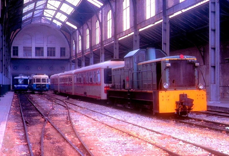
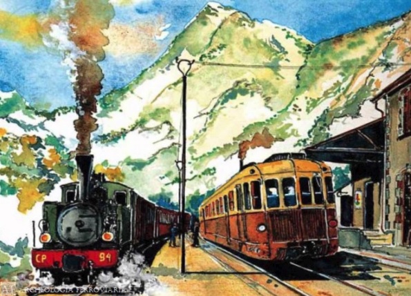
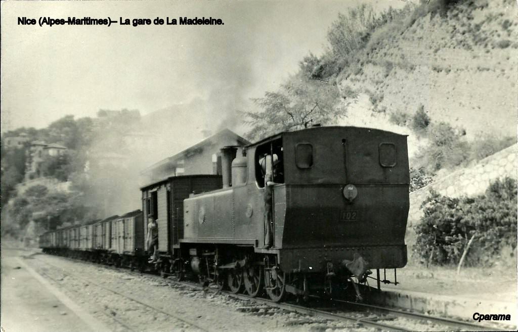
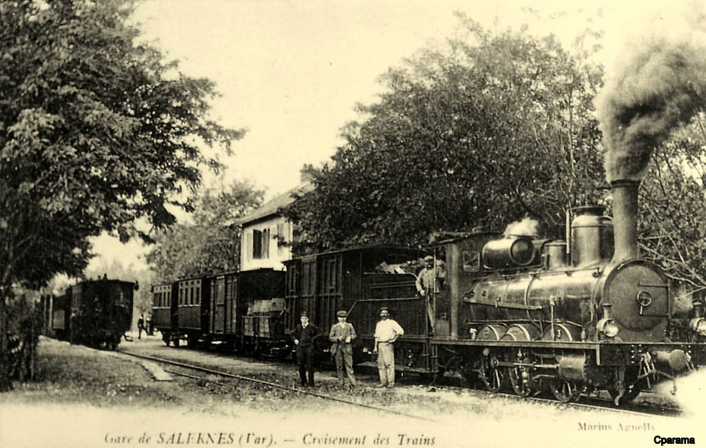
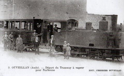
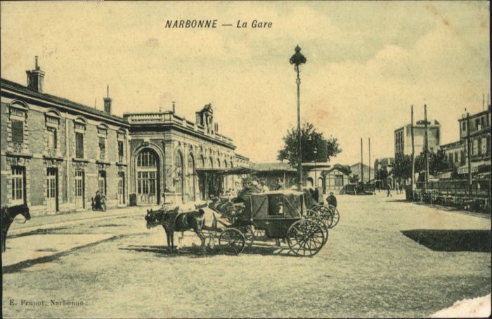
The use of steam on the Nice to Digne line was gradually abandonned. Increasingly, the travelling public became dissatisfied with steam haulage and the economics began to turn in favour of the combustion engine. The ease of use of diesel power worked in its favour, as did the rapid acceleration possible which resulted is significant reductions in journey times.
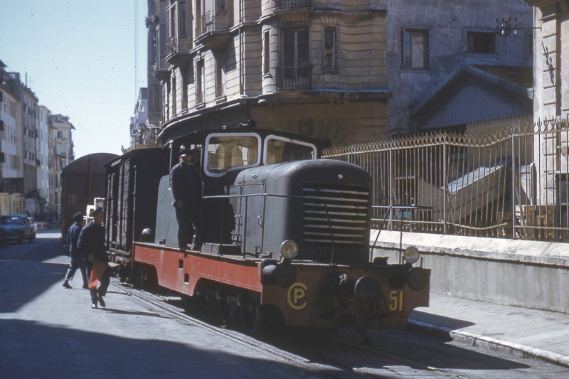
Initially, diesel traction was trialed on the shorter journeys. One of the earliest diesel units to be employed towards the end of steam was CP51 which first started work in 1948. There is an older locomotive at work on the line, BA11, but this was not brought to the line until 1988 by the GECP.
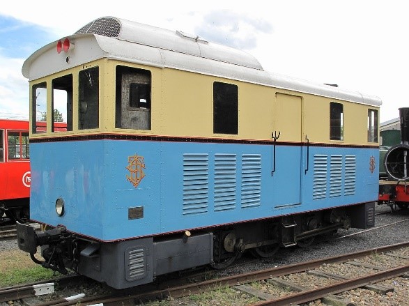
CP51
This locomotive is still present on the network and owned by the GECP. It was the first diesel shunter at work on the network and there is a hope that it will be refurbished and running once again. It was recently moved (in December 2017) from the depot at Lingostiere to the GECP depot at Puget-Theniers. CP51 at Lingostière Depot [1]
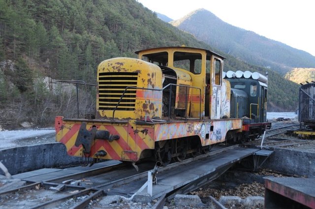 CP51 moved to Puget-Theniers in 2017. [2]
CP51 was the first of a number of diesel traction units which ultimately ran alongside a range of Railcars (Autorails) on the Nice to Digne line. It performed a series of differnt duties on the line over the years. One important role was the movement of transfer stock from the Chemins de Fer du Sud to the SNCF and vice-versa.
 Pictures of the locomotive in use on the connecting line can be seen on the following link: [3]
https://rogerfarnworth.com/2018/04/12/the-connection-between-the-plmsncf-station-in-nice-and-la-gare-du-sudchemins-de-fer-de-provence-59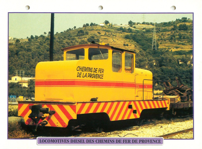 CP51 in good condition in its later use on the Nice to Digne line. [5]
BA11
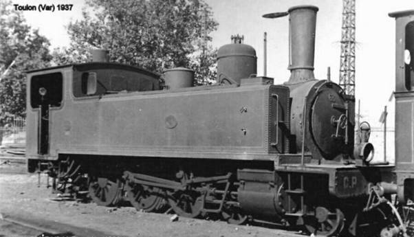
BA11 was one of 4 diesel 0-6-0 shunters (locotracteurs) in use on the Chemin de Fer du Blanc-Argent. [4] Of those four locomotives, No. 12 is now on the Chemin de Fer de la Baie de Somme, Nos. 13 and 14 are still on the Chemin de Fer du Blanc-Argent. [9] BA11 is the oldest diesel locotracteur (shunter) on the Nice to Digne line and it is still operational.
Before arriving at the Chemin de Fer du Blanc-Argens these locos were in use by the Compagnie des Chemins de Fer Departmentaux (C.F.D.) on their Nord d’Indre et Loire network.
No. 11 was built during the Second World War, based on the chassis of an old steam loco. This transformation was carried out by the C.F.D. The steam loco was itself built in 1885 by the Belgian firm, ‘Couillet’. Work on the conversion started in January 1940 at the C.F.D. workshops in Neuille-Pont-Pierre. It was completed in January 1941. [10]
The new diesel locotractuer was initially endowed with a Renault 130 hp engine but not used for lack of fuel . Then it was equipped with a Berliet 150hp engine for the Chemins de fer de l’Yonne. Once refurbished again by C.F.D, the Locotracteur No. 11 circulated from January 1950 on the Laroche Migennes – L’Isle-Angély line and was equipped with a 200 hp, 8 cylinder Willeme engine. [11]
In 1952 BA11 was sold to the Chemin de Fer du Blanc-Argens in February 1952 and not brought to the Chemin de fer de provence by the GECP until March 1989.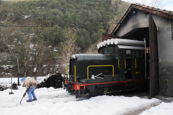 BA11 in the snow at Puget-Theniers. [11]
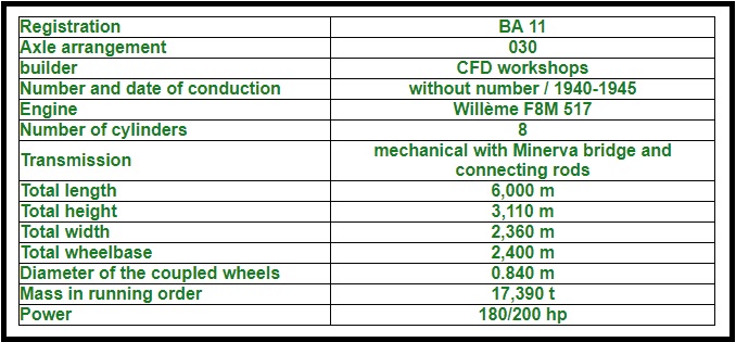 Details of BA11 provided by the GECP. [10]
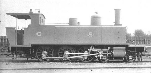
BB401
BB401 was built in 1962 [15] by the C.F.D. it was a diesel-hydraulic locomotive.
It ran, for some years on the Chemin de Fer de Paris à Orléans (PO) Corrèze and was transferred to the Nics-Digne line in 1971 where it remains. [17]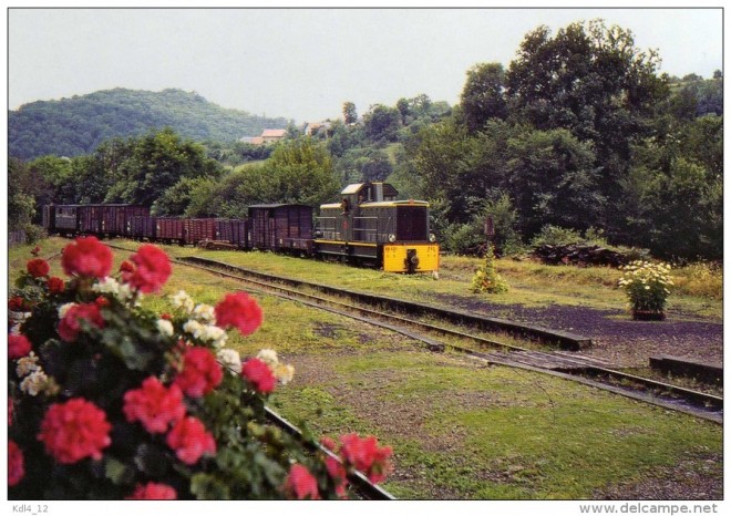 BB401 at La Gare de Saint-Bonnet-Avalouze (PO-Corrèze) in 1963, (c) Jean-Michel Vaugouin. [16]
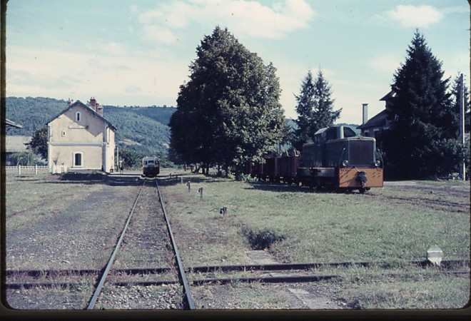 Here at Argentat on the same PO Correze network in 1967, BB 401 awaits the departure of Billard X251 courtesy of “030T 1707 Nord-Est” on the Passions Metrique et Etroit Forum in France. [16]
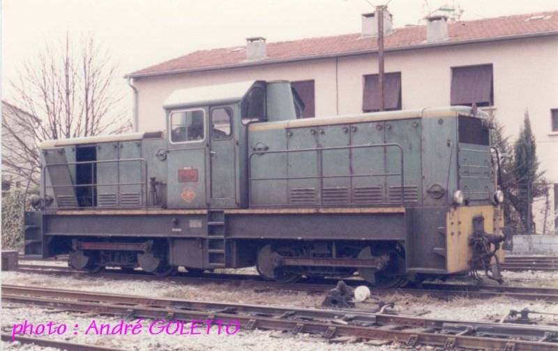 BB401 at Lingostiere in 1985. [18]
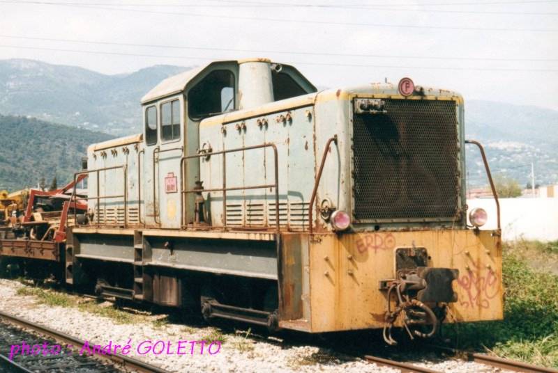 BB401 at Lingostiere in 1997. [18]
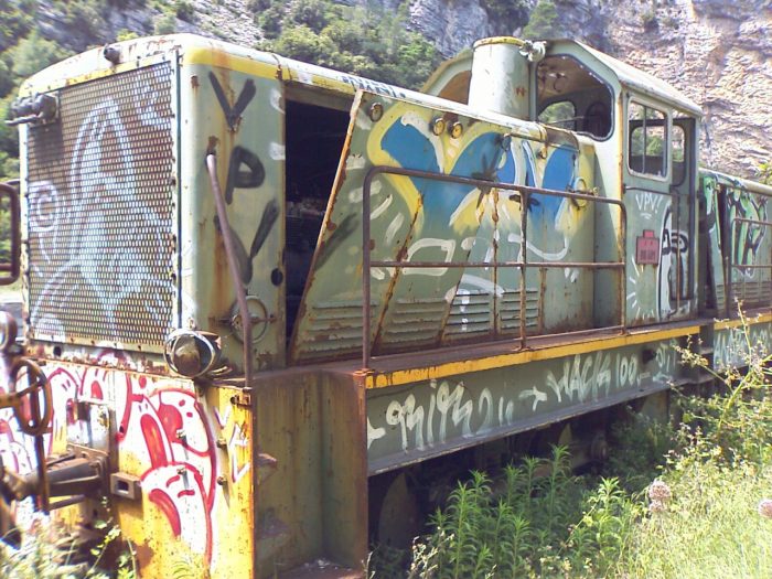 BB401 in storage at La Tinee and in a dilapidated condition in the 21st century! [12]
 BB401 at the Gare de la Tinee a little earlier in the 21st century. [13]
 BB401 at the head of a goods train in the 1970s. [6]
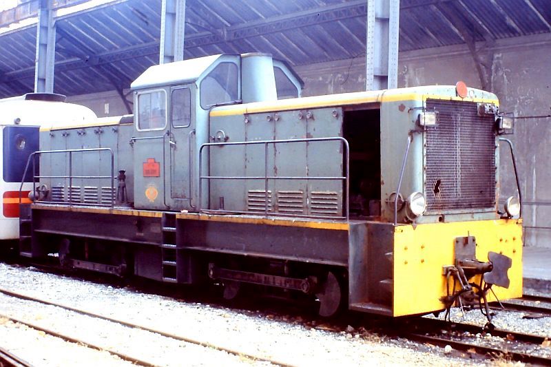
 The two images immediately above were taken in November 1989 and show BB401 at the Gare du Sud in Nice. They were downloaded from Smugmug. They were taken by Dave Rowland and freely available to download. I was unable to establish whether copyright issues applied. [14]
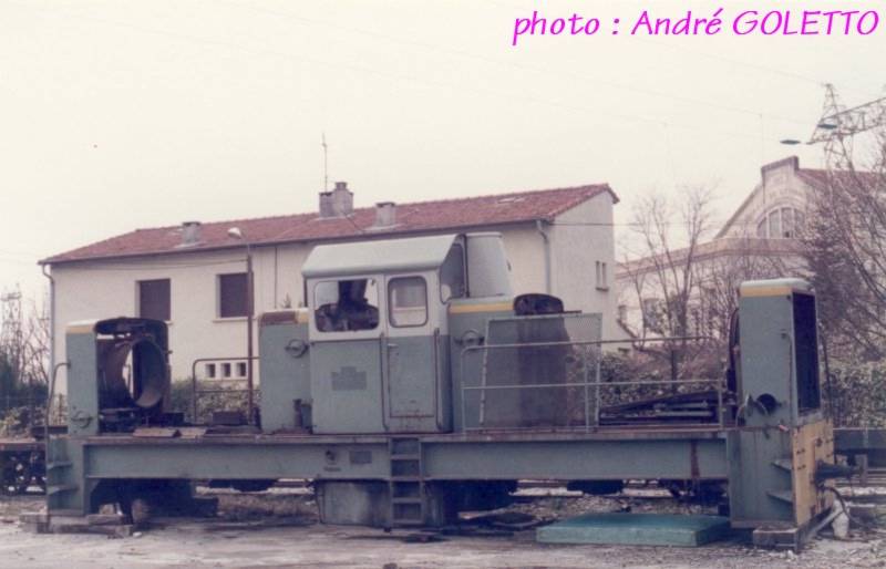
BB402
BB402 was also built by the C.F.D. at Montmirail in 1962 both locos were part of one batch of locotracteurs bult that year (BB400-BB404). Both had/have a central cabin and two ‘bonnets’ which hid/hide identical 207hp motors from Poyaud. [20]
The transmission of both units was/is hydraulic using an Asynchronous hydraulic system patented by the C.F.D. which synchronised the two engines. In both engines the axles of the bogies are coupled by connecting rods. [19]
BB402 was progressively stripped down, presumably to provide spare parts for BB401. It seems as though the remains were transported to the Chemins de Fer du Vivarais in 2001. In 2013, only the body shell remained in the depot at Tournon. [23]
 BB402 at Lingostiere in 1985. [18]
 BB402 at the Gare du Sud in May 1976. [21]
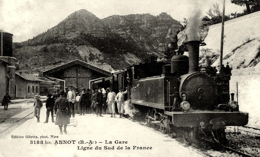
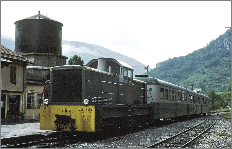 Diesel locomotive BB 402 with three passenger cars at the platform in Annot in June 1977, (c) Herbert Graf. [22]
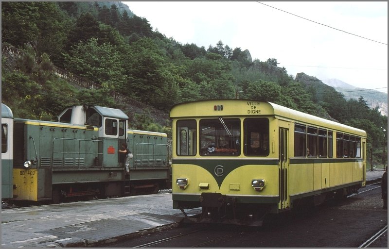 An autorail “Ville de Digne” crosses with BB 402 in Annot in June 1977, (c) Herbert Graf. [22]
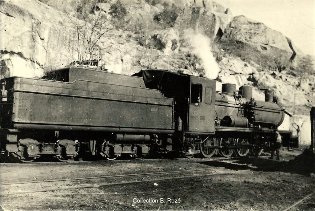
T61-T66
These six locotracteurs were built in 1950 by Brissonneau & Lotz. [19][24]
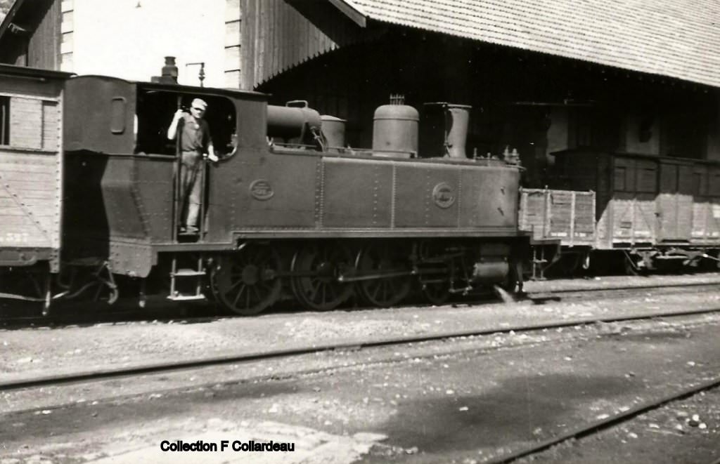
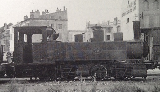
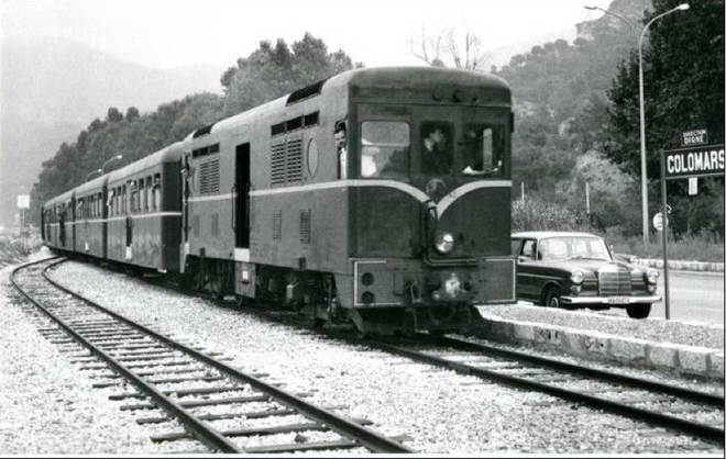 A locotracteur of the series T61-66 at Colomars. [7]
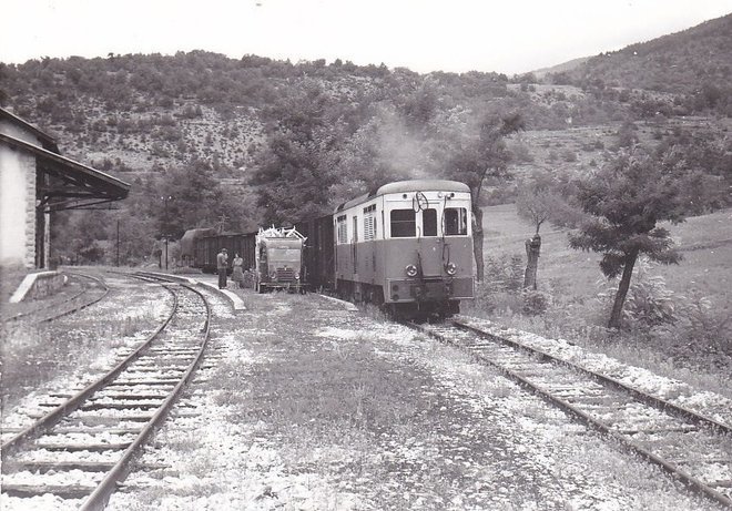 A locotracteur of the series T61-66 on 1 September 1959, taken at Fugeret, in charge of the goods train 502A [8]
An HOm model of the Brissonneau and Lotz T61 of the Chemins de fer de Provence runs with sound! (Trains d’Antan). [25]
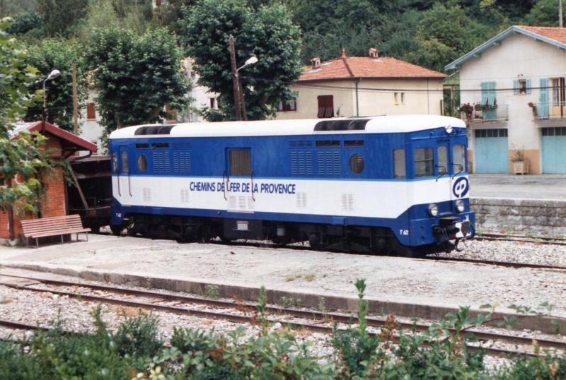
Commonly known as ‘Provence-type tracteurs’. The Brissonneau-et-Lotz 040DE locomotives were produced at the request of the Union des Voies Ferrées (UVF). These locomotives contrast significantly with the much more modest locomotives which had hitherto been used on the secondary lines in France.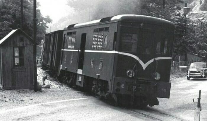 Provencal T62 in green livery. The car at the crossing gate is a Simca 1000, these vehicles were produced at Poissy in France from 1961 to 1978 [1] (c) J-C. Reese. [27]
Until 1950, the French railway Industry had very little experience in the field of diesel locomotives with electric transmission. It is not initially clear where the Brissonneau-et-Lotz gained the knowledge to allow it to manufacture this series of locomotives. The answer is primarily associated with metre-gauge railways. [27]
In the 1930s Brissonneau-et-Lotz manufactured motor vehicles (autorails/railcars) for narrow-gauge lines which were equipped with electric transmissions, for example, the railcars delivered in 1934 to the Chemins de Fer d’Anjou [28]. These railcars were seen as a loss-leader by the company and were provided at well-below market price. This allow Brissonneau-et-Lotz to undertake evaluations of the locomotives in service.
In November 1935, the Deux-Sèvres Tramway Company (TDS) awarded Brissonneau-et-Lotz a contract to retrofit a diesel locomotive onto the chassis of an 0-6-0T steam locomotive (No. 16) built by Blanc-Misseron. The revitalised locomotive was delivered in 1937 to the TDS. It had a MAN 240hp diesel engine associated with an electric transmission. After a long and valuable career, this machine has been enjoying a peaceful time, since 1996, at the “Musée des tramways à vapeur et des chemins de fer secondaires français” (MTVS). [27][28]
 Building this small locomotive (shown in the adjacent image) paved the way for Brissonneau-et-Lotz’s involvement in the manufacture of diesel-electric locomotives.
In November 1936, two Bo-Bo diesel-electric locomotives were ordered from Brissonneau-et-Lotz for the coastal line (Le Macaron). They arrived in 1938, the locos were equipped with two Berliet 150hp engines and were numbered T1 and T2. Those locomotives were sold into Spain with the closure of Le Macaron.
As a result of providing these two locos Brissonneau-et-Lotz were contracted to provide two locomotives for the Malagasy network, then four for the Reunion network (these had 160hp Saurer engines).
After the second world war, competitive tenders were invited to provide Bo-Bo locomotives for the the Union de Voie-Ferree (UVF). The design had been determined to be the best for the secondary lines. Brissonneau-et-Lotz was chosen to build a series of these machines. Unfortunately, only three networks (including the Chemins de Fer de Provence) chose to purchase the locomotives. The series was, as a result, limited to only 10 locos. They were distributed to the Voie Ferree du Dauphine (VFD), the Chemins de Fer de Provence (CP), and Chemins de Fer de la Corse (CFC). The work took 3 years to complete primarily because it was difficult to source the necessary parts and because technical specifications were altered in an endeavour to reign in project costs. [27]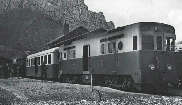 T64 in brown and cream livery at the head of a mixed goods and passenger train on the journey between Nice and Digne-les-Bains in March 1953. At the time these locos were the height of modernity, © Michel Dupont-Cazon. [27]
T62 at the Gare due Sud in Nice, © Jean Louis Paris. [27]
It appears that cost reductions were partially achieved by a sharing of design costs between Renault, which was supplying the overseas market in the 1950s and Brissonneau-et-Lotz, who were supplying the domestic market. Although Renault used hydro-mechanical transmissions, the parallels between the Renault locomotives intended for overseas and the Brissonneau-et-Lotz diesel-electric vehicles designed according to the specifications of the UVF are obvious. Both series of locomotives used Renault diesel engines, both used two diesel engines in order to attain the necessary pulling power.
The four engines of the VFD were designated T1 to T4 and received there between August 1950 and January 1951. They served there until just before the Winter Olympic Games of 1968.

T63 stabled at Nice, resplendent in its brown and cream livery. © M. Fontaine.
The Winter Olympic Games of 1968 in the area around Grenoble required significant improvements to road infrastructure. The line between Jarrie-Vizille and Livet ran alongside the N91 which had to be widened. As a result the line was closed in 1964. T1-T4 were offered for sale that year but it took 20 years for them all to find new homes. However T3 was moved to Provence where it was renumbered T63.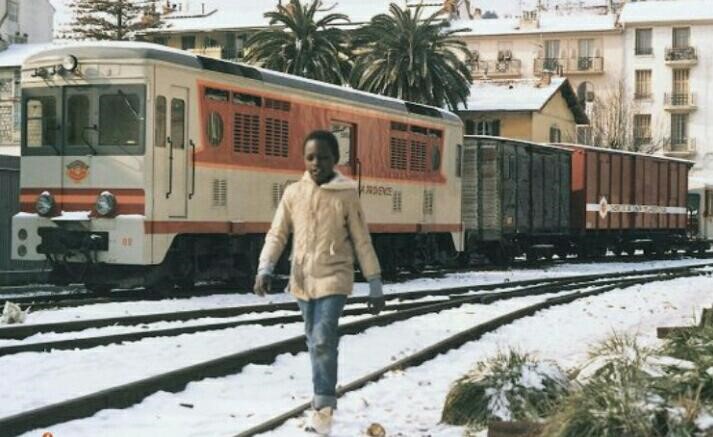 Tracteur T62 in “Arzens” livery, designed to harmonize it with second generation SY railcars. It is snowing that day in Nice, © Jean-Rémy Grasser. [29]
T64 from the Chemins de Fer de Provence was dispatched to the metre-gauge network in Corsica in August 1963 where it took the number 403. In January 1964 the Chemins de Fer de Provence received compensation in the form of locomotive T3 which was numbered T65. It survived until it was scrapped in 1983.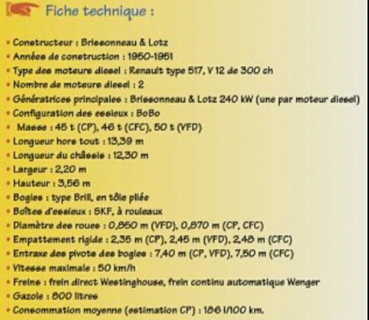 Technical spec. of the Brissonneau-et-Lotz tracteurs. [29]
When originally ordered, T61 to T64 were intended for passenger service alongside the Renault ABH railcars on the Nice to Digne-les-Bains line. The technical spec. was downgraded to limit cost overruns, their role was limited to heading goods trains. T61, T62, T63, and T64 arrived in 1951. As we have already noted T64 left the network for Corsica in 1963, T65 was added to the roster of the Chemins de Fer de Provence in 1964. The closure of the line to Meyrargues meant that the network had more Renault ABH autorails available for the Nice-Digne service than originally expected and the reduced spec. of the tracteurs created no significant problems.
T65 seems to have ceased active operations in 1970. It was canabalised to provide parts for T61 which had been in an accident in 12th August 1971. Interestingly, the locos delivered to the Chemin de Fer de Provence and the VFD networks did not have exactly the same ends. As a result, the T61 became an asymmetric machine. [29, (note 5)]
By January 1974 the condition of the locos meant that both T63 and T61 had to be cset aside and cannibalised in favour of T62, the only machine of the series kept in active by the Chemins de Fer de Provence. For the T62, the 1970s were devoted to lower-level tasks such as weeding, supplying ballast for the track and other materials, pushing snow plows, and so on. In addition to the service trains, the locomotive supported some special trains composed of cars R 1341 to 1344 (ex-AT 1 to 4), which offered enhanced capacity to the autorails. Maintenance to T62 took place in Desbrugères in the early 1980s and in 1987-88 the SNCF supplied diesel engines and electrical transmission sub-assemblies to maintain the T62. During the 1990s, the T62 remained the most obvious Brissoneau-et-Lotz locomotive on the network. Its condition deteriorated over time.
In February 1999, the T62 received a running-mate. The former T1 of the VFD arrived on the network (Gm 4/4 508 of the Jura Railways) and it was numbered T66. It required some repairs after an eventful road journey from Switzerland. The parts needed were sourced from La Mure where the locos T2 and T4 of the VFD were stored.
On 19th January 2000, tests of T66 on the network revealed poor performance and resulted in a decision to re-motorise both T62 and T66. Neither performed exceptionally in the early years of the 21st century. Major work was intended to secure their future on the network. [27]
 T62 at Entrevaux in December 2014, (c) JeffP, RMWeb.co.uk. [31]
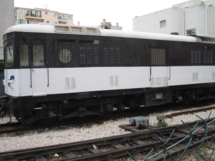 T66 in service in Nice. [12]
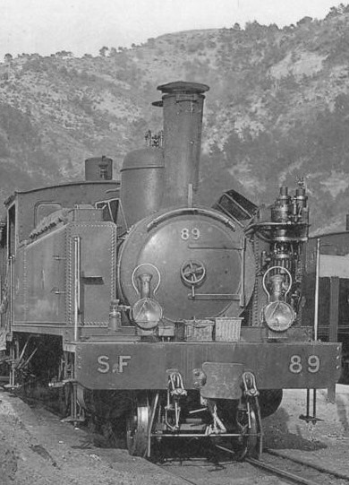
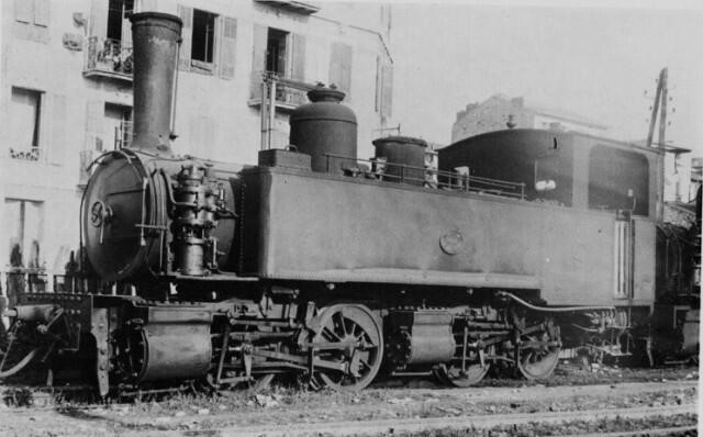
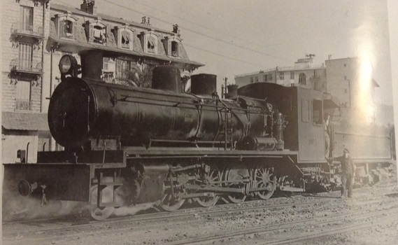
Henchel BB1200
The Compania Minera de Sierra Menera (SM) ordered first three then two additional locomotives of the type DH 1200 from Henschel in Kassel. The drive unit consisted of a four-stroke Maybach-Mercedes Benz diesel engine type MB 820b with 12 cylinders in V-arrangement. It delivered 880 kW at a maximum of 1500 revolutions per minute and was equipped with turbocharger and intercooler. The cooling water was cooled in a cooling system installed under the roof. The cooling air was sucked into the side walls and blown out through the roof. A short PTO shaft transmited the torque of the diesel engine to the Voith L306r turbo transmission with hydrodynamic brake. It included three hydraulic transducers and a reversing gearbox. Two cardan shafts each drove a bogie. The two axles in the bogie are also connected by cardan shafts. The locomotives were braked with compressed air. The locomotives were designed for double traction and therefore has a skid protection device.
Of these 5 locomotives, Henchel BB1200 No. 1004 with serial number 31003, built in 1966 was numbered 1404 by the Ferrocarriles de Vía Estrecha (FEVE) and noted on their roster in 1973.
The FEVE replaced on the Henschel locomotives the Maybach deisel engine by a French SACM engine, which was installed on other FEVE locomotives to standardize the spare parts inventory. Regularly there were problems with this engine type. To improve the reliability of the locomotives, the control of the first three locomotives was modernized. A mid-nineties built-in programmable logic controller with redesigned cabs extended their life. The locomotive 1404 was sold in 1992 through intermediaries to the Chemins de fer de Provence. The middleman just re-painted the loco. Regular disturbances led in March 2006 to the final shutdown of the locomotive and it was placed in storage at Lingostière . [32]
 BB1200 at Entrevaux. [12]
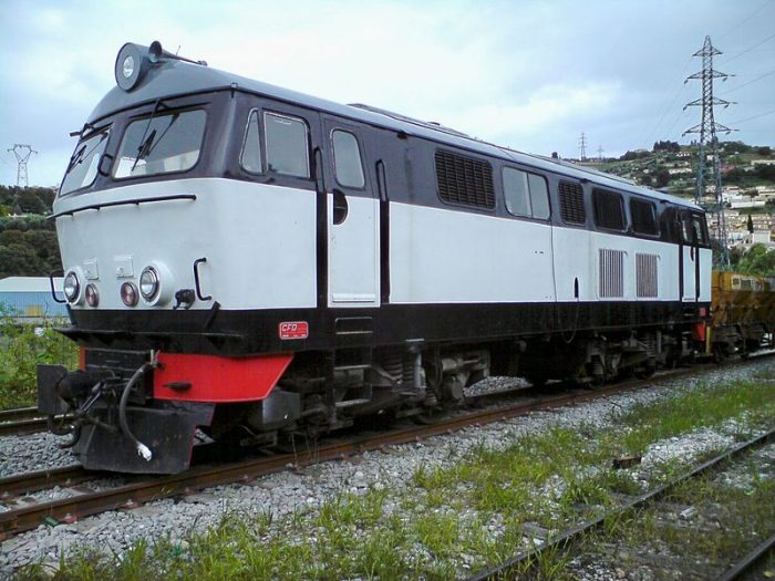 BB1200 at Lingostière on 16th May 2010, (c) Eric Coffinet. [30]
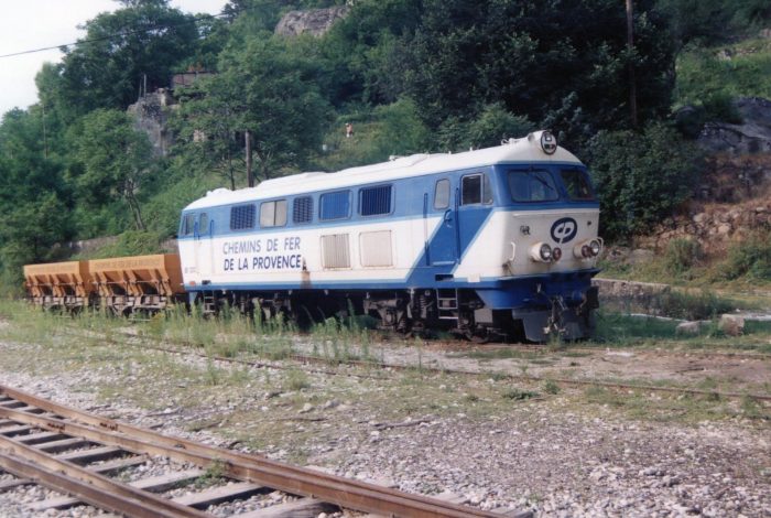 BB1200 at Annot (c) JeffP, RMWeb.co.uk. [31]
Draisines DU 101 and 102
These modern locomotives were constructed by Matisa and are used for a variety of maintenance work on the line. They are popular with the staff. They are also used to supplement existing locomotives in the event of breakdown. [33]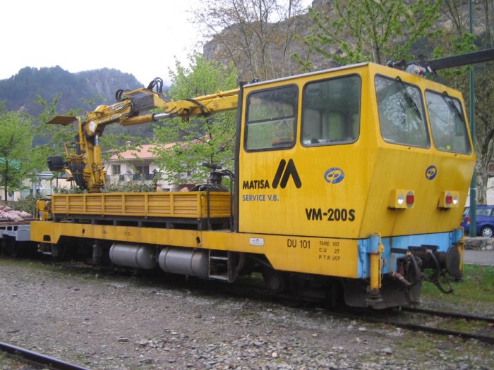 Draisine DU 101. [34]
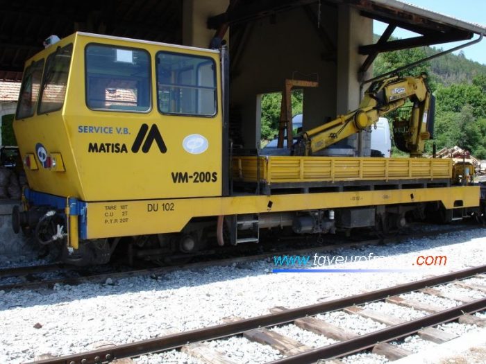 Draisine DU 102. [35]
References:
- https://commons.wikimedia.org/wiki/File:CP-51-d%C3%A9bris_Lingosti%C3%A8re_04-2014.jpg, accessed on 17th November 2018.
- https://www.gecp-asso.fr, accessed on 10th December 2018.
- https://rogerfarnworth.com/2018/04/12/the-connection-between-the-plmsncf-station-in-nice-and-la-gare-du-sudchemins-de-fer-de-provence-59
- https://en.wikipedia.org/wiki/Chemin_de_Fer_du_Blanc-Argent, accessed on 12th December 2018.
- https://picclick.fr/Diesel-de-Provence-SNCF-Locomotive-Railway-Chemin-de-153151417340.html, acessed on 12th December 2018.
- http://cccp.traindespignes.free.fr/phototheque-digne.html, accessed on 12th December 2018.
- http://www.passion-metrique.net/forums/viewtopic.php?f=2&t=8154&start=120, accessed on 12th December 2018.
- http://www.passion-metrique.net/forums/viewtopic.php?f=2&t=8154&start=135, accessed on 12th December 2018.
- Organ, John; Northern France Narrow Gauge. Midhurst: Middleton Press, 2002.
- http://gecp.asso.fr/ba11.html, accessed on 12th December 2018.
- http://train-des-pignes.over-blog.fr/article-inventaire-du-materiel-roulant-du-gecp-44929448.html, accessed on 13th December 2018.
- http://cccp.traindespignes.free.fr/phototheque-materiel.html, accessed on 18th December 2018.
- https://commons.wikimedia.org/wiki/File:BB401_Gare_de_la_Tinee.jpg, accessed on 18th December 2018.
- https://daverowland.smugmug.com/RAILWAYS/European-Railways-1988/FRANCE-03-06-November-1989, accessed on 18th December 2018.
- https://en.wikipedia.org/wiki/Chemins_de_Fer_de_Provence, accessed on 18th December 2018.
- http://www.passion-metrique.net/forums/viewtopic.php?f=2&t=8552&p=406865&hilit=BB401#p406865, accessed on 18th December 2018.
- http://www.passion-metrique.net/forums/viewtopic.php?f=2&t=3728&start=0, accessed on 18th December 2018.
- http://metrique43.free.fr/vm_reel/vm_01.htm, accessed on 18th December 2018.
- https://fr.wikipedia.org/wiki/Chemins_de_fer_de_Provence, accessed on 18th December 2018.
- https://fr.wikipedia.org/wiki/Poyaud, accessed on 18th December 2018.
- https://commons.wikimedia.org/wiki/File:CP_BB402-III.JPG, accessed on 18th December 2018.
- http://www.bahnbilder.de/name/galerie/kategorie/frankreich~schmalspur–und-zahnradbahnen~chemin-de-fer-de-provence-cp/digitalfotografie/48.html, accessed on 18th December 2018.
- http://www.passion-metrique.net/forums/viewtopic.php?f=2&t=8552&start=75, accessed on 18th December 2018.
- https://en.wikipedia.org/wiki/Brissonneau_and_Lotz, accessed on 18th December 2018.
- To learn more about the Trains d’ Antan see: http://passion-metrique.net/forums/viewtopic.php?f=3&t=4739&hilit=frot, accessed on 18th December 2018.
- https://en.m.wikipedia.org/wiki/Simca_1000, accessed on 23rd December 2018.
- Voie-Libre (Loco-Revue) No. 21: October 2002, http://fr.1001mags.com/parution/voie-libre/numero-21-octobre-2002/page-38-39-texte-integral, accessed on 23rd December 2018.
- https://fr.wikipedia.org/wiki/Mus%C3%A9e_des_tramways_%C3%A0_vapeur_et_des_chemins_de_fer_secondaires_fran%C3%A7ais#Mat%C3%A9riel_%C3%A9lectrique_ou_%C3%A0_moteur_%C3%A0_combustion_interne, accessed on 25th December 2018.
- http://fr.1001mags.com/parution/voie-libre/numero-21-octobre-2002/page-44-45-texte-integral, accessed on 25th December 2018.
- https://commons.wikimedia.org/wiki/File:CP_locomotive-Henschel-31002.JPG, accessed on 28th December 2018.
- http://www.rmweb.co.uk/community/index.php?/topic/76570-railways-in-france-1980s90s-more-pics-added-012015/page-5, accessed on 28th December 2018.
- http://www.le-rail.ch/text/projekt73.htm, accessed on 28th December 2018.
- http://golinelli.pagesperso-orange.fr/trains/actucp.htm, accessed on 29th December 2018.
- http://cccp.traindespignes.free.fr/autorails.html, accessed on 29th December 2018.
- http://tgveurofrance.com.pagesperso-orange.fr/cp.htm, accessed on 29th December 2018.


