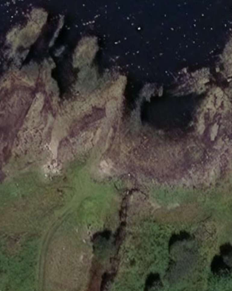
Ronachan Point, located on the Kintyre peninsula, features remnants of an industrial limestone quarry and a 19th-century tramway used to transport materials to a nearby slipway.
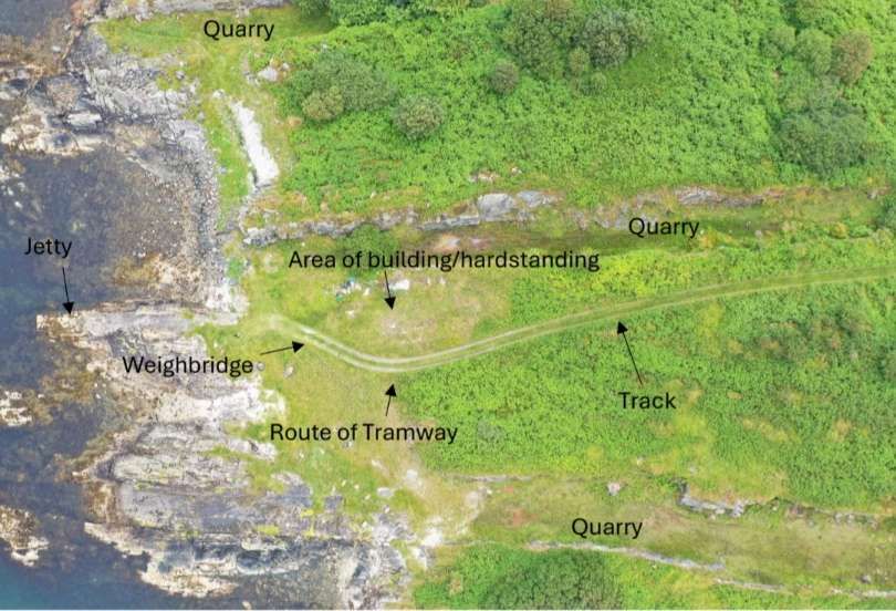
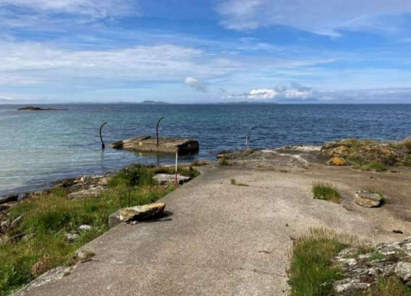
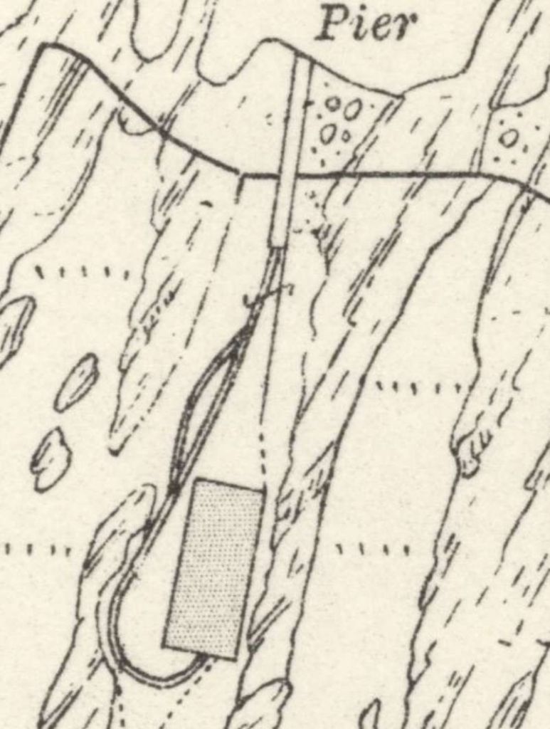
Three seams of limestone were being quarried here by 1898 and transported via a tramway to the nearby purpose-built slipway for export. On the ground and from the air the quarries are all visible, as well as the route of the tramway leading up to the pier. There are iron bolts on the pier for the tramway tracks, and iron rings and chains on the north side of the slipway where vessels could be tied up alongside to transport the limestone by sea. On the tramway is a W & T Avery Ltd. Weighbridge. The limestone quarried at this location was probably ground down for agricultural use. A few more photographs can be found here. [6]
I have not been able to establish the track-gauge of the tramway.
The location is mentioned in the SCAPE survey of the coast of the Kintyre Peninsula. [2] The notes included in that survey are provided as an appendix to this very short article below.
References
- https://m.facebook.com/story.php?story_fbid=pfbid0daJPoVq37ftjq73BxDnaBdboNWZZHXnyLWVtcEwR4vrZsx5tGmXzyhj78EPAJ4JRl&id=100032459876872, accessed on 15th May 2026.
- Paul Murtagh & Joanna Hambly; The Coastal Zone Assessment Survey of Kintyre; The SCAPE Trust and the University of St Andrews, November 2024; via., https://scapetrust.org/wp-content/uploads/reports/Kintyre-CZAS-Report.pdf, accessed on 16th May 2026.
- https://maps.nls.uk/view/82865370, accessed on 16th May 2026.
- https://maps.nls.uk/view/82865373, accessed on 16th May 2026.
- https://maps.nls.uk/geo/explore/#zoom=18.7&lat=55.74115&lon=-5.59794&layers=168&b=ESRIWorld&o=0, accessed on 16th May 2026.
- https://www.facebook.com/share/p/1UTk9okmV8, accessed on 16th May 2026.
Appendices
Appendix 1: An extract from the Coastal Zone Assessment Survey of Kintyre by Paul Murtagh, Joanna Hambly – Scottish Coastal Archaeology and the Problem of Erosion (SCAPE) – The SCAPE Trust and the University of St Andrews, November 2024.
A long-lived industrial landscape comprising the remains of historic limestone quarries, a lime kiln and associated coastal infrastructure was recorded around Ronachan Bay and Ronachan Point. The occurrence of limestone in the area was noted in both the Old and New statistical accounts of the parish of Kilcalmonell and Kilberry, in which Ronachan is located, where there was an:
“abundance of limestone … but that there was a scarcity … of coal to burn the limestone.” (OSA 1794; Gordon 1999, 409) and that “there are beds of limestone from north-east to south-west (but of inconsiderable thickness) to be found in several localities in the parish.” (NSA 1845; Sinclair 1999, 62).
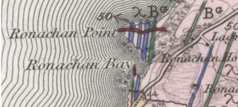
The historical Geological Survey of Britain, One-Inch to the Mile map of the region shows that the area around Ronachan had several seams of limestone (Figure 38), and the area appears to have become the focus of extraction for a period in the 19th and early 20th centuries.
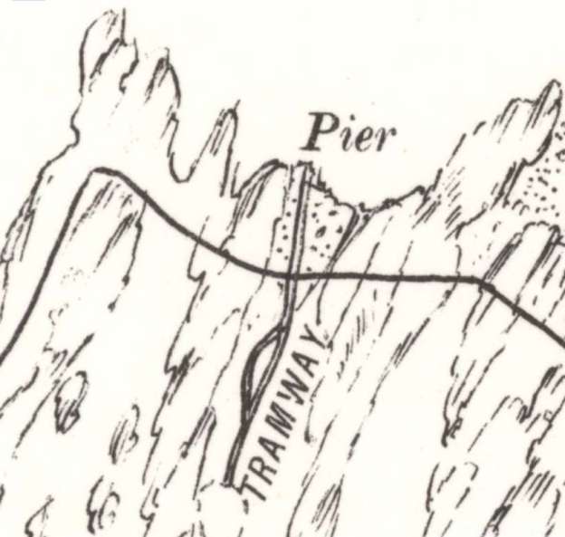
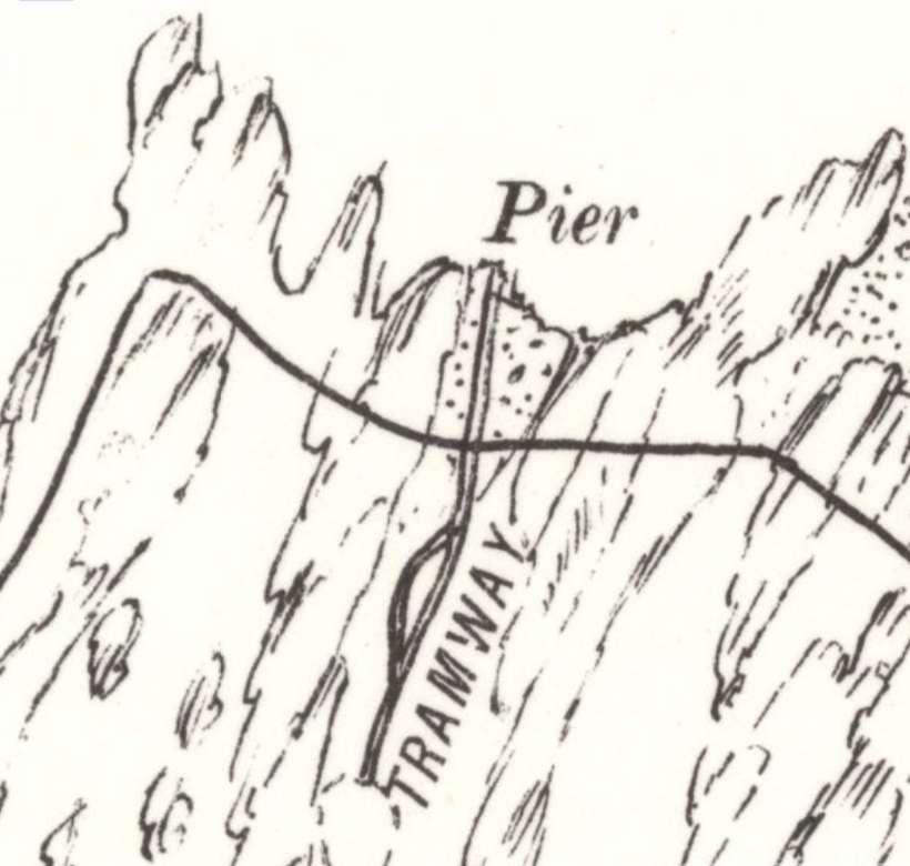
The early phase of limestone quarrying seems to have been focused near the present-day lodge house. Here we recorded a one-arched, single-draw, stone-built, rectangular lime kiln, around which there are remains of a quarry (SCAPE ID: 16992). The kiln is depicted on the first edition OS map of 1873 (Figure 39) with a coal yard on the present site of the lodge, as well as a track leading down to the beach, where a cleared slipway was recorded (SCAPE ID: 16936), probably used to bring coal ashore for use in the kiln. The kiln appears to have gone out of use by the time the second edition OS map was surveyed in 1898 when it is referred to on the 25-inch map as an Old Limekiln, while the coal yard is built over by the lodge and current house. On the third edition six-inch OS map of 1924 an Old Quarry is also illustrated next to the kiln (Figure 39).
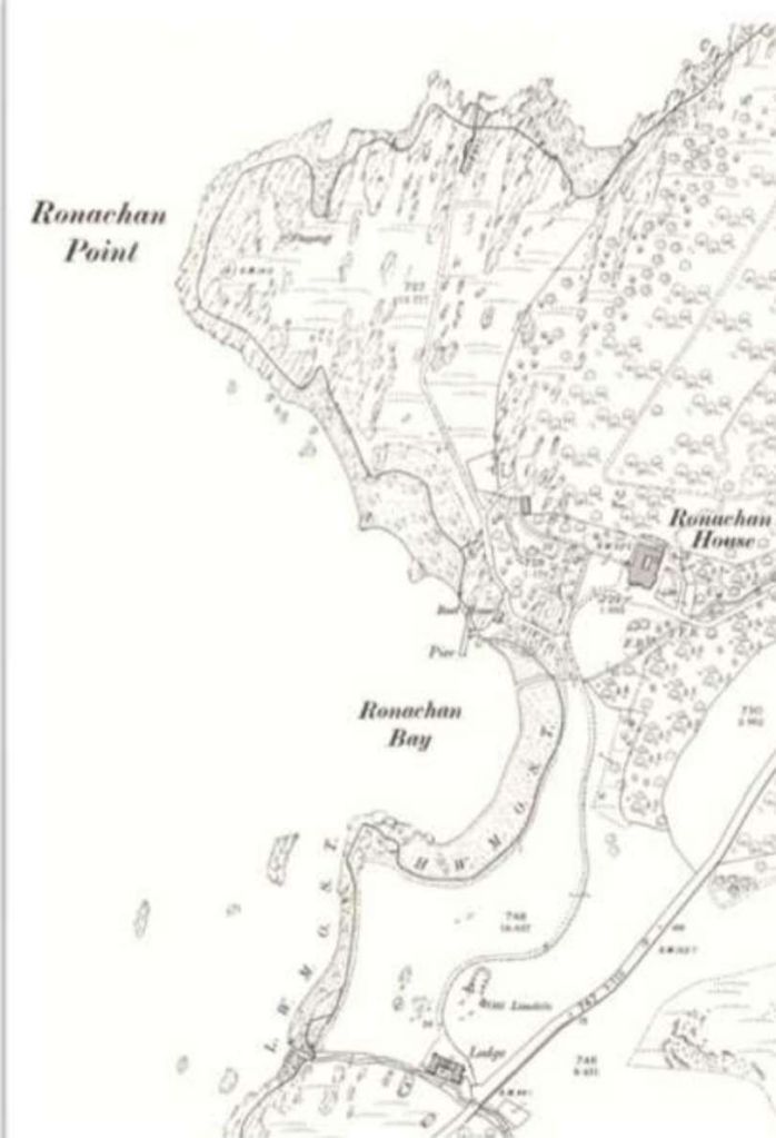
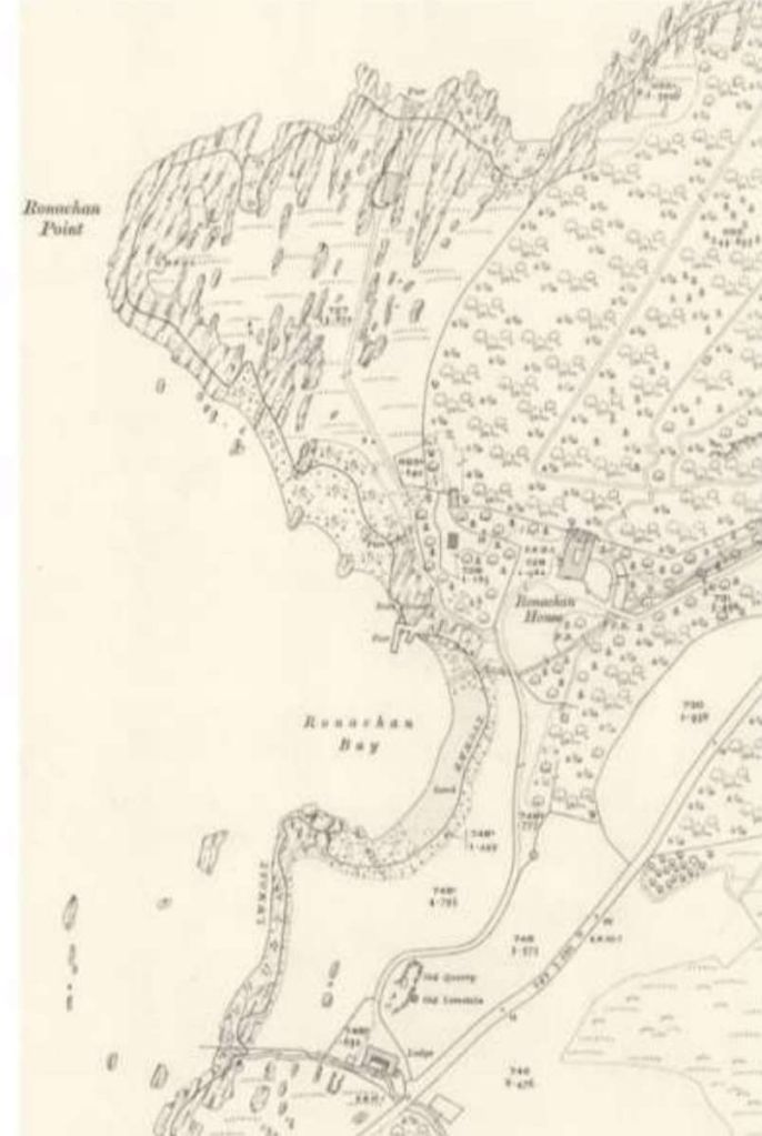
The three map extracts below constitute figure 39. Development of Ronachan limestone quarrying landscape in the 19th and 20th centuries. [2: p33]
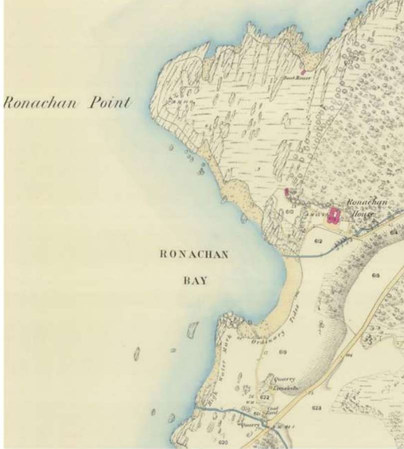
3rd edition Scotland, revised 1915. [2: p33]
Of the three images immediately above, the second two of 1898 and 1915 show the tramway heading towards the sea on the North side of Ronachan Point. Enlarged extracts are included in the article above.
By 1898, three large quarries were being worked at Ronachan Point (SCAPE ID: 16939,
Figure 40). They are oriented north-south, following seams of limestone through the
surrounding rock. Debris from the quarries lie scattered around the site including large
blocks of stone with chisel marks. A track, tramway and jetty (SCAPE ID: 16940)
associated with the quarries are depicted on the second and third edition OS Map of 1899
and 1915. The slipway is defined by a rock-cut area with a concrete surface and iron
fittings for the tramway extending to the end of the slip. A weighbridge made by W&T Avery
Ltd is still in situ on the track next to an area of concrete hardstanding which marks the site
of a large building depicted on the 1915 OS map. To the south of this site, at the northern
end of Ronachan Bay is another more substantial concrete jetty and slipway with an
associated boat house (SCAPE ID: 16989, Figure 41). The track links the concrete slipways
at Ronachan Point and Ronachan Bay and it is probable that both were used by the quarry
according to the weather and tide conditions. Another cleared slipway and the ruins of a
boat house on the eastern side of Ronachan Point (SCAPE ID: 16991) are still used as a
small harbour and boat laying up area and is associated with Ronachan House.