
The May 1951 edition of The Railway Magazine carried two articles about narrow gauge railways in the Republic of Ireland. This is the second. The Cavan & Leitrim Railway was a 3ft (914 mm) narrow gauge in the counties of Leitrim and Cavan in the northwest of Ireland. It ran from 1887 through until 1959. It survived as a result of carrying coal from the mine at Arigna. [3]
The line was built primarily to draw that coal out of the mountain in Arigna, as previously only horses and carts were available for this job. Thanks to the Cavan and Leitrim Railway, coal from Arigna was brought to homes and businesses all around Ireland, and especially during the war years, it was a vital means of ensuring that Irish homes were able to get fuel. [9]
It outlived most of the other Irish narrow-gauge lines, giving a further lease of life to some of their redundant engines. [3] In fact, it was the only one of the Irish Narrow Gauge lines to be powered by steam throughout its working life. [9]
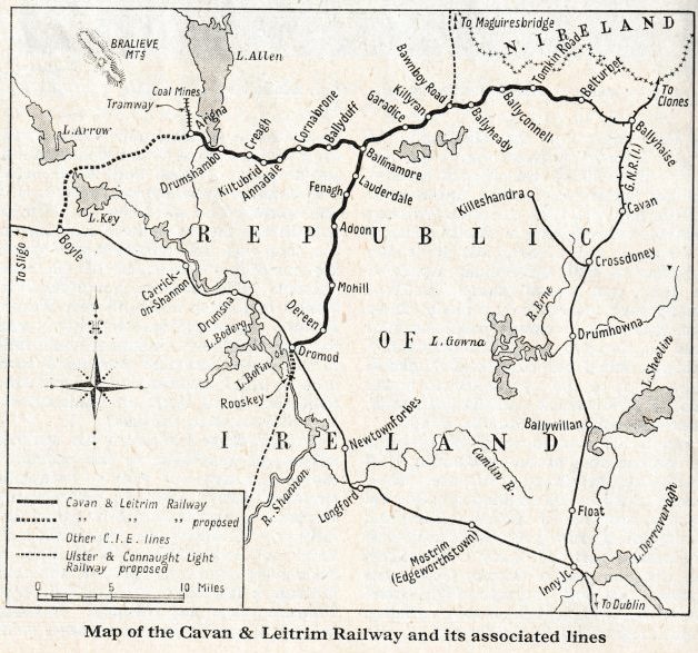
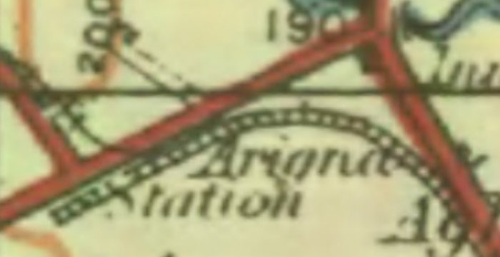
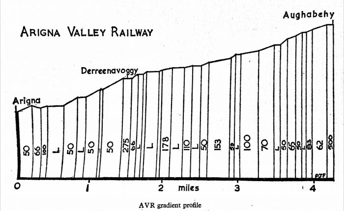
Originally the Cavan, Leitrim and Roscommon Light Railway and Tramway Co. registered on 3rd February 1883. The first section from Dromod to Belturbet (34 miles) opened on 17th October 1887. The branch from Ballinamore to Arigna was opened on 2nd May 1888 and was often referred to as ‘the tramway’. The Company became the Cavan and Leitrim in 1895. There were 48.5 route miles in 1911. In 1920 it was extended to serve coalmines at Arigna. It was closed on 31st March 1959, the second to last narrow gauge system to go, the last being the West Clare Railway. A section of the line was reopened in 1994. [10]
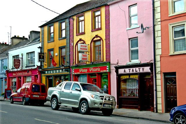
Patrick Flanagan introduces us to the country through which ths 3ft gauge line was to pass: “Leitrim stretches from the River Shannon at Rooskey to the Atlantic Ocean at Tullaghan on the borders of Donegal. The population of its 600 square miles has de-creased ten per cent in as many years to a record low of 28,000 (in 1966). Lough Allen, the northern-most lake on the Shannon, effectively halves the county, and North Leitrim is both physically and psychologically different from South Leitrim. While barren tracts of mountain are the predominant features north of the lake, the land to the south is marshy and dotted with small lakes. Above all, Leitrim is known as the county of ‘little lakes and little hills’. The area has never been industrially developed and thus the population is scattered about in small agricultural communities. A ‘town’ in Leitrim may well have only 250 inhabitants; the capital, Carrick-on-Shannon, although formerly a Royal Borough, has just over a thousand people. The remaining important towns, Drumshanbo, Ballinamore and Mohill, are all much smaller than Carrick. They are in South Leitrim and there is only one town of any size north of Lough Allen, Manorhamilton.” [1]
One of the most significant things which happened in Irish history commenced in the time of James I, and particularly contined during the regime of Cromwell. During this time, Ireland was systematically ‘planted’. “The area about Leitrim was not excluded and the native tenants found themselves dispossessed by incoming ‘landlords’ of British or Continental origin. Virtually all the land was divided into estates, the best forming the new ‘owners’ demesnes and the rest, often of unspeakably poor quality, being occupied by the native Irish who remained as tenants at will, or for some fixed period.” [1]
In Leitrim (as in west Cavan and north Roscommon) the maiority of the peasant land holdings were under ten and often as low as three acres. The fragmentation was due to sub-letting among, in all probability, the membersof a family. Every inch of land was utilized to the full in order to provide the ever-increasing rents demanded by many of the unreasonable landlords. [1]
In the 1870s the harvests were poor and it is abundantly clearthat the vast majorityof people had no interest in a railway. Their subsistence lifestyles would not have had enough surplus to warrant paying for a train ticket even to the local market.
Time to think about railways was “the prerogative of the landed gentry. It is difficult to assess the reasons for the birth of the idea of a railway. Were the landlords belatedly thinking of the common good or was profit the reason? Although in after-years various treasons for building a railway were advanced, in 1883 the primary one was the existence of the mineral deposits around Lough Allen. Just to the west, in Roscommon, were the coal seams at Arigna, which had been sporadically worked for over a century. On the eastern side of the lake, north of Drumshanbo, was the fabled Slieve an Ierin — the Mountain of Iron. Although very largely unworked, tradition held that the great deposits had been worked in prehistoric times by the mythical smith, Goibniu.” [1]
“This was the ‘chosen land’. Largely undeveloped, it got its first peripheral railway communication in 1862 with the opening of the Longford—Sligo line, followed in 1885 by the construction of the branch line westwards to Belturbet. Now it was hoped that the vast central area would have a railway of its own and that the innumerable hills would echo the sounds of heavy livestock and mineral trains.” [1]
“The earliest form of public transport in Leitrim (apart from the mail coaches) was the canal. In 1817, the Lough Allen Canal had opened joining the vast expanse of the lake to the Shannon Navigation, but after a period of moderate traffic it fell out of use and by the 1850s was choked with weeds. In 1846 construction of the Ballinamore & Ballyconnell Canal began and hopes were high for the improvement of trade in central Leitrim. The final stages of construction were completed in 1859 and the canal opened the following year. Only eight boats are said to have used it and after 1868 it steadily decayed, never carrying further traffic. Meanwhile, the fortunes of the Lough Allen Canal had revived considerably and by 1870 at least two steamboats were in use carrying clay from Spencer Harbour, near Drumkeeran.” [1]
It was 1872 when a railway was first suggested by Leitrim Grand Jury. They wanted a line constructed by the Midland Great Western Railway (MGWR) to Mohill and Ballinamore. The MGWR was just not interested. Then in 1880 a similar tramway was proposed between Dromod and Mohill. That proposal failed to gain traction. The MGWR, in 1882, proposed a line to Ballinamore by Mohill and Fenagh. That failed through lack of landowner support.
Landowners found the MGWR difficult to deal with and so they organised Chen selves. A final tentative approach was made to the MGWR “asking for assistance towards the preliminary expenses and stating that, in the event of a broad-gauge line being built, substantial financing would be expected.” [2] The MGWR refused to cooperate and the local people decided to press on alone. Lord Kingston took the chair at a public meeting in Ballinamore on 14th September 1883. Definite progress was made and it was resolved:
That a 3ft-gauge “Light Railway to connect Belturbet, Ballyconnell, Ballinamore, Mohill and Dromod with a steam Tramway upon the road from Ballinamore to Drumshanbo and Boyle, will meet the present requirements of this district and will open up the coal and iron districts of Arigna and Lough Allen. That inasmuch as a considerable outlay will be required for the preliminary expenses, a guarantee fund be formed, those subscribing to have 4.5% guaranteed shares of £10 each in the Company for the amount subscribed, and that a subscription list to same be opened.” [2]
A new company was registered on 3rd December 1883 with a capital of £300,000 in £5 sharesshares. The Cavan, Leitrim & Roscommon Light Railway (the C&L) intended to build 5 lines:
A. From Belturbetin Straheglin to Bellaheady Bridge in Crossmakelagher
B. From Bellaheady Bridge to Tully in Ballinamore.
C. From Tully to the Dromod Station of the MGWR.
D. From Tully to the Arigna Iron Works in the townland of Bodorragha in Co. Roscommon.
E. From the Arigna Iron Works to the Boyle Station of the MGWR.
The company was incorporated under the Tramways & Public Companies (Ireland) Act, 1883, and the promoters were thus relying heavily on financial guarantees from the ratepayers (see below). To whip. up enthusiasm for the project, the pro-visional committee issued a ‘Statement’ (the ‘Pamphlet’, as it was later called) in support of the C & L.
On the basis that the working expenses of the line were likely to be 50% of gross receipts, it was reckoned that the guaranteeing ratepayers of Cavan would have to pay 1.5d -2.5d in the £1, with half this burden on Leitrim and none on Roscommon. It was proposed to ask the Grand Juries concerned for a guarantee on £251,000, the capital of the lines concerned. [2]
The pamphlet included significant details of 8ron Ore flows from various parts of Britain as well as from Arigna. It was hoped that No 5 line would carry ‘a large amount of calcined iron-ore’ to Boyle for shipment to Sligo. “As further window-dressing, long lists of subscribers to the preliminary expenses of the company were appended. However, it seems that the promoters were still none too sure of their ‘customers’ and that, at some stage the ratepayers were asked to sign a preliminary guarantee. Many did so, but it was later claimed that quite a few names were forged.” [2]
Plans were lodged with the various Grand Juries and a baronial guarantee was sought at the 1884 Spring Assizes. The three Grand Juries provided the necessary presentments for a guarantee and the Sligo Grand Jury also approved the scheme for the marginal incursion into its territory. However, a year later the Roscommon Jury changed its mind. This resulted in the abandonment of the line from the Arigna Iron Works to the Boyle Station.
The final capital share issue was for £190,585. Of the amount, “£102,000 was subscribed by the Tramways Capital Guarantee Company and as difficulties were experienced in raising the rest of the money, a loan of about £67,000 on the security of the baronially-guaranteed shares was obtained from the Public Works Loan Commissioners in 1886; this money was repaid when the shares were ‘placed’. In 1886, Leitrim Grand Jury urged the speedy completion of the line to relieve ratepayers who were bearing the guarantee, but the C & L, whose organization was good, was already doing its best, though it could not bargain for unheralded difficulties.” [5]
Difficulties occurred throughout the works. “Work on the foundations of the line began in the autumn of 1885 and labour gangs were employed at Belturbet, and also at Dromod, and at the headquarters site, Ballinamore. By April 1886, some bridges were complete at the Belturbet end and a portion of the ground was ready for rails. No such progress was reported at the Dromod end, although some rails were laid in May.” [6]
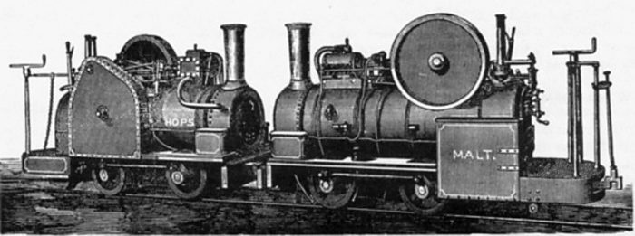
However, by June, two miles of track were ready and an engine was in use, and by August rails had been laid almost the whole way from Mohill to Dromod. “Altogether, three contractors’ engines were in use on the line, Express, Victor and Deer Hill. The first two belonged to Collens and their origins are unknown. Indeed the only certain thing about them [was] their bad condition; Express, in particular, was for ever in trouble and Collens were forced to use C & L engines, the hiring continuing for some time into 1888. The third engine, Deer Hill, belonged to Lowrys and had an interesting history. It was one of the earliest three-foot-gauge engines, having been turned out by the Hunslet Engine Company of Leeds in 1871 (maker’s number 71). It was first used on construction of the Deer Hill Reservoir for Huddersfield Corporation. Later, it was sold to S. Pearson & Sons, and no more is known of its history up to its arrival on the C & L, or of its subsequent fate. The known dimensions of the engine were: cylinders 8 ins x 14 ins; driving wheels 2 ft 9 ins diameter. The fate of Collens’ engines is also uncertain, al-though it is likely that one (probably Express) remained in Ballinamore until 1902, when it was scrapped.” [6]
“By September 1886 the ballast engine was able to reach Mohill town, completion of the line to there having been de-layed by difficulty in getting a foundation for a bridge at Drumard; it was necessary to go down thirty feet into the bog. On the Belturbet side of the line, the stone cuttings were re-ported finished in August, and shortly afterwards the embankments were nearly ready and rail-laying was continuing.” [6]
In October there were problems with significant subsidence on the Belturbet line at Tomassen Lake which took time to rectify and required a realignment of the route. If the problems with construction were relatively limited others were less so. Various objectors sought to delay progress; MGWR resistance intensified as they refused to create a transshipment siding at Dromod, threatened to inaugurate a competitive cart service in the area of the C & L, at every opportunity they demonstrated the churlish attitude for which they were well-known; labour difficulties occurred regularly; litigation over a major accident caused by the reckless driving of one of the contractors’ engines. [7]
Work was almost complete by the beginning of July 1887. It’s first recorded train was an early morning run from Belturbet to Ballinamore on 26th July with representatives from different contractors. The group held a meeting at Ballinamore. [8]
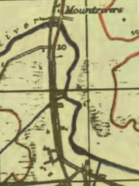
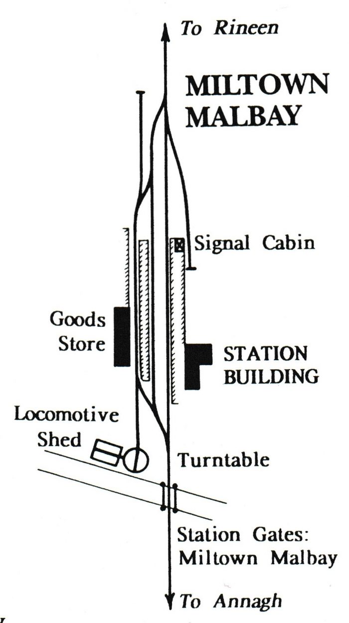
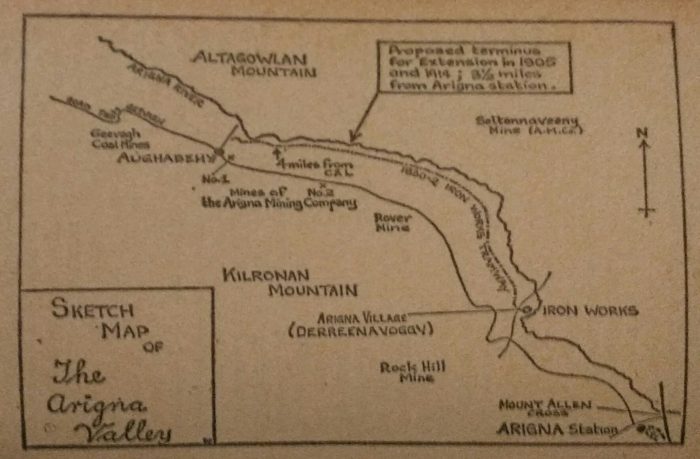
On 17th October 1887 the line was opened for goods traffic and on 24th October 1887 it opened for passenger traffic. Sadly the inaugural service was much delayed by an engine failure and a slow response from a relief locomotive.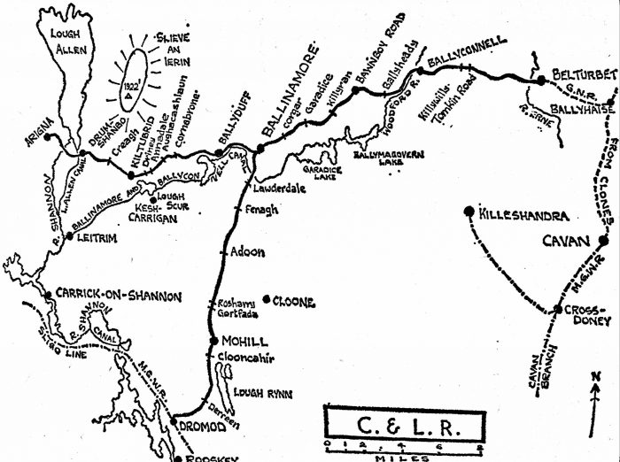 Patrick Flanagan’s hand-drawn map of the Cavan & Leitrim network. [4]
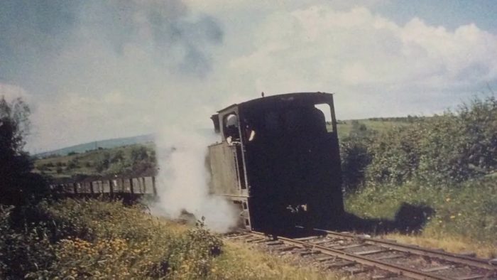
Throughout the life of the C & L, it was Arigna coal which provided its major source of income and it was the building of the power station in Arigna in 1958 which sounded the death knell for the Cavan and Leitrim Railway since coal would no longer be brought out from Arigna, the power station needing all the coal the mountain could provide.
Locals were devastated at the loss of their railway whose familiar sight and sound had become synonymous with the landscape from Belturbet all the way across to Arigna. [9]
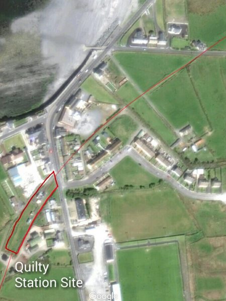
We start our survey of the line at Dromod. Patrick Flanagan notes that,”Although the official C&L direction was ‘down’ from Belturnet to Dromod, even the oldest employees regarded the line to Belturbet as the ‘down road’.” [11] So it makes sense for to follow that convention just as Flanagan chose to do in writing his book.
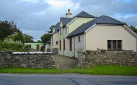
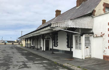
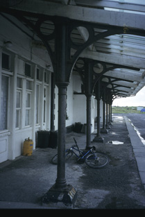
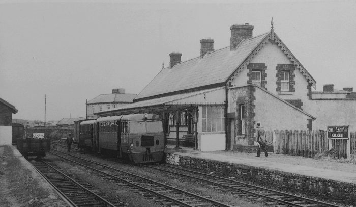
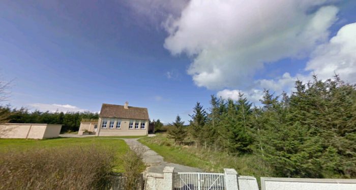
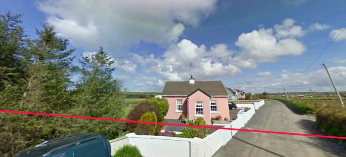
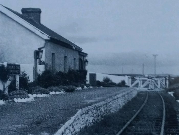
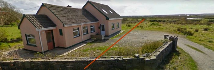
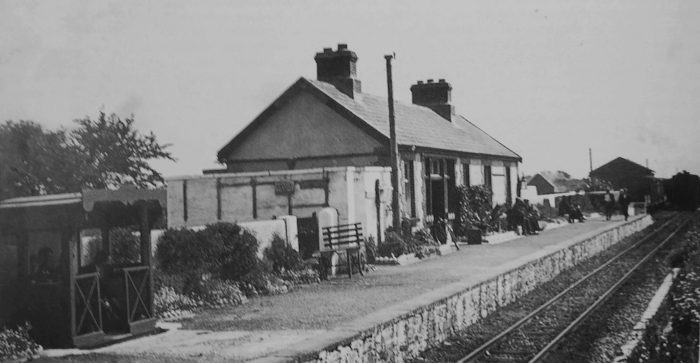
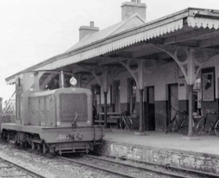
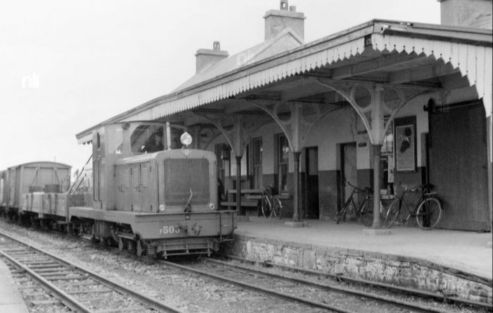
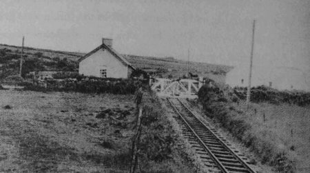
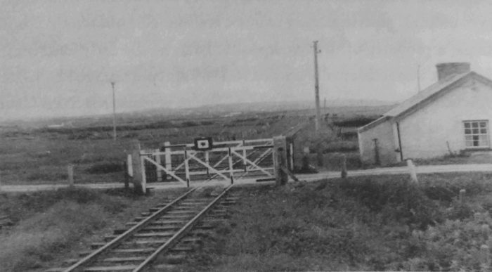
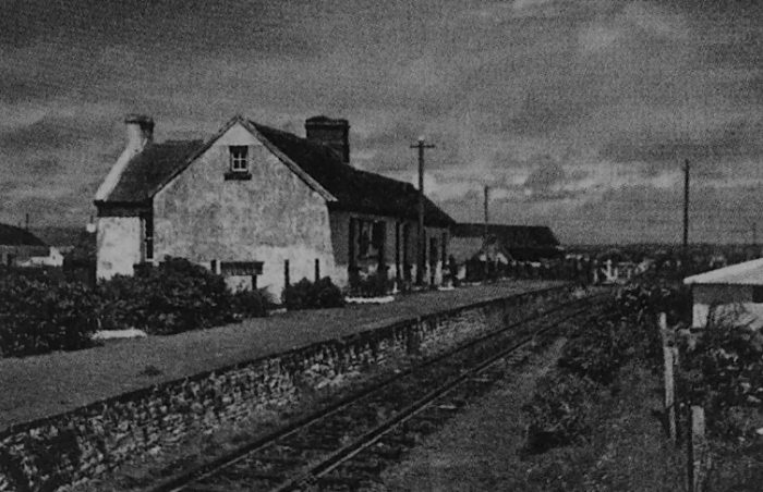
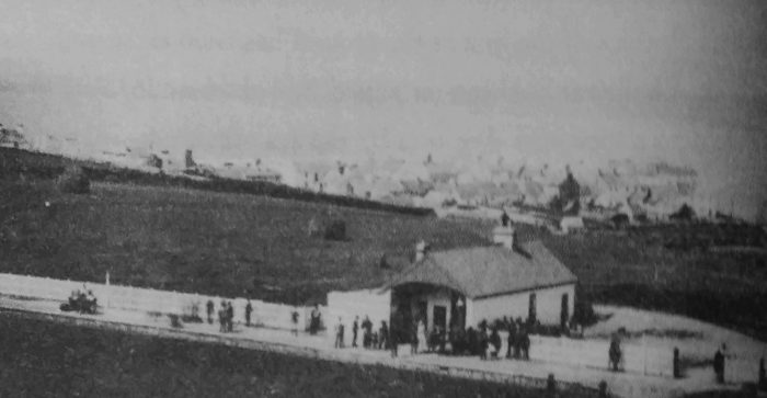
Dromod railway station serves the village of Dromod in County Leitrim and nearby Roosky in County Roscommon. It is a station on the Dublin Connolly to Sligo intercity service. The station is shared with the short preserved section of the Cavan and Leitrim Railway. [12] The station opened on 3 December 1862 and remains in operation, despite closing for goods services on 3 November 1975. Dromod was also the terminus of the narrow gauge Cavan and Leitrim Railway. It opened on 24 October 1887 and finally closed on 1 April 1959. A short section of narrow gauge line has been reopened at the station as part of preservation efforts. [12]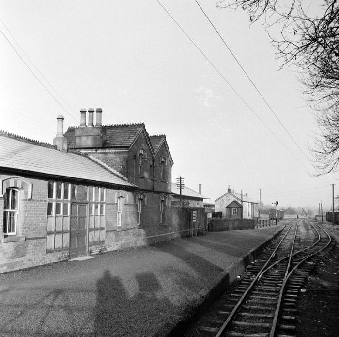 The Cavan &Leitrim station building in 1959. [12]
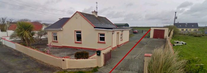
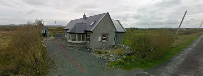
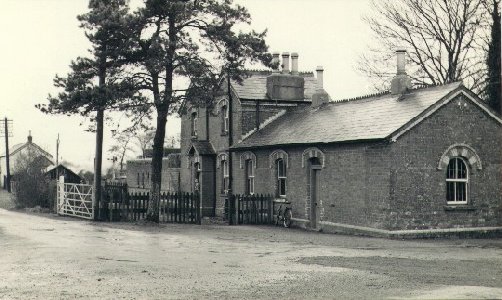 And again but from the forecourt. [21]
 Dromod Main Line Station in 1993, © Ben Brookabank. [13]
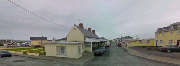
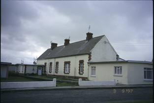
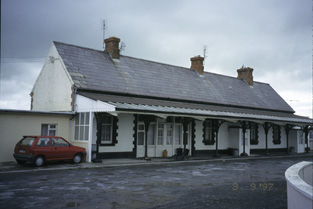
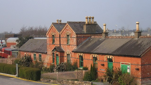 The Cavan & Leitrim station building, taken in 2007, © Sarah777. [14]
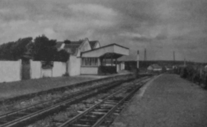
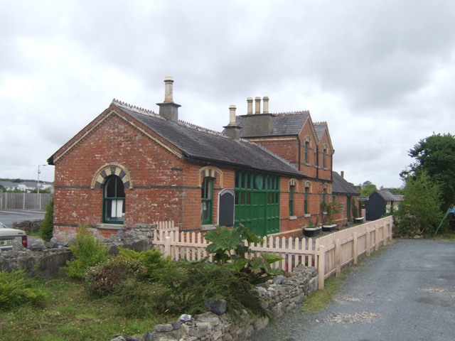 The same building from what was rail-side, taken in 2010, © John M. [15]
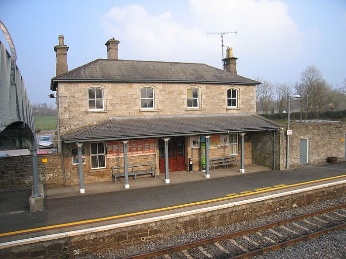 Another photograph of the main line station. [16]
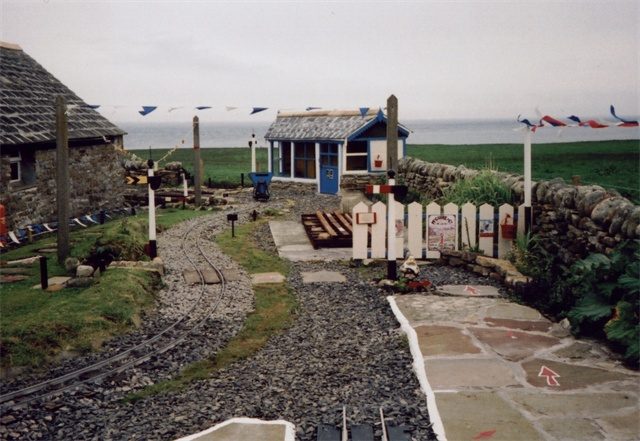
A Cavan & Leitrim Railway museum was established in 1993, and is run entirely by volunteers. The museum is located beside the Irish Rail station in Dromod on the grounds of the old Cavan and Leitrim Railway yard. Contact details are: [29]
The Cavan & Leitrim Railway, Station Road, Dromod, Leitrim, Ireland
Email: dromodrailway@gmail.com Tel: 00353-71-9638599
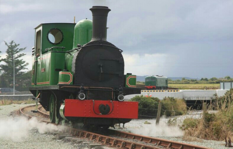
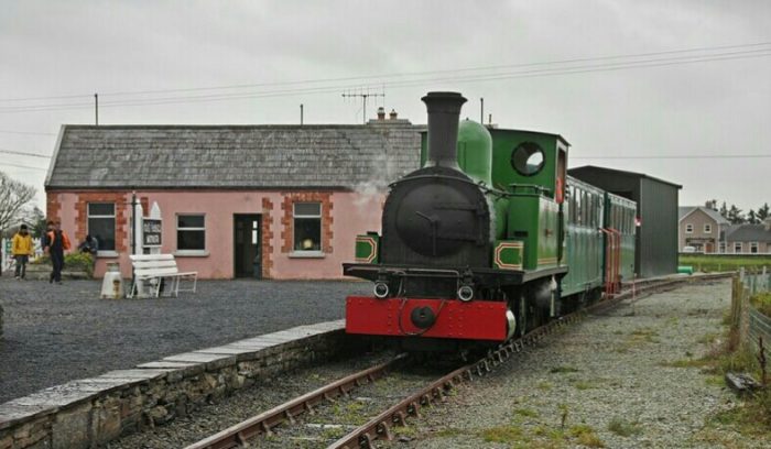
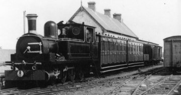
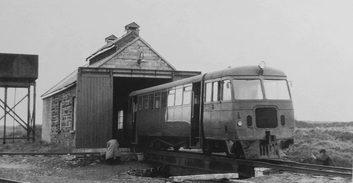
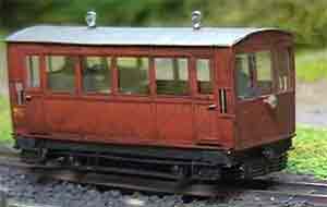
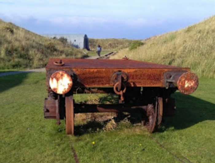
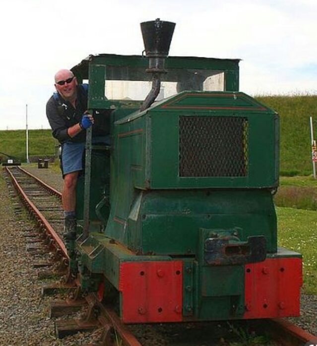
Today 0.4 kilometres of narrow gauge line has been restored and remains preserved after its closure in 1959. Following the closure, all that remained in Dromod was the Station House, the engine shed and water tower. Today they have been restored and are been preserved. One of the original locos (No. 2) and one of the original carriages are preserved and on display at the Ulster Folk Park and Transport Museum, Cultra and No. 3 “Lady Edith” is in the United States at the New Jersey Museum of Transportation. The museum has recently been working to restore ‘Nancy’ to steam. Nancy is their second steam engine. The first is ‘Dromad’, a Kerr Stewart 0-4-2ST.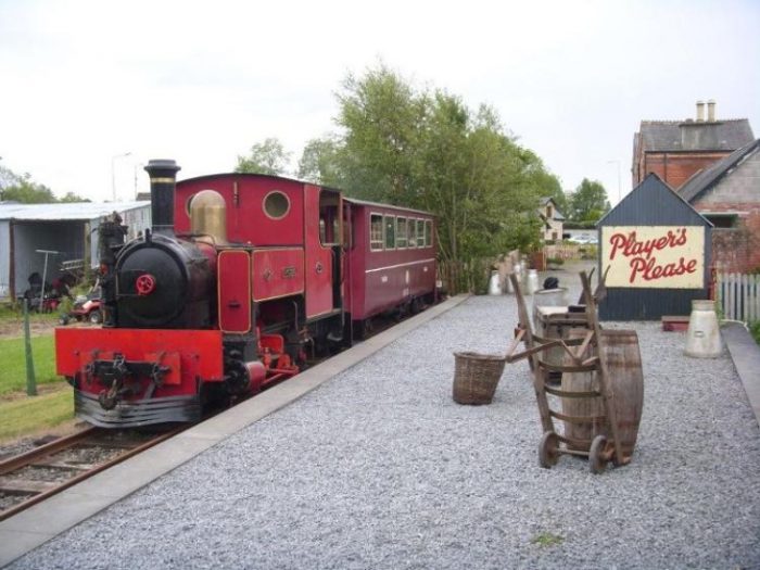 ‘Dromad’ at Dromod. [17]
Nancy is now back at the railway after refurbishment. Follow one of these links:
https://m.facebook.com/groups/733162906774904?view=permalink&id=2149453615145819
https://m.facebook.com/story.php?story_fbid=1525796770897305&id=438598052999183&sfnsn=mo
There are moves afoot to extend the preservation line to Mohill. [17]
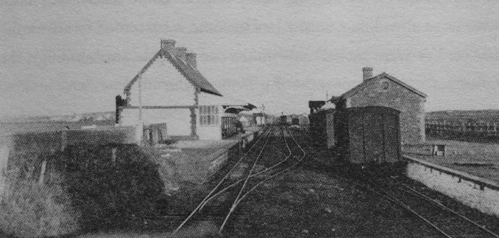
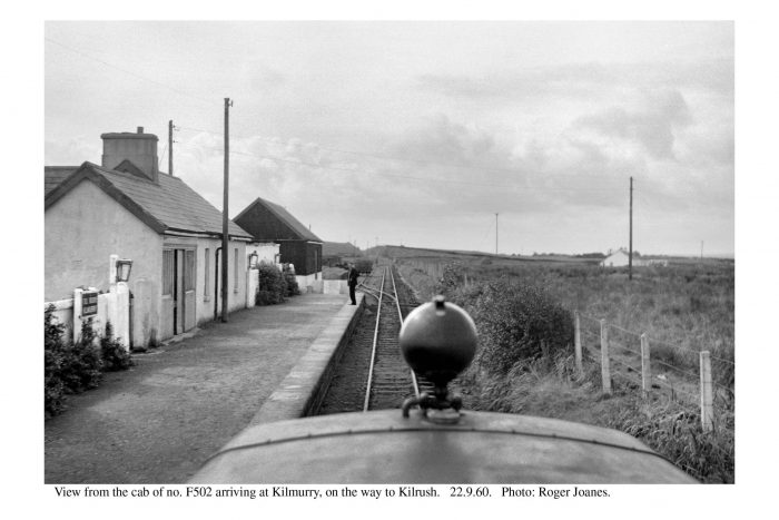
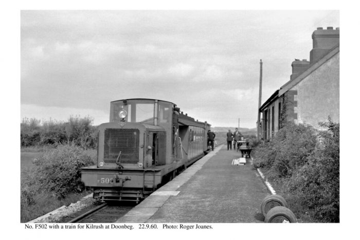
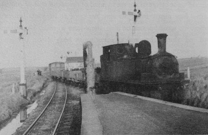
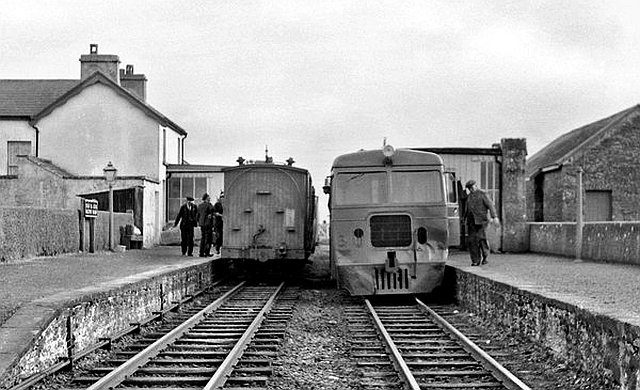
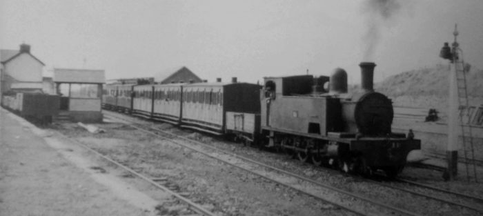
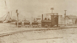
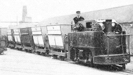
Before setting off on an armchair journey away from Dromod we look at a few images taken prior to the closure of the narrow gauge line. This loco is ex-CB&PR Loco No.12, shown by the water tank at Dromod in 1959, © Roger Joanes. [18]
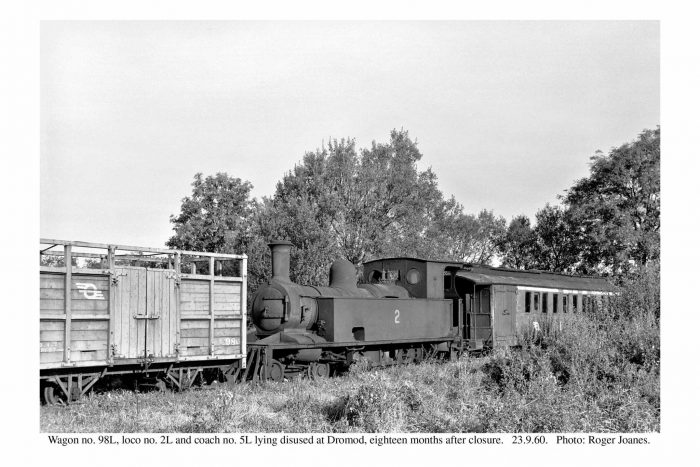

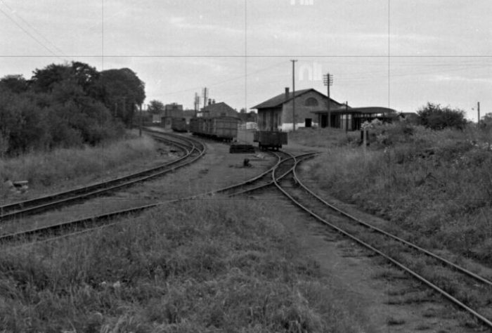
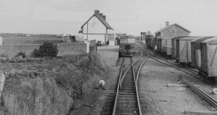
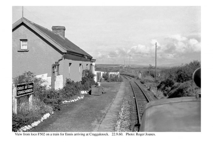
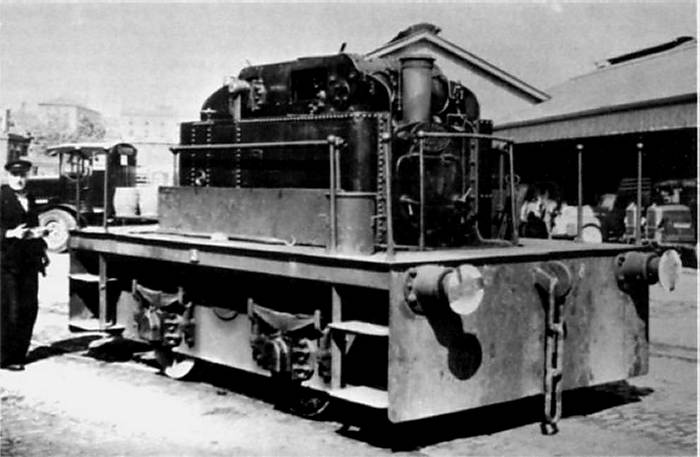
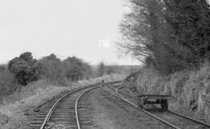
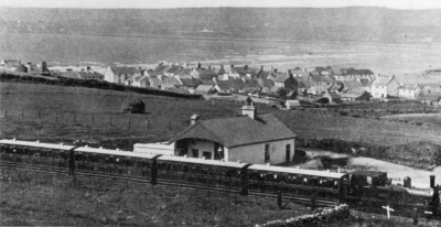
 Two more Roger Joanes photos (above) both very atmospheric. The first was taken 18 months after closure of the line. The second was taken some months earlier. The second image is helpful in that it shows, on the right, the proximity of the two station buildings at Dromod. [18] The image immediately above was taken a Dromod in 1955. [20] The picture below shows Dromod sidings in 1959. [22] Those which follow were all taken in 1959. [23][24][25]

 The National Library of Ireland holds the O’Dea Photograph Collection which has a lot of pictures of the C&L. These next few pictures come from that collection. [26]
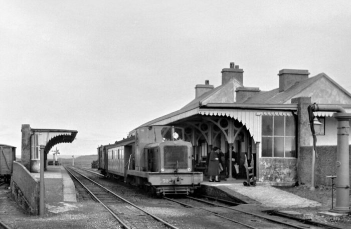
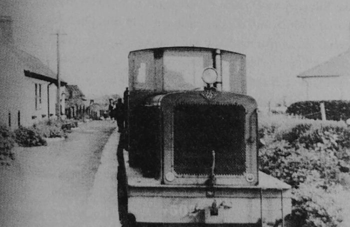
 Train from Ballinamore arrives at Dromod. [26]
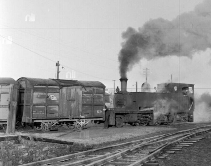 Shunting the yard at Dromod. [26]
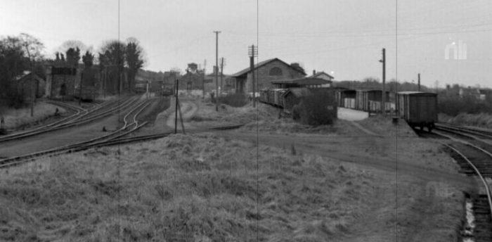
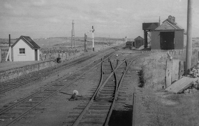
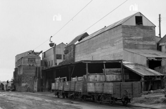
 Two views of the yard at Dromod. [26]
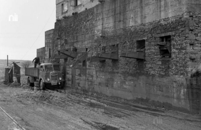
 The transhipment sidings at Dromod. [26]
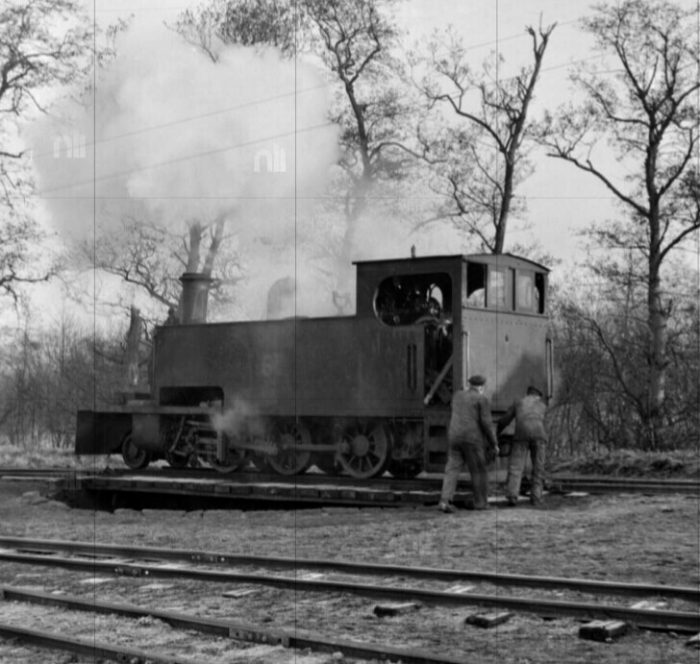 Turning the engine at Dromod. [26]
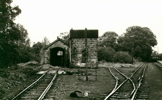
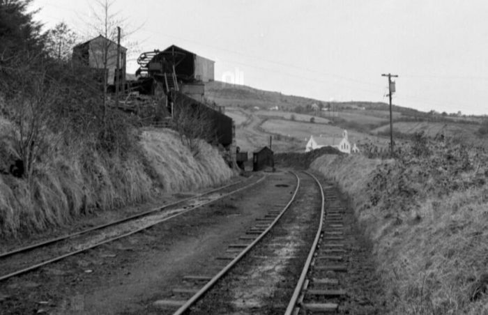
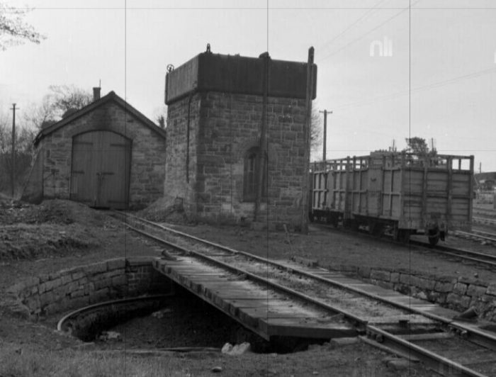 The engine shed, water tank and turntable at Dromod. [26]
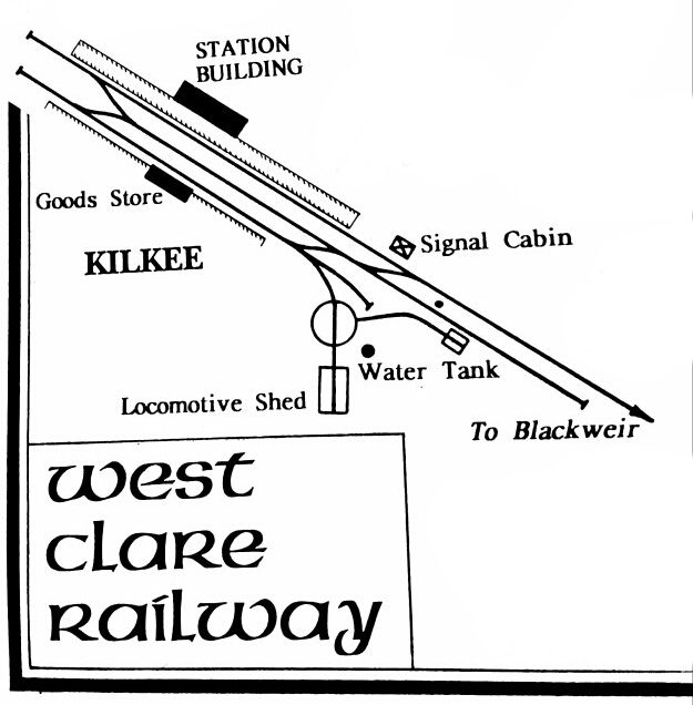
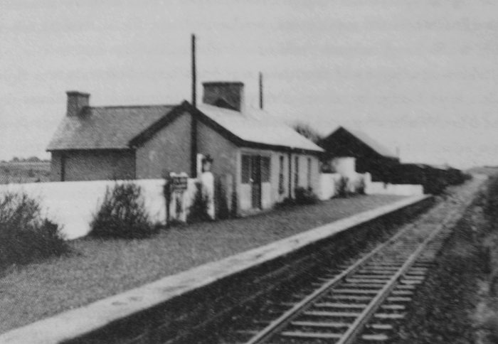
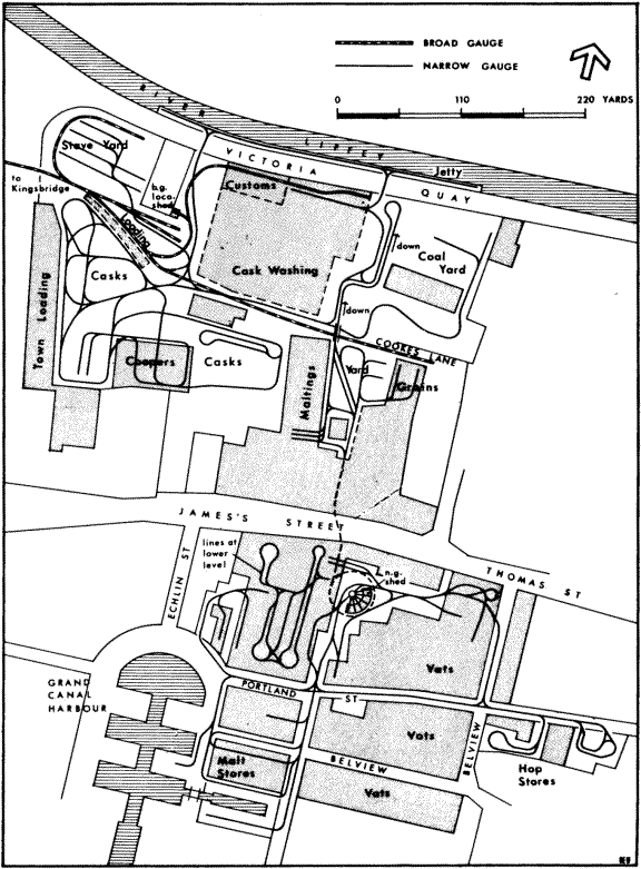
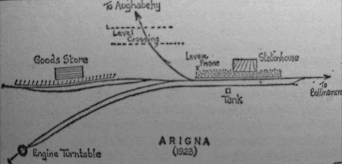
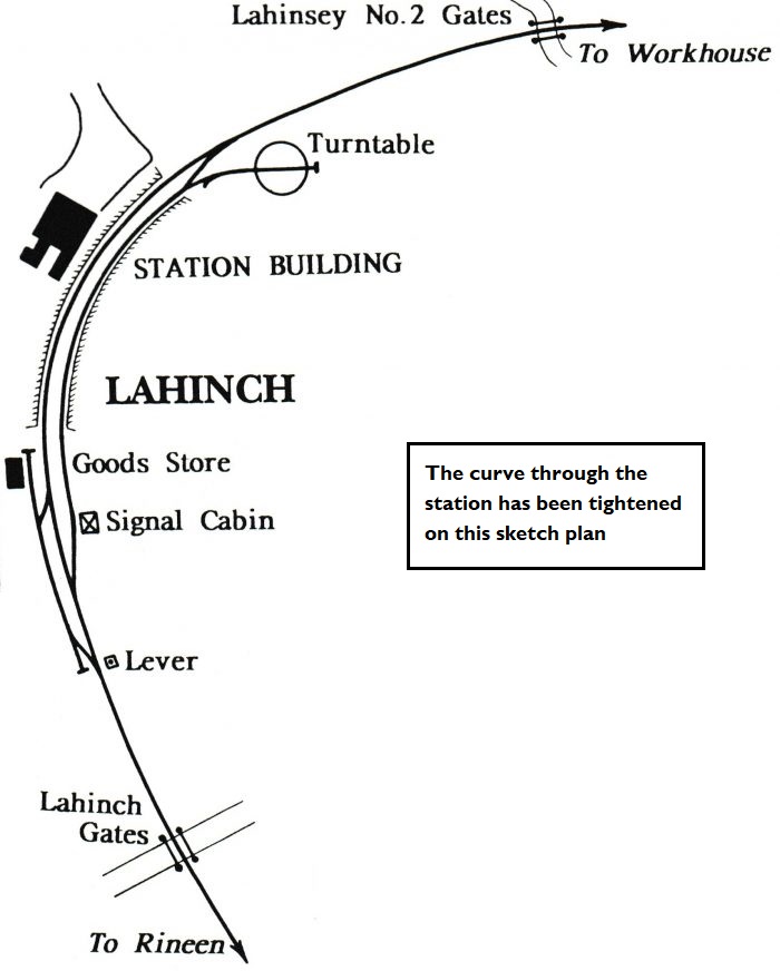
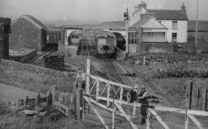
Patrick Flanagan introduces us to the station: The station was reached a”the yard from the main-line station it consisted of a solid, red-brick, two-storey house on single down-side platform. In common with the other main C&L buildings, it bore a marked resemblance to those on the Clogher Valley line. There were agent’s quarters, waiting-rooms and offices; and, from 1903 to 1917 (while James Agnew was stationmaster) a refreshment-room. In 1923, Michael Wislev reopened the room, renting it from the C&L. He provided varied reading matter in addition to refreshments and maintained the service till the Amalgamation. At the latter time, too, all booking facilities were transferred to the MGWR building and all Dromod was under the care of one station-master.” [27]
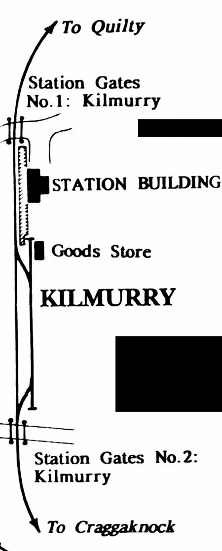
“The station had a 24-foot turntable, near which was the small shed holding one engine. … Near the shed was the 4,750-gallon water tank, mounted on a high solid-stone base. … Near the tank was the carriage shed road, which lasted until the end although the shed itself was removed thirty years earlier. The shed was 100 ft long by 12 ft high by 10 ft wide, with timber sides and a corrugated-iron roof; it was built by Rogers of Belfast. Both the engine and carriage roads were off the run-round loop which terminated in a carriage dock (installed 1890) opposite the station buildings. A second loop served the goods store which was built by the C&L as the MGWR would not cooperate, as had been hoped, by allowing the C&L to use its store.” [28]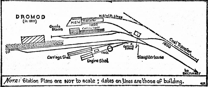 The station plan drawn by Flanagan. [28]
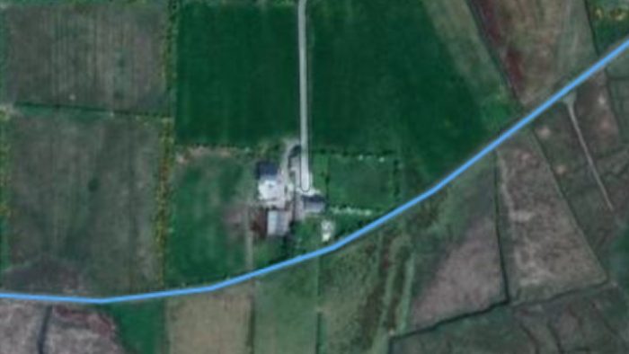
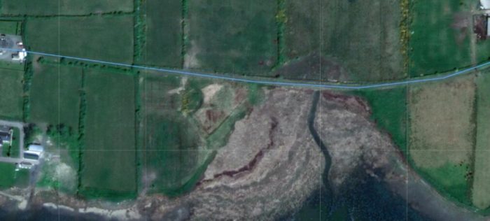
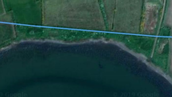
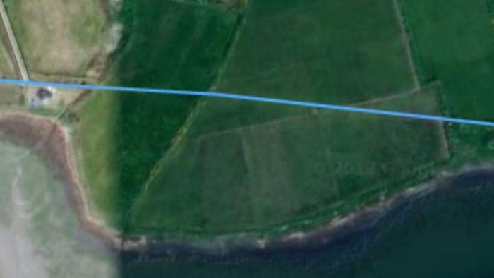
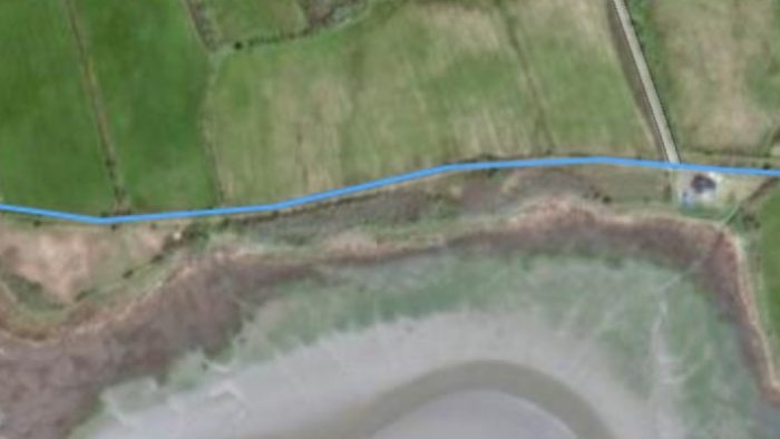
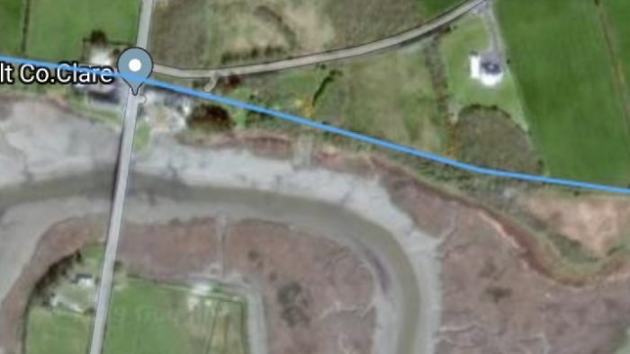
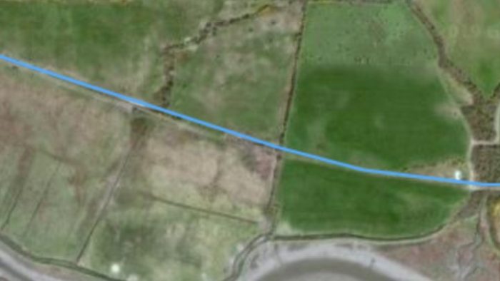
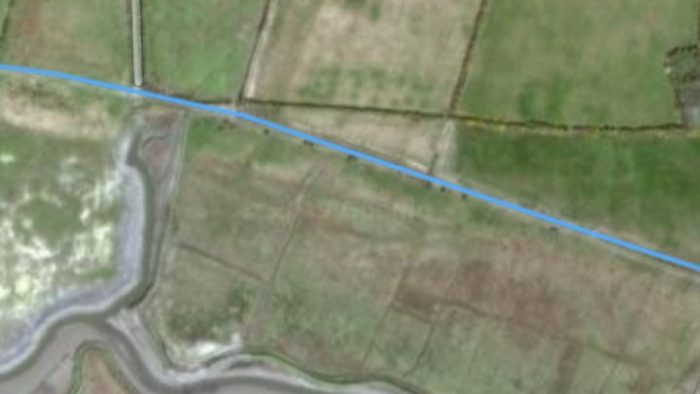
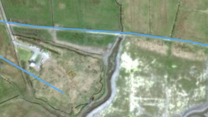
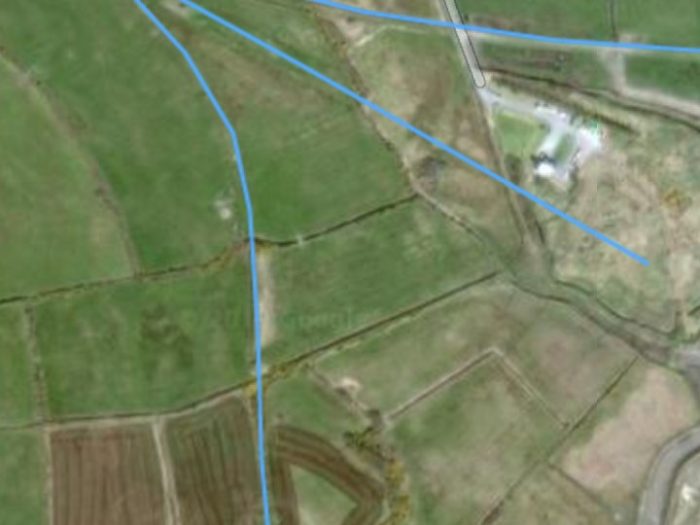
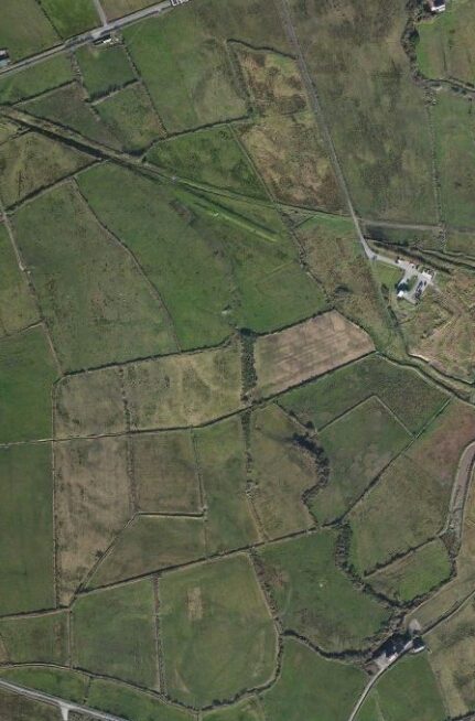
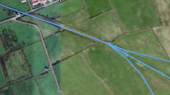
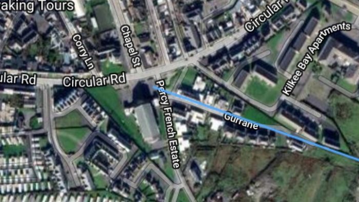
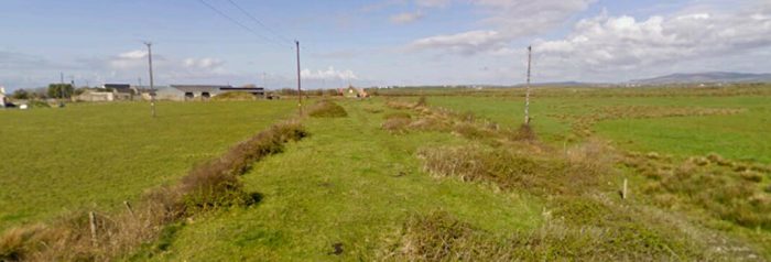
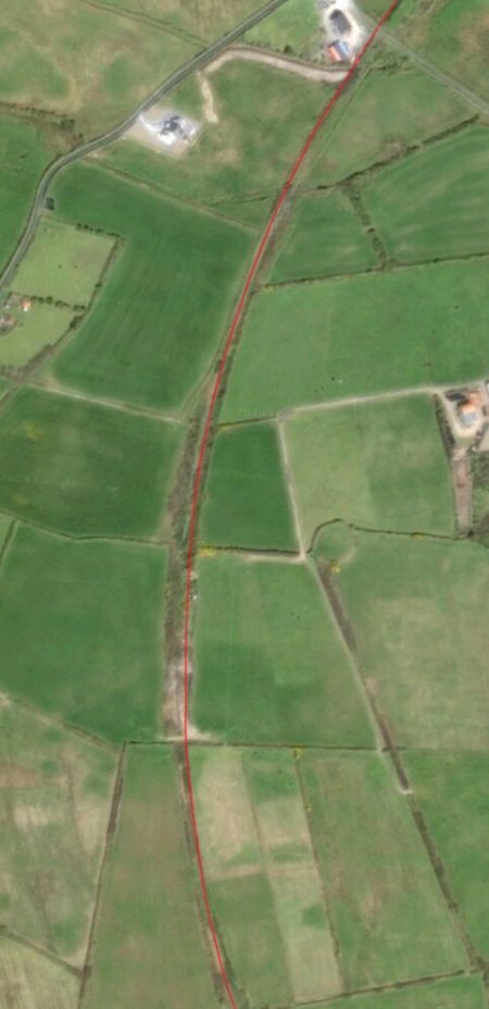
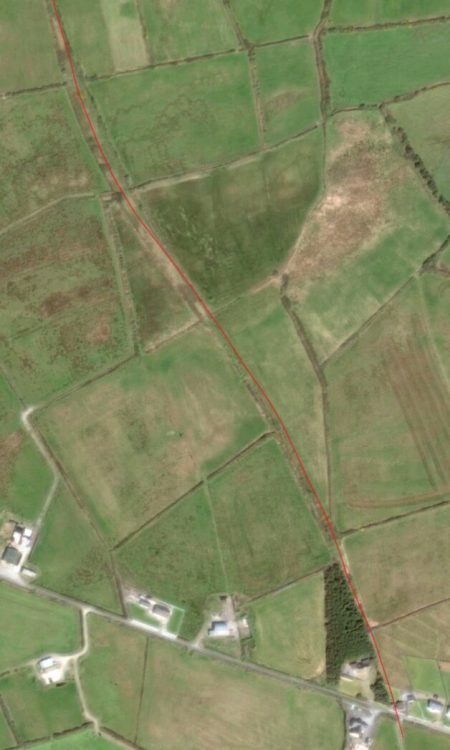
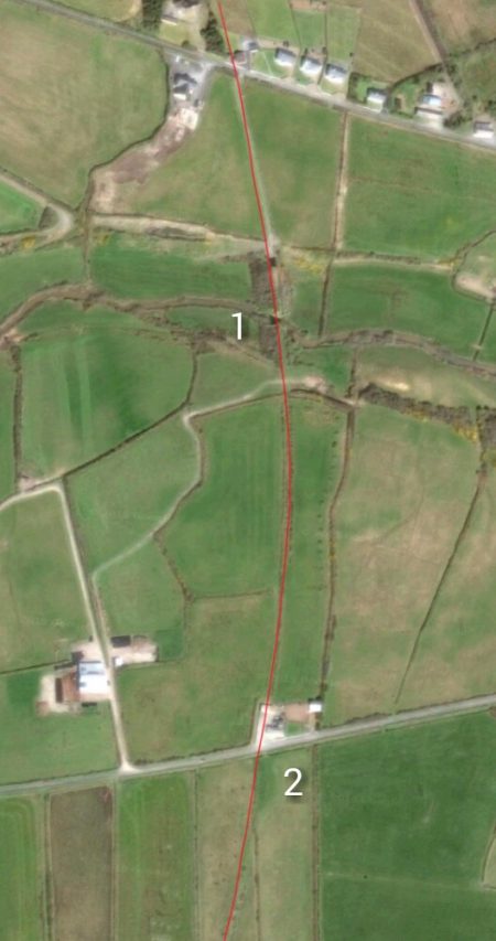
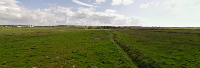
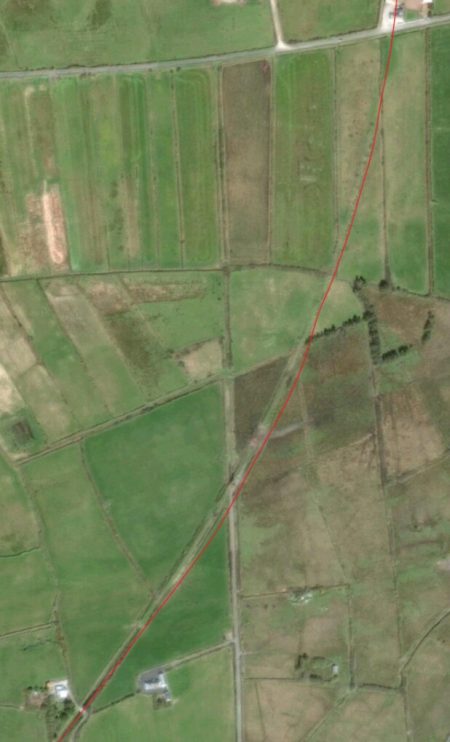
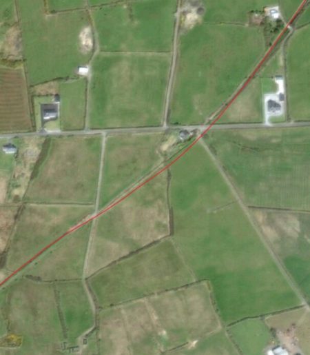
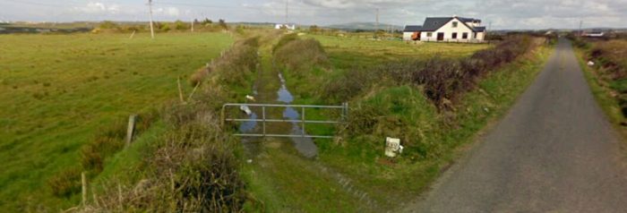
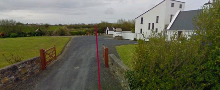
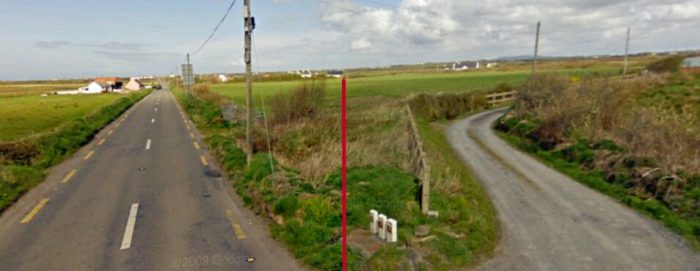
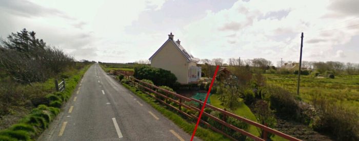
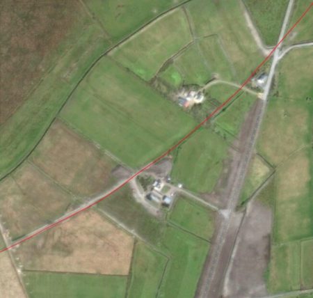
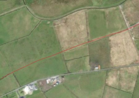
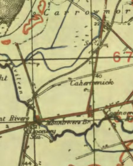
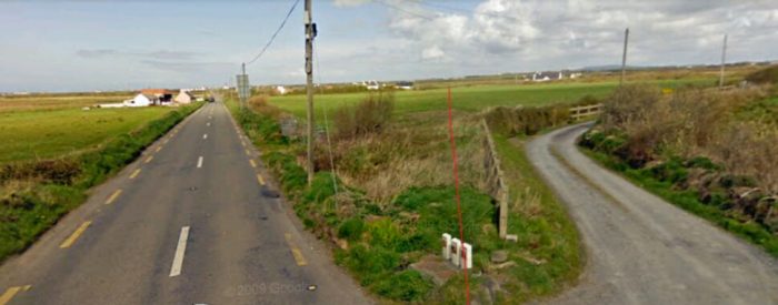
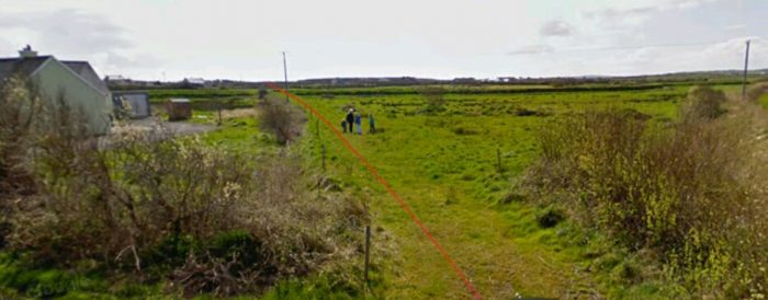
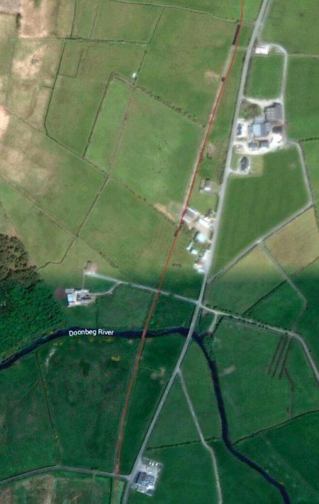
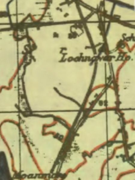
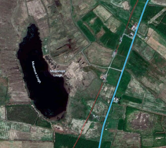
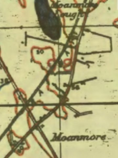
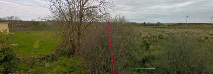
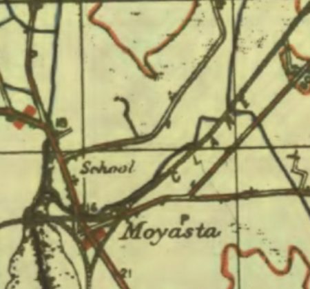
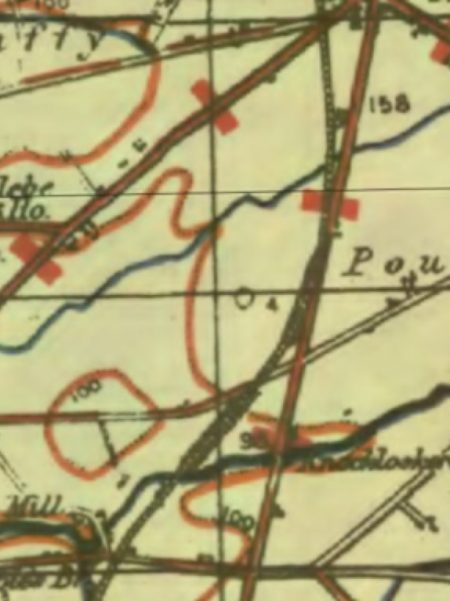
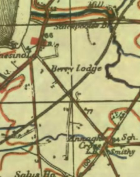
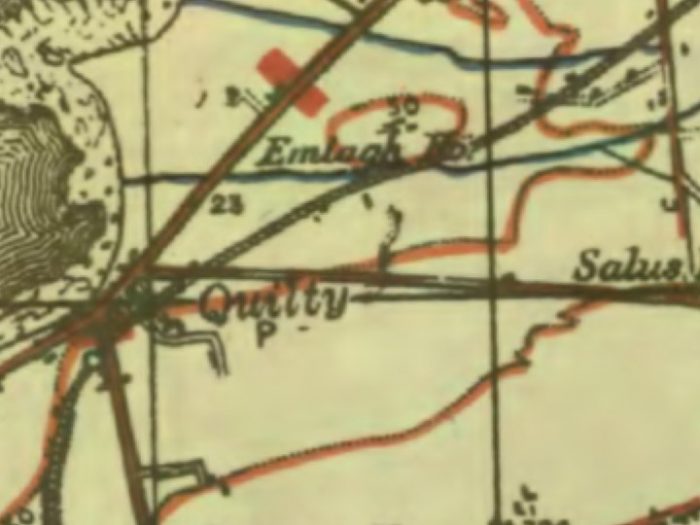
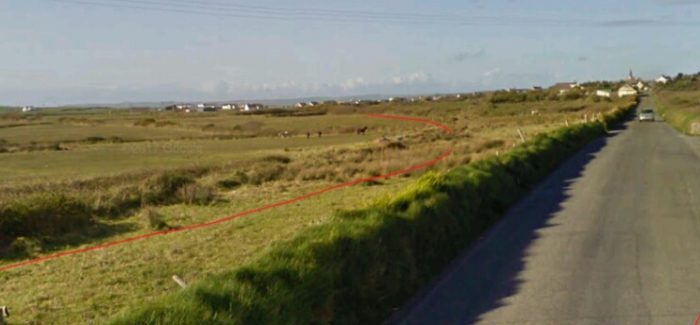
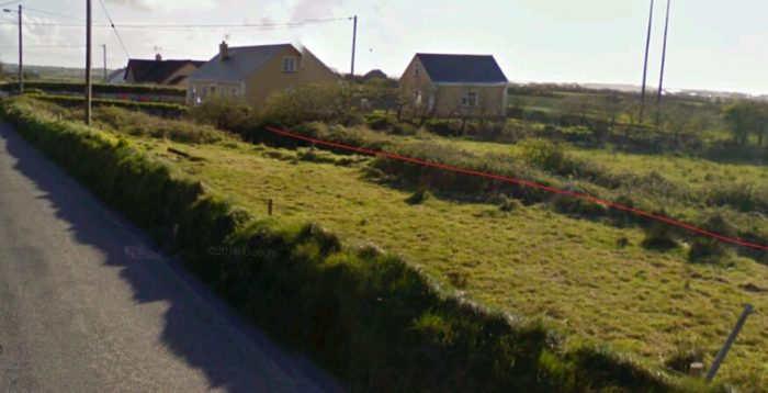
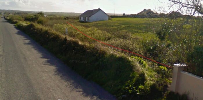
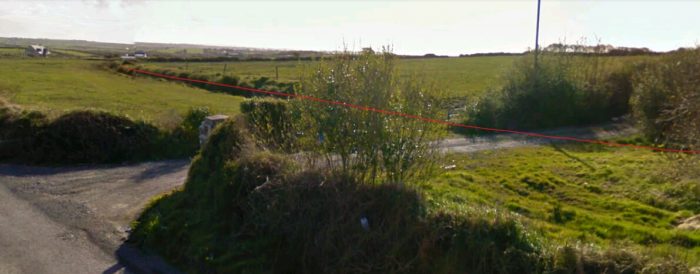
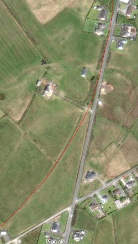
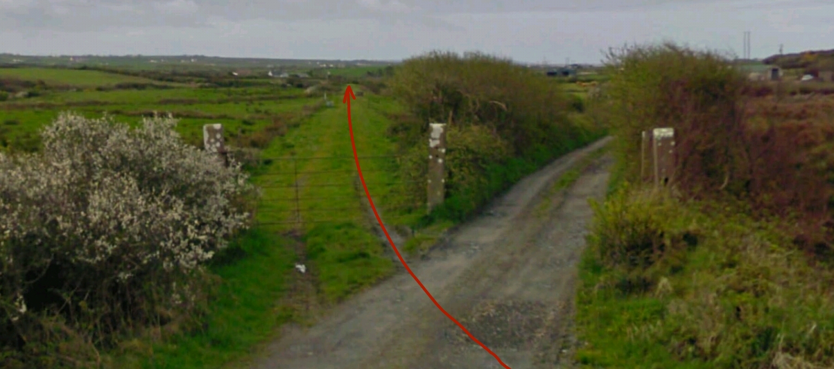
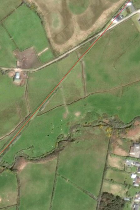
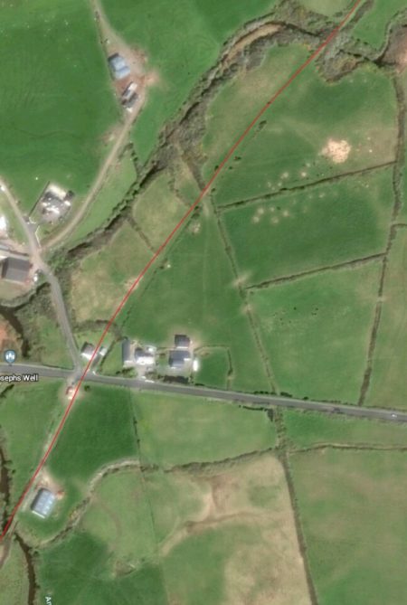
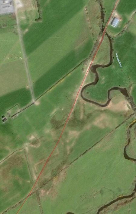
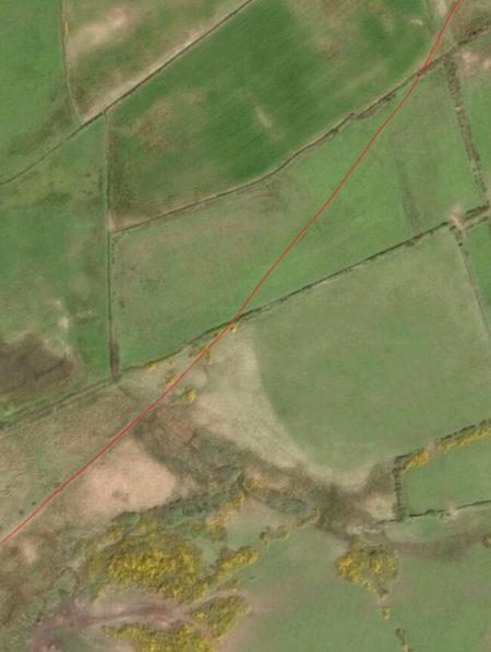
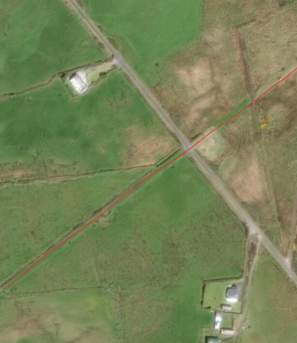
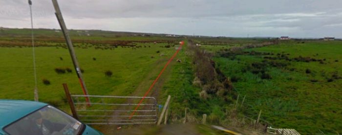
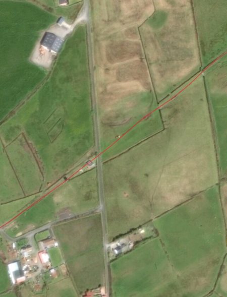
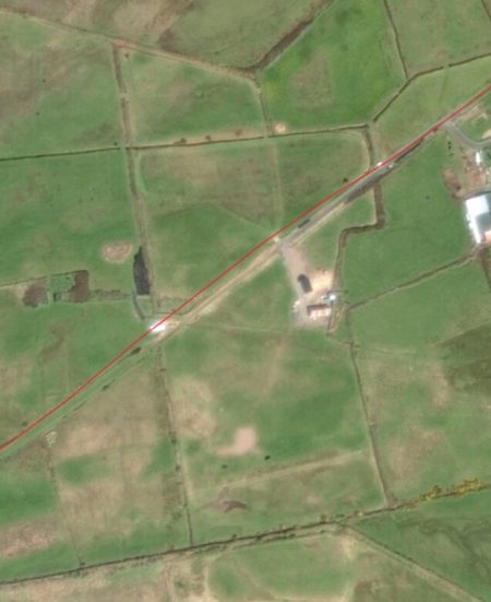
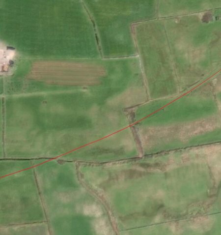
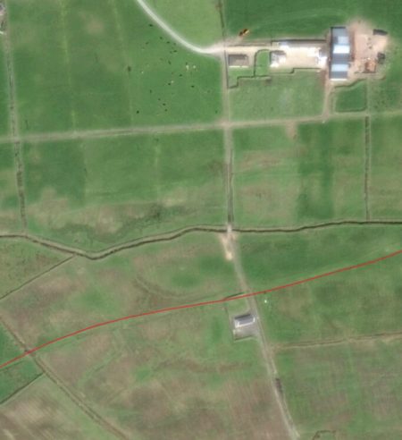
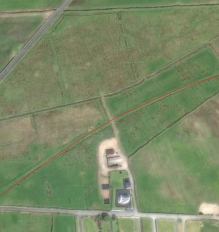
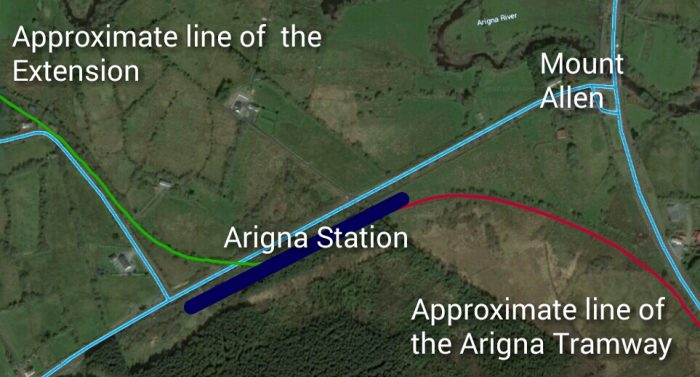
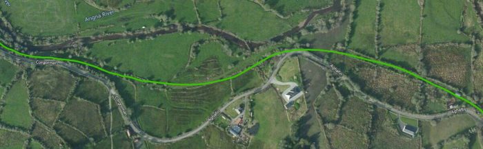
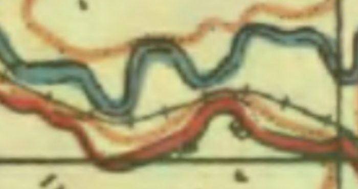
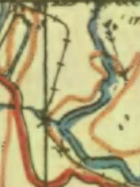
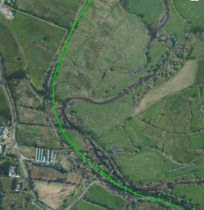
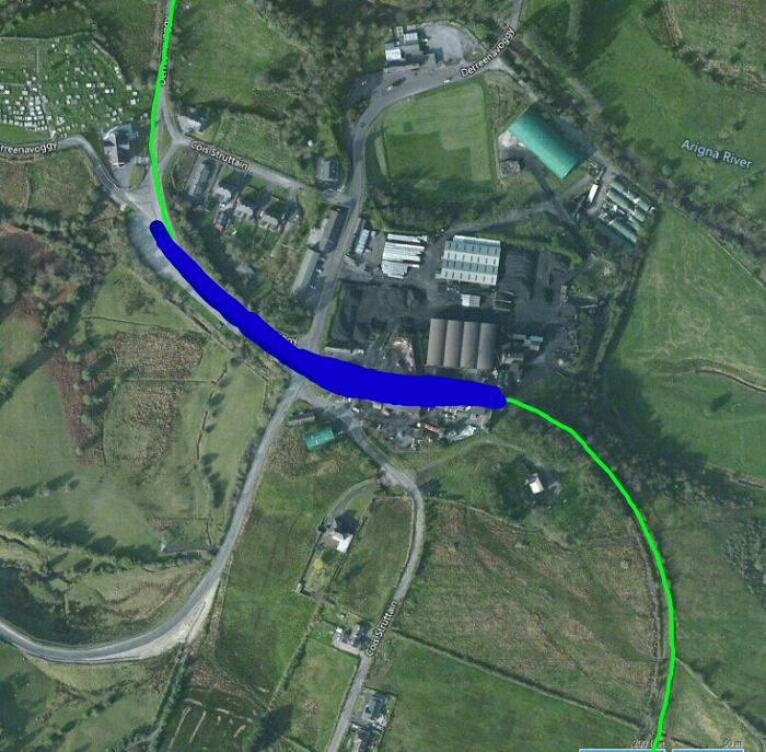
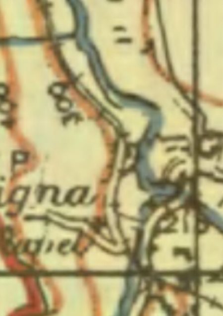
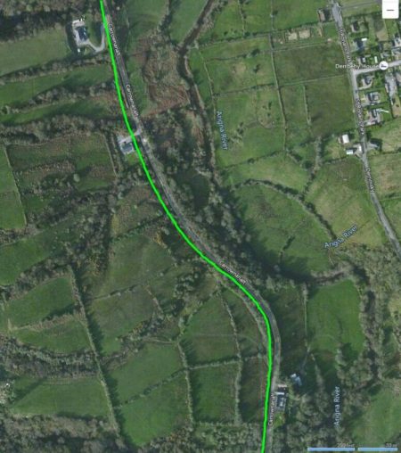
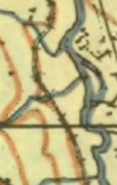
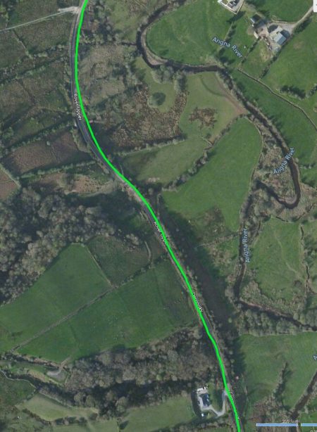
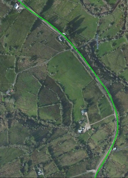
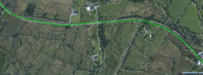
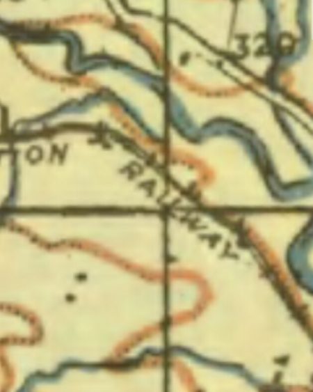
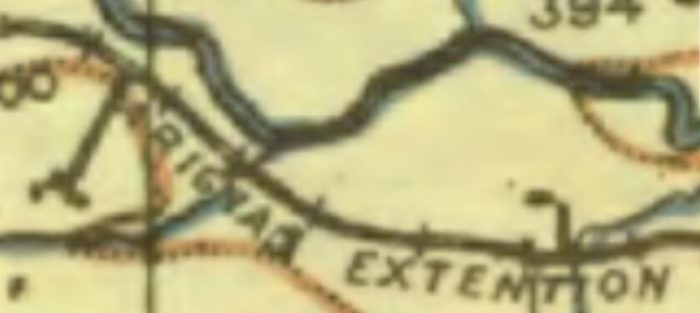
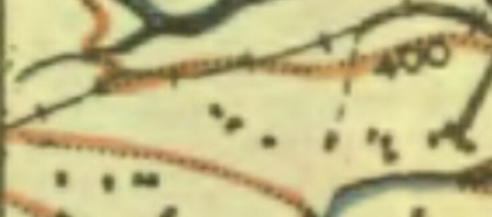
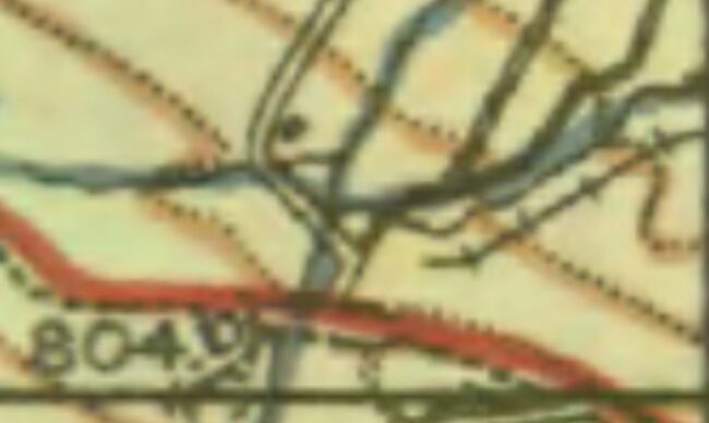
 We are now ready to set off to follow the old railway’s route out of Dromod. The old OS Map shows the main line running from top to bottom with the C&L curving away to the East. [19]
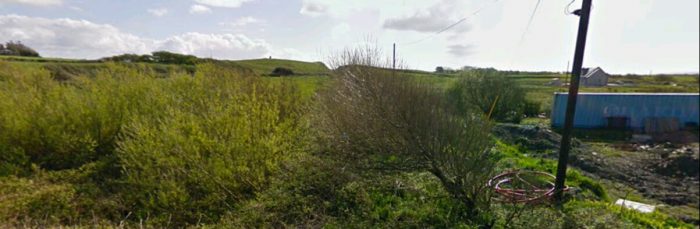
But we will leave following the line to the next post in this series.
References
- Patrick J. Flanagan; The Cavan & Leitrim Railway; Pan Books, London, 1972, p1-3.
- Ibid., p5-7
- https://en.m.wikipedia.org/wiki/Cavan_and_Leitrim_Railway, accessed on 31st March 2019.
- Patrick J. Flanagan; op. cit., p4.
- Ibid., p9.
- Ibid., p10.
- Ibid., p11-13.
- Ibid., p13-15.
- https://www.anglocelt.ie/news/roundup/articles/2012/03/07/4009414-how-the-cavan-leitrim-railway-ran-out-of-steam, accessed on 24th April 2019.
- https://www.irishrailwayana.com/pa204.htm, accessed on 24th April 2019.
- Patrick J. Flanagan; op. cit., p124.
- https://en.m.wikipedia.org/wiki/Dromod_railway_station, accessed on 9th May 2019.
- https://www.geograph.ie/photo/2238023, accessed on 9th May 2019.
- https://www.geograph.ie/photo/1811144, accessed on 9th May 2019.
- https://www.geograph.ie/photo/1945122, accessed on 9th May 2019.
- https://en.m.wikipedia.org/wiki/Dromod, accessed on 9th May 2019.
- https://www.leitrimobserver.ie/news/home/240167/re-open-narrow-gauge-railway-from-dromod-to-mohill.html, accessed on 9th May 2019.
- https://www.flickr.com/photos/110691393@N07, accessed on 1st May 2019.
- The Irish OSM Community Map; http://maps.openstreetmap.ie/oocmaps.html?zoom=15&lat=53.86144972982129&lon=-7.916875406754906&layers=B0000TFFFFF, accessed on 9th May 2019.
- http://homepage.eircom.net/~yarpie/clr/archive/2.html, accessed on 9th May 2019.
- http://homepage.eircom.net/~yarpie/clr/archive/9.html, accessed on 9th May 2019.
- http://homepage.eircom.net/~yarpie/clr/archive/10.html, accessed on 9th May 2019.
- http://homepage.eircom.net/~yarpie/clr/archive/11.html, accessed on 9th May 2019.
- http://homepage.eircom.net/~yarpie/clr/archive/12.html, accessed on 9th May 2019.
- http://homepage.eircom.net/~yarpie/clr/archive/13.html, accessed on 9th May 2019.
- http://catalogue.nli.ie/Collection/vtls000148612/CollectionList?lookfor=&filter%5B%5D=geographic_facet%3A”Leitrim+(County)”, accessed on 9th May 2019.
- Patrick J. Flanagan, op. cit., p124.
- Ibid., p124-125.
- https://sites.google.com/site/thecavanandleitrimrailway, accessed on 19th May 2019, and https://cavanandleitrim.wixsite.com/hom, accessed on 20th May 2019.


 For most people a move to Orkney embarks them on a new adventure and this is certainly what happened when Paul Tyer bought a house here complete with a model railway in the loft.

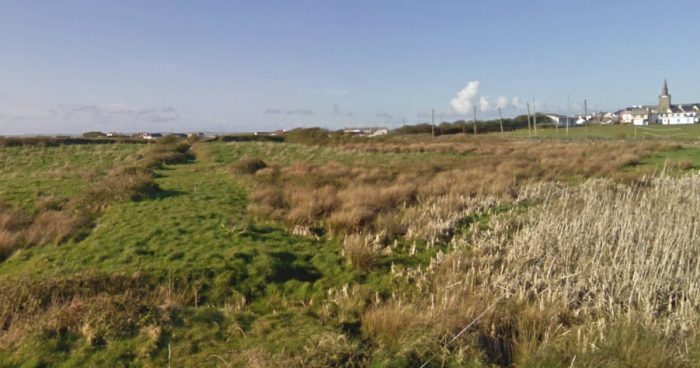


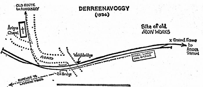


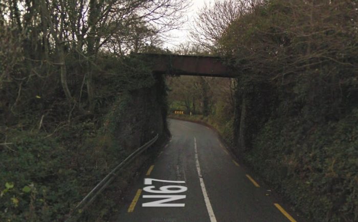
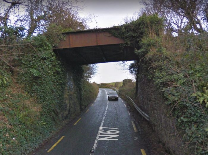
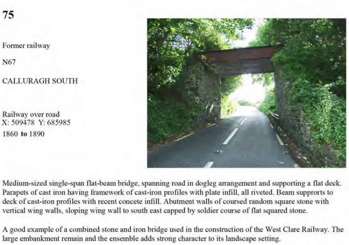
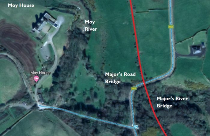
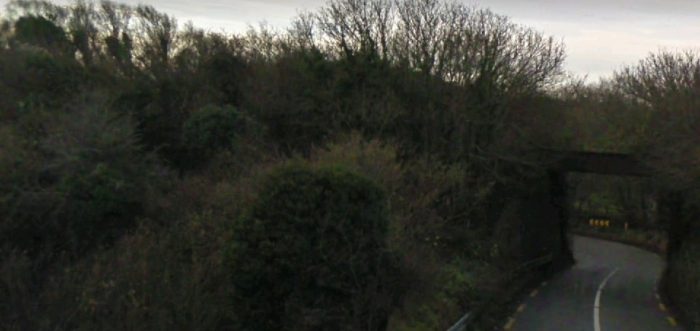
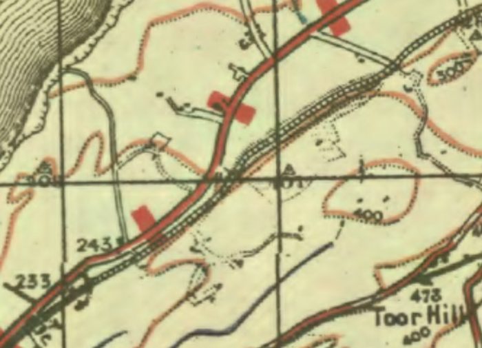
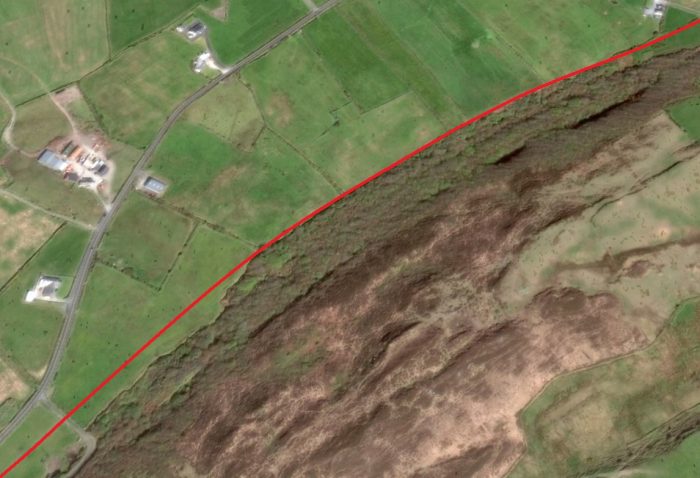
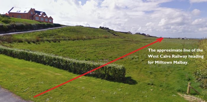

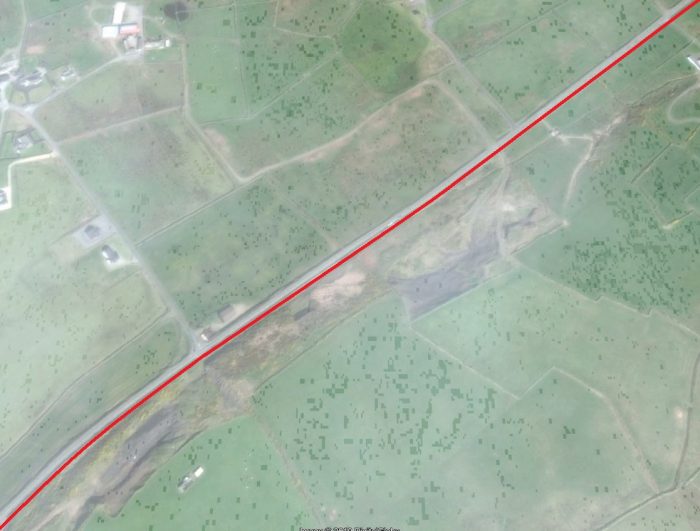
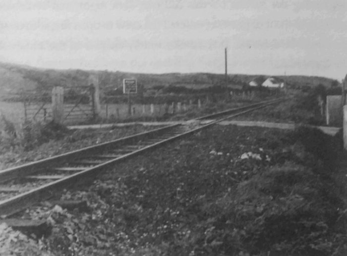
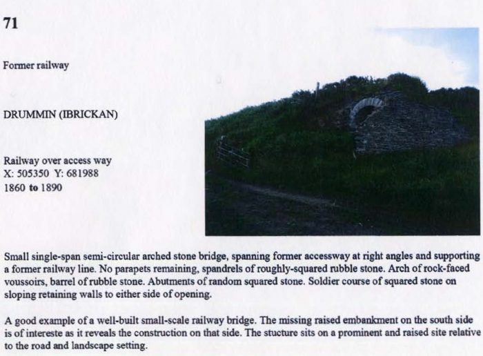
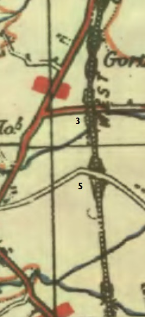
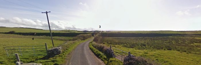
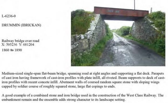
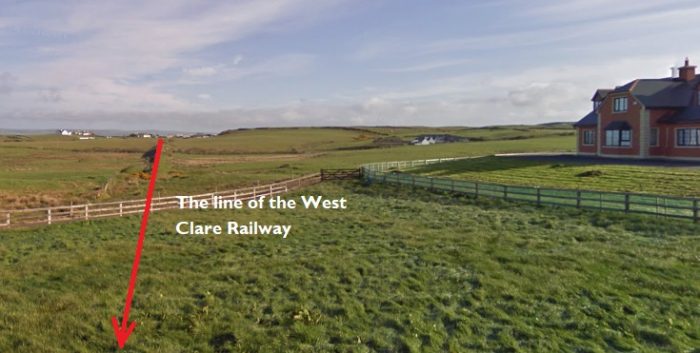
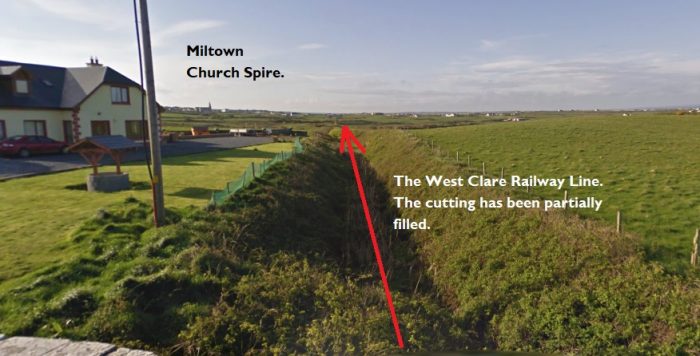

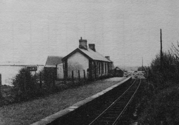
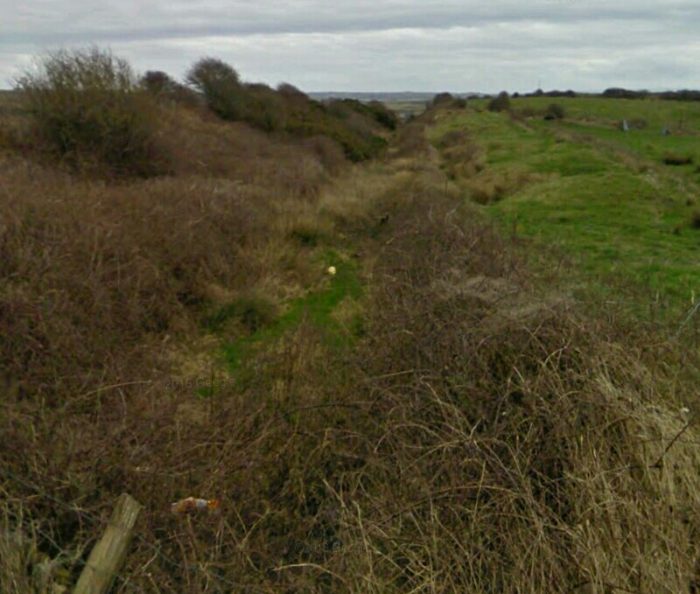
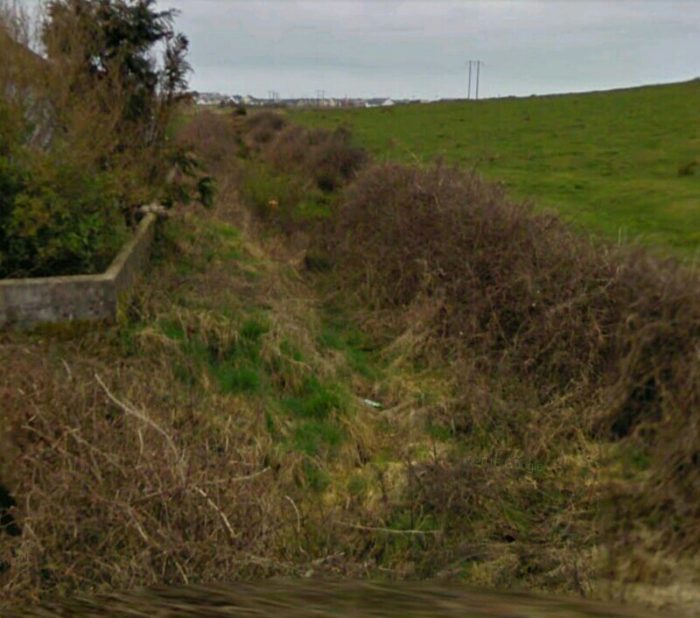
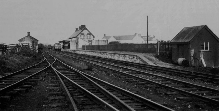
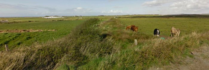
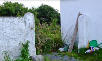
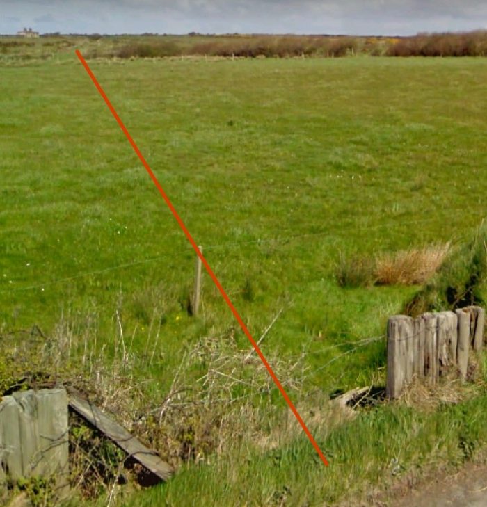
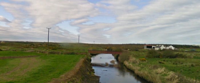
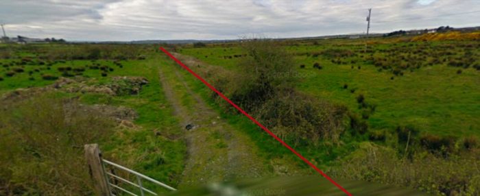
 The partially-filled cutting above clearly shows the line of the railway under the road bridge at location ‘5’. Miltown church spire can be seen on the horizon. Lenihan refers to this as Downes’ Bridge which he says is a “stone-arched span carrying a by-road over the line.” [23]
