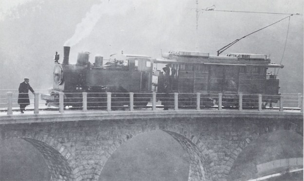
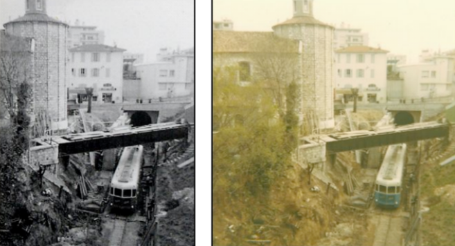
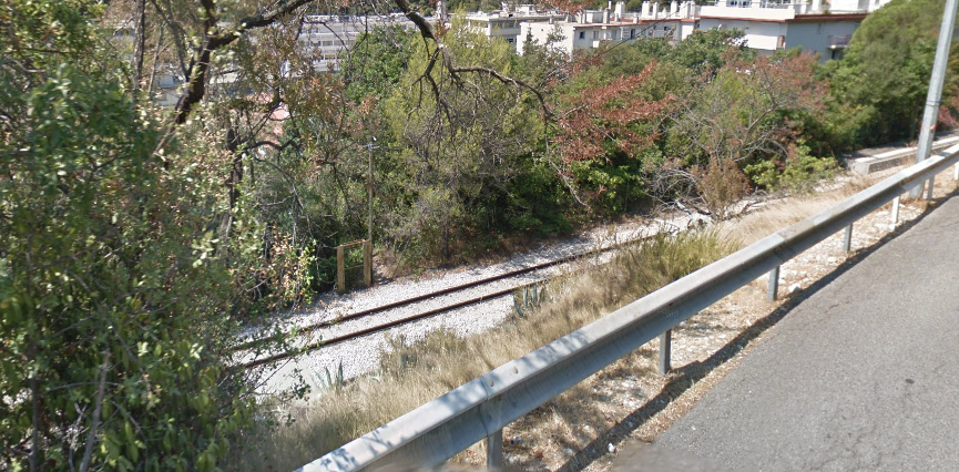
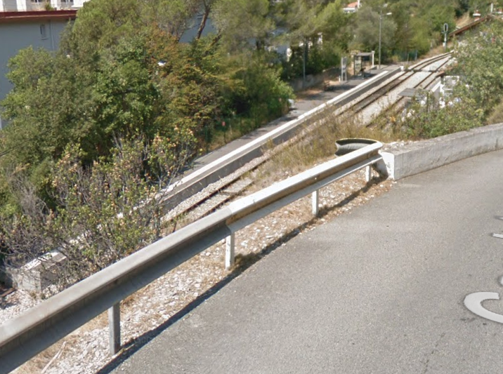
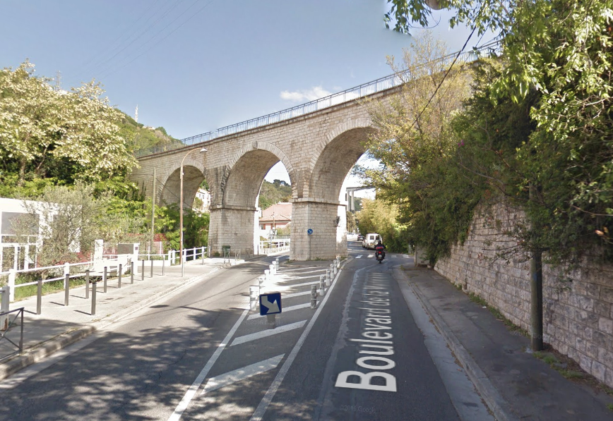
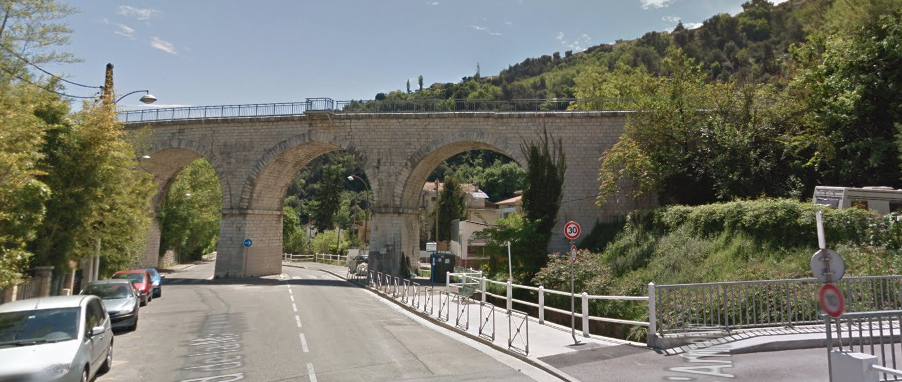
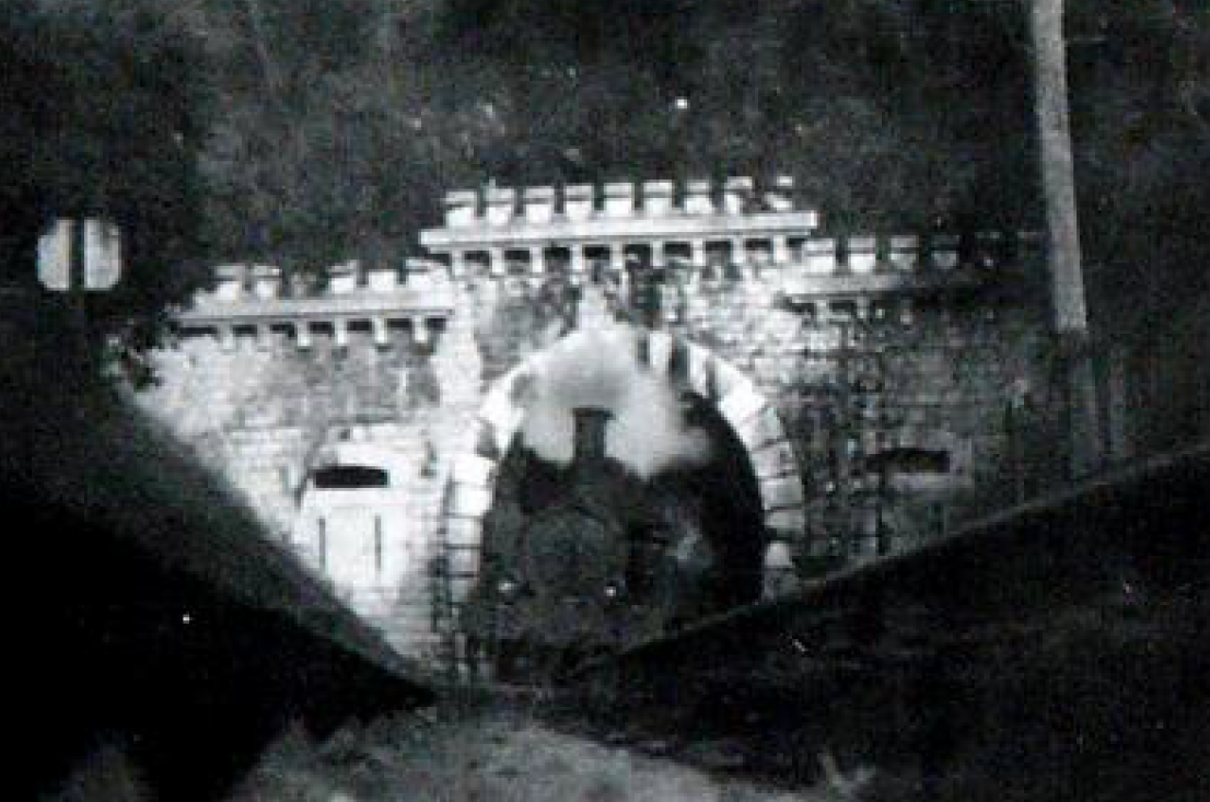
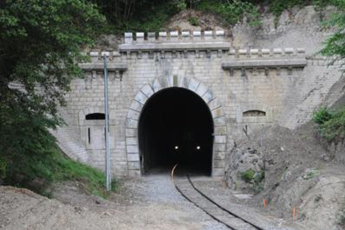
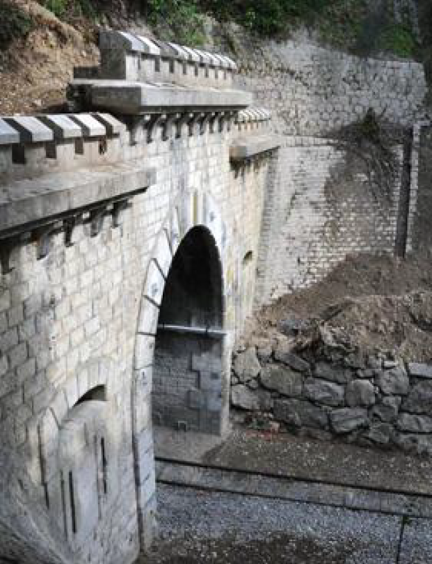
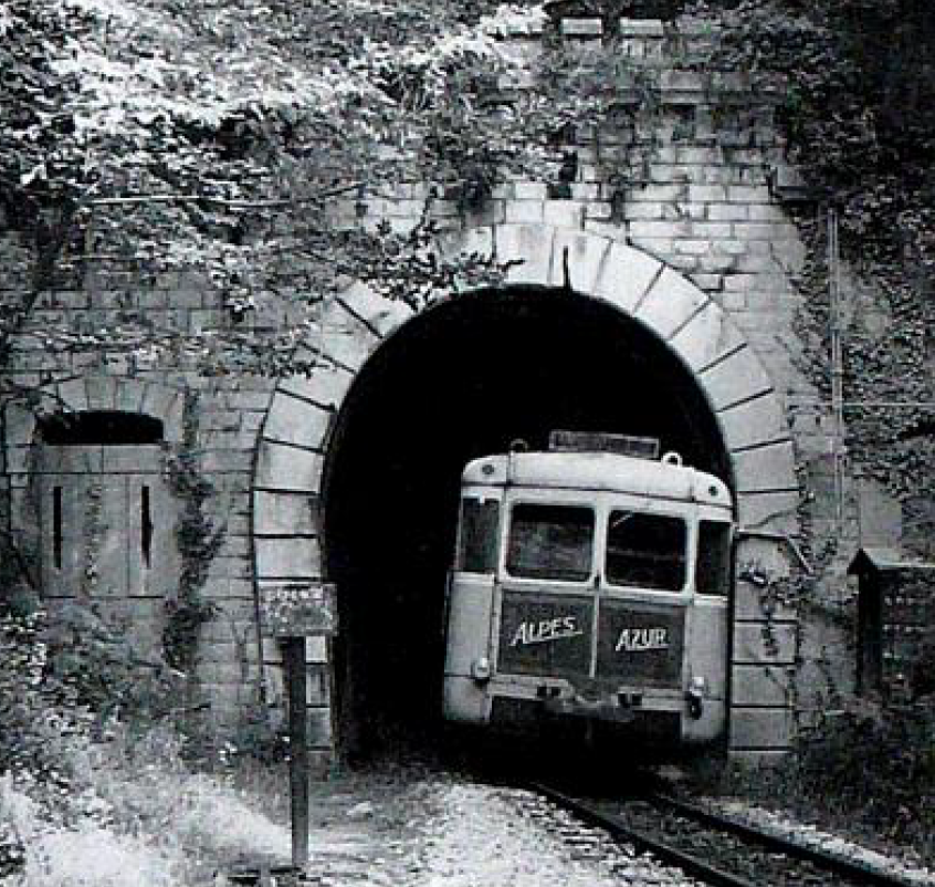
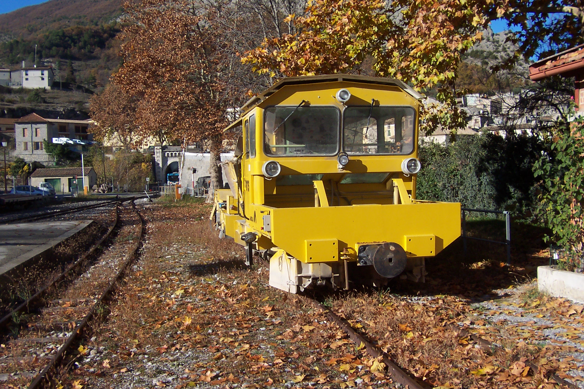
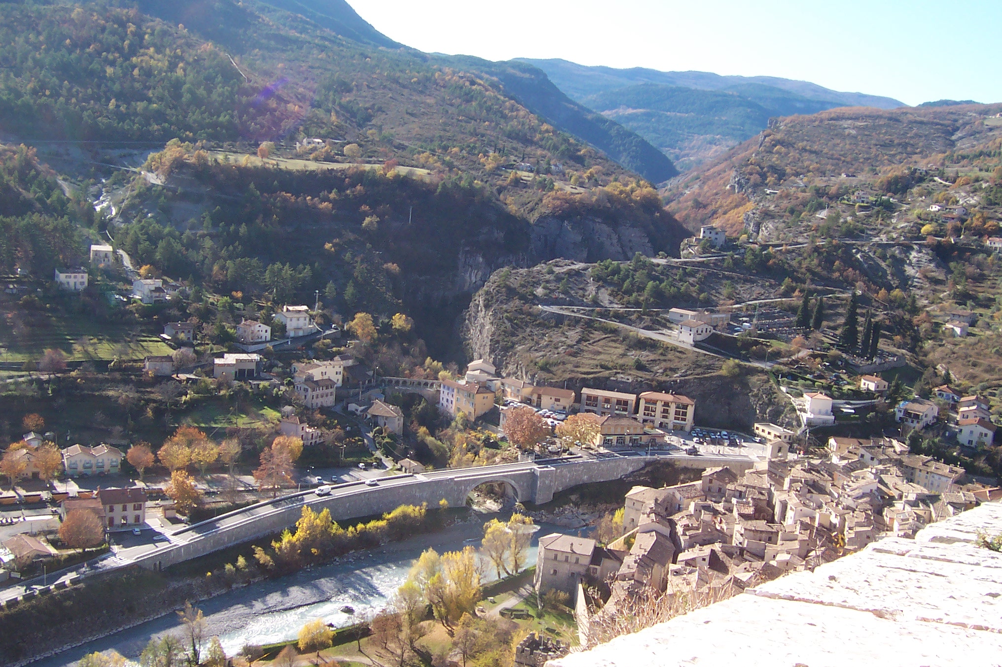
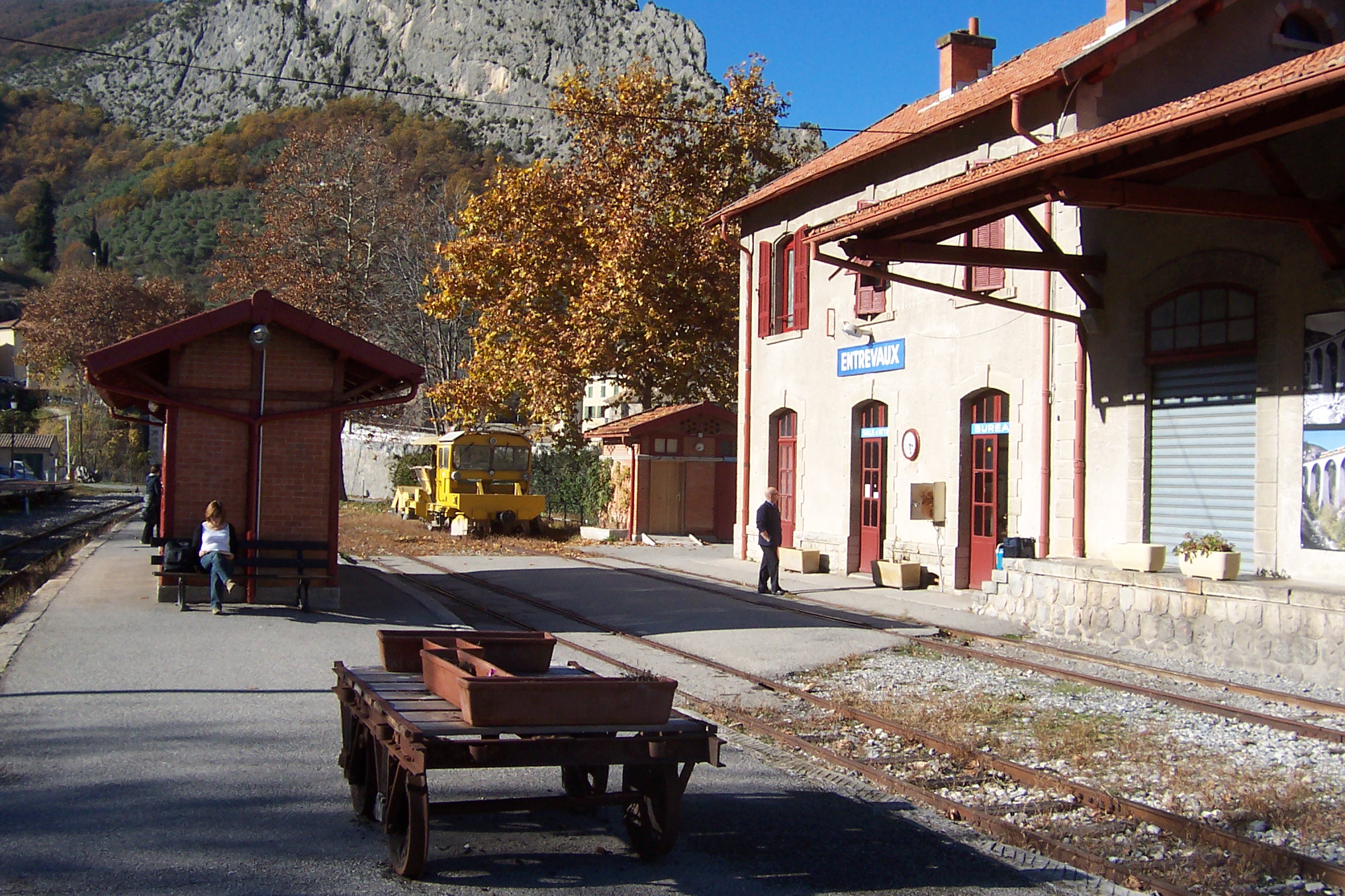
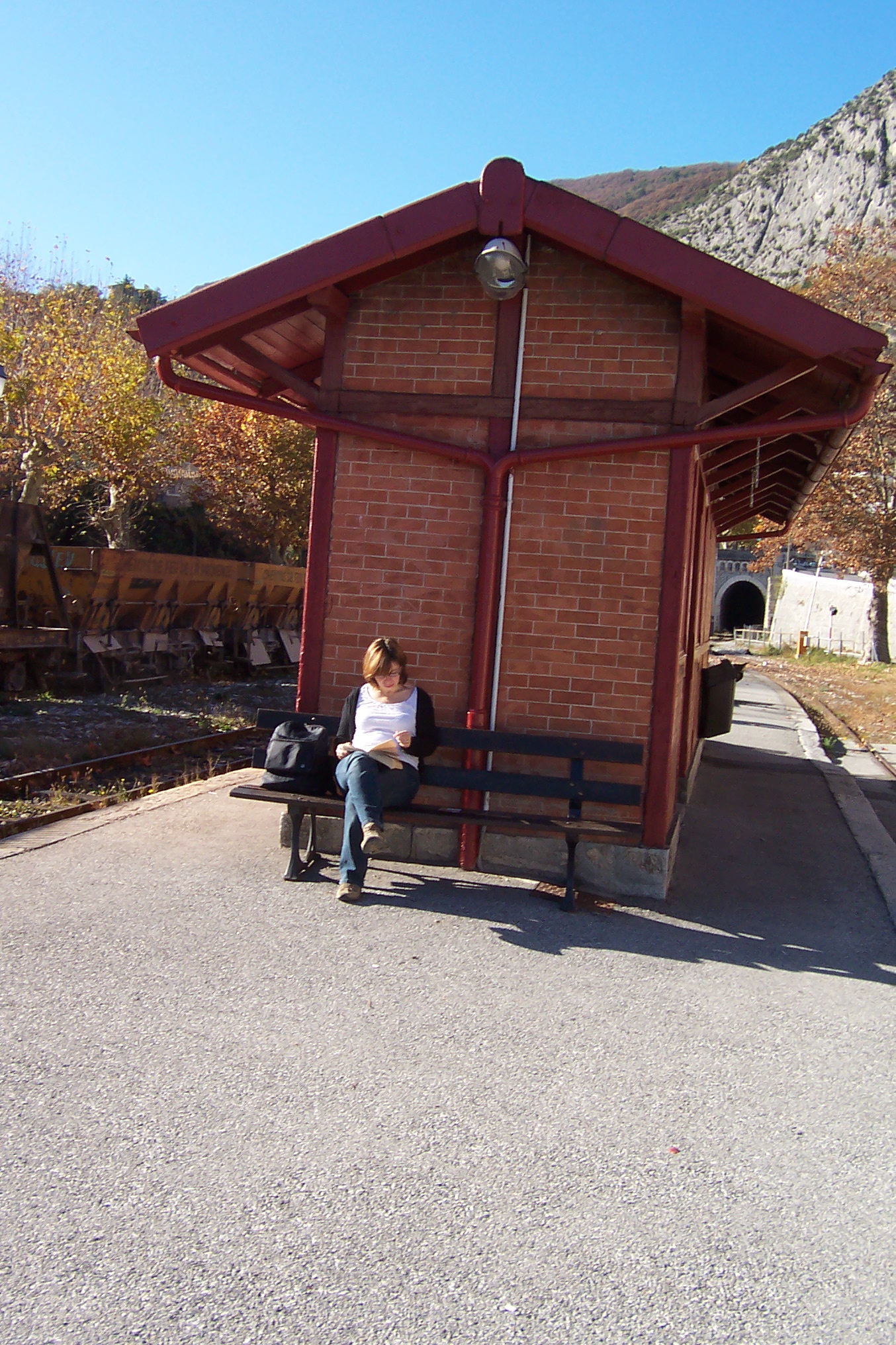
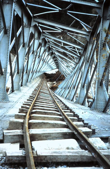
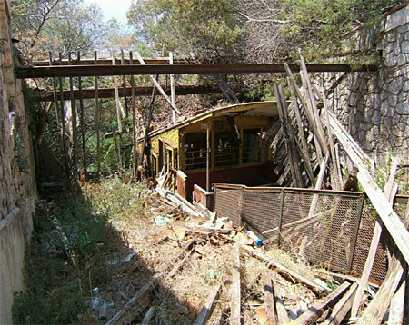
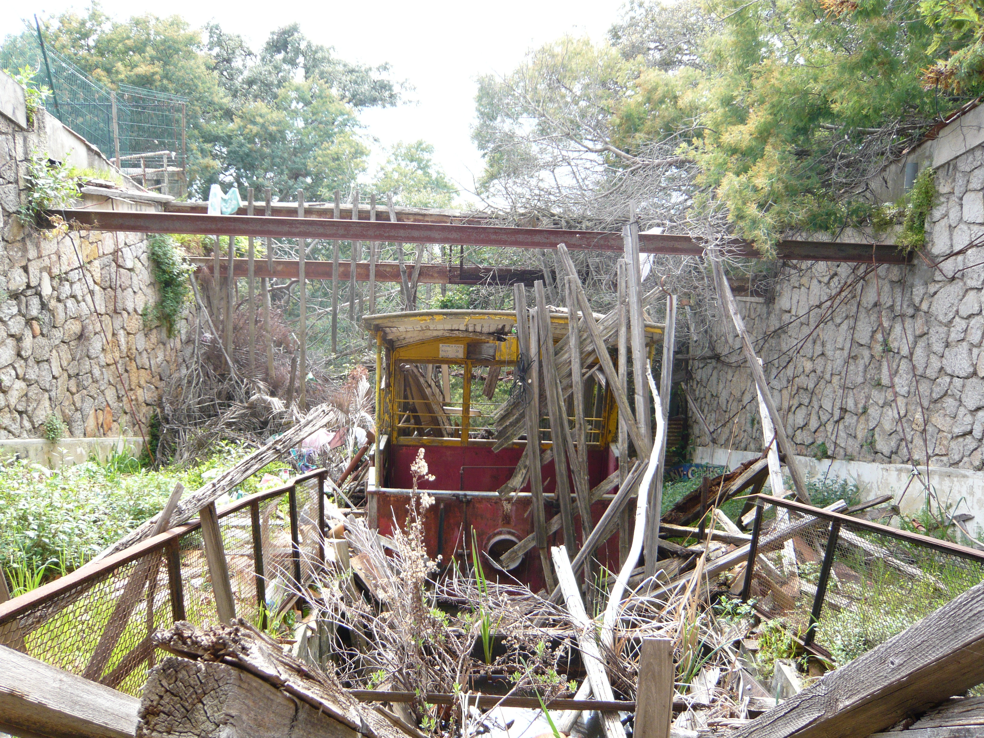
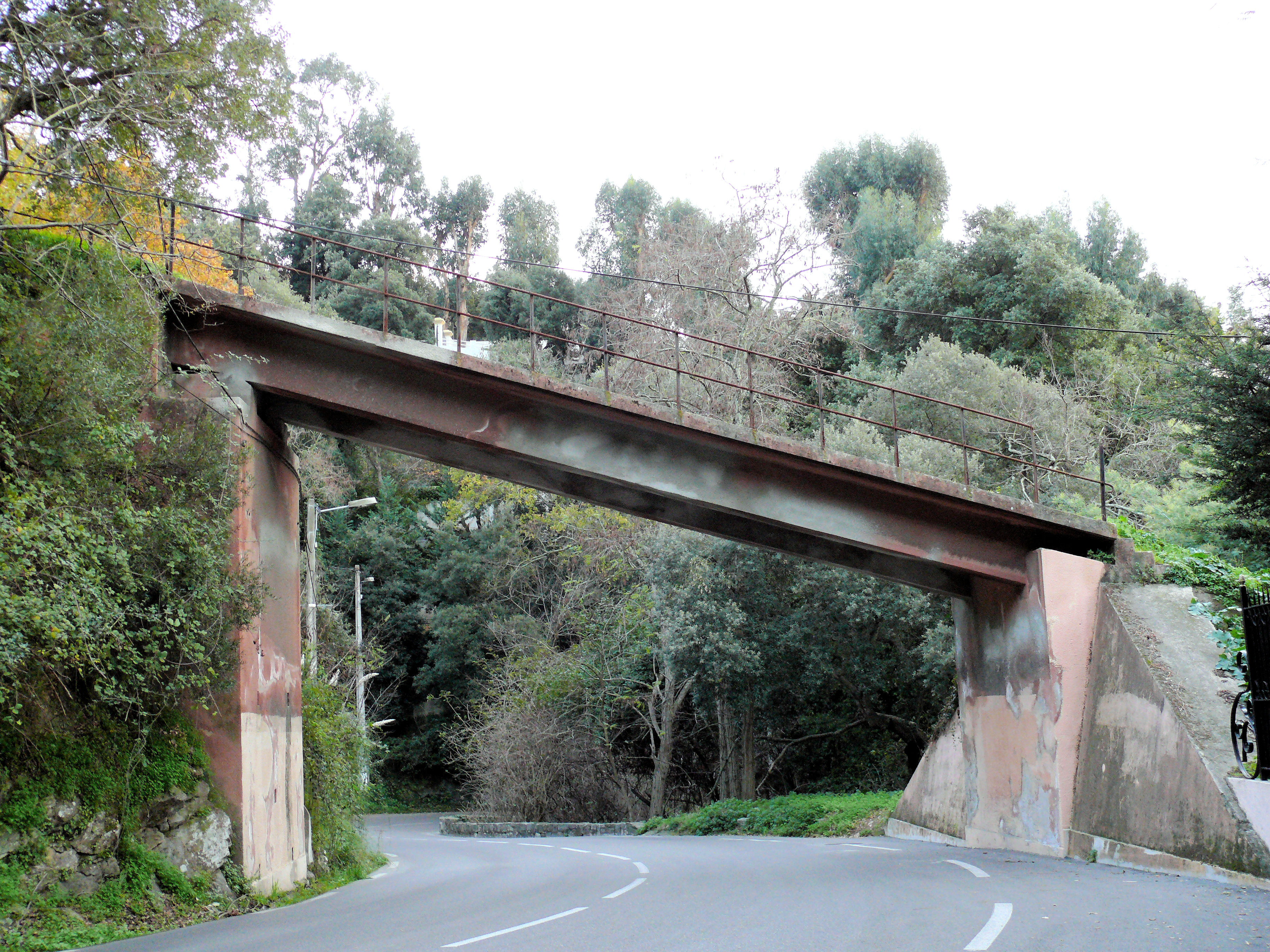
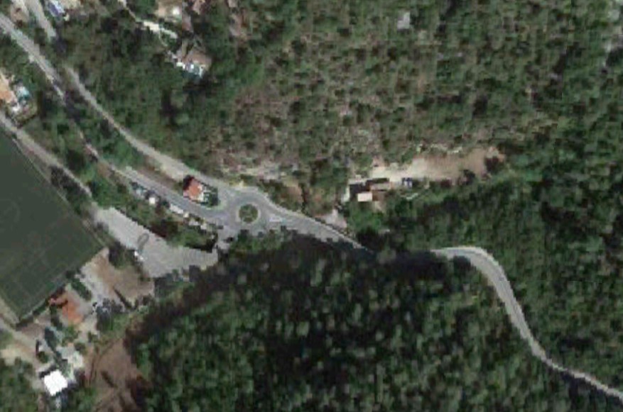
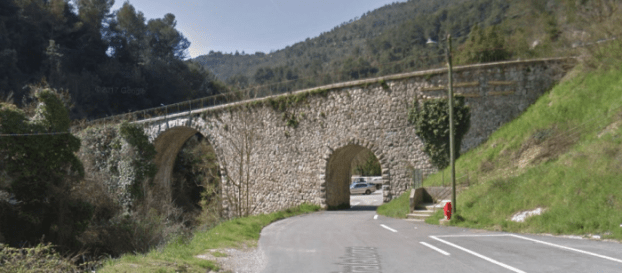
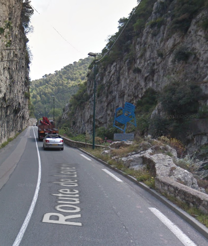
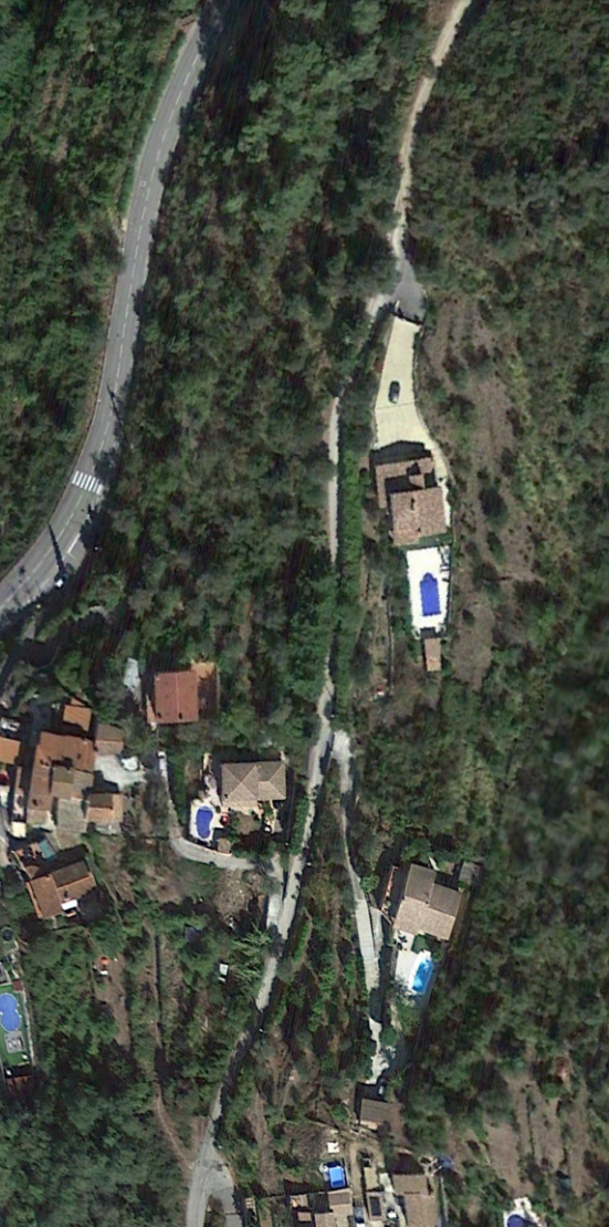
The headline image above shows a steam engine on the Viaduc du Caramel – in steam. [3]
My wife purchased two books for me as a birthday present a while back. They are written in French by Jose Banaudo. They cover the tramway network of the TNL, the Tramways de Nice et du Littoral. In the first volume there is a section about the tramways which meandered into the hills behind the Coast, one of which was the tramway from Menton to Sospel.
Among a whole series of different pictures, mainly old postcards, were some pictures of the line showing the operation of steam locomotives on the line and others of goods wagons in use between Menton and Sospel, particularly to deliver material to the construction work on the PLM Nice-Cuneo line..
One shows a small 0-4-0T No. 212. The manufacturer and the owner are not known. The locomotive is pulling a bogie truck and a wagon. Another photograph shows one of several locomotives destined for the construction sites of the PLM Nice-Cuneo line which were transported by tram to Sospel. It shows a German-built 0-6-0T which was partly deconstructed to be transported on a TNL wagon in September 1912.
A further photograph was taken in 1914. In this image the 0-6-0T Orenstein & Koppel steam locomotive No. 6871 of the Francois Mercier Company is about to leave the goods station at Carei in Menton, coupled with the shunter No. 13 of the TNL. This loco was photographed on a number of occasions by Engineer Jacques Schopfer coupled with the shunter No. 13 of the TNL on numerous occasions in 1914 – on the Viaduc de Monti, on the approaches to the Viaduc du Caramel, and stationary on the viaduct.
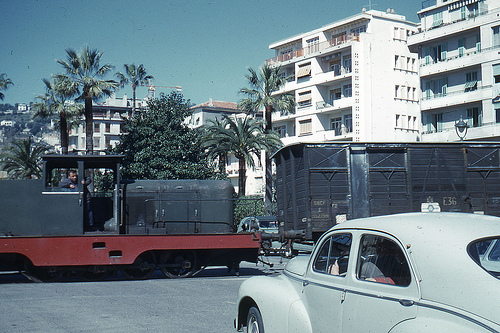
The Menton-Sospel tramway was used for the transport of material for the construction of the PLM line from Nice to Cuneo. In other pictures in Banaudo’s book we can see shunter No. 7 with a load of tubes on a flat wagon at the goods station at Carel in Menton and shunter No. 13 with a load of rails on two wagons before the stop at Villa Caserta.
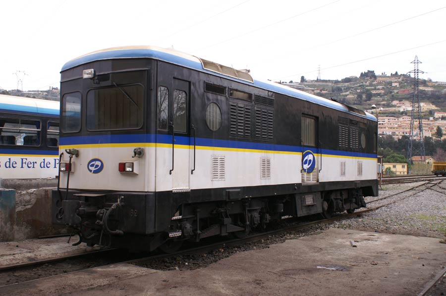
The bogie motor-trams of the 213-216 sub-series with more powerful engines and braking systems were also used for goods traffic on the Sospel line: two pictures in the book show: one with a wagon loaded with a small steam locomotive at Castillan; and another with a load of long poles on the Caramel viaduct, from the collections of André Arutur & Jean-Jacques Stefanazzi.
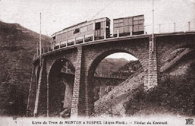
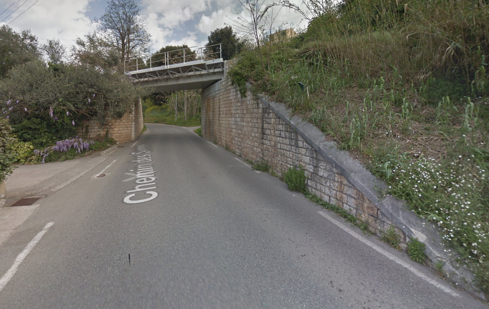
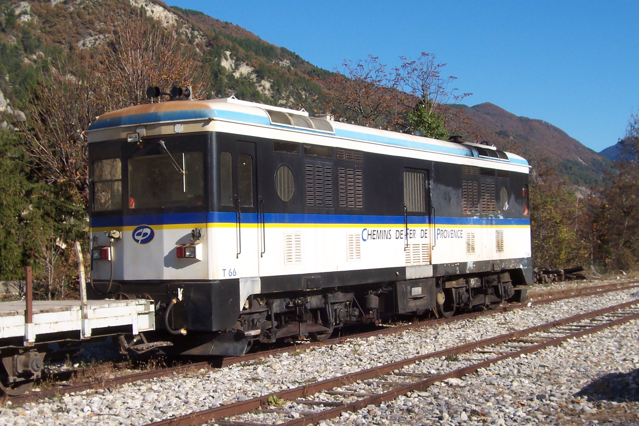
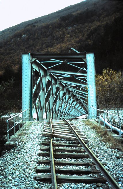
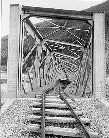
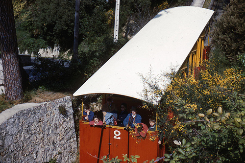
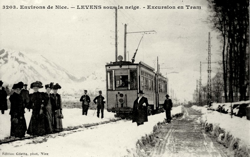
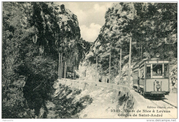
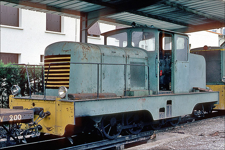
This postcard dates from around 1914 and shows the Caramel Viaduct, with one of the bogie trams pulling a goods van. [2]
Goods trains were a feature of the line from the start, but there was a serious runaway of a goods service at Monti on 12th September 1912 which destroyed tractor 4 and killed its two crewmen. From 16th June 1913 a new service was started with two tractors 6, 7 (and 13 added in 1914) in the form of motorised box cars (known as fourgons in French), which were fitted with the same powerful equipment and brakes as the bogie passenger cars, and which pulled a variety of goods wagons.
Banaudo also tells us that in 1914, four passenger trips and three or four goods trips were made on the line each day, but like the rest of the T.N.L. network traffic fell off in the 1920s. During the building of the P.L.M. main line railway from Nice to Breil via Sospel, the line had a boost of goods traffic carrying many construction materials, but once complete in 1928 there was a huge drop in traffic.
I was very fortunate indeed. … For my birthday in 2018, my wife bought me two books about the tramways of Nice. Both of these books are written in French by Jose Banuado and published by Les Editions du Cabri. [1]
I am enjoying reading the first of the two volumes at the moment which covers the history of the tramways in Nice. I have had some conversations of a number of forums about the TNL which ran the tramways along the coast and in the city of Nice as well as a number of lines which travelled up into the hilly countryside behind the coast.
One particular area of discussion has been a practice which seems unique to Nice among other major cities in France and possibly much wider afield. The TNL ran not only passenger services but good services as well.
Sadly the story of these activities is apparently currently only available in Jose Banuado’s books which are written in French.
I have used Google Translate to translate the pages of Jose Banuado’s book which relate to the goods traffic on the TNL network. [2]
By 1903, the TNL was at responsible for a 94.3 kilometre network of over 90 kilometres, of which 29km were the urban lines in Nice. The network was operated with 106 powered trams, 32 trailers, 3 tractors (shunting locos) and 22 wagons for the transport of goods.
The increase in traffic required improvements to the rolling stock. “On the urban lines, the original powered vehicles saw extended platforms, and trailers were added on the most loaded services. … New powered vehicles were ordered for the coastal lines: forty vehicles which were more powerful and comfortable were delivered in two batches between 1904 and 1909. They were equipped with air-brakes and coupled permanently into pairs.“
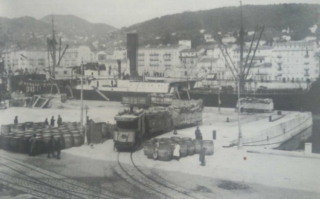
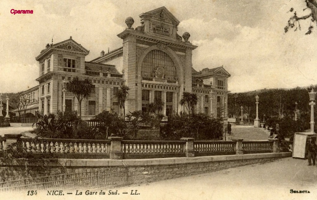
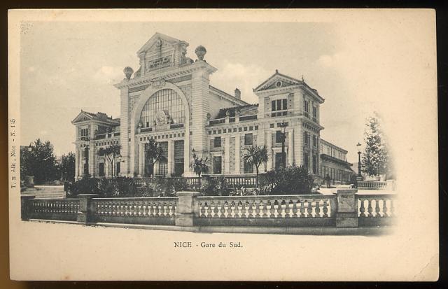
Banuado continues: “The transport of goods took off remarkably. This distinguishes the TNL network from its counterparts in most other major French cities. In addition to postal and retail freight traffic on the coast, the Contes cement plant provided substantial tonnages with coal deliveries for its kilns and lime shipments and cement in sacks. But to ensure the best trade, it was necessary to link trams to the other major transport infrastructure of the city of Nice: the commercial port, the PLM station and the Chemin de Fer du Sud.”
As the PLM had done nothing to connect to the Port, Nice made use of trams to make the connection between the PLM station and the Chemins de Fer du Sud station and the port. An agreement was signed on 7th February 1905, which provided for some minor alterations to the tram network, “the construction of an exchange platform in the sidings of the Chemin de Fer du Sud Station and the electrification of the tracks. This meant that the TNL locomotives could access these sidings. At the other end of the city, the Chamber of Commerce, … took charge of laying tracks on the docks.”
The TNL assigned shunters/power cars and a hundred wagons to the traffic, while the Chemin de Fer du Sud de la France ordered two hundred wagons able to run on the tracks of the trams to the port of Nice and the operation commenced in 1907 after all legal issues had been discussed and agreed.
Banaudo says: “The connection to the port of Nice enabled the transport of large volumes of goods, the majority of which concerned the industries alongside the line to Contes (the Contes cement factory, L’Ariane flour mill and the Nice-Riquier gasworks), as well as exchanges with the Chemin de Fer du Sud de la France Station.” The latter provided a route to the PLM. Although the PLM had always refused a direct connection with the trams, it was connected with the Chemin de Fer du Sud Station from 1899 onwards via a short branch-line which linked the two stations, set into the road pavement of the Rue de Falicon (today, the Rue des Combattants en Afrique du Nord). So, ultimately, it became possible to transship goods from a wagon of standard-gauge to a vehicle of the TNL and vice versa.
References
Nice au fil du Tram Volume 1 and 2, Jose Banuado; Les Editions du Cabri.
As an aside to the regular blog posts, I am wondering about collating my posts into a series of eBooks. I have developed the first few chapters of the first book, which will be about the Central Var Line in Provence. I would appreciate comments about the draft.
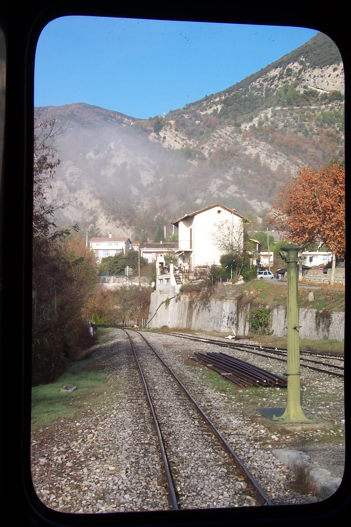
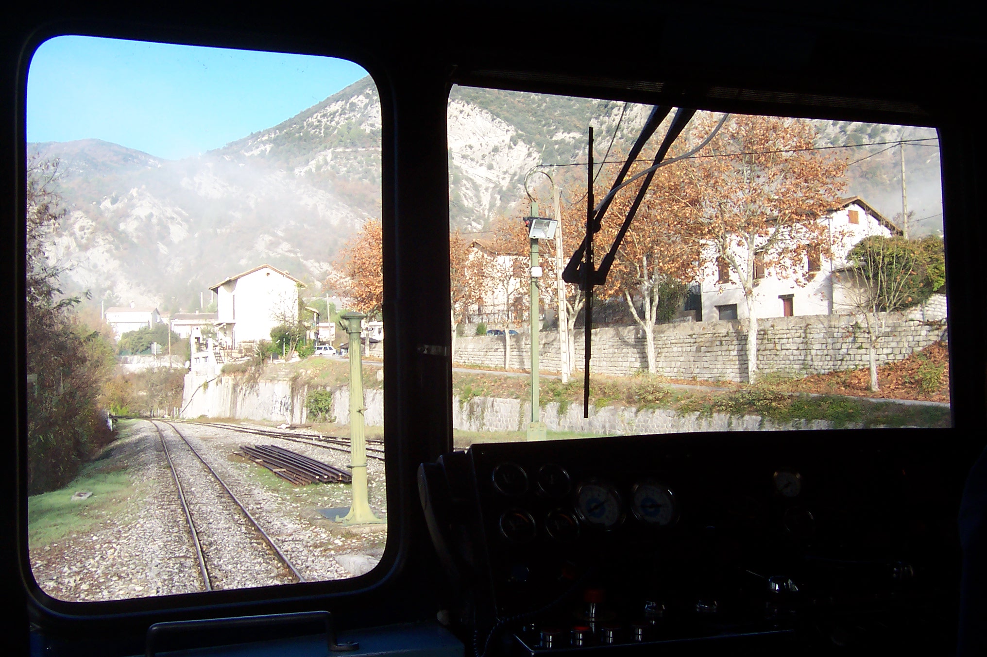
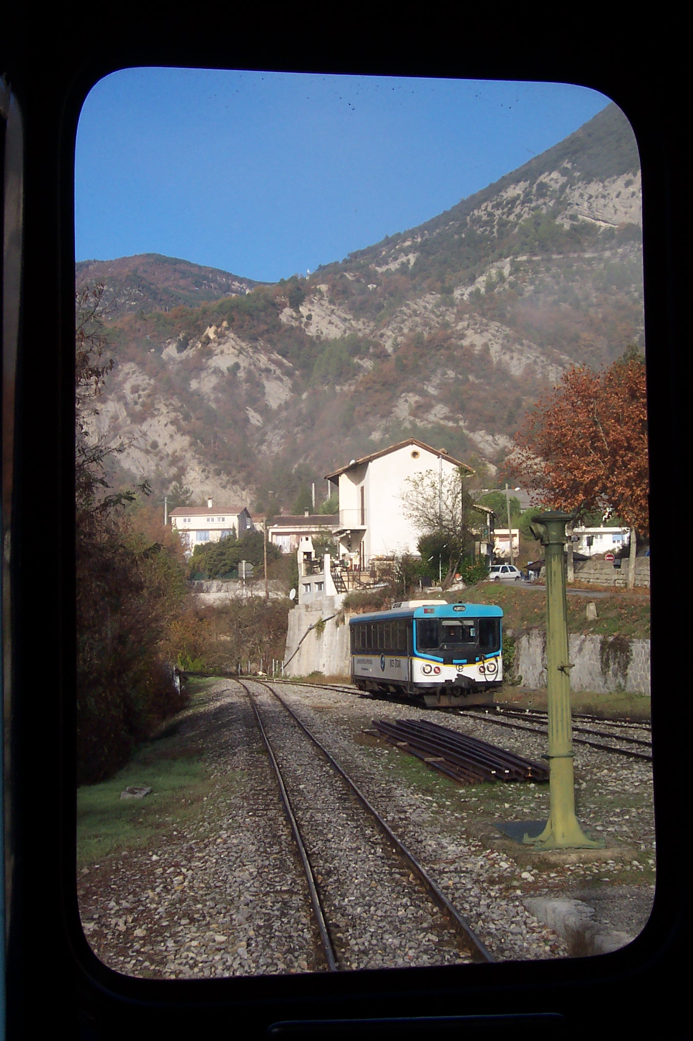
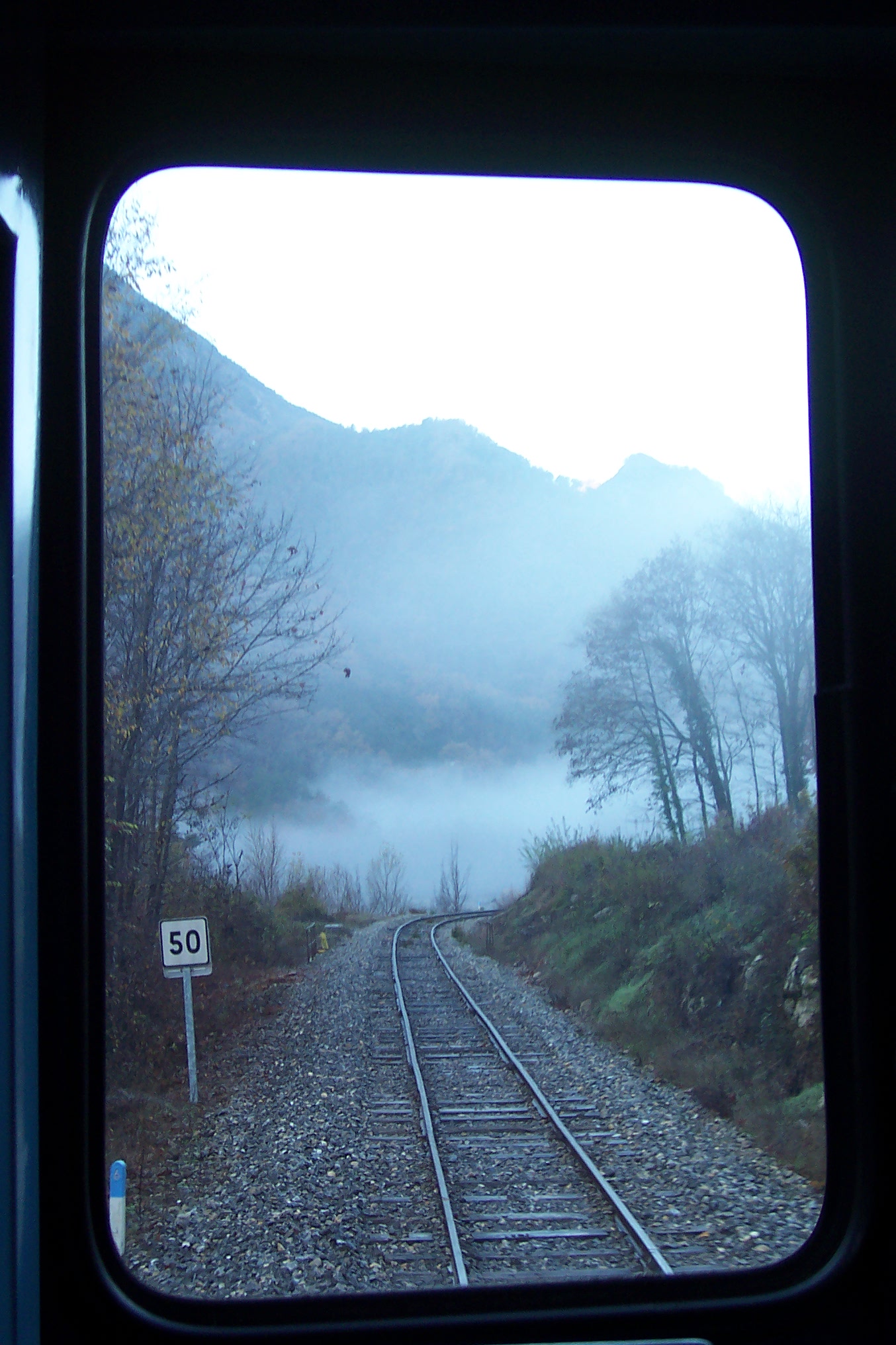
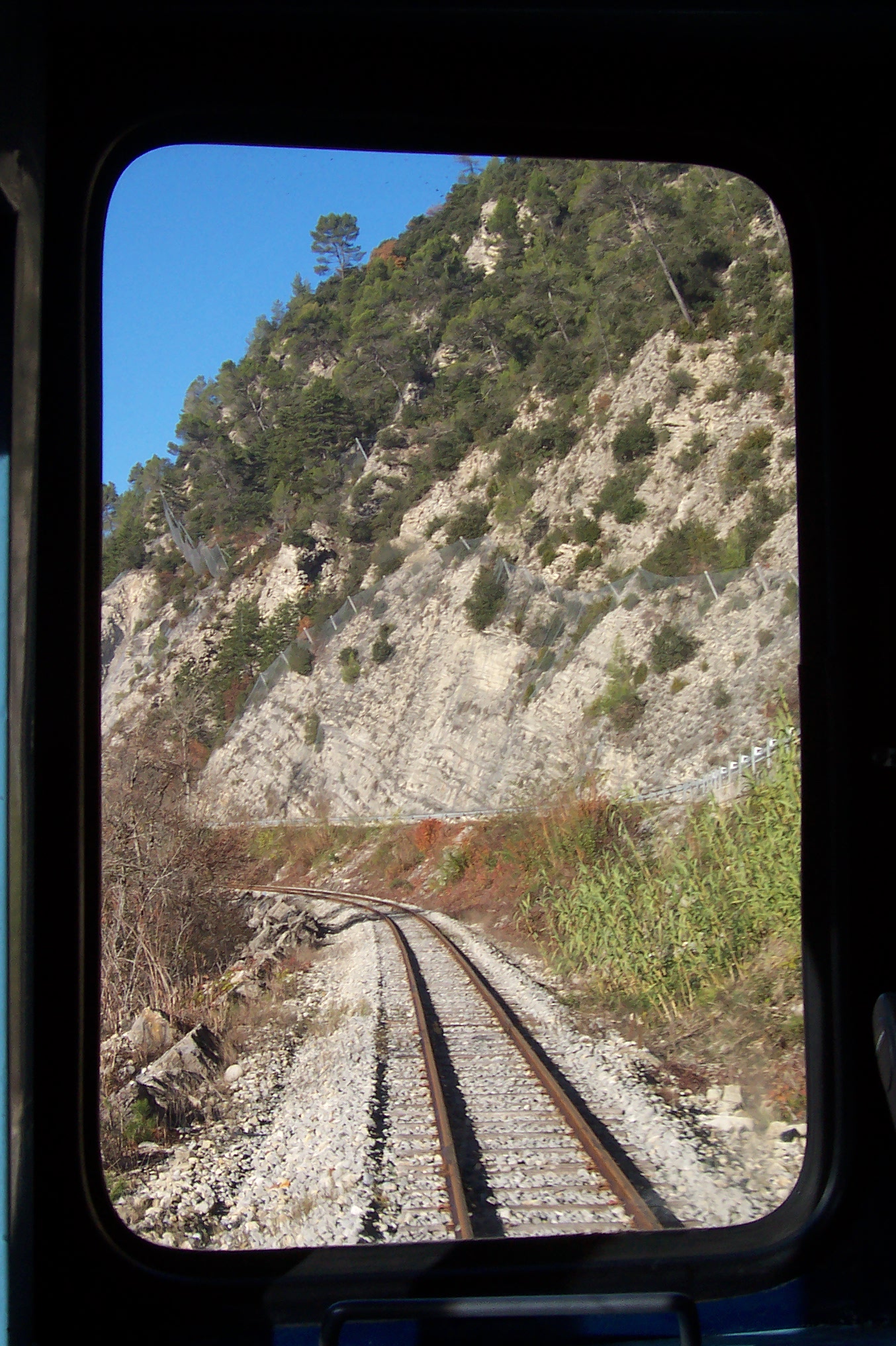
Trains left la Gare du Sud in a Westerly direction before turning first North-West and then round to the south towards St. Philippe. The video below shows the first part of the route from Nice to Colomars (La Manda).[7]
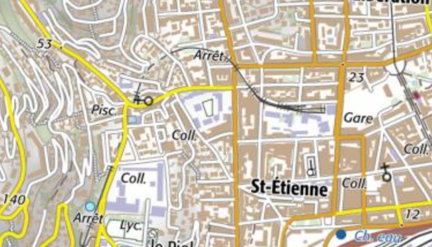
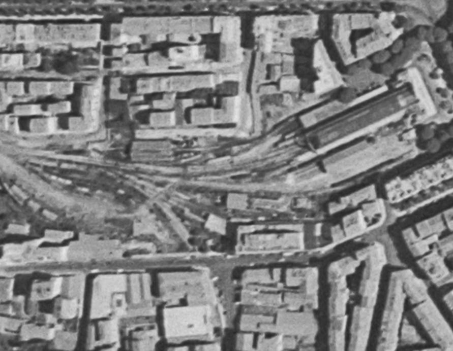
On the map below the site of the original Gare due Sud appears as a void in the right middle of the image with the present station to its West.
The two station sites are covered in the previous post in this series:
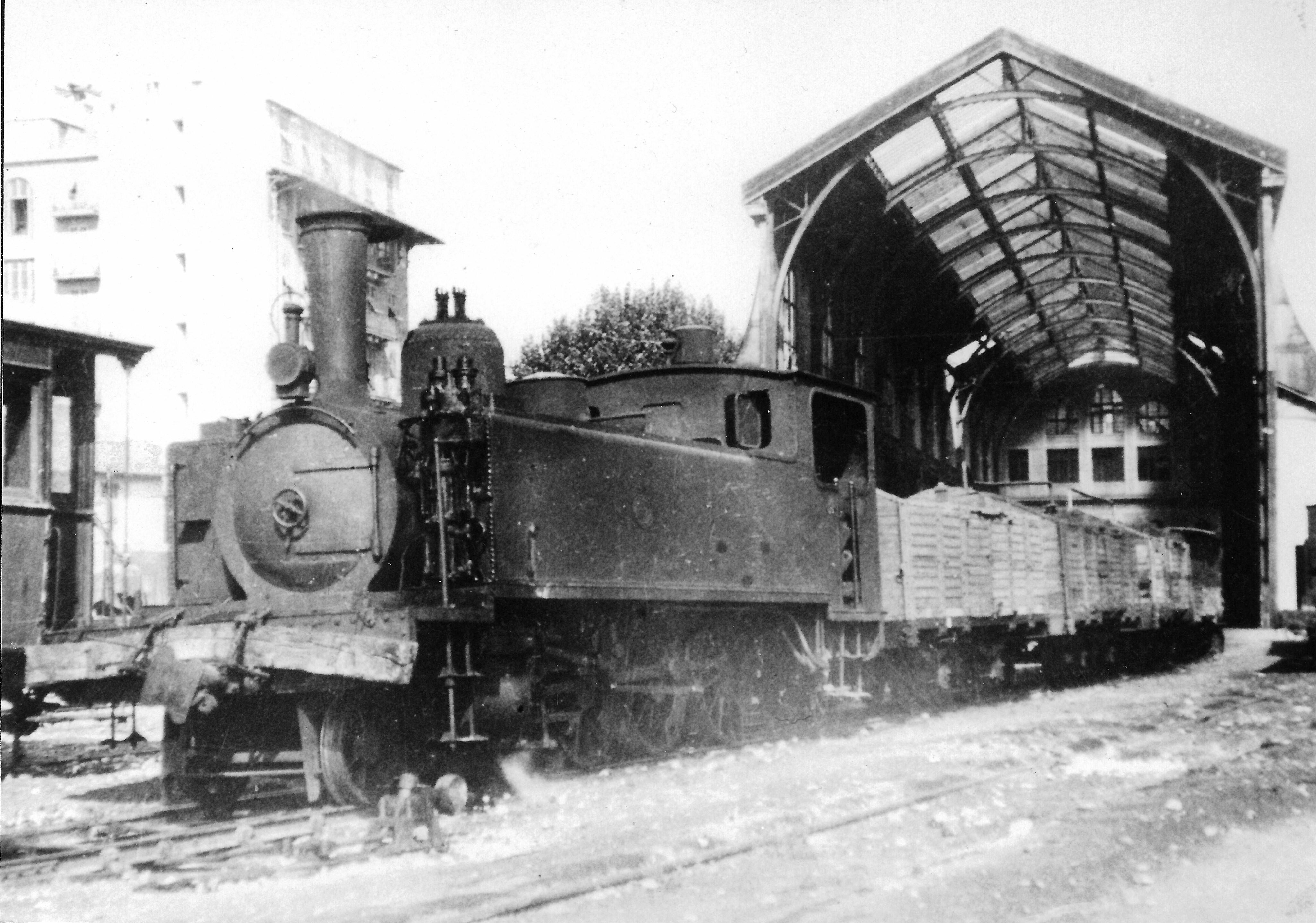
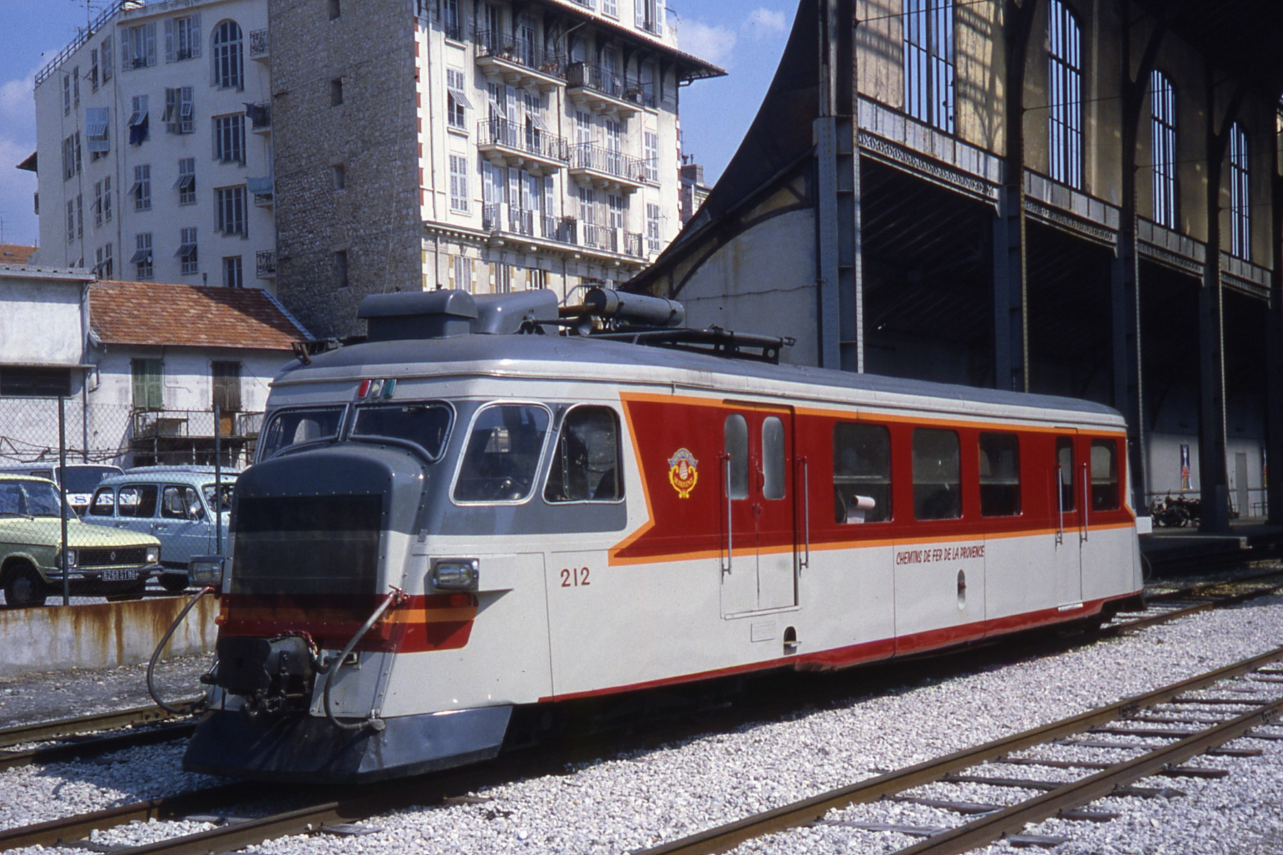
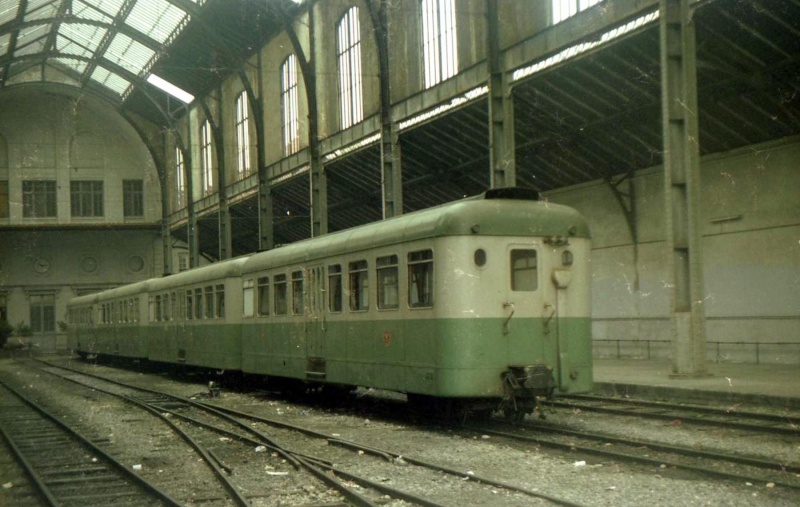
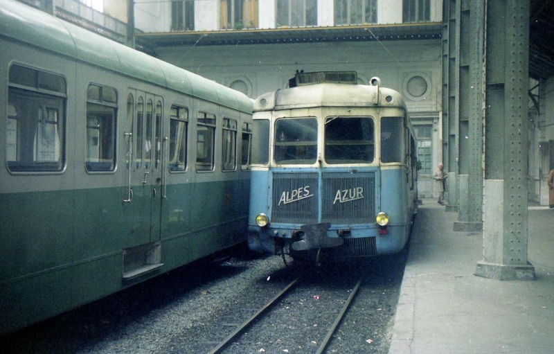
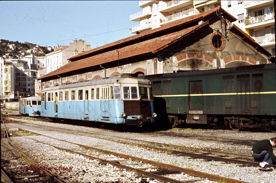
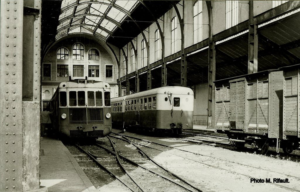
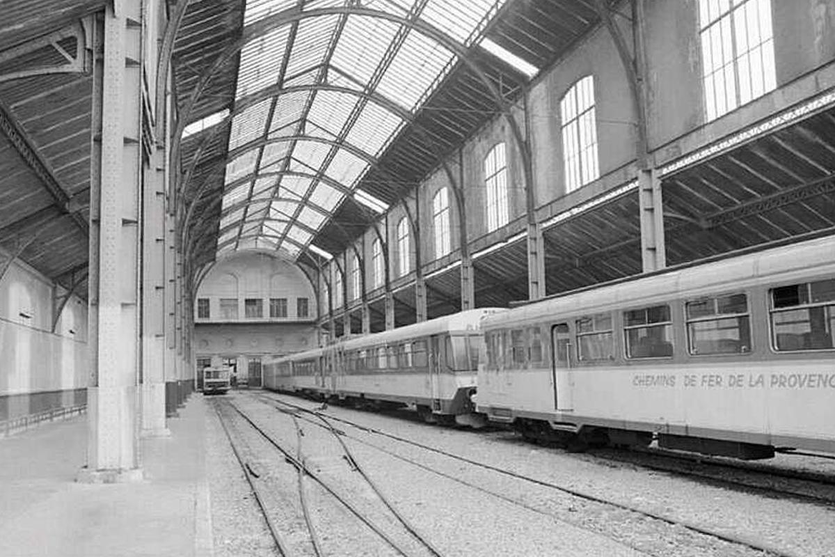
Before we finally leave the site of the two stations, modern and old, here are a few more images of the two stations and rolling stock at the site. The first image is the only one I have found which shows a steam locomotive leaving the old Gare du Sud.More photographs can be found by following the links in the reference section at the bottom of this post. [1]Les tirages sont datés de Juillet 1983. Le jour exact n’a pas été retrouvé (c) Claude Villetaneuse. [14]1984 Autorail Billard en gare de Nice Chemins de fer de Provence.
Some amazing photos can be found on various french forums. The next four are from Les Trains de l’Histoire [2] and a thread which focusses on diesel motive power on the Nice-Digne Line.
Taken in 1971/72 (c) Locky on Forum: Les Trains de l’Histoire. [15]
Taken in 1971/72 (c) Locky on Forum: Les Trains de l’Histoire. [15]
Renault autorail at La Gare du Sud (c) Gerard, Forum: Les Trains de l’Histoire [5]
Renault autorails in La Gare du Sud (c) Michel/57 Forum: Les Trains de l’Histoire. [7]
Further photographs can be found on a variety of websites.[3]
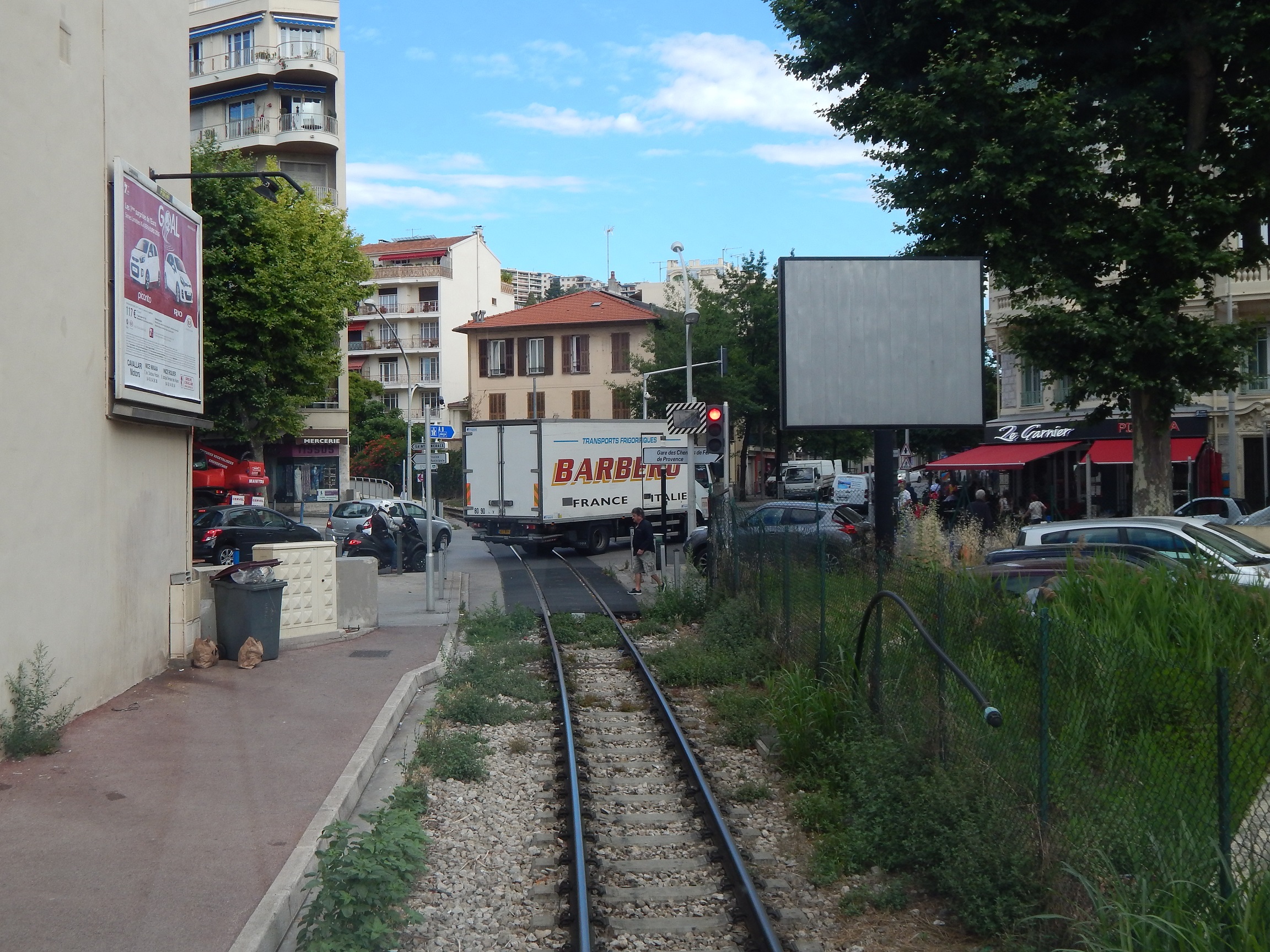
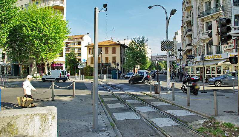
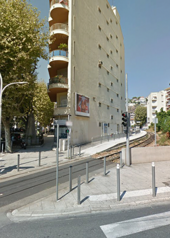
After leaving the old station, trains remained within the station site for some distance. Rue Alfred Binet did not cross the old station site in those days. Trains then had at grade crossings at Rue Dabray, Rue Gutenburg and the junction of Boulevard Joseph Garnier and Boulevard Gambetta. The first small stop on the line was immediately after the road junction.Looking back towards the station from Rue Dabray.Looking ahead from Rue Dabray across Rue Gutenburg. [4]Looking forward from Rue Gutenberg towards the Arrest Gambetta beyond the next road junction.Looking forward to the road Junction at Gambetta [4]The road junction, Google Streetview.
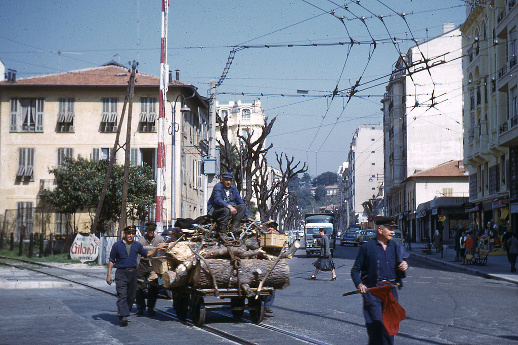
In gentler times – with the red flag to alert traffic! [6]The Arret at Gambetta.Looking forward from the Arret Gambetta.[4]
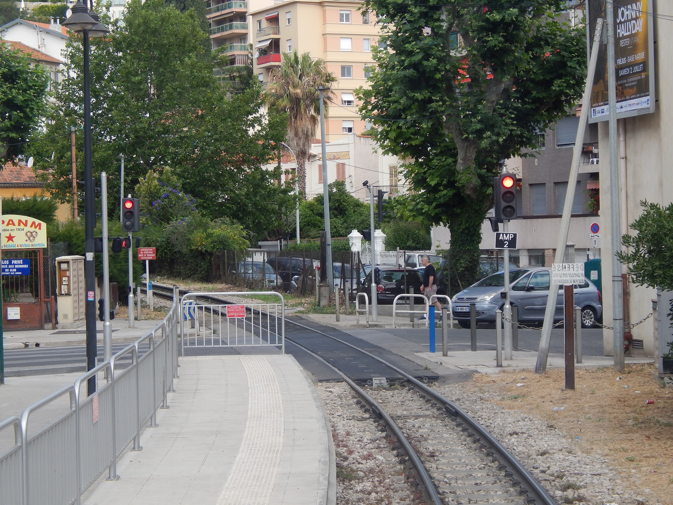
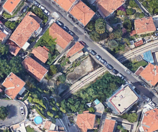
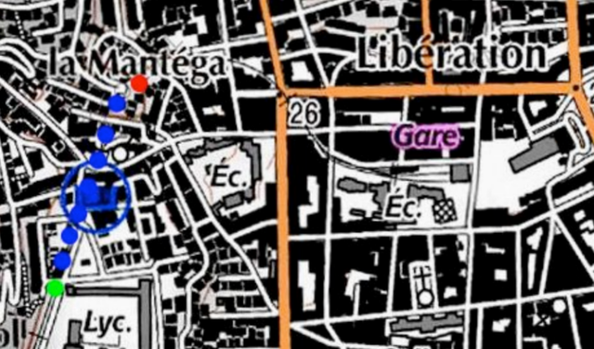
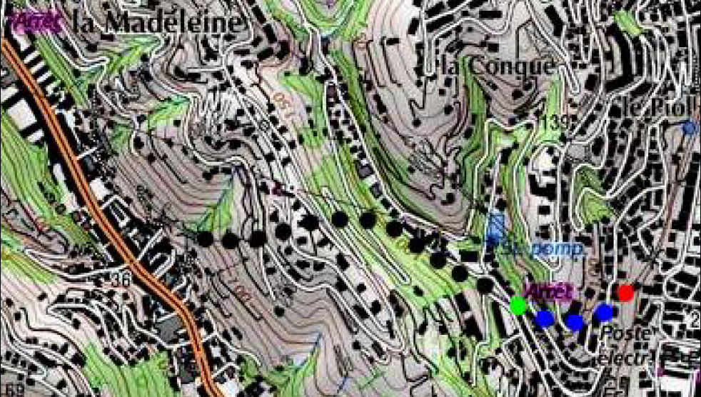
Just beyond the small Station called Gambetta the line curved round under Boulevard Mantega Righi and then entered the tunnel at La Mantega – the tunnel Piol Mantéga.The tunnel was 350 metres long. The current Piol Mantéga Tunnel is the result of the joining of two older tunnels by a modern one of 174 metres in length. The two older tunnels were La Mantega Tunnel (88 metres long) closest to La Gare du Sud, and Piol Tunnel (78 metres long).
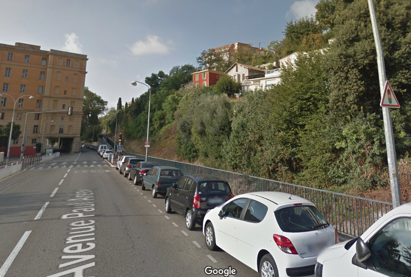
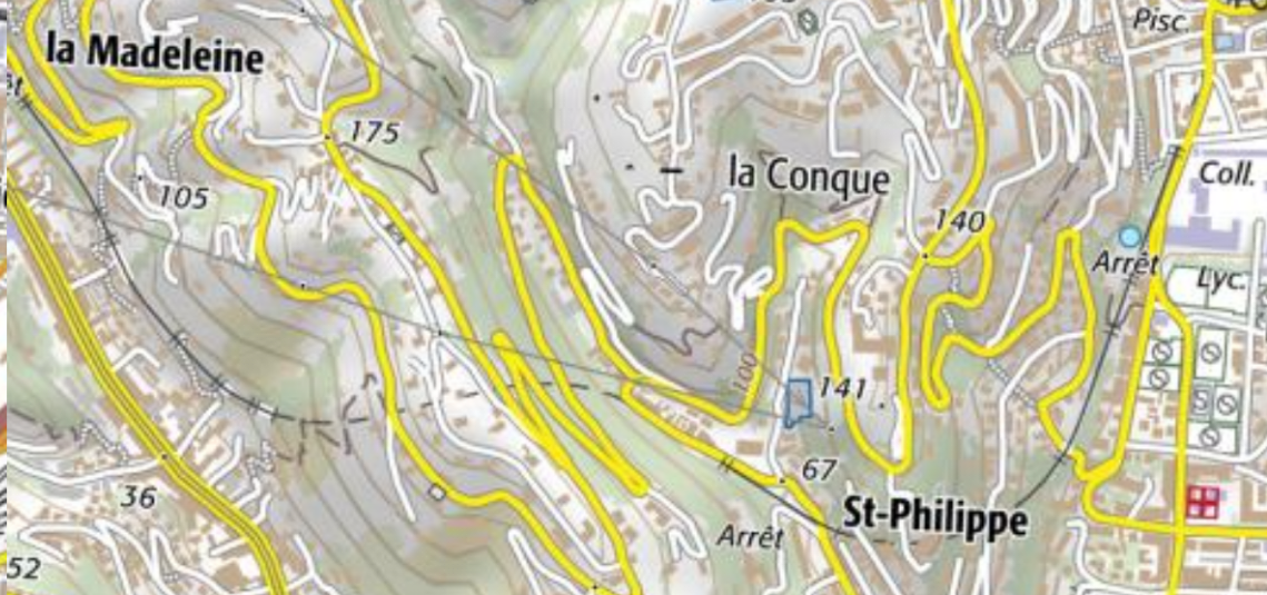
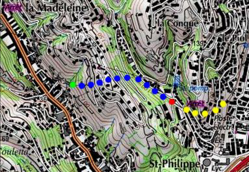
In addition, the entrance to the Piol tunnel was extended by a dozen meters towards Saint-Philippe in concrete. [8]The images below are two views of the cutting between La Mantéga and Piol tunnels close to Saint Paul’s Church. The North portal of Piol Tunnel is visible as well as an aqueduct which carries a small stream over the tunnel. A picture of St. Paul’s Church follows the views of the works. The picture of the church is taken from over the old tunnel portal in the images immediately below. The tunnel runs below the trees to the left of the church.In the photograph above the railway runs to the right of the road (Avenue Paul Arene) towards the next Station, another small halt called Nice-Parc Imperial which can be seen marked Arret on the right side of the map below.The line is shown below in the satellite image from Google Earth
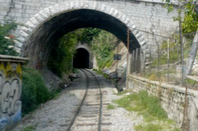
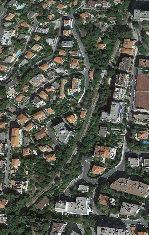
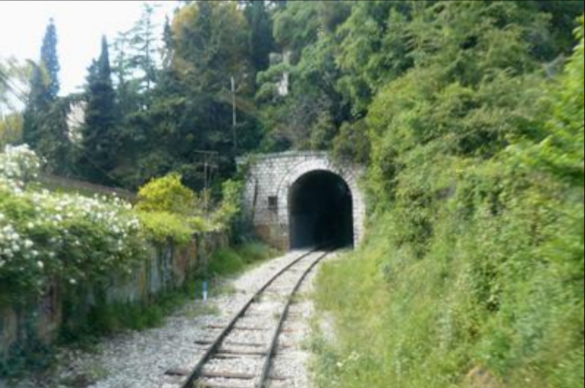
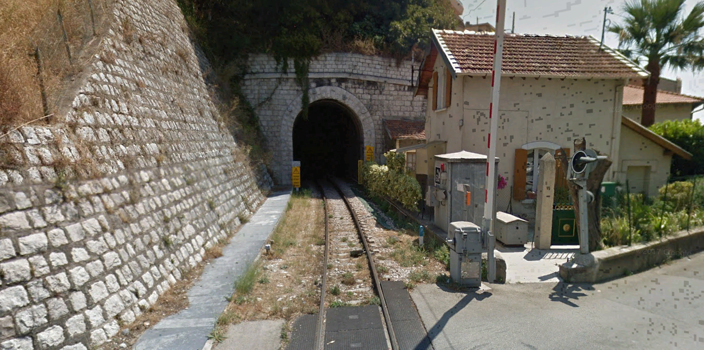
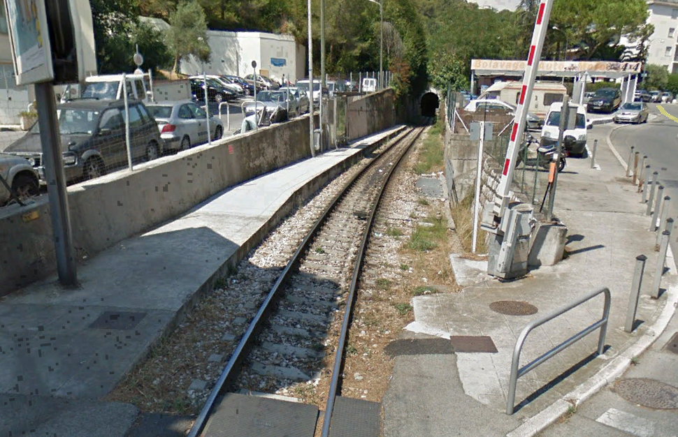
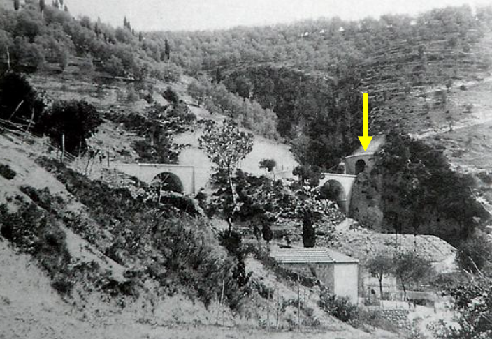
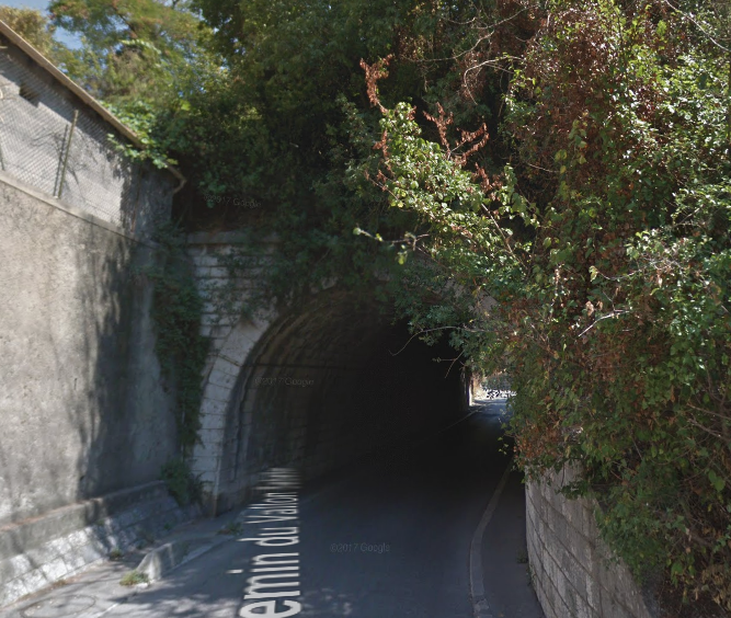
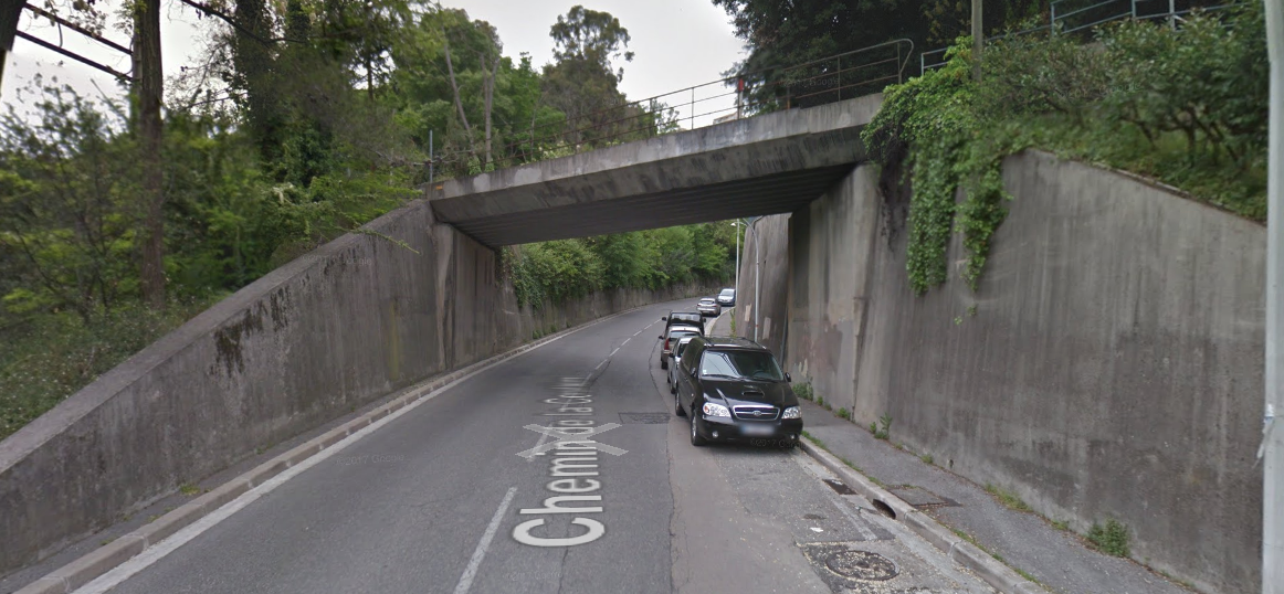
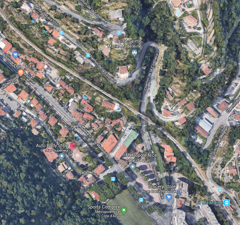
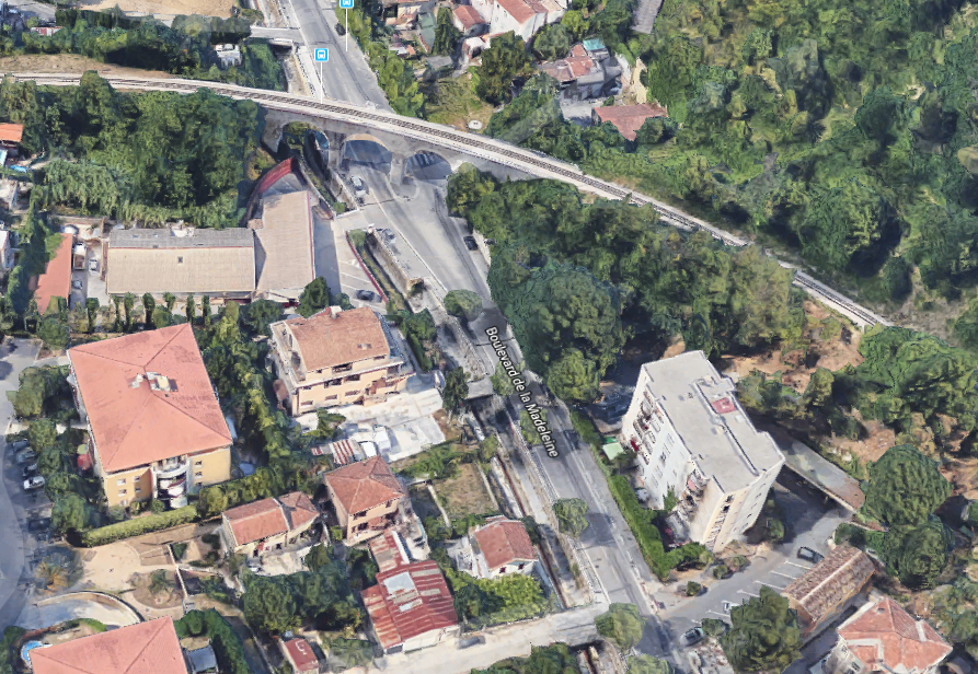
The portal of the next tunnel, that of Saint-Philippe, is just visible in the bottom left of the satellite image. Details of this tunnel can be found on the Inventaire des Tunnels Ferroviaires de France website. [9]Saint-Philippe Tunnel is 255 metres long, in it the line curves round from a south-westerly direction to a north-westerly direction. Leaving the tunnel the line immediately crosses Avenue d’Estienne d’Orves and enters another small halt.The halt of Nice-Saint-Philippe consists of no more than a small concrete platform and immediately precedes the entrance to the next tunnel, that of Saint Pierre.[10] The tunnel was 633 metres long and as the black and white image below shows, trains immediately crossed two bridges after leaving the tunnel. The tunnel portal is marked with a yellow arrow. [10]These last three pictures show the bridges along the hillside and are taken from across the valley. The pictures that follow show the approach to and the location of the next halt – La Madeleine.Chemin du Vallon Sabatier Passes under the railway to the immediate north-west of the station.As does Chemin de la Costière.The line continues North-west from La Madeleine Halt before swinging round to the West and crossing Boulevard de la Madeleine on an elegant viaduct.It then enters another tunnel – le Tunnel de Bellet (also known as le Tunnel de Saint Antoine). The tunnel is 950 metres long and straight enough to be able to see the far end from outside the near portal.The far portal, furthest from La Madeleine is interesting. Because of its proximity to the Italian border, the entrance to the tunnel was been equipped at its construction in 1892 with a fortified defence system. Six years later, in 1898, defences were reinforced by the introduction of a pit 4.2 metres long in front of the portal which in normal times was filled with sand. In times of war, it could either be emptied, or receive explosives to destroy the tunnel entrance if required.
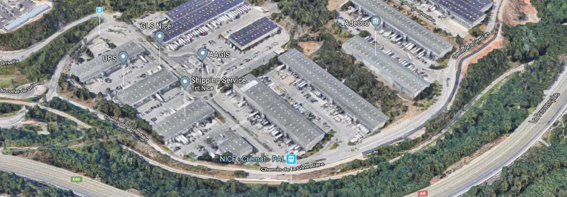
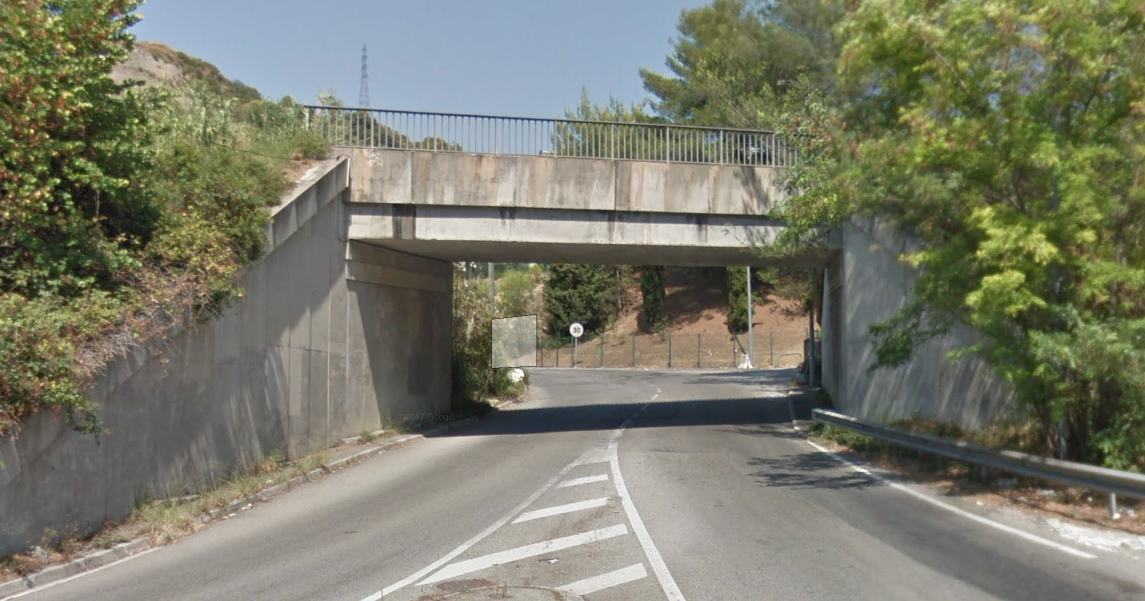
The tunnel portal now sits just under the A8 and can be seen to the right of the satellite image below. The railway continues around the edge of the industrial complex at Cremat and a halt is provided to serve the area – Nice-Cremat-PAL.This was at one time the stop of Zygofolis details of which can be found in the last post in this series. [11] Slip-roads from the A8 now travel under the line using purpose built bridges.
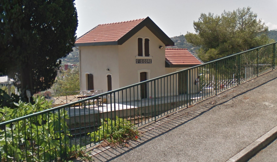
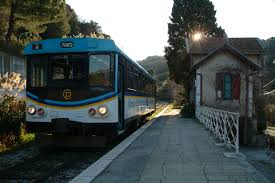
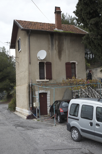
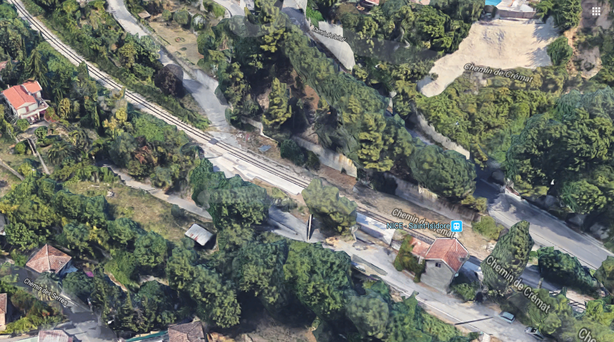
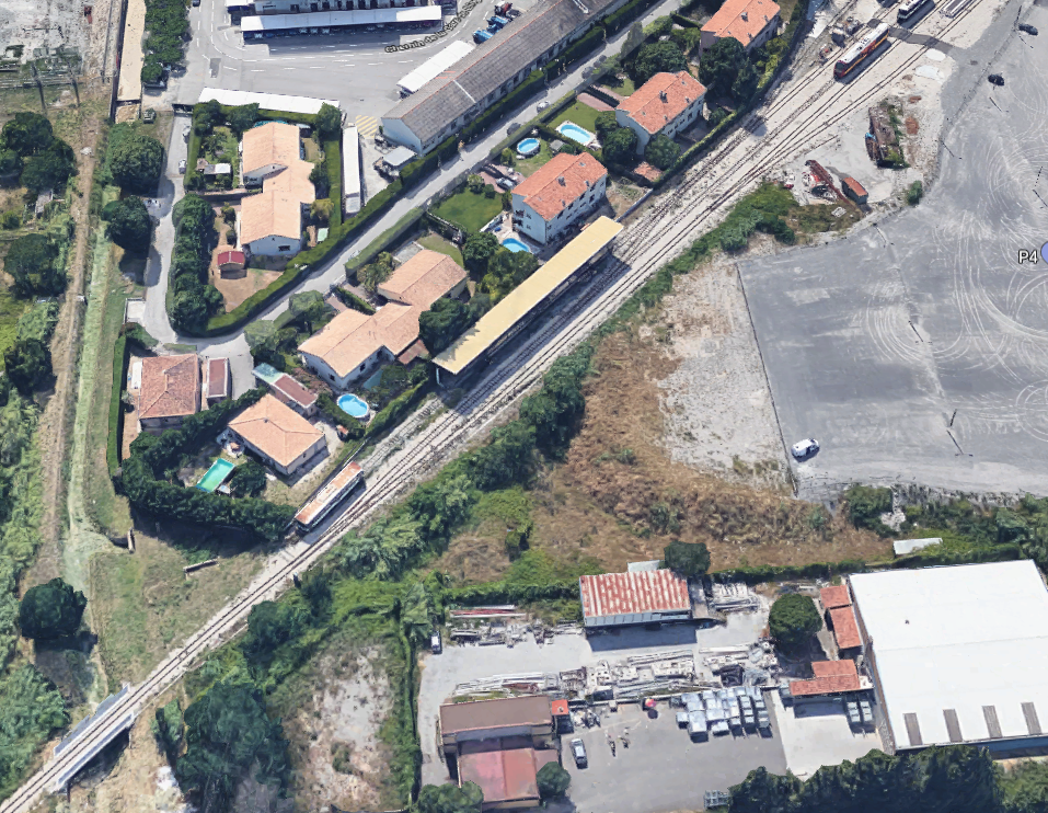
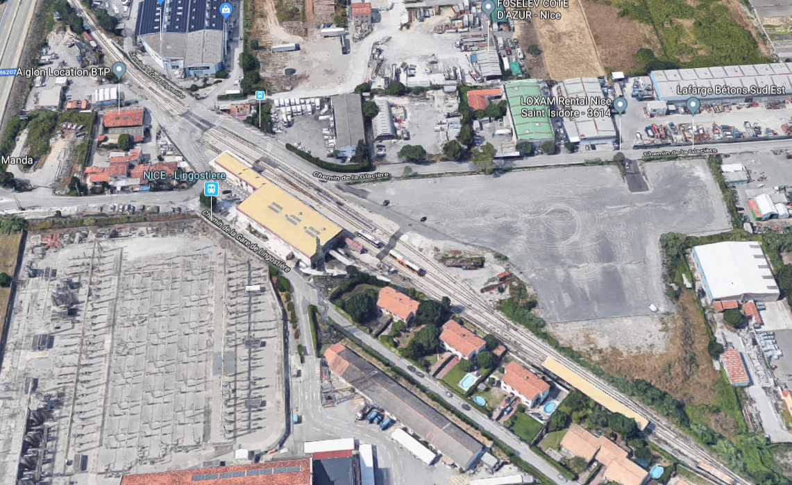
In the picture above, Nice-St. Isidore station building can just be glimpsed to the left of the image. The approach along the line is shown below. The station building can just be glimpsed from the Chemin de Crémat.From St. Isidore, the line continues and turns to a more northerly direction and then switches back towards the North-West and crosses Chemin des Serres and Chemin de la Glacière before entering the complex at Lingostiere.
The first image of the depot at Lingostiere has been rotated to show the underpass flood channel at Chemin de la Glacière in the bottom left of the picture. Just to the North-West of this bridge the tracks fan out to serve the depot.The depot at Lingostiere was the main depot on the Nice to Digne Line. The workshops were created in 1975 before that the workshops were in Draguignan despite the closure of the Central Var line in 1949.
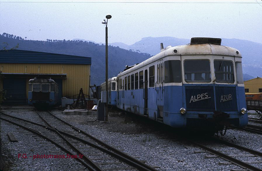
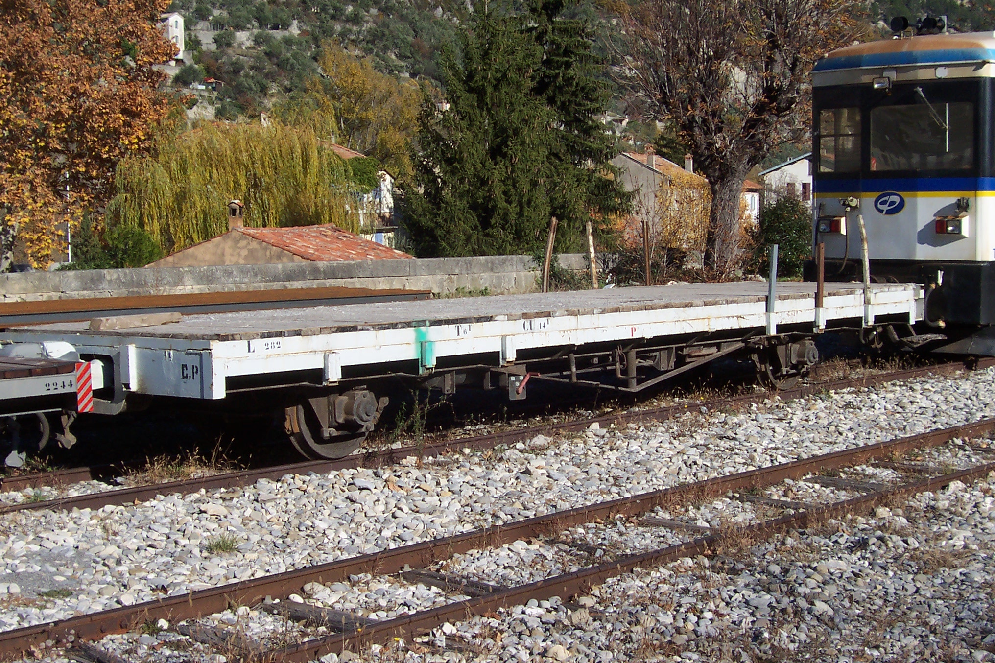
A variety of rolling stock and traction could be observed alongside the line out of Nice towards La Manda.Another photograph from Les Trains de l’Histoire, Sur les Chemins de Fer de Provence (Nice-Digne) shows the depot in 1979. [2]T62 at Lingostière on 14th February 2007. [12]
The following images are from Alain Mionnet. [13]
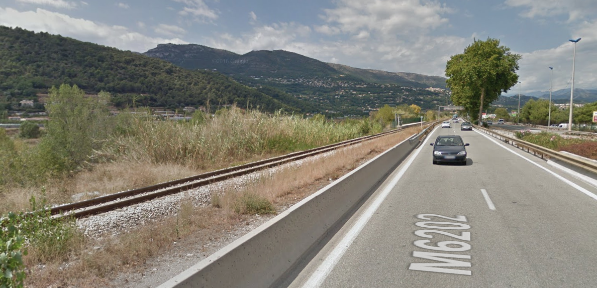
The line leaves Lingostiere and passes under the M6202 dual carriageway before settling in alongside that road. The M6202 and the Chemin de Fer de Provence follow each other for some distance alongside the River Var.
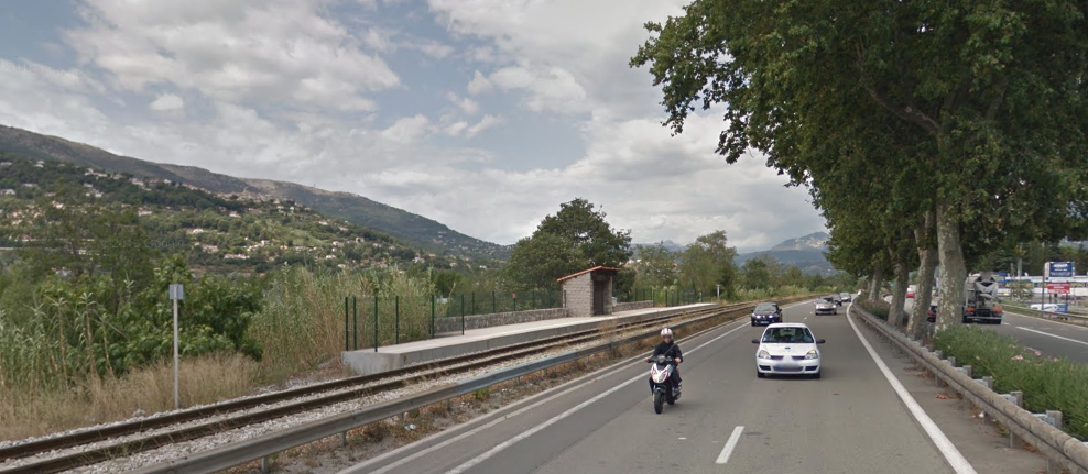
The picture below shows the two running in parallel. The halt visible in the distance is Saint-Sauveur.
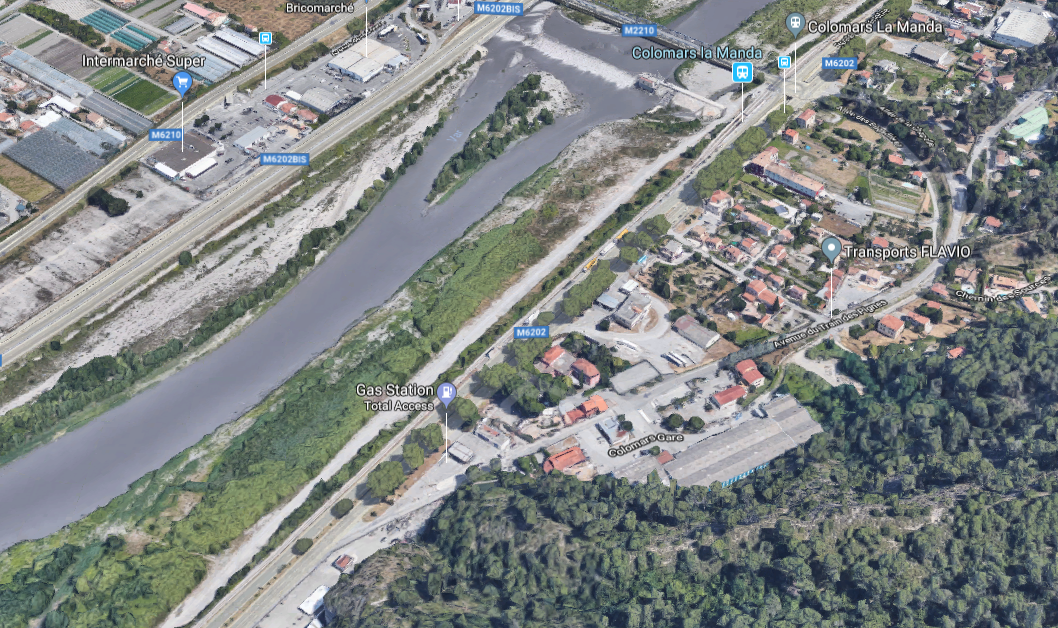
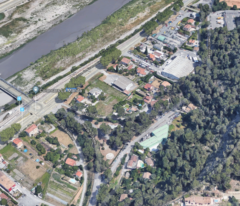
The next halt is Bellet.And the next is Colomars/La Manda. The satellite image below is of great interst to those who are following the original line of the railway. The modern line follows the River side and the M6202, the original line deviated to the East. The wide sweep of the line which branched off the Nice to Digne line can be seen curving round to the La Manda bridge. Even though the railway disappeared in the 1950s, its route is still visible in the layout of the roads at La Manda.A little less obvious because of the trees is the old alignment north of La Manda heading towards Digne-les-Bains. It can still be picked out on the next satellite image below and returns towards the river bank in the top right of the image. If your eyesight is really good you might just be able to make out the name of the road which follows the old line – Avenue du Train des Pignes.
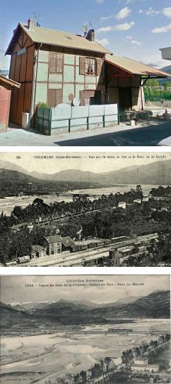
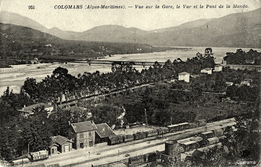
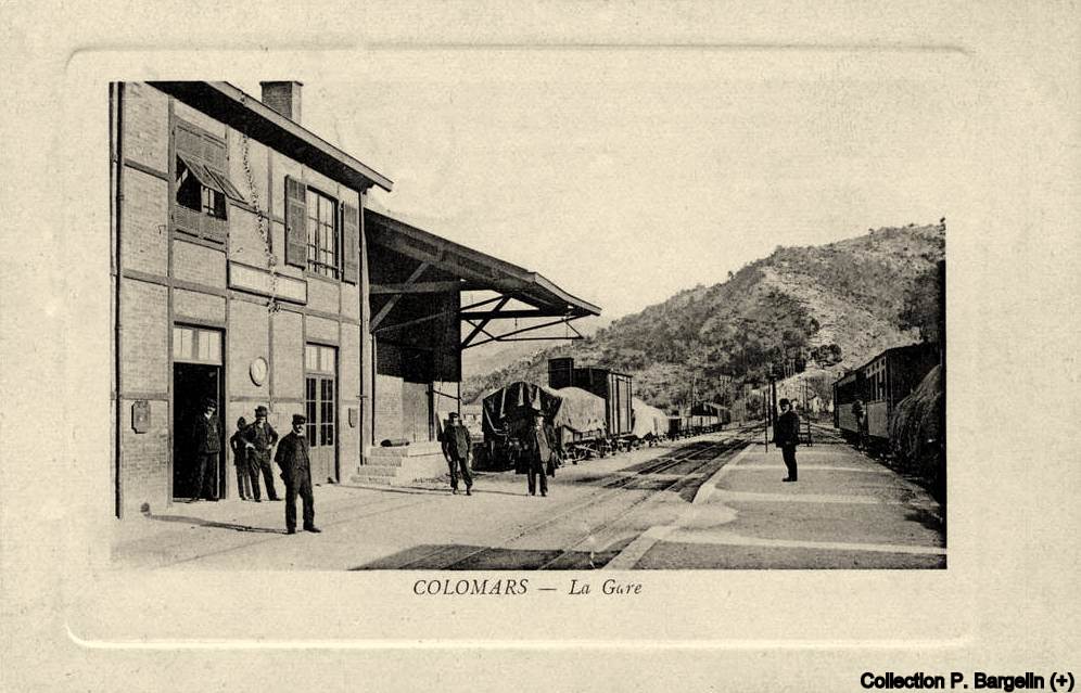
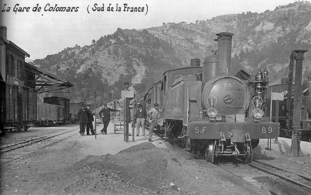
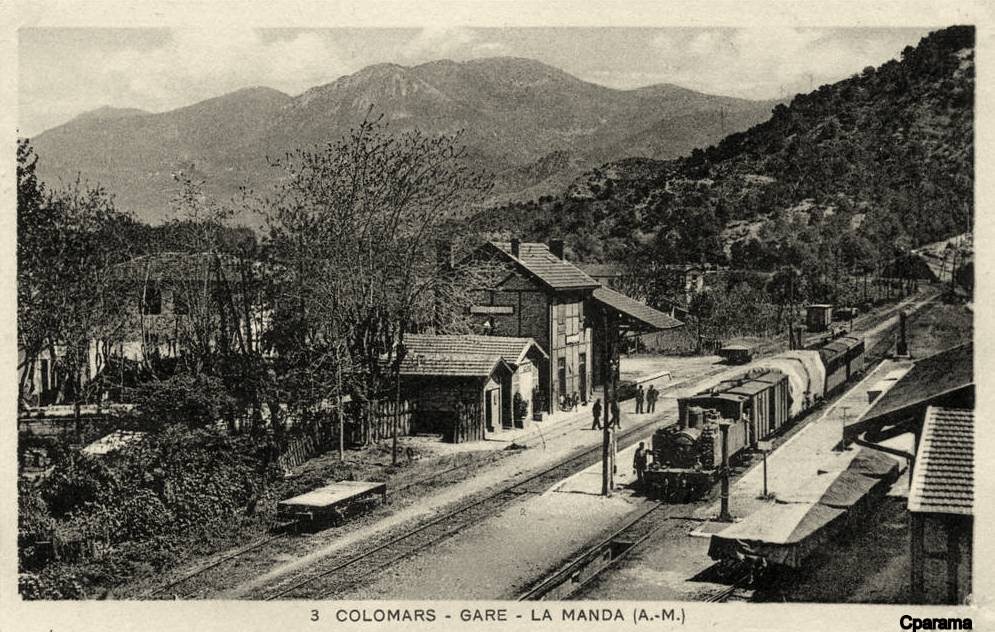
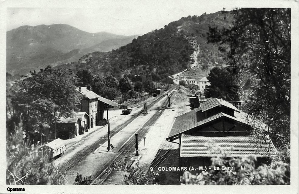
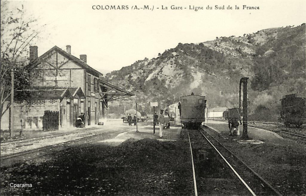
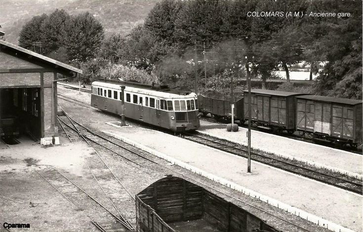
We finish this second part of the journey along the Nice to Digne line by focussing on the station at La Manda which was usually referred to as Colomars in the early life of the line.
The Ligne de Central Var left the Nice to Digne line at La Manda close to Colomars on the River Var. The station building at Colomars Station remains as evidence of the line. The line branched off the current Digne line just to the north of the hamlet of La Manda.
The station construction is typical of many of the stations still evident on the route of the line. A few historic postcards are reproduced here to give an idea of the station in the early years of the 20th century.
The second of these postcard views has been ‘adapted’ by Jean Giletta the photographer to include a hand drawn train. While it is a pity that the photographer did not wait for a real train to cross the bridge, the picture illustrates the nature of the river crossing. The railway line crossed the river on the top of the truss girders with provision between the trusses for road traffic!
Les Trains de l’Histoire, Sur les Chemins de Fer de Provence (Nice-Digne); https://www.tdh-forum.fr/viewtopic.php?t=71551, accessed on 10th April 2018. Copy right for these images rest with the photographers …. the relevant names on that site are: chavance, michel/57, Gérard and there are some great photographs to enjoy there.
Simplon Postcards, Chemins de Fer de Provence – CP, Page 1B: Rolling Stock – Diesel Locos & Trailers; http://www.simplonpc.co.uk/CPb.html, accessed on 12th April 2018.
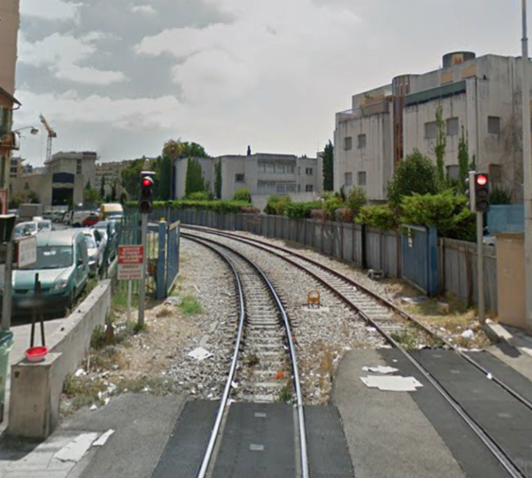
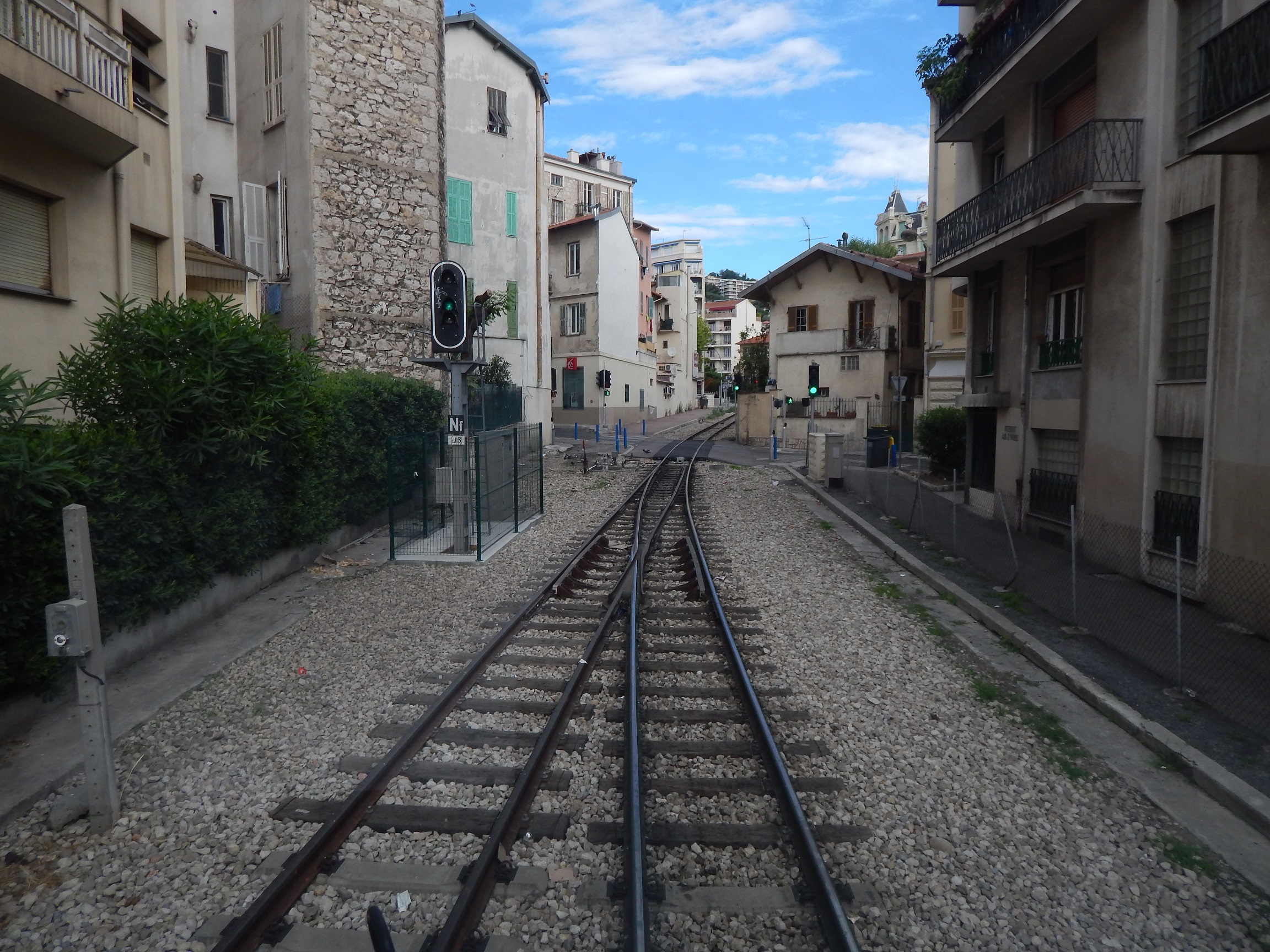
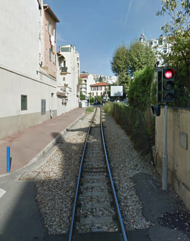
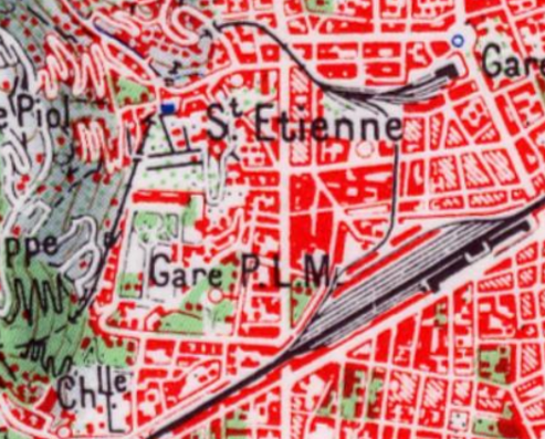
The Chemin de Fer due Sud de la France station, commissioned in 1892, benefited as early as 1899 from a 960 m connection to the PLM network.[1] The route of the connection is shown on the 1958 map of Nice below. La Gare due Sud is the more northerly of the two stations shown on the map.
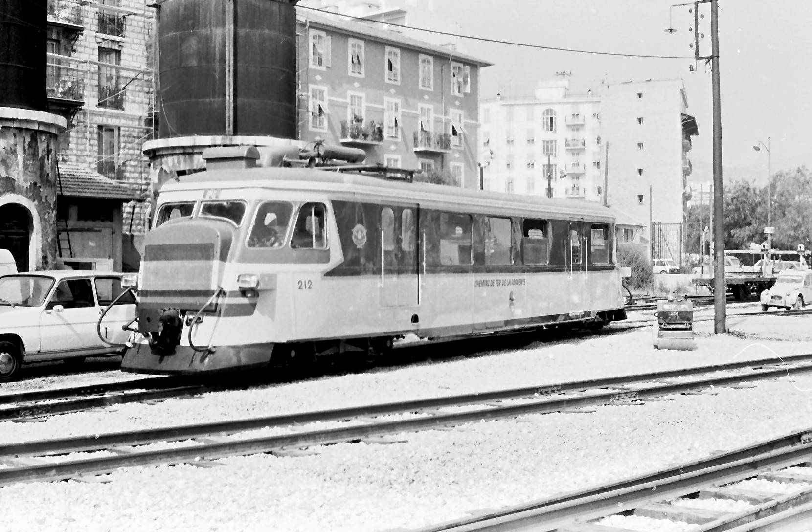
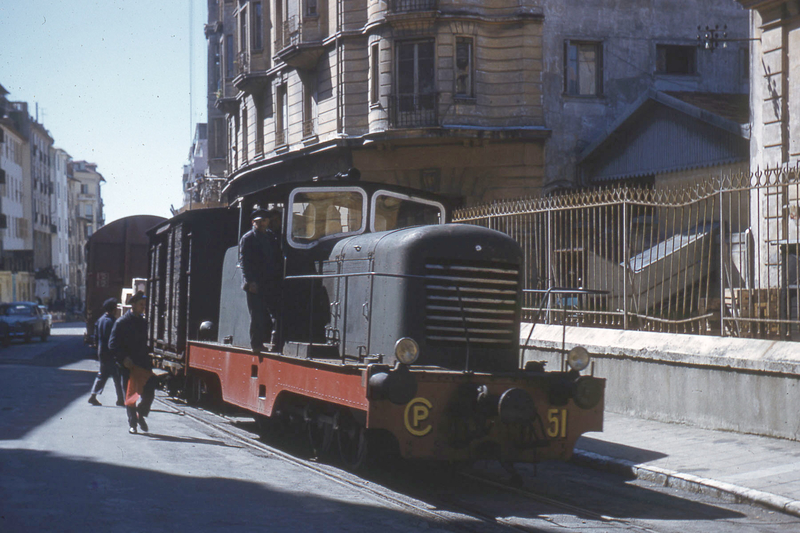
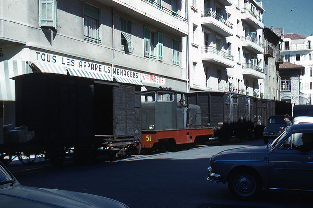
The connection between the CP and SNCF networks was established as dual-gauge line so that normal track wagons could be towed by metre-gauge shunters. In the late 1950s and early 1960s, the passage of freight trains in the middle of the street began to pose a problem with regard to traffic. I have only been able to find a few images of the line in use, taken, I think in 1963 by the same photographer, although available on the internet from different web sites.
The locomotive in the images above was also recorded on site at la Gare du Sud.1974. [4]
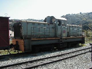
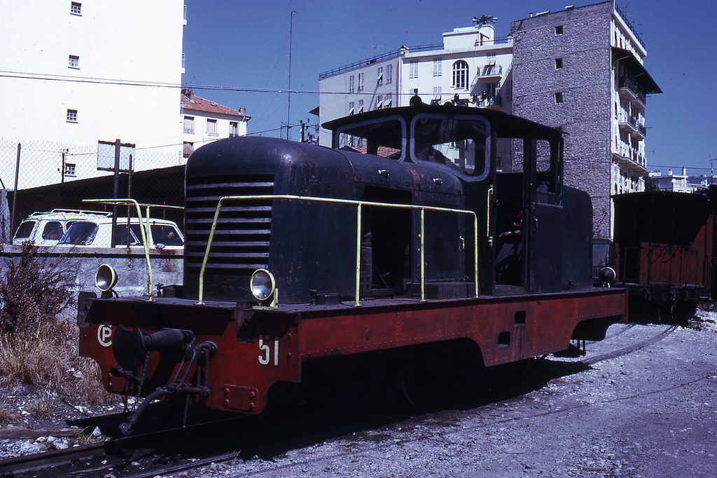
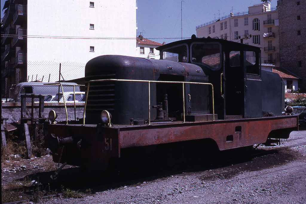
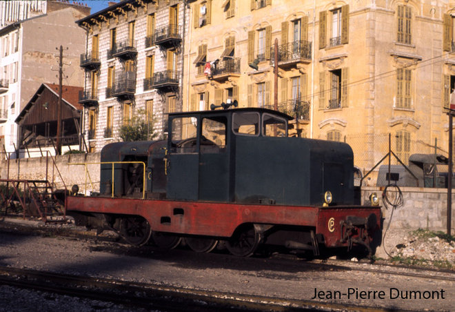
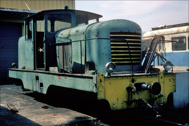
CP51 appears to be an 0-8-0 diesel shunter and seems to have had a long life on the Chemin de Fer de Provence. It was converted from a steam locomotive in 1948 and given the loco number 51. The work was done by the CFD workshop in Montmirail. In these CFD conversions, power was transferred from the diesel engine via a mechanical gearbox that drove one axle. The remaining axles are connected to the drive axle via the coupling rods. The loco was mainly used for traffic between la Gare du Sud and the SNCF station, for the transfer of freight wagons. From 1970, the vehicle was moved to Digne and shunted wagons at the station there. From 1978, the locomotive was used for construction trains and was eventually set aside at Lingostière after an engine failure in 1987. In 2010 it was still in the sidings at Lingostière.[5]
1980. [6]
1981.[7]
CP51 sits in a decrepit state in the sidings at the depot at Lingostière. [8]
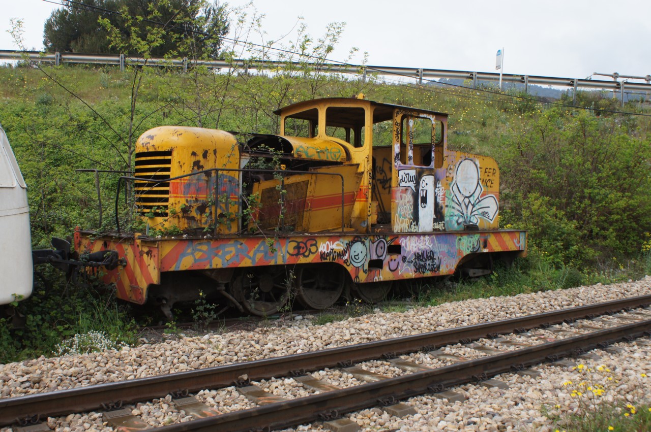
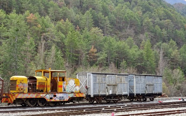
STOP PRESS …… CP51 has been found! It is hiding at Saint-André-les-Alpes! It has been photographed on 25th April 2018 in a siding awaiting restoration! [9]
There is a 3D printed body shell for this locomotive, produced by Shapeways[10] …
Tyrphon, Jean-Pierre Dumont; http://www.passion-metrique.net/forums/viewtopic.php?f=6&t=7790&hilit=locotracteur+cfd&start=240, accessed on 23rd April 2018.
File:CP-51-débris Lingostière 04-2014.jpg; https://commons.wikimedia.org/wiki/File:CP-51-d%C3%A9bris_Lingosti%C3%A8re_04-2014.jpg, accessed on 23rd April 2018 and translated from the German text of the website.
Photograph taken by ‘La bête de Calvi’ on the Passions Metrique et Etroite Forum; http://www.passion-metrique.net/forums/viewtopic.php?f=2&t=4143&sid=71f9e15a23794923765a790b153b2cc8&p=416169#p416169, accessed on 25th April 2018.
The Chemins de Fer de Provence is the name used for the one surviving metre-gauge line in Les Alpes Maritime. The route from Nice to Digne. This series of posts will follow the line from Nice to Digne and will have occasion to divert onto some branch-lines along the way.
The line from Nice to Digne is the only remaining line of the former network of the Compagnie des Chemins de Fer du Sud de La France. The company was created in 1885 by Baron Jacques de Reinach, a French banker of German and Jewish origin (1840-1892).[1] At its apogee in 1910 the company looked after 879km of railways, most of these are shown on the map below.
The Company was responsible for: the Central and Littoral Var lines; the Nice-Digne Line; the Cote-d’Or line; the Cogolin to Saint-Tropez branch-lines; the Isere tramway lines (Tramways de l’Ouest du Dauphiné);[2] the Tramways des Alpes Maritimes. However, by 1925, the company was experiencing significant difficulties. It was wound up and a new company with new financial backers was formed – Compagnie des Chemins de Fer de Provence. This new company lasted for 8 years until 1933.Early in the planning phase, relations between Italy and France were tense. The military demanded that the section of the line between Nice and Saint-Martin-du-Var was designed to permit access by standard gauge trains. Indeed, this was also a requirement for the first length of the Colomars to Meyrargues line. A dual track-gauge arrangement was included in the plans when the concession arrangements were updated on 21st May 1889. The loading gauge for the line was also enhanced to be the same as for the standard gauge lines. On 29th July 1889 the concession was approved by law, the line was declared as being of ‘public utility’ and the length of Line from Nice to Saint-André was also formally included in the concession.
Construction costs for the line were high and in order to ensure its completion the length between Puget-Théniers and Saint-André-les-Alpes was, in part, funded through an agreement signed between the company and the state. A formal agreement between the Minister of Public Works and the Compagnie des Railways du Sud de la France on 23rd March 1906 provided for the company’s construction of the Puget-Théniers to Saint-André-les-Alpes. The agreement was approved in law on 29th December 1906.[3]
Construction work began on the first length of the line on 14th August 1891. This was the length between Digne and Mezel – a length of 13km. In 1892, the sections from Nice to Colomars (also 13km), Colomars to Puget-Therniers (45km) and Saint-André-les-Alpes (previously Saint-Andre-de- Meouilles) to Mezel (31km), were under construction.[4]
Between 1892 and 1907, various scandals about the reliability of the company endangered its finances and slowed the progress of the work significantly. By 1907, only a 12km section between Puget-Théniers and Pont-de-Gueydan was open. The following year that was extended to Annot, a further 8km.[4]
The work progress relatively rapidly from this point on. The full length of the line was completed in July 1911, and a ceremony was attended by the Minister of Public Works on 6th August 1911, to inaugurate the last length of the line (the section between Saint-André and Annot).
As we have already noted, the Compagnie des Chemins de Fer du Sud de la France was unable to sustain operations beyond 1925. Their role was taken over by Compagnie des Chemins de Fer de Provence. In turn, this company was only able to manage the line until 1933 when it handed over both the Nice to Digne line and the Central Var line to the State. The Compagnie des Chemins de Fer de Provence then restricted its activities to the Littoral line. The State department for Bridges and Roads (Ponts et Chaucees) took over responsibility for the Nice to Digne Line.
In the immediate pre-war period, all three lines were developing well, services were increasingly popular thanks to the introduction of Autorails (Railcars). However, the War and particularly the fighting which accompanied the Liberation, dealt a serious blow to the railway infrastructure of the region.[6]
Recovery after 1944 was very slow. There was no hope of reconstruction for the Eastern part of the Central Var line and its trains terminated at Tanneron. Eventually, the Littoral line (Le Macaron) closed by 1949 and the Central Var line, by early 1950.[6]
In 1952, the State released the Nice to Digne line into private management once again, but this was not without its problems and by 1959, the State was threatening closure of the line unless draconian measures were taken. These threats were repeated in 1967 and again in 1968. This resulted in the two departments and the cities of Nice and Digne joining forces to create the “Syndicat mixte Méditerranée-Alpes” (SYMA) which took overall responsibility for the line and entrusted the operation of the line to the CFTA (Societe Generale de Chemins de Fer et des Transports Automobiles).[5,6]
A shuttle service between Nice and Colomars was inaugurated in the 1970s. In 1975, SYMA opened workshops at Lingostière workshops to replace those at Draguignan. The Draguignan workshops became unavailable after the War. It took quite a time to replace them![6]
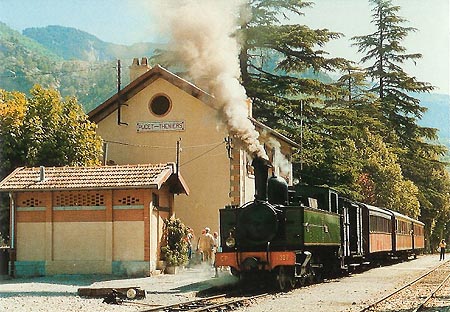
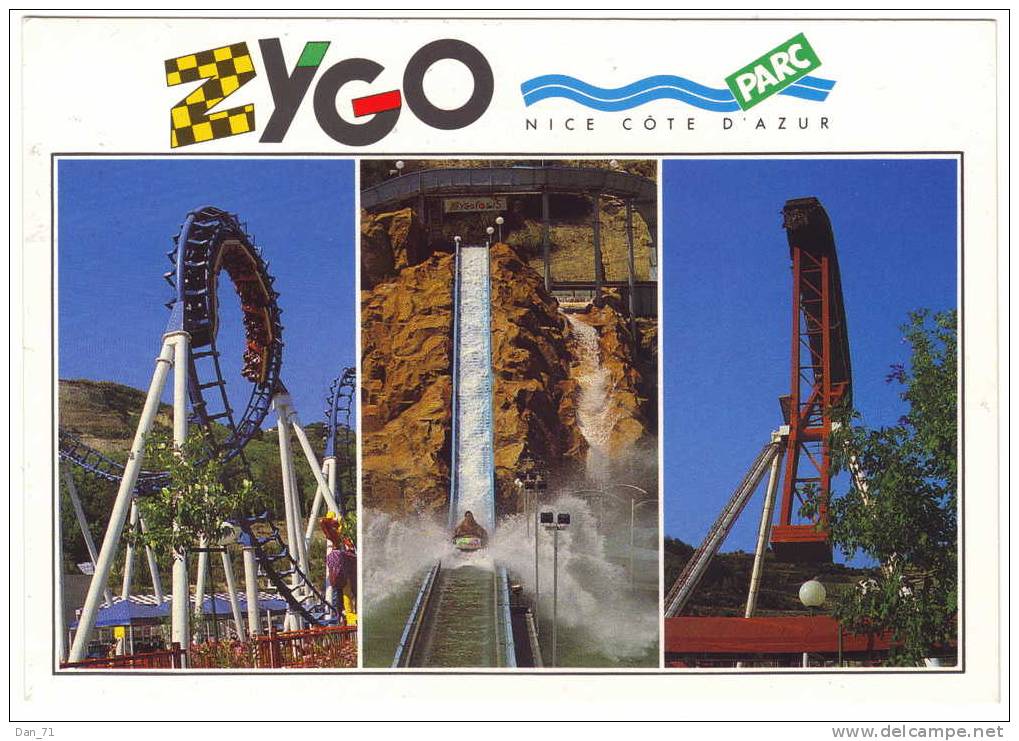
The 1980s seemed to see an up-turn in the fortunes of the line. The GECP (Groupement d’études pour le Chemin de Fer de Provence)[7] started to run steam excursion trains (an example of which can be seen below). In 1981, the link between Geneva and Nice in the form of ‘Alpazur’ was reinvigorated.[6] The service had been in place since the late 1950s.[8] A standard gauge link to Digne was used to connect with the metre-gauge line. The two different trains are shown above. That line ran from Château-Arnoux-Saint-Auban to Digne-les-Bains.The line was also enhanced by the introduction of a new stop on the line for Zygofolis, an amusement park joined to a water park.[9]
This renaissance was short-lived. The SNCF decided to close the standard-gauge link between Château-Arnoux-Saint-Auban and Digne in September 1989.[10] Nice town hall decided to call for the closure of the line from Colomars to Digne (90% of the full length).
The mayor of Nice finally agreed to accept a compromise. The deal agreed was that the Chemins de Fer de Provence (CP) would give up the magnificent Gare du Sud and the city would give up its fight to close the line.[6]
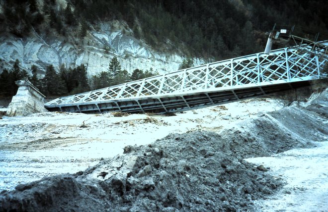
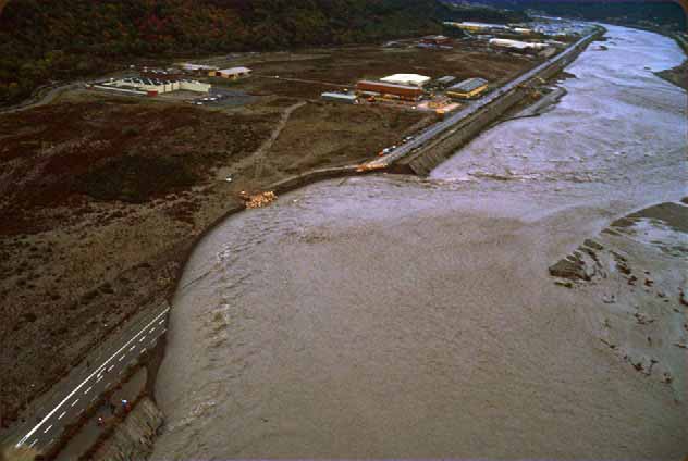
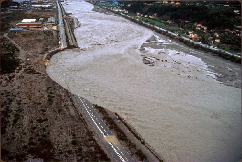
However, exceptionally bad weather and flooding in the Autumn of 1994 (5th November 1994) resulted in the River Var carrying away significant lengths of several hundred metres of the Nice to Digne line. The CP took over 18 months to repair the line and recover.[6,11,12] The images below show examples of the damage caused in the November 1994 floods.
In the last two images we have, on the right: the bridge at Gueydan on the Var destroyed by the flood which would in time be scrapped and replaced by the French Army. On the left is one of the many breaches of the line.[13] Immediately below this text are two images of a similar breach which happened in 1982. Following them are three videos shot during flood flows in the Var River channel in November 2011. The first at the Airport and the other two at the bridge at La Manda near Colomars.
SYMA’s control over the Nice to Digne Line continued until 1st January 2007 when the Appeal Court in Marseilles closed it down because of discovered flaws in procedures within the company.
The line was operated by Transdev[14] and Veolia Transport[15] through a subsidiary called Compagnie Ferroviaire du Sud de la France (CFSF)[16] until on 1st January 2014 a new company was formed to run the line – Régie Régionale des Transports de Provence Alpes Cote d’Azur (RTT PACA).[17] Under RTT PACA’s control the line has been significantly upgraded and rolling stock improved. It is still possible to travel on the line behaind a steam locomotive, courtesy of the GECP but regular services are now in the hands of very modern DMUs.
A Journey Along the Line – Part 1 – La Gare du Sud
Our journey starts in Nice at the magnificent facade of la Gare du Sud. First a few older postcards to introduce us to the station. ……..
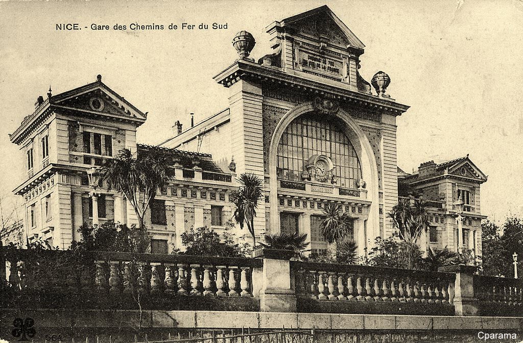
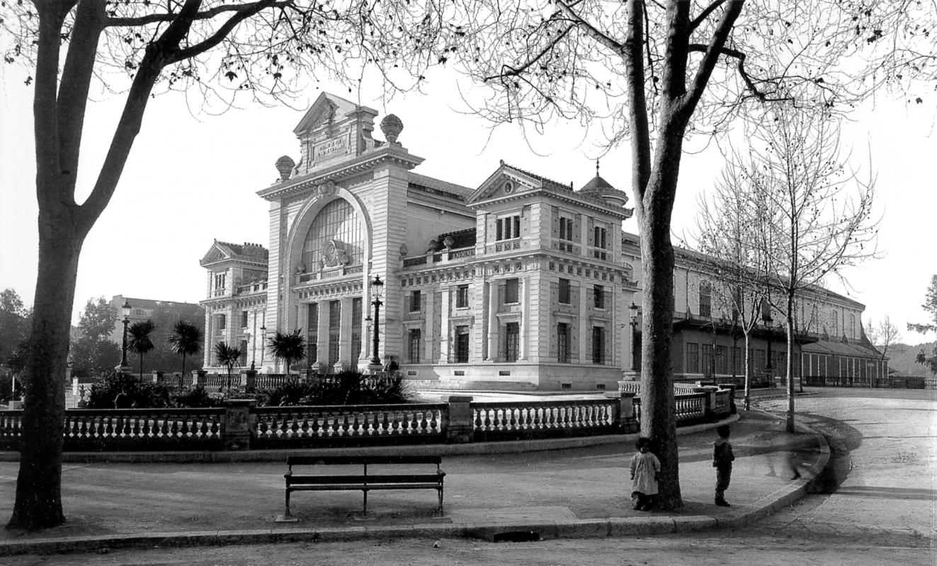
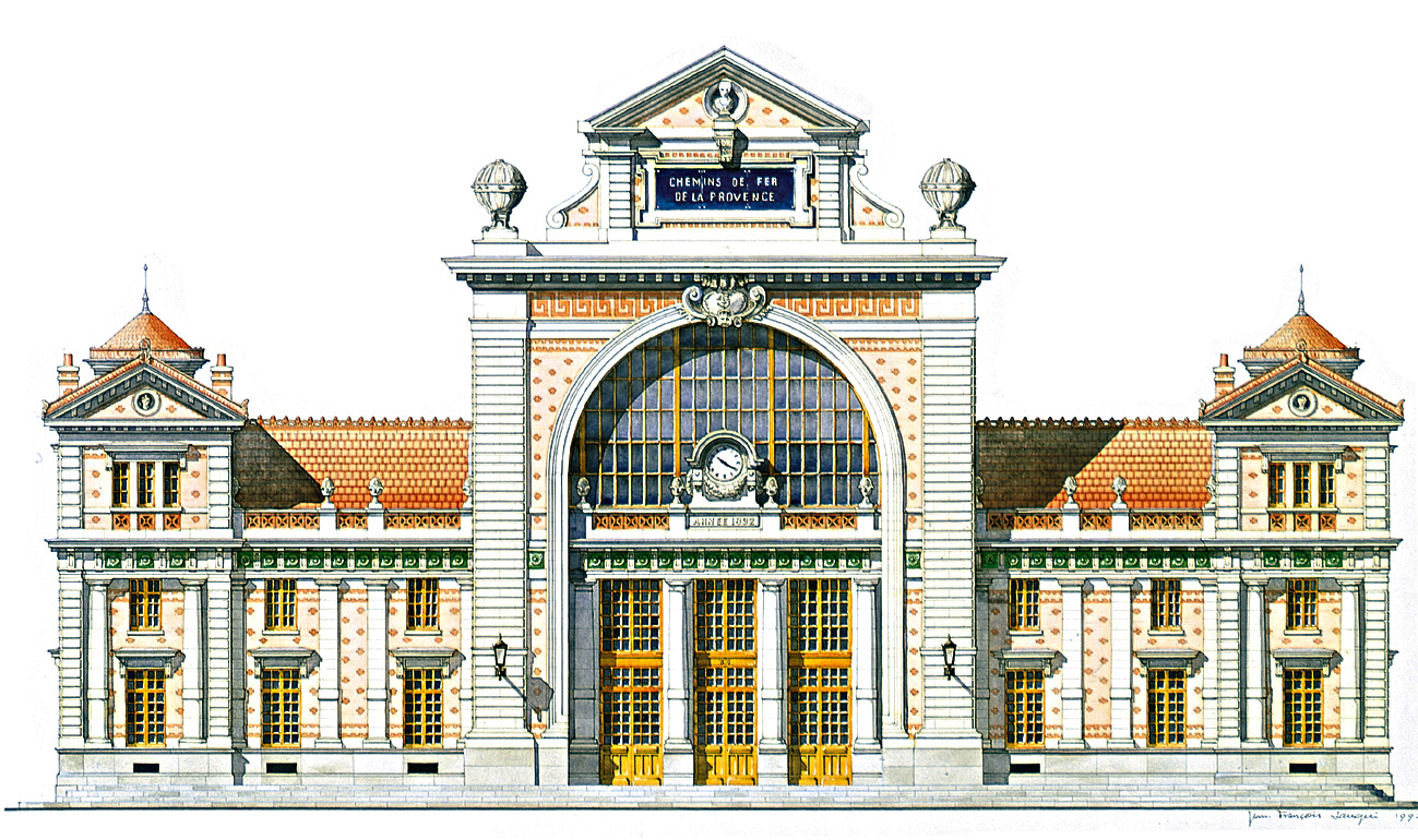
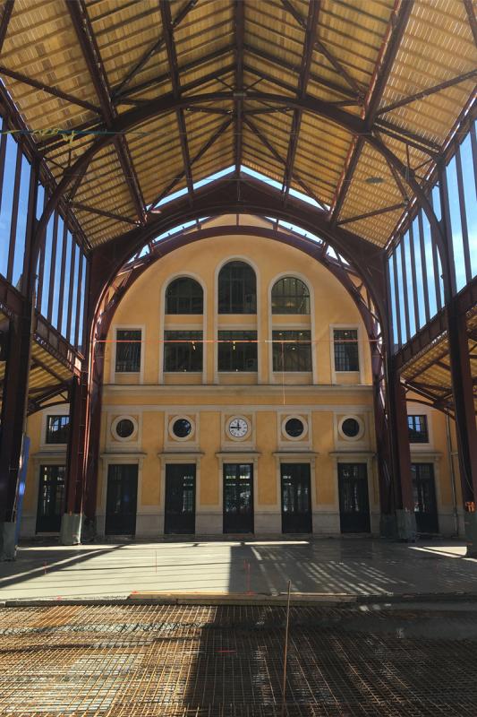
La Gare due Sud[18] was built in 1892 by the architect Prosper Bobin on behalf of the Compagnie des Chemin de Fer du Sud de la France. Prosper Etienne Bobin was born on 11th January 1844 in Montigny-en-Gohelle (Pays-de-Callais) and died on 10th December 1923 in the 6th Arrondissement in Paris.
The station has two main components, the passenger building and the train-shed. The first has a striking facade which faces onto the Boulevard Malaussena in the Liberation quarter of Nice. It was designed in the rationalist style which favoured the use of new industrial materials without compromising on elegance.[18] The name ‘rationalism’ is retroactively applied to a movement in architecture that came about during the Enlightenment (more specifically, neoclassicism), arguing that architecture’s intellectual base is primarily in science as opposed to reverence for and emulation of archaic traditions and beliefs. Rational architects, following the philosophy of René Descartes emphasized geometric forms and ideal proportions.[19] Structural rationalism most often refers to a 19th-century French movement, usually associated with Eugène Viollet-le-Duc and Auguste Choisy. Viollet-le-Duc rejected the concept of an ideal architecture and instead saw architecture as a rational construction approach defined by the materials and purpose of the structure. The architect Eugène Train was one of the most important practitioners of this school, particularly with his educational buildings such as the Collège Chaptal and Lycée Voltaire.[20]
The monumental facade of la Gare du Sud with a high central pavilion flanked by two side pavilions displays a decorative repertoire made of veneered ceramics and painted motifs overlying the stone structure. The building is roofed in terracotta.[18]
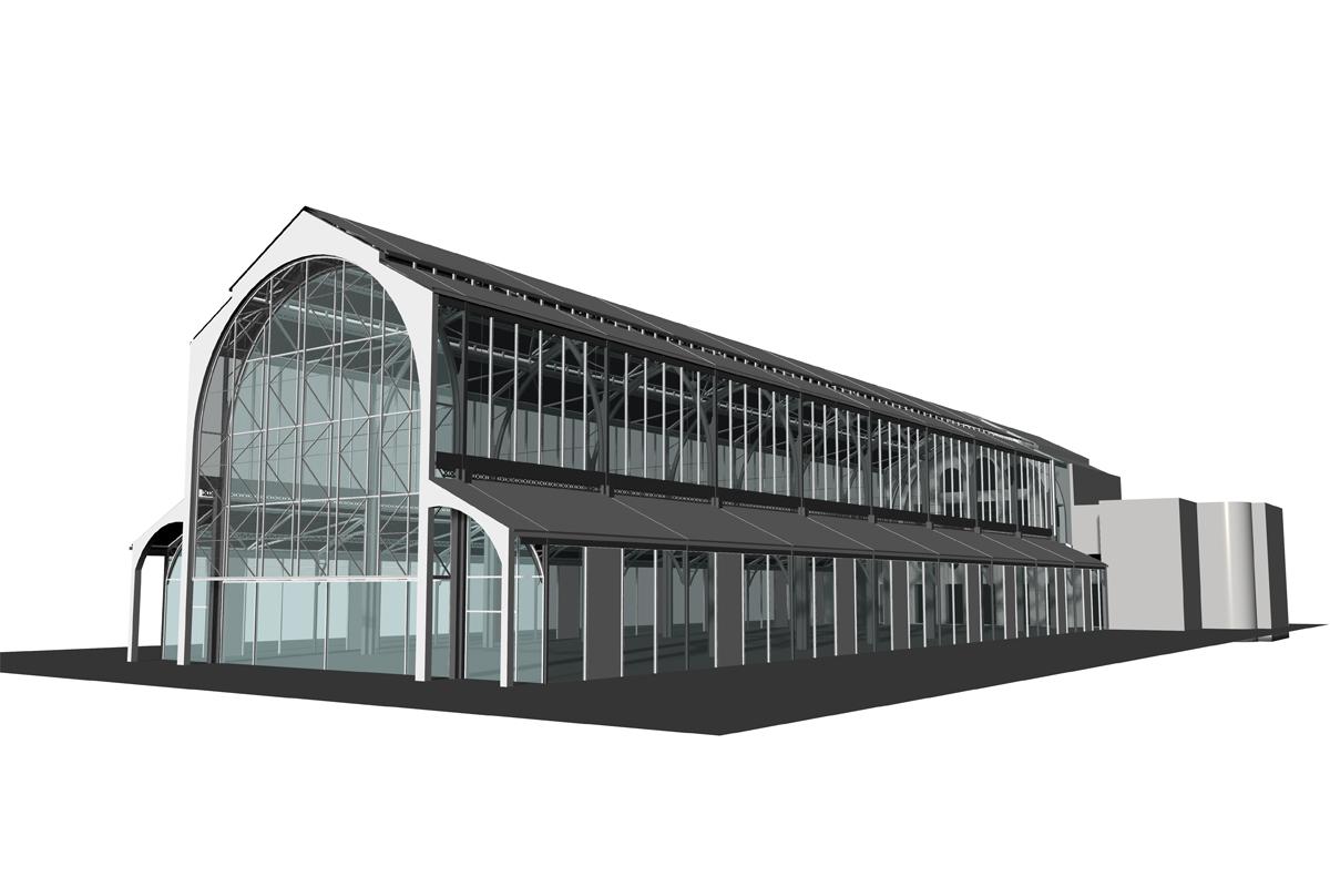
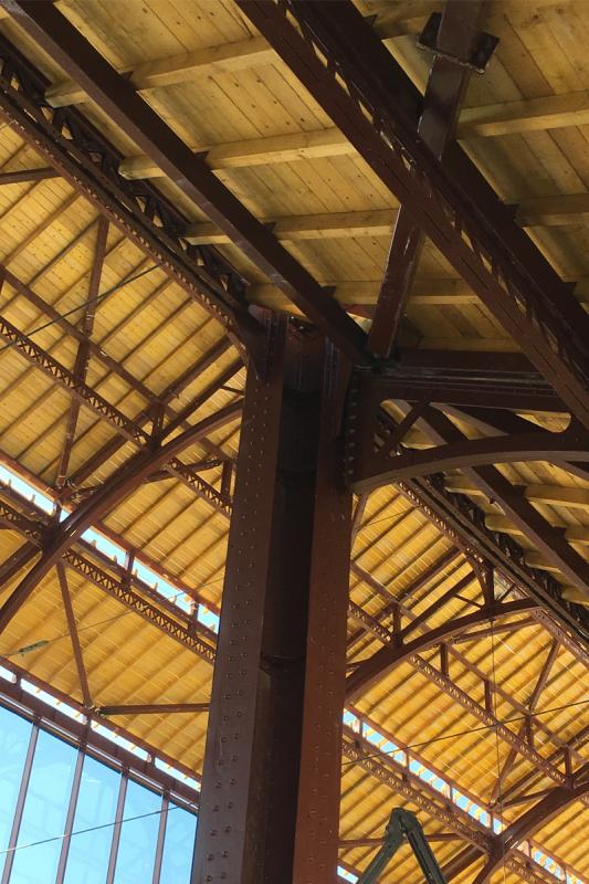
Trackside, there was (and is) a large train-shed, 23m wide, 18m tall and 87m long which covered the platforms. It is a metal structure inspired by the work of Gustave Eiffel which was originally used to house the Russian pavilion of the 1889 World Fair.
La Gare du Sud was completed in 1892, it operated as a railway station until December 1991, almost reaching its centenary as a station before circumstances in Nice dictated its closure.
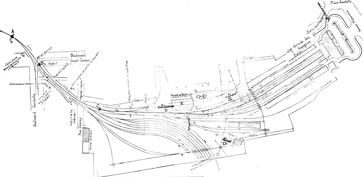
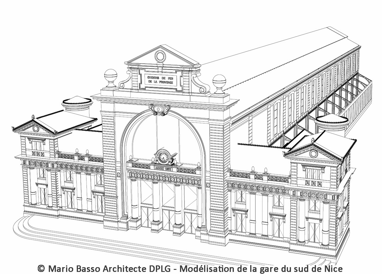
Over the years the station site was developed to the extent visible in the hand-drawing below.[21]
In the 1910s, with increased traffic, the locomotive shed was enlarged. The two water tanks were mounted on masonry pedestals. Several additional rooms were created (most of them next to the shed). These included an office for the deputy chief and a traction shop. A Cnetral Office was built to the West of the Station adjacent to Rue Dabray which brought all the key staff togetehr under one roof.
Later, in 1936, a new workshop for diesel railcars (autorails) was built at the west end of the passenger hall. By the eve of the Second World War, the station was at its zenith. In addition to the buildings there were several kilometres of track, 44 single points, four three-way points, a variety of turntables which included one locomotive turntable.
After the Second World War, a building, serving as a simple repair shop, was to be the last new building on the site.[18]
The last two images show wagons in storage at la Gare du Sud. They have been provided by a member of the GEMME forum in France.[36]
From the end of the War until the 1990s the uncertainties over the future of the Nice to Digne line meant that little was invested in the facilities at la Gare du Sud. In 1970, plans were drawn up to close the station. The city hoped to eliminate 4 level-crossings by moving the station to Rue Cross de Capéu a distance of 700 metres. The site of the proposed new station was purchased in 1972 and the Architect was chosen. The project remained on the drawing board.
In 1973, a number of unused sidings were lifted. In 1975, the President of SYMA, Jacques Médecin, Mayor of Nice, declared that he intended to stop the financial participation of the City in the organization (SYMA), and requested the sale of la Gare du Sud. Land on the south side of the station was sold, all of the buildings on that land were demolished, 150 wagons on the site were scrapped.
In 1976, access to the station was compromised when the City connected the streets of Alfred Binet and Falicon. Access to the goods hall and shunting manoeuvres became almost impossible. On 22nd March 1977, the automatic gates of Gambetta, Cros de Capeu and Gutemberg Streets were removed and replaced by traffic lights![21] This meant that trains were restricted to a speed of 4km/hr when crossing those streets.Recovery plans were negotiated in the late 1970s. Goods trains were banned from the centre of Nice. In 1978, the south side of the station site became a municipal car park. A period of ten years of relative calm then ensued, although the City maintained its intention to purchase the whole of the site of la Gare du Sud.
A memorandum of understanding was finally signed on 18th January 1991 for the sale of the site of la Gare du Sud to the City for 151 million francs. As part of that deal the terminus of the Nice to Digne line was designated as being at Rue Alfred Binet. The commissioning of a new station at Rue Alfred Binet was scheduled for November 1991 but was eventually postponed until 10th December. The last day of operation of la Gare du Sud as a railway station was 9th December 1991.[21]
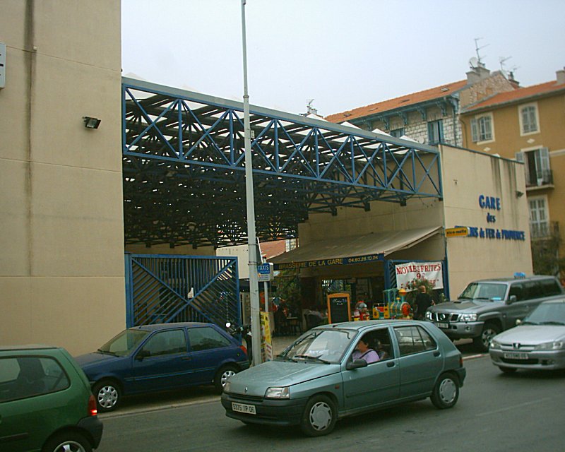
The new station was designated as the Gare de Nice CP and was built in a modernist style, in contrast to every other station on the line. [26] The following pictures show that station and can be found on the ‘Le Train des Pignes’ website. [26]
From 9th December 1991 to the year 2000, la Gare du Sud remained derelict. Although there had been a land transfer to the City the building was not sold to the City until the year 2000. The City then produced plans to demolish the station.[18]
This demolition raised many protests and finally the Minister of Culture , Renaud Donnedieu de Vabres, opposed it in 2004. Meanwhile, the facade of the old station was registered as a historical monument on 23rd September, 2002.[27] The train-shed was registered as a historical monument in June 2005. The elegance of the building is demonstrated by the following images draw by the Architect, Mario Basso.[28]
Mario Basso is also responsible for a comprehensive archive of media posts relating to the station over the years.[28] That story can also be followed on Le Train des Pignes website.[29]
The building was saved from destruction but its future remained uncertain. Several projects were promulgated and then fell by the wayside (including the site becoming a new City Hall for Nice) before finally a project to convert it into a media library became a reality. The passenger building received a full restoration.Drawing by Jean Francois Laugeri
The work was completed in time for opening in December 2013. A video taken from a drone, shows the finished work to the old passenger facilities.[30] Meanwhile refurbishment of the train-shed was also being considered. The video project presentation is below. [31]
TESS was given this project and some pictures of their work are shown below.[32]
The renovated station is intended to be at the hear of a new area in the City. [33,35] The old train-shed will become a venue for restaurants and boutiques and will be surrounded by green spaces, the site will also benefit from parking, housing, gyms, a multiplex cinema and many shops.
Further development work was due to start in April 2018. The old train-shed will be known as le Salon du Vintage and will be run for the next 45 years by Banimmo France.[34]
It is intended that the train-shed will accommodate 22 restaurants by December 2018A mezzanine floor needs to be installed. opening is planned for 15th December 2018.
References
Michel Steve, Metaphor Mediterranean: The architecture of the Riviera from 1860 to 1914 , Editions Demaistre, 1996, p.88.
Wikipedia, Ligne de Nice a Digne; https://fr.m.wikipedia.org/wiki/Ligne_de_Nice_à_Digne, accessed 3rd April 2018; and “No. 48721 – Act approving an agreement between the Minister of Public Works, Posts and Telegraphs and the Railway Company South of France for the execution of the route of the line of St. André to Puget-Théniers:” 29th December 1906. Bulletin of the laws of the French Republic , Paris, Imprimerie Nationale, serie XII, Vol. 74, n o 2811, p1365-1366.
Wikipedia, Ligne de Nice a Digne; https://fr.m.wikipedia.org/wiki/Ligne_de_Nice_à_Digne, accessed 3rd April 2018.
Wikipedia, Société générale de chemins de fer et de transports automobiles; https://fr.m.wikipedia.org/wiki/Société_générale_de_chemins_de_fer_et_de_transports_automobiles, accessed 3rd April 2018.
Wikipedia, Chemins de Fer de Provence; https://fr.m.wikipedia.org/wiki/Chemins_de_fer_de_Provence, accessed 2nd April 2018.
GECP; https://www.gecp-asso.fr, accessed 1st April 2018.
Wikipedia, Alpazur; https://fr.m.wikipedia.org/wiki/Alpazur, accessed 3rd April 2018.
Wikipedia, 1994 dans les chemins de fer; https://fr.m.wikipedia.org/wiki/1994_dans_les_chemins_de_fer, accessed 4th April 2018.
Hydro Europe, The Var River Project; https://archives.aquacloud.net/17he/a/aquacloud.net/17he01/project.html, accessed 4th April 2018, and Hydro Europe, Project; https://archives.aquacloud.net/17he/a/aquacloud.net/17he07/project.html?tmpl=%2Fsystem%2Fapp%2Ftemplates%2Fprint%2F&showPrintDialog=1, accessed 4th April 2018.
Societe.com, Régie Régionale des Transports de Provence Alpes Cote d’Azur; https://www.societe.com/societe/regie-regionale-des-transports-de-provence-alpes-cote-d-azur-793934993.html, accessed 4th April 2018.
Wikipedia, La Gare du Sud; https://fr.wikipedia.org/wiki/Gare_du_Sud, accessed 4th April 2018.
Froissart-Pezone, Rossella; Wittman, Richard, The École Nationale des Arts Décoratifs in Paris Adapts to Meet the Twentieth Century; Studies in the Decorative Arts. University of Chicago Press on behalf of the Bard Graduate Center. 7 (1): 30, 1999-2000.
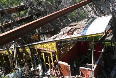
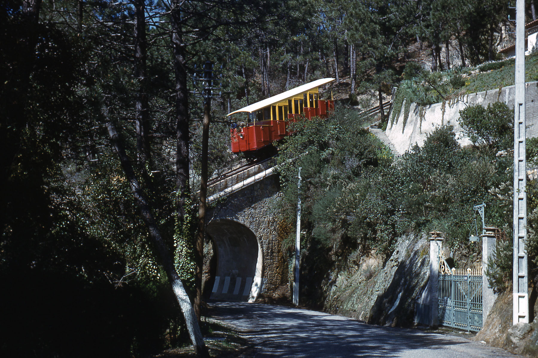
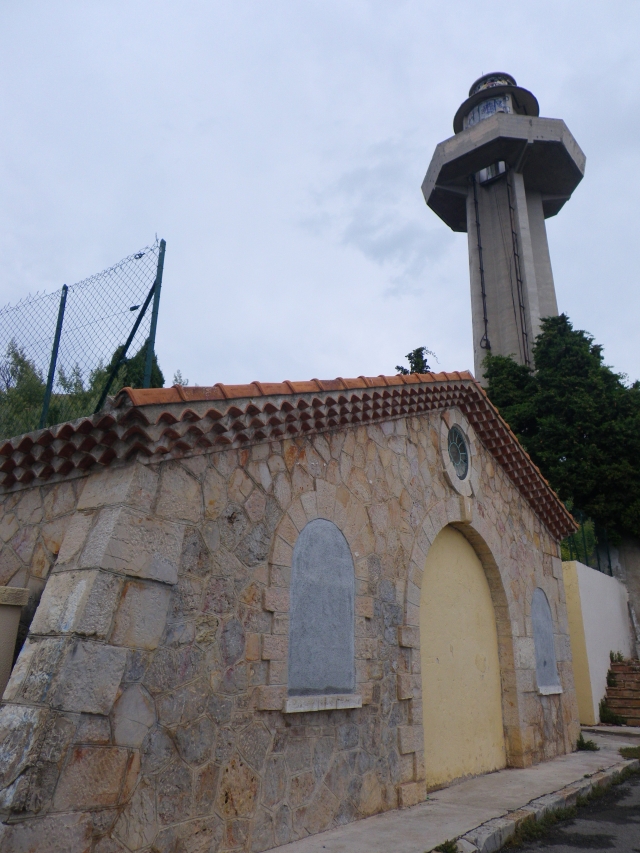
This was an 850 metre-long funicular providing access to ‘Super-Cannes’ from the town of Cannes. It was opened in 1928 and closed in 1966. Much of the infrastructure is still in place in the early 21st Century.
Super-Cannes is within the district of La Californie. It is a residential area of Cannes.
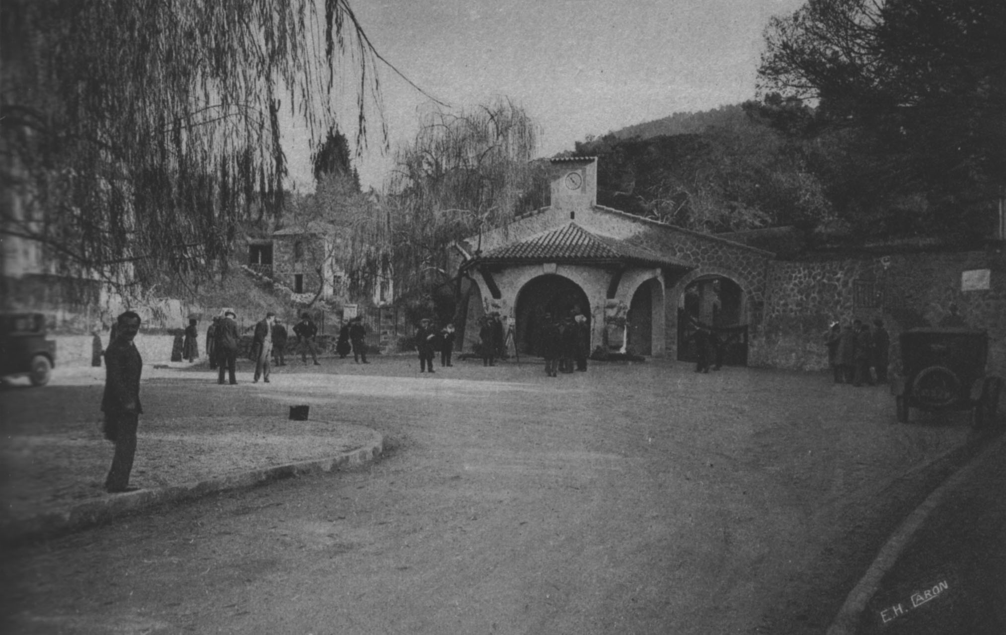
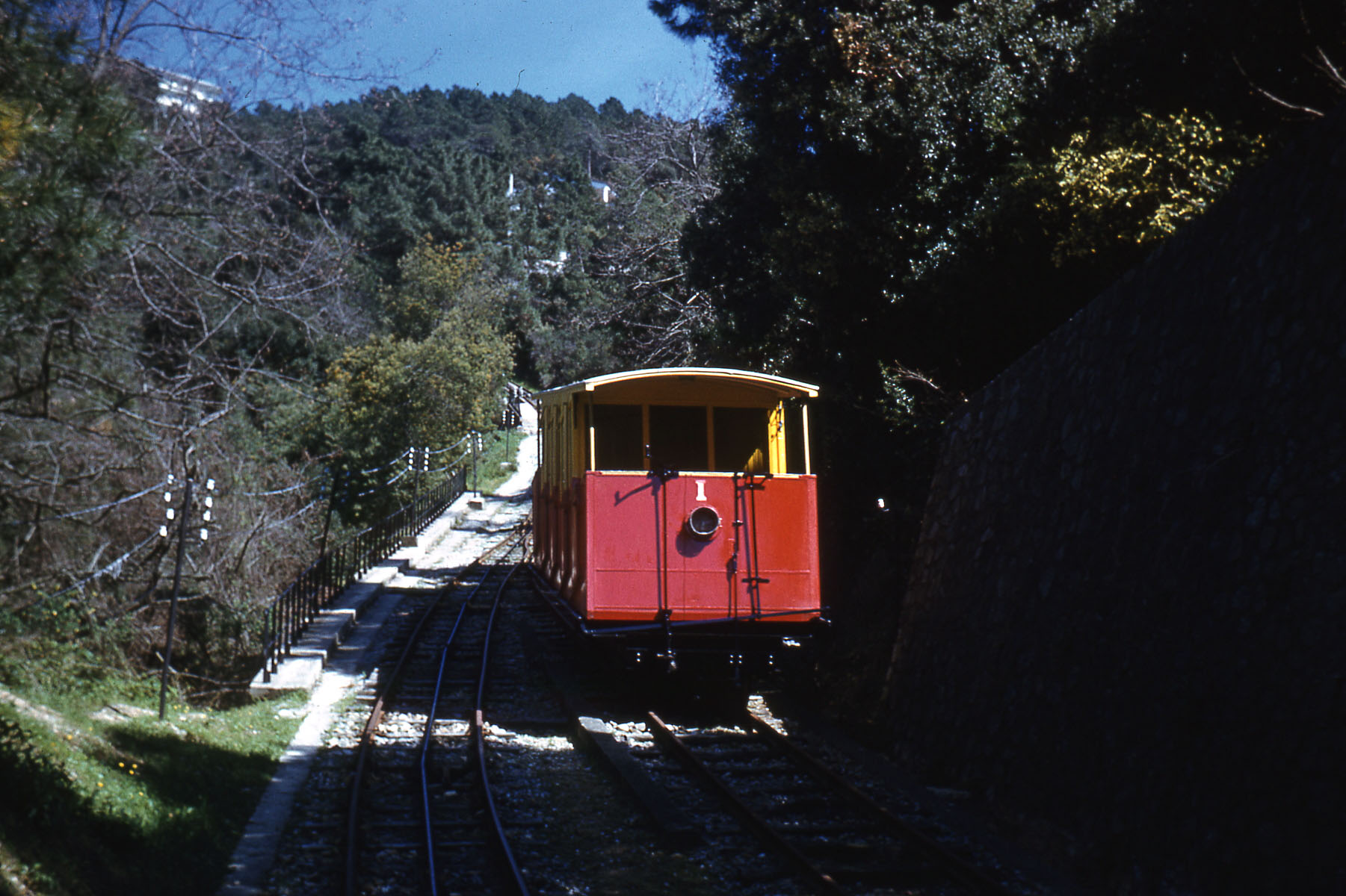
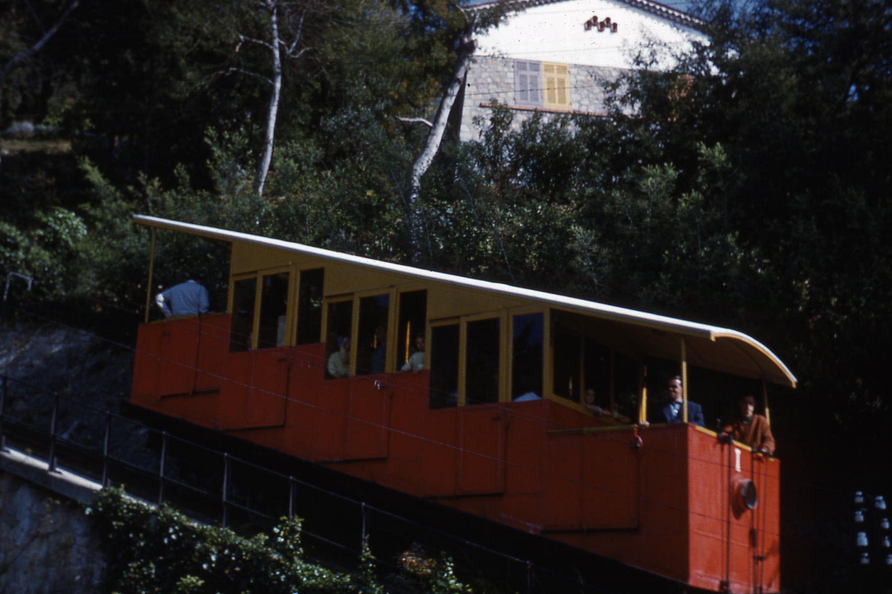
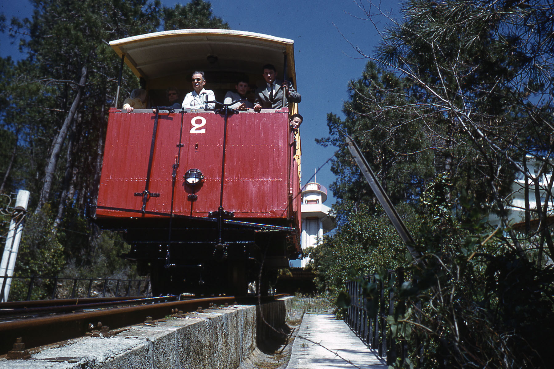
The construction of a funicular was initiated by Société immobilière de Paris et du Littoral. It was designed by the Italian company ‘Societe Ceretti et Tanfani’ and the construction engineer was E. Jaulin. [1] The contractor for the work was Dyle and Bacalan. Construction work took place between 1925 and 1928. The funicular line rose 850m from its lower station on Avenue Val Vert, through the Valley of Les Gabres. It crossed a series of roads on sloping bridges before reaching the higher station adjacent to the Observation Tower in Super Cannes on Avenue de la Gare-du-Funiculaire. The funicular was completed in January 1928 and opened by André Capron , Mayor of Cannes and Yves Le Trocquer , Minister of Transport on 27th January 1928.
As a result of the construction of the funicular there was a rapid development of properties on the hill. The view across the Baie de Cannes was, and is, spectacular.
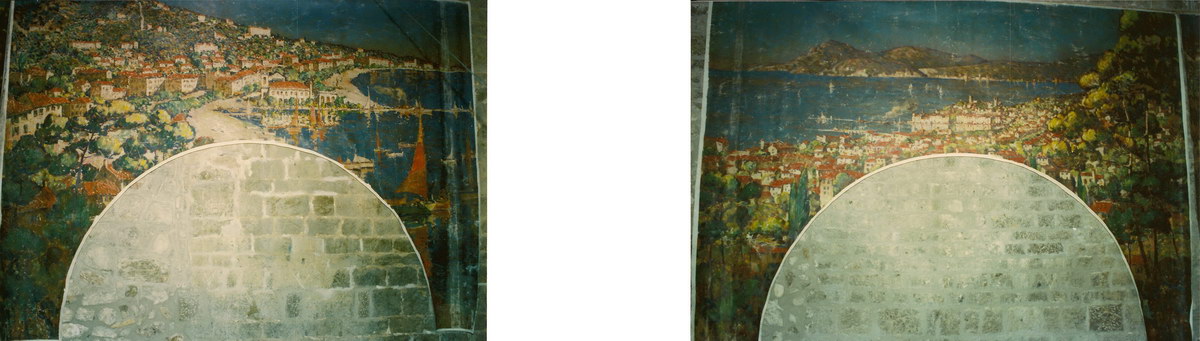
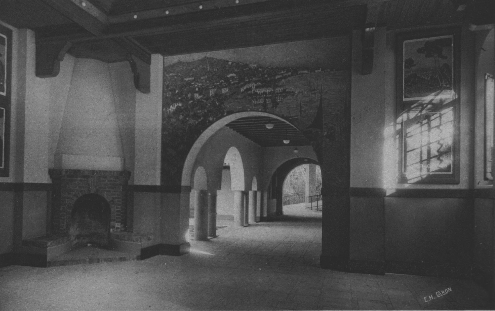
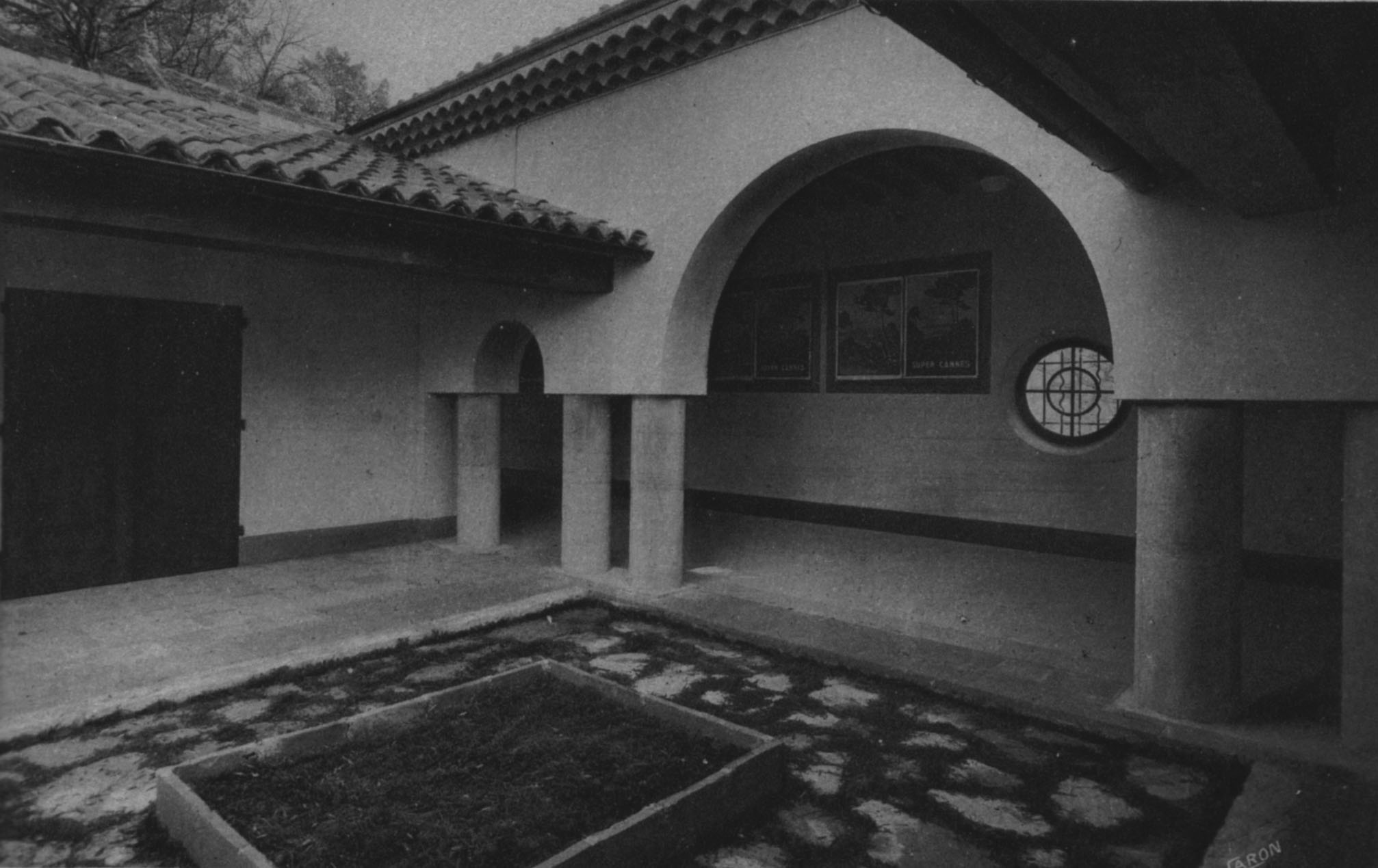
The lower station was designed to look like a chapel and was in the Neo-Provencal style. Wikipedia explains that this was, and remains, ‘a contemporary architectural and decorative style originating in Provence which extends along the French Mediterranean Coast and onto Corsica. … It replaces the traditional stone houses of the villages of the South of the country’.[2] It was decorated with a series of paintings by Louis Pastor.[3] A few images of the station and the paintings follow. Included among these pictures is a very early image of the funicular:
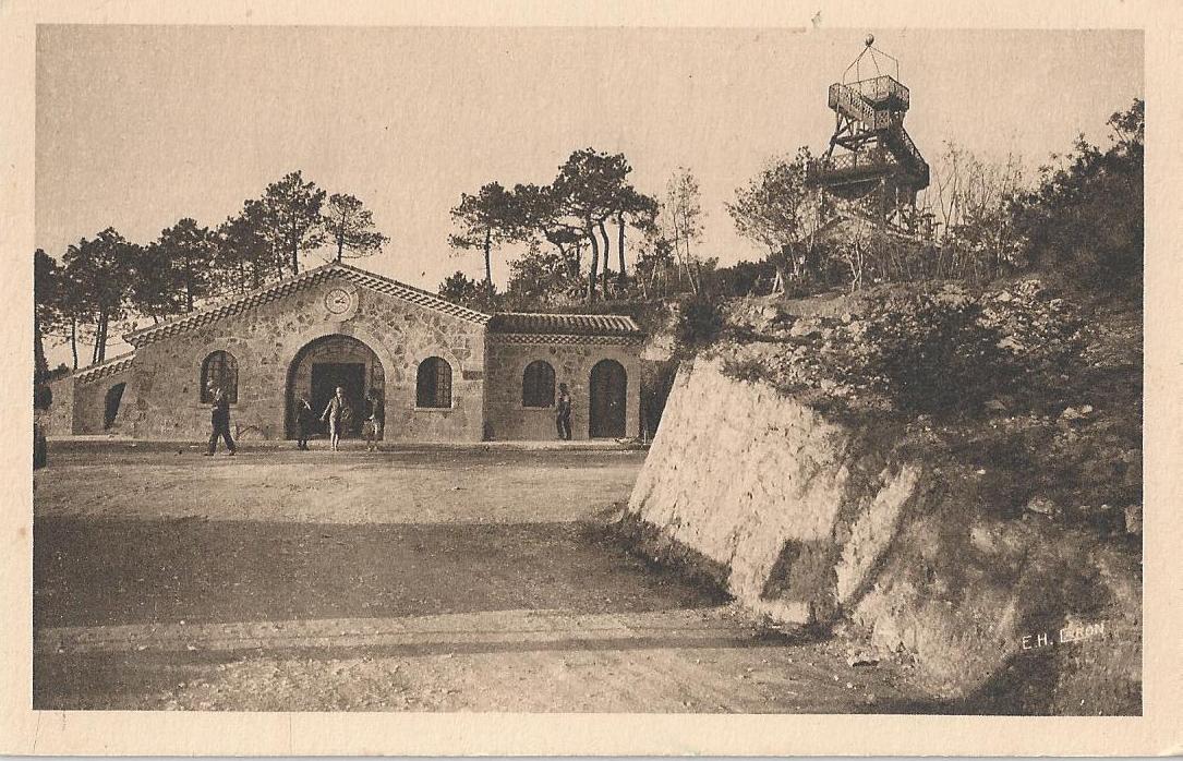
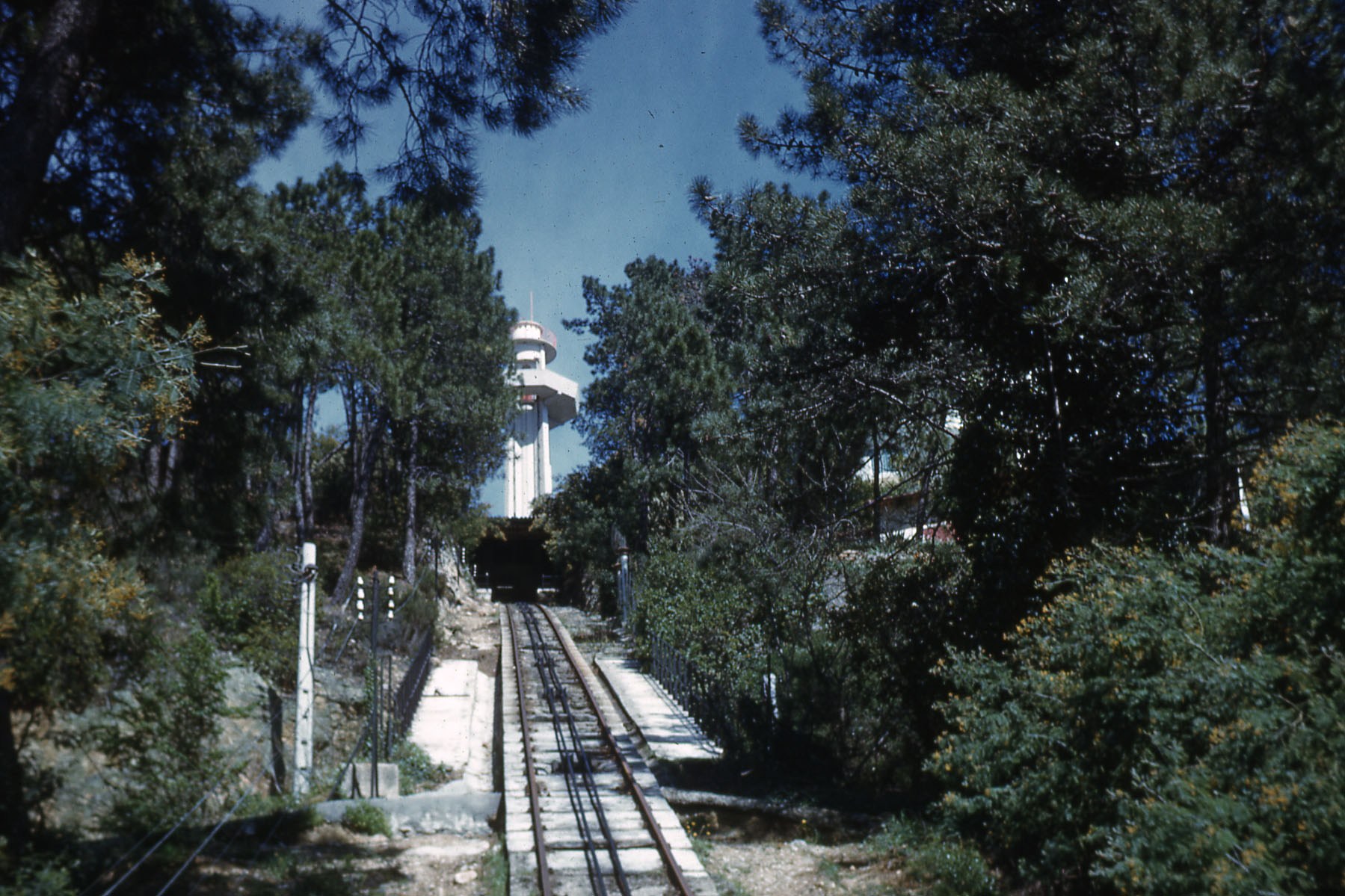
The funicular was on a steep grade, in a length of just 850m the funicular climbed to an altitude of 233m. There was one passing point at midpoint on the climb. The top station is shown below along with the wooden observatory refered to below.
At the top of the funicular there was a planned housing estate which initially was predominantly reliant on the funicular for access. 156 hectares were set aside for the project and the developers provided roads and other infrastructure as well as constructing the funicular railway. The infrastructure to be provided included a 9 metre wide road of approximately 4km in length; 7km of secondary roads; a tea room, hotel and gazebo along with luxury shops. The picture below shows the view point at the top of the funicular before major development had taken place.
A first square wooden observatory as erected in 1925. The project, however, hit financial difficulties, the large hotel was never built. The planned road works were interrupted and the land was sold on in 1931. 1939 saw the construction of a panoramic restaurant on the site of the planned hotel and a cylindrical reinforced concrete tower replaced the wooden observatory in 1953.
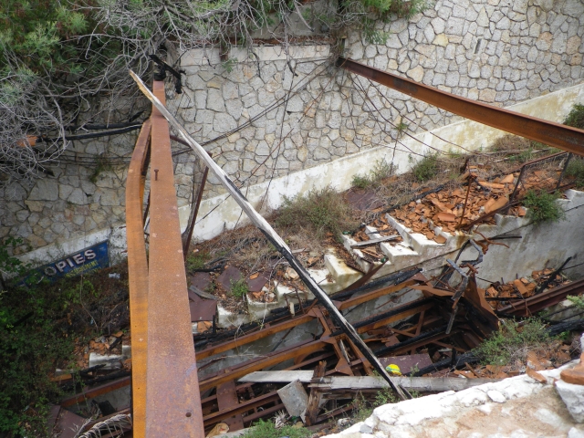
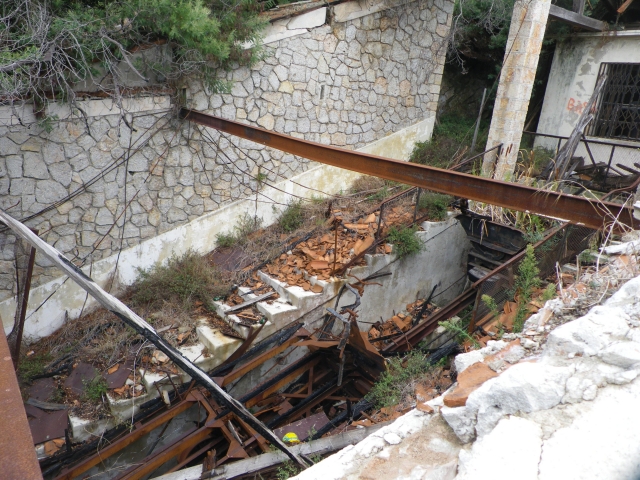
With developing road transport, the funicular began to loose money. Passenger numbers decreased and essential safety work could not be afforded. The funicular eventually had to close in 1966. The restaurant and observatory finally closed in 1986.
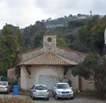
In 1989, the family of the Emir of Abu Dhabi bought much of the land at the top of the funicular. In 1993, they gained a building permit which included access to the funicular railway station by a private road. However, in 1994, the administrative court rescinded the approval. Since then, the whole site has remained in a derelict and abandoned state. The site gained heritage protection in 2001 and in 2009, some repairs were undertaken to the facade of the lower station to improve the visual amenity in its immediate locality.[5]
This picture shows the lower station as it is in the early 21st Century. The Observation Tower can be seen on the distant horizon at the top right of the image.
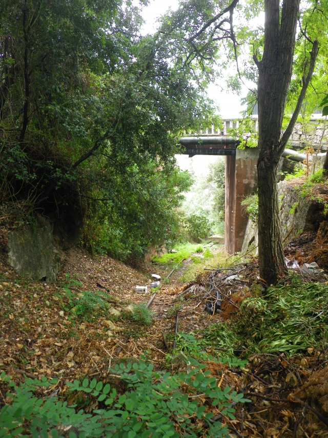
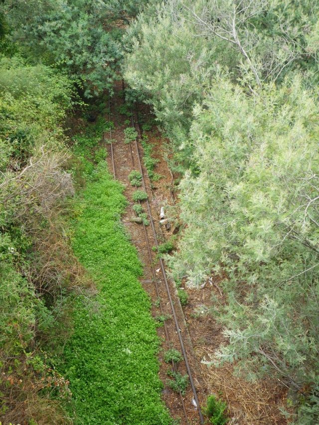
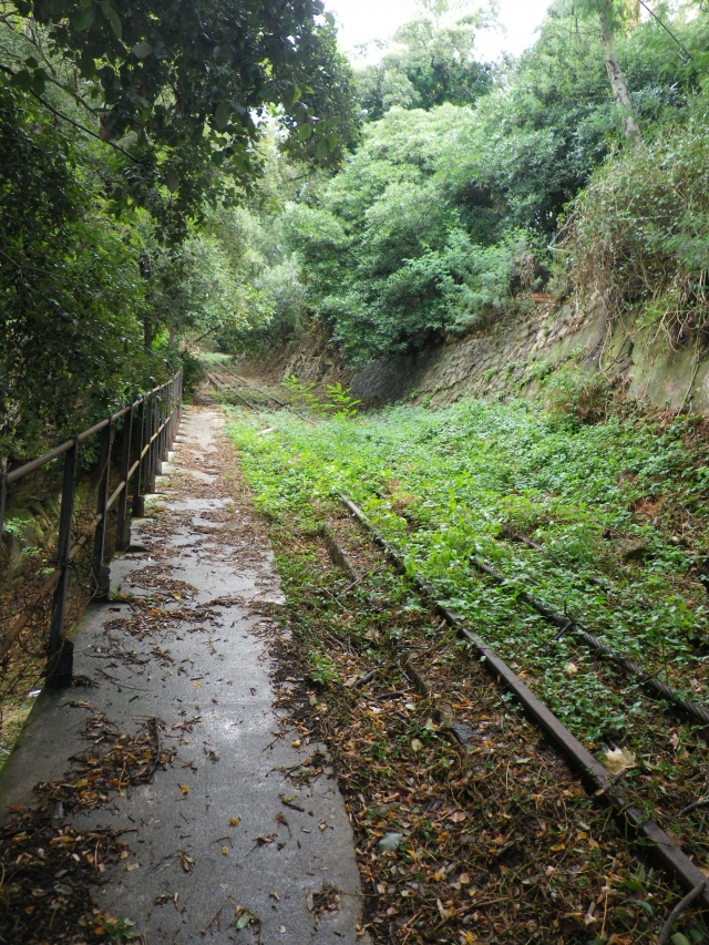
The images below show both pictures of the funicular in operation in the 1960s and its condition in the early part of the 21st Century. Included towards the end of the photographs are a series taken by RER C – Photographs on Passions Metrique et Etroite Forum in 2011. Below the photographs taken by RER C are a series of videos.
The following photos were taken in 2011.[8]
This post finishes with a series of links to YouTube.[9] They include 6 videos taken of the condition of the Super-Cannes funicular railway in the early 21st Century. The videos were uploaded onto YouTube in 2009 by Pierre l’ Antibois.
The first shows the lower station:
The second shows the rolling stock.
The third shows the drive mechanisms
The fourth shows the condition of the route of the funicular
The fifth shows the top station, the observatory and the resaurant
And finally, the 6th video shows the engine room.
References
Structurae, Super-Cannes Funicular; https://structurae.net/structures/super-cannes-funicular, accessed 1st April 2018.
Super-Cannes funicular, French Heritage monument to Cannes; http://en.patrimoine-de-france.com/alpes-maritimes/cannes/funiculaire-de-super-cannes-57.php, accessed 24th March 2018.
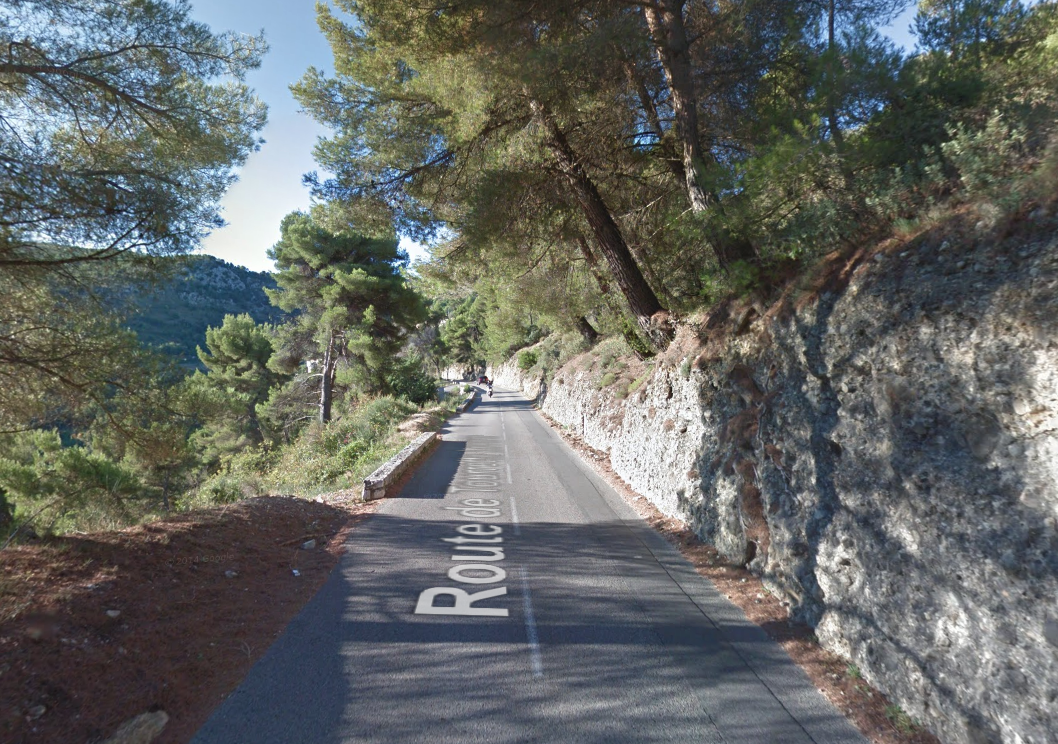
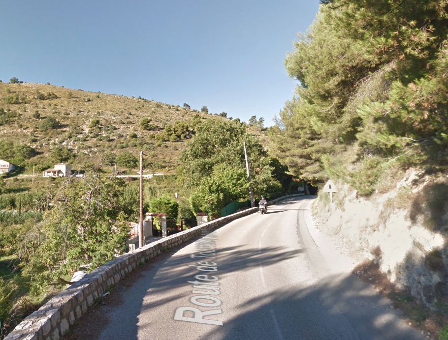
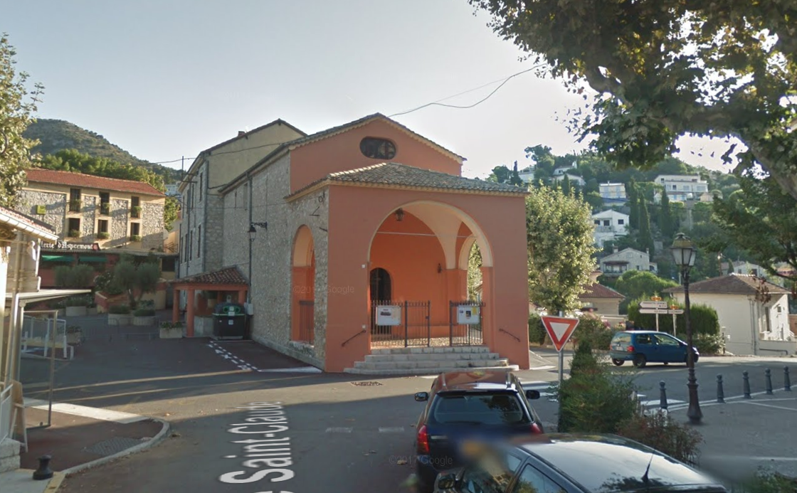
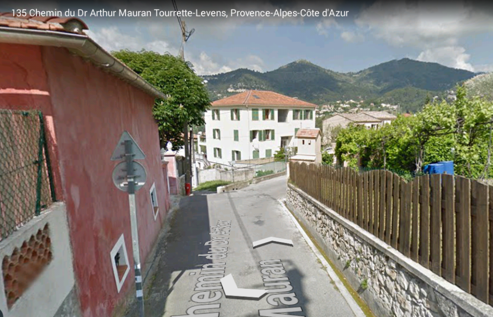
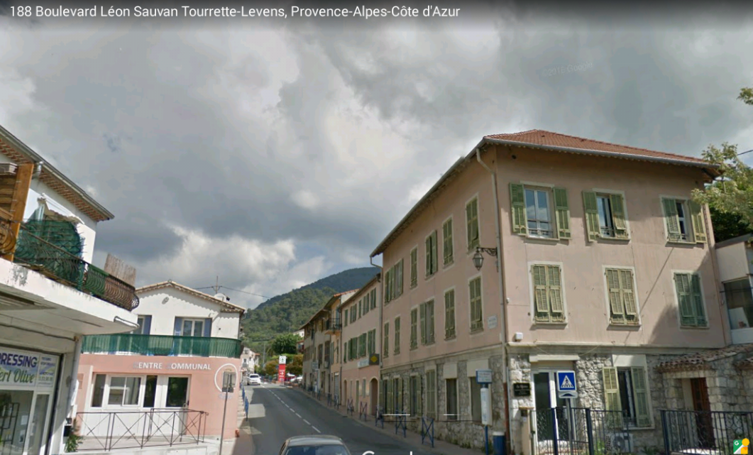
It brings us through the southern outskirts of Tourrette-Levens, past the perched village and castle on our right before joining Boulevard Léon Sauvan in the centre of the lower part of the village.
I drafted a blog a few years ago which focussed on the pinion expressed by others that the tramway found its way from Tourrette-Levens to Saint-Blaise before heading north to Levens, a route which requires quite a detour and a significant lengthening of the journey time compared with the more direct route along what is now the M19 to Levens. That blog can be found by following the link below:
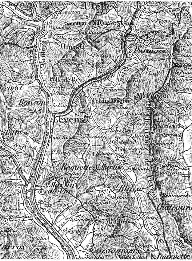
The featured image at the top of this blog is a copy of a map from the 1800s. Careful inspection of the image will show the purported route of the tramway between St. Blaise and Levens, marked as a road (or track) on the map. The quality of roads in the area at this time was poor. Images on postcards show that roads were little more than dirt tracks alongside the trams. When they were first installed the trams must have been a major step forward for transportation in Les Alpes Martimes. The possible route between St. Blaise and Levens is marked on Satellite images later in this blog.
Sadly, the planned route of the tramway between St. Blaise and Tourrette-Levens is much less clear. And analysis of satellite images does not provide a great deal of information about any possible route
I have come to the conclusion that the route via St. Blaise and Aspremeont was considered but never built. This is suggested by Jose Banuado[1] and By Jean Robert [2] as pointed out by 242T66 on the Passions Metrique et Etroite Forum[3].
So, in the sprint of all good railway modellers’ ‘might have been’ stories which support their layouts. Here is my might have been, for the route via Aspremont and St. Blaise. ……..
A ‘Might Have Been Tramway Route’ Between Tourette-Levens and Levens, via Aspremont and Saint-Blaise!!
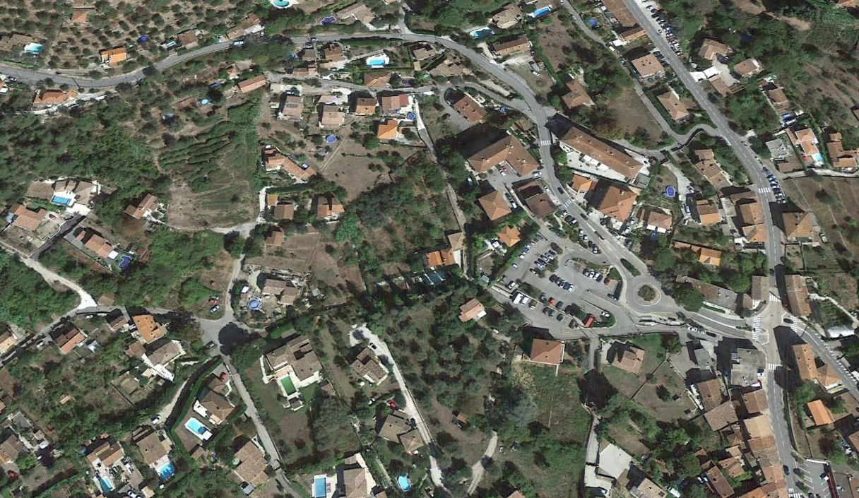
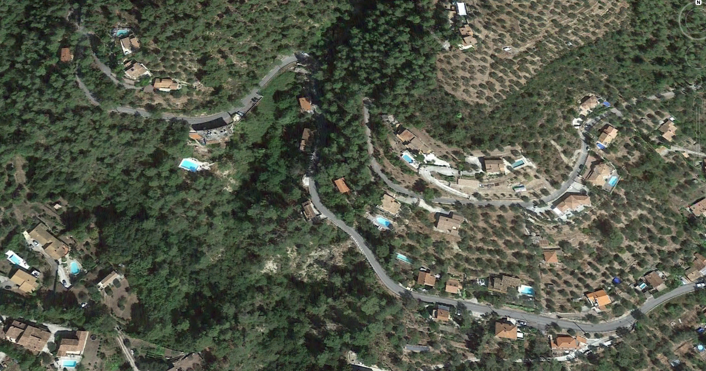
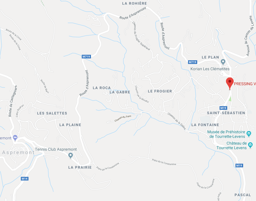
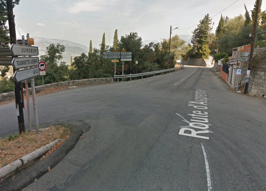
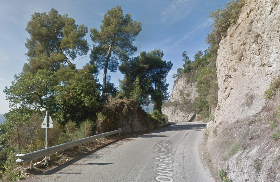
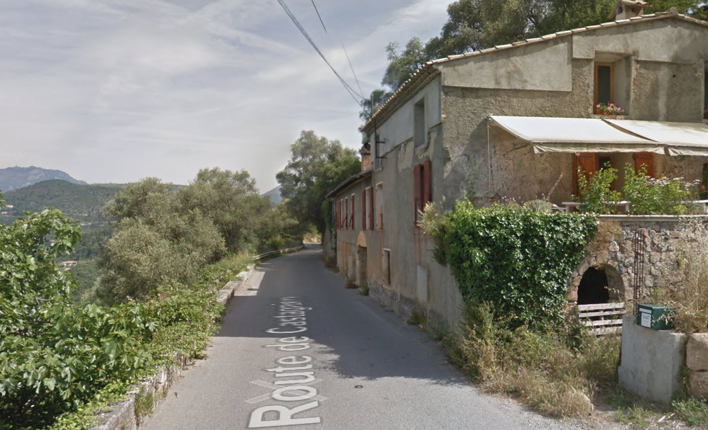
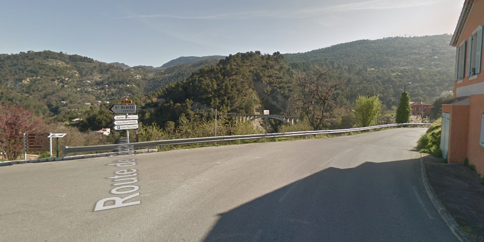
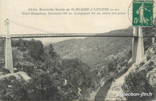
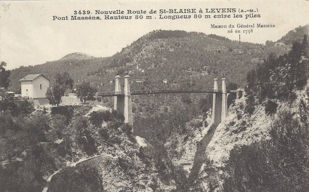
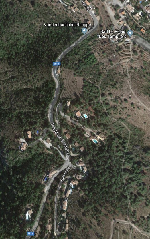
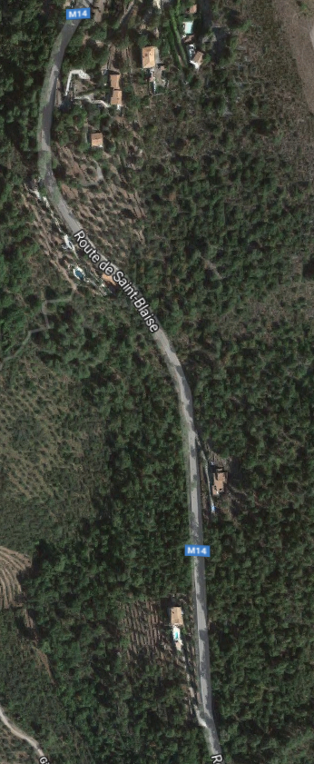
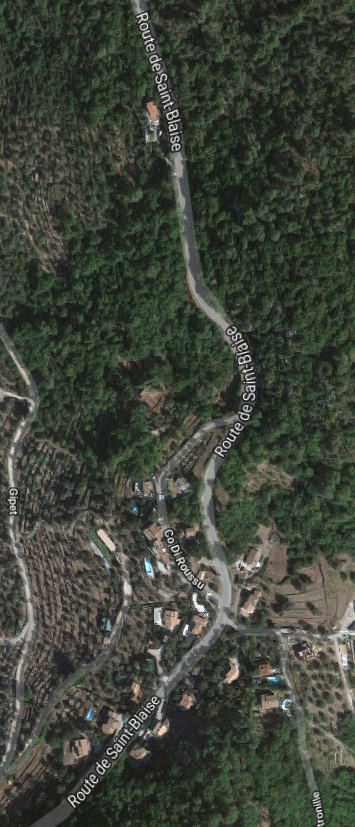
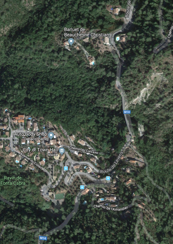
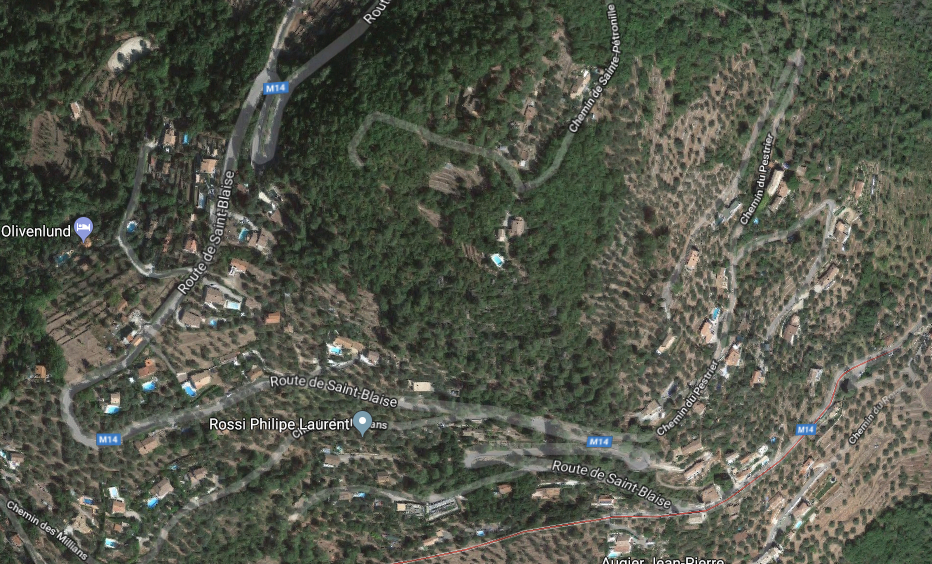
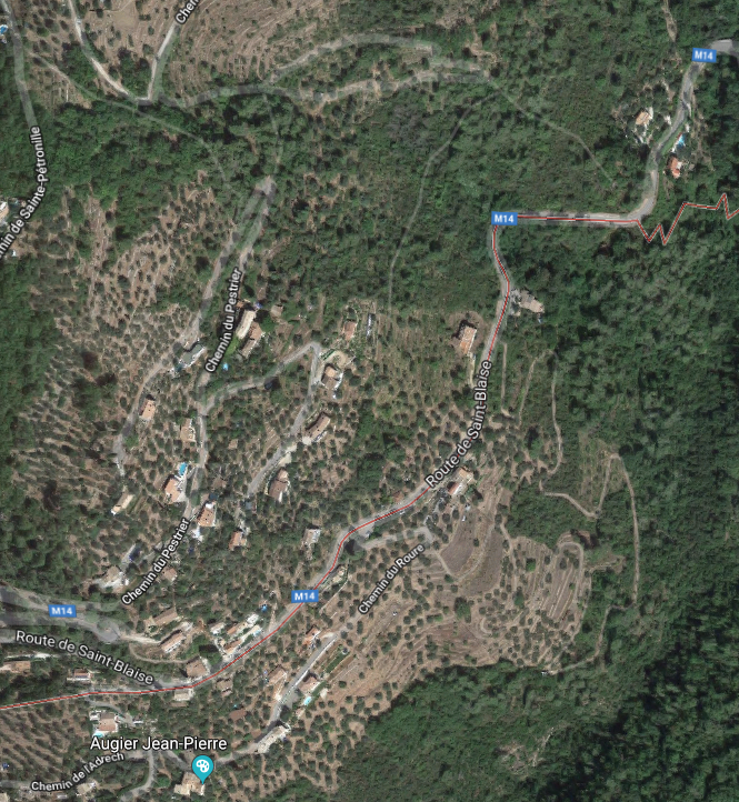
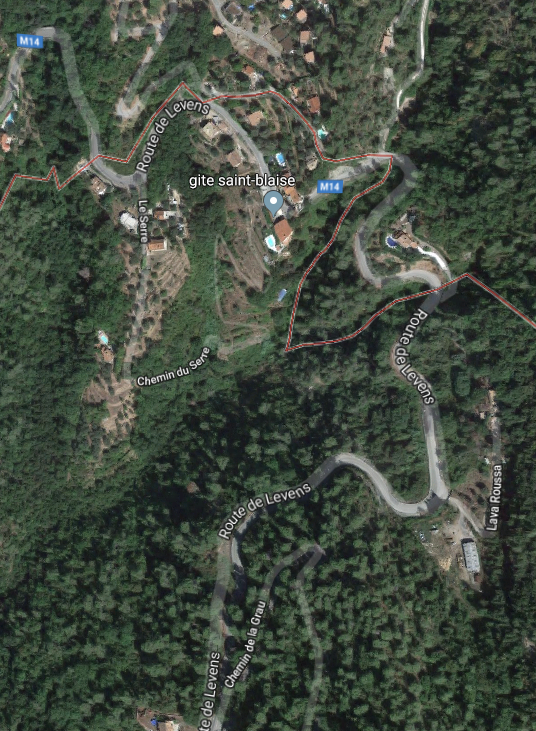
What might have been …………….. A relatively sharp left turn took the supposed tramway out of Tourrette-Levens towards Aspremont on what is now the M719. On the first satellite image below the junction can be seen middle-right and the rout heads up to the centre-top of the image before exiting top left. The two houses in the top-left corner of the image can be seen on the bottom-right of the following image, for a short distance the route travelled roughly in a Westerly direction before turning north to follow the contours around a small valley, then rounding a hillside before leaving the image close to the top-left corner. I ahve not been able to find any images which relate to the tram route between Tourrette-Levens and Saint Blaise and so am not able to be absolutely sure of the route, form this point on, however the lie of the land suggests that the tram will have followed what are now the roads linking Aspremont and Saint Blaise.The road out of Tourrette-Levens is named Route d’Aspremont (M719). It follows the contours as much as possible, to keep gradient shallow for the trams. The route shows clearly on the map below.Aspremont was approached from the East. The road running North to South narrows to not much wider than what would have been the formation of the tramway in the region of La Plaine and La Prarie above. The road, by now, is known as Route de Tourrette.The route then curves to the East to approach Aspremont.Aspremont is to the left of the satellite image below and the tramway route comes in on the right of the image just below centre. It approaches the perched village curving southwards before taking a hairpin turn in the market area of the village before heading northwards on the Route de Castagniers.On the image above, the trams from Tourrette-Levens arrived from along the road on the immediate right of the chapel and trams from Saint-Blaise (and Levens) arrived from the left of the picture. The route out of Aspremont is shown on the image below.Travelling north from Aspremont the tramway followed the Route de Castagniers high above the valley of the River Var on a ruling grade downwards towards the junction of the road to Castagniers and Saint-Blaise. The route continued approximately northwards, high above, the Var through La Loubiere and La Croix de Fer, still on a gently downward grade. At La Croix de Fer (below) the tramway turned away from the Var to head westwards towards Saint-Blaise.As the trams approached St. Blaise they were still running on a downward ruling grade and had to negotiate two hairpin bends as they approached the village. The tramway stayed above the village itself heading for what was in its day a suspension bridge carrying the route over the valley of a fast flowing tributary of the River Var. The replacement bridge can be seen in the google streetview image below.The original bridge was an 80 metre long suspension bridge just outside St. Blaise. Built for the tramway in 1908, it also carried the St. Blaise to Levens road. This graceful suspension bridge was destroyed during the Second World War.The replacement bridge was not built until 1953, by which time, in this scenario, the trams were long gone!After crossing the Pont de Massena the trams headed along the M14 towards Levens. In our imaginary scenario, these next few satellite images show the route from Levens to St. Balise to meet up with the Pont de Massena.
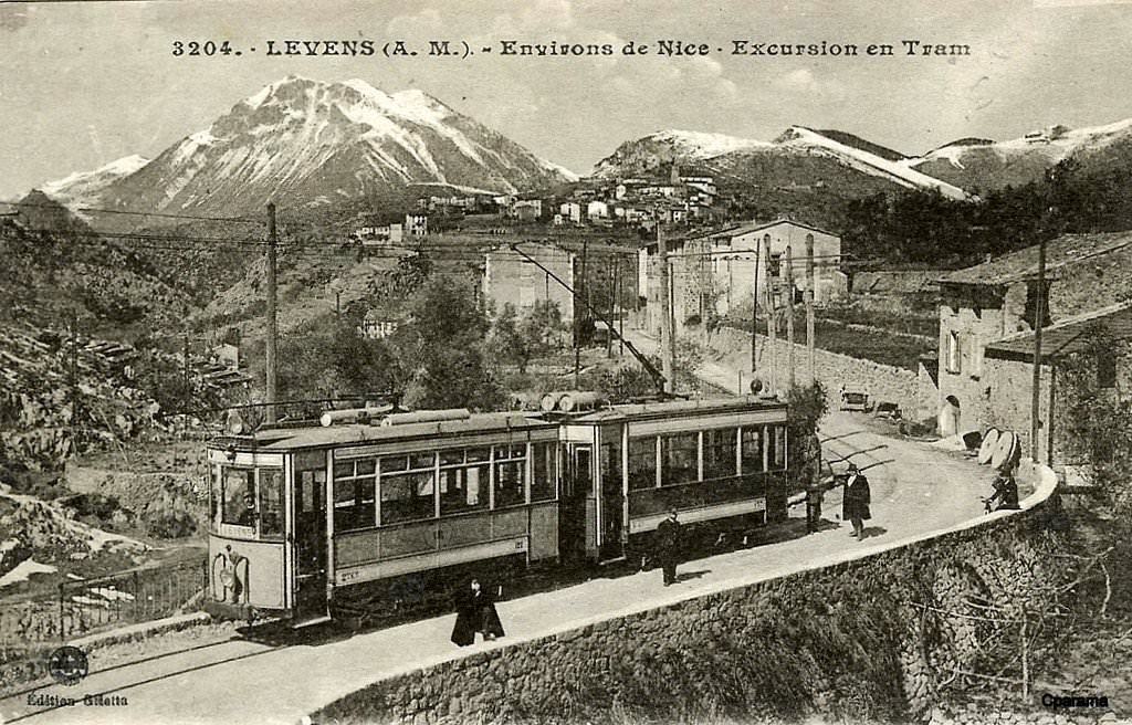
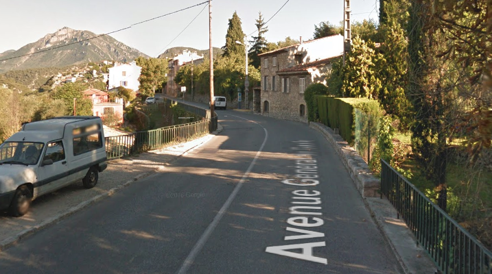
In this scenario, the tramway left Levens on the road now called the Avenue General de Gaule and then turned right onto the Route de Saint-Blaise (M14) and then followed that road all the way to Saint-Blaise.
Please note,again, that the description in italics above and the images which go with it are of an imaginary, “might-have-been,” route of the Levens tramway. Ultimately, this “might-have-been” scenario, is supported, primarily, by just two things. The suspension bridge at Saint-Blaise, shown some distance above, and the profile of the possible route through the Village of Saint-Blaise.
The Actual Tramway Route Between Tourette-Levens and Levens, along what is now the M19!!
I hope the text above has not confused you too much! It is a “flight-of-fancy” based on a few sources which I used when looking at the route back in late 2017 while on holiday in Nice. I think some lengths of the road, and probably the suspension bridge were built with an alternative tramway route in mind. But the tramway was never built.
The actual tramway route followed what is now the M19. According to the works of Jean Robert [2] and José Banaudo,[1] the tram to Levens did not pass through Saint Blaise but followed, mainly on the shoulder of the M19, sometimes on the road and also a few kilometres on an independent formation. The route travelled through Moulins-de-Tourette, Tourrette-Levens, Laval and Ste Claire, to end at the place called Les Traverses, below the village of Levens. The line was put into service in June 1908.
An extension of one km was under construction towards Levens-Village in 1914, but the works were delayed and then suspended by the war and, despite some sort of recovery after the war and the construction of a 95-m-long tunnel in a semicircle the permanent way was not laid and the extension was never opened.[3]
242T66 comments about the Masséna suspension bridge at Saint Blaise: “it dates from 1911 and was destroyed by bombing in 1944. Since 1953 it is replaced by a concrete bridge with a large arch. Given that an itinerary had been planned to pass the tram through Aspremont, Castagniers and St Blaise, which would have served a larger population but at the cost of a longer and more expensive line than that of the valley, it is possible to think that the road from St Blaise to Levens and the suspension bridge had been made with the idea of being able to pass the tram.”[3]
So, back to Tourette-Levens, and this time no flights of fancy!
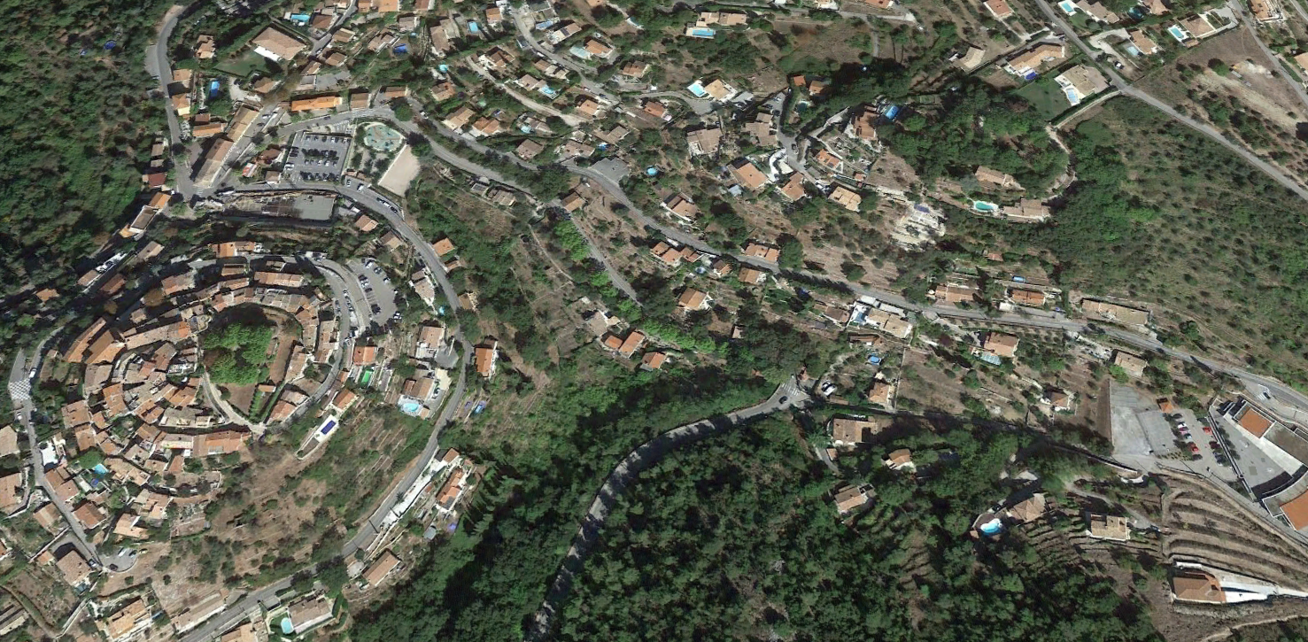
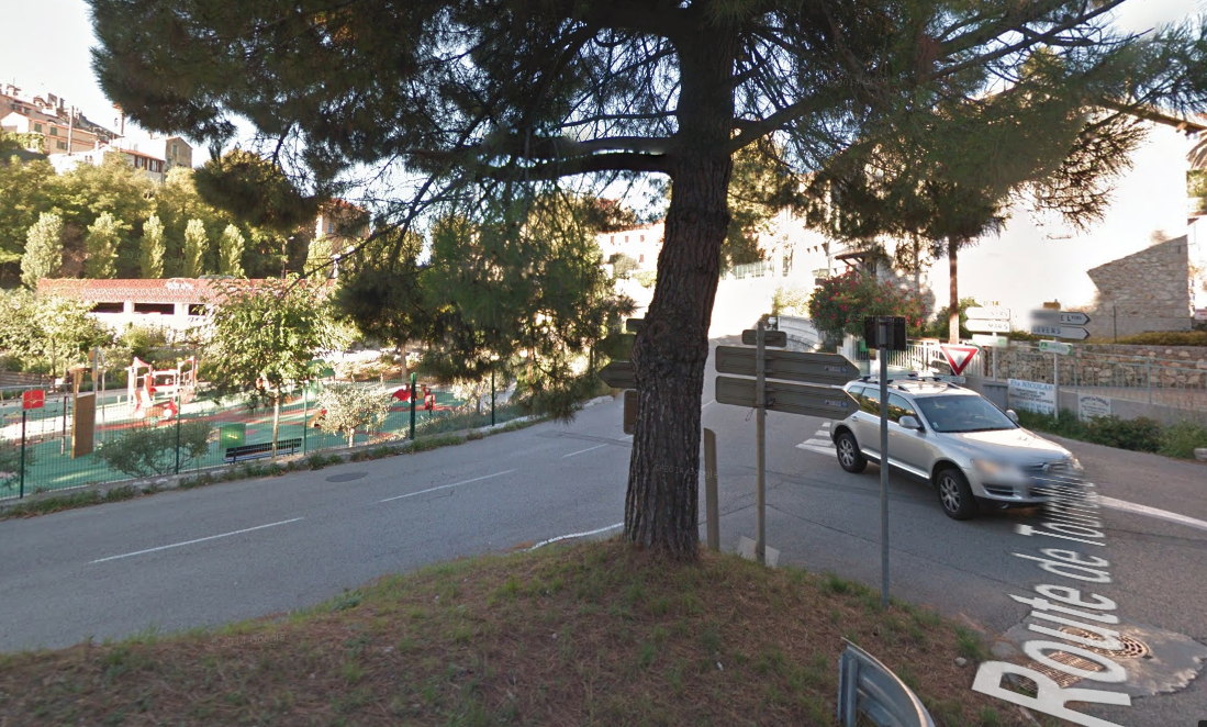
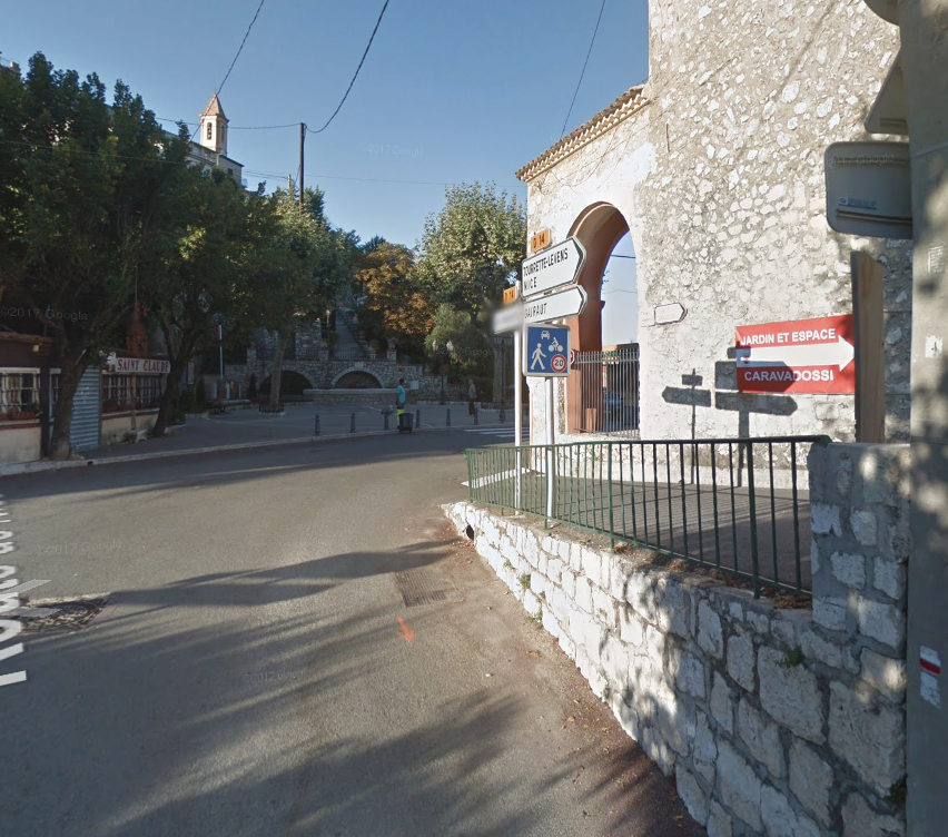
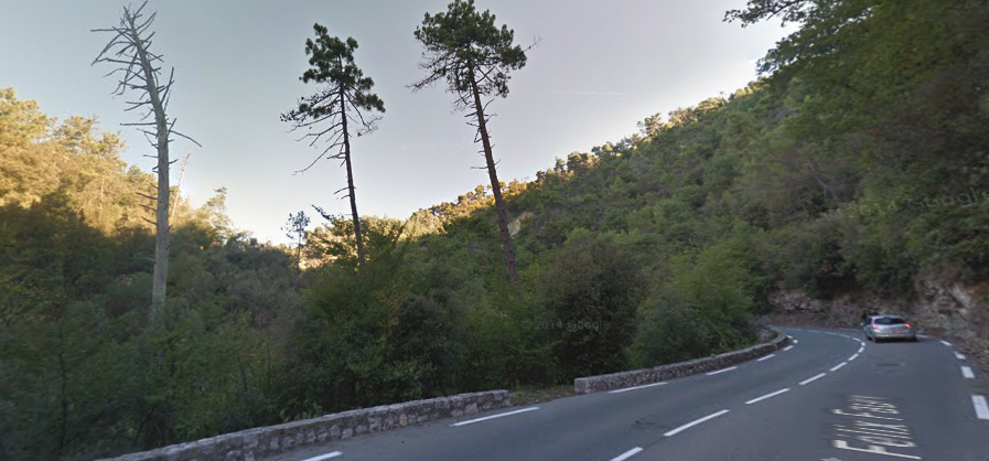
The station at Tourrette-Levens was on Boulevard Léon Sauvan in the centre of the lower part of the village. As trams left the centre of Tourrette-Levens they followed the present M19.
The road and the tramway swing sharply away to the East after leaving the northern edge of Toureete-Levens.
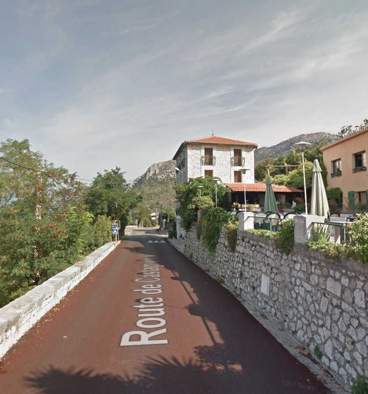
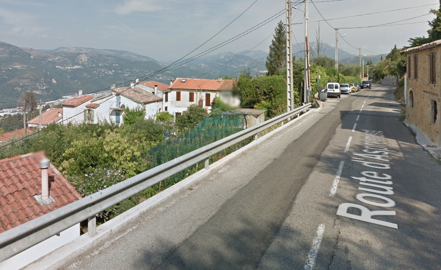
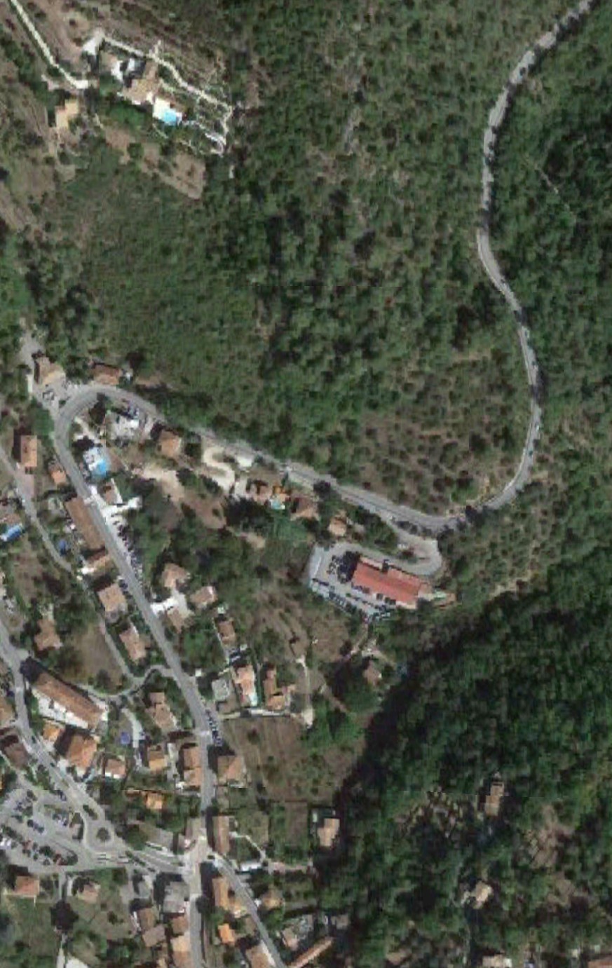
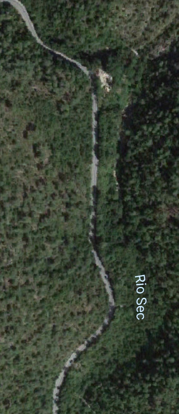
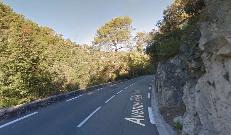
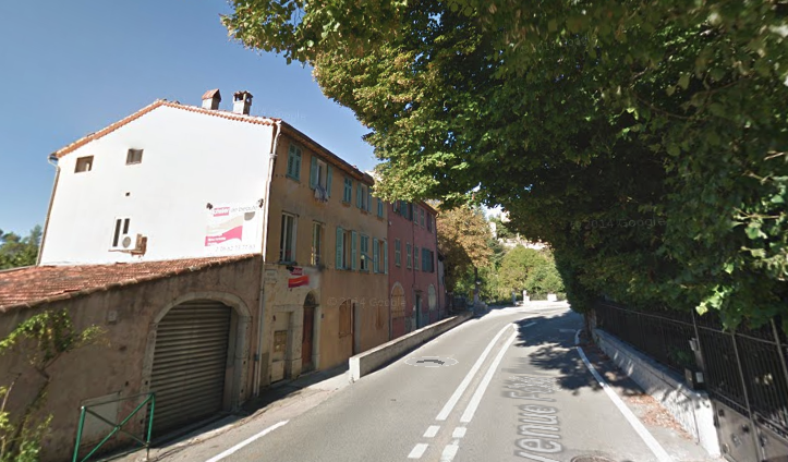
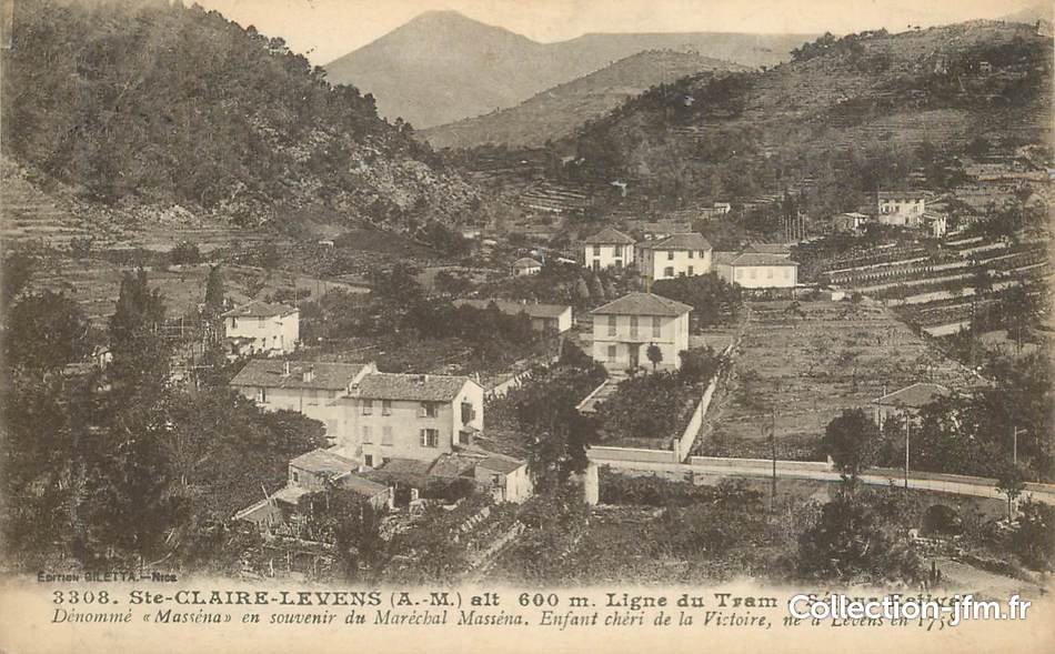
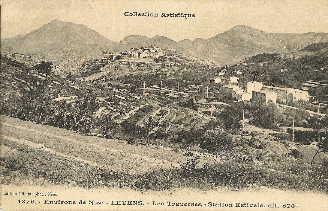
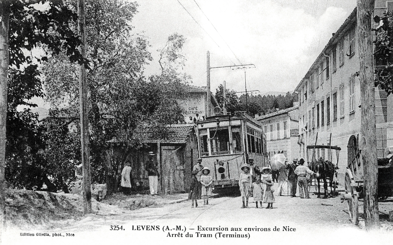
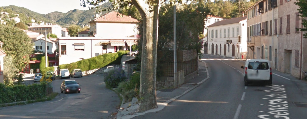
The M19 is known as the Avenue du Canton de Levens and swings north as it meets the valley of the Rio Sec. It runs high above the river in the valley below. It then crosses the river and travels on its North-East bank, towards La ColumbierLe Plan d’Arriou, below, is followed by Le Columbier.The route continues along the M19 towards Levens through Laval and closely following the North-East bank of the Rio Sec, along the Route de Levens and then Avenue Felix Faure before entering the area of Saint-Claire (the third image below). As Avenue General De Gaulle stretches ahead of us we atart to pass thorugh the locations of early 20th Century images. The first is of a tram in the snow.In the modern image, there is no snow, the trees are planted approximately in the line of the tramway and, of course, the roundabout is new!This next pair of images are difficult to tie together but the bend in the road in the modern image correlates to the bend in the centre of the older postcard. As can be seen in the old postcard the tramway was separated form the untarmacked (dirt) road by a small kerb, and the road was only wide enough for one vehicle.Just round the bend, in the modern image above, we reach the location of this next postcard which is well composed with the tram in the foreground in front of the small hamlet with Levens sitting nicely under the hills beyond. The modern image below shows the same location in the 21st Century. The railings and buildings tie down the location, the trams are long-gone and the road is now a much more substantial.The postcard above shows the road/tramway coming in from the right towards Les Traverses and heading towards Levens in the background. Trams continued along the road towards Levens, through Les Traverses and on towards Saint-Roch where they terminated in the valley below the village of Levens.The Saint-Roch terminus is shown below.Again the modern image approximates the camera position from the postcard as best can be. It was always intended that this terminus of the tramway should be temporary. The promoters planned to access the centre of the village of Levens and work was well underway at the advent of the Great War. That conflict resulted in all works being placed on hold, despite most of the infrastructure being in place. The buses now follow the planned route for the trams from Saint-Roch to Levens Village.
Trams reached Levens (Saint-Roch) in 1908 – work had started on the line in 1906. It was abandonned by the mid-1930s. Throughout the life of the service, there was only limited take-up of the service by the public, three trams ran each day in each direction along the full length of the route, supplemented by some partial services.[4]
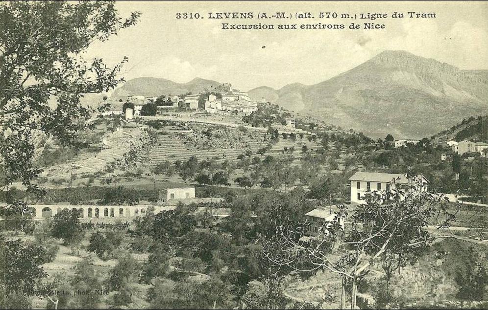
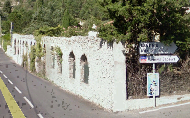
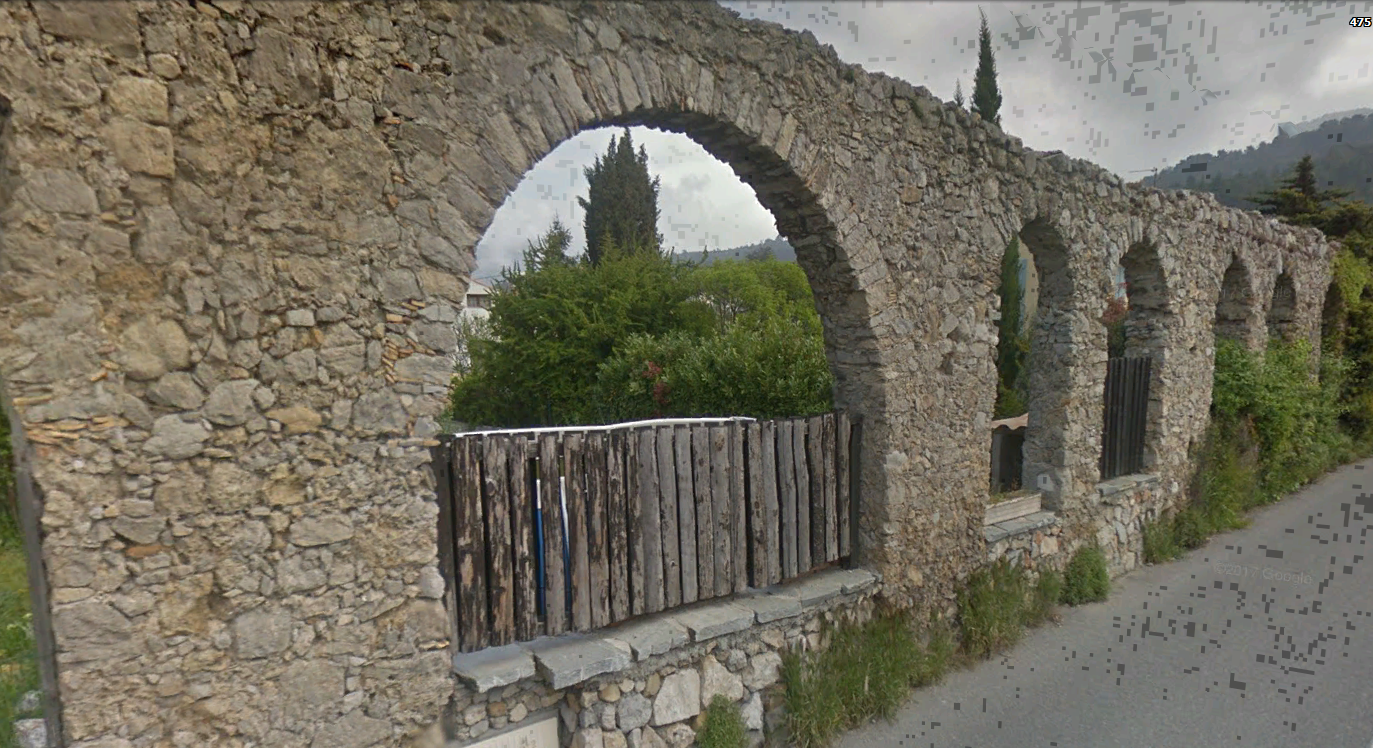
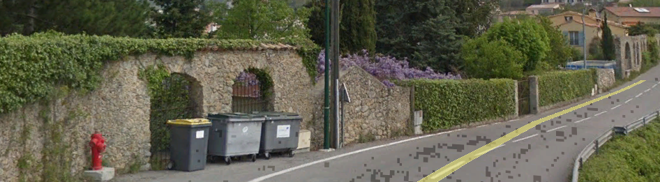
Two interesting views came to light while looking at images of Levens for possible evidence of the route of the trams. Both seem to show a viaduct or aqueduct.Some discussion about these images on Passions Metrique et Etroite resulted in what is now little more than a garden wall with arched openings being found on the Route de la Roquette.So, is it just that, or is it the remains of an ancient aqueduct. In the postcard images it seems more substantial than in the google earth images from 21st Century. What is it?
References
Jose Banuado; Nice au Fil du Tram Vol. 2, Les Editions du Cabri, 2005.
Jean Robert; Les Tramways de Nice et de la Côte d’Azur, 1988.
242T66; Passions Metrique et Etroite Forum; Archéologie Ferroviaire, les TAM; http://www.passion-metrique.net/forums/viewtopic.php?f=2&t=8464&start=60, 26th March 2018.
The Nice to Levens Tramway was part of the TNL (Les Tramways de Nice et du Littoral) and full details of the network can be found on my blog at the following link:
The line to Levens was an extension of the line from Place de Massena to Saint-André-de-la-Roche – Ligne 14 of the network in Nice. Trams for Levens were numbered 30.
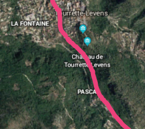
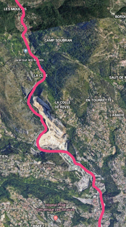
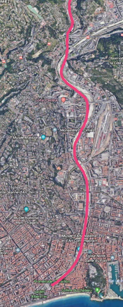
The lower part of the route is highlighted on the Google Satellite images here. This covers the length from Tourrette-Levens to Nice (or vice-versa) and is in three parts, the first image shows the length immediately north of Les Moulins. The second, the length south of Les Moulin’s through the present day quarries north of Saint-André-de-la-Roche. And the final length covers the route from Saint-André-de-la-Roche to Place Massena. Place Massena is just visible north of the coast at the bottom of the last image above.
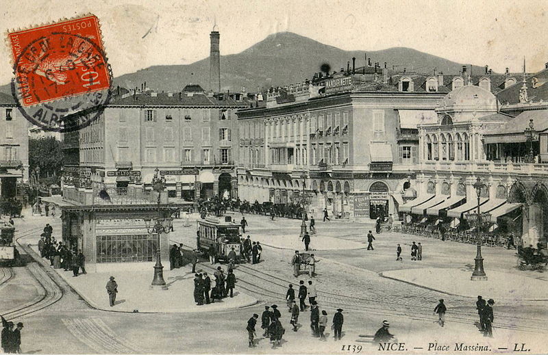
Our journey on the tramway starts at Place Massena in Nice.
Trams for Levens left Place Massena along the road at the centre-rear of the postcard image above. Rue Gioffredo heads to the right in front of the shop buildings at the rear of the square. Trams then turned right onto Boulevard Carabacel and left onto Avenue Gallieni, before heading out of Nice alongside the River Paillon on Avenue de Marechal Lyautey and Avenue Joseph Raybaud.
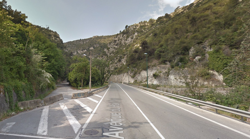
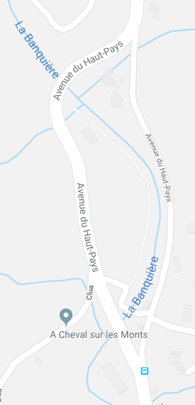
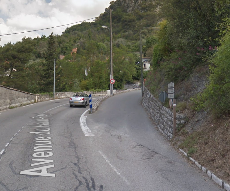
The tram route left the River Paillon on the line of the M19, Quai de La Banquiere which then becomes first the Route de Levens and then the Avenue du Haut-Pays. The following images give an impression of the route, although it must be born in mind that the quarrying enterprise north of Saint-André-de-la-Roche has expanded considerably in recent years.
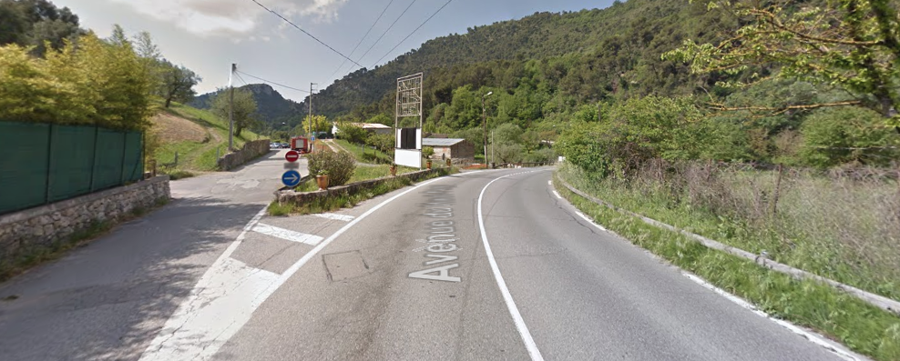
There were small deviations in the route of the tramway from the modern M19, although most of these were very short, only a matter of a few metres, and were usually the result of engineers seeking a path for the wider, newer road. This is true at La Clue, shown above.
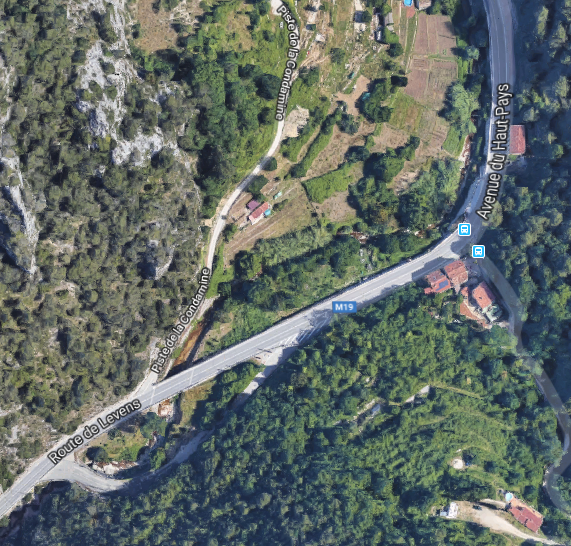
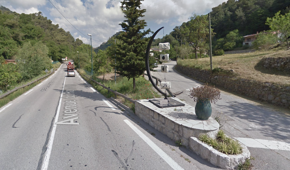
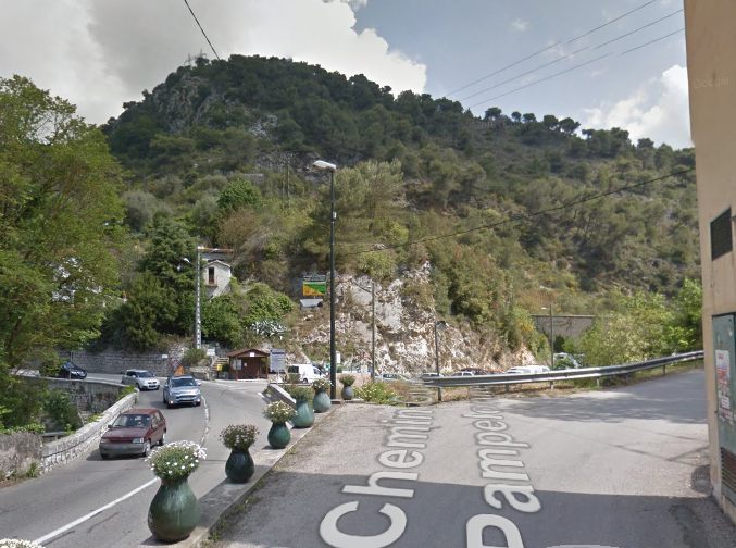
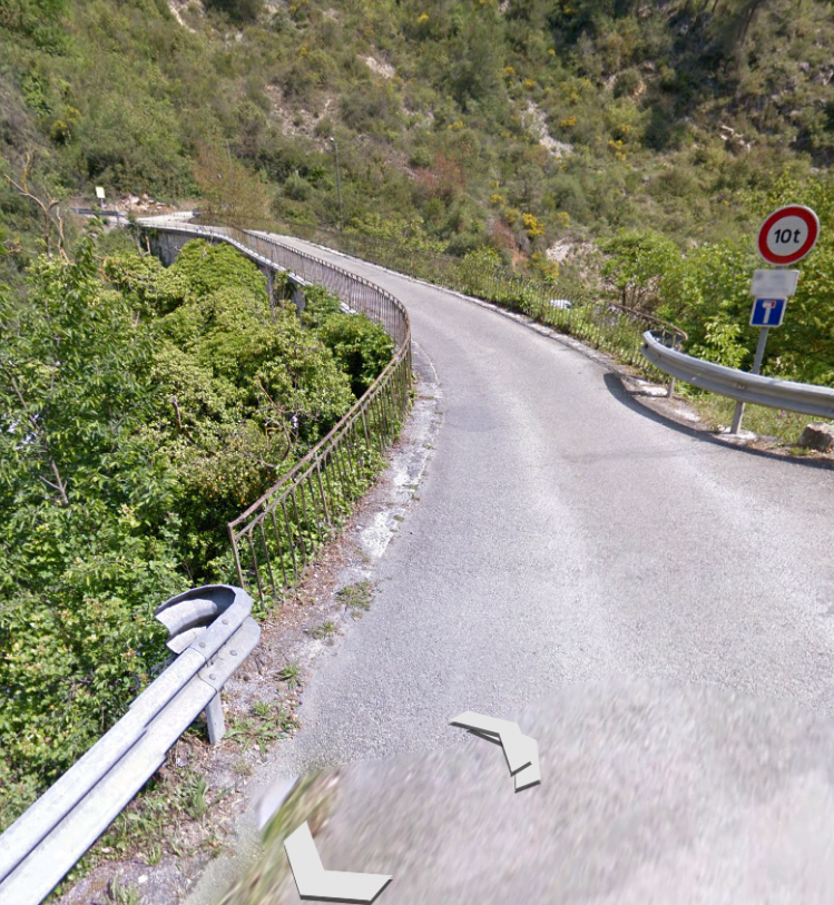
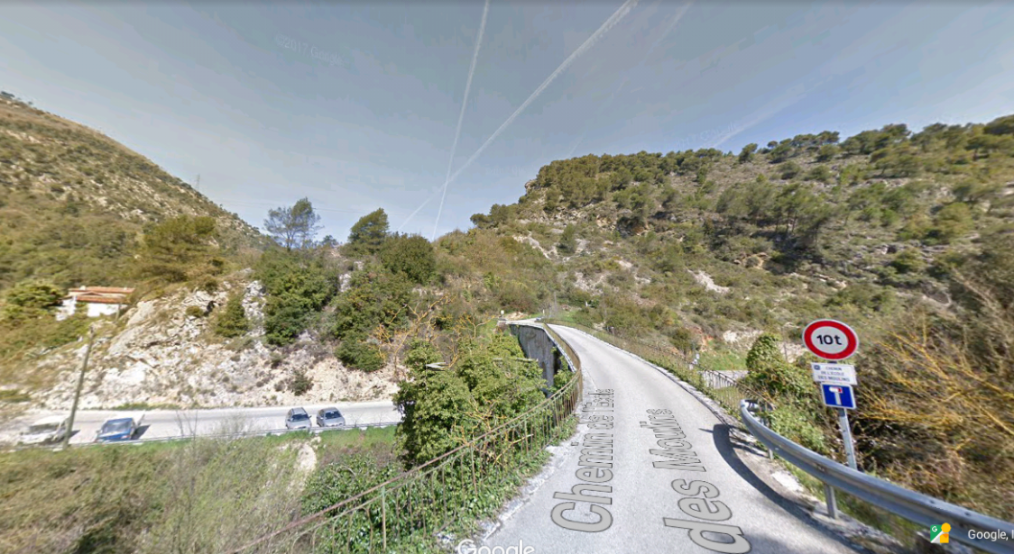
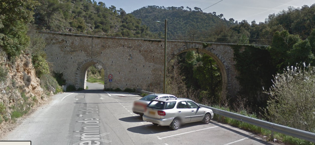
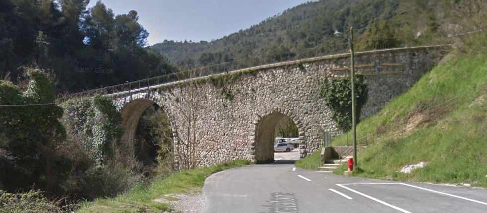
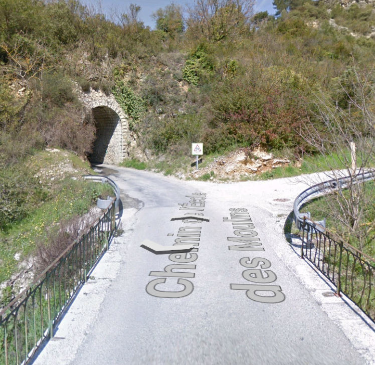
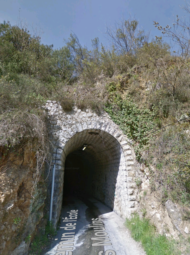
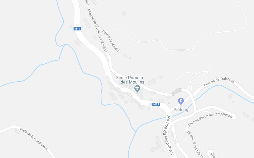
The first ‘significant’ deviation that I can identify, away from the line of the main modern M19 is shown on the adjacent map. The Avenue de Haut-Pays splits either side of the River Banqiere over a short distance. The newer, wider road is to the West, the older road which follows the route of the tram is to the East of the river. When the trams were in use the road surface would not have been of the highest quality and the roads were still relatively narrow. The picture below shows where the two roads named Avenue de Haut-Pays split. The bus stop shown on the map is on the right of the picture. There was inadequate room to widen the old road at this location, so a new road was built along with two new bridges over the River (La Banquiere).This next picture shows the point where the modern M19 rejoins the older and narrower road/tramway.The tramway approached Les Moulins on a steady grade before branching off the lower road through the village and crossing a tributary of La Banquiere (Ruisseau de Rio-Sec) at a higher level. These next pictures show the tramway formation leaving the main M19 road along what is now called Chemin de l’Ecole des Moulins.The bridge over the Ruisseau de Rio-Sec also crossed the road up the valley – Le Chemin de Tralatorre. Immediately after crossing the valley the tramway entered a tunnel which took it back into the main valley of La Banquiere above the village of Les Moulins.The route, including the viaduct and the tunnel, appears clearly as Chemin de l’Ecole des Moulins on the map below.
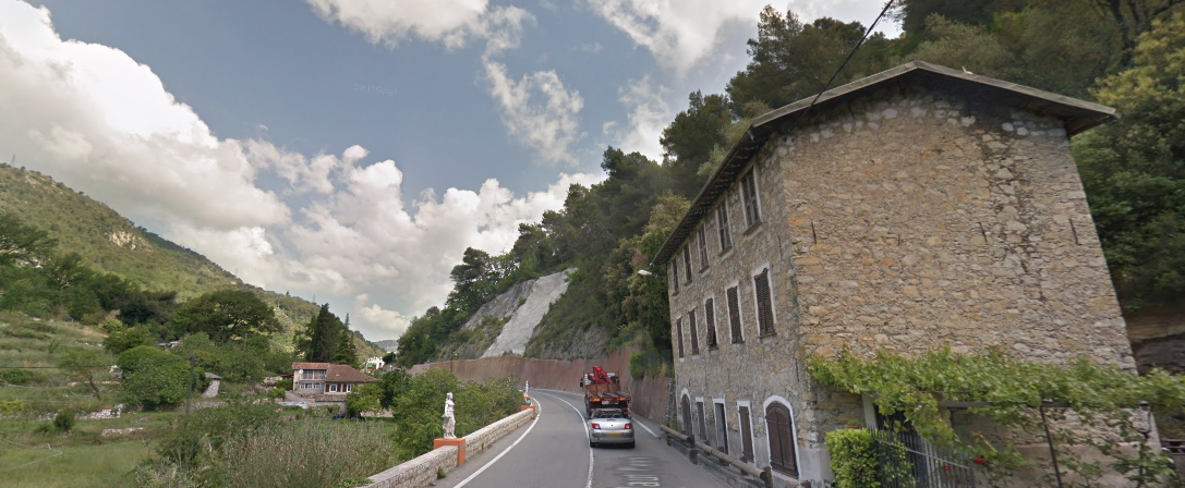
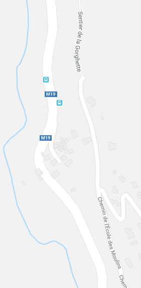
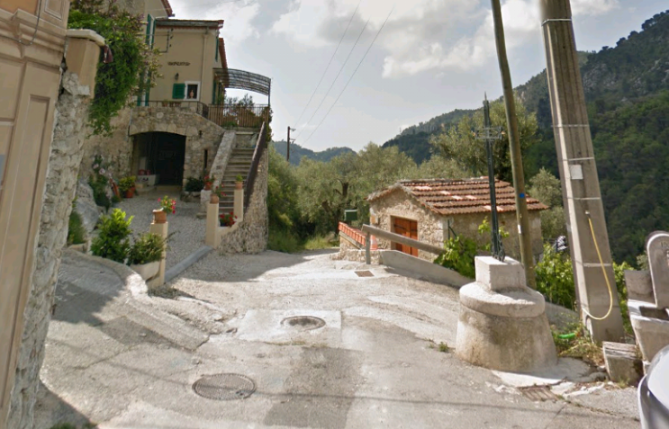
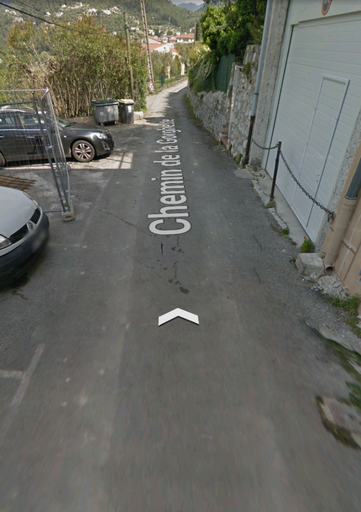
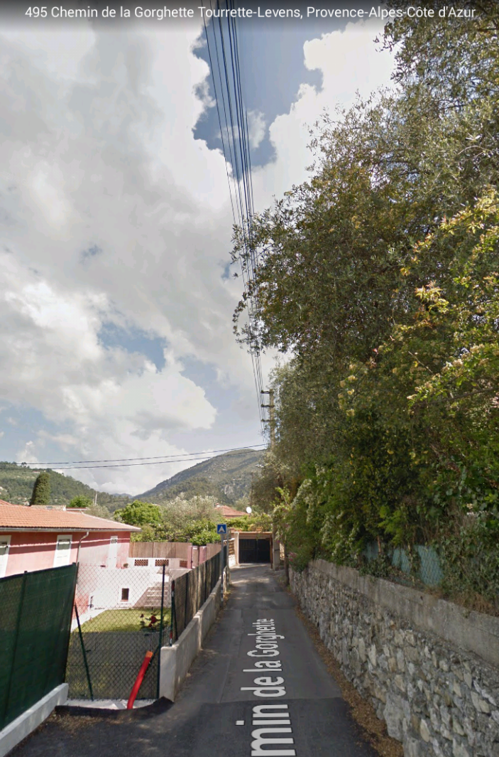
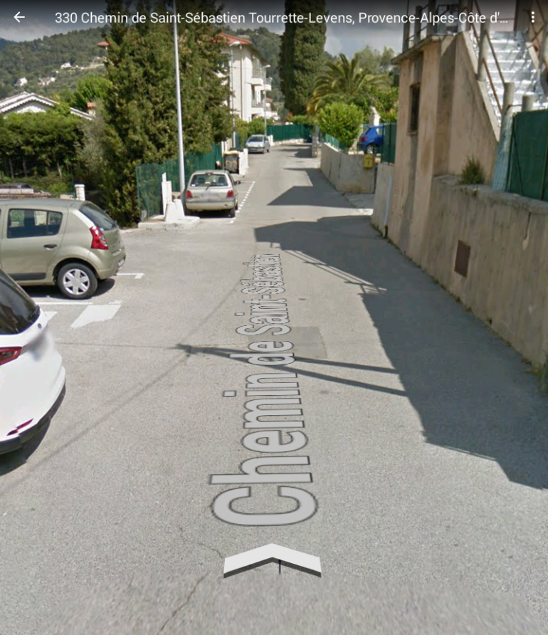
The tramway remained above the valley floor, first following the Chemin de l’Ecole des Moulins and they a footpath which is now named Sentier de la Gorghette until it reached what are now the outskirts of Tourrette-Levens. The map above and that alnogside these notes shows the route. The images below show the same length of road directly above and to the East of the main M19.
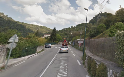
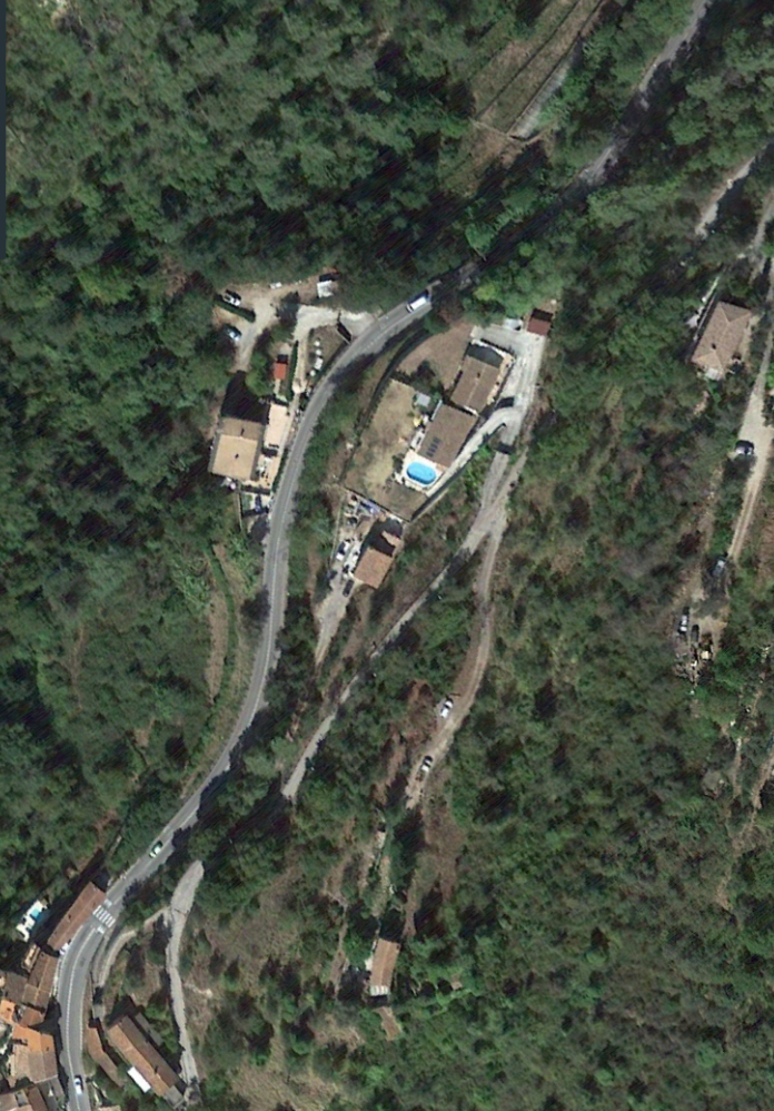
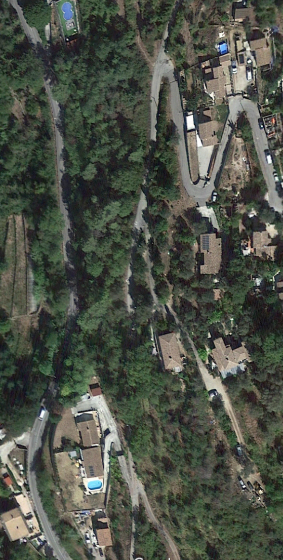
The satellite images travel in sequence from the south to the north, starting at Les Moulins and heading towards Tourrette-Levens. The swimming pools evident on these satellite images would not have been present when the tramway was in use and there would have been far fewer buildings hidden in the landscape.
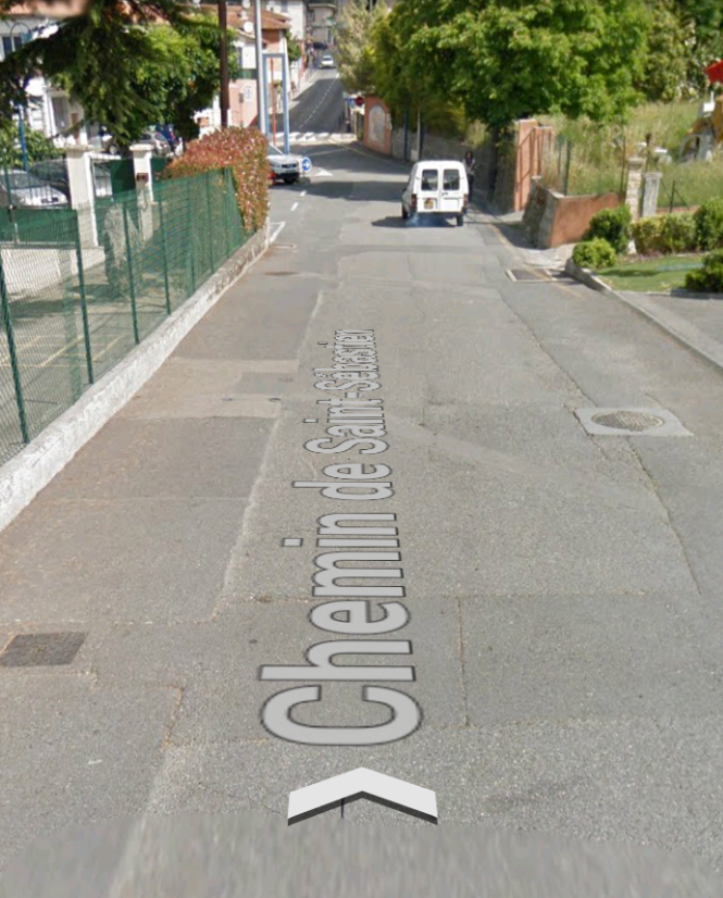
The last in the next sequence of images is not a satellite image, rather it shows the point at the edge of Tourrette-Levens today where the tramway entered the town. The camera is facing approximately southwards looking down the Sentier de la Gorghette.
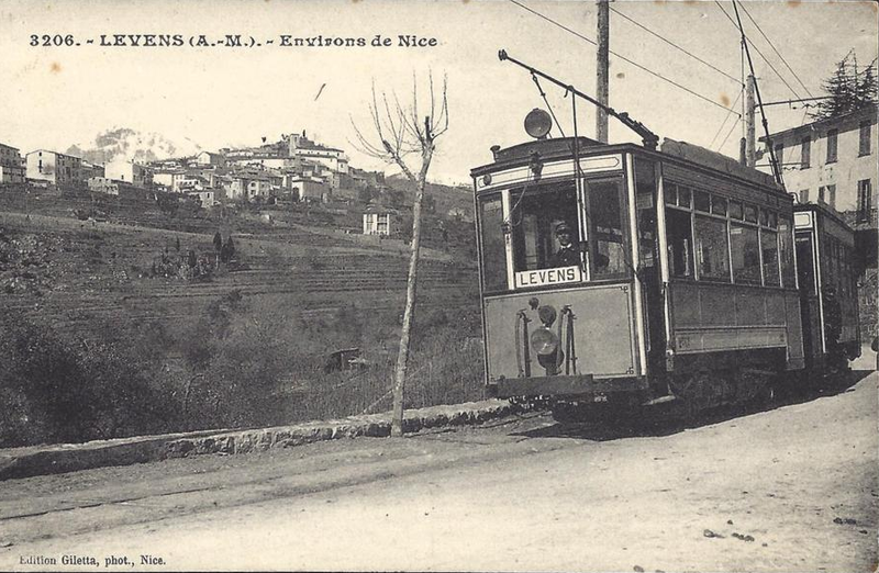
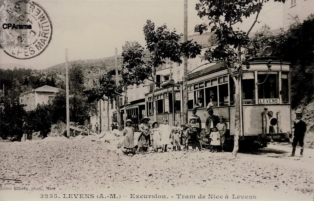
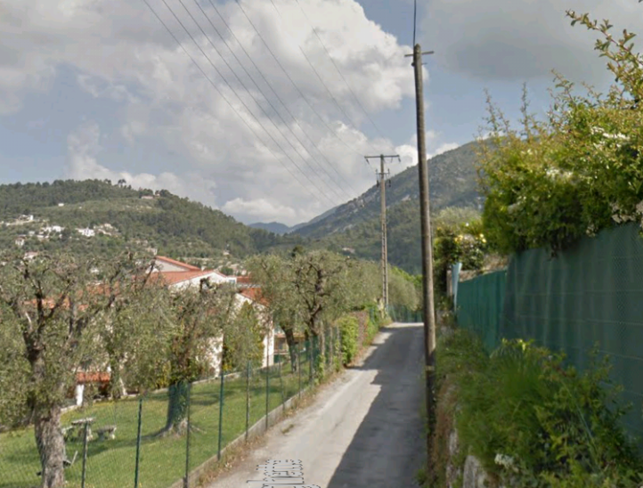
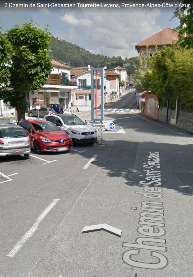
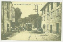
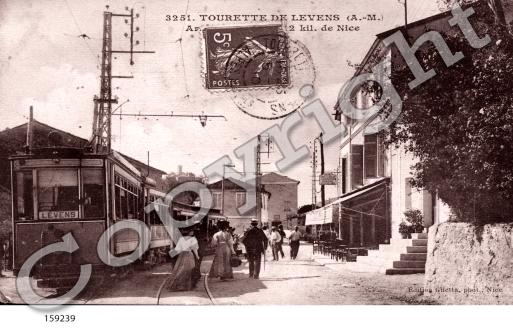
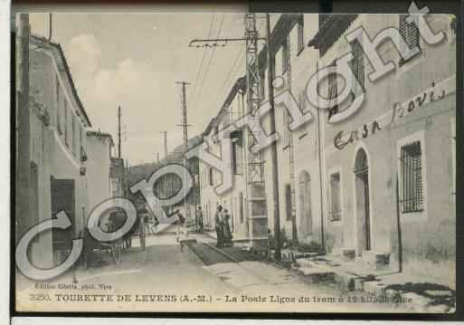
Turning to face north once again, this next view looks down the line of the tramway towards Tourrette-Levens. Subsequent images take the tramway down into the village.In Tourrette-Levens, we have a few pictures of the tram/tramway while it was in operation. The first image is very small, but it shows a tram on the main street (now the M19) of the village, Boulevard Léon Sauvan. The image below shows a tram bound for Levens sitting at the stop in Tourette-Levens. The fact that trams were able to pass at Tourrette-Levens is evident in the presence of two sets of rials which created the passing place. The image bears a copyright stamp from the Retro Photo Catalogue.[1] The image which follows that also bears a copyright stamp but is from Cartes et Patrimone.[2] The full details of the sites which hold the copyright are shown in the references below. The two images are from the same series of copyright free postcard images from the turn of the 20th Century. They are numbered sequentially, 3250 and 3251 and probably come from the camera of the same photographer. (I’d appreciate any details that readers can provide).
The route of the tramway continues from Tourrette-Levens towards Levens. This was one of the routes which drew my attention some years ago because it seemed to follow a far more difficult route to Levens than the present road. My first stab at a blog on the line from Tourrette-Levens to Levens can be found on this link:
I hope that link provides a taster for the next post (part 2 of this journey) which will hopefully provide more details about the route of the tramway between Tourrette-Levens and Levens.


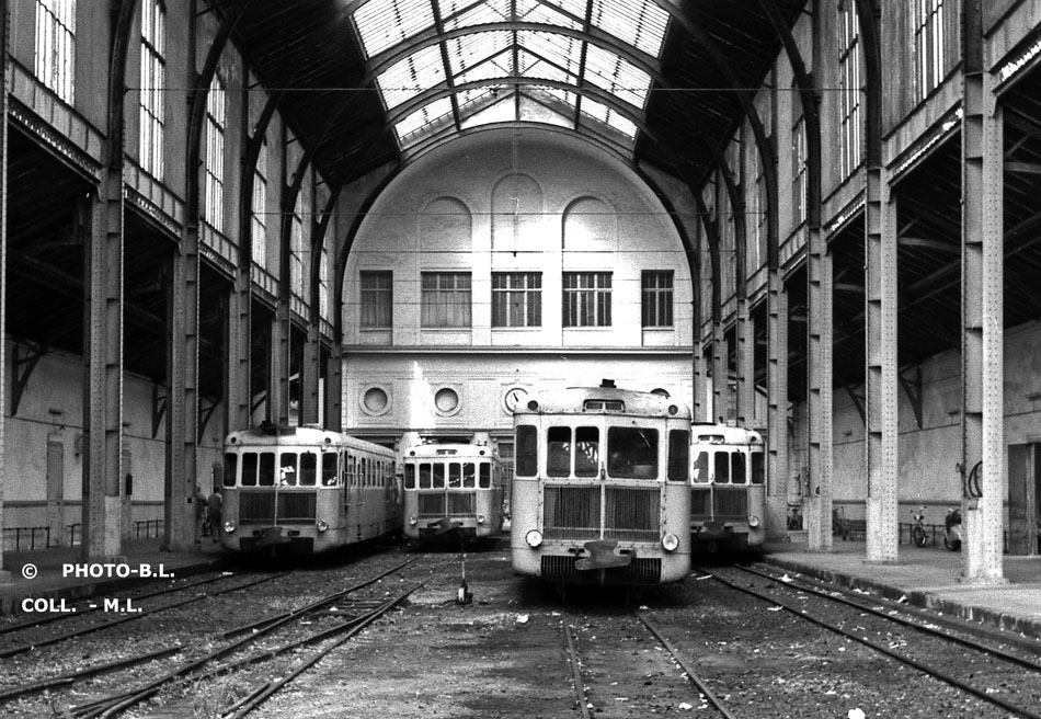


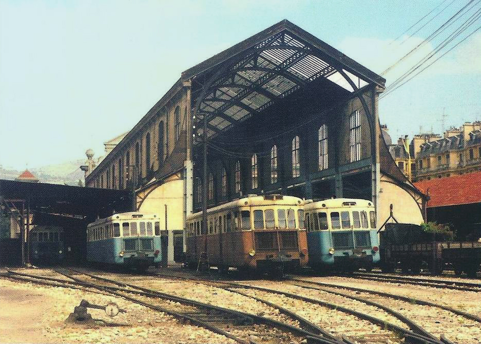
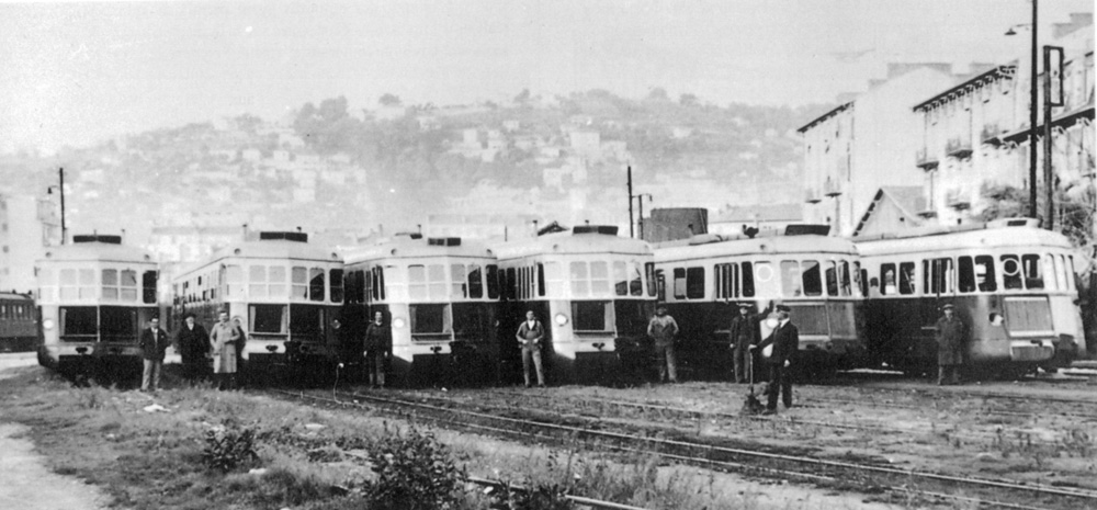


 Nice – 1969 – Remarkable view of the atmosphere of the Nice train station and its depot with a host of Billard railcars having just been recovered on various CFD lines coming to close. On the left, we can also see two ABH. © JH Manara.[22]
 Nice – 1983 – note the imposing height of the train-shed, the three railcars and the recution of the lines in favour of car parks that will soon take over the entire site! © JH Manara.[22]


 Drawing by Jean Francois Laugeri


 The replacement bridge was not built until 1953, by which time, in this scenario, the trams were long gone!
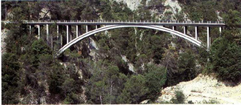
 There were small deviations in the route of the tramway from the modern M19, although most of these were very short, only a matter of a few metres, and were usually the result of engineers seeking a path for the wider, newer road. This is true at La Clue, shown above.
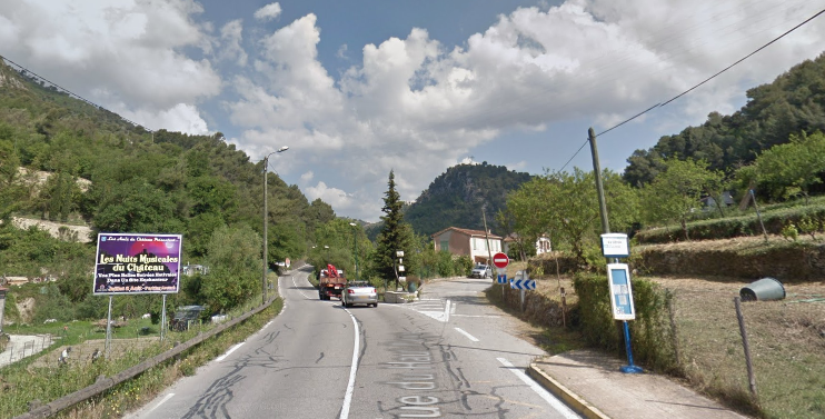

