This post continues a series of reflections on the tramway network in and around Nice which are primarily based on Jose Banaudo’s French language book “Nice au fil due Tram Volume 1: l’Histoire” [1]
Jose Banaudo’s excellent book on the Trams of Nice is sadly not available in English. This series of posts seeks to translate the text of the book for an English audience.
A more general impression of Nice in the War Years can be found on the Calameo website. [2] An English reader will require translation software or a good knowledge of French.
The Difficult Years (1935-1944)
Following the wave of tramway closures between 1929 and 1933 of departmental lines and in 1934 on the urban network, the length of the network operated by the TNL was reduced to almost a quarter of the pre-war mileage. The fleet of rolling stock had been reduced by almost two-thirds, with a usable fleet of fifty-eight powered cars and twenty-six trailers, plus ‘tractors’ and wagons assigned to freight traffic. At that time, only Paris and Nice had so profoundly transformed their network; in all other major French cities, buses had been introduced to complement existing tram lines or to replace those that were proving particularly difficult to operate.
Closures continued in subsequent years. Another reviewe of the urban network took place, and on 18th March 1935, tramway lines 4, 6 and 7 to the East of the City of Nice were converted to road vehicles.
On 18th November 1935, the tramway lines 20 from St. Laurent-du-Var and 29 from St. Augustin were switched to buses. In addition, the lines 37 from Contes and 38 from La Grave were extended towards the city centre with a new terminus on Gioffredo Street (at the corner of Place Massena).
On 20th June 1936, the staff of the TNL went on strike to demand the repeal of the laws decreed by the French government and to insist on a reduction of the working week to forty hours. Work resumed on 3rd July but not on the lines north of the PLM mainline. The company closed these routes during the strike.
The year 1937 saw no improvement in the company’s finances. The fleet of vehicles was reduced, the station at Place Garibaldi and a depot at Carnoles was abandoned. The TNL was also closing bus lines. Six were to go in July 1937.
Interurban bus lines that had replaced the trams were also gradually being handed over by the TNL to private carriers.
In 1938, the finances of the TNL continued to deteriorate. By 15th August 1938, the tram lines had been reduced to five: 21 from La Madeleine, 22 from Carras, 29 California (shortened), 35 from Cimiez, 36 from La Trinite, plus a partial service 36 shortened to the Carrieres de Bon-Voyage. However, the situation was far from stabilized and in the year leading up to the declaration of war, there was hardly a month that went by without significant changes to the network.
Banaudo records the following TNL tram lines still in existence:
No. 3, Gioffredo – La Trinité;
No. 3A, Gioffredo – La Madeleine;
No. 9, Port – Gioffredo – California;
No. 22, Port – Station – Carras;
No. 35, Hôtel-des-Postes – Cimiez;
and these TNL bus routes still running:
No. 1, Port – St. Sylvestre;
No. 2, Riquier – St. Maurice;
No. 4, St. Sylvestre – Hôpital-Pasteur;
No. 6-7, Circulaire Passage-à-Niveau – St. Roch;
No. 8, Gare du Sud – Caucade;
No. 8A, Garibaldi – Caucade. [1]
References
Jose Banaudo; Nice au fil due Tram Volume 1: l’Histoire; Les Editions de Cabri, 2004, p97-100. Translated using ‘deepl’ translation software in August 2020.
We are in holiday season – and our Old Testament Reading tells the story of the first known package holiday. Not arranged by TUI or Jet – this holiday is arranged by God.
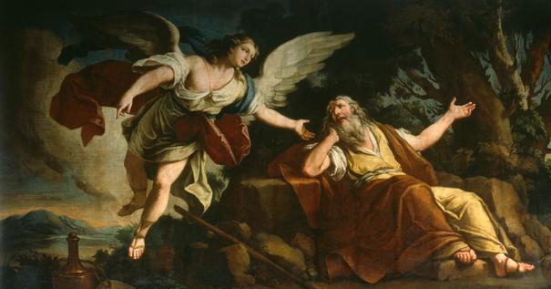
Elijah has been working all hours as the head prophet in the Yahweh organisation. Business has not been that good. The competition have been gaining ground. It seems like bankruptcy is on the cards. Yahweh could well go out of business – or succumb to a hostile takeover by the Baal conglomerate. … The tension is brought to a head on Mount Carmel. Elijah challenges the opposition. A credibility test – whoever wins is the real God.I guess that you know the story well – Elijah wins. Baal cannot provide the fire to light the sacrifice on his altar. Yahweh, the God of the Bible, sends fire down from heaven. The whole Baal organisation is in turmoil – Baal’s prophets are killed. Elijah is on cloud nine. But things are not quite that simple – the chief shareholder of the Baal conglomerate is incensed. Queen Jezebel will not go away, she issues threats on Elijah’s life.
How does Elijah respond?
The tension of recent events has got to him. Rather than confident trust in God, built on the foundation of what God has just done at Mount Carmel, Elijah panics – he runs. It’s a classic case of depression and stress – he’s taken on more than he can handle. Elijah can now only see problems where once he saw opportunities. Run down, feeling hopeless, he runs off into the desert.
I don’t know about you but there have been times in my life when I’ve been just like Elijah in our reading. Stressed out, having lost perspective on life, God seems to have disappeared.
It isn’t always something as drastic as Elijah’s experience that affects us. It’s strange isn’t it how often when we review something we have done, that it’s the negative things we remember rather than the good. Or, I wonder, have you ever had the experience in some unguarded moment of tearful emotions overcoming you. Sometimes holidays, perhaps because we begin to relax, or perhaps because of the memories they evoke, are times when life is particularly hard – times when we’re prone to self-pity – even times when God feels distant.
How did God deal with his faithful servant Elijah in this time of darkness? ……….
It’s important to note that God doesn’t tell Elijah to snap out of it – or to buck his ideas up.
No! First God allows Elijah time to rest and sleep; then God makes sure that he is well fed and watered; and then he takes him on a forty day excursion to the mountains.
At times we need to hear this – rest and recuperation are God’s gifts to us – listen to Jesus in Matthew’s Gospel: “Come to me, all you that are weary and carrying heavy burdens, and I will give you rest.” ……..
Secondly, God helps Elijah to see that although God can work in power, God is to be heard most clearly in the silence. God’s words of comfort to Elijah are whispered gently to him. Time away from noise and business, times of holiday and retreat, are times when we can hear God. Times when we can be resourced again for faithful service.
Life can drain us, it can pull us down, we can feel defeated. Holidays and retreats are God’s gift to us, they’re times when we can choose to make space for him. Times when we can pick up our Bibles again. Times when we can make space to pray. Times when we can set aside noise and competition and listen to God’s still small voice of hope. ……
Peter’s story in Matthew’s Gospel is a little different!
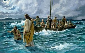
He is out of the boat walking towards Jesus. …. For a moment things seem to be going really well – until he looks around and sees the storm and suddenly the water underneath his feet really does feel like water. And Peter begins to sink. Life for him, like Elijah, is overwhelming. Peter is desperate. “Lord, save me,” he cries. And Peter, like Elijah, discovers that God is there for him. …..
Both Peter and Elijah have seen God at work in dramatic ways – Elijah on Mount Carmel, Peter, with the feeding of the 5,000. But both discover that they have to learn to trust God for themselves. It is not what they have seen that counts – not even what they have been involved in. They for themselves have to learn to trust the quiet voice of God in the midst of what life can bring.
Peter cries out, “Lord, save me.” …. Elijah stands still, listening to God’s voice.
Whoever we are, whatever our nature and whatever our experience of life, we need too to learn to place our confidence and trust not in our own abilities, not in the faith of others but in the love that we discover God has for us. And when God reaches out to us in love, we need, like Elijah and Peter, to trust him.
And we can trust God to be there for us at all times – providing the strength that we need for each day, intervening on occasions, but most of all assuring us of his loving presence.
And when we come to Communion, when we release our burdens in confession, when we receive again the reality of Christ’s death and resurrection, when we eat the food that God provides for us. We can hear God speaking once again in the silence, God says again – “I love you, rely on me!”
Every day that we come to Holy Communion can be a holiday – a Holy day!
Many of us, when we go on holiday, take with us something to read, usually a novel or two, occasionally a biography. Apart from reading books about railway history, I’m an avid reader of suspense, crime and murder mystery novels. I really like the police procedurals like Rebus from Ian Rankin, Alan Banks by Peter Robinson, Bob Skinner from Quintin Jardine and books by Rachel Lynch, Harlen Coben, James Patterson, … etc.
This isn’t really the time or place to chatter on about what I like to read. But I do want to ask you about the way in which you read a story or a novel. Who do you identify with most readily? Whose eyes are you looking through as the story unfolds? Is it the hero or the heroine, a bystander, or someone else who is involved in the plot?
I guess to some extent it depends on how the book is written, whether it is in the 1st person or the 3rd person, whether you are actually encouraged to identify with one character or another. Some of the most intriguing stories are those where the author encourages you to see things through the eyes of one character, to identify with them, only to find out that they are not the person you thought they were. The experience can be quite shocking!
It is usual for us, when we read a story or a novel, to identify with someone … to live the story through them.
So, I wonder, when we read stories in our bibles do we do the same? Or do we sort of stand detached, alongside events almost like spectators?
I think the bible authors had just the same kind of intentions as modern story-tellers do. They want to draw us into the story, to get us involved.
We are given an account of the feeding of the 5,000 in all of the Gospels, Matthew, Mark, Luke and John. All the accounts are different in their own way, all reflect the perspective or agenda of the particular Gospel writer. All help us to have different perspectives on the story! So Matthew and Mark place this story just after the death of John the Baptist – and in the context of the story that is clearly meant to be important. Luke suggests that the 12 have just arrived back from their mission as healers and preachers and that they are desperate to talk to Jesus about the things they have done and seen happen. John adds personal detail mentioning both Andrew and Philip, two of the disciples, by name – and mentioning that the five loaves and two fish came from the picnic box of a young boy. The same story told in four different ways.
Not only is the story told slightly differently by our four Gospel writers – highlighting different things in the story. We also have the opportunity to see the story through different people’s eyes. If we allow ourselves to imagine it, we can look out on the story through the eyes of the disciples, perhaps particularly Andrew or Philip, we can watch as members of the crowd, we could take the young boy’s perspective (although he does not appear in Matthew 14) or we could see things through Jesus’ eyes.
One thing I could ask you to try would be to choose a character from the story in Matthew 14 and listen again to the story trying to see things from their perspective and then perhaps share with others who have read the story but who have chosen other characters, what you saw. It would be a good way to broaden your understanding of a passage that you have read.
I’d like to highlight a couple of things that might come from doing just that as we read this story:
Jesus: The context of this story of the feeding of the 5,000 is set for us in each of our Gospels. Jesus has just heard of the death of his cousin, John the Baptist, he is in mourning. … The disciples have returned from the mission he has set them and they are full of excitement; clamouring and eager to talk to him about their impact on other people’s lives. … Our reading tells us that Jesus hearing about John’s death, withdrew by boat, privately to a solitary place. I guess he needed space to mourn. The other Gospels tell us that he withdrew with his disciples. In Mark we hear Jesus say these words to his disciples: “Come away to a deserted place all by yourselves and rest a while”.
Jesus is exhausted, emotionally, spiritually and physically – he is done in and he needs space. His disciples similarly need space to rest and recuperate from their mission. I can imagine Jesus climbing up the slopes on the far side of Galilee – so grateful for the opportunity to rest, only minutes later to look up and see a large crowd gathering. Jesus was exasperated, grief-stricken, exhausted, ready for a break. … I guess, some of those feelings will be shared by parents and others here who have still to take their holiday, maybe even by those who have just had their holiday with children in tow.
In this instance, Jesus sets aside his own needs for the needs of the crowd. Even in the midst of his tiredness and grief he is willing to give himself to their demands for his attention. A while back, on our day off at 8.30 in the morning the doorbell rang. Still in my night clothes, I answered the door and there was a man of the road – can I have some breakfast. Come back later I said, we are still in bed. At 9.00 he was back, this time shouting through the letterbox, a few expletives about our laziness and unwillingness to serve him. He eventually got a piece of my mind and some days later came back to apologise. What does Jesus’ attitude in our Gospel reading say to me about my attitude to this man? Could I not have served him rather than place my own needs for rest first?
As Christians, all of us are here to be God’s hands and feet in society. Jesus challenges us, not just by his words, but by his actions, to be willing to go the extra mile in serving others! And only after having done so, here in this story, do the following verses tell us that he makes time again for solitude and rest!
The disciples: John and Mark have the disciples chuntering away before they come up with a very small amount of food. John has them ‘borrowing’ the food from a young lad. Both the disciples and the young lad had no idea what their paltry, tiny offering would make. They perhaps only made the offering to reinforce the fact that trying to provide for this host of people was a lost cause. ‘Lord, we just have to send them away – can’t you see that now?’
But Jesus takes their reluctant, tiny offering and turns it into the most sumptuous of banquets. … Like the disciples we so easily see what we have to offer as not enough. We are not gifted enough, our congregations are too small, we can’t possibly afford to meet Parish Share, we cannot meet the maintenance demands of our buildings – it is hopeless. … And it is so easy to think like that.
We are small and seemingly overwhelmed by the world around us, yet God is still working in our midst. We reminded ourselves last week that it is when we feel small and helpless, then we are most like the Kingdom of God, for it is then that God can work through us. Things are fragile, they are certainly very dependent on the life of God’s Spirit. God is quietly at work in our midst and we have had a part to play in his work in our world.
Here in the characters of our story – seeing events through their eyes – we can be:
challenged and encouraged;
spurred on to service; and
reminded of God’s love and provision for us.
Prayers
Why not try what I have suggested for your prayers this week? Sit with this or another passage of Scripture for a little while. Try picking one of the characters in the story and see things from their perspective. Ask yourself: What do they notice? What do they do? Why, what motivates their actions? If you chose the passage from Matthew 14, you might find that you gain a different insight to the ones that I have suggested. …………..
Take time as well to pray for the work of the church, for those in authority in our world, for peace, for the needy, for those who are unwell and for those who are at rest with the Lord.
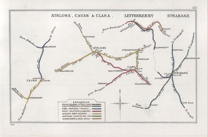
Wikipedia gives us a very short history of the line from Strabane to Letterkenny and provides a single image – the Railway Clearing House map with stations in Strabane and Letterkenny:
The Railway Clearing House map with stations in Strabane and Letterkenny. [3]
“The County Donegal Railways Joint Committee (CDRJC) constructed the Strabane and Letterkenny Railway. It opened for public service on 1 January 1909 with a route length of 19.25 miles. It was the last railway constructed by the CDRJC bringing the network operated by this company to 121 miles. The company pioneered the use of diesel operated railcars, but despite this innovation, closure came at the end of 1959, and the railway was shut on 1 January 1960.” [2]
This history must be worth expanding! It gives so little detail!
Wikipedia tells us that Letterkenny was already rail-served in 1909. “‘The Londonderry and Lough Swilly Railway Company’ (The L&LSR, the Swilly) was an Irish public transport and freight company that operated in parts of County Londonderry and County Donegal between 1853 and 2014.” [4] Incorporated in June 1853, [5] “it once operated 99 miles of railways. … It closed its last railway line in July 1953 but continued to operate bus services under the name Lough Swilly Bus Company until April 2014, becoming the oldest railway company established in the Victorian era to continue trading as a commercial concern into the 21st century. Following a High Court petition by HM Revenue and Customs, the company went into liquidation and operated its final bus services on 19 April 2014.” [4][7][8]
The first railway station in Letterkenny opened on 30th June 1883. The line out of Derry started out as the “Londonderry and Buncrana Railway” and was absorbed into the L&LSR in 1887. [9] That line is not the subject of this article but it is important to note that Letterkenny had been rail-served for many years before the branch from Strabane arrived in the town.
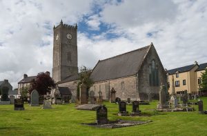
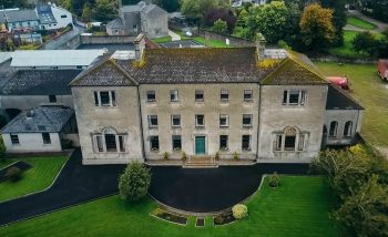
Raphoe Bishop’s Palace. [10]
Raphoe Cathedral. [11]
Raphoe Royal and Prior School in 21st century. [12]
Patterson et al [1: p41] explain that the Co. Donegal Railways from Strabane to Stranolar – which were accessed from Londonderry over either the Great Northern Railway (along the valley of the River Foyle) to Strabane or the more tortuous route owned by the Co. Donegal Railways which passed over the higher ground to the East of the River Foyle, through New Buildings, Collion, Donemana, Ballyheather and Ballymagorry and on to Strabane – ran to the South of an area which included the small towns of Raphoe and Convoy. The L&LSR ran to the North of this area. “At the end of the 19th century, Raphoe had a population of around 700, …. centred around a cathedral, a ruined bishop’s palace and a Royal School. Convoy, only about a third he size of Raphoe, was a manufacturing village with a reputation for woolen textile manufacture. By Donegal standards, the people living there felt they ought to have a railway.” [1: p41]
That sense of entitlement built on endeavours which began as early as 1860 but which foundered on more powerful interests. It wasn’t until around 25 years later that a light railway/tramway was planned between Strabane and Drumcairn and it became more likely that the area would be rail served. However, that scheme also foundered for lack of money. [1: p41]
It was 1902 when a new version of the scheme was proposed at an estimated cost of £100,000 which ran between Strabane and Letterkenny via Lifford, Ballindrait, Convoy and Raphoe. The scheme was the subject of a bill submitted to Parliament in the winter of 1902-3. [1: p41-42] That application failed to achieve its key objective of reaching Letterkenny. The Act only allowed a line from Strabane to Convoy. A further submission was made in 1904 and was successful. The promoters called the line the Strabane and Letterkenny Railway (S&LR) and within no more than a year it had effectively been taken over by the Great Northern Railway in advance of their takeover of the Co. Donegal Railway. [1: p42-43]. Work started on building the line in 1906. Robert McAlpine and Sons were the principal contractor. The line was eventually opened to traffic on New Year’s Day 1909. [1: p43-44]
Patterson et al comment that “since much of the share capital of the S&L had been provided by the Midland and the Great Northern, owners of the CDRJC since 1906, it was natural that the Joint Committee should take over the operation of the line and work it as a branch. ” {1: p44-45]
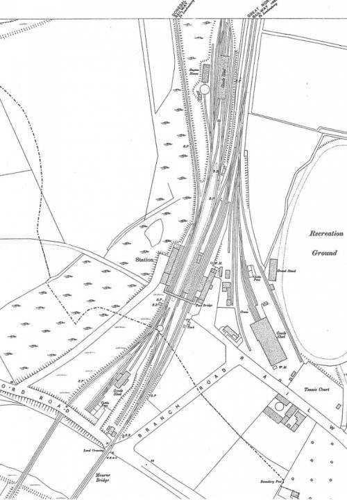
1905 Ordnance Survey Map. [14]
Strabane Railway Station was first opened in 1847 on the Great Northern Irish standard-gauge line. It expanded to include the narrow-gauge Co. Donegal lines in 1894 when the new narrow gauge crossed the river into the southern end of the station.
Prior to the narrow-gauge, the Finn Valley railway shared the southern approach to the railway station with the Irish North Western Railway – the predecessor of the GNR. The Finn Valley Railway was held to ransom for access into Strabane Railway Station. The advent in Ireland of the new 3ft gauge railways encouraged the directors of the West Donegal Railway (WDR) to choose that gauge for their new railway in the late 1870s. After a period of mixed gauge use of Stranorlar Railway Station, Parliament sanctioned the amalgamation of the Finn Valley with the WDR in 1892 and in 1893 powers were obtained for a change of gauge between Stranorlar and Strabane and for the construction of a new narrow-gauge link from the old Finn Valley junction with the GNR into Strabane Railway Station. [1: p19-28] That link appears on the 1905 Ordnance Survey Map above. The map was drawn only a few years before the construction of the S&LR.
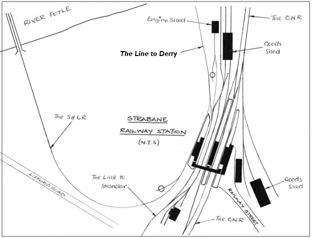
My sketch below shows the layout of Strabane Railway Station in the years following the construction of the S&LR. Strabane Railway Station in the 1930s (c) Roger Farnworth
A Journey Along the Line – Strabane to Letterkenny – Part A – Strabane to Raphoe
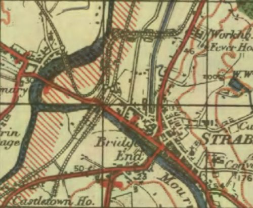
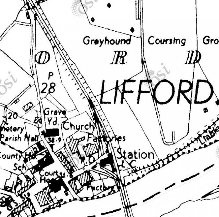
Strabane on the GSGS Map from the 1940s. The GNR runs roughly North-South the Co. Donegal runs from the top right to the bottom left with the branch to Letterkenny returning to the North edge of the map having passed through the Railway Station at Lifford. The station at Strabane is marked by the linked roundels near to the centre of the map. [13]
On the GSGS 1940s OS Map, the Strabane to Letterkenny branch is shown leaving the Co. Donegal mainline just to the North of Strabane Railway Station. My sketch above shows the actual arrangement. It was difficult to fairly represent the track arrangement at the station at the scale the GSGS Maps were drfated. Letterkenny trains left Strabane Railway Station at the station platforms and then turned sharply round to the Northwest before crossing the River Foyle and entering Lifford Railway Station.
Recently, I have been consulting with Chris Amundson. The link immediately below shows what is known about the layout of Strabane Railway Station in different eras:
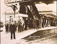
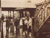
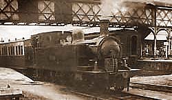
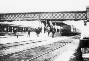
The next few pictures show the footbridge at Strabane Station. The first three are relatively low resolution images posted on the BBC Northern Ireland Your Place and Mine website. [15]
These first three images are taken looking North through the Station. The first is taken from just South of the Western station platform. On the far left of the image the S&LR platform can be glimpsed. The second shows the main station buildings with the footbridge steps to the right of the image. The third looks Northeast under the footbridge towards the main station buildings.
The fourth picture was found on both Sepiatown [16] and OldStrabane webpages [17] It shows the station footbridge, again looking North, from the GNR side of the station. (I have been unable to contact both of the two sites to get permission to share photographs, postcard images, etc., here. Email links, where they exist, no longer function. Should the site owners wish me to remove the images credited to those sites then I will do so and replace them with the links referred to in the references at the end of this article.)
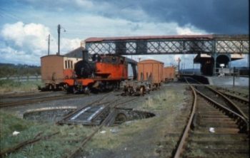
The first colour image shows the station footbridge again, also looking Northeast, this time from close to the Co. Donegal lines turntable. County Donegal Railway No 11 “ERNE” is moving vans in May 1957. [17][18]
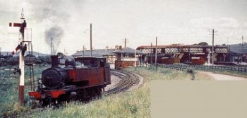
The second colour image shows the same engine (No. 11 ERNE Class 4, 4-6-4 ‘Baltic’ tank), heading away, light engine, from Strabane Railway Station on the Letterkenny line in March 1958. The CDR signal box, and station footbridge are shown in the background. [17][19]
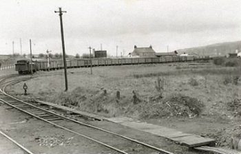
The following image shows a Goods Train approaching Strabane from Lifford, presumably having travelled from Letterkenny. The photographer is looking Southwest from a point near the Signal Box at Strabane. [17][20]
As noted above, these superb images can be found on two sites, http://www.sepiatown.com and oldstrabane.blogspot.com. Each image is individually referenced on the http://www.sepiatown.com website. I have only been able to provide a general reference for the same images on the oldstrabane.blogspot.com website.
Those on the http://www.sepiatown.com website are geographically referenced for their location around the station site.
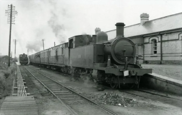
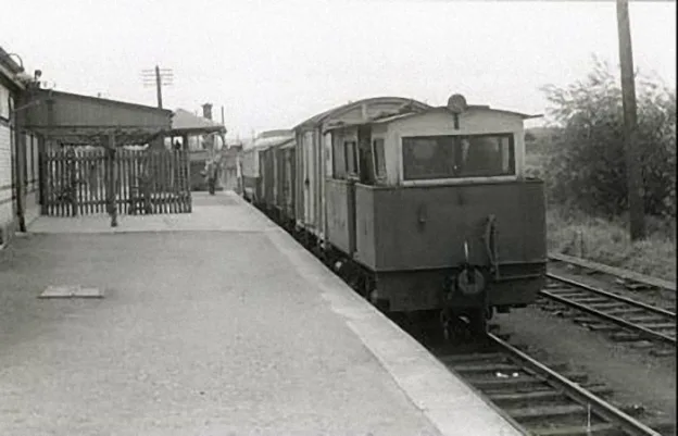
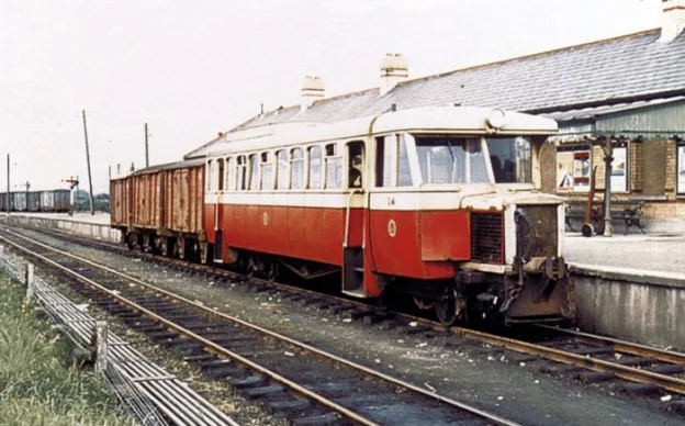
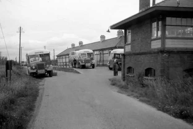
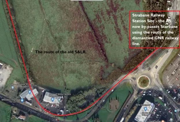
A train prepares to depart for Letterkenny. Platform 5 at Strabane Railway Station. [17][24]Diesel Shunter Phoenix at Strabane Station looking Southwest from Platform 5 – the platform used by the Strabane to Letterkenny services The signal box can be made out beyond the end of the platform. [17][22]Railcar No. 14 at Strabane Railway Station on 20th August 1959, preparing to leave Platform 5 for Letterkenny. [17][23]he Strabane & Letterkenny Railway closed on 1st January 1960. This photograph was taken sometime after the closure (probably in 1965). The rail track has been removed and replaced by a road. The building on the right nearest to the camera is the Co. Donegal Railways signal box. [17][21]he route of the old S&LR is marked by the double row of trees heading North from the modern A38 (Google Maps).Kerry Doherty supplied this photograph for comparison with the one above. It shows Strabane Railway Station and is taken from the “camels hump” bridge. He comments that ‘This site has been much filled in and raised quite a bit.’ Photograph supplied by Kerry Doherty. [45]Kerry Doherty supplied this photograph for comparison with the one above. It shows Strabane Railway Station and is taken from the “camels hump” bridge. He comments that ‘This site has been much filled in and raised quite a bit.’ The line in the centre foreground is the S&LR. Photograph supplied by Kerry Doherty. [45]Turning through 180 degrees, we are now looking in the direction of Lifford, the Letterkenny line trackbed would have been where the grass is on the far side of the road. Curving off sharply to the right (c) Kenny Doherty. [45]
Trains for Letterkenny used the most westerly platform at Strabane Railway Station – Platform No. 5. Trains traversed a very tight curve round to the Northwest, followed a short straight-alignment before crossing the River Foyle.
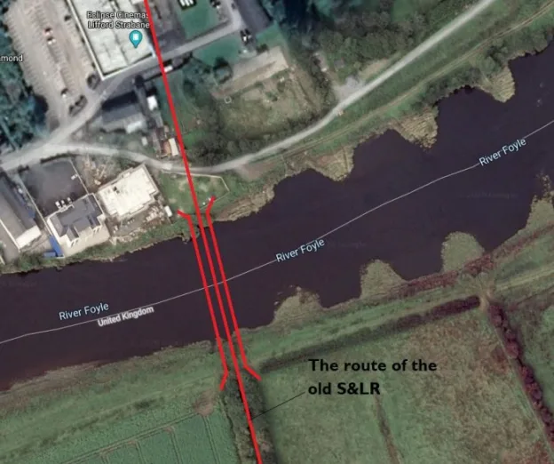
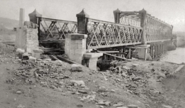
As we have noted, there was a sharp curve in the line out of out of Strabane. THis image shows the trackbed after the curve, looking towards Lifford. Kerry Doherty comments: ‘It’s interesting to note that when the line was lifted in January 1960, this was tarred and the railway bridge used for buses and lorries and the road bridge was being replaced. The tar is still under the moss underfoot,’ (c) Kerry Doherty. [45]Looking across the River Foyle at the location of Lifford Station which is in the trees, (c) Kerry Doherty [45]The magnificent stone abutment of the bridge. This is the southern bridge abutment, (c) Kerry Doherty. [45]The location of Lifford Bridge, (c) Kerry Doherty. [45]Lifford Bridge. Photo by John Langford, supplied for inclusion here by Kerry Doherty. The picture is taken from approximately the same angle as the more modern image above. Lifford Station Halt can be seen on the right side of this image. Kerry Doherty Collection. [45]The location of the old Strabane/Liffor Railway Bridge across the River Foyle. (Google Maps)he Construction of Lifford Railway Bridge. The photographer is on the West side of the River Foyle, looking SE towards Strabane Station on the Strabane-Letterkenny line. The picture was taken in 1908. [17][25]
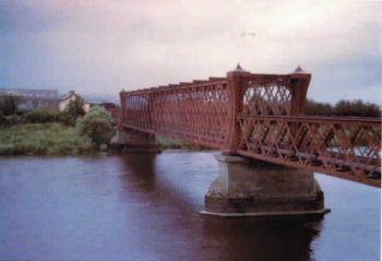
A much later image of the Strabane/Lifford Railway Bridge (c) Margaret (Blee) Fisher. [26]
The Strabane/Lifford Railway Bridge over the River Foyle is shown during construction above and much later, probably not long before demolition, in the adjacent photograph.
All that remained in the latter 20th century was the bridge foundations. By the early 21st century, these also were gone.
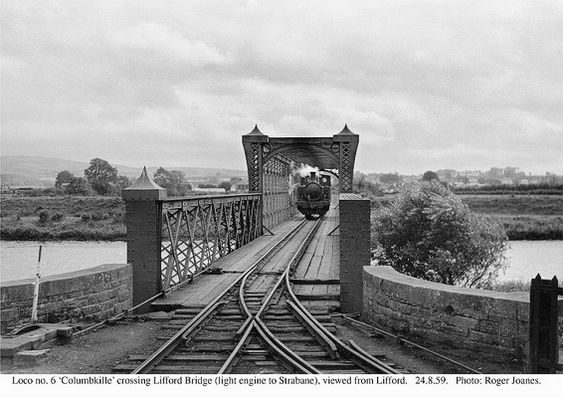
The same bridge in 1959. This photograph is taken from the end of the platform at Lifford Halt (c) Roger Joanes (CC BY-NC-ND 2.0). [29]
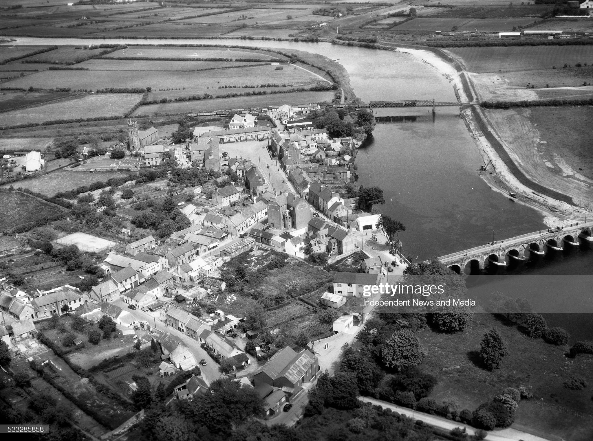
The S&LR bridge can be seen towards the top of this image. Lifford Halt Station is just to the left pf the bridge. This image is embedded with permission from http://www.gettyimages.co.uk. An unidentified Co. Donegal steam locomotive is crossing the bridge in charge of a long goods from Letterkenny. [30]
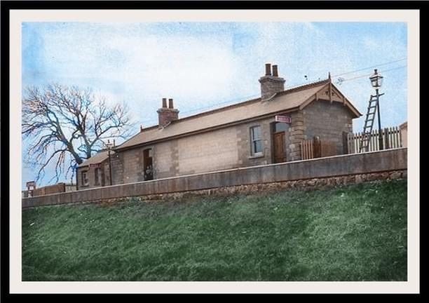
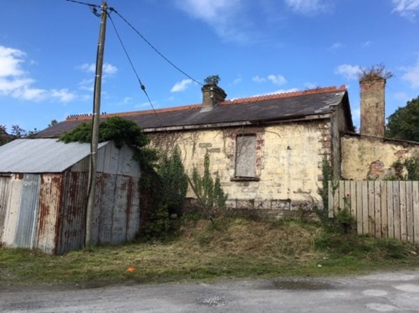
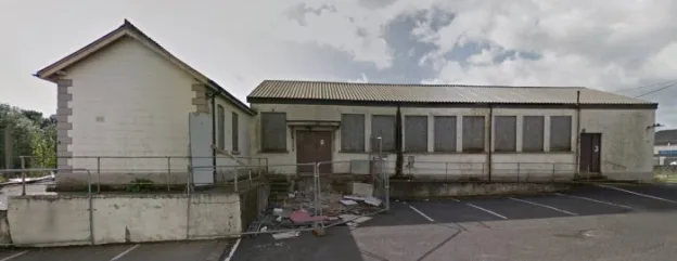
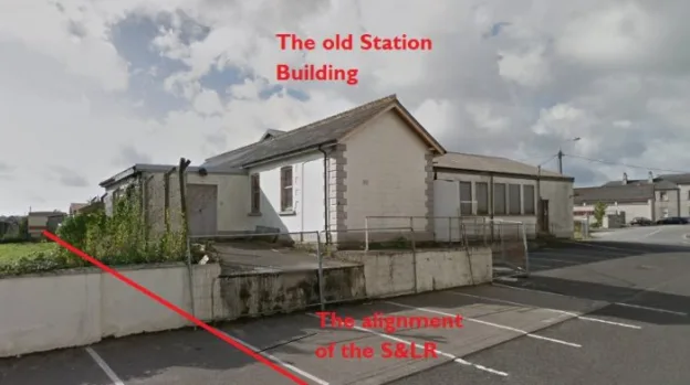
Lifford Station and Railway on the S&LR. [27]Lifford Halt Station Builing, a colourised monochrome image. The photograph was taken by William Lawrence included here courtesy of Kerry Doherty. [43]Lifford Station (from behind), the platform was on the other side of the building. This picture was taken some years ago as the building has been modified and is now surrounded, as can be seen below, by a high fence. The images below show the building as it is now, owned by two different people. The track-side elevation is much better kept and in recent years was the post office, (c) Kerry Doherty. [45]Lifford Halt Station Building (Google Streetview).Lifford Halt Station (Google Streetview).
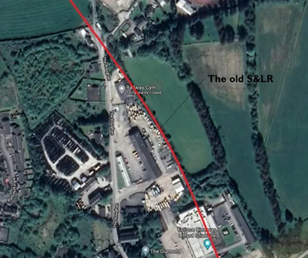
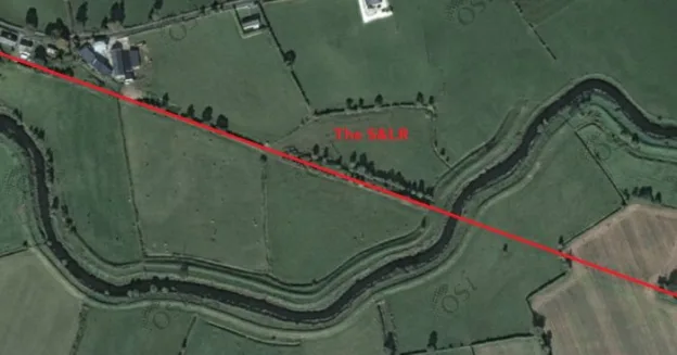
The photo above appears on the Donegal Heritage Centre Facebook page and is embedded here with permission. [31] There is also an excellent photograph of the station and platform in Anthony Burges book, The Swilly and the Wee Donegal. [44: p30] The satellite image below shows the S&LR just North of the location of the old station.
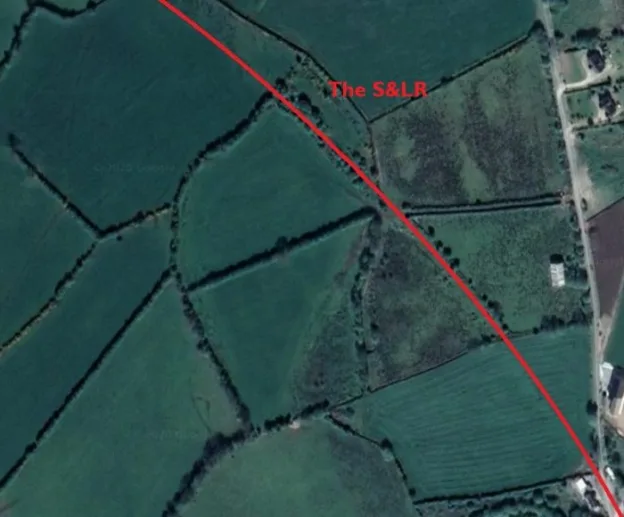
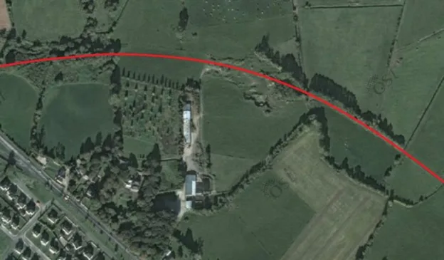
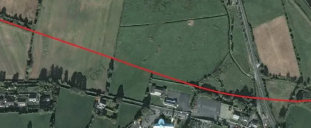
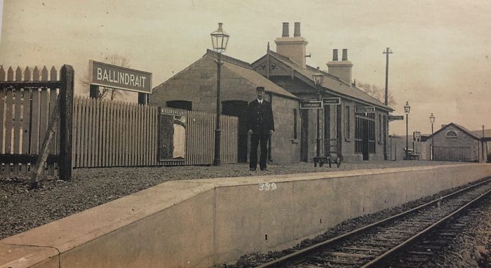
The S&LR (Google Maps)The S&LR [31]The S&LR [31]The approximate alignment of the S&LR approaching Ballindrait Station which is just off the satellite image to the West. [31]The approximate line of the S&LR in the 21st century. [27]Ballindrait Railway Station as first built. This picture is an old postcard view taken by William Lawrence and provided courtesy of Kerry Docherty. [43]
Ballindrait Station in 21st century viewed from the West along the access road from the village (Google Streetview). The building on the right is the old passenger building with the platform beyond.
Ballindrait Railway Station was to the Northeast of the village on the North side of the Deele River.
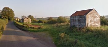
The Goods Shed (Google Streetview).
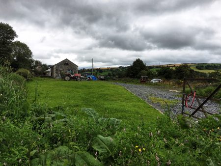
Ballindrait Goods Shed, looking towards Lifford (c) Kerry Doherty. [43]
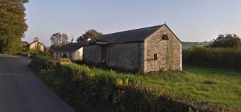
There is a bungalow on the site of the old station, close to the old station house, but many of the buildings associated with the station are also still present. A sequence of views are adjacent to this text, three of which are views on Google Streetview.
The two wintry views are from the Irish National Inventory of Architectural Heritage. [32]
Ballindrait Goods Shed from the Southwest. [32]
The Station Master’s House (Google Streetview)
There are also some pictures taken recently by Kerry Doherty which show the site from the alignment of the old railway (these make an excellent comparison with one of the images in the book, The Swilly and the Wee Donegal, by Anthony Burges . [44: p31])
Kerry Doherty’s photos include one of the old goods shed looking towards Lifford.
The Station Master’s House from the Southeast. [32]
The station buildings are in a surprisingly good condition having seen little or no maintenance over the years since the closure of the S&LR.
Ballindrait platform shelter and platform remains, looking towards Coolaghy (c) Kerry Doherty. [43]
I am particularly grateful to Kerry Doherty for the modern images which appear to be more up-to-date than the Google Streetview images.
Leaving the station, the railway travelled only a short distance due West before crossing the station access road leading up from Ballindrait village on a steel girder bridge.
Ballindrait platform shelter and platform remains, looking towards Coolaghy (c) Kerry Doherty. [43]
The bridge deck has been removed and the abutments, if they still exist, are completely obscured by vegetation.
Beyond Ballindrait the S&LR followed the route of the R264 closely. The picture below looks back towards Ballindrait railway station in the year before closure of the line.
Leaving Ballindrait the line followed a relatively straight course for a short distance. This view looks back towards the station from just beyond the road under bridge which took the station access road into Ballindrait. [45]
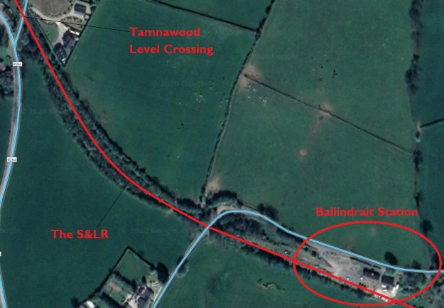
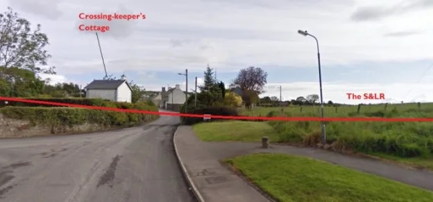
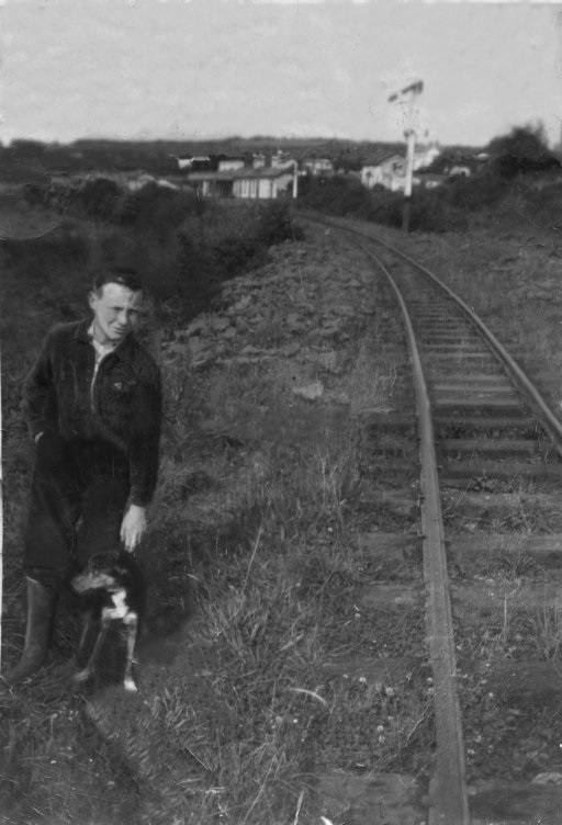
Initially crossing a side road on the level at Tamnawood Crossing. The crossing keeper’s cottage still stands in the early 21st century and is shown below in two images, the first comes from the Irish National Inventory of Architectural Heritage. [33] The second from Google Streetview.
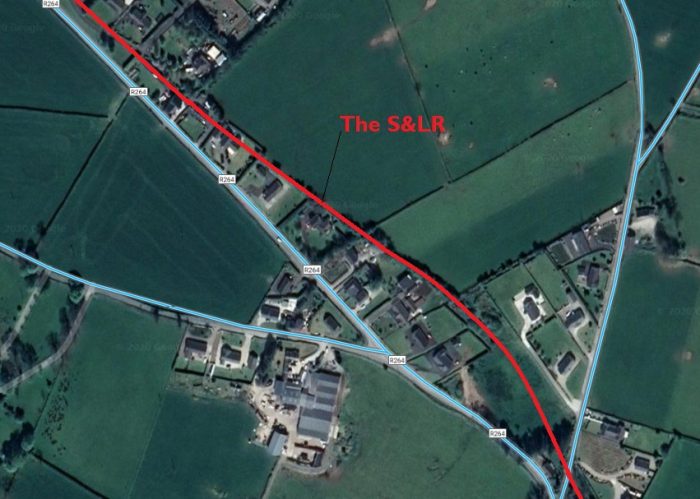
At first it ran along the North side of the road. Modern develop obscures its route. The first two Google Satellite images below show that modern development.
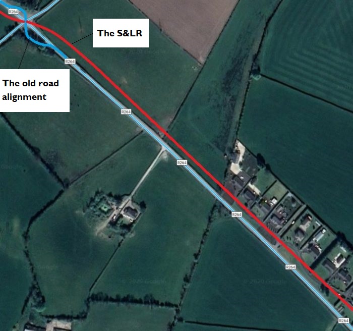
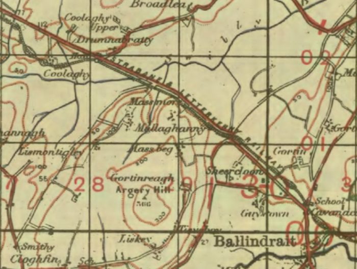
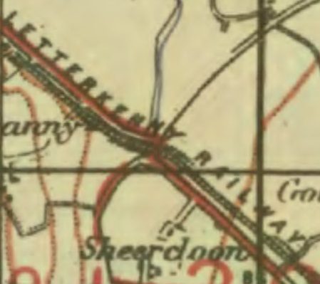
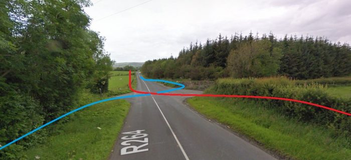
After a few more hundreds of metres, line crossed the R264 on the level. The old road has been realigned at this point. The location can be picked out on the GSGS Map below but is more easily picked out on the larger scale extract provided after the two satellite images.
The approximate alignment of road and rail is illustrated on the Google Streetview photograph below the larger scale map extract.
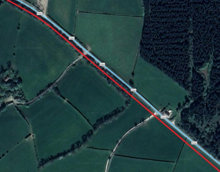
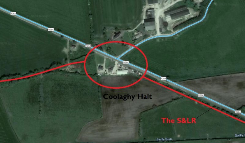
Beyond the road crossing the S&LR followed the South side of the R264, only a few metres away from the carriageway, until it reach Coolaghy Halt where it turned away Southwest from the road.
The route as far as Coolaghy Halt is illustrated on the Google Sateliite images below.GSGS Map from 1941 shows the route of the Strabane to Letterkenny Railway following the route of the Ballindrait to Raphoe Raod (R264). [34]GSGS Map from 1941 shows the point at which the S&LR crossed the R264. [34]The R264 looking Northwest towards Raphoe showing the approximate alignments of the old road and the S&LR (Google Streetview).
The location of Coolaghy Halt (Google Maps)
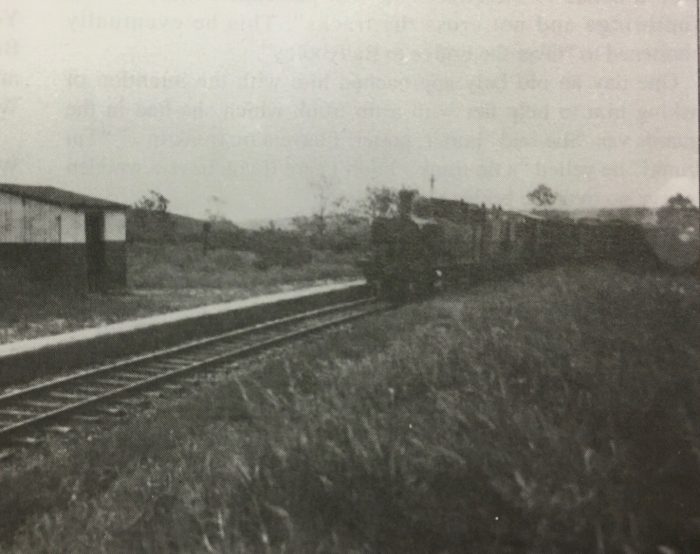
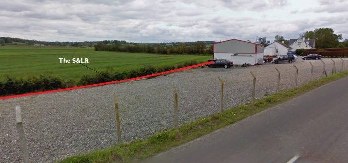
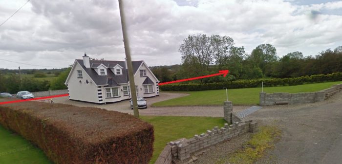
Coolaghy Halt was the first point for some distance that the railway left the side of the old road. The route of the S&LR is still easily picked out as a line of trees and shrubs running West-southwest away from the R264.Coolaghy Halt in 1942 from the Tom P. McDevitte Collection courtesy of Kerry Doherty, the image is also reproduced in ‘Railway Days in Strabane’. [43]Coolaghy Halt’s location in the 21st century. The platform was where the fence sits today. Photograph by Kerry Doherty. [43]The location of Coolaghy Halt (Google Streetview)A side road from the Northeast met the R264 at the location of the Halt which was on the South side of the road. The red line on these two Google Streetview images shows the approximate alignment of the old S&LR at this point (Google Streetview).
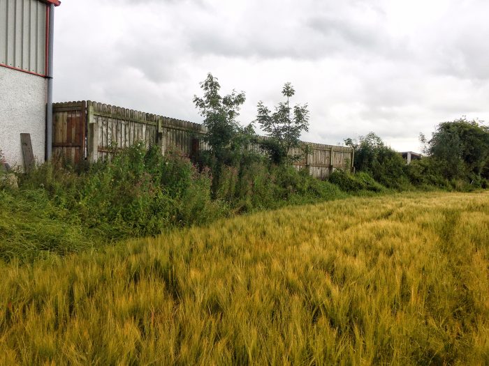
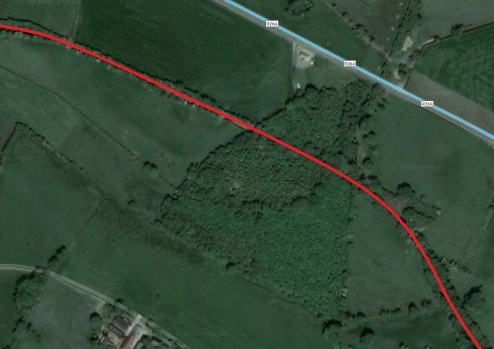
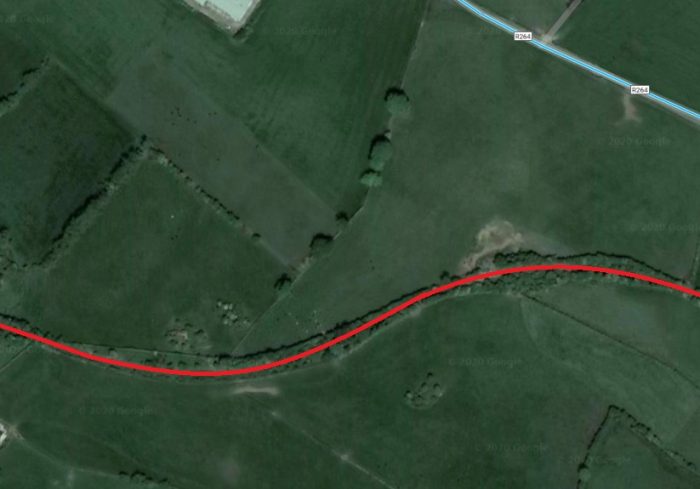
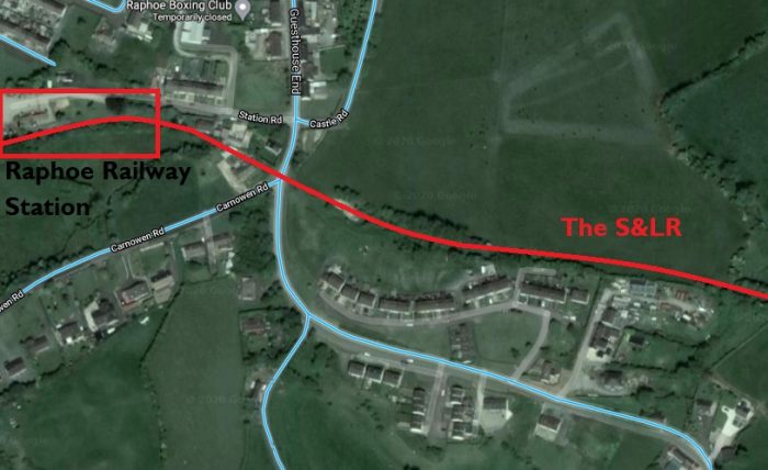
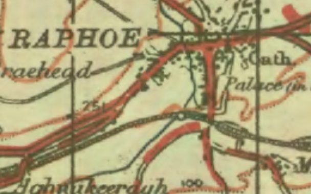
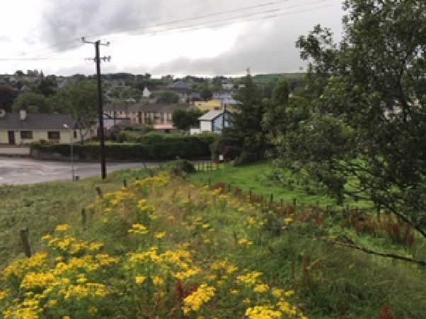
Onward from Coolaghy Halt, the S&LR was only away from the R264 for a few hundred metres, running behind what is now P Connolly Car Sales and Repairs before drifting back towards the road and roughly following its alignment for a few hundred metres before turning away to the Southwest again en-route to what was Raphoe Railway Station.Raphoe Railway Station sat on the South side of the town. [35]
A view from above the cutting just before crossing the road into the Raphoe Station site, you can see the gap where it crossed the road, (c) Kerry Doherty. [45].
There is an excellent view of the station complex available in Ernie’s Railway Archive on Flickr … https://flic.kr/p/2iRSdWW … That image is best seen as part of that album of photographs on Flickr. [40] The next few pictures show the station while the line was in operation.
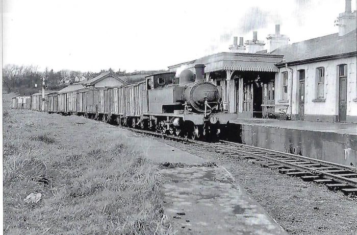
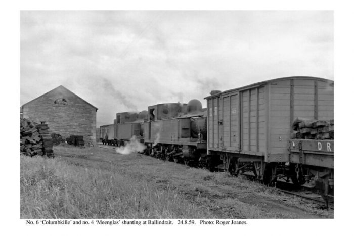
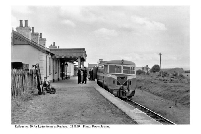
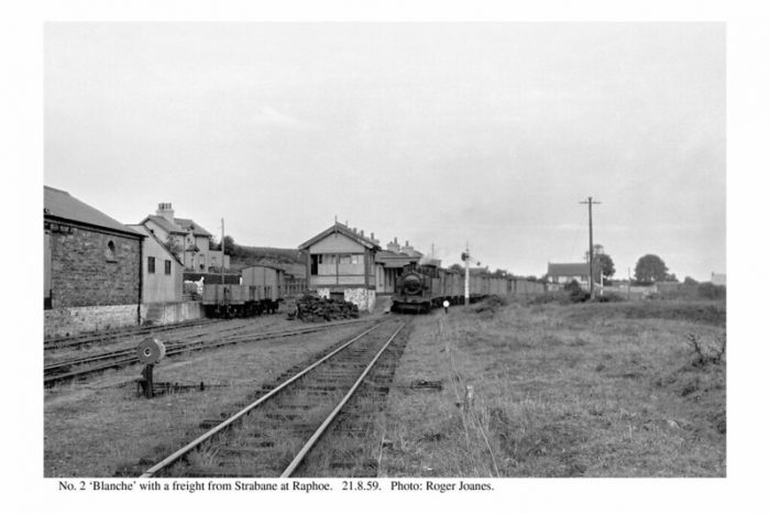
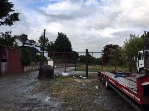
Erne at Raphoe Railway Station in 1959 (c) Douglas Robinson, used with permission from the Co. Donegal Railway Heritage Centre. [36]Shunting at Ballindrait in 1959 (c) Roger Joanes (CC BY-NC-ND 2.0) [41]Railcar No. at Rahoe Station (c) Roger Joanes (CC BY-NC-ND 2.0) [39]A view of Raphoe Station from the West (c) Roger Joanes (CC BY-NC-ND 2.0) [38]The site of Raphoe Station in 21st century taken from a similar position to the last Roger Joanes image above. The Station Master’s House on the left is the only building remaining on the site. Kerry Doherty comments that ‘it was difficult to get a photo of the site as many lorries now occupy the yard’, (c) Kerry Doherty. [45]
We complete the first stage of the journey along the Strabane to Letterkenny Railway at Raphoe. As we noted at the start of this article, this is a place with a long history and it is worth the stopover to see the town!! There are two superb pictures of the station in Anthony Burges book, The Swilly and the Wee Donegal. [44: p32 &33]
References
Edward M Patterson (original author), Joe Begley & Steve Flanders (authors of additional material in the Revised Edition); The County Donegal Railways; Colourpoint Books, Newtownards, Co. Down 2014. As noted in my first article about the Co. Donegal Railways this was to have been my holiday reading while walking different parts of the network, but 2020 has been a strange year!
Steve Flanders & Hugh Dougherty, The Londonderry and Lough Swilly Railway; Midland Publishing, 1997.
Edward M Patterson (original author), Joe Begley & Steve Flanders (authors of additional material in the Revised Edition); The Lough Swilly Railway; Colourpoint Books, Newtownards, Co. Down 2017. This was to have been part of my holiday reading, but 2020 has been a strange year!
Kerry Doherty of Ballindrait, Co. Donegal. provided a series of images from his collection of photographs for use in this article.
Anthony Burges; The Swilly and the Wee Donegal; Colourpoint, Newtownards, Second Impression, 2010.
After first publishing this article, Kerry Doherty of Ballindrait very kindly sent me a series of pictures which needed to be included in the article. Each of these bears the reference number [45].
Jesus gives us a number of pictures of the Kingdom of God or the Kingdom of Heaven.
First, the mustard seed – something so small that you can hardly see it, yet when it is fully grown it is almost as big as a tree – seemingly insignificant and of no apparent value yet having an impact far beyond what could be imagined.
Second, the Kingdom is like yeast which when mixed into the dough leavens the whole loaf and makes it rise – perhaps just 7g or 10g of yeast will leaven 500g of flour. so, the kingdom is alive and growing. It’s an agent which turns something flat and dry into something light and airy.
Thirdly, two pictures about the value of the Kingdom, treasure hidden in the field, and a pearl of great price. The kingdom has hidden value, easily missed for years, like treasure trove in a field, trampled under foot as the farmer ploughs the field, or a pearl hidden inside an ugly clam.
The overall impression is of something easily missed, seemingly of little value or importance – but yet, ultimately of immense worth. Something hidden, seemingly small and of little value – yet far more important than we can imagine.
So when Jesus uses the words “the Kingdom of God”, what is he talking about?
In the Gospels we hear Jesus saying these words on many occasions: “Repent, for the kingdom of God has come close to you.” And in the context it sounds a little as though he is talking about himself.
So, is that what the Kingdom is? Anywhere where Jesus is present? …
Elsewhere Jesus talks of the Kingdom as being within us. … So, is that what the kingdom is about – not something physical but something that governs our hearts? …
Sometimes Jesus seems to talk of the Kingdom as being something for the future, something beyond this life – somewhere that we call Heaven. … So is that what the Kingdom is about – something that Christ will bring in when he returns, whenever that may be – something not for now but for then, for the future?
What are you praying when we pray those words in the Lord’s Prayer … ‘Your Kingdom Come’?
The Kingdom of God is the Rule of God – wherever it may be. Yes, it does refer to heaven, and we look forward to a time when all that is evil is gone, when peace and justice, mercy and goodness have sway.
But it also encompasses life here on earth – God’s rule in our hearts, changing us, calling us on to love others, to work for a just, peaceful world, experiencing his presence with us. But a lot more than that too.
The church has fallen into the trap down the years of identifying itself with the Kingdom and of seeing God’s kingdom being about the rule of earthly Christian Kings. …………… So we have been responsible in the past for the Crusades; the temporal power and authority of the Bishop of Rome has been called the Holy Roman Empire; we have assumed that because we have a Christian heritage, all our culture must also be Christian, that the values we live by must be the values that the world should live by; and at times we have been arrogant and aggressive.
But says Jesus – that is not the kingdom. The kingdom is often insignificant, often overlooked. It is not about physical wealth, or might or power. In fact, the church is most like the Kingdom when it is weak and small, unsuccessful and overlooked by society. And the Kingdom exists where hope is born out of nothing, where God’s servants live like yeast in the dough of society, where truth and light and goodness is a treasure to be discovered hidden in the lives of ordinary people.
And as we look at ourselves and the world around us. As we feel insignificant and small, as our churches seem to have little hope for the future, … then we are most like the Kingdom of God, for then we can begin to feel the weakness and hopelessness of so many around us. And we can be part of our community like the yeast in the dough – not going out arrogantly with the answers, but rather joining our community in seeking God=s presence, looking for signs of the Kingdom, carrying with us the love of God and looking out for that love evident in the lives of those around us.
Then God’s kingdom is coming here on earth and small seeds of hope will germinate in our lives and the lives of those around us – and perhaps new shoots of life will develop and in time trees of righteousness and justice and peace may well have grown in the places where we live and work.
Prayers for the coming of God’s Kingdom
Almighty God,
your ascended Son has sent us into the world
to preach the good news of your kingdom:
inspire us with your Spirit
and fill our hearts with the fire of your love,
that all who hear your Word
may be drawn to you,
through Jesus Christ our Lord. Amen
God of our salvation, hope of all the ends of the earth,
we pray: Your kingdom come.
That the world may know Jesus Christ as the Prince of Peace,
we pray: Your kingdom come.
That all who are estranged and without hope
may be brought near in the blood of Christ,
we pray: Your kingdom come.
That the Church may be one in serving
and proclaiming the gospel,
we pray: Your kingdom come.
That we may be bold to speak the word of God
while you stretch out your hand to save,
we pray: Your kingdom come.
That the Church may be generous in giving,
faithful in serving, bold in proclaiming,
we pray: Your kingdom come.
That the Church may welcome and support
all whom God calls to faith,
we pray: Your kingdom come.
That all who serve the gospel may be kept in safety
while your word accomplishes its purpose,
we pray: Your kingdom come.
That all who suffer for the gospel
may know the comfort and glory of Christ,
we pray: Your kingdom come.
That all who are unwell may know your consolation, strength and healing …….. particularly ……………we pray: Your kingdom come.
That your constant care will be the experience of all who rest in you …….. particularly …………… we pray: Your kingdom come.
That the day may come when every knee shall bow
and every tongue confess that Jesus Christ is Lord,
we pray: Your kingdom come.
Almighty God,
by your Holy Spirit you have made us one
with your saints in heaven and on earth:
grant that in our earthly pilgrimage
we may ever be supported by this fellowship of love and prayer,
and know ourselves surrounded by their witness
to your power and mercy;
through Jesus Christ our Lord. Amen.
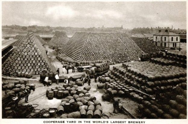
The featured image above shows a staggering number of barrels at the Guinness Brewery in Dublin! [3]
This very short article results from some recent reading about the railways on the Guinness Brewery site in Dublin.
An article in ‘Narrow Gauge & Industrial Railway Modelling Review’ Issue 60 Volume 8, October 2004, p134-142; [1] and
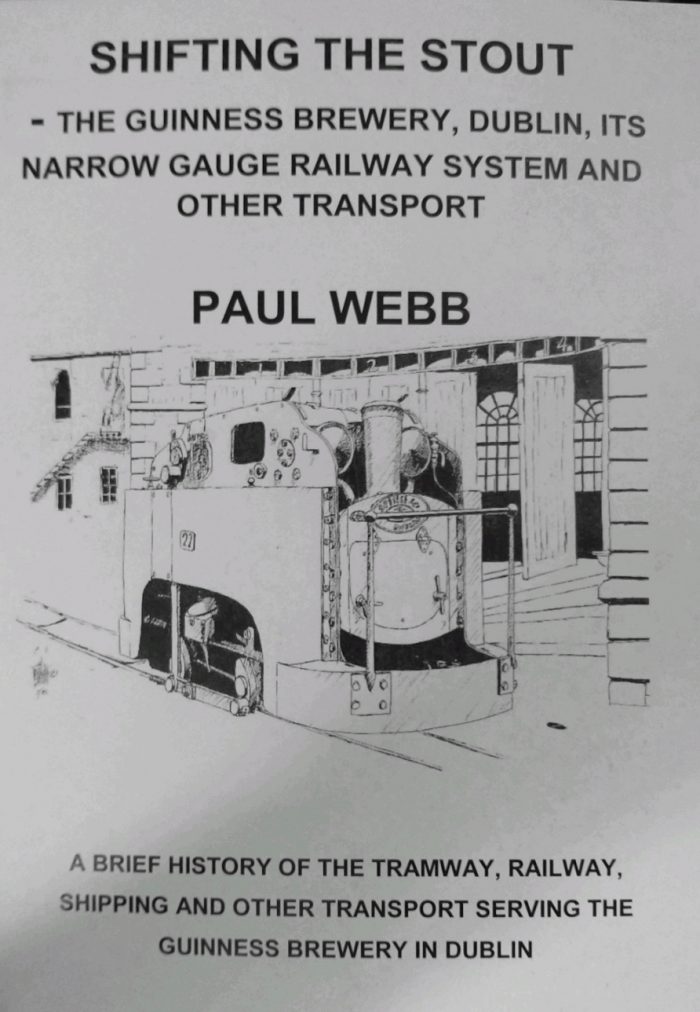
Paul Webb, ‘Shifting the Stout’, The Moseley Trust, Apedale, Newcastle-under-Lyme, Staffordshire. [2]
The Brewery in St James’s Gate, Dublin was founded by Arthur Guinness in 1759, one of dozens based on the pure water available from the River Liffey. Guinness outlasted and outgrew all its competitors to become one of the greatest brewing empires in the world.
Between 1868 and 1886 Guinness spent over £1 million on capital projects. As part of these developments, two rail systems were created within the expanded brewery site. I have covered these in some depth in an earlier article about the brewery railways. ….
Instrumental in much of the development of the brewery site was Samuel Geoghegan who was Engineer to the Brewery.
The article in Narrow Gauge & Industrial Railway Modelling Review is archive material, courtesy of ‘Engineering’ magazine and the Greenwich & District NGRS. It consists primarily of a transcript of an illustrated presentation by Samuel Geoghegan which was carried by ‘Engineering’ Magazine in September and October 1888. It includes detailed drawings, engravings and photographs. Back copies of the magazine are available from Roy C. Link, Cambrian Forge, Garndolbenmaen, Gwynedd, LL51 9RX.
Paul Webb’s book is an A4 no-frills publication in basic green card cover and printed on standard copier paper but it contains a wealth of illustrations and detailed text about the Brewery and the various forms of transport, road, rail and water, that served it. Well worth the £8.50 plus postage that it cost, especially knowing that any profit from the sale supports the Moseley Railway Trust.
There are also some excellent YouTube offerings which focus on the brewery and the different modes of transport it employed. …. For example: [4]
References
Samuel Geohegan; Tramways and Rolling Stock at Guinness’s Brewery; Narrow Gauge & Industrial Railway Modelling Review, Issue 60 Volume 8, October 2004, p134-142 (https://narrowgaugeandindustrial.co.uk, accessed on 22nd July 2020.)
Paul Webb, Shifting the Stout; The Moseley Trust, Apedale, Newcastle-under-Lyme, Staffordshire. (https://avlr.org.uk/moseley-railway-trust, accessed on 22nd July 2020.)
Some people are just doomed to be failures. That’s something we sometimes say. It is just the judgement being made in the story in our gospel reading. As out talk for this morning, I want to tell you a story about a teenager called T. J. Ware:
Some people are just doomed to be failures. … T. J. Ware was made to feel this way almost every day in school.
By high school, T. J. was the neighbourhood troublemaker. Teachers cringed when they saw he was in their class. He wasn’t very talkative, didn’t answer questions and got into lots of fights. He had failed every test throughout his school career.
Everyone at the school as invited to sign up for training, about becoming more involved in their communities. T. J. was one of 405 young people who signed up.
The community leaders briefed the course leader: We have a real spectrum represented today, from the brightest student to T. J. Ware, the boy with the longest arrest record in our part of the city.” This wasn’t the first time T.J had been described this way.
At the start of the weekend course, T. J. was literally standing outside the circle of students, against the back wall, with that “go ahead, impress me” look on his face. He didn’t readily join the discussion groups, didn’t seem to have much to say. But slowly, he got drawn in.
The ice really melted when the groups started to build a list of positive and negative things that had occurred at school that year. T. J. had some definite thoughts on those situations. The other students in T. J.’s group welcomed his comments. All of a sudden T. J. felt like a part of the group, and before long he was being treated like a leader. He was saying things that made a lot of sense, and everyone was listening. T. J. was actually quite smart, and he had some great ideas.
The next day, T. J. was very active. By the end of the course, he had joined the Homeless Project team. He knew something about poverty, hunger and hopelessness. The other students on the team were impressed with his passionate concern and ideas. They elected T. J. co-chairman of the team.
When T. J. showed up at school on Monday morning, he arrived to a firestorm. A group of teachers were protesting to the headteacher about T. J. being elected co-chairman. The very first community-wide service project was to be a giant food drive, organized by the Homeless Project team. These teachers couldn’t believe that the headteacher would allow this crucial beginning to stay in the incapable hands of T. J. Ware.
They reminded the headteacher, “He has an arrest record as long as your arm. He’ll probably steal half the food.” The headteacher reminded them that the purpose of the course was to uncover any real passion that a student had and reinforce its practice until true change can take place. The teachers left the meeting shaking their heads in disgust, firmly convinced that failure was imminent.
Two weeks later, T. J. and his friends led a group of 70 students in a drive to collect food. They collected a school record: 2,854 cans of food in just two hours. It was enough to fill the empty shelves in two community centres, and the food took care of needy families in the area for 75 days.
The local newspaper covered the event with a full-page article the next day. That newspaper story was posted on the main bulletin board at school, where everyone could see it. T. J.’s picture was up there for doing something great, for leading a record-setting food drive. Every day he was reminded about what he did. He was being acknowledged as leadership material.
T.J. started showing up at school every day and answered questions from teachers for the first time. He led a second project, collecting 300 blankets and 1,000 pairs of shoes for the homeless shelter. The event he started now yields 9,000 cans of food in one day, taking care of 70 percent of the need for food for one year.
T. J. reminds us that we cannot judge people by their appearance and that we need to leave all final judgements about people to God. What appear to be weeds may well turn out to be something very different!
The parable of the sower is one of the few parables where Jesus gives us an interpretation along with the story, but this doesn’t mean it’s straight forward. Parables are a genre of stories to chew on and reflect over. Basically, this is a disclaimer to say that my interpretation below is not the only way of reading it and I encourage you to read it for yourself and see how it speaks to you. What I am about to share has spoken to me in our context.
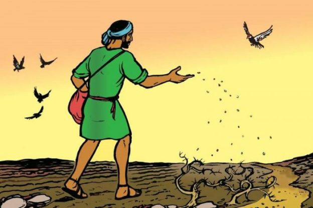
So we begin with the sower scattering seed everywhere. We are told that the seeds land in four different areas. They land on the path, on rocky ground, among thorns, and then on good soil.
Gosh this sounds messy! Why not just throw all the seed on the good soil? Why not avoid the places that the seed won’t work? I think it’s because we can never know what will take root or what good soil even looks like.
The seed being scattered is the message of good news. It is thrown everywhere regardless of what the ground looks like. I think the four locations are less about us trying to decipher different types of people, but to see the seed as something growing and changing within them, regardless of how we may perceive them as “good or bad soil”.
The question is what are we sowing and how can we sow?
I believe we sow through relationships, conversations and simply sharing our experience; our story of how God is in our lives.
The biggest hurdle can be how little we think of our own story of faith. Maybe we don’t think it is ‘flashy’ enough. Most people have less a “Damascus road” experience, pardon the pun, where Paul is blinded, thrown off his horse and hears the voice of Christ. We should be thankful for that as he wrote a majority of the New Testament. But we usually have an “Emmaus Road” experience. We look back at times in our lives and see that Jesus was with us, even though we may not have seen it.
Regardless of which “Road” experience you had, people respond to hearing stories and experiences. I’m more likely to try something new because a friend suggests it, than reading about it elsewhere.
Christianity is a shared faith. All of our stories join together as people of faith. During the early church, Christians were described as “gossiping the gospel” among fellow slaves in households. People’s curiosity was piqued by hearing how Christ and his followers were transforming lives – whether it be outwardly, caring for the widows, or inwardly, knowing they are loved by God, the creator of all things through Christ.
Back to the parable, the sower is throwing the seed everywhere regardless. For me, this implies an abundance of seeds. We cannot run out of our story. Not only does our story have no “use by” date, we are adding to it daily by simply living. This is not a solo mission, we are not alone. Matthew says in verse 23 “But as for what was sown on good soil, this is the one who hears the word and understands it, who indeed bears fruit and yields, in one case a hundredfold, in another sixty, and in another thirty.” The people who have been changed, become sowers too. Their story joins our story of the Church continuing to this day.
To close, part of the Collect for Sunday 12th July 2020 says “hear our prayer which we offer for all your faithful people, that in their vocation and ministry they may serve you in holiness and truth to the glory of your name”.
This is a prayer for all of us, not just people in positions of leadership.
We don’t “convert” people, the Holy Spirit does. We are messengers with Good News.
The 1973 Railway World Annual carried a one page article about the short railway on Alderney which was owned by the Department of the Environment and which served a quarry. [1]
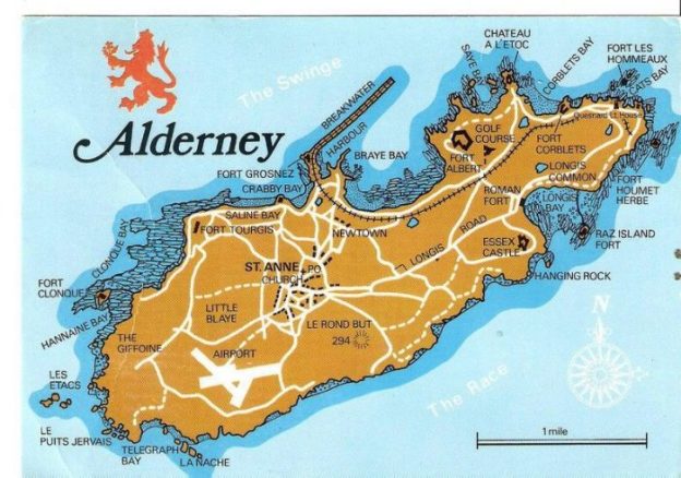
The Alderney Railway opened in 1847 and ran for about 2 miles (3.2 km), mostly following a coastal route, from Braye Road to Mannez Quarry and Lighthouse. Wikipedia notes that: “The railway was built by the British Government in the 1840s and opened in 1847.” [2] It was built as standard-gauge track. [5]
On 8th August 1854, the Queen Victoria and Prince Albert rode on the railway in a horse drawn tender.
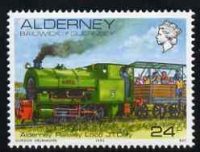
Alderney Postage Stamp (1983-1993) showing one of the locos which used to run on The Alderney Railway. [8]
The line’s “original purpose was to carry stone from the eastern end of the island to build the breakwater and the Victorian era forts.” [2] It was operated by the Admiralty and so was probably the first nationalized railway in the British Isles? [4] It carried stone for around 130 years. From the 1920s it was in private hands and crushed stone was taken off-island for road-building until the Second World War. [4]
During the War, under German occupation, no effort was made to maintain the breakwater. The standard-gauge track was replaced by German 60cm gauge rails and the line was used for the transport of munitions.
As we have noted its primary function was providing stone for the building of Alderney’s Breakwater. There bis an excellent article about this, written by M. Swift, in the Industrial Railway Society Journal, “The Industrial Railway Record,” No. 52 (February1974)– p170-173. [5]
M. Swift notes: “The vast increase in maritime trade during the early Victorian period was followed by a demand for harbours of refuge around Britain, and the Government proposed several schemes during 1846‑47. One was for a breakwater some 2,650 feet long from Grosnez Point, on the north side of Alderney in the Channel Islands, enclosing 67 acres of water. This was developed by successive Admiralty Boards during 1854‑58, the final proposal being a west breakwater 6,600 feet long and an east breakwater from Chateau a I’Etoc, 1,700 feet long enclosing 150 acres. The cost was estimated at £2½ million pounds.” [5]
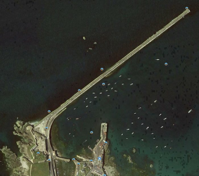
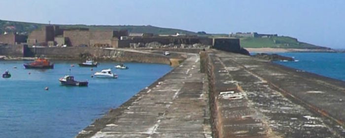
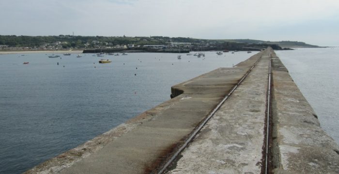
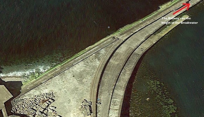
“The breakwater was planned as a rubble bank built up to 12 feet below low water, topped by a masonry wall with the promenade level on the sea side 37 feet above low water, and the quay level on the harbour side 23 feet above low water. The scale of the task was magnified by the depth of the water, which reached a depth of some 150ft.” [5]Alderney Breakwater (Google Earth)The view Southwest along the breakwater towards Fort Grosnez (Google Maps). The old breakwater railway can just be picked out running from the bottom right towards the fort.A clearer image of the rails in the top surface of the breakwater. The picture is taken from further to the Northeast along the breakwater (Google Earth).
M. Swift describes the construction work in some detail. This is not directly relevant to this article but can be found by following the link in the references below. [5]
“The railway from the breakwater to Mannez quarries was 2½ miles long, laid to standard gauge with 65lb double-headed rails. A branch ran about half a mile to Craby Bay where shingle was excavated for making concrete blocks. The first two locomotives were six coupled with four wheel tenders, named ‘Veteran’ and ‘Fairfield’. These were replaced by two six coupled tank locomotives ‘Bee’ and ‘Spider’, and a four coupled tank locomotive ‘Waverley’ built by Henry Hughes of Loughborough. 300 to 400 four wheel 5‑ton capacity end tipping wagons were used to carry stone over the railway, and a few survived at least into the 1920’s.” [5]
The Industrial Railway Record (IRR) [5] includes a photograph of one of the locomotives used on the line. The Henry Hughes locomotive (Waverley) used by Thomas Jackson (the Contractor) in building the breakwater was later photographed on Alderney, presumably in Mannez Quarry when it was used to pull trains of stone in connection with the maintenance of the breakwater. The picture is included in the IRR article courtesy Ian Allan Ltd. [5]
The Alderney Railwat website has a photograph of one of the two 0-6-0 ST locomotives with the train of low stone wagons at the head of a page about the railway’s history. This photograph was also taken at Mannez Quarry. [4]
After the Second World War, “the Ministry of Defence re-laid the track at standard gauge (56½” – 1.435m) with concrete sleepers in panels and used ‘Molly’ a four wheeled Sentinel vertical boiler engine and rolling stock of 24 side tipping wagons (‘Yankees’) to tip Granite chippings into the sea from the Breakwater for maintenance of the mound.” [4]
The railway was probably in this form when it became the subject of the short article in The 1973 Railway World Annual. It was not long after this that negotiations were opened between the Home Office and the Alderney Railway Society which was formally established in 1978. ……Vulcan Drewry 0-4-0 diesel locomotive Elizabeth and former London Underground 1959 Tube Stock cars, (c) Dmartin@ukonline.co.uk (2007), (GNU Free Documentation License). [2]
In the mid 1970’s The British Home Office who were responsible for maintenance and operation, (there being only a minimal use of the track at this time), were approached to see if the line could be used for Passenger transport and after several years permission was obtained. Alderney Railway Society was established in 1978. When trains began to run in 1979, Alderney Railway Company Ltd was formed to hold the lease and operate the line. [4]
Passenger trains first ran in 1980. [4] Trip Advisor tells us that, for a time, the passenger railway ran under steam power(as illustrated on the postage stamp earlier in this article:
In 1982 an 0-4-0 Bagnall steam locomotive by the name of “J.T. Daly” was acquired and ran with two ex-Chatham Dockyard open wagons which had light weight roofs to provide some protection for the passengers. J.T. Daly remained with the Alderney Railway until the early 1990s but due to its limited use and high cost of maintenance was subsequently sold to the Pallot Steam Museum in Jersey.
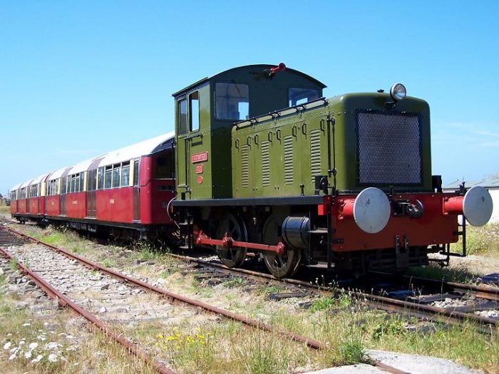
1985 saw the arrival of the Vulcan Drewry 0-4-0 diesel locomotive “Elizabeth” which after 20 years is still providing sterling service. By 1987 it was decided to try and provide improved accommodation for passengers and two ex London Underground 1938 tube cars were acquired from the North Downs Railway. These were drawn and propelled by Elizabeth and gave good service but by 2000 both vehicles had unfortunately succumbed to corrosion caused by the salt sea air. They were returned to England and scrapped.
In 2001 the Alderney Railway acquired two replacement 1959 tube cars from London Underground numbered 1044 and 1045. These vehicles have aluminum bodies with wooden floors and hopefully will survive the salt air. [9]
Wikipedia tells us that the current stock includes the two London Underground carriages, two 0-4-0 diesel locomotives and six Wickham 27A MkIII railcars. [2, c.f. 10]
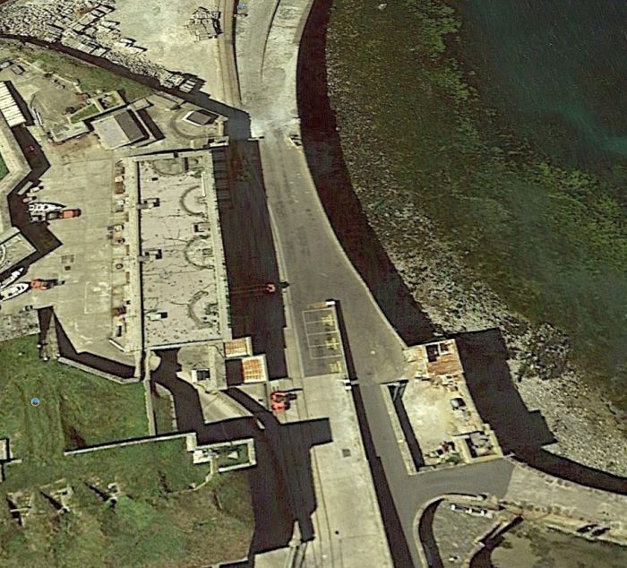
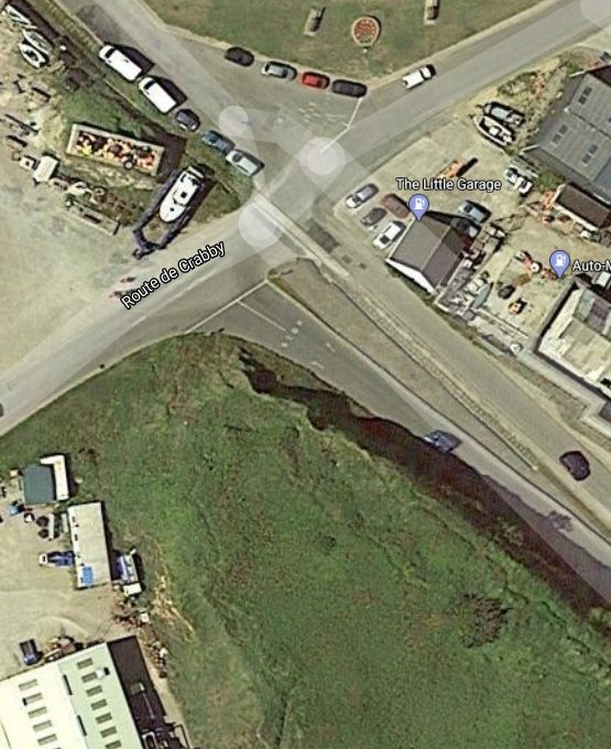
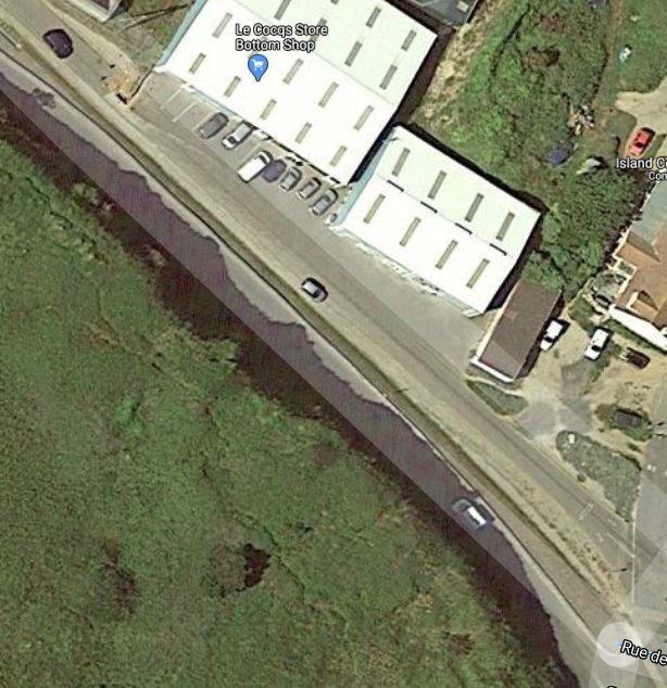
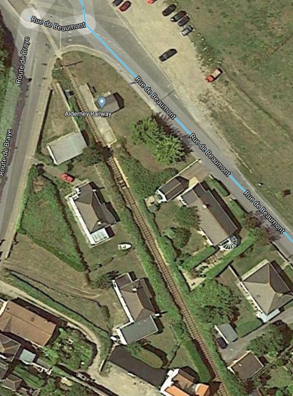
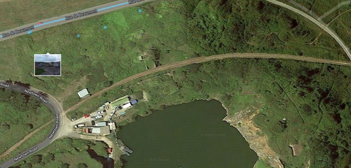
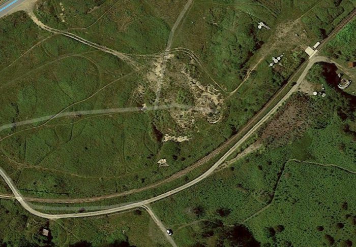
The first length of the historic line ran along the breakwater, then in front of Fort Grosnez before entering Braye Village. The passenger line running in the 21st century starts from Braye Road Station and heads East to Mannez Quarry.The old railway was in use out onto the breakwater. It can still be seen on satellite images. A short stub siding ran in the yard in the bottom left of this image. The route to Mannez Quarry curved South from the breakwater, (Google Earth).As it passed the East aspect of the fort, it divided into two to allow shunting of wagons (Google Earth).
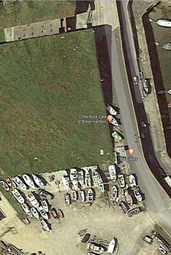
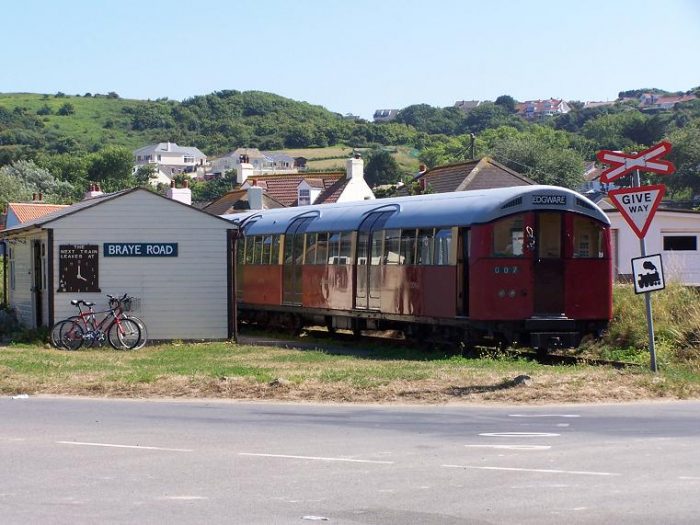
Running Southeast from the breakwater and Fort Grosnez the old line reached the location of the present railway station.
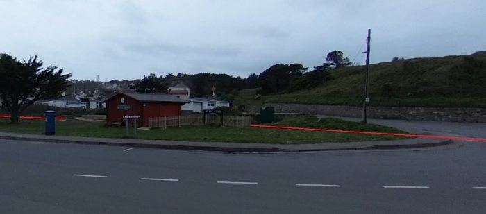
The railway is open, Covid-19 permitting, as a tourist attraction, “nowadays, the old train wagons have been replaced by two London Underground carriages and a diesel engine carrying visitors from Braye Road Station to Mannez Station near the Lighthouse.” [3]The line from the breakwater enters on the right of this picture. The station building at Braye Road Station is the timber shed to the left of centre. (Google Streetview).Tube stock stabled at Braye Road Station, (c) Dmartin@ukonline.co.uk (2007), (GNU Free Documentation License). [2]
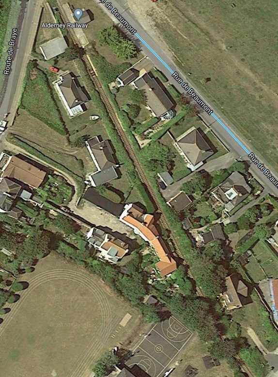
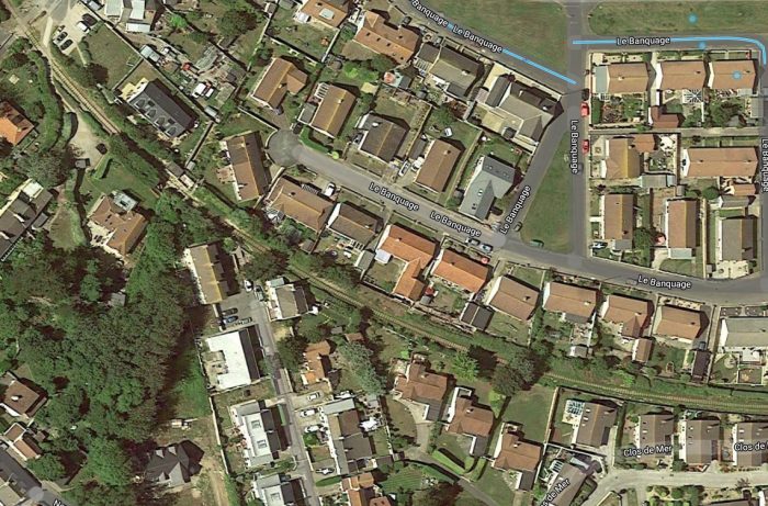
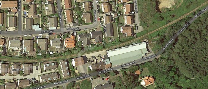
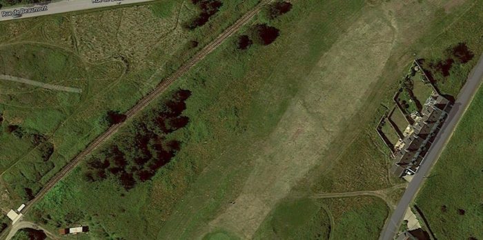
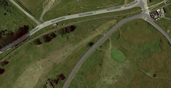
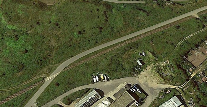
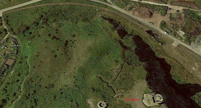
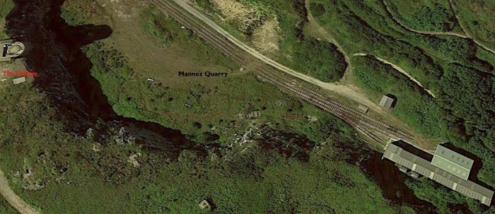
These next satellite images show the line leading away from Braye Road Station in the 21st century.The last few Google Earth satellite images below show the approach to the Station in Mannez Quarry.
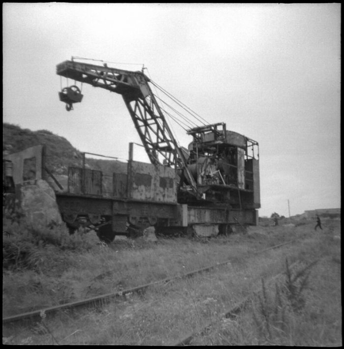
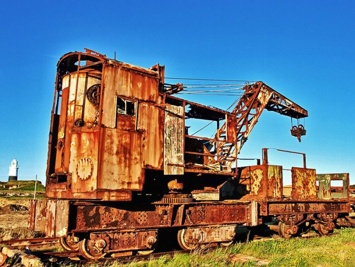
Steam Crane at Mannez Quarry (c) moogiemedia on Flickr (2011) (CC BY-NC 2.0). [6]Steam Crane at Mannez Quarry (c) Neil Howard (2009) (CC BY-NC 2.0). [7]
There was also a single branch line which left the main line in the village of Braye, not too far from Fort Grosnez, and headed West along the coast of Alderney a short distance to Craby Bay. It was used to transport shingle for the making of concrete blocks. [5] Its approximate route is imposed on the Google Earth Satellite image below.
References
Michael Bryan; Alderney’s Railway; in A. Williams; Railway World Annual; Ian Allan, Sheperton, Surrey, 1973, p89.
A child can ask questions that a wise man cannot answer. ~Author Unknown
While we try to teach our children all about life, our children teach us what life is all about. ~ Angela Schwindt
Children find everything in nothing; men find nothing in everything. ~Giacomo Leopardi.
That last quote is, I think, about children’s capacity to wonder at what they encounter as opposed to our adult cynicism. … At times children have the capacity to cut through the nonsense and get to the heart of the matter. So often, children are transparent when we are at best clouded and insecure.
This is why, I think, Jesus talks in Matthew 11 of God revealing things to children that are hidden from the wise and learned. Sometimes the only appropriate response to things we encounter is that of wonder and praise. Sometimes things are just beautiful, any attempt to explain them diminishes them.
We find it difficult to accept that children’s faith is real, and yet the truth is that children have not yet encountered the cynicism which destroys faith. They can still wonder at the seemingly unexplained, and they know that God is there for them.
Here are a few little stories (culled from elsewhere) to enjoy:
A Sunday School asked her young class to learn Psalm 23. She gave them a month. One young lad was excited about the task, but he just couldn’t remember the Psalm. After much practice, he could barely get past the first line. On the day the children were going to recite the psalm in front of the congregation, he was really nervous. His turn came and he stepped up to the microphone. He said proudly, “The Lord is my shepherd . . . and that’s all I need to know!”
When a mother saw a thunderstorm forming in mid-afternoon, she worried about her seven-year-old daughter who would be walking home from school. Deciding to go to meet her, she saw her daughter walking nonchalantly along, stopping to smile whenever lightning flashed. Seeing her mother, the little girl ran to her, explaining happily, “All the way home, God’s been taking my picture!”
A foundation stage teacher was watching her children drawing. She would occasionally walk around to see each child’s artwork. As she wandered round the classroom, she stopped by one little girl who was working hard. She asked what her drawing was. The girl replied, “I’m drawing God.” The teacher paused and said, “but no one knows what God looks like.” Without missing a beat, or looking up from her drawing the girl replied, “They will in a minute.”
God does not call Christians to be childish, but he does ask us to be child-like in our faith, full of wonder, love and praise; open to seeing the beauty in everything and everyone; honest about ourselves and the world around us; willing to learn and grow; always asking questions and seeking knowledge; playful; full of hope; able to overcome grudges because we don’t hold onto things for too long; able, because we have learnt to trust God even in the worst of times, to see the good in every circumstance; able, because we trust God, to come though adversity in his grace and strength and power.
Try to make room today for a child-like faith: seek to find God in every encounter you have with others; seek to receive God’s promises for yourself once again. Let’s allow children to teach us about wonder, about life and joy and hope, and ultimately about faith as well. For, in doing so, I believe that we will discover that the last verses of the reading from Matthew are true. Let’s hear and hold onto Jesus own words:
“Come to me, all you that are weary and are carrying heavy burdens, and I will give you rest. Take my yoke upon you, and learn from me; for I am gentle and humble in heart, and you will find rest for your souls. For my yoke is easy, and my burden is light.”

















 Try to make room today for a child-like faith: seek to find God in every encounter you have with others; seek to receive God’s promises for yourself once again. Let’s allow children to teach us about wonder, about life and joy and hope, and ultimately about faith as well. For, in doing so, I believe that we will discover that the last verses of the reading from Matthew are true. Let’s hear and hold onto Jesus own words:

