
 This short series of posts was prompted by encountering a piece about the line on a facebook group. The group:
https://www.facebook.com/groups/rtvanished
The substantial link:
http://rfbwharailway.blogspot.com [1]
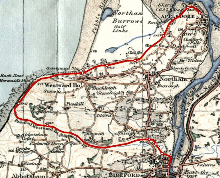
In my first post I provided a few pictures of the station at Westward Ho! which had not appeared on the links above. The second post followed the line from Bideford to Westward Ho! This post covers the remainder of the line from Westward Ho! to Appledore.
The Bideford, Westward Ho! & Appledore Railway was incorporated on 21 May 1896, with its Head Office address at the Electrical Federation Offices in Kingsway, London WC2. Soon after the line passed to the British Electric Traction Company (BET). It was not until 24 April 1901 that the single track line was opened as far as Northam, although the first trial train ran with a few friends of the directors in January 1901. The first train, pulled by Grenville was played off by Herr Groop’s German Band which had been hired for the season and it reached speeds of 36 mph on its inaugural run. The remaining extension to Appledore finally opened in 1908, on 1st May, costing £10,000. The railway was built in three sections, with the first being from Bideford for just over the third of a kilometre; the second from the termination of the first, to Westward Ho!, a length 6 to 7 kilometres; and the third being from Westward Ho! to Appledore, a length of between 3 and 4 kilometres. [3]
Westward Ho! to Appledore
Westward Ho! Railway Station is shown to the right-hand side of the OS Map extract from the very early 20th century below. [5] The area has changed significantly over the years since then and is now heavily built-up. It is shown in the early 21st century in the satellite image an aerial photograph below the OS Map.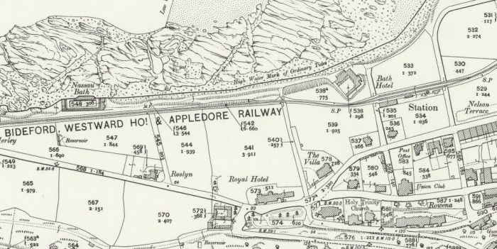
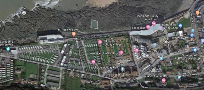 Westward Ho! (Google Earth)
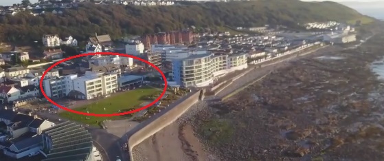 The Westward Ho! Railway Station location in 2019.
Westward Ho! Railway Station, had two platforms of 320 ft long and just 1ft above rail level, platform lighting, a passing loop long enough to allow three coach trains to pass, a ticket office with waiting rooms and toilet, an 8-lever signal box and a 2-lever ground frame; a waiting room, refreshment room, bookstall, level crossing gates and a Concert Hall called the Station Hall. [2][6: p101][7: p20][8: p76] Provision was also made for access to Westward Ho! Gas Works – a siding controlled by a two-lever ground frame. [6: p106][8: p76].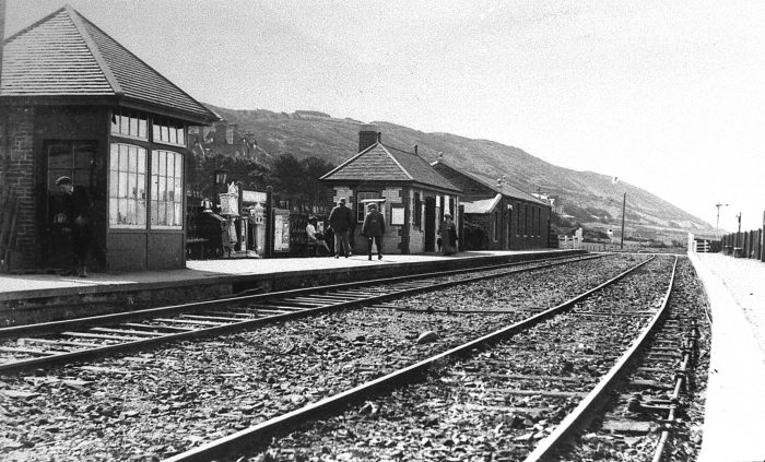 A general view of the station site at Westward Ho! [3]
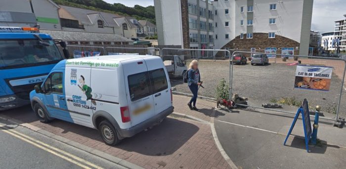 Looking back into what was the Station site from the modern Golf Links Road (Google Streetview).
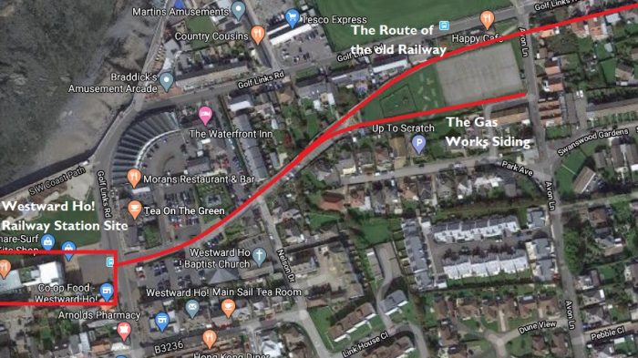 The route of the old railway East of the Westward Ho! Railway Station (Google Maps)
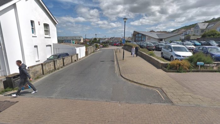 Looking East along the line of the old railway from Golf Links Road in the 21st Century (Google Streetview).
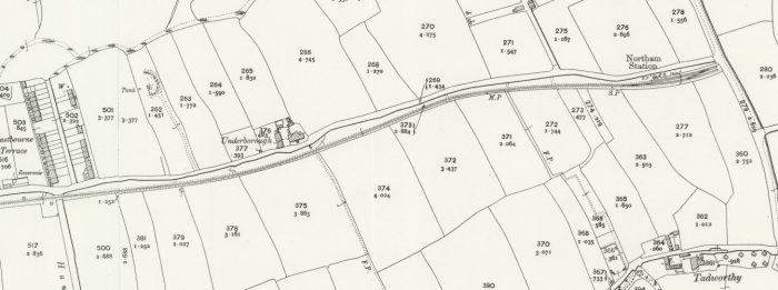
The line East of Westward Ho! was completed as far as Northam in 1901. The next two OS Map extracts show that length of line. The extracts come from the 25″ OS Series 1892-1914. [9] The line served Westward Ho! Gas Works, as we have seen in the notes about Westward Ho! Railway Station above, by means of a single siding. The ‘mainline’ ran to a run-round loop close to the road to Pimpley, north from Northam.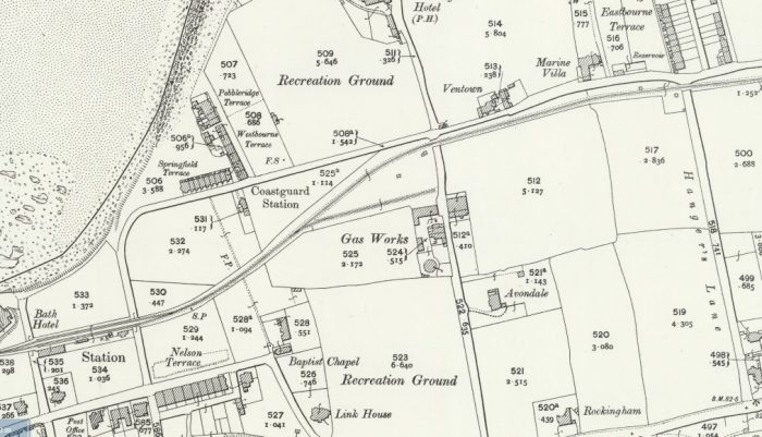
 From the Station Westward Ho! the line curved gently round to the Northeast before the Gas Works siding left the line on the right. A short distance further, the old route turned back towards the East and ran parallel to Golf Links Road. It ran on the South side of Golf Links Road all the way to Northam crossing Avon Lane and what was called Hanger’s Lane on the way. In the 21st century, Hanger’s Lane is now called Beech Road and what were open fields are now housing estates. [9]
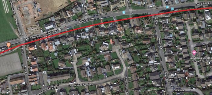 The route of the old line followed the Southern verge of Golf Links Road travelling East from Avon Lane (Google Maps).
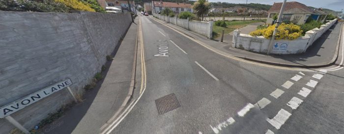 The site of the un-gated crossing at Avon Lane as it appears in the 21st century. The Gas Works was on Avon Lane at the far end of the open space. The southern pedestrian pavement of Golf Links Road and the kerbing between it and the carriageway is visible at the right-hand side of this picture. (Google Streetview).
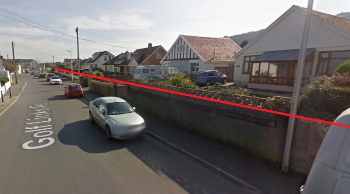 The approximate alignment of the old railway looking East along Golf Links Road in the 21st century (Google Streetview).
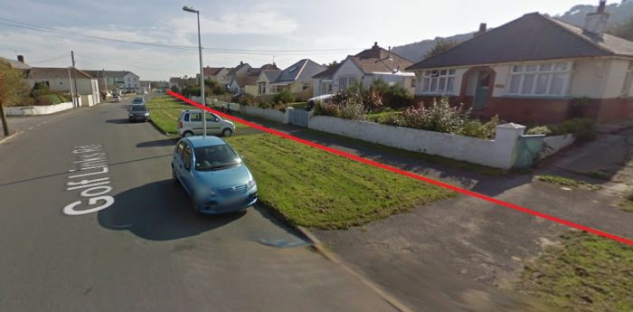 Further East along Golf Links Road in the 21st century (Google Streetview).
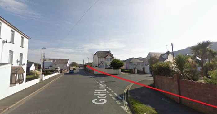 Further East again at the junction of Golf Links Road with Beech Road (former Hanger’s Lane). The buildings at the extreme left of the picture were in place when the railway was in use (Google Streetview).
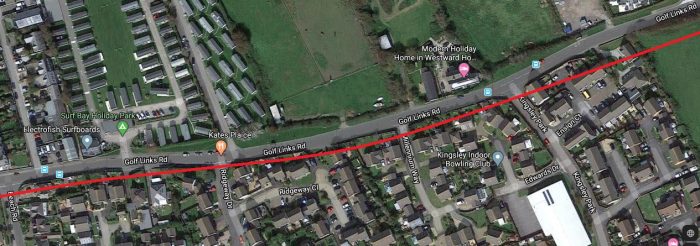 East of Beech Road the old alignment was just in open fields at the South side of Golf Links Road. The property on the North side of the road between what are now Millennium Way and Kingsley Park were known as Underborough and are now modern holiday lets (Google Maps).
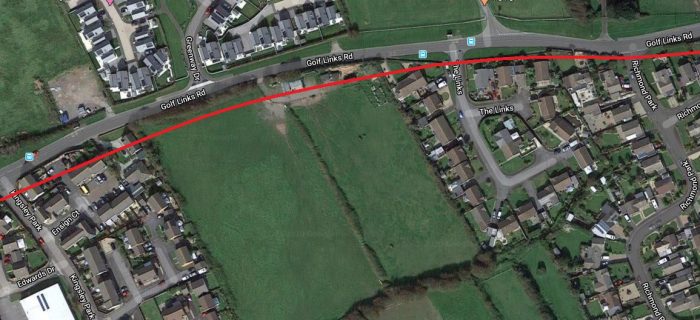
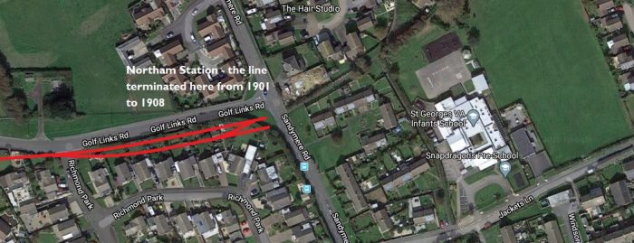 Wikipedia tells us that “Northam had one platform 180 feet (55 m) in length, with a shelter, on the down side of the line. It originally had a short run-around loop, a signal box and one semaphore signal, but with the completion of the extension to Appledore in 1908 it was reduced to a single line without sidings or signalling. [6: p110][8: p76] A goods yard was provided at one time.” [6: p61][10]
Beyond Northam, the line crossed Pimpley Road (now Sandymere Road) on the level by means of an un-gated crossing before reaching the Richmond Road request halt. [6: p110][10] The route of the line does not appear on OS Maps as, in this area, the different series were either complete before 1905 of not redrawn until after closure of the line. The route can be seen on a Bartholomew Map which is dated 1907, just before the opening of the extension to Appledore.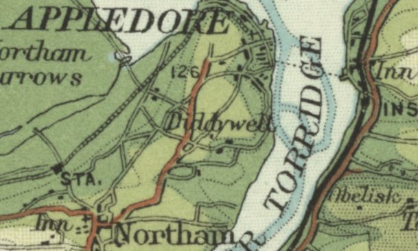 The Bartholomew 1897-1907 series (not to scale) shows the approximate route of the formation of the railway. [11]
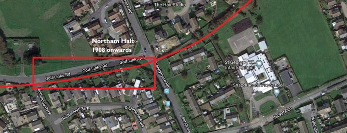 Northam Station became a Halt in 1908 and the line continued on to Appledore (Google Maps).
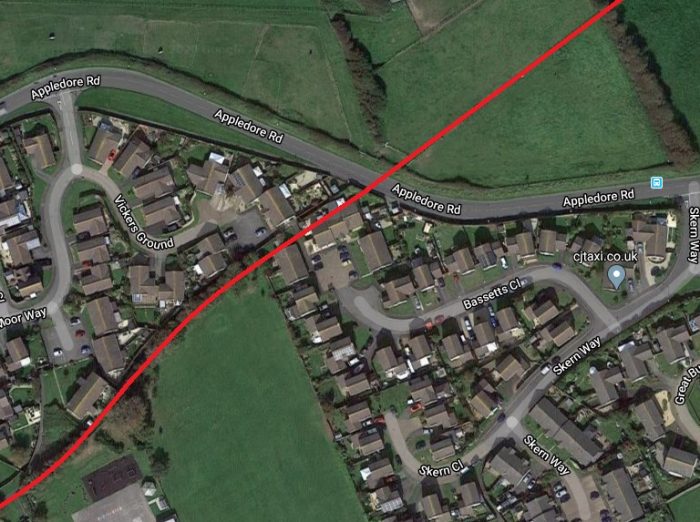 The approximate alignment of the old railway. Evidence on the ground is minimal as the line was very short-lived opening in 1908 and closing int he First World War (Google Maps). All of the 21st century roads and buildings visible on this satellite image were not present at the time the railway was in use.
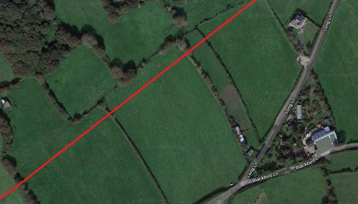
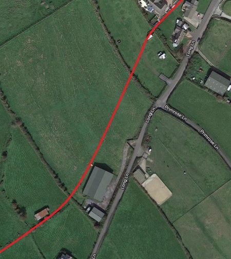
 The route of the extension turned gradually to the North running just to the Northwest of Long Lane. The actual alignment is not clear. The alignment shown on the modern satellite images reflects the alignment drawn on the Bartholomew Map extract and the map at the head of this article.
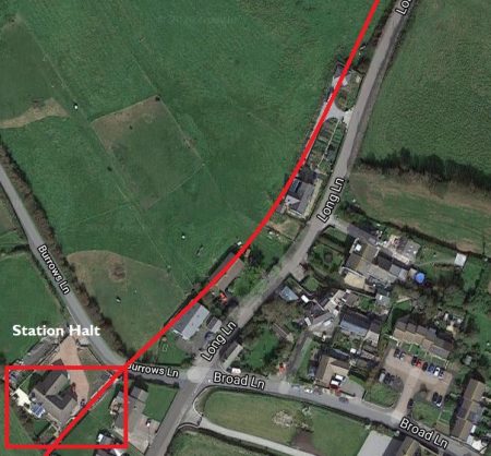
There was a Halt at what s now called Burrows Lane and which used to lead out to the old Appledore Lifeboat Station and the old line then either crossed Long Lane at an un-gated crossing at a very shallow angle as suggested by the Bartholomew Map, or followed the Northwest verge of Long Lane as suggested by the map at the head of this article. I am unsure which of these routes applied but have chosen to show the route staying on the Northwest verge of Long Lane as this seems to fit best with the alignment further along the line. The historic Long Lane soon came to an end and the line continued along the shore line close to what is now the South West Coastal Path. The old line has been built over and is now used as a road providing access to Appledore. This work was completed in 1935 [12]. The start of this length can be seen on the immediately adjacent satellite image and continues on those which follow below. But first, a few images from Google Streetview which show the location of the Halt and the probable route of the line to the Northwest of Burrows Lane. Looking back to the Southwest along the old railway alignment towards Northam Halt (Google Streetview).
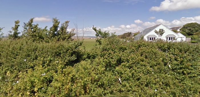 Looking Northwest along the probable route of the old line from the same point on Burrows Lane towards Appledore (Google Streetview).
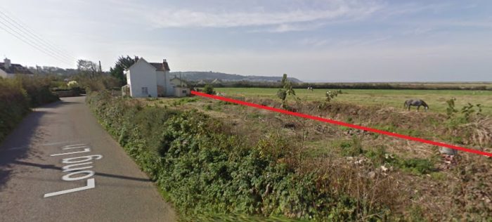 Looking back along Long Lane to the junction with Burrows Lane. The approximate route of the old line is shown (Google Streetview).
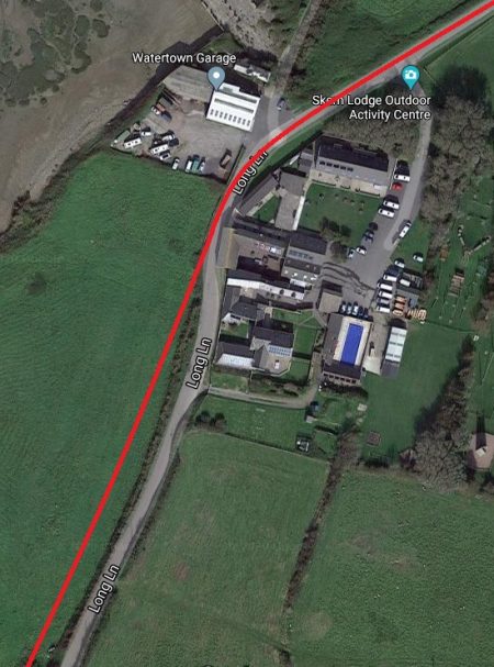
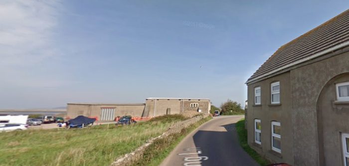 Further to the Northeast along Long Lane at the point where the old lane finished. The line crossed between the building on the right and the building shown a little further in the distance. The road now follows the alignment of the line (Google Streetview).
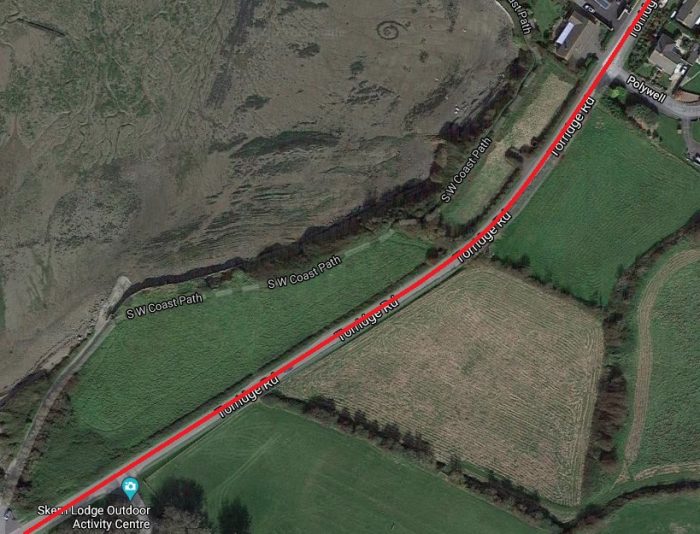 The alignment of the railway now provides the formation for Torridge Road which heads into Appledore (Google Maps).
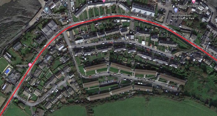
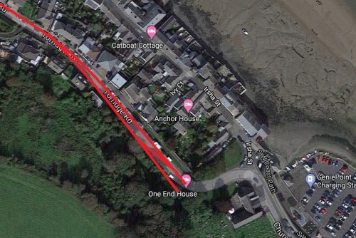 The old railway’s route into Appledore was through open fields but it now forms the spine of significant expansion of the town (Google Maps). There was a Halt at approximately the same location as the modern Lifeboat Station. The station in Appledore was a little to the West of the town/village centre.
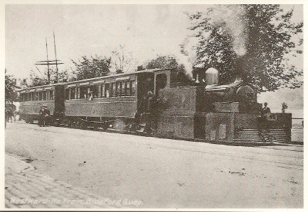
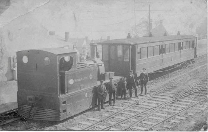 Locomotive Kingsley at Appledore Station with a single coach train. [4]
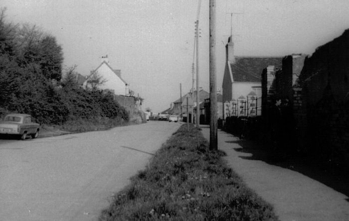 Long after closure but in the early 1960s, this picture shows the station site and on the right, the ruined station building. [12]
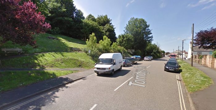
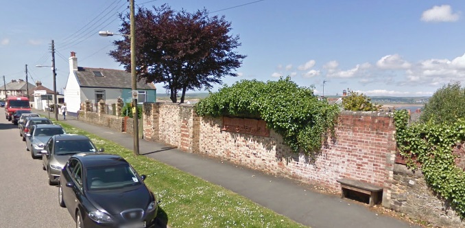 The site of Appledore Railway Station seen in the 21st century from the access to the Village/Town of Appledore. The remains of the station building can be seen in the adjacent image (Google Streetview).
Wikipedia tells us that the station was the terminus of the 7½ mile line from Bideford. It served in this capacity from 1908 to 1917 when the whole line was closed for resources for the war effort in the Great War. [12][8: p29]. “Appledore had a 300-ft long, one-foot high platform, situated on the down side of the line. [8: p70] Brick built public toilets, a general and ladies waiting rooms and ticket office were provided, [6: p142] similar in appearance to those built at Westward Ho!. Two railway cottages were built at the site. [6: p113][8: p76] The station had gas lighting and was unique for the line in having a footbridge; this allowed access from Irsha Street to nearby allotments. [6: p113] A run-round loop was provided, together with a dead-end siding, engine shed, water tower, hydrant, and coal store. The signal cabin, situated on the platform, had ten levers and the station was controlled by up, down, and distant signals. [6: p142]” [12]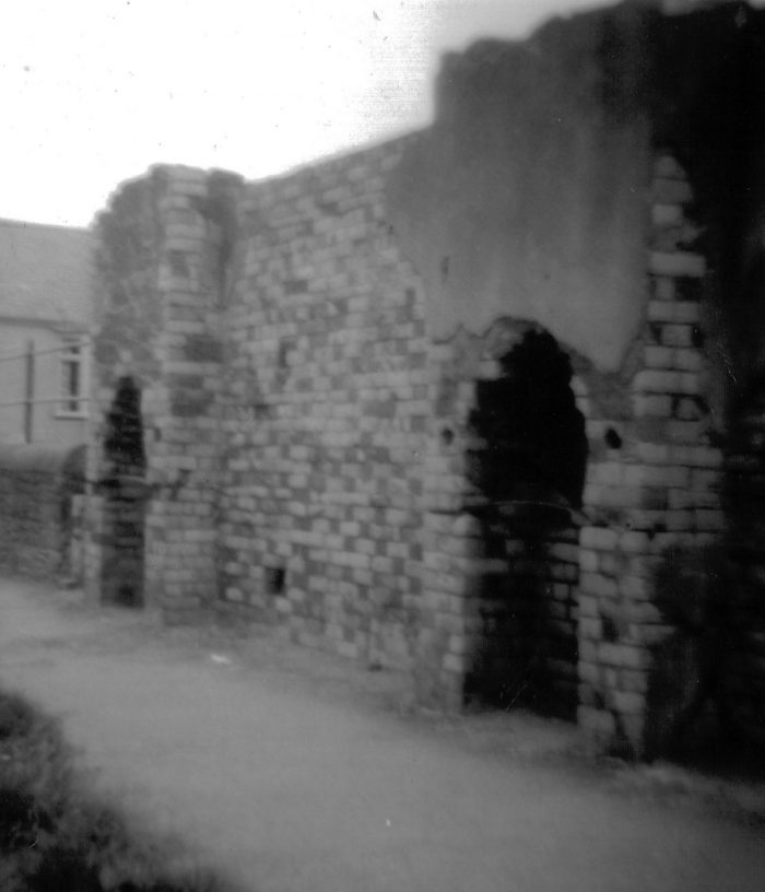 An earlier image of what was the back wall of the station building showing the two old fireplaces. [13]
References
- http://rfbwharailway.blogspot.com, accessed on 5th June 2019.
- https://en.m.wikipedia.org/wiki/Westward_Ho!_railway_station, accessed on 5th June 2019.
- http://www.westwardhohistory.co.uk/the-railway, accessed on 5th June 2019.
- https://www.pinterest.co.uk/pin/172051648248692984/?lp=true, accessed on 6th June 2019.
- https://maps.nls.uk/geo/explore/#zoom=17&lat=51.0404&lon=-4.2419&layers=168&b=1, accessed on 30th November 2019.
- Stanley Jenkins; The Bideford, Westward Ho! and Appledore Railway; Oakwood Press, Oxford, 1993.
- Julia & Jonathan Baxter; The Bideford, Westward Ho! and Appledore railway 1901-1917; Chard, 1980.
- Rod Garner; The Bideford, Westward Ho! & Appledore Railway; Kestrel Railway Books, 2008.
- https://englishrail.wordpress.com/2009/09/14/bideford-westward-ho-appledore-rwy, accessed on 5th June 2019.
- https://en.wikipedia.org/wiki/Northam_railway_station_(Devon), accessed on 20th March 2020.
- https://maps.nls.uk/geo/explore/#zoom=14&lat=51.05353&lon=-4.20945&layers=156&b=1, accessed on 21st March 2020.
- https://en.wikipedia.org/wiki/Appledore_railway_station_(Devon), accessed on 21st March 2020.
- https://commons.wikimedia.org/wiki/File:BWH%26AR_Appledore_station_1969-70.jpg, accessed on 21st March 2020.
Resources for further investigation, [2]:
- Baxter, Julia & Jonathan (1980). The Bideford, Westward Ho! and Appledore railway 1901-1917. Pub. Chard. ISBN 0-9507330-1-6.
- Christie, Peter (1995). North Devon History. The Lazarus Press. ISBN 1-898546-08-8
- Garner, Rod (2008). The Bideford, Westward Ho! & Appledore Railway. Pub. Kestrel Railway Books. ISBN 978-1-905505-09-8.
- Griffith, Roger (1969). The Bideford, Westward Ho! and Appledore Railway. School project and personal communications. Bideford Museum.
- Jenkins, Stanley C. (1993). The Bideford, Westward Ho! and Appledore Railway. Pub. Oakwood Press. ISBN 0-85361-452-0.
- Kingsley, Charles (1923). Westward Ho! Pub. London.
- Stuckey, Douglas (1962). The Bideford, Westward Ho! and Appledore Railway 1901-1917. Pub. West Country Publications.
- Thomas, David St John (1973). A Regional History of the Railways of Britain, Vol.1: The Westcountry. Pub. David & Charles.

I am the secretary for the group that is responsible for the content of the Fremington Quay Heritage Centre in North Devon. We are about to introduce Kiosk screens into the Centre as a means of sharing more information and images about the Fremington Quay, and North Devon Railway with locals and visitors alike.
Many people are not aware that there used to be a railway right the way from Barnstaple to Westward Ho! and Appledore, and I would like to include screen(s) to show this historical link.
Would it be possible for me to use 3 or 4 of the photos from your site to illustrate this, please?
Dear John
I very happy for you to do so. I think I have credited everything to original photographers where possible but you might just want to check for yourself that you are not contravening any copyrights
Best wishes
Roger