
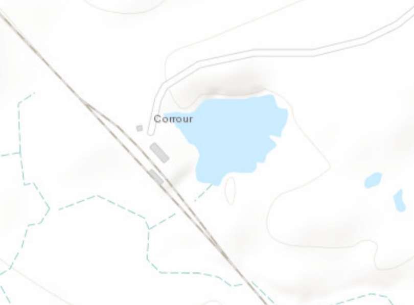
Corrour Station is near Loch Ossian on the Corrour Estate. It is the highest mainline railway station in the United Kingdom at an elevation of 1,340 feet (410 m) above sea level. It is located between Rannoch and Tulloch, and is sited 71 miles 54 chains (115.3 km) from Craigendoran Junction, near Helensburgh. In the 21st century, ScotRail manages the station and provides the most services, along with Caledonian Sleeper. [2]
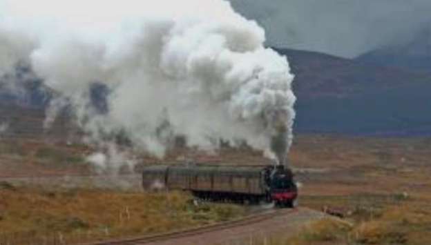
The featured image for this article is a video of steam at work on Rannoch Moor not far from Corrour. The video can be watched here. [7]
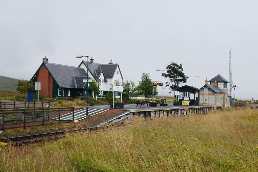
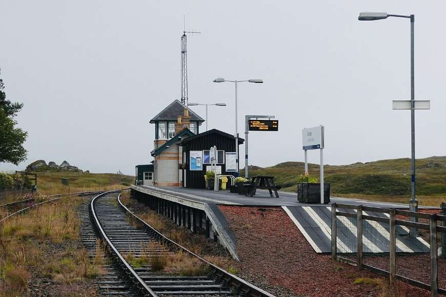
Corrour Railway Station “has a passing loop around an island platform with a siding on the east side. In common with the line’s two other remote passing places, Gorton and Glen Douglas, it was built with a tall signalbox and an adjacent low building in which the signalman lived. The adjacent low building (in Corrour’s case) was also used as a sub post office from 15th December 1896 and a Post Office telegraph office from 16th August 1898; Corrour even qualified as a post town. Later, the railway constructed a station house for the signalman on the east side of the tracks, and the original building became purely office accommodation for the railway and the post office.” [2]
When the North British Railway opened the West Highland Lines to Fort William in 1894, it had been forced to build a station at Corrour, ten miles from the nearest road. Sir John Sterling-Maxwell permitted the line to be built across the Corrour Estate on the proviso that this Railway Station would be built to serve the estate.
McGregor tells us that only 48 miles of the 100 mile line lay within lands belonging to firm supporters of the new railway:
“There was assured passage from Craigendoran to Inverarnan, through the Colquhoun estate, and from Inverlair (Tulloch) to Fort William, through The Mackintosh’s Brae Lochaber property and Lord Abinger’s Inverlochy. But between Glen Falloch and Glen Spean the landowners in question (Breadalbane, Menzies, Walker and now Stirling-Maxwell) had to be variously cultivated or won over.
“Facilities were a matter for the North British. General Manager John Walker, who died in 1891 with the West Highland still three years from completion, had begun negotiations with his namesake Colonel Walker, on the basis that the then Corrour lodge, on the ridge east of the railway, could be accessed from a simple halt or private platform near Lubnaclach. His successor, John Conacher, looked to conclude a formal agreement with Stirling-Maxwell, by which time it had been decided that the passing place to break the long section between the stations at Rannoch and Inverlair would be sited at the summit of the line and named ‘Corrour’. With a siding for coal and other deliveries, the passing loop would be convenient for the larger, up-to-date lodge which the new proprietor planned to build beside Loch Ossian. Request-stop rights were confirmed, while Stirling-Maxwell, for his part, permitted railway-builders Lucas & Aird to take sand and gravel free of charge; this outcropped in useful quantities across the wet, peaty heights of Rannoch which he now owned. George Malcolm, long-established factor for the Glen Garry and Glen Quoich estates and a notable West Highland campaigner, became Corrour factor as well – surely no coincidence? He may have helped frame the agreement, which he vigorously upheld after the railway opened for traffic in August 1894.
“Ambiguities remained … while Conacher and his deputy David Deuchars [head of the North British traffic department and ‘superintendent of the line’], less sanguine about the prospects of the West Highland than John Walker, were determined to keep North British obligations within bounds. Much conflict ensued, beginning with the unfinished state of Corrour passing place that first autumn, gates had not been installed in the railway fence and the siding lacked buffer stops. When Stirling-Maxwell was in residence, a mail pouch went to and fro, but the regulations governing postal traffic, at first strictly interpreted, meant that it was dropped and collected at Rannoch, entailing a 7-8 mile pony trip.“The early months of operation saw vulnerable consignments (nursery-grown trees for planting out, young fish to stock Loch Ossian) carried past Corrour, to be “lost” in Fort William goods yard. Cheap weekend tickets to Glasgow, for the sizeable workforce employed on building the new lodge, were only grudgingly conceded. And strife repeatedly arose over the cumbersome request-stop procedure on which Deuchars insisted, involving the North British district superintendents at Glasgow and Fort William. (The Corrour signalman risked being disciplined if he used his own discretion.)
“Some relaxation came for Stirling-Maxwell personally, after he was elected to Parliament in 1895 and made regular journeys to Westminster. Nevertheless, strict conditions remained – for estate workers, Fort William tradesmen and even Corrour guests, while brake-van passes for travel by the daily goods trains were not willingly issued, despite the slender passenger timetable. A festering grievance was the imposition of ‘next station’ fares standard North British practice in respect of unadvertised halts with a restricted passenger-and-parcels traffic; these were calculated to Tulloch (northbound) or to Rannoch (southbound). Returning from Corrour one evening, Malcolm at last refused to pay the excess and a fractious correspondence followed, verging on the ludicrous, before the North British solicitor advised that the trivial sum was best forgotten.” [1: p27-28]
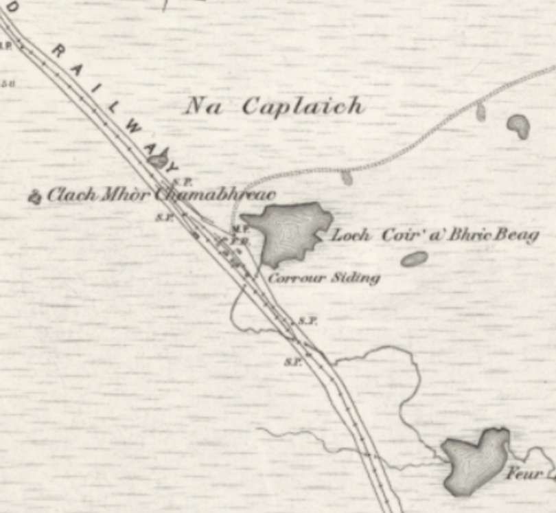
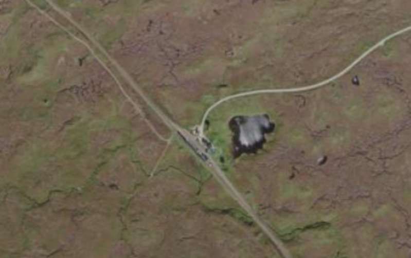
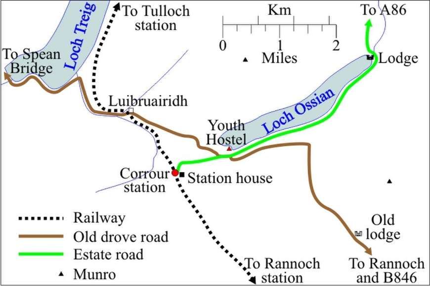
Beyond its role as a halt serving the Corrour Estate, Corrour Railway Station was intended to be a passing place named Luibruaridh (sic) after the nearest habitation Luibruairidh, on the old drove road between Rannoch and Spean Bridge (1 1⁄2 miles (2.4 km) northwest). The Station broke up what would have been an excessively long stretch between passing places at Rannoch and Tulloch on the railway.
Wikipedia tells us that the halt was used “as a station, and the name ‘Corrour’ was also used although Corrour Lodge at that time was where the drove road crossed Coire Odhar, some 5 miles (8.0 km) southeast of the station (marked Corrour Old Lodge on the OS map). However, when the station opened, estate traffic was facilitated by the building of a mile-long (1.6 km) track connecting the station to the old drove road as it passed near the head of Loch Ossian. … In the early days, there was so much estate business that the railway employed an extra [clerk] during the grouse season. It was theoretically a private station for the use of the estate, but it was also used by the public from the start, despite its not appearing in public timetables until September 1934.” [2]
McGregor tells us that the solution to all of the early bickering was finally agreed. Full public station status was approved by the Board of Trade with no onerous conditions. [1: p28]
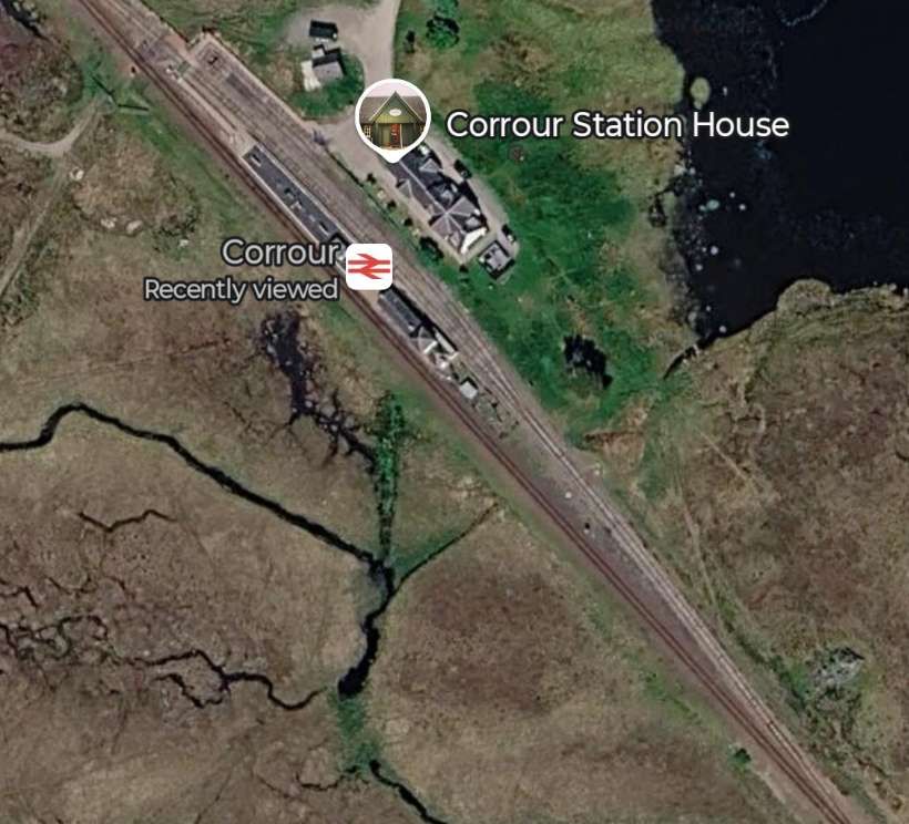
Wikipedia continues: “In 1897, the estate built a new lodge at the foot of Loch Ossian, 4 1⁄2 miles (7.2 km) northeast of the station. There was, however, no vehicular access to the lodge from the public road system, so all goods (including vehicles) had to come and go by rail via Corrour station. Until the track along the south shore of Loch Ossian was built, the estate ran a small steamer from the lodge to the head of Loch Ossian (where Loch Ossian youth hostel is now), from which the station was only a little over a mile (1.6 km) away. In 1972, the Forestry Commission built a private macadamized road from the A86 at near Moy Lodge to Corrour Lodge, so for the first time there was vehicular access to the station, via Corrour Lodge and Moy Lodge – a total distance of 15 miles (24 km).” [2]
We noted earlier that circumstances improved significantly for Sterling-Maxwell when he became an MP. Whatever deal was actually done, Sterling-Maxwell “gave his support to the much-contested Treasury Guarantee on which the West Highland Mallaig Extension depended. By virtue of his lesser property at Morar, he had a personal interest in the Mallaig line. Stirling-Maxwell later became a North British director, a “West Highland voice” on the board. Of a younger generation that the familiar landed “names” behind the West Highland project, he would live on into the mid-20th century, and his paternalist concern for successive railway families at isolated Corrour is well attested.” [1: p28]
Corrour Railway Station was just to the South of the summit of the line – the highest point on the railway network in the UK. Its sub post and telegraph office closed on 5 March 1977. [8]
In the 21st century, specifically in the year from April 2018, the station was the most used on the line North of Crianlarich with the exception of Fort William and Mallaig. [9] In recent years passenger usage has been:
2020/21. 2,268. (COVID-19)
2021/22. 11,518
2022/23. 14,108
2023/24. 17,930
2024/25. 20,500. [2]
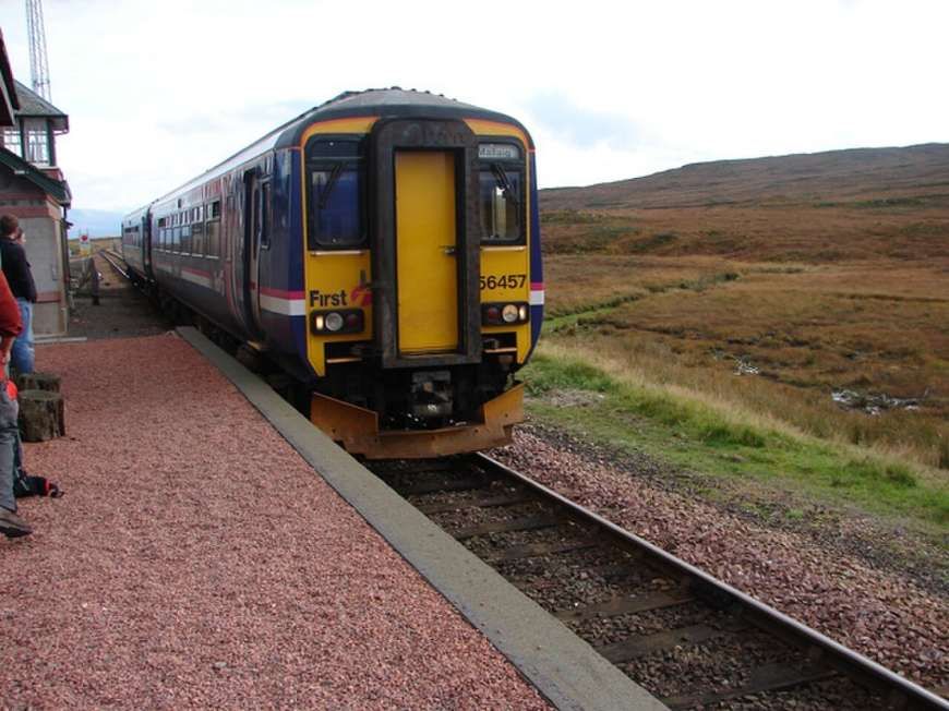
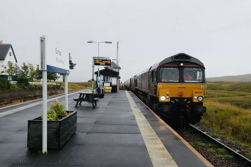
In the mid-21st century, Corrour is unstaffed and there are no ticket-issuing facilities. There are no departure announcements but there is WiFi, a telephone help point, an electronic departure display and a Caledonian Sleeper digital information point. There is a shelter with bench seats and cycle racks. The station is lit by electric lights. [2][10]
There is a great introduction to what life at Corrour Railway Station was like in the past, here on WordPress. [6]
References
- John McGregor; Corrour; in West Highland News – Plus; Friends of the West Highland Lines, Spring 2026, p26-28.
- https://en.wikipedia.org/wiki/Corrour_railway_station, accessed on 25th June 2026.
- https://en.wikipedia.org/wiki/Corrour_railway_station#/media/File:Corrour_3.jpg, accessed on 26th June 2026.
- https://en.wikipedia.org/wiki/Corrour_railway_station#/media/File:Corrour_2.jpg, accessed on 26th June 2026.
- https://en.wikipedia.org/wiki/File:Corrour_railway_station_map_2017_v1.jpg, accessed on 26th June 2026.
- https://wp.me/pab5wM-2j, accessed on 26th June 2026.
- https://youtu.be/SURGUaDU-M8?is=28t5jfCDtEGSbDN, accessed on 26th June 2026.
- https://sites.google.com/site/ukpostofficesbycounty/home/scotland, accessed on 26th June 2026.
- https://dataportal.orr.gov.uk/statistics/usage/estimates-of-station-usage, accessed on 26th June 2026.
- https://www.nationalrail.co.uk/stations/corrour, accessed on 26th June 2026.
- https://en.wikipedia.org/wiki/Corrour_railway_station#/media/File:Corrour(2).jpg, accessed on 26th June 2026.
- https://en.wikipedia.org/wiki/Corrour_railway_station#/media/File:CS_Corrour.jpg, accessed on 26th June 2026.
- https://maps.nls.uk/geo/explore/#zoom=15.3&lat=56.76232&lon=-4.68915&layers=6&b=ESRIWorld&o=100, accessed on 26th June 2026.
- https://maps.nls.uk/geo/explore/#zoom=15.3&lat=56.76188&lon=-4.69037&layers=6&b=ESRIWorld&o=0, accessed on 26th June 2026.
- https://maps.nls.uk/geo/find/#zoom=16.0&lat=56.76017&lon=-4.69071&layers=102&b=1&z=0&point=0,0, accessed on 26th June 2026.

.jpg)
Pingback: Friends of The West Highland Lines Journal – ‘West Highland News Plus’ | Roger Farnworth