Lawrence begins his article about the relatively newly refurbished Shrewsbury Railway Station by remarking on the debt Shrewsbury Station owes to the construction of the Severn Tunnel: “it is to the Severn Tunnel that Shrewsbury owes the position it claims as one of the most important distributing centres in the country if not the most. In telephonic language, it is a “switch board,” and those on the spot claim that more traffic is interchanged and redistributed at Shrewsbury than even at York.” [1: p461]
At the Southeast end of the station site, rails predominantly from the South and West converge. At the Northwest end of the station lines predominantly from the North and East meet to enter the Station.
Lawrence highlights the origins of different trains by noting the “places in each direction to and from which there are through carriages.” [1: p461]
From the South and West: London, Worcester, Dover, Kidderminster, Minsterley, Bournemouth, Cheltenham, Portsmouth, Cardiff, Bristol, Swansea, Penzance, Torquay, Weston-super-Mare, Southampton, Carmarthen, and Ilfracombe.
From the North and East: Aberystwyth, Criccieth, Barmouth, Llandudno, Dolgelly, (all of which are more West than East or North), Manchester, Leeds, Liverpool. York and Newcastle, Glasgow and Gourock, Edinburgh, Perth and Aberdeen, Chester and Birkenhead.
Lawrence comments that “these are terminal points, and separate through carriages are labelled to the places named; but, of course, the actual services are enormous: Penzance, for instance, means Exeter, Plymouth, and practically all Cornwall; and London, means Wolverhampton, Birmingham, Leamington and Oxford. And the bulk of these through connections only came into existence – and, in fact, were only possible – after the opening of the Severn Tunnel.” [1: p461-462]
Before 1887, the Midland Railway “had something like a monopoly of the traffic between North and West, and Derby occupied a position analogous to that occupied by Shrewsbury today, but, of course, on a much smaller scale. In 1887, the North and West expresses were introduced by the London and North Western Railway and the Great Western Railway, and then Ludlow, Leo- minster, Hereford, and a host of sleepy old world towns suddenly found themselves on.an important main line.” [1: p462]
From Manchester and Liverpool, Lawrence says, “the new route not only saved the detour by way of Derby, but incidentally substituted a fairly level road for a very hilly one. There are now nine expresses in each direction leaving and arriving at Shrews-bury, connecting Devonshire and the West of England and South Wales with Lancashire and Yorkshire.” [1: p462]
Shrewsbury Station was erected in 1848, and was the terminus of the Shrewsbury and Birmingham Railway, constructed by Mr. Brassey. It was enlarged in 1855, and practically reconstructed in 1901.
The current Historic England listing for the Station notes that it opened in 1849 and was extended circa 1900. The architect was Thomas Penson Junior of Oswestry. The building is “Ashlar faced with Welsh slate roof. Tudor Gothic style. 3 storeys, though originally two. 25-window range, divided as 4 principal bays, articulated by polygonal buttresses with finials. Asymmetrical, with tower over main entrance and advanced wing to the left. 4-storeyed entrance tower with oriel window in the third stage, with clock over. Polygonal angle pinnacles, and parapet. Mullioned and transomed windows of 3 and 4 lights with decorative glazing and hoodmoulds. String courses between the storeys, with quatrefoil panels. Parapet with traceried panels. Ridge cresting to roof, and axial octagonal stacks. Glazed canopy projects from first floor. Platforms roofed by a series of transverse glazed gables. The building was originally 2-storeyed, and was altered by the insertion of a lower ground floor, in association with the provision of tunnel access to the platforms.” [6]
Lawrence says that the building “possesses a handsome façade and is of freestone, in the Tudor Gothic style. Unfortunately, its imposing frontage is not shewn to the best advantage, as the station lies literally in a hole. Previously to 1901 there was direct access from the roadway to the platforms; but the principal feature of the 1901 alteration was the excavation of the square in which the station was built to a depth of 10 or 12 feet, in order to allow the booking offices, parcels offices, etc., to be on the ground floor, under the platforms, and passengers thus enter the station from a subway, wheeled traffic approaching the platform level by means of a slope. On one side frowns the County Gaol, on the other is the Castle, now a private residence. All around and in front are small shops, for the approach is only by way of a back street.” [1: p462]
A satellite image showing Shrewsbury Prison, the Railway Station, the River Severn and Shrewsbury Castle. [Google Maps, September 2024.
Shrewsbury Gaol is more normally referred to as Shrewsbury Prison, but you may hear it called ‘The Dana’. It was completed in 1793 and named after Rev Edmund Dana. The original building was constructed by Thomas Telford, following plans by Shrewsbury Architect, John Hiram Haycock.
“William Blackburn, an architect who designed many prisons, also played a part in drawing up the plans for a new prison. It was Blackburn who chose the site on which the prison is built. Blackburn was influenced by the ideas of John Howard, … a renowned Prison Reformer. … Howard visited Shrewsbury in 1788 to inspect the plans for the new prison. He disliked some aspects of the designs, such as the size of the interior courts. … Consequently, redesigns were undertaken by Thomas Telford who had been given the position of Clerk of Works at the new prison the previous year. Shrewsbury Prison was finished in 1793 with a bust of John Howard sitting proudly above the gate lodge. He gives his name to Howard Street where the prison is located.” [7]
The gatehouse of Shrewsbury Prison with the bust of John Howard above. [7]
Shrewsbury Castle was commissioned by William the Conqueror soon after he claimed the monarchy and was enlarged by Roger de Montgomery shortly thereafter “as a base for operations into Wales, an administrative centre and as a defensive fortification for the town, which was otherwise protected by the loop of the river. Town walls, of which little now remains, were later added to the defences, as a response to Welsh raids. … In 1138, King Stephen successfully besieged the castle held by William FitzAlan for the Empress Maud during the period known as The Anarchy [and] the castle was briefly held by Llywelyn the Great, Prince of Wales, in 1215. Parts of the original medieval structure remain largely incorporating the inner bailey of the castle; the outer bailey, which extended into the town, has long ago vanished under the encroachment of later shops and other buildings. … The castle became a domestic residence during the reign of Elizabeth I and passed to the ownership of the town council c.1600. The castle was extensively repaired in 1643 during the Civil War and was briefly besieged by Parliamentary forces from Wem before its surrender. It was acquired by Sir Francis Newport in 1663. Further repairs were carried out by Thomas Telford on behalf of Sir William Pulteney, MP for Shrewsbury, after 1780 to the designs of the architect Robert Adam.” [10]
At the time of the writing of Lawrence’s article in The Railway Magazine, the castle was owned by Lord Barnard, from whom it was purchased by the Shropshire Horticultural Society. The Society gave it to the town in 1924 “and it became the location of Shrewsbury’s Borough Council chambers for over 50 years. The castle was internally restructured to become the home of the Shropshire Regimental Museum when it moved from Copthorne Barracks and other local sites in 1985. The museum was attacked by the IRA on 25 August 1992 and extensive damage to the collection and to some of the Castle resulted. The museum was officially re-opened by Princess Alexandra on 2 May 1995. In 2019 it was rebranded as the Soldiers of Shropshire Museum.” [10]
Lawrence continues to describe the Railway Station building: “Inside, one notices how the prevailing style of architecture of the front is carried into every detail of the interior. All the windows of waiting room and other platform offions are in the peculiar Tudor style, and the whole interior is graceful and handsome. The excavation of the station square involved the removal of a statue erected to the memory of one of the foremost citizens, Dr. Clement, who lost his life in combating the cholera in the early [1870s]. It was removed to the ‘Quarry’, a place of fashionable public resort.” [1: p462]
“The two main platforms are of considerable length, 1,400 and 1,250 ft. respectively, and each of them can accommodate two trains at once. The station was designed with this object in view, being divided into two block sections by a cabin, from which the whole of the station traffic is controlled. There are seven cabins in all, the most important of which contains 185 levers.” [1: p462-463]
“The lines approaching the station are laid out in curves of somewhat short radius, and the system of o guard rails is deserving of notice. Instead of being in short lengths, as is frequently the case, they are in apparent continuity with the respective facing points, and any derailment seems to be impossible. The new station is built over the river, and consequently the bridge which formerly carried only the permanent way was considerably widened – more than trebled in width, in fact. The platforms are supported by piers driven 25 ft. below the bed of the river by hydraulic pressure.” [1: p463]
Lawrence continues: “Looking across the river, the stationmaster’s house, ‘Aenon Cottage’ it is now called, is seen on the opposite bank, a house which has had a very chequered history. It started life as a thatched cottage; then it became a public house; then a ‘manse’, the residence of the Baptist minister. Then it was altered and enlarged and afforded house room for the Shropshire Union Railway and Canal Offices, and has now entered upon another phase of its railway history as the residence of Mr. McNaught, the stationmaster.” [1: p463] I have not been able to determine the exact location of this property.
Lawrence shares details of McNaught’s employment history with the railways, including periods as Stationmaster at Craven Arms and Hereford before arriving at Shrewsbury in 1890. Under McNaught at Shrewsbury were a joint staff of 160, including 16 clerical and 25 signalmen. Additional non-joint staff included clerical staff in the Superintendent’s office and the carriage cleaners.
At Shrewsbury there were locomotive sheds of the LNWR (57 engines and 151 staff) and the GWR (35 locomotives and about 110 staff).
The station was 171.5 miles from Paddington, the fastest scheduled journey was 3 hr 28min. The route via Stafford to London was 9 miles shorter than the GWR route, the fastest scheduled train in 1905 did that journey in 3hr 10min.
Lawrence notes that “the really fast running in this neighborhood is that to be found on the Hereford line, the 50.75 miles being covered in 63 min.” [1: p464]
Lawrence comments that beyond the station site, “The town of Shrewsbury is not the important place it once was. … Shrewsbury was the centre whence radiated a good deal of warlike enterprise. All this glory has departed, and Shrewsbury has not been as careful as its neighbour, Chester, to preserve its relics of the past. The walls have almost gone, railway trucks bump about on the site of the old monastic buildings, public institutions of undoubted utility but of very doubtful picturesqueness have replaced abbey and keep and drawbridge and its very name has disappeared into limbo. … (‘Scrosbesberig’).” [1: p465]
But, it seems that its importance as a railway hub in someway makes up for other losses of status: During a typical 24 hour period, “there are 24 arrivals from Hereford, 21 from Chester, 18 from Crewe, 18 from Wolverhampton, 13 from Stafford, 7 each from Welshpool and the Severn Valley, 4 from Minsterley, and 2 local trains from Wellington. There are thus 114 arrivals, and the departures are 107, making a total of 221. But a considerable number of these trains break up into their component parts when they reach Shrewsbury, and are united with the fragments of other trains in accordance with the legend on their respective destination boards, so that the total number of train movements is a good deal in excess of the nominal figure.” [1: p465]
Lawrence talks of Shrewsbury as the starting point for GWR trains to make a vigorous attack upon North Wales and similarly as the starting point for their rivals to make a descent upon South Wales. For 115 miles, all the way down to Swansea, the they had local traffic to themselves. Trains ran on the Shrewsbury and Hereford Joint line for twenty miles, as far as Craven Arms, a journey which took about half-an-hour. Trains then commenced on a leisurely run of 3 hours 5 min to 4 hours 40 min. Much of the line was single and stops were numerous. Lawrence remarked that, in the early part of the 20th century, “the fastest train from Swansea stops no less than fourteen times, eight booked and six conditional. This is the favourite route from the north to Swansea, for the scenery along the line is pretty, and, as far as alignment goes, it is much more direct than any other, although the Midland obligingly book travellers via Birminghamand Gloucester.” [1: p466]
Lawrence continues: “The only purely local service in and out of Shrewsbury is that to the little old-world town of Minsterley, 10 miles away, served by four trains each way daily. … The Severn Valley branch connects Shrewsbury with Worcester. The latter city is 52.25 miles away, but there is no express running. It forms no part of any through route. … Two hours and a half is [the] … allowance for 52 miles.” [1: p466-467]
Of interest to me is the time Lawrence quotes for the 63 mile journey from Manchester to Shrewsbury, 1 hour 45 minutes. The shortest train journey from Manchester to Shrewsbury in the 21st century is from Manchester Piccadilly to Shrewsbury, which takes about 1 hour and 9 minutes, although a more typical journey would take more like 1hour 40 minutes. The distance is, today, quoted as 57 miles. There are currently 20 scheduled services on a weekday (15 of which are direct) from Manchester to Shrewsbury. In the opposite direction, there are 37 scheduled rail journeys between Shrewsbury and Manchester Stations (with 17 being direct).
Improvements to Shrewsbury Station Quarter
In 2024/25 Shropshire Council is undertaking work in front of Shrewsbury Railway Station. Work began in June 2024. [20]
Two artists impressions of the work being done in 2024/25 conclude this look at Shrewsbury Station at the start of the 20th century.
Two drawings showing the improvements underway at the time of writing. [20]
References
J.T. Lawrence; Notable Railway Stations, No. 34 – Shrewsbury: Joint London and North-Western Railway and Great Western Railway; in The Railway Magazine,London, December 1905, p461-467.
A note in the August 1905 edition of The Railway Magazine mentions a 1904 report from the Light Railway Commissioners and comments from the Board of Trade in 1905. [1: p170]
The Regulation of Railways Act 1868 permitted the construction of light railways subject to ‘…such conditions and regulations as the Board of Trade may from time to time impose or make’; for such railways it specified a maximum permitted axle weight and stated that ‘…the regulations respecting the speed of trains shall not authorize a speed exceeding at any time twenty-five miles an hour’. [2]
“The Light Railways Act 1896 did not specify any exceptions or limitations that should apply to light railways; it did not even attempt to define a ‘light railway’. However, it gave powers to a panel of three Light Railway Commissioners to include ‘provisions for the safety of the public… as they think necessary for the proper construction and working of the railway’ in any light railway order (LRO) granted under the act. These could limit vehicle axle weights and speeds: the maximum speed of 25 miles per hour (mph) often associated with the Light Railways Act 1896 is not specified in the act but was a product of the earlier Regulation of Railways Act 1868. … However, limits were particularly needed when lightly laid track and relatively modest bridges were used in order to keep costs down.” [2]
Sir Francis Hopwood’s report to the Board of Trade on the proceedings of the Light Railways Commission during 1902, indicated “a growing tendency to embark on private and municipal light railway schemes all over the country. Thirty-one fresh orders, of which only two for steam traction, were submitted, eighteen being confirmed, making a total of thirty-five for the year. No order was rejected. Since 1896, 420 applications [had] been made, more than half being confirmed. They represented 3,900 miles of line, with a capital expenditure of £30,371,193. The total mileage sanctioned during 1902 amount[ed] to 1,500 miles, with a capital expenditure of £10,148,900, or over a third of the aggregate for five years.” [10]
The short report in the August 1905 Railway Magazine highlighted the “number of applications made to the Commissioners in each year since the commencement of the Act, the number of orders made by the Commissioners, and the number confirmed by the Board of Trade, with mileage and estimates.” [1: p170]
Applications for Light Railway Orders (*From 278 applications. + From 237 Orders submitted). [1: p170]
Railways built under the Light Railways Act 1896 struggled financially and by the 1920s the use of road transport had put paid to the majority. Some survived thanks to clever management and tight financial control.
“The Light Railways Act was repealed in 1993 for England and Wales by the Transport and Works Act 1992 and no new light railway orders were allowed to be issued for Scotland after 2007. … Until the Transport and Works Act 1992 introduced transport works orders, heritage railways in the UK were operated under light railway orders.” [2]
Among many others, Light Railways which were built under the Act include these examples:
Welshpool and Llanfair Light Railway, opened in 1903, closed in 1956, reconstructed and reopened between 1963 and 1981 on the entire route except Welshpool town section. Articles about this line can be found here, here and here. [3]
Tanat Valley Light Railway, articles about the line can be found here and here. [4]
Shropshire & Montgomery Light Railway, five articles about this line and its rolling stock can be found here, here, here, here and here. [5]
Kelvedon & Tollesbury Light Railway, an article about this line can be found here. [6]
Campbeltown and Machrihanish Light Railway is referred to in this article. [7]
Bere Alston and Calstock Light Railway, the East Cornwall Mineral Railway and this line are covered in three articles which can be found here, here and here. [8]
Ashover Light Railway, is covered in three articles which can be found here, here and here. [9]
A parallel act governed light railways built in Ireland.
The Railway Magazine of February 1922 introduced its readers to the advantages of ‘demountable flats’. ‘Demountable flats’ significantly improved the loading and unloading of consignments of goods on railways and road motor vehicles. ‘Demountable flats’ made it possible to transfer a load from one to the other or vice versa in a few minutes. The result was a significant “saving in time and labour. … The system, which [was] capable of considerable extension, [was] finding favour on several railways. It [had] recently been adopted by the London and South Western Railway with great advantage and two illustrations [were] reproduced [in their article] showing the arrangements employed.” [1: p137-138]
Demountable flat in position on stand-dray, London & South Western Railway. [1: p137]
“The old method of collecting goods was to despatch a pair-horse van with two men at 9 a.m. each day to pick up a load. The horses and men were compulsorily kept idle while the goods were loaded piecemeal, the van eventually returning to the goods yard with its load and frequently being unable to perform more than one return journey in the day. Under the new arrangement a motor lorry leaves the depôt at 9 a.m. with an empty demountable flat to pick up a load. Upon arrival the flat is pushed or lifted off the chassis and a loaded one transferred thereto by similar means. The lorry is able to return with this load at 10 a.m., the load being then transferred to the stand-dray, after which the motor sets out again on another trip at about 10.15 a.m., carrying an empty flat as before.” [1: p138]
Two men transferring a load of 50 barrels of apples (weight: 4 tons), London & South Western Railway. [1: p138]
“Horses are harnessed to the stand-dray to which the first load was, as stated, transferred, and haul it to the goods siding ready to load it on to a wagon of the goods train. By this means loads collected late in the afternoon can be delivered at far distant points early the following day per goods train. Also six return journeys can be accomplished in a day, whereas previously this might necessitate the employment of twelve men and six pairs of horses. The inward traffic or goods delivery is conducted on the same lines and with the same saving of time and labour. The wheels of the demountable flats illustrated are fitted with self-aligning ball bearings, which considerably facilitate the ease of handling of the flats, especially in their loaded condition.” [1: p138]
These revised methods of working were relatively novel in 1922. As can be seen in the text above,, working patterns were changing and manual labour was becoming less important as more mechanised operations were undertaken. No doubt, the reduced number of men required for these operations eventually saw redundancies.
“The larger the unit loads the greater the reduction in handling time for a given quantity of cargo. To make economic sense any container system has to be widely adopted, prior to the 1930s this meant that the majority of containers used were for bulk flows of minerals.” [4]
The presence of an article focussing on the use of ‘demountable flats’ in The Railway Magazine might suggest that they were a relatively early form of ‘unit load’ used on the railways. Their use was certainly a development in a flow of innovation in the movement of goods across different modes of transport. They were, though, effectively, but loosely, a form of ‘containerisation’. And containers had, by 1922, been around for some time, “various kinds were in regular use on the canals from the 1780s and wooden containers were adopted by the Liverpool & Manchester line in the 1830s for both coal and general goods.” [4]
“The Liverpool & Manchester Railway built open frame ‘skeliton (sic) wagons’ to carry rectangular bottom-door coal containers already in use of the canals but used their standard flat wagons to carry Pickfords general goods containers.” [4]
Although some of the mineral ‘containers’ “travelled on specially built wagons a lot were carried in three and four plank standard open wagons.” [4]
In 1841 Brunel introduced iron mineral boxes/containers in South Wales to protect friable coal. Cranes then lifted these containers into the holds of ships at Swansea docks. They were then emptied using bottom doors. 8ft long by 4.5ft wide, these containers were carried four to a wagon. [4]
During the pre-grouping era, containers were also used for passenger luggage where that luggage needed to be loaded onto boats travelling to the continent. Certainly, both the Great Eastern Railway and the South East & Chatham Railway provided this service. [4]
“By about 1900 road furniture vans were fitted with removable wheels so they could be moved on standard railway wagons, these evolved into covered furniture containers by the time of the First World War. Building on the work done by the pre grouping (pre 1923) companies railway container designs were standardised during the later 1920’s. The new RCH approved standard containers were based on the existing designs of the time. This move was mainly lead by the LMS who began promoting containers in 1928 in order to counter the competition from road haulage companies for door-to-door services.” [4]
By the 1930s, furniture and some high value items were being carried in containers. In the late 1930s almost all meat transportation by rail was undertaken using dedicated containers.
“British railways built many thousands of containers, mainly to the standard pre-war ‘van’ type designs. Up to the 1960’s it was usual to send containers through the system as single loads, hauled in standard mixed goods trains but under British Railways all-container ‘liner’ services began to emerge in the late 1950s.” [4]
The breweries used tank wagons of both the fixed and ‘demountable’ kind for beer and spirits. “Guinness developed a steel tank in the 1940s that could be carried in ordinary open wagons but demountable beer tanks were in effect containers and ran on purpose built chassis. Bass built up quite a fleet of these tanks, some of which were later used for other work, one example being the movement of glue to chipboard factories. This latter traffic was carried throughout the 1950s and 60s but … transferred to road in the 1970s. There were a few demountable tanks carried in pairs on a single wagon, Scottish and Newcastle had two of these and Truman’s had one (which could carry either two tanks or a single tank mounted … centrally).” [2]
‘Conflats’ were developed, in the era before nationalisation of the railways. ‘Conflat’ was the telegraphic code within the GWR’s “coding of railway wagons for a container wagon. Unlike normal wagon loads, containers were only listed to carry furniture or goods (unless they were refrigerated containers, which carried frozen products kept cold by ice) which needed to be placed on a specialist flatbed wagon which had train braking capability due to the fragile nature of the products carried.” [3]
These “wagons were removed from service (as were the containers themselves) when more modern containers came into use.” [3]
“British Railways used several standard types of wagon. The Conflat A, which could carry one type ‘B’, or two type ‘A’, containers, was the most common. It was regularly used to carry AF (frozen food) containers: while the Conflat L, which could carry three smaller containers for bulk powders, was also produced in large numbers. … The Conflat B wagon could carry 2 AFP (frozen food) containers. These were slightly wider than the standard AF containers, and were designed to carry loads on pallets.” [3]
Innovation continued through the 1950s, 1960s and 1970s, but this discussion has taken us quite a distance from the ‘demountable flats’ of the 1920s and their dramatic impact on goods handling.
I was reading (in August 2024) the July 1903 Railway Magazine and came across an article about the Welshpool & Llanfair Light Railway. [1: p64-68] The article marked the opening of the line at the beginning of April 1903.
After the first railway entered Welshpool on 10th June 1862 – the Oswestry (by 1903, the Cambrian) Railway – a series of three different schemes were proposed to connect Welshpool and Llanfair Caereinion. The first scheme was put forward in 1864, the second in 1875, the third in 1887. None of these schemes came to fruition. However, “in 1896 a ray of light (the Light Railways Act) illumined the gloomy darkness of uncertainty and failure. Before the measure had received the Royal assent, Dr. C. E. Humphreys (Llanfair) had launched a scheme for connecting Llanfair with the Cambrian Railways, by means of a line through the Meifod Valley and Four Crosses. This was not allowed to pass unchallenged. Immediately Welshpool … entered the lists with a Bill for a 2ft. 6in. gauge light railway, to run from Welshpool to Llanfair. If Llanfair was to have a railway (which was of all things most desirable) that railway, said they, must run from Welshpool. … A spirited war of routes resulted, terminated by the Light Railways Commissioners giving the award to Welshpool for a 2ft. 6in. gauge railway from Welshpool to Llanfair.” [1: p64]
The successful company “was liberally supported by Welshpool, the Montgomery County Council, Forden District Council, and Llanfyllin Rural District Council.” [1: p64]. The Treasury granted a gift of £17,500 – one-third of the estimated cost. The new railway was planned as a single line, 2ft, 6in. gauge running from the road outside Welshpool Railway Station, along “the Lledan Gorge, over the Pass at Glyn Golfa to Castle Caereinion, through the Banwy Valley to Llanfair. An agreement was entered into with the Cambrian Railways to work and maintain the line; the construction of the line [was] … under the supervision of the Cambrian Railway’s Engineer, Mr. A.J. Collin: Mr. Strachan (Cardiff) being the contractor. On 30th May 1901, … Viscount Clive the son of the Earl and Countess Powys … cut the first sod for the new line. In February [1903] the line was completed; and passed by Major Druitt, of the Board of Trade.” [1: p64-65]
On 4th April 1903, the first passenger train navigated the new line. The Railway Magazine described the route: “The new railway [cut] through the town of Welshpool, over the brook and canal, and burrow[ed] its way up the Golfa Pass.” [1: p66]
The length of the line through the town of Welshpool has already been covered. For the relevant articles, please check these two links …
Those articles cover the length of the line abandoned when Welshpool undertook highway improvements, the run from Welshpool Railway Station as far as Raven Square, now a roundabout.
The roundabout at Raven Square appears top-right. The abandoned length of line heads off to the Northeast. The preservation line has a new station to the Southwest of the roundabout, approximately on the site of the passing loop shown here. 1:2500 Ordnance Survey SJ2007-SJ2107 – AA Revised: 1966, Published: 1967. [4]A sketch map of the Welshpool & Llanfair Railway. [1: p64]
The preservation line occupies the trackbed of the line from Raven Square to Llanfair. It runs immediately alongside the A458 on the North side of Nant-y-caws Brook.
A first length of the line to the West of Raven Square. This extract, and the following map extracts, is from the OS Landranger map series as held by Streetmap.co.uk. [5]The same length of the line as it appears on railmaponline.com’s satellite imagery. [6]This extract from the OS War Office, England and Wales One-Inch Popular, GSGS 3907 – 1933-43, Sheet 60 – Shrewsbury & Welshpool was printed in 1943 on a base map dated around 1916. It shows the location of the halt at Raven Square (immediately above the ‘309’) and shows the line continuing Northeast towards the centre of Welshpool. [18]Looking Southwest along the A458. The road and railway are separated by no more than a hedge or fence. [Google Streetview, May 2024]Ungated crossing adjacent to the A458 at the junction with the lane which appears bottom-left in the map extract and satellite image above. [Google Streetview, May 2024]
The Railway Magazine continues: In the Golfa Pass, “by means of a series of curves of small radii and steep inclines, the great natural beauty of the surrounding country has been retained. Rising 300ft, in the first two miles it reache[d] Golfa … with its lung-filling expanse of common – its garden of fern, gorse, and broom – where at 1,000ft above the sea level is presented a glorious panorama of typical Welsh pastoral scenery – the ideal of the pedestrian, artist, and rambler.” [1: p66]
The line then moves away from the A458 to enable it to best find its way up the valley at a reasonable grade. In doing so it follows the contours and passes through a series of tight curves. [5]The same length of the line on satellite imagery. [6]In Sylfaen Dingle, to the West of Barn Farm, it returns to run very close to the A458. [5]Once again, this satellite image covers the same length of the line as the map extract above. [6]The level crossing at Cwm Ln from the Northeast. [Google Streetview, May 2024]
The Railway Magazine continues to describe the route ahead, the line “threads the beautiful Pass of Sylvaen; there, far to westward, is spread the famous vale of Caerinion, where, silhouetted against the misty horizon, Cader Idris and The Arrans lend an air of magnificent solemnity to an impressive scene.” [1: p66]
The railway remains close to the road as far as Sylfaen Halt after which it turns away to the South. [5]A similar length of the line on railmaponline.com’s satellite imagery. [6]Farm/forest access road crossing just to the East of Sylfaen Halt. [Google Streetview, May 2024]Sylfaen Halt seen from the A458. The photo is taken from the East. [Google Streetview, May 2024]Gradients are shallower here, witnessed by the broadening of the contours. the line crosses Coppice Lane and passes to the North of the Sewage Works. [5]A very similar length of the line as it appears on railmaponline com’s satellite imagery. [6]
Castle Caereinion is South of the line down Coppice Lane from the level crossing which can be seen in the bottom-left of the image above.
Coppice Lane level crossing seen from the South. [Google Streetview, May 2024]
Again, the article in The Railway Magazine continues: the village of Castle Caereinion is about 0.5 mile from the station bearing its name. The line passed the site of the Castle of Caereinion and ran on through Cyfronydd and along the banks of the Afon Banwy, also known as the Afon Einion. It crossed the Bryn-Elen Viaduct, “a very substantial piece of engineering. The rails [were] then carried across the dingle which [ran]up to Cwmbaw by a stone bridge of six arches, at a considerable height above the bottom of the ravine. Half a mile further on is the Banwy Viaduct.” [1: 67]
After another tight curve the line enters Castle Caereinion Station. It is here that some of the services from Llanfair on the preservation line terminate. The loco runs round its train and then shepherds its carriages back to Llanfair Caereinion. Immediately at the edge of the station site the line crosses the B4385 and turns sharply to the Northwest. [5]Once again, a similar area to that covered by the OS map extract above. Along this length of the line trains for Llanfair first encounter Castle Caereinion Station, then cross the B4385 and, as they turn northward they again cross the B4385. [6]Castle Caereinion Railway Station as seen from the first level-crossing with the B4385, looking East. [Google Streetview, May 2024]The first rail-crossing on the B4385 seen from the South. Castle Caereinion Station is of the picture to the right. [Google Streetview, May 2024]The vIew West along the line from the same level-crossing with the B4385. [Google Streetview, May 2024]The second, more westerly, level-crossing over the B4385. [Google Streetview, May 2024]The view back towards Welshpool. [Google Streetview, May 2024]The line ahead towards Llanfair. [Google Streetview, May 2024]The line runs Northwest towards Cyfronwydd Bridge and Cyfronydd Station from the crossing on the B4385. [5]Railmaponline.com covers the same length of the railway. [6]
The line continues down through Cyfronydd Railway Station, over Bryn-Elen Viaduct to the banks of the Afon Banwy.
After running for a while on the South bank of the Afon Banwy (Afon Einion) the line crosses the river on a three-span girder bridge, Banwy Viaduct. It turns West once again and enters Heniarth Railway Station. Opened as Heniarth Gate on 6th April 1903 the station was renamed ‘Heniarth’ on 1st February 1913. [16]
Heniarth “is the centre for Meifod District. A short distance further on is the picturesque Melin [Dol-rhyd-y-defaid] where the rails are carried between the mill race and the River Banwy, by means of a substantial stone embankment.” [1: p67]
The Railway Magazine commented on the importance of this new railway: “This railway opens up and connects to an established system of railways, an area of over 100 square miles of Welsh scenery of great natural beauty-possessing abundance of excellent fishing and many other attractions. … Llanfair, a typical little Welsh town, is now within easy access, and the greatest obstacle to its success as a health resort has been removed. In the year 1824 (Montgomeryshire Collections) the medicinal properties of the springs of Llanfair, were discovered by one ‘Madock’, sulphur being present in one; another, close by, had chalybeat properties; while a third was saline. Pumps and other appliances were erected for the convenience of those who would make use of the springs, and the value of the waters becoming more widely known, the place was largely visited by invalids. The waters are still in good repute, and now that the difficulties consequent upon bad roads are removed, it is believed that they will become as popular as the waters of Llandrindod and Llanwrtyd in South Wales.” [1: p67]
The track is of a small gauge – 2ft 6in. The Railway Magazine described the rails as being “of the Vignoles section, flat bottomed, 421bs. per yard. The small radii of the curves, with their steep gradients, have necessitated a general use of check rails, sole-plates, and cross-stays to ensure a safe and substantial track.” [1: p67]
Although the railway gauge is only 2ft 6in “care in designing the rolling stock has prevented this line being catalogued under the title of ‘Toy Railways’, as will be apparent from the photographs. The responsibility of designing and providing the whole of the rolling stock devolved upon Mr. Herbert Jones, the Locomotive Superintendent of the Cambrian Railways, and is of a substantial and commodious character. The coaches, very roomy and comfortable vehicles – bogie type being built after the style of the one-storey electric car, are provided with first, third, and smoking compartments, divided by sliding doors; adjustable platforms, also, at the ends provide a convenient means of communication.” [1: p68]
The railway was initially worked by the Cambrian Railways, for 60 per cent. of the earnings. [1: p68]
Original Locomotives
The railway originally operated with two locomotives, No. 1, ‘The Earl’ and No. 2, ‘The Countess’.
As The Railway Magazine says: the engines were “two in number, named respectively ‘The Earl’ and ‘The Countess’, [they were] six-wheeled coupled, side tanks, with outside cylinders, built by Messrs. Beyer, Peacock and Co. Weight in working order, 194 tons; cylinders, 11in. diameter by 16in. stroke; diameter of cast-steel wheels, 2ft. 9in.; wheel base, 10ft.; steel boiler, 7ft long, 3ft. 5.5in. diameter; 119 copper tubes, 1.75in. diameter.” [1: p68]
With Walschaerts valve gear and a maximum boiler pressure of 150 lbf/in2 (1.03 MPa), they yielded a tractive effort of 8,175 lbf (36.36 kN). [17]
The Earl and TheCountess ran the line from 1903 until closure of the railway in 1956. The engines were overhauled at Oswestry Works and were sent there on closure of the railway. [17]
By 1959, negotiations had begun with British Railways and the Welshpool and Llanfair Light Railway Preservation Company had leased the line from British Railways by the end of 1962. On 28 July 1961, The Earl returned after storage and overhaul at Oswestry Works, with Countess following not long after. They have continued to work on the line ever since. [17]
During their lifetime the locos have had many modifications, particularly after the takeover by the Great Western. During this period they were fitted with a larger cab, handles on the smokebox door, rather than the original wheel, a larger dome, a much larger and more sophisticated safety valve and two different funnels. They were painted in Great Western green. … When taken over by British Railways, their shunting bells and chopper couplings were removed, and were repainted black. … From 1997 to 2001, the locomotives were fully overhauled at Llanfair, which included the fitting of new boilers and cylinders. They are currently the same design as the BR era, but have worn different liveries in preservation. [17]
Original Rolling Stock
The Railway Magazine said: “The stock is painted in the Cambrian colours coaches, bronze, green and white; engines, black, picked out with red and yellow.” [1: p68]
3rd class bogie coach. [1: p67]
Carriage details were: “Length over headstocks, 35ft.; centres of bogies, 24ft.; width outside, 6ft. 6in.; wheel base of bogies, 4ft.; size of journals, 6in. by 3in. diameter; centres of journals, 4ft. The body [was] built of oak and mahogany, the steel underframes [were] fitted with the automatic vacuum brake, and a hand brake [was] placed on each carriage. Weight of carriage, 94 tons.” [1: p68]
Cattle Wagon. [1: p67]
“The whole of the stock was fitted with central ‘buffer couplings’ and safety chains.” [1: p68]
Goods Brake Van [1: p67]
Sadly, the coaches purchased for the opening of the line did not survive into preservation. When passenger services were suspended in 1931 the coaches were sent to Swindon for ‘storage’ but never re-entered traffic and were broken up in 1936. That would have been the end of the story but for a desire by the preserved Welshpool & Llanfair Light Railway to reverse history and through the generosity of donors a complete new rake was built by the Ffestiniog Railway at their Boston Lodge works. [23]
References
Welshpool & Llanfair Light Railway; in The Railway Magazine, London, July 1903, p64-68.
This article follows on from seven other articles which covered the Wellington to Severn Junction Railway and this line from Buildwas to Harton Road Station. The first three articles can be found by clicking on these links:
We noted in the last three articles that from the commencement of the building of the line between Buildwas and Much Wenlock, the directors hoped that the line could be extended to Craven Arms via Presthope on Wenlock Edge (linking with the limestone quarries/works at that location).
The directors of the Wellington & Severn Junction Railway were, however, fully occupied with the line from Wellington to Buildwas. Another company was set up to build the ‘Wenlock & Craven Arms and Coalbrookdale Extension Railway‘. The bill went through the parliamentary process unopposed and authorised the ‘Wenlock Railway Company‘ to construct the line. Work started on 23rd October 1861.
By 5th December 1864, the line was open from Much Wenlock to Presthope. (That length is covered in the last but one online article listed above.) At this time, because it was a freight-only line, the Board of Trade saw no need for an inspection of the line. It had already been agreed at a meeting held on 4th December 1863 not to proceed with the line from Presthope to Craven Arms for the time being. It was to be three years after the line reached Presthope before the connection to the Shrewsbury & Hereford Railway close to Craven Arms was completed. It was finally opened on 16th December 1867.
Harton Road Station to Craven Arms
Harton Road Station to Marsh Farm Junction as shown on the Ordnance Survey Landranger Series mapping. [20]
We start our onward journey at Harton Road Station which is now a private dwelling. The station building and platform were on the North side of the line. There was a loop to the West of the passenger facilities which could act as an unloading/loading point for goods or even, possibly, as a passing loop if required.
Ken Jones deals with much of the length towards Marsh Farm Junction by telling us that, “Shortly after leaving Harton Road there [was] a long straight stretch across Henley Common, this was once part of the common field system attached to the small hamlet of Henley. Across the common and into a tree-lined deep cutting; as the train weaves in and out of the trees and cuttings between Harton Road and Marsh Farm Junction brief glimpses can be seen of a tower rising well above the trees to the left of the line; this is the well known Shropshire landmark Flounders Folly, a mid-19th century folly. After negotiating its stone staircase tourists would be rewarded with commanding views of the surrounding Shropshire and Border countryside.” [1: p109]
From this point on, the line crosses private land and for some distance the formation has been ploughed into the fields. After some distance, to the South side of the line there is a large Solar Farm. The access track to the solar farm runs West from the farm towards the A49.
Not long after joining the main line branch trains stopped at Wistanstow Halt, the village being to the West of the Halt.
In 1901, there is no sign of Wistanstow Halt. The Halt opened in 1934 and closed in 1956. [26]The bridge over the main line on the minor road between the A49 and Wistanstow, seen from the West. The Halt was on the Northside of the bridge on the length of track visible to the left of this image. [Google Streetview, September 2021]This is the only picture of the halt that I have been able to find. It is unattributed in John Hodge’s second volume about the North & West Route. [27: p66]Just South of Wistanstow the line crosses the A489 very close to its junction with the A49. [Google Maps, August 2024]The same location as it appeared on the 25″ Ordnance Survey of 1901. [28]The A489 passes under the line from Shrewsbury to Hereford close to Craven Arms. [Google Streetview, May 2024]
Before entering Craven Arms station, on the right was Stretford Bridge Junction, for the Bishop’s Castle Railway. In the early 1930s the Wenlock branch train could be brought to a stand here, whilst a Bishop’s Castle Railway mixed train was allowed to pass, with its former GWR ‘517’ class engine and its chain-braked ex-LNWR four-wheeled coaching stock, an open-planked wagon, a cattle truck and a Bishop’s Castle brake van.
Within a very short distance the line crosses the River Onny, ran on through what was once the junction for the Bishop’s Castle Railway (Stretfordbridge Junction and under and [29]The same area on Google Maps. Earthworks associated with the Bishop’s Castle Railway are visible at the West side of the line. [Google Maps, August 2024]The view from the West along the minor road which crosses the railway at the bottom of the extract from Google Maps above. {Google Streetview. May 2024]
After passing Stretford Junction, the line crossed Watling Street, the old roman road at an oblique angle.
After passing Stretford Junction, Watling Street and Long Lane Crossing, to the right was the carriage and engine shed, and to the left the goods shed and yard.
The train pulled in on the down platform at Craven Arms, and after taking water the engine ran round the two coaches, and backed into the bay at the north end of the platform, this also being used by the Bishop’s Castle trains.
Craven Arms owes its existence to the coming of the Shrewsbury and Hereford Railway in 1852. It is truly a railway town created out of the hamlet of Newton. The S&H line passed through the Onny Valley, its route taking it past Shropshire’s famous beauty spot Stokesay Castle, and past a coaching inn named after the Lord of Manor the Earl of Craven, prompting the S&H to give the station the name of Craven Arms. The station was opened for traffic on 20th April, 1852. The parish name of Stokesay was added to the station’s name a little later.
The importance of Craven Arms as a railway centre was given added impetus by the opening of the Knighton Railway in 1861. Although only a branch it was in reality to be the embryo of the LNWR’s march upon Swansea. Various small companies were involved in the construction of the line between Craven Arms and Swansea, these later being absorbed into the LNWR or operated jointly by the LNWR and GWR.
On 1st July, 1862 Craven Arms station came under the joint ownership of the LNWR, GWR and West Midland Railway. The station consisted of up and down main line platforms, with booking office, general and ladies waiting room, together with refreshment rooms on the down side. Also on the downside was the station master’s house. The up side consisted of general and ladies’ waiting rooms only. The north and south end bays were on the down side. The North [1: p109] end bay was utilised by the Bishop’s Castle and Wenlock branch trains. [1: p114]
An aerial photograph from the South of Craven Arms and Stokesay Railway Station in 1948. Found on eBay on 12th August 2024. [25]Craven Arms in the 21st century is much reduced. [34]
This brings us to the end of our journey from Wellington to Craven Arms along the Wenlock Branch.
References
Ken Jones; The Wenlock Branch; The Oakwood Press, Usk, Monmouthshire, 1998.
The photographs of the pre-contract drawings for the line were taken by myself and show extracts from the construction plans held in the Shropshire Archive. There is a standard charge of £10 per visit for taking photographs of their records.
Adrian Knowles; The Wellington, Much Wenlock & Craven Arms Railway; Lightmoor Press, Lydney, Gloucestershire, 2022.
The photographs of the pre-contract drawings for the line were taken by myself and show extracts from the construction plans held in the Shropshire Archive. There is a standard charge of £10 per visit for taking photographs of their records.
J. Holt Schooling produced a series of articles in The Railway Magazine after the turn of the 20th century. I came across the third of these in the July 1903 edition of the magazine. [1: p20-28] Elsewhere in the same magazine, there was a short note which highlighted the total net receipts of all Britain’s railways companies with the figures tabulated. [9: p59]
Headline figures for Britain’s railway companies for 1901 and 1902. [9: p59]
The figures show a small but significant increase between 1901 and 1902.
Holt Schooling’s article looked at some detailed statistics relating to British railways, with some comparisons made with statistics relating to the railways of the USA. …
Accidents
Holt Schooling highlighted the decrease in the chance of death or injury to railway passengers over the period from 1877 to 1901. Accidental deaths fluctuated over the period, injuries fell significantly in absolute terms (4,330 injured between 1877 and 1881 and 2,988 in 1897 to 1901) during the same period, the number of passengers carried rose significantly (2.9 billion to 5.5 billion). In relative terms, the number of deaths and injuries improved dramatically. The proportion killed, reducing from 1 in 17.9 million to 1 in 75.6 million, and the proportion injured refusing from 1 in 700 thousand to 1 in 1.2 million.
Passenger accident statistics on British railways. [1: p20]
Comparable figures in the USA show that the chance of death or injury while travelling by rail in the USA is very much higher, close to eight times higher.
Passenger accident statistics on railways in the USA. [1: p20]
Holt Schooling notes that “This result, unfavourable to the United States, is partly qualified by the fact that American railway journeys are of greater duration than English railway journeys, American passengers thus being exposed to risk of accident for a longer time than the British pas- senger, and also the American returns do not explicitly state whether or not the accidents to passengers are ‘from causes beyond their own control’ – a condition that applies to the foregoing accident facts for British railways.” [1: p21]
Holt Schooling produced a 10year summary of the causes of accidents. …
Causes of accidents in the British Isles during the ten years 1802-1901. [1: p21]
He notes that, “collisions account[ed] for 60% of all train accidents that happened, and that only two other causes of accidents had any material degree of frequency.” [1: p21] These were defects in the permanent way and trains entering stations at too great a speed.
Rates of Dividend on Ordinary Stock
In 1901, over £454 million was invested in railway companies ordinary stock. Schooling focuses on Ordinary Stock because it is the largest of the stocks under which railway capital is grouped. He explains that Guaranteed and Preference Stock amounted to more than £425 million, and Loans and Debenture Stock, just over £316 million.
Rates of Dividend Paid in 1901. [1: p22]
31% of Ordinary Stock paid a dividend between 2 and 3%. Interestingly, nearly 20% of the stock paid a dividend from 5 to 6%. [1: p22]
Working Expenditure
Railway costs per 1000 train-miles all rose between 1900 and 1901, with the exception of the cost of compensation which marginally decreased.
Railway Expenditure 1900/1901. [1: p22]
In absolute terms, the pattern is similar. Railway costs rose by just over £2.7 million between 1900 and 1901.
Railway Expenditure 1900/1901. [1: p23]
That increase in costs was only partially matched by a £1.5 million increase in gross receipts.
Train Mileage
Holt Schooling compared British and American figures for the year 1900 which was the latest year he had figures for. …
USA passenger train miles were 363.5 million, goods train miles were 492.6 million. A total of 856.1 million miles. The figures for the UK were respectively, 220 million, 180 million and a total of 400 million miles.
It is worth noting that freight mileage in the USA was considerably higher than passenger mileage. In the UK passenger mileage exceeded freight mileage. Train mileage in total in the USA was more than double that in the UK.
It is interesting, however, to consider the intensity of use of lines in the USA and the UK. This provides a very different picture. …
Train mileage per mile open for traffic. [1: p24]
Holt Schooling comments that on “average, each mile of American railroad is passed over by a train 4,400 times in the year, or twelve times per day. But each mile of British railroad is passed over by a train 18,300 times in the year, or fifty times per day. This is a striking fact, and it is another of those fundamental differences between the railway systems of the two countries … Our railways are used more than four times as often as the American lines are used, and this fact necessarily carries with it many other important differences between the two railway systems and the methods by which they are worked.” [1: p24]
Classes of Passengers
Three different classes were used on Britain’s railways. Holt Schooling tabulates the figures for each class in 1901.
Patronage of British railways passenger trains by class in 1901. [1: p24]
Holt Schooling notes “the overwhelming preponderance of the third-class passenger … 91.2 per hundred. The [highest] proportion of third-class passengers [was] in Scotland; and the lowest proportion of third class passengers [was] in Ireland, 81.4 per 100.” [1: p24-25] It is worth reminding ourselves that the whole of Ireland, at this time, was still considered to be part of the UK.
Holt Schooling goes on to note that the highest proportion of second- and first-class passengers in the UK was in Ireland and then comments that these figures suggest that Irish travellers do not feel the need for thrift in the way others in the UK do. He seems to suggest that his figures show that Ireland was not as poverty-stricken as was currently being made out in 1903.
It seems to me that this is only one way of interpreting the figures. Surely it is, at least, just as possible that these figures suggest that relative poverty was greater in Ireland given that a lower proportion of people were able to afford to travel third-class. It is also possible to infer from the figures that there was a greater disparity between rich and poor in Ireland than in the rest of the UK.
Receipts from Passenger and Goods Traffic
Gross receipts of British railway companies in 1901 were £106.5 million of which over £99.5 million were traffic receipts (passenger and goods combined). Holt Schooling notes that “Goods Traffic yielded more than one-half of this amount namely, £53 million, and passenger traffic, £46.5 million.” [1: p25-26] He goes on to state that over the 10 years (1892-1901), passengers receipts had increased in relation to goods receipts as shown in the table below.
Traffic Receipts of the Railways of Britain. [1: p26]
Overall receipts had increased year on year from £78.6 million in 1892 to £99.6 million in 1901. Despite the slight discrepancy in figures between Holt Schooling’s narrative and the table above, it is clear that the relative proportion of income changed over the 10 year period from 45% passenger/55% goods, to 47% passenger/43% goods.
Holt Schooling looks behind these overall figures and notes that close to 77% of passenger receipts came from third-class passengers! The figures were: 76.8% third-class; 10.7% second-class; 12.5% first-class.
Comparison of some Individual Railway Companies
Holt Schooling provides some details of individual railway company receipts/expenditure in 1901. [1: p26]
The lowest percentage of expenditure to receipts that he quotes is for the Furness Railway, 51%, closely followed by the Great North of Scotland Railway (52%), the North British Railway (53%), the Caledonian Railway (56%), the Great Northern Railway of Ireland (56%), the Taff Vale Railway (58%), Midland Great Western Railway of Ireland (59%) and the Glasgow and South Western Railway (61%).
The average of all British railways was 63%, a figure which also applied to the GWR, the L&Y and the LNWR. Those with higher percentage of expenditure included: the Great Southern & Western Railway of Ireland, the London & South Western Railway and the Midland Railway (64%), the North Eastern Railway (65%), the Great Eastern Railway (66%), the Great Northern Railway (67%) and the Great Central Railway (70%)
Holt Schooling suggests that these figures are counterintuitive. Rather than the larger companies being the most efficient, it seems that it was the smaller companies for whom this was true. There also appears to be a Northwest/Southeast divide with the least efficient companies being to the South and East of the country, while the more efficient were in the North and West, including Ireland!)
Holt Schooling also looks at receipts per train mile in pence/mile. …
Railway company receipts per train-mile. [1: p27]
Holt Schooling comments: “Here, again, are very large differences. The Taff Vale Railway received nearly 7s. per train-mile run from passenger and goods traffic, while the Great North of Scotland Railway received little more than 4s., the mean result for all railways in the United Kingdom being almost exactly 5s. per train-mile run. There are many important railways in the above list whose receipts per train-mile run are appreciably below the average, although upon general considerations, one would expect them to be above rather than below the average.” [1: p27]
Delayed Arrival of Trains
The most recent figures available to Holt Schooling, issues by the Board of Trade, related to some companies’ long-distance train arrivals in London in the 3 month period, June-August 1895. …
Punctuality of Railway Companies’ Trains at London termini in June to August 1895. [1: p27]
Figures for trains originating more than 50 miles from London may well feel comparable for the first four companies in the table above. Given the greater distances travelled by trains in the GWR, it is to be expected that a smaller percentage would have arrived within 5 minutes of the scheduled time than other companies in the list.
Rail Usage, January to March 2024 and earlier.
How do the statistics from 1903 compare with modern figures? The Office of Rail and Road produces quarterly statistics about rail usage. At the time of writing, the latest statistics cover the period from January to March 2024. [2]
The ORR report is dated 13th June 2024.
“A total of 1,610 million journeys (1.61 billion) were made by rail passengers in Great Britain in the latest year (1 April 2023 to 31 March 2024). This is a 16% increase on the 1,380 million journeys (1.38 billion) in the previous year (1 April 2022 to 31 March 2023). There were 405 million journeys in the latest quarter (1 January to 31 March 2024). This is a 13% increase on the 359 million journeys made in the same quarter in the previous year (1 January to 31 March 2023).” [2]
“Total passenger revenue was £10.3 billion in the latest year. This is a 13% increase on the £9.1 billion in the previous year (when adjusted for inflation). In the latest quarter, total passenger revenue in Great Britain was £2.6 billion. This is 13% more than the £2.3 billion generated in the same quarter in the previous year (when adjusted for inflation).” [2]
Included within the ORR report was a graph showing passenger numbers since 1946.
Passenger numbers on British railways since 1946 [2]
In 1946, passenger numbers were 1,270 million. A nadir was reached in 1982, just 630 million passengers. The peak since then was reached at the end of the 2010s, 1,740 million. At the turn of the 20th century Holt Schooling reported annual passenger numbers as 1,712 million, almost the same as the figure for 2019/20. The effect of the pandemic was marked. In 2020/21, passenger numbers fell to 388 million, recovering to 990 million in 2021/22, 1,380 million in 2022/23 and 1,610 million in 2023/24.
Before 1946, figures were interrupted by the two world wars. It is possible, however, to produce a similar graph to that above covering the period prior to 1946. The ORR has done so and an extract from another of their regular reports is below.
Passenger numbers on British railways from 1872 to 1947 and beyond. [8]
Peak patronage of the country’s railways occurred in 1920 when the railways carried 2,186 million passengers.
Passenger train kilometres: distances are recorded in kilometres in 2024. Between January and March 2024, “there were 126 million passenger train kilometres travelled, … an 8% increase on the 117 million recorded in the same quarter in the previous year. However, this is 93% relative to the 136 million in the same quarter five years previously (January to March 2019).” [2] These figures record full train movements.
Passenger vehicle kilometres: “include both the distance covered by locomotives and the carriages they transport. In the latest quarter (January to March 2024), there were 764 million passenger vehicle kilometres operated. This is a 6% increase on the 722 million kilometres in the same quarter in the previous year. However, this is still slightly below prepandemic levels, at 96% relative to the 800 million five years ago (January to March 2019).” [2]
The ORR report summary says that the key results of their statistical work are:
A total of 1.61 billion journeys were made by rail passengers in Great Britain in the latest year (1 April 2023 to 31 March 2024). This is a 16% increase on the 1.38 billion journeys in the previous year (1 April 2022 to 31 March 2023).
There were 405 million journeys in the latest quarter (1 January to 31 March 2024). This is a 13% increase on the 359 million journeys made in the same quarter in the previous year (1 January to 31 March 2023).
Total passenger revenue was £10.3 billion in the latest year. This is a 13% increase on the £9.1 billion in the previous year (when adjusted for inflation).
A total of 60.1 billion passenger kilometres were travelled in the latest year. This is a 13% increase on the 53.0 billion passenger kilometres travelled in the previous year.
Rail Accidents to 2024
Annual rail safety statistics on mainline rail, London Underground, and other non-mainline networks (trams, metros, other light rail, minor and heritage railways) are provided by the ORR, “reporting on fatalities and injuries to passengers, members of the public and workforce in Great Britain. It also covers train accidents and (annual and quarterly) number of signals passed at danger (SPADs). These incidents are reported to the Office of Rail and Road under the Reporting of Injuries, Diseases and Dangerous Occurrences Regulation (RIDDOR).” [4]
The ORR reports on rail safety at the end of September each year, at the time of writing the latest report was published on 28th September 2023. [5]
“There were eight non-workforce fatalities (passenger or public) in the latest year (April 2022 to March 2023), a decrease from 11 in the previous year. These included five fatalities which occurred in mainline stations and at the platform-train interface, two passenger fatalities at stations on the London Underground and one fatality from a collision between a member of the public and a tram.” [5] The 8 fatalities in the year are lower than those reported by Holt Schooling. The total number of passenger fatalities in the years 1887 to 1901 was 520 people. The average number of fatalities per annum during that time was close to 35. But the network in the 21st century is much smaller.
“As of August 2024, the UK’s National Rail network is 10,072 miles (16,209 km) in Great Britain and 189 route miles (303 route km) in Northern Ireland. This network includes 20,000 miles of track, 30,000 bridges, tunnels, and viaducts, and around 2,500 stations.” [6]
By 1914, “the country had 23,000 miles of rail track and 4,000 stations, according to industry body Rail Delivery Group.” [7] Assuming the parameters are consistent, this means that the network in 2024 is less than 45% of that serving the country in 1914. If the network were of a similar size to that in 1914, the 8 fatalities in 2022/23 would equate to nearer to 15 fatalities after the turn of the 20th century. It is reasonable to think that, at least as far as fatalities are concerned, the modern rail network is safer than that operating in the early 20th century.
Conclusions
The statistics quoted and reviewed by Holt Schooling, provide an insight into the activities of railway companies at the turn of the 20th century. Passenger numbers were to increase further over the years and hit a peak in 1920 but then dropped to a low point in 1982 before recovering strongly. Only to see a drastic temporary reduction as a result of the pandemic.
Both passenger numbers and accidents are reported differently in the 21st century. However, as much as it is possible to compare figures from times more than a century apart, and as limited as this analysis has been, we can tentatively say that modern railways are comparably well patronised and safer than they were early in the 20th century.
References
J. Holt. Schooling; Lessons from Railway Statistics; The Railway Magazine, London, July 1903, p20-28.
The featured image above was included in a Steam Days article in September 2021. Crossing the River Tyne on approach to Border Counties Junction is Gresley ‘K3’ class 2-6-0 No 61897, a St Margarets allocated locomotive that has worked through, and the stock is different too, ex-LNER and cascaded down from main line work. In due course the condition of the Border Counties Bridge and the predicted cost of repairs was a major factor in the abandonment of this ex-NBR route, with passenger trains ceasing to run on 13th October 1956, although the passage of goods trains continued through to 1 September 1958. [37]
At the end of August 2024, we visited Kielder Water Reservoir, passing through Bellingham on the way. We noticed a disused railway for which a good number of structures and embankments/cuttings remained in place.
This was the Border Counties Railway (BCR), a line connecting Hexham in Northumberland, with Riccarton Junction on the Waverley Route in Roxburghshire. [1]
The BCR was also known as the North Tyne Railway as it ran beside the River North Tyne for much of its length.
The line between Kielder and Falstone is now under the waters of the Kielder Water Reservoir.
“In 1844 the North British Railway (NBR) was authorised to build a line from Edinburgh to Berwick to join an English line there. The NBR line ran close to the coast avoiding most high ground and opened in 1846. In 1845 the Caledonian Railway was authorised to construct a line from both Glasgow and Edinburgh to Carlisle, crossing the Southern Uplands at Beattock Summit, 1,033 ft (315 m) above sea level.” [1][2][3][4]
In 1853, talk was of a significant coal seam around Plashetts and in 1854, Robert Nicholson was engaged to survey a railway route to serve this coalfield. “His line was to run from Hexham, … through Reedsmouth to Bellingham, and on to the coal deposits at Falstone. His work was remarkably quickly done, for a bill for the Border Counties Railway was submitted to Parliament for the 1854 session. … The scheme was authorised when the Border Counties Railway (North Tyne Section) Act 1854 (17 & 18 Vict. c. ccxii) was given royal assent on 31st July 1854. The capital was to be £250,000.” [1]
The line was built as a single line, but land was acquired for later doubling, and all the bridges except the Hexham bridge, were built for double-track The full length of the authorised line was initially not built before “a public train service started on 5th April 1858; there were four passenger trains each way Monday to Saturday, and two on Sunday. They ran from Hexham to Chollerford, with an intermediate station at Wall.” [1]
It was to be only a further 16 months before the remaining length of the line was authorised when the Border Counties Railway (Liddesdale Section and Deviations) Act 1859 (22 & 23 Vict. c. xliii) got royal assent on 11th August 1859. The authorised capital for the whole line was increased by £100,000. The North British Railway were authorised to make a working arrangement with the BCR.
“From Wark, the line approached Reedsmouth, and there was a temporary goods terminus at Countess Park there while the river bridge was completed. The passenger service terminated at Wark. There was a demonstration train from Newcastle to Countess Park run on 1st December 1859. Public opening was expected ‘within the week” but this proved to be inaccurate, and the opening throughout to Falstone was delayed until 2nd September 1861.”
By 1860 the BCR was seriously short of cash; “the authorised capital had never been fully raised and the hoped-for coal reserves at Plashetts were disappointing. There seemed little chance of raising more capital now. The North British Railway was expansive, and was happy to take over the local line, and the result was the North British and Border Counties Railways Amalgamation Act 1860 (23 & 24 Vict. c. cxcv), passed on 13th August 1860; … the act regularised the use by BCR trains of Hexham station of the Newcastle and Carlisle Railway. The BCR network was known now as the NBR (Border Counties Section).” [1]
The construction of the line throughout to Riccarton was completed by mid-April 1862, but the opening of the line to Riccarton did not take place until 24th June 1862 for goods, and 1st July 1862 for passengers. [1]
On 1st May 1865, “the Wansbeck Railway was opened, between Morpeth and Reedsmouth. The Wansbeck Railway had been promoted independently but was taken over by the North British Railway in 1863.” [1]
Hexham sits on what was once the Newcastle to Carlisle Railway (NCR) and which is, in the 21st century, known as the Tyne Valley Line.
Hexham Station was opened on 9th March 1835 by the NCR which became part of the North Eastern Railway (NER) in 1862.
The original station was probably designed by the architect Benjamin Green of Newcastle-upon-Tyne. It was altered and extended between 1835 and 1871 and again by 1901. It is now a Grade II listed structure and stands in a conservation area. The station was restored in 1998/1999. [5]
After the NCR had been absorbed by the NER, the station became a junction, with the opening of the first section of the BCR, between Hexham and Chollerford in April 1858. The first section of a second branch, the Hexham and Allendale Railway, was opened for goods in August 1867. Initially promoted to serve lead mines, that line opened for passengers in March 1869. [6][7]
Since the closure of the Hexham and Allendale Railway to passengers in 1930 (completely in 1950), as well as the BCR in 1956 (completely in 1958), the station has diminished in size and importance. Both lines met with the Tyne Valley Line to the West of the station. [6][7][8: p134]
The Disused Stations website covers Hexham Station in some detail. [9]
A straight length of line brings the railway to the banks of the Tyne. The line curves round toward the West and follows the South bank of the Tyne as far as Border Counties Junction where trains for Riccarton Junction and Hawick left the Borders Railway and crossed the Tyne on an angled viaduct.
A short distance beyond the viaduct on the Border Counties Railway was a private colliery line which served Acomb Colliery.
“Mining at Acomb seemed to stop and start between the mid 19th century until 1909, when a larger complex opened until 1952.” [20]
There were various owners before the pit was taken on at nationalisation by the NCB. … Messrs. Stobart & Co. (1840s), J. Morrison & Co. (1860s), Messrs. Morrison (1880s), Tynedale Coal Co. Ltd. (1910s), Acomb Coal Co. Ltd. (1920s), National Coal Board (1947). [20]
For more information about the coal workings on the site, please consult the Durham Mining Museum. [21]
It is worth noting that the half-mile long line was worked by one engine, Black Hawthorn 0-4-0ST No. 1068 for over 30 years until closure of the mine in 1952. [13: p12]
These works sat alongside the line, just a few hundred metres North of the Acomb Colliery Railway.
Howford Brick & Tile Works. [23]The location of Howford Brick & Tile Works hosts Heidelberg Materials Ready mixed Concrete plant in the 21st century. The route of the old railway is shrouded in trees. [Google Maps, September 2024]
North Tyne Colliery
Some distance further North, North Tyne Colliery sat adjacent to the line.
North Tyne Colliery was served by a 500yd. loop off the Border Counties Railway, it also had a tramway linking it to the road network (A6079). Messrs Walton & Cooper worked a drift mine here from 1906 to 1922. This extract comes from the 25″ Ordnance Survey of 1921. [13: p13][23]Approximately the same area as shown on the OS map extract above. The site of the colliery is now heavily wooded. [Google Maps, September 2024]
For further information about this colliery, please consult Durham Mining Museum. [22]
Wall Railway Station
Wall Railway Station was 1/3 mile from the village. It sat alongside the River North Tyne on its East bank a few hundred metres North of North Tyne Colliery.
There is good coverage of Wall Railway Station on the Disused Stations website. [25]
Humshaugh Railway Station
North of Wall Railway Station there was little to interest us until the BCR reached Humshaugh Railway Station. Darsley & Lovett say that “the station was opened as Chollerford on 5th August 1858 and was the BCR’s first temporary terminus. Sidings once led to a lime depot, where a tramway, inclined at 1 in 5, led to Brunton kilns. Another tramway led to the quarry. They closed in 1895.” [13: p18]
Historic England say that the grade II listed kilns were located North of Brunton Bank near Chollerford were probably built in the early 19th century. [29] Nearby was Brunton Bank Quarry. There is no evidence of a tramway, in the immediate vicinity of the station, leading to these two sites on the Ordnance Survey of 1896.
Only a short distance beyond Humshaugh Railway Station, the old railway passed under what became the A6079 and then passed a Limekiln at the bottom of a tramroad which served Cocklaw Quarry.
Another extract from the 25″ Ordnance Survey completed before the turn of the 20th century. Shows both the location of the road bridge and the Limekiln. [28]The same location on 21st century satellite imagery. The line of the BCR can easily be made out, as can the location of the limekiln at the junction of the tramroad and railway. [Google Streetview, September 2024]An enlarged extract from the 25″ Ordnance Survey which shows the loop provided by the NCR at the limekiln. [28]This extract from the 25″ Ordnance Survey at a small scale than the previous extracts shows the full length of the tramroads serving Cocklaw Quarry. This was a 3ft gauge tramroad with an incline. [28]
A short distance further North the line bridged a road and stream at the same location. …
An enlarged extract from the 25″ Ordnance Survey of 1895/6 which shows the next significant structure on the BCR. [32]The same location in the 21st century. [Google Maps, September 2024]The line bridged both road and stream by means of a stone-arched structure. This photo of the bridge is taken from the Southeast. [Google Streetview, July 2021]Another extract from the 25″ Ordnance Survey. Another bridge, this time spanning both the road which became the A6079 and a tributary to the River North Tyne. [34]The same area on 21st century satellite imagery. [Google Maps, September 2024]The viaduct which carried the BCR over what became the A6079. [Google Streetview, July 2023]The view from the North on the A6079 of the same viaduct. [Google Streetview, July 2023]
Chollerton Railway Station
“The station was opened on 1st December 1859 by the North British Railway. It was on the west side of the A6079 at the junction with an unclassified road and immediately southwest of Chollerton village. A goods loop and a coal depot were to the south. A small goods shed was sited at the south end of the platform. Instead of extending the platform, the NBR built a new one to the north with a wooden waiting shelter. The original buildings remained in use and the siding was adjusted so that one of the two docks used the old platform. There was a three-ton crane in the goods yard. The station closed to passengers on 15th October 1956 and closed completely on 1st September 1958.” [33]
Shortly after crossing the viaduct above the line entered Chollerton Railway Station. The station sat opposite the village church, St. Giles. [35]The same area on modern satellite imagery. [Google Maps, September 2024]The northern end of Chollerton Railway Station looking North. [36]A view of the site of Chollerton Railway Station from the East on the A6079. [Google Streetview, July 2023]
Chollerton Railway Station is the end of this first part of the journey along the Border Counties Railway.
The featured image above is of the Aveling & Porter locomotive known as ‘Old Chainey’, one of two unusual steam locomotives which served the line in early days. [29]
One of the delightful things about reading early copies of The Railway Magazine is the perspective from which articles are written. In this particular case the existence of the Great Central Railway is a welcome novelty!
This article begins: “Quainton Road is a name which has of late become familiar to the railway public owing to its being the converging point of the lines of the Great Central Railway’s recently-opened extension to London with those of the Metropolitan. It is situated in Buckinghamshire, at a distance of 45 miles from London” [1: p456]
Goodman goes on to refer to the Great Central as being “destined to become a power in the land.” [1: p456]
With the benefit of hindsight, whatever could be said about the Great Central during its lifetime, we know that it has not survived as a main line!
“The Great Central Railway [GCR] in England was formed when the Manchester, Sheffield and Lincolnshire Railway changed its name in 1897, anticipating the opening in 1899 of its London Extension.” [2]
It survived as an independent company until, “on 1st January 1923, the company was grouped into the London and North Eastern Railway.” [2]
Ultimately, “the express services from London to destinations beyond Nottingham were withdrawn in 1960. The line was closed to passenger trains between Aylesbury and Rugby on 3 September 1966. A diesel multiple-unit service ran between Rugby Central and Nottingham Arkwright Street until withdrawal on 3 May 1969.” [2]
But this article is not about the GCR. It is about what Goodman describes as a “useful but little-known line … Called the Oxford and Aylesbury Tram Road.” [1: p456] The name is somewhat of a misnomer, as the line depended on the Metropolitan service between Aylesbury and Quainton and only ever ran as far as Brill, with a population of 1,300. It was only 6.5 miles in length. It was known during its lifetime by a number of different names: the Brill Tramway; the Quainton Tramway; the Wotton Tramway; the Oxford & Aylesbury Tramroad; and the Metropolitan Railway Brill Branch.
“In 1883, the Duke of Buckingham planned to upgrade the route to main line standards and extend the line to Oxford, creating the shortest route between Aylesbury and Oxford. Despite the backing of the wealthy Ferdinand de Rothschild, investors were deterred by costly tunnelling. In 1888 a cheaper scheme was proposed in which the line would be built to a lower standard and avoid tunnelling. In anticipation, the line was named the Oxford & Aylesbury Tramroad.” [3]
The first locomotives on the line were particularly unusual. Built by Aveling and Porter of Rochester, they arrived on the line in 1872, at which time the line was known as the Wotton Tramway.
A previous article looked at these Aveling and Porter locomotives among other unusual locomotives. Goodman says that “the early locomotive stock of the tramway consisted of two four-wheeled engines, which would now-a-days present a more or less unique appearance by the side of more modern types of locomotion.” [1: p457]
“Old Chainey” is a chain and flywheel-driven loco built in 1872. It was one of two locomotives on the line between Quainton Road and Brill. It was not very successful, especially if loads were heavy. It lasted in service on the Tramway until 1895 when it was sold for use at Nether Heyford Brickworks in Northamptonshire, where it continued working until the Second World War. [5]
It is now a static exhibit. It was placed, first at the London Transport Museum and then on long-term loan from the London Transport Museum to the Buckinghamshire Railway Centre. [6]
Goodman continues: “In general design [the locomotives] were not unlike the familiar traction engine, being built upon the same principle. Each engine had only one cylinder, which was situated above the boiler. Motion was accordingly imparted to a fly-wheel placed near the foot-plate, which, being connected with the running (not driving) wheels by a chain passing round their axles, caused the engine to move. The dimensions of the cylinders were 7 in. in diameter and 10 inches stroke. The wheels on the rails were 3 ft. in diameter. Both engines had long chimneys, fitted with caps to prevent the emission of sparks. For the accommodation of the enginemen, cabs – in reality little more than weather-boards – were provided, and at each side, about 18 in. above the rail-level, a footboard was fixed. …. The speed attained by them would hardly be termed ‘express’, the time occupied on the 6.5 miles from one terminus to the other averaging about 90 minutes!” [1: p457] That is just over 4 mph.
The line was upgraded in 1894, but the extension to Oxford was never built. “Instead, operation of the Brill Tramway was taken over by London’s Metropolitan Railway and Brill became one of its two north-western termini.” [3] The Aveling and Porter locomotives appear to have remained in service until 1895.
The nickname “Old Chainey” appears to result from the noisy operation of these locos. The one on static display at Buckinghamshire Railway Centre is Aveling and Porter No. 807. It was the first of the two locomotives converted for use on the Tramway. They cost £398 each. [7: p13] It was delivered to the Tramway in January 1872. The second loco was delivered in September of the same year. [7: p18][8: p29]
Before the writing of Goodman’s article in 1899, probably as early as 1895, more advanced locomotives were introduced, allowing trains to run faster. Goodman comments that the Aveling and Porter locos were: “superseded by two smart little locomotives of a more modern design. They [were] Huddersfield No.1 and Brill No. 2. and were built by Messrs. Manning, Wardle and Co., Boyne Engine Works, Leeds, the former in 1878 and the latter in 1804. Both [had] six wheels, all coupled, saddle tanks, and inside cylinders, with a total wheel-base of 10 ft. 9 in. and when in working order they each [weighed] about 10 tons. The wheels [were] 3 ft. in diameter, and the cylinders 12 in. in diameter, with a stroke of 17 in.” [1: p458]
Manning Wardle engine Brill No.1, Huddersfield at Quainton Road in the late 1890s with the Wotton Tramway’s passenger coach of the mid-1870s, an 1895 Oxford & Aylesbury Tramroad passenger coach, and a goods wagon loaded with milk churns. [3]A rather poor photograph showing Brill No. 2, Brill. [1: p457]
The rural nature of the area meant that passenger traffic on the line was never particularly high. “The primary income source remained the carriage of goods to and from farms. Between 1899 and 1910 other lines were built in the area, providing more direct services to London and the north of England. The Brill Tramway went into financial decline.” [3]
In 1899, Goodman reported that “the traffic receipts of this little line have always been gratifying to the proprietors, and in 1894 the reconstruction of the tramway was sanctioned, and, as previously mentioned, it was decided to carry it through to Oxford. The old light rails have been replaced by flat-bottomed ones spiked directly on to transverse sleepers, but in some places bull-headed rails and chairs are utilised. The banks of earth which originally did duty for platforms have made way for small but serviceable stations, of which there are four, besides those at the two terminal points, viz Waddesden, Westcott, Wotton, and Wood Siding.” [1: p458]
Goodman also commented that “the train service was also smartened up although the speed of ten miles per hour [was] never exceeded. There [were] four trains each way daily (Sundays excepted), which [ran] at the following times: [departing Brill] 8.10, 10.30 am, 3.05, 5.05 pm, [arriving Quainton Road] 8.53, 11.10 am, 3.45, 5.50 pm; [departing] Quainton Road 9.30 am, 12.15, 4.15, 6.25 pm, [arriving Brill] 10.10 am, 12.55, 4.50, 7.00pm. … None of the trains [were] timed to stop at the intermediate stations except Wotton, unless required. Passengers and goods [were] conveyed by all trains, which [were] thus ‘mixed’, and their ‘make-up’ would certainly provoke a smile when seen for the first time.” [1: p458] The ‘consist’ was made up of a combined carriage and luggage van, one (or sometimes two) bogie coach(es) with an open interior, and an open ‘low-sided’ goods wagon which often was seen with one or two milk churns. All passengers were charged a standard 1d/mile and there was no first class accommodation. The line was worked on a single-engine in steam principal which meant no signals except on approaches to level-crossings. Goodman notes that the line was only separated from roads and adjacent property by a light wire fence.
When the line was independent, its head offices were at Brill, as was the engine shed, which sat alongside the line on the approach to Brill Station. A further two or three sidings were dedicated to the handling of goods. The station sat about a mile from the centre of Brill.
This low resolution extract from the 25″ Ordnance Survey from the turn of the 20th century shows Brill with its station. The small town is at the bottom of the extract. The Station is around a mile North at the top of the extract. [9]An enlarged extract from the 25″ Ordnance Survey showing Brill Station. The engine shed is centre-top of the extract. Passenger facilities are. Lose to the end of the line to the Southwest of the engine shed and they sit in front of the goods facilities. [10]A similar area on modern satellite imagery. The road from Brill enters this image bottom-left, it is called Tramhill. The route of the old line enters from the rightc. [Google Maps, September 2024]Brill Station in the 1890s. [1: p460]A view from Brill Station Platform with a tram running into the station and the engine shed to the left. [1: p459]An unidentified London Transport train at Brill Railway Station in 1935. [25]
Goodman also notes that the construction of the line posed no significant difficulties. He comments that “the tram road [was] a party to the Railway Clearing House so far as goods and parcels traffic [was] concerned.” [1: p459]
In 1899, through booking of passengers was not in operation, “in fact, the neighbouring companies completely ignore[d] the existence of the tram road in their time tables, and some omit to show it on their maps.” [1: p460]
Goodman expressed confidence that “when the extension to Oxford [was] opened [the line would] necessarily assume a position of more importance.” [1: p460] As we will see below, that confidence was misplaced.
In 1933, the Metropolitan Railway became the Metropolitan line of London Transport. The Brill Tramway became part of the London Underground, despite Quainton Road being 40 miles (64 km) from London. London Transport focussed on “electrification and improvement of passenger services in London and saw little possibility that passenger routes in Buckinghamshire could become viable. In 1935 the Brill Tramway closed.” [3]
“After closure, the line was largely forgotten. Because it had been built on private land without an Act of Parliament, few records of it prior to the Oxford extension schemes exist in official archives. At least some of the rails remained in place in 1940, as records exist of their removal during the building of RAF Westcott.[139] Other than the station buildings at Westcott and Quainton Road almost nothing survives of the tramway; much of the route can still be traced by a double line of hedges.[154] The former trackbed between Quainton Road and Waddesdon Road is now a public footpath known as the Tramway Walk.” [3]
References
F Goodman; The Oxford and Aylesbury Tram Road; in The Railway Magazine, London, November 1899, p456-460.
Ian Melton, From Quainton to Brill: A history of the Wotton Tramway; in R. J., Greenaway (ed.). Underground, Hemel Hempstead: The London Underground Railway Society, 1984.
Bill Simpson; The Brill Tramway; Oxford Publishing, Poole, 1985.
The November 1899 issue of The Railway Magazine carried the first of a short series of articles about the railways of New Zealand. As you will discover if you choose to read on, the author does not hold back on offering his personal opinions about the state of the railways and choices made by the government of the day for the country’s railways.
It is a pity that I do not have access to the subsequent article(s) about New Zealand’s Railways nor to any debate that the article may have provoked.
It might be interesting to hear some present day reflections on the comments the author makes!
The article is also of interest for an introduction to the rather unusual decisions taken by the Southland government about its first railway.
Rous-Marten begins: “When railway construction first began in New Zealand, that ‘Britain of the South’ was a sort of Heptarchy – an association of seven Provinces’, subsequently nine, with a ‘General’ or Federal Government at the capital, Wellington. And three of these Provinces separately entered upon railway making, each on its own account.” [1: p465]
He continues: “There was a special reason in every instance for the embarkation on this enterprise. In Southland the local capital, Invercargill, was separated from the port by about fifteen miles of swamps, and from its goldfields by a stretch of country over which road-making was difficult on account of the numerous boggy streams which had to be crossed. In Otago – more accurately Otakou … – the capital, Dunedin was approachable from the port only by a difficult channel, or a still more difficult land-track. In Canterbury the chief town, Christchurch, was separated from the port (Lyttelton) by a high – almost mountainous – range of hills. And so connection by rail was sought as the most efficient and, in the end, the cheapest, means of communication. … Unfortunately, each of those semi-independent Governments adopted a different gauge.” [1: p465]
Rous-Marten says that “Southland chose the British standard gauge, 4 ft. 8.5 in.; Otago preferred the 3 ft. 6 in. gauge; Canterbury – wisest of all selected the ‘Irish’ gauge of – 5 ft. 3 in.” There is a glimpse in this sentence of Rous-Marten’s own position which quickly becomes clear as the article unfolds. [1: p465]
He goes on to say that “still more unfortunately, when, the Provincial Governments were abo- lished, and when a general system of railways was adopted, the 3 ft. 6 in. gauge was chosen for the whole colony as the most economical – a grievous and, I fear, irreparable blunder.” [1: p465]
Otago Province
The first Otago railway, was from Dunedin to Port Chalmers. Once built, it “was worked by Double-Fairlie engines without any very serious difficulty being experienced from initiation to completion.” [1: p465]
Rous-Marten says that this Double-Fairlie Engine was a Class K, New Zealand Railways. [1: p466] The Double-Fairlie locos were, in fact, Class E locomotives. The Class K locomotives were built by Rogers in the USA and were 2-4-2 tender locomotives. Otago Province was a significant province of New Zealand until the abolition of provincial government in 1876. The capital of the province was Dunedin. Southland Province split from Otago in 1861, but became part of the province again in 1870. [36]Otago, in the 21st century, is a southeastern region on New Zealand’s South Island. Its terrain encompasses snow-capped mountains, glacial lakes and a rugged peninsula sheltering sandy beaches and wildlife like penguins. Queenstown, a lakeside resort town framed by the dramatic Southern Alps, is famous for adventure sports like bungee jumping and paragliding. Outside Queenstown are dozens of wineries. It has an area of approximately 32,000 square kilometres (12,000 sq mi), making it the country’s second largest local government region. Its population was 254,600 in June 2023. [37]
Canterbury Province
Canterbury (Māori: Waitaha) is a region of New Zealand, located in the central-eastern South Island. The region covers an area of 44,503.88 square kilometres (17,183.04 sq mi), making it the largest region in the country by area. It is home to a population of 666,300 (June 2023). [38]
Canterbury region. [38]
Rous-Marten’s article continues: “The Canterbury railway from Lyttelton to Christchurch had one solitary work of large magnitude, a tunnel through the dividing range. … The length of the ‘Moorhouse Tunnel’ is almost exactly the same as that … of the Box Tunnel of the Great Western Railway … a mile and seventy chains. … Originally, the Canterbury line was equipped with six six-wheeled tank locomotives, all built by the Avondale Company, Bristol. Of these, four had 5ft. 6in. driving and trailing wheels, coupled and inside cylinders 15 x 22; two had leading and driving wheels coupled 5 ft. in diameter, and cylinders 14 x 22.” [1: p466]
Wikipedia tells us that later the tunnel appears to have become known as the Lyttelton Tunnel. It opened on 9th December 1867. “The line and the tunnel were constructed to accommodate 5 ft 3 in (1,600 mm) rolling stock at the behest of contractors Holmes & Richardson of Melbourne, as this was the gauge they were already working with in Victoria. The line remained this way until, following the abolition of provincial government in New Zealand and the establishment of a new uniform national track gauge, the line was converted to 3 ft 6 in (1,067 mm) by April 1876.” [2]
This indicates that for the first 8 years and 4 months of its existence the line was of 5ft 3in gauge. Those first locomotives will have been of that gauge. During that time, all the railways built in Canterbury Province were of the same gauge.
Wikipedia [4] also tells us that the “Canterbury Provincial Railways operated ten steam locomotives of varying types, not divided into separate classes. They were all tank locomotives based on contemporary British practice and were built by the Avonside Engine Company, except for No. 9 by Neilson and Company. Nos. 1-4 had a 2-4-0T wheel arrangement: No. 1, named Pilgrim,[3: p12] was built for the Melbourne and Essendon Railway Company of Melbourne, Australia in 1862 but was quickly on-sold unused to Holmes and Company, who were building the Ferrymead line (in New Zealand. The line was closed after the Moorhouse/Lyttleton Tunnel opened). [3: p11] It entered revenue service when the line opened.” [4]
The remainder of the first six locomotives, No. 2 (arrived April 1864), No. 3 (arrived March 1867), No. 4 (arrived May 1868), [3: p12] Nos. 5 and 6 also arrived in May 1868. The first four were 2-4-0T locos, Nos 5 & 6 were 0-4-2T and were somewhat smaller. [3: p13]
The Province purchased three more 0-4-2T locomotives, ordered independently, No. 7 entered service in August 1872, No.8 in March 1874 and No. 10 in June 1874.[3: p12] No. 9 was a diminutive 0-4-0T ordered after No. 8 but entered service before it, in January 1874, shunting on Lyttelton wharf. [4][3: p14]
“Only No. 1 was withdrawn while in Canterbury Provincial Railways’ service, in 1876.[3: p12] When the conversion of the Canterbury lines to narrow gauge was completed, its frame and the other nine locomotives were sold to the South Australian Railways. [3: p12] Despite the ship carrying the locomotives and rolling stock, the ‘Hydrabad’, being shipwrecked near Foxton on the North Island’s west coast on its journey to Australia, the locomotives and rolling stock ultimately were safely delivered to South Australia and with considerable modification seven of them remained in service until the 1920s.” [5: p9-11]
Rous-Marten was unable to find illustrations of these locomotives. Modern technology makes it easier to search for available to sources. One of the 2-4-0T locomotives Nos 1-4 appears in the image below.
One of four 5ft 3in gauge 2-4-0T locomotives ( Nos 1-4) operating on the railways of Canterbury Province prior to 1876 and the gauge change. [6: p1]
Rous-Marten described these locomotives as “very excellent engines … [that] had large brass-covered domes (with safety-valves) over their fire-boxes.” [1: p466]
A.A. Cross, in his MA thesis, says that the “broad-gauge Canterbury Railways are considered unanimously by New Zealand historians as the origins of the modern-day railway network in New Zealand. Built by the Canterbury Provincial Government in 1863 to relieve transport issues between Christchurch and Lyttelton, the broad-gauge railway later expanded to reach Amberley in the north and Rakaia in the south, opening up the Canterbury Plains and stimulating trade and immigration.” [6: p2]
“Brought under the control of the Public Works Department in 1876 along with several narrow-gauge lines built by the Provincial Government, the broad-gauge was converted to the New Zealand standard narrow-gauge in 1878 and the locomotives and rolling-stock were sold to the South Australian Railways.” [6: p2]
Since the majority of the locomotives from Canterbury Province continued to serve on South Australian railways until the 1920 they were clearly very suited to the roles that they fulfilled in Australia.
Rous-Marten notes that, while these locomotives were serving in New Zealand, he had “timed [them] at 56 to 60 miles an hour on favourable gradients. As a rule the gradients were very easy, and the permanent way was good, the whole line being laid with 75 lb. rails.”
Southland Province
“The Southland Province was a province of New Zealand from March 1861, when it split from Otago Province, until 1870, when it rejoined Otago.” [39]
Southland Province. [39]
Rous-Marten turns to the story of the railways in Southland Province: “In the first place, to save time and expense, it was rashly decided to employ timber for the permanent way, that is to say for the rails as well as for the sleepers. Square baulks of timber were pinned longitudinally on transverse sleepers, while the engines and rolling stock were constructed on the ‘Davies’ system. That is to say, instead of the wheels having the usual flanges – which would soon have cut up the wooden road they were broad in the tread and flangeless, while smaller wheels set at an angle of 45 degrees against the inside face of the rails kept the main wheels in position. It was an ingenious idea, but proved in practice a complete failure. The wooden rails speedily perished. The locomotives, four-wheeled ‘single-wheelers’, with outside cylinders, were quite unable to obtain sufficient adhesion on the slippery surface of the timber in wet or frosty weather, especially up grades of 1 in 79 and 1 in 90.” [1: p466-467]
‘Crampton’ type locomotive “Oreti” departing Invercargill Railway Station on the “Great Northern Railway” to Makarewa in 1864. The sleepers – and the rails – are wooden. (From a painting by W.W. Stewart) [7]
More detail about the wooden railed railway in Southland Province can be found here. The experiment lasted about three years from 1864 to 1867. [7]
It seems that James M. Davies proposed this solution to the transportation dilemma besetting Invercargill in 1863, or thereabouts. Apparently, Davies had recently been instrumental in planning and building the Geelong-Ballarat Railway in southeastern Australia, and had designed a steam locomotive that was then manufactured in 1861 by Hunt & Opie’s Victoria Foundry in Australia. [8]
The ‘Lady Barkly’ was shipped by Davies to Invercargill and over four hours had it steaming along the town’s jetty on timber baulks laid for the demonstration. An enthusiastic public response resulted from the demonstration of which the Southland Times reported: “Crowds of spectators passed the afternoon at the Jetty in riding delightedly in the locomotive. … The motion was found pleasant and quite free from that oscillation and concussion, which distinguish traveling on iron rails with the usual engine.” [8]
The ‘powers that be’ were persuaded to construct a railway following Davies’ principles.
Rous-Marten continues his article by recounting a tale from his own experience of an occasion when “all the passengers of whom [he] was one, were politely asked to leave the carriage and help to push the carriage and engine to the summit of the bank. This, [he says] we did with colonial cheerfulness, and on resuming our seats the guard promptly collected 2s. 6d. apiece from us as our fares! At this time Mr. W. Conyers MICE, who subsequently was Chief Commissioner of the South Island Railways of New Zealand, was in charge of the locomotive department of the Southland line, and he conceived the idea of converting a stationary sawmill-engine into a coupled locomotive, in the hope of tiding over the difficulty until more suitable engines and permanent way could be provided.” [1: p467]
Rous-Marten expresses regret that he did not take a photograph of what he calls “this ingenious but amazing nondescript.” [1: p467] He is sure that a written description is inadequate to convey its astonishing appearance. Even so he attempts to provide details of the locomotive, which had “a pair of horizontal cylinders along the boiler, which drove a ‘dummy’ crankshaft, whence an oblique coupling-rod drove one pair of 3 ft. wheels, these being coupled to a pair of 3 ft. trailing wheels, while a third pair of 3 ft. wheels led the way, I convey all the idea I can of an engine which probably stands alone in locomotive history. I have actually travelled at 20 miles an hour with this marvellous locomotive, with the flangeless wheels and the little slanting guide-wheels, yet without disaster. True we went off the rails once when I was there; but the only damage was the smashing of a basket full of eggs, which a farmer’s wife was carrying to market. But ere long the unnatural strains to which the working parts of the engine were subjected brought her to grief, and soon the entire experiment of the railway was abandoned as a hopeless failure. Its fate was shared by the Province, which became bankrupt, and had the balliffs in its Government offices. Ultimately an arrangement was effected, and the railway was relaid with the usual permanent way, including iron rails of 72 lbs. to the yard, and was opened for a distance of 35 miles, viz., from Bluff Harbour to Invercargill and Winton.” [1: p467]
The replacement railway, completed in 1867, was built to standard gauge and three small six-wheeled tank engines were purchased. Of these three locomotives, one (a 2-4-0T) was supplied by Avonside and two (0-4-2Ts) by Hudswell Clarke. I have been unable to find photographs of these locomotives.
Rous-Marten says that “with the smaller engines I several times recorded 45 miles an hour, and once 50; with the larger engine in several instances 55 miles an hour.” [1: p468]
Gauge Standardisation
In 1870, Southland rejoined the larger Otago Province. [9] “On 22 February 1871,” Winton History Website says, “a railway line from Invercargill was opened to Winton, built to the international standard gauge of 1,435mm. This was the furthest extent of Southland’s standard gauge network, and the next section to Caroline was built to New Zealand’s national gauge, 3 ft 6 in (1,067 mm) narrow gauge railway. This extension opened on 20 October 1875, ending Winton’s 4.5 years as a railway terminus, and two months later, the line back to Invercargill was converted to 1,067mm gauge. This line grew to be the Kingston Branch.” [10]
By 1875, both Southland and Canterbury Province’s railways were converted to what the New Zealand government had decided would be the national gauge, 3ft 6in.. Rous-Marten says that this move was “very much to the annoyance and regret of the local population, who regarded the narrower gauge and smaller engines with unconcealed contempt and derision.” [1: p468] Given Rous-Marten’s already established negative views on the narrow -gauge, it is impossible to determine whether he is forcefully expressing his own views, or speaking for the wider population.
Rous-Marten comments that “after having, for a time, three different gauges in operation, and in Canterbury a mixed gauge of three rails, [New Zealand] ultimately arrived at uniformity by the process of ‘levelling down’ to the narrowest gauge of all, and the one least suitable for permanent operation. This decision was largely governed by the political influence which subsequently operated so seriously for evil in the career of the New Zealand railways. It was believed that by using the narrower gauge construction would be cheaper, and so that the millions borrowed for railway construction could be spread over a larger area than if the wider gauge were employed, and that thus a larger number of voters would be interested in supporting the scheme. And so it proved. But the results are nevertheless regrettable.” [1: p468]
I suspect that there may be, at least, some who would want to challenge Rous-Marten’s strongly expressed views. …
Moreover, says Rous-Marten, “the further mistake was committed of laying down 40lb. iron rails, which almost immediately proved unable to carry even the moderate amount of traffic anticipated, and had to be replaced with 53 lb. steel rails. However, it was but natural that errors should be committed in the starting of a large enterprise by a small community, the total population of the colony at the inception of railways being under a quarter of a million, scattered over an area more than 1,000 miles in length, and about 200 miles in breadth, divided midway by 20 miles of stormy sea, the dreaded Cook Strait. Probably New Zealand made no more blunders than did the Mother Country, if all the respective circumstances be taken into due consideration. And at the present date [1899] the colony possesses a fairly good and efficient railway system extending over more than 2,000 miles.” [1: p468]
Developments
Rous-Marten notes that by 1899, New Zealand was still waiting for the completion of a main trunk railway system. But his further assertions move beyond just reporting circumstances. … “Vast sums [had] been frittered away on small local and branch lines which [did] not pay interest on cost – some not even their bare working expenses – while main lines have been left unfinished. Indeed, in one case the first length of 84 miles of main trunk line from the capital (Wellington) northward was left to be made by a private company, which [had] since been harassed and persecuted by the Government with the object of forcing it to sell the line to the State at a price much below its just value, while it [had] been the favourite target of the small district governing bodies in respect of local taxation.” [1: p468-469]
The line in question, that from Wellington to Manuwatu, ran/runs North from Wellington, through Palmerston where it divided/divided with one arm serving Palmerston and the other, Napier. In 1899, there was also a project underway to take the line to Auckland in the North. That project was being worked from Auckland and from the South with some distance yet to go before the two projects met. Rous-Marten writes of likely long delays before the link could be completed, “as the route of the connecting link [had] been for years – and still [was] a subject of hot and embittered political strife.” [1: p469]
It seems that Rous-Marten was right about timescales, NZ History tells that in the end, “after more than two decades of surveys, engineering challenges and sheer hard work, the main trunk’s first through train left Wellington on the night of 7th August 1908. This ‘Parliament Special’ carried politicians and other dignitaries to Auckland to meet the United States Navy’s visiting Great White Fleet, which arrived in port on the 9th. The train needed 20½ hours, and several changes of locomotive, to complete the trip. In the middle section it crawled over a temporary, unballasted track that the Public Works Department had rushed through in the nick of time.” [13]
In 1899, in the South Island, things appear to have been somewhat better. Rous-Marten tells us that the main trunk line started from “Bluff Harbour, in the extreme south, and [continued] unbrokenly through Invercargill, Dunedin, Oamaru, and Timaru to Christchurch, a distance of nearly 400 miles. … It [had] been extended northward for 70 miles, and there [ended at] … Culverden station, and many miles [had] to be traversed before the [then] southern termination [was] reached of the short line which ultimately [would] continue the Southern Main Trunk to the pretty little port of Picton, in Queen Charlotte Sound.” [1: p469]
From Picton it was then a journey of about 50 miles by boat to reach Wellington and the North Island.
Wikipedia tells us that construction of the Southern Main Trunk “was completed all the way from Picton to Invercargill in 1945.” [14] It seems then that Rous-Marten somewhat misjudged how close to completion the Southern Main Trunk was.
In the 21st century, there is an 11 hour train, thrice a week, between Auckland and Wellington. [15] From Wellington you catch a ferry to Picton. There you can board the Coastal Pacific to Christchurch. [16] The Southerner, that went to Invercargill, stopped operating in 2002. [17] The journey from Auckland to Christchurch takes around 22 hours in total, provided, that is, connections can be made. Allowing a minimum of two days for the journey would be advisable.
Engineering and Structures
Rous-Marten turns to the engineering work on the New Zealand railway system. In 1899 the heaviest engineering on the system [was] the Moorhouse/Lyttelton Tunnel.
In addition to that tunnel, Rous-Marten says that in 1899 there was no lack of important construction achievements. “Abounding as New Zealand does in huge rivers fed from the snowy Southern Alps, which in their turn bring about the condensation of the vast volumes of aqueous vapour raised from the Tasman Sea by the hot N.W. winds, bridges of large magnitude are necessarily numerous. Longest of all these is that over the Rakaia River in the South Island, which is more than a mile and a quarter in length. Ordinarily it spans a wide desert of rough, pebbly shingle, which has several comparatively small streams meandering through it. But during several weeks in each year that entire mile-and-a-quarter of width is a tremendous foaming torrent.” [1: p469-470]
The combined Rakaia road and rail bridge built in 1873. It was replaced by separate road and rail bridges in 1939. [20]
The Rangitata and Waitaki Rivers are no less formidable.
Building of the Rangitata River Railway Bridge. [21]The Rangitata River Railway Bridge. [22]The old Waitaki River Bridge was dual purpose road/rail. This picture was shared on the Oamaru TODAY Facebook Page on 3rd May 2023. [23]
The bridging of South Canterbury’s wide, braided rivers made travel easier and faster. Initially the bridges carried both rail and vehicular traffic. [24]
It was these early bridges that Rous-Marten was referring to in his article when he said that these rivers were “all crossed … by really fine bridges, which resist the worst assaults of the snow-fed torrents let loose against them from the mountains but the first spring rains.” [1: p470] All these structures have now been replaced by separate road and railway bridges.
Rous-Marten also points to two “specially interesting works. … Both … on the Wellington and Manawatu line, and [both] within twenty miles of Wellington. The trestle viaduct span[ned] a deep, dry ravine. The lattice girder-bridge crosse[d] an arm of the sea known as the Porirua Harbour. Both [were] highly creditable works.” [1: p470]
A wooden trestle bridge, 150 ft high, over a ravine about 16 miles from Wellington on the Wellington and Manawatu Railway. [1: p467]The bridge carrying the Wellington and Manawatu Railway across a branch of the Porirua Harbour. [1: p468]
It is not clear why Rous-Marten chose to illustrate the two bridges above. There were many structures on the Wellington and Manawatu Railway which he could have chosen, including:
Belmont viaduct: A 38 metre-high, 102 metre-long wooden viaduct that crossed a gully in Paparangi. Built in 1885, it was the largest wooden viaduct in New Zealand at the time. It was replaced by a steel viaduct in 1903, but was demolished in 1951 due to safety concerns. This may well be the wooden trestle bridge shown above. [25]
Tunnels: A series of tunnels along the Paekākāriki escarpment. [26]
Bridges: Major bridges over the Pāuatahanui inlet and the Waikanae, Ōtaki, and Manawatū rivers. [26]
Makurerua Swamp: A raised embankment across the Makurerua Swamp in Horowhenua. [26]
Rous-Marten refers to “other important bridges … over the Clutha, Waimakariri, Wanganui, Manawatu, Waikato, and many more large rivers, the Clutha and Whanganui bridges being particularly fine.” [1: p470]
Rous-Marten continues: “Perhaps the engineering feat which has attracted most interest in connection with the New Zealand railways is the means by which the Rimutaka range of mountains, about thirty-five miles from Wellington, has been surmounted by the railway that runs from the capital northward. Starting trom Wellington the line winds round the edge of the bay and then goes by very slight gradients up the valley of the Hutt River to a point about twenty miles from the city. Here it begins its climb up the mountain, which is effected by a series of severe gradients, chiefly I in 35 and 1 in 40, with some 40 curves of only five chains radius!” [1: p470]
A single boiler Fairlie locomotive (R Class), New Zealand Railways. [1: p466]
For this heavy work, single-boiler Fairlie engines as shown immediately above were usually used. Rous-Marten says that in 1899 these locos were being replaced “by a more powerful class designed and constructed in New Zealand.” [1: p470]
He goes on to talk about the line again: “At the summit, a tunnel, not quite half a mile long, is passed through, and then the descent is begun. But the conditions are totally changed. … While the ascent of 1,200 ft. from the southward takes 15 miles of line, being … on gradients not steeper than I in 35, the descent northward is made in less than 3 miles, the gradient being continuously 1 in 15, while there are 39 curves of 5 chain radius. Thus in the total distance of 18 miles traversed in the ascent and descent of the Rimutaka, no fewer than 79 5-chain curves have to be rounded. The gradient of 1 in 15 is dealt with on the Fell system, the ordinary vertical locomotive being supplemented with an interior one actuating horizontal wheels which are forcibly pressed against a raised middle (third) rail. This constitutes a powerful climbing apparatus, and a no less powerful brake in the descent.” [1: p470-471]
The slow climb up the Rimutaka Incline. This image shows four locomotives at work on the incline which used the Fell System. This image is held in the New Zealand Archives [31] and is used here under a Creative Commons Licence (CC BY-SA 2.0). [30]
The Rimutaka Summit Station, Tunnel and Incline were built in the 1870s. It was intended that the work should be completed between “12th July 1874 and 22nd July 1876.” [29]
Once the station yard had been levelled, work started on the tunnel itself, it took 17 months longer than intended at the start of the contract. [29]
The Rimutaka Summit Tunnel at the top of the 1 in 15 incline. The Fell system third rail sits in between the running rails. [1: p470]
The Fell System was invented by English engineer John Barraclough Fell (1815-1902). It was the first third-rail system for railways that were too steep for adhesion on the two running rails alone.
The Fell System was used on several railways in addition to the Rimutaka Incline including:
The Rewanui Incline: on the West Coast of New Zealand, the Fell system was used for braking descending trains. [32]
The Roa Incline: also on the West Coast of New Zealand. [32]
The Cantagalo Railway in Brazil: the Estrada de Ferro Cantagalo. [32]
The Mont Cenis Pass Railway on the border between France and Italy was 77 km (48 mi) long and ran from 1868 until superseded by a tunnel under the pass in 1871. [33]
“The Fell system was developed in the 1860s and was soon superseded by various types of rack railway for new lines, but some Fell systems remained in use into the 1960s. The Snaefell Mountain Railway still uses the Fell system for (emergency) braking, but not for traction.” [33]
Rous-Marten mentions one incident associated with the Rimutaka Incline which resulted in the construction of a “massive, high timber fence” [1: p471] as a wind break.
The wind break protected the line against “the devastating force of the furious gales which sweep down the ravines on the northern side of the Rimutaka range. That the precaution is not supererogatory was disastrously proved by the most serious and fatal railway accident which had ever occurred in New Zealand up to the current year. A mixed train of passenger coaches and goods wagons was struck ‘broadside on’ by a terrific blast of wind when on this incline, with the result that the whole train was blown sideways off the rails and flung down the precipice beneath, the vehicles hanging like a string of huge beads to the engine, which, by the grip of its Fell machinery on the middle rail, still sturdily maintained its place on the metals.” [1: 471]
An artist’s impression of the scene of the accident on 11th September 1880 on the Rimutaka Incline. Four children were killed and 13 adults injured when two rail carriages were blown off the tracks by severe winds on a notoriously exposed part of the Rimutaka Incline. This was the first major loss of life on New Zealand’s railways; only five rail accidents have claimed more lives in this country’s history. [34]
In summary, “the Rimutaka Incline was a 3-mile-long (4.8 km), 3 ft 6 in (1,067 mm) gauge railway line on an average grade of 1-in-15 using the Fell system between Summit and Cross Creek stations on the Wairarapa side of the original Wairarapa Line in the Wairarapa district of New Zealand. … The incline formation is now part of the Remutaka Rail Trail.” [30]
Rous-Marten continues: “A few years [after the incident on the Rimutaka Incline], trains were thrice blown off the rails while crossing the Wairarapa Plain, … and similar wind-breaks had to be erected there also, the particular spot being opposite to a deep gully in the mountain range, which acted as a funnel for the wind and concentrated its full force on one special spot on the plain.” [1: p471]
He also notes a further problem with the “formidable Rimutaka Range, … the tendency to vast landslips, a whole mountain-side sometimes slid “down bodily when once its base [had] been disturbed. And the tremendous floods to which New Zealand rivers are liable constitute[d] another trouble, often a very costly one – in the way of slips and wash-outs.” [1: p472]
Rous-Marten also notes that “it has often been doubted whether [the] … crossing of the Rimutaka might not have been avoided by a detour through more level country.” He comments that in 1899, “the feasibleness of constructing a new line to avoid the obstacle [was] under careful consideration.” [1: p472]
In the end a new, longer tunnel was built through the Rimutaka Mountains at a lower level. That lower tunnel is now known as the Remutaka Tunnel (‘Rimutaka’, before 2017). It “was opened to traffic on 3rd November 1955, is 8.93 kilometres (5.55 mi) long. It was the longest tunnel in New Zealand, superseding the Otira Tunnel in the South Island until the completion of the Kaimai Tunnel, 9.03 kilometres (5.61 mi), near Tauranga in 1978. Remutaka remains the longest tunnel in New Zealand with scheduled passenger trains.” [35]
Rous-Marten also points out another “formidable and troublesome work, … the rounding of the Waitati Cliffs, about 15 miles north of Dunedin, in the South Island. … In order to round a precipitous cape standing between two deep bays of the sea it was necessary to ascend by grades of 1 in 50 to a point where the cliff had to be rounded by a ledge or shelf being cut out of the solid rock at a height of some 400 ft. perpendicular above the sea. At one point, indeed, a ‘fault’ ran inward under the line, and was crossed by girders, so that, standing on the foot-plate and looking down on the landward side of the engine, one could gaze straight down into the boiling sea some 400 ft. below. For some years the trains passed this awe-inspiring place without accident.” [1: p472]
Rous-Marten says that he had been “on the engine foot-plate when [rounding] the point at 25 or 30 miles an hour. But the dangerous character of the place, not only below, but from rock-falls above, forced itself more and more upon the public mind; indeed, many people were afraid to travel by so apparently perilous a route, and preferred to go by sea. So first the speed there was rigorously kept down to 10 miles an hour, and in the end a tunnel was cut through the point, so as to avoid the worst ‘bit’.” [1: p472]
Rous-Marten wants also to tell us about the main trunk line from Christchurch to Dunedin, connects two cities which are about 230 miles apart and which in 1899 had populations of about 70,000 each, was, South from Christchurch, ” [1: p472]
He continues: “From Oamaru onward to Dunedin the line is an almost uninterrupted alternation of rises and falls on steep gradients, often I in 50 and I in 60, a descent of several miles at the sharper rate, after Deborah Bay tunnel (0.75 mile long), bringing the train down to the final level run of 7 miles along the shore of the picturesque harbour to the … southern city of Dunedin.” [1: p472]
At least one further article by Rous-Marten, in a later issue if The Railway Magazine was planned. Unfortunately, I do not yet have access to a copy. Rous-Marten promised that he would continues to describe some interesting railway routes as well as look in detail at the motive power in use in 1899 on New Zealand Railways. ….
References
Charles Rous-Marten; New Zealand Railways; in The Railway Magazine, London, November 1899, p465-472.
The November 1899 edition of The Railway Magazine carried a short article about the L&LSR which was not heavy on technical detail. It mostly reads as though it were a holiday brochure rather than an article in a railway journal. None-the-less, the article is still of interest, particularly for the fact that it was written during the period when the L&LSR was expanding.
A map of the L&LS Railway in 1899, before its significant expansion. I was particularly drawn to this map as my wife and I spent our main holiday this year in Rathmullan directly across Lough Scilly from Buncrana. I have still to complete a series of articles about the L&LSR between Derry and Cardonagh. [1: p461]
Chisholm starts his article: the L&LSR “is one of those excellent little lines constructed on the narrow gange principle, which are to be found in all parts of Ireland. The country has the benefit of light rail ways It is with one of these lines that the present article is intended to deal. It is to be hoped that the following notes respecting the L&LSR will prove interesting to readers.” [1: p461-464]
Chisholm then spends a number of paragraphs explaining how best a traveller from the mainland to Derry.
I found his outline of the route from London interesting as it highlighted the number of railway companies whose rails the journey would cross. “Leaving London (Euston or St. Pancras) the passenger is taken to Carlisle, the ‘Clapham Junction of the North’. The journey is continued to Stranraer on the Portpatrick and Wigtownshire Joint Railway, owned by the London & North Western, Midland, Caledonian, Glasgow & South Western, Companies. The steamers run alongside the harbour station, Stran raer. The boats are well built, and are fitted with the latest improvements, The joint companies are financially interested in this steam boat service, as is also the Belfast and Northern Counties Railway. The time occupied in crossing is approximately two hours. Larne harbour station also adjoins the steamer pler, … A narrow gauge train awaits the arrival of the boat, and by this train the traveller is taken to Ballymena, It is necessary to change here into the broad gauge ‘Londonderry Express’, which speedily runs to the city on the banks of the Foyle.” [1: p464-465]
At that time, Derry “consist[ed] of two towns, one on each side of the River Foyle. The waterside station of the Belfast and Northern Counties Rail- way is on the eastern bank. The river is spanned by the stately Carlisle Bridge, a fine structure, which can truly be termed ‘[Derry’s landmark’. … The [L&LSR’s] station was on the western bank of the river. On entering it and viewing for the first time the rolling stock therein, the Londoner’s thoughts [would] immediately fly to the London and South Western Railway. The carriages before him [were] painted almost exactly after the style of that Company’s coaching stock. In addition to this, [the L&LSR] Company paint their engines a bright grass green – another prominent ‘South Western’ feature.”
The featured image for this article shows L&LSR Locomotive No.1 J.T. Macky which was built by Black, Hawthorn & Co., of Gateshead in 1883. At the time of Chisholm’s article this locomotive was only around 6 years old. In a surprising digression from the more general nature of his article, Chisholm provides quite some detail about this locomotive. “It was named after the then Chairman of the Company. Mr. Fred. Dawson, the … General Manager of the Company, … supplied the [Chisholm] with the leading dimensions of ‘J.T. Macky’. It [was an 0-6-2T loco], a six-coupled engine with a two-wheeled pony truck at the rear. The diameter of the coupled wheels [was] 3 ft. 6 in., the diameter of the trailing wheels being 2 ft. 2 in. The gauge of the line [was] 3 ft 0 in. ‘J. T. Macky’ [had] cylinders 13 in. by 19 in.; a total heating surface of 592 square feet. …(112 tubes); a steam pressure of 140 lbs. per square inch, and a total length over the buffers of 27 ft. The total weight of the engine in working order [was] 23 tons 3 cwt.” [1: p462]
L&LSR Locomotive No. 1 ‘J.T. Macky’. [1: p463]
It is clear that Chisholm was quite taken by this locomotive: “The locomotive is extremely handsome, being painted … brought green picked out with black and white stripes. A bright brass dome is mounted on the top of the barrel.” [1: p462]
In 1899, Chisholm claimed that the L&LSR owned ten locomotives the first four named, respectively, J.T. Macky, Londonderry, Donegal and Inneshowen. The remaining engines bore numbers only. J.T. Macky, Londonderry, and Donegal were numbered ‘1’ to ‘3’ and were all 0-6-2T locomotives supplied by Black, Hawthorn & Co. Inneshowen was numbered ‘4’, supplied by the same company it was an 0-6-0T. I have only found evidence of a further four locomotives having been supplied to the L&LSR by 1899: No. 5(A) and No. 6(A), both supplied by Robert Stephenson & Co. in 1873, both 2-4-0T locomotives; and No. 5 and No. 6, both supplied by Hudswell Clarke in 1889, both 4-6-2T locomotives. [3]
Chisholm continues: The L&LSR consisted of “two branches. … The longer branch extend[ed] to Letterkenny, and the shorter to Buncrana. [At that time] the company work[ed] and own[ed] 14.5 miles of line.” [1: p462-463]
Chisholm goes on to write about the L&LSR’s expansion plans. Looking forward from the end of 1899, he says: “It aspires to greater things, … there are now being made extensions of great importance.The first of these is a line from Letterkenny to Burtonport, 49.5 miles. An extension from Buncrana northwards to Carndonagh (see map) is also now being undertaken. The latter will be 18.5 miles long. It will be seen that when these extensions are completed, the Lough Swilly Railway will be a comparatively big concern.” [1: p463]
From this point in his article, Chisholm sells the area around the L&LSR as a holiday destination. “The scenery in and around … County Donegal is exceptionally fine. … Buncrana has truly been described as a lovely spot. It is an ideal holiday resort. A fine building – the Lough Swilly Hotel – has been erected, where tourists will find excellent accommodation. The Lough Swilly Railway is fully alive to the fact that the district served by its line is essentially a resort for the tourist. With this view, [the Company] has introduced a number of facilities for holiday makers. For example, cheap tickets are issued daily between Londonderry and Buncrana – the fare for the double journey being only one shilling. The tickets are available by all trains. The passenger has not to get up at an unearthly hour in the morning to catch a special train. … There has also been introduced, … passengers proceed by rail from Londonderry to Buncrana, thence to Fahan, by steamer from Fahan to Rathmullan, by coach from Rathmullan to Rosapenna, Dunfanaghy, Gweedore, Dungloe, Glenties, Ardara, Carrick, Killybegs, thence by rail to [Derry]. ” [1: p463]
A train from Derry arrives at Buncrana. The Locomotive is L&LSR No. 4, ‘Innishowen’. [1: p464]
In Chisholm’s concluding remarks, he comments that “the railway is a thoroughly up-to-date concern. … The management is … thoroughly enterprising. The railway … is an interesting and well-managed line; the scenery in the district it serves can truly be described as amongst the grandest in the British Isles.” [1: p464]
References
A J. Chisholm; The Londonderry & Lough Swilly Railway; in The Railway Magazine, London, November 1899, p461-464.
My completed articles about the L&LSR can be found on this blog on the following links:

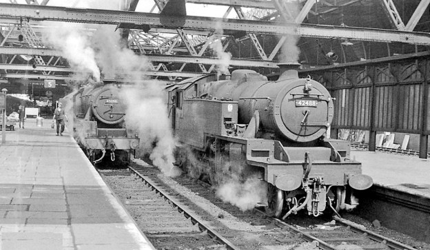
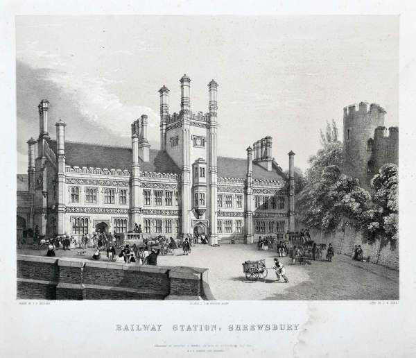
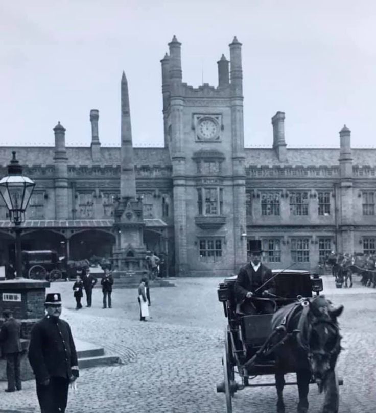
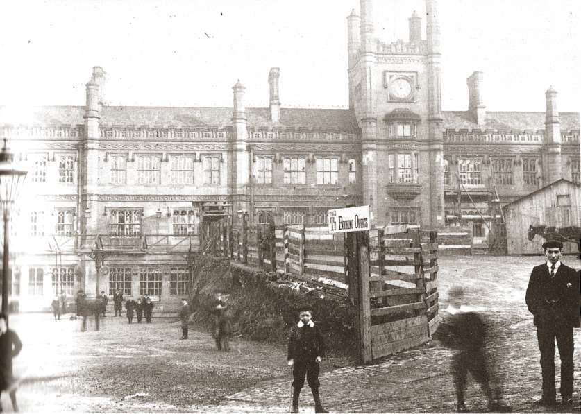
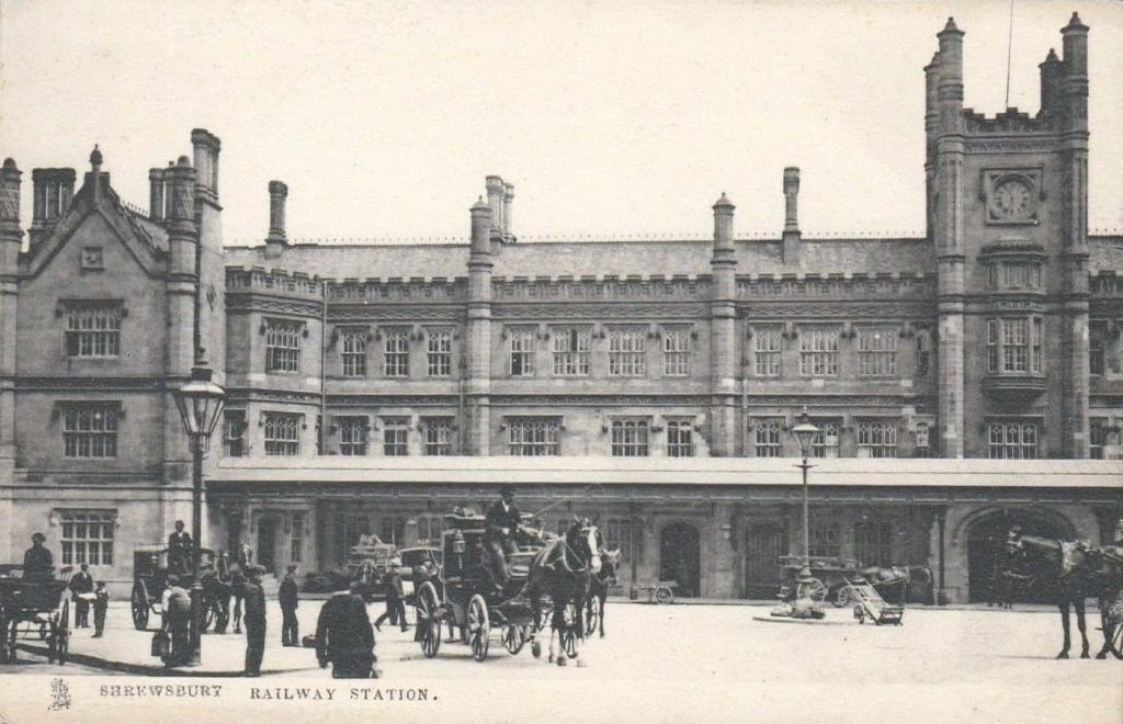
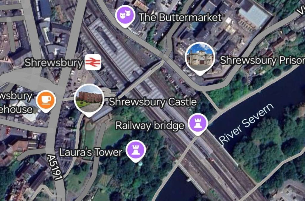
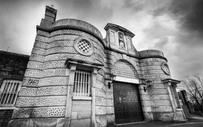
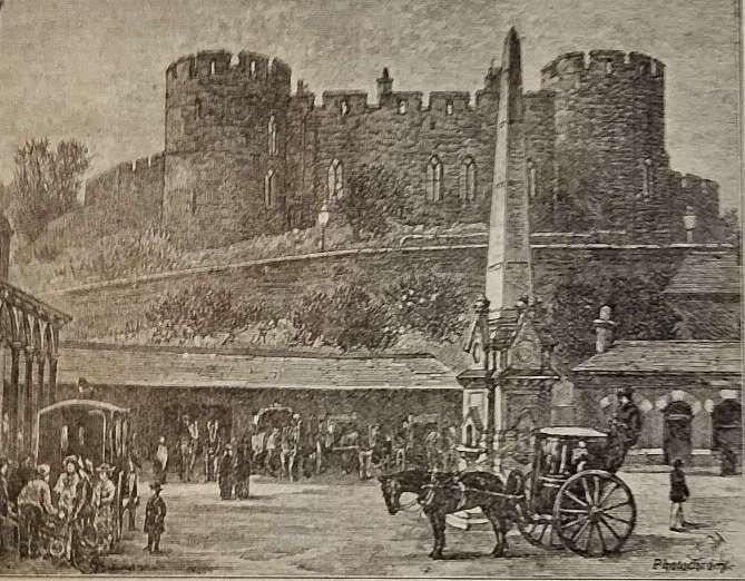
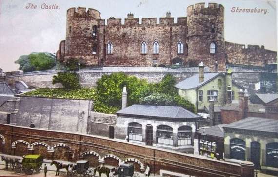
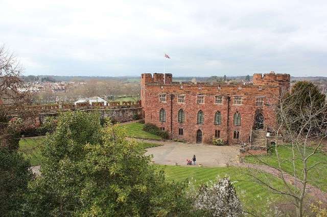
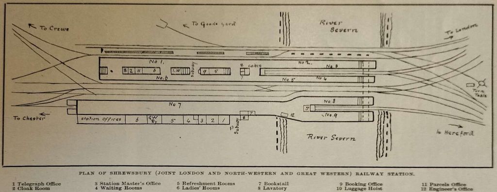
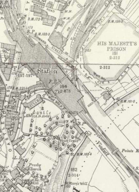
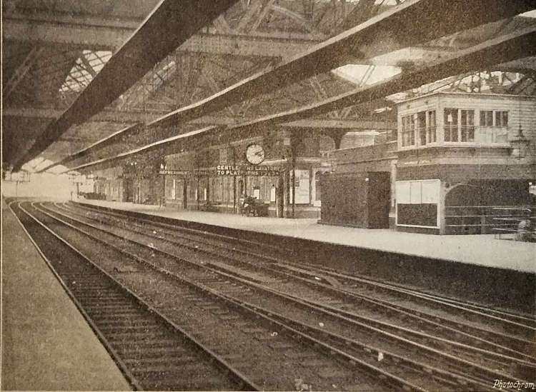
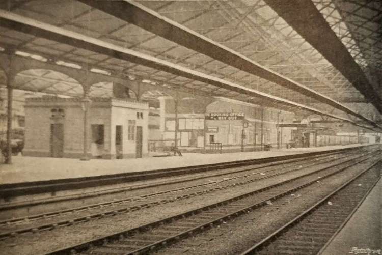
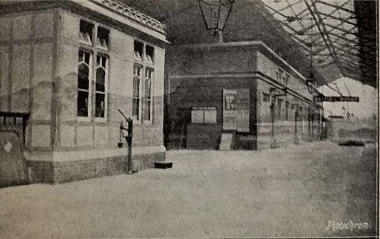
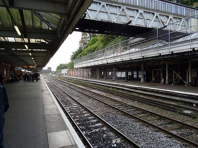


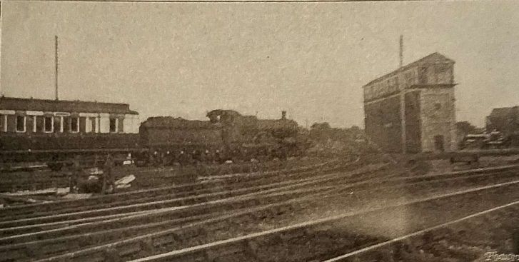
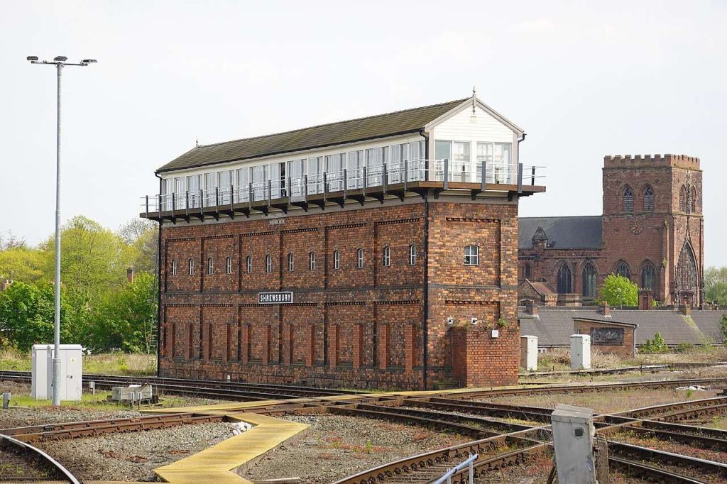
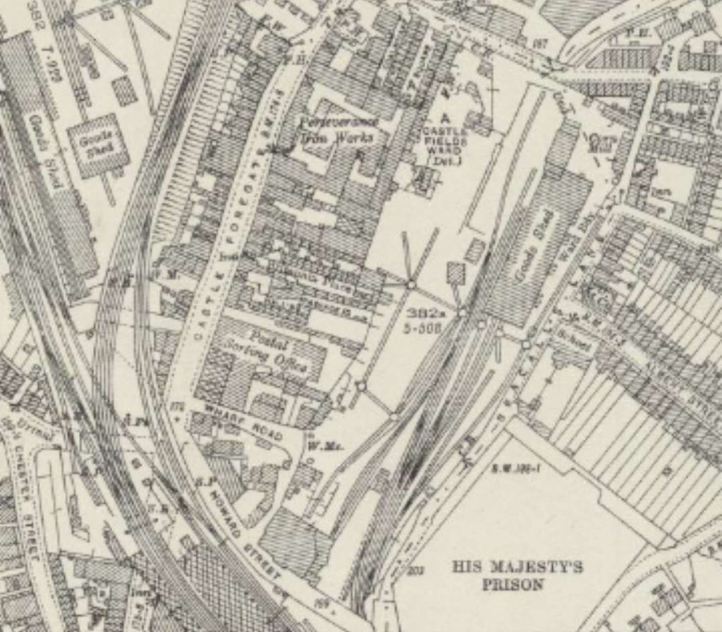
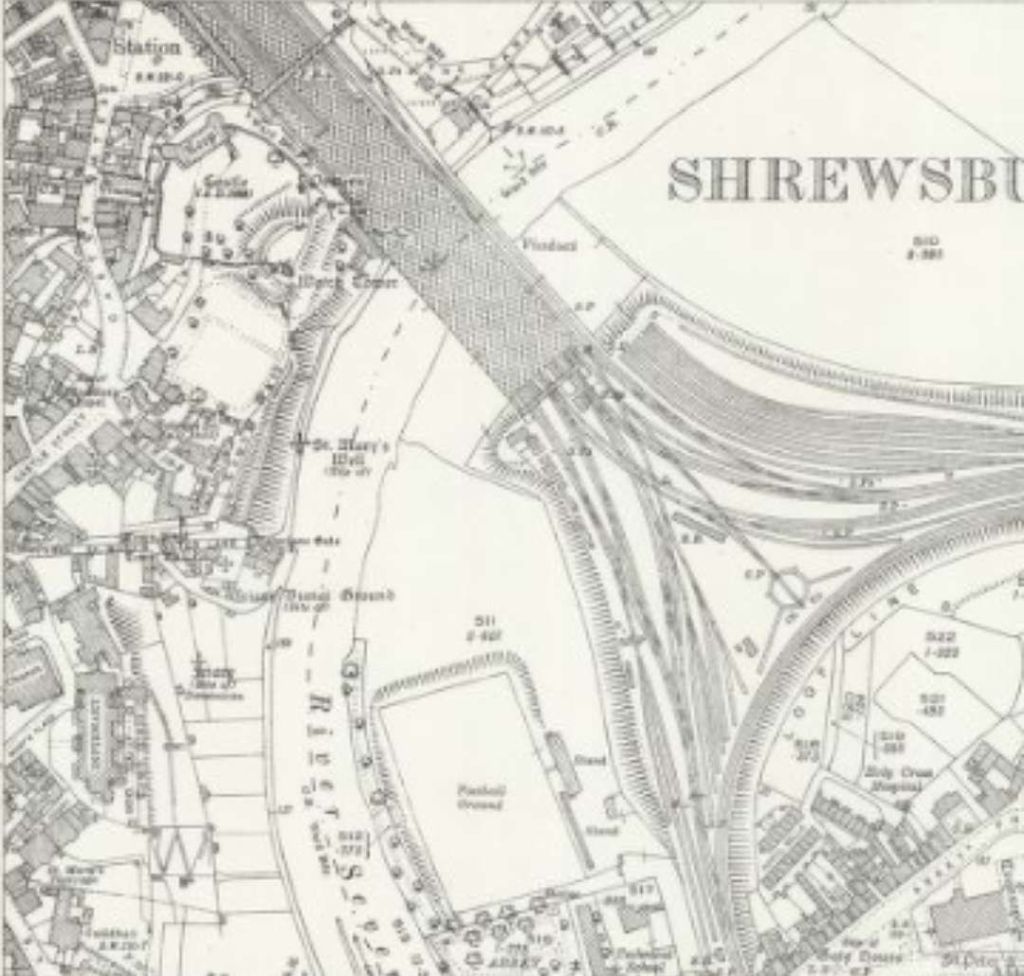
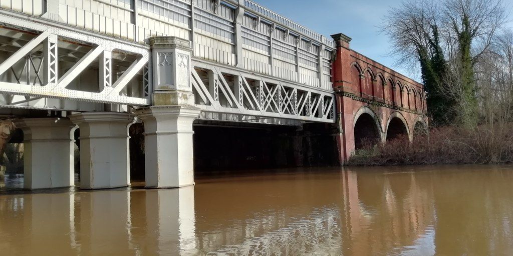
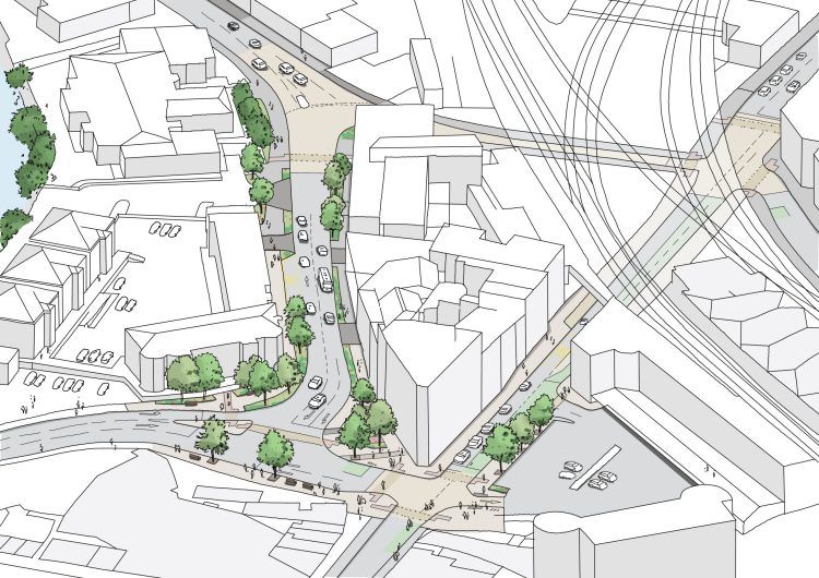
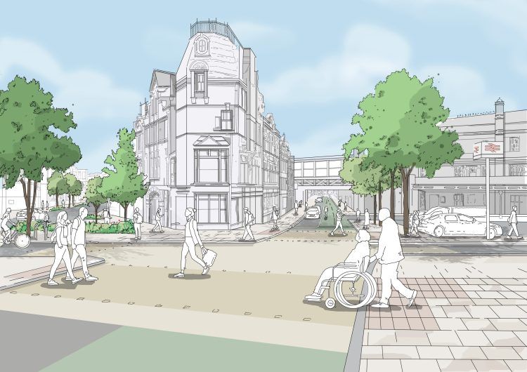
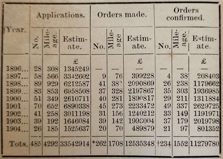
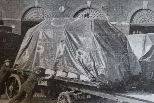
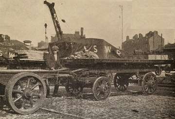

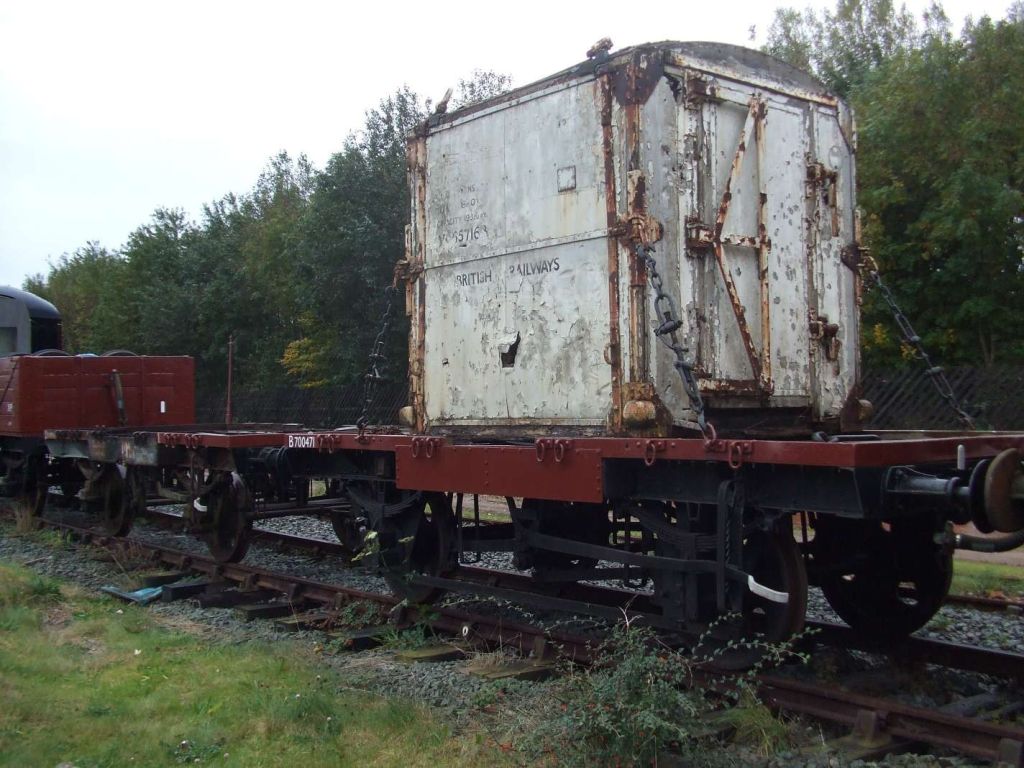
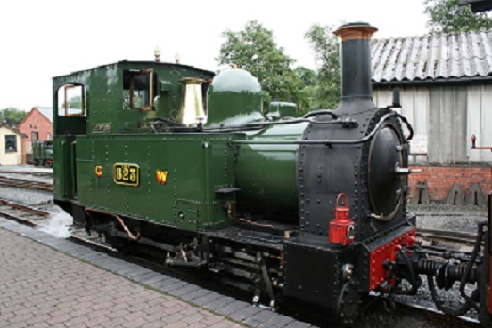
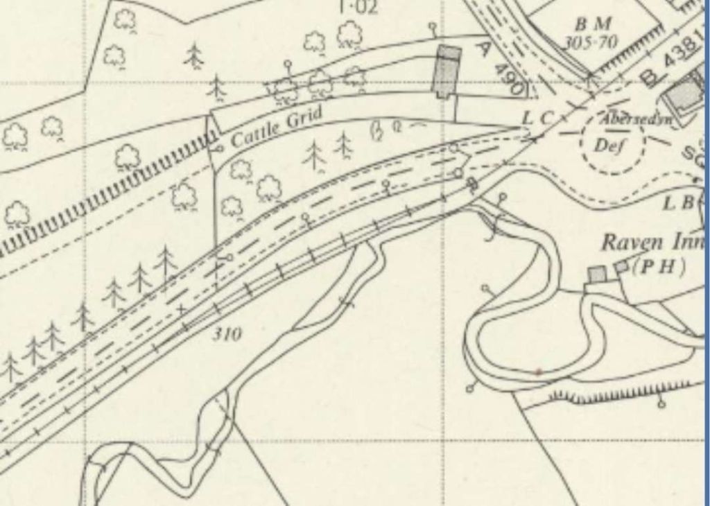
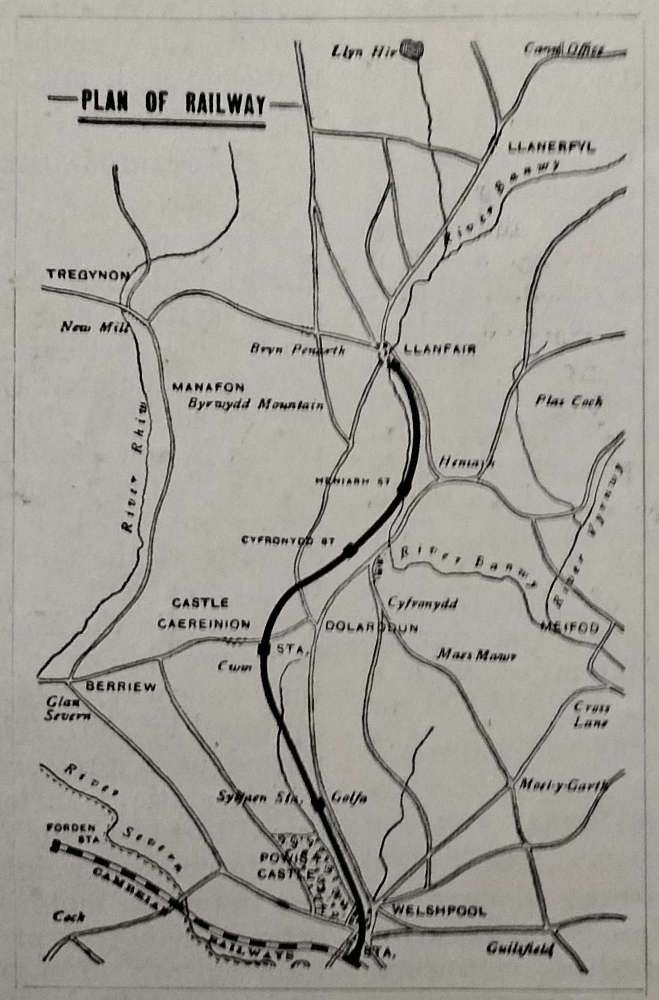
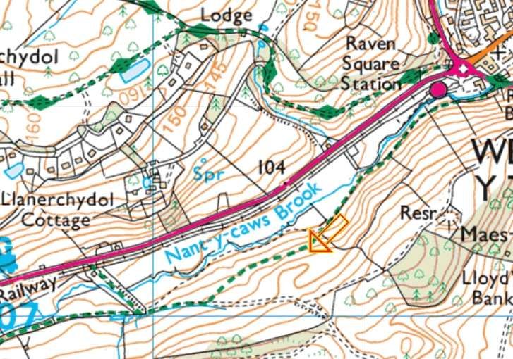
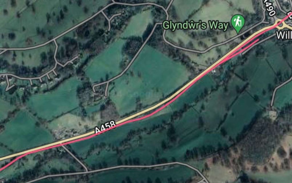
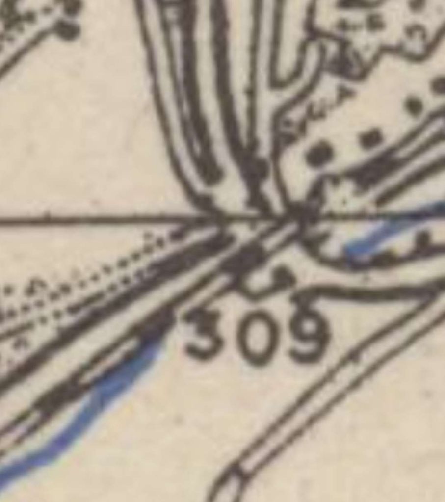
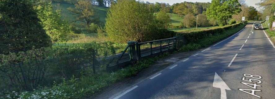
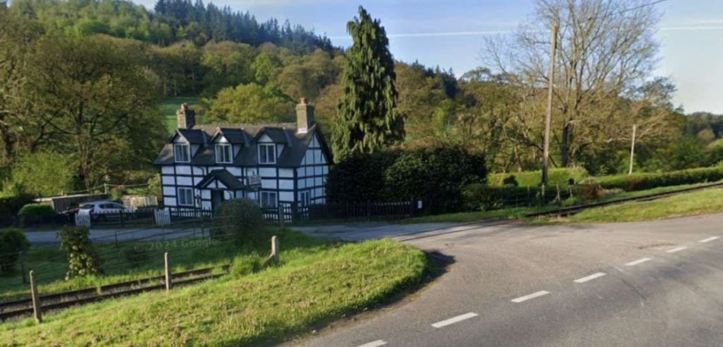
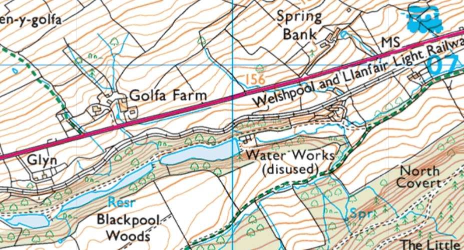
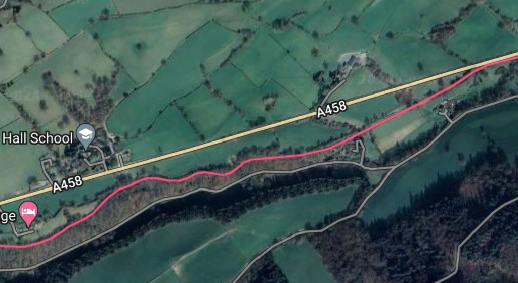
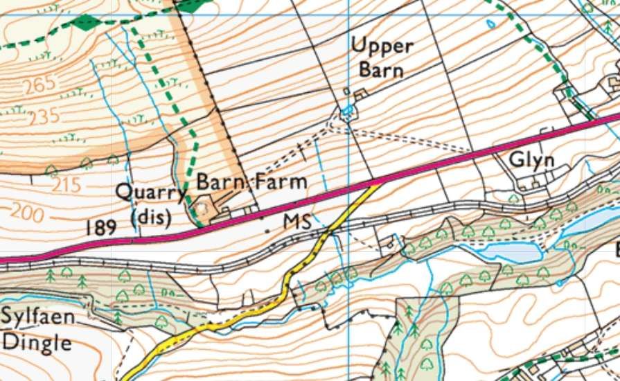
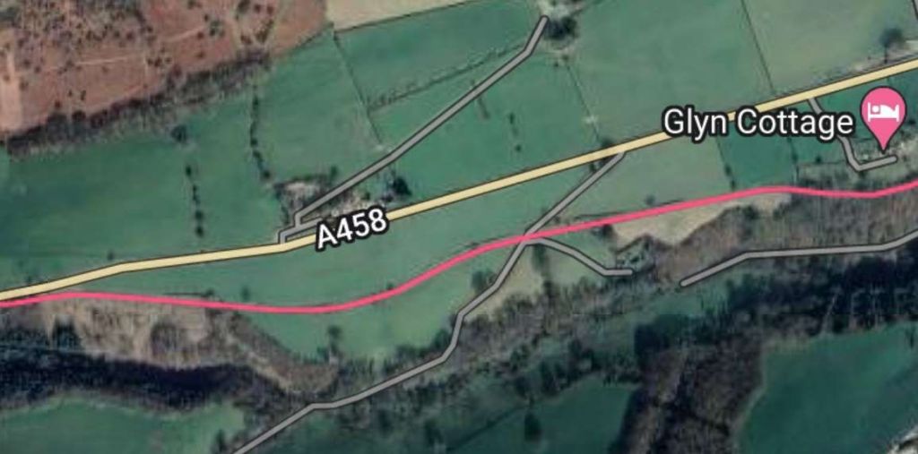
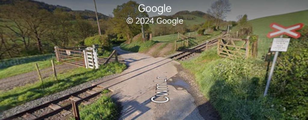
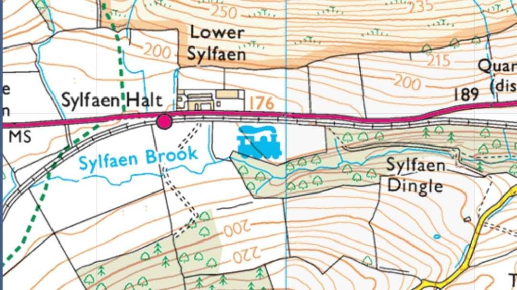
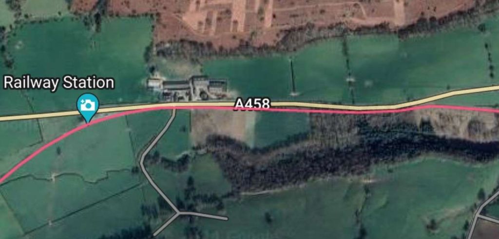
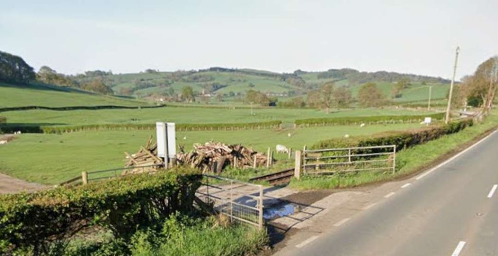
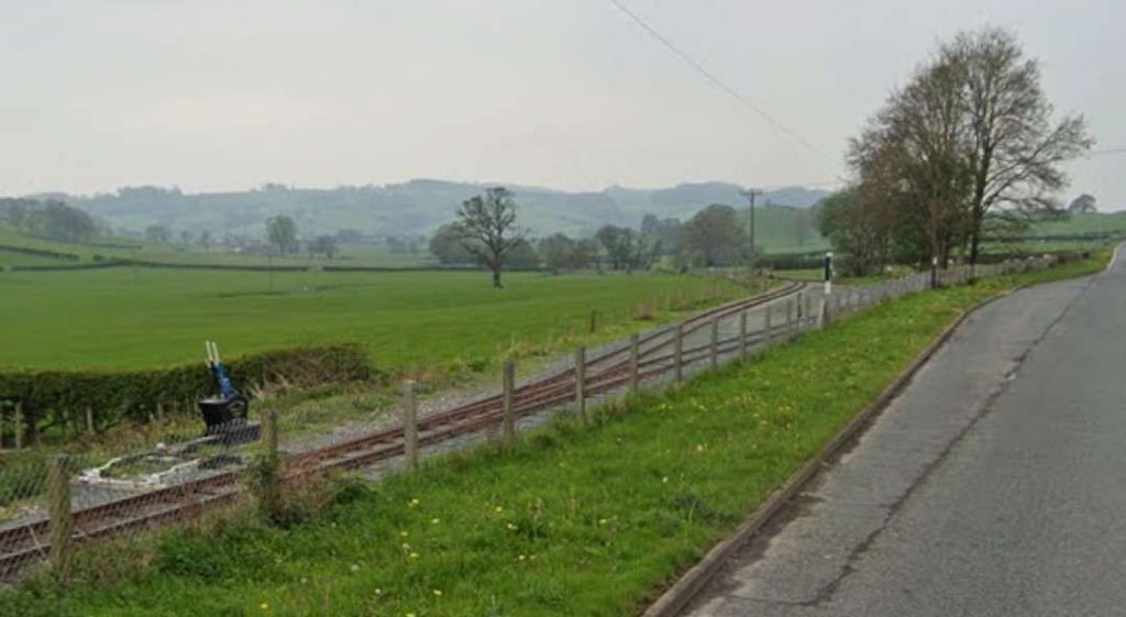
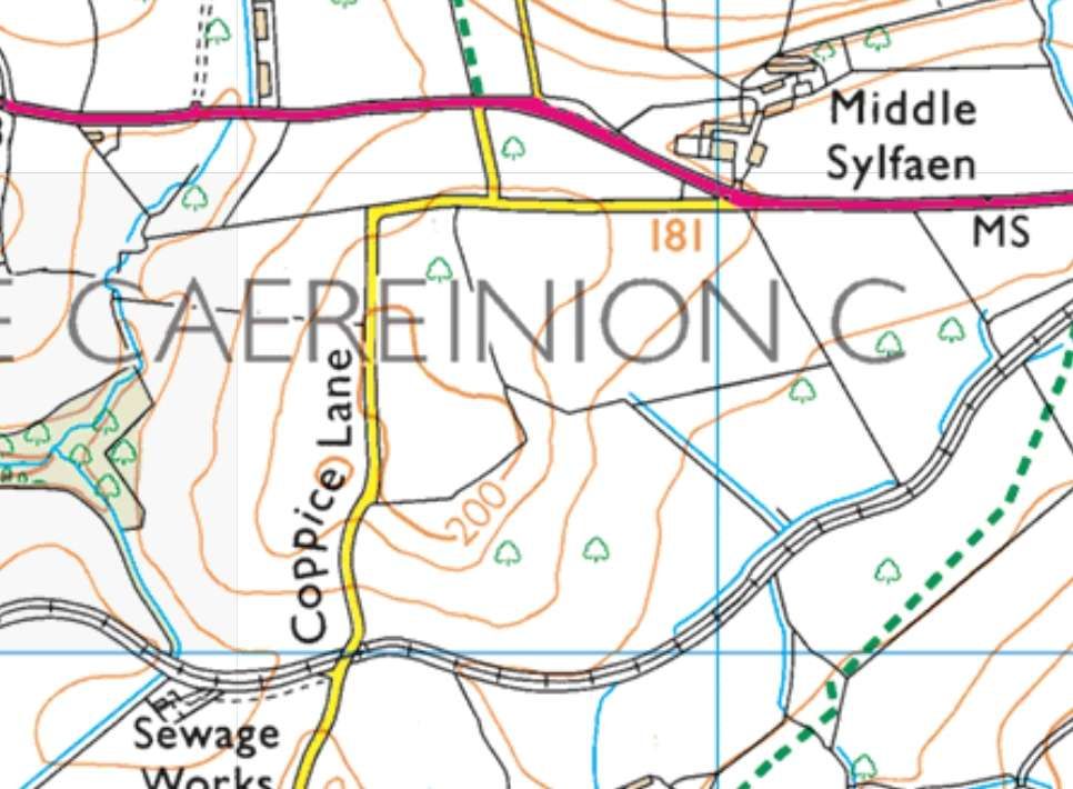
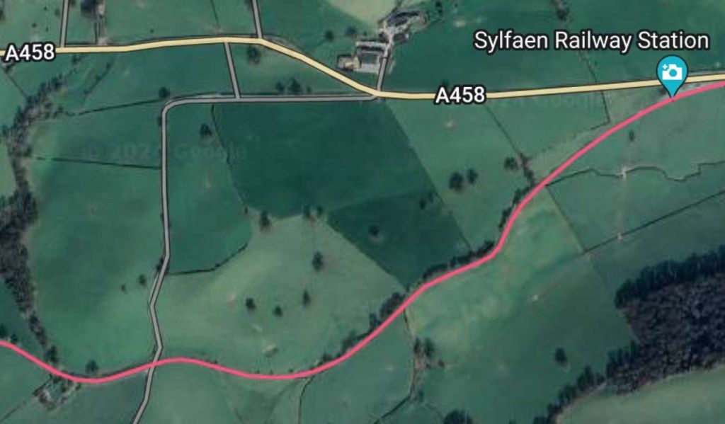
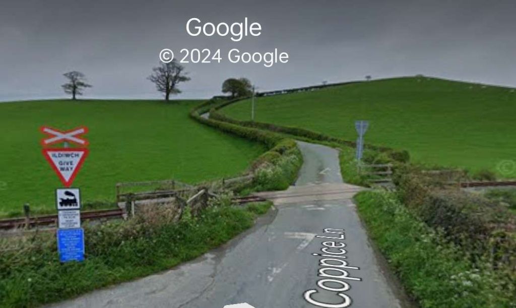
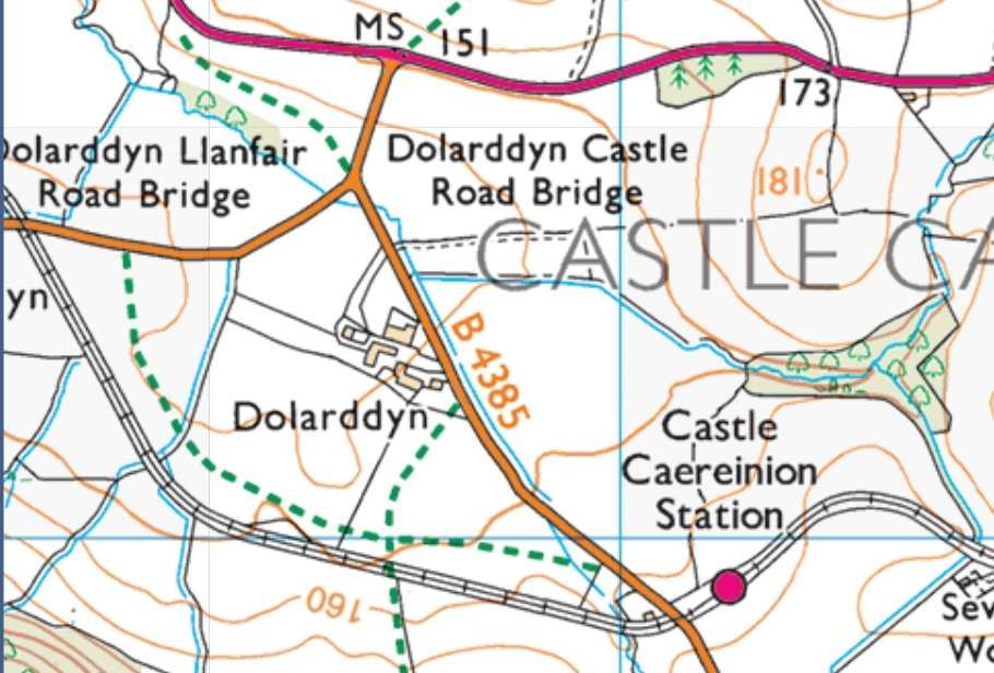
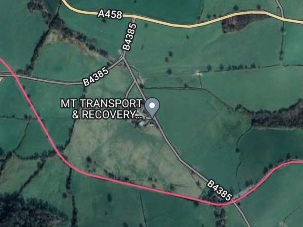
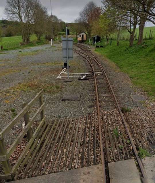
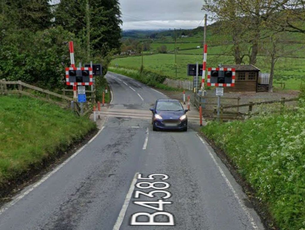
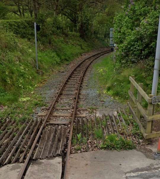
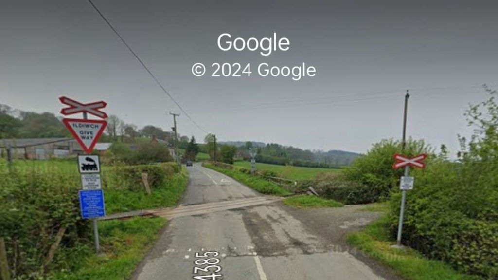
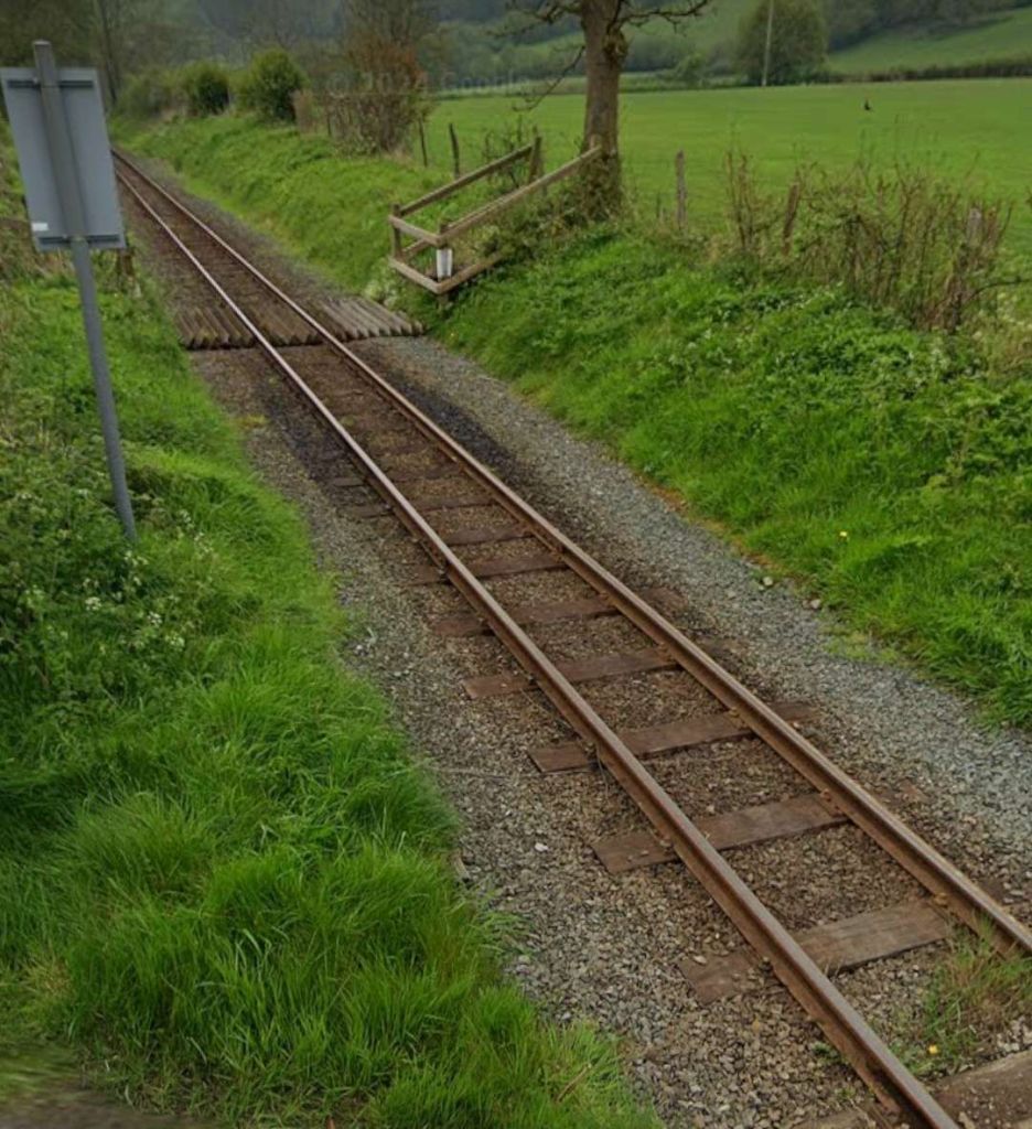
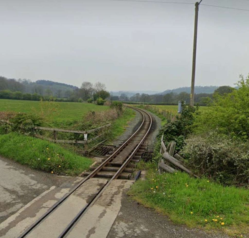
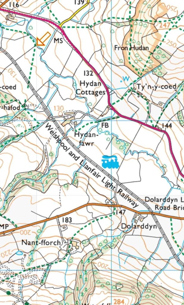
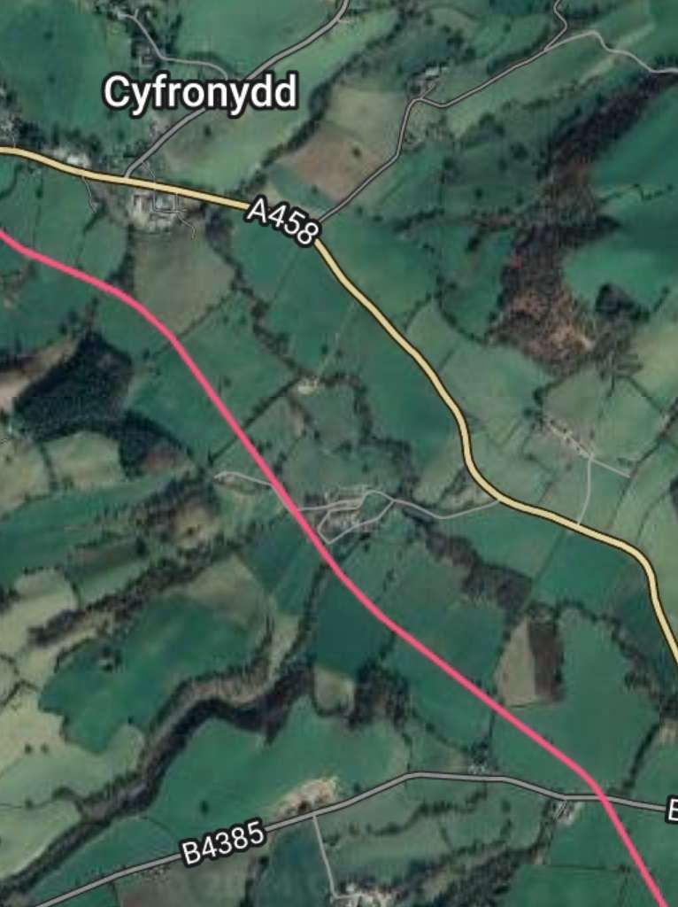
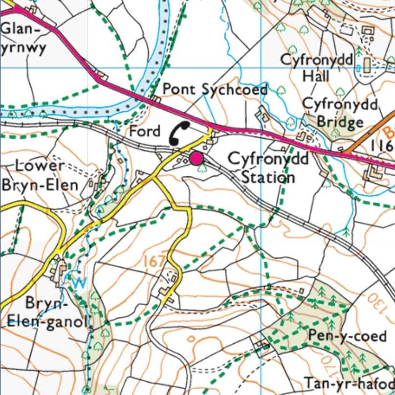
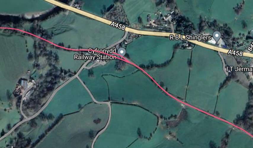
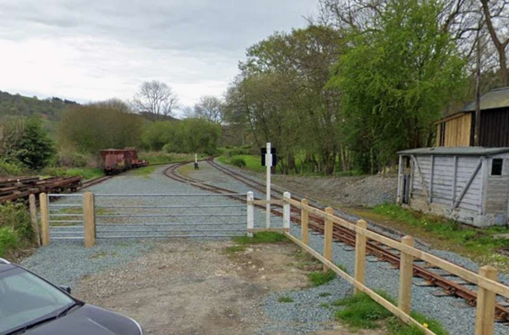
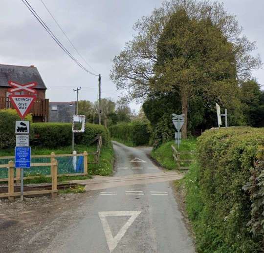
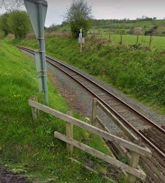
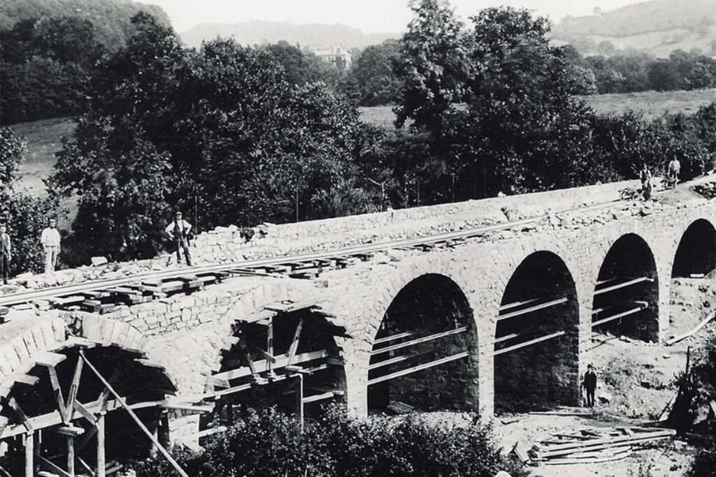
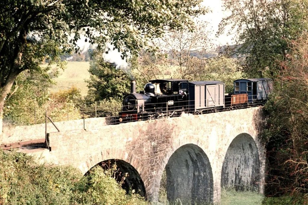
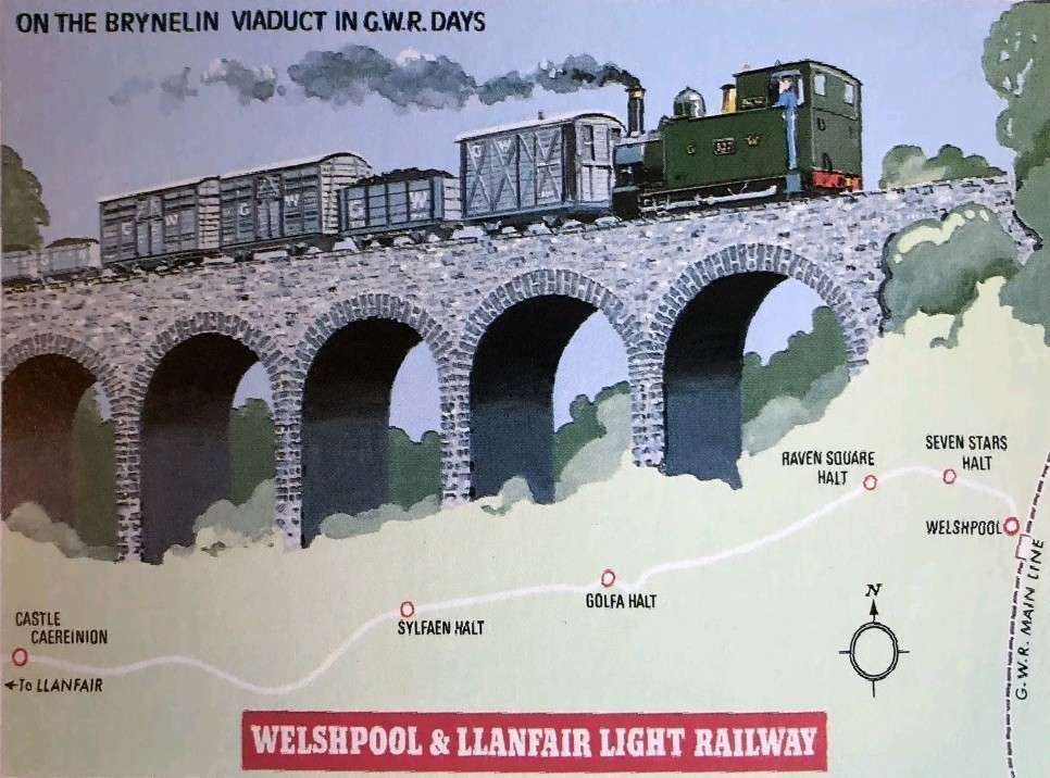
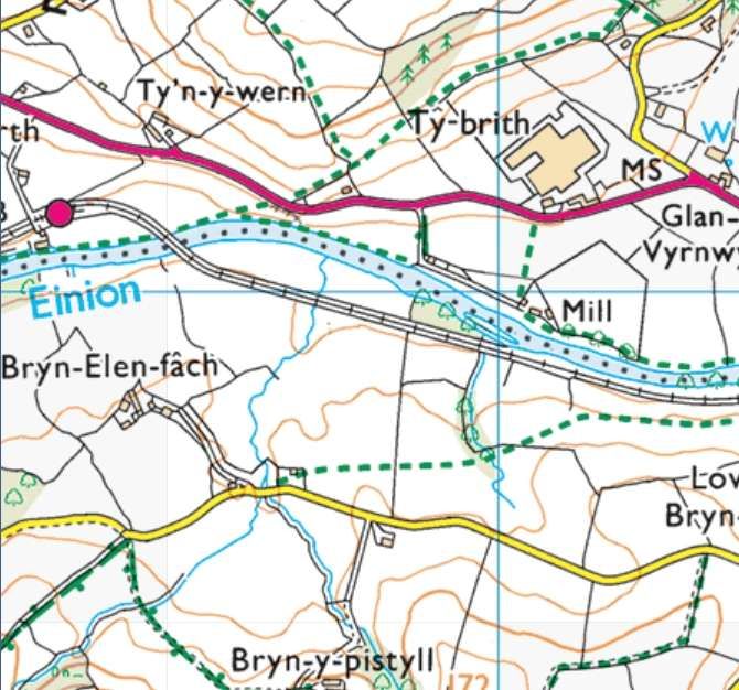
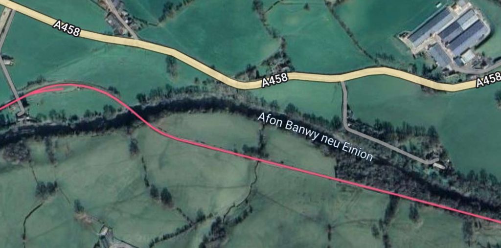
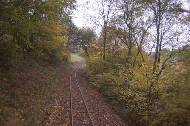
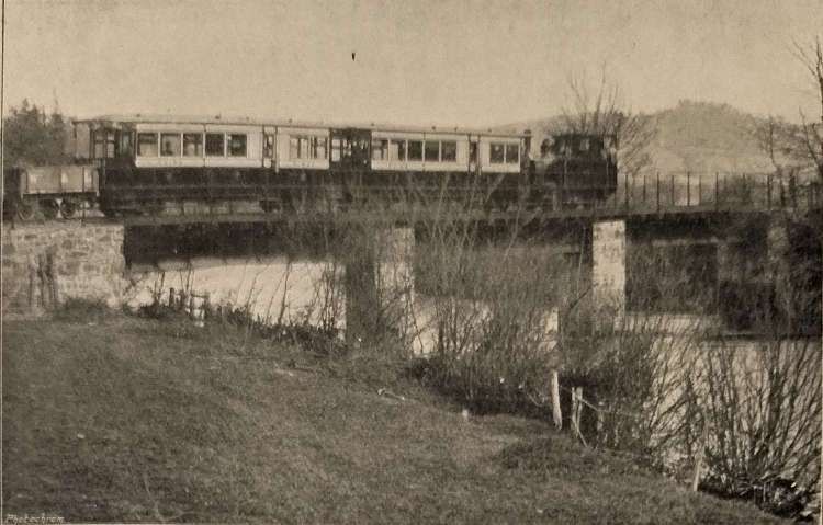
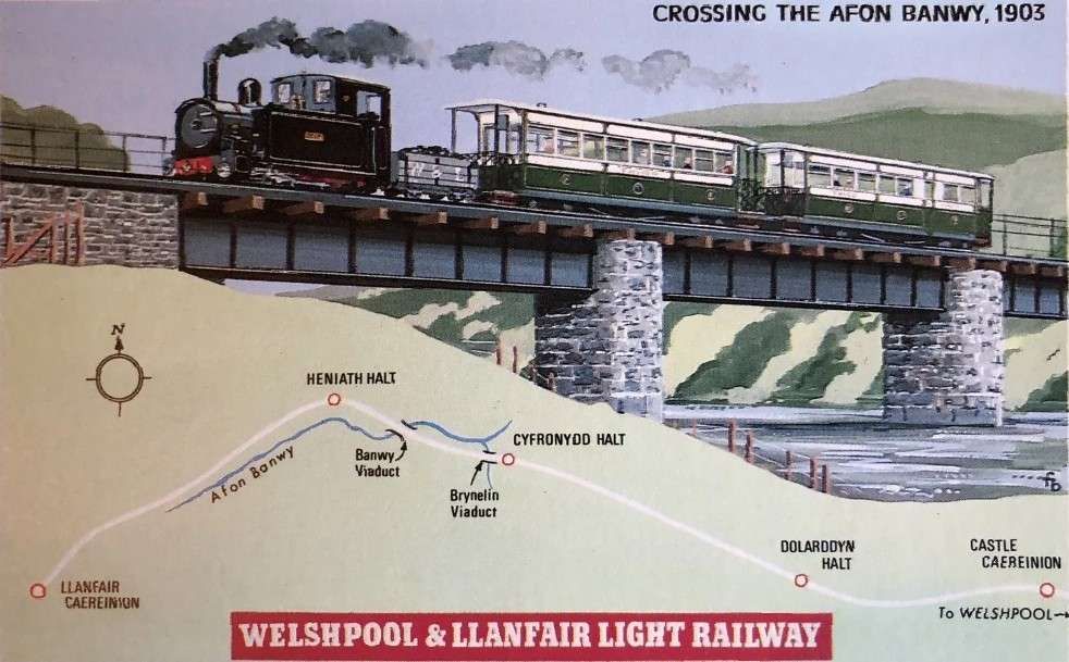
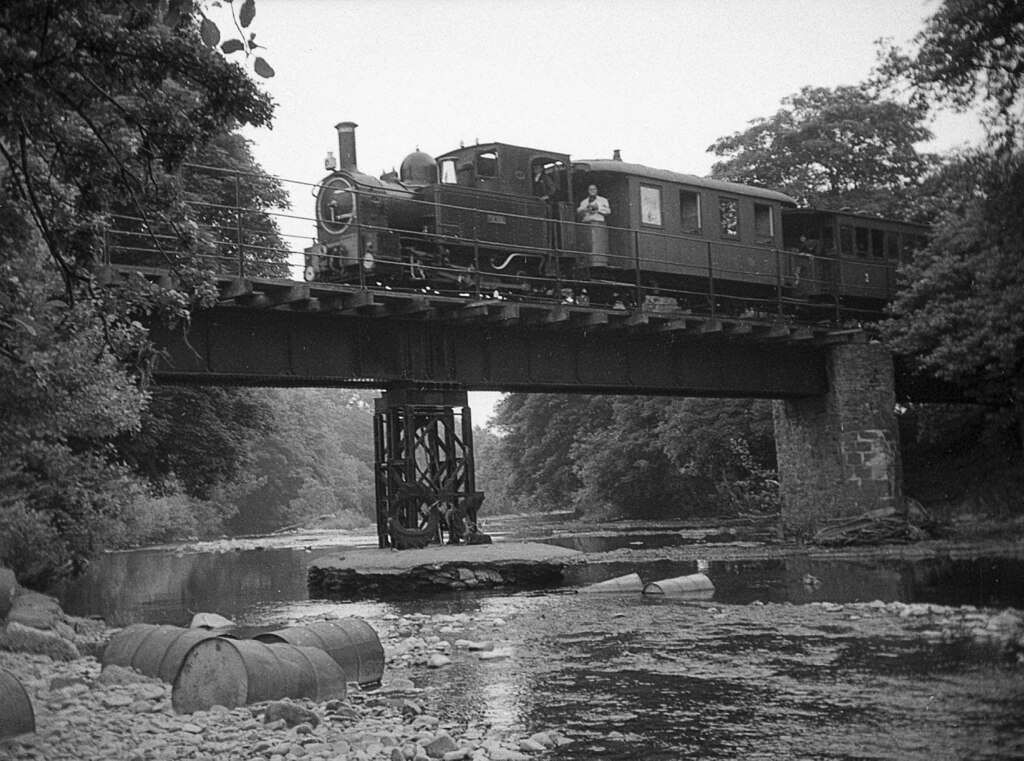
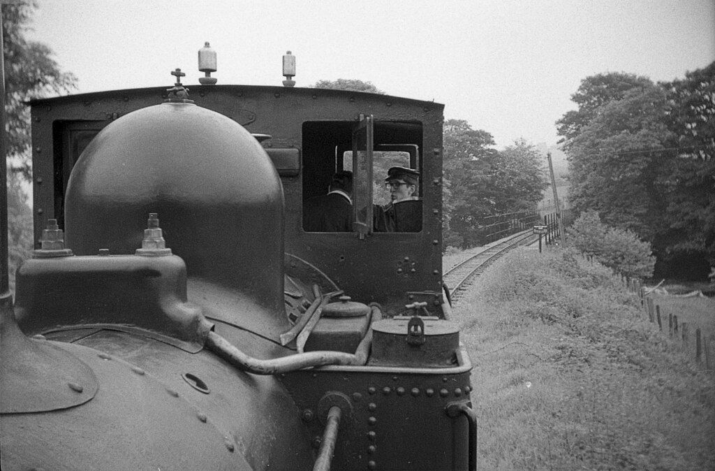
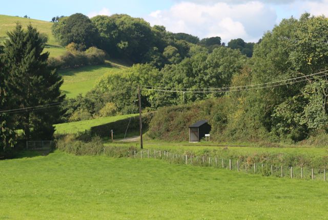

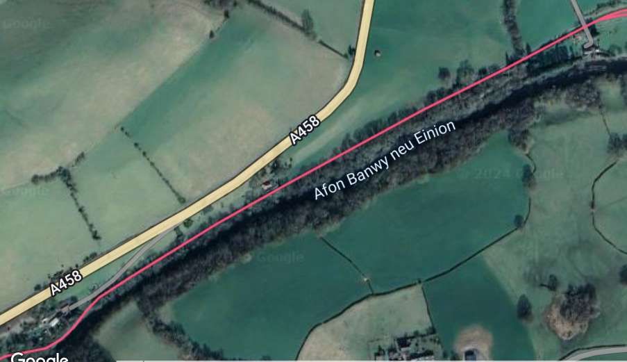
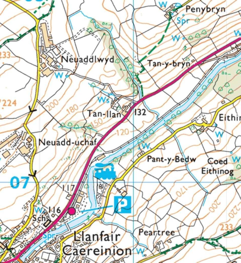
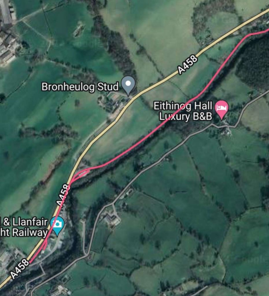
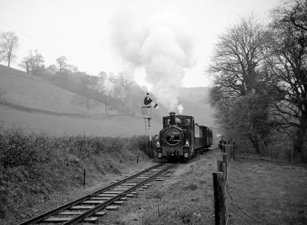
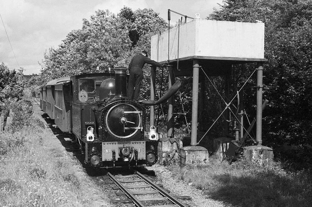
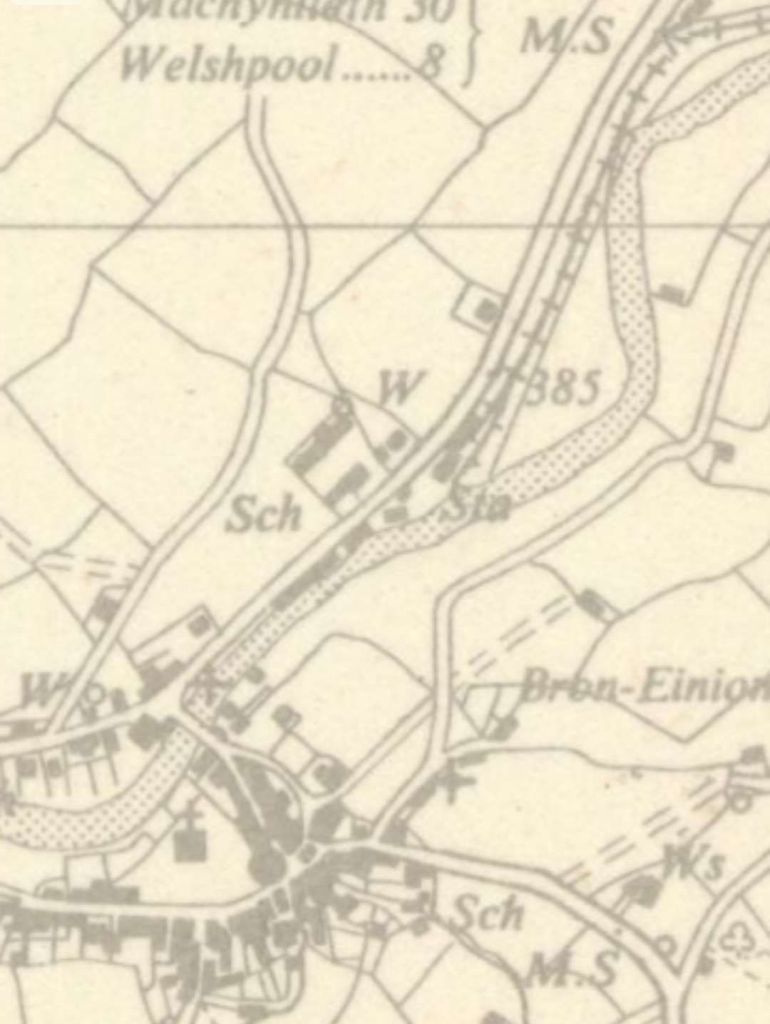
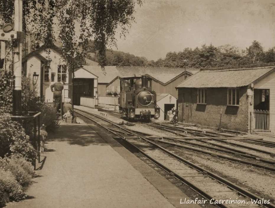
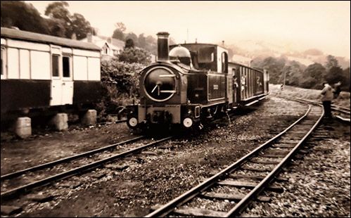
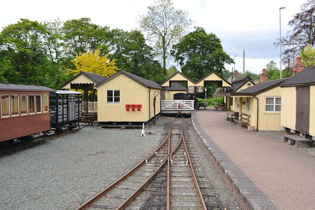
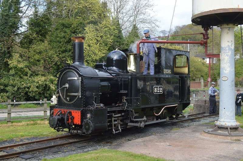
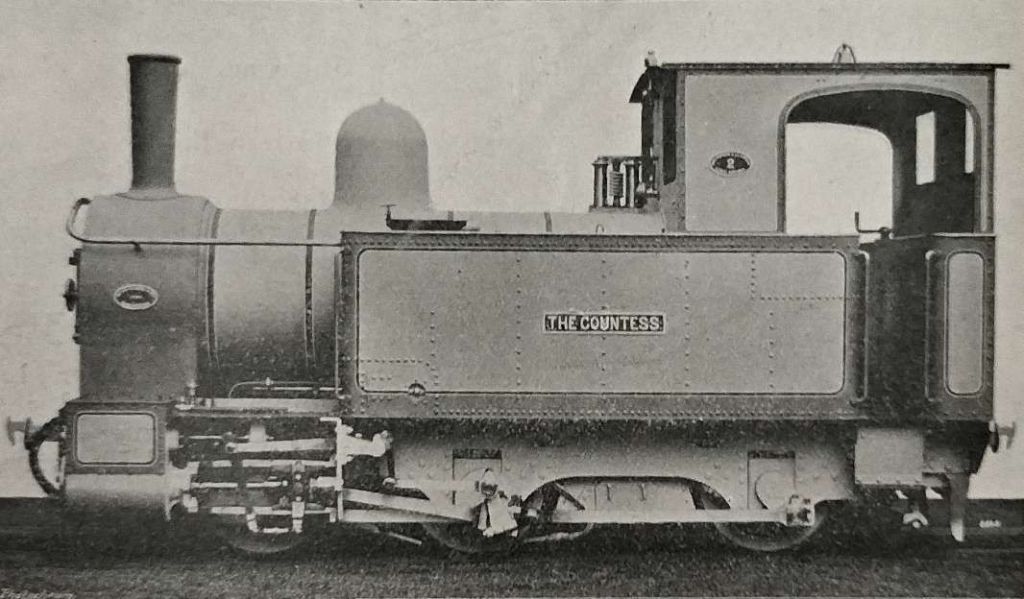
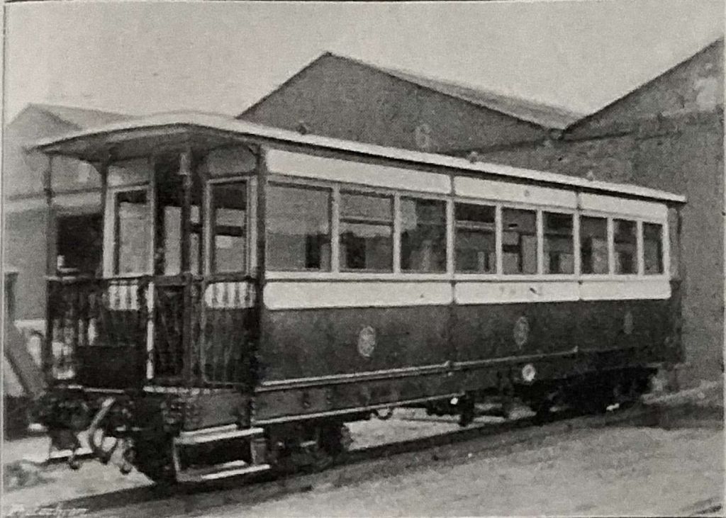
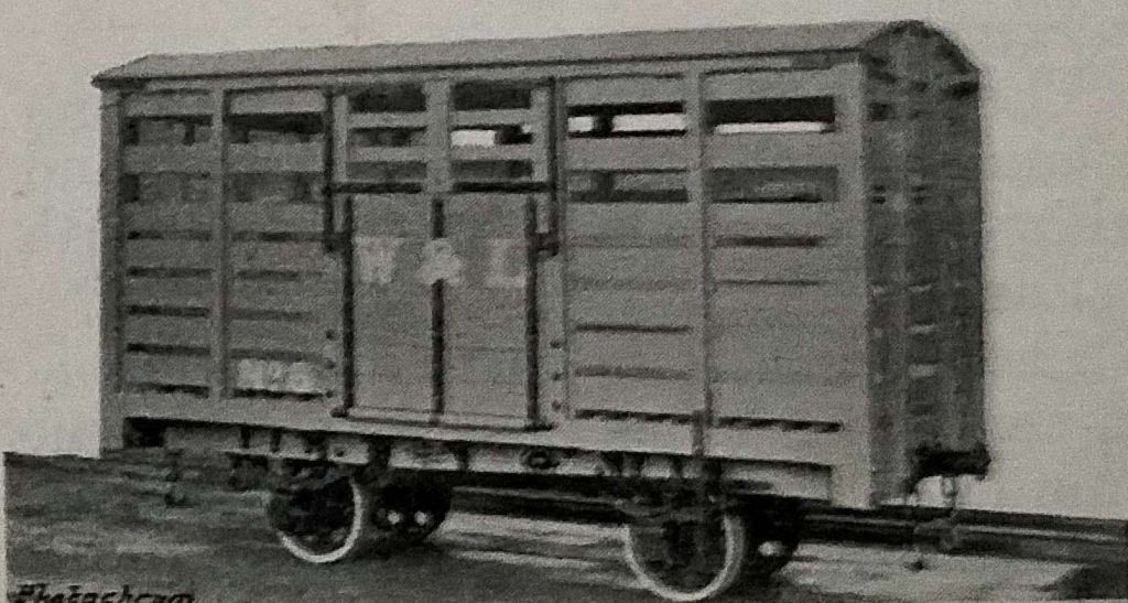
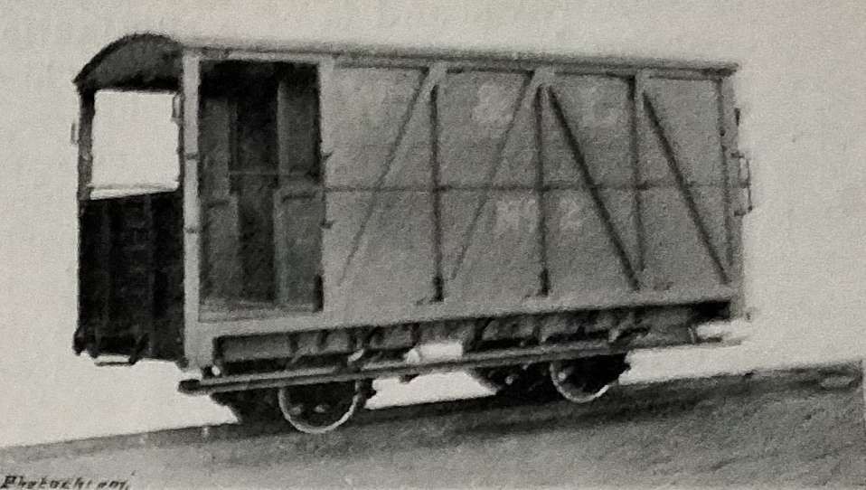
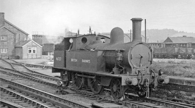
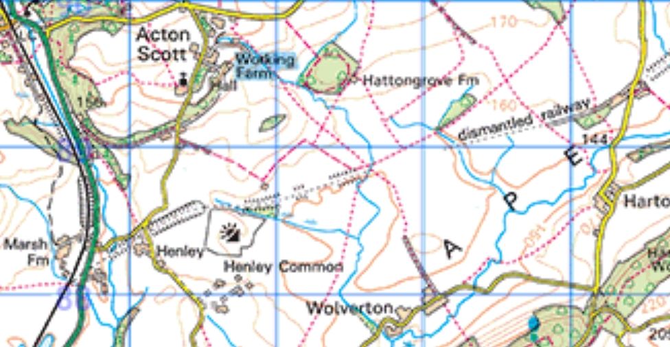
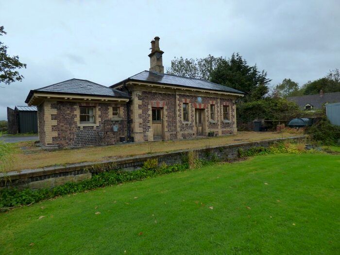
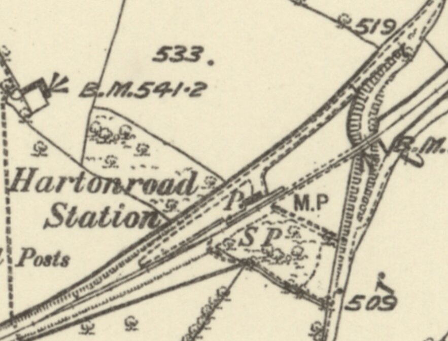
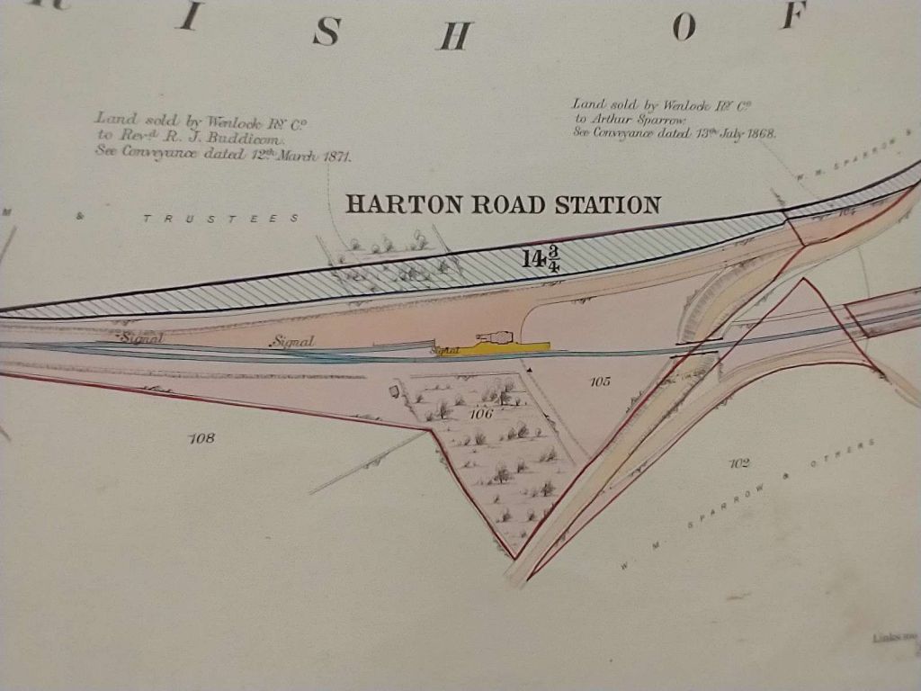
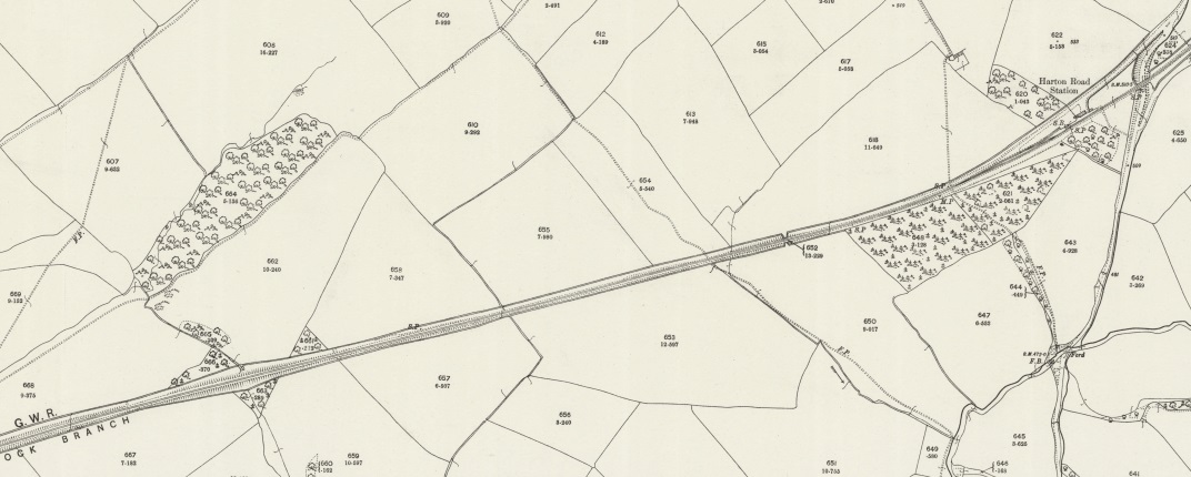
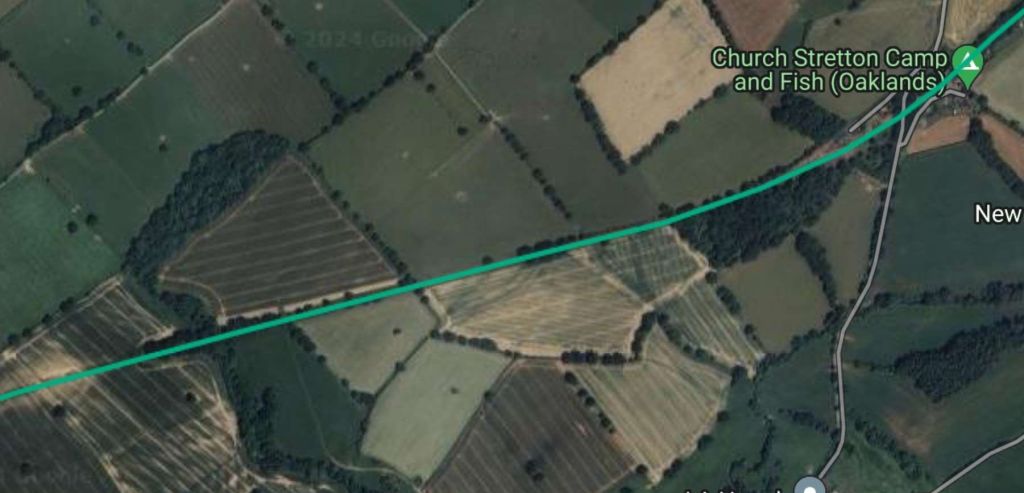
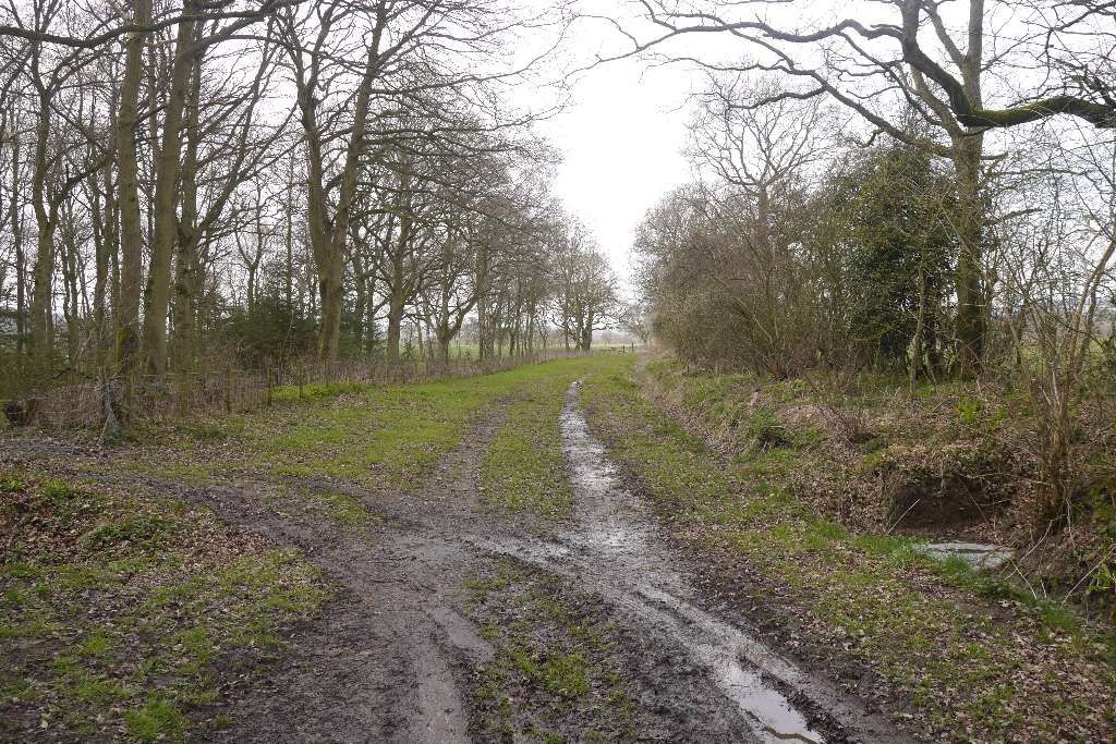
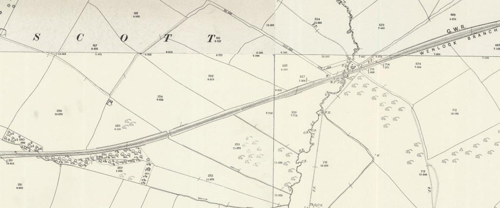
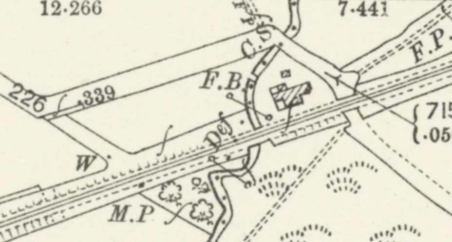
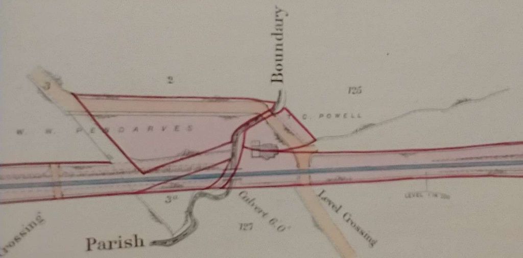
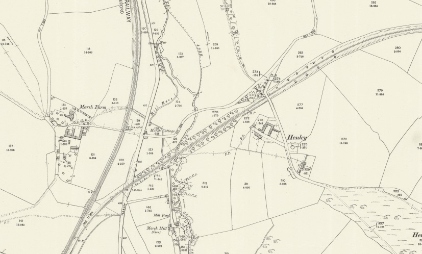
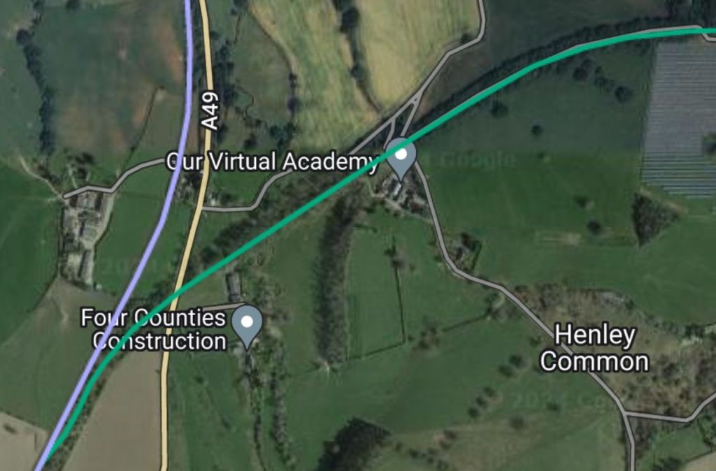
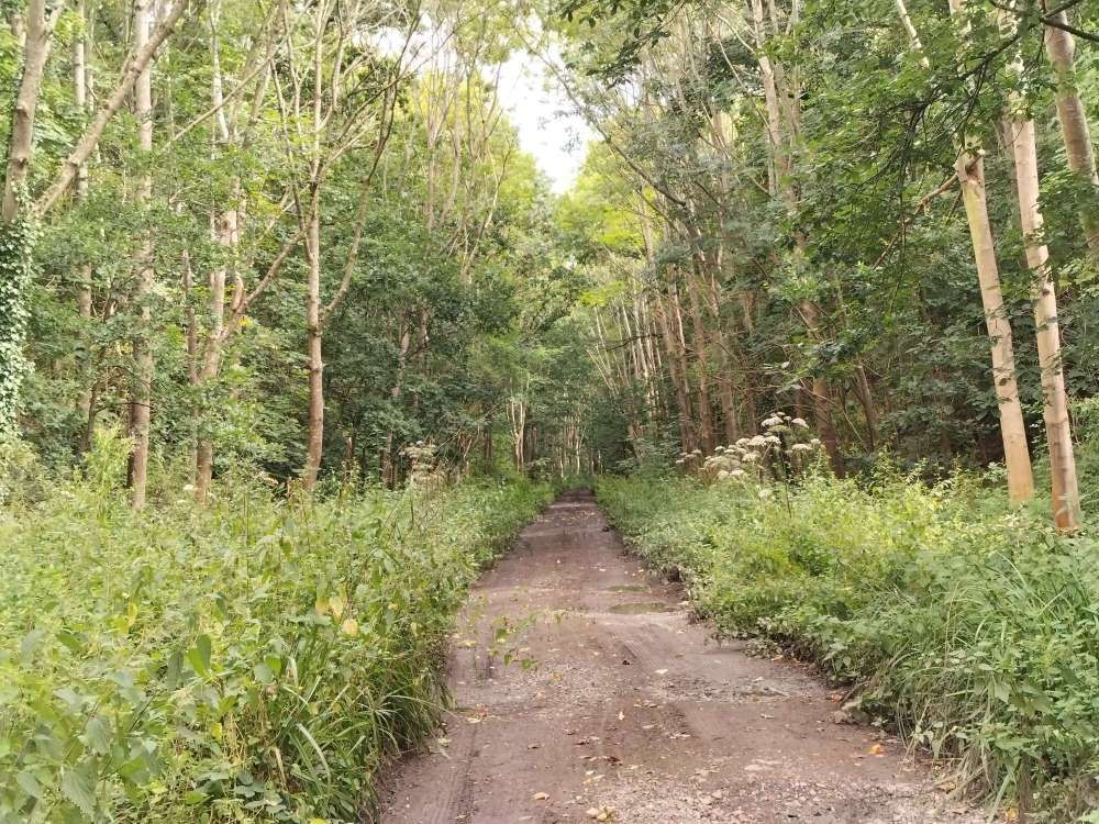
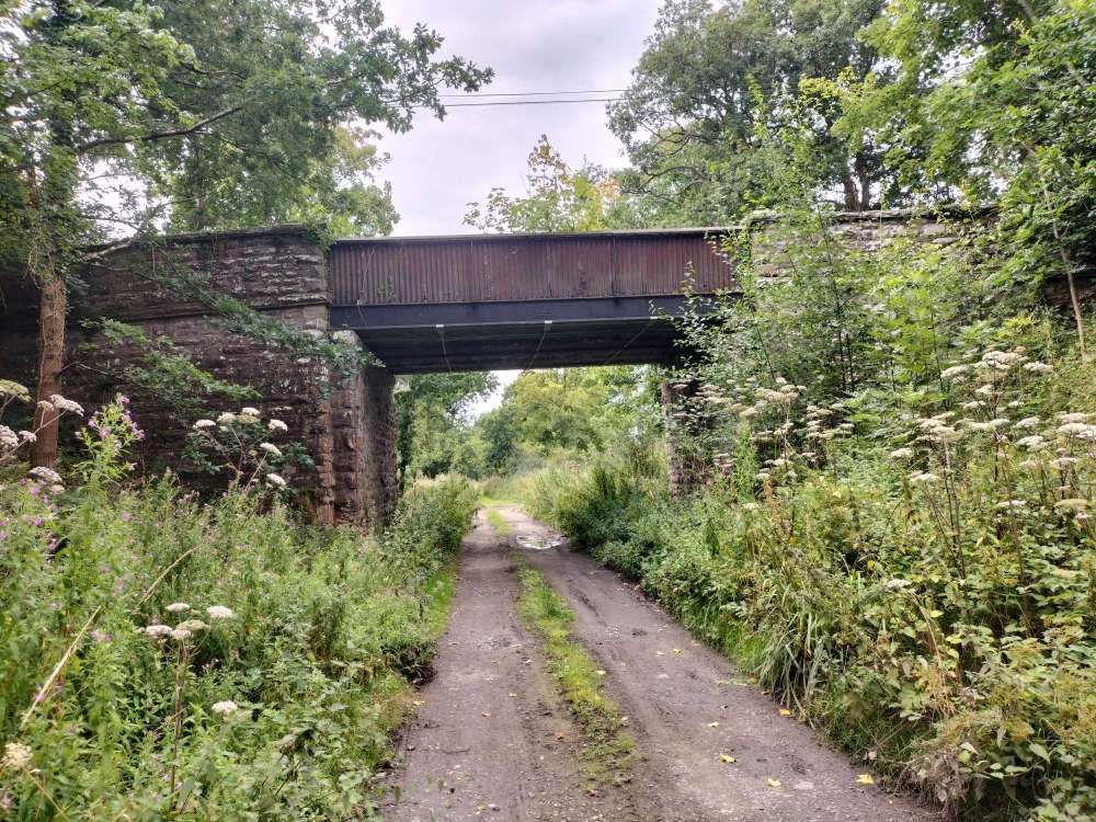
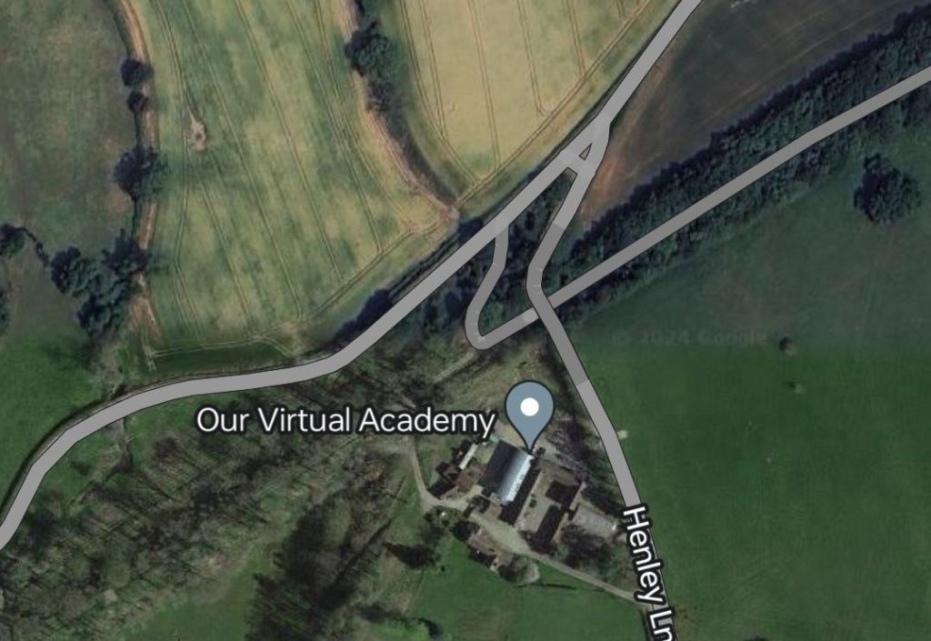
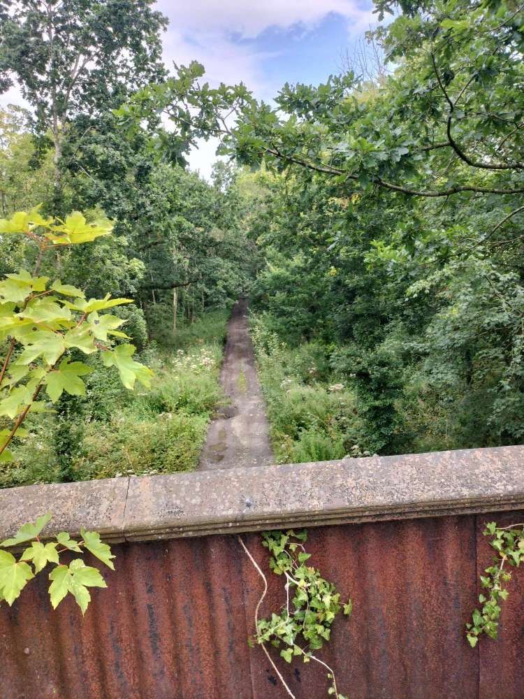
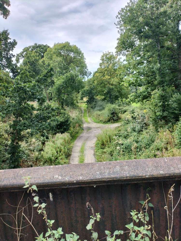
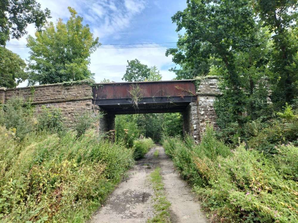
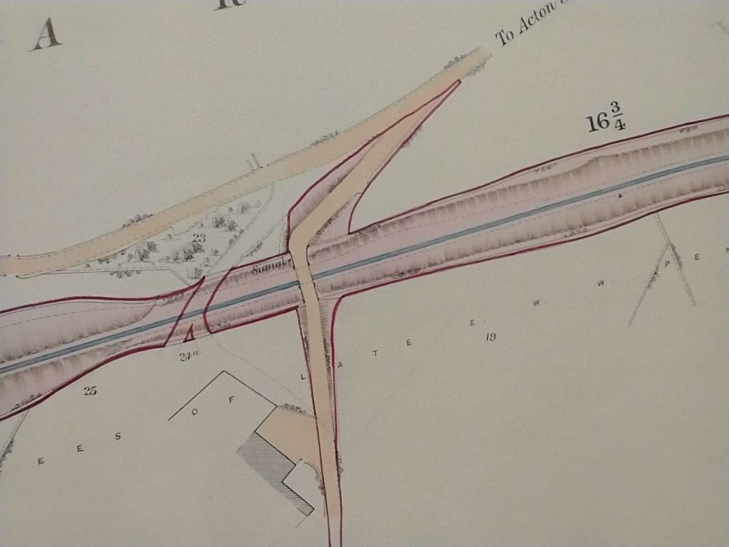

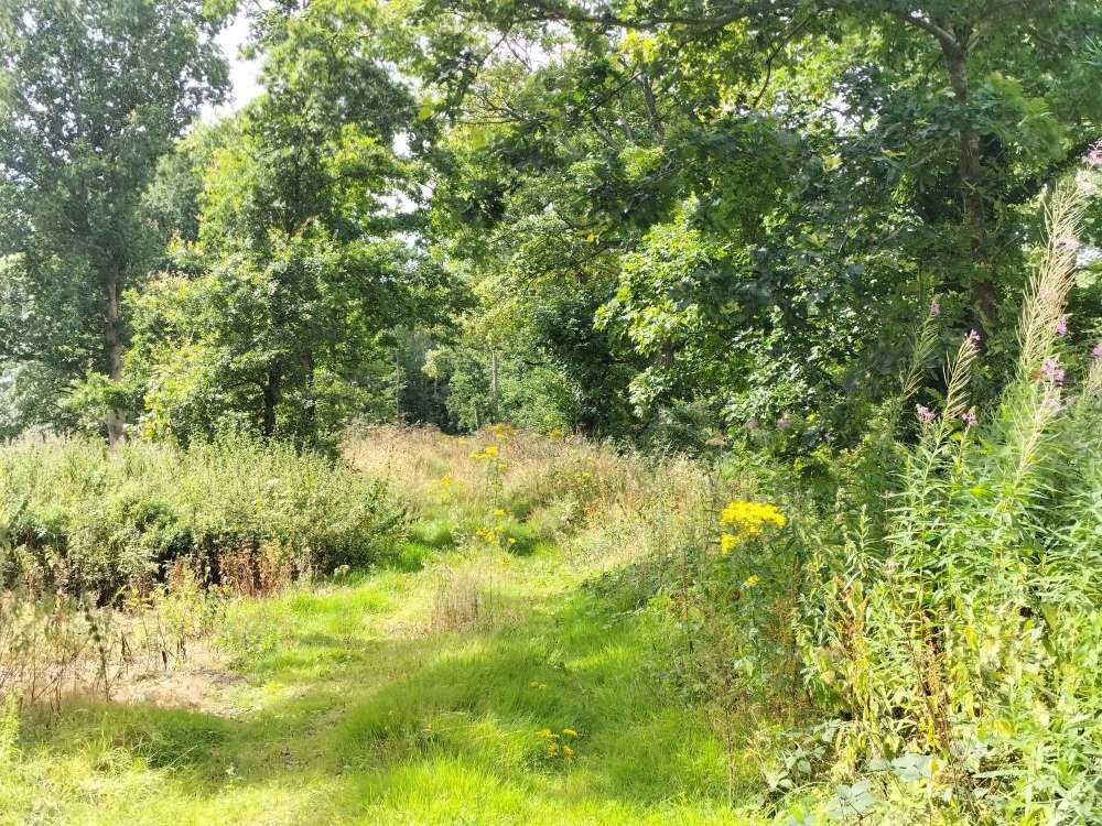
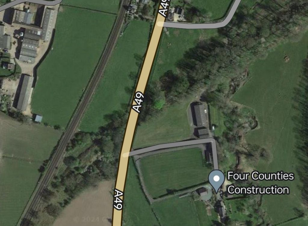
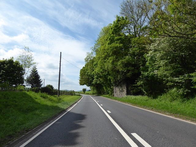
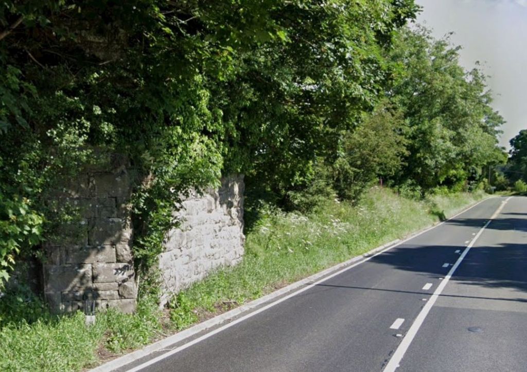
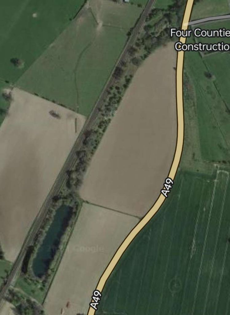
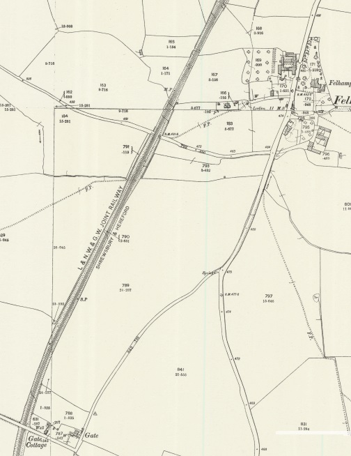
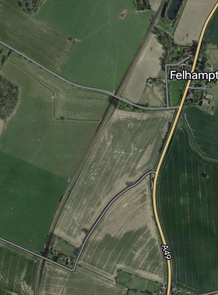
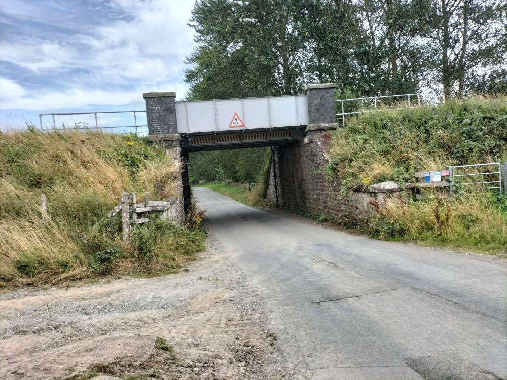
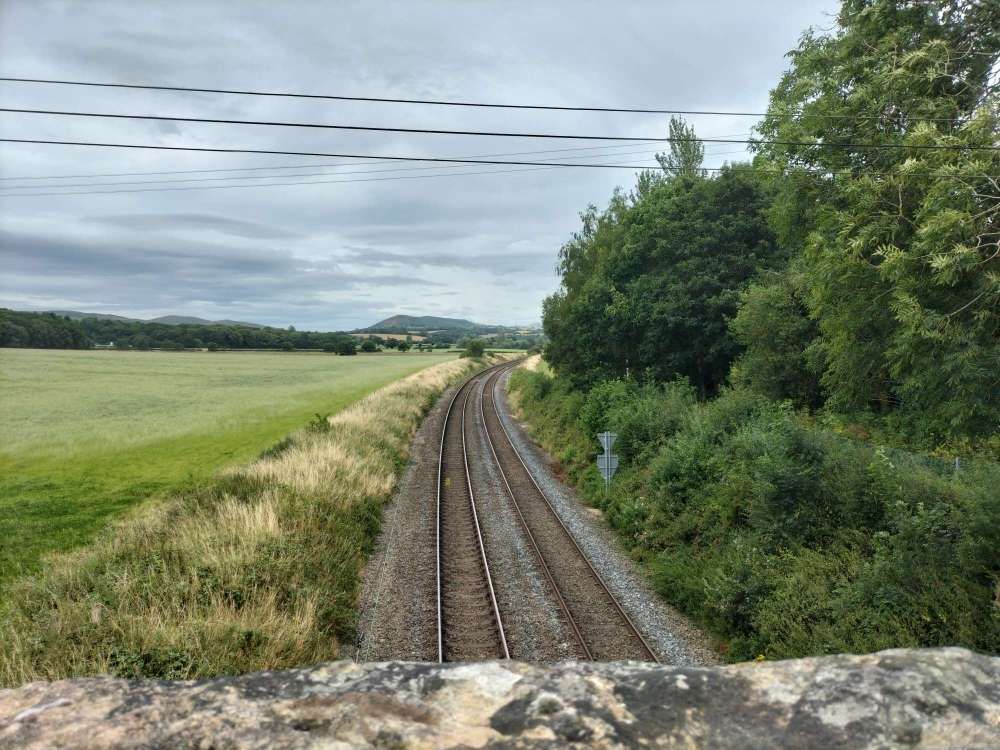
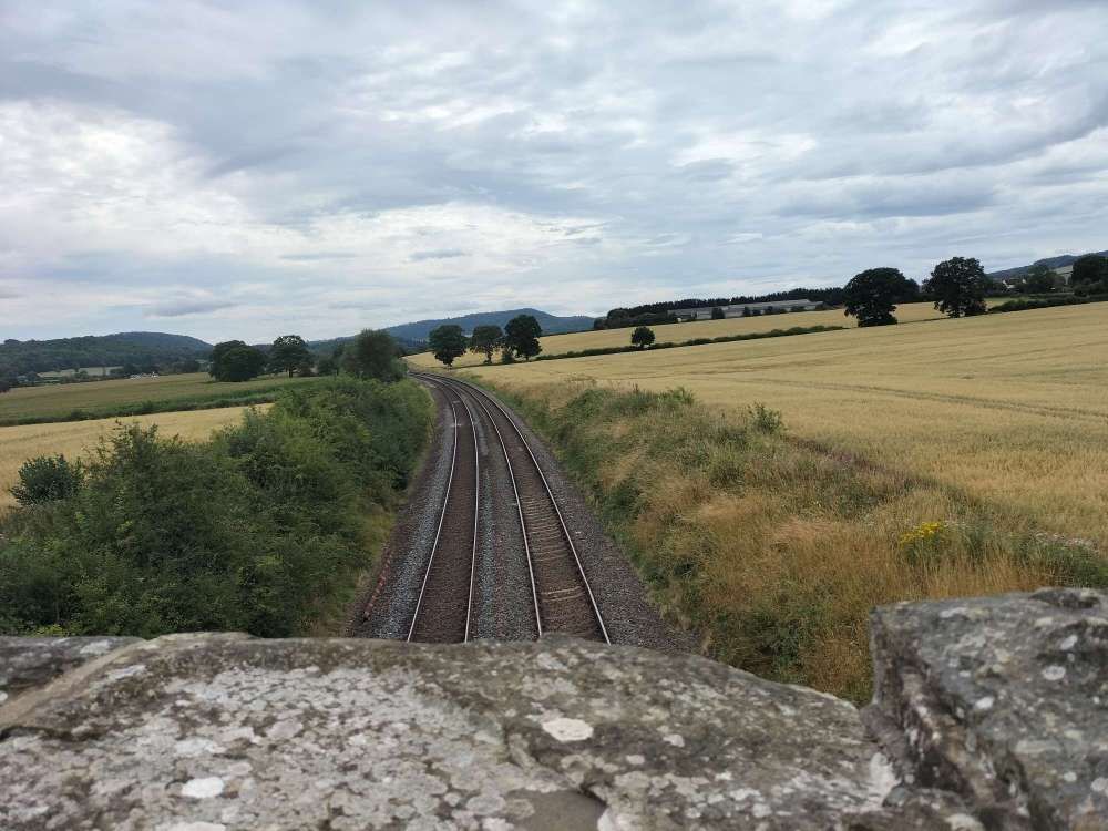
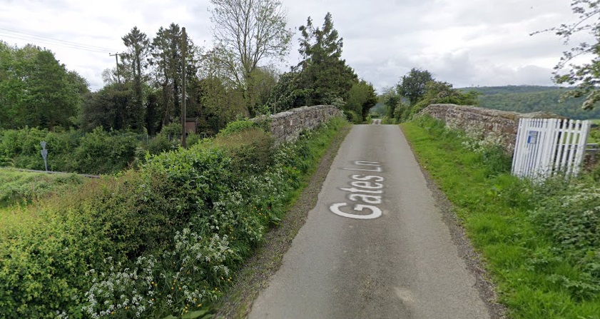
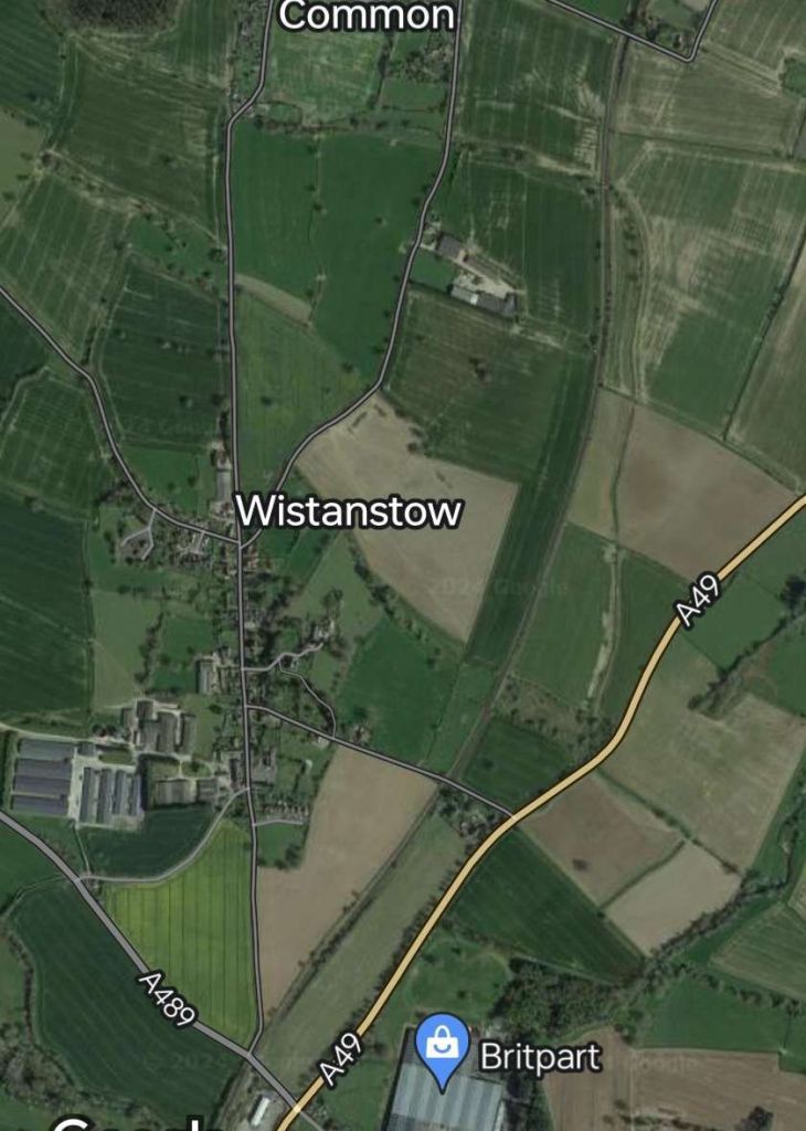

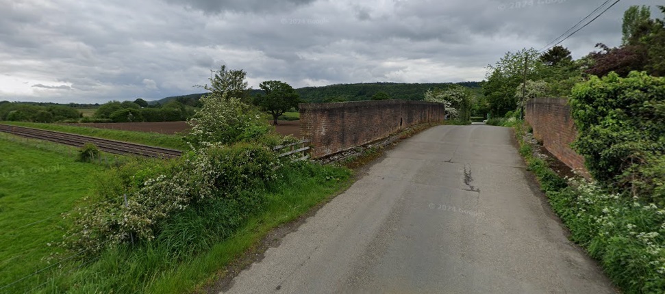
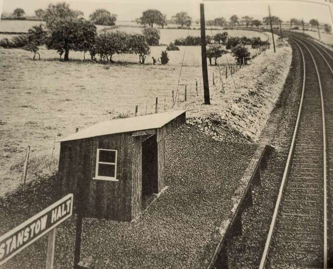
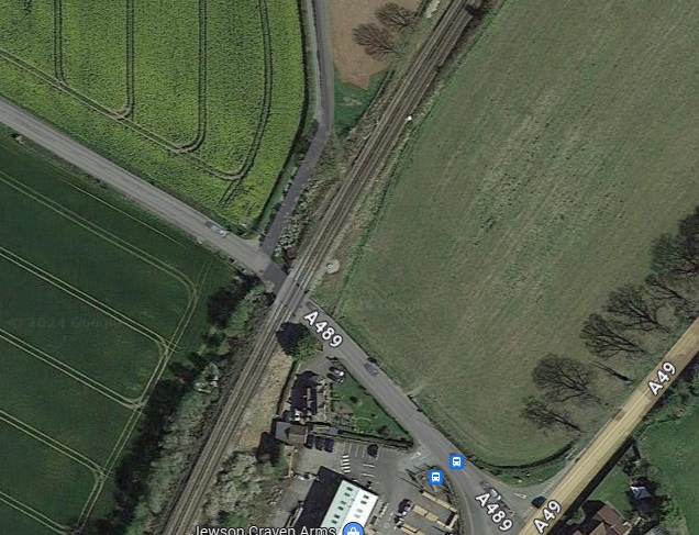
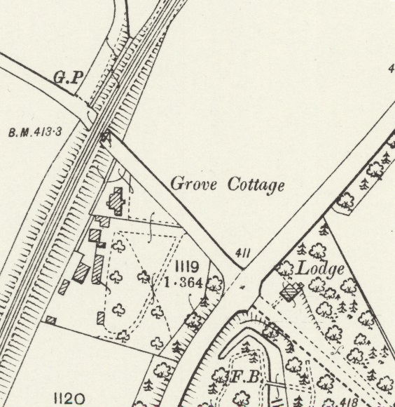
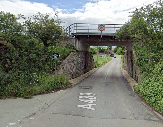
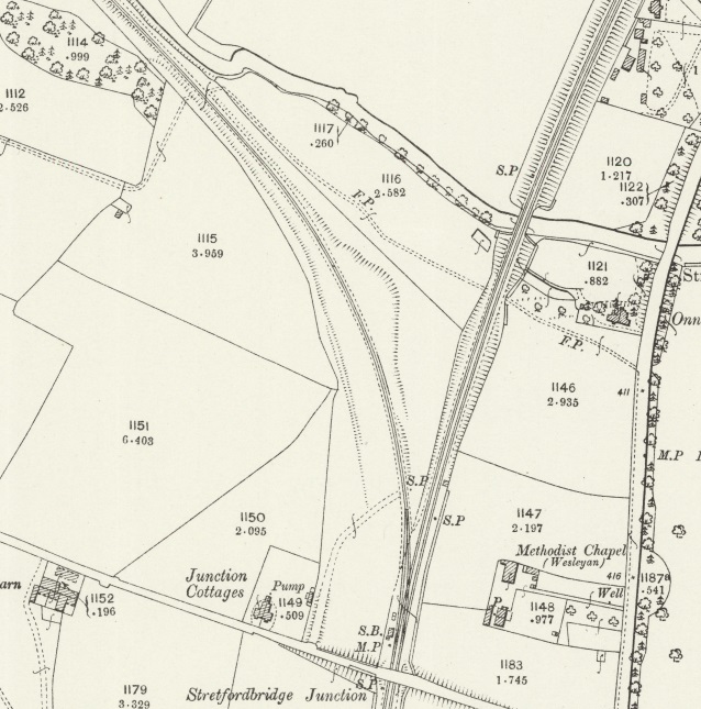
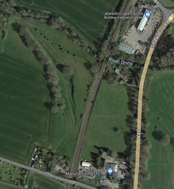
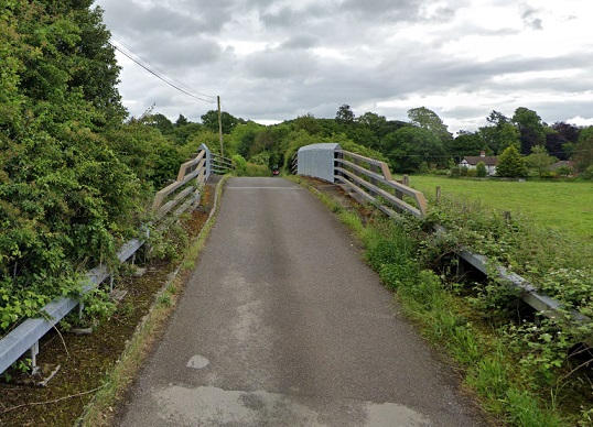
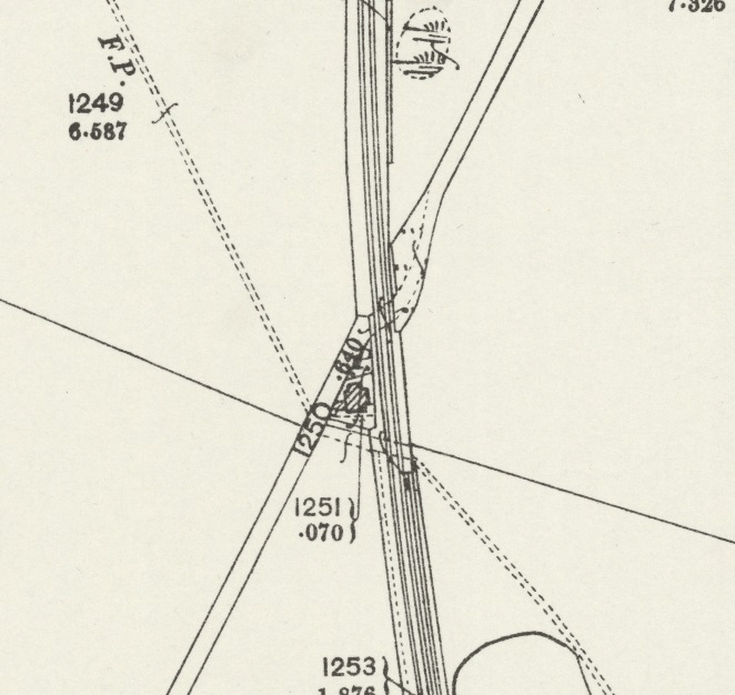
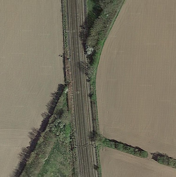
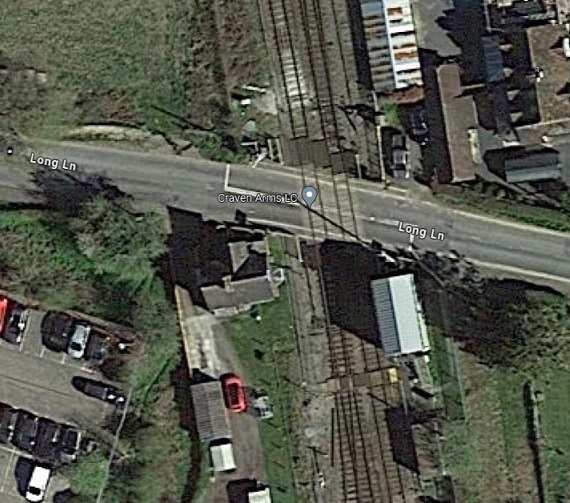
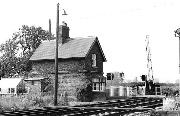
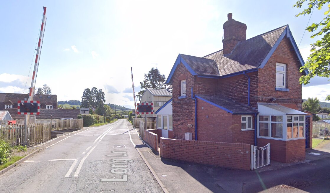
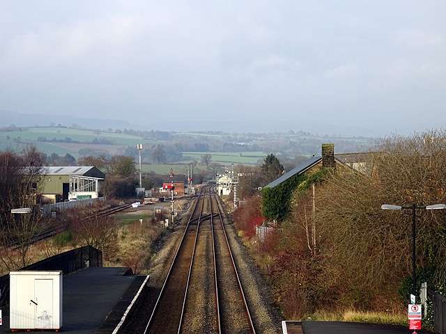
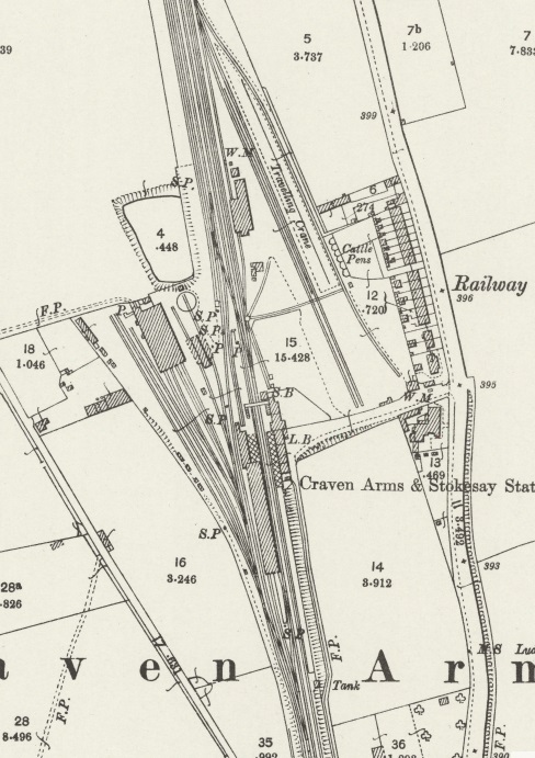
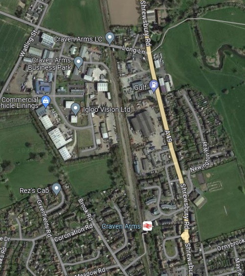
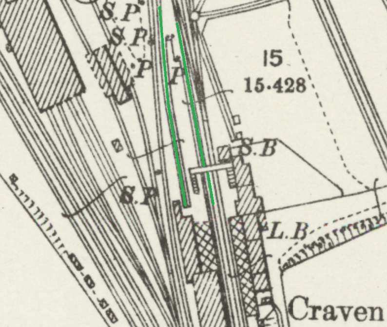
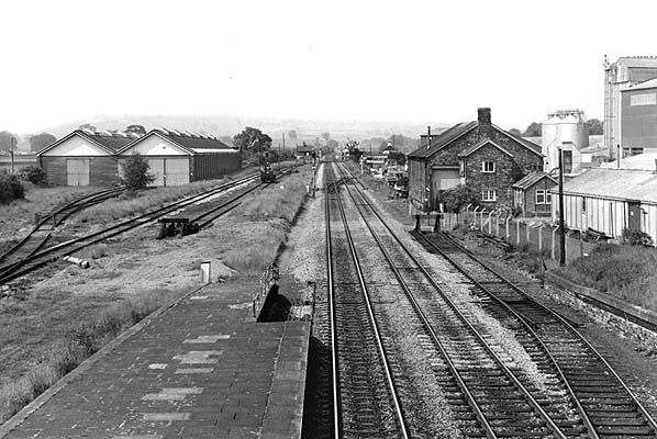

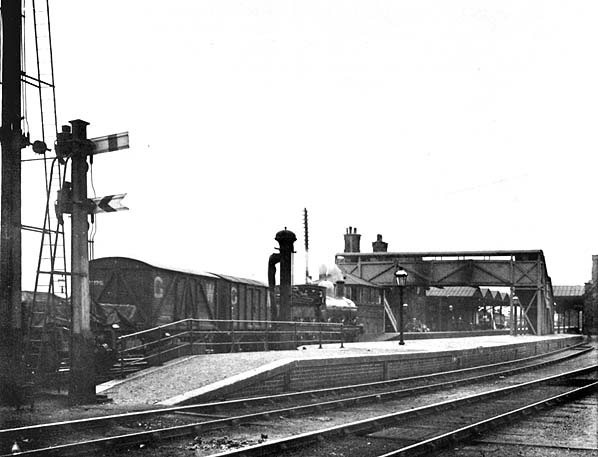
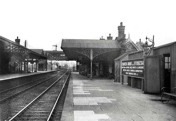
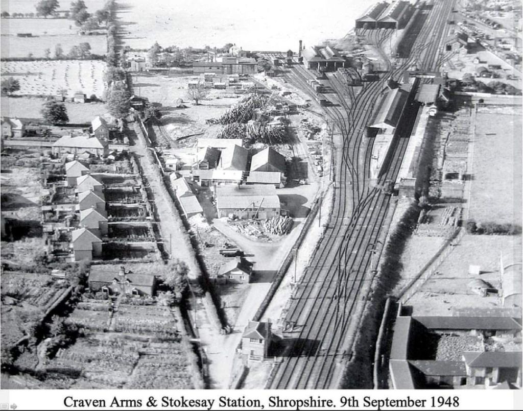
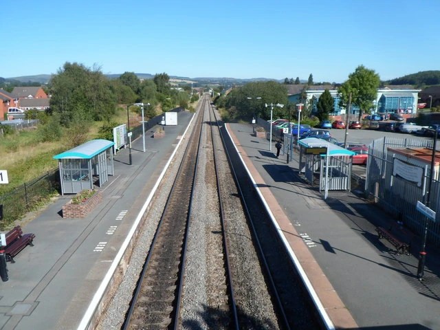
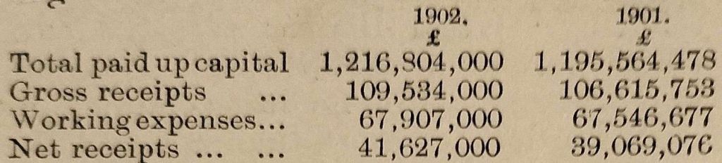
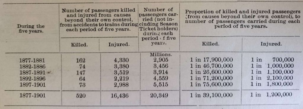
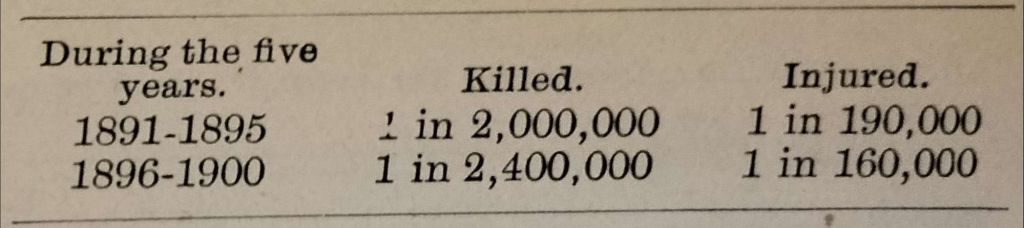
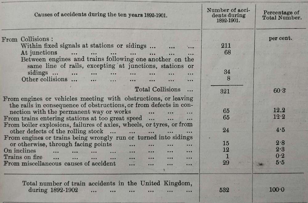
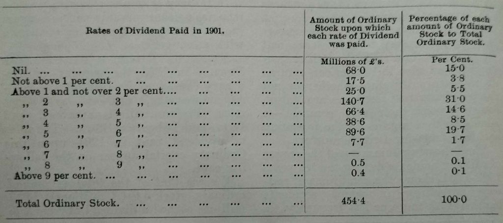

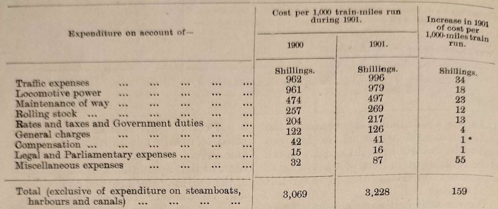
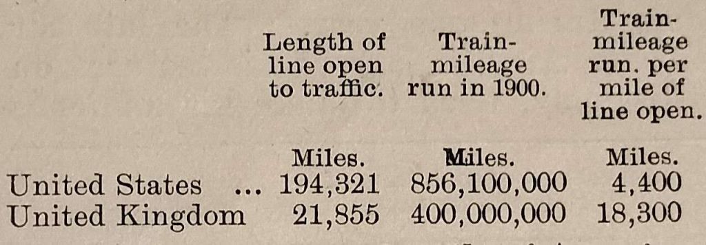
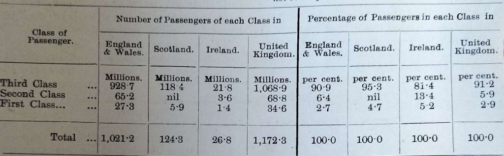
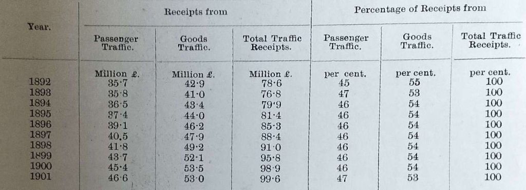
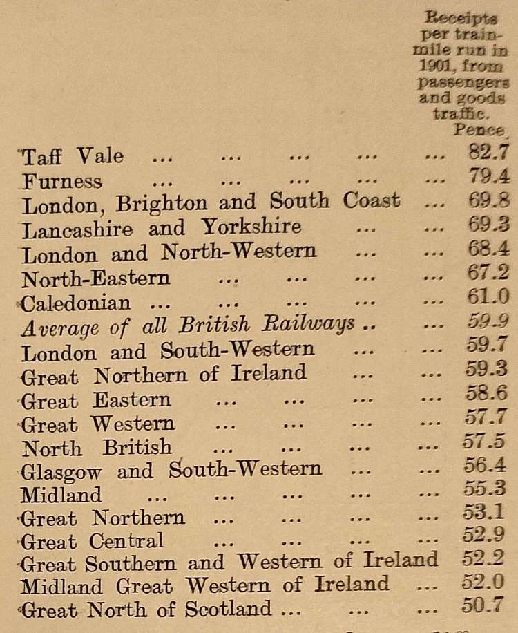
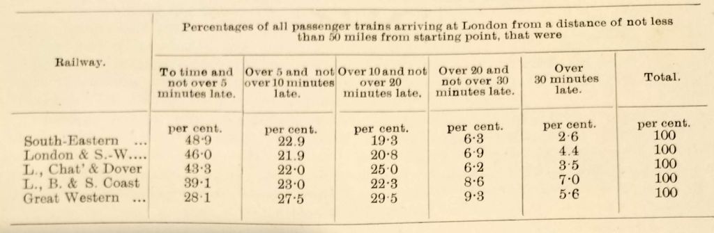
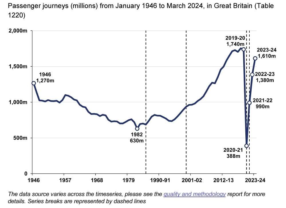
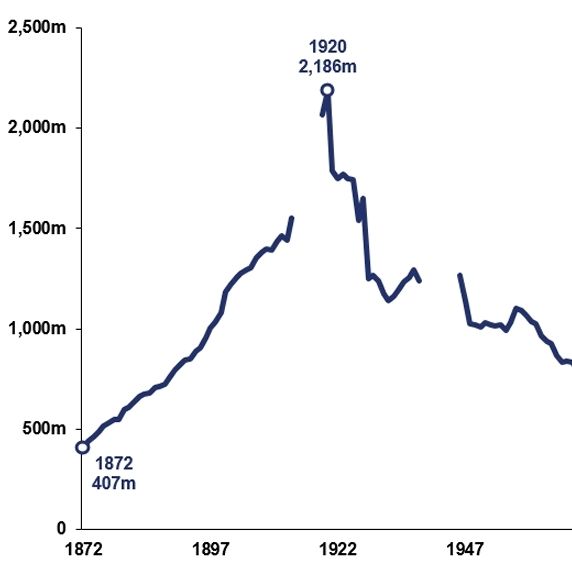
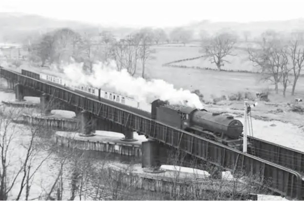
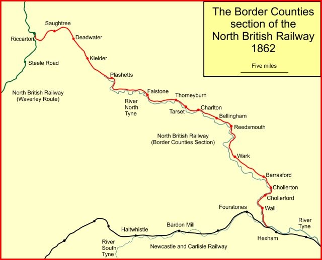
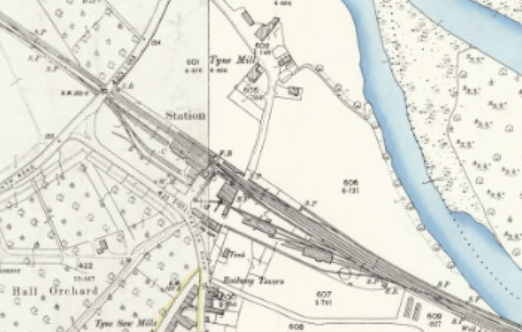
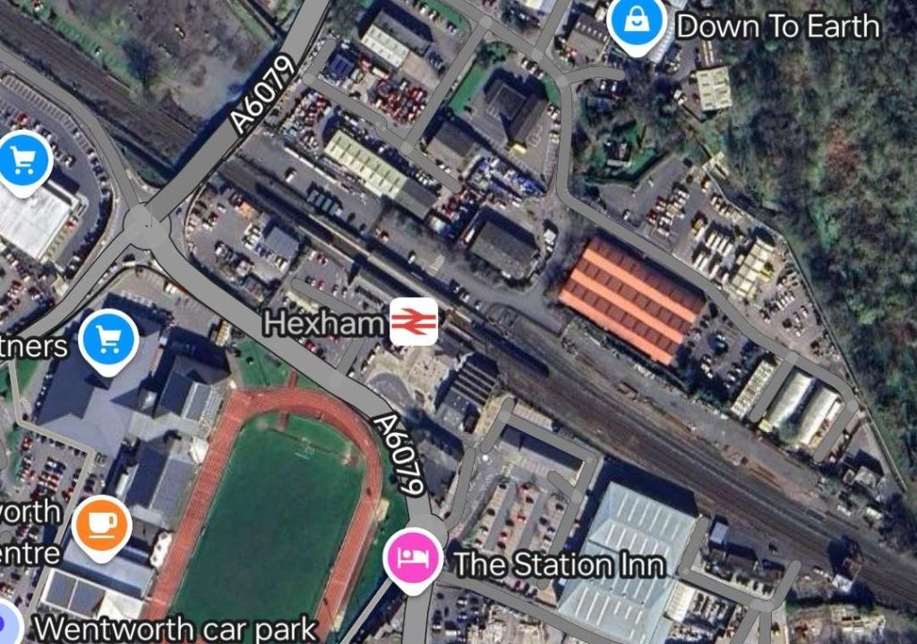
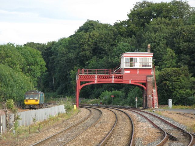
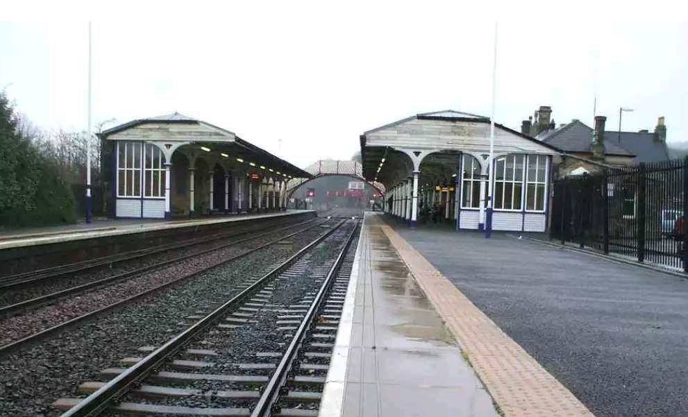

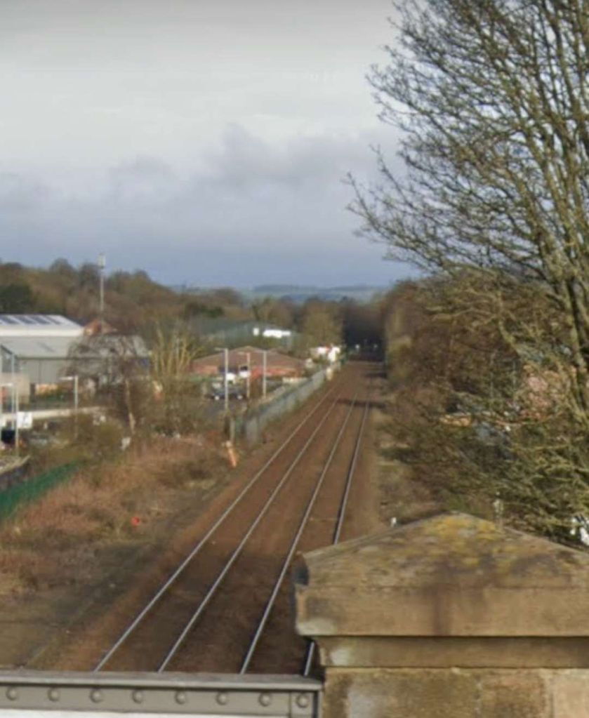
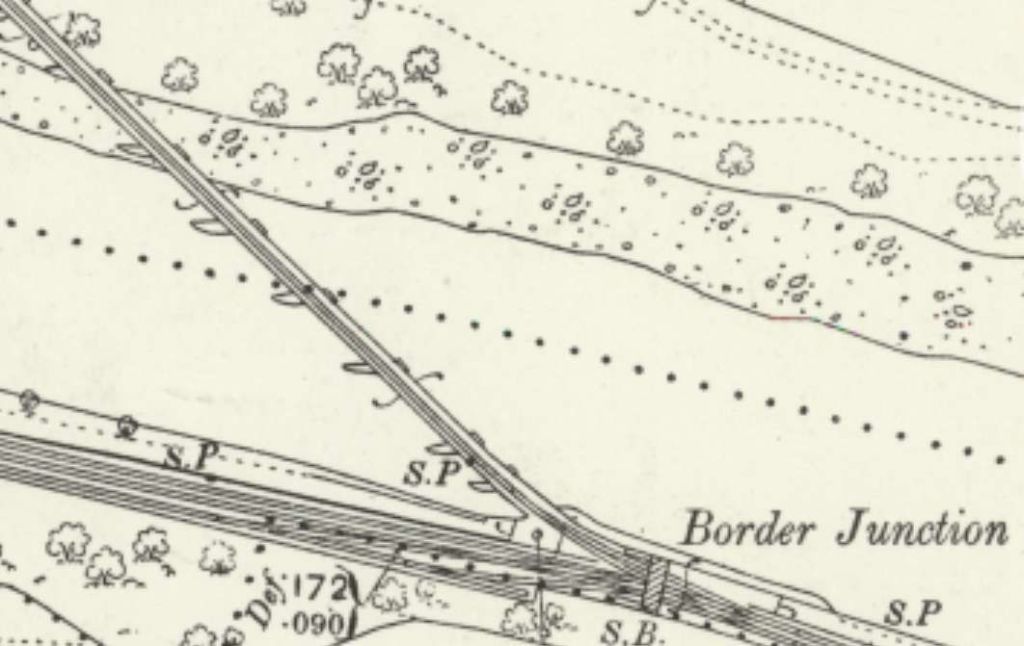
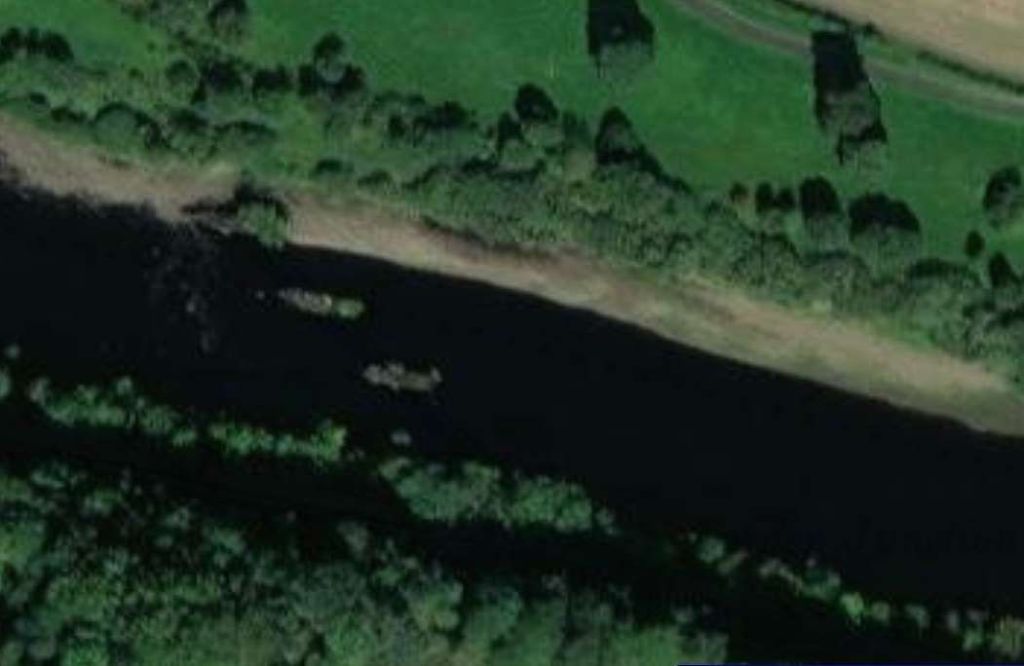
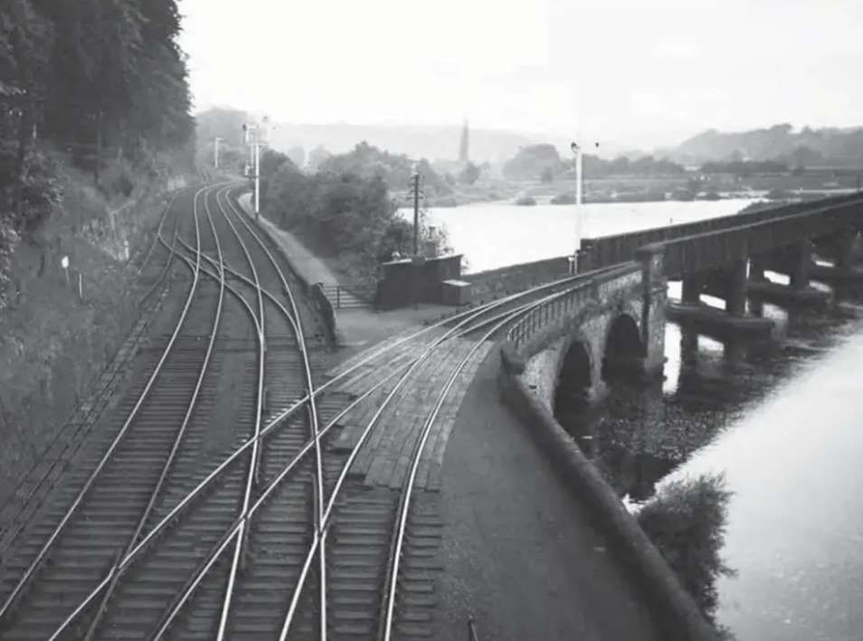
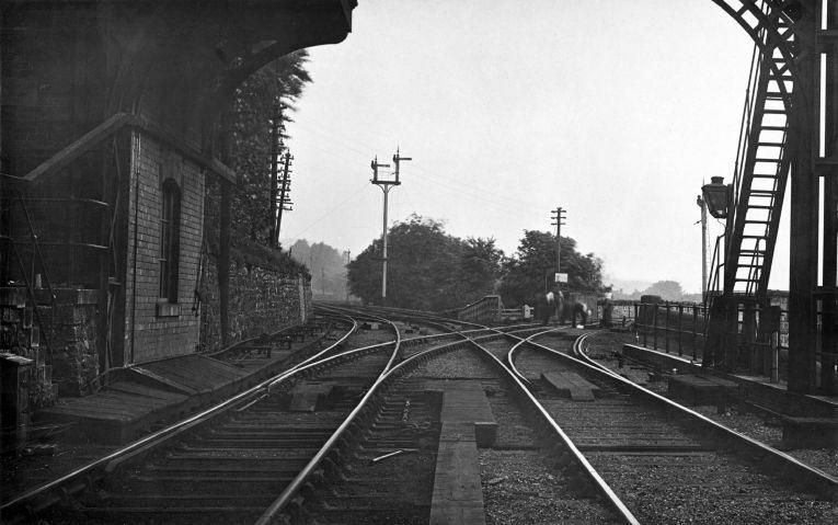
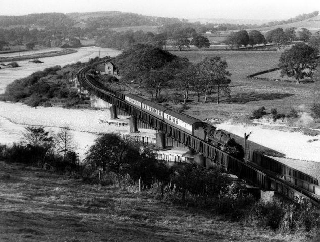
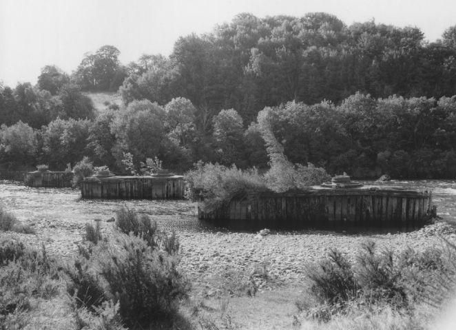
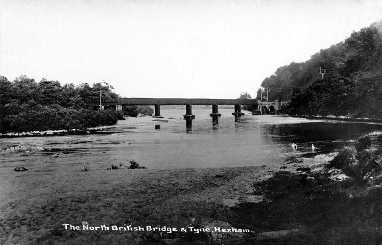
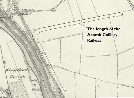
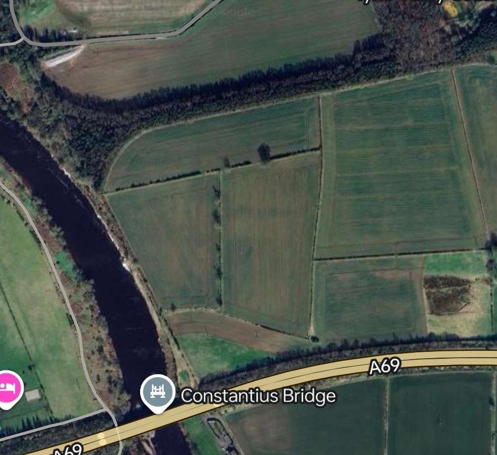
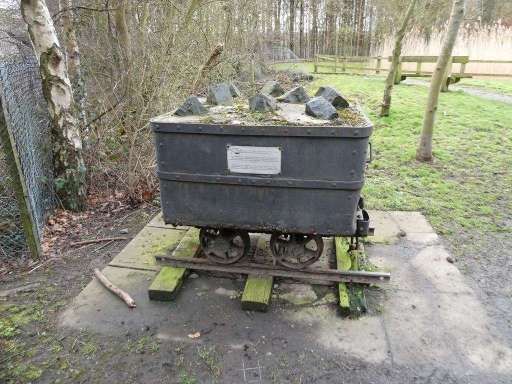
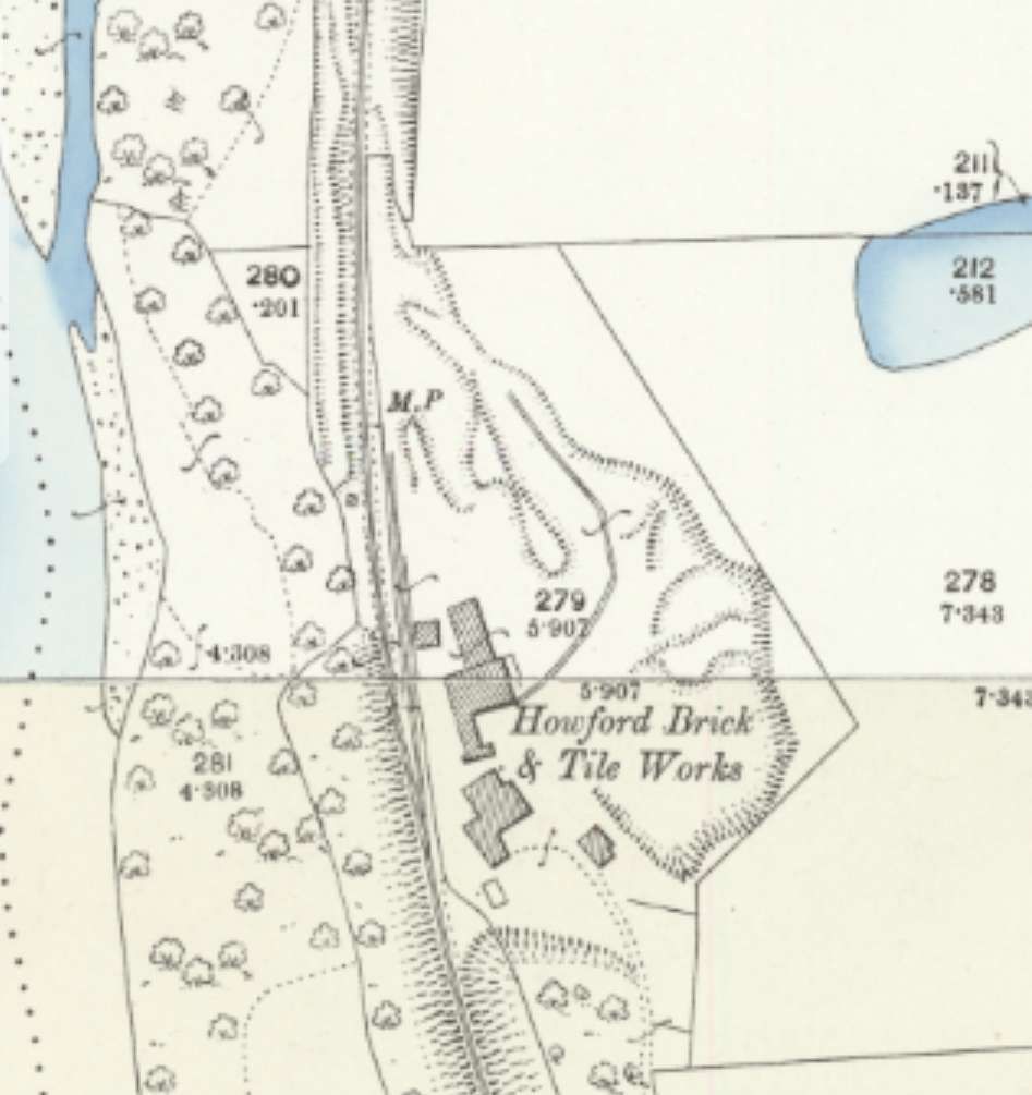
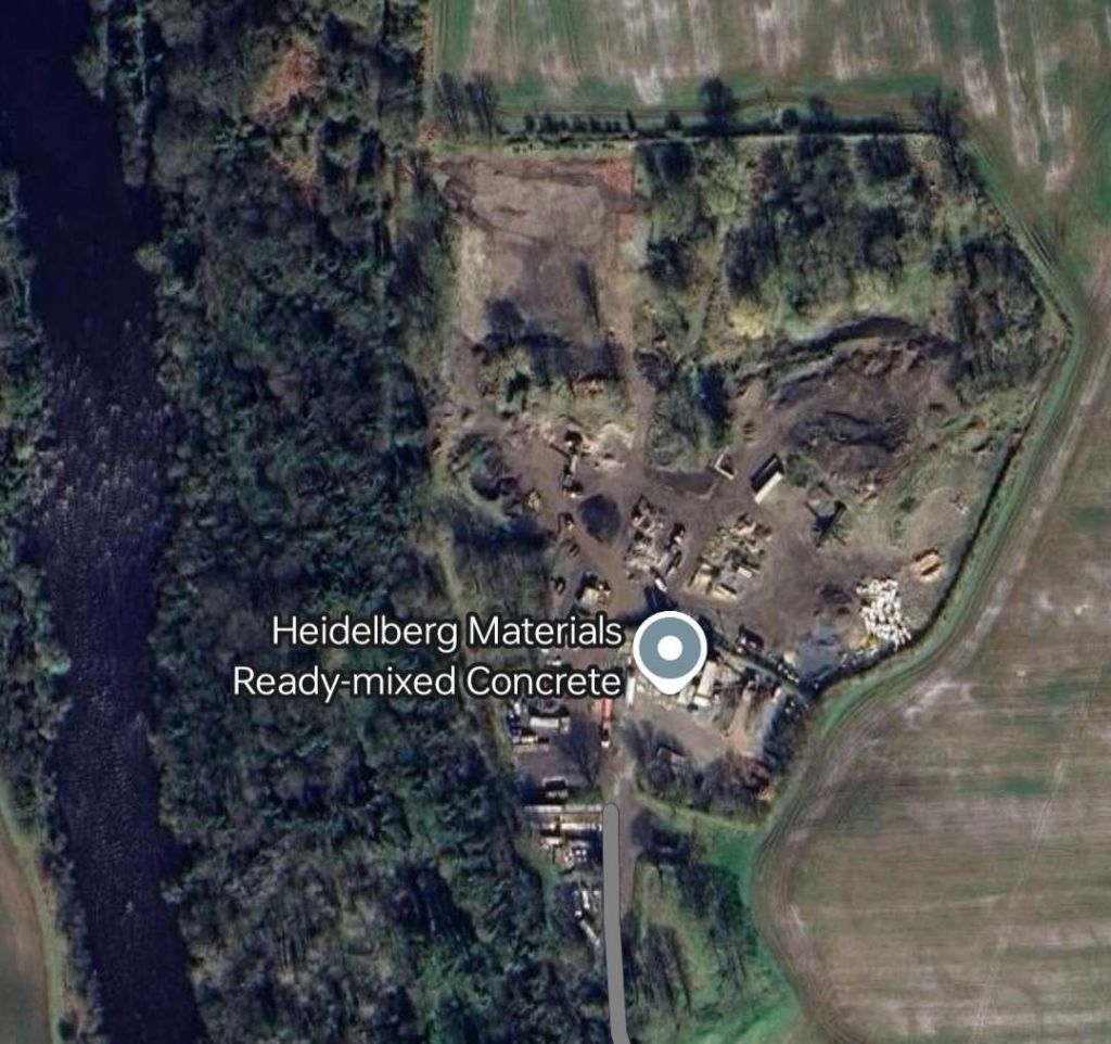
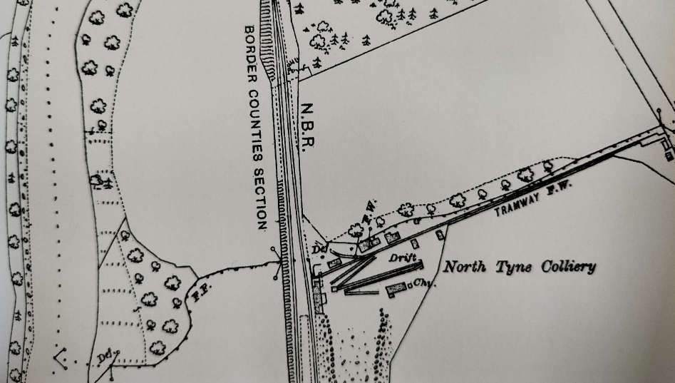
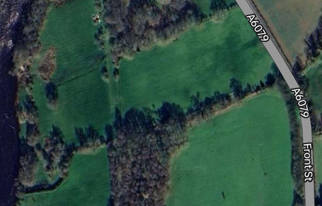
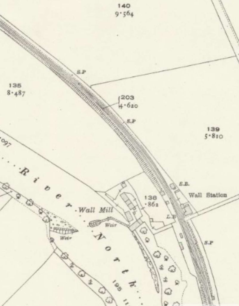
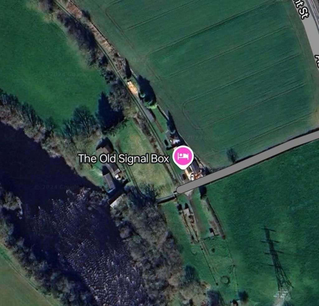
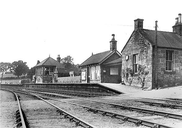
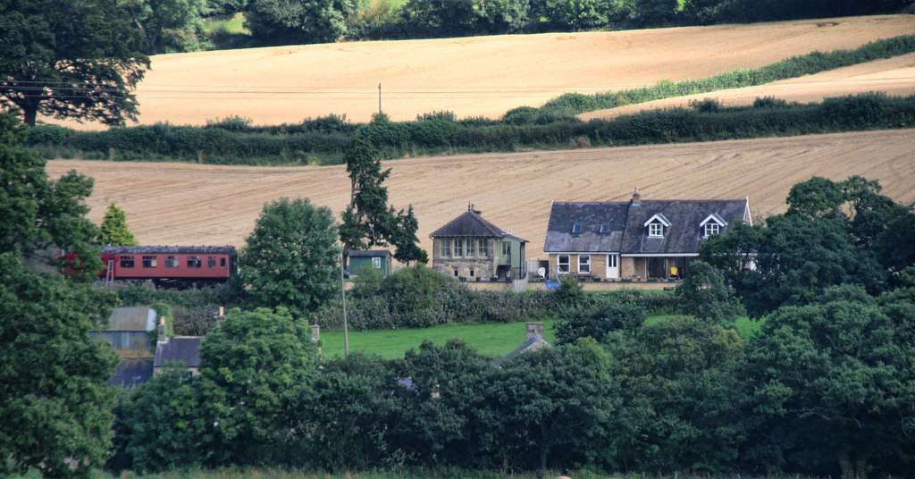
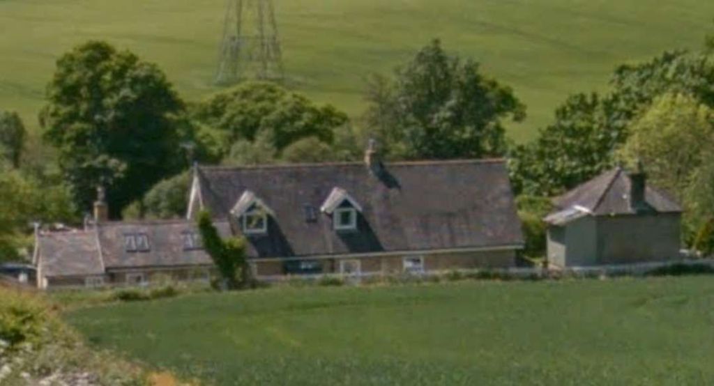
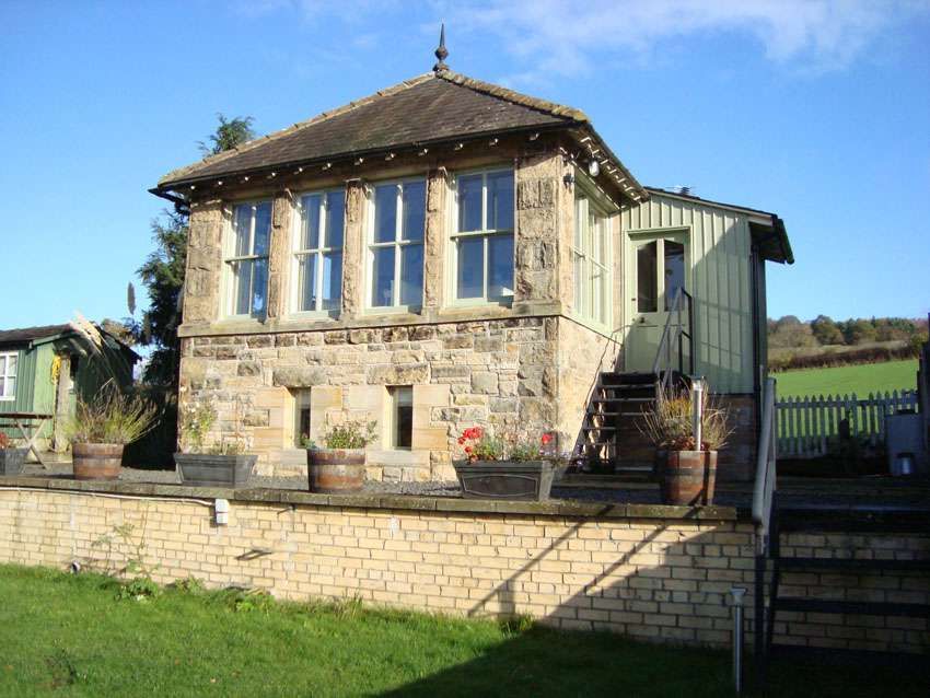
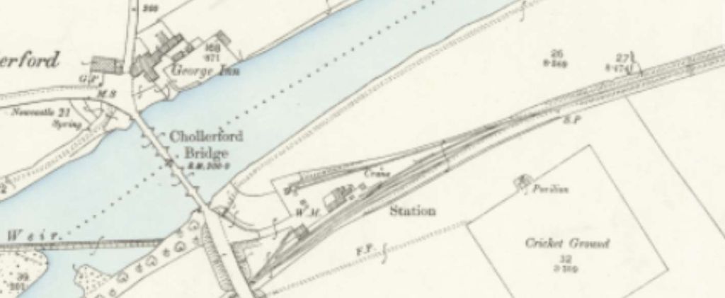
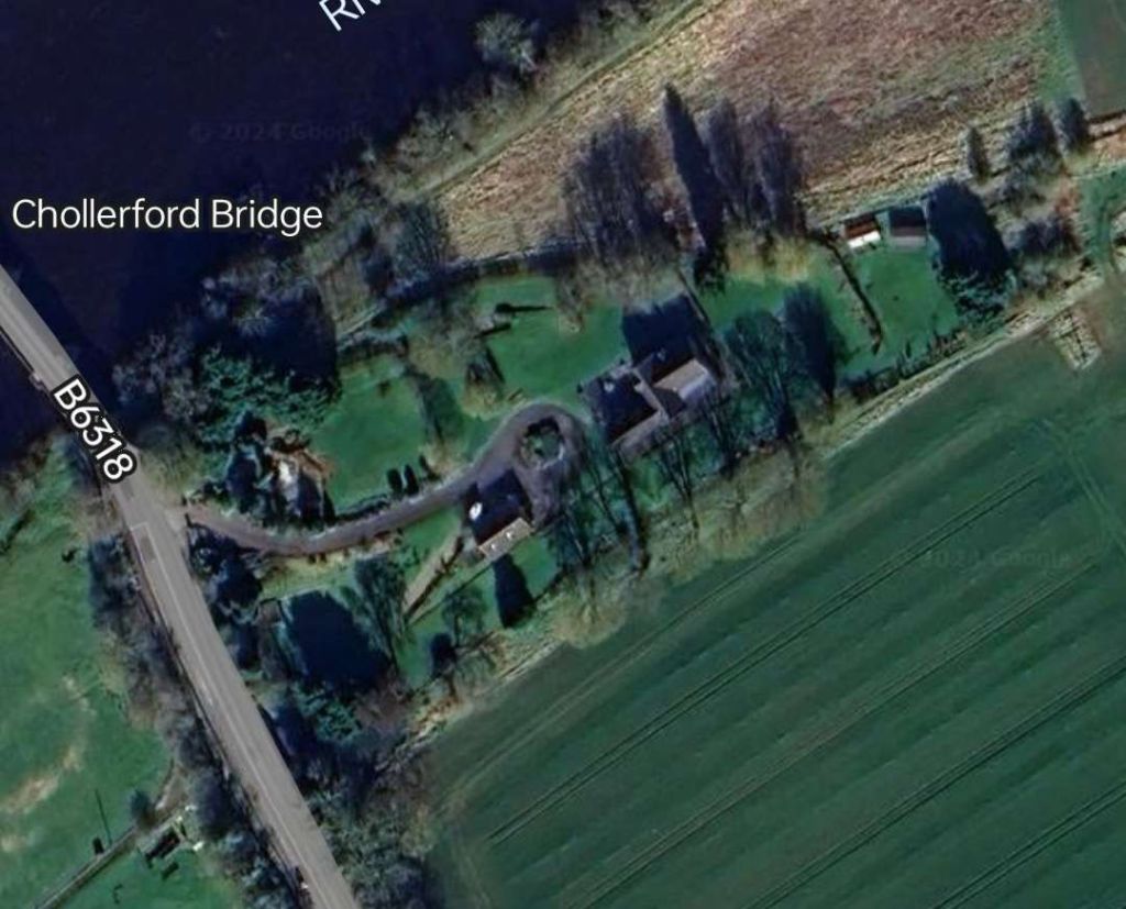
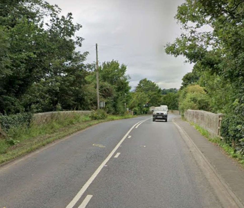
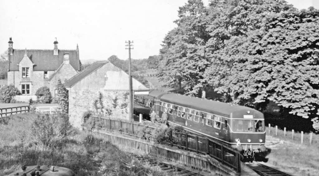
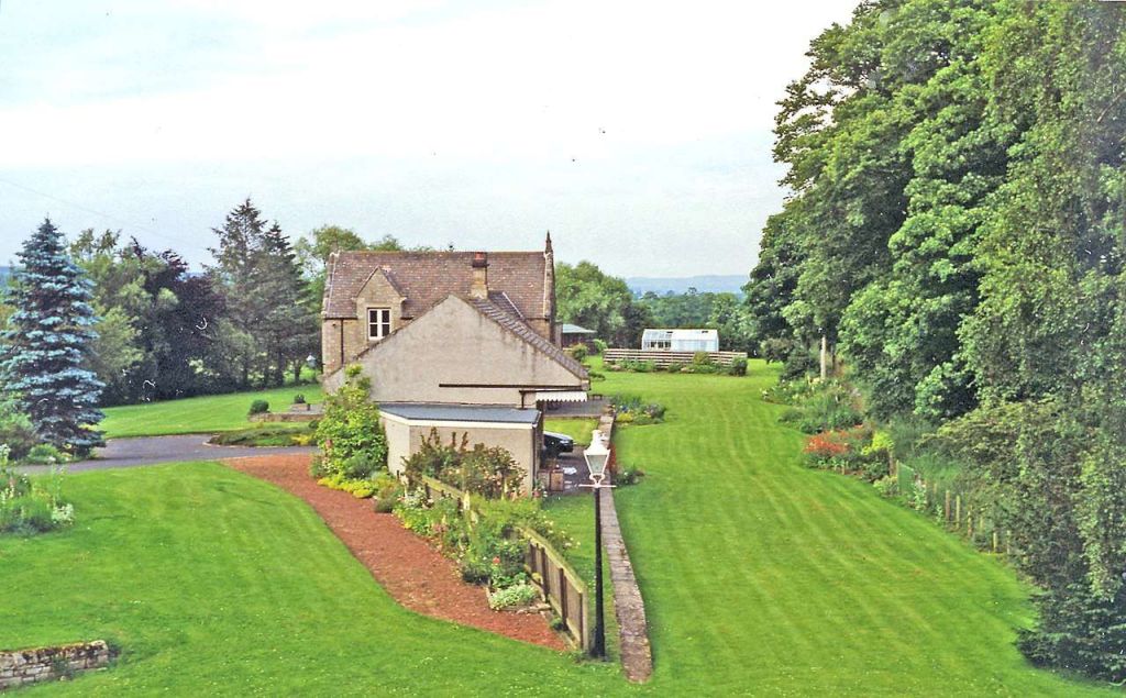
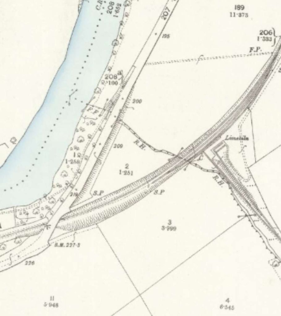
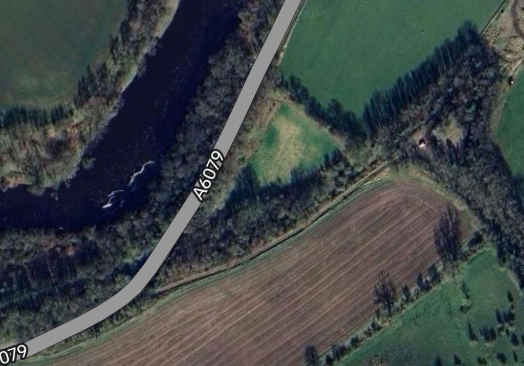
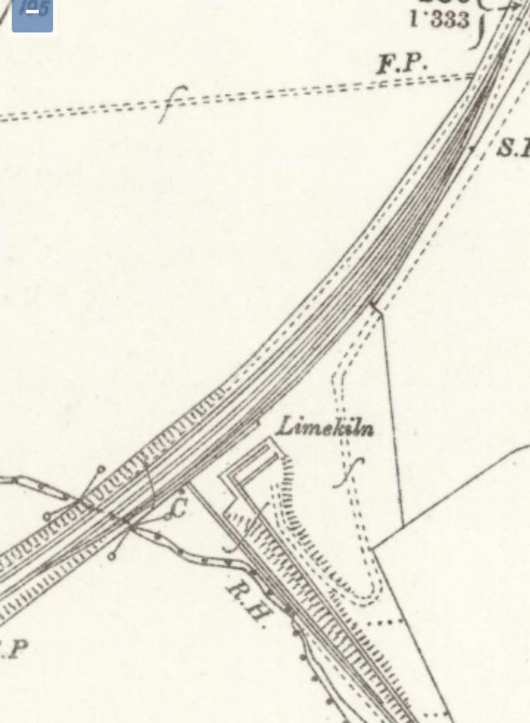
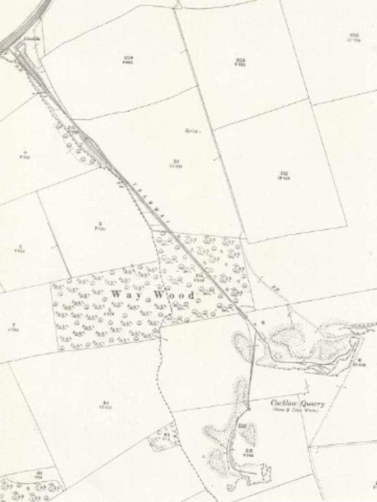
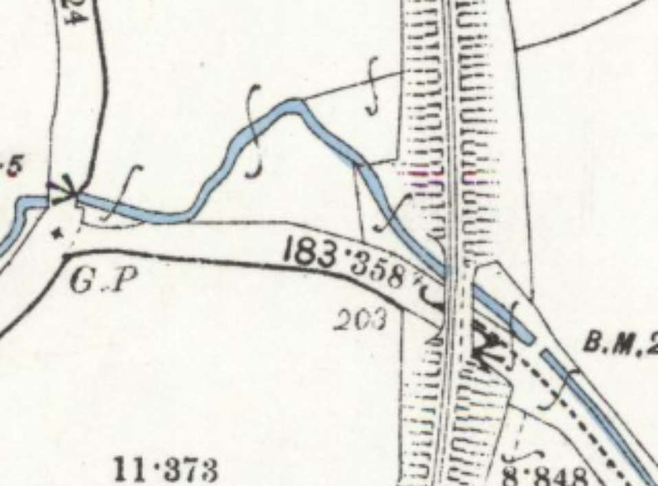
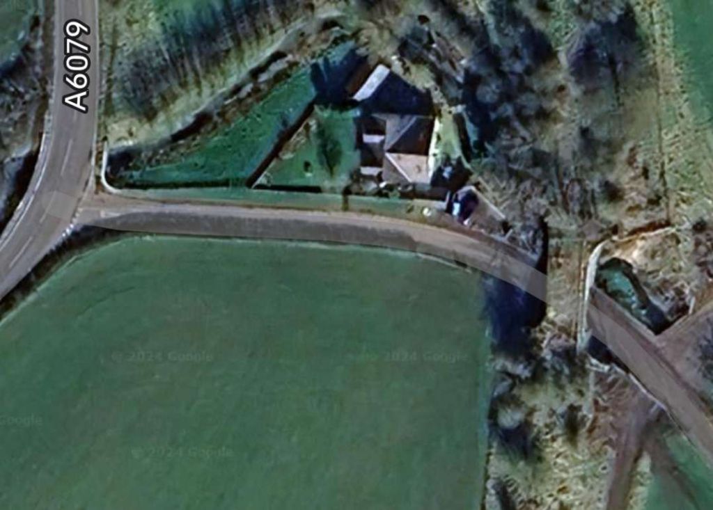
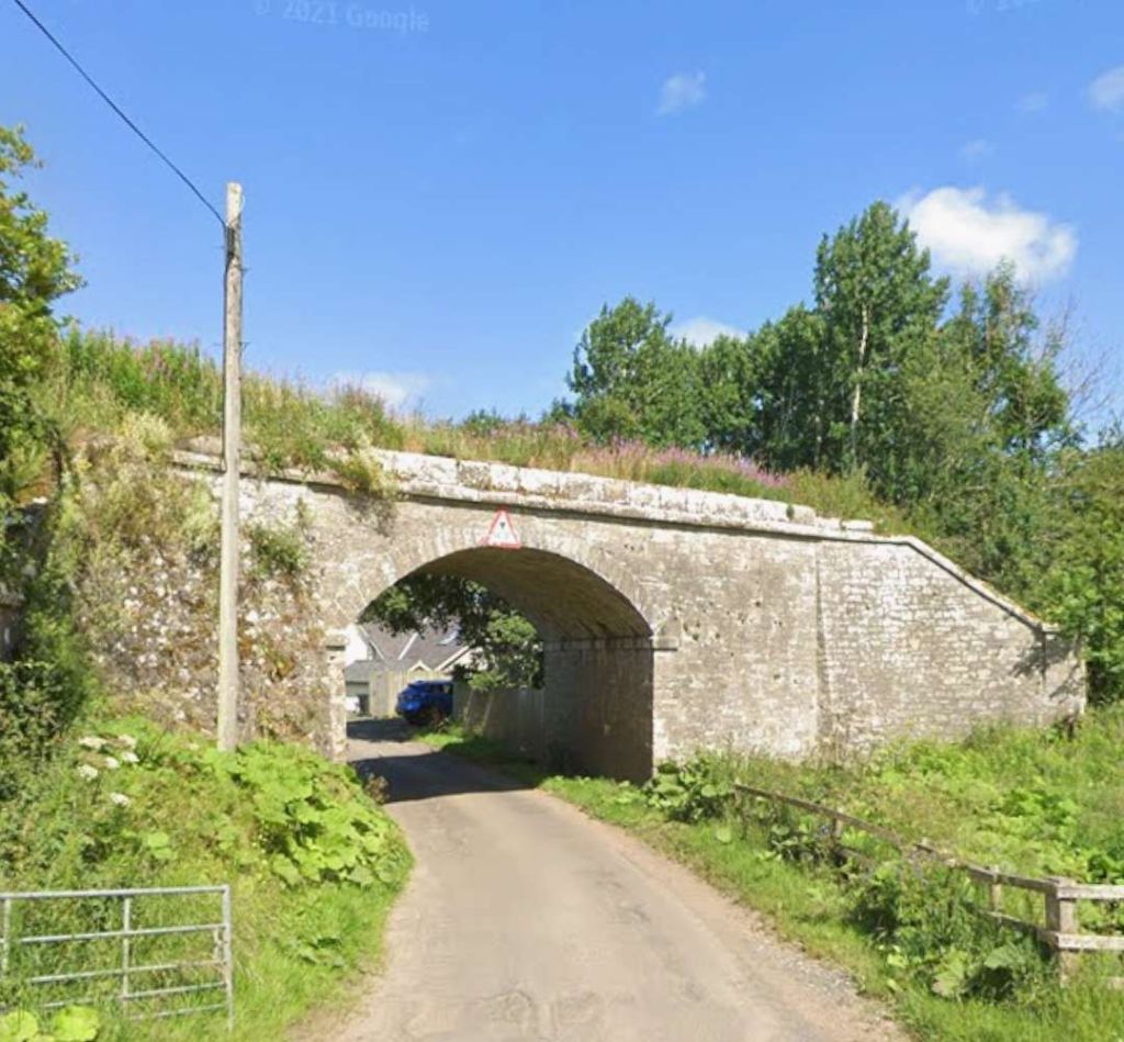
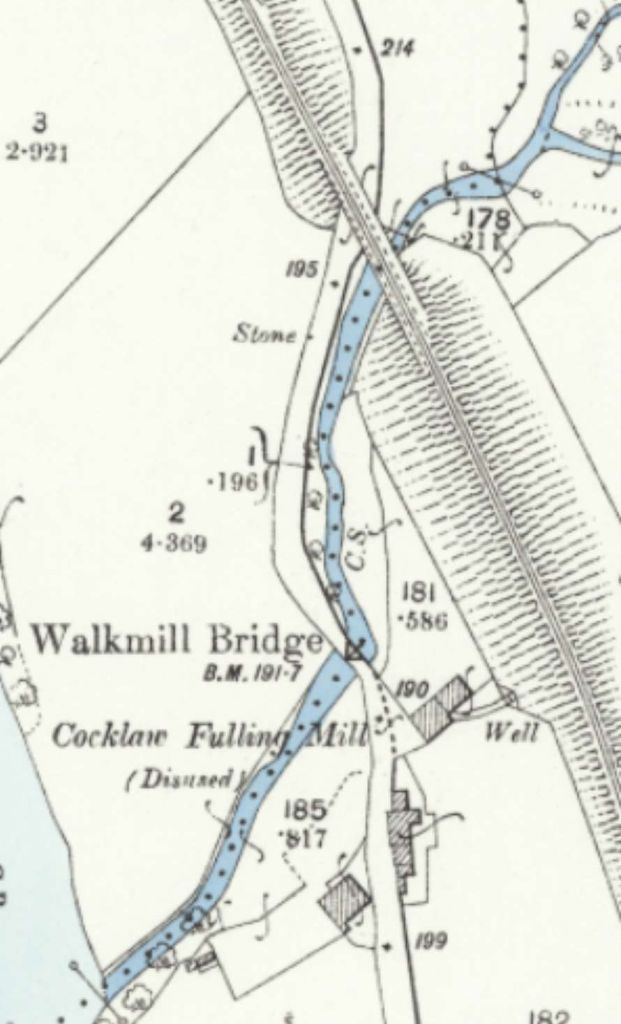
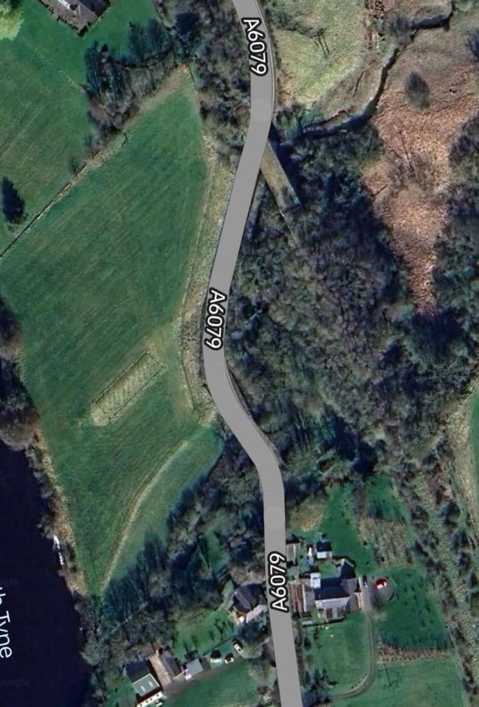
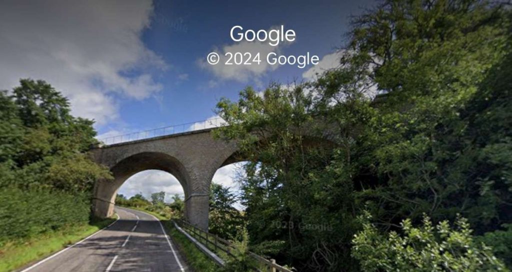
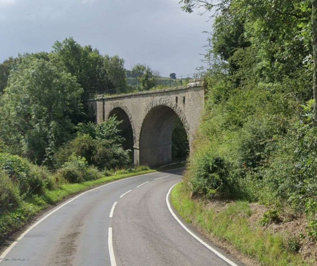
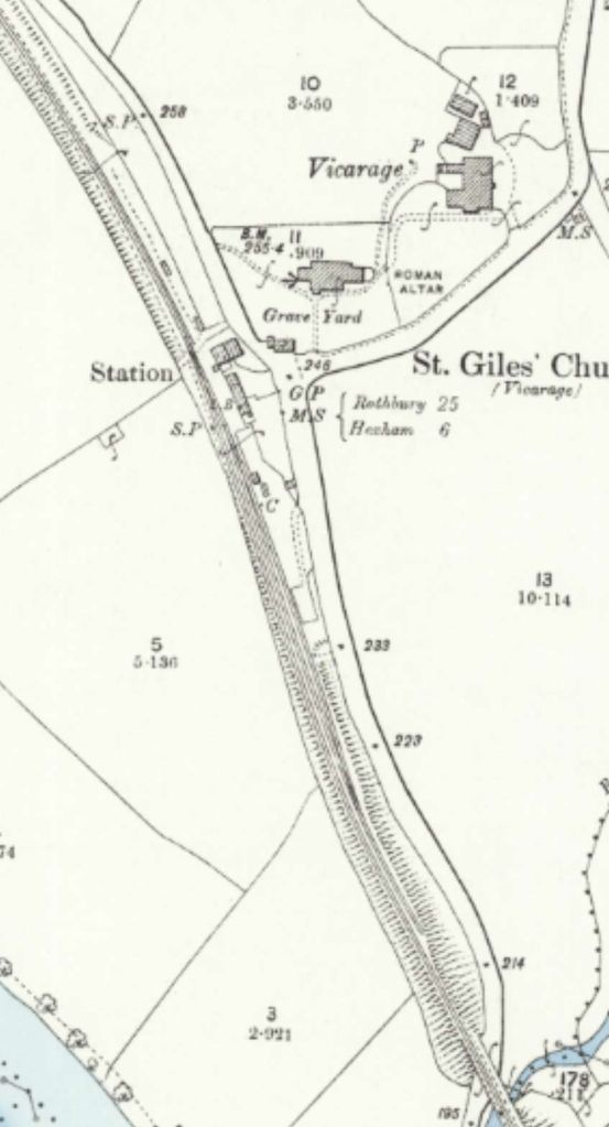
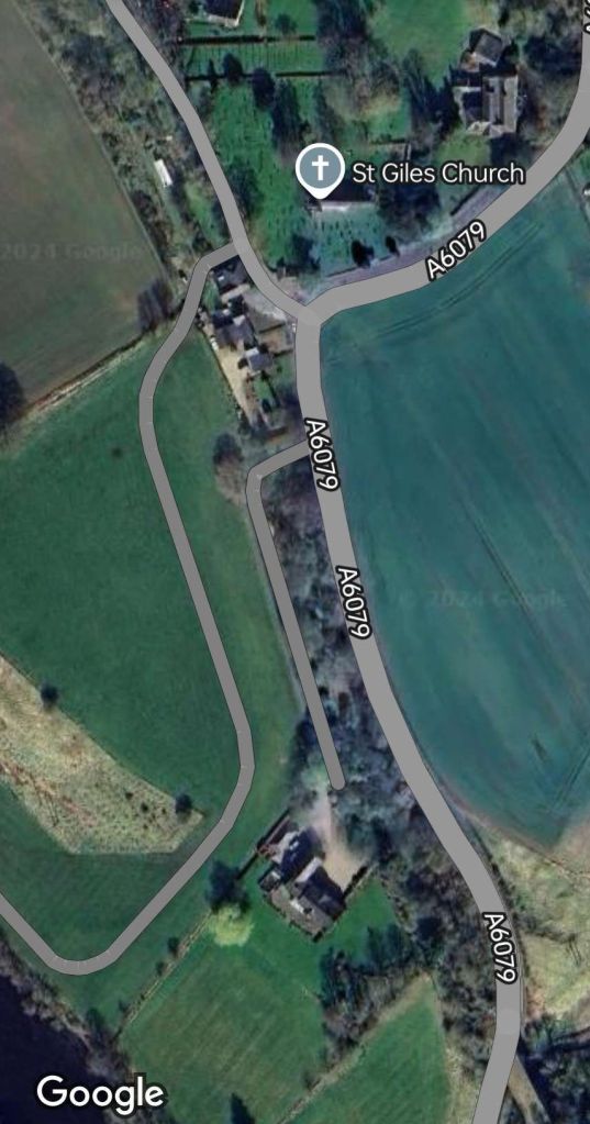
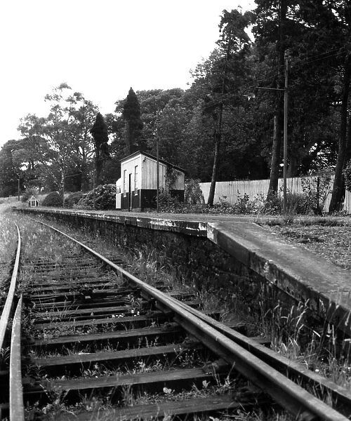
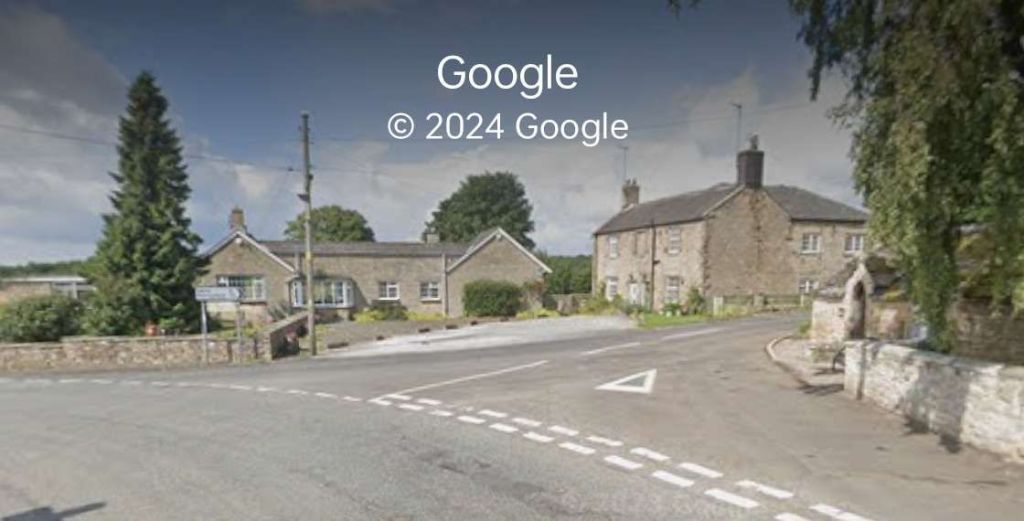
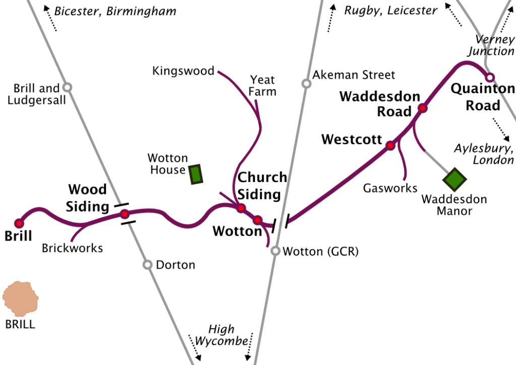
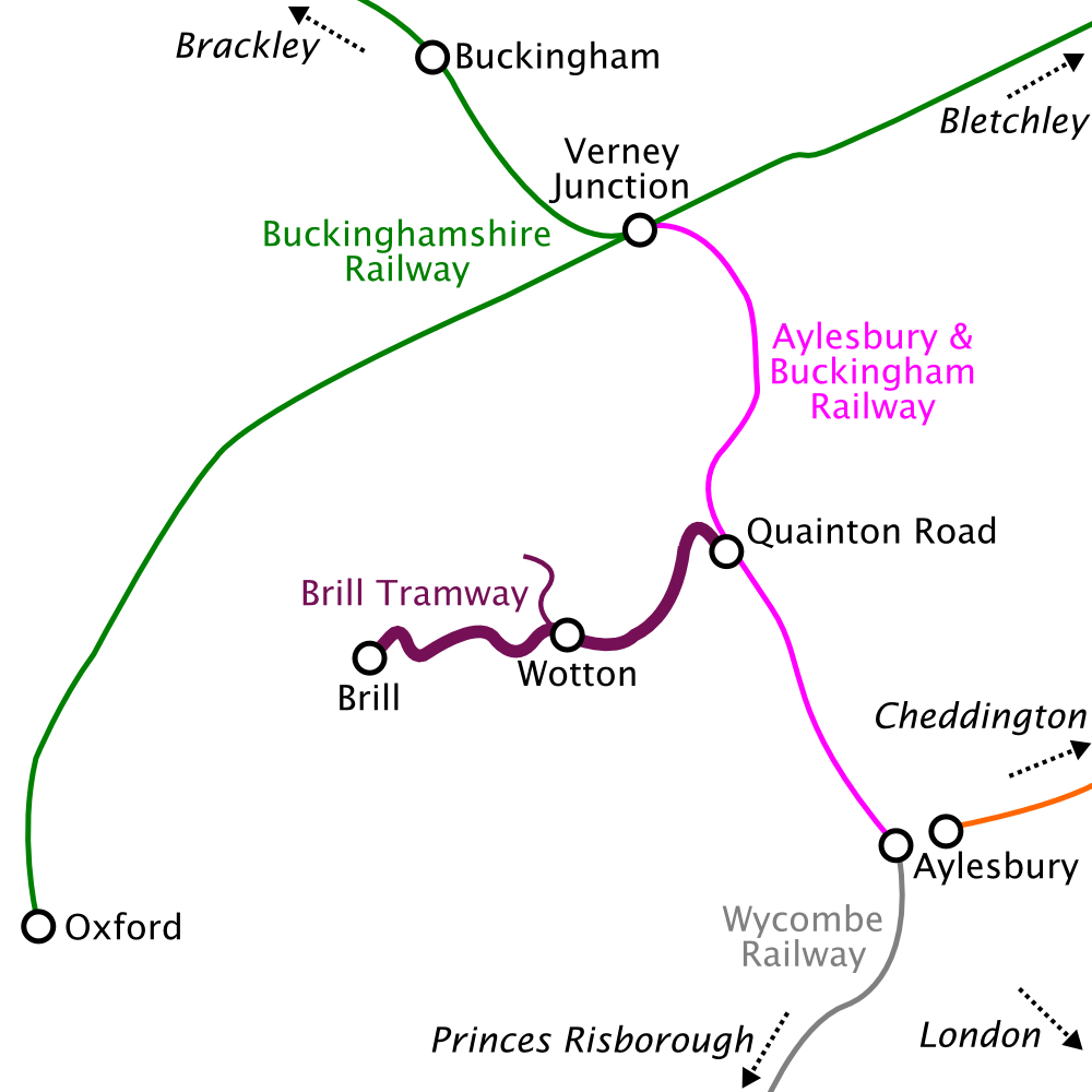
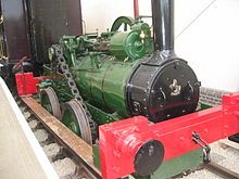
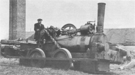
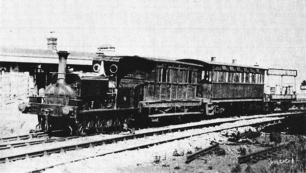
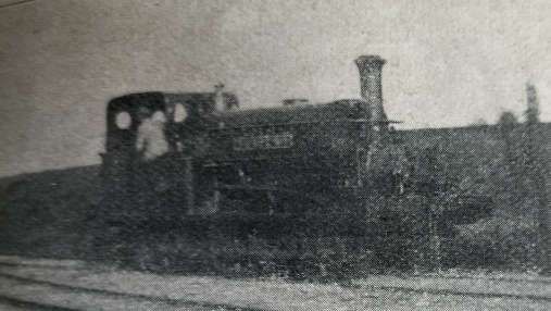
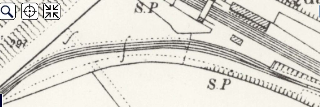
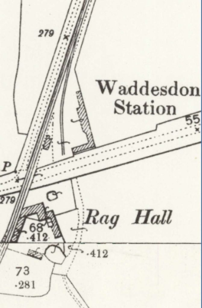
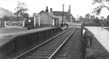
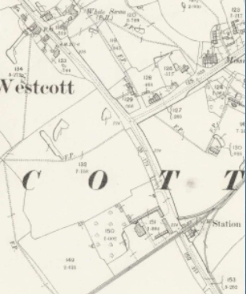
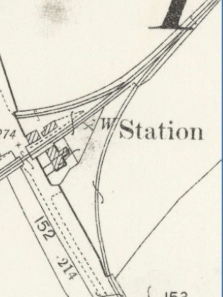
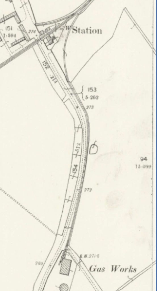
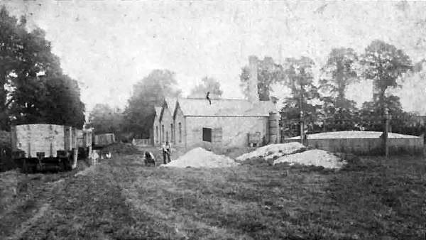
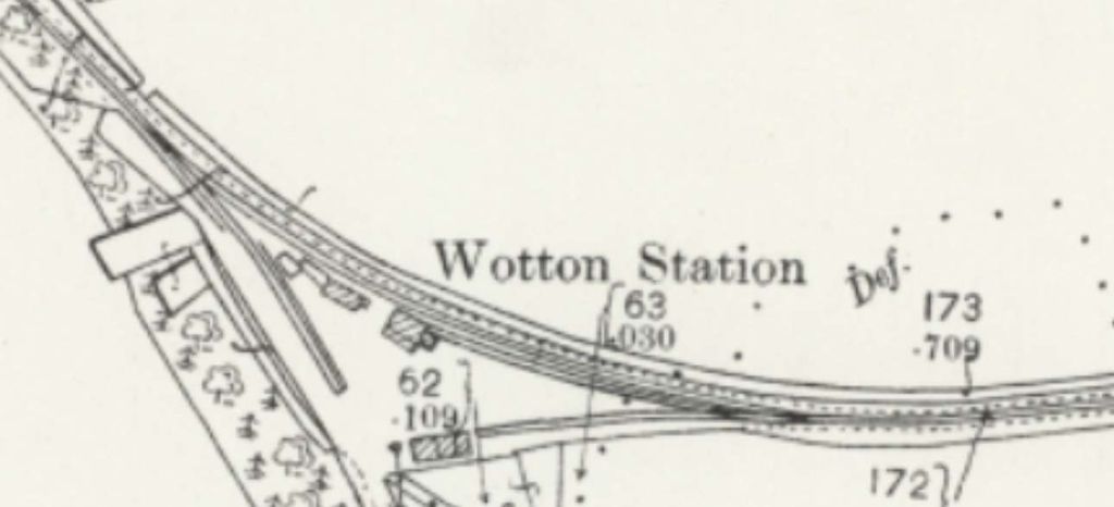
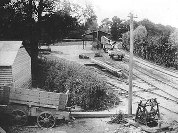
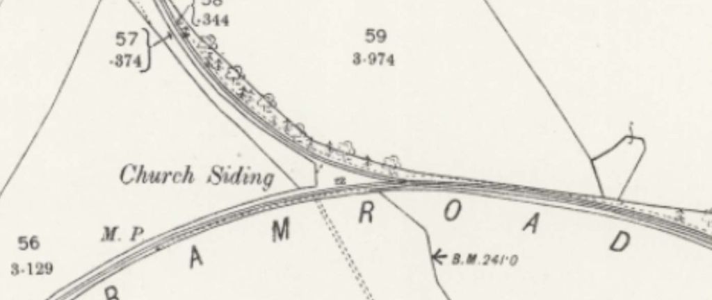
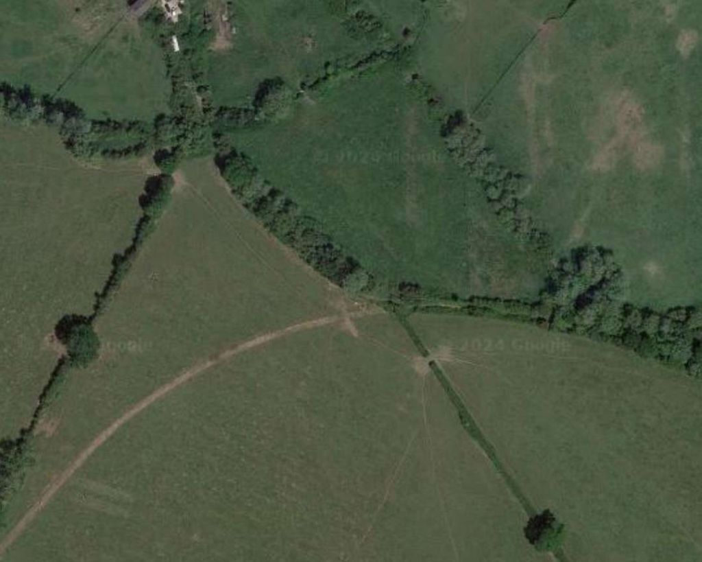

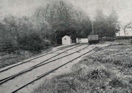
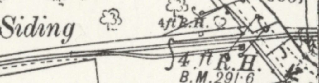
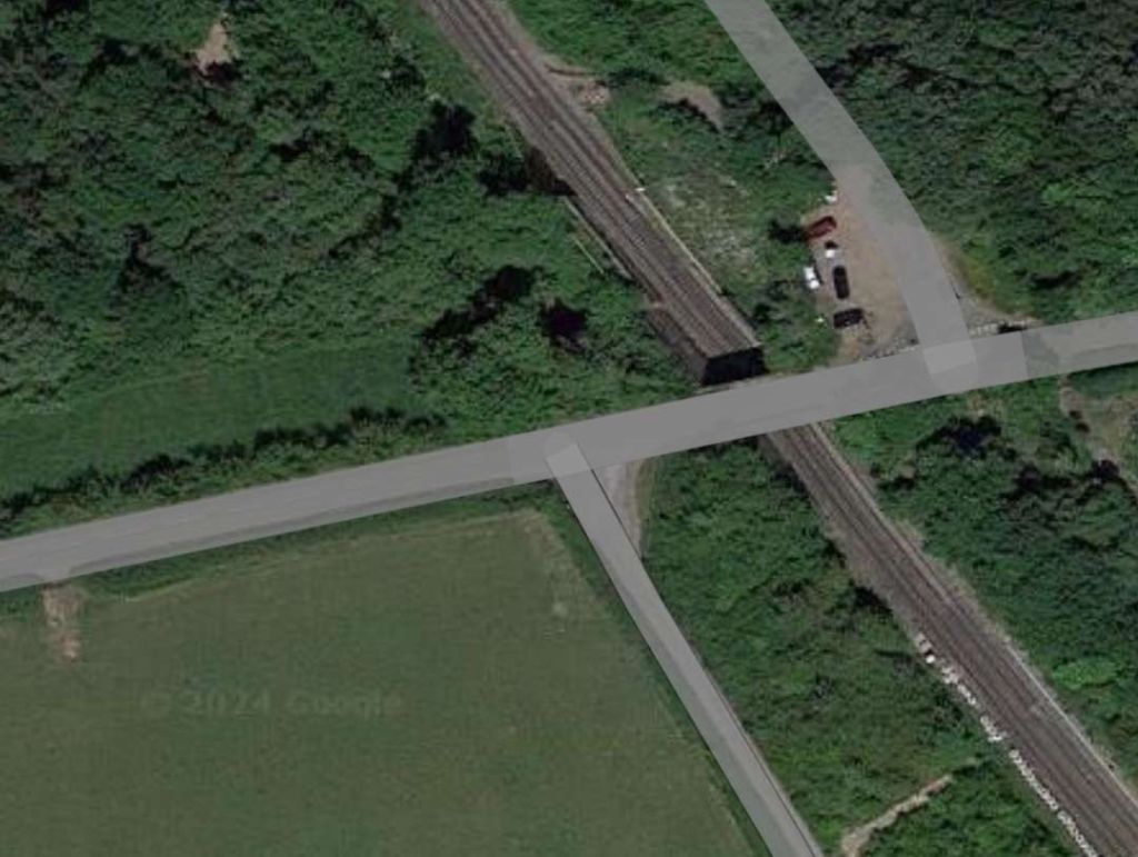
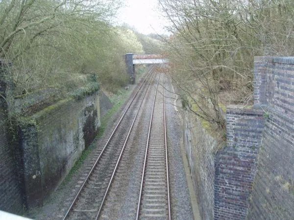
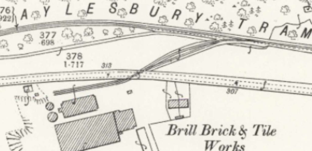
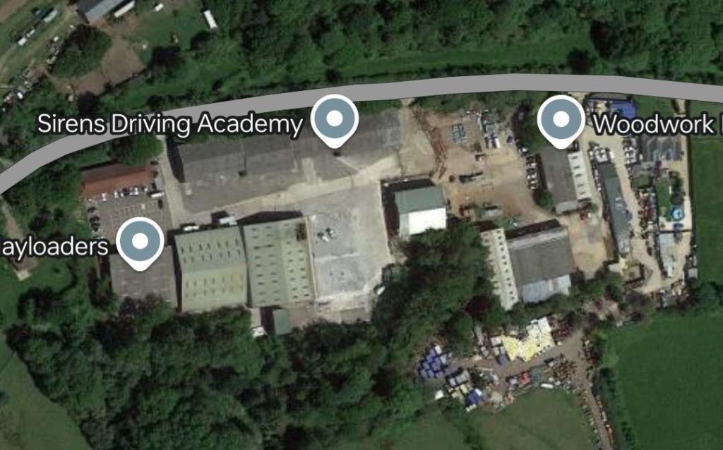
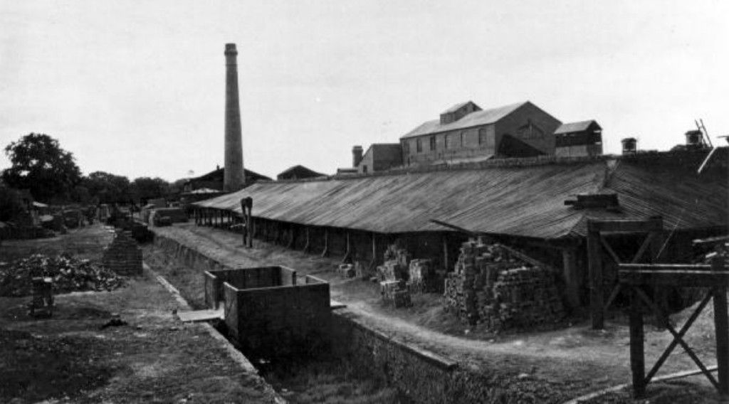
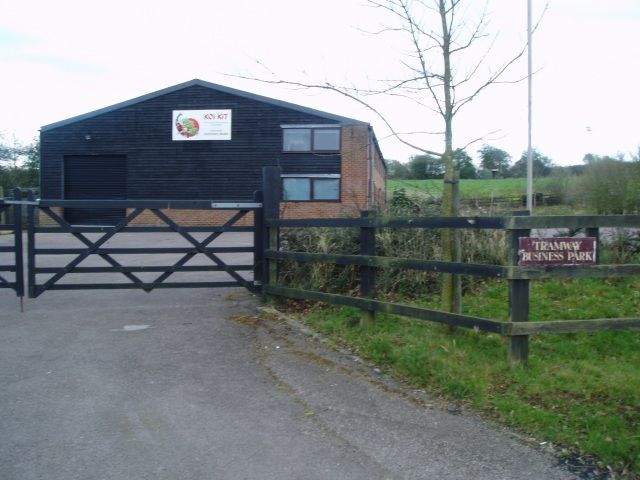
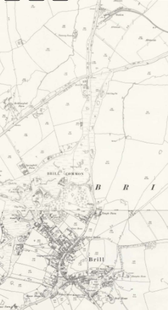
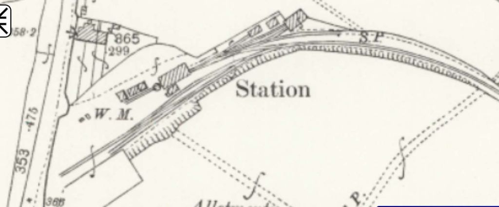

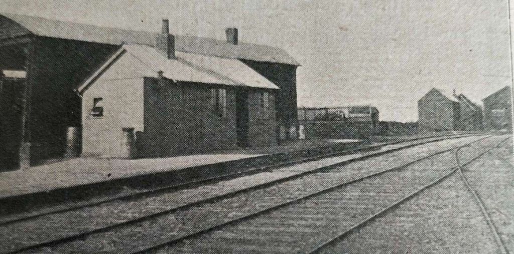
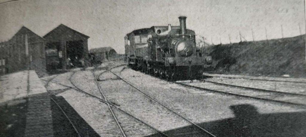
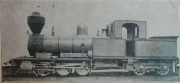


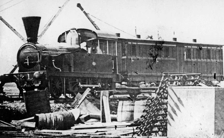
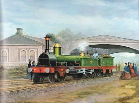
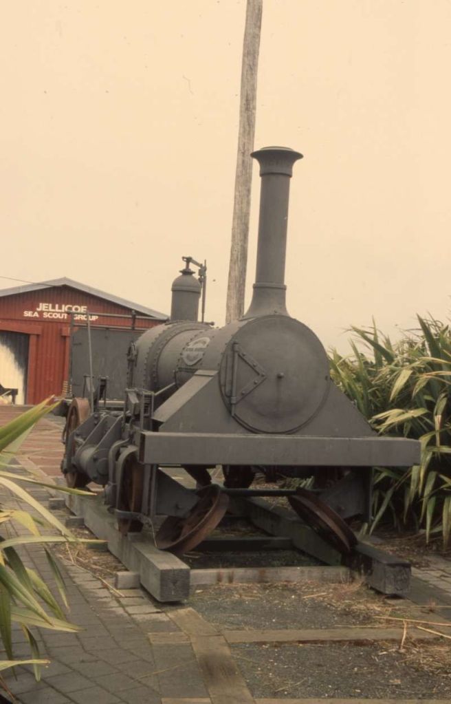
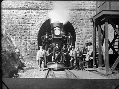
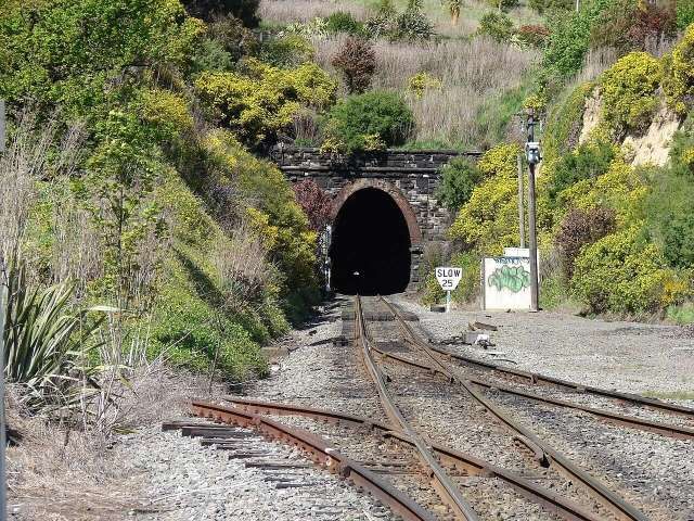
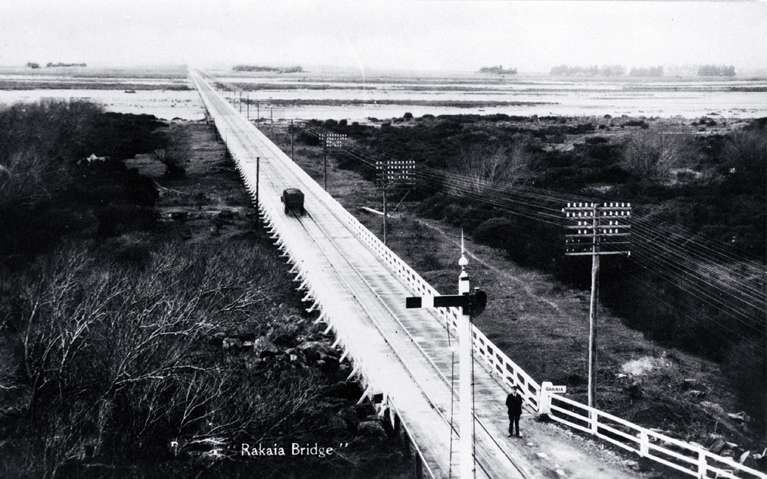
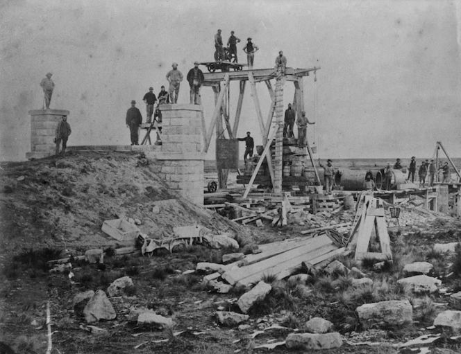
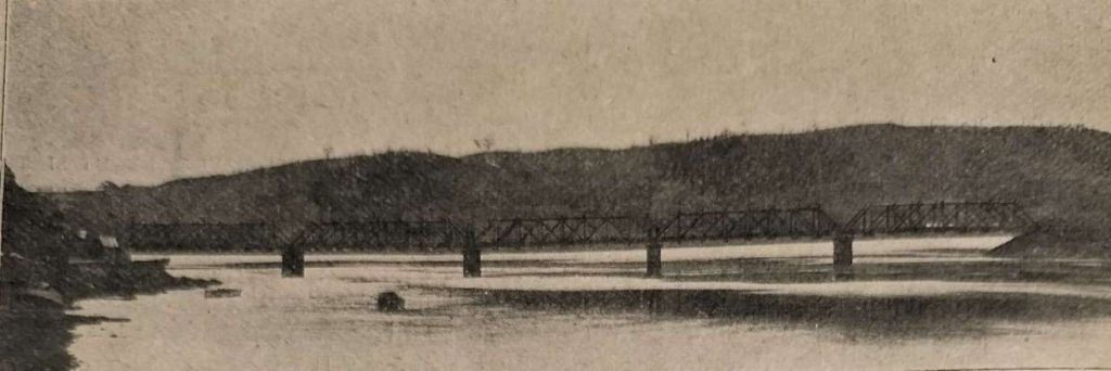
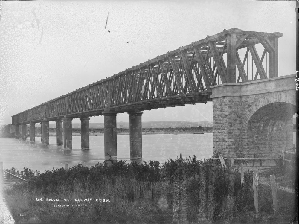
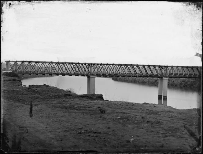
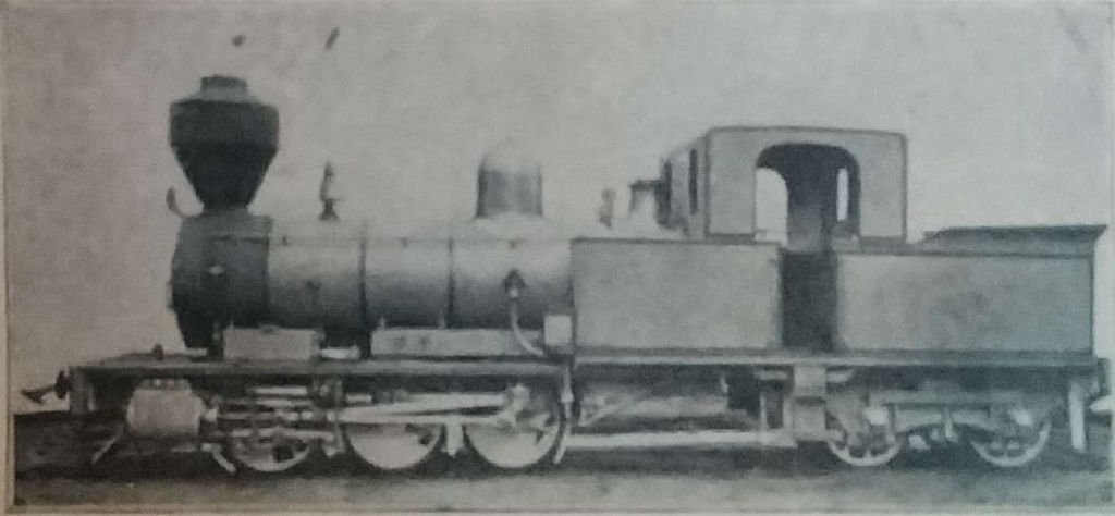
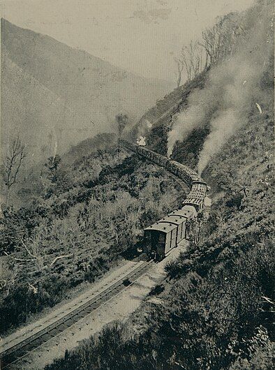
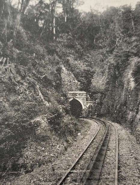
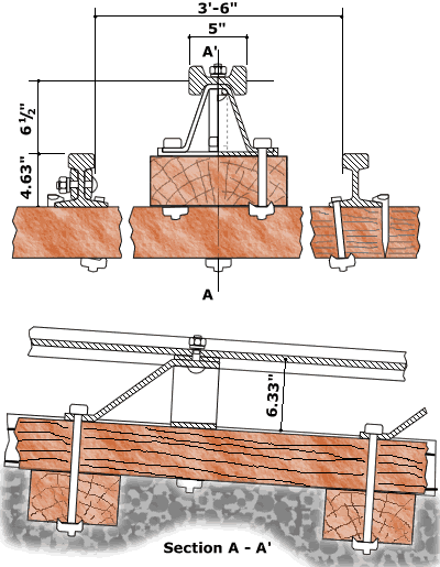
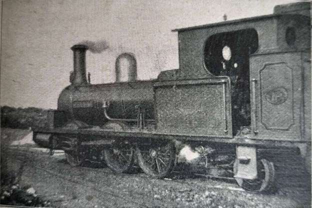
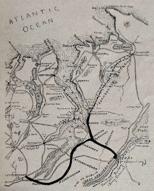
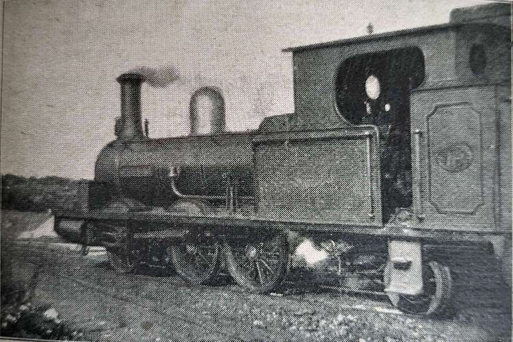
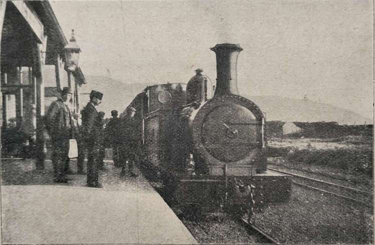

_1906.jpg)
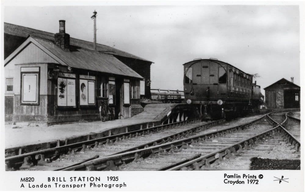