
I first looked at this tramway in 2013. It was only a short blog recognising the existence of the line to Roquesteron:
https://rogerfarnworth.wordpress.com/2013/12/20/chemins-de-fer-de-provence-9-tramway-to-roquesteron.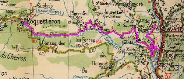 This map of the Esteron Valley tram route can be found on Marc Andre Dubout’s Website. [1]
Marc Andre Dubout comments: “The declaration of public utility dates from February 10, 1906 and the commissioning takes place seventeen years later, July 29, 1923. The commissioning of the line was delayed by landslides occurring on the line of Daluis which have monopolized the teams of roadmenders. … One month after the opening, an accident due to a braking problem interrupted the operation from November to December 15, 1924, barely a year after it was put into operation. The inauguration took place on July 24, 1924 in great pomp with MM. the prefect, mayors of the communes crossed, and of course banquet, Marseillaise, etc.”
The line departed from the Nice to Digne mainline at the station for the Charles Albert Bridge.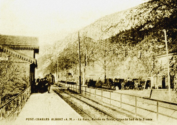 The Charles-Albert Bridge station at the time of the Estéron line. [1]
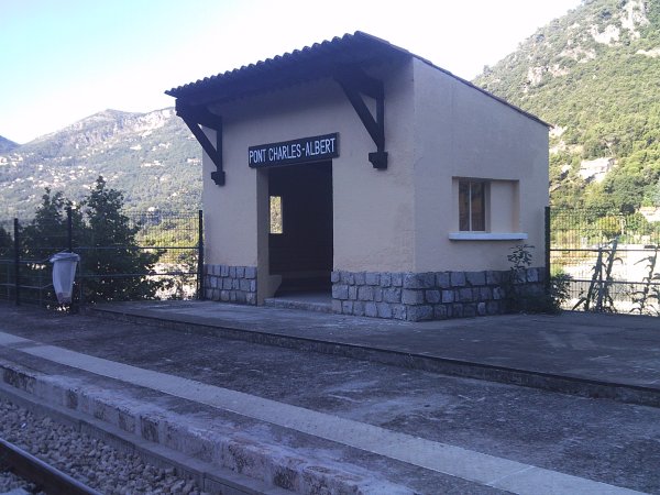 The modern day halt. [1]
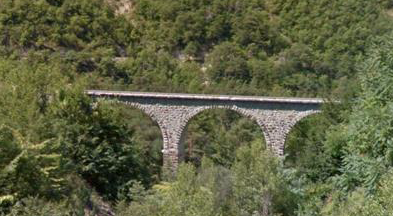
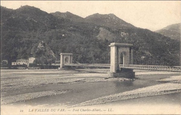 Before the tramway was constructed the Charles Albert Bridge was a suspension bridge (built by Marc Seguin in the mid-19th Century) [2] but this bridge was not designed to accommodate tramway loading. In 1913 it was rebuilt to accommodate the trams, just as was necessary with the Pont de la Mescla on the Tinée tramway. The replacement structure had six spans of over 30 metres in concrete built by the company Thorrand. In the foreground of the image immediately below, there is the Pont-Charles Albert stop and the lime kilns at La Lauziere overseen by the perched village of La Roquette sur Var, © Yann Duvivier. [6] This ‘new’ bridge was replaced in the mid-20th Century by the one which is in use today.
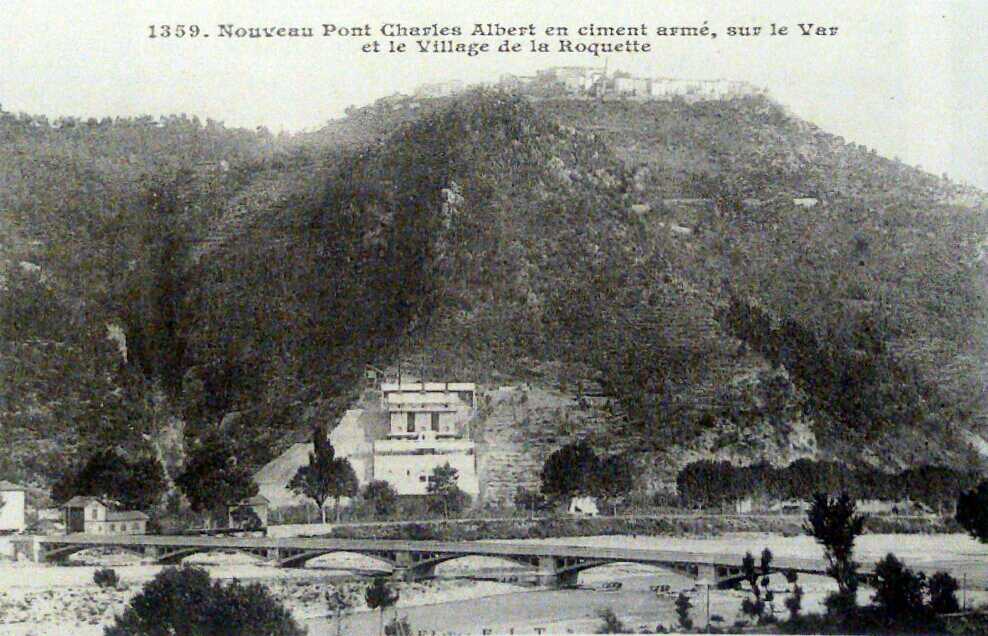
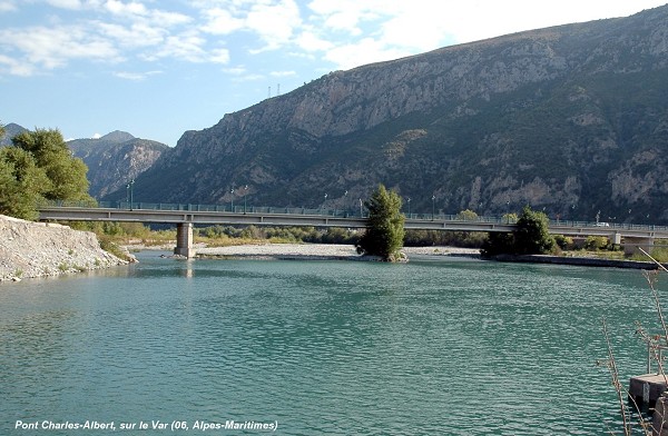
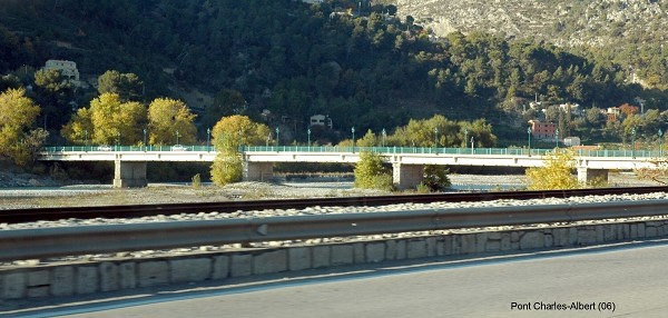
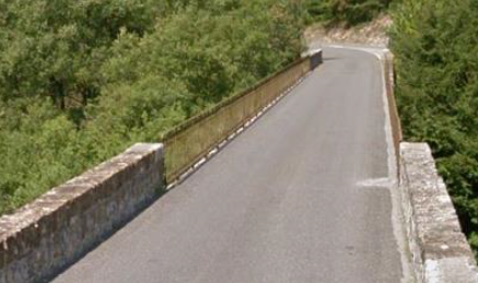
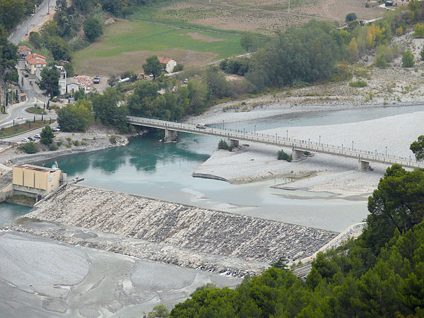 The bridge as it is in the early 21st Century is shown on the three images immediately above. [3][4]
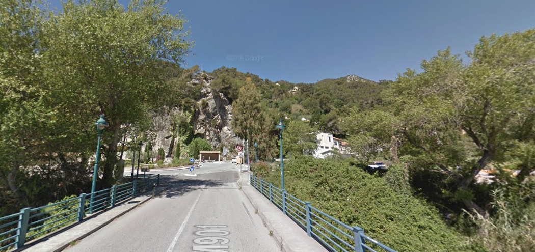
 The west end of the present bridgebridge (above), recovered from Google Streetview.
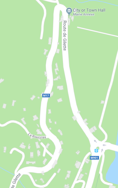
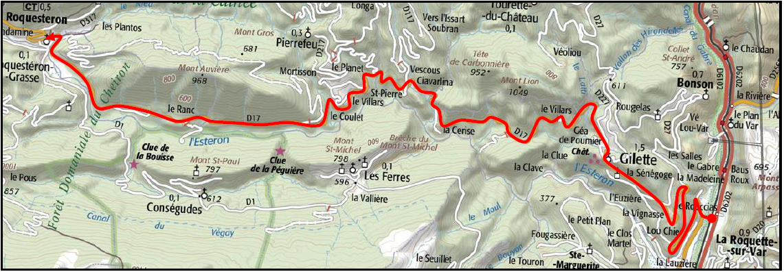
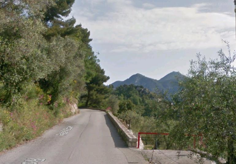
Leaving the end of the Charles Albert Bridge the tramway turned right and began to climb the Route de Gilette (M17), first, in a northerly direction and then, after a hairpin bend, in a southerly direction. That southerly direction was only maintained for a short distance (about 1.5 kilometres) as the M17 approached another hairpin bend and then returned to a northerly course.
After about 2 kilometres a further hairpin bend led to the tramway and road returning to a southerly direction for over a kilometre. A branch-line struck off from this hairpin to provide a service to Bonson. A further bend led to the road and tramway travelling in a north-westerly direction. The excerpts from Google Maps illustrate the route.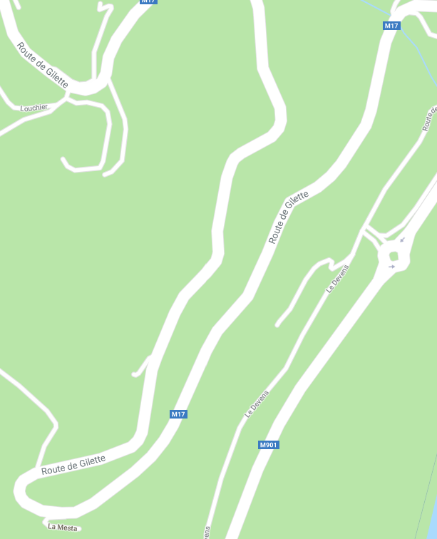
 We can also follow the route of the tramway on Google Earth, as immediately below, and on the http://www.inventaires-ferroviaires.fr website [5] in the following image.
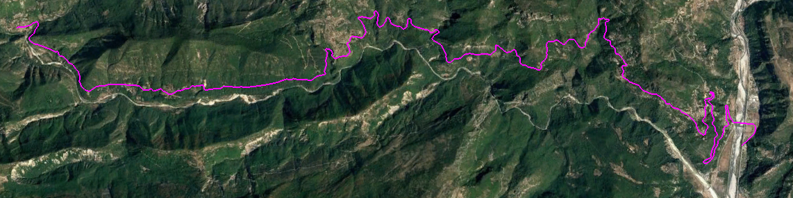
 There is a discrepancy between the two lines (pink and red) shown above, at the eastern end. I can find no evidence to support the wide-sweeping approach by the tramway to the Charles Albert Bridge as suggested in the Google Earth image above. The tramway at other locations on the network could manage some very tight curves. There is evidence of this at Le Pont de la Mescla. The railway station in the photograph of the bridge which was built for the tramway in 1913, is close to the bridge. This mitigates against the tramway joining the main line further south after crossing the main line.
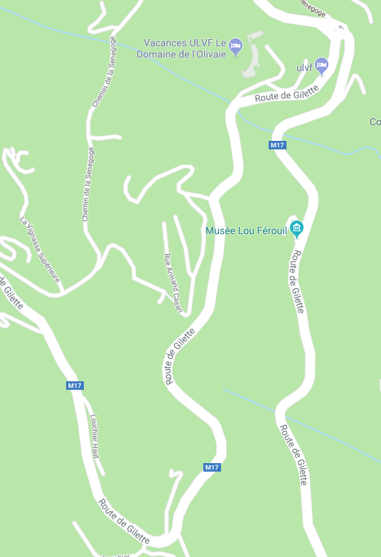
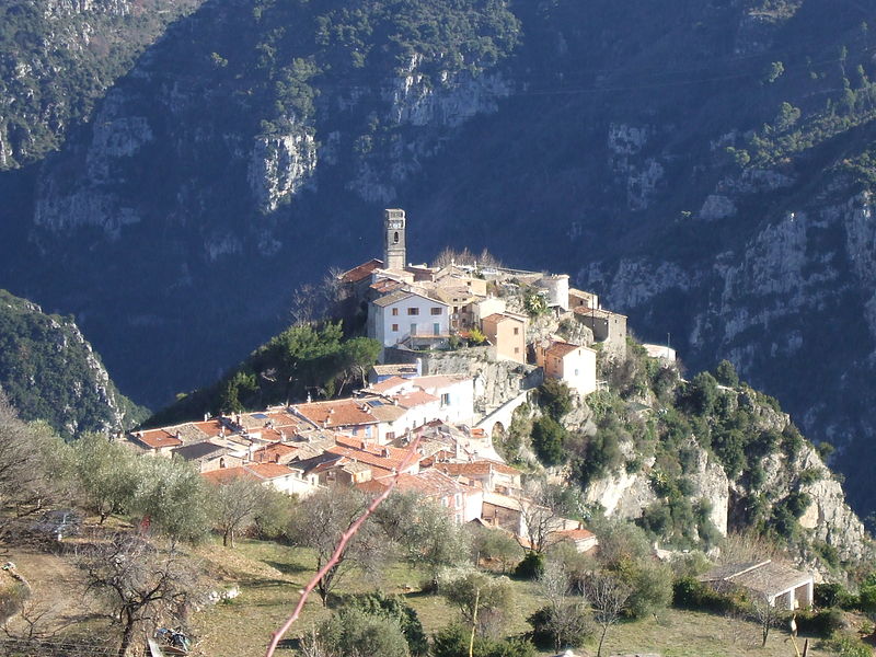
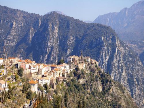
Carrying on with our journey, we have seen that the tramway gained height along with the M17 by running through a series of hairpin bends so as to keep the gradient reasonable. At ‘la Senegoge’ there was a junction. A branch-line went north to Bonson (blue arrows, below) and the mainline continued to Roquesteron (red arrows, below). [5]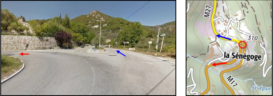 Before continuing towards Roquesteron, we will check out the branch-line to Bonson. Sadly I have not yet been able to find any images along the route to Bonson which are contemporary to the tramway. We will have to be satisfied with images from Google street view in 2017 which show a wide metalled road in place of what would have been a narrow un-metalled carriageway not much wider than the loading-gauge of the trams. The tram loading gauge was 1.9 metres and the road width would have been no more than 3.3 metres if not less.
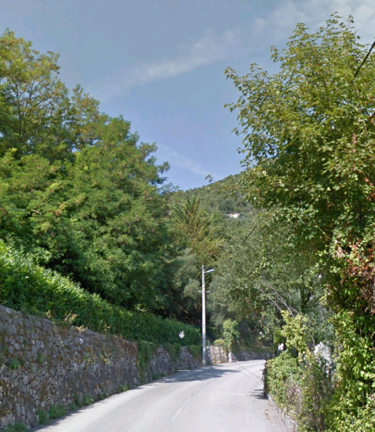
 Initially the road/tramway travelled northwest from La Senegoge approximately following the contours of the hillside, before turning tightly to the east in the Vallons du Baus de Lunel. The road/tramway climbed through La Salles and turned north. The approximate line of the route is marked in pink on the satellite image below.
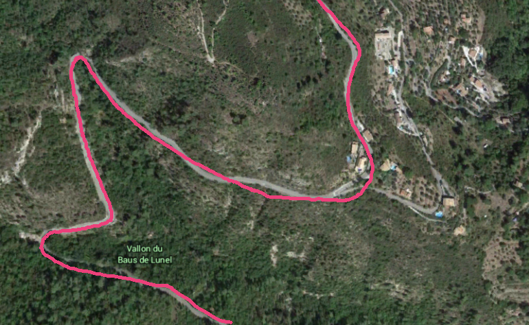 North of La Salles the road/tramway continued following the contours through olive groves towards Bonson.
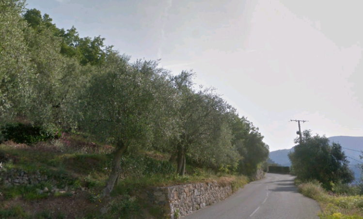
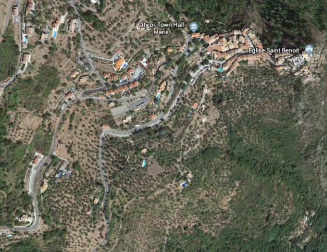 The route enters the satellite image above at the third point on the left side at the bottom, and travels through this olive groves to Bonson, the village in the top flight of the photograph and the terminus of the tramway branch-line. [6][7][8]
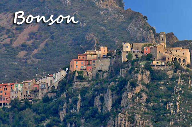
 We now return to ‘la Senegoge’ and resume our journey up the valley of the Esteron River. As we have already seen the road/tramway travelled south from ‘la Senegoge’ before turning sharply to the northwest and heading for the village of Gilette high on the slopes above l’Esteron and visible on the left side of the picture immediately below. [9]
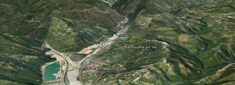
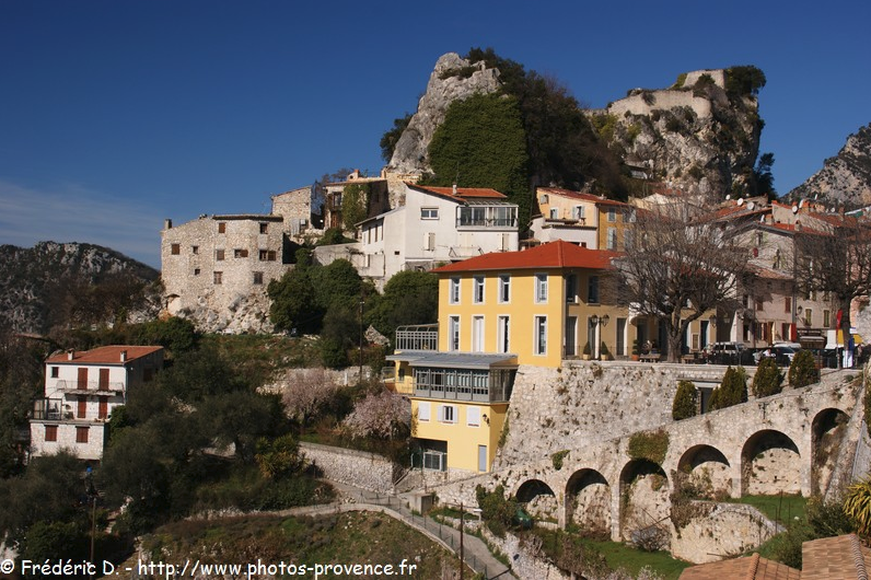
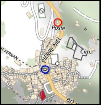 The village of Gillette sits in a craggy location above the River Esteron. Two features are highlighted here. The blue circle marks the location of a bridge over the road/tramway in the pictures immediately below. The red circle is the location of the tramway station. [5]
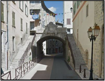
 The bridge from the North, Google Street view.
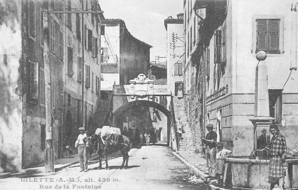
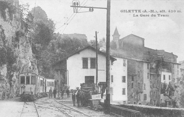 Gillette tramway station.
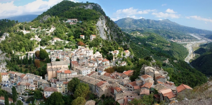 Gilette is a small village sited approximately 480 metres above sea-level. In 1999, its population was 1,252 which increased to 1,449 in 2007. [10]
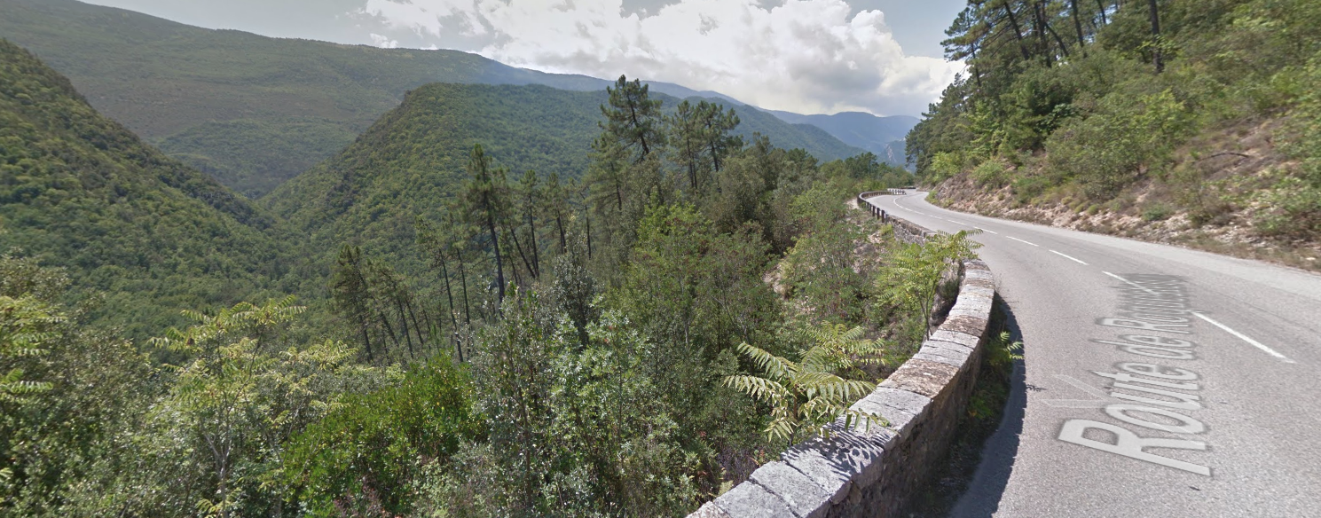
Heading on from Gillette, the road/tramway followed the contours above l’Esteron, through the forested slopes on the north side of the valley.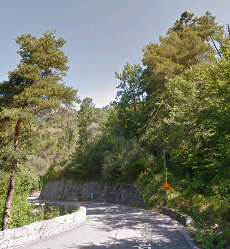
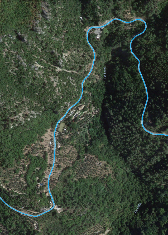 The route circumnavigated the side valley of Le Latti. The route is shown in blue above entering the satellite image from Gilette on the right.
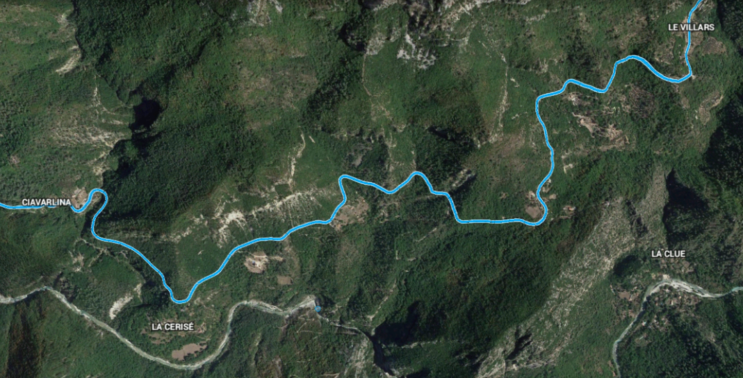 The route continues to follow the contours through the forests on the north side of l’Esteron. There is a very short tunnel on the route close to the top right of the above image, its location is shown below. [5], and in images immediately below the map, first from the East and then from the West.
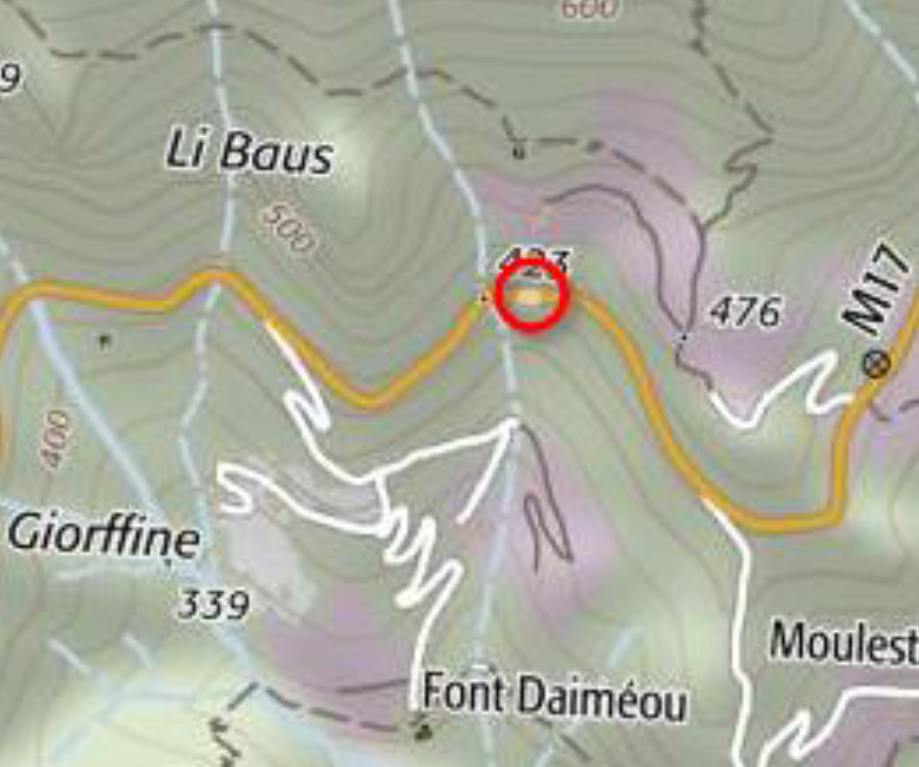
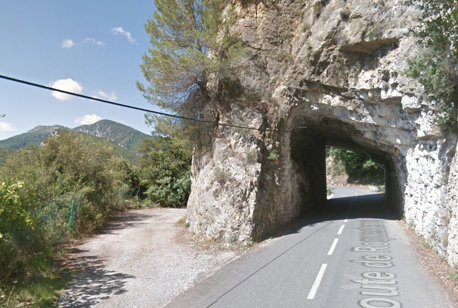
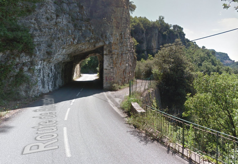 It is very likely that the tramway followed the track on the outside of the bluff.
The next point of interest on the rout is the halt at Colle Belle which is identified on the map below by a red circle.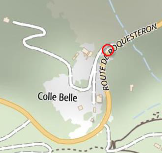
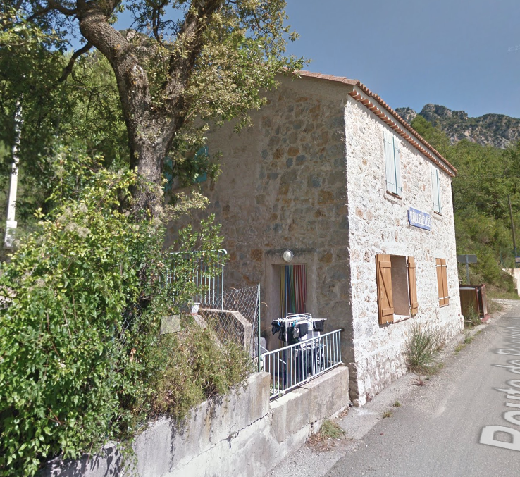 The small station building of Colle Belle, the name-plate is still visible on the face of the building. [5]
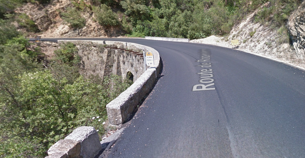
Before leaving Colle Belle, it is worth noting a significant accident which occured here in November 1924, soon after the line was finally opened. The headline is shown below and a translation of the article is provided in the references below, courtesy of Marc Andrea Dubout. [12]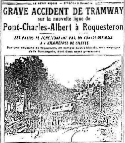 At Ciavarlina, the tramway passed through a steeply side cutting which inevitably has been widened to accommodate the modern road.
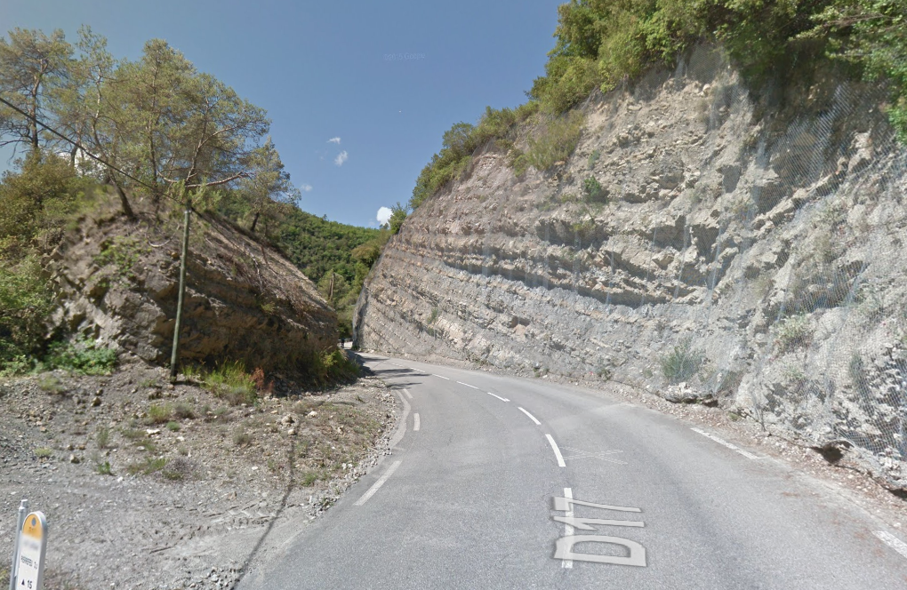
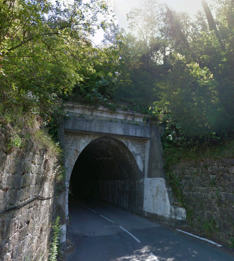
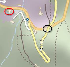 It then passed under the D117 at Vescous in another short tunnel, marked with a black circle on the adjacent plan, [5] before winding its way into what was the station. The old station building is circled in red on the adjacent plan. It is now a restaurant.
The tunnel portals are shown in the next couple of pictures which are followed by a picture of the old station building.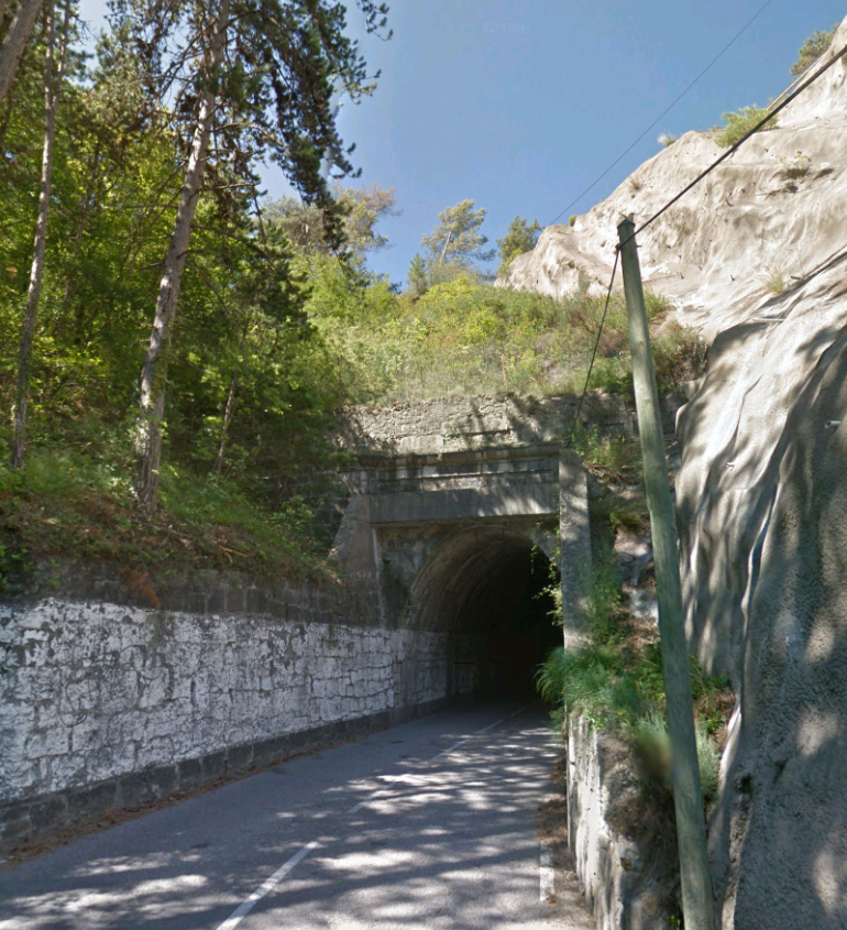
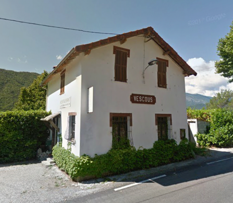
 The old station building at Vescous (above) still bears the station name-board but it is now a restaurant. [11]
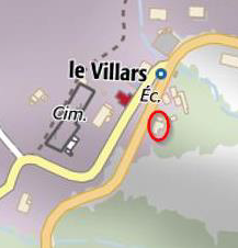
The next stop on the line was le Villars (sometimes spoken of as the halt serving Pierrefeu). The station building is circled in red on the adjacent map. It was much smaller than the station building at Vescous which probably suggests the the stop was of lesser importance at the time the tramway was built.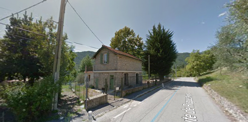 After le Villars, the line continued to share its formation with the road. The route is shown on the satellite image below. It is the lowest blue line in the photograph, running southwest from le Villars before turning east and the following the contours around the valley of Le Riou.
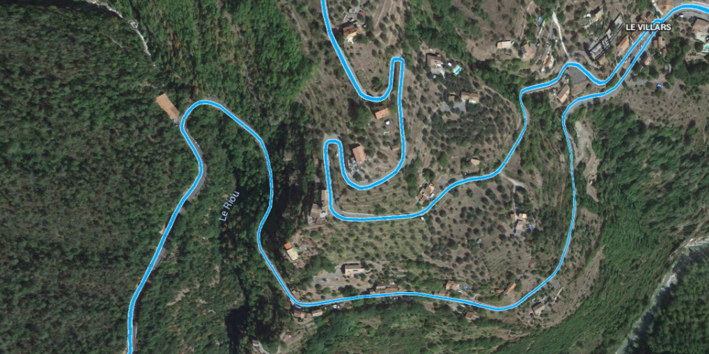
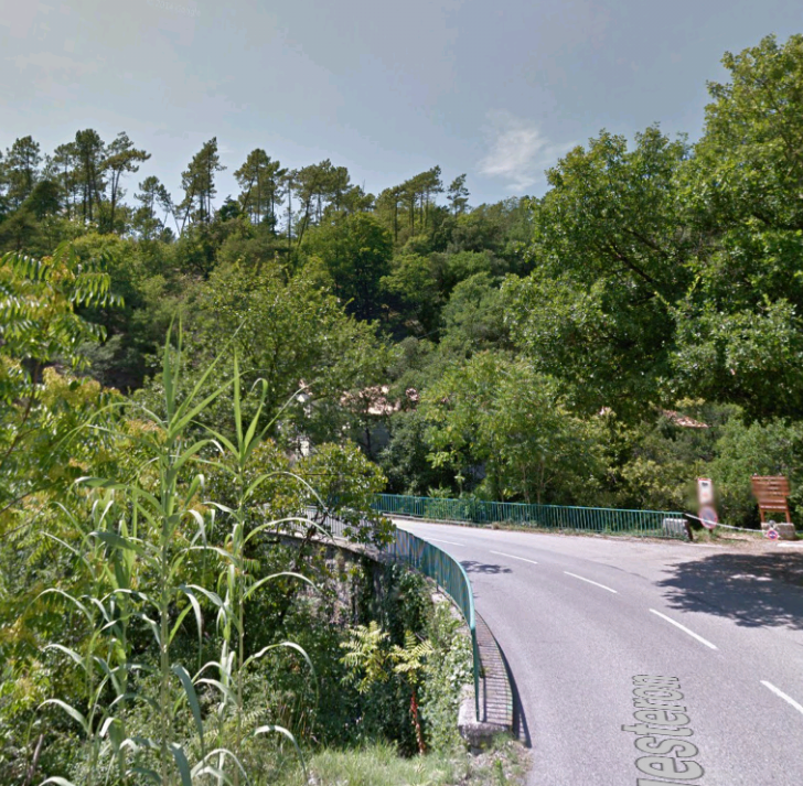 The present bridge over Le Riou, the image is taken from Google Streetview.
The road/tramway is seen leaving the satellite image above heading in a southerly direction. Very soon, it turns to the west and runs parallel to the River Esteron which can be seen at the bottom of the satellite images below. The blue line continues to show the alignment of the road/tramway.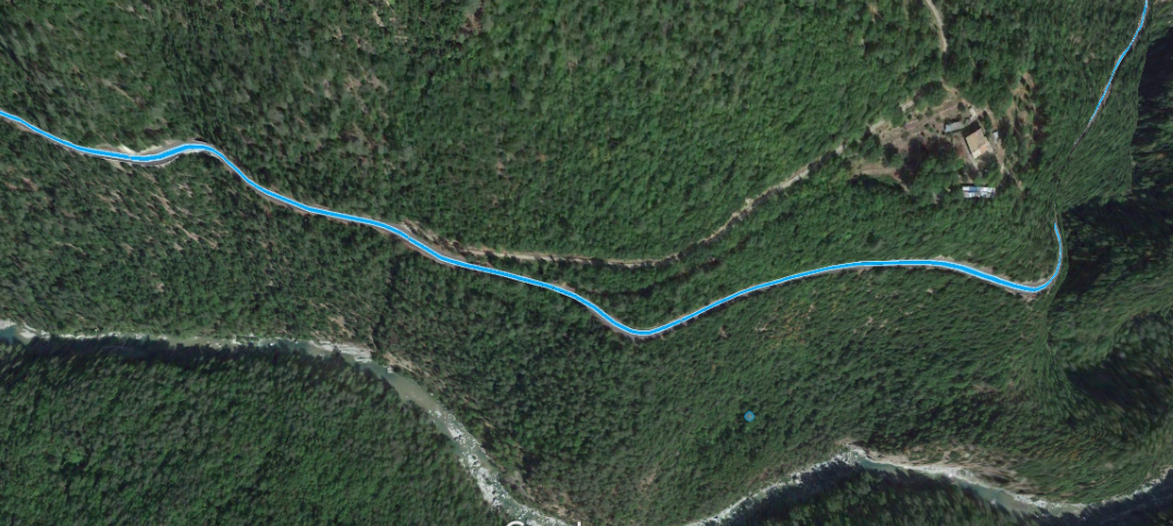
 The valley is heavily forested at this point and the image above is typical of the next few kilometres of the route. The road/tramway follows the contours on the north side of l’Esteron Valley, crossing a series of different culverted run-off water courses from the hills above. The images below show the locations of the culverts provided for the Ravin de Vuefort and Ravin de Caine which are typical of a number along the route.
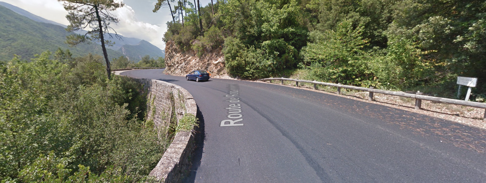
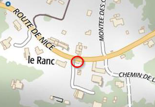 The next station on the tramway was at Le Ranc. The location of the station building is circled in red on the adjacent map.
The building design closely mirrors that at Le Villars. The location od the station name-board can be picked out on the elevation of the building which once faced the tramway.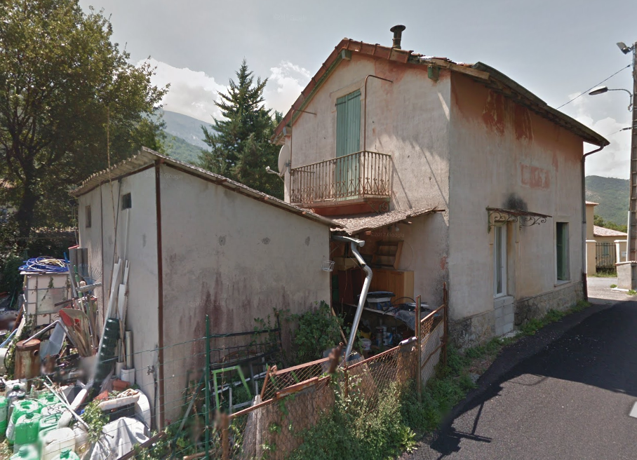 We are closing in on the end of the line – just a few more kilometres to go. The map below shows the remaining 3 to 4 kilometres of the line. Le Ranc appears in the bottom right and Roquesteron in the top left.
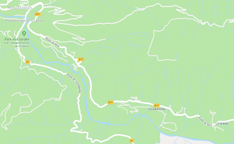
 A little before Roquesteron the tramway crossed a more substantial viaduct over La Villette. Now-a-days the road divides as the viaduct was only constructed for the width of a single vehicle. The adjacent pictures show the viaduct. [5]
Another couple of kilometres and the tramway reached Roquesteron, both road/tramway and river turned north into the village.
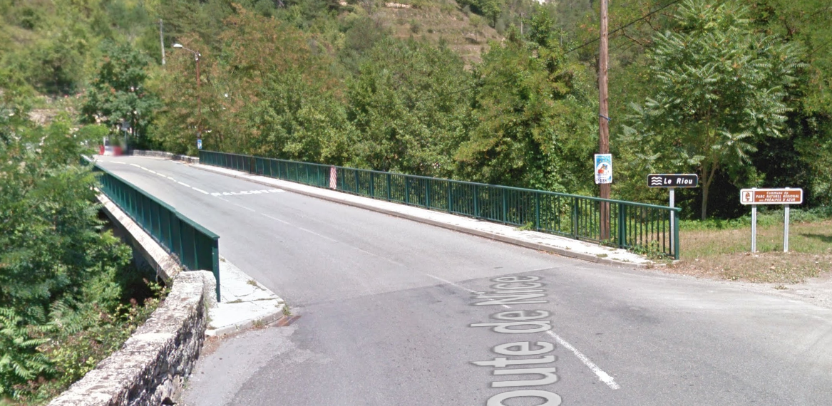 Before entering the village proper, the tramway/road crossed Le Riou a tributary of l’Esteron. A popular local name for a watercourse! The bridge can be seen above and on the right of the map below.
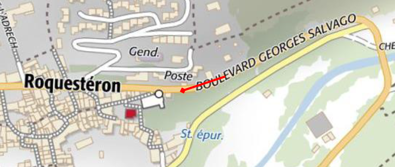 The tramway entered the village on what is now called Boulevard George Salvago. The terminus was adjacent to the Post Office and the depot was almost next door. The image below shows the arrival of the first tram in Roquesteron when the line was first opened.
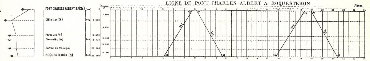
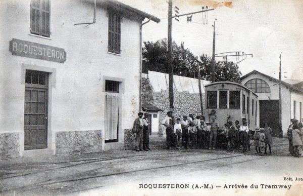 And finally … the timetable ….. [1]
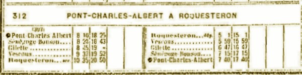
References
- http://marc-andre-dubout.org/cf/baguenaude/esteron/esteron.htm, accessed on 20th December 2013.
- https://gallica.bnf.fr/ark:/12148/bpt6k612616g/f591.image, accessed on 12th July 2018.
- https://structurae.net/structures/charles-albert-bridge, accessed on 12th July 2018.
- https://wikivisually.com/lang-fr/wiki/Liste_de_ponts_des_Alpes-Maritimes, accessed on 12th July 2018.
- http://www.inventaires-ferroviaires.fr/hd06/06109.a.pdf, accessed on 12th July 2018.
- https://www.provence7.com/portails/villes-et-villages/communes-a-visiter/bonson-a-visiter-06, accessed on 14th July 2018.
- https://pt.m.wikipedia.org/wiki/Bonson_(Alpes_Mar%C3%ADtimos), accessed on 14th July 2018.
- https://www.france-voyage.com/cities-towns/bonson-22627.htm, accessed on 14th July 2018.
- http://ratatoulha.chez-alice.fr/_genealogie/gilletta-stmartinvar.html, accessed on 15th July 2018.
- https://www.communes.com/photo-gilette,183966, accessed on 15th July 2018.
- https://www.restaurant-lacapeline.fr, accessed on 15th July 2018.
- http://marc-andre-dubout.org/cf/baguenaude/esteron/esteron.htm, accessed on 20th December 2013. Source: http://www.basesdocumentaires-cg06.fr/archives/ImageZoomViewerPA.php?WDIDDOC=2005113151655959104300&WDVOLUMEID=VOL239&j=02&m=11&a=1924&journal=1. … The accident referred to in the text was reported in Le Petit Niçois , it occurred on 2nd November 1924. The article was written in french and the following text is a paraphrase translation of the text:After the accident the three cars in the consist rolled over on the road. The power car was resting against electricty poles; the second car lay across the road; the last car, whose fasteners broke, faced in the opposite direction.
A little more than a month ago, on 20th September 1924, the officials of our Department inaugurated the tram line going from Charles Albert Bridge to Roquestéron via Gilette. Yesterday, a very serious accident halted all traffic on the line which since its inauguration has been well-received by the populations of the villages and hamlets along the route. This accident, although serious – as we shall see later – has caused the death of no one and we hope that all four of the injured can be saved.
Curiously, exactly one year and one day a similar accident occured on the Villeneuve-Loubet line, and as in yesterday’s incident, only employees on that train were injured.Yesterday morning at 6:25, a train consisting of two power cars and a freight car left Charles Albert Bridge for Roquesteron. Many travellers had taken their places in the first two cars. The freight car was carrying 6 tons of wooden sleepers. Most of the travellers left the tram at Gilette, only six or seven travellers continued up the line.
Among them were Mr. and Mrs. Jules Aubert, residing in Nice, 19 rue d’Alsace-Lorraine, Mr. Pleinera, Administrative Officer of the Chiefdom of Engineering in Nice, MA Bonhomme, residing in Grasse, Benaud district, Mr. Marius Farau As a farmer, he went to Pierrefeu and the other travelers went to Roquesteron, as well as M Désiré Jauffrel, a railway driver from South France who was on leave.
The wattman of the train, Mr Adolphe Faissole, 30 years old living in Roquesteron, the driver, Mr Marius Fredy, 52 years old retired from the Arsenal Toulon living in Roquesteron, with his wife having also taken place on a car, M Honoré Saurin, 26 years old, single living in Gilette, brigadier, poseur of the company.
At the Collebelle stop, another employee of the departmental trams joined the tram, Mr. François Bruni, 34 years old, married and father of a charming baby only 14 days old.
About 400 metres from the Collebelle stop – 4.86 kilometres from Gilette at 9.35am the accident occurred. In what circumstances exactly? This is what has not yet been established, the wounded could not be questioned being all employees of the Company and the only ones who would have been able to provide an answer.
However, according to the people we spoke to at the scene of the accident and the condition of the cars overturned, here is what we presume:Leaving Collebelle, the road has a fairly steep descent turns to the right at about 400 metres. Approaching the curve, the wattman began to put the brakes but the train failed to slow sufficiently. When his car left the rails and hit two of the catenary supports, the wattman jumped out of the car by the door and rolled on the road.
The first engine, left the rails, and was thrown to the side of the road. The next car tipped over onto its right side, completely obstructing the road. The coach of rail sleepers was overturned to the left.
Our picture, shows the position of the three cars after the accident and their position is explained by the following findings: The brakes of the first motor did not work; those of the second, on the other hand, were tightly packed and those of the freight car had not been connected to the engines and could not be used.That most of the travellers escaped almost unscathed and that there have only been four seriously wounded, is almost incredible given the state of the cars on the road. But it is fortunately so! When the cars were overthrown, the able occupants helped the wounded who were the employees of the Company Fred Bruini, Saurin and Faissole. The Brigadier of Gendarmerie Barandon, the Gendarme Dubeau, Mr. Brezès, judge of Peace of Roquesteron, then arrived and undertook their respective investigations.
An ambulance was requested from Nice and immediately arrived. After around 14 hours it went back carrying the four wounded to the Hospital Saint Roch, it was from Les Ambulances Automobiles of the Côte d’Azur , 1 place Gambetta. Meanwhile, first aid was given to them by Gilette’s doctor. In the meantime all the traffic was naturally interrupted on the line, a bus of the service of the Upper Valley came from Roquestéron to collect travellers going in this commune.By 2.15pm, MM. Couturier, Inspector of Compagnie du Sud-France, Talent, Inspector of Traction, Fouquet Inspector of the Way arrived to begin their investigation. At 3:35 pm, MM. Israel and Lotier, Engineers of the Control of Roads and Bridges and Mr. Capiello, Wattman Chief of South-France also arrived. According to the findings of MM. Israel and Lotier, the wattman was no longer in control of the tram about 800 metres before the scene of the accident. On the other hand, it would be the driver who was in the second car who should have applied the brakes to this car, seeing the danger. These gentlemen will be returning to the scene today with the Chief Engineer of Alpes Maritimes to complete the investigation.
The wounded were received at the Saint Roch Hospital by Mr. Gasigila, an intern who provided them with the most enlightened care. Their diagnosis is as follows:
– François Brun, open fracture of the left leg
– Honoré Saurin, slight bruises all over his body
– Marius Frédy minor bruises to the head and kidneys
– the most seriously affected is the Faissole wattman who has received a strong concussion.
We wish them the most sincere wishes for their recovery.All traffic on the line of departmental trams Pont Charles Albert-Roquestéron suspended for a few days. It may be possible before the complete reopening of the line in operation, to ensure aservice to and from Gilette. The road, as we said above, is completely obstructed by the second power car. After the accident, no vehicular access along the highway was possible. As we leave, a team of diggers arrived to open a passage in the embankment on the right side of the road because we can not touch the cars until the official investigations are completed. However, a night and day will be, at least, necessary for this work.
