
 I first looked at this tramway in 2013. It was only a short blog recognising the existence of the line in the valley.
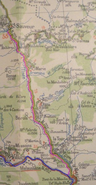
This line was 26.5 Km long and connected villages in the Tinée valley to Nice to Digne line. Like other lines of the Tramways Alpes Maritimes (TAM), the electric current was single phase. The civil engineering works (bridges, tunnels) were executed by the Department.
The line was built in 1911 and operation started on 1st April 1912. Landslides affected the operation of the line in the early months. The original opening was delayed from January to April because of landslides and on 2nd April a further landslide affected several hundred metres of track and destroyed power lines.
The line operated until July 1931.
The line left the Nice to Digne line at Pont de la Mescla. The junction station was south of the confluence of the two rivers. La Tinee Station is featured in a previous blog, …
https://rogerfarnworth.wordpress.com/2018/07/12/nice-to-digne-les-bains-part-4-plan-du-var-to-la-mescla-chemins-de-fer-de-provence-65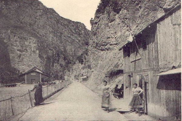 La Tinee Railway Station.
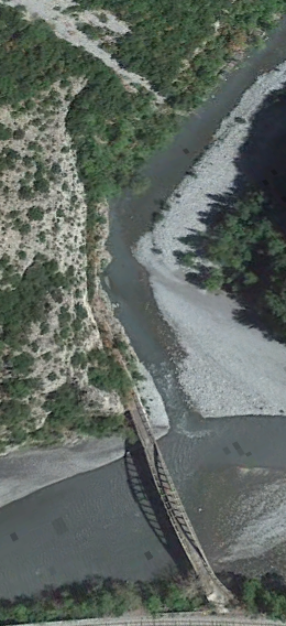
Trams left La Tinee Station and travelled along the Nice to Digne line into Les Gorges de la Mescla and their route along the a River Var is covered in detail in the blog above.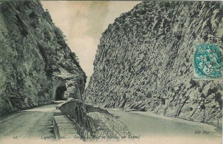 Trams passed through the halt at La Mescla and then crossed the River Var on a new bridge built for the tramway.
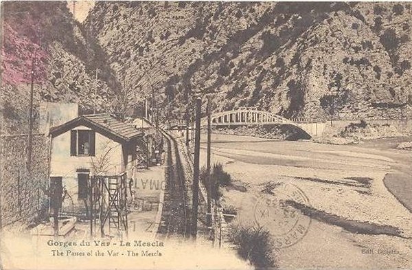
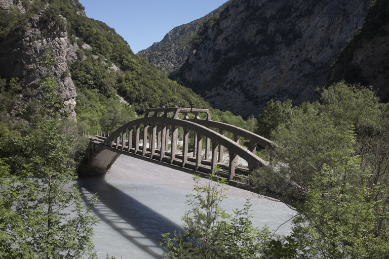
 A modern view of the tramway bridge taken from upstream on the banks of the River Var. [1]
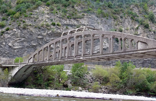
 The tramway left the mainline and curved tightly onto the concrete arch bridge built for it in the early 20th century. It replaced an earlier suspension bridge which would not have been able to carry the loads imposed by the trams. [2]
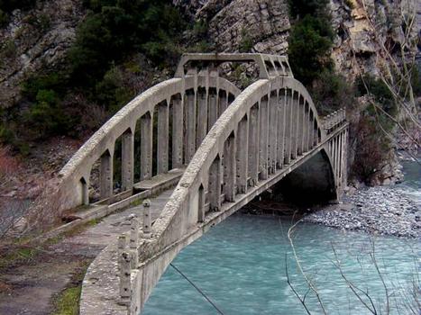
 A view taken from upstream on the West bank of the River Var, © Provence-Alpes-Côte d’Azur Region – General inventory [3]
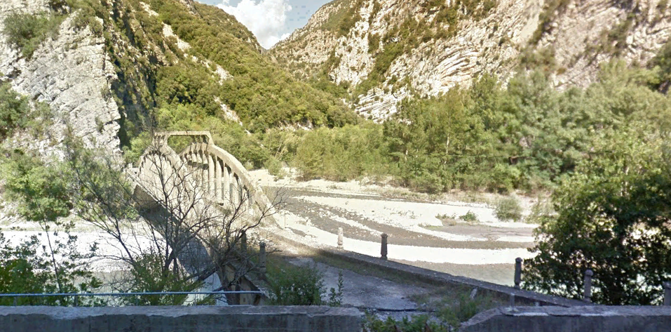
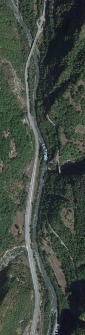
 Once across the bridge, the tramway hugged the western side of the valley of La Tinee. On the adjacent image, the formation of the line is visible at the base of the rock outcrop. The line continued on the west side of the valley with the road on the east side for around 500 metres. The formation of the tramway is easily visible along that length of the river/road on the far bank. The images below are taken from Google Streetview and show first the tramway formation (indicated by the line of vegetation) on the West bank of the Gorge, then the old road bridge (taken from the new bridge).
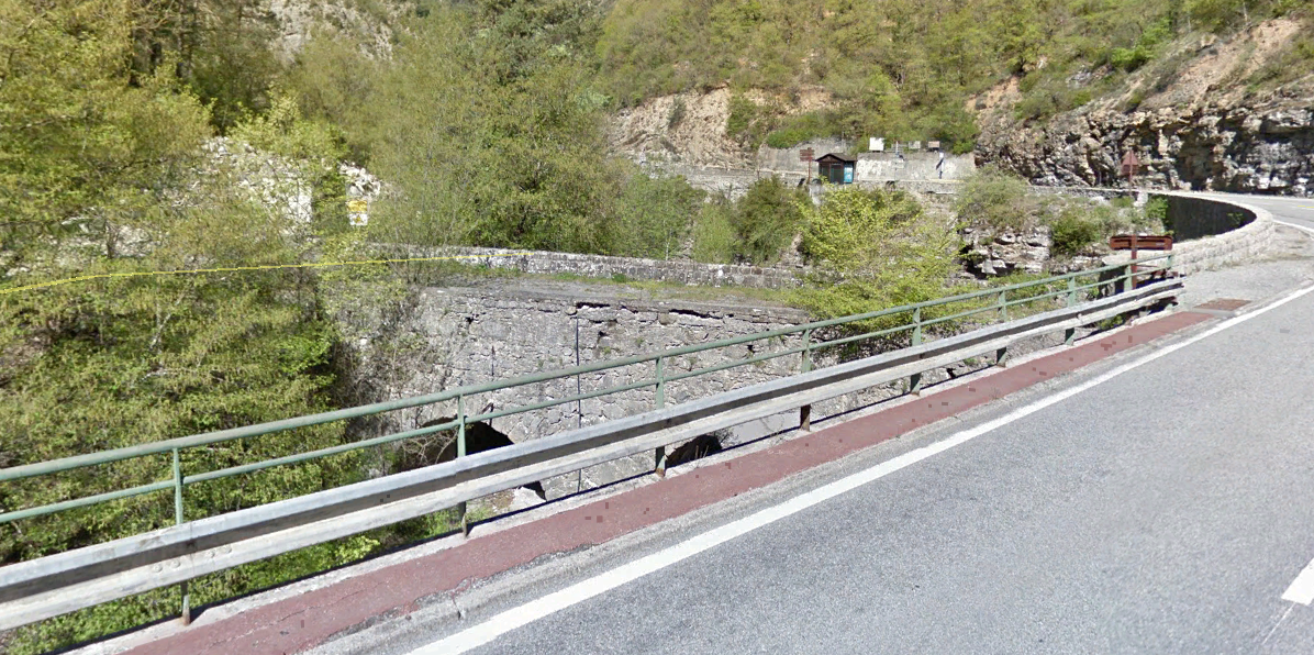
There are some very interesting structures built into the rock of the valley walls at this point. The picture of the old road bridge includes pictures of structures on the East side of yhe valley and the follwing image shows those to be found on the West side of the valley above the road. The structures are known as Les Chuise de Bauma Negra.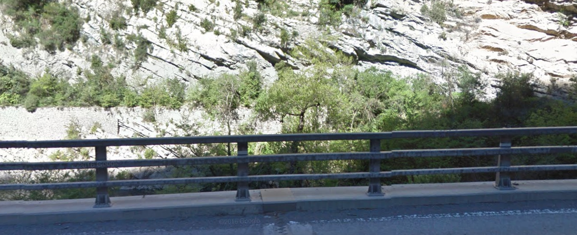
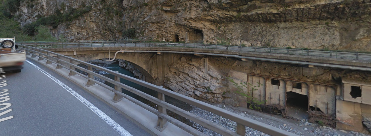
 The Chuise de Bauma Negra belongs to the system for controlling the gorges that lead to Nice within the Séré de Rivières’ system. [4]
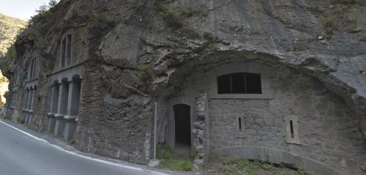
The fortification was constructed between 1884 and 1887 to block the way to Nice from la Tinée. The Chuise is situated at the narrowest point of the valley, in the Mescla gorges, just before the confluence with the Var. Its design is identical to that of the Chuise de Saint-Jean-de-la-Rivière. It is a fort built into a dam.
The limestone valley of La Roya was and is a communications route that has been controlled in turn by the Sardinians, the Spanish, the Austrians and the French. The southern part was incorporated into France in 1860 during the reintegration of the county of Nice. Control of this border region allowed the regulation of Italian activity. In this respect, the fort (Chuise de Bauma Negra) provided support for the Fort du Pic Charvet. It is built on the right bank of the gorge, on the edge of the road. It combines concrete parts with a two-storey façade in stone cut into the cliff. The structure comprises two floors next to the road. It has openings for 40 and 120 mm canons. Underground galleries lead to the gun shelters and firing posts that in turn lead on to the main road. Two rolling bridges, which could be moved from inside the fort, allowed the road to be cut off. It could house between 30 and 60 men. There was no separation between the stores and billets. On the left bank of the gorge, the engineer had planned to install mortars to catch the enemy in crossfire. [4][5]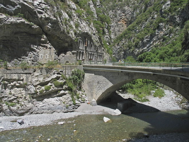
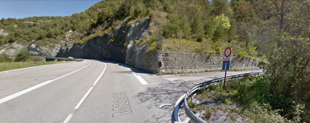
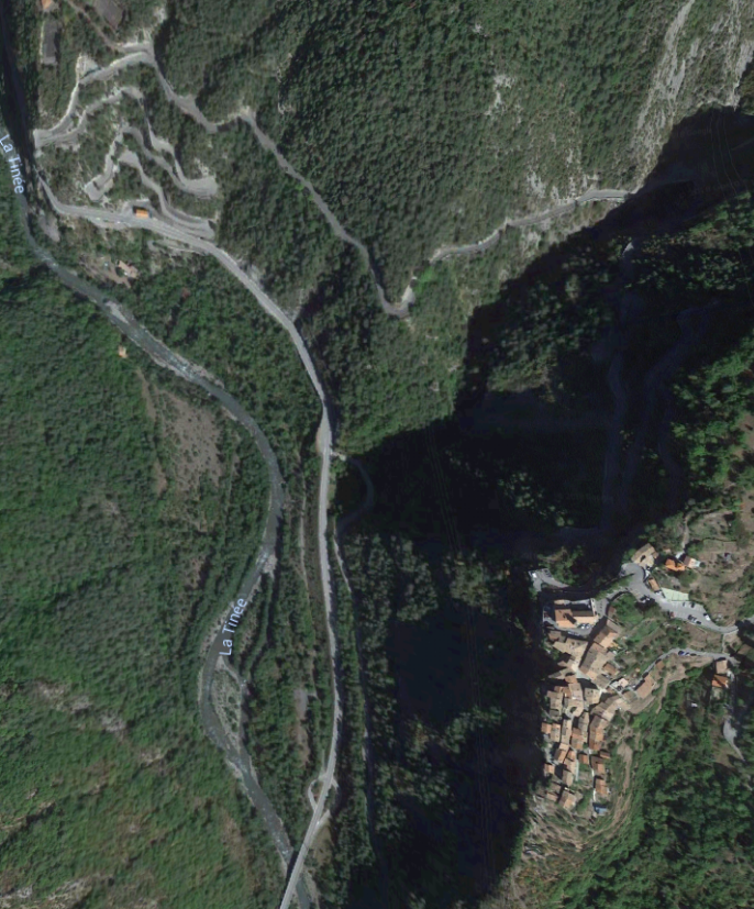
 North of the Chuise de Bauma Negra, the tramway shares its formation with the M2205 road and runs through La Courbaisse and on towards La Tour. It passes a large quarry at La Courbaisse which dominates the satellite image below.
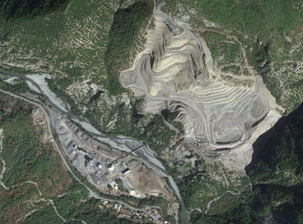
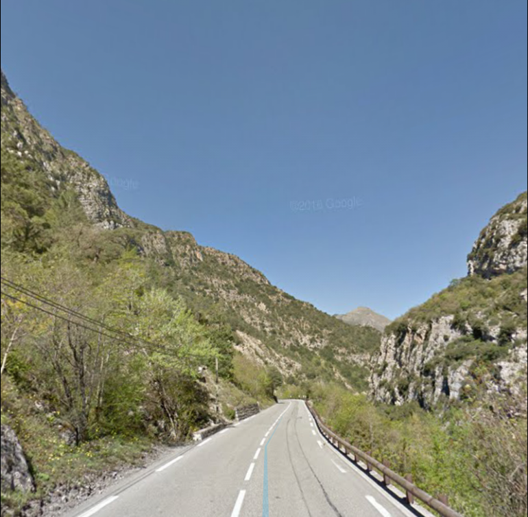 Typical or the road/tramway route north of La Courbaisse.
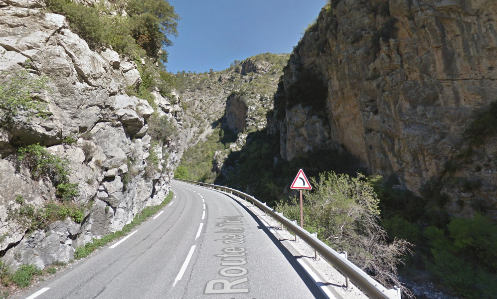 Before reaching La Tour the gorge closes in once again.
The road/river/tramway turn westward and immediately before reaching the Station of La Tour the road/tramway cross to the North side of the river. In the satellite image below the station building is on the left, the road accessing the village of La Tour leaves the main road just to the left og the bridge which is on the right of the photograph.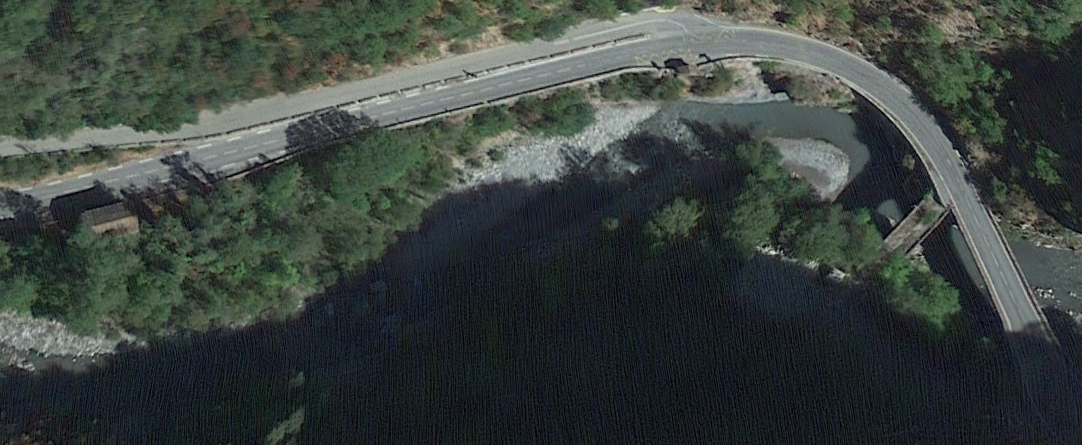
 The old road/tramway bridge has been superseded by a modern structure.
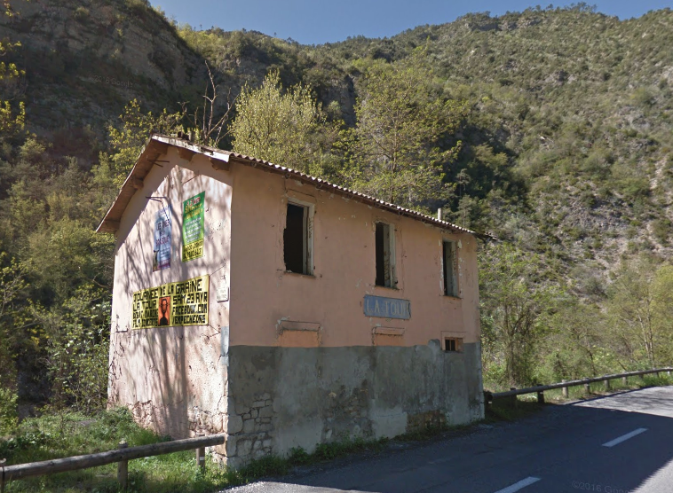 The station building at La Tour still bears its station-board. It is 4 kilometres from the village of the same name which sits above the valley to the North.
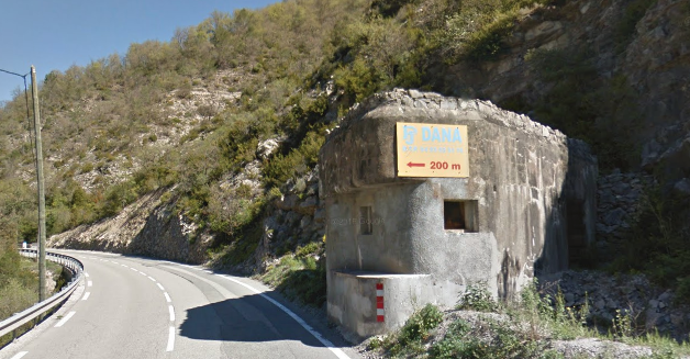 Second World War gun emplacement to the west of the station at La Tour.
The next stop on the line was the halt for Tournefort [2] (a village high above the river to the South). There is an old arched bridge across the river at the approximate location of the halt and an old barn that might have been used for storage of goods close to the tramway. Any other evidence of the halt appears to have been lost.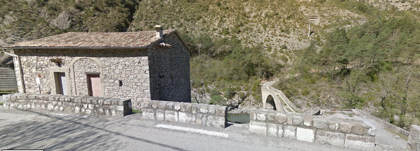
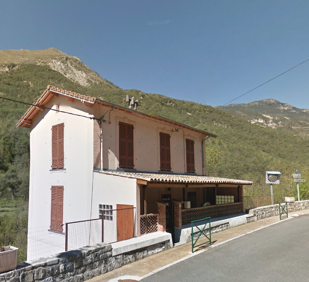 Marc Andre Dubout records this building as being the Station at Roussillon. [2] It is at the bottom of the road which leads to the higher parts of the village but some distance to the West of the village in the valley.
Roussillon was the next stop on the line, followed by Pont de Clans.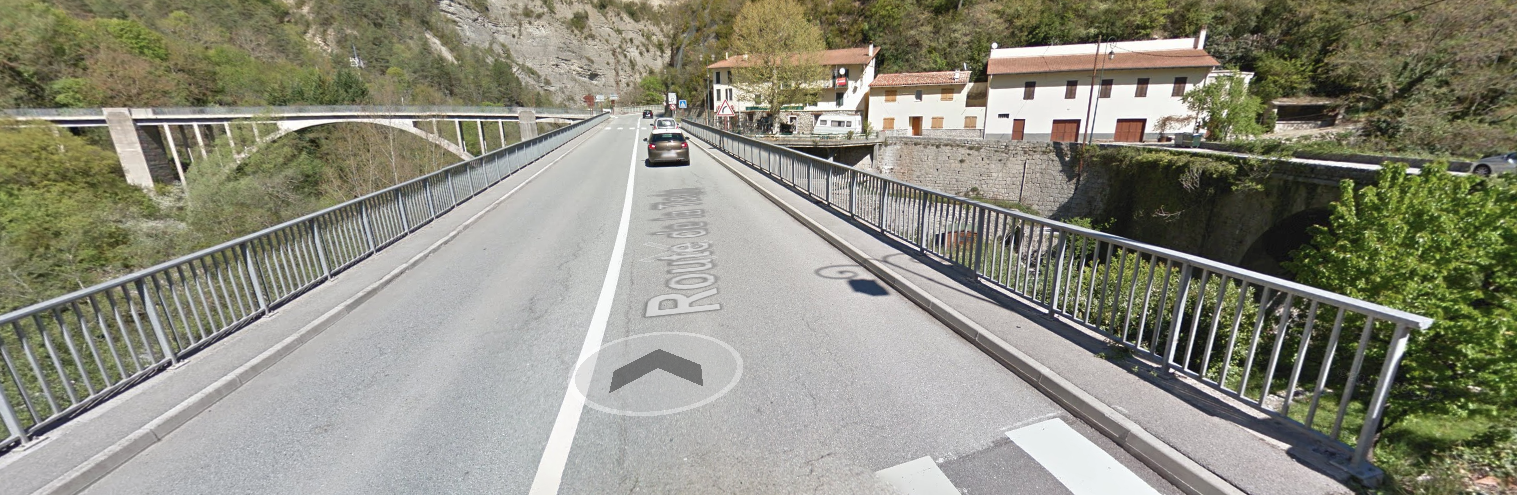 Three bridges at Pont de Clans. The roadway now uses what was the alignment of the tramway.
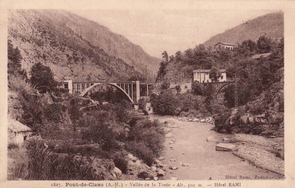
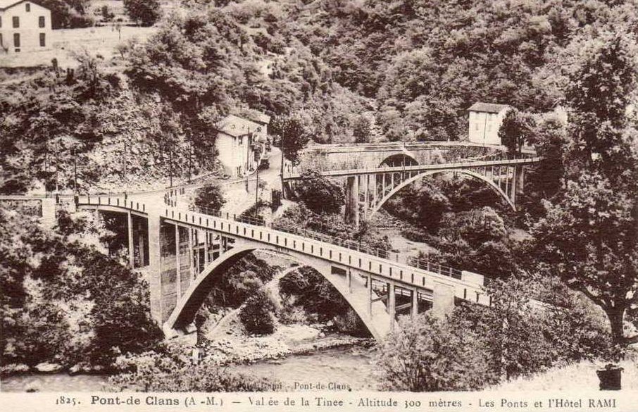 In the image above [2] the tramway uses the middle bridge. It avoids the sharp turn of the road that we see at the rear of the picture and is of the same construction as the road bridge (in the foreground) which crosses La Tinée and leads to the hillside beyond. in the two images below the tramway bridge is shown first in the foreground with the old road bridge behind and then on the right with the road bridge which provides access across La Tinee, centre-left.
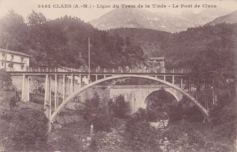
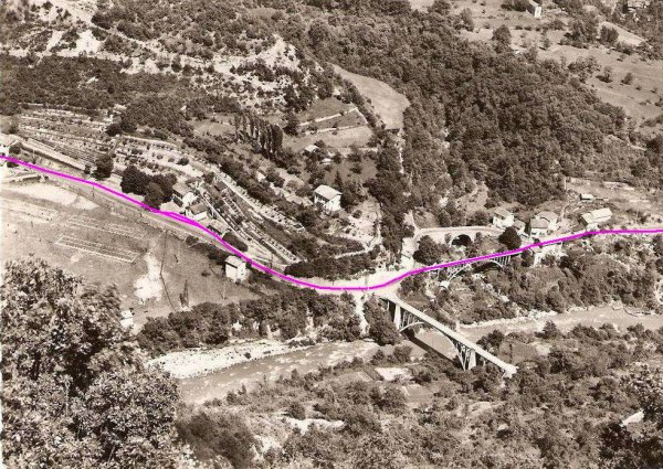 In this aerial image the tramway alignment it shown as a pink line. [2]
 Sadly, the old tramway bridge was not able to support modern highway loading and has been replaced by a far more functional structure. The same is not true of the bridge which provides access across La Tinee (see below).
 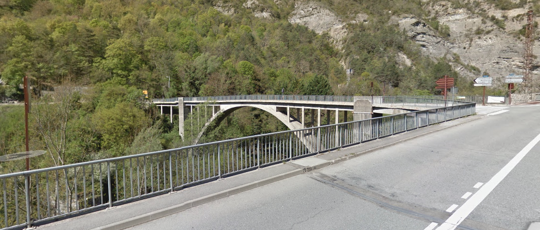 The station building can be found just round the bend travelling north from the bridges. It bears the station name-board.
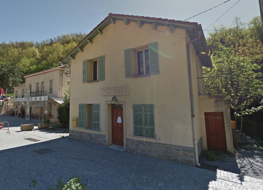 North of Pont de Clans the road/tramway remain on the East bank of the river. The next stop is the halt for Bancairon which is a little to the north of the present village. Soon after the Station (below) the modern road runs on a viaduct down the middle of the gorge with the river beneath, and at the end of the viaduct it ends up on the West bank of the river.
 The old road (and so also the tramway) remains on the East bank of the river. [6]
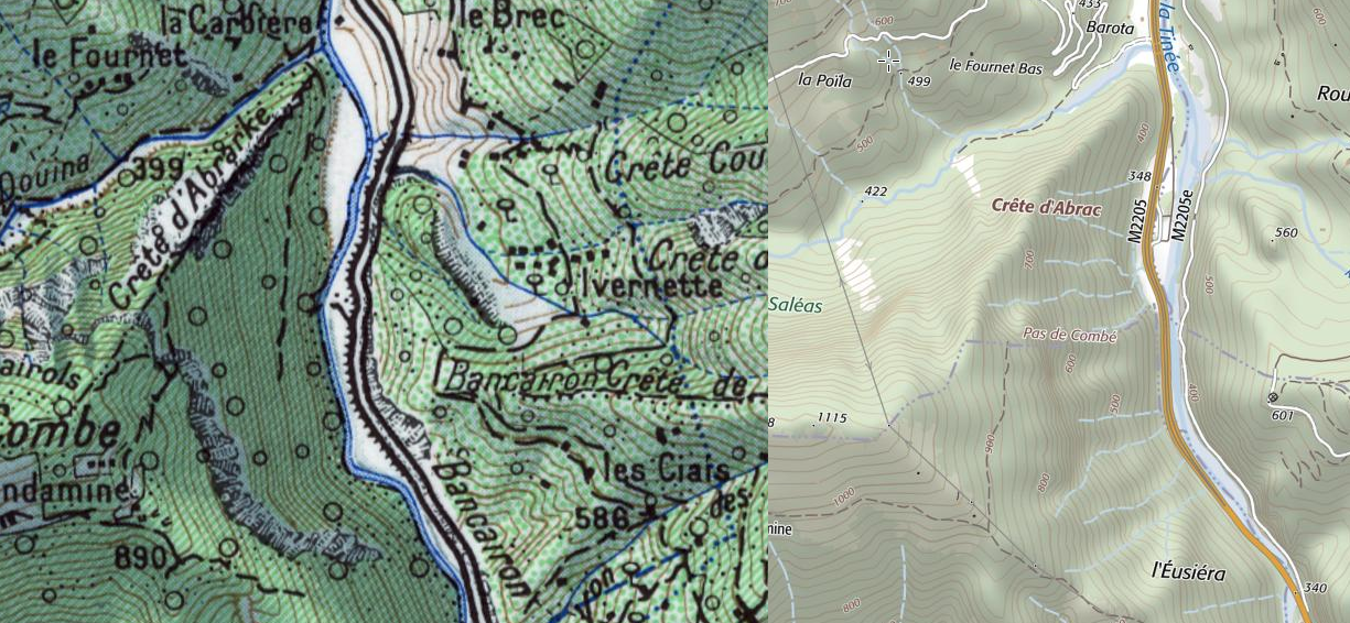
The old road/tram route continued on the East side of the river and was eventually joined once again by the modern M2205. Just before the modern road crosses back over the river the old road/tramway was carried over the Vallon d’Ullion on a viaduct.
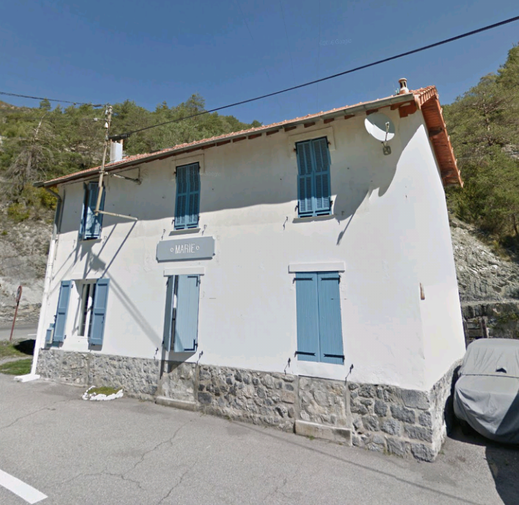
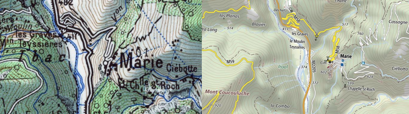
The point where the old road and tramway meet the new M2205 is shown in the first image below. North of this point the tramway encountered its next stop at Marie. The station is at the bottom of the side-road leading to the village of Marie.
The village sits high above the valley floor on the East side of the River.
The station is shown in the satellite image below in the top left corner, the village is in the right bottom corner.
Just as for the village of La Tour, the climb to the village of Marie along the M58 road is steep and long.
The 1:50000 plan from the 1950s and the most up-to-date IGN plan show the road clearly below. [7] In the case of both villages it required some stamina to return home after being dropped off by the tram.
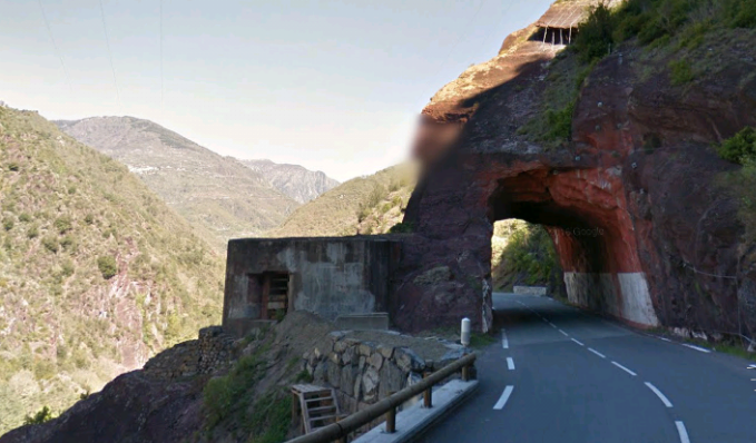
 North of Marie the tramway continued on the East side of the valley all the way to St. Sauveur sur Tinee. Very occasionally the modern road and the oldroad/tramway followed a different course – as here just south of La Bolinette.
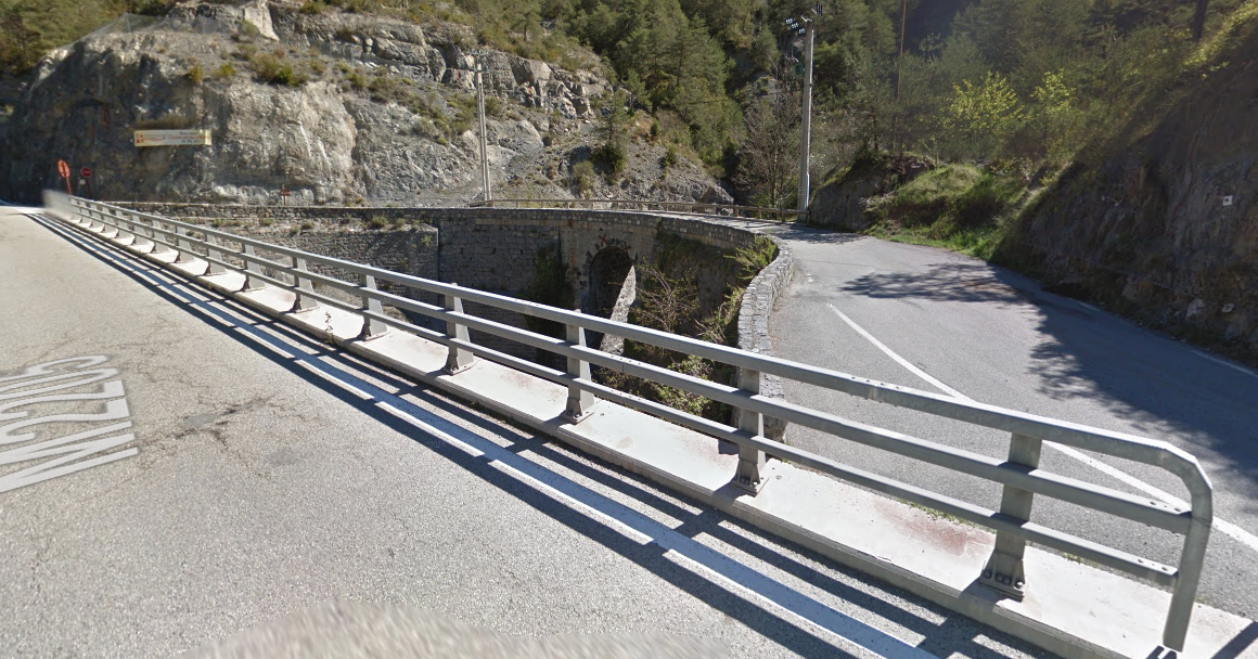 And when crossing the Valley of the Bramafan River.
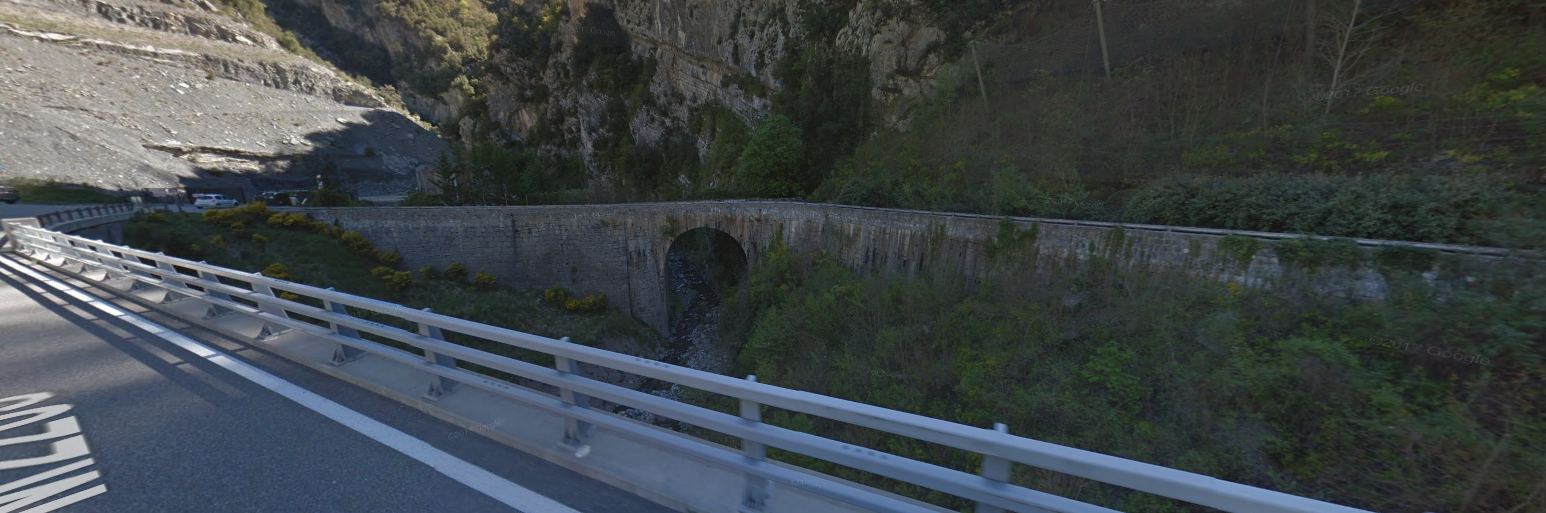 The tramway required three tunnels within less than one kilometre at Les Fours (Rimplas).
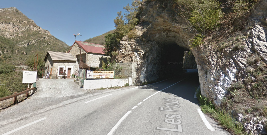
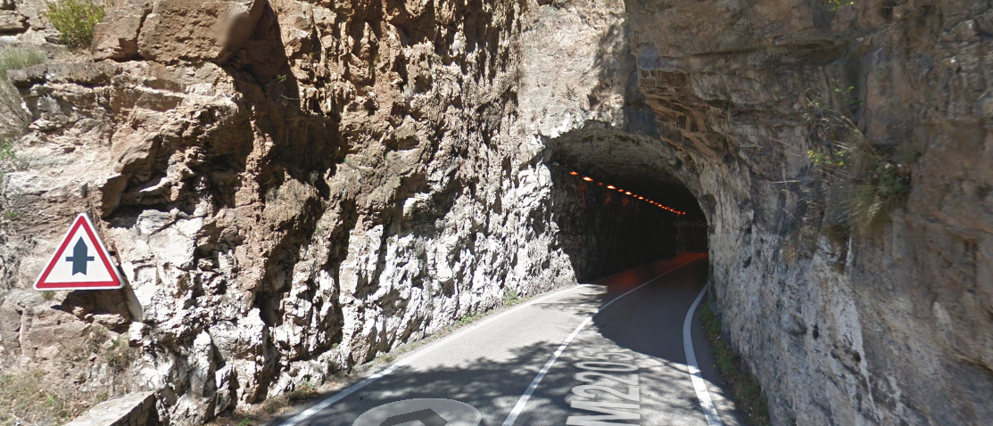
 In all three pictures immediately above the tunnels are of an asymmetrical shape. The additional height on one side allowed space for the catenary and its support poles.
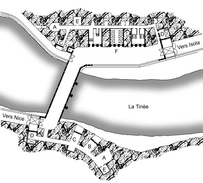
Continuing north along the valley the tramway closes in on Saint Sauveur sur Tinee. Marc Andre Dubout says that the station was located at the southern entrance to the village. [2]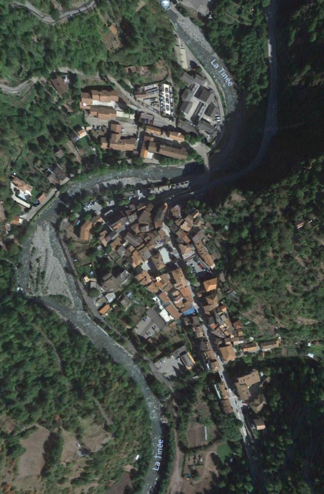
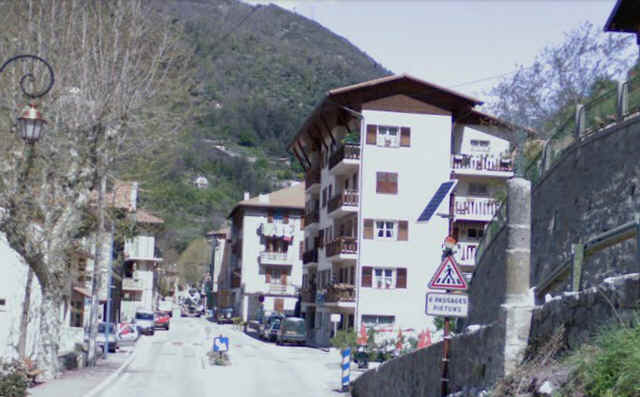 Dubout goes on to say that the passenger building was demolished to make way for the building in the above photograph. The locomotive shed was located on the right just before the present building above. He provides the picture below which is taken in almost the same location as the one above, in fact just a few metres closer to the village centre. It is taken after tracks have been lifted but before the removal of the station building
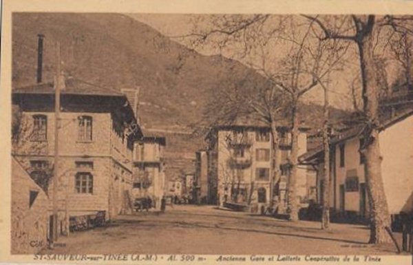
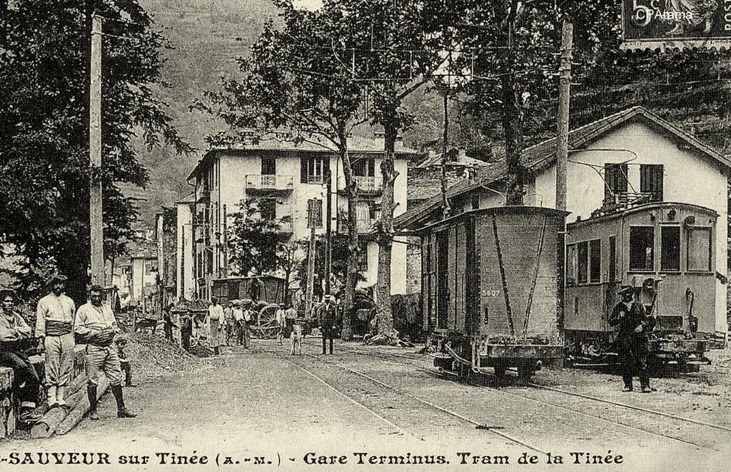
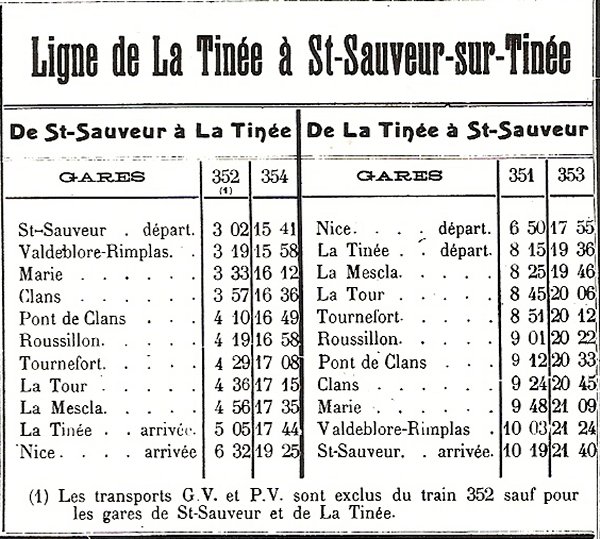
The postcard image above is similar to one offered by Dubout but with less of a postage stamp obscuring part of the image. This picture was taken a few steps further into the village but this time with the tramway in place. Dubout suggests that we should note the width of the rolling stock – 1.90 metre was the loading gauge width. [2][8]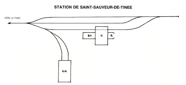 Dubout also provides a sketch map of the station and details of the timetable for the line. [2]
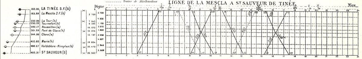
References
- https://fr.m.wikipedia.org/wiki/Tramways_des_Alpes-Maritimes, accessed on 16th July 2018.
- http://marc-andre-dubout.org/cf/baguenaude/tinee/tinee.htm, accessed on 16th July 2018.
- Frédéric Pauvarel; https://dossiersinventaire.maregionsud.fr/gertrude-diffusion/dossier/pont-de-la-mescla/e99d7d30-cbac-47bb-9047-9484f60ccce4/illustration/1, accessed on 17th July 2018.
- http://www.cheminsdememoire.gouv.fr/en/chuise-de-bauma-negra, accessed on 17th July 2018.
- http://www.lignemaginot.com/ligne/sf-am/bauma/index.htm, accessed on 17th July 2018.
- https://remonterletemps.ign.fr/comparer/basic?x=7.132322&y=44.014557&z=15&layer1=GEOGRAPHICALGRIDSYSTEMS.MAPS.SCAN50.1950&layer2=GEOGRAPHICALGRIDSYSTEMS.MAPS.SCAN-EXPRESS.STANDARD&mode=doubleMap, accessed on 17th July 2018
- https://remonterletemps.ign.fr/comparer/basic?x=7.132666&y=44.031035&z=15&layer1=GEOGRAPHICALGRIDSYSTEMS.MAPS.SCAN50.1950&layer2=GEOGRAPHICALGRIDSYSTEMS.MAPS.SCAN-EXPRESS.STANDARD&mode=doubleMap, accessed on 18th July 2018.
- https://www.cparama.com/forum/saint-sauveur-sur-tinee-t4668.html, accessed on 18th July 2018.
