
As I have mentioned in the last month or two, I have been very fortunate indeed. … For my birthday this year, my wife has bought me two books about the tramways of Nice. Both of these books are written in French by Jose Banaudo and published by Les Editions du Cabri. [1]
I am enjoying reading the first of the two volumes at the moment which covers the history of the tramways in Nice. I have had some conversations of a number of forums about the TNL which ran the tramways along the coast and in the city of Nice as well as a number of lines which travelled up into the hilly countryside behind the coast.
Sadly the full story of the TNL network is currently only available in Jose Banaudo’s books which are written in French.
I have used Google Translate to translate some of the pages of Jose Banaudo’s book. These notes are based on that translation. This post focusses on the years immediately before the First World War. It was at this time that the network reached its fullest extent and it was the time when it was both in its best condition and carrying the greatest number of passengers. After the First World War things began to change and competition from other forms of transport increased.
The pictures included below are not those included in Jose Banaudo’s book. He entitles this section of his book, The TNL Network at its Height (Jose Banaudo Volume 1 : p62-68)
Like many French rail transport networks on the eve of the first world war, the TNL experienced, significant growth in all areas: mileage exploited, number of passengers and tonnage of goods, staff numbers, etc. There were a number of improvement and development projects underway, both for urban and interurban traffic, but the economic and human upheavals brought by the war were soon to bring a halt to the overall prosperity of the tramways of Nice.
The Completion of the Departmental Network
On the eve of the war, one line of the departmental network in the hinterland behind Nice remained to be built and an extension to another had just been agreed.
The 1904 convention provided for the extension of the La Grave-de Peille line along Les Gorges de Paillon to reach the village of L’Escarène. L’Escarène was the capital of the canton and had a commercial importance but also a military significance, because from L’Escarène one could extend the tramway towards Lucéram and Peïra-Cava, at the edge of the highly strategic Authion massif. However, the new PLM international route Nice-Breil-Cuneo had just been confirmed across the same route. This resulted in a rapid diminution of interest in the establishment of a tramway in what were very sparcely populated gorges
As a result, the general council decided to replace the planned line with a totally different route: La Pointe-de-Contes – L’Escarène. The proposed line was just over 7.5 km in length.
In addition, since the location of the terminus of the Nice-Levens line required tram passengers to walk nearly a kilometre to reach the village, an extension to Levens village was promulgated in October 1908. It was just over one kilometre long and included a tunnel. Work has just begun when war commenced and no further progress was made.
The Completion of the Urban Network
The network in the city of Nice had last seen alterations not long after the turn of the 20th Century. They were supplemented by a new line when on 8th February 1908, the city of Nice granted the TNL a line connecting Magnan bridge to the suburb of La Madeleine.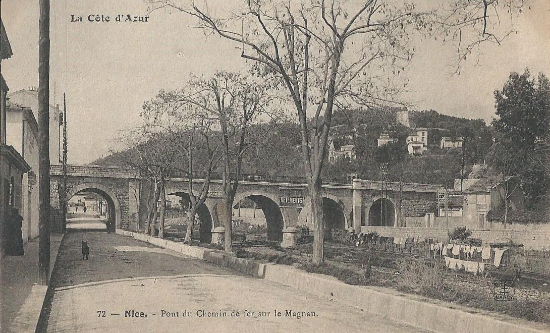
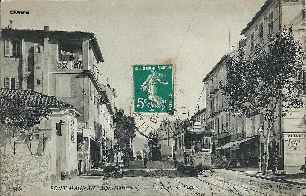 The line was give the route number 12 and began operations on 27th April 1908. A single track followed the shoulder of the road up the valley for a distance of over 2.2km. It facilitated the rapid urbanization of this popular district where small factories, laundries, restaurants and cafes opened up. La Madeleine became a popular Sunday walk destination.
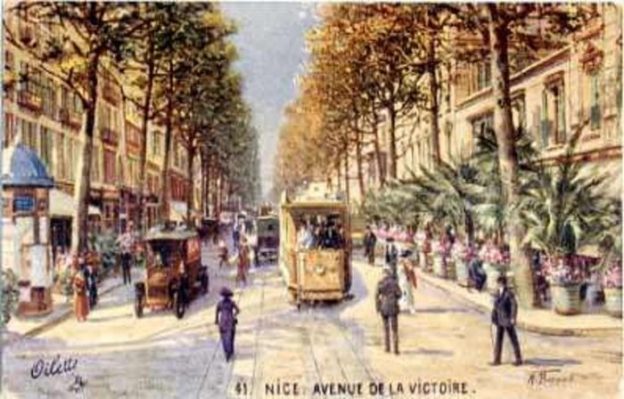
Closer to the centre of Nice, three lines had been granted in the period from 1902 onwards and should have entered the area bounded by the Boulevard Gambetta, the Rue de France, the Avenue de la Gare and the Avenue Thiers, which is nowadays called “Quartier des Musicians” because most of the streets are named after famous composers of the 19th century. Place Gambetta
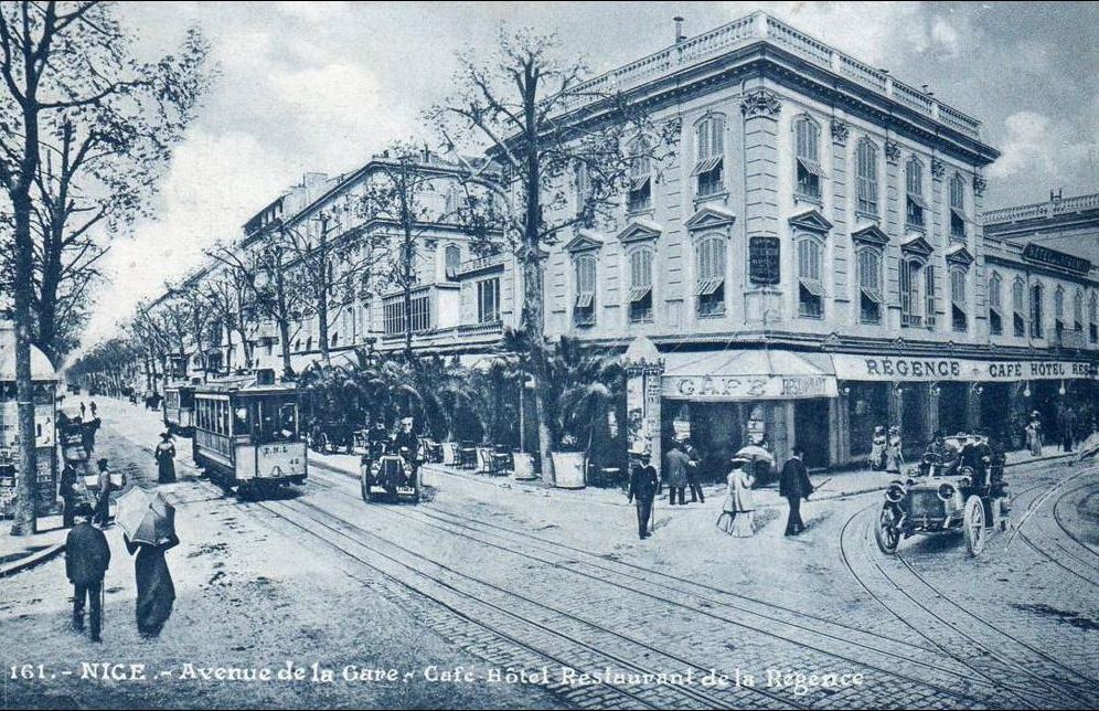
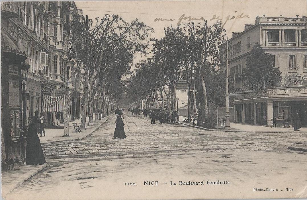
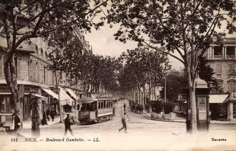
 However, as a result of opposition from residents in the Musicians Quarter the company and the municipality decided not to construct the lines in the Quarter.
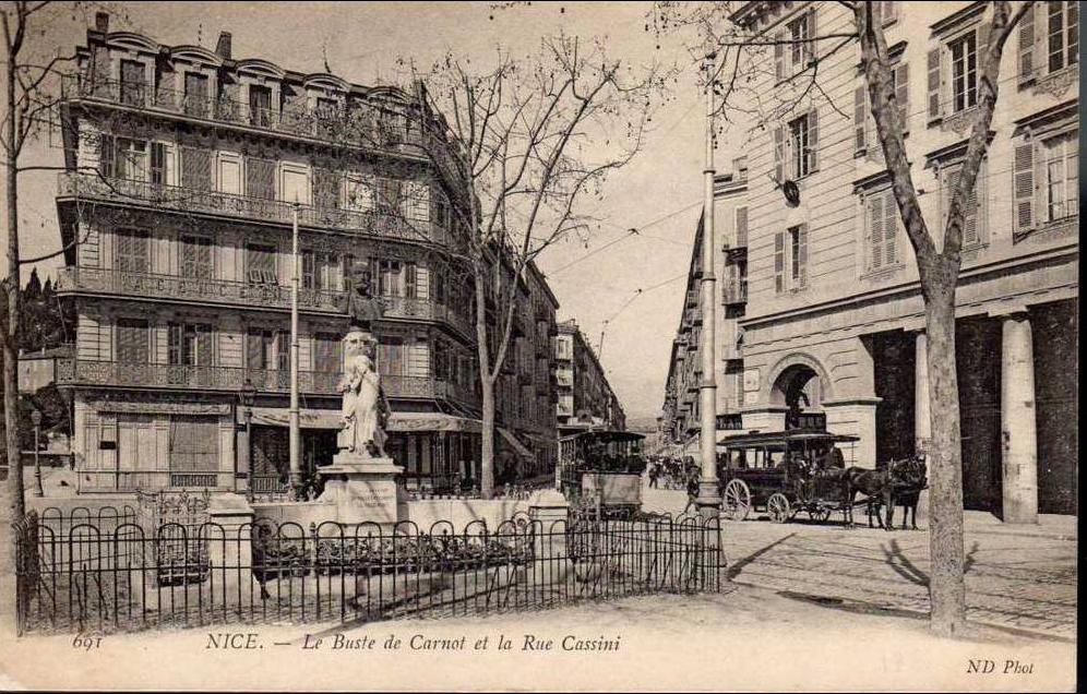
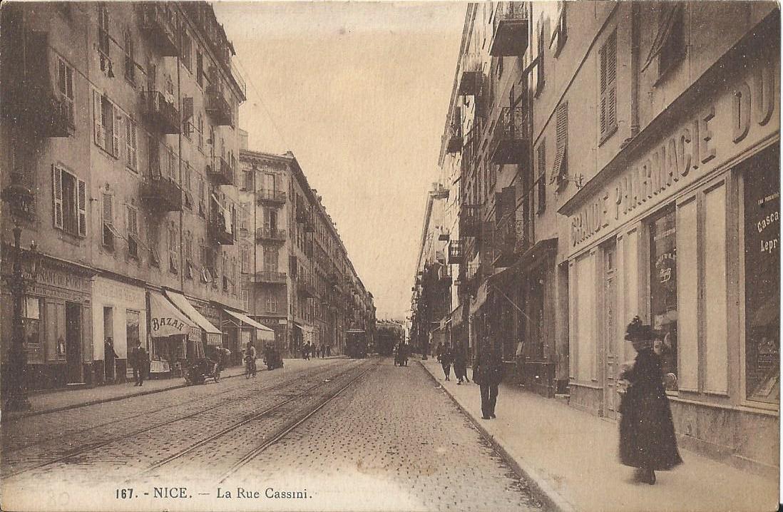
Another line close to the Old Town was proposed. .. The route which was initially planned to follow Rue de St. François-de-Paule and Cours Saleya sparked protests from the market traders. The image below indicates the extent of the market and highlights the likely disruption that would have been caused by the tram route.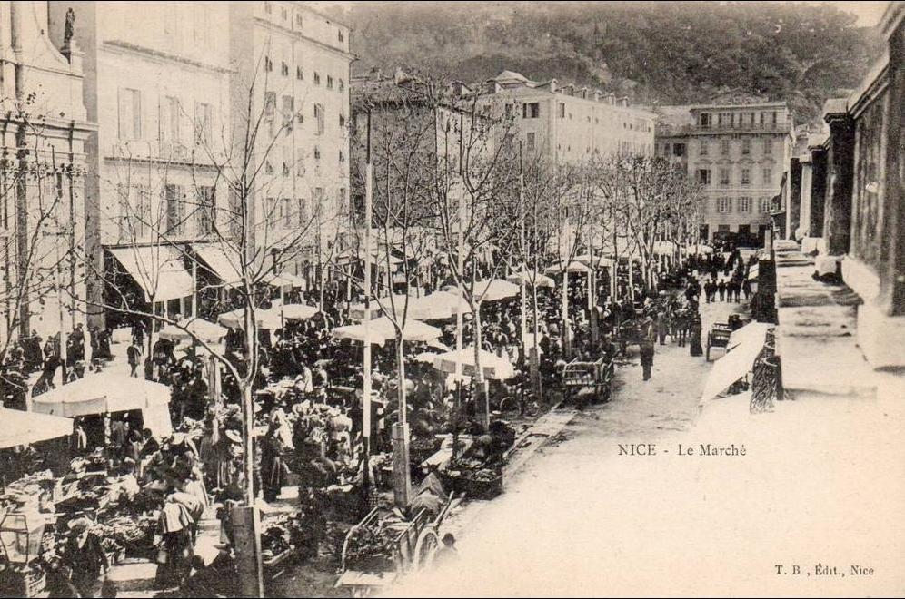 Another route through the historic heart of the city, via Rues du Palais et de la Terrasse, Les Quais du Midi and Des Ponchettes (today, Etats-Unis and Rauba-Capèu), the Quai Lunel and La Place Cassini (today, Ile-de-Beauté), was also defeated by opposition.
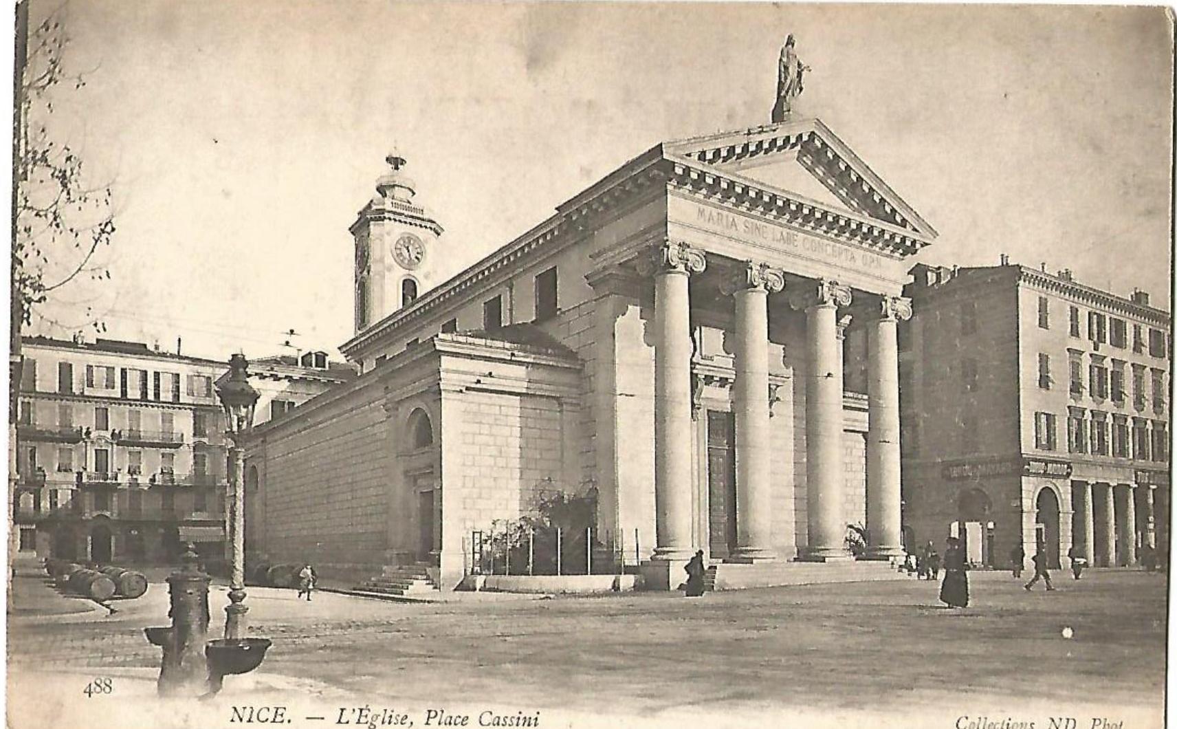
 In the first half of the 1910s, the completion of the urban network was the subject of arduous negotiations between the municipality and the TNL. On 5th and 6th February 1912, two amendments and a new convention were signed to alter the lines to be built. The four routes not yet realized were abandoned in favor of extensions and new links towards the suburbs of the city. Banaudo cites these as:
• an extension of line 4 Port-Lazaret, via the Boulevard Empress-de-Russie;
• line 6 (Massena) Boulevard Joseph Garnier-St. Sylvestre via Avenues St. Barthelemy (today, Auguste Ravnaud), Cyrille-Besset and Boulevard de Cessole;
• line 7 Place Saluzzo-Rue de Lépante;
• line 7 bis (Masséna) Carras-Caucade;
• Line 11 (Masséna) Place de Tende-Eglise St. Roch;
• an extension of line 12 to Le Madeleine-Supérieure;
• line 13 (Masséna) Place Saluzzo-Col de Villefranche on the flank of Mont Boron.
Political issues intervened and planned routes were again altered. Banaudo says that after interminable discussions only lines 6, 7a and 11, on different routes to those previously proposed were approved.
Banaudo reports that “in the spring of 1914, the TNL operated a network of 166.5 km, including 33.6 km of urban lines, 2 km of routes within the port area and 130.9 km of coastal and departmental lines. If common lines are deducted the total reduces by about 5km. The rolling stock fleet consisted of 174 powered units (including 9 in Monaco) and 90 passenger trailers, as well as 13 tractors and 140 freight cars. The staff consisted of a thousand employees, ensuring an annual traffic of nearly 25 million passengers and more than 200,000 tons of goods. For 1913, the last year before the war, with 4,564,544 francs of receipts and 3,227,730 francs of expenses, the financial balance sheet of the company was largely profitable and the coefficient of exploitation remained at a rate of 0.71 to the envy of many other networks.”
References
- Nice au fil du Tram Volume 1 and 2, Jose Banaudo; Les Editions du Cabri.
- Nice au fil du Tram Volume 1; p62-67.

What would be great is a juxtapose with the identical spot now. I suspect – in a nice* way – that it would be very recognisable.
* See what I did there