
Colomars/La Manda to Plan du Var
At La Manda, a branch line to Meyrargues separated from the main line to Digne les Bains immediately north of La Manda/Colomars Station. That branch-line is the subject of a run of blogs in this series. The route is covered in one series, the first of which is:
https://rogerfarnworth.wordpress.com/2017/11/20/ligne-de-central-var-part-1
The post above contains a significant number of images of Colomars/La Manda Station.
The last of the series on the route of the branch-line is:
A short series of posts covers locomotives and rolling stock on the branch which inevitably overlap with that on the main line. The first of these is:
The last of these is:

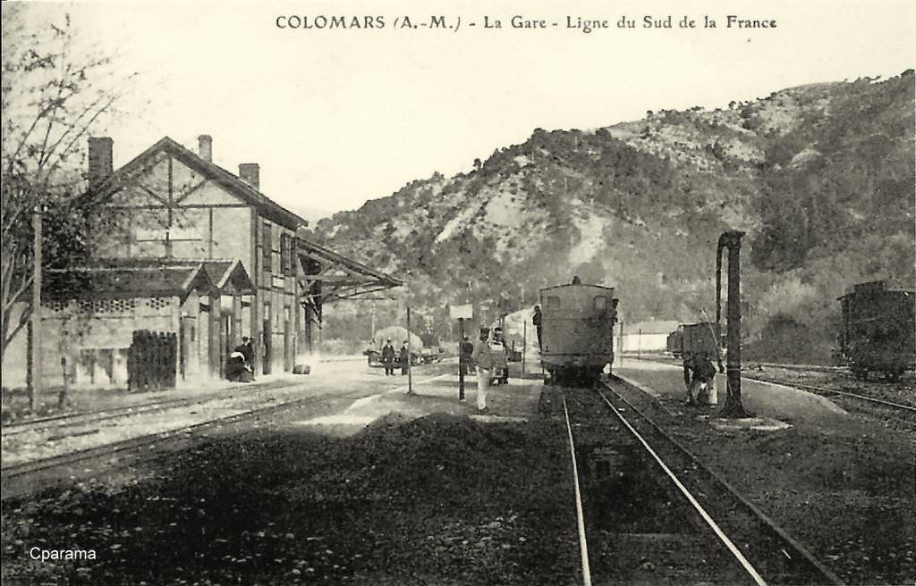
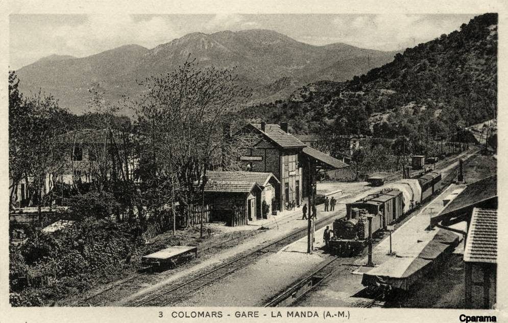
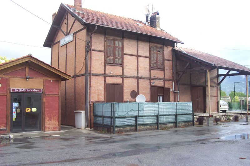
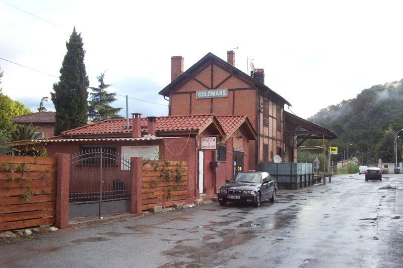
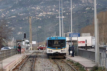
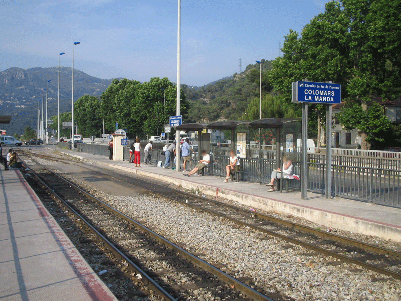
Colomars/La Manda
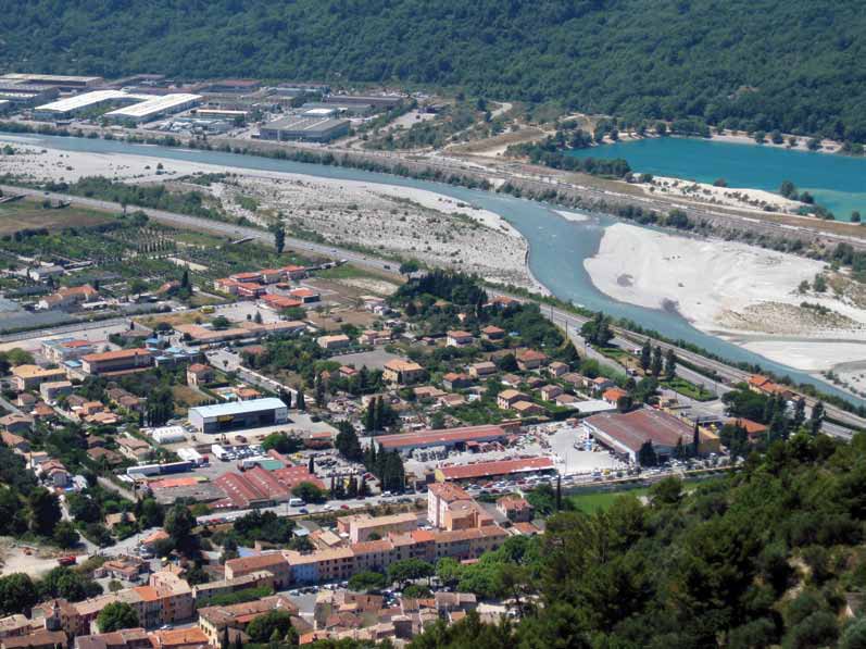
We begin the next stage of our journey along the Nice to Digne les Bains line at Colomars Station. The modern halt is on a section of railway line which was not part of the original alignment. The as-built alignment had to accommodate access for the branch-line to the bridge over the River Var and had to allow for a height gain to permit trains to travel over the top girders of the truss-bridge over the Var.
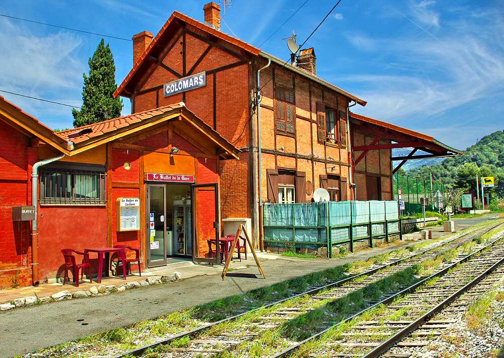
The relative positions of the old station and the modern halt can be seen on the adjacent sketch map. A few photos of both the station and the halt follow. First, the ancient station is shown in the early 1900s and then in more up-to-date photographs shows what of it remains. [1]
The modern halt, is literally just that, a couple of unmanned platforms adjacent to the river revetments. [1]
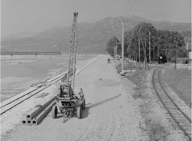
Two final pictures before we leave La Manda. The first is a reconstruction of the station site, the second is an archive photograph of the old line to the south of the station which shows the construction work for the new diversion along the river bank in the 1960s. Note, in that picture, the La Manda has still to be reconstructed. Both of these pictures come from the ‘formule4’ website. [12]
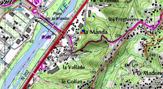
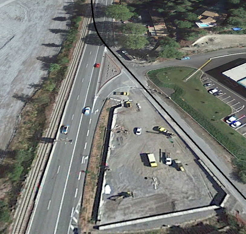
While the modern line follows the east bank of the Var, the original line north of the old Colomars/La Manda Station and the original junction with the Central Var line the Nice to Digne line entered a short tunnel which is now used as a one-way access from the main road to La Manda for vehicles travelling in a southerly direction. The plan below shows the current road layout at La Manda and the location of the tunnel. The roads to the south-east of the main road follow the alignment of the railway that they have replaced. [2]
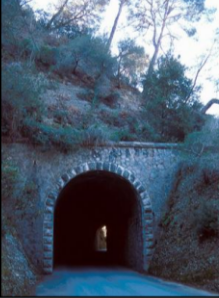
The northern portal. [2]
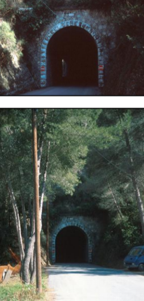
Two Images (above) of the southern portal in 21st Century. [2]
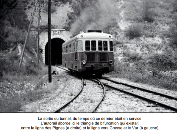
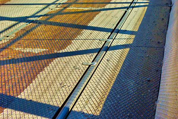
The southern portal immediately before it ceased to serve as a railway tunnel. The picture also shows a Renault railcar and the northern arm of the triangular junction with the Central Var line. [2]
The tunnel is known as Le Tunnel de Vallade. It is approximately 50m long and is just over 65m above sea-level. Its use as a pad tunnel means that it has been kept in good condition since the railway like he was diverted.
North of the tunnel, the line drifted back towards the bank of the River Var to join the present alignment of the railway. The old line is shown by the black line on the Google earth satellite image below.
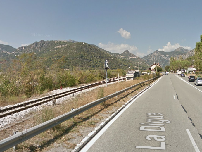
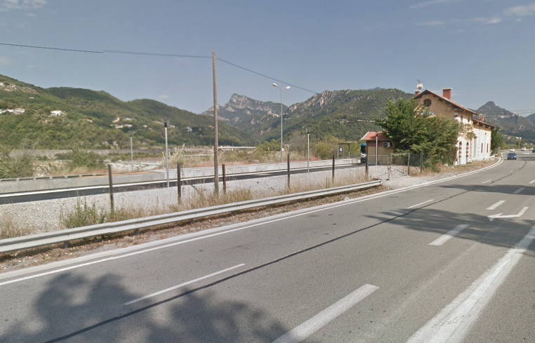
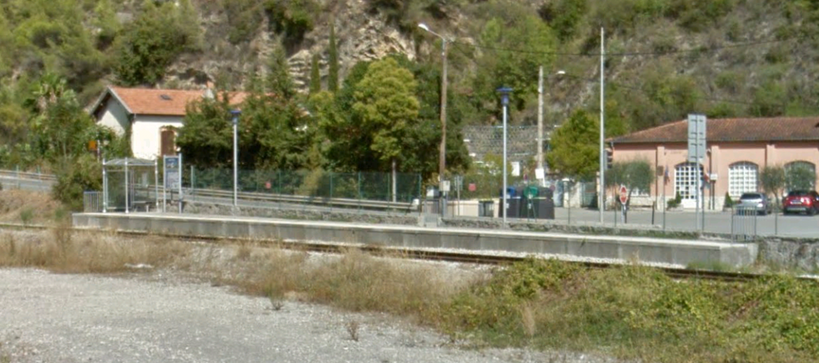
The line then followed the East bank of the Var to St. Martin du Var which was the next station on the route. The next three images are taken from Google Maps Streetview and show the approach to the station at St. Martin du Var.
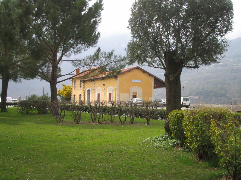
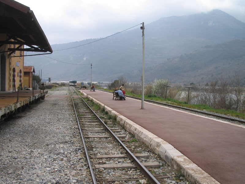

The three images immediately above are taken from the website, ‘Le Train de Pignes’. [3]
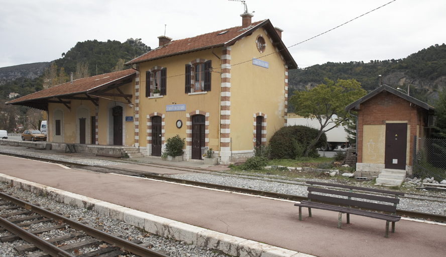
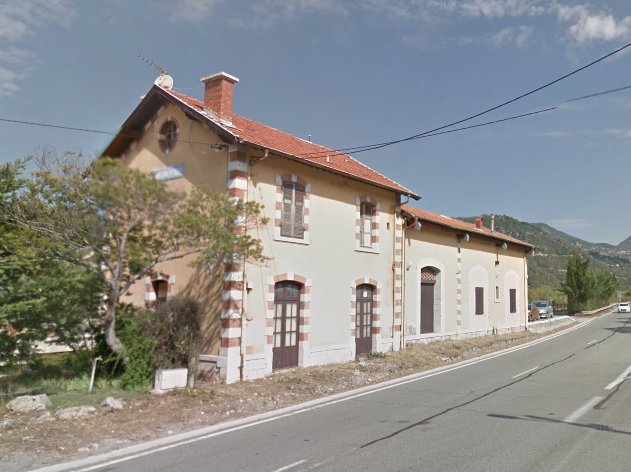
A trackside view of the station building at St. Martin due Var. [4]
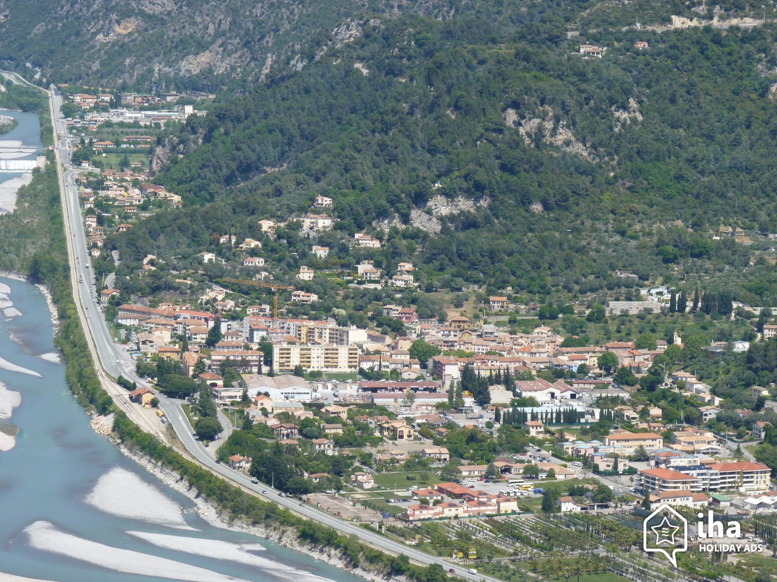
Two aerial shots of St. Martin du Var. The first from the south. [5] The second from the Northeast, shows the station buildings on the right of the photograph. [6] These two pictures show the station in its modern context.
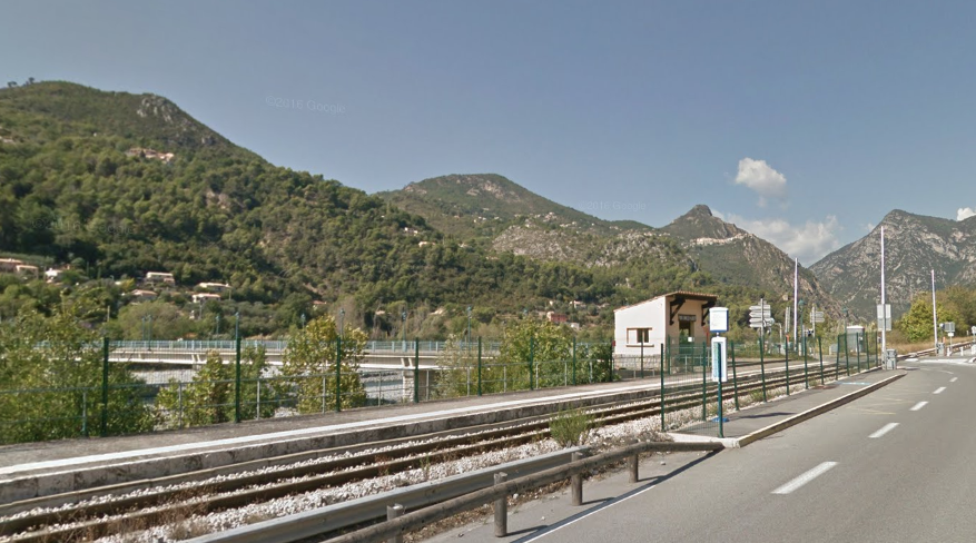
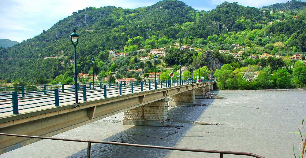
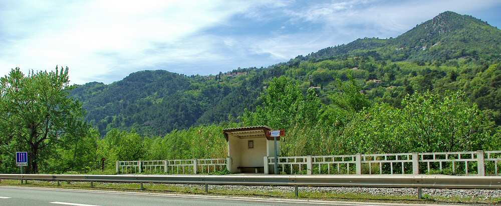
The line continues to follow the east bank of the Var passing through the halt at La Roquette-sur-Var (immediately below). The bridge behind the halt is Pont Charles Albert and gives its name to the halt.
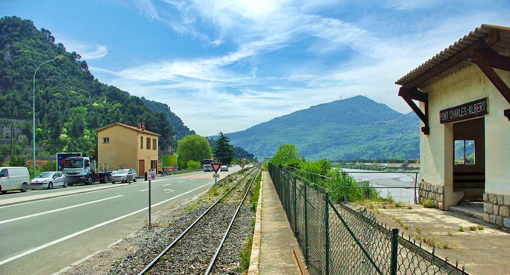

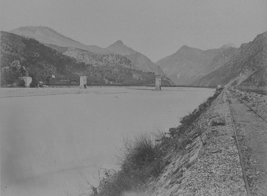
The three images immediately above are taken from the formule4 site and show the location in the 21st century. [7] The image below was also found on the formule4 site but was sourced from BNF Gallicia. [8] It shows the original bridge, a suspension bridge across the Var and interestingly a standard-gauge railway which connected the Baus Roux to the mouth of the Var by means of a cariole pulled by horses heading up the valley away from the coast and descending under gravitational power towards the coast. A cariole was a type of carriage used in the 19th century. It was a light, small, two- or four-wheeled vehicle, open or covered, drawn by a single horse. The Baus Roux was an industrial area just to the north of the Pont Charles Albert on the East side of the Var.
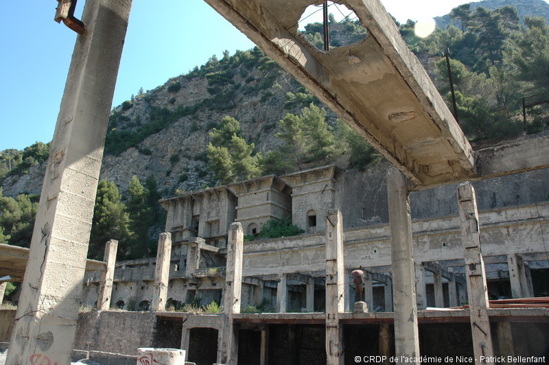
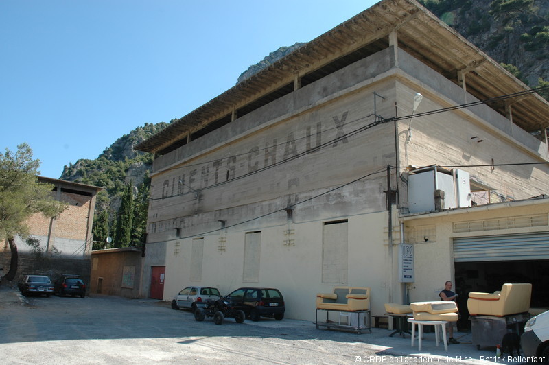
Two pictures of the old cement works at Baus Roux. [9]
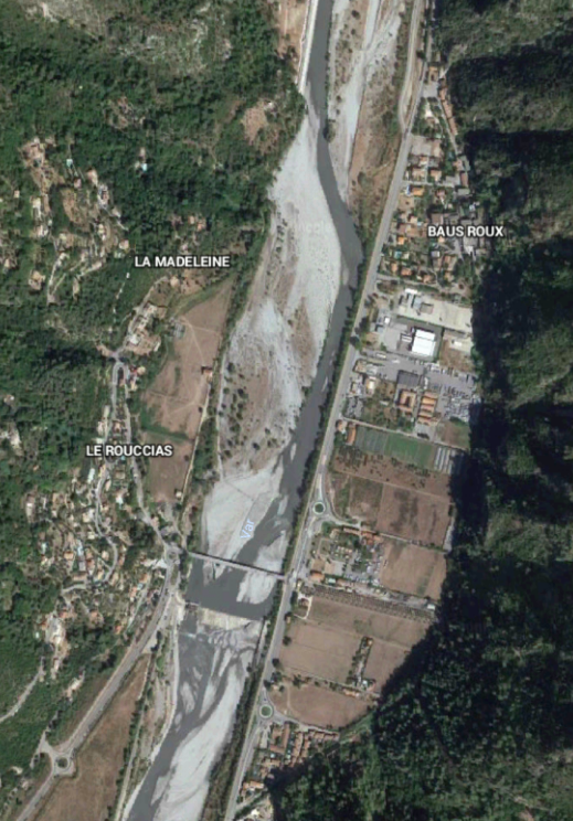
The bridge in the bottom half of the above satellite image is Pont Charles Albert. one of the abandoned cement works is immediately below the words ‘Baus Roux’.
The line passed through a halt on its way North to Plan du Var – Arret de Baus Roux is shown immediately below (abandonned). [7] That halt was replaced by one with the name ‘La Roquette sur Var/Baus Roux’ which s shown on a Google Streetview image below.
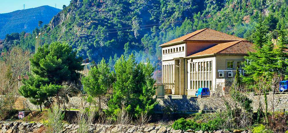
Within a short distance we catch sight of a large industrial complex on the west bank of the River Var. This is Gabre Power Station which sits on a promontory which sticks out into the course of the river. The power station was served by its own rail link which crossed the metal truss girder bridge shown in both of the two images below.
Gabre district in the commune of Le Barbant/Bonson (Alpes-Maritimes, France), opposite Plan du Var, with the Gabre bridge and the Gabre power plant built in 1890 to supply electricity to the trams of Nice. On the other side of the Var, you can see the road to Digne (ex-N202, currently D6202) and the railway line of the Railways of Provence (“Train Pignes”). This picture was taken from the village of Le Barbant/Bonson in 2007 © Eric Coffinet [10]
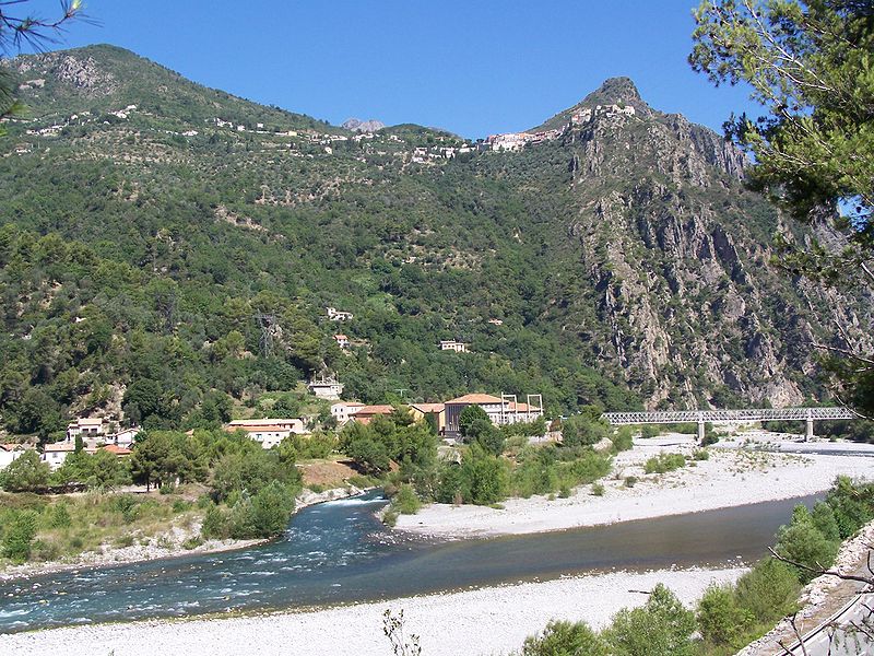
The perched village above the power station is Le Barbant/Bonson © Eric Coffinet [11]
The rail link to Gabre Power station diverged from the Nice to Digne line on the west side of Plan due Var. Its rails could still be seen in the road surface of the truss girder bridge in the early 21st Century. [7]
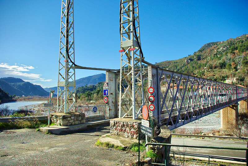
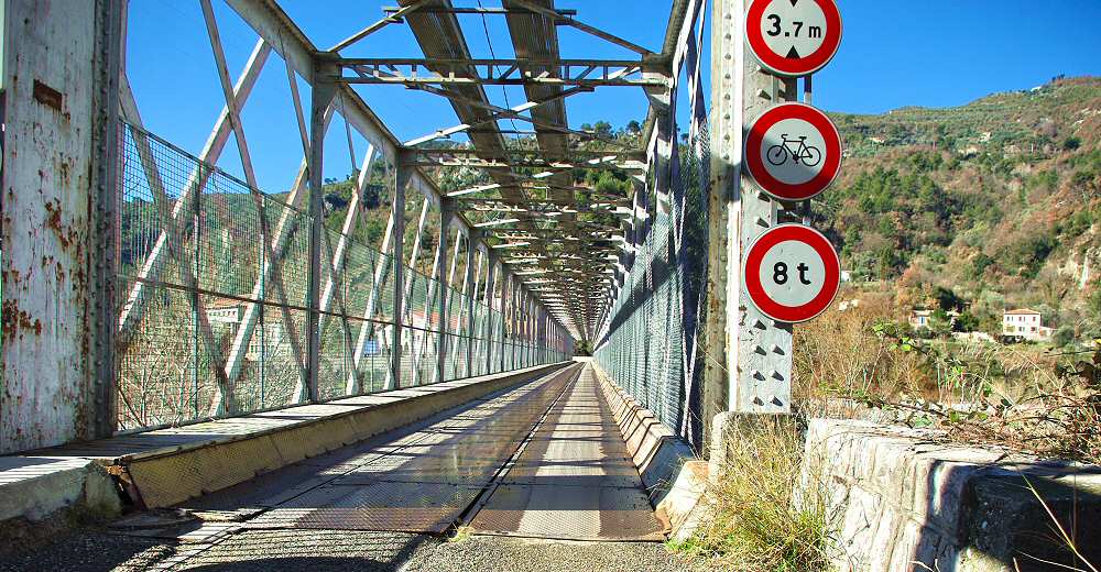
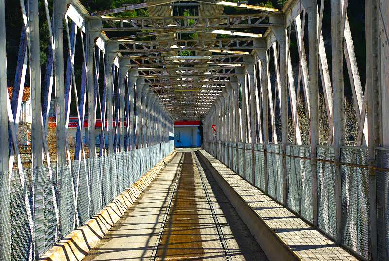
This series of 5 photographs of the Gabre Bridge are culled from formule4’s website. [7]
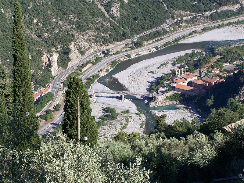
There is evidence of this short branch-line on the 1955 IGN 1:50,000 map of the area. [13] It can been seen close to the Hyrdoelectric plant on the left side of the ‘fold’ in the map. I cannot find details of how itconnected to the mainline and can only assume an at grade crossing at the east end of Le Pont de Gabre and a junction at the railway station in Plan du Var.
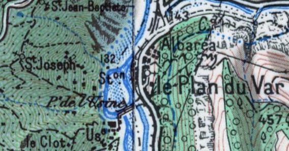
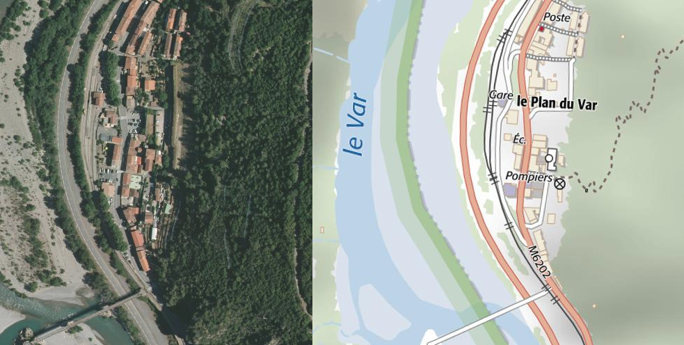
Plan du Var with Le Pont du Gabre at the bottom of the combine map/satellite image and the station buildings between the River Var and the village. [14]
The next few images of the station at Plan du Var come from the ‘formule4’ website. [7]
Looking north through the station.
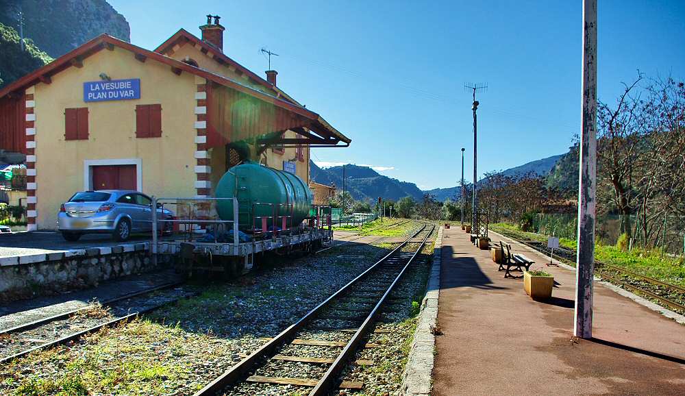
The station buildings with the village off to the left.
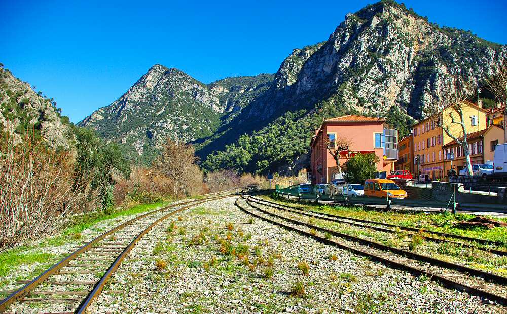
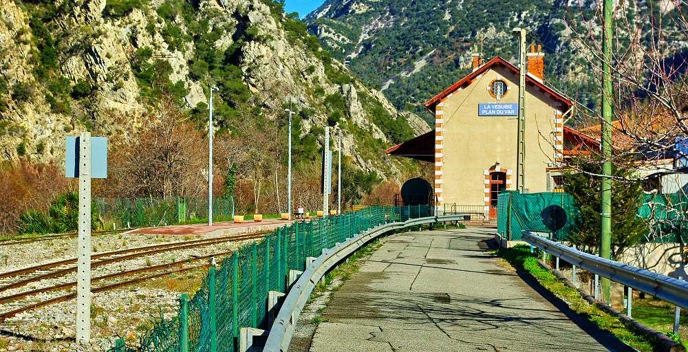
Looking North from the station into Les Gorges de la Mescla. Just beyond the building on the right the tracks coverage to a single line once again. The buildings on the left were originally associated with the tramway which ran up the Vesubie Valley.
At Plan du Var a tramway diverged from the mainline and headed up the Vesubie Valley. Some limited details of this branch-line can be found at:
We finish this part of our journey along the Nice to Digne line at Plan du Var.
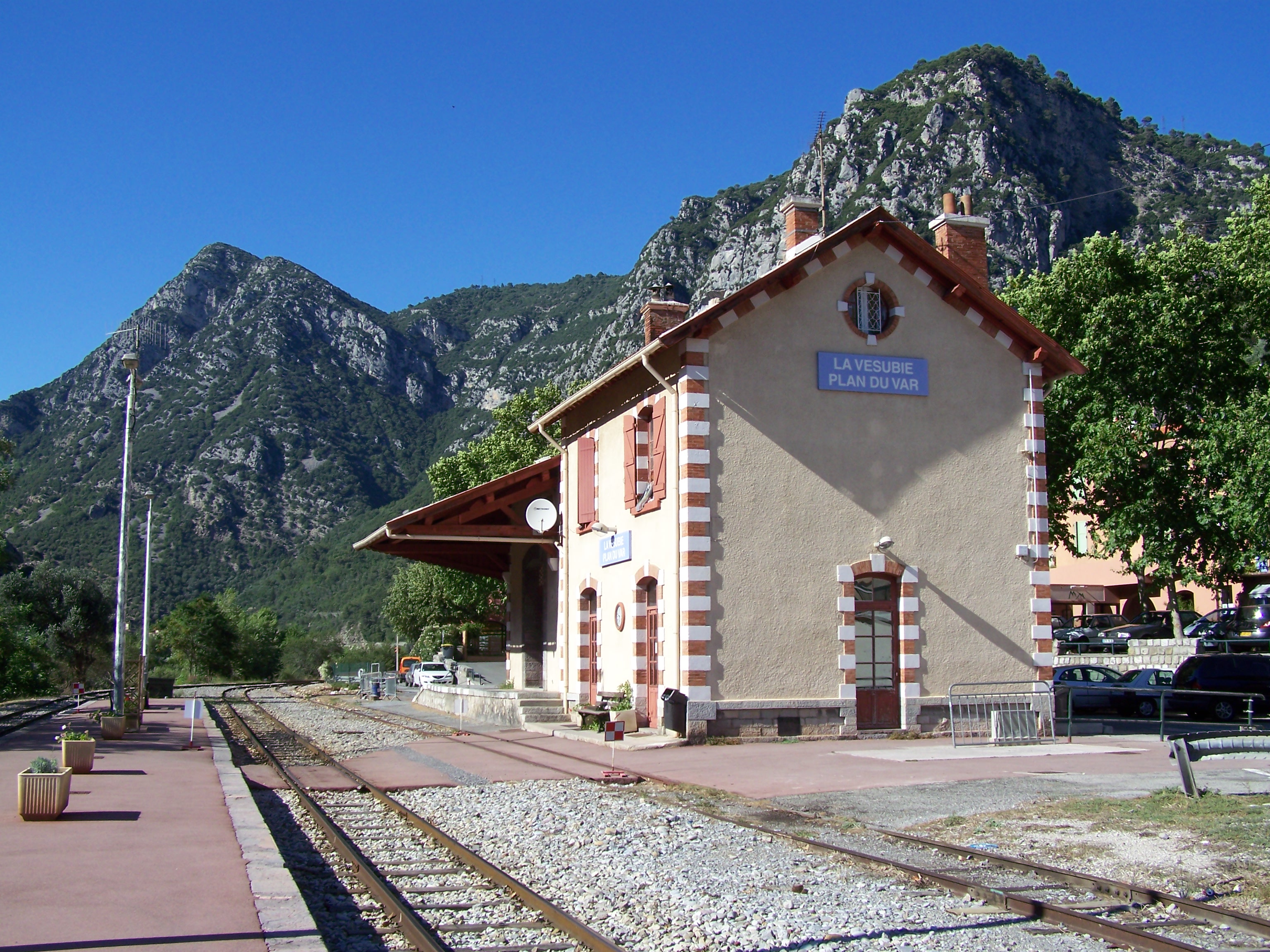
Plan du Var Station (c) Eric Coffinet. [15]
References
- http://cccp.traindespignes.free.fr/phototheque-nostalgie.html, accessed on 20th November 2017.
- http://www.tunnels-ferroviaires.org/inventaire.htm, tunnel No. 06046.1, accessed on 7th July 2018.
- http://cccp.traindespignes.free.fr/gare-stmartin.html, accessed on 7th July 2018.
- https://dossiersinventaire.regionpaca.fr/gertrude-diffusion/dossier/gares-des-chemins-de-fer-de-provence/5db69410-c3ec-4217-b30c-92f975a65c27/illustration/57, accessed on 7th July 2018.
- https://www.iha.co.nl/vakantiehuis-saint-martin-du-var/Am=, accessed on 7th July 2018.
- http://www.ecovallee-cotedazur.com/projects/the-eco-district-saint-martin-du-var, accessed on 7th July 2018.
- http://www.formule4.com/route_code.php?rcode=35#wpt12, accessed on 7th July 2018.
- https://gallica.bnf.fr/ark:/12148/btv1b12000805.item.r=pont+charles+albert.f18.langFR, accessed on 7th July 2018.
- http://www.valleeduvar.fr/index.php?page=gypse, accessed on 7th July 2018.
- https://commons.m.wikimedia.org/wiki/File:Bonson_(Gabre).jpg, accessed on 8th July 2018.
- https://commons.m.wikimedia.org/wiki/File:Bonson_(Gabre-2).jpg, accessed on 8th July 2018.
- http://www.formule4.com/route_code.php?rcode=35, and http://www.basesdocumentaires-cg06.fr/os-cgi/cgixpd.exe?exec=DOCUMENT&mode=0&start=20&num=28&fnmq=&fnmr=foto/page-r.html&fnmd=foto/page-f.html&q_ft_any_text_column=manda, accessed on 8th July 2018.
- https://remonterletemps.ign.fr/comparer/basic?x=7.197585&y=43.855283&z=15&layer1=GEOGRAPHICALGRIDSYSTEMS.MAPS.SCAN50.1950&layer2=GEOGRAPHICALGRIDSYSTEMS.MAPS.SCAN-EXPRESS.STANDARD&mode=doubleMap, accessed on 8th July 2018.
- https://remonterletemps.ign.fr/comparer/basic?x=7.196726&y=43.856888&z=17&layer1=ORTHOIMAGERY.ORTHOPHOTOS&layer2=GEOGRAPHICALGRIDSYSTEMS.MAPS.SCAN-EXPRESS.STANDARD&mode=doubleMap, accessed on 8th July 2018.
- https://commons.wikimedia.org/wiki/File:Gare_de_Plan_du_Var.jpg, accessed on 7th July 2018.

.jpg)
.jpg)