
This short line originated from a proposal made by the stationmaster at Wendover. [1: p97]
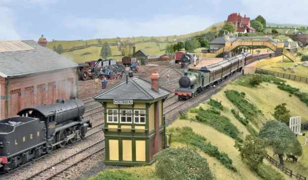
The featured image for this short article is a photograph of a OO-Gauge model of Wendover Railway Station built by David Dan Givens and covered in the September 2018 edition of Hornby Magazine. The image shows the Northwest approach to Wendover Station. The branch line to RAF Halton leaves the main line just off camera to the left. [17]
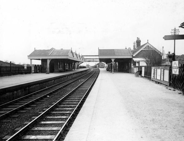
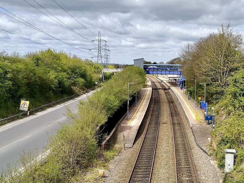
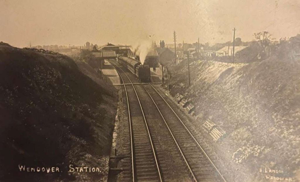
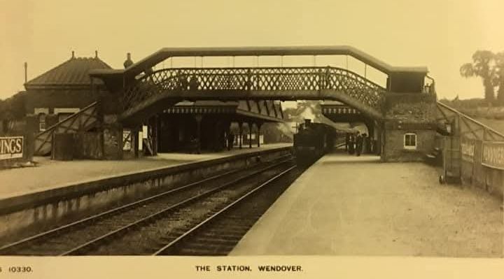
Wendover Railway Station serves the town of Wendover in Buckinghamshire, England, and villages including Ellesborough and Wendover Dean. It was opened by the Metropolitan Railway in 1892 and is on the London Marylebone to Aylesbury line and, in the 21st century, is served by Chiltern Railways trains. It sits between Great Missenden and Stoke Mandeville stations. [4]
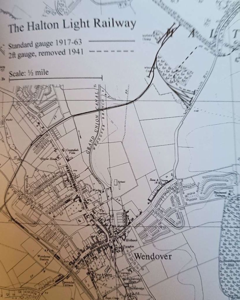
The Halton Light Railway was a spur line from Wendover Station to RAF Halton used to transport coal and other goods to and from RAF Halton.
A narrow gauge railway link to Wendover station, which had been used to transport timber from beech woods on the Halton Estate in support of the [First World] war effort, was replaced in 1917 with a standard gauge branch line, to bring in coal and building materials to the RFC workshops. Timber from Halton Woods was used as trench props on the Western Front. [7]
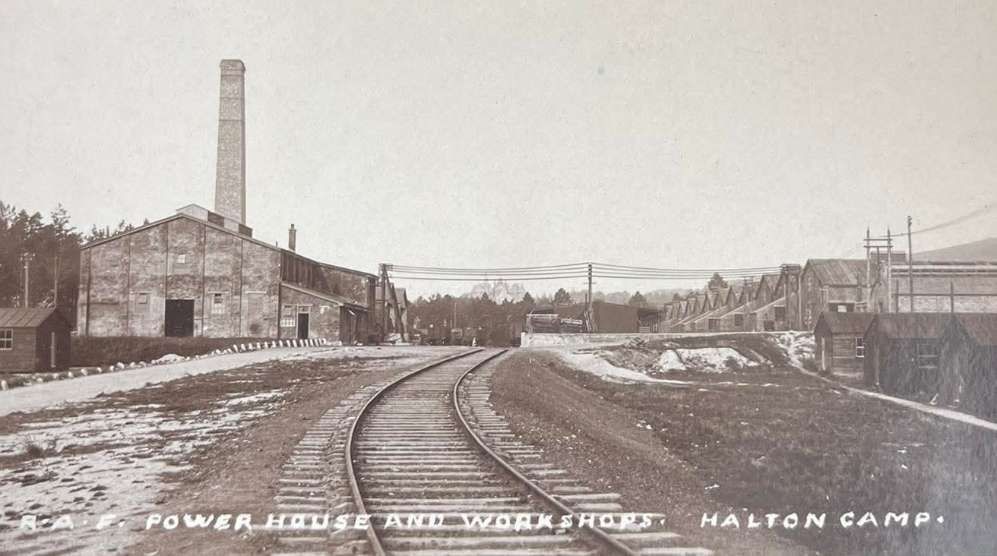
Opened in 1917 after an eight-week construction period, the line ran for 1.75 miles (2.82 km) and was constructed by German prisoners of war during World War I. The railway was originally built, earlier in WW1 to carry timber from local beech woods to Wendover Station and building materials into the site of RAF Halton for construction of the workshops and other units. It also forwarded coal to the boilers on the camp. [7]
Wikipedia says that the line was originally built as a narrow gauge line and “was later converted from a narrow gauge of 1 ft 11 1⁄2 in (597 mm) to 4 ft 8 1⁄2 in (1,435 mm) standard gauge and was used to bring timber out of Halton woods.” [2]
The Railway has a Monument Record and appears on Buckinghamshire County Council’s Heritage Portal. It is Monument Record No. 0951006000. [7]
The Historic Monument Record says that the Railway is shown on historic mapping NG 6″ Provisional Edition 1955-62 and NG 10k Edition 1972-90. Labelled as ‘dismantled railway’ on 25k digital raster map. It appears to be disused even by 1955-62 edition. [7]
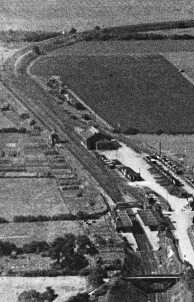
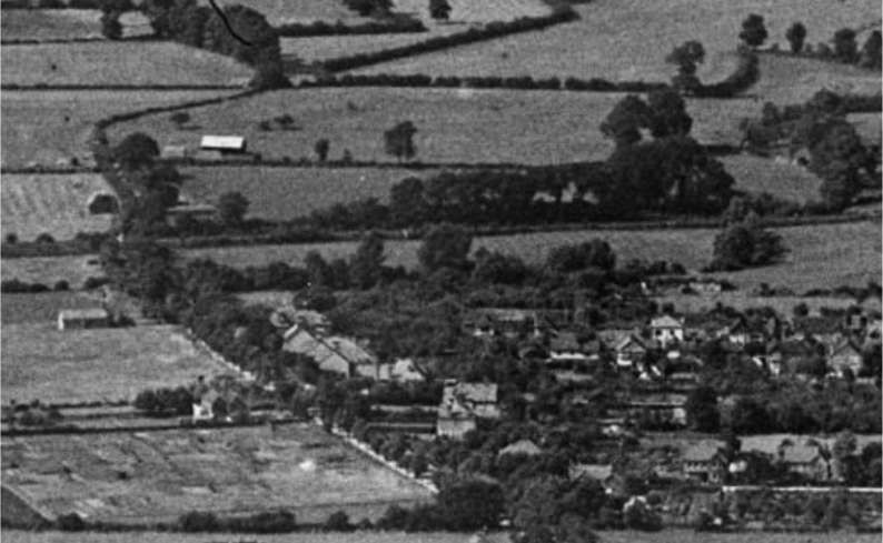
A railway dating from the 20th century is visible on historic aerial photographs and remote sensing data as extant structures, earthworks and levelled earthworks and was mapped as part of the Aylesbury Vale Aerial Investigation and Mapping project (EBC18604). Located on the north side of the town of Wendover and centred at SP 86991 08905. The railway line, originally built as a narrow-gauge line, was constructed to extract timber from the woods at Halton, felled by Canadian lumberjacks, for use in the trenches in World War I. [8: p81] Aerial photographs from 1961 appear to show the railway still present but it does not show on those from 1967. Images of the railway and the station at West Camp are on the ukairfields website for Halton. [7]
The conversion of boilers on the RAF station from coal fired to oil fired, allowed road-tankers to take over the inward flow of fuel and accelerated the demise of the railway and the last train ran on 29th March 1963 with closure following two days afterwards.[7]
The majority of the track has since been removed, including the original bridge over the Grand Union Canal which was replaced by a modern footbridge, however much of the line is designated a permissive footpath (rail trail).
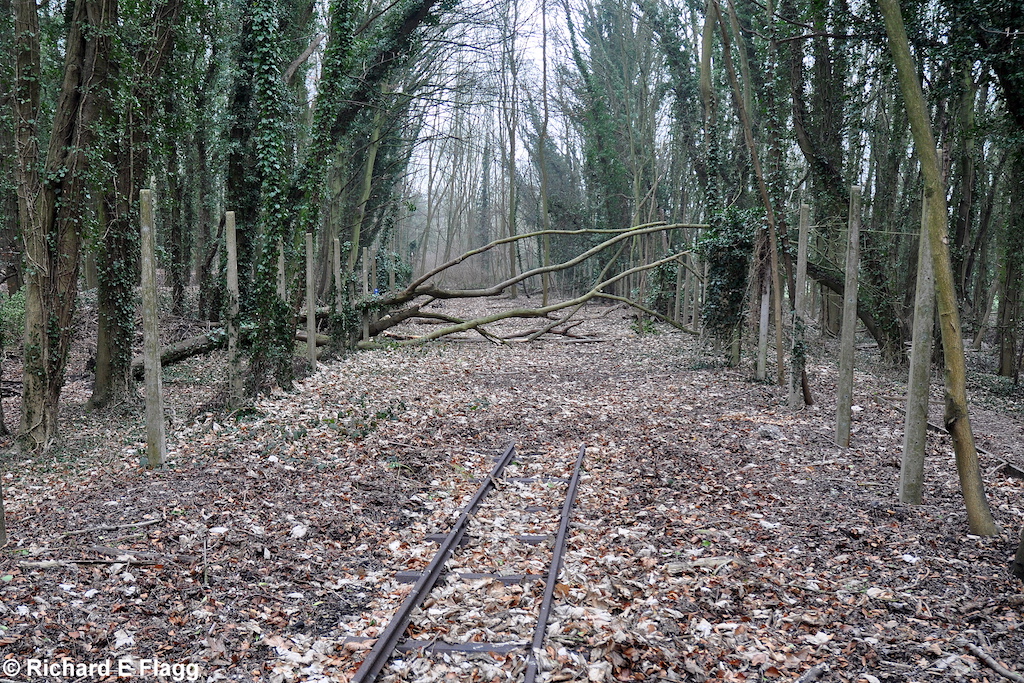
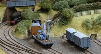
The two images below are embedded in this article from ukairfields.org.uk and are © Richard E. Flagg. The first shows a remaining length of what appears to be 2ft-gauge track. The second shows what was the RAF Halton Railway Station.

A video covering this line can be found here. [5] This is one of a series of videos under the overall title of “Henry’s Adventures.”
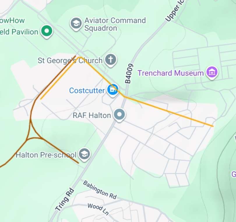
The Route of the Line
Leaving Wendover heading Northwest, trains serving the Halton RAF Station ran alongside the main line before turning away to the Northeast.
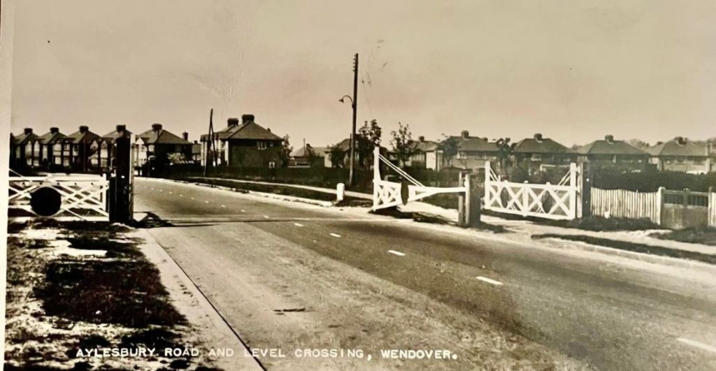
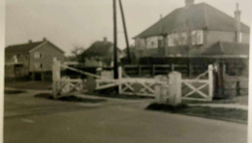
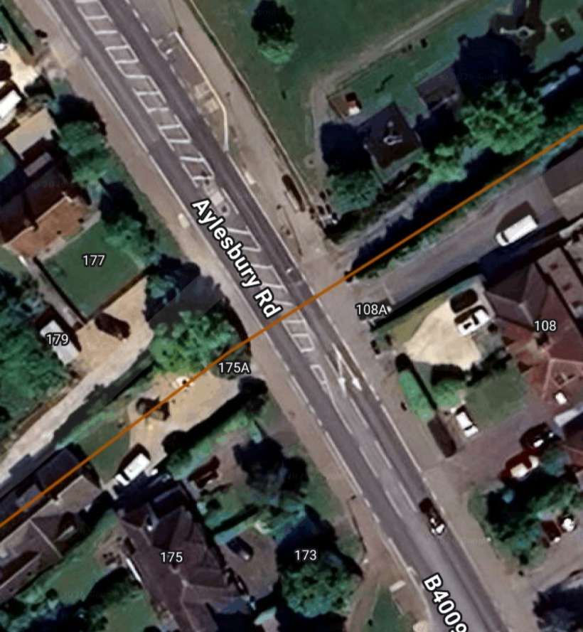
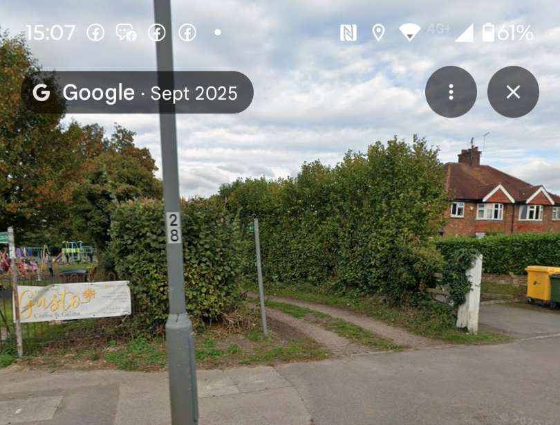
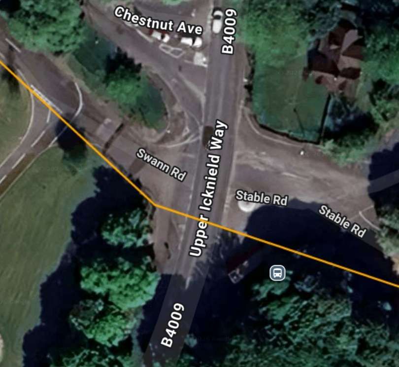
The line crossed Aylesbury road at a level -crossing. …
Further East the line crossed the Wendover Arm of the Grand Union Canal. …
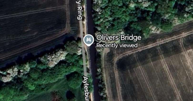
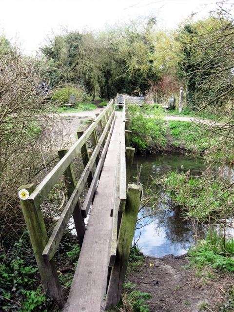
The Footbridge (Oliver’s Bridge) replacing the original railway bridge over the Canal. As is obvious, the footbridge is narrow-gauge, unsuitable for access for all, © Chris Reynolds and licenced for reuse in under a Creative Commons licence (CC BY-SA 2.0). [15]
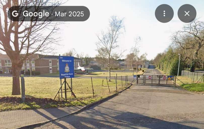
Beyond the Canal, the line turned Northeast before reaching RAF Halton where a station building and platform received and despatched trains. A fan of sidings sat to the right of the line.
A short length of 2ft-gauge line remained in use until it was closed in 1941. It sat to the Northeast of the sidings and crossed Icknield Way before coming to its terminus.
Locomotives
I have not been able to establish a locomotive roster for the RAF lines at Halton. One locomotive in particular was identified by Frank Jones in the 1960s. ….
Manning Wardle 0−4−0 saddle tank R.A.F. No.2 was photographed by Frank Jones, presumably after the closure of the branch line and after she had been through the hands of John F. Wake’s Geneva Engineering Works in Darlington. Frank Jones submitted a photograph of No. 2 to the Industrial Railway Record in October 1968. It can be seen here. [6]
Modelling
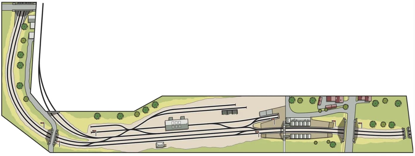
Hornby Magazine covered an OO-Gauge Model of Wendover Railway Station which included the first few metres of the branch line. The layout featured in the September 2018 edition of the magazine. [17]
The RAF Halton Branch is represented by the line at the centre of this image which has a very short train heading away along the branch. [17]
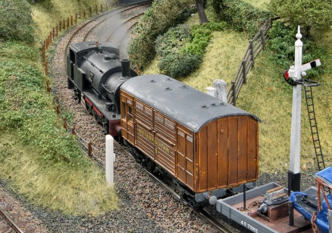
This image shows the branch locomotive which was a Manning Wardle 0-4-0ST heading for RAF Halton. [17]
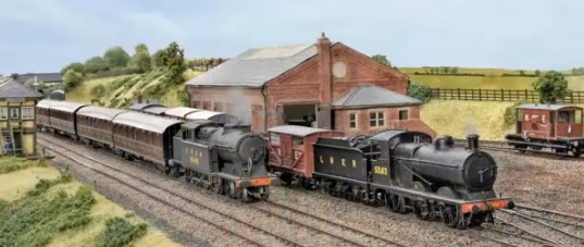
Wendover’s Goods Shed and Signal Box (shown here) sat immediately Southeast of the junction. [17]
References
- Clive Foxell; The Story of the Met & GC Joint Line; Clive Foxell, Chesham, Buckinghamshire, 2000.
- https://en.wikipedia.org/wiki/Halton_Railwayhttps://en.wikipedia.org/wiki/Halton_Railway, accessed on 13th March 2026.
- https://www.raf.mod.uk/our-organisation/stations/raf-halton, accessed on 13th March 2026.
- https://en.wikipedia.org/wiki/Wendover_railway_station, accessed on 13th March 2026.
- https://share.google/53r8ODIIX65bYAGnx, accessed on 13th March 2026.
- https://www.irsociety.co.uk/Archives/21/PP_21.htm, accessed on 13th March 2026.
- https://heritageportal.buckinghamshire.gov.uk/Monument/MBC24945, accessed on 13th March 2026.
- Andrew E. Adam; Beechwoods and Bayonets: The Book of Halton; Barracuda Books, 1983.
- http://www.ukairfields.org.uk/halton.html, accessed on 13th March 2026.
- https://www.britainfromabove.org.uk/en/image/EPW036323, accessed on 13th March 2026.
- https://www.ltmuseum.co.uk/collections/collections-online/photographs/item/1998-66276, accessed on 13th March 2026.
- https://commons.wikimedia.org/wiki/File:Wendover_railway_station_and_A413_road,_Wendover,_Buckinghamshire.jpg, accessed on 13th March 2026.
- https://www.ltmuseum.co.uk/collections/my-collections/simon-eccles/wendover-rail-collection, accessed on 13th March 2026.
- https://www.railmaponline.com/UKIEMap.php, accessed on 13th March 2026.
- https://www.geograph.org.uk/photo/1235766, accessed on 13th March 2026.
- https://signalbox.org/branch-lines/lets-wend-over-to-wendover, accessed on 14th March 2026.
- David Dan Givens; Wendover; Hornby Magazine, September 2018, via https://www.keymodelworld.com/article/wendover-oo-gauge-1930-lner-layout, accessed on 14th March 2026.
- https://www.facebook.com/share/p/1DXAafLM4i, accessed on 15th March 2026.
- https://www.facebook.com/share/p/1CAPnmd3ng, accessed on 15th March 2026.
- https://www.facebook.com/share/p/1DozKwvnab, accessed on 15th March 2026.
- https://www.facebook.com/share/p/18Ldav8tSn, accessed on 15th March 2026.
- https://www.facebook.com/share/p/1a586d1661, accessed on 15th March 2026.
