Category Archives: Railways and Tramways Blog

MOD Ashchurch and Ashchurch Railway Station

I was reading a book by Neil Parkhouse and looking at a series of photographs of the historic station at Ashchurch which was demolished as part of the fall out from the cuts associated with Dr. Breeching. Apart from feeling a sense of dismay that the original station and its building, together with the branch-lines it served, has been lost for ever, I noticed a reference to a siding serving MOD Ashchurch and decided to investigate. [1] …

DE&S Ashchurch, known locally as “Ashchurch Camp”, was the UK MOD’s primary vehicle storage and distribution site for all types of armoured and soft-skinned vehicles, together with Royal Engineer bridges, boats and construction plant. The Centre was the only vehicle depot in the UK using Controlled Humidity Environments (CHE) for long-term vehicle storage. [2]

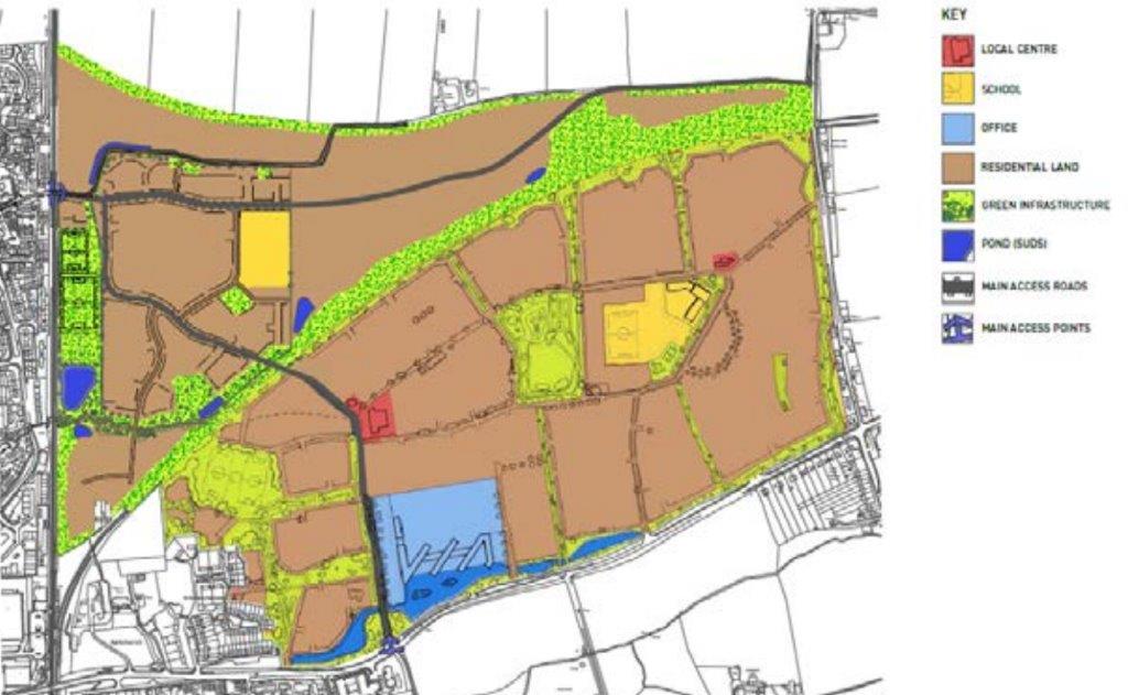
In March 2012, the UK MOD’s Defence Infrastructure Organisation confirmed its intention to consult publicly on proposals to redevelop ‘MOD Ashchurch’ for creation of a sustainable mixed use development, likely to include new homes, community and local retail facilities, a primary school, employment uses and open space. [2][4]

After this a campaign was fought to save the site and in 2015 the GMB Union reported that the site had been save and would remain in operation at least until 2025. [3]  However, continuing pressures on MOD budgets leave the position of the site uncertain. Atb present proposed developments are adjacent to the site but they indicate that pressure still exists in the locality for new housing. [5]

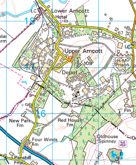
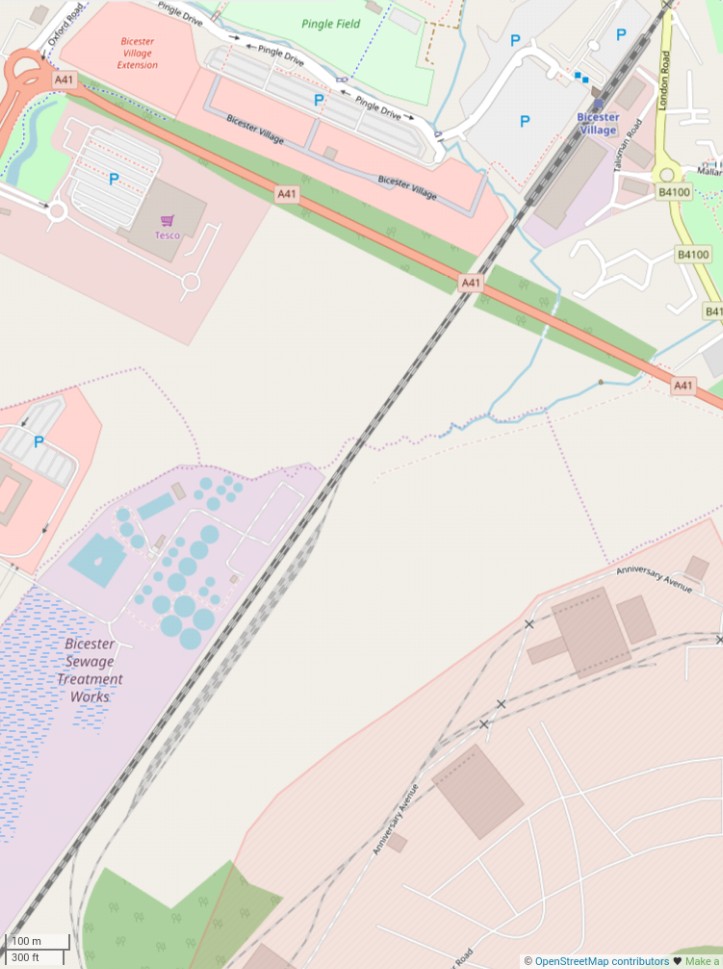
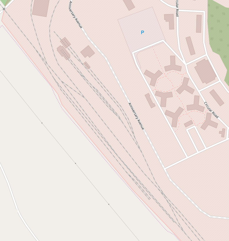
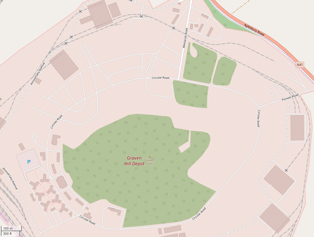
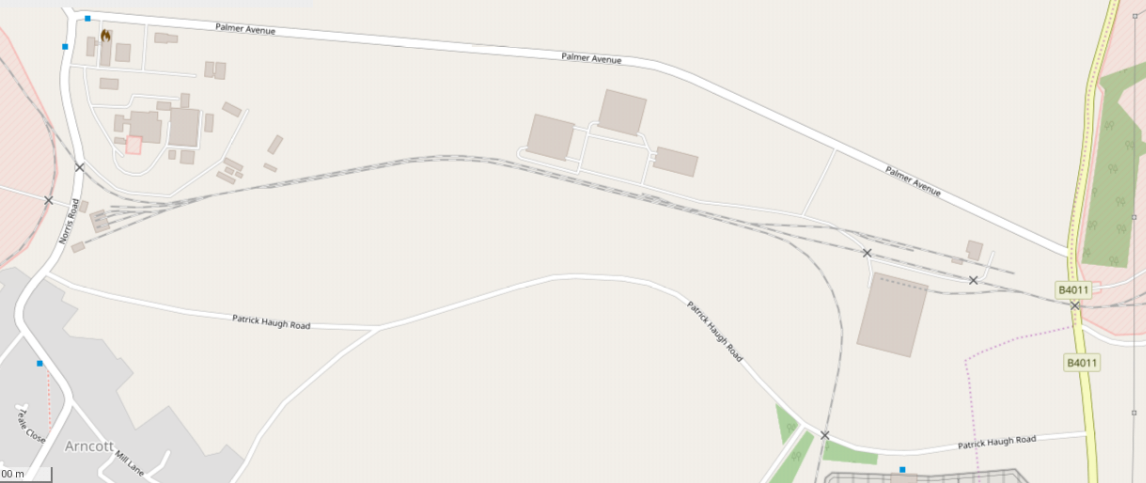
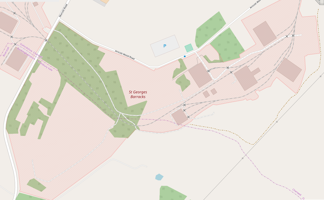
A rail link remains, as can be seen on the OpenStreetMap excerpt below.

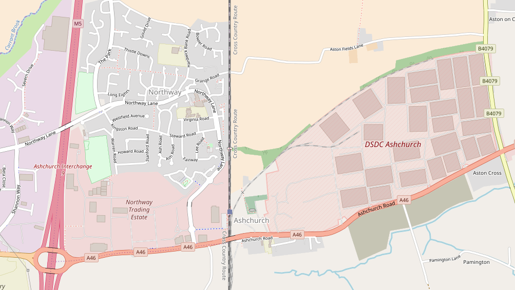
This blog provides some details of the history of the site and its rail link and inevitably covers some of the history of the railway station at Ashchurch.

Ashchurch Railway Station
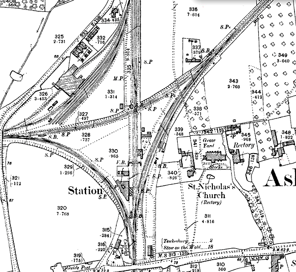
The 1902, 1:2500 OS Map of the station. The line to Tewkesbury leaves to the West, that which formed the relieving line via Evesham heads off to the East. The goods sidings enter at the top of the map and there is at at-grade crossing which makes a through route between the two branch-lines. MOD Ashchurch is off the map to the right. [6]
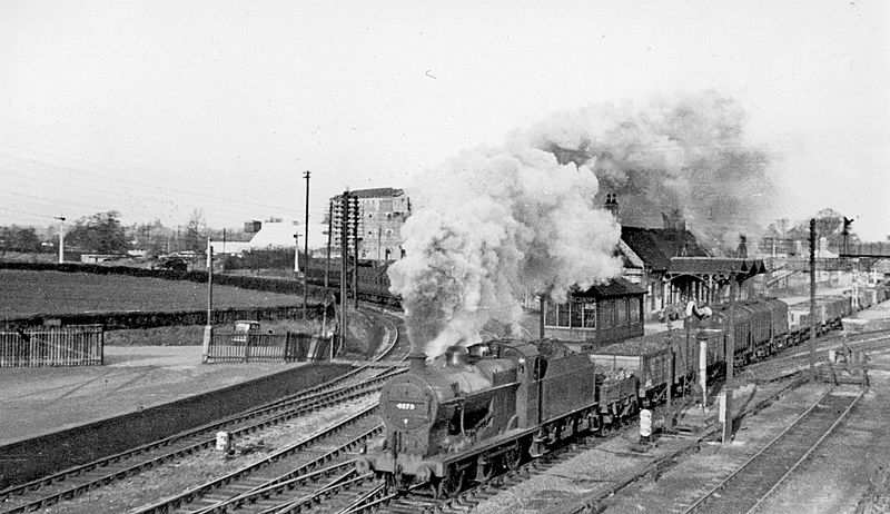
View looking Northwest of the ex-Midland Birmingham – Bristol main line, the Down freight being on the Down Main, headed by LMS 4F 0-6-0 No. 4272 (not yet renumbered). On the left is the branch to Tewkesbury and Great Malvern, with a train at the branch platform and its engine further left, running round. Out of view to the right is the line to Evesham, Redditch and Birmingham – also the Ashchurch Military Depot. Ashchurch Junction signalbox (rebuilt 10 years later) is in the centre, in the ‘V’ of the Up platform. To get onto the station platform, you had to use the level-crossing from the approach road to the left: the booking office etc. was on the Up platform, where there was also a privately owned Public House. Behind the smoke is the large Provender Store. This picture was taken on Christmas Eve 1948, (c) Ben Brooksbank. [8]
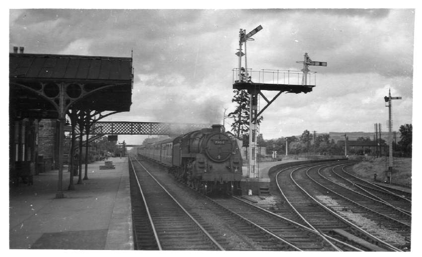
No. 73010 is on the main line in August 1952 and is heading towards Gloucester. The line curving off to the right leads to Evesham and the cottages on the far right can be seen in the third picture below, (c) D. J. Norton. A donation has been made to Ashtma UK to acknowledge the use of this photograph. [9]
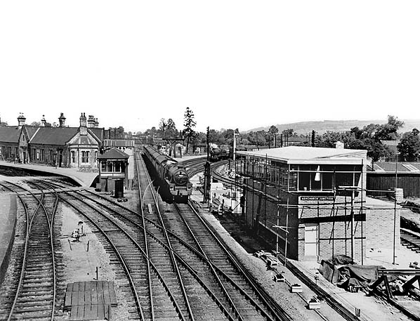
A view taken from the south of Ashchurch Station from A438 road bridge, in 1957 with the new signal box under construction. The 08.06 Sheffield – Gloucester express (hauled by a Class 5 4-6-0) is approaching. On right, the line to Evesham etc. (also the MoD Depot), with a GWR 2-8-0 waiting on a southbound freight. On left, the line to Tewkesbury and Malvern, with Ashchurch Junction signalbox in the V of the Up main and branch platforms. The new signal box will not open for another year and will last only until February 1969. (c) Ben Brooksbank. [10]
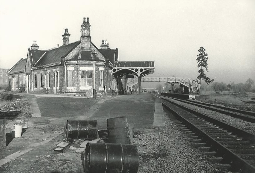
The station in January 1970 after the removal of both branch-lines, (c) Hugh Llewelyn. [7]
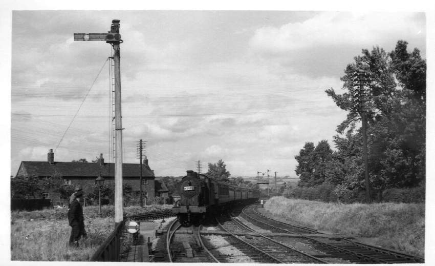
No. 44362 is approaching the station on the Birmingham & Gloucester Loop on 4th August 1952 on its way from Evesham. The line in front of the cottages leads to the at-level rail crossing on the map above. The line on the right provides access to the sidings for MOD Ashchurch, (c) D. J. Norton. A donation has been made to Ashtma UK to acknowledge the use of this photograph. [9]

Ashchurch Railway Station was opened by the Birmingham and Gloucester Railway on 24 June 1840. Later it became a part of the Midland Railway and later still the LMS. This was once a railway centre of some importance, as it was the spring-off point for two branches, one each side of the main line.

The Evesham line was actually a lengthy loop serving Evesham, Alcester and Redditch, re-joining the main line at Barnt Green, near Bromsgrove. This line closed between Evesham and Redditch on 15 October 1962 due to poor condition of the track, while Ashchurch to Evesham followed on 17 June 1963 (Redditch to Barnt Green remains open on the electrified Birmingham suburban network).

The line to Tewkesbury, Upton-upon-Severn and Malvern, closed beyond Upton on 1 December 1952, Ashchurch to Upton following on 14 August 1961. At this time Ashchurch station was renamed Ashchurch for Tewkesbury, but it too was to close, on 15 November 1971, reopening on 1 June 1997 as a through station.

There used to be a connecting curve linking the two branches, crossing the main line on the level just north of the station, creating a layout which may have been unique in Britain, but this curve closed in December 1957. There was an extensive goods yard to the south and another to the north, and to the north west a large grain store.

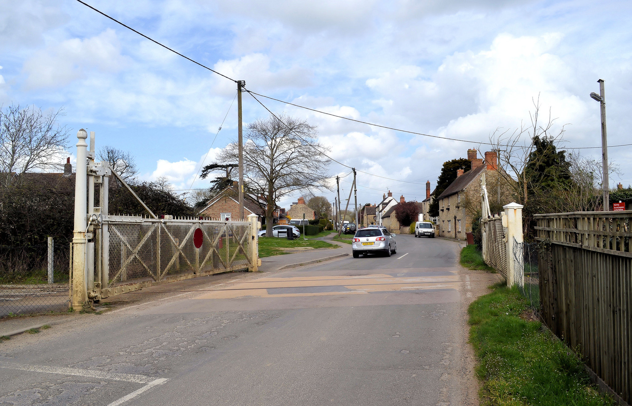
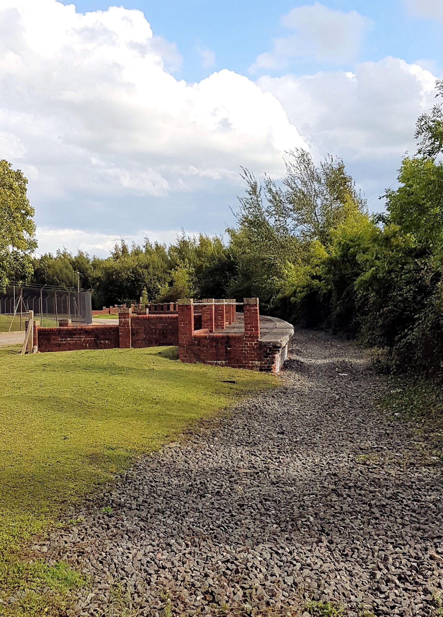
The remains of the old line are still apparent, in places, with much of its infrastructure in existence. The old connecting curve and the two branches it served could be clearly be traced on a map as late as 2007. With much of the Ashchurch to Tewkesbury line now being used as a Segregated Cycle Path and Footpath, this section proved valuable during the 2007 floods as it was the only dry route into, and out of, Tewkesbury at the time. [2] Much of the station site has been built over and we are left with a new incarnation of the railway station with no real character.

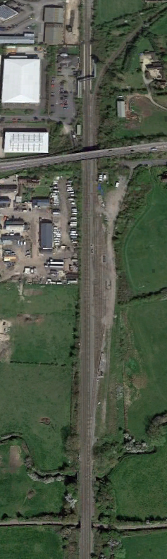
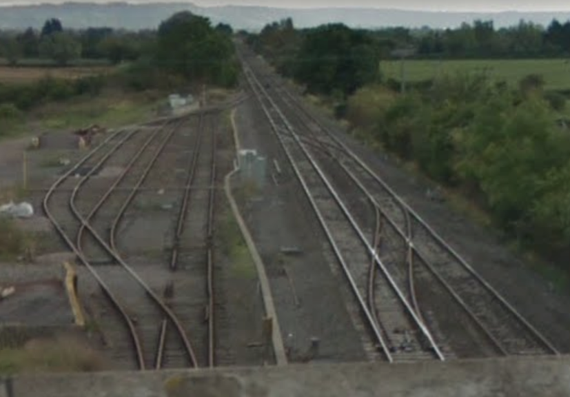
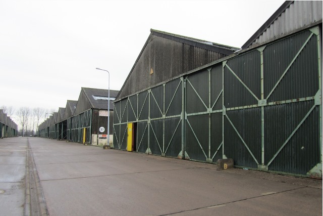
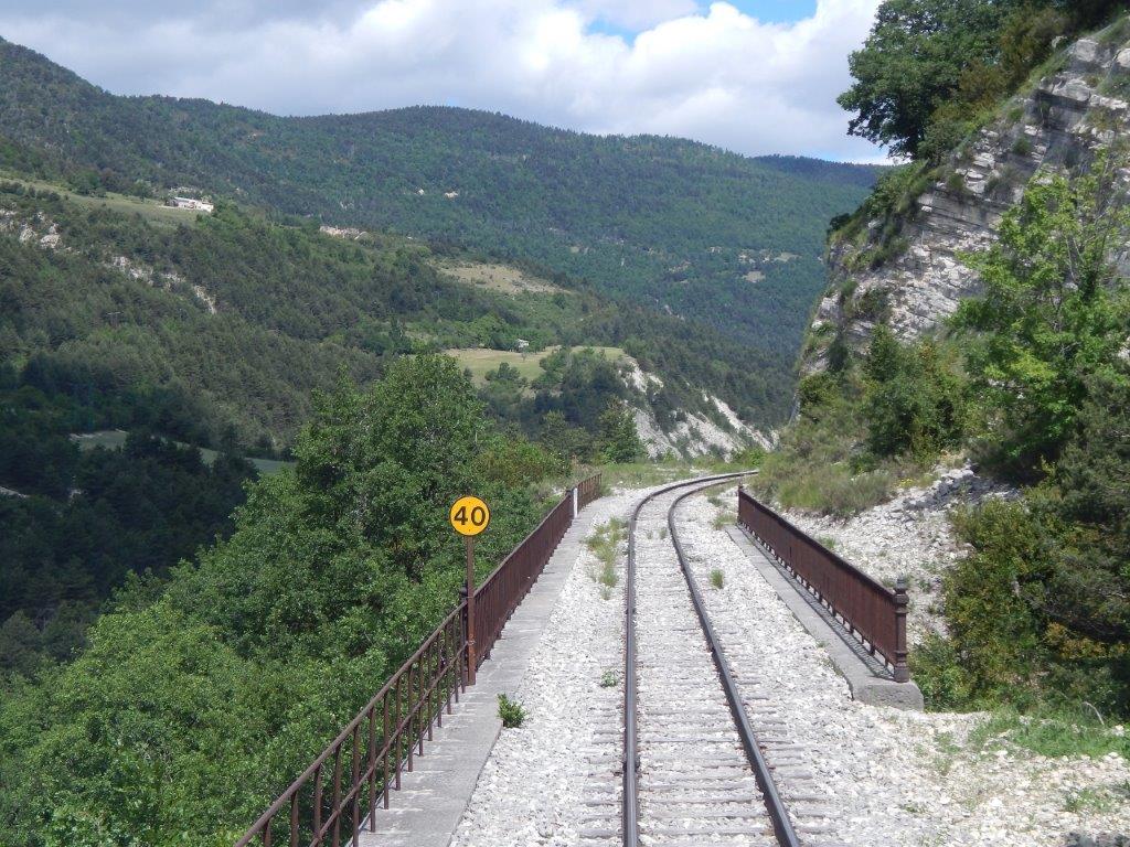
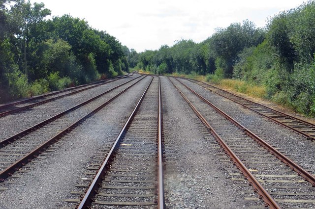
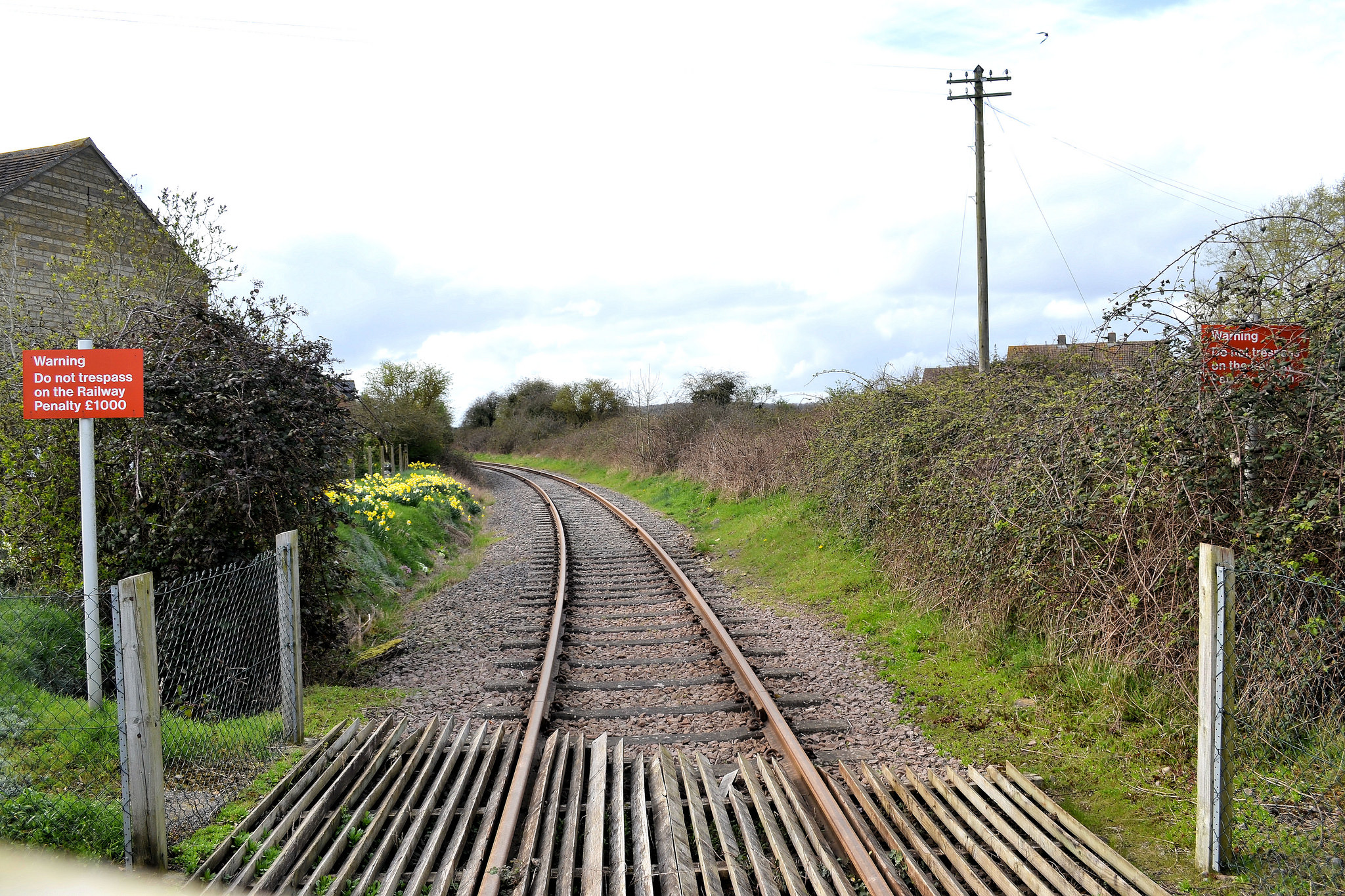
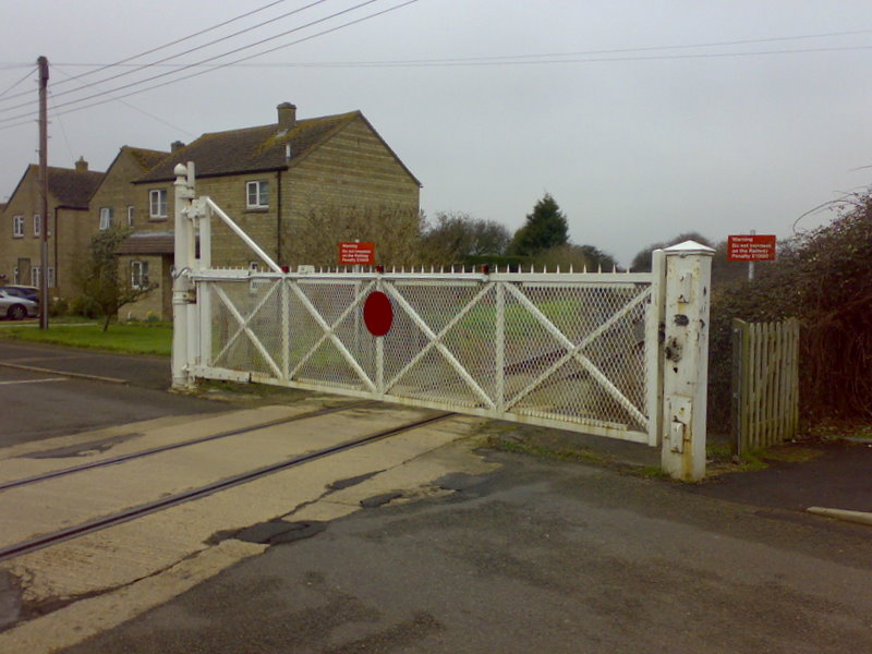
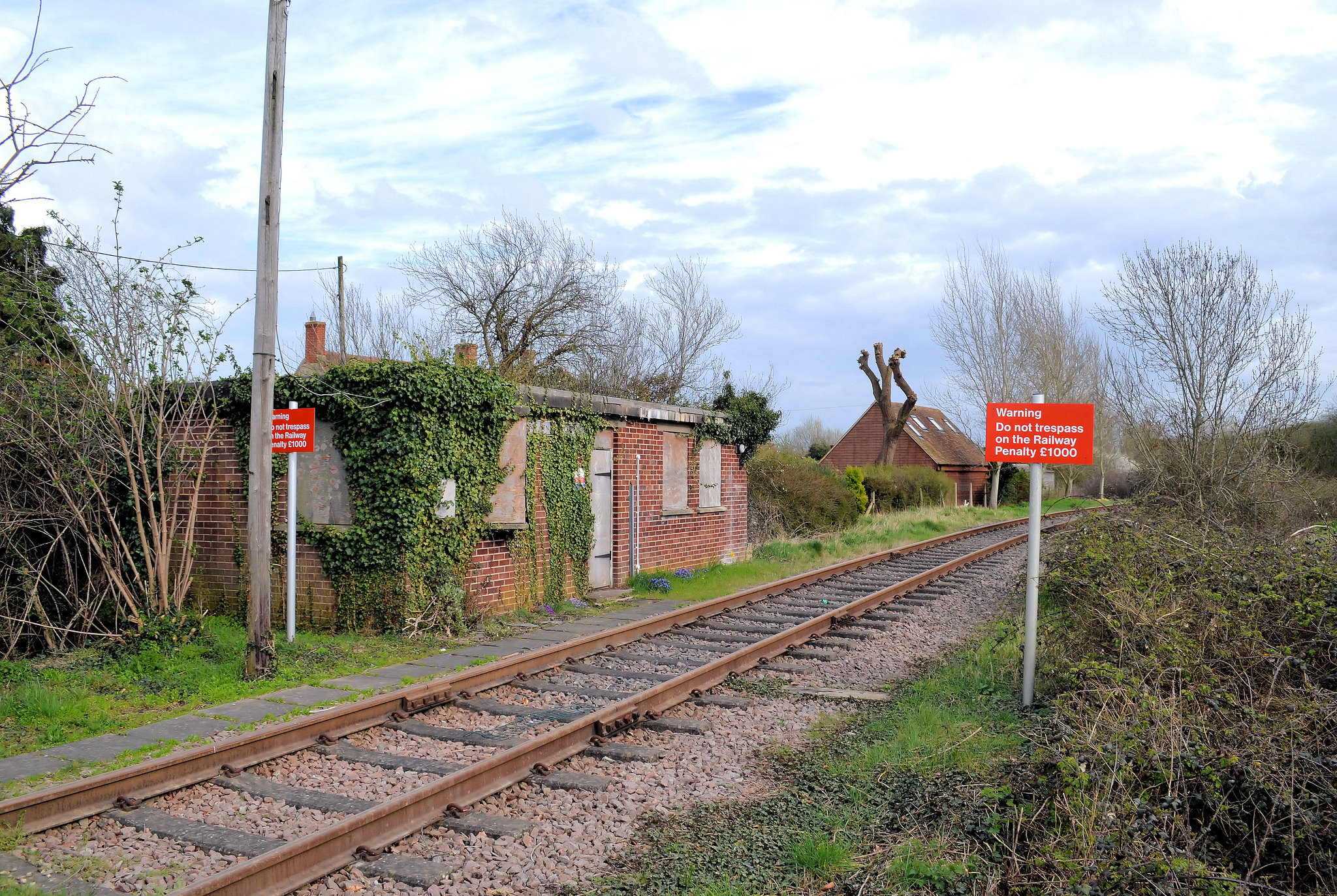
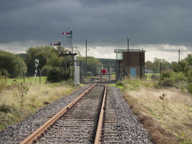
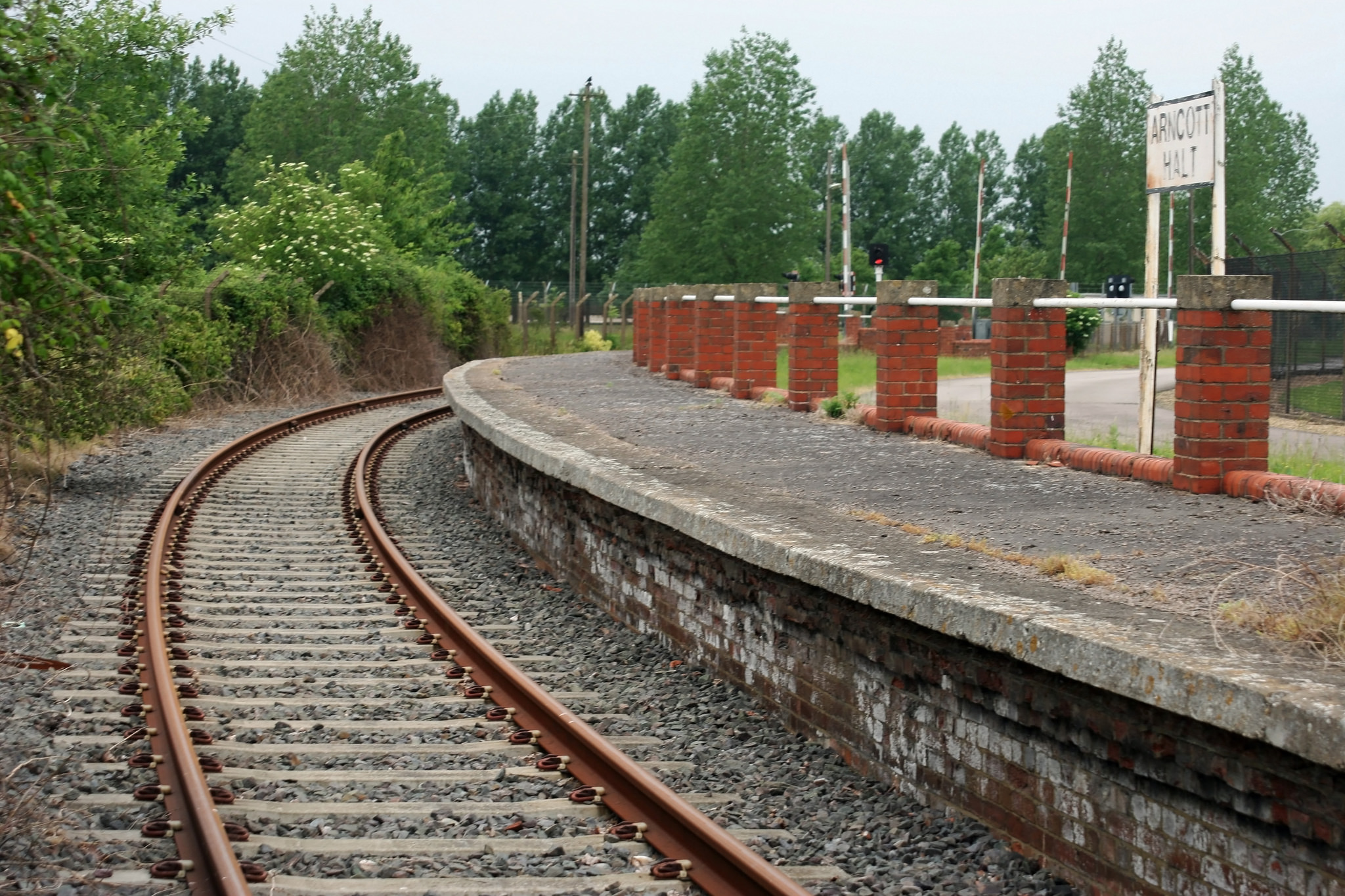
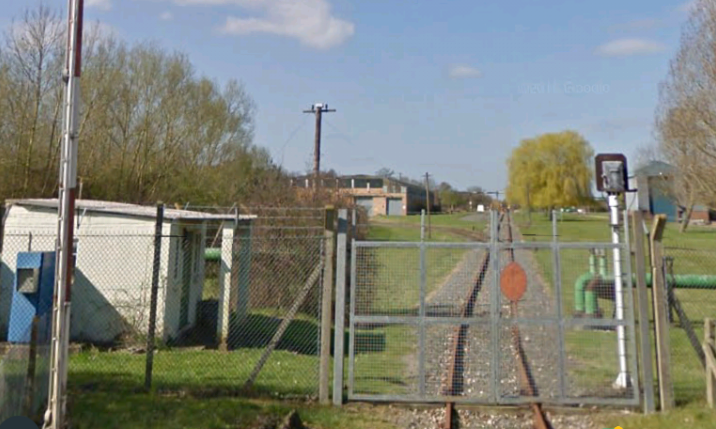
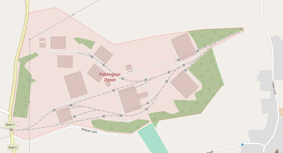
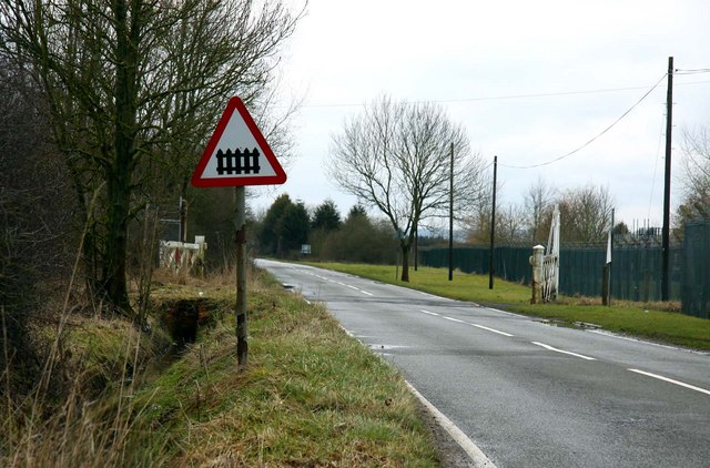
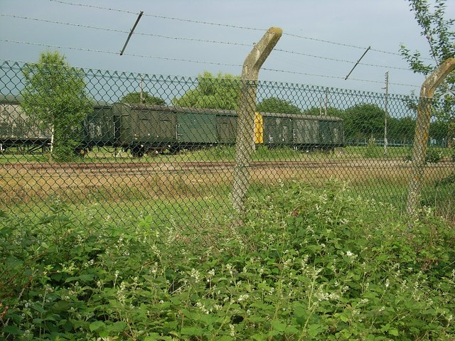
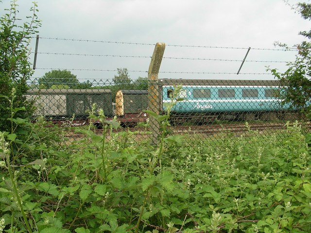
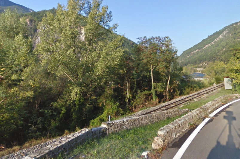
An access siding to MOD Ashchurch remains, together with exchange sidings alongside the main line. In the image below, the single-track to the right of the mainline leads to the army depot. The exchange sidings are to the south of the road bridge on which the photographer is standing.
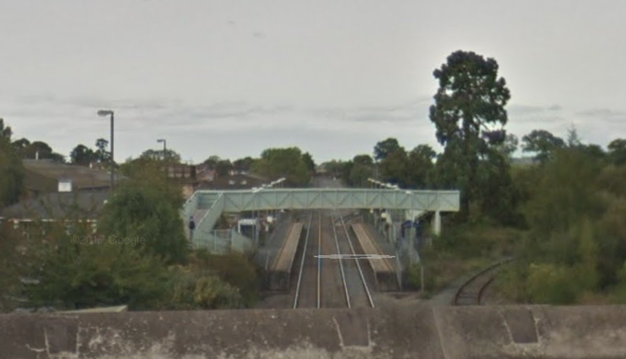
MOD Ashchurch’s Exchange Sidings to the south of the present A46.

MOD Ashchurch

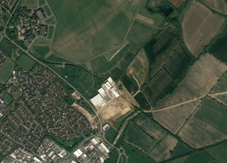
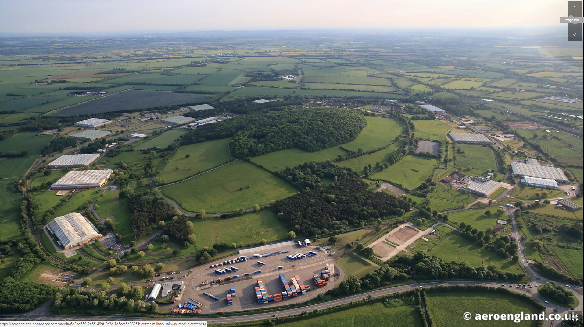
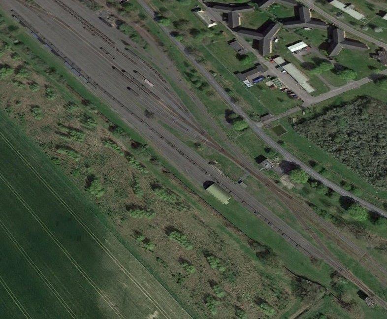
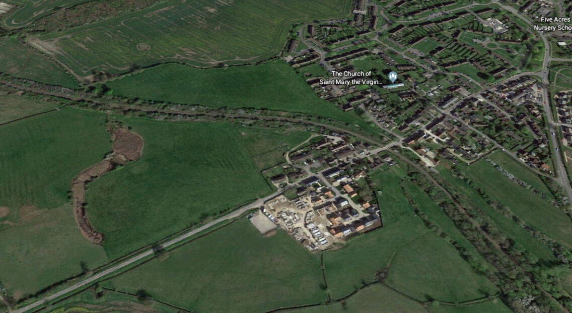
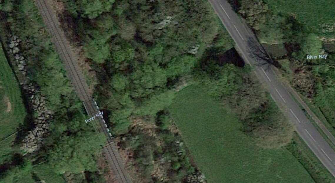
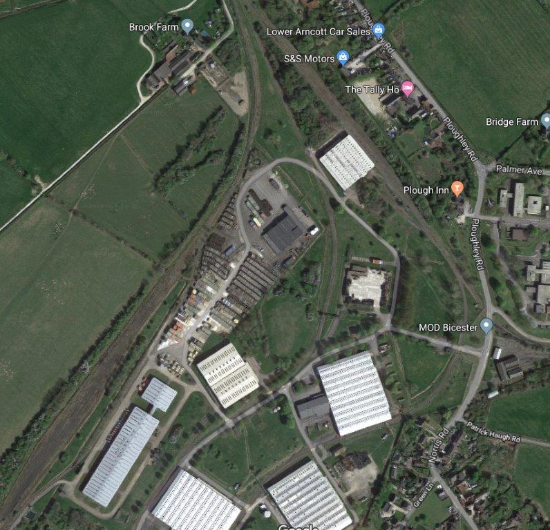
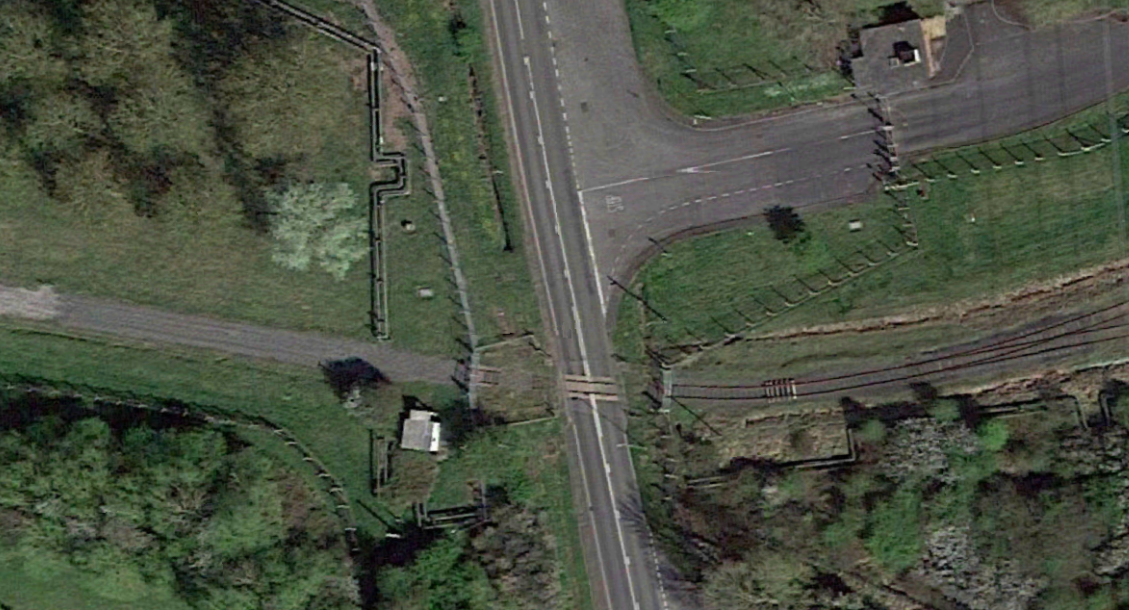
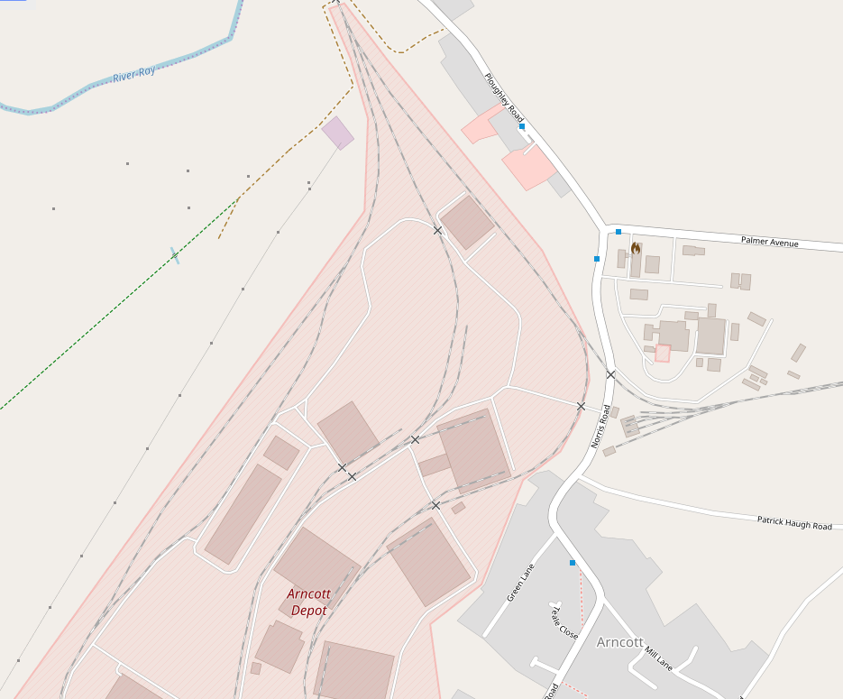
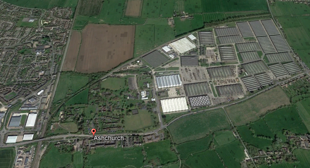
This satellite image shows the full extent of MOD Ashchurch and the rail access which can be seen curving away from the present Ashchurch Railway Station across the north side of the depot. The old Evesham line continues beyond the extent of the depot as a defined line of vegetation across the fields the two images below are pictures take looking first west, then east from the B4079 which forms the eastern boundary of MOD Ashchurch.
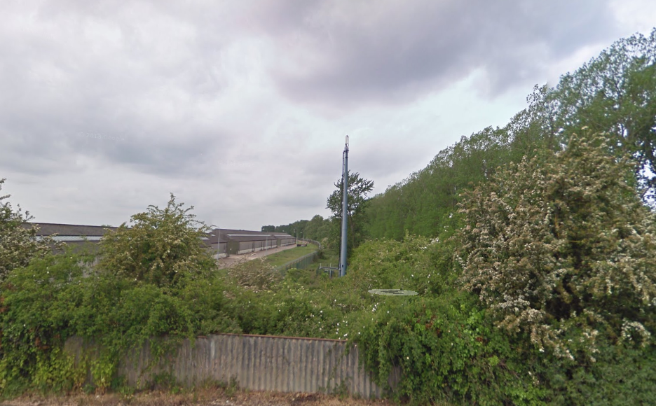
Looking West from the B4079 along the north side of MOD Ashchurch.
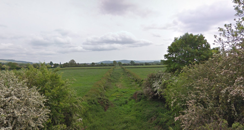
Looking East from the B4079 along what was the railway line to Evesham.

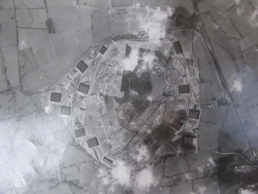
MOD Ashchurch was confirmed as an Army depot in 1939 and is visible under construction on aerial photographs taken in 1940. On aerial photographs taken in 1943 it comprised eleven very large rectilinear vehicle storage and repair buildings that measure between 90m and 122m wide and between 97m and 147m long. A number of long narrow buildings are dispersed between them, plus a number of separate circular possible fuel stores, protected by flat-topped mounds which measure circa 12m in diameter. The buildings were painted with camouflage patterns during World War II. [11]

A large rail terminus was situated to their north-east, around SO 9393 3408, but this was replaced with more large rectangular buildings by 1954. Railway tracks also formed a loop through the buildings and around the rail terminus and are connected to the main line at SO 9296 3375, with additional sidings at SO 9333 3383. A large number of assorted vehicles and other equipment were parked in rows between the railway tracks and the buildings, and in large spaces at SO 9347 3372, SO 9365 3366 and SO 9385 3367. [11]

The site has continued in use as a military vehicle depot and in 2005 was the Ministry of Defence’s primary vehicle storage and distribution site, known as Defence Storage and Distribution Centre (DSDC) Ashchurch. In Summer 2016, relocation of the depot was being considered. Ashchurch and its sister site in Mönchengladbach, Germany were the 2 major “controlled humidity storage” sites preserving vehicles and kit for all three the Services, but government wanted to close both by 2018. [12]

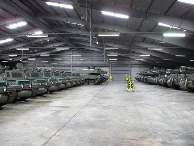
Broadly, the construction of the depot may be divided into two phases, wartime and early 1950s post-war expansion. Construction work began shortly after the outbreak of the Second World War and building work is visible on 1940 aerial photographs. By 1943 building work was complete and the depot comprised eleven large storage and workshop buildings, a large rail loading areas to the north, and barrack accommodation to the west (SO 93 SW 115). A ring of light anti-aircraft guns defended the depot and other defence sites in the vicinity, sites (SO 93 SW 108, 109, 117 and 126, and SO 93 SE 65). [11]

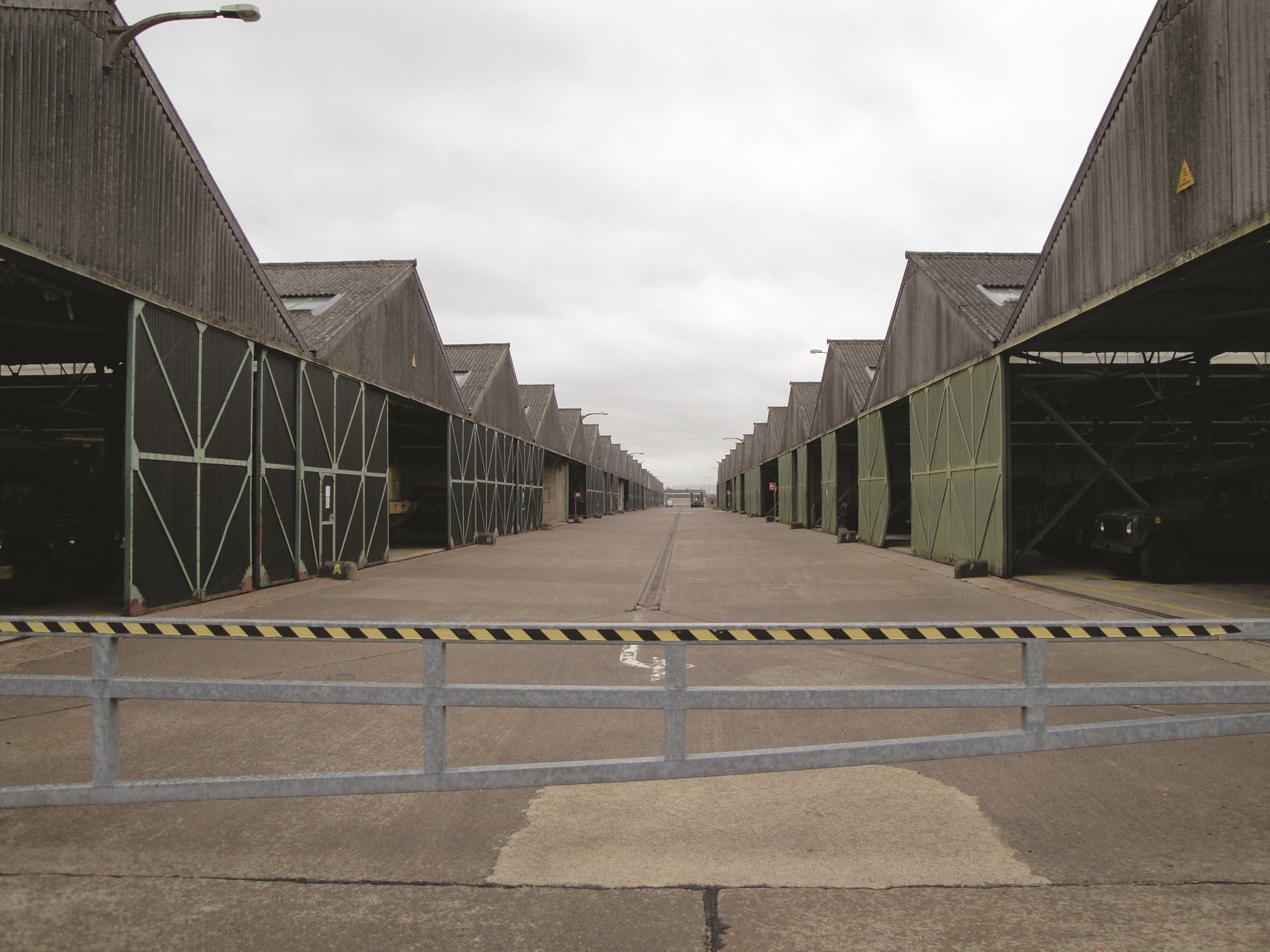
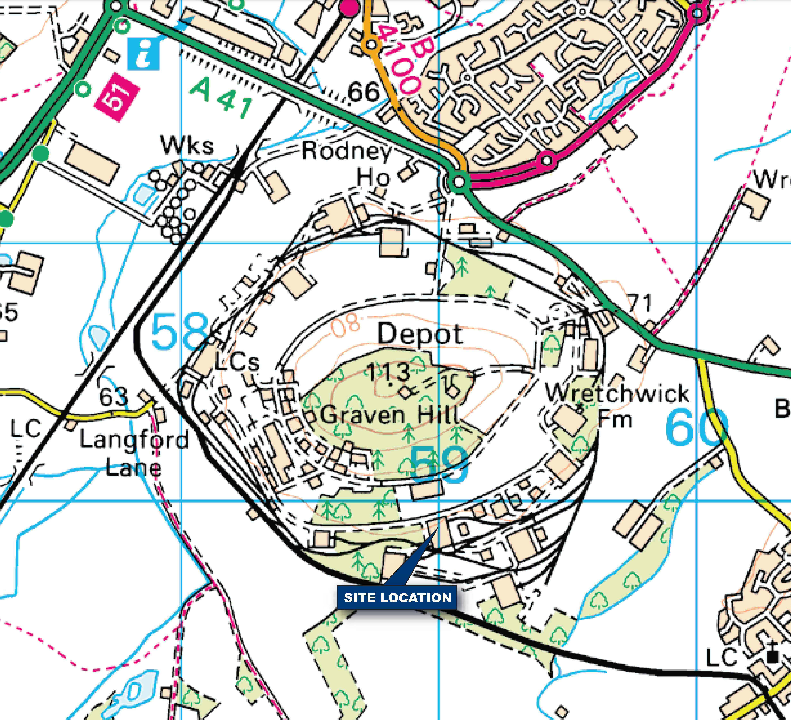
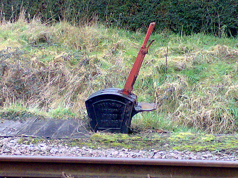
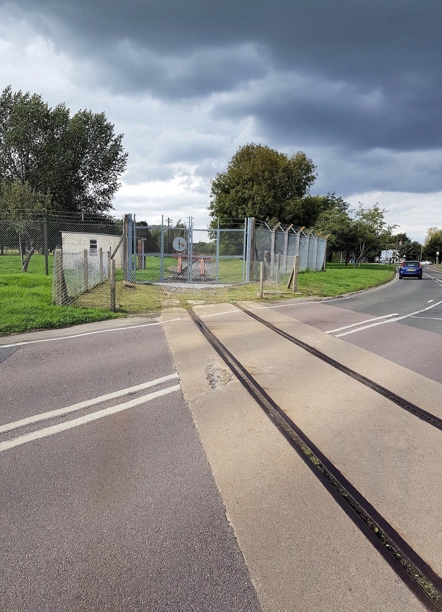
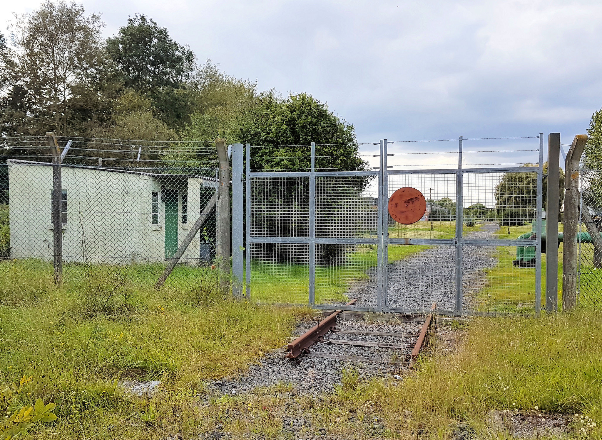
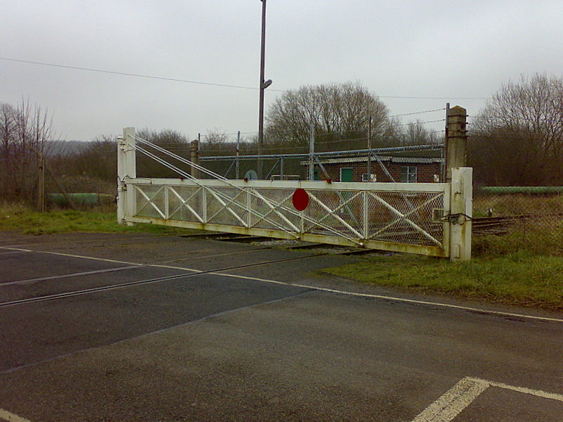
The adjacent Ashchurch railway junction was one of the reasons why the depot was located here and in the event of damage to one of the lines trains could easily be rerouted. When this line was closed in 1964 a section was left in place to serve the depot. Today a siding leads to a loading area where vehicles may be driven directly on to flatbed rail wagons and the transport and loading area. [11]

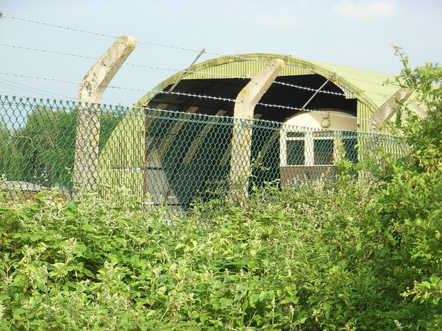
The depot was originally entered through four gates off the A46, three of these are now closed and it is entered from a single western entrance, Austin Road that leads to the guardroom. Functionally, the depot may be divided into two uneven areas. To the west of Austin Road is an essentially domestic and administrative area with two playing fields, the one to the south has a 1960s sports club on its north side (SO 93 SW 115). To the west of this playing field is a small, post-war service housing estate known as St Barbara’s Barracks. To the north of the guardroom and west of the main approach road is the unit headquarters, a NAAFI, barrack accommodation, and at its northern end a small maintenance area. To the north are also a handful of timber wartime huts, remnants of a once far larger camp. [11]

At the northern end of the main approach road is the triangular transport and loading area. A railway siding enters here from the branch line to the west and is today served by a travelling crane. 
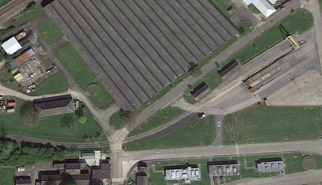
Along the southern side of this area, Churchill Avenue, are three, single storey, brick buildings, with steel Crittall-style windows and flat concrete roofs with raised clerestory lights. These were originally gas decontamination buildings and in the event of a poison gas attack would have provided changing and washing facilities for the workforce. On the northern side of the loading area are two less substantial wartime buildings constructed from hollow clay blocks: a wartime measure to economise on clay and fuel. [11]

To the north and east of the main approach road are 11 large wartime maintenance and storage sheds and smaller ancillary buildings. Two types of shed were built. To the north are four steel framed sheds with brick walls, which are lit by northlight roofs. The provision for good lighting in these buildings may suggest that they were used for maintenance activities. Along the side walls of these buildings are integral brick air-raid shelters. Most have been stripped, although at some their entrances traces of the sloping support for the anti-gas curtains may be seen. Internally, a few retain wooden bench seats along their walls and emergency bulkhead lights. The remaining eight large sheds are also steel-framed with brick walls, but these have hipped, corrugated asbestos sheet clad roofs illuminated by glass roof lights. These buildings are entered from either end of the aisles through pressed steel folding doors. Between some of the buildings are large open spaces that were used for marshalling vehicles or storage, at the centre the largest of these is known as Liaison Square. [11]

Between the main store sheds are a variety of smaller brick ancillary buildings and as described above, some, such as, the administrative offices are built from wartime hollow bricks. Other smaller workshop and stores buildings are brick-built with hipped roofs.

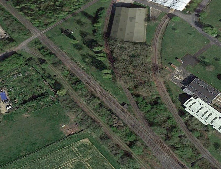
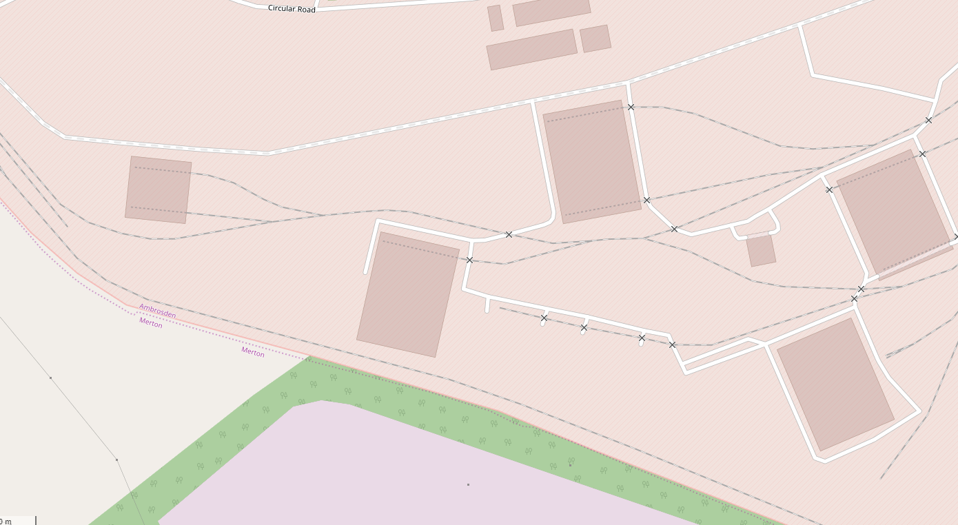
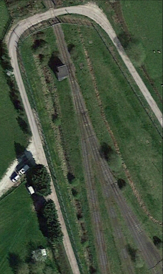
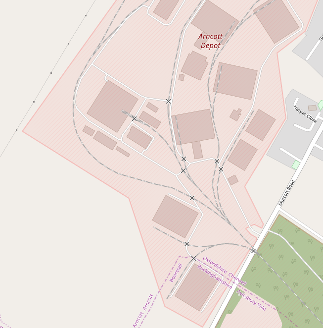
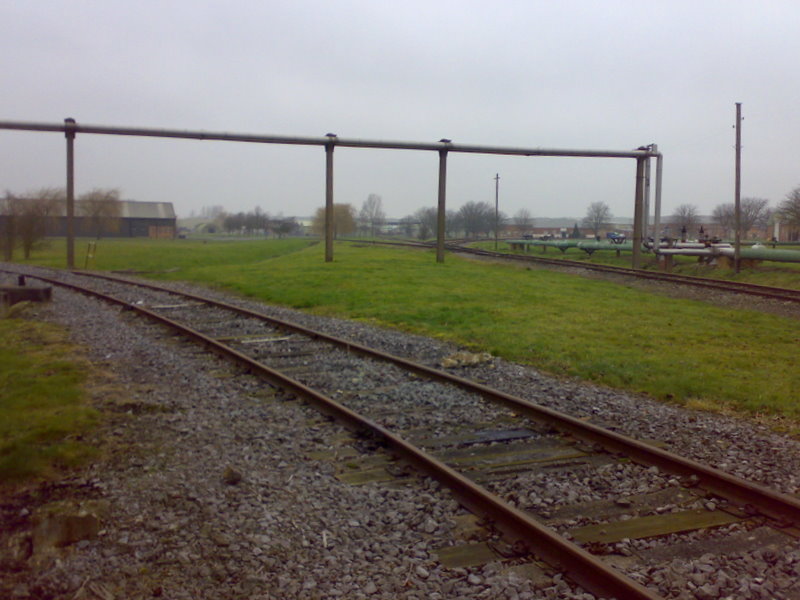
During the war extensive railway sidings and open storage areas covered the northeast part of the site. By 1954, this area had been covered by a further 14 large storage sheds. These are steel framed structures comprising standard gabled aisles arranged in different number configurations. The external walls appear to be infilled with low breeze block walls to about 1m in height and above by corrugated asbestos cement sheeting, this is also used for the roofs, which are lit by glass roof lights. The buildings are entered from either end through sliding steel-framed doors clad in corrugated metal sheets. Also built at this time was the double-storey structure with a gabled roof set adjacent to the A46. This is also steel-framed with low concrete, or cement rendered, walls at its base and the upper part is clad in corrugated asbestos cement sheets with horizontal glazing bands. [11] 
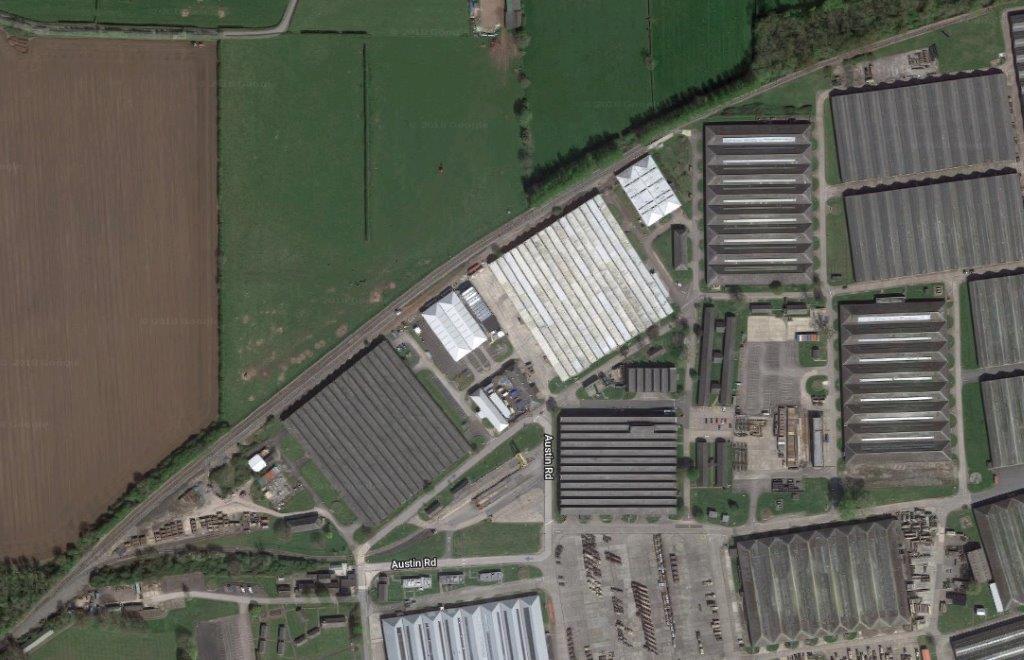
The main sidings are shown on this satellite image along the northwest boundary of the depot.
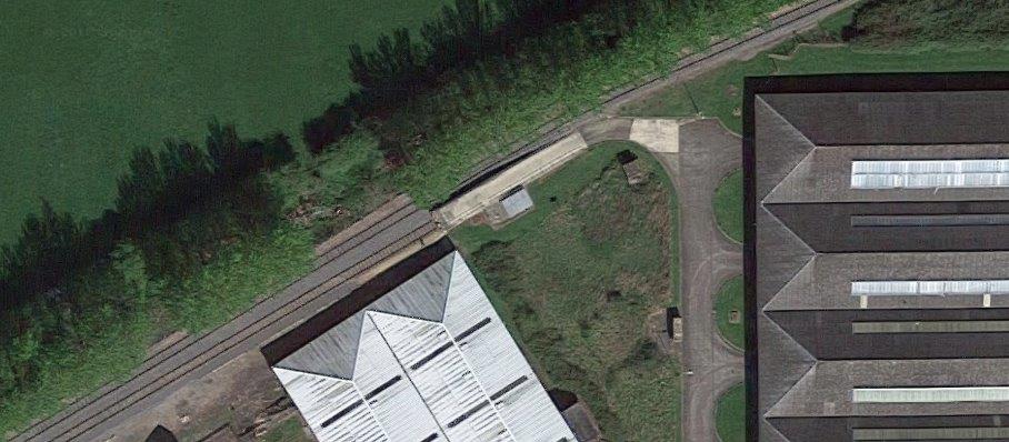
One end-loading platform was provided at the depot to allow vehicle to roll on or roll off wagons.

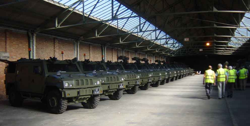
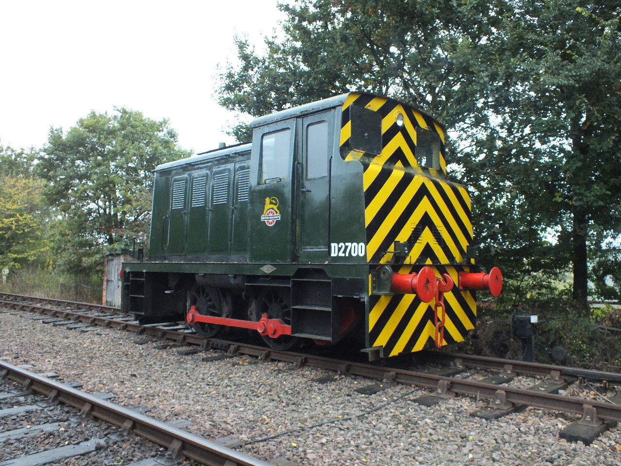
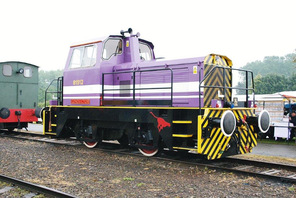
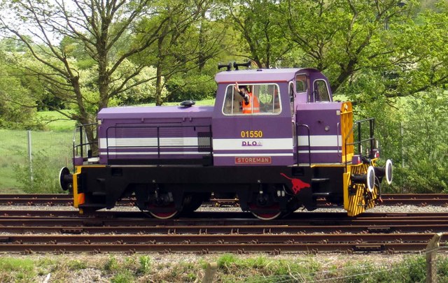
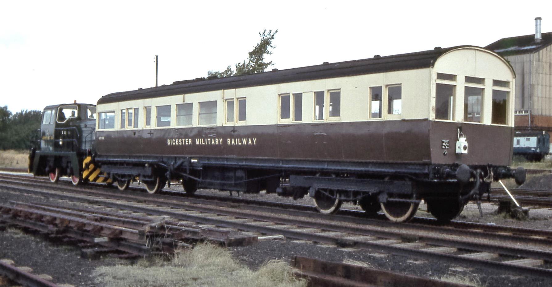
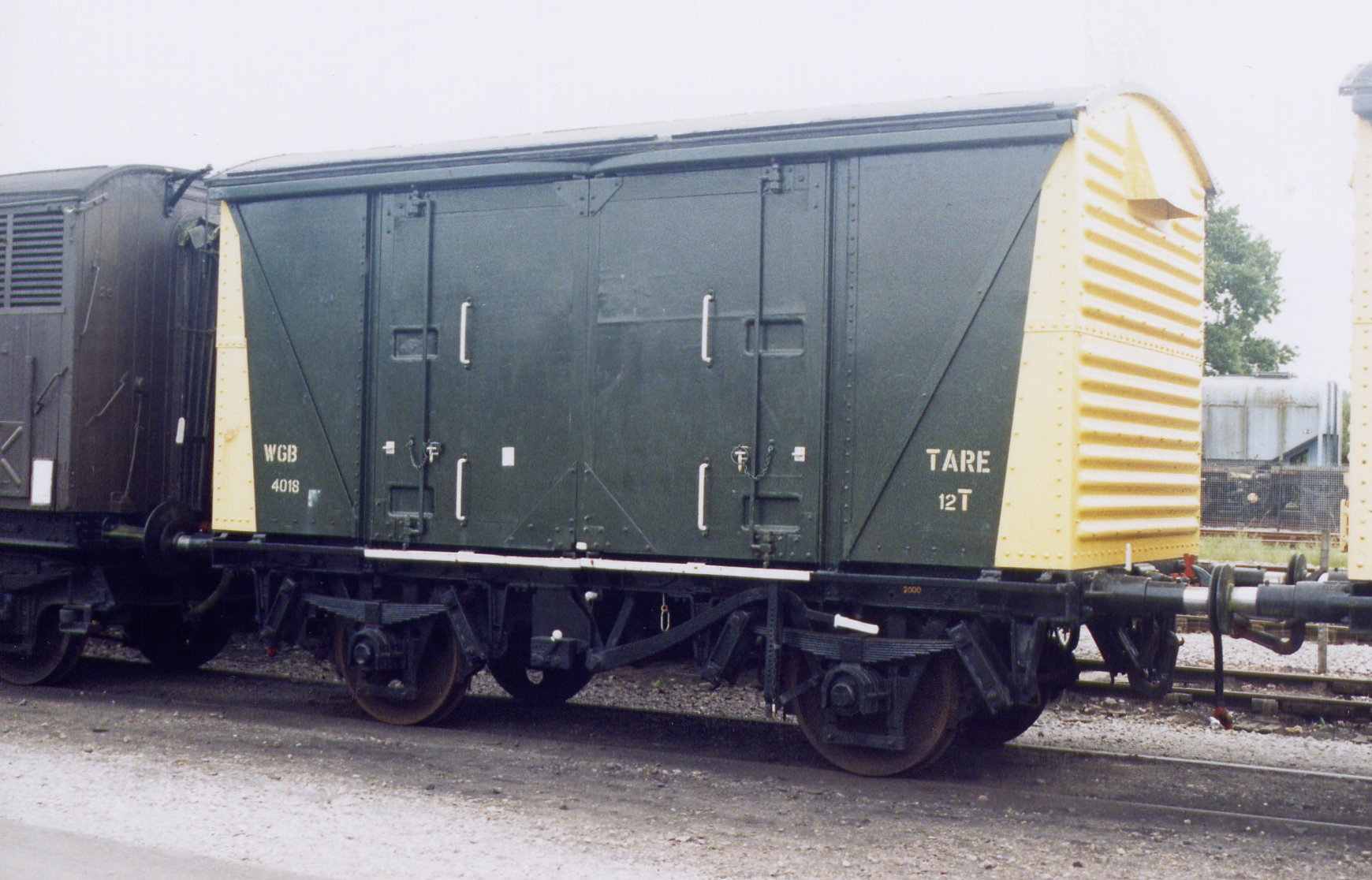
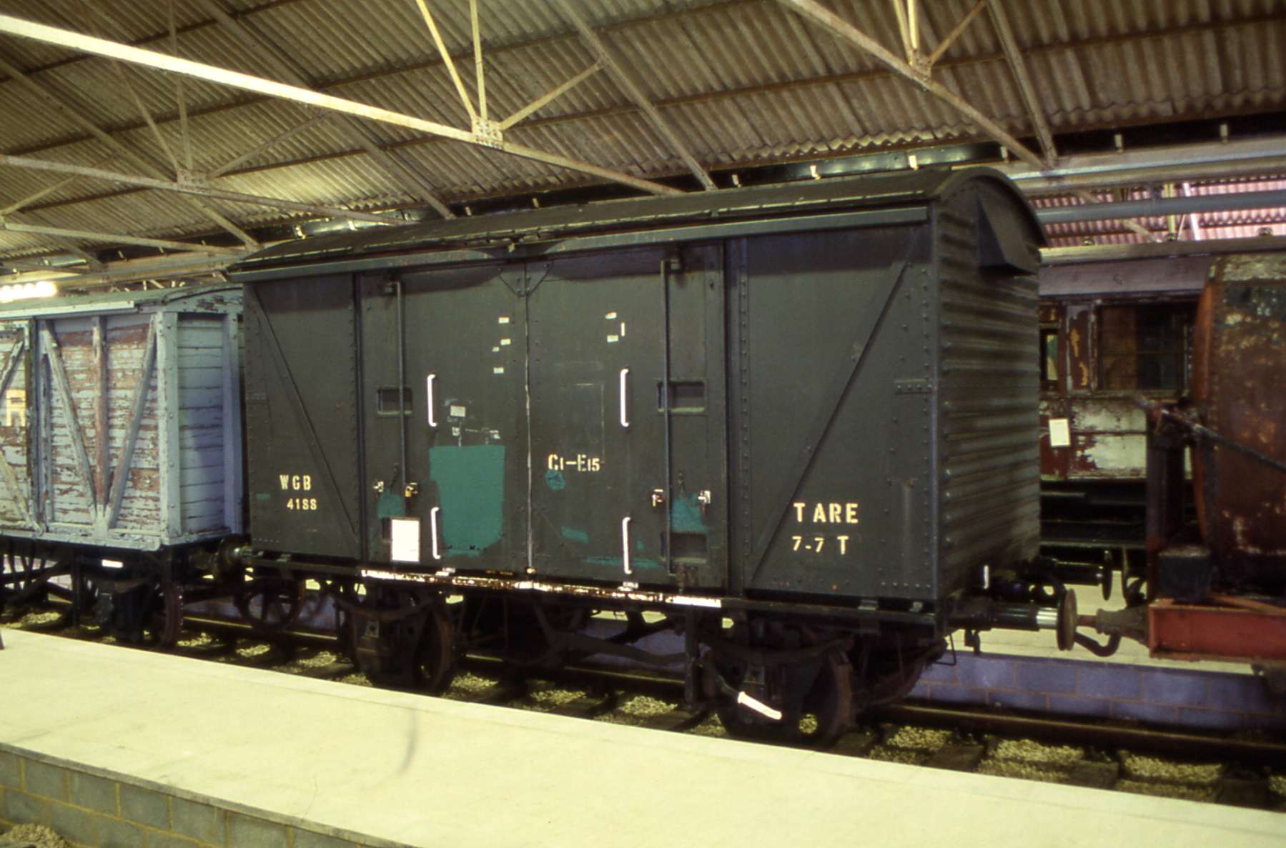
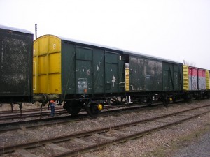
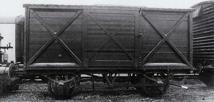
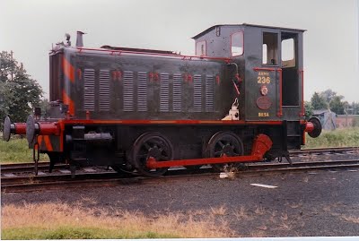
A few images taken withing the site of MOD Ashchurch follow below. The adjacent image shows Andrew Barclay 0-4-0D ARMY 236 in excellent order during the 1980s and based at Ashchurch. The image immediately below shows warflats in the sidings at Ashchurch. [14] 
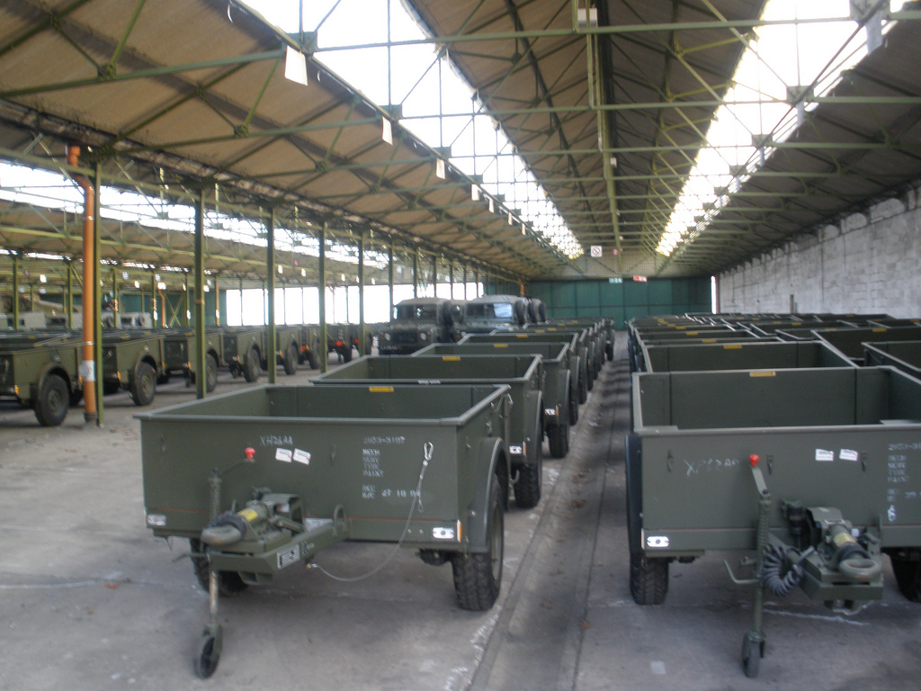
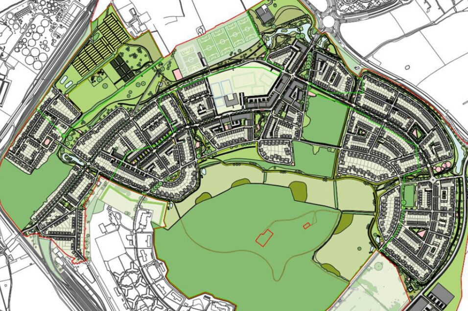
MOD Ashchurch’s future is uncertain. Cheltenham, Gloucester and Tewkesbury Councils have included the site for housing in their Strategic Allocation for redevelopment as housing. [13]

References

  1. Neil Parkhouse; British Railway History in Colour, Volume 3: Gloucester Midland Lines Part 1: North; Lightmoor Press, Lydney, 2017. (http://lightmoor.co.uk/books/gloucester-midland-lines-part-1-north/L8184).
  2. https://en.m.wikipedia.org/wiki/Ashchurch, accessed on 4th August 2018.
  3. http://www.gmb.org.uk/newsroom/mod-ashchurch-saved, accessed on 4th August 2018.
  4. https://www.telegraph.co.uk/news/uknews/defence/9088261/MoD-considers-moving-6000-tanks-and-military-vehicles-to-Germany.html, accessed on 4th August 2018.
  5. https://www.gloucestershirelive.co.uk/news/cheltenham-news/8million-windfall-could-lead-more-1167508, written on 5th February 2018, accessed on 4th August 2018.
  6. http://www.disused-stations.org.uk/a/ashchurch, accessed on 4th August 2018.
  7. https://www.flickr.com/photos/camperdown/8446048076, accessed on 4th August 2018.
  8. https://commons.wikimedia.org/wiki/File:Ashchurch_13_railway_station_geograph-2188680.jpg, accessed on 4th August 2018.
  9. http://www.photobydjnorton.com/Stations/Ashchurch.html, accessed on 4th August 2018.
  10. https://commons.wikimedia.org/wiki/File:Ashchurch_for_Tewkesbury_train_station_1738932_243ca718.jpg, accessed on 4th August 2018.
  11. http://www.pastscape.org.uk/hob.aspx?hob_id=1439231, accessed on 4th August 2018.
  12. http://ukarmedforcescommentary.blogspot.com/2015/11/a-last-summary-two-weeks-from-sdsr-day.html, accessed on 4th August 2018.
  13. http://www.gloucester.gov.uk/resident/Documents/Planning%20and%20Building%20Control/EvidenceBase/City_Plan_Evidence_2017/Infrastructure_Delivery_Position_Updates_MOD_Ashchurch_2016.pdf, accessed on 4th August 2018.
  14. https://sites.google.com/site/gloucestershirerailwaymemories/home/ashchurch/ashchurch—a-rural-railway-rendezvous, accessed on 4th August 2018.

Nice to Digne-les-Bains Part 7 – Annot to Meailles (Chemins de Fer de Provence 71)

Our journey along the Nice to Digne line recommences at Annot. We are halfway between Nice and Digne. My memory of travelling on the line is that Annot was touted as being an excellent destination when travelling from Nice, to allow access to mountain walking. A little research shows that to be the case. The map below is a copy of the hiking route map which includes an extensive range of walks. The “.pdf” from which it is taken can be accessed by following the link in the references at the bottom of this post. [1] The train we travelled on through Annot to Digne in 2001 was full of hikers who left the train at Annot.It will also be evident from the above map that the line has left behind the department of Les Alpes Martimes and is now in the Alpes de Haute-Provence. The Tramway from Pont de Gueydan northwards (https://rogerfarnworth.wordpress.com/2018/07/25/tam-tramway-from…r-de-provence-69) followed the approximate boundary between the two departments.

Annot is in the valley of La Vaire. Its station is on the valley side to the southeast of the town centre. [2]

Annot is located on the edge of Mercantour National Park, it was founded on a small hill and surrounded by wooded mountains, the village which dates from the 11th century, has little by little spread along the banks of La Vaïre. The old village is built in sandstone. Immense boulders of this rock (sometimes more than 100 metres high) can be seen at close quarters by following the “Chambre du Roi” waymarked circuit. Some of these rocks can be seen in the background of the image below.The viaduct seen from beyond the village. [3]A view of Annot from further to the southwest. [4]Annot from above. the railway can be seen crossing the viaduct behind the town. Annot railway station is just off picture to the right. [5]

OpenStreetMap provides an excellent cartographic image of the town, station and viaduct. The railway can be picked out easily as a black line to the east and north of the town. [6]

So, we return to the railway station and prepare to leave travelling North, initially, towards Digne-les-Bains.

The pictures immediately below are taken at the station. The first shows the most modern trains on the line and the carriages of the Steam service. [7]An older railcar (autorail) and the steam service waiting at Annot Station. [8]A modern train approaches the throat of Annot station from Digne while the “Portuguese” Steam Locomotive waits in the station. [9]The three images above show Annot station in its very early days. [16]

Our train sets off from Annot. The next few images give a driver’s eye views along the line as we leave the station. [10] About 700 metres beyond the Station the line crossed the Viaduc de la Beite, across the valley of La Beite. We have already seen the viaduct in the photographs of the town of Annot above. But it is an elegant structure, so more photographs seem appropriate.This is Le Train des Châtaignes. It is the last day of the 2013 season (Saturday 2nd November) for the “Train des Pignes” It circulated between Puget-Théniers and Le Fugeret for the Fête de la Châtaigne at Le Fugeret, (c) Jose Banuado. [11]

Post card images follow: A freight train has just crossed the viaduct heading for Annot, circa 1956. [16]

As trains travel over the Viaduc de la Beite, they turn back to towards the D908 and for a short distance travel east-west before turning to the northwest once again. As the road and railway continue in a northwesterly direction their paths drift closer together so that around 4 kilometres northwest of Annot they are running side by side.as they approach l’Arret des Lunieres. [10]l’Arret des Lunieres.

North of the Halt the road drifts down toward the valley floor while the railway follows the contours. As the disparity in levels increased the old road swung underneath the railway at Ravin de Fouent Bouisse and back again under the viaduct having crossed the stream. The clearances between road and rail were not adequate fro modern vehicles and the road had to be diverted to stay on the southwest side of the railway.The viaduct before any consideration of diversion of the road. [14]

In no more than a couple of hundred metres, the road had dropped sufficiently to pass under the railway at a second viaduct and then follow it on its northeast side. before switching back to the southwest side again. The viaduct was named, “Viaduc de Fontbouisse.”Looking back towards Annot.From the same position, looking forward towards Le Fugeret.An early picture of the Viaduct. [14]With the road back on the southwest side of the railway, the lines are supported a significant height above the road by a substantial retaining wall.

As the road and railway approach the village of Le Fugeret, they separate and Google Streetview becomes less effective in showing the route of the railway! Before entering the station at Le Fugeret it is worth looking at the satellite image below to get a feel for the railway in the immediate vicinity of the village. As can be seen in the image, the railway station is some distance from the old village. The station is just visible at the bottom of the picture, with the old village to the middle left. The railway line uses this location to loop back on itself to gain height before continuing once again in a northwesterly direction. It’s track can be picked out on the satellite image, and can more easily be seen on the openstreetmap extract below it.Le Fugeret Station was set on an approximately north-south alignment to the southeast of the village to permit the line to gain sufficient height to continue on its journey up the valley of La Vaïre. The station buildings from the south. [10]The station buildings looking south towards Annot. [12]The northern end of the platforms at Le Fugeret Railway Station. [10]The northern station throat with the old village of Le Fugeret visible to the left of the track ahead. [10]A rural idyll near Le Fugeret. [13]A train leaves Le Fugeret station for Digne and passes the old village. The small bridge under the train in the image is shown below in a telephoto view from the main road in the village. [15]The line leaves the station and heads towards the loop. The station is off the picture to the right, the village is in the foreground, the accommodation bridge is visible to the left of the churchThe railway can be seen again right at the top of the photograph having turned through 180° close to the village, as seen below. [17]The railway turns round to the northeast with the old village behind. [18]The village is off the photo to the left. The railway continues to turn through 180° in the foreground, and can be picked out again, after turning through another loop, at the top of the picture. To the bottom right of this picture and hidden behind the trees, the line passes through a short tunnel. [17]

A 194 metre tunnel allows the 180° turn to negotiate the topography of the village. This tunnel is called “Tunnel Notre Dame.” It is shown below marked with red, blue and green dots. [19]The southwest portal of the Tunnel Notre Dame. [10]The southeast portal of the Tunnel Notre Dame and the small bridge over the grandly named Ravin du Gros Vallon. [19]An accommodation bridge provides access between fields either side of the line. There are a number of driver’s eye views in this post which have been taken from the website of Reinhard Douté (www.rd-rail.fr) [10]

The line completes its first 180° turn after passing under the accommodation bridge above. It then crosses the Ravin du Coin, on an embankment, before entering a lengthy curved tunnel which accommodates the next 180° turn – The Tunnel du Fugeret. The tunnel is marked by red, blue and green dots below and is over 500 metres long. [20]The southern portal of the Tunnel du Fugeret. [20]The northern portal of the Tunnel du Fugeret. [20]

The line then curves gently across the north of the village to the Tunnel de la Barre which can be picked out on the left of the satellite image immediately below. On the way, it crosses the Ravin du Gros Vallon again. The second image below shows the viaduct which spans the ravine.The third image below shows Le Fugeret with the line running high on the hillside behind it and the viaduct over the Ravin du Gros Vallon can bee seen on the right of the picture.Le Fugeret from the southwest. [21]

The Tunnel de la Barre is marked on the map below by red, blue and green dots and is just 75 metres long its portals are shown below. [22]The east portal of the Tunnel de la Barre. [22]The west portal of the Tunnel de la Barre. [22]

After leaving the tunnel the line continues to curve round to the north and then crosses a viaduct and passes through another short tunnel.The Viaduc de l’Hubac. [10]The viaduct and tunnel of l’Hubac. The Ravine is known as the “Ravin de l’Ubac.” [14]

The viaduct is a substantial structure, the tunnel is short, only 35 metres in length. The south east portal is shown in the first image below and the northwest portal can be seen in the second image below. [23] A short distance beyond the Tunnel de l’Hubac, the line crosses the D210 on what is now (2018) a very new, short-span structure. The road then climbs steeply, first to run, for a very short distance, at the same elevation as the track, and then to rise high above it.In the two images immediately above, the line continues alongside La Vaire, but high above it to the East, towards the next station at Méailles. Along the way it crosses a series of viaducts and requires a number of retaining walls. [10]High retaining walls can be seen from the D908 on the West side of the valley of La Vaire. Some, as above, hold the hillside above the railway. Some, like immediately below, support the railway. And in places the railway leaves the hillside to run on its own retained embankments and crosses ravines by means of bridges, as in the second image below.Looking forward up the line towards the station at Meailles from the D908 across the valley.A similar view from a few hundred metes further north along the D908. [24]Two images (above) of the Meailles Viaduc Sud, both taken from Google Streetview.

The Village of Meailles sits high above the valley floor to the East of La Vaire. The railway station sits midway between the village and the river, as shown on the map below (OpenStreetMap). [25]The station is overlooked by a massive retaining wall. [28] In the image below from 2016 we can see the wall under repair. [10] It is obvious in this image that now-a-days the station is little more than a Halt. But this is where we are going to stop and take time out. Meailles is that end of this stage of our journey and we finish this post with some pictures of the station.The station sits on a platform built into the valley side. [26]There was once a single siding which branched off the mainline to the south of the station and clung to the retaining wall behind the station buildings. [27]The civil engineering works associated with this small station are very significant. [29]The station is just visible to the bottom left in this postcard view of the village of Meailles. [30]

References

  1. http://www.annot-tourisme.com/GB_carte_des_randonnees_en_pays_d_annot.html, access on 2nd August 2018.
  2. https://www.viamichelin.co.uk/web/Maps/Map-Annot-04240-Alpes_de_Haute_Provence-France, accessed on 2nd August 2018.
  3. http://www.tourism-alps-provence.com/annot, accessed on 2nd August 2018.
  4. https://www.france-voyage.com/tourism/annot-1473.htm, accessed on 2nd August 2018.
  5. http://www.map-france.com/Annot-04240, accessed on 2nd August 2018.
  6. https://www.openstreetmap.org/search?query=Annot#map=16/43.9654/6.6669, accessed on 2nd August 2018.
  7. https://www.pinterest.co.uk/pin/356206651756315603/?lp=true, accessed on 2nd August 2018.
  8. http://www.annot-tourisme.com/GB_train-des-pignes.html, accessed on 2nd August 2018.
  9. https://trainmec.blogspot.com/2012/10/train-des-pignes-puget-theniers-to-annot.html, accessed on 2nd August 2018.
  10. http://www.rd-rail.fr/1-PHOTOS/PH43/index-ph43.html, accessed on 30th July 2018.
  11. https://www.facs-patrimoine-ferroviaire.fr/phototheque/albums/train-des-chataignes, accessed on 2nd August 2018.
  12. https://fr.m.wikipedia.org/wiki/Gare_du_Fugeret, accessed on 2nd August 2018.
  13. http://www.archives04.fr/arkotheque/visionneuse/visionneuse.php?arko=YTo3OntzOjQ6ImRhdGUiO3M6MTA6IjIwMTgtMDgtMDIiO3M6MTA6InR5cGVfZm9uZHMiO3M6MTE6ImFya29fc2VyaWVsIjtzOjQ6InJlZjEiO2k6MTk7czo0OiJyZWYyIjtpOjI0NDA7czoyMDoicmVmX2Fya19mYWNldHRlX2NvbmYiO3M6MTQ6ImNhcnRlc3Bvc3RhbGVzIjtzOjE2OiJ2aXNpb25uZXVzZV9odG1sIjtiOjE7czoyMToidmlzaW9ubmV1c2VfaHRtbF9tb2RlIjtzOjQ6InByb2QiO30=#uielem_move=5%2C65&uielem_islocked=0&uielem_zoom=99, accessed on 2nd August 2018.
  14. https://www.cparama.com/forum/le-fugeret-t28157.html, accessed on 2nd August 2018.
  15. https://collection-jfm.fr/p/cpsm-france-04-le-fugeret-train-19533
  16. https://www.cparama.com/forum/annot-t1810-20.html, accessed on 2nd August 2018.
  17. https://www.communes.com/photo-le-fugeret,12099, accessed on 3rd August 2018.
  18. https://www.france-voyage.com/cities-towns/le-fugeret-14492.htm, accessed on 3rd August 2018.
  19. http://www.tunnels-ferroviaires.org/tu04/04090.4.pdf, accessed on 3rd August 2018.
  20. http://www.tunnels-ferroviaires.org/tu04/04090.3.pdf, accessed on 3rd August 2018.
  21. http://www.lefugeret.com, accessed on 3rd August 2018.
  22. http://www.tunnels-ferroviaires.org/tu04/04090.2.pdf, accessed on 3rd August 2018.
  23. http://www.tunnels-ferroviaires.org/tu04/04090.1.pdf, accessed on 3rd August 2018.
  24. https://commons.wikimedia.org/wiki/File:Meailles_gare_et_viaduc_sud.jpg, accessed on 3rd August 2018.
  25. https://www.openstreetmap.org/search?query=Annot#map=17/44.02336/6.62999, accessed on 3rd August 2018.
  26. http://www.linternaute.com/sortir/chemins-de-fer/chemin-fer-provence/diaporama/11.shtml, accessed on 3rd August 2018.
  27. http://www.map-france.com/Meailles-04240, accessed on 3rd August 2018.
  28. http://www.forum-train.fr/forum/viewtopic.php?f=18&t=4208&start=20, accessed on 3rd August 2018.
  29. http://www.beyond.fr/villphotos/meailles-photo-gallery.html, accessed on 3rd August 2018.
  30. https://collection-jfm.fr/p/cpsm-france-04-meailles-vue-generale-aerienne-213831, accessed on 3rd August 2018.

MOD Bicester Military Railway

I have been aware of the Longmoor Military Railway for some time now. I knew nothing of the Bicester Military Railway until my wife and I had part of a weekend in the area. We were travelling along the M40 and using Satnav and we noticed and interesting area off to the East of the motorway which was just visible on the Satnav. Our initial thought was that there might have been some opencast workings in the area.

From looking at maps, we must have seen the area around Upper Arncott on the Satnav. It stood out far more clearly on the Satnav than it seems to do on the adjacent map. We thought that it would be good to investigate what we had seen. All we could manage was to drive through the area on the way to a wedding that we were attending.

Although some of the original railway appears to have been removed, much is still in place.

Further investigation seemed in order!

I have discovered that the Bicester Military Railway (BMR) is now a scheduled monument. It was the primary mode of transport at the Central Ordnance Depot Bicester. [1] It was opened in 1942 as part of the war effort. It belongs to the Ministry of Defence and links the military depots at PiddingtonArncott and Graven Hill with the Oxford to Bicester Line. The BMR has no road bridges. All of its crossings of public roads at Ambrosden, Arncott and between Arncott and Piddington are level crossings. [2]

Historic England provides the following information: [1]

Work on surveying the land for the rail system commenced in April 1941 and the 2.6 miles of railway that circled Graven Hill was pegged out ready for construction by August 1942. Track laying was well underway by the following month. Initially the entire track was to be laid using ‘philplug’ concrete sleepers and the rails were held in place by simple bearing plates and ‘dog’ spikes. These sleepers were found to be unsatisfactory and were replaced by different types of concrete sleeper; including those manufactured by Stent that can still be found at a number of points on the railway, especially within the spurs leading into the storage hangars.

Elsewhere on the system, once it was realised that the concrete sleepers were highly visible at night, it was intended to replace them with conventional timber sleepers; however, limitations on the supply of timber dictated that some of the concrete sleepers were retained and these were painted with a thin coat of black bituminous paint to tone them down.

The concrete sleepers that were gathered up after replacement were not wasted and they were put to a number of alternative uses, including the building of passenger platforms. Six passenger platforms were built around the Graven Hill depot – Langford Farm Halt (demolished), E2 Platform (demolished), Westacott Platform (partially demolished), D6 Platform (demolished), Queens Platform (demolished), and Graven Hill Platform. Fragmentary remains of the Westacott Platform can still be found to the west of the level-crossing gates on Westacott Road, and Graven Hill platform adjacent to the running line within the Sorting Sidings complex is the only fully extant example left. In addition to these improvised passenger platforms, a purpose-built ramped two-road loading / unloading bay was built in the gun park for the handling of artillery pieces.

The scale of the operations during the Second World War can be appreciated when it is realised that up to seventeen steam locomotives were working virtually around the clock to receive, sort, deliver, recover, and despatch wagons to the various storage hangars and sidings. During 1944 with the build up to D-Day and the supply of the invasion forces in Europe, 78,623 wagons were received and 77,896 were despatched through the exchange sidings; together with135,034 internal movements, this gives a grand total of 291,554 wagons being handled during one year.

Initially all train movements were controlled by a manual ‘Regulator’ system, using a block system whereby the drivers of any train had to stop at a phone cabin and ring for permission to advance into the next section, all controlled from the railway control office at Graven Hill and the regulator building at Arncott.

Eventually in 1947, two redundant locking lever frames, rodding, and semaphore signals were obtained from the defunct Cairnryan Military Railway and installed at Bicester to control major rail movements on the running lines at Graven Hill and the 2-mile section to Arncott depot that ran through Ambrosden. The lever frames were installed in two new two-storey structures that resembled a civilian signal box called ‘Blockposts’; the example at Graven Hill was called ‘A’ Blockpost and it housed a 16-lever interlocking frame (SP 58417 19846).

In 1960 a two-road locomotive shed with inspection and ash pits was built together with associated locomotive yard sidings at the north western end of the Sorting Sidings. The locomotive shed was designed to hold up to six locomotives and originally this structure had a flat central roof flanked by a row of smoke ventilators over each road, with a single pitch roof dropping to the side walls. This arrangement was to allow the smoke and steam to escape up through the roof. With the withdrawal of steam locomotives and introduction of diesel locomotives in 1965, these vents were removed and replaced by simple electrically driven extraction fans, and the roof was altered to a gabled design.

During the 1980s, the old Romney hut C1 (Carriage and Wagon Shop) at C Site, Arncott was closed and the work was transferred to a new purpose-built two-road Carriage and Wagon Department workshop at Graven Hill. The workshop was constructed against the north eastern corner of the Graven Hill locomotive shed. The shed is a simple rectangular-plan steel framed structure clad with corrugated steel sheeting.

The original railway administrative centre was located at Arncott depot, but it was moved in 1978 to a new two-storey Railway Headquarters (Building D99) over-looking the southern end of the Sorting Sidings (SP 58361 19972).

The map above is clearer than the one near the top of this post. The section of the railway which feeds Piddington Depot is now abandonned. The Military railway links into the Oxford to Cambridge line close to Bicester Outlet Village. A sketch plan of the site is included below. [10]

As an aside, RAF Bicester was also rail served and connected to the Oxford to Cambridge line as well. The old line cannot be seen on the adjacent map, but it is clearly visible on the satellite image below. The thin black line shows the route of the branch/siding. For much of its length the line of trees betrays its path. In 2008 the route was walked and pictures were taken for the website ‘Dereliction in the Shires’. [3] At the time, there was little hope for the rejuvenation of the Oxford to Cambridge line.

The Bicester Military Railway (BMR) had no connection to the RAF branch/siding and was a much more significant endeavour. It served what is now the Defence, Storage and Distribution Centre (DSDC), the construction of which began in 1941. By September 1942 the Headquarters and first storehouse had opened and in 1943 the Depot assumed its first role as a main Support Base for future operations in Europe, and an Army Mobilisation Centre.

By 1943, 31 miles of track had been laid which was operated by 7 locomotives. The personnel of the BMR was formed of the Railway Operating and Maintenance Detachment of the Royal Engineers, which in 1943 consisted of 136 officers and men. The railway personnel resided at No. 3 Camp in Arncott, in poor conditions in overcrowded Nissen huts. Most of the BMR staff had been employed by the civilian railway lines. In addition to training on the Longmoor or Melbourne Military railways, the personnel also received basic military training in drill, weapons and explosives. [10]

The original BMR was considered an excellent achievement and a testament to the Corps of Railway Engineers, Royal Pioneer Corps, Royal Corps of Siganls, the 3rd Non-combatant Corps and the Italian PoW. The network was built quickly, and performed very well for a heavy loading job. [10][11]

The depot achieved its peak activity in the latter part of the war when some 20,000 troops and members of the ATS were employed there. Since then the depot has had a number of roles.

It was in 1961 that Central Ordnance Depot (COD) Bicester was selected to play a key role in a major reorganisation of the UK Base Ordnance Installations. The ordnance depots at Didcot and Branston, together with their associated “outstations”, were closed and their functions concentrated at Bicester.

Further reorganisation in 1980-82 led to the closure of other Depots – Chilwell and Ruddington (near Nottingham) – and the transfer of its stock holdings to Bicester and even more responsibilities.

The Garrison occupies an area of 12½ square miles. The storage area was initially dispersed to minimise the effect of conventional aerial bombing. The Garrison roads stretch over 32 miles and the Army railway has over 41 miles of track. The storage areas are enclosed by 21 square miles of perimeter fence.

In April 1999, the depot changed its name to Defence Storage and Distribution Centre (DSDC) Bicester.

In 2000, the Garrison had 850 servicemen and 2500 civilians working within its boundaries. They were the largest employer within Cherwell District Council. [4]

Bicester Garrison has responsibilities extending to Banbury in the north, Milton Keynes in the east and Oxford city in the south. The Bicester site occupies an area of some 12 square miles, this is primarily because of the storage depots which were spread out and dispersed to minimise the effects of conventional aerial bombing. The Garrison roads stretch over 32 miles and the Army railway has over 41 miles of track. The perimeter fence is 23 miles long round the storage areas, but the estate boundary is considerably more. [5]

As of 31st July 2018, Bicester Garrison lists the following units as being active on site:

HQ Bicester Garrison and Garrison Support Unit (HQ BG & BGSU)
23 Pioneer Regt RLC/1 CSL Regt RLC
DEMS Trg Regt
241 Signals Squadron – 10 Signal Regiment
299 Signals Squadron (SC) – Bletchley
Bicester Army Learning Centre 77 AEC
Logistic Commodities and Services (DES LCS)
262 Signal Squadron – 15th Signal Regiment (IS) – LogNEC (Fwd)
16 Cadet Training Team (CTT)
Defence Storage Group (DSG)
DES Log NEC PMG
142 Veh Sqn RLC – Banbury
710 Op Hygiene Sqn RLC – Aylesbury
Oxford University Officer Training Corp
Army recruiting Team
HQ Oxon/Bucks Cadet Force. [5]

Very recently (2018) the MOD has been selling off some of its estate and the Graven Hill Depot area of this site has now been turned over to housing which has inevitably resulted in the closure of lengths of the railway. The site of Graven Hill was an ordnance depot first used during World War Two and still in use in the early 21st Century. Arncott Hill and Graven Hill formed the focii of the vast site. Some areas of the site have fallen out of operational use. However, numerous storage hangars and much of the original infrastructure remain. It is the outstanding example in the UK of a bulk storage depot built during the Second World War, designed to be fully integrated into rail and road transport networks and is the precursor of the modern commercial distribution depots dotted around the motorway network. [6]

The Bicester site was divided into two main areas. The depots were named for the hills that they surround – Graven Hill Depot and Arncott Depot. The two depots were further sub-divided into six distinct functional sites, A, B, C, and F at Arncott, and D and E at Graven Hill.

Graven Hill Depot Railways

Completed in 1943, the depot at Graven Hill was operated by a mixture of soldiers, Auxiliary Territorial Service (ATS), and civilian staff; military personnel were originally housed in temporary Nissen huts, later to be replaced by permanent barrack blocks – St. David’s Barracks (completed 1958). The complex was served by the Bicester Military Railway, fed from the Oxford to Bletchley railway line. After 1945, COD Bicester remained the premier ordnance depot for the British Army, although since the 1960s, the functions associated with the different parts changed. The depot is now subject to disposal. [6]. The site is shown below courtesy of an image from aeroengland.co.uk available on the internet. [7]An aerial view of the Graven Hill Site taken in 1945. The connection to the national network can be seen on the top right of the image. [10]An extract from the Ordnance Survey plan of the site taken from an archaeological report on the site which shows the general railway layout well. Graven Hill signal box can be picked out to the southwest side of the main line. [12]The proposed housing development plans from 2015 leave the railway intact on the southwest side of the site. [13]

The Bicester Military Railway left the national network to the South of Bicester. The OpenStreetMap map below shows Bicester Village Railway Station and Bicester Outlet Village and to the south of these, Bicester Sewage Treatment Works and the network rail-side exchange sidings for Bicester Military Railway.Holding sidings at MOD Bicester. Wagons are brought into the holding sidings by main line locomotives. They are then taken onto the military railway by the MOD locomotive, (c) Steve Daniels. [19]

Access to the Military Base was from the south end of the exchange sidings above and is shown on the map below.The military base is shown as a light pink tinged area, surrounded by a red line. The railway entered it as it crossed Langford Lane, marked with a ‘x’ above and shown at the north-west corner of the satellite image below.A train enters the Bicester Miltary Railway site, (c) Steve Daniels. [8]There was a complex network of sidings at the entry point to the Military railway. [9]Graven Hill Signal Box viewed from the East was south east of the sidings shown on the map above. [10] It can be seen casting a long shadow in the bottom right-hand corner of the satellite image below.

The main line linking Graven Hill to Arncott continues along the south boundary of the military site (below). A network of rails surround Graven Hill providing access to a whole series of warehouses.

Ambrosden

Leaving Graven Hill Depot, the railway line approaches Ambrosden on the way to Arncott Depot.The first road encountered on the journey was crossed by a level crossing – Merton Road was crossed just to the West of Ambrosden.Looking north-west towards Graven Hill from Merton Road Level Crossing, Bicester Military Railway. Ambrosden platform was situated on the right hand side of the track. 28th March 2017, (c) Roger Marks.Merton Road west side gate, (c) John Grey Turner.Looking south-east towards Arncott from Merton Road Level Crossing, Bicester Military Railway. The building on the left once housed the crossing keeper. 28th March 2017, (c) Roger Marks.Merton Road Level Crossing at Ambrosden on the Bicester Military Railway. 28th March 2017, (c) Roger Marks.Merton Road ground frame, (c) John Grey Turner.  

The line continues on beyond Merton Road with the village of Ambrosden on its left and then runs parallel to the road between Ambrosden and Lower Arncott, and crosses the River Ray.

Arncott Depot

Just to the south of the River Ray the line enters the Arncott Depot. The depot boundary extends out towards the River Ray so as to encompass the multi-way points which opened out into the depot sidings and the signal box which can be seen towards the top of the satellite image below.Arncott Depot entrance gates and signal box, (c) Mark Edwards. [14]The railway spreads out to serve a series of warehouses and operational buildings. Top centre to bottom right is the line which runs toward the now disused Piddington Depot which crossed Norris Road close to the also doused Arncott halt.

The next three pictures show the area immediately around the blue flag on the satellite image above, the road crossing and halt.The disused Arncott Main level crossing on the Bicester Military Railway, looking towards Arncott yard and Bicester. 12th September 2017, (c) Roger Marks.Arncott Halt before the track was lifted, this view looks towards the level crossing above, (c) 70023venus2009. The remains of Arncott station on a disused section of the Bicester Military Railway. 12th September 2017, this view is taken from the level crossing above, (c) Roger Marks.

The line to the Paddington Depot travelled to the south of Palmer Avenue to meet the B4011. The level-crossing on the B4011 is shown after removal of some of the line. Looking West towards Arncott with tracks in place. The view looking towards Arncott and the working part of the Bicester Military Railway, from the disused Piddington branch at Piddington crossing. The former crossing keeper’s hut is on the left. 12th September 2017, (c) Roger Marks.The view from the level crossing looking east towards Piddington Depot before the removal of the line. The disused Piddington branch of the Bicester Military Railway, looking towards the terminus from Piddington Crossing. 12th September 2017, (c) Roger Marks.

The site beyond the gates (above) is shown on the extract from ‘OpenStreetMap’ below. The depot is now disused.

Returning to Arncott Depot. The map below shows the northern part of the Depot with the gate/signalbox at the top  and the line to Piddington leaving the image on the right. The second map below shows the southern half of the depot and its connection across Murcott Road to St. George’s Barracks.The crossing at Murcott Raod is shown in the next few images.Murcott Road Crossing west side, (c) John Grey Turner.Murcott Road Crossing west side, (c) John Grey Turner.Murcott Road Crossing, (c) Steve Daniels.Murcott Road West, (c) John Grey Turner.This plan shows St. George’s Barracks and the link at the top right back up to the line to the Piddington Depot.

Locomotives and Rolling Stock

I have only been able to find a small number of pictures without all rights reserved. There are a variety of sources of photographs of the line and it rolling stock. One interesting set of photos are taken by Chris Turnbull on a Railway Study Association visit to the BMR. [16] A short, eclectic series of photographs follow below, some taken at Bicester, others elsewhere. The common thread is that locomotives and rolling stock once served on the BMR.D2700, 0-4-0DM built by the North British Locomotive Co.Ltd., Glasgow in 1955 No.27426. Originally numbered WD8205, it worked at Bicester, Marchwood and Longmoor Military Railways before passing into private ownership in the 1980’s. [17]MoD No.01512 (ex-301) “Conductor”, a Thomas Hill (Vanguard) 34t 0-4-0 diesel hydraulic locomotive with 255 hp Rolls Royce C6SFL engine. On display at Long Marston Open Day in June 2009, from its home base of the Defence Storage & Distribution Centre, Bicester. [15]Shunting loco “Storeman”, (c) Steve Daniels. [22]The exchange sidings, with a coach and loco from the Bicester Military Railway © Ian Mortimer.BR Mk1 SO 4754 ex Bicester Military Railway, Horsted Keynes, 2 August 2014, (c) Nigel Menzies.Purchased from the Army’s Central Ordnance Depot Military Railway at Bicester, its TOPS classification is VJX. It was built as No. 23136. [23]BR Box Van B784284 – B784284 was withdrawn from British Rail service in November 1984, going into Army service. It was purchased from the Army’s Bicester Central Ordinance Depot in October 2000, the Army’s number being WGB 4188. This van is fitted with instanter couplings, which are a later version of the three link, (c) Mark Cann. [18]Looking through the boundary fence at MOD rolling stock, (c) David Luther Thomas. [20]M.o.D. and ex railway company rolling stock at Bicester Depot. (c) David Luther Thomas. [21]LSWR Goods Van (AD 47253) – Arriving at Quainton in August 1972 from the Ministry of Defence, Graven Hill, Bicester; this van carried the army number AD47253. It is fitted with a hand brake only. [24]The 2-row carriage shed at the Bicester Military Railway, June 2007. [25]

References

  1. http://www.pastscape.org.uk/hob.aspx?hob_id=1363495, accessed on 30th July 2018.
  2. https://en.m.wikipedia.org/wiki/Bicester_Military_Railway, accessed on 30th July 2018.
  3. https://sites.google.com/site/derelictionintheshires/military-sites/raf-bicester-rail-siding, accessed on 30th July 2018.
  4. https://www.blhs.org.uk/index.php?page=bicester-cod, accessed on 30th July 2018.
  5. http://www.bicester-garrison.co.uk/Bicester-Garrison/Bicester-Garrison-Past-and-Present-26062015.htm, accessed on 31st July 2018.
  6. http://www.pastscape.org.uk/hob.aspx?hob_id=1411454&sort=2&type=&rational=a&class1=None&period=43%7C410%7CROMAN%7C38%7C0&county=None&district=None&parish=None&place=Bicester&yearfrom=43&yearto=410&recordsperpage=10&source=text&rtype=&rnumber=, accessed on 31st July 2018.
  7. https://aeroengland.photodeck.com/media/6d2ad559-2a65-499f-9c3c-1e5ece5e982f-bicester-military-railway-mod-bicester/fs, accessed on 31st July 2018.
  8. By Steve Daniels, CC BY-SA 2.0, https://commons.wikimedia.org/w/index.php?curid=13983840, accessed on 31st July 2018.
  9. https://www.openstreetmap.org/#map=17/51.87673/-1.15561, accessed on 31st July 2018.
  10. NMR Aerial photograph Library No: 6914 Frame No: 5033/5034, in http://archaeologydataservice.ac.uk/archiveDS/archiveDownload?t=arch-2170-1/dissemination/pdf/EED13983-106-R-1-1-3-TM_.pdf, accessed on 31st July 2018.
  11. E.R. Lawton and Major M. W. Sackett;  The Bicester Military Railway and the Army’s Central Railway
    Workshops;  Oxford Publishing Co. Ltd, 1992.
  12. http://archaeologydataservice.ac.uk/archiveDS/archiveDownload?t=arch-2170-1/dissemination/pdf/EED13983_WSI/EED13983-106_S_1_1_3_TM.pdf, accessed on 31st July 2018.
  13. http://righttobuildtoolkit.org.uk/case-studies/graven-hill-bicester, accessed on 31st July 2018.
  14. https://www.geograph.org.uk/photo/256274, accessed on 31st July 2018.
  15. https://en.wikipedia.org/wiki/Bicester_Military_Railway#/media/File:Thomas_Hill_(Vanguard)_319V_(5676879108).jpg, accessed on 1st August 2018.
  16. http://www.rmweb.co.uk/community/index.php?/topic/91758-chris-ts-photo-archives-updated-6th-march/page-13. Pictures were posted on 10th December 2014 at 20:41, and were accessed on 30th July 2018.
  17. http://colnevalleyrailway.blogspot.com/2012/10, acessed on 1st August 2018.
  18. https://www.pinterest.co.uk/pin/56435801566058783, accessed on 1st August 2018.
  19. http://www.geograph.org.uk/photo/3647138, accessed on 1st August 2018.
  20. http://www.geograph.org.uk/photo/464267, accessed on 1st August 2018.
  21. http://www.geograph.org.uk/photo/464271, accessed on 1st August 2018.
  22. http://www.geograph.org.uk/photo/4120799, accessed on 1st August 2018.
  23. https://www.pinterest.pt/cannyuk/locomotion, accessed on 1st August 2018.
  24. https://www.pinterest.co.uk/pin/56435801566058820, accessed on 1st August 2018.
  25. https://wikivividly.com/wiki/Bicester_Military_Railway, accessed on 30th July 2018.

Nice to Digne-les-Bains Part 6 – Saint-Benoît Pont de Gueydan to Annot (Chemins de Fer de Provence 70)

After a detour up another branch tramway (Saint-Benoît Pont de Gueydan to Guillaumes) operated by the TAM: https://rogerfarnworth.wordpress.com/2018/07/25/tam-tramway-from-le-pont-de-gueydan-to-guillaumes-chemins-de-fer-de-provence-69, we continue our journey along the Nice to Digne line from Saint-Benoît Pont de Gueydan.Two images of the station building at St. Benoit Pont de Gueydan. It has been abandoned but once acted as the junction station for the TAM line to Guillaumes. The first looks back towards Entrevaux, the second looks forward towards Digne. [1]A Nice to Digne service at St. Benoit Pont de Gueydan Station. [2]Ballast train at St. Benoit Pont de Gueydan Station. [3]The station is shown close to the centre of the map above, which also shows the start of the line to Guillaumes, the Pont de Gueydan and the railway bridge across the River Coulomp. We are travelling West along the line. [4]  Two pictures (above) of the line west of Saint Benoit Pont de Gueydan. [5]

The first two significant structures on this section of the line are a bridge which carries the N202 over the railway and then the Tunnel de Saint Benoit which is also known as the Tunnel du Pont de la Reine Jeanne and is curved in plan and 110 metres long. This tunnel’s north-east portal is a matter of metres from the road bridge. The bridge is located under the red dot on the map below and the tunnel is marked by the blue and green dots. [8] The steel or wrought iron road bridge shown above [8] has now been supplemented by a more modern structure (below). [5]The western portal of the tunnel is shown is the various images below.  [5] The monochrome image is an old postcard which shows the railway and road tunnels alongside the bridge which provides the alternative name for the tunnel – Tunnel du Pont de la Reine Jeanne. [9] The following two images are of the same bridge. The first comes from the era before the construction of the railway and is taken from upstream of the bridge. [10] The second comes from the modern era and shows much the same view as the older image above this text. It is also taken from upstream of the bridge.  [11]Beyond the tunnel, the railway runs parallel to the N202 on its North side until reaching the halt at St. Benoit. [5] The two pictures above are the remainder of a sequence of photographs from this source which have taken us along the first length of the line to the west of Saint Benoit Pont de Gueydan to the next stop on the line – Saint Benoit Halte [5]Saint Benoit Halte before refurbishment. [6]Saint Benoit Halte after refurbishment. [7] The two pictures above are taken about 1 kilometre beyond Saint Benoit Halt. The track to the right of the crossing on the first image is the access road to Saint Benoit Halt. The line continues west alongside the small retaining wall shown on the second image. It then follows the N202 until reaching the next ravine – Ravin de Gross Vallon. On the road it is hard to even notice the ravine. On the railway the bridge is easy to identify. [5]From the N202, the viaduct can only be glimpsed through the vegetation.Google Earth provides the best view of the viaduct that I have been able to find.

The railway continues about 100 metres north of the N202 for a further kilometre before encountering another tunnel – Tunnel du Plan de Coulomp. [12] The Tunnel du Plan de Coulomp is shown on the map below by the red, blue and green dots. It is 75 metres long and is followed immediately by another viaduct and another two tunnels which are shown by a series of back dots on the map. These tunnels are known as Scaffarels Nos. 1 and 2.The eastern portal of the tunnel du Plan de Coulomp. [5]The western portal of the Tunnel du Plan de Coulomp. The picture also shows the retaining wall which supports the formation of the railway on the approach to the next viaduct.  [12]The view of the viaduct over Le Coulomp. The picture is taken from the N202 which itself is relatively high above the river.The Portuguese steam locomotive owned by GECP pulls a train over the viaduct heading for Annot. [13]The same viaduct but this time showing its full height. [14] And below, another view of a steam train, this time travelling away from Annot. [15]A short distance to the west of the viaduct, trains plunged into another tunnel – Galerie des Scaffarels. This was a protective structure avoiding the worst effects of rock and snowfalls. [16] It was 151 metres long. The first two images below are taken from the East looking at the tunnel portal. The third image is taken inside the gallery and shows the small arched openings in the south wall of the gallery. [16] The fourth image below shows the western portal of the gallery. The gallery is immediately followed by a 207 metre long tunnel – Tunnel des Scaffarels. [17] The first two images below are taken from inside the gallery and show just how close the two structures are to each other. They depict the eastern portal of the tunnel. The third photo below shows the western portal in cutting. The 100 metre cutting gives way yo open land and the line immediately encounters another halt – Les Scafferals. [5]400m metres after the halt at Les Scafferals, the line begins to swing round to the northwest and in a further kilometre or so the Station of Annot is encountered. [5] Annot functions as the usual terminus of the GECP steam services from Puget-Therniers. The station is shown in plan on the adjacent satellite image.

Annot is located some 80 km north-west of Nice, 15 km east of Saint-Andre-les-Alpes, and 13 km west of Puget-Theniers. Access to the commune is by National Road N202 from Saint-Andre-les-Alpes to Puget-Theniers which passes through the south of the commune. Access to the village is by road D908 running north off the N202 and continuing north to Le Fugeret. There are two railway stations in the commune: Scaffarels station, an optional stop built on a masonry embankment; and Annot Railway Station near the village. [18]

We finish this section of our journey from Nice to Digne at Annot station and with a few different vies of the station taken at different times in its history. [19] [20][21][22][23][18][23][24]The next photograph below shows a Renault ABH railcar and Billard trailer in the snow at Annot station in 1987 (Pierre Boyer Collection).

References

  1. https://www.google.co.uk/maps/place/Saint-Beno%C3%AEt+Pont+de+Gueydan/@43.967581,6.75664,17z/data=!4m13!1m7!3m6!1s0x12cc41f9dc0aa187:0xf10a773ab9badd02!2sPont+de+Gueydan,+04240+Saint-Beno%C3%AEt,+France!3b1!8m2!3d43.969065!4d6.7597711!3m4!1s0x12cc41fbe0e4fe7d:0x425b3824df9b5b03!8m2!3d43.9678859!4d6.7570404, accessed on 26th July 2018.
  2. https://www.cparama.com/forum/pont-de-gueydan-cne-de-saint-benoit-t28160.html, accessed on 20th July 2018.
  3. https://mapio.net/a/60593367, accessed on 26th July 2018.
  4. http://sierm.eaurmc.fr/surveillance/eaux-superficielles/etat-qualitatif.php?station=06710029, accessed on 26th July 2018.
  5. http://www.rd-rail.fr/1-PHOTOS/PH43/index-ph43.html, accessed on 26th July 2018.
  6. http://trip-suggest.com/france/provence-alpes-cote-d-azur/ourges, accessed on 26th July 2018.
  7. https://www.google.co.uk/maps/place/Saint-Benoit/@43.960033,6.727445,3a,75y,90t/data=!3m8!1e2!3m6!1sAF1QipMXVem6e6mYYcyxeYWboq42DYz51wFSABmPfpoI!2e10!3e12!6shttps:%2F%2Flh5.googleusercontent.com%2Fp%2FAF1QipMXVem6e6mYYcyxeYWboq42DYz51wFSABmPfpoI%3Dw129-h86-k-no!7i1500!8i1000!4m13!1m7!3m6!1s0x12cc41f9dc0aa187:0xf10a773ab9badd02!2sPont+de+Gueydan,+04240+Saint-Beno%C3%AEt,+France!3b1!8m2!3d43.969137!4d6.759779!3m4!1s0x12cc6a3dfd6d4f0b:0xfc663905836cc5!8m2!3d43.9600332!4d6.7274449, accessed on 26th July 2018.
  8. http://www.tunnels-ferroviaires.org/tu04/04174.2.pdf, accessed on 26th July 2018.
  9. http://www.cparama.com/forum/saint-benoit-t28171.html, accessed on 18th July 2018.
  10. https://entrepierres.net/wiki/Pont_Reine_Jeanne, accessed on 27th July 2018.
  11. This image has been saved on my computer for a while and I cannot find details to attribute it. I’d be very happy to do so should someone contact me with details.
  12. http://www.tunnels-ferroviaires.org/tu04/04174.1.pdf, accessed on 27th July 2018.
  13. https://trainmec.blogspot.com/2016/01/la-portuguese-moving-in-steam.html, accessed on 27th July 2018.
  14. http://www.proxiti.info/photoscommune.php?o=04174&n=Saint-Beno%C3%AEt, accessed on 27th July 2018.
  15. http://www.cartophilie-viroflay.org/article.php?id_article=163, accessd on 27th July 2018.
  16. http://www.tunnels-ferroviaires.org/tu04/04008.2.pdf, accessed on 27th July 2018.
  17. http://www.tunnels-ferroviaires.org/tu04/04008.1.pdf, accessed on 27th July 2018.
  18. https://en.wikipedia.org/wiki/Annot, accessed on 27th July 2018.
  19. http://www.en-noir-et-blanc.com/rch-k1-171879.html, accessed on 27th July 2018.
  20. http://www.map-france.com/Annot-04240/photos-Annot.html, accessed on 27th July 2018.
  21. http://jan-san-climbing.blogspot.com/2017/05/annot-trad-climbing.html, accessed on 27th July 2018.
  22. http://www.ravnsbak.dk/Railways/France/Railcars/Narrow%20gauge%20railway%20Nice%20Digne/index.html, accessed on 27th July 2018.
  23. https://mapio.net/pic/p-7389278, accessed on 27th July 2018.
  24. https://mapio.net/pic/p-80055650, accessed on 27th July 2018.

TAM Tramway from Le Pont de Gueydan to Guillaumes (Chemins de Fer de Provence 69)

The line from Le Pont de Gueydan north to Guillaumes followed the valley of the River Var and ran through the Gorges de Daluis.

Marc Andre Dubout, writing in French, says that the line was probably the moist daring of secondary line construction work with very steep gradients, numerous tunnels, two remarkable bridges. He comments that it is the most impressive tramway from a tourist perspective with ‘unique viewpoints and singular landscapes’.

The proposed line was declared as being of public utility on the 10th February 1906. It did not open until 29th July 1923 and closed only 6 years later on 16th May 1929. The line was just under 19km long and had 17 tunnels, numerous culverts and retaining walls. This was all provided for just two daily services in each direction. [1]

As with a number of these lines, the expenditure was profligate and the value limited. by the time the line was completed road transport was already becoming reliable and more comfortable. The line stood no chance of being profitable.

The Gorges de Daluis is a 6km long canyon reaching south from Guillaumes to Daluis. The canyon was formed by the River Var. The gorge [2] is cut in the red rock (sandstone colored by iron oxide, 260 million years old). [3]  Notable views along the gorge (a touristic high point[3] and one of a number of “long, lonely canyons” in the area)[4] include the final waterfall of the Clue d’Amen. [5][6]The Gorges de Daluis are to the West of the dominant Dome de Barrot. [1]The Gorges de Daluis are narrow and dramatic! [1]

The station at St. Benoit Pont de Gueydan was the junction station for the line north through the Gorges de Daluis. The tramway followed the road round the bluff which faced  west across the River Var and entered its first tunnel as it rounded the curve. The main road (N202) continues West and the D902 travels north up the valley of the Var using the old tramway tunnel.The south portal.The postcard view (above) of the north portal shows the old bridge on the main road – Le Pont de Gueydan. The image below shows the old bridges more clearly.The same bridges from the south side.This image clearly shows the tramway in place.

After the old bridges were removed there was a temporary structure in place for a time. This is shown in the adjacent monochrome image. A new structure was planned for the main road and was built in 1949. That new structure is shown in the picture immediately below. The image shows the south side of the bridge. [7] The image below that shows the 1949 structure from the north side. The old bridge abutments are still visible to the north of the 1949 bridge. The road tunnel is now disused. The third image below provides a final image of the tunnel and its north portal.The tramway and road travelled north through the relatively wide valley of the Var heading for Castellet-lès-Saussesm and crossing streams on the way. The original bridge over Ravin du Riou was also the location of a stop serving Enriez.The road/tramway followed the river bank and at times that closeness meant that the track-bed or in later days the road were disturbed by flood flows in the river.

The road ran below the villages of Castellet-lès-Sausses and Sausses with the next station being at the bottom of the road from Sausses, adjacent to another Ravin du Riou.

The tramway continued up the valley, tightly following the river. The departmental boundary sees the road number change from D902 to D2202 and we soon encounter a bridge over the Var, not for the tramway but for the D316. It is an elegant concrete arch with a capacity of only 3 tonnes.

At Daluis, the tramway crossed the Vallons de la Salette on a viaduct which has now been replaced by a modern structure. The viaduct is visible on the right of the picture on the left below and is circled in blue on the map. The red circle highlights the position of the station building. [8]Daluis Station Building. [1]Pont de Berthéou (Berthet). [9]

After Daluis, the tramway climbed steadily above the river and at the Vallon de Berthéon turned away from the Var to negotiate the tributary, seeking to avoid  a much longer viaduct that was required higher up the valley. The Pont de Berthéou was the compromise position. The detour is shown on the satellite image below. The Pont de Berthéou is in the top left of the image, the River Var, at the bottom right. The picture immediately below the satellite image shows the road/tramway formation just before entering the Gorges de Daluis, clearly a significant height above the valley floor.The rock formations alongside the tramway/road have changed significantly in appearance. The Gorge de Daluis is , as we have already noted, in an area of red sandstone. The satellite image below sows that this is a very discrete area. Both Daluis and Guillaumes are shwn on the image and it is just possible to pick out the Vallon de Berthéon on the western edge of the red sanstone to the Northeast of Daluis.The commune of Guillaumes has produced information about this distinctive area. Tourist brochures [10], are supplemented by detailed geological information. [11].

At the end of the Paleozoic Era, about 250 million years ago, following the erosion of a Hercynian crystalline massif, now extinct, clay sediments, quartz, mica flakes, minerals rich in iron and volcanic ash settled on the site of the dome of Barrot which was then a floodplain. As they accumulated, these sediments were sunk into a collapsing basin (a graben in distension, named the Argentera-Barrot basin) where pressure and heat turned them into rocks called pelites.

The hot and humid climate of the time caused the oxidation of the iron, which coloured the sediments red.

In the Mesozoic Era, the sea settled on this pelitic base rock and new sediments were deposited from a massif located in the current Mediterranean. Over tme, these new sediments produced limestones, gray marl and sandstone.

In the Cenozoic Era, the formation of the Alps resulted in this area being forced up to create Dome de Barrot whose pelites cut by the erosive action of Var and Cians are today visible for several hundreds of metres in the Gorges de Cians and de Daluis. [11]We have reached the entrance to the Gorges and continue the journey from the point marked with a blue flag on the satellite image above. The road/tramway cut a deep cleft in the rock, and as can be seen there is a warning of tunnels ahead!The tramway is visible in this postcard image which is taken facing towards Daluis. [1]

The scenery is dramatic! At certain points along its length the tramway/ road clung to the rockface.

The first tunnel built for the road and used by the tramway is shown in the two images  below which are taken from Googles Streetview. The south portal of the first tunnel.The north portal of the first tunnel.The first and second tunnels are marked on the map above. The first, has a combiination of green, blue and red dots. It is 117 metres long. The second tunnel is marked north of the first by two black dots. It was built for the tramway as the road bend on the valley side was too tight for trams to negotiate. It was only 31 metres long. [12][13]

The very narrow and deep gorges of the Var, north of Daluis, were always a serious blockhampering communications between the high and low valleys. A road was built in the late 19th Century to replace mule tracks and required the drilling of 10 tunnels. [8]

Subsequently, when secondary railways were being built, the town of Guillaumes lobbied for a railway. But the nature of the terrain would only permit the construction of a tramway between Pont de Gueydan and Guillaumes. 

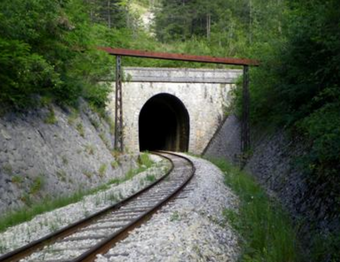
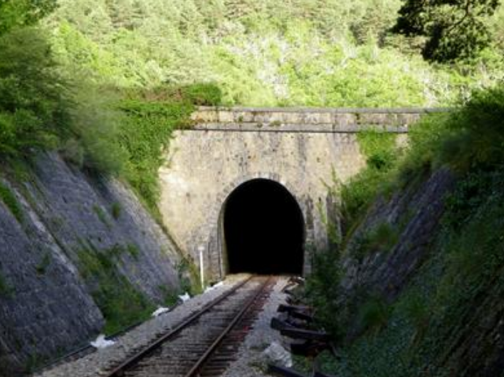
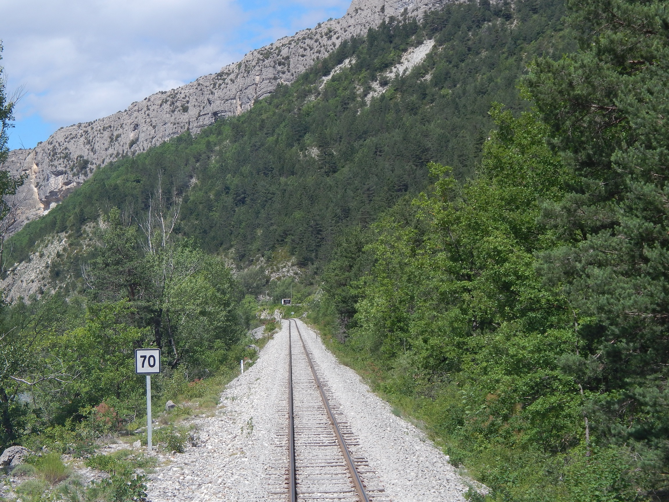
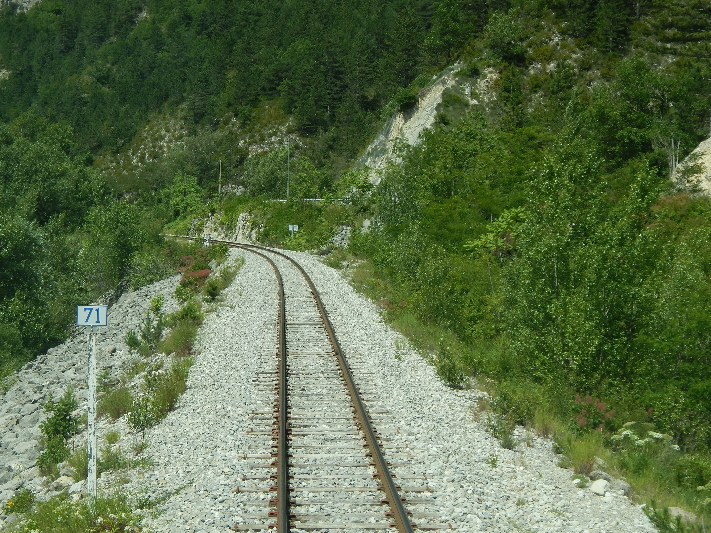
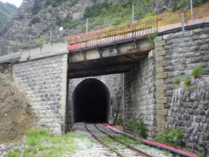
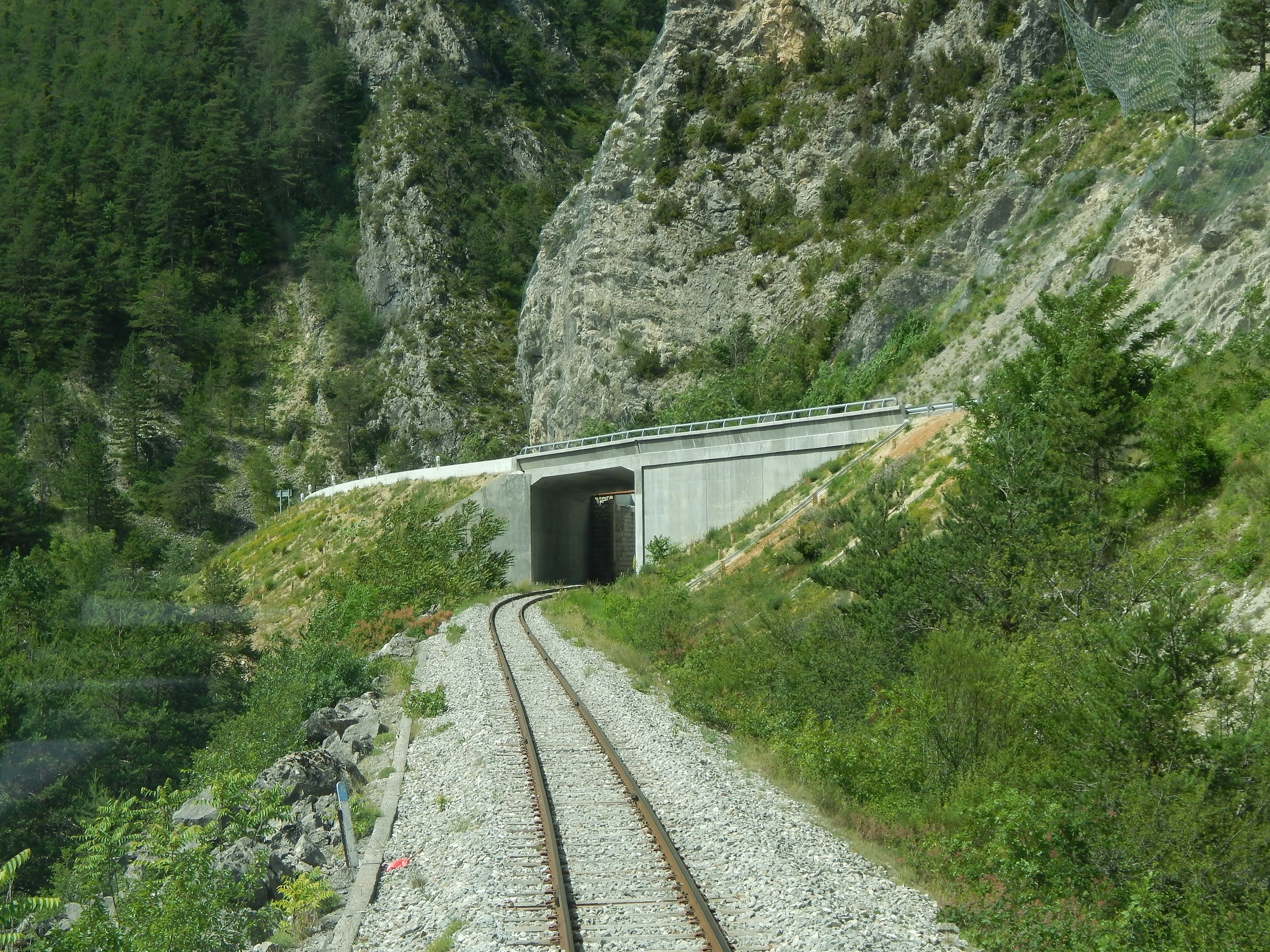
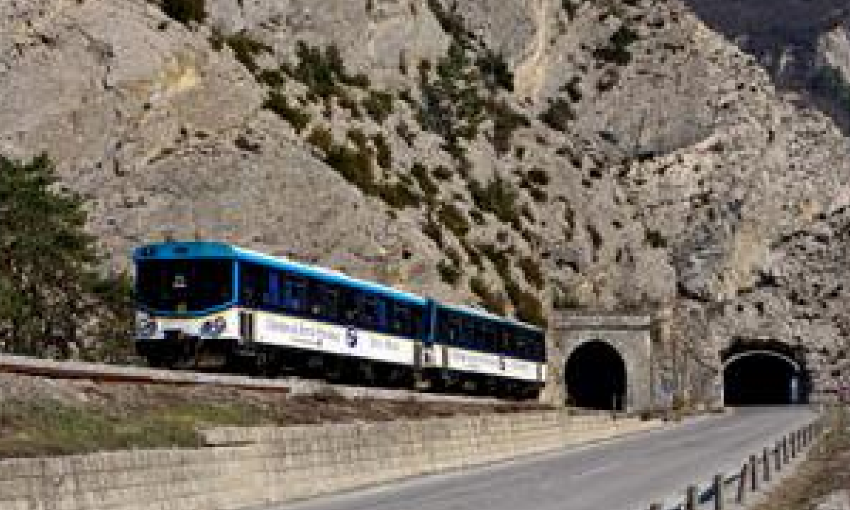
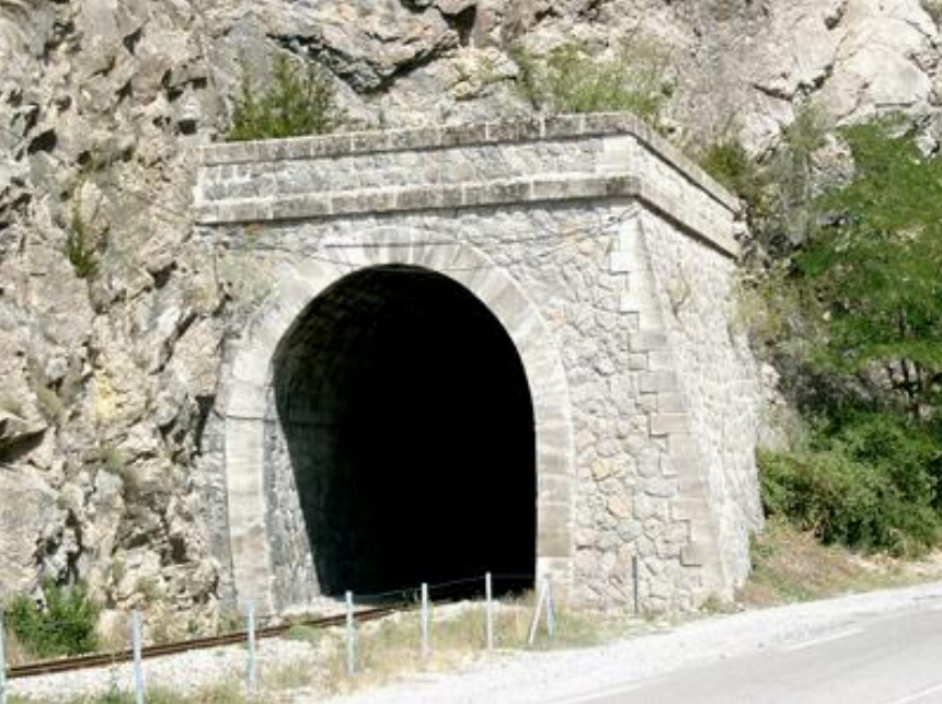
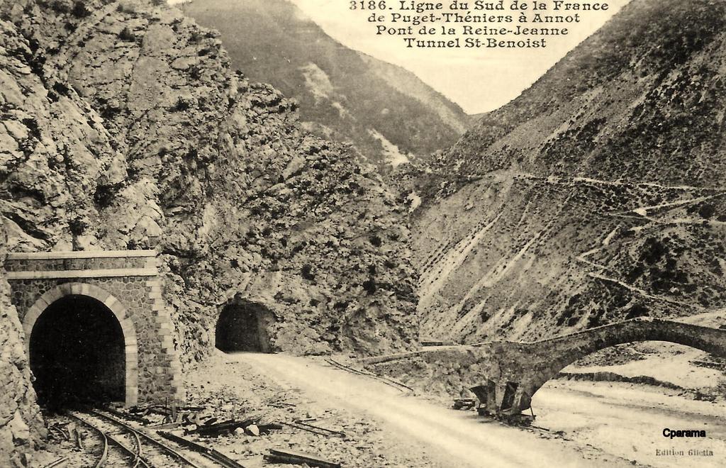
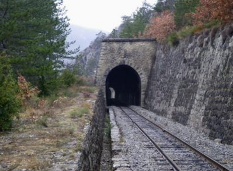
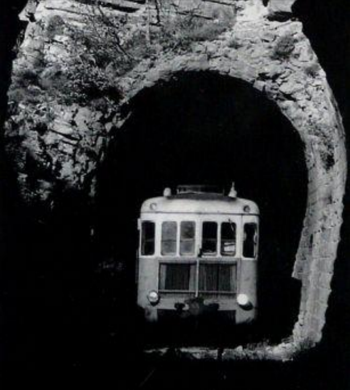
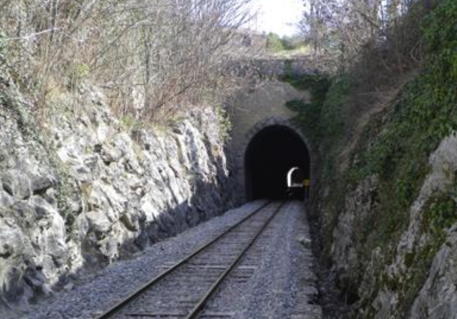
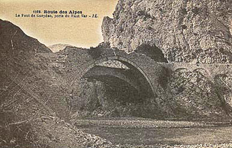
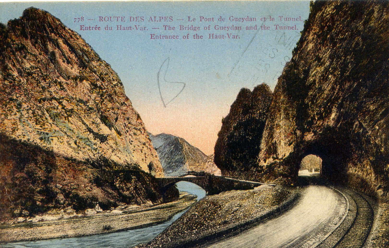
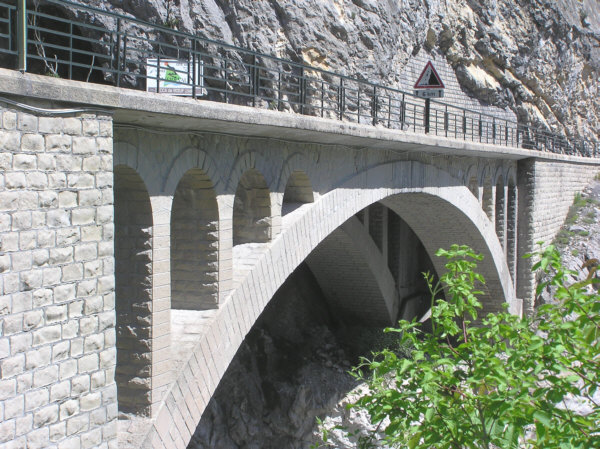
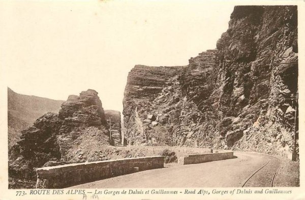
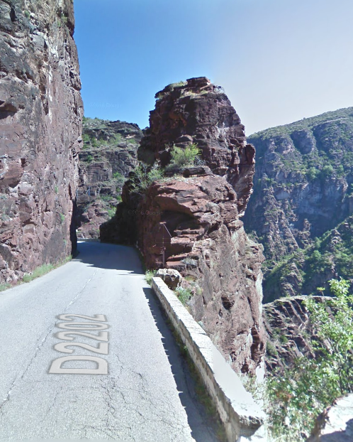
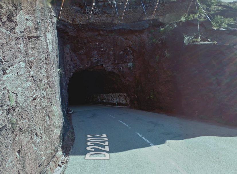
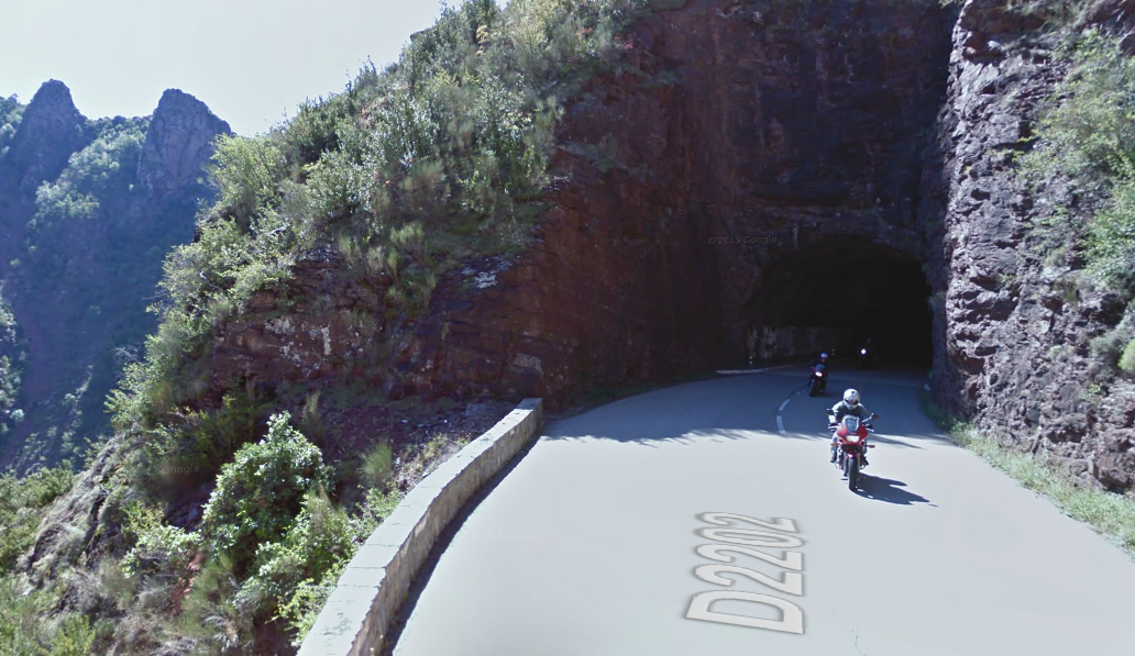
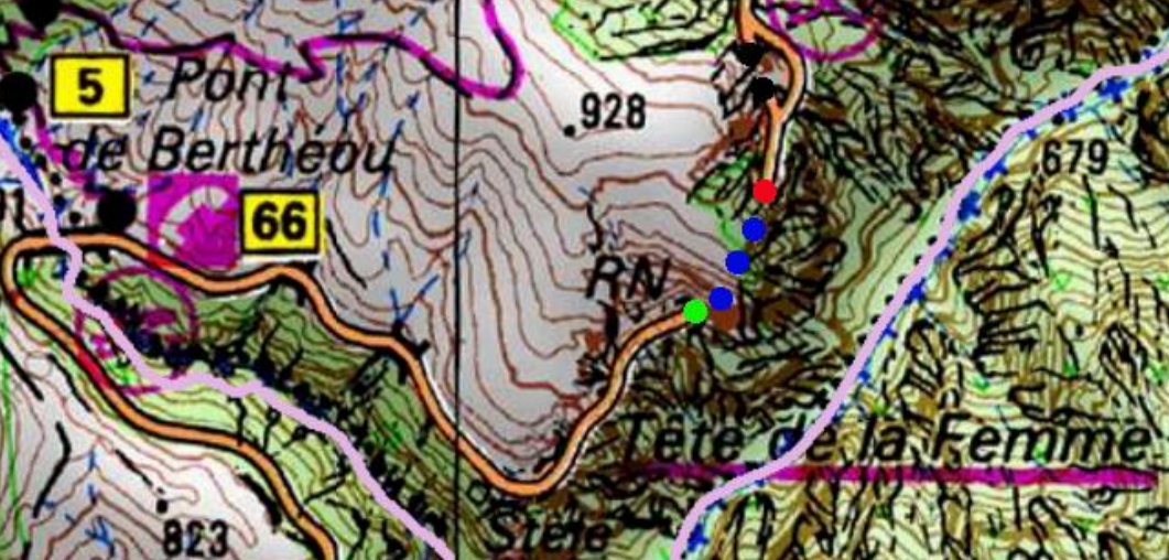
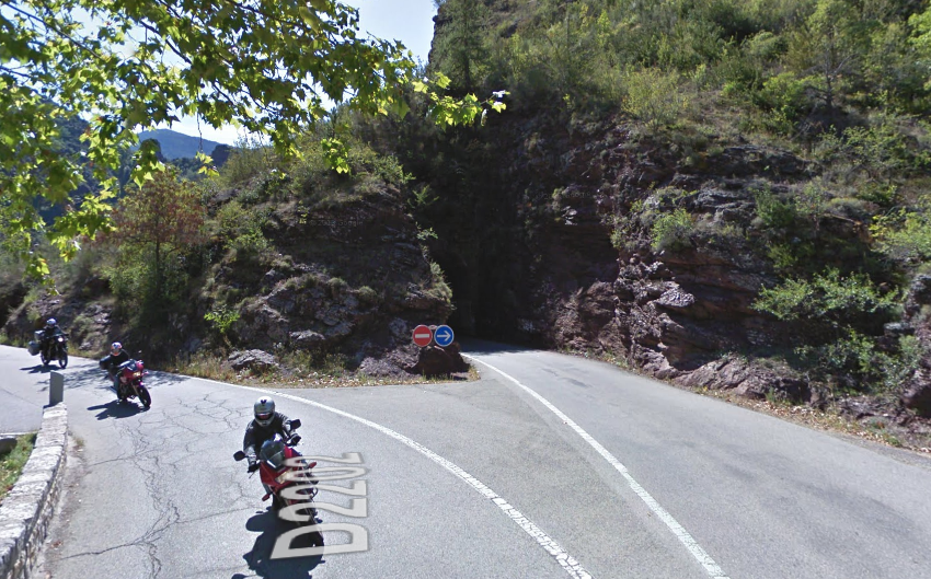
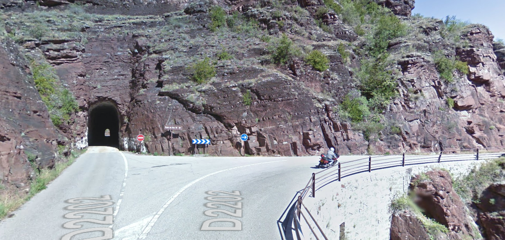
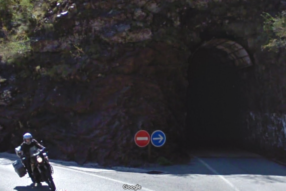
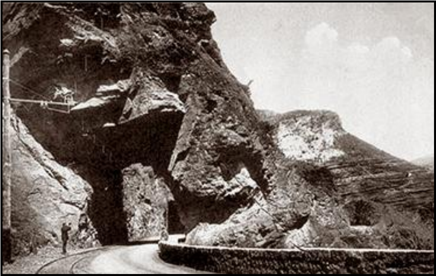
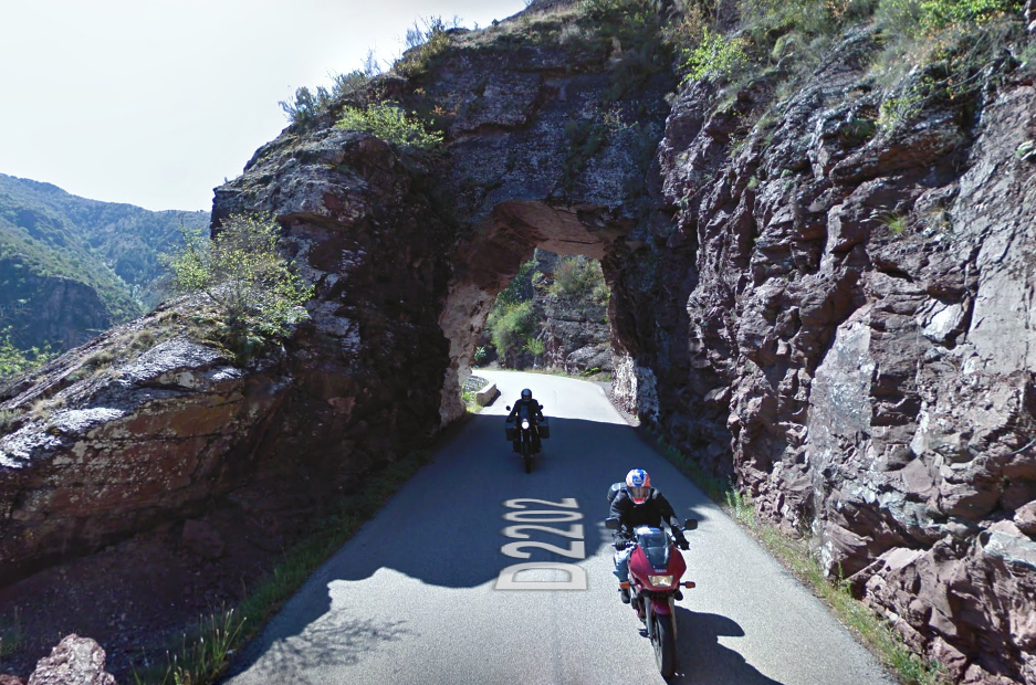
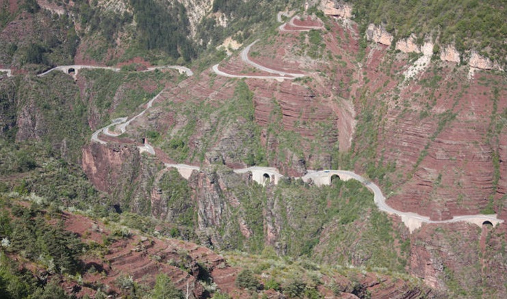
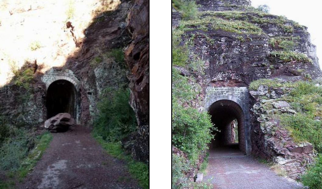
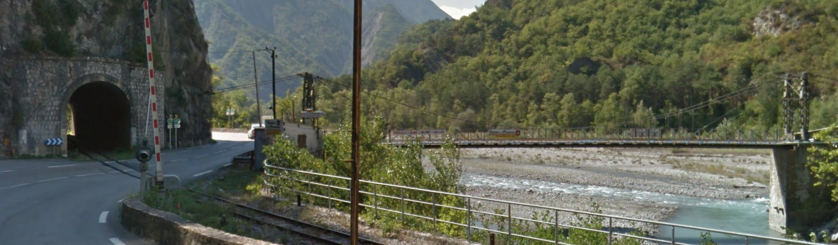
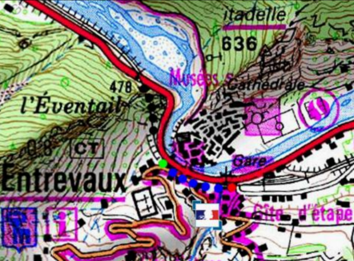
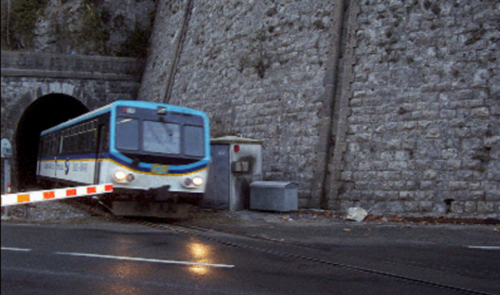
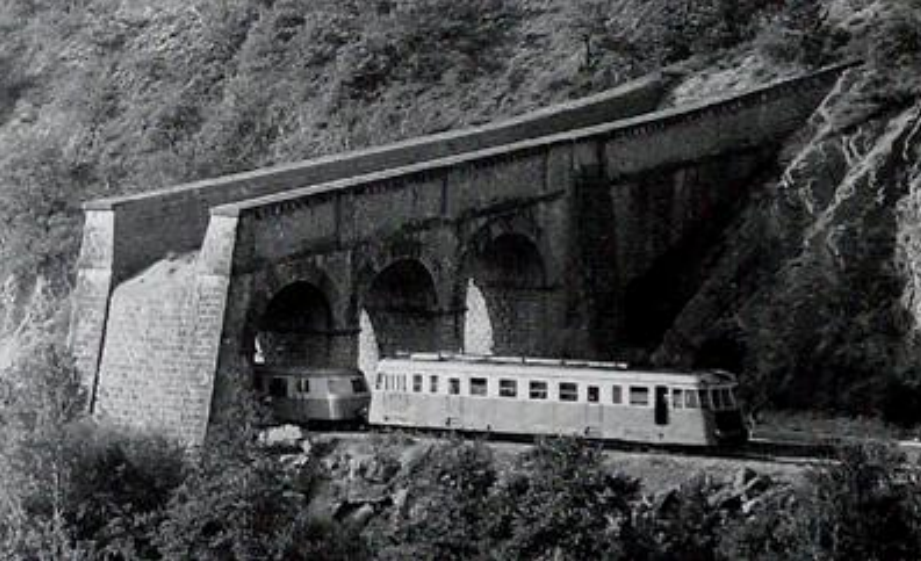
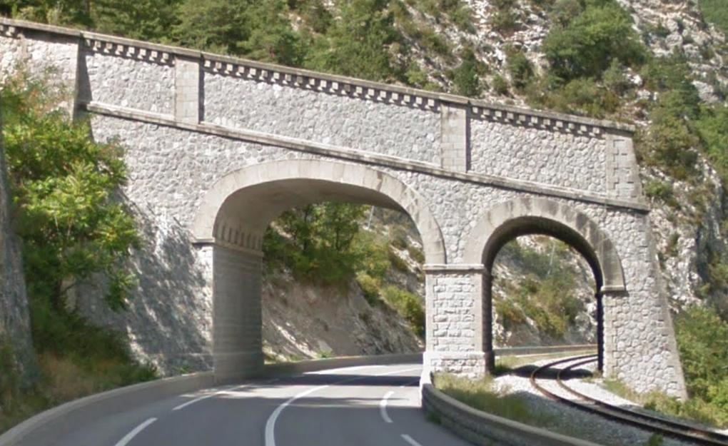
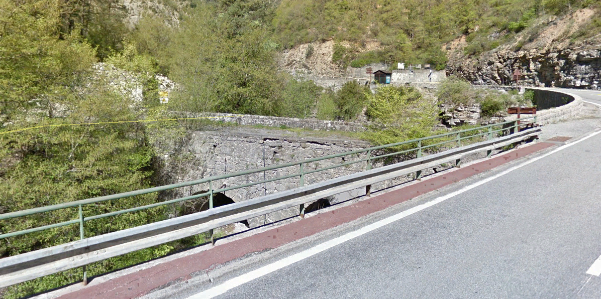
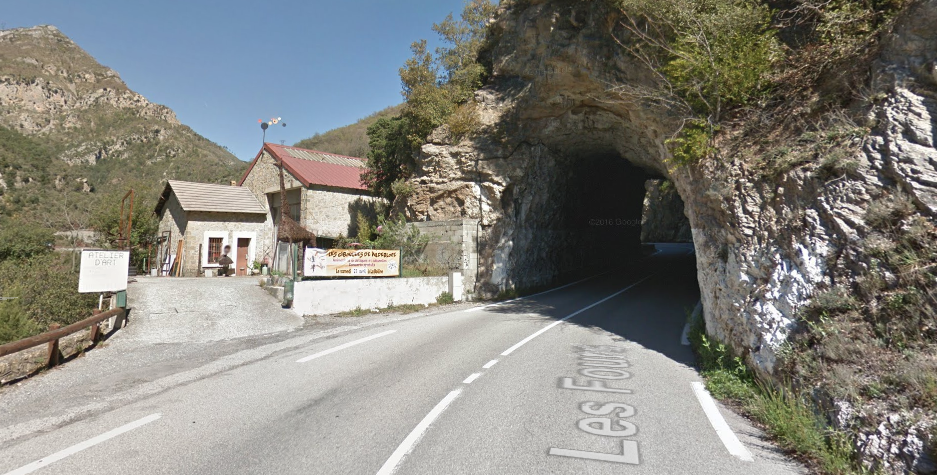
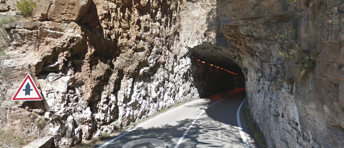
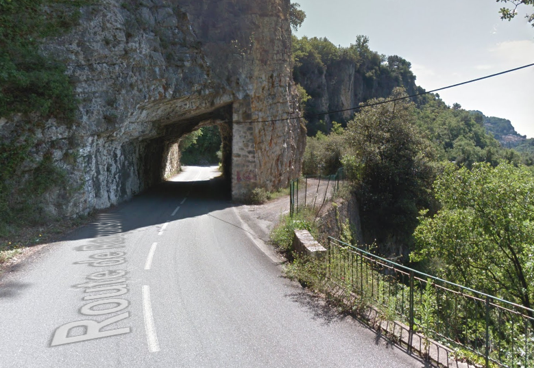
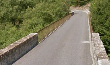
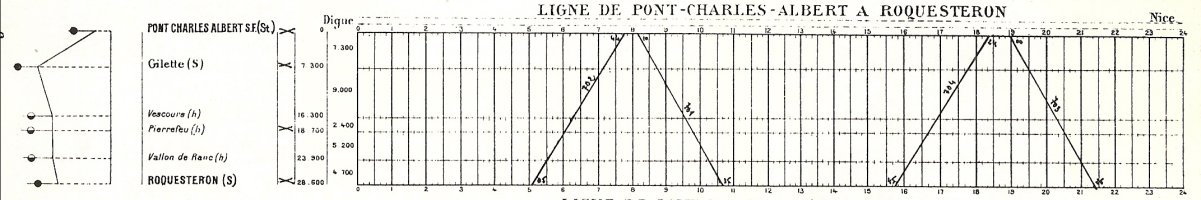
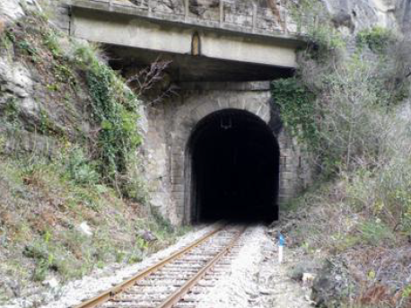
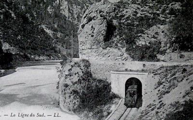
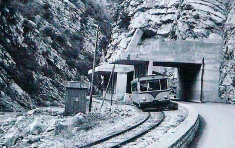
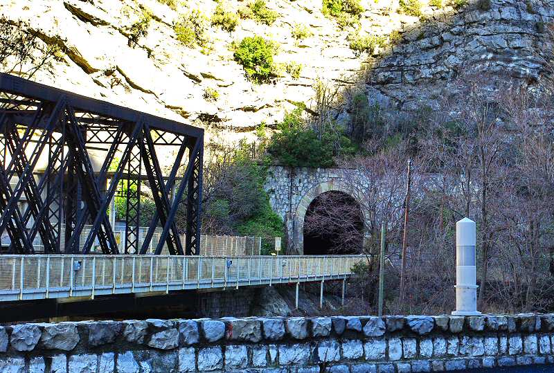
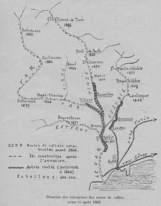
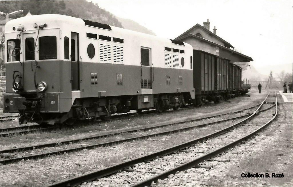
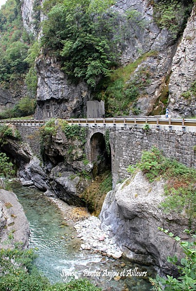
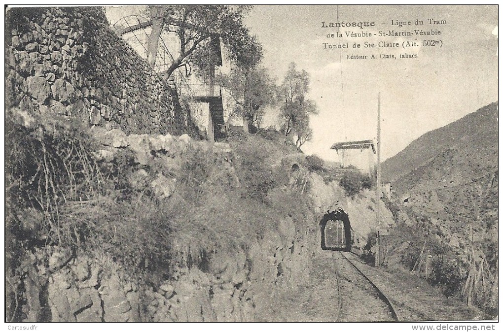
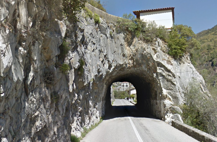
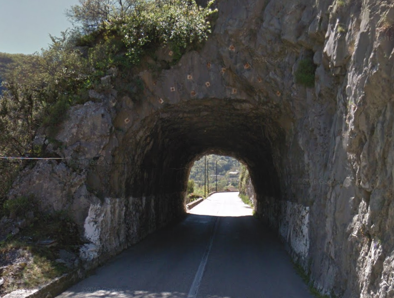
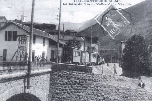
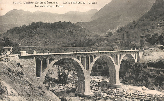
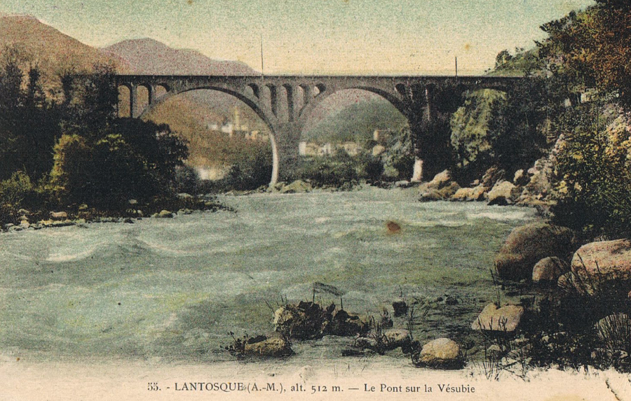
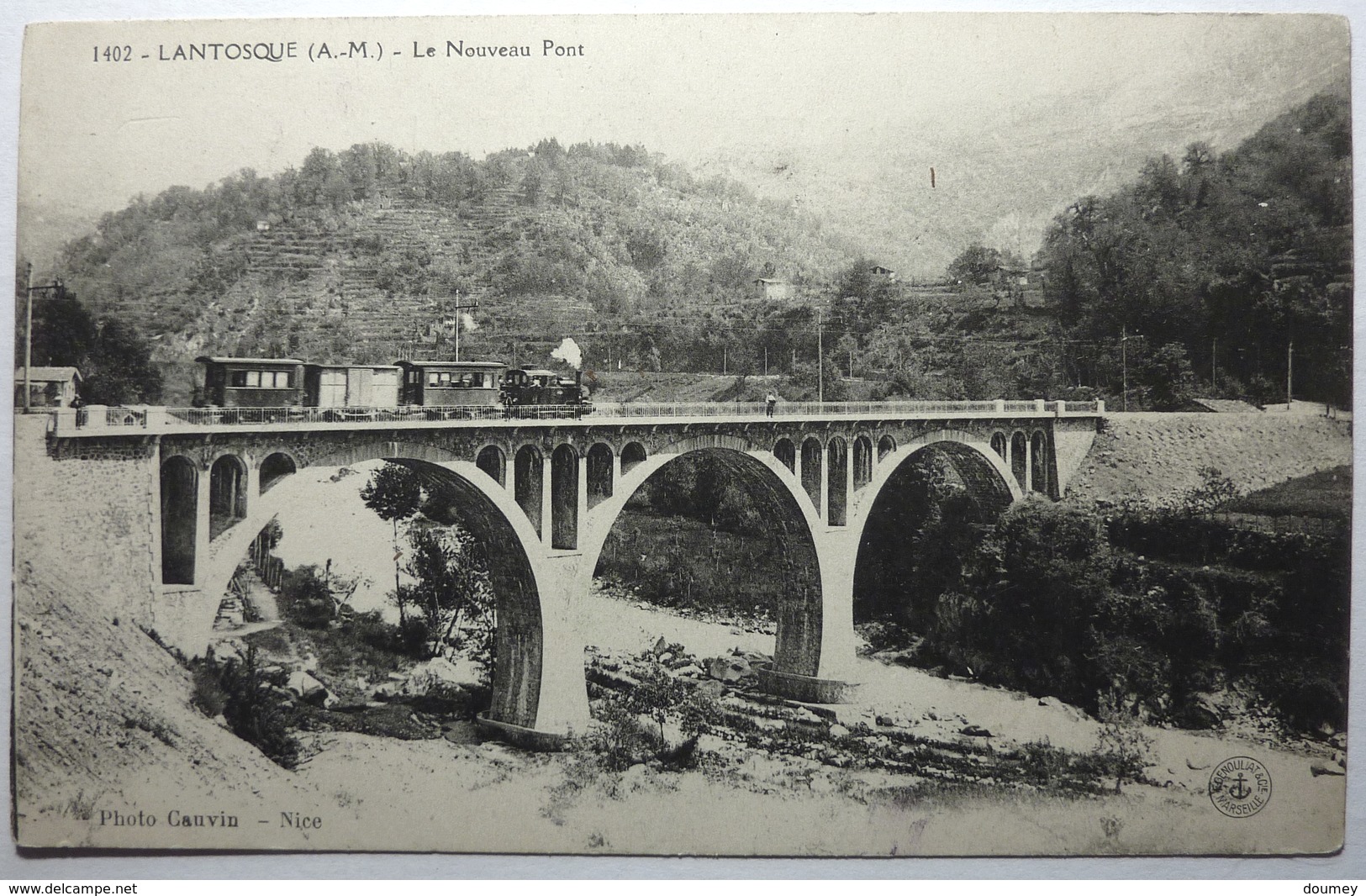
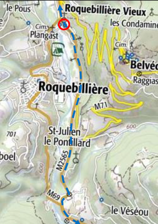
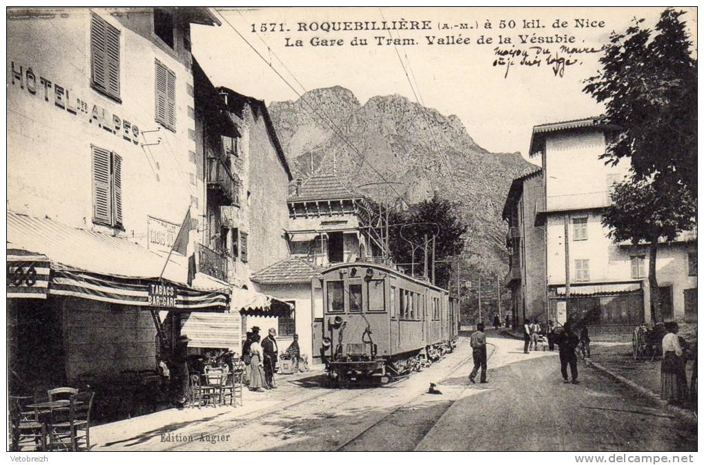
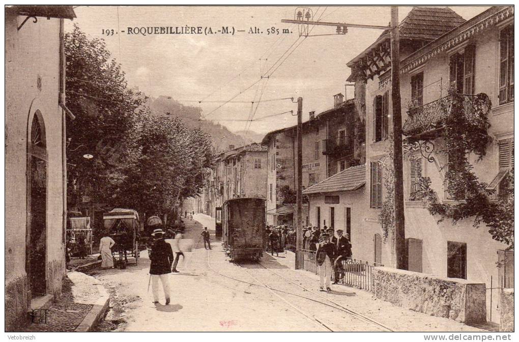
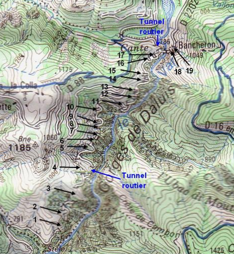
The ten tunnels already built became combined road/tramway tunnels, but it was also necessary to by-pass some very tight curves in the road using a dozen new
tunnels specific to the tramway. These also became road tunnels after the tramway was abandonned,

It was only north of the Gorges de Daluis, before arriving at Guillaumes, where the valley became wider, that the tramline was free to choose its own route. That section contains the last four tunnels on the line.

Because of their number, proximity and lack of specific place names, these
Tunnels do not have specific names and are often referred to as numbers in registers of structures. The numbering starts close to Daluis and heads towards Guillaumes.Tunnel 2, South Portal.The two images immediately above show the north portal of tunnel No. 2.Tunnel No. 3, south portal.Tunnel No. 3 is marked on the above map by the green, blue and ed dots. It is 233 metres long and was originally constructed for the road in the late 1800s before becoming a shared tunnel when the tramway was built. [14]

The north portal of Tunnel No. 3 is immediately followed by an arch bridge carrying the road [14] and a couple of significant retaining walls before Tunnel No. 4 is reached.Tunnel No. 4 was built for the tramway, and again avoided a sharp bend on the road. It was a straight tunnel of 241 metres in length. The picture above shows the south portal and the road curving away to the right. As can be seen on the map below the road entered a tunnel just off shot on the picture above.Tunnel No. 4 is marked with green, blue and red dots on the plan above. Immediately to the north of the tunnel, the road/tramway crossed another arch bridge. [15]Looking back at the north portal of Tunnel No. 4 from the arch bridge above.In a very short distance we encounter Tunnel No. 5 (above), this was built for the tramway as was 69 metres long. It is marked on the plan below  with a green, blue and red dot. The yellow dots represent Tunnel No. 6. [16]Tunnel No. 5, north portal.

Tunnel No. 6 is encountered immediately, it was originally built for the road, although at the time of its construction the road was much narrower than at present. The shot immediately below shows the old arch bridge over the stream which was directly before the tunnel entrance and clearly shows the modern widening of the bridge.The south portal of Tunnel No. 6The north portal of Tunnel No. 6 demonstrates the asymmetrical shape of the tunnels after conversion for the trams. The higher side allowed for the catenary and poles which supplied electrical power to the trams.The south portal of Tunnel No. 7, which only about 15m in length. The road curves sharply to the left beyond the tunnel and the picture below looks back at the rock wall from round the corner.Tunnel No. 8 is another very short tunnel, encountered within 10s of metres of Tunnel No. 7. It also is very short, no more than 10 metres in length. The first image below shows the south elevation in the 21st Century, and the second shows the same elevation while the tram tracks and catenary were still in place. [17]The north elevation of Tunnel No. 8 in the 21st Century.

Tunnel No. 9 is a longer tunnel (43m). It was built for the tramway, as the road heads out round another rocky promontory. Tunnel No. 9 South elevation. Tunnel No. 9 North elevation.The bridge over the Ravine immediately after Tunnel No. 9.

This next map shows the locations of Tunnels Nos. 9, 10 and 11. Tunnel No. 9 is marked with yellow dots at the bottom of the map; Tunnel No. 10 is marked with a read and a green dot; Tunnel No. 11 runs is a more southwest to north east direction close to the top of the map. Tunnel No. 10 was just 22m in length but was, like Nos. 9 and 11, built for the tramway. The tunnel roof has been removed and the road diverted along the line of the tunnel.Tunnels and bridges alternate along this route with frightening regularity! This structure is between Tunnels Nos 10 and 11.This ‘interesting’ three-way junction heralds Tunnel No. 11. It appears very narrow but was built wide enough to accommodate the 1.9 metre loading gauge of the trams on this route.The north-east portal of Tunnel No. 11. Immediately after leaving the 57 metre-long tunnel the road/tramway needed the support of a substantial retaining wall.

Tunnel No. 12 is just 16 metres long.South portal of Tunnel No. 12.North portal of Tunnel No. 12.Turning 180 degrees from the location of the last photo … the south portal of Tunnel No. 13 and the bridge over a gully immediately before the tunnel.A panoramic view from above Tunnel No. 12 of the road approaching the dramatic bridge, Le Pont de la Mariée. The 2CV is on the road adjacent to Tunnel No. 13. [18]The north portal of Tunnel No. 13.The south portals of Tunnels Nos. 14 and 15.The south portal of Tunnel No. 15.The north portal of Tunnel No. 14.The north portal of Tunnel No. 15.The southwest portal of Tunnel No. 16, which reveals further tunnels beyond!The northeast portal of Tunnel No. 16.

The southwest portal of Tunnel No. 17, with another bridge over a ravine.The northeast portal of Tunnel No. 17.The road and the tramway diverge. Le Pont de la Mariée was built for and carried the tramway.Looking back at the tramway/road from the east bank! [26]A drammatic photo (above) that shows the upstream part of Les Gorges de Daluis. In the foreground we can see Tunnel No. 16, then the entrance to Tunnel No. 17 and then Le Pont de la Mariée which is one of the fist reinforced concrete arched bridges in France. The route of the road is shown by a blue arrow and the route of the tramway is marked with red arrows. [19]

Le Pont de la Mariée was built in the early part of the 20th Century. It has a 62 metre span and sits 80 metres above the valley floor. It is salutary to think that this bridge only saw active use for a period of  6 years in the 1920s. So much work for so little gain! The image below was taken during its construction. [20]The next tunnel, Tunnel No. 18, is the first of these tunnels on the east side of the River Var. [21] Tunnel No. 18 is marked on the plan above by the green and red dots. It is 42 metres long and was built specifically for the tramway. Access in the 21st Century is restricted to pedestrians.  Its west postal is shown immediately below and its east portal on the second image below. Tunnel No. 19 is shown by the two black dots on the above map. It is just 28 metres long and also only accessible on foot.The West portal of Tunnel No. 18.The East portal of Tunnel No. 18. [22]Tunnel No. 19: south portal (left above) and north portal (right above).The satellite image above shows the bridge and the tramway route passing through the rock in Tunnels Now 18 and 19 before heading north until quite close to the River Var. The image immediately below picks up the line of the tramway travelling further north through a heavily wooded area, and the one below that shows the tramway formation leaving the wodds and passing a campsite. The old tramway has now become an access road for the campsite.The tramway formation crosses the Vallon de Tireboeuf and continues north as shown on the map below. Two tunnels were encountered on this part of the journey – Tunnels Nos. 20 and 21. Tunnel No. 20 is marked by the green and red dots on the plan. Tunnel No. 21 is marked by the black dots.Tunnel No. 20 is also known as Tunnel de Ruine. It is no more than 20 metres long. The picture below shows it north portal. [23]Tunnel No. 21 is in fact a 4i metre-long protective gallery over the line which the images below show clearly. [24]The tramway ran north from the gallery towards Guillaumes on the east side of the River Var. In the adjacent satllite image the gallery can be seen close to the bottom of the picture. The point at which the road crosses the river to rejoin the tramway alignment can be seen close to the top of the picture. The modern road bridge seems to dominate the location , but the old road bridge can be picked out immediately to the north of the modern bridge.

The location is shown in the images below.

The first picture shows the modern road bridge and alongside it the original road bridge built in the mid-1800s. The picture is taken looking towards Daluis, downstream of the location.

The second image below shows the the modern bridge and, on the east bank of the river the tramway formation under high cliffs. This picture is taken looking upstream towards Guillaumes.

The third picture is taken from the south looking up the valley of the Var towards the same bridge – Pont des Roberts. [25]

The road/tramway followed a straight course northward to just south of Guillaumes. After a minor deviation to the left and then the right the tramway crossed the Pont de Tuébi. [1]

The station buildings can be easily picked out on the images above. The ones below are annotated in French. [1]

The station buildings were sited on the south side of the town and the tram tracks ran beyond them (as can be seen in the sketch plan above). A loop was provided which extended into the village. [1] The postcard below shows the loop extending into the village and the second image below shows the same location in the 21st Century.The only remaining building is the passenger station building which is now occupied by a pharmacist. [1]

References

  1. http://marc-andre-dubout.org/cf/baguenaude/daluis/daluis.htm, accessed on 22nd July 2018.
  2. Rainer Eisenschmid; Provence, Côte d’Azur. Baedeker, 2011. p. 266.
  3. Reinhard Scholl; Französische Seealpen: Alpes-Maritimes: Mercantour – Merveilles; 50 ausgewählte Berg- und Talwanderungen (in German). Bergverlag Rother, 2002. pp. 48–55.
  4. Dana Facaros, Michael Pauls; Provence. New Holland, 2004. p. 254.
  5. M. Victor de Cessole; “En Hiver: Ascensions dans les Alpes Maritimes”. Annuaire (in French). 24. Club Alpin Français, 1898. pp. 157–72.
  6. https://en.wikipedia.org/wiki/Gorges_de_Daluis, accessed on 22nd July 2018.
  7. https://structurae.net/structures/pont-de-gueydan, accessed on 22nd July 2018.
  8. http://www.inventaires-ferroviaires.fr/hd04/04174.a.pdf, accessed on 22nd July 2018.
  9. https://www.camptocamp.org/waypoints/439483/fr/pont-de-bertheou, accessed on 22nd July 2018.
  10. https://www.guillaumes.fr/la-mineralogie and http://paca.lpo.fr/images/mediatheque/fichiers/section_protection/espaces/reserve_naturelle_regionale_des_gorges_de_daluis/documentation/depliant_presentation_rnr_daluis.pdf, accessed on 23rd July 2018.
  11. https://www.guillaumes.fr/le-circuit-cyansdaluisle-circuit-cyansdaluis, accessed on 23rd July 2018.
  12. http://www.tunnels-ferroviaires.org/tu06/06071.1.pdf, accessed on 23rd July 2018.
  13. http://www.tunnels-ferroviaires.org/tu06/06071.2.pdf, accessed on 23rd July 2018.
  14. http://www.tunnels-ferroviaires.org/tu06/06071.3.pdf, accessed on 23rd July 2018.
  15. http://www.tunnels-ferroviaires.org/tu06/06071.4.pdf, accessed on 23rd July 2018.
  16. http://www.tunnels-ferroviaires.org/tu06/06071.5.pdf, accessed on 23rd July 2018.
  17. http://www.tunnels-ferroviaires.org/tu06/06071.8.pdf, accessed on 23rd July 2018.
  18. http://club.caradisiac.com/interceptor-s4/cartes-postales-81352/photo/gorges-daluis-2cv-5554845.html#photo_5554845, accessed on 24th July 2018.
  19. http://www.tunnels-ferroviaires.org/tu06/06071.16.pdf, accessed on 24th July 2018.
  20. http://www.tunnels-ferroviaires.org/tu06/06000.1.pdf, accessed on 24th July 2018.
  21. http://www.par-monts-et-par-vaux.eu/ponts_alpes-maritimes_1.html#Pont_Mari%C3%A9e_Guillaumes, accessed on 24th July 2018.
  22. http://www.tunnels-ferroviaires.org/tu06/06071.18.pdf, accessed on 24th July 2018.
  23. http://www.tunnels-ferroviaires.org/tu06/06071.20.pdf, accessed on 25th July 2018.
  24. http://www.tunnels-ferroviaires.org/tu06/06071.21.pdf, accessed on 25th July 2018.
  25. http://dan-randos-photos.monsite-orange.fr/page-592d18d4a3c5a.html, accessed on 25th July 2018.
  26. http://draillescantoun.canalblog.com/archives/2009/05/11/13841773.html, accessed on 25th July 2018.

Nice to Digne-les-Bains Part 5 – La Mescla to Le Pont de Gueydan (Chemins de Fer de Provence 68)

We return once again to the Nice to Digne metre-gauge line and continue our journey from La Mescla.We start at the La Mescla Station which was completed in 1904 to replace an earlier building which had been located about 500 metres further north.The next image shows the station which was abandonned in 1904, and the colour image shows the same site later in the life of the line. The road and the tunnel in the distance have been widened.Beyond La Mescla the railway continues to hug the river bank on the South West side of the River Var. The satellite image below shows the extent of quarry workings on the north bank of the river associated with Lafarge Bétons Centrale Malaussène (Construction Material Wholesaler)! Two bridges are visible in the satellite image. The first in the bottom right crosses both railway and river, the second appears to be an internal industrial bridge across the river.The route continues in a generally northwesterly direction for a distance of little more than a kilometre alongside the river, before turning to a more westerly alignment. The line continues to remain close to the River until crossed by the road as shown on the second image below.The 50 metre span suspension bridge is Pont Auguste Dubois at Massoins has a maximum load capacity of 3 tonnes and it provides access for the D126 across the river to Massoins high above the river on the north bank. Malaussène holds a similar position on the south bank! Their shared station is in the valley floor on the south side of the river after the short tunnel known as Tunnel de Malaussène which is marked on the plan immediately above by the red and green dots. Early in the life of the line there was a crossing keepers cottage alongside the railway crossing at the eastern tunnel portal, as the Gilletta postcard below shows.The eastern portal of the Tunnel de Malaussène. [1]The western portal of the Tunnel de Malaussène is hidden beyond a road over-bridge and a myriad of road signs!A road underpass immediately before Malaussène Station.La gare Malaussène, trackside. [2]La gare Malaussène, forecourt – hidden from the road by trees and a hedge. [2]

After La gare Malaussène, the railway drifts away from the road as it travels west across the flood plain. The road remains close to the River Var. The road (D6202) then swings away from the river to allow it to access a new bridge across the watercourse. As it does so, it alignment comes close once again to the railway, and road and railway cross the river in close proximity.The old road travelled along the south bank and under the railway bridge before crossing the river on a bridge which is now long-gone. The two shots immediately below show the old road bridge upstream of the railway bridge. The third picture below shows a goods train pulled by a diesel locomotive heading towards Nice. [6] Now on the north side of the valley, modern road and railway run closely in parallel until reaching Villars-sur-Var. The entrance to the station area is shown below.CP-X-304 arrives at Villars-sur-Var travelling towards Nice in 2016, (c) Kjell Strandberg. [3]Villars-sur-Var Station building in 2016, (c) Kjell Strandberg. [3]An aerial view of the station. [4]An overall view of the station site featuring the watertower. [5]A Renault Railcar at Villars-sur-Var Station. [6] And in the two images immediately below the station is shown with other railcars present. [7]

The final image of the station at Villars-sur-Var is taken from the road side in winter.

Travelling on from Villar-sur-Var the line closely follows the northern bank of the river as far as the station at Plan Souteyran. In that length of the line the river meanders back and forth and only very occasionally is the line more than 100 metres from the River Var.

The halt at Plan Souteyran is not evident on the ground and appears to have been destroyed. It sat between the railway and the old road as can be seen on the map and satellite image below and served a very small community on the river bank.The next halt was at Touet-sur-Var – Le Tournel, and came after another length of line hugging the north bank of the Var. There appears to be no evidence of this halt which may have been removed to allow for the modern road formation.Just beyond the location of the halt is a small lattice truss bridge, typical of those crossing small streams along the line.Another kilometre or two along the line the railway entered the village of Touet-sur-Var. Its alignment can easily be picked out in the satellite image below. The village station can be seen to the left of the image.The old village of Touet-sur-Var sits high above the more modern village which has formed around the railway station. [10]

After Touet-sur-Var the line closely follows the river once again in a westerly direction, smaller lattice girder bridges carry the railway over tributaries of the Var, such as the one below which crosses Le Cians immediately before the halt of the same name.The Halt Shelter can just be picked out on the right side of the image above. Beyond l’Arret Cians the road, railway and river continue in close proximity, typically as below, until approaching Puget-Théniers.En-route to Puget-Théniers, the line once passed through a further three halts, of which there is no evidence of two in the early 21st Century. The third appears to to be no more than a sign and a length of railing alongside the main road into Puget-Théniers.The Station Approach, Puget-Théniers.A satellite plan of the whole station site including the GECP workshops.The station can be seen on the left of this elevated image of the village, adjacent to the river. [13]In another elevated image, the railway can be seen alongside the river. A train is entering the shot from the bottom (the East). [14]The railway is even more visible in this image. [15]Landslide on the approach to the village in 1960. [12]The railway is in the immediate foreground of this picture of Puget-Théniers. [16]Renault ZZ-06 and XR-1336 at the bridge shown in the postcard above at Puget-Théniers on 08/07/1987, (c) Photo Martijn Haman. [18]Old postcard of the station. [11]The station building early in the 21st Century. [17]SY 03 in Puget-Théniers on 07/07/1987, (c) Martijn Haman. [18] A later image is shown below. [19]Puget-Théniers is the headquarters of the GECP (Groupe d’Étude pour les Chemins de fer de Provence). The GECP was formed to: renovate and restore rolling stock and locomotives on the line; promote of the line of the Railways of Provence; operate the Train des Pignes à vapeur; and undertake Heritage Activities and Historical Research. [20]GECP’s workshops are in an old station building (above and below). [20][21]The loco shed. [19]The new and the old together. [22]

The “Train des Pignes” operates out of Puget-Théniers on parts of the 151 km metre-gauge Chemins de fer de Provence (CP). The steam trains run by the GECP which was founded in 1975 when the line was seriously threatened with closure. Most trains operate to Annot (a distance of around 20 km), with an intermediate stop at Entrevaux, on select days from early May to early November and are hauled by ex-CP (Portugal) 2-4-0+0-6-0T Mallet E 211 (Henschel 19874/1923). In Portugal, the loco was in use out of Sernada on the Val de Vouga lines until 1975, out of Lousado from 1975 to 1976 and out of Regua on the Corgo line from 1976 to 1981. The loco was sold to the GECP in 1986, she first saw use on the CP between 1988 and 1992, after which she went through a major overhaul at the Lucato Termica workshops in Castelletto-Montferrato (Alessandria, Italy) only to return to service in 2010.

Prior to the arrival of the Portuguese Mallet, the GECP used ex-SNCF ‘Réseau Breton’ 4-6-0T E 327 (Fives-Lille 3582/1909) between 1980 and 1987, and again between 1993 and 2007. Before it came to the CP, it had been saved by FACS in 1967 and saw limited use on the Vivarais line between 1969 and 1979. Since 2007 it has been out-of-use and stored inside the shed at Puget-Théniers. It would need some major repair to work once again, but is not really adapted to the steep gradients. Also at Puget, GECP uses ex-SNCF ‘Blanc-Argent’ 0-6-0DM No. 11 (CFD Neuillé-Pont-Pierre 1940-41) as a shunter. Built on the frames of CFD Indre & Loire Nord 0-6-0T No. 8 (Couillet 1885), the little diesel first saw use on the CFD Indre & Loire Nord and Yonne lines, before being sold to the Blanc-Argent (BA) railway in 1952 and ending up with GECP in 1988. [23]

After leaving Puget-Théniers, heading west towards Digne-les-Bains, trains continues tofollow the river course. The railway, for about one kilometre, remains on the northside of the river.Trinité bridge on the Var between Puget-Théniers and Entrevaux. [11]Trinité bridge, taken from the south side of the River Var.

Once on the south side of the river, the railway and the road stay clos together. One year while staying in Nice, my wife and I took the train to Entrevaux and walked back along the line to Puget-Théniers. I remember the trees shading the road and the line really well. The picture below is typical of that length of the line.En-route to Entrevaux the line passes through an abandonned station (above), and as it gets closer to Entrevaux is crossed by the road at grade (below). The old cottage for the crossing-keeper still remains.A view of Entrevaux Station from the East.Entrevaux taken from a drone. The railway station can be seen on the right of the river and in the top half of the image. [24] Four historic images of Entrevaux Station and bridges above. [25]

In 2011, my wife and I spent an hour or so sitting on the platform at Entrevaux Station, the following six pictures were among a number taken then.Immediately after the railway station at Entrevaux the railway crossed a tributary of the River Var and plunged into a 164m long curved tunnel. The two pictures immediately above show the tunnel portal in the 21st Century and in the time of steam. The map below shows the tunnel highlighted in red, blue and green. A few tens of metres beyond the west portal of this tunnel, trains entered another tunnel, shown as black dots on the map which was 128m long. [26][27]The western portal of the first tunnel is quickly followed by the Eastern portal of the second tunnel.After the western portal of the second tunnel, the railway crossed the road once again at a level crossing and resumed a path close to, and on the south side of, the River Var.In the 21st Century, the crossing is automated, but the crossing keeper’s cottage remains a few tens of metres beyond the level crossing. While the road meanders away from the river, the railway line hugs the river bank as we travel on. After a few kilometres, road, rail and river converge once again after the railway has passed through a mall halt at Plan d’Entrevaux.Along the next length of track two interesting structures are encountered, both are visible in the picture above. These are false tunnels/aqueducts and have been given the nickname ‘Elephants’ because they bear some resemblance to an elephant. They provide for some relatively high water flows on two temporary streams. [28][29] Both are shown on the map below.The first encountered is marked with red and green dots, the second with black dots. These provide an interesting location for photographs, as can be seen below. After the ‘elephants’ the line swings more to the north following the course of the river and passes through another halt – Entrevaux-Agnerc. The halt immediately precedes another level crossing. The location of the halt, the crossing and the crossing keeper’s cottage can be seen below.The railway then dives into another tunnel – Tunnel des Cornillons. The tunnel is just 62m long and is marked with black dots towards the top-middle of the map above.The East Portal.The West Portal. [30]A steam train leaves the west portal of the tunnel on is way west. [30]

The road crosses the River Var at this point (just north of the East Portal of the tunnel). The location is known as ‘Le Pont Noir’. The railway remains on the south side of the valley for another kilometre or so before reaching Le Pont Gueydan. The adjacent photograph shows the railway bridge as it was before 1994. The image immediately below shows the structure after the floods.The four images above show the new railway bridge installed after the floods of 1994. The Bridge spans the Le Coulomp. Just to the east of the bridge, the River Var turns sharply to the north and the railway follows the course of a tributary – Le Coulomp. The first station after the bridge is Saint Benoit Pont de Gueydan. This station was a junction station. The TAM ran a tramway north up the valley of the Var from Le Pont de Gueydan. It was the starting point of the tramway, which was often referred to as the Haut-Var tramway, which ran as far as Guillaumes.

This is the end of this stage of the journey.

References

  1. http://www.tunnels-ferroviaires.org/tu06/06078.1.pdf, accessed on 18th July 2018.
  2. http://cccp.traindespignes.free.fr/gare-malaussene.html, accessed on 18th July 2018
  3. https://trainmec.blogspot.com/2016/04/five-minutes-at-villars-sur-var-station.html, accessed on 11th July 2018.
  4. http://www.lecomtedenice.fr/Visi_nice/val_var_villars_sur_var_village.html, accessed on 19th July 2018.
  5. http://www.map-france.com/Villars-sur-Var-06710/photos-Villars-sur-Var.html, accessed on 19th July 2018.
  6. https://www.cparama.com/forum/villars-sur-var-t23761.html, accessed on 19th July 2018.
  7. https://www.delcampe.net/fr/cartes-postales/europe/france/06-alpes-maritimes/autres-communes?f=lieux:chemin-de-fer, accessed on 19th July 2018.
  8. https://dossiersinventaire.maregionsud.fr//gertrude-diffusion/dossier/gares-des-chemins-de-fer-de-provence/5db69410-c3ec-4217-b30c-92f975a65c27/illustration/66, accessed on 19th July 2018.
  9. http://cccp.traindespignes.free.fr/gare-touet.html, accessed on 19th July 2018.
  10. https://fr.m.wikipedia.org/wiki/Touët-sur-Var, accessed on 19th July 2018.
  11. https://www.cparama.com/forum/puget-theniers-t8978.html, accessed on 20th July 2018.
  12. https://www.geneanet.org/cartes-postales/view/271322#0, accessed on 20th July 2018.
  13. https://collection-jfm.fr/p/cpa-france-06-puget-theniers-222734, accessed on 20th July 2018.
  14. https://collection-jfm.fr/p/cpa-france-06-puget-theniers-vue-generale-pont-sur-le-var-carte-toilee-7207, accessed on 20th July 2018.
  15. http://www.collection-jfm.fr/p/cpa-france-06-puget-theniers-sur-la-route-des-alpes-et-sur-les-bords-du-var-171856, accessed on 20th July 2018.
  16. https://collection-jfm.fr/p/cpa-france-06-puget-theniers-la-place-et-la-roudoule-21338, accessed on 20th July 2018.
  17. http://cccp.traindespignes.free.fr/gare-puget.html, accessed on 20th July 2018.
  18. http://cccp.traindespignes.free.fr/phototheque-digne.html, accessed on 20th July 2018.
  19. http://www.beyond.fr/villages/puget-theniers-provence-france.html, accessed on 20th July 2018.
  20. https://www.gecp-asso.fr, accessed on 20th July 2018.
  21. https://trainmec.blogspot.com/2015/02/train-des-pignes-steam-train-winter.html, accessed on 20th July 2018.
  22. https://www.pinterest.co.uk/pin/356206651752278128/?lp=true, accessed on 1st July 2018.
  23. http://www.internationalsteam.co.uk/tales/francetales04.htm, accessed on 20th July 2018.
  24. http://www.dronestagr.am/citadelle-dentrevaux, accessed on 20th July 2018.
  25. https://www.cparama.com/forum/entrevaux-t17950.html accessed on 20th July 2018.
  26. http://www.tunnels-ferroviaires.org/tu04/04076.5.pdf, accessed on 20th July 2018.
  27. http://www.tunnels-ferroviaires.org/tu04/04076.4.pdf, accessed on 20th July 2018.
  28. http://www.tunnels-ferroviaires.org/tu04/04076.3.pdf, accessed on 21st July 2018.
  29. http://www.tunnels-ferroviaires.org/tu04/04076.2.pdf, accessed on 21st July 2018.
  30. http://www.tunnels-ferroviaires.org/tu04/04076.1.pdf, accessed on 21st July 2018.
  31. http://ollivier.haemmerle.free.fr/entrevaux.html, accessed on 21st July 2018.

TAM Tramway from La Mescla to Saint-Sauveur-sur-Tinée – Revisited (Chemins de Fer de Provence 67)

I first looked at this tramway in 2013. It was only a short blog recognising the existence of the line in the valley.

https://rogerfarnworth.wordpress.com/2013/12/19/chemins-de-fer-de-provence-8-tramway-in-the-tinee-valley.

This line was 26.5 Km long and connected villages in the Tinée valley to Nice to Digne line. Like other lines of the Tramways Alpes Maritimes (TAM), the electric current was single phase. The civil engineering works (bridges, tunnels) were executed by the Department.

The line was built in 1911 and operation started on 1st April 1912. Landslides affected the operation of the line in the early months. The original opening was delayed from January to April because of landslides and on 2nd April a further landslide affected several hundred metres of track and destroyed power lines.

The line operated until July 1931.

The line left the Nice to Digne line at Pont de la Mescla. The junction station was south of the confluence of the two rivers. La Tinee Station is featured in a previous blog, …

https://rogerfarnworth.wordpress.com/2018/07/12/nice-to-digne-les-bains-part-4-plan-du-var-to-la-mescla-chemins-de-fer-de-provence-65La Tinee Railway Station.

Trams left La Tinee Station and travelled along the Nice to Digne line into Les Gorges de la Mescla and their route along the a River Var is covered in detail in the blog above. Trams passed through the halt at La Mescla and then crossed the River Var on a new bridge built for the tramway.A modern view of the tramway bridge taken from upstream on the banks of the River Var. [1]The tramway left the mainline and curved tightly onto the concrete arch bridge built for it in the early 20th century. It replaced an earlier suspension bridge which would not have been able to carry the loads imposed by the trams. [2]

A view taken from upstream on the West bank of the River Var, © Provence-Alpes-Côte d’Azur Region – General inventory [3]Once across the bridge, the tramway hugged the western side of the valley of La Tinee. On the adjacent image, the formation of the line is visible at the base of the rock outcrop. The line continued on the west side of the valley with the road on the east side for around 500 metres. The formation of the tramway is easily visible along that length of the river/road on the far bank. The images below are taken from Google Streetview and show first the tramway formation (indicated by the line of vegetation) on the West bank of the Gorge, then the old road bridge (taken from the new bridge).

There are some very interesting structures built into the rock of the valley walls at this point. The picture of the old road bridge includes pictures of structures on the East side of yhe valley and the follwing image shows those to be found on the West side of the valley above the road. The structures are known as Les Chuise de Bauma Negra.

The Chuise de Bauma Negra belongs to the system for controlling the gorges that lead to Nice within the Séré de Rivières’ system. [4] 

The fortification was constructed between 1884 and 1887 to block the way to Nice from la Tinée. The Chuise is situated at the narrowest point of the valley, in the Mescla gorges, just before the confluence with the Var. Its design is identical to that of the Chuise de Saint-Jean-de-la-Rivière. It is a fort built into a dam.


The limestone valley of La Roya was and is a communications route that has been controlled in turn by the Sardinians, the Spanish, the Austrians and the French. The southern part was incorporated into France in 1860 during the reintegration of the county of Nice. Control of this border region allowed the regulation of Italian activity. In this respect, the fort (Chuise de Bauma Negra) provided support for the Fort du Pic Charvet. It is built on the right bank of the gorge, on the edge of the road. It combines concrete parts with a two-storey façade in stone cut into the cliff. The structure comprises two floors next to the road. It has openings for 40 and 120 mm canons. Underground galleries lead to the gun shelters and firing posts that in turn lead on to the main road. Two rolling bridges, which could be moved from inside the fort, allowed the road to be cut off. It could house between 30 and 60 men. There was no separation between the stores and billets. On the left bank of the gorge, the engineer had planned to install mortars to catch the enemy in crossfire. [4][5]North of the Chuise de Bauma Negra, the tramway shares its formation with the M2205 road and runs through La Courbaisse and on towards La Tour. It passes a large quarry at La Courbaisse which dominates the satellite image below.Typical or the road/tramway route north of La Courbaisse.Before reaching La Tour the gorge closes in once again.

The road/river/tramway turn westward and immediately before reaching the Station of La Tour the road/tramway cross to the North side of the river. In the satellite image below the station building is on the left, the road accessing the village of La Tour leaves the main road just to the left og the bridge which is on the right of the photograph.The old road/tramway bridge has been superseded by a modern structure.The station building at La Tour still bears its station-board. It is 4 kilometres from the village of the same name which sits above the valley to the North.Second World War gun emplacement to the west of the station at La Tour.

The next stop on the line was the halt for Tournefort [2] (a village high above the river to the South). There is an old arched bridge across the river at the approximate location of the halt and an old barn that might have been used for storage of goods close to the tramway. Any other evidence of the halt appears to have been lost.Marc Andre Dubout records this building as being the Station at Roussillon. [2] It is at the bottom of the road which leads to the higher parts of the village but some distance to the West of the village in the valley.

Roussillon was the next stop on the line, followed by Pont de Clans.Three bridges at Pont de Clans. The roadway now uses what was the alignment of the tramway.In the image above [2] the tramway uses the middle bridge. It avoids the sharp turn of the road that we see at the rear of the picture and is of the same construction as the road bridge (in the foreground) which crosses La Tinée and leads to the hillside beyond. in the two images below the tramway bridge is shown first in the foreground with the old road bridge behind and then on the right with the road bridge which provides access across La Tinee, centre-left. In this aerial image the tramway alignment it shown as a pink line. [2]Sadly, the old tramway bridge was not able to support modern highway loading and has been replaced by a far more functional structure. The same is not true of the bridge which provides access across La Tinee (see below). The station building can be found just round the bend travelling north from the bridges. It bears the station name-board.North of Pont de Clans the road/tramway remain on the East bank of the river. The next stop is the halt for Bancairon which is a little to the north of the present village. Soon after the Station (below) the modern road runs on a viaduct down the middle of the gorge with the river beneath, and at the end of the viaduct it ends up on the West bank of the river.The old road (and so also the tramway) remains on the East bank of the river. [6]

The old road/tram route continued on the East side of the river and was eventually joined once again by the modern M2205. Just before the modern road crosses back over the river the old road/tramway was carried over the Vallon d’Ullion on a viaduct.

The point where the old road and tramway meet the new M2205 is shown in the first image below. North of this point the tramway encountered its next stop at Marie. The station is at the bottom of the side-road leading to the village of Marie.

The village sits high above the valley floor on the East side of the River.

The station is shown in the satellite image below in the top left corner, the village is in the right bottom corner.

Just as for the village of La Tour, the climb to the village of Marie along the M58 road is steep and long.

The 1:50000 plan from the 1950s and the most up-to-date IGN plan show the road clearly below. [7] In the case of both villages it required some stamina to return home after being dropped off by the tram.

North of Marie the tramway continued on the East side of the valley all the way to St. Sauveur sur Tinee. Very occasionally the modern road and the oldroad/tramway followed a different course – as here just south of La Bolinette.And when crossing the Valley of the Bramafan River.The tramway required three tunnels within less than one kilometre at Les Fours (Rimplas).

In all three pictures immediately above the tunnels are of an asymmetrical shape. The additional height on one side allowed space for the catenary and its support poles.

Continuing north along the valley the tramway closes in on Saint Sauveur sur Tinee. Marc Andre Dubout says that the station was located at the southern entrance to the village. [2]Dubout goes on to say that the passenger building was demolished to make way for the building in the above photograph. The locomotive shed was located on the right just before the present building above. He provides the picture below which is taken in almost the same location as the one above, in fact just a few metres closer to the village centre. It is taken after tracks have been lifted but before the removal of the station building

The postcard image above is similar to one offered by Dubout but with less of a postage stamp obscuring part of the image. This picture was taken a few steps further into the village but this time with the tramway in place. Dubout suggests that we should note the width of the rolling stock – 1.90 metre was the loading gauge width. [2][8]Dubout also provides a sketch map of the station and details of the timetable for the line. [2]

References

  1. https://fr.m.wikipedia.org/wiki/Tramways_des_Alpes-Maritimes, accessed on 16th July 2018.
  2. http://marc-andre-dubout.org/cf/baguenaude/tinee/tinee.htm, accessed on 16th July 2018.
  3. Frédéric Pauvarel; https://dossiersinventaire.maregionsud.fr/gertrude-diffusion/dossier/pont-de-la-mescla/e99d7d30-cbac-47bb-9047-9484f60ccce4/illustration/1, accessed on 17th July 2018.
  4. http://www.cheminsdememoire.gouv.fr/en/chuise-de-bauma-negra, accessed on 17th July 2018.
  5. http://www.lignemaginot.com/ligne/sf-am/bauma/index.htm, accessed on 17th July 2018.
  6. https://remonterletemps.ign.fr/comparer/basic?x=7.132322&y=44.014557&z=15&layer1=GEOGRAPHICALGRIDSYSTEMS.MAPS.SCAN50.1950&layer2=GEOGRAPHICALGRIDSYSTEMS.MAPS.SCAN-EXPRESS.STANDARD&mode=doubleMap, accessed on 17th July 2018
  7. https://remonterletemps.ign.fr/comparer/basic?x=7.132666&y=44.031035&z=15&layer1=GEOGRAPHICALGRIDSYSTEMS.MAPS.SCAN50.1950&layer2=GEOGRAPHICALGRIDSYSTEMS.MAPS.SCAN-EXPRESS.STANDARD&mode=doubleMap, accessed on 18th July 2018.
  8. https://www.cparama.com/forum/saint-sauveur-sur-tinee-t4668.html, accessed on 18th July 2018.

TAM Tramway in the Valley of the River Esteron – Revisited (Chemins de Fer de Provence 66)

I first looked at this tramway in 2013. It was only a short blog recognising the existence of the line to Roquesteron:

https://rogerfarnworth.wordpress.com/2013/12/20/chemins-de-fer-de-provence-9-tramway-to-roquesteron.This map of the Esteron Valley tram route can be found on Marc Andre Dubout’s Website. [1]

Marc Andre Dubout comments: “The declaration of public utility dates from February 10, 1906 and the commissioning takes place seventeen years later, July 29, 1923. The commissioning of the line was delayed by landslides occurring on the line of Daluis which have monopolized the teams of roadmenders. … One month after the opening, an accident due to a braking problem interrupted the operation from November to December 15, 1924, barely a year after it was put into operation. The inauguration took place on July 24, 1924 in great pomp with MM. the prefect, mayors of the communes crossed, and of course banquet, Marseillaise, etc.”

The line departed from the Nice to Digne mainline at the station for the Charles Albert Bridge.The Charles-Albert Bridge station at the time of the Estéron line. [1]The modern day halt. [1]Before the tramway was constructed the Charles Albert Bridge was a suspension bridge (built by Marc Seguin in the mid-19th Century) [2] but this bridge was not designed to accommodate tramway loading. In 1913 it was rebuilt to accommodate the trams, just as was necessary with the Pont de la Mescla on the Tinée tramway. The replacement structure had six spans of over 30 metres in concrete built by the company Thorrand. In the foreground of the image immediately below, there is the Pont-Charles Albert stop and the lime kilns at La Lauziere overseen by the perched village of La Roquette sur Var, © Yann Duvivier. [6] This ‘new’ bridge was replaced in the mid-20th Century by the one which is in use today. The bridge as it is in the early 21st Century is shown on the three images immediately above. [3][4]The west end of the present bridgebridge (above), recovered from Google Streetview.

Leaving the end of the Charles Albert Bridge the tramway turned right and began to climb the Route de Gilette (M17), first, in a northerly direction and then, after a hairpin bend, in a southerly direction. That southerly direction was only maintained for a short distance (about 1.5 kilometres) as the M17 approached another hairpin bend and then returned to a northerly course.

After about 2 kilometres a further hairpin bend led to the tramway and road returning to a southerly direction for over a kilometre. A branch-line struck off from this hairpin to provide a service to Bonson. A further bend led to the road and tramway travelling in a north-westerly direction. The excerpts from Google Maps illustrate the route.We can also follow the route of the tramway on Google Earth, as immediately below, and on the http://www.inventaires-ferroviaires.fr website [5] in the following image.There is a discrepancy between the two lines (pink and red) shown above, at the eastern end. I can find no evidence to support the wide-sweeping approach by the tramway to the Charles Albert Bridge as suggested in the Google Earth image above. The tramway at other locations on the network could manage some very tight curves. There is evidence of this at Le Pont de la Mescla. The railway station in the photograph of the bridge which was built for the tramway in 1913, is close to the bridge. This mitigates against the tramway joining the main line further south after crossing the main line.

Carrying on with our journey, we have seen that the tramway gained height along with the M17 by running through a series of hairpin bends so as to keep the gradient reasonable. At ‘la Senegoge’ there was a junction. A branch-line went north to Bonson (blue arrows, below) and the mainline continued to Roquesteron (red arrows, below). [5]Before continuing towards Roquesteron, we will check out the branch-line to Bonson. Sadly I have not yet been able to find any images along the route to Bonson which are contemporary to the tramway. We will have to be satisfied with images from Google street view in 2017 which show a wide metalled road in place of what would have been a narrow un-metalled carriageway not much wider than the loading-gauge of the trams. The tram loading gauge was 1.9 metres and the road width would have been no more than 3.3 metres if not less.Initially the road/tramway travelled northwest from La Senegoge approximately following the contours of the hillside, before turning tightly to the east in the Vallons du Baus de Lunel. The road/tramway climbed through La Salles and turned north. The approximate line of the route is marked in pink on the satellite image below.North of La Salles the road/tramway continued following the contours through olive groves towards Bonson.The route enters the satellite image above at the third point on the left side at the bottom, and travels through this olive groves to Bonson, the village in the top flight of the photograph and the terminus of the tramway branch-line. [6][7][8]We now return to ‘la Senegoge’ and resume our journey up the valley of the Esteron River. As we have already seen the road/tramway travelled south from ‘la Senegoge’ before turning sharply to the northwest and heading for the village of Gilette high on the slopes above l’Esteron and visible on the left side of the picture immediately below. [9]The village of Gillette sits in a craggy location above the River Esteron. Two features are highlighted here. The blue circle marks the location of a bridge over the road/tramway in the pictures immediately below. The red circle is the location of the tramway station. [5]The bridge from the North, Google Street view.Gillette tramway station.Gilette is a small village sited approximately 480 metres above sea-level. In 1999, its population was 1,252 which increased to 1,449 in 2007. [10]

Heading on from Gillette, the road/tramway followed the contours above l’Esteron, through the forested slopes on the north side of the valley.The route circumnavigated the side valley of Le Latti. The route is shown in blue above entering the satellite image from Gilette on the right.The route continues to follow the contours through the forests on the north side of l’Esteron. There is a very short tunnel on the route close to the top right of the above image, its location is shown below. [5], and in images immediately below the map, first from the East and then from the West.It is very likely that the tramway followed the track on the outside of the bluff.

The next point of interest on the rout is the halt at Colle Belle which is identified on the map below by a red circle.The small station building of Colle Belle, the name-plate is still visible on the face of the building. [5]

Before leaving Colle Belle, it is worth noting a significant accident which occured here in November 1924, soon after the line was finally opened. The headline is shown below and a translation of the article is provided in the references below, courtesy of Marc Andrea Dubout. [12]At Ciavarlina, the tramway passed through a steeply side cutting which inevitably has been widened to accommodate the modern road.

It then passed under the D117 at Vescous in another short tunnel, marked with a black circle on the adjacent plan, [5] before winding its way into what was the station. The old station building is circled in red on the adjacent plan. It is now a restaurant.

The tunnel portals are shown in the next couple of pictures which are followed by a picture of the old station building.The old station building at Vescous (above) still bears the station name-board but it is now a restaurant. [11]

The next stop on the line was le Villars (sometimes spoken of as the halt serving Pierrefeu). The station building is circled in red on the adjacent map. It was much smaller than the station building at Vescous which probably suggests the the stop was of lesser importance at the time the tramway was built.After le Villars, the line continued to share its formation with the road. The route is shown on the satellite image below.  It is the lowest blue line in the photograph, running southwest from le Villars before turning east and the following the contours around the valley of Le Riou.The present bridge over Le Riou, the image is taken from Google Streetview.

The road/tramway is seen leaving the satellite image above heading in a southerly direction. Very soon, it turns to the west and runs parallel to the River Esteron which can be seen at the bottom of the satellite images below. The blue line continues to show the alignment of the road/tramway.The valley is heavily forested at this point and the image above is typical of the next few kilometres of the route. The road/tramway follows the contours on the north side of  l’Esteron Valley, crossing a series of different culverted run-off water courses from the hills above. The images below show the locations of the culverts provided for the Ravin de Vuefort and Ravin de Caine which are typical of a number along the route.The next station on the tramway was at Le Ranc. The location of the station building is circled in red on the adjacent map.

The building design closely mirrors that at Le Villars. The location od the station name-board can be picked out on the elevation of the building which once faced the tramway.We are closing in on the end of the line – just a few more kilometres to go. The map below shows the remaining 3 to 4 kilometres of the line. Le Ranc appears in the bottom right and Roquesteron in the top left.A little before Roquesteron the tramway crossed a more substantial viaduct over La Villette. Now-a-days the road divides as the viaduct was only constructed for the width of a single vehicle. The adjacent pictures show the viaduct. [5]

Another couple of kilometres and the tramway reached Roquesteron, both road/tramway and river turned north into the village.Before entering the village proper, the tramway/road crossed Le Riou a tributary  of l’Esteron. A popular local name for a watercourse! The bridge can be seen above and on the right of the map below.The tramway entered the village on what is now called Boulevard George Salvago. The terminus was adjacent to the Post Office and the depot was almost next door. The image below shows the arrival of the first tram in Roquesteron when the line was first opened.And finally … the timetable ….. [1]

References

  1. http://marc-andre-dubout.org/cf/baguenaude/esteron/esteron.htm, accessed on 20th December 2013.
  2. https://gallica.bnf.fr/ark:/12148/bpt6k612616g/f591.image, accessed on 12th July 2018.
  3. https://structurae.net/structures/charles-albert-bridge, accessed on 12th July 2018.
  4. https://wikivisually.com/lang-fr/wiki/Liste_de_ponts_des_Alpes-Maritimes, accessed on 12th July 2018.
  5. http://www.inventaires-ferroviaires.fr/hd06/06109.a.pdf, accessed on 12th July 2018.
  6. https://www.provence7.com/portails/villes-et-villages/communes-a-visiter/bonson-a-visiter-06, accessed on 14th July 2018.
  7. https://pt.m.wikipedia.org/wiki/Bonson_(Alpes_Mar%C3%ADtimos), accessed on 14th July 2018.
  8. https://www.france-voyage.com/cities-towns/bonson-22627.htm, accessed on 14th July 2018.
  9. http://ratatoulha.chez-alice.fr/_genealogie/gilletta-stmartinvar.html, accessed on 15th July 2018.
  10. https://www.communes.com/photo-gilette,183966, accessed on 15th July 2018.
  11. https://www.restaurant-lacapeline.fr, accessed on 15th July 2018.
  12. http://marc-andre-dubout.org/cf/baguenaude/esteron/esteron.htm, accessed on 20th December 2013. Source: http://www.basesdocumentaires-cg06.fr/archives/ImageZoomViewerPA.php?WDIDDOC=2005113151655959104300&WDVOLUMEID=VOL239&j=02&m=11&a=1924&journal=1. … The accident referred to in the text was reported in Le Petit Niçois , it occurred on 2nd November 1924. The article was written in french and the following text is a paraphrase translation of the text:After the accident the three cars in the consist rolled over on the road. The power car was resting against electricty poles; the second car lay across the road; the last car, whose fasteners broke, faced in the opposite direction.
    A little more than a month ago, on 20th September 1924, the officials of our Department inaugurated the tram line going from Charles Albert Bridge to Roquestéron via Gilette. Yesterday, a very serious accident halted all traffic on the line which since its inauguration has been well-received by the populations of the villages and hamlets along the route. This accident, although serious – as we shall see later – has caused the death of no one and we hope that all four of the injured can be saved.
    Curiously, exactly one year and one day a similar accident occured on the Villeneuve-Loubet line, and as in yesterday’s incident, only employees on that train were injured.Yesterday morning at 6:25, a train consisting of two power cars and a freight car left Charles Albert Bridge for Roquesteron. Many travellers had taken their places in the first two cars. The freight car was carrying 6 tons of wooden sleepers. Most of the travellers left the tram at Gilette,  only six or seven travellers continued up the line.
    Among them were Mr. and Mrs. Jules Aubert, residing in Nice, 19 rue d’Alsace-Lorraine, Mr. Pleinera, Administrative Officer of the Chiefdom of Engineering in Nice, MA Bonhomme, residing in Grasse, Benaud district, Mr. Marius Farau As a farmer, he went to Pierrefeu and the other travelers went to Roquesteron, as well as M Désiré Jauffrel, a railway driver from South France who was on leave.
    The wattman of the train, Mr Adolphe Faissole, 30 years old living in Roquesteron, the driver, Mr Marius Fredy, 52 years old retired from the Arsenal Toulon living in Roquesteron, with his wife having also taken place on a car, M Honoré Saurin, 26 years old, single living in Gilette, brigadier, poseur of the company.
    At the Collebelle stop, another employee of the departmental trams joined the tram, Mr. François Bruni, 34 years old, married and father of a charming baby only 14 days old.
    About 400 metres from the Collebelle stop – 4.86 kilometres from Gilette  at 9.35am the accident occurred. In what circumstances exactly? This is what has not yet been established, the wounded could not be questioned being all employees of the Company and the only ones who would have been able to provide an answer. 
    However, according to the people we spoke to at the scene of the accident and the condition of the cars overturned, here is what we presume:

    Leaving Collebelle, the road has a fairly steep descent turns to the right at about 400 metres. Approaching the curve, the wattman began to put the brakes but the train failed to slow sufficiently. When his car left the rails and hit  two of the catenary supports, the wattman jumped out of the car by the door and rolled on the road.
    The first engine, left the rails, and was thrown to the side of the road. The next car tipped over onto its right side, completely obstructing the road. The coach of rail sleepers was overturned to the left.
    Our picture, shows the position of the three cars after the accident and their position is explained by the following findings: The brakes of the first motor did not work; those of the second, on the other hand, were tightly packed and those of the freight car had not been connected to the engines and could not be used.

    That most of the travellers escaped almost unscathed and that there have only been four seriously wounded,  is almost incredible given the state of the cars on the road. But it is fortunately so!  When the cars were overthrown, the able occupants helped the wounded who were the employees of the Company Fred Bruini, Saurin and Faissole. The Brigadier of Gendarmerie Barandon, the Gendarme Dubeau, Mr. Brezès, judge of Peace of Roquesteron, then arrived and undertook their respective investigations.
    An ambulance was requested from Nice and immediately arrived. After around 14 hours it went back carrying the four wounded to the Hospital Saint Roch, it was from Les Ambulances Automobiles of the Côte d’Azur , 1 place Gambetta. Meanwhile, first aid was given to them by Gilette’s doctor. In the meantime all the traffic was naturally interrupted on the line, a bus of the service of the Upper Valley came from Roquestéron to collect travellers going in this commune.

    By 2.15pm, MM. Couturier, Inspector of Compagnie du Sud-France, Talent, Inspector of Traction, Fouquet Inspector of the Way arrived to begin their investigation. At 3:35 pm, MM. Israel and Lotier, Engineers of the Control of Roads and Bridges and Mr. Capiello, Wattman Chief of South-France also arrived. According to the findings of MM. Israel and Lotier, the wattman was no longer in control of the tram about 800 metres before the scene of the accident. On the other hand, it would be the driver who was in the second car who should have applied the brakes to this car, seeing the danger. These gentlemen will be returning to the scene today with the Chief Engineer of Alpes Maritimes to complete the investigation.

    The wounded were received at the Saint Roch Hospital by Mr. Gasigila, an intern who provided them with the most enlightened care. Their diagnosis is as follows:
    – François Brun, open fracture of the left leg
    – Honoré Saurin, slight bruises all over his body
    – Marius Frédy minor bruises to the head and kidneys
    – the most seriously affected is the Faissole wattman who has received a strong concussion.
    We wish them the most sincere wishes for their recovery.

    All traffic on the line of departmental trams Pont Charles Albert-Roquestéron suspended for a few days. It may be possible before the complete reopening of the line in operation, to ensure aservice to and from Gilette. The road, as we said above, is completely obstructed by the second power car. After the accident, no vehicular access along the highway was possible. As we leave, a team of diggers arrived to open a passage in the embankment on the right side of the road because we can not touch the cars until the official investigations are completed. However, a night and day will be, at least, necessary for this work.

Nice to Digne-les-Bains Part 4 – Plan du Var to La Mescla (Chemins de Fer de Provence 65)

After a detour to look at the metre-gauge TAM tramway from Plan du Var to St. Martin Vesubie we continue along the main line toward Digne. We board the train once again and head North from Plan du Var.Travelling in the other direction, this Soulé/Garnéro two car unit is on the 14.25pm  Digne les Bains to Nice Sud on 6th July 2004. [1]

North of the Station the line crosses the River Vesubie and continues on the east side of the River Var towards Chaudan, about 2 kilometres north of Plan du Var..Looking back to Plan du Var across the valley of the River Vesubie. [2]Road and Rail bridges over the River Vesubie [3]Chaudan village in 2010. [3]The halt at Le Chaudan is between the two roads on the East side of the Var. [4]

Some close-up shots of the station are shown below. The view from the Station platform is beautiful in both directions. The platform is provided with a small shelter and there are no other facilities at the station.

This picture is taken on the platform at Le Chaudan in 2010. [3]The view north from Le Chaudan Station. [3]The next stop on the line is La Tinée Arrêt. This station is also sited between the two parts of the Route de Grenoble but there is a passing loop provided which allows trains to cross at this point on the line.  The approach to the station is shown in the image above. [3]

28 kilometres from Nice, the Station was opened in 1892 and was the provisional terminus of the line from Nice during the construction towards Digne.

La Tinée was also the starting point of the electric Tramway service operated by the TAM, heading up to Saint Sauveur sur Tinée. The trams shared the line as far as Mescla. The line to Saint Sauveur sur Tinée operated for just 19 years much as the route to St. Martin Vesubie. It was opened in 1912 and closed in 1931

La Tinée is the name of the tributary of the Var whose confluence is a little further north.The station buildings are large. The image above shows the station from the roadside looking north. [5]. A water tank was provided as were significant goods handling facilities. The following pictures document the state of the station in 2010 and are to be found on the http://www.formule4.com website. [3]Arriving at the Station from the South in 2010.An early postcard showing La Tinee Railway Station.

La Tinee Station, boarded up in 2010.An obstructed view back towards Nice.Three locomotives were recovered from Les Réseaux Métriques du Massif Central. BB401 was one of these. According to Jose Banuado (Le Train des Pignes) BB401 joined the Chemins de Fer de Provence in 1971. It was built in Marne by Les Ateliers C.F.D. de Montmirail.The water-tower was north of the main buildings of the station.After La Tinee, the railway continued North into Les Gorges de la Mescla.The railway line hugs the East bank of the Var for about a further 2 kilometres until it reaches another halt – Le Reveston (Arrêt). [3] On the way it is protected at points from likely rock falls by some interestign structure and also passes through one tunnel – Tunnel de Barre du Pin.Tunnel de Barre du Pin is 84 metres long. The south portal is shown in the adjacent image, the railway tunnel runs below the old road tunnel. The North portal is shown below. [6]

This early postcard image shows the tunnel and the old road. The old road curved round the rock outcrop above the tunnel. [6]Very slightly downstream of the Tunnel de Barre du Pin tunnel, the railway passes under concrete structures (casquettes) which are not strictly galleries but which protect the line from rock falls. [6]

At Le Reveston  the railway passes through the halt and then crosses the River Var on a steel truss girder. It approaches Le Reveston tightly sandwiched between the two arms of the Route de Grenoble. The Google Streetview image immediately below shows this clearly.

The line the curves round following the old road through the halt and across the Var on the steel truss bridge.The tunnel beyond the bridge is just visible in the shot above and shows up better in the image immediately below.There is a public footpath on this side of the truss bridge and a maintenance pathway on the other side which provides access to the building beyond. That building, which is visible in some of these shots, is a power station and is shown in monochrome below. [3]At the beginning of the plant’s operation in 1900, there was no pedestrian bridge or other access to the plant. Conflicts arose when plant operators crossed the bridge over the railway tracks to reach their workplace. It took over ten years (until 1912) for the wisdom of a pedestrian access being provided to prevail in the minds of those in power.The bridge will be added in 1912, after ten years of vain quarrels.

In 1953, a short stub line was provided (35 metres long) to provide access from the railway to the plant. There was a point installed at this time which eventually was removed in 1998. [3]

The first electrical plant in the Alpes Maritimes, it was set up under the direction of Alexandre Durandy in 1896 to generate electricity for the tramways. It delivered about 2000 horsepower (1.5 MW) in three-phase current of 10,000 volts 25Hz transmitted to the Sainte-Agathe plant of the TNL. The power-station was rebuilt in the 1950s and takes water from further up the valley of the Var. The turbine house is visible in the monochrome image above. The water supply by pipe and gallery comes from some distance further up the river valley.

The Tunnel de Mescla South portal is visible in the pictures of the truss-girder bridge above. The tunnel is 934 metres long. [10]The North portal is now-a-days smothered by the modern road network as is the Station of La Mescla. The present station building is disused but it sits on the site of one built in 1904 to replace another station some 500 metres further upstream. The original station building of 1904 can be seen on the postcard image immediately below.The 1904 La Mescla Station with the tramway bridge visible in the distance. The image comes from the mid to late 1920s. [7] It is just possible, in this image, to pick out the tramway branching from the Nice to Digne main line before the concrete bridge is reached. This building replaced an earlier station some distance north of this point.

The Station at La Mescla was immediately adjacent to the confluence of the two rivers – the Var and the Tinee as demonstrated in the title provided by the photographer of the postcard image below.The next few images focus on the tramway bridge and its predecessor. [3][4]The bow-string concrete arch bridge was not the first bridge at this location. The original suspension bridge was not designed to carry the loads which would have been placed on it by the trams. It was built in 1883 to provide better access to the Tinee Valley, and was removed in 1909. [11] The tramway turned sharply onto the concrete arch bridge which was built in 1909. [9] It replaced the earlier suspension bridge. The adjacent photograph shows the bridge in excellent light. It was a graceful structure. [13]The view of the old bridge from the South s now obscured bt the much newer road bridge across the Var. [8]

It may be helpful here to reflect on the early history of road building in the hinterland behind Nice as that history goes some way to explaining the route chosen for the railway in later years.

A route north from Nice was first promulgated via Levens and indeed the road to Levens was built in the mid-1850s. The Valley of the Var being notorious for flooding an the erosion of the river banks. However, consideration was then given to containing the river not only to prevent flooding and its economic effects but also to address health issues including the malarial marshes near the coast. [12]

The construction of a dike along the Var, from its mouth to Baus-Roux over a length of over 23 kilometres, also allowed the construction of a road accessible to motor vehicles. This new road became the main access to the valleys of Estéron, Vésubie, Var and Tinée. It became indispensable.

Construction of this new road was easy. It was based on a flat stable surface and provided for an excellent road on long straights and broad curves. The climb alongside the river was gradual and the land gained by retaining the river created space for future widening of the road an other transport projects. [12]

As early as 18th August 1860, an imperial decree was promulgated, declaring the public utility  of the works to contain the Var. The French State carried the full cost of the work and the length from the coast to Baus-Roux was finished quickly (by 1869).

The new road was given the designation IR205 (Imperial Road No. 205) and ran from the coast up the Var and into the Gorge at Le Chaudan. It ran through the Gorge, exiting at La Mescla and then followed the valley of the River Tinée to Saint-Etienne a dn over the pass to the Valley of Haute Ubaye and then on to Barcelonnette. The link to Barcelonnette was perceived to be of great strategic importance.

The image below is a hand-drawn map of the road network in the immediate area north of Nice and the valleys of the hinterland.

However, the proximity of the border, coupled with an ever-increasing deterioration of Franco-Italian relations from 1881, lead the military authorities to oppose the extension of the road to Barcelonnette. This situation immediately benefited the Var valley and more particularly the Haut-Var, since a route further west to reach Barcelonnette was now required and the route along the Var was ideal. [12]

It is natural, therefore, that the thinking of engineers planning the new metre-gauge railway should think first of the Valley of the River Var.

The route of the railway north and west of La Mescla will be the subject of a separate post, as will the tramway in the Tinee Valley.

References

  1. http://myweb.tiscali.co.uk/peclegg/sncf/articles/article_2010_07.html, accessed on 11th July 2018.
  2. http://www.beyond.fr/villages/planvar.html, accessed on 11th July 2018.
  3. http://www.formule4.com/route_code.php?rcode=37, accessed on 8th July 2018.
  4. https://www.google.co.uk/maps/place/Le+Chaudan,+06450+Utelle,+France/@43.8710267,7.195743,17.25z/data=!4m5!3m4!1s0x12cdb61fb9048de5:0xeddd760d1f05ab36!8m2!3d43.870819!4d7.198762, accessed on 11th July 2018.
  5. http://cccp.traindespignes.free.fr/gare-tinee.html, accessed on 11th July 2018.
  6. http://www.tunnels-ferroviaires.org/tu06/06151.1.pdf, accessed on 11th July 2018.
  7. http://marc-andre-dubout.org/cf/baguenaude/tinee/tinee.htm, accessed on 11th July 2018.
  8. https://structurae.info/ouvrages/pont-de-la-mescla-2, accessed on 12th July 2018.
  9. https://structurae.info/ouvrages/pont-de-la-mescla accessed on 12th July 2018.
  10. http://www.tunnels-ferroviaires.org/tu06/06078.2.pdf, accessed on 11th July 2018.
  11. https://commons.m.wikimedia.org/wiki/File:Pont_de_la_Mescla_sur_le_Var_-_Les_Travaux_Publics_de_la_France.jpg, accessed on 12th July 2018.
  12. https://passeurdememoires.wordpress.com/2016/10/23/notre-202, accessed on 12th July 2018
  13. https://infovallees.wordpress.com/2016/11/15/patrimoine-8, accessed on 12th July 2018.

TAM Tramway from Plan du Var to St. Martin Vesubie – Revisited (Chemins de Fer de Provence 64)

Back in 2013, I wrote a short blog about the line from Plan du Var to St. Martin-Vesubie:

https://rogerfarnworth.wordpress.com/2013/12/16/chemins-de-fer-de-provence-7-the-line-to-st-martin-vesubie

Many of the images in that post were culled from a blog by Marc Andre Debout. [1] It feels appropriate that I should revisit my blog and update it. I have discovered significantly more about the route and I’d like to complete a detailed survey of the route.

An interesting survey of the line was undertaken for the French website “http://www.inventaires-ferroviaires.fr” (written in French) [2] which I have drawn on, along with the things, in producing this post.

The “Brissonneau” heads, a freight train in La Vésubie station. Bernard Rozé Collection – published by BVA, April 1956. [4] This will have been taken after the closure of the tramway (1929).Also taken at Plan du Var, this could only be a train off the tramway during the first year of its life 1909 to 1910. It is more likely to be a Digne to Nice train. [4]

Tramway services left Plan du Var Station travelling North and diverged from the Nice to Digne line before reaching the Vesubie River. The images below are old postcards of the location of the junction and show the development of the site over a number of years. Initially an stone arch bridge took the road over the Vesubie, but when this failed is was replaced by the concrete arch bridge visible in some of the pictures.

The first picture shows the location prior to the construction of a number of buildings to the North of the confluence. The second still has the old arch bridge and includes those buildings. The third shows both the tramway and the new bridge. The fourth encompasses both bridge and junction but it is [possible that the tramway peters out when it reaches the tarmac of the road over the Pont Durandy. If that is the case, then the fourth photograph was probably taken after the closure of the tramway in 1929.
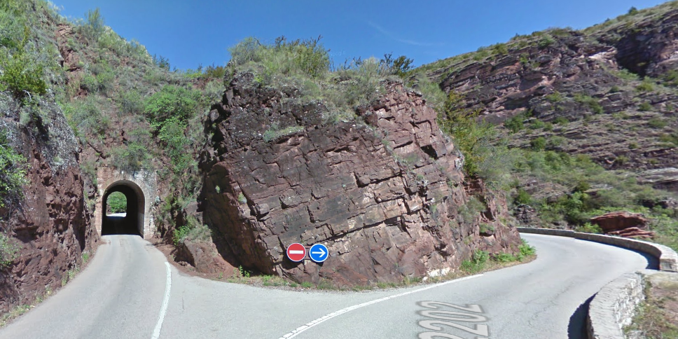
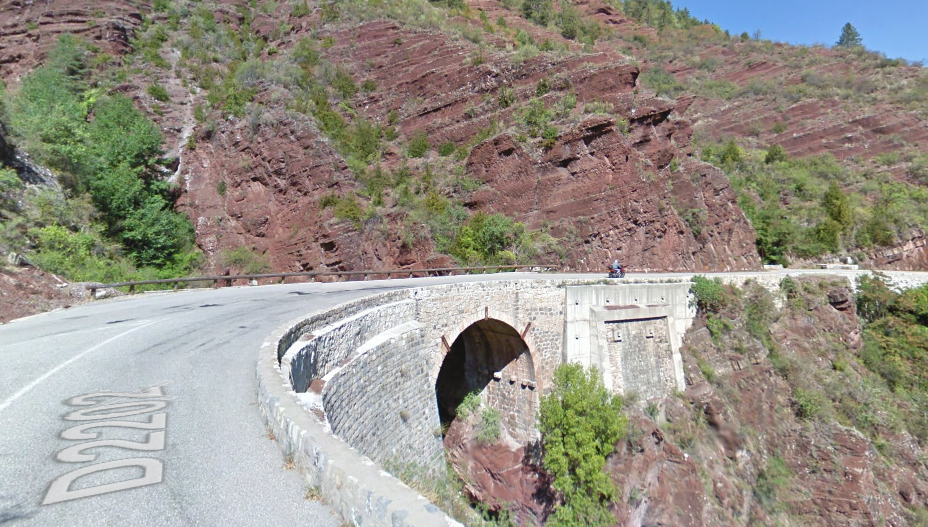
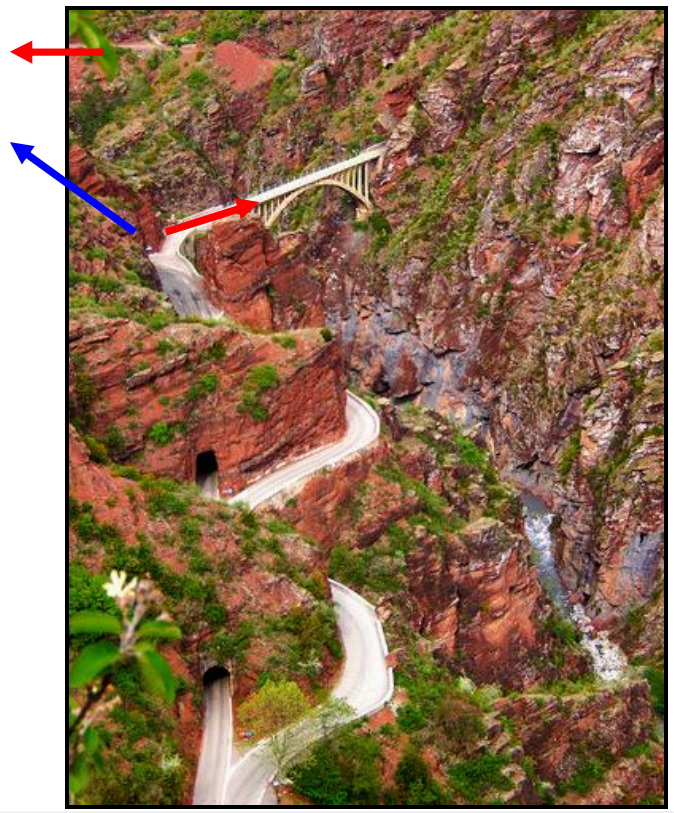
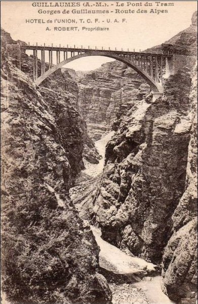
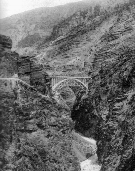
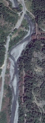
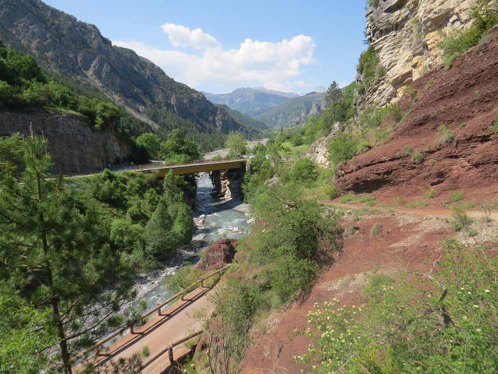
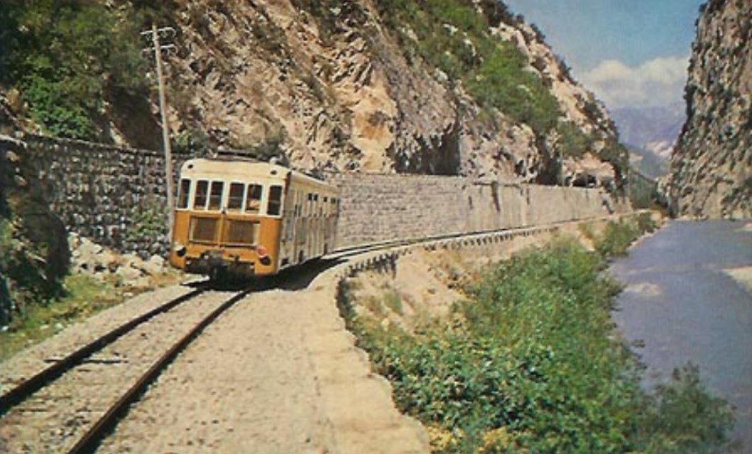
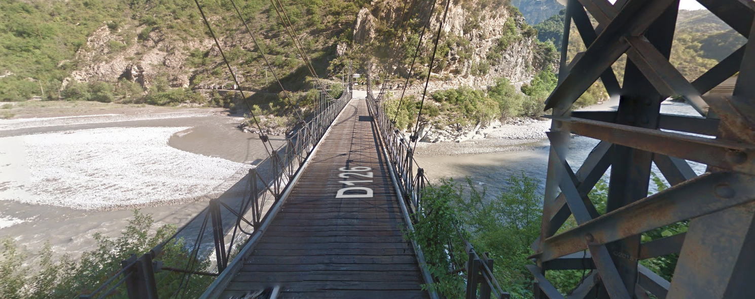
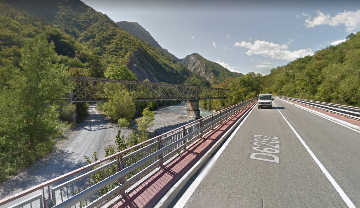
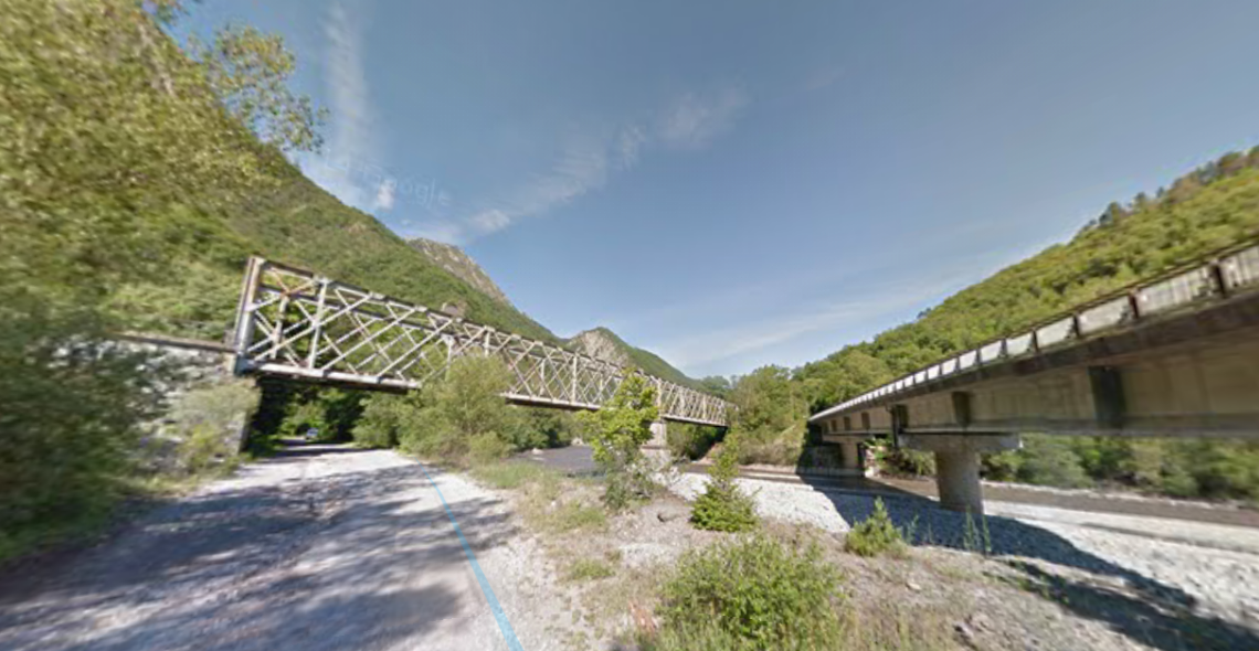
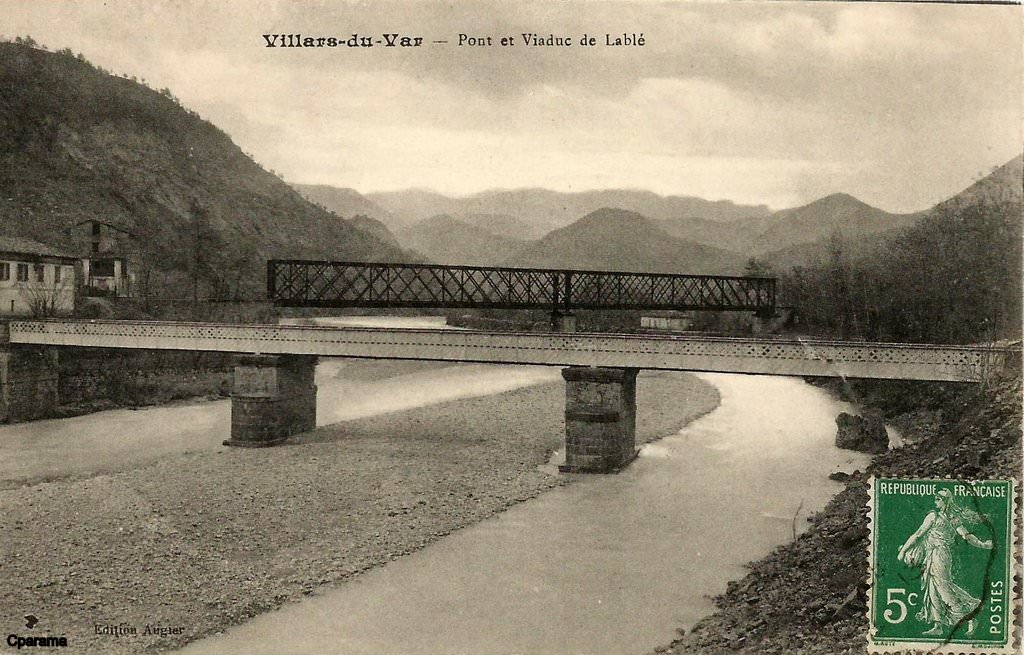
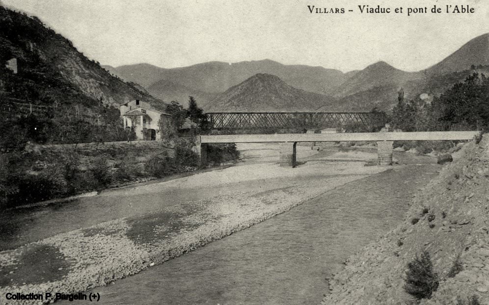
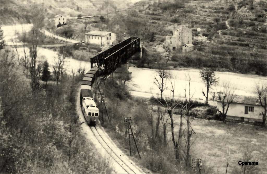
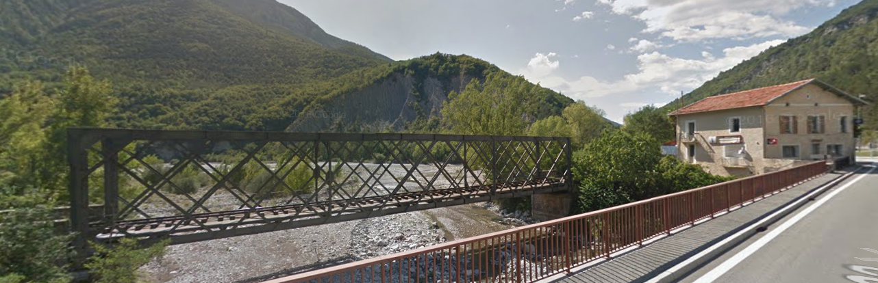
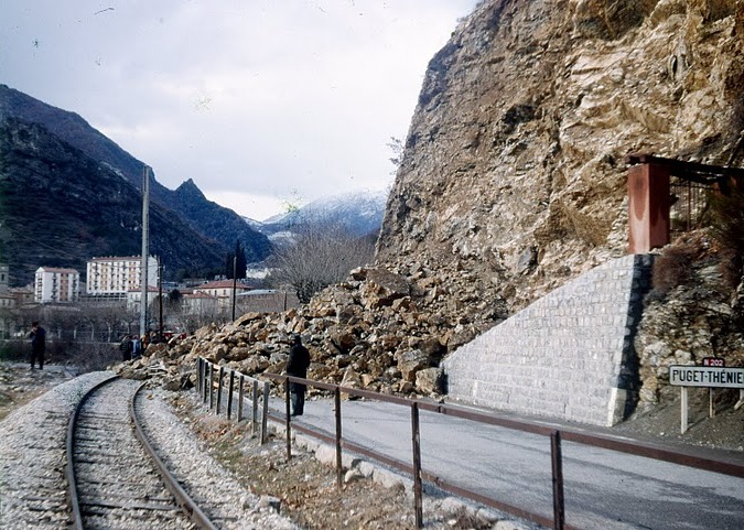
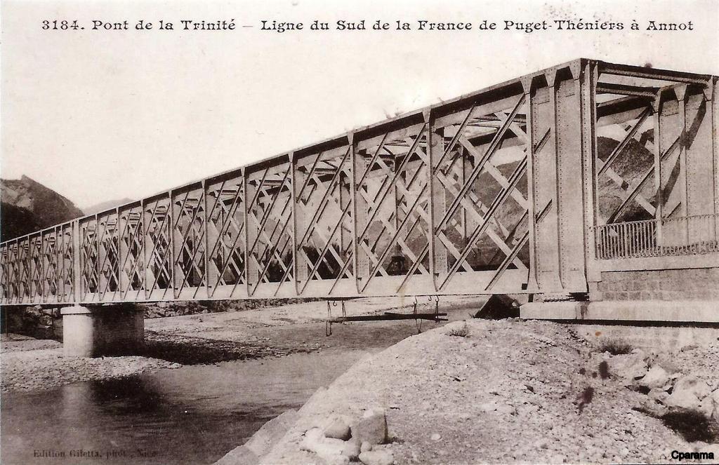
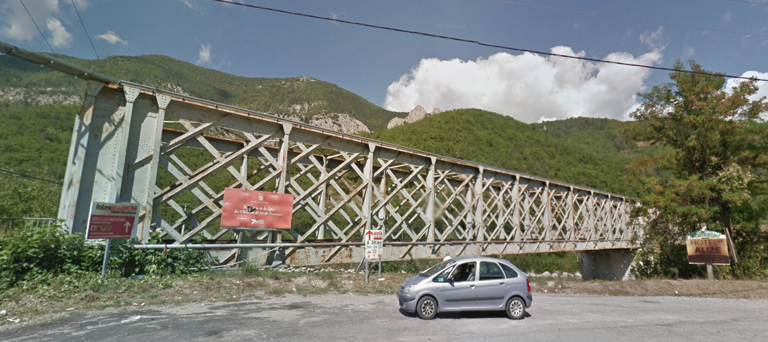
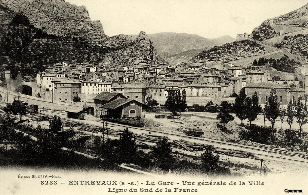
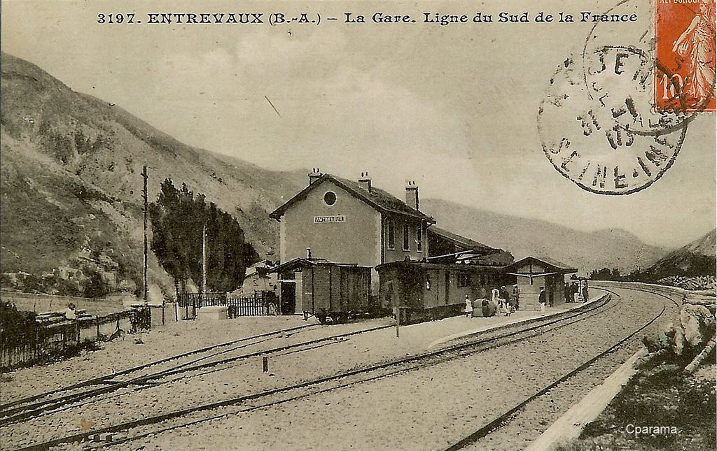
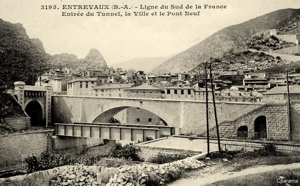
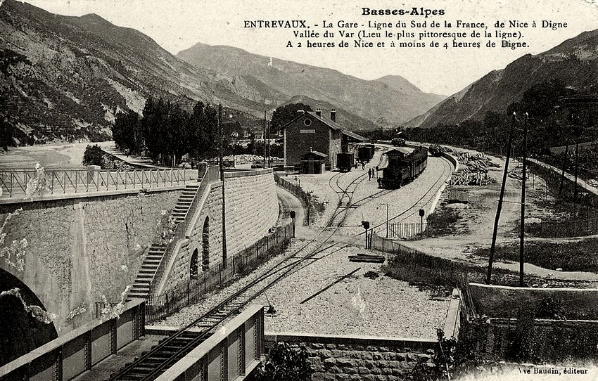
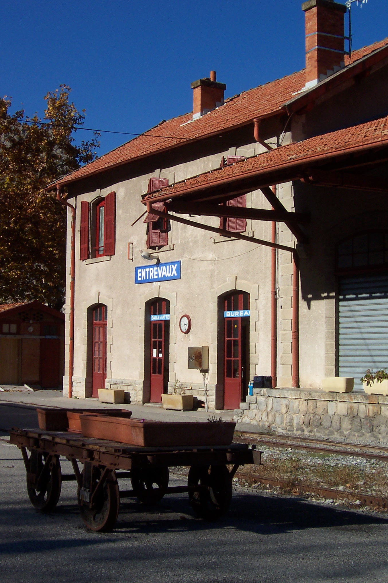
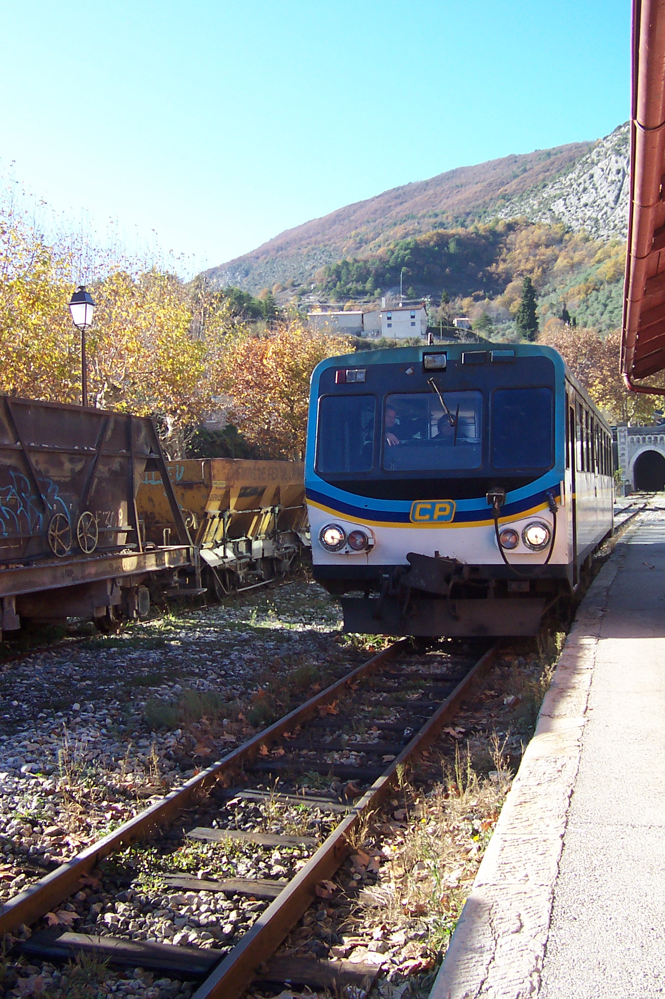
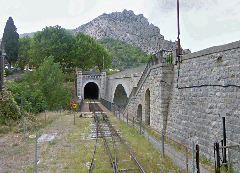
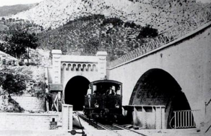
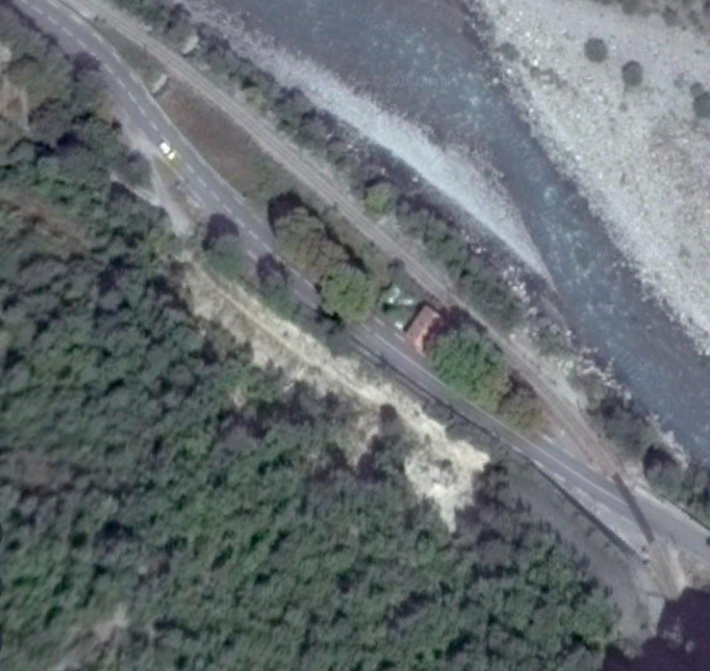
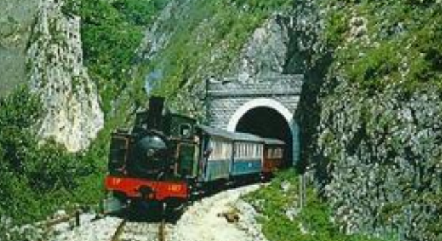
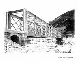
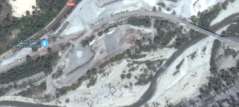
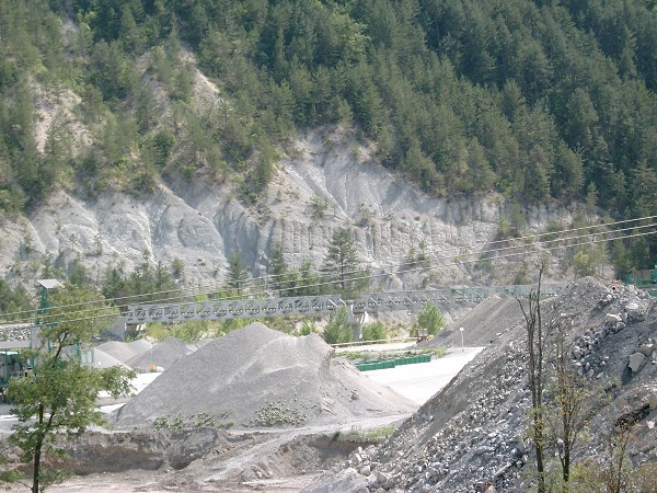
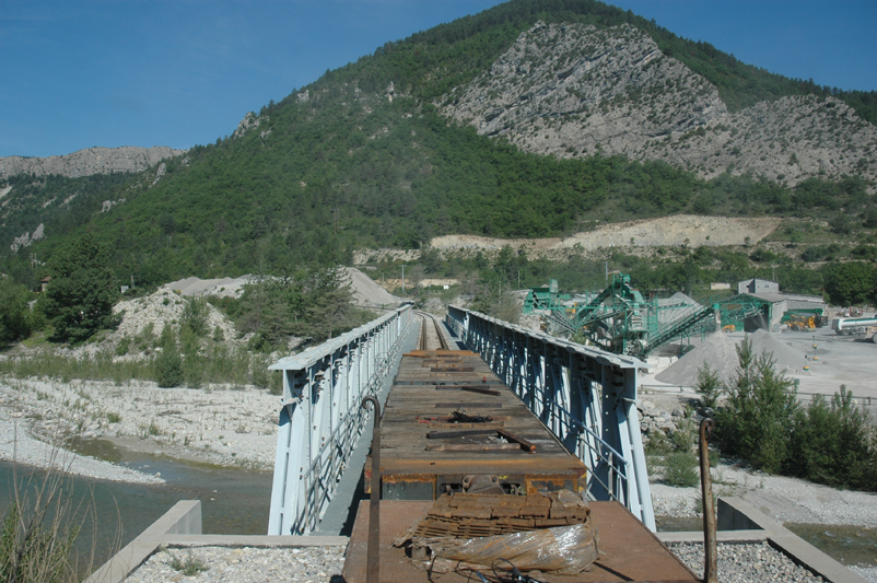
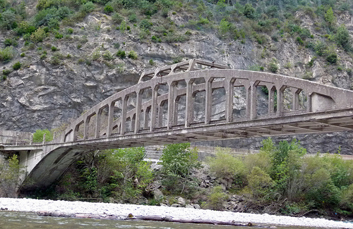
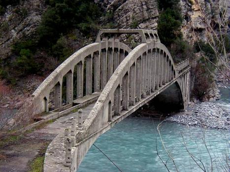
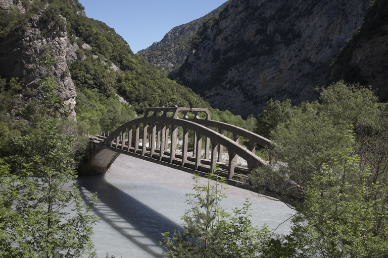
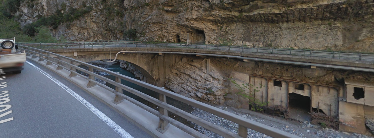
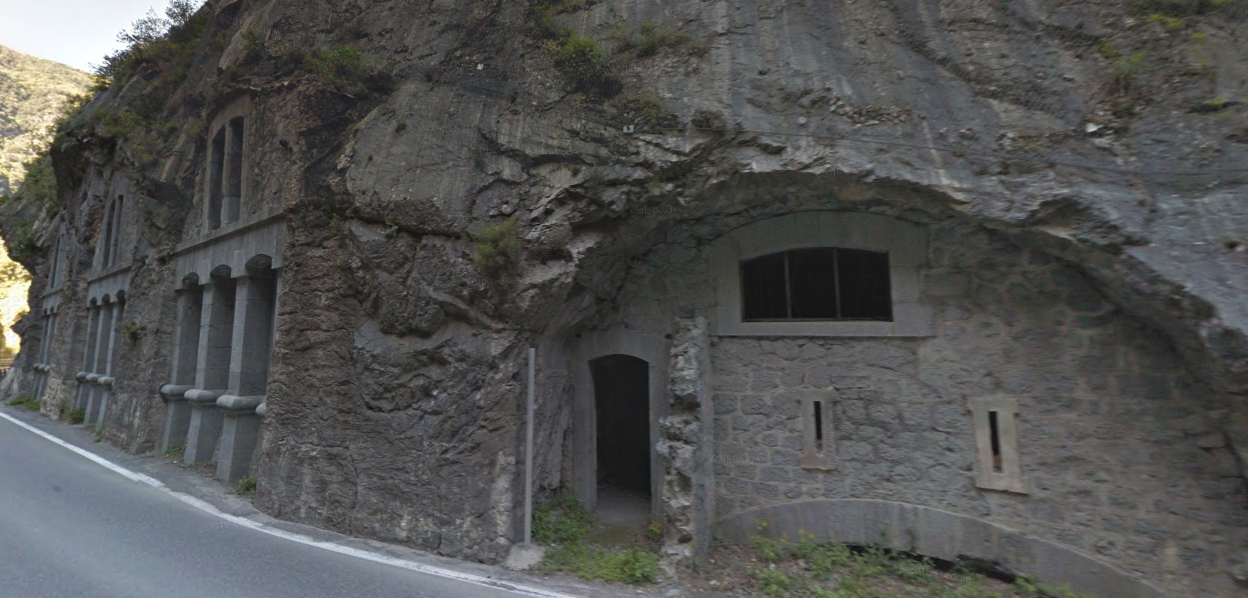
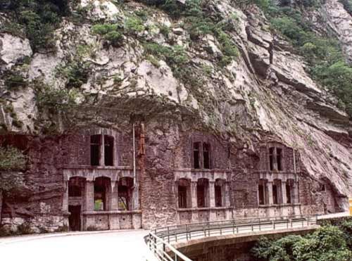
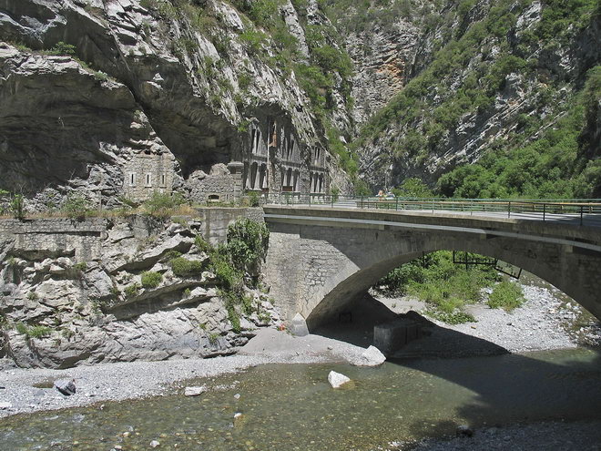
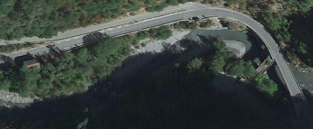
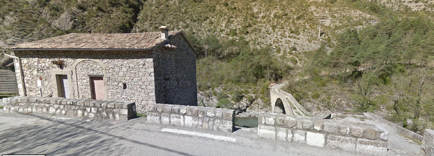
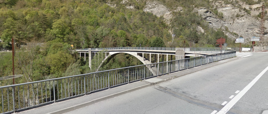
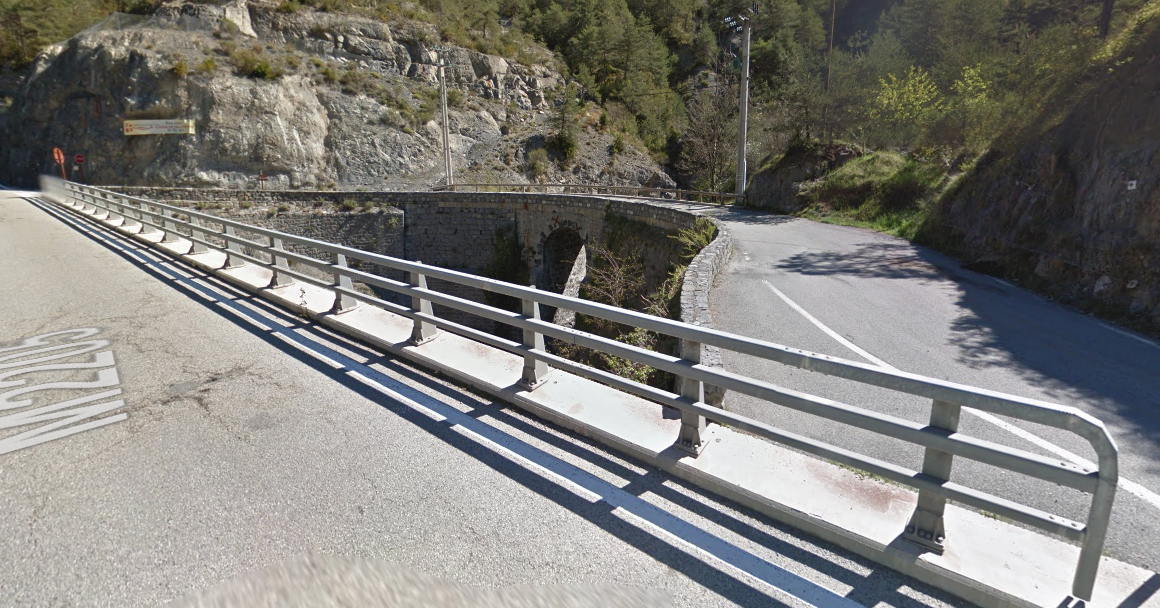
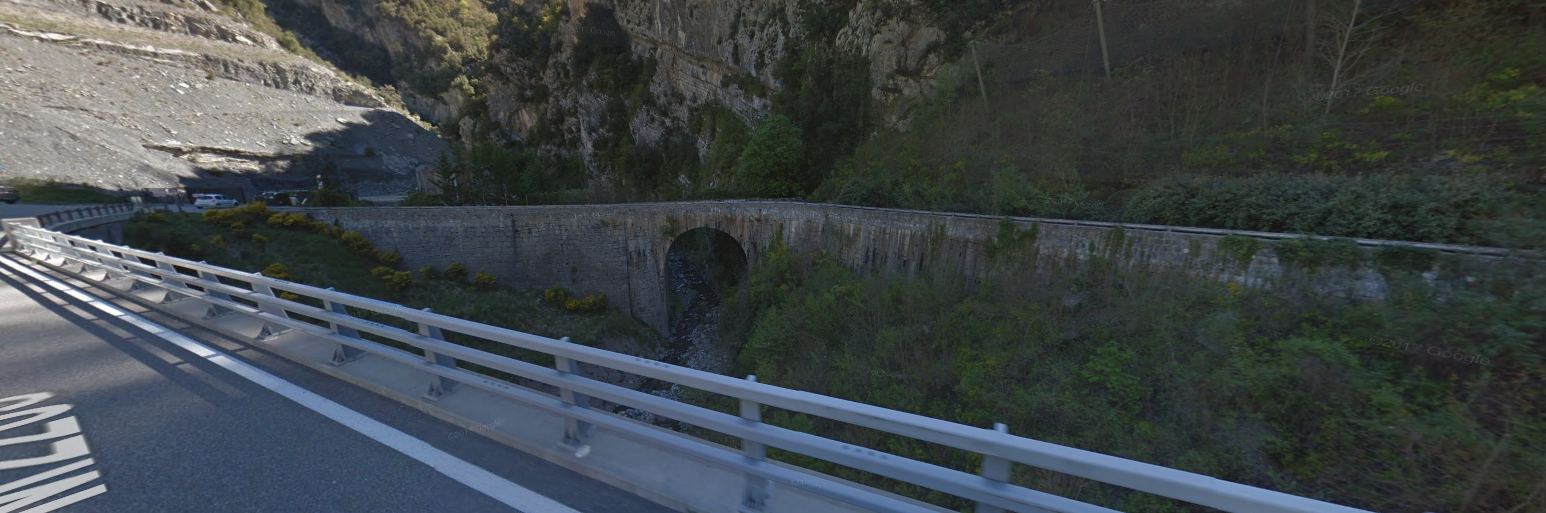
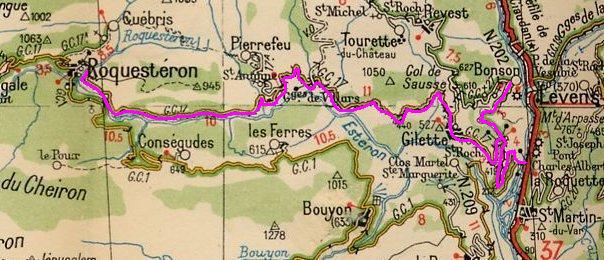
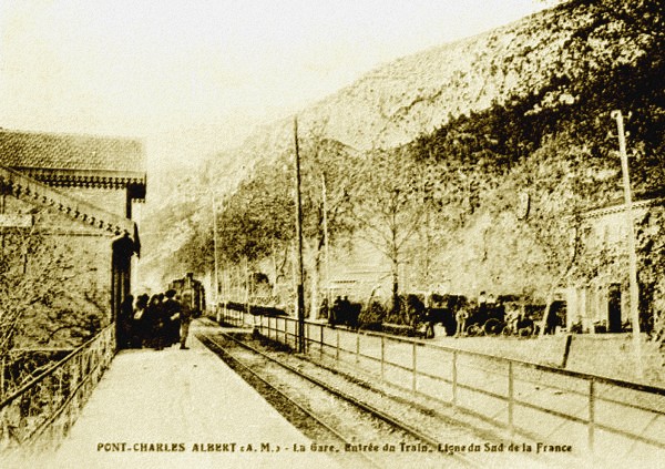
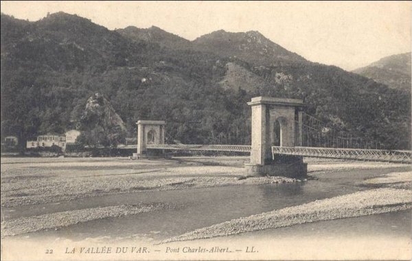
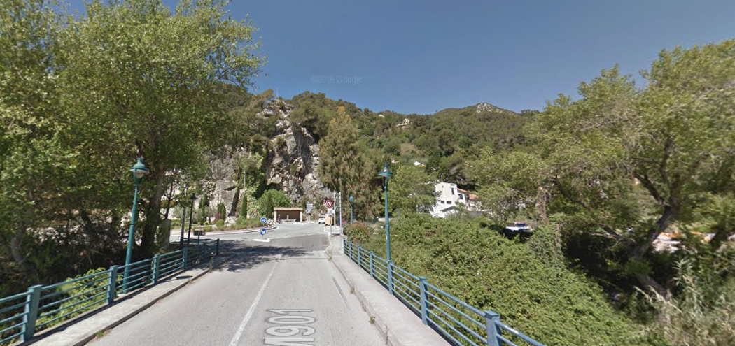
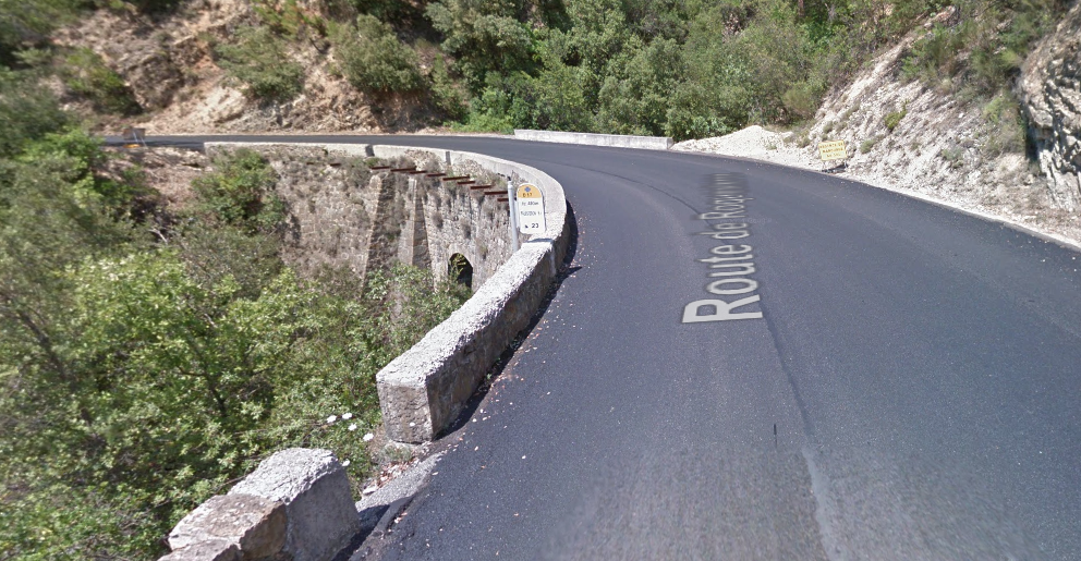
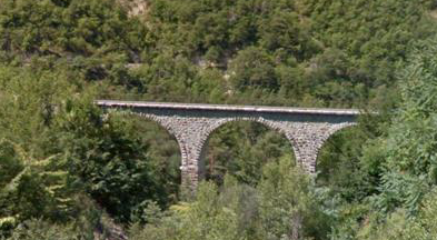
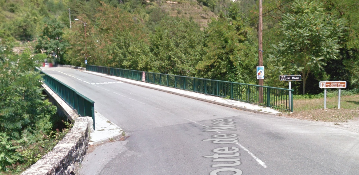
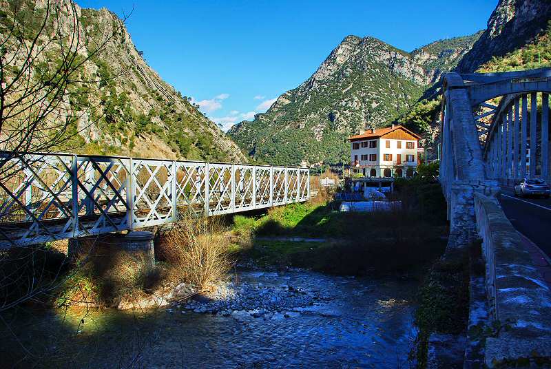
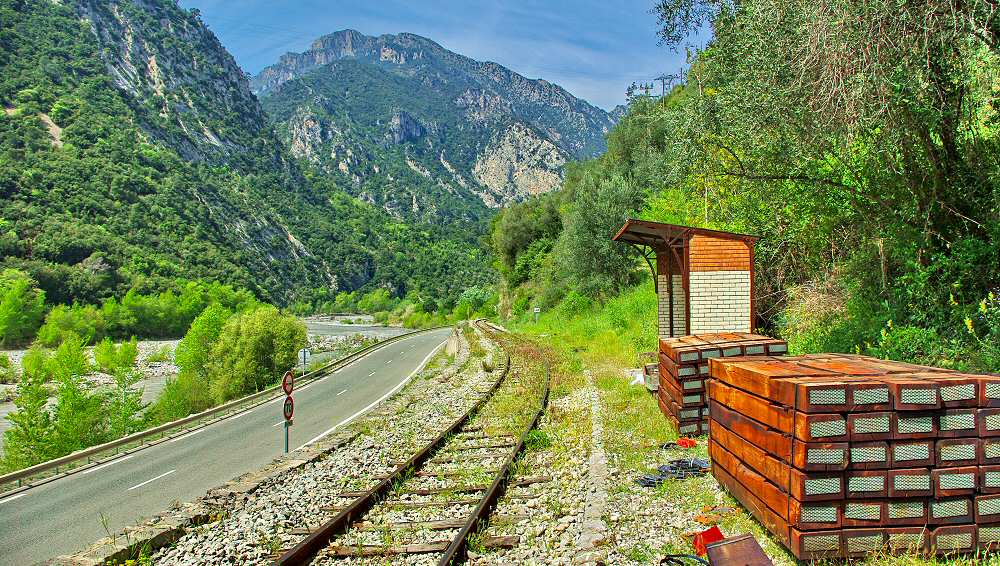
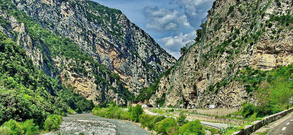
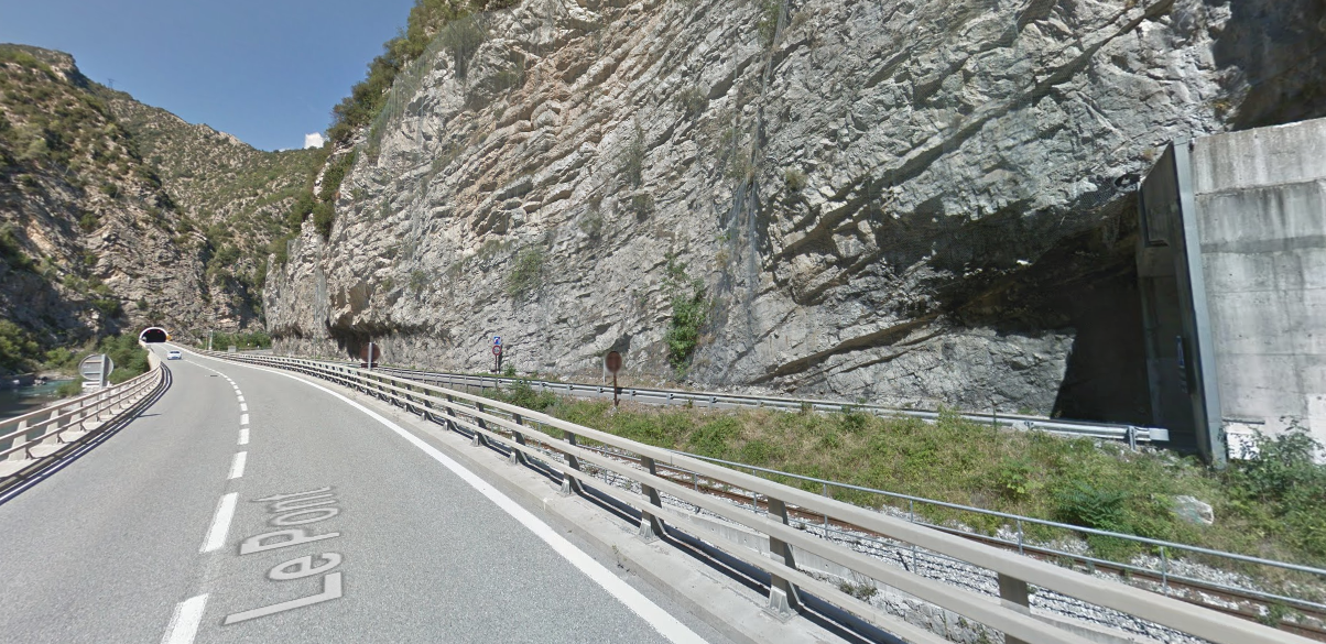
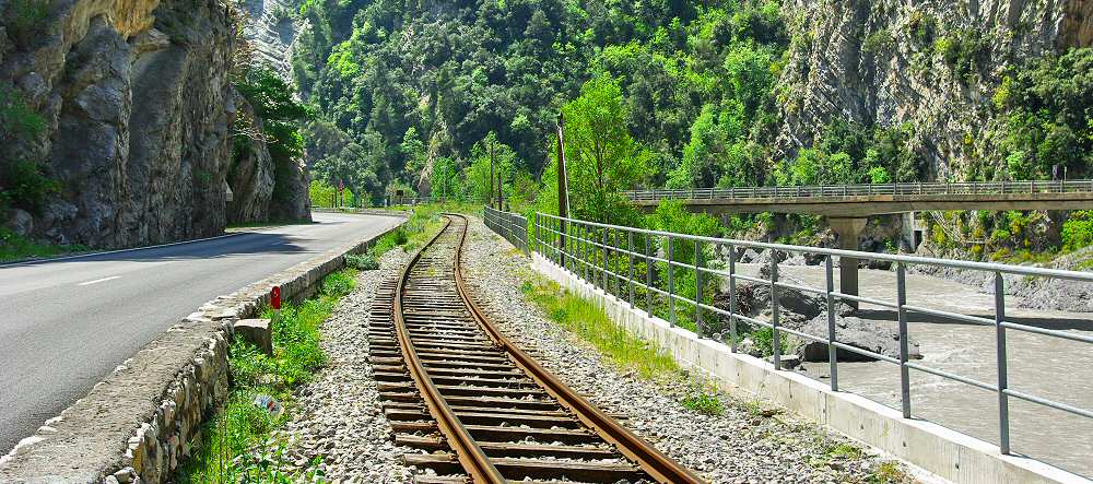
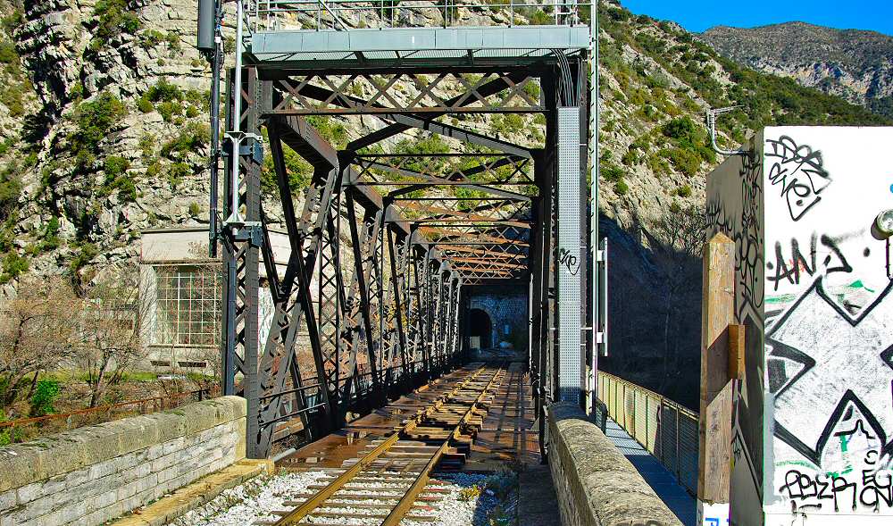
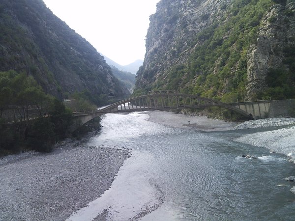
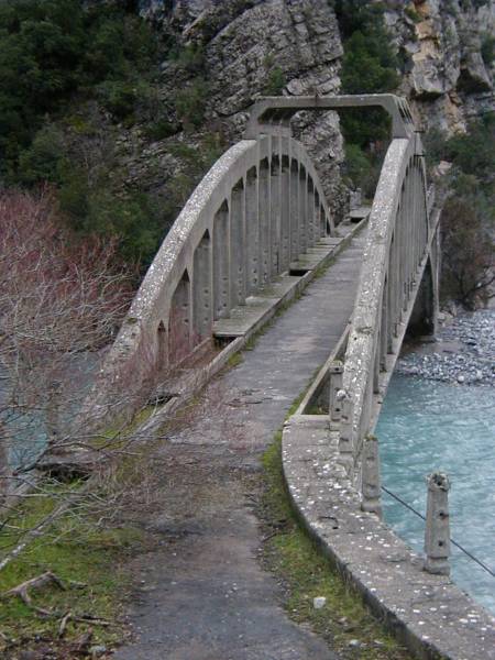
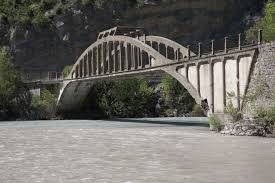
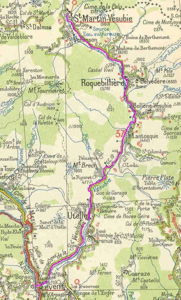
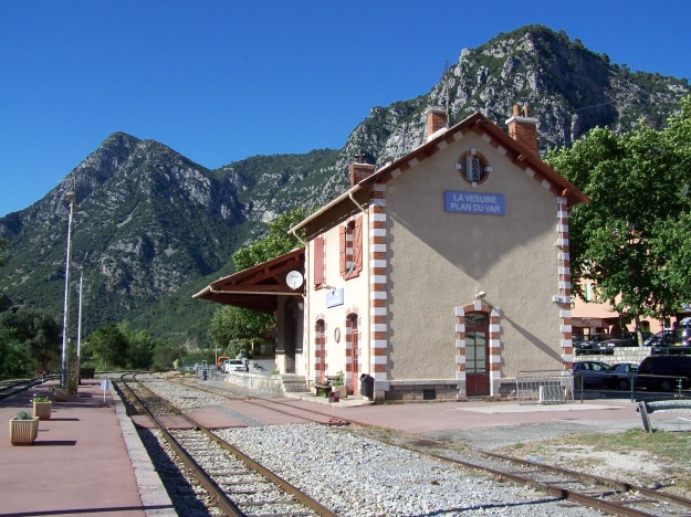
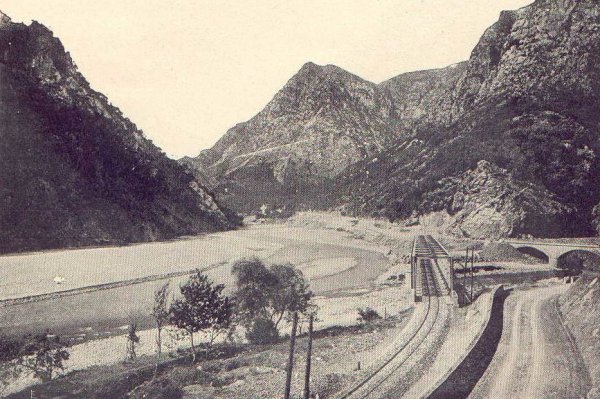
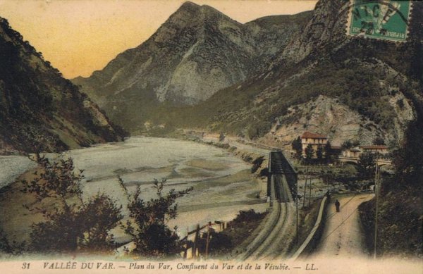
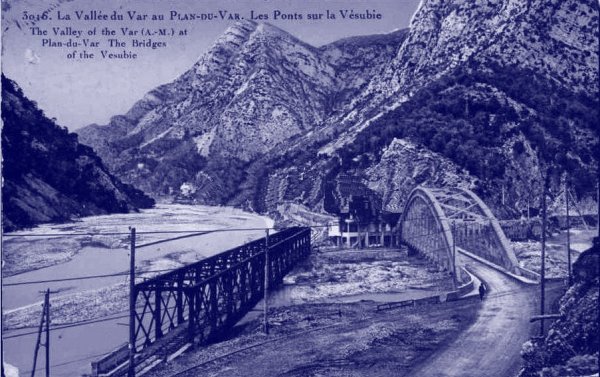
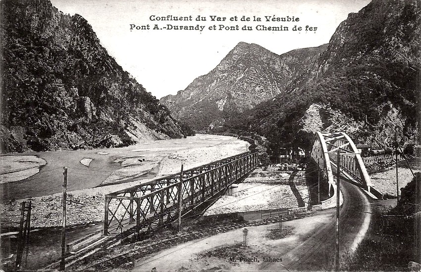
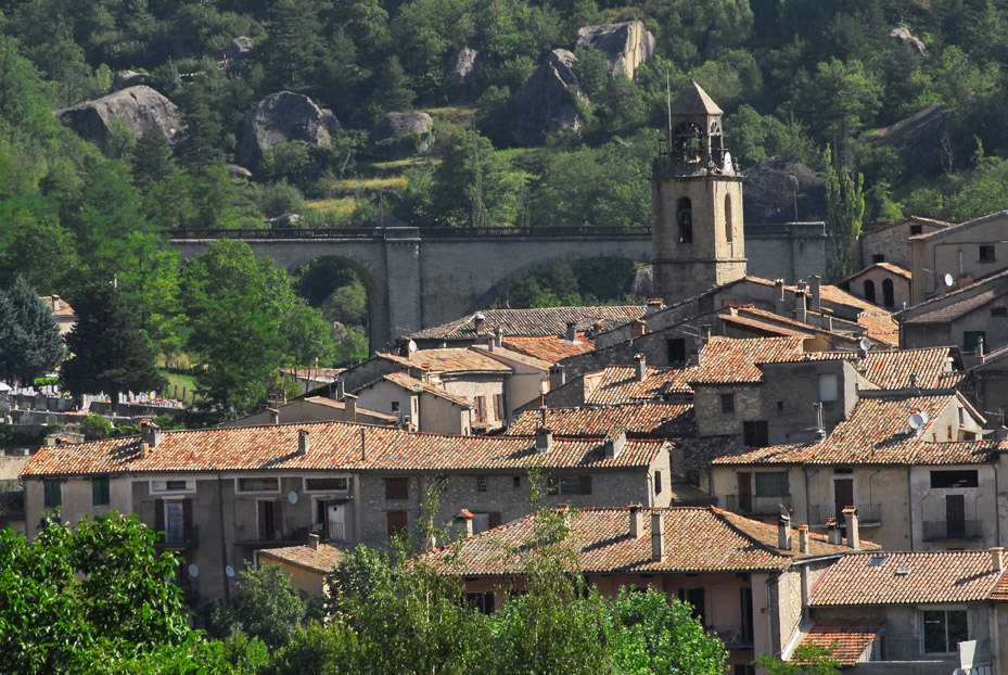
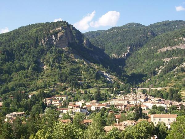
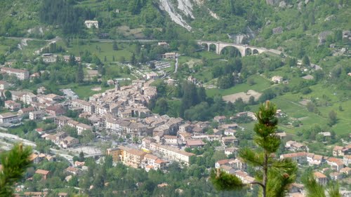
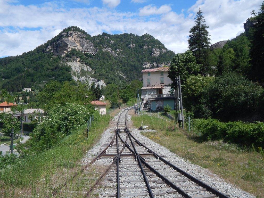
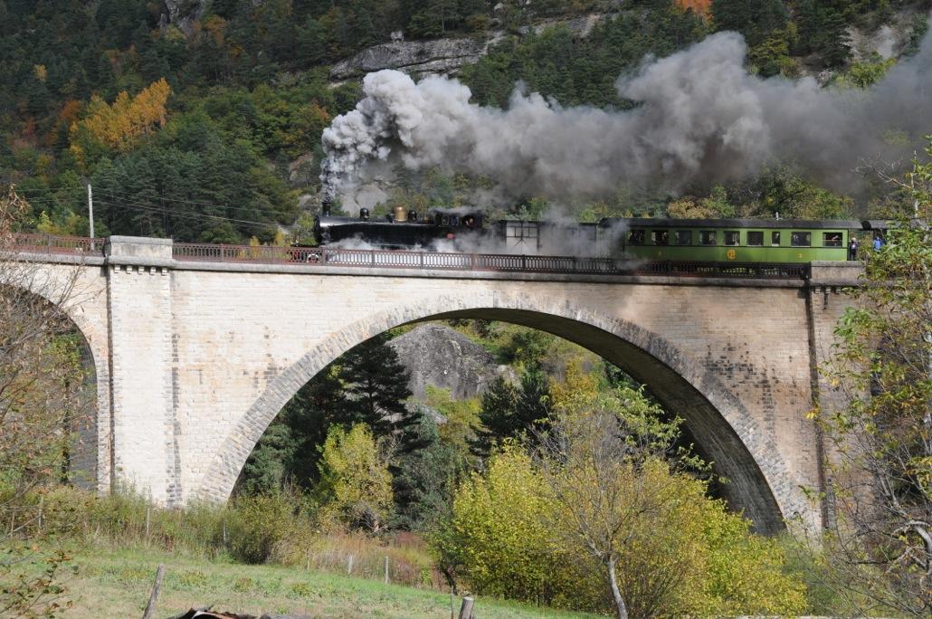
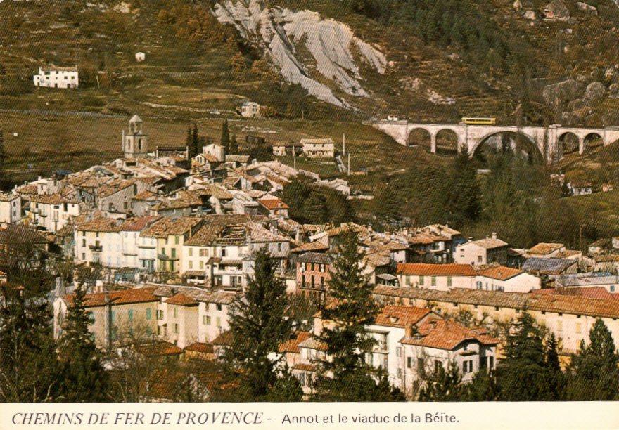
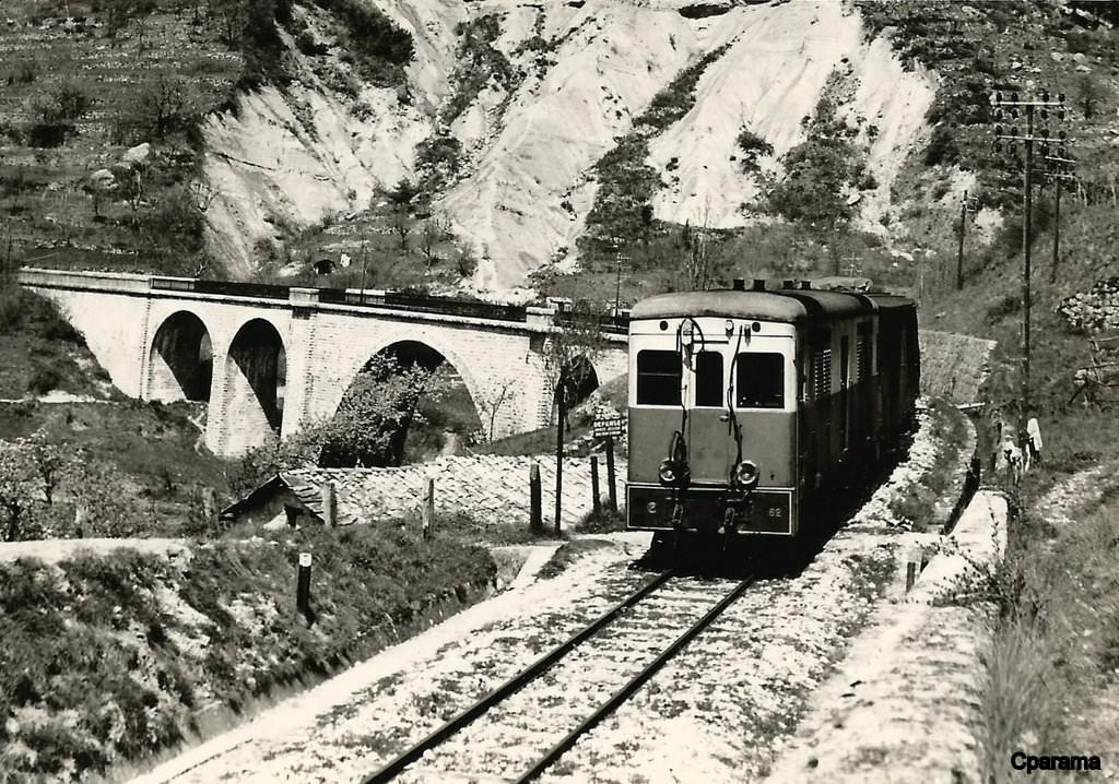
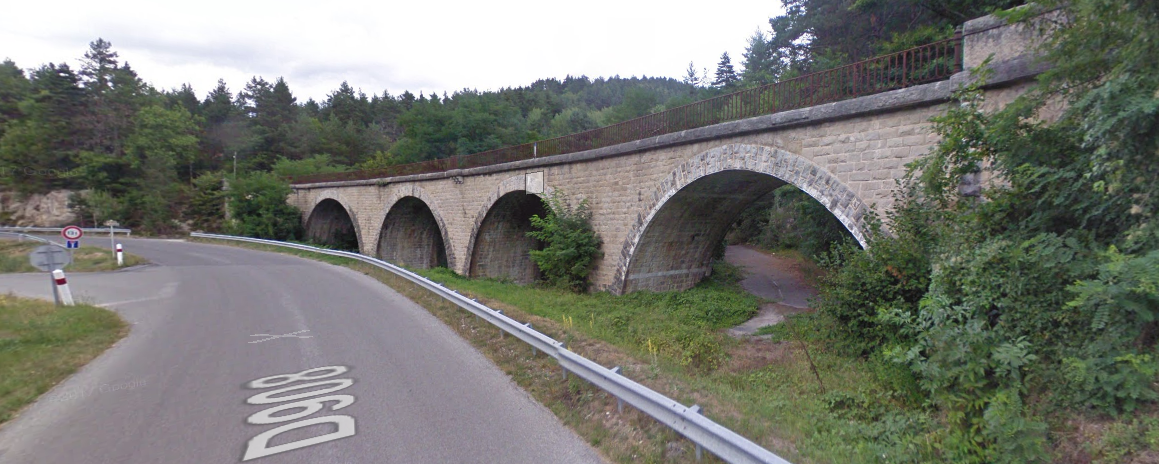
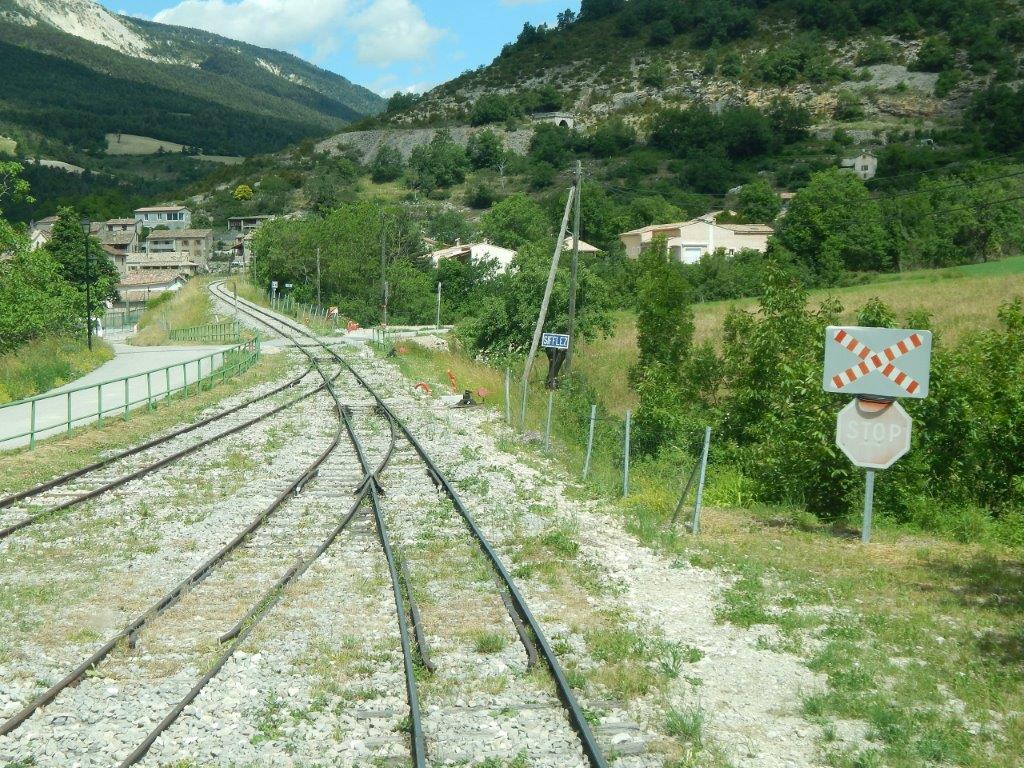
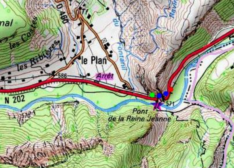
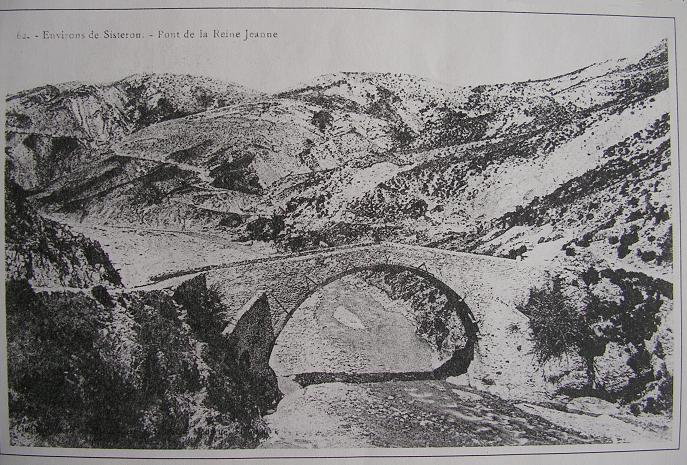
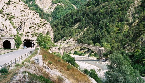
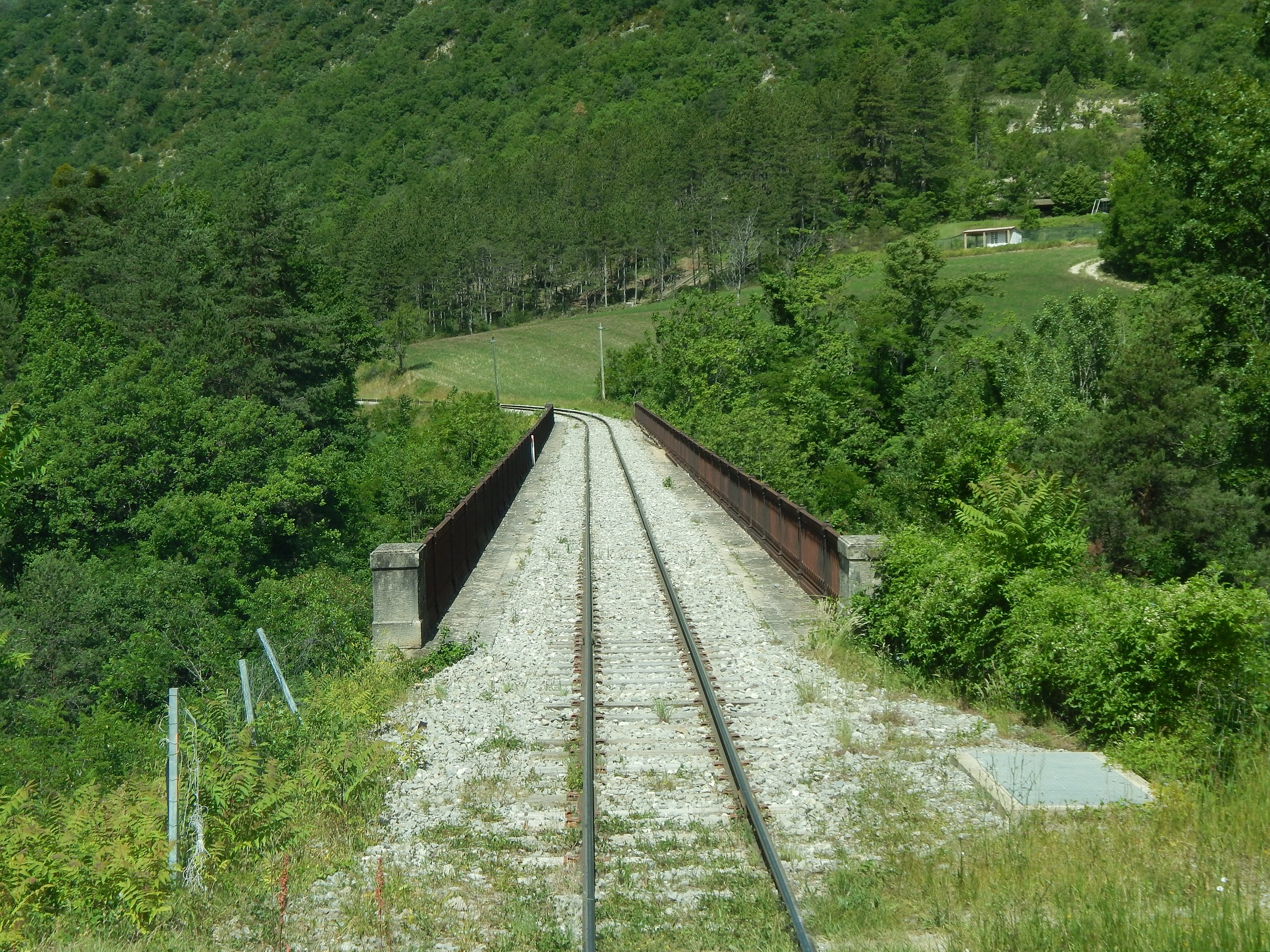
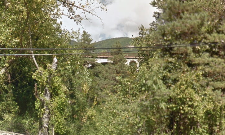
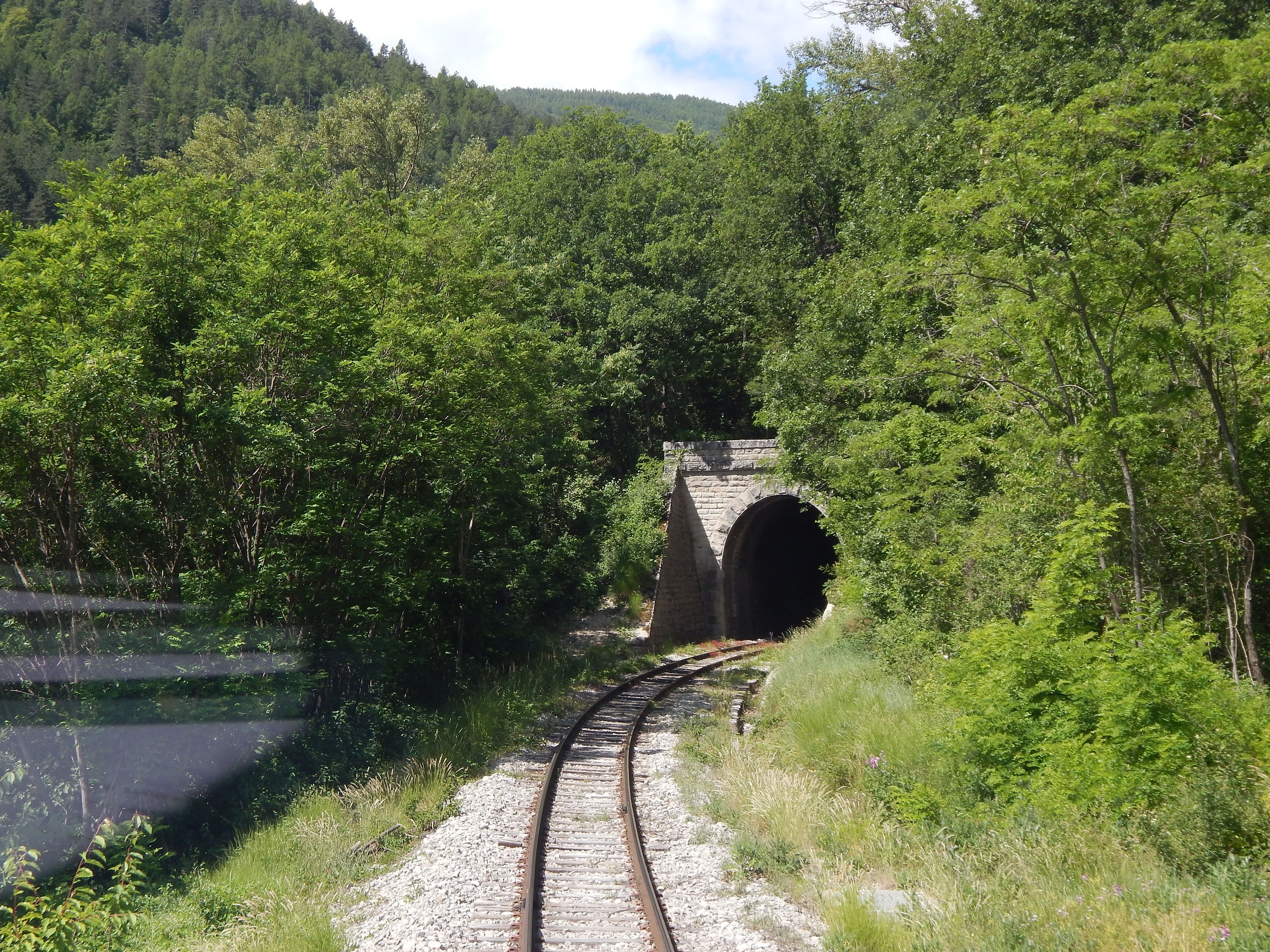
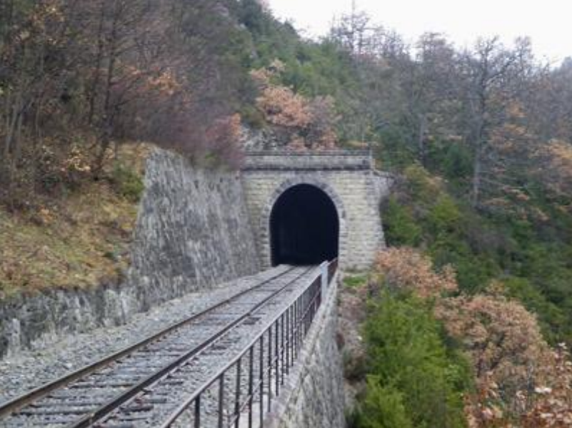
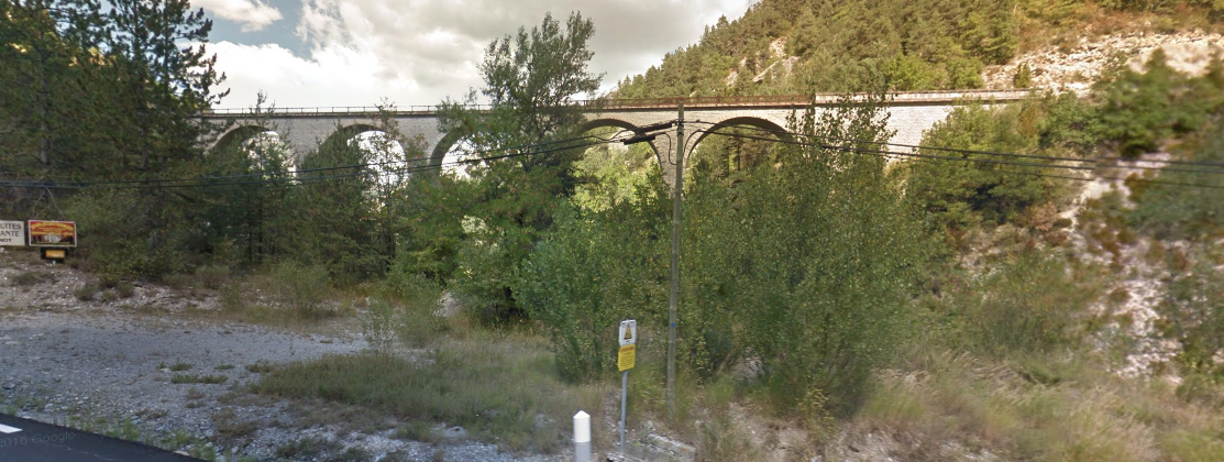
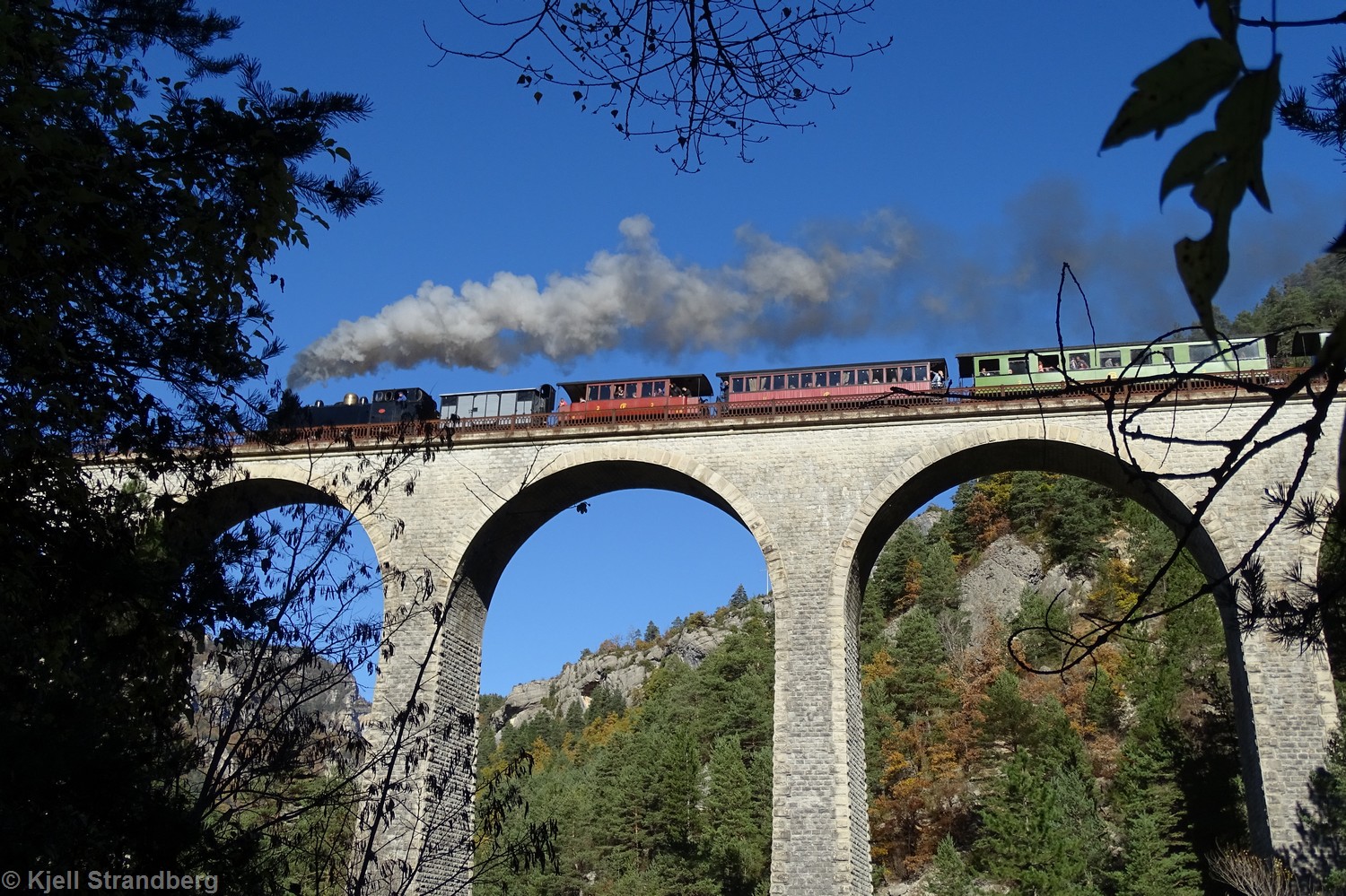
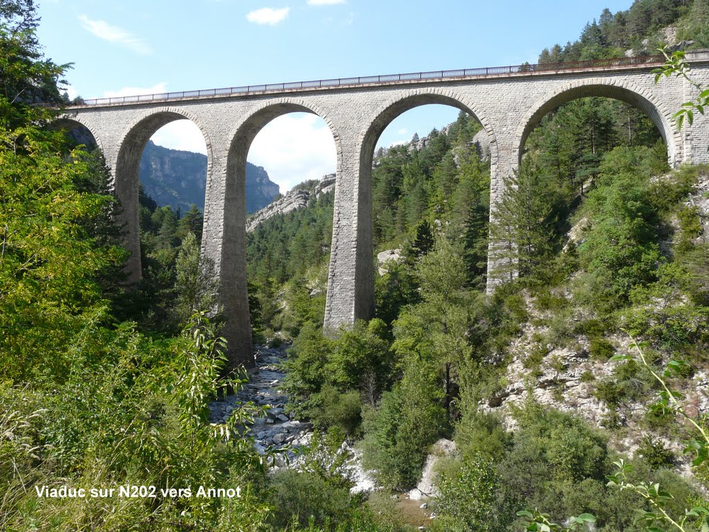
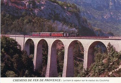
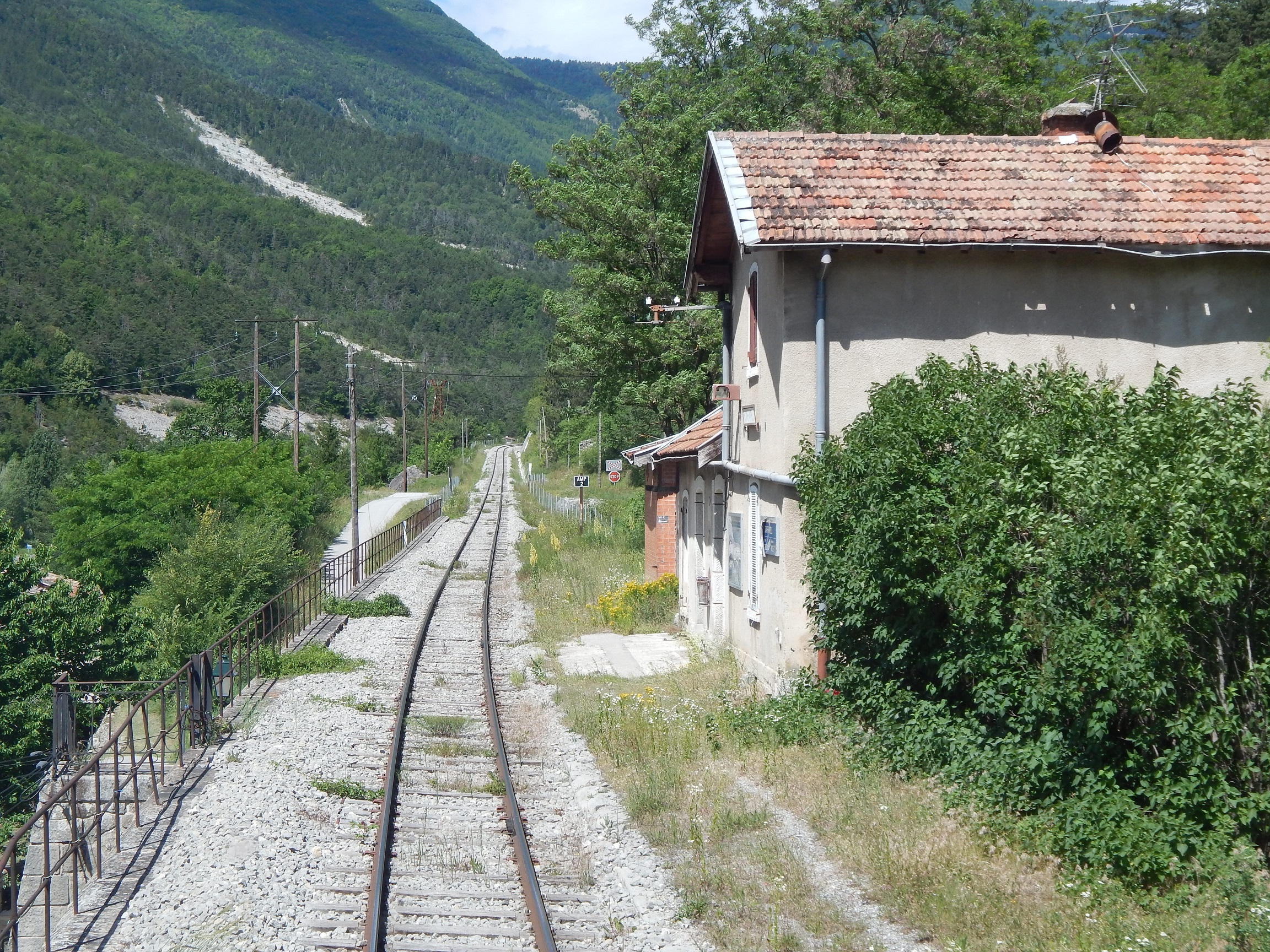
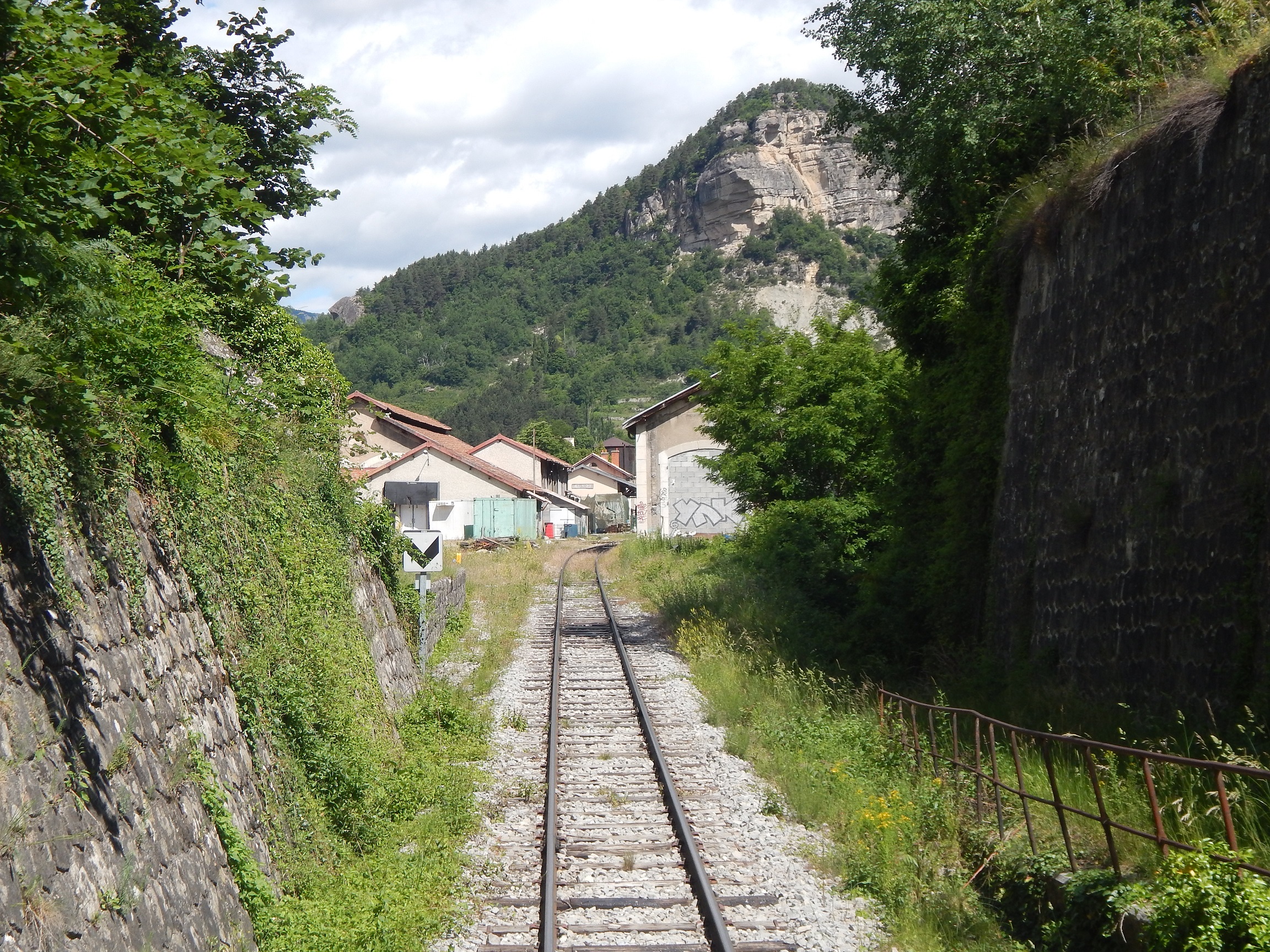
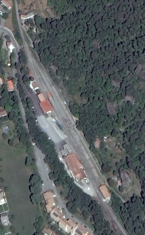
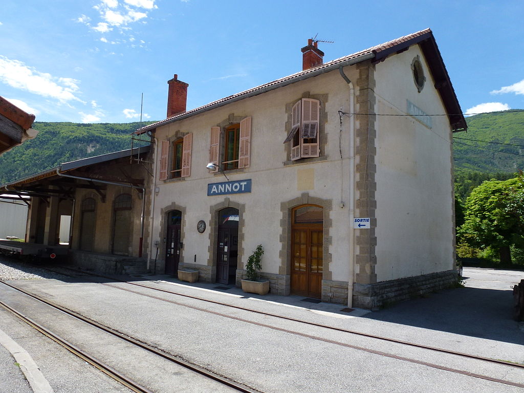
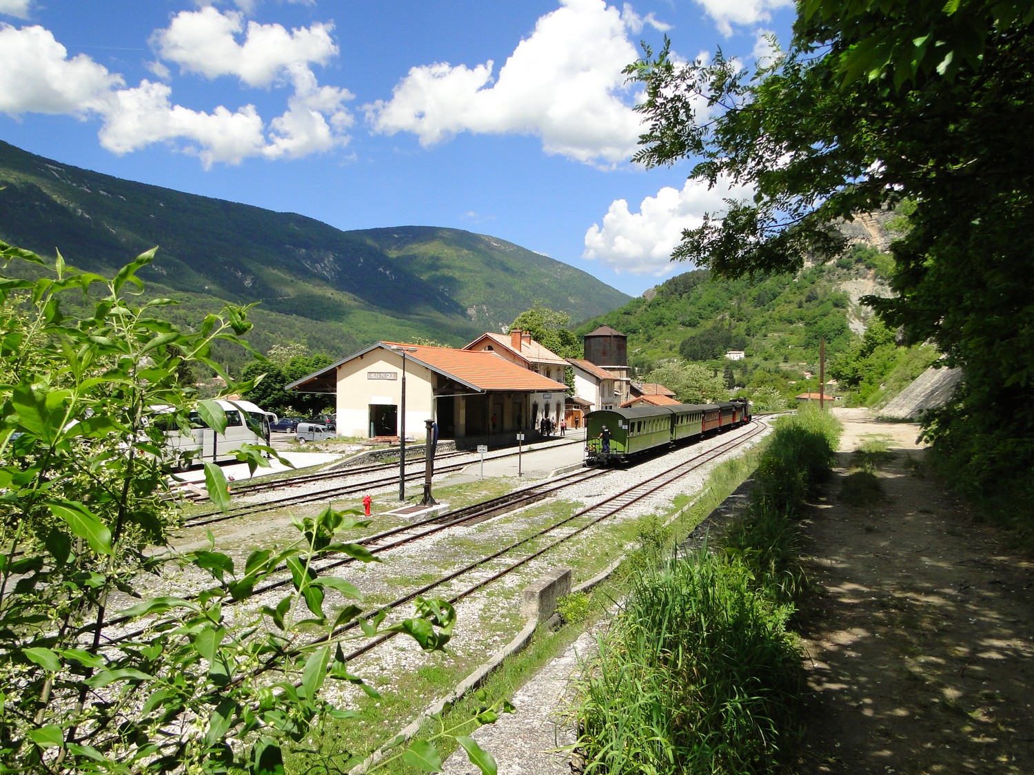
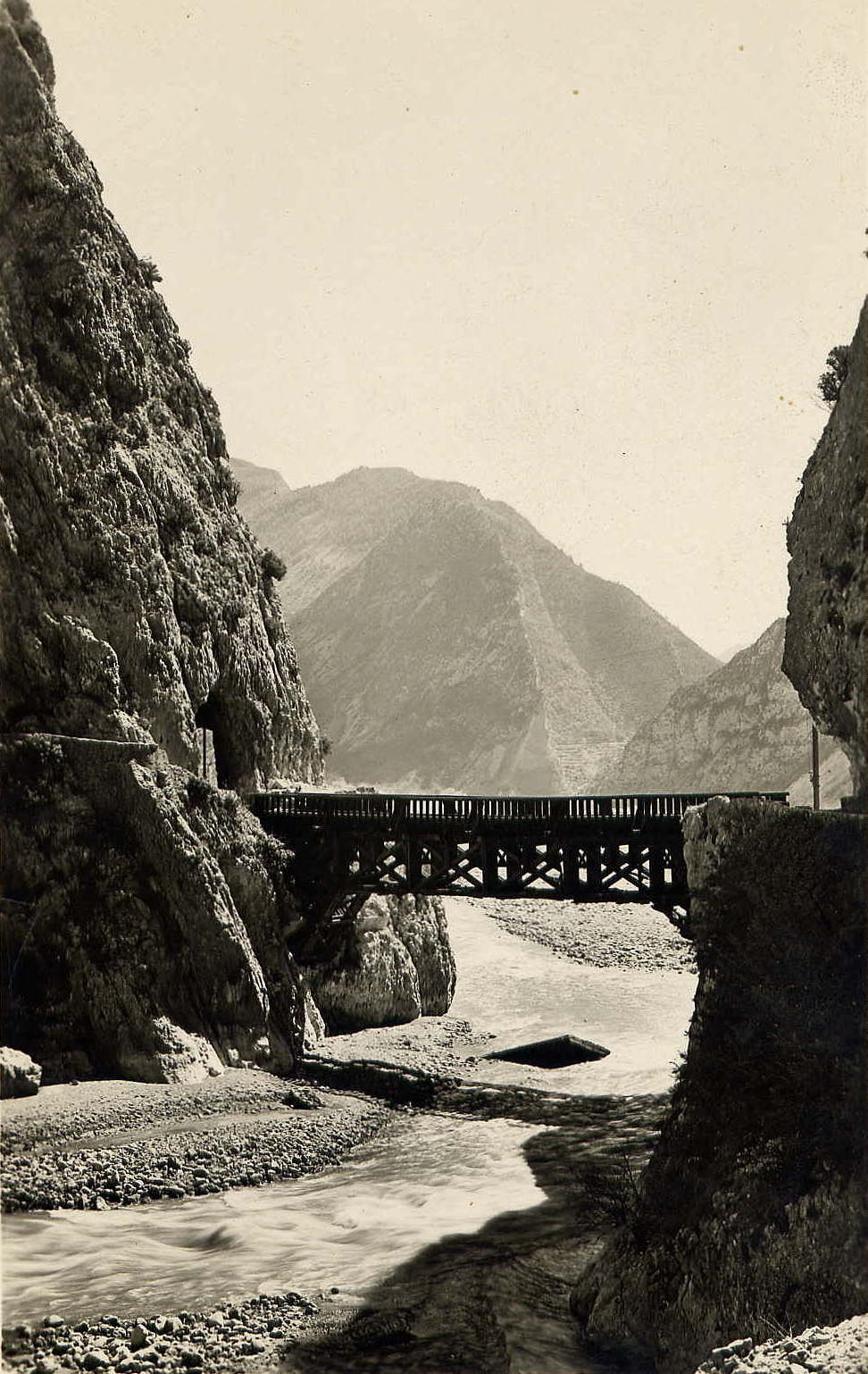
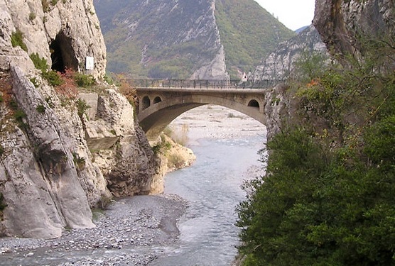
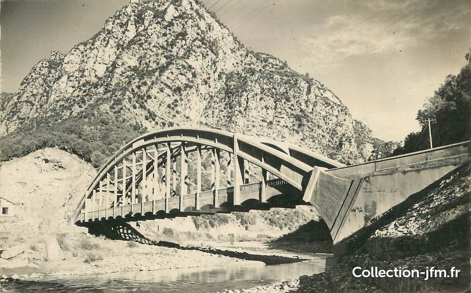
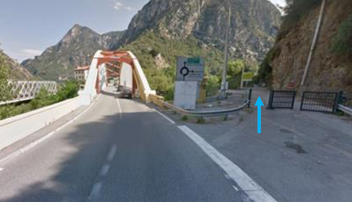
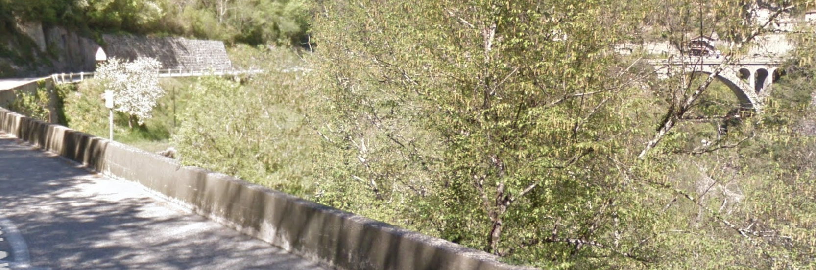
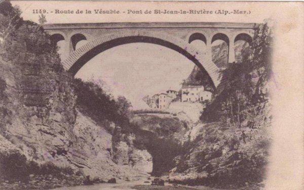
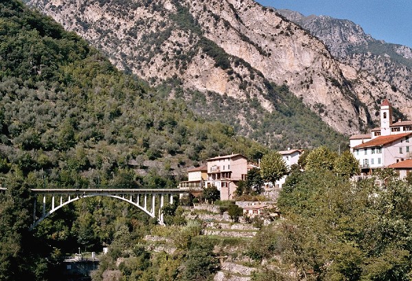
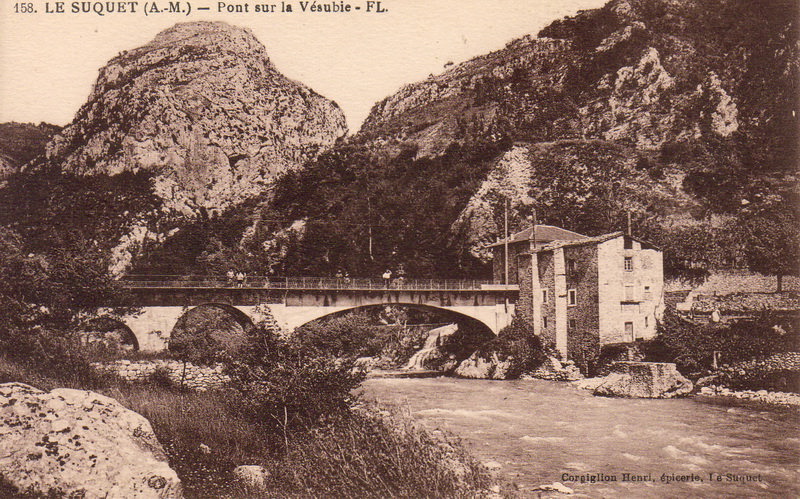
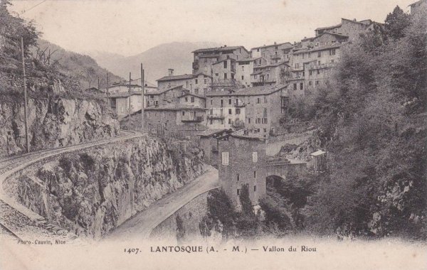
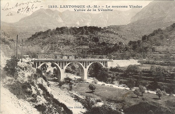
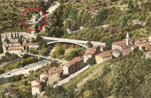
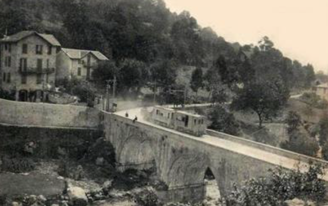
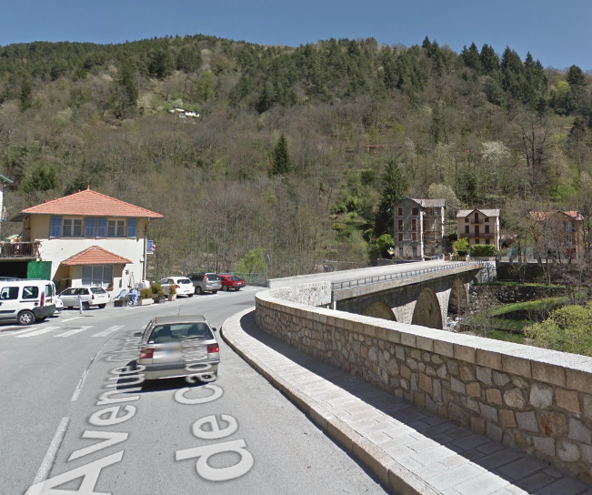
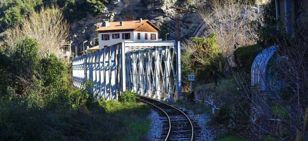
Taken from the railway in the 21st Century. This picture shows the truss girder bridge over the Vesubie on the Nice Digne Line and the road bridge (Concrete Arch) behind the vegetation.The two postcard pictures immediately above were found for sale on the collection-jfm.fr website in 2018. [5]The 1955 1:50,000 IGN map shows a track which was once the tramway along the Vesubie River Valley commencing at the road bridge, Pont Durandy, and running under the ’43’ (on the map) before turning North to cross the river and join the roadway up the valley. [3]The plan above shows the road route into the Vesubie Valley marked with the green arrow the blue dotted line is that of the old tramway. The tram line crossed the road just before the Vésubie bridge. She went up this last about 400m before crossing it in turn on a bridge that has now disappeared. [2] The image below shows the location of the tramway formation as it can be seen in the early 21st Century. [2]After traveling for around 400m on the South side of the Vesubie River the tramway crossed to the North side and joined the road at the point shown on the image above.

The General Council of the department decided to construct of three lines in the area on 10th February 1906. They were The Plan-du-Var – Saint-Martin-Vésubie line for the Vésubie valley and, for the Tinée valley, the “La-Tinée” line – Saint-Sauveur-sur-Tinée. These two lines were given to the TAM (Tramways of the Alpes-Maritimes) to manage [6] . The third line was the Nice – Levens line, allocated to the TNL (Trams of Nice and Littoral). [7]

Within just a few weeks of the establishment of a Municipal Council for St. Martin-Vesubie (1908) a campaign was inaugurated to see modifications to the proposed tram service to the town/village which included revisions to the planned station location and layout. The budget for the station site was originally 6,000 francs. The revised and agreed scheme amounted to 10,000 francs.

Considered a priority, the Vésubie line was commissioned in 1909. Construction took place, during that year and the line opened on 1st September 1909. However, electric powered tramcars were not delivered in time for the opening and for approximately one year steam engines were in use on the line. Electric trams finally entered service in 1910.

The trams allowed both good s and passengers to be transported quickly: the cans of milk from the pastures were delivered directly to the centre of Nice and other perishable items also reached buyers much more quickly.

In translating French to English in my last post on this line, I managed to misconstrue the history of the line. In that post I said that the line did not reach St. Martin Vesubie until 1928 and Roquebillière in 1926. What I should have understood at the time was that there was an interruption in the service betwen 1926 and 1928. A huge landslide that buried the village of Roquebillière also covered roads and railways. 24th November 1926, date of the tragedy, was engraved in local memories. As a result, the saints-martinois had to take a bus to complete their journey until the trams were again allowed to cross the landslide in September 1928. This transhipment promoted the use of coaches instead of trams and as a result it was decided to close the line in 1929. Tram transport was, by then considered archaic in the face of competition from the automobile.

Positive decisions in favour of the tramway were regularly made within the local communes and the tramway was seen positively until the advent of the Great War. However, the last action by the Municipal Council relating to the line was the refusal of an increase in tariffs on the line because of the increased competition from buses and lorries It seems that the demise of the tramway was already anticipated, long before the Roquebillière disaster provided what was ultimately the fatal blow to the line.

I came across the adjacent image of a Nice-St. Martin bus, while researching the route on the internet. I cannot remember where I found it. It is perhaps easy to see that the newer and more reliable buses provided very strong competition for the trams.

Once the tramway crossed to the north side of the Vesubie close to Plan du Var, it followed the road perched above the river [10] for some distance. There was a short tunnel through which the old road passed in the 1950s which was probably in existence at the time of the tramway.

The road leading to that tunnel (and the route of the old tramway) can be seen below diverging from the newer road and tunnel. [11] The image is taken from Google Streetview. A similar image shows the old road/tramway formation, close to the River Vesubie, returning to join the newer road/tunnel on the north side of the rock outcrop. After the tunnel the formation/road passes through La Madone (La Cros d’Utelle) still following what is the northwest bank of the river.A typical early postcard view of the road alongside the River Vesubie before the tramway was constructed. [8]A typical scene on the road up the Vesubie Gorge. This picture was taken in February 2017. The road was closed to allow the landslide to be removed and the site secured. [9]The station building next to the river at La Cros d’Utelle (La Madone). [1]

From La Madone (La Cros D’Utelle), the tramway continued along the West bank of the Vesubie and through a short (20 metre) rough-hewn tunnel which is shown in the map below and in the two images which immediately follow the map. [11]The pictures immediately above show typical scenes along the route of the tramway formation which is now hidden under the M2565 road through the Vesubie Gorge. The first picture is from Google Streetview and shows a narrow private footbridge providing access to a steep footpath on the East bank of the river. The second shows a tunnel and almost hidden a bridge supporting the road over the river. The third photograph shows the entrance to the tunnel (Tunnel de Pagary Longeur) which is located on the map below. [11]

Interestingly, the TAM lines were equipped with a single-phase electrical supply of 6600 Volts, 25 Hertz. The catenary was suspended from wooden posts or cliff walls by metal brackets. Th electric traction units worked throughout the life of the tramway (approximately 20 years) although some improved units were provided in 1920 on the line of Vésubie. In 1911, four to five round trips of trams were scheduled each day. But by 1914, because of the war, there were only two daily movements until the line was closed in 1929. [7]

North of the tunnel the gorge narrowed significantly and hemned in the tramway. The adjacent photograph gives an idea of just how narrow the gorge cut by the Vesubie is/was at this point. As the gorge widens out again the tramway took the opportunity to cross the Vesubie onto its eastern bank by means of a very graceful arch bridge.

In the image below, Google Streetview has allowed me to pick out the bridge through the local vegetation. That photo is then followed by an older postcard picture of the bridge [1] – the first Pont de St-Jean-la-Riviere. There is a later bridge built immediately adjacent to the village which took a road over to the Westbank and up to Utelle.The bridge in the two images above is shown at the bottom left of the IGN map above, close t toe Colombier. The second, newer bridge is immediately adjacent to the village of St-Jean-la-Riviere where the M32 leaves the M2565/M19. The newer bridge is shown below. [12] Between these two bridges the tramway followed the West bank of the Vesubie while the main road took to the East bank. [2]The station at St. Jean la Riviere on the south-west side of the river, circled in red on the map below. It is now the town hall! [1][2]From the new bridge, the line travelled up the East bank of the Vesubie northwards out of the village of St. Jean la Riviere. In a couple of kilometres, the tramway crossed back to the west bank of the river by means of the bridge below. Within 300 metres, the Tarmway returned to the East bank by means of the structure show below.The tramway and road then travelled in an easterly direction towards Le Suquet.

Close to Le Suquet, the Gorge opens out and the tramway formation/road drift away from the River Vesubie before turning northwards to cross the river once again. Then for a time the tramway and road kept their distance from the river.The station building at Le Suquet [1] is shown on the adjacent plan circled in red. The bridge in the postcard above is circled in blue. [2]

North of Le Suquet, a new tunnel takes the M2565 on a straighter course than the old road/tramway took. The older route can be seen on the right-hand side of the picture below.. The northern portal of the new tunnel can be seen in the second picture below with the old road (and so the tramway formation) joining the newer road from the left.The tramway route remains on the West side of the valley through Le Fourcat and on towards Lantosque. Tram-travellers faced none of the confusion of modern drivers about which route to take. The trams just followed their tracks which took the higher route alongside the retaining wall in the picture below and then passed through a tunnel at St. Claire.The tunnel was just 28 metres in length. [11] The first image below shows the South-West Portal  and the tramway, the second shows the same view but from the 21st Century and the third picture shows the North-East portal. The second and third images come from Google Streetview. The tunnel is rough-hewn from the rock. The first is an old postcard view. [13]The two postcards immediately above show the tramway following what is now the M173 but was in those days a separate route from the road. [1]

Trams approached Lantosque along the line of what is now the M173. The bridge shown in the image below was not crossed by the trams. It carries a road over the Riou de Lantosque.The trams followed what is now the M173 round to the left in the above image and then round a relatively tight bend into the centre of Lantosque. [14][15]In the light of the fact that the train on the viaduct is steam hauled we can date this image to the period from September 1909 to November 2010 when all trains were steam-hauled as the electric traction had still to arrive from the manufacturer. [16]The 5 images immediately above all show the same viaduct North of Lantosque and close to La Bollene-Vesubie. The bridge was built for the tramway and also provided road access across the Vesubie River. All the images are old postcards. The bridge is not easy to photograph in the 21st Century because of the growth of vegetation in the river valley.

North of the Viaduct the Vesubie Valley opens out further. The tramway took the east side of the valley heading for the old village of Roquebilliere. The next station was provided for the village of La Bollene Vesubie, although it was in the valley 5 kilometres from the village which couldm only be accessed via a mountain road. The station location can eb seen below on a Google Streetview image and then below that in a picture and map from http://www.inventaires-ferroviaires.fr. [2]North of the Viaduct the Vesubie Valley opens out further. The tramway took the east side of the valley heading for the old village of Roquebilliere. On the approach to what is now the old village there was a very significant landslide in 1926 which took away a significant number of houses.

There are pictures and a video below (after the pictures of the village as it was before 1926) which show the extent of the damage caused. 19 people were lost in the rubble of the landslide and attempts to rescue them or recover their bodies seemed likely to result in further movement of the hillside. Collapse of the village of Belvedere above the slip remained a very real possibility.

The original slip occurred on 24th November, continuing rains meant that one 30th November the hillside started to move again. Movement  over two days amounted to about 10 metres over a width of between 60 and 200 metres. The buildings in its path could not resist this and by 1st December 1926, a further 10 buildings had collapsed. Fortunately, by the end of December, with frost, the earth was harder, and stabilized. [22]The 7 images immediately above show the tramway in the village of Roquebilliere in advance of the tragedy which struck the village in 1926. The old village was of quite a significant size and much of it disappeared in the landslide of that year. Three images in old postcards are shown below.The village has suffered landslides and floods six times since the 6th  century. It was rebuilt each time in the same place, except for this last time, after the landslide of the 24th November 1926.  Most of the inhabitants left the severe tall houses of their old village to go to a new location on the West bank where there was already a church dating from the 15th Century. The old village remains inhabited but much smaller than before the 1926 disaster. 

The two videos below show, respectively,  the village immediately after the landslip, [18] and the village in the 21st Century. [19]

A late 20th Century shot of the old village taken from the road to Belvédère, high on the hill where the landslip occurred in 1926. [17] The red ring circles a WW2 gun emplacement.Another shot of the road bridge, this time from the new village. [20]The route of the tramway in 2017, taken from Google Streetview.Belvédère, high above Vieux Roquebilliere on the East side of the Vesubie Valley. [21]

After Roquebilliere, the tramway followed the East bank of the Vesubie until immediately below the village of St. Martin Vesubie. On the approach to the village it crossed a substantial viaduct. The first image below is an old postcard view looking back across the viaduct from St. Martin.The tramway can be seen crossing the bridge in both of the old postcard images above. The location of the bridge is shown circled in red on the plan above. [2]The viaduct in the 21st Century is shown (above) on an image from Google Streetview.

The trams climbed into the village along Route de la Vesubie and then, as shown on the adjacent plan, turned left onto Place de la Gare as the main road swung round to the right in a hairpin bend. [2]The station building is shown above as it appears in the early 21st Century! [2]We finish this journey with a series of postcard views of the station at St. Martin Vesubie. The one immediately above was taken while steam power was still active on the line, probably in 1910. The images below show a busy station area in the early years before the first world war.And finally a plan of the Station at Saint-Martin-Vesubie and a video made by Pathe News in 1912 ….A plan of the station track layout – the route to Plan du Var heads off on the left of the plan. [2]

The Pathe New Video. [23]

References

  1. http://marc-andre-dubout.org/cf/baguenaude/vesubie/vesubie.htm, accessed on 16th December 2013.
  2. http://www.inventaires-ferroviaires.fr/hd06/06075.a.pdf, accessed on 8th July 2018.
  3. https://remonterletemps.ign.fr/comparer/basic?x=7.204426&y=43.858319&z=15&layer1=GEOGRAPHICALGRIDSYSTEMS.MAPS.SCAN50.1950&layer2=GEOGRAPHICALGRIDSYSTEMS.MAPS.SCAN-EXPRESS.STANDARD&mode=doubleMap, accessed on 8th July 2018.
  4. http://www.en-noir-et-blanc.com/levens-p1-838.html, accessed on 8th July 2018.
  5. https://collection-jfm.fr/p/cpa-france-06-plan-du-var-le-pont-sur-la-vesubie-88555, and https://collection-jfm.fr/p/cpsm-france-06-plan-du-var-le-pont-sur-la-vesubie-33701, both offered for sale, accessed on 9th July 2018.
  6. As noted in other posts the TAM was a subsidiary of the Chemin de fer du Sud de la France (SF) then the Chemin de fer de Provence (CP) continues to provided a service between Nice and Digne.
  7. http://amontcev.free.fr/tramways.htm, accessed on 9th July 2018.
  8. https://www.geneanet.org/cartes-postales/view/6221073#0, accessed on 9th July 2018.
  9. http://www.nicematin.com/vie-locale/les-gorges-de-la-vesubie-fermees-jusqua-mercredi-apres-un-eboulement-115405, accessed on 9th July 2018.
  10. http://anjouetailleurs.eklablog.com/la-cote-d-azur-c23345521/3?noajax&mobile=1, accessed on 9th July 2018.
  11. http://www.tunnels-ferroviaires.org/inventaire.htm, accessed on 9th July 2018.
  12. https://structurae.info/ouvrages/pont-de-saint-jean-la-riviere, accessed on 9th July 2018.
  13. https://www.delcampe.net/fr/collections/cartes-postales/france/lantosque/06-lantosque-ligne-du-tram-tunnel-ste-clairetbe-300006705.html, accessed on 9th July 2018.
  14. https://www.delcampe.net/fr/collections/cartes-postales/france/lantosque/lantosque-06-vue-prise-du-riou-la-gare-tram-de-la-vallee-de-la-vesubie-593785660.htm, accessed on 9th July 2018.
  15. https://www.delcampe.net/fr/collections/cartes-postales/france/lantosque/06-lantosque-fl-89-tram-la-gare-beau-plan-superbe-300551522.html, accessed on 9th July 2018.
  16. https://en.wikipedia.org/wiki/Belv%C3%A9d%C3%A8re, accessed on 9th July 2018.
  17. http://club.quomodo.com/fortif06/fortifications/ouvrages_maginot/secteur_vesubie/casemate_de_roquebilliere, accessed on 7th July 2018.
  18. https://www.youtube.com/watch?v=0kySBA8b_io, accessed on 9th July 2018.
  19. https://www.youtube.com/watch?v=jF90I0kZuFo, accessed on 9th July 2018.
  20. http://www.dronestagr.am/snow-roquebilliere, accessed on 9th July 2018.
  21. https://fr.wikipedia.org/wiki/Belv%C3%A9d%C3%A8re_(Alpes-Maritimes), accessed on 8th July 2018.
  22. https://www.departement06.fr/documents/Import/decouvrir-les-am/rr135-roquebiliere.pdf, accessed on 10th July 2018.
  23. https://www.youtube.com/watch?v=Q39tIIVlCh8, accessed on 11th July 2021