Category Archives: Genoa

Genoa – La Ferrovia delle Gavette

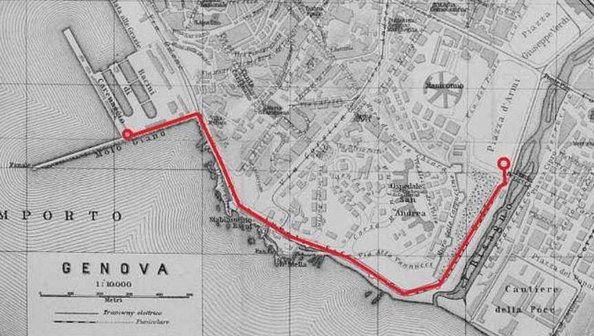
This was an industrial railway in the valley of the Bisagno River (Torrent). The Binario Industriale della Val Bisagno, also known as La Ferrovia delle Gavette, was in use from 1926 until 1965. It was a standard-gauge line and was 4.7km in length.

A drawing of the approximate route of the Ferrovia delle Gavette, © Andre86, Public Domain. [1]

A translation from the Italian Wikipedia site: “The area of the lower Bisagno valley was developed at the end of the nineteenth century thanks to marble works at the monumental cemetery of Staglieno and a flourishing of agriculture; the area of Marassi experienced a strong expansion at the beginning of the 20th century with:

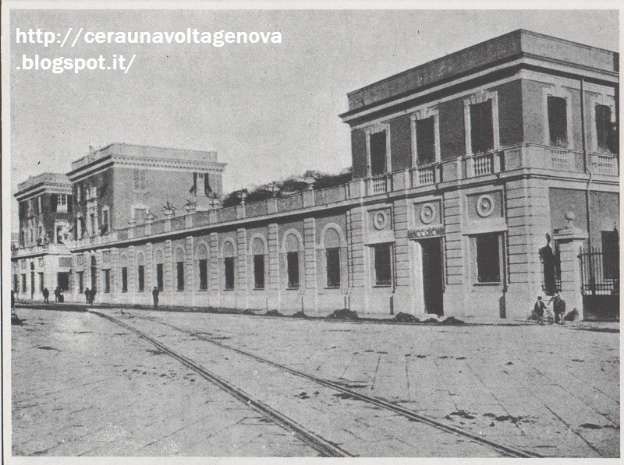
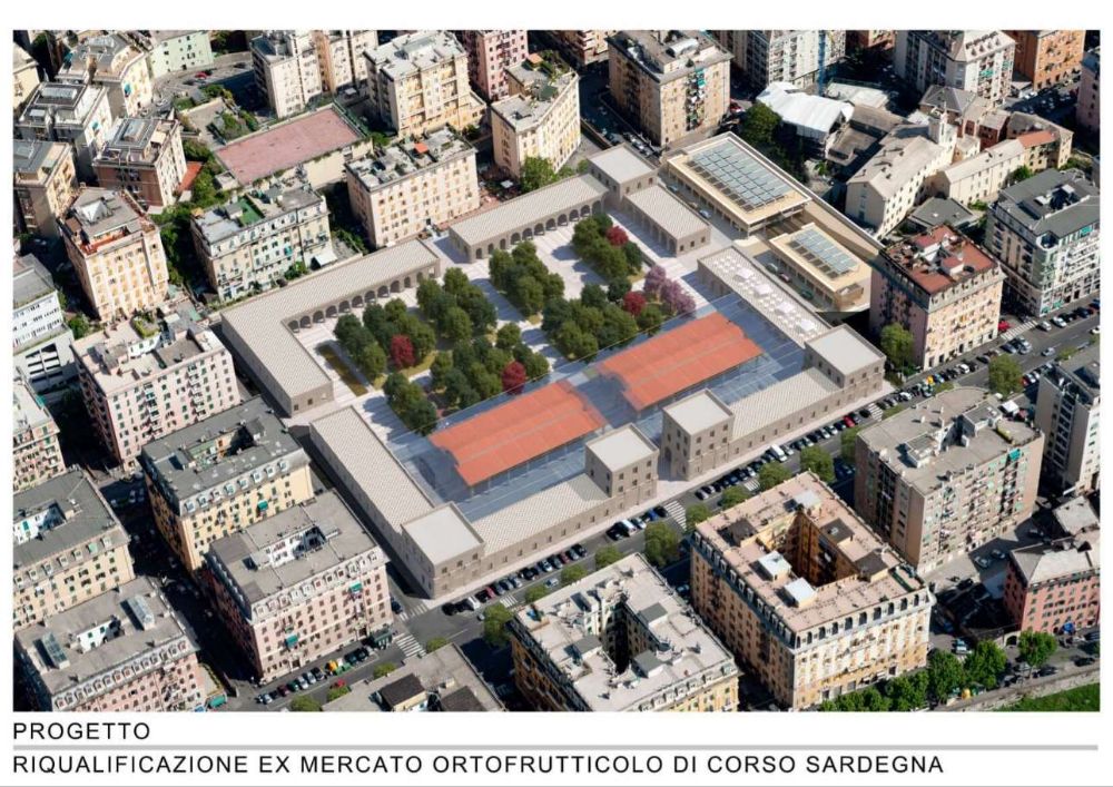
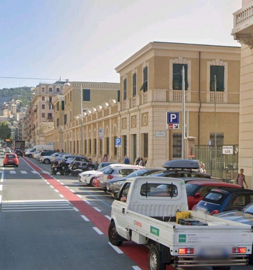
  • the construction of the general fruit and vegetable market in Corso Sardegna;
  • the municipal stadium;
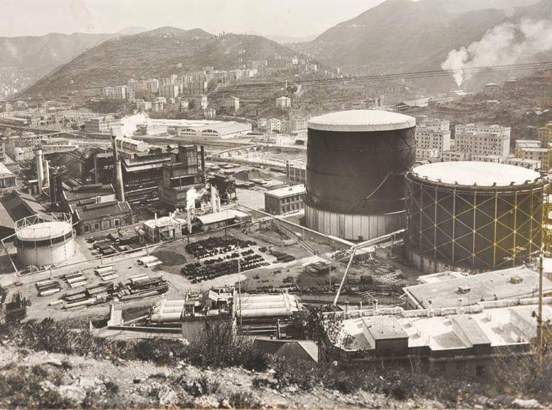
  • the workshops for the production of city gas with the gasometer built in the “Gavette” area of the Municipal Gas and Water Company (AMGA) located near Ponte Carrega;
  • the new municipal slaughterhouses in the Cà de Pitta area located in Piazzale Bligny.” [7][8]

Contracted out in 1925, the railway was built at an initial cost of about 2 million lire and served the new commercial and industrial settlements that had sprung up in the valley. [7][9]
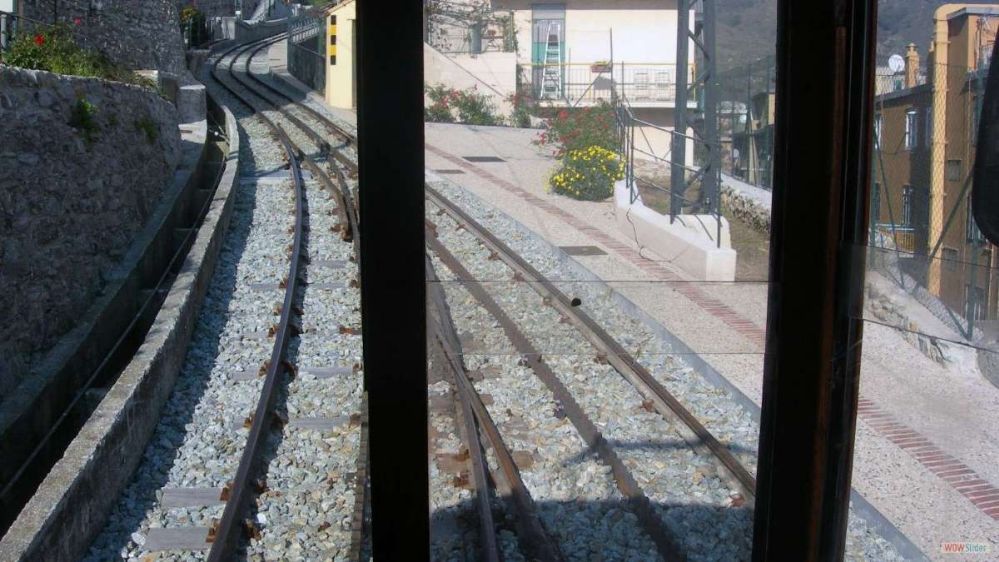
This low definition image shows the route of the railway up the Valley of the Bisagno. It comes from a public participation brochure: ‘Trasporto Pubblico Locale in Valbisagno: un percorso di partecipazione’. [10]
A schematic drawing of the route of the railway which shows the main connections to the line. [7 – translated from Italian]

The line, single-track and not electrified, was mainly equipped with normal 36 kg/metre Vignoles rails placed on ballast, with the exception of the sections shared with road traffic, notably in Piazza Giusti and Corso Sardegna, where there were counter-rails.” [7][9]
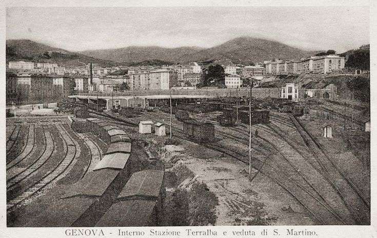
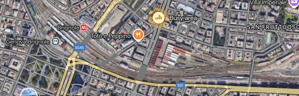
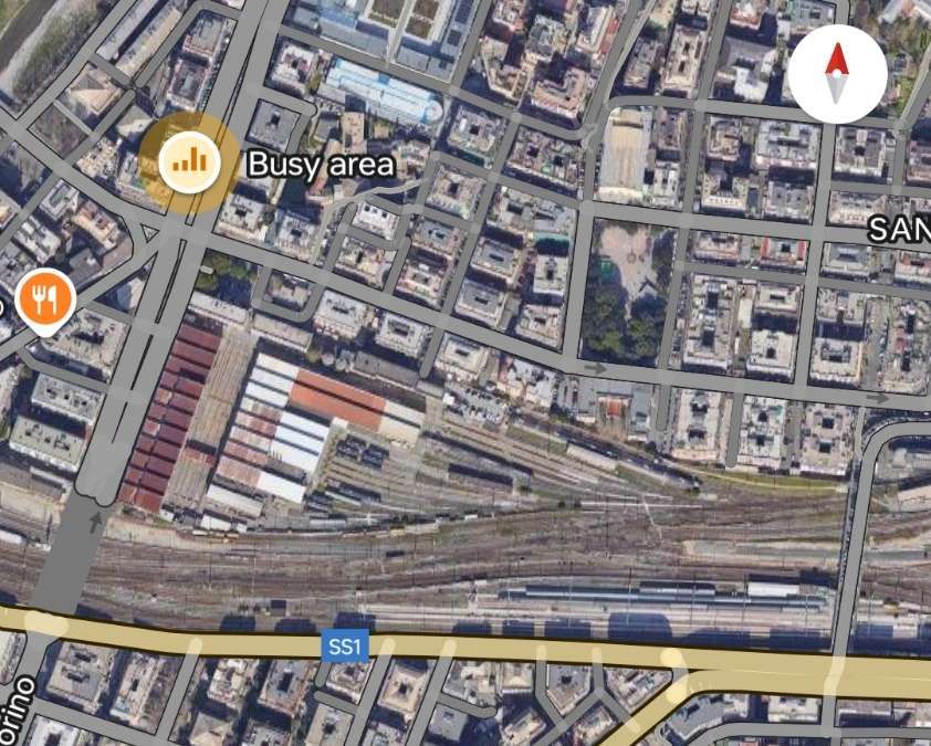
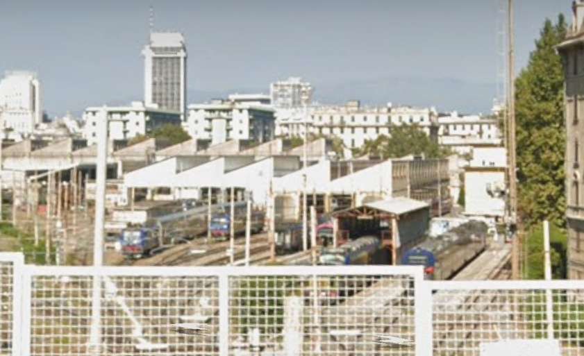
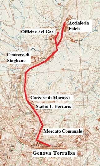
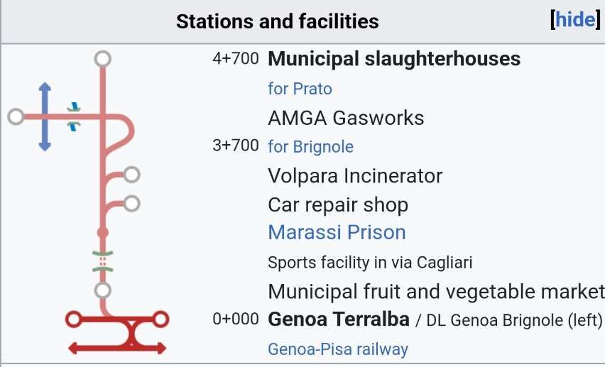
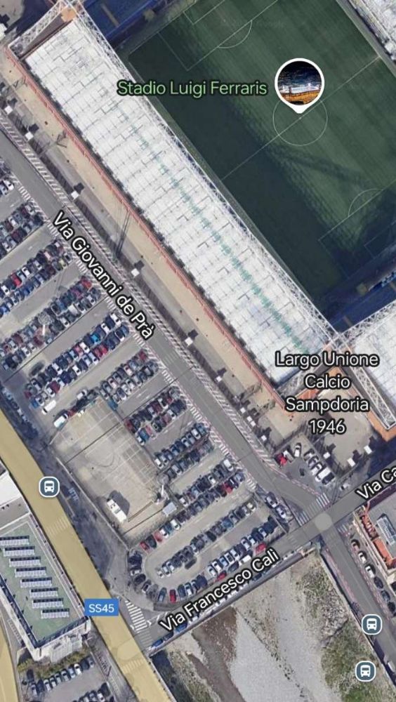
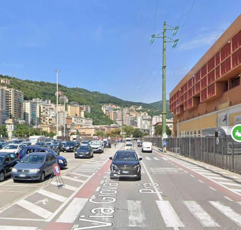
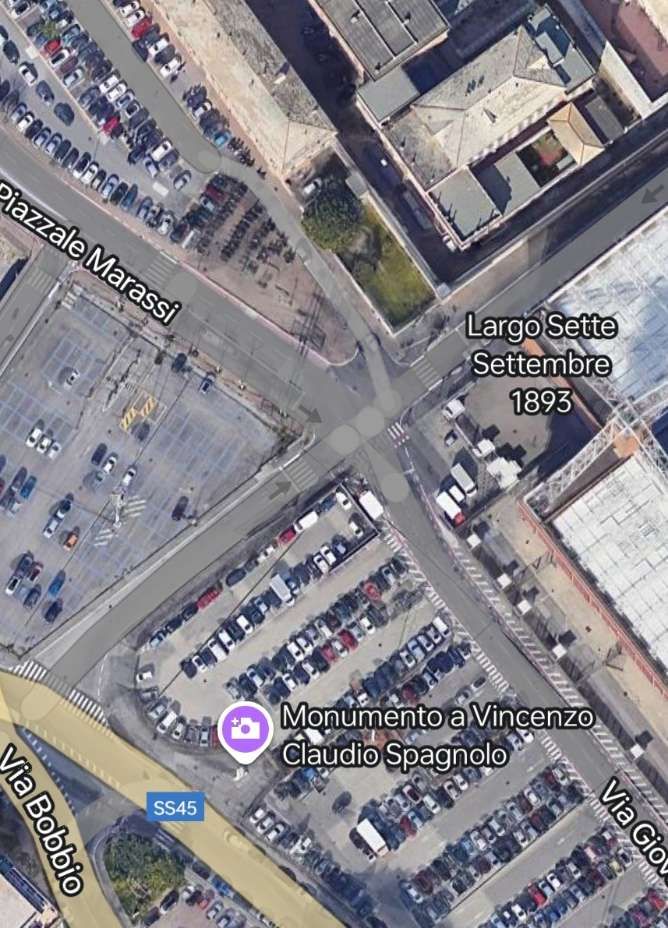
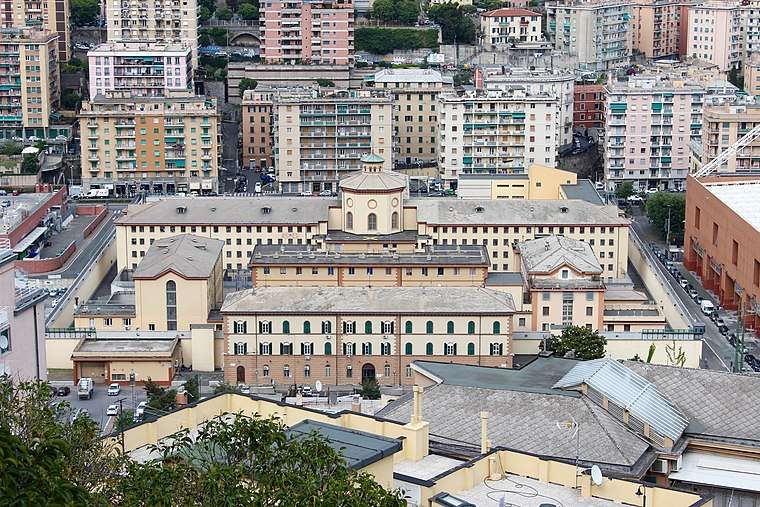
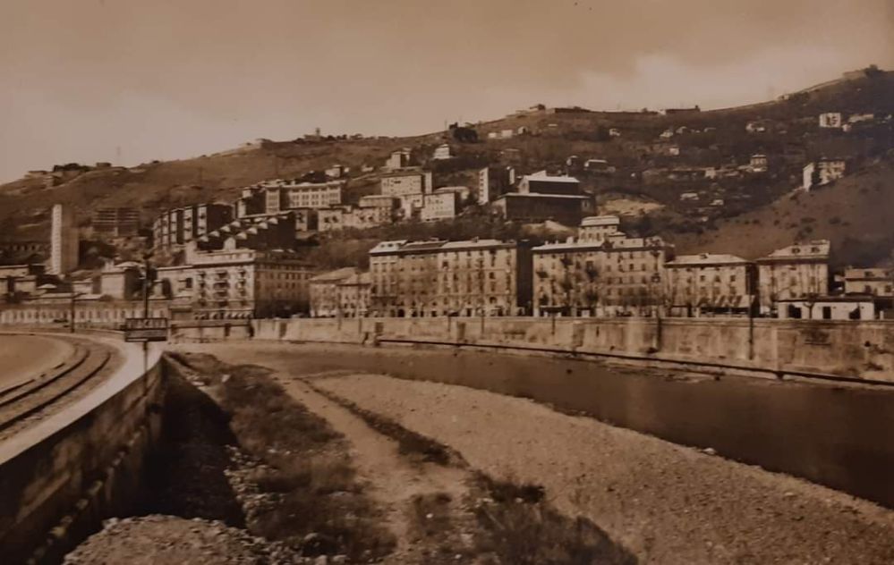
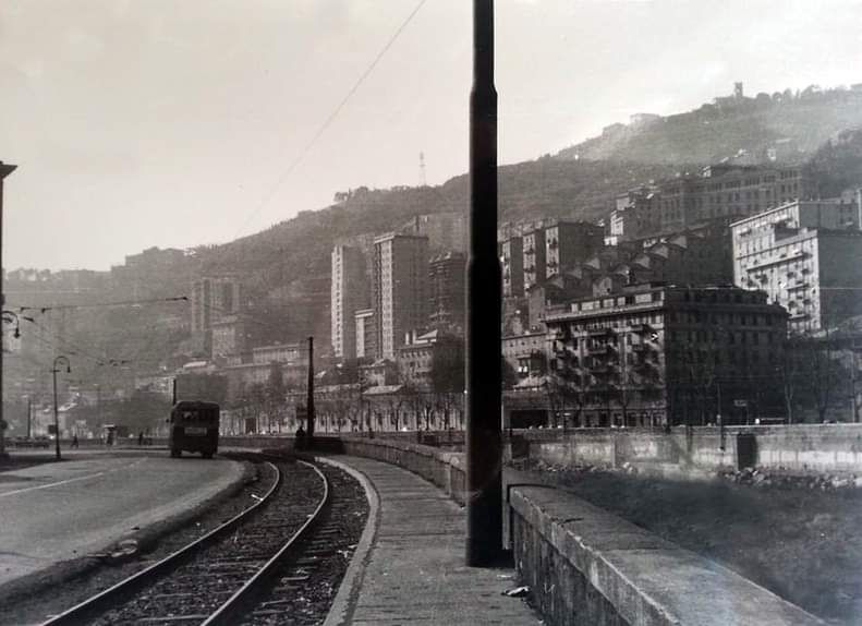
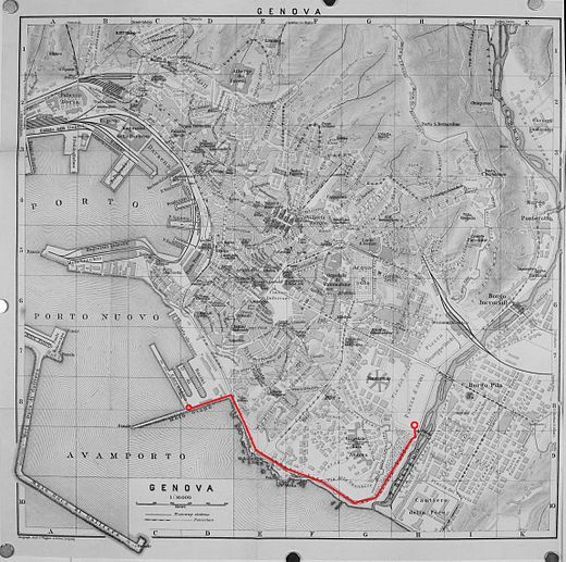
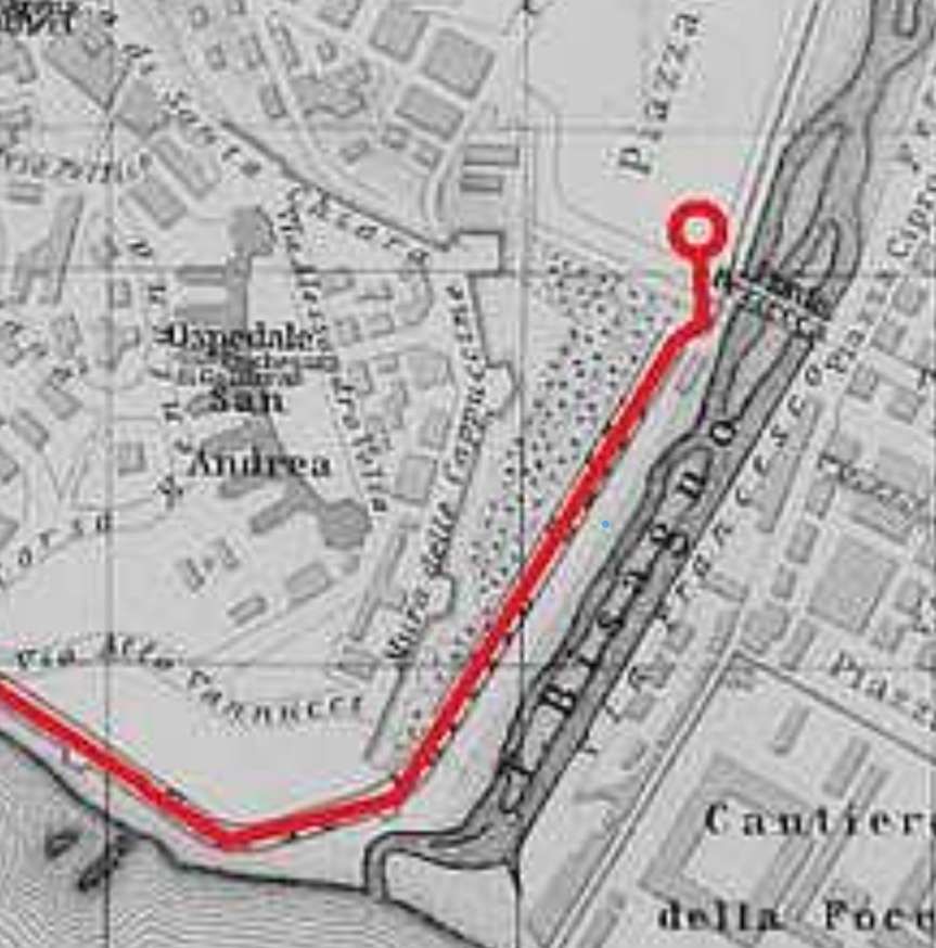
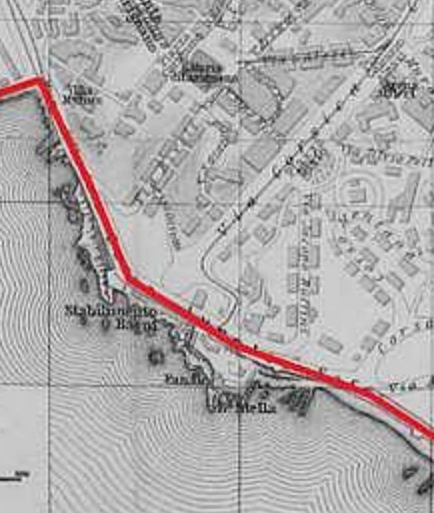
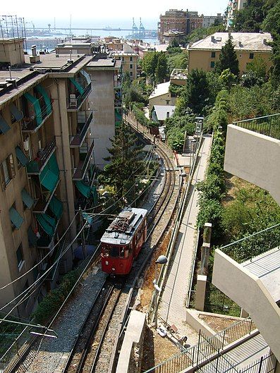
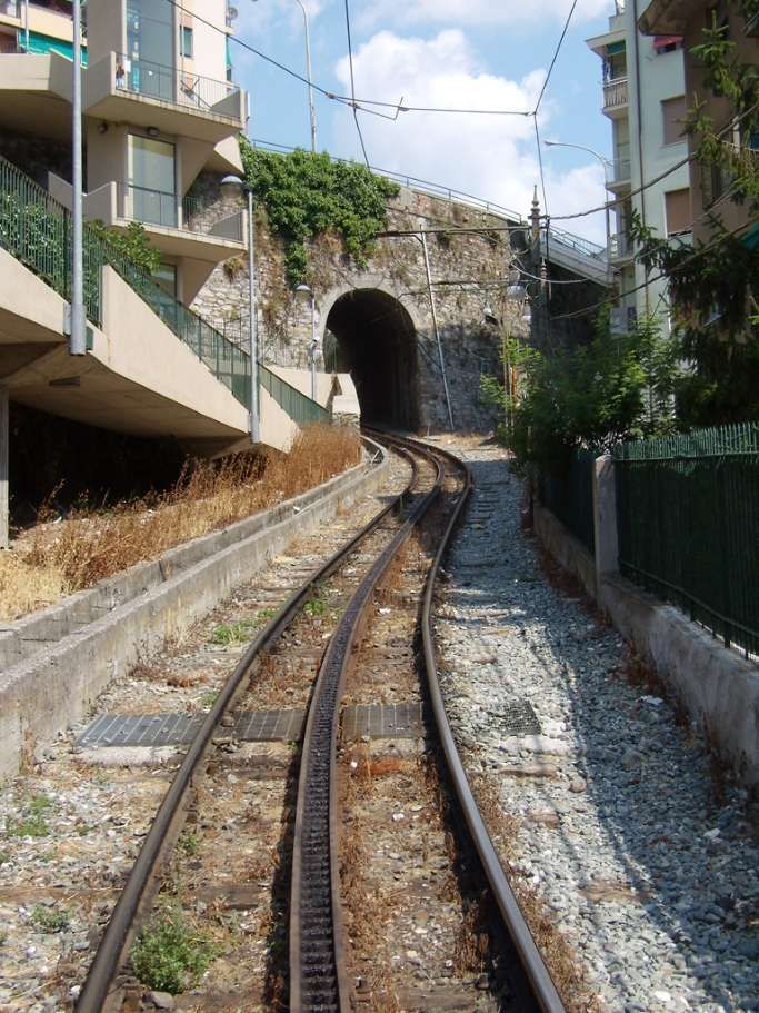
Old postcard view of Terralba Goods Station, Genoa (Genova)m, © Public Domain. [15]
The combined passenger and goods stations of Brignole and Terralba in the 21st century. [Google Maps, November 2024]
The Terralba Goods Station in the 21st century. The dual carriageway which runs under the railway in the bottom left corner of the image and heads North-northeast is Corso Sardegna. The railway curved out of Terralba Goods Station and ran North up Corso Sardegna. [Google Maps, November 2024]
A view looking West into the Terralba Goods Station from Via Terralba. [Google Streetview, August 2024]

The track branched off from the Terralba freight yard, near Piazza Giusti, entered the Corso Sardegna, along which the general fruit and vegetable markets were located, then turned left entering Via Cagliari, reached Piazza Carloforte and continued along Via del Piano, running alongside the municipal stadium and prisons.” [8 – translated from Italian]

The first length of the old railway. Terralba Goods Station is at the left of this map extract, Corso Sardegna runs from middle-left to bottom-right. The fruit and veg market is on the bottom (East) side of Corso Sardegna. [18]
An empty coal train returns to Terralba from Corso Sardegna in the 1950s, © Marcello Fezzaroni. [2]
Double steam traction of a convoy loaded with coal heading for the gasworks. The train has just left Terralba and crossed Piazza Giusti visible in the background, it now curves round across Corso Sardegna diagonally. The train is long, it extends back towards Terralba. [14]
A postcard view North along Corso Sardegna. The railway can be made out, sweeping across the picture from the bottom right to the opposing kerb of the road before swinging back towards the right, © Public Domain. [2]
A postcard view from a slightly higher position. The railway can again be made out in the picture. This time entering the image centre-bottom and curving round to run alongside the fruit and veg market, © Public Domain. [17]
The view West-northwest along Via towards its junction with Corso Sardegna. The old railway exited the Terralba Goods Station behind the lorry on the left of this image and curved across the road leaving on the far side of Corso Sardegna on the right-hand side of this picture. [Google Streetview, August 2024]
Looking Southeast, back into Terralba Goods Station (beyond the warning sign) along the line of the old railway. [Google Streetview, August 2024]
The old railway left the Terralba Goods Station on a line that entered this satellite image at the centre-bottom running in a northwesterly direction before curving round close to the West kerb of Corso Sardegna and swinging back across the road towards the East kerb of the road. [Google Maps, November 2024]
This modern view North up Corso Sardegna covers the area of the satellite image above. The old railway would have swung round from the bottom-right of this photograph to meet the West kerb of the road beyond the green car at the left of the image. It then swung back across Corso Sardegna before reaching the fruit and veg market where two lines of track ran parallel to the East kerb of the road. [Google Streetview, November 2024]

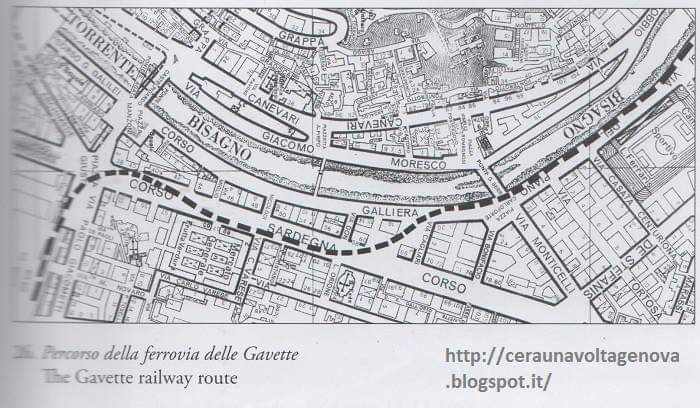
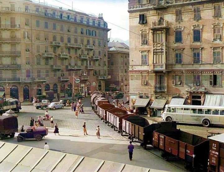
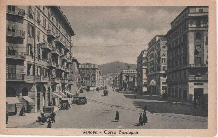
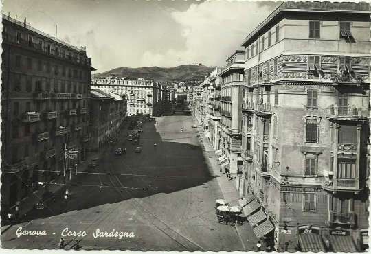
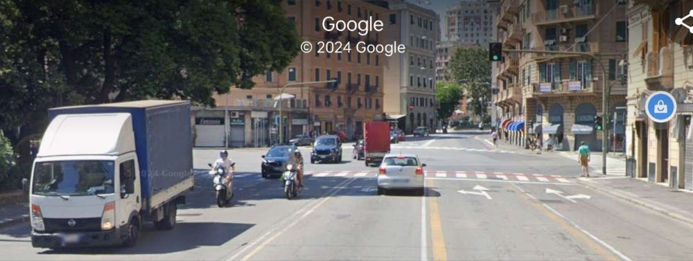
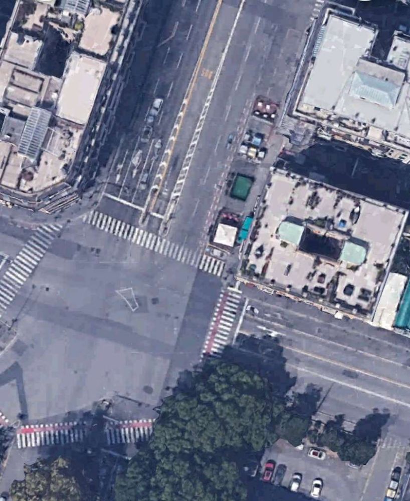
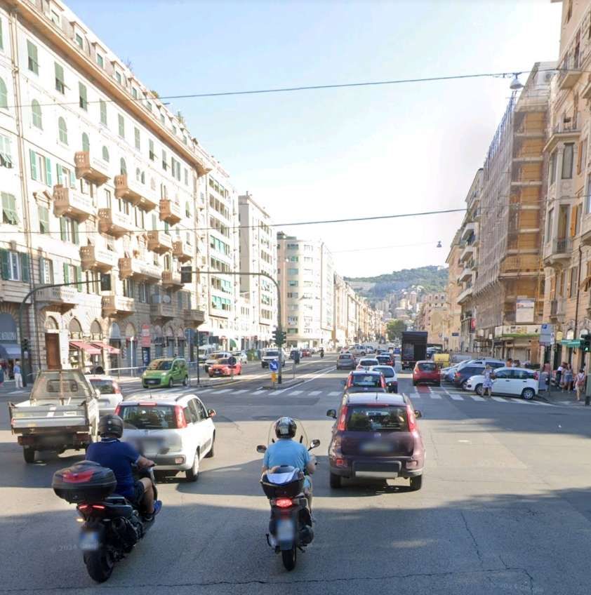
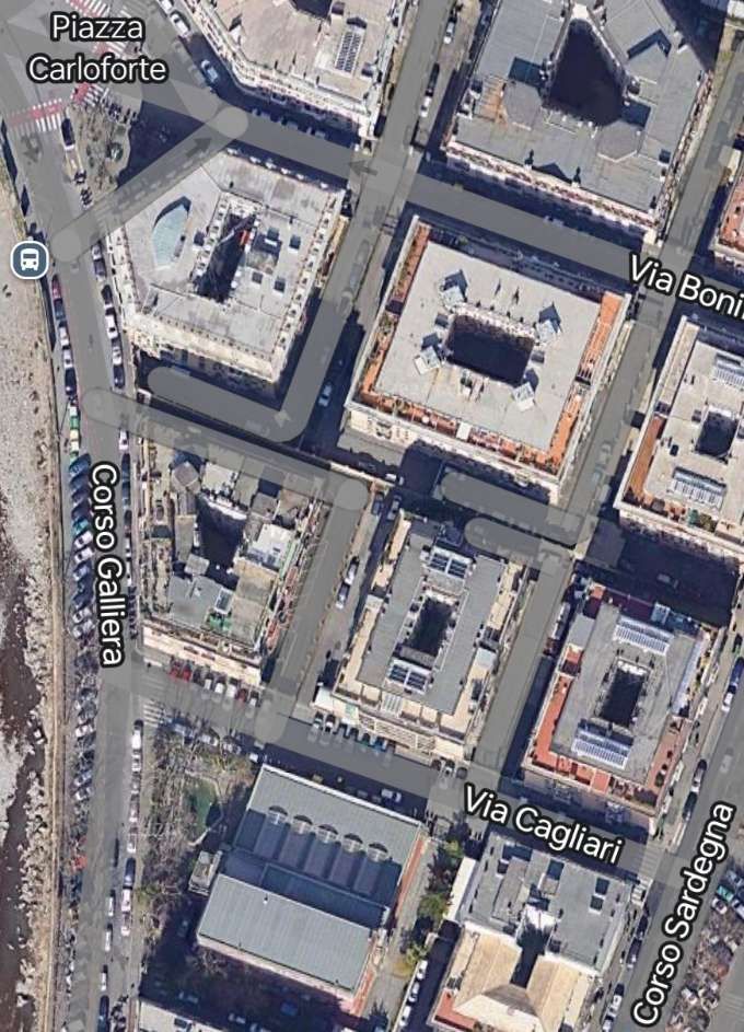
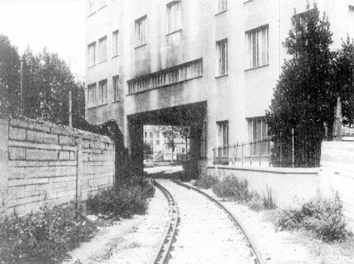
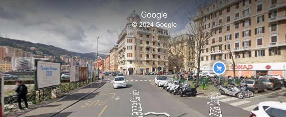
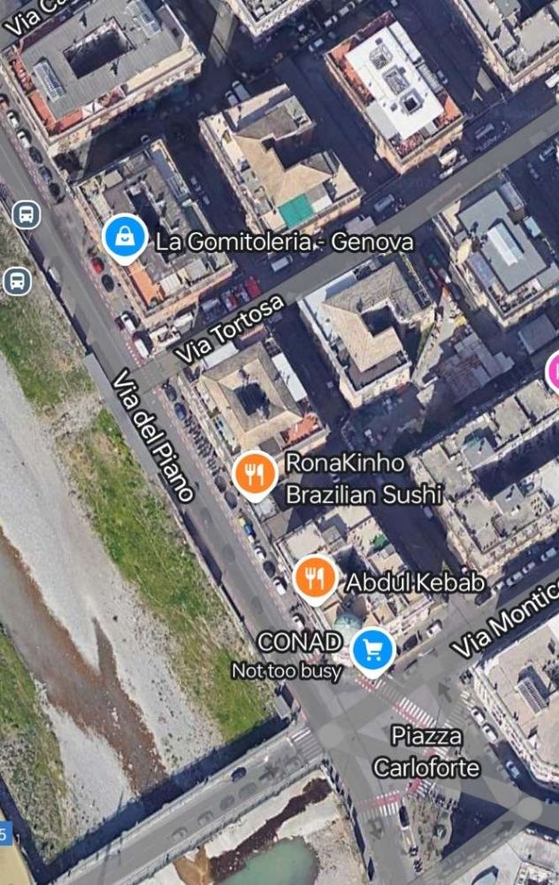
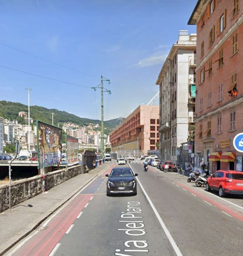
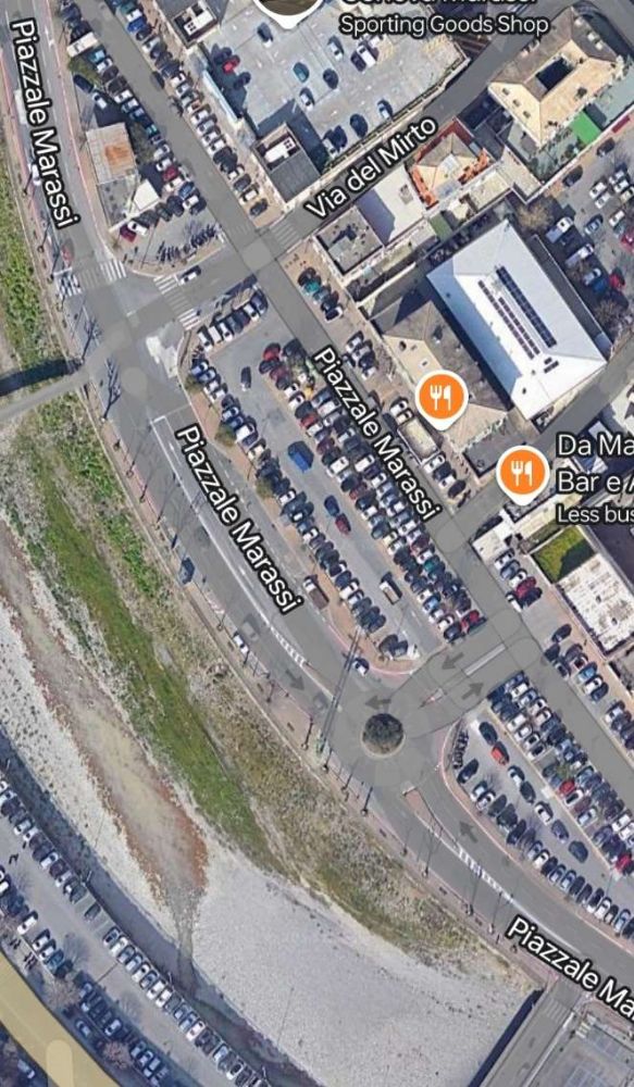
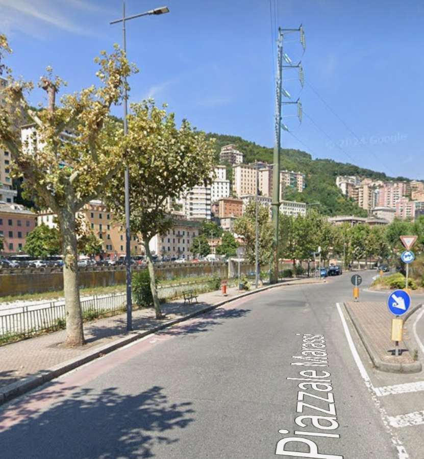
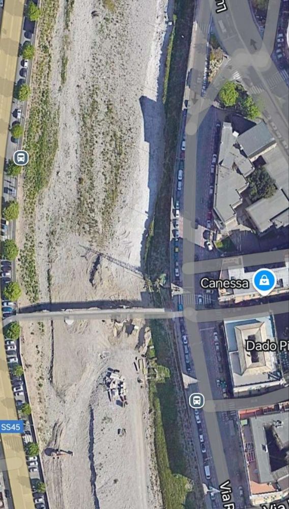
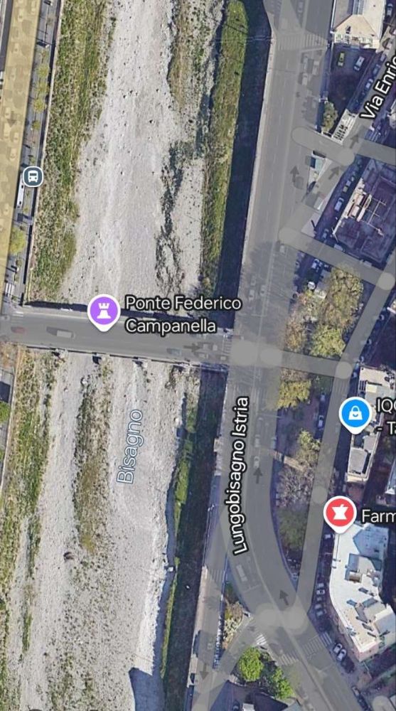
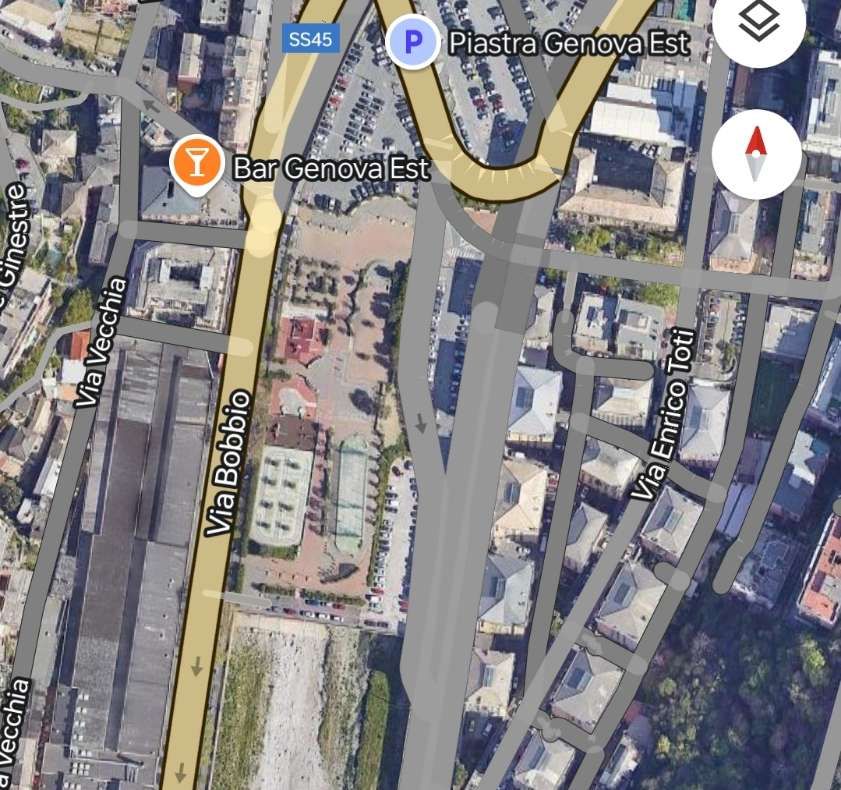
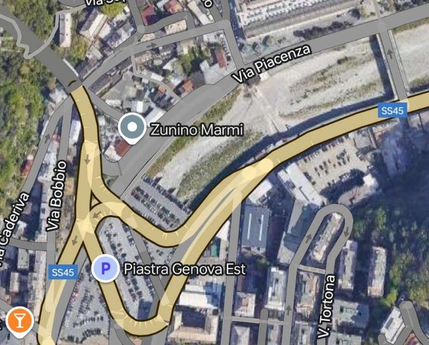
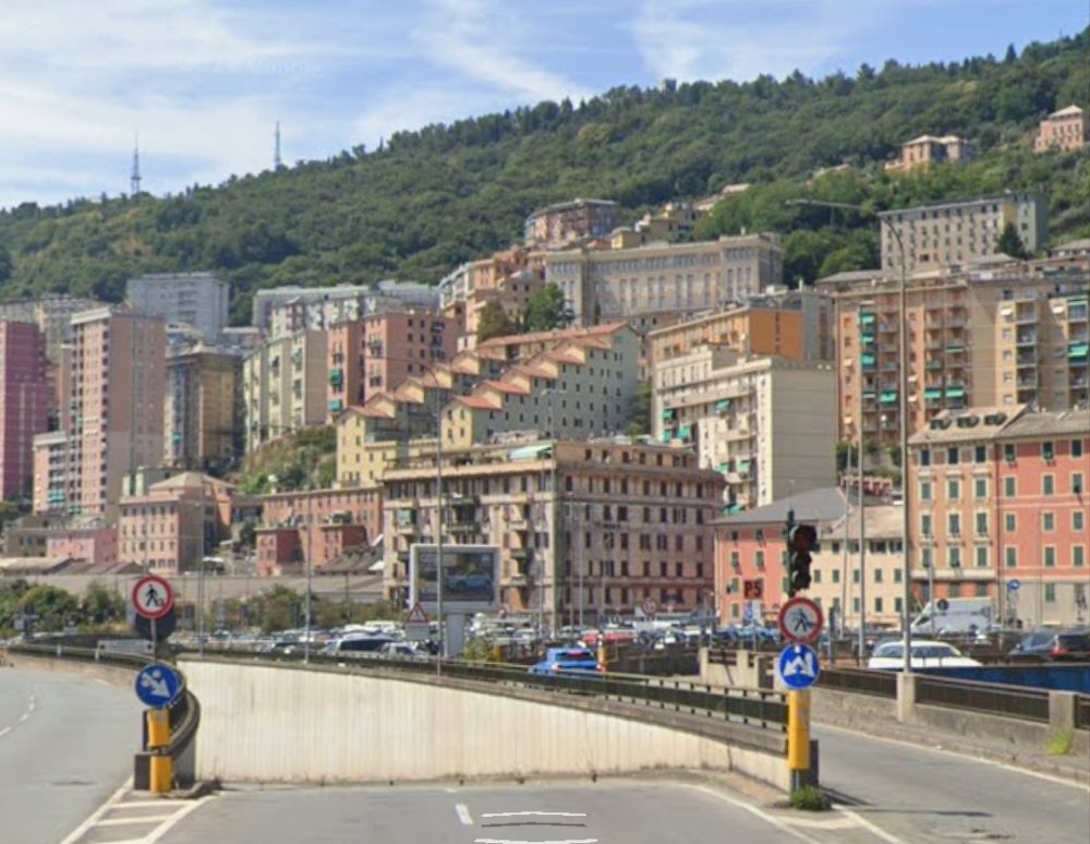
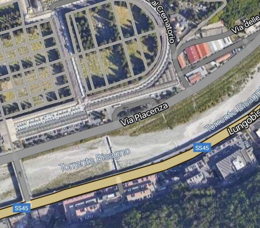
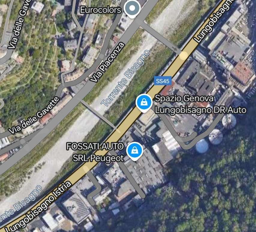
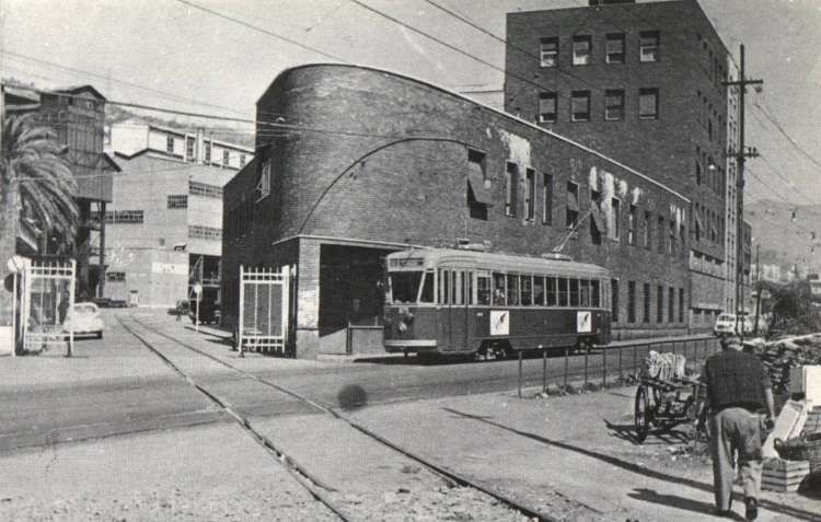
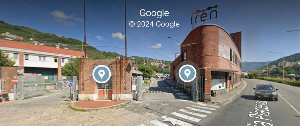
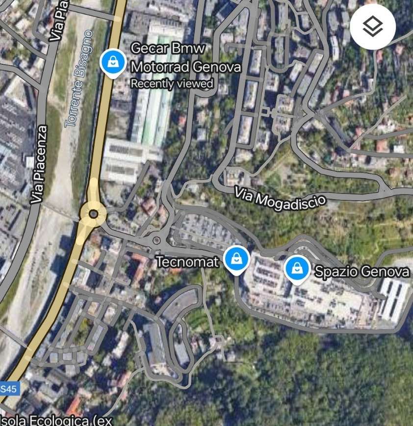
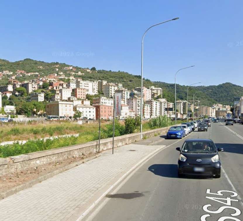
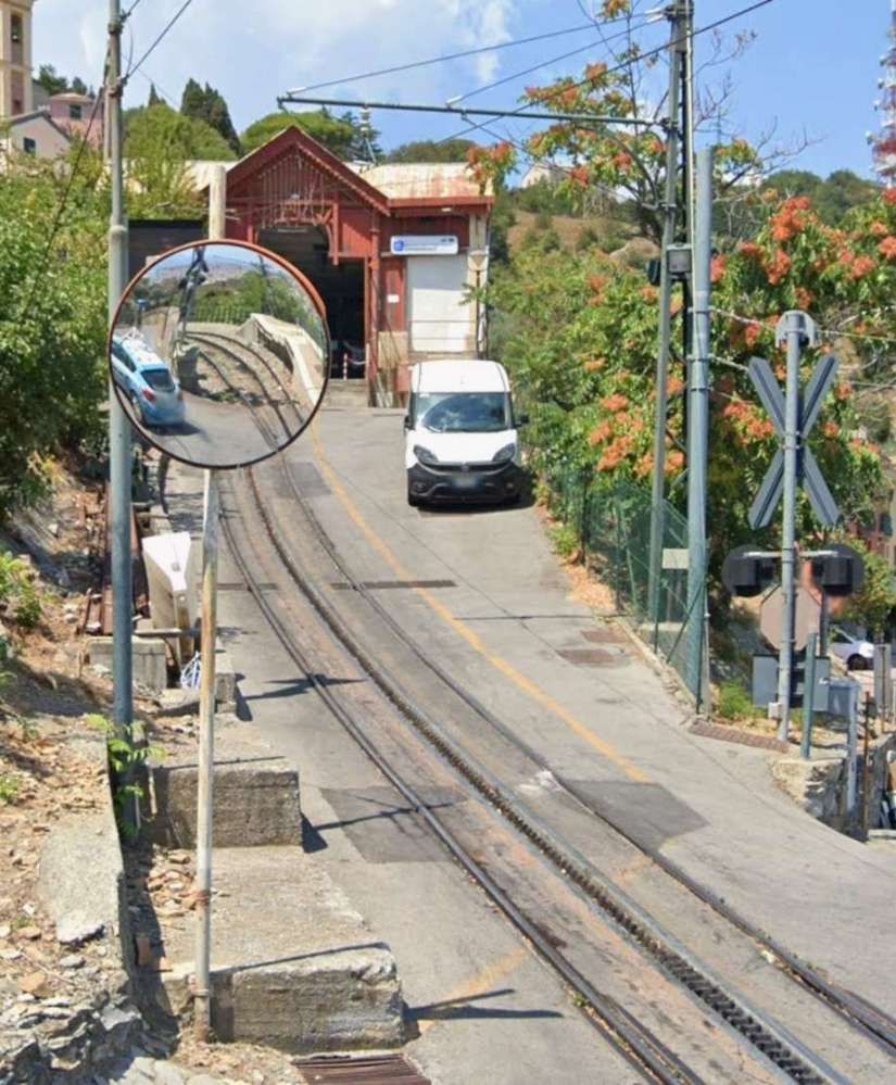
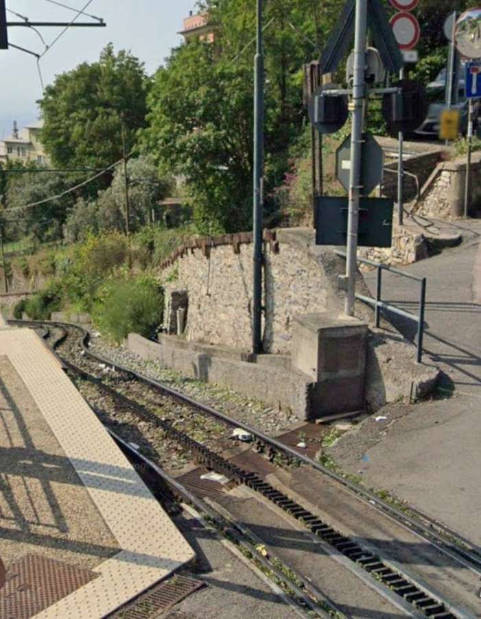
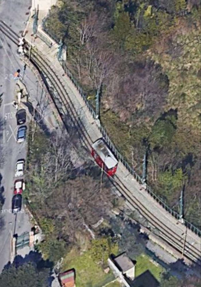
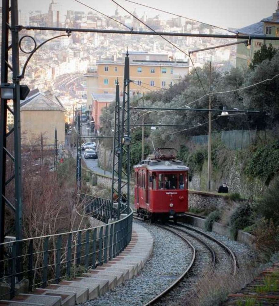
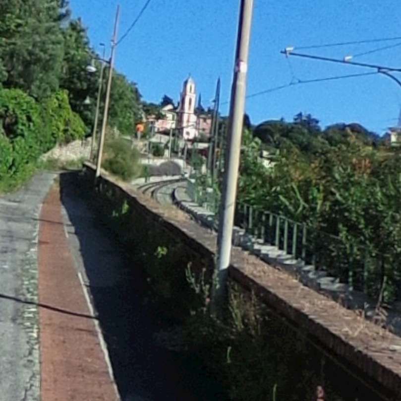
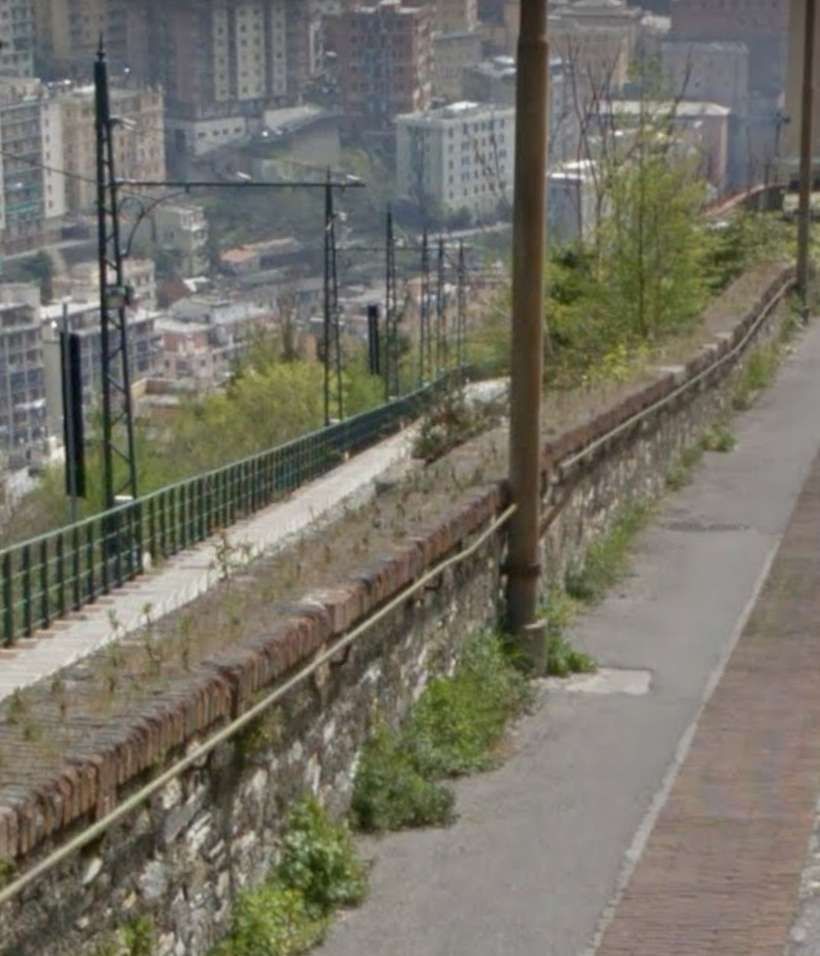
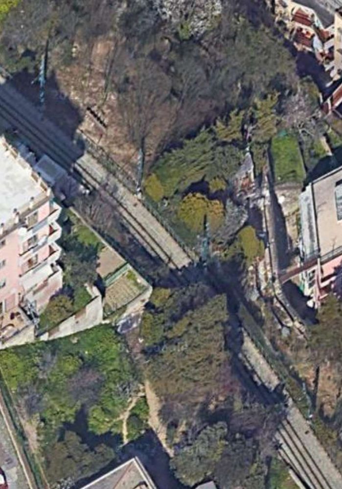
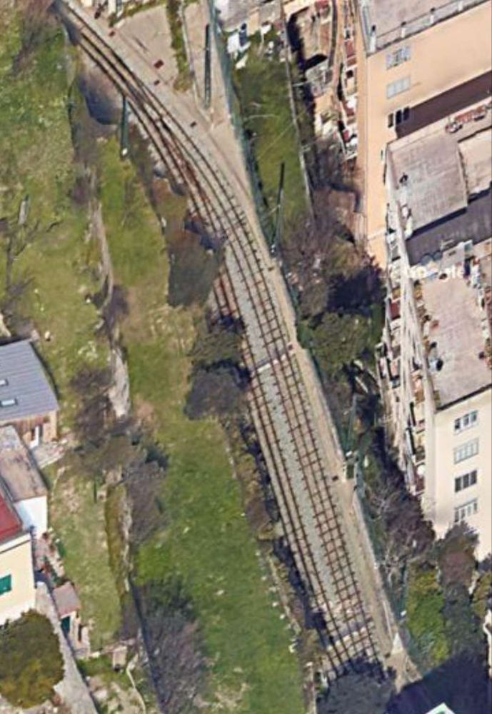
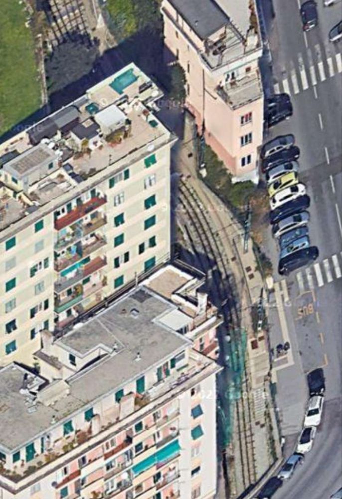
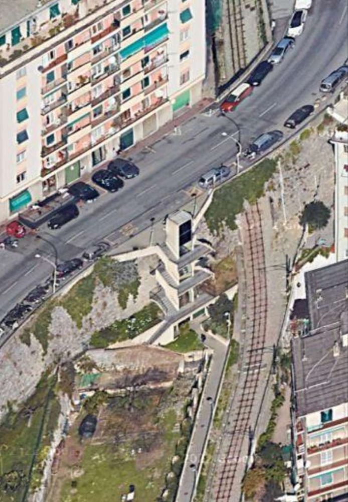
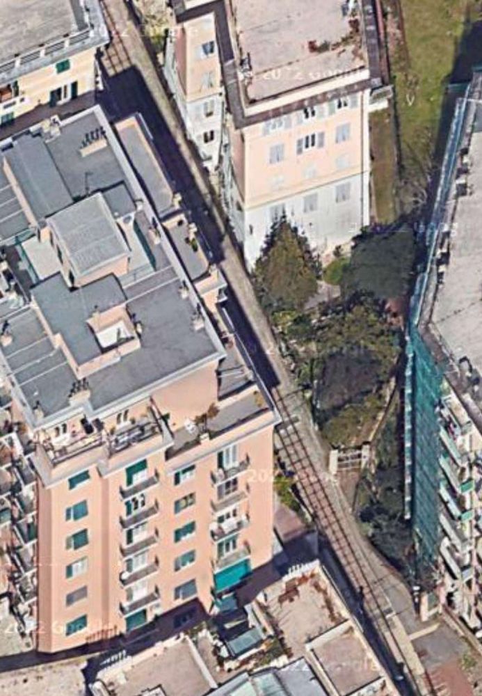
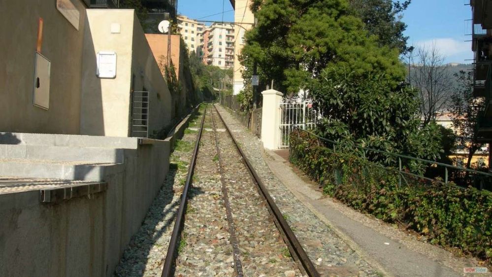
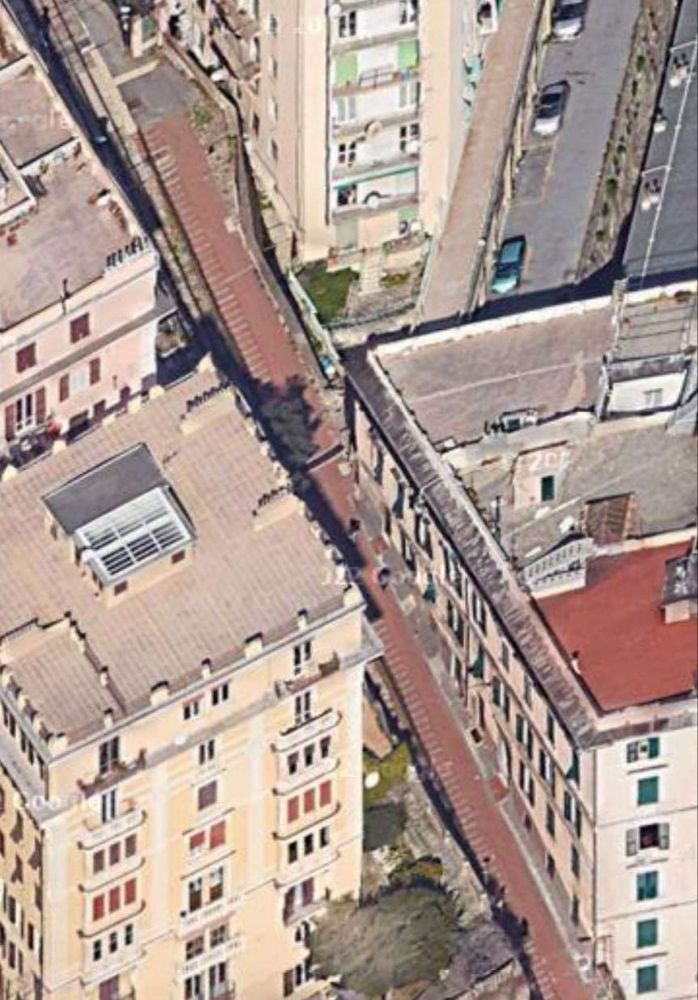
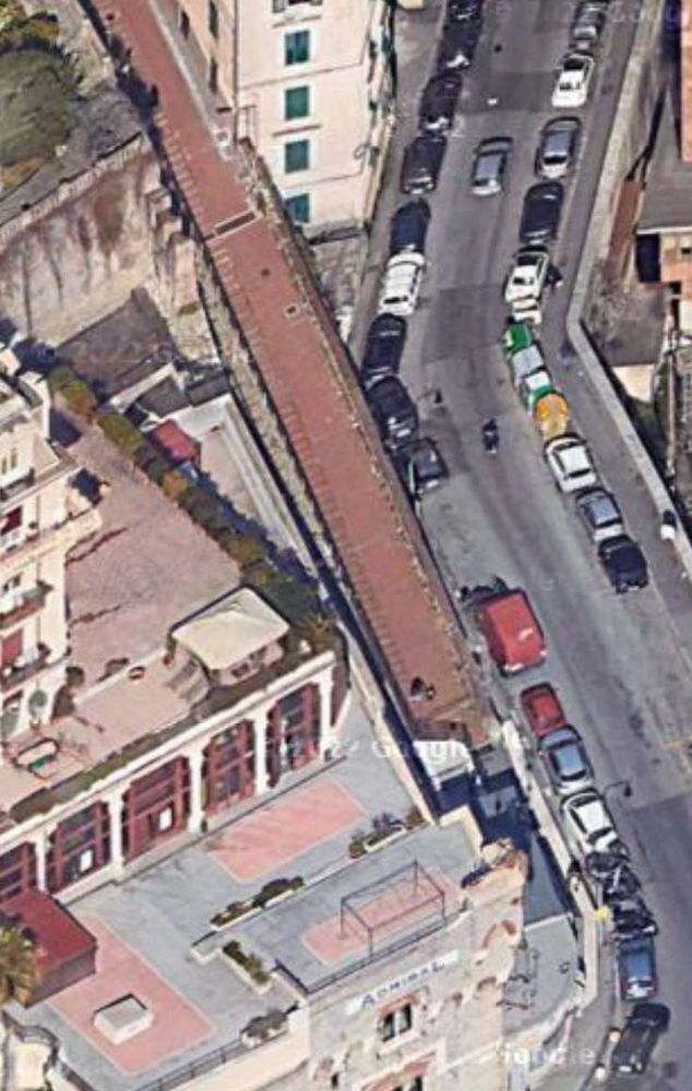
The Italian Wikipedia article adds a little to the information in the last paragraph. … On the Corsa Sardegna, the line was doubled to allow wagons to be left alongside the market area for loading and unloading. “After passing the market, the track crossed the road diagonally towards the Bisagno, … passing through a specially built archway in the building that, in the 21st century, houses the sports facility on Via Cagliari, through which it emerged at Corso Galliera. … Once in Piazza Carloforte, the track continued along Via del Piano, which was constructed at the same time as the railway, running alongside the municipal stadium and the prison , where trains carrying prison carriages sometimes stopped.” [7][9] The places mentioned in this paragraph appear in the images below.
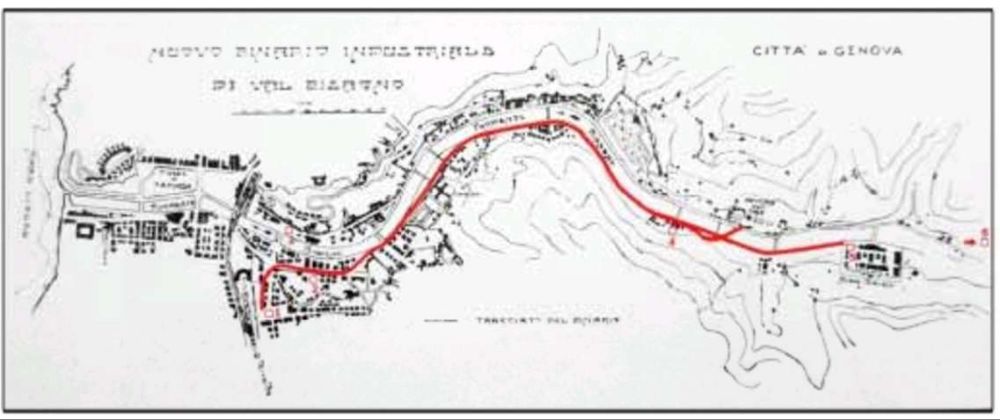
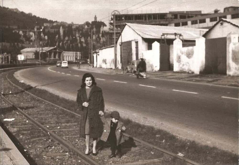
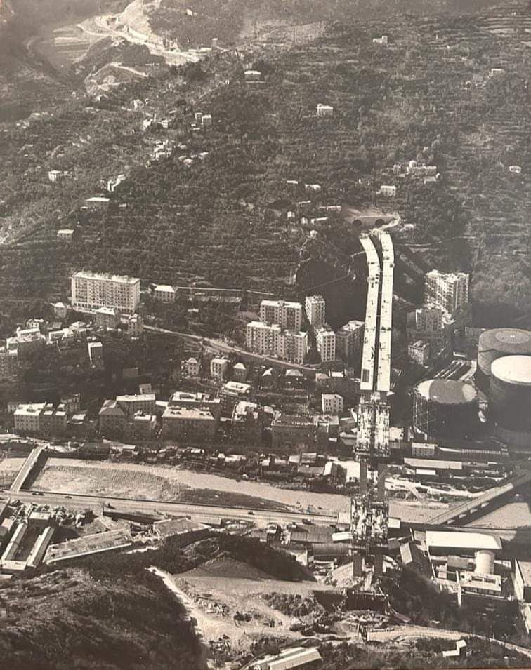
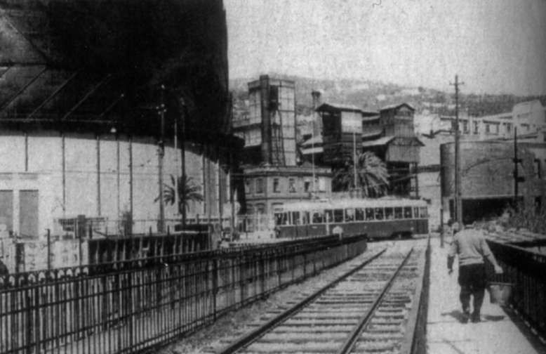
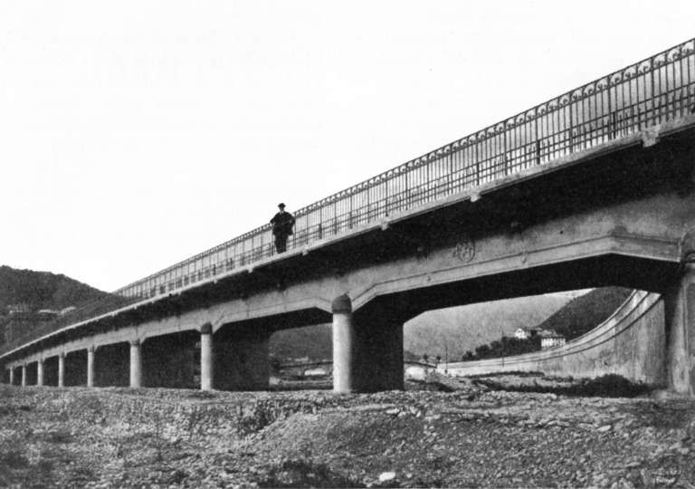
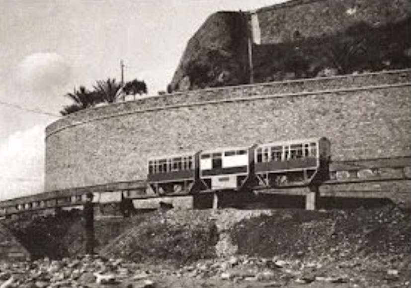
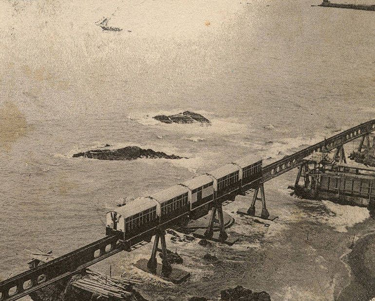
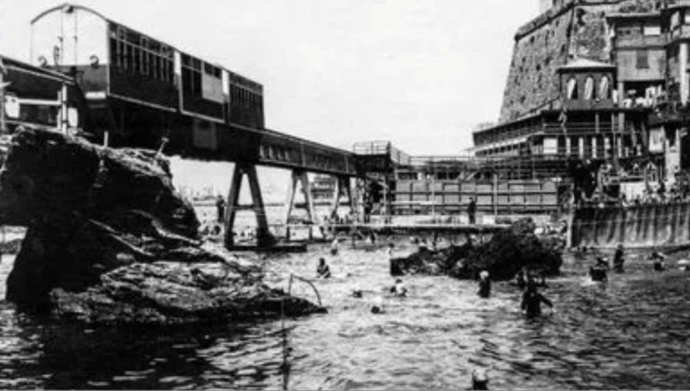
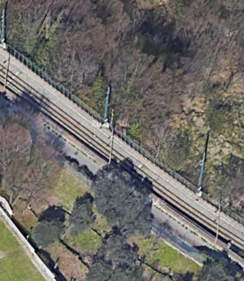
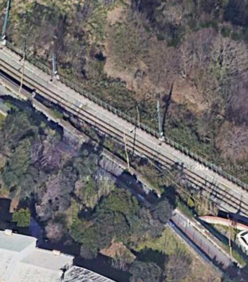
The imposing facade of the large fruit and veg market on the East side of Corso Sardegna. The old railway can be seen drifting across the street in the foreground of the image, © Public Domain. [18]
3D drawing of the refurbishment of the Mercator Ortofrutticolo di Corso Sardegna. [19]
The refurbished buildings of the Mercator Ortofrutticolo di Corso Sardegna. [Google Streetview, August 2024]
The exact line of the railway from Corso Sardegna to Corso Galliera is not clear, but it was in the area of Via Cagliari. The railway curved round to the Northwest from adjacent to the market. The line has since been built over. [Google Maps, November 2024]
The archway over the line mentioned above. The route of the railway line, deviating from Corso Sardegna to Corso Galliera affected a building, constructed over the railway in anticipation of the imminent decommissioning of the railway, © Public Domain. [14]
Looking North into Piazza Carloforte from Corso Galliera. The River Bisagno is on the left behind the advertising hoardings. The old railway followed Via del Piano alongside the river wall. [Google Streetview, March 2023]
The line ran on the verge of Via del Piano above the river. [Google Maps, November 2024]
Via del Piano looking North. The railway ran adjacent to the river channel. [Google Streetview, August 2024]
The railway followed the left bank of the river, running past the sports stadium (now Stadio Luigi Ferraris. Additional car parking has been created by culverting the river channel. [Google Maps, November 2024]
The railway ran approximately where the hatched pedestrian walkway appears on this photograph taken looking Northwest on the Via Giovanni de Pra. The football stadium is on the right. The car park covers the culverted River Bisagno. [Google Streetview, August 2024]
The sports stadium peeps into the bottom-right of this next satellite image. The line of the old railway runs across the junction at the centre of the photograph, following, first, the Southwest side of Via Giovanni de Pra, and then the Southwest side of Piazzale Marassi. [Google Maps, November 2024]
Casa circumdariale di Genova Marassi, Genoa’s Remand Prison. [Google Streetview, August 2024]
Casa circumdariale di Genova Marassi, Genoa’s Remand Prison, © Gab997 (CC BY-SA 4.0). [20]
The old railway followed the curve of the river wall along the length of what is, in the 21st century, Piazzale Marassi. [Google Maps, November 2024]
Looking North from alongside the Casa circumdariale di Genova Marassi. [Google Streetview, August 2024]

The line continued up the left bank of the Bisagno, connecting to a number of factories. 3.7 km from its southern terminus a branch to the right which immediately curved round to cross [what became] the main line, Via del Piano and River Bisagno on a reinforced concrete bridge (Ponte G. Veronelli – which stood until destroyed during the flood of 1993); after crossing the river the line entered directly into the Gas Works, crossing, at ground level, the UITE (Unione Italiana Tramvie Elettriche) tramway Line No. 12, Genoa – Prato.” [8 – translated from Italian]

Italian Wikipedia tells us that the factories mentioned above which sat between the prison and the branch to the gasworks were: a plant for the repair of railway tanks and the NU “Volpara” plant for the incineration of urban waste. [7][9]

‘Trasporto Pubblico Locale in Valbisagno: un percorso di partecipazione’ [10] included the Volpara, Gavette and Guglielmetti Workshops and municipal waste treatment facilities, in its list of concerns which benefitted from the new railway. [10]

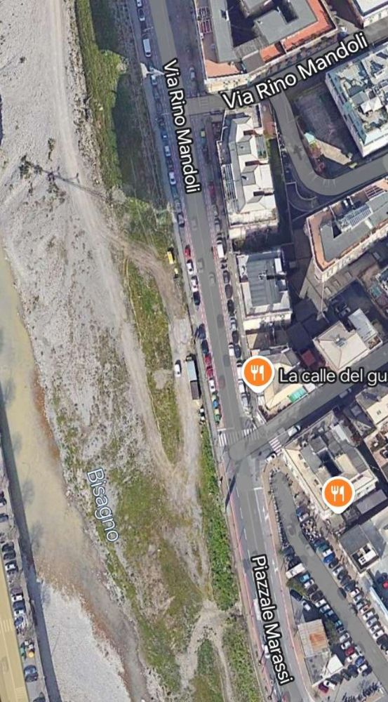
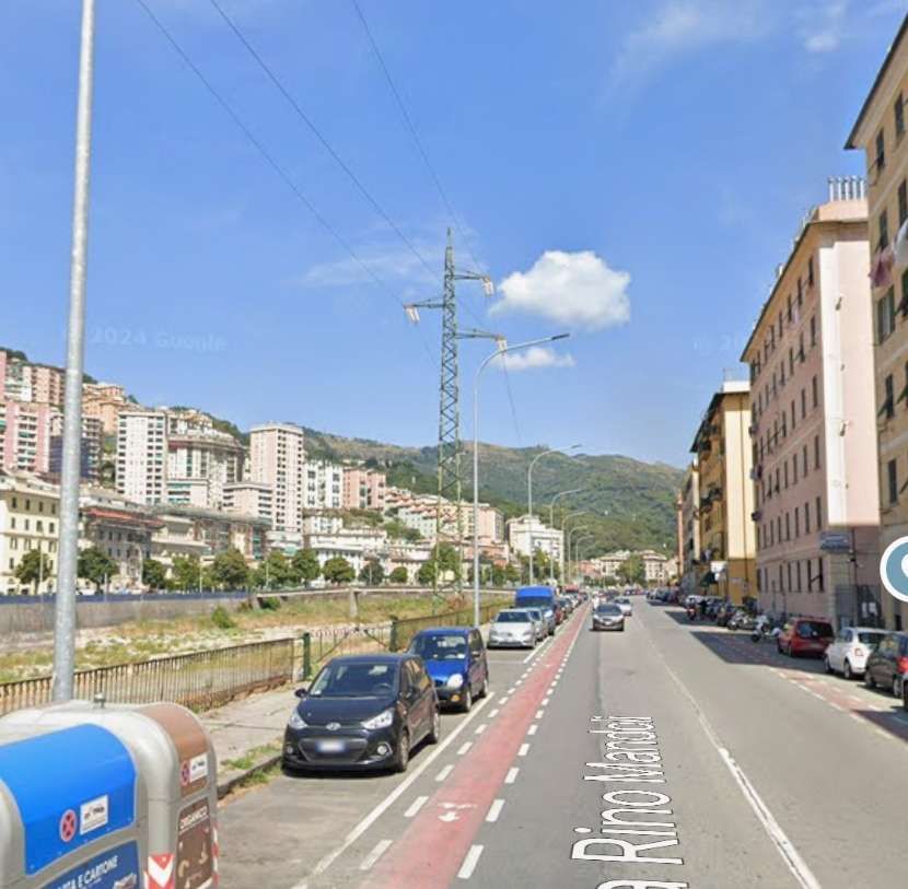
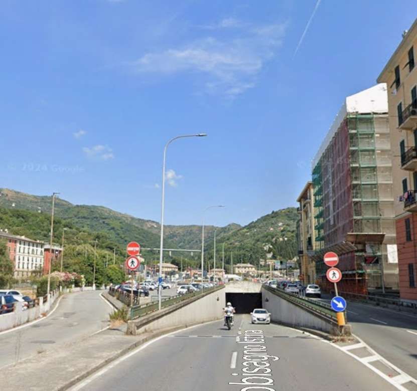
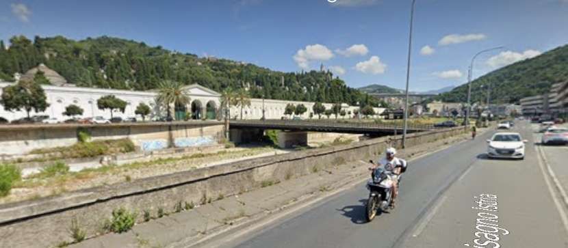
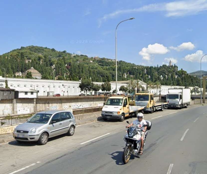
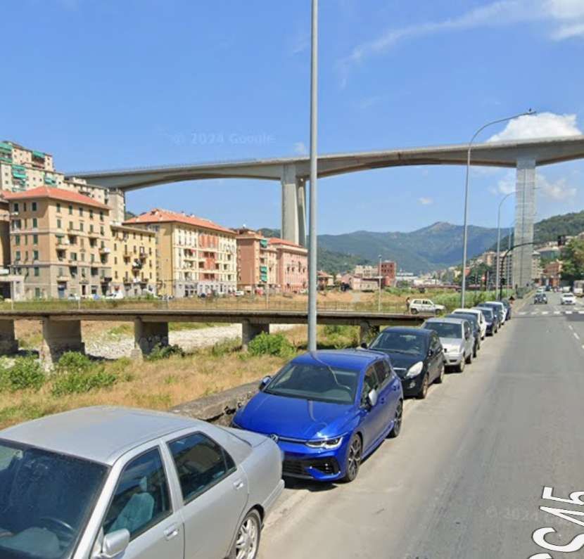
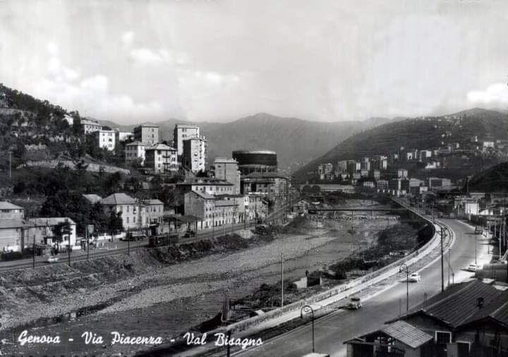
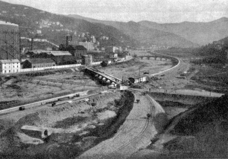
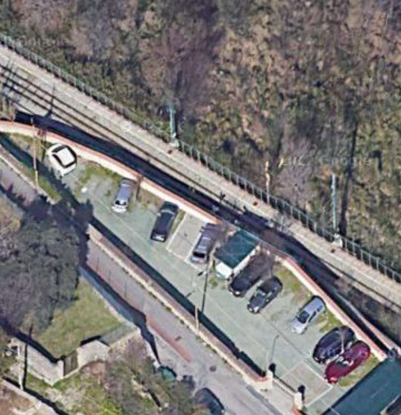
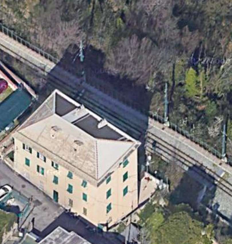
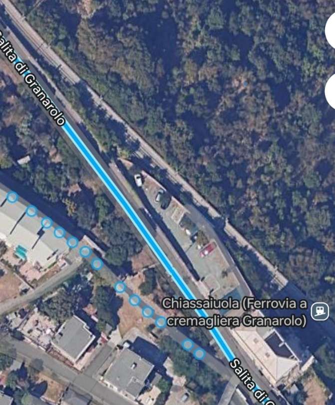
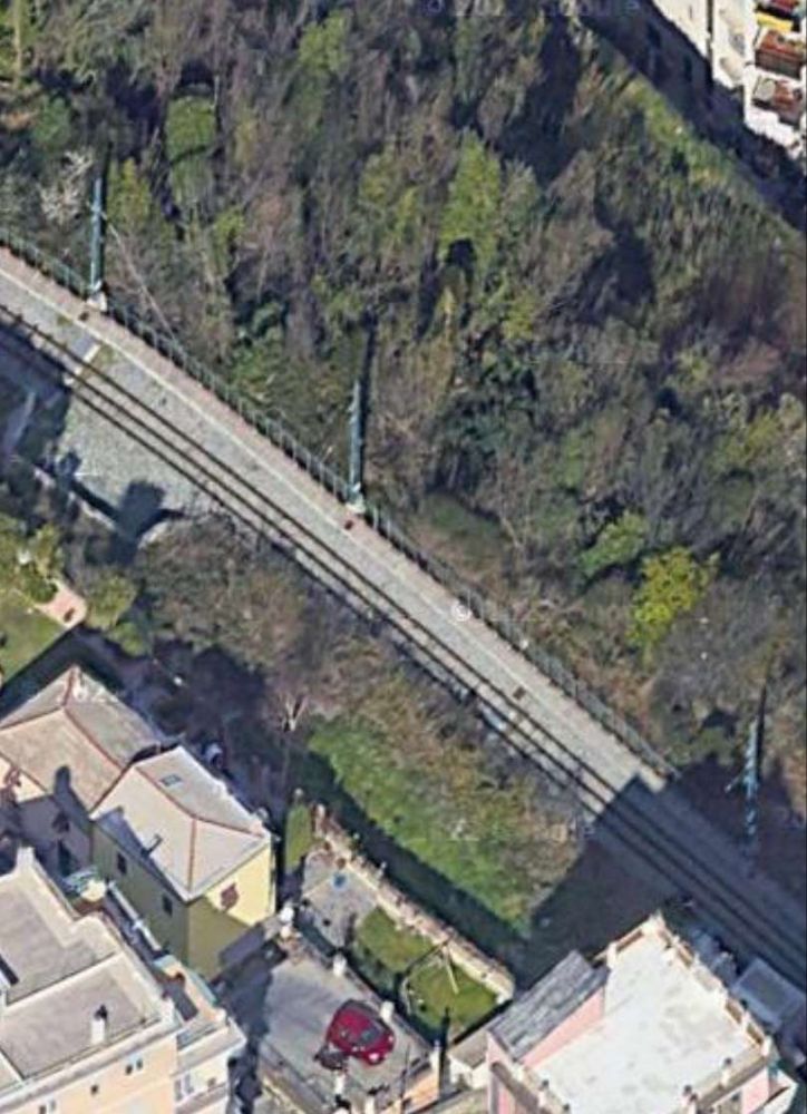
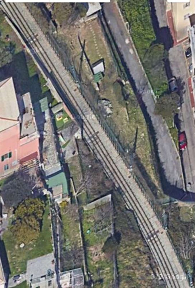
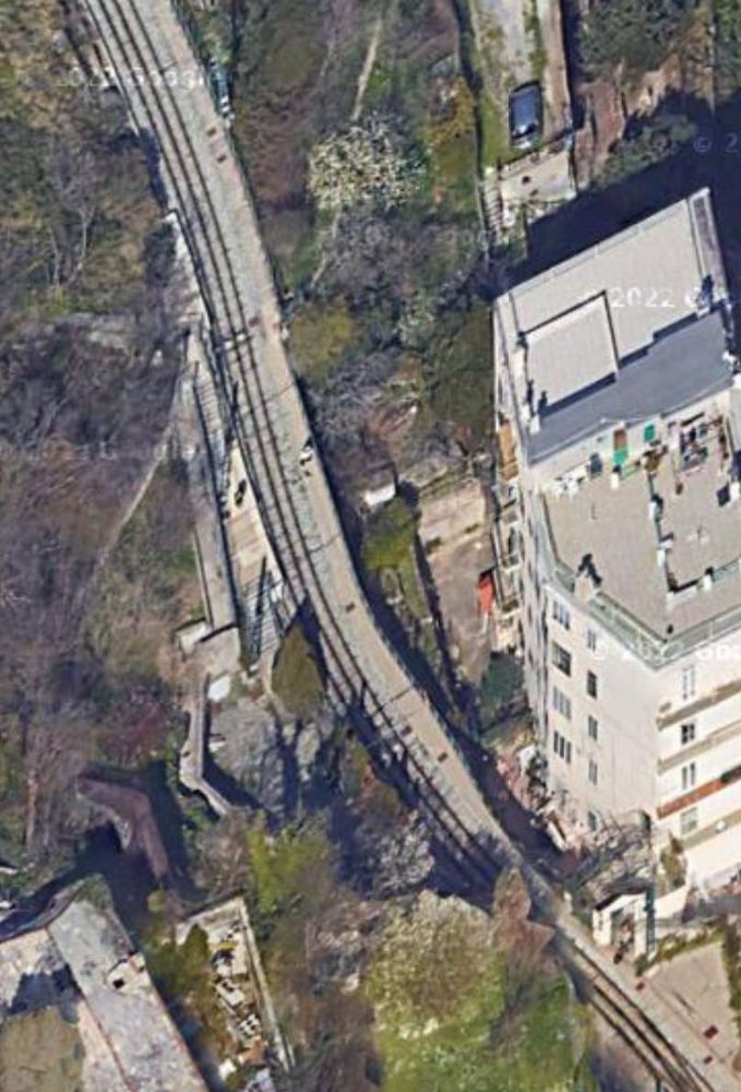
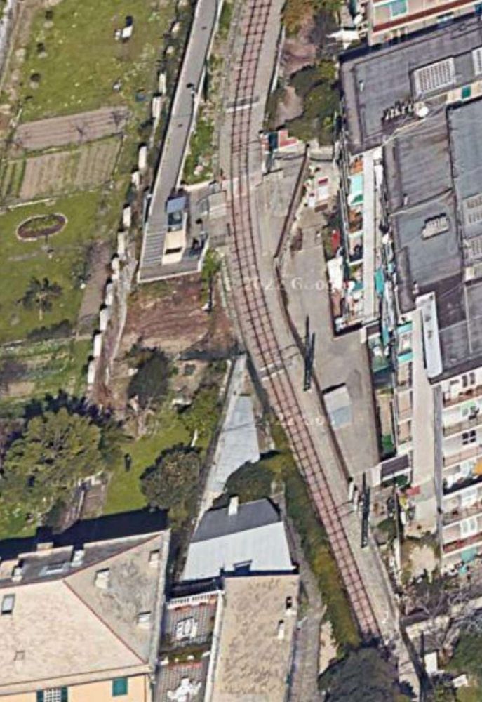
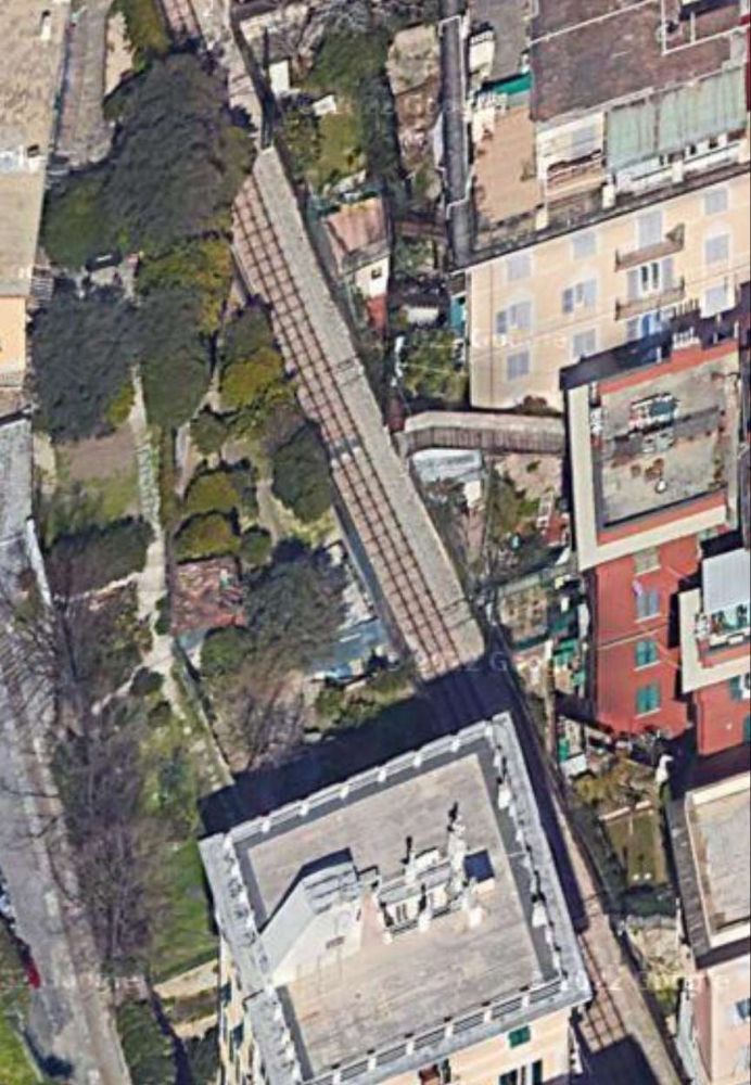
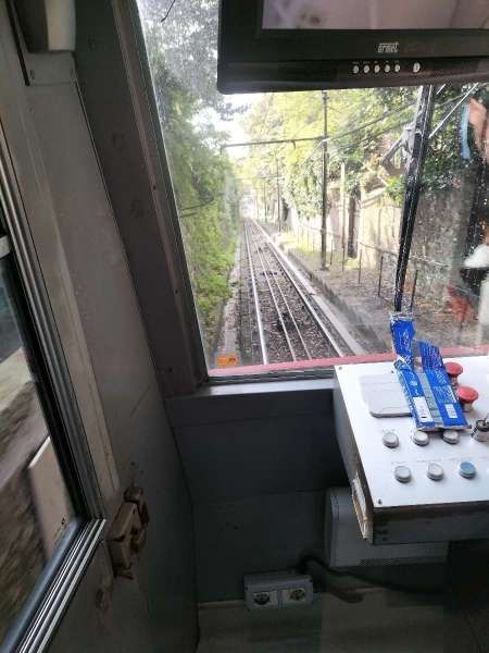
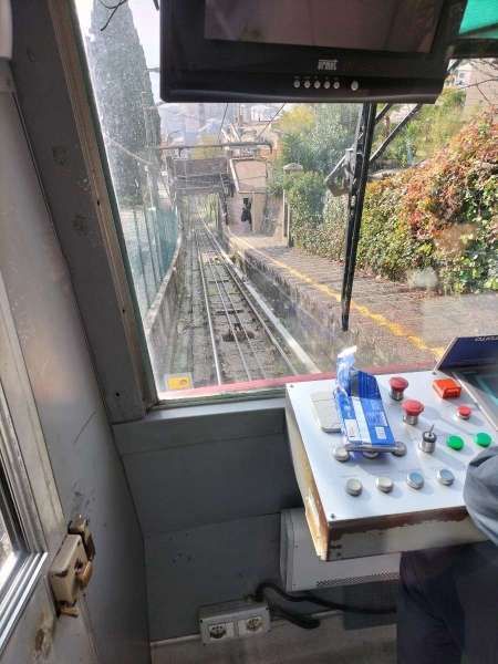
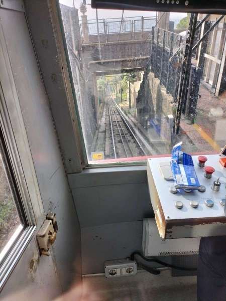
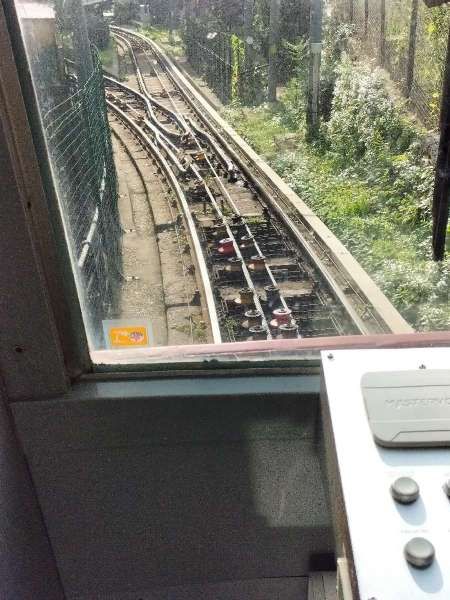
The next series of images cover the length of the line referred to in the paragraph above.

The line continued North from the prison,  on the left (East) bank of the River Bisagno. On the West side of Piazzale Marassi and then Via Rino Mandoli. [Google Maps, November 2024]
Looking North on Via Rino Mandoli. [Google Streetview, August 2024]
The bridge over the next length of the Bisagno connecting Via Rino Mandoli to the right bank of the river is a footbridge Ponte Staglieno. [Google Maps, November 2024]
Via Rino Mandoli in the 1960s, with the railway and the river to the left. This image was shared on the C’era una volta Genova Facebook Group by Luigi Carlo Piccardo on 25th April 2018. [26]
The bridge in this view looking North on Via Rino Mandoli is Ponte Staglieno. [Google Streetview, August 2024]

The line continued North along the left bank of the river. [Google Maps, August 2024]
The bridge in this view looking North on Lungobisagno Istria is Ponte Federico Campanella. [Google Streetview, August 2024]
This next length of the River Bisagno is now culverted but was not in the days when the old railway was in use. [Google Maps, November 2024]
Upstream of the culvert, the river runs East-West for a short distance. Just visible at the top of this extract from Google Maps is the Southwest corner of the cemetery. [Google Maps, August 2024]
The Lungobisagno Istria passes under the gyratory at this location. The railway once ran along the line of the top of the retaining wall to the left of the underpass. [Google Streetview, August 2024]
The River Bisagno looking West from alongside Luongobisagno Istria in the early 1960s.
Lungobisagne Istria again, also facing West in Staglieno and taken circa. late 1960s. The old railway was still in place at that time. The image below locates this view in the 21st century. [22]
A similar location in the 21st century, at the Northeast end of the underpass. Some of the buildings on the far side of the river are recognisable in both images. [Google Streetview, August 2024]
Turning through 180° we again see road, river and railway curving round to the East. This is the same curve in the river bank as appears in images above. The view from the mid-20th century this time extends beyond the cemetery which appears in the images below as far as the church tower on the hill on the far side of the river. Careful inspection of the two Google Streetview images below will identify the same church on the horizon in each photograph- Chiesa di San Bartolomeo Apostolo di Staglieno which sat above and to the Northeast of the cemetery. This image was shared on the C’era una volta Genova Facebook Group by Alessandro Platone  on 30th May 2019. [24]
The old railway continued on the left bank of the River Bisagno at the side of Lungobisagno Istria with the cemetery on the right bank. [Google Maps, November 2024]
Two views of the cemetery from Lungobisagno Istria the old railway would have been in the foreground close to the parapet wall probably where the vehicles are parked. [Google Streetview, August 2024]
Jung R42C 0-6-0 Diesel Locomotive No. 2 pulling a convoy from Terralba towards Gavette in 1961. The Staglieno cemetery is in the background. [14]
The old railway continued on the left bank of the river. [Google Maps, November 2024]
In the 21st century, the River Bisagno is bridged by the E80 Autostrada on a high concrete viaduct. It was in this area that the branch swung away from the river bank to the East(through the wooded area, bottom-right) before turning to cross the railway line on the river wall and bridge the river on the diagonal. [Google Maps, November 2024]
The E80 above the River valley. [Google Streetview, August 2024]
Looking upstream along the River Bisagno towards the gasworks. The line of the railway which continues North on the left bank of the river can easily be seen. The line which arced round to cross the River to the gasworks is not visible. This image was shared on the C’era una volta Genova Facebook Group by Georgia Mellini  on 15th March 2021. [28]

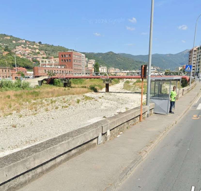
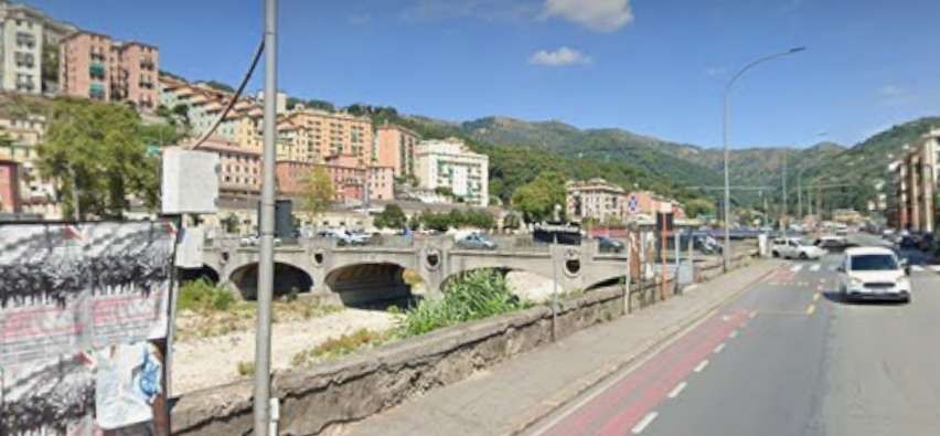
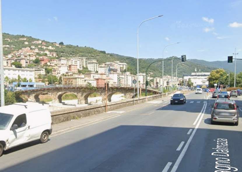
Italian Wikipedia also gives a description of the branch line to the gasworks: which curved in a wide arc before crossing the Via del Piano. It then “crossed the Bisagno engaging the G. Veronelli bridge, with 9 spans and 8 piers, built in reinforced concrete by the Società Italiana Chini.” [7][9]

An aerial view of Ponte G. Veronelli. Probably while construction work was being undertaken in the 1920s, © Archivio AMGA, Public Domain. [11]
The E80 viaduct under construction. The Gasometers sit alongside it with Ponte G. Veronelli crossing the River Bisagno on the diagonal. [21]
One of the Gasometers associated with the gasworks with a tram running on Line No. 12 seen from the Ponte G. Veronelli over the River Bisagno, © Public Domain. [7]
A closer view of Ponte G. Veronelli, © Archivio AMGA, Public Domain. [12]
Jung R42C 0-6-0 Diesel Locomotive No. 2 leaving the Gavette gasworks in the direction of Terralba. It is about to cross the road on the right bank of the Bisagno and then the river. This image was shared on the C’era una volta Genova Facebook Group by Gianfranco Dell’Oro Bussetti on 9th July 2016. [27]
Jung R42C 0-6-0 Diesel Locomotive No. 2 pulling a train of empty coal wagons. It has just left the Gavette gasworks in the direction of Terralba and is crossing the River Bisagno. In the background the gasometers and on the right the Gavette gatehouse. [14]
The railway immediately to the West of the River Bisagno. It crossed the tramway at level and dived directly into the gasworks, © Public Domain. [2]
The entrance to the gasworks in the 21st century. [Google Streetview, August 2024]
Looking back from the gasworks entrance across the river on what would have been the old railway running on Ponte G. Veronelli. [Google Streetview, August 2024]
The area of the gasworks in the 21st century. [Google Maps, November 2024]
Gavette gasworks in the 1950s. One of the Gasometers id visible on the left. The bridge visible in the picture is Ponte Geovani Vernoulli  but it is to the bridge which carried the railway. That bridge is off to the left of this photograph. This image was shared on the C’era una volta Genova Facebook Group by Loredana Assereto on 5th March 2022. [29]
A panoramic view of the gasworks site, probably in the 1960s. This image was shared on the C’era una volta Genova Facebook Group by Carlo Risore on 26th November 2019, © Pino Bellarosa. [30]

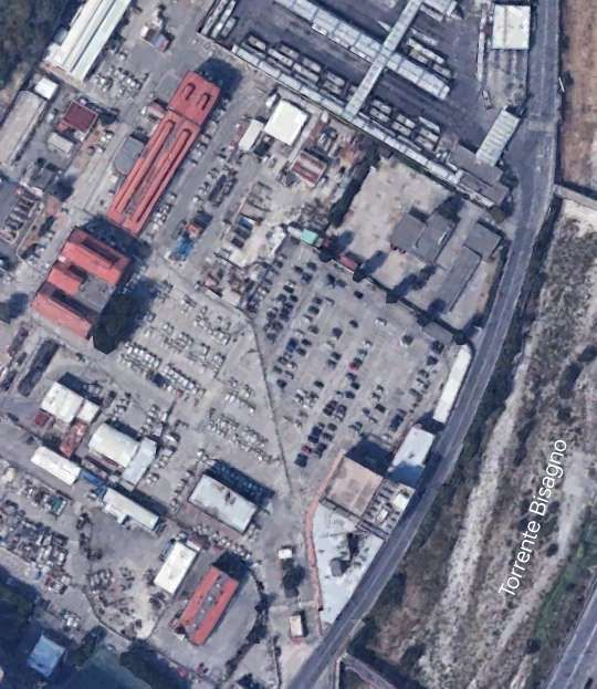
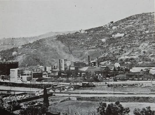
The remaining length of the line (approximately 1 km) ran along the left bank of the river to slaughterhouses near the Falck steelworks in Cà de Pitta. [7][8][9][10] There was also a shorter-lived branch which served a cement works to the East of the river.

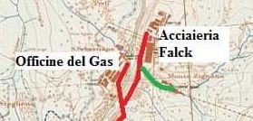
The head of the line! The branch serving the cement works is shown in green. [31]

The line on the left bank of the Bisagno served the Falck Steelworks (adjacent to the SS45 in the top-left of this image), and a cement works (which was located in the industrial area North of the wooded area to the bottom-right of the image. [Google Maps, November 2024 – but note that the steelworks is under redevelopment at the end of 2024]
The gasworks site is off to the left of this image which looks North along the left bank of the River Bisagno. The railway ran close to the dwarf wall which acts as the parapet to the wall at the river’s edge. [Google Streetview, August 2024]
Further North, the railway ran under the location of the parked vehicles at the river’s edge. [Google Streetview, August 2024]
The Falck Steelworks site in 2020, seen from the right bank of the Bisagno. [Google Streetview, September 2020]

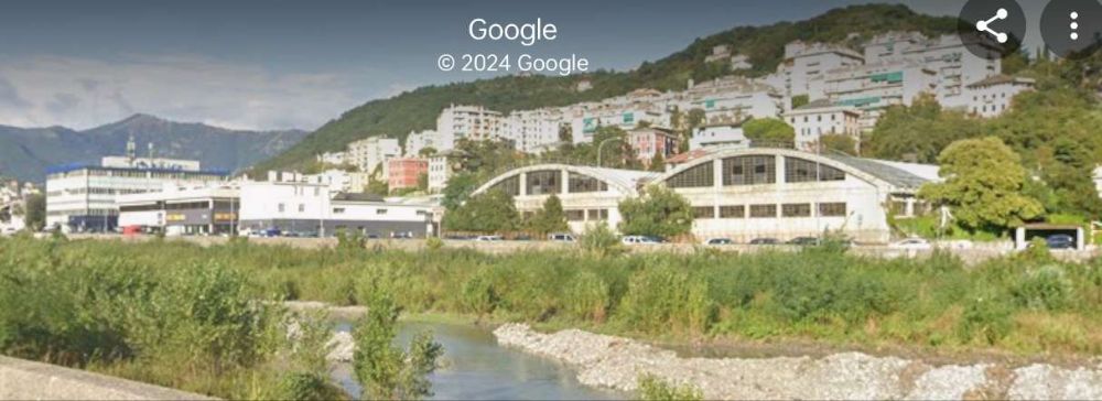
The picture of the site of the steelworks brings us to the end of our journey along this industrial railway.

It was commented at the time of the construction of the line that through “the use of this rapid and economical means of transport, the potential of the gasworks can be significantly increased, at the same time reducing the costs for the transport of coal and by-products of the works themselves by approximately 1 million lire per year. … There will also be indirect advantages since the roads along the right bank of the Bisagno, currently congested by the transit of vehicles of all kinds, with great and evident danger to public safety, will be partially cleared and consequently the maintenance costs of said roads will also be reduced. The implementation of the industrial track will also contribute profitably to transforming a large area of land, still inaccessible a few years ago, and give it a new and fruitful industrial impulse. … Not to mention that the operating, maintenance, depreciation, etc. costs will weigh on the budget of the Municipality to a minimal extent since private companies will also contribute to the maintenance costs of the railway.” [10: p18 – quoting the Genoa Magazine of 1926 – translated from Italian]
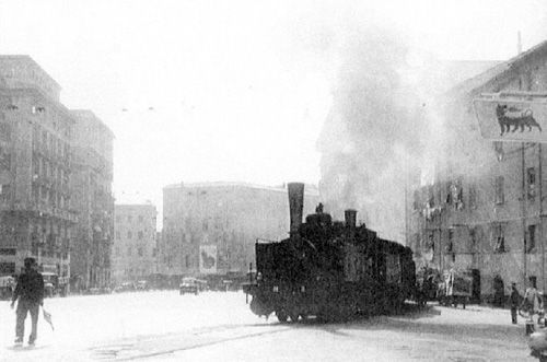
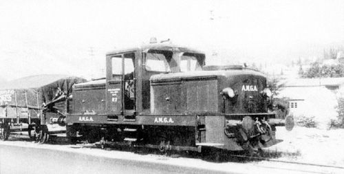
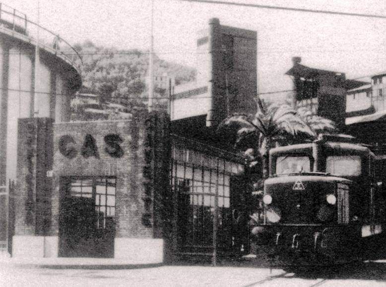
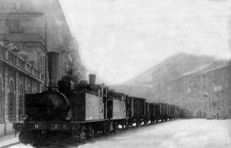
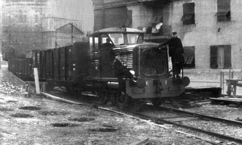
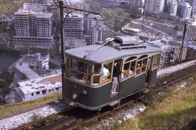
The management of the railway line was entrusted to the Municipality through its Municipal Gas and Water Company (AMGA), which had three Breda-built steam engines and, subsequently, also a three-axle Jung R42C diesel locomotive, while the wagons were owned by the FS (Ferrovie Della Stato) which made them available to the Municipality.” [8 – translated from Italian]

Two of the three Breda-built steam locomotives owned by AMGA which worked the line. Here they are in charge of a train of fruit and veg wagons outside the market on Corso Sardegna. [7]

AMGA certainly owned two diesel locomotives which are shown below.
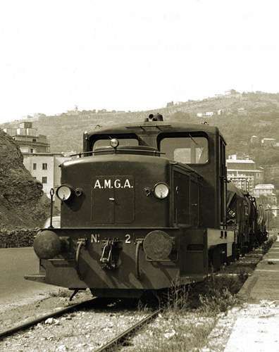
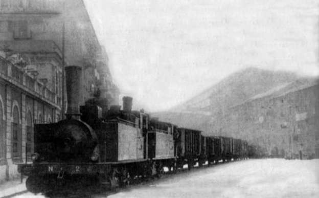
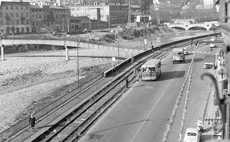
AMGA Diesel Locomotive No. 1, hauling wagons loaded with coal, leaves Corso Sardegna to go up the Val Bisagno towards Gavette, soon it will pass under the school building in Via Cagliari. © Public Domain. [7]
Jung R42C 0-6-0 Diesel Locomotive No. 2 owned by AMGA and at work in 1957., © Public Domain. [7]

Any train travelling along the line was escorted by a shunter (an operative on the ground), equipped with a red flag, and, normally, also by a traffic policeman on a cyclist or motorcyclist who had the task of stopping the traffic. Particularly  spectacular were the long trains of coal wagons destined for the Officine Gas delle Gavette for the production of town (city) gas.” [8 – translated from Italian]

Italian Wikipedia tells us that “the line was decommissioned in 1965 as a result of the use of methane gas instead of town gas, thus ceasing its need for it by AMGA, now the sole user of the plant after road transport had replaced rail transport to the slaughterhouses and the market.” [7][10]

References

  1. https://commons.m.wikimedia.org/wiki/File:Carta_della_Ferrovia_della_Gavette.png, accessed on 15th November 2024.
  2. https://www.ilmugugnogenovese.it/ferrovia-delle-gavette, accessed on 15th November 2024
  3. https://www.ilportaledeitreni.it/2019/05/08/la-ferrovia-delle-gavette-un-impianto-genovese-poco-conosciuto, accessed on 15th November 2024.
  4. https://www.superbadlf.it/wordpress/il-treno-nella-storia-binari-lungo-il-bisagno, accessed on 15th November 2024.
  5. https://wp.me/p4UqjX-gp, accessed on 15th November 2024.
  6. https://www.facebook.com/groups/gianfranco.curatolo/permalink/4257695100941408/?app=fbl, accessed on 15th November 2024.
  7. https://it.m.wikipedia.org/wiki/Binario_industriale_della_val_Bisagno, accessed on 16th November 2024.
  8. La ferrovia delle Gavette (binario industriale della val Bisagno); on gassicuro.it., https://web.archive.org/web/20140910195722/http://www.gassicuro.it/storiagas-genova-appr-ferr-gavette.asp, accessed on 16th November 2024.
  9. Alessandro Sasso, Claudio Serra; The Gavette Railway; in Mondo Ferroviario , No. 154, April 1999, p10.
  10. http://www.urbancenter.comune.genova.it/sites/default/files/quaderno_arch_2011_03_21.pdf, accessed on 16th November 2024.
  11. https://commons.m.wikimedia.org/wiki/File:Ponte_Veronelli_-_Gavette.jpg, accessed on 16th November 2024.
  12. https://commons.m.wikimedia.org/wiki/File:Vista_ponte_Veronelli.jpg, accessed on 16th November 2024.
  13. https://www.stagniweb.it/jqzoom.asp?ImgBig=mappe/ge943.jpg&ImgSmall=mappe/ge943_.jpg&bSmall=500&file=mappe_ge&inizio=5, accessed on 16th November 2024.
  14. https://web.archive.org/web/20140910215759/http://www.gassicuro.it/galleriffic/mezzi.asp#15, accessed on 16th November 2024
  15. https://it.pinterest.com/pin/256775616243441061, accessed on 16th November 2024.
  16. https://www.ebay.co.uk/itm/133338084620?mkcid=16&mkevt=1&mkrid=711-127632-2357-0&ssspo=TA95VFW8Qea&sssrc=4429486&ssuid=afQhrar7TGK&var=&widget_ver=artemis&media=COPY, accessed on 16th November 2024.
  17. https://de.pinterest.com/pin/206884176619651422, accessed on 17th November 2024.
  18. https://ceraunavoltagenova.blogspot.com/2015/02/genova-marassi-e-quezzi.html?m=1, accessed on 17th November 2024.
  19. https://genova.repubblica.it/cronaca/2018/02/21/foto/l_ex_mercato_di_corso_sardegna_riparte_dal_verde_il_comune_presenta_il_progetto-189401770/1, accessed on 17th November 2024.
  20. Casa circumdariale di Genova Marassi; https://images.app.goo.gl/yMg3fsAgg2c6vsao7, accessed on 18th November 2024.
  21. https://www.facebook.com/groups/gianfranco.curatolo, accessed on 18th November 2024.
  22. https://www.facebook.com/share/p/2mo3VEGfjWoA18Di, accessed on 18th November 2024.
  23. https://www.facebook.com/share/p/4Gyv5fSuKi6AAFA5, accessed on 18th November 2024.
  24. https://www.facebook.com/share/p/rvyqDzDgnb3Zf1XH, accessed on 18th November 2024.
  25. https://www.facebook.com/share/p/fRgGbQviKdGTWZR8, accessed on 18th November 2024.
  26. https://www.facebook.com/share/p/yCEcP8WSx2UNwhNx, accessed on 18th November 2024.
  27. https://www.facebook.com/share/p/VsRrXqjSKUYKUvih, accessed on 18th November 2024.
  28. https://www.facebook.com/share/p/TdQCn4jv2wxRxcRP, accessed on 18th November 2024.
  29. https://www.facebook.com/share/p/N9UYkoambK7J1fjW, accessed on 18th November 2024.
  30. https://www.facebook.com/share/p/rbAnaTF1E3pTSxN3, accessed on 18th November 2024.
  31. https://www.facebook.com/share/p/xPR32MbMWLBnpAwF, accessed on 18th November 2024.

Genoa – A Telfer

For a very short time Genoa had a Telfer.

‘Telfer’ or ‘Telfere elettrico’, was a monorail railway line built in Genoa in 1914, the first of its kind built in Italy. The name was derived from the English term ‘telpher’. [1]

In this case, the ‘Telfer’ was a monorail. Examples of telphers in the UK include one at Manchester Victoria Railway Station which is described here. [6]

The term has more normally been used for the moving element of a beam crane used in warehouses or other industrial settings. [6]

Examples of a variety of small Telphers. [15]
The route of Genoa’s Telfer is shown here as a red line. [1]
A closer view from the map above. The line drawn in red is the approximate route of the line. The first image below shows that, at least in one place, the line was constructed beyond the water’s edge. [8]
Genoa’s Telfer approaching its terminus in the Port. The Stella Batterie can be seen at the rear of the photograph with the Telfer passing through a widened window, © Public Domain. [1]

Given the Telfer’s link to the English word ‘Telpher’ then strictly speaking ‘Telfer’ should be assumed to apply to the moving element of this short term transport solution in Genoa which could itself, perhaps,  be considered to be a monorail.

The Telfer was installed for the Italian Colonial International Exhibition of Marine and Marine Hygiene which opened in May 1914 and closed in November of the same year. [7]

The poster advertising the International Exhibition, © Public Domain. [7]
The Telfer was one of the key advertising images associated with the Exhibition. [10]

In an historical period when European powers were involved in colonial expansion. The stated aim of the Exhibition was to show the developments in the sectors of hygiene and maritime trade, but ultimately it was an opportunity for Italy to celebrate its colonial conquests! [7]

The Telfer connected Piazza di Francia (the south-eastern part of the current Piazza della Vittoria) to the Giano pier of the port, near the new Harbour Master’s Office. It was managed by UITE (Società Unione Italiana Tramways Elettrici).

The Telfer was originally intended for Milan, to connect Milan with the residential area of Milanino, approximately 8 km from the city. That project never came to fruition.

Instead, a shorter version was built in just 100 days for the Exhibition in Genoa. The Telfer entered service on 18th June 1914 and served throughout the time of the exhibition. It was later modified for the transport of goods, in particular coal, from the port to the factories located along the Bisagno. It continued to function throughout the period of the First World War but was dismantled in 1918.

Italian patents for the system were held by BBB (the Badoni Bellani Benazzoli Company of Milan). [4]

The Italian Wikipedia tells us that “the line was traversed by a single, symmetrical train, which ran on its own track formed by a beam raised from the ground, with a running rail at the top and two lateral ones for support and guidance. For the support piers, reinforced concrete was used. … The monorail beams were of an inverted T section, 85 cm wide at the base and 190 cm in height, over which Vignoles 36 kg/m rail was fixed on oak stringers. … Along the lower edges of the inverted T beams, two guides for the horizontal wheels were provided, made from L-shaped bars. …  The items of rolling-stock sat astride the beam and were supported by hooded double-edged central wheels. They had lateral appendages extended downwards for the guide rollers.” [1]

Seats were arranged in four longitudinal rows, two on each side, stacked in steps, with the backrests on the inside. Each ‘carriage’ had 38 seats and 12 standing places, or with the seats folded down a standing capacity of 80 passengers could be achieved. There were three access doors on each side. … The ‘locomotive’ had four 700 mm wheels, all powered, each connected to an AEG Thomson-Houston 40 hp 500 V engine regulated by controller as used for electric trams. The brake was compressed air with a double shoe for each wheel.” [1]

As the driver’s position in the train was at the centre of the convoy (the locomotive was at the centre of the train), automatic safety devices were placed to stop the train at the station. The entire convoy when fully loaded carried about 350 people and weighed 80 tons. All the rolling stock was built by Carminati & Toselli of Milan.” [1]

The Route of the Telfer Monorail

A map from around 1914 (shown in full above) shows the route of the line. Segments of the line follow together with appropriate supporting images.

An enlarged view from the map of the Telfer/Monorail which shows the most Easterly length of the line. [8]
The Telfer terminus near the Exhibition, the bowstring arch at the left of this image is shown in more detail in the image immediately below, © Public Domain. [1]
The Telfer at Piazza di Francia station, © Public Domain. [5]

The Telfer’s Northeast terminus was in the southern corner of Piazza d’Armi above the River (Torrent) Bisagno, close to the Bezzecca Bridge which at the time was the first structure spanning the river North of its outfall into the Mediterranean.  Piazza d’Armi became Piazza di Francia and later Piazza Della Vittoria.

Piazza Della Vittoria with its triumphal arch is at the top of this extract from Google’s satellite imagery. [Google Maps, November 2024]

The route crossed the Corso Aurelio Saffi by means of a 26 metre span skew bowstring concrete arch bridge and ran straight down the West side of the river channel on the road known as Via del Feritore at that time. The line hugged the base of the high retaining wall and, in doing so, curved round to the West.

The Telfer on the move along the stretch of Corso Aurelio Saffi, © Public Domain. [1]
The Telfer running round the curve below Corso Aurelia Saffi, © Public Domain. [11]
The Telfer curved round the retaining wall which supported Corso Aurelio Saffi. [Google Maps, November 2024]
The next length of the line shown on historic mapping. The location of the Stella Batterie can be made out just to the right of the centre of the image.  The sharp turn onto Pier Giano appears at the top-left of this MDP extract. [8]

The line continued above the water’s edge clinging to the base of the retaining wall before passing above Strega swimming baths.

The Telpher at the start of the length carried over the sea, © Public Domain. [12]
The Telfer over the bathing area at Strega, © Public Domain. [13]

The Telpher/monorail then described a wide arc as it approached the historic Stella battery. [1][3: p103]

The line described a wide arc as it ran through to the Stella Batterie. [Google Maps, November 2024]
The Stella Batteries after the turn of the 20th century. The Telfer required windows to be widened to allow it to pass through the building [17]
The Telfer over the water before turning sharply to the left into its Western terminus on the Giano Pier, © Public Domain. [9]

The Telfer passed through the Stella Batterie by means of widened windows. [1][3: p103]

The line then ran straight to the landward end of Pier Giano, cutting across the stretch of water in front of the Cava baths like a viaduct. A curve as tight as 50 metre radius took the Telpher onto the pier and the line continued for some 370 metres. [1]

The last curve on the line on the approach to Giano Pier seen from the seaward side of the line. [11]
The final curve seen from the landward side of the line, © Public Domain. [16]

The terminus of the line was close to the pilots’ tower, 370 metres from the tight curve that brought the Telfer onto the pier.

The last 370 metres of the line were on Giano Pier. [8]
The station at Giano Pier, © Public Domain. [14]

The entire route was just over 2.2 km in length, with an average height above ground of 4 m. Except for the short stretch on the Giano pier, which was made of wood, the route was fabricated in reinforced concrete and was supported on a total of 72 piers. A third of the piers sat directly in the sea. [1]

The route was travelled at a speed of 20-30 km/h and was completed in about seven minutes. [3] The train ran every half hour from 9:00 to 24:00, A single ticket cost 1.00 lire (about 3.70 euros today), a return ticket 1.50 lire (about 5.50 euros today), there were concessions for shareholders, military personnel, children and groups. [1][3: p99]

References

  1. https://it.m.wikipedia.org/wiki/Telfer_(monorotaia), translated from Italianand accessed on 10th November 2024.
  2. https://www.meer.com/it/10565-sospesi-sullabisso, accessed on 10th November 2024.
  3. Massimo Minella; The Telfer, a monorail on the water; in 1914 – The International Exhibition of Genoa; De Ferrari, Genoa, 2014, pp. 99–111.
  4. Let’s talk about Badoni , in 
    I Treni , No. 215, May 2000, pp. 22-25.
  5. https://web.archive.org/web/20140503133000/http://fotoalbum.virgilio.it/lucaboggio/vecchia-genova/esposizioneigienema/telferdicollegament-2.html, accessed on 10th November 2024.
  6. https://rogerfarnworth.com/2018/12/07/manchester-victorias-telpher
  7. https://it.m.wikipedia.org/wiki/Esposizione_internazionale_di_marina_e_igiene_marinara_-_Mostra_coloniale_italiana, accessed on 14th November 2024.
  8. https://picryl.com/media/telfer-genoa-1914-1918-942c06, accessed on 14th November 2024.
  9. https://www.infogenova.info/conoscigenova/curiosita/209-monorotaia, accessed on 14th November 2024.
  10. https://www.etsy.com/listing/843011848/vintage-1914-genoa-italy-exposition, accessed on 14th November 2024.
  11. https://ceraunavoltagenova.blogspot.com/2017/12/telfer.html?m=1, accessed on 14th November 2024.
  12. https://www.ilcittadino.ge.it/Cultura/Expo-Genova-1914-mostra-a-Palazzo-San-Giorgio, accessed on 14th November 2024
  13. https://www.ilsecoloxix.it/video/2019/05/21/video/quando_genova_aveva_la_funivia_e_la_monorotaia-9553479, accessed on 14th November 2024.
  14. https://www.alamy.com/stock-photo/telfer.html, accessed on 14th November 2024.
  15. https://www.industritorget.se/objekt/elektriska+telfrar/15290/#mobileAnchor, accessed on 14th November 2024.
  16. https://www.marklinfan.com/f/topic.asp?TOPIC_ID=1028, accessed on 14th November 2024.
  17. https://www.amezena.net/tag/batteria-della-stella, accessed on 14th November 2024.
  18. http://www.uwrbancenter.comune.genova.it/sites/default/files/quaderno_arch_2011_03_21.pdf, accessed on 16th November 2024, p17. …..”The first monorail in Europe: On 14th June 1914, the first monorail built in Europe was inaugurated in Genoa. It was built for the International Exhibition that occupied the area of the current Piazza della Vittoria and Via Diaze hosted numerous exhibitions set up inside pavilions designed largely by the architect Coppedè. The “Telfer elettrico” (or “suspended or aerial railway”) connected the “aerial” station, located inside the Exhibition, to the port, at Molo Giano, where the exhibition pavilion of the Consorzio Autonomo del Porto was located. The Telfer was 2227 m long and followed, approximately, the route of the current Viale Brigate Partigiane and part of the current Aldo Moro flyover: to cross the final part of Corso Aurelio Saffi a parabolic bridge with a span of 28 m was built, a true “work of art”. The Telfer consisted of a monorail suspended on wooden or concrete beams resting on triangular-shaped supports and an electric traction train that moved in both directions, placed astride the beam and composed of a central locomotive that drove two or four carriages. The carriages had a capacity of 46 seats or, alternatively, 80 standing places. The Telfer reached a maximum speed of between 20 and 30 km/h and took eight minutes to complete the entire journey. It was built in one hundred and fifty days of actual work and had seen the employment of more than six hundred workers. It  could have been used, after the closing of the exhibition, for the transport of people or goods, but unfortunately the war events imposed the dismantling of the monorail and the partial reuse of the materials.”

Bibliography

  • Enrico Pieri, Il “Telfer” di Genova, in Strade Ferrate , n. 16, ottobre 1983, pp. 22-27.
  • Marco Marchisio, Il Telfer di Genova, in Tutto treno & storia, n. 14, novembre 2005, pp. 30-43.
  • Lorenzo Bortolin, TELFER, la monorotaia di Genova, in I Treni Oggi, n. 16, gennaio 1982, pp. 20–21.
  • Cornolò Ogliari, Si viaggia anche … così, Milano, Arcipelago edizioni, 2002, ISBN 88-7695-228-4.
  • Stefano Percivale (da un progetto di), Genova com’era Genova com’è, Genova, Fratelli Frilli Editori, 2008.
  • Franco Rebagliati, Franco Dell’Amico, Giovanni Gallotti e Magno Di Murro, Il Telfer, in In tram da Savona a Vado 1912-1948, L. Editrice, 2012, pp. 68–71, ISBN 978-88-95955-73-5.
  • Massimo Minella, Il Telfer, una monorotaia sull’acqua, in 1914 – L’Esposizione Internazionale di Genova, De Ferrari, Genova, 2014, pp. 99–111. ISBN 978-88-6405-564-0.

Genoa Rack Railway – Ferrovia Principe Granarolo Genova

The Principe–Granarolo rack railway (Ferrovia Principe-Granarolo) is a rack railway that connects Via del Lagaccio, near the Genoa Piazza Principe railway station, to the Granarolo hills. The line is sometimes erroneously described as a funicular.  The line is managed by AMT Genova, which manages the city’s public transport. [1]

The route of the Ferrovia Principe Granarolo, © Arbalete and authorised for reuse under a Creative Commons Licence (CC BY-SA 2.0). [1]

Work on the Principe–Granarolo rack railway started in 1898, and operation commenced in 1901. The line’s unusual track gauge and passing loop arrangement, both common in funiculars but rare elsewhere, have suggested to some that the line may have started life as a funicular and been converted to rack operation; however the line’s owners have dismissed this theory. [1][2][3]

The line’s cars were totally rebuilt in 1929, with new body and mechanical equipment, and the line was rebuilt in 1976. [1][3]

Car No. 1 (circa 1950) in a relatively dilapidated condition, © Public Domain. This image was shared on the Ferrovia Principe Granarolo Genova Facebook Page on 22nd June 2022. [7]
Car No. 2 close to the top of the line, possibly in the 1940s, © Public Domain. This image was shared on the Ferrovia Principe Granarolo Genova Facebook Page on 22nd May 2022. [8]

In 2002, Car 2 was sent away for an overhaul, but the bankruptcy of the original contractor and the involvement of a replacement in an alleged bribery scandal meant that the overhaul was not completed and the car returned to the line until March 2019. The overhaul included the replacement of the car floor, lighting, safety systems, electric drive, air conditioning and a new driver’s seat. Between 2002 and 2019, service was provided by Car 1 operating alone. AMT now plans to use the rebuilt car to double the service frequency to every 15 minutes. [1][4]

In November 2024, AMT Genova were undertaking significant maintenance work and the line was closed. On 8th November, they explained that the rack railway was “temporarily down due to an electrical problem with the motor of the upstream traction axle. The restoration activities have already started. Updates on the resumption of service will follow. … During rack downtime, the G1 replacement bus is active.” [5]

Built to 1.2 metre-gauge, the rack railway is 1,130 metres (3,710 ft) in length, and rises 194 metres (636 ft) with a maximum gradient of 21.4%. It uses the Riggenbach rack system and is electrified at 550 V DC. The single central passing loop uses fixed points, and the two cars have double-flanged wheels on one side and unflanged wheels on the other side, thus ensuring that each car keeps to its own side in the loop. [1][2]

The line serves 9 stops, including the two terminals, and, until the closure in early November 2024 for maintenance work, it operated an irregular timetable, with cars departing each terminus between every 30 and 40 minutes. [6]

A Journey Down the Line

We start at the head of the line at Granarolo. The first photograph shows Car No. 1 resting at Granarolo before its next journey South.

Car No.1 at Granarolo Station, © Jens Stundel (2023). [Google Maps, November 2024]
Google Earth 3D satellite image showing the Granarolo terminus of the railway and the crossing at Via Bartolomeo Bianco. [Google Earth, November 2024]
The view North along the line to Granarolo Station from Via Bartolomeo Bianco. [Google Streetview, May 2023]
The view South along the line from Via Bartolomeo Bianco. [Google Streetview, May 2023]
The line South of the crossing at Via Bartolomeo Bianco. Although downloaded from Google Earth in November 2824, the satellite image must be from before October when trams were running on the northern half of the railway.  [Google Earth, November 2024]
Just a hundred metres or so down the line Car No. 1 runs beside Salita di Granarolo. [10]
The view North from Salita di Granarolo which runs alongside the railway for some distance. [Google Streetview, July 2018]
The view South from the same location. The overhead mast indicates the presence of the railway beyond the low wall which runs diagonally across the photograph. [Google Streetview, April 2019]
The line continues Southeast alongside Salita di Granarolo. [Google Earth, November 2024]
The route of Salita di Granarolo and the railway begin to diverge. [Google Earth, November 2024]
The Salita di Granarolo and the railway are separated by the parking area for the building which sits between the railway and the road on the next satellite image. [Google Earth, November 2024]
A footpath links Salita di Granarolo to the railway at the location of Chiassaiuola Halt which was at the rear of the building which dominates this next satellite image. [Google Earth, November 2024]
The Salita di Granarolo (in blue) drops away to the South as the line runs Southeast through Chiassaiuola Halt seen on the right of this satellite image. [Google Maps, November 2024]
The line continues Southeast of Chiassaiuola Halt. [Google Earth, November 2024]
It then begins to turn to a more southerly direction. [Google Earth, November 2024]
The drift round towards the South continues as the line drops down the hillside. [Google Earth, November 2024]
A slight S-bend brings the line to the crossing point. The points at the North end of the loop can be seen bottom-right of this satellite image. [Google Earth, November 2024]
Car No. 2 close to Cambiaso Halt in 1969, © Public Domain. [12]
The passing loop/crossing point. [Google Earth, November 2024]
The driver’s view North from the crossing point. [10]
The line South of the crossing point runs almost due South alongside Via Bari. [Google Earth, November 2024]
The line is bridged by Via Bari and continues southward towards the Southern terminus at Principe. [Google Earth, November 2024]
The Ferrovia Principe Granarolo seen from Via Bari, with car 1 descending towards Principe, © Arbalete and authorised for reuse under a Creative Commons Licence (CC BY-SA 3.0). [1]
The bridge that carries Via Bari over the railway. This image also gives a good view of the original Riggenbach rack system used on the line, © Arbalete and authorised for reuse under a Creative Commons Licence (CC BY-SA 3.0). [12]
A short distance to the South of Via Bari the line drifts towards the South-southeast. [Google Earth, November 2024]
Google Maps shows the majority of the remaining length of the railway as contiguous with Salita San Rocco the annotation does not appear on Google Earth. [Google Earth, November 2024]
The approach to the Halt (Salita San Rocco) the pedestrian gateway which is in the bottom right of this image appears prominently adjacent to Car No. 1 in the photograph of the Halt below. The image immediately below features the wider gateway which sits to the North of the pedestrian gateway.[Google Earth, November 2024]
The view North from a point just to the North of the Salita San Rocco Halt. [10]
Car No. 1 at the Salita San Rocco Halt which was only a short distance from the terminus at Principe, © Walter and authorised for reuse under a Creative Commons Licence (CC BY-SA 2.0) [11]
The Salita San Rocco Halt is at the top of this satellite image. [Google Earth, November 2024]
The terminus of the line directly above the tunnel portal which opens onto Genoa Railway Station. The road alongside the terminus of the line is Via del Lagaccio. [Google Earth, November 2024]
The southern terminus at Principe sits over the tunnels at the West end of Genoa Railway Station, © Alessio Sbarbaro and authorised for reuse under a Creative Commons Licence (CC BY-SA 2.5). [12]
Car No 1  at the southern terminus of the line at Principe. [9]
Looking North from the southern terminus at Principe above the western end of Genoa Railway Station. [My photograph, 12th November 2024]

References

  1. https://en.m.wikipedia.org/wiki/Principe%E2%80%93Granarolo_rack_railway, accessed on 10th November 2024.
  2. Funicolare Principe – Granarolo (1); in Funimag. Archived from the original on 2nd June 2019; via https://www.funimag.com/funimag07/GENOVA04.HTM, accessed on 19th November 2024
  3. Funicolare Principe – Granarolo (5); in Funimag. Archived from the original on 2nd June 2019; via https://www.funimag.com/funimag07/GENOVA08.HTM, accessed on 10th November 2024.
  4. Marco Carroza; (June 2019). Car No.2 returns to Genova; in Today’s Railways. No. 282; Platform 5 Publishing Ltd., June 2019, p17.
  5. https://www.amt.genova.it/amt/cremagliera-principe-granarolo-18, (English translation of the AMT website), accessed on 11th November 2024.
  6. Partenze dal capolinea della linea FGR, [Departures from the terminus of the FGR line] (in Italian). AMT Genova. Archived from the original on 2nd June 2019, https://web.archive.org/web/20190602201756/https://www.amt.genova.it/amt/trasporto-multimodale/partenze/?linea=FGR&datagiorno=03%2F06%2F2019&orari=Orari, accessed on 11th November 2024.
  7. https://www.facebook.com/share/p/j1WLKA1gcFyZr3te, accessed on 11th November 2024.
  8. https://www.facebook.com/share/p/YnJLcUzeZ9GzyNkc, accessed on 11th November 2024.
  9. http://www.metrogenova.com/granarolo.asp, accessed on 13th November 2024.
  10. https://www.infogenova.info/da-non-perdere/57-ferrovia-principe-granarolo, accessed on 13th November 2024
  11. https://it.m.wikipedia.org/wiki/Ferrovia_Principe-Granarolo#/media/File%3ATra_le_case_(San_Francisco_a_Zena)_P2060637.jpg, accessed on 13th November 2024.
  12. https://it.m.wikipedia.org/wiki/Ferrovia_Principe-Granarolo, accessed on 13th November 2024.

Genoa – Funicular Railways

A. Zecca–Righi Funicular

The Zecca–Righi funicular (Funicolare Zecca–Righi) connects Largo della Zecca, on the edge of the historic city centre, with several stations on the slopes of the hill called del Righi , in the Castellaccio area, on the slopes of Mount Peralto. [1][4]

The line consists of a single metre-gauge track with a single crossing point. It rises 279 metres over1,428 metres and has an average gradient of just over 19%. The 42mm traction cable moves at 6 metres/second which means that the route can be covered in 12 minutes. The two articulated cars have 33 seats with a total capacity of 150 people. The ballast cable in 24mm in diameter. [4][10]

Schematic Map showing the Funicolare Zecca-Righi, superimposed on the AMT Genova transport map of Genoa. [3]
The route, superimposed on more traditional mapping. The line from Zecca to San Nicola is in tunnel, © Arbalete and authorised for reuse under a Creative Commons Licence (CC BY-SA 2.0). [1]

In 1890 the city of Genoa was convinced by Franz Joseph Butcher and his son Teodoro (Swiss citizens) to invest in a funicular railway which ran North from Largo Zeccan in tunnel as far as the church of San Nicola and then in the open, Northeast to Castellaccio. On 25th August 1890 the city offered the concession for this project to the Buchers. [5: p53]

Bücher himself decided to give the line the name “Funicolare del Righi” borrowed from the Swiss rack railways of Mount Rigi (pronounced Righi in German), which Bucher had already built in his homeland, and whose tourist success inspired him to design the one in Genoa. [6] The hilly area near the final station in the Castellaccio area has since then been commonly called the Righi, or simply Righi. [4]

On 28th February 1891 the Società di Ferrovie Elettriche e Funicolari (SFEF) was established in Kerns , with a share capital of 1,500 Lire. On 29th October 1892 a preliminary project was drawn up by the engineers Luigi Mignacco and Carlo Pfaltz; the latter, an Austrian, had already worked on the Gotthard tunnel and the Giovi branch. By 1894, when the work was nearing completion, the company capital was taken over by AEG. [4][5: p55]

The northern half of the project, which was simpler to build, was inaugurated on 28th September 1895. The tunnelled section was completed in February 1897.  (It seems, however, that a final completion certificate and testing was not formally provided until January 1912). [5: p57]

The Station at San Nicola which is now the crossing point for the two units running on the funicular railway, © Andrea Puggioni and licenced for reuse under a Creative Commons Licence (CC BY 2.0). [4]

For some time the two sections effectively ran as independent systems sharing the San Nicola station where passengers had to transfer between cabins. AEG eventually brought these and other concerns together in the Unione Italiana Tranvie Elettriche (UITE) company in September 1901. [5: p62]

A postcard view of the funicular in operation in 1919, © Public Domain. [4]

In 1906, the driving positions in the cars were enclosed to protect the operators from the elements. After the First World War and until the Second World War, the lower terminus was called Piazza Corridoni, in due course this became known as Largo della Zecca. [4][5: p69]

The 1920s saw the replacement of the cars and the improvement of the traction system which permitted the establishment of a new intermediate stop under Corso Carbonara, (opened on 1st January 1930). [4][5: p70-72]

In 1937, at the San Nicola crossing station, an original level crossing was replaced by a walkway that allowed people to step over the tracks and the cable. Between the wars both passenger and freight traffic increased significantly. During the Second World War, the bombings of 7th November 1942 caused heavy damage to the upper system, forcing its closure, while the tunnels of the lower one were converted into an air raid shelter. [4][5: p75]

After the Second World War the funicular was opened in two stages. The section above San Nicola  in 1945, the remaining length in 1946. The San Simone stop was reactivated in July 1958 and the Madonnetta stop in September 1959. [4][5: p75]

After the War, the funicular was reopened in two phases. The length above San Nicola in 1945, the remainder in 1946. The stop at San Simone was reopened in July 1958 and that at Madonnetta in September  1959. [5: p78-79]

The Italian Wikipedia site tells us that the two parts of the system were not unified until the 1960s. The San Nicola Station became a crossing point rather than X double terminus. The Righi Station was moved 34 metres and built with viewing platforms above the terminus. The old wooden chalet with housed the terminus was dismantled. In addition to the total reconstruction of the route, the rolling stock was replaced. The Bell company of Lucerne completed the works in November 1964 but, due to a dispute with the ministerial commission that should have inspected the works, the funicular only entered service on 28th February 1966. [4][5: p81-89]

A colour postcard showing the newly refurbished funicular in the late 1960s, © Public Domain. [4]

Changes in regulations meant that at the end of the 1980s, it was necessary to install an additional braking system; that and other work was undertaken between 1987 and 1990. The works involved the reconstruction of the track and the platforms of the stations, (lengthened to allow the use of new carriages that were longer than the previous ones), and of the mechanical parts as well as an increase in automation. The funicular returned to service in March 1990. [4][7][8]

After 20 years of service, on 1st April 2010 the Zecca-Righi funicular closed again for a 20 year overhaul. It was closed untill 27th November 2010. During this closure, significant changes were made to the system, which was equipped with two new 458 kW engines. The carriages were repainted and their interiors were completely redone: real glass was fitted to the windows, the seats were no longer made of plastic but of fabric, the doors were no longer opened by compressed air but electrically. The ticket machines were removed from inside the carriages to be positioned at the various stations and a video surveillance system was installed both at the stations and inside the cabins. Numerous rollers along the tracks and the pulleys were changed. [4][5: p89-91][9]

We travelled on this funicular on 12th November 2024. The photographs of this funicular in the galleries below were all taken by me on 12th November. Hopefully they give a reasonable impression of the journey up and back on the line.

B. Sant’Anna Funicular

The Sant’Anna funicular (Funicolare Sant’Anna) connects Piazza Portello, on the edge of the historic city centre, to the Corso Magenta. [2]

The funicular was opened in 1891, and was initially water-driven, with water filling a ballast tank under the carriage at the top station, and emptying at the bottom. The line was converted to electric operation in 1980, and was again modernized in 1991 following a fire that destroyed the top station. [2]

From 1st December 2021 it has been free to use courtesy of the Municipality of Genoa and AMT.[2]

We travelled on the Sant’Anna Funicular in both directions on Monday 11th November 2024.

The view North up the Sant’Anna Funicular from inside the passenger car. [My photograph, 11th November 2024]
The passing loop at the halfway point on the Funicular with the second car travelling down the line. [My photograph, 11th November 2024]
A side elevation (wide-angle) of the funicular car at the top of the journey. [My photograph, 11th November 2024]
The same car shown in a three-quarter view. [My photograph, 11th November 2024]
Just prior to the return journey down the funicular to the old city. [My photograph, 11th November 2024]
The view South down the Sant’Anna Funicular from inside the passenger car. [My photograph, 11th November 2024]
This closer view shows the cable, guide rollers and the 1.2 metre-gauge track. [My photograph, 11th November 2024]
The funicular car at the bottom terminus of the line. [My photograph, 11th November 2024]

The line is currently (2024) managed by AMT Genova. These are its operational details:

These operational details are provided by AMT Genova. [2]

C. Quezzi Funicular

The Quezzi Funicular/Elevator (Ascensore inclinato di Quezzi) is a public inclined elevator with variable slope in the Quezzi quarter of Genoa which sits North of the heart of the city. It opened in May 2015 and connects the lower terminus at Via Pinetti to the terminus at Via Fontanarossa, with an intermediate stop at Portazza. [11]

We were unable to visit this funicular during our visit to Genoa in November 2024. There is some uncertainty in my mind as to whether it is actually a funicular.

A view down the Ascensore inclinato di Quezzi, © Ale Sasso and licenced for reuse under a Creative Commons Licence (CC BY-SA 4.0). [11]

The elevator/funicular is managed by AMT Genova. It has a total length of 131 metres (430 ft), of which the lower 27 metres (89 ft) are in a tunnel, the middle 23 metres (75 ft) in a cutting, and the remainder on an elevated rail. The lower section has a gradient of 44%, transitioning to a gradient of 30% in the upper section. The single car is designed to tilt, in order to maintain the floor leveled, despite the change in gradient. [11][12][13]

These are the details of the line: [11][12][13]

The details of the line provided by Wikipedia. [11]
The Ascensore inclinato di Quezzi. [14],

AMT Genova describes the system as an ‘elevator’ that consists of a single cabin that moves along two parallel steel beams that act as a runway; the cabin is tilting to adapt to the variable slope track while maintaining the horizontal position. … The runway is characterized by two different inclinations of 44.13º and 30.33º and by a connecting section. The use of different gradients is a national innovation for inclined elevators for public use. It limits the amount of excavation and causes less impact on the immediate environment. They believe that the system is truly sustainable as it:

  • is equipped with solar panels to power the cabin lighting and ventilation.
  • has low-energy LED cabin lighting.
  • has a high-performance cabin air conditioning system.
  • it runs on load-bearing wheels in Vulkosoft, a special high-tech material, resistant to abrasion and specifically designed to minimize noise emissions and the transmission of vibrations.
  • has three stations, each equipped with sound diffusion systems and variable message panels for public information.
  • incorporates pedactyl paths and tactile maps for the blind and visually impaired.
  • complies with current legislation on the removal of architectural barriers.

The three stations are: Pinetti, Portazza and Fontanarossa. 1 cabin is used which is accessible to disabled people. [14]

References

  1. https://en.m.wikipedia.org/wiki/Zecca%E2%80%93Righi_funicular, accessed on 10th November.
  2. https://en.m.wikipedia.org/wiki/Sant%27Anna_funicular, accessed on 11th November 2024.
  3. https://www.amt.genova.it/amt/trasporto-multimodale/funicolari/funicolare-zecca-righi, accessed on 12th November 2024.
  4. https://it.m.wikipedia.org/wiki/Funicolare_Zecca-Righi, (translated from the Italian), accessed on 12th November 2024.
  5. Corrado Bozzano, Roberto Pastore and Claudio Serra; Genoa on the Rise; Nuova Editrice Genovese, Genoa, 2014.
  6. https://gazzettasvizzera.org/ricordati-a-genova-i-120-anni-della-storica-funicolare-del-righi, accessed on 12th November 2024.
  7. News , in Strade Ferrate, No. 40, July 1989, p. 91.
  8. Alessandro Sasso; New funicular for Genoa, in Mondo Ferroviario, No. 46, April 1990, p20-21.
  9. Giuseppe Viscardi, News , in I Treni, No. 346, March 2012, p6.
  10. Michel Azima; The funiculars of Genoa, in FuniMag , September 1996; https://www.funimag.com/funimag07/GENOVA02.HTM, accessed on 12th November 2024.
  11. https://en.m.wikipedia.org/wiki/Quezzi_inclined_elevator, accessed on 12th November 2024.
  12. Marco Cacozza; New funicular in Genova; in Today’s Railways Europe, No. 244, Platform 5 Publishing Ltd., April 2916, p18.
  13. Ascensore inclinato di Quezzi; (in Italian). AMT. 21st January 2015; https://www.amt.genova.it/amt/mobilita-sostenibile-prolungata-fino-al-31-luglio-la-gratuita-di-metro-e-impianti-verticali, accessed on 12th November 2024.
  14. https://www.amt.genova.it/amt/trasporto-multimodale/ascensori/ascensore-di-quezzi, accessed on 12th November 2024.