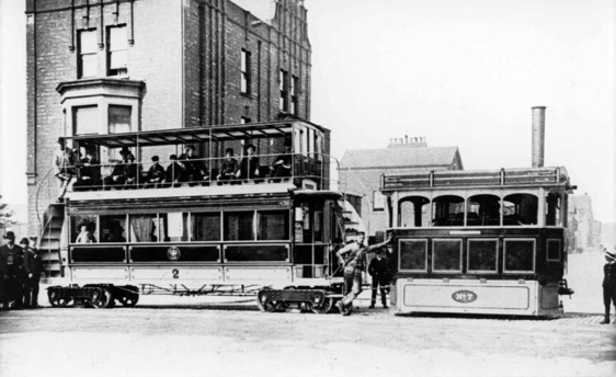
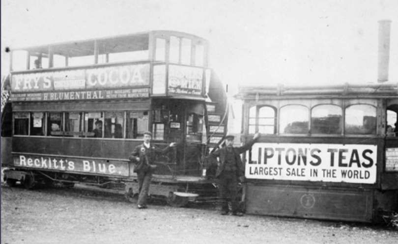
The Barrow-in-Furness Tramways Company operated a steam-powered tram service from 11th July 1885 until electrification in 1904. Using a 4 ft (1.219 m) gauge, the tramway reached Ramsden Dock by 1886 and continued expanding through the electric era to locations such as Bigger Bank. Ultimately, on 5th April 1932 the tramway network was closed in favour of buses. [1]
From 1876 to 1901 the Kitson built over 300 steam tram engines and steam railmotor units, which were developed from a design by W. R.Rowan. [6][7]
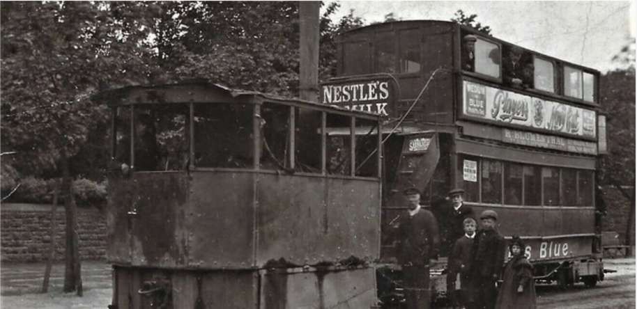
The tramway network connected the town centre with areas like Ramsden Dock (1886) and eventually extended to Biggar Bank on Walney Island in 1911. After the network was bought by British Electric Traction, the company embarked on a modernisaton programme and the network saw its first electric service in 1904. [1]
Barrow-in-Furness Corporation took over operation of the service on 1st January 1920 at a cost of £96,250 (close to £5 million in 2026). Technological advancements in the form of petrol and diesel powered buses resulted in the closure of the tramway, with the last service running on 5th April 1932. [1]
The Network in 1899/1890
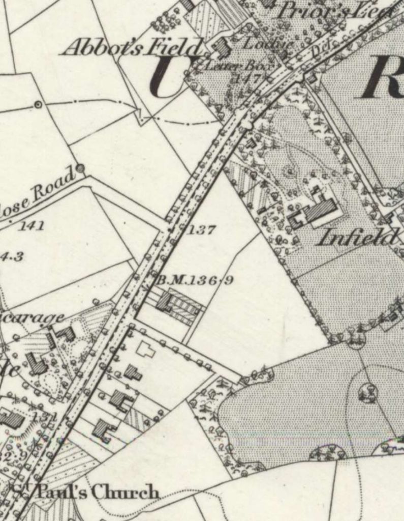
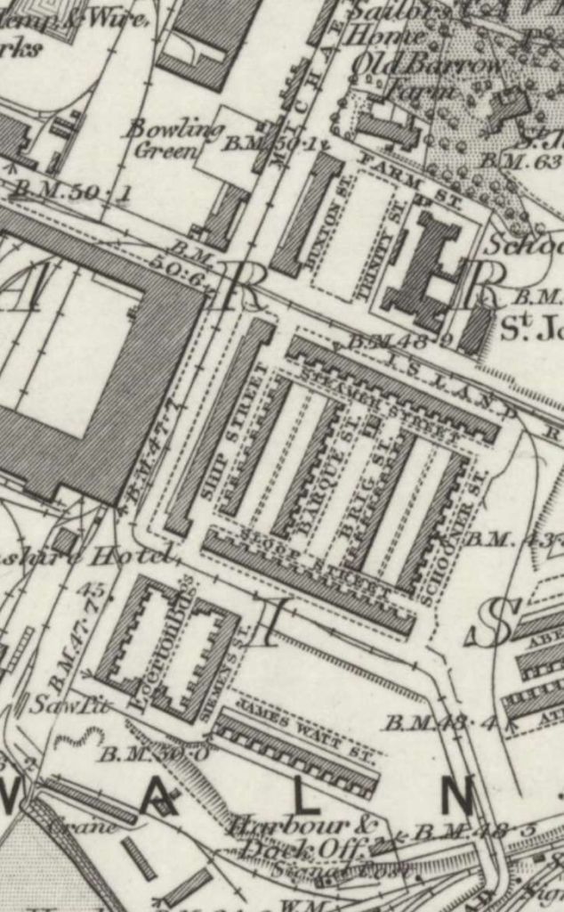
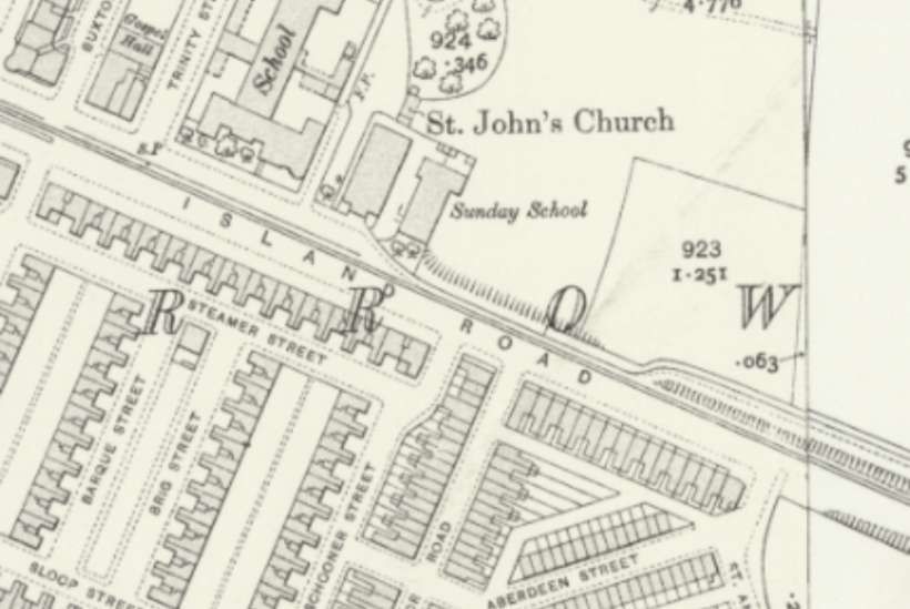
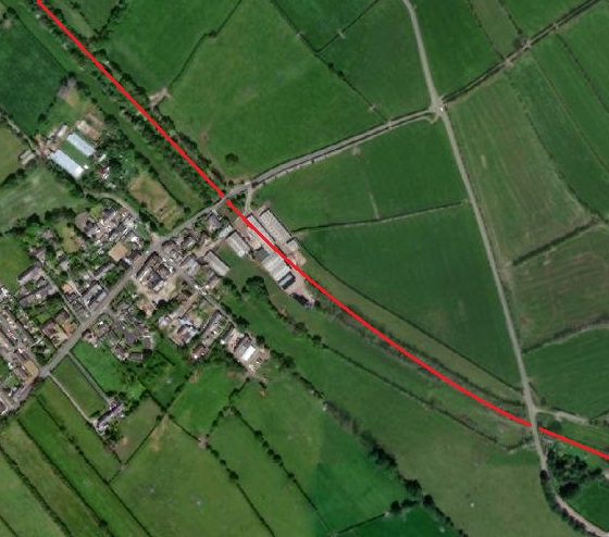
The steam tram network appears on the 1889/1890 6″ Ordnance Survey which was published in 1895. Three element can be identified:
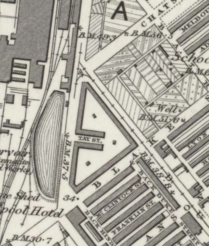
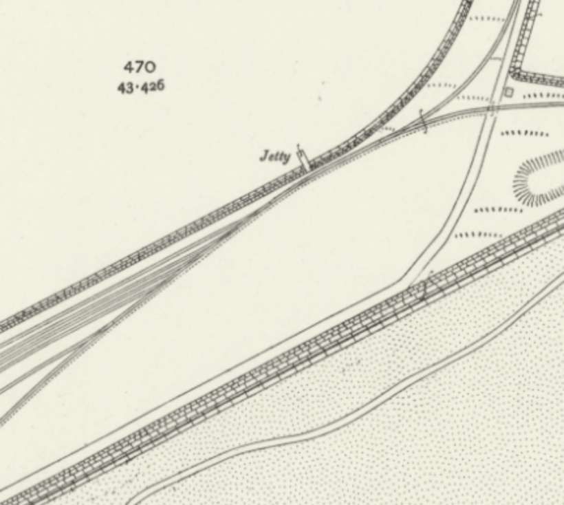
1. Priors Lea to Ramsden Dock Station
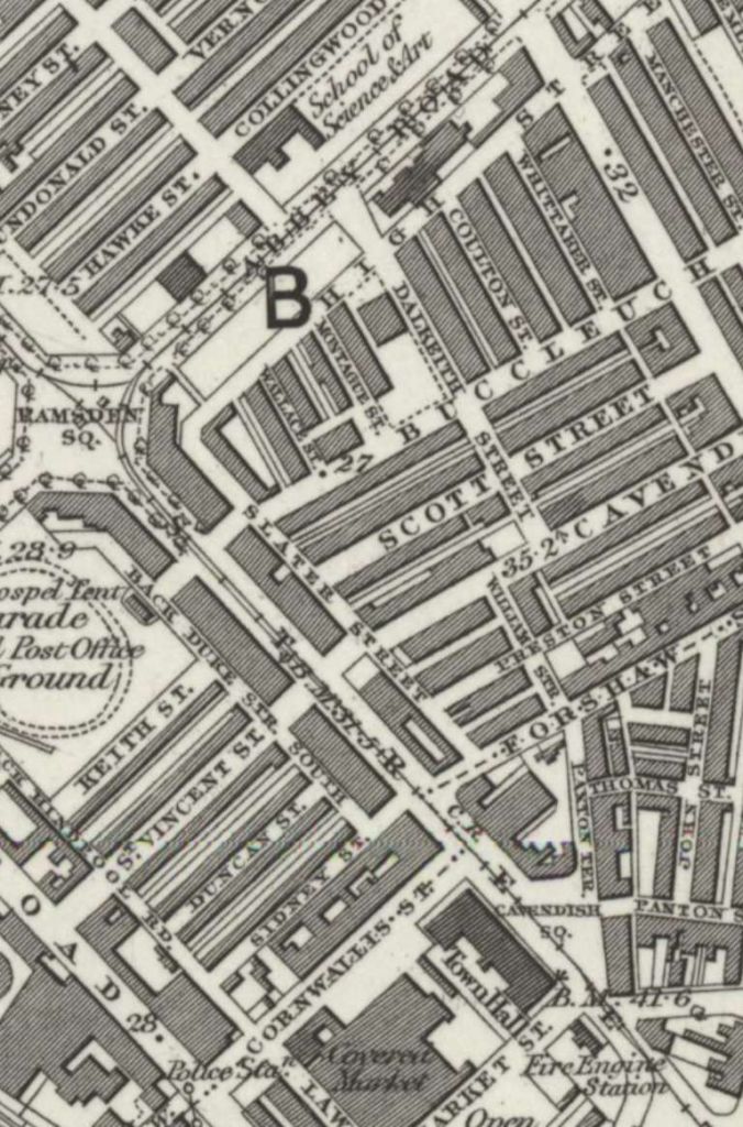
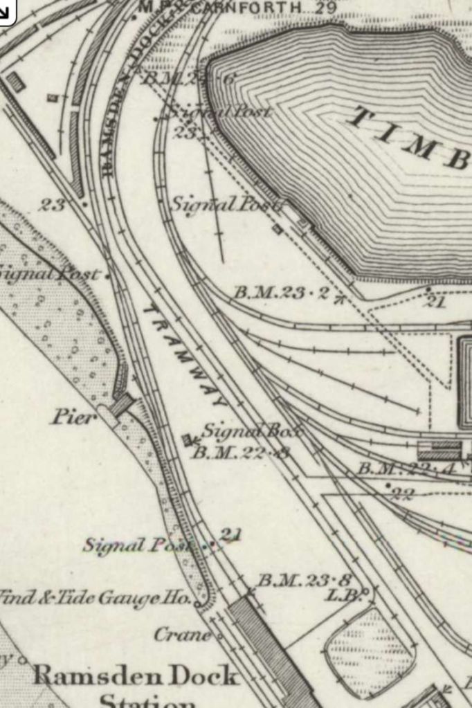
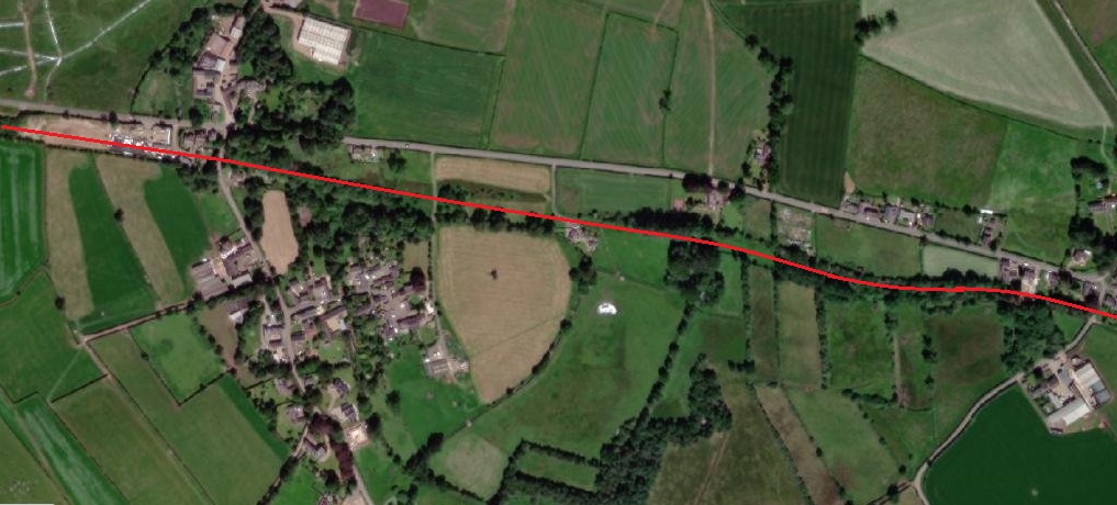
One axis of the steam tramway appears to have run from Priors Lea in the North to Ramsden Dock in the South via Ramsden Square. … The route appears on the next eight extracts from the 6″Ordnance Survey of 1889/1990 which was published in 1895.
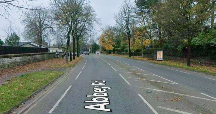
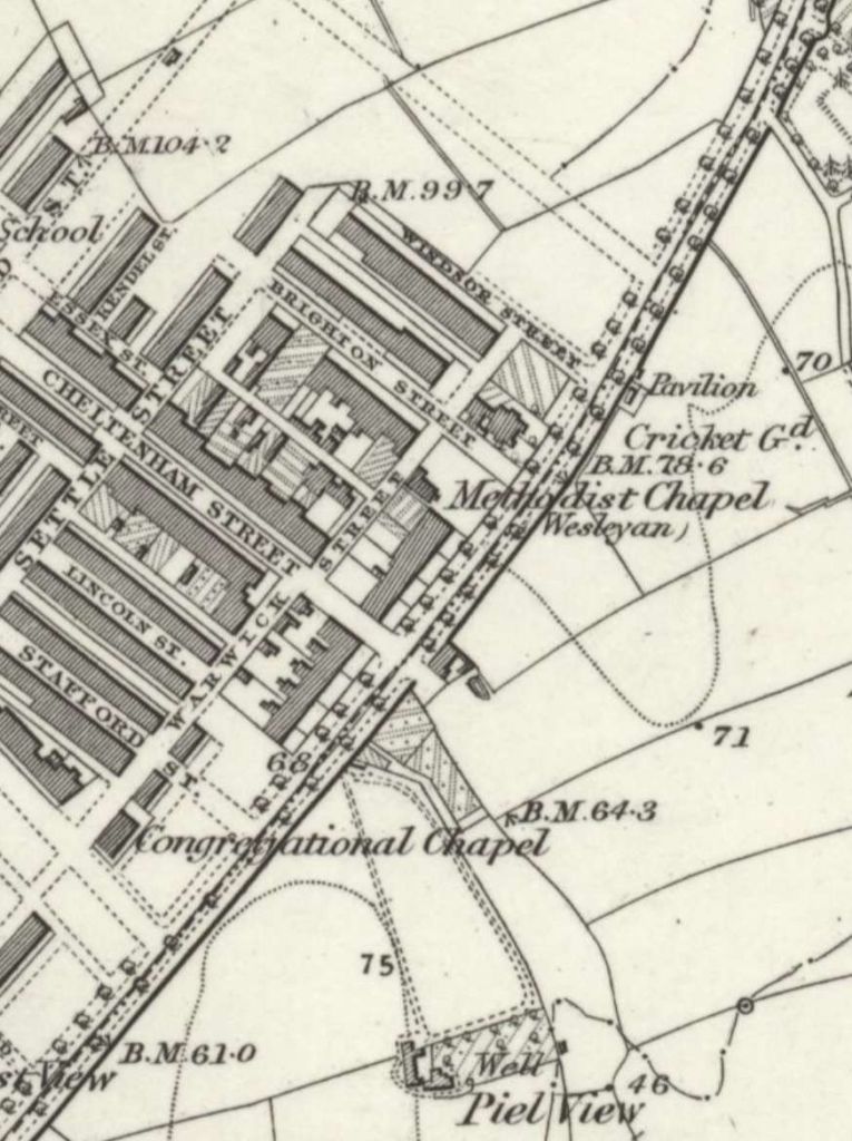
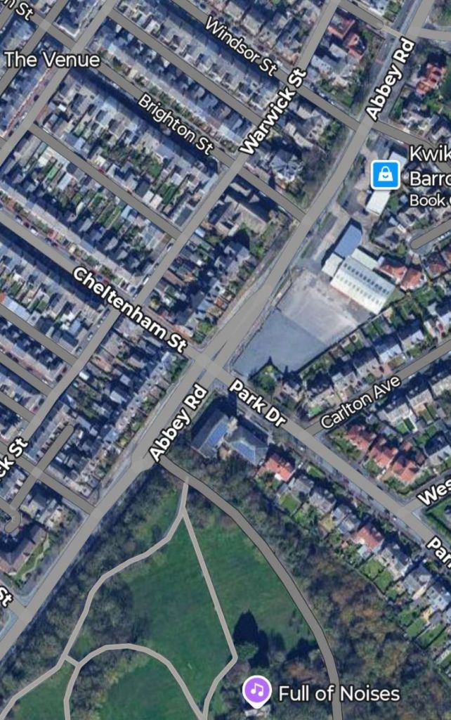
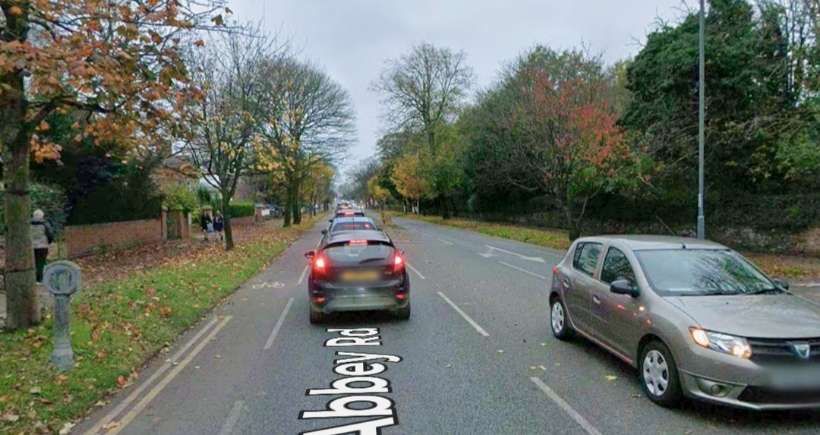
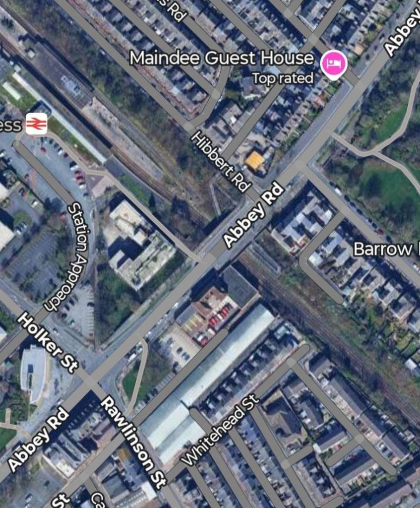
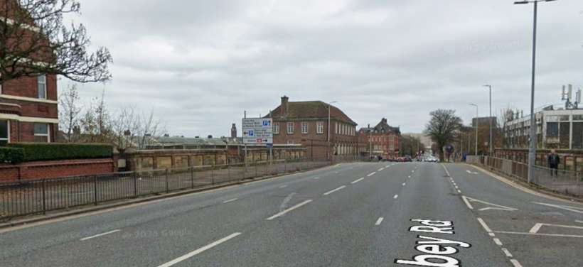
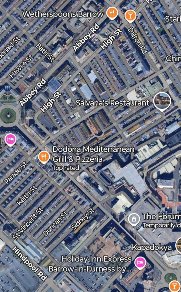
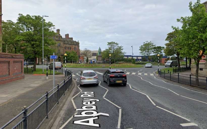
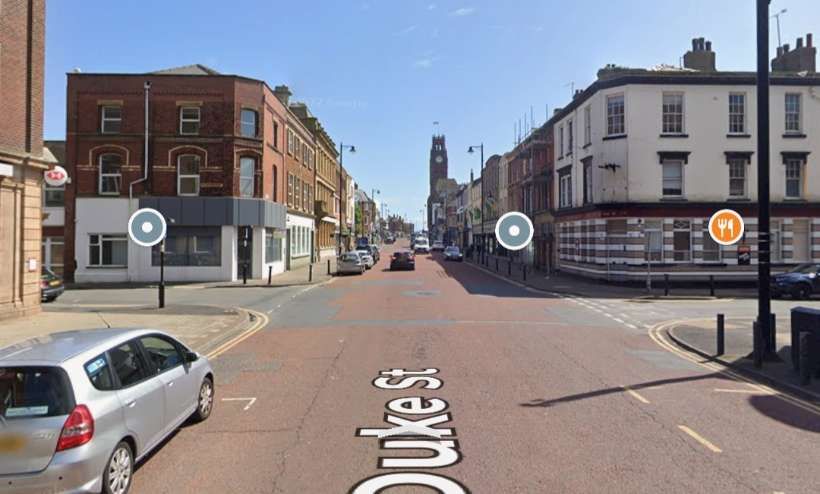
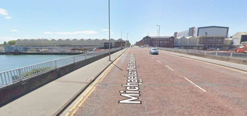
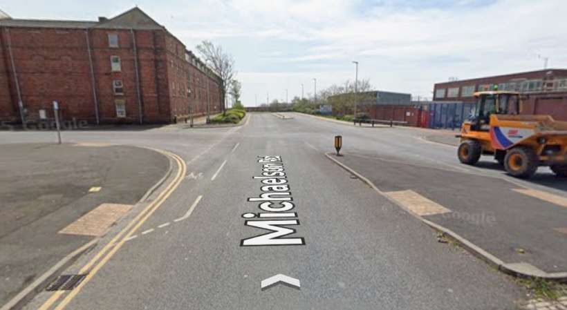
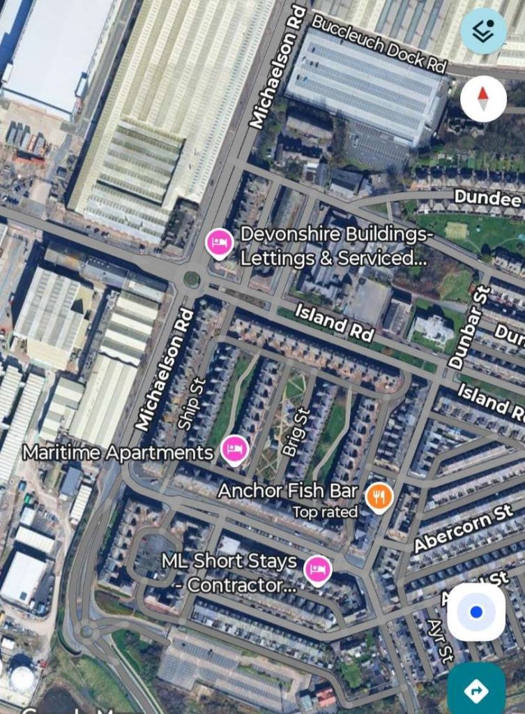
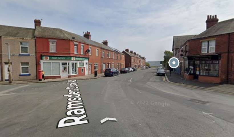
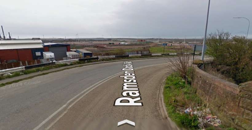
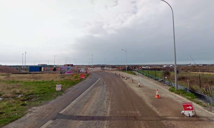
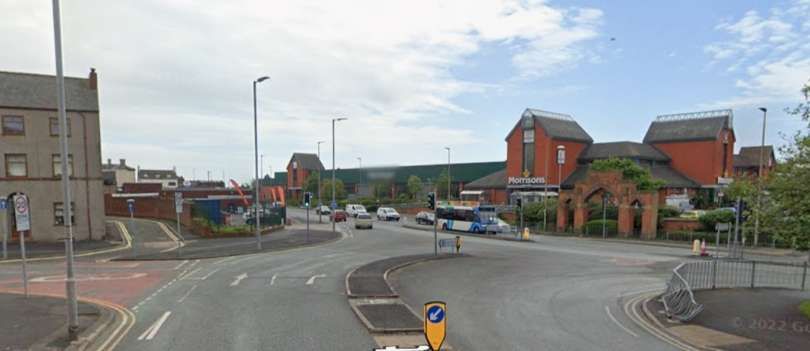
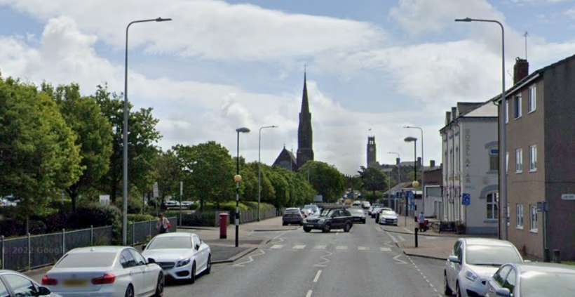
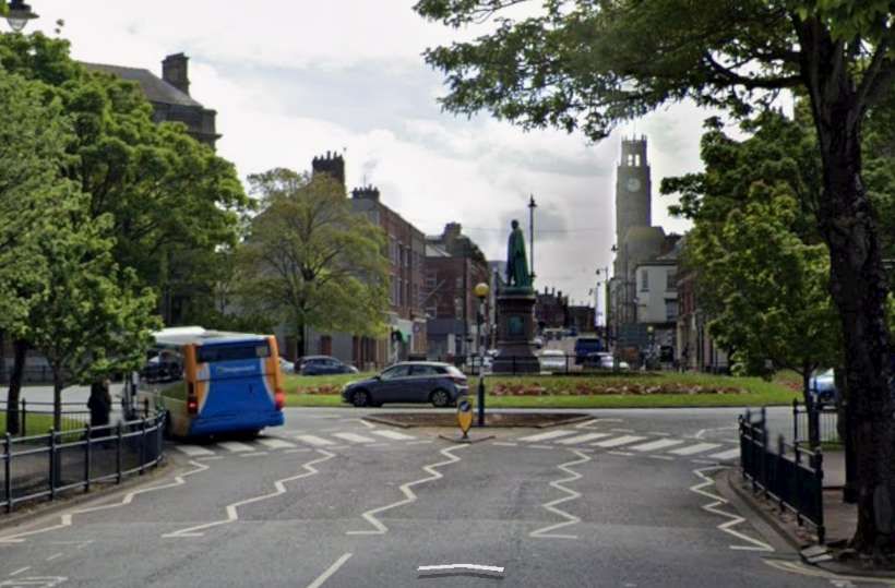
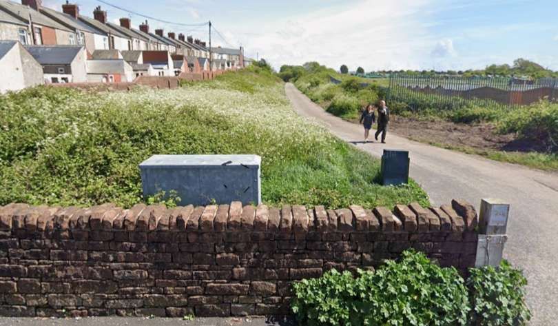
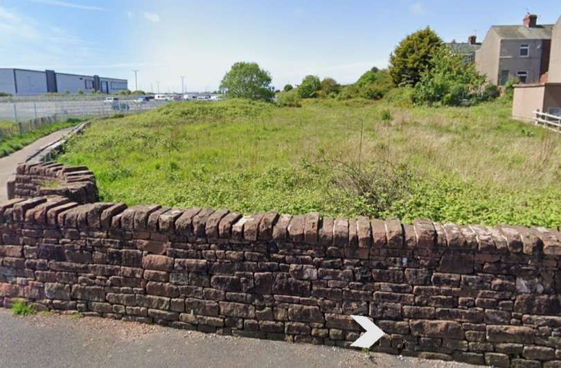
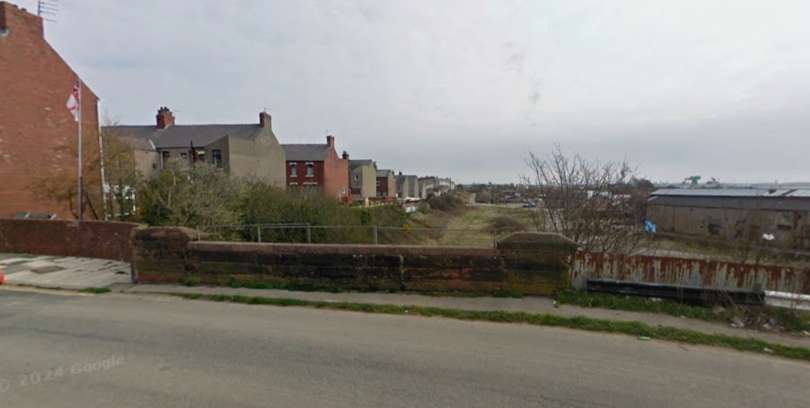
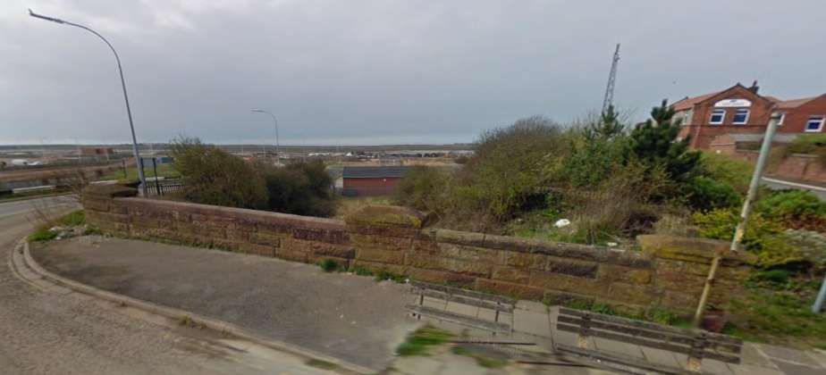
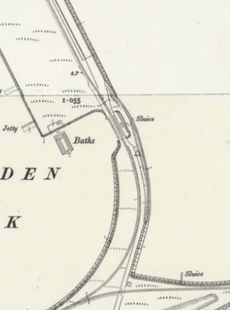
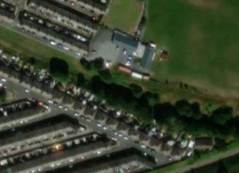
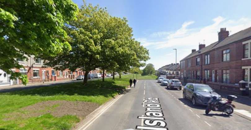
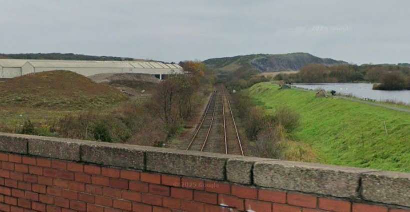
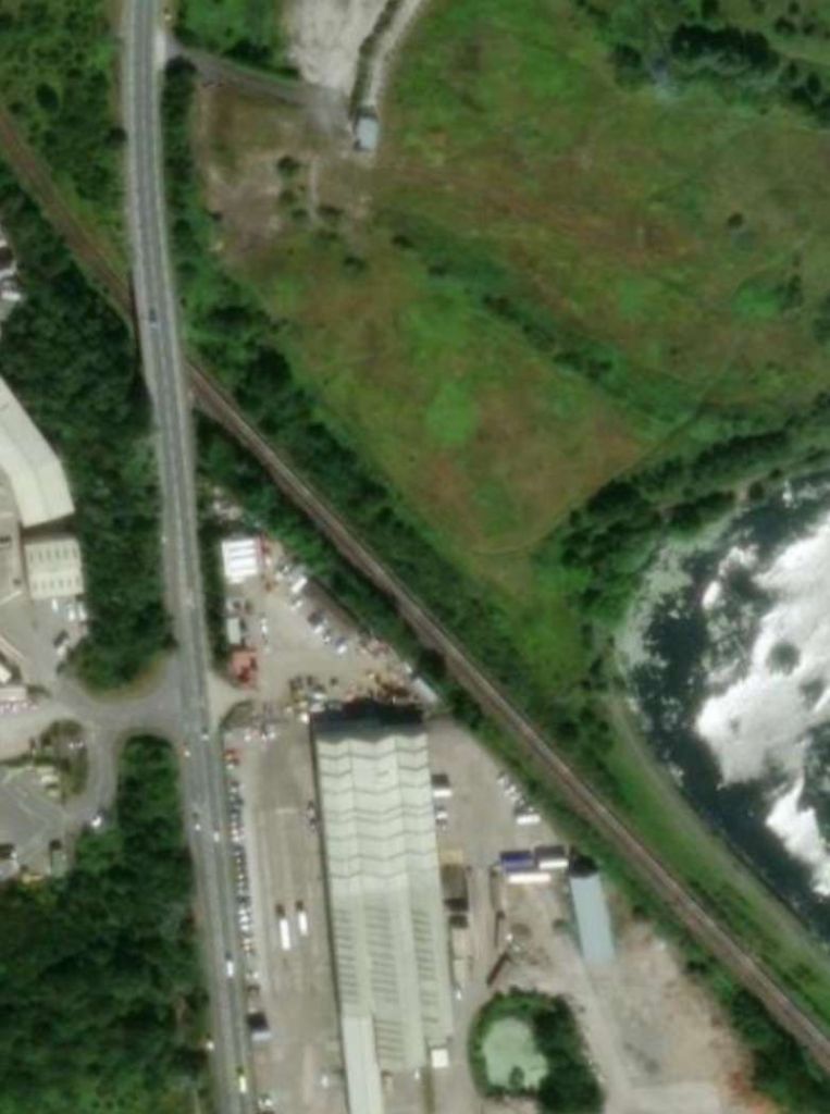
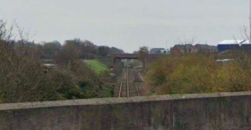
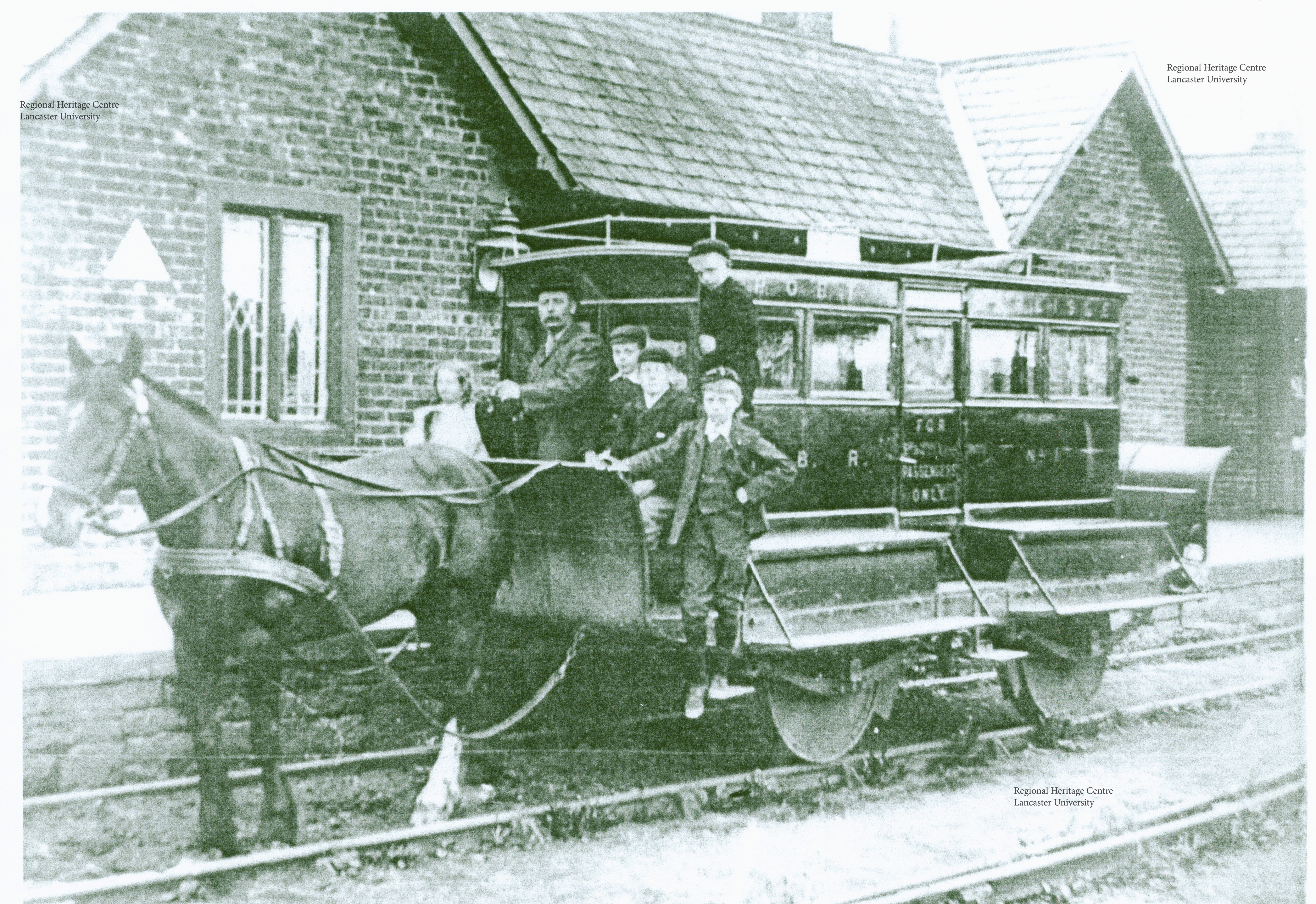
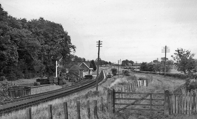
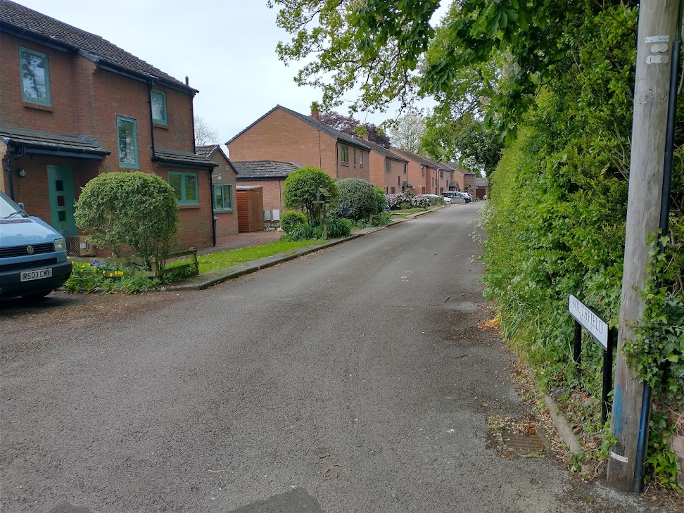
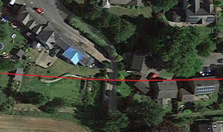
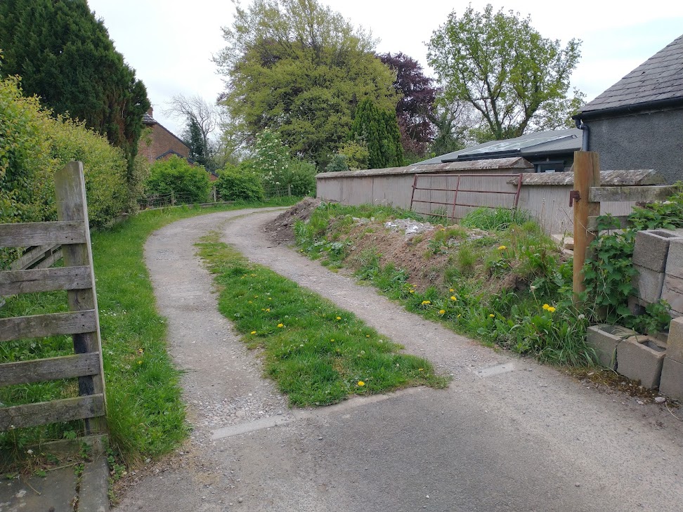
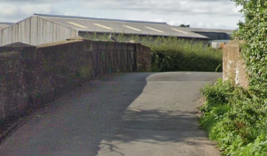
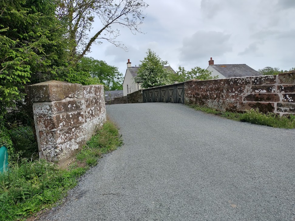
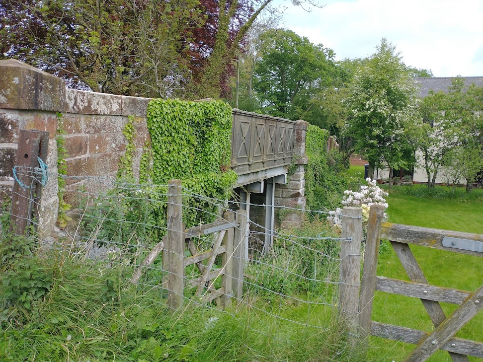
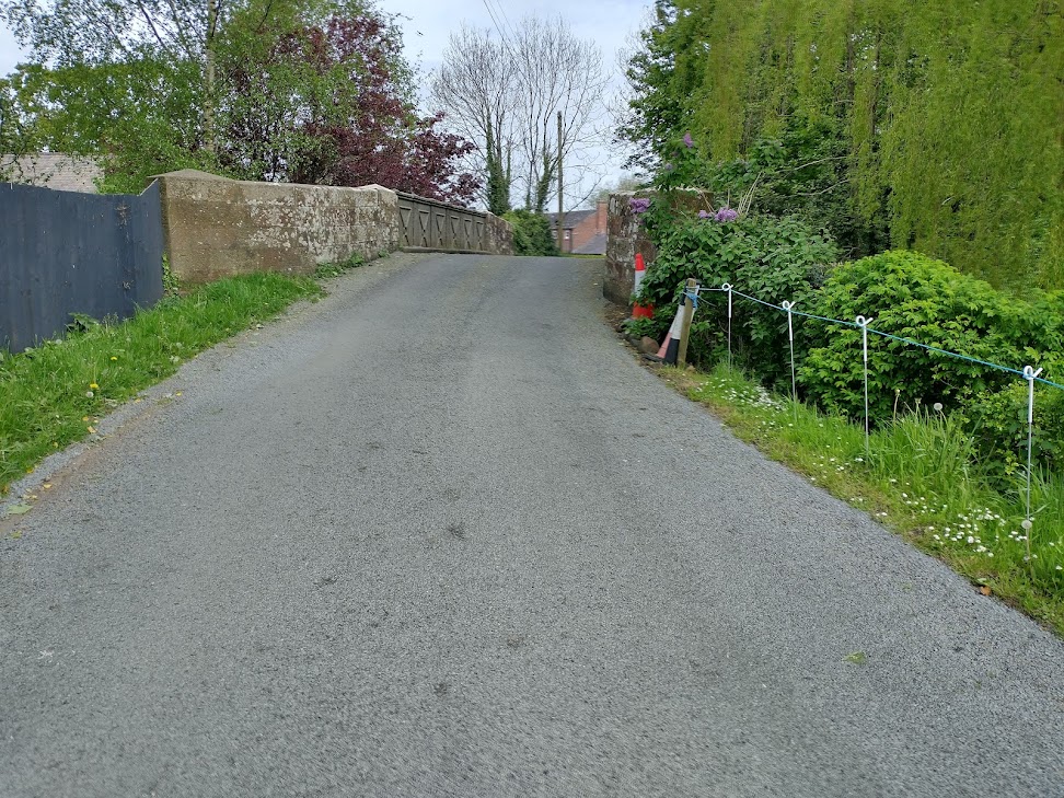
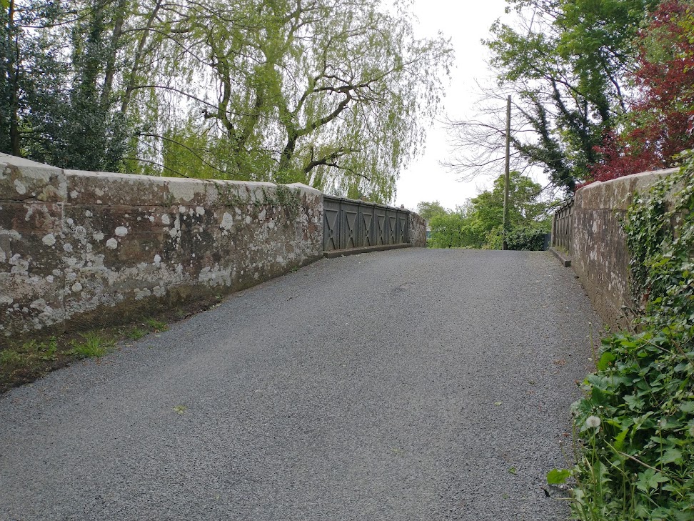
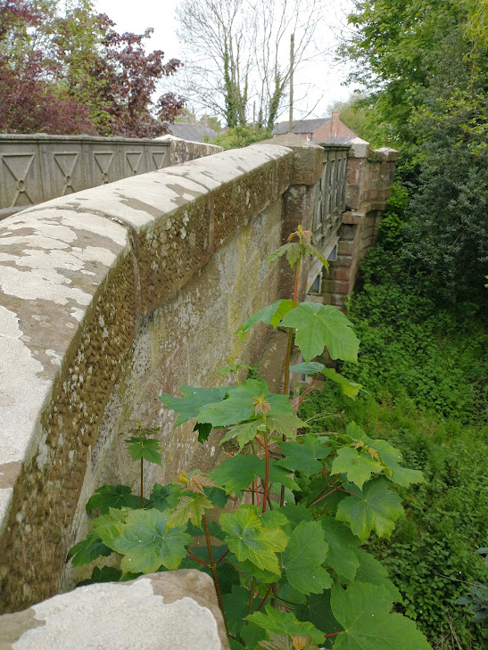
At the Priors Lee terminus, Top-right a tram engine had to run round its carriage. [5]The same length of Abbey Road in the 21st century, as shown above. [Google Maps, February 2026]Looking South on Abbey Road approximately at the location of the old tramway terminus. [Google Streetview, November 2024]Trams ran up and down Abbey Road. [5]The same length of Abbey Road in the 21st century, as shown above. [Google Maps, February 2026]A Methodist Chapel and Congregational Chapel sat to the West of the line. [5]A similar length of Abbey Road. [Google Maps, February 2026]Travelling South down Abbey Road. [Google Streetview, November 2024]The line crossed Abbey Road Bridge, with the Station a short distance away to the Northwest. [5]A similar length of Abbey Road in the 21st century. [Google Maps, February 2026]Looking Southwest along Abbey Road. Ahead is the bridge carrying the road over the railway. [Google Streetview, November 2024]At Ramsden Square the tramway turned Southeast along Duke Street. [5]Abbey Road, Ramsden Square, Duke Street and the very top of Michaelson’s Bridge Road. [Google Streetview, February 2026]The approach to Ramsden Square along Abbey Road. [Google Streetview, May 2022]Having turned left into Duke Street, trams continued in. Southeasterly direction. [Google Streetview, May 2022]A roundabout now sits at the top end of Michaelson Road. Trams would have been confined by the road layout of earlier time and swept round to the right on the near side of the modern roundabout. [Google Streetview, May 2022]It then turned Southwest along Michaelson Bridge Road [5]Michaelson Road Bridge carried the Tramway across the Devonshire & Buccleuch Docks. [Google Maps, February 2026]Looking South along the line of the old tramway across Michaelson Bridge. [Google Streetview, May 2022]Further South down Michaelson Road trams turned to the left into Ramsden Dock Road. [Google Streetview, May 2022]Trams ran along Ramsden Dock Road from its right-angle junction with Michaelson Road. [5]Approximately the same area in 21st century. [Google Maps, February 2026]Trams followed Ramsden Dock Road sweeping round to the South. [Google Streetview, May 2022]A relatively sharp curve to the right followed Ramsden Dock Road after the road had bridged the dock railways. [Google Streetview, May 2022]Ramsden Dock Road has now been closed to traffic. This photograph in 2009 appears to have been taken as the work to close the road was underway. [Google Streetview, April 2009]The steam tram served Ramsden Dock Station at its Southern terminal, where a loop was provided to obviate the need for the steam tram to run past its carriage. [5]The same length of the route of the old tramway as is shown on the above map extract. [Google Maps, February 2026]This final photograph faces South along the line of the old tramway towards the location of Ramsden Dock Station. [Google Streetview, May 2022]
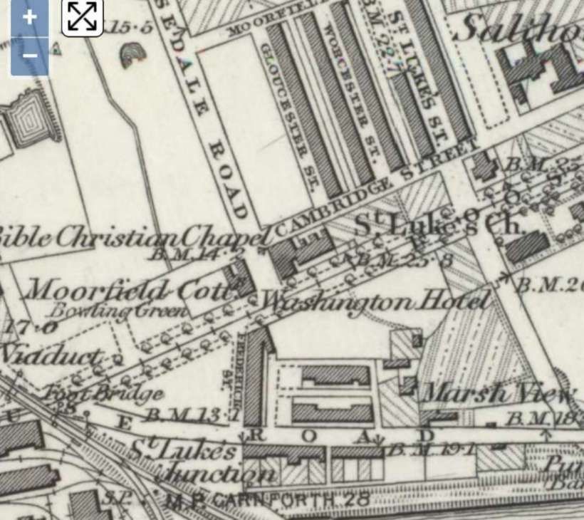
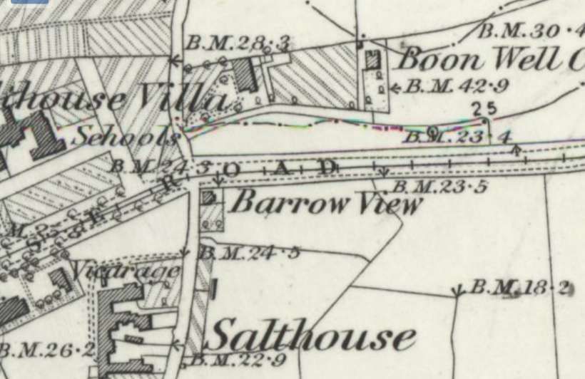
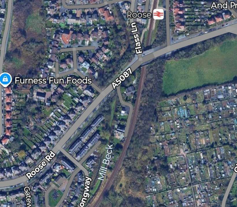
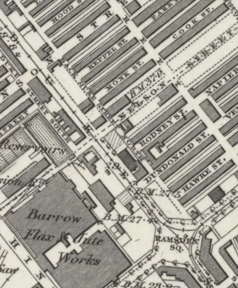
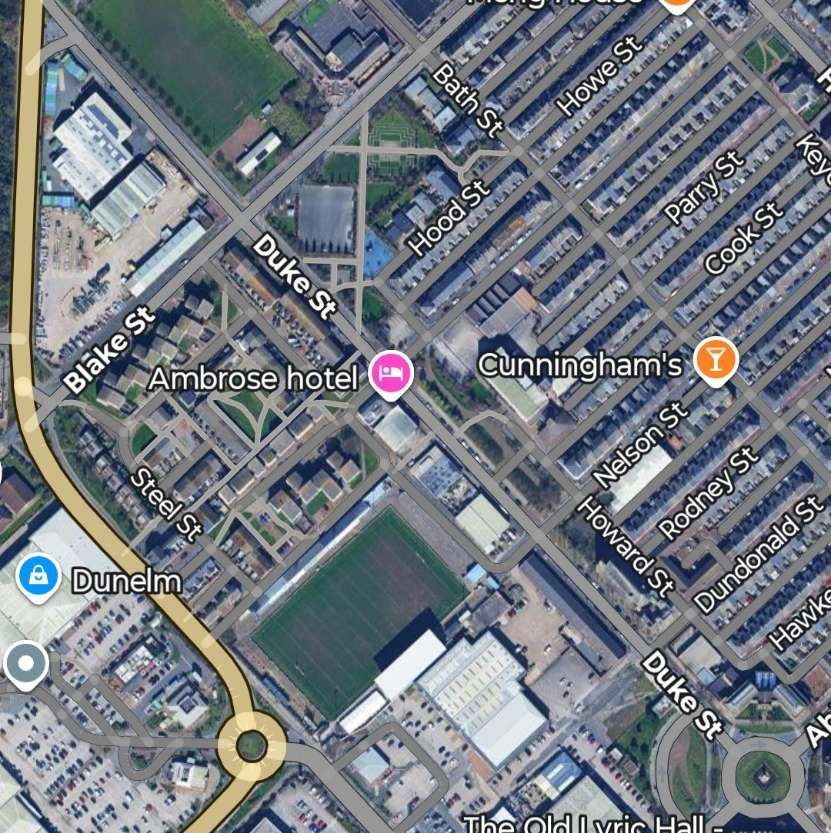
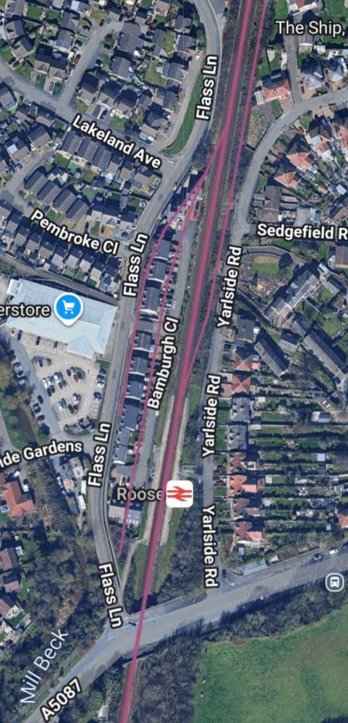
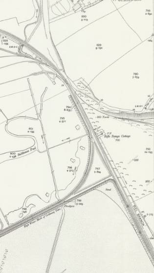
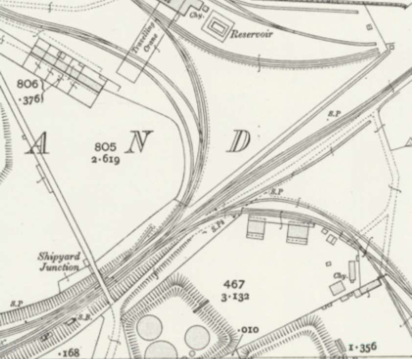
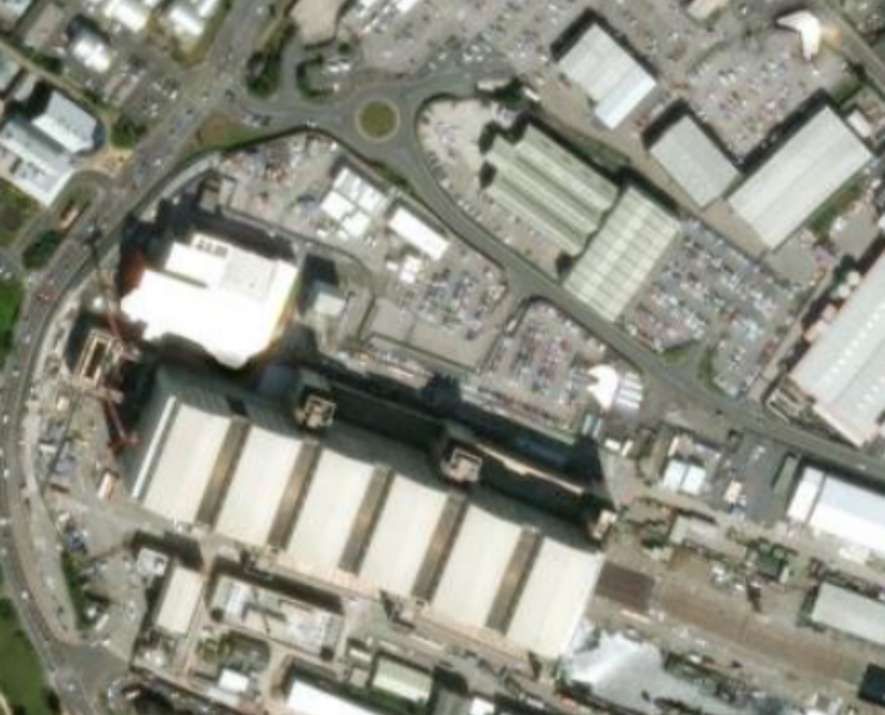
2. A Line to Roose Station
A line left the route to Ramsden Dock Station at the North end of Michaelson Road, continuing Southeast on Duke Street and then along Strand to Cambridge Hall Mechanics Institute where it turned Northeast.
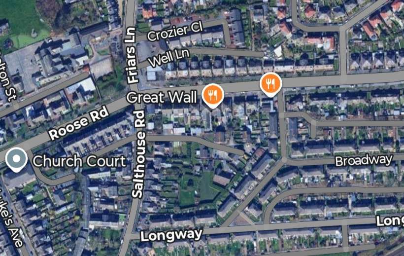
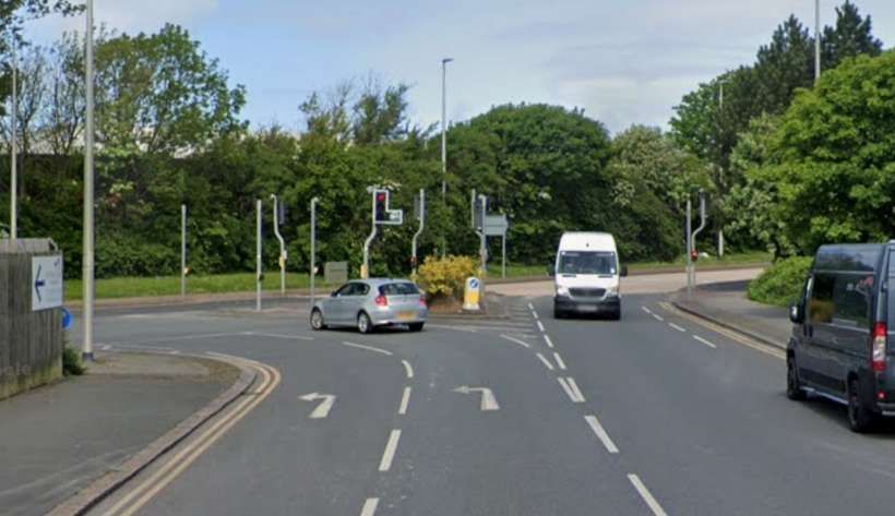
This tramway route ran along Duke Street and Strand to Cambridge Hall Mechanics Institute and the old Strand Station where it turned Northeast at St. George Square. [5]The roads mentioned above still remain – Duke Street, Strand. St. George’s Square still exists but Salthouse Road now runs through it to meet Strand. [Google Maps, February 2026]Duke Street immediately beyond the roundabout. [Google Streetview, May 2022]Duke Street meets Strand, the tramway ran round to the left, almost straight on. [Google Streetview, May 2022]Further along Strand with the old railway station in the distance. [Google Streetview, May 2022]Trams turned from Strand onto Salthouse Road. [Google Streetview, May 2022]
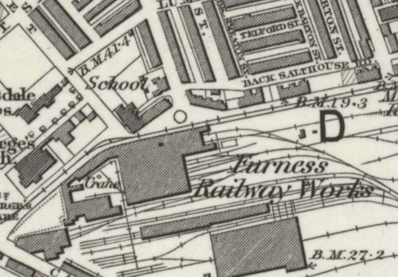
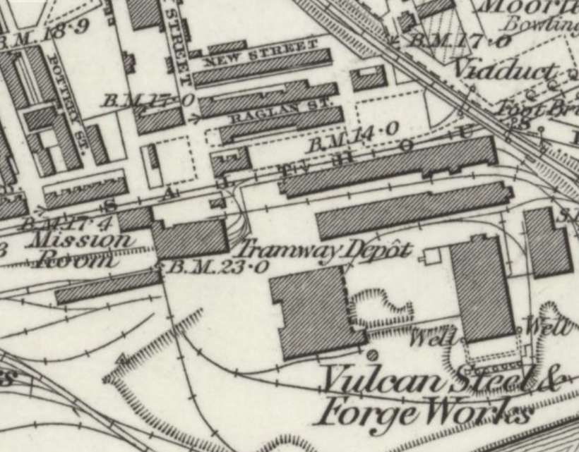
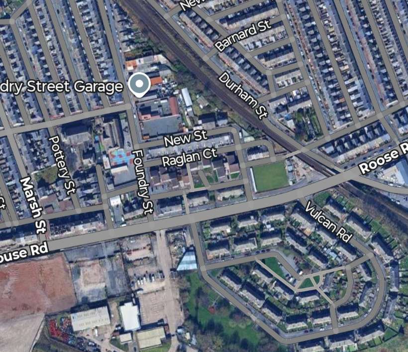
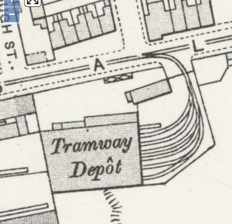
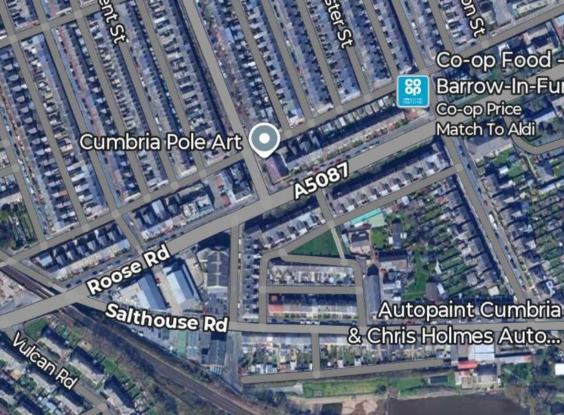
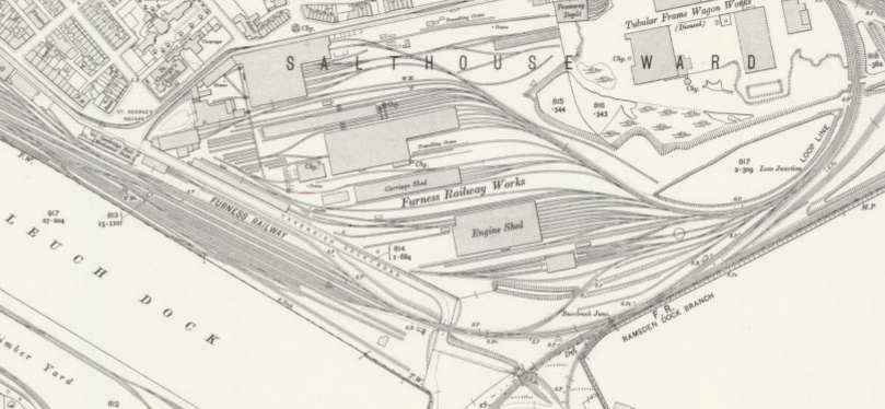
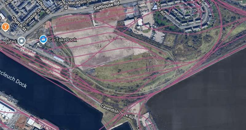
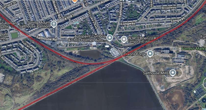
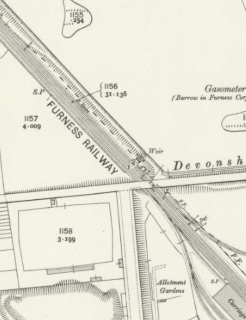
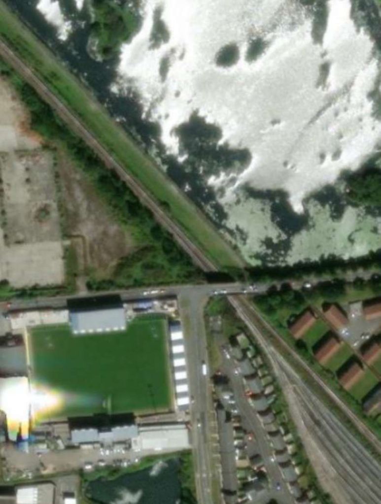
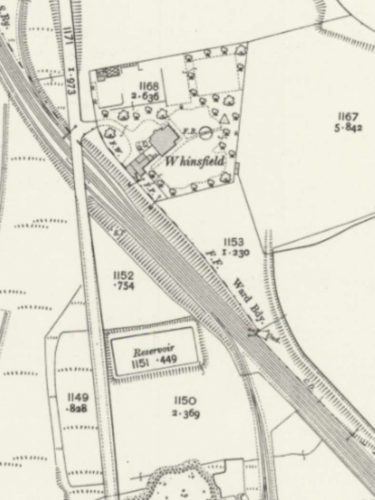
The tramway then ran along Salthouse Road on the North side of the Furness Railway Works.
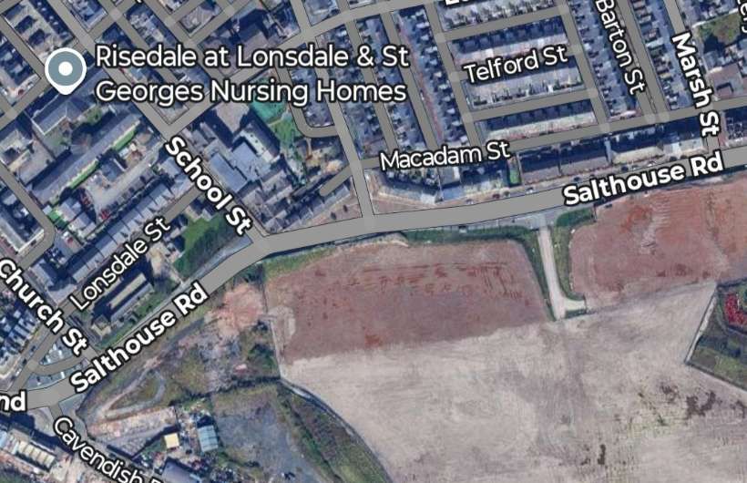
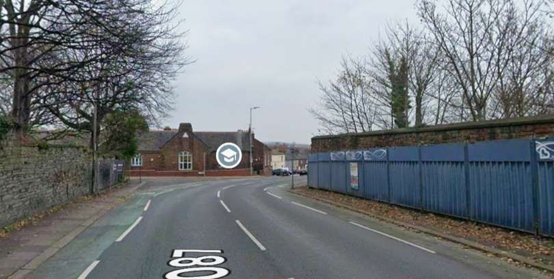
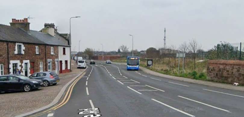
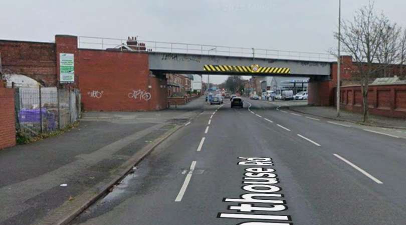
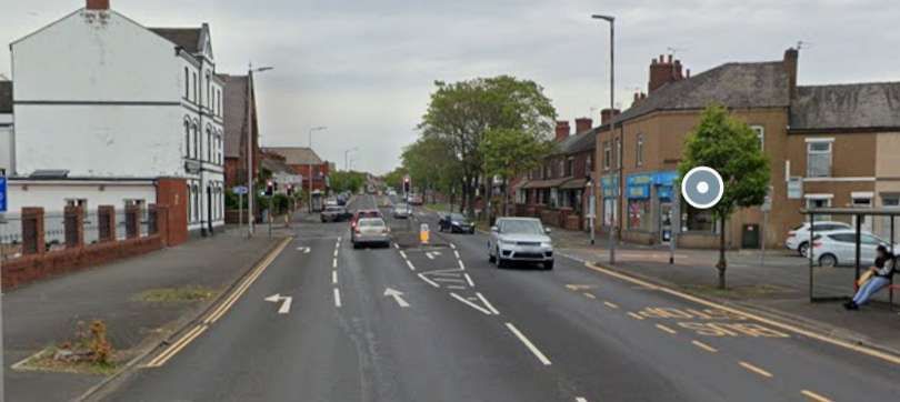
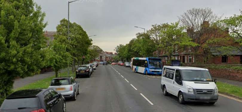
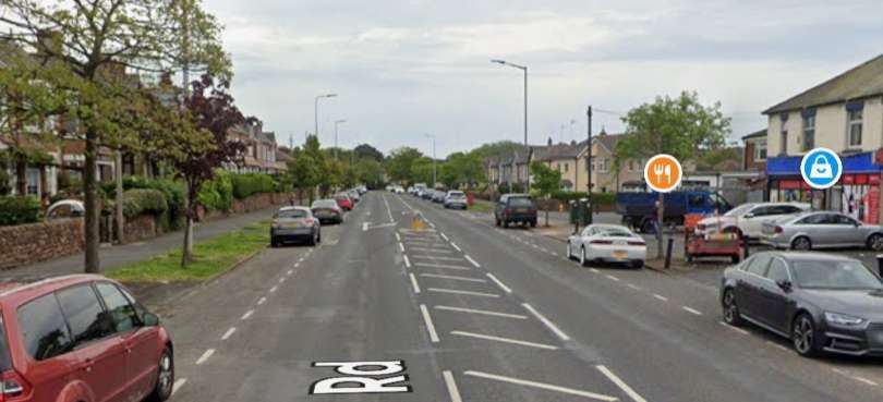
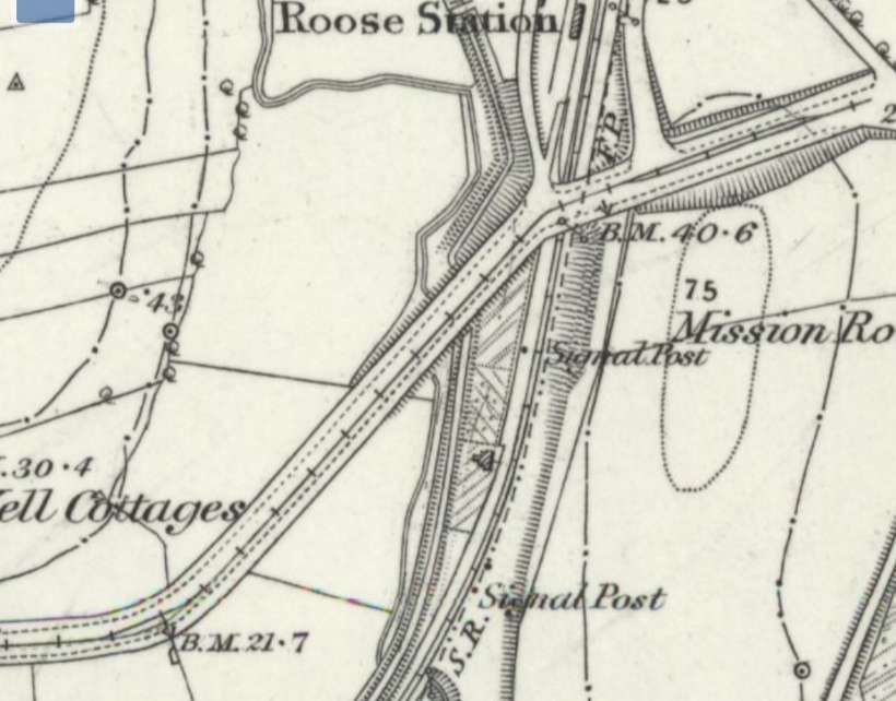
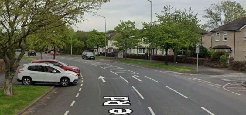
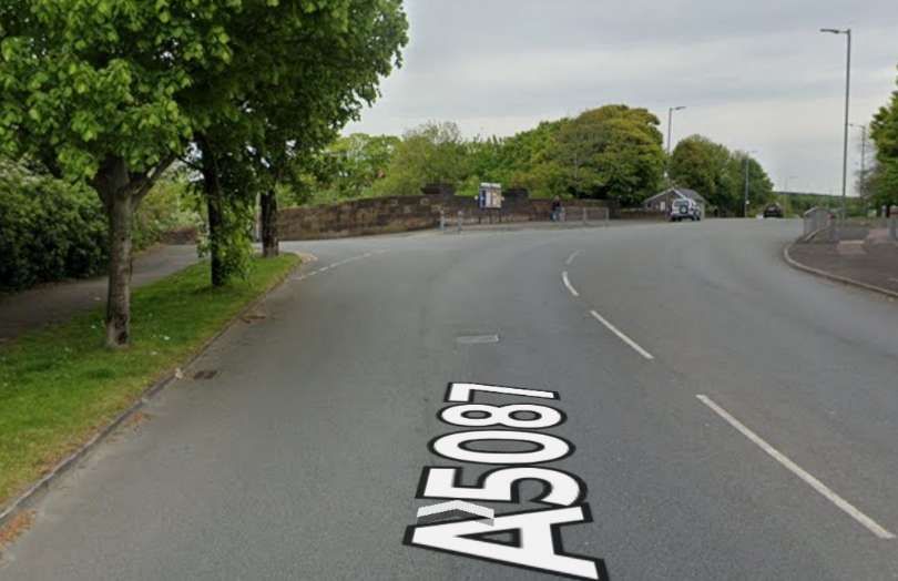
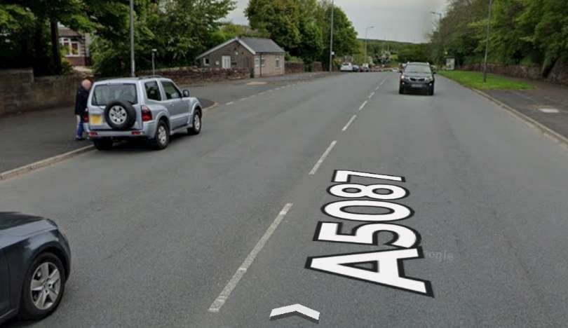
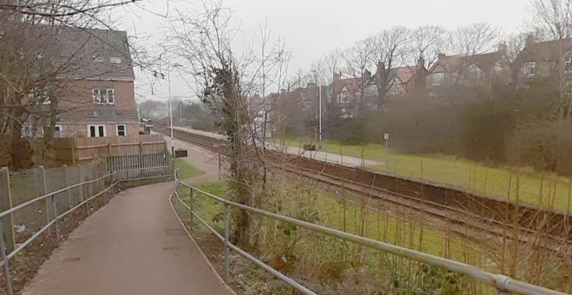
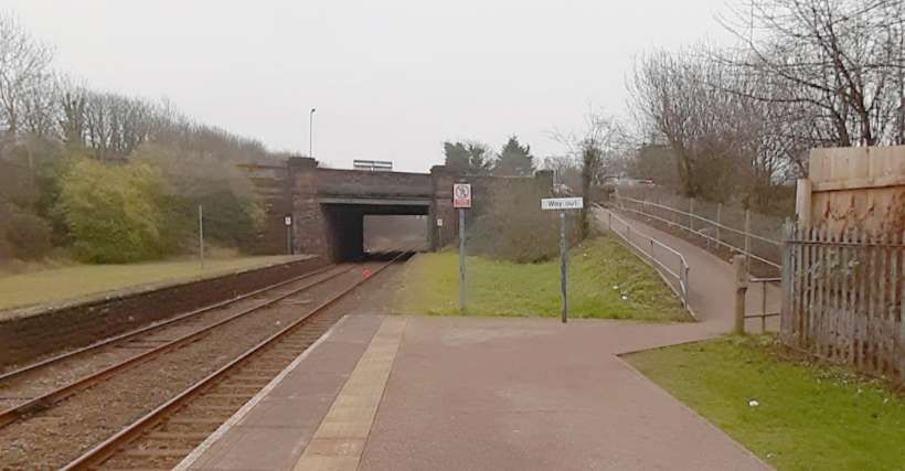
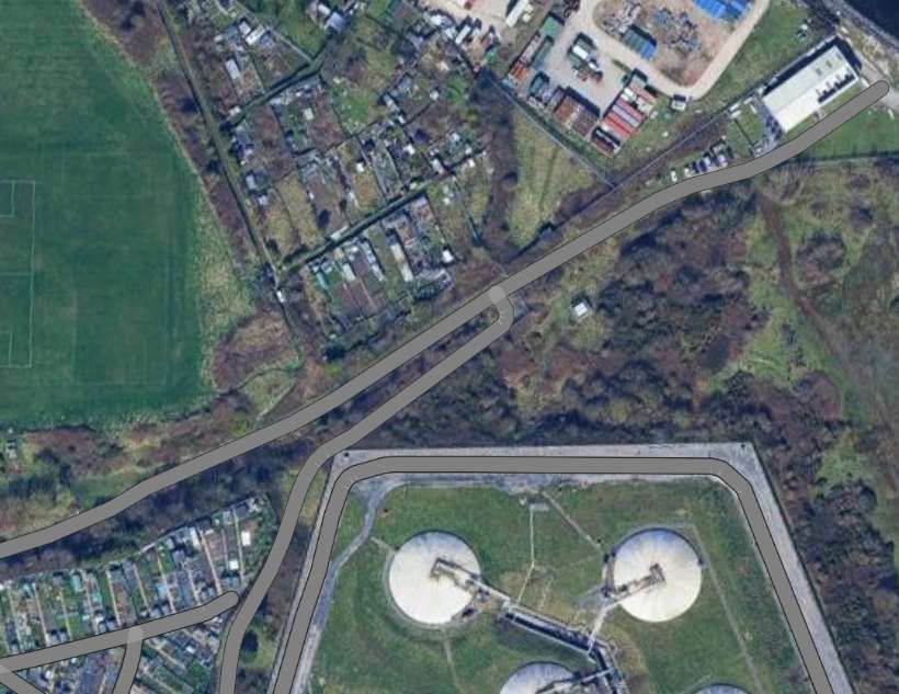
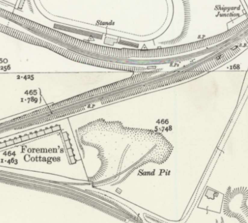
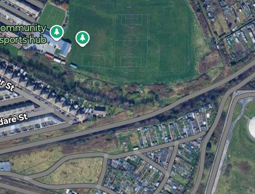
From St. George’s Square the line ran along Salthouse Road on the North side of the Railway Works. [5]The area of Furness Railway Works appears to be underdevelopment in this image. Salthouse Road runs across the top of the site. [Google Maps, February 2026]Salthouse Road with the old Furness Railway Works on the right. The rod curves round to the right. [Google Streetview, May 2022]Further East on Salthouse Road. [Google Streetview, May 2022]Close to the Vulcan Foundry was a tramway depot on the South side of Salthouse Road. The tramway then passed under the viaduct carrying the line Northwest from St. Luke’s Junction to Barrow Central Station. [5]The same area in the 21st century. A housing estate sits on the site of the Vulcan Steel & Forge Works. [Google Maps, February 2026]The tramway depot on the South side of Salthouse Road, as it appears on the 1910 25″ Ordnance Survey. [8]The Viaduct carrying the railway from what was St. Luke’s Junction, Northwest towards Barrow Central Station. Google Streetview, May 2022]St. Luke’s Junction is bottom left of this next map extract, St Luke’s Church is at the right side of the image. The tramway continues Northeast up Roose Road. [5]The same location in the 21st century. [Google Maps, February 2026]Further East, the old tramway ran ahead along Roose Road. [Google Streetview, May 2022]Further East the tramway continued along Roose Road. [Google Streetview, May 2022]The tramway continued East on Roose Road. [5]The same area in the 21st century. [Google Maps, February 2026]Continuing along Roose Road. [Google Streetview, May 2022]Approaching Roose Station and the terminus of the tramway, the road and tramway turned Northeast before bridging athe railway at the South end of Roose Railway Station. A loop was provided to allow a steam tram to run round its carriage. [5]The final length of the tramway was on Roose Road. The terminus was to the East of the railway line and Roose Station. [Google Maps, February 2026]Roose Road bends round towards the Northeast. [Google Streetview, May 2022]Approaching the location of Roose Station, the road curves back towards the East a crosses a railway bridge. Google Streetview, May 2022]The location of the tramway terminus, the photograph is taken facing away from Barrow in an East-northeast direction. Google Streetview, May 2026]
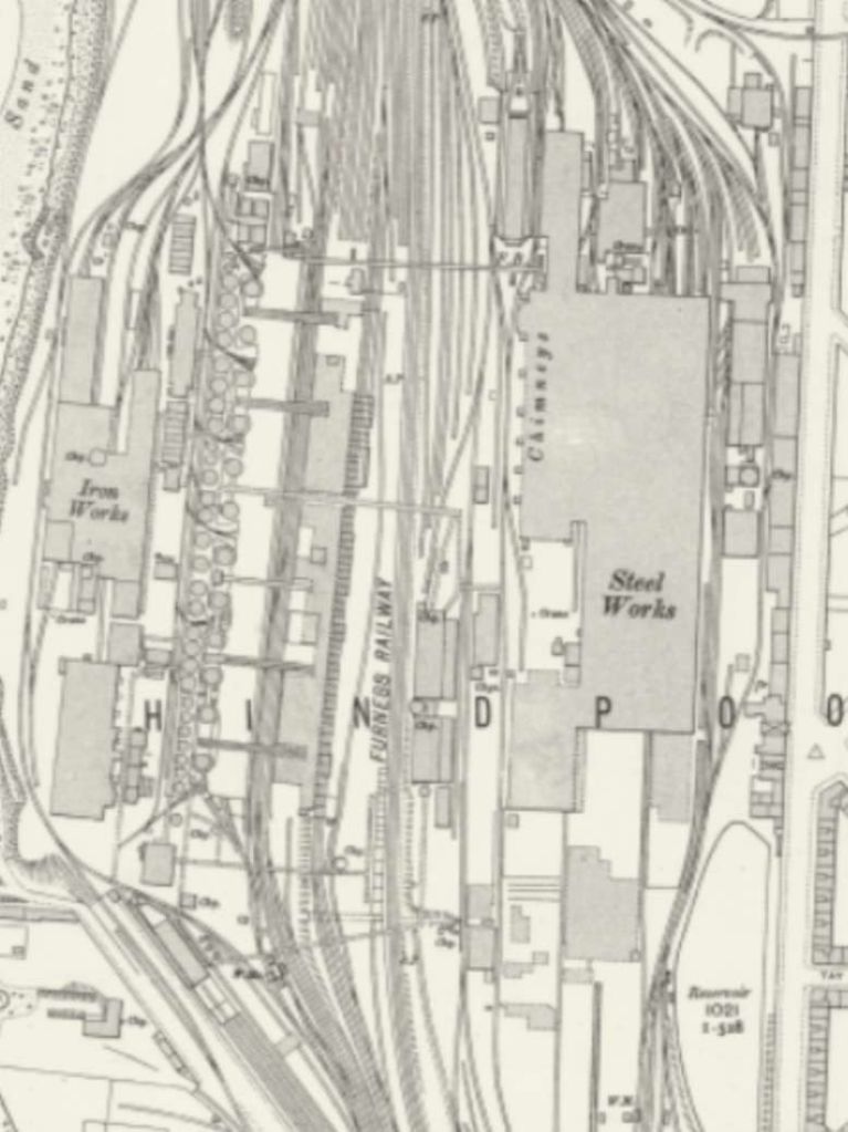
3. A Short Line Serving the Steelworks
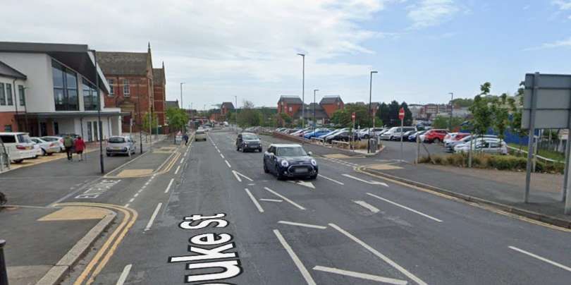
Just two map extracts are all that is needed to cover the length of this short line which ran along Duke Street between the Steelworks and Ramsden Square.
A triangular junction was formed at the Northwest end of Duke Street. A short length of tramway with its mid-point at the junction with Duke Street, ran North-South on Walney Road outside the Steelworks. From there the line ran Southeast along Duke Street. [5]The line continued Southeast on Duke Street and met the wider tramway network at Ramsden Square. [5]
The full length of the line is shown on modern mapping below. ….
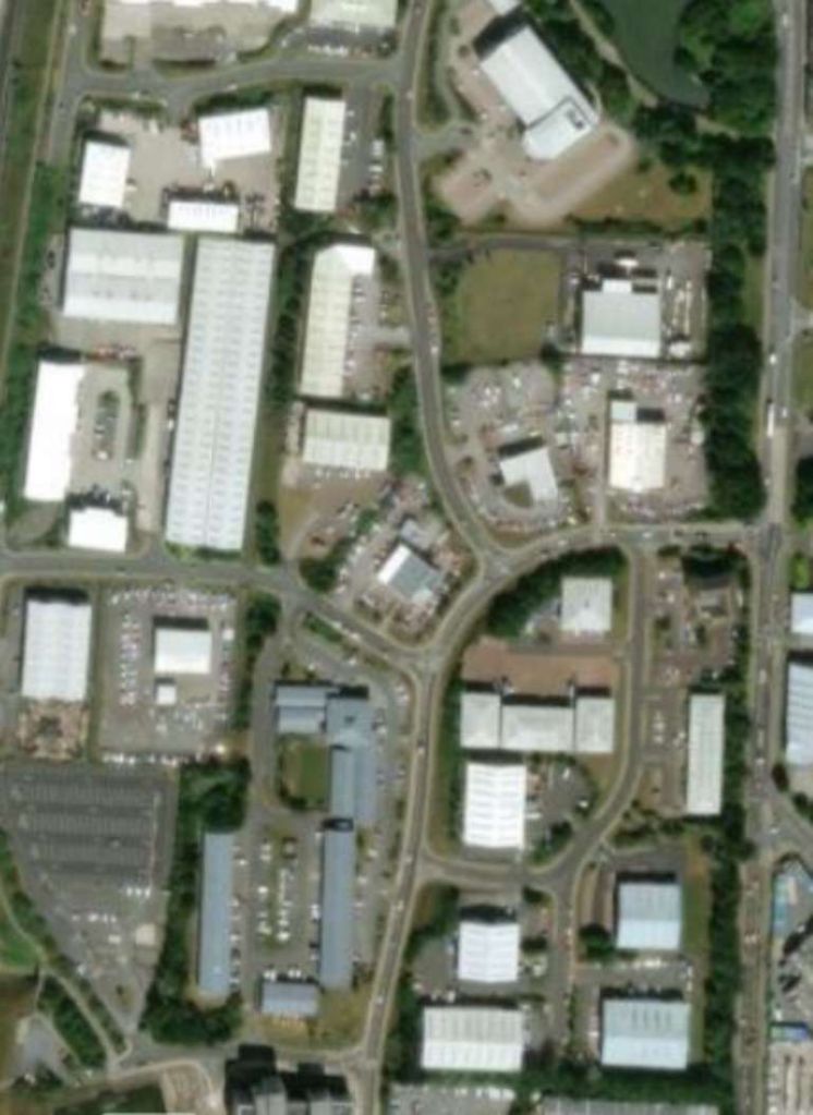
The old tramway ran from Walney Road to Ramsden Square along Duke Street. [Google Maps, February 2026]The View Northwest along Duke Street towards the junction at Walney Road. In times past this view would have been dominated by the Steelworks and no doubt shrouded in a pall of smoke. Google Streetview, May 2022]A view along Duke Street, facing Southeast towards Ramsden Square. [Google Streetview, May 2022]Looking Southeast along Duke Street close to Ramsden Square. [Google Streetview, May 2022]
Changes Immediately After Electrification
The short line along Duke Street serving the Steelworks does not feature on the 1910/1911 25″Ordnance Survey published in 1911/1913.
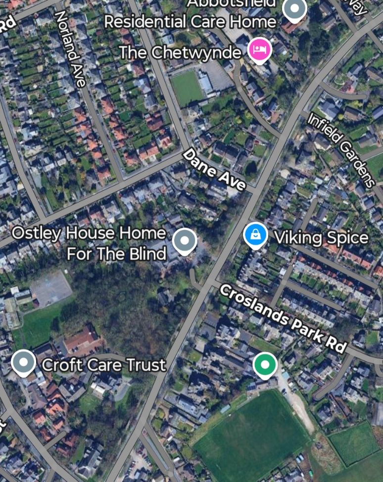
A new tramway line left Michaelson Road at its junction with Bridge Road. The surface of Bridge Road was littered with a whole series of different lines. The tramway sat on the North side of the road and ran on Northwest into Ferry Road, terminating opposite the Walney Bridge Approach Road.
Summary
Steam powered trams in Barrow-in-Furness, like elsewhere we’re a relatively short-lived phenomenon which last only until electrical technology had advanced sufficiently to be used on street networks.
“Kitsons entered the steam tramway locomotive field in 1876 building some combined steam cars to W.R. Rowan’s design. In 1878 they built three to their own design with vertical boilers, four coupled wheels and inclined outside cylinders. Motion was by means of a modified version of Walschaerts valve gear. All was enclosed in bodywork and the wheels and motions were surrounded by protective plates. The condensing system was placed on the roof and consisted of a series of copper tubes through which the exhaust steam passed, the surrounding air cooling the steam and the condensate returning to the feed water tank. After many trials it was decided to replace the vertical boiler by a horizontal type and this was standardised for future steam trains. Various types of condensers were tried and the final type was a series of arched transverse tubes which were a great improvement.
In Kitson’s patent valve-gear, a modification of Walschaert’s valve gear, the ends of a floating lever are linked to the crosshead, the valve-spindle, and intermediately at a point near the valve-spindle; the lever is pinned to the radius-link, which receives its rocking movement through an arm linked to the coupling rod. The motion of the valve and its spindle is a compound of two movements: one, a movement directly the inverse of that of the piston, on a reduced scale, for the lead; the other a reduced duplicate of the vertical movement of the coupling rod, to open the port for steam” (D. K. Clark Tramways, their construction and working, 2nd Ed., 1894).
More than 300 units were built and besides supplying many to the tramway systems of the British Isles, others were sent to New Zealand. Australia and the continent. The last one built was in 1901 for the Portstewart Tramway (Works No. T302). Work numbers for tram locomotives were kept separate and bore a prefix T.”, via, https://steamindex.com/manlocos/kitsons.htm, accessed on 16th February 2026.
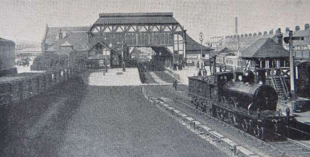
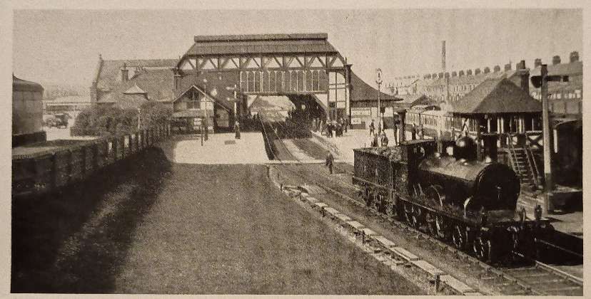
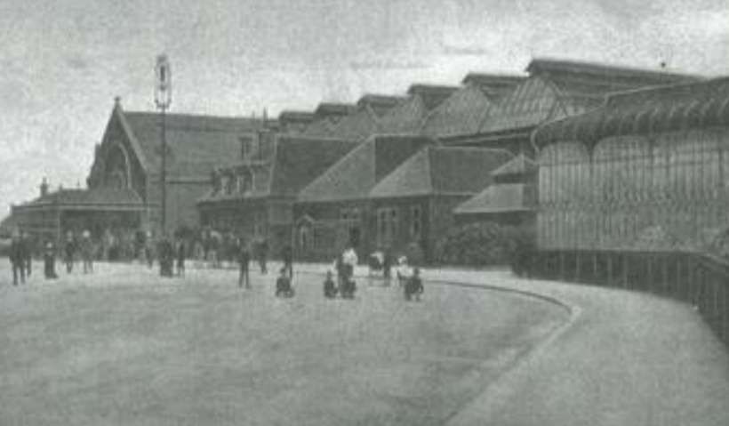
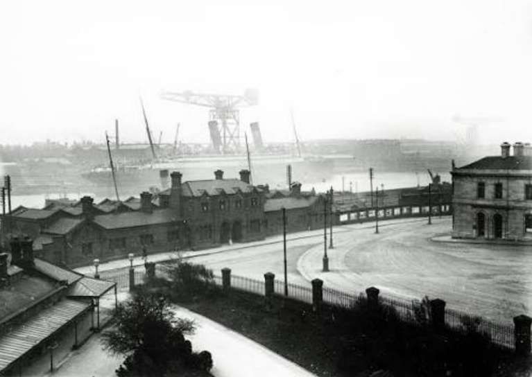
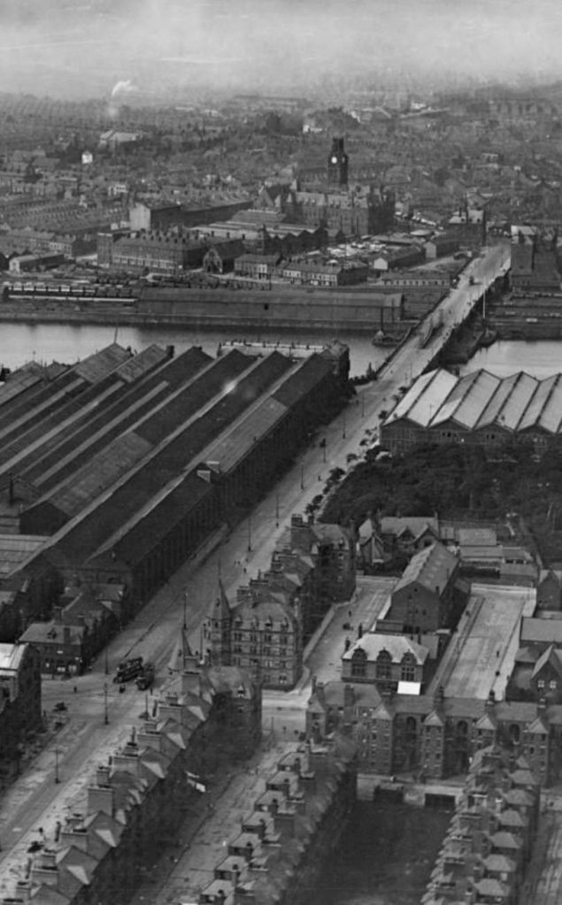
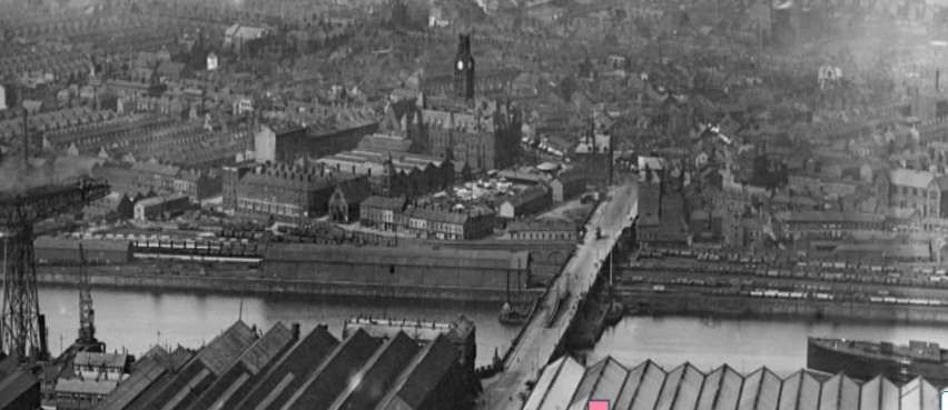
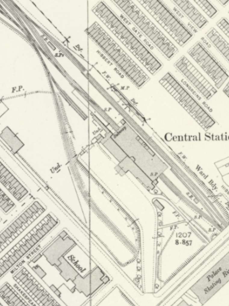
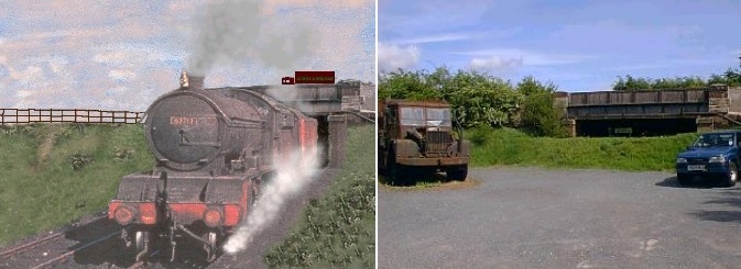
Barrow-in-Furness Railway Station is shown in the featured image above and repeated in the first image below. It featured a large, distinct covered roof over the platforms, as seen in this vintage postcard view from the south. The prominent locomotive is one of the Furness Railway K2 Class locomotive, often referred to as “Larger Seagulls”. [4]
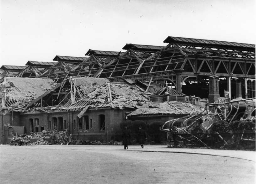
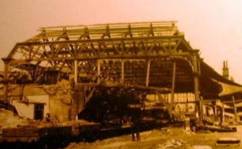
Barrow was featured in The Railway Magazine in March 1959. [1] The rebuilding of the old Central Station at Barrow-in-Furness which was virtually destroyed (please see the images below) in the air-raids of 1941 was completed in the late 1950s. The replacement buildings marked another link broken with Barrow’s past. Originally known as Barrow Central Station and the headquarters of the Furness Railway, it was, by the end of the rebuilding renamed Barrow-in-Furness. Early in the 20th century, the borough boasted ten stations. It had grown from a hamlet of a few farms with a population of around 100 to “a seething steel-town of 60,000 in under forty years.” [1: p149]
The most significant factor in the dramatic increase in population was apparently “the progress in railway development in the 1830s. The two dukes had toyed with the possibility of a mineral line for some years, but it was not until George Stephenson’s plan for the Caledonian, West Cumberland & Furness Railway was made known in 1837 that serious attention was given to the idea. Though this scheme for crossing the Duddon Estuary and Morecambe Bay came to nothing, a survey for embanking and reclaiming land and for a mineral line in Furness was carried out in 1841 by James Walker at the request of the Earl of Burlington (later seventh Duke of Devonshire).” [1: p149]
The coming of the railway made the exploitation of vast iron ore deposits feasible. Large ironworks, steelmaking, and shipbuilding industries developed, attracting thousands of workers and causing rapid population growth, urbanization, and infrastructural development. Barrow village had been shipping iron ore for many years and was chosen as a suitable port for iron ore from Lindal-in-Furness and slate quarries at Kirkby-in-Furness.
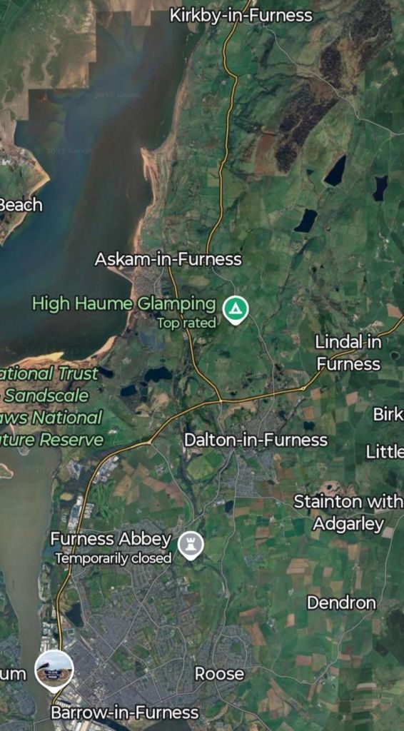
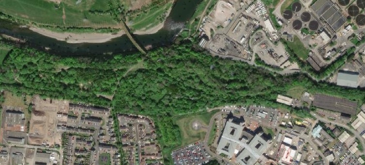
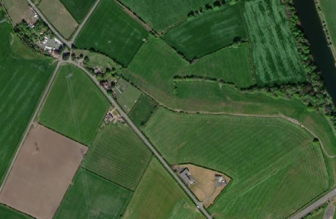
Google Maps satellite imagery shows the relative location of Kirkby-, Lindal-, and Barrow-in-Furness. [Google Maps, 21st December 2025]
The person directly responsible for the organisation of the Bill and for the affairs of the new Furness Railway Company was Benjamin Currey, Clerk of the House of Lords and Agent of the Devonshire Estates. He visited Furness frequently at this period and was able to influence the local population in favour of the railway. [1: p149-151]
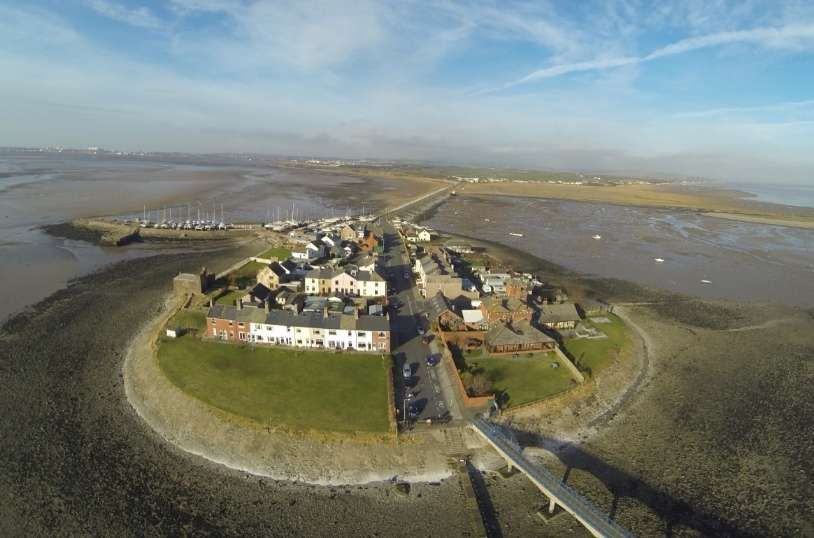
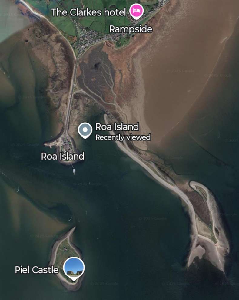
It appears that a strong influence on the development of railways in the area was the purchase of Roa Island by J. A. Smith, who, in conjunction with the Preston & Wyre Railway at Fleetwood, planned to build a pier to accommodate a ferry service between Furness and Fleetwood.
Roa Island lies just over half a mile (1 km) south of the village of Rampside at the southernmost point of the Furness Peninsula in Cumbria. [2]
Roa Island in the 21st Century. This view looks North towards the village of Rampside. [3]Roa Island sits to the South of the Furness Peninsula and North of Piel Island and Piel Castle. [Google Maps, December 2025]
Smith’s plans meant that the Furness Railway Company needed to provide a connecting line to the pier. Two trips between Fleetwood and Roa Island were made daily from 24th August 1846.
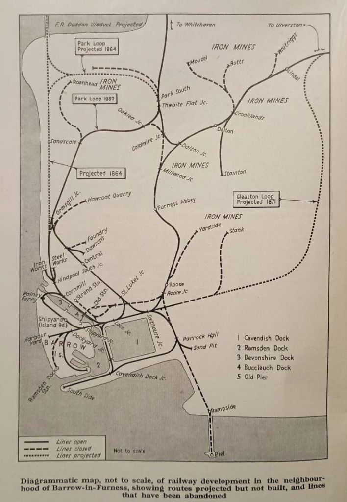
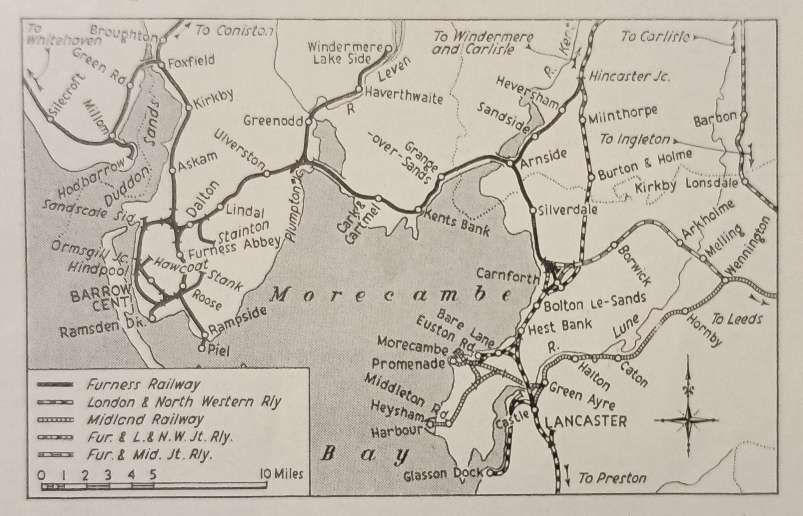
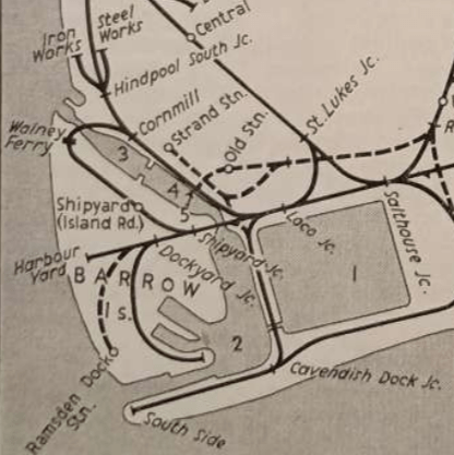
A superb diagrammatic map of the railway system around Barrow-in-Furness giving details of the network in 1959 with dates on railways previously proposed but not built and others which had already been removed. The present main line from Ulverston enters the sketch map in the top right. The line to Whitehaven leaves the map centre-top. [1: p150]The wider Furness Railway network and its connections to other companies’ railways in the pre-grouping era. [1: p151]
Initially the Furness Railway Company built a single line North from the pier on Roa Island. The competing needs of mineral and passenger traffic could not be accommodated. The solution was the doubling of the track running North-South between Millwood Junction and Roose Junction. Timetables were published in Bradshaw but Smith’s ferry was not ready in time for the new season. Unsurprisingly, relationships between Smith and the Furness Railway Company were strained!
Indeed, the relationship continued to be difficult, seemingly with Smith seeking to persuade the Furness Railway to purchase his interest in the pier. Eventually, after significant damage occurred to the pier in a storm on 27th December 1852. The Furness Railway saw an opportunity to deal with the problem and bought out Smith’s interests in the pier and in any of Smith’s schemes to access mineral reserves in Furness. Apparently the buy out cost £15,000. However Smith’s pier continued in use until the opening of Ramsden Dock Station in 1881. The pier “was rebuilt in 1867-8 to accommodate the Midland Railway boat trains (which began in 1867) and survived until 1891, when it was finally demolished.” [1: p152]
Andrews continues: “During the early years Barrow grew slowly, as railway workshops were built and its pier gradually enlarged, and it was not until 1859 that the stage was set for the boom that hit this village in the 1860s. In 1846 a young man named James Ramsden, from Wolverton Works, had been appointed Locomotive Superintendent of the Furness, and from the outset had shown considerable promise as an administrator. He was appointed Secretary and Superintendent of the Line in 1850.” [1: p152]
Continuing developments saw the line to Kirkby-in-Furness extended in 1848 to Broughton and the Whitehaven & Furness Junction Railway opened to Whitehaven in 1850. The line to Dalton was continued to Ulverston by 1854 and the Ulverston & Lancaster Railway opened through to Carnforth by 1857. In Barrow, the first blast furnaces opened in 1859.
“With the local production of iron and the establishment of through rail communication, Ramsden was able to put into operation his plan for a new Barrow – a model industrial town and port. The first stage was the construction of a dock between Barrow Island and the mainland, when it would be possible to build up passenger and freight steamer services with Belfast and the Isle of Man. Stage two was the development of an industrial estate on Barrow Island and on the mainland shore, with a residential area inland.” [1: p152]
1863 saw an Act obtained for the construction of the Devonshire and Buccleuch Docks. The Devonshire Dock was opened in September 1867. During that year: Barrow became a County Borough; a ferry service from Piel Pier to the Isle of Man commenced; the Belfast ferry service opened (in the Autumn); and the population of Barrow exceeded 11,000; and the Barrow Haematite Iron & Steel Company paid a 30% divided to shareholders.
“Negotiations with the Midland Railway led to the Furness & Midland Joint line scheme of 1863 which included the moving of the Midland steamer services from Morecambe to Piel Pier.” [1: p153]
It seems that the “Midland Railway was anxious that a communication should be provided for affording better access to the Lakes in connection with the Yorkshire districts.” [8]
Andrews tells us that, “During the 1860s, the Furness Railway … absorbed its neighbours one by one. The Ulverston & Lancaster, which had been heavily subsidised by the Furness during its construction, was bought in 1862 and … the Whitehaven & Furness Junction Railway was taken over in 1866.” [1: p154]
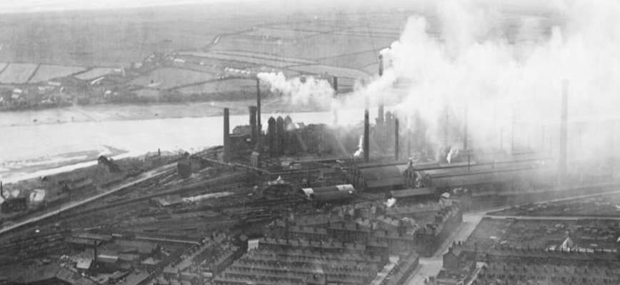
There were plans for the construction of a viaduct to span the Duddon Estuary which would have been part of a new line running North along the coast from a point near to the Iron Works and Steel Works at Hindpool. The scheme failed to gain parliamentary approval because it constricted access to the small port at Borwick Rails.
After a depression in the late 1860s, a return to prosperity in 1870 brought with it a fresh wave of development plans. These included:
Moving the ferry/steamer service from Piel Pier to a new Dock Station.
Two loop lines intended to relieve congestion on the mainline, one the Gleaston loop between Lindal and Salt-house, and the other the Barrow loop from Salthouse to Ormsgill. Later the Gleaston scheme was abbreviated to a single line branch to Stank Mines (opened in 1873. The Barrow loop was slowed by the depression of the late 1870s and was not opened until 1882;
Completion of the docks, which ultimately proved to be somewhat over scale. However the deep water berth at Ramsden Dock was a great improvement over Piel Pier.
High capital expenditure in the 1870s meant that resources for railway development were limited in the 1880s. In the 1890s, exhaustion of local iron ore stocks and the lower cost of imported iron ore saw local freight traffic decline rapidly. In 1893, the Midland Railway gave three years’ notice to the Furness Railway as it had developed its own harbour at Heysham. Some services remained at Barrow until the first world war. Services declined further after the railway grouping, iron ore traffic dwindled away, leaving only that between Hodbarrow and the iron works/docks.
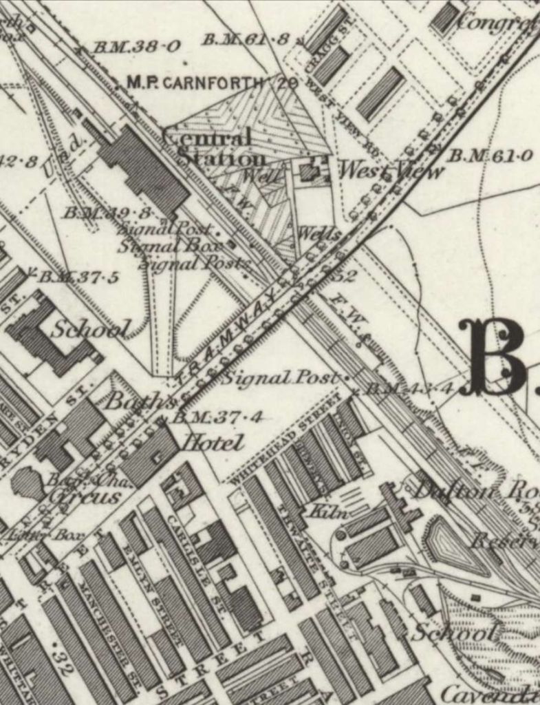
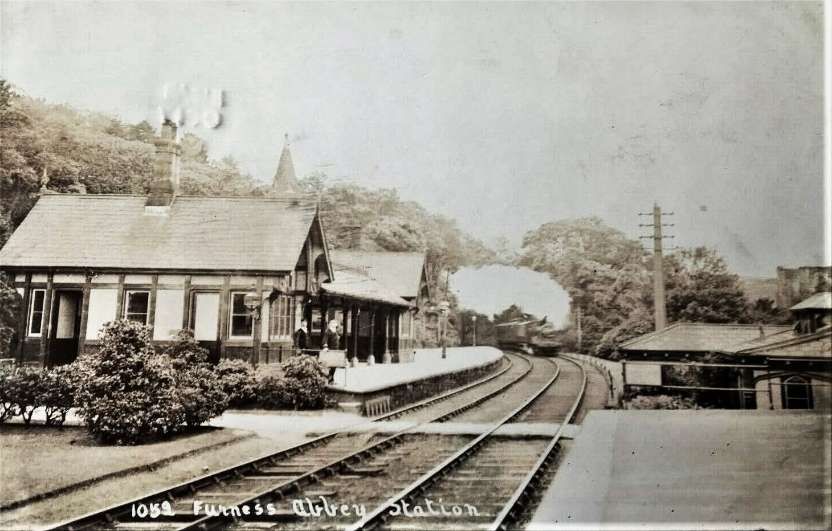
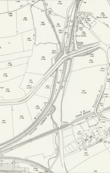
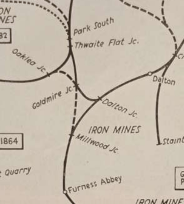
A century of gradual decline brought changes to the rail network. The original line entered Barrow “at Millwood Junction, where the Kirkby and Dalton branches joined, and then ran down the narrow valley to the ruins of Furness Abbey, where a station and hotel were completed in 1847. This became an important interchange station when the lines through to Carnforth and Whitehaven were open, and although a curve was opened between the two branches on 1st August 1858, most trains continued to reverse at Furness Abbey until 1873 when Dalton took over the exchange traffic; the now-unused bays at Dalton were for the Barrow branch trains. Furness Abbey was still used for dividing boat trains into portions for the dock and Barrow until 1904, and the down loop used for this existed until the 1930s. An up bay at Furness Abbey was used in the 1880s for a service from and to Coniston, but this was discontinued in 1891. The first part of the original Kirkby branch from Millwood to Park Junction (renamed Goldmire in 1882) fell rapidly into disuse after this as Whitehaven-Barrow traffic used the Park loop after 1882. Millwood Junction was finally removed in 1898.” [1: p155]
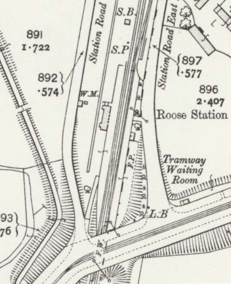
In 1959, Roose had “a reasonable passenger traffic from the surrounding housing estates. The main road originally crossed the line on the level and it was at these gates that trains first stopped by signal in the 1850s. The old junction with the Piel line was where the bridge carrying the main road now stands (which was completed with the [station present in 1959] in 1875).” [1: p156]
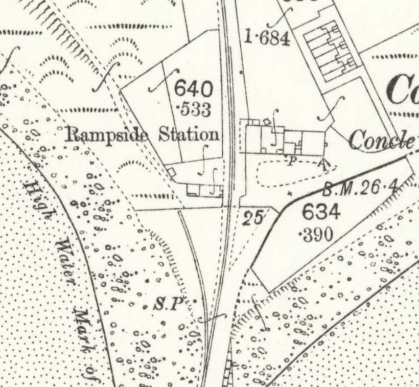
“The Piel line curved away to the left, following the shore for about a mile before entering a cutting to reach Rampside Station.” [1: p156]
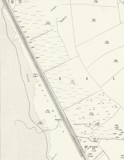
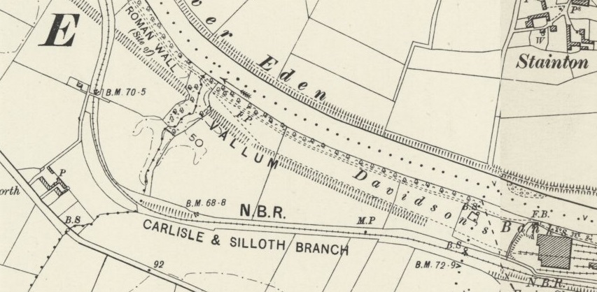
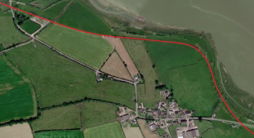
The three map extracts below show the line as it appeared on 25″ OS mapping of 1889, published in 1890. The chord running South towards Rampside Station had, by this time, already been removed. …
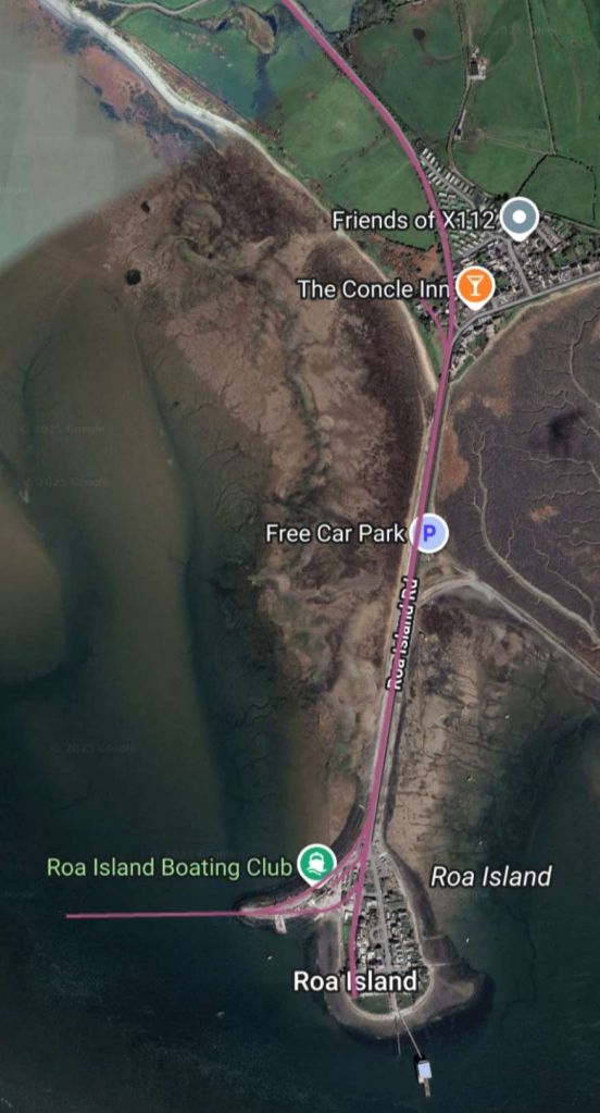
The next sequence of satellite images shows the line to Rampside Station and Roa Island superimposed on modern satellite imagery. The main line can be seen curving away to the West after passing South through Roose Railway Station. …
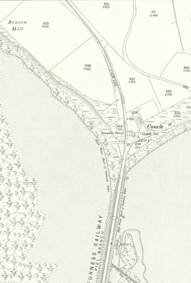
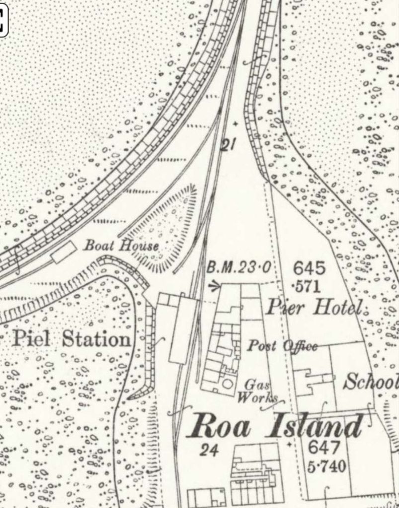
This sequence of three satellite image extracts from Railmaponline.com show the line serving Piel Pier. Rampside Station was closed to the Concle Inn at the top of the third of the images. [10]
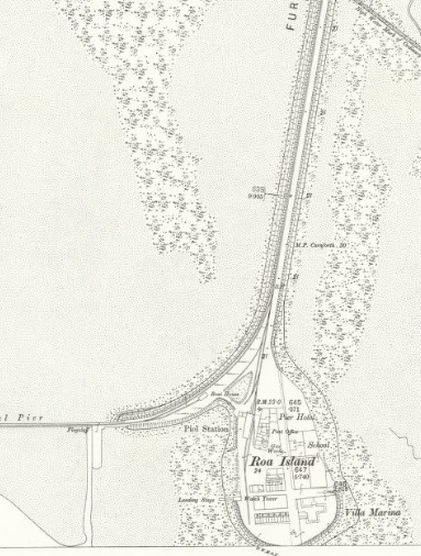
The two map extracts below show Rampside Station and Roa Island as they appear on the 25″ OS mapping of 1889, published in 1890.
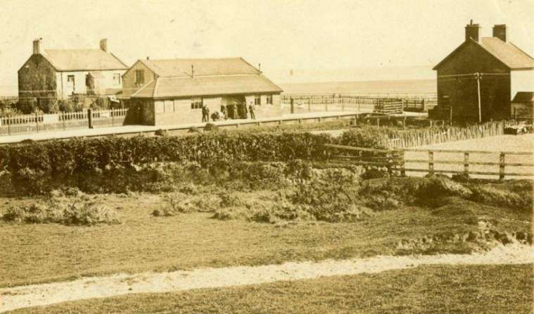
Rampside Railway Station was a single platform station opened on 24th August 1846 as Concle Station, [14: p37] it was renamed Rampside in 1869. The station remained operational until 1936 when it closed along with the line and the following station at Piel, which had been reachable via the Roa Island Causeway. The station building and entire branch line had been demolished by the 1980s. [15]
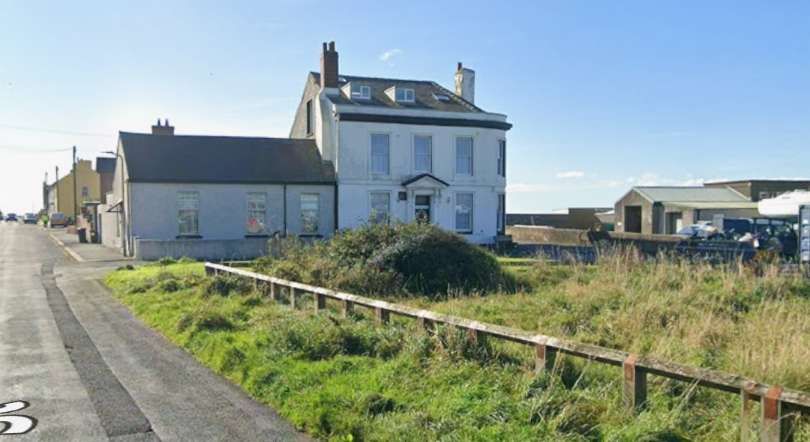
Roa Island in 1889. The Pier Hotel has the benchmark on its West side. [13]This view faces South on Roa Island, the Pier Hotel is now a private dwelling, Piel Station was to its West side (on the right of the Hotel in this image). [Google Streetview, October 2024]
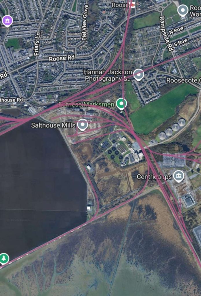
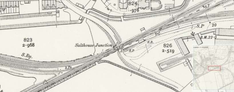
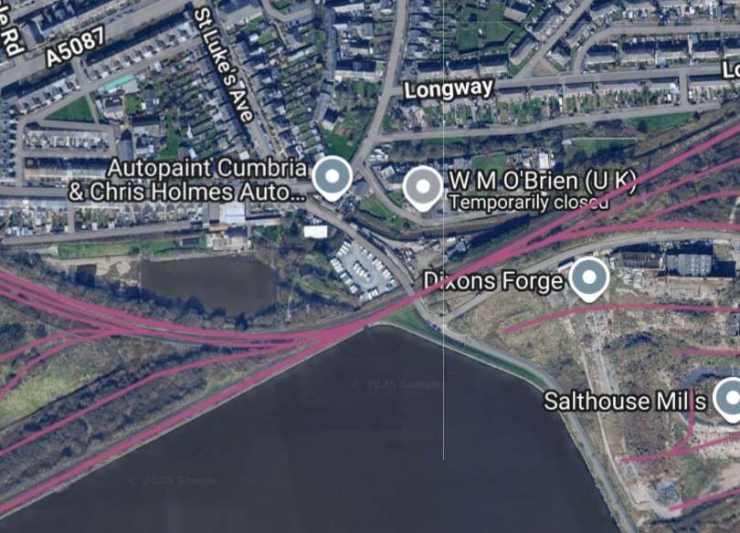
Returning to the main line: South and West of Roose Railway Station the main line curves round towards what was Salthouse Junction.
Only the main line remains to the East of Salthouse Junction. To the West, a single line leaves the main line at Salthouse Junction on the South side of the main line, heading West alongside Cavendish Dock.
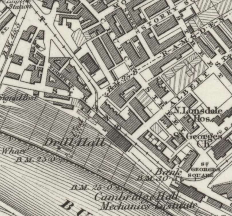
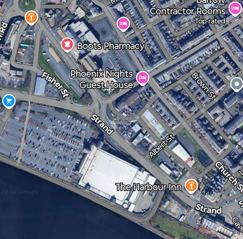
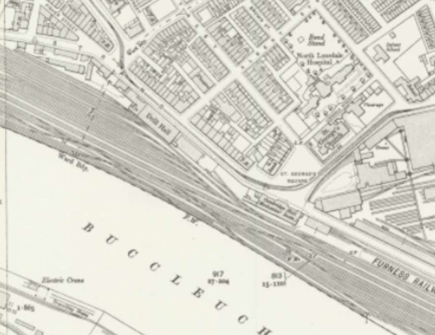
Andrews tells us that a significant embankment was built from Salthouse Junction to Barrow Island. A line was laid along this which separated the Ramsden and Buccleuch Docks, running to the South of what was the old line to Strand Station. After the building of the embankment, land to its North was reclaimed and the old Strand Station was closed together with the line which approached it on a rather tortuous/sinuous route. Parts of the embankment for this old line were still visible in the late 1950s.
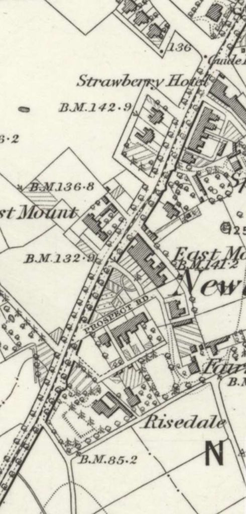
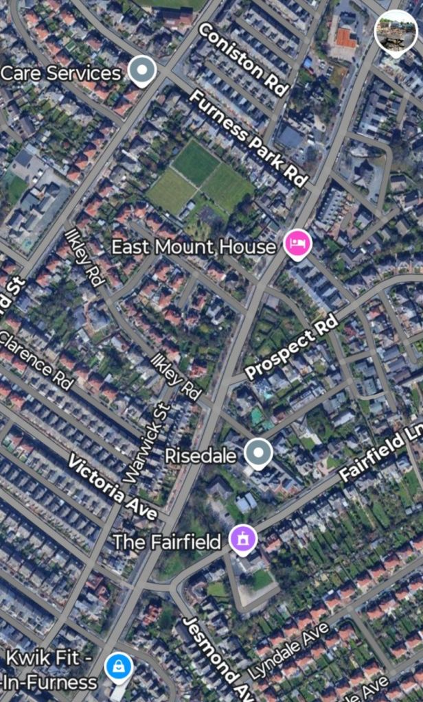
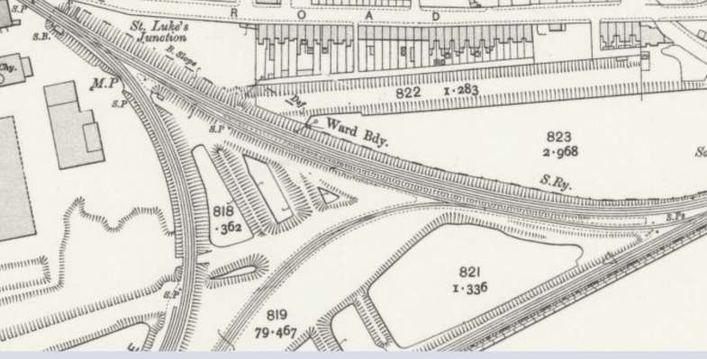
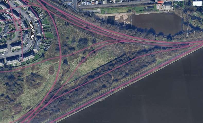
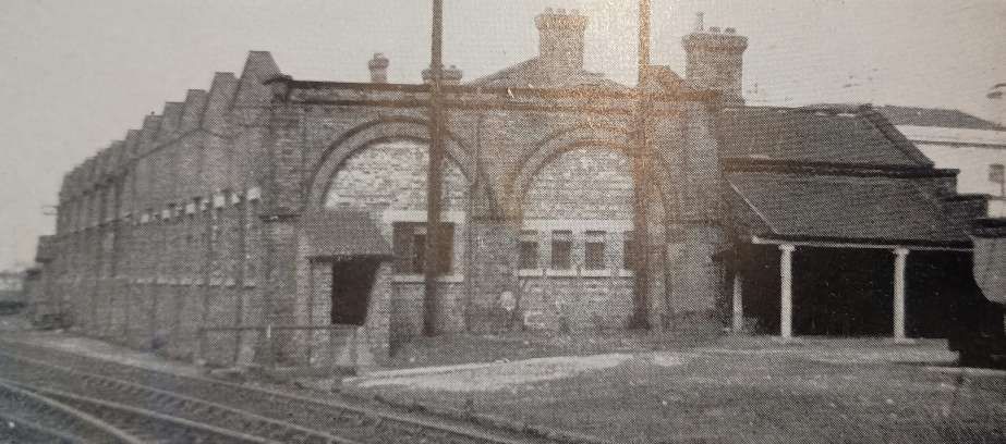
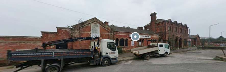
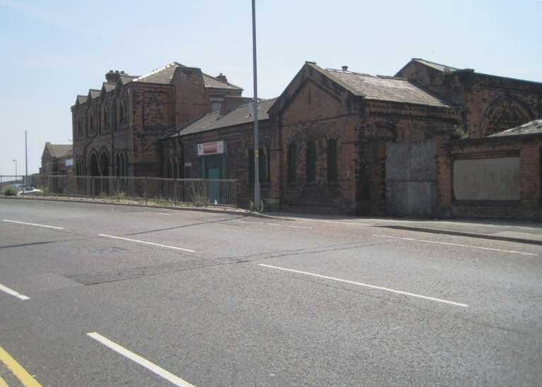
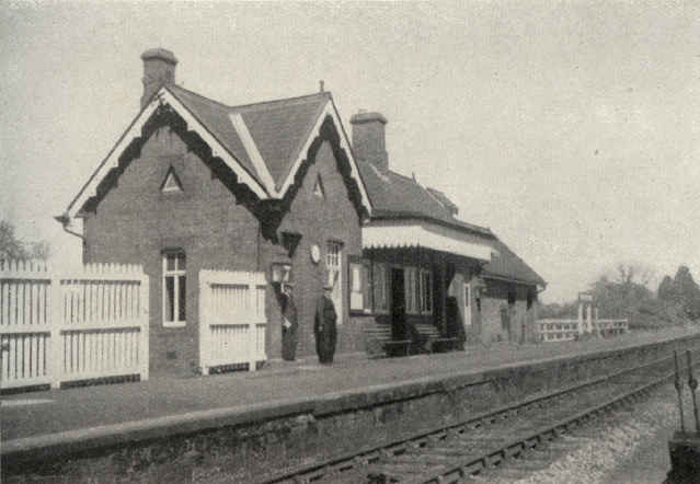
Andrews tells us that “The original Barrow Station, a wooden structure with one platform, rapidly became inadequate to deal with the expanding traffic of the town and was converted into an engine shed in 1862.” [1: p156] Apparently, in the late 1950s, it was still in use “as a carpenters’ shed and offices, although the lines leading to it were closed in January 1871. … The main line was taken round the outside of the works [shown below] to reach the newer Strand Station in 1862. This, [in the late 1950s,] the Railway Institute, had to be enlarged again in 1873 and the old carriage shed … converted into an arrival station. However, hardly had these alterations been completed in the Strand, than the intention to build a large new station in the centre of the new town.” [1: p156]
This extract from the 1911 Ordnance Survey shows the railway works and sidings. [11]This image is an extract from Railmaponline.com’s satellite imagery showing the same area as the map extract above. So much railway infrastructure has been lost. [10]
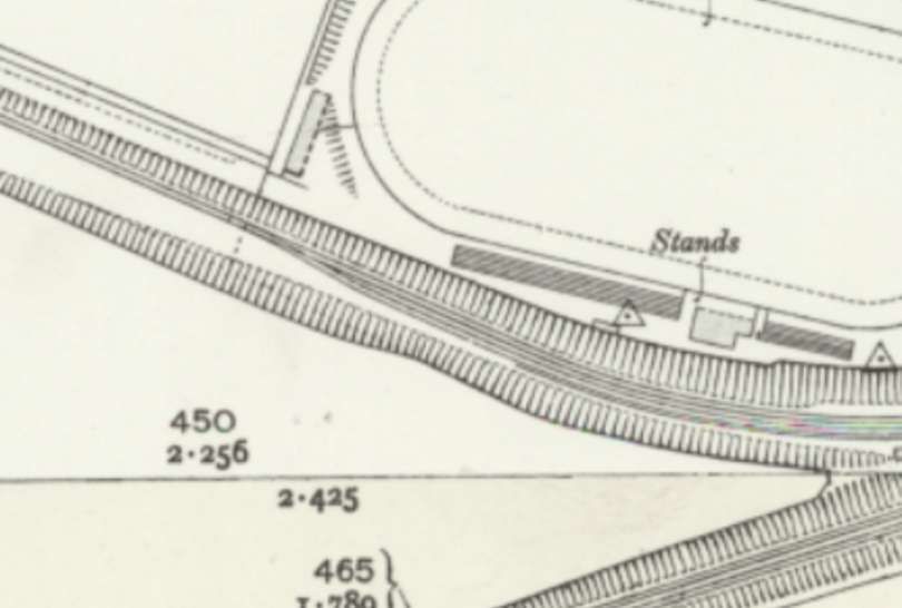
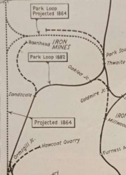
The line from St. Luke’s Junction through Barrow Central Station was not opened until 1882. Andrews continues: “by which time it had been put on a through route to the North by the completion of the Park loop line. A curve between Oaklea and Goldmire Junctions allowed the station to be approached from Carnforth in both directions. This curve [shown dashed in the adjacent image] was closed in 1904.” [1: p156]
Andrew’s describes Central Station as having “a large, all-over roof covering Platforms 1 and 2. No. 3, the other side of the island platform, was uncovered and was used by the local service to Piel which ran from 1881 to 1936. These trains approached the Piel line by a curve from Salthouse Junction built in 1873; the line from Roose Junction to Parrock Hall was closed in 1881, after the boat trains were diverted to Ramsden Dock.” [1: p156]
Central Station appears top-centre on the extract from the sketch map of Barrow’s railways below. We will return to look at this later in this article
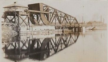
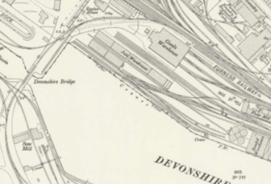
Andrews continued: “From 1881, the boat trains left the main line at Salthouse Junction and proceeded down the embankment to Loco Junction, where the curve from St. Lukes Junction, on the Central line, came in on the up side, and where the line to the Barrow goods yard and old Strand Station curved away. The passageway between the Ramsden and Buccleuch Docks was crossed by a swing bridge, replaced by the present lift bridge in 1907.” [1: p156-157]
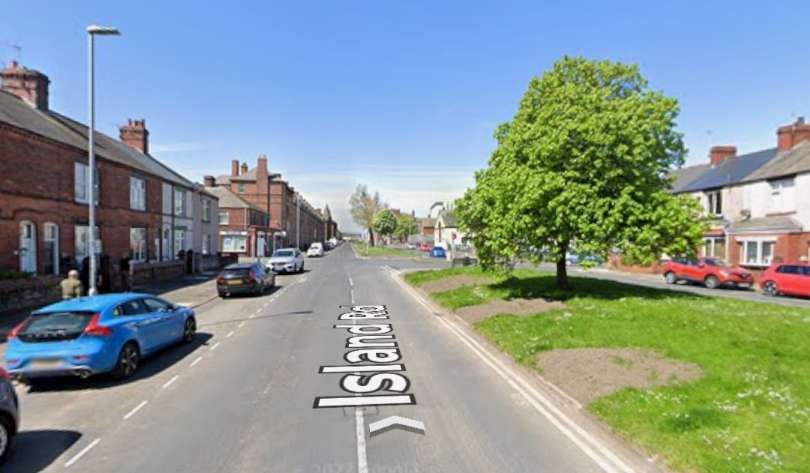
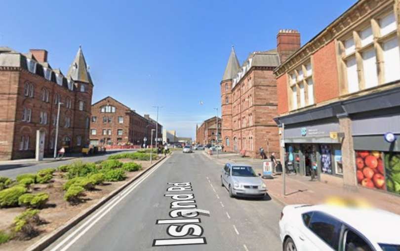
And again: “Shipyard Junction was reached in a cutting and the line to the Naval construction works curved off to the right. A station, Island Road, was built in 1899 for workmen’s trains and these have used the platforms ever since. The line is now used for out-of-gauge loads to Vickers Works, near Island Road Station, and normal freight traffic is worked over Devonshire Bridge from the goods yard.” [1: p157]
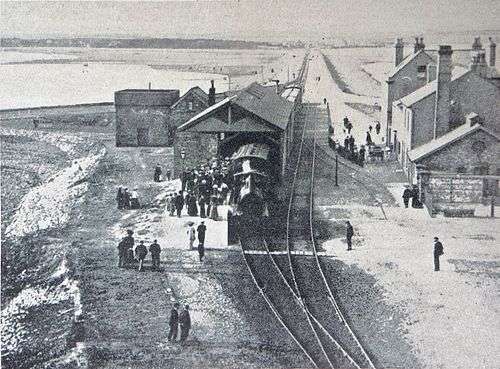
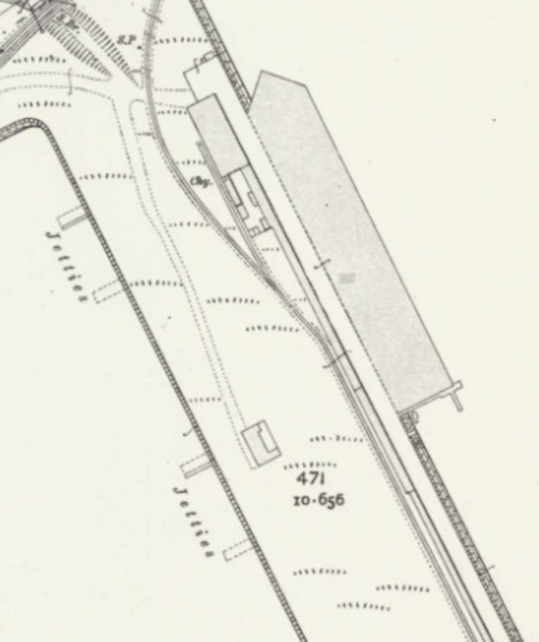
Andrews continued: “Reaching the shore, the line to the docks branched off at Dockyard Junction and the passenger line curved away to the left to reach Ramsden Dock Station, which consisted of a long covered platform and a short bay. A goods shed separated the platform from the quayside and at low tide passengers embarked through a tunnel under the lines. The station was completed in 1885. Regular steamboat traffic to the Isle of Man, Belfast and Fleetwood ceased at the outbreak of the first world war, but excursion boats were run from the station, mainly to Blackpool, until 1936. The station was pulled down in 1938.” [1: p157]
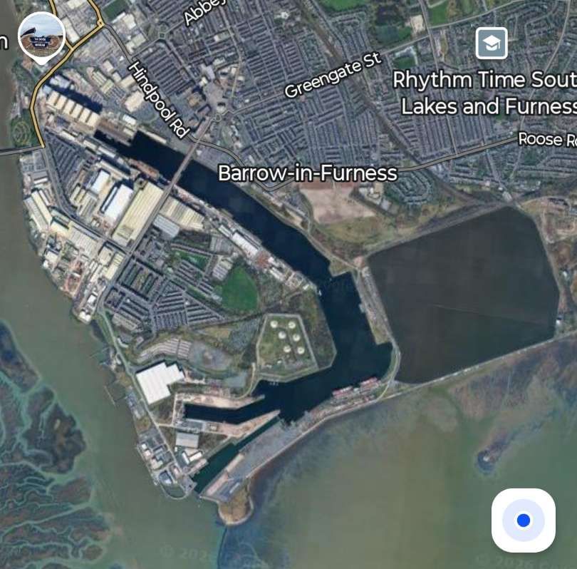
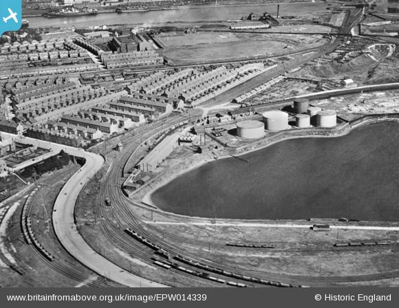
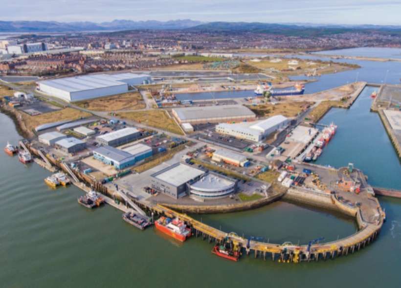
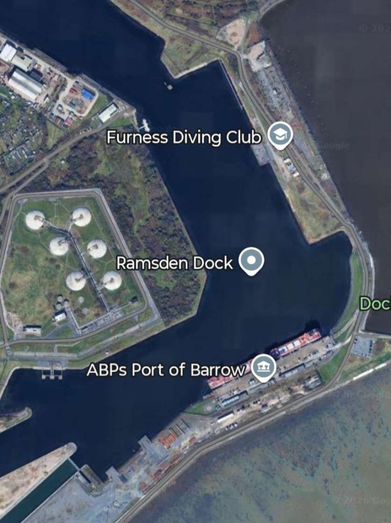
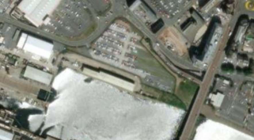
Although the docks, seen on satellite imagery, seem substantially as shown on the drawing in Andrews’ article, closer inspection will reveal substantial changes. [Google Maps, February 2026]
Before looking at the rail infrastructure of the 21st century it is right to at least try to show what existed in around 1910 and which has since been substantially lost.
It is difficult to give an effective account of the complexity of the railway infrastructure around the docks at the turn of the 20th century, although the sketch map from 1959 is particularly helpful for understanding the mid-20th century situation. The following extracts from the 25″ Ordnance Survey from around 1910 may do more to obfuscate than to illustrate!
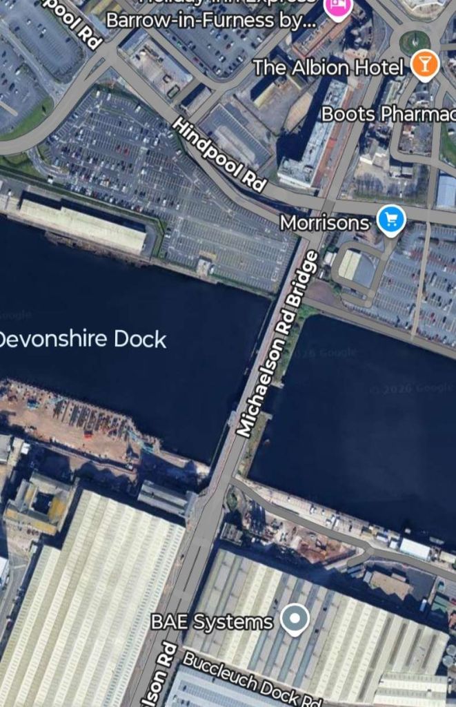
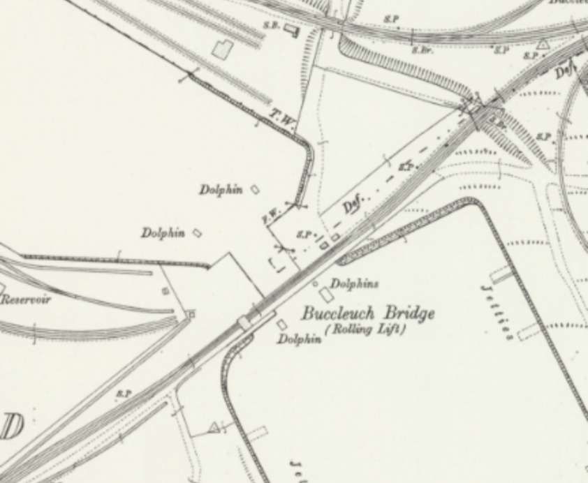
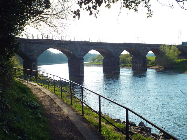
The Buccleuch Bridge of 1907 is shown in this extract. [20]
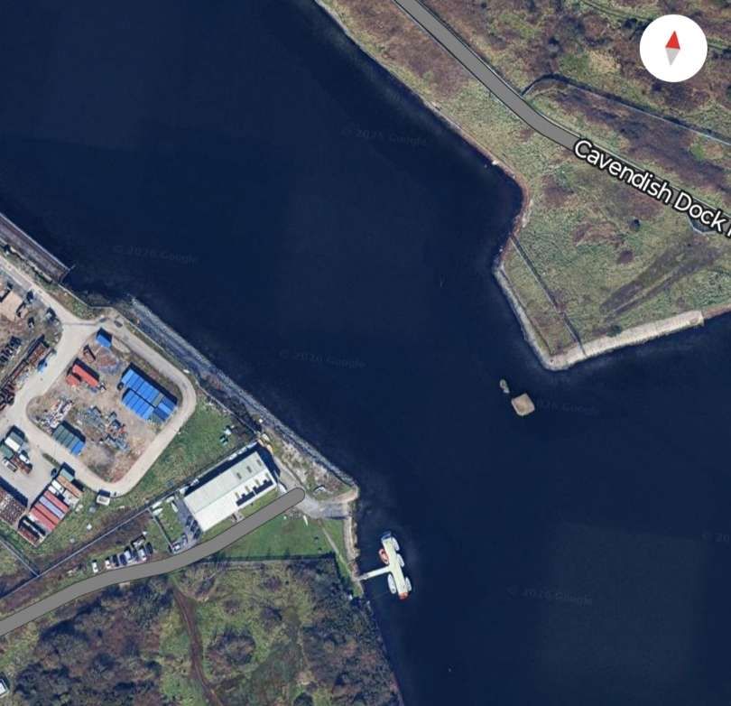
The location of the 1907 lift bridge as it appears in the 21st century. [Google Maps, February 2026]
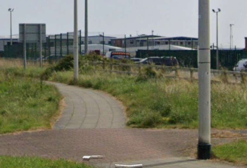
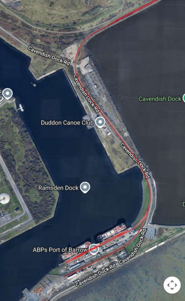
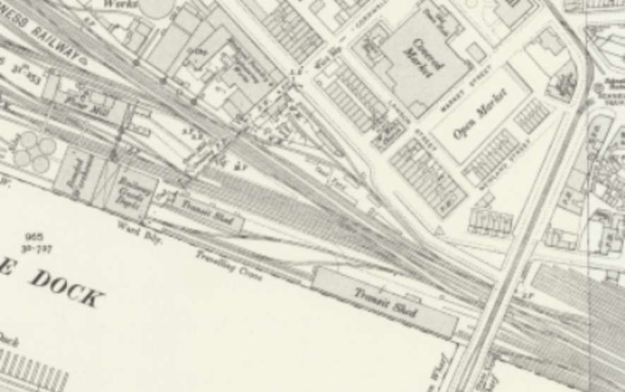
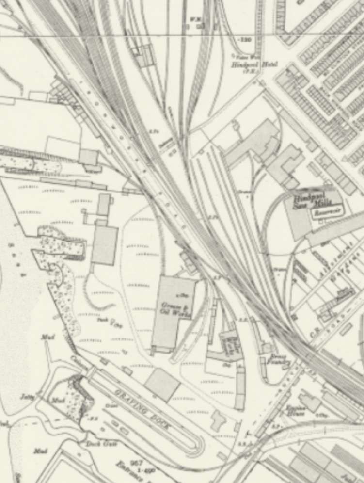
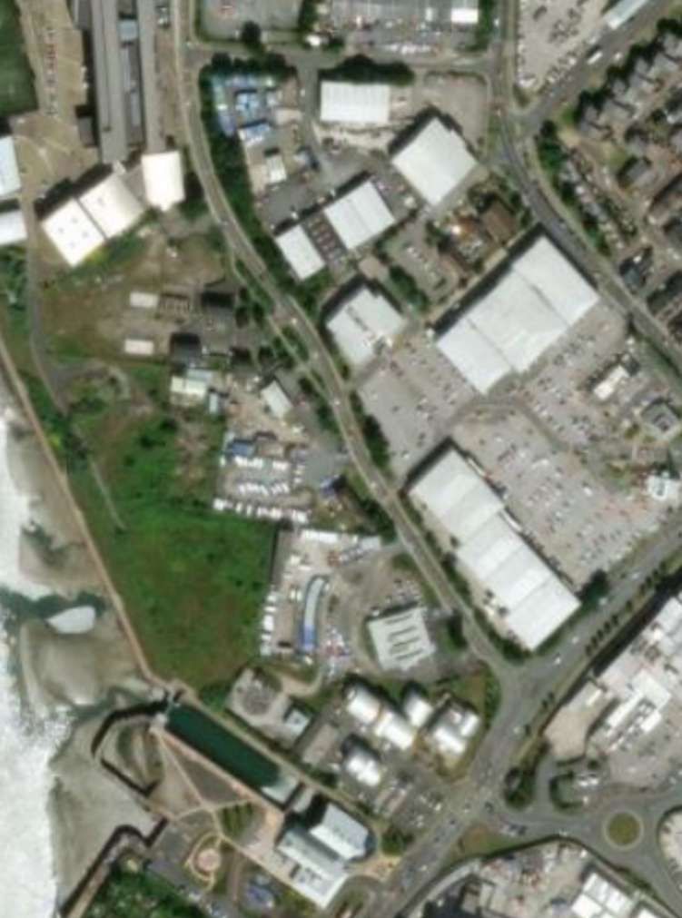
As we have noted, the lift bridge mentioned by Andrews in 1959, is long gone, as is all of the network to the West of the bridge. That network was substantial. … A line ran from the bridge Southwest before curving round to the Southeast to head into Ramsden Dock Station.
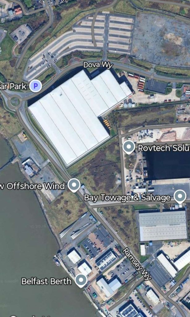
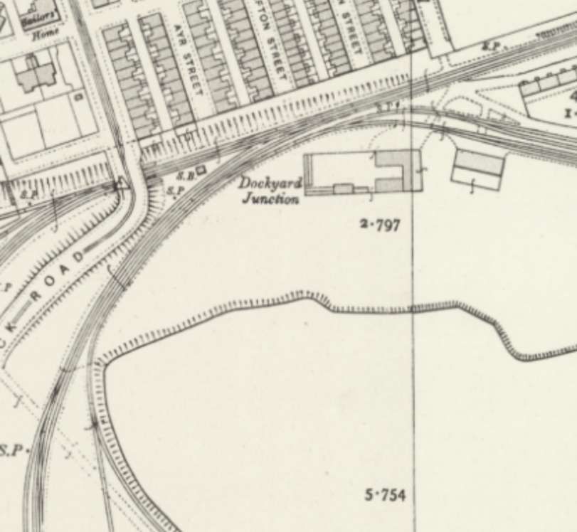
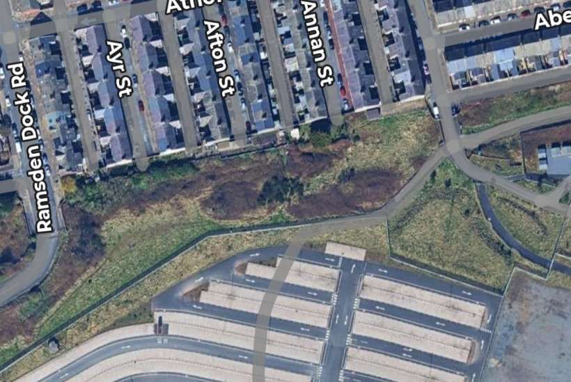
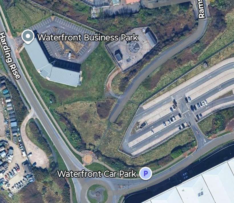
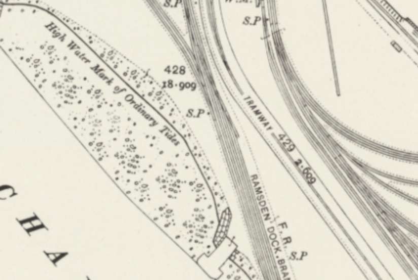
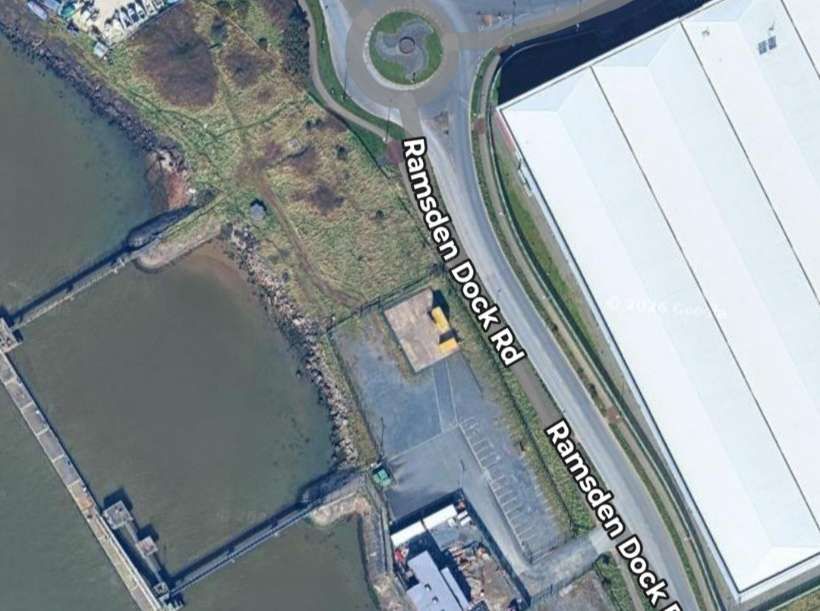
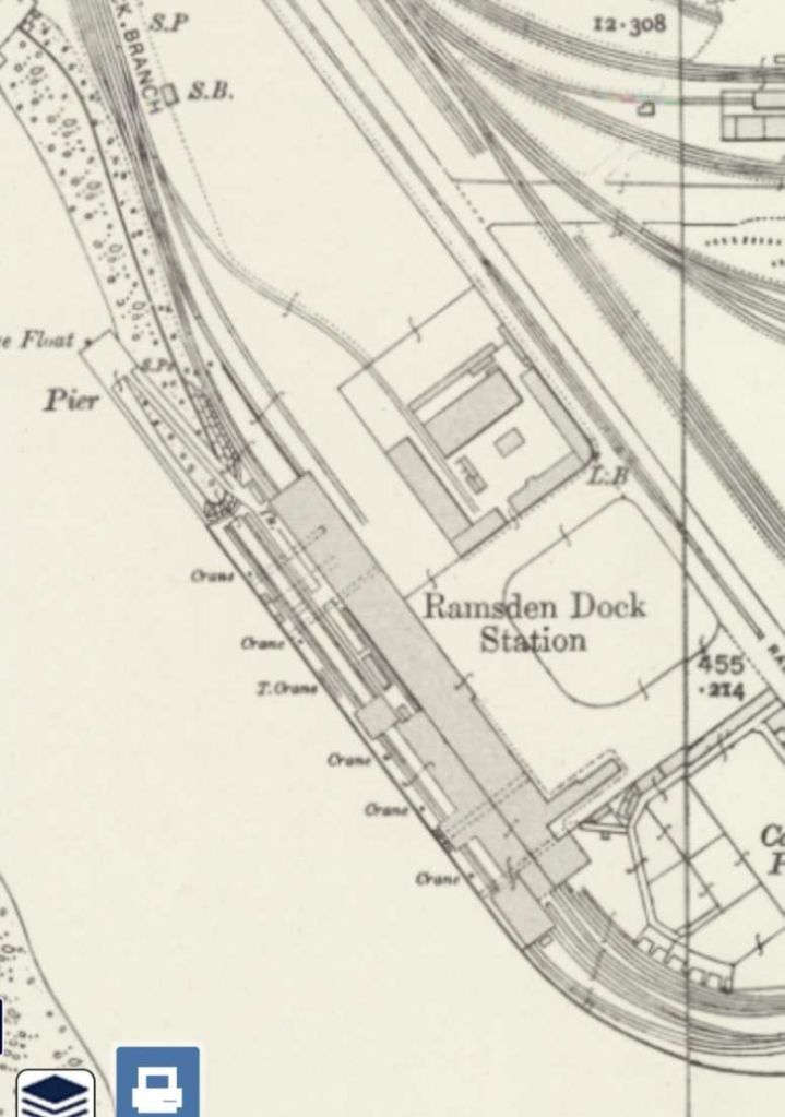
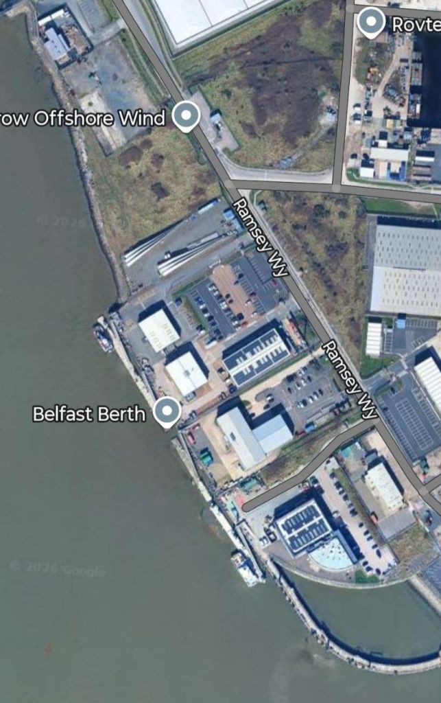
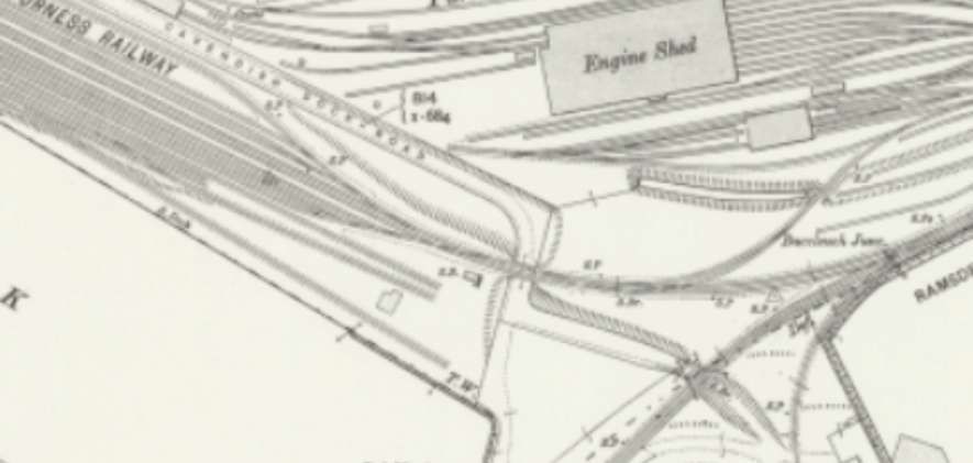
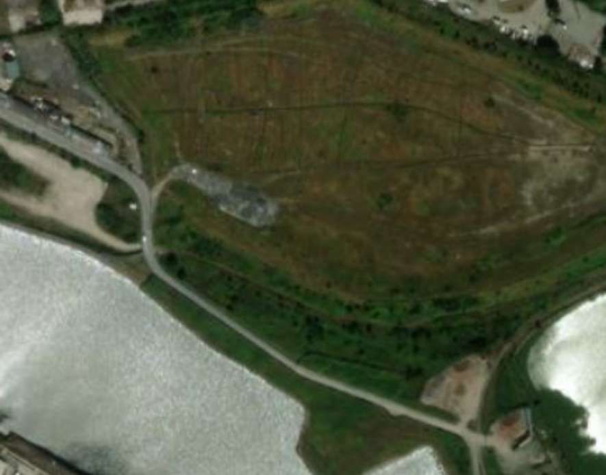
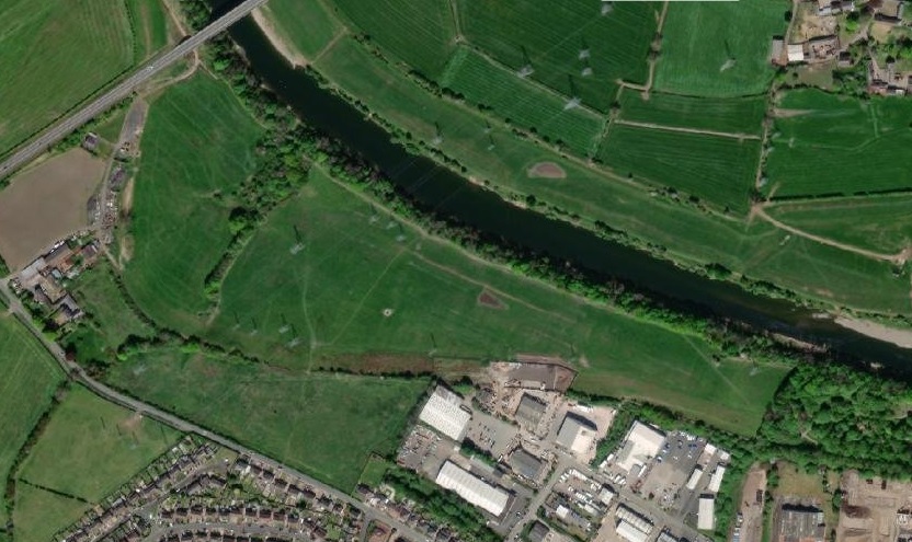
Ramsden Dock railway station (also known as Barrow Island and officially as Barrow Ramsden Dock) was the terminus of the Furness Railway’s Ramsden Dock Branch. [26]
The station operated between 1881 and 1915. Located at the southern tip of Barrow Island alongside Ramsden Dock it primarily served the adjacent Walney Channel passenger ferry terminal. It was accessible by Ramsden Dock Road and the Barrow-in-Furness Tramway. [26]
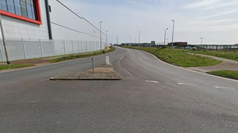
The station building was demolished in the 1940s, while the rail line leading to it was completely removed in the 1990s. No evidence of either remain and a windfarm operations centre has been built on the site. [26]
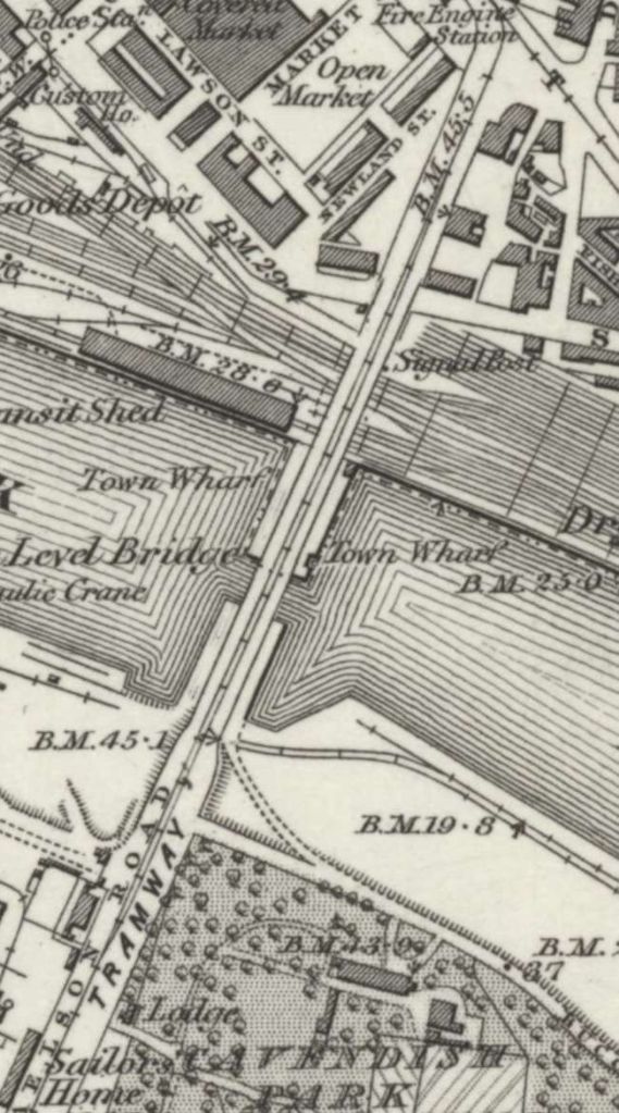
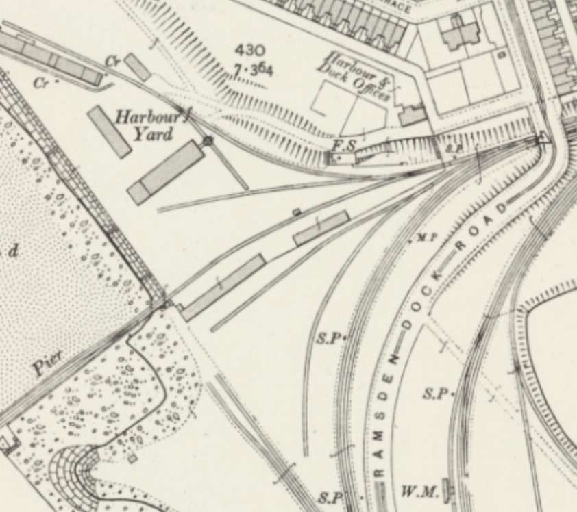
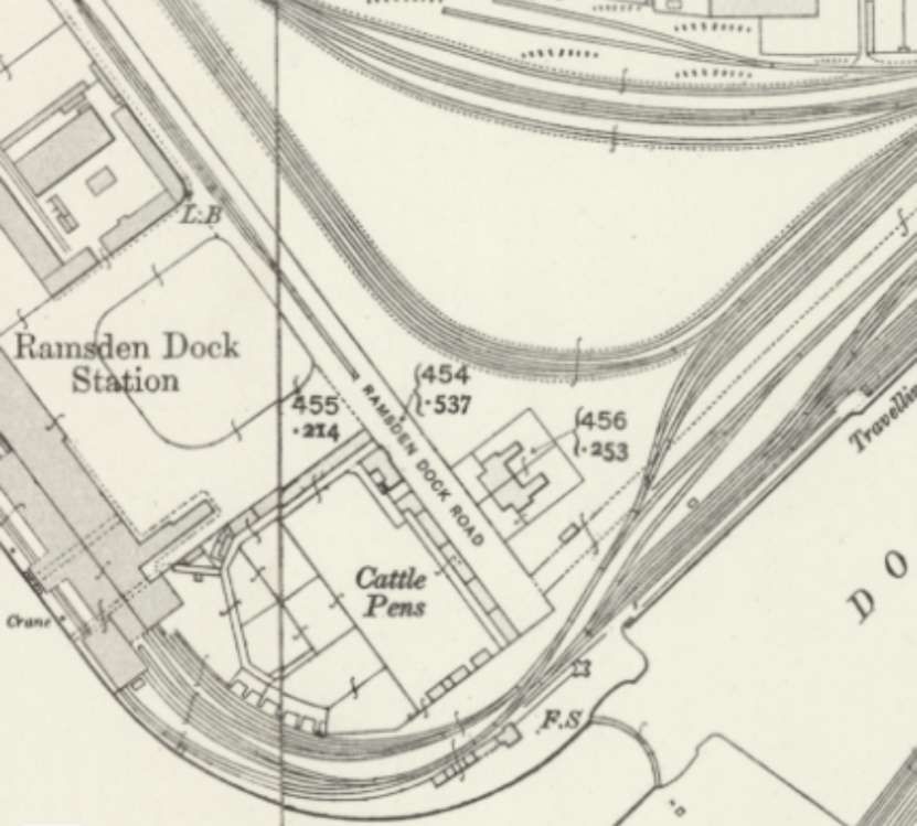
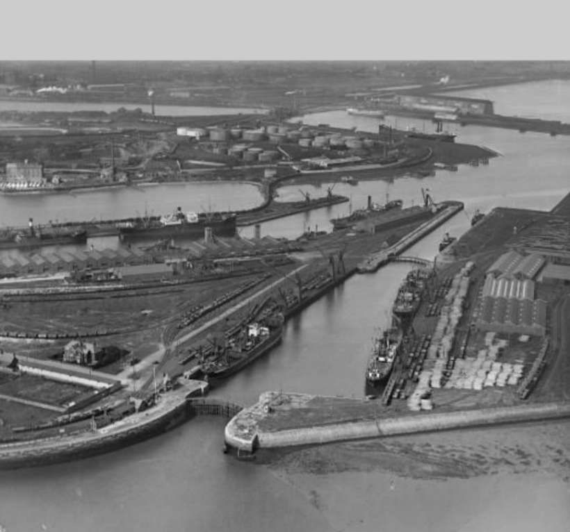
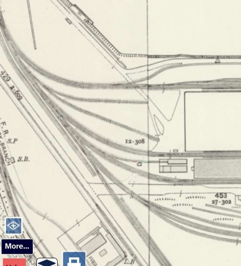
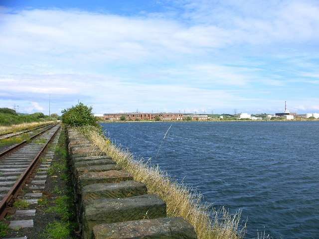
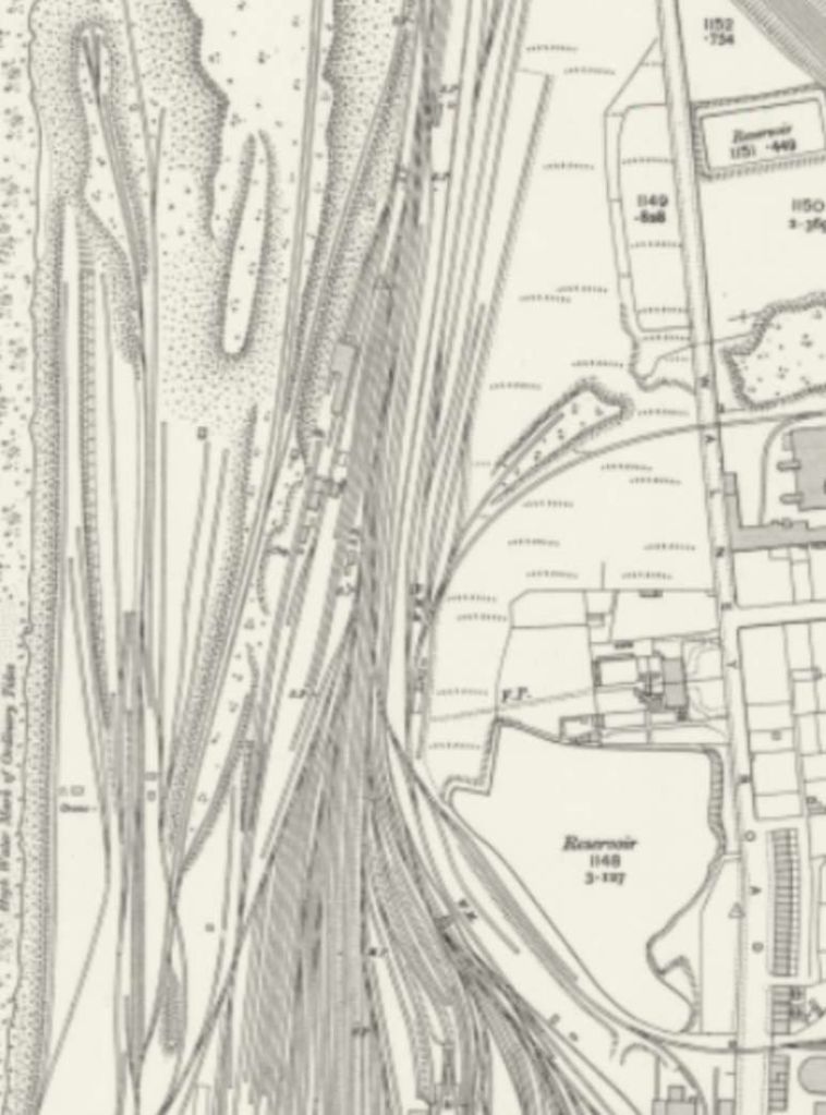
Running parallel to the line through Ramsden Dock Station were lines which served the various sidings in the docks. These lines can be seen in the extract above entering at the third-point along the top from the left of the image, and appear on the extract below, running diagonally across the image from the top-left corner.
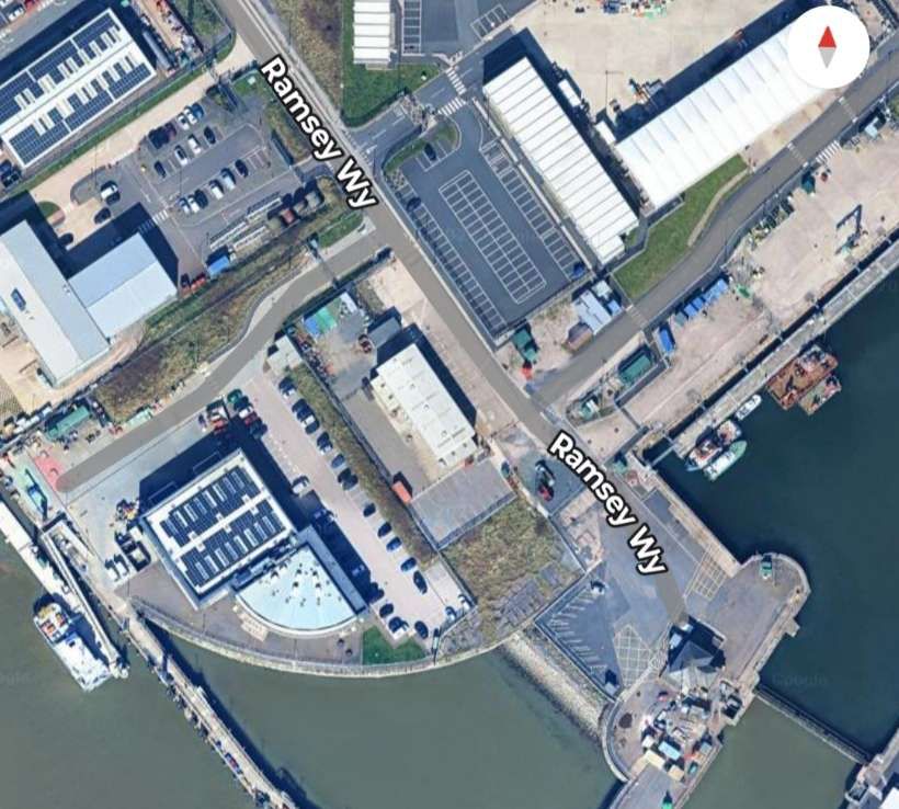
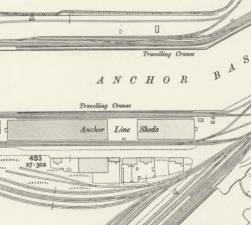
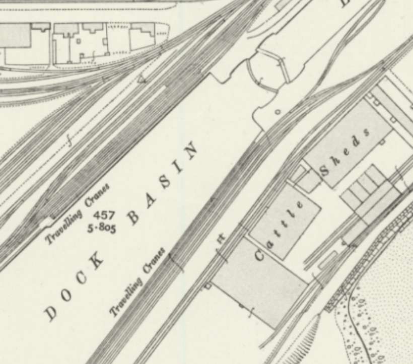
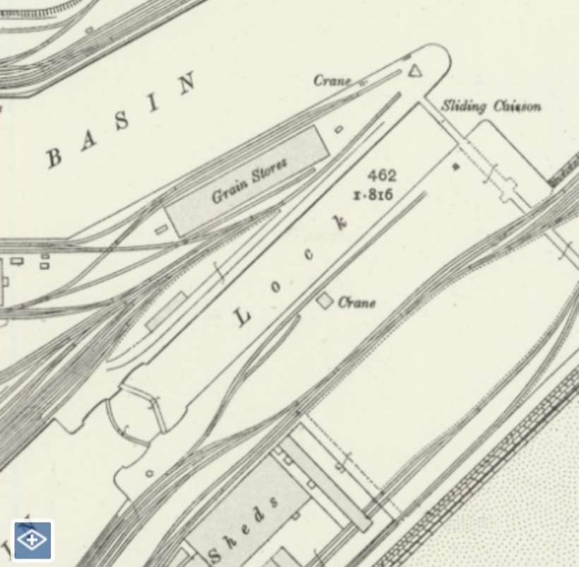
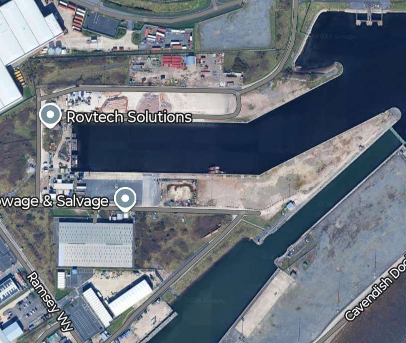
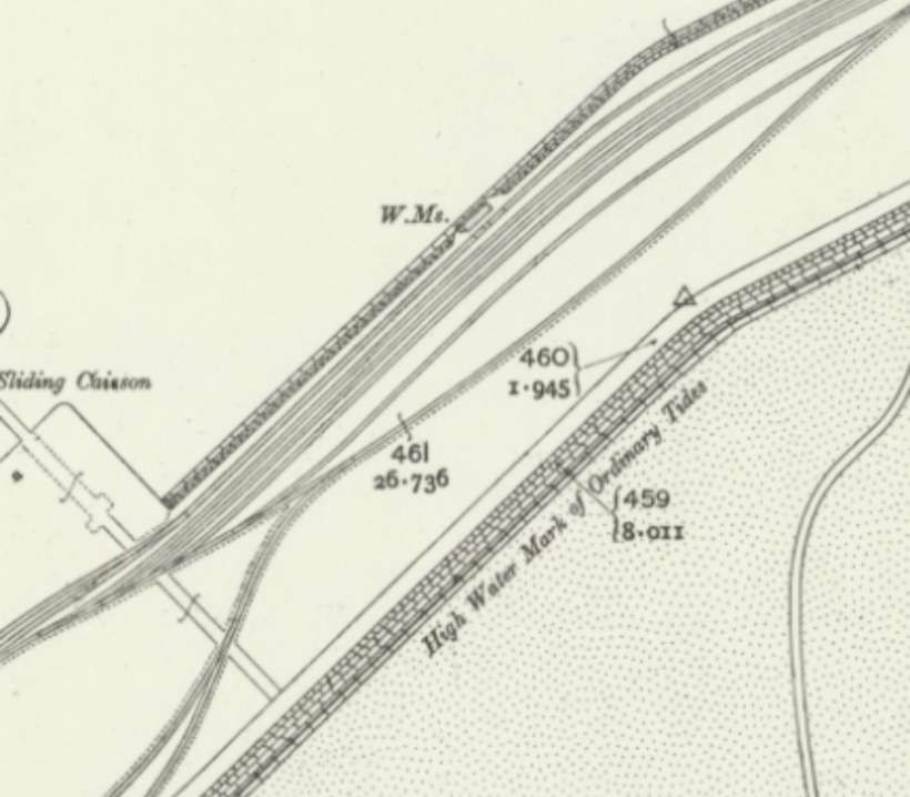
A tree of sidings curved off the feeder line and ran East-West. The lines leaving the bottom of the extract at the third-point from the right enter the last extract from the quarter-point from the left. [20]Anchor Basin and the Anchor Line Sheds circa 1910. [20]South of the extract above, the extract shows the Dock Basin which had a lock gate to open water at its Southwest end with Cattle Sheds to its Southeast. [20]A grain store sat to the Southeast of Anchor Basin and a lock linked it with the Dock Basin in the last extract. The Northeast end of the Cattle Sheds can be seen at the bottom of this extract. [20]Approximately the same area as covered by the four map extracts above, as it appears in the 21st century! [Google Maps, February 2026]Lines ran between the Southeast dock wall of Ramsden Dock and the shore. [20]At the Southeast corner of Ramsden Dock, one line remained close to the shore with another turning North to run between Ramsden Dock and Cavendish Dock. The line along the Southeast side of Cavendish Dock and close to the shore led across to the Piel Branch curving round to the North to make a junction with the Branch. [20]The line heading North linked back to the line that ran along the Northwest edge of Cavendish Dock and crossed the Buccleuch Bridge. [20]This length of line is part of the remnants of what was on an extensive rail system. [20]Approximately the same area as covered by the four map extracts above in the 21st century! [Google Maps, February 2026]
Much more has changed since 1959. The significant network of dock railways has been replaced by a single line running down the East side of Ramsden Dock.
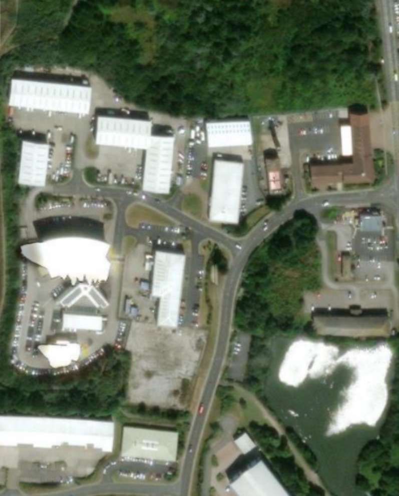
Associated British Ports’ “Port of Barrow plays a key role in serving the offshore energy industry in the region described as Britain’s “energy coast”. The port has 15ha of secure open storage and is the site of BAE Systems’ submarine design and manufacturing facility. … The Port of Barrow … handles over 100,000 tonnes of cargo each year, comprising an array of different products including limestone, sand, aggregates, granite and woodpulp. Heavy lift projects are also routinely and efficiently carried out to support the offshore energy sector.” [19]
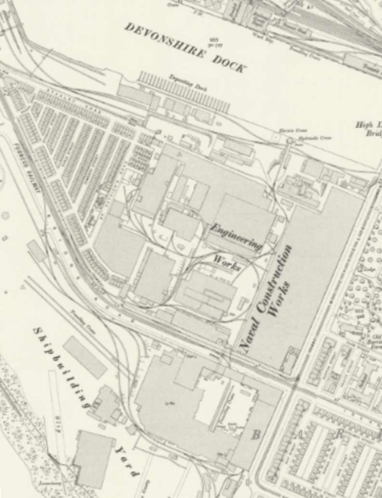
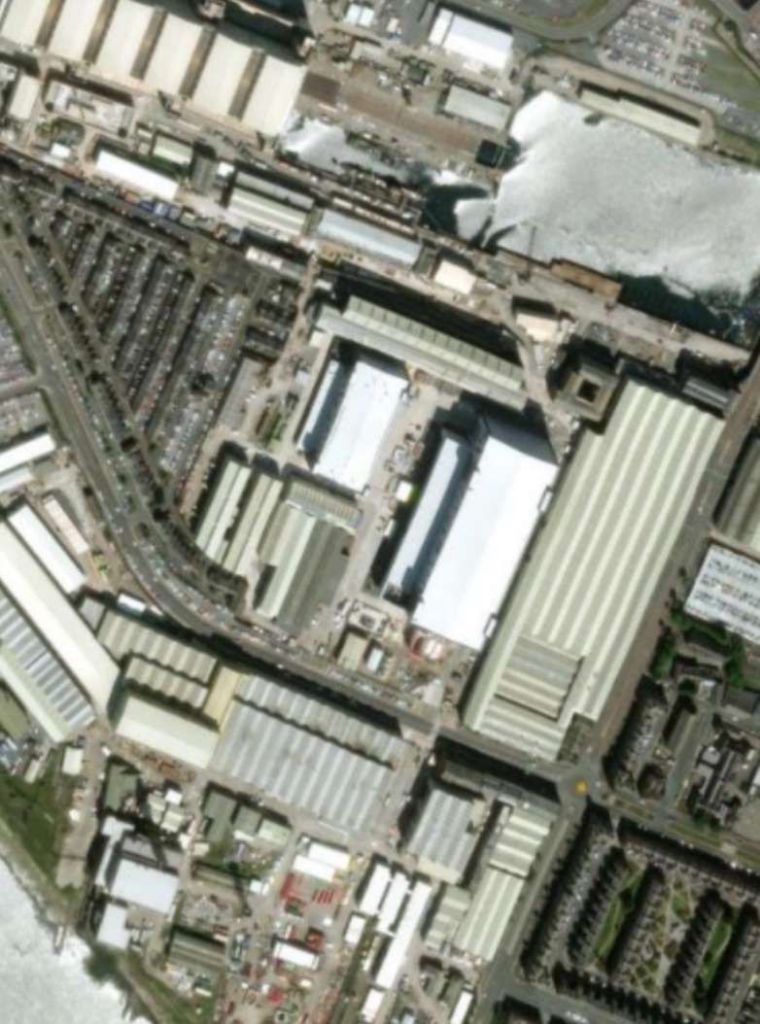
To the Northwest of the dock lines we have been looking at, were the Naval Engineering Works and Shipbuilding Yard. These were served from the Southeast by a line heading West-northwest from Shipyard Junction which ran round the Southern side of the stadium and then in the surface of Island Road.
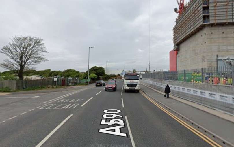
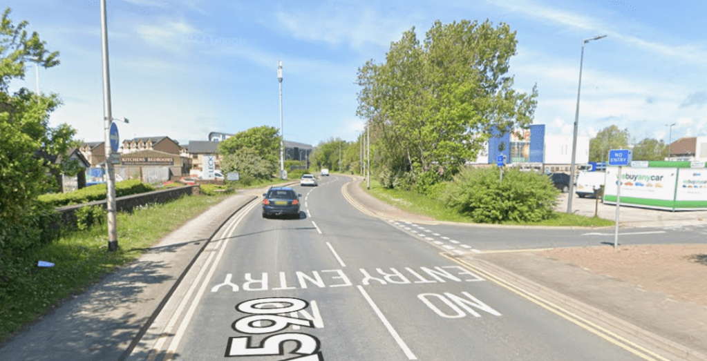
The road layout in the area of the Steelworks and to their immediate South has changed significantly. The image immediately below looks North-northwest along the line of the old and new Ironworks Road which now accommodates Northbound traffic on the A590.
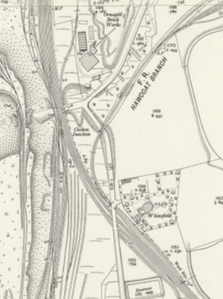
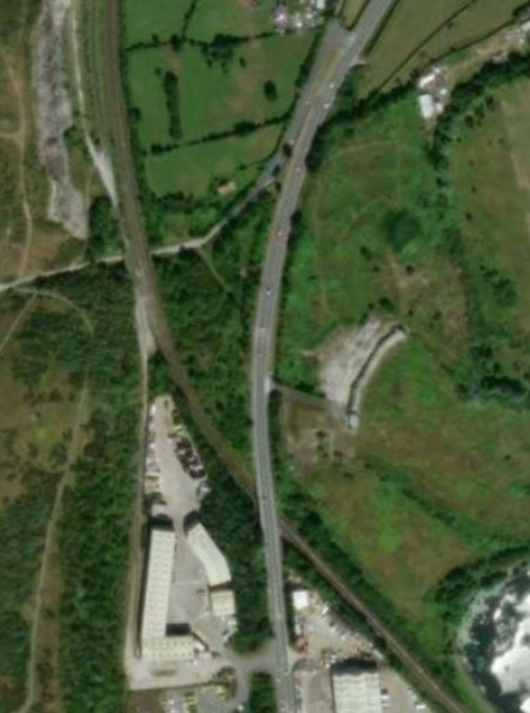
Looking at the lines further to the North, Andrews said in 1959 that, “The economy drive which closed the Piel branch in 1936 also abolished the junction into the goods lines at Ormsgill north of the Central Station, and now trains from the north of the iron works have to work round through Loco Junction and Barrow yard.” [1: p157]
Ormsgill Junction is at the bottom-left of this sketch map. Lines to Hawcoat Quarry and Roanhead Iron Mines were similarly closed by the late-1950s. [1: p150]
But to complete our look at the central area of Barrow, we follow the line up through Barrow Central Station to the North.
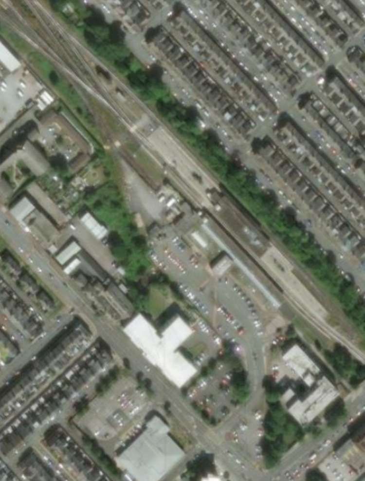
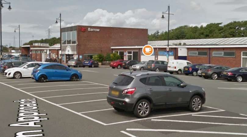
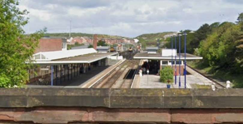
Barrow Central Station after the turn of the 29th century. [21]The site of the station as it appears on the ESRI satellite imagery supplied by the National Library of Scotland. [21]Barrow Central Station seen from the South on the Station Approach in the 21st century. [Google Streetview, August 2018]Barrow Central Station seen from Abbey Road Bridge looking Northwest. [Google Streetview, May 2022]
Andrews said in 1959: “The buildings at the new Barrow in Furness Station have been constructed on the site of the old, and are mainly steel framed. A considerable amount of glass has been introduced in the infilling panels forming windows to both the road and platform elevations. Multi-coloured rustic bricks have been used, with slate window sills and fascia over the high-level windows of the front entrance. The platform awnings are of light steel decking, with continuous roof glazing in line with the face of the external wall adjacent to No. 1 platform. The flooring of the booking hall and cafeteria-waiting rooms is laid in precast tiles, and polished hardwood has been used extensively as a decorative wall lining in the cafeterias, and for the framing to the ticket windows and internal window frames. The walls of the booking hall are finished in glazed tiles to the top of door height, with a glossy finish above, and re-erected on the south wall is the Furness Railway 1914-18 war memorial, Loudspeakers have been installed through out the station, and the open platform lighting is fluorescent, incorporating the station name within the light fitting.” [1: p200]
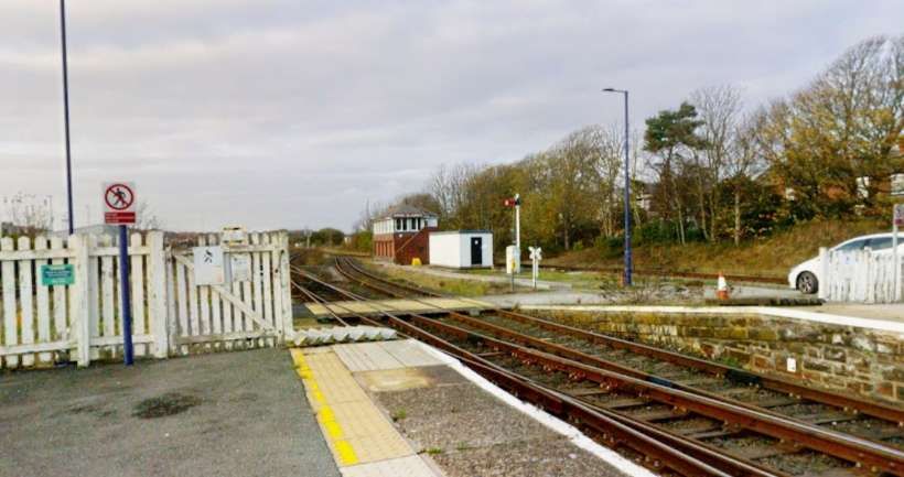
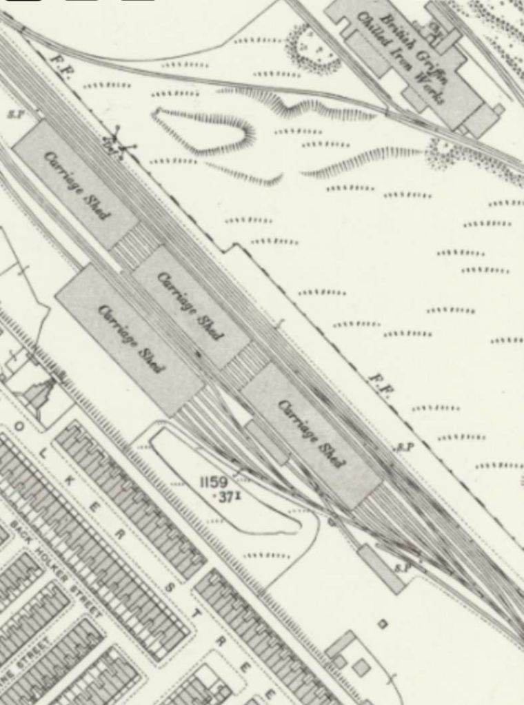
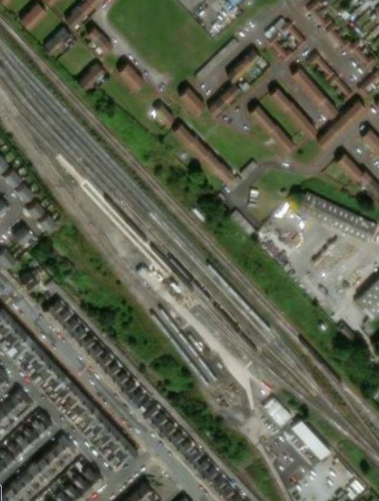
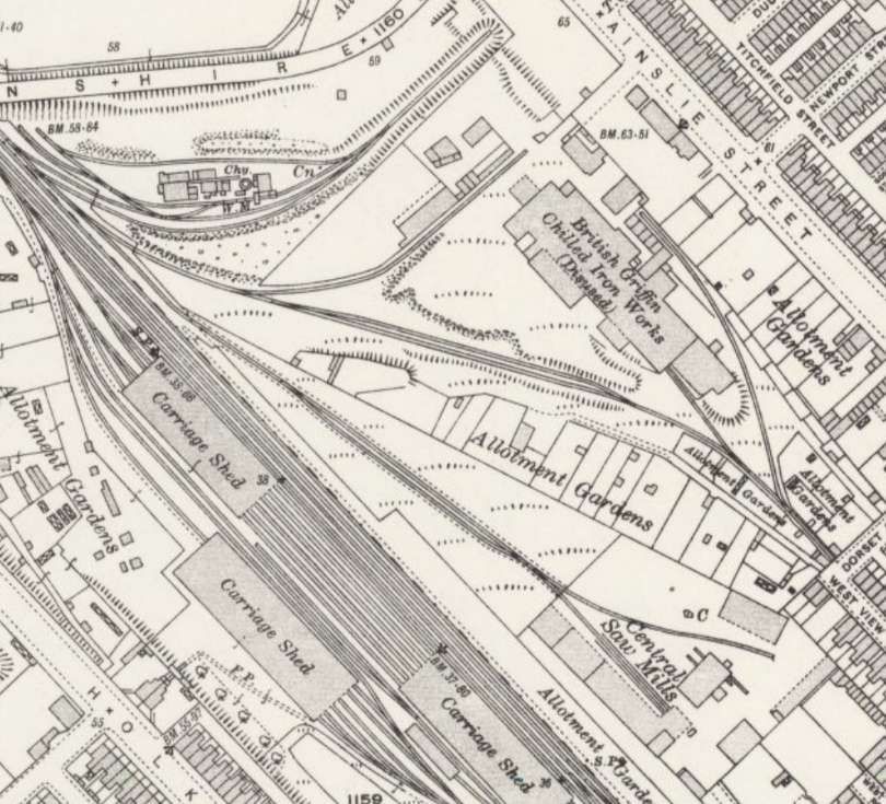
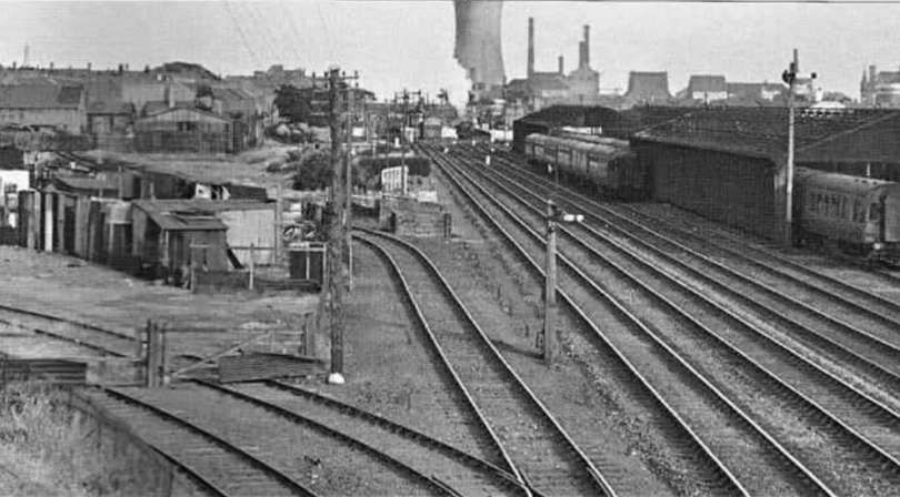
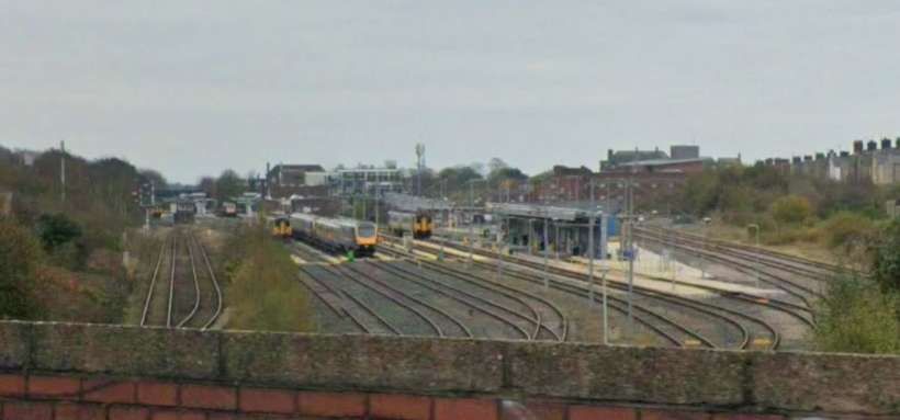
Looking North from the end of the station platform towards what was the location of the carriage sheds. [Google Streetview & Vextrix Surveys, November 2021]Carriage Sheds to the Northwest of Barrow Central Station in the early 20th century. Note the single industrial siding serving British Griffin Chilled Iron Works. [21]A similar area in the 21st century! [21]By the early 1930s, the provision for local industry close to the carriage sidings had increased significantly! This extract comes from the 25″ Ordnance Survey of 1931, published in 1933. [35]The lines passed under Devonshire Road. [23]The same location in the 21st century. [23]This photograph was taken in the late 1950s from a point somewhere Southeast of Devonshire Road. The carriage sheds are on the right of the photograph. There are two tracks on the left of the main line which served industrial premises. The Ordnance Survey shows the first of these sidings serving British Griffin Chilled Ironworks. This image was shared by Ralph Sheppard on the Barrow-in-Furness in Old Photos Facebook Group on 29th December 2019. [34]Looking Southeast from Devonshire Road towards the maintenance facilities and the station beyond. [Google Streetview, November 2024]Looking Northwest from Devonshire Road. [Google Streetview, November 2024]Continuing Northwest, the lines passed under Walney Road. [23]The same location in the 21st century. [23]Looking Southeast from the A590, Walney Road, along the line of the railway towards Barrow Railway Station. [Google Streetview, November 2024]
We finish our survey of Barrow’s Railways at this northern point. Towards the end of his 1959 article, Andrews commented about the first half of the 20th century: “The last fifty years have shown a steady decline in Barrow’s railway system, the inevitable result of the failure of James Ramsden’s vision to become reality. Although the iron ore brought a temporary and easy prosperity, the geographical situation was a permanent setback to the port. The industrial centres of Lancashire and Yorkshire were just too far away and the Furness main line was not built for real speed. Moreover, the Furness Railway Company just failed to establish sufficient variety of local industry to keep the port busy with local trade and the town came in the end to rely almost entirely on the shipbuilding industry. Since the last war, however, there have been signs of a reversal in this downward trend; sidings are being laid in to serve new factories at Salthouse and Sandscale, and Barrow is to become a divisional centre in the L.M.R. de-centralisation scheme. It is hoped that some of the prosperity of the old days is on the way back.” [1: p157]
From 1959 to 2026, Barrow-in-Furness transitioned from a traditional heavy industrial town into a specialized hub for nuclear submarine construction and offshore energy. While iron and steel industries closed by 1988, the BAE Systems shipyard became the town’s primary economic driver, cementing its role in national defense.
British Cellophane (1959) and Kimberly Clark (1967) established manufacturing plants in Barrow and the 1980s saw the development of gas terminals for the Morecambe Bay gas field.
The vast majority of the industrial railway heritage has disappeared. The town is left with its mainline service which serves the Cumbrian Coast and connects the town to the wider UK, and a branch line which runs down to the ABP port facilities.
References
M. J. Andrews; The Railways of Barrow; in The Railway Magazine, Tothill Press, London, March 1959, p149-157 & 200.
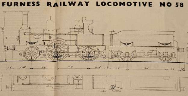
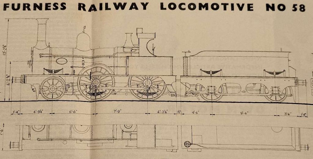
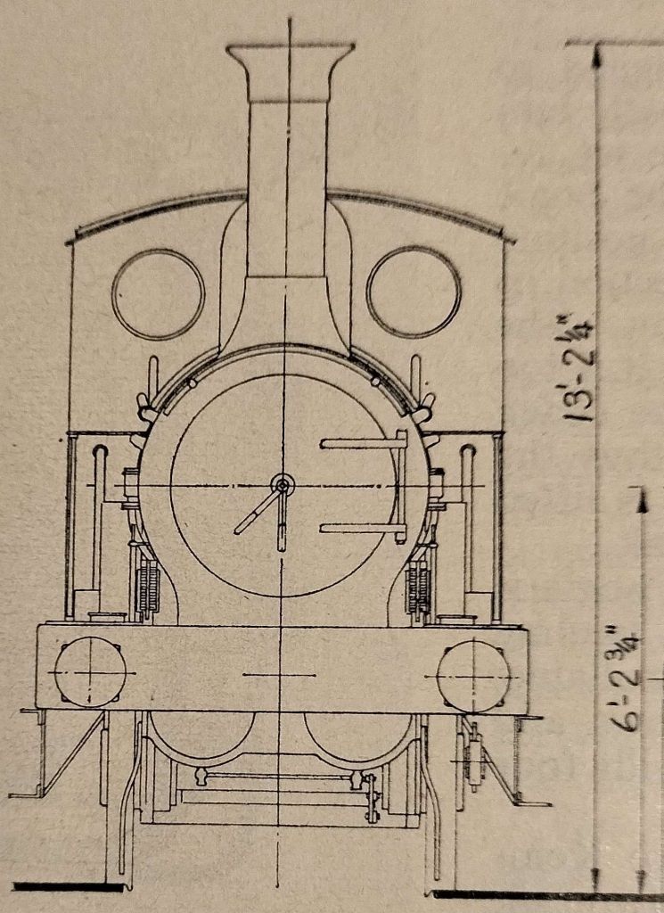
Looking through a number of 1964 Model Railway News magazines, I came across drawings of Sharp, Stewart & Co. 2-4-0, built in 1870 for the Furness Railway Co. and numbered 58 on their roster.
Side elevation and half plan of Locomotive No. 58 [1]Front elevation. [1]Tender, front and back half-elevations. [1]
Originally conceived as a mineral railway, the Furness Railway later played a major role in the development of the town of Barrow-in-Furness, and in the development of the Lake District Tourist industry. It was formed in 1846 and survived as an independent, viable concern until the Grouping of 1923. [4]
The Furness Railway contracted out the building of its locomotives until Pettigrew became Chief Locomotive Engineer in 1897. He put his first locomotive on the line in 1898.
2-4-0 Locomotive No. 58 had inside cylinders (16 in by 20 in), 5 ft 6 in diameter coupled wheels. It operated with a boiler pressure of 120 lb and weighed 30 tons 5 cwt. Its tender was 4-wheeled with a 1,200 gallon water capacity.
The locomotive, as designed, had no brake blocks, the only brake being a clasp type on the tender.
This relatively small locomotive was one of a series of 19 locos built to the same design. The class fulfilled the needs of the Furness Railway as passenger locomotives. The class was given the designation ‘E1’ by Bob Rush in his books about the Furness Railway. Rush’s classification was his own not that of the Furness Railway, but has become accepted generally. [2]
A photograph of one of this class can be found by clicking on the link immediately below. No. 44 was built in 1882 by Sharp Stewart & Co., Works No.3086. It was rebuilt in 1898, presumably in the Furness Railway works. Renumbered 44A in 1920, it became LMS No. 10002 – but was withdrawn in April 1925. [5]
Later, seven of the class were converted to J1-class 2-4-2 tank engines in 1891. [3]
References
T.A. Lindsay; Furness Railway Locomotive No. 58; in Model Railway News, Volume 40, No. 480, December 1964, p608-609. (Permission to copy granted for any non-commercial purpose.)
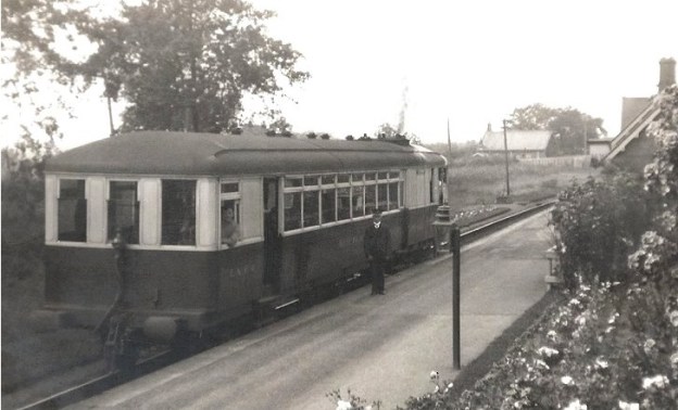
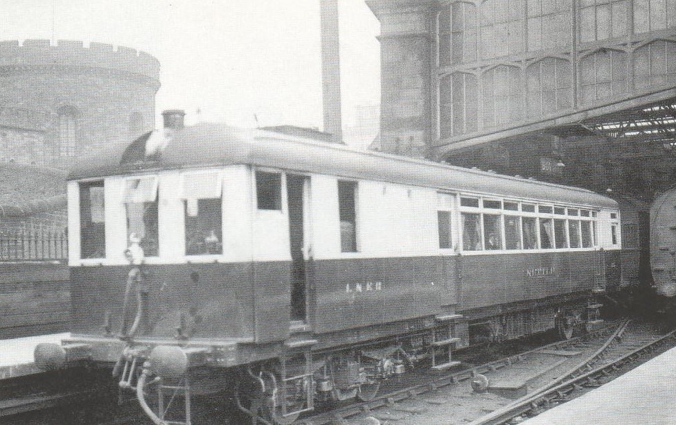
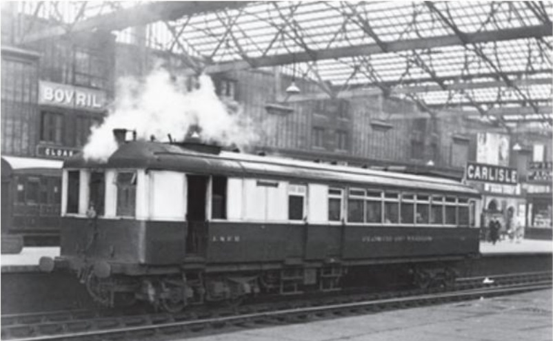
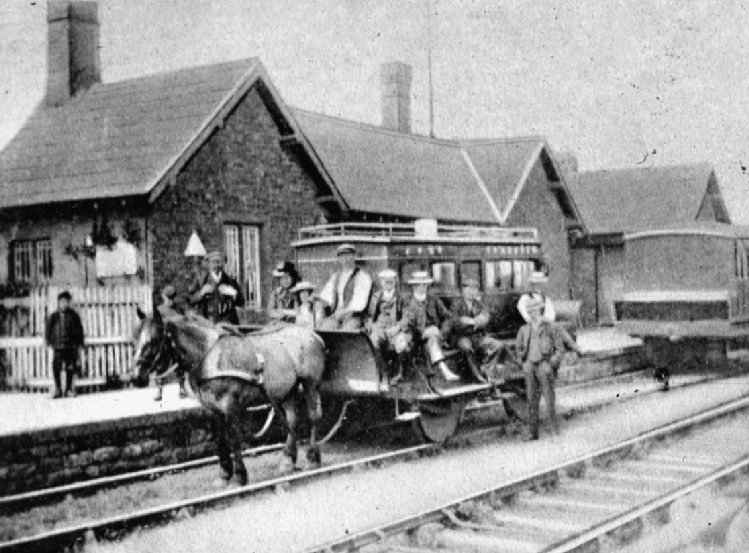
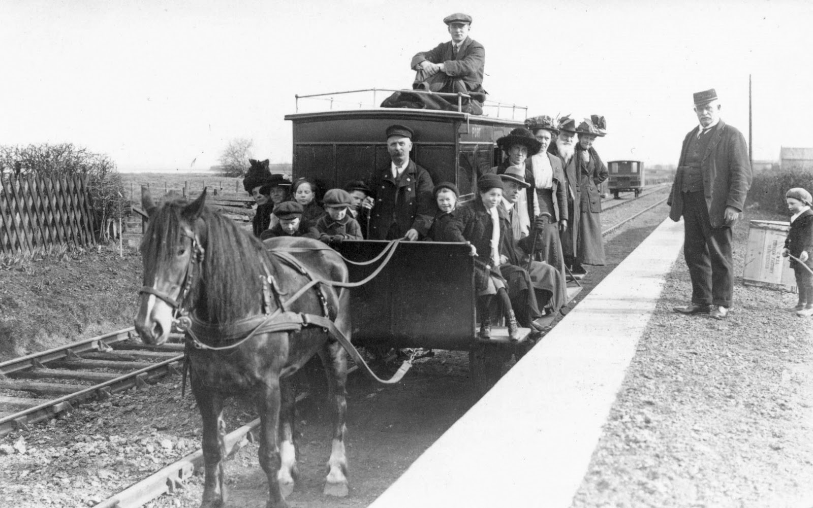
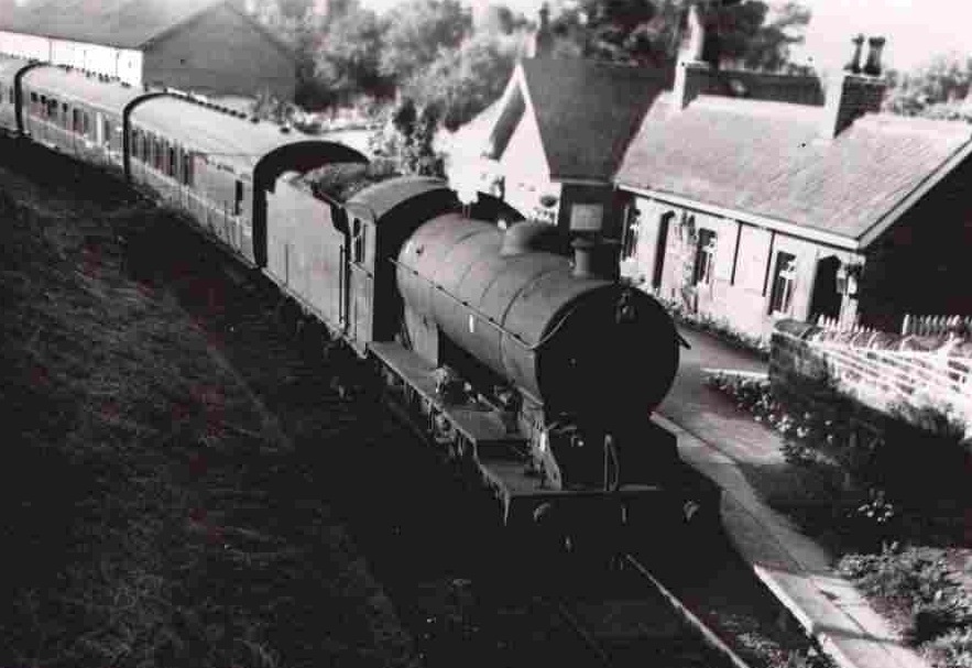
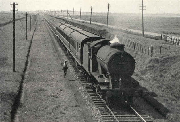
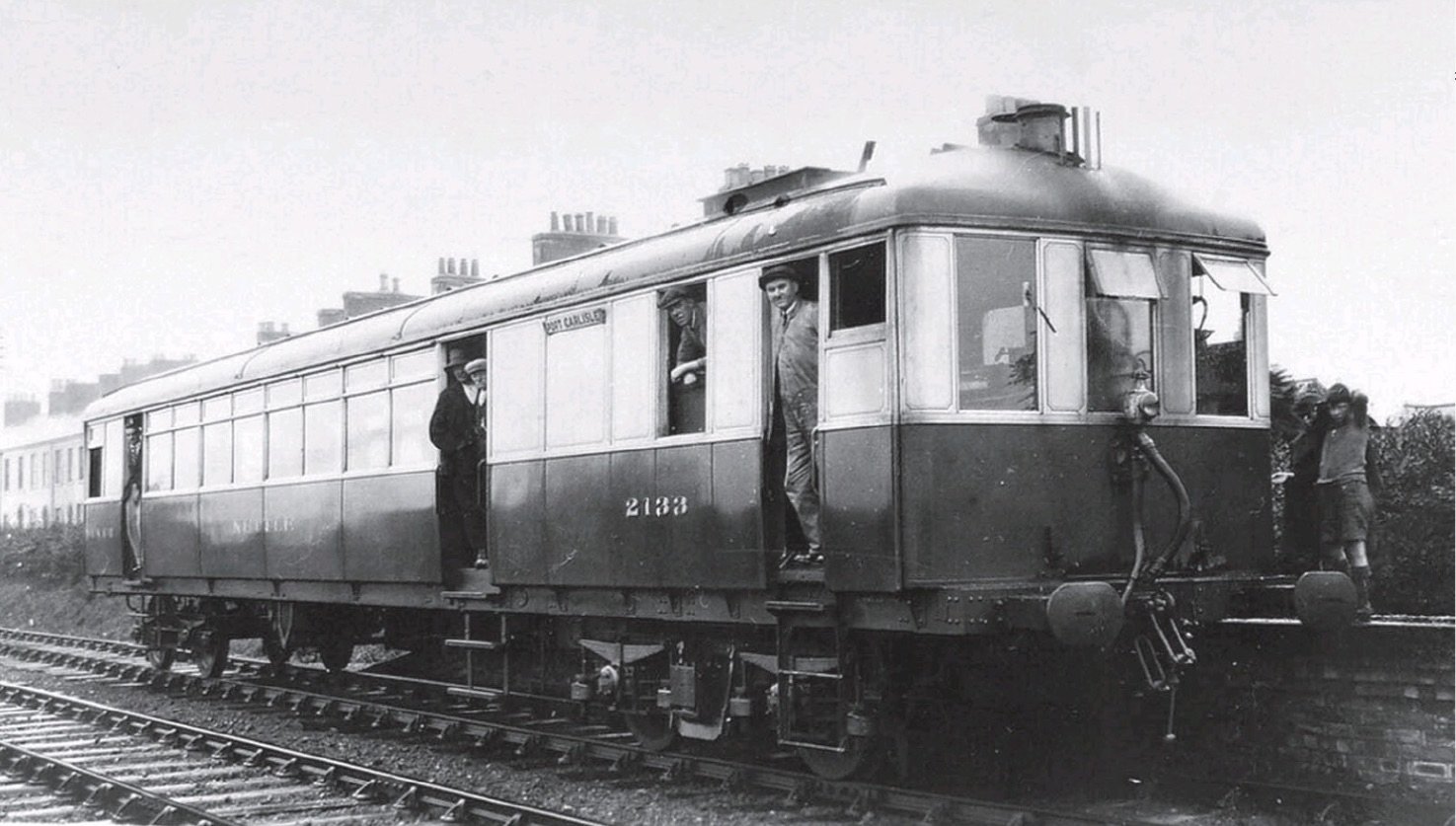
Towards the end of its life the Port Carlisle Branch was served by two Sentinel Steam Railmotors, ‘Nettle’ and ‘Flower of Yarrow’. The featured image above is part of the Bruce McCartney Collection. It shows a Sentiel Steam Railcar calling at Burgh-by-Sands on a service to Port Carlisle in around 1930. Station Master Walter Tait is posing alongside the railcar on the platform. Bruce McCartney comments: “The Sentinel is thought to be No. 31 ‘Flower of Yarrow’ which was built in 1928 and operated on the Port Carlisle Branch up to the time the branch was closed from Drum burgh in 1932, although, being on the ‘main-line’ Burgh-by-Sands kept going until 1964.” (c) the Bruce McCartney Collection, used by kind permission. [1]
‘Nettle’ and ‘Flower of Yarrow’
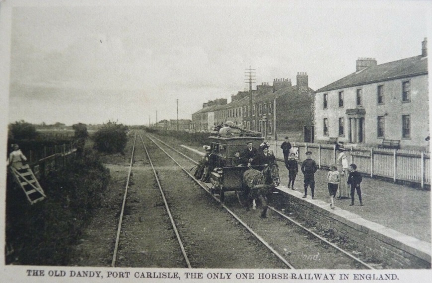
After 50 or so years being served by a horse-drawn Dandy. Port Carlisle was given a replacement steam service in 1914. It was envisaged that providing a good reliable service from Carlisle, the village of Port Carlisle would develop as a seaside resort.
In 1914, Port Carlisle was once again given its own steam service to Carlisle. [2]
Sadly the hoped for development did not occur and Port Carlisle remained a backwater, but one with a significant history as a port where ocean-going vessels could dock. For a time it was a ‘ferry’ terminal and a place where goods could be transshipped onto smaller craft heading up the canal to Carlisle. Later the canal was replaced by a railway and for a time a reasonable flow of goods passed through the port. However, by 1863, goods services on the Port Carlisle branch were terminated and for a time passengers were served by a horse-drawn Dandy.
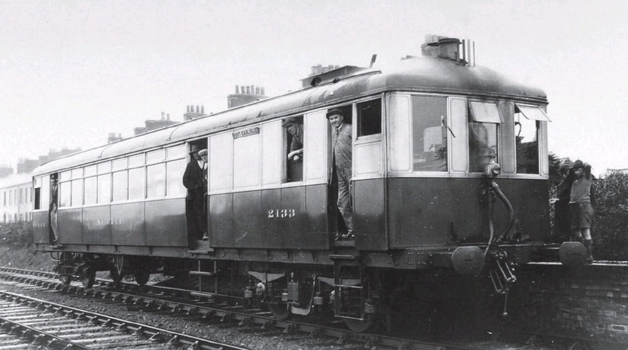
As the early 20th century unfolded the steam service was unable to pay its way and eventually, hoping against hope, that some service could be retained to Port Carlisle steam engines and carriages were replace by a pair of Sentinel Steam Rail Cars, No. 31 ‘Flower of Yarrow’ (Sentinel Diagram No. 96) and No. 35 ‘Nettle’ (originally, LNER No. 2133 – Sentinel Diagram no. 93). [3]
‘Nettle’ was built in 1928 and originally carried the LNER number 2133 which was later changed to 35. ‘Flower of Yarrow’ was a slightly later build by Sentinel and only ever carried the LNER number 31.
‘Nettle’ at Port Carlisle [3][4]Flower of Yarrow at St. Margaret’s Shed, Edinburgh. [3]Sentinel Railcar ‘Nettle’ at Carlisle, probably on the service to Port Carlisle. It appears to be running with at least another carriage attached. Photographer not known. [5]‘Flower of Yarrow’ also at Carlisle. Photographer not known. [6]
These railmotors/railcars saw out the remaining years of the passenger service on the line to Port Carlisle and were moved elsewhere when it closed between Drumburgh and Port Carlisle in 1932.
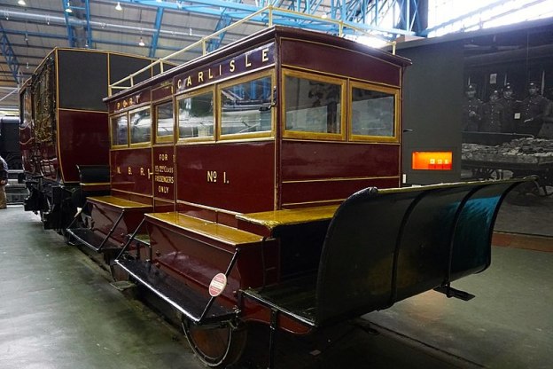
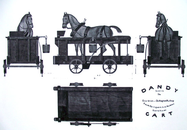
The featured image at the head of this post was taken on 24th February 2017 at the National Railway Museum in York. The ‘Dandy’ Car was horse-drawn and provided the branch service between Port Carlisle and Drumburgh until 1914 when the service was enhanced and steam-power was used, (c) Glen Bowman (Attribution 2.0 Generic – CC BY 2.0) [1]
The Science Museum, of which the Railway Museum is a constituent part describes the exhibit: “This is one of four horse-drawn Dandy cars built by the North British Railway at its St Margaret’s Works, Edinburgh. The North British Railway, one of Scotland’s major railways, operated the branch extending from Carlisle to Silloth and its sub-branch to Port Carlisle. Freight services on the latter branch were discontinued as early as 1899, but a horse-drawn passenger service instituted in 1863 remained until early 1914, when it was finally superseded by steam.” [2]
After the reintroduction of steam power on the branch line, the “railway company gave the old Dandy coaches to the village. For many years, they served as pavilions for the local bowling green and tennis club. In 1925, there was an exhibition at Darlington to mark the centenary of the world’s first railway there.” [3] The organisers thought that one of the old Dandy cars “would prove a popular exhibit and entered negotiations with the bowling club for its return. Repainted in its original colours, the Dandy took pride of place in the Darlington show. When the exhibition closed, it was taken to Waverley Station in Edinburgh where it remained until it was moved to its present location, the National Railway Museum in York.” [3]
So, where does the name ‘Dandy’ come from?
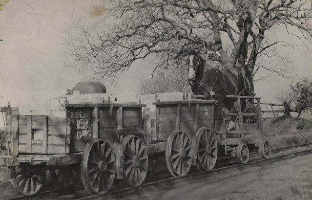
One possibility is that the ‘Dandy’ on the Port Carlisle branch derived its name from the Dandy Waggons (‘Wagons’ or ‘Carts’) which were used on old waggonways for the carriage of horses. They were “usually used on the down-hill sections of horse-drawn railways and waggonways. George Stephenson is credited for having proposed the idea for dandy wagons, building these carriages for the horses, for use on the Stockton & Darlington Railway, which opened in 1825. [4] However, they were particularly associated with the Ffestiniog Railway where they were in use until 1863. [5]
The term Dandy Wagon was also used during the 19th century in the USA to refer to a horse-drawn private buggy. [7]
It might be that the combination of these two ideas resulted in the name ‘Dandy’ being applied to a horse-drawn vehicle particularly on the Port Carlisle Branch. Small two- or four-wheel carts could often be called a ‘Dandy’ as an image search on the internet will illustrate. ….
Various ‘dandy’ carts appear when searched for on the internet. [Google.com]
None-the-less the term ‘Dandy’ was used for the passenger carrying rolling stock on the Port Carlisle branch. The horse-drawn service was long-lived, lasting from 1863 to 1914, over 50 years in all!
We finish this short article with some photographs and postcards showing the Dandy in operation!
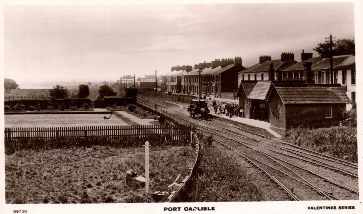
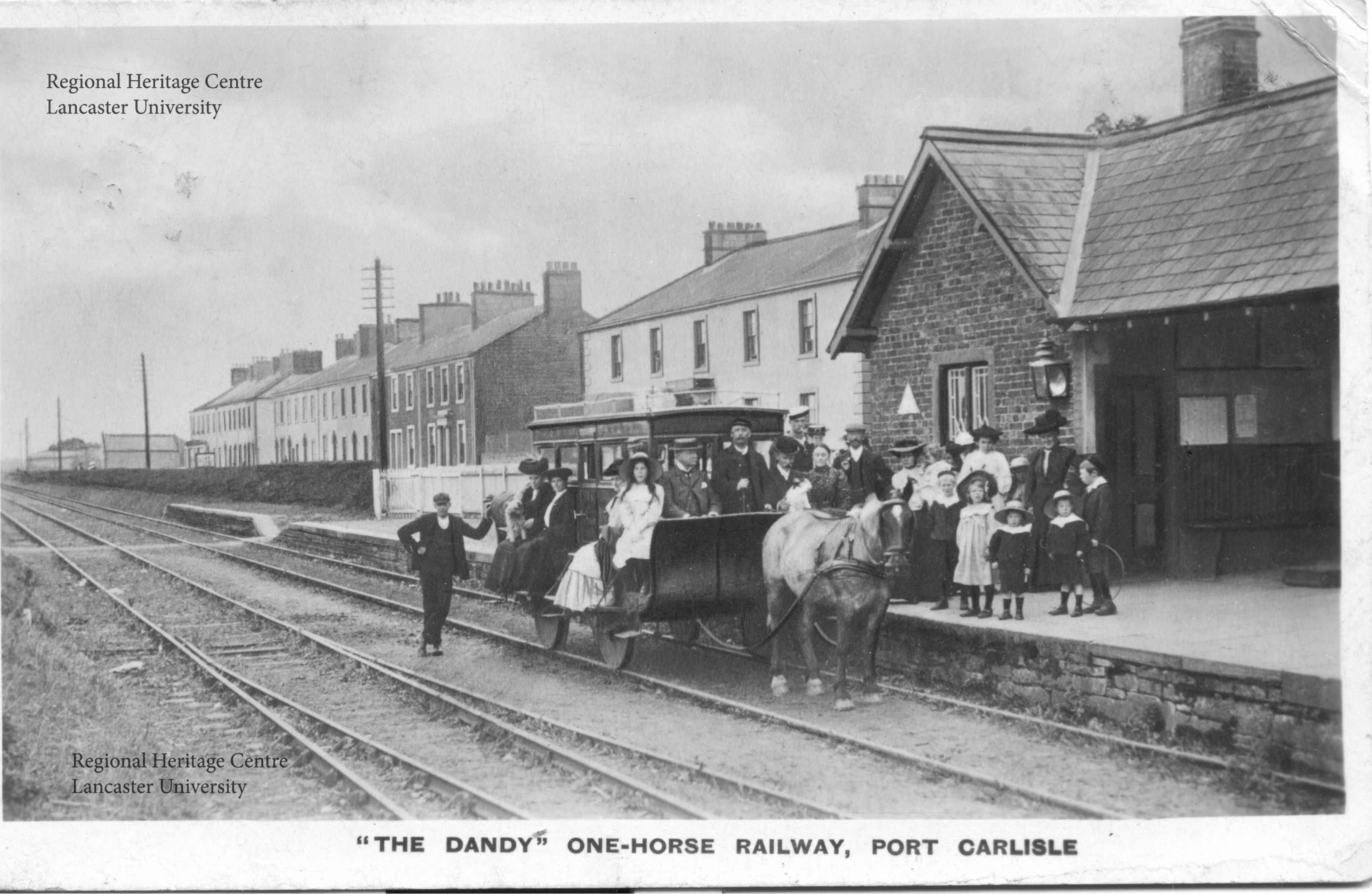
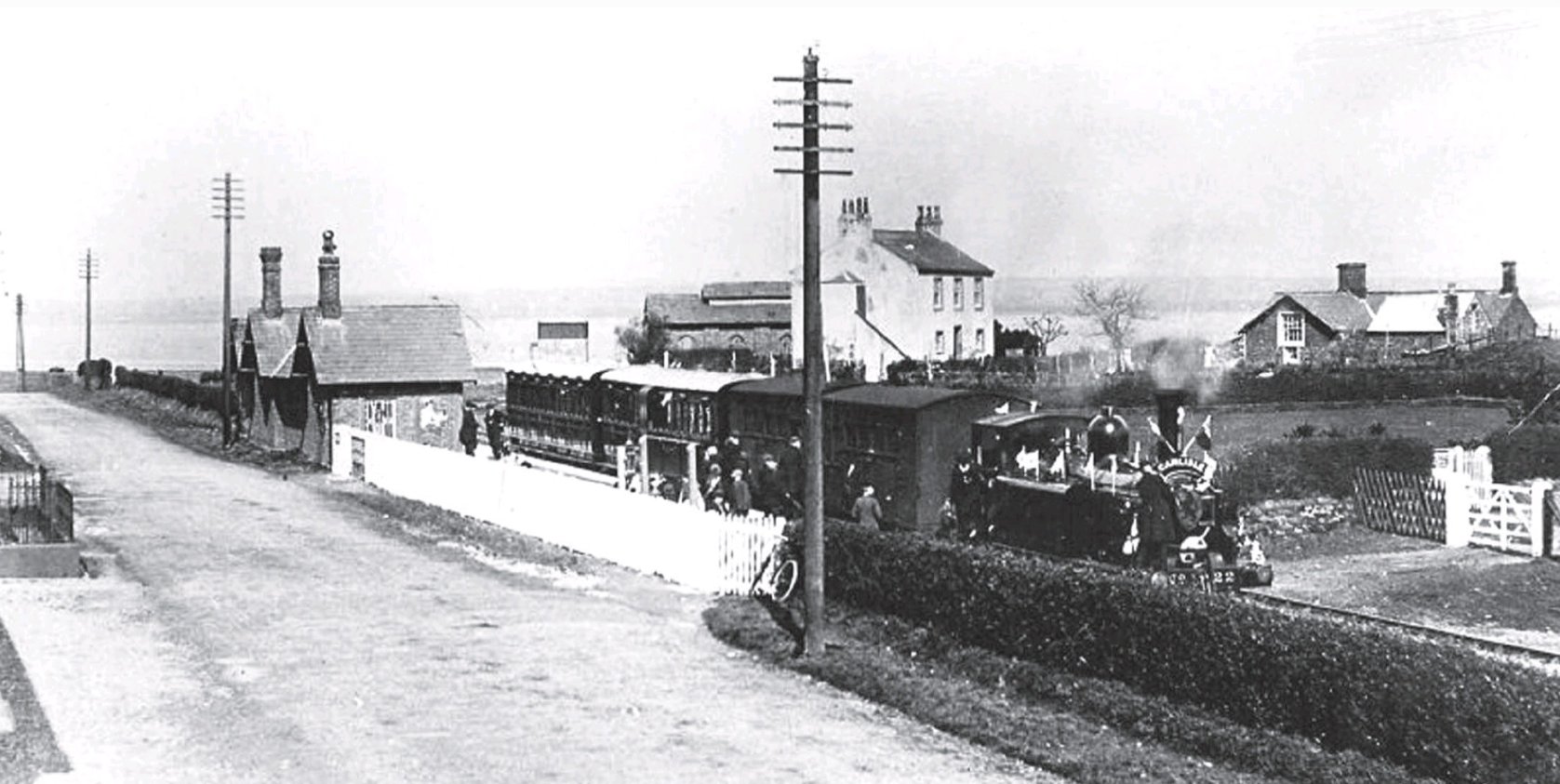
A panorama showing the whole of the Port Carlisle Railway Station, the bowling green and many of the properties that made up the village – and at the centre the horse-drawn Dandy! [11]The Dandy at Port Carlisle. Photographer unknown – Lancaster University Local History Resources for Schools. [8]The Dandy at Port Carlisle again. Photographer unknown – Lancaster University Local History Resources for Schools. [8]The Bygone Cumberland Facebook page carries this picture of the Dandy at Port Carlisle Railway Station in a prominent position. [9]A postcard image for sale on eBay in May 2022. [10]This image is valuable in that it shows that there were at least two Dandy carriages in use on the line. [12]Solway Past and Present says: “On April 4th 1914, the horse-drawn ‘Dandy’ coach made its last trip along the railway line to Port Carlisle. Two days later, steam locomotives were chuffing along the quiet country line for the first time in over fifty years.” [3]
The Carlisle to Port Carlisle Canal opened in 1823. It was approximately 11 miles long. It linked the city of Carlisle to the Solway Firth. [1]
Prior to the 16th century, coal from mines at Ellen Foot (now Maryport) was brought up river to Carlisle and other locations by boat. However, in 1720, duties began to be levied on all goods carried around the coast by sea.As a result, the local coal trade switched to land-based transport.
It took the actions of a small group of local traders to secure an Act of Parliament in 1721, which allowed coastal duties to be waived. While the Act enabled them to build wharves and warehouses and erect cranes, even allowing the dredging of the river and the charging of tolls (for 31 years), it did not permit them to improve the river in any way. [2]
The Canal was a long time in coming … a public meeting which sought its construction did not take place until 21st May 1807. “The principal aim was to provide the city with a better and cheaper supply of coal, and a committee was appointed to push the plan forwards. They asked the engineer William Chapman to advise them, and he proposed a route from Carlisle to Maryport, which he had also promoted in 1795 as part of a coast to coast route. He estimated that it would cost between £90,000 and £100,000 to build, but conceded that a terminus near Bowness on the Solway Firth would be cheaper. £40,000 would pay for a canal suitable for 45-ton boats, but a larger canal, suitable for 90-ton boats that could cross the Irish Sea or reach the Forth and Clyde Canal, would cost between £55,000 and £60,000. The larger canal could still be part of a coast to coast route. The options as to the size and destination of the canal were put to subscribers by the committee. In August 1807 Chapman suggested that a ship canal for the Irish, Scottish and Liverpool trade, and a 50-ton canal to Maryport for the coal trade could both be built, with both finding support in the newspapers.”[2][3: p337–339, 456]
With a range of options on the table, the Committee sought a second opinion from Thomas Telford. He produced a report on 6th February 1808.
Telford “described a Cumberland Canal, which would allow sea-going vessels to reach Carlisle, but would also be part of a grander plan to link Carlisle to other parts of the country, and could be incorporated into the coast to coast waterway. He suggested that locks should be at least as big as those on the Forth and Clyde Canal, with a width of 20 feet (6.1 m) and a depth of water of 8 feet (2.4 m) over the lock cills. His canal would leave the Solway Firth about 1 mile (1.6 km) upstream of Bowness-on-Solway to reach Carlisle, and would cost £109,393. In order to provide a water supply, a navigable feeder would continue onwards to Wigton, which would be suitable for 7-foot (2.1 m) wide narrow boats, and would cost an additional £38,139. He also quoted two other prices for narrower canals, but noted that these would require goods to be transferred to smaller boats, with the inherent costs and inconvenience.” [3: p339]
Sadly, no further progress was made at that time.
After a further eight and a half years, another meeting was held at Carlisle. The result of that meeting on 7th October 1817 was that Chapman was asked “to produce a survey for a canal suitable for vessels of at least 70 tons. He was to ensure that it could become part of the coast to coast link. His canal started at Fisher’s Cross, subsequently named Port Carlisle, … It would feature locks 74 by 17 feet (22.6 by 5.2 m), while the channel would be 50 feet (15 m) wide by 8 feet (2.4 m) deep, and would cost £75,392. A link to Newcastle-upon-Tyne could be built on a smaller scale, and another link could be built along the valley of the Eden to serve slate quarries near Ullswater. His plan was accepted, money was raised locally, and an Act of Parliament was obtained in 1819, which authorised the Carlisle Canal to raise £80,000 in capital, and an extra £40,000 if required. The chairman of the committee, Dr John Heysham, suggested they look at other canals before starting work, and visits were made to the Lancaster Canal and the Forth and Clyde Canal. [2][3: p339-340]
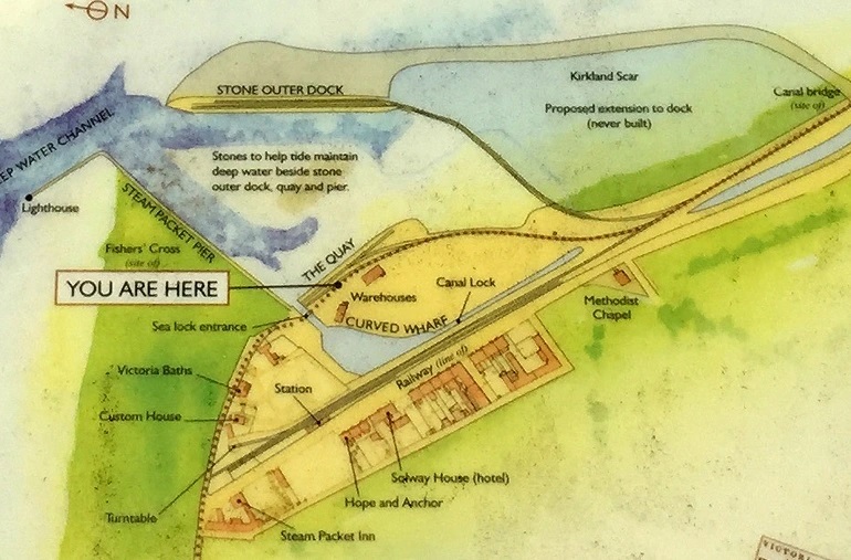
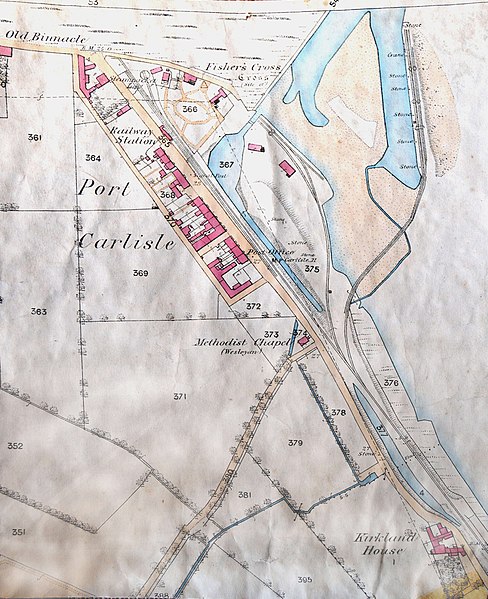
Contracts to build the entire canal were awarded by early 1820. The Canal opened in March 1823. It was “11.25 miles (18.11 km) long, had a surface width of 54 feet (16 m) and was 8 feet (2.4 m) deep. At Fisher’s Cross, a basin 250 by 80 feet (76 by 24 m) had been built, which was connected to the Solway Firth by a sea lock with a long timber jetty. Seven more locks raised the level of the canal by 46 feet (14 m), and at Carlisle there was a second basin, 450 by 100 feet (137 by 30 m), complete with wharves and a warehouse. The locks were 78 feet (24 m) long and 18.5 feet (5.6 m) wide, and water supply was provided by a reservoir on Mill Beck near Grindale.” [2][4: p128]
The cost of construction was just over the estimated £80,000. [2][3: p341]
In 1825 the Carlisle & Liverpool Steam Navigation Company paid for the construction of an exclusive berth at Port Carlisle. The Canal Cpany purchased their own packet boat to transport passenger from Port Carlisle to Carlisle. Both passenger services commenced in 1826. Goods carried from Liverpool to Port Carlisle were carried along the canal by lighters. The Solway Hotel opened in Port Carlisle soon afterwards. [2][3: p341-342]
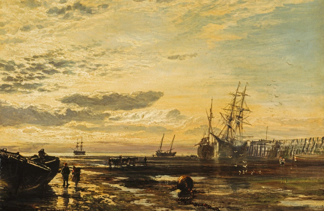
“The Solway at Port Carlisle” (1859) by Samuel Bough (1822 – 1878), National Galleries Scotland. Use permitted under a Creative Commons Licence. [34]
Times were beginning to change. … In “August 1824, there were public meetings in Newcastle, to consider again the idea of a canal to Carlisle, or possibly a railway. William Chapman, who had surveyed a route for a canal in 1796, suggested that the route was also suitable for a railway, and was asked to cost both options. He quoted £888,000 for a canal and £252,488 for a railway. A company was created to build a railway, although they did not obtain an Act of Parliament until 1829. There was support in Carlisle, and an agreement was reached that the railway would terminate at the canal basin.” [2][3: p342-343]
The opening of the railway to Newcastle in the 1830s brought a significant upturn in profits on the canal. Its imminent arrival resulted in another shipowner starting a service between Carlisle, Annan and Liverpool.
“However, the boom did not last long, and the company found that it was in competition with the railways. The Lancaster and Carlisle Railway was authorised in 1844, and was a direct threat to the steamer service and canal. The Maryport and Carlisle Railway had been authorised in 1837, but opening was delayed until 1845 by financial difficulties. It was extended to Whitehaven in early 1847 by the opening of the Whitehaven Junction Railway, and at the end of the year the Lancaster and Carlisle Railway opened. The Caledonian Railway opened in February 1848, running northwards from Carlisle to Scotland.” [2][3: p345-346]
“In March 1852, the company decided that the best option was to convert the canal into a railway, raised some money from shareholders and loan holders, and sought an Act of Parliament. Work began in June 1853, although the Act was not obtained until 3 August. An omnibus service was used to ferry passengers between Carlisle and the steamers at Port Carlisle, and the canal closed on 1 August 1853.” [2][3: p347-348].
The Act both wound up the canal company and created the Port Carlisle Dock and Railway Company. Further details about the history of the Canal can be found here [35]
Construction was completed within a year and opened to goods traffic on 12 May 1854 and passengers on 22 June. [2]
The Port Carlisle Railway Company had filled in the canal basin at Carlisle and built sidings and a passenger terminal there. Passenger services between Port Carlisle and Carlisle were short-lived. Two years later the line from Carlisle to Silloth opened. The through passenger service to Port Carlisle was replaced by a horse-worked service between Drumburgh and Port Carlisle. This horse-drawn service lasted until 1914 when it was replaced by steam-power. In due course a steam railmotor service was introduced which lasted until the branch closed in 1932. [2][5]
The Route of the Line
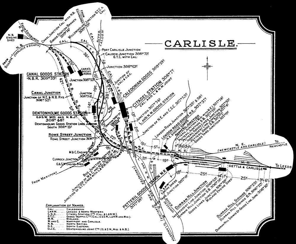
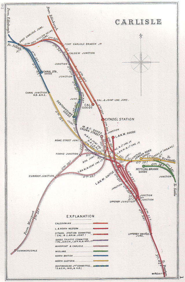
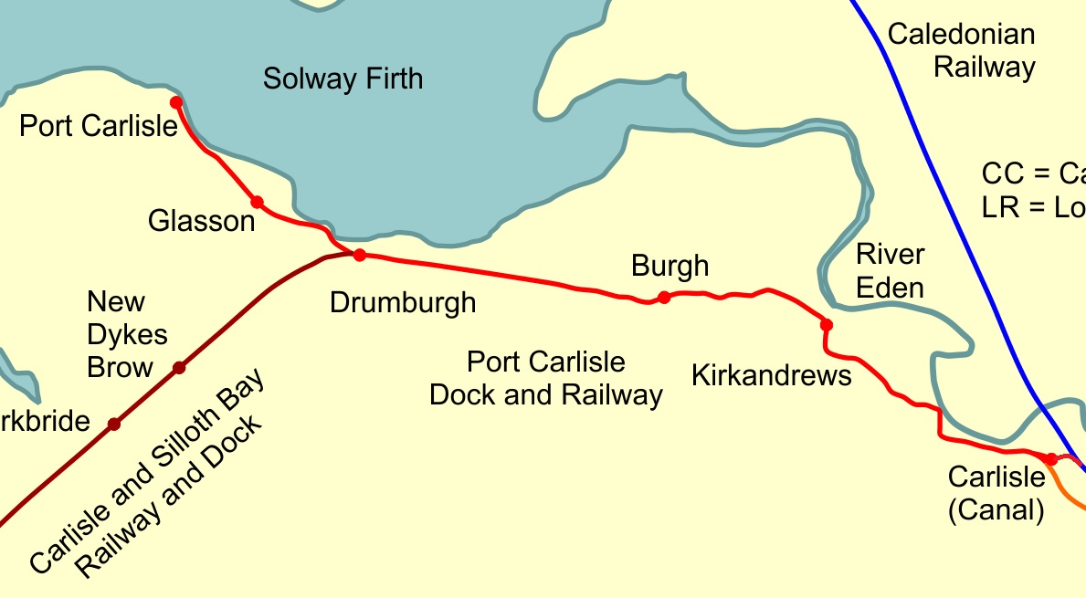
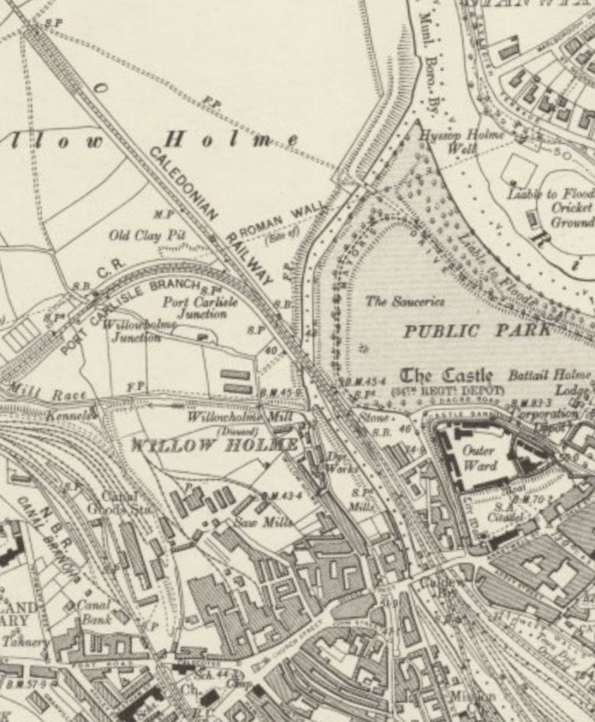
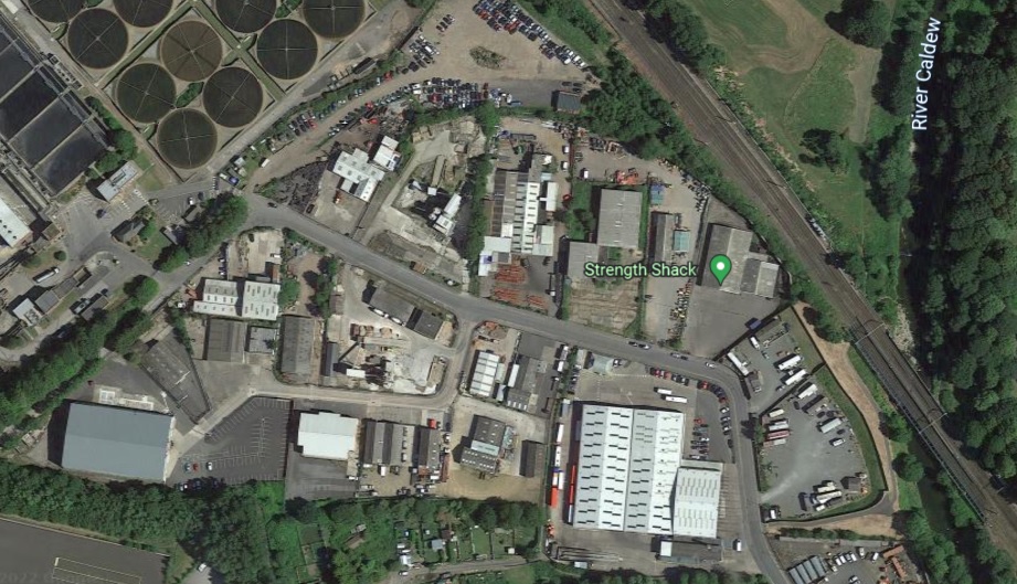
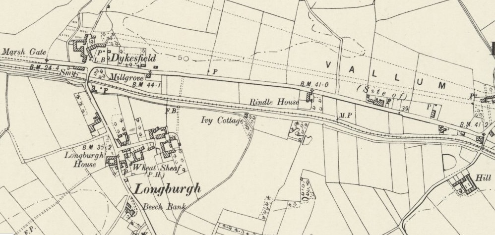
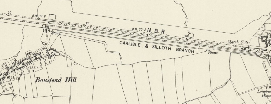
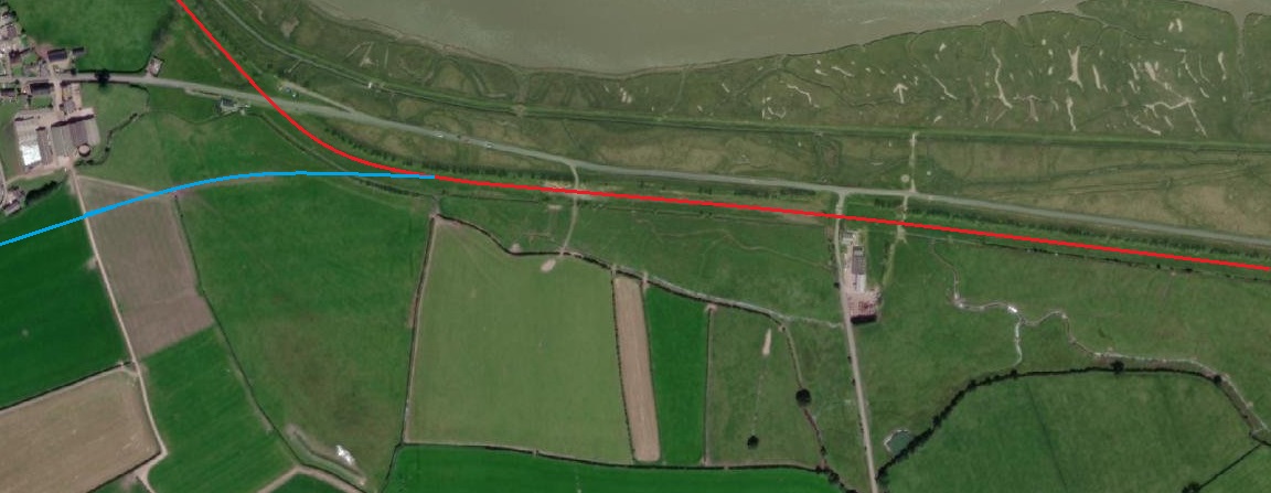
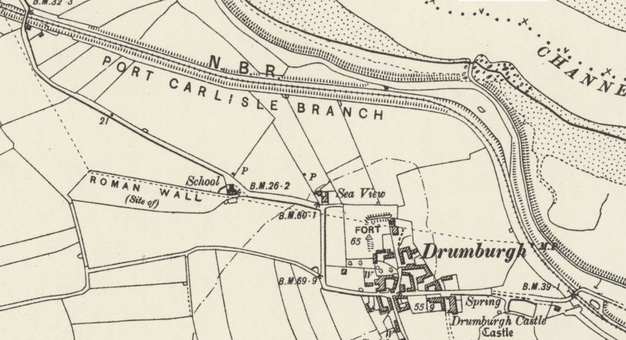
The rail network in Carlisle in 1914 as drawn by the Midland Railway. The Port Carlisle line left the Caledonian main line at Port Carlisle Junction (top left of this drawing), passed through Canal Junction and then set off West just South of the North British Railway Engine Shed shown in the far top left of the drawing. [36]Wikiwand comments: “Port Carlisle Junction was a railway junction between the lines of the former Caledonian Railway and North British Railway companies lines to the north of Carlisle Citadel station in, what is now, Cumbria, England. It opened in July 1863. Port Carlisle Junction railway station was a very short lived station that first came into use in July 1863 and there was some untimetabled use until 29 October 1863, but the station closed as early as 1 July 1864. After closure, the up (northbound) platform was retained for use by those crews requiring change and also for passing messages on to crews.” [37][38: p78][39: p80][40: p16]The route of the Port Carlisle Railway. [44]
The Port Carlisle Branch left the main Caledonian Railway line at Port Carlisle Junction, which was just to the North of the River Caldew, and curved way to the Southwest.
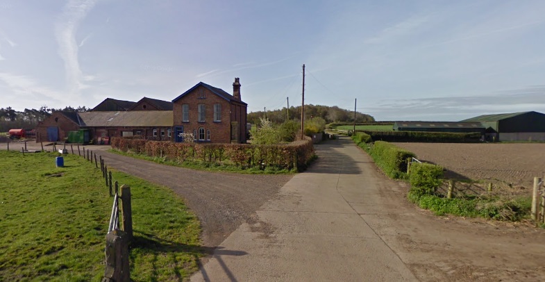
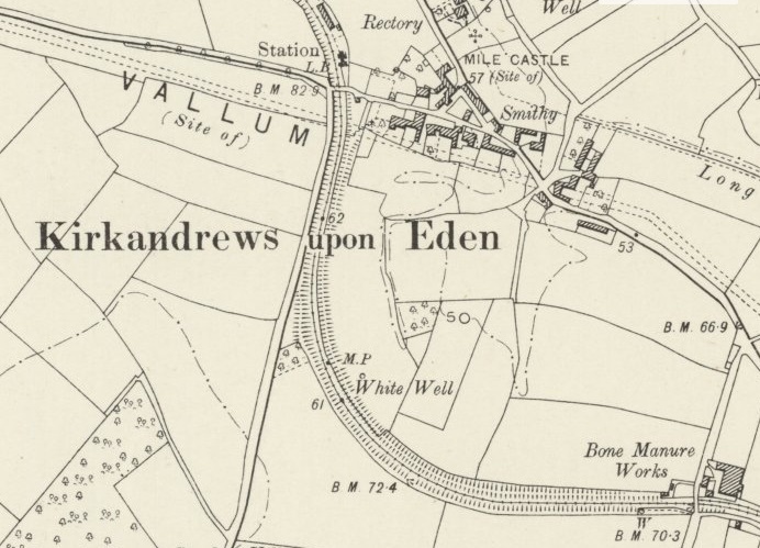
Wikipedia tells us that Kirkandrews-upon-Eden railway station “sat close to the village in the cut of the old canal; it had a single platform, and a shelter. … A substantial station building was present. A large seed warehouse was located at the station. In common with other stations on the line, it had its name picked out in sea shells on a raised area opposite the station building.” [14][15]
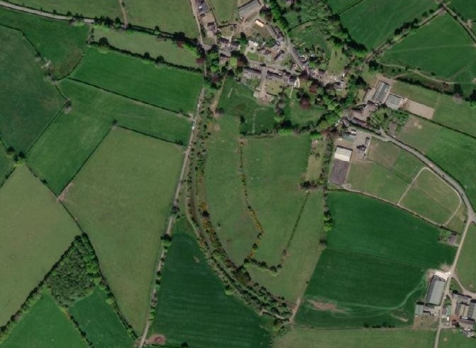
Continuing on from Kirkandrews the old line curved round to the Northwest. As can be seen on the next extract from the 6″ OS Maps of 1901, there are a couple of things which show that the old railway line followed the Carlisle Canal along most of its length.
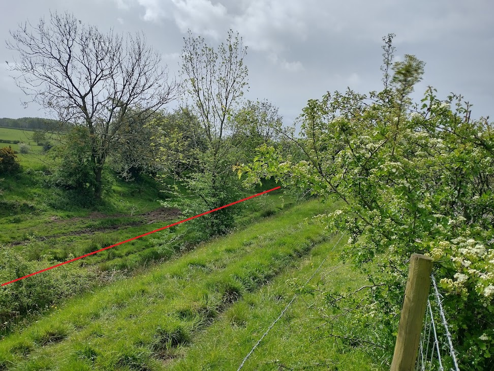
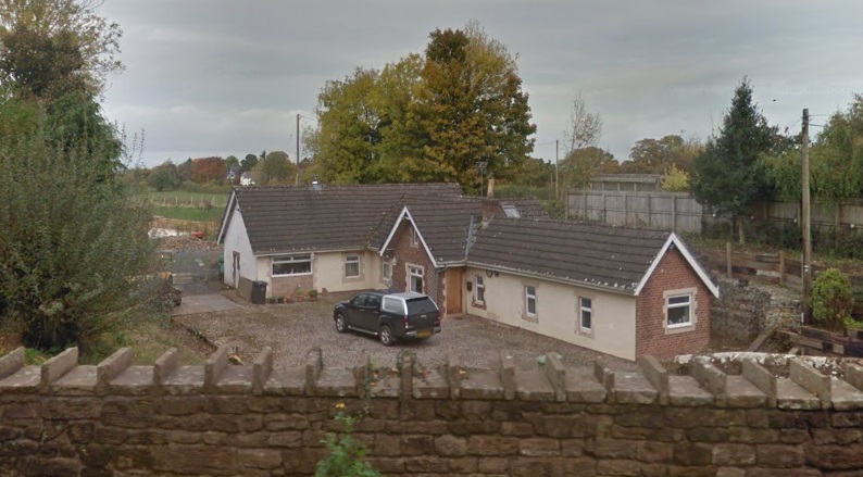
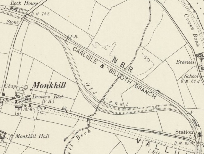
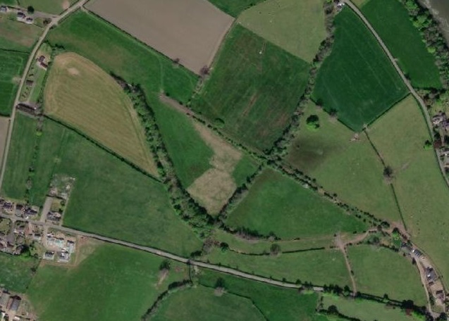
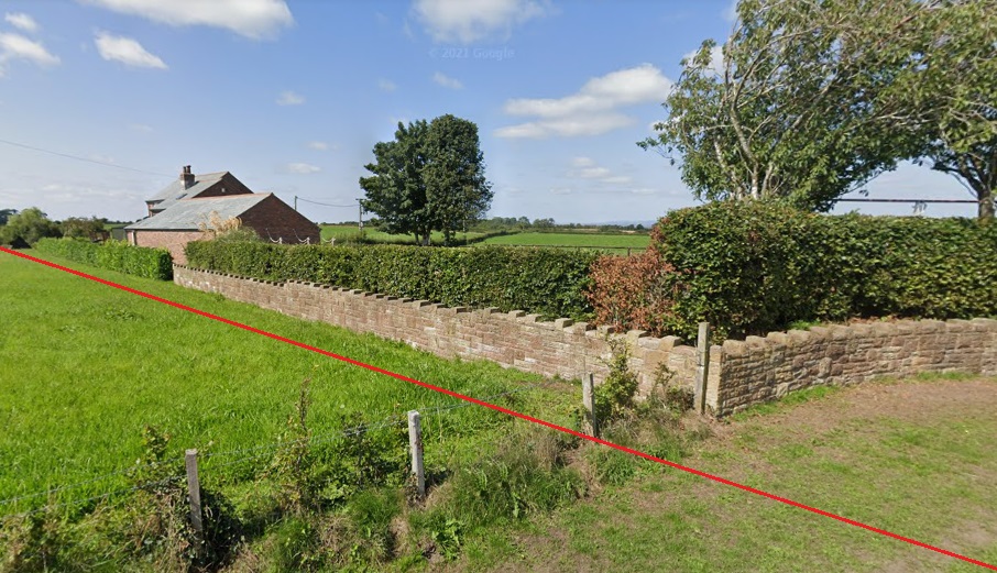
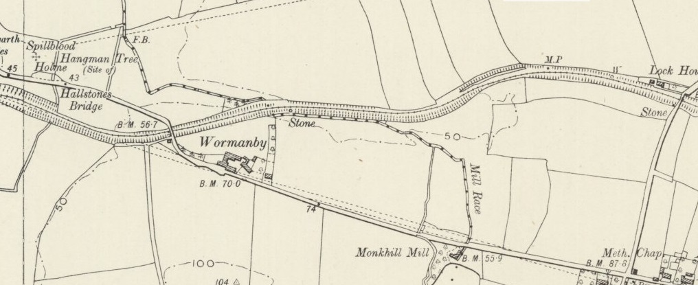
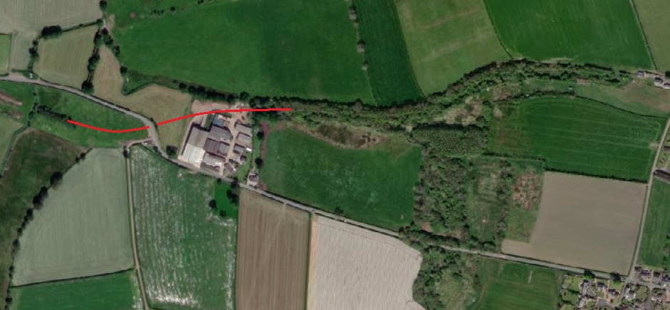
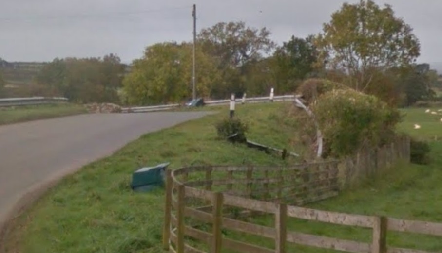
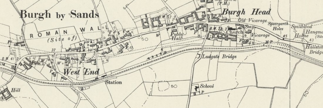
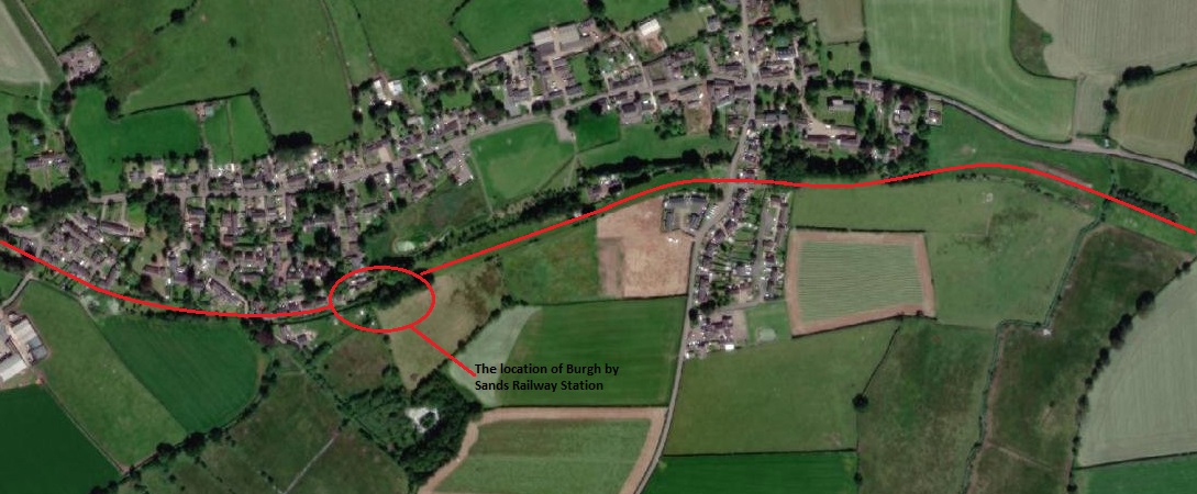
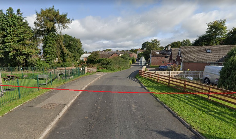
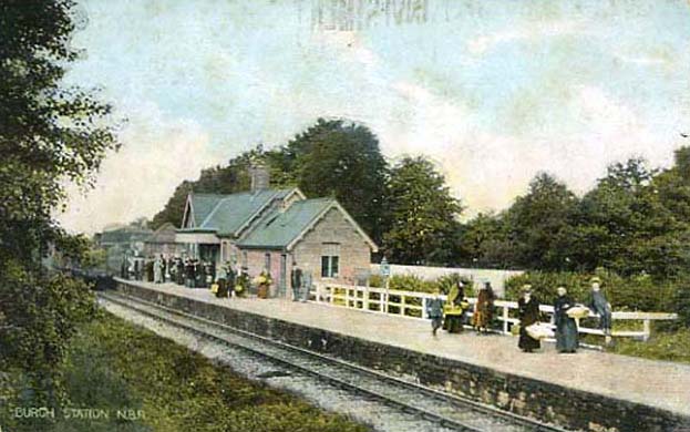
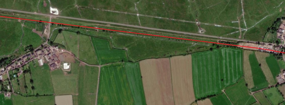
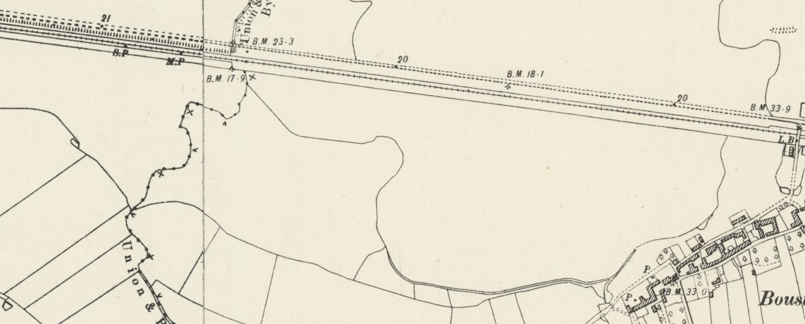
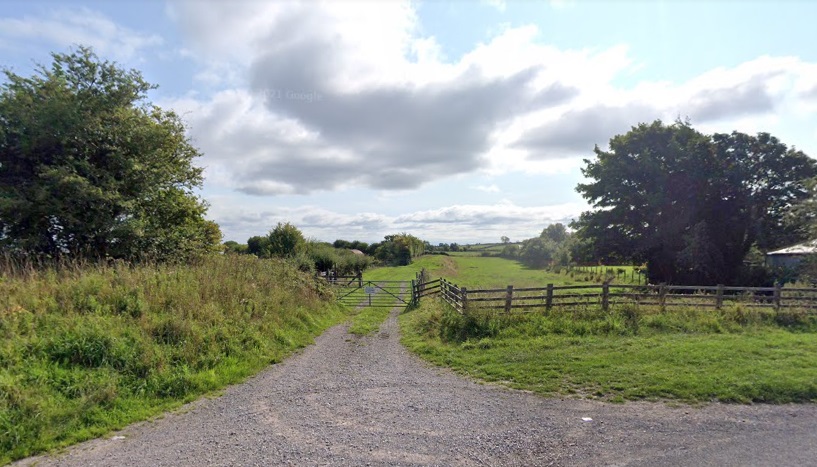
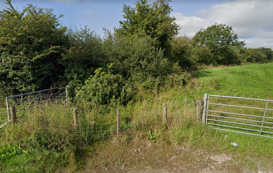
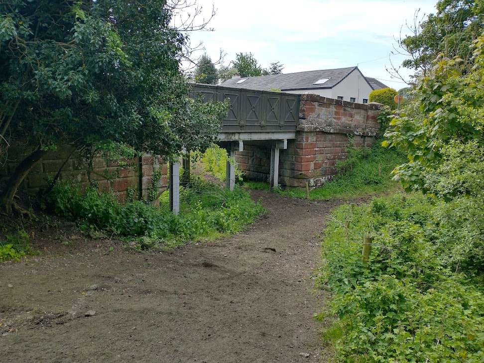
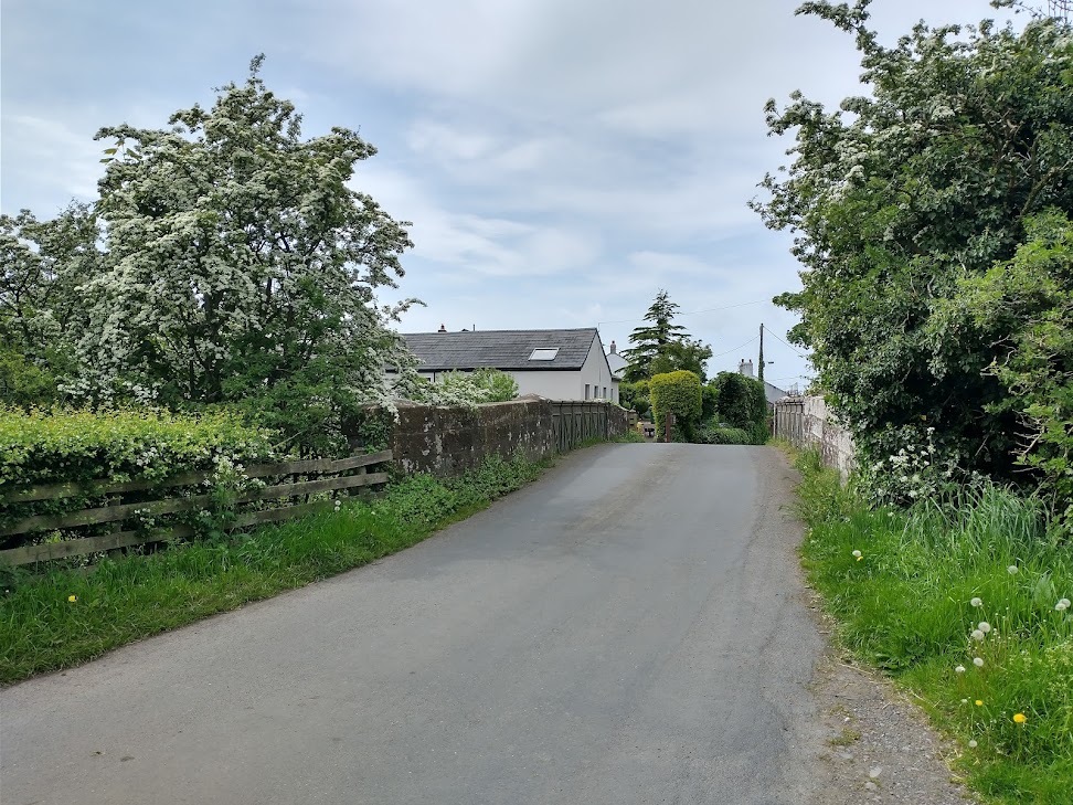
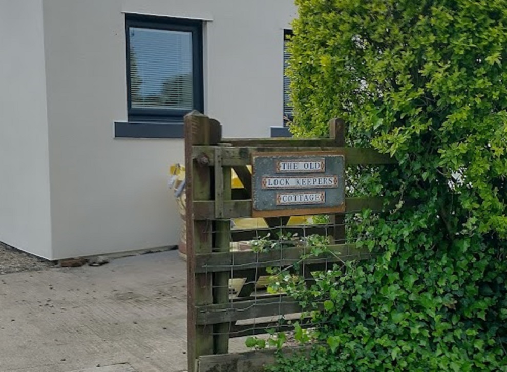
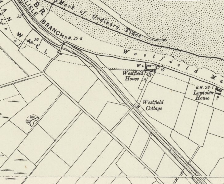
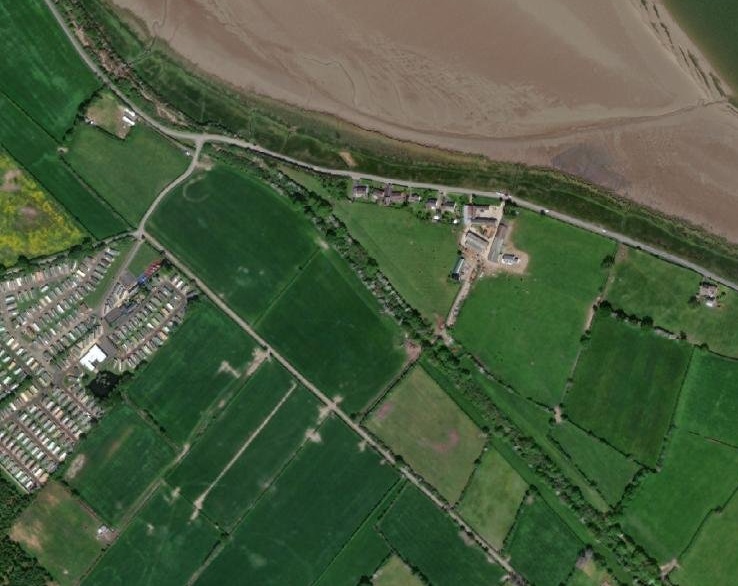
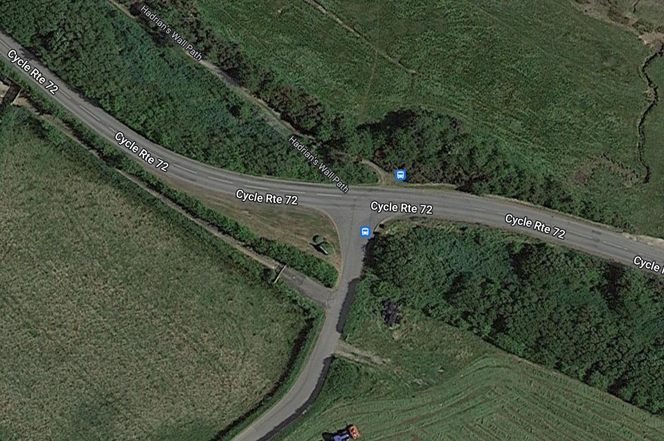
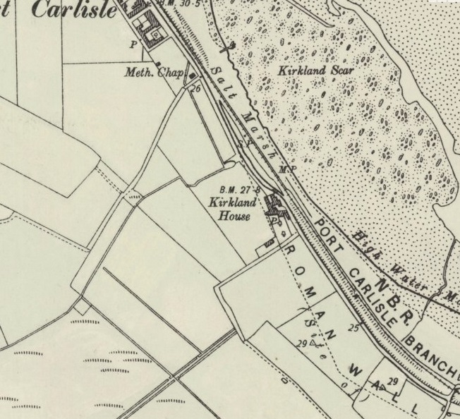
Northwest of Kirkandrews Station the railway and the older canal diverge for a short distance. This is one of a few locations along the line to Port Carlisle where the historic route of the canal was in evidence on the ground after the construction of the railway. North of Monkhill was further evidence of the old canal – a lock keeper’s cottage remained alongside the railway where it passed under the lane between Monkhill and Beaumont. [16]On the modern satellite imagery, the routes of the old railway and the earlier canal are still very much in evidence. [16]The site of the old lock-keeper’s cottage seen from the Monkhill to Beaumont road. The alignment of both the railway and the canal are represented by the red line. The lock house remains in private hands, extended and refurbished. [Google Streetview – August 2021]The generally East-West direction of the line continues towards Burgh Head, both canal and railway following the same alignment. At Wormanby the road to Port Carlisle crossed the line again by means of an overbridge – Hallstones Bridge. [17]On modern satellite imagery the majority of the old line’s route is clear from the alignment of field boundaries and the presence of trees. At Hallstone’s Bridge the road alignment remains as it was when the railway was active, the bridge has gone and the land either side of the road has been regraded. [17]The location of Hallstone’s Bridge at Wormanby. Remais of the retaining walls supporting the road embankment approaching the bridge can still be seen on the right of this picture. [Google Streetview, October 2016]The view West from just to the North of Hallstone’s Bridge with the line of the old railway indicated by the red line. The trees on the line sit on a low embankment which has not yet been regraded as of May 2022. [Google Streetview, October 2016]The railway ran along the South side of Burgh Head and Burgh by Sands, passing under Ludgate Bridge and then through Burgh by Sands Railway Station and then under another two bridges at the West end of Burgh by Sands. [18] The route of the line is again picked out in red on this modern satellite image. [18]The location of Ludgate Bridge with the approximate line of the old railway shown in red. [Google Streetview]Burgh by Sands Station Building in 2022. The picture is taken looking East from Station Road which is an un-adopted highway. The station platform and tracks were to the right of the building. [My photograph, 14th May 2022]Burgh by Sands Railway Station in 1903. The postcard view looks from the Southeast. [18]
Burgh-by-Sands Railway Station looking West along the platform. [48]This monochrome image looks from the Southwest and shows the Station Buildings to good effect. [18]
Wikipedia tells us that Burgh-by-Sands station “sat close the village, reached by Station Road that branched off the mainstreet; it had a single platform, a shelter and a signal box. … A substantial station building was present, together with a station master’s house.” [19]
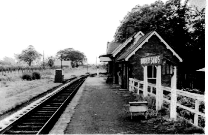
Burgh-by-Sands Station. Viewed from beyond the station looking eastward, towards Carlisle. The line and station closed completely on 7/9/64, Note that in this image a short siding is shown at the near end of the station platform, on the North side of the line, serving a loading bay. (c) Ben Brooksbank. Creative Commons Attribution Share-alike license 2.0 (CC BY-SA 2.0) [19]These houses on Southfield stand on the line of the old railway to the West of the station building which is behind the camera. [My photograph, 14th May 2022]The line of the railway where it passed under Lawrence Lane. Just to the north of the line Lawrence Lane now becomes a private driveway. [Google Maps]Lawrence Lane looking towards the old line which would have been just round the corner ahead. [My photograph]The final bridge in Burgh-by-Sands can be seen looking South along the Thurstonfield, Great Orton Road from the Main road through the village. [Google Streetview]This view is taken from the Southern end of the bridge. The bridge is typical of a number on the route with decorative metal parapets and stone abutments. [My photograph, 14th May 2022]This picture was taken through vegetation from an unmetalled lane on the Southwest side of the old railway line. The bridge has been strengthened by steel column supports at the third-points of the span and longitudinal steel joists. [My photograph, 14th May 2022]A similar view from the Southeast. [My photograph, 14th May 2022]Looking east over the decorative bridge parapet towards Burgh-by-Sands Station. [My photograph, 14th May 2022]Looking West along the old line from the same location. [My photograph, 14th May 2022]The train from Carlisle to Silloth leaves Burgh-by-Sands behind J39 64895 in June 1960. (c) Brian Irwin. [13]This next length of the line takes us from Burgh-by-Sands to Dykesfield and just out onto the Marsh. [20]The approximate line of the old railway is again marked on the modern satellite image with a red line. Over this length the canal and railway followed the same alignment. The bridge at Dykesfield still remains. [20]The bridge at Dykesfield (West Green Bridge) from the South. [My photograph, 14th May 2022]The bridge at Dykesfield (West Green Bridge) from the North. [My photograph, 14th May 2022]The bridge remains acting as a bridge by strengthened in the same way as the bridge at the West end of Burgh. [My photograph, 14th May 2022]
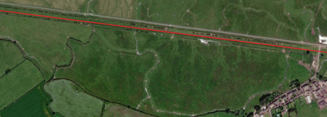
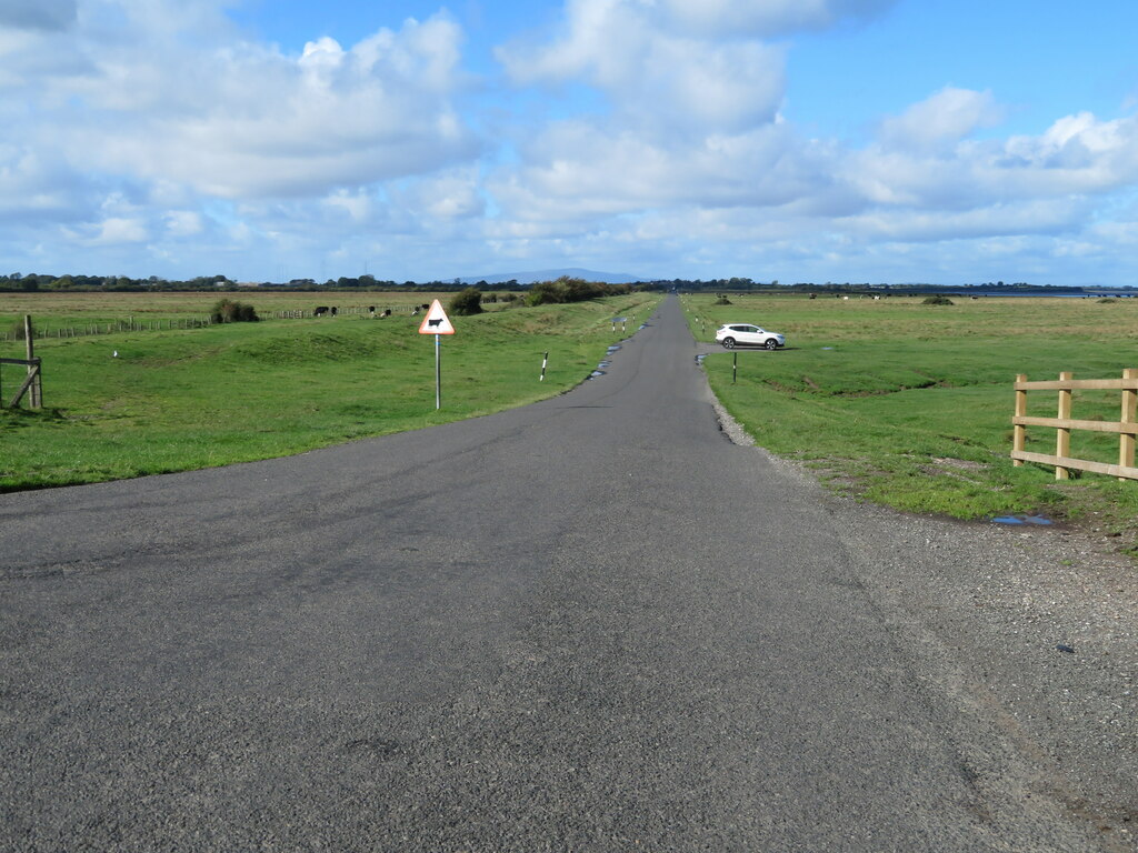
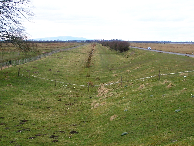
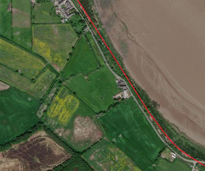
After passing through Dykesfield the railway broke out onto the marshes on the South side of the Solway Firth. A long straight stretch of line carried trains on to Drumburgh. The picture immediately below gives an impression of the lay of the land and shows that the railway was indeed built within the old canal.
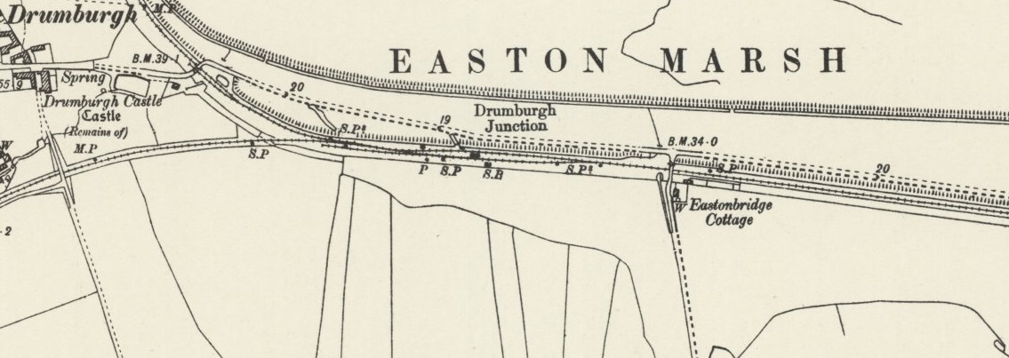
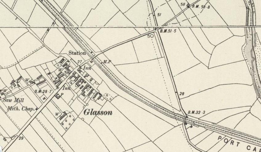
Wikipedia informs us that Drumburgh Railway Station “was the junction station for the Port Carlisle Railway branch and the Silloth branch, serving both as a junction and transfer station and also serving the small village of Drumburgh. The station closed on 4 July 1955; nothing now remains of the station. The line to Silloth closed on 7 September 1964 as part of the Beeching cuts. Port Carlisle was two and a half miles away by train and Glasson was one and a quarter miles away. The journey time was nine minutes, although Glasson was a request stop.” [27][28] The service to Port Carlisle was horse-powered.
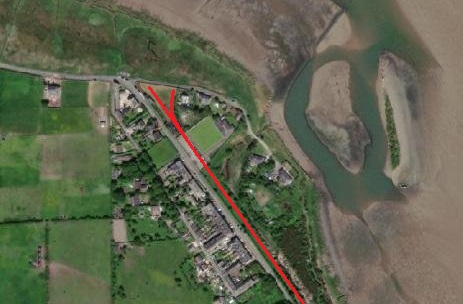
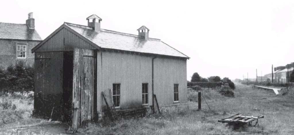
Griffiths and Hooper tell us that Port Carlisle had two locomotive sheds: “Firstly, a 32ft x 14ft one-road dead-end building, in brick with a tiled, pitched roof and having a central smoke vent, was erected to the east of Port Carlisle station. It stood at right angles to the station and could only be entered via 24ft turntable accessed by an approach spur; a water tank stood near the depot but it is not known what facilities were available for coal.” [45]
Once the steam-hauled service was replaced by the horde-drawn Dandy it seems as though “the engine shed remained in situ – assumedly it was utilised for stabling the horses and possibly also to shelter the small tramcars, but that needs confirmation.” [45]
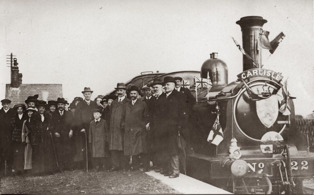
A steam hauled service was reinstated on “6th April 1914 when an inaugural passenger train was run from Port Carlisle to the city of Carlisle … behind a North British Railway Drummond ‘165’ class 0-6-0T, No. 22, that engine having been taken off its previous regular duty on the Langholm branch to run the passenger service from Port Carlisle. However, less than three years after the upgrade of Port Carlisle passenger services World War I brought an economy measure whereby the branch closed to all traffic from 1 January 1917 and until reopened from 1 February 1919.” [45]
Griffiths and Hooper believe that the second engine shed we built not long after 1914, when a locomotive-hauled service was reinstated “or it may have appeared with the post-war reopening. It was a single road through building in wood on dwarf brick walls and with a pitched tiled roof, scaling 34ft x 16ft. It was positioned over the approach spur south of the turntable, which then, or earlier, had been reduced in size to 16ft diameter. Being of such modest dimensions it was realistically of little use anyway so it probably did not matter that engines had to pass through the shed to access the ‘table.” [45]
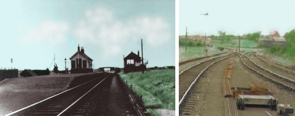
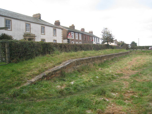
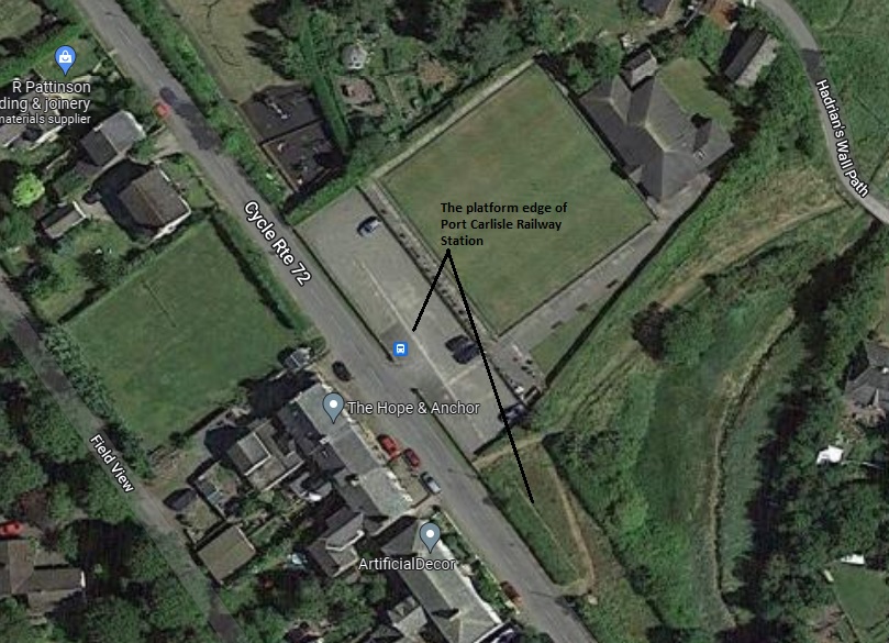
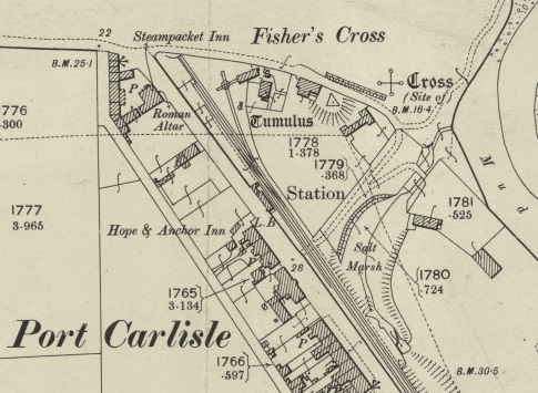
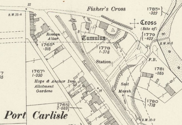
The 25″ OS Map series from the turn of the 20th century shows the first engine shed on a spur off to the side of the mainlines and accessed only via a small turntable. [46]The 1925 edition of the 25″ OS Maps show the replacement engine shed. [47]Port Carlisle’s second engine shed. This view looks back down the branch towards Carlisle and was taken after the closure of the line. The platform face of the station is visible on the right of this image. [45]
Charles Hadfield, Gordon Biddle; The Canals of North West England, Vol 2 (pp.241-496); David and Charles, Devon, 1970.
Sir Alec Skempton, et al.; A Biographical Dictionary of Civil Engineers in Great Britain and Ireland: Vol 1: 1500 to 1830; Thomas Telford, London, 2002.


