Category Archives: Uganda and Kenya Railways

Various posts about railways in East Africa

The Uganda Railway – Part 9 – Naivasha to Nakuru

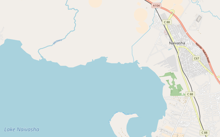
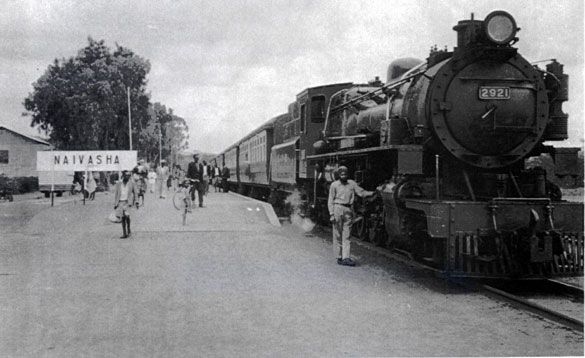
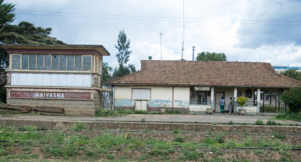
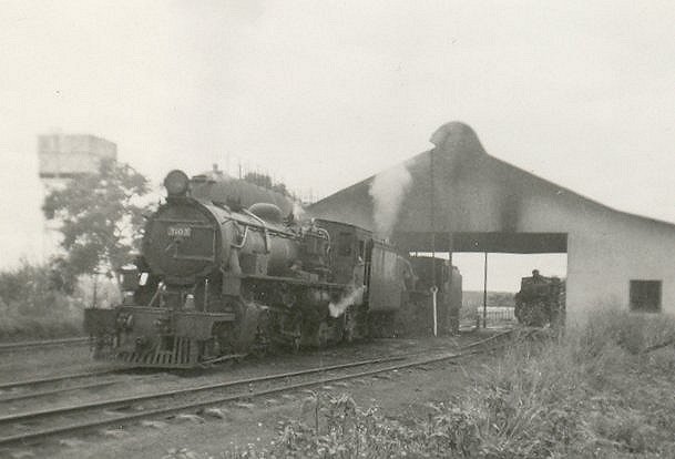
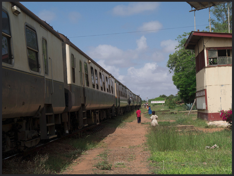
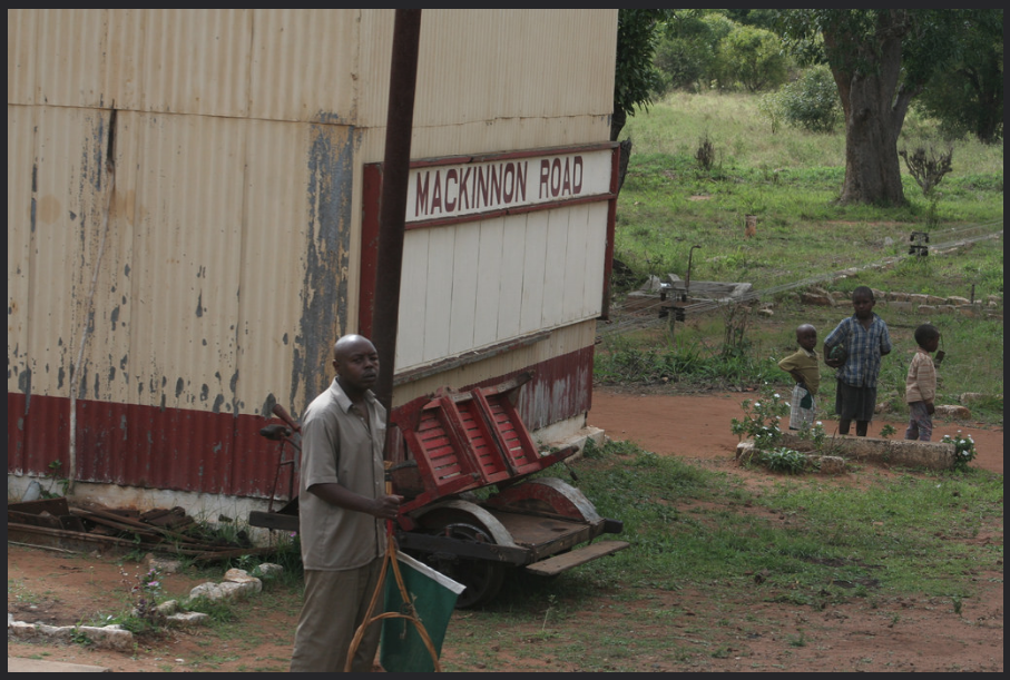
We start the next leg of the journey at Naivasha Railway Station. 
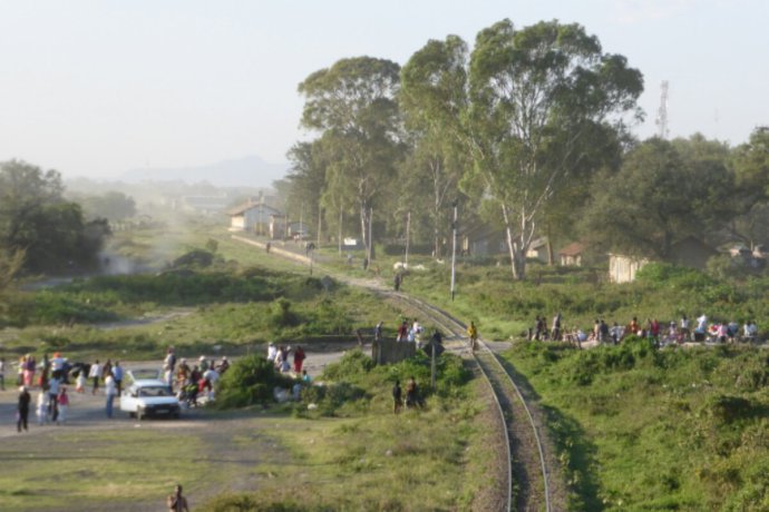
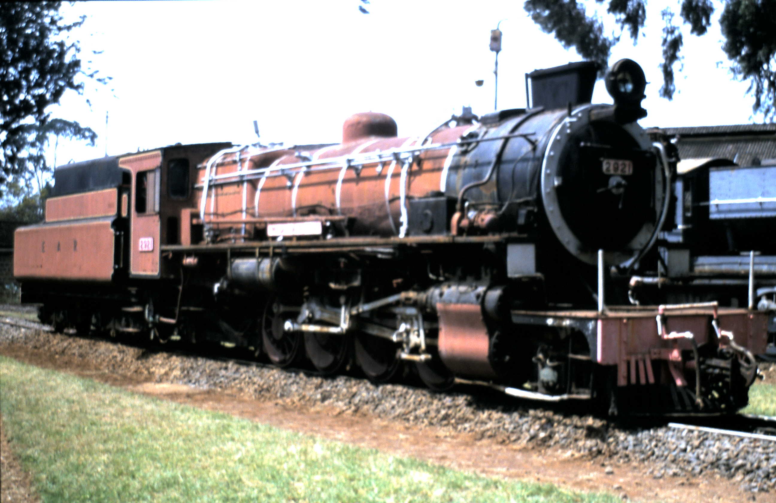
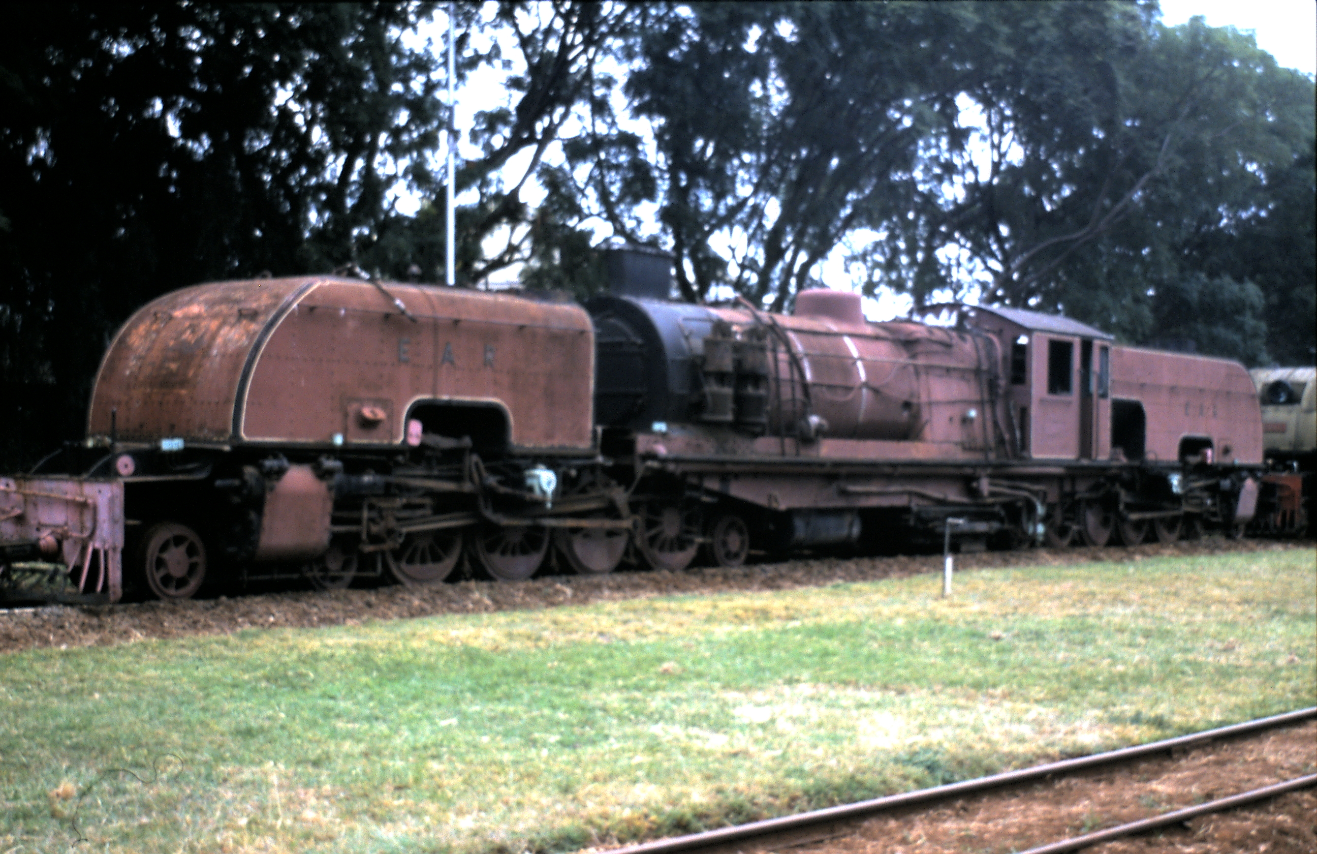
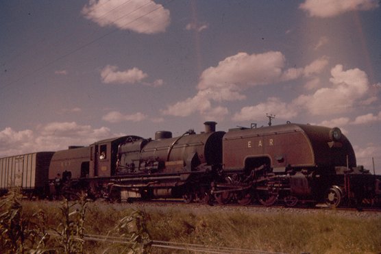
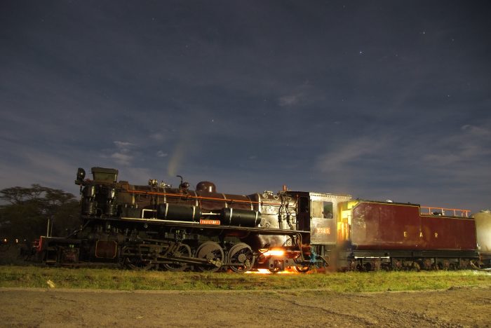
Class 30 2-8-4 No. 3020 “Nyaturu” (NBL 27466/1955) stands at Naivasha, it is one of three locomotives restored by Nairobi Railway Museum and was originally in use on the Tanzanian part of the EAR system (c) James Waite. [1]
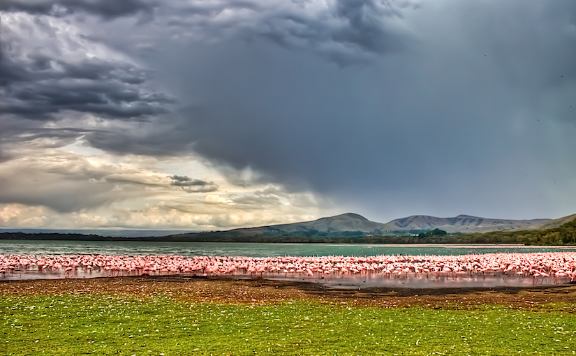
As we leave Naivasha, the railway continues in a north-westerly direction through Morendat Station, over Morendat River Bridge and through Ilkek Station to Gilgil. 
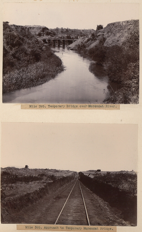
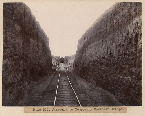
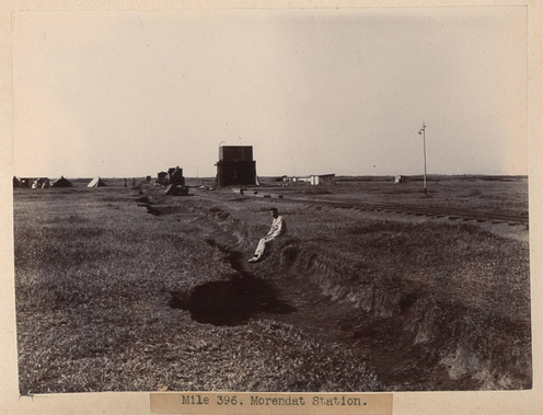
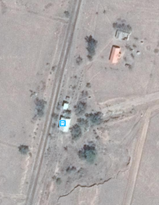
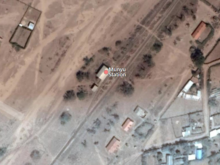
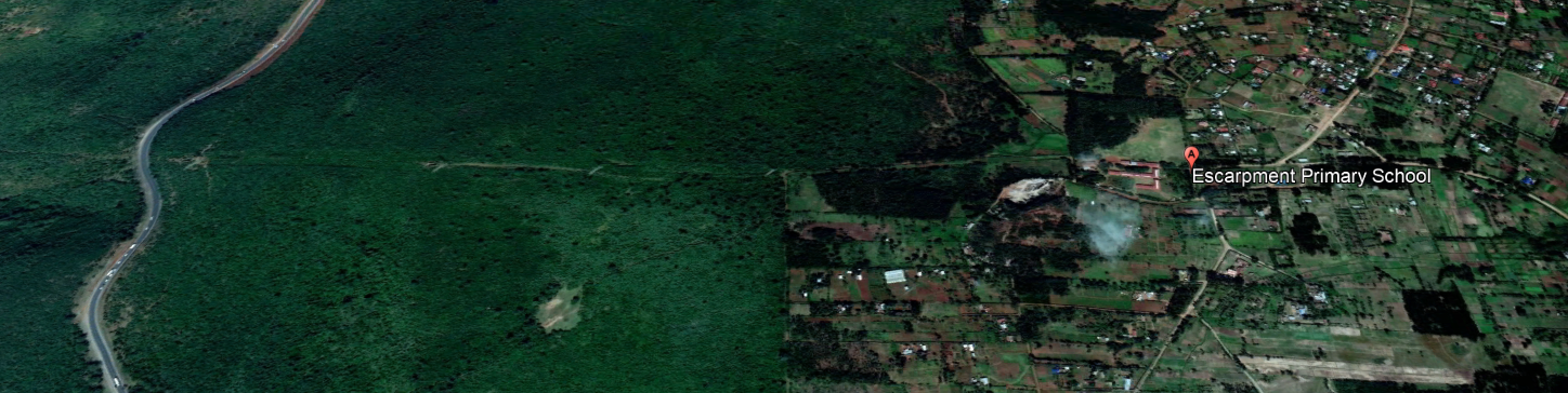
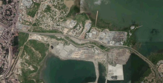
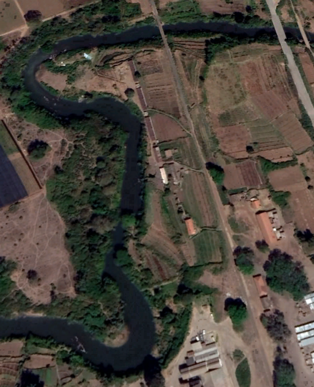
Morendat Station and River Bridge on Google Satellite Image.
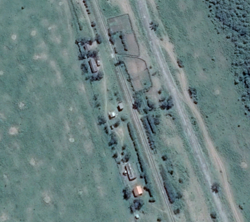
Ilkek Station.

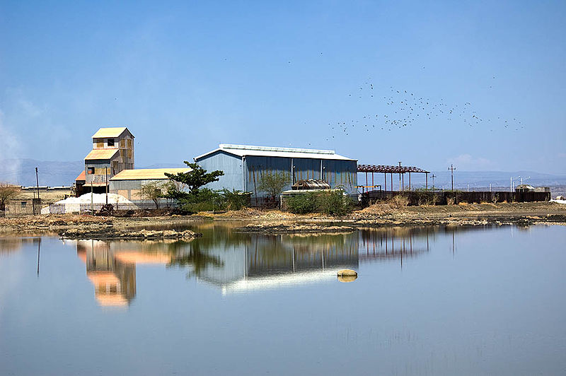
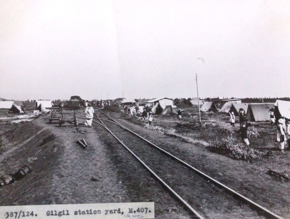
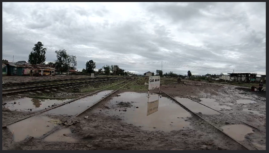
Gilgil is the first town after Naivasha along the line.
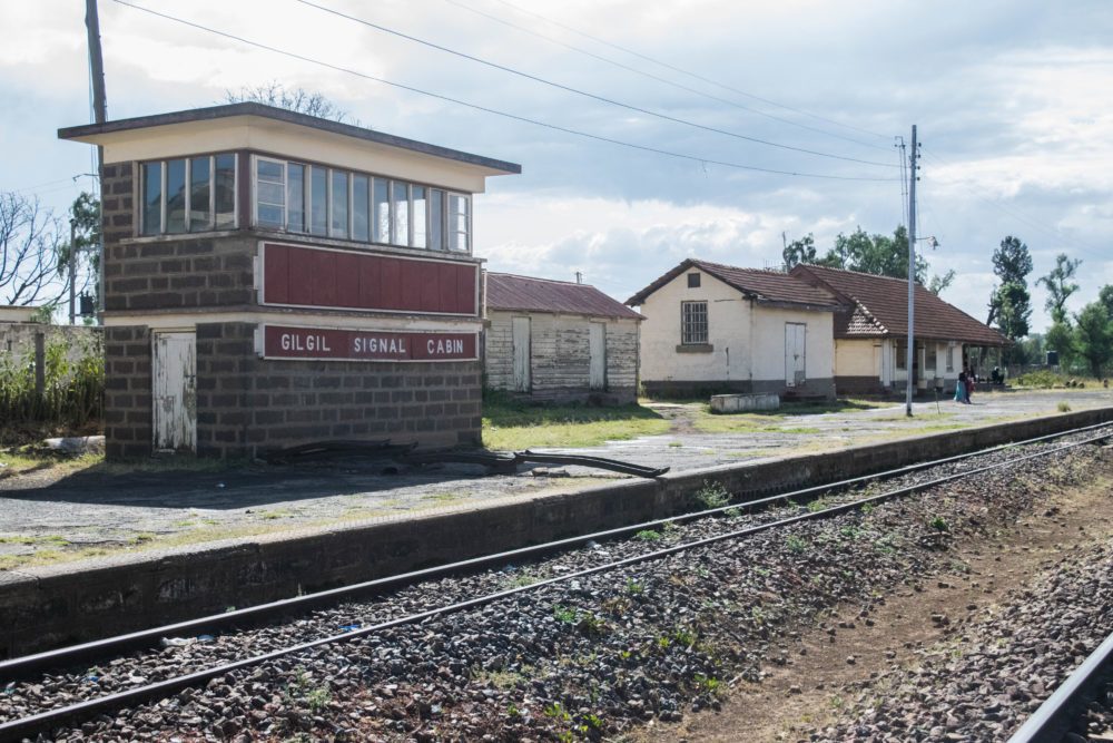
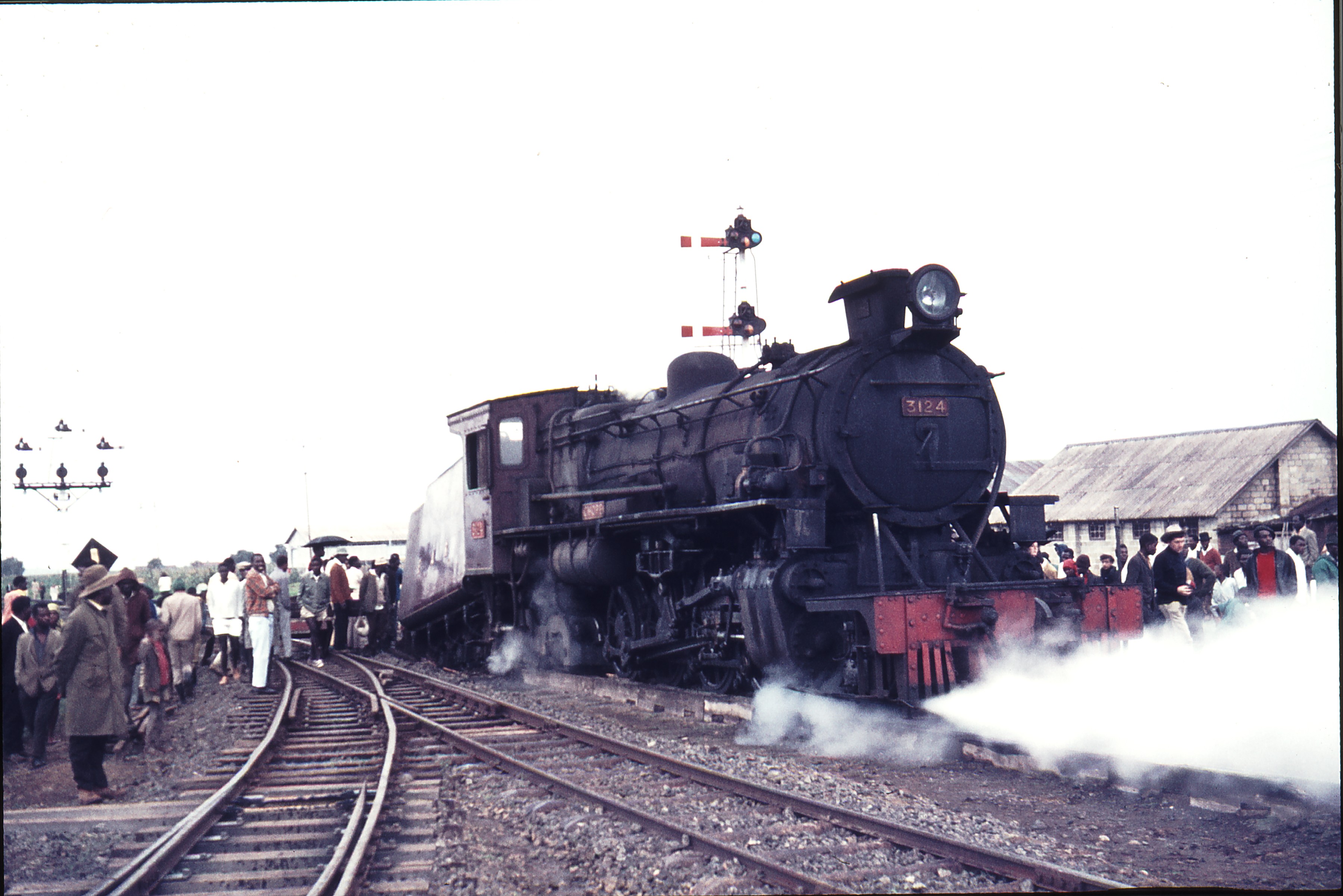
111464: Gilgil Kenya 3124 Chope Derailed – taken on 24th August 1971, (c) Weston Langford.[2] 
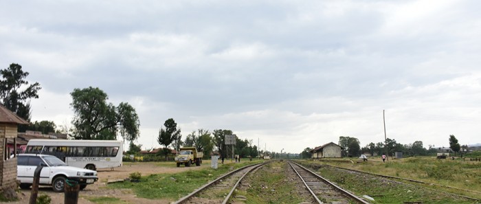
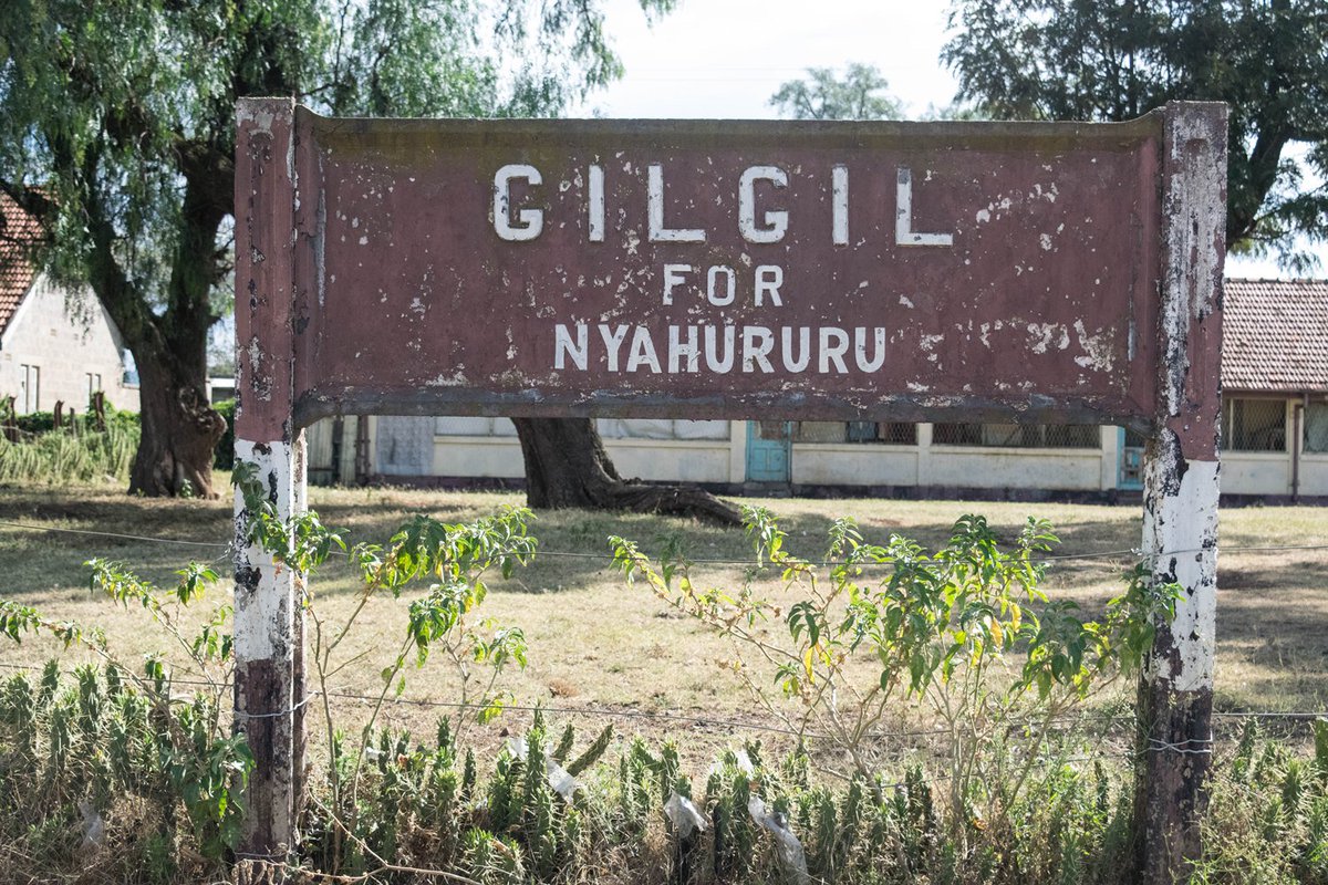
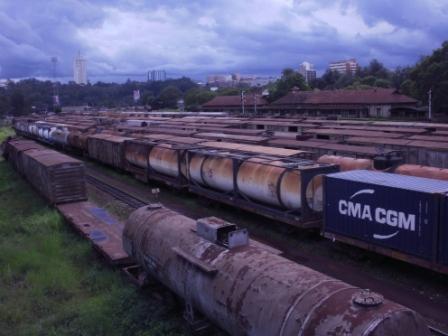
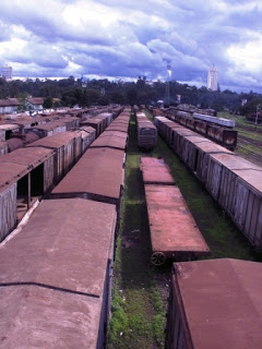
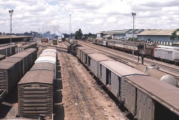
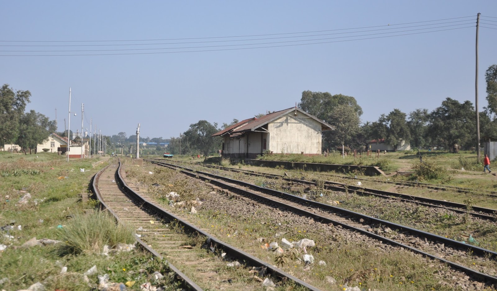
Three images of Gilgil Station seemingly abandonned in 2013 …….[3],[4],[5]
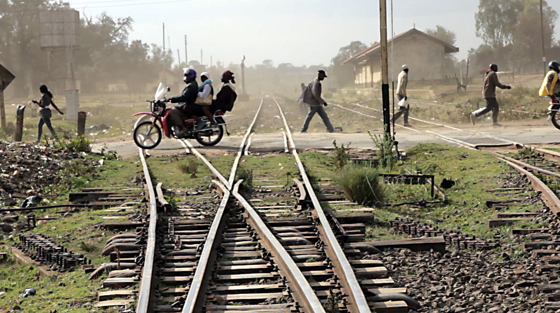
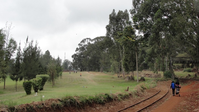
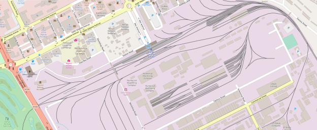
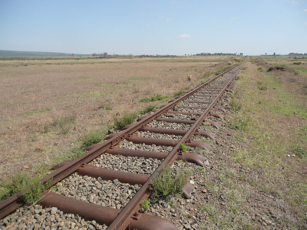
Gilgil was the junction station for the line to Nyahururu. This branch ran through Oleolondo and Ol Kalou to reach Nyahururu, the branch terminus. It left the mainline just to the East of Gilgil and followed what is now the C77 road from Gilgil. The line snaked around passing through Gilgil Golf Course and can be seen alongside the 4th hole of the 9-hole course in the image below.[6]
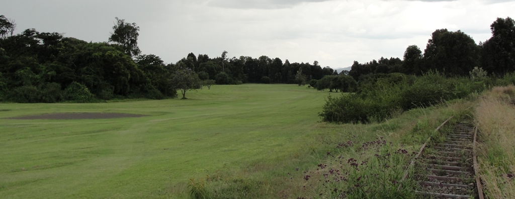
After the golf course the line swung away from the C77 to the south-east and then for a very short distance ran alongside what is now the D390 before turning to the north and eventually regaining a path  a 100 metres or a bit more to the east of the C&7 running north towards Oleolondo where the line crossed the road at grade. It conitnued to follow the C77 northwards but now on its west side until reaching a station halt at Ol Kalou.

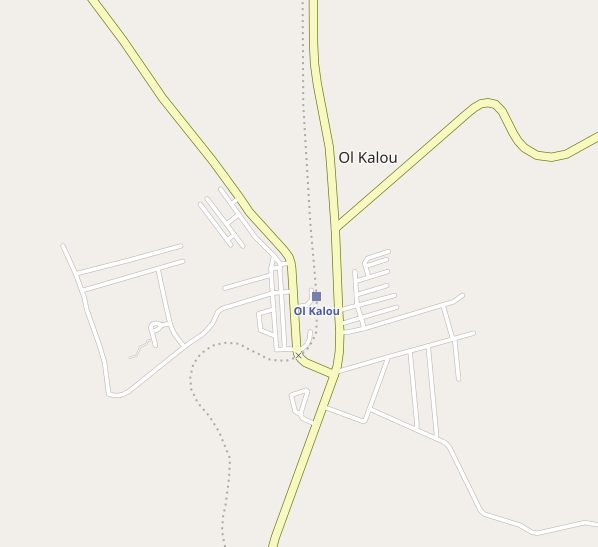
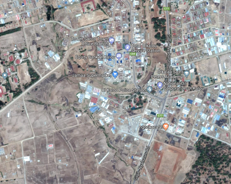
The old station site at Ol Kalou remains open and undeveloped as can be seen on the adjacent satellite images from Google Earth.

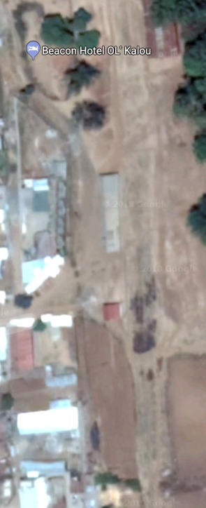
From Ol Kalou the abandonned line continued north alongside the C77, always within about 100 metres of it and then crossing over to the east side of the road a kilometre or two north of Ol Kalou before reaching its terminus at Nyahururu.

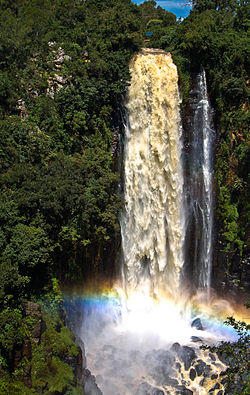
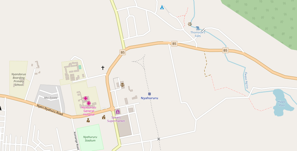
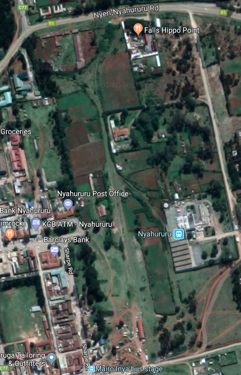
In the images above the tourist attraction which probably supported the branch-line while it was in operation can be seen – the Thompson Falls gave their name to the town in colonial times. Nyahururu was founded as Thomson’s Falls after the 243 ft (74m) high Thomson’s Falls on Ewaso Narok river, a tributary of the Ewaso Nyiro River, which drains from the Aberdare mountain ranges. It is on the Junction of Ol Kalou-Rumuruti road and the Nyeri-Nakuru road.

The town grew around a railway from Gilgil opened in 1929 (and now effectively abandoned). As well as providing access to a tourist attraction the line supported local industry. The town was once an important player in the timber milling industry, and the now defunct National Pencil Company had a factory there. It is also an important milk processing hub.[7]

The map and satellite image show the location of the railway terminus and the turning triangle for locomotives.

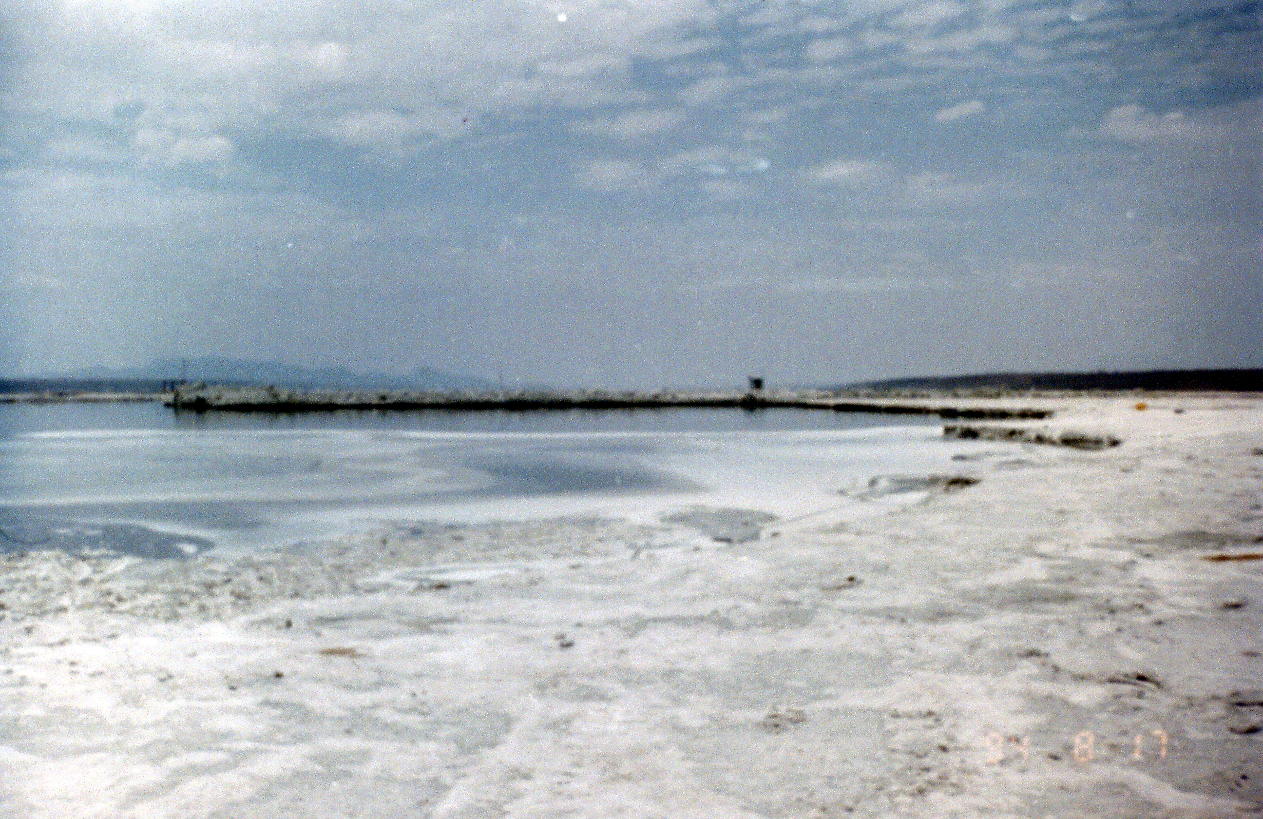
We return now to the mainline and travel on from Gilgil. The next station on the mainline is Kariandusi.
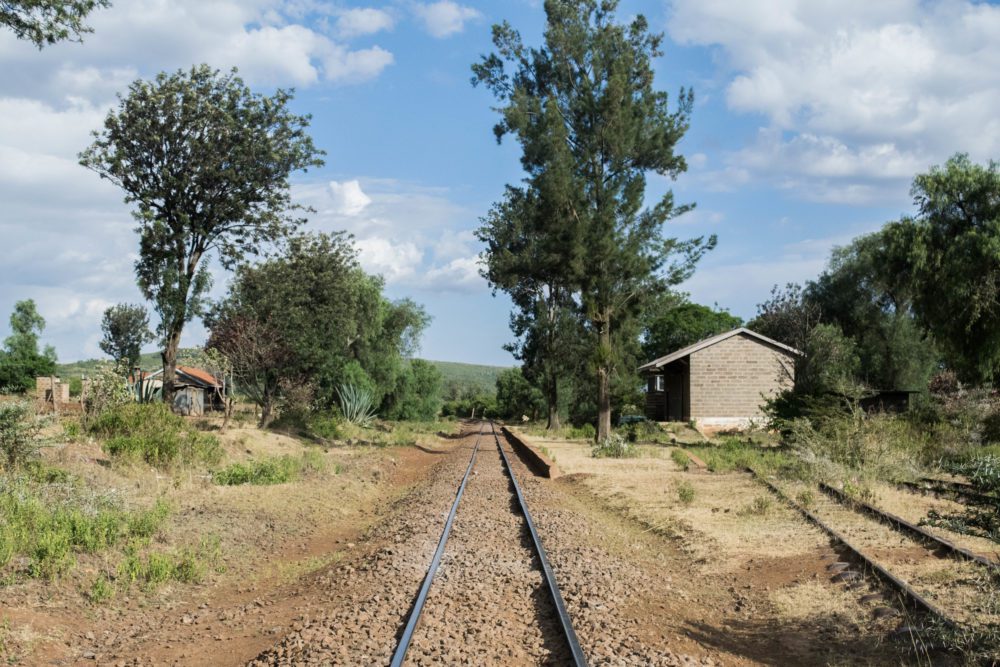
Kariandusi village is a settlement in Nakuru County, Kenya. It is located 17.5 miles from Nakuru town and 7.5 miles from Gilgil town. Inhabitants of Kariandusi settled in the area in early 1980s in the former Lord Egerton Cole and Lord Delamere ranches. The area has a well established tourism industry, with Kariandusi prehistoric site, Lake Elementaita, Several Hot Springs and booming hospitality industry providing the economic growth for the area.[8] It sits close to the lake and under the significant local peak know as Table Mountain.

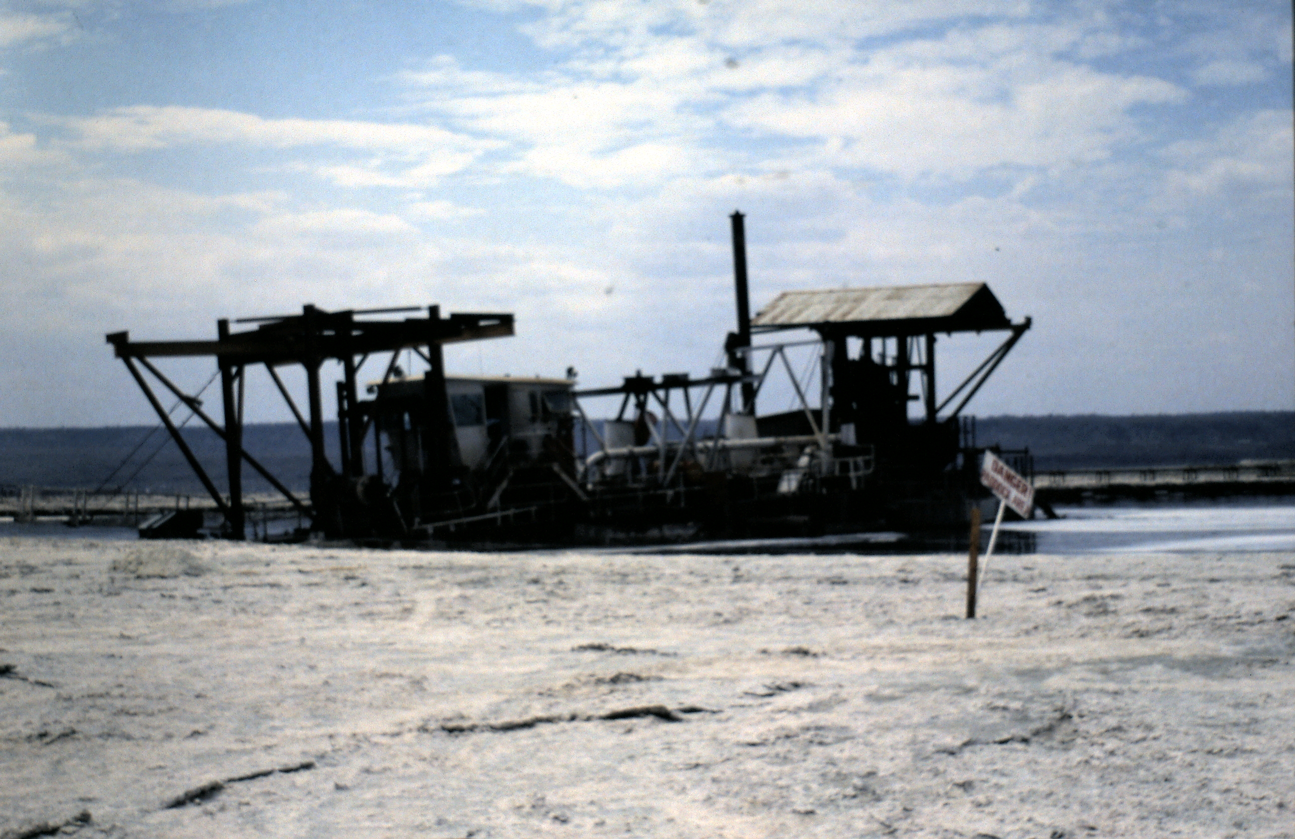
The prehistoric site is amongst the first discoveries of Lower Paleolithic sites in East Africa. There is enough geological evidence to show that in the past, large lakes, sometimes reaching levels hundreds of meters higher than the Present Lake Nakuru and Elementaita, occupied this basin.

Dating back between 700,000 to 1 million years old, Kariandusi is possibly the first Acheulian site to have been found in Situ in East Africa. Dr. Leakey, a renowned paleontologist, believed that this was a factory site of the Acheulian period. He made this conclusion after numerous collections of specimens were found lying in the Kariandusi riverbed.

This living site of he hand-axe man, was discovered in 1928. A rise in the Lake level drove pre-historic men from their lake-side home and buried all the tools and weapons which they left behind in a hurry. The Acheulian stage of the great hand-axe culture, to which this site belongs, is found over a very widespread area from England, France, and Southwest Europe generally to Cape Town.[9]

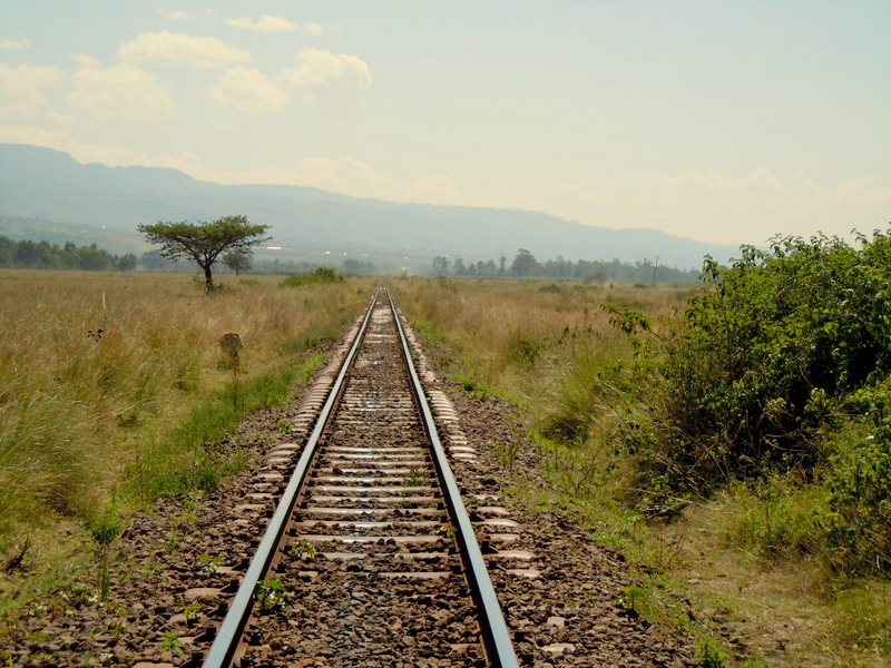
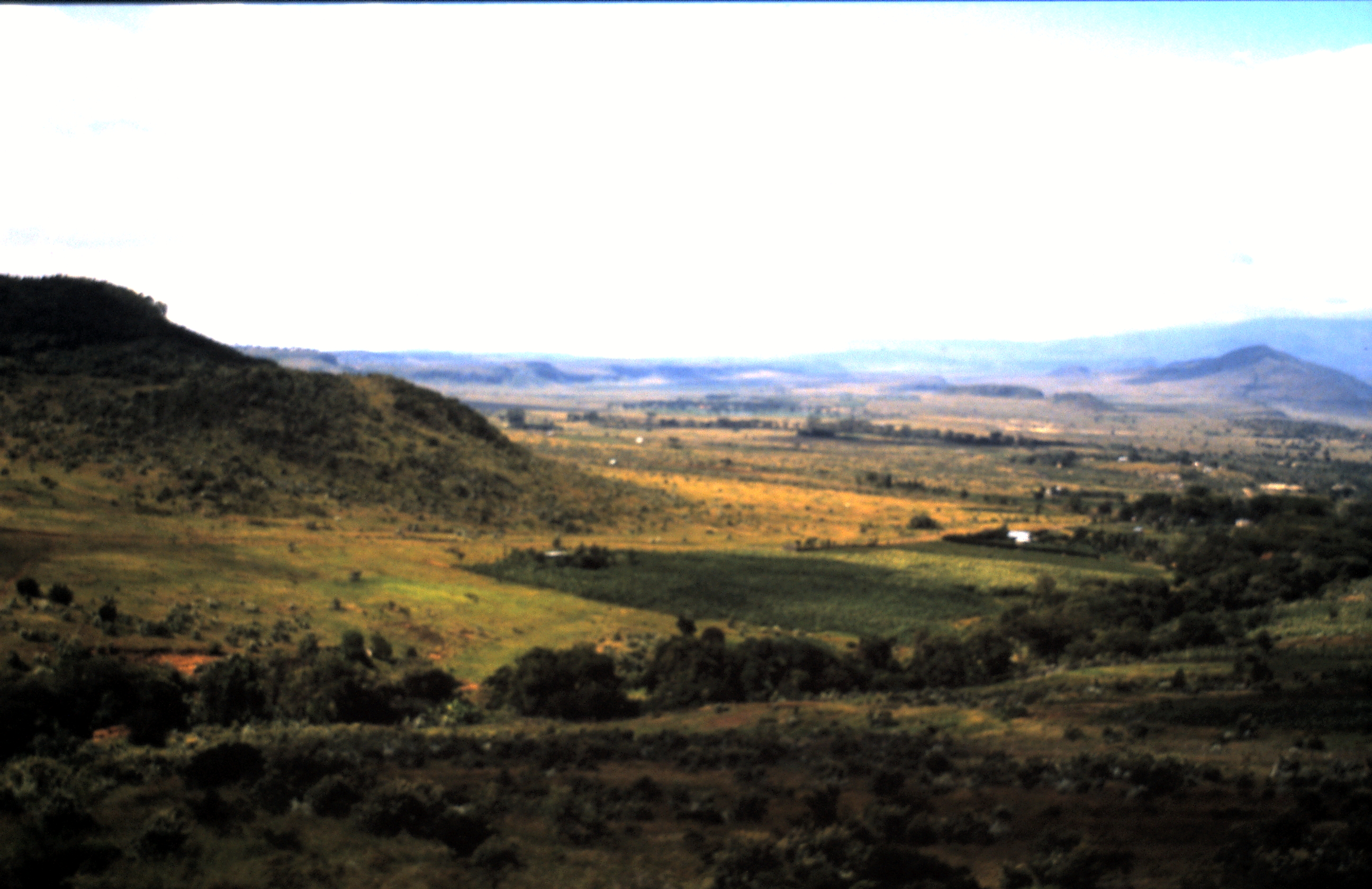
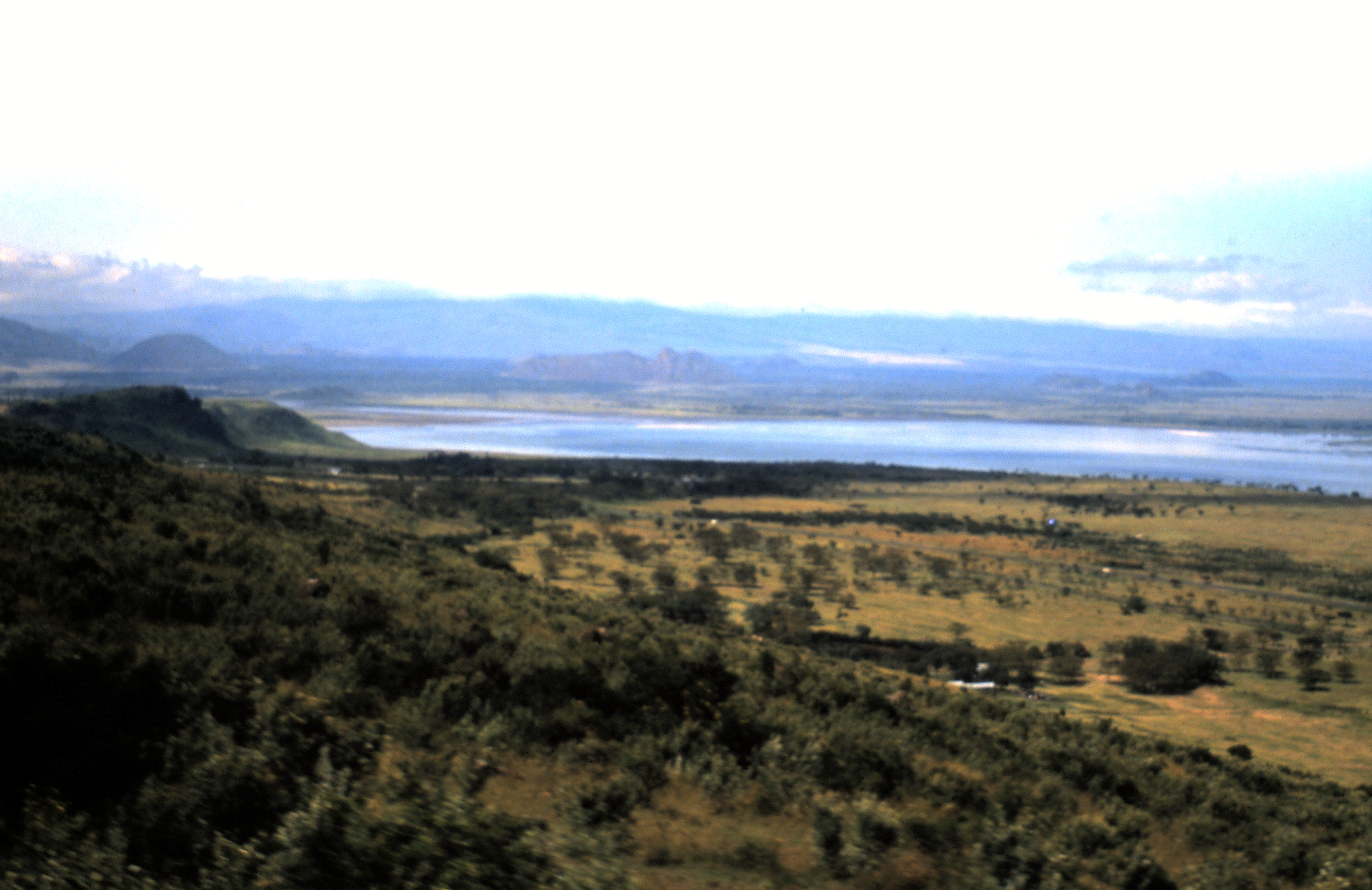
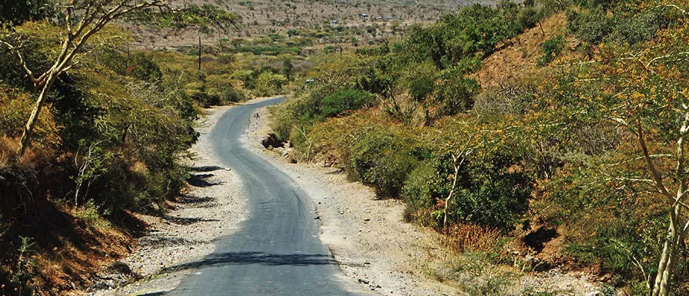
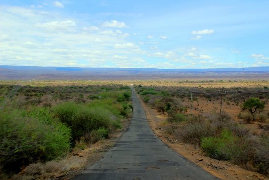
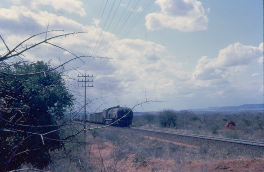
The image above is typical of the scenery in this area of the Rift Valley and is taken close to Mbaruk the next station on the line. The satellite image below shows the passing loop and station at Mbaruk.
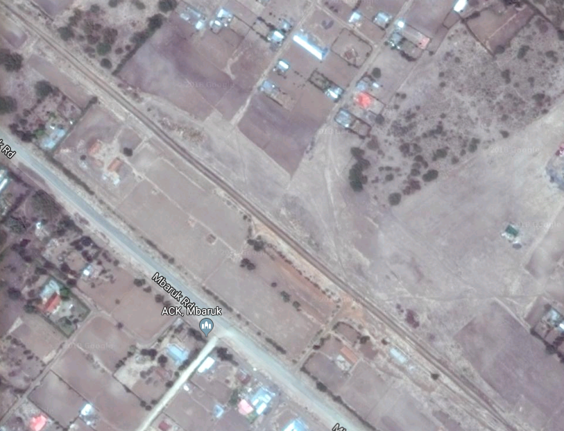
The last station before Nakuru itself is in Nakuru’s suburbs at Lanet and the location is shown in the satellite image below.
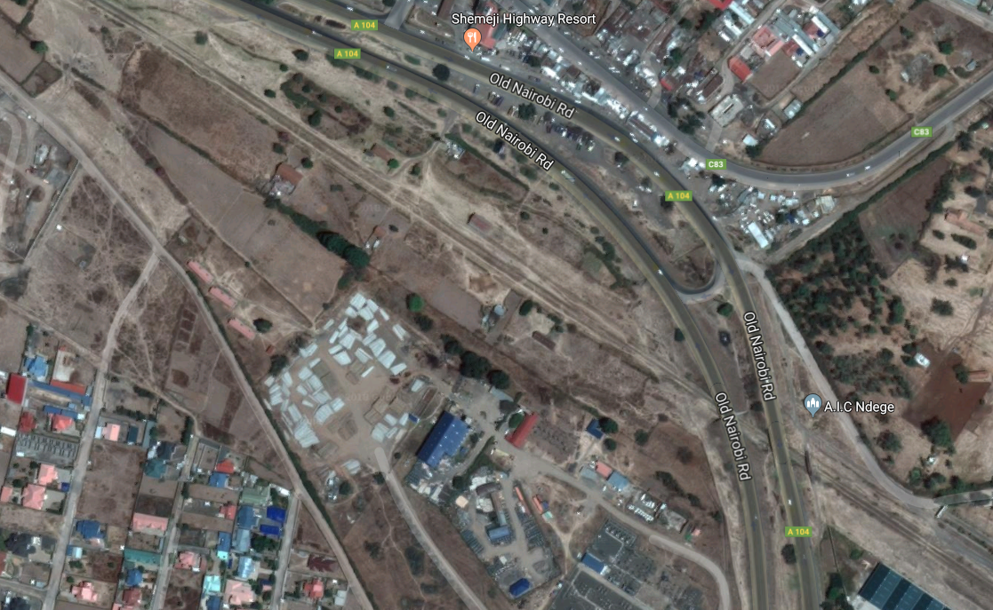
Nakuru is the final destination for this blog post.

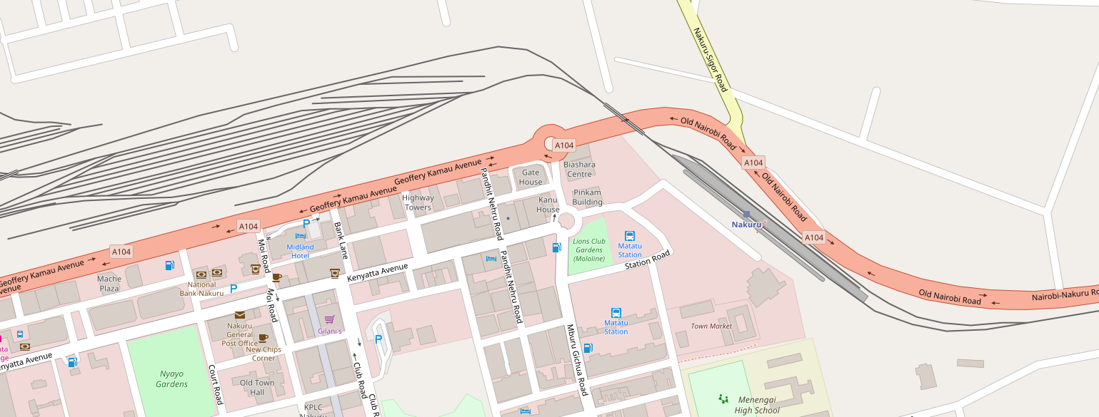
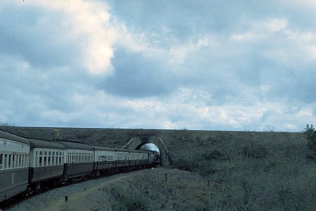
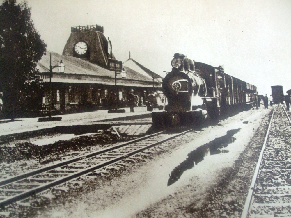
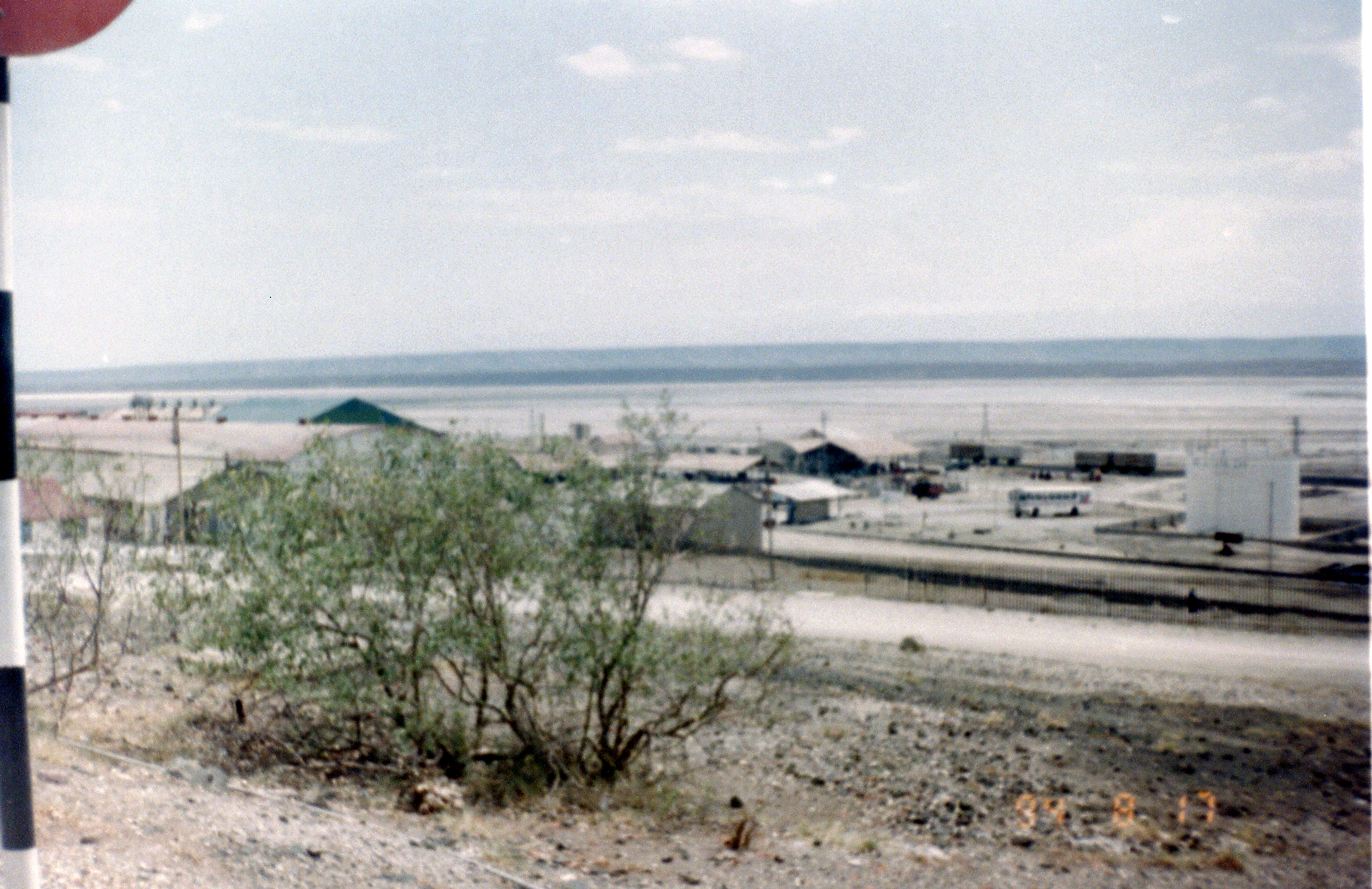
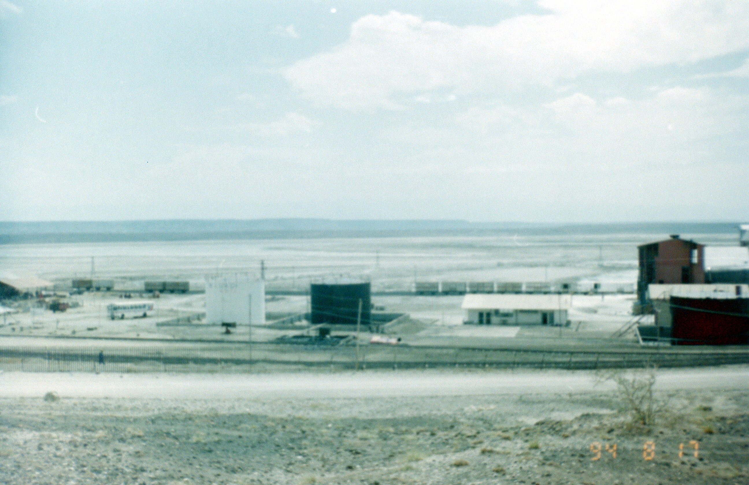
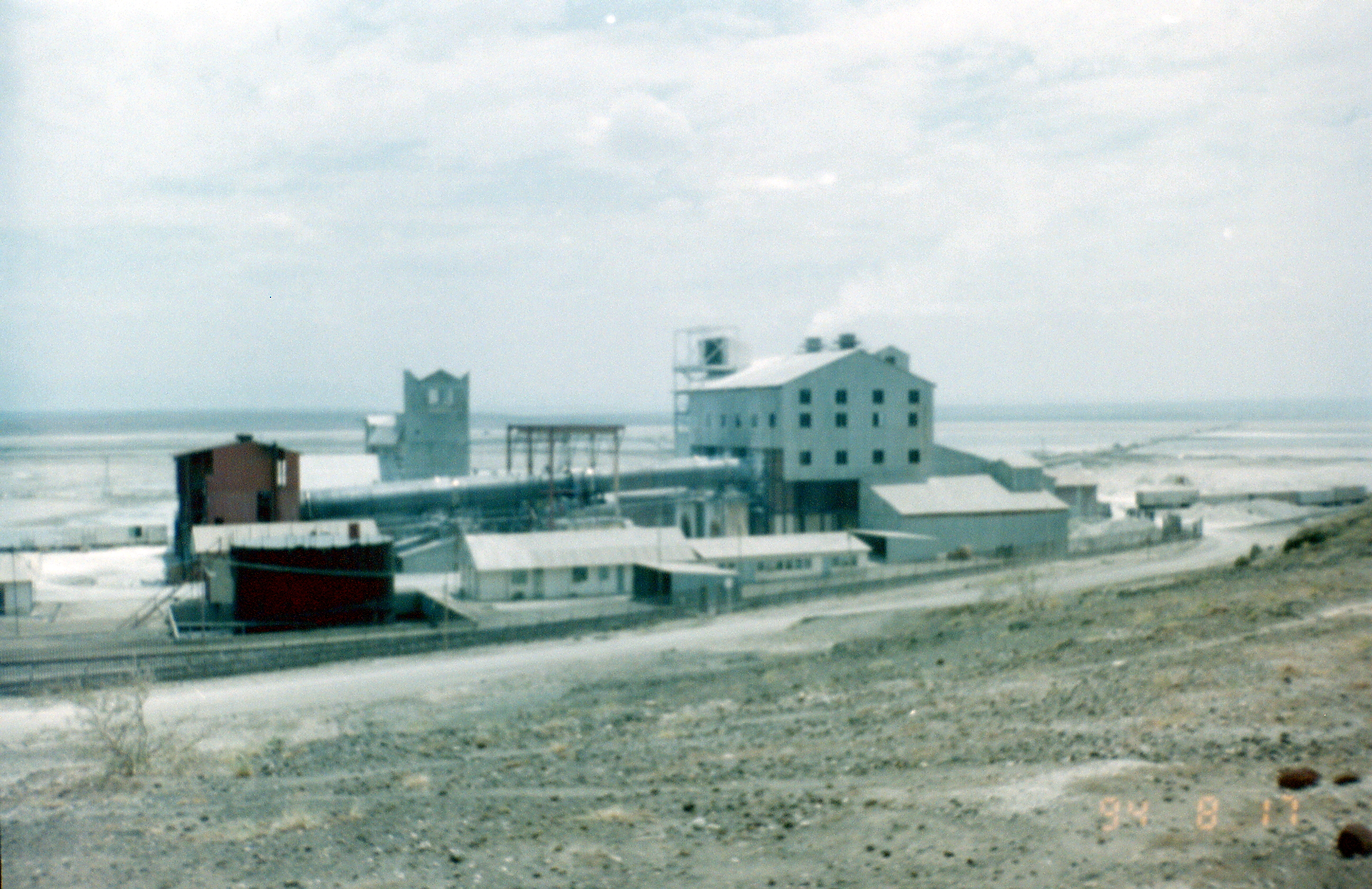
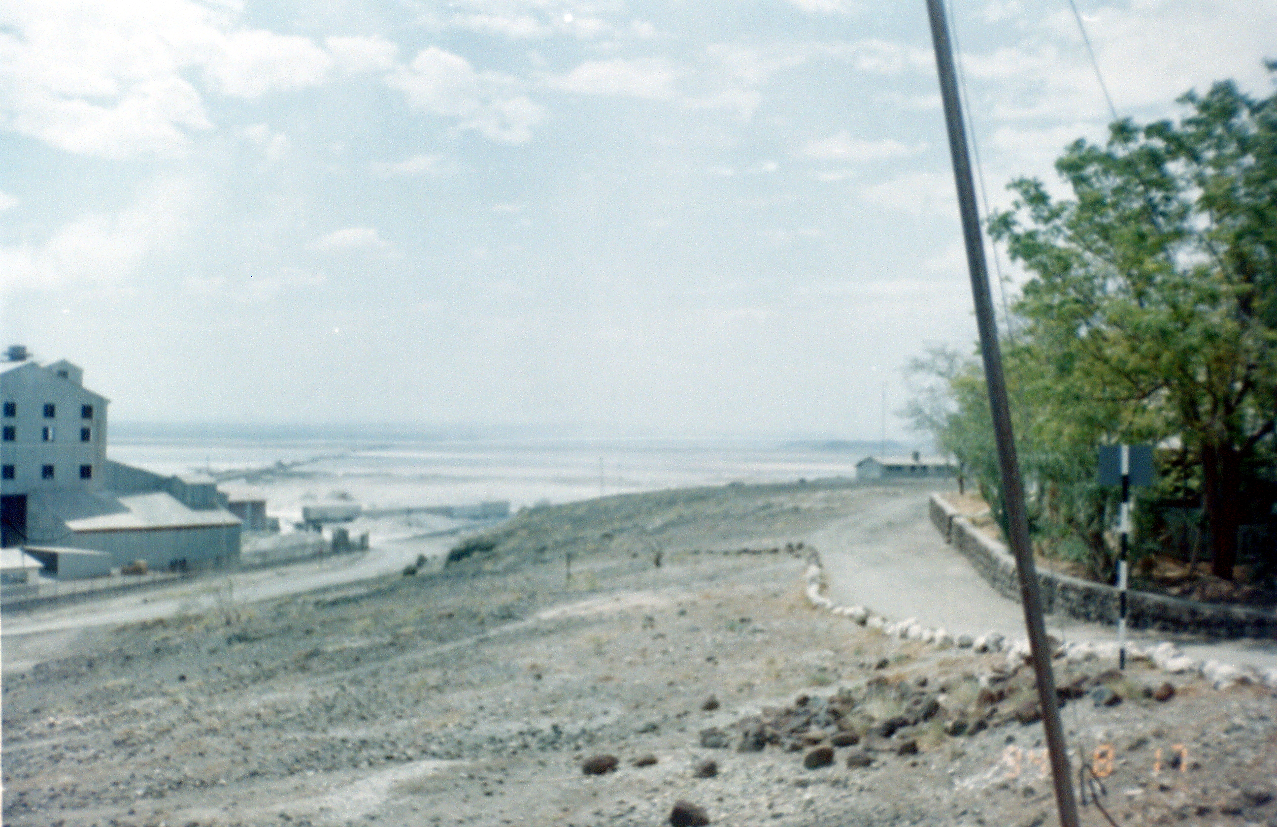
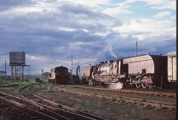
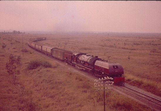
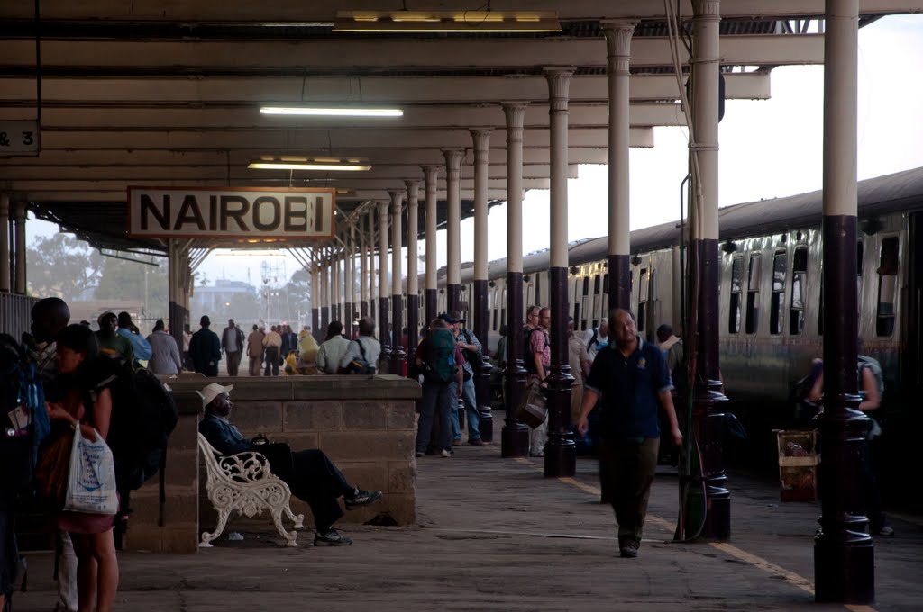
Nakuru was the most modern station on the line – complete with a public address system, colour light signalling and double track westbound between Nakuru East and the divergence of the former mainline to Kisumu.  During stops at Nakuru passengers could buy refreshments, books and newspapers from a trolley which passed down the platform while the locomotive was being changed, © Malcolm McCrow.[10]

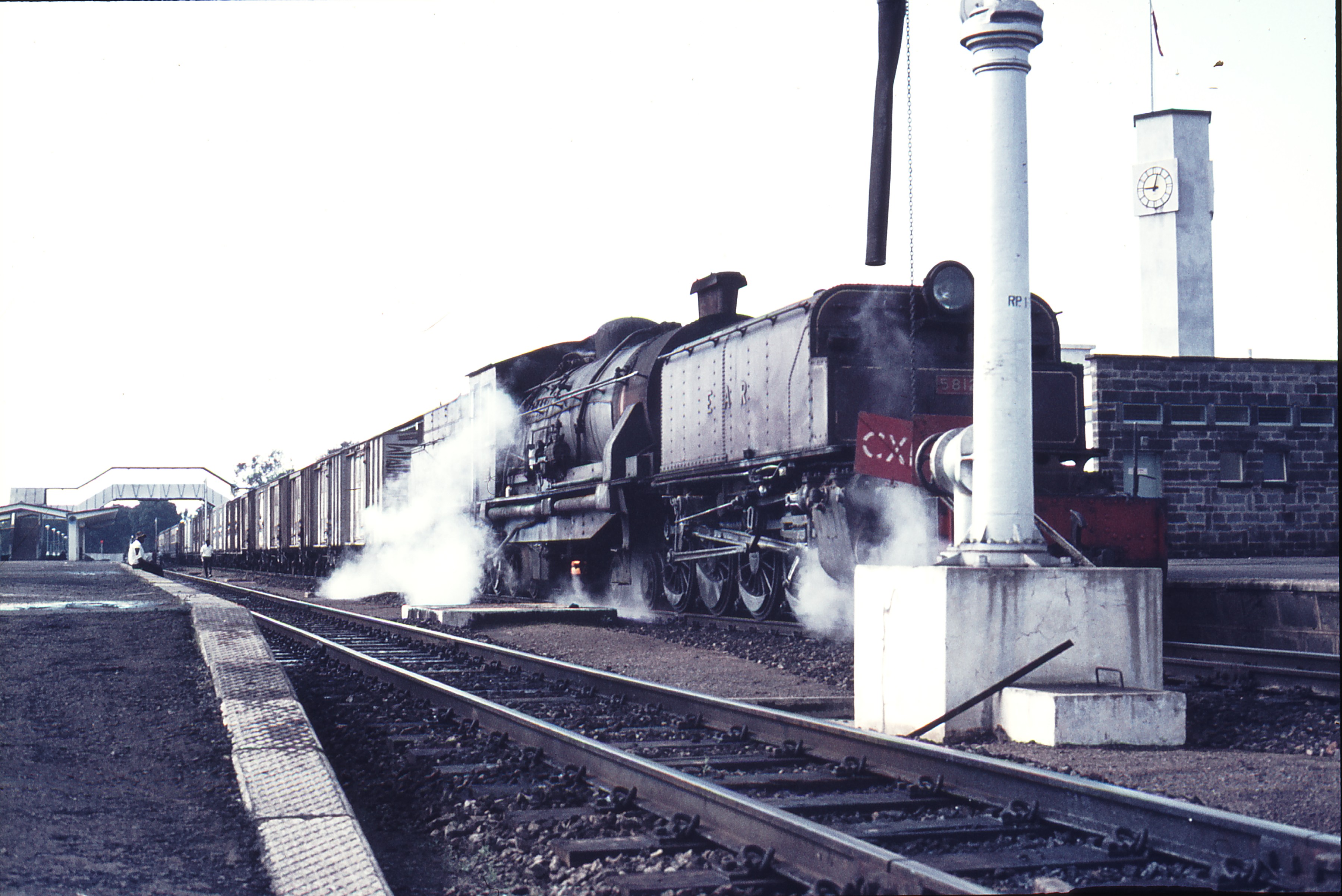
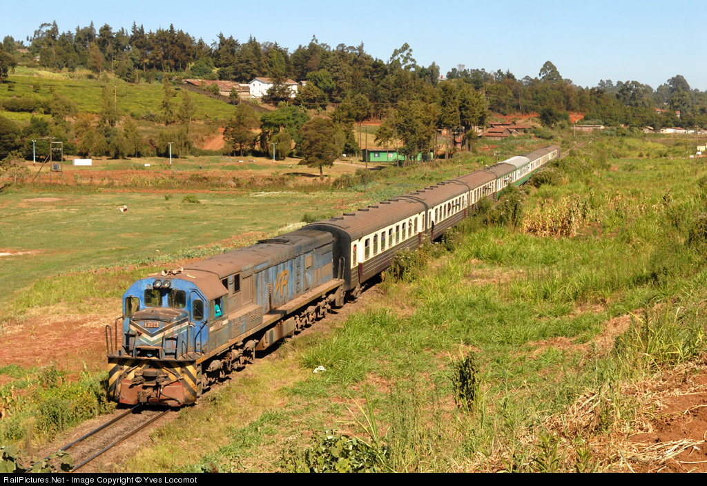
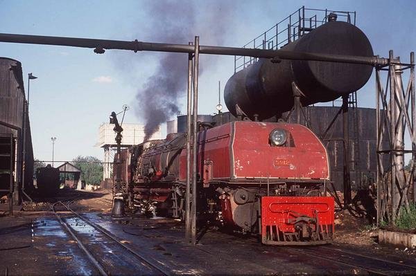
111545: Nakuru Kenya 0920 Mixed to Kisumu 5812©Weston Langford.[2]
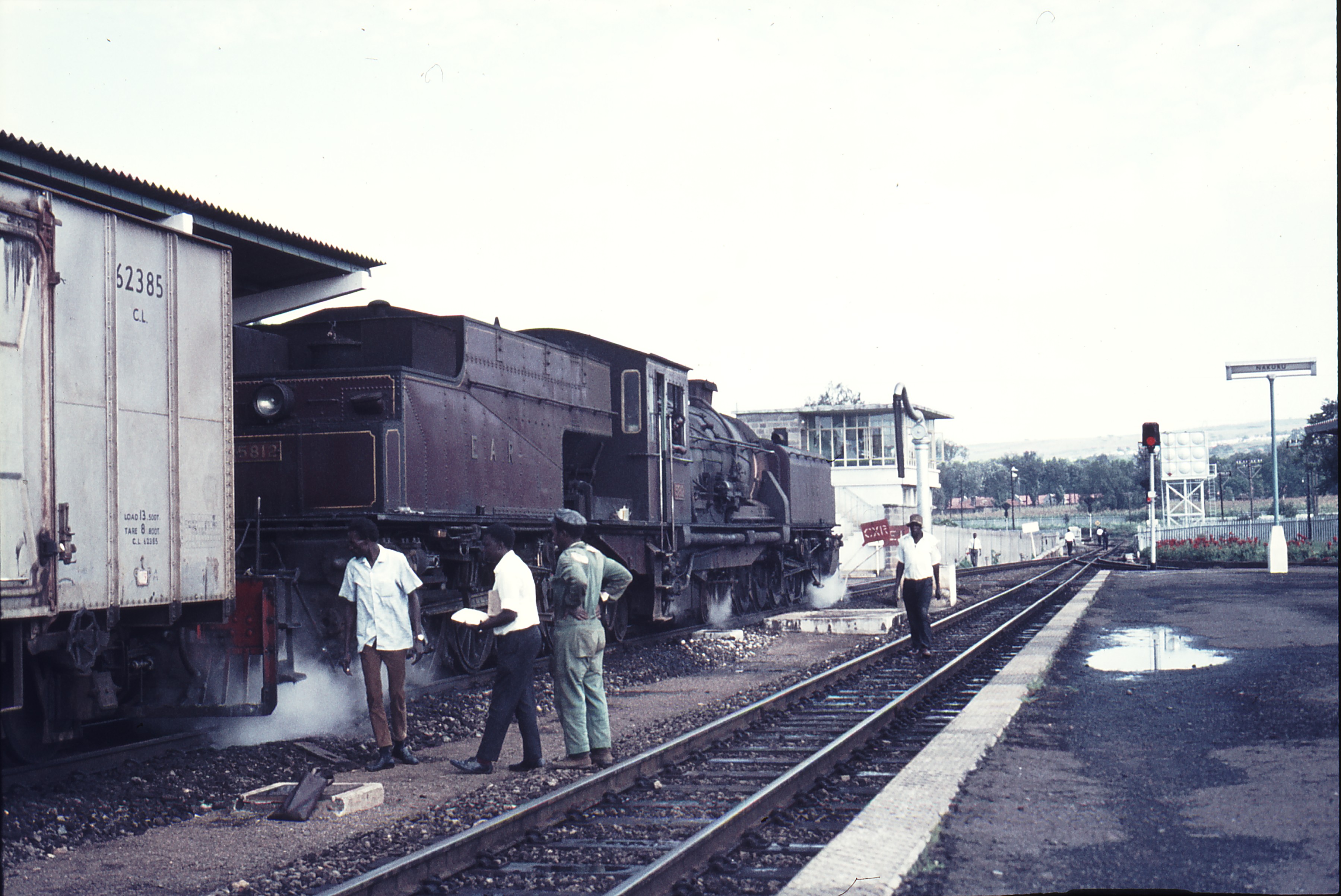
111546: Nakuru Kenya 0920 Mixed to Kisumu 5812©Weston Langford.[2]111547: Nakuru Kenya 0920 Mixed to Kisumu 5812©Weston Langford.[2]

References

  1. http://www.internationalsteam.co.uk/trains/kenya11.htm, accessed on 24th May 2018. The photograph was taken by James Waite. He comments: This photograph, “took a long time to set up, even by the standards of night photos. I had gone out to Naivasha on the empty stock of the steam special and spent the night at the Bell Inn on the main street at Naivasha opposite the station. As I was travelling light I didn’t take a tripod with me and it wasn’t until I was talking to the loco’s support crew over supper the previous evening that I realised they would be lighting up before dawn. I walked over to the station and took my suitcase with me to use as a camera stand. The light was too dim for my camera’s autofocus to work, and its manual focus setting was erratic. I ended up taking something like 20 to 30 exposures, each at a slightly different focus, and only this one worked out properly by the time I had eliminated all those suffering from shake because of the lack of a tripod. I only had ten minutes or so between inky-black dark and too much dawn light as the sun comes up so quickly close to the equator.
    Everyone else on the photo tour had spent the previous afternoon visiting Nairobi works, spent the night in the city and travelled out to Naivasha by road for the start of the photo charter, and I counted myself very lucky to have been able to enjoy the ride in the empty train down the side of the escarpment into the Rift Valley in the afternoon sunshine, as well as being able to take this night shot without having to work around other photographers.
  2. http://www.westonlangford.com, accessed on 25th May 2018.
  3. http://jimstotherssabbatical.blogspot.co.uk/2013/08/sabbaticalday-19-12-august-correction.html, accessed on 25th May 2018.
  4. https://innovation.journalismgrants.org/projects/chinas-train-to-african-development, accessed on 25th May 2018.
  5. https://www.flickr.com/photos/156858441@N07/26344179857/in/photolist-G8WNRx, accessed on 25th May 2018.
  6. http://www.shoestringgolfer.com/2011/11/gilgil-golf-club-great-rift-valley, accessed on 25th May 2018.
  7. https://en.wikipedia.org/wiki/Nyahururu, accessed on 25th May 2018.
  8. https://en.wikipedia.org/wiki/Kariandusi, accessed on 25th May 2018.
  9. http://www.museums.or.ke/kariandusi, accessed on 25th May 2018.
  10. http://www.mccrow.org.uk/eastafrica/eastafricanrailways/KampalaNairobi.htm, accessed on 24th May 2018.

The Uganda Railway – Part 8 – West of Nairobi (Nairobi to Naivasha)

In 1994, I had a few hours waiting at Nairobi Railway Station before getting on the train to Kampala. It was a fantastic journey at a very slow speed with the journey length extended by a 6 hour stop in Jinja waiting for a derailed goods train to be re-positioned on the rails in the section between Jinja and Kampala. My pictures were sadly not of the highest standard and I was having problems with my SLR camera by this time. The next two pictures prove that I was there but achieve little else!Later in my 1994 trip, I spent a day with a friend in Kibera Slum, again, the pictures are of a very low quality. One of the first places encountered by the railway west of Nairobi is the Kibera slum. The date stamp on two of the photos remind me of the time of year I was there. Travelling across Kenya and then into the South West of Uganda became a real expedition as I ended up spending two weeks just over the border from Rwanda at the time of the genocide in that country.

Trains left Nairobi Central Station in a generally south-westerly direction and the line meandered through the suburbs of the city. The adjacent picture shows the interior of a carriage on the train in 1994. The image below shows a Garratt hauled train to the West of Nairobi Station in the post war period, © East African Railways.

Trains first crossed the 9-hole Kenya Railway Golf Course! In 1921, the wife of the Kenya Railways manager, Mrs Couper, established a Golf Club for the Kenya Uganda Railways staff and in 1924 it opened its membership to non-railways staff. The course still revolves heavily around the railway line, which passes straight through the middle of the course. The only hole though where it comes into play is the 2nd, where your tee shot could cause some damage to a passing train if not connected well! [1] The footbridge over the railway can be seen on the right of the first photograph below. The third image below is taken from that footbridge

The line winds its way through the relatively affluent areas before reaching Kibera, 6.6 kilometres (4.1 miles) from the city centre. [2] Kibera is the largest slum in Nairobi, and the largest urban slum in Africa. [3][4][5] The 2009 Kenya Population and Housing Census reports Kibera’s population as 170,070, contrary to previous estimates of one or two million people. [6] Other sources suggest the total Kibera population may be 500,000 to well over 1,000,000 depending on which slums are included in defining Kibera. [7][8][9][10]

Most of Kibera slum residents live in extreme poverty, earning less than $1.00 per day. Unemployment rates are high. Persons living with HIV in the slum are many, as are AIDS cases. [11] Cases of assault and rape are common. There are few schools, and most people cannot afford education for their children. Clean water is scarce. Diseases caused by poor hygiene are prevalent. A great majority living in the slum lack access to basic services, including electricity, running water, and medical care.[12]Significant slum clearance was underway when I was in Kibera in 1994 and the elements of the slum which were on the north side of the railway seem now to have been replaced by high-end apartments, but the slum still exists, as can be seen below.After passing alongside/through Kibera, the railway meanders in a generally westward direction through the Nairobi suburbs, north of the Ngong Road Forest and north of the Racecourse and through Dagoretti Station.The railway travels North-northwest for a time and then switches back, crosses the Nairobi Southern By-Pass and enters Kikuyu Station.Kikuyu Station is 20 kilometres or so from Nairobi, railway officers established a temporary base in Kikuyu while they supervised work on the laying of the track down at the rift valley escarpment. [13]A green liveried East African Railways Corporation Loco heads an all classes passenger train into Kikuyu while a freight train headed by a Class 29 awaits departure, © Kevin Patience. [14]

After Kikuyu, the railway travels almost due north to Muguga and then Limuru. On the way to Limuru, trains pass through a 1.7 kilometre long tunnel.

Limuru is  located on the eastern edge of the Great Rift Valley about 27 kilometres (17 mi), by road, northwest of Nairobi. Most of the area of Limuru is now what was previously known as the “white highlands”, a rich agricultural land just south of the equator. The term “white highlands” derived from the British and other Europeans who realised the productive potential of this area and settled in large numbers with the support of the colonial government, establishing coffee and tea plantations, cereal farms and ranches. The altitude of the town is about 2,500 metres. [15]A Mail Train has just exited Limuru Tunnel, © Iain Mulligan. [14]Limuru Footbridge. [16]From Limuru, trains begin their decent into the Rift Valley, through Uplands (Lari),  Matathia,  Kijabe, Longonot, Suswa and Munyu stations before reach Naivasha in the valley floor.Uplands (Lari) Station.The two images immediately above were taken by me in 1994 looking down into the Rift Valley.Royal train bearing TRH The Duke and Duchess of Gloucester approaching Matathia station in the Kenya Highlands, then to Uganda 1950. [17]Longonot Railway Station. [18]Mount Longonot. [19] SuswaMunyuMunyu Signal BoxNaivasha. [18] Lake Naivasha

Two Postscripts

Postscript A – The Future ………. This length of the Uganda Railway coincides with the current programme of work on the SGR. A line from Nairobi to Naivasha should be completed in 2019. Major work is being undertaken as I write this blog in May 2018. A significant tunnel is being built as part of the work.[20]

Construction of SGR phase II from Nairobi-Naivasha is on course as Kenyans already enjoy the stretch from Mombasa-Nairobi. The extension to the geothermal town on Naivasha was launched by Uhuru in 2015. The line is being undertaken by China Road and Bridge Corporation at a cost of KSh 105 billion.

SGR phase 2 was funded by the Export-Import Bank of China, earmarking a loan of a total of KSh 357 billion. The finance is meant to cater for the construction of the Railway up to Kisumu and rule out land hitches by reimbursing displaced persons.[20]

Postscript B – The Past ……….. In order to allow the original Uganda Railway construction to proceed at pace and incline was created. It was a primitive form of Funicular Railway, built on a steep and straight incline with trolleys on which locomotives and wagons could be lowered. It lasted in operation for only about 15 months before the main railway reached the valley floor and it became redundant.

While the incline was only in use for a few months during the construction of the railway, the main line passed through Escarpment Station until 1948 before being rerouted. [21] The line of the incline can be seen in the satellite image below running west from the Primary school across the centre of the image. and the remains of winding houses can be seen on the image and more clearly on Google Earth.

References

  1. http://www.shoestringgolfer.com/2011/10/kenya-railway-golf-club-nairobi, accessed on 24th May 2018.
  2. “Kibera to Nairobi”. Google Maps. Google, accessed on 26th May 2017.
  3. “A Trip Through Kenya’s Kibera Slum”. International Medical Corps. 27th March 2006, accessed on 31st January 2013.
  4. “Sanitation – vacutug | Participating countries”. Un-Habitat, accessed on 31st January 2013.
  5. http://www.dominionpaper.ca/articles/1703 Machetes, Ethnic Conflict and Reductionism
    Karanja, Muchiri (3 September 2010). “Myth shattered: Kibera numbers fail to add up”. Daily Nation. acessed on 4th September 2010.
  6. Annabel S. Erulkar, James K. Matheka. “Adolescence in the Kibera Slums of Nairobi Kenya” (PDF). Population Council. Archived from the original (PDF) on 11th May 2012, accessed on 10th July 2012.
  7. Understanding the Grassroots Dynamics of Slums in Nairobi: The Dilemma of Kibera Informal Settlements Emmanuel MUTISYA and Masaru YARIME, International Transaction Journal of Engineering, Management, & Applied Sciences & Technologies, Volume 2, No.2 (2011); pages 197–213
  8. Audio Slideshow: Dr. Biden Sees the Neighborhoods of Kenya The White House, United States (June 2010)
  9. Kibera: How slum lords cash in on misery Kimathi Mutegi, The Nation, Kenya (19th September 2013).
  10. Archived copy on the Wayback Machine from 12th October 2013.
  11. “Video: The women of Kibera in Kenya | Amnesty International”. Amnesty.org. 4th March 2009, accessed on 18th October 2010.
  12. Wikipedia, Kibera; https://en.wikipedia.org/wiki/Kibera, accessed on 24th May 2018.
  13. https://www.theeagora.com/the-lunatic-express-a-photo-essay-on-the-uganda-railway, accessed on 15th May 2018.
  14. http://www.mccrow.org.uk/eastafrica/eastafricanrailways/KampalaNairobi.htm, accessed on 24th May 2018.
  15. Wikipedia, Limuru; https://en.wikipedia.org/wiki/Limuru, accessed on 24th May 2018.
  16. http://robertbiu.com/2016/02/13/not-a-weaver-bird-but-a-weaver-man, accessed on 24th May 2018.
  17. https://imagineuganda.wordpress.com/2012/05/11/uganda-50-a-revolving-industrial-aspect, accessed on 24th May 2018.
  18. http://www.savetherailway.com, accessed 15th May 2018.
  19. https://thetreasureblog.wordpress.com/tag/mt-longonot, accessed on 24th May 2018.
  20. https://www.tuko.co.ke/247982-4-glorious-photos-underground-tunnel-sgr-nairobi-naivasha.html#247982, accessed on 24th May 2018.
  21. http://www.friendsoftherail.com/forum/viewtopic.php?t=8362, accessed on 24th May 2018.

The Uganda Railway – Part 7 – Nairobi Railway Station, Good Yard, MPD and Railway Museum

Nairobi is a city that was created by the Uganda Railway! There was nothing on the site of the present capital city of Kenya before railway construction started in the last years of the 19th Century.The first two shots show the location as the settlement was beginning to grow.Train leaving Nairobi for Mombasa in 1900.Nairobi Railway Station in the early 1900s.

Nairobi was founded in 1899 by the colonial authorities in British East Africa, as a rail depot on the Uganda Railway.[1] The town quickly grew to replace Machakos as the capital of Kenya in 1907. After independence in 1963, Nairobi became the capital of the Republic of Kenya.[2] During Kenya’s colonial period, the city became a centre for the colony’s coffee, tea and sisal industry.[3]

The city lies on the River Athi in the southern part of the country, and has an elevation of 1,795 metres (5,889 ft) above sea level.[4]

The present station is utilitarian and functional and shows none of the colonial splendour of some Indian railway stations.Class 58 Garratt ready to leave Nairobi Station for Mombasa (1955).[6] East African Railways Class59 class 4-8-2+2-8-4, No. 5910 “Mount Hanang,” oil fired, weighing in at 251t with a tractive effort of 83,350lbs, is shown in the two pictures above arriving in Nairobi with a goods train from Mombasa in 1970.[7]

Nairobi Railway Station in 1987, © Graeme Wall.[8]

Commuter Trains

The Nairobi suburbs are served by commuter trains. Not all as heavily loaded as that shown below.

There are daily services from Nairobi Suburbs into the Central Station.[11]

An interesting project saw officially sanctioned graffiti replacing unauthorised graffiti. Trains had been badly disfigured but of greater significance was the fact that in the days around  elections in 2007,  the balloting ignited deadly ethnic tensions. Weeks of violence left more than a 1,000 people dead and hundreds of thousands of Kenyans were left homeless. The ethnic tension was particularly toxic in the Kibera, one of the largest slums in Africa, in the heart of Nairobi. It is the focal point of rival ethnicity and unemployed youth.

Hoping to avoid a repeat of that violence in the election process in 2013, a Brooklyn artist and educator Joe Bergner launched a project that used graffiti art to encourage peace and unity against ethnicity and political groups.

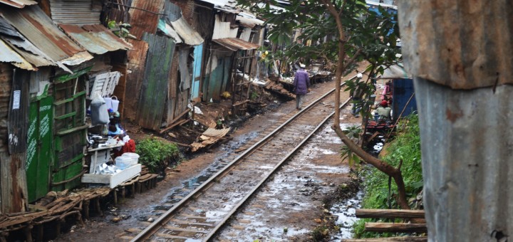
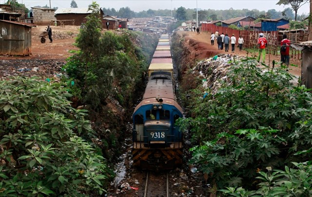
The project is called ‘Kibera Walls for Peace’.  Peace murals were painted by local youth around Kibera. The project approached and worked with Rift Valley Railways to use the commuter trains as a canvas to spread peace messages and togetherness. The railways had been a major target in the previous post-election violence, especially the route through Kibera. In 2007, mobs of young people tore up the train tracks that connect Kenya and Uganda and sold them for scrap metal.

The idea of having graffiti artists come on board to spray the 10 coaches of a commuter train was an idea well received, since most of the Kibera dwellers use the commuter train to and from work. It’s their main means of transport. The train travels through the massive Nairobi slum of Kibera advertising peace. A portrait of Martin Luther King Jnr and the Kenyan flag grace the last coach. The message reads from the front to the back and looks like a sentence that’s beautifully crafted. Tuwache ukabila…tuwache ubaguzi…tuishi kwa amani.[12]

Freight and Goods Sidings

These next few pictures cover the good sidings adjacent to the station.

Sidings close to the platforms.

Oil tanks sitting idle.

The same sidings from a different direction.

Class 31 No. 3143 ‘Somal’ heads a freight through Nairobi Yard. Note the lower quadrant signals: up country the norm was a 3 aspect upper quadrant signal – vertical, line clear; 45 degree, caution; horizontal, stop. © Anthony Potterton.[9]A Class 60 Garratt with name plates removed pauses in Nairobi. © Kevin Patience.[9]Another Class 60 heads a freight out of Nairobi Yard for the Nanyuki Branch, © James Waite.[9]

Nairobi Shed

In Steam days ……EAR Garratt at works entrance, Nairobi Sep 1977, © Whiteflyman.[13]EAR Class 60 Garratt 6008, Nairobi MPD, Sep 1977, © Whiteflyman.[13]Princess Margaret's visit to Nairobi 1956 (Dad - Neil Rossenrode, standing at the back on right)Staff at Nairobi MPD on the occasion of Princess Margaret’s visit in 1956.[14] 5919 ‘Mount Lengai’ at Nairobi Shed, © James Waite.[10] No. 5912 ‘Mount Oldeani’ on the fuelling road at Nairobi MPD, © James Waite.[10] Nairobi Shed in the lengthening shadows of the rapidly setting sun in 1975. A  Class 13 4-8-4T with a Class 31 and two Class 11 tank engines in the background, © Anthony Potterton.[10] Line-up of East African Railways motive power at Nairobi MPD with Class 60 Garratt 6024 Sir James Hayes Saddler prominent left and Class 57/58 right. Five Class 59 Garratts, two Class 29 (Tribal) and two tank engines are also quite clearly discernable. The post card was probably produced around 1955-6, © EAR&H. [10]

Nairobi Railway Museum

I visited Nairobi Railway Museum in 1994. It was in a relatively run-down state and many of the locomotives stored there were rusting away. These next 13 pictures are from 1994 and were taken as slides. The quality is not good but the ability to wander around next to some of the remaining Beyer Garratt locomotives was an experience to remember. The Museum has changed a bit since 1994, and there are now even some of these machines back in steam on the railways in Kenya.Image may contain: train and outdoor5918
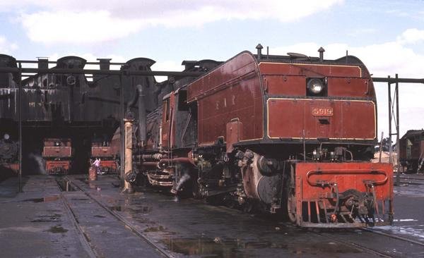
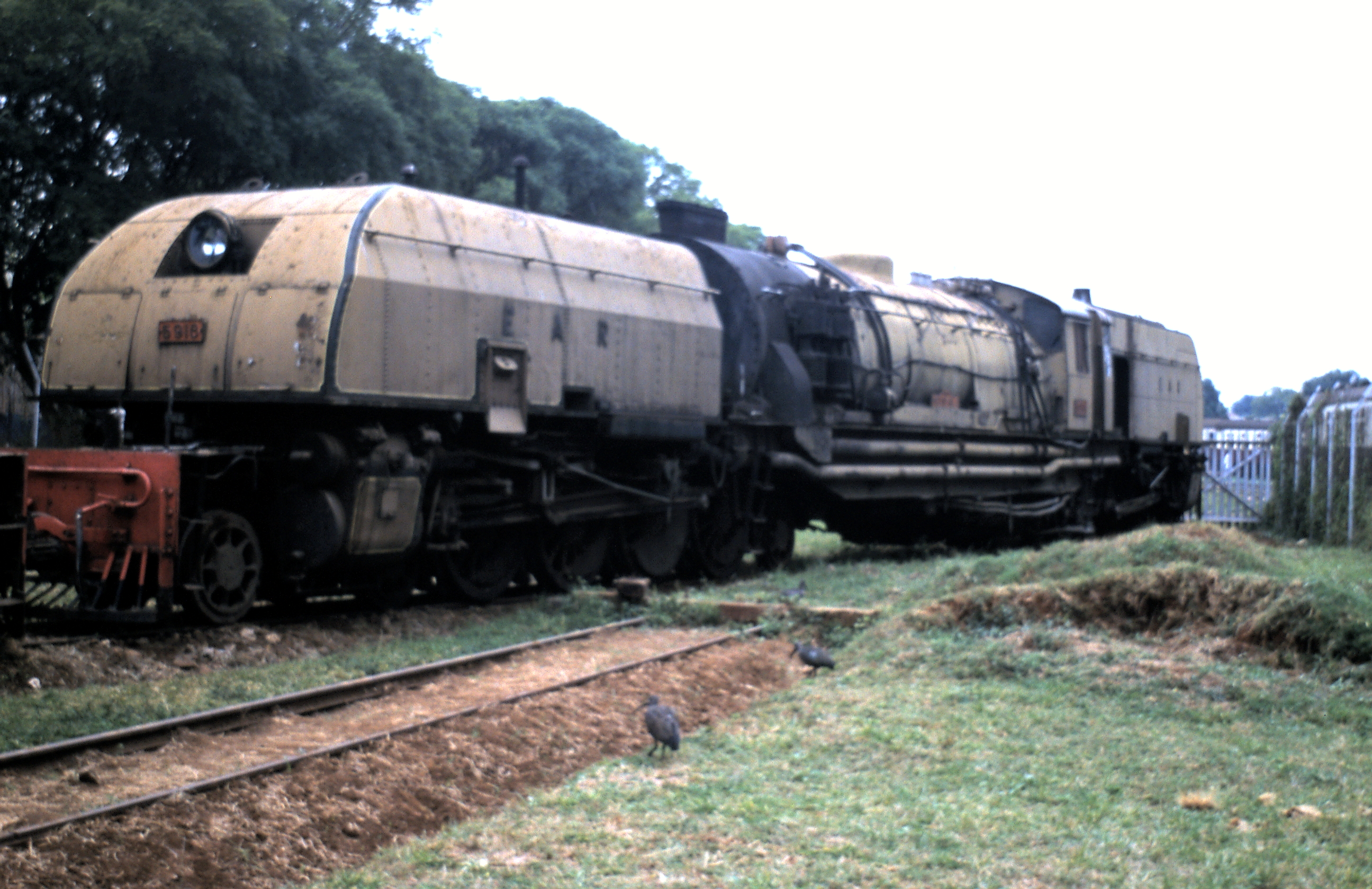
Class 59 Garratt No. 5918 ‘Mt Gelai’ in Steam in 2004.[15]

And finally ….. a drone’s eye view of the Museum in the 21st Century!

References

  1. Roger S. Greenway, Timothy M. Monsma, Cities: missions’ new frontier, (Baker Book House: 1989), p.163.
  2. City-Data.com. “Nairobi History”. http://www.city-data.com, accessed on 22nd May 2018.
  3. “History – Nairobi”. City-data.com, accessed on 22nd May 2018.
  4. AlNinga. “Attractions of Nairobi”. alninga.com. Archived from the original on 30 September 2007, accessed on 22nd May 2018.
  5. Nairobi, Wikipediahttps://en.m.wikipedia.org/wiki/Nairobi, accessed on 22nd May 2018.
  6. https://www.pinterest.com/pin/559361216211036942, accessed on 22nd May 2018.
  7. http://www.norgrove.me.uk/garratts.htm, accessed on 22nd May 2018.
  8. http://www.greywall.demon.co.uk/rail/Kenya/nrm.html, accessed on 22nd May 2018.
  9. http://www.mccrow.org.uk/EastAfrica/EastAfricanRailways/NairobiMombasa.htm, accessed on 15th May 2018.
  10. http://www.mccrow.org.uk/EastAfrica/EastAfricanRailways/NairobiMPD.htm accessed on 22nd May 2018.
  11. https://metaphorimages.photoshelter.com/image/I0000e12YBt5NpVA, accessed on 23rd May 2018.
  12. https://joelukhovi.wordpress.com/tag/rift-valley-railways, accessed on 23rd May 2018.
  13. http://picssr.com/photos/13661517@N06?nsid=13661517@N06, accessed on 23rd May 2018.
  14. https://www.pinterest.co.uk/pin/462463455475676221, accessed on 23rd May 2018.
  15. http://www.greywall.demon.co.uk/rail/Kenya/nrm.html, accessed on 23rd May 2018.


The Uganda Railway – Part 6 – Ulu to Nairobi

Our journey along the Uganda Railway continues ………….

Ulu is our starting point for the next leg of the journey. The station can be seen on the satellite image below. It is at the top of the photograph and approximately in the middle of the image. Ulu is located in the region of Kajiado. The distance from Ulu to Kenya’s capital Nairobi is approximately 69 km/43 miles (as the crow flies).[1]  This next leg of our journey is not a long one!Leaving Ulu for Nairobi, trains travel in a North-easterly direction before eventually swinging round to the North-west towards Konza.Just before we reach Konza a branch-line diverts off the mainline in a south-westerly direction. Konza is the junction for the line which serves Magadi Soda Works. The branch travels via  Kajiado, Kenya Marble Quarry, Elangata Wuas, Singiraini, and Koora to Magadi Soda Works. I visited the Soda Works in 1994, travelling there by car from Nairobi. The first six pictures below are my own and the quality is not great.  Road is the easiest way to access Magadi despite the railway link.[3] One other way of visiting Lake Magadi is to take the Jaza train. [2] Konza Station is reached just after the branch-line leaves the mainline.Early daylight at Konza –  © Peter Ritchie.[4]The line then follows a north-north-easterly path until it reaches Kitengela (Kapiti Plains Estate/Stony Athi) and turns northeast towards Athi River. As the line approaches Athi River it passes the new SGR Station of Athi River and then turns sharply to the west and enters the town. Two short branches leave the mainline at Athi River, serving the Blue Triangle Cement Company (East African Portland Cement) works to the West if the town.Class 58 Garratt in about 1960 – the locomotive has been fitted with a Giesel ejector. No. 5810 is seen at Athi River, 16 miles from Nairobi – © Iain Mullilgan.[4]Class 59 Garratt, No. 5918 sitting in the late afternoon sun at Athi River waiting for the return working above. Below, a fireman’s eye view as the train sets off for Nairobi.[6]EARC 92 Class diesel arriving as Class 59 Garratt No. 5904 Mount Elgon at Athi River – © James Waite.[4]

The mainline crosses the Athi River just after the station and then passes under the new SGR line.Mount Elgon and its train depart across the Athi River for Nairobi – © Iain Mullilgan. [4]Mount Elgon and its train continue across the Athi River for Nairobi – © James Waite.[4]

After crossing the Athi River the metre-gauge railway passes through Marimbeti Station before reaching Embakasi Station. As can be seen from the map below, Embakasi is the location of the present Nairobi terminus of the SGR line, some distance away from the city centre.The next few pictures show Embakasi in the days long before the SGR was imagined!An unidentified 59 Class heading a freight over the Athi Plain – © Iain Mulligan.[4]Class 60 Garratt  No. 6003 Sir Stewart Symes before it was fitted with a Giesel ejector.  The train is near Embakasi – © Iain Mulligan.[4]Class 59 heads No 4 Down near Embakasi. The train would have departed Nairobi at 1545, calling at all stations to Mombasa where it was due to arrive at 0710 the following morning – just 50 minutes ahead of No 2 Down – the Mail Train which will have left Nairobi at 1830 for Athi River, Konza, Mtito Andei, Voi and Mombasa © Iain Mulligan.[4]

Beyond Embakasi the railway passed through a marshalling yard and then through Imara Daima Station before swinging round to the North-East.It then crossed the Ngong River in the southern suburbs of Nairobi.The first passenger train from the coast crosses the Ngong River Bridge which was completed as part of the Embakasi/Nairobi realignment in 1958. PHOTO – EAR&H.[4]

A short branch-line joins the mainline from the East just as it swings round to travel almost due West and is immediately joined by another branch, this time much longer. This branch headed off in a Northerly and then Northeasterly direction and terminated at Nanyuki. On the way it passed through Dandora, Githurai, Kahawa, Ruiru, Kalimoni (Juja), Komo and Thika Stations.Tribal Class 3109 Bahororo takes water at Thika.  © Iain Mulligan.[8]

Beyond Thika, the line passed through Mitubiri, Santamor, Makuyu, Saba Saba, Maragua, Murang’a, Sagana, Makaungu, Karatina, Nyeri, and Naro Moru Stations, before arriving at Nanyuki.

A Class 31 was permanently stabled at Sagana to double head freights over the 3.5% grade to Nanyuki, © Iain Mulligan.[8]

Nanyuki is a market town in Laikipia County of Kenya lying northwest of Mount Kenya along the A2 road and at the terminus of the branch railway from Nairobi. It is situated just north of the Equator. It was founded in 1907 by British settlers, some of whose descendants still live in and around the town. Nanyuki is currently the main airfield (airbase) of the Kenya Air Force. The British Army also keeps a base at The Nanyuki Show Ground (NSG) from where it conducts yearly desert and jungle training exercises on the mountain and in the arid areas to the north.[7]Nanyuki – branch terminus

After passing the Nanyuki branch-line, the railway is now in the industrial heart of Nairobi with a whole series of branches and sidings. Approaching Nairobi Central Station it passes through two more stations/halts, at Makadara and Makongeni. Then we arrive at Nairobi Central Station. The next two photographs are more of my poorer slide photos from 1994. The one’s following have been culled over time off the internet.The map above focusses more specifically on Nairobi Station. The lines leaving the right of the image head for Mombasa, the line leaving the left of the image is the line heading West to Kisumu and to Uganda.

The next post in this series about the Uganda Railway will spend time in Nairobi and will also visit the Railway Museum.[9]

References

  1. http://kenya.places-in-the-world.com/178769-place-ulu.html, accessed on 21st May 2018.
  2. http://www.lakemagadiadventures.com/jaza_train_to_lake_magadi, accessed on 21st May 2018.
  3. Lake Magadi Soda by Road from Nairobi; https://www.tripadvisor.co.uk/ShowUserReviews-g1137919-d6609180-r234172046-Lake_Magadi_Conservancy-Magadi_Rift_Valley_Province.html, accessed on 21st May 2018.
  4. http://www.mccrow.org.uk/EastAfrica/EastAfricanRailways/NairobiMombasa.htm, accessed on 15th May 2018.
  5. https://www.pinterest.co.uk/pin/554083560377607665, accessed on 21st May 2018.
  6. http://www.trevorheath.com/livesteaming/Kenya.htm, accessed on 21st May 2018.
  7. https://en.m.wikipedia.org/wiki/Nanyuki, accessed on 21st May 2018.
  8. http://www.mccrow.org.uk/EastAfrica/EastAfricanRailways/NairobiNanyuki.htm, accessed on 21st May 2018.
  9. http://www.xinhuanet.com/english/2016-05/18/c_135369174.htm, accessed on 22nd May 2018.

Mombasa, Kenya – A very early tramway?

I came across some photographs while doing some research for my posts about the Uganda Railway. Further investigation led to a discovery of a very early tramway system in Mombasa. The adjacent image was one of these. There are clearly a set of tracks running on the streets of Mombasa.

Further investigation highlighted the existence of what was called a ‘trolley'[1]There were stations throughout Mombasa Island. The next picture shows the station at Kilindini.[1] It did not take long to find a significant number of other photographs showing the trolley and the tracks used.The trolley track, ran from Mbarak Hinawy Road (Vasco da Gama Street) to Government Square (Customs Area, Leven House) and on to Nkrumah Road (Macdonald Terrace) past the Old Law Court on to Kilindini. It provided access to the “Jubilee Hall” (put up to commemorate the English Queen Victoria’s diamond jubilee in 1897 and also used as a meeting place for Old Town elders until 1950’s) and veered to the right to the famous Mombasa Club which was also built in 1897 by the trader Rex Boustead.[1]Old postcard showing the main street (Ndia Kuu) in Old town. You can see the trolleys in the bottom left hand corner of the picture.[2]Between 1890 and the early 1920s, Mombasa Island was serv­ed by an unusual transport system. A light two-foot gauge railway line was laid across the island from Government Square (in the old port) to Kilindini docks, and on it were pushed by hand small trolleys which could carry goods or passengers. By 1903 a branch had been laid to the station (then in Treasury Square), the hospital, the sub-­commissioner’s house, the lighthouse at Ras Serani, the sports club and to the cemetery.

In 1900 it cost 4 annas to travel from Government Square to Kilindini, or 2 annas as far as the station. If two trolleys met on a single line, the lower ranking officer or civilian had to have his trolley lifted from the rails to allow his senior to pass.

The trolleys were withdrawn in about 1923, after which people had the choice of walking, hiring a rickshaw or taking a motor car. The first car arrived in Kenya in about 1900. A horse and carriage was a rare phenomenon, horses being very susceptible to local diseases.[1]

A replica trolley stands in the courtyard of Fort Jesus, on some reconstructed original line.[2]The track for the two-foot gauge trolley line came from an abortive attempt to build a railway into the interior, The “Central African Railway” which had reached a mere 11 kilometres inland from Mombasa Island![3]

The ” Central African Railway” had an interesting history ……. [1] The story which follows is sourced mainly from the Friends of Mombasa Website.

Sir William Mackinnon, the ship owner in charge of the IBEA (Imperial British East Africa) Company, lost no time in writing to Lord Salisbury, six months after the signing of the Brussels Treaty, suggesting Government assistance for the construction of a 60-mile (96.5 kms) railway inland from Mombasa. He also sought aid for opening up roads and forming “stations” along the route to Lake Victoria.

As a result of this successful appeal, the Director of the IBEA in London was able to send out sufficient materials and rolling stock for building a narrow gauge light railway to cost £50,000. The following year construction got under-way, starting from a point on the mainland opposite Mombasa Island, at the head of what has now become Kilindini Harbour.

It was given the very ambitious title of the “Central African Railway”, and as a symbol of the good intentions of the IBEA to open up the hinterland, sounded very impressive., but the venture got no further than seven miles (11.2 kms) before work stopped. Although it covered no more than a tiny fraction of the distance to Lake Victoria and the source of the Nile, the “Central Africa Railway” did secure a place for itself in history as one of the first railways to be built in East Africa, albeit no wider than two feet (61 cms) gauge. The tracks were later pulled up and, together with some of the unused rails, were re-laid to form the trolley line on Mombasa Island. Until 1923 this line was mainly used by Government officials, the more senior of whom had their own trolleys and received monthly allowances to pay the Africans employed to push them.

In its original form the “Central Africa Railway” was used only once for official purposes. It was used, however, as a stylish conveyance for picnic parties venturing inland from the port.

By 1893, the IBEA had withdrawn from Buganda, but remained temporarily at Mombasa until the British Government finally “took the plunge” by declaring a protectorate over the Buganda Kingdom and neighbouring lands as an alternative to outright annexation. It then began to consider a “proper” railway that would run all the way from the Indian Ocean to Lake Victoria. Not only would this be a really serious indication of Britain’s intentions to open up the interior for trade, and combat slavery, but it would be useful for transporting British troops, whom the government in London thought would be necessary for maintaining a permanent garrison at the source of the White Nile, near Jinja.

This post should perhaps, therefore have been written before may posts about the development of the Uganda Railway![4]

I was blissfully unaware of this little bit of railway history when I wandered round Mombasa Island before embarking on the night train for the journey to Nairobi and Kampala.No automatic alt text available.
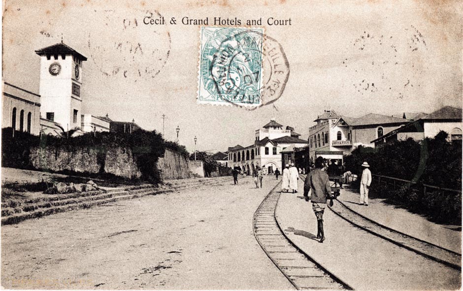
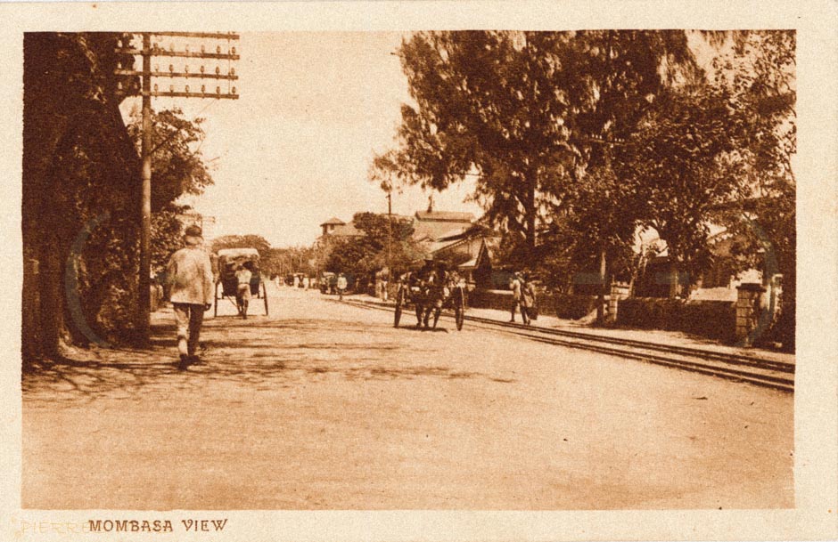
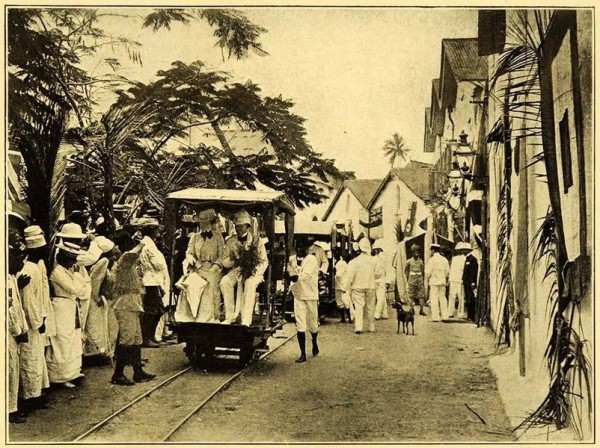
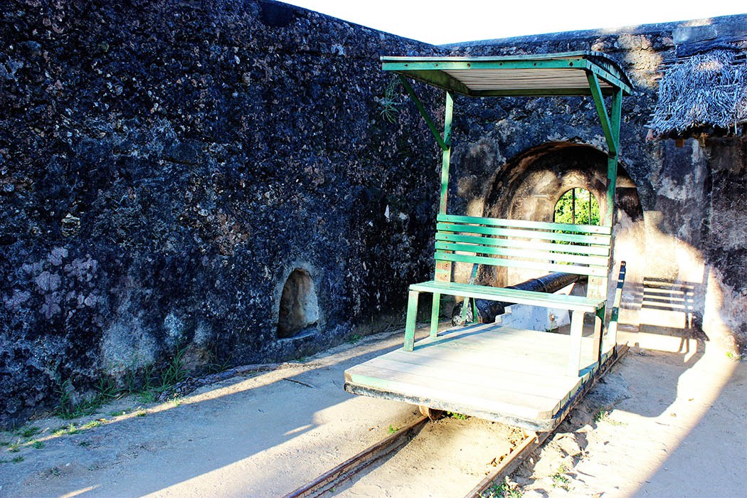
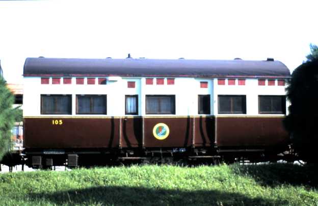
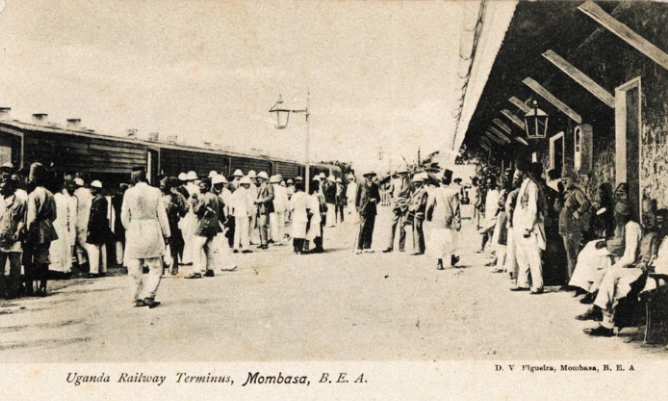
On the left of the picture above is a replica of a Mombasa trolley. [5]
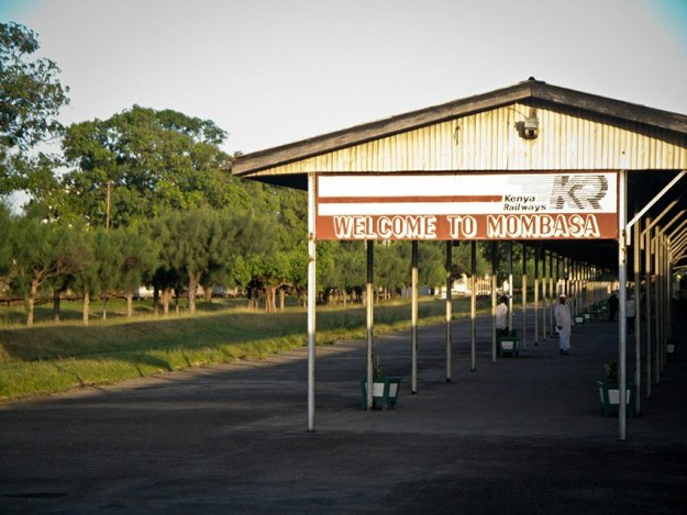
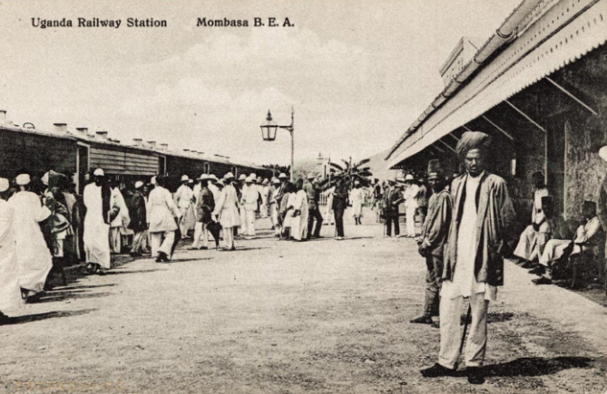
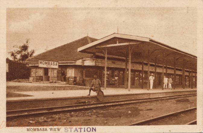
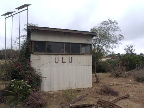
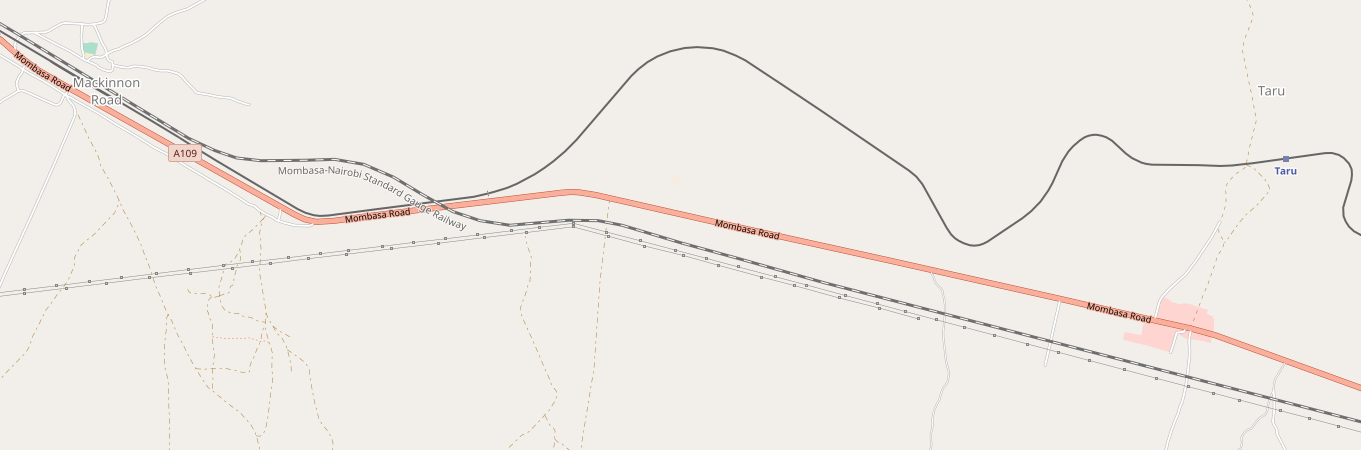
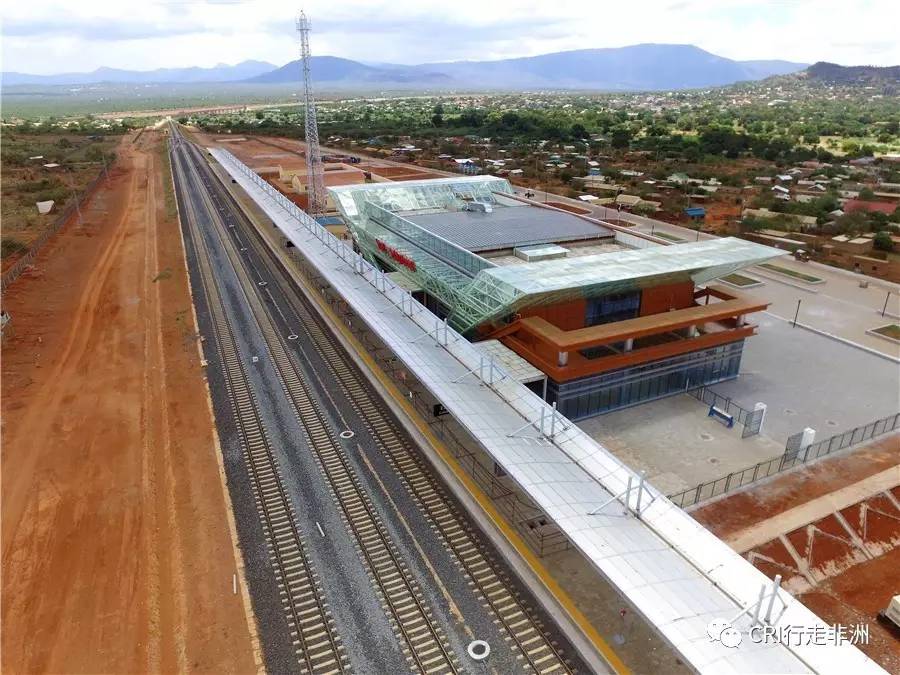
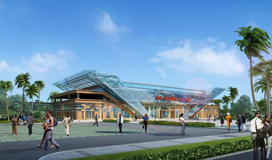
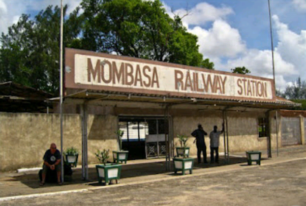
References

  1. http://www.friendsofmombasa.com/british-empire-in-east-africa/east-african-railways, accessed on 11th May 2018.
  2. http://www.oldeastafricapostcards.com/?page_id=512, accessed 12th May 2018.
  3. http://www.greywall.demon.co.uk/rail/Kenya/nrm.html, accessed on 22nd May 2018.
  4. The posts on my blog start with the Uganda Railway Story and continue to review the line along its full length. Please see https://rogerfarnworth.wordpress.com/category/uganda.
  5. https://www.facebook.com/nrailwaymuseum/photos/pcb.1699207140092552/1699205880092678/?type=3&theater, accessed on 23rd May 2018.

The Uganda Railway – Part 5 – Voi to Ulu

We start this next post with a variety of images from the station at Voi, and from its immediate surroundings. The first picture is the featured image which shows the publicity photo for the railhead reaching Voi in 1897.Class 59 Garratt No. 5902, Ruwenzori Mountains takes on water at Voi Station. Image result for voi railwayVoi Station Sign. [1]An old colonial-era railway line sits near the site of the new Mombasa-Nairobi Standard Gauge Railway line under construction in Voi, Kenya. Bloomberg photo by Riccardo Gangale.[8]

EAR Class 59 Garratt No. 5902 “Ruwenzori Mountains” heads away from Voi with a Mombasa to Nairobi Goods train on 10th December 1976 © Bingley Hall, on flickr.[2]Class 59, 5914 at the same location. [5]The map shows the branch-line to Moshi as a dotted line turning away from the A109 and following the A23 to the bottom left of the image. The route is bridged by the SGR. The next two images are taken of trains on that branch-line. Both show the same locomotive, Class 60 Garratt No. 6013, © CPH 3 on flickr.[3]Class 59 Garratt en-route to Voi – © James Waite.[4]

Travelling north from Voi and after the branch to Moshi turns away to the West, the line passes through Irima, Ndi and Manyani Stations and between the two game reserves of Tsavo East and Tsavo West in a corridor which also includes the A109 road between Mombasa and Nairobi and the new SGR.Irima Railway Station.Ndi Railway Station.Manyani © Thomas Roland on Flickr [6]

The SGR and the A109 run consistently parallel to each other the metre-gauge line follows a route which best works with the contours of the land. All three pass through Tsavo.

Tsavo railway station was some distance from the village.An image from google maps. [7]The metre-gauge line crosses a relatively low level bridge over the Tsavo River, just beyond Tsavo Station, which can be seen in the next few images, the first of which is taken from the A109 bridge over the Tsavo River.Class 59 Garratt, 5903 Mount Meru, on Tsavo Bridge, heading towards Voi – © James Waite.[4]Another shot of the bridge. [6]

The last image at Tsavo shows the construction work on the SGR viaduct across the Tsavo River … all along the length of the new line provision is made to allow wildlife access under the line and to avoid high-speed collisions between trains and wildlife.

Moving on from Tsavo the line continues to meander in a generally North-westerly direction for a number of kilometres on almost exactly the same line as the SGR, through Kyulu Railway Station.[9]
And Kenani Railway Station,[9] and then Kanga, before reaching Mtito Andei.
Mtito Andei is the nearest stop on the SGR to Tsavo.[10]It supersedes the station on the old metre-gauge line, although that line may well remain open for goods traffic.[9]

The old metre-gauge line continues on through Kathekani, Darajani, Ngwata, Masongaleni,  Kikumbulyu, and Kibwezi.Darajani, © Matthew O’Connor on flickr. [11]The last three sepia pictures are courtesy of the UK National Archive. [12]

The Railway continues in a north-westerly direction through Mbuinzau, Makindu, Ikoyo,  Kiboko, Simba,  Kabati and Emali Stations

Plan of Makindu Station and sidings.[12] The following photos are from Dr Gurraj Singh Jabal [14] and a few other sources.There was a rail accident at Makindu on 29th March 1958.

Emali. [9]

After Email, is passes through Nzai, Sultan Hamud, Kima, Kalembwani and Kiu Stations before reaching Ulu.Kima. [9] Kalembwani. [9] Ulu. [9]Ulu. [15]

We finish this leg of the journey at Ulu and look forward to travelling on to Nairobi in the next post.


References

1. https://theeagora.wordpress.com/2013/08/03/voi-railway-station, accessed on 19th May 2018.

2. https://www.flickr.com/photos/markcarter/14338441191/in/photolist-nR3g2i-sYdBgH, accessed on 19th May 2018.

3. https://www.flickr.com/photos/steam_locos/12132360645/in/photolist-ju6w8P-iDJaq6-iFiks9-iFkoFj, accessed on 20th May 2018.

4. http://www.mccrow.org.uk/EastAfrica/EastAfricanRailways/NairobiMombasa.htm, accessed on 19th May 2018.

5. https://www.pinterest.co.uk/pin/688839705474887109, accessed on 20th May 2018.

6. https://strategicdepth.org/2017/06, accessed on 20th May 2018.

7. https://www.google.co.uk/maps/place/Tsavo+Station/@-2.9931068,38.4689082,3a,75y,90t/data=!3m8!1e2!3m6!1sAF1QipP4jOul9RQMOMR3VrJAfu6wgE7GFS4rrEiAIhTD!2e10!3e12!6shttps:%2F%2Flh5.googleusercontent.com%2Fp%2FAF1QipP4jOul9RQMOMR3VrJAfu6wgE7GFS4rrEiAIhTD%3Dw129-h86-k-no!7i6000!8i4000!4m5!3m4!1s0x183959f41c019539:0x786fe9903739f4c5!8m2!3d-2.9931068!4d38.4689069, accessed on 20th May 2018.

8. https://www.bloomberg.com/news/articles/2016-04-08/africa-s-30-billion-rail-renaissance-holds-ticket-for-trade, accessed on 20th May 2018.

9. http://www.savetherailway.com/railway-stations, accessed on 18th May 2018.

10. https://www.google.co.uk/maps/uv?hl=en&pb=!1s0x183bb8751a761d9b%3A0x1c2fac4b35e4a8bf!2m22!2m2!1i80!2i80!3m1!2i20!16m16!1b1!2m2!1m1!1e1!2m2!1m1!1e3!2m2!1m1!1e5!2m2!1m1!1e4!2m2!1m1!1e6!3m1!7e115!4shttps%3A%2F%2Flh5.googleusercontent.com%2Fp%2FAF1QipO1kG9cbCL_gJ17EFd6RpYfv7oz1cTQUYj2HzDz%3Dw240-h160-k-no!5sMtito%20Andei%20railway%20station%20-%20Google%20Search&imagekey=!1e10!2sAF1QipOUxm6EAfKZtxK1rg-xvRhE1dQw39qbHCaKRHMB&sa=X&ved=0ahUKEwiX8tWvgpXbAhUfOsAKHQa4BOYQoioIjwEwDg, accessed on 20th May 2018.

11. https://www.flickr.com/photos/hadenoak/29842259871/in/photolist-Mt4oaV-kaYDpr-8nLN2m-bPabo4-bAfL3A-aCVMTM-FLyXgK-FRQ2qr-GxHPuU-GxHPKy-bPapRi-bAfwiy-NQoAC-r4WnTo-aWe2DD-fnT25s-bokDL-9HDBH5-6EDL3M-jh9DA9-aWiuJx-Jz64hu-NA9jZ-LbXZSJ-f9iWQE-8u155z-peR8pW-8oNqcF-aWivXi-7wknz8-9WNrqo-aWivNx-cyUfZw-aWe2z2-aWitUR-cyUfJ7-7wkniM-9ePedD-aWivAV-aWe3YH-6EDKRv-aWe1PD-aWe2wR-ReNwV5-LinKah-aWe39x-dZgfjY-8NqyQB-aeZZzh-7XevFt, accessed on 20th May 2018.

12. UK National Archives; http://www.nationalarchives.gov.uk, accessed on 20th May 2018.

13. https://www.openstreetmap.org/#map=17/-2.28318/37.82820, accessed on 20th May 2018.

14. http://www.savetherailway.com/remembering-makindu-station, accessed on 20th May 2018.

15. http://ke.geoview.info/ulu_railway_station,109548331p, accessed on 21st May 2018.

The Uganda Railway – Part 4 – Mazeras to Voi

The next instalment of the journey from Mombasa to Kampala.

We start at Mazeras Station.

The railway roughly follows the Mombasa to Nairobi Road in a North-north-westerly direction to the next station on the line, Mariakani, a distance of 15 kilometres. The first image is ©Rohn Wood. [1] The second image below is © East African Corridors (Image 5031), [2] and the third image (consisting of two photographs comes from the National Archive Library (CO 1069-185-81). [3]

Mariakani is the first stop on the new Standard Gauge Railway (SGR) after leaviing Mombasa.

From Mariakani, the metre-gauge line continued a further 13 kilometres in a Northwesterly direction to Maji ya Chumvi, initially the railway and road followed a similar path, but just under halfway between the two stations as the crow flies,the road and the old metre-gauge line separate to allow a steadier grade for the railway. For a short distance railway and river are close to each other before the railway crosses the river and heads for Maji Ya Chumvi.Maji Ya Chumvi River Bridge

In the map below the deviation away from the road is evident and the location of the bridge over the river. The line of the SGR is also visible. The road and metre-gauge line converge once again at Maji ya Cumvi and the road crosses the railway line at that point.

Beyond the road crossing the railway heads on a further 16 kilometres in a westerly direction to Samburu village (not to be confused with Saburu County and the Wildlife reserve of the same name which is in that county).The image immediately above is a photograph taken in 2015 and can be found in a library of photos of stations on the metre-gauge line.[4] The photo of Mazeras Station, further above, comes from that same library. Much more ancient images follow. The first two come from very early in the line’s history and were both taken at Samburu. The third is a later image of the station from the early 1900s. An interesting digital 3D model of this station has been created by ADH (African Digital Heritage).[5]

After Samburu, the line continued west-north-west to Taru a distance of about 18 kilometres.

From Taru, we head on to Mackinnon Road Station, probably so named because it was at the junction between the old Mackinnon ox-cart road, construction of which was started in 1890 by the British East Africa Company, and the railway. Quickly, once the railway was complete the Ox-cart road became disused.[6]The railway was some distance north of the Nairobi to Mombasa Road at Taru. En-route to Mackinnon Road it converged again with the line of the road, before deviating north and then approaching the line of the road very closely.At Mackinnon Road, as can be seen above, the old metre-gauge railway route through the town has been superseded by the SGR.5903 at Mackinnon Road – Class 59 Beyer-Garratt on a Nairobi-Mombasa freight train near Mackinnon Road on 21st February 1978, © James Waite.[7]

In Dec 1977 No.5918 Mount Gelai hauls the A38 goods eastwards over steep
gradients towards Mackinnon Road. The 59 class was well suited to hauling heavy loads.
They had double the tractive effort of any locomotive employed on passenger service in the UK, where they were built in 1955.[8]. The next three photos can be found on the same reference.[8]Mackinnon Road  Jennifer Wu. [9]Mackinnon Road Inspection Vehicle, National Archives.Mackinnon Road  Ken Flottman. [10]

Immediately adjacent to the running lines of both the metre-gauge line and the SGR is Mackinnon Road Mosque. The track of the metre-gauge line can be seen in the image below.

Travelling on from Mackinnon Road, the railway travels in a straight line in a North-westerly direction. The next station is Miasenyi at the corner of the Tsavo East National Park. And then along the boundary of the park is passes through intermediate stations at Buchuma, Wangala and Maungu before passing under the new SGR.

Bucuma Railway Station.

The new SGR station at Miasenyi is shown above the old railway station at Maungu, below.

There is another station at Ndara before we reach Voi.At Voi, the SGR station is outside the town limits and south of the River Voi, The metre-gauge line is in the centre of the urban area and north of the River Voi. The images below show the SGR station.

The remaining images in this post show different aspects of the metre-gauge line in and around Voi and station at Voi. Voi is the largest town in Taita-Taveta County in southern Kenya, in the former Coast Province. It lies at the western edge of the Taru Desert, south and west of the Tsavo East National Park. The Sagala Hills are to the south. [12] It is also a junction station with a branch-line leaving the Nairobi-Mombasa line to head into Kenya. Stations on that branch-line are Mwatate,  Bura,  Mashoti,  Maktau,  Murka,  Ziwani and  Taveta, all in Kenya. The line connects with the Tanzanian main-line at Moshi, close to Mt. Kilimanjaro.

The River Voi Bridge, not far before the Station at Voi.Tribal Class 3113 Bamba in the passing loop near Voi. Note the meticulously maintained ballast. –  © James Waite. [11]A 59 Class at speed with a tank train train near Voi –  © James Waite. [11]5903 Mount Meru at Voi with a train from Taveta in the loop, © James Waite. [11]2455 detaches from its train and prepares to take on water at Voi –  © James Waite. [11]1307 4-8-4T takes water at Voi Shed – © James Waite. [11]

Station name board in 1979 © CPH3 on Flickr [13] and a considerably old picture courtesy of the National Archive of the Eastern End of Voi Station.


References

1. https://www.flickr.com/photos/99955440@N00/5769666434/in/photolist-9MR3Pu-ozRbFX-oQksuC-ozTi1V-fY73g6-f7yutZ-ZYFAJw-6CyFbU-9we32a-8wscyi-8ws5yH-8wrsnM-eDFyrF-8wu1L1-a471FW-8wvJJm-ohCG7b-8wuzqE-f7QNcg-f7t5ep-8wsgyR-8wvdph-8wraCr-9eNPFi-8wvk27-ofDfwN-eDFz7x-8wrjar-o1cHbg-8wtWab-ctLxKh-ojrcLp-8wqYyH-8wqSbH-8wr416-dsfbym-8wr7vP-8wu5K9-o98cvX-8wvMyJ-ozRx1q-8wv83L-8wvxZJ-8wsq3K-ojre6i-gJqL1G-8wuVzC-G5N9ne-ohF7Wk-G5N9fk, accessed on 16th May 2018.

2. https://www.flickr.com/photos/47611518@N05/4938958783/in/photolist-8wrsnM-eDFyrF-8wu1L1-a471FW-8wvJJm-ohCG7b-8wuzqE-f7QNcg-f7t5ep-8wsgyR-8wvdph-8wraCr-9eNPFi-8wvk27-ofDfwN-eDFz7x-8wrjar-o1cHbg-8wtWab-ctLxKh-ojrcLp-8wqYyH-8wqSbH-8wr416-dsfbym-8wr7vP-8wu5K9-o98cvX-8wvMyJ-ozRx1q-8wv83L-8wvxZJ-8wsq3K-ojre6i-gJqL1G-8wuVzC-G5N9ne-ohF7Wk-G5N9fk-8wvm4G-8wuBqL-ohF3Ck-8wuPXw-9XYj2v-o98cDx-8WMrNX-opkeZ4-CVkCYJ-8WQyTE-4Wm3nw, accessed on 16th May 2018.

3. https://www.flickr.com/photos/nationalarchives/5407104131/in/photolist-9eNPFi-8wvk27-ofDfwN-eDFz7x-8wrjar-o1cHbg-8wtWab-ctLxKh-ojrcLp-8wqYyH-8wqSbH-8wr416-dsfbym-8wr7vP-8wu5K9-8wvMyJ-ozRx1q-8WMrNX-8WQyTE-8wv83L-8wvxZJ-8wsq3K-ojre6i-8wuVzC-G5N9ne-ohF7Wk-G5N9fk-8wvm4G-8wuBqL-ohF3Ck-8wuPXw-o98cDx-9XYj2v-opkeZ4-CVkCYJ-4Wm3nw-4WgHP2-4WkxAd-KmrH99-874wuf-8wvGVf-8WQx99-CVkDbN-ejxoqQ-f7QNwF-ofDdwq-f863wq-9XYxe2-8WMtVD-f7QNqT, accessed on 16th May 2018.

4. #Savetherailway; http://www.savetherailway.com, accessed on 14th May 2018.

5. African Digital Heritagehttp://africandigitalheritage.com/2017/11/21/3d-reconstruction-of-samburu-railway-station.

6. Wikipedia, Mackinnon Roadhttps://en.wikipedia.org/wiki/Mackinnon_Road, accessed on 19th May 2018.

7. https://www.narrow-gauge.co.uk/gallery/show.php?image_id=472&cat_id=93, accessed on 19th May 2018.

8. Sikh Heritage in East Africahttps://www.sikhnet.com/news/sikh-heritage-east-africa, accessed on 19th May 2018.

9. https://www.flickr.com/photos/wippetywu/8334292244/in/photolist-dCVoSC-QsEenu-RaD6ny-6MTzC7-dGtqHS-cyt9W9-673J6P-yENGnZ-dNcMXE-9eSeFo-EPDdqs-8nNbSk-au78S2-dsRSfD-dsRZmb-T7YJZB-EPD4NN-dsS285-pRFA4Y-oUKYKU-DTNExR-JxcHi6-JxcHrc-dRKYJy-dsRY5s-DTsZts-DQatYa-au6W7i-Sx6upE-itmJVp-DQauNg-JxcHSn-pTuNZj-fr49Ei-e8Ujgm-frirKj-frirys-e8NEUk-e8NERK-wxHG4-wxHGQ-oj1Vwc-oCfZK2-oj1qDd-oj1r1L-9eC7YM-oraXMr-DQatEp-oAtmPU-9eFjX9, accessed on 19th May 2018.

10. https://www.flickr.com/photos/oaxacania/3350214665/in/photolist-dCVoSC-QsEenu-RaD6ny-6MTzC7-dGtqHS-cyt9W9-673J6P-yENGnZ-dNcMXE-9eSeFo-EPDdqs-8nNbSk-au78S2-dsRSfD-dsRZmb-T7YJZB-EPD4NN-dsS285-pRFA4Y-oUKYKU-DTNExR-JxcHi6-JxcHrc-dRKYJy-dsRY5s-DTsZts-DQatYa-au6W7i-Sx6upE-itmJVp-DQauNg-JxcHSn-pTuNZj-fr49Ei-e8Ujgm-frirKj-frirys-e8NEUk-e8NERK-wxHG4-wxHGQ-oj1Vwc-oCfZK2-oj1qDd-oj1r1L-9eC7YM-oraXMr-DQatEp-oAtmPU-9eFjX9, accessed on 19th May 2018.

11. http://www.mccrow.org.uk/EastAfrica/EastAfricanRailways/NairobiMombasa.htm, accessed on 19th May 2018.

12. Wikipedia, Voi; https://en.wikipedia.org/wiki/Voi, accessed on 19th May 2018.

13. https://www.flickr.com/photos/steam_locos/11603191816/in/photolist-iFkoFj-aLaZ5n-9eFoeL, accessed on 19th May 2018.

The Uganda Railway – Part 3 – Mombasa to Mazeras

This post follows the line of the Uganda Railway from Mombasa. In the light of the advent of a standard gauge line between Mombasa and Nairobi, there is a campaign to save some of the older stations and perhaps part of the metre-gauge line as well. Some of the pictures of stations come from the campaign website.[1]

We start at Mombasa. The first image is a Google Earth satellite image showing the station and some immediate goods sidings. the station is in the middle of Mombasa Island and at the heart of the city.

The station retains it old colonial style but has been upstaged by the new standard-gauge station on the mainland.

Trains travelled north out of the station throat passing the station engine shed. The pictures of the shed are courtesy of the Friends of Mombasa website.[2]

The line was joined by a branch from Mbaraki Creek and then had a series of small industrial branches evident to the west of the line, before first swinging to the north-east and then back to a roughly north-westerly trajectory to cross the water between Mombasa Island and the mainland.

Once on the mainland the mainline turned west and then north. The picture above is courtesy of the Friends of Mombasa.[2] These two images of Garratt locomotives are taken close to the bridge on Mombasa Island.[3] They are both publicity pictures for East African Railways.

download6c89ff1a_f0_2fPictures_2fScreenshots_2fScreenshot_2018-05-14-09-47-15
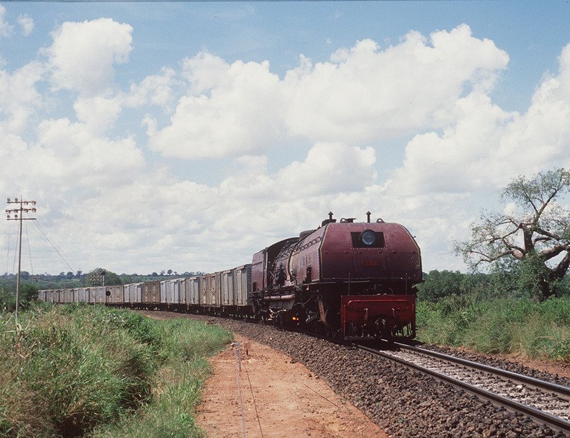
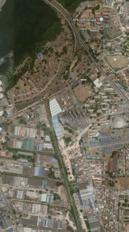
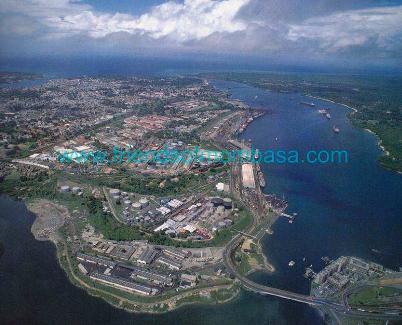
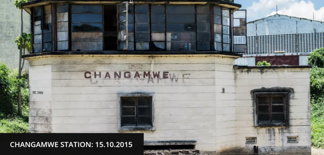
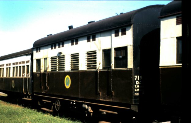
As the line turned to the north it was joined by a branch which served the Chamgamwe Oil Refinery to the south. Next came the first station on the line at Chamgamwe. The photographs of this station from the 1960s and 1970s are courtesy of Malcolm McCrow’s website [3] and are copyright Malcolm McCrow and Kevin Patience.

This picture shows a single-headed goods train arriving at Chamgamwe from Nairobi.

Double-headed by Class 59 Garratts a goods train travels through Chamgamwe Station in the two pictures above.

As we travel further along the line, the next station is Miritini. This is the location of the terminus of the new SGR (Standard Gauge Railway). It is close to the north end of the runway of Moi International Airport. The route of the line is marked on the map below just below the Mombasa Road. The two satallite images below show the line passing through a goods marshalling yard to the north-east of the airport and then travelling passed the north end of the runway.

Class 59 Garratt 5911 Mount Sekerri from Nairobi arrives beneath the palm tress at Miritini hauling a tank train.[4] 

The passenger train station in Miritini, Mombasa, on May 2017. [5]

At the time of writing of this blog post, the old metre-gauge line can still be followed on the satellite images provided by Google Earth beyond Mirtini. The next significant points on the line are the station and spiral at Mazeras. The spiral is encountered first and a kilometre or two further along the line we encounter the station.

Approaching the spiral from Mombasa the railway has been following the Mombasa to Nairobi main roadroad andntravelling in a roughly westerly direction. The map and the satellite image below show the railway separating from the road and travelling in a south-westerly direction towards the spiral.

Nairobi-bound trains pass under the higher level of the spiral before then crossing over the lower line. Malcolm McCrow provides a few images from 1970s. [3] I have not yet been able to find any other pictures.

An evening train from Mombasa approaches the spiral, © Peter Ritchie (1971).

The view from the cab of a Class 59 Garratt as it comes down off the spiral and passes under the higher line. ©Kevin Patience.

The Morning Train A02 from Nairobi descends the Mazeras Spiral as it heads for its 8:00am arrival in Mombasa, © Peter Ritchie.

And before we leave the spiral, a sequence showing Class 59 Garratt No. 5918 Mount Gelai negotiating the spiral in 1975.[3] The picture quality is lower as these images come from  video, © Ian Stone.Mazeras station comes a short distance north along the line.

In the next post we will travel on toward Voi and then on to Nairobi.


References

1. #Savetherailway; http://www.savetherailway.com, accessed on 14th May 2018.

2. The Friends of Mombasahttp://www.friendsofmombasa.com, accessed on 15th May 2018.

3. McCrow.org.uk; http://www.mccrow.org.uk/EastAfrica/EastAfricanRailways/NairobiMombasa.htm, accessed 14th May 2018.

4. https://www.pinterest.com/pin/554083560377607729, accessed on 15th May 2018, sourced from http://www.mccrow.org.uk © Kevin Patience.

5. Photo courtesy of the Nation Media Group photographer, Jeff Angote; Ng’ang’a Mbugua; SGR can open up Kenya if we build lines to feed it; Friday 2nd June 2017, https://www.nation.co.ke/oped/opinion/sgr-can-open-up-kenya-if-we-build-service-lines-to-feed-it/440808-3953710-bxs6l0z/index.html, accessed on 15th May 2018.

The Uganda Railway – Part 2

Although the featured image bears the title ‘Zanzibar’ it is actually a picture of an early wooden trestle bridge on the Uganda Railway at Mombasa. The picture is probably taken in 1899.[1] The card itself is dated 1901. The pictures were taken by Coutinho Bros. Photographers of Zanzibar. The picture of the railway is taken from “the lead in to the wooden trestle bridge built across the creek for the Uganda Railway between Mombasa Island and the mainland in 1896.”[2] This only remained in service for a short time, being replaced by an iron pile bridge, which itself was only in service until the 1920s. Pictures of this iron bridge are shown below. The crossing was called the Macupa (Salisbury) Bridge. The first picture was taken in 1903, the second in 1909 …

More about the History of the network of Metre-Gauge Railways in East Africa

A. Uganda Railway: The Uganda Railway was, first of all, a means of reaching Lake Victoria from Mombasa. Construction of the railway line started, as we have noted in the first post in this series,[3] just before the turn of the 20th Century. The Uganda Railway Company lasted until 1927 when it was reorganised and renamed as the Kenya-Uganda Railways & Harbours Company.

The terminus at Lake Victoria was called Port Florence and was named for the wife of the railway engineer, Ronald Preston. On 20th December 1901, Mrs Florence Preston took a hammer to symbollically drive in the last spike of the last rail immediately on the shore of the Lake.[4]

Within a year the name of the settlement had reverted to that given by the Luo people. The Luo called it ‘Kisumo’ (a good place to look for food). Kisumu was not the first port used by the British on the East coast of Lake Victoria. They first established Port Victoria, but by 1898, British explorers decided that the location of Kisumu was favourable. It was at the cusp of the Winasm Gulf and at the end of caravan trails from Pemba, Mombasa and Malindi and had great potential for access by lake steamers.

Almost from its inception the Uganda Railway developed shipping services on Lake Victoria. In 1898, it launched the 110 ton SS William Mackinnon at Kisumu, having assembled the vessel from a kit supplied by Bow, McLachlan and Company of Paisley in Scotland. A succession of further Bow, McLachlan & Co. kits followed. The 662 ton sister ships SS Winifred and SS Sybil (1902 and 1903), the 1,134 ton SS Clement Hill (1907) and the 1,300 ton sister ships SS Rusinga and SS Usoga (1914 and 1915) were combined passenger and cargo ferries. The 812 ton SS Nyanza (launched after Clement Hill) was purely a cargo ship. The 228 ton SS Kavirondo launched in 1913 was a tugboat. Two more tugboats from Bow, McLachlan were added in 1925: SS Buganda and SS Buvuma.[1],[5],[6]

The amazing story of the delivery and construction of the SS William Mackinnon is covered elsewhere but is worth reading. The ship was dismantled into a series of parts, all but two of which were less than the weight designated for an individual porter. The parts made their way across the interior by porter long before the railway was completed.[7]

Boats, ships and steamers are not the main focus of this post, so let’s get back on track! Here are two images of the railway which I have found on another WordPress blog.[8]. The first shows construction in progress the second shows the railway passing through a small local settlement.

There is an excellent collection of photographs relating to the construction of the Uganda Railway on this link:

https://www.theeagora.com/the-lunatic-express-a-photo-essay-on-the-uganda-railway

Just a few of those images are reproduced here … three examples include the arrival of the line at its first station out of Mombasa, Chamgamwe, just 6 miles out of Mombasa. It was opened on 15th December 1897.

Voi (below) was 100 miles from Mombasa.


Nairobi Station was 326 miles from Mombasa and is shown in old postcard pictures below.


The railway continued through a series of smaller stations to Kisumu. Once the railway reached Kisumu, access to Lake Victoria was transformed, and an 11-kilometre (7 mile) rail line between Port Bell and Kampala was the final link in the chain providing efficient transport between the Ugandan capital and the open sea at Mombasa, more than 1,400 km (900 miles) away.[1]

Branch lines were built to Tikka in 1913, Lake Magadi in 1915, Kitale in 1926, Naro Moro in 1927 and from Tororo to Soroti in 1929. Lake Magadi provided a strong commercial interest as it proved to be an excellent place for harvesting naturally occuring soda.

Lake Magadi is the southernmost lake in the Kenyan Rift Valley, lying in a catchment of faulted volcanic rocks, north of Tanzania’s Lake Natron. During the dry season, it is 80% covered by soda and is well known for its wading birds, including flamingos, it is a saline, alkaline lake, approximately 100 square kilometres in size and an example of a “saline pan”. The lake water, which is a dense sodium carbonate brine, precipitates vast quantities of the mineral trona (sodium sesquicarbonate). In places, the salt is up to 40 metres thick. The lake is recharged mainly by saline hot springs (temperatures up to 86 °C) that discharge into alkaline “lagoons” around the lake margins.[8]
I enjoyed a visit to the soda works at Lake Magadi in 1994, sadly by car and not by train!

The Soda Works

A soda train on the Magadi branch in Kenya

Theeagora.com refers to the Uganda Railway as ‘The Lunatic Express’, as do a number of different sources.[1],[9] It was first given a similar moniker as early as the late 19th Century. The Uganda Railway faced a great deal of criticism in the British Parliament, as many MPs felt that the railway was a Lunatic Line:

What is the use of it, none can conjecture,
What it will carry, there is none can define,
And in spite of George Curzon’s superior lecture,
It is clearly naught but a lunatic line.
— Henry Labouchère, MP, [1],[10]

“Political resistance to this “gigantic folly”, as Henry Labouchère called it,[1],[11] surfaced immediately. Such arguments along with the claim that it would be a waste of taxpayers’ money were easily dismissed by the Conservatives. Years before, Joseph Chamberlain had proclaimed that, if Britain were to step away from its “manifest destiny”, it would by default leave it to other nations to take up the work that it would have been seen as “too weak, too poor, and too cowardly” to have done itself.[1],[12] Its cost has been estimated by one source at £3 million in 1894 money, which is more than £170 million in 2005 money,[1],[13] and £5.5 million or £650 million in 2016 money by another source.”[1],[14]

“Because of the wooden trestle bridges, enormous chasms, prohibitive cost, hostile tribes, men infected by the hundreds by diseases, and man-eating lions pulling railway workers out of carriages at night, the name “Lunatic Line” certainly seemed to fit. Winston Churchill, who regarded it “a brilliant conception”, said of the project: “The British art of ‘muddling through’ is here seen in one of its finest expositions. Through everything—through the forests, through the ravines, through troops of marauding lions, through famine, through war, through five years of excoriating Parliamentary debate, muddled and marched the railway.””[1],[15]

The modern term Lunatic Express was coined by Charles Miller in his 1971 “The Lunatic Express: An Entertainment in Imperialism.” [9]

B. Kenya-Uganda Railways and Harbours: In 1927 the Uganda Railway was transformed into Kenya-Uganda Railways & Harbours by the British colonial administration. The railway system in Kenya & Uganda operated in this guise until 1948. during this time the railway system was further expanded. In 1931, a branch line was completed to Mount Kenya and a significant extension to the mainline was made from Nakuru to Kampala in Uganda. This line made the route to Kisumu less significant. Nakuru Station had significant marshalling yards. The first image is an early picture of the station and its sidings. The second picture shows the station building built in the mid-1950s. This new station was opened on 14th June 1957 by the then Governor of Kenya Sir Eveleyn Baring. As can be seen it was of an architectural style redolent of buildings in the UK in the 1950s.


C. East African Railways and Harbours – 1948 to 1966: in 1948, Kenya, Uganda and Tanzania came under the same British Colonial Administration. Following the terms of the Versailles Treaty in 1919 Germany lost all her colonies worldwide. The colonies became the mandate territories of the League of Nations (currently United Nations). Victorious nations surrounding the mandate territories were allowed to administer them on behalf of the League of Nations. The railways of the three colonies/ protectorates were amalgamated.

D. East African Railways Corporation – 1966 to 1978: following independence, the three East African Presidents Jomo Kenyatta, Julius Nyerere and Milton Obote met in Arusha and came up with the Arusha declaration in 1966. In the declaration, it was resolved that efficiency in parastatals needed to be improved. One of the parastatals identified for reform was East African Railways & Harbours. It was decided in this meeting that harbours be divorced from the railways administration. This was done purely for the purpose of efficiency. In 1969, the name changed to East African Railways Corporation.

E. Kenya Railways Corporation, Uganda Railways Corporation and Tanzania Railways Corporation – 1978-2006: by the late 1970s, the distrust between the three East African leaders, Nyerere, Kenyatta and Idi Amin had reached fever pitch. This was partly due to the different political ideologies that the three leaders practiced. Additionally, Nyerere and Amin believed that Kenya was benefiting more from the East African Community than Tanzania and Uganda. Personal differences between the three leaders culminated in the break-up of the East African Community in 1977. The break up led to the birth of Kenya Railways, Uganda Railways & Tanzania Railways as separate entities.

F. Rift Valley Railways – 2006 to 2017: Rift Valley Railways (RVR) took over the operations of the Kenya and Uganda Railways on 1st November, 2006. RVR was established on October 14, 2005, when the Government of Kenya and the Government of Uganda jointly tendered through a bidding process, a 25 year concession for the rehabilitation, operation and maintenance of the railways then run by Kenya Railways Corporation (KRC) and Uganda Railways Corporation (URC) respectively. The concession was terminated in October 2017.[16]

G. Uganda Railways Corporation – 2017 to …….: The railways of Uganda and Kenya are now back under government control. Kenya is already developing a standard gauge railway system and it is very possible that with Chinese investment , a standard gauge system will extend across Uganda  and Tanzania into Rwanda, Burundi and the Democratic Republic of Congo. There may be more about this in a future post.

The existing lines within Uganda are in the hands of a renewed Uganda Railways Corporation. The transfer finally occurred in February 2018.[18] Commuter services in Kampala are due to resume in 2018, now that the railway is back in Ugandan hands.

References

1. Wikipedia, Uganda Railway; https://en.m.wikipedia.org/wiki/Uganda_Railway, accessed on 6th May 2018.

2. Old East Africa Postcards; http://www.oldeastafricapostcards.com/?page_id=2352, accessed 7th May 2018.

3. https://rogerfarnworth.wordpress.com/2018/05/09/uganda-railways-part-1.

4. AllAfrica.com; A Hundred Years Down the Drain; http://allafrica.com/stories/200110220533.html, accessed 9th May 2018.

5. Stuart Cameron, David Asprey & Bruce Allan; SS Buganda. Clyde-built Database, accessed on 22nd May 2011.

6. Stuart Cameron, David Asprey & Bruce Allan; SS Buvuma. Clyde-built Database, accessed on 22nd May 2011.

7. Ian H. Grant; Nyansa Watering Place, the Remarkable Story of the SS. William MacKinnon; The British Empire; https://www.britishempire.co.uk/article/nyanzawateringplace.htm, accessed on 9th May 2018.

8. Wikipedia, Lake Magadi; https://en.m.wikipedia.org/wiki/Lake_Magadi, accessed on 9th May 2018.

9. Theeagora.com, The Lunatic Express; https://www.theeagora.com/the-lunatic-express-a-photo-essay-on-the-uganda-railway,accessed on 9th May 2018; & Charles Miller, The Lunatic Express – An Entertainment in Imperialism; The History Book Club, 1971.

10. Peter Muiruri, End of road for first railway that defined Kenya’s history; The Standard; https://www.standardmedia.co.ke/article/2001241674/end-of-road-for-first-railway-that-defined-kenya-s-history, accessed on 9th May 2018.

11. Henry Labouchère. “UGANDA RAILWAY [CONSOLIDATED FUND]. HC Deb 30 April 1900 vol 82 cc288-335”. Hansard 1803–2005. UK Parliament. Retrieved 10 March 2012. I am opposed entirely to this sort of railway in Africa, and I have been opposed to this railroad from the very commencement because it is a gigantic folly. . . . This railroad has been, from the very first commencement, a gigantic folly.

12. Joseph Chamberlain. “CIVIL SERVICES AND REVENUE DEPARTMENTS ESTIMATES, 1894–5: CLASS V. HC Deb 01 June 1894 vol 25 cc181-270”. Hansard 1803–2005. UK Parliament, accessed on 10th March 2012.

13. Currency converter; The National Archives, accessed on 10th March 2012.

14. Daniel Knowles; The lunatic express. 1843; The Economist, 23rd June 2016, accessed on 15th July 2016.

15. Winston Spencer Churchill,; My African Journey; William Briggs, Toronto, 1909, p4-5.

16. Uganda, Kenya, failed railway deal, (Rift Valley Railways); The Monitor; http://www.monitor.co.ug/Business/Markets/Uganda–Kenya-failed-railway-deal—RVR-chief/688606-4140902-15aa6p0/index.html, accessed on 10th May 2018.

17. Isaac Khisa; The Independent (Kampala) AllAfrica.com, Uganda Railways is back! http://allafrica.com/stories/201708140089.html, accessed on 10th May 2018.

18. Amos Ngwomwoya“Passenger train services to resume on Monday”Daily Monitor. Kampala, 23rd February 2018, accessed on 10th May 2018 & Alfred Ochwo, and Mercy Ahukana (27 February 2018). “Kampalans welcome revamped passenger train services”The Observer (Uganda), Kampala, 27th February 2018, accessed on 10th May 2018.

The Uganda Railway – Part 1

From late April to mid May 2018 my wife and I were in Uganda. This was my 6th visit to the country. On the first, in 1994, I travelled to Kampala from Mombasa on the railway. It was a fantastic journey in a slow moving train with silver service in the dining car and with beds made up for us by staff each night. There were two separate trains, a njght train from Mkmbasa to Nairobi run by the then Kenya Railways and a train from Nairobi to Kampala run by Uganda Railways.

The track is metre-gauge.

This short series of posts tells the story of the line to 2018 and then looks forward from that year into the future. In recent times the railway system in Uganda has had a chequered history and had been relatively badly managed, as you will see. The present network is in a dilapidated state. The network is shown in the image below.


The country of Uganda has about 1,350 kms of railway lines and most of it has not been operational for over 25 years. Repairs had been completed on the Tororo-Gulu line and were still ongoing on the Gulu-Pakwach Line in early 2014. [1]

The railway originating at Mombasa on the Indian Ocean connects to Tororo in Uganda, where it branches westward to Jinja, Kampala, and Kasese and northward to Mbale, Soroti, Lira, Gulu, and Pakwach (to the south-east of Arua and on the northern edge of the Murchison Falls National Park – the Pakwach Bridge crosses the White Nile close to the town).

There was no chance, in 2018, for me to check out the railway system. After a very short stay in Kampala we spent the rest of our time in the south-west of the country in Kyegegwa, Rukungiri and Kisoro.

Back in 1994, I was taking slides and being very careful not to exhaust my supply of film. How much things have changed! I do have four pictures, taken at Mombasa railway station, of coaches from the early to mid 20th Century which were stored among slightly more modern stock, at least three seemed still to be in use. …..

The last photo above is courtesy of Jennifer Wu (https://www.flickr.com/photos/wippetywu/8333244855), those below are some early postcards of the station in Mombasa.

The Early History of the Line

The Uganda Railway was built during what became known as the Scramble for Africa, (the struggle between European powers for dominance in Africa). It provided a strategic link between the coast at Mombasa and the Great Lakes region. In doing so, it effectively secured British domination of the region.[2],[3]

The Uganda Railway was named for its ultimate destination. Its original length of 660 miles (or 1056 kilometres) lay entirely in what we now call Kenya.

Work on the railway began at the port of Mombasa, in what was then called British East Africa, in 1896. The intended terminus at Kisumu on the shores of Lake Victoria was reached in 1901.[2],[4]

Construction was carried out principally by labourers from the Indian subcontinent, 32,000 of whom were brought in because of a lack of local labour in very sparcely populated areas of East Africa. The horrendous truth is that the line was built on the lives of those labourers. 2,498 workers died during the construction of the railway.[2],[5] An artists impression of the work is shown in the image below (courtesy of Charan Kundi).

Many of the labourers returned to India but 6,724 decided to remain after the line’s completion, creating a community of Indian East Africans.

The railway is, almost in its entirety, single-track. A massive logistical exercise was put in place to import from India a very significant amount of steelwork – rails; fishplates and bolts; keys; and girders. Over 1.2 million sleepers were also required. To secure the necessary throughput of materials, Kilindini Harbour ws created in Mombasa. “The railway was a huge logistical achievement and became strategically and economically vital for both Uganda and Kenya. It helped to suppress slavery, by removing the need for humans in the transport of goods.” [2],[6]

The railway line had a significant impact. It effectively created Uganda and Kenya as the countries that they became. As we have already noted, the railway defeated the slave trade in British East Africa. It allowed heavy equipment to be transported with relative ease.

The use of indian sub-continent labour resulted in a very significant minority of Asians in East Africa. These Indians worked as “dukawallas” (shopkeepers), artisans, traders, clerks, and, finally, lower-level administrators. Excluded from the middle and senior ranks of the colonial government and from farming, they became a commercial middleman and professional community.[7] The British administration encouraged European settlement and farms were set up for coffee and tea production with the railway available to ensure easy shipping to Europe for processing. As the numbers of settlers and farms increased native populations became alienated from their land and seeds were sown for the later struggle for independence. At the same time, inceeases in white settlement made demands on the railway. New small stations were required to allow transportation of agricultural produce. These stations included: Nakuru, Naivasha, Tigoni, Kijabe and Sigona.

In addition, the railway contributed to increased urbanisation. Many of today’s towns in Kenya, and some in Uganda, have reulted from the presence of the railway. Mombasa urbanisation can be traced to the start of the construction of the line. Nairobi was a rail depot placed in the middle of a swamp, and is now the capital of Kenya. Other towns for which this is true are … Kikuyu, Naivasha, Nakuru (where the main line splits, one branch going to Kisumu and the other to Uganda), Nanyuki, Eldoret (originally called “64″ its distance, in miles, from the railhead at the time), Kitale (a small farming community in the foothills of Mount Elgon), Kisumu (then called port Florence, a city and port on Lake Victoria allowing ferry transport between Kenya, Tanganyika (modern Tanzania) and Uganda), Port Bell (a rail-linked port, near to Kampala, on Lake Victoria allowing ferry transport between Kenya, Tanganyika and Uganda), and Jinja.

Tourism also began to develop. “The railway provided a ‘modern’ means of transport from the East African coast to the higher plateaus of the interior. US president Theodore Roosevelt is one of the notable people who had safari adventures aboard a train in the early days of the use of the Kenya-Uganda railway.”[7]

The railway also opened up the interior to systematic government programmes to attack slavery, witchcraft, disease and famine. [7]

We have already heard that close to 2,500 of the 32,000 workers on the line died during its construction. There are two particular causes worthy of significant note.

The first concerns the death of a number of conctruction workers in 1898 during the building of a bridge across the Tsavo River. Hunting mainly at night, a pair of maneless male lions stalked and killed at least 28 Indian and African workers – although some accounts put the number of victims as high as 135.[2],[8] The picture above shows one of the two lions and Lieutenant-Colonel John H Petterson who killed it.

The second concerns resistance from locals. Building the railway met local resistance on various occasions. A major incident was the Kedong Massacre, when the Maasai attacked a railway worker’s caravan killing around 500 people because two Maasai girls had been raped. An Englishman unconnected to the railway, Andrew Dick, led a counter-attack against them, but ran out of ammunition and was speared to death by the Maasai.[2],[9] At the turn of the 20th century, the railway construction was disturbed by the resistance of the Nandi people led by Koitalel Arap Samoei. He was killed in 1905 by Richard Meinertzhagen, finally ending the Nandi resistance.[2],[9]

Some of the socio-economic background to the construction of the Uganda Railway will be considered in later articles in this series.

References

1. Lucy Styles, Uganda Railway Assessment, January 2014 (updated to June 2015); http://dlca.logcluster.org/plugins/servlet/mobile#content/view/3375402, accessedon 8th May 2018.

2. Wikipedia, Uganda Railway; https://en.m.wikipedia.org/wiki/Uganda_Railway, accessed on 6th May 2018.

3. Richard T. Ogonda & George M. Onyango; Development of Transport and Communication. In William Robert Ochieng’; Historical Studies and Social Change in Western Kenya. Nairobi: East African Educational Publishers, 2002. p219–231.

4. Richard T. Ogonda; Transport and Communications in the Colonial Economy. In William Robert Ochieng’ & R. M. Maxon; An Economic History of Kenya. Nairobi: East African Educational Publishers, 1992. p129–146.

5. Christian Wolmar; Blood, Iron & Gold: How the Railways Transformed the World. London: Atlantic Books, 2009.

6. Frank Richardson Cana; British East Africa. In Hugh Chisholm. Encyclopædia Britannica. 4 (11th ed.). Cambridge University Press, 1911. p601–606.

7. The Enzi Museum, Construction of the Kenya-Uganda Railway;
http://www.enzimuseum.org/archives/275, accessed on 8th May 2018.

8. Man eating lions – not (as) many dead; Railway Gazette International. 27 November 2009. http://www.railwaygazette.com/news/single-view/view/man-eating-lions-not-as-many-dead.html, accessed on 8th May 2018.

9. David Kaiza; End of Lunatic Express; The East African. 21 September 2009. http://www.theeastafrican.co.ke/magazine/-/434746/660876/-/view/printVersion/-/32dc3d/-/index.html, accessed on 8th May 2018.