
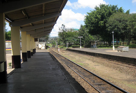
We start this next portion of the journey at Jinja Railway Station, Jinja sits on the northern shore of Lake Victoria, near the source of the White Nile.[1] Lonely Planet says that Jinja is “famous as the historic source of the Nile River, Jinja is now the adrenaline capital of East Africa. Get your fix of white-water rafting, kayaking, quad biking, mountain biking and horse riding in a gorgeous natural setting with crumbling colonial architecture. The Nile River’s world-famous rapids are under threat, however. In 2011 the Bujagali Hydroelectric Project buried around half of the rapids under a giant reservoir. Although the government has pledged to not further dam the river, Uganda still needs energy and so a new hydroelectric plant is planned for Kalagala Falls. Though worker strikes and faulty construction have it behind schedule for now, it’s expected that the Isimba Dam will flood some key rapids and even an island lodging as early as October 2018. It’s not the end of rafting though. Meanwhile locals keep pushing to keep Jinja’s tourism industry alive with offerings that have wisely begun to diversify.” [2]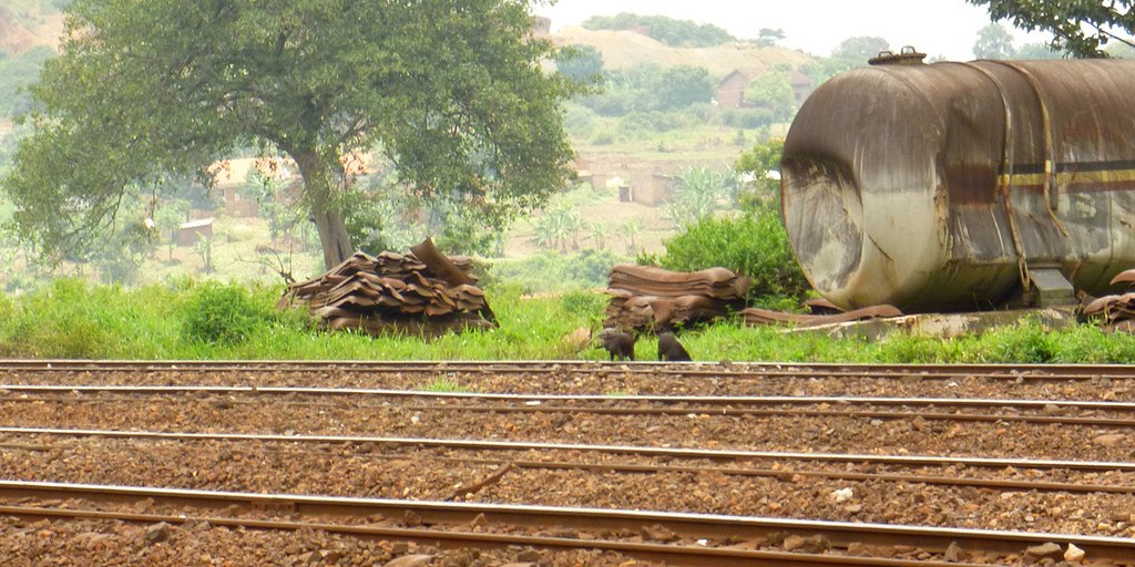 Before 1906, Jinja was a fishing village that benefited from being located on long-distance trade routes. The origin of the name “Jinja” comes from the language of the two peoples (the Baganda and the Basoga) that lived on either side of the River Nile in the area. In both languages “Jinja” means “Rock”. In most of Africa, rivers like the Nile hindered migration, this explains the ethnic boundaries along the Nile as one moves north from the river’s source on the northern shores of Lake Victoria.
 However the area around Jinja was one place where the river could be breached due to the large rocks near the Ripon Falls. Here, on either bank of the river, were large flat rocks where small boats could be launched to cross the river. These rock formations were also accredited with providing a natural moderator for the water flow out of Lake Victoria. For the original local inhabitants, the location was a crossing point, for trade, migration and as a fishing post.
This might explain why, despite this barrier, the two tribes have very similar languages, and the more powerful Baganda had an enormous influence on the Basoga. The area was called the ‘Place of Rocks’ or ‘The Place of Flat Rocks’. The word for stones or rocks in the language of the Baganda is ‘Ejjinja (Plural Amayinja), and in the Basoga dialect this became Edinda. The British used this reference to name the town they established – “Jinja”
In 1954,with the building of the Owen Falls Dam, (later renamed Nalubaale Power Station, the Ripon Falls were submerged. Most of the ‘Flat Rocks’ that gave the area its name disappeared under water as well. However a description of what the area looked like can be found in the notes of John Hanning Speke, the first European to lay eyes on the Source of the Nile:
“Though beautiful, the scene was not exactly what I expected, for the broad surface of the lake was shut out from view by a spur of hill, and the falls, about twelve feet deep and four to five hundred feet broad, were broken by rocks; still it was a sight that attracted one to it for hours. The roar of the waters, the thousands of passenger fish leaping at the falls with all their might, the fishermen coming out in boats, and taking post on all the rocks with rod and hook, hippopotami and crocodiles lying sleepily on the water, the ferry at work above the falls, and cattle driven down to drink at the margin of the lake, made in all, with the pretty nature of the country—small grassy-topped hills, with trees in the intervening valleys and on the lower slopes—as interesting a picture as one could wish to see.”
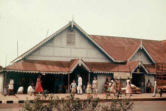
 Cotton-packing, nearby sugar estates, and railway access all enabled Jinja to grow in size. By 1906 a street pattern had been laid out, and Indian traders moved in starting around 1910. The Indians were Catholic Christians and English-speaking, and originated in the former Portuguese colony of Goa on the west coast of India.
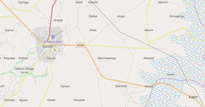
The town was founded in 1907 by the British, as an administrative centre for the Provincial Government Headquarters for Busoga region. This was around the time that Lake Victoria’s importance in transport rose due to the Uganda Railway linking Kisumu, a Kenyan town on the lake, with Mombasa on the Indian Ocean, 900 miles (1,400 km) away. British-American Tobacco Uganda (BATU) established a tobacco processing factory in Jinja in 1928. [3]
Jinja is a major station on the Uganda Railway and a port for Lake Victoria ferries since the early 1900s, when access to the railway was by ferry to the railhead at Kisumu. [4]
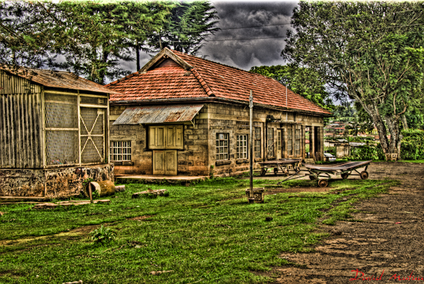
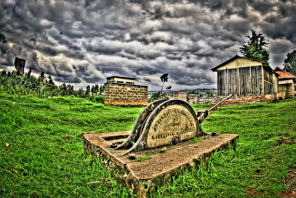
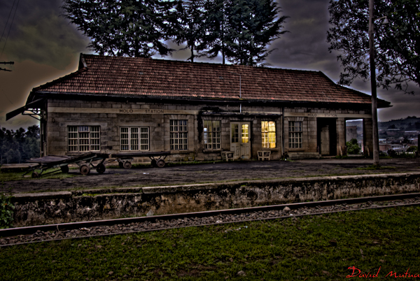
Before we get on our train, here are a few pictures from Jinja, taken in different eras and culled from a variety of different websites.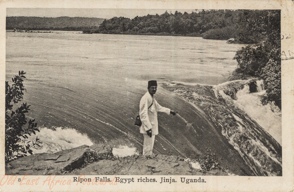 Ripon Falls
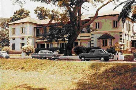 Ripon Falls Hotel
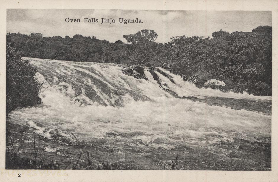 Owen Falls
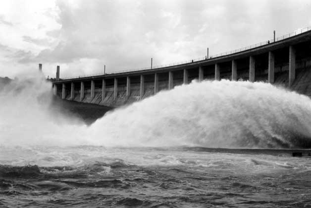 Owen Falls Dam in the early 1960s.
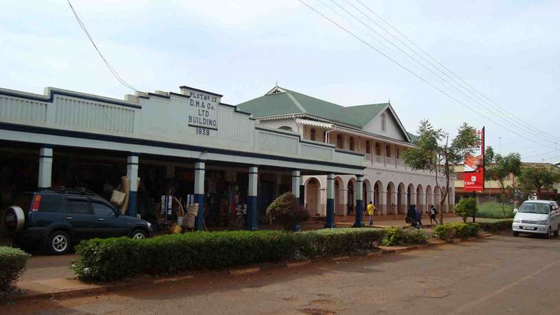
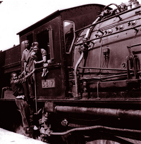
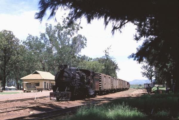
Enough of the City of Jinja. [5] ….. We return to the railway station and get ready to depart for Kampala.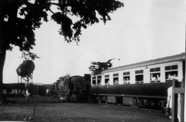 In this picture, it is January 1956 and a School Train for Eldoret has just arrived at Jinja – still in daylight. Until 1961, trains departed Kampala at 1500, as opposed to 1715, and thus arrived in Jinja just before sunset. The Class 60 Garratt is taking on water, (c) Malcolm McCrow. [6]
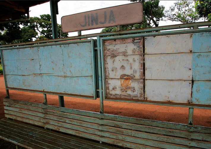
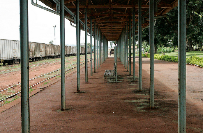
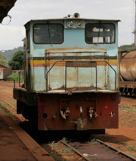
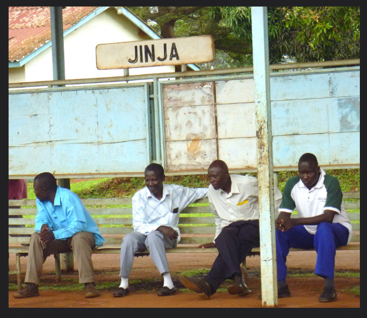
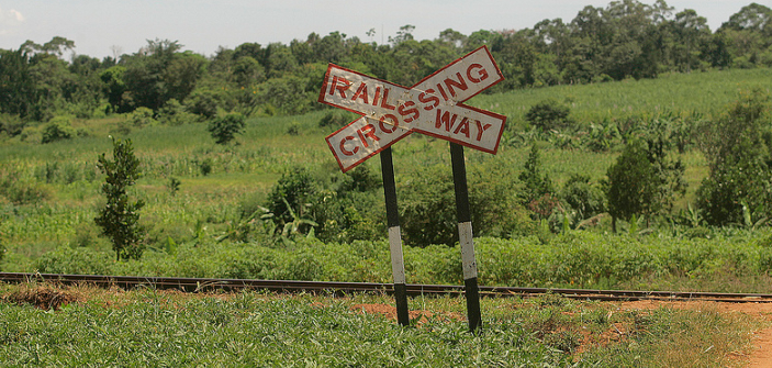
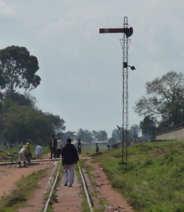
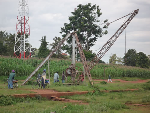
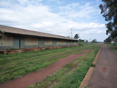
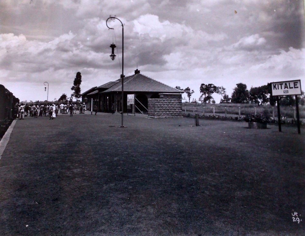
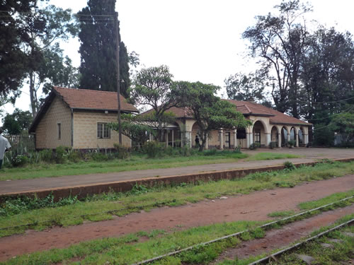
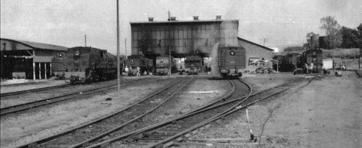
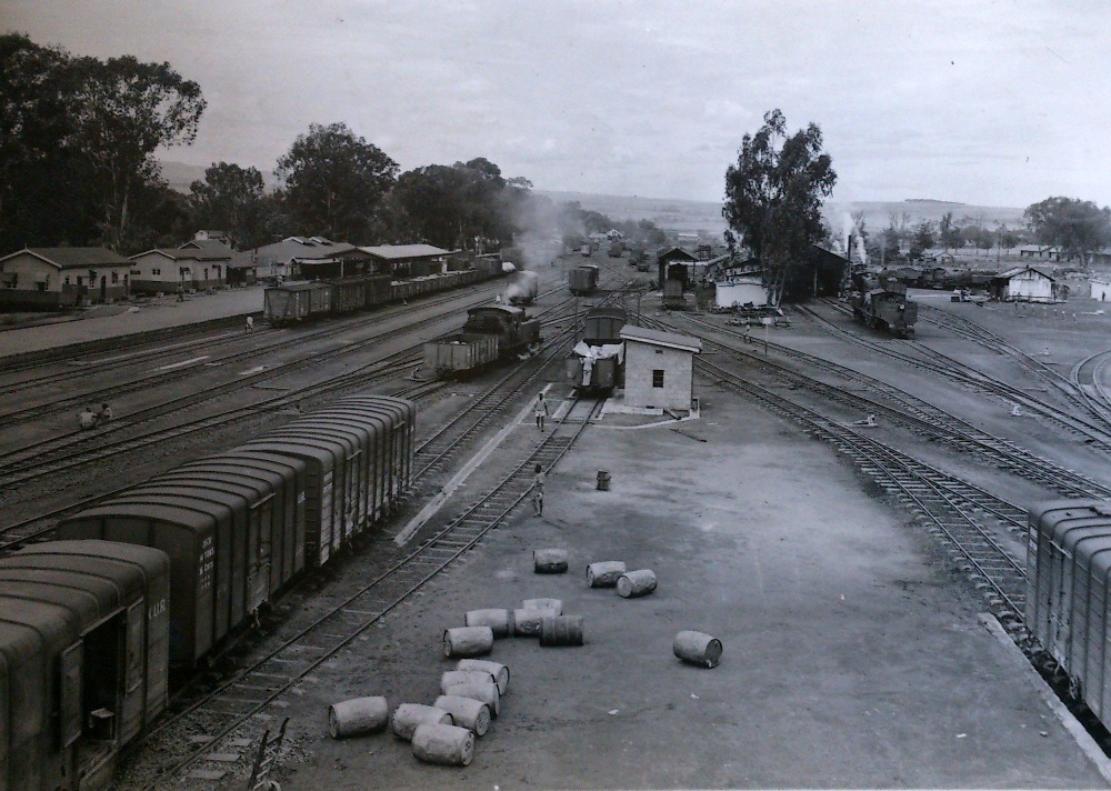
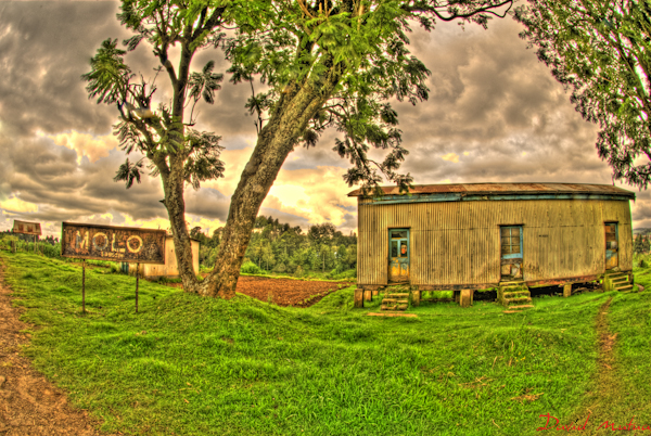
And below, a series of photos around the station site. [10][11]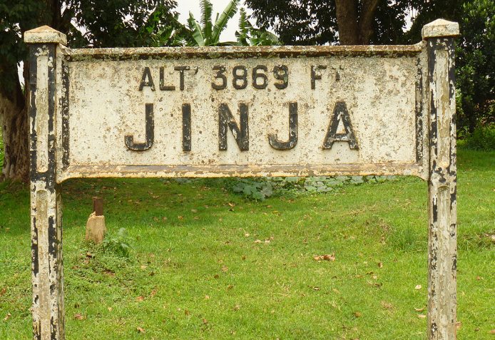
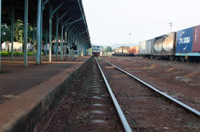
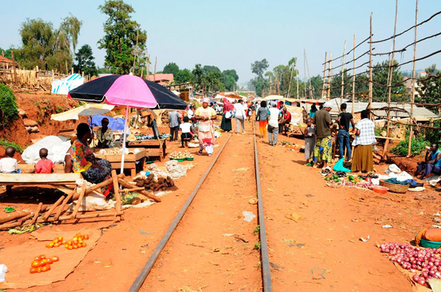
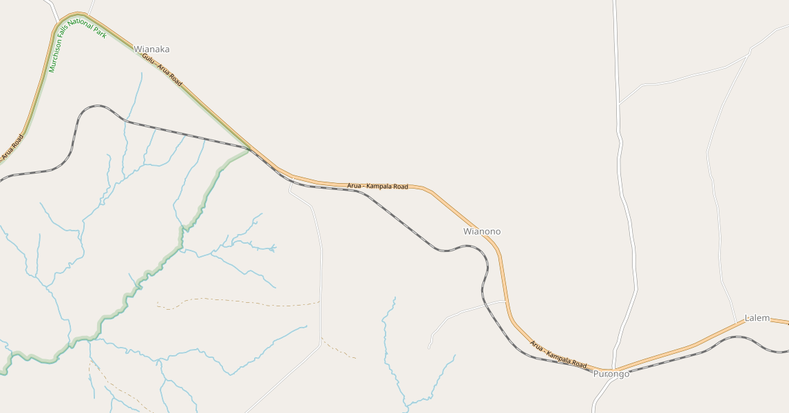
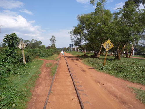
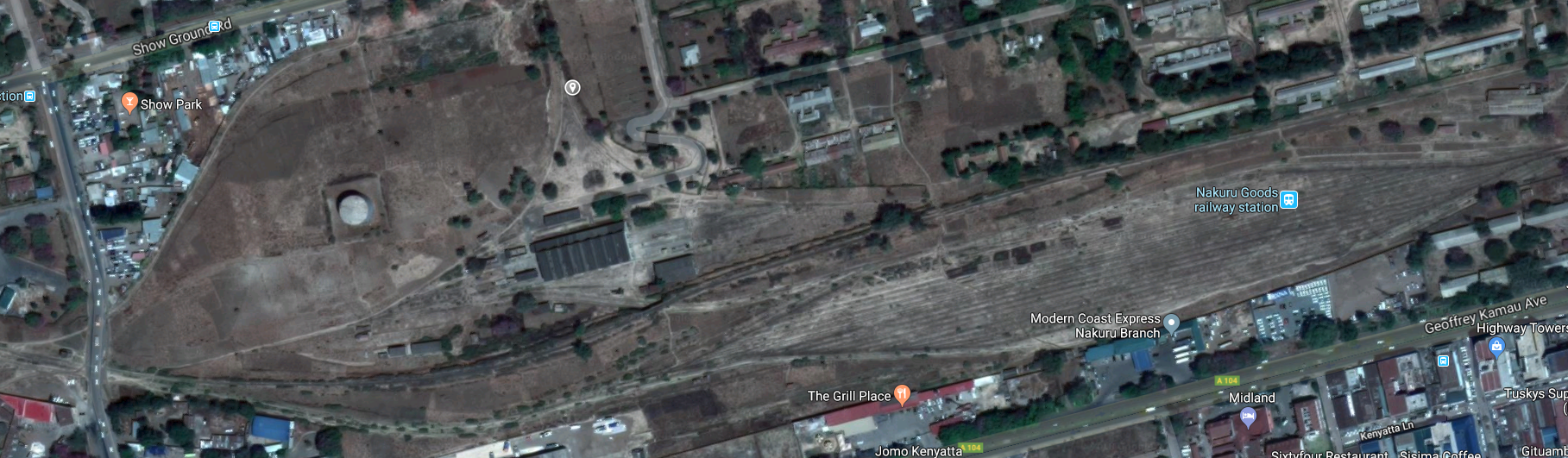
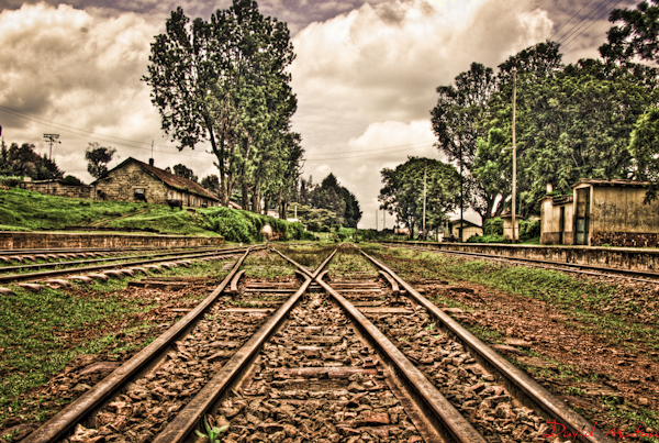
As we leave Jinja Railway Station, we cross unmetalled roads and head on towards the Victoria Nile. On the way, close to the Station throat, we pass two branch-lines, the first travels east and is no more than a factory access to the railway system. The second travels south alongside Nile Crescent to sidings and a pier on Lake Victoria. On the map immediately below, the main line turns to the west.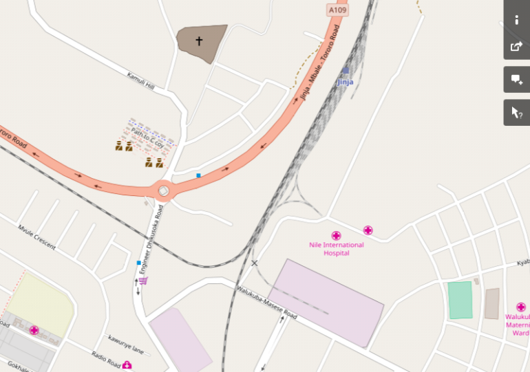
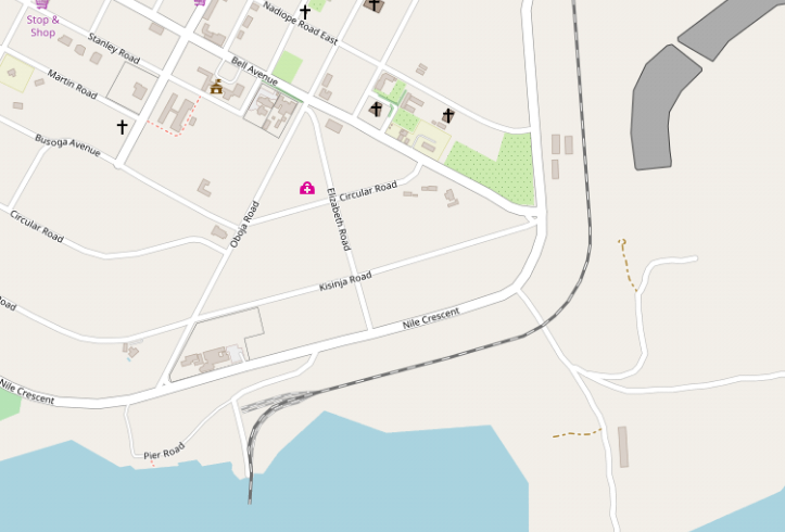 In a very short distance the line switches to the south and heads directly for the Nile Bridge.
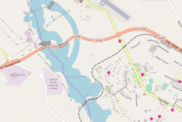
 A sharply curving alignment of the railway approaching the bridge from the east shows it in good light.
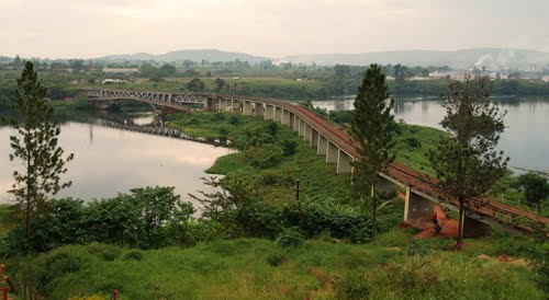
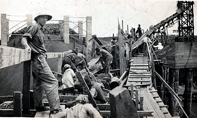
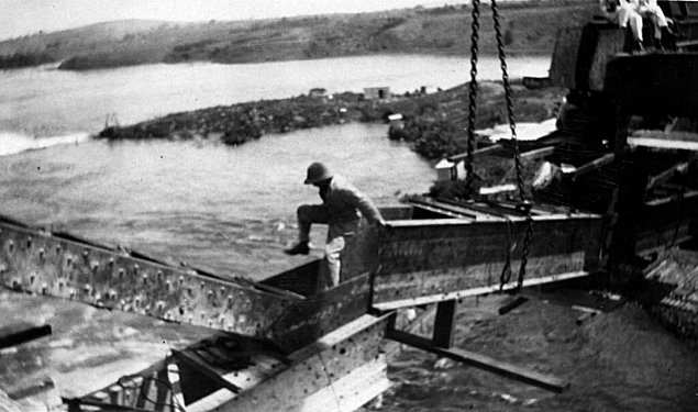
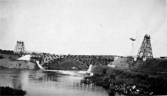
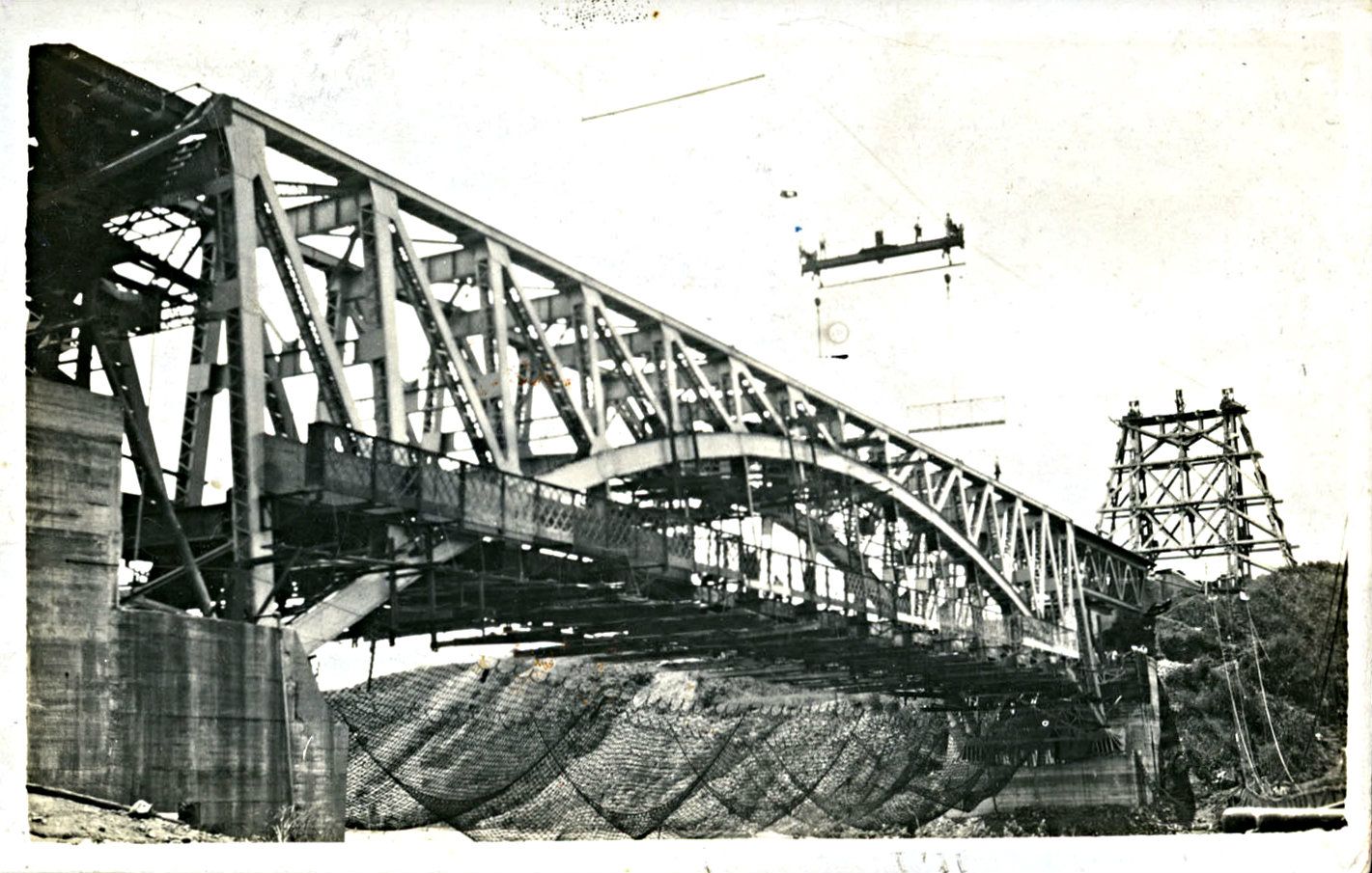
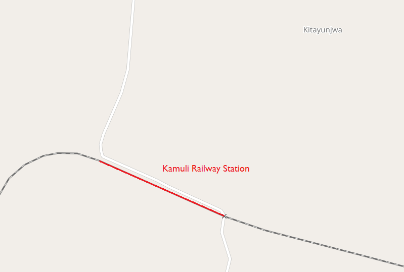
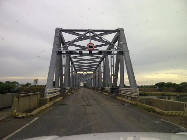
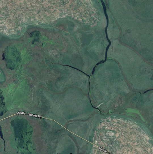
The Nile River Bridge at Jinja was built in the late 1920s. It is perhaps the iconic structure for the whole of the metre-gauge railway system from Mombasa to Kasese.
The first railway in Uganda ran from Jinja to Namasagali on the Victoria Nile where a steamer service ran on to Masindi Port. From there passengers travelled by road through Masindi to Butiaba on Lake Albert. From there they could travel on by steamer to the Belgian Congo or north to Juba in the Sudan.
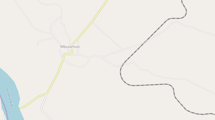
Train passengers from Kenya reached Uganda by steamer from the railhead at Kisumu and across Lake Victoria to Entebbe or Port Bell. In the mid 1920s the main line in Kenya was extended from Nakuru through Eldoret, and Tororo to Mbulamuti where it met up with the original Jinja to Namasagali line. The new line to Kampala then crossed the Nile at Jinja by a bridge carrying both the railway and a roadway underneath.
Ramsay Nicholson with the assistance of his younger brother Pearce Nicholson was responsible for supervising the construction of the bridge in 1926 and the following historic photographs were copied from their family’s photograph album in 2010. There are more in the album. [13]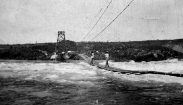
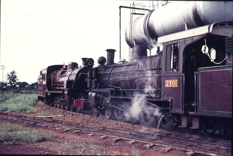
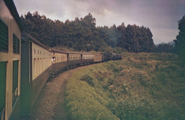
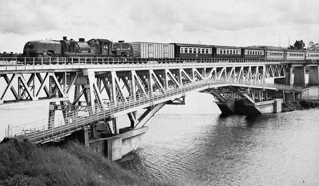 Both above and below (in colour) – looking east: Classic scene with Class 60 Garratt heading a Mail Train bound for Kampala over Jinja Bridge. The photograph was taken after 1958 as the dining car (last vehicle in photograph) has acquired the all cream livery which was introduced after the Queen Mother’s visit that year when several of the the aluminium coaches were painted cream to give a uniformity to the royal train consist. By 1961 all passenger coaches had acquired the dark maroon and cream livery which had previously only appeared on 2nd and 3rd class stock, (c) East African Railways & Harbours. [6]
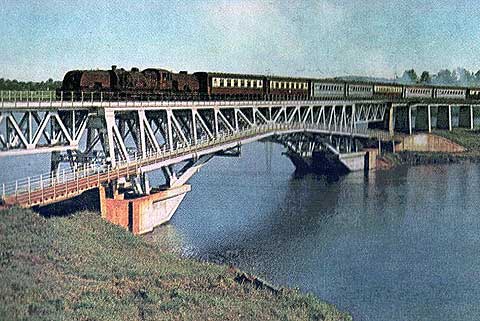
 Again looking east, A diesel in charge of a train on Jinja Bridge. [8]
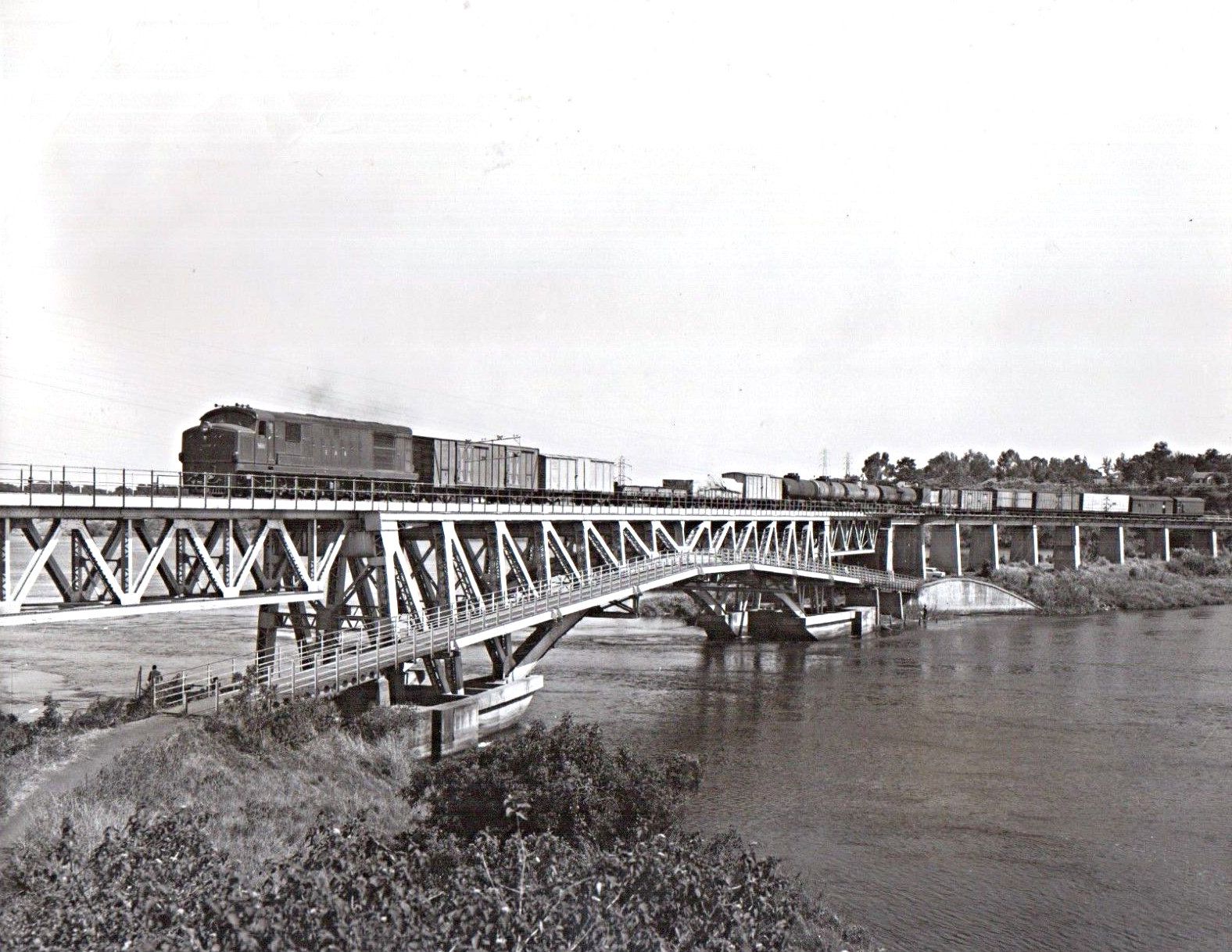
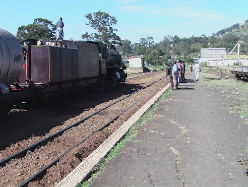
 The Nile Bridge at Jinja looking west. Jinja is still a very important railway centre with wagons being mustered for despatch by to Kenya – by rail via Tororo, or by rail ferry to Kisumu. Another possible destination for the wagons is Mwanza in Tanzania. Vague about what decides a wagon to go by rail via TRO or by Lake via KSM or MWZ, but thought to be customer who decides, (c) Iain Mulligan. [9]
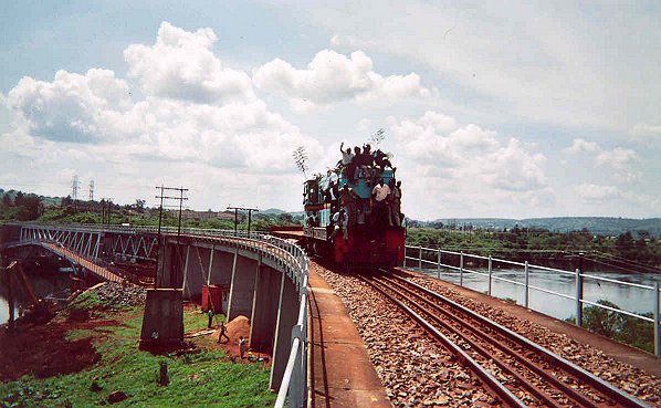 Again looking west, the photographer climbed up on to the Bridge and then walked back eastwards along the tracks. Once past the bridge itself, but still on the elevated approach, joy of joys, a “train” came over behind him. Not a real train, but the works train, and what that meant was a Class 62 decorated with palm leaves pulling a LSB, with a crowd of workers on their way from the stations to the west to a union meeting at Jinja. To the photographer’s horror the sides of the LSB were open flat, and there was only just room for him between them and the railings. Anyway, a great cheer from the passengers as they went past. (c) Iain Mulligan. [9]
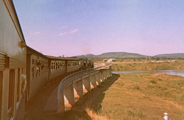 Happy days and homeward bound, the train is travelling toward Kampala. Most school pupils tended to get to a window for the crossing of the White Nile just after the train left Jinja. At primary school, many boys would carve “propellers” which they held out the window as the train went along at around 25 to 30 miles per hour, (c) Malcolm McCrow. [6]
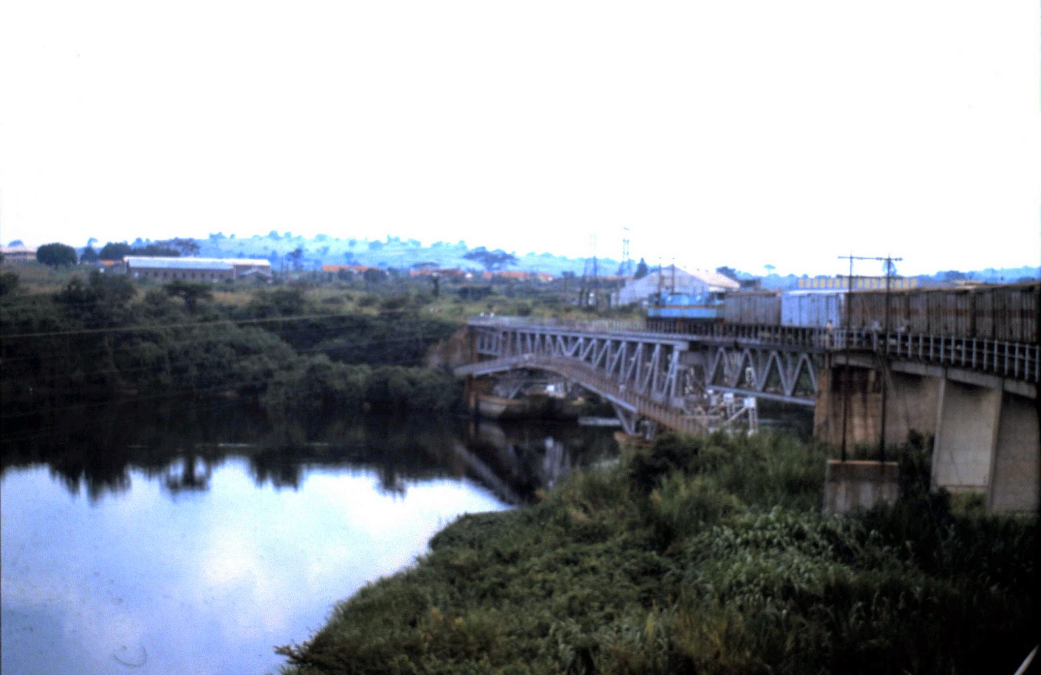 The Nile Bridge looking West in 1994. Our train has just moved on after a 6 hour delay at Jinja Railway Station.
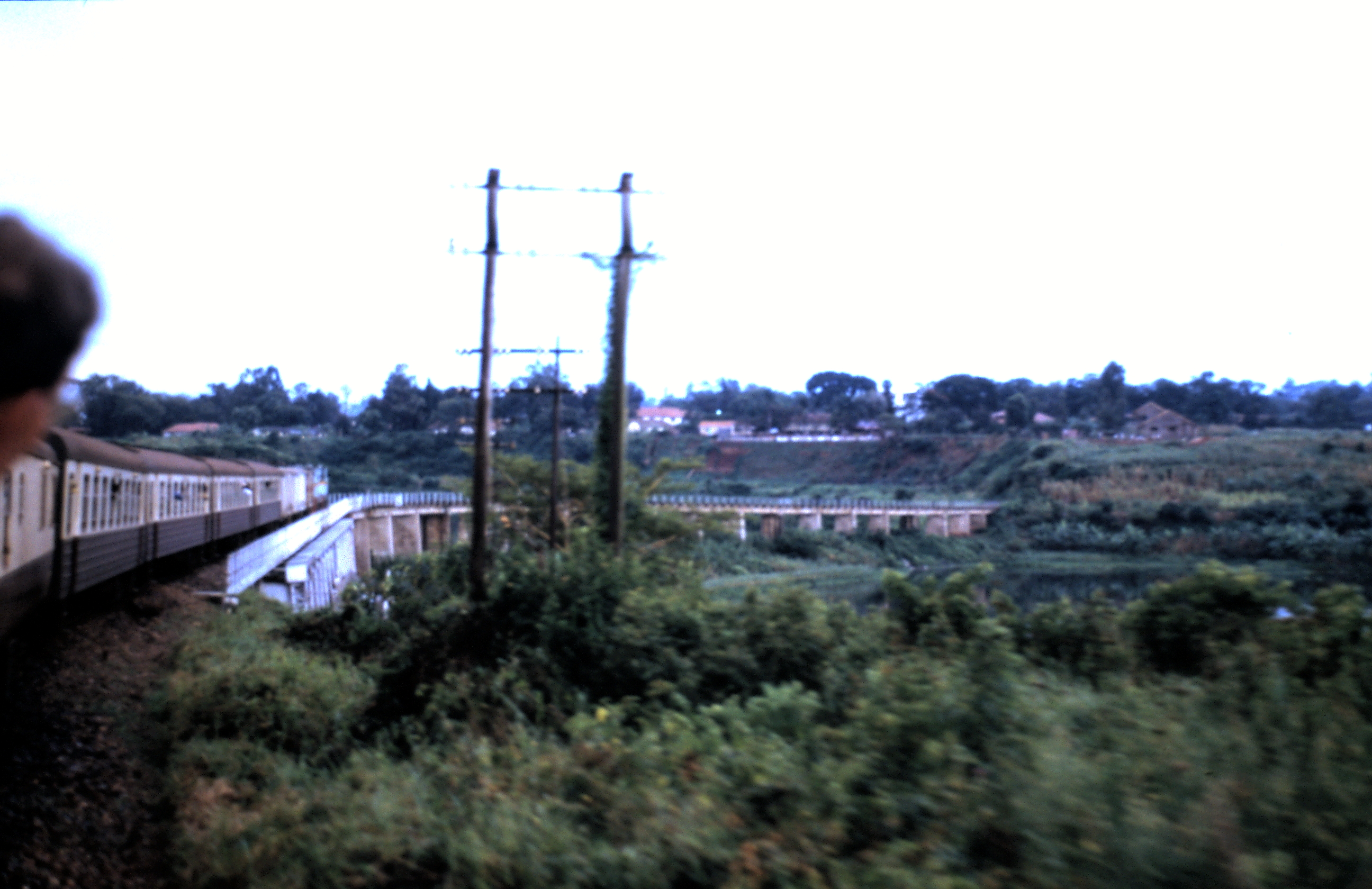 The Nile Bridge in 1994 looking east, on my return journey to Nairobi from Kampala.
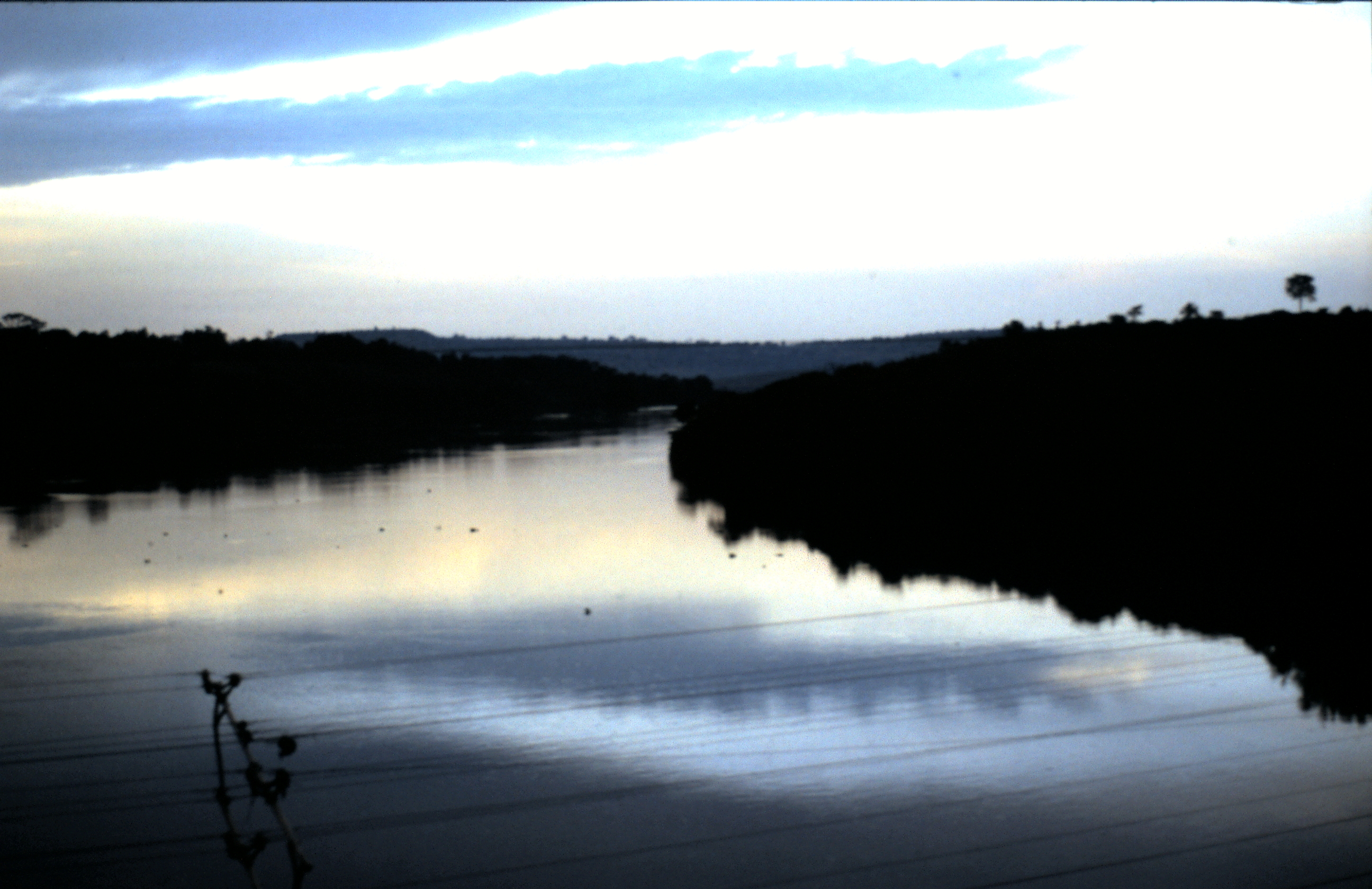 View from the Jinja Bridge at dusk in 1994.
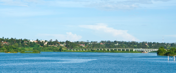 From a distance! [12]
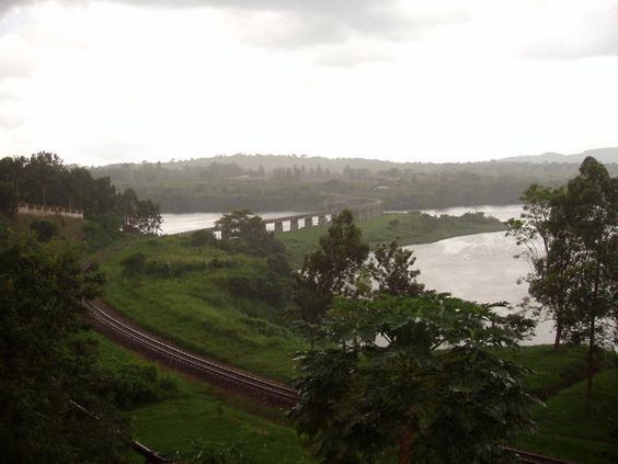
 River Nile Bridge at Jinja looking west. [7].
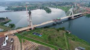
There is (June 2018) a new road bridge being constructed across the Nile between the railway bridge and the old road bridge which should be open in 2018. It is a strikingly modern cable-stayed bridge! [14]
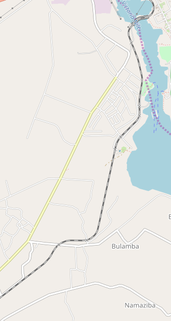 Once the railway has crossed the Nile it travels on in a southerly direction towards Bulamba and then swings gradually round to the south-west. On its way to Kampala the railway passes through the following Stations:
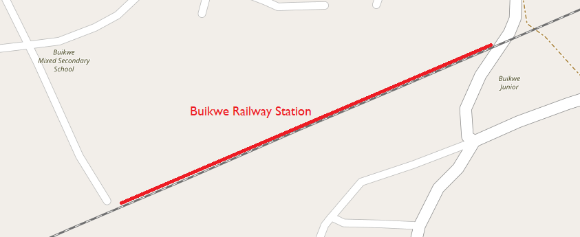
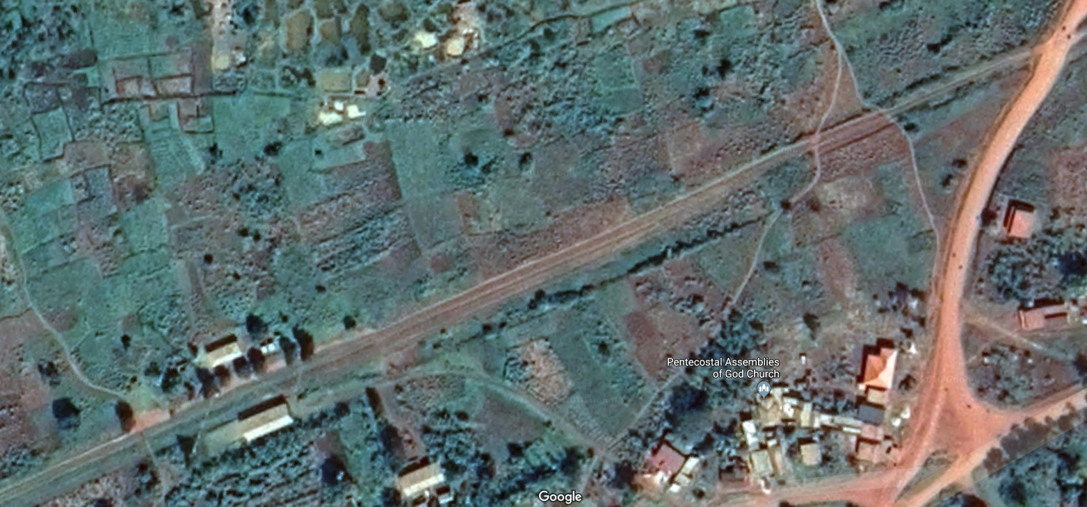
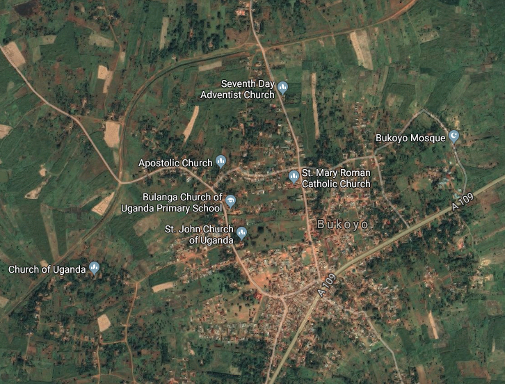
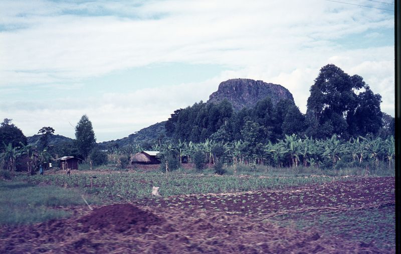
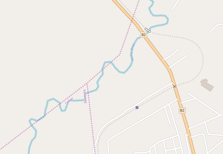
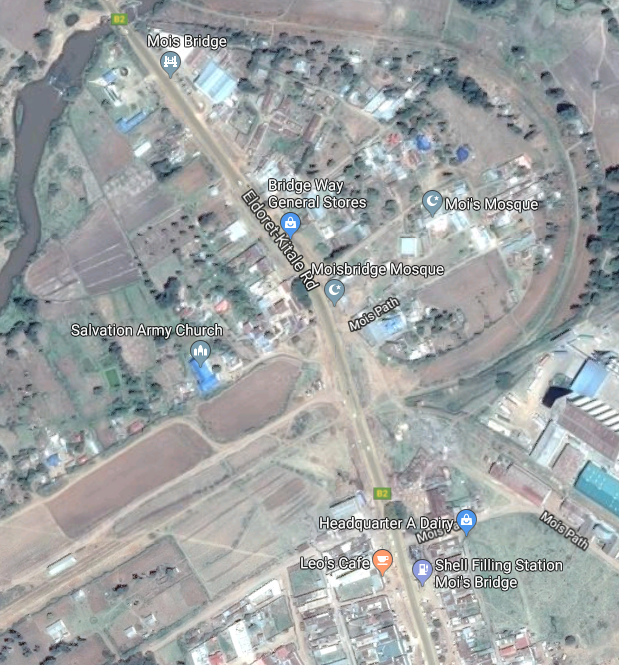
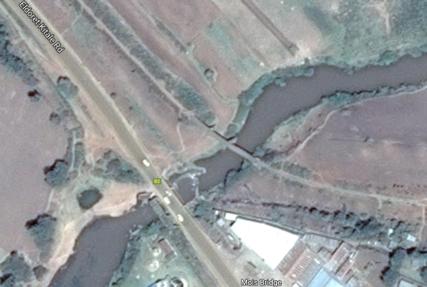
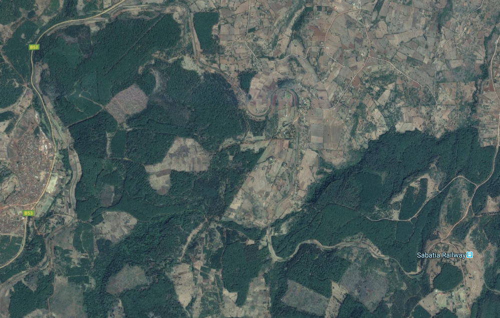
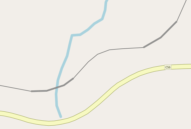
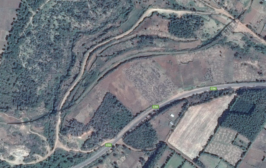
Buikwe (Buyikwe): as far as I can tell, this is the first station/halt beyond Jinja Railway Bridge when travelling towards Kampala. The first map and satellite image below show its location and I believe that it is likely that the monochrome picture which follows was taken at the Station in the early 1950s.
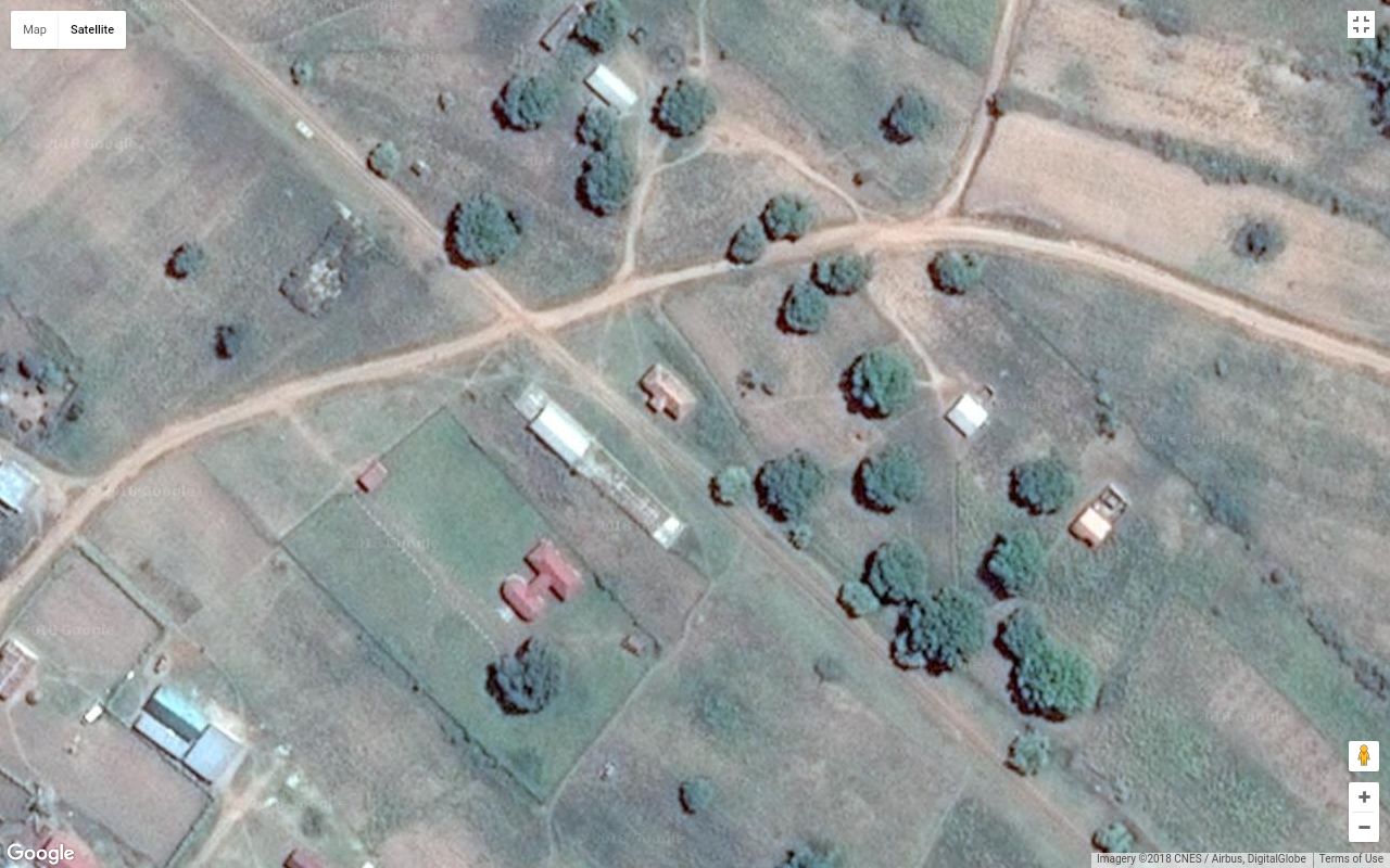
Lugazi/Kawolo: is 45 kilometres (28 miles) east of Kampala by road. There is a Station close to the centre of the town as shown on the map and satellite image below. The Station also served the hospital at Kawolo which is shown on the map of Lugazi just to the east of the town.
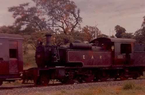
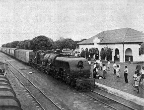
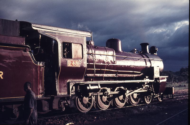
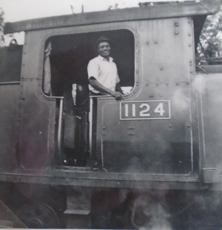
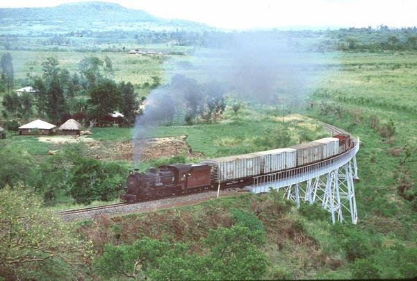
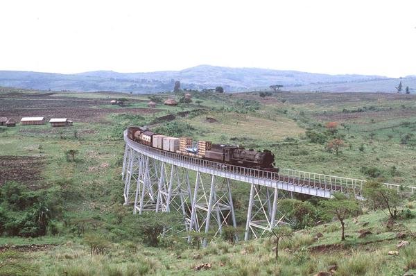
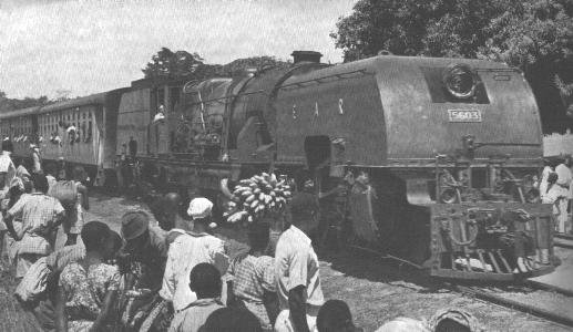 A Guide To Uganda” (Crown Agents, Curwin Press 1954) shows a Class 56 Garratt No. 5603, at a station between Kampala and Jinja. The 56s were replaced by the 60s in 1954-5, (c) East African Railways and Harbours. [6]
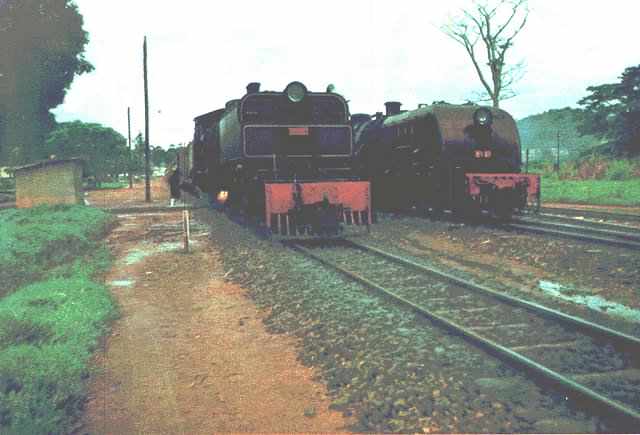 School Trains ran to the same schedule as the Mail Trains, but on days when the Mail did not run. The consist was virtually the same, although there was often only one, or no first class coach at all, on many of the School Trains. Here a Giesel ejector fitted Class 58 Garratt heads a Kampala bound Mail Train through Kawolo, 226 miles from Eldoret and 31 miles from Kampala. The oil fired furnace is clearly visible. A Kampala bound freight is headed by a Class 60 Garratt still to be fitted with its Giesel ejector, © A J Hudson.[21]
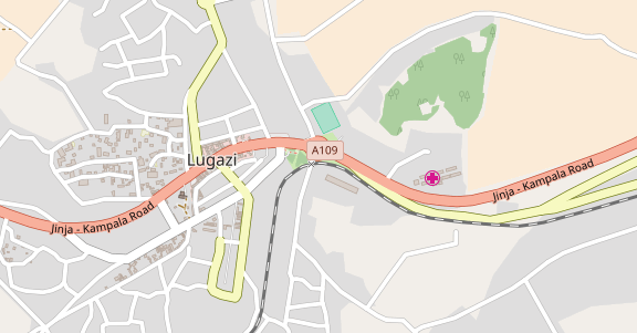
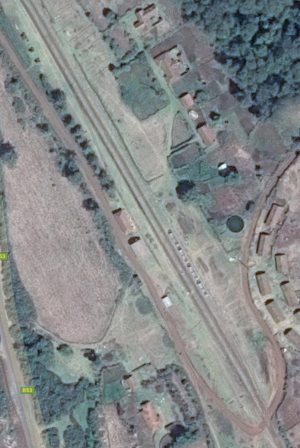
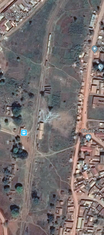 Lugazi Railway Station runs north-south near to the centre of the map above.
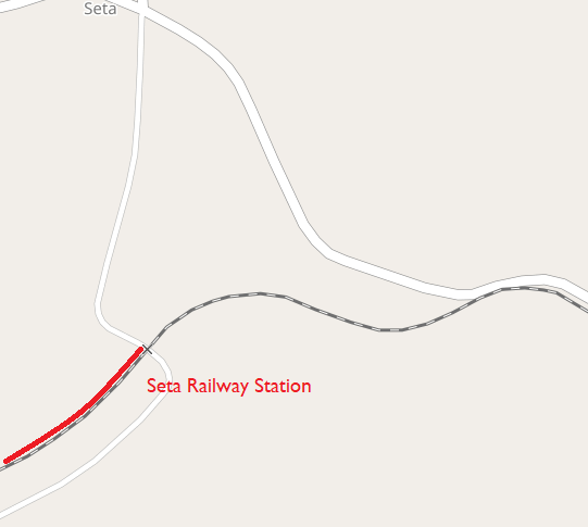
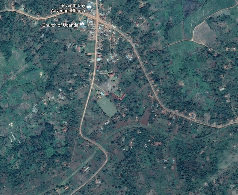
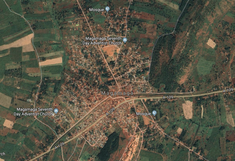
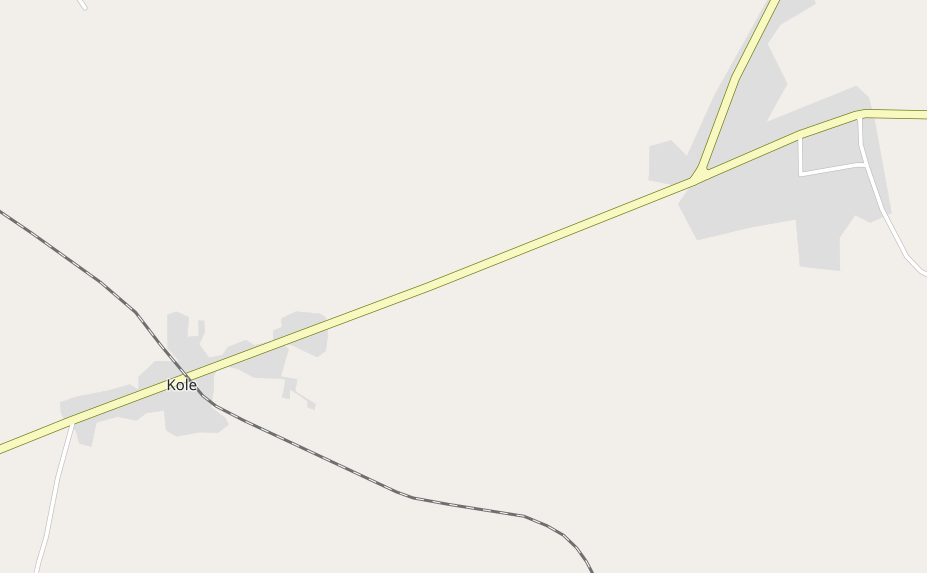
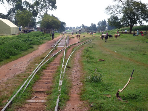
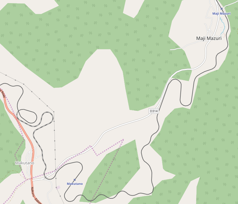
Seta: The next Station is at Seta. It was on the south side of the small village bearing the same name.
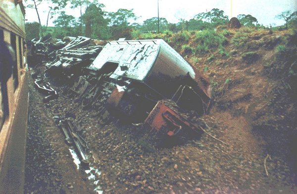 The EAR&H had few serious accidents, but on 3 January 1963, just 23 miles from Kampala and not far from Seta, a freight train with a caboose and 6 tank cars of high octane aviation fuel for Entebbe Airport stalled on the gradient. After setting back, the driver made a run at the gradient which the engine cleared with ease and tore off down the other side where it derailed. The escaping fuel was ignited by the Garratt’s oil furnace and the driver and firemen were killed. After three days of continuous round-the-clock working the single track line to Nairobi was re-opened, (c) A J Hudson. [6]
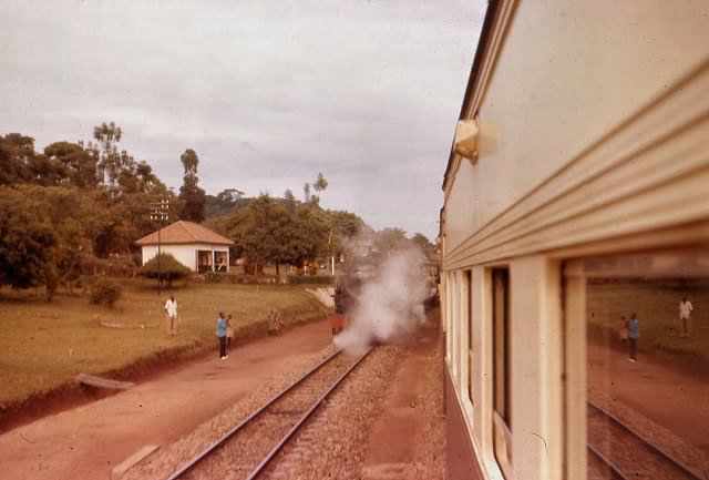 Kampala bound Mail passing a Tribal headed freight at Seta, 21 miles from Kampala, © Malcolm McCrow. [21]
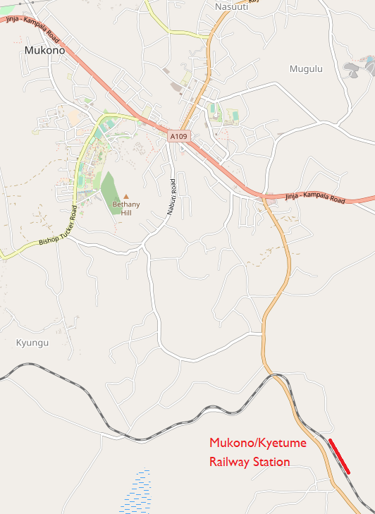
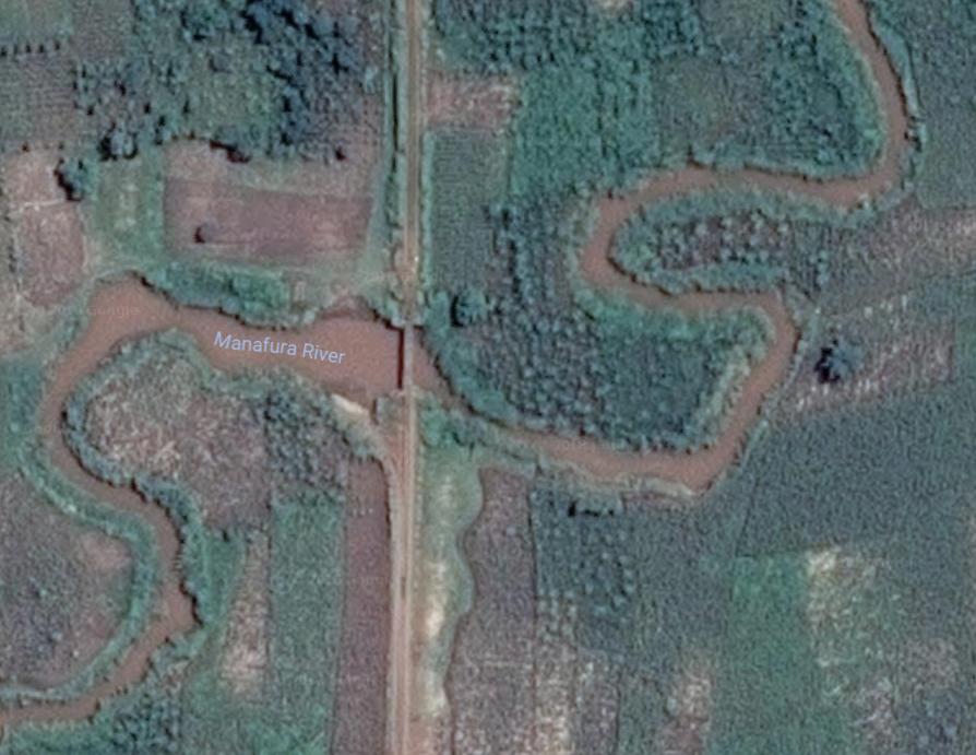
Mukono/Kyetume: The next Station is close to Mukono at Kyetume as shown on the adjacent map. Work on a new railway station [15] and a Railway Inland Container Depot (ICD) was completed in 2015. [16]
The ICD project was funded by World Bank and managed by the Ugandan ministry of works and transport in line with the East African trade facilitation program.
Its current capacity is 1,644 containers with an average of 6,500 annually, with enough parking space for container trucks. Construction of the depot was undertaken by Chinese company China Jiangxi International. [16]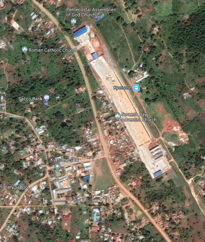 The Mukono railway station contracted by CJIC has significantly alleviated the traffic pressure in the capital Kampala and greatly cuts down the cost of local transportation of goods in Mukono, which, in turn, boosts the local economy. [15]
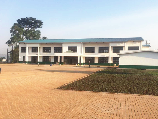 Mukono Railway Station Building completed in 2015. [15]
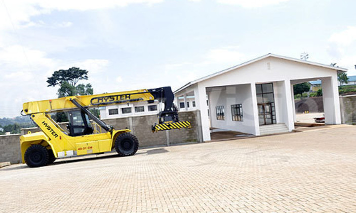
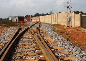 Mukono Railway Inland Container Depot was also completed in 2015. [16] The associated siding is shown in the adjacent image. [17]
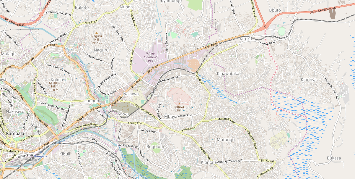
From Mukono, the railway travels North-west towards the Kampala-Jinja Road and then westwards into Kampala and its railway station which can be seen to the bottom left of the map below. before reaching Kampala Station the railway passes through Kireka close to the point that the Northern By-Pass leaves the Jinja-Kampala Road. Sporadic communter services are provided. Four pictures below show the railway at Kireka. [22][23]

 The map also shows the old railway from Port Bell joining the mainline just before it reaches Kampala Station. The line to an from Port Bell was constructed to provide access from the Lake Victoria Steamers which brought passengers to Uganda from Kisumu. The full length of that line is shown on the next map.
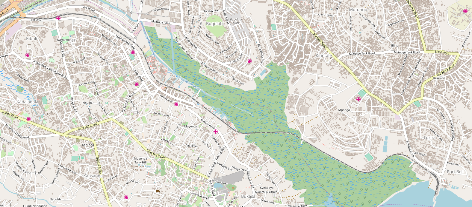 The track arrangement at Port Bell is shown on the next map and satellite image.
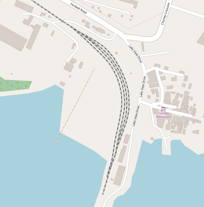

 An 11 Class tank engine on the Kampala to Port Bell branch, © Iain Mulligan
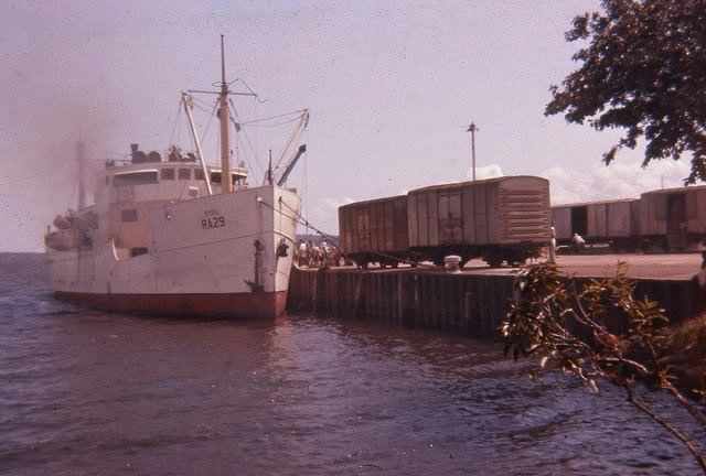 The motor vessel SYBIL unloading at Port Bell which was at the end of the six mile branch line from Kampala. Mixed passenger and freight trains ran three times a week to and from Kampala to meet the round the Lake service which by 1962 was operated by the motor vessel VICTORIA. The train journey between Kampala and Port Bell took 20 minutes and only 2nd and 3rd class was provided © Malcolm McCrow
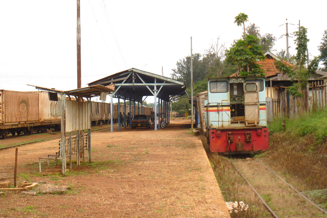
The station at Kampala is the end of this part of the journey. 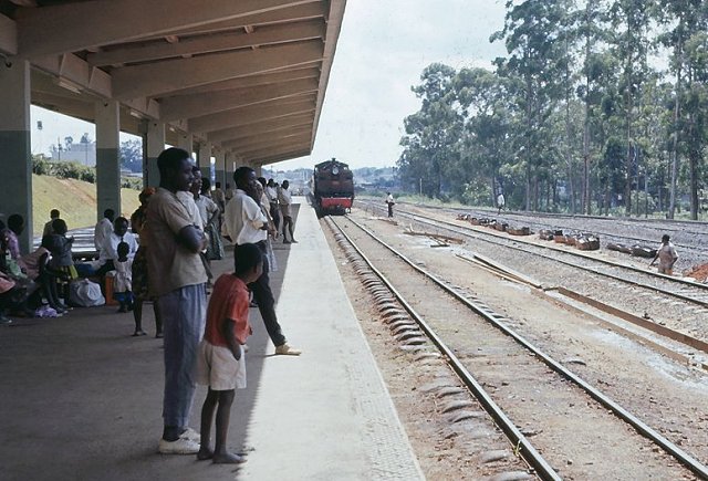 A Class 58 Barratt arrives at Kampala Station (Low Level) with a train from Kenya © Geoff Pollard. [20]
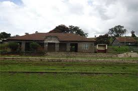
 Kampala Railway Station in the 1980s. [18]
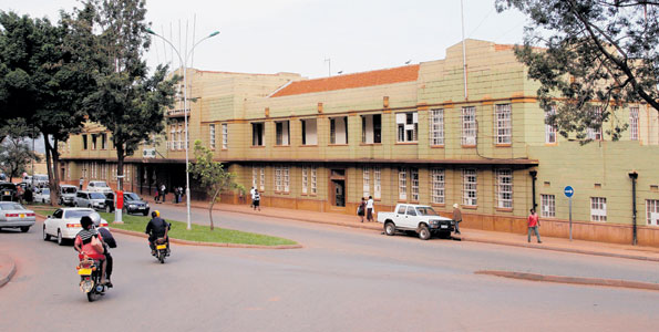 Kampala Railway Station was built by 1940. It is shown here in the 2010s, © Morgan Mbabazi. [19]
References
- The Editors of Encyclopædia Britannica (13 January 2014). “Profile of Lake Victoria, East Africa”, https://www.britannica.com/place/Lake-Victoria, accessed on 5th June 2018.
- https://www.lonelyplanet.com/uganda/eastern-uganda/jinja, accessed on 5th June 2018.
- http://jinja.go.ug/about-us/history-location-size, accessed on 5th June 2018.
- http://www.jinjatours.com/guide/about-jinja.html, accessed on 5th June 2018.
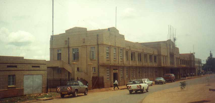
- https://bigeye.ug/photos-top-five-prominent-buildings-in-jinja, accessed on 5th June 2018.
- http://www.mccrow.org.uk/eastafrica/eastafricanrailways/KampalaNairobi.htm, accessed on 1st June 2018.
- https://www.pinterest.co.uk/pin/269793833897649501/?lp=true, accessed on 5th June 2018.
- https://www.pinterest.co.uk/pin/262334747022488313/?lp=true, accessed on 5th June 2018.
- http://www.mccrow.org.uk/EastAfrica/EastAfricanRailways/EARIainMulligan/UgandaRailways2004.htm, accessed on 5th June 2018.
- https://www.flickr.com/photos/kibogroup, accessed on 5th June 2018.
- https://www.flickr.com/photos/usarmyafrica, accessed on 6th June 2018.
- https://www.flickr.com/photos/tattoodjay/3665215232/in/photolist-8MRSUk-8NcJGa-58QCkB-7WskKS-6Nb4iz-6zTbN5-6NfeEy-6Nfv75-7kW7Bn-6NbgBx-6PikUT-jZMK7-8NcJNn-8NfTXm-8NcNan-8NfSxN-8NfUeG-8NfSN7-8NfQvw-8NfQcs-8MRSbe-8MRTvg-8MRTXF-8NcPan-8NcNoH-8MUWHh-8NfRHG-8MUWkw-8MRUr6-8MUXxE-8MUX3h-8MRSGi-8MRSAr-8NcK9x-8MRSQB-8NcKra-8MUXTU-8MRS3R-oeQAKP-6NfBME-5wabK1-qvh1r1-F9UCe5-4iVME4-4BrXVg-4iVRBc-4iVMrH-4iZQP9-4iVMgx-me7Mrr, accessed on 5th June 2018.
- http://www.mccrow.org.uk/EastAfrica/EastAfricanRailways/KURJinjaBridge.htm, accessed on 6th June 2018.
- https://en.wikipedia.org/wiki/New_Jinja_Bridge, accessed on 6th June 2018.
- http://english.cjic.cn/news/2015928/n5409763.html, accessed on 6th June 2018.
- https://www.newvision.co.ug/new_vision/news/1331101/construction-usd86m-rail-icd-mukono-completed, accessed on 6th June 2018.
- http://www.sakisizwe.co.za/services.html, accessed on 6th June 2018.
- http://www.ugandaforum.org/Africa/Photos/Country/PicCountrypg3.htm, accessed on 6th June 2018.
- http://www.theeastafrican.co.ke/magazine/Kampala-now-mapping-its-historical-buildings/434746-3053984-e1i9pz/index.html, accessed on 6th June 2018.
- http://www.mccrow.org.uk/EastAfrica/EastAfricanRailways/EAR_GeoffPollard.htm, accessed on 6th June 2018.
- http://www.mccrow.org.uk/EastAfrica/EastAfricanRailways/KampalaNairobi.htm, accessed on 31st May 2018.
- http://observer.ug/news-headlines/44973-survival-for-the-fittest-as-kampala-train-gathers-pace, accessed on 8th June 2018.
- https://www.redpepper.co.ug/govt-railway-line-evictions-to-continue, accessed on 8th June 2018.


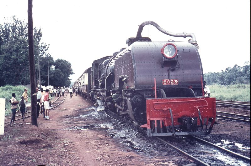
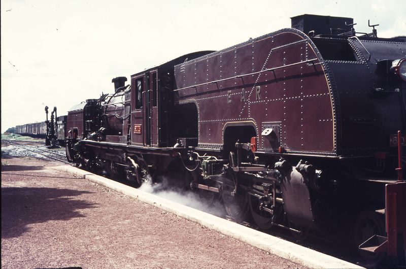
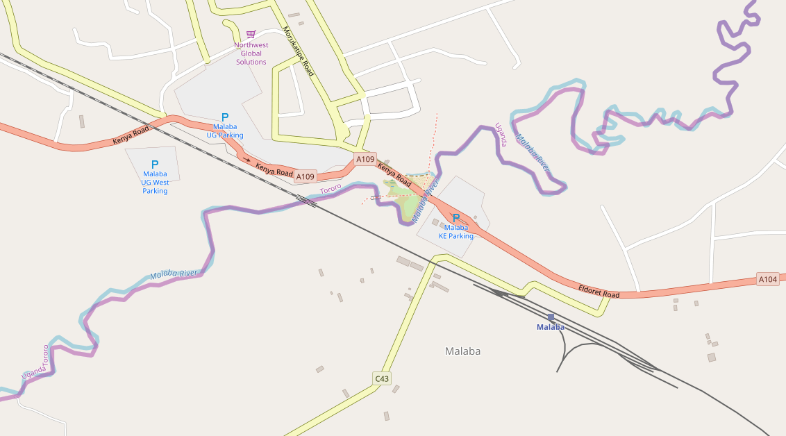
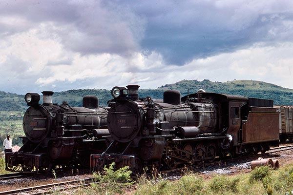
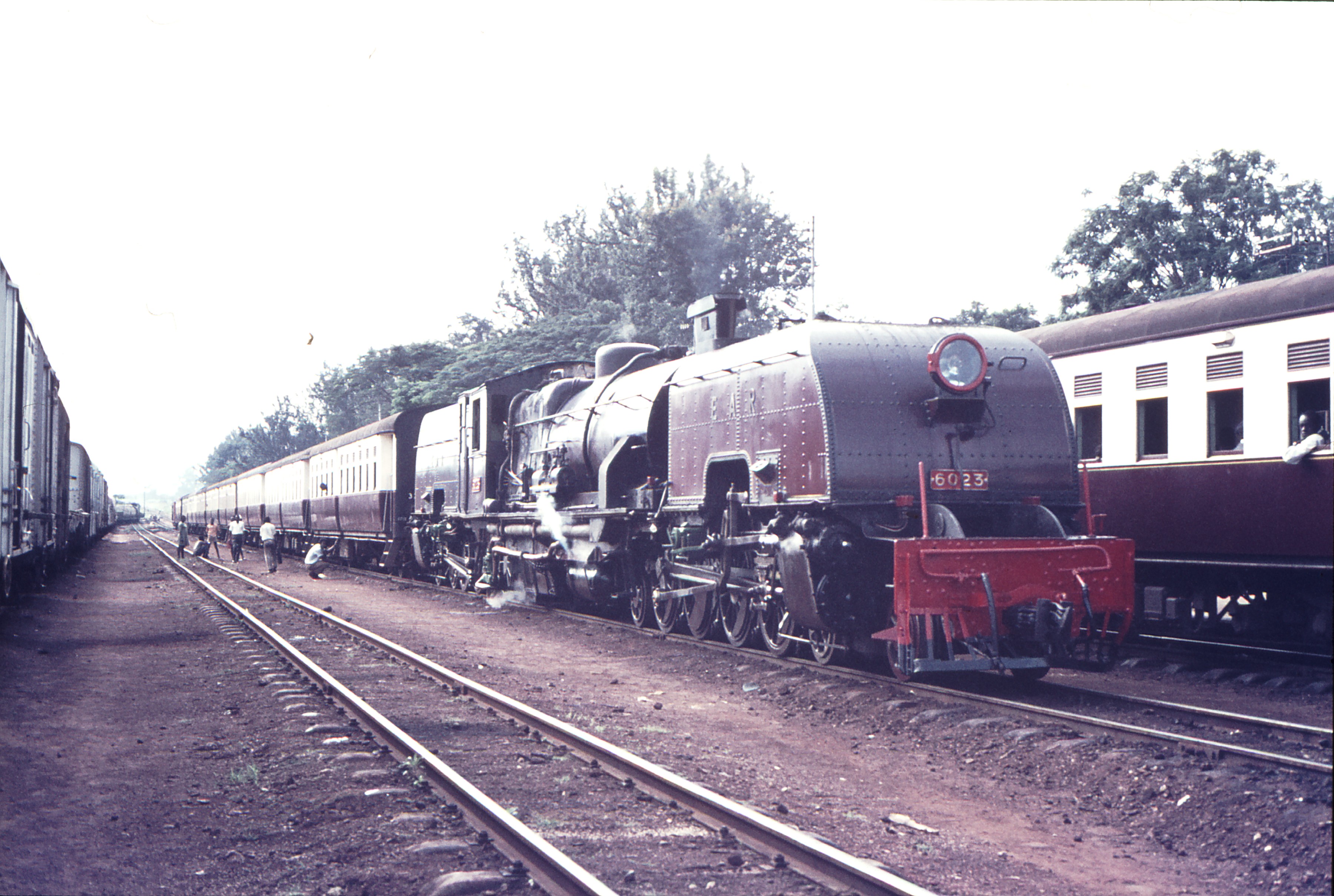 Class 60 Garratt No. 6023 in Tororo in 1971


 Above: 111497: Aloi Railway Station, Uganda Westbound Passenger Service with No. 2431, © Weston Langford. [3]


 President Museveni (in hat) in the cab of a lcoc at the commencement of the Rift Valley Railway operations at the weekend in Gulu District (October 2013), (c) Cissy Makumbi. [8]
 President Museveni flags off a train in Gulu, Uganda. [9]
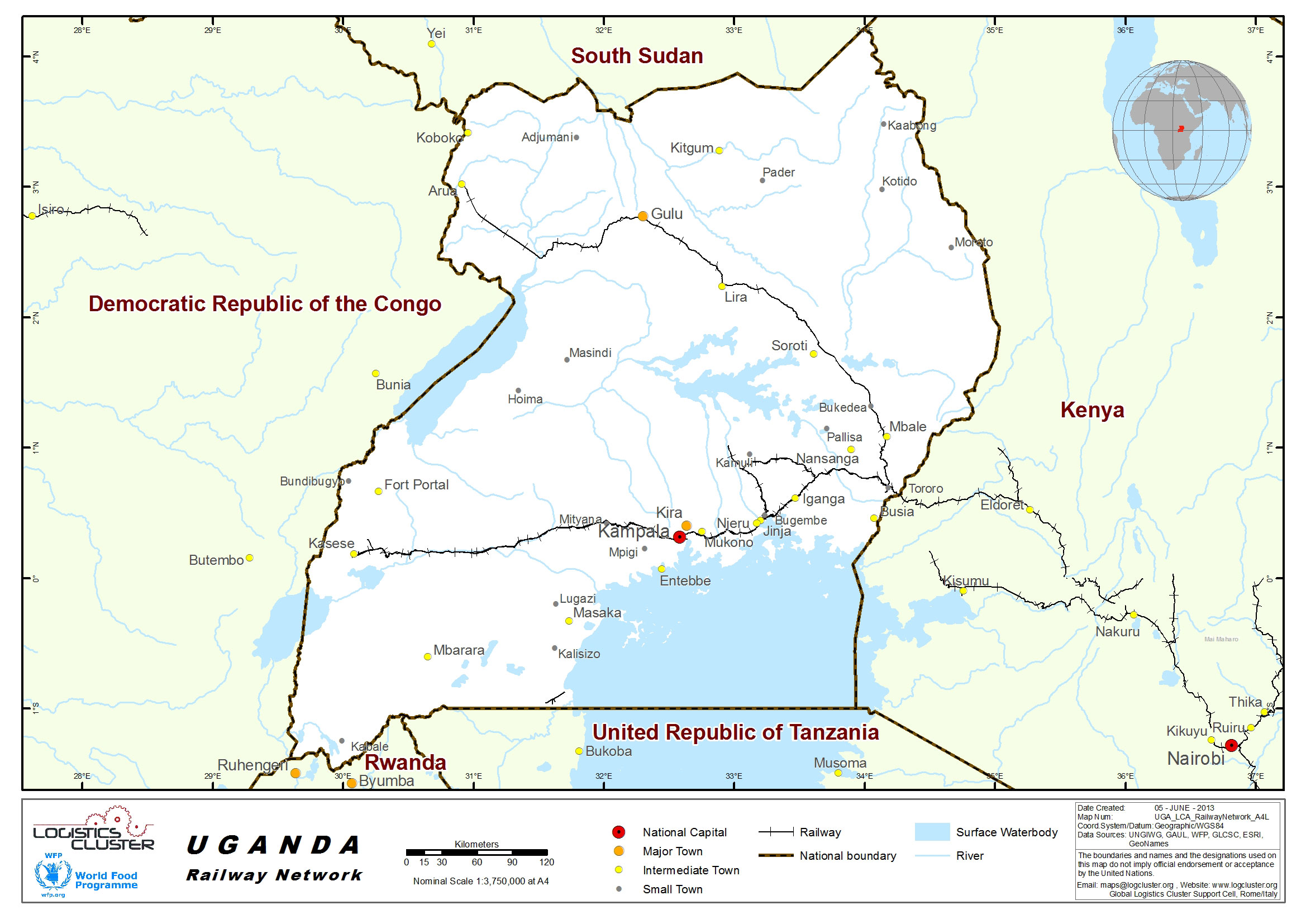


 The three images of Tororo Station above come from a report by Dr R Choudhuri. [7]


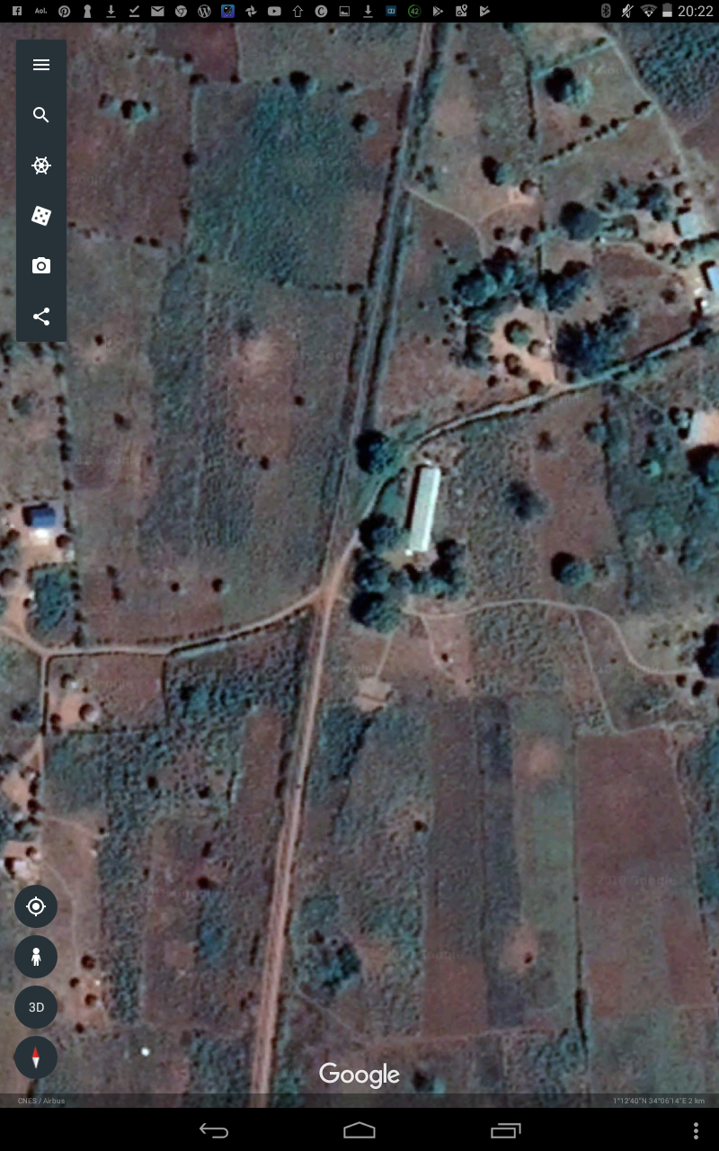
 Bukedea
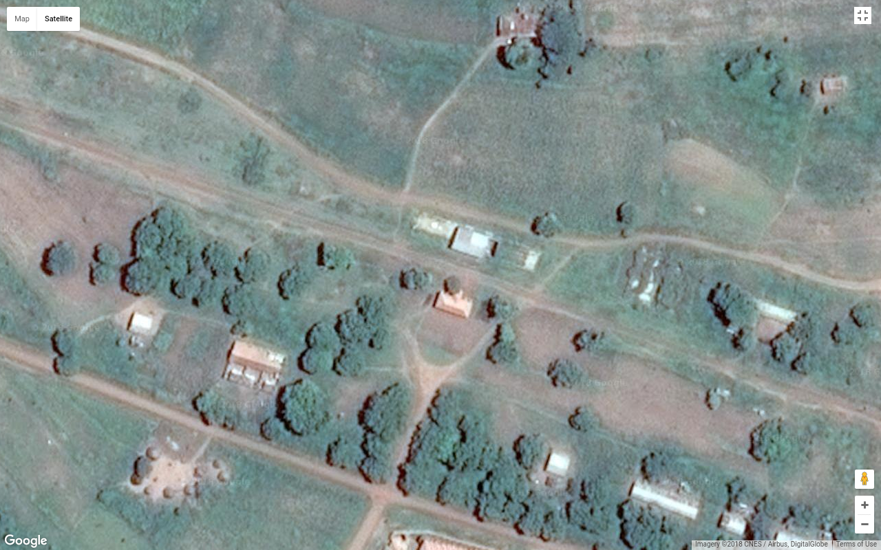


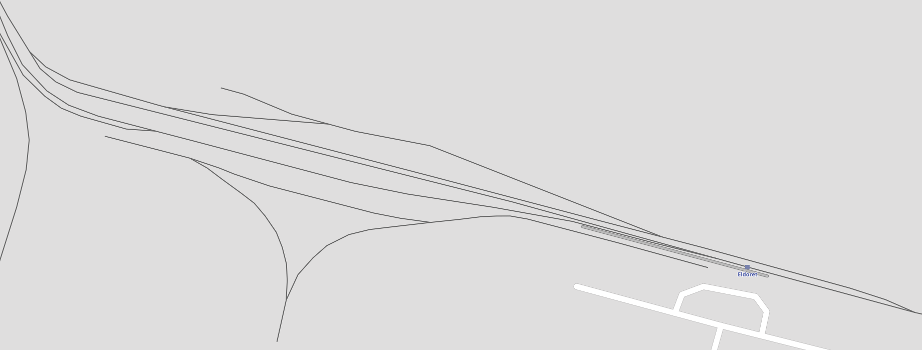
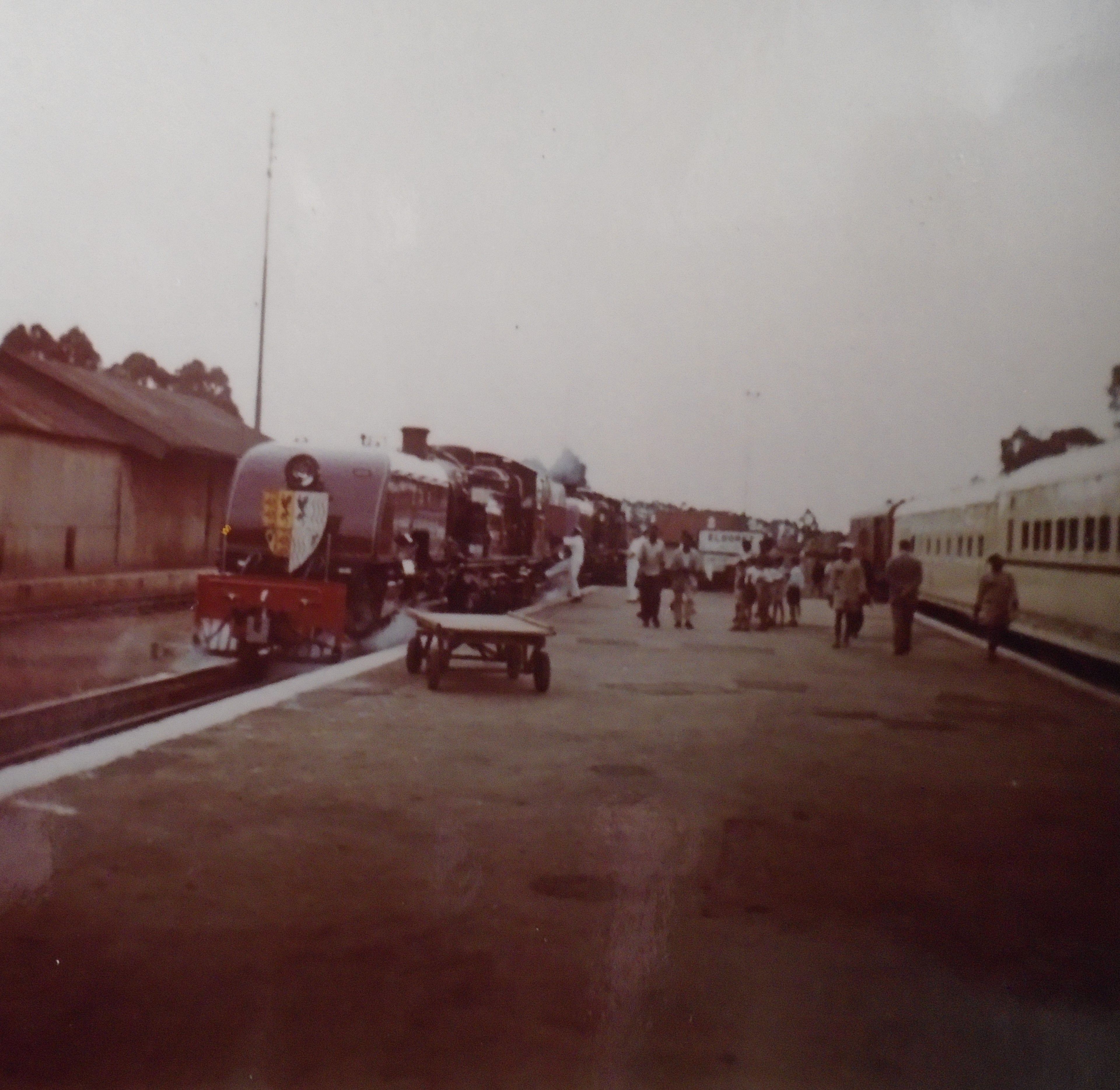
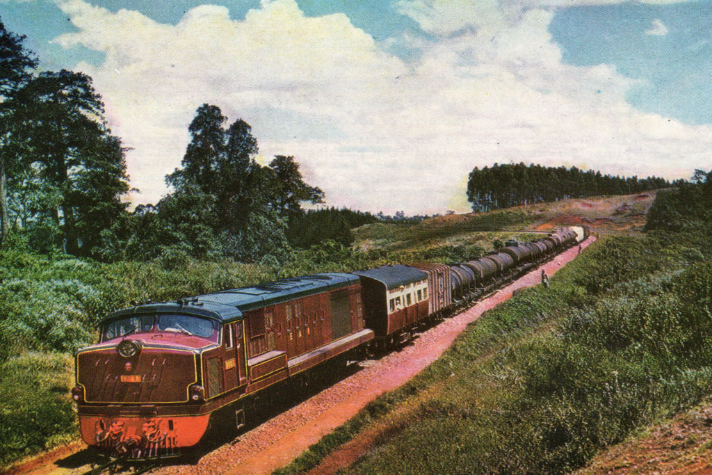


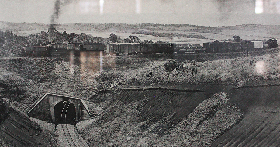
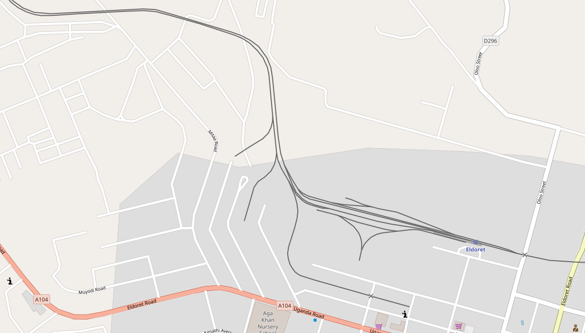
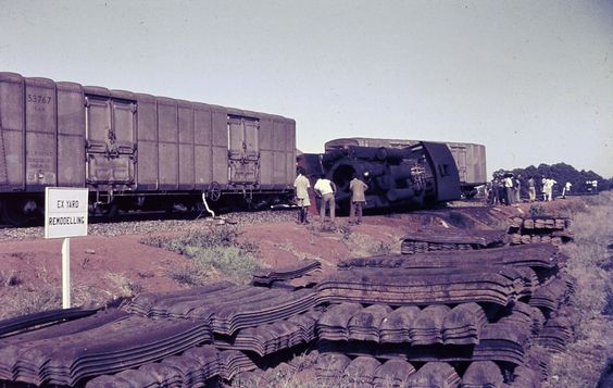
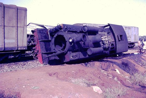
 Derailment, Eldoret Yard, 1963 (c) Neil Rossenrode. [21]
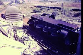

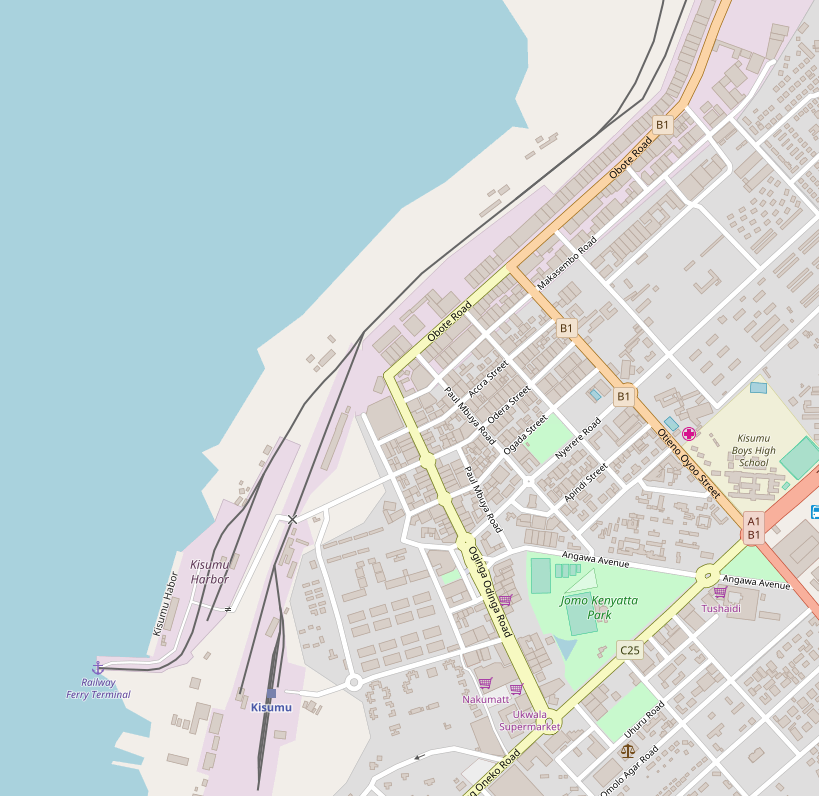
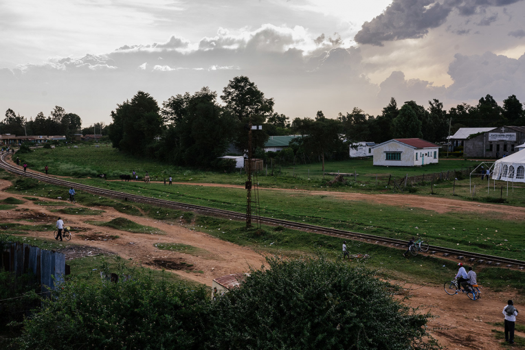
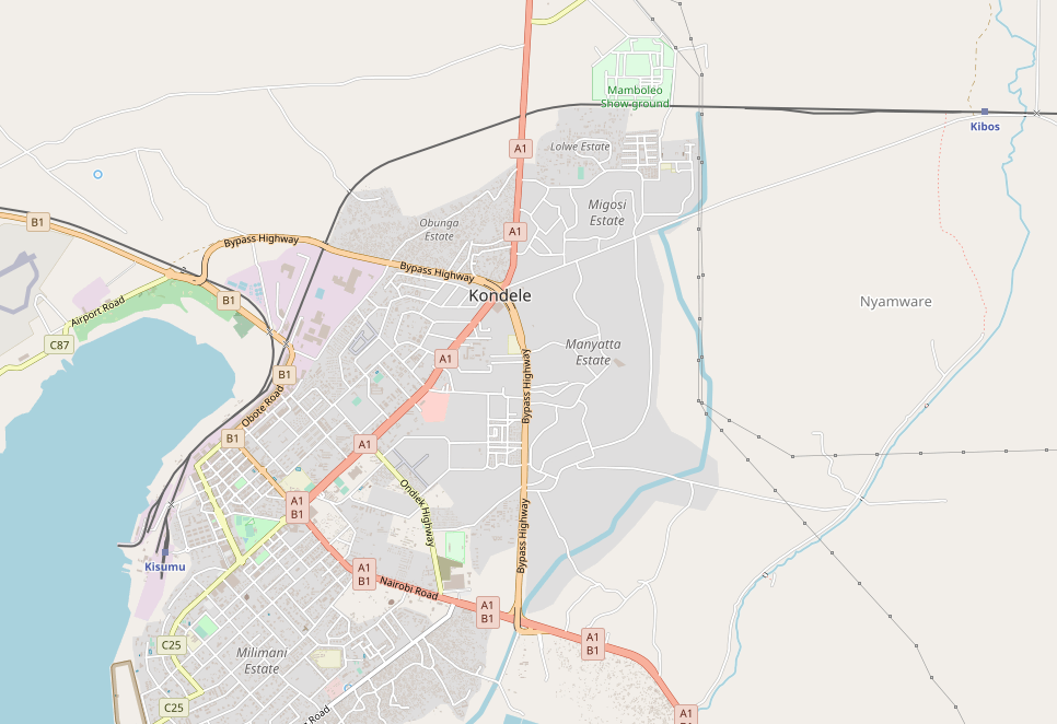
 We travel on through Lela Station and very quickly after that through Maseno Station. A short distance further on and the train passes through Luanda Station, and then on over the Yala River to Yala Railway Station. Sadly, there are very few pictures of these stations available on the internet, but one great source is Rob Dickinson’s site. [4]
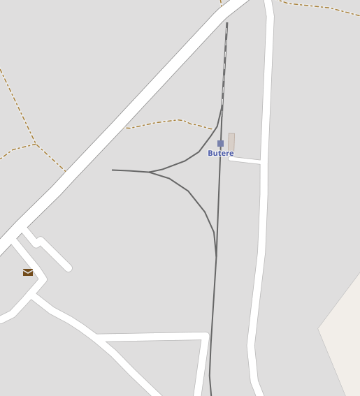


.jpg)
.jpg)