
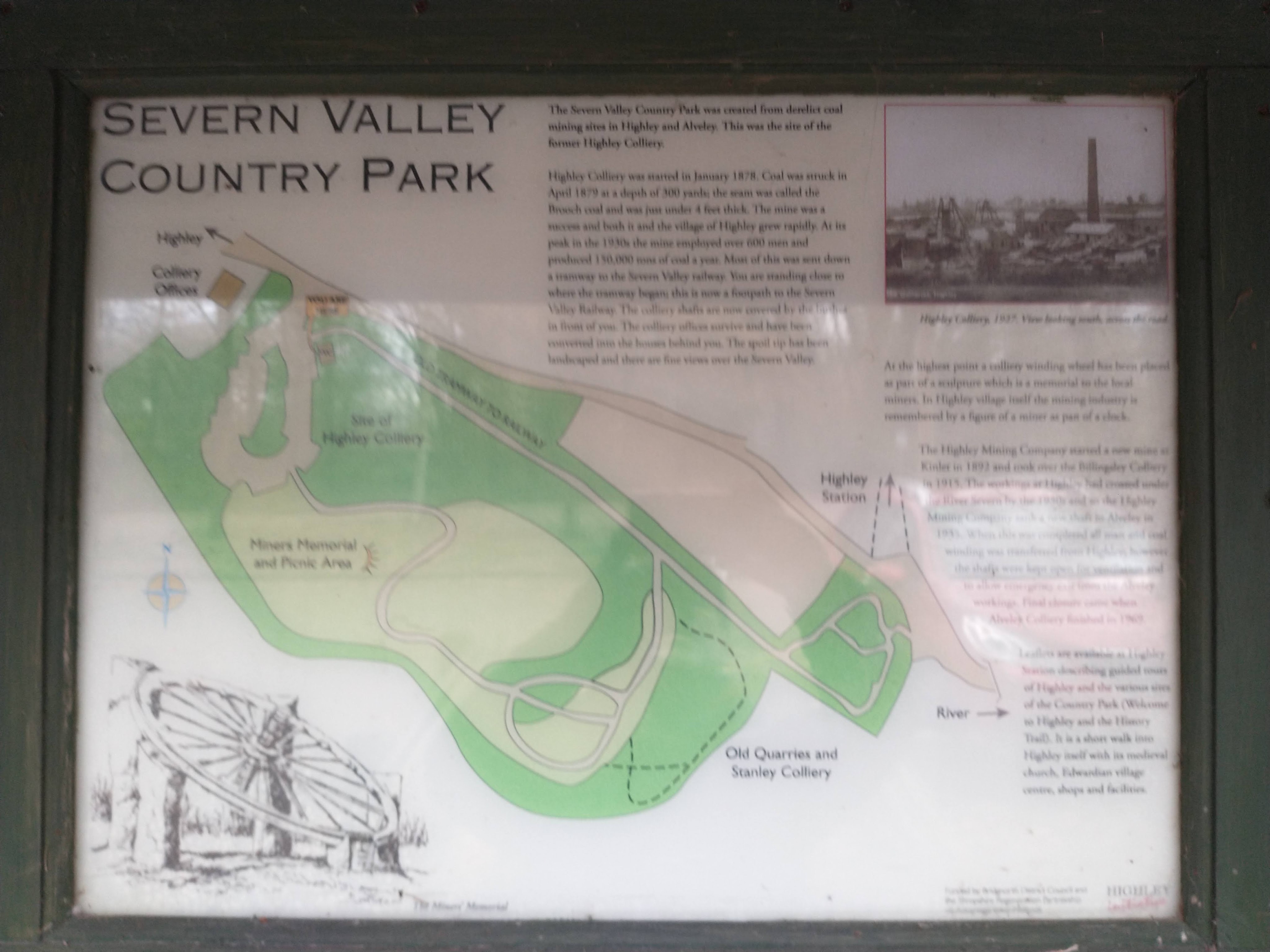
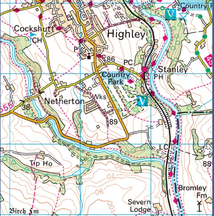
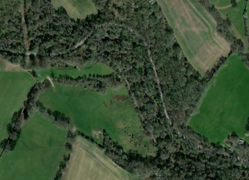
Highley and Billingsley
South of Bridgnorth in the valley of the River Severn were:
- Alveley Sidings and Alveley Colliery with a private railway/aerial ropeway;
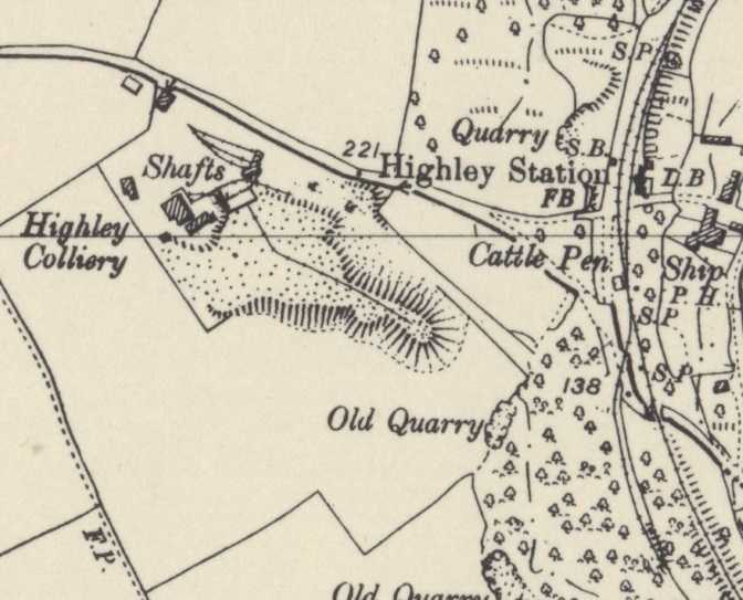
- Highley Station;
- Highley Colliery & Sidings;
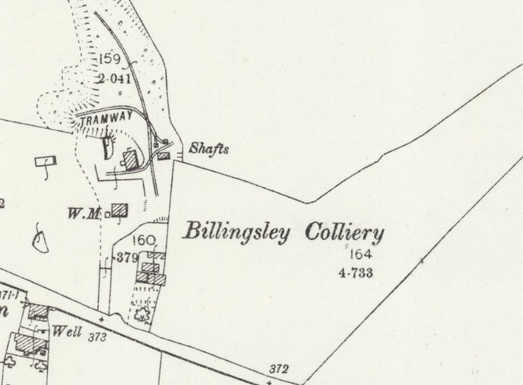
- The Billingsley Railway & Collery; and
- Kinlet Colliery and Sidings.
These locations were all within the Wyre Forest Coalfield. All were connected to the GWR Severn Valley Railway (SVR)
Alveley Sidings, Alveley Colliery, Private Railway and Aerial Ropeway.
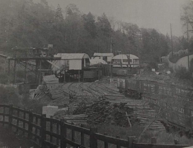
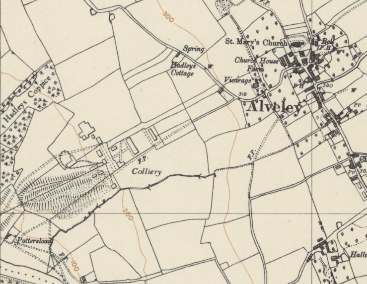
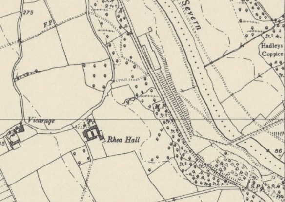
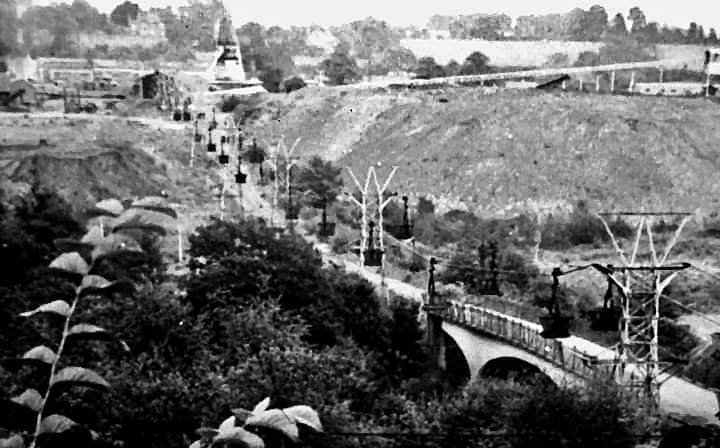
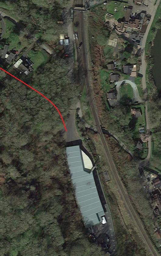
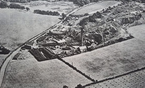
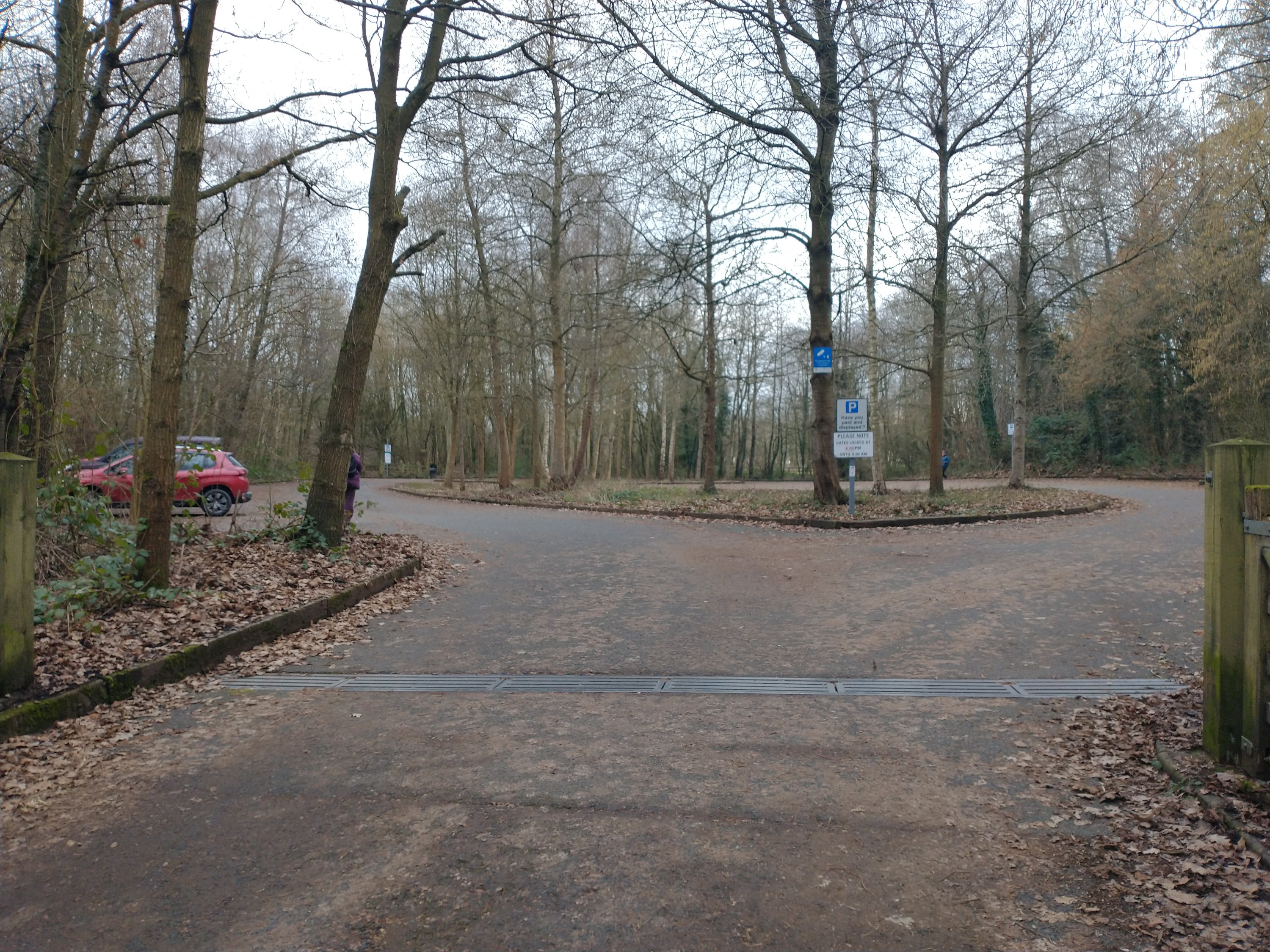
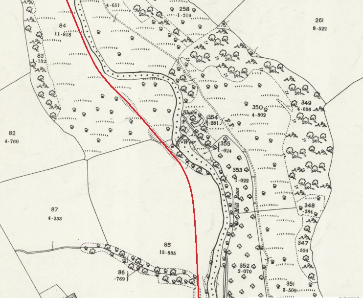
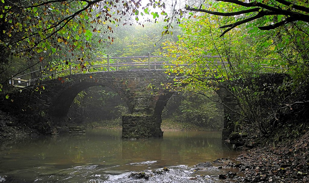
Of the locations looked at in this article the Alveley Sidings and Colliery were the closest to Bridgenorth. It was situated east of the River Severn, a little way north of Highley Station in the area now forming the Alveley section of the Severn Valley Country Park. [8][9]
The shaft at Alveley was sunk in 1935 to a depth of 360 yards by the Highley Mining Company. It was connected to their Highley shaft by underground workings which passed under the River Severn. Production started at the colliery in 1938. The shaft at Highley was then closed in 1939, only being retained for ventilation and as an emergency evacuation route. Alveley’s workings were very modern, with full use being made of electrical power and mechanical working at the coal face.
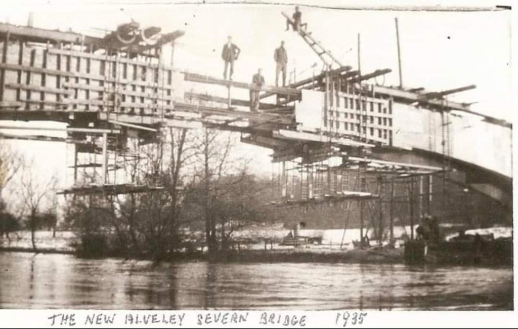
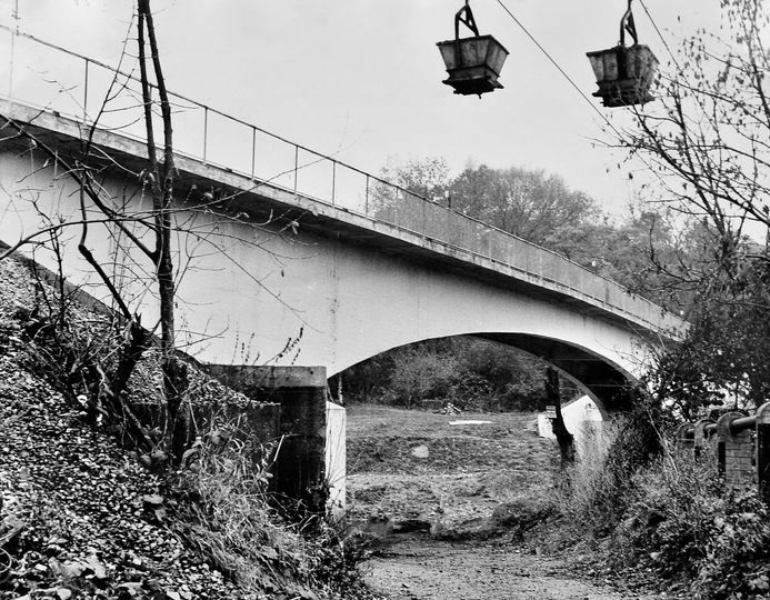
Coal was brought across the Severn by a rope-worked tramway across a bridge built to serve the mine, which was later replaced with an aerial ropeway in 1961. The colliery was connected to washeries, screens and sidings adjacent to the Severn Valley Railway by an endless cable-worked narrow gauge tramway which crossed the river on a concrete bridge bringing coal to the screens. The tramway was replaced later by an aerial ropeway. The sidings eventually became the location of Country Park Halt on the Severn Valley railway.
Colliery production reached “full output in 1944 with 275,000 tons raised, with that year’s record being 5,547 tons in one week, and a peak of 300,000 tons per year reached in the late 1950s. The colliery became part of the National Coal Bard (NCB) on nationalisation in 1947; at that time employment was 741, rising to over 1,250 in the mid-1950s, and falling to around 700 by the mine’s closure. A major expansion was undertaken in the late 1950s and early 1960s, completed in 1962, after large reserves of coal were found to the East of the current workings. These were purported to be enough to last the mine between 50 and 100 years, but a drop in the quality of coal combined with a reduction in demand due to a national over supply forced the closure of the mine in 1969, with the last coal being lifted on 31 January.” [8]
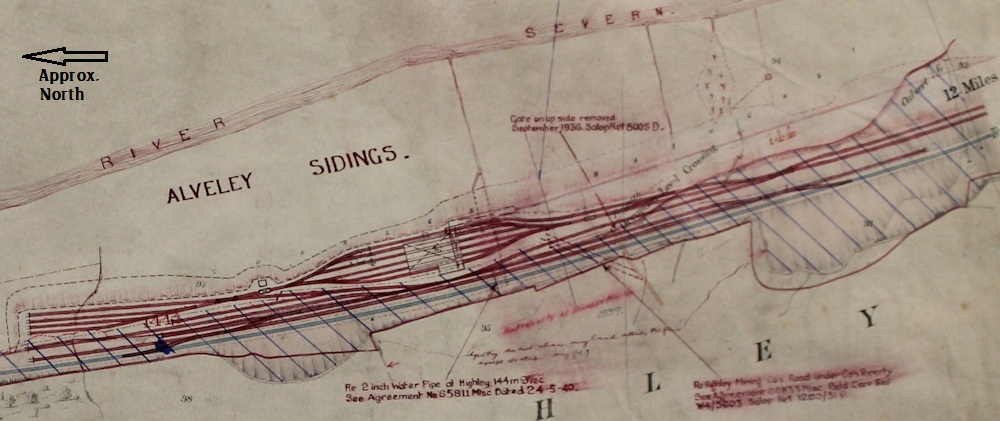
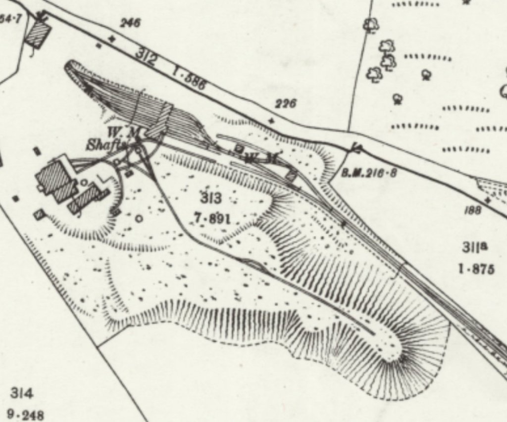
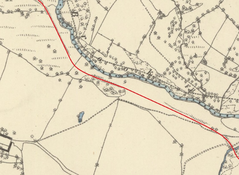
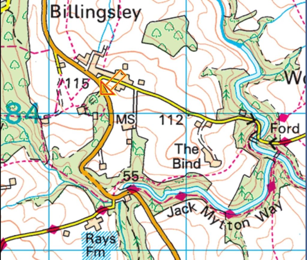
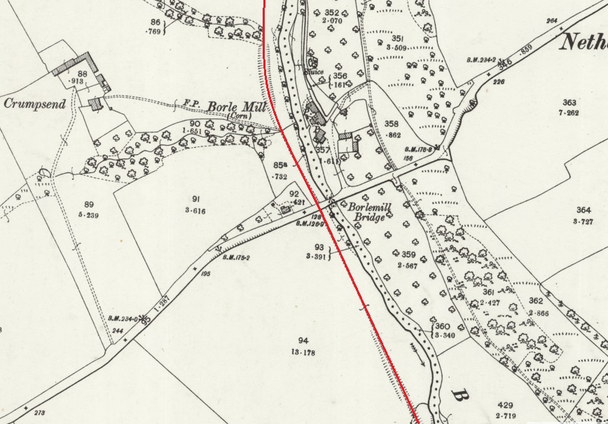
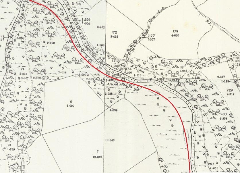
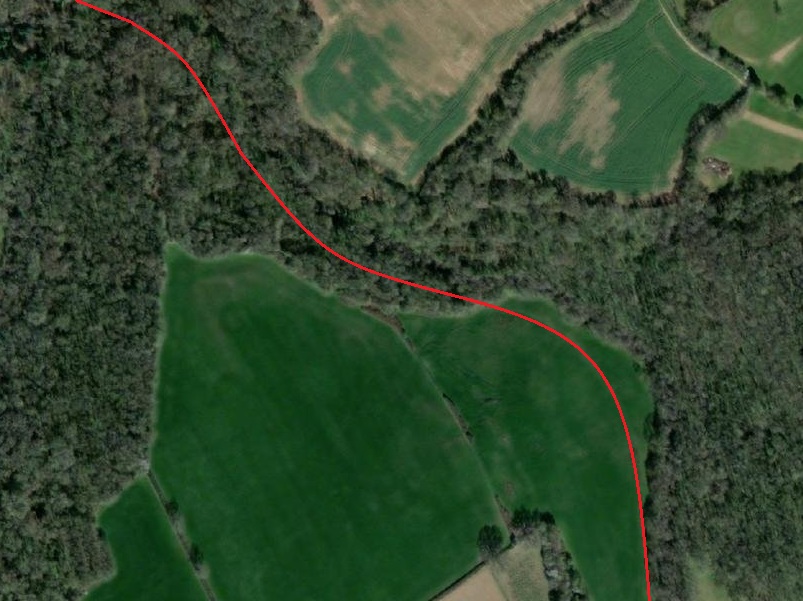
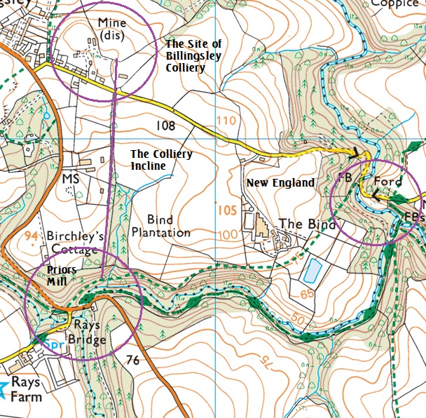
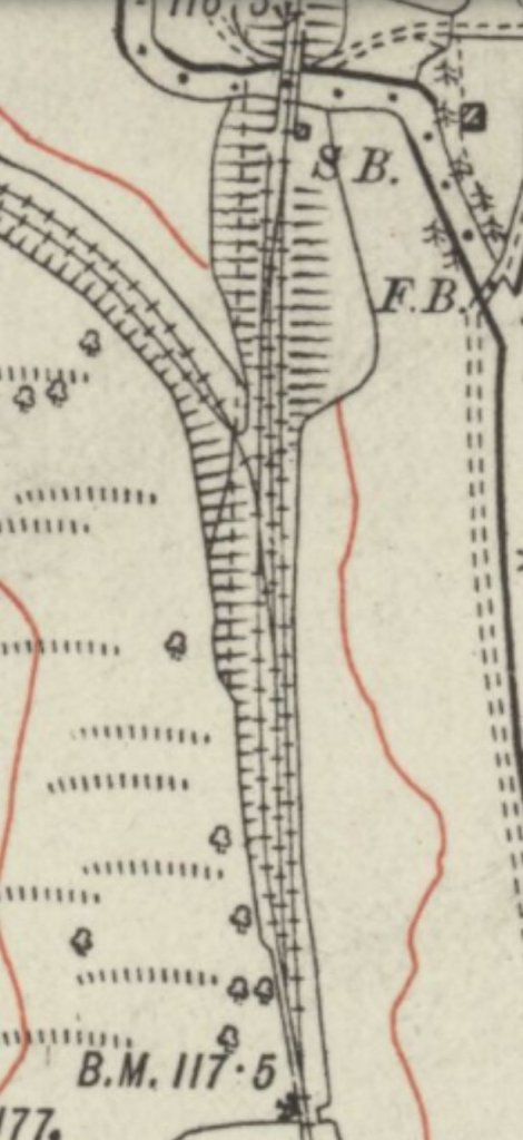
A closer focus is provided on the National Grid Maps, two extracts follow, as the location runs across map boundaries. The Inclined Plane was not replaced by an aerial ropeway until 1960. [15: p16-18]
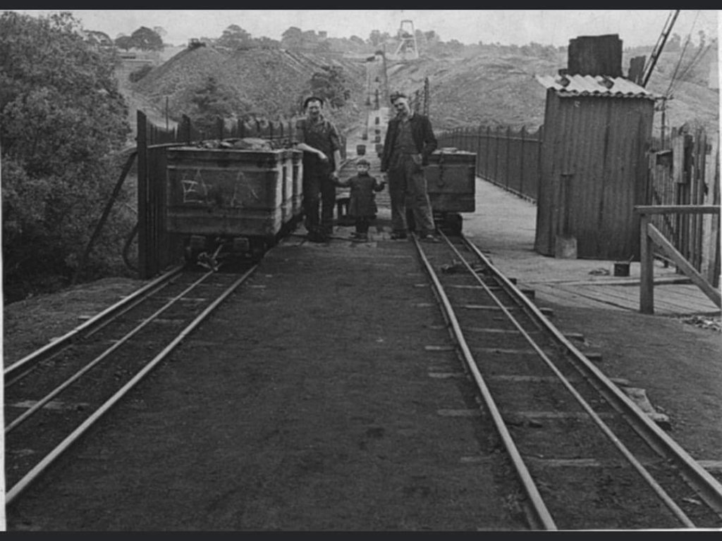
George & David Poyner tell us that the “surface haulage used a 7/8th inch rope. The length of the track was 1100 yards so the endless rope was 2200 yards long. The railway was 21″ gauge with wooden sleepers 3′ apart; 9″ rollers fixed in wooden boxes supported the rope. There were eight tubs to each journey: the tubs were made of wood and later of iron and held 10 cwt of coal. The rope took the tubs to the Barker Screens.” [15: p16]
At the pit head, tubs were clipped to the haul-rope in gangs of eight. The first and last tubs, being attached to the rope and the wagons were coupled together. There was an haulage engine at the top of the incline. Initially a skilled operative manned the engine, but later it was worked by signals. when the wagons reached the creeper at the screens, the tubs were unclipped and “they were sent up the creeper into the tippler on the screens and then returned down the retarder. The chalk numbers were removed and the tubs were clipped back onto the haulage rope to go back to the colliery.” [15: p17]
The empties were sent back up the incline to the pit head where they were “unclipped off the rope and sent up creepers to the top and bottom decks of the cage. The supplies were also brought by rail so there were six men loading the tubs with pit props and unloading railway wagons. The rails needed quite a lot of maintenance, during hot weather they would expand and buckle, requiring the joints to be loosened.” [15: p17]
As the Incline became too old for continued use, a case was made for the replacement of the incline with an aerial ropeway. This was considered in 1958 by the colliery reconstruction committee. Apparently, the rope worked incline “required 54 men from the pit to the washery. It was estimated that an aerial ropeway would require 15 mean and would cost £160,568. … Figures are not available to show how much money was actually saved by the aerial ropeway. However, at least in its early days it was plagued by breakdowns.” [15: p18]
Further photographs can be found on the Alveley Historical Society web page:
http://www.alveleyhistoricalsociety.org/mining.html [10]
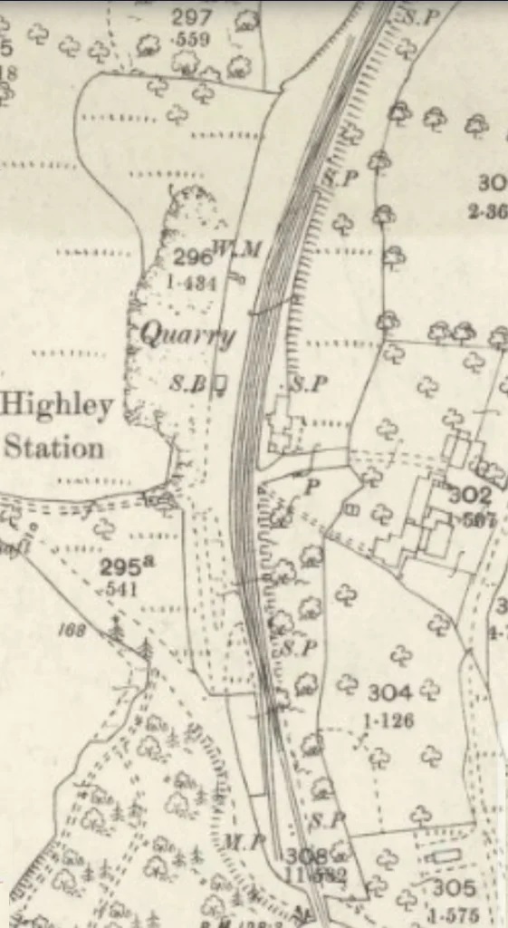
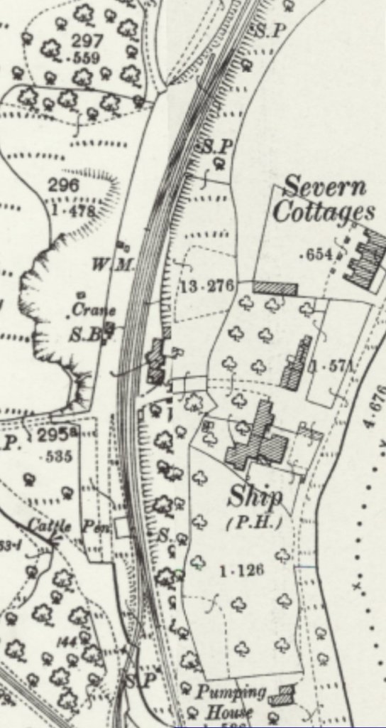
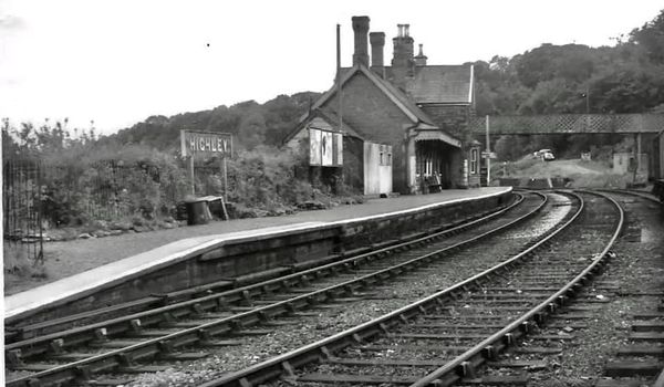
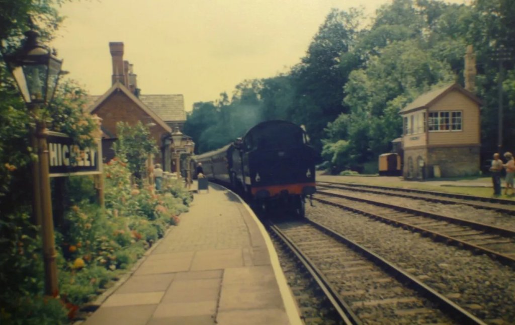
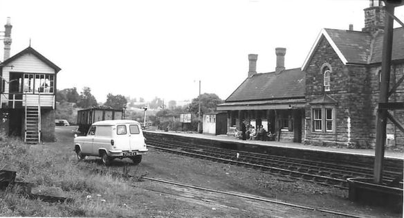
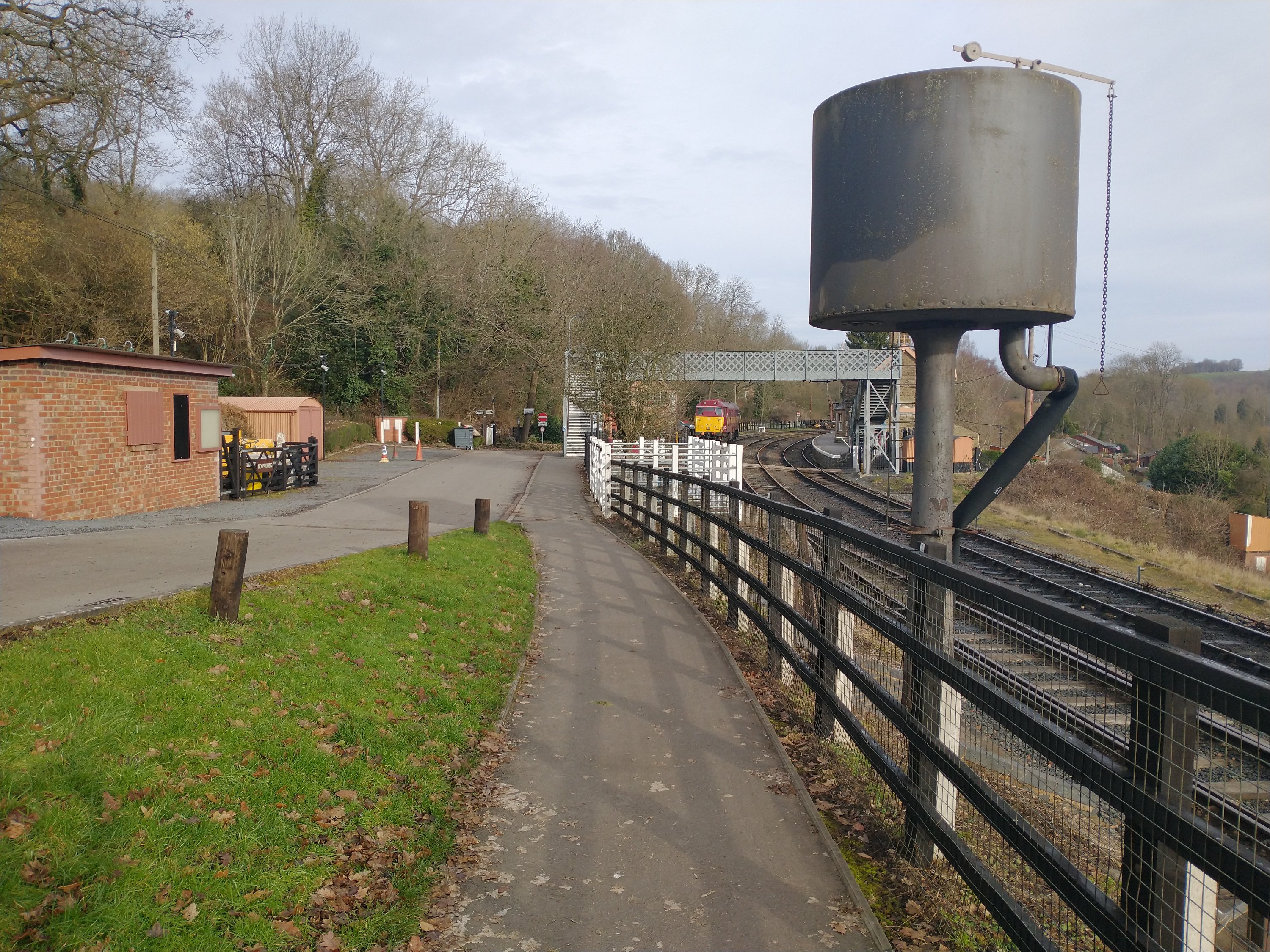
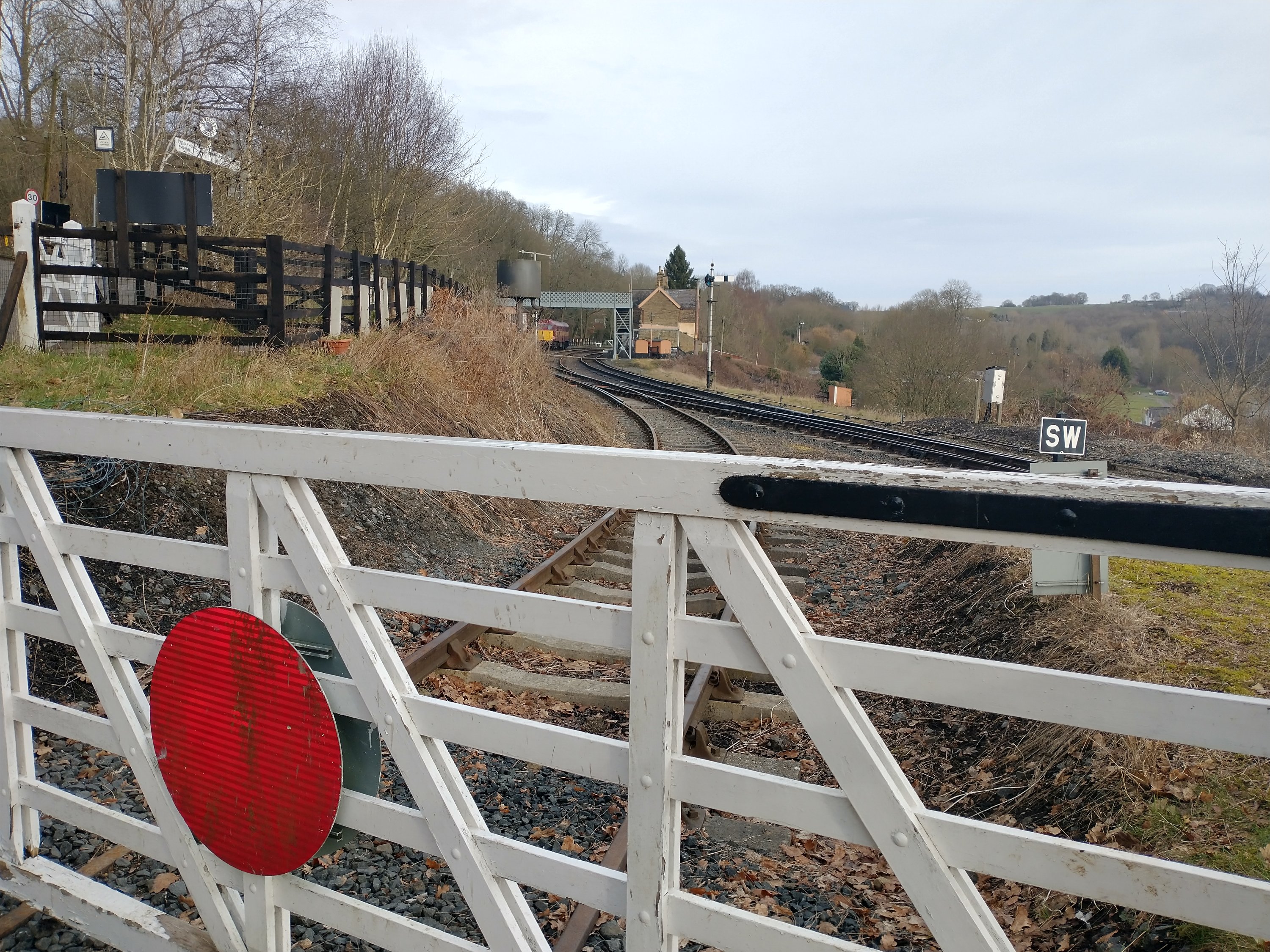
Highley Station
The Station at Highley was just a short distance to the South of the Alveley Colliery sidings.
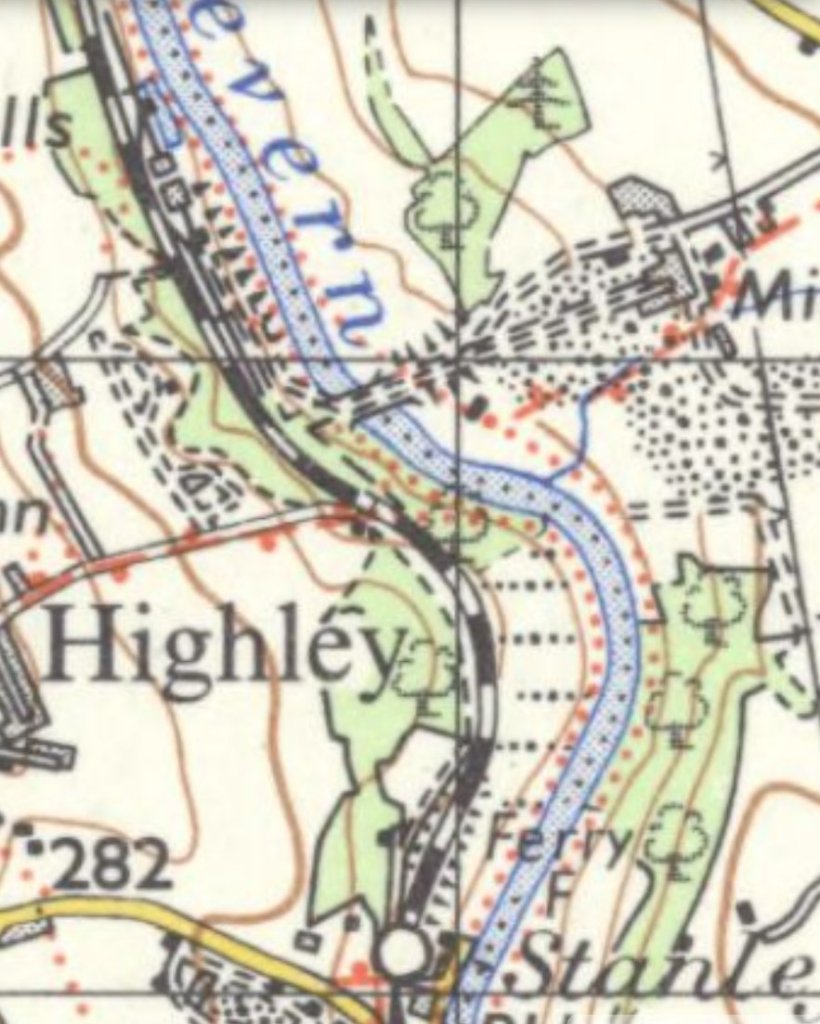
Publication date: Revised: 1949 to 1967, Published: 1967), the mine at Alveley, the 1935 bridge over the Severn, the sidings and screens on the West side of the river are clearly shown well within a mile to the North of Highley Station. [17]
The Station was built and opened at the same time as the Severn Valley line. It “opened to the public on 1 February 1862 and closed on 9 September 1963, before the Beeching axe closures.” [18]
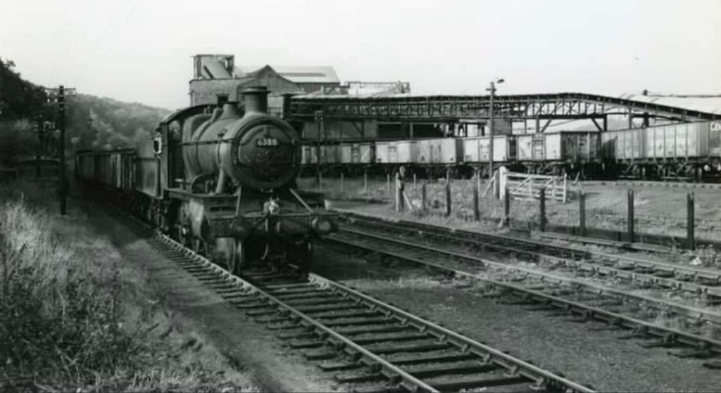
The Station was important as “the transport hub of a colliery district, with four nearby coal mines linked to the Severn Valley line by standard and narrow gauge lines, cable inclines and aerial ropeways . There were extensive sidings along the line, and wagon repair works at Kinlet, half-a-mile south.” [18]
The station was too far from the village of Highley to be convenient. The advent of reliable bus services and better roads soon resulted in passenger use dwindling. However, the signal box at the station remained in use until the closure of Alveley Colliery in 1969. The site of the Station remained disused until it was rejuvenated by the preservation movement.
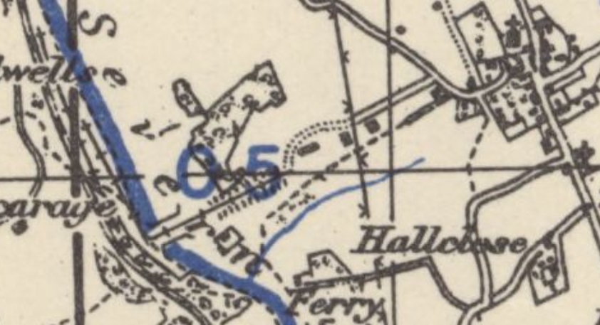
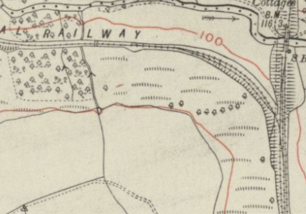
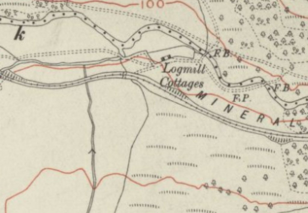
The map extracts below show the Station in 1882 and then at around the turn of the 20th century.

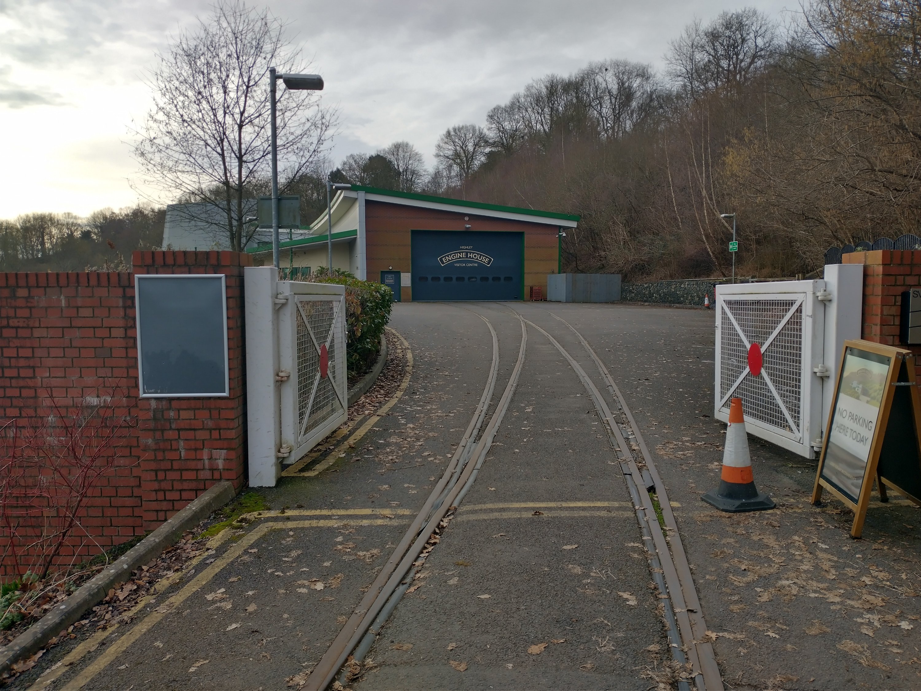
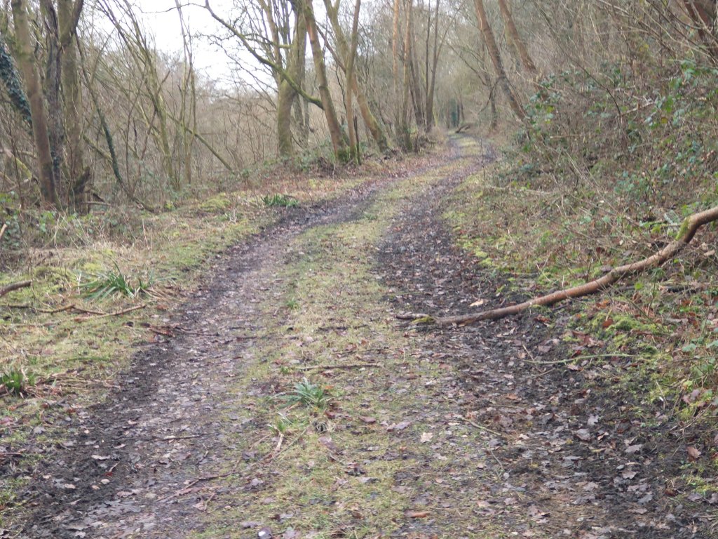
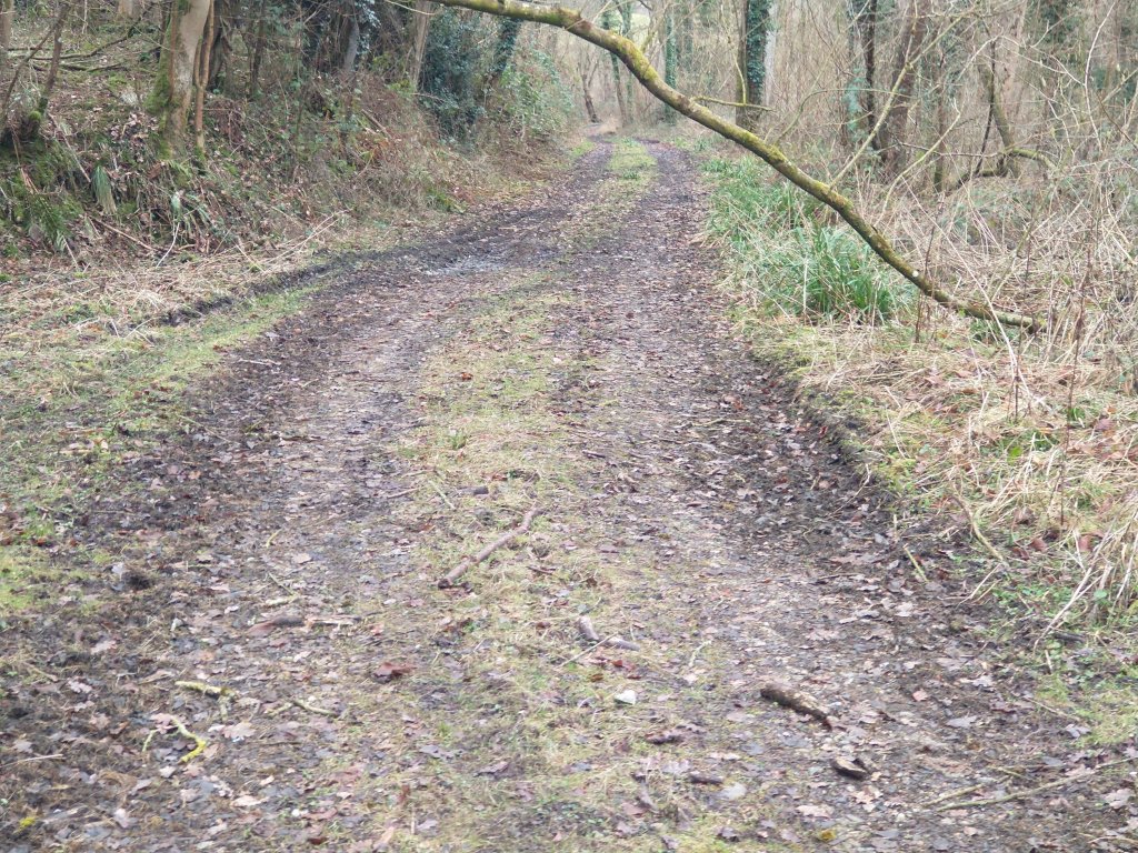
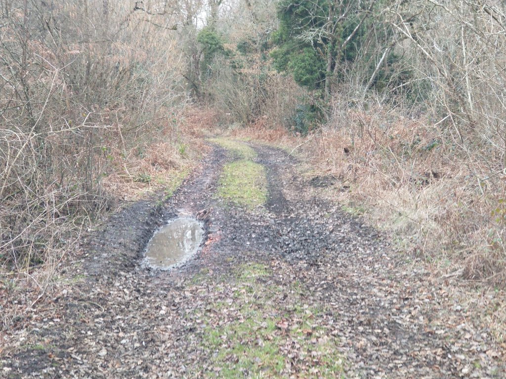
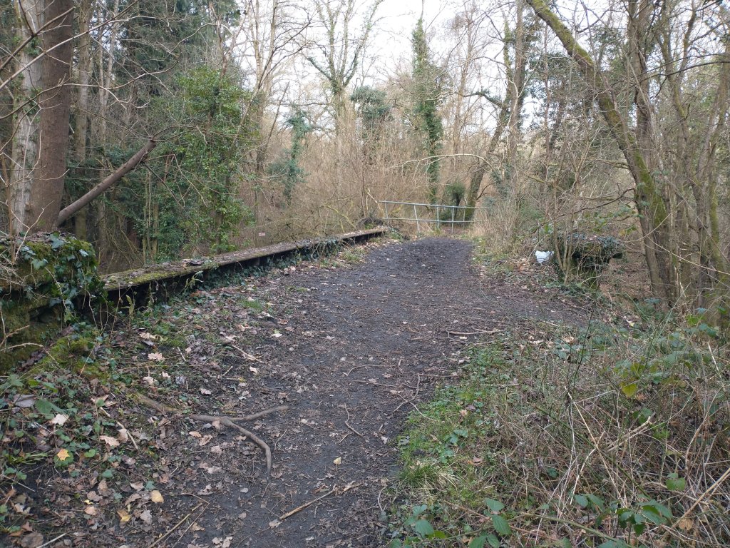
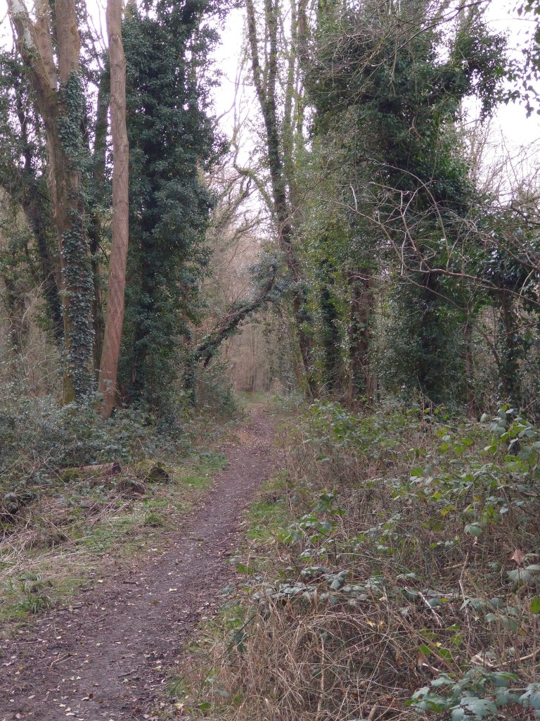
Highley Colliery and the Highley Mining Company
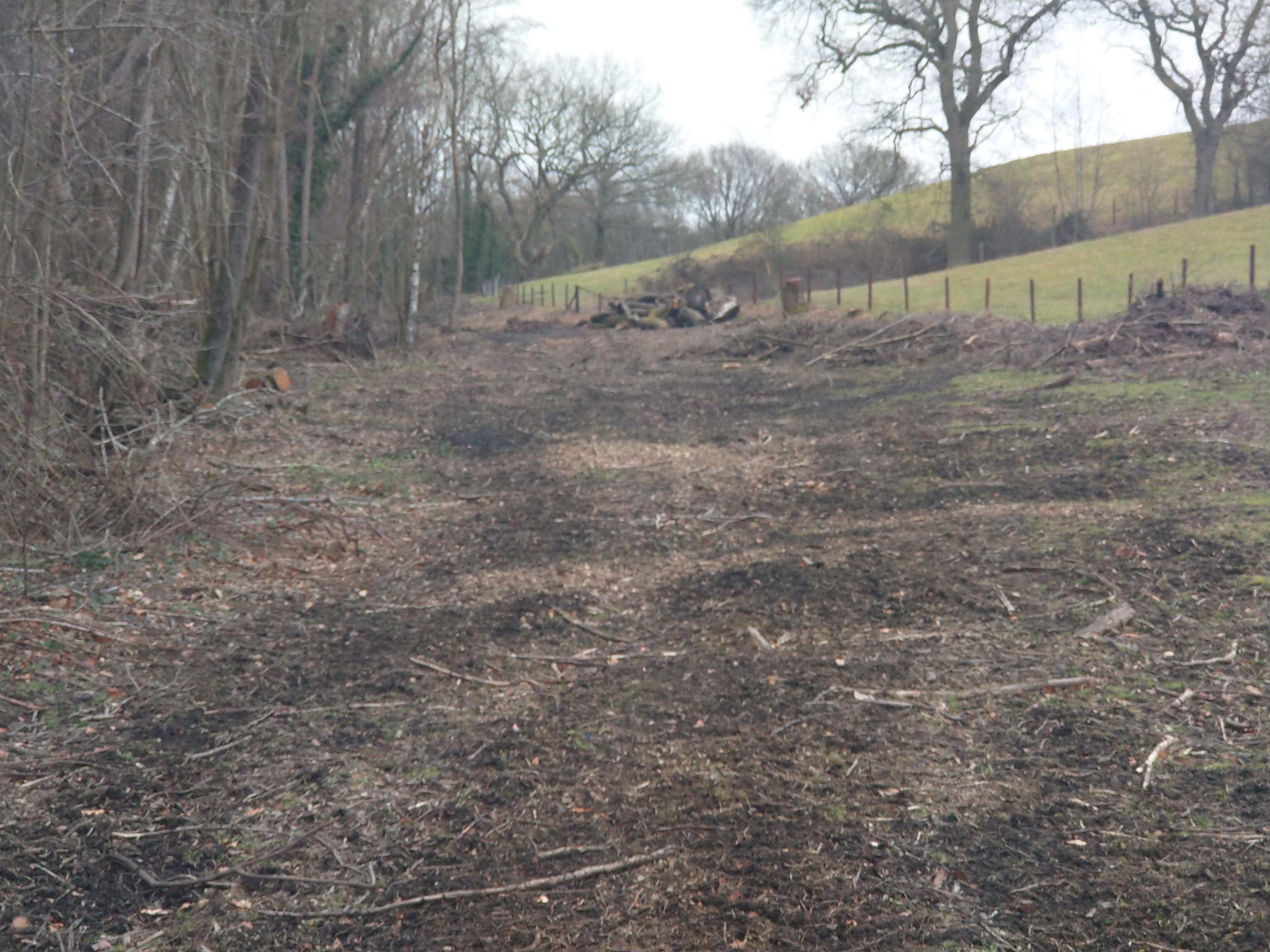
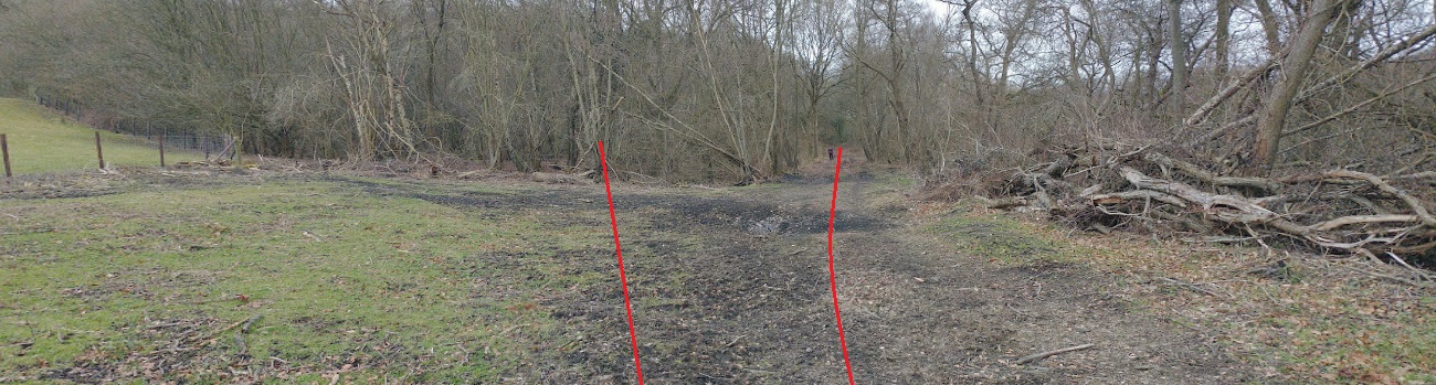
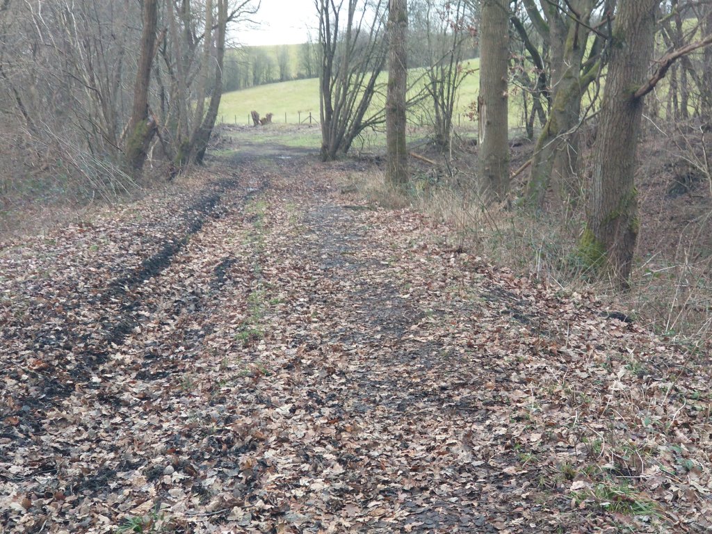
John Tennent tells us that in early days (1883), Highley Colliery was connected to the Severn Valley Railway (SVR) at Highley Station via a standard-gauge self-acting rope-worked incline with 3 rails splitting into four at the halfway-point to allow rakes of wagons to pass. A loco may have been used at the top of the incline. [1] There is no evidence of this incline at the station site on the 1883 Ordnance Survey. It may well be that the Incline referred to is that which is shown of the later Ordnance Survey from the turn of the 20th century. That incline just sneaks onto the bottom left of the map extract from the later survey above.
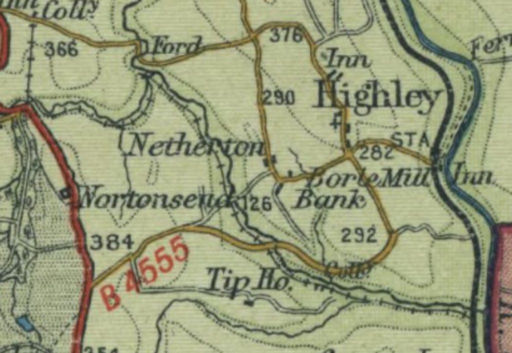
By 1892, the Hindley Mining Co. opened a site a short distance to the Southwest of Highley Station. This became Kinlet Colliery and its link to the SVR was completed by 1895. An agreement between the Company and the GWR dated 27/05/1895 which required the GWR to construct a junction and sidings at the expense of the Hindley Mining Company. John Tennent tells us that these sidings “became known as Kinlet Sidings and survived as a wagon repair yard long after the colliery railways had closed.” [1: p9]

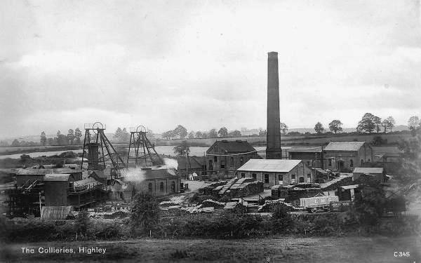
“By 1900, about 240 men and boys were employed. … Main line railway trucks were filled with coal at the colliery, and then run down a standard gauge incline to the sidings, the layout of which can be seen on the extract from the Ordnance Survey Map, 1888-1913 series [above]. One of the main destinations of the coal was the carpet factories of Kidderminster.” [21]
“The Highley Mining Company ran the colliery successfully for many years, with the workforce increasing to 670 by 1937. As the workings moved under the River Severn towards Alveley, a new shaft was opened at Alveley. Once the Alveley and Highley workings had joined up in 1937, men and equipment were transferred to Alveley, and by 1940 Highley Colliery itself had closed, although the pithead remained open for ventilation. The former colliery sidings then became the landsale yard for Alveley Colliery.” [8]
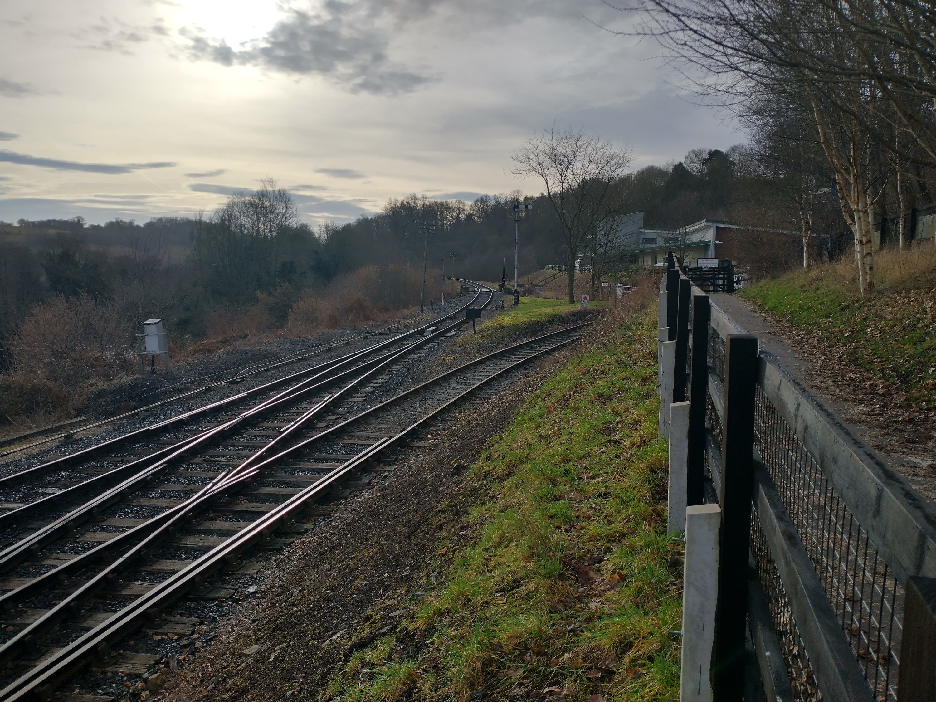
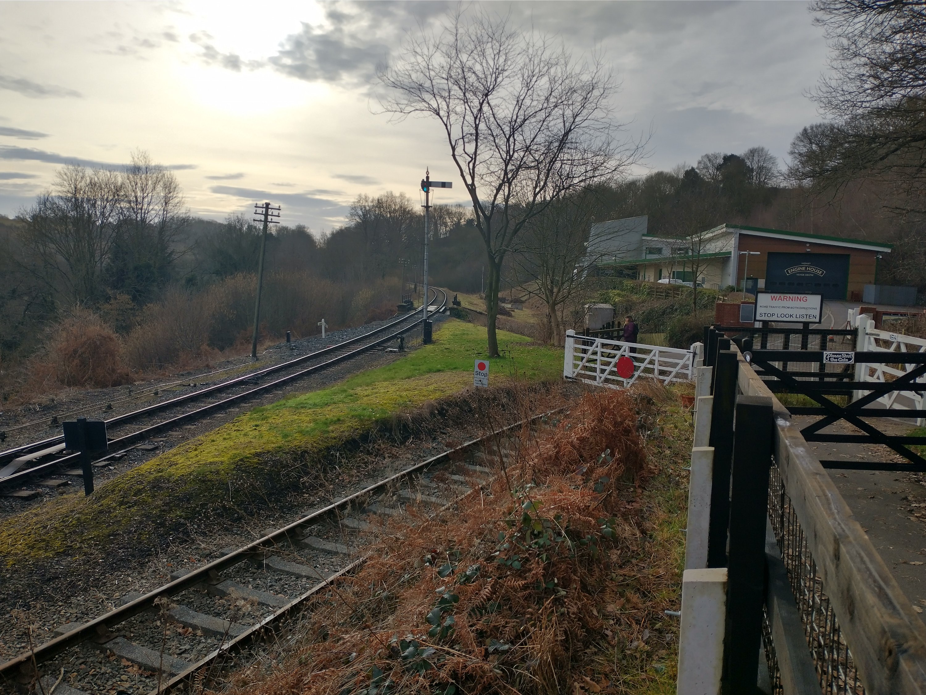
The area of the former sidings was eventually bought by the SVR and is now the site of The Engine House.
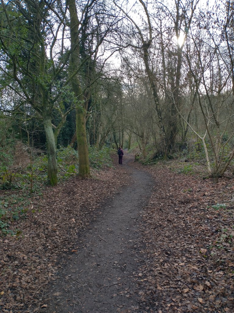
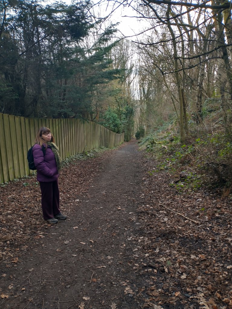
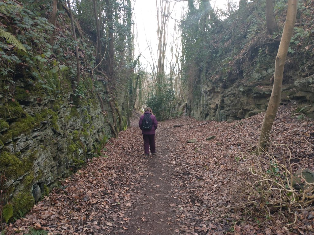
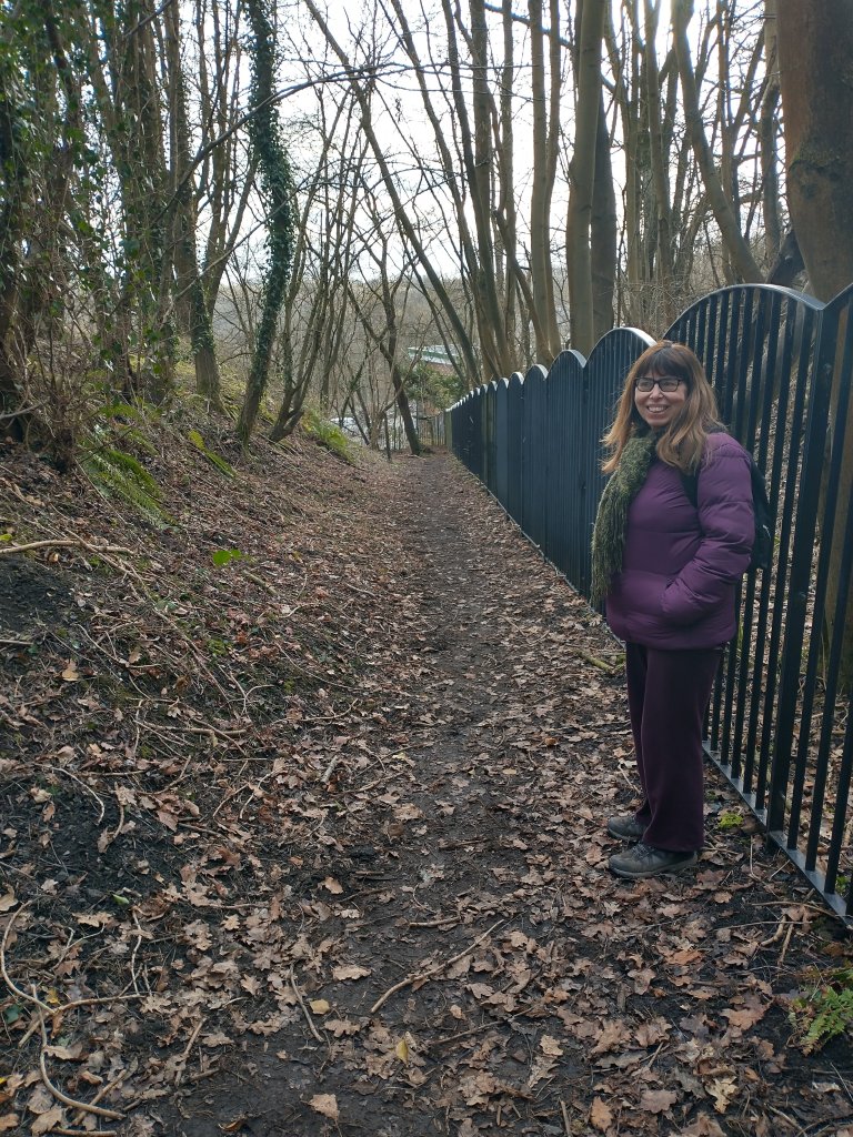
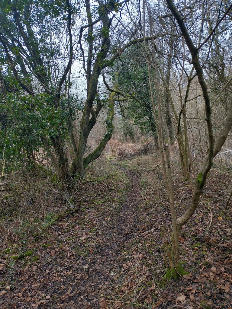
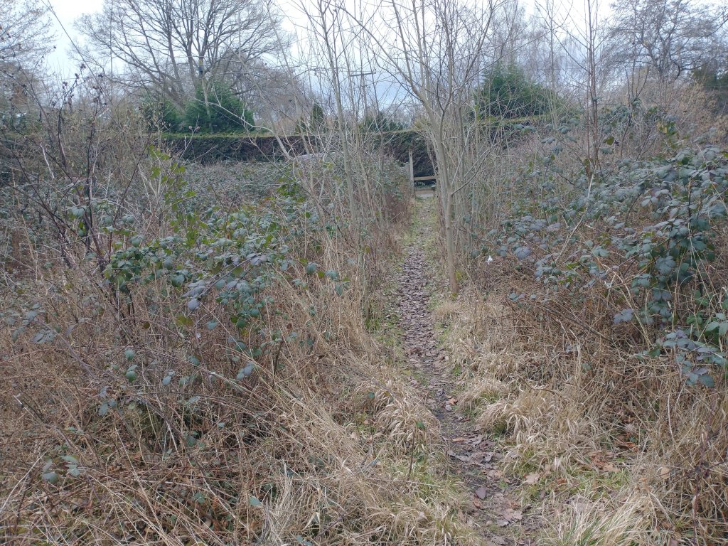
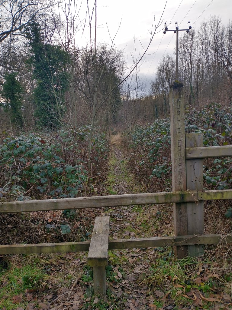
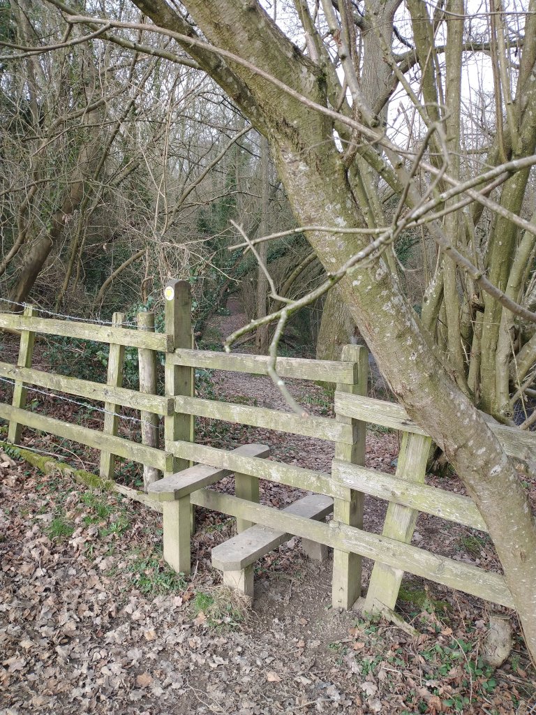
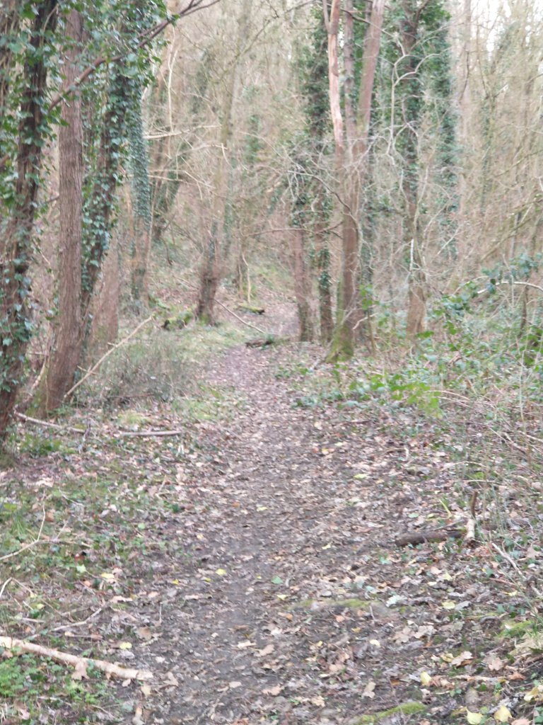
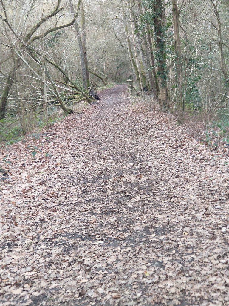
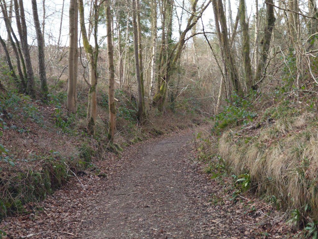
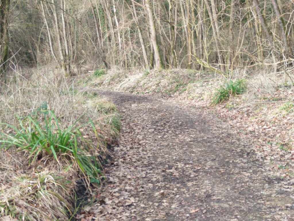
The next sequence of photographs show the path which follows the incline between Highley Colliery and the colliery sidings adjacent to the SVR.
The Billingsley Railway
Highley, and the area immediately around, it has a long industrial history and the remains of numerous railways and tramways can be seen today. At the end of the 18th century coal mines and a blast furnace were opened in Billingsley. The coal and iron were brought alongside the Borle Brook through Highley by a horse-worked tramway to the River Severn where they were sent downstream in boats. The “tramway worked for no more than 15 years, but its route can still largely be traced on the North side of Borle Brook, running via shallow embankments and cuttings. A little later the Stanley Colliery (1804-1823) opened close to the site of the present Highley Station and this was also served by tramways, as were the numerous sandstone quarries by the river.” [26]
Stanley Colliery was just to the South of Highley Station. It was worked for that short period at the beginning of the 19th century in the sulphur coal at a depth of about 100 yards; the Brooch seam worked by the Highley Colliery was a further 200 yards below this. Stanley Colliery “is partially overlain by the trackbed of the Severn Valley Railway and sidings built by the HMCo. [Highley Mining Company] There are also extensive remains of the stone quarries which worked in this area from perhaps the Middle Ages to the 19th Century.” [21]
The old plateway/tramway/tramroad route is covered in an earlier article in this short series about railways to the South of Bridgenorth:
Railways Around Bridgnorth – Part 1
The tramroad was the first transport venture alongside the Borle Brook. It was some time before industrial development at Billingsley warranted the construction of another railway. In the early 1870s, a new mine had been sunk at Billingsley. The mine site was to the East of the Cape of Good Hope Inn. It “reached ‘Sweet Coal’ at 160 yards depth by Christmas 1872 (Sweet coal is low sulphur coal).” [24]
In the 1875 a public limited company, the Billingsley Colliery Company, was formed to work the mine and a decision was taken to link Billingsley Colliery to the Severn Valley Railway (SVR). [31]
Progress was slow, but eventually, in March 1877, a lease permitting the railway to cross land belonging to the Duke of Cleveland between the mine and the River Severn was signed. Further access rights were granted over land in Kinlet by February 1878 and, in December 1878, the GWR agreed a connection could be made to the SVR. [31]
The mine suffered significant cashflow problems in the late 1870s and the Company was bought out in 1878 by “Samuel Norton Dimbleby. The next year Dimbleby renamed it the Severn Valley Colliery Company and by various means … he raised enough money to allow construction of the railway to begin.” [31]
Work commenced in October 1880. The line was to follow the Borle Brook on its South side as far as New England. There it was to continue alongside the Borle Brook for a short distance “before striking due west to reach the colliery by a chain-worked incline, over half a mile long.” [31]
“The line was due to be completed by the end of January 1881 and open by 31st March. This was an ambitious target but the contractors, Messrs Drewitt and Pickering of Stoke on Trent, seem to have made good progress, quickly constructing all the earthworks as far as New England. Then work stopped.” [31] It seems likely that “Dimbleby and the company never had enough money to pay for the completion of the line.” [31]
For two years, Dimbleby strove to complete the railway but without success. “Finally, in October 1882, the materials on the line were sold, probably by Drewitt and Pickering in an attempt to get some of their money back.” [31]
Dimbleby’s endeavours left a local landscape scarred by embankments and cuttings. The fruit of his labours is illustrated below on another series of extracts from the 6″ Ordnance Survey published in 1883.
Dimbleby’s efforts were, ultimately, not to be wasted. The mine was purchased, along with Dimbleby’s Severn Valley Colliery Company, in 1882 by Alfred Gibbs. He continued to operate the mine successfully on a small scale until, after the turn of the 20th century, a new company, the Billingsley Colliery Company, was created. [24]
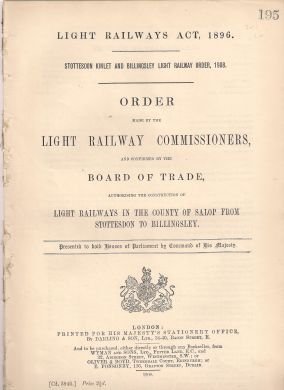
This new company brought great optimism and quickly sought to establish the mine as a significant local player. A connection to the SVR once again became paramount in their plans for the Colliery and a light railway order was sought under the 1896 Act.
Billingsley Colliery Co. “undertook a major transformation of the mine, including a complete reconstruction of the surface buildings and alteration of the layout – adding a fan-house, lamp room, an electrical powerhouse, carpenters and fitters shops. Electric haulage was installed underground and a rope-hauled narrow gauge tramway built to drop coal tubs down to new railway sidings in a valley at Priors Moor about half a mile away and 300ft lower than the mine site. A new Garden Village was also built for the miners at Highley.” [24]
The Railway was built by 1913. The colliery screens were built at the head of the railway at Priors Moor. Coal came down the Incline was processed and loaded onto wagons. Waste from the screens and pit materials were sent up the Incline to the mine. [24][31]
Leaving the sidings alongside the SVR, the line initially ran parallel to the Kinlet railway, but continued for an extra 1½ miles to the colliery screens at Prior’s Moor. “This had no severe gradients although it did have a number of sharp curves. To work this railway, the Billingsley Colliery Company purchased a second-hand 0-4-0 saddle tank. No 599 built by Peckett’s of Bristol.” [41: p13]
In 1915. Billingsley Colliery was taken over by the Highley Mining Company, this means that they inherited No. 599. As we will see later in this article, they favoured No. 599 over their own locomotive ‘Kinlet’.
Much of the Railway from Kinlet to New England used the earthworks built by Drewitt and Pickering. From New England a spur was created which followed Bind Brook to Priors Moor where it met the narrow gauge ropeway. [31]
A brickworks opened in Billingsley in the late 1860s and was in use until the start of WW1. An aerial ropeway from the brickworks brought bricks, tiles and other products down to the sidings with coal for the kilns going back to the brickworks. [24][34]
The Colliery itself was relatively prosperous in the years around WW1. It was employing more than 200 men at that time. This prosperity was short-lived, Billingsley Colliery was taken over in 1915 by the Highley Mining Company after it had, had a number of financial and geological difficulties – they also took over the Garden Village housing development in Highley. [24]
The Colliery closed very early in the 1920s. The railway to Priors Moor remained in use until the late 1930s, serving a landsale yard at its terminus near the colliery screens close to Priors Moor. A few of the mine buildings survive and have been turned into farm buildings. The track bed of this railway and some of the bridges survive largely intact. [24]
The landsale yard closed in the 1930s and the railway had been dismantled by the end of 1938. Much of the Billingsley line is now a public footpath; the stretch from Billingsley to New England in Highley forms part of the Jack Mytton Way, a long-distance bridleway. [24][32]
Although initially separate, the Billingsley and Kinlet (see further below) railways were later connected and worked until the closure of Kinlet Colliery in 1937, when the railway was closed. [24]
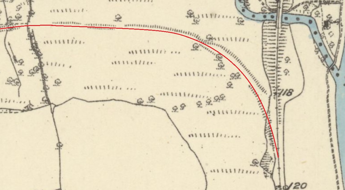
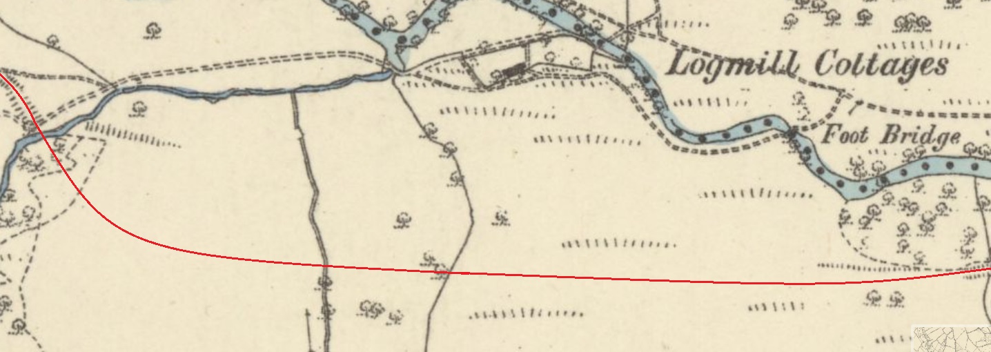
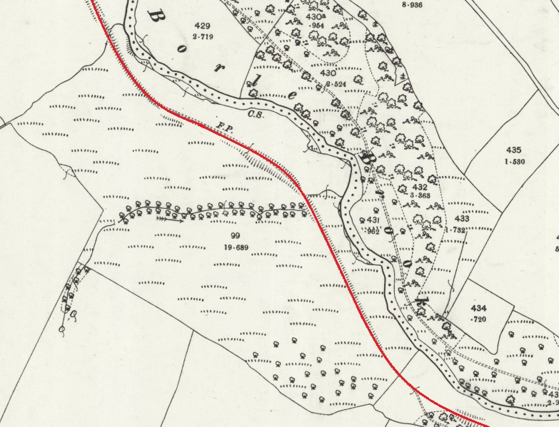
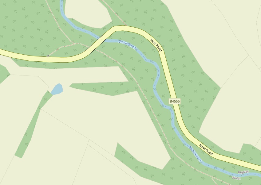
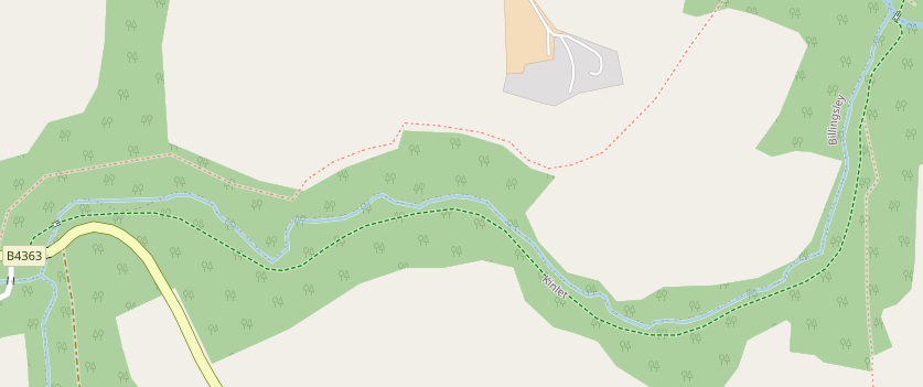
The Billingsley Railway was about 3 miles in length. It ran along the valley of Borle Brook as far as New England. For much of its life the first section of the line followed the Kinslet line only a metre or two to the North, closer to Borle Brook. The sketch map below is based on a map provided by John Tennent [1: p8] Both the Billingsley Railway and the Kinlet line were gated close to the sidings.
In its latter years the loop and sidings shown above were removed and along with the branch mainline and a connection was made to the Kinlet line closer to the point at which the steepest gradient of the Kinlet line commenced.
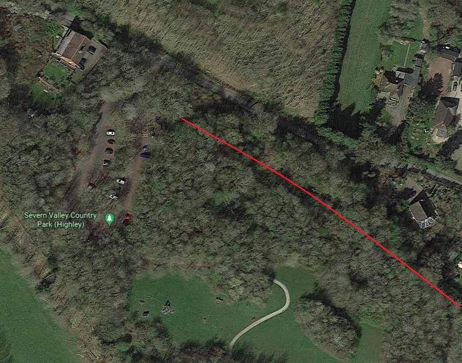
The Billingsley Railway is not shown on any of the extracts from the 25″ (1901/1902) and 6″ Ordnance Survey of 1925 shown in the notes about the Kinlet Colliery further below. I have imposed the approximate route of the line on the 25″ Ordnance Survey of 1901, published in 1902. A red line is shown on the 25″ Ordnance Survey extracts below.
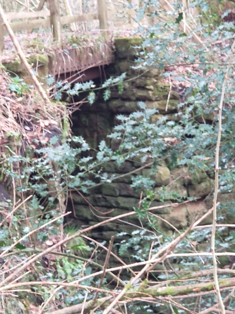
There was a culvert provided for this stream when the Billingsley Railway was built. A photograph of the culvert can be seen by following this link. [59]
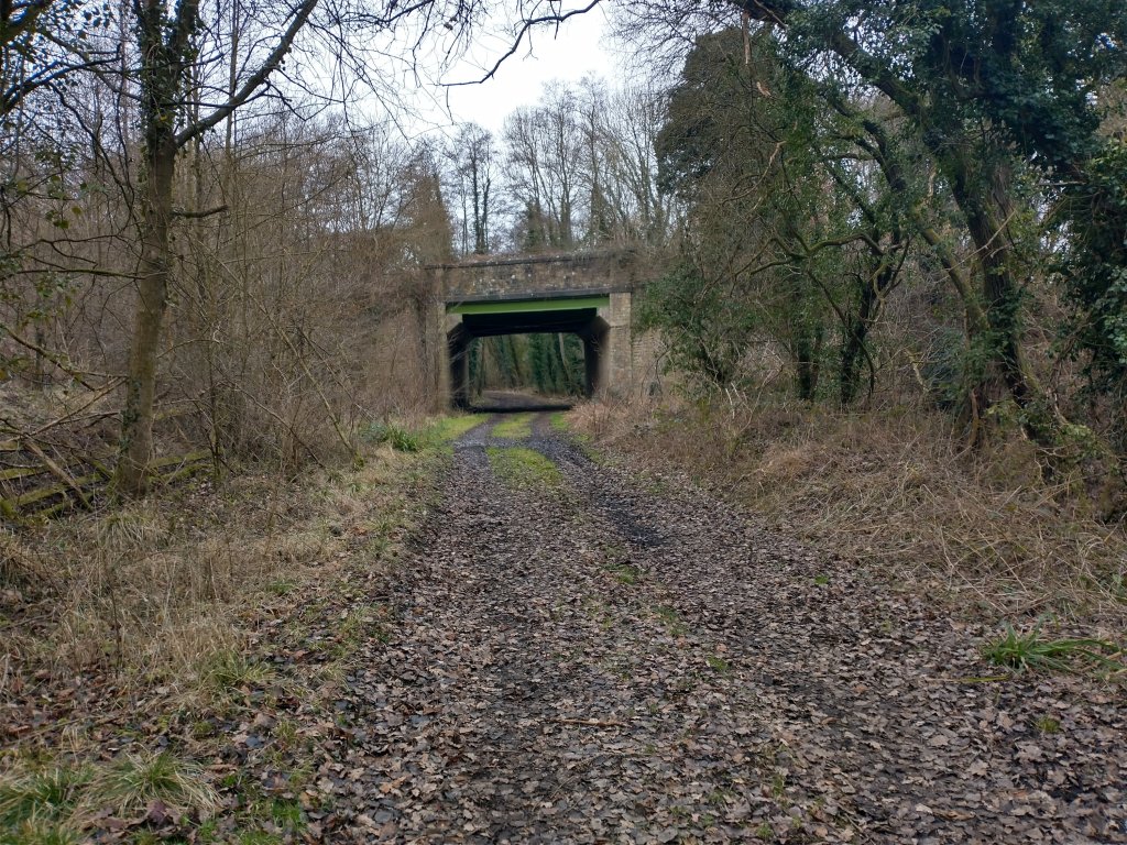
Tennent tells us that there was a single siding on the South side of the line before the railway passed under a concrete bridge built for New Road. [1: p9] There is, unsurprisingly, no evidence of the sliding at the location in 2023!
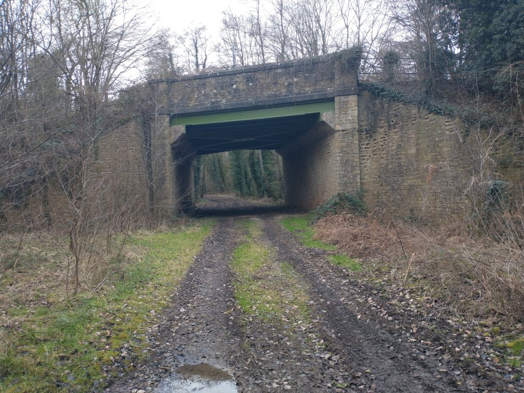
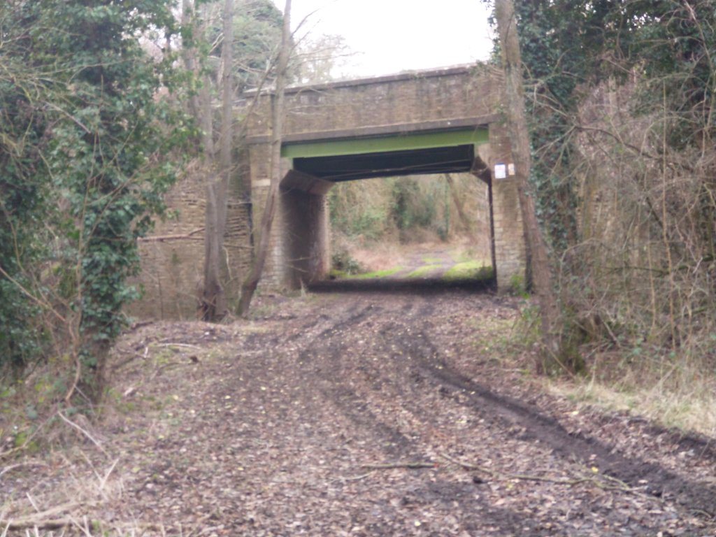
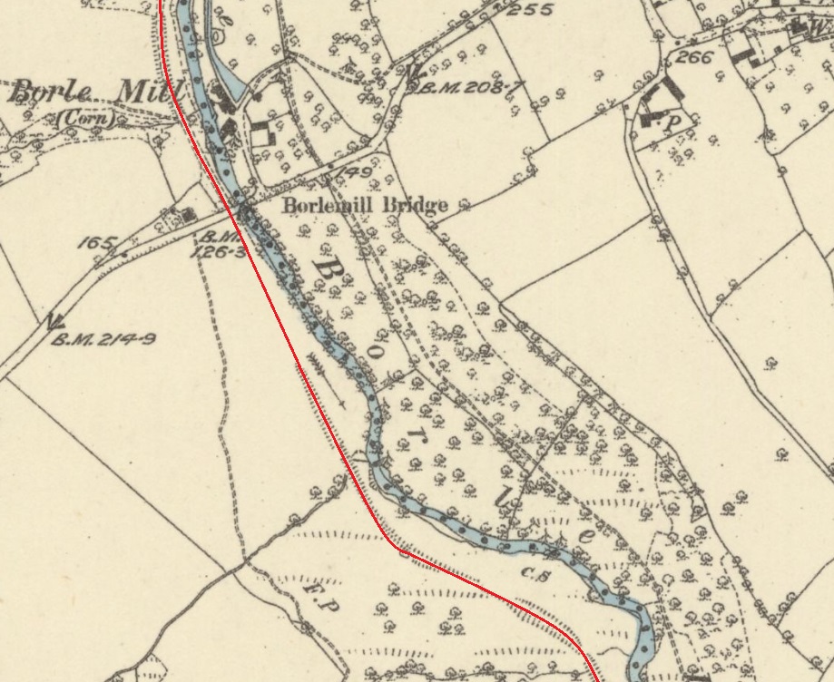
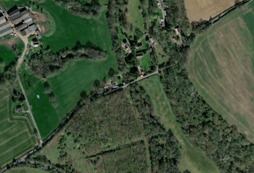
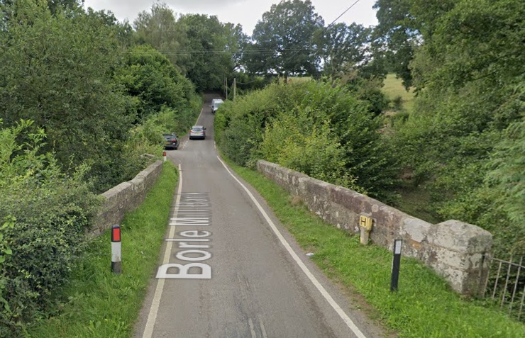
The railway encountered the old road a few hundreds of yards to the Northwest of New Road. It crossed the road on the level. The old road, Borle Mill Bank, was very steep at either side of Borle Brook’s valley. Tennent says that, “the crossing gates were linked by wires to two semaphore signals at the top of the gradients on each side of the valley. When the gates closed to the road, the signals went to danger and road users stayed at the top of the hill if they had any doubts about the effectiveness of their brakes. Strangely, the signal arms were painted white or grey but not the usual red. They did, however, display the usual red or green lights at night. The west one was level with the top of Borle Mill Cottage garden and the east one was by the bend in the road near the house at the of the hill.” [1: p9]

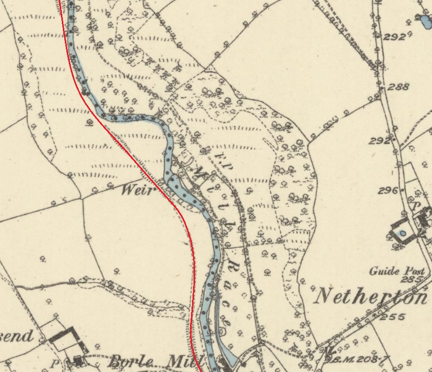
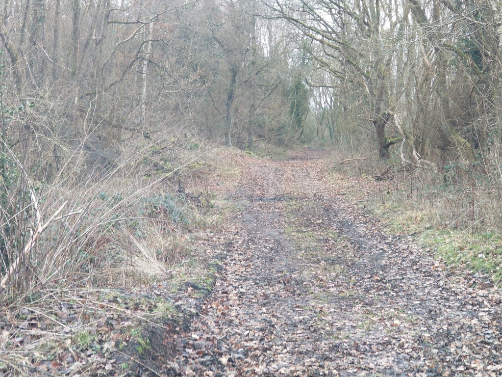
The railway continued North alongside Borle Brook.
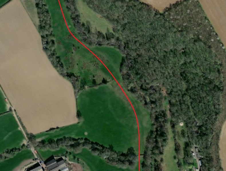
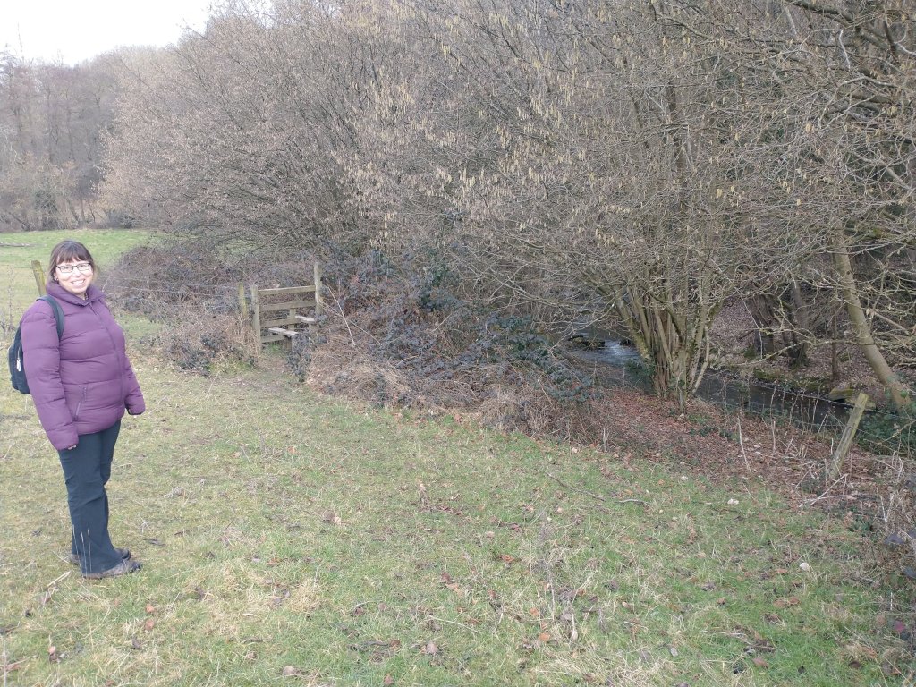
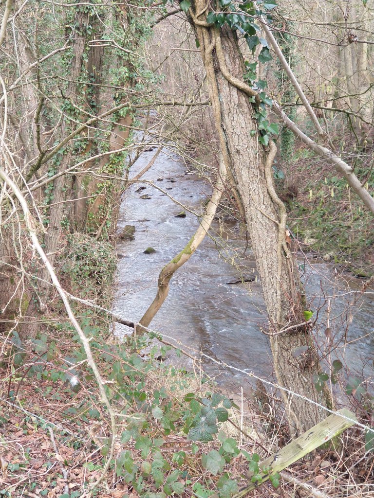
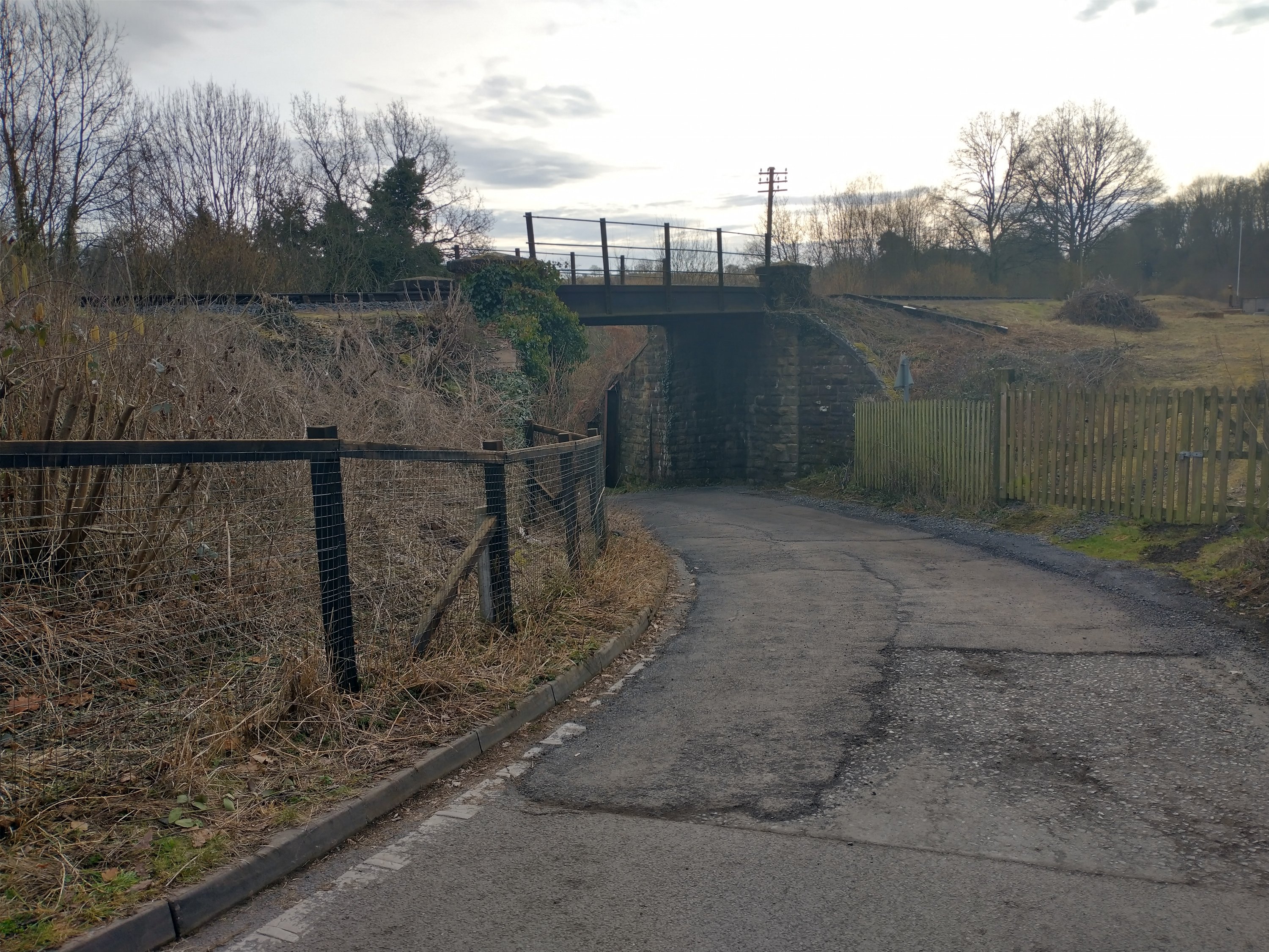
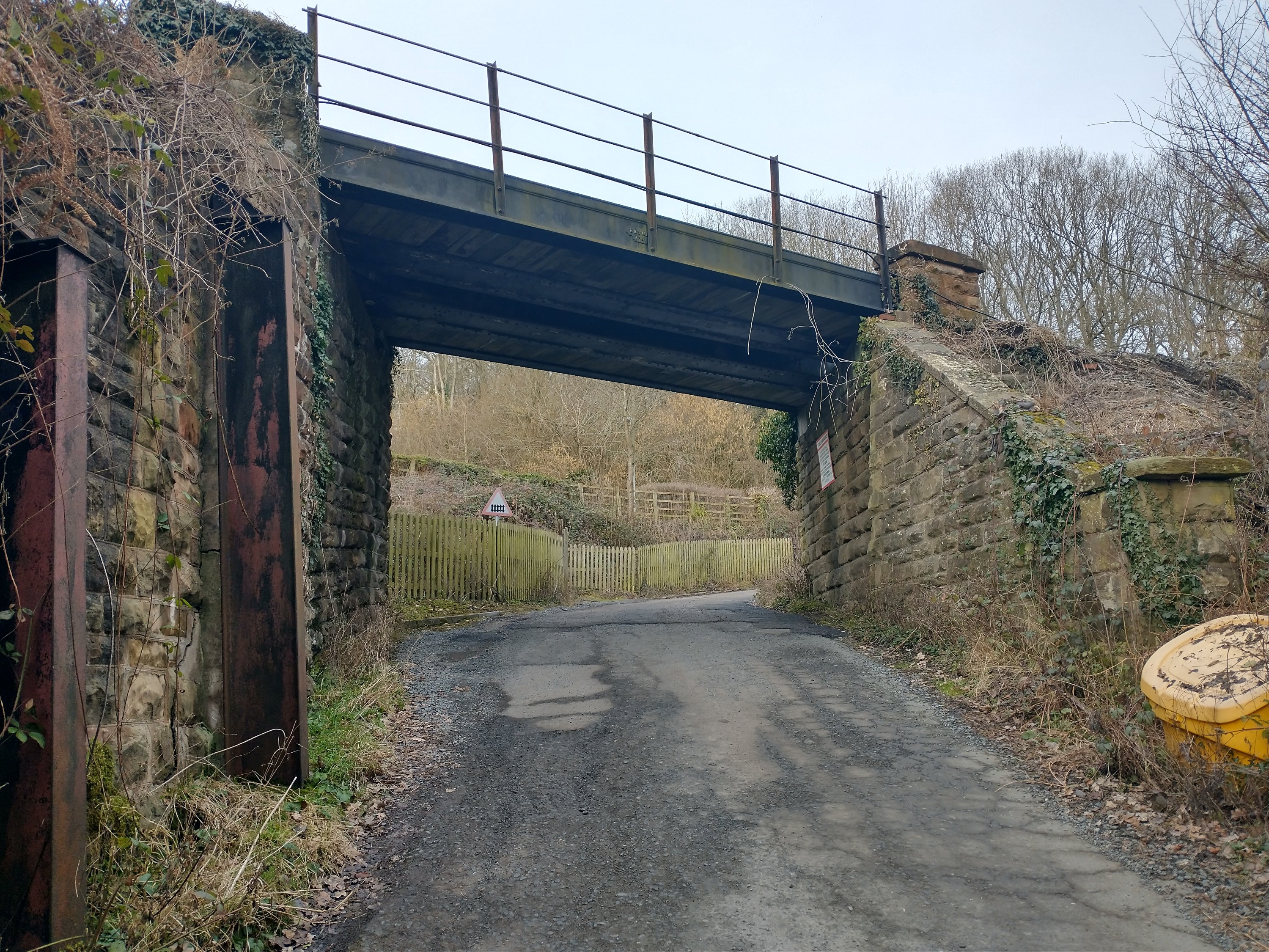
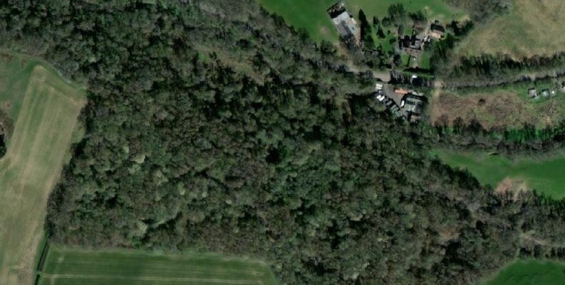
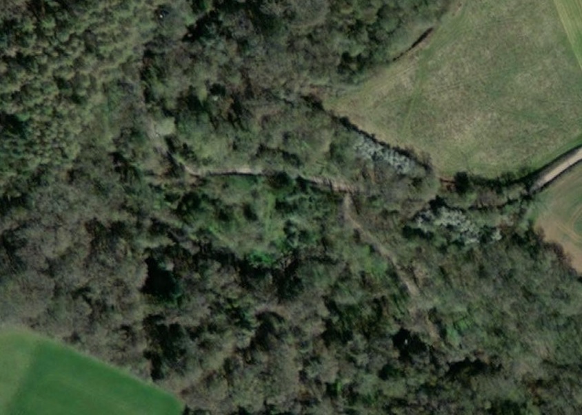
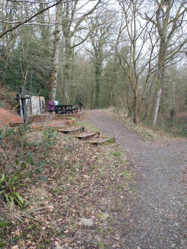
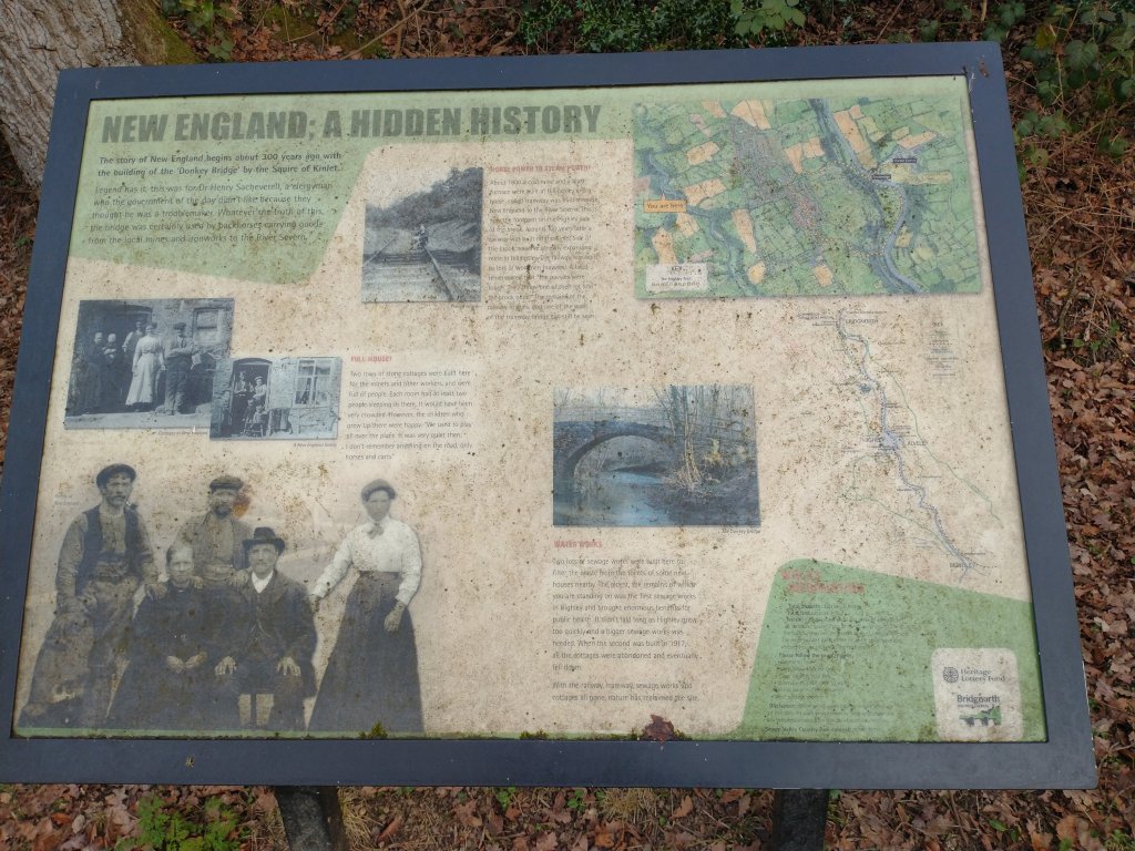
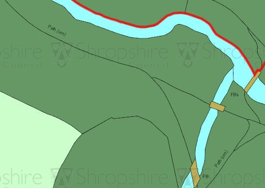
About a mile from Borlemill Bridge, the line crossed a tributary stream and entered a short reversing line. Two bridges crossed the tributary and the ongoing line needed to curve sharply to the South to follow the tributary. The location was known as New England.
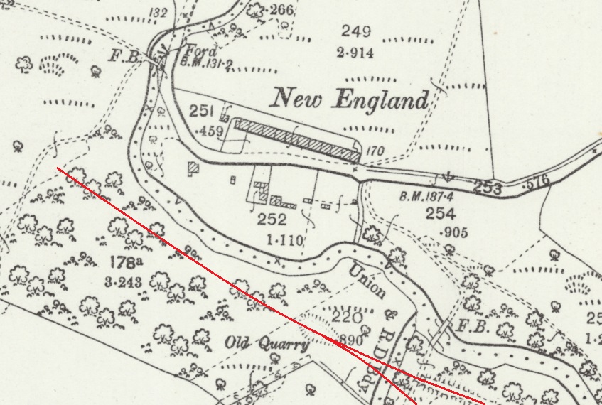
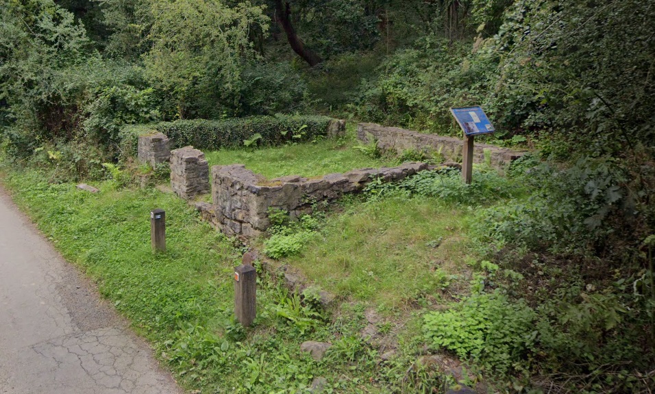
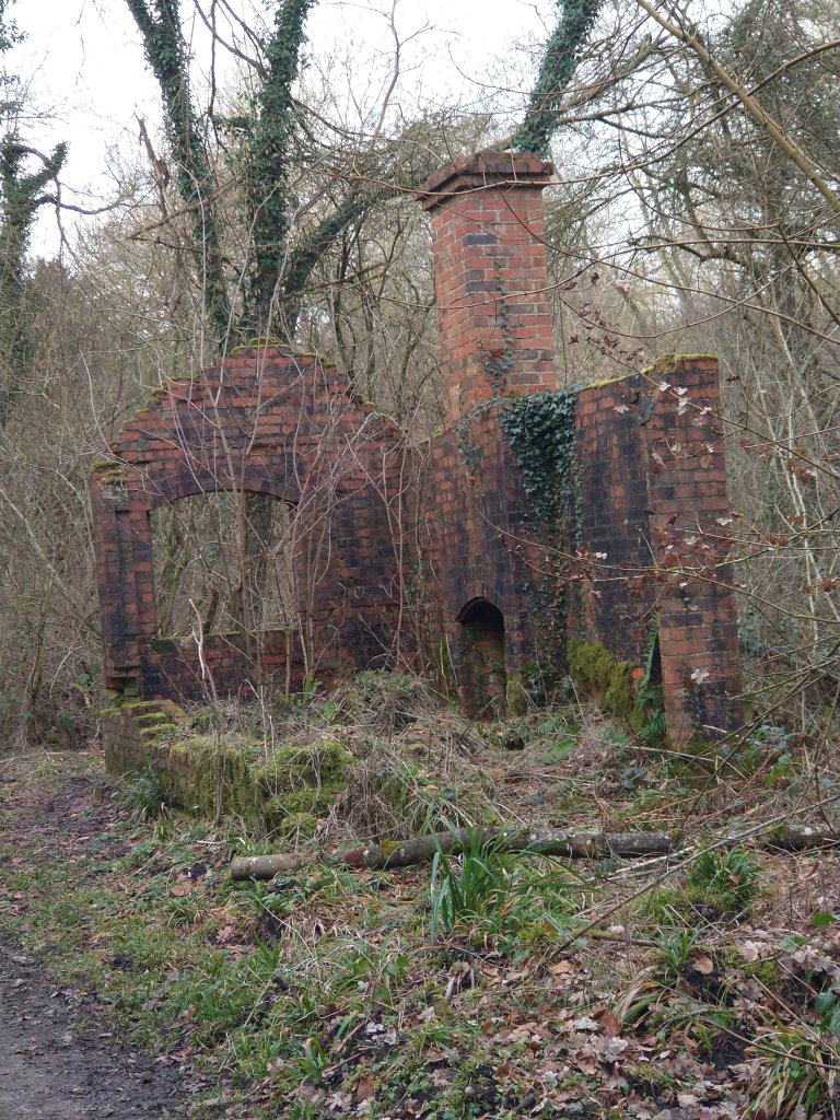
“In 1807 two rows of stone cottages were built at right angles to each other. The cottages were occupied by colliers, woodsmen and labourers. There was also a brick washhouse on the site. By 1918 the cottages were empty and demolished. The footprint of one of the cottages can still be seen,” (as shown in the Google Streetview image above). [49]
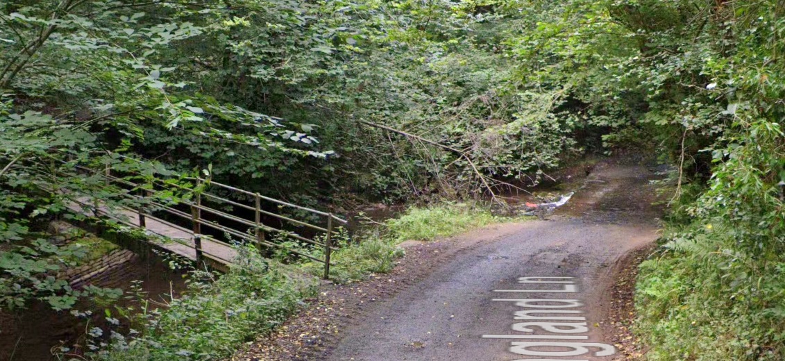
In addition to the cottages, there is a ford near the location and the remains of Highley’s first sewage works. The ford by which New England Lane crossed Borle Brook can be seen above. The site of the sewage works can be seen immediately below.
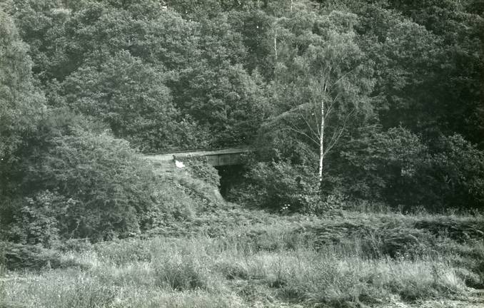
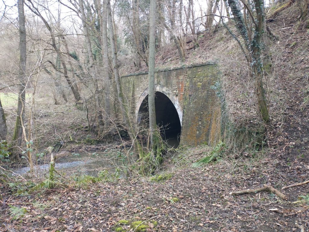
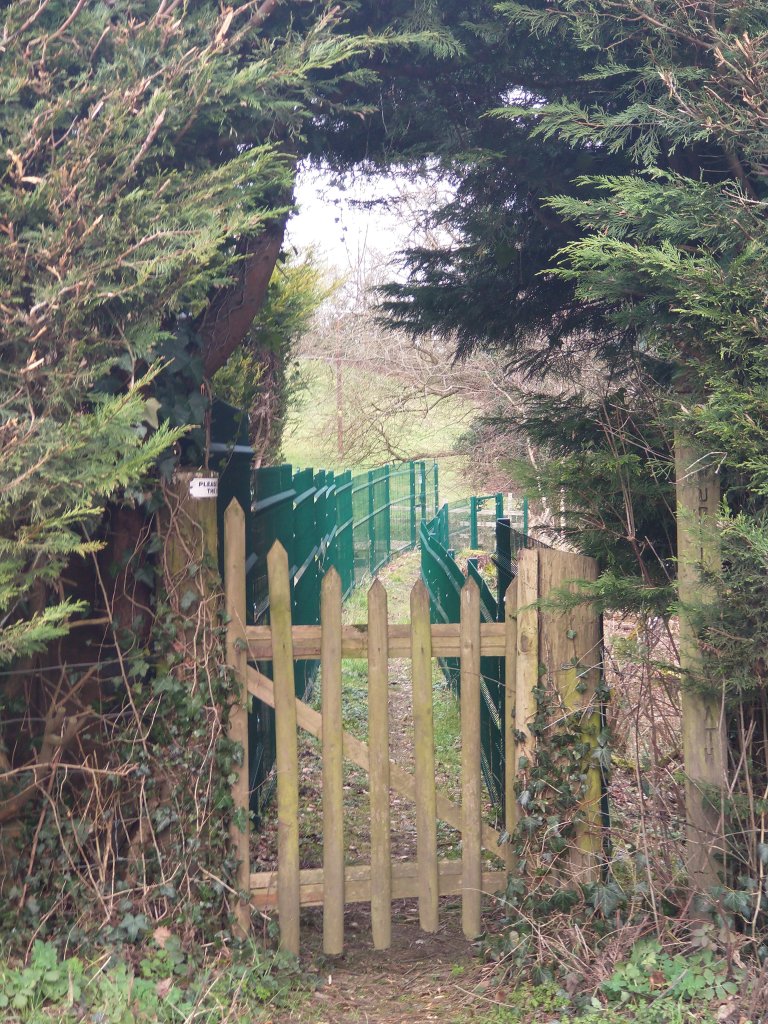
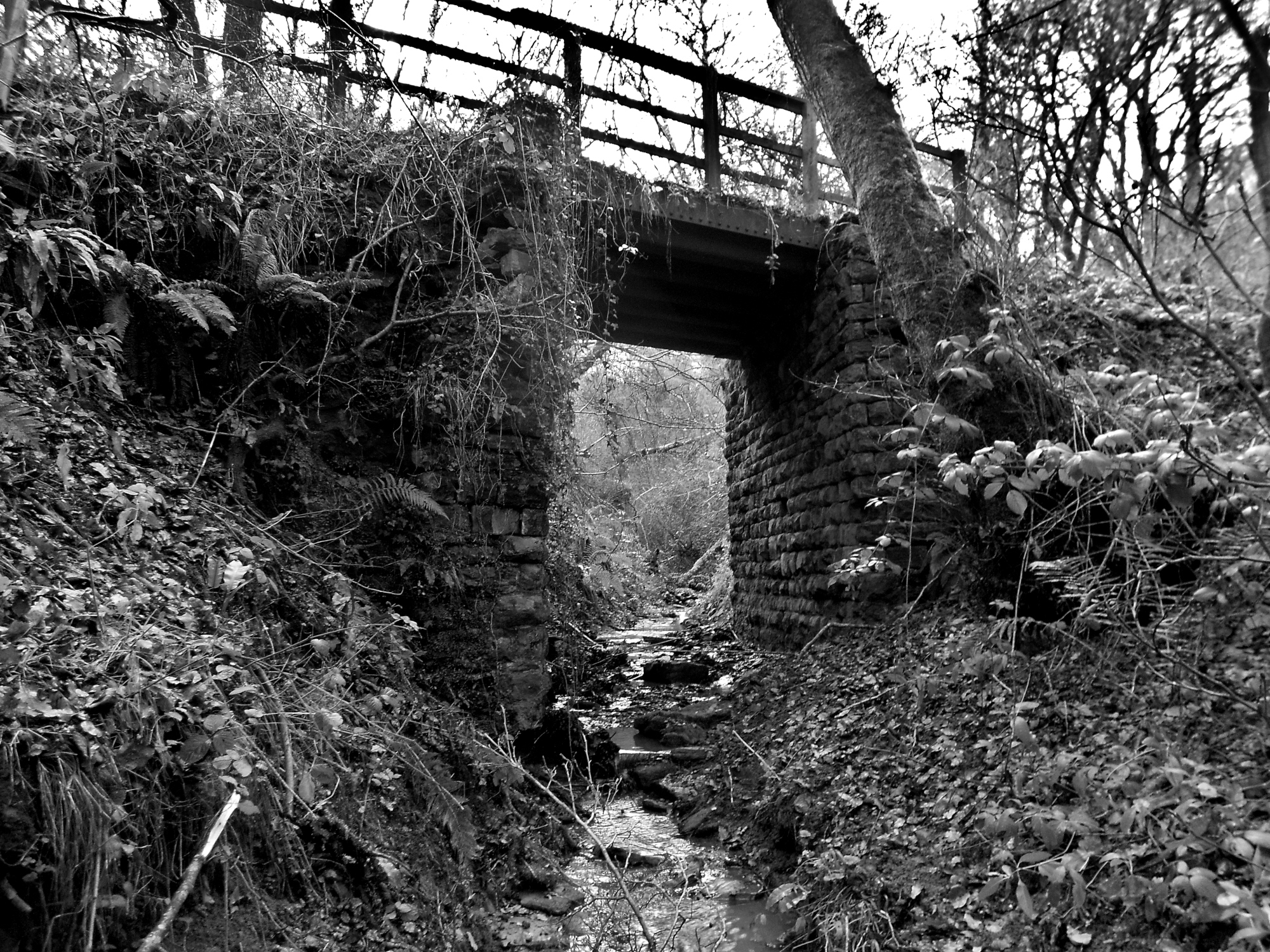
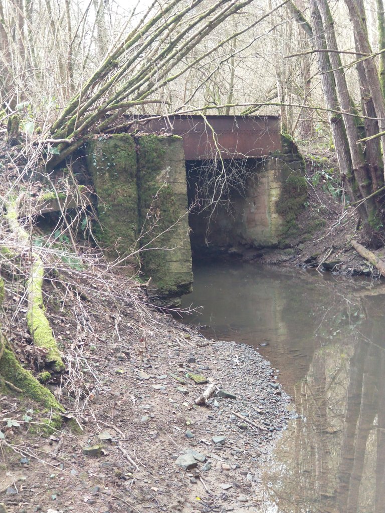
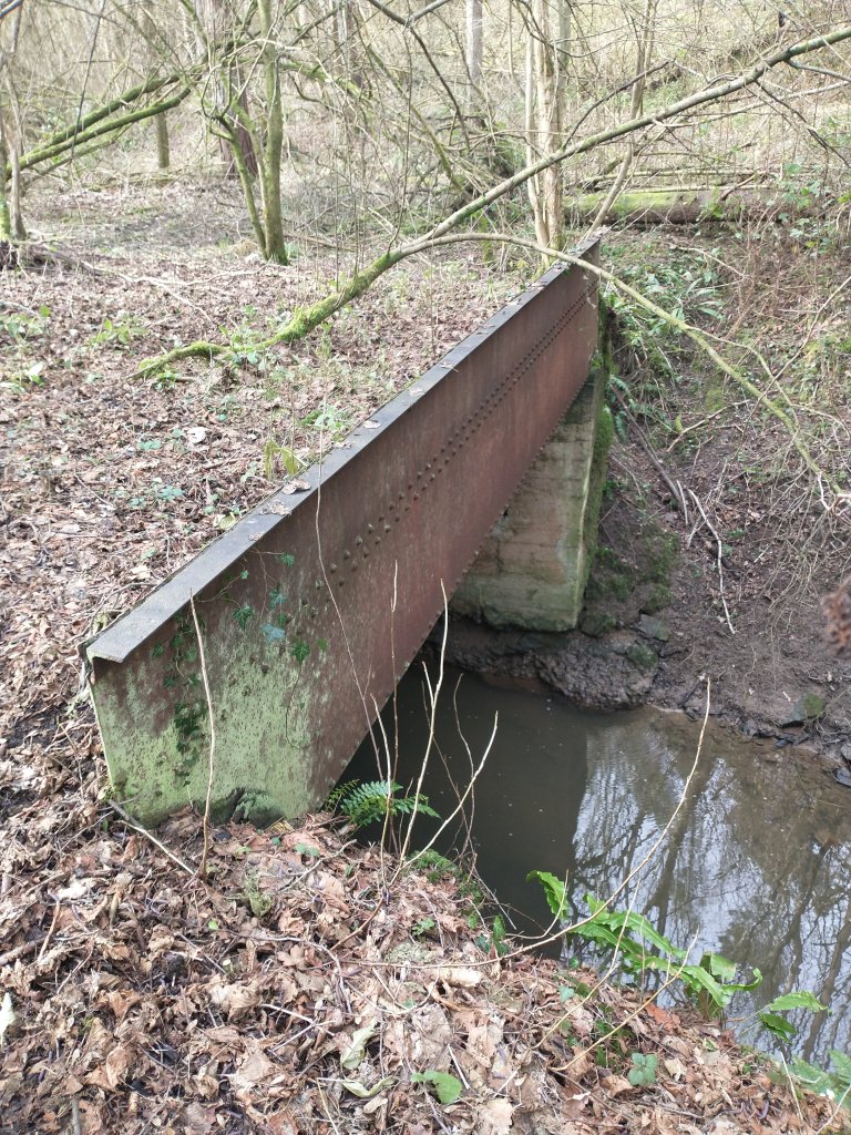
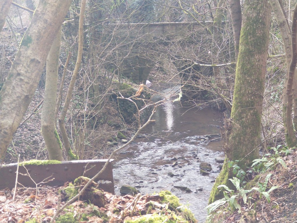
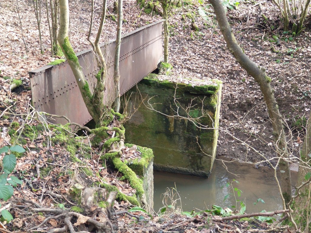
Three bridges at this location are shown on the Ordnance Survey below. All are shown with footpaths crossing them. The footpaths over the bridges crossing the tributary are now closed.
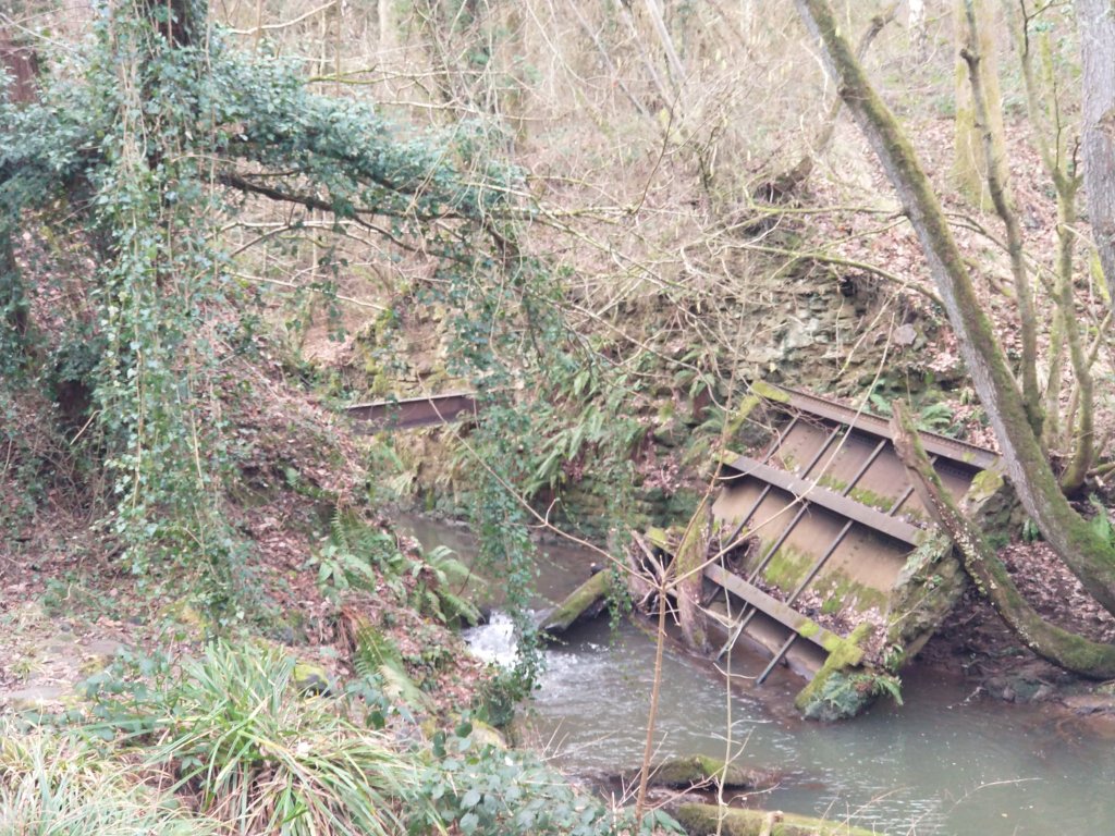
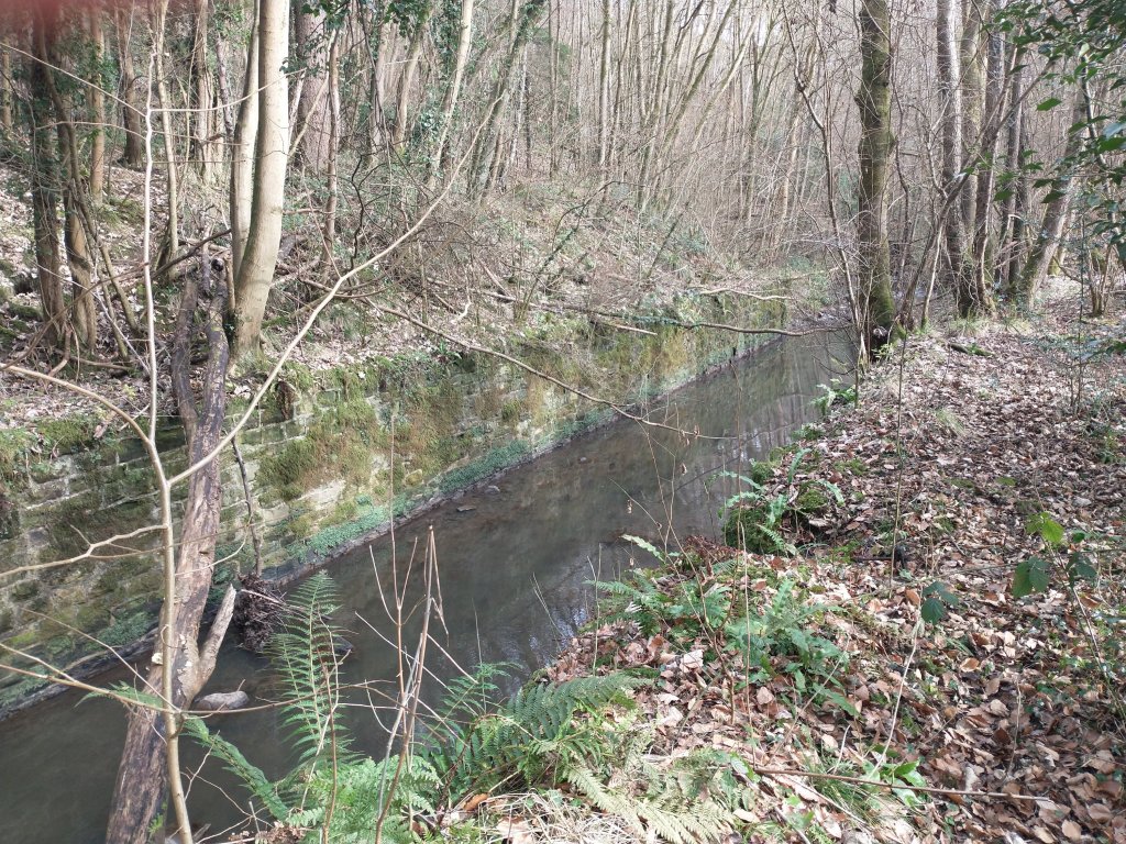
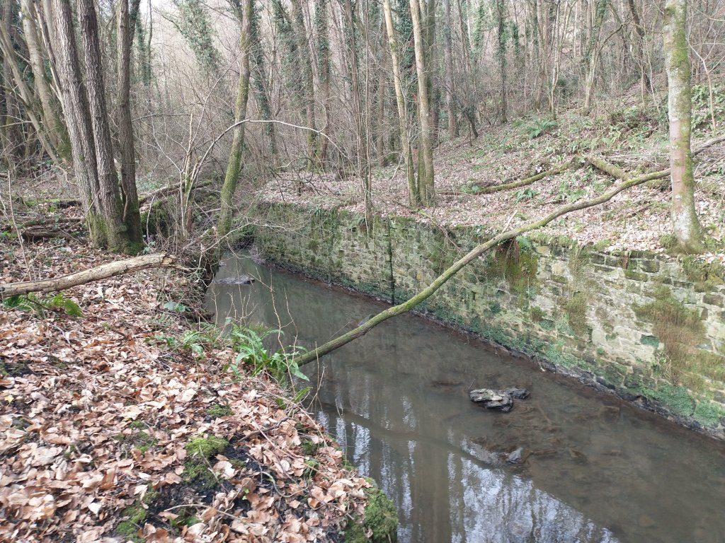
A sequence of three photos of the second bridge follows …..
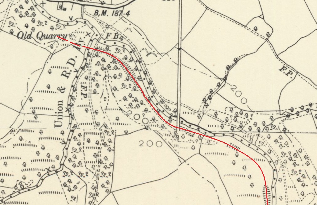
After reversing at New England, trains crossed the tributary stream and followed its East bank to Priors Moor. There it terminated at the colliery screens.
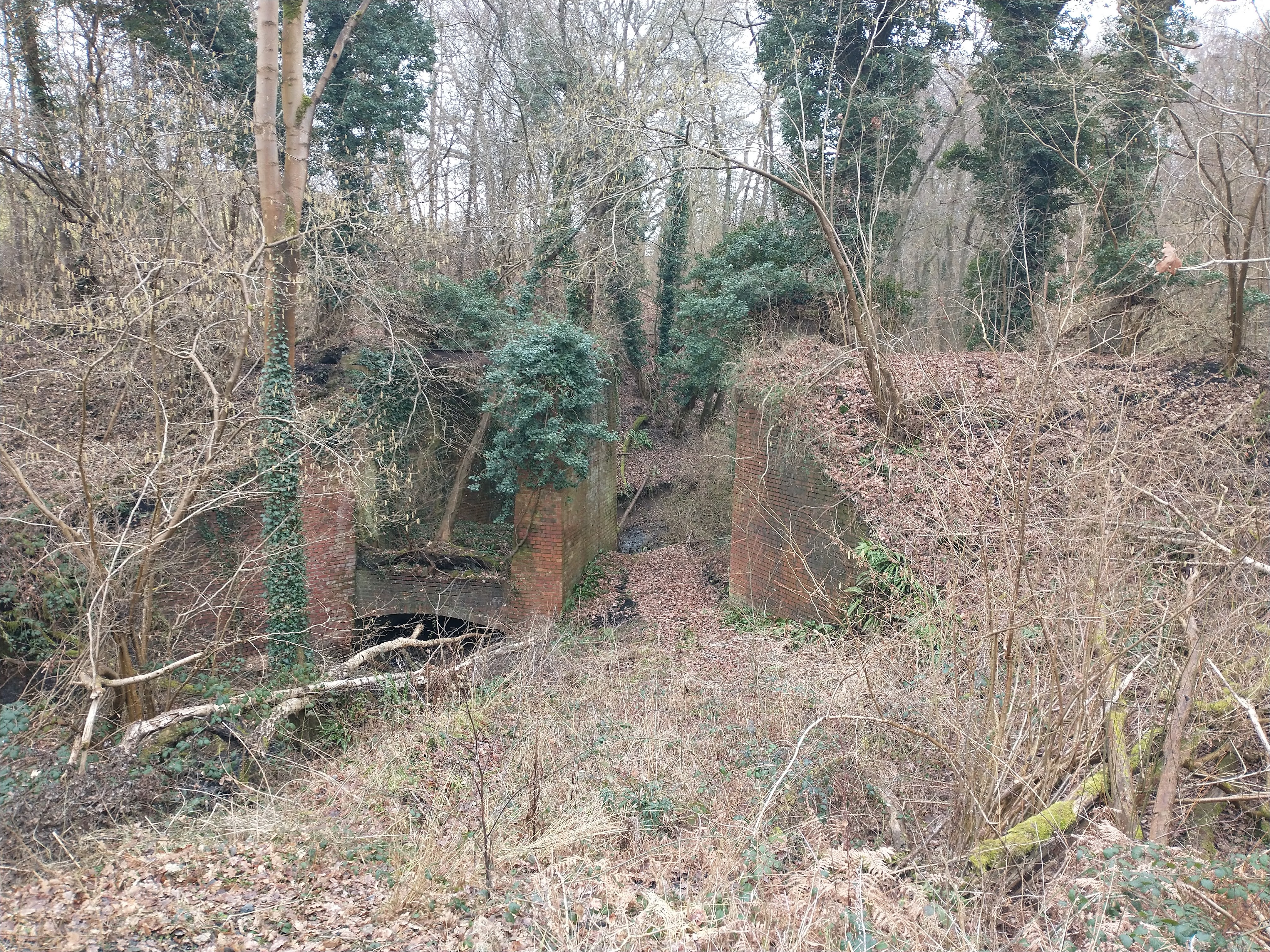
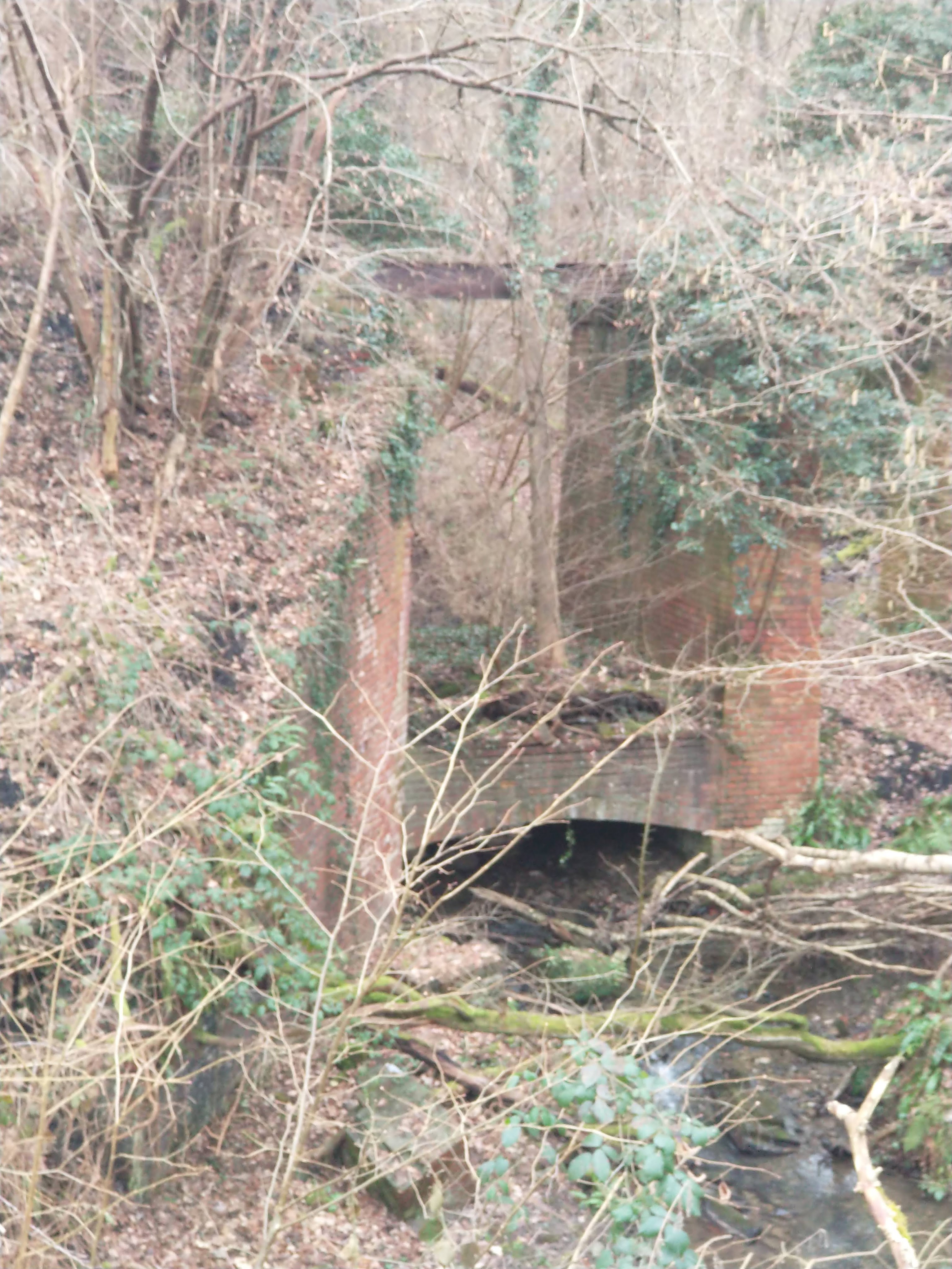
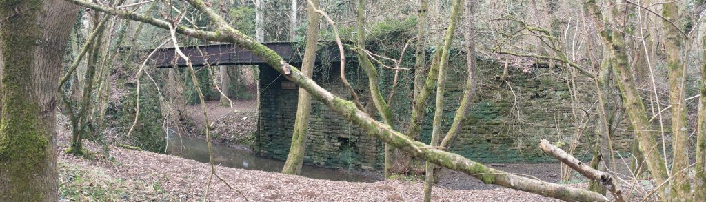
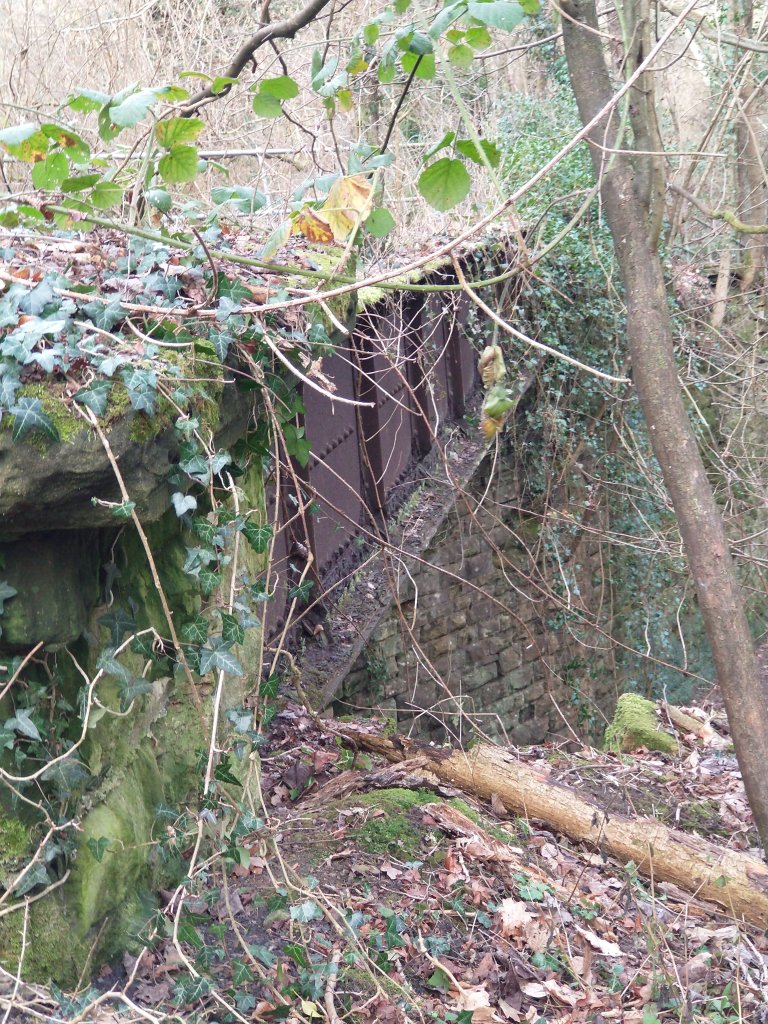
Priors Moor, the terminus of the standard-gauge Billingsley Railway: The railway terminated at the Billingsley Colliery screens at Priors Moor. Tennent tells us that “just before the terminus, a single road engine shed was passed on the right. The colliery was situated some 200 feet above the valley near Billingsley village and was connected to the screens by means of a rope-worked narrow-gauge tramway incline. The screens and railway yard were partly constructed on a girder bridge above the stream and this structure can still be seen from the adjacent road.” [1: p9-10]
We did not see any remnants of the engine shed on our site visit on 3rd February 2023. We found the channelled length of the stream and the culvert which carried the stream under the screens.
The yard was also the terminus of a short-lived aerial ropeway serving a brick works near the Cape of Good Hope Inn. It seems that the brickworks were reopened in 1914. Tennent tells us that this was intended to “provide bricks for miners’ houses at the “New Village” at Highley … [The ropeway had a short working life as, following a dispute with the local council, building work ceased and the ropeway closed just a year after opening. It was not dismantled until 1937-38 when the railway was lifted. … The delivery of bricks was unbelievably complicated – ropeway to Priors Moor, Billingsley Railway to Kinlet Sidings, GWR to Highley Station and steam lorry to the building site. The latter caused complaints as it cut up the roads.” [1: p11]
The AditNow website has a number of photographs of the Priors Moor location, all of these were provided by I.A. Recordings. Rather than showing the images here, links are provided to the most relevant pictures to the Priors Moor site: [52]
- A view along the formation of the Billingsley Railway towards the location of the Colliery Screens at Priors Moor: https://www.aditnow.co.uk/Photo/Billingsley-Colliery-Branch-Railway_85835
- The bridge over the stream which carried the sidings at Priors Moor can still be seen: https://www.aditnow.co.uk/SuperSize/Billingsley-Screens-And-Sidings-Bridge_85834 and https://www.aditnow.co.uk/Photo/Billingsley-Screens-And-Sidings-Bridge_85832/
- The deck and parapet of the metal riveted plate bridge at Billingsley screens and sidings: https://www.aditnow.co.uk/Photo/Billingsley-Screens-And-Sidings-Bridge_85833
- Retaining walls alongside the site of the screens and sidings – a collapsed section: https://www.aditnow.co.uk/Photo/Billingsley-Sidings-Retaining-Walls_85830
- Retaining walls alongside the site of the screens and sidings – a standing section: https://www.aditnow.co.uk/Photo/Billingsley-Sidings-Retaining-Walls_85831
Tennent provides an excellent monochrome postcard view of the Priors Moor site [1: p10] which shows that the sidings had four lines. The same image (below) was shared on the Bewdley Past Facebook Group in 2018.
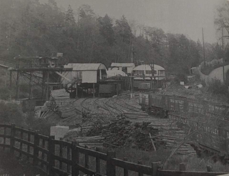
Steam on the Billingsley Railway
Peckett & Sons Ltd. W4 Class 0-4-0ST (Works No. 599)
This locomotive was built in May 1895 for “Christopher Rowland, a shunting contractor of Swansea Docks: the works photograph shows that it carried “R No. 4” on its tank indicating that it was his fourth locomotive. In August 1891 Rowland was given a contract by the Swans Harbour Trust to load and discharge ballast and cargoes at the docks. … His business continued until his death in 1910 when it is probable that his work was taken over by Powesland and Mason, the main shunting contractors at the docks.” [41: p13]
No. 599 seems to have become surplus to requirements at this time and “was sold to C.D. Phillips, an engine dealer of Newport. … [by] May 1913 … the engine had probably been acquired by the Billingsley Colliery Company. William Foxlee, a director of the Billingsley Colliery Company was also a railway engineer who admired the products of Peckett’s Atlas works; he may have recommended purchase of [No.] 599.” [41: p13]
Several hundred of Peckett’s W4 Class locos were built over a period of 20 years from 1886. “As built, it was of peculiar appearance as it was adapted for extensive street running. … The wheels and coupling rods were hidden behind hinged panels and the exhaust steam from the cylinders was not discharged into the air but was led back by pipes to the tank where it was silently condensed. It is likely that, if these modifications still exited in 1913, they were removed by the Billingsley Colliery Company. The cab had no side panels above waist height as originally built, it is possible that more protection would have been offered to the crew when the engine ran to Billingsley.” [41: p13]
The Highley Mining Company bought Billingsley Colliery in 1915. When Billingsley Colliery closed in 1921. Poyner suggests that they favoured the 0-4-0ST which it seems was more than capable of managing the 1 in 15 incline and was more able to negotiate the sharp curves on the Billingsley Colliery line. It was retained and ‘Kinlet’ was sold.
Kinlet Colliery and Railway
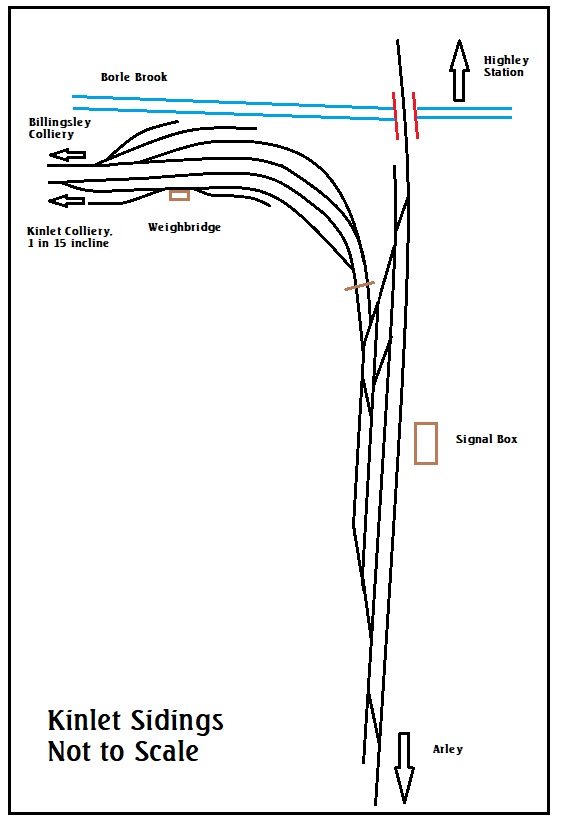
“The first siding for the Highley Mining Company’s Kinlet Colliery was sanctioned for use by the Board of Trade on 9 October 1895. It was situated a short distance south of Borle Viaduct, and had a single south-facing connection to the main line. The GWR subsequently entered into a contract for coal from the colliery, and in 1899 the sidings were greatly enlarged and connected to a 320 yard loop off the main line, accessed by a ground frame at each end. The Kinlet Sidings North ground frame was located on the left (west of the line) at 142 miles 9 chains, and Kinlet Sidings South ground frame on the right (east of the line) at 142 miles 3.9 chains.” [58]
When the New Billingsley Colliery Company applied to the GWR for siding accommodation in 1911. This was provided at the point where Kinlet traffic was already dealt with.
“To handle the increased traffic from both collieries, a new signal box was opened in December 1913. Unlike all other signal boxes on the line, it was able to switch out, presumably only being open when required. The Signalling Record Society holds a document (SRS200701006) dated 16/08/1911, which references the new connection to Billingsley Colliery, including the provision of the new signal box. There are records of new tablet machines being provided in Arley and Highley signalboxes, used for long section working (short section working was by staff). The tablet machines on the long section were later replaced by token instruments. The box is recorded by the SRS as having 38 levers, making it one of the largest on the SVR. Of these, 32 were operational and 6 were spare. Presumably the existing ground frames were removed when the signal box was commissioned.” [57][58: p133]
Both of the lines to Billingsley Colliery and Kinlet Colliery “were removed at some time before 1941. The Highley Mining Company established a wagon repair works at the location, so when the signal box was closed in March 1943, it was replaced by two ground frames, once again referred to as Kinlet Sidings North ground frame and Kinlet Sidings South ground frame. These were locked by the electric train token for the Arley-Highley section. There was also an intermediate token machine provided in a cabin in the middle of the loop. Working Time Tables from 1948, 1949 and 1960 refer to these arrangements.” [57][58: p97]
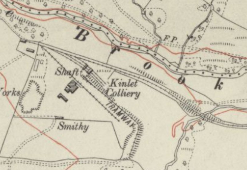
Further pictures of the bridge in the map extract above and of Kinlet Colliery buildings as they were in 2013 can be found by following this link and then scrolling through to the relevant pictures. [60]
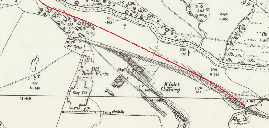
In June 1885, agreement was reached with the Kinlet Estate of William Lacon Childe to bore for coal at the site of the proposed colliery. But it was not until 1892 that a shaft reached “the Brooch Seam – a good quality coal seam about 3ft. 9in. thick. Production started in the late 1890s, with the completion of the railway.” [39]
The Aditnow website records that “a large horizontal steam winding engine house was built in 1896, which wound from the Upcast shaft. Steam was provided by 4 Lancashire boilers. A fan house at the rear of the large winder house worked on the Downcast or ‘Back’ shaft – a small horizontal winder also worked this shaft.” [40]
“Screens were erected around the upcast shaft, with coal being loaded into railway wagons and sent down an incline to join the branch line from Billingsley Colliery and eventually the GWR main line of what is now the Severn Valley Railway.” [40] David Poyner notes that the 300-yard length of the colliery line closest to the pit was at a gradient of 1 in 15. [41: p13] He further suggests that the locomotive ‘Kinlet’ (see below) was able to bring empty wagons up the 1 in 15 gradient. [41: p13]
‘Aditnow’ also notes that “there was a brickworks on the West side of the large horizontal winding engine house, with the colliery loco shed at the top of the incline with a spur running round the hillside between the winder and headframe.” [40]
“There were hopes of finding additional seams, but these never materialised. Much of the seam consisted of basalt, which formed a hard rock mass difficult to cut through and destructive of the colliery screens. Conditions did eventually improve to the north of the shafts, but working Kinlet was never easy. Nevertheless it grew from employing about 150 men at the turn of the century to twice that by the start of the First World War with an output of about 50,000 tons a year.” [39]
The colliery closed in 1935 [1: p12] and was subsequently abandoned “in September 1937, when the leases on the Kinlet Estate expired. The mine had proved impossible to mechanise, and there were continued problems with basalt having burnt out the coal; ironically, at the time of closure, the workings entered some of the best ground ever encountered at the mine.” [39]
Steam at Kinlet
‘Kinlet’ – Andrew Barclay 0-6-0ST (Works No. 782)

(c) Copyright Gillett’s Crossing, authorised for use here under a Creative commons Licence (CC BY 2.0) [56]
Andrew Barclay built a locomotive in 1896 which was supplied to Kinlet Colliery and named ‘Kinlet’ it was an 0-6-0ST loco (Works No. 782). In the 21st century, it is held undercover at Blists Hill.
“The locomotive was sold to H S Pitt & Co at Pensnett near Dudley and moved there in 1938 to work at the coal depot. It worked there until around 1966 when it was replaced by a Rushton diesel. Whilst at Pesnett the locomotive carried the name Peter.” [39]
Tennent is less sure about the date when the locomotive moved to H S Pitt and Co. suggesting that the date might have been earlier since he records the purchase of a replacement engine in 1929. [1: p13]
Poyner suggests that the date of sale was probably the end of December 2021. [41: p14]
Peckett & Sons Ltd. W4 Class 0-4-0ST (Works No. 599)
This locomotive (see the details provided above under the heading ‘Steam on the Billingsley Railway’) was inherited by the Highley Mining Company when they took over the Billingsley Colliery in 1915. It worked alongside ‘Kinlet’ until ‘Kinlet’ was sold and No. 599 then continued working for the Company until 1929 when a Hawthorn Leslie 0-4-0ST was purchased.
Hawthorn Leslie 0-4-0ST (Works No. 3424)
It seems that No. 599 was replaced by this locomotive which probably remained in service until the closure of the colliery. This loco was built in 1919 and “obtained,” says Tennent, “from Thos W. Ward in 1929. Later, this locomotive went to the Steel Company of Scotland via Thos W. Ward. Possibly it was about when the colliery closed but another engine was acquired from Ward’s Charlton Works at Sheffield in 1937.” [1: p13]
The history of the locomotive is interesting. I was sent new “to India, to work on a railway system belonging to the City of Bombay Improvement Trust. When this was wound up it was returned to the UK probably being purchased by Wards for resale. … it had very similar specifications to the Peckett. The probability is that by 1929, the Peckett was considered to be at the end of its working life: its fate is not known but it may have been scrapped after over 15 years service at Billingsley and Kinlet. An added consideration is that from 1929-30 the Billingsley railway saw extra traffic connected with the construction of a new road following the valley of the Borle Brook by Shropshire County Council. It may be that [No.] 3424 was purchased with one eye on these extra duties. It probably had a short tenure at Kinlet. For, in 1933, Ward supplied another engine to the Highley Mining Company.” [41: p14]
Hudswell Clarke 0-4-0ST (Works No. 1401)
This locomotive was built in 1920 and worked at first for the Darton Main Colliery Company in Yorkshire It was purchased by the colliery from Thos W. Ward. Tennet indicates that this purchase took place in 1937. Tennent suggests that it may have been required for the clearance of the railway and colliery “because it left in 1941 for W. Gilbertson & Co Ltd, Pontardawe in Glamorganshire.” [1: p13] Poyner’s view, above, is that this locomotive replaced No. 3424 as early as 1933. [41: p14] He goes on to suggest that No.1401 may well have left Kinlett in 1937, rather than 1941. Poyner provides details of a further locomotive which saw employment with the Highley Mining Company at Kinlet.
Andrew Barclay 0-6-0ST (Works No. 1113)
This locomotive was built in 1907 for the Shelton Iron and Steel Company in Stoke and named ‘Bowood’. Poyner says that “the existence of this locomotive at Kinlet is known only from a photograph, showing the engine with a footplate crew of Highley Mining Company staff, and the associated oral evidence.” [41: p14]
Poyner goes on to explain that ‘Bowood’ must have arrived at Kinlet after May 1936, as it was photographed at the previous owners premises on 16th May 1936. [41: p14][42] He goes on to relate how the locomotive arrived at Kinlet: “The Shelton Iron and Steel Company operated the nearby Holditch Colliery via a subsidiary. In July 1937, this was put out of use by an explosion. This may have resulted in the steel company having surplus locomotives at exactly the time the Highley Mining Company was looking for a new engine to work their salvage trains. The board of the Highley Mining Company was mostly made up of individuals from north Staffordshire, and so they may have had links with the Shelton company, making it easy for them to either purchase or, more likely, hire the engine, Bowood was substantially more powerful than any machine that had previously worked at Kinlet. … It is possible it was obtained specifically to work heavier than usual trains to help the dismantling work. This stretched well into 1938; hard core was used from Kinlet pit mound for earthworks at the new screens being built for Alveley Colliery. It is not known what happened to 1401 after Bowood arrived: it may have been left straight away although it is possible that it was retained to work alongside Bowood to help with salvage. perhaps allowing recovery work to take place simultaneously on both the Kinlet and Billingsley lines. In 1938 Bowood returned to North Staffordshire, arriving at the Florence Colliery of the Florence Coal & Iron Co Ltd. a subsidiary of the Shelton company. It eventually [was] transferred to Holditch Colliery in March 1960 by the National Coal Board, where it was scrapped in 1964.” [41: p14-15]
The Later Years of Highley Mining Company
In the late 1920s, the Highley Mining Co was looking for new reserves of coal in the area. It established that the coal beyond the River Severn at Alveley was of good quality. A single shaft was (11) sunk there in 1935 but the Highley Colliery shafts were retained for ventilation and emergency access because there was good underground communication between the two pits. Alveley Colliery involved the use of modern equipment with coal cutters, electricity and underground conveyors progressively replacing pit ponies. It was connected to a new set of screens next to the Severn Valley Railway by an endless cable-worked narrow gauge tramway which crossed the river on a concrete bridge. The tramway was replaced later by an aerial ropeway. All coal and men haulage transferred to Alveley in 1940 marking the end of Highley Colliery.
Kinlet Colliery had closed in 1935 and been abandoned in September 1937 when the lease on the estate had expired. It had proved difficult to modernise the colliery and there were geological problems. The railway was lifted about 1940 and it had all gone by July 1941.
Kinlet Sidings had consisted of three parallel loops to the west of the Severn Valley Railway line just south of the bridge over the Borle Brook. A signal box was provided on the east side of the layout and the Kinlet and Billingsley railways had separate exits at the north end of the yard. Each exit was provided with a gate. The lines then ran parallel to each other along the valley of the Borle Brook. Both became double on leaving the yard but soon singled again. There was latterly one, possibly two, connections between the lines hereabouts and a weighbridge on the Kinlet track. The Kinlet railway soon began to climb the south side of the valley, while the Billingsley railway remained on the valley floor alongside the brook. The One Inch Ordnance Survey map of the period mistakenly shows only one line here. The Billingsley Railway suffers the indignity of not appearing on large scale maps as it came and went between two surveys; the One Inch detail being taken from a corrected earlier large scale sheet, now destroyed. The Kinlet Railway soon reached Kinlet Colliery perched high on the valley side and terminated at a single-road engine shed, the various sidings trailing back from a point just short of the shed.
As to the locomotives used on the Kinlet line, the Highley Mining Co purchased the new Andrew Barclay six-coupled saddle tank number 782 in 1896 presumably for the opening of the colliery. It had the following inscription painted on its tank – HIGHLEY MINING CO LD “KINLET”. The apostrophes appear to indicate that it was named KINLET and that the word was not just part of the address. It was sold to Guy Pitt & Co Ltd of Shutt End, Staffordshire at some date, being noted there by November 1946. Named PETER, it remained at Shutt End for the rest of its working life before being transferred to the Ironbridge Gorge Museum for preservation. It was replaced at Kinlet by Hawthorn Leslie 0-4-0 saddle tank, maker’s number 3424 of 1919, obtained from Thos W. Ward in 1929. Later, this locomotive went to the Steel Company of Scotland via Thos W. Ward. Possibly it was about when the colliery closed but another engine was acquired from Ward’s Charlton Works at Sheffield in 1937. This was a four-coupled saddle tank, Hudswell Clarke 1401 of 1920; it may have been needed for the site clearance because it left in 1941 for W. Gilbertson & Co Ltd, Pontardawe in Glamorganshire.
The loss of Highley and Kinlet Collieries was not felt by the mining company as, by 1945, Alveley was producing almost 250,000 tons of coal, more than the output of the earlier two combined. With the market for coal contracting, Alveley Colliery closed in January 1969, but remained active until March for clearance operations and so ended coal production in the area. The waste tips at Alveley have been landscaped into a country park and, amongst the relics on display, are two tramway tubs, one old wooden type and one modern metal one.
References
- John Tennent; The Railways of the Highley Mining Company; in ‘The Industrial Railway Record’ No. 250, September 2022, p7-13.
- D. Poyner & R. Evans: The Wyre Forest Coalfield; Tempus, Stroud, Gloucestershire, 2000.
- M. Shaw, D. Poyner & R. Evans; Aerial Ropeways of Shropshire; Shropshire Caving & Mining Club, 2015.
- https://maps.nls.uk/view/121153529, accessed on 17th January 2023.
- https://maps.nls.uk/geo/explore/#zoom=17.1&lat=52.44523&lon=-2.37060&layers=168&b=1, accessed on 17th January 2023.
- https://maps.nls.uk/geo/explore/#zoom=17.1&lat=52.44363&lon=-2.37060&layers=168&b=1, accessed on 17th January 2023.
- https://maps.nls.uk/geo/explore/#zoom=17.1&lat=52.44510&lon=-2.37402&layers=168&b=1, accessed on 17th January 2023.
- https://www.svrwiki.com/Collieries_served_by_the_Severn_Valley_Railway#Alveley_Colliery, accessed on 24th January 2023.
- https://www.tripadvisor.co.uk/Attraction_Review-g2056585-d6612408-Reviews-Severn_Valley_Country_Park-Alveley_Shropshire_England.html, accessed on 24th January 2023.
- http://www.alveleyhistoricalsociety.org/mining.html, accessed on 24th January 2023.
- https://maps.nls.uk/view/239291761, accessed on 24th January 2023.
- https://maps.nls.uk/view/197236508, accessed on 24th January 2023.
- https://maps.nls.uk/view/189234258, accessed on 24th January 2023.
- https://maps.nls.uk/view/189234249, accessed on 24th January 2023.
- George & David Poyner; The Surface Haulage at Alveley Colliery; in ‘Below’, the quarterly journal of the Shropshire Caving and Mining Club, Winter Issue 2002.4, 2002; viewed online at https://www.shropshirecmc.org.uk/below/2002_4w.pdf, accessed on 24th January 2023.
- https://m.facebook.com/groups/238304664346000/permalink/715859019923893, accessed on 24th January 2023.
- https://maps.nls.uk/view/197236505, accessed on 24th January 2023.
- https://en.m.wikipedia.org/wiki/Highley_railway_station, accessed on 24th January 2023.
- https://www.nmrs.org.uk/mines-map/coal-mining-in-the-british-isles/shropshire, accessed on 26th January 2023.
- https://www.shropshirestar.com/news/local-hubs/bridgnorth/2019/01/19/history-day-marks-50-years-since-pit-closure, accessed on 26th January 2023.
- https://www.shropshirecmc.org.uk/below/2004_1w.pdf, accessed on 26th January 2023.
- https://maps.nls.uk/view/189234249, accessed on 26th January 2023.
- https://maps.nls.uk/geo/explore/#zoom=17.0&lat=52.44415&lon=-2.37124&layers=193&b=1, accessed on 26th January 2023.
- https://www.aditnow.co.uk/Mines/Billingsley-Coal-Colliery_9556, accessed on 26th January 2023.
- https://maps.nls.uk/view/121152875, accessed on 26th January 2023.
- http://www.highley.org.uk/railhist.html, assessed on 26th January 2023.
- https://maps.nls.uk/view/101595358, accessed on 27th January 2023.
- https://maps.nls.uk/geo/explore/#zoom=17.0&lat=52.44943&lon=-2.40133&layers=6&b=1, accessed on 27th January 2023.
- https://transportpasttimes.co.uk/railway-light-railway-orders/stottesdon-kinlet-billingsley-light-railway-order-1908.html, accessed on 28th January 2023.
- https://maps.nls.uk/view/101585827, accessed on 28th January 2023.
- http://www.highley.org.uk/page27.html, accessed on 28th January 2023.
- https://en.m.wikipedia.org/wiki/Jack_Mytton_Way, accessed on 28th January 2023.
- https://maps.nls.uk/geo/explore/#zoom=14.5&lat=52.45071&lon=-2.39843&layers=192&b=1&marker=53.260932,-2.4960864, accessed on 28th January 2023.
- https://en.m.wikipedia.org/wiki/Billingsley,_Shropshire, accessed on 28th January 2023.
- https://www.facebook.com/photo?fbid=10222540093745946&set=pcb.3020627781514789, accessed on 12th February 2023.
- https://www.facebook.com/photo?fbid=10222540093505940&set=pcb.3020627781514789, accessed on 12th February 2023.
- https://www.facebook.com/photo/?fbid=3370620066526324&set=gm.1787159831657761&idorvanity=1515738962133184, accessed on 12th February 2023.
- https://www.facebook.com/ShropshireStar/photos/a.10150113631596009/10159206874136009, accessed on 12th February 2023.
- https://preservedbritishsteamlocomotives.com/works-no-782-kinlet-0-6-0st, accessed on 31st January 2023.
- https://www.aditnow.co.uk/Mines/Kinlet-Colliery-Coal-Colliery_9453 accessed on 31st January 2023.
- David Poyner; Railway Locomotives of the Highley Mining Company and Billingsley Colliery Company; in ‘Below’, the quarterly journal of the Shropshire Caving and Mining Club, Autumn Issue 2013.3, 2013, p13-15; viewed online at https://www.shropshirecmc.org.uk/below/2013_3w.pdf, accessed on 31st January 2023.
- Industrial Locomotive No. 4, 1977 – backcover.
- https://maps.nls.uk/geo/explore/#zoom=17.0&lat=52.43491&lon=-2.38261&layers=168&b=1, accessed on 31st January 2023.
- https://maps.nls.uk/geo/explore/#zoom=17.0&lat=52.43788&lon=-2.39153&layers=168&b=8, accessed on 31st January 2023.
- https://maps.nls.uk/geo/explore/#zoom=17.0&lat=52.44155&lon=-2.39486&layers=168&b=1, accessed on 31st January 2023.
- https://maps.nls.uk/geo/explore/#zoom=17.0&lat=52.44495&lon=-2.39721&layers=168&b=8, 1st February 2023.
- https://maps.nls.uk/geo/explore/#zoom=17.0&lat=52.44875&lon=-2.40118&layers=168&b=1, accessed on 1st February 2023.
- https://maps.nls.uk/geo/explore/#zoom=18.0&lat=52.45139&lon=-2.40514&layers=168&b=1, accessed on 1st February 2023.
- http://www.shropshiresgreatoutdoors.co.uk/site/new-england, accessed on 1st February 2023.
- https://www.geograph.org.uk/photo/5964987, accessed on 1st February 2023.
- https://www.openstreetmap.org/#map=16/52.4483/-2.4129, accessed on 1st February 2023.
- https://www.aditnow.co.uk/Photos/Mine/Billingsley-Coal-Colliery_9556, accessed on 1st February 2023.
- https://www.ebay.co.uk/itm/184659247141?mkcid=16&mkevt=1&mkrid=711-127632-2357-0&ssspo=y1qm-Gs2Qtu&sssrc=2349624&ssuid=afQhrar7TGK&var=&widget_ver=artemis&media=COPY, accessed on 2nd February 2023.
- https://www.openstreetmap.org, accessed on 3rd February 2023.
- https://www.facebook.com/groups/942854255808092/permalink/1645176155575895, accessed on 3rd February 2023.
- https://commons.wikimedia.org/wiki/File:Andrew_Barclay_0-6-0ST_782_%27Kinlet%27_(1896)Blists_Hill,_Ironbridge_Gorge_Museum_19.08.09_222795_031_06(10253536205).jpg, accessed on 4th February 2023.
- https://www.svrwiki.com/File:Billingsley-Line-Abandoned-1963-08-14.jpeg, accessed on 13th February 2023.
- John Marshall; The Severn Valley Railway; David St John Thomas, Nairn, Scotland,1991.
- https://www.aditnow.co.uk/Photo/Billingsley-Colliery-Branch-Line-Culvert_85758, accessed on 13th February 2023.
- https://www.aditnow.co.uk/Photo/Kinlet-Colliery-Branch-Railway-Bridge_85757, accessed on 13th February 2023.
- https://www.mylocalforum.co.uk/area/highley-shropshire-2418/general-highley-discussion-168/billingsley-colliery-railway-remains-149673, accessed on 3rd February 2023.
