
The Elan Valley Railway was built to make the construction of the Birmingham Water Corporation Dams in the Elan Valley possible. It transported equipment, materials and men to the different dam sites. It was also used by visitors from Birmingham and it carried King Edward VII and Queen Alexandra for the official opening of the dams on 21st July 1904.
Work on the construction of the line began in 1893 and was completed in 1896. It was built to standard gauge in four separate stages.
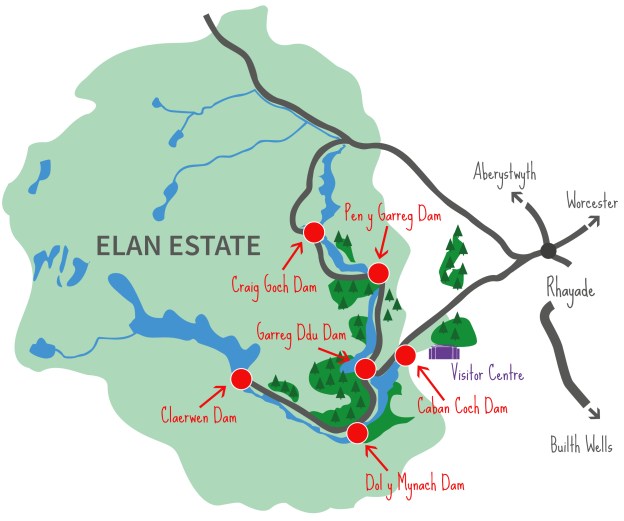
The four separate sections of the railway were numbered 1 to 4.
Railway No. 1 extended from Elan Valley Junction, the junction with the Cambrian Railway Southwest of Rhayader, just beyond Rhayader Tunnel, to what is now the Elan Valley Visitor Centre. These buildings were then the location of workshops and sheds of the contractor and sat below the site of the proposed Caban-Coch Dam.
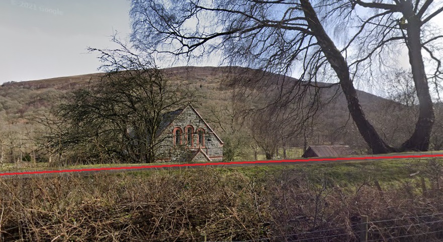
Railway No. 2 left Railway No. 1 close to the Baptist Church in Elan Village and followed a higher alignment on the North side of the Elan Valley. It passed above the site of the Caban Dam and on westward to the site of the Careg-Ddu Dam
Railway No. 3 ran from Careg-Ddu Northeast to Pen-y-Gareg Dam.
Railway No. 4 travel North from a junction to the Southeast of Pen-y- Gareg Dam to Craig-Goch Dam
This post provides an introduction to the railway and covers the route of Railway No. 1.
The sharp ruling radius of the tracks required short wheelbase locomotives. “The locomotives were all named after rivers and streams on the Estate. The first two were acquired in April 1894 and were named Elan and Claerwen. These were joined by Nant Gwyllt and Methan in October 1894 and Rhiwnant and Calettwr in 1895. … By 1898 the steep 1:33 gradients of some sections of the railway had taken their toll on the original locomotives, so Coel and Marchnant were bought.” [1]
The Elan Valley Railway Branch Line was inspected and passed by a Board of Trade Inspector in July 1894 and the Elan Valley Railway branch was available for use from that date. Railway No. 4 took the route to the furthest away Craig-Goch Dam. Blasting the cutting mid-way along this route held up the construction by 3 months. This resulted in the cutting being given the name, ‘The Devil’s Gulch’!
At its fullest extent, the railway had approximately 53 kilometres (33 miles) of track. In all, 17 coaches were used for transporting men to the work sites. In addition to the steam locomotives operating in the Elan Valley, steam-powered cranes, power drills and crushers were also in use. To facilitate the works arrangements had to be made to accommodate around 1000 tons of materials being moved every day!
The line was only provided for construction work and in 1906 the Birmingham Corporation Water Works locomotives were sold. In 1908, the junction with the Cambrian Railway was removed. However complete closure of the railway occurred as late as 1916. [1]
Before looking at the route of the railways in detail, it is interesting to note that In 2004, to mark the centenary of the opening of the dams, the only surviving locomotive (Rhiwnant) was brought back to the Elan Valley from a private owner in South East England. [1]
It is also worth noting that there is a detailed treatment of the railways in the Elan Valley in a book by C. W. Judge; ‘The Elan Valley Railway’, published by Oakwood Press. [2] The route is described in detail in the fourth chapter of Judge’s book. [2: p79-111]
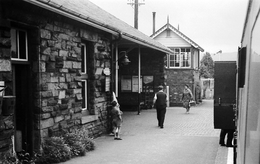
Rhayader Railway Station
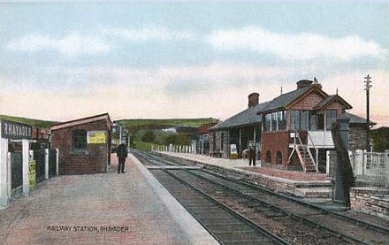
The Cambrian Railway through mid-Wales was a single-track line with passing loops. Rhayader Station sat between the stations of Moat Lane Junction and Brecon on the Cambrian mainline. Llanidloes was to the North of Rhayader and Builth Wells to the South.
Rhayader Railway Station was opened in 1864 in Cwmdauddwr, a village on the opposite bank of the River Wye. The line, which took over 5 years to build, was closed in 1962 and dismantled within months. [3]
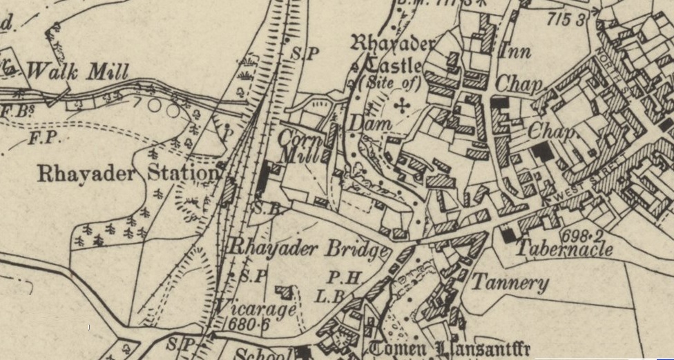
with the town on the East side of the river. This extract comes from the 6″ OS Maps published just after the turn of the 20th century. [4]
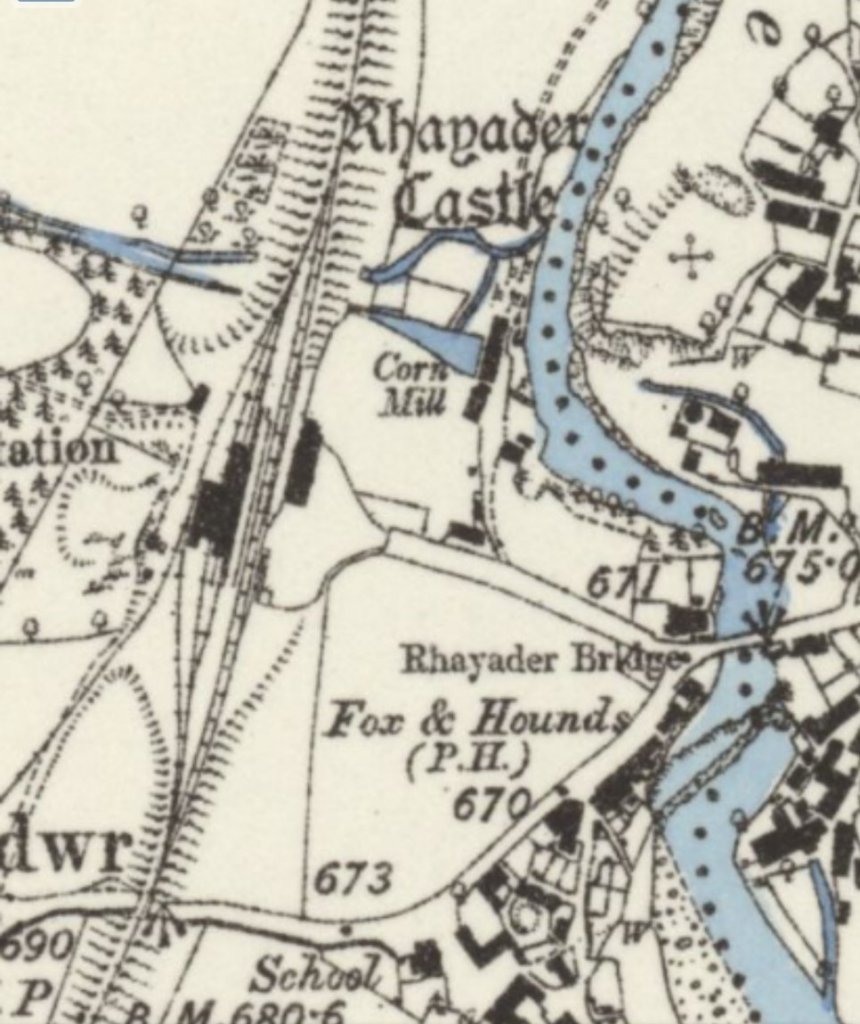
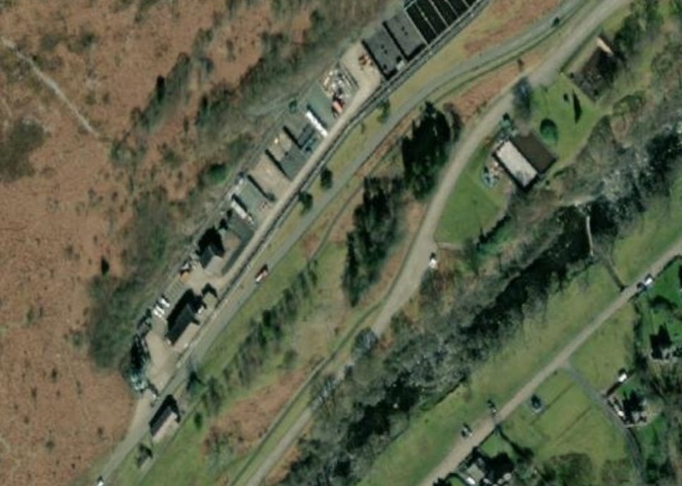
The station site in the 21st Century is a Highways Depot for Powys Council. It is access along the station approach road which is in the same location in the 21st century as that shown above. The station building on the above map is fully shaded and sits close to the words ‘Corn Mill’, the goods shed which is on the West side of the mainline, is shown hatched.
The same location is shown immediately below on Google Earth’s satellite imagery in the 21st century. The station approach is also shown below in an image from Google Streetview…
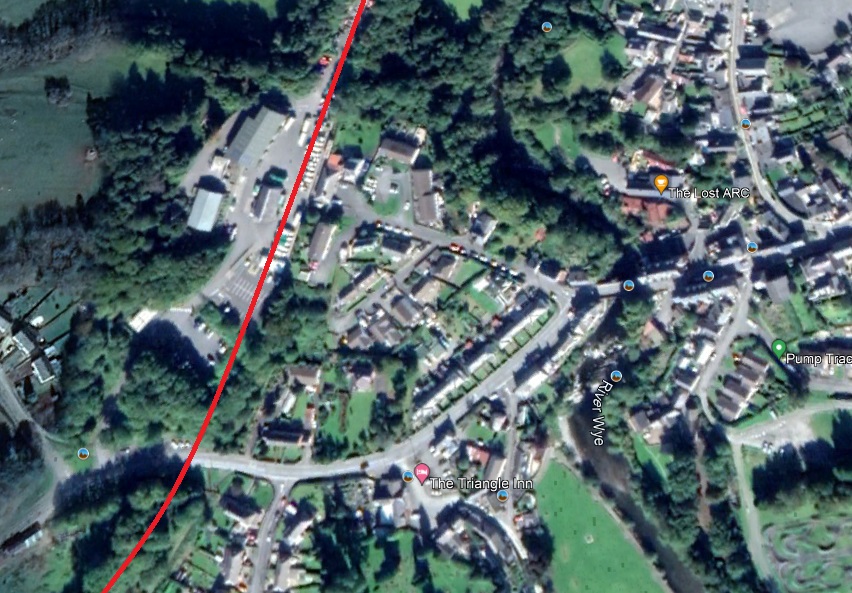
The approximate alignment of the Mid-Wales Line of the Cambrian is shown in red [Google Maps].
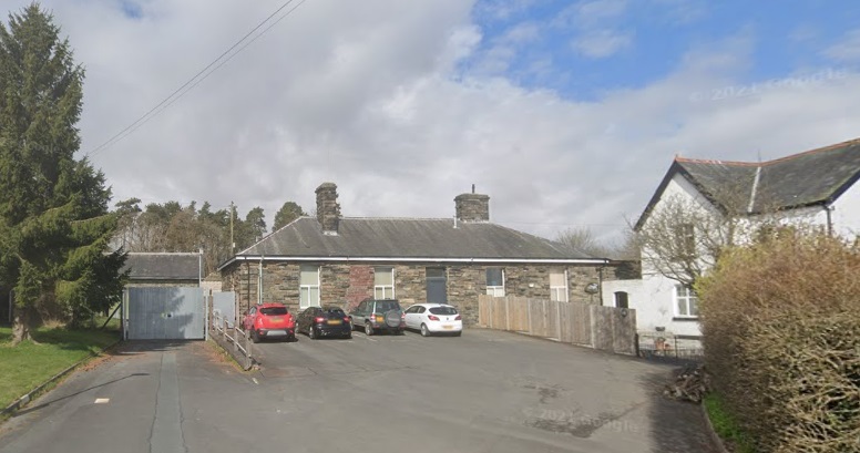
This shows the platform side of the ex Mid Wales Railway station building, as modified for use as a council maintenance depot office. The new walling (with windows) would be to enclose what used to be a minimal outdoor sheltered waiting area.
© Copyright Nigel Brown and licensed for reuse under a Creative Commons Licence (CC BY-SA 2.0). [22]
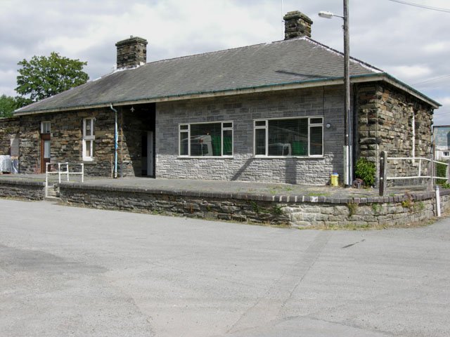
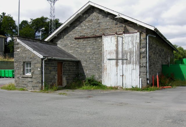
this shows the north end of the ex Mid-Wales Railway goods shed, now part of a council maintenance depot. Note the simple but massive design. The track went in through the double end doors; goods were moved to and from road vehicles in a bay accessed through the double side doors (one of which is missing).
© Copyright Nigel Brown and licensed for reuse under a Creative Commons Licence (CC BY-SA 2.0). [23]
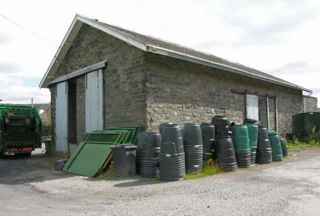
this shows one end of the old Mid-Wales Railway goods shed at Rhayader, now used as part of a council maintenance depot.
© Copyright Nigel Brown and licensed for reuse under a Creative Commons Licence (CC BY-SA 2.0)[24]
© Copyright Flying Stag and licensed for reuse under a Creative Commons Licence (CC BY-SA 2.0) [25]
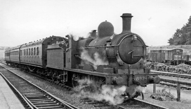
View SW, towards Builth and Brecon: the Builth Road (Low Level) – Moat Lane train is headed by one of the few remaining ex-Cambrian Class 15 0-6-0s, No. 893 (built 3/1908, withdrawn 2/1953).
© Copyright Ben Brooksbank and licensed for reuse under a Creative Commons Licence (CC BY-SA 2.0). [26]
The Route up the Elan Valley
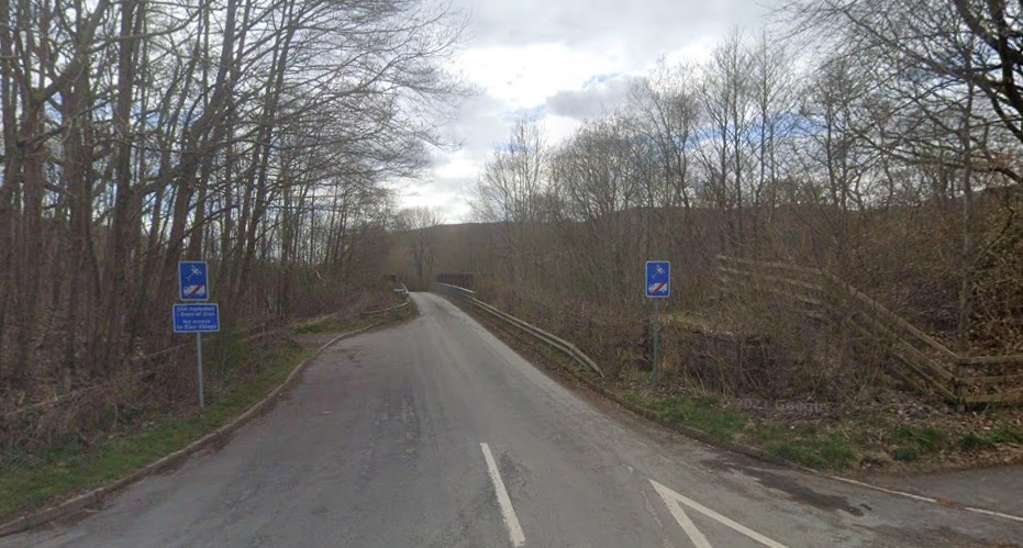
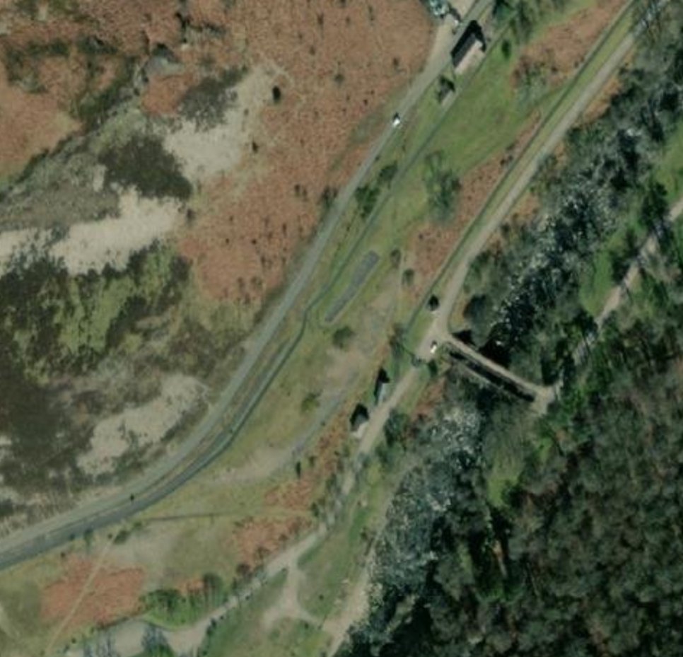
Immediately to the South of the station, the Mid-Wales line crossed the road which led up the Elan Valley. Google Streetview shows the embankment beyond the bridge location to the South. Pivoting round through 180 degrees to look towards the Railway Station, does not provide a productive image. ….
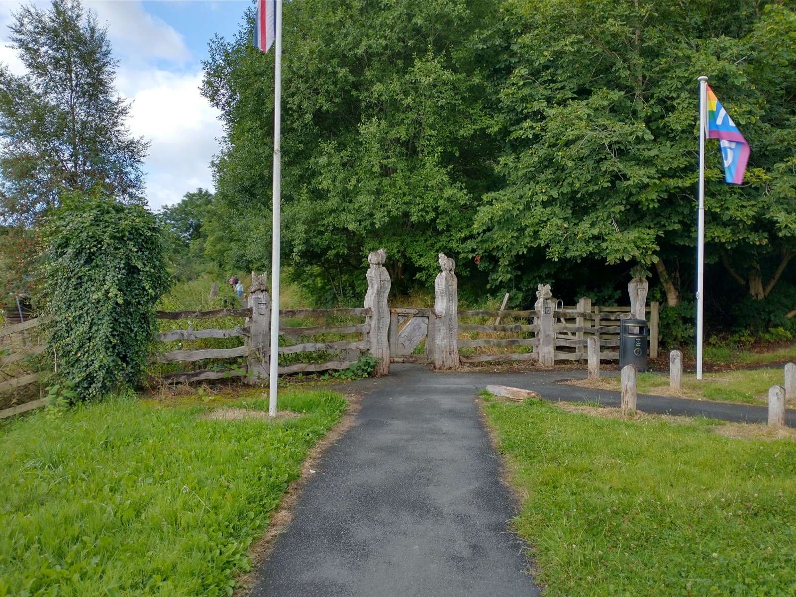
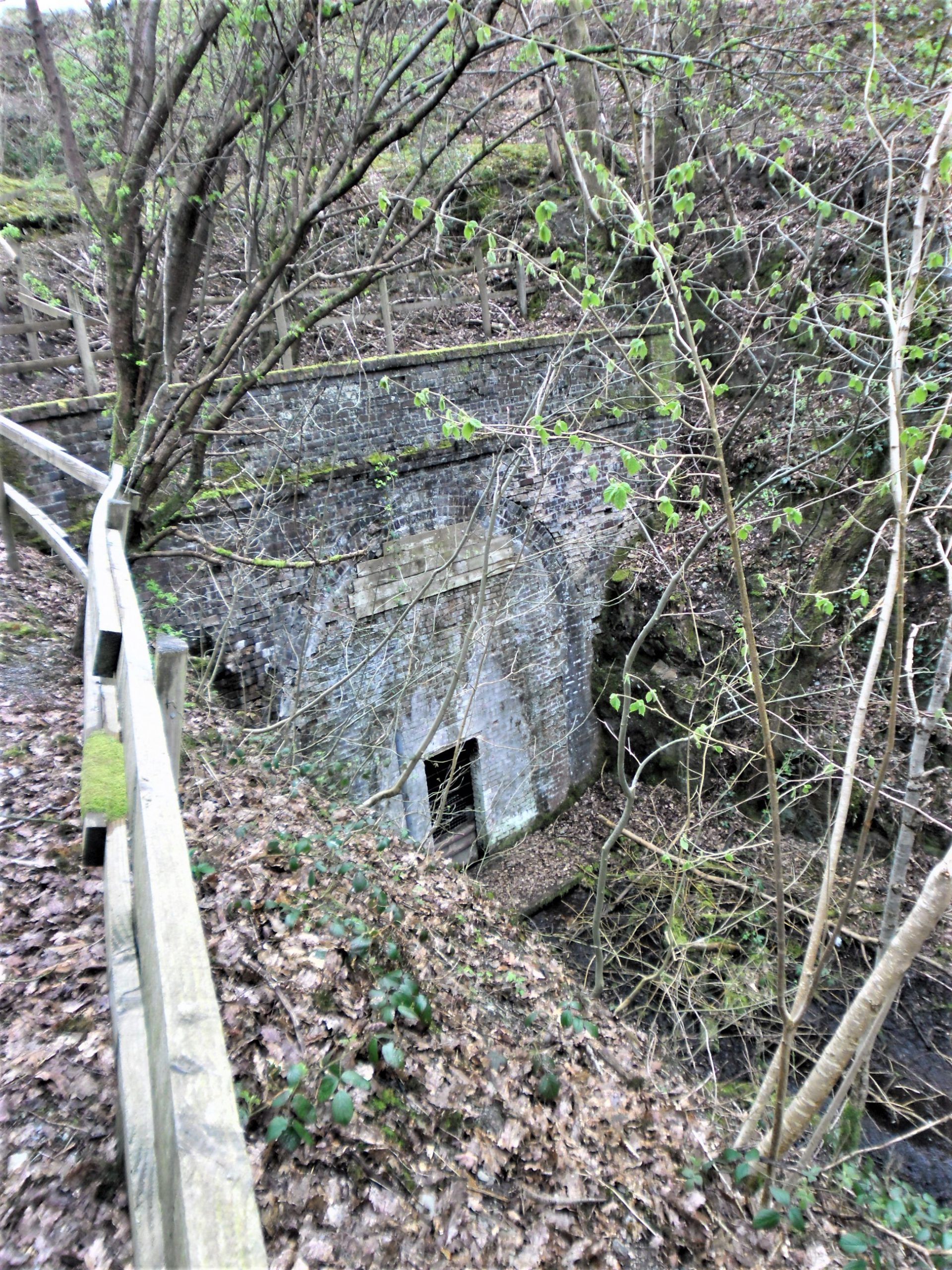
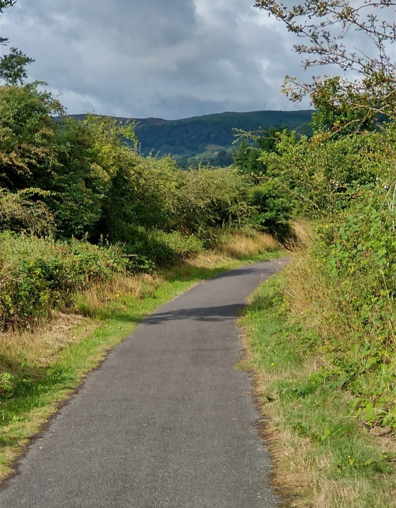
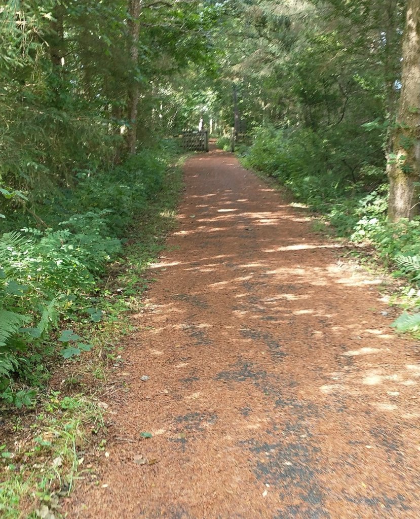
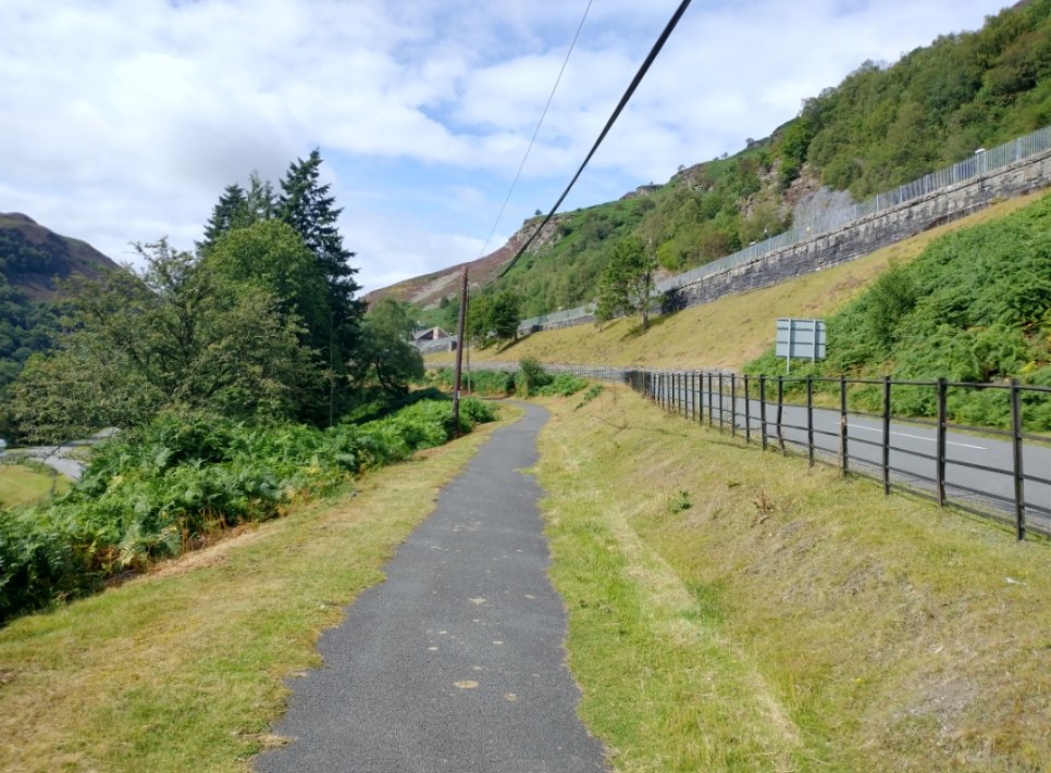
My wife and I walked the Elan Valley Trail in August 2021. Some of the photos which follow were taken on that walk. The first photograph below shows the start of the Trail. …. From that point the footpath climbs slowly alongside the old railway embankment before rising above the old line which was in cutting as it approached the northern portal of Rhayader Tunnel. The second picture below shows the Northern Portal.
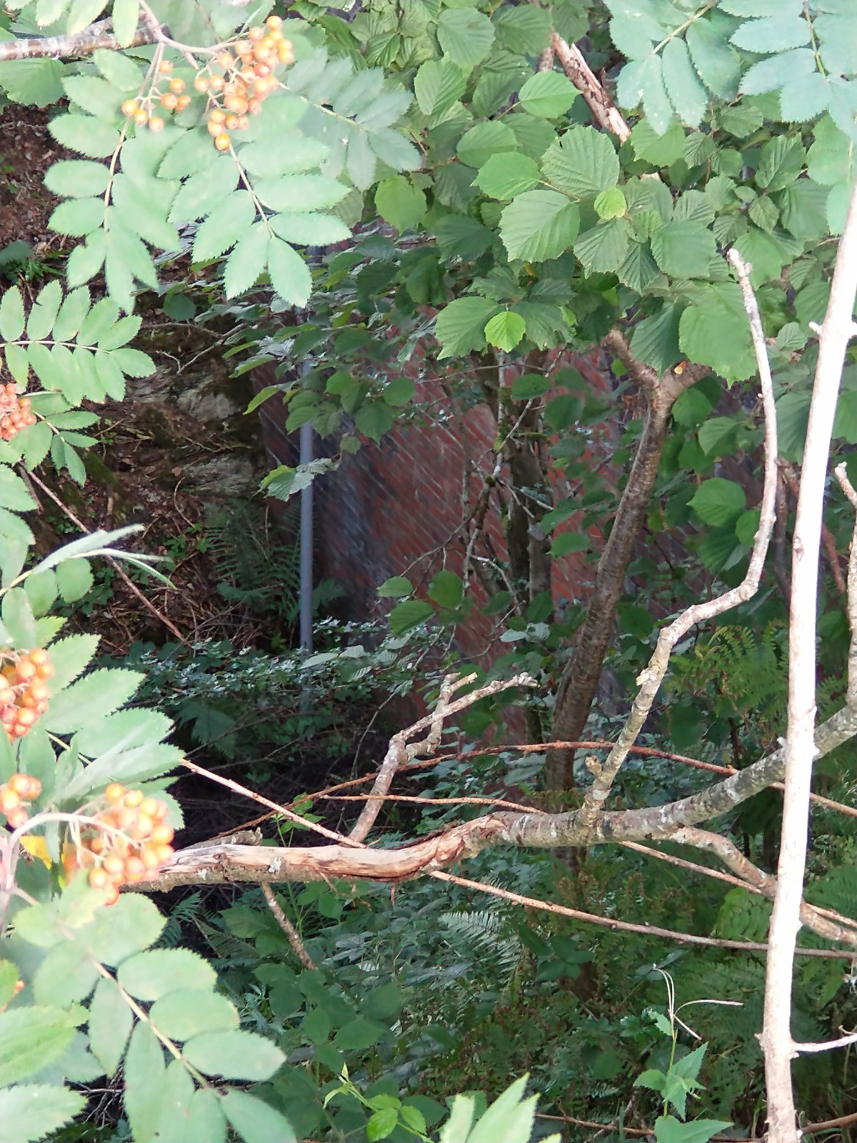
A small nature reserve sits on the land immediately above Rhayader Tunnel which the footpath crosses and the South Portal of the tunnel can be glimpsed to the right of the path through the undergrowth. (The nature reserve is intended to protect the different species of bats which have made the tunnel their home.)
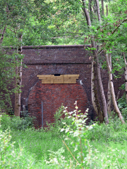
A better view of the closed South Portal can be seen at track level. The picture below is taken from the track-bed approximately at the location of the first point of the Elan Valley Junction.
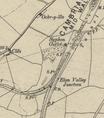
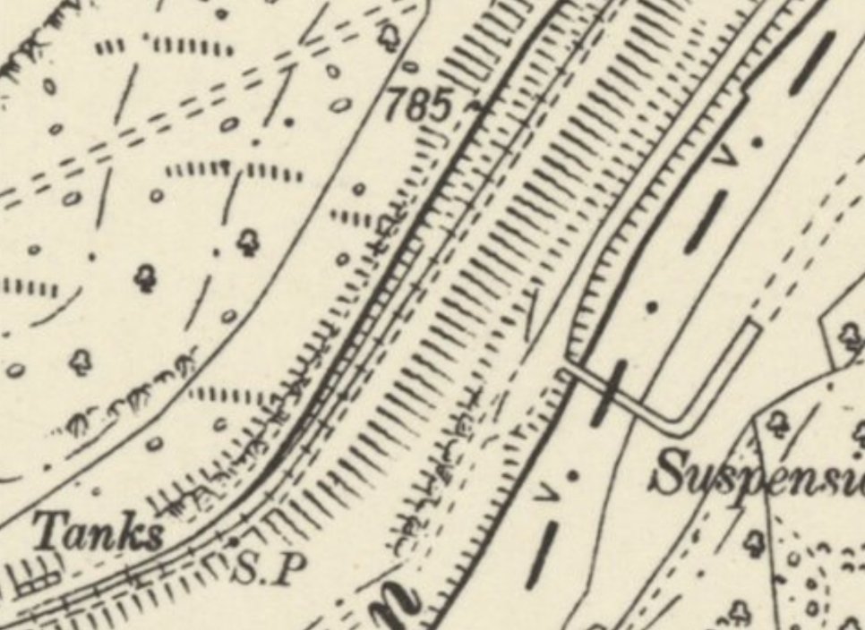
C. W. Judge provides a copy of Birmingham Corporation Waterworks’ drawing of the double junction with a note indication that the double junction was provided at the insistence of the Board of Trade. [2: p81] He also provides an extract from c. 1900 Ordnance Survey which shows the double junction in place. [2: p84]
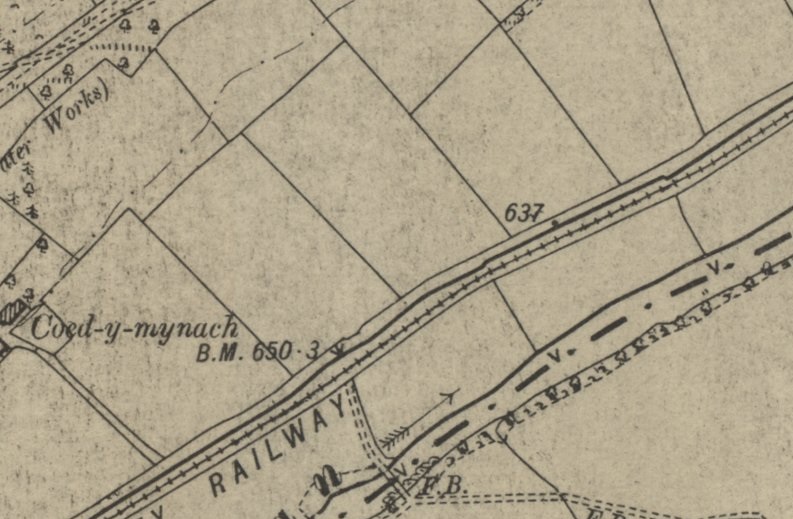
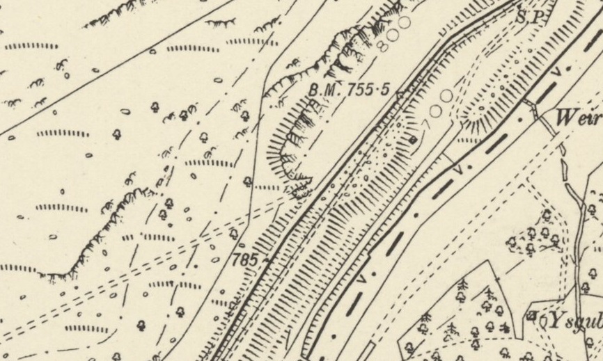
Within a very short distance from the Elan Valley Junction the branch line was provided with storage/exchange sidings. Some of these sidings are clearly shown on the map extract below. Judge refers to these sidings as the Down Noyadd Sidings. the Up Sidings which are evident on the OS Map c. 1900 [2: p84] are no longer shown on the 1905 extract.
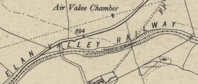
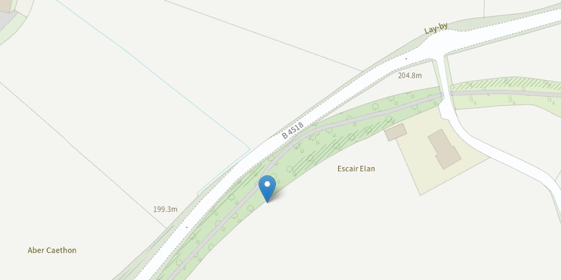
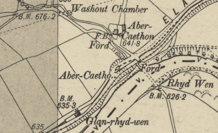
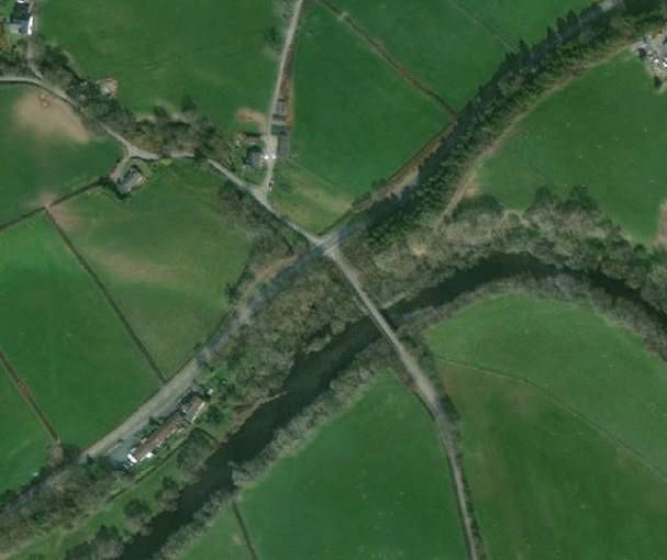
Travelling on along the line, the next point of interest is that shown on the map extract below. At the turn of the century the line passed over a narrow lane leading to a ford in the Afon Elan at Rhyd Wen.
Continuing in a Southwest direction the railway and the road ran immediately next to each other with the Afan Elan slightly to the South. There is little of note on the next few extracts from the 6″ OS Map.
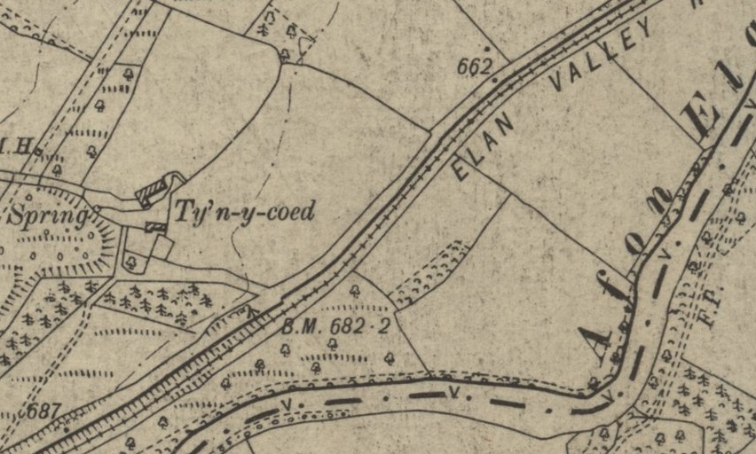
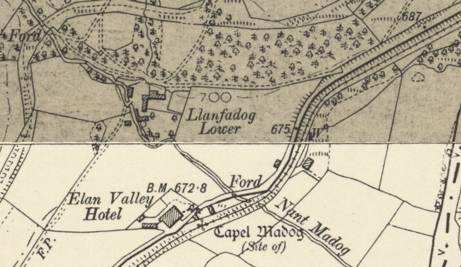

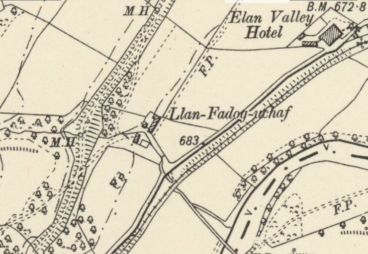
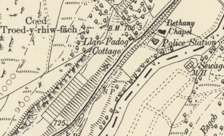

Sadly, the 6″ OS Maps from the turn of the 20th century that we have been using do not give us a good impression of the railway network in the Elan Valley during the construction of the dams. They do show the main line of the railway as it was in around 1902 when the survey for the maps published in 1905 took place.
Llandrindod Wells. [34]
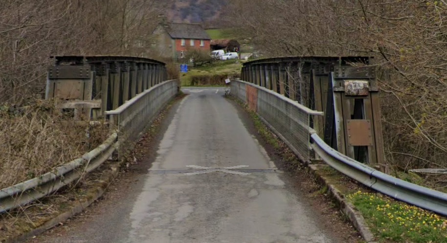
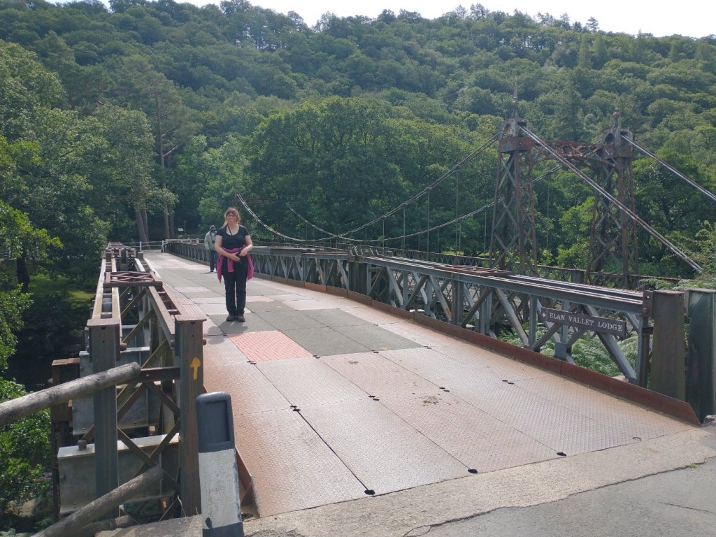
During the construction period, access to the construction village was over the suspension bridge shown above. “The navvies village can be seen on the far side of the river to the left, and the accident hospital is to the right of the bridge. The road on this side of the river leads to Rhayader to the left” and further up the Elan Valley to the right. [34]
The current suspension bridge (the third on the site) “is no longer safe, and modern traffic entering Elan Village now crosses the river by a rather more functional bridge alongside.” [34]

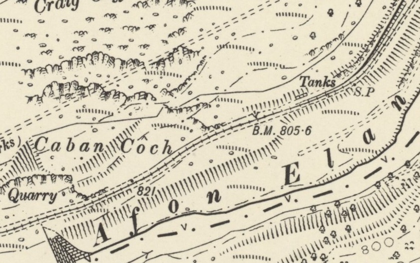
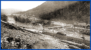
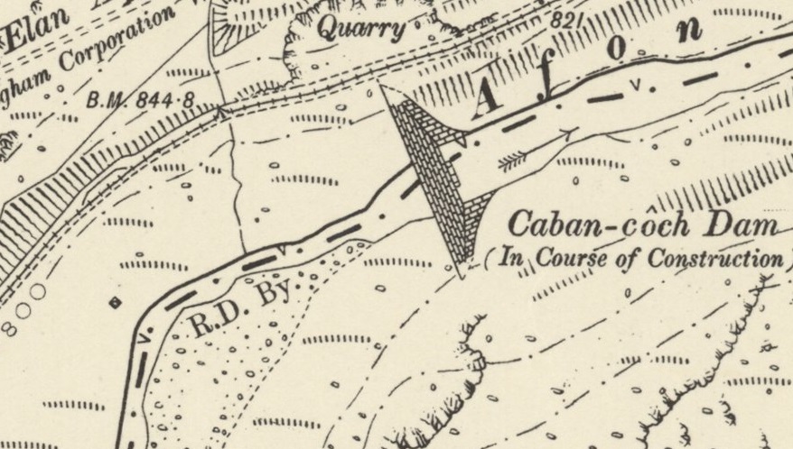
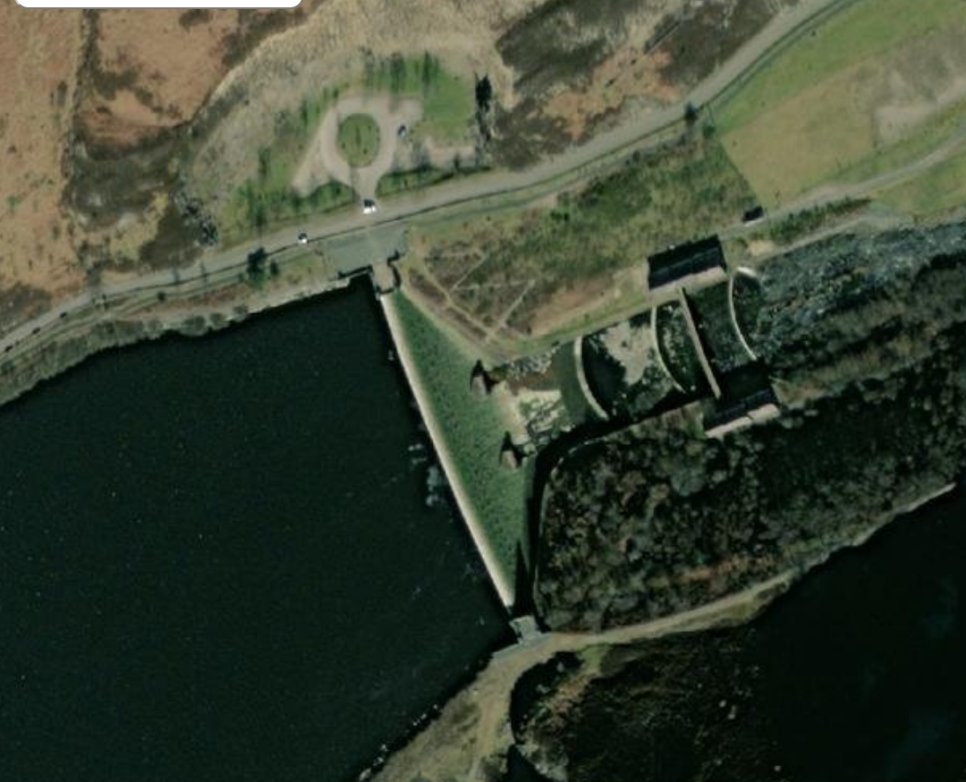
Caban-Coch Dam, the first dam encountered in a journey up the Elan Valley, was the first at which construction work commenced. The digging and blasting of the foundations for the dam started in August 1894, and work on the masonry structure of the dam itself began in 1896. [29]
The 6″ OS Map from the turn of the 20th century shows the construction of the masonry structure well underway.


The Elan Valley website tells us that building work began in 1893. “100 occupants of the Elan Valley had to move, only landowners received compensation payments. Many buildings were demolished, 3 manor houses, 18 farms, a school and a church (which was replaced by the corporation as the Nantgwyllt Church). … A village of wooden huts was purpose-built to house most of the workers on the site of the present Elan Village.” [30]
“New workers spent a night in the dosshouse to be deloused and examined for infectious diseases, only then were they allowed across the river to the village. Single men lived in groups of eight in a terrace house shared with a man and his wife. A school was provided for those under 11, after this they were expected to work. The village employed a guard to look out for illegal importation of liquor and unauthorised visitors. There was a hospital for injuries and an isolation hospital. A bath house which the men could use up to 3 times a week but the women only once! The pub was for men only. Other facilities included a library, public hall, shop and canteen. There was even street lighting (powered by hydroelectric generators).” [30]
The dams were built in two phases, firstly construction in the Elan Valley and later the Claerwen. The foundations of Dol y Mynach Dam were laid in phase one as the site would have flooded once Caban-Coch had filled up.” [30]
It is clear that local rock was not of a suitable quality for dressing the external faces of the dams. It was used as structural fill inside of the dams. The hand-chiselled facing stones were transported from Glamorgan. [30]
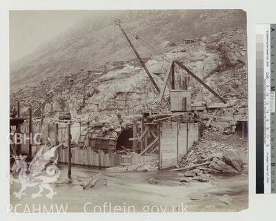
glass slide of 1901. Note the broad-gauge tracks provided for the steam crane(s). The trestles supporting the tracks can be seen under the rails at the right of the picture © Powys County Archives. [29]
“The Caban Coch dam contributes to the supply of water to Birmingham when water levels are normal, but it also provides compensation water to ensure that adequate flow is maintained in the Elan and the Wye downstream from the dams.” [29]
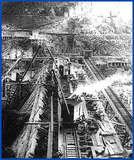
I have asked for permission from the Oakwood Press to reproduce sections of the fold out map at the rear of Colin Judge-s book (see below) as these illustrate the density of the rail facilities at the construction site of the Caban Coch Dam. I await their response with interest.
We have cover Railway No. 1. The next article in this series will begin at the junction between Railway No. 1 and Railway No. 2 a little to the East of Caban Coch Dam.
Further Reading
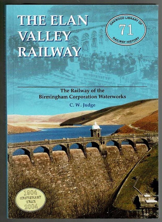
As we noted much earlier in this post, the accepted authority on all things associated with the Elan Valley Railway is Colin Judge. Anyone with any interest in this railway should regard the purchase of Judge’s book as a good investment. Second-hand copies are relatively easy to come by. It is important, when buying a copy, to check whether the fold-out map (referred to above) which was attached to the back cover of the book is still present. My copy is the latest reprint of the book, as shown below, which was published in 2001 and has a sticker on the front marking the centenary of the formal opening of the reservoirs which was celebrated in 2004. [2]
References
- https://www.geograph.org.uk/photo/661188https://www.elanvalley.org.uk/discover/history/railway, accessed on 20th March 2022.
- C. W. Judge; The Elan Valley Railway; Oakwood Press No. 71; Usk, Monmouthshire, 1987, latest edition, 2004.
- https://en.wikipedia.org/wiki/Rhayader_railway_station, accessed on 23rd March 2022
- https://maps.nls.uk/geo/explore/#zoom=17&lat=52.30041&lon=-3.51438&layers=6&b=1, accessed on 23rd March 2022.
- https://www.railwayramblers.org.uk/apr-2021-rock-fall-elan-valley-railway-evr-powys, accessed on 6th April 2022
- https://www.geograph.org.uk/photo/471519, accessed on 26th March 2022.
- https://maps.nls.uk/geo/explore/#zoom=16&lat=52.29189&lon=-3.52349&layers=6&b=1, accessed on 26th March 2022.
- “A double junction was built to join it to the Cambrian Railway near Rhayader;” quoted from https://www.elanvalley.org.uk/discover/history/railway, accessed on 20th March 2022.
- https://maps.nls.uk/geo/explore/#zoom=17&lat=52.29161&lon=-3.52882&layers=6&b=1, accessed on 6th April 2022.
- https://coflein.gov.uk/en/site/43061, accessed on 6th April 2022.
- https://www.peoplescollection.wales/creative-archive-licence, accessed on 20th March 2022.
- https://www.casgliadywerin.cymru/items/10995, accessed on 6th April 2022.
- https://maps.nls.uk/geo/explore/#zoom=17&lat=52.29011&lon=-3.53500&layers=6&b=1, accessed on 28th April 2022.
- https://maps.nls.uk/geo/explore/#zoom=17&lat=52.28721&lon=-3.54389&layers=6&b=1, accessed on 19th May 2022.
- https://maps.nls.uk/geo/explore/#zoom=17&lat=52.28433&lon=-3.54985&layers=6&b=1, accessed on 19th May 2022.
- https://maps.nls.uk/geo/explore/#zoom=17&lat=52.28126&lon=-3.55819&layers=6&b=1, accessed on 19th May 2022.
- https://maps.nls.uk/geo/explore/#zoom=17&lat=52.27883&lon=-3.56343&layers=6&b=1, accessed on 19th May 2022.
- https://maps.nls.uk/geo/explore/#zoom=17&lat=52.27592&lon=-3.56655&layers=6&b=1, accessed on 19th May 2022.
- https://maps.nls.uk/geo/explore/#zoom=17&lat=52.27296&lon=-3.57134&layers=6&b=1, accessed on 19th May 2022.
- https://maps.nls.uk/geo/explore/#zoom=17&lat=52.27002&lon=-3.57636&layers=6&b=1, accessed on 19th May 2022.
- https://maps.nls.uk/geo/explore/#zoom=17&lat=52.26776&lon=-3.57961&layers=6&b=1, accessed on 19th May 2022.
- https://www.geograph.org.uk/photo/661182, accessed on 20th May 2022.
- https://www.geograph.org.uk/photo/661197, accessed on 20th May 2022.
- https://www.geograph.org.uk/photo/661188, accessed on 20th May 2022.
- https://www.geograph.org.uk/photo/3915206, accessed on 20th May 2022.
- https://www.geograph.org.uk/photo/2540449, accessed on 20th May 2022.
- https://www.peoplescollection.wales/creative-archive-licence, accessed on 15th March 2022.
- https://www.peoplescollection.wales/items/10634, accessed on 20th May 2022.
- http://history.powys.org.uk/history/rhayader/caban.html, accessed on 20th May 2022.
- https://www.elanvalley.org.uk/discover/reservoirs-dams/building-dams, accessed on 20th May 2022.
- https://rcahmw.ibase.media/en/view-item?i=177046&WINID=1653054405781, accessed on 20th May 2022.
- http://history.powys.org.uk/school1/rhayader/tracks.shtml, accessed on 20th May 2022.
- https://maps.nls.uk/geo/explore/#zoom=16.80059521354383&lat=52.27134&lon=-3.57009&layers=6&b=1, accessed on 20th May 2022.
- http://history.powys.org.uk/history/rhayader/village2.html, accessed on 20th May 2022.
- https://logastonpress.co.uk/product/the-elan-valley-clearance, accessed on 20th May 2022.
- https://www.prints-online.com/rhayader-railway-station-powys-14352008.html, accessed on 20th May 2022.
- https://maps.nls.uk/view/101604533, accessed on 20th May 2022.
