
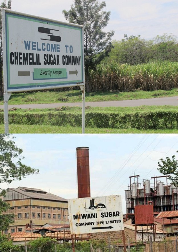
On the final approaches to Kisumu the line passed through a significant sugar cane growing region. Sugar processing factories were set up in two locations along the line – Chemelil and Miwani. Both these locations were provided with short branch-line connections to the main Nakuru to Kisumu line. Both of these branch-lines are shown on the 1:250,000 OS Maps from the second half of the 20th Century. [1] The extract below is taken from an image file very kindly sent to me by James Waite.
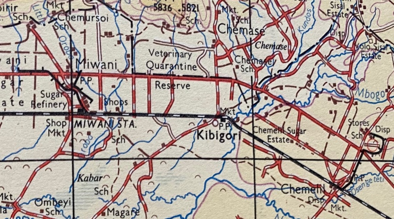
Chemelil Railway Station was 26 miles East of Kisumu and was mentioned in Part 10 of the main series of articles about the Uganda Railway which can be found on this link:
https://wordpress.com/post/rogerfarnworth.com/8058
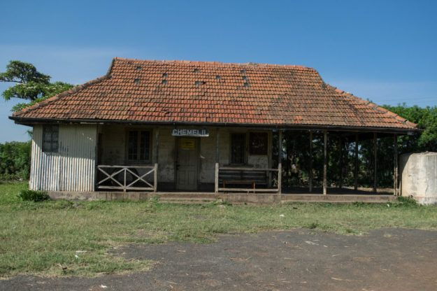 Chemelil Railway Station. [2]
 Chemelil in the mid-1950s. A double headed passenger train arrives at Chemelil, 26 miles from Kisumu . The pilot engine is 2445 (c) Ron Bullock. [3][4]
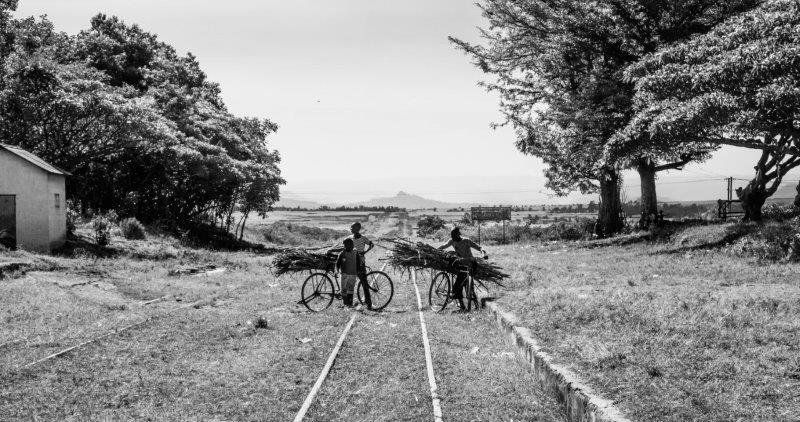 Children cross the tracks at Chemelil. [2]
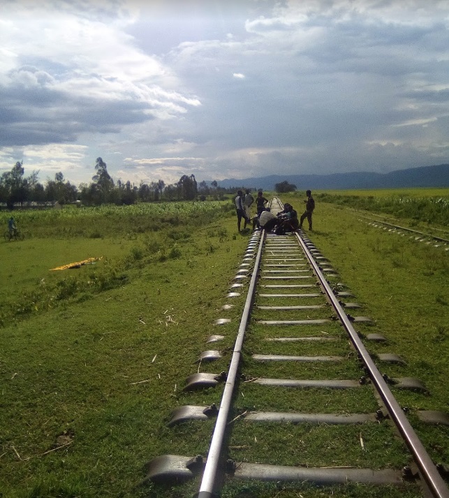
The short branch-line to Chemelil Sugar Factory left the mainline just to the Southeast of the Station beyond the C37 road. The next image shows a trip-working on the branch-line in the 1970s.
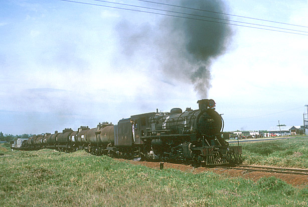
Although the condition of the locomotives running on the mainline freight service dictated the need for a double-header, the short branch to the sugar mill at Chemelil was out of bounds to heavier of the two locomotives in charge of the train, No. 2924. This meant that No. 3145 had to make the trip along the branch-line on its own. This picture is (c) Rob Dickinson and used by kind permission. [8]
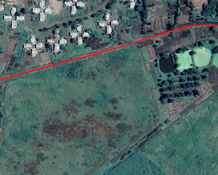
The branch travelled over relatively flat land, its junction with the mainline is shown on the first satellite image below it is followed by a series of satellite images which follow the line of the branch.
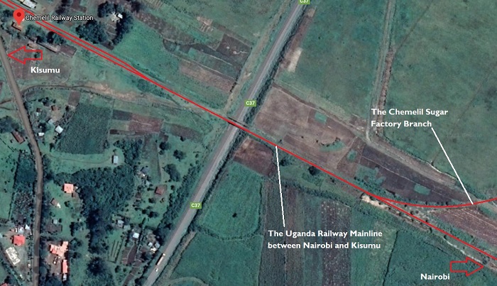
The branch junction at Chemelil was sited to the Southeast of the C37 road (Google Maps).
The branch travelled North East away from the mainline (Google Maps).

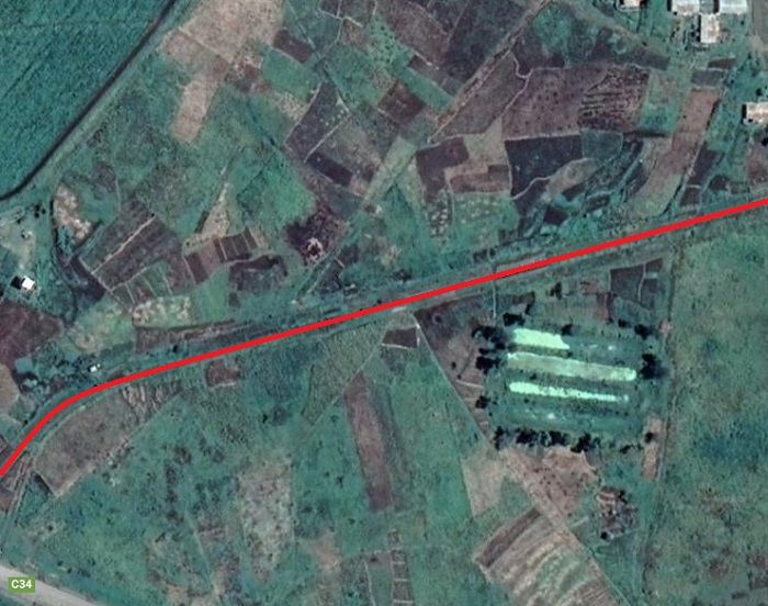
The C37 and the route of the branch-line soon converged (Google Maps).

Road and rail ran parallel to each other for a short while (Google Maps).

Road and Rail ran parallel to each other just a few metres apart (Google Streetview)

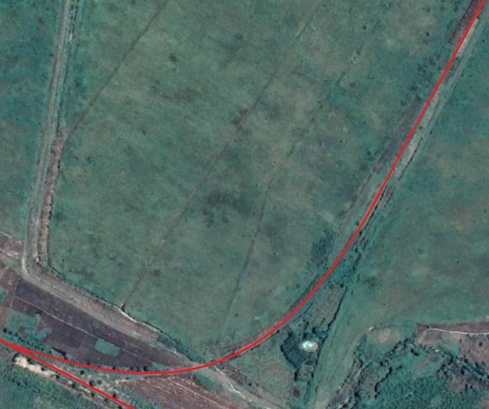
As the C37 approaches a large roundabout, the branch turns gradually away form the road (Google Maps).

Just Southeast of the large roundabout junction between the C37 and the C34 the route of the line crossed the C34 and turned further round towards the East (Google Maps).
And across the southern side of the workers village at the Sugar Factory (Google Maps).
The line continues across the South side of the Factory workers village (Google Maps)

Before swinging away to the South (Google Maps)

And then round to the North along the West side of the settlement (Google Maps).
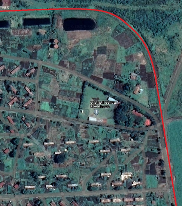
Then back around to the West as it approached its terminus in the industrial complex (Google Maps).

Chemelil Sugar Factory from above (Google Maps).
The Mainline to Kisumu travelling Northwest from Chemelil Railway Station followed a straight line to Kibigori. The next two images are taken just a short distance to the Northwest of Chemelil Station.

Looking Southeast towards the Chemelil Railway Station (c) Joshua Obera – April 2018. [9]
Looking Northwest towards Kibigori, from the same location (c) Joshua Obera – April 2018 [9]
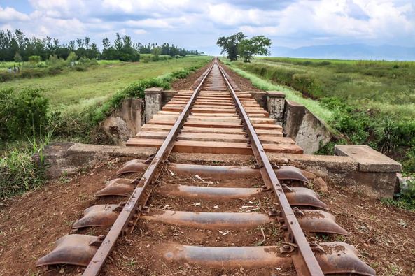
Rehabilitated bridge at km 174 on the Chemelil – Kibigori Section (c) Kenya Railways January 2021. [5]
Kibigori Railway Station was only a short distance Northwest along the mainline beyond the Nyando River. The adjacent photograph shows the station building. [6]
Leaving Kibigori, the line now travels due West to Miwani and then on to Kisumu.

Kibigori Railway Station (Google Maps)
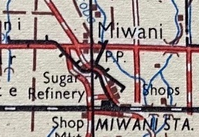
The Miwani Sugar Factory branch-line. [1]
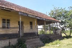
Miwani Station building is shown below, the Sugar Factory branch-line left the mainline just to the East of the station and ran directly to the Sugar Factory. Subsidiary lines spread out at the factory to serve close-by cane fields. It is interesting to note that there were also a series of more temporary light tramway lines in use, as explained below. Miwani Railway Station Building. [7]
The route of the branch-line is shown on the satellite images that follow:

Trains from the East were able to access the branch on a facing turnout/point (Google Maps).
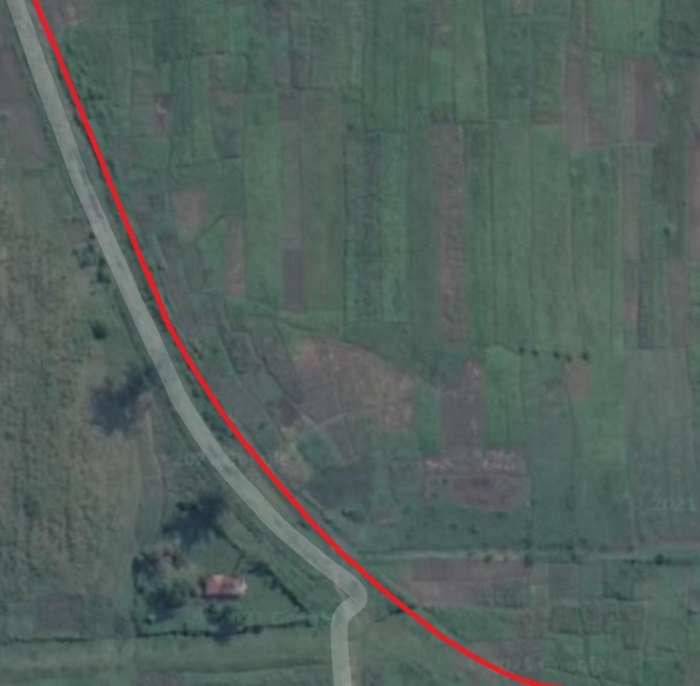
The branch ran alongside the railway station approach road from the Sugar Factory and the C34 to the North, almost all the way to the Factory. The full length is not shown in these satellite images (Google Maps).
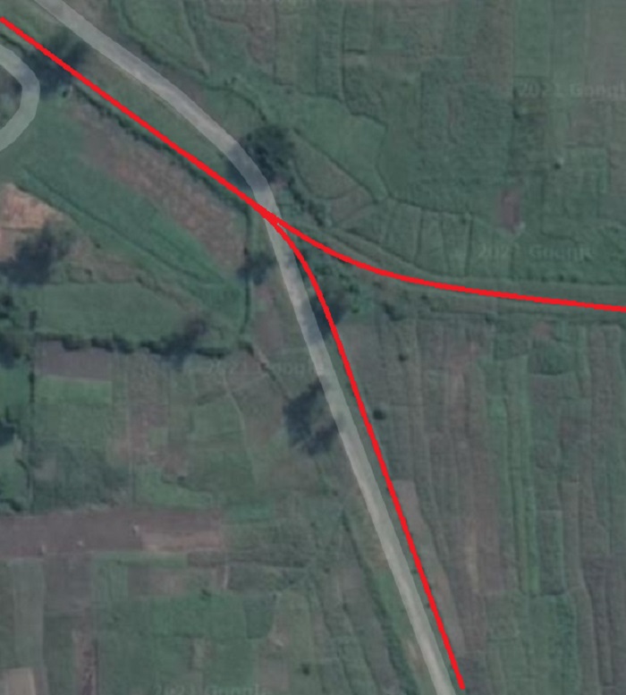
Immediately before reaching the factory sidings the line crossed the access road while turning towards the Northwest and was joined by one of the distribution lines from/to the cane fields (Google Maps)

The Miwani Sugar Factory. Its sidings were on its Northeast flank (Google Maps).

The approximate layout of the feeder lines to the Factory. These were supplemented by lighter tramways which are explained below (Google Maps).
Miwani Sugar Factory was once named the Victoria Nyanza Sugar Company and was one of the earliest plants of its kind in Kenya. The notes which follow are gleaned from a paper written by Godriver A. N. Wanga Odhiambo, “Colonial Sugar Production in Nyanza: (Kibos-Muhoroni) The Asian Initiative, The Genesis, and
Development of Kenya’s Sugar Industry, 1903-1963.” [10]
Given the problems of transporting sugar cane along relatively poor roads The Victoria Nyanza Sugar Company set up an alternative means of transport to the raods and the heavier metre-gauge lines. Large-wheeled metal containers were moved around the sugar cane estates on the Company’s own trolley or tramway lines. This network required its own ordinance, (the Victoria Tramway Ordinance No.1 of 1922). This ordinance was introduced specifically to enable the company to convey sugarcane from the neighboring farms to the factory on trolley lines which were drawn by small locomotives. [10: p205]
Wanga Odhiambo says that “a tramway was built in 1923 by the Victoria Nyanza Sugar Company, starting on its own estate and running along a line of a public road, and terminating at the Kibos railway station.” Wanga Odhiambo [10: p206] If this is correct, the trolley way would have followed the line of the C34 road which appears in the satellite images above and would probably have been an extension to the short length of line that appears on the satellite image above.
Wanga Odhiambo also comments that: “According to the agreement between the Victoria Nyanza Sugar Company and the railway, the company was allowed the use of the railway siding line from Miwani railway station to the company’s nearby sidings. This was meant to be used for light trolley conveyance; thus the railway provided the engine for use of the trolley.” [10: p206]
“Farmers were expected to allow feeder lines to be laid and maintained in their fields for transport of cane from the adjoining farms by extension of the feeder line. Farmers also had access to portable tramlines which were connected to the nearest mainline and when not in use these were removed and returned to the nearest mainline. This arrangement by the Kenya-Uganda Railway facilitated the transportation of cane from the farms to the factory, but again it could only help those farmers whose farms were near the railway line, since the feeder lines were not very long.” [10: p207]
The cost of using the mainline was high and only 8 wagons were provided by the Uganda Railway per day for moving cane along the mainline. The result was quite an extended network of trolley lines being created to enable cane to be transported to Miwani from as far away as Chemelil.
The majority of these tramways/trolleyways have left little evidence of their existence, they were light and easily moved and they were often moved to suit the needs of farmers.
References
- Modern versions of the 1:250,000 Map of Kenya can be sourced from a variety of online sales sites. This extract can be found on Map No. SA-36-04.
- http://www.savetherailway.com/scenes, accessed on 24th May 2018.
- https://www.pinterest.com/pin/554083560377608216, accessed on 25th May 2018.
- http://www.mccrow.org.uk/eastafrica/eastafricanrailways/NairobiKisumu.htm, accessed on 22nd March 2021.
- https://www.facebook.com/permalink.php?id=248578828508174&story_fbid=3961245473908139, accessed on 24th March 2021.
- https://nation.africa/kenya/life-and-style/saturday-magazine/bitter-sweet-railway-tales-920850, accessed on 22nd March 2021
- http://lastdanceinkaloleni.co.ke/save-the-railway-exhbition/kenya-miwani-railway-station-1-of-1-4, accessed on 22nd March 2021.
- https://www.internationalsteam.co.uk/safari/kenya314.htm, accessed on 22nd March 2021.
- https://www.google.co.uk/maps/place/Chemelil+Railway+Station/@-0.1059847,35.111779,3a,75y,90t/data=!3m8!1e2!3m6!1sAF1QipOswTA_nt0PRTN_1v6oYXNZrtHhPp95MV0Ifcm4!2e10!3e12!6shttps:%2F%2Flh5.googleusercontent.com%2Fp%2FAF1QipOswTA_nt0PRTN_1v6oYXNZrtHhPp95MV0Ifcm4%3Dw203-h270-k-no!7i1920!8i2560!4m5!3m4!1s0x182a85c2400ef241:0x40029cd4350e8b0a!8m2!3d-0.1059847!4d35.111779, accessed on 23rd March 2021.
- Godriver A. N. Wanga Odhiambo; Colonial Sugar Production in Nyanza: (Kibos-Muhoroni) The Asian Initiative, The Genesis, and Development of Kenya’s Sugar Industry, 1903-1963; West Virginia University; Chapter 5 p199-228; accessed via https://researchrepository.wvu.edu/cgi/viewcontent.cgi?article=4567&context=etd, on 24th March 2021.
