
The Hay Inclined Plane at Coalport, Shropshire
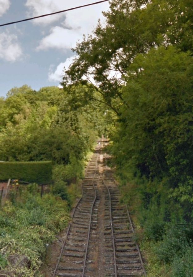
On a visit to Ludlow in late October 2020, my wife and I drove down through Ironbridge Gorge on the River Severn. Just North of Ironbridge we drive through the village of Coalport and over a bridge which spanned a steep inclined plane – two steeply graded parallel railway lines. I suppose it is arguable whether the Inclined Plane really constitutes a railway as it was used for transporting boats between a Canal and a river.
This was the Hay Inclined Plane which provided access from the Shropshire Canal to the River Severn. As far back as 1788 the owners of the canal held a competition to find the most effective way of lowering and lifting loads between the canal and the river.
The winning proposal was submitted by Henry Williams and James Loudon, which was also used at a number of other places in Shropshire. Construction was completed in 1793. By 1820 it was in poor condition and major repairs were needed. (This was also the case in the 1940s.) [1]
In 1857 the Incline was taken over by the LNWR (London and North Western Railway). In 1858, the LNWR closed the Shropshire Canal between the Wrockwardine Wood and Windmill inclined planes, leaving only a short section of canal to serve the industrial area of Blists Hill.
In the 18th and 19th centuries, Blists Hill was an industrial region consisting of a brick and tile works, blast furnaces and coal, iron and fire clay mines operated by the Madeley Wood Company. A short section of the Shropshire Canal ran across the site to the Hay Inclined Plane, which transported boats up and down the 207 ft (63m) high incline from Blists Hill to Coalport. [2]
By 1861, the LNWR had opened their Coalport Branch from Wellington to Coalport which passed across the bottom of the Hay Incline. It seems as though the last use of the Hay Incline was in the year 1894 and it was formally closed in 1907. [1]
The Incline was restored in 1968 and once more in 1975. Rails were reinstated as part of the creation of the Ironbridge Gorge Museums. [3][4]
The video below was taken by DJI Spark. It gives an excellent overview of the location. [5]
References
- Ironbridge Gorge Museum information boards.
- https://en.wikipedia.org/wiki/Blists_Hill_Victorian_Town#History_of_the_site, accessed on 21st October 2020.
- https://en.wikipedia.org/wiki/Blists_Hill_Victorian_Town#History_of_the_site, accessed on 21st October 2020.
- https://www.ironbridge.org.uk, accessed on 21st October 2020.
- https://youtu.be/L2isxApfOto, accessed on 21st October 2020.

Pingback: Canal Inclines in East Shropshire – the Trench Inclined Plane … | Roger Farnworth
Pingback: The Coalport Branch of the Shropshire Canal – Part 1 – The length as far South as Stirchley Iron Works. | Roger Farnworth
Pingback: The Coalport Branch of the Shropshire Canal – Part 2 – The length from Stirchley Iron Works to the River Severn | Roger Farnworth