
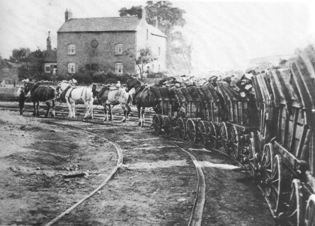
The featured image above is not from the Forest of Dean but is typical of the tramways/tramroads of the area. It is actually a picture of the Little Eaton Tramway in the Midlands.
Moseley Green Tramroads
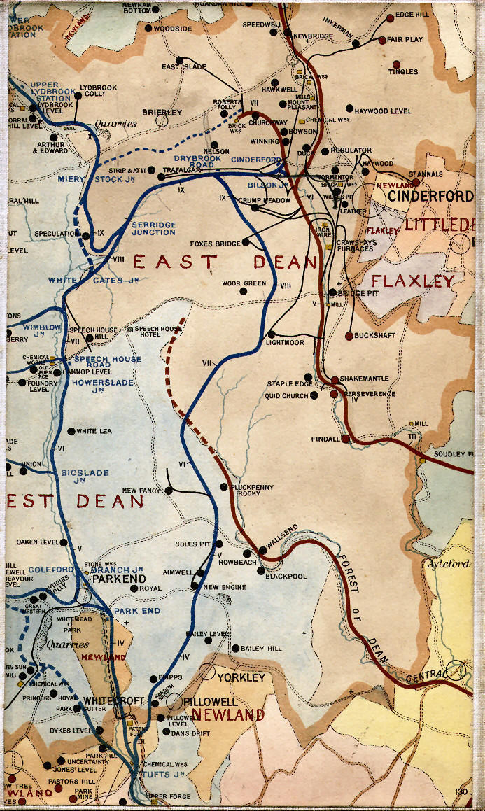
A map of railways in the Eastern half of the Forest of Dean in 1894 clearly shows a short stub end of tramroad at Moseley Green associated with three pits, Soles, Aimwell and New Engine. The Historic Environment Record Archive says that: “A number of earthworks associated with the Moseley Green branch line are visible on aerial photographs. After leaving the mineral loop the branch heads south running parallel with the main line before being taken south west by an embankment at SO 6320 0852. The embankment is approximately 80 metres long and ends at SO 6310 0844 at a cutting. The cutting can be traced for approximately 95 metres terminating at SO 6301 0834 near the Moseley Green New Engine Coal Pit.” All of this is visible in detail on the OS map below.
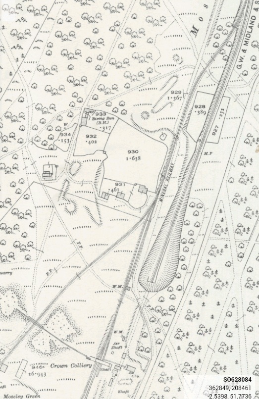
Earlier in the same document it is noted that: “A number of earthworks associated with the Birches branch line are visible on aerial photographs. A cutting at SO 6176 0736 is close to where the line begins; it takes the line westwards into Oakenhill Inclosure. A second cutting starts at SO 6184 0783 and can be traced for 218 metres. On leaving the cutting the line heads north west and then follows a series of loops where after a cutting 35 metres long it returned to its north west course to Moseley Green. On entering Moseley Green the line is taken to the western edge by a cutting with a flanking bank and heads north passing through a second cutting with flanking bank and on to a junction at SO 6332 0919. Northwards from this junction the line passes the spoil heaps of the most northerly colliery on Moseley Green and through a cutting before turning west on an embankment to New Fancy Colliery. Southwards, the line passes through a cutting and connects with the Moseley Green Branch Line.”
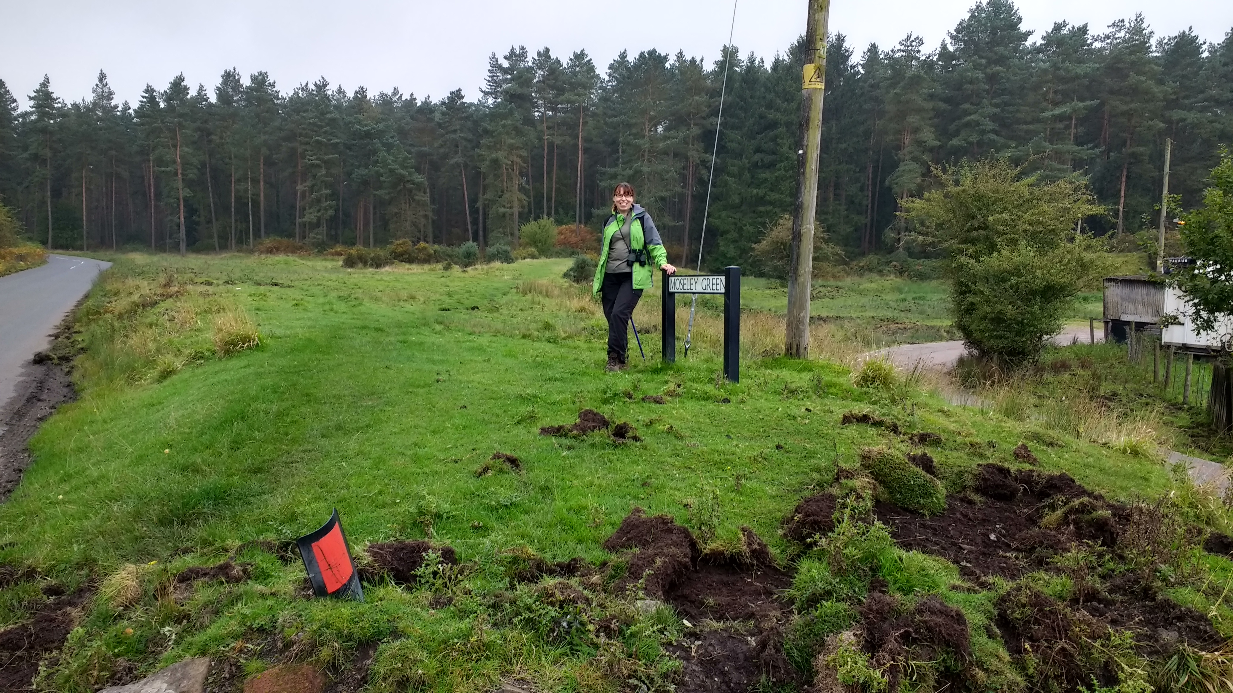
On the map below, the blue line appears to be the route of the Birches/Moseley Green Tramroad. We walked a good length of that route on 27th September 2017. The pink route is the Moseley Green branch referred to in the notes above. We also walked along the turquoise route on 27th September which has earthworks associated with tramroad. It runs parallel to and to the west of the Mineral Loop Line.
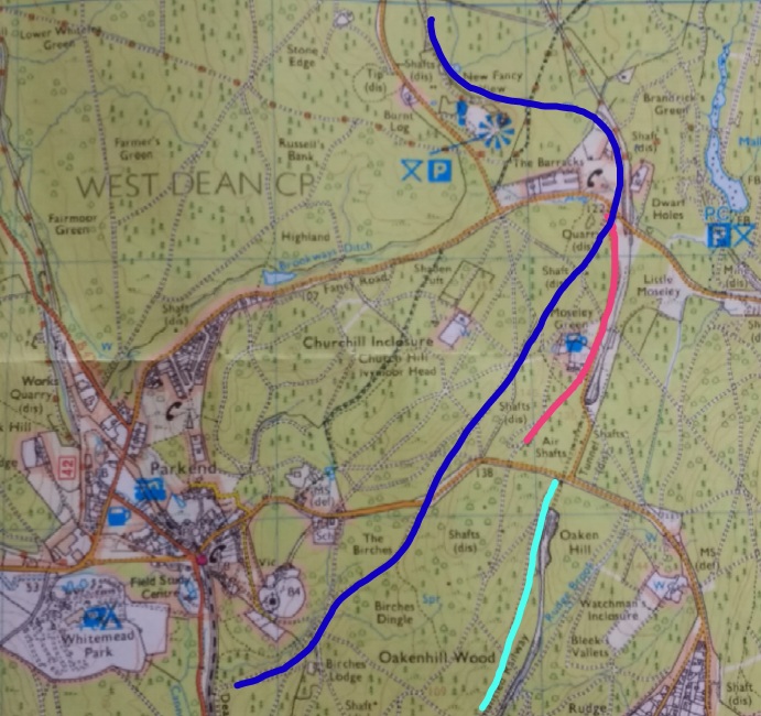
That route is the line of the Kidnall’s Mill/Moseley Green Tramroad which was superseded by the Mineral Loop. The construction of the tramroad did not commence until 1841 and was not completed until 1844. The tramroad ran north from the approximate location of Tufts Junction on the Severn and Wye Joint Line, north through Phipps Bottom and then just to the west of the later Mineral Loop Line.
A licence of 1843 authorised an extension to Foxes Bridge, but this was not completed, Foxes Bridge was unopened. A new line with easier curves was completed in 1856 from Pillowell to Tufts, however the superseded route from Whitecroft was repaired in 1866, as it was more direct for the Patent Fuel Co. there. A branch to New Fancy Colliery (SMR 5824) was made by the Park End Coal Co. in 1859. The Kidnall’s Mill branch was superseded by the Mineral Loop Line and it was abandoned in 1874.
The Kidnall’s Mill branch passed under the Parkend to Yorkley road by a short tunnel just west of the railway tunnel, the keystone on the south side is marked 1842.
Beyond, the route is covered by a colliery tip, a railway siding and then the roadway, to the junction with the Birches branch. Here the line forks to serve New Fancy (SMR 5701/16), the line to which was laid in 1859 and Wellington Colliery (this part of the line has been obliterated by the railway embankment).
References
1. Gloucestershire County Council: Historic Environment Record Archive…. Monument No. 5701.

Pingback: The Branch Tramways and Sidings of the Severn and Wye Tramroad. | Roger Farnworth
The blue line on the map has too many ups and downs to be a tramroad. The line of the Birches branch can be traced fairly easily as it meanders around the contours through the woods. It crossed the Parkend-Yorkley road through a tunnel.
Hi Richard, might you be able to transcribe the route you mean on a map of some sort, perhaps Google maps? Roger.
Here is a sketch map of the route:

Correction: the Birches branch crossed the Parkend-Yorkley road on the level; it was the nearby parallel tramroad which went through a tunnel.
Thank you Richard.
The tunnel for the Mineral Loop remains in place. I thought the tramroad ran through the road at level. I think you are right that the sketched line in dark blue is a little too far to the west once south of the pub. I am afraid that when I was drawing the route, I did so on a tablet which did not have quite the functionality of a desktop, so I was drawing lines with my fingers rather then using a cursor. Still no real excuse.
I will leave things as they are with your correction in the comments, otherwise your comments will not make sense. Thank you.
Roger