Genoa’s Early Tram Network – Part 3 – The Remainder of the Eastern Network before the First World War.

A summary of what was covered in the first two articles

In the previous articles in this short series we looked at the history of trams in Genoa (Genova) – both horse trams and electric trams. In the first article, we covered the story as far as the beginning of the First World War. That article can be found here. [1]

In that article we looked at the tunnels which the city created in order to facilitate access to different parts of the tram network.

That article also covered the Western Network (which is marked in green on the map below).

In the second article we looked at a large part of the Eastern Tram Network. That article can be found here. [2]

We still have to look at the remainder of the network and the history of the network through to its final closure in the mid-1960s.

This map shows the three companies’ lines immediately prior to the date of unification under UITE. The Green lines were UITE (the former French Company). The Red lines were SFEF. The Blue lines were SATO, © Arbalete and authorised for reuse under a Creative Commons Licence (CC BY-SA 2.0). [19]

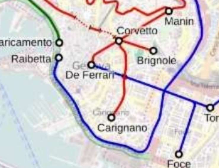
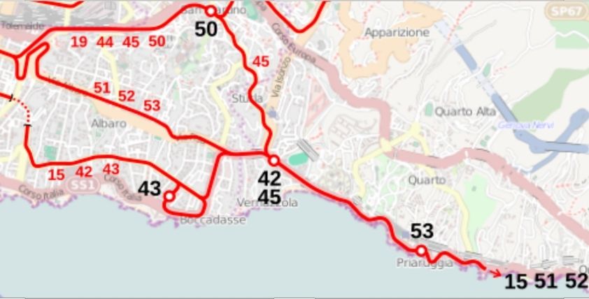
In this article we look at the services provided on the route from Piazza Corvetto to Prato (via Piazza Manin and Staglieno) which appears in red on the map above and the blue lines which ran out of Piazza Raffeale di Ferrari along Via XX Settembre to Staglieno, Foce, Thommaseo and Nervi. Firstly, looking as those provided before the First World War.

The Years Before World War One – The Eastern Network

Before the start of World War 1, the Eastern network provided these services: [19]

I. Eastern Network:

21 De Ferrari – Manin – Staglieno
22 De Ferrari – Manin
23 De Ferrari – Manin – Castelletto
24 De Ferrari – Manin – Castelletto – San Nicholo
25 Circuit in the hilly suburbs
26 Piazza Principe – Corso Ugo Bassi
27 De Ferrari – Zecca – Principe
28 Caricamento – De Ferrari – Galliera ‘Ospital
29 De Ferrari – Carignano
30 Circular Raibetta – Brignole – Corvetto – Raibetta
31 De Ferrari – Staglieno – Molassana – Prato
32 De Ferrari – Staglieno – Molassana
33 De Ferrari – Pila – Staglieno
34 Staglieno – Iassa
35 Pila – Staglieno
36 Pila – Staglieno – Molassana
37 De Ferrari – San Fruttuoso
38 De Ferrari – Foce
39 De Ferrari – San Francesco – Sturla – Priaruggia – Quinto – Nervi
40 De Ferrari – San Francesco – Sturla – Priaruggia – Quinto
41 De Ferrari – San Francesco – Sturla – Priaruggia
42 De Ferrari – San Francesco – Sturla
43 De Ferrari – Villa Raggio – Lido
44 De Ferrari – Tommaseo – San Martino – Borgoratti
45 De Ferrari – Tommaseo – San Martino – Sturla
46 De Ferrari – Tommaseo – San Martino
47 De Ferrari – Tommaseo
48 Raibetta – Pila

II. Municipal line:
De Ferrari – Quezzi

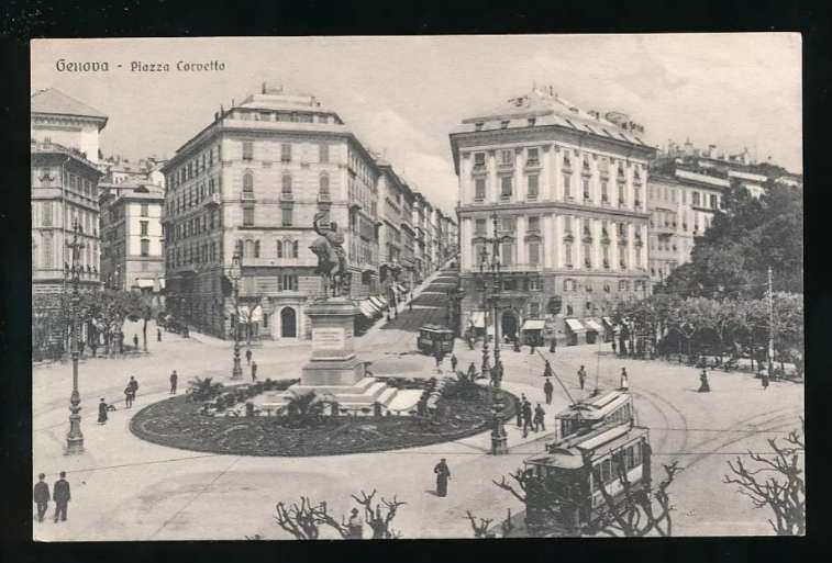
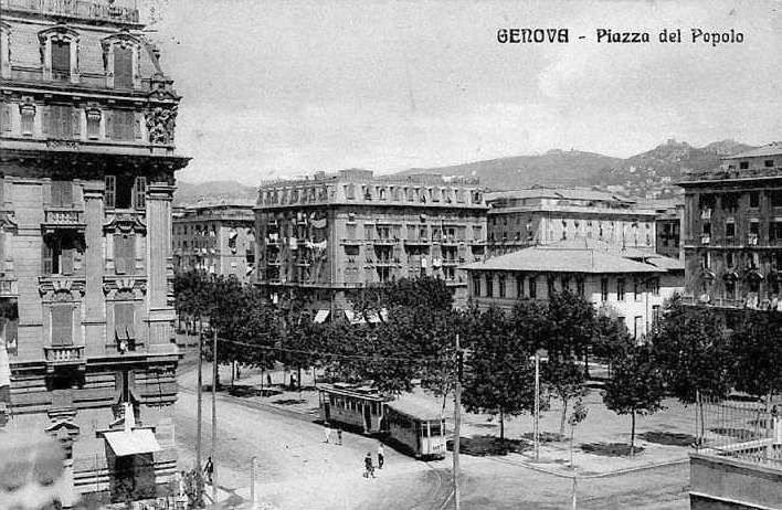
The Eastern network focussed on Piazza Raffeale de Ferrari. We looked at images from that piazza in the first article [1] about the trams of Genoa (Genova). At one time, Piazza de Ferrari was full of ‘circular tramlines’ and it was congested through much of the day.

Piazza Raffeale de Ferrari was the busy hub for the Eastern network, © Public Domain. [7]

Tram lines left Piazza Raffeale de Ferrari along Via Roma, to the Northeast and along Via XX Settembre. We covered most of those which radiated from the Northeast end of Via Roma (Piazza Corvetto) in the second article. [2]

This Article: The Rest of the Eastern Network

The line running from Piazza Corvetto to Prato will be covered in this article, along with those which ran out of Piazza Raffeale de Ferrari along Via XX Settembre.

Piazza Corvetto to Prato

Looking Northeast across Piazza Corvetto from close to Via Roma, circa 1900-1910. Via Asserotti leave the piazza at the mid point of the image. A tram can be seen leaving Via Asserotti in this image,, © Public Domain. [15]
A similar view from ground level in the 20th century, again Via Asserotti leaves the piazza at the centre of this image, [Google Streetview, August 2024]

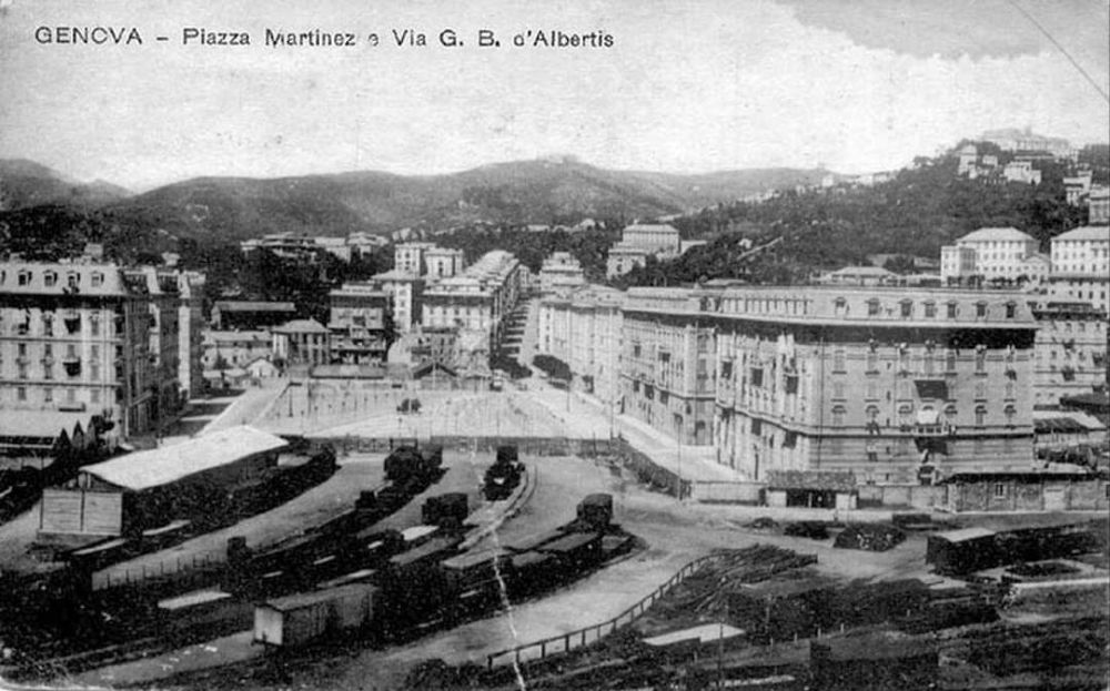
As we have already noted in the second article in this short series, at Piazza Corvetto lines diverged to Piazza Carignano, Brignole, Manin and Acquaverde and Principe. The line to Prato ran Northeast from Piazza Corvetto through Piazza Manin.

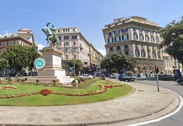
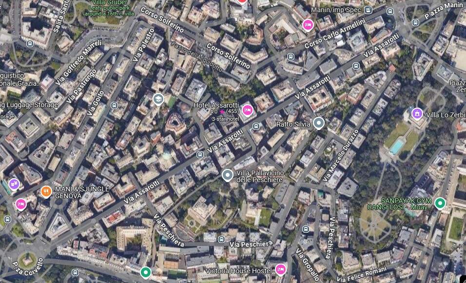
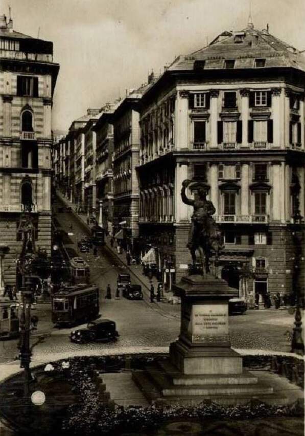
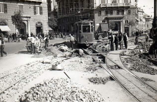
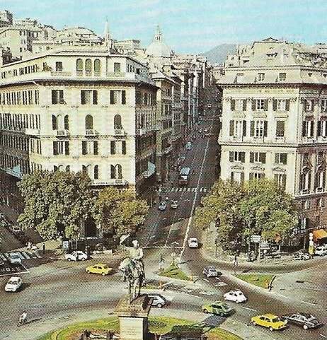
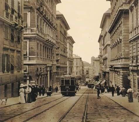
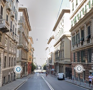
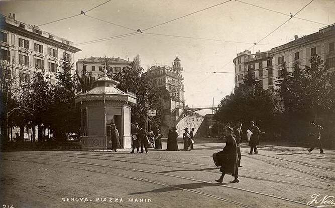
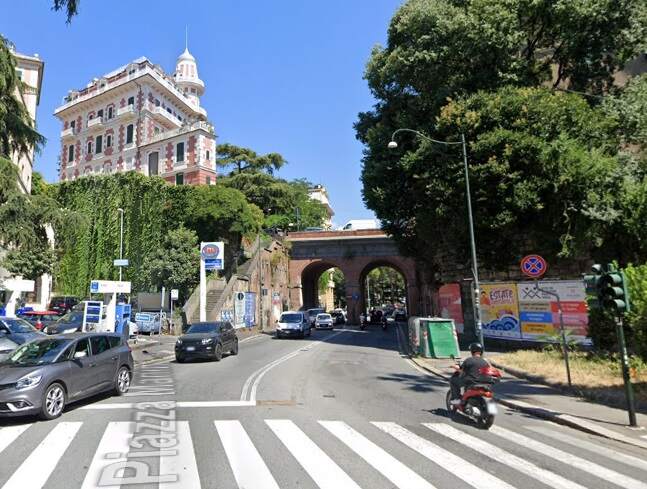
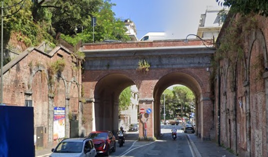
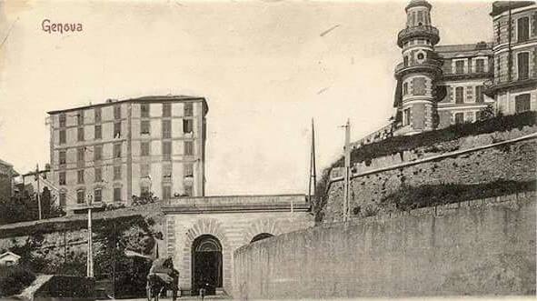
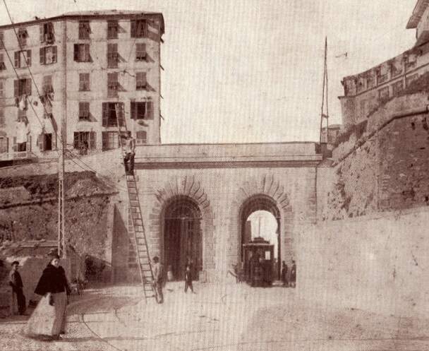
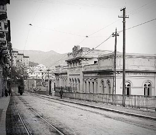
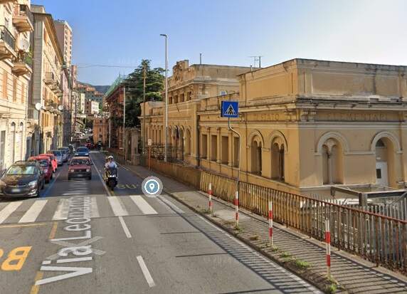
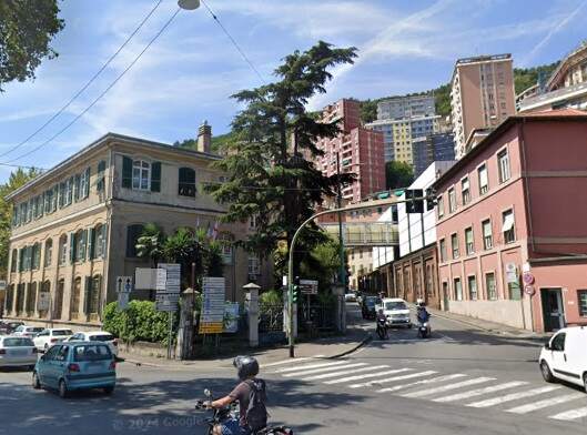
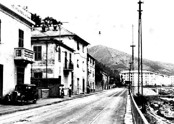
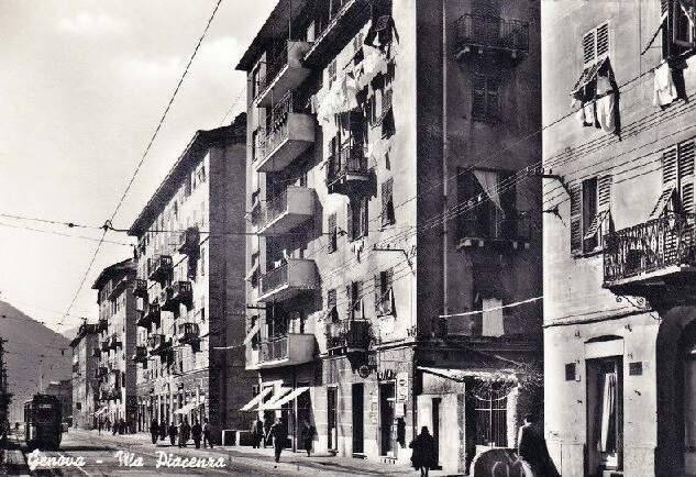
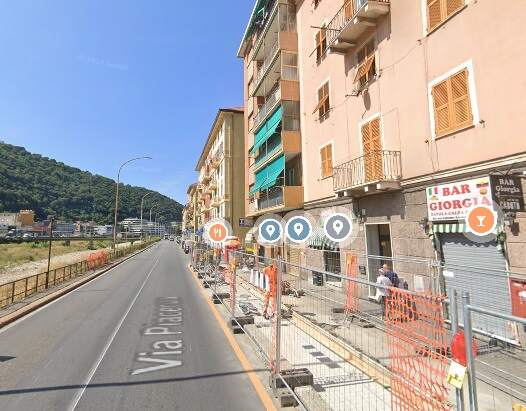
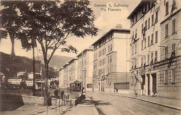
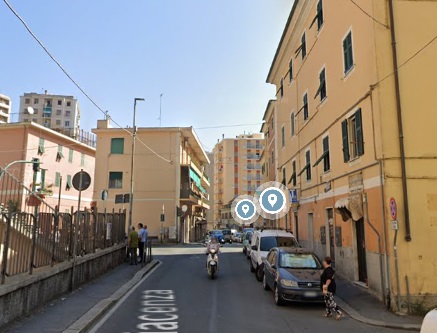
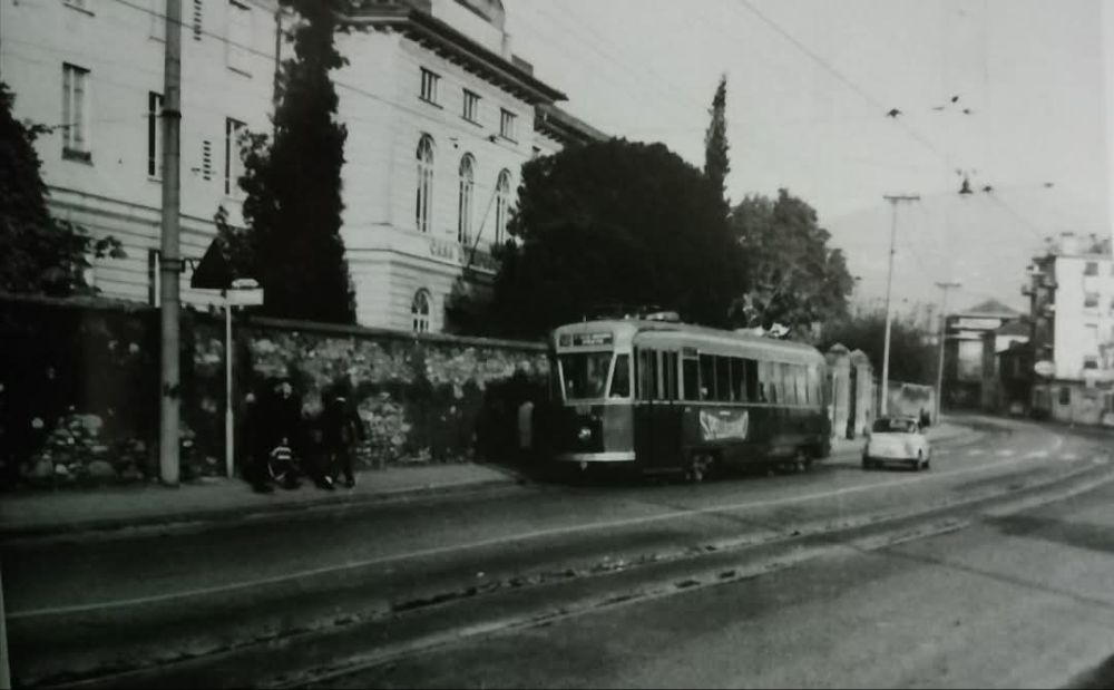
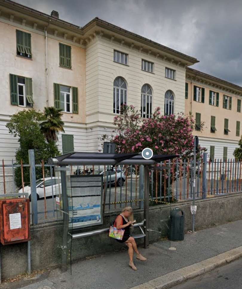
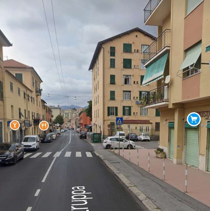
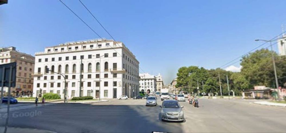
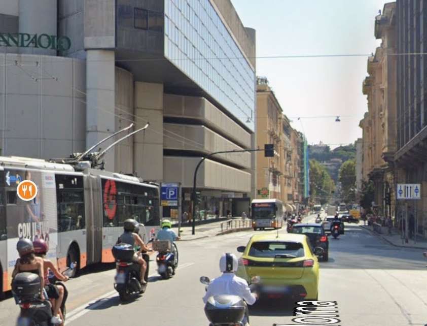
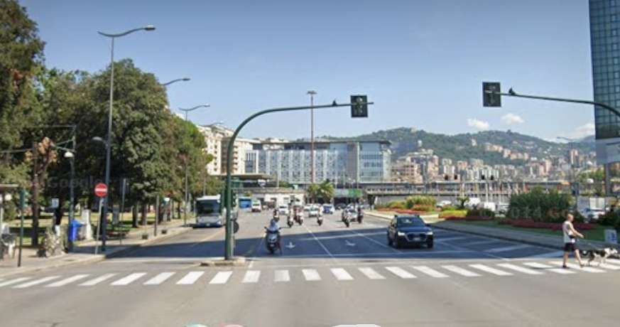
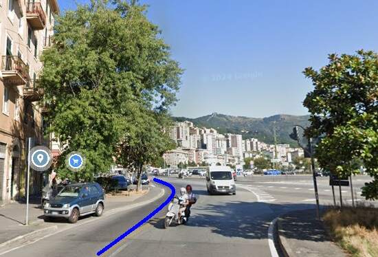
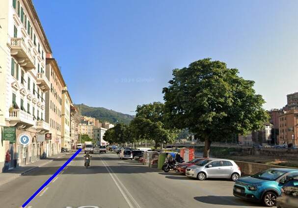
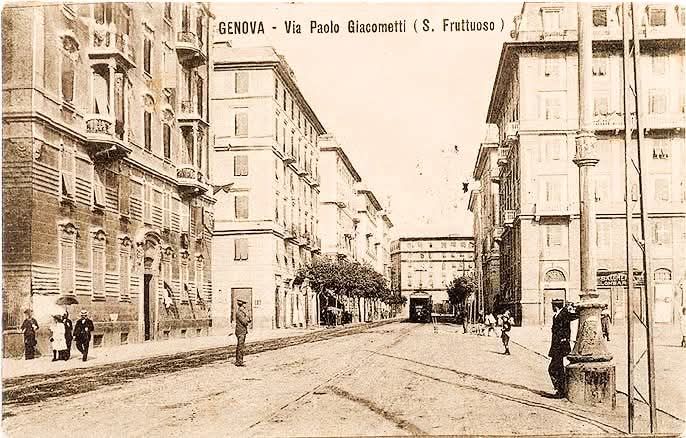
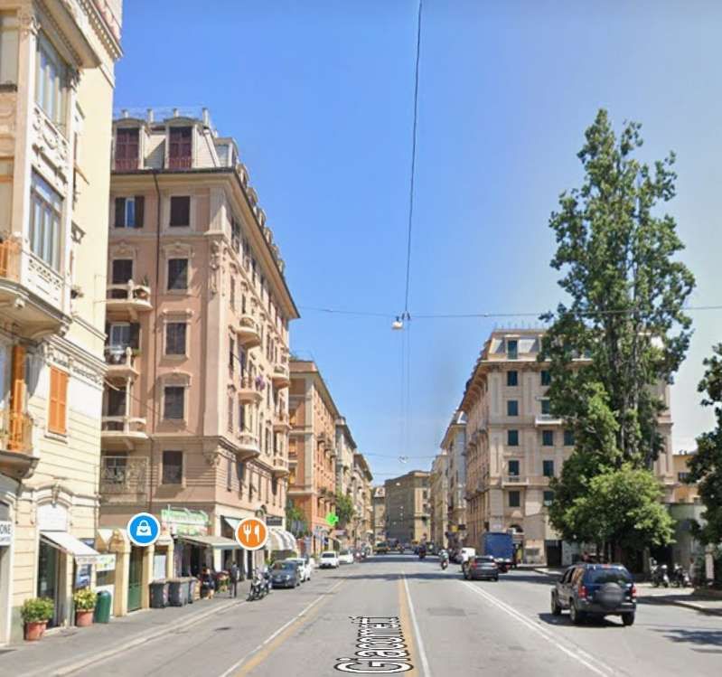
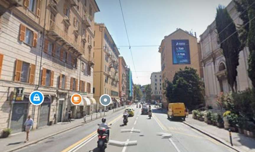
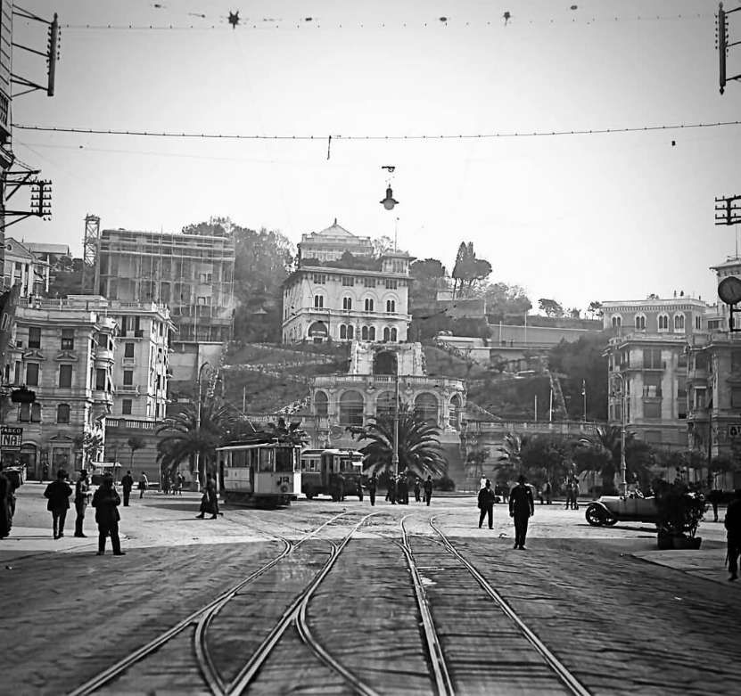
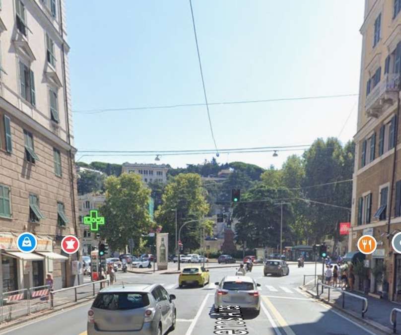
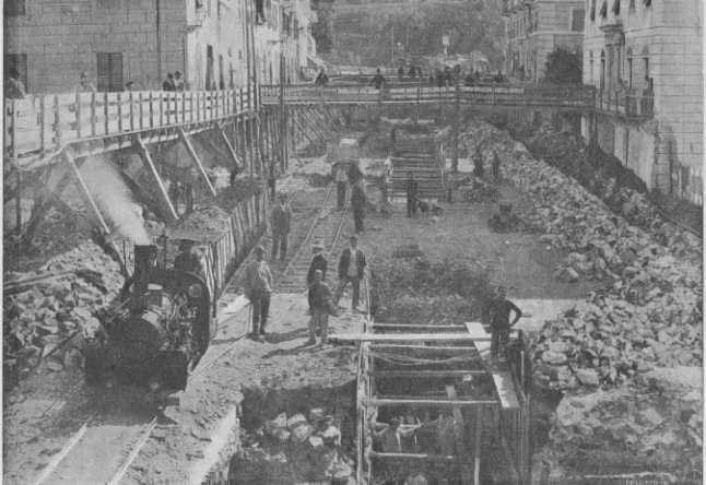
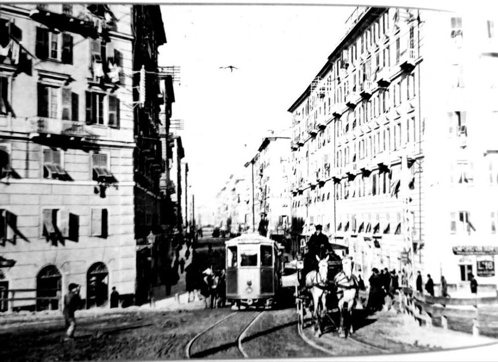
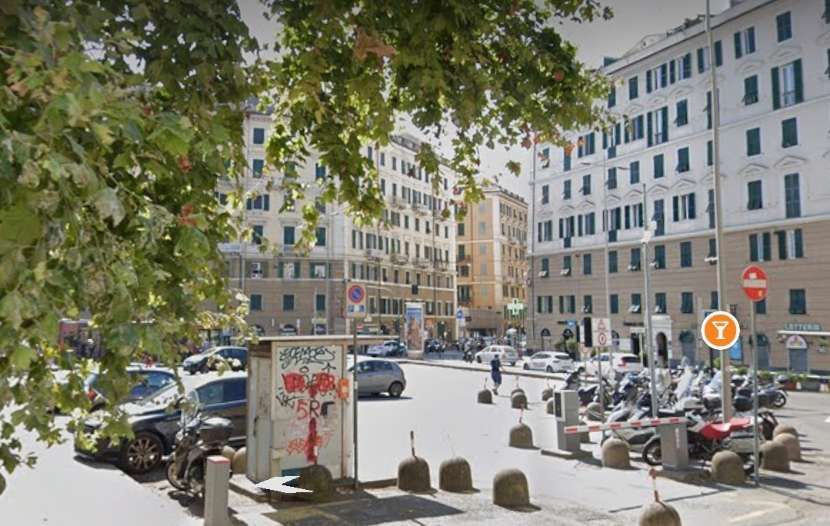
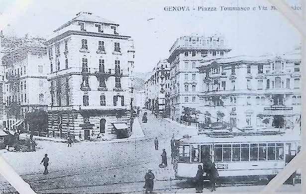
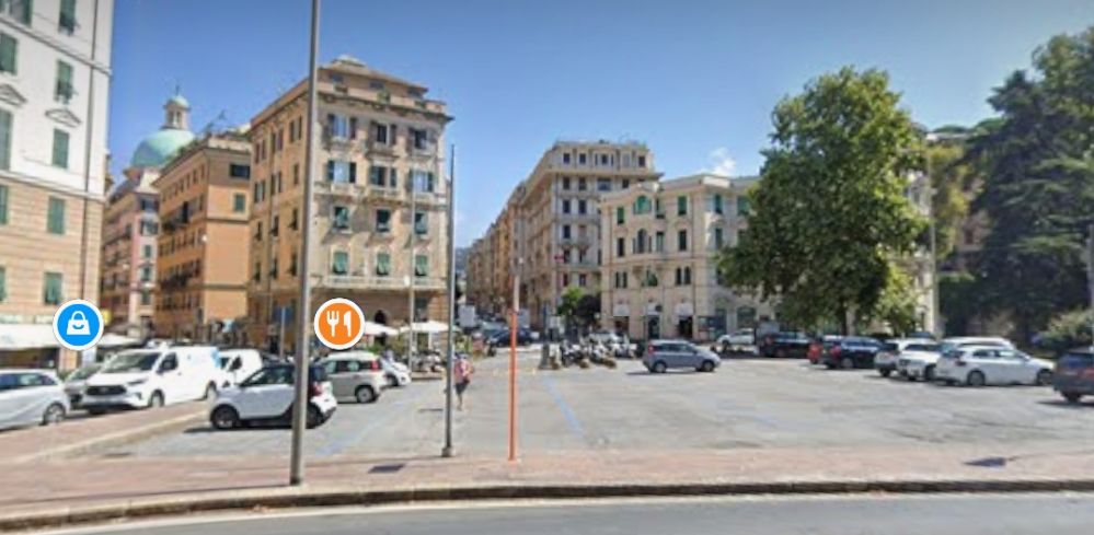
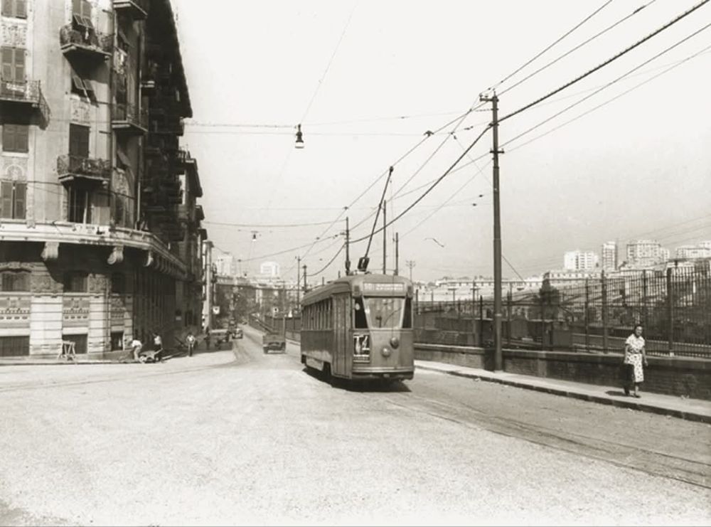
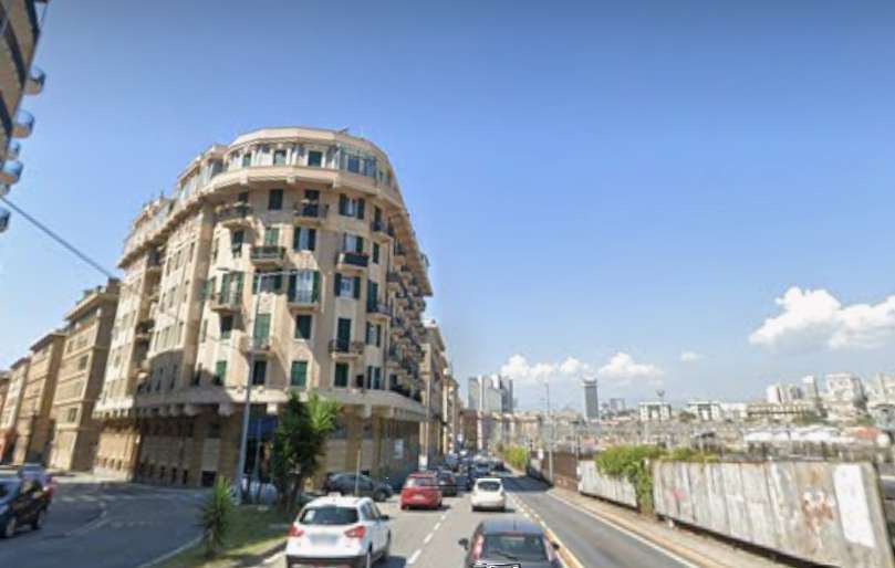
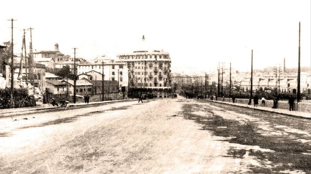
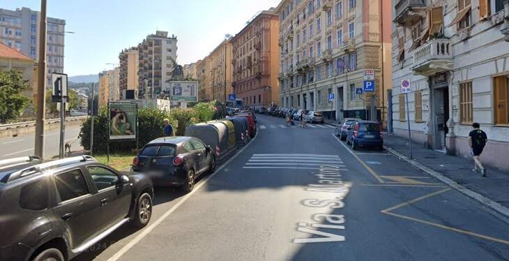
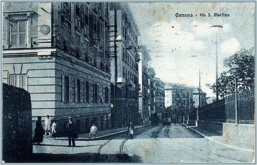
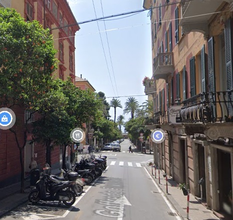
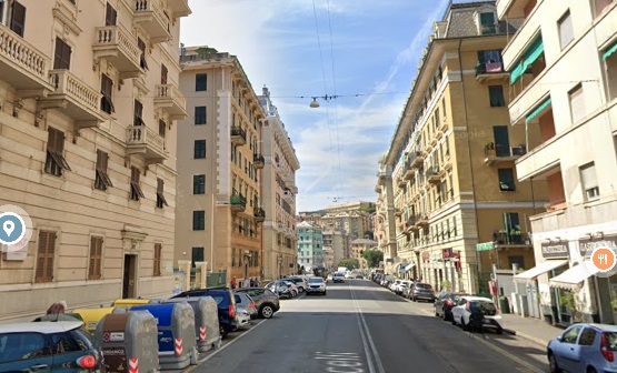
Trams ran between Piazza Corvetto and Piazza Manin along Via Assarotti. [Google Maps, December 2024]
Looking Northeast along Via Asserotti in the 1940s. Traffic is now driving on the right. Genova had vehicles driving on the left until 1923 when the national government imposed a common practice across the country, (c) Public Domain. [5]
Later roadworks at the mouth of Via Asserotti on Piazza Corvetto. Behind the tram is Via Asserotti and to the right, Via S.S Giacomo e Filippo, (c) Public Domain. [3]
A postcard view from the 1970s along Via Asserotti from Piazza Corvetto. This is an extract from an image shared on the C’era una volta Genova Facebook Group by Paolo Nuzzo on 12th July 2019. [4]
Looking Southwest along Via Asserotti towards Piazza Corvetto, (c) Public Domain. [6]
A similar view Southwest along Via Asserotti in the 21st century. [Google Streetview, August 2024]
Piazza Manin, looking East towards the city walls. Via Asserotti is behind the camera to the right, (c) J. Neer, Public Domain. [8]
A similar view in the 2st century. [Google Streetview, August 2024]
Trams ran through the city walls under Ponte di Via alla Stazione per Casella. [Google Streetview, August 2024]
Looking West toward Piazza Manin from outside the city walls. (c) Public Domain. [10]
An earlier view looking West with a tram heading towards the camera, (c) Public Domain. [11]

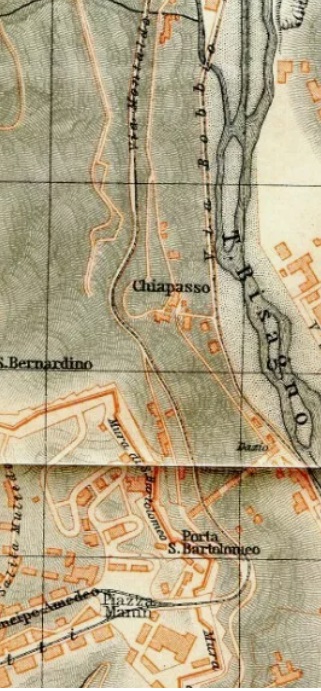
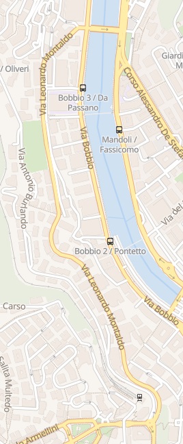
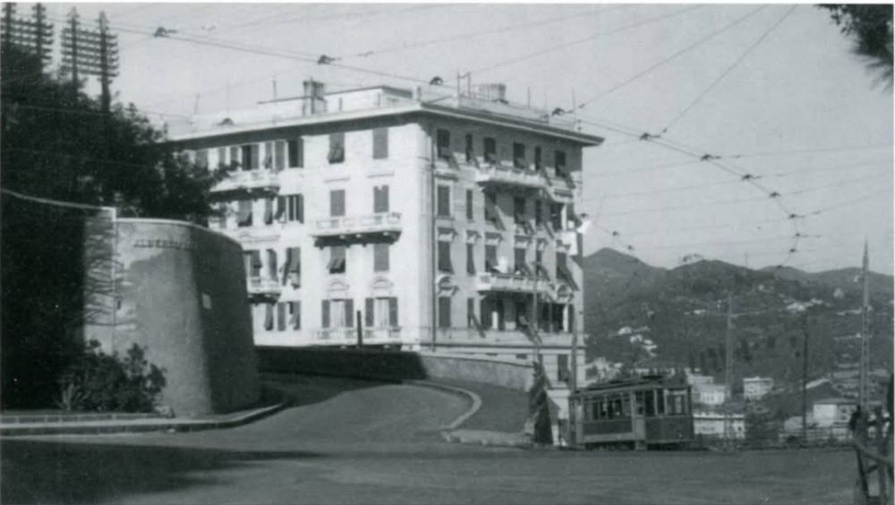
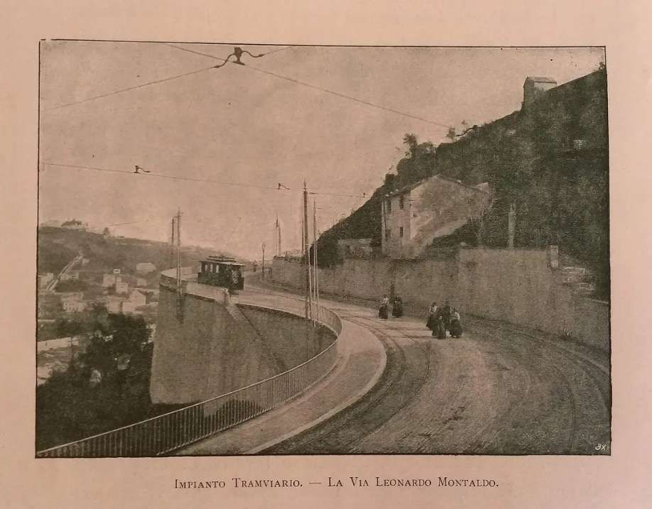
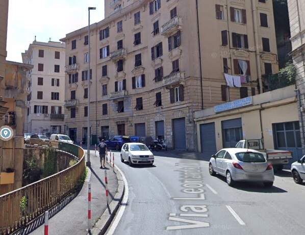
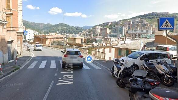
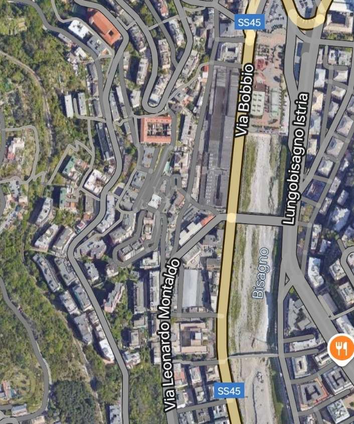
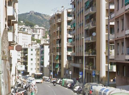
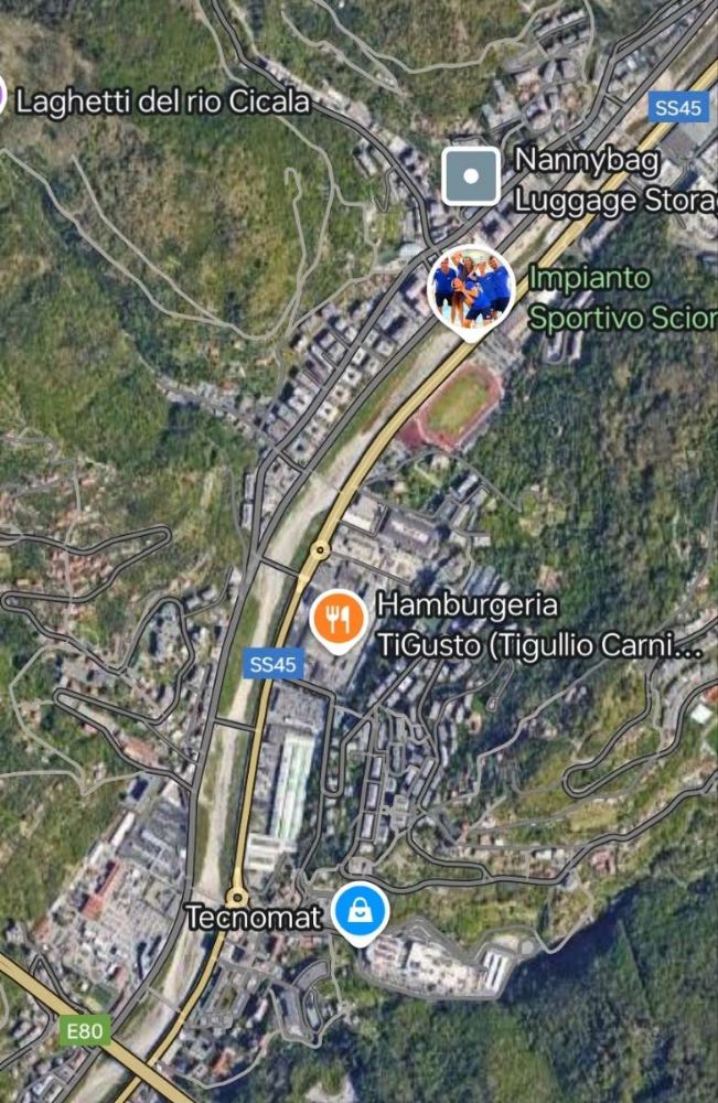
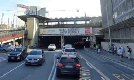
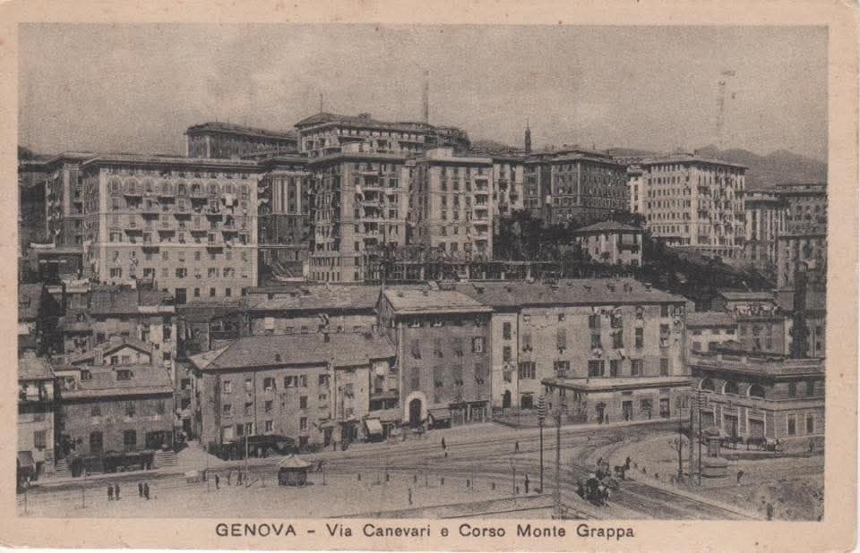
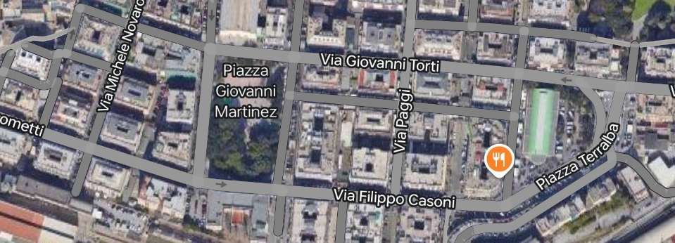
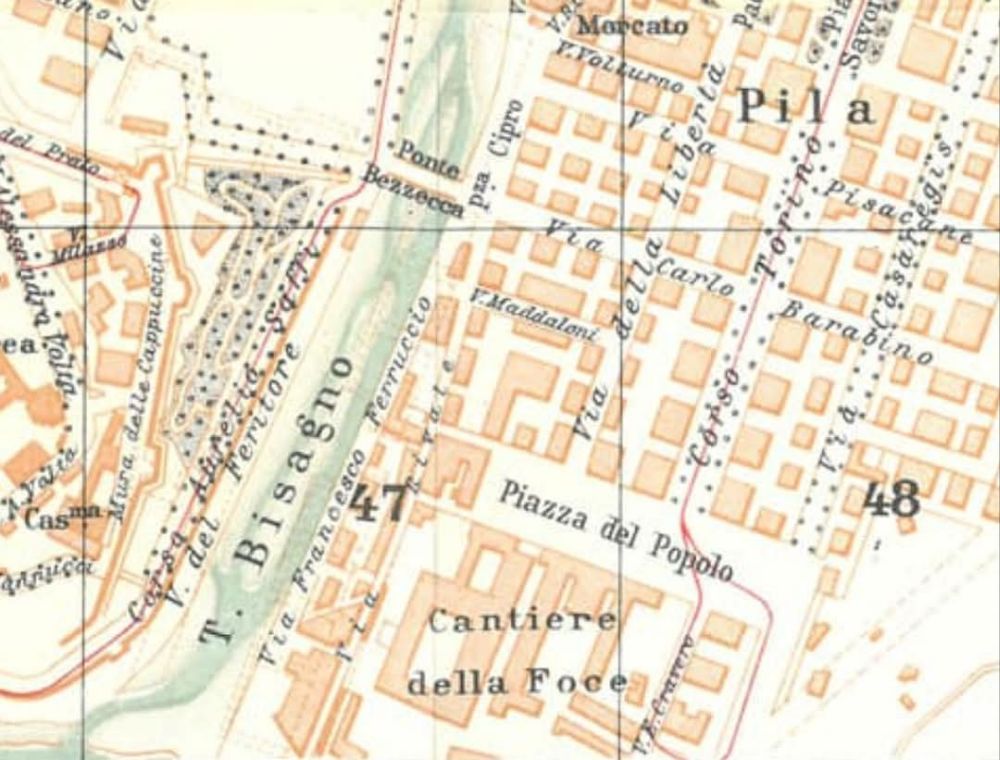
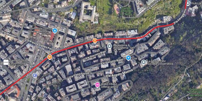
Just East of Piazza Manin, trams passed through the old city walls & turned North following the contours of the side of the Bisagno Valley. This extract from the Baedeker 1906 map of Genova shows the route of the tramway as it heads North. The openstreetmap.org extract shows that the route is along Via Leonardo Montaldo. [13][14]

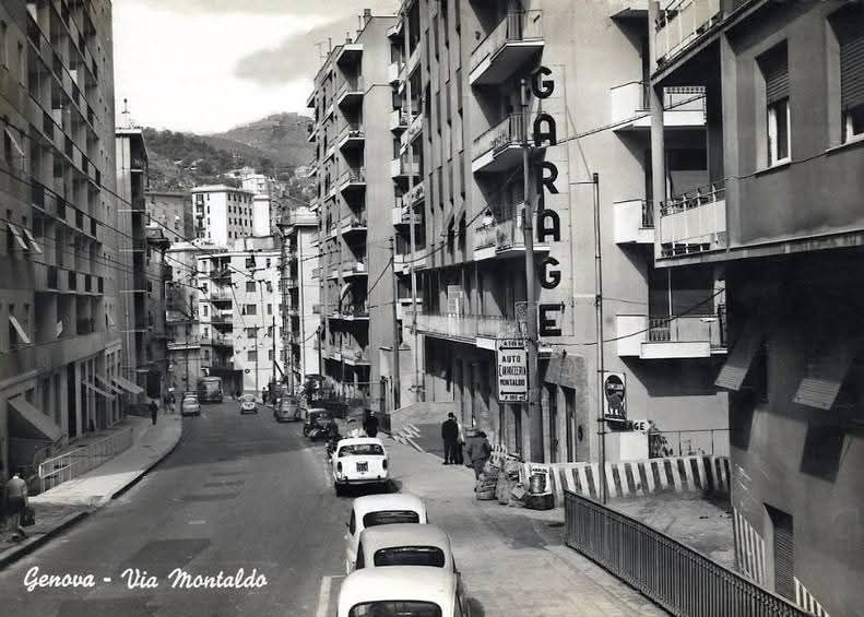
Trams ran North along Via Leonardo Montaldo. The road was built, initially through undeveloped land, to accommodate the tram service.

Piazza Manin is about 100 metres off to the left of this satellite image. Trams ran out from Piazza Manin to hed North up Via Leonardo Montaldo. [Google Maps, December 2024]
A tram heads away from Piazza Manin up Via Leonardo Montaldo from its southern end. It has just turned left at Largo Gaetano Giardino after passing under the city walls, © Public Domain. [26]
Via Leonardo Montaldo heading away to the North from Largo Gaetano Giardino. [Google Maps, December 2024]
Via Leonardo Montaldo follows the contours as it heads North, roughly parallel to Via Bobbio (SS45). [Google Maps, December 2024]
An early South facing view of a newly built Via Leonardo Montaldo, (c) Public Domian. [22]
Major changes have occurred in the area around Via Leonardo Montaldo. A relatively rural area in the early part of the 20th century is now well-developed. [Google Streetview, August 2024]
Looking North along Via Leonardo Montaldo, © Public Domain. [24]
The view North from a similar location in the 21st century. [Google Streetview, August 2024]
Looking North up the valley of the Bisagno with Via Leonardo Montaldo (not Via Canevari) on the left, © Public Domain. [9]
The view North from a similar location in the 21st century. [Google Streetview, August 2024]
Via Leonardo Montaldo joins Via Bobbio in Staglieno. [Google Maps, December 2024]
This panorama of the Bisagno Valley sows Via Leonardo Montaldo curving round towards the river in the middle distance. [28]
This closer view shows Via Leonardo Montaldo (on the left) curving round towards the river in the middle distance. [29]
Via Montaldo in the mid-20th century. This image was shared on the C’era una volta Genova Facebook Group by Christiano Burzi on 18th October 2016. [25]
The 21st century view looking North from a similar location. [Google Streetview, August 2024]
The final run down the hill to the valley floor in Staglieno. The building on the right is da Passano School, (c) Public Domain. [27]
A very similar view in the 21st century. [Google Streetview, August 2024]
A very early view of the UITE depot at the junction of Via Leonardo Montaldo and Via Bobbio in Staglieno, © Public Domain. [23]
The junction of Via Leonardo Montaldo with Via Bobbio in Staglieno. The buildings in the centre of the photograph belong to UITE, (c) Public Domain. [12]
The same view in the 21st century. Via Bobbio is on the left, Via Leonardo Montaldo is on the right. [Google Streetview, August 2024]

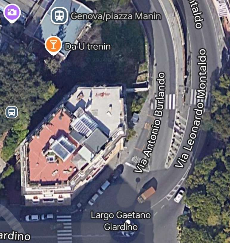
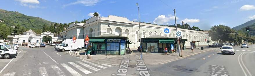
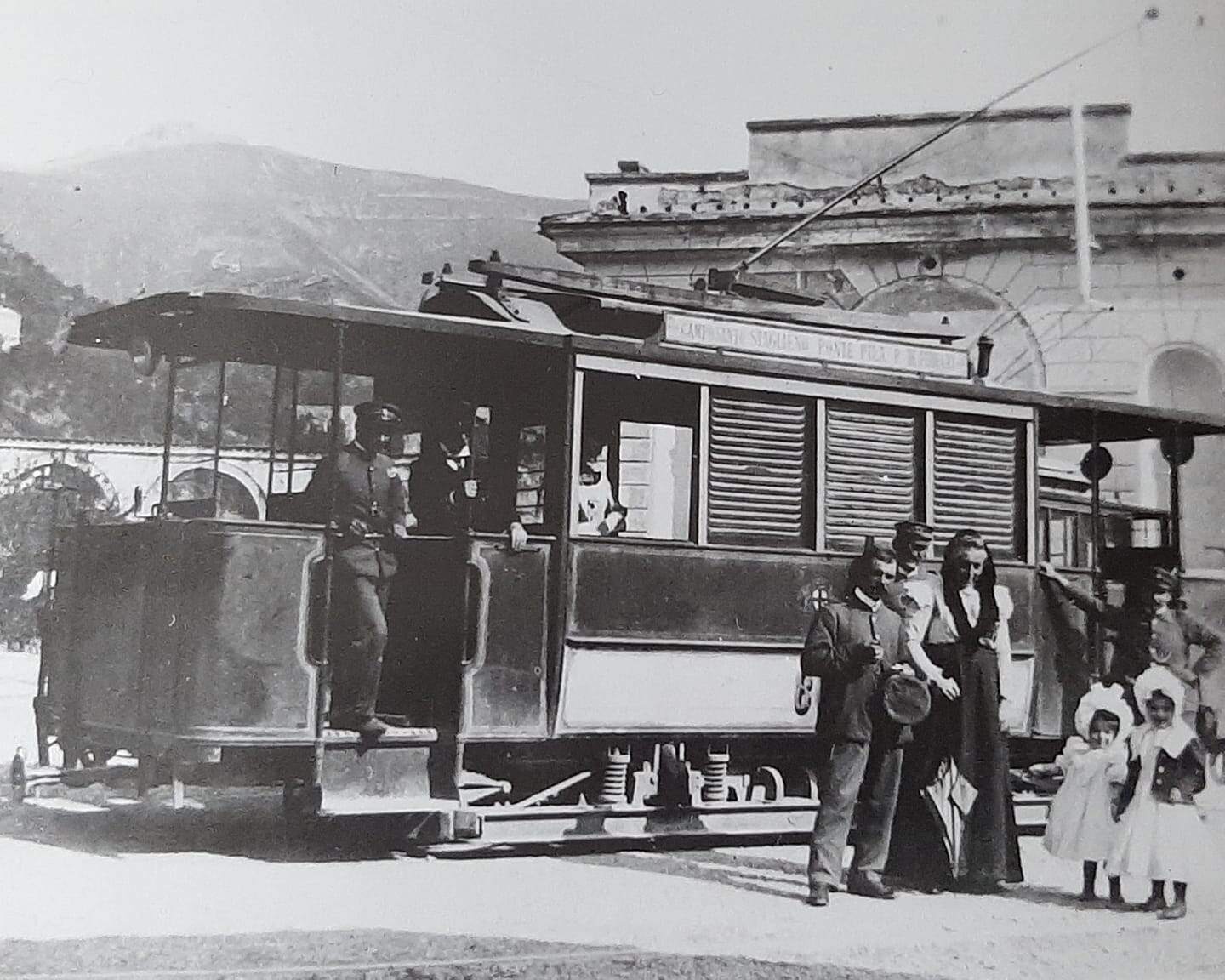
Trams from the centre of Genoa arrived at the junction shown above, both along Via Bobbio and Via Montaldo and then continued North and East up the valley of the Bisagno River, passing the Cemetery on the way.

Looking North along the right bank of the Bisagno River along Via Bobbio. Not too far ahead Via Bobbio becomes Via Piacenza. [Google Streetview, August 2024]
Staglieno Cemetery sits to the Northeast. Via Piacenza is on the right of this photo, the river just off the picture to the right. To the left of the prominent cemetery walls is Piazzale Giovanni Battista Resasco. The cemetery gates can be seen at the far end of the piazzale. [Google Streetview, August 2024]
1895: A tram at the end of Piazzale Resasco at the gates of Staglieno Cemetery, (c) Public Domain. [35]
The length of Via Piacenza approaching the gasworks at Gavette, (c) Public Domain. [34]
A tram passing the entrance to the gasworks. The line which runs from the camera into the works has been covered in another article on this website, © Public Domain. [43]

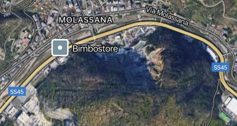
The line which served the Gavette works ran up the East side of the River Bisagno, crossing the river on its approach to the works. It was primarily used for bringing coal to the works in the days when it produced town gas. The article about that railway can be found here. [44]

A panorama of the Gavette gasworks . Trams ran along the road (Via Piacenza) between the works and the river. [c] Public Domain. [39]
The gasworks site is in the bottom-left of this extract from Google Maps satellite imagery. The tram line continued North along Via Piacenza on the West side of the River Bisagno. The main road (SS45) can be seen on the East side of the river. [Google Maps, December 2024]
Looking upstream along the right bank of the Bisagno river in San Bartolomeo. I have not been able to locate this view on Google Maps/Streetview, (c) Public Domain. [38]
Looking Southwest along Via Piacenza . The River Bisagno is off the left of the image, (c) Public Domain. [37]
The 21st century view, Southwest along Via Piacenza, from approximately the same location. [Google Streetview, August 2024]
Via Piacenza in San Goffardo looking back towards Stagieno, (c) Public Domain. [36]
It is difficult to be sure, but this is approximately the same location on Via Piacenza in San Goffardo. The church is behind the camera to the left. There has been a lot of development since the monochrome photograph above was taken. What seems like gardens to the left of the road in the image above have disappeared under more recent developments/buildings. Via Emilio is now between Via Piacenza and the river. [Google Streetview, August 2024]
This next extract from the satellite imagery shows Via Piacenza on the North side of the river as it heads away from San Goffredo and through Molassana. Trams continued to follow the right bank of the river through Molassana and on towards Struppa. [Google Maps, December 2024]
This final length of the tramway runs West to East through Doria to Prato. [Google Maps, December 2024]
A panoramic view from the Southwest of the hospital buildings in Doria (in the left and middle foreground) and the highway running through Prato (to the right side of the image) in Struppa, © Public Domain. [31]
The same buildings in the 21st century – Palazzo Della Salute, ASL3 Genovese  – seen from across the River Bisagno from approximately the same direction as the postcard image above[Google Streetview, August 2024]
The same buildings with a tram stopped outside in 1966. The notes with this photo say that the tram is sitting outside the Casa di Riposo. Line No. 12 was the last tramline to close, running until 27th December 1966, © Luciano Rosselli (La Valbisagno). [30]
Taken from the middle of the road in the 21st century. The tram stop outside of the hospital is now a bus stop! [Google Streetview, August 2024]

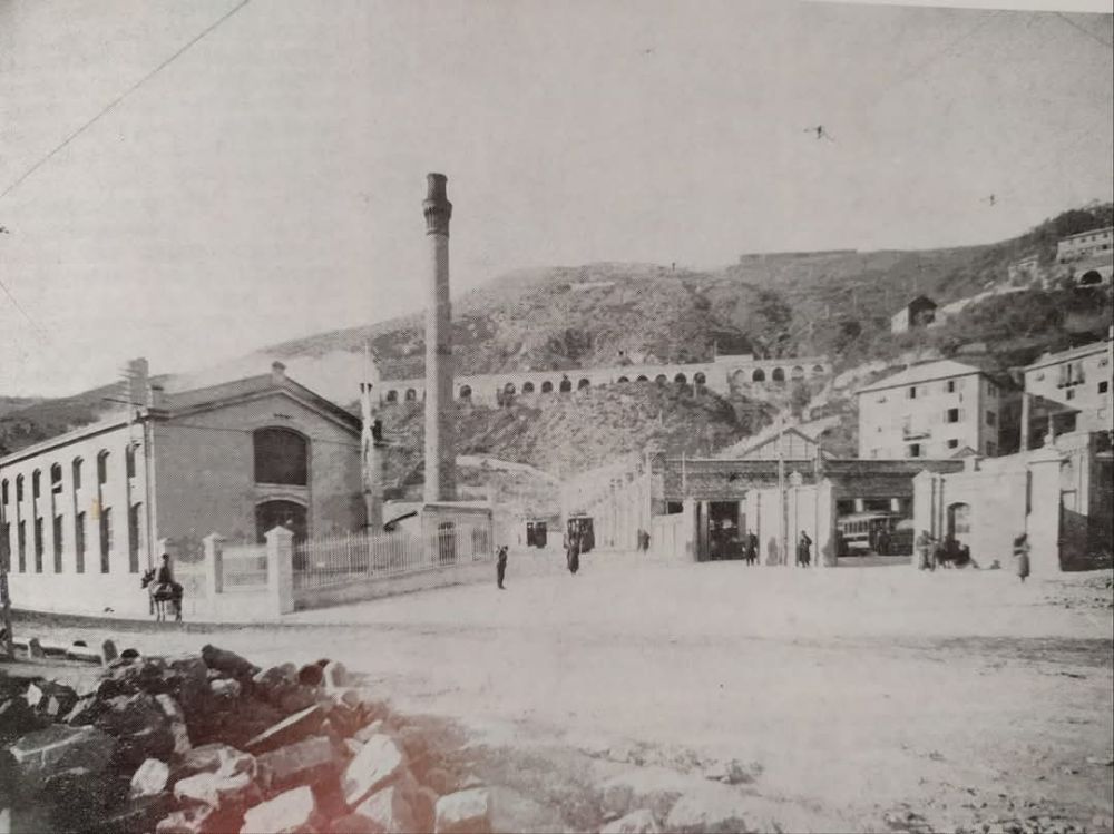
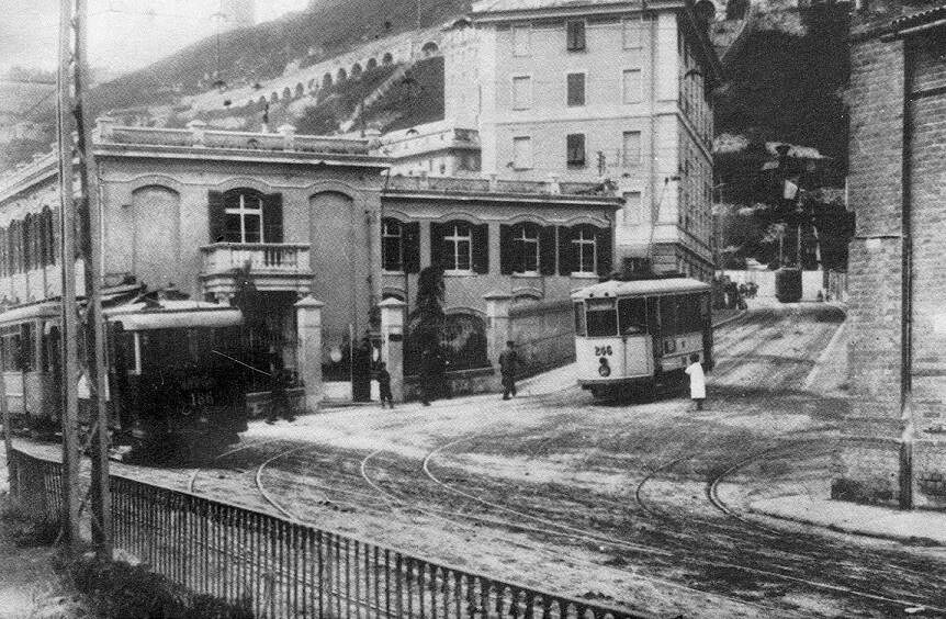
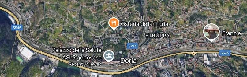
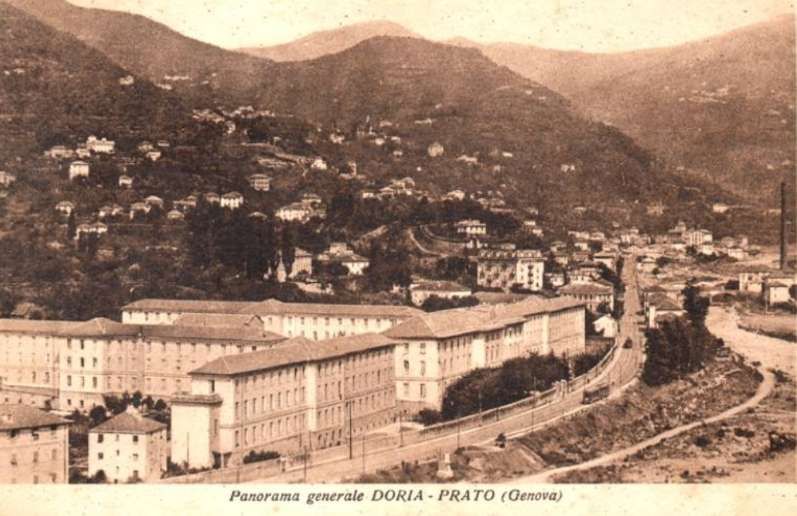
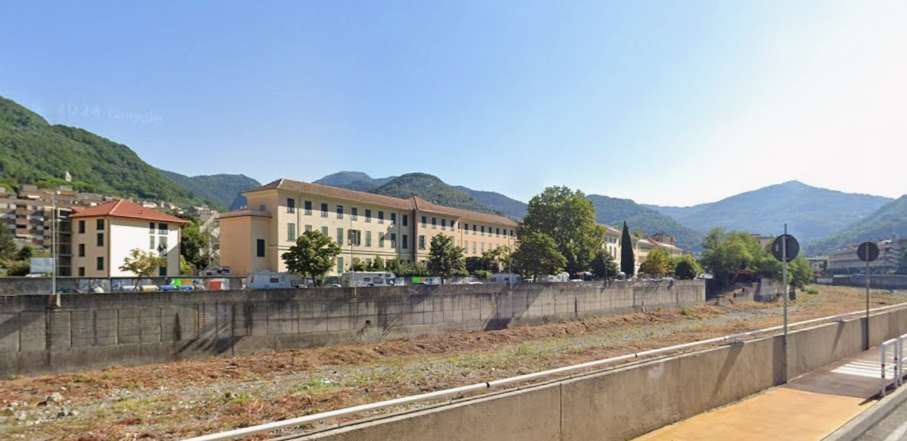
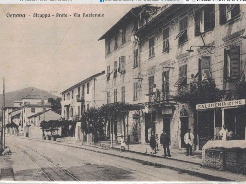
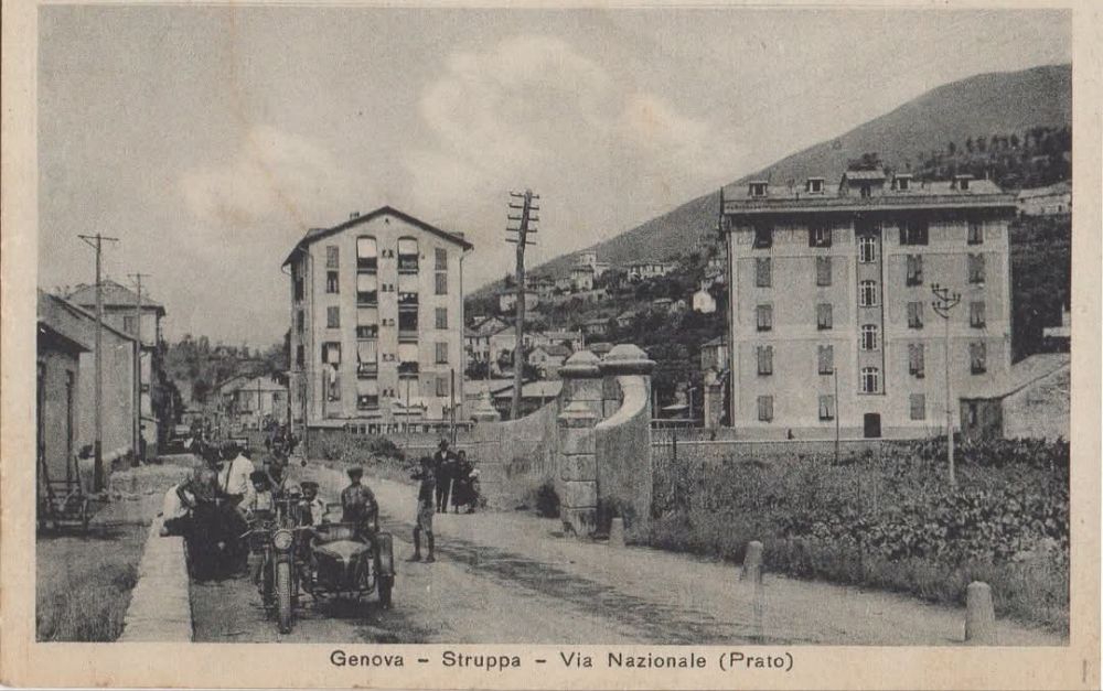
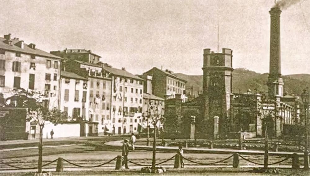
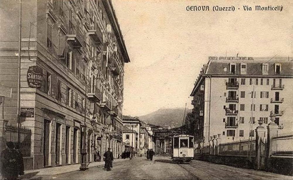
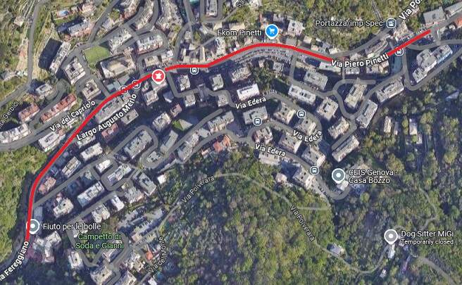
The terminus of the tramway is a little further East from the hospital/health buildings. These next few images take us to the end of the line in Prato.

Struppa – Prato – looking West on Via Nazionale (in the 21st century, Via Struppa), © Public Domain. [32]
Looking West again, at the same location on Via Struppa. [Google Streetview, July 2024]
In 1909 a tram sits at the terminus in Prato next to the recently completed tram company building, © Public Domain. [33]
A similar post card view, © Public Domain. [41]
Looking West along Via Struppa in Prato. The large tramway building that stood at the tramway terminus is still in use in the 21st century. [Google Streetview, July 2023]

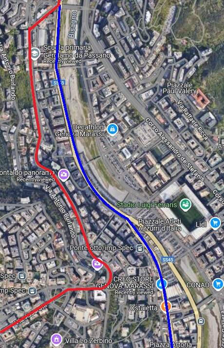
Having arrived in Prato we have now covered all the ‘green lines’ and the ‘red lines’ on the network plan provided close to the start of this article. We still have to look at most of the ‘blue lines’. …..

We have previously looked at the blue line around the coast from Raibetta and that from Piazza Raffeale de Ferrari to Pila. The next line to look at is that from Pila North to Staglieno. We then complete looking at the routes by looking at the lines on the East side of the Bisagno valley, © Arbalete and authorised for reuse under a Creative Commons Licence (CC BY-SA 2.0. [19]

Pila to Staglieno

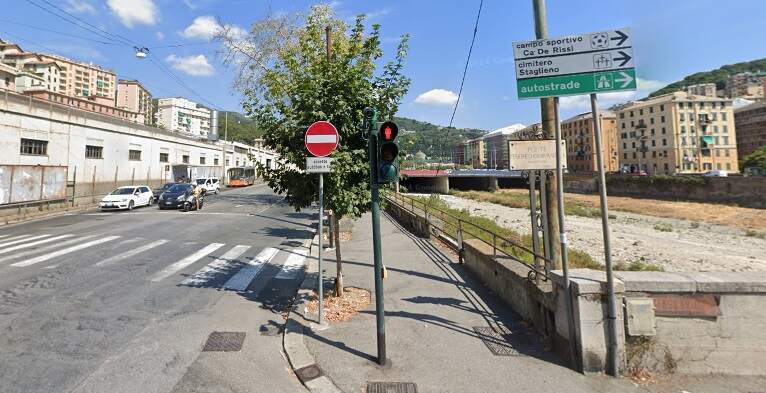
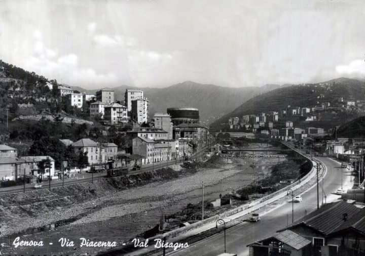
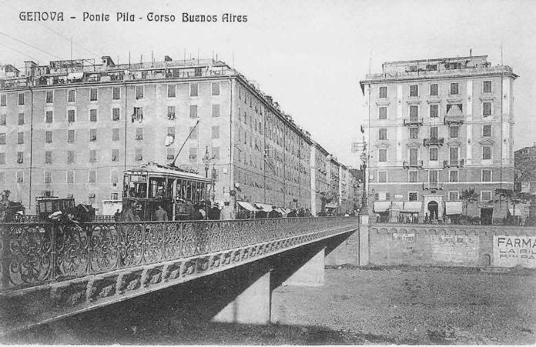
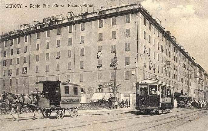
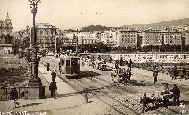
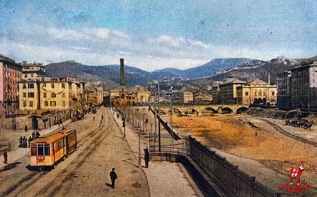
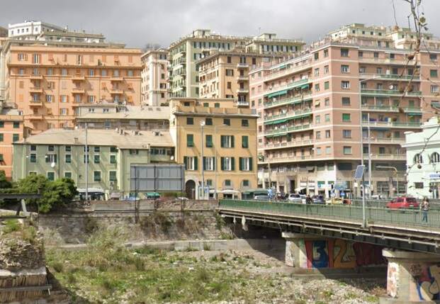
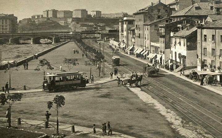
Trams following the route North alongside the River Bisagno started and ended their journeys at Piazza Raffeale de Ferrari and travelled along Via XX Settembre and Via Luigi Cadorna to the location of Ponte Pila. What was once a bridge over the Bisagno River is now part of the culverted length of the river.

Ponte Pila bridging the River Bisagno, © Public Domain. [45]
Looking East across Ponte Pila, © Public Domain. [42]
Looking West across what was Ponte Pila, from Corso Buenos Aires towards Via Luigi Cadorna. [Google Streetview, August 2024]
Looking East from the location of Ponte Pila along Corso Buenos Aires which was the route followed by all tram services to the East of the River Bisagno. [Google Streetview, August 2024]
Looking North in the 21st century from the location of Ponte Pila. [Google Streetview, August 2024]

In the 21st century, the road North from this location is Viale Emanuele Filiberto Duca d’ Aosta (SS1). Facing North from Ponte Pila the large Piazza Giuseppe Verdi was to the left of the road. This remains as a large garden area. Further ahead on the left is Brignole Railway Station.

Ponte Pila looking Northwest. Via Luigi Cadorna is ahead across the bridge on the left. Via Canevari runs North on the far side of the river, between the river and the public gardens which can be seen in front of the large building on the right half of the image, © Public Domain. [46]
Looking North up Via Canevari with the River Bisagno on the right. This image was shared on the Foto Genova Antica Facebook Group by Asinus Natator on 7th February 2022, (c) Public Domain. [47]

The next two images are difficult to location on the modern landscape as so much has change in the are around the River Bisagno. Most probably the building shown are on the line of the dual carriageway which sits over the culverted river.

Via Canevari in the 1920s. The prominent buildings behind the tram appear in the image above, © Public Domain. [54]
Via Canevari runs North and Via  Giovanni Tommaso Invrea runs East across the River Bisagno in the 1930s, © Public Domain. [49]
A view from the North of construction work on the underpass which takes Via Canevari under the railway tracks at Brignole Railway Station in 1940, © Public Domain. [53]
The same underpass seen from the North in the 21st century, now with the Metro Station above the road. [Google Streetview, June 2022]
The junction of Via Canevari and Corso Monte Grappa to the North of the Brignole Railway Station, © Public Domain. [52]
A similar 21st century view. [Google Streetview, March 2023]
Looking downstream on the River Bisagno with Via Canevari in the centre of the picture. The Bakery is behind the camera. The main tramway route to Stagieno leaves the image bottom-right. The tramline crossing the river on Ponte Castelfidardo is not shown on the tram map of the network in 1901 above. [57]

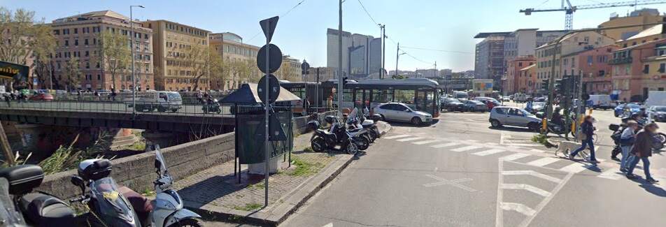
The junction shown in the image above appears left as a satellite image [Google Maps, December 2024] and below as a Streetview image [Google Streetview, April 2023]

Via Canevari in the 1920s, © Collezione Vito Elio Petrucci, Public Domain. [51]
A similar 21st century view. [Google Streetview, August 2024]
This is the municipal bakery in 1921. e year 1921. Via Canevari runs North to the left of the bakery. The building is now a Police Stationand Via Moresco. . Now is the Local Police station.
The smoking chimney is the one of the Genoa Electric Offices (OEG), which produced electricity for the city of Genoa and its trams. It used coal as fuel. The image was included in the Municipal bulletin in 1921, (c) Public Domain. [55]
The old bakery is, in the 21st century, a police station. [Google Streetview, August 2024]
The large electricity generation station for the tramway network sat alongside Via Canevari, between Via Canevari and the river. [48]
This extract from Google’s satellite imagery shows Via Canevari running one street back from the waterfront. The blue line highlights the tramway route to Staglieno. The bakery building (now a police station) is bottom-left. The electricity buildings stretch diagonally Northeast across the image from the bakery. [Google Maps, December 2024]
Further North and looking North on Via Canevari, (c) Public Domain. [56]
A similar 21st century view. [Google Streetview, August 2024]

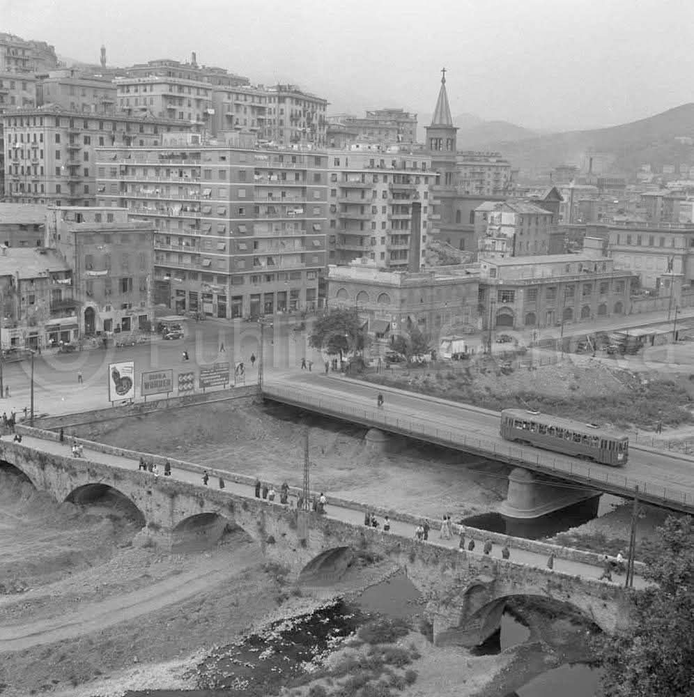
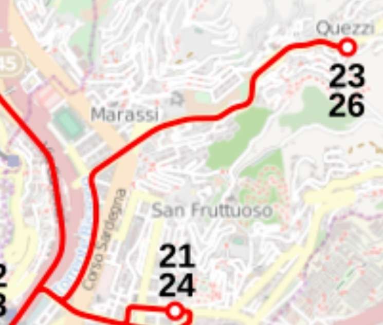
The satellite image shows the remaining length of the route (in blue) as far as Staglieno where it joins the route from Via Lombardo Montaldo (in red). Two views typical of this length in the 21st century are shown below.

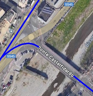
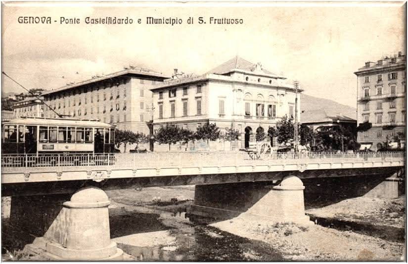
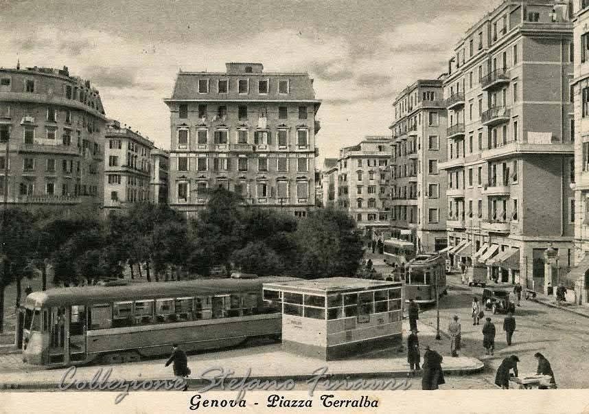
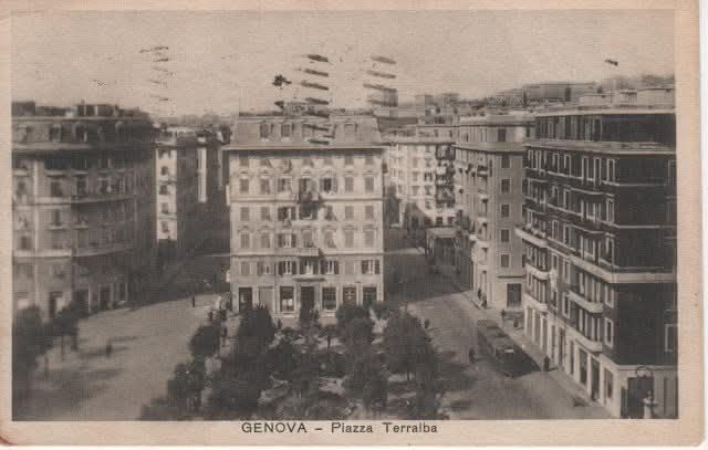
Ponte Castelfidardo to Piazza Terralba

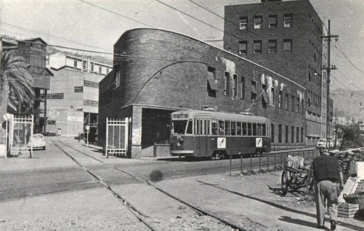
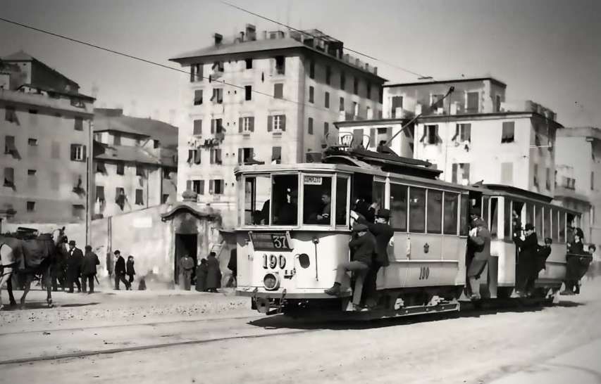
We saw a picture of a tram on Ponte Castelfidardo above, on a section of tramway not recorded on the map of pre-1902 tramways of Genova, but Line No. 37 is recorded as running to the area of San Fruttuosa which is the area to the East of the River Bisagno through which this tram ran so was inaugurated between the turn of the century and the start of WW1. We will also see further below that a municipally owned line crossed the bridge and ran out to Quezzi. This line was also put in service before WW1.

This North-facing view of 1910 shows a tram on Ponte Castelfidardo with substantial municipal buildings on the East bank of the River Bisagno behind, © Public Domain. [62]
A later view of Ponte Castelfidardo seen from the Southeast, © Public Domain. [63]

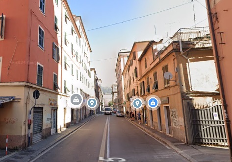
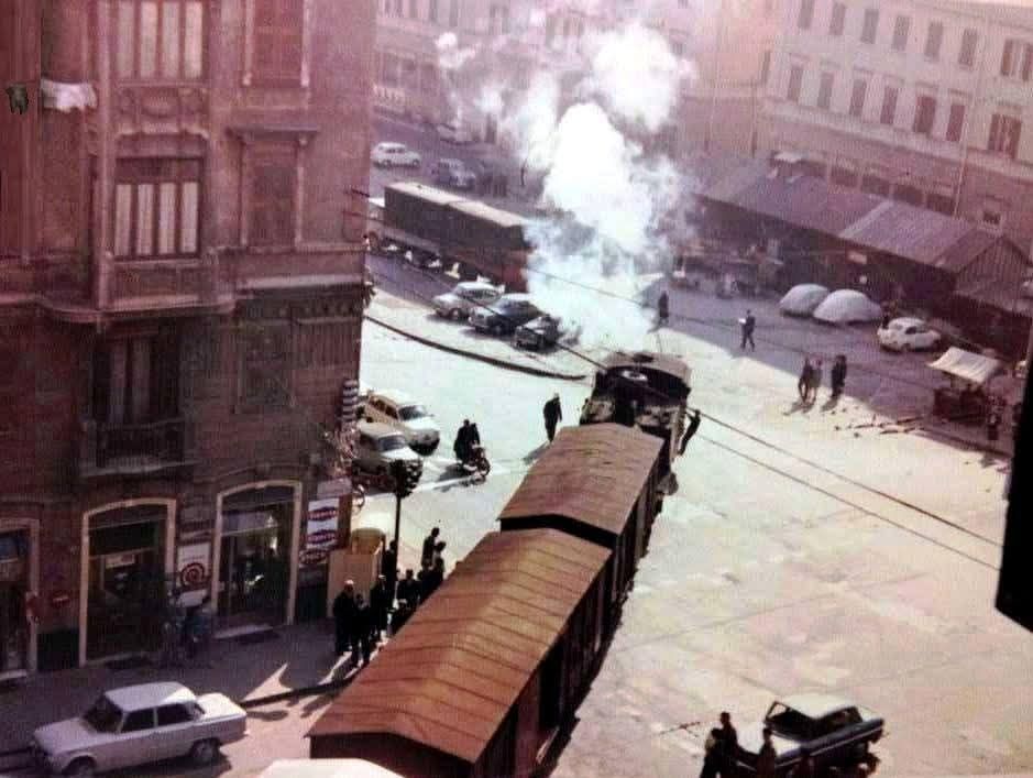
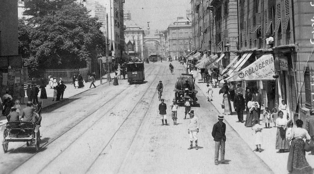
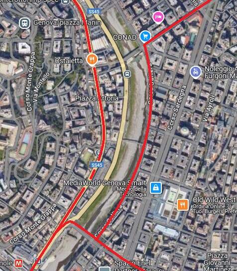
To the East of Ponte Castelfidardo trams entered Piazza Manzoni.. Piazza Manzoni led East into Piazza Giusti. The industrial railway from Terralba to Gavette crossed Piazza Giusti. Information about that line can be found here. [64] The photograph below shows a train of covered wagons, probably from the fruit and vegetable market on Corso Sardegna, heading into the goods yard at Terralba. In the picture is the tramway crossing the line of the railway.

A train of covered wagons, probably from the fruit and vegetable market on Corso Sardegna, heads into the goods yard at Terralba. In the picture is a tramway crossing the line of the railway. By the time of this photo, the tramway appears disused as cars are parked across it. [65]

The route of this line beyond Piazza Giusti which circulated through Piazza Terralba. This is an extract from the 1956 tram map provided by Italian Wkipedia, © Arbalete and authorised for reuse under a Creative Commons Licence (CC BY-SA 2.0). [19]

The route can easily be made out on the modern satellite imagery from Google Maps. [Google Maps, December 2024]
An early 20th century photograph (facing East) of Via Paolo Giacometti.. The building in the distance was removed when the road was extended, © Public Domain. [66]
Via Paolo Giacometti facing East in the 21st century. The buildings at the far end of the street face out onto Piazza Giovanni Martinez. [Google Streetview, August 2024]
An early photograph of Piazza Martinez with railway sidings in place, © Public Domain. [79]
Piazza Martinez seen from the Southeast. Rail tracks can still be seen crossing the piazza on the diagonal from the bottom-left of this image, remnants of the standard-gauge sidings in the image above. © Public Domain. [67]
A similar view in the 21st century. [Google Streetview, August 2024]
By 1937, the year of this photograph, the tram tracks had been removed from Piazza Giovanni Martinez. This view looks South towards the FS standard-gauge railway lines. Trams running out from the city centre passed across the far side o, © Public Domain. [68]
Looking West across Piazza Terralba in 1940, © Public Domain. [78]
Piazza Terralba, © Public Domain. [80]

Lines East of the River Bisagno – Corso Buenos Aires

Corso Buenos Aires looking West, © Public Domain. [59]
Corso Buenos Aires looking West. [Google Streetview, August 2024]
Looking East along Corso Buenos Aires, © Public Domain. [61]
Corso Buenos Aires looking East. [Google Streetview, August 2024]
The view from Corso Buenos Aires into Piazza Thommaseo in 1922, © Public Domain. [58]
A similar view from Corso Buenos Aires into Piazza Thommaseo in the 21st century. [Google Streetview, August 2024]
This photograph shows how the city of Genoa went about regrading streets to meet their aspirations as a modern, cosmopolitan city. This is Corso Buenos Aires in 1896. It was being lowered to connect it with the road axis that ran through to Via XX Settembre. As a result, the basements became shops and the shops above apartments. On the right you can still see a door, now located on the first floor. Also of interest is the use of steam power and rails to remove excavated m© Public Domain. [60]
An early view West from Piazza Thommaseo along Corso Buenos Aires, © Public Domain. [69]
A view West across Piazza Thommaseo towards Corso Buenos Aires. [Google Streetview, August 2024]

Corso Buenos Aires to Foce and beyond

Partway along Corso Buenos Aires a branch tramway ran South down Corso Torino. This was pre-1902 Line No. 38.

The line South to Foce along Corso Torino, which terminated in Piazza del Popolo. This extract comes for the pre-1902 plan of the tramways of Genova provided by Italian Wikipedia. It does no shows developments which occurred after 1902 and before WW1, © Arbalete and authorised for reuse under a Creative Commons Licence (CC BY-SA 2.0). [19]

Facing North on Corso Torino, two trams pass, © Public Domain. [71]
Looking North on Corso Torino in the 21st century. [Google Streetview, August 2024]
It seems as though this photo was taken after 1923 when the national government enforced driving on the right. A tram heading South on Corso Torino close to the route terminus  which involved a loop in streets close to Piazza del Popolo (now Via Antonio Cecchi), which also host a local market, which was off to the right of the photograph, © Public Domain. [70]
A very similar view looking North on Corso Torino in the 21st century. [Google Streetview, August 2024]
Piazza del Popolo hosted a local market and was the effective terminus of the tram line to Foce. The red line marks the tram route which looped round the streets on the South side of the piazza. This is an extract from the Baedeker map of 1927, © Public Domain. [72]

Piazza del Popolo seen from the Southeast. [73]
Via Antonio Cecchi (previously Piazza del Popolo) in the 21st century. [Google Streetview, March 2023]

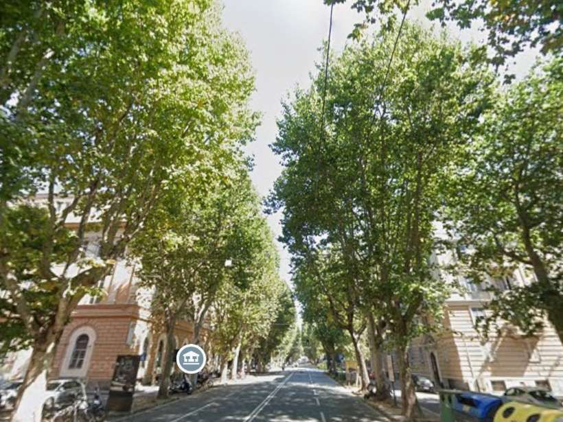
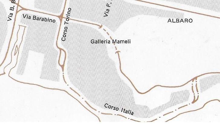
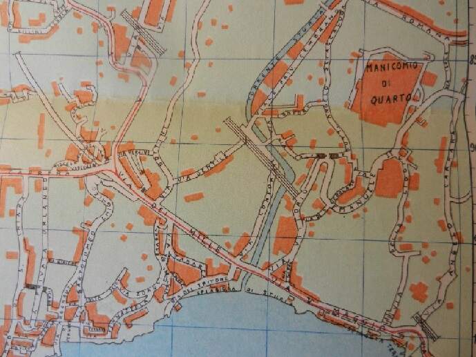
After 1901 and before WW1 a significant extension was made to the route to Foce which took trams South of Piazza del Popolo to the coast and along Corso Italia. That line is illustrated (dotted) on the map extract from the Markilnfan.com Forum below.

This map extract comes form a slightly larger one on the Marklin.com Forum. That new line connected in the East with a later line which ran along Via Barabino and through Galleria Marneli. Phots of the construction work on Corso Italia show it being built immediately after WW1, so it is not strictly relevant to the period we are looking at. [111]

Piazza Thommaseo to Nervi

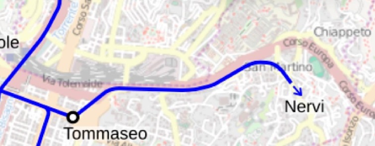
There were two possible routes to Nervi. That shown blue on the image below was one of these.

The line to Nervi frpm Piazza Thommaseo, © Arbalete and authorised for reuse under a Creative Commons Licence (CC BY-SA 2.0). [19]

A second route can be seen on the map of tramlines in 1956 below. It is not clear when the alternative route began offering a service. We will look at this route later when we have followed the more northerly route as far as Piazza Sturla.

A later tramway map showing more of the route to Nervi. Note that on this later map an alternative route to that via San Martino marked as the terminus of Line 50 in 1956, was the route of Lines 51,52,53 in 1956, The two routes met at Piazza Sturla which is marked as the terminus of Lines 42 and 45 in 1956, © Arbalete and authorised for reuse under a Creative Commons Licence (CC BY-SA 2.0). [19]

The more northerly route left Piazza Thommaseo along Via Montevideo.

Looking Northeast across Piazza Thommaseo and along Via Montevideo in the 1920s, © Public Domain.  [74]
A similar view in the 21st century. [Google Streetview, August 2023]
At the Northeast end of Via Montevideo (off to the left of the picture), this mid-20th century view looks East on Via Tolemaide, © Public Domain. [75]
A similar view in the 21st century. [Google Streetview, August 2024]
Looking West along Corso Giulio Cesare (now Via Aldo Gastaldi) early in the 20th century, © Public Domain. [76]
Again looking West along Corso Giulio Cesare (now Via Aldo Gastaldi) in the mid-20th century, © Public Domain. [77]
Via Aldo Gastaldi (SS1) is highlighted in yellow on this satellite image. Trams left Via Aldo Gastaldi at the left of this image, travelling along Via San Marino which can be seen on the South side of the SS1. At the bottom-right of this image the road carrying the tramway becomes Via Sturla. [Google Maps, December 2024]
Looking East along what is now Via Aldo Gastaldi. Via San Martino bears off to the right. An earlier picture at this location can be seen below, © Public Domain. [94]
The tram in this East facing image from 1929 is travelling on Via San Martino. Construction work on the SS1 is underway. That road will open in 1933. Via Aldo Gastaldi was first known as Via Nuova San Martino, then as Corso Giulio Cesare and, after WW2, it was named after the partisan Aldo Gastald, © Public Domain. [82]
Looking East at the same location in the 21st century. On the left is the SS1 . Via San Martino runs up the centre of this image. [Google Streetview, August 2024]
Looking West along Via San Marino, © Public Domain. [95]
The samw vie, looking West, as in the monochrome image above, in the 21st century. [Google Streetview, August 2024]
The tram route along Via Sturla (c) unknown but most probably Public Domain. This image was shared on the Foto Genova Antic Facebook Group by Luciano Lully Lulli on 31st March 2020. [92]
Via Sturla, San Martino, (c) Public Domain. [93]
Via Sturla, San Martino, 1956. This image was shared on the C’era Una Volta Genova Facebook Group by Maurizio Maggiali on 22nd November 2020. It it taken at the same location as the monochrome imgae immediately above. [81]
The same location in the 21st century. [Google Streetview, August 2024]
Via Sturla winds its way Southeast through th Genoa’s suburbs. [Google Maps, December 2024]
Much closer to the coast now trams leave Via Sturla to run along Via Dei Mille. [Google Maps, December 2024]
In this photo, the line from San Martino is close to Piazza Sturla where it merged
with the shorter variant coming from Via Albaro (see below). The tram is heading for Quarto, Priaruggia, Quinto and Nervi. The image is later than 1915 as the new Sturla railway station is present, (c) Public Doamin. [102]
A similar location looking North on Via Sturla in the 21st century. [Google Streetview, August 2024]
This extract from a map of the East of Genova copnurbation shows the length of the tramway running along Via Sturla, Via dei Mille and Via V. Maggio, (c) unknown but most probably Public Domain. This image was shared on the Fotto Genova Antic Facebook Group by Luciano Lully Lulli on 2nd May 2023. [18]
Piazza Sturla with Via dei Mille running away from the camera. Vis Sturla enters the image on the left, (c) Public Domain. [96]
Via Sturla looking Northwest from adjacent to Via dei Mille, (c) Public Domain. [97]
Lookin Northwest, Piazza Sturla in the 21st century. [Google Streetview, August 2024]

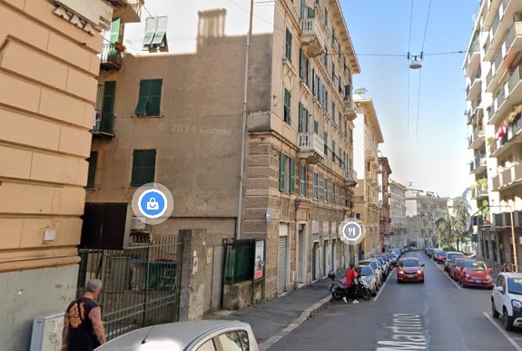
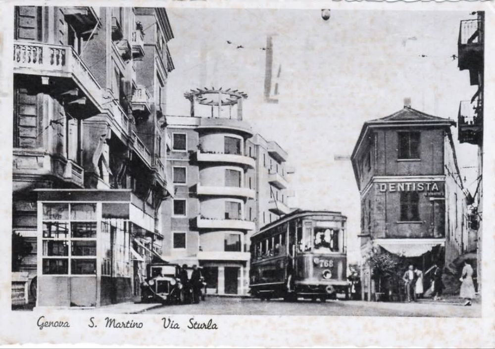
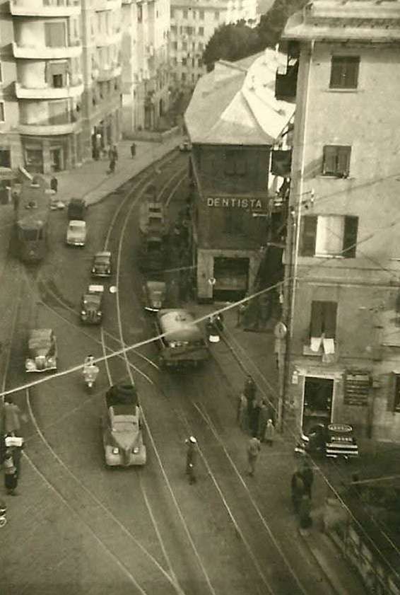
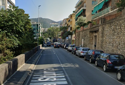
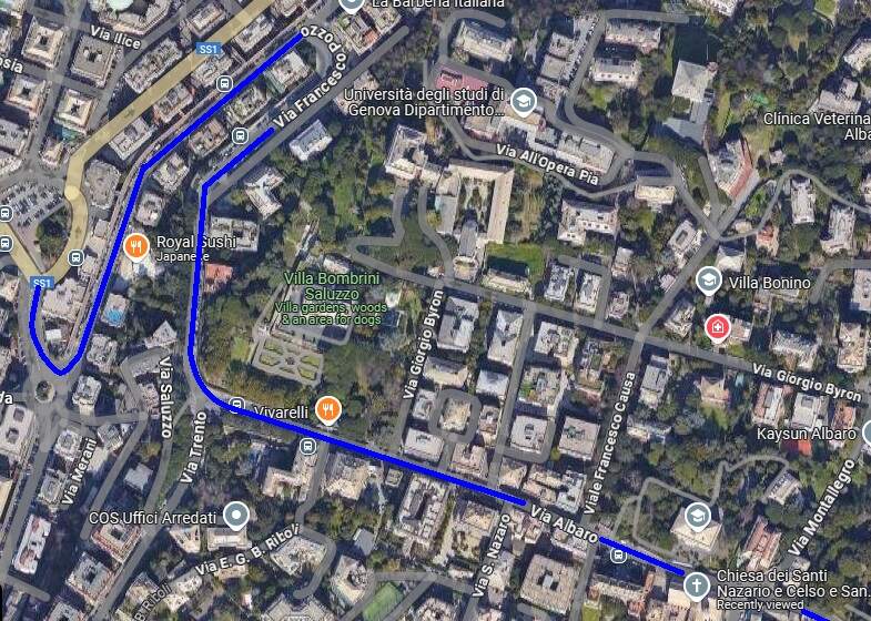
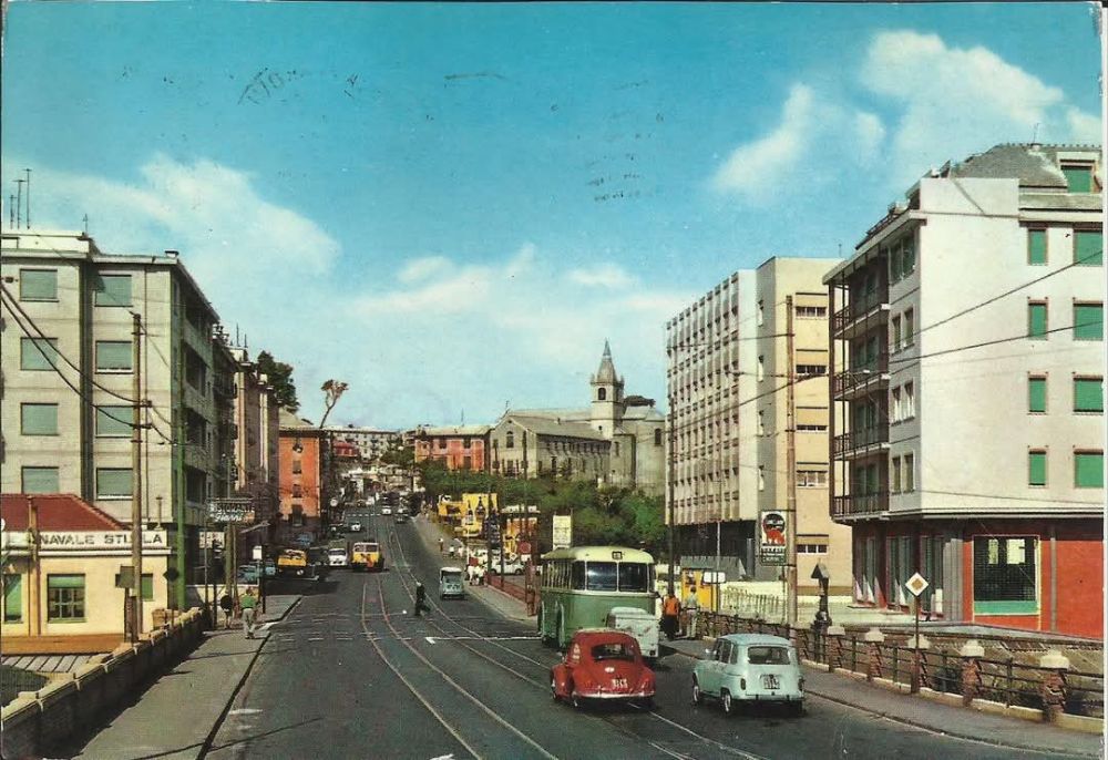
Before heading on towards Nervi along Via dei Mille we need to look back at the alternative route to Piazza Sturla. Trams using this route left Piazza Thommaseo. It is not entirely clear when trams began serving this route. An early, probably pre-WW1 image, shows a tram on Via Albaro near the church of San Francesco.

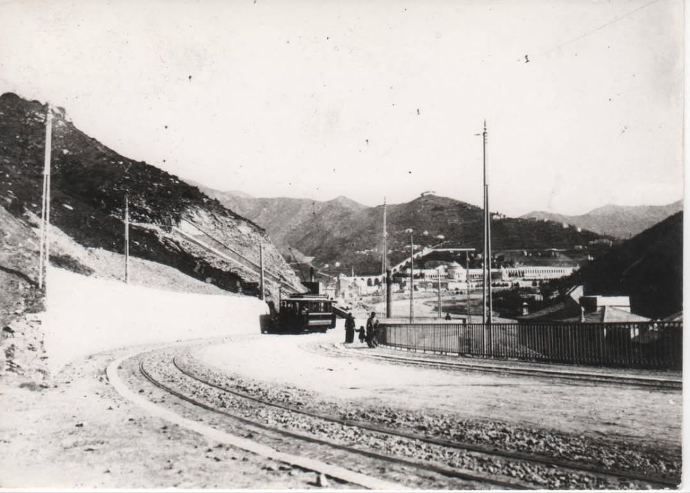
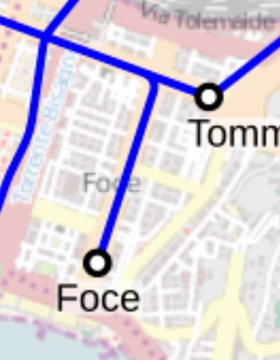
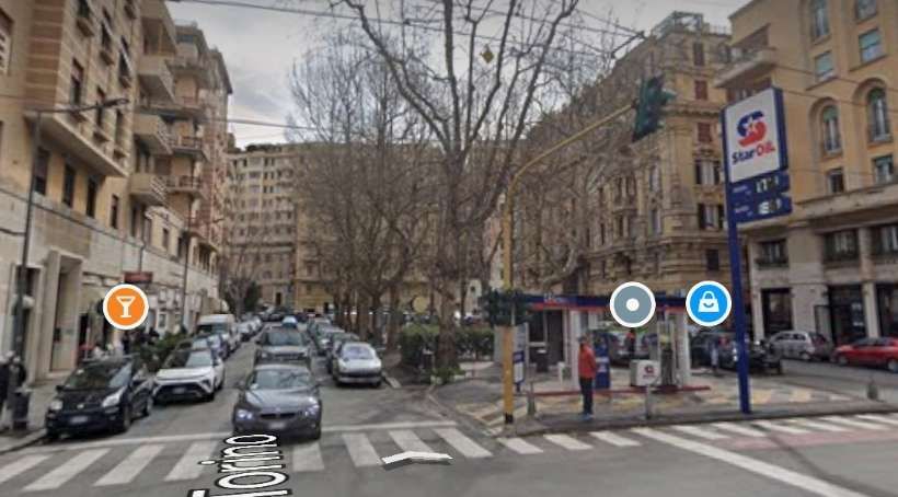
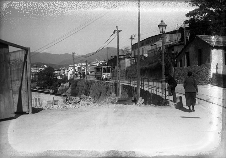
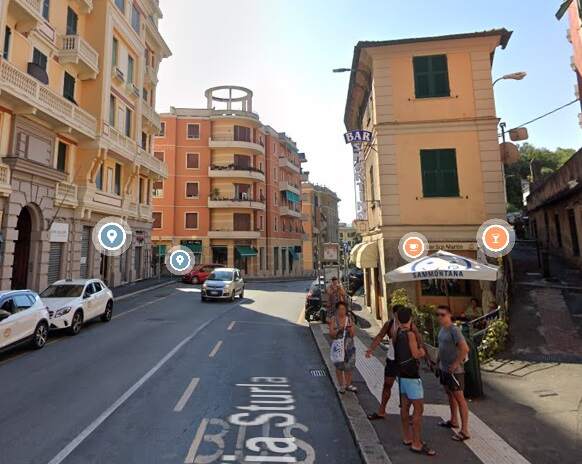
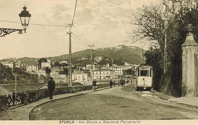
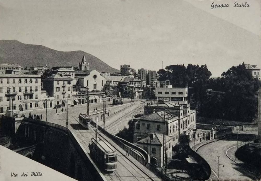
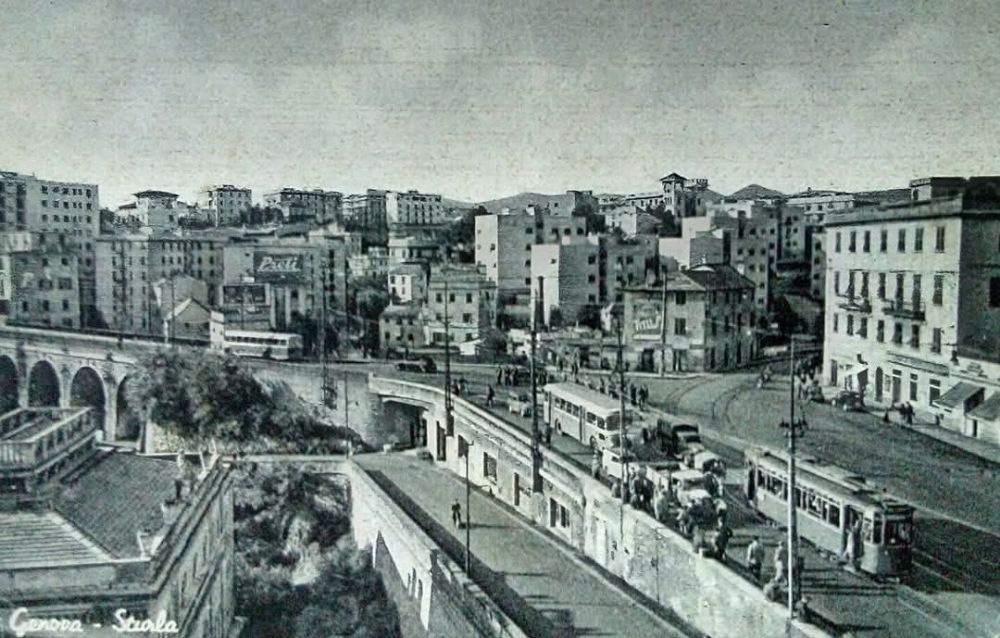
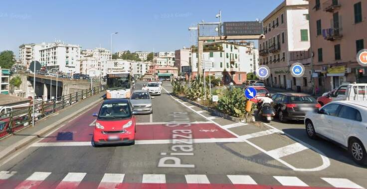
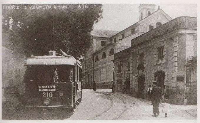
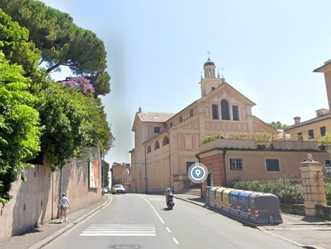
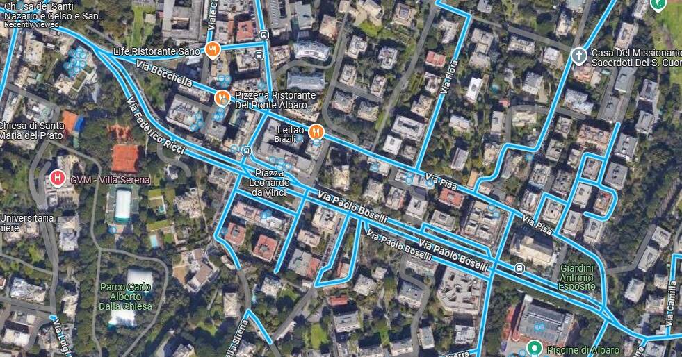
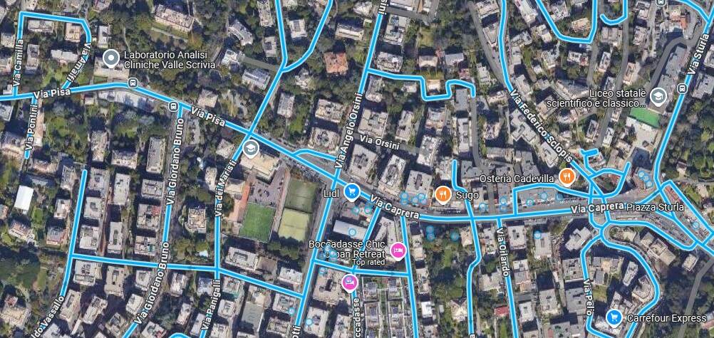
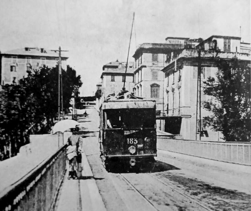
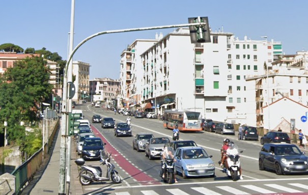
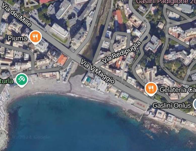
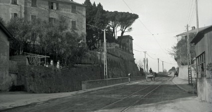
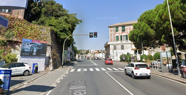
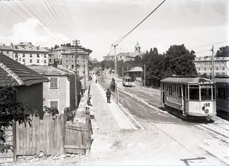
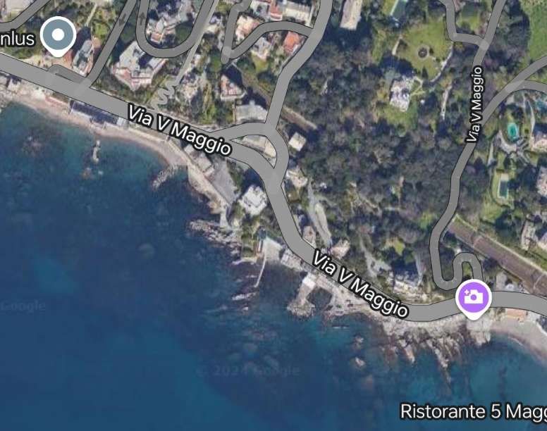
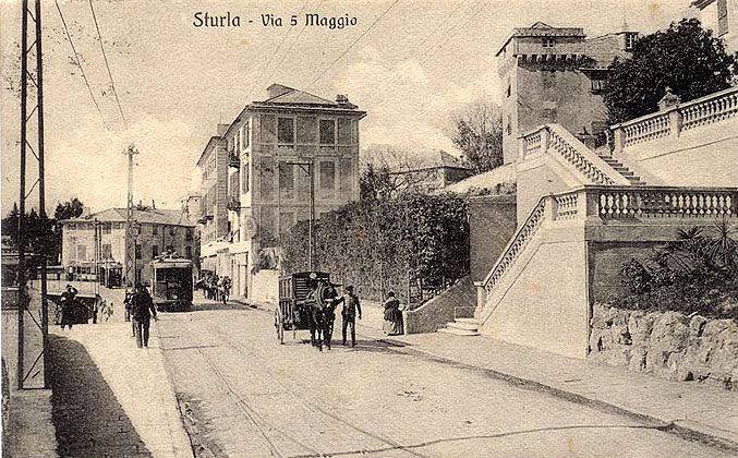
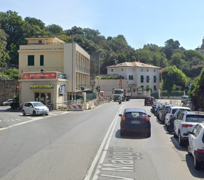
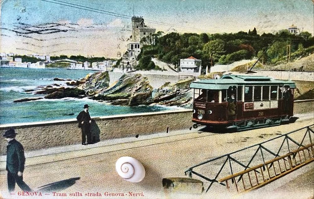
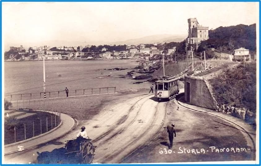
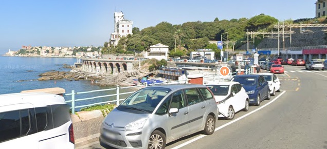
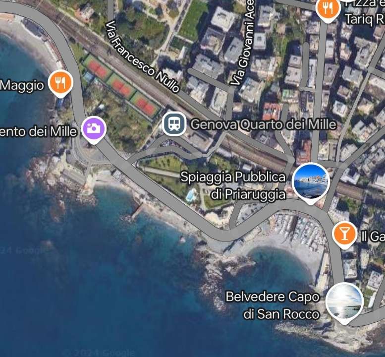
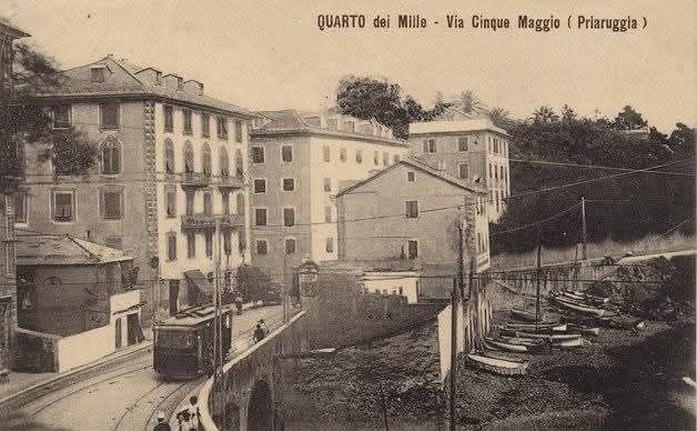
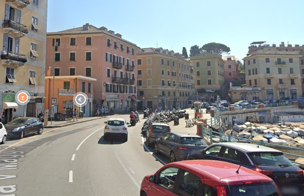
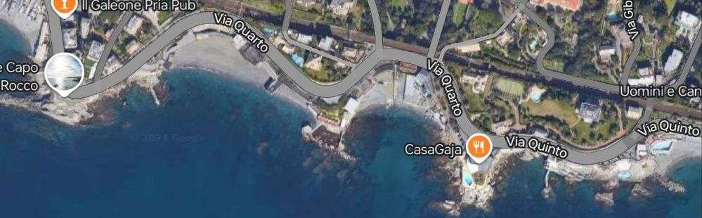
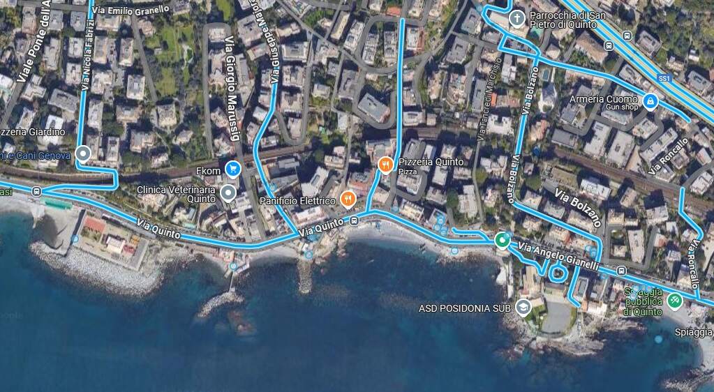
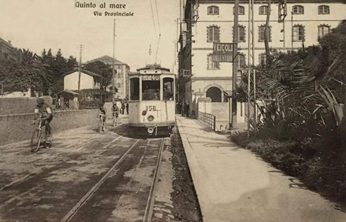
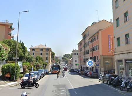
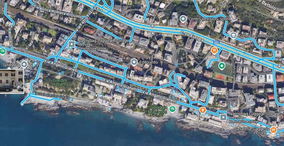
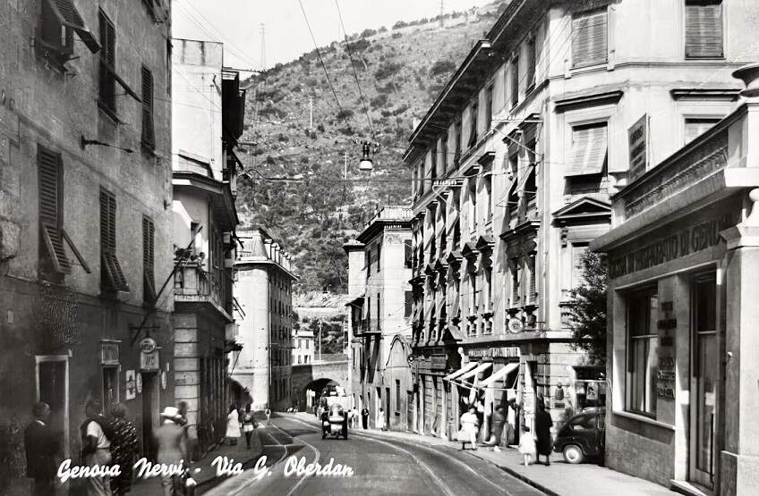
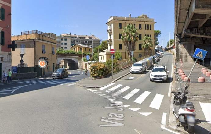
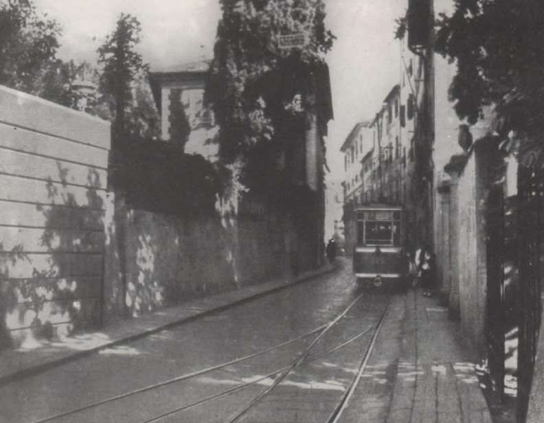
This satellite image shows Piazza Thommaseo on the left. The blue line shows the tram route as far as the Church of San Francesco. The image below shows a tram using the route between Genova (Genoa) and Nervi. [Google Maps, December 2024]
A tram heading for Nervi is travelling along Via Albaro close to the church of San Francesco, (c) Public Domain. [85]
The same location in the 21st century, also looking East. [Google Streetview, August 2024]
Trams continued Southeast along Via Frederico Ricci and Via Paolo Boselli. [Google Maps, December 2024]
Continuing, East-southeast trams ran along Via Pisa and Via Caprera to Piazza Sturla. [Google Maps, December 2024]
Before the first world war, a tram heads for the city centre along Via Caprera over the old viaduct, (c) Public Domain. [84]
The same view towards the city centre in the 21st century. [Google Streetview, August 2024]

Two different routes to the West of Piazza Sturla have been covered. We now go on from Piazza Sturla to Nervi, setting off along Via dei Mille.

Via dei Mille becomes Via V. Maggio. [Google Maps, December 2024]
A view West on Via dei Mille towards Piazza Sturla, (c) Public Domain. [91]
The same view in the 21st century. [Google Streetview, August 2024]
Looking Northwest from Via V. Maggio along Via dei Mille, (c) Public Domain. [98]
A more modern postcard image looking Northwest from Via V. Maggio along Via dei Mille, (c) Unknown. This image was shared by Diego Ardenghi on the Foto Genova Antica Facebook Group on 20th January 2024. [99]
Via V. Maggio wanders along beside the Mediterranean. [Google Maps, December 2024]
Looking East on Via V. Maggio, (c) Public Domain. [90]
A similar location looking East on Via V. Maggio in the 21st century. [Google Streetview, August 2024]
Via V. Maggio looking West, (c) Public Domain. [100]
Via V. Maggio looking West, (c) Public Domain. [101]
A similar location on Via V. Maggio to the two monochrome images above. [Google Streetview, August 2024]
Via V. Maggio continues East along the coast. [Google Maps, December 2024]
Quarto dei Mille looking East from Via V. Maggio to Via Quarto, (c) Public Domain. [50]
The same location in the 21st century. Via V. Maggio is about to lead into Via Quarto
Via V. Maggio gives way to Via Quarto and then Via Quinto as trams run East. [Google Maps, December 2024]
Via Qunito gives way to Via Angelo Gianelli. [Google Maps, December 2024]
Via Proveinciale, Quinto, (now Via Angelo Gianelli, (c) Public Domain. [105]
The same location, looking East on Via Angelo Gianelli in the 21st century. [Google Streetview, August 2024]
Trams ran along Via Angelo Gianelli across the full width of this satellite image. [Google Maps, December 2024]
The final length of the tramway took it along Via Guglielmo Oberdan to Piazza Antonio Pittaluga (once Piazza Virrorio Emanuele). [Google Maps, December 2024]
Tram tracks on Via Guglielmo Oberdan in the 1950s, (c) Public Domain. With the SSi running through this part of Nervi, it is very difficult to find this location on Google Streetview. The arch bridge in the distance should be a helpful indicator but, as you will see below, the built environment is very different. I have also found it impossible to match the arch bridge and the steep hill side visible in this photograph. [86]
Possibly the same arch bridge as on that image above. If so, the immediate built environment has changed dramatically. [Google Streetview, August 2024]
Looking West on Via Guglielmo Oberdan, (c) Public Domain. [107]
The same location, looking West on Via Guglielmo Oberdan in the 21st century. [Google Streetview, June 2021]
Trams in Nervi – those on the left are heading towards the camera on Via Guglielmo Oberdan. The tram seen side-on is just turning out of Viale Goffredo Franchini after running round the loop from the terminus, © Public Domain. [83]
Looking West along Via Guglielmo Oberdan from the same location in the 21st century. [Google Streetview, June 2021]
The terminus loop to allow trams to be turned. This replaced a simple terminus in Piazza Vittorio Emanuele (now Piazza Antonio Pittaluga). [Google Maps, December 2024]

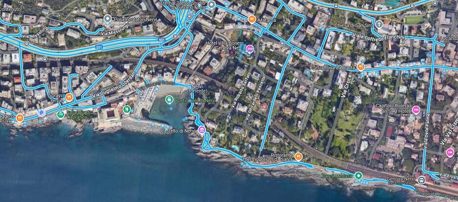
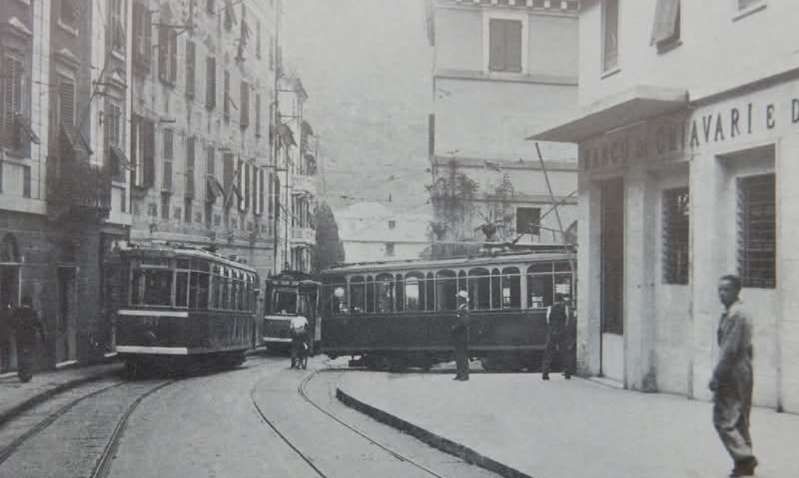
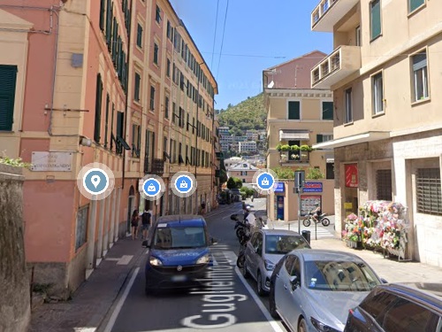
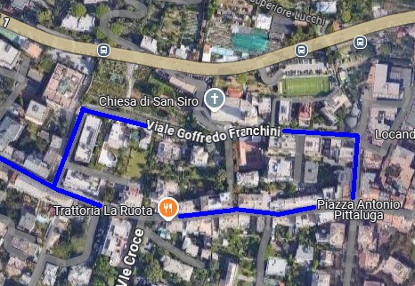
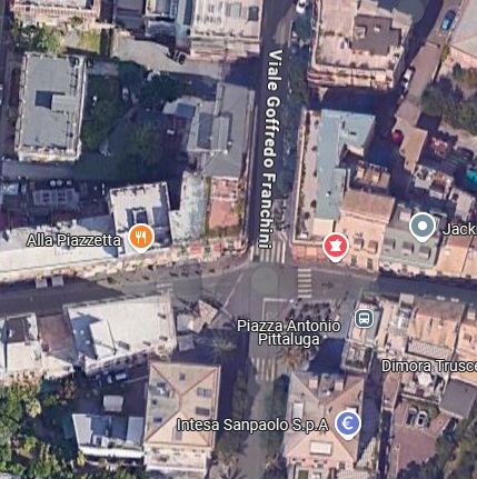
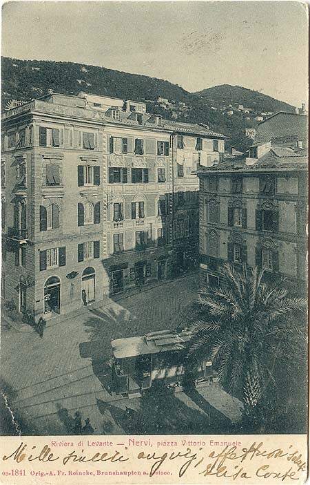
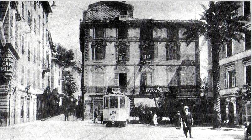
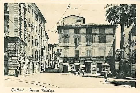
The tram terminus in Nervi was in Piazza Antonio Pittaluga (once Piazza Vittorio Emanuele) Early in the life of the network the terminus was in the piazza, later it was in Viale Goffredo Franchini on the North side of the piazza.

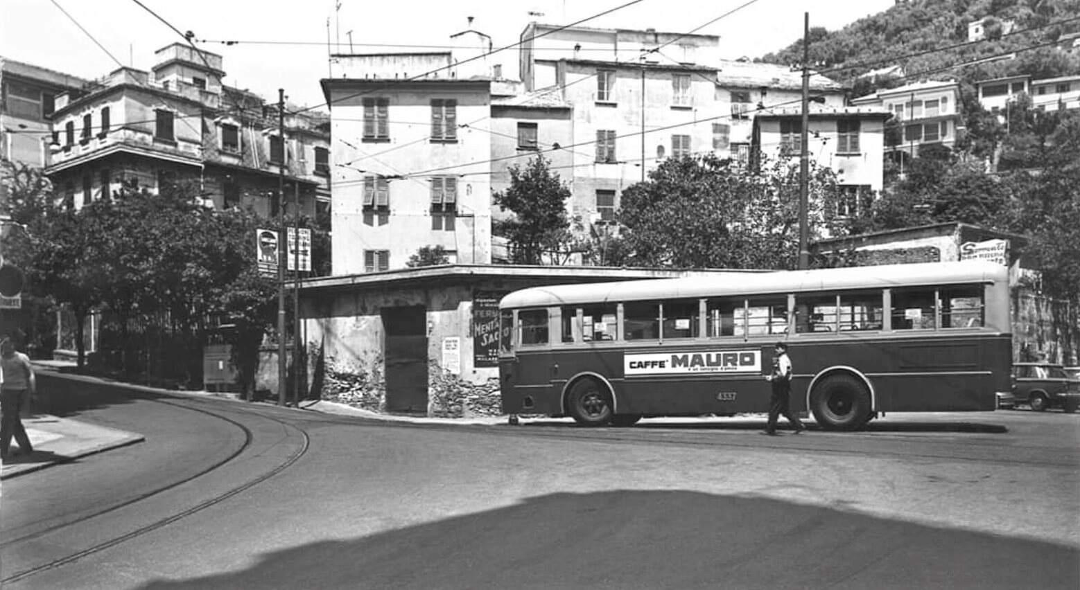
Piazza Vittorio Emanuele (later Piazza Antonio Pitta luga), Nervi, (c) Public Domain. [104]
The tram terminus in what is now Piazza Antonio Pittaluga, Nervi, (c) Public Domain. [106]
Piazza Antonio Pittaluga, Nervi, The terminus has, by the time of this photograph, been moved into Viale Goffredo Franchini on the North side of the piazza. (c) Public Domain. [88]
Piazza Antonio Pittaluga, Nerve. Although busses have replaced trams by the time of this 1960s photograph, the tram tracks remain in place. This image was shared on the Foto Genova Antica Facebook Group by Gianfranco Dell’Oro Bussetti on 14th November 2019, (c) Unknown Photographer. [103]
The tram terminus at Nervi in the mid-20th century. This image was shared on the Foto Genova Antica Facebook Group by Giovanna Levaggi on 13th May 2022, (c) Unknown Photographer. [87]
The same location in the 21st century. [Google Streetview, May 2022]
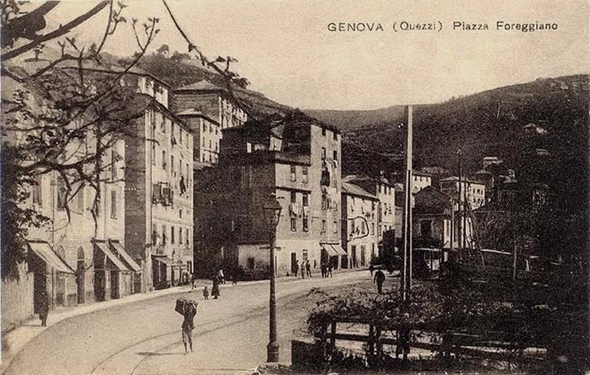
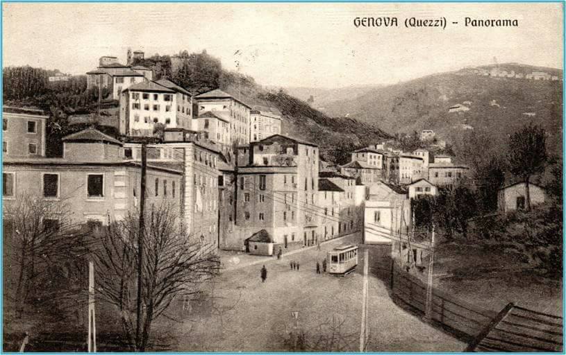
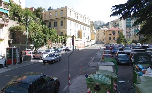
The Line to Quezzi

Partially in anticipation of taking control of the whole tram network before WW1, the municipality constructed its own line to Quezzi which used existing tram tracks as far as Ponte Castelfidardo. The transfer of the network to the municipality did not happen and this line, while remaining in the ownership of the city authorities was operated on their behalf by the tram company.

The municipally owned route to Quezzi – Ponte Castelfidardo is in the bottom left of this extract from the network map of 1956, © Arbalete and authorised for reuse under a Creative Commons Licence (CC BY-SA 2.0). [19]
The line to Quezzi followed the left (East) bank of the River Bisagno North from Ponte Castelfidardo along Corso Galliera before heading Northeast along Via Monticelli. [Google Maps, December 2024]
Via Monticelli facing Southwest, (c) Public Domain. [89]
The same location on Via Monticelli in the 21st century. [Google Streetview, August 2024]
The route continued to the Northeast along Via Ferreggiano. [Google Maps, December 2024]
The remaining length of the tramway. [Google Maps, December 2024]
A panorama of Quezzi in circa. 1935, with a tram close to the end of the line, (c) Public Domain. [108]
Piazza Foreggiano, Quezzi – the end of the line, (c) Public Domain. [109]
Another postcard view of Piazza Foreggiano. [110]
Quezzi – the end of the line as seen in the 21st century. [Google Streetview, September 2008]

Summary

The first three articles about the trams of Genoa cover the network up until the First World War. Future articles will go on to look at the later history of the network and the rolling stock used.

References

  1. https://rogerfarnworth.com/2024/12/03/genoas-early-tram-network-part-1-general-introduction-tunnels-the-years-before-world-war-one-and-the-early-western-network.
  2. https://rogerfarnworth.com/2024/12/08/genoas-early-tram-network-part-2-the-western-half-of-the-eastern-network/
  3. https://www.facebook.com/photo/?fbid=2545146392420285&set=gm.2936759829701615, accessed on 9th December 2024.
  4. https://www.facebook.com/photo/?fbid=10217441139974434&set=gm.2542054162505519, accessed on 9th December 2024.
  5. https://www.facebook.com/photo/?fbid=573155813058901&set=gm.1864386280272314, accessed on 9th December 2024.
  6. https://www.facebook.com/photo/?fbid=965102997232334&set=gm.3437059006393238, accessed on 9th December 2024.
  7. https://commons.wikimedia.org/wiki/File:Genova,_piazza_De_Ferrari_with_tram.jpg, accessed on 3rd December 2024.
  8. https://www.facebook.com/photo/?fbid=7096985957051867&set=gm.7429651220412431&idorvanity=903038299740455, accessed on 9th December 2024.
  9. https://www.genovacollezioni.it/Default.aspx?q=CARTOLINE%20PAESAGGISTICHE&t=VIA%20MONTALDO, accessed on 9th December 2024.
  10. https://www.facebook.com/photo/?fbid=10207100780029842&set=gm.1069967196380897, accessed on 9th December 2024.
  11. https://www.facebook.com/photo/?fbid=3855888057759977&set=gm.3510466582330934, accessed on 9th December 2024.
  12. https://www.facebook.com/photo/?fbid=2653365294930575&set=gm.3430201183690808, accessed on 9th December 2024.
  13. https://www.ebay.co.uk/itm/202978505253?mkrid=710-53481-19255-0&siteid=3&mkcid=1&campid=5337134778&toolid=11800&mkevt=1&customid=211123355, accessed on 9th December 2024.
  14. https://www.tuttocitta.it/mappa-search/Genova%20(GE)%20Via%20Leonardo%20Montaldo, accessed on 9th December 2024.
  15. https://www.ebay.co.uk/itm/152214705370?mkcid=16&mkevt=1&mkrid=711-127632-2357-0&ssspo=JNiy4OlNSAG&sssrc=4429486&ssuid=afQhrar7TGK&var=&widget_ver=artemis&media=COPY, accessed on 15th November 2024.
  16. https://en.m.wikipedia.org/wiki/AMT_Genova, accessed on 15th November 2024.
  17. Storia [History] (in Italian). AMT Genova; https://www.amt.genova.it/amt/amt-istituzionale/storia, accessed on 15th November 2024.
  18. https://www.facebook.com/photo/?fbid=10229785112963156&set=gm.5994591733973273&idorvanity=574539035978597, accessed on 14th December 2024.
  19. Rete tranviaria di Genova; https://it.wikipedia.org/wiki/Rete_tranviaria_di_Genova, accessed on 26th November 2024.
  20. AMT (ed.); History of public transport in Genoa; Genoa, SAGEP Editrice, 1980.
  21. Paolo Gassani; Photo history of the tramway in Genoa , Genoa, Nuova Editrice Genovese, 1982.
  22. https://www.facebook.com/photo/?fbid=755352478566422&set=gm.3020646531367823, accessed on 9th December 2024.
  23. https://www.facebook.com/share/p/HJc9iVmefjPnhGpJ, accessed on 9th December 2024.
  24. https://www.facebook.com/share/p/MpWZL2Xgd8rPHG2G, accessed on 9th December 2024.
  25. https://www.facebook.com/share/p/LY3C1m1gfTmGifja, accessed on 9th December 2024.
  26. https://www.facebook.com/share/p/uTT5SvihLiTAtJwV, accessed on 9th December 2024.
  27. https://www.facebook.com/photo/?fbid=10233032974313593&set=gm.7302826293149804&idorvanity=574539035978597, accessed on 10th December 2024.
  28. https://www.facebook.com/share/p/2vypu5hHje72PaXU, accessed on 9th December 2024.
  29. I have lost the link to this photograph. It is likely to be in the public domain. Please let me know if this is not the case.
  30. https://www.facebook.com/share/p/NSjuD7jr1jRvqFeq, accessed on 10th December 2024.
  31. https://www.facebook.com/share/p/uNKGpntDeuV3od7Q, accessed on 10th December 2024.
  32. https://www.facebook.com/share/p/eYCuJK5CHLD53gi1, accessed on 10th December 2024.
  33. https://www.facebook.com/share/p/zBqMBE1e2UWme6TR, accessed on 10th December 2024.
  34. https://www.facebook.com/photo/?fbid=150128121309176&set=gm.6294729730571258&idorvanity=903038299740455, accessed on 10th December 2024.
  35. https://www.facebook.com/photo/?fbid=10216638691114240&set=gm.3405748586190947, accessed on 10th December 2024.
  36. https://www.facebook.com/photo/?fbid=469395820062384&set=gm.1275670705865423, accessed on 10th December 2024.
  37. https://www.facebook.com/photo/?fbid=1677991308939616&set=gm.1396100543822438, accessed on 10th December 2024.
  38. https://www.facebook.com/photo/?fbid=10217419496272900&set=gm.2241116015987549, accessed on 10th December 2024.
  39. https://www.facebook.com/photo/?fbid=216418616833610&set=gm.3626517400780730, accessed on 10th December 2024.
  40. https://www.ebay.co.uk/itm/202978505253?, accessed on 5th December 2024.
  41. https://www.facebook.com/share/p/kuAkS8ufcnFCU2Dj, accessed on 10th December 2024.
  42. https://www.facebook.com/share/p/nJQXhcW3MqUM26Zz, accessed on 11th December 2024.
  43. https://www.ilmugugnogenovese.it/ferrovia-delle-gavette, accessed on 15th November 2024
  44. https://rogerfarnworth.com/2024/11/18/genoa-la-ferrovia-delle-gavette
  45. https://www.facebook.com/share/p/XfBaKjNUfwshrpN3, accessed on 11th December 2024.
  46. https://www.facebook.com/share/p/brJsfTBmchV1YXpy, accessed on 11th December 2024.
  47. https://www.facebook.com/photo/?fbid=1827047184155064&set=gm.4694766263955833&idorvanity=574539035978597, accessed on 1st December 2024.
  48. https://www.facebook.com/share/p/2wDz9QBSZGXU2XSX, accessed on 11th December 2024.
  49. https://www.facebook.com/share/p/ergRjUYdkJs65naj, accessed on 11th December 2024.
  50. https://www.guidadigenova.it/storia-genova/quarto, accessed on 14th December 2024.
  51. https://www.facebook.com/share/p/T3bExUHBYTuoZG6r, accessed on 11th December 2024.
  52. https://www.facebook.com/share/p/giyRFnSpqudeYqtQ, accessed on 11th December 2024.
  53. https://www.facebook.com/share/p/R4RXu7YUFKbjwRXD, accessed on 11th December 2024.
  54. https://www.facebook.com/share/p/c1JkABjHseSEcvi1, accessed on 11th December 2024.
  55. https://www.facebook.com/photo/?fbid=3141815219420063&set=pcb.4735444926554633, accessed on 11th December 2024.
  56. https://www.facebook.com/photo/?fbid=915418016933663&set=gm.7237966066302494&idorvanity=574539035978597, accessed on 11th December 2024.
  57. https://www.facebook.com/photo/?fbid=839038781238254&set=gm.6707808295984943&idorvanity=574539035978597, accessed on 11th December 2024.
  58. https://www.facebook.com/share/p/Gss7qM4tzS77QGDS, accessed on 11th December 2024.
  59. https://www.facebook.com/share/p/aYM6wPCPnB2ofKYF, accessed on 11th December 2024.
  60. https://www.facebook.com/share/p/H6iHSRihjQkKktmU, accessed on 11th December 2024.
  61. https://ceraunavoltagenova.blogspot.com/2013/09/piazza-tommaseo.html?fbclid=IwY2xjawHG6VBleHRuA2FlbQIxMQABHaSswouHm8qFk1i2LgaeWUrAFpnJGB_LkiaQsgJnV0dCeuaws4smMZNFJQ_aem_ZmFrZWR1bW15MTZieXRlcw&m=1, accessed on 11th December 2024.
  62. https://www.facebook.com/share/p/yQUBtrxc6mzukwyp, accessed on 12th December 2024.
  63. https://www.facebook.com/share/p/AwYCrepQZPwxvYK1, accessed on 12th December 2024.
  64. https://rogerfarnworth.com/2024/11/18/genoa-la-ferrovia-delle-gavette
  65. https://www.facebook.com/share/p/zHMhVzAzbf21SFJr, accessed on 12th December 2024.
  66. https://www.facebook.com/share/p/sv7t9EobPd6bUjXy, accessed on 12th December 2024.
  67. https://www.facebook.com/share/p/pRtppcDKy6JxSRzX, accessed on 12th December 2024.
  68. https://www.facebook.com/share/p/jyireLyczpUQ8ipY, accessed on 12th December 2024.
  69. https://www.facebook.com/share/p/Zx69u2D2BC9hmRo7, accessed on 12th December 2024.
  70. https://www.facebook.com/share/p/nHhryhRvYJF6sBU4, accessed on 12th December 2024.
  71. https://www.facebook.com/share/p/2JxyerNd7234HjT1, accessed on 12th December 2024.
  72. https://www.facebook.com/share/p/KoUfYx4zJCE4qi62, accessed on 12th December 2024.
  73. https://www.facebook.com/share/p/ZgYhb81EDaggRf1k, accessed on 13th December 2024.
  74. https://www.facebook.com/share/p/6sQxoJhBFrkmegiq, accessed on 13th December 2024.
  75. https://www.facebook.com/share/p/nLw68kMLxJbd3kfe, accessed on 13th December 2024.
  76. https://www.facebook.com/share/p/RrdJwTjcaQYs1dY9, accessed on 13th December 2024.
  77. https://www.facebook.com/share/p/tDtkkufAQe1hBpJG, accessed on 13th December 2024.
  78. https://www.facebook.com/share/p/e3UMaGmZC9uwpXJD, accessed on 13th December 2024.
  79. https://www.facebook.com/share/p/NTFSGBDbu7nESP7D, accessed on 13th December 2024
  80. https://www.facebook.com/share/p/ZbSYiLpi3bRp59kD, accessed on 13th December 2024.
  81. https://www.facebook.com/share/p/asbjVqqwSciYTYxo, accessed on 13th December 2024.
  82. https://www.facebook.com/photo/?fbid=10232503808884788&set=gm.6923456397753464&idorvanity=574539035978597, accessed on 13th December 2024.
  83. https://www.facebook.com/share/p/H5joMxafW9CcGB2M, accessed on 13th December 2024.
  84. https://www.facebook.com/photo/?fbid=830015374527522&set=pcb.3715897175176085, accessed on 14th December 2024.
  85. https://www.facebook.com/share/p/bE35E8u2tRThi7mo, accessed on 13th December 2024.
  86. https://www.facebook.com/photo/?fbid=1749021275539733&set=gm.6774155576016881&idorvanity=574539035978597, accessed on 15th December 2024.
  87. https://www.facebook.com/share/p/ARUTyhRnXRSKP29C, accessed on 13th December 2024.
  88. https://www.ebay.com.my/itm/360699660797, accessed on 13th December 2024.
  89. https://es.pinterest.com/pin/1070801248921208097, accessed on 13th December 2024.
  90. https://it.pinterest.com/pin/320459329748473144, accessed on 15th December 2024.
  91. https://www.facebook.com/photo/?fbid=1295163664942340&set=gm.8687040024728417&idorvanity=574539035978597, accessed on 14th December 2024.
  92. https://www.facebook.com/photo/?fbid=10221847299762787&set=gm.2756177604481385&locale=en_GB, accessed on 14th December 2024.
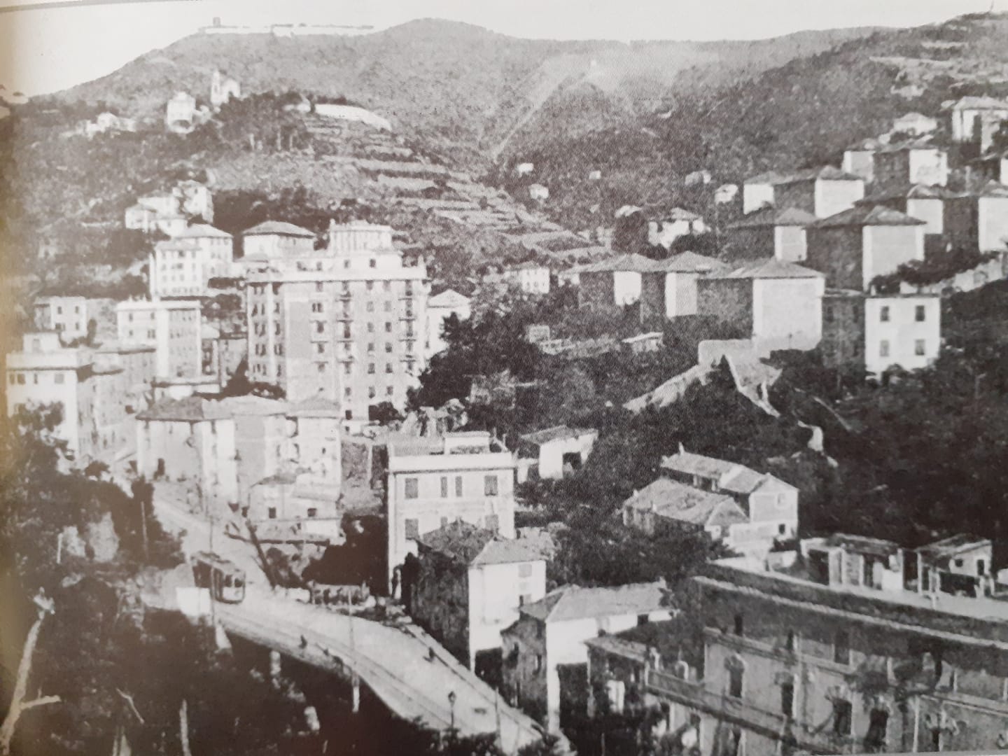
  93. I have not been able to identify the source of this image. It was sourced on line and is likely to no longer be within copyright. Please let me know if this is not the case.
  94. https://www.facebook.com/share/p/V6xTHbjjzwnQdhj5, accessed on 14th December 2024.
  95. https://www.facebook.com/share/p/F6Z2aQxpRfNiEx98, accessed on 14th December 2024.
  96. http://ceraunavoltagenova.blogspot.com/2017/04, accessed on 14th December 2024.
  97. https://www.facebook.com/photo?fbid=5183431385063284&set=gm.3693528314079638, accessed on 14th December 2024.
  98. https://www.facebook.com/photo/?fbid=10232245247706535&set=gm.9124273784283491&idorvanity=903038299740455, accessed on 14th December 2024.
  99. https://www.facebook.com/photo/?fbid=10228634444758874&set=gm.6928343290598108&idorvanity=574539035978597, accessed on 14th December 2024.
  100. https://picclick.it/Popular/tram-genova, accessed on 14th December 2024.
  101. https://www.facebook.com/photo?fbid=2435039796642329&set=gm.3959778180733103, accessed on 14th December 2024.
  102. https://www.marklinfan.com/f/topic.asp?TOPIC_ID=4530, accessed on 15th December 2024.
  103. https://www.facebook.com/photo/?fbid=3174148302658279&set=gm.2789467474430852, accessed on 15th December 2024.
  104. https://www.facebook.com/photo/?fbid=7219539698129825&set=gm.7554523737925178&idorvanity=903038299740455, accessed on 15th December 2024.
  105. https://www.facebook.com/photo/?fbid=625509079257893&set=gm.5470138519751933&idorvanity=574539035978597, accessed on 15th December.
  106. https://www.facebook.com/groups/574539035978597/search/?q=nervi%20capolinea%20del%20tram, accessed on 15th December 2024.
  107. https://www.facebook.com/photo/?fbid=980825313545627&set=gm.7671055249660238&idorvanity=574539035978597, accessed on 13th December 2024.
  108. https://www.facebook.com/photo/?fbid=1165459913948101&set=gm.4181704171928714, accessed on 15th December 2024.
  109. https://www.facebook.com/photo/?fbid=460732799068856&set=gm.4806745552757903&idorvanity=574539035978597, accessed on 15th December 2024.
  110. https://www.facebook.com/photo/?fbid=1611654688880626&set=pcb.1387312114701281, accessed on 15th December 2024.
  111. https://www.marklinfan.com/f/topic.asp?TOPIC_ID=4530&whichpage=2, accessed on 16th December 2024.

2 thoughts on “Genoa’s Early Tram Network – Part 3 – The Remainder of the Eastern Network before the First World War.

  1. Pingback: Genoa’s Early Tram Network – Part 4 – World War 1 to World War 2 | Roger Farnworth

  2. Pingback: Genoa’s Early Tram Network – Part 5 – World War 2 to its decline and closure in the 1960s and the Rolling Stock used on the Network. | Roger Farnworth

Leave a comment

This site uses Akismet to reduce spam. Learn how your comment data is processed.