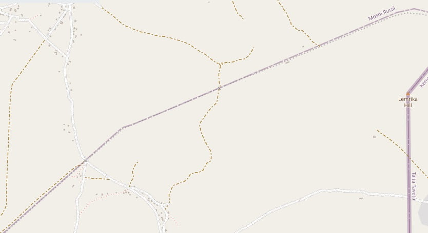
At the Kenyan end of this line it formed a junction with the Mombasa to Nairobi line at Voi. Two articles on this blog feature Voi. The first looks at the line traveling from the coast to Voi and particularly at the length of that line between Mazaras and Voi. That article can be found here. [1] The second looks at the length of that line running from Voi towards Nairobi and particularly at the length of the line between Voi and Ulu. That article can be found here. [2]
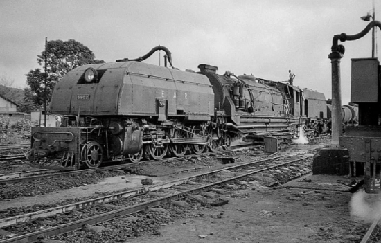
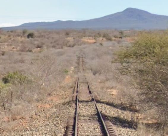
The featured image for this article shows a Class 59 Beyer-Garratt locomotive, No. 5902, Ruwenzori Mountains taking on water at Voi Station, (c) EAR&H. [2]
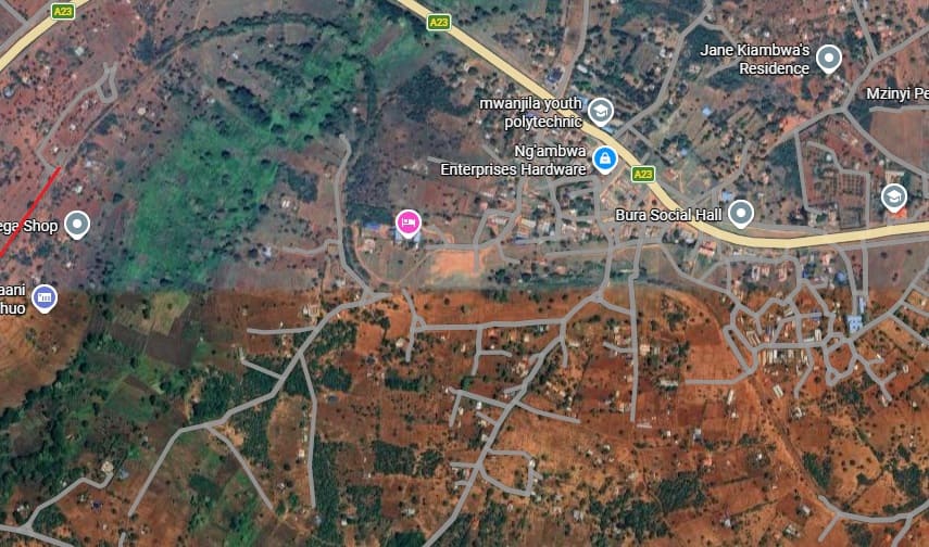
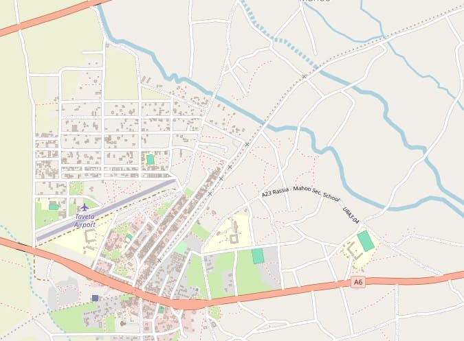
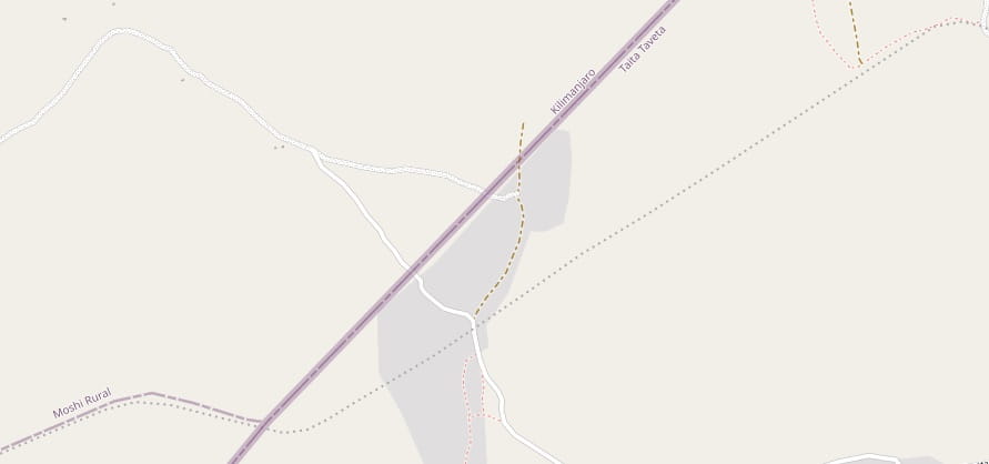
Voi is the largest town in Taita-Taveta County in southern Kenya, in the former Coast Province. It lies at the western edge of the Taru Desert, south and west of the Tsavo East National Park. The Sagala Hills are to the south. [3] It is also a junction station with a branch-line leaving the Nairobi-Mombasa line to head into Tanzania. Stations on that branch-line are Mwatate, Bura, Mashoti, Maktau, Murka, Ziwani and Taveta, all in Kenya. The line connected with the Tanzanian main-line at Moshi/Kahe, close to Mt. Kilimanjaro.
Photographs of the area and the Kenyan main line close to Voi can be seen in the two articles above [1][2]
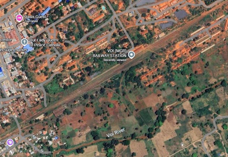
Voi Metre-gauge Railway Station sits on the North side of Voi River. The Standard-gauge Railway station sits to the South. [Google Maps, April 2026]Both stations appear on this extract from MapCarta’s mapping. [5]
The line from Voi towards Tanzania was constructed during the hostilities of WW1.
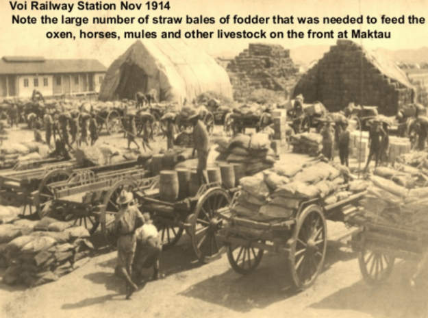
This photograph shows the intense preparations for the campaign in East Africa at Voi Railway Station (c) Public Domain. [4]
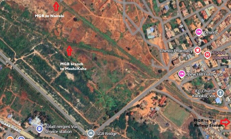
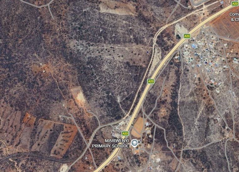
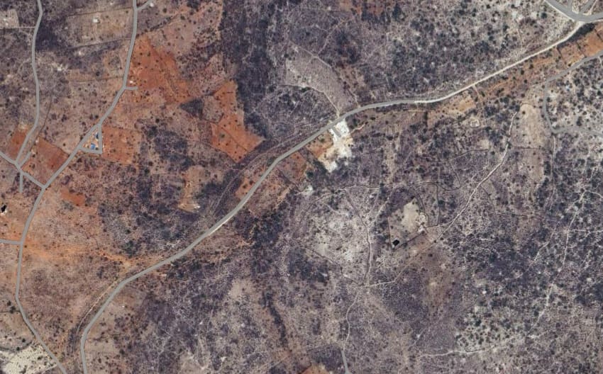
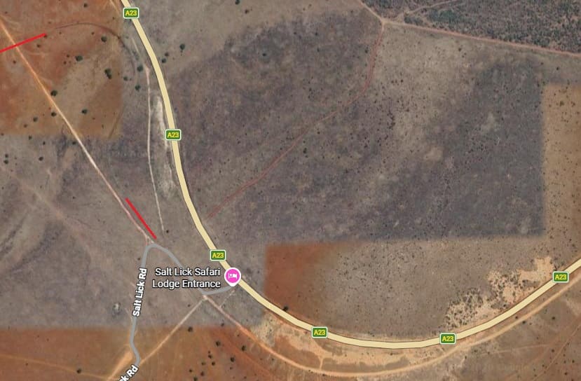
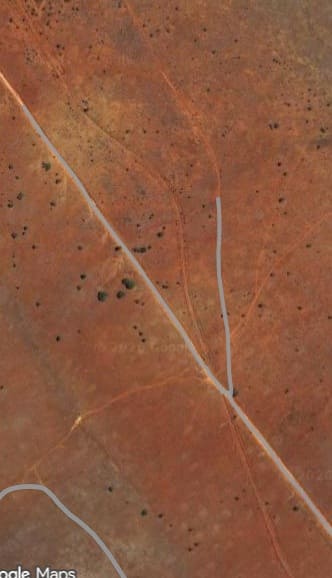
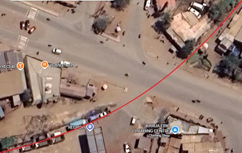
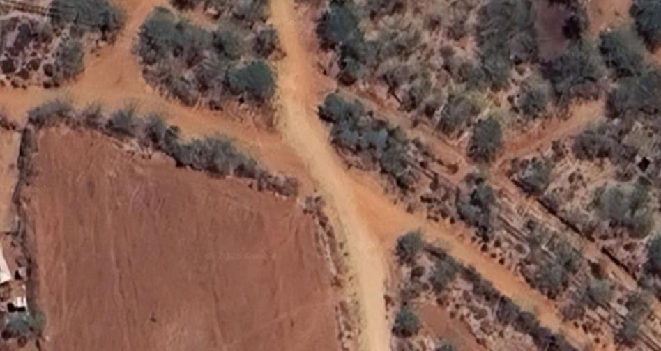
The branch line to Moshi/Kahe left the Metre-gauge railway (MGR) between Mombasa and Nairobi to the West of Voi MGR Station.
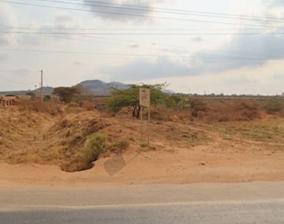
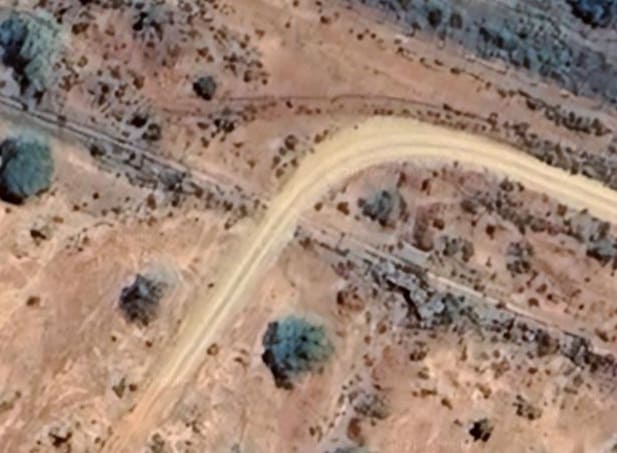
Just to the Northwest of the level-crossing over the road into Voi from the Mombasa Road (A109), the branch line left the MGR main line. [Google Maps, April 2026]
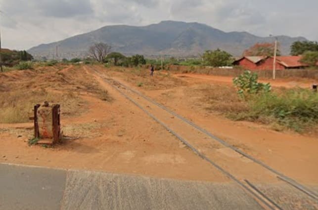
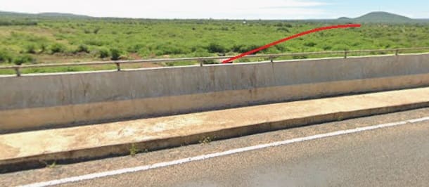
The two images above look along the MGR mainline from the level-crossing. The image on the left looks back towards Voi MGR station, that on the right looks ahead towards Nairobi. The branch line to Moshi/Kahe cannot be picked out on the image on the right as it is hidden by the bushes/grass ahead. [Google Streetview, July 2024]
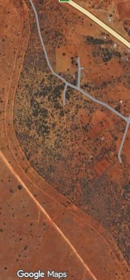
A very short distance beyond the junction, the branch line turns away to the Southwest. Its route crosses the Standard-gauge Railway (SGR) at 90°. The crossing point can be seen on the left of the extract from the satellite imagery.
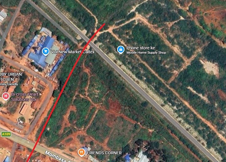
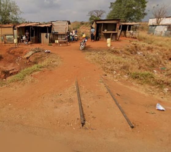
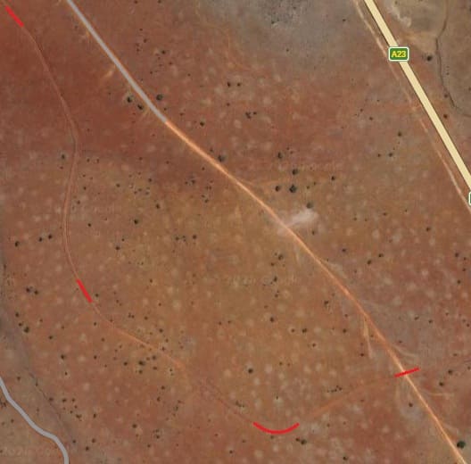
This next extract shows the route of the branch line,. The length in red shows the line of the old railway, sections of it are either buried or have been lifted. At Mombasa Road 9A109) only a short length of track is visible. [Google Maps, April 2026]The crossing at Mombasa Road
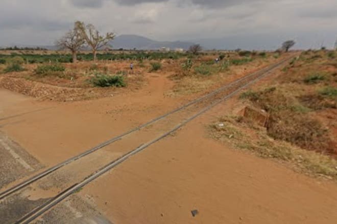
Looking along the branch line at the crossing at Mombasa Road (A109): the image on the left looks back Northeast towards the MGR main line. The image on the right looks ahead along the line towards Moshi. [Google Streetview, July 2024]
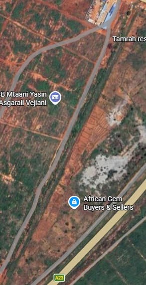
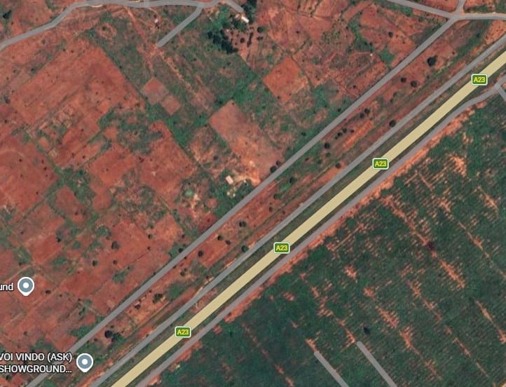
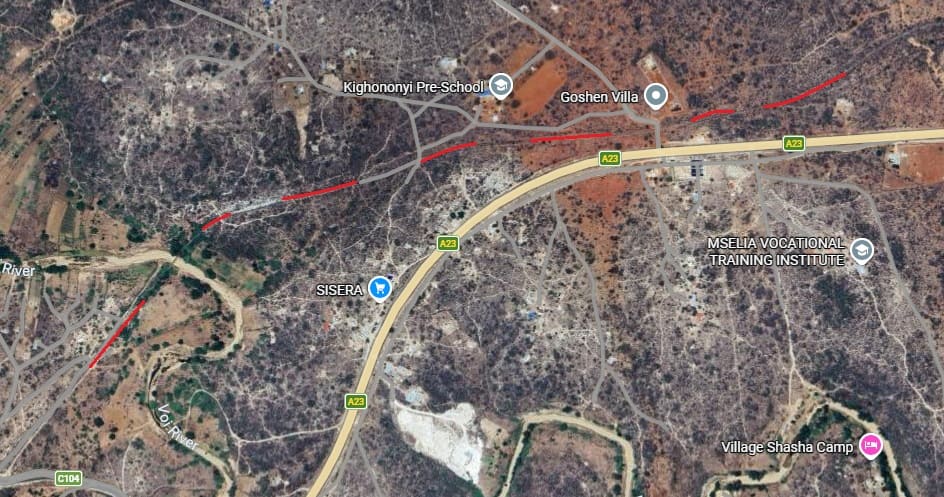
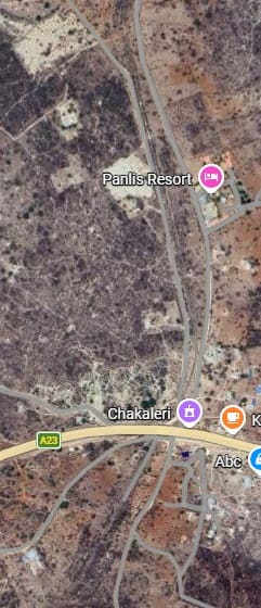
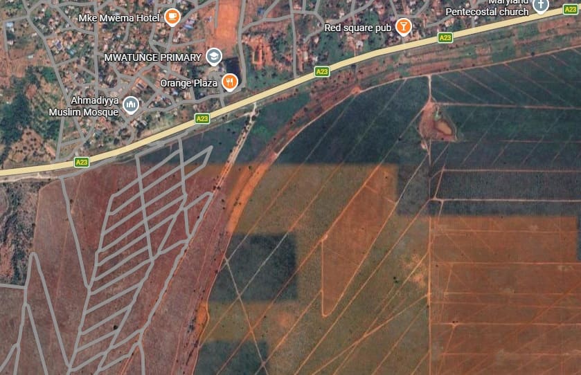
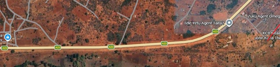
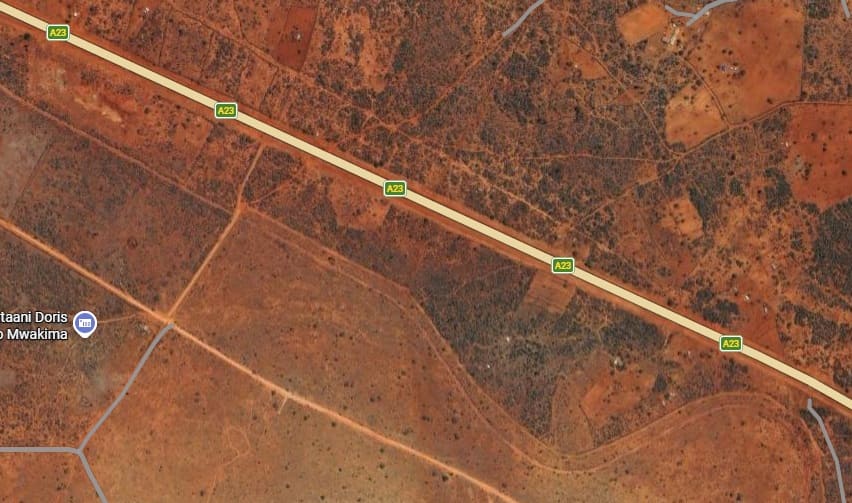
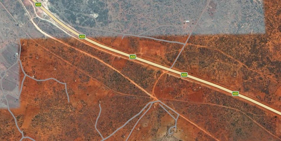
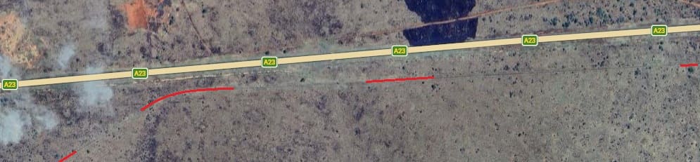
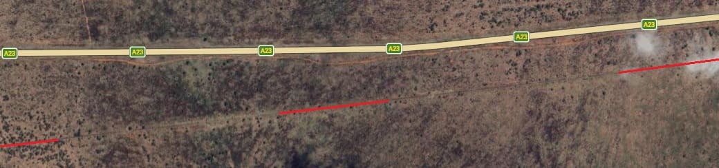
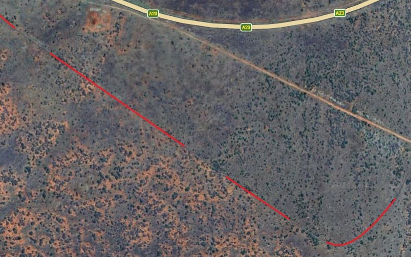
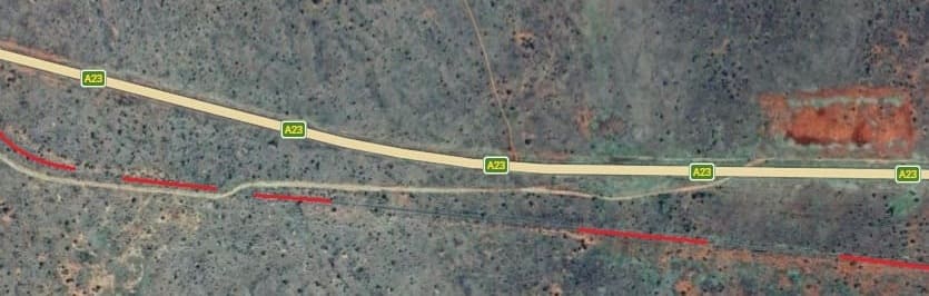
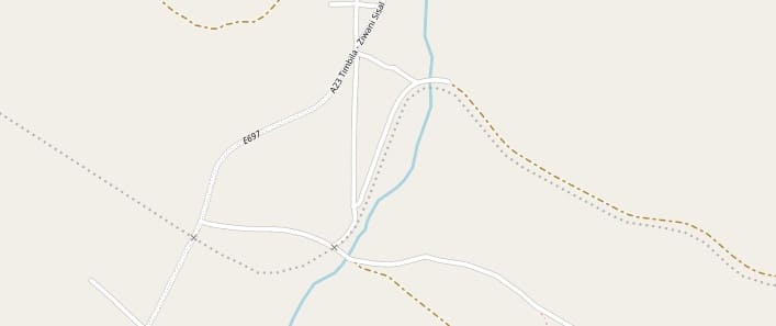
The route of the old railway is relatively easy to pick out on this extract from Google’s satellite imagery. The line runs alongside a minor road heading Southwest to take up a position adjacent to the A23 road.
Just beyond the bottom-left of this image the line crosses a minor murram road to the North of the A23.
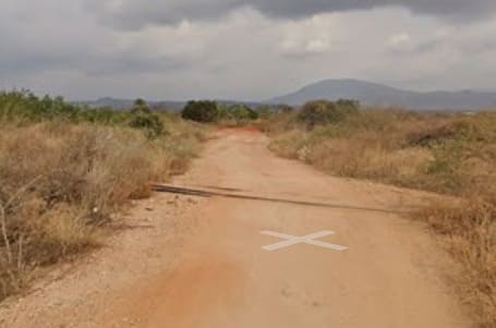
This murram road can be seen at the top-right of the next extract from the satellite imagery. The line can be seen crossing the road in this image from Google Streetview. [Google Streetview, July 2024]
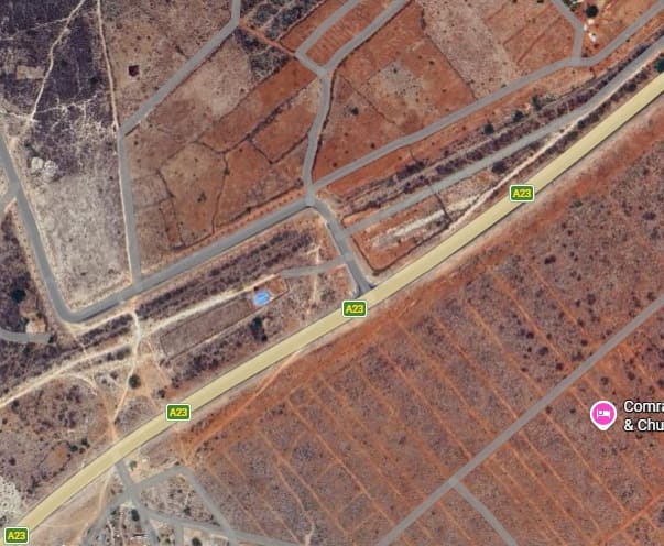
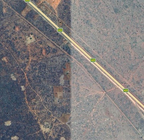
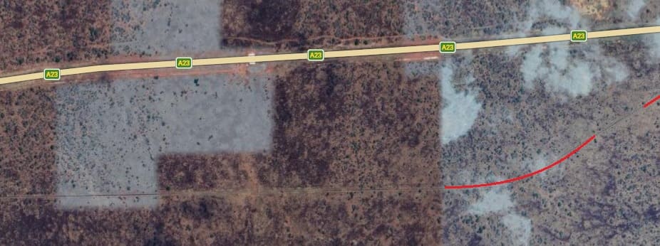
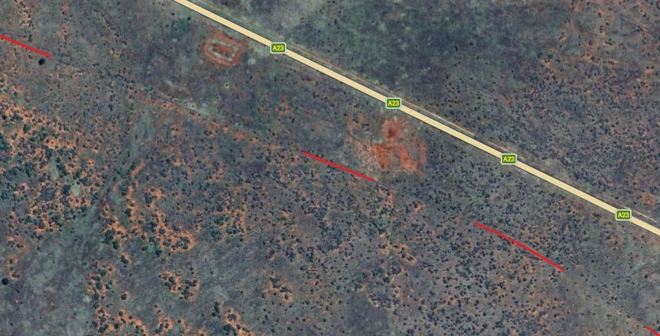
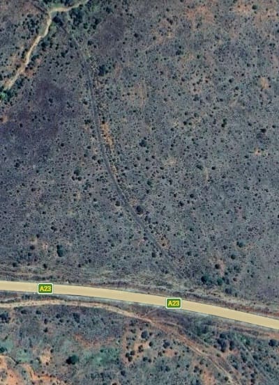
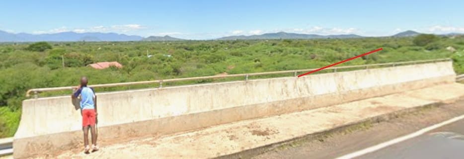
The route of the old railway sits on the Northwest side of the A23 and can be picked out between the two roads shown grey on this satellite image.In this view looking West from the A23, the line can just about be made out as a straight line running approximately across the centre of the image. [Google Streetview, August 2022]
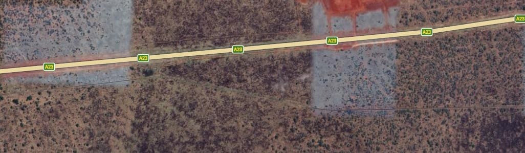
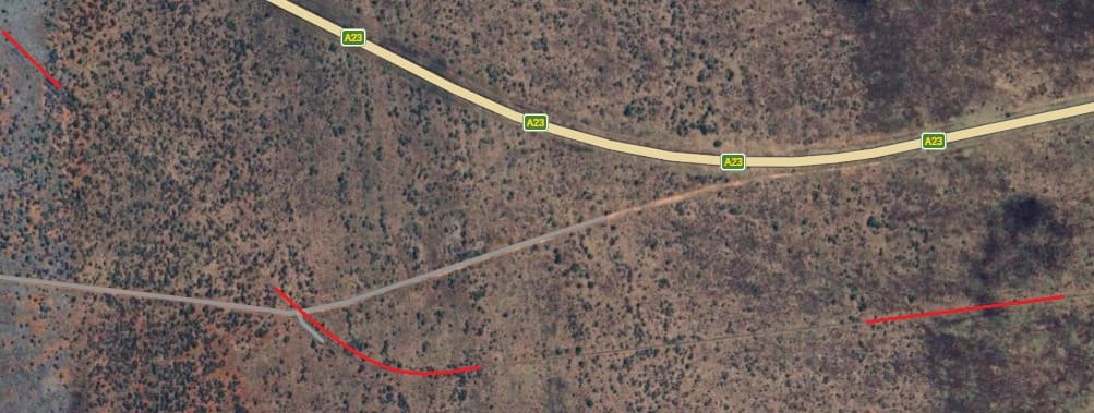
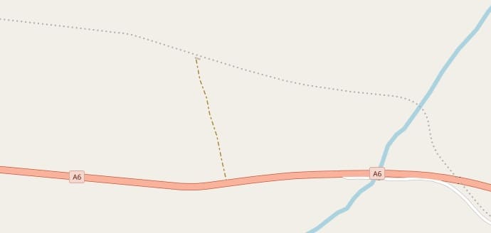
After some distance running close to the A23, the line begins to diverge from it and then crosses a metalled side road as shown in the images below.
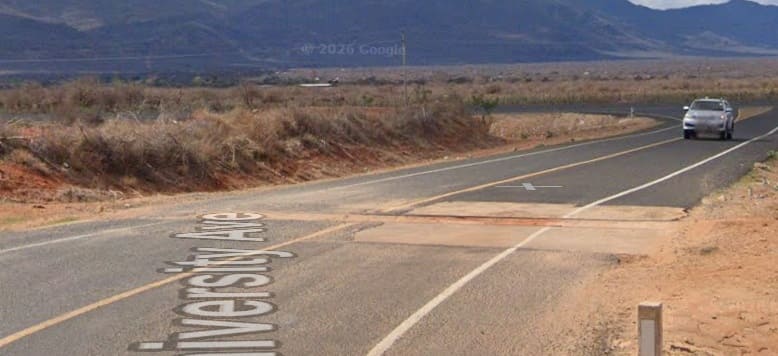
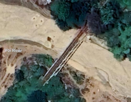
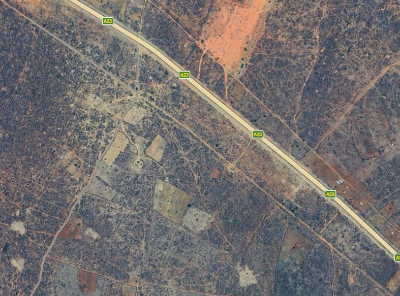
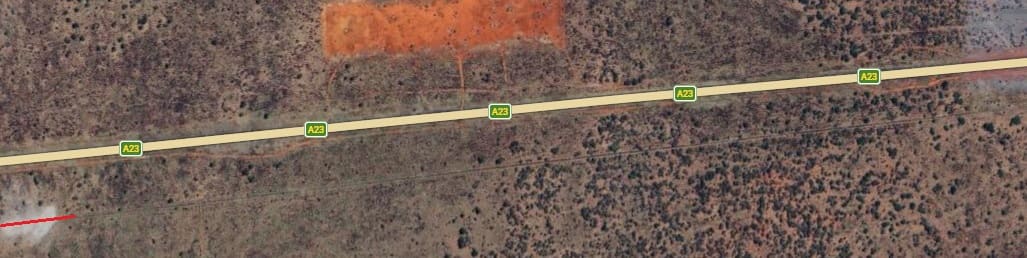
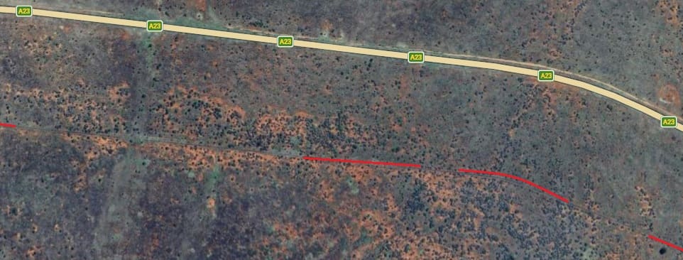
The line and the A23 begin to diverge and the railway crosses a metalled side road close to the A23. The side road is named – Taita-Taveta University Avenue [Google Maps, April 2026]The level-crossing on Taita-Tavita University Avenue seen from the Northwest. The junction with the A23 can be seen beyond the vehicle in the image. [Google Streetview, August 2022]The railway and the A23 follow the same corridor as the land drops gradually away. The line is more of a slave to the contours than the road. The railway route enters top-right and leaves the sateelite image just above the bottom-left corner. [Google Maps, April 2026]The intermittent red line marks the route of the railway. Towards the left of this satellite image, the line bridges the River Voi. [Google Maps, April 2026]
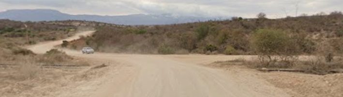
On the left below is a closer look at the Voi River Bridge. [Google Maps, April 2026] On the right is a view along the C104 which appears in the bottom left of the satellite image above.
Looking West on the C104, the railway tracks can be seen either side of the road. [Google Streetview, October 2021]
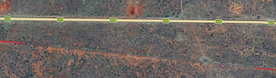
Running Southwest, the line crosses the C104 in the top corner of the next extract from Google’s satellite imagery below. …
The line crosses the C104 at the top-right of this image and runs diagonally Southwest. It can be seen as a fainter line on the nNorth side of what is recorded by Google as a road. In the bottom left corner the line curves to the South and leaves the image just to the right of the bottom-left corner of the image. [Google Maps, April 2026]
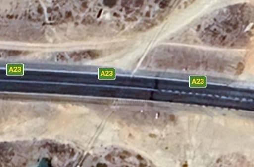
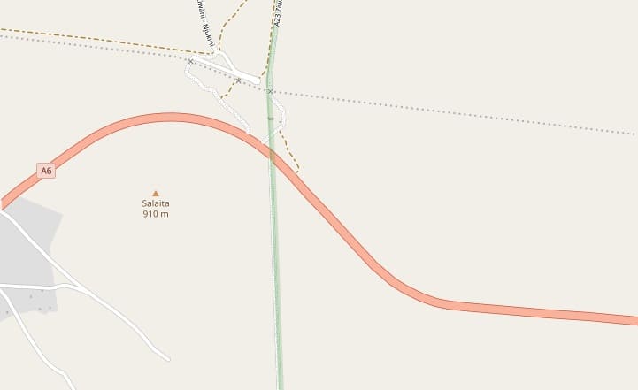
The image on the left below is the next length of the line which runs South to cross the A23 at an ungated crossing. [Google Maps, April 2026] On the right at the top is the closer view of the crossing at the A23. [Google Maps, April 2026] Then below on the right the view North from the A23. [Google Streetview, August 2022] …
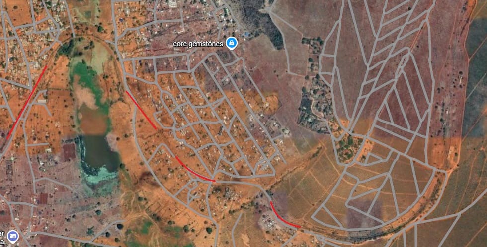
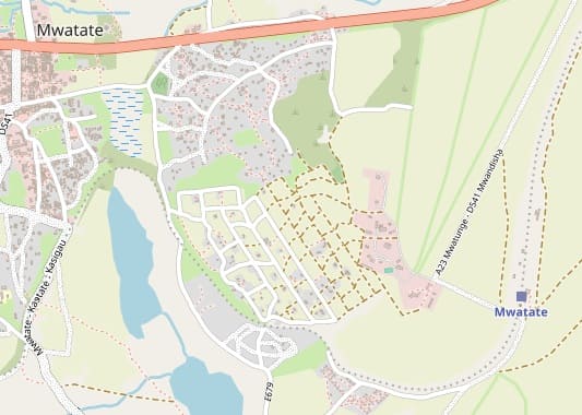
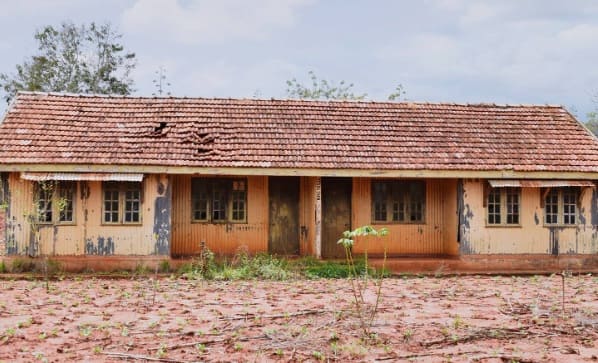
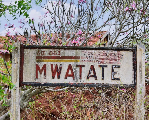
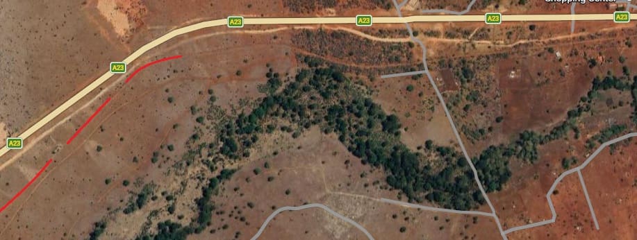
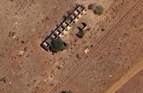
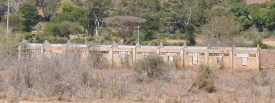
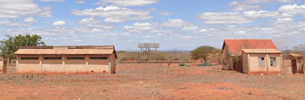
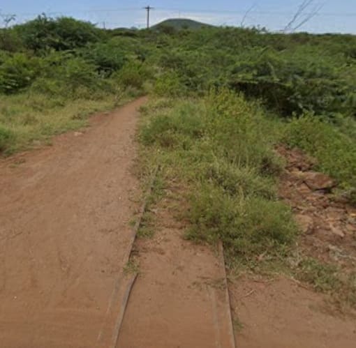
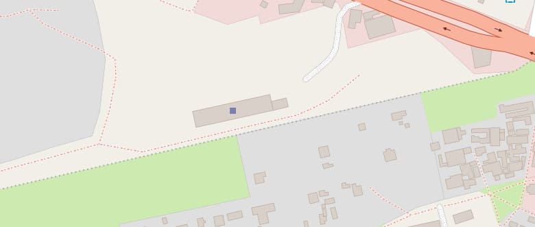
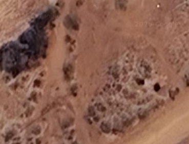
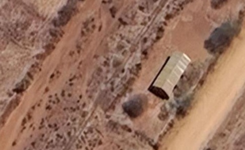
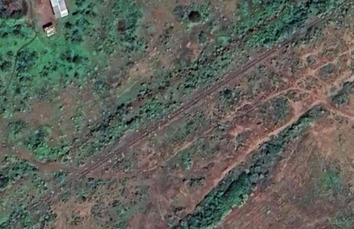
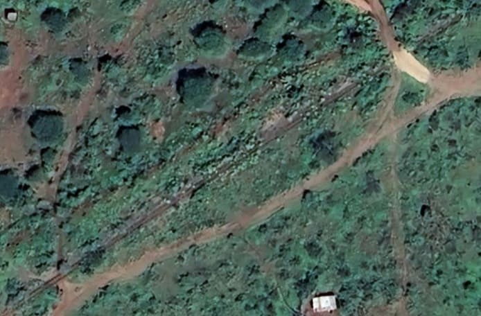
The last image at this location shows the railway heading South from the A23. [Google Streetview, August 2022]Just South of the A23, the line curves away from South to head Southwest once again. It can be seen entering this satellite image at the top-right and then runs diagonally across to close to the bottom-left corner of the image. [Google Maps, April 2026]Perhaps difficult to pickout at certain points on the satellite imagery, the line of the railway has been highlighted by the two red lines. It runs from the top-right of this next extract from Google’s satellite imagery to the bottom-left, running roughly parallel to the A23. [Google Maps, April 2026]Again, in this next satellite image, the line runs diagonally from top-right to bottom left. The greener lined area in the bottom half of this image will be a sisal plantation. The railway runs between this area and the A23. [Google Maps, April 2026]Close to Mwatate (which is just off this satellite image to the West (left)), the line turns southwards. [Google Maps, April 2026]On this next extract from Google’s satellite imagery, the line passes through Mwatate Railway Station on the right side of the image and then wanders sinuously across the image. The intermittent red lines show the route of the line where the image itself, at this scale, is less clear. This is a similar area on OpenStreetMap’s mapping. It shows the location of Mwatate Railway station and the town it is named after. The route of the railway is shown as a dotted line. [6] The station is located inside a private sisal farm and not available to the public. [7]Mwatate Railway Station Building, (c) Chao Tayiana Maina. [7]
The station nameboard, (c) Chao Tayiana Maina. [8]
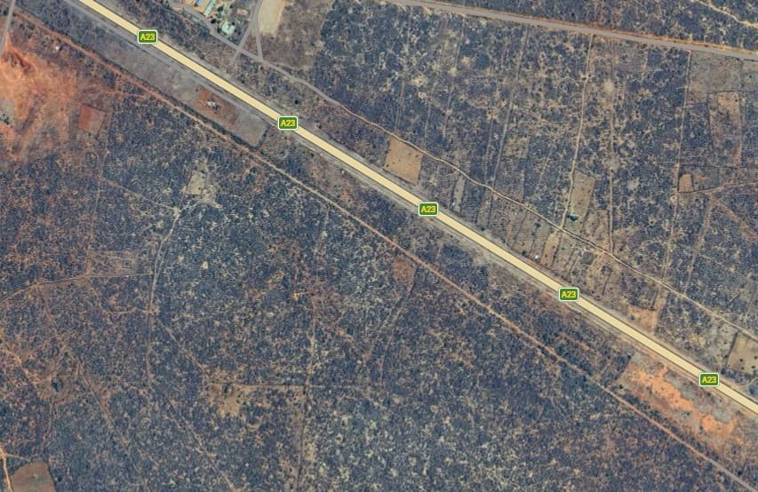
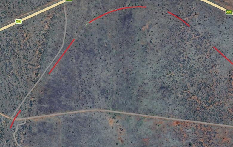
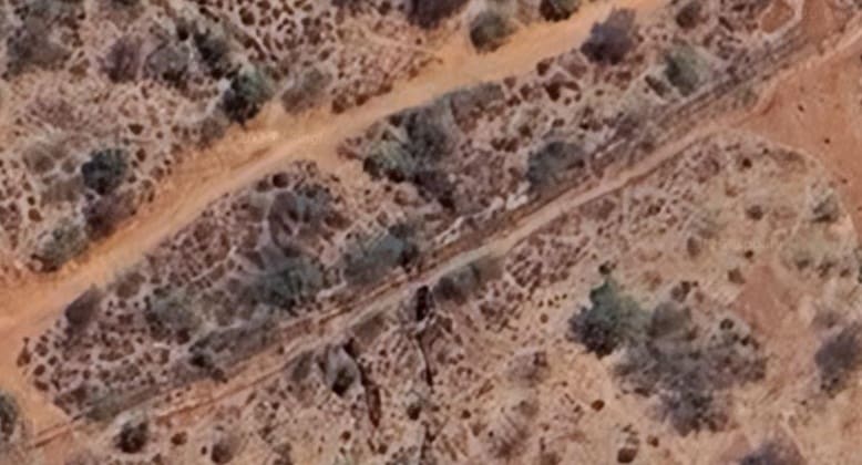
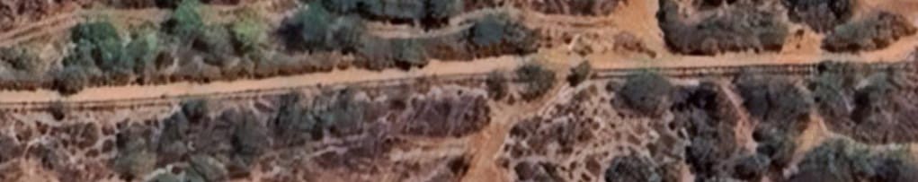
Following on from the last satellite image this next extract shows the line continuing in a generally westerly direction. It continues to seek the easiest route as so curves around following the contours, entering top-right and leaving the image just above the bottom left corner. [Goggle Maps, April 2026]Still heading West, the line runs from the bottom-right to the top-left of this satellite image and leaves the image close to the A23. [Google Maps, April 2026]Continuing West the line follows the A23 but then turns away to the South towards the left of this image. A red line has been added to show the curve of the line, where difficult to distinguish at this scale. It follows the curving grey line to the left edge of the image. [Google Maps, April 2026]Still heading West, the line curves sinuously across this next extract. It enters adjacent to the grey road just above the bottom-right corner of this image and leaves following the red line at the left of the image. [Google Maps, April 2026]After a relatively tight radius curve at the right side of this image, the line runs due West alongside the A23. [Google Maps, April 2026]Looking Southwest from the A23, the line can be seen across a wide sandy strip before the bushland begins. [Google Streetview, August 2022]Again, intermittent red lines mark the route of the line where it is least obvious. [Google Maps, April 2026]
These ruins sit close to the line and appear to have been built to serve the line. They can just be made out towards the left edge of the satellite image immediately above. [Google Maps, April 2026]
The same building(s) as seen from the A23. [Google Streetview, August 2022]Continuing West, the route of the line is relatively easy to pick out. A couple of red line ensure that the eye follows the correct route. [Google Maps, April 2026]
At a slightly larger scale, this extract shows the line turning to the Northwest. Even at this scale the trace is faint, so intermittent red lines are provided to direct the eye. [Google Maps, April 2026]
Two extracts take the line further Northwest. (left image first, then the right). [Google Maps, April 2026]
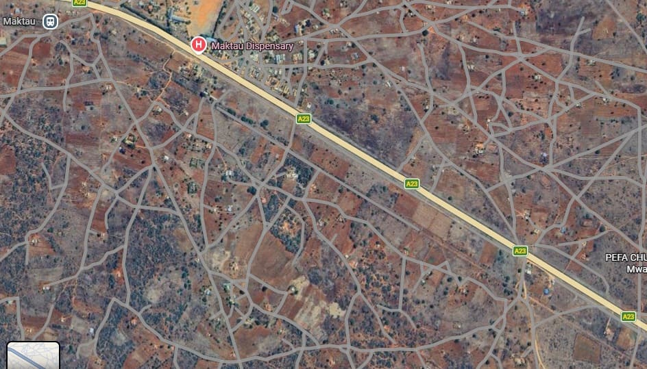
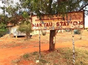
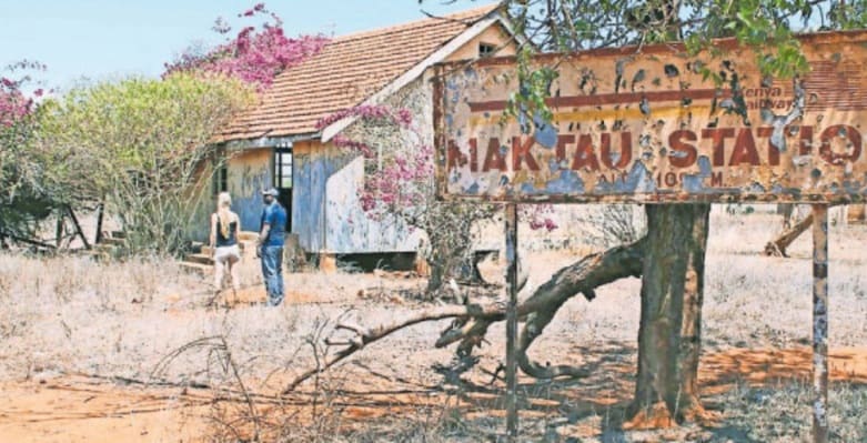
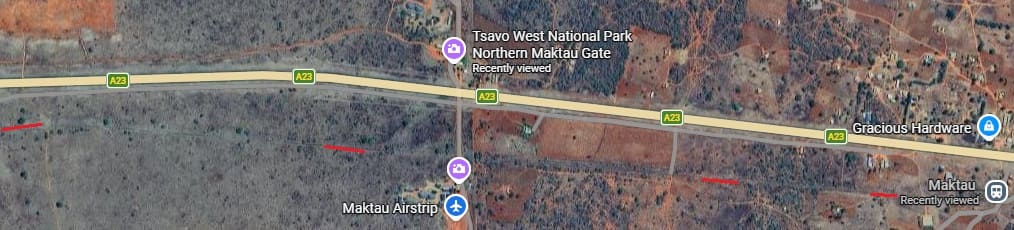
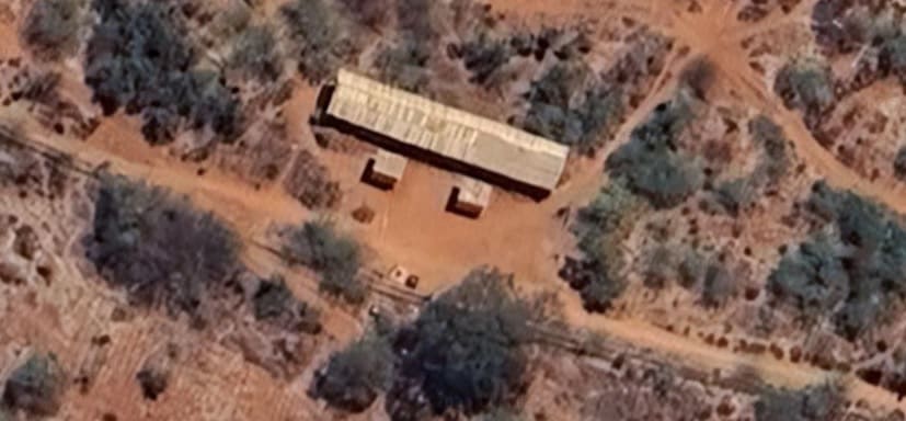
A more West-northwest alignment is followed now, with the line once again close to the A23. [Google Maps, April 2026]The is the line seen from the A23 at the bottom-right of the satellite image above. [Google Streetview, August 2022]The railway continues to run relatively close to the A23. [Google Maps, April 2026]On this next extract the line runs bottom-right to top-left relatively close to the A23. [Google Maps, April 2026]And again here, the line runs bottom-right to top-left relatively close to the A23. [Google Maps, April 2026]And again here, the line runs bottom-right to top-left relatively close to the A23. [Google Maps, April 2026]The line reaches Maktau Railway Station at the top-left of the image. [Google Maps, April 2026]
The station sign and the main station building seen from the old railway. [13]
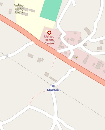
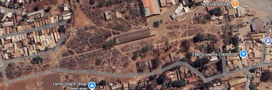
The blue square marks the location of Maktau Railway Station. [12]
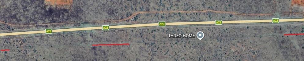
The station buildings seen from the A23. [Google Streetview, April 2024]Railway line close to Maktau. [21]The line leave Maktau in a generally westerly directi, on, running parallel to the A6/A23 but a short distance to the South[Google Maps, April 2026]The line continues to head West, the intermittent red lines clarify its path. [Google Maps, April 2026]The line turns further away to the South. [Google Maps, April 2026]It then returns to its westerly trajectory. [Google Maps, April 2026]The railway and the road converge over this next length of the line, [Google Maps, April 2026]Now much closer together, the road and the old railway run parallel to each other. Both are running in a West-southwest direction, [Google Maps, April 2026]The line continues to run West-southwest while the road turns to the West. [Google Maps, April 2026]The line continues West-southwest. [Google Maps, April 2026]It then turns to the Northwest. [Google Maps, April 2026]And then sweeps round to the South-southwest. [Google Maps, April 2026]The general direction of travel is still westerly, but the line turns to the Northwest. [Google Maps, April 2026]The line continues Northwest. [Google Maps, April 2026]It then turns back closer to the West. [Google Maps, April 2026]Road and rail begin to converge once more. [Google Maps, April 2026]A murram road leaves the A23 and crosses the old railway, then running parallel to if for a distance. [Google Maps, April 2026]This extract from Openstreetmap,com’s mapping shows the next length of the railway which, running Northwest, crosses the A6/A23 (on the right of this map extract) and then runs away to the North of the road before turning West, [14]
This satellite image extract shows the point where the railway crosses the modern A6/A23 towards the bottom-right of the image, The line can then be seen heading North to cross a watercourse. Google Maps, April 2026]
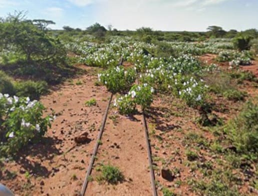
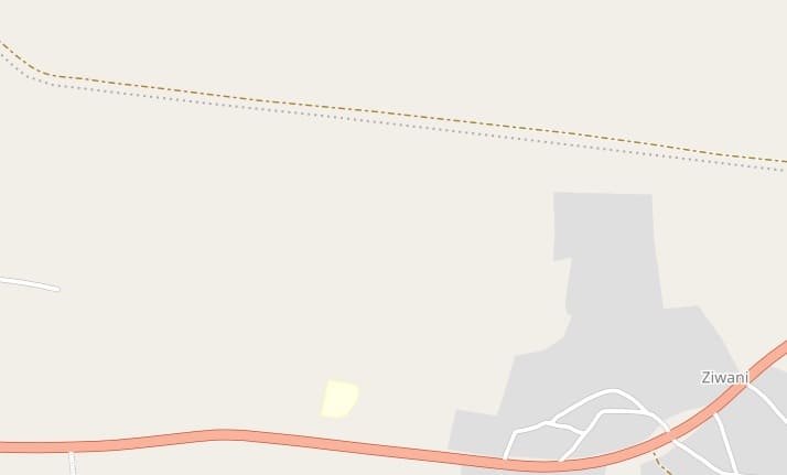
Travelling West-northwest the line crosses the route of the Ziwani-Mtito Andei road which seems to have had a variety of alignments over time. Three crossing points are marked. The most westerly of these appears to still be in use today. Two photographs appear below. [15]The crossing point on the Ziwani-Mtito Andei road. [Google Maps, April 2026]
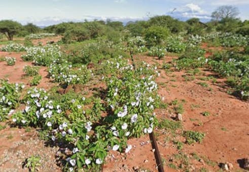
Two photographs taken on the Ziwani-Mtito Andrei road. That on the left looks back East, that below looks West along the line. [Google Streetview, April 2024]
Further West, this is the next length of the line. [16]And this is the next length of the line, bearing first to the Northwest, then South-southwest, then Northwest again. The line can be seen crossing the E697 road towards the left of this extract. [17]Little seems to remain of the bridge which once spanned the waterway, shown on the map above. [Google Maps, April 2026]
Two photographs taken from the E697 level-crossing; that on the left was taken facing East, that below was taken facing West. [Google Streetview, April 2024]
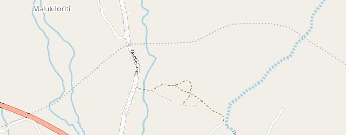
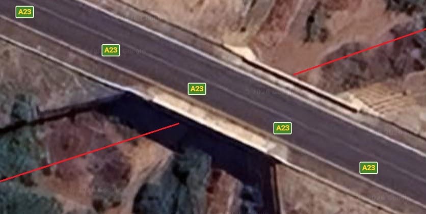
Further West again, the line crosses the Taveta-Laset road before running under the A6/A23. The bridge carrying the main road appears in the bottom-left corner of this map extract. [18]
On the left, a view looking back east along the old railway and below the view looking Southwest along the line. [Google Streetview, April 2024]
The bridge carrying the modern A6/A23 across the line of the old railway. [Google Maps, April 2026]Looking back, East-northeast along the line of the old railway. There appear to no obvious traces of the line, although, admittedly, photographs only look out from the bridge deck and the A23. [Google Streetview, April 2024]Looking Westsouthwest towards Taveta along the line of the old railway. Again, appear to no obvious traces of the railway. [Google Streetview, April 2024]Taveta as shown on Openstreetmap.com. The Railway Station is marked by the blue square. [11]The red line shows the route of the old railway through Taveta, [Google Maps, April 2026]The road crossing at the Northeast end of Taveta Railway Station site. [Google Maps, April 2026]Looking Northeast from the crossing of the A6 at the Northeast end of the Taveta Railway Station site. [Google Streetview, August 2022]Looking Southwest into the Taveta Railway Station site. While the water tower is visible, the station building is hidden behind the sheds on the right of this image. [Google Streetview, August 2022]Looking Southwest into the Taveta Railway Station site again, this time from just to the Southeast of the rail crossing. While the water tower is still visible, the slight change in the camera location allows the the station building to be seen on the right of this image. [Google Streetview, August 2022]Taveta Railway Station site as shown on Openstreetmap.com. [11]The same area on Google’s satellite imagery [Google Maps, April 2026]
Taveta Railway Station Nameboard, (c) Chao Taylana Maina [10]
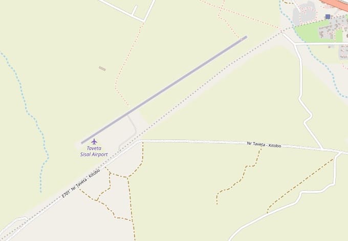
This next extract from the mapping of Openstreetmap,com shows the line of the old railway running Southwest from Taveta Railway Station (again shown by the blue square), then to the Southeast of Taveta Sisal Airport. []
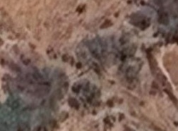
Two images which are typical of the length of line shown on in the map extract above, The first is on the left the second on the right. [Google Maps, April 2026]
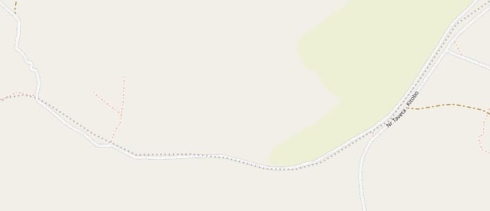
This next extract from Openstreetmap shows the next length of the line. [20]
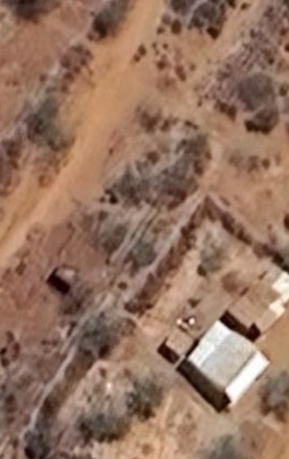
This sequence of extracts from Google’s satellite imagery shows the line running across the map extract above. The first two, on the left and below show the line in the first quarter of the map from the right. The third image is from a location at the third point from the left. The fourth, fifth and sixth images show locations on the left half of the map. [Google Maps, April 2026]
The last six images are extracts from Google’s satellite imagery which come from the length of the old railway shown on the map extract above, [Google Maps, April 2026]This next extract from Openstreetmap shows the line travelling Southwest and crossing the Kenya/Tanzania border (the pink line), [22]
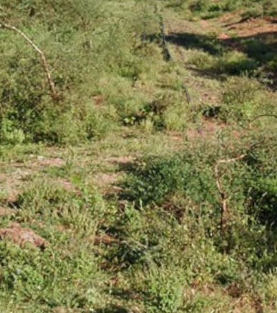
The next four satellite images are relatively typical of the route of the railway across the map extract above.
The line can be seen heading from top-right to bottom-left across this satellite image, [Google Maps, April 2026]Similarly, here, the line runs top-right to bottom-left. [Google Maps, April 2026]
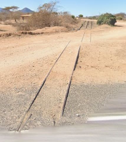
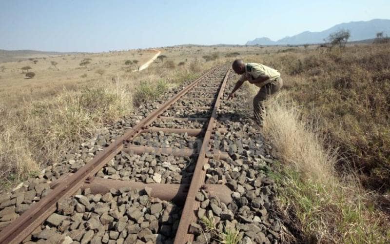
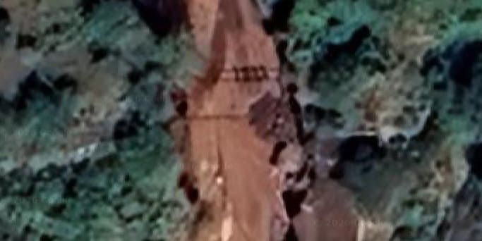
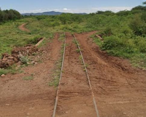
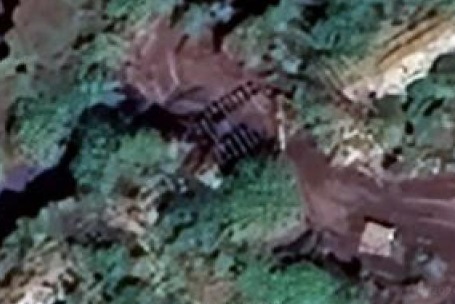
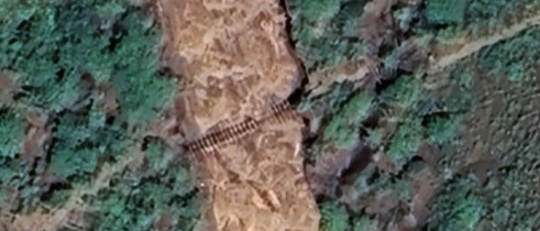
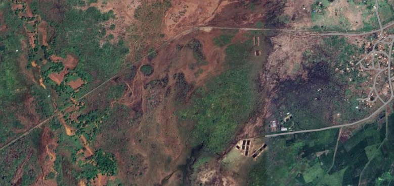
Bridges under the line have in many cases been washed away. The image below shows one such location – here as elsewhere, the railway tracks and metal sleepers span the gap but unsupported.
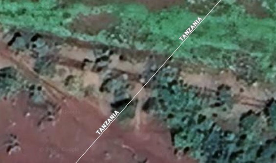
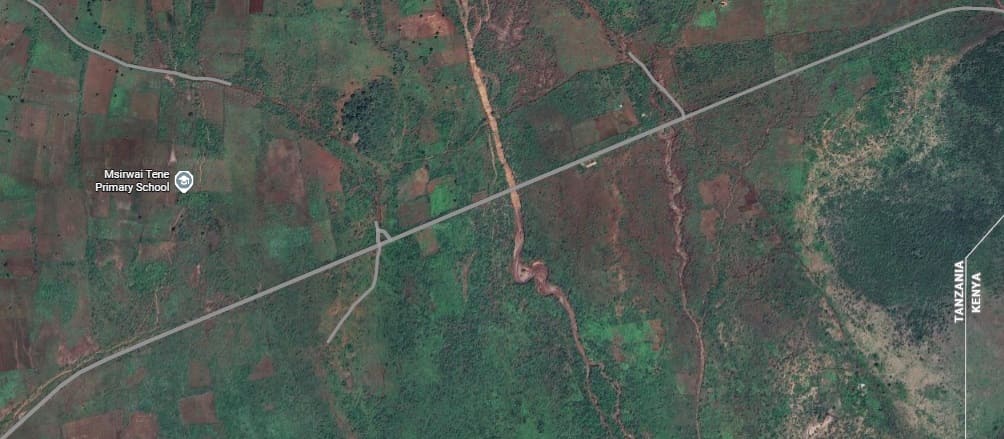
On the left, railway tracks left spanning a gap where a bridge once sat. Below, the railway crosses the international border. [Google Maps, April 2006]
In Tanzania, the route of the railway line follows the border between Moshi Rural and Mwanga provinces in Tanzania. [23]Approximately the same area as it appears on satellite imagery in the 21st century. The route of the old railway is marked by the grey line, approximately at the centre of this image, the route of the line crosses a water course. [Google Maps, April 2026]
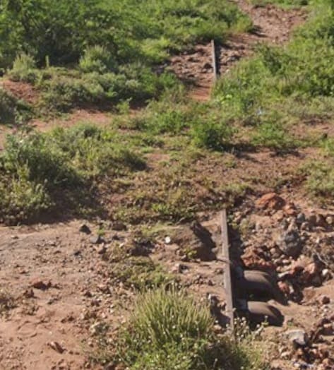
Another example of a river crossing where the the superstructure of the bridge/culvert has been washed away, [Google Maps, April 2026]
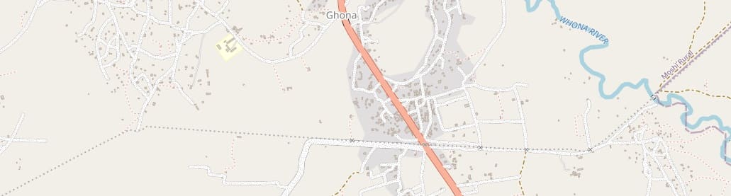
The old railway route can be seen crossing the Whona River in the top-right of this next image, then turning to the West and crossing the T2/B1 on the South side of Ghona and then heading away West and then Southwest. [24]Approximately the same length of the line as appears on the map extract above. The line follows the grey line across the image from the top-right corner along the South side of Ghona, but where the road turns sharply to the South, the lie continues on the same westerly bearing before curving to the Southwest close to the edge of this image. [Google Maps, April 2026]
Now in Tanzania, no Google Streetview images are available.
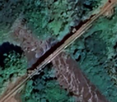
The bridge crossing the Whona River still stands. Just to the Southwest of this bridge the railway curves round to the West and passes on the South side of Ghona. [Google Maps, April 2026]
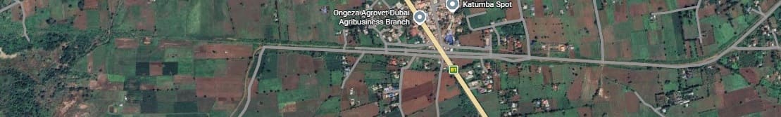
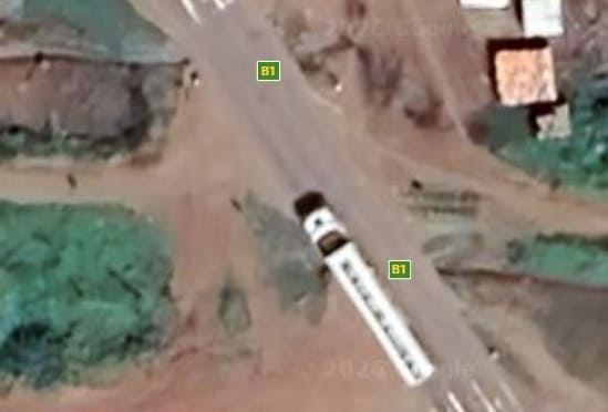
The crossing point on the B1/T2 to the South of the centre of Ghona. Either side of the crossing little is visible of the rails and sleepers of the old railway, but immediately adjacent to the road (on its East side) a short length is visible. [Google Maps, April 2026]
The line heads Southwest from Ghona running to the Southeast of Kiterini. [24]This satellite image covers the first half of the map immediately above. The line continues in a Southwest direction from the top-right of this image to close to the bottom-left where it turns to the West. [Google Maps, April 2026]
The remainder of the length of the line covered by the Openstreetmap extract above. [Google Maps, April 2026]
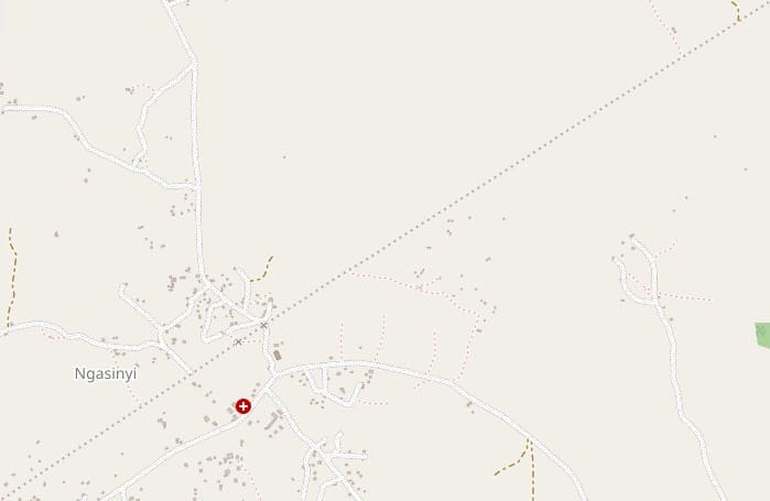
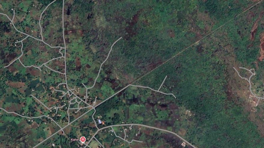
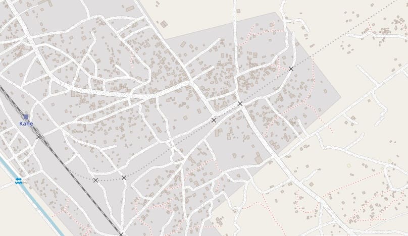
The line continues Southwest through Ngasinyi. [25]A similar area shown on Google’s satellite imagery. The line runs from the top-right to close to the bottom-left of the image. [Google Maps, April 2026]The line runs Southwest down to the Usambarabahn (the Tanga Line) at Kahe. [26]Approximately the same area again, The route of the old railway enters at the top-right apex and runs diagonally on the same bearing to what was a triangular junction with the Tanga Line which runs Northwest across the bottom-left corner of the image. [Google Maps, April 2026]
The route of the Usambarabahn from Tanga to Moshi can be followed here [27]

