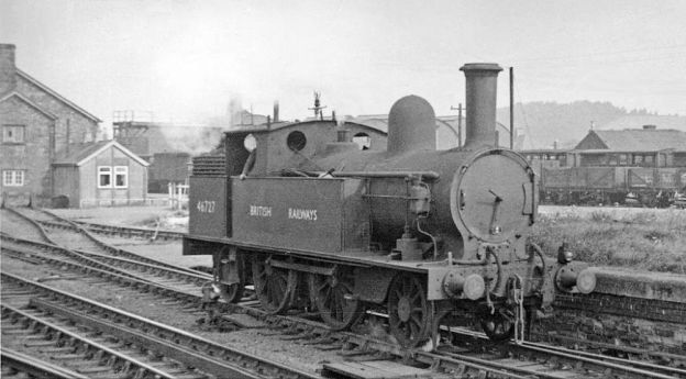
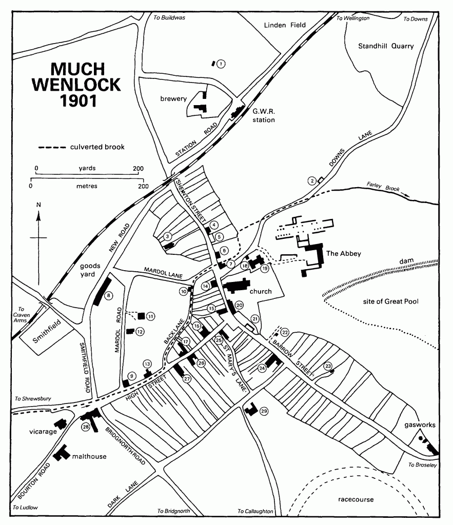
This article follows on from seven other articles which covered the Wellington to Severn Junction Railway and this line from Buildwas to Harton Road Station. The first three articles can be found by clicking on these links:
We noted in the last three articles that from the commencement of the building of the line between Buildwas and Much Wenlock, the directors hoped that the line could be extended to Craven Arms via Presthope on Wenlock Edge (linking with the limestone quarries/works at that location).
The directors of the Wellington & Severn Junction Railway were, however, fully occupied with the line from Wellington to Buildwas. Another company was set up to build the ‘Wenlock & Craven Arms and Coalbrookdale Extension Railway‘. The bill went through the parliamentary process unopposed and authorised the ‘Wenlock Railway Company‘ to construct the line. Work started on 23rd October 1861.
By 5th December 1864, the line was open from Much Wenlock to Presthope. (That length is covered in the last but one online article listed above.) At this time, because it was a freight-only line, the Board of Trade saw no need for an inspection of the line. It had already been agreed at a meeting held on 4th December 1863 not to proceed with the line from Presthope to Craven Arms for the time being. It was to be three years after the line reached Presthope before the connection to the Shrewsbury & Hereford Railway close to Craven Arms was completed. It was finally opened on 16th December 1867.
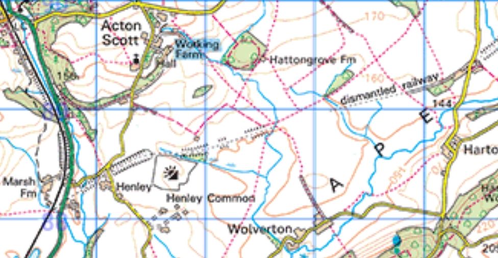
Harton Road Station to Craven Arms
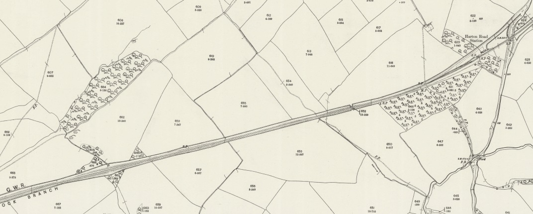
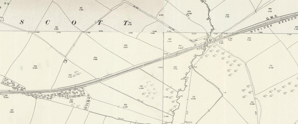
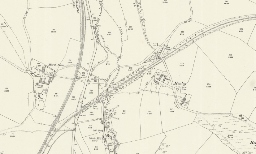
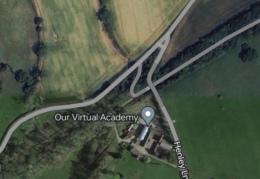
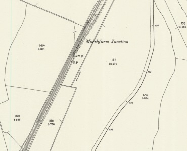
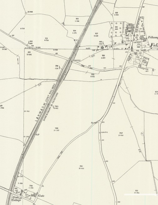
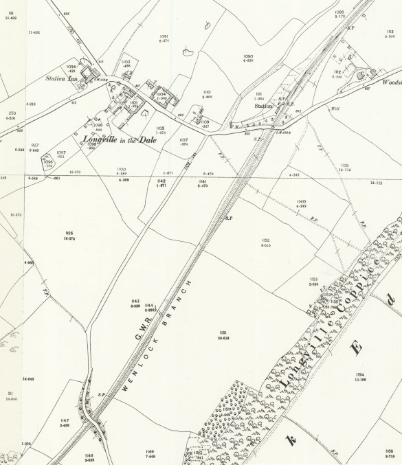
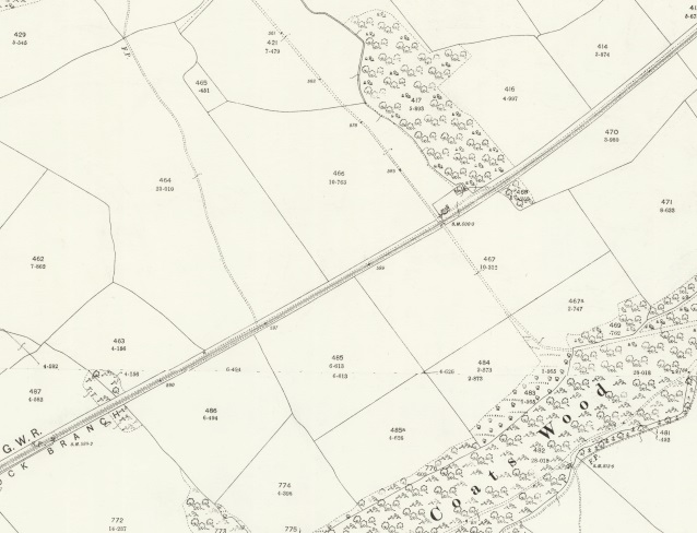
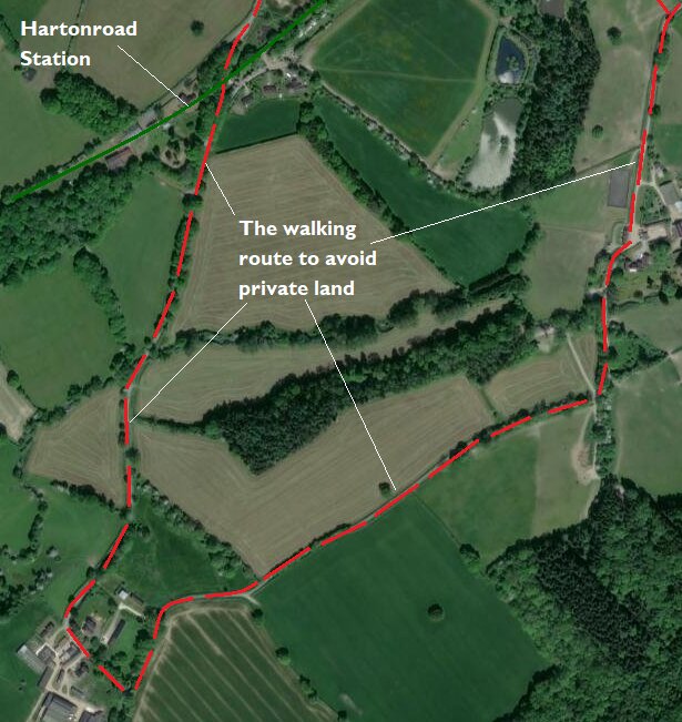
Harton Road Station to Marsh Farm Junction as shown on the Ordnance Survey Landranger Series mapping. [20]
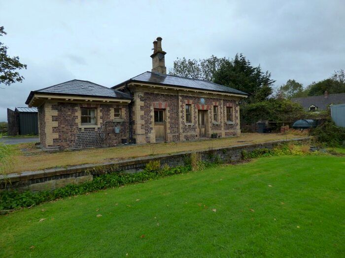
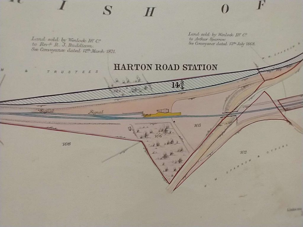
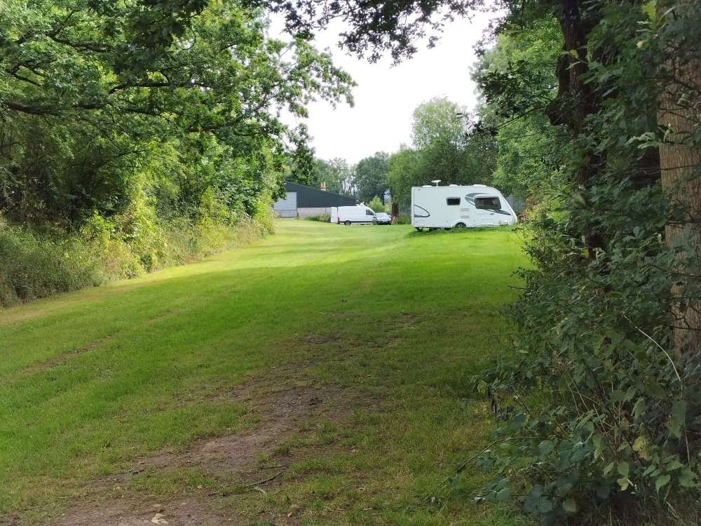
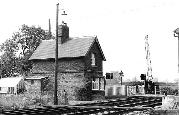
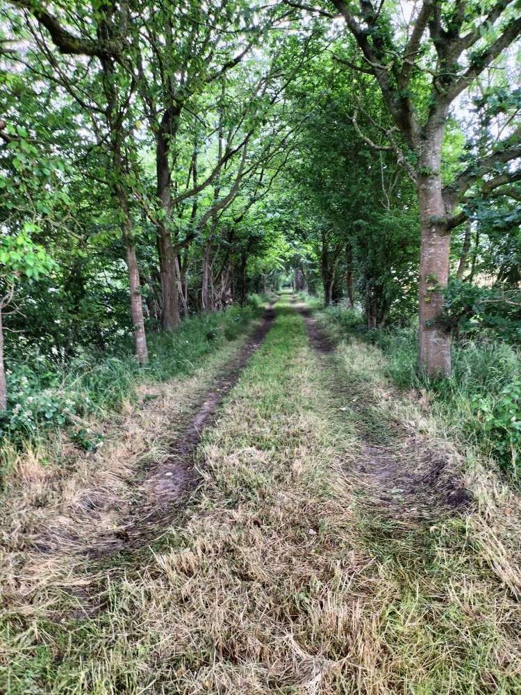
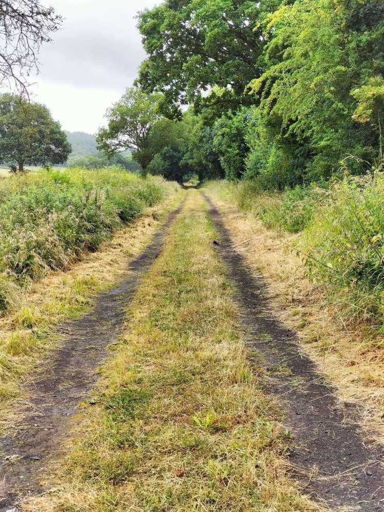
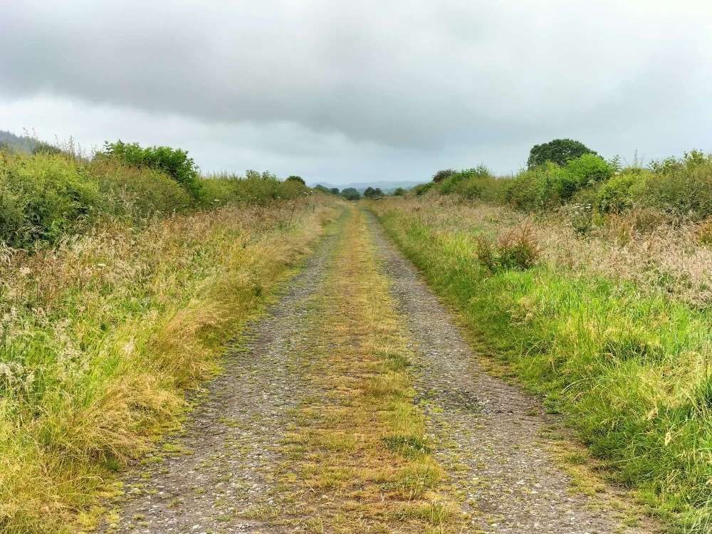
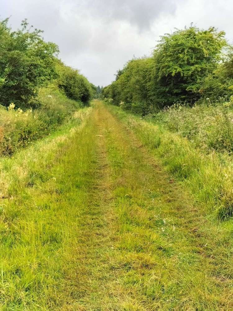
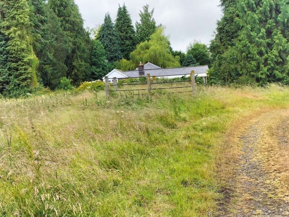
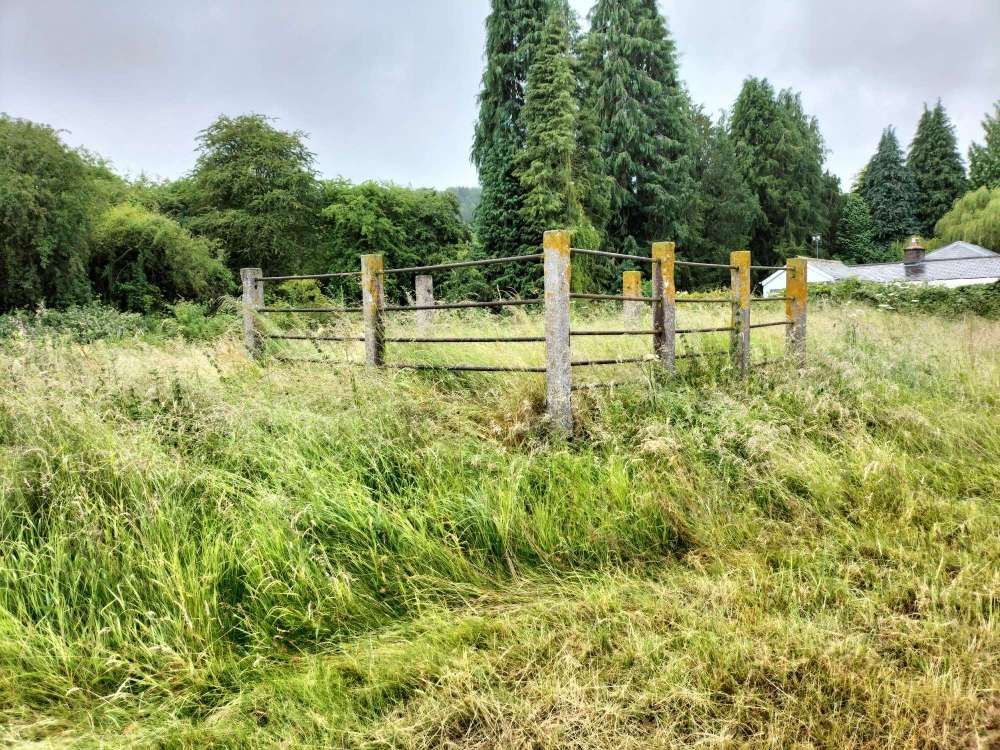
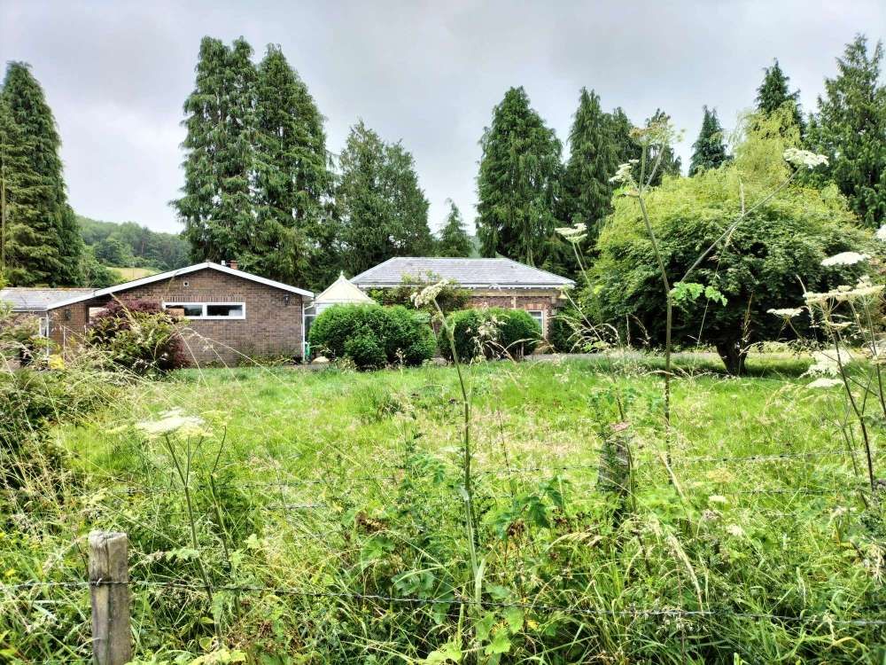
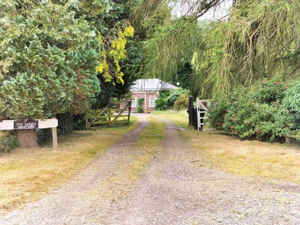
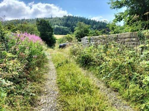
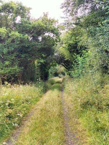
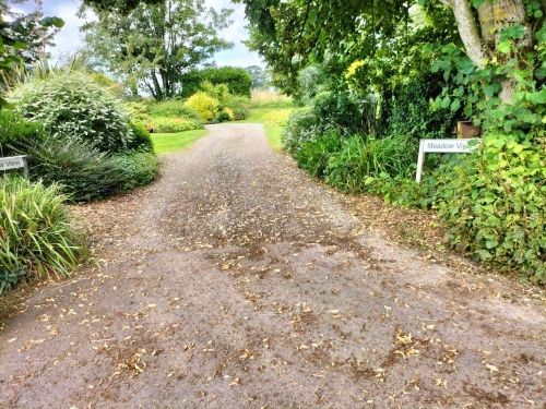
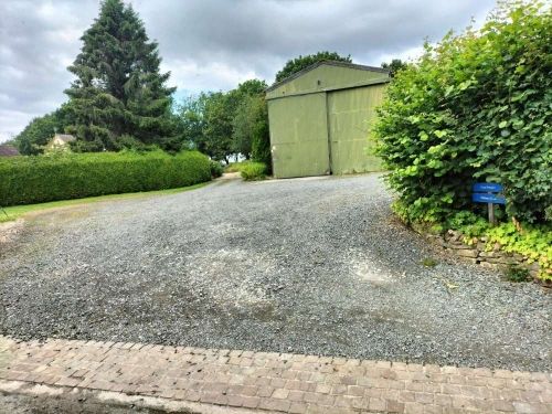
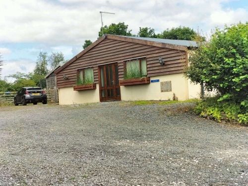
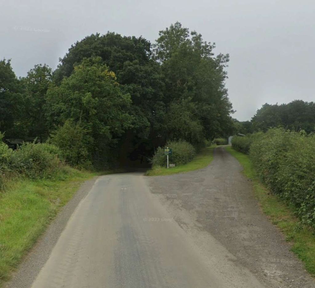
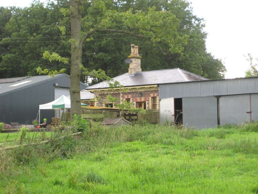
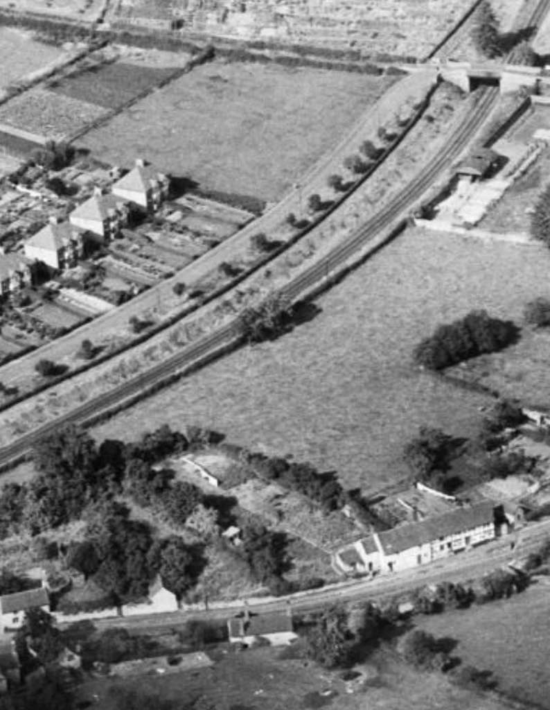
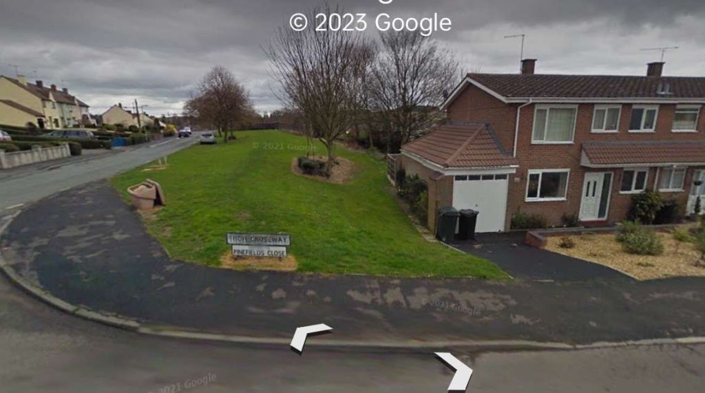
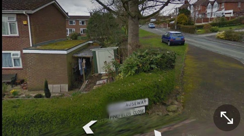
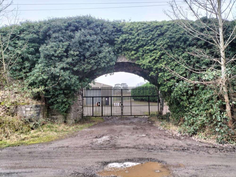
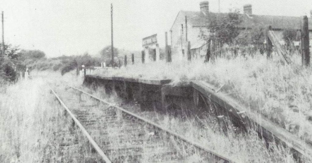
We start our onward journey at Harton Road Station which is now a private dwelling. The station building and platform were on the North side of the line. There was a loop to the West of the passenger facilities which could act as an unloading/loading point for goods or even, possibly, as a passing loop if required.
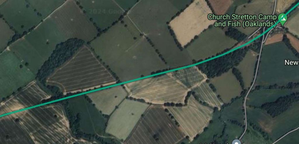
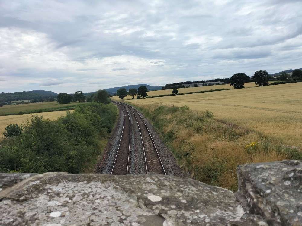
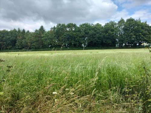
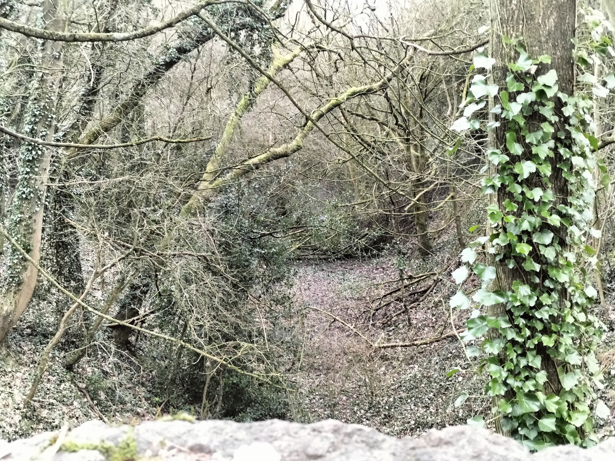
Ken Jones deals with much of the length towards Marsh Farm Junction by telling us that, “Shortly after leaving Harton Road there [was] a long straight stretch across Henley Common, this was once part of the common field system attached to the small hamlet of Henley. Across the common and into a tree-lined deep cutting; as the train weaves in and out of the trees and cuttings between Harton Road and Marsh Farm Junction brief glimpses can be seen of a tower rising well above the trees to the left of the line; this is the well known Shropshire landmark Flounders Folly, a mid-19th century folly. After negotiating its stone staircase tourists would be rewarded with commanding views of the surrounding Shropshire and Border countryside.” [1: p109]
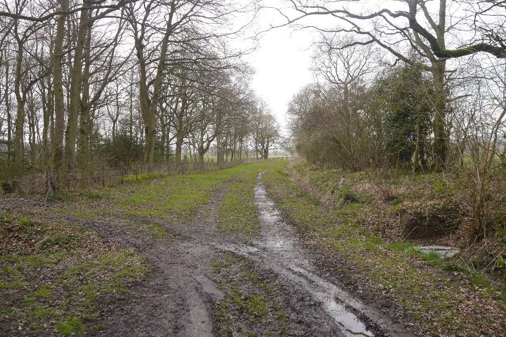
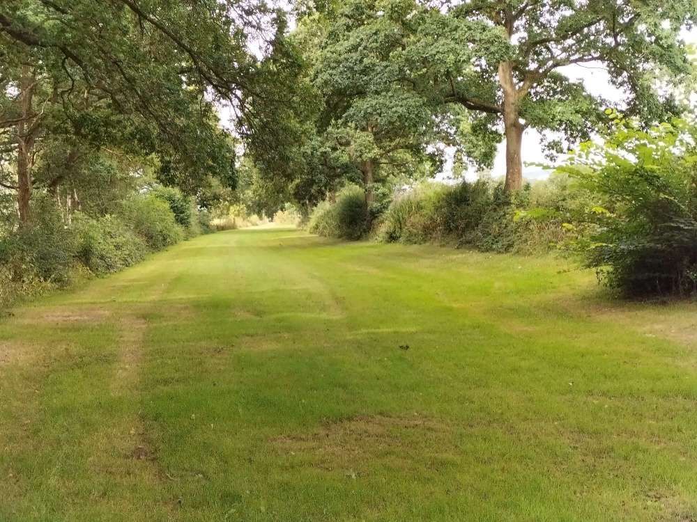
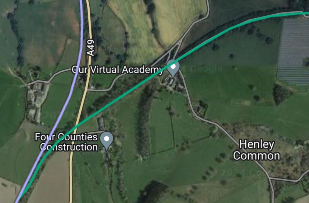
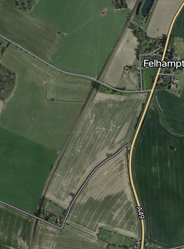
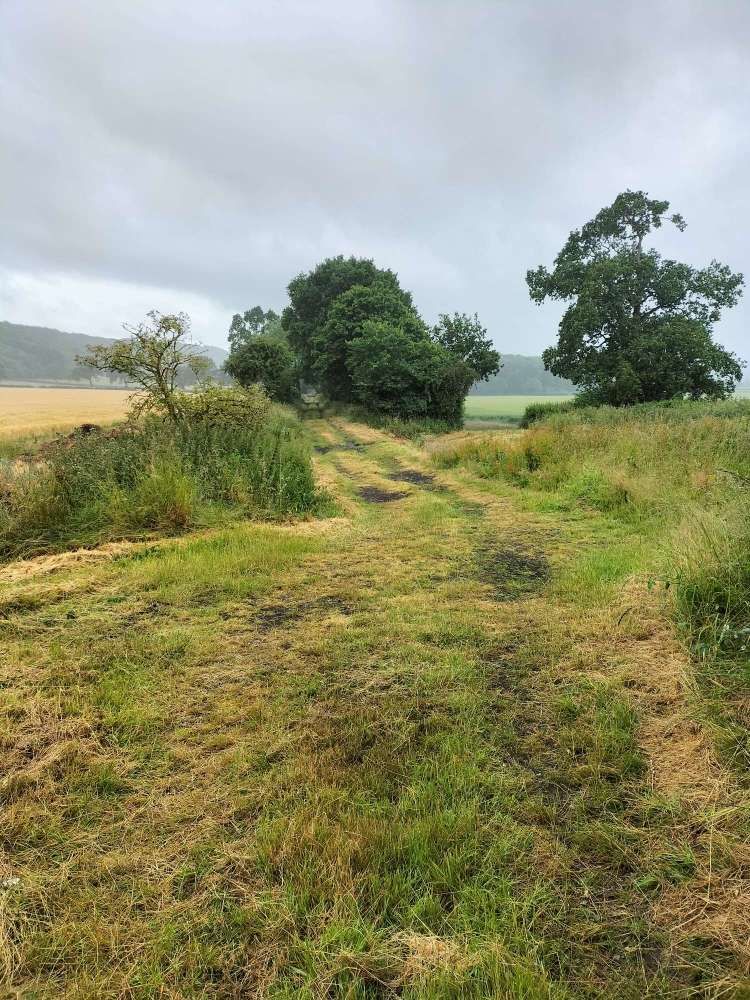
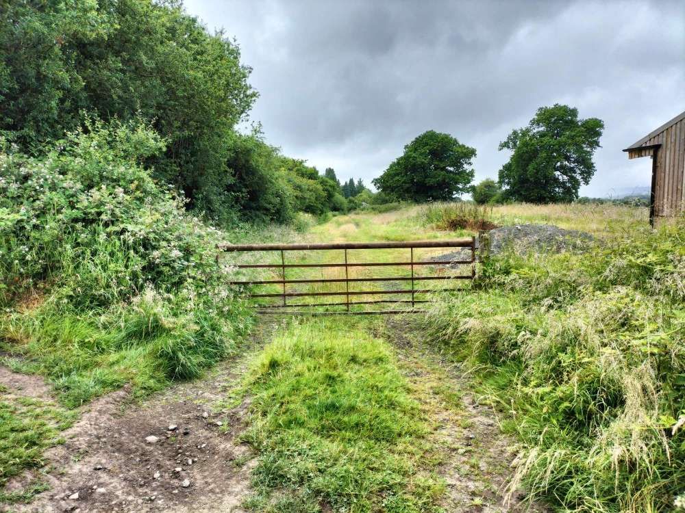
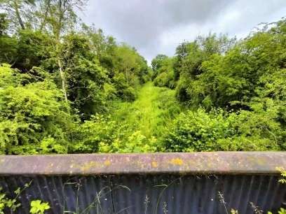
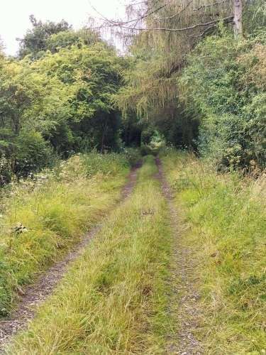
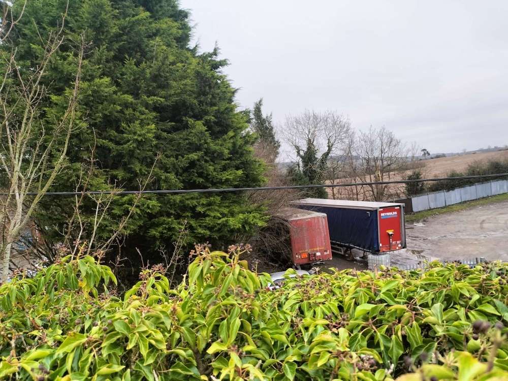
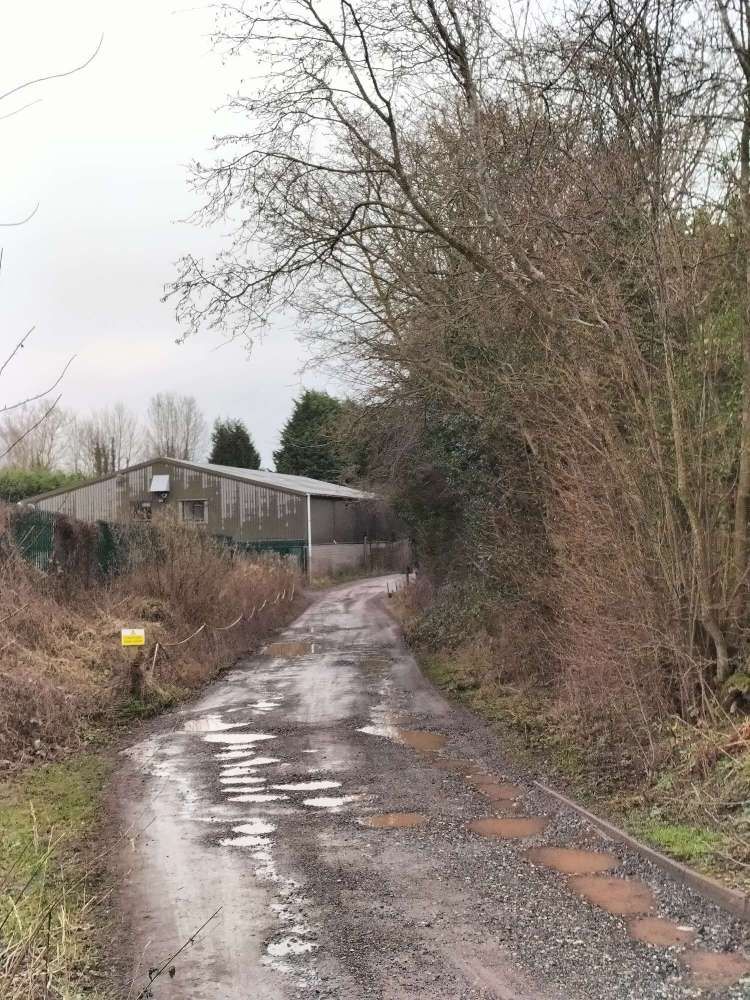
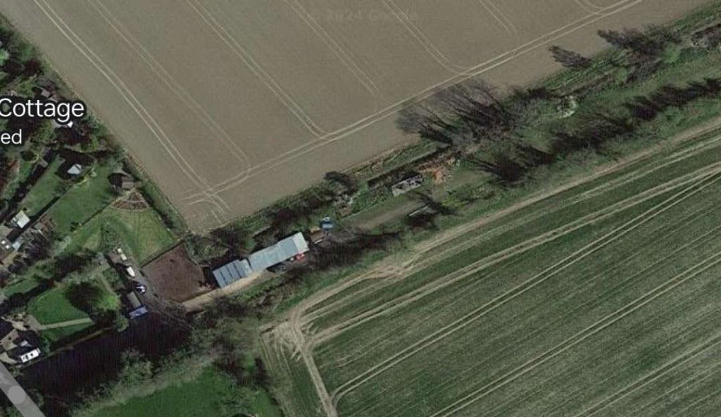
From this point on, the line crosses private land and for some distance the formation has been ploughed into the fields. After some distance, to the South side of the line there is a large Solar Farm. The access track to the solar farm runs West from the farm towards the A49.
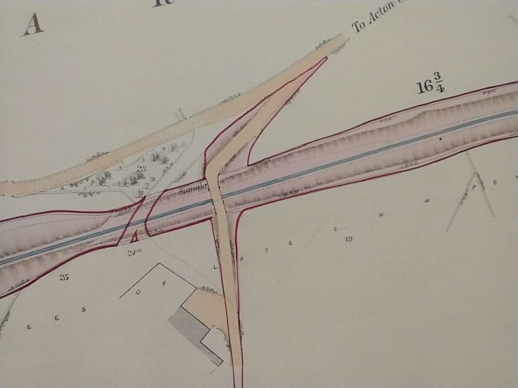
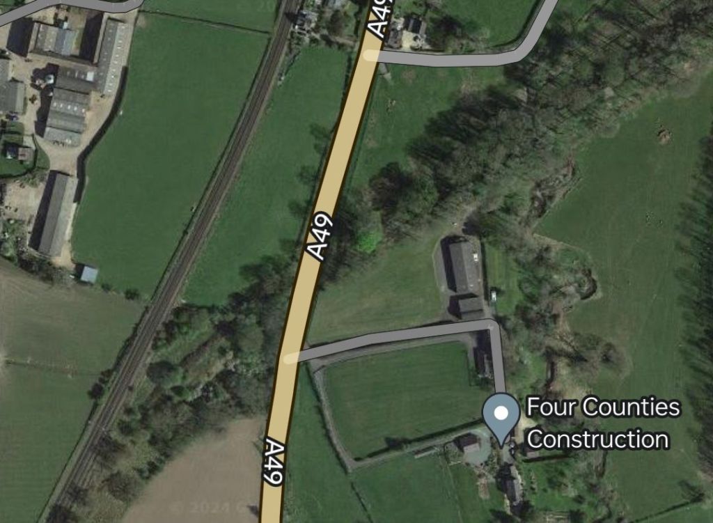
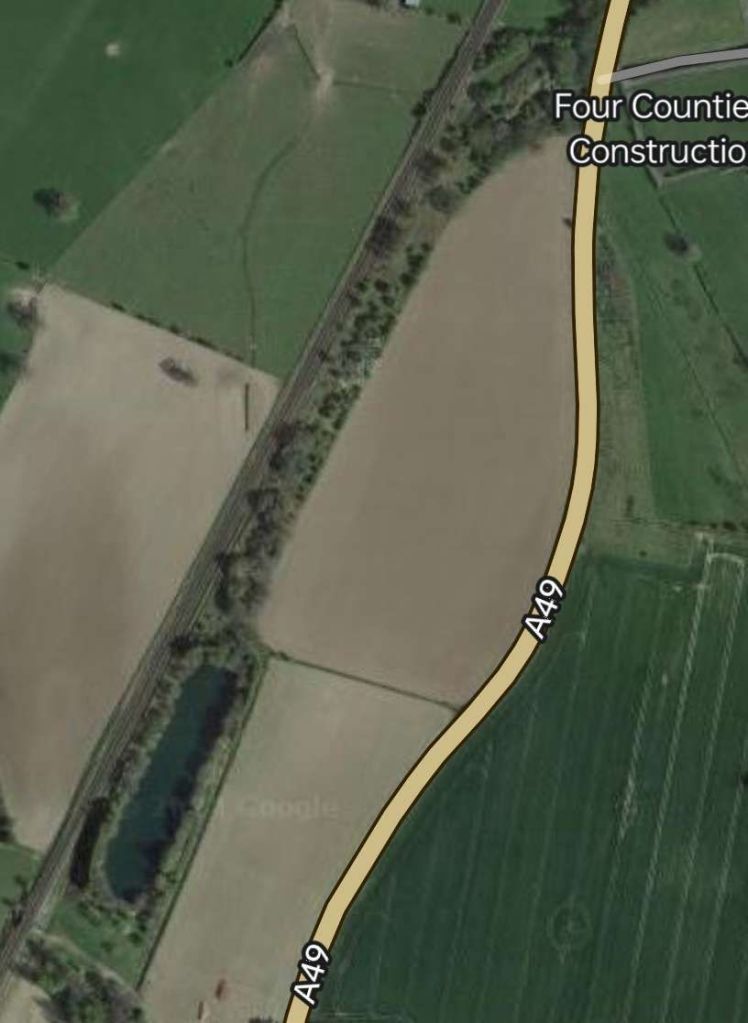
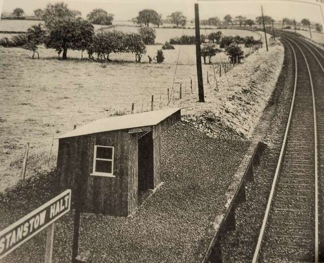
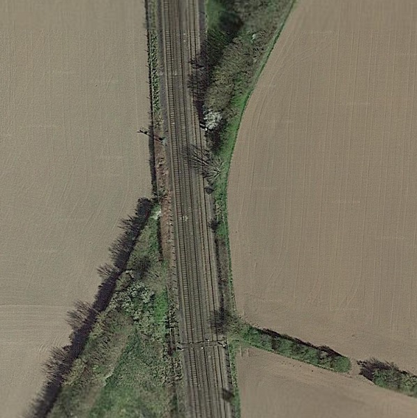
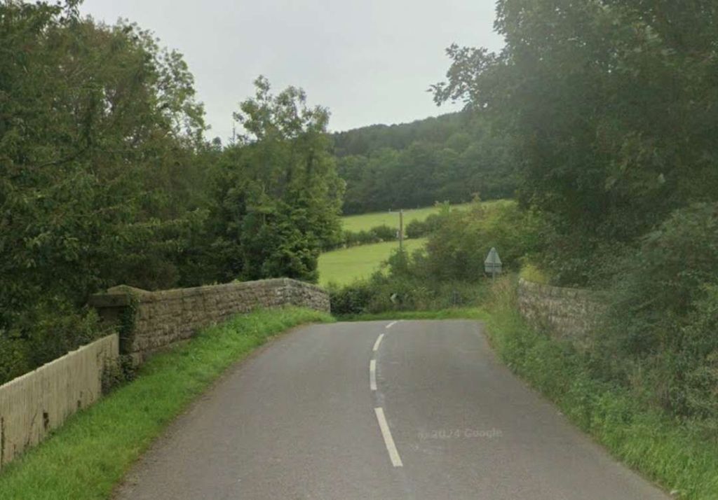
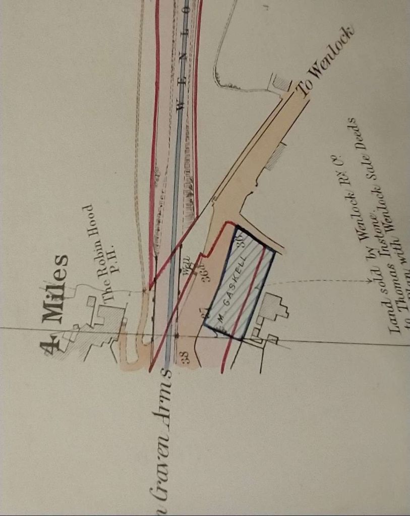
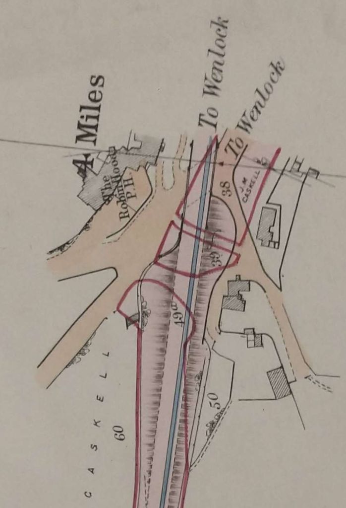
Not long after joining the main line branch trains stopped at Wistanstow Halt, the village being to the West of the Halt.
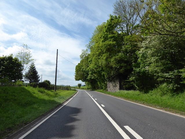
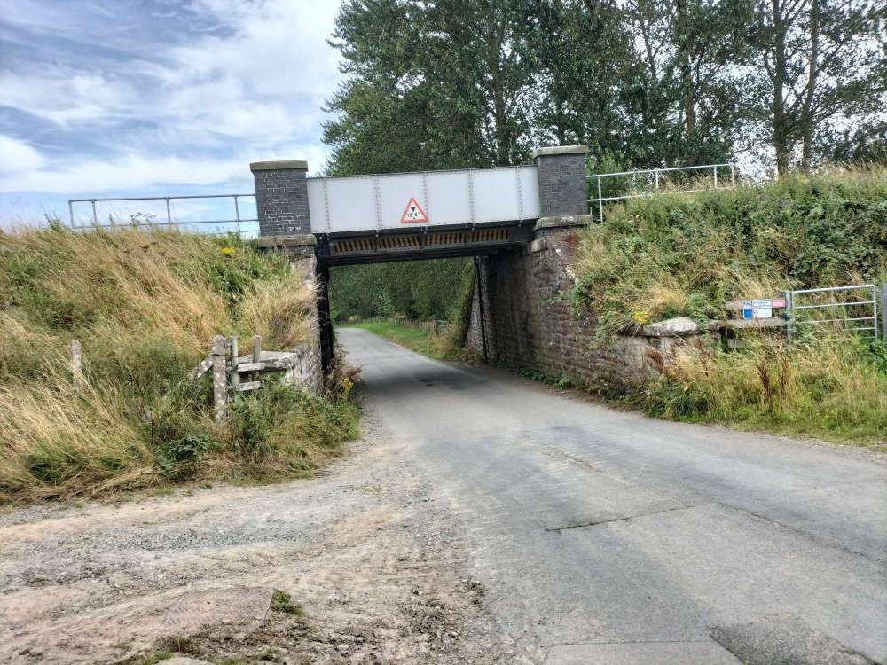
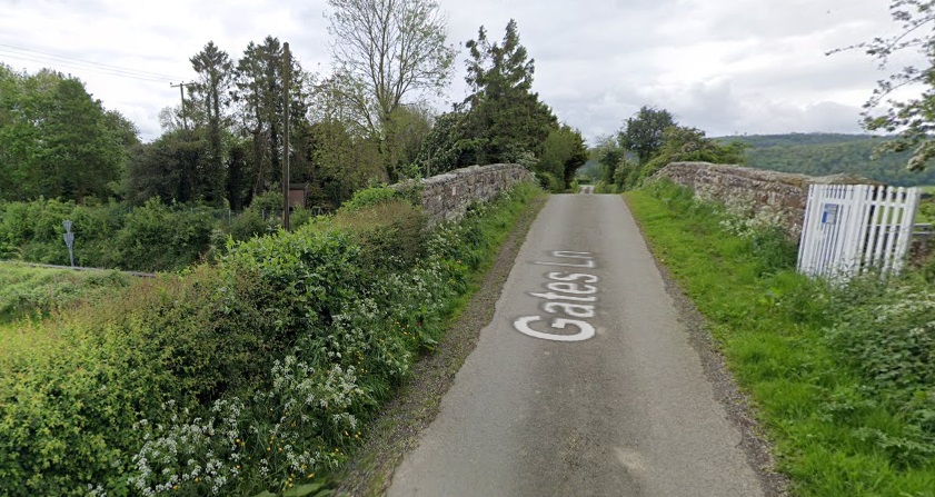
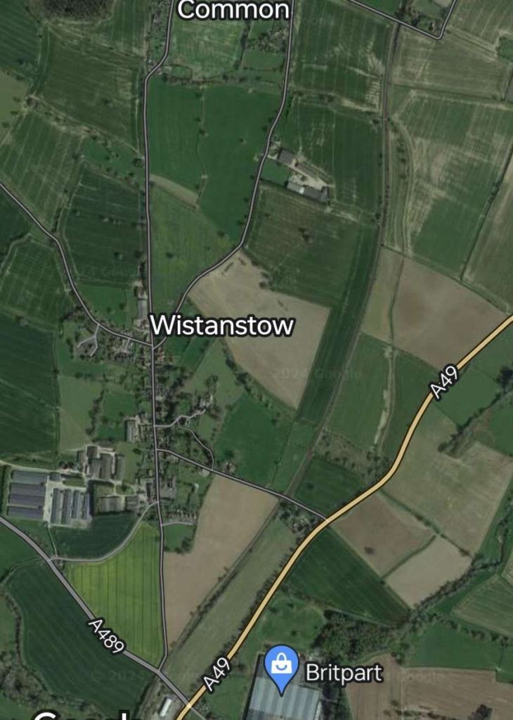
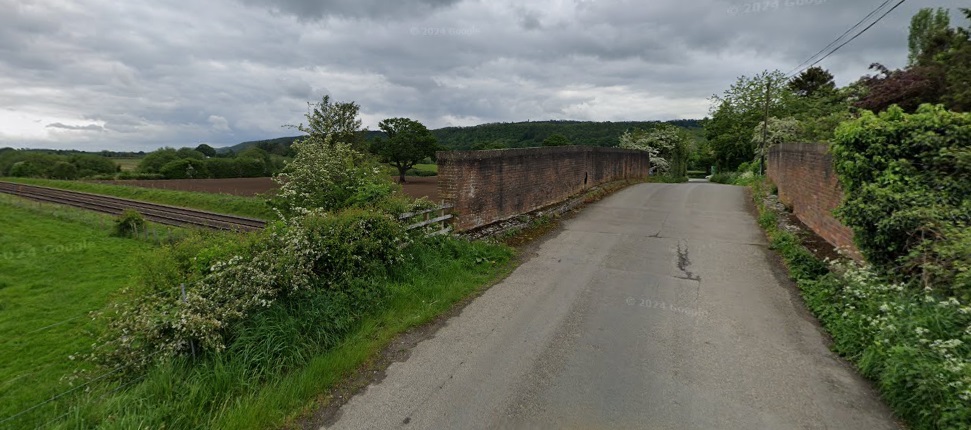
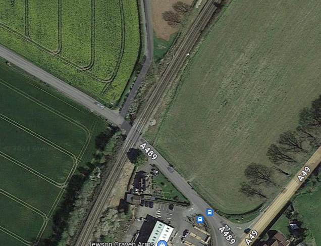
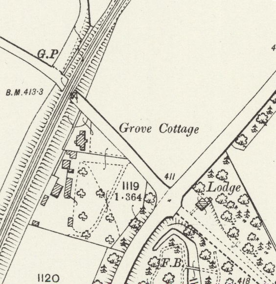
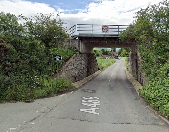
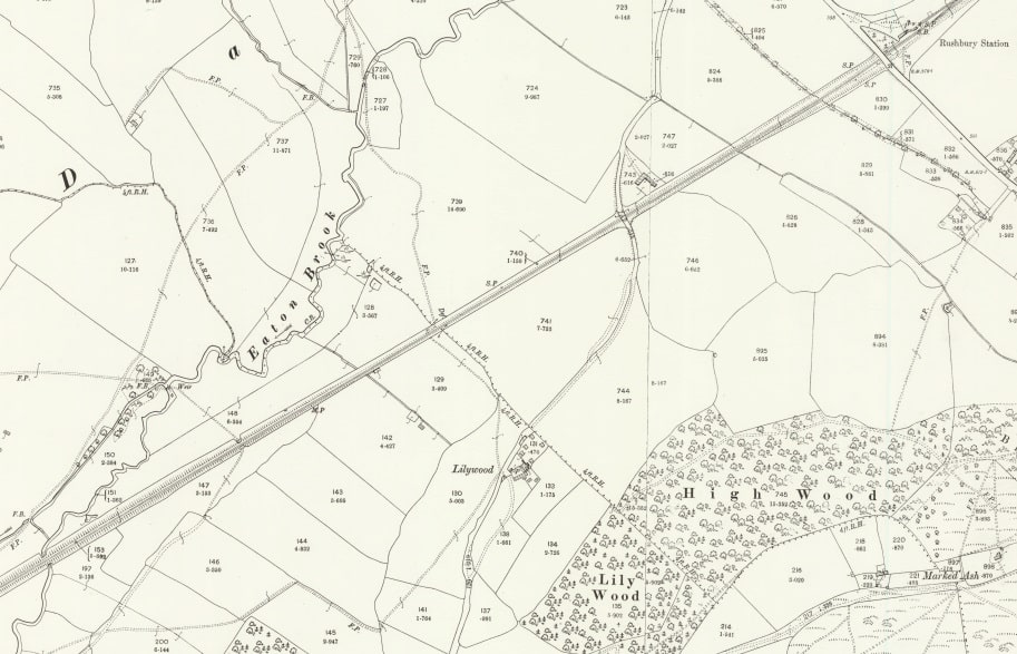
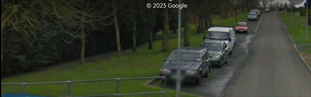
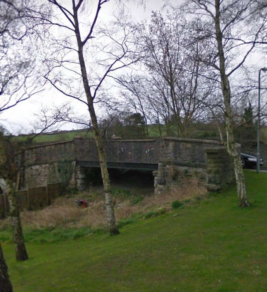
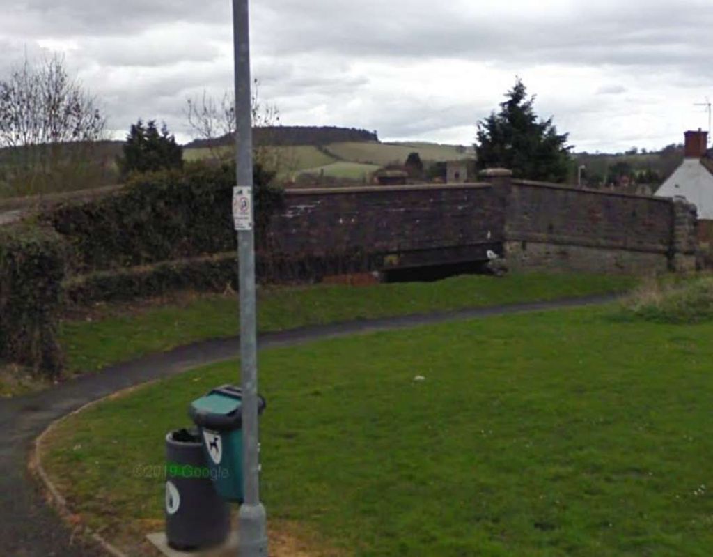
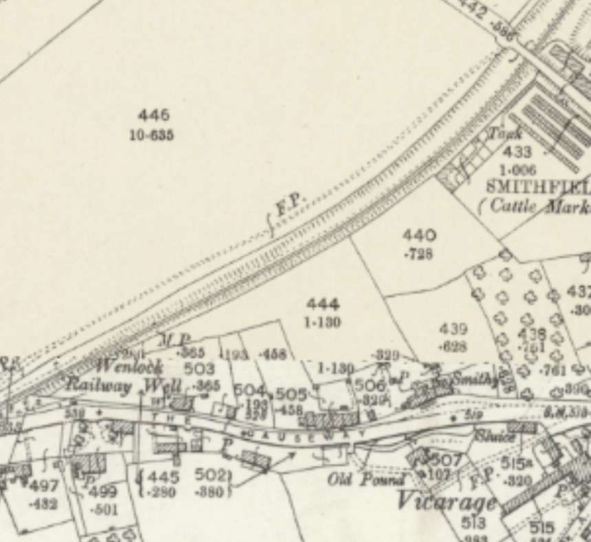
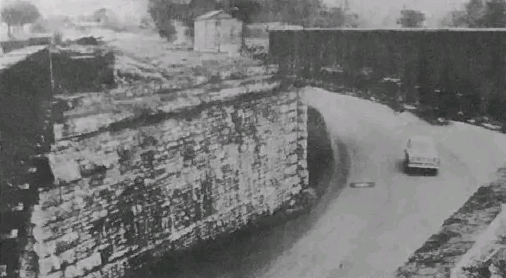
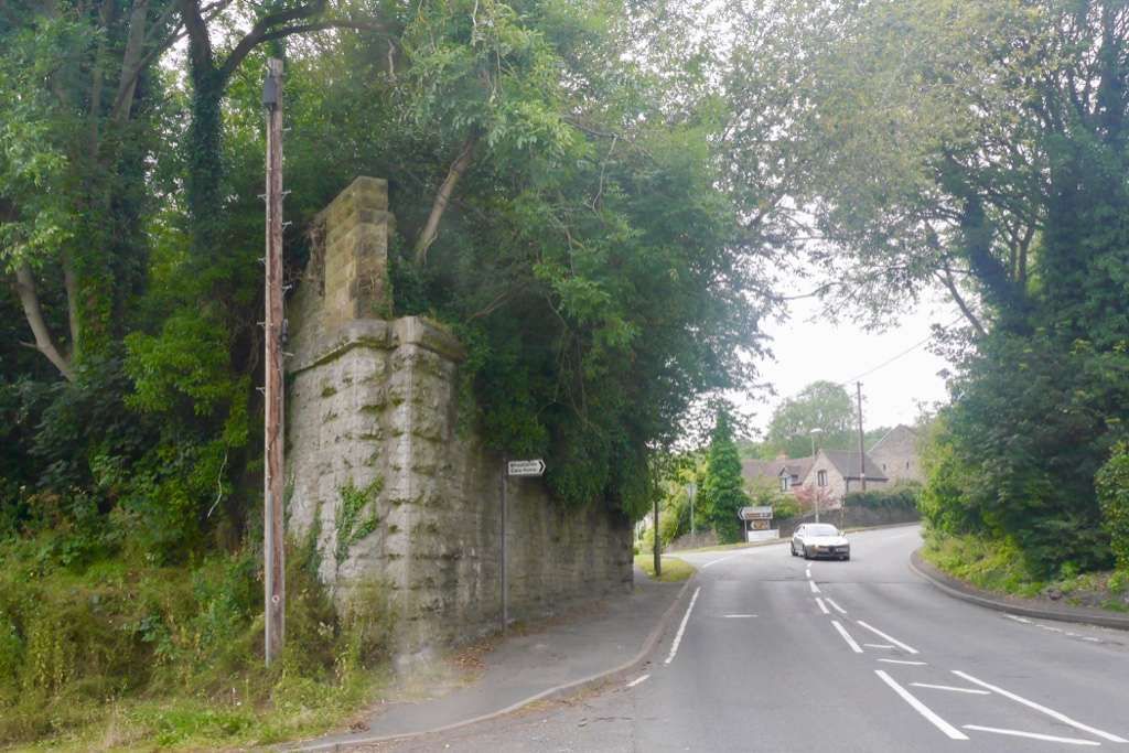
In 1901, there is no sign of Wistanstow Halt. The Halt opened in 1934 and closed in 1956. [26]The bridge over the main line on the minor road between the A49 and Wistanstow, seen from the West. The Halt was on the Northside of the bridge on the length of track visible to the left of this image. [Google Streetview, September 2021]This is the only picture of the halt that I have been able to find. It is unattributed in John Hodge’s second volume about the North & West Route. [27: p66]Just South of Wistanstow the line crosses the A489 very close to its junction with the A49. [Google Maps, August 2024]The same location as it appeared on the 25″ Ordnance Survey of 1901. [28]The A489 passes under the line from Shrewsbury to Hereford close to Craven Arms. [Google Streetview, May 2024]
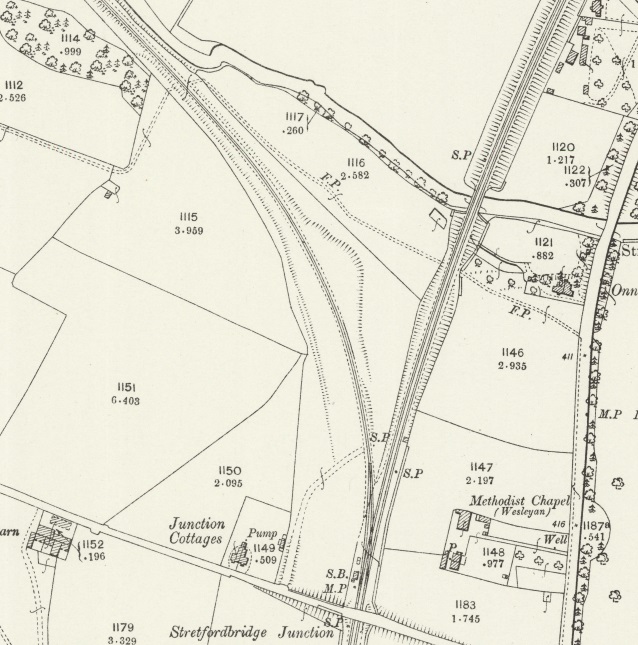
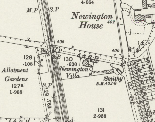
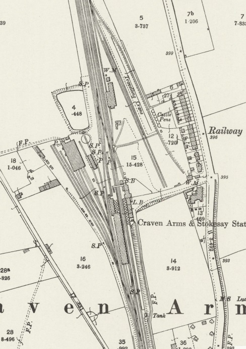
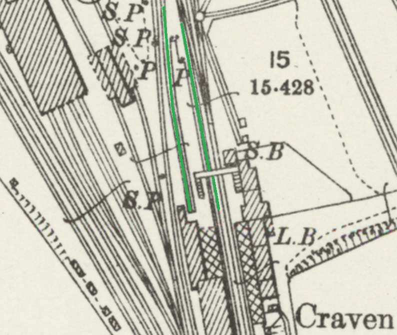
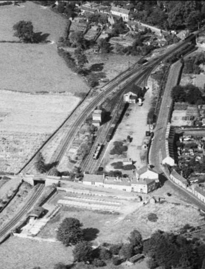
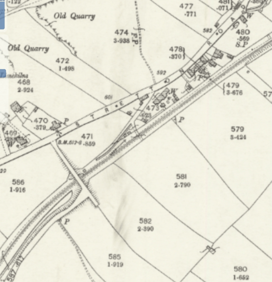
Before entering Craven Arms station, on the right was Stretford Bridge Junction, for the Bishop’s Castle Railway. In the early 1930s the Wenlock branch train could be brought to a stand here, whilst a Bishop’s Castle Railway mixed train was allowed to pass, with its former GWR ‘517’ class engine and its chain-braked ex-LNWR four-wheeled coaching stock, an open-planked wagon, a cattle truck and a Bishop’s Castle brake van.
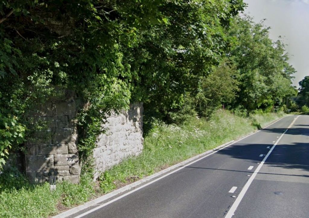
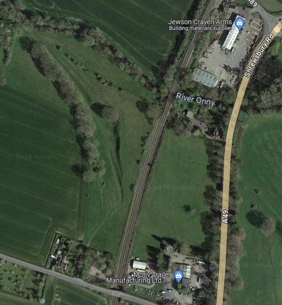
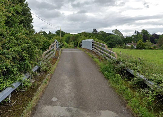
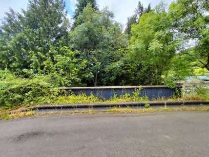
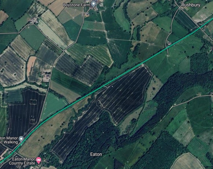
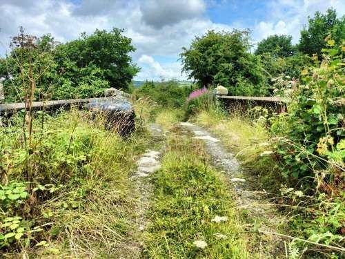
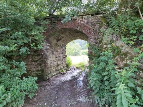
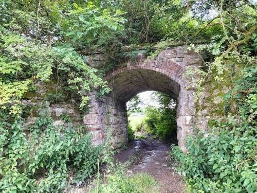
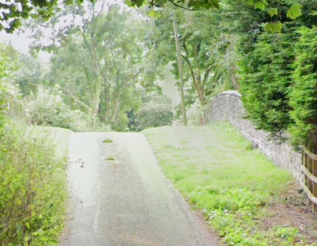
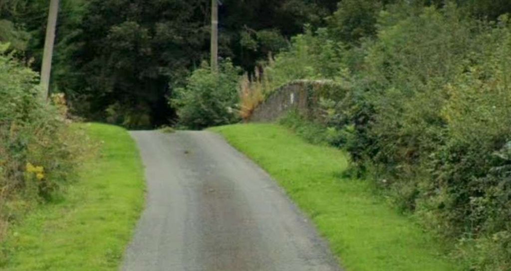
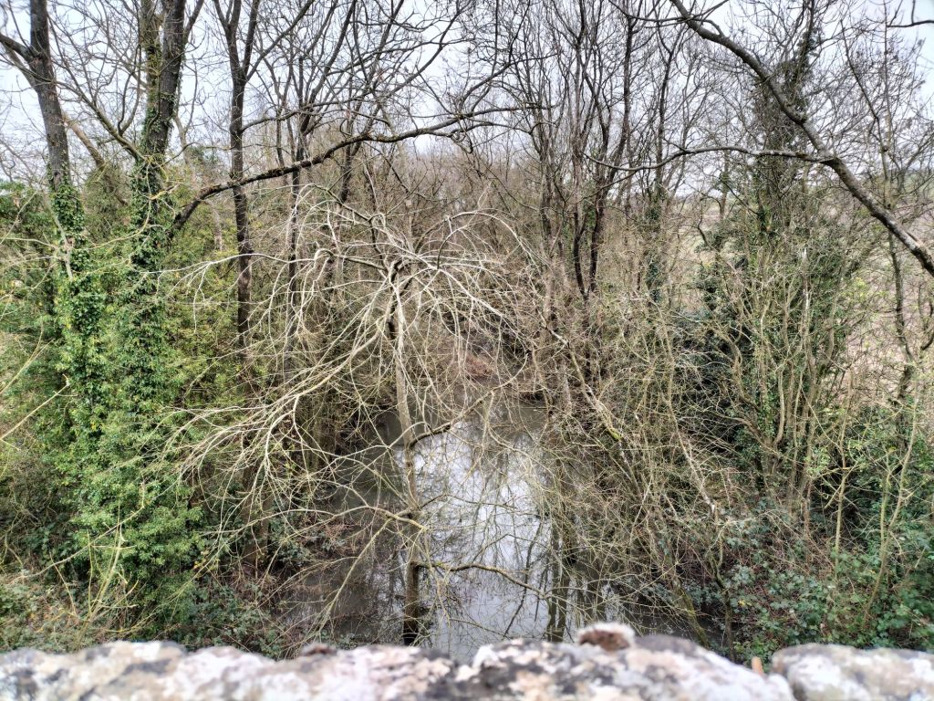
Within a very short distance the line crosses the River Onny, ran on through what was once the junction for the Bishop’s Castle Railway (Stretfordbridge Junction and under and [29]The same area on Google Maps. Earthworks associated with the Bishop’s Castle Railway are visible at the West side of the line. [Google Maps, August 2024]The view from the West along the minor road which crosses the railway at the bottom of the extract from Google Maps above. {Google Streetview. May 2024]
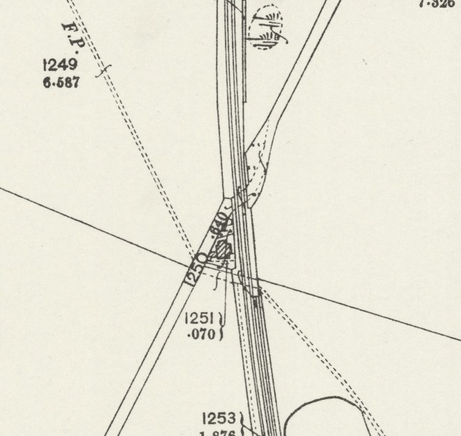
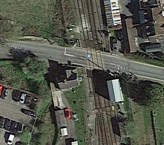
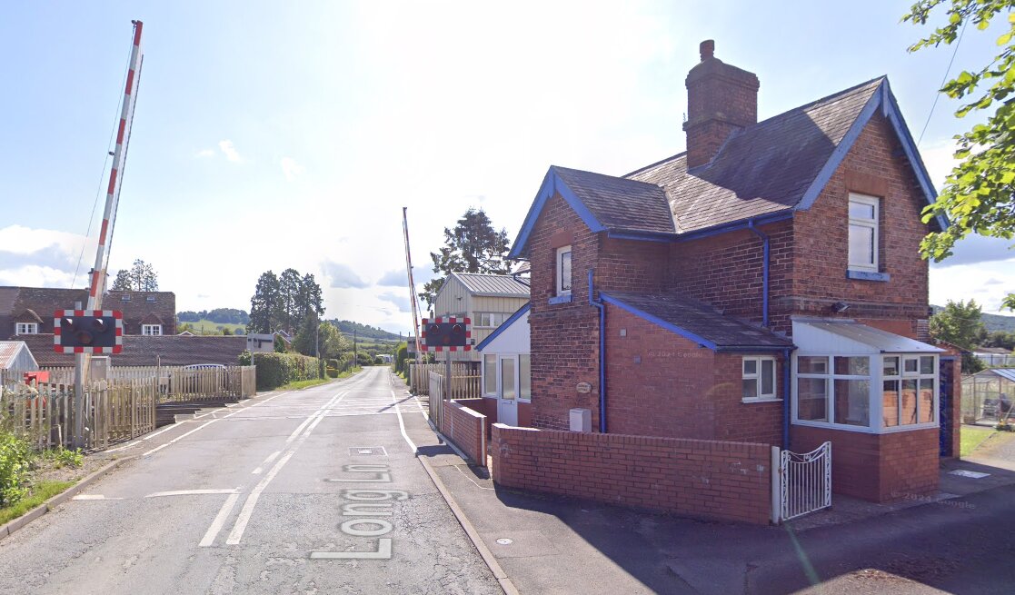
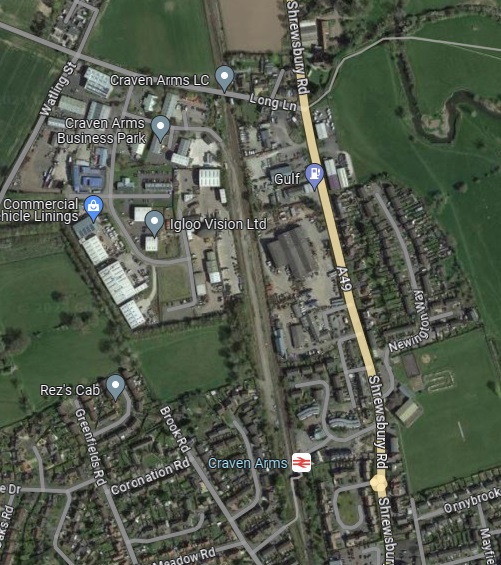
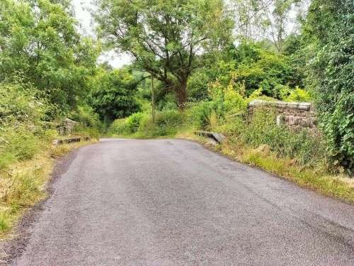
After passing Stretford Junction, the line crossed Watling Street, the old roman road at an oblique angle.
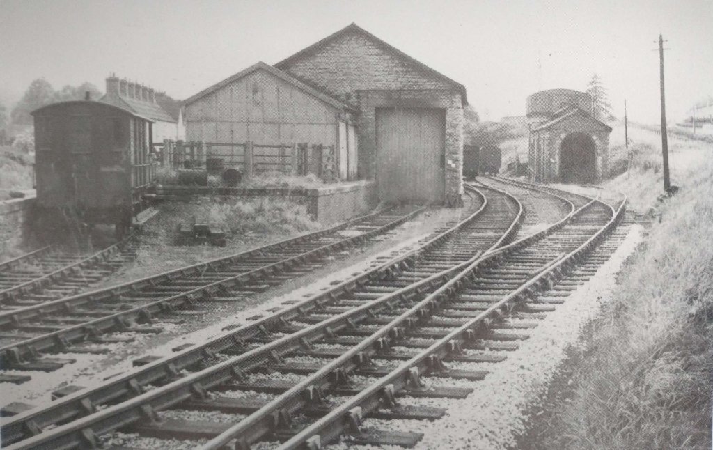
After passing Stretford Junction, Watling Street and Long Lane Crossing, to the right was the carriage and engine shed, and to the left the goods shed and yard.
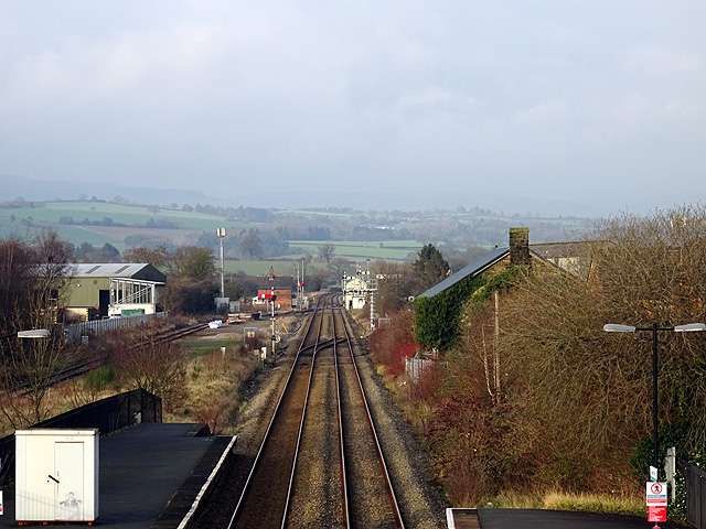
The train pulled in on the down platform at Craven Arms, and after taking water the engine ran round the two coaches, and backed into the bay at the north end of the platform, this also being used by the Bishop’s Castle trains.
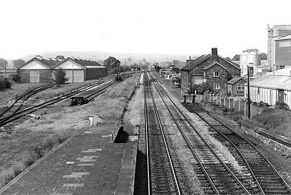
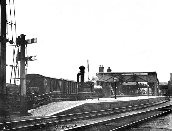
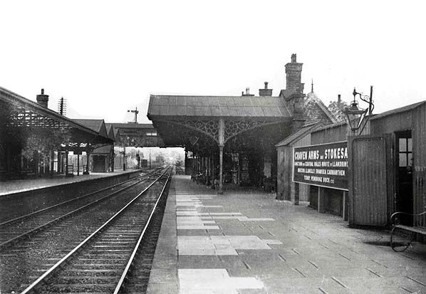
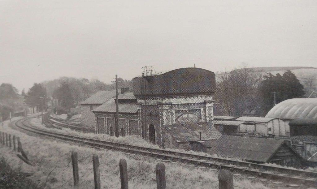
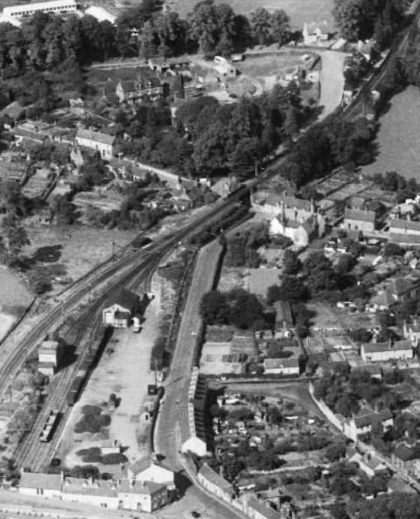
Craven Arms owes its existence to the coming of the Shrewsbury and Hereford Railway in 1852. It is truly a railway town created out of the hamlet of Newton. The S&H line passed through the Onny Valley, its route taking it past Shropshire’s famous beauty spot Stokesay Castle, and past a coaching inn named after the Lord of Manor the Earl of Craven, prompting the S&H to give the station the name of Craven Arms. The station was opened for traffic on 20th April, 1852. The parish name of Stokesay was added to the station’s name a little later.
The importance of Craven Arms as a railway centre was given added impetus by the opening of the Knighton Railway in 1861. Although only a branch it was in reality to be the embryo of the LNWR’s march upon Swansea. Various small companies were involved in the construction of the line between Craven Arms and Swansea, these later being absorbed into the LNWR or operated jointly by the LNWR and GWR.
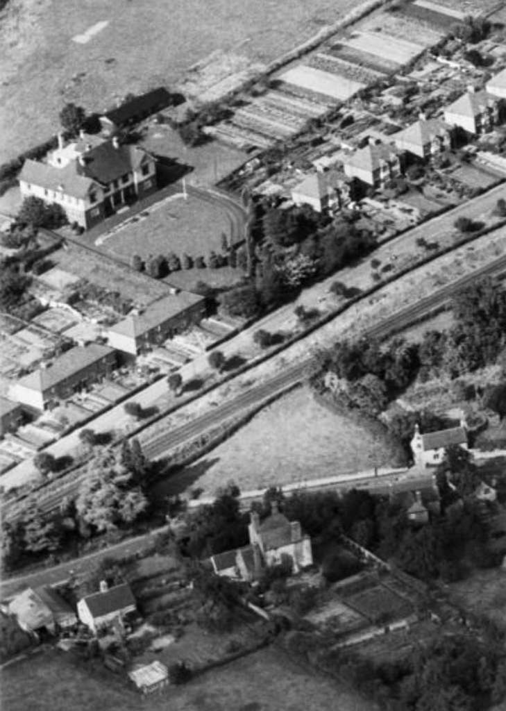
On 1st July, 1862 Craven Arms station came under the joint ownership of the LNWR, GWR and West Midland Railway. The station consisted of up and down main line platforms, with booking office, general and ladies waiting room, together with refreshment rooms on the down side. Also on the downside was the station master’s house. The up side consisted of general and ladies’ waiting rooms only. The north and south end bays were on the down side. The North [1: p109] end bay was utilised by the Bishop’s Castle and Wenlock branch trains. [1: p114]
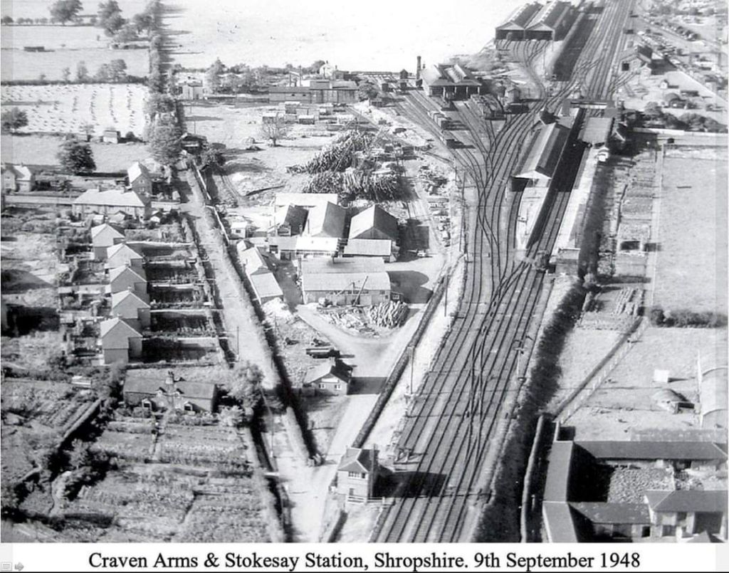
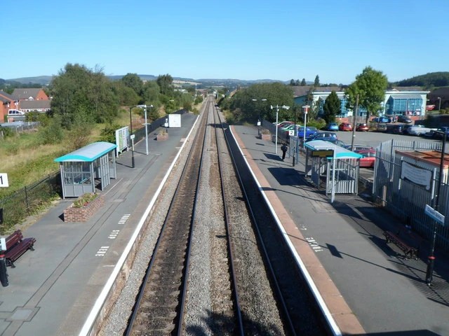
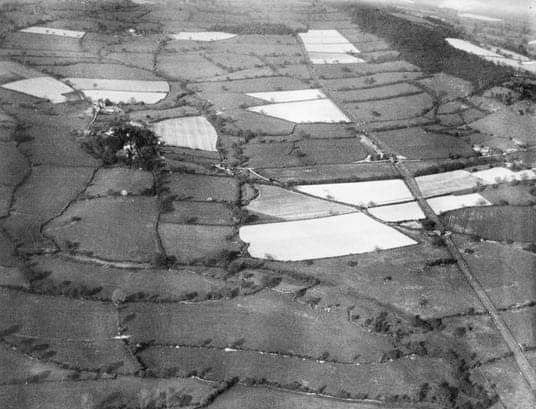
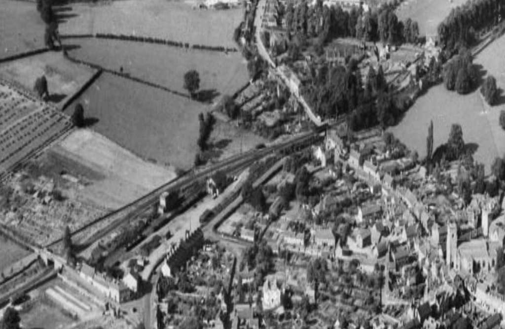
An aerial photograph from the South of Craven Arms and Stokesay Railway Station in 1948. Found on eBay on 12th August 2024. [25]Craven Arms in the 21st century is much reduced. [34]
This brings us to the end of our journey from Wellington to Craven Arms along the Wenlock Branch.
References
Ken Jones; The Wenlock Branch; The Oakwood Press, Usk, Monmouthshire, 1998.
The photographs of the pre-contract drawings for the line were taken by myself and show extracts from the construction plans held in the Shropshire Archive. There is a standard charge of £10 per visit for taking photographs of their records.
Adrian Knowles; The Wellington, Much Wenlock & Craven Arms Railway; Lightmoor Press, Lydney, Gloucestershire, 2022.
The photographs of the pre-contract drawings for the line were taken by myself and show extracts from the construction plans held in the Shropshire Archive. There is a standard charge of £10 per visit for taking photographs of their records.
This article follows on from six other articles which covered the Wellington to Severn Junction Railway and this line from Buildwas to Longville-in-the-Dale. The first three articles can be found on these links:
As we noted in the last two articles, from the commencement of the building of the line between Buildwas and Much Wenlock, the directors hoped that the line could be extended to Craven Arms via Presthope on Wenlock Edge (linking with the limestone quarries/works at that location).
The directors of the Wellington & Severn Junction Railway were, however, fully occupied with the line from Wellington to Buildwas. Another company was set up to build the ‘Wenlock & Craven Arms and Coalbrookdale Extension Railway‘. The bill went through the parliamentary process unopposed and authorised the ‘Wenlock Railway Company‘ to construct the line. Work started on 23rd October 1861.
By 5th December 1864, the line was open from Much Wenlock to Presthope. (That length is covered in the last but one online article listed above.) At this time, because it was a freight-only line, the Board of Trade saw no need for an inspection of the line. It had already been agreed at a meeting held on 4th December 1863 not to proceed with the line from Presthope to Craven Arms for the time being. It was to be three years after the line reached Presthope before the connection to the Shrewsbury & Hereford Railway close to Craven Arms was completed. It was finally opened on 16th December 1867.
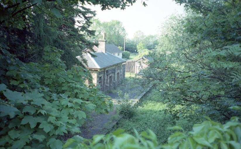
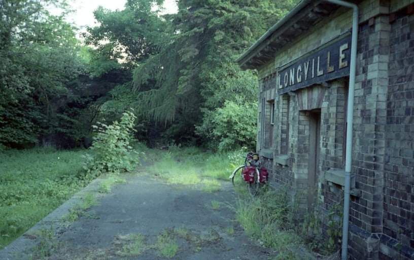
Longville in the Dale to Harton Road Station
We begin this article at Longville Railway Station and travel towards Craven Arms, we complete this part of the journey at Harton Road Station.
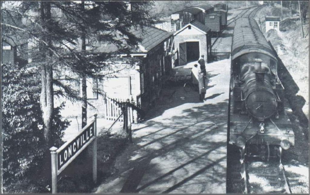
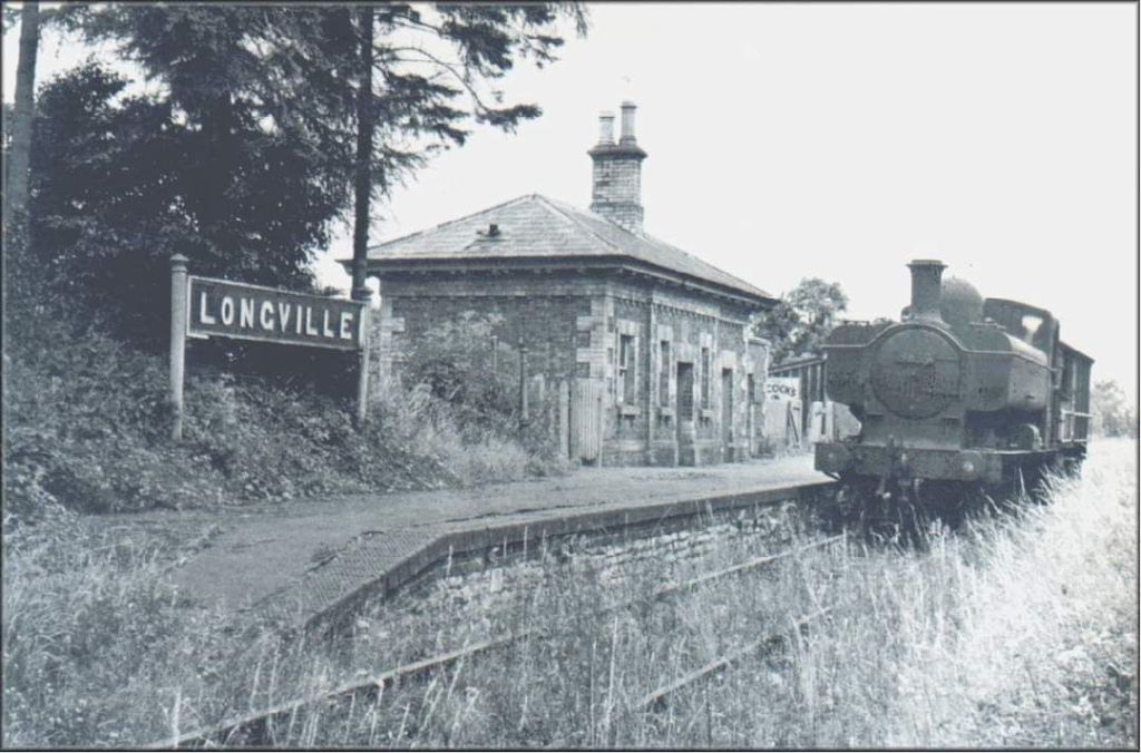
Longville Station had a single platform with a red and yellow brick booking office and waiting room. Ken Jones tells us that it “served a few cottages, a farm, an Inn, and the nearby Lutwyche Hall, the home of the Benson family, who did so much to promote the building of the line between Much Wenlock and Craven Arms. The station also served the villages of Cardington, Holdgate, Shipton and Stanton Long. The platform was on the up side, and the station buildings consisted of a general waiting room, ladies’ waiting room of brick and goods warehouse lock-up. There were two sidings, and a horse landing for two horse boxes, and a cattle landing for two wagons. There was no signal box, Longville being an intermediate station on the Presthope to Rushbury staff section. There were east and west ground frames, access to both being obtained by a key on the Presthope-Rushbury staff.” [1: p105]
After passing under the minor road the line ran Southwest towards Coates Crossing.
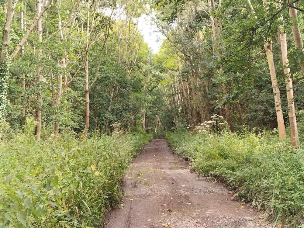
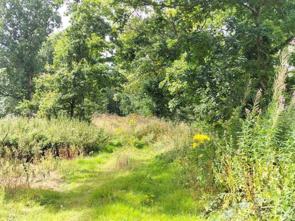
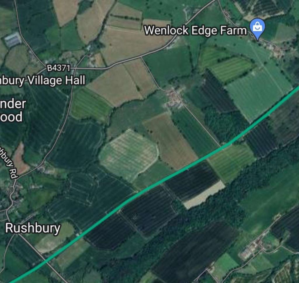
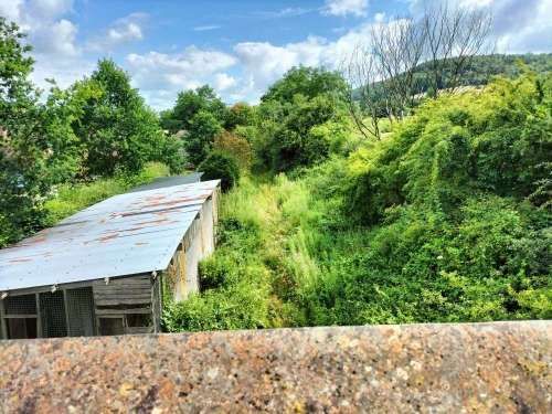
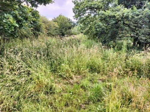
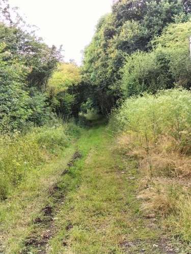
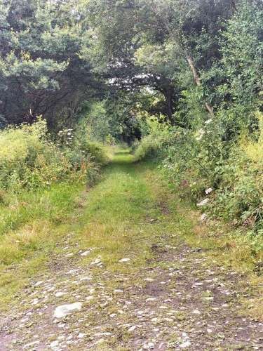
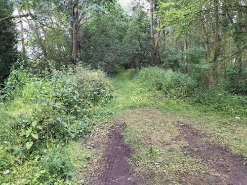
I was able to access the line from Northeast of Coates Crossing (via a footpath from Wenlock Edge Farm) to Rushbury Station with permission from local landowners. From here to Rushbury Station the original railway boundaries are predominantly fenced and gated with significant hedgerows and trees.
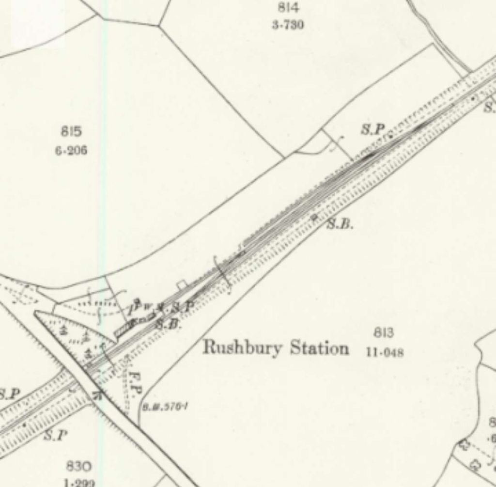
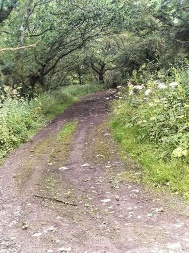
Looking Northeast along the line of the Wenlock Branch toward the minor road bridge above. [My photograph, 3rd July 2024]Looking Southwest along the line of the old railway towards Rushbury Station, for a distance of around 100 metres the route of the line is not protected by hedging. [My photograph, 3rd July 2024]A couple of hundred metres to the Southwest, another view looking Southwest along the line of the old railway. [My photograph, 3rd July 2024]This extract from the 25″ Ordinance Survey, together with the extract immediately below, cover the length of the line to Rushbury Station. [7]Rushbury Station appears in the bottom-left of this extract from the 25″Ordnance Survey. [8]This next railmaponline.com satellite image covers the same length of the line as the two map extracts above. Wenlock Edge Farm appears in the top-right, Rushbury Station in the bottom-left. [3]Approaching, and looking towards, the location of Coates Crossing which is about 200 metres ahead. [My photograph, 3rd July 2024]
Coates Crossing’s keeper’s cottage was from its construction “occupied by the Rushbury station master, and it was the duty of the station master’s wife to operate the crossing gates as and when a farm cart from the nearby Coates Farm required to go into the fields under Coates Wood. Later, after the abolition of the Rushbury SM’s post, it became the duty of the Longville station master’s wife.” [1: p105]
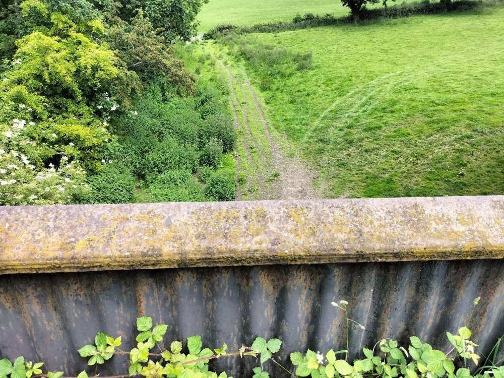
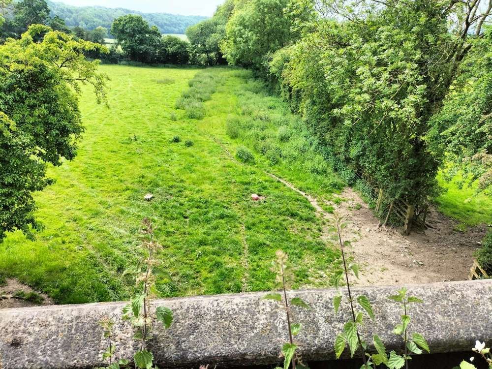
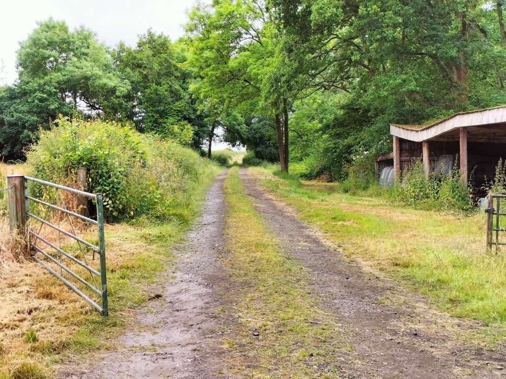
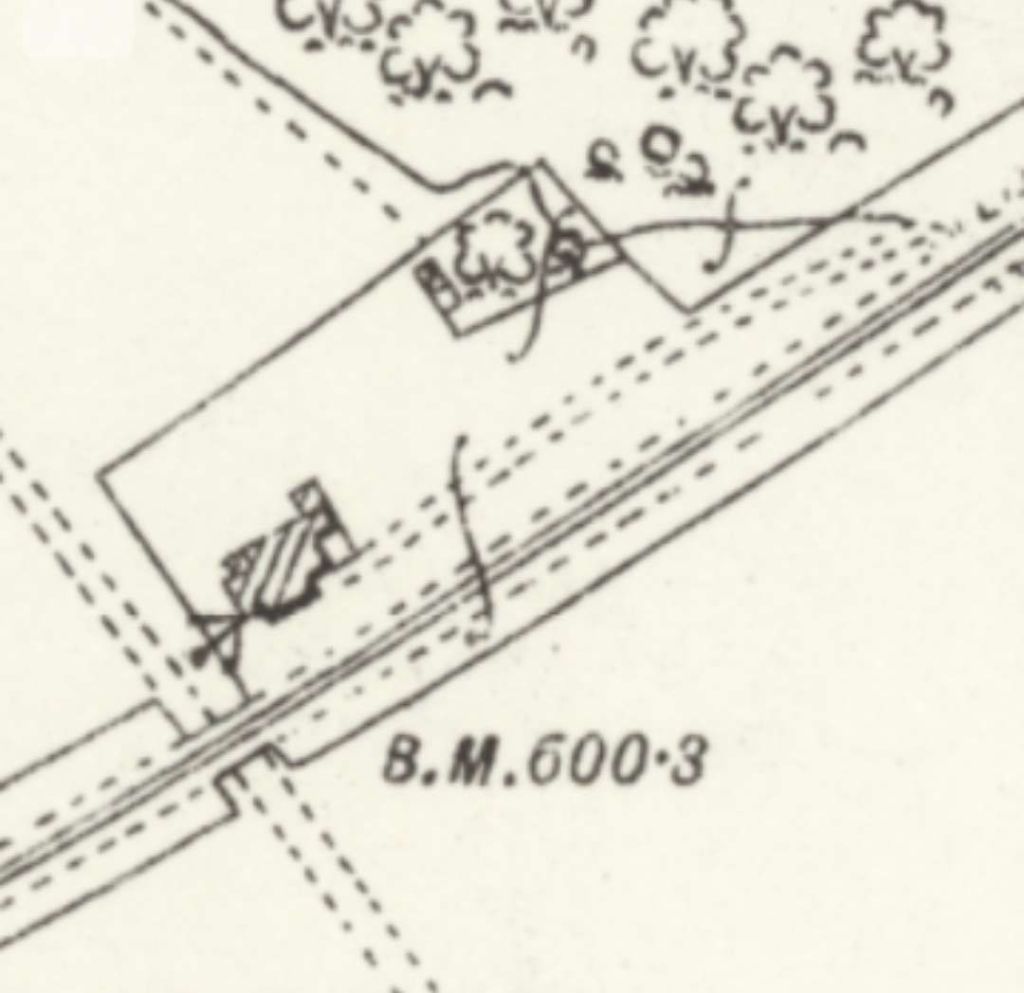
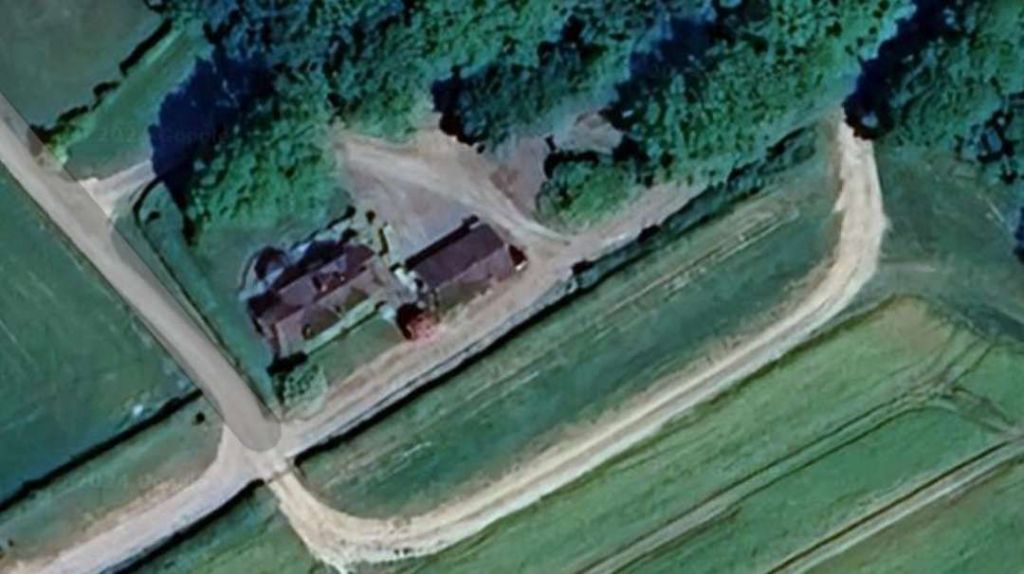
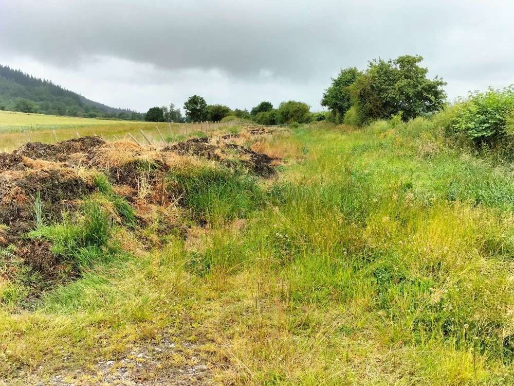
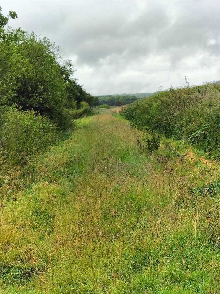
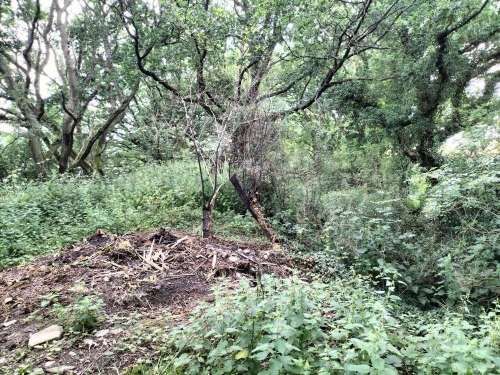
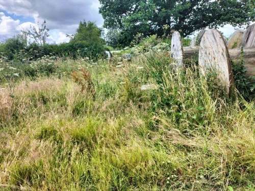
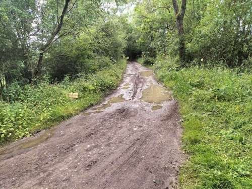
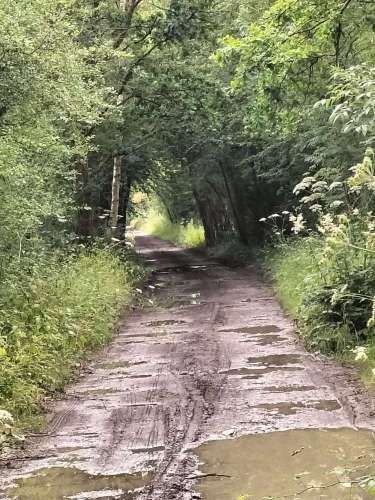
An enlarged extract from the 25″ Ordnance Survey shows Coates Crossing. [7]The location of Coates Crossing. The building shown is larger than the original crossing-keepers cottage which for a good while doubled up as the Rushbury Stationmaster’s house. [Google Maps, July 2024]250 metres or so to the Southwest of the location of Coates Crossing, looking Southwest. [My photograph, 3rd July 2024]Just under halfway from Coates Crossing to Rushbury Station the old formation becomes overgrown and is being used by the landowner for muck storage. [My photograph, 3rd July 2024]Beyond the piles of muck a gate is closed across the line of the old railway. Access along the line required turning to the last and walking through the field immediately alongside the line until it was possible to get back onto the line 100metres or so ahead. [My photograph, 3rd July 2024]Having regained the line of the old railway it is noticeable that the route is not as heavily used in the 21st century as the length already covered. [My photograph, 3rd July 2024]The ‘green lane’ continues. [My photograph, 3rd July 2024]Much closer now to the site of Rushbury Station a gate marks a change in ownership. [My photograph, 3rd July 2024]The modern complex of buildings on the Rushbury station site appears on the horizon, flanked by various fir trees. [My photograph, 3rd July 2024]The occasional railway sleeper can be seen. This photo was taken towards the Eastern end of the Rushbury Station site. [My photograph, 3rd July 2024]The modern track diverts away from the line of the old railway once within the boundaries of the station site. The trees to the left run alongside the route taken by the line through the station. The roof of the old station building can just be made out at the centre-top of this image. The concrete post and railings are what remains of the cattle loading pens. [My photograph, 3rd July 2024]Rushbury Station: the remains of the cattle loading pens. [My photograph, 3rd July 2024]The site of the old station, viewed from the North. [My photograph, 3rd July 2024]The road approach to Rushbury Station, seen from the Northeast. [My photograph, 3rd July 2024]
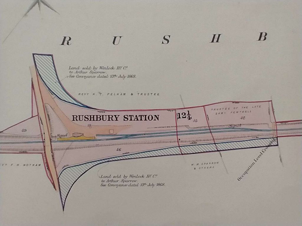
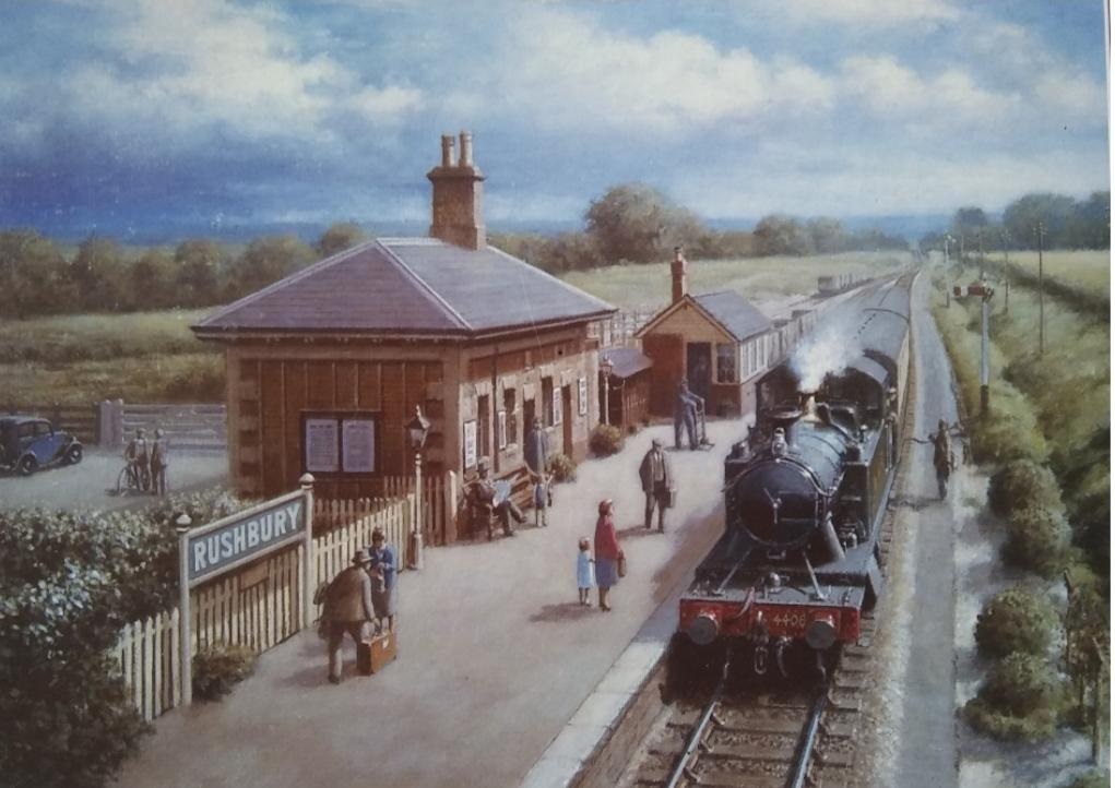
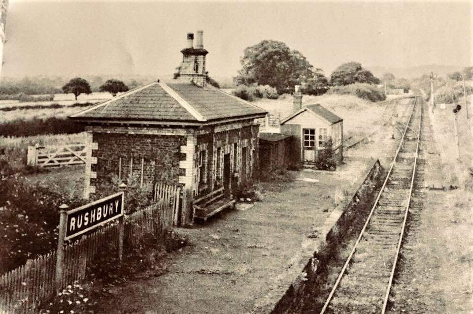
About the length just walked and about Rushbury and its station, Ken Jones writes: “The line has now levelled out into Ape Dale, and soon enters Rushbury station with its avenue of fir trees on either side, the station in every respect being similar to that of Longville. … The station served the villages of Rushbury and Munslow. The signal box was at the north end of the platform, the box containing the locking frame only, the electric train staff instruments being situated in the booking office. The station was not a crossing place. The station buildings consisted of a booking office, general and ladies’ waiting room, and a lamp room. The staff were just the station master and a signalman, the latter being required to assist with station duties.” [1: p105]
A further ground frame was situated at the Northeast end of the station, “and gave access to two sidings, a horse landing and cattle pens. In the station yard there was a cart weighbridge. At the Craven Arms end of the platform there was a water column.” [1: p105]
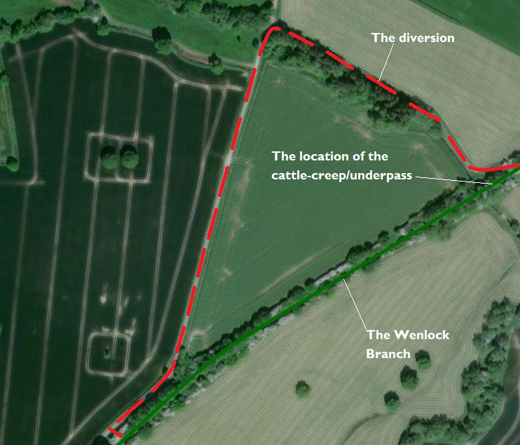
At this point on the Wenlock Branch it was necessary to leave the line of the old railway. A short detour along a field boundary and then along Darby Lane led to another access point to the old railway line.
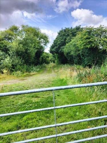
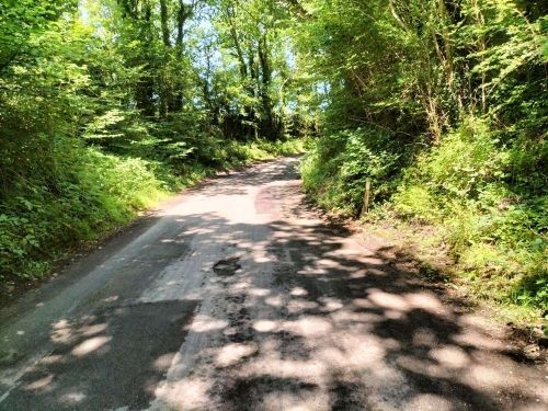
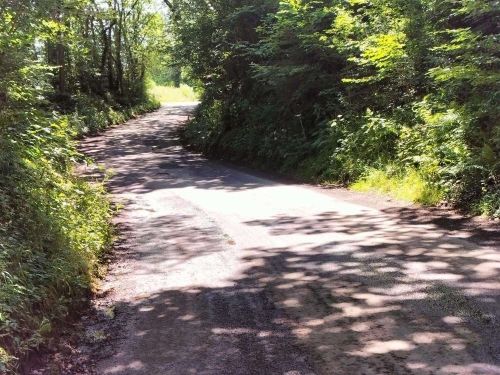
To the West of this location the line of the old railway is now in private hands. Access to the line is limited to that possible on public footpaths/roads which cross the line. A diversion to the South of the line was necessary to reach the first point of access.
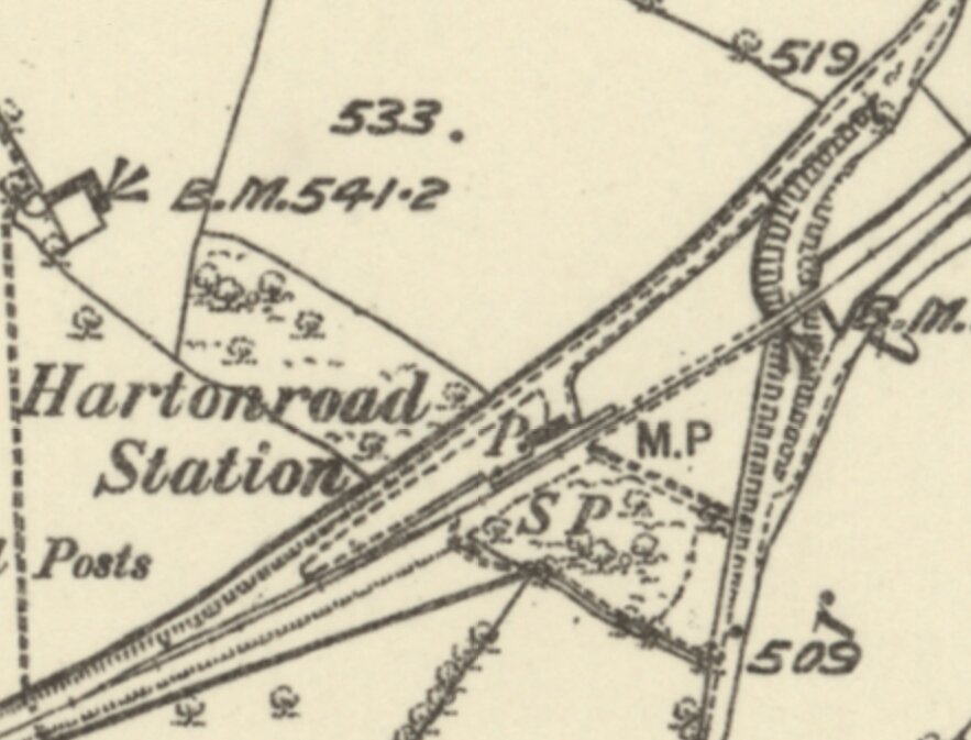
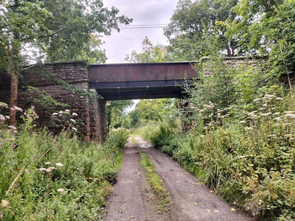
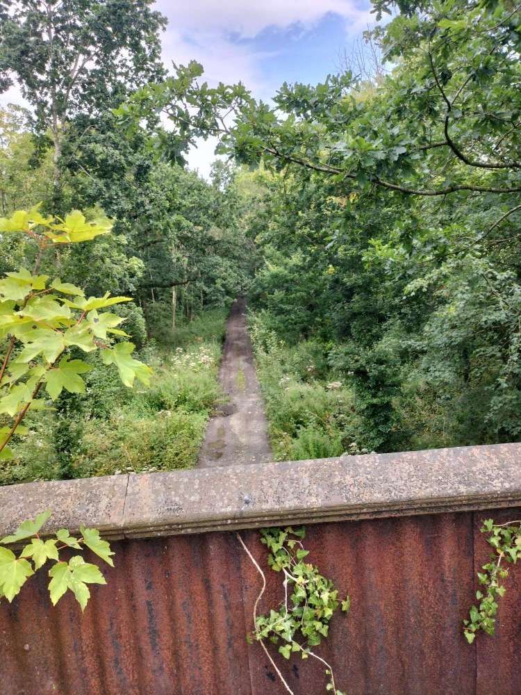
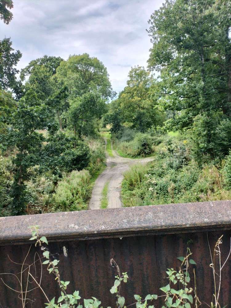
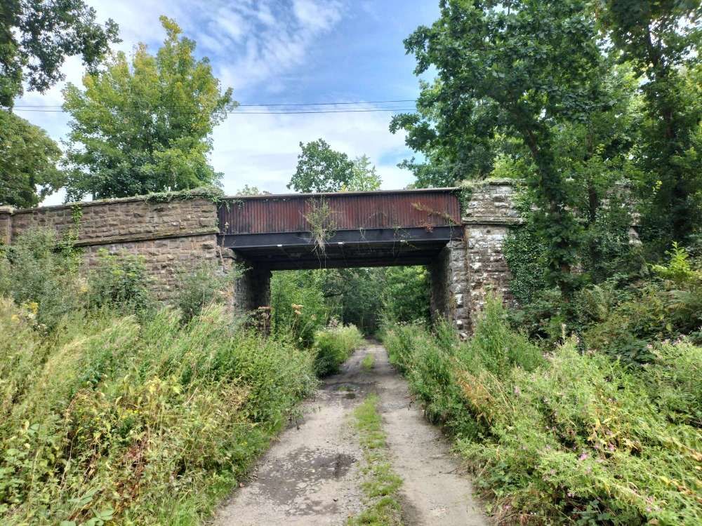
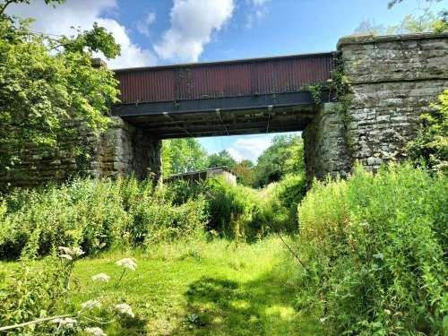
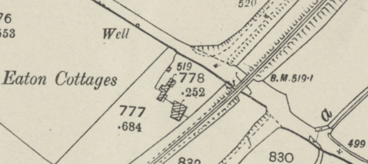
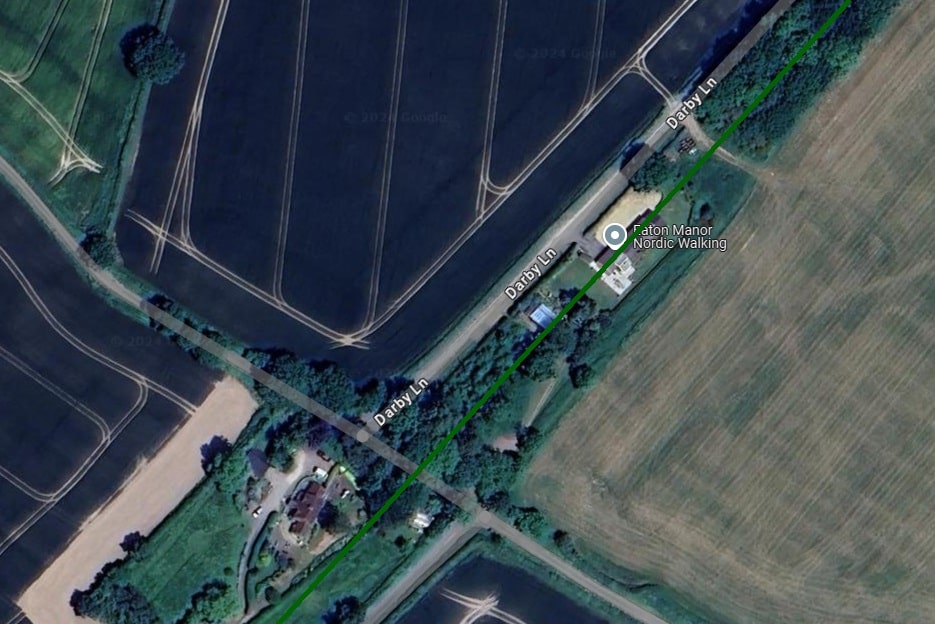
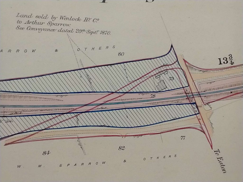
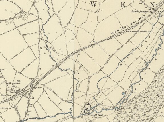
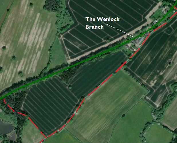
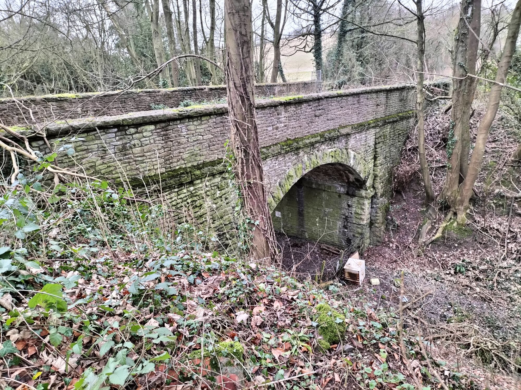
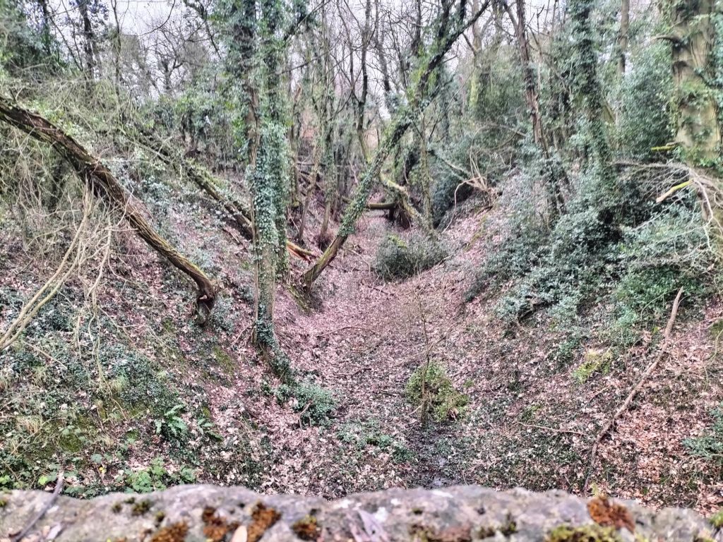
The next length of line from close to Eaton Cottage to Hartonroad Station. An extract from the 25″ Ordnance Survey mapping of 1882/1883. [21]The same area as that shown on the OS map extract above. [21]The route of the old railway is again shown in green, the necessary diversion by a red-dashed line. At the East edge of this image there are a series of private properties built over the line of the old railway. These are shown immediately below.
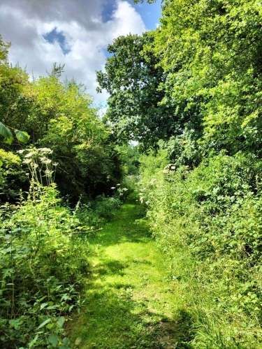
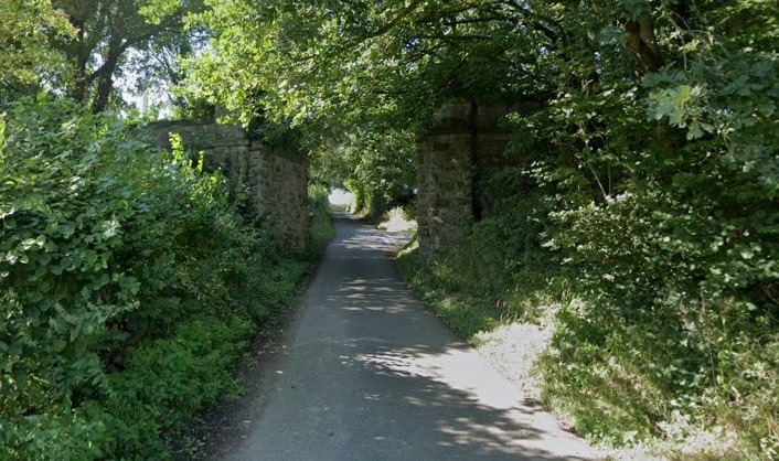
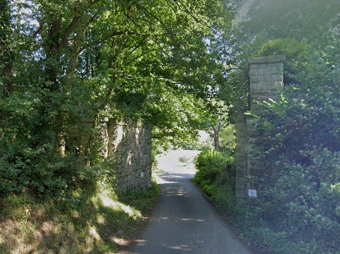
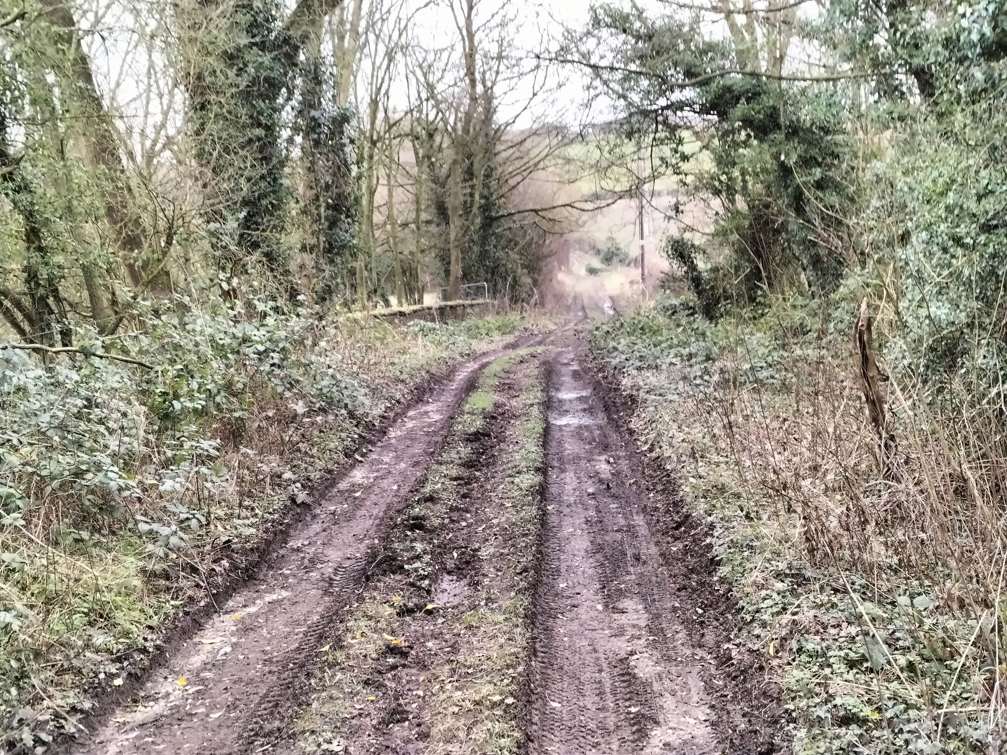
At the West edge of this image the footpath marked by the red-dashed line crossed the line of the old railway. In both directions from the footpath the old line is now in private ownership. [20]A series of four photographs look North from the public highway into the properties built over the line of the old railway. [My photographs, 17th July 2024]A further 200 metres to the Southwest on the road to the hamlet of Harton, this photo shows an open field between the road and the treeline which marks the line of the Wenlock Branch. [My photograph, 17th July 2023]Looking East at the point where the footpath crossed the old railway. [17th July 2024]Looking West at the same location. [My photograph, 17th July 2024]Using a telephoto lens, this is the line of the old railway heading West. [My photograph, 17th July 2024]A view from the South through the location of the bridge carrying the Wenlock Branch over the road adjacent to Hartonroad Railway Station. [My photograph, 17th July 2024]A view from the North through the location of the bridge carrying the Wenlock Branch over the road adjacent to Hartonroad Railway Station. [My photograph, 17th July 2024]
Writing of the length of the line between Rushbury and Harton Road stations, Ken Jones says: “On leaving [Rushbury] station the train passes under the roadway which formed part of the Roman road, with a steep rise from the station leading on to Roman Bank and over Wenlock Edge into the Corve Dale. Still passing under the densely wooded Edge Wood, to the left, and nestling under the wood, can be seen the small hamlet of Eaton-under-Heywood, and the embattled tower of the 12th century church of St Edith; the hamlet consists of one farm, the rectory and one cottage. Soon the train enters Harton Road station, the last on the branch. The station is as isolated as the hamlet of Eaton, all that can be seen from the train is a farm, and the station master’s house. Harton Road served the hamlets of Ticklerton, Halton, Soudley, Eaton, Westhope and Burwood, most of these (in 1922) each having a population of 50 people, Eaton and Burwood having only 40. The station consisted of the usual buildings: booking office, general and ladies’ waiting room and a lamp room. The staff consisted of the station master and one gate woman, she being employed at Wolverton Crossing, which was situated between Harton Road and Marsh Farm [Junction]. There was one double-ended siding which held 10 wagons, access to which was from either the east or west ground frames. The ground frames were controlled by the key on the Rushbury to Marsh Farm [Junction] staff. Also in the sidings was a cattle pen, which held one wagon and a horse landing for three horse boxes. One scene of activity that could be witnessed at the station was when the local estate farmers conveyed coal from the yard to the home of the local Lord of the Manor, as part of their statutory estate duty.” [1: p105 & 109]
Ken Jones; The Wenlock Branch; The Oakwood Press, Usk, Monmouthshire, 1998.
The photographs of the pre-contract drawings for the line were taken by myself and show extracts from the construction plans held in the Shropshire Archive. There is a standard charge of £10 per visit for taking photographs of their records.
The photographs of the pre-contract drawings for the line were taken by myself and show extracts from the construction plans held in the Shropshire Archive. There is a standard charge of £10 per visit for taking photographs of their records.
This article follows on from five other articles which covered the Wellington to Severn Junction Railway and this line from Buildwas to Presthope. The first three articles can be found on these links:
Much Wenlock to Presthope and on towards Craven Arms
From the commencement of the building of the line between Buildwas and Much Wenlock, the directors hoped that the line could be extended to Craven Arms via Presthope on Wenlock Edge (linking with the limestone quarries/works at that location).
The directors of the Wellington & Severn Junction Railway were, however, fully occupied with the line from Wellington to Buildwas. Another company was set up to build the ‘Wenlock & Craven Arms and Coalbrookdale Extension Railway‘. The bill went through the parliamentary process unopposed and authorised the ‘Wenlock Railway Company‘ to construct the line. Work started on 23rd October 1861.
By 5th December 1864, the line was open from Much Wenlock to Presthope. (That length is covered in the last online article listed above.) At this time, because it was a freight-only line, the Board of Trade saw no need for an inspection of the line. It had already been agreed at a meeting held on 4th December 1863 not to proceed with the line from Presthope to Craven Arms for the time being. It was to be three years after the line reached Presthope before the connection to the Shrewsbury & Hereford Railway close to Craven Arms was completed. It was finally opened on 16th December 1867.
Presthope to Longville
We begin this article at Presthope Railway Station and travel towards Craven Arms, as far as the village of Longville in the Dale. …….
Ken Jones comments: “On arrival at Presthope station … its complete isolation is striking, the only sign of habitation being the station master’s house standing on a ridge above the station. Although isolated, its importance is magnified by the number of sidings (a mini-marshalling yard on a branch line), because of the extensive quarrying formerly carried out by the Lilleshall Company in this area. A siding [1.5] miles long ran from the station sidings into the Lilleshall quarries. Prior to World War I a special train left Presthope each day for the Lilleshall Company’s furnaces at Priors Lee. However, by the early 1920s the company had ceased quarrying operations in the Presthope.” [1: p97]
The limestone quarry on Moses Benson’s land was the prime reason for the railway reaching Presthope. It was “developed by the Lilleshall Company, the line being opened to this point in 1864 solely for mineral traffic.” [15: p134]
Knowles comments: “The Wenlock Railway Bill stipulated that ‘The Company at their own expense shall make a proper and convenient siding at Presthope at the eastern end of the proposed tunnel, and at their own expense maintain this siding for the exclusive use of Moses George Benson.’ … The Benson family owned the Lutwyche Estate which included much of the land south west of Much Wenlock over which the Craven Arms extension would pass. Extensive limestone quarrying was carried out in the area and the Bensons had accrued wealth by leasing land for limestone extraction. The new railway would facilitate transport of the stone, a benefit to Moses Benson who became a strong advocate of the railway. In 1862 he leased the site of the limestone quarry at Presthope to the Earl of Granville who was acting on behalf of the Lilleshall Company. … The Wenlock Railway duly installed a 50-yard siding which was soon extended right into the quarry by the Lilleshall Company, ready for the start of mineral traffic from Presthope over the Wenlock Railway in 1864.” [15: p53]
The Lilleshall Company Mineral Railway at Presthope
The limestone found on Wenlock Edge is a relatively hard and resistant rock, grey/blue in colour. Its thickness varies from around 35 metres to more than 135 metres. It “has been used from the earliest days as a building stone locally as can be seen in the remaining Priory Walls and the Corn Exchange in Wenlock Town. More significantly, the limestone was used for lime mortar, especially as can be seen in the Roman City of Viriconium, Wroxeter.” [16: p229-230] Historically it was also used as a fertiliser, as a flux in blast furnaces, as a road stone, as bricks and slabs and in the manufacture of artificial stone.
This versatility made the limestone from Wenlock Edge a valuable resource and so very attractive to the Lilleshall Company. It was its use in their industrial processes which made it so important.
As we have already noted, the first 50 yards of the Mineral Railway were built by the railway company under the provisions of the Wenlock Railway Bill. Knowles comments that, “this was then continued by the Lilleshall Company for almost a mile and a half, linking to a network of moveable tramways which extended into the far reaches of the quarry.” [15: p134-135]
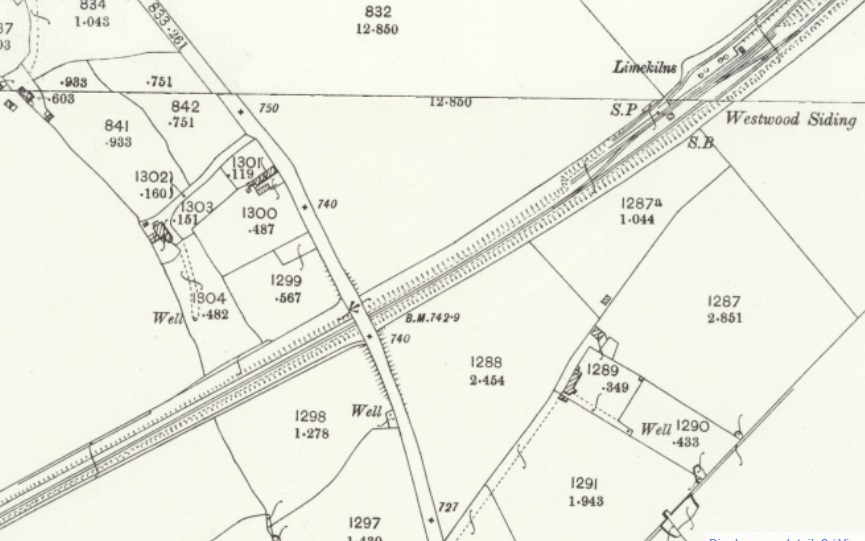
Prior to the construction of the Wenlock Branch and the Lilleshall Company Mineral Railway there was a quarry close to what became the tunnel mouth of the extension towards Craven Arms. Associated with that limestone quarry we’re Limekilns which can be seen on the OS map extract above – a series of four circles on the South side of the main line close to the tunnel portal.
The Lilleshall Company worked their quarry until just before WW1. When no longer needed the mineral railway was closed and lifted. “Knowle Lime Works took over part of the site and reopened [the] older working almost adjacent to Presthope Tunnel.” [15: p135]
The 50 yard length of siding provided by the railway company was still in place and Knowle Lime Works provided their own tramway and wharf alongside the original siding for the transhipment of goods for onward transport.
This is an extract from the modern OS Explorer Map as reproduced in the Much Wenlock Neighbourhood Plan with the area of the Lilleshall Company quarries shaded lilac. [19]
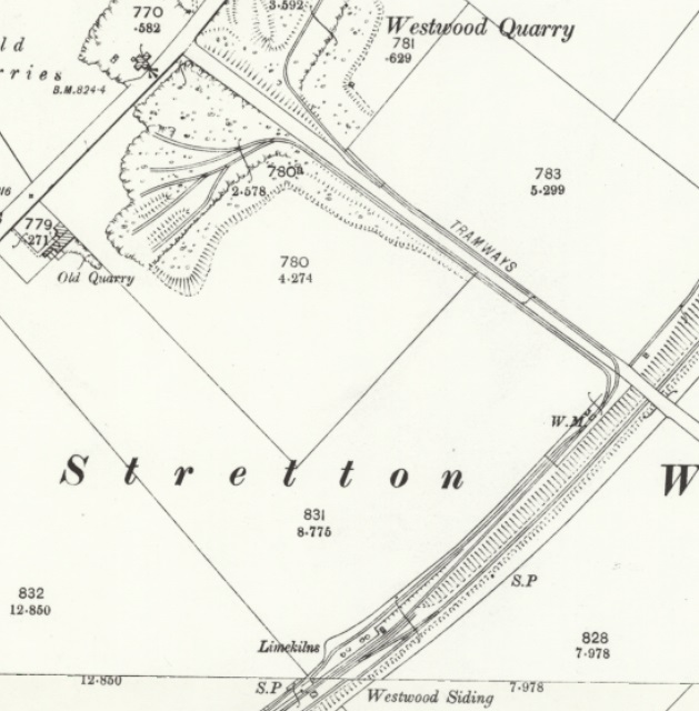
The next three extracts from the 25″ Ordnance Survey of 1883 show the length of the Lilleshall Company line from the Inn to their quarries.
Two extracts from the 25″ Ordnance Survey Sheet Shropshire L. 14 of 1883. [17]This map extract comes from the Ordnance Survey Sheet immediately to the South of Shropshire L. 14, Shropshire LVII.2 of 1883. [18]The quarry area and its internal tramways as recorded on the 25″ Ordnance Survey of 1902. [20]The two lines (Quarry Railway and Much Wenlock Branch) continued in Southwesterly directions across this next satellite image, the mineral railway is the more southerly of the two lines shown. The railmaponline.com satellite imagery shows the end of the quarry branch (in the bottom-left of the image), while the line to Craven Arms continues on the Northwest side of Wenlock Edge heading down a relatively gentle incline by following the line of the Edge. [3]Looking Northeast towards Presthope along the line of the Mineral Railway. [Google Streetview, May 2011]Looking Southwest into the site of the Lilleshall Company quarry. [Google Streetview, May 2011]
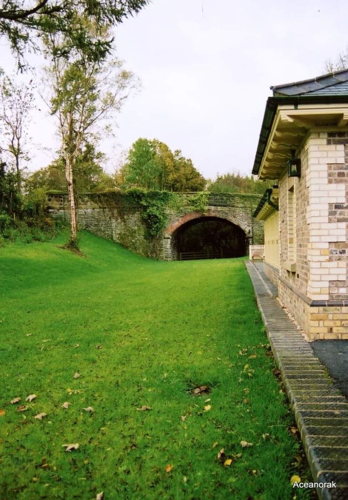
Presthope Tunnel and the line to the West
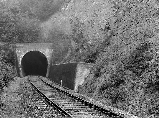
Ken Jones comments: “Leaving Presthope Station, to the left of the train was a large outcrop of limestone rock on which were three limekilns, this outcrop with its kilns forming a most dramatic entrance to the 207 yds-long Presthope tunnel driven through the limestone rock.” [1: p97]
Ken Jones says: “On emergence from the tunnel the passenger is rewarded with a panoramic view of the beautiful Ape Dale with its irregular field patterns and isolated farms with the gently rising backcloth of the Stretton Hills in the distance. A sight never to be forgotten on a winter’s morning with the snowcapped hills dominating the Vale.” [1: p97]
The views which Ken Jones mentions above are, in the 21st century, hidden first by the embankment walls close to the tunnel mouth and then by the dense woodland which surrounds the old railway.
We were able to walk the length of the formation of the old railway between Presthope tunnel and Easthope Halt on 24th May 2024. The length walked is covered by the next three extracts from the 1901 25″ Ordnance Survey
This next extract from the 1901 25″ Ordnance Survey covers the bottom-left quarter of the railmaponline.com image above. [22]A further length of the line as it appears on the 1901 25″ Ordnance Survey. Together with the extract below, the length of the line shown on the railmaponline.com extract below is covered. [23]The next length of the line. Easthope Halt was sited just to the West of the lane which passed under the line in the bottom-left corner of this extract. [24]The same length of the line as covered on the two map extracts immediately above. Easthope Halt was located tight into the bottom-left corner of this image, just to the West of the lane which passed under the railway. [3]
These next images come from our walk on 24th May 2024. They show the formation of the old railway at regular intervals. It is now primarily in use as a logging road by the National Trust. There is about 250 metres between each image.
Easthope Halt. This image was shared on the Much Wenlock History Facebook Group by Judith Goodman on 9th December 2020. It looks Northeast towards Presthope Tunnel.The Halt was opened on 4th April 1936 and closed on 31st December 1951. [12]
Ken Jones; The Wenlock Branch; The Oakwood Press, Usk, Monmouthshire, 1998.
The photographs of the pre-contract drawings for the line were taken by myself and show extracts from the construction plans held in the Shropshire Archive. There is a standard charge of £10 per visit for taking photographs of their records.
The photographs of the pre-contract drawings for the line were taken by myself and show extracts from the construction plans held in the Shropshire Archive. There is a standard charge of £10 per visit for taking photographs of their records.
The featured image shows Presthope Station with the 18.00 hrs Craven Arms – Much Wenlock – Wellington train is leaving on 21st April 1951, heading for Much Wenlock. [30]
This article follows on from four other articles which covered the Wellington to Severn Junction Railway and this line from Buildwas to Much Wenlock. The first three articles can be found on these links:
From the commencement of the building of the line between Buildwas and Much Wenlock, the directors hoped that the line could be extended to Craven Arms via Presthope on Wenlock Edge (linking with the limestone quarries/works at that location).
The directors of the Wellington & Severn Junction Railway were, however, fully occupied with the line from Wellington to Buildwas. Another company was set up to build the ‘Wenlock & Craven Arms and Coalbrookdale Extension Railway‘. The bill went through the parliamentary process unopposed and authorised the ‘Wenlock Railway Company‘ to construct the line. Work started on 23rd October 1861.
By 5th December 1864, the line was open from Much Wenlock to Presthope. At this time, because it was a freight-only line, the Board of Trade saw no need for an inspection of the line. It had already been agreed at a meeting held on 4th December 1863 not to proceed with the line from Presthope to Craven Arms for the time being. It was to be three years after the line reached Presthope before the connection to the Shrewsbury & Hereford Railway close to Craven Arms was completed. It was finally opened on 16th December 1867.
Much Wenlock to Presthope
This article focusses on the length of the line which was completed in December 1864 – Much Wenlock to Presthope. Another article will follow the line to the West of Presthope.
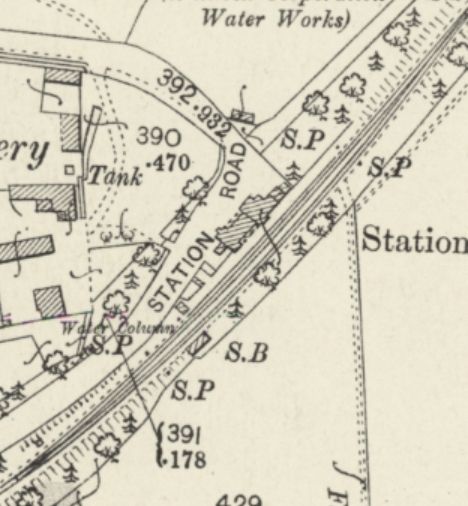
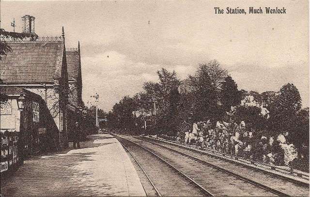
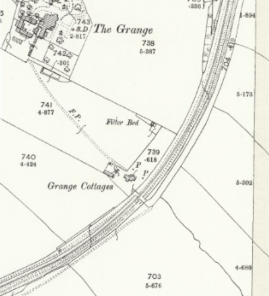
Much Wenlock Railway Station had a single platform adjacent to the main running line. A passing loop was provided opposing the platform, and beyond it there was a rockery garden, “large limestone boulders [were] interspersed with shrubs and alpine plants flanked by a row of rhododendron bushes. In the centre of the rockery was a fountain.” [1: p97]
Trains leaving for Craven Arms crossed Sheinton Road/Street Bridge and passed the goods shed and yard on the left and then the engine shed. When the line terminated at Much Wenlock, the goods facilities used until the final closure of the line were the temporary railway station.
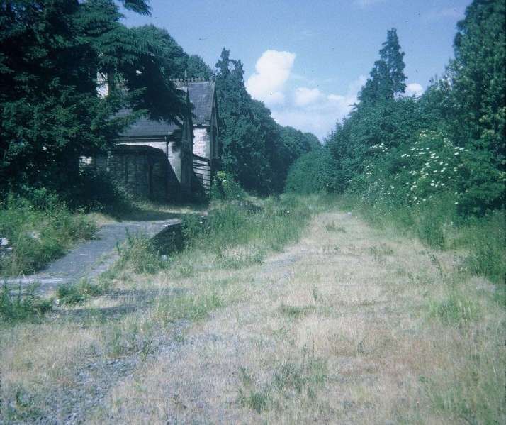
Trains began the climb towards Wenlock Edge. The pictures above show the climb had already begun alongside the goods yard. Neither the goods shed nor the engine shed remain in the 21st century.
That length is in private hands with a significant length in use as a paddock for horses and a small holding.
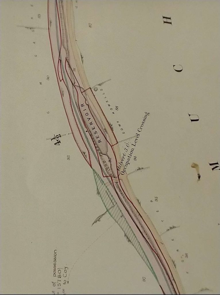
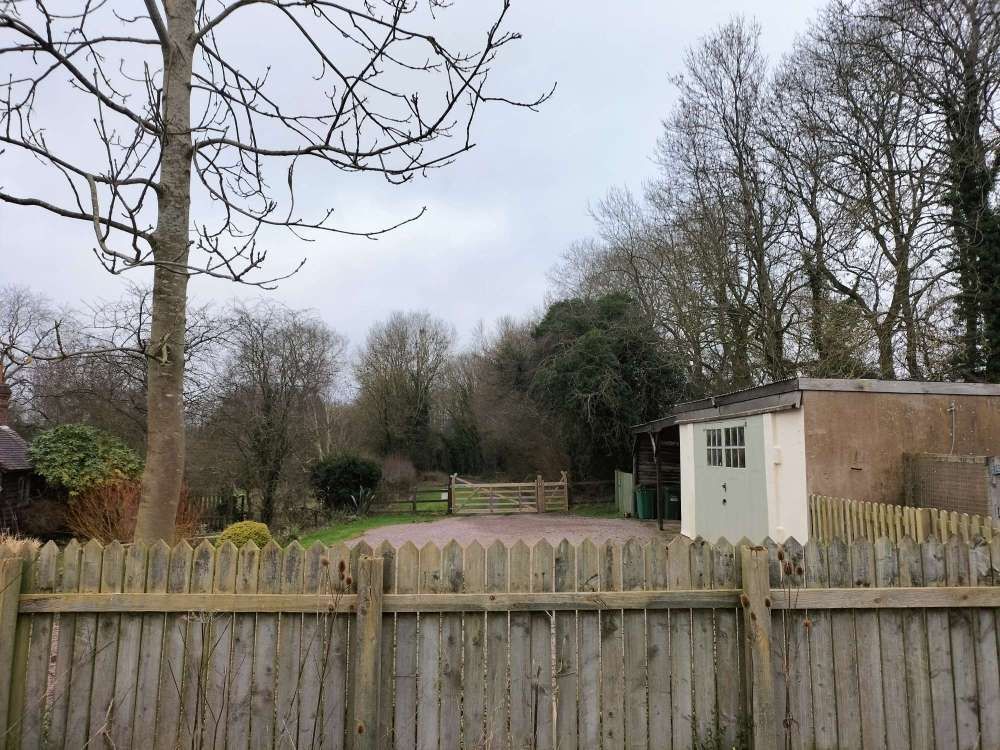
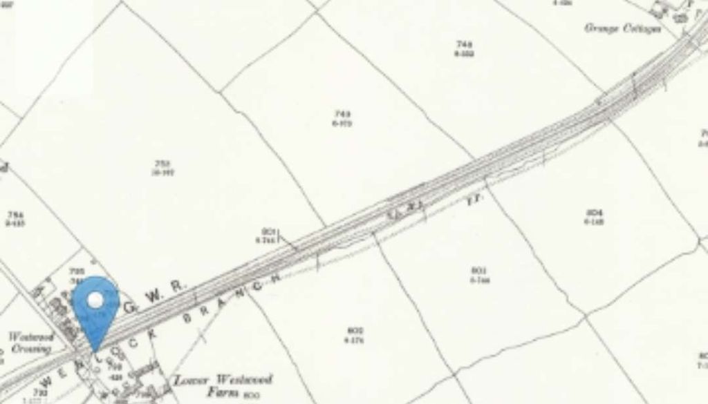
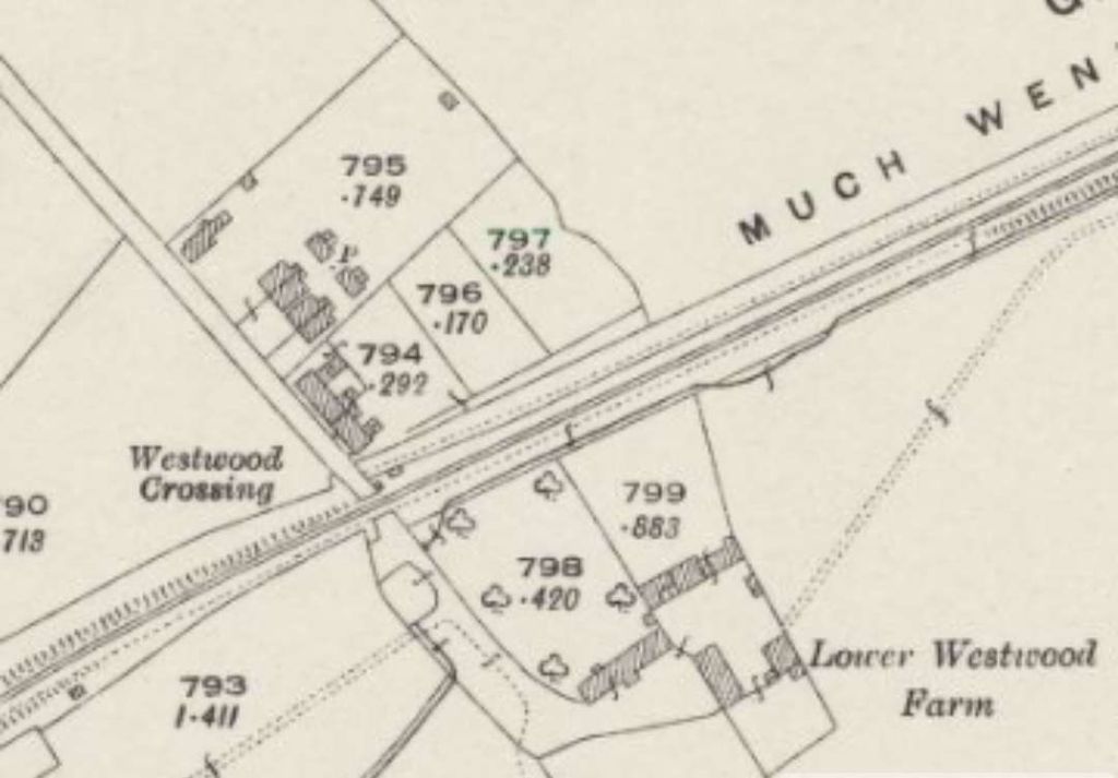
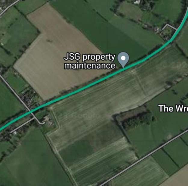
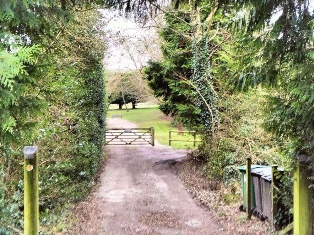
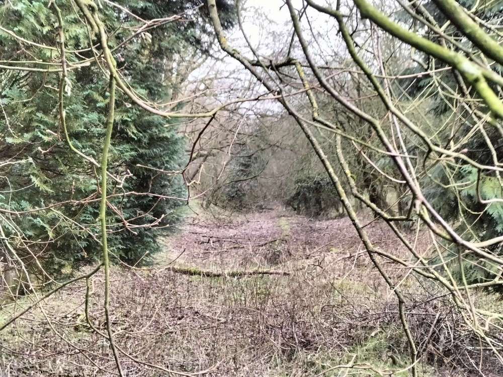
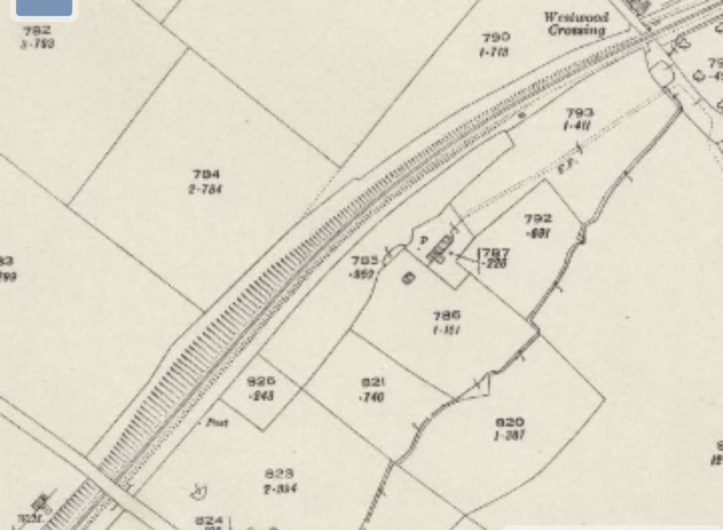
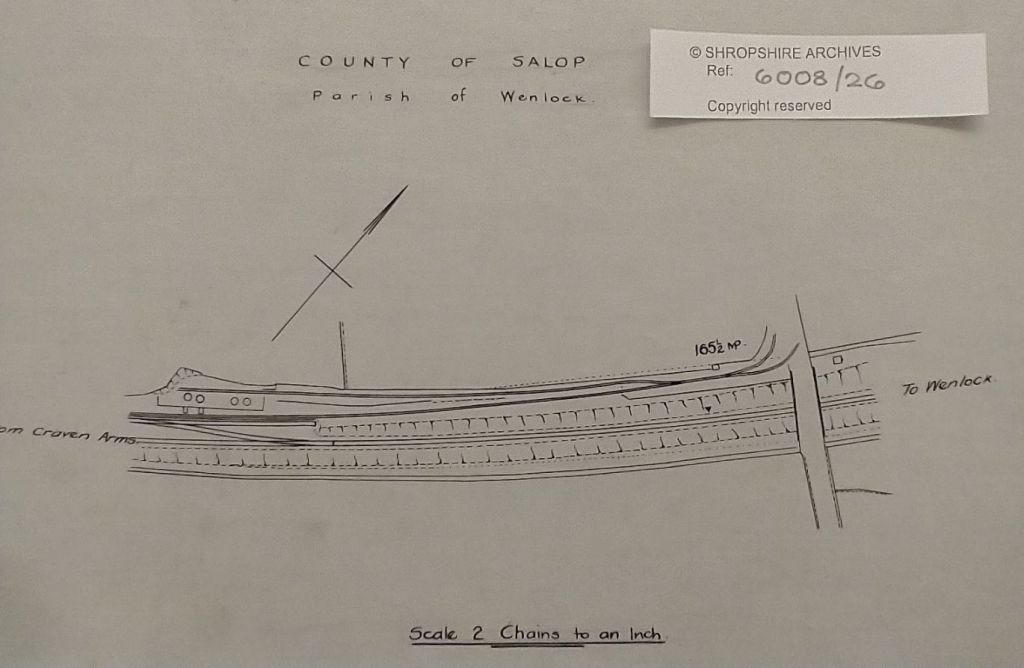
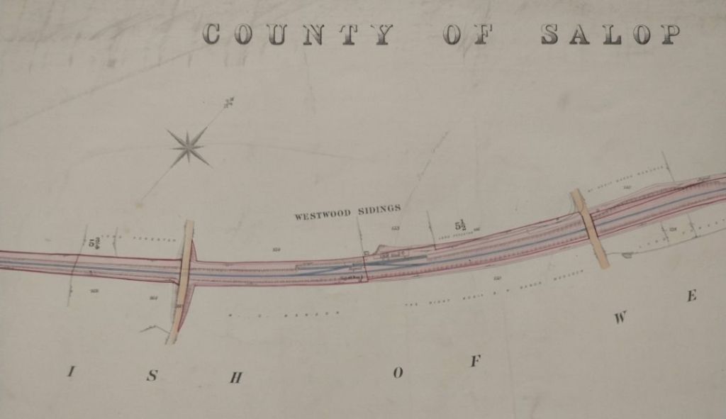
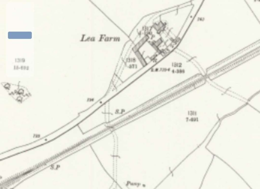
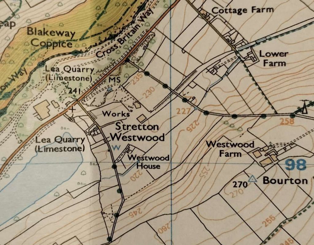
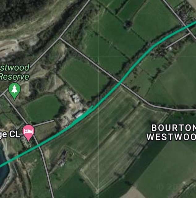
Westwood Halt in around 1960 – seen from the East. The single platform sat on the North side of the line immediately to the East of Westwood Crossing. It was not until 7th December 1935 that the Halt opened. It closed to passenger traffic on 31st December 1951. This picture was shared on the Much Wenlock Memories Facebook Group by Judith Goodman on 8th December 2020. The photographer is not known and the image is used under a Creative Commons Licence (CC BY-SA 4.0). [19]Google Maps image of the site of Westwood Halt. [Google Maps, 12th January 2024]Westwood Crossing seen from the North. The red line marks the approximate centre-line of the old railway. The Halt would have been off to the left of this image. [Google Streetview, 2009]Looking Northwest from Westwood Crossing towards the B4371. [My photograph, 12th January 2024]Looking Southeast from the location of Westwood Crossing. It is not possible to follow the route of the old railway to the West of this location as it is in private hands. To continue following the route requires a diversion along the footpath ahead, across one field to join another track and then heading back Northwest towards the olod line. [My photograph, 12th January 2024]The line leaving Westwood Crossing and heading towards Presthope. [My photograph, 12th January 2024]Westwood Crossing to the next overbridge, as shown on the 25″ Ordnance Survey of 1901. [22]Within a couple of hundred yards, trains passed Westwood Sidings. The sidings served Westwood Quarry. There were ground frames controlling access at each end of the siding. [23]
When the Wenlock Branch opened “limestone was being extracted [at Westwood Quarry] for use in the Madeley Wood Company’s furnaces. Horse-drawn tramways ran from the quarry on to a loading ramp above the sidings.” [1: p97]
The photographs of the pre-contract drawings for the line were taken by myself and show extracts from the construction plans held in the Shropshire Archive. There is a standard charge of £10 per visit for taking photographs of their records.


