
[NB: I have sought, where-ever possible to attribute all sources and have no intention of contravening copyright. Should there be an issue with any of the images below, if you are the copyright holder, please contact me. Please accept my apologies in advance if this has occurred.]
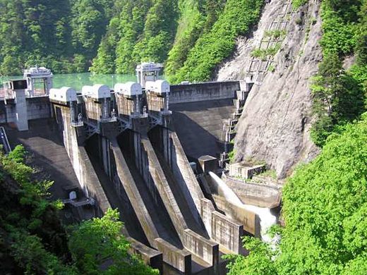
Railways for the transport of timber from Japanese State and Crown forest locations were first used at around the beginning of the 20th Century. As a result, dependence on rivers and streams lessened and this facilitated the construction of hydro electric dams. [11] In Kiso, as in the other forests, the branch or temporary railway lines were narrow (30-inch gauge), built with maximum grade of 10 percent and curves with minimum radius of 16 feet. The main lines, however, were well-built, well ballasted lines, with many tunnels, with maximum grades of 5 percent and with 42-inch gauge, the standard gauge for Japan and Formosa. This means that logs could not be shipped to their destination without reloading. [4]
The Kiso Forest is centred around the valley of the Kiso River and is famous for the quality of its lumber. Approximately 90% of the Kiso Valley is covered in forest. [6]
Wikipedia says that “The Kiso River (Kiso-gawa) is roughly 229 km long, flowing through the prefectures of Nagano, Gifu, Aichi, and Mie before emptying into Ise Bay a short distance from the city of Nagoya. It is the principal river of the area (along with Ibi and Nagara rivers) and forms a major part of the Nōbi Plain. The valley around the upper portion of the river forms the Kiso Valley.” [15]
“Kiso Valley (Kiso-dani) is a geographical area that centres on the valley of the upper portions of the Kiso River in the southwestern part of Nagano Prefecture in Japan. It is a v-shaped valley with length of approximately 60 km (36 mi) that follows the river as it flows from north by northwest to south by southwest into Gifu Prefecture.” [16]
JapanVisitor tells us that “the upper part of the river valley in Gifu and Nagano prefectures is the most visited. Known as the Kiso Valley (Kisoji) – a district famous for its hiking trails and picturesque towns and villages which were once on the historic Edo Period Nakasendo highway between Kyoto and Edo (Tokyo). High peaks in the Kiso Valley include Mt. Ontake (3,063m) and Mt. Komagatake (2,956m).” [17]
During the Edo period, the ruling samurai class prohibited people cutting the five trees of the Kiso river valley and successive governments made large profits from felling and selling timber. [3] The Kiso River and Region at a time when Nagoya had not already begun to sprawl out into its hinterland. The urban sprawl now extends north across the line of the Kisoro River. [5]
According to WalkJapann the five varieties of trees “the native evergreens of sawara, asuhi, koya maki, nezuko and hinoki (Japanese cypress). The forest had scatterings of cherry (sakura), pine (matsu) and zelkova (keyaki, a relative of the elm but native to Japan) mixed in. All were prized for use in the construction industry because of their beautiful grain, durability, and ease of working.” [3]
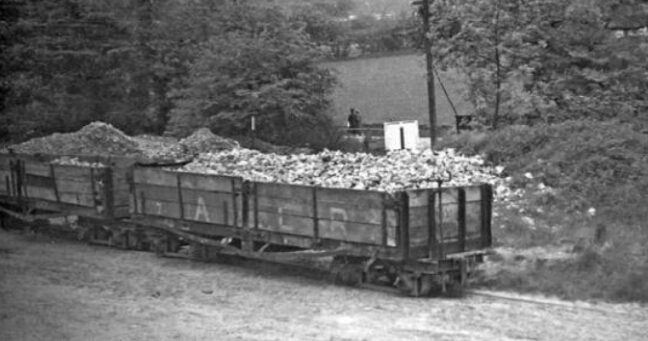
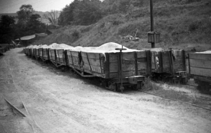
An old US forestry resource says that “in the Kiso forest both heavy American and light Japanese skidders proved unsatisfactory, but. a 60,HP gasoline slack-line outfit was giving good service (in 1928). The logs were loaded by hand onto light cars of about 2000 board feet capacity; and these were run, by gravity or by light gasoline locomotives, to landings on the main forest railways. There the logs were shifted to larger cars (about 3000 bd.ft.), which were hauled in 15-car trains by 10 to 11-ton steam locomotives to a junction with the main-line government railway (at Nojiri and Agematsu). At these points they were unloaded and placed in storage yards until th ppey could be taken over that railway to Nagoya, 80 miles distant. Logs were loaded, unloaded, or piled, all by hand, eight times between the stump and the mill. Obviously, the costs were high, even with cheap labour.” [4]
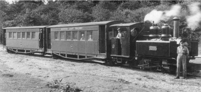
At first, the Kiso Forest Railway focussed solely on the transport of timber and the labourers who were winning that timber from the forest. But the dedicated rail network, penetrating deep into mountainous areas, was soon recognized for its potential to carry human passengers as well. Kiso-hinoki.jp states that residents were eventually permitted to “occupy any vacant seats, also accepting a logistical responsibility. Certificates were issued to the local residents, allowing them to ride for free, although they also became the default baggage handlers. Additionally, in exchange for paying no fare, travelers on the railway also waived any rights to state compensation in the case of an accident. In spite of this, the Forest Railway became a popular and indispensable feature of life in Kiso.” [11]
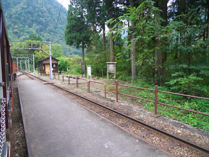
The Kiso Forest Railway was actually a network of well over 400 km of 762 mm (2 ft 6 in) narrow gauge light (keiben) railway lines that operated in the Kiso Valley in Nagano Prefecture, Japan. Some authorities estimate the the network length to be over 500km. [11] The railway was extensively rebuilt in 1920, with steel bridges and 24 tunnels. [2] The Kiso Forest, Ogawa Line [10]
The railway was used to support the logging of evergreen forests in the region as outlined above. Wikipedia tells us that “the Kiso Forest had historically been the possession of a local lord, but at the time of the Meiji Restoration had become the property of the Imperial family.” [1]
Steam Locomotives:
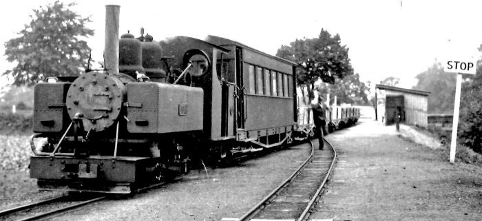
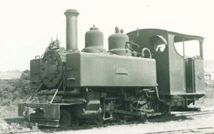
In 1901, a railway was laid into the forests and was initially worked by hand or animals. The first 0-4-2T locomotives built by the Baldwin Locomotive Works were introduced in 1907. The Japanese Language site Kiso-hinoki.jp states that “The Ogawa Line opened formally in 1916. … Steam locomotives from makers all over the world were analyzed for their application as haulage locomotives. Among them, locomotives from the American company Baldwin earned the strongest reputation and ten of these locomotives were imported, becoming the backbone of the Kiso Forest Railway.” [11] One of the Baldwin 0-4-2T locos. [8]
Further locomotives were obtained from Baldwin, as well as a Shay Locomotive that was transferred to the Alishan Forest Railway in Taiwan when that line opened.
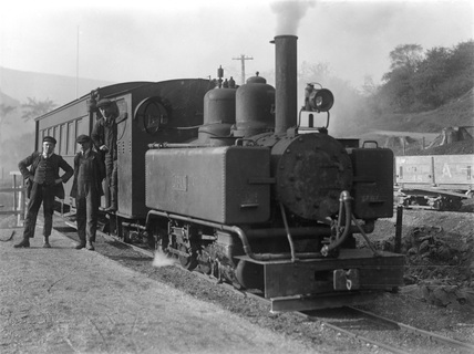
The advent of the Second World War brought turmoil to the Forest Railway. Resources in the country were depleted by the war effort. “Faced with insufficient supplies of coal to power the locomotives, officials turned to scraps of wood and branches from trees felled in the mountains to keep the engines running. However, unlike coal that burned rapidly in the locomotive’s firebox, the new fuel caused still burning sparks to be ejected from the chimney, presenting a fire hazard wherever the trains traveled. After several years of trial and error a greatly enlarged chimney was designed that no longer ejected sparks, and an extended bunker was incorporated to carry the new, bulkier, fuel. In this way, the steam locomotives of the Kiso Forest Railway took on their own distinctive style.” [11] The locos in the images in this blog were adapted in this way.
The War depleted resources further and as the condition of locos deteriorated they were first set aside and then broken up after being requisitioned for the war effort. Of the 10 original Baldwin locomotives, only 3 remained after the War. [11]
The three remaining Baldwin locomotives were retired in 1960. The network had been gradually transitioning from steam to diesel traction. Two of the three locos returned to the United States, via Nagoya Port, and are now preserved at the California State Railroad Museum. [11]
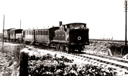
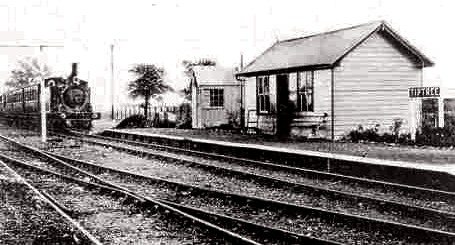
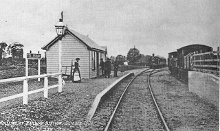
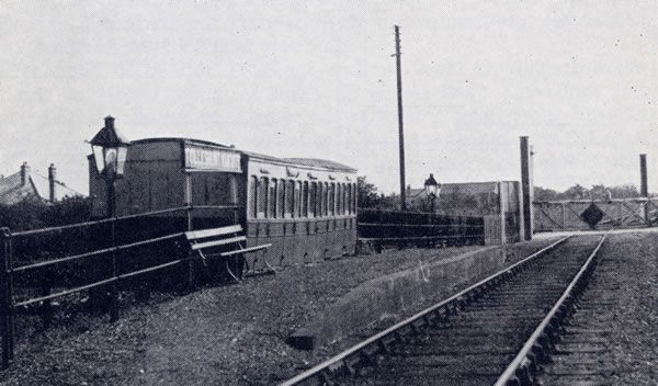
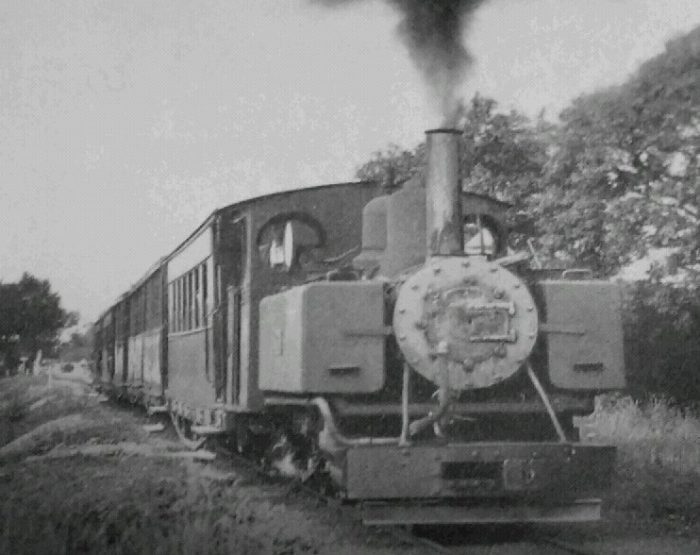
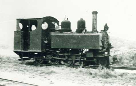
The last remaining locomotive was the first locomotive introduced to the Kiso Valley at the opening of the Ogawa Line and it can be seen in the photographs in this blog. [11]
Kiso Forest railway No. 1 (0-4-2T) is shown in the four images immediately above.
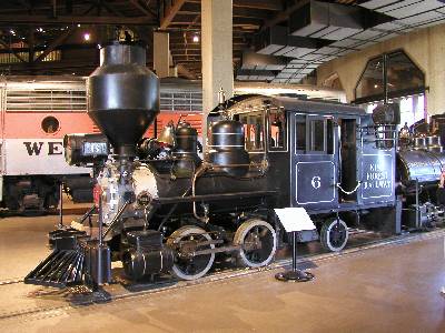 Kiso Forest Railway No.6 (0-4-2T) was also built by Baldwin in 1929. It has 28″ drivers and 8-1/2″ x 12″ cylinders, and it weighs 28,000 lbs. It was built to burn wood and to run on 30″ gauge track, but it was converted to oil and 36″ gauge when it returned to the United States in 1960. This interesting little locomotive is on display at the California State Railroad Museum, Sacramento, California.
Kiso Forest Railway No.7 (0-4-2T) was also built by Baldwin but in 1927 (Works No. 60069). For many years after its return to the USA it was stored in a shed at the rear of Moss Motors in Goleta, California. The loco had been donated to the San Luis Obispo RR Museum by owner Philip Goldman. [12] The pictures immediately below were taken in May 1998 just before the locomotive was removed from storage.
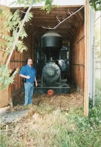
 The third of the three saved locomotives from the Kiso Forest Railway was No. 7 which was transported back to the USA in 1960. In 1998 it was donated by thee Goleta & Shoreline RR for its new home at the San Luis Obispo RR Museum. The video below records that move. [12]
The three remaining Baldwin Locos in 1960. [11]
Diesel Locomotives:
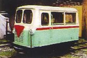
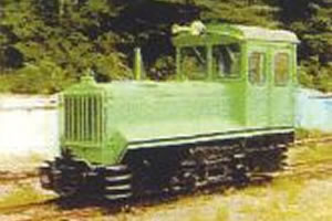
Soon after the Second World War it was obvious that the remaining three Baldwin locomotives were inadequate for the needs of the railway and a process of dieselisation took place. A series of different locomotives were bought for the railways in the forest. The numbers of these logos and small railcars were significant and there is only opportunity to show a representative range of diesel traction as part of this post.
An interesting development at the closure of these railways was the way in which many of these diesel vehicles found a long-term place in the local communities that they had served, becoming static displays at various places in the Kiso Forest. Some of these are shown below.
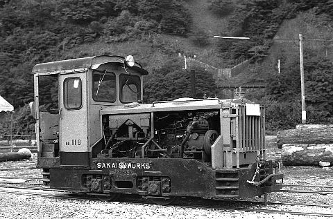
 Diesel No. 118.[18]
Diesel Motor Car No. 4, was initially assigned to the Yabohara Forestry Station and transferred to the Ohtaki Forestry Department around 1972. Although the timing is unknown, the body was replaced by the machinery section of the Uematsu Transportation Forestry Authority. In the later years, it saw service on the Ugi river line. Like No 132, it was transferred to Otaki Village and exhibited and stored in Matsubara Sports Park. [13]
Diesel Locomotive No. 132. This locomotive worked on thethe branc of the Ogawa line of Uematsu, etc., and transferred to Ohtaki Municipal Office in 1964. Later it was active mainly on the Miura Hoya Line. After closure of the Otaki main line in 1975 it was moved to Suwagawa River line. For a time it sat in the car park at Tajima Station for a while, before it was transferred to Otaki Village and exhibited and stored in Matsubara Sports Park. [13] 
Motor Car at Tajima Station. [18]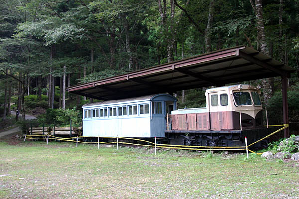 Kiso Forest Railway Locomotive No. 128 with a Type C passenger coach and 2 small cargo wagons on static display. The picture is taken of this preserved loco at the campsite near the Amagi Pass. The loco workd on the Amagi Yu Yu line in Izu-shi. The picture was taken in 2010. [22]
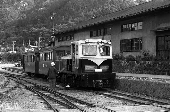  This diesel locomotive was the main locomotive type on the Kiso Forest Railway. It is a C4 type manufactured by the Sakai Craft Centre. The type was designated DBT 10 by the Kiso Forest Railway. It was a 10 tonne loco. [18]
 This diesel locomotive was the main locomotive type on the Kiso Forest Railway. It is a C4 type manufactured by the Sakai Craft Centre. The type was designated DBT 10 by the Kiso Forest Railway. It was a 10 tonne loco. [18] Kiso Forest Railway No. 95 with a Type B Passenger Car and Transport Truck, all on display in the car-park close to Naraichi Station in September 2014. The locomotive is a 5 tonne loco, made at the Sakai Works. [21]
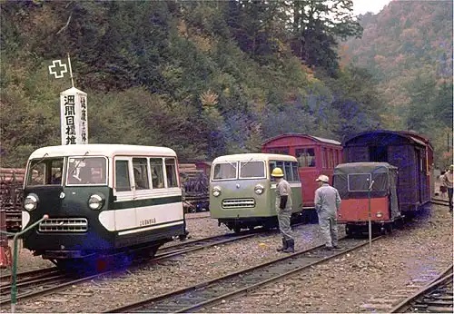 Two Forest Railway Motor Cars at Tajima station in 1972. [21]
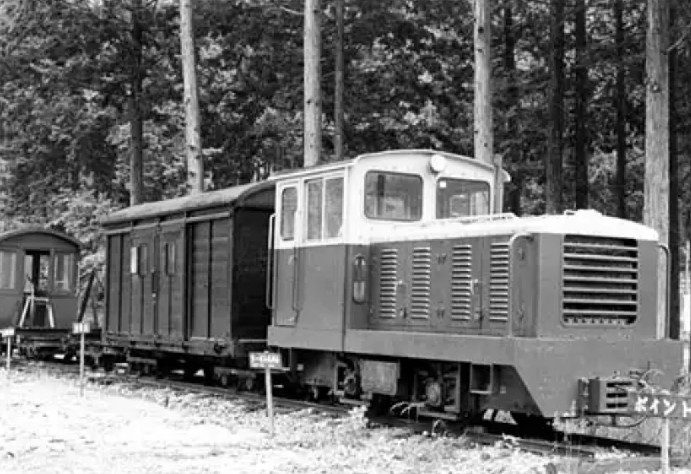
 Kiso Forest Railway No. 139 on display at Yunomori campsite (about 8 km from Central Chuo station, Sakashita station) Kiso Forest Motor Car No. 20in 1977 [14]
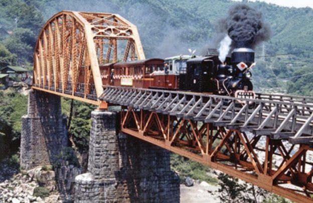
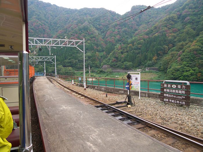
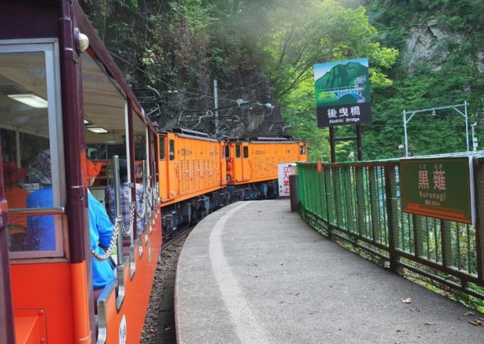
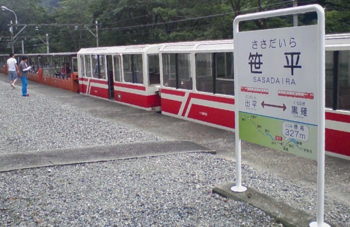
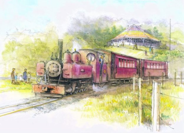
The adjacent picture shows a diesel Hauled passenger train on the tourist railway in the Kiso Forest – the Akasawa Forest Railway. The tourist line provides a short journey in the forest – a 2.2 kilometre round trip.[11]
 No. 136 is an articulated diesel locomotive and it is in the workshop at Uematsu. [18]
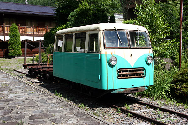 Kiso Forest Motor Car No. 20, preserved at the entrance to the Woodworking Culture Centre at Koga Village Regional Museum about 5 minutes on foot from Yabihara Station. in 2008. [19]
 Kiso Forest Railway Locomotive No. 119 stored in Yukigoshi, picture taken in 2012. [20]
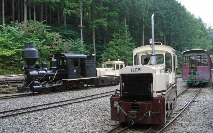
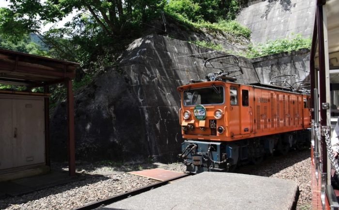
 Diesel Locomotives at the Akasawa Forest Railway. [11]
Type DBT 10 Loco in charge of a logging train in the Kiso Forest. Note the diminutive guards van at the back of the train. [13]
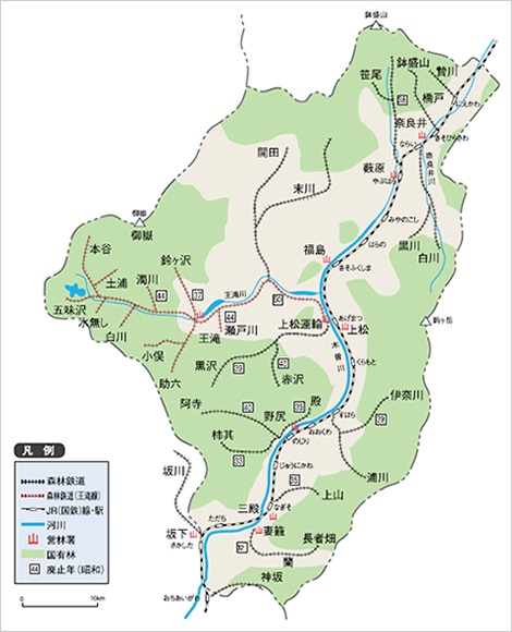
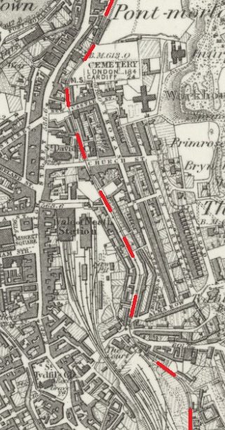
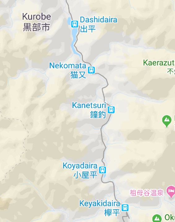
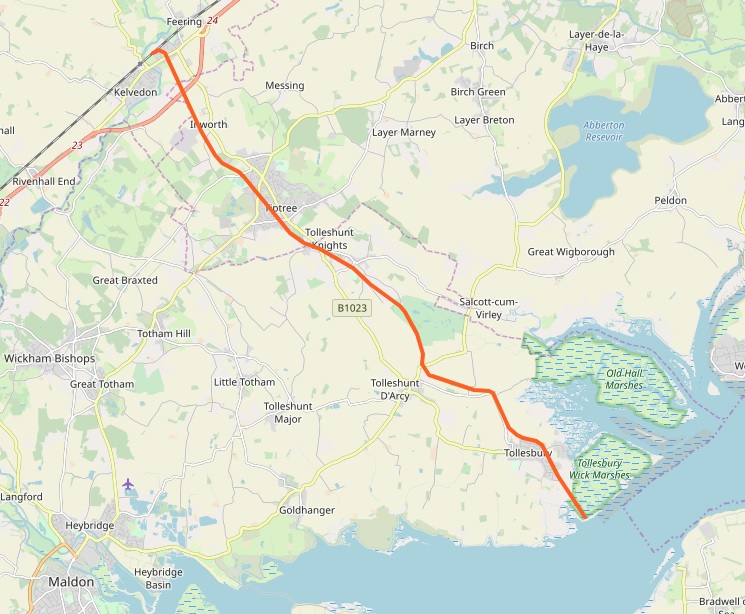
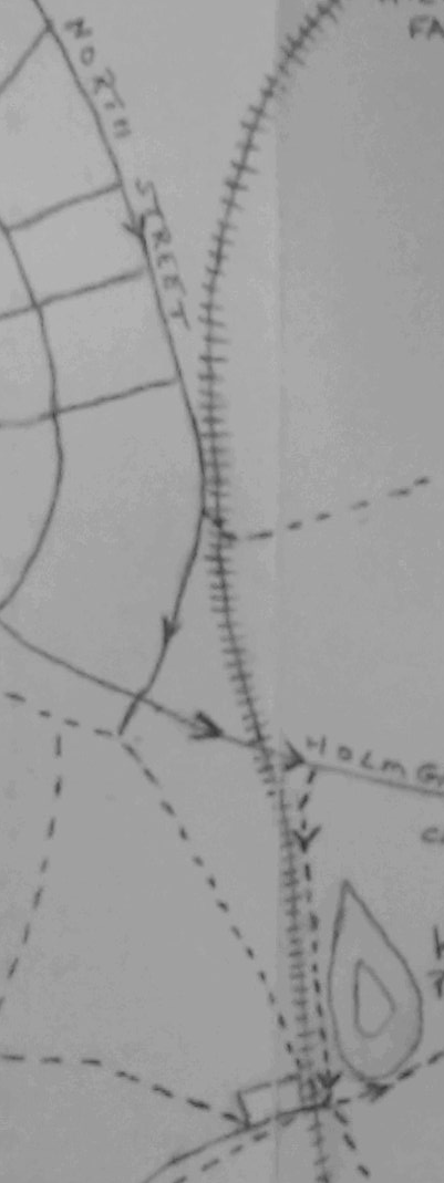
The adjacent map shows the Kiso Valley area with the various parts of the Kiso Forest Railway shown in red and black dots and with the JNR Chuo Line running along the Kiso River on the East side of the map. These different routes will be considered in later posts. Among them, the Owataki Forest Railway was the representative presence of Kiso Forest Railroad, which has the longest route mileage and the heaviest usage. [13] There are a number of YouTube clips showing one or two of the diesel locos in action these include:
And there are a number of Japanese made models which seek to give a good flavour of the line:
References
- https://en.m.wikipedia.org/wiki/Kiso_Forest_Railway#cite_note-Small-1, accessed on 7th February 2019.
- Charles S. Small; Far Wheels II; Railhead Publications, Canton Ohio, 1986.
- https:// http://www.nakasendoway.com/kiso-forest, accessed on 7th February 2019.
- Japan: forest resources, forest products, forest policy; United States. Forest Service
Division of forest economics, Forest service, U.S. Dept. of agriculture, 1945; p14-15; sourced from https://books.google.co.uk/books?id=3vfNAAAAMAAJ&pg=PA14&lpg=PA14&dq=exploiting+kiso+forest+timber&source=bl&ots=AuJDLEO2KG&sig=ACfU3U0RSXmf9c9tEO5CwkqzRC2ql5mPYA&hl=en&sa=X&ved=2ahUKEwjlnuLiqazgAhWUShUIHYGuDUYQ6AEwCXoECAUQAQ#v=onepage&q=exploiting%20kiso%20forest%20timber&f=false, accessed on 8th February 2019. - Adapted from Tokoro Mitsuo; Kinsei ringyoshi no kenkyu; Yoshikawa kobunkand, Tokyo, 1980, p2, in Conrad D. Totman; The Lumber Industry in Early Modern Japan; University of Hawaii Press, 1995, p56; sourced from https://books.google.co.uk/books?id=EiKa-CSX1SgC&pg=PA55&lpg=PA55&dq=exploiting+kiso+forest+timber&source=bl&ots=ju-KkEcS8H&sig=ACfU3U11DGuMXi1t7YVen1HKMUoghsgDnw&hl=en&sa=X&ved=2ahUKEwjlnuLiqazgAhWUShUIHYGuDUYQ6AEwCnoECAQQAQ#v=onepage&q=exploiting%20kiso%20forest%20timber&f=false, accessed on 8th February 2019.
- http://www.kisoji-isan.com/s/en/story/01.html, accessed on 8th February 2019.
- http://www.kisoji-isan.com/s/en/heritage/2326.html, accessed on 8th February 2019.
- https://blog.goo.ne.jp/pmpkenji/e/abea7ada625cbcf882504719705d94e4, accessed on 8th February 2019.
- https://commons.wikimedia.org/wiki/File:Kiso_Forest_Railway_Ogawa_Line_2.jpg, accessed on 8th February 2019.
- https://commons.wikimedia.org/wiki/File:Kiso_Forest_Railway_Ogawa_Line_1.jpg, accessed on 8th February 2019.
- https://kiso-hinoki.jp/en/01akasawa2.html, accessed on 8th February 2019.
- http://www.jnsforum.com/community/topic/2668-kiso-forest-railway-7/?tab=comments#comment-29972, accessed on 10th February 2019.
- http://www.ontake.jp/%E3%81%84%E3%81%AE%E3%81%A1%E5%91%BC%E3%81%B3%E8%A6%9A%E3%81%BE%E3%81%99%E3%81%A8%E3%81%93%E3%82%8D/%E7%8E%8B%E6%BB%9D%E6%9D%91%E3%81%AE%E6%97%A5%E6%9C%AC%E9%81%BA%E7%94%A3%E3%80%8C%E6%A3%AE%E6%9E%97%E9%89%84%E9%81%93%E3%80%8D, accessed on 10th February 2019.
- http://c5557.kiteki.jp/html/hozon-yuumori.htm, accessed on 11th February 2019.
- https://en.wikipedia.org/wiki/Kiso_River, accessed on 10th February 2019.
- https://en.wikipedia.org/wiki/Kiso_Valley, accessed on 10th February 2019.
- https://www.japanvisitor.com/japan-city-guides/kiso-valley-guide, accessed on 10th February 2019.
- http://tsushima-keibendo.a.la9.jp/kiso/kiso-map.html, accessed on 10th February 2019.
- http://c5557.kiteki.jp/html/kisosin-No20.htm, accessed on 11th February 2019.
- http://c5557.kiteki.jp/html/kisosin-takikosi.htm, accessed on 11th February 2019.
- http://omoidenoshasoukara.web.fc2.com/kiso/kiso10.html, accessed on 11th February 2019.
- http://c5557.kiteki.jp/html/amagi-yuuyuunomori.htm, accessed on 11th February 2019.

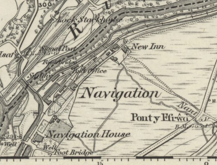
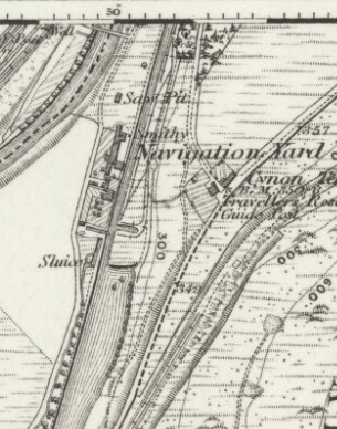
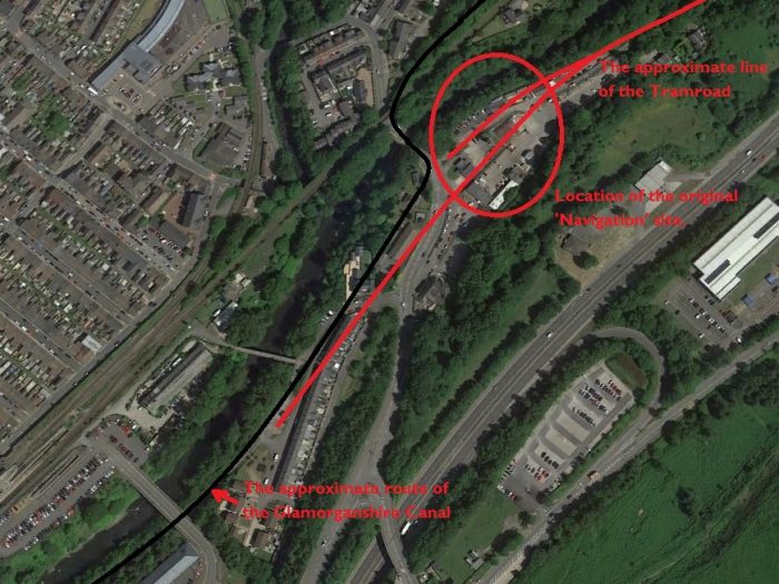
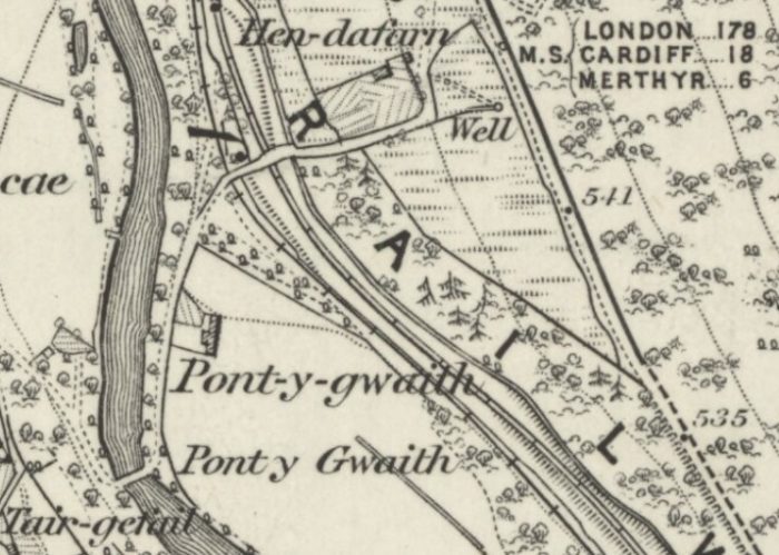
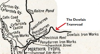
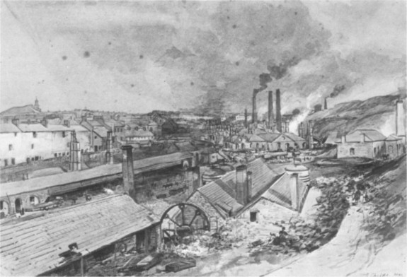
 Keeling travelled round a whole series of different Works and Tramroads which included: Fothergill’s Ironworks at Abernant (owned by The Aberdare Iron Company); and the Neath Abbey Iron Company’s works, an establishment with a history as venerable as its name suggests, having been established in 1792. [1]


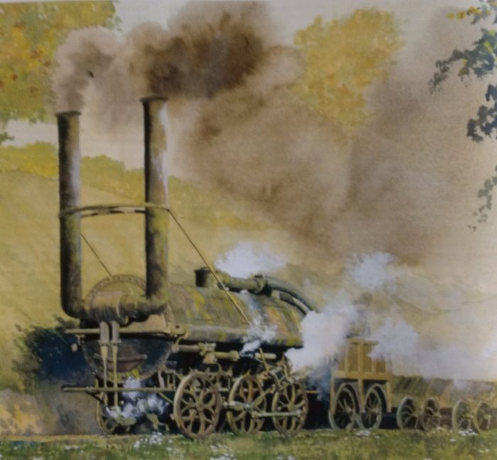


 BRIDGET was built by Baldwin in 1917
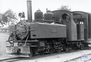


