Author Archives: Roger Farnworth

Unknown's avatar

About Roger Farnworth

A retired Civil Engineer and Priest

The Uganda Railway – Part 6 – Ulu to Nairobi

Our journey along the Uganda Railway continues ………….

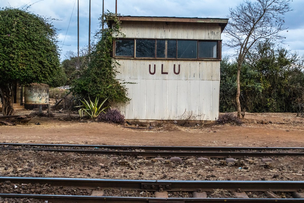
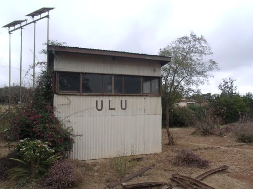
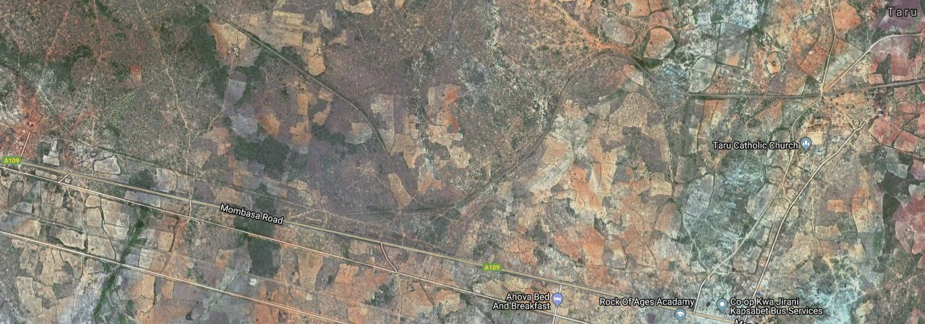
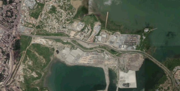
Ulu is our starting point for the next leg of the journey. The station can be seen on the satellite image below. It is at the top of the photograph and approximately in the middle of the image. Ulu is located in the region of Kajiado. The distance from Ulu to Kenya’s capital Nairobi is approximately 69 km/43 miles (as the crow flies).[1]  This next leg of our journey is not a long one!Leaving Ulu for Nairobi, trains travel in a North-easterly direction before eventually swinging round to the North-west towards Konza.
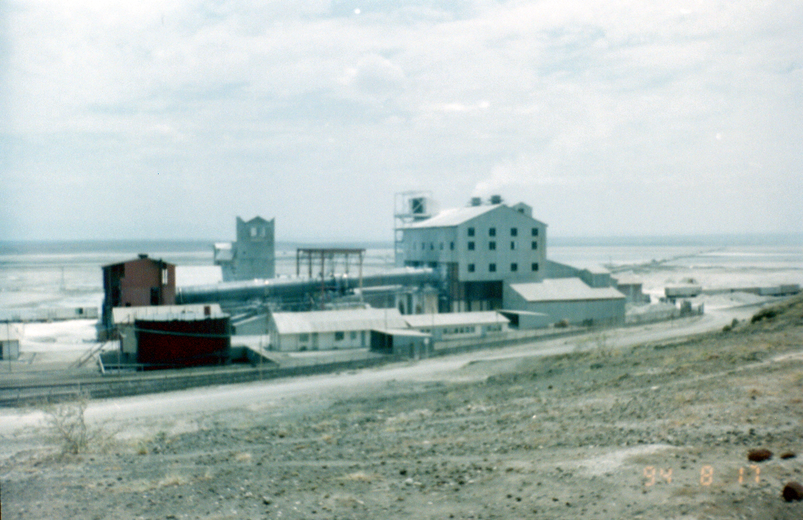
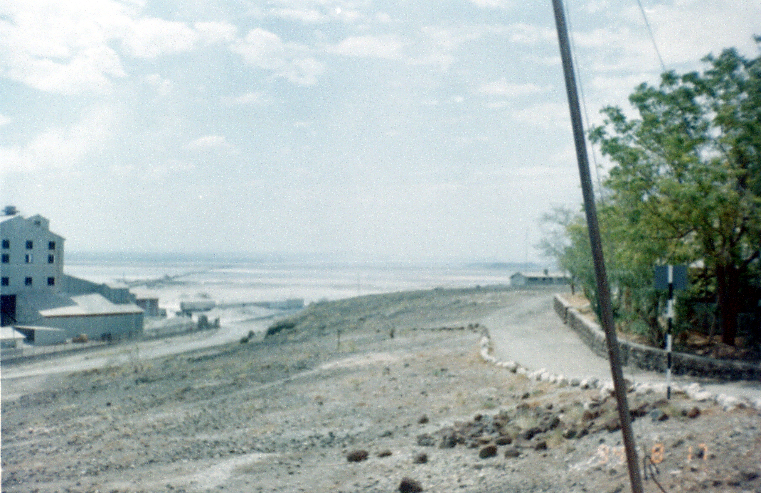
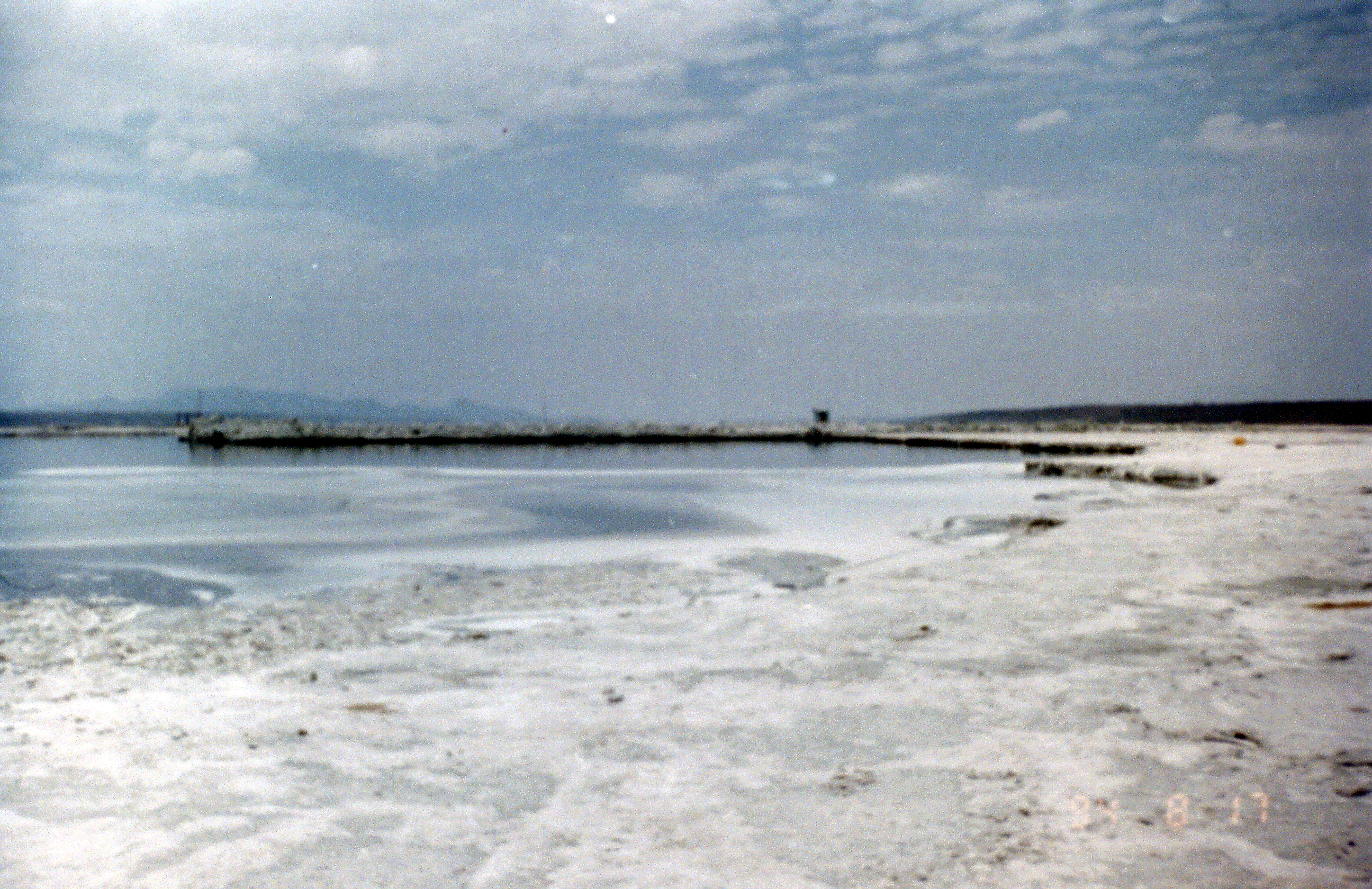
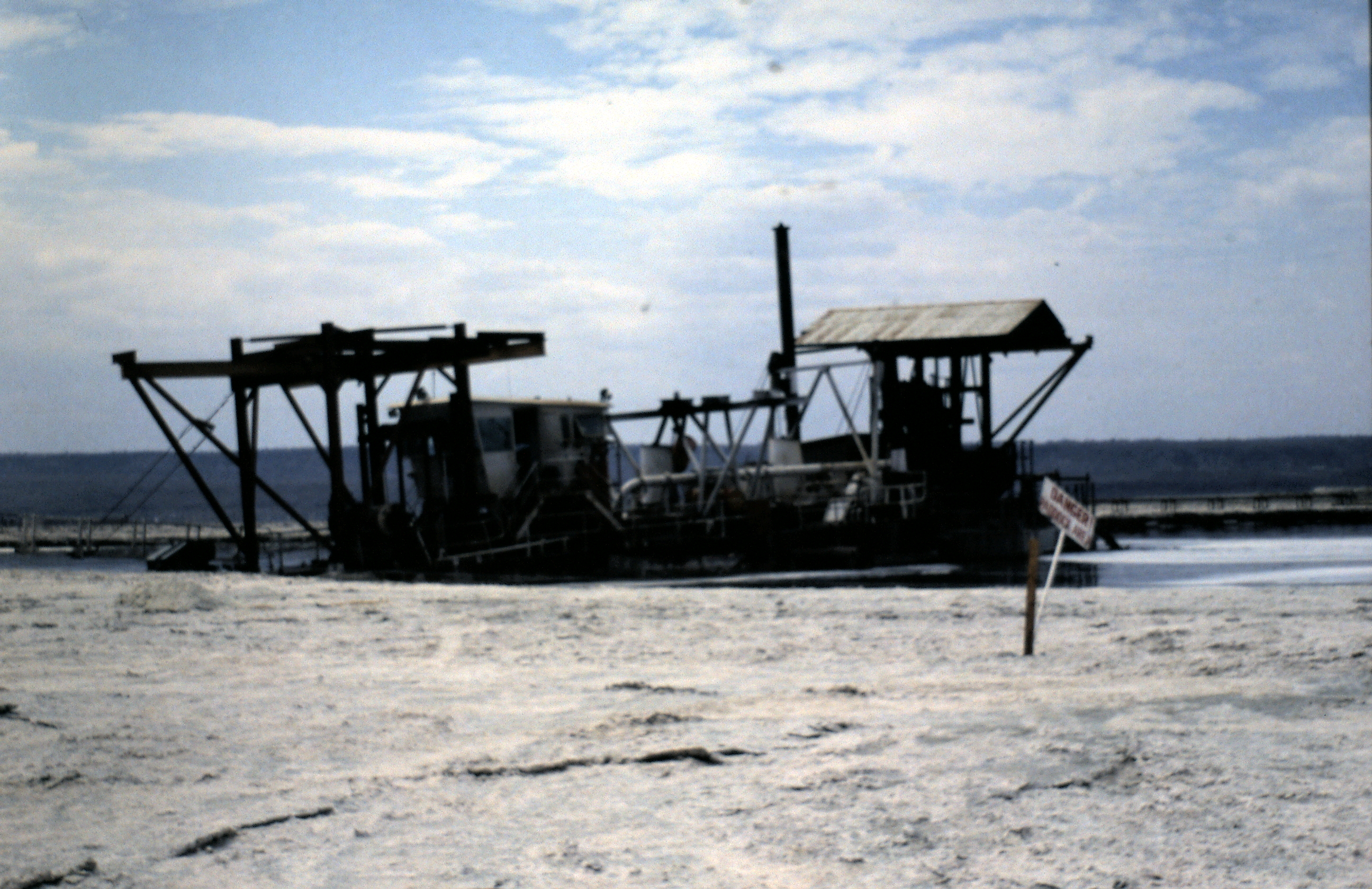
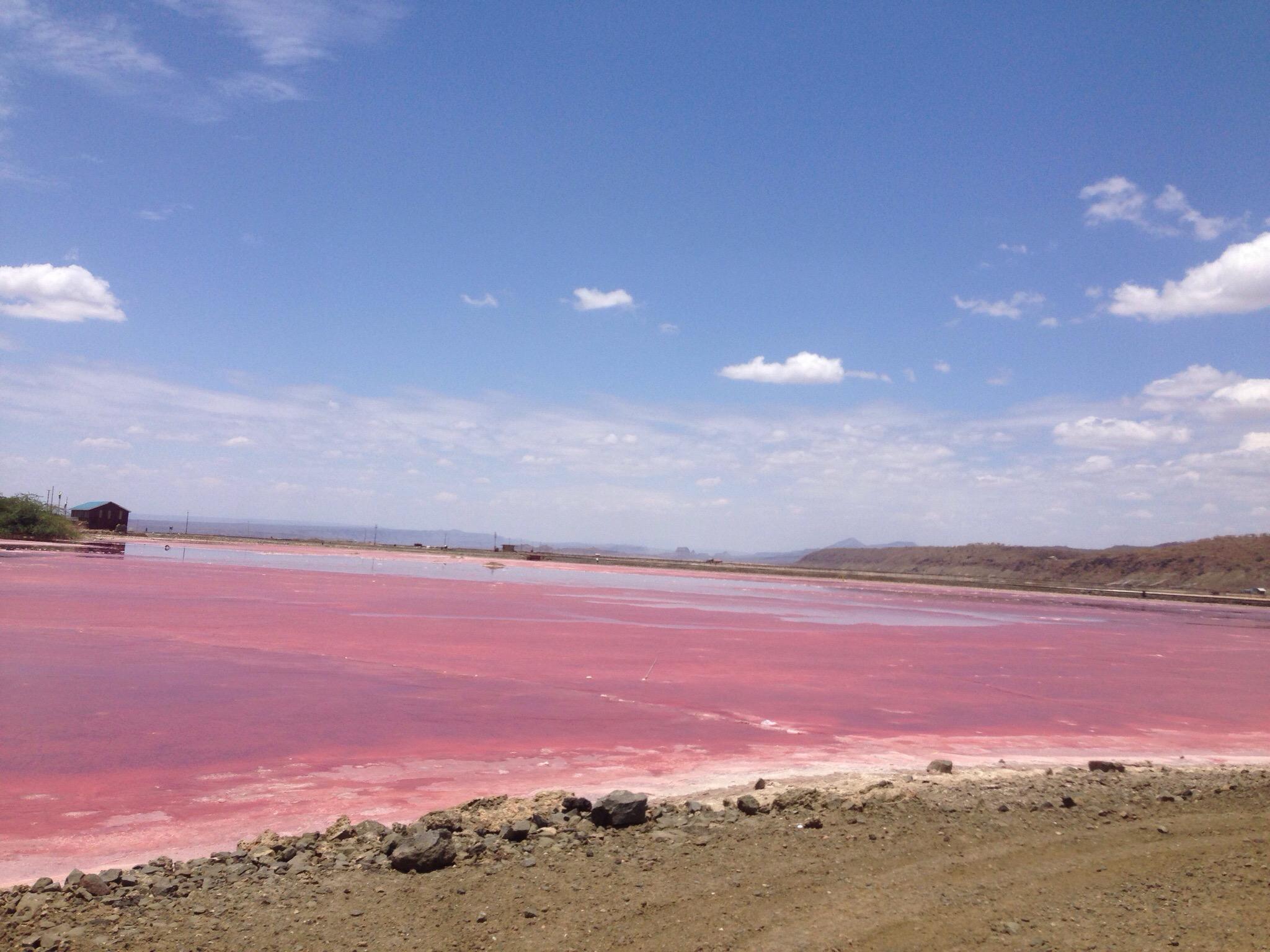
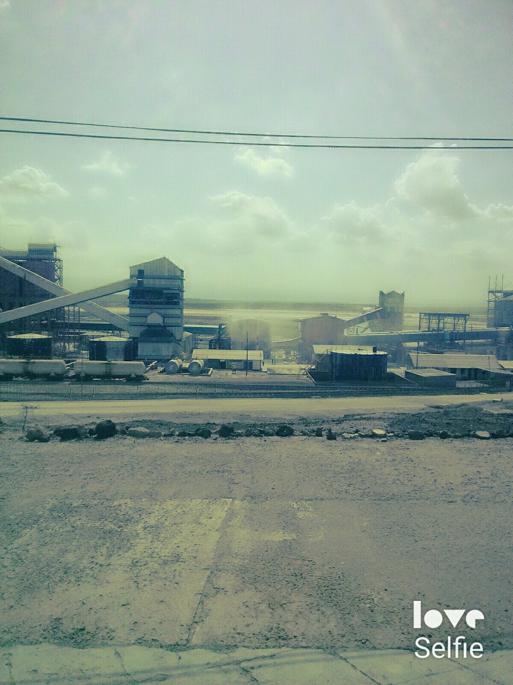
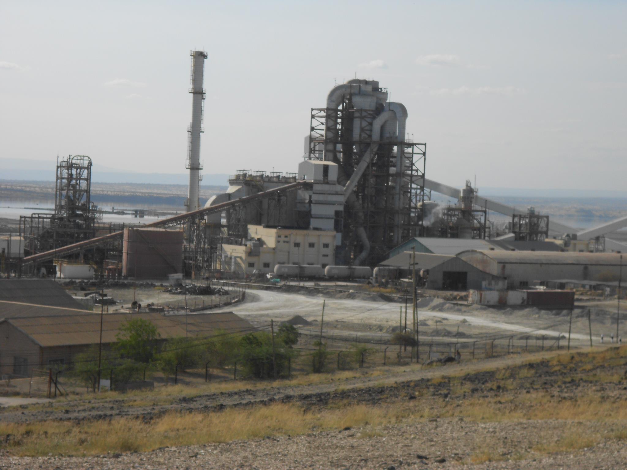
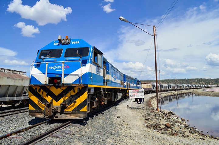
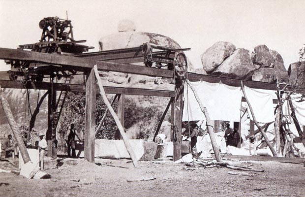
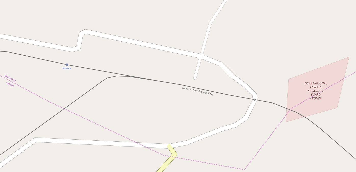
Just before we reach Konza a branch-line diverts off the mainline in a south-westerly direction. Konza is the junction for the line which serves Magadi Soda Works. The branch travels via  Kajiado, Kenya Marble Quarry, Elangata Wuas, Singiraini, and Koora to Magadi Soda Works. I visited the Soda Works in 1994, travelling there by car from Nairobi. The first six pictures below are my own and the quality is not great.  
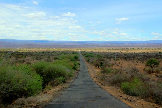
Road is the easiest way to access Magadi despite the railway link.[3] 
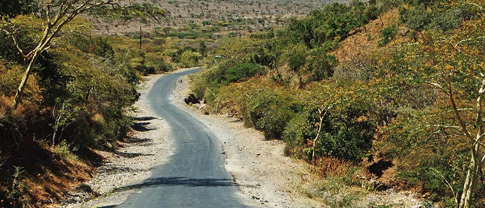
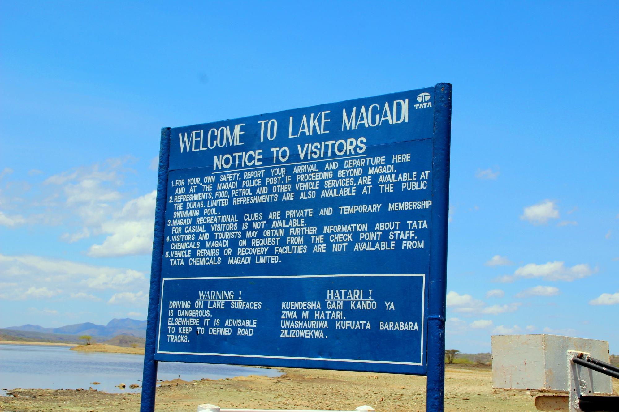
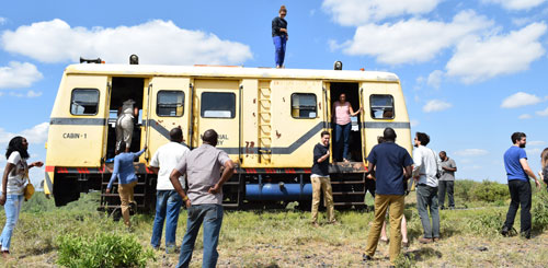
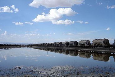
One other way of visiting Lake Magadi is to take the Jaza train. [2] 
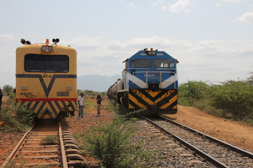
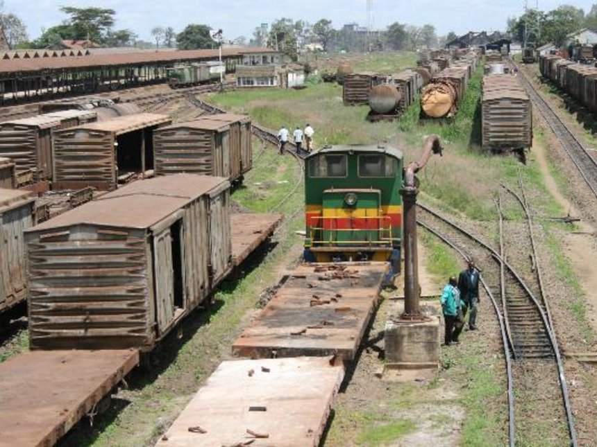
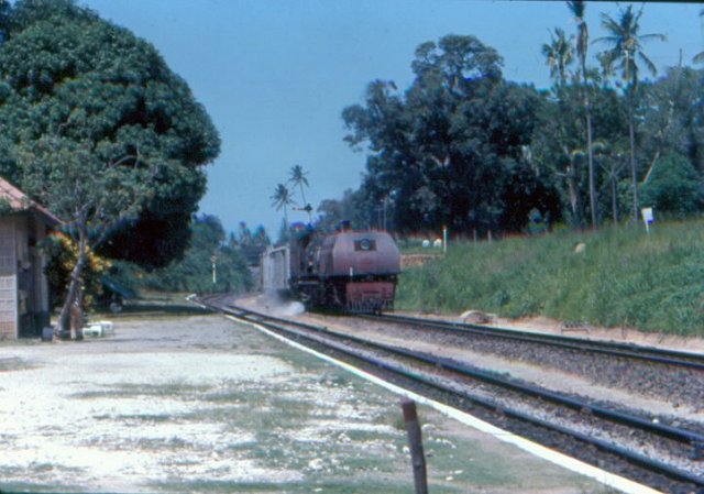
Konza Station is reached just after the branch-line leaves the mainline.
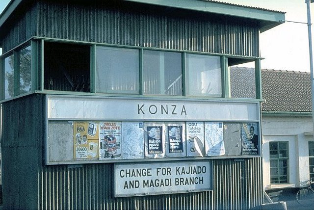
Early daylight at Konza –  © Peter Ritchie.[4]
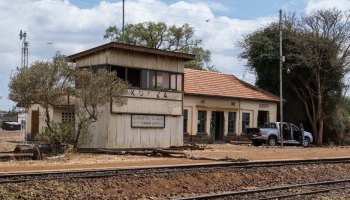
The line then follows a north-north-easterly path until it reaches Kitengela (Kapiti Plains Estate/Stony Athi) and turns northeast towards Athi River. 
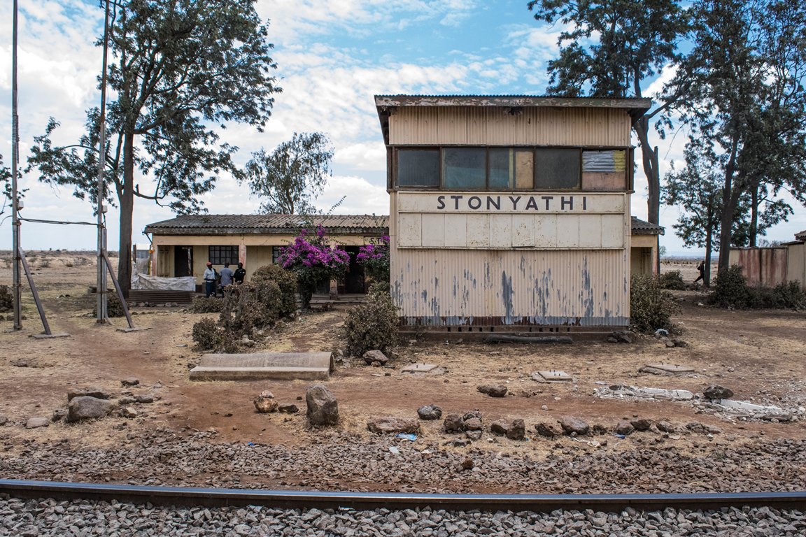
As the line approaches Athi River it passes the new SGR Station of Athi River and then turns sharply to the west and enters the town. 
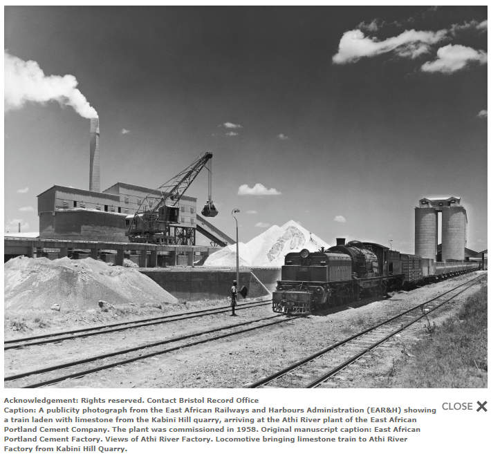
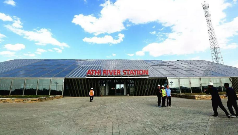
Two short branches leave the mainline at Athi River, serving the Blue Triangle Cement Company (East African Portland Cement) works to the West if the town.
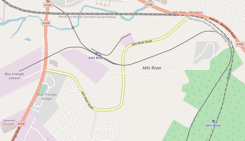
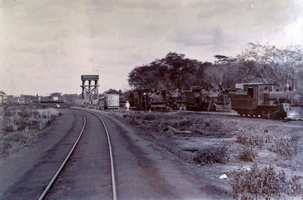
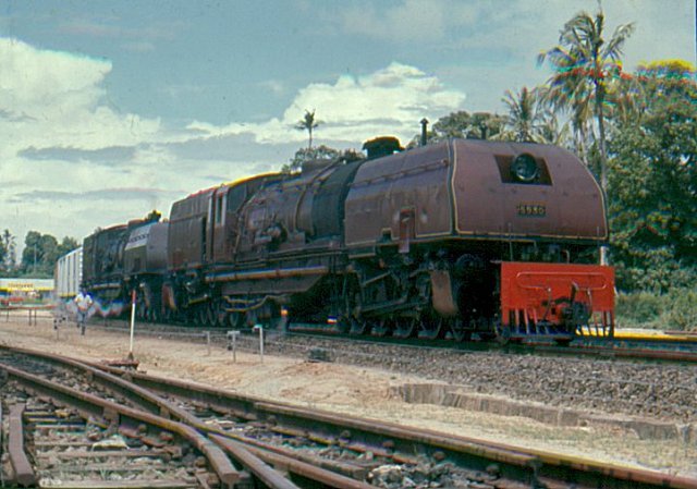
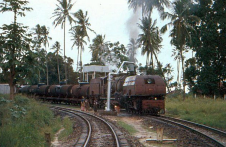
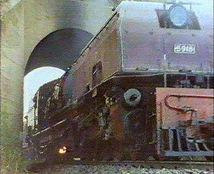
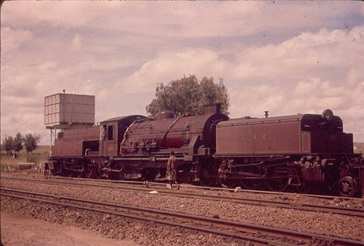
Class 58 Garratt in about 1960 – the locomotive has been fitted with a Giesel ejector. No. 5810 is seen at Athi River, 16 miles from Nairobi – © Iain Mullilgan.[4]
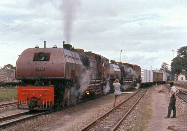
Class 59 Garratt, No. 5918 sitting in the late afternoon sun at Athi River waiting for the return working above. Below, a fireman’s eye view as the train sets off for Nairobi.[6]EARC 92 Class diesel arriving as Class 59 Garratt No. 5904 Mount Elgon at Athi River – © James Waite.[4]

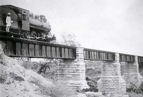
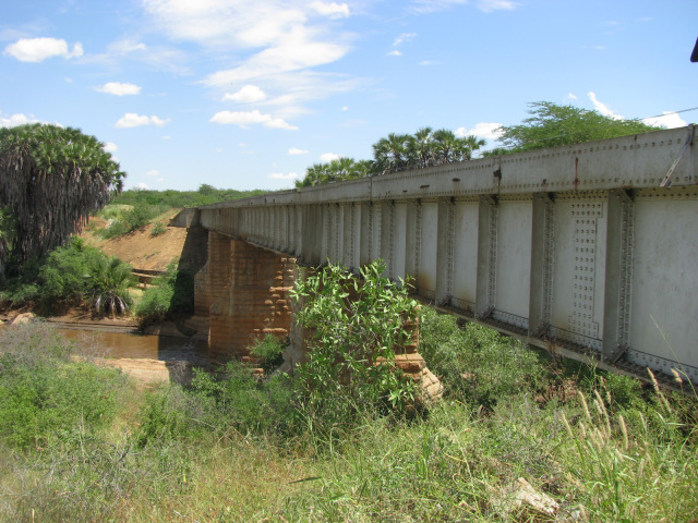
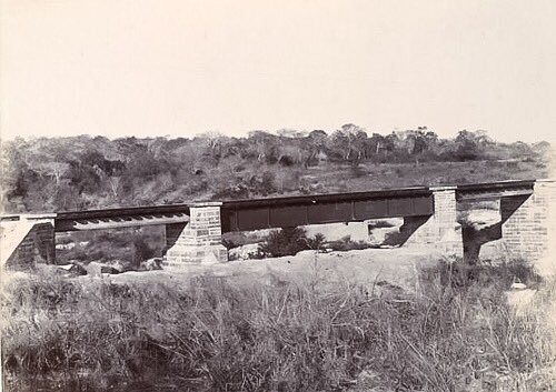
The mainline crosses the Athi River just after the station and then passes under the new SGR line.
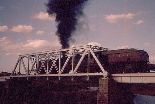
Mount Elgon and its train depart across the Athi River for Nairobi – © Iain Mullilgan. [4]
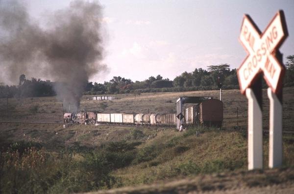
Mount Elgon and its train continue across the Athi River for Nairobi – © James Waite.[4]

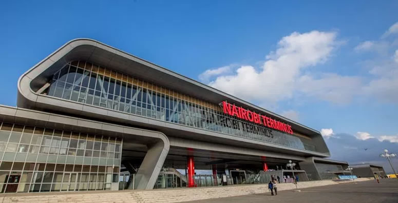
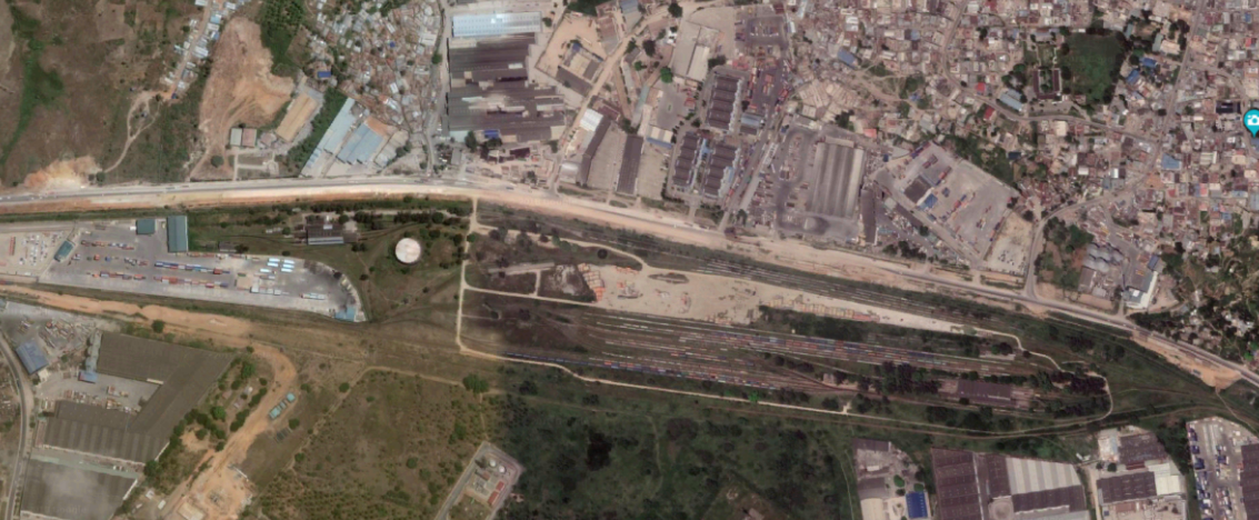
After crossing the Athi River the metre-gauge railway passes through Marimbeti Station before reaching Embakasi Station. As can be seen from the map below, Embakasi is the location of the present Nairobi terminus of the SGR line, some distance away from the city centre.
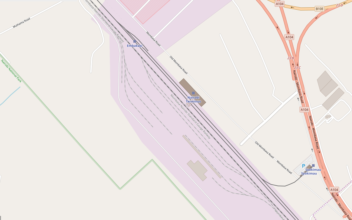
The next few pictures show Embakasi in the days long before the SGR was imagined!
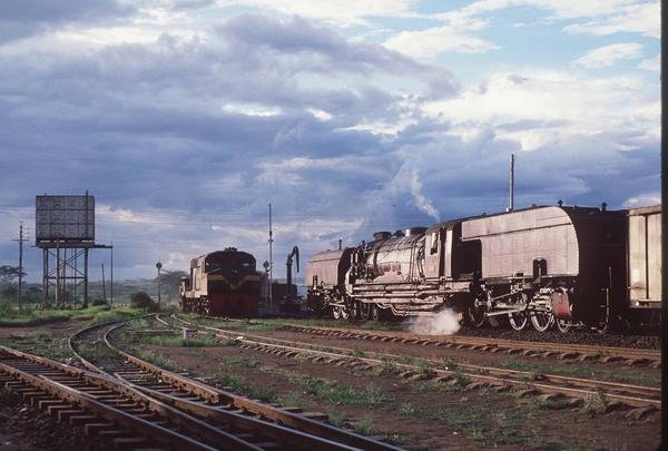
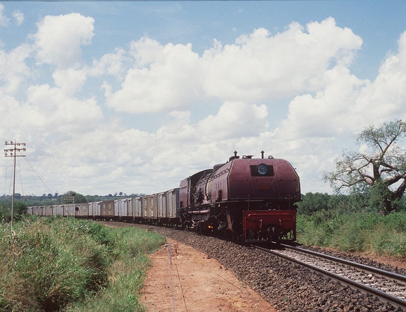
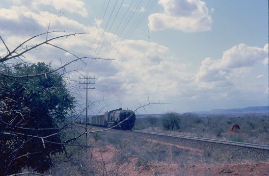
An unidentified 59 Class heading a freight over the Athi Plain – © Iain Mulligan.[4]
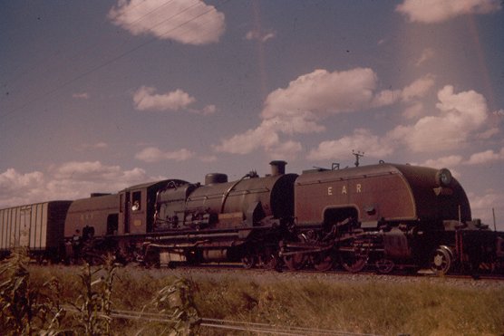
Class 60 Garratt  No. 6003 Sir Stewart Symes before it was fitted with a Giesel ejector.  The train is near Embakasi – © Iain Mulligan.[4]
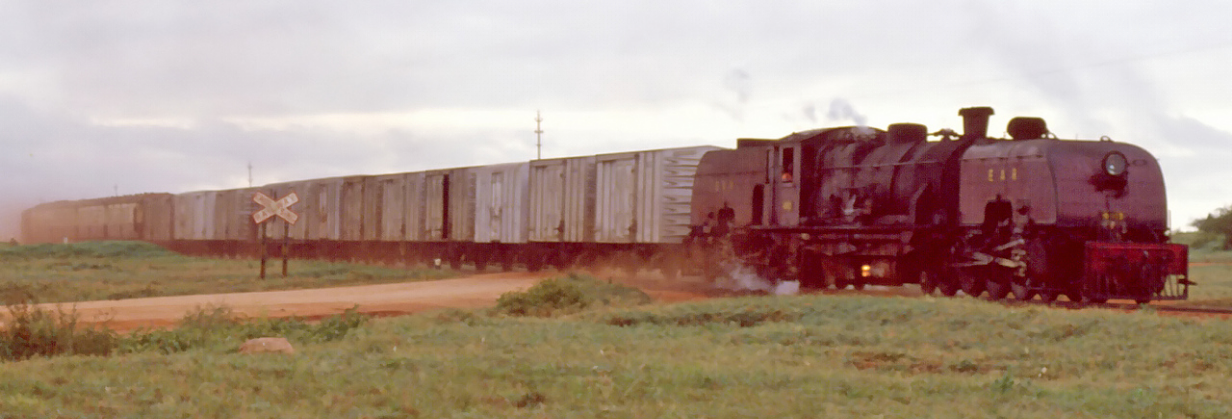
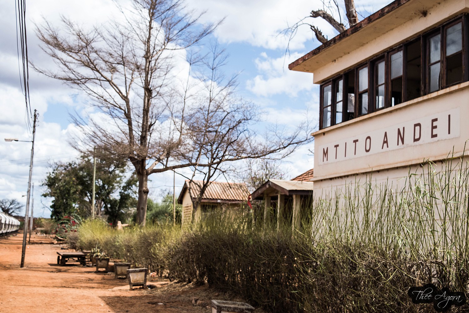
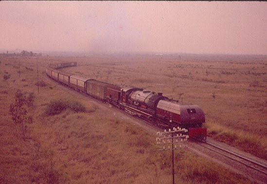
Class 59 heads No 4 Down near Embakasi. The train would have departed Nairobi at 1545, calling at all stations to Mombasa where it was due to arrive at 0710 the following morning – just 50 minutes ahead of No 2 Down – the Mail Train which will have left Nairobi at 1830 for Athi River, Konza, Mtito Andei, Voi and Mombasa © Iain Mulligan.[4]

Beyond Embakasi the railway passed through a marshalling yard and then through Imara Daima Station before swinging round to the North-East.
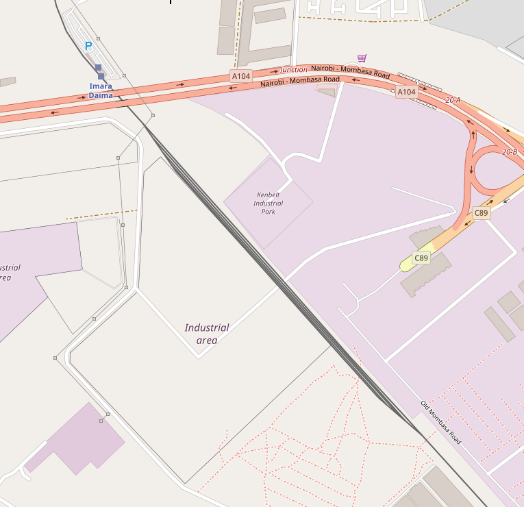
It then crossed the Ngong River in the southern suburbs of Nairobi.
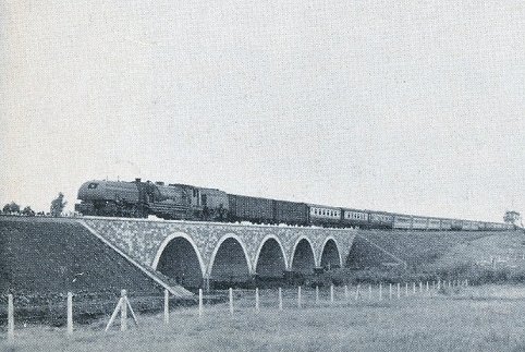
The first passenger train from the coast crosses the Ngong River Bridge which was completed as part of the Embakasi/Nairobi realignment in 1958. PHOTO – EAR&H.[4]

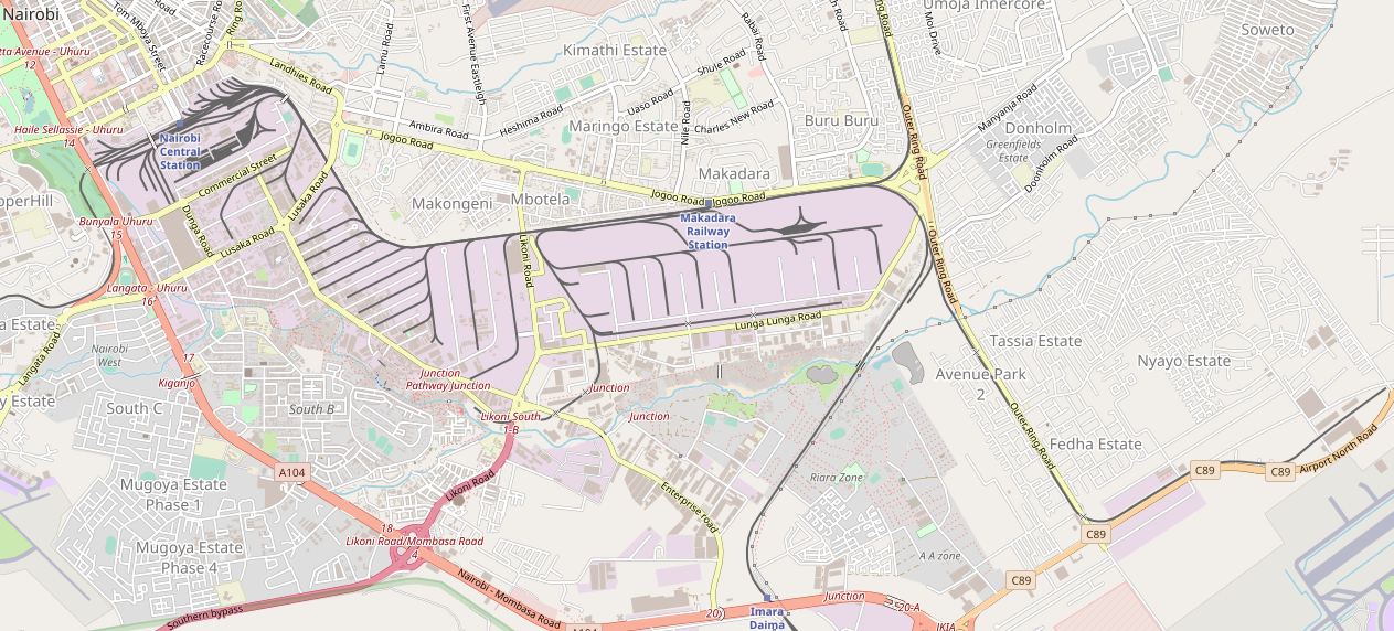
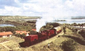
A short branch-line joins the mainline from the East just as it swings round to travel almost due West and is immediately joined by another branch, this time much longer. This branch headed off in a Northerly and then Northeasterly direction and terminated at Nanyuki. On the way it passed through Dandora, Githurai, Kahawa, Ruiru, Kalimoni (Juja), Komo and Thika Stations.
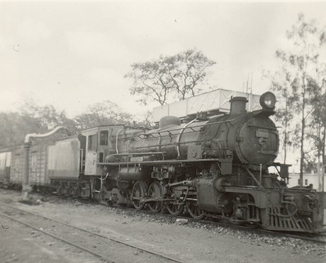
Tribal Class 3109 Bahororo takes water at Thika.  © Iain Mulligan.[8]

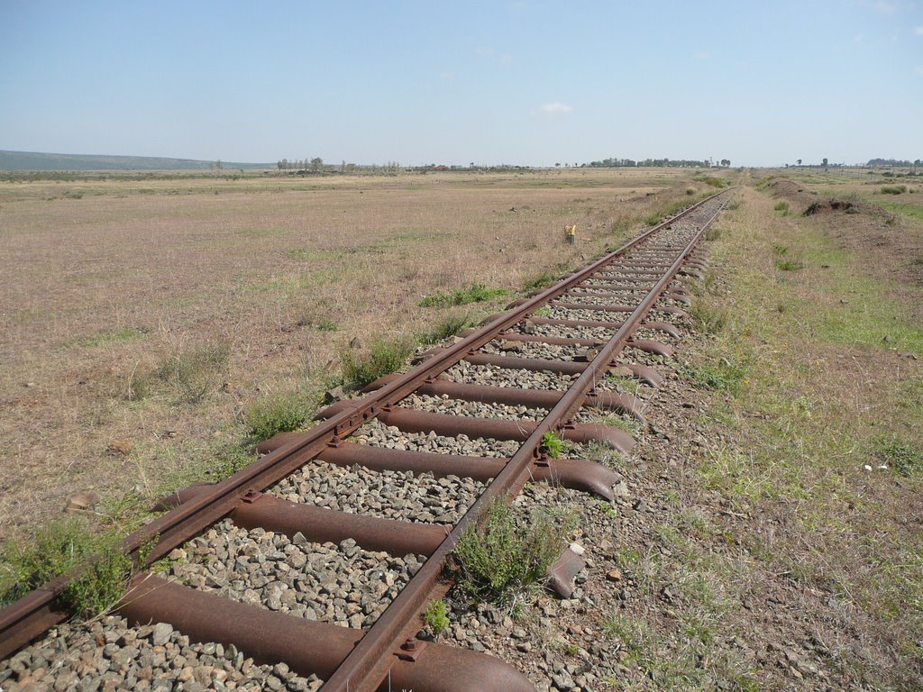
Beyond Thika, the line passed through Mitubiri, Santamor, Makuyu, Saba Saba, Maragua, Murang’a, Sagana, Makaungu, Karatina, Nyeri, and Naro Moru Stations, before arriving at Nanyuki.

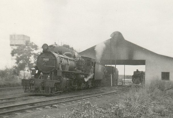
A Class 31 was permanently stabled at Sagana to double head freights over the 3.5% grade to Nanyuki, © Iain Mulligan.[8]

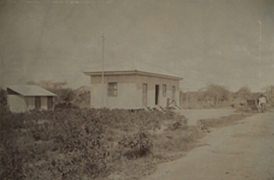
Nanyuki is a market town in Laikipia County of Kenya lying northwest of Mount Kenya along the A2 road and at the terminus of the branch railway from Nairobi. It is situated just north of the Equator. It was founded in 1907 by British settlers, some of whose descendants still live in and around the town. Nanyuki is currently the main airfield (airbase) of the Kenya Air Force. The British Army also keeps a base at The Nanyuki Show Ground (NSG) from where it conducts yearly desert and jungle training exercises on the mountain and in the arid areas to the north.[7]Nanyuki – branch terminus

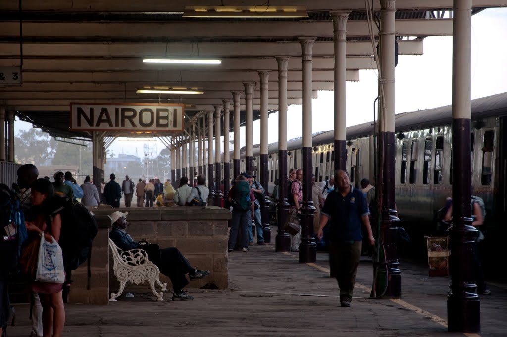
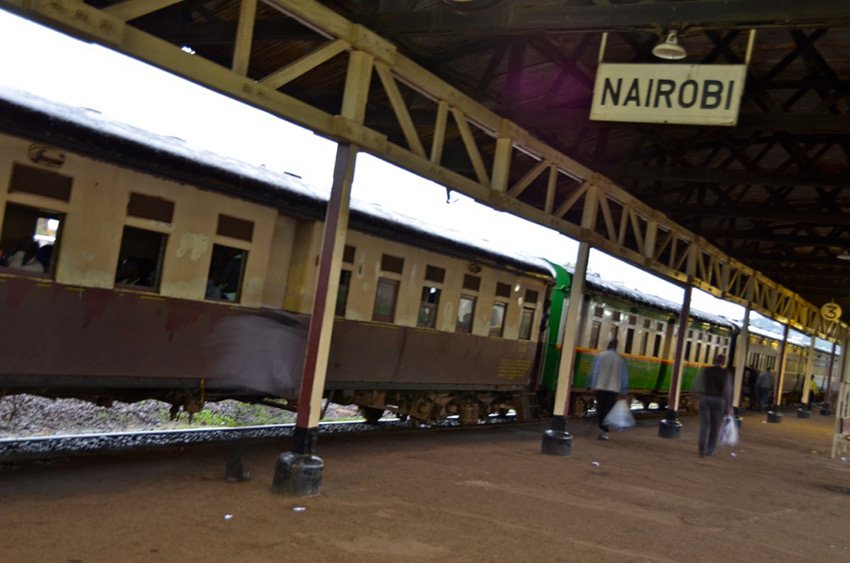
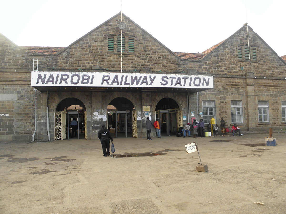
After passing the Nanyuki branch-line, the railway is now in the industrial heart of Nairobi with a whole series of branches and sidings. Approaching Nairobi Central Station it passes through two more stations/halts, at Makadara and Makongeni. Then we arrive at Nairobi Central Station. The next two photographs are more of my poorer slide photos from 1994. The one’s following have been culled over time off the internet.
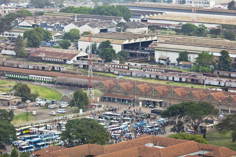
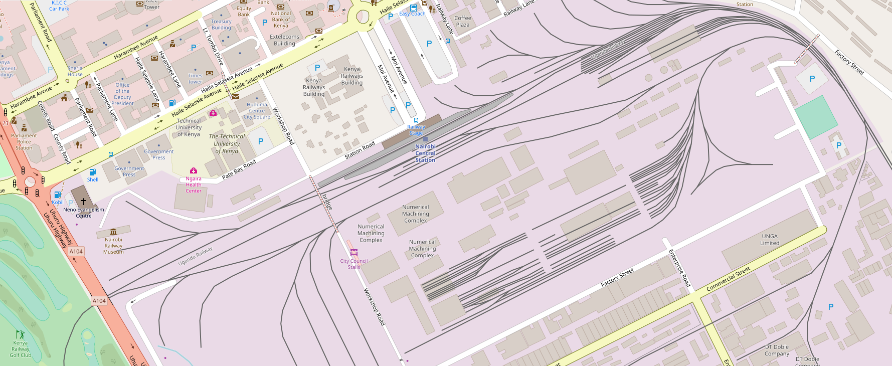
The map above focusses more specifically on Nairobi Station. The lines leaving the right of the image head for Mombasa, the line leaving the left of the image is the line heading West to Kisumu and to Uganda.

The next post in this series about the Uganda Railway will spend time in Nairobi and will also visit the Railway Museum.[9]
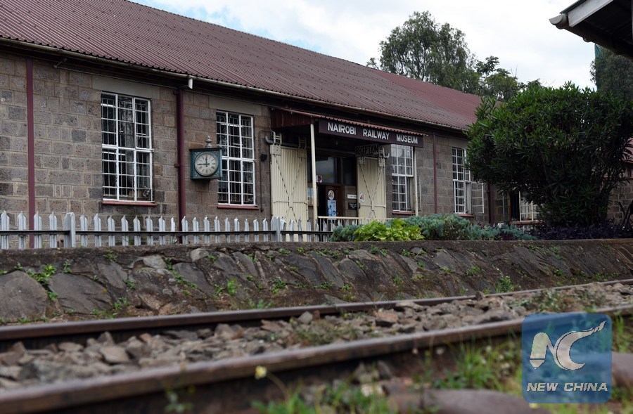
References

  1. http://kenya.places-in-the-world.com/178769-place-ulu.html, accessed on 21st May 2018.
  2. http://www.lakemagadiadventures.com/jaza_train_to_lake_magadi, accessed on 21st May 2018.
  3. Lake Magadi Soda by Road from Nairobi; https://www.tripadvisor.co.uk/ShowUserReviews-g1137919-d6609180-r234172046-Lake_Magadi_Conservancy-Magadi_Rift_Valley_Province.html, accessed on 21st May 2018.
  4. http://www.mccrow.org.uk/EastAfrica/EastAfricanRailways/NairobiMombasa.htm, accessed on 15th May 2018.
  5. https://www.pinterest.co.uk/pin/554083560377607665, accessed on 21st May 2018.
  6. http://www.trevorheath.com/livesteaming/Kenya.htm, accessed on 21st May 2018.
  7. https://en.m.wikipedia.org/wiki/Nanyuki, accessed on 21st May 2018.
  8. http://www.mccrow.org.uk/EastAfrica/EastAfricanRailways/NairobiNanyuki.htm, accessed on 21st May 2018.
  9. http://www.xinhuanet.com/english/2016-05/18/c_135369174.htm, accessed on 22nd May 2018.

Mombasa, Kenya – A very early tramway?

I came across some photographs while doing some research for my posts about the Uganda Railway. Further investigation led to a discovery of a very early tramway system in Mombasa. The adjacent image was one of these. There are clearly a set of tracks running on the streets of Mombasa.

Further investigation highlighted the existence of what was called a ‘trolley'[1]There were stations throughout Mombasa Island. The next picture shows the station at Kilindini.[1] It did not take long to find a significant number of other photographs showing the trolley and the tracks used.The trolley track, ran from Mbarak Hinawy Road (Vasco da Gama Street) to Government Square (Customs Area, Leven House) and on to Nkrumah Road (Macdonald Terrace) past the Old Law Court on to Kilindini. It provided access to the “Jubilee Hall” (put up to commemorate the English Queen Victoria’s diamond jubilee in 1897 and also used as a meeting place for Old Town elders until 1950’s) and veered to the right to the famous Mombasa Club which was also built in 1897 by the trader Rex Boustead.[1]Old postcard showing the main street (Ndia Kuu) in Old town. You can see the trolleys in the bottom left hand corner of the picture.[2]Between 1890 and the early 1920s, Mombasa Island was serv­ed by an unusual transport system. A light two-foot gauge railway line was laid across the island from Government Square (in the old port) to Kilindini docks, and on it were pushed by hand small trolleys which could carry goods or passengers. By 1903 a branch had been laid to the station (then in Treasury Square), the hospital, the sub-­commissioner’s house, the lighthouse at Ras Serani, the sports club and to the cemetery.

In 1900 it cost 4 annas to travel from Government Square to Kilindini, or 2 annas as far as the station. If two trolleys met on a single line, the lower ranking officer or civilian had to have his trolley lifted from the rails to allow his senior to pass.

The trolleys were withdrawn in about 1923, after which people had the choice of walking, hiring a rickshaw or taking a motor car. The first car arrived in Kenya in about 1900. A horse and carriage was a rare phenomenon, horses being very susceptible to local diseases.[1]

A replica trolley stands in the courtyard of Fort Jesus, on some reconstructed original line.[2]The track for the two-foot gauge trolley line came from an abortive attempt to build a railway into the interior, The “Central African Railway” which had reached a mere 11 kilometres inland from Mombasa Island![3]

The ” Central African Railway” had an interesting history ……. [1] The story which follows is sourced mainly from the Friends of Mombasa Website.

Sir William Mackinnon, the ship owner in charge of the IBEA (Imperial British East Africa) Company, lost no time in writing to Lord Salisbury, six months after the signing of the Brussels Treaty, suggesting Government assistance for the construction of a 60-mile (96.5 kms) railway inland from Mombasa. He also sought aid for opening up roads and forming “stations” along the route to Lake Victoria.

As a result of this successful appeal, the Director of the IBEA in London was able to send out sufficient materials and rolling stock for building a narrow gauge light railway to cost £50,000. The following year construction got under-way, starting from a point on the mainland opposite Mombasa Island, at the head of what has now become Kilindini Harbour.

It was given the very ambitious title of the “Central African Railway”, and as a symbol of the good intentions of the IBEA to open up the hinterland, sounded very impressive., but the venture got no further than seven miles (11.2 kms) before work stopped. Although it covered no more than a tiny fraction of the distance to Lake Victoria and the source of the Nile, the “Central Africa Railway” did secure a place for itself in history as one of the first railways to be built in East Africa, albeit no wider than two feet (61 cms) gauge. The tracks were later pulled up and, together with some of the unused rails, were re-laid to form the trolley line on Mombasa Island. Until 1923 this line was mainly used by Government officials, the more senior of whom had their own trolleys and received monthly allowances to pay the Africans employed to push them.

In its original form the “Central Africa Railway” was used only once for official purposes. It was used, however, as a stylish conveyance for picnic parties venturing inland from the port.

By 1893, the IBEA had withdrawn from Buganda, but remained temporarily at Mombasa until the British Government finally “took the plunge” by declaring a protectorate over the Buganda Kingdom and neighbouring lands as an alternative to outright annexation. It then began to consider a “proper” railway that would run all the way from the Indian Ocean to Lake Victoria. Not only would this be a really serious indication of Britain’s intentions to open up the interior for trade, and combat slavery, but it would be useful for transporting British troops, whom the government in London thought would be necessary for maintaining a permanent garrison at the source of the White Nile, near Jinja.

This post should perhaps, therefore have been written before may posts about the development of the Uganda Railway![4]

I was blissfully unaware of this little bit of railway history when I wandered round Mombasa Island before embarking on the night train for the journey to Nairobi and Kampala.No automatic alt text available.
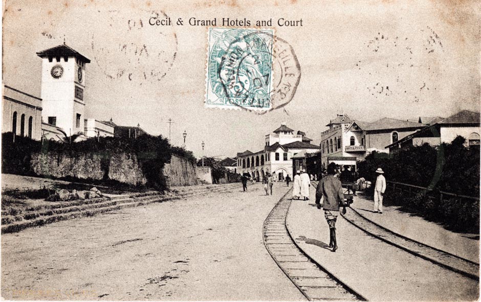
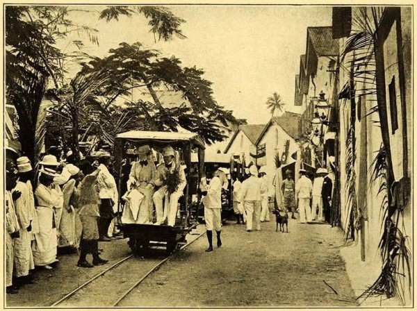
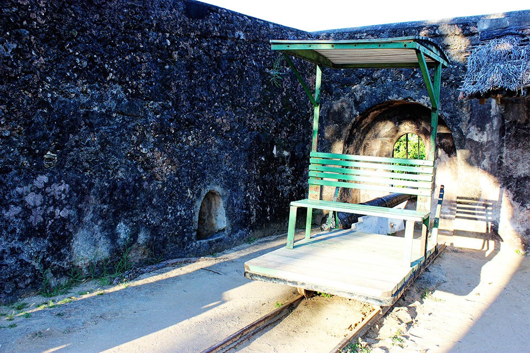
On the left of the picture above is a replica of a Mombasa trolley. [5]
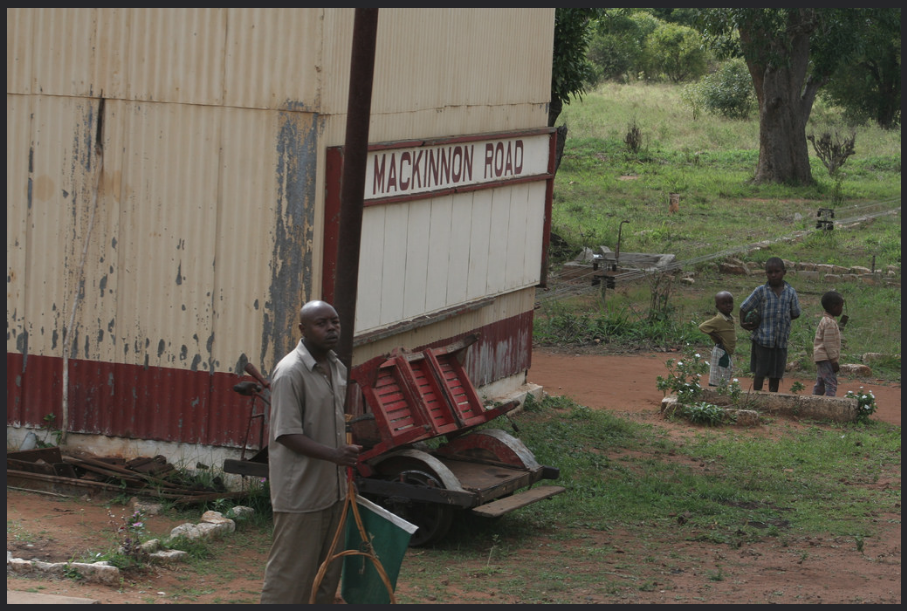
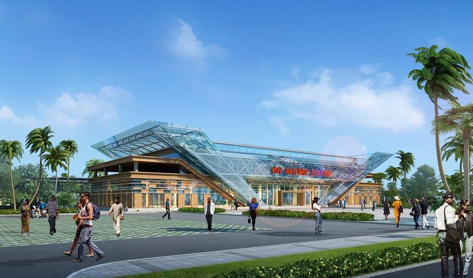
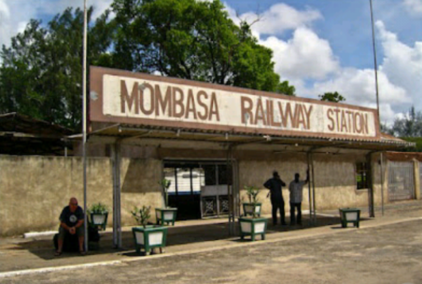
References

  1. http://www.friendsofmombasa.com/british-empire-in-east-africa/east-african-railways, accessed on 11th May 2018.
  2. http://www.oldeastafricapostcards.com/?page_id=512, accessed 12th May 2018.
  3. http://www.greywall.demon.co.uk/rail/Kenya/nrm.html, accessed on 22nd May 2018.
  4. The posts on my blog start with the Uganda Railway Story and continue to review the line along its full length. Please see https://rogerfarnworth.wordpress.com/category/uganda.
  5. https://www.facebook.com/nrailwaymuseum/photos/pcb.1699207140092552/1699205880092678/?type=3&theater, accessed on 23rd May 2018.

The Uganda Railway – Part 5 – Voi to Ulu

We start this next post with a variety of images from the station at Voi, and from its immediate surroundings. The first picture is the featured image which shows the publicity photo for the railhead reaching Voi in 1897.Class 59 Garratt No. 5902, Ruwenzori Mountains takes on water at Voi Station. Image result for voi railwayVoi Station Sign. [1]An old colonial-era railway line sits near the site of the new Mombasa-Nairobi Standard Gauge Railway line under construction in Voi, Kenya. Bloomberg photo by Riccardo Gangale.[8]

EAR Class 59 Garratt No. 5902 “Ruwenzori Mountains” heads away from Voi with a Mombasa to Nairobi Goods train on 10th December 1976 © Bingley Hall, on flickr.[2]Class 59, 5914 at the same location. [5]The map shows the branch-line to Moshi as a dotted line turning away from the A109 and following the A23 to the bottom left of the image. The route is bridged by the SGR. The next two images are taken of trains on that branch-line. Both show the same locomotive, Class 60 Garratt No. 6013, © CPH 3 on flickr.[3]Class 59 Garratt en-route to Voi – © James Waite.[4]

Travelling north from Voi and after the branch to Moshi turns away to the West, the line passes through Irima, Ndi and Manyani Stations and between the two game reserves of Tsavo East and Tsavo West in a corridor which also includes the A109 road between Mombasa and Nairobi and the new SGR.Irima Railway Station.Ndi Railway Station.Manyani © Thomas Roland on Flickr [6]

The SGR and the A109 run consistently parallel to each other the metre-gauge line follows a route which best works with the contours of the land. All three pass through Tsavo.

Tsavo railway station was some distance from the village.An image from google maps. [7]The metre-gauge line crosses a relatively low level bridge over the Tsavo River, just beyond Tsavo Station, which can be seen in the next few images, the first of which is taken from the A109 bridge over the Tsavo River.Class 59 Garratt, 5903 Mount Meru, on Tsavo Bridge, heading towards Voi – © James Waite.[4]Another shot of the bridge. [6]

The last image at Tsavo shows the construction work on the SGR viaduct across the Tsavo River … all along the length of the new line provision is made to allow wildlife access under the line and to avoid high-speed collisions between trains and wildlife.

Moving on from Tsavo the line continues to meander in a generally North-westerly direction for a number of kilometres on almost exactly the same line as the SGR, through Kyulu Railway Station.[9]
And Kenani Railway Station,[9] and then Kanga, before reaching Mtito Andei.
Mtito Andei is the nearest stop on the SGR to Tsavo.[10]It supersedes the station on the old metre-gauge line, although that line may well remain open for goods traffic.[9]

The old metre-gauge line continues on through Kathekani, Darajani, Ngwata, Masongaleni,  Kikumbulyu, and Kibwezi.Darajani, © Matthew O’Connor on flickr. [11]The last three sepia pictures are courtesy of the UK National Archive. [12]

The Railway continues in a north-westerly direction through Mbuinzau, Makindu, Ikoyo,  Kiboko, Simba,  Kabati and Emali Stations

Plan of Makindu Station and sidings.[12] The following photos are from Dr Gurraj Singh Jabal [14] and a few other sources.There was a rail accident at Makindu on 29th March 1958.

Emali. [9]

After Email, is passes through Nzai, Sultan Hamud, Kima, Kalembwani and Kiu Stations before reaching Ulu.Kima. [9] Kalembwani. [9] Ulu. [9]Ulu. [15]

We finish this leg of the journey at Ulu and look forward to travelling on to Nairobi in the next post.


References

1. https://theeagora.wordpress.com/2013/08/03/voi-railway-station, accessed on 19th May 2018.

2. https://www.flickr.com/photos/markcarter/14338441191/in/photolist-nR3g2i-sYdBgH, accessed on 19th May 2018.

3. https://www.flickr.com/photos/steam_locos/12132360645/in/photolist-ju6w8P-iDJaq6-iFiks9-iFkoFj, accessed on 20th May 2018.

4. http://www.mccrow.org.uk/EastAfrica/EastAfricanRailways/NairobiMombasa.htm, accessed on 19th May 2018.

5. https://www.pinterest.co.uk/pin/688839705474887109, accessed on 20th May 2018.

6. https://strategicdepth.org/2017/06, accessed on 20th May 2018.

7. https://www.google.co.uk/maps/place/Tsavo+Station/@-2.9931068,38.4689082,3a,75y,90t/data=!3m8!1e2!3m6!1sAF1QipP4jOul9RQMOMR3VrJAfu6wgE7GFS4rrEiAIhTD!2e10!3e12!6shttps:%2F%2Flh5.googleusercontent.com%2Fp%2FAF1QipP4jOul9RQMOMR3VrJAfu6wgE7GFS4rrEiAIhTD%3Dw129-h86-k-no!7i6000!8i4000!4m5!3m4!1s0x183959f41c019539:0x786fe9903739f4c5!8m2!3d-2.9931068!4d38.4689069, accessed on 20th May 2018.

8. https://www.bloomberg.com/news/articles/2016-04-08/africa-s-30-billion-rail-renaissance-holds-ticket-for-trade, accessed on 20th May 2018.

9. http://www.savetherailway.com/railway-stations, accessed on 18th May 2018.

10. https://www.google.co.uk/maps/uv?hl=en&pb=!1s0x183bb8751a761d9b%3A0x1c2fac4b35e4a8bf!2m22!2m2!1i80!2i80!3m1!2i20!16m16!1b1!2m2!1m1!1e1!2m2!1m1!1e3!2m2!1m1!1e5!2m2!1m1!1e4!2m2!1m1!1e6!3m1!7e115!4shttps%3A%2F%2Flh5.googleusercontent.com%2Fp%2FAF1QipO1kG9cbCL_gJ17EFd6RpYfv7oz1cTQUYj2HzDz%3Dw240-h160-k-no!5sMtito%20Andei%20railway%20station%20-%20Google%20Search&imagekey=!1e10!2sAF1QipOUxm6EAfKZtxK1rg-xvRhE1dQw39qbHCaKRHMB&sa=X&ved=0ahUKEwiX8tWvgpXbAhUfOsAKHQa4BOYQoioIjwEwDg, accessed on 20th May 2018.

11. https://www.flickr.com/photos/hadenoak/29842259871/in/photolist-Mt4oaV-kaYDpr-8nLN2m-bPabo4-bAfL3A-aCVMTM-FLyXgK-FRQ2qr-GxHPuU-GxHPKy-bPapRi-bAfwiy-NQoAC-r4WnTo-aWe2DD-fnT25s-bokDL-9HDBH5-6EDL3M-jh9DA9-aWiuJx-Jz64hu-NA9jZ-LbXZSJ-f9iWQE-8u155z-peR8pW-8oNqcF-aWivXi-7wknz8-9WNrqo-aWivNx-cyUfZw-aWe2z2-aWitUR-cyUfJ7-7wkniM-9ePedD-aWivAV-aWe3YH-6EDKRv-aWe1PD-aWe2wR-ReNwV5-LinKah-aWe39x-dZgfjY-8NqyQB-aeZZzh-7XevFt, accessed on 20th May 2018.

12. UK National Archives; http://www.nationalarchives.gov.uk, accessed on 20th May 2018.

13. https://www.openstreetmap.org/#map=17/-2.28318/37.82820, accessed on 20th May 2018.

14. http://www.savetherailway.com/remembering-makindu-station, accessed on 20th May 2018.

15. http://ke.geoview.info/ulu_railway_station,109548331p, accessed on 21st May 2018.

The Uganda Railway – Part 4 – Mazeras to Voi

The next instalment of the journey from Mombasa to Kampala.

We start at Mazeras Station.

The railway roughly follows the Mombasa to Nairobi Road in a North-north-westerly direction to the next station on the line, Mariakani, a distance of 15 kilometres. The first image is ©Rohn Wood. [1] The second image below is © East African Corridors (Image 5031), [2] and the third image (consisting of two photographs comes from the National Archive Library (CO 1069-185-81). [3]

Mariakani is the first stop on the new Standard Gauge Railway (SGR) after leaviing Mombasa.

From Mariakani, the metre-gauge line continued a further 13 kilometres in a Northwesterly direction to Maji ya Chumvi, initially the railway and road followed a similar path, but just under halfway between the two stations as the crow flies,the road and the old metre-gauge line separate to allow a steadier grade for the railway. For a short distance railway and river are close to each other before the railway crosses the river and heads for Maji Ya Chumvi.Maji Ya Chumvi River Bridge

In the map below the deviation away from the road is evident and the location of the bridge over the river. The line of the SGR is also visible. The road and metre-gauge line converge once again at Maji ya Cumvi and the road crosses the railway line at that point.

Beyond the road crossing the railway heads on a further 16 kilometres in a westerly direction to Samburu village (not to be confused with Saburu County and the Wildlife reserve of the same name which is in that county).The image immediately above is a photograph taken in 2015 and can be found in a library of photos of stations on the metre-gauge line.[4] The photo of Mazeras Station, further above, comes from that same library. Much more ancient images follow. The first two come from very early in the line’s history and were both taken at Samburu. The third is a later image of the station from the early 1900s. An interesting digital 3D model of this station has been created by ADH (African Digital Heritage).[5]

After Samburu, the line continued west-north-west to Taru a distance of about 18 kilometres.

From Taru, we head on to Mackinnon Road Station, probably so named because it was at the junction between the old Mackinnon ox-cart road, construction of which was started in 1890 by the British East Africa Company, and the railway. Quickly, once the railway was complete the Ox-cart road became disused.[6]The railway was some distance north of the Nairobi to Mombasa Road at Taru. En-route to Mackinnon Road it converged again with the line of the road, before deviating north and then approaching the line of the road very closely.At Mackinnon Road, as can be seen above, the old metre-gauge railway route through the town has been superseded by the SGR.5903 at Mackinnon Road – Class 59 Beyer-Garratt on a Nairobi-Mombasa freight train near Mackinnon Road on 21st February 1978, © James Waite.[7]

In Dec 1977 No.5918 Mount Gelai hauls the A38 goods eastwards over steep
gradients towards Mackinnon Road. The 59 class was well suited to hauling heavy loads.
They had double the tractive effort of any locomotive employed on passenger service in the UK, where they were built in 1955.[8]. The next three photos can be found on the same reference.[8]Mackinnon Road  Jennifer Wu. [9]Mackinnon Road Inspection Vehicle, National Archives.Mackinnon Road  Ken Flottman. [10]

Immediately adjacent to the running lines of both the metre-gauge line and the SGR is Mackinnon Road Mosque. The track of the metre-gauge line can be seen in the image below.

Travelling on from Mackinnon Road, the railway travels in a straight line in a North-westerly direction. The next station is Miasenyi at the corner of the Tsavo East National Park. And then along the boundary of the park is passes through intermediate stations at Buchuma, Wangala and Maungu before passing under the new SGR.

Bucuma Railway Station.

The new SGR station at Miasenyi is shown above the old railway station at Maungu, below.

There is another station at Ndara before we reach Voi.At Voi, the SGR station is outside the town limits and south of the River Voi, The metre-gauge line is in the centre of the urban area and north of the River Voi. The images below show the SGR station.

The remaining images in this post show different aspects of the metre-gauge line in and around Voi and station at Voi. Voi is the largest town in Taita-Taveta County in southern Kenya, in the former Coast Province. It lies at the western edge of the Taru Desert, south and west of the Tsavo East National Park. The Sagala Hills are to the south. [12] It is also a junction station with a branch-line leaving the Nairobi-Mombasa line to head into Kenya. Stations on that branch-line are Mwatate,  Bura,  Mashoti,  Maktau,  Murka,  Ziwani and  Taveta, all in Kenya. The line connects with the Tanzanian main-line at Moshi, close to Mt. Kilimanjaro.

The River Voi Bridge, not far before the Station at Voi.Tribal Class 3113 Bamba in the passing loop near Voi. Note the meticulously maintained ballast. –  © James Waite. [11]A 59 Class at speed with a tank train train near Voi –  © James Waite. [11]5903 Mount Meru at Voi with a train from Taveta in the loop, © James Waite. [11]2455 detaches from its train and prepares to take on water at Voi –  © James Waite. [11]1307 4-8-4T takes water at Voi Shed – © James Waite. [11]

Station name board in 1979 © CPH3 on Flickr [13] and a considerably old picture courtesy of the National Archive of the Eastern End of Voi Station.


References

1. https://www.flickr.com/photos/99955440@N00/5769666434/in/photolist-9MR3Pu-ozRbFX-oQksuC-ozTi1V-fY73g6-f7yutZ-ZYFAJw-6CyFbU-9we32a-8wscyi-8ws5yH-8wrsnM-eDFyrF-8wu1L1-a471FW-8wvJJm-ohCG7b-8wuzqE-f7QNcg-f7t5ep-8wsgyR-8wvdph-8wraCr-9eNPFi-8wvk27-ofDfwN-eDFz7x-8wrjar-o1cHbg-8wtWab-ctLxKh-ojrcLp-8wqYyH-8wqSbH-8wr416-dsfbym-8wr7vP-8wu5K9-o98cvX-8wvMyJ-ozRx1q-8wv83L-8wvxZJ-8wsq3K-ojre6i-gJqL1G-8wuVzC-G5N9ne-ohF7Wk-G5N9fk, accessed on 16th May 2018.

2. https://www.flickr.com/photos/47611518@N05/4938958783/in/photolist-8wrsnM-eDFyrF-8wu1L1-a471FW-8wvJJm-ohCG7b-8wuzqE-f7QNcg-f7t5ep-8wsgyR-8wvdph-8wraCr-9eNPFi-8wvk27-ofDfwN-eDFz7x-8wrjar-o1cHbg-8wtWab-ctLxKh-ojrcLp-8wqYyH-8wqSbH-8wr416-dsfbym-8wr7vP-8wu5K9-o98cvX-8wvMyJ-ozRx1q-8wv83L-8wvxZJ-8wsq3K-ojre6i-gJqL1G-8wuVzC-G5N9ne-ohF7Wk-G5N9fk-8wvm4G-8wuBqL-ohF3Ck-8wuPXw-9XYj2v-o98cDx-8WMrNX-opkeZ4-CVkCYJ-8WQyTE-4Wm3nw, accessed on 16th May 2018.

3. https://www.flickr.com/photos/nationalarchives/5407104131/in/photolist-9eNPFi-8wvk27-ofDfwN-eDFz7x-8wrjar-o1cHbg-8wtWab-ctLxKh-ojrcLp-8wqYyH-8wqSbH-8wr416-dsfbym-8wr7vP-8wu5K9-8wvMyJ-ozRx1q-8WMrNX-8WQyTE-8wv83L-8wvxZJ-8wsq3K-ojre6i-8wuVzC-G5N9ne-ohF7Wk-G5N9fk-8wvm4G-8wuBqL-ohF3Ck-8wuPXw-o98cDx-9XYj2v-opkeZ4-CVkCYJ-4Wm3nw-4WgHP2-4WkxAd-KmrH99-874wuf-8wvGVf-8WQx99-CVkDbN-ejxoqQ-f7QNwF-ofDdwq-f863wq-9XYxe2-8WMtVD-f7QNqT, accessed on 16th May 2018.

4. #Savetherailway; http://www.savetherailway.com, accessed on 14th May 2018.

5. African Digital Heritagehttp://africandigitalheritage.com/2017/11/21/3d-reconstruction-of-samburu-railway-station.

6. Wikipedia, Mackinnon Roadhttps://en.wikipedia.org/wiki/Mackinnon_Road, accessed on 19th May 2018.

7. https://www.narrow-gauge.co.uk/gallery/show.php?image_id=472&cat_id=93, accessed on 19th May 2018.

8. Sikh Heritage in East Africahttps://www.sikhnet.com/news/sikh-heritage-east-africa, accessed on 19th May 2018.

9. https://www.flickr.com/photos/wippetywu/8334292244/in/photolist-dCVoSC-QsEenu-RaD6ny-6MTzC7-dGtqHS-cyt9W9-673J6P-yENGnZ-dNcMXE-9eSeFo-EPDdqs-8nNbSk-au78S2-dsRSfD-dsRZmb-T7YJZB-EPD4NN-dsS285-pRFA4Y-oUKYKU-DTNExR-JxcHi6-JxcHrc-dRKYJy-dsRY5s-DTsZts-DQatYa-au6W7i-Sx6upE-itmJVp-DQauNg-JxcHSn-pTuNZj-fr49Ei-e8Ujgm-frirKj-frirys-e8NEUk-e8NERK-wxHG4-wxHGQ-oj1Vwc-oCfZK2-oj1qDd-oj1r1L-9eC7YM-oraXMr-DQatEp-oAtmPU-9eFjX9, accessed on 19th May 2018.

10. https://www.flickr.com/photos/oaxacania/3350214665/in/photolist-dCVoSC-QsEenu-RaD6ny-6MTzC7-dGtqHS-cyt9W9-673J6P-yENGnZ-dNcMXE-9eSeFo-EPDdqs-8nNbSk-au78S2-dsRSfD-dsRZmb-T7YJZB-EPD4NN-dsS285-pRFA4Y-oUKYKU-DTNExR-JxcHi6-JxcHrc-dRKYJy-dsRY5s-DTsZts-DQatYa-au6W7i-Sx6upE-itmJVp-DQauNg-JxcHSn-pTuNZj-fr49Ei-e8Ujgm-frirKj-frirys-e8NEUk-e8NERK-wxHG4-wxHGQ-oj1Vwc-oCfZK2-oj1qDd-oj1r1L-9eC7YM-oraXMr-DQatEp-oAtmPU-9eFjX9, accessed on 19th May 2018.

11. http://www.mccrow.org.uk/EastAfrica/EastAfricanRailways/NairobiMombasa.htm, accessed on 19th May 2018.

12. Wikipedia, Voi; https://en.wikipedia.org/wiki/Voi, accessed on 19th May 2018.

13. https://www.flickr.com/photos/steam_locos/11603191816/in/photolist-iFkoFj-aLaZ5n-9eFoeL, accessed on 19th May 2018.

Uganda 2018 – 16th May

Wednesday 16th May 2018

Just a short post for today.

A quiet day in Kampala with SimonPeter and Lisa and lovely lunch in Cafe Javas in the centre of the city. An afternoon reading before a late evening drive to theAirport for our 11.30 departure from Entebbe.

Should be back in the UK before 9.00am tomorrow.

This is the last of our posts from our trip to Uganda.

Uganda 2018 – 15th May

Tuesday 15th May 2018

Up at 6.00am ready for a prompt 7.30pm departure from Kisoro. Cranmer was up to send us on the way with a prayer for safety on our journey. A comfortable and relatively new car picked us up and as we climbed over the pass between Kisoro and Kabale we found ourselves in thick early morning cloud. We encountered a lot of slow moving lorries on the road and did not pass through Kabale until 9:10am.

We then encountered a significant accident between two lorries on the steep hill down from the Kabale hills. It looked as though a lorry and trailer tried to take a sharp bend at too great a speed.

From Kabale to Muhanga we drove through steady heavy rain. Just after Muhanga we hit thick fog with visibility down to little more than a car-length in front of our vehicle. The rain intensified once we cleared the worst of the fog, so it was still very difficult to see through the windscreen!

Rain and low cloud continued through Ntungamo and the Ankole hills, and on to Mbarara. By the time we reached the Mbarara by-pass at about 11.00am then weather was beginning to lift. The road between Mbarara and Masaka is older tarmac and the traffic heavier, the humps harder to see. By the time we reached Masaka (1:00pm) the clouds had lifted somewhat and the rain had stopped.

We stopped at the Equator (but didn’t get a photo at the circles) for a lunch of guacamole and sweet potato chips at AidChild’s Equation Cafe’ and Gallery, Kayabwe.

Arrived safely at Whitecrest Guest House at 4.30pm.

Uganda 2018 – 14th May

Monday 14th May

A gentle morning started for Roger with an early rise to watch the dawn over Kisoro and Mt. Muhabura and to post images on Facebook. Today is our last full day in Kisoro. We travel to Kampala tomorrow. It will be a 7 hour drive. Bishop Cranmer has negotiated a good rate for us for the journey. It will cost us 570,000 UgSh ….. sounds a lot but it is about £120 at the local exchange rate. Mid-morning we walked into Kisoro and did a little shopping before having lunch at The Coffee Pot – Guacamole and Chapati.

In the afternoon, Bishop Cranmer took us to the border with the Congo and we were given permission to cross and return by customs officers.We had a different experience at the border gate at the other end of the crossing. The customs officers for the DRC were great, they allowed us to enter the DRC temporarily and even gave permission for photographs to be taken, but then a relatively young man not in uniform who had a big car, called us over and threatened to put Cranmer in jail, then he took my phone and scrutinised all the photographs before giving us a stern rebuke for taking photograph without permission.

We wondered who he was, the customs officers told us to take no notice of him, they had given permission for the photographs. Still, it leaves one wondering, ……… given that government structures are weak in the DRC and given the story in the news recently of two British people being kidnapped and then released in the eastern part of the Congo.

Anyway, we got our 10 minutes in a different country!☺ We got a few photos to prove it, and Roger did not, in the end, lose his phone!After our border experience, we stopped off on the south side of the main road at a small hill, Sagitwe and climbed it. In the past, it was a volcano and the caldera still remains. The whole hill is intensively farmed. At the top we also had a good view of the Virunga Mountains.We spent the early evening with Cranmer and Hope, and then completed our packing.

Our home over the past week has been Muhubura View Guesthouse (http://www.muhaburaview.com) which is owned by the Diocese of Muhabura. It sits on a hill overlooking Kisoro and the Virunga Mountains.The Guest House from the Bishop’s compound.

It is very close to the Bishop’s house.


The Uganda Railway – Part 3 – Mombasa to Mazeras

This post follows the line of the Uganda Railway from Mombasa. In the light of the advent of a standard gauge line between Mombasa and Nairobi, there is a campaign to save some of the older stations and perhaps part of the metre-gauge line as well. Some of the pictures of stations come from the campaign website.[1]

We start at Mombasa. The first image is a Google Earth satellite image showing the station and some immediate goods sidings. the station is in the middle of Mombasa Island and at the heart of the city.

The station retains it old colonial style but has been upstaged by the new standard-gauge station on the mainland.

Trains travelled north out of the station throat passing the station engine shed. The pictures of the shed are courtesy of the Friends of Mombasa website.[2]

The line was joined by a branch from Mbaraki Creek and then had a series of small industrial branches evident to the west of the line, before first swinging to the north-east and then back to a roughly north-westerly trajectory to cross the water between Mombasa Island and the mainland.

Once on the mainland the mainline turned west and then north. The picture above is courtesy of the Friends of Mombasa.[2] These two images of Garratt locomotives are taken close to the bridge on Mombasa Island.[3] They are both publicity pictures for East African Railways.

download6c89ff1a_f0_2fPictures_2fScreenshots_2fScreenshot_2018-05-14-09-47-15
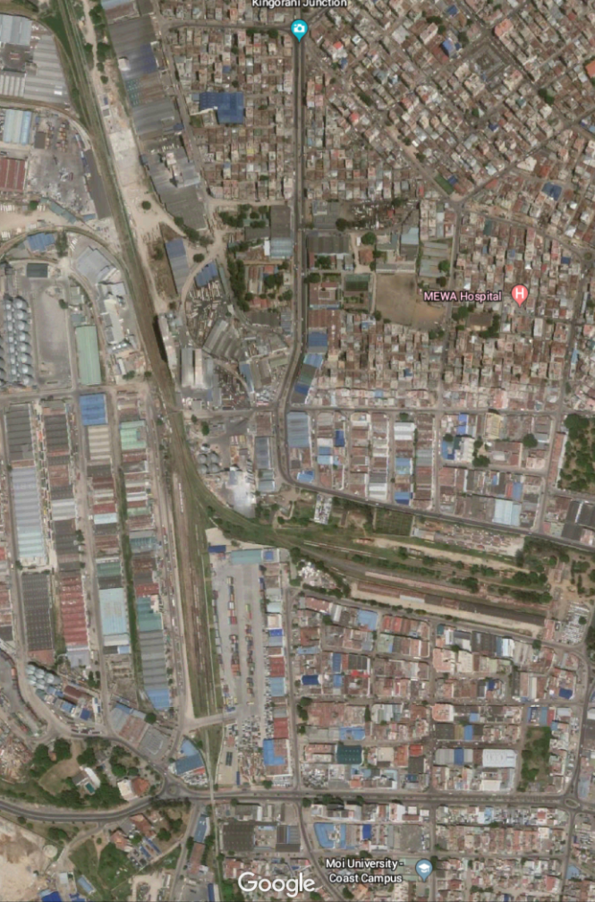
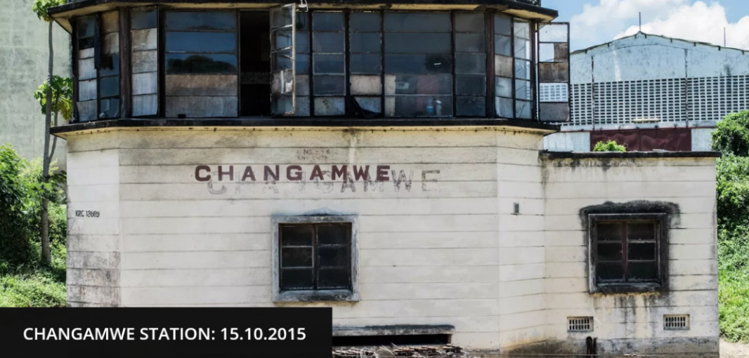
As the line turned to the north it was joined by a branch which served the Chamgamwe Oil Refinery to the south. Next came the first station on the line at Chamgamwe. The photographs of this station from the 1960s and 1970s are courtesy of Malcolm McCrow’s website [3] and are copyright Malcolm McCrow and Kevin Patience.

This picture shows a single-headed goods train arriving at Chamgamwe from Nairobi.

Double-headed by Class 59 Garratts a goods train travels through Chamgamwe Station in the two pictures above.

As we travel further along the line, the next station is Miritini. This is the location of the terminus of the new SGR (Standard Gauge Railway). It is close to the north end of the runway of Moi International Airport. The route of the line is marked on the map below just below the Mombasa Road. The two satallite images below show the line passing through a goods marshalling yard to the north-east of the airport and then travelling passed the north end of the runway.

Class 59 Garratt 5911 Mount Sekerri from Nairobi arrives beneath the palm tress at Miritini hauling a tank train.[4] 

The passenger train station in Miritini, Mombasa, on May 2017. [5]

At the time of writing of this blog post, the old metre-gauge line can still be followed on the satellite images provided by Google Earth beyond Mirtini. The next significant points on the line are the station and spiral at Mazeras. The spiral is encountered first and a kilometre or two further along the line we encounter the station.

Approaching the spiral from Mombasa the railway has been following the Mombasa to Nairobi main roadroad andntravelling in a roughly westerly direction. The map and the satellite image below show the railway separating from the road and travelling in a south-westerly direction towards the spiral.

Nairobi-bound trains pass under the higher level of the spiral before then crossing over the lower line. Malcolm McCrow provides a few images from 1970s. [3] I have not yet been able to find any other pictures.

An evening train from Mombasa approaches the spiral, © Peter Ritchie (1971).

The view from the cab of a Class 59 Garratt as it comes down off the spiral and passes under the higher line. ©Kevin Patience.

The Morning Train A02 from Nairobi descends the Mazeras Spiral as it heads for its 8:00am arrival in Mombasa, © Peter Ritchie.

And before we leave the spiral, a sequence showing Class 59 Garratt No. 5918 Mount Gelai negotiating the spiral in 1975.[3] The picture quality is lower as these images come from  video, © Ian Stone.Mazeras station comes a short distance north along the line.

In the next post we will travel on toward Voi and then on to Nairobi.


References

1. #Savetherailway; http://www.savetherailway.com, accessed on 14th May 2018.

2. The Friends of Mombasahttp://www.friendsofmombasa.com, accessed on 15th May 2018.

3. McCrow.org.uk; http://www.mccrow.org.uk/EastAfrica/EastAfricanRailways/NairobiMombasa.htm, accessed 14th May 2018.

4. https://www.pinterest.com/pin/554083560377607729, accessed on 15th May 2018, sourced from http://www.mccrow.org.uk © Kevin Patience.

5. Photo courtesy of the Nation Media Group photographer, Jeff Angote; Ng’ang’a Mbugua; SGR can open up Kenya if we build lines to feed it; Friday 2nd June 2017, https://www.nation.co.ke/oped/opinion/sgr-can-open-up-kenya-if-we-build-service-lines-to-feed-it/440808-3953710-bxs6l0z/index.html, accessed on 15th May 2018.

Uganda 2018 – 13th May


Sunday 13th May 2018

An early start today, heading for another confirmation service. This one is also close to the DRC border and in Hope Mugisha’s home village of Buhozi. We arrived for 10am and left at about 2.30pm.Roger discovers that drumming is not his forte!

First order of the day after arriving was our second breakfast. The processing up hill (steeply up hill) to the church.

The church was packed (literally – there was no room to process to the altar as the aisle was full of young adults and children sitting on the floor).

The church was roasting hot😥, but we loved the service and Roger got to preach for 45 minutes. It is a pity that cannot happen often in Ashton-under-Lyne!😏 Should we try to make it possible?Do not fear, for I have redeemed you, I have called you by name. You are mine. (Isaiah 43:1-4).

33 young people and one adult from Buhozi parish were confirmed.

It was about 1.30pm when we processed back to the vicar’s house for lunch and 2.30pm when we left to head back to Kisoro.

Two pastoral visits with Bishop Cranmer completed ‘work’ for the day.

The evening was spent at the Bishop’s house with a meal prepared by Phoebe their youngest daughter.

Uganda 2018 – May 12th

During a relaxed morning we strolled down into Kisoro to visit the Coffee Pot Cafe to say thank you for my birthday cake and enjoy a cup of Ugandan coffee. We added extra data onto the local SIM that we have, and changed some more money.

By 12 noon we were at St. Andrew’s Cathedral for the first of two weddings today.
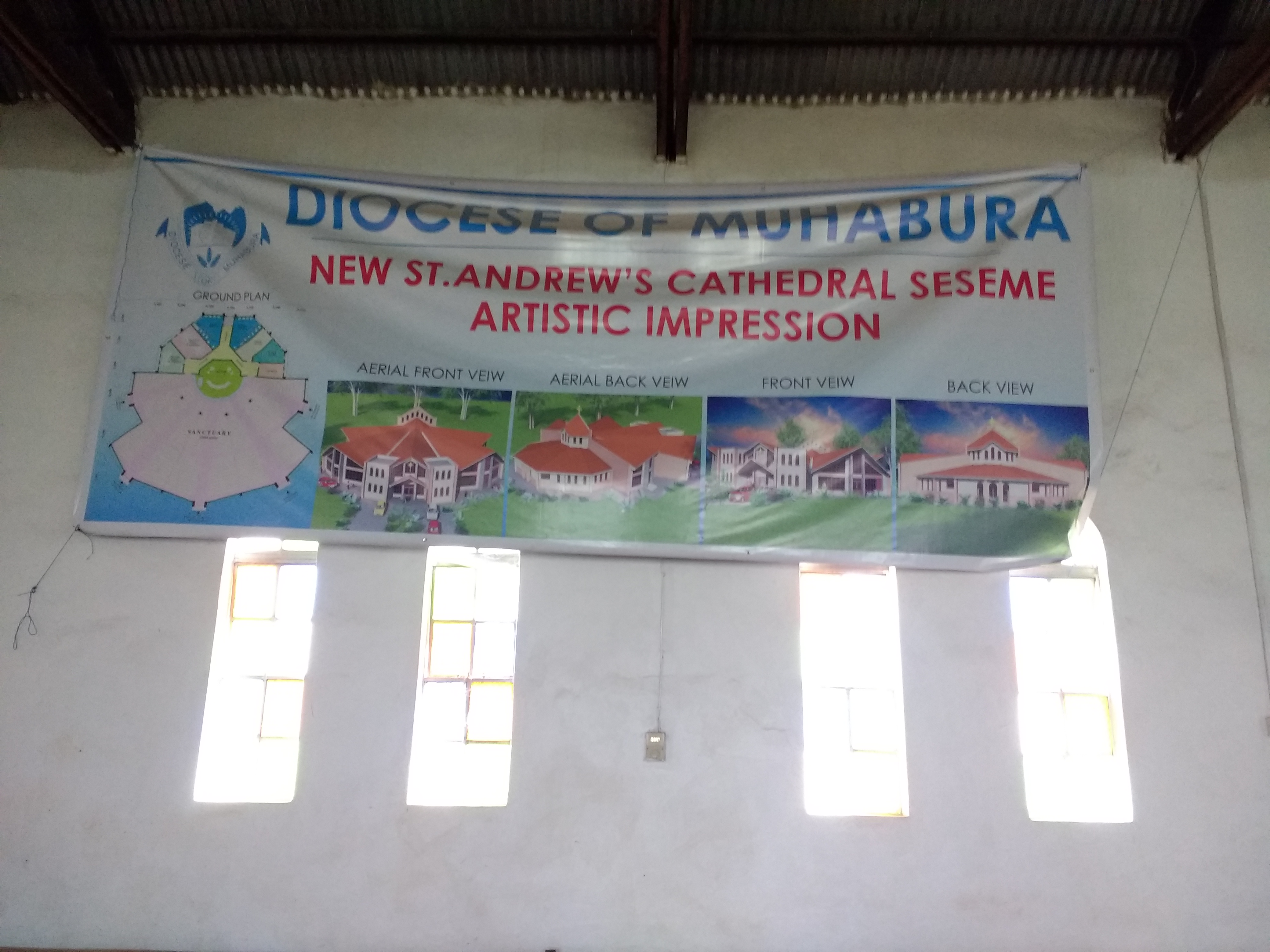
There are plans to build a new cathedral. They are in an advanced stage of development but the diocese has been advised that they should not start the project until they have at least 500 million UgSh set aside which will cover the cost of the foundations. It sounds a lot of money but it is approximately £100,000. I doubt we’d get the foundations of a new cathedral in the UK anything like as cheaply as this.Then on with Bishop Cranmer to Sooko for a second wedding.After which we enjoyed going to two wedding receptions in one day! They took place within a hundred metres of each other in Kisoro town!Another full day!