
This is the second article following the Strathspey Line. The first can be found here. [22]
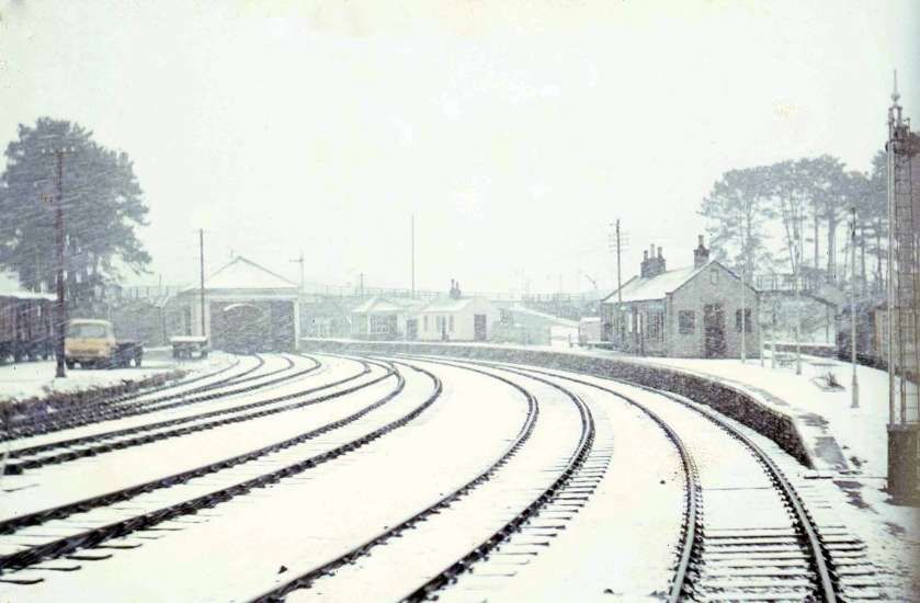
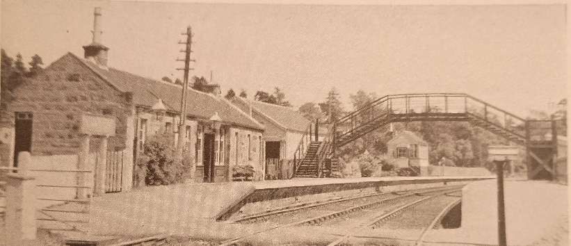
The featured image above shows Carron Railway Station early in the 20th century, © Public Domain. [61]
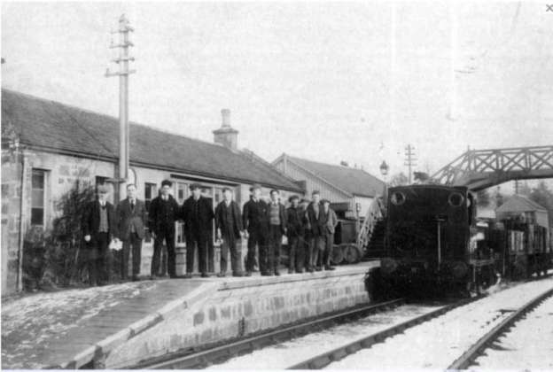
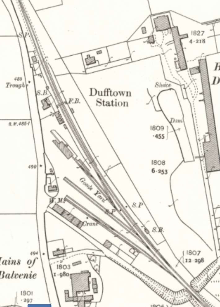
We start this next leg of the journey in Dufftown at the Railway Station which is the terminus of the Keith & Dufftown Railway.
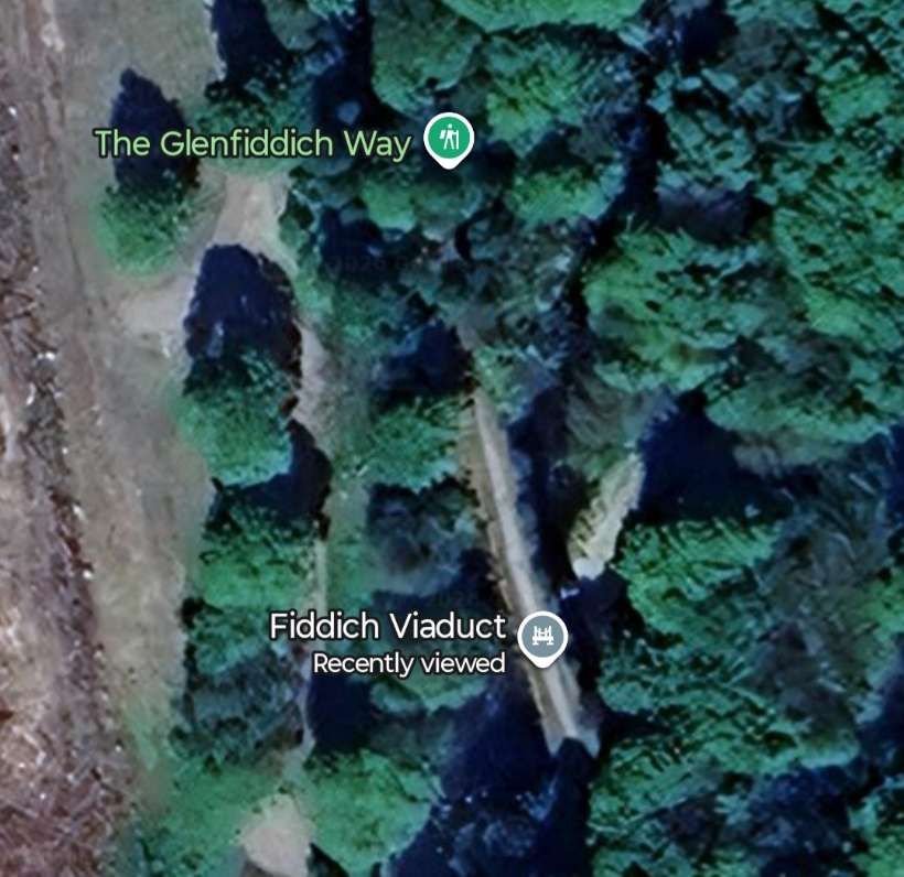
Beyond Dufftown we continue a descent at 1 in 78 and 1 in 80 through the Fiddich Gorge. “The engineering works on this section include two masonry bridges over the Fiddich, a deep rock cutting at Corbie’s Craig, and a diversion of the river to enable an embankment to be formed on what had been the bed of the stream. The line emerges from the gorge at Craigellachie, a short distance from the confluence of the Fiddich and the Spey.” [1: p5-6]

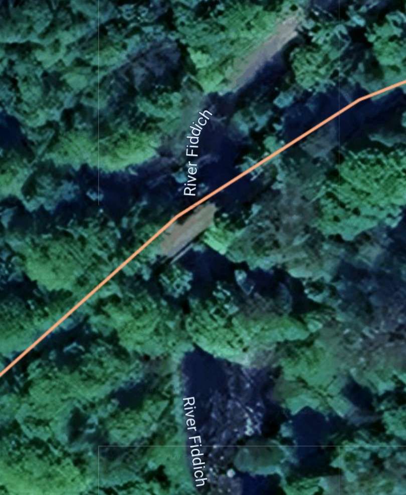
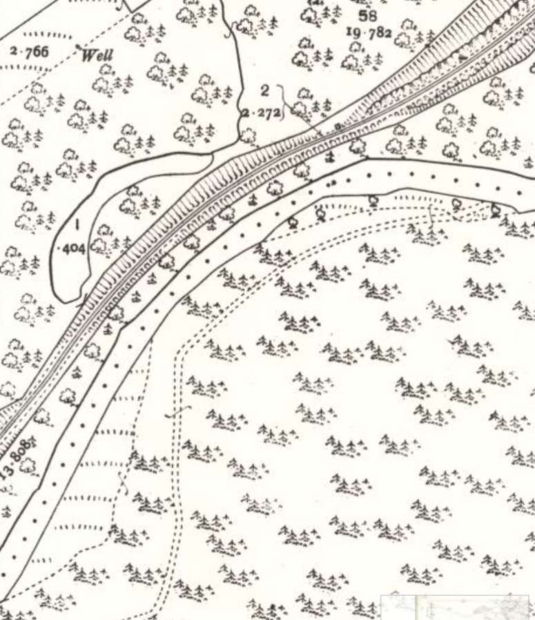
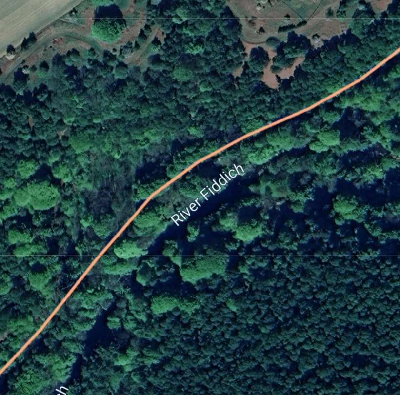
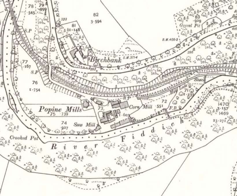
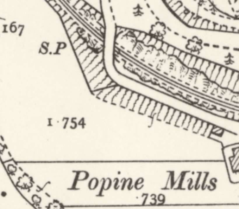
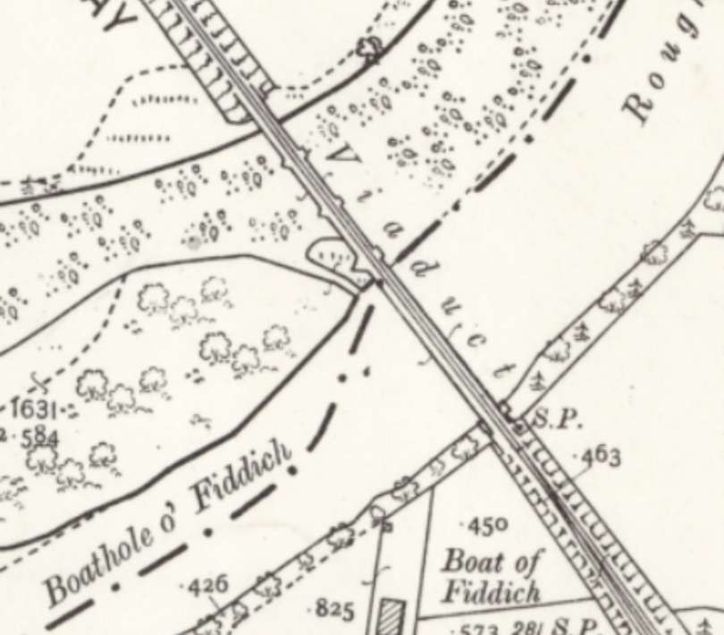
The railway continues its sinuous way down the valley of the River Fiddich before reaching Popine Mills. …
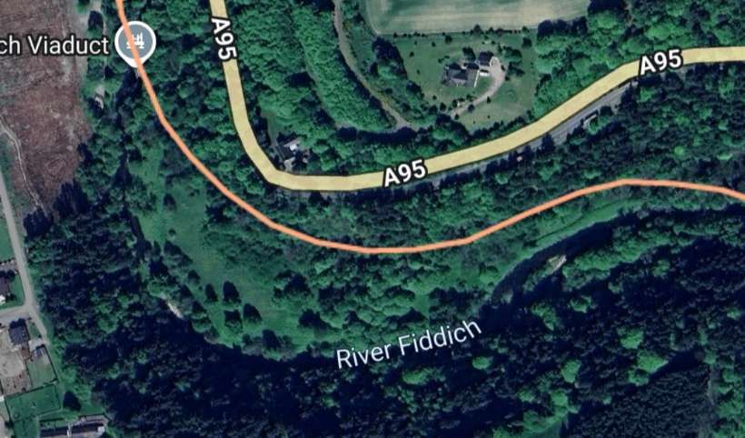
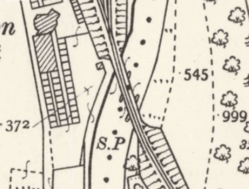
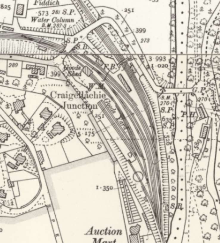
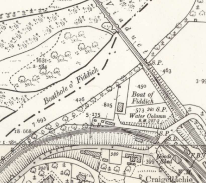
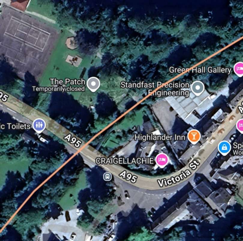
Once across the viaduct trains immediately entered Craigellachie Junction Railway Station. The River Fiddich was on the East side of the station site.
An excellent photograph of steam at Craigellachie can be found here. [23]
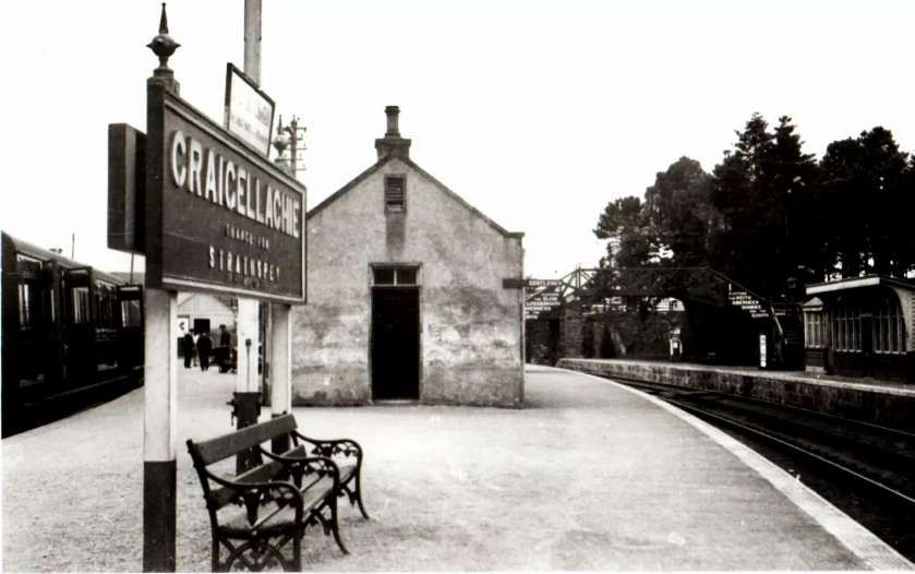
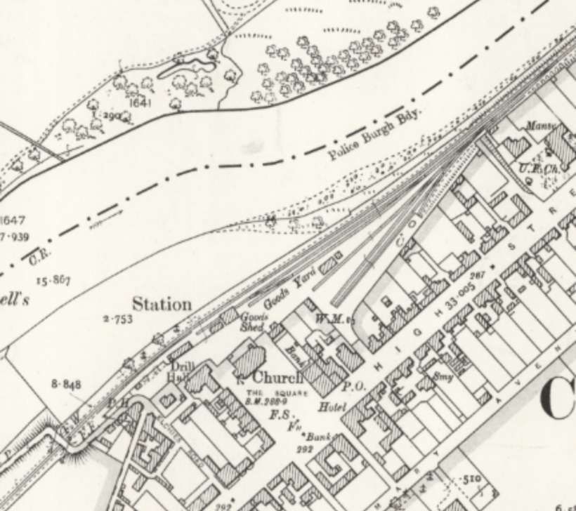
Craigellachie Junction Railway Station was opened as Strathspey Junction on 1st July 1863 by the Great North of Scotland Railway. It was renamed Craigellachie on 1st June 1864. There was a large goods yard to the west. The station closed to passengers on 6th May 1968 and to goods traffic on 4th November 1968. [13]
This was a three platform station and junction, with two platforms on the route between Elgin East and Keith via Dufftown and one platform on the Strathspey route to Boat of Garten. Almost immediately after leaving the station, trains for Elgin crossed the Craigellachie Bridge to reach Dandaleith.
The main station building at Craigellachie Junction Railway Station was a long single-storey building situated on the platform between the Elgin line and the Boat of Garten line. There was a smaller waiting room structure on the platform that served Dufftown trains from Elgin. There was a goods yard on the West side of the station site. A turntable sat at the Southwest corner of the site.
The station had three signal boxes, all opened in 1900. The South box, “located on the east side at the south end of the station at the junction between the Boat of Garten and Elgin East routes and the turn out for the goods yard. This box above the west bank of the River Fiddich with a large stone base. The line crossed over the Fiddich just to the south by a girder bridge.” [17]
The other two signal boxes, the West box and the North box were at the North end of the two platforms.
Vallance wrote of Craigellachie Station: “Craigellachie Station … has three, platform faces, of which two serve the Elgin line, and the third the Boat of Garten trains. Sidings and a run-round loop for locomotives adjoin the third platform.” [1: p6]
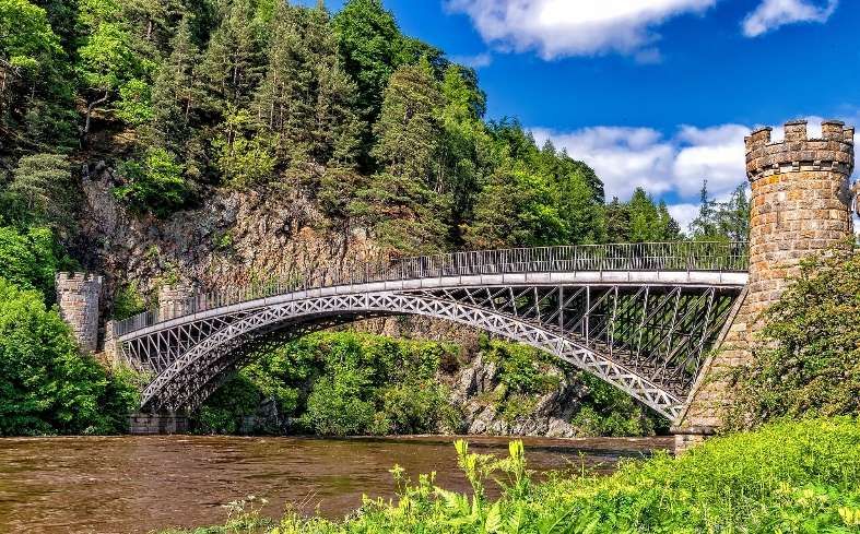
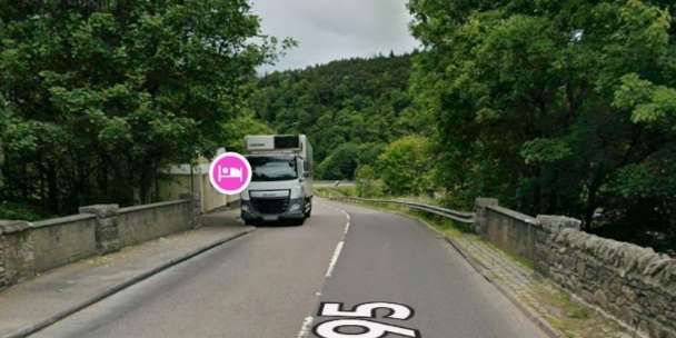
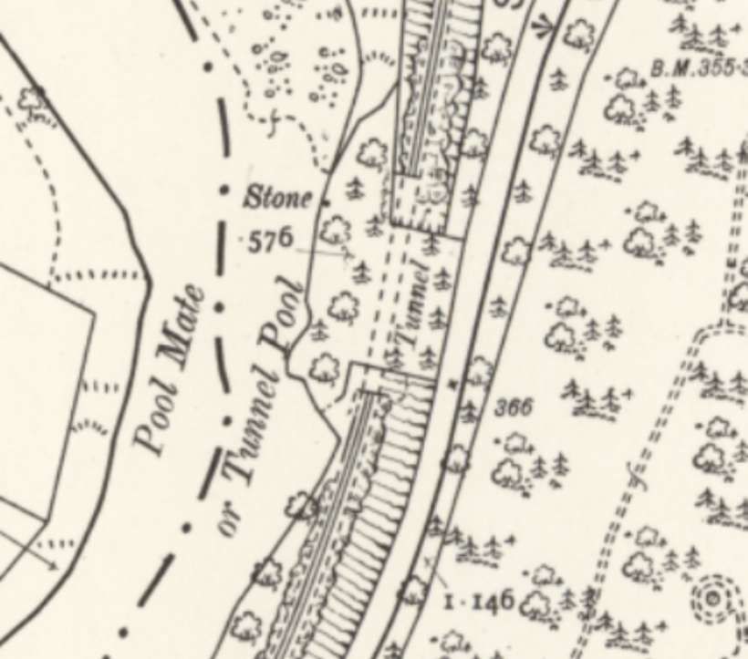
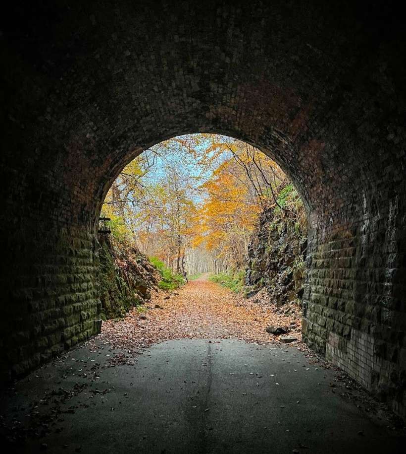
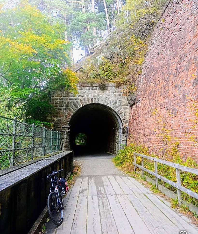
Vallance continues: “The Strathspey line reaches the right bank of the Spey a short distance beyond the station, and a glimpse is caught of Telford’s graceful iron bridge. with embattled towers, erected in 1815 to carry the Elgin road over the river. The train then passes through a short tunnel (65 yd. long), the only one on the line, and one of the very few on the former Great North of Scotland Railway.” [1: p6]
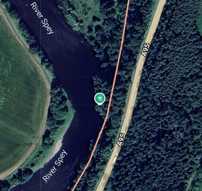
Vallance continues: “A run of 4.75 miles beside the wooded banks of the river takes the train past the crossing station of Aberlour to the single-platform halt of Dailuaine.” [1: p6]

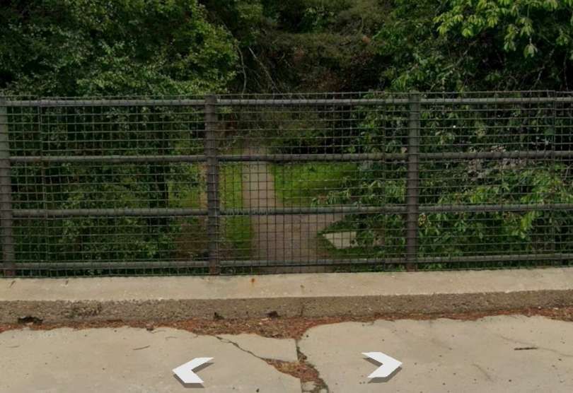
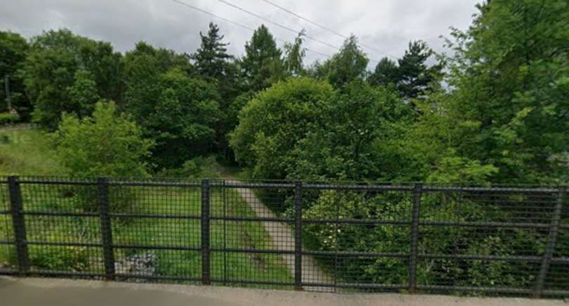
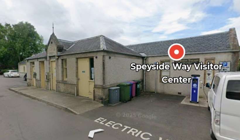
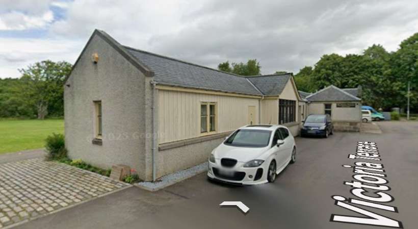
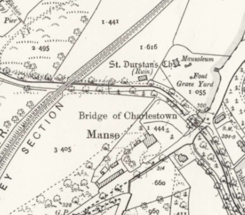
The village was founded by Charles Grant of Elchies in 1812 – with the name of Charlestown of Aberlour after his son Charles. It is commonly referred to simply as Aberlour. [30] The railway Station closed to passengers in 1965 and to freight in 1971. The station building is now the Speyside Way Visitor Centre and Cafe. [31]
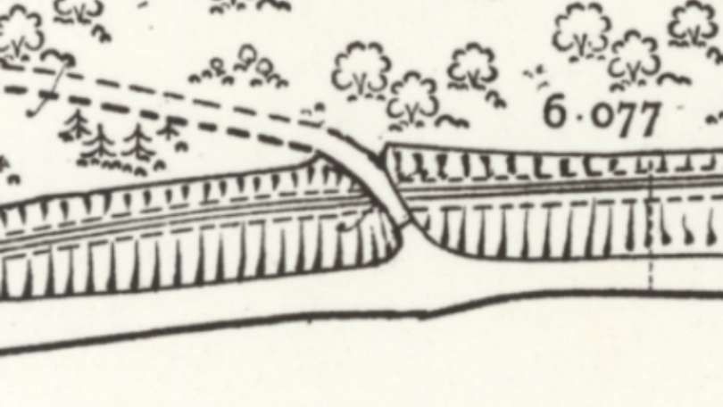
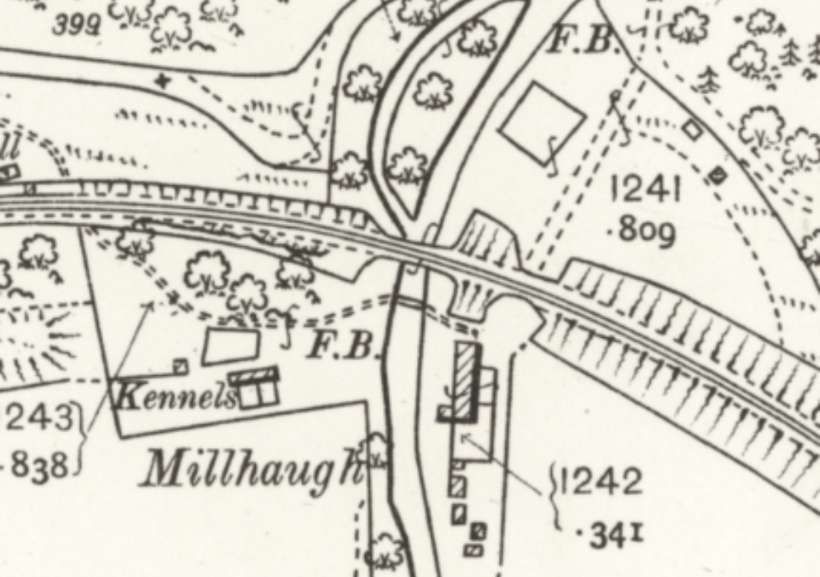
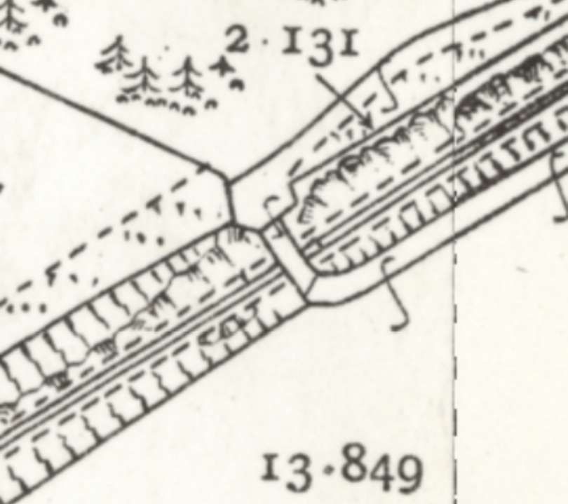
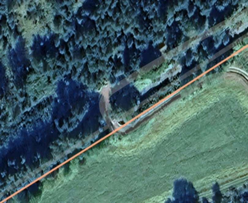
The next significant location on the line was some distance further to the Southwest bridging another stream close to Dailuaine Halt.
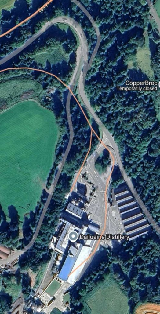
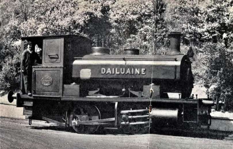
More photographs of the Dailuaine Distillery branch and its locomotive can be found here. [27]
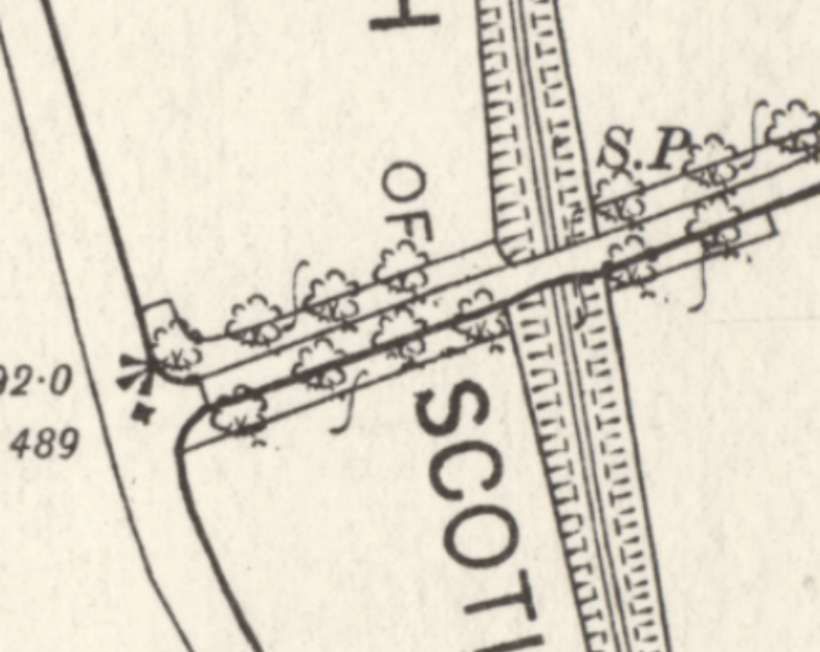
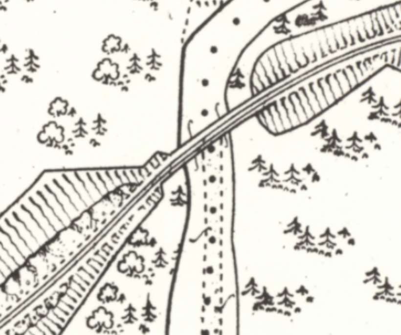
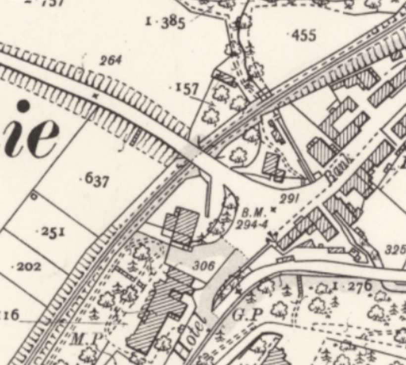
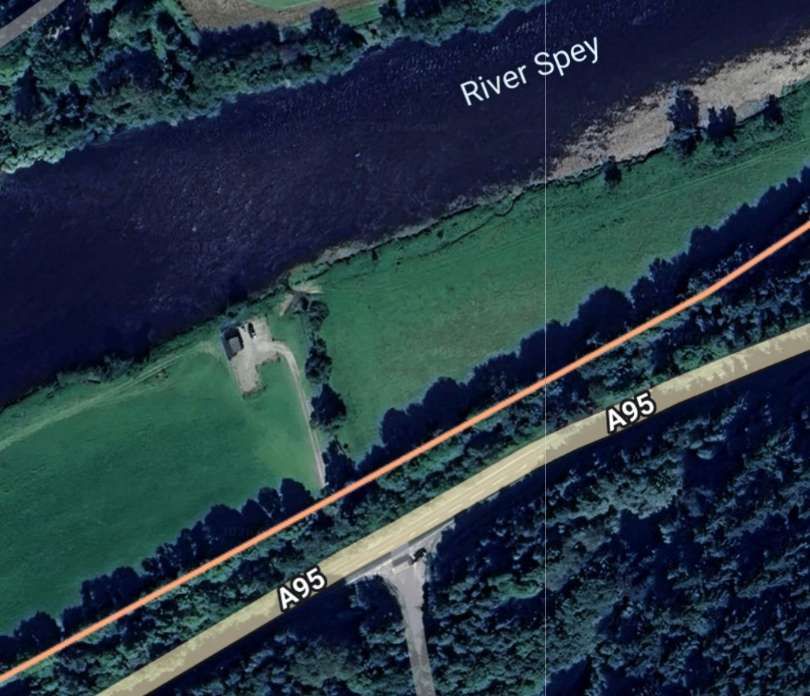
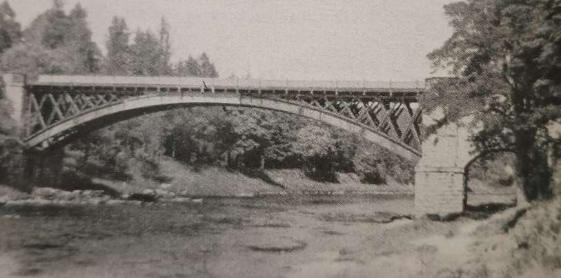
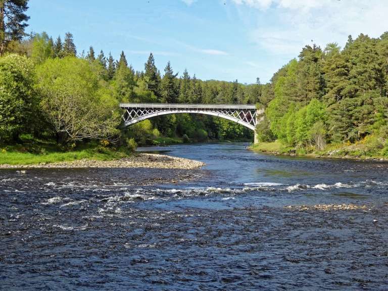
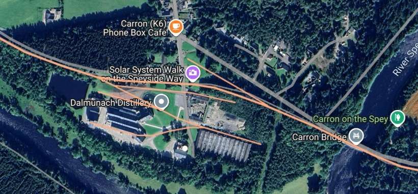
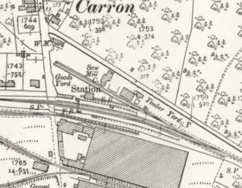
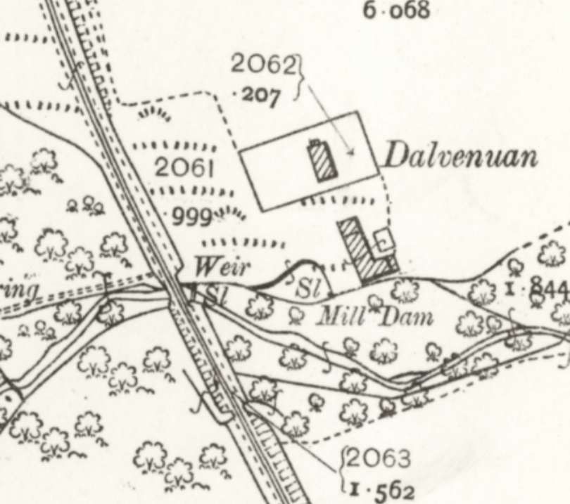
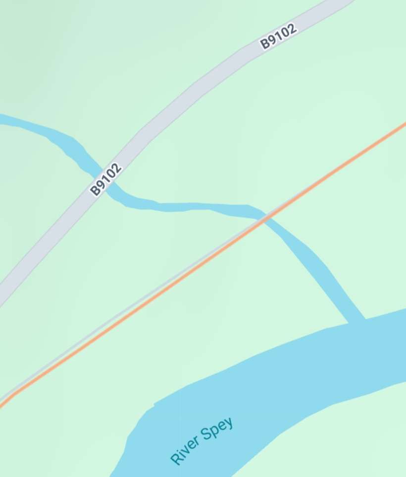
A short distance to the West. The industrial line formed a junction with the main line before the line crossed the River Spey and entered Carron Railway Station. in so doing, the line left “Banffshire, and [crossed] to the Morayshire side of the Spey on [the Bridge of Carron] with a central iron span of 150 ft., flanked on each side by a single masonry arch, which also [carried] a public road.” [1: p6]
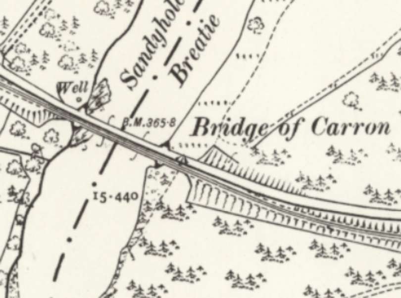
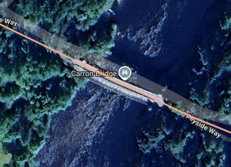
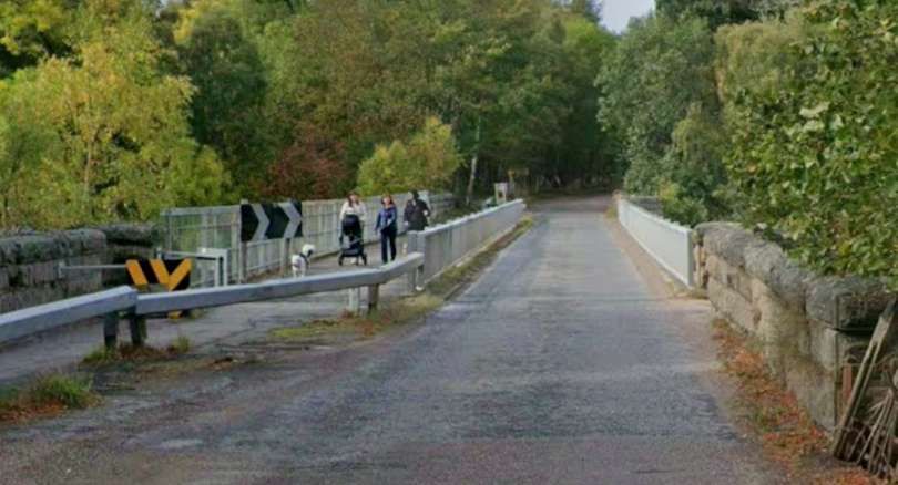
The Bridge of Carron was built for the Strathspey Railway in 1863, to a design by Alexander Gibb, an engineer for the Great North of Scotland Railway. It was fabricated by the iron founders William McKinnon and Co. It originally carried both the railway and a roadway. [35]
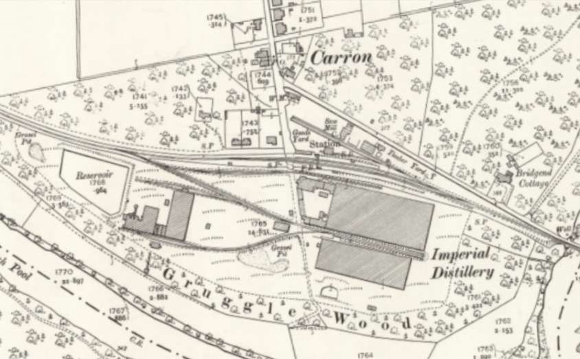
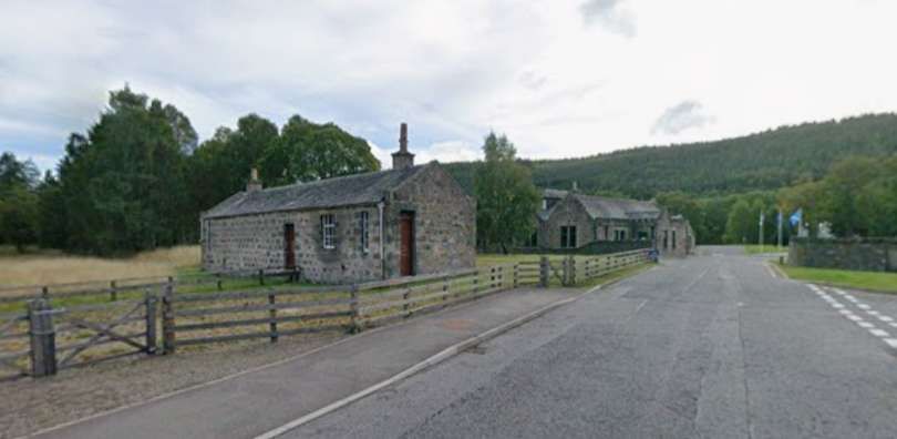
Once over the Bridge of Carron the goods yard of the railway station opened out alongside the road with a Saw Mill and timber yard immediately next to the road. The railway curved gently through the Station.
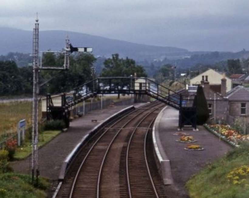
An August 1978 view of the station after closure can be found here, [38] and another view, here. [39]
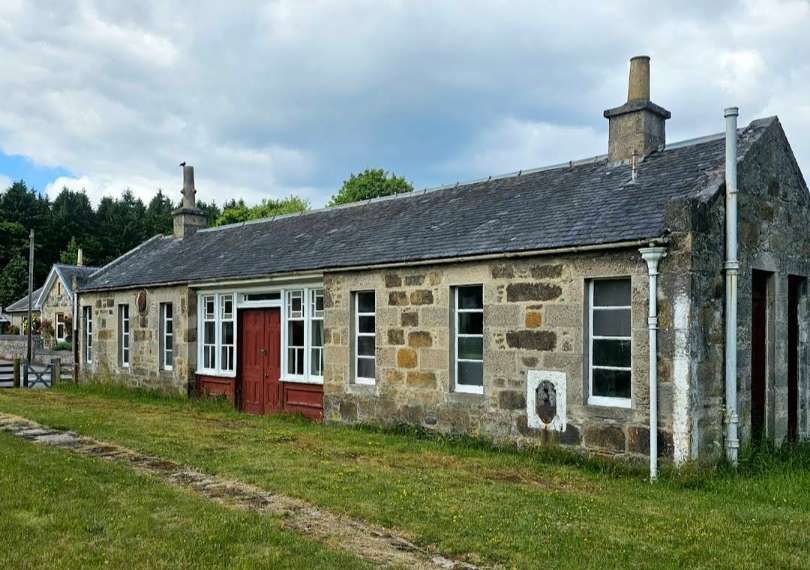
Vallance continues: “Carron Station … has a crossing loop, and its solidly-constructed stone buildings are typical of those provided by the G.N.S.R. at many other roadside stations. The large whisky distilleries at Carron and at Knockando, 2.5 miles further on, bring a considerable amount of traffic to the railway.” [1: p6]
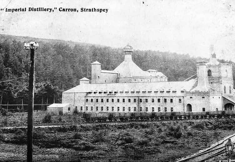
Imperial Distillery which was immediately to the South of the Station, was built by Thomas Mackenzie in 1897. In 1925, Imperial joined The Distillers Company, in 1989, it was sold to Allied Distillers. The distillery was demolished in 2013 and a new distillery, Dalmunach, established on the site in 2015. [40]
The line continued West from Carron ….
The line continues on the North bank of the Spey running by Knockando distillery.
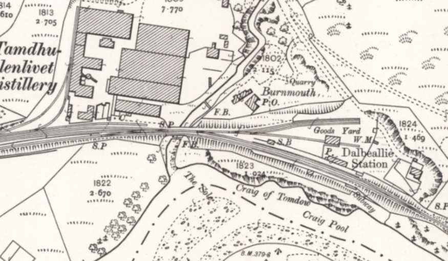
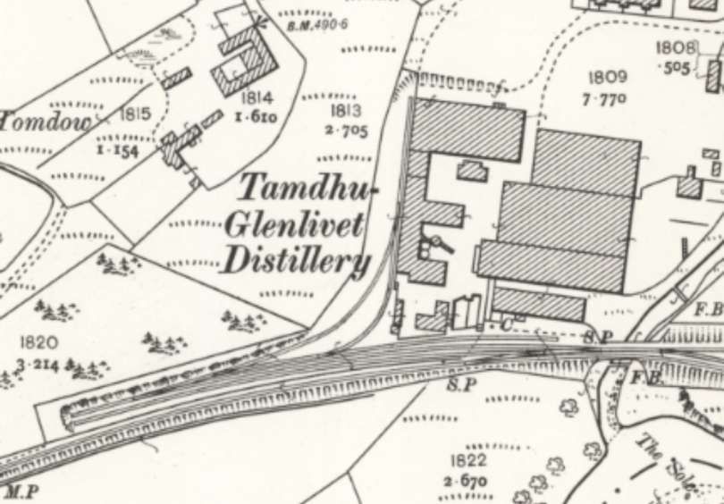
Vallance writing in 1959, says that, “When the railway was opened, there was no station between Carron and Blacksboat, a distance of 4.75 miles, but on 1st September 1869, a platform, at which certain trains called by request, was opened at Knockando, 1.25 miles from Carron. This platform (now known as Knockando House Halt) ranks as an unadvertised private station for the Knockando estate. On 1st July 1899, a public station was brought into use at a distillery siding, 1.25 miles south of the private platform. Known at first as Dalbeallie, the name of this station became Knockando on 1st May 1905.” [1: p6]
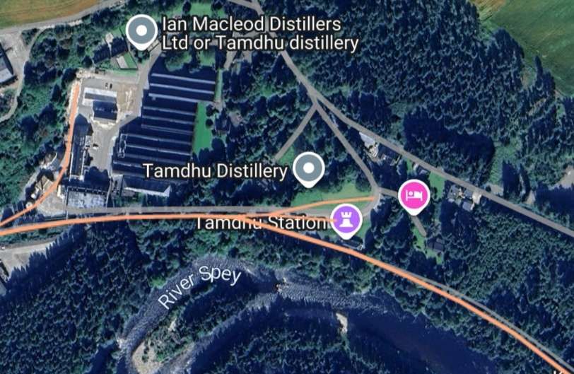

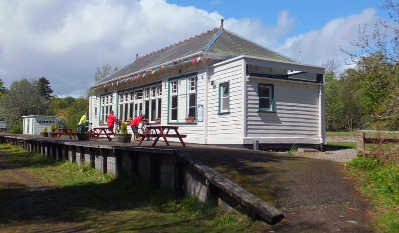
More about the Tamdhu Distillery and its whisky can be found here. [47]
As trains left the station travelling West they crossed the Knockando Burn and ran to the South of the Tamdhu Distillery. The distillery was rail served from sidings alongside the Speyside Line.
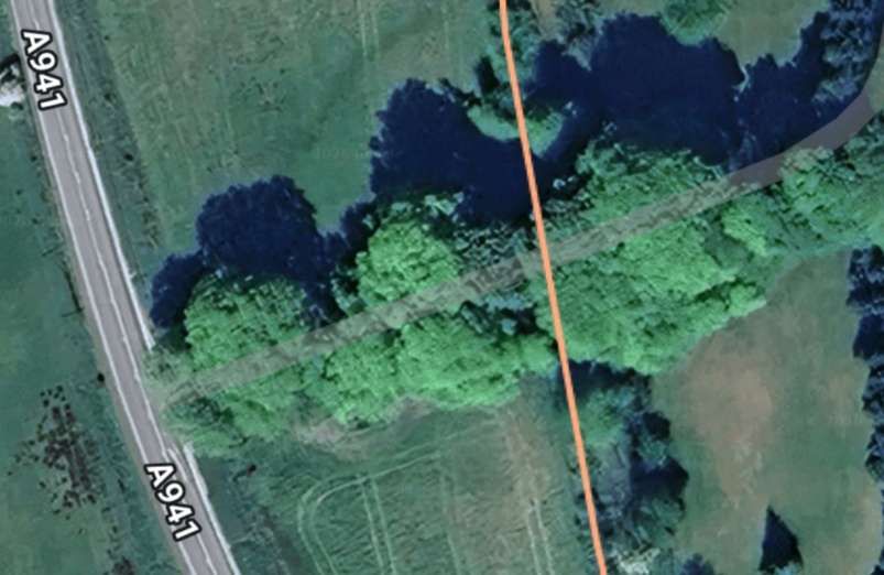
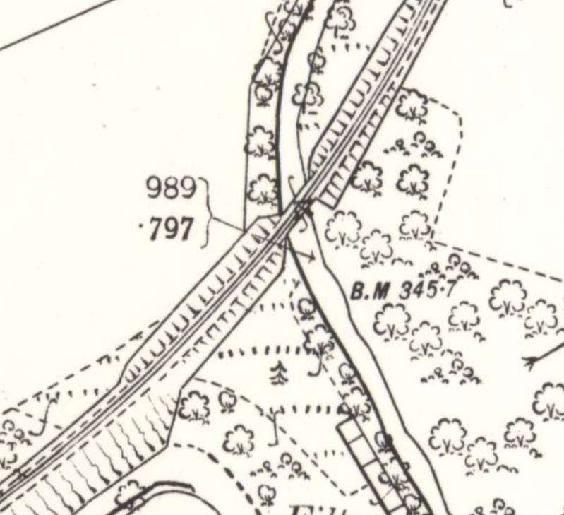
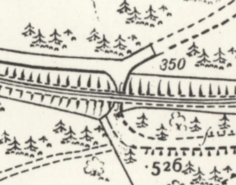
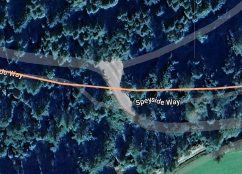
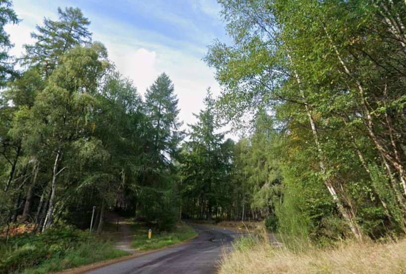
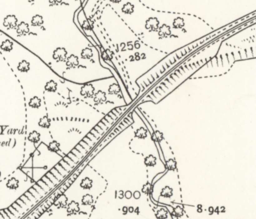
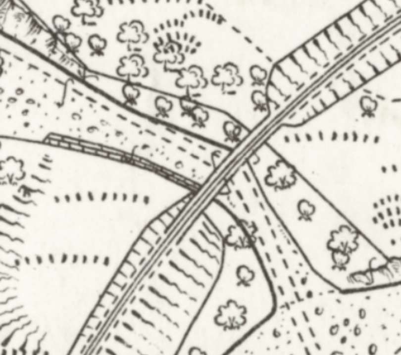
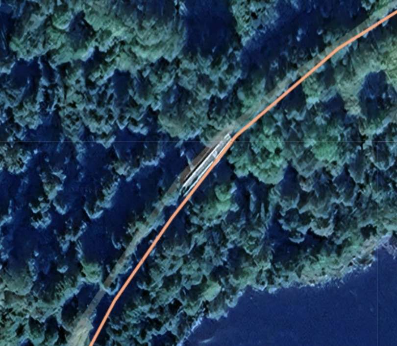
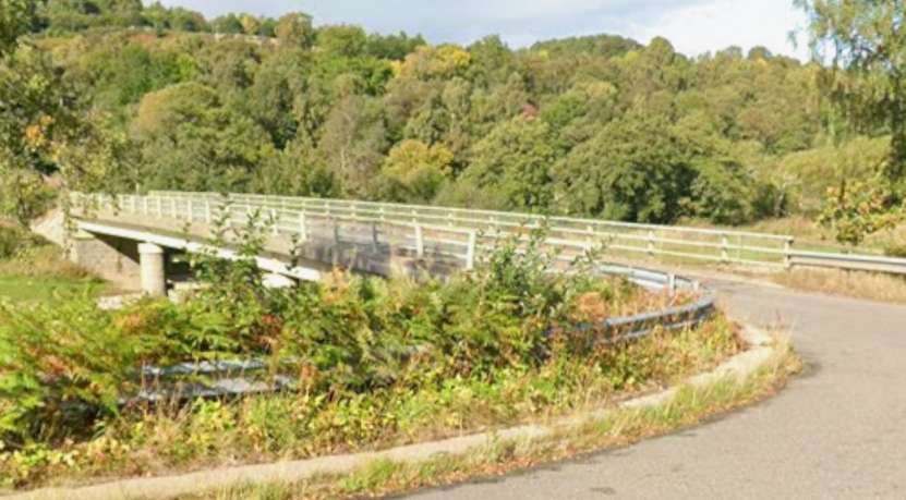
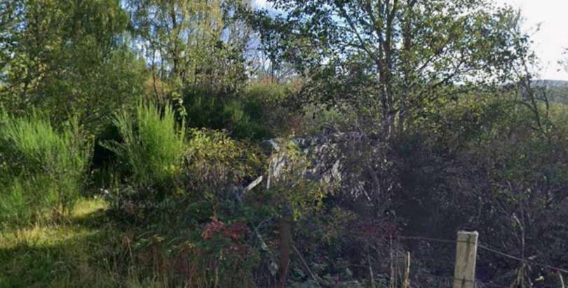
Beyond the Tamdhu Distillery, the Speyside Line curved round to the South following the river bank and crossed the burn shown on the map extract below. Vallance, writing about this location, says: “About three-quarters of a mile beyond Knockando, the railway crosses the Allt Arder, a tributary of the Spey, on a masonry bridge of three spans, one of 50 ft. and two of 40 ft. Difficulty was experienced in obtaining sound foundations for the piers of this structure, and after loose boulders and shingle had been excavated to a depth of 16 ft., piles had to be driven for a further 15ft.” [1: p6]
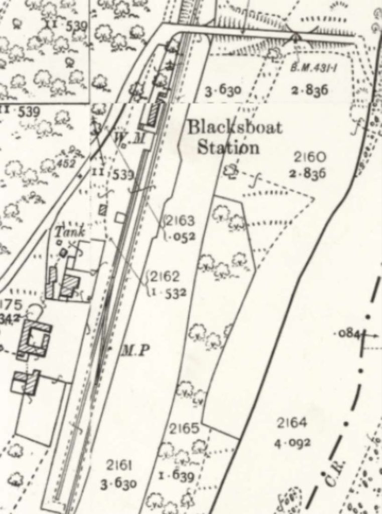
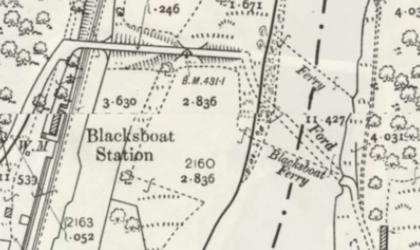
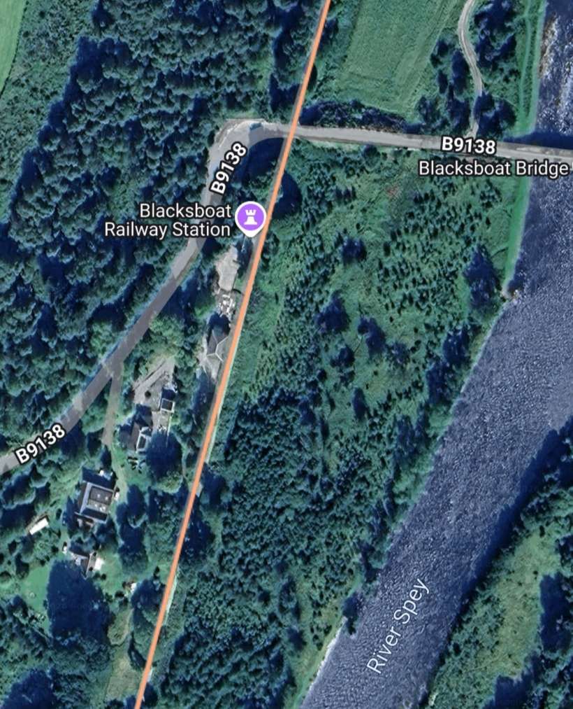
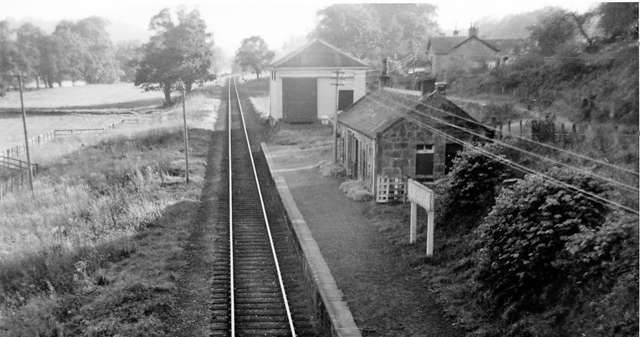
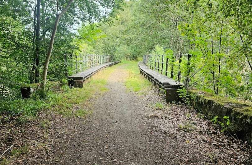
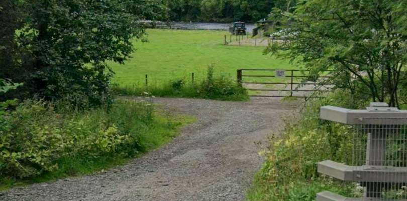
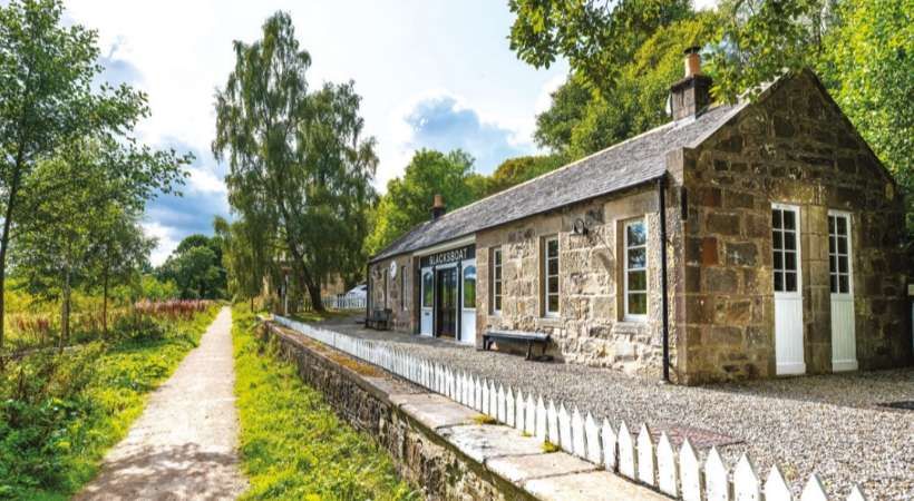
Blacksboat Railway Station opened on 1st July 1863. It had a rectangular-shaped building and a wooden goods shed. The station closed to both passengers and goods traffic on 18th October 1965. [52] It had a single platform on the West side of the line and a small Goods Yard to the South. The station building is well-preserved.bdetsils of the building can be found here. [53]
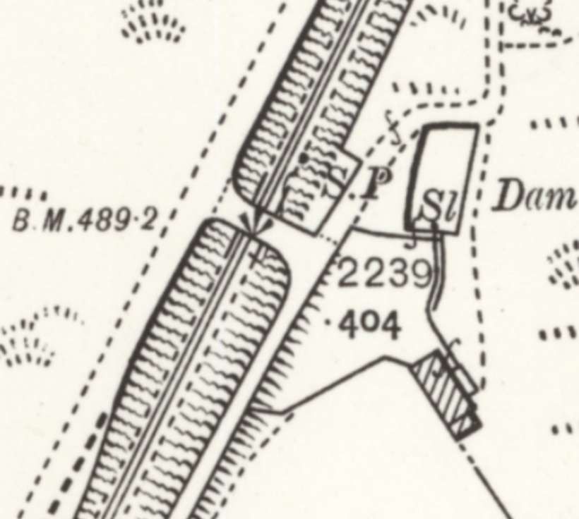
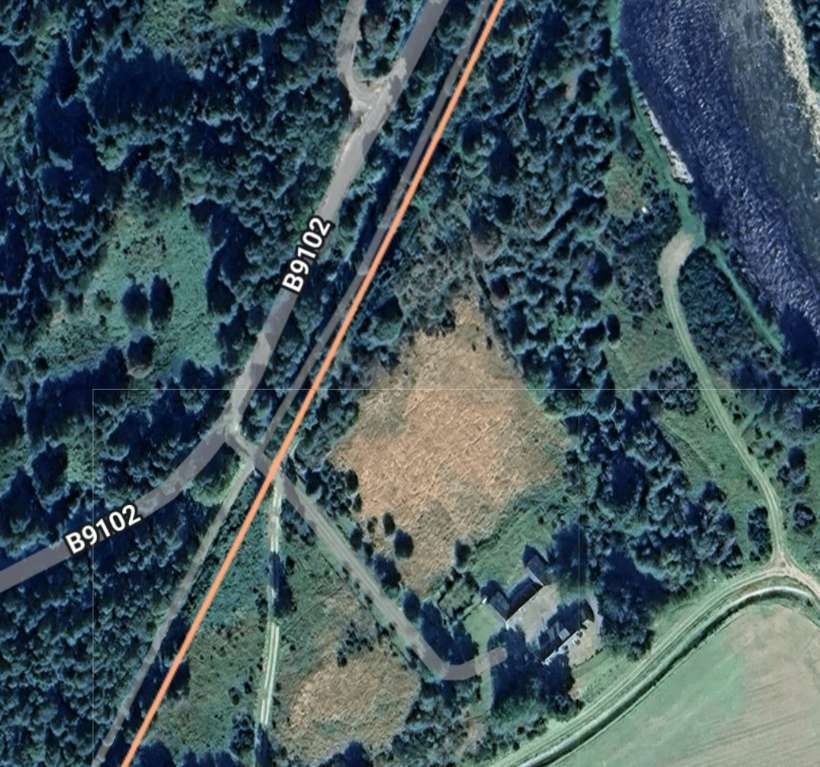
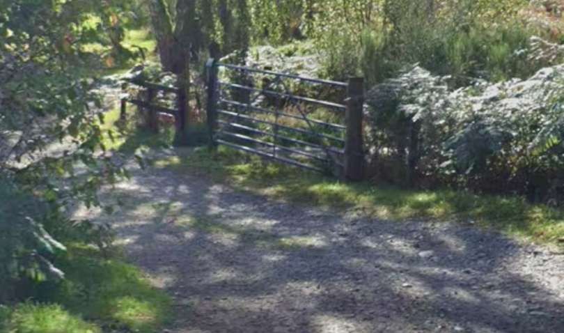
The access road to Dalnapot ran down the far side of the cutting from the bridge. That lane has been abandoned in favour of a more direct route between the B9102 and Dalnapot Futher South along the line of the old railway.
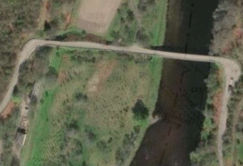
Vallance continues his narrative: “Beyond the single-platform station of Blacksboat, the train returns to the Banffshire side of the Spey on a lattice girder bridge of 198 ft. span, and reaches Ballindalloch Station, 12.25 miles from Craigellachie. In less than a mile, however, the county boundary crosses to the eastern side of the river, and Morayshire is re-entered.” [1: p6]
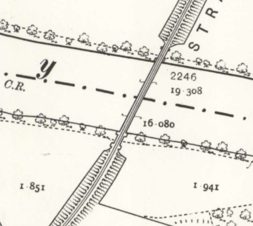
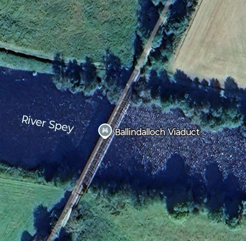
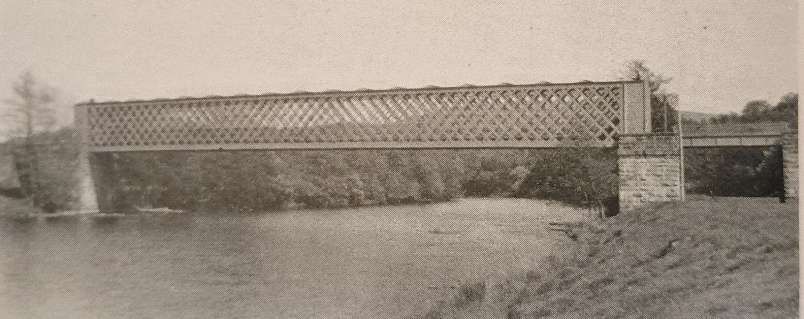
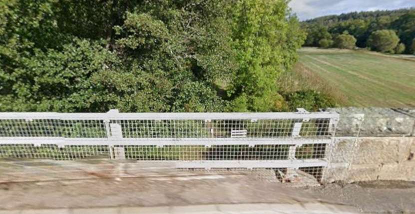
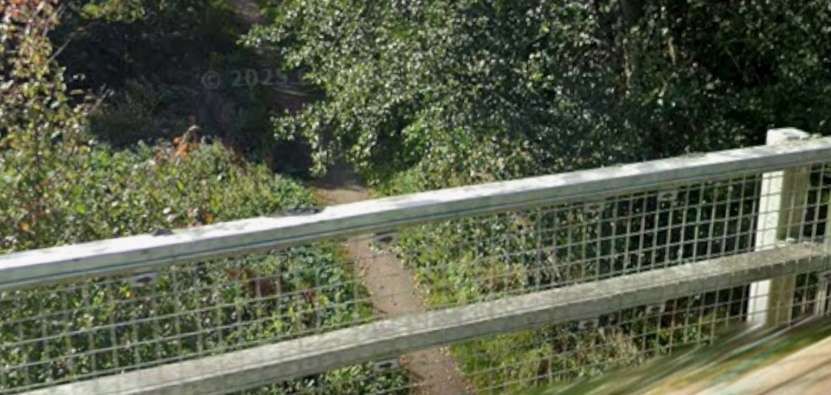
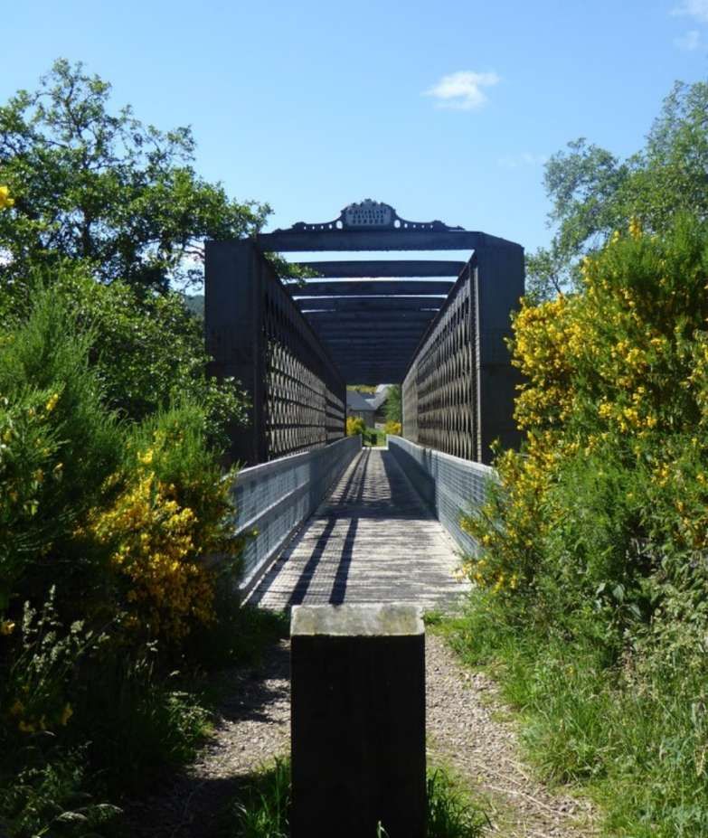
Ballindalloch Viaduct crosses the Spey at Ballindaloch, linking the parishes of Inveravon in Banffshire and Knockando in Moray. It is a wrought iron lattice girder bridge, with a single-span of 195 feet (59 metres), supported by rubble abutments, and with plate girder spans at either end giving an overall length of around 250 feet (75 metres). The viaduct was designated a Category A listed building in 1987, and was a scheduled monument until 2006. It is open to pedestrians and cyclists, forming a part of the Speyside Way. [57]
Immediately after crossing the River Spey over Ballindalloch Viaduct, trains entered Ballindalloch Railway Station which was situated on a relatively tightly curved length of the Strathspey Line.
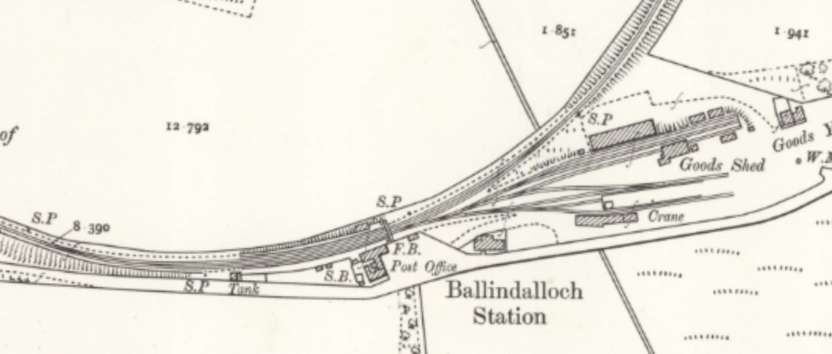
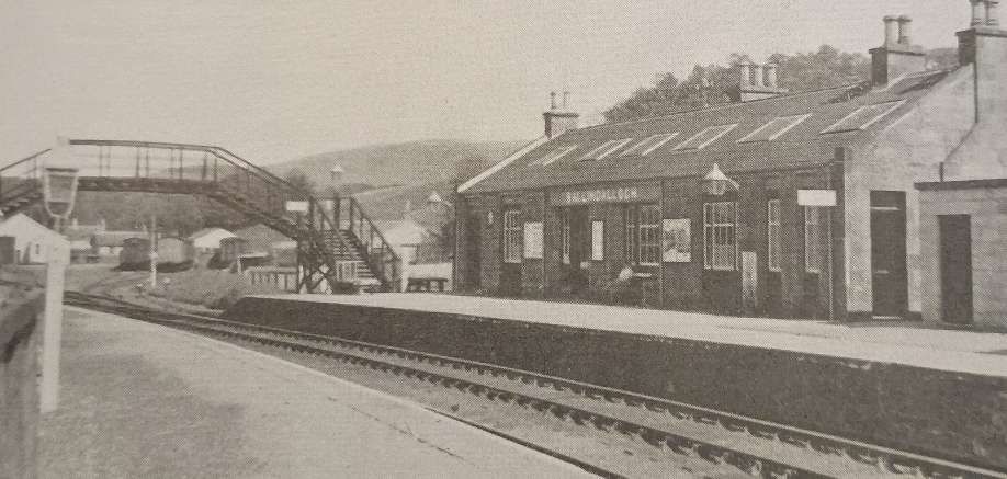
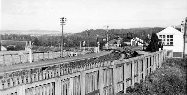
Ballindalloch Railway Station opened on 1st July 1863 by the Great North of Scotland Railway. To the north was Cragganmore distillery, which had opened because it was close to the railway. There were two goods sheds: a two-storey goods shed that connected with the distillery and the other was in the middle of the large goods yard which was to the east of the station site. The two-storey goods shed was used to store whisky from the distillery. The station closed to both passengers and goods traffic on 18th October 1965. [60]
References
- The Railway Magazine Volume 105 No. 693, Tothill Press, London, January 1959.
- H.A. Vallance; The Strathspey Line; in The Railway Magazine Volume 105 No. 693, Tothill Press, London, January 1959, p3-9.
- https://maps.nls.uk/geo/explore/#zoom=16.7&lat=57.45846&lon=-3.13049&layers=168&b=ESRIWorld&o=100, accessed on 16th January 2026.
- https://maps.nls.uk/view/82870776, accessed on 16th January 2026.
- https://railmaponline.com/UKIEMap.php, accessed on 16th January 2026.
- https://maps.nls.uk/view/82870764, accessed on 16th January 2026.
- https://maps.nls.uk/view/82870581, accessed on 16th January 2026.
- https://maps.nls.uk/view/82870545, accessed on 17th January 2026.
- https://maps.nls.uk/geo/explore/#zoom=16.8&lat=57.49141&lon=-3.18201&layers=168&b=ESRIWorld&o=100, accessed on 17th January 2026.
- https://www.geograph.org.uk/photo/3156785, accessed on 17th January 2026.
- https://www.geograph.org.uk/photo/5924067, accessed on 17th January 2026.
- https://www.geograph.org.uk/photo/5924068, accessed on 17th January 2026.
- https://en.wikipedia.org/wiki/Craigellachie_railway_station, accessed on 17th January 2026.
- https://maps.nls.uk/geo/explore/#zoom=17.3&lat=57.49327&lon=-3.18402&layers=168&b=ESRIWorld&o=100, accessed on 17th January 2026.
- https://www.facebook.com/share/p/1ACNrA4Umd, accessed on 17th January 2026.
- https://www.facebook.com/share/p/1GhhuAuYE4, accessed on 17th January 2026.
- https://www.railscot.co.uk/locations/C/Craigellachie_2nd, accessed on 18th January 2026.
- https://maps.nls.uk/geo/explore/#zoom=16.6&lat=57.49236&lon=-3.18419&layers=168&b=ESRIWorld&o=100, accessed on 18th January 2026.
- https://pixabay.com/photos/bridge-metal-framework-scotland-2406071, accessed on 18th January 2026.
- https://maps.nls.uk/geo/explore/#zoom=17.2&lat=57.48989&lon=-3.18980&layers=168&b=ESRIWorld&o=97, accessed on 18th January 2026.
- https://maps.nls.uk/geo/explore/#zoom=18.0&lat=57.48364&lon=-3.19528&layers=168&b=ESRIWorld&o=100, accessed on 18th January 2026.
- https://rogerfarnworth.com/2026/01/16/the-strathspey-line-part-1-keith-to-dufftown
- https://www.facebook.com/share/p/16yN97FHEZ, accessed on 18th January 2026.
- https://maps.nls.uk/view/82870734, accessed on 27th January 2026.
- https://en.wikipedia.org/wiki/Dailuaine_Halt_railway_station, accessed on 27th January 2026.
- The original source for this image has not been recorded. It was shared on the BR: Disused Railway Stations: Britain and Ireland Facebook Group by Mark Davidson on 26th December 2025, https://www.facebook.com/share/p/1D2Xsot4Un, accessed on 27th January 2026.
- https://www.speysidevisitorcentre.scot/railway-gallery, accessed on 27th January 2026.
- https://maps.nls.uk/geo/explore/#zoom=17.5&lat=57.48068&lon=-3.20074&layers=168&b=ESRIWorld&o=100, accessed on 27th January 2026.
- https://maps.nls.uk/geo/explore/#zoom=16.4&lat=57.47204&lon=-3.22537&layers=168&b=ESRIWorld&o=100, accessed on 27th January 2026.
- https://en.wikipedia.org/wiki/Aberlour, accessed on 27th January 2026.
- https://www.speysidevisitorcentre.scot, accessed on 27th January 2026.
- https://maps.nls.uk/geo/explore/#zoom=16.9&lat=57.46927&lon=-3.23164&layers=168&b=ESRIWorld&o=100, accessed on 27th January 2026.
- https://maps.nls.uk/geo/explore/#zoom=17.6&lat=57.45395&lon=-3.29108&layers=168&b=ESRIWorld&o=100, accessed on 28th January 2026.
- https://maps.nls.uk/geo/explore/#zoom=17.6&lat=57.45438&lon=-3.29397&layers=168&b=ESRIWorld&o=100, accessed on 28th January 2026.
- https://en.wikipedia.org/wiki/Carron_Bridge_(River_Spey, accessed on 28th January 2026.
- https://www.geograph.org.uk/photo/4810444, accessed on 28th January 2026.
- https://maps.nls.uk/geo/explore/#zoom=15.7&lat=57.45592&lon=-3.29906&layers=168&b=ESRIWorld&o=100, accessed on 28th January 2026.
- https://www.facebook.com/share/p/1DyezX4UMU, accessed on 28th January 2026.
- https://www.facebook.com/share/p/1DYLhhAZT6, accessed on 28th January 2026.
- https://en.wikipedia.org/wiki/Imperial_distillery, accessed on 28th January 2026.
- https://www.facebook.com/share/p/1DSTE4hokA, accessed on 28th January 2026.
- https://maps.nls.uk/geo/explore/#zoom=18.1&lat=57.46416&lon=-3.32475&layers=168&b=ESRIWorld&o=99, accessed on 28th January 2026.
- https://maps.nls.uk/geo/explore/#zoom=17.8&lat=57.46359&lon=-3.32959&layers=168&b=ESRIWorld&o=100, accessed on 28th January 2026.
- https://maps.nls.uk/geo/explore/#zoom=16.1&lat=57.45918&lon=-3.35144&layers=168&b=ESRIWorld&o=100, accessed on 28th January 2026.
- https://tour-scotland-photographs.blogspot.com/2016/01/old-photograph-railway-statiom.html?m=1, accessed on 28th January 2026
- https://www.geograph.org.uk/photo/4481751, accessed on 28th January 2026.
- https://www.tamdhu.com, accessed on 28th January 2026.
- https://maps.nls.uk/geo/explore/#zoom=16.6&lat=57.45940&lon=-3.35453&layers=168&b=ESRIWorld&o=100, accessed on 28th January 2026.
- https://maps.nls.uk/geo/explore/#zoom=17.1&lat=57.44677&lon=-3.36446&layers=168&b=ESRIWorld&o=100, accessed on 28th January 2026.
- https://maps.nls.uk/geo/explore/#zoom=17.1&lat=57.43376&lon=-3.36126&layers=168&b=ESRIWorld&o=92, accessed on 28th January 2026.
- https://www.geograph.org.uk/photo/1821111, accessed on 28th January 2026.
- https://en.wikipedia.org/wiki/Blacksboat_railway_station, accessed on 28th January 2026.
- https://content.knightfrank.com/property/prh012394818/brochures/en/prh012394818-en-brochure-5fd5c7a8-3c29-45a6-a0ea-609a65decad0-1.pdf, accessed on 28th January 2026.
- https://maps.nls.uk/geo/explore/#zoom=16.8&lat=57.42306&lon=-3.37478&layers=168&b=ESRIWorld&o=100, accessed on 28th January 2026.
- https://maps.nls.uk/geo/explore/#zoom=18.3&lat=57.41756&lon=-3.38208&layers=168&b=ESRIWorld&o=100, accessed on 28th January 2026.
- https://maps.nls.uk/geo/explore/#zoom=17.3&lat=57.41422&lon=-3.38543&layers=168&b=ESRIWorld&o=100, accessed on 28th January 2026.
- https://en.wikipedia.org/wiki/Ballindalloch_Railway_Bridge, accessed on 28th January 2026.
- https://www.geograph.org.uk/photo/5020155, accessed on 28th January 2026.
- https://www.geograph.org.uk/photo/1747084, accessed on 29th January 2026.
- https://en.wikipedia.org/wiki/Ballindalloch_railway_station, accessed on 29th January 2026.
- http://gnsra.org.uk/carron%20station.htm, accessed on 29th January 2026.

Pingback: The Railway Magazine – January 1959 Volume 105 No. 693 | Roger Farnworth